
What You Missed
Summer 2022
Summer 2022
![]()
![]()
![]()
![]()
![]() On Wednesday, September 21st, I had returned from a short hike on Round Top with Lisa at about 2:20 PM. The day was so beautiful I wanted to stay out but did not want to stay on Round Top. I asked Cindy if she wanted to hike the Beaverkill Campgrounds and she agreed. I knew she would like my choice as it is flat and shirt. I was ready to go and Cindy got changed quickly. Sheila seemed a little confused but was certainly happy to go hiking twice in one day. The temperature at 82 degrees under sunny skies. I was already dressed in a short-sleeved wicking shirt I had gotten some years ago at a cross country race. I wore my Railriders hiking pants which are expensive but last along time and have features like deep pockets and a generous cut which I really like. The pants have Velcro closures at the ankles. I had on my Keen Durand hiking boots which fit well and are newer than what I have been wearing. I added a new pair of Xstance insoles in an effort to find the best support and cushioning for my feet. These insoles have shock absorbing gel pads, TPU arch support, and memory foam cushioning all wrapped in a breathable fabric. The insoles have been hyped by their manufacturer and I wondered if they would live up to that hype. I took a pair of Leki external lock poles I have been using for some time. I added my OR floppy hat which I have decided shields me from the sun and allows me to spray some insect repellant on it rather than on me. We left the house at 2:45 PM as I drove out Old Route 17 toward Roscoe and turned right on Beaverkill Road. As we started the descent into the Beaverkill Valley, I turned left on Campsite Road and followed it down to the parking area near the Beaverkill Covered Bridge. There was one car parked at the far end of the lot. A glance at the river showed that the level had risen slightly but was still below the usual level for the year. I grabbed my camera and walked down to the side of the stream to take some pictures and Sheila came wit me. I took some shots and the repositioned on a rock that sticks out into the stream for some better shots of the covered bridge. A woman came walking across the bridge with her dog that was not on a leash. I held onto Sheila but the dog came running straight for us ignoring the woman's commands. I took Sheila back to the car with the dog following us. The woman had no control over her dog and made no apologies. I had Sheila on her leash as another car pulled into the lot. A man and woman got out and asked some questions about hiking trail. I answered them before I shouldered my pack to begin our hike.
On Wednesday, September 21st, I had returned from a short hike on Round Top with Lisa at about 2:20 PM. The day was so beautiful I wanted to stay out but did not want to stay on Round Top. I asked Cindy if she wanted to hike the Beaverkill Campgrounds and she agreed. I knew she would like my choice as it is flat and shirt. I was ready to go and Cindy got changed quickly. Sheila seemed a little confused but was certainly happy to go hiking twice in one day. The temperature at 82 degrees under sunny skies. I was already dressed in a short-sleeved wicking shirt I had gotten some years ago at a cross country race. I wore my Railriders hiking pants which are expensive but last along time and have features like deep pockets and a generous cut which I really like. The pants have Velcro closures at the ankles. I had on my Keen Durand hiking boots which fit well and are newer than what I have been wearing. I added a new pair of Xstance insoles in an effort to find the best support and cushioning for my feet. These insoles have shock absorbing gel pads, TPU arch support, and memory foam cushioning all wrapped in a breathable fabric. The insoles have been hyped by their manufacturer and I wondered if they would live up to that hype. I took a pair of Leki external lock poles I have been using for some time. I added my OR floppy hat which I have decided shields me from the sun and allows me to spray some insect repellant on it rather than on me. We left the house at 2:45 PM as I drove out Old Route 17 toward Roscoe and turned right on Beaverkill Road. As we started the descent into the Beaverkill Valley, I turned left on Campsite Road and followed it down to the parking area near the Beaverkill Covered Bridge. There was one car parked at the far end of the lot. A glance at the river showed that the level had risen slightly but was still below the usual level for the year. I grabbed my camera and walked down to the side of the stream to take some pictures and Sheila came wit me. I took some shots and the repositioned on a rock that sticks out into the stream for some better shots of the covered bridge. A woman came walking across the bridge with her dog that was not on a leash. I held onto Sheila but the dog came running straight for us ignoring the woman's commands. I took Sheila back to the car with the dog following us. The woman had no control over her dog and made no apologies. I had Sheila on her leash as another car pulled into the lot. A man and woman got out and asked some questions about hiking trail. I answered them before I shouldered my pack to begin our hike.
 We started out at 3:00 PM by walking out of the parking lot to the bridge with the temperature at 82 degrees. The skies were bright blue with puffy white clouds. When we got to the other side, the gate just off the road was closed as the campgrounds had closed September 5. I looked at the trail and saw that it was a little damp but not muddy. We turned left on a woods road that parallels the river and started down a short hill. We passed the spring house and continued on the deserted woods road where I could detect a few recent footprints. We came to an area with a little path down to the river. Just passed this area the trail had been eroding due to the water running down the bank. The DEC had replaced a culvert pipe and installed a second. They had also brought in fill and packed it to reconstruct the path. I found this interesting as the campsites along this path are no longer used and are abandoned. I walked down to the edge of the river very carefully as the rocks were slippery and the water looked deep and cold. I took some pictures downstream and some upstream to the bridge. There were several places where trees at the edge of the river had fallen into the water testifying to the power of the river when it is high. The view of the bridge was almost blocked by the foliage on the trees. Some of the leaves were beginning to change which add color to the pictures. When I was done, we got back on the trail and passed several areas with unused picnic tables. The state had mowed around many of the tables so that they could be used by people who wanted to picnic. Others sat unused and rotting along the road, a testimony to better days. We walked by these tables which had not been used in many years. A little later we came to what was once a bathroom for some campsites that had long since disappeared. There were more tables in this area. There was a path over to the river so I walked over and found the water was sparkling in the sun and was very clear. I took some pictures of the sun reflecting off the water both upstream and downstream. A large bird that I had seen before took off and flew upstream. I was too slow to get out the camera to take some shots.
 At about .7 miles the woods road met the paved road that serves the campsites. We continued on the road through the campsites and along the river. The campsites were all empty and I took pictures of the solitude. We walked to the last campsite where the road ends and Sheila and I walked down to the edge of the river. I was careful to watch where I was walking but the water was low and warm. I stopped to take some pictures of the river especially downstream. Sheila decided to take a dip in the water and I took some shots of her. We continued along the shore a little further passed the last campsite and I took some more shots before walking up to the campsite and back to where Cindy was standing. I stowed my camera and picked up the pack. We walked back from the last campsite, staying to the left of the last bathroom to walk back on the other paved road through the campsites. This road parallels the one we walked out on to make a sort of loop. We retuned the way we had come although at a quicker pace. As we approached the bridge, I saw that there was only one car parked in the lot with three people talking. We walked through the bridge and turned right to go back to the car. We were back at the car at 4:10 PM having hiked 2.7 miles in 1 hour and 10 minutes. The car's thermometer still read 82 degrees.
![]()
![]()
![]()
![]() On Wednesday, September 21st I had planned to hike the Hardenburgh Mongaup Trail with a hiking friend Sharon. Sharon canceled the night before so I changed plans to hike a route at Frick Pond after my 10:00 AM pastors' Zoom meeting. The meeting ran almost twice as long as I thought it would! I also got an text from Lisa who wanted to hike on Round Top and talk about our 5th anniversary hike there on Sunday at 4:00 PM. I decided to again change plans and hike on Round Top with Lisa. I am lucky that I have a place so close to hike but it has become very familiar. I have found that even a short hike helps to keep my blood pressure in check and I am hoping I can get my weight down also. I started to get ready at 12:30 PM while Sheila was already prepared to go as she really likes to hike. She was lying on the floor with her front legs spread barking up a storm. It was 78 degrees on the back porch so I decided to put on a short-sleeved wicking shirt I had gotten some years ago at a cross country race. I wore my Railriders hiking pants which are expensive but last along time and have features like deep pockets and a generous cut which I really like. The pants have Velcro closures at the ankles. I decided to put on my Keen Durand hiking boots which fit well and are newer than what I have been wearing. I added a new pair of Xstance insoles in an effort to find the best support and cushioning for my feet. These insoles have shock absorbing gel pads, TPU arch support, and memory foam cushioning all wrapped in a breathable fabric. The insoles have been hyped by their manufacturer and I wondered if they would live up to that hype. I grabbed a pair of Leki external lock poles I have been using for some time. At 12:55 PM we walked out the door to start the hike. I looked around and saw that the sky was blue with puffy white clouds. I grabbed Sheila's leash from the car and we walked up the driveway. We walked to the parking lot at the Presbyterian Church where Lisa was parked. Lisa was ready to go so we headed to the back of the church to the cemetery hill. We began the ascent of the steepest hill behind the church and continued directly up the hill to the trailhead. The hill is short but gets the circulation pumping and is the steepest and longest climb on the "trail." My goal was to make it all the way up the hill without stopping. At the top of the hill we stopped for minute so that we could observe the skies all around us. We turned left and entered the woods to begin our hike. The trailhead was damp from the rain showers and that continued as we entered the woods.
On Wednesday, September 21st I had planned to hike the Hardenburgh Mongaup Trail with a hiking friend Sharon. Sharon canceled the night before so I changed plans to hike a route at Frick Pond after my 10:00 AM pastors' Zoom meeting. The meeting ran almost twice as long as I thought it would! I also got an text from Lisa who wanted to hike on Round Top and talk about our 5th anniversary hike there on Sunday at 4:00 PM. I decided to again change plans and hike on Round Top with Lisa. I am lucky that I have a place so close to hike but it has become very familiar. I have found that even a short hike helps to keep my blood pressure in check and I am hoping I can get my weight down also. I started to get ready at 12:30 PM while Sheila was already prepared to go as she really likes to hike. She was lying on the floor with her front legs spread barking up a storm. It was 78 degrees on the back porch so I decided to put on a short-sleeved wicking shirt I had gotten some years ago at a cross country race. I wore my Railriders hiking pants which are expensive but last along time and have features like deep pockets and a generous cut which I really like. The pants have Velcro closures at the ankles. I decided to put on my Keen Durand hiking boots which fit well and are newer than what I have been wearing. I added a new pair of Xstance insoles in an effort to find the best support and cushioning for my feet. These insoles have shock absorbing gel pads, TPU arch support, and memory foam cushioning all wrapped in a breathable fabric. The insoles have been hyped by their manufacturer and I wondered if they would live up to that hype. I grabbed a pair of Leki external lock poles I have been using for some time. At 12:55 PM we walked out the door to start the hike. I looked around and saw that the sky was blue with puffy white clouds. I grabbed Sheila's leash from the car and we walked up the driveway. We walked to the parking lot at the Presbyterian Church where Lisa was parked. Lisa was ready to go so we headed to the back of the church to the cemetery hill. We began the ascent of the steepest hill behind the church and continued directly up the hill to the trailhead. The hill is short but gets the circulation pumping and is the steepest and longest climb on the "trail." My goal was to make it all the way up the hill without stopping. At the top of the hill we stopped for minute so that we could observe the skies all around us. We turned left and entered the woods to begin our hike. The trailhead was damp from the rain showers and that continued as we entered the woods.
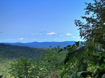
At the first trail junction, we followed Sheila as she turned right and started up the woods road which has the gentler approach of the two. I was surprised to see that a tree that had overarched the trail for more than a year had finally fallen. I remarked to Lisa that I would come and remove it as soon as possible. We continued up the trail and I showed Lisa the rather larger tree I had cut by hand and removed from the trail. We reached the end of the woods road and turned left up the hill on the trail. We continued up the trail to the first trail junction with the upper blue trail. We turned left and walked the yellow trail along the base of Round Top to the next junction with the blue trail. I was happy to see that the trail work Cindy and I had done was keeping the brush ay bay. We had trimmed back brush along this trail and removed a large blowdown. No more brush had fallen into the trail as I thought it might. When we reached the junction, I told Sheila "right" and she turned right on the blue trail and started to climb the hill. Lisa and I had not hiked together for some time so we talked to catch up. We turned right on the switchback in the blue trail which I had constructed to ease the erosion on the main trail and allow people to have a slightly more gentle climb. At the end of the switchback we turned right on the main blue trail and passed the white crossover trail on the way to the summit. We crossed over the summit and started down the blue rail on the other side. We again passed the white crossover trail continuing on to the yellow trail. We had not run into any blowdowns blocking the trail but we had removed a few small branches. We turned right and again walked along the yellow trail to the next junction with the blue trail. This time we turned left and headed down toward the lookout. The trail bed was clear but many of the ferns were turning brown or were already dead from lack of water. When we reached the viewpoint, we noticed that the view was almost completely blocked by a few trees that had grown up. I asked Lisa if she would like to walk along the top of the ledges and she agreed. We walked along a herd path at the edge of the ledges and quickly ran into a crossarm on a tree. After that, we found a bracket and another crossarm. These were remnants of an old TV system which had an antenna on Round Top and used wires to distribute the signal. Lisa did not want to explore any more so we walked back toward the lookout and turned left to descend the yellow trail to the first trail junction. We continued straight ahead and walked out to the trailhead. We turned right and walked down the hill to the church parking lot to Lisa's car. We said goodbye to Lisa and Sheila and I crossed the parking lot and Rock Avenue to get to our driveway. When we arrived home, it was 2:20 PM and we had hiked just under over 2 miles in an hour and 20 minutes.
![]()
![]()
![]()
![]() On Monday, September 19th I finally had a little time to get out for a hike after days of ambulance corps commitments. After responding to several ambulance calls, I concluded that my only choice was to again head across the street to Round Top and see if we could get in some hiking. I am lucky that I have a place so close to hike but it has become very familiar. I have found that even a short hike helps to keep my blood pressure in check and I am hoping I can get my weight down also. Sheila was ready to go as she really likes to hike but she was being a good dog and just whining a little bit while keeping an eye on me. It was 70 degrees on the back porch so I decided to put on my White Sierra long-sleeved wicking shirt without a baselayer. I wore my Railriders hiking pants which are expensive but last along time and have features like deep pockets and a generous cut which I really like. The pants have Velcro closures at the ankles. I decided to put on my Keen Durand hiking boots which fit well and are newer than what I have been wearing. I added a new pair of Xstance insoles in an effort to find the best support and cushioning for my feet. These insoles have shock absorbing gel pads, TPU arch support, and memory foam cushioning all wrapped in a breathable fabric. The insoles have been hyped by their manufacturer and I wondered if they would live up to that hype. I grabbed a pair of Leki external lock poles I have been using for some time. At 1:45 PM we walked out the door to start the hike. I looked around and saw that the sky was blue over Round Top with a few puffy white clouds but that the clouds to the north and west were dark and threatening rain. I grabbed Sheila's leash from the car and we walked up the driveway.
On Monday, September 19th I finally had a little time to get out for a hike after days of ambulance corps commitments. After responding to several ambulance calls, I concluded that my only choice was to again head across the street to Round Top and see if we could get in some hiking. I am lucky that I have a place so close to hike but it has become very familiar. I have found that even a short hike helps to keep my blood pressure in check and I am hoping I can get my weight down also. Sheila was ready to go as she really likes to hike but she was being a good dog and just whining a little bit while keeping an eye on me. It was 70 degrees on the back porch so I decided to put on my White Sierra long-sleeved wicking shirt without a baselayer. I wore my Railriders hiking pants which are expensive but last along time and have features like deep pockets and a generous cut which I really like. The pants have Velcro closures at the ankles. I decided to put on my Keen Durand hiking boots which fit well and are newer than what I have been wearing. I added a new pair of Xstance insoles in an effort to find the best support and cushioning for my feet. These insoles have shock absorbing gel pads, TPU arch support, and memory foam cushioning all wrapped in a breathable fabric. The insoles have been hyped by their manufacturer and I wondered if they would live up to that hype. I grabbed a pair of Leki external lock poles I have been using for some time. At 1:45 PM we walked out the door to start the hike. I looked around and saw that the sky was blue over Round Top with a few puffy white clouds but that the clouds to the north and west were dark and threatening rain. I grabbed Sheila's leash from the car and we walked up the driveway.
We began the ascent of the steepest hill behind the church and continued directly up the hill to the trailhead. The hill is short but gets the circulation pumping and is the steepest and longest climb on the "trail." My goal was to make it all the way up the hill without stopping. At the top of the hill we stopped for minute so that I could observe the skies and hills all around us. We turned left and entered the woods to begin our hike. The trailhead was damp and muddy in a few spots from some rain and that continued as we entered the woods. I used my pole to poke at the dirt and found that the dirt was damp to some depth. At the first trail junction, I followed Sheila as she continued straight ahead up the hill toward the lookout. We stopped for a minute at the upper lookout and found the view partially blocked by the leaves on the trees. We followed the yellow trail as it turned right and headed uphill through the fern glade. The drought had contributed to many of the ferns dying and most were now brown an shriveled. The woods looked like fall was approaching with some leaves dying and falling from the trees because of the earlier drought. We passed the "sitting rock" and continued on the yellow trail to the first junction with the blue trail. At the junction we turned right and walked the yellow trail along the base of Round Top to the next junction with the blue trail. The trail was still clear of brush but I thought about giving it another trim before winter. We turned left on the blue trail and started up the hill. We bypassed the white crossover trail and continued on the blue trail across the summit of Round Top. As we began down the other side, we again bypassed the white crossover trail. We immediately turned left on the switchback in the blue trail and followed it out and then back to the main trail. We turned left and followed the blue trail to the yellow trail. We again walked on the yellow trail to the junction with the blue trail.
This time we turned right and walked down the yellow trail to the woods road. We walked along the woods road toward the first trail junction. Just before the first trail junction, I looked at the remains of the larger blowdown I had cut and removed from the trail. We turned around at the first trail junction and started back p the woods road. We turned left when the yellow trail started up toward the first junction with the blue trail. We turned left and walked the yellow trail to the next junction with the blue trail. This part of the yellow trail remains clear without blowdowns or encroaching brush. At the next trail unction we turned right on the blue trail and started up the hill. We turned right on the switchback and walked out into the rest and then back to the blue trail. We turned right on the blue trail and then immediately right again on the white crossover trail. We had an anniversary walk on these rails coming up and I wanted to be sure they were clear. We walked across the white crossover trail an d then gown down the other side of the hill to the junction with the yellow trail. At the junction with the yellow trail we turned right and again walked to the next junction with the blue trail. This time we turned left and continued on the yellow trail through the ferns to the viewpoint. At the viewpoint we turned left and walked down the steep trail to the first trail junction. This time we continued out to the trailhead. At the trailhead we turned right and walked down the hill to the church parking lot. We crossed the parking lot and Rock Avenue to get to our driveway. When we arrived home, it was 2:50 PM and we had hiked a little more than 2 miles in a little more than an hour.
![]()
![]()
![]()
![]()
![]() On Friday, September 16th I had planned to hike with two friends doing an out-and-back from on the Mongaup Hardenburgh Trail from Hardenburgh to the junction with the Long Pond Beaverkill Ridge Trail. One friend is trying to complete the All Trail Challenge and this was one of the last sections she needed. Early in the morning I got a text that she needed a rest day and we agreed to postpone the hike. I decided to ask Cindy if she wanted to hike and she agreed as long as it wasn't too far and wasn't to hilly. We kicked around some routes and decided on the new route to Hodge Pond from the parking area off Shin Creek Road in Lew Beach. The land around Hodge Pond had recently changed hands and is now under the care of the Beaverkill Land Trust. The Beaverkill Land Trust has created a parking lot on a woods road off Shin Creek Road in Lew Beach. The woods road leads to Hodge Pond near the site of the former Beech Mountain Boy Scout Camp. There are also two nice lookouts on the shoulders of Beech Mountain; the highest point in Sullivan County. We got up late as I had covered four ambulance calls the day before and was tired. I spent some time doing chores around the house and started getting ready at 1:00 PM. I put on my White Sierra long-sleeved crew top without a baselayer. I often wear a long-sleeved top even on warm days as it protects me from the sun and allows me to spray insect repellant on it rather than on me. I donned put on a pair of RailRiders hiking pants which are expensive but last along time and have features like deep pockets and a generous cut which I really like. The pants have Velcro closures at the ankles which help keep out mud, sticks, stones and ticks. The ticks have not been very numerous this season but prevention is the key. I decided to put on my Keen Durand hiking boots which fit well and are newer than what I have been wearing. I added a new pair of Xstance insoles in an effort to find the best support and cushioning for my feet. These insoles have shock absorbing gel pads, TPU arch support, and memory foam cushioning all wrapped in a breathable fabric. The insoles have been hyped by their manufacturer and I wondered if they would live up to that hype. I decided to take my Leki poles with external locks as the internal twist locks sometimes fail. I added my OR floppy hat which I have decided shields me from the sun and allows me to spray some insect repellant on it rather than on me. I was a little worried about getting to the trailhead as Shin Creek Road is "seasonal maintenance" only and I thought the recent downpours might have eroded some sections.
On Friday, September 16th I had planned to hike with two friends doing an out-and-back from on the Mongaup Hardenburgh Trail from Hardenburgh to the junction with the Long Pond Beaverkill Ridge Trail. One friend is trying to complete the All Trail Challenge and this was one of the last sections she needed. Early in the morning I got a text that she needed a rest day and we agreed to postpone the hike. I decided to ask Cindy if she wanted to hike and she agreed as long as it wasn't too far and wasn't to hilly. We kicked around some routes and decided on the new route to Hodge Pond from the parking area off Shin Creek Road in Lew Beach. The land around Hodge Pond had recently changed hands and is now under the care of the Beaverkill Land Trust. The Beaverkill Land Trust has created a parking lot on a woods road off Shin Creek Road in Lew Beach. The woods road leads to Hodge Pond near the site of the former Beech Mountain Boy Scout Camp. There are also two nice lookouts on the shoulders of Beech Mountain; the highest point in Sullivan County. We got up late as I had covered four ambulance calls the day before and was tired. I spent some time doing chores around the house and started getting ready at 1:00 PM. I put on my White Sierra long-sleeved crew top without a baselayer. I often wear a long-sleeved top even on warm days as it protects me from the sun and allows me to spray insect repellant on it rather than on me. I donned put on a pair of RailRiders hiking pants which are expensive but last along time and have features like deep pockets and a generous cut which I really like. The pants have Velcro closures at the ankles which help keep out mud, sticks, stones and ticks. The ticks have not been very numerous this season but prevention is the key. I decided to put on my Keen Durand hiking boots which fit well and are newer than what I have been wearing. I added a new pair of Xstance insoles in an effort to find the best support and cushioning for my feet. These insoles have shock absorbing gel pads, TPU arch support, and memory foam cushioning all wrapped in a breathable fabric. The insoles have been hyped by their manufacturer and I wondered if they would live up to that hype. I decided to take my Leki poles with external locks as the internal twist locks sometimes fail. I added my OR floppy hat which I have decided shields me from the sun and allows me to spray some insect repellant on it rather than on me. I was a little worried about getting to the trailhead as Shin Creek Road is "seasonal maintenance" only and I thought the recent downpours might have eroded some sections.
 We got my gear in the car and put an excited Sheila in the back seat. At 1:25 PM I drove north on Old Route 17 to the Beaverkill Road. I drove north to the four corners just after the Beaverkill Valley fire house. Here I turned right and started up Shin Creek Road. The drive on this road is beautiful but very rough in spots. After we crossed into the Town of Hardenburgh in Ulster County we soon ran into the "Seasonal Maintenance" the sign and the road did get rougher. I was pretty sure Cindy was wondering if I knew where I was going and if it was worth it. When we came to the road on the right I turned and found it was smoother than Shin Creek Road! I passed a small pulloff on the right and continued up the road to the parking area on the left. I pulled in to park and noticed the temperature was 66 degrees. When I stepped out of the car, it actually seemed warmer although a light breeze was blowing. The skies were blue and the sun was out but there were a lot of clouds in the sky. I set my GPS and we began our hike at 1:45 PM by starting up the road. We walked over to the "gate" which is a chain with a large plastic culvert around it. Members of the Land Trust can get a key to open it and drive all the way to Hodge Pond and a cabin if they have the right vehicle. We crossed the stream on a bridge constructed to support cars and saw that there was quite a bit of water in the creek. I passed up taking any pictures on the way up the road as it is a pretty hike but has no remarkable attractions. The road was uphill all the way but the grade was gentle in most spots. There were a few places that were steeper than I remembered and had a few more rocks. Sheila was walking with us as she often does when Cindy is with us. I tried walking in the center of the road on a strip of grass and moss or along the sides of the road to avoid the rocks. Despite the footing, we were making good time and the hike was going faster than I expected. I was warming up but was not sweating too much.
 At 1.2 miles the road leveled and I recognized the site of the former Beech Mountain Boy Scout Camp. There are several spots where the trail levels and they had fooled me into thinking we were at this point before we were. The cabins from the Boy Scout camp had deteriorated so much that the Beaverkill Land Trust had them cleared away. We walked out to the road junction and turned left on the woods road that goes toward the top of Beech Mountain. I wasn't really tired and was actually feeling much fresher so we pushed the pace a little. Not very far up the road my phone let me know there was an ambulance call. I got a call from another member asking if I was available and I told him I was about an hour and 15 minutes away! When we got to the old sand and gravel pit where the trail levels, I noticed that there was almost no sun and the clouds were gathering. The breeze had also picked up. The trail began to gain elevation again and we passed by a spring house on the right where Sheila stopped to get a quick drink and wade in the water. There are several twists and turns along this road and it is sometimes hard for me to know exactly where I am. At 1.6 miles we came to a lookout on the left of the trail. The lookout had been "cut out" to get a better view but the trees were already beginning to grow back. I decided to stop briefly for pictures as the view was not spectacular and I wanted to reach the other two lookouts. We followed the road uphill as it made a sharp right turn. Just after this the road turned to the left and another trail branched off to the right. We turned to the right on the trail that circle Beech Mountain. The trail was almost flat but did roll a little. All the vegetation was very green along the trail and there were some impressive ledges on the left of the trail. Soon we arrived at the Hodge Pond Lookout. This lookout had also been cut out but the brush was beginning to grow back. I put my pack down and got out the camera. Sheila was wandering around on the lookout rocks making Cindy very nervous. I took pictures of Hodge Pond and the mountains in the background. The overcast was building and I was anxious to get to the other lookout. After taking the pictures, we got a drink and shared a bar before packing up and continuing on the trail counterclockwise.
 As we walked on then trail, we both commented on the rock formations on the left side of the trail. These formations are part of Beech Mountain and are hard to photograph. Soon we came to a spot where the trail fork with the main trail continuing straight ahead. We turned right and walked downhill following some red trail markers placed by the Land Trust. We passed by three new camping platforms and the came to the cabin with a lawn and one of the best views in the Catskills. Many 3500 foot mountains are visible from this viewpoint. I had promised Cindy a nice view and she was not disappointed. The panorama from this lookout takes in the Burroughs Range and many of the other Catskill peaks. A newly installed display shows the outline of the peaks and their names. The only problem was that there was now no sun because of the heavy overcast. I got out my camera and took pictures of the mountains to the east even though the sky was flat and without clouds. I zoomed in and took some more shots. When I was done, I stowed my camera, picked up the pack and we continued on the woods road in a counterclockwise direction. I showed Cindy the path to Mongaup Mountain as we climbed the hill passing by the main trail on the left. Near the top of the hill, I pointed out the woods road that starts up to the ridge and runs the length to the high point of Beech Mountain. I also pointed out that we would now be walking either flat or downhill all the way back to the car. We set a pretty fast pace downhill being careful of where we placed our feet as there were a lot of loose stones. We were soon at the junction with the road to the Shin Creek parking. At the bottom of the hill we turned right, walked along the flat part of the trail and started the 1.3 miles descent to the car. The skies were still overcast and a breeze was blowing but it did not look like it would rain. We were back at the car at 4:00 PM after a very satisfying hike. We had hiked 4.3 miles in 2 hours and 20 minutes gaining 880 feet along the way. Our overall speed was 1.85 mph with moving average of 2.0 mph with 15 minutes of stopped time.
![]() On Wednesday, September 14th I wanted to remove a large blowdown I had found on Round Top the day before. I asked Cindy if she would go with me and she agreed We started to get ready at 10:15 AM with Shiela watching us very carefully. It was 68 degrees on the back porch so I decided to put on a short-sleeved wicking shirt I had gotten some years ago at a cross country race. I wore my Railriders hiking pants which are expensive but last along time and have features like deep pockets and a generous cut which I really like. The pants have Velcro closures at the ankles. I decided to put on my Keen Durand hiking boots which fit well and are newer than what I have been wearing. I added a new pair of Xstance insoles in an effort to find the best support and cushioning for my feet. These insoles have shock absorbing gel pads, TPU arch support, and memory foam cushioning all wrapped in a breathable fabric. The insoles have been hyped by their manufacturer and I wondered if they would live up to that hype. I did not intend to bring hiking poles as the walk is short and I would be carrying axes and saws. At 10:30 AM I started to put my gear in the car. I took my Fiskars pack ax, Council Tools American felling ax, Silky Sugowaza saw and Silky Katanaboy saw. I put Sheila in the back seat and I drove across the street and up the hill on Orchard Street to the trailhead at the top of the cemetery. We got out of the car to start our hike at 10:45 AM. Cindy carried the Fiskars ax while I put the saws in my pack and carried the Council Tool felling ax. We walked from the trailhead to the first trail junction and turned right. Almost immediately we ran into the large blowdown. The biggest trunk was larger than I thought. I put my pack and tools down and got my camera out of my pack. I took a series of pictures of the entire blowdown from different angles.
On Wednesday, September 14th I wanted to remove a large blowdown I had found on Round Top the day before. I asked Cindy if she would go with me and she agreed We started to get ready at 10:15 AM with Shiela watching us very carefully. It was 68 degrees on the back porch so I decided to put on a short-sleeved wicking shirt I had gotten some years ago at a cross country race. I wore my Railriders hiking pants which are expensive but last along time and have features like deep pockets and a generous cut which I really like. The pants have Velcro closures at the ankles. I decided to put on my Keen Durand hiking boots which fit well and are newer than what I have been wearing. I added a new pair of Xstance insoles in an effort to find the best support and cushioning for my feet. These insoles have shock absorbing gel pads, TPU arch support, and memory foam cushioning all wrapped in a breathable fabric. The insoles have been hyped by their manufacturer and I wondered if they would live up to that hype. I did not intend to bring hiking poles as the walk is short and I would be carrying axes and saws. At 10:30 AM I started to put my gear in the car. I took my Fiskars pack ax, Council Tools American felling ax, Silky Sugowaza saw and Silky Katanaboy saw. I put Sheila in the back seat and I drove across the street and up the hill on Orchard Street to the trailhead at the top of the cemetery. We got out of the car to start our hike at 10:45 AM. Cindy carried the Fiskars ax while I put the saws in my pack and carried the Council Tool felling ax. We walked from the trailhead to the first trail junction and turned right. Almost immediately we ran into the large blowdown. The biggest trunk was larger than I thought. I put my pack and tools down and got my camera out of my pack. I took a series of pictures of the entire blowdown from different angles.
 I began by using the Council Tools ax to cut a smaller trunk on both sides of the trail. It didn't take long until the cuts were completed. Cindy and I were able to roll and pivot the section I had cut off the trail. I took some pictures and then again evaluated the blowdown. I chose to cut another smaller trunk on the other side of the blowdown. This time I chose the Fiskars ax which is smaller and lighter but cuts very well. I cut through the trunk and then lifted and the end to flip, it off the trail. It was now time to start on the large trunk that I was not sure I could cut. I decided to cut the smaller diameter end first. I used the Council Tools ax to start a wide cut through the trunk. I switched sides a couple of times and then switched to the Fiskars ax to complete the cut. As I was finishing the cut, Cindy decided to walk home to get something to eat. I completed the cut and began to look at what it would take to cut this large trunk on the other side of the trail. The trunk had a larger diameter there and its height and position would make it difficult to use an ax. I also knew that the section that I would cut from the center would be very heavy; perhaps too heavy for me to move. I decided to start cut and see what happened. I chose to use the Katanaboy because of the diameter of the trunk. I found a place to cut that was close to the edge of the trail and seemed to have no knots. As I began to cut, I noticed that this was the Katanaboy 500 that I had not use before. It did seem sharper than the one I had used but that may have been my imagination. The cut was going well as I chose different angles by cutting with the blade tipped up, then down and then flat. I tried using the Sugowaza with its curved blade and this helped also.
 As I gotten further into the cut, I began to worry that the kerf would start to close and pinch the saw. I had left my wedges at home and was torn by just trying to finish and going home to get the wedges. I decided to leave my tools but take Sheila home so that I could retrieve the wedges. We walked out to the trailhead and I drove down the hill and back home. I brought Sheila inside and picked up all four wedges and a 3 pound sledge to drive the wedges. I also brought along a mattocks that I thought might help me move the section once I completed the cut. I drove back to the trailhead, took the tools out of the car and headed back to the blowdown. I pounded two wedges in as far as I could and used the Katanaboy to continue the cut. I must have been further through the trunk than I thought as the section dropped off and hit the ground. The portion of the trunk off the trail toward the roots never moved and the wedges were not necessary! I took a couple of pictures and then started to attempt to move the section. I was able to pivot and roll the large section almost to the edge of the trail but a protruding branch and a slight uphill lip interfered. After several attempts with the mattocks and the addition of sheer will, I was able to roll it off the trail. I was pretty pleased with the overall work I had done! I took my "after" pictures and then collected all my tools. I put what I could in my pack and was able to carry the rest to the car. I drove back to my house at 1:00 PM after spending a total of 2 hours and 15 minutes removing the entire blowdown.
![]()
![]()
![]()
![]() On Tuesday, September 13th I finally had a little time to get out for a hike after days of ambulance corps commitments and poor weather. I had to time a soccer game in the afternoon so I concluded that my only choice was to again head across the street to Round Top and see if we could get in some hiking. I am lucky that I have a place so close to hike but it has become very familiar. I have found that even a short hike helps to keep my blood pressure in check and I am hoping I can get my weight down also. Sheila was ready to go as she really likes to hike but she was being a good dog and just whining a little bit while keeping an eye on me. It was 70 degrees on the back porch so I decided to put on my White Sierra long-sleeved wicking shirt without a baselayer. I wore my Railriders hiking pants which are expensive but last along time and have features like deep pockets and a generous cut which I really like. The pants have Velcro closures at the ankles. I decided to put on my Keen Durand hiking boots which fit well and are newer than what I have been wearing. I added a new pair of Xstance insoles in an effort to find the best support and cushioning for my feet. These insoles have shock absorbing gel pads, TPU arch support, and memory foam cushioning all wrapped in a breathable fabric. The insoles have been hyped by their manufacturer and I wondered if they would live up to that hype. I grabbed a pair of Leki external lock poles I have been using for some time. At 11:45 PM we walked out the door to start the hike. I looked around and saw that the sky was blue over Round Top with a few puffy white clouds but that the clouds to the north and west were dark and threatening rain. I grabbed Sheila's leash from the car and we walked up the driveway.
On Tuesday, September 13th I finally had a little time to get out for a hike after days of ambulance corps commitments and poor weather. I had to time a soccer game in the afternoon so I concluded that my only choice was to again head across the street to Round Top and see if we could get in some hiking. I am lucky that I have a place so close to hike but it has become very familiar. I have found that even a short hike helps to keep my blood pressure in check and I am hoping I can get my weight down also. Sheila was ready to go as she really likes to hike but she was being a good dog and just whining a little bit while keeping an eye on me. It was 70 degrees on the back porch so I decided to put on my White Sierra long-sleeved wicking shirt without a baselayer. I wore my Railriders hiking pants which are expensive but last along time and have features like deep pockets and a generous cut which I really like. The pants have Velcro closures at the ankles. I decided to put on my Keen Durand hiking boots which fit well and are newer than what I have been wearing. I added a new pair of Xstance insoles in an effort to find the best support and cushioning for my feet. These insoles have shock absorbing gel pads, TPU arch support, and memory foam cushioning all wrapped in a breathable fabric. The insoles have been hyped by their manufacturer and I wondered if they would live up to that hype. I grabbed a pair of Leki external lock poles I have been using for some time. At 11:45 PM we walked out the door to start the hike. I looked around and saw that the sky was blue over Round Top with a few puffy white clouds but that the clouds to the north and west were dark and threatening rain. I grabbed Sheila's leash from the car and we walked up the driveway.
We began the ascent of the steepest hill behind the church and continued directly up the hill to the trailhead. The hill is short but gets the circulation pumping and is the steepest and longest climb on the "trail." My goal was to make it all the way up the hill without stopping. At the top of the hill we stopped for minute so that I could observe the skies and hills all around us. We turned left and entered the woods to begin our hike. The trailhead was wet and muddy in a few spots from some heavy rain the day before and that continued as we entered the woods. I used my pole to poke at the dirt and found that the dirt was wet to some depth. At the first trail junction, I followed Sheila as she continued straight ahead up the hill toward the lookout. We stopped for a minute at the upper lookout and found the view partially blocked by the leaves on the trees. We followed the yellow trail as it turned right and headed uphill through the fern glade. The drought had contributed to many of the ferns dying but the rain had made the remaining ferns much greener. The woods had a fresh and bright look I had not seen for some time. We passed the "sitting rock" and continued on the yellow trail to the first junction with the blue trail. At the junction we turned right and walked the yellow trail along the base of Round Top to the next junction with the blue trail. We turned left on the blue trail and started up the hill. We bypassed the white crossover trail and continued on the blue trail across the summit of Round Top. As we began down the other side, we again bypassed the white crossover trail. We immediately turned left on the switchback in the blue trail and followed it out and then back to the main trail. We turned ;eft and followed the blue trail to the yellow trail. The wind had started to come up and the skies were darkening so I was interested in getting back to the trailhead as quickly as possible. We again walked on the yellow trail to the junction with the blue trail.
This time we turned right and walked down the yellow trail to the woods road. We walked along the woods road toward the first trail junction. Just before the first trail junction, I found a large tree blocking the trail. The large tree had taken down some other branches which were also blocking the trail. I knew I would be able to clear some of the blowdown with my hand tools but I doubted I could easily cut the large trunk. We worked our way over the blowdown and walked to the first trail junction. We trued left and walked out to the trailhead. At the trailhead, I took a look at the sky and concluded we could probably get in another figure 8. We walked back to the first trail junction and turned right on the woods road. We worked our way over the blowdown and turned left when the yellow trail started up toward the first junction with the blue trail. We turned left and walked the yellow trail to the next junction with the blue trail. This part of the yellow trail remains clear without blowdowns or encroaching brush. At the next trail unction we turned right on the blue trail and started up the hill. We turned right on the switchback and walked out into the rest and then back to the blue trail. We turned right on the blue trail, bypassed the white crossover trail, and walked across the summit of Round Top. We walked down the other side of the hill bypassing the white crossover trail. At the junction with the yellow trail we turned right and again walked to the next junction with the blue trail. This time we turned left and continued on the yellow trail through the ferns to the viewpoint. At the viewpoint we turned left and walked down the steep trail to the first trail junction. This time we continued out to the trailhead. At the trailhead we turned right and walked down the hill to the church parking lot. We crossed the parking lot and Rock Avenue to get to our driveway. When we arrived home, it was 1:00 PM and we had hiked a little more than 2 miles in an hour and 15 minutes.
![]()
![]()
![]()
![]()
![]() On Friday, September 9th, I had planned to hike the Pelnor Hollow trail and Liable Spring Brook Trail with my friend Sharon and her friend Linda. This was at least the third time Sharon and I had scheduled this hike! Previous attempts had succumbed to bad weather or my covering ambulance calls. Sharon needed these two trails for the AllTrails Challenge which she was close to completing. I wanted to check out the trails as several people had been asking about the status of the maintenance on these trails and the access at Pelnor Hollow Road. The trailhead at Pelnor Hollow Road is surrounded by private property and the owners do not want cars parked on their land. This is reasonable but at one time they had claimed hikers could not access the trail at all. Cindy agreed to help us by giving us a ride from the Little Spring Brook parking area to the Pelnor Hollow trailhead. When I got up in the morning is was cool with the temperature at 48 degrees at 7:00 AM. The weather report indicated a beautiful day with no rain and highs in the high 70's. I started getting dressed at 8:15 AM choosing my Whute Sierra long-sleeved crew top with a short-sleeved baselayer. I often wear a long-sleeved top even on warm days as it protects me from the sun and allows me to spray insect repellant on it rather than on me. For this hike I knew there might be some areas of briars and this makes long sleeves almost mandatory. I put on a pair of RailRiders hiking pants which are expensive but last along time and have features like deep pockets and a generous cut which I really like. The pants have Velcro closures at the ankles which help keep out mud, sticks, stones and ticks. The ticks have not been very numerous this season but prevention is the key. I decided to put on my Keen Durand hiking boots which fit well and are newer than what I have been wearing. I added a new pair of Xstance insoles in an effort to find the best support and cushioning for my feet. These insoles have shock absorbing gel pads, TPU arch support, and memory foam cushioning all wrapped in a breathable fabric. The insoles have been hyped by their manufacturer and I wondered if they would live up to that hype. I decided to take my Leki poles with external locks as the internal twist locks sometimes fail. I added my OR floppy hat which I have decided shields me from the sun and allows me to spray some insect repellant on it rather than on me. I also put on my OR Crocodile gaiters to keep my lower legs dry. I also packed my LT Wright Overland machete to deal with the prickers and brush if needed. I put my gear in the back of my car and Sheila in the back seat. Sheila loves to get out an hike anywhere and she had kept her eye on both of us as we were getting ready. We had not hiked for almost a week due to my commitments and the rainy weather.
On Friday, September 9th, I had planned to hike the Pelnor Hollow trail and Liable Spring Brook Trail with my friend Sharon and her friend Linda. This was at least the third time Sharon and I had scheduled this hike! Previous attempts had succumbed to bad weather or my covering ambulance calls. Sharon needed these two trails for the AllTrails Challenge which she was close to completing. I wanted to check out the trails as several people had been asking about the status of the maintenance on these trails and the access at Pelnor Hollow Road. The trailhead at Pelnor Hollow Road is surrounded by private property and the owners do not want cars parked on their land. This is reasonable but at one time they had claimed hikers could not access the trail at all. Cindy agreed to help us by giving us a ride from the Little Spring Brook parking area to the Pelnor Hollow trailhead. When I got up in the morning is was cool with the temperature at 48 degrees at 7:00 AM. The weather report indicated a beautiful day with no rain and highs in the high 70's. I started getting dressed at 8:15 AM choosing my Whute Sierra long-sleeved crew top with a short-sleeved baselayer. I often wear a long-sleeved top even on warm days as it protects me from the sun and allows me to spray insect repellant on it rather than on me. For this hike I knew there might be some areas of briars and this makes long sleeves almost mandatory. I put on a pair of RailRiders hiking pants which are expensive but last along time and have features like deep pockets and a generous cut which I really like. The pants have Velcro closures at the ankles which help keep out mud, sticks, stones and ticks. The ticks have not been very numerous this season but prevention is the key. I decided to put on my Keen Durand hiking boots which fit well and are newer than what I have been wearing. I added a new pair of Xstance insoles in an effort to find the best support and cushioning for my feet. These insoles have shock absorbing gel pads, TPU arch support, and memory foam cushioning all wrapped in a breathable fabric. The insoles have been hyped by their manufacturer and I wondered if they would live up to that hype. I decided to take my Leki poles with external locks as the internal twist locks sometimes fail. I added my OR floppy hat which I have decided shields me from the sun and allows me to spray some insect repellant on it rather than on me. I also put on my OR Crocodile gaiters to keep my lower legs dry. I also packed my LT Wright Overland machete to deal with the prickers and brush if needed. I put my gear in the back of my car and Sheila in the back seat. Sheila loves to get out an hike anywhere and she had kept her eye on both of us as we were getting ready. We had not hiked for almost a week due to my commitments and the rainy weather.
 As we left Livingston Manor at 8:45 AM, the sun was just beginning to break through the fog. We drove west on State Route 17 and got off at Exit 94 for Roscoe. We followed Route 206 north through Roscoe and Rockland heading toward Downsville. Just before starting up Brock Mountain we turned right on Little Spring Brook Road and drove to the parking area at the end. Sharon and Linda were already there so we introduced ourselves. We put all our gear in the rear of Cindy's car. I drove and Cindy sat in the front seat with Sheila. Linda and Sharon got it the back seat. I drove back out Little Spring Brook Road and turned left on Route 206 and, after a short distance left, on Beaverkill Valley Road. As I drove along the road I pointed out Dundas Castle on the left side of the road. Almost immediately after the castle, I turned left on Pelnor Hollow Road and drove to the end passing many "No Parking" and "Keep Out" signs. After about a mile, we arrived at the end of the road and the effective beginning of the Pelnor Hollow Trail. There was no one around but we felt very unwelcome! I got Sheila out of the car and put her in her leash. I debated whether or not to wear the jacket I had brought but in the end I decided to leave it is the car as it was very warm in the sun. Linda, Sharon and I shouldered our packs and grabbed our poles. I wanted to get going before someone came to let us know we could not park where we were. I set my GPS, said goodbye to Cindy and started to hike at 9:30 AM. I kept Sheila on her leash to keep her with me and off the private property that surrounds the easement New York State has to the state forest. The gate was open and signs posted by New York state indicated that there was no parking and that the land on either side of the woods road was private property. These signs continued all the way along the road to the state land boundary. It was obvious a wheeled vehicle had been on the road as the high grass was matted own. As we entered the shade of the trees I noticed it was very cool and I almost regretted not brining the jacket. After hiking a short distance I warmed up. The road was wet and muddy in places from the rain during the week but was passable even with a car. The stream was flowing nicely with quite a bit of water.
 When we arrived at the first bridge, we found it in good shape after it was rebuilt several years ago. The road was very rocky and still wet with running water and muddy spots. The second bridge was in poor condition and I wondered why someone had replaced one and not the other. We arrived at the cabin on the left side of the trail but no one was home. As we continued on the road I saw the state land signs appear. The road deteriorated making me believe that it would be unwise to bring any vehicle up the road even though there is a parking area where the road ends. The gate at the end of Pelnor Hollow Road should be treated as the effective end of the road and the beginning of the trail. We eventually came to a wide spot in the trail where the road definitely ended. A sign indicated that the lean-to was .5 miles up the trail. The trail now narrowed from woods road width to trail width as we entered hardwood forest. It did seem that some trail maintenance had been done but that could have been the result of more people hiking the trail. The walk to the lean-to seemed longer than a half mile and the trail had flattened. At 1.5 miles we came to the lean-to which appeared to be in good shape. We stopped for a rest and so that I could take some pictures. There was a sign at the lean-to indicating distances which is unusual out in the middle of nowhere. I knew that after the lean-to the trail could be hard to find and might be covered in briars but we pushed on anyway. It was immediately obvious that the some trail maintenance continued beyond the lean-to and I began to suspect that the DEC had done some work on the trail although I was not sure. Briars were cut back some and some branches had been removed but there were some blowdowns blocking the trail. The trail was pretty easy to follow and pretty easy to walk. Sheila does a great job of finding the trail even when it has not been used much. From the lean-to we walked about .7 miles uphill gaining 425 feet to just below the top of a hill. At this point the maintenance abruptly stopped and the briars had only a narrow path where someone else had walked.
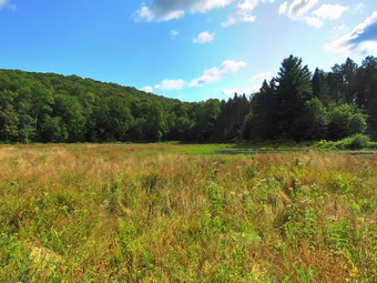 I was disappointed that we would now have to negotiate through the briars and that the trail had not had new markers placed in a very long time. As we got to the top of the hill the trail and trail markers disappeared and we spent some time wandering around. Eventually I got out Avenza which helped but the biggest aid in navigation was following Sheila who has built-in CPS. Even when the trail and markers disappear I can follow her and that she is walking from marker to marker. We continued to struggle to follow the trail and avoid the worst of the briars. The markers few and far between and very old but at least the trail bed was better worn in than in the past. We started won off the top of the hill and lost the trail again. I knew we had over a mile to go and another hill to climb just to get to the junction with the Mary Smith Trail. We stopped to take a quick break which resulted in me feeling more energetic but also let my muscles tighten up. I was surprised that I had cell service along much of the trail and 3 out of 4 phone calls were actually important. We continued to descend to the area between the two hills at 3 miles before starting up the next hill. At the top of the hill there seemed to be the possibility of some viewpoints on the right side of the trail. I knew from previous experience that trying to find a lookout would result in an area where trees and brush would block the view. There were a series of interesting glacial erratics perched on the hill and I took some pictures. At 3.8 miles we came to the intersection with the Mary Smith Trail and turned left to follow the trail downhill. The descent is steep and the damp rocks made every foot placement important. The grade is almost 20% but last less than .6 miles before arriving at Split Rock. We stopped to take a look from the viewpoint. It has grown in over the year but we could get a view. The view looks west and southwest but mostly consists of looking at the surrounding hills and a few mountains in the background. After a brief stop, we continued on the Pelnor Hollow Trail. I knew that we were nearing the end of the hike and it was all downhill or flat but I remembered some rough and rocky sections.
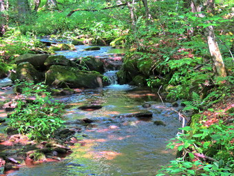 The trail makes a loop to the north along the edge of a ravine or hollow and then begins to descend. At one point several huge oaks trees had recently and one was across the trail. We were able to work our way over them but it will take a large chainsaw to clear them. This was also the point where we began to hear gunshots coming from the direction of Little Spring Brook Road! We continued to hike working our way down a tricky descent. The trail then passed through a pine plantation and crossed a brook which was running nicely. Eventually, we came to the junction of the Pelnor Hollow Trail, the Campbell Mountain Trail and the Little Spring Brook Trail. We stopped for a moment to read the signs and marvel at how wrong they are! The DEC has tried to replace some of their signs that have glaring errors but this was not one of them. The signs give incorrect trail names and incorrect distances. For seasoned hikers they may not be a problem but for those new to hiking this area they are completely confusing. We turned left and started to walk down the woods road toward the pond. The trail was damp and we could hear the brook flowing next to it. We came to the upper end of the pond and skirted the pond on a path to the right. We had to fuck under a large blowdown and the try to follow the path. It loomed like the Dec had tried to reroute the trail but it is poorly marked and more of a path. I walked down to the shore of the pond and found it less than half the size it had been on my last visit. I took some pictures and then we moved on. It is hard to follow the trail as it is overgrown with weeds and the brook wends its way onto the trail at times. There are some beautiful stone walls and a large culvert to take the brook beneath what once was a much larger road. We stopped so that I could take a few pictures of the brook but the sun was too bright to get really good shots. We walked out the trail to the cars. The trail is very rocky and very wet which is a bad condition for hiking. We were back at the cars at 2:50 PM after hiking 5.8 miles in 5 hours and 20 minutes with 1 hour and 20 minutes of stopped time. The elevation gain was 1287 feet. We met no other hikers. The Western Catskills are the place to go for quite solitude!
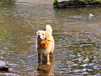
![]()
![]()
![]()
![]()
![]() On Saturday, September 3rd I wanted to get out for an easy hike so that my wife Cindy could go along and so that I could nurse my aching heels and Achilles tendons. Around 11:15 AM I asked Cindy if she would like to hike the Parksville Rail Trail and she agreed. The walk is less than 3 miles round trip and almost completely flat. It does have a few limited views and a nice waterfall. I was anxious to see what impact the recent rains had on the volume of the Little Beaverkill and the waterfalls. It was 68 degrees when we started to get ready and the skies were completely overcast. The forecast had called for sunny skies and no chance of rain! Sheila's expectant gaze and sharp bark "encouraged" me to continue the hiking plans. It was warm and I did not expected any water or mud on the trail so I dressed accordingly. I put on my White Sierra long-sleeved crew top without a baselayer as it was warm. I put on a pair of RailRiders hiking pants which are expensive but last a long time and have features like deep pockets and a generous cut which I really like. I decided to put on my Keen Durand hiking boots which fit well and are newer than what I have been wearing. I added a new pair of Xstance insoles in an effort to find the best support and cushioning for my feet. These insoles have shock absorbing gel pads, TPU arch support, and memory foam cushioning all wrapped in a breathable fabric. The insoles have been hyped by their manufacturer and I wondered if they would live up to that hype. I decided to take my Leki poles with external locks as the internal twist locks sometimes fail. I skipped wearing a hat as there was no sun and I feel more comfortable without one. At 11:25 AM we put our gear in the car and Sheila in the back seat. I headed out Old Route 17 across the Flats and then took Old Route 17 and Service Road to the point where they meet Fox Mountain Road. Just after this intersection is the western parking area for the rail trail.
On Saturday, September 3rd I wanted to get out for an easy hike so that my wife Cindy could go along and so that I could nurse my aching heels and Achilles tendons. Around 11:15 AM I asked Cindy if she would like to hike the Parksville Rail Trail and she agreed. The walk is less than 3 miles round trip and almost completely flat. It does have a few limited views and a nice waterfall. I was anxious to see what impact the recent rains had on the volume of the Little Beaverkill and the waterfalls. It was 68 degrees when we started to get ready and the skies were completely overcast. The forecast had called for sunny skies and no chance of rain! Sheila's expectant gaze and sharp bark "encouraged" me to continue the hiking plans. It was warm and I did not expected any water or mud on the trail so I dressed accordingly. I put on my White Sierra long-sleeved crew top without a baselayer as it was warm. I put on a pair of RailRiders hiking pants which are expensive but last a long time and have features like deep pockets and a generous cut which I really like. I decided to put on my Keen Durand hiking boots which fit well and are newer than what I have been wearing. I added a new pair of Xstance insoles in an effort to find the best support and cushioning for my feet. These insoles have shock absorbing gel pads, TPU arch support, and memory foam cushioning all wrapped in a breathable fabric. The insoles have been hyped by their manufacturer and I wondered if they would live up to that hype. I decided to take my Leki poles with external locks as the internal twist locks sometimes fail. I skipped wearing a hat as there was no sun and I feel more comfortable without one. At 11:25 AM we put our gear in the car and Sheila in the back seat. I headed out Old Route 17 across the Flats and then took Old Route 17 and Service Road to the point where they meet Fox Mountain Road. Just after this intersection is the western parking area for the rail trail.
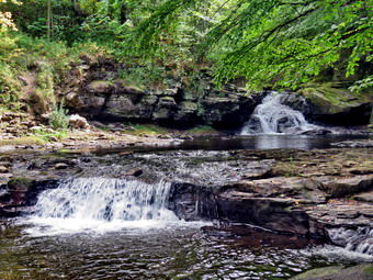 The parking lot had no cars parked. I did not bring my GPS unit as we had hiked the trail so many times before. We quickly got ready to hike leaving the trailhead at 11:35 AM. The open trail just before the woods had quite a few branches hanging into the trail. It is not clear who is responsible for clearing the trail but the job is not being done. Usually as we enter the shade of the trees, it seems a little cooler but on this day I did not notice much change. One look down to the Little Beaverkill showed the stream volume was still very low depute some rain. I wondered if the falls would have any more enough water than during our last visit. Sheila was taking her own route and following her nose. Just after entering the woods we came to an area which is normally muddy but this area was only slightly damp. Most of the rest of the trail was dry even in areas that are usually wet. The few muddy areas we would find on the trail were easily avoided. We were soon at the wooden walkways where I stopped, put my pack down and took out the camera. I took some shots of the stream below with the overcast skies in the background. I put away the camera and picked up my pack to continue over the walkways. The wooden surface was dry but had a coating of dried mud. The problem is that a rock slide has blocked the culvert under the small bridge causing water, mud and stones to be diverted over the walkway. Unblocking the culvert and covering the walkways with some screening would help. We continued on the trail and found a few blowdowns that should be cleared. Some areas of the trail also had brush that needed trimming. Other areas of the trail had large branches and blowdowns that should be removed for aesthetic reasons. Just before the falls, we met a family of four enjoying a walk along the railtrail. I had seen them coming and out Sheila on her leash. The young girl with them seemed to be enjoying the walk and really wanted to pet Sheila. We exchanged greetings and continued in opposite directions. As we approached the falls, we could hear the sound of the falls.
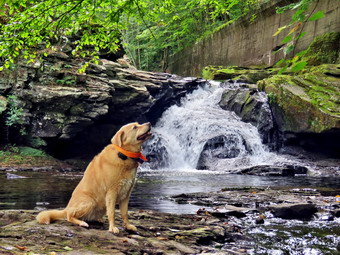 When we arrived at the falls, there did seem to be a little more volume than in recent visits. I took a few shots from above the falls and then decided to go down to the streambed so that I could take pictures from in front of the falls. It was relatively easy to work my way down the bank to the streambed and Sheila followed. I took some shots down stream and a few of Sheila in the water. She does a good job of posing even when standing in the stream. I then the turned my attention to the falls. I took numerous pictures of the area in front of falls and the falls themselves. The water was very clear and the red rock beneath the water really showed through. Sheila, decided to walk toward the falls on the wet racks. I had her pose with the falls in the background so I could get some more pictures of her. When I was done, we worked our way back up the bank. We continued on the trail to a bench where a path leads down to the stream. I left my pack on the bench and we all began to walk along a path at the edge of the stream which is normally underwater. The rocks were covered in moss and most were wet making it important to watch every step. I walked all the way to the brink of the falls. I could have gotten down to the base of the falls from here but I was not sure I could get back up! I took shots of the falls from several angles and then turned upstream and took shots of the smaller falls. I repositioned myself and took some more pictures downstream toward the falls. I finished and walked back to the bench to stow the camera. I noticed that someone had piled rocks across the stream to form a sort of dam topped with several tree trunks. People just can't seem to leave nature natural and instead have to improve it.
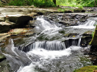 The trail continued to be dry had been wet and a little muddy in places but we managed to walk around them. From the falls to the other end of the trail there were a few wet areas and some mud. We set a quick pace for the rest of the hike to the Parksville end of the trail. Along the way we met a young couple hiking toward us and I put Shiela on her leash. We were all hiking pretty quickly so there was only time for a brief "Hello". I left Sheila on her leash which was good since another man and his dog approached us. We stopped to talk for a few minutes and I realized we had met before on this trail. His dog was a rescue and was in great shape. As we started to separate his dog began baying which let me know that there was some hound in him! We continued to the Parksville end of the trail. Just after the gate at that end, we stopped to read the sign which outlined the milk that the O&W transported. The sign also mentioned the large number of hotels that had been in the area. We turned around and headed back to the car. I knew I would not be taking any more pictures and we set a rapid return pace. As we passed the falls, there was a woman with a lack admiring the sight. We greeted each other as Cindy and I hiked along. At the wooden walkways we caught up to the man with his dog. Just before we broke out from under the trees we met and passed the young couple we had passed before. This was as many people as we had seen in one day on the trail. Cindy and I continued back to the car. We were back at the car at 12:55 PM after hiking 2.8 miles in 1 hour and 20 minutes including the stopped time for pictures. There is virtually no elevation gain on the hike except the short trips down to the streambed.
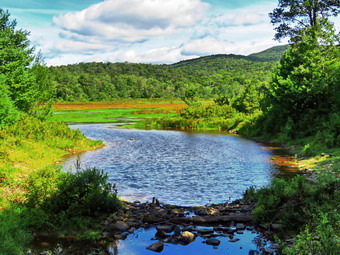
![]()
![]()
![]()
![]()
![]() On Thursday, September 1st I wanted to get out for a longer hike after hiking too many times on Round Top across the street. I decided to go to Frick Pond to do the Frick Pond to Hodge Pond loop on the Quick Lake and Flynn Trails which is a little over 6 miles. I started to get ready at 10:00 AM with the temperature hovering at 62 degrees with bright blue and sunny skies that had some puffy white clouds. Sheila sat watching my every move to make sure she would not be left behind. I put on my White Sierra long-sleeved crew top without a baselayer to protect me from the biting insects often present at Frick Pond. I put on a pair of RailRiders hiking pants which are expensive but last along time and have features like deep pockets and a generous cut which I really like. I decided to put on my Keen Durand hiking boots which fit well and are newer than what I have been wearing. I added a new pair of Fulton insoles which are cork based and seem to be molding nicely to my feet. I decided to take my Leki poles with external locks as the internal twist locks sometimes fail. I added my OR floppy hat which I have decided shields me from the sun and allows me to spray some insect repellant on it rather than on me. I put my gear in the back and Sheila in the backseat and drove out the Debruce Road at 10:20 AM. I drove about 6 miles before turning left onto Mongaup Pond Road and continued to where the road split. I turned left onto Beech Mountain Road, and drove to the parking areas at the Frick Pond. Both lots were empty so I parked in the smaller lot. The car thermometer read 66 degrees as I set my GPS to get ready for the hike. At 10:45 AM we headed out the woods road toward the trail register. The woods road was damp from the recent rains and there were even a few muddy places.
On Thursday, September 1st I wanted to get out for a longer hike after hiking too many times on Round Top across the street. I decided to go to Frick Pond to do the Frick Pond to Hodge Pond loop on the Quick Lake and Flynn Trails which is a little over 6 miles. I started to get ready at 10:00 AM with the temperature hovering at 62 degrees with bright blue and sunny skies that had some puffy white clouds. Sheila sat watching my every move to make sure she would not be left behind. I put on my White Sierra long-sleeved crew top without a baselayer to protect me from the biting insects often present at Frick Pond. I put on a pair of RailRiders hiking pants which are expensive but last along time and have features like deep pockets and a generous cut which I really like. I decided to put on my Keen Durand hiking boots which fit well and are newer than what I have been wearing. I added a new pair of Fulton insoles which are cork based and seem to be molding nicely to my feet. I decided to take my Leki poles with external locks as the internal twist locks sometimes fail. I added my OR floppy hat which I have decided shields me from the sun and allows me to spray some insect repellant on it rather than on me. I put my gear in the back and Sheila in the backseat and drove out the Debruce Road at 10:20 AM. I drove about 6 miles before turning left onto Mongaup Pond Road and continued to where the road split. I turned left onto Beech Mountain Road, and drove to the parking areas at the Frick Pond. Both lots were empty so I parked in the smaller lot. The car thermometer read 66 degrees as I set my GPS to get ready for the hike. At 10:45 AM we headed out the woods road toward the trail register. The woods road was damp from the recent rains and there were even a few muddy places.
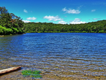 We continued straight ahead at the register and headed out the woods road toward Frick Pond. The trail was damp in a few places and a few small puddles from the rains the night before. The drainage work we had done seemed to have helped in some places but made little impact in others. At Gravestone Junction, we turned left to stay on the Quick Lake Trail and head down to Frick Pond. The muddy area just after the junction was only damp as was the other place that is usually wet and muddy. We stopped at the bridge across the outlet to Frick Pond and I took some shots of the pond and Flynn's Point. I always stop to take pictures even when the scene is not remarkable. I also too a shot of the outlet stream below the bridge. The water level in the pond was higher than it had been as there had been a drought with some heavy rains the night before. We didn't stay long and were soon walking along the west side of Frick Pond where there is usually a mud pit that had been almost impassable. We had worked to drain the water and put in stepping stones. Our work had paid off and the area was draining well and the stepping stones made an easy path across the area. At the junction with the Big Rock Trail, we stayed to the left as I wanted to keep hiking the Quick Lake Trail. The first part of the trail was only damp in areas where there is often standing water and mud. This is not an easy place to improve drainage as there is a lot of water and the edges of the woods road are higher than the trail. We entered the evergreen tunnel which was mostly dry and had only a few damp areas. There were some old blowdowns lying on the ground. There was also one large blowdown across the trail at thigh height. This blowdown was a little too large to cut with hand tools. A little further along there was another large branch that would have to be removed. When we came to the small stream across the trail, Sheila easily jumped across the water and I used the stepping stones to get across. Just after this crossing I made my way up the bank and back on the trail. We continued to push toward Iron Wheel Junction making good time as the trail, which is often covered in deep mud, was only a little damp. As we walked along the trails, I had been removing branches that were on the trail and continued to do so. When we came to Iron Wheel Junction, we turned left to head to Hodge Pond at 11:30 AM after hiking 1.5 miles in 45 minutes.
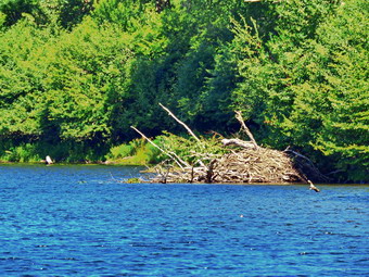 The sun was out which always makes me feel better as did the breeze that was blowing. The breeze was keeping all the insects away which I appreciated as there are normally clouds of biting mosquitoes. Sheila was having a great time staying on the trail with me most of the time with a few off-trail excursions. The next mile of trail is all uphill but the grade only averages around 8%. At times this can seem like a long slog but on this day it seemed to go quickly. The constant climb did begin to tire my legs and although the scenery was beautiful it began to get repetitive. We hit the flatter ground but on this day there were no pools of water or muddy areas. There were several small trees that could be cleared with hand tools. As we made the right turn following the trail, we started downhill toward Junkyard Junction where we arrived at 12:22 PM after hiking 3.1 miles. We turned right to start out on the Flynn Trail and almost immediately I noticed that the trail was almost dry when it normally is very wet and muddy. Sheila and I easily walked along the trail with only a few wet and muddy areas to avoid. There was one small blowdown before we came to a much larger blowdown just before a gate. Bryce and I worked to cut smaller branches off this blowdown leaving the larger branches and trunk in place. The remaining pieces of the blowdown will require some persistent work with and tools or the use if a chainsaw. We arrived at the gate which separates the state land from the Beaverkill Land Trust land around Hodge Pond. We continued on the Flynn Trail by turning right and following the trail downhill to an area near the shore of Hodge Pond. The downhill stretch was very enjoyable and I was glad that the last 1.7 miles of the hike is all downhill on the Flynn Trail. We turned right to stay on the Flynn Trail and walked along the woods road which was in good shape. There was one large blowdown that almost completely blocked the trail and would require some work to remove it. We walked through the forest and then out to the field where the sun was brightly shining. We walked back into the trees and continued to the point where the Flynn Trail enters a clearing at the outlet end of Hodge Pond. We turned left and walked over to the shore of the pond where I put down my pack and got out my camera. I took some pictures of the pond and the surroundings with the blue sky and white clouds. Sheila decided to wade in the water and then chased a stick I had thrown. I took some pictures of her and then got a bar. We headed back across the field to the point where the Flynn Trail enters the forest and began the walk up the hill on the Flynn Trail. This was the last climb before the long downhill back to the car.
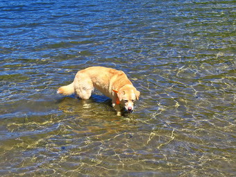 The walk up this hill often seems tedious but on this day it went quickly. We passed two large blowdowns Cindy and I had removed from the trail. I always find it satisfying to see work we have done to help maintain trails for other hikers. We were soon at the top of the hill where we stayed to the right on the Flynn Trail. We walked along the flat trail under the trees passing through the other gate. This part of the trail was barely damp and there were no muddy areas. We arrived at the junction with the Big Rock trail at 1:15 PM after hiking 4.7 miles. We continued straight ahead on the Flynn Trail. The trail was in good shape with only few small blowdowns and branches. I much prefer walking up the Flynn Trail but like to vary the route from time to time. We reached the spot where there is an interesting clearing to the left of the trail but I decided to stay on the main trail. We continued on the trail and soon were passing by the large spruce tree that had fallen across the trail. Cindy and I had cut a tunnel through the branches but the DEC sawyers had cleared the entire blowdown to allow access for emergency vehicles. At the gate at the bottom of the hill, we turned left on the trail to avoid the private property around the cabin. When we got back to the parking area, there were no cars in either parking lot . It was 2:00 PM when we got back to the car after hiking 6.3 miles in 3 hours and 15 minutes with an elevation gain of 895 feet. We had maintained an overall speed of 2.0 mph with a moving average of 2.1 mph which I thought was good for my present conditioning. The temperature was 68 degrees and Sheila and I were both ready to go home.
![]()
![]()
![]()
![]() On Wednesday, August 31st I had to take an ambulance to a Ford dealer to have it checked for a recall. I did not get home until after noon so I knew that any hike would be short. I concluded that my only choice was to again head across the street to Round Top and see if we could get in some hiking. I am lucky that I have a place so close to hike but it has become very familiar. I have found that even a short hike helps to keep my blood pressure in check and I am hoping I can get my weight down also. Sheila was ready to go as she really likes to hike but she was being a good dog and just whining a little bit while keeping an eye on me. It was 74 degrees on the back porch so I decided to put on a short-sleeved wicking shirt I had gotten some years ago at a cross country race. I wore my Railriders hiking pants which are expensive but last along time and have features like deep pockets and a generous cut which I really like. The pants have Velcro closures at the ankles. I decided to wear my newer Keen Durand hiking boots with a new pair of Fulton cork insoles. I felt I need more foot support as I was having some pain especially in my Achilles' tendons. I grabbed a pair of Leki external lock poles I have been using for some time. At 2:45 PM we walked out the door to start the hike. I looked around and saw that the sky was blue over Round Top with a few puffy white clouds. I grabbed Sheila's leash from the car and we walked up the driveway. I was unsure of the route we would take but I sure it would not be our usual two figure 8's!
On Wednesday, August 31st I had to take an ambulance to a Ford dealer to have it checked for a recall. I did not get home until after noon so I knew that any hike would be short. I concluded that my only choice was to again head across the street to Round Top and see if we could get in some hiking. I am lucky that I have a place so close to hike but it has become very familiar. I have found that even a short hike helps to keep my blood pressure in check and I am hoping I can get my weight down also. Sheila was ready to go as she really likes to hike but she was being a good dog and just whining a little bit while keeping an eye on me. It was 74 degrees on the back porch so I decided to put on a short-sleeved wicking shirt I had gotten some years ago at a cross country race. I wore my Railriders hiking pants which are expensive but last along time and have features like deep pockets and a generous cut which I really like. The pants have Velcro closures at the ankles. I decided to wear my newer Keen Durand hiking boots with a new pair of Fulton cork insoles. I felt I need more foot support as I was having some pain especially in my Achilles' tendons. I grabbed a pair of Leki external lock poles I have been using for some time. At 2:45 PM we walked out the door to start the hike. I looked around and saw that the sky was blue over Round Top with a few puffy white clouds. I grabbed Sheila's leash from the car and we walked up the driveway. I was unsure of the route we would take but I sure it would not be our usual two figure 8's!
We began the ascent of the steepest hill behind the church and continued directly up the hill to the trailhead. The hill is short but gets the circulation pumping and is the steepest and longest climb on the "trail." My goal was to make it all the way up the hill without stopping. At the top of the hill we stopped for minute so that I could observe the skies and hills all around us. We turned left and entered the woods to begin our hike. The trailhead was damp from somet rain showers the day before and that continued as we entered the woods. I used my pole to poke at the dirt and found that just underneath the damp layer the dirt was still dry. I was not surprised that the trails were still dry as we had not had any significant rain for some time. I followed Sheila as she continued straight ahead up the hill toward the lookout. We stopped for a minute at the upper lookout and found the view partially blocked by the leaves on the trees. We followed the yellow trail as it turned right and headed uphill through the fern glade. Unfortunately, the drought had contributed to many of the ferns dying of and turning brown. We passed the "sitting rock" and continued on the yellow trail to the first junction with the blue trail. At the junction we continued straight up the blue trail toward the summit of Round Top. We bypassed the switchback in the blue trail and the white crossover trail and headed directly toward the top. I don't do this often as I want people to follow the switchback to avoid further erosion of the former trail but on this day it felt good. We walked over the top on the blue trail and continued down the other side. We again bypassed the white trail and walked downhill to the trail junction with the yellow trails. We followed the yellow trail straight ahead and walked down to the woods road. We took a slight right following the woods road back to the first junction.
At this point Sheila seemed to want to head home but I turned around and started back up the woods road. This time when we got to the junction with the blue trail we continental ahead toward the summit of Round Top. When we came to the white crossover trail, we turned left and walked along this trail which follows the shoulder of Round Top and avoids the summit. The trail was in good shape and we turned left when we came to the blue trail. It was a quick walk downhill to the junction with the yellow trail. We continued straight ahead on the yellow trail walking downhill through the ferns to the overlook. We turned left on the yellow trail and walked down the short but steep hill to the first trail junction. I again confused Sheila by turning around and starting back up the hill toward the lookout. This time we again followed the yellow trail to the junction with the blue trail. We turned right and followed the yellow trail along the base of Round Top to the next junction with the blue trail. We turned right and followed the yellow trail down to the woods road and the woods road out to the first junction. Sheila turned left to go out toward the trailhead and I followed her. At the trailhead we turned right and walked down the hill to the church parking lot. We crossed the parking lot and Rock Avenue to get to our driveway. When we arrived home, it was 4:00 PM and we had hiked almost 3 miles in an hour and 15 minutes.
![]()
![]()
![]()
![]() On Tuesday, August 30th I had planned to hike the Pelnor Hollow Trail and the Little Spring Trail with a hiking friend Sharon. As I was about to leave the house to meet her at the trailhead, the ambulance pager sounded for a call across the street at the clinic. Fortunately two other volunteers were able to take the call so that I could continue with my plans to hike. Unfortunately, a few minutes later the pager sounded again and I was the only EMT left to take the call. I had hoped to get back in time to hike but my patient was seriously injured and we transported them to a trauma center. By the time I got home, it was too late to meet my friend so I looked at the radar to plan a short hike. I concluded that my only choice was to again head across the street to Round Top and see if we could get in some hiking before then rain. I am lucky that I have a place so close to hike but it has become very familiar. I have found that even a short hike helps to keep my blood pressure in check and I am hoping I can get my weight down also. Sheila was ready to go as she really likes to hike but she was being a good dog and just whining a little bit while keeping an eye on me. It was 78 degrees on the back porch so I decided to put on a short-sleeved wicking shirt I had gotten some years ago at a cross country race. I wore my Railriders hiking pants which are expensive but last along time and have features like deep pockets and a generous cut which I really like. The pants have Velcro closures at the ankles. I decided to wear my newer Keen Durand hiking boots with a new pair of Fulton cork insoles. I felt I need more foot support as I was having some pain especially in my Achilles' Tendons. I grabbed a pair of Leki external lock poles I have been using for some time. At 1:45 PM we walked out the door to start the hike. I looked around and saw that the sky was black to the north and west but that sky over Round Top was blue. I grabbed Sheila's leash from the car and we walked up the driveway. I thought we could hike our usual two figure 8's which would give us about an hour of exercise.
On Tuesday, August 30th I had planned to hike the Pelnor Hollow Trail and the Little Spring Trail with a hiking friend Sharon. As I was about to leave the house to meet her at the trailhead, the ambulance pager sounded for a call across the street at the clinic. Fortunately two other volunteers were able to take the call so that I could continue with my plans to hike. Unfortunately, a few minutes later the pager sounded again and I was the only EMT left to take the call. I had hoped to get back in time to hike but my patient was seriously injured and we transported them to a trauma center. By the time I got home, it was too late to meet my friend so I looked at the radar to plan a short hike. I concluded that my only choice was to again head across the street to Round Top and see if we could get in some hiking before then rain. I am lucky that I have a place so close to hike but it has become very familiar. I have found that even a short hike helps to keep my blood pressure in check and I am hoping I can get my weight down also. Sheila was ready to go as she really likes to hike but she was being a good dog and just whining a little bit while keeping an eye on me. It was 78 degrees on the back porch so I decided to put on a short-sleeved wicking shirt I had gotten some years ago at a cross country race. I wore my Railriders hiking pants which are expensive but last along time and have features like deep pockets and a generous cut which I really like. The pants have Velcro closures at the ankles. I decided to wear my newer Keen Durand hiking boots with a new pair of Fulton cork insoles. I felt I need more foot support as I was having some pain especially in my Achilles' Tendons. I grabbed a pair of Leki external lock poles I have been using for some time. At 1:45 PM we walked out the door to start the hike. I looked around and saw that the sky was black to the north and west but that sky over Round Top was blue. I grabbed Sheila's leash from the car and we walked up the driveway. I thought we could hike our usual two figure 8's which would give us about an hour of exercise.
We began the ascent of the steepest hill behind the church and continued directly up the hill to the trailhead. The hill is short but gets the circulation pumping and is the steepest and longest climb on the "trail." My goal was to make it all the way up the hill without stopping. At the top of the hill we stopped for minute so that I could observe the dark skies all around us. We turned left and entered the woods to begin our hike. The trailhead was damp from the rain showers and that continued as we entered the woods. I used my pole to poke at the dirt and found that just underneath the damp layer the dirt was still dry. I was not surprised that the trails were still dry as we had not had any significant rain for some time. I followed Sheila as she turned right and started up the woods road which has the gentler approach of the two. There was no breeze to cool us off and the humidity high. I thought this was a precursor to the thunderstorms that were forecast! We reached the end of the woods road and turned left up the hill on the trail. We continued up the trail to the first trail junction with the upper blue trail. We turned left and walked the yellow trail along the base of Round Top to the next junction with the blue trail. I was happy to see that the trail work Cindy and I had done was keeping the brush ay bay. We had trimmed back brush along this trail and removed a large blowdown. No more brush had fallen into the trail as I thought it might. When we reached the junction, I told Sheila "right" and she turned right on the blue trail and started to climb the hill. I began to think about the songs I would pick for Sunday and the hiking went very quickly. We turned right on the switchback in the blue trail which I had constructed to ease the erosion on the main trail and allow people to have a slightly more gentle climb. At the end of the switchback we turned right on the main blue trail and passed the white crossover trail on the way to the summit. We crossed over the summit and started down the blue rail on the other side. We again passed the white crossover trail continuing on to the yellow trail. We had not run into any blowdowns blocking the trail but I had removed a few small braces. We turned right and again walked along the yellow trail to the next junction with the blue trail. This time we turned left and headed down toward the lookout. The trail bed was clear but many of the ferns were turning brown or were already dead from lack of water. When we reached the viewpoint, I noticed that the skies to the north and west were even blacker than before and a stiff breeze was blowing. We followed the yellow trail as it turned left and descended to the first trail junction. We had completed a figure 8 and were ready to start another.
By now there was quite a bit of thunder and I wondered if trying another figure 8 would be a good idea. I decided to try it and we turned around and started back up the short but steep hill to the lookout. The trip back up the hill to the lookout was pretty easy which, again, surprised me because I have not been hiking long hikes to get me in shape. At the top of the hill we turned right to follow the yellow trail to the first junction with the blue trail. We turned right to follow the yellow trail around the base of Round Top. At the next junction with the blue trail, we turned left and started uphill toward the summit. When we came to the white crossover trail, we continued on the blue trail over the summit or Round Top. We turned left and then left again on the switchback in the blue trail as some raindrops began to fall. We followed the switchback out and back to the main trail and turned left to walk down to the yellow trail. We turned left and followed the yellow trail along the base of Round Top. At the next junction with the blue trail, we turned right on the yellow trail and followed it downhill to the woods road. We walked down the woods road to the first trail junction. This time we turned left and walked out to the trailhead. We turned right and walked down the hill to the church parking lot as the rain began to fall and thunder boomed on the hills around town. We crossed the parking lot and Rock Avenue to get to our driveway. When we arrived home, it was 2:45 PM and we had hiked over 2 miles in an hour.
On Saturday, August 27th I planned to take a longer hike up the Flynn Trail to Hodge Pond and continue to Junkyard Junction. From the junction I would continue on the Quick Lake Trail back to Frick Pond and then to my car. As has been happening often lately, the ambulance pager sounded early Saturday morning an I responded. The call was in the Town of Andes and took some time to complete. I returned at 6:30 AM and decided to regain some hours of sleep I had lost. After I finally got out of bed, I did some chores around the house and visited the transfer station. Once again the pager went off at 2:45 PM to respond to a call in a neighboring town. As we approached the address, the call was canceled because the patient was being transported by private vehicle. This was fortunate as we had another call in our district for a lost or injured hiker! As we were about to respond to this call, a vehicle approached us with the patient from the previous call and it was obvious they needed transport by ambulance. We let the control center know we were transporting the patient. Fortunately, another crew from our corps was able to cover the call for the hiker. We transported the patient to the hospital and returned to service and headed for our base. On the way home we contacted our other ambulance to see if they needed assistance and they asked us to assist. They knew that I was very familiar with the area as I hike there all the time. We responded and were directed to Terwilliger Road off Brown Settlement Road. I was surprised that we were first on the scene. I was able to located the snowmobile trail that was to be the jumping off spot for the search using my Avenza app on my phone. A forest ranger and our other ambulance passed us as we pulled over at the proper location but soon returned to join us. After speaking to the forest ranger and the other ambulance crew my driver and I entered the woods to look for the hikers. I had a hunch the hikers may have moved back toward Mongaup Pond and suggested coming n from that direction. The forest ranger reasonably suggested we first search using their last known location. We had their exact GPS location and they were less than a Nile from the staging point. I knew the trail well and decided a little hike would be nice even though the LMFD UTV was on its way, I was not sure when they would arrive. We walked down on old road and within a few hundred feet we turned right onto the snowmobile trail. We walked along the trail headed toward the GPS coordinates. We could hear over the radio that the UTV had deployed and was on the trail behind us. As we crossed the first bridge, the UTV caught up with us with two fire-fighters on board. One of the fire fighters was the ambulance crops captain who is also an EMT. I climbed on the back of the UTV and sent my driver back to the rig with a radio. We were now off on a real adventure.
Riding on top of the UTV means sitting perched on top of the hose reel which is somewhat uncomfortable. I had to brace myself and hold on tight as the trail goes from rough to very rough. The drive was very skilled and picked a speed that made progress but did not shake me loose. Since I was riding higher on the back, I had to keep ducking branches coming my way. We arrived at the GPS coordinates without seeing any sign of the hikers. We radioed command and they told us to continue. Several times we had to stop to clear large branches. One time the driver used the chainsaw to clear the way. I was pretty miserable as my body was getting beaten up and I was tired from holding on. It seemed like forever but we were finally at the trail junction with another snowmobile trail that runs from Mongaup Pond to Flugertown Road in Willowemoc. I was sure command would turn as around. I was going to ask to walk to Mongaup Pond using the snowmobile trail which was only 1.3 miles. I thought this would be preferable to riding back on top of the UTV. Instead command asked us to turn right and continue the search. At this point the firefighters made room for me in the cab which was big enough for three! We turned right and within a few hundred feet we ran into a blowdown too big to cut with the chain saw. The driver was able to turn us around and command asked us that we go passed the junction and head toward Mongaup Pond. This made me happy as I knew it was a shorter distance than returning and it was where I suspected the hikers might be located. A few hundred feet passed the junction, we again ran into a blowdown we could not clear. We informed command and they directed us to return. The 2.6 mile trip was much faster as I was in the cab. I can tell you the cab is much more comfortable than riding atop the hose reel!
When we retuned, it seemed that some :friends" of the hikers were pretty sure they were on the snowmobile trail near Mongaup Pond right where I thought they might be. Our other rig headed in that direction and we followed a little while after. Our first rig staged at the Mongaup Pond parking lot and waited for another UTV to locate the hikers and transport them to the ambulance. My partner and I returned to service to cover other calls in town. The hikers were located as it was getting dark and were simply tired and did not want to go to the hospital. They refused medical attention and our rig returned to base. There are several lessons to learn from this event on the part of the searchers and the hikers. The LMFD UTV was first deployed at Frick Pond as someone thought that was where the hikers were located. This location is far from where GPS coordinates given and does not have a trail with the name given. The area is a maze of trails and I am familiar with them but other need to have the same familiarity with maps to back it up. We also need cell phone apps that work using satellite GPS and indicate current location and the GPS coordinates of the subjects if they are available. The snowmobile club, DEC and NYNJTC maintainers have to work together to keep the trail clear to allow UTV access for search and rescue operations. The hikers did almost everything wrong than inexperienced hikers can do. They were recovering from COVID and overestimated their abilities. One hiker had new hiking boots and decided to break them in on an unknown trail over a long distance. They did not have enough water for their hike. They did not plan their hike ahead of time and did not have maps or could not read them correctly. Their friends were able t hike faster and left them behind thinking they would catch up. They called for help and gave their location but decided to move when they felt better. Finding someone in hundreds of acres of forest is difficult enough if they stay where they are. It is even harder to find a moving target. Because of their lack of planning, it seems these hikers probably traveled as much as 10 miles. I do not mean to be too hard on these people but they tied up a lot of resources because of their foolish mistakes. Moreover, the outcome could have been MUCH worse. I hope this event allows both rescuers and hikers to learn some important points.
![]()
![]()
![]()
![]() On Friday, August 26th I slept in as I had been out on an ambulance call in the middle of the night. After getting up, my wife and I went to our church to prepare parts of the service for Sunday. We retuned home by 3:15 PM and I decided to go across the street for a short hike on Round Top. We decided to go across the street to hike on Round Top with the temperature at 84 degrees. I started to get ready at 3:30 PM and Sheila certainly agreed with my decision to take a walk. It was almost as warm as the day before so I decided to put on a light short-sleeved crew shirt made of wicking material. I wore my Railriders hiking pants which are expensive but last along time and have features like deep pockets and a generous cut which I really like. The pants have Velcro closures at the ankles. I decided to wear my newer Keen Durand hiking boots which fit well. I had added a pair of Fulton cork insoles that were in the process of molding to my feet to support my arches. I grabbed a pair of Leki external lock poles I have been using for some time. I decided not to wear a hat as the hike was short and almost completely under the trees. At 4:00 PM we walked out the door to start the hike. The heat was high but the humidity was not as high as it had been. I grabbed Sheila's leash from the car and we walked up the driveway. We walked out the driveway and crossed the street to walk along the street to the parking lot of the Presbyterian Church. We walked to the back of the lot and began the ascent of the steepest hill behind the church.
On Friday, August 26th I slept in as I had been out on an ambulance call in the middle of the night. After getting up, my wife and I went to our church to prepare parts of the service for Sunday. We retuned home by 3:15 PM and I decided to go across the street for a short hike on Round Top. We decided to go across the street to hike on Round Top with the temperature at 84 degrees. I started to get ready at 3:30 PM and Sheila certainly agreed with my decision to take a walk. It was almost as warm as the day before so I decided to put on a light short-sleeved crew shirt made of wicking material. I wore my Railriders hiking pants which are expensive but last along time and have features like deep pockets and a generous cut which I really like. The pants have Velcro closures at the ankles. I decided to wear my newer Keen Durand hiking boots which fit well. I had added a pair of Fulton cork insoles that were in the process of molding to my feet to support my arches. I grabbed a pair of Leki external lock poles I have been using for some time. I decided not to wear a hat as the hike was short and almost completely under the trees. At 4:00 PM we walked out the door to start the hike. The heat was high but the humidity was not as high as it had been. I grabbed Sheila's leash from the car and we walked up the driveway. We walked out the driveway and crossed the street to walk along the street to the parking lot of the Presbyterian Church. We walked to the back of the lot and began the ascent of the steepest hill behind the church.
The hill is short but gets the circulation pumping and is the steepest and longest climb on the "trail." Sheila was giving me a little pull up the hill. At the top of the hill we stopped to look around. I always look at the state of the headstones as the hillside creep in the cemetery is causing some of them to topple. The sky was blue with puffy white clouds. The view across to Beer Mountain was clear as were those to the other hillsides that surround the town. We started on the trail by turning left at the trailhead. The trailhead was dry and that continued as we entered the woods. At the first trail junction, I followed Sheila as she continued straight ahead up the hill to the lookout over town. The trails were pretty dry as there had not been any significant rain for many days. When we reached the top of the hill, we continued on the yellow trail and ascended through the woods. The trail continued to be dry and the ferns were turning yellow and brown from the lack of water. I also noticed that many of the trees were losing leaves well before the normal time of year. When we reached the junction with the blue trail we turned right to stay on the yellow trail. As we continued on this trail along the base of Round Top I found one small trunk across the trail. I was able to grab the trunk at one end and pull it out of the trail. We came to the second junction with the blue trail and turned left to start up toward the summit of Round Top. We bypassed the white trail and continued over the top and started down the other side.
When we came to the switchback in the blue trail, we followed it to the left out into the woods and then back as it rejoined the main blue trail where we turned left again. When we came to the junction with the yellow trail, we turned left and again walked along the base of Round Top. This time when we came to the trail junction, we turned right and followed the yellow trail down to the woods road that would return us to the very first trail junction. I was removing many small branches from the trail until we came to the first trail junction. We immediately turned around and started back up the woods road and the yellow trail. I always look up at the interesting ledges and cliffs along the trail. At the junction with the blue trail, we turned left to again follow the yellow trail to the next junction with the blue trail. At that junction we turned right and headed up the hill toward the summit. We turned right on the switchback and followed it around and back to the main blue trail. We continued up the blue trail over the summit and down the other side. At the trail junction with the yellow trail, we turned right and made one final trip across the yellow trial. We continued to follow the yellow trail when it turned left at the trail junction. We walked downhill through the waving but brown ferns to the viewpoint. We turned left and continued on the yellow trail down the steep hill to the first trail junction. We continued straight ahead and walked out to the trailhead. We turned right to start down the hill to the church parking lot. At the bottom of the hill we walked out to the parking lot. We walked through the parking lot to Rock Avenue. After crossing the street to our driveway, we walked back to the house. We were home by 5:15 PM after hiking a little less than three miles in a little over an hour.
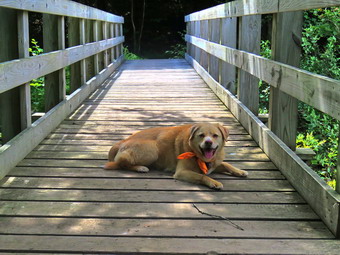
![]()
![]()
![]()
![]()
![]() On Wednesday, August 24th, I wanted to get out and hike after four days of inactivity due to ambulance calls and church commitments. I had some morning meetings so I could not begin to get ready until afternoon. Rather than travel too far I decided to go to Frick Pond and hike the Flynn Trail where could hike some uphill miles. This would give me some choices of how far I wanted to hike and the route I would take. As I started to get ready at 12:15 PM, the temperature on the back porch was 86 degrees. I put on my White Sierra long-sleeved crew top without a baselayer to protect me from the biting insects often present at Frick Pond. I put on a pair of RailRiders hiking pants which are expensive but last along time and have features like deep pockets and a generous cut which I really like. I decided to put on my Keen Durand hiking boots which fit well and are newer than what I have been wearing. I added a new pair of Fulton insoles which are cork based and seem to be molding nicely to my feet. I decided to take my Leki poles with external locks as the internal twist locks sometimes fail. I added my OR floppy hat which I have decided shields me from the sun and allows me to spray some insect repellant on it rather than on me. I put my gear in the back and Sheila in the backseat and headed out the DeBruce Road at 12:40 PM. After 6 miles, at Mongaup Pond Road, I turned left and continued to follow the road bearing left onto Beech Mountain Road at the fork. When we arrived in the parking area there was one car parked in the smaller lot and 8 cars lined up in the larger lot. I pulled into the smaller lot with Sheila was acting as if she hadn't hiked in a month as she ran around and headed for the trail. The temperature was 75 degrees and the skies were blue with white clouds with a reasonable humidity. I set my GPS as we got ready to head out on the Flynn Trail with Sheila on her leash as the dog from the cabin up the road was running loose. We crossed the road and began our hike at 1:00 PM.
On Wednesday, August 24th, I wanted to get out and hike after four days of inactivity due to ambulance calls and church commitments. I had some morning meetings so I could not begin to get ready until afternoon. Rather than travel too far I decided to go to Frick Pond and hike the Flynn Trail where could hike some uphill miles. This would give me some choices of how far I wanted to hike and the route I would take. As I started to get ready at 12:15 PM, the temperature on the back porch was 86 degrees. I put on my White Sierra long-sleeved crew top without a baselayer to protect me from the biting insects often present at Frick Pond. I put on a pair of RailRiders hiking pants which are expensive but last along time and have features like deep pockets and a generous cut which I really like. I decided to put on my Keen Durand hiking boots which fit well and are newer than what I have been wearing. I added a new pair of Fulton insoles which are cork based and seem to be molding nicely to my feet. I decided to take my Leki poles with external locks as the internal twist locks sometimes fail. I added my OR floppy hat which I have decided shields me from the sun and allows me to spray some insect repellant on it rather than on me. I put my gear in the back and Sheila in the backseat and headed out the DeBruce Road at 12:40 PM. After 6 miles, at Mongaup Pond Road, I turned left and continued to follow the road bearing left onto Beech Mountain Road at the fork. When we arrived in the parking area there was one car parked in the smaller lot and 8 cars lined up in the larger lot. I pulled into the smaller lot with Sheila was acting as if she hadn't hiked in a month as she ran around and headed for the trail. The temperature was 75 degrees and the skies were blue with white clouds with a reasonable humidity. I set my GPS as we got ready to head out on the Flynn Trail with Sheila on her leash as the dog from the cabin up the road was running loose. We crossed the road and began our hike at 1:00 PM.
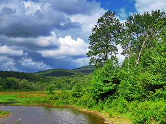 The Flynn Trail is sited along what used to be Beech Mountain Road which was the access for the Beech Mountain Boy Scout Camp. We walked the trail through the woods which was very dry and showed heavier use than it had in the past. I immediately noticed that although my Achilles tendons were still aching with every step I was keeping up a good pace. We turned right on the woods road and continued to set a good pace up the hill. The trail gains a little over 600 feet in 1.7 miles to the highest point at the junction with the Big Rock Trail. We passed the hemlock that used to form a tunnel but was recently cleared by the DEC. I began to find some small branches on the trail which I removed. I was surprised that there were no large branches or trees across the trail. I began to notice that the Frick Pond mosquitoes were out in full force. I chose to keep up my pace rather than to stop and apply repellant. As we approached and passed the clearing to the right of the trail, I thought about visiting the clearing but decided I wanted to stay on the main trail. We kept walking uphill and we were soon at the junction with the Big Rock Trail. It was 1:45 PM and we had covered the 1.7 miles in 45 minutes. This matched my fastest time. I considered trying to hike to the lookout on Beech Mountain but decided against it. We turned left to walk down the Big Rock Trail. The trail continued to be very dry and well-used. The hike down the trail went well and more quickly when I expected. It was definitely easier than the uphill hike. The hike went quickly since we were setting a fast pace. This trail can be tricky as there are several levels that make it seem like the bottom of the hill.
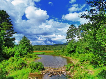 We were soon at Times Square and I thought about turning right to hike up and around the Logger's Loop to add some distance to our hike. I decided against this and we continued our hike by walking straight across Times Square to stay on the Big Rock Trail. This trail can be very wet but on this day it was dry. We crossed the two small bridges over the inlets to the pond and this time I decided not to stop to take pictures. The water under the first bridge was back up from the wetlands. The area under the second bridge was completely dry as was the area upstream of the bridge. The sun was out now and gave a warm feeling to the setting. When we got to the area that was covered by tall evergreens, I pushed on through as I had taken pictures here very recently. The wooden boardwalks continue to show wear with many boards loose and other beginning to rot. Much of the boardwalk now "floats" in midair as the supports are rotting. The rest of the trail was dry with only one damp spot. At the next trail junction we turned left on the Quick Lake Trail to head for the bridge across the outlet of Frick Pond. We walked along the west side of Frick Pond to the bridge across the outlet of the pond. I stopped at the bridge for a minute and took a few more photographs. I took a couple of Sheila on the bridge before we walked up the hill toward Gravestone Junction. We continued to Gravestone Junction and passed the Lobdell memorial marker. The marker is a memorial to two children who died in the 1930's in a fire that consumed their cabin. The trail to the register was well-worn but the marker was standing intact. The trail back to the register was dry and very rocky. I saw a lobe hiker coming toward us so I put Sheila on a leash. The hiker was NYS Forest Ranger Eric Stratton. We both stopped to talk to each other. I am always happy to meet rangers when hiking since they have good stories and seem to appreciate mine. We talked for a few minutes on various topics. Ranger Stratton agreed that we should get together and cut some blowdowns at Balsam Lake Mountain. He also let me know that the Alder Lake Beaver Meadow lean-to was scheduled to be repaired this fall! We both continued in our opposite directions. Just short of the trail register I saw a couple hiking toward us with a dog on a leash. We passed each other with a simple greeting. We passed the trail register heading toward the parking area. We continued straight ahead to follow the woods road out to the car in the small lot. We arrived at the car at 3:10 PM having hiked 4.0 miles in 2 hours and 10 minutes with an elevation gain of 690 feet.
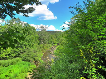
![]()
![]()
![]()
![]()
![]() On Friday, August 19th I wanted to get out for an easy hike so that my wife Cindy could go along and so that I could nurse my aching Achilles tendon. Around 1:15 PM I asked Cindy if she would like to hike the Parksville Rail Trail and she agreed. The walk is less than 3 miles round trip and almost completely flat. It does have a few limited views and a nice waterfall. I was anxious to see what impact the lack of rain had on the volume of the Little Beaverkill and the waterfalls. It was 86 degrees when we started to get ready and the skies were blue with some nice white clouds. Sheila's expectant gaze and sharp bark "encouraged" me to continue the hiking plans. It was warm and I did not expected a lot of water or mud on the trail so I dressed accordingly. I put on my White Sierra long-sleeved crew top without a baselayer as it was so warm. I put on a pair of RailRiders hiking pants which are expensive but last a long time and have features like deep pockets and a generous cut which I really like. I decided to put on my Keen Durand II hiking boots which fit well and are newer than what I have been wearing. I added a new pair of Fulton insoles which are cork based and seem to be molding nicely to my feet. I decided to take my Leki poles with external locks as the internal twist locks sometimes fail. I also added my OR floppy hat which I have decided shields me from the sun and allows me to spray some insect repellant on it rather than on me. At 1:25 PM we put our gear in the car and Sheila in the back seat. I headed out Old Route 17 across the Flats and then took Old Route 17 and Service Road to the point where they meet Fox Mountain Road. Just after this intersection is the western parking area for the rail trail.
On Friday, August 19th I wanted to get out for an easy hike so that my wife Cindy could go along and so that I could nurse my aching Achilles tendon. Around 1:15 PM I asked Cindy if she would like to hike the Parksville Rail Trail and she agreed. The walk is less than 3 miles round trip and almost completely flat. It does have a few limited views and a nice waterfall. I was anxious to see what impact the lack of rain had on the volume of the Little Beaverkill and the waterfalls. It was 86 degrees when we started to get ready and the skies were blue with some nice white clouds. Sheila's expectant gaze and sharp bark "encouraged" me to continue the hiking plans. It was warm and I did not expected a lot of water or mud on the trail so I dressed accordingly. I put on my White Sierra long-sleeved crew top without a baselayer as it was so warm. I put on a pair of RailRiders hiking pants which are expensive but last a long time and have features like deep pockets and a generous cut which I really like. I decided to put on my Keen Durand II hiking boots which fit well and are newer than what I have been wearing. I added a new pair of Fulton insoles which are cork based and seem to be molding nicely to my feet. I decided to take my Leki poles with external locks as the internal twist locks sometimes fail. I also added my OR floppy hat which I have decided shields me from the sun and allows me to spray some insect repellant on it rather than on me. At 1:25 PM we put our gear in the car and Sheila in the back seat. I headed out Old Route 17 across the Flats and then took Old Route 17 and Service Road to the point where they meet Fox Mountain Road. Just after this intersection is the western parking area for the rail trail.
 The parking lot had no cars parked. I did not bring my GPS unit as we had hiked the trail so many times before. We quickly got ready to hike as I did not want Sheila to burn her paws on the hot pavement. As we entered the shade of the trees, it immediately seemed a little cooler. The stream volume was very low. I wondered if the falls would have enough water to be interesting. Sheila was taking her own route and following her nose. Just after entering the woods we came to an area which is normally muddy but this area was only slightly damp. Most of the rest of the trail was dry even in areas that are usually wet. The few muddy areas we would find on the trail were easily avoided. We were soon at the wooden walkways where I stopped, put my pack down and took out the camera. I took some shots of the stream below with nice blue skies and white clouds. I put away the camera and picked up my pack to continue over the walkways. The wooden surface was dry but had a coating of dried mud. The problem is that a rock slide has blocked the culvert under the small bridge causing water, mud and stones to be diverted over the walkway. Unblocking the culvert and covering the walkways with some screening would help. We continued on the trail and found a few blowdowns that should be cleared. Some areas of the trail also had brush that needed trimming. Other areas of the trail had large branches and blowdowns that should be removed for aesthetic reasons. As we approached the falls, we could hear voices and screams coming from the area below the falls. When we arrived there was a father sitting by the falls on the opposite bank. His two daughters were sitting in the water below the falls
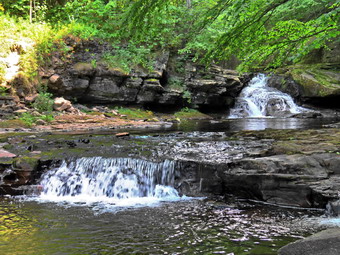 We continued on the trail and came to the falls. I wanted to get down to the streambed so that I could take pictures from in front of the falls. It was relatively easy to work my way down the bank to the streambed. I got out the camera and took some shots down stream and the turned my attention to the falls. I took numerous pictures of the falls and the area in front. The water was very clear and the red rock beneath the water really showed through. Sheila, of course, decided to jump in and cool off so I took some shots of her. When I was done, we worked our way back up the bank. I took a few pictures of the falls from the edge of the trail where I had a good view. As we were preparing to leave, two men came walking by and we said "Hello" as we went in opposite directions. We continued on the trail to a bench where a path leads down to the stream. I left my pack on the bench and took the camera with me to the stream's edge. I took shots upstream and downstream with some close-ups right in front of me. I repositioned myself and took some more pictures downstream toward the falls. I finished and walked back to the bench to stow the camera. The trail had been wet and a little muddy in places but we managed to walk around them. From the falls to the other end of the trail there were a few wet areas and some mud. We set a quick pace for the rest of the hike to the Parksville end of the trail. Just after the gate at that end, we stopped to read the sign which outlined the milk that the O&W transported. The sign also mentioned the large number of hotels that had been in the area. We turned around and headed back to the car. In a short distance, we met the two men that had passed by before and we stopped for a short conversation. They were from liberty and said they often hiked the rail trail there. When we parted, Cindy and I continued back to the car without stopping and without seeing any other people except for the dirt bike on the return trip. We were back at the car at 5:20 PM after hiking 2.8 miles in 1 hour and 30 minutes including the stopped time for pictures. There is virtually no elevation gain on the hike except the short trips down to the streambed.
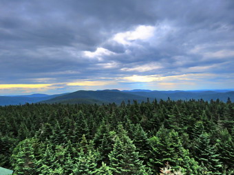
![]()
![]()
![]()
![]()
![]() On Wednesday, August 17th, I planned to do a hike with Raj from Edgewater Hikers and two other people. We had arranged to meet at the municipal parking area in town at 7:15 AM and then drive to the trailhead at the end of Beaverkill Road. When I got up in the morning at 6:30 AM it was only 52 degrees so I knew I would need a jacket of some kind as the temperature at the trailhead would probably be cooler. The forecast included a relatively low probability of a shower in the morning. I was a little concerned about the hike as I had been having some pain in my Achilles tendon especially at the insertion point at my heel. As I started to get ready Sheila was excited as she loves to be outside. I put on my White Sierra long-sleeved crew top without a base layer as it was warm enough. I put on a pair of RailRiders hiking pants which are expensive but last a long time and have features like deep pockets and a generous cut which I really like. I decided to put on my Keen Durand II hiking boots which fit well and are newer than what I have been wearing. I added a new pair of Fulton insoles which are cork based and seem to be molding nicely to my feet. I grabbed a pair of Leki external lock poles I have been using for some time. I added my OR floppy hat which I have decided shields me from the sun and allows me to spray some insect repellant on it rather than on me. I brought my Mammut hoody which has lots of zippers to dump heat if necessary. Just before 7:00 AM, I got a phone call from Raj saying she and another hiker were at the Robin Hood Diner and the fourth member of our party had pulled out. I agreed to meet them there. I put my gear in the back of the car and Sheila in the back seat and left the house at 7:10 AM. There was one car at the diner and I pulled over to greet Raj and her friend. I took the lead and we headed toward Roscoe on Old Rt 17 and I turned right on the Beaverkill Road. I headed north toward Lew Beach and Turnwood. Somewhere along the road some raindrops began to hit the windshield. I had hiked on Monday and gotten soaked so I hoped the rain would jet up as we began to hike. The Beaverkill Falls were flowing but with a greatly reduced volume. The road conditions were pretty good but deteriorated when the pavement ended. I passed the White Castle and the Buddhist monastery and continued on toward the trailhead. I only had to slow down a few times to let the other car catch up!
On Wednesday, August 17th, I planned to do a hike with Raj from Edgewater Hikers and two other people. We had arranged to meet at the municipal parking area in town at 7:15 AM and then drive to the trailhead at the end of Beaverkill Road. When I got up in the morning at 6:30 AM it was only 52 degrees so I knew I would need a jacket of some kind as the temperature at the trailhead would probably be cooler. The forecast included a relatively low probability of a shower in the morning. I was a little concerned about the hike as I had been having some pain in my Achilles tendon especially at the insertion point at my heel. As I started to get ready Sheila was excited as she loves to be outside. I put on my White Sierra long-sleeved crew top without a base layer as it was warm enough. I put on a pair of RailRiders hiking pants which are expensive but last a long time and have features like deep pockets and a generous cut which I really like. I decided to put on my Keen Durand II hiking boots which fit well and are newer than what I have been wearing. I added a new pair of Fulton insoles which are cork based and seem to be molding nicely to my feet. I grabbed a pair of Leki external lock poles I have been using for some time. I added my OR floppy hat which I have decided shields me from the sun and allows me to spray some insect repellant on it rather than on me. I brought my Mammut hoody which has lots of zippers to dump heat if necessary. Just before 7:00 AM, I got a phone call from Raj saying she and another hiker were at the Robin Hood Diner and the fourth member of our party had pulled out. I agreed to meet them there. I put my gear in the back of the car and Sheila in the back seat and left the house at 7:10 AM. There was one car at the diner and I pulled over to greet Raj and her friend. I took the lead and we headed toward Roscoe on Old Rt 17 and I turned right on the Beaverkill Road. I headed north toward Lew Beach and Turnwood. Somewhere along the road some raindrops began to hit the windshield. I had hiked on Monday and gotten soaked so I hoped the rain would jet up as we began to hike. The Beaverkill Falls were flowing but with a greatly reduced volume. The road conditions were pretty good but deteriorated when the pavement ended. I passed the White Castle and the Buddhist monastery and continued on toward the trailhead. I only had to slow down a few times to let the other car catch up!
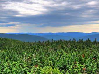 When we got to the "Seasonal Maintenance" sign, I was happy that it was still before 8:00 AM as I did not anticipate any cars coming from the opposite direction. The road was narrow but in good condition as it had been so dry for weeks. We arrived at the parking area at 7:50 AM and found no other cars in the lot. I was not surprised as it was early on a Wednesday morning. The temperature was 54 degrees. When we got out of our cars, we introduced ourselves. Sheila jumped out of the car and ignored the other hikers which O knew was a sign she would be alright hiking with them. I decided to put on my Mammut hoody. I knew I could open zippers when I got warm and stow it in my pack if I needed to do so. Unfortunately, the skies were overcast and there were a few small raindrops falling. I decided that I had come this far and would at least give hiking a chance. I set my GPS and we were off at 8:00 AM just as we planned. Both of the other hikers made it clear that they considered themselves slow hikers which was good for me as I was nursing my Achilles tendons. As we got on the trail, the raindrops started falling a little heavier. When we stopped at the trail register, I thought about putting on my pack cover until I realized I had left it home! I put my hone, camera and GPS unit in a plastic in my pack. The trail register had been repaired from the pieces that were there on previous trips. As we walked up the trail, I noticed that it needed some trimming but was clear of major blowdowns. The three of us kept up a conversation about hiking and many other topics which made the walk pass more quickly. I pointed out some of the blowdowns I had cut and explained the need for UTV access for trail rescues. Walking was easy as the trail has only a slight incline until the turn up the mountain. I appreciated the relaxed pace although I could have pushed the pace. At 8:35 AM we started up the mountain and I could feel a slight pain in my heels but it was better than I thought it might be. We paused briefly and I took off my hoody. I had already opened all the zippers and was still sweating profusely. Fortunately, the rain had stopped although the skies were still overcast.
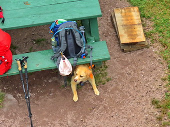 The first part of the trail is a gentle climb and I was feeling pretty good with an occasional stop to let the others catch up. The trail was mostly dry but the small amount if rain had made all the rocks just wet enough to be very slippery. Over the next half mile the trail gains about 750 feet before leveling off which means an average of around a 28% grade! The trail has a lot of rocks and roots with more and more being exposed by the erosion caused by more people using the trail. I also noted the trail was getting wider as people were not sticking with the established route. Sheila is always able to hike faster than I can and she was running far ahead on the trails and then taking off following game trails through the woods. We kept moving along with Sheila always ahead of us but not too far which encouraged me. The climb seemed shorter than I remembered since we were all talking to each other which helped pass the time. Several times I thought we were near the trail to the lean-to but had another steep section to climb. Finally we reached the trail to the lean-to and continued straight up the hill through a short but steep climb. We passed the 3500 foot sign and the trail became a small stream from the spring just above. We arrived at the spring which was actually flowing better than I had expected. Sheila got a drink before we left the spring and climbed the stone steps to the summit plateau where the trail flattens a little. Some people had reported giant hogweed near the spring. The plants I saw that looked a little like hogweed were barely waist high and were definitely not "giant". They may have been cow parsnip but I thought they looked more like Queen Anne's Lace! It amazes me how ignorant people can spread misinformation to other ignorant people so quickly! Once we were on the flatter part of the trail, I felt much better since we were not climbing. We passed the Millbrook Ridge Trail to Alder Lake which is also the route of the FLT. As we continued on to the fire tower clearing, we passed the relocated privy on the right side of the trail. We arrived at the tower clearing at 9:40 AM after hiking 1.7 miles. The skies were still overcast without any direct sunlight. I put my pack down on the picnic table and leashed Sheila to a leg of the table so she would not follow me up the tower. Unlike many other dogs, Sheila will climb all the way up the tower and back down! I walked over to the tower with my camera and started to climb. I saw that some of the steps had been replaced and were slightly wider and sturdier than the old ones. As I rose above the treeline, the breeze hit me but I did not really feel cold. I took pictures of the surrounding landscape as I climbed and more at the top of the tower. I stopped on the landing just below the cab and looked around. The scene was beautiful and, as always, I knew that pictures could not do it justice. I took a number of shots of the trees and cabin below and then turned my attention to the mountains. I took shots in all directions getting pictures of the Devil's Path to the north and some of Graham. Eventually I was satisfied I had enough pictures and wanted to get back down to Sheila. On the way down I took a few shots of Sheila underneath the picnic table. I walked back to my pack and put away my camera, took a drink and got out a bar.
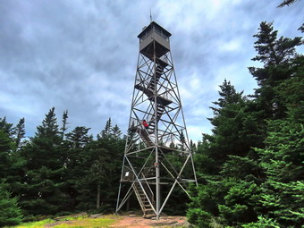 After the others had visited the tower, we headed down the Millbrook side of the mountain at 10:00 AM. Raj had originally planned a true out-and-back but I suggested the loop as the steep descent can be tricky. So far this year, I have transported two people who injured their leg or ankle descending the steeper trail! We walked down the trail on the other side of the mountain passing the cabin. The trail was very dry on the descent and covered in many small rocks which made things very "slippery". When the trail flattened some, we came to areas which are usually muddy. All of these areas were dry except for one area that had quite a bit of mud. On the way down we encountered a couple hiking up from Millbrook. A little further along we met an older, solo hiker who said he also was coming from Millbrook Road. Soon we were approaching the junction with the Dry Brook Ridge Trail that connects Millbrook Road to the Beaverkill Road. Just before the gate at the bottom of the trail, we met two men also hiking up from Millbrook Road. Whenever we met people, I would tell Sheila to go to the side of the trail and sit which she did without fail. We came to the trail junction with Sheila in the lead and I said to her "Back to the car" without making any signal Sheila immediately turned right and walked down the trail! There was a sign at the junction warning hikers to stay on the trails and that Graham Mountain was closed to all hikers. The trail has a lot of rocks and they were all wet and mossy which made them slippery. There isn't much to see on this return trip so I was glad to have other people along. I pointed out the Gulf of Mexico below and explained that the trail had once been a wagon road. We encountered some blowdowns which were old and would require a chainsaw to remove. There were also a few new blowdowns. Some of the new trees would require a chainsaw but at least one could be cut with hand tools. I looked down into the Gulf of Mexico several times but did not see or hear any water. The trail. Which had been very narrow, was wider since more people were using it. After just less than a mile, we were back at the trail junction where we had turned up the mountain earlier. We continued on toward the car by retracing our steps. As we approached the register, we met two more women who knew Malabika. They were also hiking the fire tower challenge. We were happy that the temperature had remained cool but pleasant and that the rain had stayed away. We were back in the parking area at 11:40 AM after hiking 4.4 miles in 3 hours and 40 minutes with 55 minutes stopped time. We had climbed 1200 feet in elevation. The temperature at the car was 67 degrees. Raj and Malabika were going on to hike Red hill but I drove straight home without stopping.
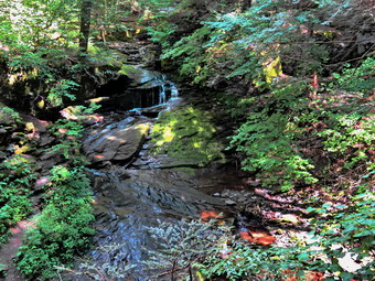
![]()
![]()
![]()
![]()
![]() On Monday, August 15th, I asked Brad, my son-in-law, if she wanted to go hiking and he agreed. The forecast had changed so the chance of showers was minimal. We decided to go to Trout Pond to walk the loop and visit Russell Brook Falls. I was interested to see the effect the lack if rain was having on the water going over the falls and the level of Trout Pond. When I got up at 9:00 AM, the skies were bright and sunny with a few white clouds. The temperature was in the high 60's and the humidity seemed low compared to the last few days. We started to get ready at 11:00 AM with Sheila acting very enthusiastic about getting out. I put on my White Sierra long-sleeved crew top without a base layer as it was warm enough. I put on a pair of RailRiders hiking pants which are expensive but last a long time and have features like deep pockets and a generous cut which I really like. I decided to put on my Keen Cascade hiking boots which fit well and are newer than what I have been wearing. I added a new pair of Fulton insoles which are cork based and seem to be molding nicely to my feet. I grabbed a pair of Leki external lock poles I have been using for some time. I added my OR floppy hat which I have decided shields me from the sun and allows me to spray some insect repellant on it rather than on me. I packed my LT Wright Overland machete in case we had some time to cut back the Japanese knotweed. We put our gear in the back and Sheila in the backseat and pulled out of Livingston Manor at 11:20 AM. I headed to Roscoe on State Route 17, got off at exit 94 and got on Route 206. I followed it across the Delaware County line to Morton Hill Road. After a left turn on Morton Hill Road, I drove toward the intersection with Russell Brook Road. There was one car parked in the "lot" at the intersection. This area is private property but people insist on parking there despite the signs. I turned left on Russell Brook Road to drive to the lower parking area. There was a tent set up at the first camping area on the right and another, larger tent erected at the first area on the left.
On Monday, August 15th, I asked Brad, my son-in-law, if she wanted to go hiking and he agreed. The forecast had changed so the chance of showers was minimal. We decided to go to Trout Pond to walk the loop and visit Russell Brook Falls. I was interested to see the effect the lack if rain was having on the water going over the falls and the level of Trout Pond. When I got up at 9:00 AM, the skies were bright and sunny with a few white clouds. The temperature was in the high 60's and the humidity seemed low compared to the last few days. We started to get ready at 11:00 AM with Sheila acting very enthusiastic about getting out. I put on my White Sierra long-sleeved crew top without a base layer as it was warm enough. I put on a pair of RailRiders hiking pants which are expensive but last a long time and have features like deep pockets and a generous cut which I really like. I decided to put on my Keen Cascade hiking boots which fit well and are newer than what I have been wearing. I added a new pair of Fulton insoles which are cork based and seem to be molding nicely to my feet. I grabbed a pair of Leki external lock poles I have been using for some time. I added my OR floppy hat which I have decided shields me from the sun and allows me to spray some insect repellant on it rather than on me. I packed my LT Wright Overland machete in case we had some time to cut back the Japanese knotweed. We put our gear in the back and Sheila in the backseat and pulled out of Livingston Manor at 11:20 AM. I headed to Roscoe on State Route 17, got off at exit 94 and got on Route 206. I followed it across the Delaware County line to Morton Hill Road. After a left turn on Morton Hill Road, I drove toward the intersection with Russell Brook Road. There was one car parked in the "lot" at the intersection. This area is private property but people insist on parking there despite the signs. I turned left on Russell Brook Road to drive to the lower parking area. There was a tent set up at the first camping area on the right and another, larger tent erected at the first area on the left.
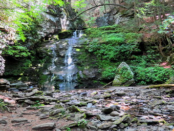 I stopped on the right side of the road near the paths that lead down to the upper drop of Russell Brook Falls. I grabbed my camera and Brad and I walked down the steep path to the overlook. The path was well-used and very dry which made it surprisingly slippery. I knew the flow at the falls would be reduced but I was surprised that the falls were barely a trickle! It was hard to see the flow of water through the lens of the camera. I took pictures being careful to avoid the bright sunlight behind the falls. When I was done, we walked back up to the car where a frantic Sheila was waiting. I drove down to the lower parking area where there were only a few cars parked. There was one group of people reading the map at the kiosk so I ask Brad to put Sheila on her leash. I found that I had forgotten my GPS unit so I got out my iPhone and fired up the Avenza app. I had not used it in some time and did not know how long the battery would last. we started down the woods road to the bridge across Russell Brook at 11:45 AM. The group that had been at the kiosk got in there car and drove away! We crossed the bridge and found that the Japanese knotweed was growing back from where I had cut it about a month before. I hoped we would have time to get rid of some of it on our return trip. It is a shame the DEC has not kept this trimmed back as the area is very popular and used by many people. We turned right on the path toward Russell Brook Falls and found it also had almost grown closed despite the traffic. We walked the path toward the falls. As we started down the bank, I could see there was nobody at the falls which I knew would make taking pictures easier. Sheila ran down to the stream to get a drink and walk in the water. The bank in this area was also well-used and we took are time getting down to the streambed. I got out my camera and took pictures of the falls and the stream. There was almost no flow over the falls and the stream was barely moving. Sheila went to pose in front of the falls although I had to clear the rock she normally sits on. I took several pictures of Sheila and a few more of the falls before returning to my pack. I stowed the camera and prepared to climb back up the bank. We walked up the bank and back out the way we came. Instead of walking back out to the main trail, we turned right and headed up the bank to another viewpoint over the upper falls.
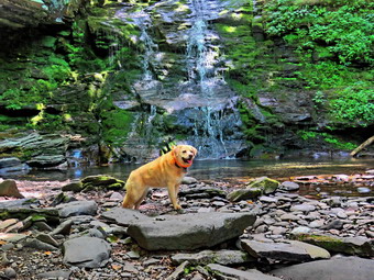 I took a few shots from the top of the climb and then looked for a way to get down to the streambed. I let myself down one level and took a few shots. I worked my way down to the streambed and took pictures of the falls from that angle. I also took pictures downstream toward the top of the lower falls. The remains of the dam that had been placed here to control the flow of the stream was clearly visible. I finished taking pictures and climbed back up to the upper level where I stowed my camera. We walked down the path and back out to the main trail. At the main trail we turned right and then left where the trail split. We started out on the Mud Pond Trail crossing the outlet stream from Trout Pond on the bridge. As we passed by the large campsite on the right, we noted that no one was camped but we could smell a smoldering fire. I was surprised since this is one of the most popular campsites. The trail began to climb the hill and in .6 miles we gained over 350 feet. Along the way we removed some loose branches and moved at least one trunk to the side of the trail. The climb is a little steep at times so moving the branches and blowdowns gave me a couple of breaks. At one point Sheila alerted and I saw a couple ahead with what looked like a Jack Russell terrier. Brad put Sheila on her leash as we passed the couple who had pulled off the side of the trail. There are several places where small stream cross the trail and all of these were completely dry. The trail itself was dry and extremely rocky which made walking difficult. Soon we were at the top of the hill and began a slight descent toward the trail junction. The trail remained dry even in places that were normally wet. When we reached the trail junction, we turned right on the Mud Pond Trail and began a long climb. We stopped to try to move a large trunk but it just would not give in even after I whacked it several times with the machete. We ran into two more medium sized trunks lying ion the ground across the trail but we easily stepped over them. As we walked, the skies began to grow darker and then a few drops of rain began to fall. I hoped that the rain would stay as a brief shower but these hopes were in vain. The drops turned to many drops and we stopped just before the top of the climb so that I could cover my pack. I was glad I hade put on my pack cover as immediately began to pour. The climb seemed to go on for a long time and when we got to the top I was glad the rest of the hike was downhill or flat.
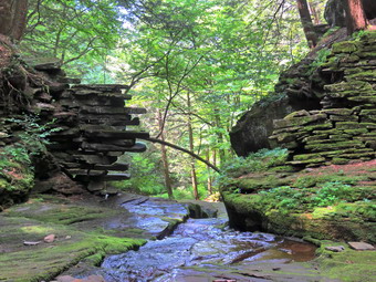 As we began our descent, I was feeling I was as wet as I could get and I was a little cold. I was wrong as sheets of rain began to fall! All my clothing was wet and the water was pooling in my boots. The descent from the highest point on the hike to the outlet bridge is .7 miles and loses 455 feet in elevation. The trail is rocky but I can normally make good time on the descent. The rocks were so wet I had to carefully looked to see where I was placing my feet. We ran into some pooled water and some running water that I am sure originated with the storm. On the final descent to the pond, we made a slight right turn to start down to the pond. The rain began to let up and I could even see some blue in the sky and some sun. We arrived at the outlet end of the pond where I had intended to take some pictures. Instead of stopping we continued across the bridge over the inlet stream. I was surprised that this stream was completely dry which I had never seen before. We continued on the trail and decided to stop at the lean-to for a few minutes. I noticed that the roof of the lean-to was leaking and that was generally in poor shape. A lot of effort has been put into repairing lean-tos that are in the high peaks areas but the ones in the western Catskills are ignored. The rain had slacked off so we decided to head for the car. We walked out to the Trout Pond Trail and started toward the outlet end of the pond. We found the large campsite on the left of the trail unused. The trail was wet from the storm and the rain was still falling. My boots were so wet it really didn't matter where I walked. At one point there was a place to walk off the trail to take some pictures of the pond and there was some interesting mist rising off the water. I thought about stopping but decided against it because of the rain. We continued down the trail and I decided not to stop at the beach to take pictures. I did notice that the pond was low enough so that there was at least 10 feet of beach! We continued on the main trail setting a rapid pace as this part of the trail has less rocks. The trail descends gently losing 260 feet over .7 miles on a wide woods road. We passed the junction with the Mud Pond Trail and walked by Te trail register as we continued on the trail and back to the car. We arrived at 2:30 PM after walking 4.6 miles in 2 hours and 45 minutes. The elevation gain was about 900 feet. The temperature at the car was 67 degrees!
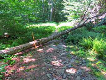
![]()
![]()
![]()
![]()
![]() On Friday, August 12th I wanted to go to Frick Pond to remove a blowdown on the Logger's Loop that makes up part of the loop around Frick Pond. My son-in-law Brad was at our house and he is a great asset in doing this kind of work. We had planned to start in the morning but several ambulance calls delayed our start time. By 1:00 PM we started to get ready to head out with the treasure a comfortable 78 degrees and a low humidity. Sheila was watching us quietly but making sure that we did not leave without her. I put on my White Sierra long-sleeved crew top with no baselayer because of the temperature. I put on a pair of RailRiders hiking pants which are expensive but last along time and have features like deep pockets and a generous cut which I really like. I decided to put on my Keen Cascade hiking boots which fit well and are newer than what I have been wearing. I added a new pair of Fulton insoles which are cork based and seem to be molding nicely to my feet. I grabbed a pair of Leki external lock poles I have been using for some time. I added my OR floppy hat which I have decided shields me from the sun and allows me to spray some insect repellant on it rather than on me. I packed my Silky Sugowaza and Katanaboy saws and two felling wedges. I took my Council Tools American felling ax which Brad could carry. We got all our gear in the car and put Sheila in the backseat and drove out the Debruce Road at 1:35 PM. I drive about 6 miles before turning left onto Mongaup Pond Road and continued to where the road split. I turned left onto Beech Mountain Road, and drove to the parking areas at the Frick Pond. I parked next to the only car in the smaller parking area. The car thermometer read 76 degrees as I set my GPS to get ready for the hike. At 1:50 PM we headed out the woods road toward the trail register. The woods road was damp with a few muddy places.
On Friday, August 12th I wanted to go to Frick Pond to remove a blowdown on the Logger's Loop that makes up part of the loop around Frick Pond. My son-in-law Brad was at our house and he is a great asset in doing this kind of work. We had planned to start in the morning but several ambulance calls delayed our start time. By 1:00 PM we started to get ready to head out with the treasure a comfortable 78 degrees and a low humidity. Sheila was watching us quietly but making sure that we did not leave without her. I put on my White Sierra long-sleeved crew top with no baselayer because of the temperature. I put on a pair of RailRiders hiking pants which are expensive but last along time and have features like deep pockets and a generous cut which I really like. I decided to put on my Keen Cascade hiking boots which fit well and are newer than what I have been wearing. I added a new pair of Fulton insoles which are cork based and seem to be molding nicely to my feet. I grabbed a pair of Leki external lock poles I have been using for some time. I added my OR floppy hat which I have decided shields me from the sun and allows me to spray some insect repellant on it rather than on me. I packed my Silky Sugowaza and Katanaboy saws and two felling wedges. I took my Council Tools American felling ax which Brad could carry. We got all our gear in the car and put Sheila in the backseat and drove out the Debruce Road at 1:35 PM. I drive about 6 miles before turning left onto Mongaup Pond Road and continued to where the road split. I turned left onto Beech Mountain Road, and drove to the parking areas at the Frick Pond. I parked next to the only car in the smaller parking area. The car thermometer read 76 degrees as I set my GPS to get ready for the hike. At 1:50 PM we headed out the woods road toward the trail register. The woods road was damp with a few muddy places.
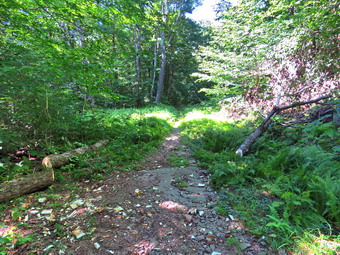 We continued straight ahead at the register and headed out the woods road toward Frick Pond. The trail was only damp with no standing or running water and only a few muddy places. At Gravestone Junction, we turned right to get on the Logger's Loop heading toward Times Square. The grass and brush was overgrowing the trail which meant my maintainer had not been around in some time. At least the grass was dry as was the rest of the trail. The sky was blue and had some puffy white clouds. We walked passed the designated campsites looking for the blowdown the maintainer had reported. We followed the trail as it turned a little to the left to parallel the eastern shore of Frick Pond. There are usually some wet and muddy spots along the way but these were almost completely dried up. We stayed on the main trail and avoided the "detours" which hikers had created. We topped the small hill and began walking down the other side as I wondered if I had been mistaken about the location of the blowdown. We walked a little farther and found the tree across the trail almost at the bottom of the descent. The tree was a little bigger in diameter than I remembered! I dropped my pack and got out the camera. I took some "before" pictures from both sides of the blowdown as the sunlight was bright and was overexposing my photographs. Brad and I discussed how we would do the job. We decided to cut the main trunk on one side of the trail and then on the other. We knew this would produce a short piece that we could easily move on the root end of the tree. We also knew there would be the longer center piece which we might be able to move or might have to cut again. Brad grabbed the ax and started in on the first cut. The wood was a little softer than it looked but Brad was swinging hard producing large chips. I spelled Brad briefly and we completed the cut quickly. As we anticipated, it was easy to roll the smaller piece off the trail. We went to the other end of the log and found it sitting about waist high off the ground.
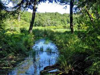 This makes cutting with the ax more difficult and we though about using the Katanaboy saw. In the end we decided to use the ax as the position of the trunk would cause it to collapse and bind the saw. Brad started the cut and I finished it. The section was large and heavy. We were able to roll, push and lift it off the trail and get it well over to the side. I took a few "after" shots and then we packed up. It had taken a little more than an hour to finish the job and we decided to continue to walk around Frick Pond to complete the loop. We continued to Times Square on the Logger's Loop where we turned left and started the short loop around Frick Pond which I knew was barely 2 miles. The Big Rock Trail had some damp areas but the really muddy spots were dry. We crossed the bridges over the outlet streams and I stopped to take a few pictures. The water that normally flows under one of the bridges was completely dried up. I could not tell whether this was due to the drought conditions or a beaver dam somewhere. We entered the spruce forest which is always a treat. I pointed out to Brad the large hemlock tree I had cut. The wooden walkways were almost dry and, therefore, not very slippery. I stopped to take some pictures but was not sure if they would be very good due to the lighting conditions. When we reached the end of the Big Rock Trail, we turned left on the Quick Lake Trail to head toward the bridge across the outlet of Frick Pond. The trail was barely damp including the place that is usually a mud pit. At the bridge, I stopped and dropped my pack to take a few pictures even though I have hundreds and maybe thousands from this same spot. I put the camera away and shouldered my pack to walk up the hill to Gravestone Junction. We walked back along the Quick Lake Trail and the woods road to the parking area. We were back at the car at 4:00 PM after hiking 2.1 miles in a little over 2 hour. Of course, over and hour of that time was spent clearing the blowdown and taking some pictures. The overall elevation gain was around 165 feet.
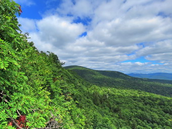
![]()
![]()
![]()
![]()
![]() On Wednesday, August 10th I had decided to finally get in hike to Ginat Ledge and Panther Mountain. I knew my grandson Bryce would be at my house around 9:00 AM and would want to hike. An ambulance call in the middle of the night meant that I slept in until 9:00 AM and was a little less energetic than when I had planned the hike the night before. Bryce arrived a little after 9:00 AM but I needed a little time to get ready. I did not know if we could get a parking space at Giant Ledge so I decided to take along my ax and sawt. If the plan for Giant Ledge fell through, we could go to Frick Pond and cut some trees on the Logger's Loop. The temperature was 68 degrees on the back porch as I began to get ready at 9:45 AM. While I was getting ready, Sheila was always nearby making it very clear that she wanted to go. I put on my White Sierra long-sleeved crew top without a baselayer as it was so warm. I put on a pair of RailRiders hiking pants which are expensive but last a long time and have features like deep pockets and a generous cut which I really like. I decided to put on my Keen Cascade hiking boots which fit well and are newer than what I have been wearing. I added a new pair of Fulton insoles which are cork based and seem to be molding nicely to my feet. I grabbed a pair of Leki external lock poles I have been using for some time. I added my OR floppy hat which I have decided shields me from the sun and allows me to spray some insect repellant on it rather than on me. We got our gear together and put Sheila in the back seat as Bryce sat beside me in the front. I headed out the DeBruce Road at 10:10 AM with the temperature in the high 60's. At the end of Pole Road I turned left onto the Frost Valley Road and drove toward Slide Mountain and Giant Ledge. We both noticed that the level of water in the Neversink River was very low. There were no cars parked at Biscuit Brook but quite a few in the Slide Mountain parking area. When we arrived at the big bend in Route 47, the lot for Giant Ledge and Panther was full which I found interesting for a Wednesday! I was able to find a parking spot well off the road just below the parking area. There were a few people getting ready to start out and I wanted to get ahead of them so that I did not have to keep Sheila on her leash for the whole hike.
On Wednesday, August 10th I had decided to finally get in hike to Ginat Ledge and Panther Mountain. I knew my grandson Bryce would be at my house around 9:00 AM and would want to hike. An ambulance call in the middle of the night meant that I slept in until 9:00 AM and was a little less energetic than when I had planned the hike the night before. Bryce arrived a little after 9:00 AM but I needed a little time to get ready. I did not know if we could get a parking space at Giant Ledge so I decided to take along my ax and sawt. If the plan for Giant Ledge fell through, we could go to Frick Pond and cut some trees on the Logger's Loop. The temperature was 68 degrees on the back porch as I began to get ready at 9:45 AM. While I was getting ready, Sheila was always nearby making it very clear that she wanted to go. I put on my White Sierra long-sleeved crew top without a baselayer as it was so warm. I put on a pair of RailRiders hiking pants which are expensive but last a long time and have features like deep pockets and a generous cut which I really like. I decided to put on my Keen Cascade hiking boots which fit well and are newer than what I have been wearing. I added a new pair of Fulton insoles which are cork based and seem to be molding nicely to my feet. I grabbed a pair of Leki external lock poles I have been using for some time. I added my OR floppy hat which I have decided shields me from the sun and allows me to spray some insect repellant on it rather than on me. We got our gear together and put Sheila in the back seat as Bryce sat beside me in the front. I headed out the DeBruce Road at 10:10 AM with the temperature in the high 60's. At the end of Pole Road I turned left onto the Frost Valley Road and drove toward Slide Mountain and Giant Ledge. We both noticed that the level of water in the Neversink River was very low. There were no cars parked at Biscuit Brook but quite a few in the Slide Mountain parking area. When we arrived at the big bend in Route 47, the lot for Giant Ledge and Panther was full which I found interesting for a Wednesday! I was able to find a parking spot well off the road just below the parking area. There were a few people getting ready to start out and I wanted to get ahead of them so that I did not have to keep Sheila on her leash for the whole hike.
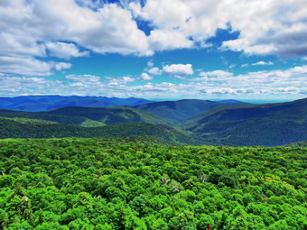 I set my GPS and we crossed the road to start the hike at 10:55 AM with the temperature at 65 degrees. The humidity was low and the hiking conditions were almost ideal. The trail was damp in spots from some recent storms and there was a little mud. Most of the trail was though was dry. The stream under the bridge barely had any water running. As we climbed over the normally rocky areas, I was reminded of how many small but very rocky climbs are on this trail! I had given Bryce Sheila's leash so that he could restrain her when we passed other people or when others passed us. Several times along the trail groups passed us or we caught up to others. Each time Bryce put Sheila on her leash and walked her off the side of the trail to allow others to pass. Within about 35 minutes we had hiked the .75 miles to the trail junction meeting a few people coming down the trail and passing a few more going up. I have made this in 15 minutes under ideal conditions but we weren't in any real hurry on this day. The trail straight ahead would take us to Woodland Valley but we made a left turn to go to Giant Ledge. The next .3 miles or so was almost flat and the trail was still dry with just a few damp spots. We ascended through a few small climbs. We passed a couple of hikers and again met a few coming down from the ledges. The trail is incredibly rocky and we took every chance to let Sheila off her leash. Soon we began the climb up to Giant Ledge passing the sign for the spring on the way. I thought about visiting the spring to determine its flow but decided to wait until the return trip. We started the final climb up to the Giant Ledge plateau by passing a few more people who seemed to have started a bushwhack to the right of the climb. As we started the ascent. One of the hikers in the group called out to us asking about the trail to Ginat Ledge. I indicated they were off the trail and we were following it. They tanked us and started up behind us. I was surprised at how quickly this last part went and before I knew it we were at the top. Bryce had Sheila on her leash as we would soon be at the ledges where I knew there would be a lot of people. We walked across the trail and down toward the first lookout where there were a couple of hikers. I put down my pack and got out my camera. I left Bryce and Sheila in a spot off the trail and went down to the ledge to take some pictures. The view was spectacular and the light was almost ideal. I did notice that the viewpoint was beginning to blocked by brush. I took a number of pictures at slightly different zooms and slightly different angles. The couple who were at the viewpoint asked me a number of questions which I was able to answer. We could see Slide, Cornell and Wittenberg to the right. After that was Friday and in the distance the mountains of the Devil's Path. On the far left was Panther Mountain. At this point others began arriving and I decided to let Bryce have a look before we moved on.
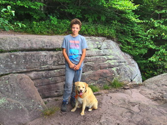 Bryce and I decided to move on and visit some other unoccupied viewpoints so that I could take some more pictures. I knew the hike wasn't very long and wanted to walk the entire ledge plateau until it began to descend to the col with Panther. We continued to the next lookout which was empty. I took some pictures of Sheila and Bryce on the ledge and then took more pictures of the valley below and the surrounding mountains. We visited two more viewpoints and stopped where the trail began to descend. I was ready to hike to Panther and asked Bryce who politely declined the offer. It was after noon and Bryce had not eaten lunch. I was a little disappointed that we were not continuing on to Panther but I was happy we had done a short but challenging hike. It was 12:35 PM when we turned around after hiking about 1.8 miles. We started back across the plateau of the ledges passing a few groups eating lunch. Soon we were starting down from the ledges. We met several groups heading back at the same time and we tried to pass several of these that were moving slowly. We continued to meet hikers and groups still coming up the trail. We passed people descending ahead of us. Each time we met a group Bryce put Sheila on her leash. We did not meet any other dogs which surprised me as I almost always meet some. When we came to the side trail to the spring, we turned right and started walking out to the spring. I had never been on this trail and it was longer than I thought. Eventually the trail ended and I had to assume the small trickle of water was the spring. There was no way to get water from the spring. We turned around and walked back out to the main trail where we turned right to head back to the car. Eventually we were at the trail junction where we turned right to start down the final .75 miles of trail. We passed group at the top of the descent but were being "chased" by another larger group. We began a rather fast descent down the trail. We both agreed that the fact that there were many similar descent was annoying. These descents are where the rockiness of the trail becomes even more evident than on the climb! We finally arrived at the descent to the bridge over the stream. We crossed the bridge where Sheila usually likes to get a final drink and to cool off. There was not enough water to make the effort worthwhile. As we walked out the trail to the road several other small groups were headed up the trail. The lot was still full and cars were parked on the side of the road below the parking area. We were back at the car at 2:00 PM after covering 3.6 miles in 3 hours and 5 minutes with an ascent of about 1150 feet.
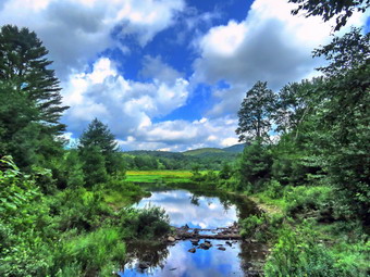
![]()
![]()
![]()
![]()
![]() On Monday, August 8th, I found out my grandson Bryce would be coming to my house but not until 11:00 AM. I knew by that time the heat index would be climbing so I planned to hike a route at Frick Pond to inspect some of the trails for blowdowns after some recent storms. I got some work done around the house and Bryce arrived at 11:00 AM as promised. I started to get ready at 11:15 AM when the temperature was 86 degrees with high humidity. As I was getting dressed, Sheila was very quiet but did not let me out of her sight. I decided to put on a short-sleeved wicking shirt I had gotten some years ago at a cross country race. I wore my Railriders hiking pants which are expensive but last along time and have features like deep pockets and a generous cut which I really like. The pants have Velcro closures at the ankles. I decided to wear my newer Keen Cascade hiking boots with a new pair of Fulton cork insoles. I felt I need more foot support as I was having some pain especially in my Achilles' Tendons. I grabbed a pair of Leki external lock poles I have been using for some time. I put my gear in the car and Sheila in the back seat while Bryce sat beside me in the front. We left Livingston Manor at 11:30 AM as I drove out the DeBruce Road about 6 miles to Mongaup Road. I turned left to continue up the road to the point where it splits. I stayed left on Beech Mountain Road and drove to the Frick Pond trailhead. When we arrived at the parking areas, there was one car parked in the larger lot. I pulled into the smaller lot and parked. The skies were sunny and blue with a few clouds and a slight breeze blowing. The temperature right at 82 degrees which was cooler than I thought it might be. I set my GPS unit and we started out the woods road to the register. As we walked out the woods road, we saw a couple of hikers at the register. I asked Bryce to put Sheila on her leash and hold onto her. At the register we continued straight ahead on the Quick Lake Trail. From the register the trail was only damp with very little standing or running water and some mud. The trail would have been dry but there had been a few showers the previous evening. The couple who were hiking stopped at the Lobdell memorial marker and we passed them on the way to the trail junction.
On Monday, August 8th, I found out my grandson Bryce would be coming to my house but not until 11:00 AM. I knew by that time the heat index would be climbing so I planned to hike a route at Frick Pond to inspect some of the trails for blowdowns after some recent storms. I got some work done around the house and Bryce arrived at 11:00 AM as promised. I started to get ready at 11:15 AM when the temperature was 86 degrees with high humidity. As I was getting dressed, Sheila was very quiet but did not let me out of her sight. I decided to put on a short-sleeved wicking shirt I had gotten some years ago at a cross country race. I wore my Railriders hiking pants which are expensive but last along time and have features like deep pockets and a generous cut which I really like. The pants have Velcro closures at the ankles. I decided to wear my newer Keen Cascade hiking boots with a new pair of Fulton cork insoles. I felt I need more foot support as I was having some pain especially in my Achilles' Tendons. I grabbed a pair of Leki external lock poles I have been using for some time. I put my gear in the car and Sheila in the back seat while Bryce sat beside me in the front. We left Livingston Manor at 11:30 AM as I drove out the DeBruce Road about 6 miles to Mongaup Road. I turned left to continue up the road to the point where it splits. I stayed left on Beech Mountain Road and drove to the Frick Pond trailhead. When we arrived at the parking areas, there was one car parked in the larger lot. I pulled into the smaller lot and parked. The skies were sunny and blue with a few clouds and a slight breeze blowing. The temperature right at 82 degrees which was cooler than I thought it might be. I set my GPS unit and we started out the woods road to the register. As we walked out the woods road, we saw a couple of hikers at the register. I asked Bryce to put Sheila on her leash and hold onto her. At the register we continued straight ahead on the Quick Lake Trail. From the register the trail was only damp with very little standing or running water and some mud. The trail would have been dry but there had been a few showers the previous evening. The couple who were hiking stopped at the Lobdell memorial marker and we passed them on the way to the trail junction.
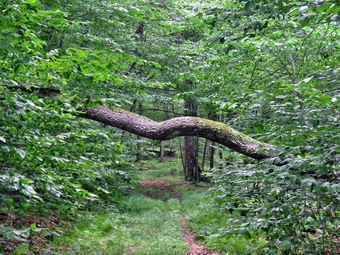 At Gravestone Junction, we stayed left on the Quick Lake trail heading toward the bridge at the outlet to Frick Pond. This area of the trail had more mud but it was minimal compared to what it usually looks like. When we arrived at the bridge, I looked at the scene and decided to take some shots even though I have hundreds from the same location. The pond was very low which was partly due to the fact that someone had ripped out the beaver dam! I took pictures of the whole scene and some of Beech Mountain. The couple caught up to us but decided to walk to the shore of the pond and look around. Before we started out again, Bryce and I both applied insect repellant as the mosquitoes and other biting insects were numerous. We continued around the west side of the pond where the trail was just damp with a small amount of mud here and there. At the junction with the Big Rock Trail, we headed left on the Quick Lake Trail which was almost dry. I had been removing smaller branches but there were a few larger ones in this area that Bryce and I managed to drag off the trail. It is always a pleasure to hike with Bryce as we talk about such a range of topics. Now that he is 11 years old he can actually do a lot of work on the trails. As we walked through the spruce tunnel, we came upon a rather large blowdown almost blocking the trail. Fortunately, it was loose and Bryce and I were able to pull it off the trail and clean up the trail. When we came to the small stream across the trail, we found it almost dry and easy to step across. I took a few pictures and then moved on. We continued on up the Quick Lake Trail toward Iron Wheel Junction. This part of the trail is usually wet and muddy but this day it was damp in most places with only a few muddy spots.
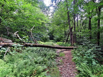 When we got to the junction, we turned right on the Logger's Loop without taking pictures of the iron wheels that gave the junction its name. As we started out, the trail seemed to have almost no water and I was hopeful this would continue. We were lucky and the trail remained very dry for the entire length. We did run across another large blowdown which we were able to muscle off to the side of the trail. A little farther along there was another large trunk that had fallen across the trail. This one was above head high and would be difficult to cut with hand tools. There had been a few other trunks lying on the ground and I thought about getting the local ranger to tackle them with me. All of the streams that run across the trail or under it were dry. Even the outlet stream from Hodge Pond was dry! This was completely different than the last time I had hiked when there had been water in all of these streams. We came to the large cherry tree that had broken off high up and fallen so that it was arching across the trail. This tree was not blocking the trail and it was clear it was not coming down soon. We passed the seasonal pond on the left side of the trail and I could see that it was completely dry. We continued downhill to Times Square which was also almost dry. I thought about turning left and climbing the Big Rock Trail to add mileage but Bryce wanted to stay on the Logger's Loop and I didn't object as I wanted to see if there were any blowdowns. We walked straight across Times Square to stay on the Logger's Loop and started uphill. Just before the beginning of the uphill was another streambed which we crossed and it was also dry. Although the trail is slightly uphill we were setting a fast pace. We did find another medium sized trunk across the trail which would have to be dealt with. We continued walking on the trail and crested the hill to walk out to Gravestone Junction. We turned left at the Gravestone Junction and headed back to the car on the woods road. At the register we continued straight ahead on the woods road back to the car. It was 2:00 PM and we had spent 2 hour and 15 minutes hiking 3.7 miles with an elevation gain was a modest 400 feet. We had spent 30 minutes stopped to take pictures and clear the trail. The temperature had risen to 86 degrees.
![]()
![]()
![]()
![]() On Saturday, August 5th I wanted to get out for a hike after two days off for ambulance calls and some work at the church. Sheila had spent most of Friday getting her teeth cleaned general anesthetic. When I picked her up, she was a little off balance and obvious still feeling the effects of the anesthetic. By Saturday morning she seemed back to normal so I decided to take her hiking. I decided to go across the street and hike on Round Top as I so often do in these circumstances. I am lucky that I have a place so close to hike but it has become very familiar. I have found that even a short hike helps to keep my blood pressure in check and I am hoping I can get my weight down also. Sheila was ready to go as she really likes to hike but she was being a good dog and just whining a little bit. It was 88 degrees on the back porch so I decided to put on a short-sleeved wicking shirt I had gotten some years ago at a cross country race. I wore my Railriders hiking pants which are expensive but last along time and have features like deep pockets and a generous cut which I really like. The pants have Velcro closures at the ankles. I decided to wear my newer Keen Cascade hiking boots with a new pair of Fulton cork insoles. I felt I need more foot support as I was having some pain especially in my Achilles' Tendons. I grabbed a pair of Leki external lock poles I have been using for some time. At 12:35 PM we walked out the door to start the hike. I grabbed Sheila's leash from the car and we walked up the driveway. I thought we could hike our usual two figure 8's which would give us about an hour of exercise.
On Saturday, August 5th I wanted to get out for a hike after two days off for ambulance calls and some work at the church. Sheila had spent most of Friday getting her teeth cleaned general anesthetic. When I picked her up, she was a little off balance and obvious still feeling the effects of the anesthetic. By Saturday morning she seemed back to normal so I decided to take her hiking. I decided to go across the street and hike on Round Top as I so often do in these circumstances. I am lucky that I have a place so close to hike but it has become very familiar. I have found that even a short hike helps to keep my blood pressure in check and I am hoping I can get my weight down also. Sheila was ready to go as she really likes to hike but she was being a good dog and just whining a little bit. It was 88 degrees on the back porch so I decided to put on a short-sleeved wicking shirt I had gotten some years ago at a cross country race. I wore my Railriders hiking pants which are expensive but last along time and have features like deep pockets and a generous cut which I really like. The pants have Velcro closures at the ankles. I decided to wear my newer Keen Cascade hiking boots with a new pair of Fulton cork insoles. I felt I need more foot support as I was having some pain especially in my Achilles' Tendons. I grabbed a pair of Leki external lock poles I have been using for some time. At 12:35 PM we walked out the door to start the hike. I grabbed Sheila's leash from the car and we walked up the driveway. I thought we could hike our usual two figure 8's which would give us about an hour of exercise.
We began the ascent of the steepest hill behind the church and continued directly up the hill to the trailhead. The hill is short but gets the circulation pumping and is the steepest and longest climb on the "trail." My goal was to make it all the way up the hill without stopping. At the top of the hill we turned left and entered the woods to begin our hike. The trailhead was very dry and that continued as we entered the woods. I was not surprised that the trails were so completely dry as we had not had any significant rain for some time. I followed Sheila as she turned right and started up the woods road which has the gentler approach of the two. There was a slight breeze which cooled us off but I wondered if it was a precursor to a thunderstorm! Sheila was already panting and I was feeling a little dry. We reached the end of the woods road and turned left up the hill on the trail. We continued up the trail to the first trail junction with the upper blue trail. We turned left and walked the yellow trail along the base of Round Top to the next junction with the blue trail. I was happy to see that the trail work Cindy and I had done was Holcomb up. We had trimmed back brush along this trail and removed a large blowdown. No more brush had fallen into the trail as I thought it might. We turned right on the blue trail and started to climb the hill. I began to think about my sermon for Sunday and the hiking went very quickly. We turned right on the switchback in the blue trail which I had constructed to ease the erosion on the main trail and allow people to have a slightly more gentle climb. At the end of the switchback we turned right on the main blue trail and passed the white crossover trail on the way to the summit. We crossed over the summit and started down the blue rail on the other side. We again passed the white crossover trail continuing on to the yellow trail. We had not run into any blowdowns blocking the trail but I had removed a few small braces. We turned right and again walked along the yellow trail to the next junction with the blue trail. This time we turned left and headed down toward the lookout. The trail bed was clear but some ferns were beginning to encroach on the trail. The forest here was a sea of ferns gently waving in the breeze. When we reached the viewpoint, I noticed that the view was almost completely blocked by the trees. I made a note to contact the town supervisor to see if we could work something out. We followed the yellow trail as it turned left and descended to the first trail junction. We had completed a figure 8 and were ready to start another.
We immediately turned around and started back up the short but steep hill to the lookout. The trip back up the hill to the lookout was pretty easy which, again, surprised me because I have not been hiking long hikes to get me in shape. At the top of the hill we turned right to follow the yellow trail to the first junction with the blue trail. We turned right to follow the yellow trail around the base of Round Top. At the next junction with the blue trail, we turned left and started uphill toward the summit. When we came to the white crossover trail, we turned left and walked the trail until it met the blue trail on the other side of the hill. At the blue trail, we turned left and then left again on the switchback in the blue trail. We followed the switchback out and back to the main trail and turned left to walk down to the yellow trail. We turned left and followed the yellow trail along the base of Round Top. At the next junction with the blue trail, we turned right on the yellow trail and followed it downhill to the woods road. We walked down the woods road to the first trail junction. This time we turned left and walked out to the trailhead. We turned right and walked down the hill to the church parking lot. We crossed the parking lot and Rock Avenue to get to our driveway. When we arrived home, it was 1:35 PM and we had hiked around 2 miles in an hour.
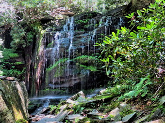
![]()
![]()
![]()
![]()
![]() On Wednesday, August 3rd I wanted to hike a little longer and a little farther away from home. I had not hiked since the previous Friday as I had been at a church Conference. I decided to head to the Neversink Unique Are near Rock Hill since there are several waterfalls which I knew would be flowing. I was anxious to see how much water was in the Neversink River and Mullet Brook as the weather had been very dry. The temperature was in the high 80's by the time I started to get ready at noon and the humidity was high. As soon as Sheila realized I was getting ready to hike, she began whining and would not leave my side. I got my gear ready and dressed for what was going to be a warmer day than I had expected. I put on my White Sierra long-sleeved crew top without a baselayer as it was so warm. I put on a pair of RailRiders hiking pants which are expensive but last a long time and have features like deep pockets and a generous cut which I really like. I decided to put on my Keen Cascade hiking boots which fit well and are newer than what I have been wearing. I added a new pair of Fulton insoles which are cork based and seem to be molding nicely to my feet. I grabbed a pair of Leki external lock poles I have been using for some time. I added my OR floppy hat which I have decided shields me from the sun and allows me to spray some insect repellant on it rather than on me. We left Livingston Manor at 12:20 PM and headed down State Route 17 toward Rock Hill. I took the Rock Hill exit and drove down Katrina Falls Road until I saw the Dead End sign. I turned left on Wolf Lake Road and after a short distance found the access road to the parking area. There was a nice parking area near the road but I wanted to drive to the end of the road and park abate upper parking area. The road was in decent shape but had several washed out areas. The powerlines in the area are very impressive as they are carried by tall steel towers in several different directions. I drove to the parking area 12:45 PM. I set my electronics and we were on our way shortly after that with the temperature at 88 degrees and high humidity.
On Wednesday, August 3rd I wanted to hike a little longer and a little farther away from home. I had not hiked since the previous Friday as I had been at a church Conference. I decided to head to the Neversink Unique Are near Rock Hill since there are several waterfalls which I knew would be flowing. I was anxious to see how much water was in the Neversink River and Mullet Brook as the weather had been very dry. The temperature was in the high 80's by the time I started to get ready at noon and the humidity was high. As soon as Sheila realized I was getting ready to hike, she began whining and would not leave my side. I got my gear ready and dressed for what was going to be a warmer day than I had expected. I put on my White Sierra long-sleeved crew top without a baselayer as it was so warm. I put on a pair of RailRiders hiking pants which are expensive but last a long time and have features like deep pockets and a generous cut which I really like. I decided to put on my Keen Cascade hiking boots which fit well and are newer than what I have been wearing. I added a new pair of Fulton insoles which are cork based and seem to be molding nicely to my feet. I grabbed a pair of Leki external lock poles I have been using for some time. I added my OR floppy hat which I have decided shields me from the sun and allows me to spray some insect repellant on it rather than on me. We left Livingston Manor at 12:20 PM and headed down State Route 17 toward Rock Hill. I took the Rock Hill exit and drove down Katrina Falls Road until I saw the Dead End sign. I turned left on Wolf Lake Road and after a short distance found the access road to the parking area. There was a nice parking area near the road but I wanted to drive to the end of the road and park abate upper parking area. The road was in decent shape but had several washed out areas. The powerlines in the area are very impressive as they are carried by tall steel towers in several different directions. I drove to the parking area 12:45 PM. I set my electronics and we were on our way shortly after that with the temperature at 88 degrees and high humidity.
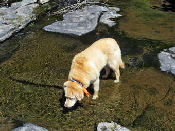 We picked up the yellow trail out of the parking area. The trail was dry and well-trimmed which made walking very easy. The trail is was slightly longer and more downhill than I remembered. The hike in on the side trail was .6 miles and it was mostly downhill losing about 100 feet. Soon we arrived at the red trail where we turned left knowing that we would have to walk uphill to the car at the end of the hike no matter which way we went. We walked along the trail finding a few muddy and damp areas. At one point I looked up to find three women hiking toward us. I ushered Sheila off the trail and we exchanged greetings a they passed. At .7 miles we crossed the upper bridge over Mullet Brook. The bridge had a tree fall across it some time ago. The tree has been removed but the bridge is still in disrepair. There wasn't much water in the stream so I did not stop to take pictures. We followed the trail as it made a sharp right turn and headed downhill. We could hear the brook falling over the stony streambed as we hiked the trail. I could also hear voices in the area of Mullet Brook Falls and wondered how many people I might find there. We continued along the trail and at 1.25 miles we came to the yellow blazed spur trail to Mullet Brook Falls and turned right to visit this attraction. As we walked along the trail I could still hear the loud voices and it sounded like quite a crowd. The spur trail is less than .2 miles and we were soon near the falls. I tied Sheila to a tree and left my pack with her. I grabbed my camera and walked out toward the falls. I was surprised to find only three young people near the base of the falls! I was able to position myself to get some pictures of the falls without people in them. The lighting was difficult as the sub was bright and shining directly in the falls. I returned to my pack and Sheila, got a drink and then headed back out the spur trail to the main trail. We turned right and walked downhill to the junction where the red trail meets the blue trail at 2.8 miles. The blue trail stretches from the Katrina Falls parking area all the way south to High Falls where it ends. Future plans may included blazing this trail farther south along existing woods roads to reach the southern part of the Neversink Unique Area. We turned right on the blue trail and then almost immediately turned left on the yellow spur trail to Denton Falls.
 The trail was dry and in pretty good shape and but a few more markers need to be added in places. Just after the turn we met a family of four coming back up from the river. I escorted Sheila off the trail and they stopped to talk for a few minutes. We parted and headed in opposite directions. The trail is about .3 miles long but over that length it loses 175 feet to the lowest point on the hike at the Neversink River. We met one more hiker coming up the trail working his way trough the maze of paths created by hikers who cannot find the trail markers! As the trail leveled, we ran into some very muddy areas despite the lack of rain. There are springs in the area and runoff from the hill keeps the area wet. Someone had taken the time to install a makeshift corduroy which did help us through the mud. The trail down to the falls is very eroded from use and there are many roots and rocks to trip over. As we got to the river, I could see a mother and two children on the rocks by the falls. I took my pack off and got out my camera. The water was very low but there were still falls. I was able to walk out on the rocks above the falls farther than I ever have. I took pictures upstream and downstream while Sheila got a drink and played in the water. I put Sheila on her leash and we work our way passed the family and down to the rocks below the falls. This was not easy as the rocks were wet and slippery. Again, I was able to walk out on rocks I had never seen before. This allowed me to get some good pictures of the falls from a different angle. Eventually, I was done and we walked back up to my pack. The family asked me some questions about the area and about fishing. Sheila and I started back up the hill and were soon back at the main blue trail where we turned left to complete the loop.
 We came to the lower bridge across Mullet Brook which has been replaced with twin steel I-beams for support and all new wood. The water level was low and I was interested in getting back to the car as the heat and humidity were both very high! Sheila did take the time to jump in and get wet all over again. We continued to hike the blue trail which continued descending. The trail was dry for the most part even in places which usually have small streams. At 2.85 miles we came to the trail junction where the blue trail bends to the left and the red trail begins. We turned right on the red trail knowing we were now headed back to the car but also knowing the trip would be all uphill! This part of the trail was also dry but there were a few large blowdowns along the way. In some places the laurel was beginning to encroach on the trail. The trail took us south and then at about 3.4 miles turned to the east. As we were nearing the top of the climb we met the same family we had met on the trail to Denton Falls. We gain stopped to talk for a few minutes before continuing on. At 3.75 miles we came to the trail junction with the yellow trail to the Wolf Lake parking area and our car. We had gained over 400 feet in .9 miles and the climb was never steep but it was continuous. We turned left on the yellow trail and continued to climb back toward the upper parking area. We gained another 140 feet over the half mile back to the parking lot. When we arrived at the upper parking area, I was glad I could get in the car and turn on the air conditioning. The thermometer on the car read 95 degrees! We arrived back at the car at 3:25 PM having hiked 4.3 miles in 2 hours and 35 minutes with about 25 minutes stopped for pictures. I honestly thought we had set a quicker pace but in any case we had great fun.
![]()
![]()
![]()
![]()
![]() On Friday, July 29th, I wanted to get out and do a longer hike but a morning ambulance call delayed my departure until late morning. I decided that I wanted to go to Alder Lake to hike to the Beaver Meadow Lean-to which would be better named the Beaver Pond lean-to as the beavers have returned. They have built an impressive dam and there are at least two lodges. I thought I would take along my Silky Sugowaza saw and wedges just in case I came across any small blowdowns to cut. I started to get ready at 1:30 PM when the temperature was 78 degrees. Sheila was hovering around me as she can always detect when I am getting ready for a hike. It was almost as warm as the day before so I decided to put on a light short-sleeved crew shirt made of wicking material. I wore my Railriders hiking pants which are expensive but last along time and have features like deep pockets and a generous cut which I really like. The pants have Velcro closures at the ankles. I decided to wear my newer Keen Cascade hiking boots which fit well. I had added a pair of Fulton cork insoles that were in the process of molding to my feet to support my arches. I grabbed a pair of Leki external lock poles I have been using for some time. I decided to wear my wide-brimmed floppy hat for some protection from the sun. I stowed my Silky Sugowaza saw in my pack and put on a pair of OR BugOut gaiters to combat the ticks that have been around. I got my gear and Sheila in my car and left Livingston Manor at 1:45 PM and drove north and west on Old Route 17 toward Roscoe. Just outside of town I turned right on the Beaverkill Road and headed north. I continued on the Beaverkill Road through Lew Beach and Turnwood toward Alder Creek Road where I made a left. I continued to the end on the road where I turned right toward Alder Lake. I drove up the access road very slowly as there are some very rough spots. When I got to the parking area there were five vehicles parked in the lot with at least one getting ready to start a hike. The temperature was 74 degrees and there was a cool breeze blowing. There was evidence that the state was cutting some trees and brush to widen the access after the gate and around the remains of the Coykendall Mansion which makes me nervous! The skies were bright and sunny with lots of blue but and many puffy white clouds to provide contrast. I set my GPS and we started out on the path toward the "lawn" at 2:15 PM.
On Friday, July 29th, I wanted to get out and do a longer hike but a morning ambulance call delayed my departure until late morning. I decided that I wanted to go to Alder Lake to hike to the Beaver Meadow Lean-to which would be better named the Beaver Pond lean-to as the beavers have returned. They have built an impressive dam and there are at least two lodges. I thought I would take along my Silky Sugowaza saw and wedges just in case I came across any small blowdowns to cut. I started to get ready at 1:30 PM when the temperature was 78 degrees. Sheila was hovering around me as she can always detect when I am getting ready for a hike. It was almost as warm as the day before so I decided to put on a light short-sleeved crew shirt made of wicking material. I wore my Railriders hiking pants which are expensive but last along time and have features like deep pockets and a generous cut which I really like. The pants have Velcro closures at the ankles. I decided to wear my newer Keen Cascade hiking boots which fit well. I had added a pair of Fulton cork insoles that were in the process of molding to my feet to support my arches. I grabbed a pair of Leki external lock poles I have been using for some time. I decided to wear my wide-brimmed floppy hat for some protection from the sun. I stowed my Silky Sugowaza saw in my pack and put on a pair of OR BugOut gaiters to combat the ticks that have been around. I got my gear and Sheila in my car and left Livingston Manor at 1:45 PM and drove north and west on Old Route 17 toward Roscoe. Just outside of town I turned right on the Beaverkill Road and headed north. I continued on the Beaverkill Road through Lew Beach and Turnwood toward Alder Creek Road where I made a left. I continued to the end on the road where I turned right toward Alder Lake. I drove up the access road very slowly as there are some very rough spots. When I got to the parking area there were five vehicles parked in the lot with at least one getting ready to start a hike. The temperature was 74 degrees and there was a cool breeze blowing. There was evidence that the state was cutting some trees and brush to widen the access after the gate and around the remains of the Coykendall Mansion which makes me nervous! The skies were bright and sunny with lots of blue but and many puffy white clouds to provide contrast. I set my GPS and we started out on the path toward the "lawn" at 2:15 PM.
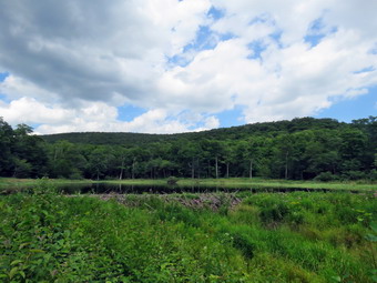 We walked along the path which passes by the stone foundations which marks the last remnants of the Coykendall Mansion. The house had been built as a large hunting lodge and then was gifted to the Boy Scouts of America. When the state took over the property, the mansion fell into disrepair with campers tearing boards away to use for campfires. The state added a fence but it did not deter people so the house was eventually burned to the ground. As we walked down the right side of the lawn, I noticed that none of the grass had been cut and the picnic tables that were present were hiding in the tall weeds. I don't know whether this is done on purpose by the DEC or whether they just lack staff. In either case, it is a shame that such a beautiful place is treated so shabbily with almost no maintenance. I walked toward the dam as there was a family on the "beach" where I normally tale pictures. I took pout my camera and snapped some shots of the lake and the hills around it. The lighting was almost perfect and there were interesting reflections in the lake. The breeze caused ripples on the lake which added another element to my pictures. We started to walk across the lawn toward the trail around the left side of the lake but were intercepted by an unleashed barking dog. I get so tired of irresponsible dog owners who only consider what is easiest for them. I politely suggested to the owner that he get a leash and he politely suggested that I calm down! We made it to the other side of the lawn and started walking east along the trail on the north side of the lake. The trail was mostly dry and the brush had been beaten back by use. We found a few muddy spots but nothing like the ones that are often present. The brush and branches that had overgrown the trail were now dead and the walking was much easier. Sheila was happy to be out and ran ahead and then returned to me. I began to remove small branches from the trail and moved one larger one. As we approached the bridges, Sheila alerted and I could see two people fishing along the shore. We stopped to talk and I found the one man was someone I knew from Livingston Manor.
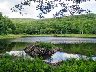 We continued on the trail and I could see a young couple coming up behind us with their dog on a leash. We crossed the bridges on the trail near the head end of the lake and I could see the beaver dam that impounded some water from the inlet streams was still intact. I decided to wait to take pictures on the way back. We continued on the trail toward the junction with the Millbrook Ridge Trail. At the point where a path leads to the left to some primitive campsite, some large trees had fallen across the trail. We were able to step over them but it was not easy. I could cut them with my hand tools but it would take a long time! I made a note to call the local ranger to see if we could schedule a time to remove them with a chainsaw. At the trail junction, we turned left to head toward the lean-to on the Millbrook Ridge Trail. The trail was dry in most places but we did run into a stretch of nettles. Fortunately, the trail showed more use than I had expected and the nettles were well back from the trail. There were a few small blowdowns which I removed from the trail. There were also some older and rotten trunks that I was able to move and this continued for the rest of the hike. I did find a few blowdowns that I thought I might cut on the return trip. We crossed some stream that were almost dry and even Alder Creek was down to a trickle. We did find a few large, older blowdowns which would be hard to clear with hand tools so I thought about getting get a crew with a sawyer to remove some of the larger ones from trail. The trail is pretty obvious and the blazes easy to see in most places. For the next 1.5 miles the trail climbed and then leveled off several times. The elevation gain is several hundred feet but the grade is never more than 12% and averages around 6%. There isn't too much to see along the way but this day was very pleasant because of the temperature and my mood. We enjoyed the sounds and sights of Alder Creek as it flows parallel to the trail much of the way even though the volume was low.
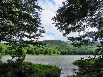 The trail leveled off at the first beaver meadow and we crossed a small stream that feeds it. At 2.2 miles we began the last climb and I found that the going was easier than I thought it would be. As we started the climb, we came across a few more blowdowns. Soon we arrived at the beaver pond. Where there had once been a beaver meadow, there was now a pond with a dam and a beaver lodge. The pond was the same size as the last time I had visited occupying the entire meadow. As we came to the spot on the trail opposite the beaver dam, we walked off the trail to the right and found a good viewpoint. I took pictures of the pond and the dam which I thought would be good as there were reflections in the pond and white clouds in the sky. I also took some shots of the beaver lodge with the lean-to in the background. As I looked around I was overcome by the feeling of joy at seeing what God has created! I realized that the return trip would be much easier as it was almost all downhill but that I might stop to remove some trunk and branches. We walked over to the lean-to and found it in a shambles. The lean-to has been largely ignored while others are repaired or entirely reconstructed. This is a popular spot but it is not near a 3500 foot peak. I took some pictures of what is now an open-air "outhouse" since the structure surrounding it was long ago torn down. I also noticed large holes in the roof and took some more pictures. After I got a drink and ate a bar, we started back on the trail. I did take some time at various places to remove larger branches and some rotten trunks. By the time I was done there were six or seven large trunks that would be easier to cut with a chainsaw and a few smaller ones that could be taken with hand tools. The walk did go quickly and we were soon at the loop trail around Alder Lake where we turned right to return the way we came. When we came to the bridges there was the open view of Cradle Rock Ridge but the skies were overcast and black clouds were gathering. We continued on the trail toward the parking area and at one point I got another view of Cradle Rock Ridge so I took the opportunity to snap some shots. We met one person walking along the trail toward us and a person on a mountain bike! In both cases I took Sheila to the side of the trail. We also met another couple with their two dogs. Unfortunately, one was on a leash but the other was not. As we approached the parking area the black clouds were gathering over Cradle Rock Ridge. As the trail came to the "lawn" we turned right and walked up the hill toward the stonework of the mansion. We walked back to the car. We were back at the car at 4:55 PM after hiking 4.6 miles in 2 hours and 40 minutes with 20 minutes of stopped time. The elevation gain was 650 feet. Our moving speed was 2 MPH. We did not run into any rain on the way hoe but at home it was obvious it had rain hard!
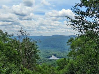
![]()
![]()
![]()
![]() On Wednesday, July 27th, I wanted to get out and hike a mountain not too far from home. I have been sleeping late because almost every night brings an ambulance call or two and Tuesday night was no exception. I decided I would combine a shorter hike up a mountain with some trail maintenance. The Touch-Me-Not Trail from Beech Hill Road to Cabot Mountain seemed like a good choice. Since I had done the maintenance from Barkaboom Road to Cabot Mountain earlier, this would complete my maintenance except for a little lopping to do in a few spots. I am the Finger Lakes Trail Conference Trail Coordinator for the eastern Catskills from Route 206 to the top of Slide Mountain which is the trail's eastern terminus. I also maintain this section of trail for the Finger Lakes Trail Conference. By 11:00 AM it was already 76 degrees with some lingering humidity from the rain showers. I got my gear ready and dressed for what was going to be a warmer day than I had expected. I put on my White Sierra long-sleeved crew top without a baselayer as it was so warm. I put on a pair of RailRiders hiking pants which are expensive but last a long time and have features like deep pockets and a generous cut which I really like. I decided to put on my Keen Cascade hiking boots which fit well and are newer than what I have been wearing. I added a new pair of Fulton insoles which are cork based and seem to be molding nicely to my feet. I decided to take my Leki poles and forego an ax as I expected to do only so light work. I added my OR floppy hat which I have decided shields me from the sun and allows me to spray some insect repellant on it rather than on me. I also put on my OR BugOut gaiters to make sure the ticks stayed on the outside. I put my Silky Sugowaza saw and two felling wedges in my pack. Sheila was ready to go as we pulled out of Livingston Manor at 11:20 AM. I drove north on Old Route 17 before turning right on the Beaverkill Road. I got behind some slower traffic as was further delayed by some tree trimming. I passed through Lew Beach and turned left on Beech Hill Road Road. I drove up the road about 2.6 miles and parked at the small pullout on the right side of the road at the beginning of the trail. The temperature was 74 degrees but a light breeze was blowing. There was one other car parked in the lot.
On Wednesday, July 27th, I wanted to get out and hike a mountain not too far from home. I have been sleeping late because almost every night brings an ambulance call or two and Tuesday night was no exception. I decided I would combine a shorter hike up a mountain with some trail maintenance. The Touch-Me-Not Trail from Beech Hill Road to Cabot Mountain seemed like a good choice. Since I had done the maintenance from Barkaboom Road to Cabot Mountain earlier, this would complete my maintenance except for a little lopping to do in a few spots. I am the Finger Lakes Trail Conference Trail Coordinator for the eastern Catskills from Route 206 to the top of Slide Mountain which is the trail's eastern terminus. I also maintain this section of trail for the Finger Lakes Trail Conference. By 11:00 AM it was already 76 degrees with some lingering humidity from the rain showers. I got my gear ready and dressed for what was going to be a warmer day than I had expected. I put on my White Sierra long-sleeved crew top without a baselayer as it was so warm. I put on a pair of RailRiders hiking pants which are expensive but last a long time and have features like deep pockets and a generous cut which I really like. I decided to put on my Keen Cascade hiking boots which fit well and are newer than what I have been wearing. I added a new pair of Fulton insoles which are cork based and seem to be molding nicely to my feet. I decided to take my Leki poles and forego an ax as I expected to do only so light work. I added my OR floppy hat which I have decided shields me from the sun and allows me to spray some insect repellant on it rather than on me. I also put on my OR BugOut gaiters to make sure the ticks stayed on the outside. I put my Silky Sugowaza saw and two felling wedges in my pack. Sheila was ready to go as we pulled out of Livingston Manor at 11:20 AM. I drove north on Old Route 17 before turning right on the Beaverkill Road. I got behind some slower traffic as was further delayed by some tree trimming. I passed through Lew Beach and turned left on Beech Hill Road Road. I drove up the road about 2.6 miles and parked at the small pullout on the right side of the road at the beginning of the trail. The temperature was 74 degrees but a light breeze was blowing. There was one other car parked in the lot.
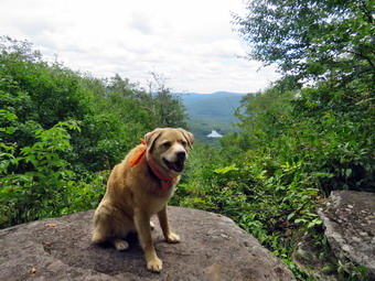 I set my electronics and we walked down through the field and into the woods to begin our hike at 11:40 AM. The first part of the trail is flat and usually very wet but on this day the grass had been cut and the trail was relatively dry. We walked along a stone wall and almost immediately came to a few small trunk across the trail. I moved the ones I could and decided to leave the ones that I would need to cut for the trip back. As we walked, I picked up a few branches and threw them aside. The trail was damp and with a few muddy spots. Some of the rocks were damp and slippery. There were no major blowdowns on the flat part of the trail. At .2 miles the trail begins to climb and in about half a mile it gains almost 600 feet averaging a 20% grade. This is not as steep as the other side but is plenty challenging. After climbing a little we ran into a stand of nettles that continued for a few hundred feet and then ended. We did not see any more nettles for the rest of the trip. I did see several large logs that I had cut last year or before. We continued up the trail which has a few switchbacks and several flatter areas. We came to a steep section which was bare of vegetation. Sheila alerted and I looked up to see two men walking down the trail toward us. They had no poles and each carried a water bottle. I pulled Sheila off the trail as they passed. They stopped for a minute and I asked them about the trail ahead. They told me it was mostly clear. After they passed, we continued up the mountain. As we climbed the steep trail, I though about the descent which is always tricky! We found a large tree trunk on the trail that was almost completely rotted. Just passed this was another large diameter trunk across the trail with a red trial marker on it. Hikers had begun to walk around the end of the log.
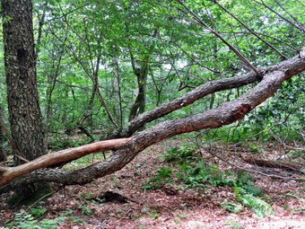 At about .7 miles the trail levels off and then rolls over several bumps to the Cabot Mountain Vista at 1.6 miles. Shortly after the trail flattened we came to another tree that had fallen across the trail. It had several trunks and I knew I could not completely remove it by myself with the small saw. I thought I might ne able to cut away enough branches to allow hikers to walk upright through the mess. We continued along the trail climbing a few bumps and descending others. Two young men in their teens approached us and we greeted each other as they passed. Sheila was having a great time as she roamed ahead and followed some game trails always coming back at my call. We passed many blowdowns that I remember clearing and I was surprise that the trail was in such good shape. The trailbed was ease to follow and there were bough trail markers to designate the trail. We continued along the flat part of the trail toward the viewpoint. As we were only a half mile from the overlook we met a man and woman with a four year old child. I again pulled Sheila off the trail. The couple slowed as they passed and I told them I was confused as I had met three groups of people and there was only one car. They told me that the two teenagers were part of their family so that just left the first two men I had met! There was one more tree across the trail as we were approaching the viewpoint. We arrived at the lookout at about 12:50 PM. The view was starting to grow back in after it had been cut out a few years ago. The individual puffy white clouds had started to come together into an overcast. I took some pictures including a few of Sheila sitting on the lookout with Little Pond in the background. We both got a drink and I could tell that I was dehydrated and knew I would face the consequences in the from of leg cramps at night! I knew that the trip back should go quickly and I was glad that I had brought poles to help. As we started back we ran into a blowdown that could be stepped over but I decided to cut off a few branches to make it easier. I took some pictures and then used the saw to remove a few branches to make the hike easier. I took some "after" pictures and the we moved on.
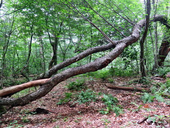 While walking a low hanging branch grabbed hold of me. I broke off the branch but I noticed a dead tree standing near the trail. I knew the tree would soon fall onto the trail so I though I should remove the dead tree. I decided to give it a push and see what would happen. I gave it a push and heard a crack but the tree did not fall! I looked up to see the tree had cracked in half further above me. I decided that I would try again and positioned myself so that I was sure any falling pieces would miss me. I gave it a push and the bottom section fell in front of me across the trail. Before I could move, the top section fell about 6 inches from my left elbow. I was startled. As I began to pick up the pieces I found that they were very light but I was sure that it they had hit me it would have HURT! I finished cleaning up the mess and moved on. I stopped a couple of times to roll or lift some larger branches off the trail. I also cut several branches that had sharp ends sticking out into the trail. As we started to leave the for a long time section to begin the descent we came to three with two trunks that was blocking the trail. I decided to improve what I could. I took some pictures and then got to work. I cut some branches off the main trunks and removed them to the side of the trail. I then removed all the loose branches in the area where the trunks were highest above the ground. I then began to cut and remove all the branches in that area to clear a way for hikers to walk through. I looked at what I had done and called it good. I took some pictures and we began our descent. We came to the larger trunk across the trail and followed the path other hikers had used around one end. Just below this was the large rotten trunk. I kicked this one several times and found it was in section. I took the time to remove the rotten sections by lifting and rolling. By the time I was done there was almost nothing left. We started down the mountain trying to keep a fast pace. Sheila had no problems but I had to be careful in the steep sections even with poles. Soon we were on the last flat section before the car. I thought about clearing the last few small trunks but knew I could get these at any time. We walked back to the car arriving at 2:20 PM after spending 2 hours and 40 minutes hiking 3.2 miles and doing some trail work. I spent about 50 minutes stopped at the viewpoint and the various work sites. I was surprised that the elevation gain was only 900 feet!
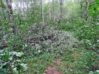
![]()
![]()
![]()
![]()
![]() On Tuesday, July 26th I decided I wanted to go over to Round Top to clear the brush on the trail that Ariana and I had found the day before. Some morning ambulance calls pushed this off to the afternoon. I asked Cindy if she would go hoping that having tow people would make the work go more quickly. As we started to get ready at 1:30 PM the temperature had risen to 72 degrees with partly sunny skies. It was cooler than the day before so I decided to again put on a light short-sleeved crew shirt made of wicking material. I wore my Railriders hiking pants which are expensive but last along time and have features like deep pockets and a generous cut which I really like. The pants have Velcro closures at the ankles. I decided to wear my newer Keen Cascade hiking boots which fit well. I had added a pair of Fulton cork insoles that were in the process of molding to my feet to support my arches. I decided to forego any poles as I would be carrying some maintenance tools. I decided to wear my wide-brimmed floppy hat for some protection from the sun. I put my Silky Sugowaza in my pack and carried my extensible Corona loppers. At 1:50 PM we walked out the door to start the hike. The heat and humidity were high but not as bad as they had been. The forecast for the late afternoon included some thunderstorms so I wanted to get finished as soon as possible. We put our gear in the car and Sheila in the back seat as I drove across the street and up the roads to the trailhead. I parked on the side of the road and we got started on the trail. I knew Cindy wanted to use her poles so I carried the loppers. Just before the first trail junction there was a small tree that had broken off and I wanted to clear the branches encroaching on the trail. I put my pack down but did not bother to take pictures. Cindy had walked ahead so I was on my own. I decided to not just cut the small branches but to eliminate the problem at the source. I used the saw to cut off the largest branches which I would eventually drag off the trail. Cindy came back to watch me work and eventually helped moved some brush off the trail.
On Tuesday, July 26th I decided I wanted to go over to Round Top to clear the brush on the trail that Ariana and I had found the day before. Some morning ambulance calls pushed this off to the afternoon. I asked Cindy if she would go hoping that having tow people would make the work go more quickly. As we started to get ready at 1:30 PM the temperature had risen to 72 degrees with partly sunny skies. It was cooler than the day before so I decided to again put on a light short-sleeved crew shirt made of wicking material. I wore my Railriders hiking pants which are expensive but last along time and have features like deep pockets and a generous cut which I really like. The pants have Velcro closures at the ankles. I decided to wear my newer Keen Cascade hiking boots which fit well. I had added a pair of Fulton cork insoles that were in the process of molding to my feet to support my arches. I decided to forego any poles as I would be carrying some maintenance tools. I decided to wear my wide-brimmed floppy hat for some protection from the sun. I put my Silky Sugowaza in my pack and carried my extensible Corona loppers. At 1:50 PM we walked out the door to start the hike. The heat and humidity were high but not as bad as they had been. The forecast for the late afternoon included some thunderstorms so I wanted to get finished as soon as possible. We put our gear in the car and Sheila in the back seat as I drove across the street and up the roads to the trailhead. I parked on the side of the road and we got started on the trail. I knew Cindy wanted to use her poles so I carried the loppers. Just before the first trail junction there was a small tree that had broken off and I wanted to clear the branches encroaching on the trail. I put my pack down but did not bother to take pictures. Cindy had walked ahead so I was on my own. I decided to not just cut the small branches but to eliminate the problem at the source. I used the saw to cut off the largest branches which I would eventually drag off the trail. Cindy came back to watch me work and eventually helped moved some brush off the trail.
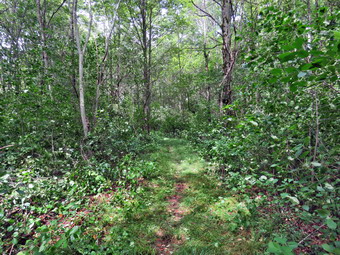 When we were done, we walked to the first trail junction and turned right to start up the woods road which is the easier f the two approaches to the trail system. We stopped at a tree that had been hanging over trail for some time and looked ready to fall. I tried shaking it loose but concluded we would have to wait for the next wind storm. We continued up the trail removing branches that had blown off the trees in the storm the night before. We followed the yellow makers as they turned off the road and along the trail up through the woods. I stopped several times to cut brush that was beginning to lean over into the trail. It took me longer as I had to cut the brush and remove it from the trail. It wasn't very long until we came to the junction with the blue trail where we turned left. We walked along the yellow trail as I continued to cut and remove some small and not so small branches. We soon ran into the biggest blowdown which was little more complex than I thought. This time I took some pictures before I started. The tree was very long but on the top had fallen onto the trail so there was no large trunk to cut. I removed some lose branches and then cut a few small ones to reveal what remained. It looked to me like I could walked along the trunk and "top" the tree. I removed a few more branches and pulled them out of the way because after topping the tree I wanted to drag to tops back into the woods. I made three cuts and the started dragging the tops into the woods. The first was the largest and it gave me some trouble until I decided it was going. I noticed Cindy had taken the clippers and was working a little farther down the trail. I dragged the other two tops off the trail and was surprised that the job was almost finished. I cut some ore small branches and asked Cindy to use the loppers on a few more. I took some after pictures and then moved a little but along the trail. I moved some branches Cindy had cut to the large pile I had created from the blowdown. This made things look neater and created a bigger brush pile for rabbits and other animals. Cindy and I worked to clear branches that were leani9ng into the trail and other dead branches that could potentially obstruct hikers. We spend some time cutting back the trail and stacking the cuttings on the large brush pile. Soon we were at the junction with the blue trail where we turned right head up the hill.
 As we started up the hill, we came to a small tree that had broken off about 5 feet up from the ground and had fallen so that it was hanging over the trail. I knew it was just a matter of time before this tree fell. I took some shots and then tried rocking the tree back and forth. It stayed lodged high in the other tree and would not budge. I decided to cut it near where the break was on the trunk hoping it would fall to the ground and dislodge on the other side. I made the cut which was nerve wracking as I did not know how the trunk would twist. Fortunately it fell neatly onto the trail. I made one more cut further up the trunk which allowed the rest of the trunk to swing off the trail. I removed the piece I had cut off, took some pictures and moved on. We followed the switchback in the blue trail but found nothing major to remove. We continued up the hill on the blue trail. On the summit we cleared a few small beaches and cut back a tree or two. It was getting late as we made our way down the other side of the hill toward the yellow trail. We lopped off some branches and I cut a few larger ones with the saw. We removed everything and I continued down the blue trail to the junction with the yellow trail with Cindy lagging a little behind. I turned right and walked the yellow trail along the base of Round Top to the next junction with the blue trail. I turned left to follow the yellow trail down to the lookout to make sure there were Ni major blowdowns on this part of the trail. I wasn't find much but at some point I noticed Cindy was not behind us! I had no idea what she had done but decided to continue on my route. I did move a few larger branches off the trail but was able to leave the saw in my pack. We turned left at the viewpoint and started down the steep hill toward the first trail junction where I could see Cindy waiting. We walked straight out the trail to the car, put our gear in the back, and headed home. We arrived home at 3:50 PM after spending 2 hours in the hear clearing the trail system!
![]()
![]()
![]()
![]() On Monday, July 25th my granddaughter Ariana was at our house. She had been there for the weekend but the weather had been hot and humid when it was not raining. We finally decided to go out on Monday even though the weather was still "sticky". We decided to go across the street to hike on Round Top. As we started to get ready at 3:00 PM the temperature had risen to 80 degrees with partly sunny skies and high humidity. It was almost as warm as the day before so I decided to put on a light short-sleeved crew shirt made of wicking material. I wore my Railriders hiking pants which are expensive but last along time and have features like deep pockets and a generous cut which I really like. The pants have Velcro closures at the ankles. I decided to wear my newer Keen Cascade hiking boots which fit well. I had added a pair of Fulton cork insoles that were in the process of molding to my feet to support my arches. I grabbed a pair of Leki external lock poles I have been using for some time. I decided to wear my wide-brimmed floppy hat for some protection from the sun. At 3:15 PM we walked out the door to start the hike. The heat and humidity were high but not as bad as they had been. The forecast for the late afternoon included some thunderstorms so I wanted to get finished as soon as possible. I grabbed Sheila's leash from the car and we walked up the driveway. We walked out the driveway and crossed the street to walk along the street to the parking lot of the Presbyterian Church. We walked to the back of the lot and began the ascent of the steepest hill behind the church.
On Monday, July 25th my granddaughter Ariana was at our house. She had been there for the weekend but the weather had been hot and humid when it was not raining. We finally decided to go out on Monday even though the weather was still "sticky". We decided to go across the street to hike on Round Top. As we started to get ready at 3:00 PM the temperature had risen to 80 degrees with partly sunny skies and high humidity. It was almost as warm as the day before so I decided to put on a light short-sleeved crew shirt made of wicking material. I wore my Railriders hiking pants which are expensive but last along time and have features like deep pockets and a generous cut which I really like. The pants have Velcro closures at the ankles. I decided to wear my newer Keen Cascade hiking boots which fit well. I had added a pair of Fulton cork insoles that were in the process of molding to my feet to support my arches. I grabbed a pair of Leki external lock poles I have been using for some time. I decided to wear my wide-brimmed floppy hat for some protection from the sun. At 3:15 PM we walked out the door to start the hike. The heat and humidity were high but not as bad as they had been. The forecast for the late afternoon included some thunderstorms so I wanted to get finished as soon as possible. I grabbed Sheila's leash from the car and we walked up the driveway. We walked out the driveway and crossed the street to walk along the street to the parking lot of the Presbyterian Church. We walked to the back of the lot and began the ascent of the steepest hill behind the church.
The hill is short but gets the circulation pumping and is the steepest and longest climb on the "trail." Sheila was giving me a little pull but Ariana was having no problem climbing the hill on her own. At the top of the hill we stopped to look around. I showed Ariana the work that a crew had done in repairing some headstones that had fallen over. I talked to her about "hillside creep" and how it effects the cemetery. We started on the trail by turning left at the trailhead. The trailhead was dry and that continued as we entered the woods. At the first trail junction, we followed Sheila as she continued straight ahead up the hill to the lookout over town. The trails were pretty dry despite the rain that had fallen. When we reached the top of the hill, we walked out the path to the lookout over town. I pointed out the gap in the path and explained to Ariana why I did not want to encourage people to hike on the path. We stood on the viewpoint and I pointed out various buildings in town and the spot on the opposing hill where a development has been proposed. I explained to Ariana that we are not standing on solid rock but on a shelf with a "cave" underneath. We decided to go down below to see the cave. We walked a little further along the ledge and found a crack that allowed us to descend to a narrow path to the cave. We turned left and walked along the path until we were under the ledge where we had just been standing. Ariana was impressed by the thin layers of sedimentary rock that made up the supporting structure of the viewpoint. After taking a look, we turned around and started back up the way we came. We were soon back on the viewpoint. We continued up over a small ledge to the clearing above. Someone had stared a small fire without a stone ring which could be very dangerous. We picked up the yellow trail and ascended through the woods. The trail continued to be dry with only a few damp spots here and there but plenty of ferns. When we reached the junction with the blue trail we turned right to stay on the yellow trail. As we continued on this trail along the base of Round Top we found many branches leaning into the trail and one large blowdown almost blocking the trail. I knew I would have to come back soon to clear this part of the trails. We were able to walk by these branches and soon came to the second junction with the blue trail. Here we turned left and started up the blue trail toward the summit of Round Top. We bypassed the white trail and continued over the top and started down the other side.
When we came to the switchback in the blue trail, we followed it to the right out into the woods and then back as it rejoined the main blue trail. When we came to the junction with the yellow trail, we turned left and again walked along the base1 of Round Top through the brush that was on the trail. This time when we came to the trail junction, we turned right and followed the yellow trail down to the woods road that would return us to the very first trail junction. As we were walking, Ariana and I were having a great conversation about many topics. I don't get to see her as much as some of the other grandchildren and found talking to her very interesting. We were also removing many small branches from the trail until we came to the first trail junction. We immediately turned around and started back up the woods road and the yellow trail. I pointed out many of the interesting ledges and cliffs along the trail. At the junction with the blue trail, we turned left to again follow the yellow trail to the next junction with the blue trail. At that junction we turned right and headed up the hill toward the summit. We turned right on the switchback and followed it around and back to the main blue trail. We continued up the blue trail over the summit and down the other side. At the trail junction we turned right and made one final trip across the yellow trial. We continued to follow the yellow trail when it turned left at the trail junction. We walked downhill through the waving ferns to the viewpoint. We turned left and continued on the yellow trail down the steep hill to the first trail junction. We continued straight ahead and walked out to the trailhead. We turned right to start down the hill to the church parking lot. At the bottom of the hill we walked out to the parking lot. We walked through the parking lot to Rock Avenue. After crossing the street to our driveway, we walked back to the house. We were home by 4:15 PM after hiking a little less than three miles in an hour.
![]()
![]()
![]()
![]()
![]() On Wednesday, July 20th I wanted to clear a large evergreen trunk that I had lefty across the trail the day before. Lisa and I has removed a few blowdowns on the Big Rock Trail and then had come to this large evergreen in the "spruce tunnel" on the west side of Frick Pond. We had worked to clear all the breaches that had obscured the trail leaving only the trunk. The trunk was large and I wanted to have a larger ax to handle it. I knew my Grandson Bryce would be coming to the house so I decided to ask him if he wanted to go. Bryce arrived at 9:30 AM and we took some time to do work around the house. At 11:45 AM we decided to go remove the one trunk with the temperature at 88 degrees. I put on my White Sierra long-sleeved crew top without a baselayer as it was so warm. I put on a pair of RailRiders hiking pants which are expensive but last a long time and have features like deep pockets and a generous cut which I really like. I decided to put on my Keen Cascade hiking boots which fit well and are newer than what I have been wearing. I added a new pair of Fulton insoles which are cork based and seem to be molding nicely to my feet. I decided to take my Leki poles as Bryce would be carrying my Council Tool 4lb felling ax and the Silky Katanaboy saw. I added my OR floppy hat which I have decided shields me from the sun and allows me to spray some insect repellant on it rather than on me. I put my Silky Sugowaza saw and two felling wedges in my pack. We put our gear in the car and Sheila in the back seat at noon with the temperature at 90 degrees. I drove out the Debruce Road about 6 miles and turned left onto Mongaup Pond Road and continued to where the road split. At the split, I turned left onto Beech Mountain Road, and drove to the parking areas at the Frick Pond. There was one cars parked in each parking lots as I pulled into the smaller area. The thermometer read 86 degrees. I hoped that being under the trees would be cooler! There did not seem too be many insects so we skipped the repellant. At 12L15 PM we started our hike by heading out on the wood road to the trail register and the Quick Lake Trail.
On Wednesday, July 20th I wanted to clear a large evergreen trunk that I had lefty across the trail the day before. Lisa and I has removed a few blowdowns on the Big Rock Trail and then had come to this large evergreen in the "spruce tunnel" on the west side of Frick Pond. We had worked to clear all the breaches that had obscured the trail leaving only the trunk. The trunk was large and I wanted to have a larger ax to handle it. I knew my Grandson Bryce would be coming to the house so I decided to ask him if he wanted to go. Bryce arrived at 9:30 AM and we took some time to do work around the house. At 11:45 AM we decided to go remove the one trunk with the temperature at 88 degrees. I put on my White Sierra long-sleeved crew top without a baselayer as it was so warm. I put on a pair of RailRiders hiking pants which are expensive but last a long time and have features like deep pockets and a generous cut which I really like. I decided to put on my Keen Cascade hiking boots which fit well and are newer than what I have been wearing. I added a new pair of Fulton insoles which are cork based and seem to be molding nicely to my feet. I decided to take my Leki poles as Bryce would be carrying my Council Tool 4lb felling ax and the Silky Katanaboy saw. I added my OR floppy hat which I have decided shields me from the sun and allows me to spray some insect repellant on it rather than on me. I put my Silky Sugowaza saw and two felling wedges in my pack. We put our gear in the car and Sheila in the back seat at noon with the temperature at 90 degrees. I drove out the Debruce Road about 6 miles and turned left onto Mongaup Pond Road and continued to where the road split. At the split, I turned left onto Beech Mountain Road, and drove to the parking areas at the Frick Pond. There was one cars parked in each parking lots as I pulled into the smaller area. The thermometer read 86 degrees. I hoped that being under the trees would be cooler! There did not seem too be many insects so we skipped the repellant. At 12L15 PM we started our hike by heading out on the wood road to the trail register and the Quick Lake Trail.
 The woods road was damp with a few small muddy spots. The Quick Lake Trail after the register was wetter and muddier but we could avoid most of these spots. At Gravestone Junction we sated to the left on the Quick Lake Trail and headed toward Frick Pond. When we arrived at the pond, we crossed the bridge and saw that someone had vandalized the beaver dam. I think I know who is doing this but I have been unable to determine of they have permission to do it! We continued to hike on the Quick Lake Trail along the west side of Frick Pond. At the junction with the Big Rock Trail, we turned right to get on the Big Rock Trail. There were a few wet and muddy spots on this trail but we easily got by them. After passing over some wooden walkway, we came to the large trunk across the trail at just less than a mile. I dropped my pack and took some "before pictures" and then went to look at the trunk. Because of its position and the fact that it was almost flat on the ground, I decided to use the ax to make a cut off the trail toward the butt end where the trunk was thickest. After completing that cut, my plan was to make another cut of the trail ward the top of the tree where the diameter was smaller. I was concerned as there had been so many branches that I knew there would be knots which are much harder than the softer evergreen wood. Bryce and I both noticed that the mosquitoes were gathering so we put on some insect repellent which seemed to work.
 I got the Council Tools felling ax and began the rather straightforward work. I was determined to get the cut wide enough which meant I had to start by cutting quite a bit of wood. The bigger ax is a beast and works very will for this purpose. With each swing I can develop more momentum and have the ax bite deeper. The drawback is that the ax is twice as heavy as the composite Fiskars pack ax and it takes a lot more energy to swing it. I alternated chopping from each side and taking a few breaks. It wasn't too long until I was breaking through. I walked to the other side of the trail and immediately began to make the second cut. I was tired but the diameter was smaller so the work went quickly. Once I cut through there was a long section of trunk that had to be moved. I knew that cutting it in half would make it easier but I was not enthusiastic about that solution. I thought we could pivot the section downhill and roll it off the trail but it proved to be too long to get around another tree. Bryce and I were able to slide the section a few feet downhill so that it would clear the other tree. I lifted the section which was heavier than I thought and, after several tries, I got it around the other tree. Bryce and I rolled it down hill and then well off the trail. We stepped back to look at our work and decided it was good. We took the time to clean up some small branches. I took some "after pictures" including a few with Bryce and Sheila. It had taken almost 45 minutes to clear the trunk! We turned around and hiked back to the car. We did stop at the bridge where I took a few shots. We were back at the car at 1:45 PM after hiking about 2 miles and working on the large trunk. We were both wet with sweat but satisfied we completed the work. The temperature at the car was 91 degrees and the humanity was high.
![]()
![]()
![]()
![]()
![]() On Tuesday, July 19th, I wanted to get out to clear some blowdowns that hikers had reported on the Big Rock Trail. I had not surveyed the Big Rock Trail in some time but the report was that there were several large trees and branches all but blocking the trail. The snowmobile club clears these trail but I knew they would not be around until fall. Lisa had Aled and wanted to go on a hike. When I suggested this trial maintenance, she readily agreed. She would come to my house at 9:30 AM and I would drive to the trailhead. I started getting ready at 9:00 Am with the temperature at 78 degrees. I put on my White Sierra long-sleeved crew top without a baselayer as it was so warm. I put on a pair of RailRiders hiking pants which are expensive but last a long time and have features like deep pockets and a generous cut which I really like. I decided to put on my Keen Cascade hiking boots which fit well and are newer than what I have been wearing. I added a new pair of Fulton insoles which are cork based and seem to be molding nicely to my feet. I decided to take my Leki poles as Bryce would be carrying my Council Tool 4lb felling ax and the Silky Katanaboy saw. I added my OR floppy hat which I have decided shields me from the sun and allows me to spray some insect repellant on it rather than on me. I put my Silky Sugowaza saw and two felling wedges in my pack and decided to carry my Fiskars pack ax. I don't like hiking without poles but sometimes I do not have a choice. Lisa arrived on time and Sheila was overjoyed to see her. We put our gear in the car and Sheila in the back seat at 9:40 AM with the temperature at 86 degrees. We left Livingston Manor as I drove out the DeBruce Road about 6 miles to Mongaup Road. I turned left and drove up the road to the intersection with Beech Mountain Road. I stayed left on Beech Mountain Road and drove to the parking areas on the left. I pulled into the smaller parking area which where no cars were parked. The larger lot also had no cars in it. I set my GPS and we cross the road to begin our hike at 0L00 AM.
On Tuesday, July 19th, I wanted to get out to clear some blowdowns that hikers had reported on the Big Rock Trail. I had not surveyed the Big Rock Trail in some time but the report was that there were several large trees and branches all but blocking the trail. The snowmobile club clears these trail but I knew they would not be around until fall. Lisa had Aled and wanted to go on a hike. When I suggested this trial maintenance, she readily agreed. She would come to my house at 9:30 AM and I would drive to the trailhead. I started getting ready at 9:00 Am with the temperature at 78 degrees. I put on my White Sierra long-sleeved crew top without a baselayer as it was so warm. I put on a pair of RailRiders hiking pants which are expensive but last a long time and have features like deep pockets and a generous cut which I really like. I decided to put on my Keen Cascade hiking boots which fit well and are newer than what I have been wearing. I added a new pair of Fulton insoles which are cork based and seem to be molding nicely to my feet. I decided to take my Leki poles as Bryce would be carrying my Council Tool 4lb felling ax and the Silky Katanaboy saw. I added my OR floppy hat which I have decided shields me from the sun and allows me to spray some insect repellant on it rather than on me. I put my Silky Sugowaza saw and two felling wedges in my pack and decided to carry my Fiskars pack ax. I don't like hiking without poles but sometimes I do not have a choice. Lisa arrived on time and Sheila was overjoyed to see her. We put our gear in the car and Sheila in the back seat at 9:40 AM with the temperature at 86 degrees. We left Livingston Manor as I drove out the DeBruce Road about 6 miles to Mongaup Road. I turned left and drove up the road to the intersection with Beech Mountain Road. I stayed left on Beech Mountain Road and drove to the parking areas on the left. I pulled into the smaller parking area which where no cars were parked. The larger lot also had no cars in it. I set my GPS and we cross the road to begin our hike at 0L00 AM.
 Lisa and I discussed the trees that had been cut and not clear and agreed they were an eyesore. I also showed her the increased erosion as the water runs off the road and down the trail. The Flynn Trail is sited along what used to be Beech Mountain Road which was the access for the Beech Mountain Boy Scout Camp. We walked the trail through the woods and I pointed out the one large blowdown Cindy and I had cut. We turned right on the woods road and set a good pace up the hill despite finding only a few damp and muddy spots. The trail gains a little over 600 feet in 1.7 miles to the highest point at the junction with the Big Rock Trail. The day was warm and humid and the first time we stopped I sprayed on some insect repellent. We had been picking up a few branches here and there but there weren't many as I had been through a week before. I pointed out to Lisa some of the blowdowns Cindy and I had cleared several of which were impressive. We approached and passed the clearing to the right of the trail but did not stop. We kept walking uphill and we were soon at the junction with the Big Rock Trail. It was 10:50 AM and we had covered the 1.7 miles in 50 minutes including clearing some branches. We turned left to walk down the Big Rock Trail and I anticipated that we would now begin to work on the numerous blowdowns hikers had reported. The hike went quickly since we were setting a fast pace and because we were finding NO BLOWDOWNS! On the first descent, we did find large hole in the trail. We blocked the whole by putting in a rock to plug it and placing a flat stone over it. Finally at 11:10 Am we found a large trunk across the trail with a few branches. The trunk was a little larger than I want to clear with the Fiskars ax. I took some pictures and then used the saw to remove some branches. Lisa and I both swamped and cleared what we could from the trail. I was still anticipating more blowdowns and decided to leave this one. I took some :after" shots and we continued on down the trail. To my surprise and dismay we found only a few branches and no blowdowns. I did cut one or two small trees that were encroaching on the trail but the situation certainly did not match the descriptions I had been given. This trail can be tricky as there are several levels that make it seem like the bottom of the hill.
 We were soon at Times Square where we continued our hike by walking straight across Times Square to stay on the Big Rock Trail. Again, we were noir finding any blowdowns to clear. We crossed the two small bridges over the inlets to the pond and this time I stopped to take pictures. The sun was out now and gave a warm feeling to the setting. When we got to the area that was covered by tall evergreens, we finally ran into a large evergreen across the trail. It must have been their for some time as hikers were beginning to work their way around it. I took some pictures even though the light was poor because the sun was so bright. Lisa and I cleared the loose branches moving them well off the trail. I used the Sugowaza to begin to cut off the branches which was easy as the wood is soft. I kept cutting as Lisa dragged branches off the trail. I stopped to remove some of the larger ones and then began cutting again. After almost 45 minutes, I had cut all the branches. I helped Lisa remove everything that was loose. I was tired and though I might need bigger ax to cut the trunk so I reluctantly decided to leave the trunk. In reality, it was very easy to step over the trunk as it lay on the ground. I took some after pictures and we departed. We walked out the Big Rock Trail to the quick Lake Trail where we turned left. The trail to the bridge was mostly dry. We stopped at the bridge for me to take a few quick pictures and the continued on. The Quick Lake Trail back to the car was wet and muddy in spots but it was mostly just damp. We arrived at the car at 12:51 PM having hiked 4.1 miles in 2 hours and 40 minutes with an elevation gain of 690 feet. Our stopped time was just over an hour! The temperature had risen to 86 degrees and the humidity was palpable. I have no idea where the hiker that reported all the blowdowns was hiking but it was NOT the Big Rock Trail.
![]()
![]()
![]()
![]()
![]() On Saturday, July 16th I wanted to clear some blowdowns on the Flynn Trail from the trailhead to Hodge Pond. I had surveyed the blowdowns and thought I could get them completed with hand tools. I asked Cindy if she would like to go as she said "Yes" despite a sore back. I put on my White Sierra long-sleeved crew top without a baselayer as it was so warm. I put on a pair of RailRiders hiking pants which are expensive but last a long time and have features like deep pockets and a generous cut which I really like. I decided to put on my Keen Cascade hiking boots which fit well and are newer than what I have been wearing. I added a new pair of Fulton insoles which are cork based and seem to be molding nicely to my feet. I decided not to take my Leki poles as I would be carrying an ax. I added my OR floppy hat which I have decided shields me from the sun and allows me to spray some insect repellant on it rather than on me. I put my Silky Sugowaza saw and two felling wedges in my pack and decided to carry the Fiskars pack. We put our gear in the car and Sheila in the back seat at 9:05 AM with the temperature at 74 degrees. I drove out the Debruce Road about 6 miles and turned left onto Mongaup Pond Road and continued to where the road split. At the split, I turned left onto Beech Mountain Road, and drove to the parking areas at the Frick Pond. There were a few cars parked in both parking lots as I pulled into the smaller area. The thermometer read 76 degrees as I set my GPS but the sun was out and it was humid making it feel warmer. I hoped that being under the trees would be cooler! There did not seem too be many insects so we skipped the repellant. At 9:25 AM we started our hike by crossing the road to start out on the Flynn Trail. There were a few trees that had been cut but they were not in the trail. The erosion at the beginning of the trail gets worse each time it rains but I do not know how to fix the problem.
On Saturday, July 16th I wanted to clear some blowdowns on the Flynn Trail from the trailhead to Hodge Pond. I had surveyed the blowdowns and thought I could get them completed with hand tools. I asked Cindy if she would like to go as she said "Yes" despite a sore back. I put on my White Sierra long-sleeved crew top without a baselayer as it was so warm. I put on a pair of RailRiders hiking pants which are expensive but last a long time and have features like deep pockets and a generous cut which I really like. I decided to put on my Keen Cascade hiking boots which fit well and are newer than what I have been wearing. I added a new pair of Fulton insoles which are cork based and seem to be molding nicely to my feet. I decided not to take my Leki poles as I would be carrying an ax. I added my OR floppy hat which I have decided shields me from the sun and allows me to spray some insect repellant on it rather than on me. I put my Silky Sugowaza saw and two felling wedges in my pack and decided to carry the Fiskars pack. We put our gear in the car and Sheila in the back seat at 9:05 AM with the temperature at 74 degrees. I drove out the Debruce Road about 6 miles and turned left onto Mongaup Pond Road and continued to where the road split. At the split, I turned left onto Beech Mountain Road, and drove to the parking areas at the Frick Pond. There were a few cars parked in both parking lots as I pulled into the smaller area. The thermometer read 76 degrees as I set my GPS but the sun was out and it was humid making it feel warmer. I hoped that being under the trees would be cooler! There did not seem too be many insects so we skipped the repellant. At 9:25 AM we started our hike by crossing the road to start out on the Flynn Trail. There were a few trees that had been cut but they were not in the trail. The erosion at the beginning of the trail gets worse each time it rains but I do not know how to fix the problem.
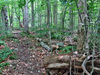 Just before the turn onto the woods road we encountered the first blowdown. A dead tree had fallen across the trail taking a few other smaller live ones with it. I put down my pack and got out the camera to take my "before" pictures. I grabbed the saw and began to make cuts and pull away what I removed. Cindy could not help so I had to cut and swamp. Soon I had eliminated all but the dead tree across the trail. I used the saw to make a cut at the upper end of the trunk where it was rather thin. The cut went faster than I expected although the dead wood was hard. As I was preparing to make another cut, Sheila alerted and we could see a couple coming toward us with their dog. We put Sheila on her leash and their dog was also restrained. As they passed by they greeted us and said "This is a nice day for a hike." I thought it was a nice day for a hike but it was also 'a nice day to work doing trail maintenance to make hiking more enjoyable for others!' I decided to cut the trunk off the trail near the butt end with the ax. I made my first strike and found the wood was very hard. Fortunately, I was able to make the cut all the way through the log. I tried pivoting Te section uphill but that was not working. I was able to pull the section toward one side of the trail and then swing the other end around so that the section ended up off the trail and parallel to it. I was satisfied with the result and took some after shots. It had taken 30 minutes to do the work. I packed up and we continued on the trail to the woods road toward Hodge Pond. We turned right at the end of the trail and started up the road. We passed the large spruce where Cindy and I had cut a tunnel. The DEC crew had been through and removed the tree. Not too far after this was a single small diameter trunk across the trail. I almost removed it without taking picture but I gave in mad took some shots. I cut the top end of the trunk off the trail with the saw. I grabbed the ax and cut again off the trail on the other side. The section was very long but of small diameter so I was able to pivot it off the trail. I took my 'after' pictures and then we got back underway. As we hiked up the road, the insects, especially the mosquitoes began to swarm. We stopped and applied insect repellent to our skin and clothes. When we got back in motion, the insects seemed to be less aggressive.
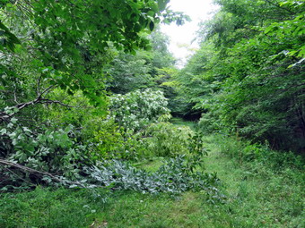 We walked a few more minutes up the trail and ran into a third blowdown. This tree had broken off high on the right side of the trail and was draped across it. I took my before pictures and then got to work. I used the saw to cut as high as I could on the right side of the trail. The cut went quickly and the entire tree was now on the ground. I stayed with the saw and began to cut off branches. I have found that removing branches takes only a few seconds and makes it easier to handle the blowdowns. I kept cutting and stacking the branches until only the main trunk was left. I cut the main trunk and dragged the pieces off the trail. After taking my after shots, I packed up and we continued toward Hodge Pond. At 1 miles we passed by the path to the clearing to the right of the trail. On this day I was most interested in doing as much work as possible. We descended a little bit and then began a gentle climb to the junction with the Big Rock Trail. Along the way I took the time to cut two logs that were sticking out into the trail. When we reached the trail junction, we continued straight ahead on the Flynn Trail. I had not surveyed the rest of the trail after this point but a hiker had told me there were blowdowns near Hodge Pond. I had been a little tired climbing the Flynn Trail but was rejuvenated as the trail flattened out. We passed through the gate that separates state land from land owned by the Beaverkill Land Trust. When the trail split we stayed left to follow the Flynn Trail.
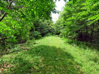 Almost immediately we came to another blowdown which was the largest of the day. A large tree had fallen in the woods taking other with it. Some of those other trees and fallen into the trail. Although the trail was not completely blocked, the blowdown needed to be removed. I took my camera out of the pack and snapped some 'before' shots from different angles. I put the camera away and began to evaluate the blowdown and make a plan. There was one tree that was hanging over the trail which worried me but a few pull on it convinced me it was not coming down soon. I tried to penetrate the blowdown but it repelled me. I took the saw and went around the other side. I found a place to begin to cut braces so I made a few cuts and the dragged what I had cut out of the pile. I found a spot where I could drag the branches and make a pile well off the trail. I continued to cut and stack and, at times, it did not seem the blowdown was getting and smaller. I switched to the other side of the blowdown and made some more cuts. As usually happens when I am away, my phone signaled that we had an ambulance call. I knew I was too far out to respond but knew there were others who could go on the call. At this point, a couple approached us coming up the Flynn Trail and heading toward Hodge Pond. The couple greeted us but did not acknowledge the work we were doing. I kept cutting and dragging away what I had cut until the blowdown was cleared as wide as the road. I took some after shots. It had taken almost an hour to do the work. I knew there was at least one more blowdown near Hodge Pond but Cindy indicated she would not be able to make it there and back! We turned around and started back at 12:35 PM. The trip back was about 2.1 miles but I knew we could make the trip quickly as it was all flat or downhill. We set a fast pace and did not stop at all. We passed through the gate and then continued straight ahead at the trail junction. From there we walked downhill on the wide woods road. We turned left on the trail just after the first gate to avoid the private property around the cabin. We were back at the car at 1:20 PM after hiking 4.1 miles in 3 hours and 50 minutes. Our total stopped time was 1 hour and 45 minutes to do the work. The elevation gain was 640 feet. As we left the parking area, the temperature was 78 degrees but the humidity made it feel warmer. The 2.1 mile trip back took only 45 minutes which was an average of 2.8 mph!
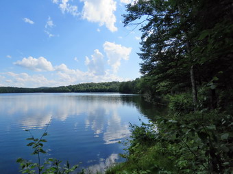
![]()
![]()
![]()
![]()
![]() On Thursday, July 14th I wanted to get out for a longer hike after taking some shorter hikes the previous few says. I had an overnight ambulance call so I tried to sleep in but another morning call ruined that idea. When I got home, I did some chores and waited for Cindy as she said she might hike with me. When she arrived home, it was obvious she did NT want to hike with me so I began to make alternate plans. I decided to get ready and go to the Frick Pond area to hike the Flynn Trail and the snowmobile trail to Mongaup Pond. From Mongaup Pond I would walk the roads back to the car with the possibility of lengthening the hike by going around the pond. A visit to the falls on the outlet creek was also a possibility. I began to get ready at 1:30 PM when the temperature was 78 degrees on the back porch. Sheila was watching me very closely as I got dressed. I put on my White Sierra long-sleeved crew top without a baselayer to protect me from the biting insects often present at Frick Pond. I put on a pair of RailRiders hiking pants which are expensive but last along time and have features like deep pockets and a generous cut which I really like. I decided to put on my Keen Cascade hiking boots which fit well and are newer than what I have been wearing. I added a new pair of Fulton insoles which are cork based and seem to be molding nicely to my feet. I decided to take my Leki poles with external locks as the internal twist locks sometimes fail. I added my OR floppy hat which I have decided shields me from the sun and allows me to spray some insect repellant on it rather than on me. I put my gear in the back and Sheila in the backseat and headed out the DeBruce Road just before 2:00 PM. After 6 miles, at Mongaup Pond Road, I turned left and continued to follow the road bearing left onto Beech Mountain Road at the fork. When we arrived in the parking area there was one car parked in the large lot. I pulled into the smaller lot with Sheila was acting as if she hadn't hiked in a month as she ran around and headed for the trail. The temperature was 76 degrees and the skies were blue with white clouds with a reasonable humidity. Every now and then the clouds would cover the sun making it seem like the weather was burning but that did not last long. I got my gear ready to go and set my GPS unit. We headed across the road to get on the Flynn Trail at 2:15 PM.
On Thursday, July 14th I wanted to get out for a longer hike after taking some shorter hikes the previous few says. I had an overnight ambulance call so I tried to sleep in but another morning call ruined that idea. When I got home, I did some chores and waited for Cindy as she said she might hike with me. When she arrived home, it was obvious she did NT want to hike with me so I began to make alternate plans. I decided to get ready and go to the Frick Pond area to hike the Flynn Trail and the snowmobile trail to Mongaup Pond. From Mongaup Pond I would walk the roads back to the car with the possibility of lengthening the hike by going around the pond. A visit to the falls on the outlet creek was also a possibility. I began to get ready at 1:30 PM when the temperature was 78 degrees on the back porch. Sheila was watching me very closely as I got dressed. I put on my White Sierra long-sleeved crew top without a baselayer to protect me from the biting insects often present at Frick Pond. I put on a pair of RailRiders hiking pants which are expensive but last along time and have features like deep pockets and a generous cut which I really like. I decided to put on my Keen Cascade hiking boots which fit well and are newer than what I have been wearing. I added a new pair of Fulton insoles which are cork based and seem to be molding nicely to my feet. I decided to take my Leki poles with external locks as the internal twist locks sometimes fail. I added my OR floppy hat which I have decided shields me from the sun and allows me to spray some insect repellant on it rather than on me. I put my gear in the back and Sheila in the backseat and headed out the DeBruce Road just before 2:00 PM. After 6 miles, at Mongaup Pond Road, I turned left and continued to follow the road bearing left onto Beech Mountain Road at the fork. When we arrived in the parking area there was one car parked in the large lot. I pulled into the smaller lot with Sheila was acting as if she hadn't hiked in a month as she ran around and headed for the trail. The temperature was 76 degrees and the skies were blue with white clouds with a reasonable humidity. Every now and then the clouds would cover the sun making it seem like the weather was burning but that did not last long. I got my gear ready to go and set my GPS unit. We headed across the road to get on the Flynn Trail at 2:15 PM.
 The Flynn Trail was damp from the rains the night before and it was obvious that there had been more erosion of the beginning of the trail from the heavy rains. The first blowdown we ran into was a medium sized tree across the trail in the woods. I knew this would be an easy one to cut in the near future. At the end of the trail, we turned right on the woods road that was once the Beech Mountain Road to the Beech Mountain Boy Scout Camp. I once again noticed that although the Flynn Trail ascends to the junction with the Big Rock trail, it seemed much easier now that I have recently been hiking more. We passed the large spruce where Cindy and I had cut a tunnel. The DEC crew had been through and removed the tree. There were some branches encroaching on the trail and two more small blowdowns. At a mile we hit a high point and passed by the path on the right to a large clearing. The skies were still blue with plenty of sun. Just after this point, Sheila alerted and I saw a woman hiking toward us. I grabbed Sheila as the woman stopped for a moment to talk. She had hiked around Hodge Pond and said there were some more blowdowns across the trail in that area. The insects started to gather as I was stopped so I took the time to spray some insect repellant on me. It didn't seem long at all until we were approaching the junction with the Big Rock Trail at 1.7 miles into the hike. By the time we were at the junction, we had already gained 600 feet and only had a little more elevation gain until we would start downhill. The trip up the Flynn Trail had only taken 50 minutes even though I had been removing branches and had stopped to talk with the other hiker. We turned right at the junction on the snowmobile trail and climbed another 120 feet to the highest point on the hike at a little over 1.9 miles. After hitting the high point, most of the rest of the hike was downhill. The Flynn Trail heads directly north from the trailhead but the snowmobile trail wanders first east, then south, the east, then north before finally heading southeast and south toward Mongaup Pond. As we descended from the high point we found evidence that there had been a stream of water flowing down most of the trail. The trail has become highly eroded and difficult to hike because of all the exposed rocks. Many of the rocks were covered with a thin film of water making them very slippery. Sheila was wandering off trail and then returning to us never getting very far away.
 We encountered another blowdown which I walked around. After that there were more blowdowns of various sizes than I could count. When I was looking at the radar the night efface it seemed that the Frick Pond area was getting more of the storm than Livingston Manor. The mess on the trail that extended more than half a mile seemed to indicate that. The snowmobile club will clear the blowdowns but not until the late fall. I thought about notifying the local ranger or doing the work myself. At 3.1 miles we followed the trail as it turned southeast and then east still descending toward the pond. We finally hit a woods road and the trail leveled out. Just before getting to the roads that run through the campground we passed by a swamp on the left. Even though it had rained there were no small streams across the trail as there usually are. When we got to the campground roads, I put Sheila on her leash as I expected the campgrounds to be packed. We turned right and walked out to the main loop road. We turned right and headed south on the loop road. After a short walk, we turned left and walked over to a bench near the shores of the pond. Sheila declined to take a dip in the pond but did get a drink. I took a look at the scene and decided it was interesting enough to take pictures. The sky was blue with me interesting clouds. We walked out to the loop road and continued heading south. After walking a little more than half a mile, we came to the observation deck which had been under construction but now was completed. I stopped again to take a few shots and then we continued on the loop road out to the entrance of the campground. We walked out the access road to begin the walk back to the car. The access road is easy to walk but is always longer than I remember except on this day when it seemed short. From the booth at the campground entrance to the intersection with Beech Mountain Road it is only 1.1 miles and on this day it seemed shorter as we pushed the pace. In fact, I remember leaving the campground and a few cars along the way but the rest is a blur. At the intersection, I considered walking down to the falls but I wanted to get home for supper. We turned right and walked up the hill for .3 miles to the car. One car that had been in the lot was gone but another car had pulled in next to mine. It was 5:10 PM and we had spent 2 hours 55 minutes hiking 6.5 miles for an overall average speed of 2.3 mph and a total climb of 960 feet. The temperature was 74 degrees and as I drove home.
![]()
![]()
![]()
![]()
![]() On Tuesday, July 12th I wanted to get out for hike with my Granddaughter Brynn who was at our house for the day. Around noon I asked Cindy and Brynn if they would like to hike the Parksville Rail Trail. The walk is less than 3 miles round trip and almost completely flat. It does have a few limited views and a nice waterfall. It was 82 degrees when we started to get ready and the skies were blue with some nice white clouds. Sheila's expectant gaze and sharp bark "encouraged" me to continue the hiking plans. It was warm and I did not expected a lot of water or mud on the trail so I dressed accordingly. I put on a NYNJTC cotton T-shirt without a baselayer as it was so warm. I put on a pair of RailRiders hiking pants which are expensive but last a long time and have features like deep pockets and a generous cut which I really like. I decided to put on my Keen Cascade hiking boots which fit well and are newer than what I have been wearing. I added a new pair of Fulton insoles which are cork based and seem to be molding nicely to my feet. I decided to take my Leki poles with external locks as the internal twist locks sometimes fail. I added my OR floppy hat which I have decided shields me from the sun and allows me to spray some insect repellant on it rather than on me. At 12:15 PM we put our gear in the car and Sheila in the back seat with Brynn. I headed out Old Route 17 across the Flats and then took Old Route 17 and Service Road to the point where they meet Fox Mountain Road. Just after this intersection is the western parking area for the rail trail. The parking lot was empty.
On Tuesday, July 12th I wanted to get out for hike with my Granddaughter Brynn who was at our house for the day. Around noon I asked Cindy and Brynn if they would like to hike the Parksville Rail Trail. The walk is less than 3 miles round trip and almost completely flat. It does have a few limited views and a nice waterfall. It was 82 degrees when we started to get ready and the skies were blue with some nice white clouds. Sheila's expectant gaze and sharp bark "encouraged" me to continue the hiking plans. It was warm and I did not expected a lot of water or mud on the trail so I dressed accordingly. I put on a NYNJTC cotton T-shirt without a baselayer as it was so warm. I put on a pair of RailRiders hiking pants which are expensive but last a long time and have features like deep pockets and a generous cut which I really like. I decided to put on my Keen Cascade hiking boots which fit well and are newer than what I have been wearing. I added a new pair of Fulton insoles which are cork based and seem to be molding nicely to my feet. I decided to take my Leki poles with external locks as the internal twist locks sometimes fail. I added my OR floppy hat which I have decided shields me from the sun and allows me to spray some insect repellant on it rather than on me. At 12:15 PM we put our gear in the car and Sheila in the back seat with Brynn. I headed out Old Route 17 across the Flats and then took Old Route 17 and Service Road to the point where they meet Fox Mountain Road. Just after this intersection is the western parking area for the rail trail. The parking lot was empty.
 As we started out on the trail the sun was beating down and I felt very hot. When we entered the shade of the trees, it immediately seemed a little cooler. The stream volume looked a little lower than average. I hoped the falls would have enough water to be interesting. Sheila was taking her own route and following her nose. Just after entering the woods we came to an area that is often but on this day it was barely damp. We found that the trail was very dry with inky a few damp places here and there. We were soon at the wooden walkways where I stopped, put my pack down and took out the camera. I took some shots of the stream below with nice blue skies and white clouds. I put away the camera and picked up my pack to continue over the walkways. The wooden surface was dey but had a coating of dried mud. The problem is that a rock slide has blocked the culvert under the small bridge causing water, mud and stones to be diverted over the walkway. Unblocking the culvert and covering the walkways with some screening would help. There was some water running down the hill and over the area between the bridge and the walkways. We continued on the trail with me talking to Brynn as we walked. Brynn is six years old but knows so much and is willing to share what she knows with you!
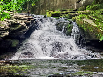 We continued on the trail and came to the falls. Brynn was excited as she could hear the falls before we could see them. I wanted to get down to the streambed so that I could take pictures from in front of the falls. It was relatively easy to work my way down the bank to the streambed. I got out the camera and took some shots down stream and the turned my attention to the falls. The water level was low but the falls were still interesting. I took numerous pictures of the falls and the area in front. The water was very clear and the red rock beneath the water really showed through. Sheila, of course, decided to jump in and cool off so I took some shots of her. When I was done, we worked our way back up the bank. I took a few pictures of the falls from the edge of the trail where I had a good view. I brought Brynn over so that she could safely view the falls below. We continued on the trail to a bench where a path leads down to the stream. I left my pack on the bench and took the camera with me to the stream's edge. I took shots upstream and downstream with some close-ups right in front of me. I repositioned myself and took some more pictures downstream toward the falls. I finished and walked back to the bench to stow the camera. From the falls to the other end of the trail there were a few areas that can be wet but they had all dried out. We met a couple with two young dogs so I put Sheila on her leash as we passed. The two dogs started to bark loudly but we were soon passed them. I left Sheila on her leash which proved to be a good idea because another couple approached with their dog. This canine was much better behaved and we passed by without incident. We set a quick pace for the rest of the hike to the Parksville end of the trail. Just after the gate at that end, we stopped to read the sign which outlined the milk that the O&W transported. The sign also mentioned the large number of hotels that had been in the area. We turned around and headed back to the car. We continued back to the car without stopping and passed by both the couples with their dogs. The two younger dogs that had barked last time were quite as we passed by them. We were back at the car at 2:00 PM after hiking 2.8 miles in 1 hour and 25 minutes including the stopped time for pictures. There is virtually no elevation gain on the hike except the short trips down to the streambed.
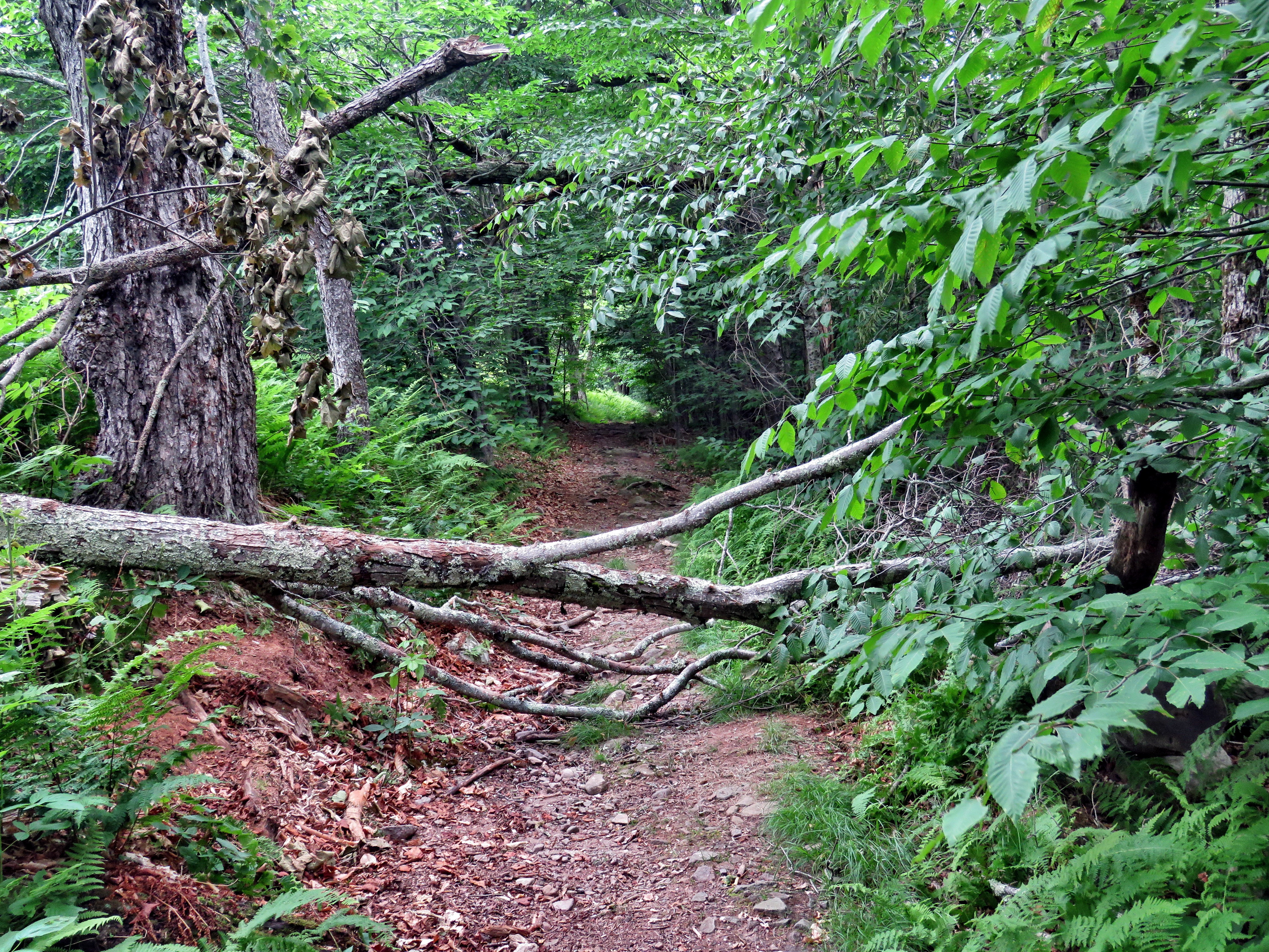
![]() On Monday, July 11th, I wanted to go to Balsam Lake Mountain to remove two blowdowns across the trail that several hikers had reported. Most maintainers do not want to cut these larger blowdowns but I like to use my saws and axes. I was not sure of the exact location of these blowdowns but they seemed to be between the Beaverkill Road trailhead and the first trail junction. I asked Cindy if she would like to go and she said "Yes". I thought that after we cleared the blowdowns we could get in the short hike to Vly Pond. At 10:15 AM we started to get ready with the temperature at 82 degrees on the back porch. The skies were a bright blue with billowing white clouds and the forecast had no hint of rain.Sheila was pretty excited as I started to get ready as we had not hiked for two days. It was warm enough that I decided to just put on a short-sleeved NYNJTC cotton shirt. I wore my Railriders hiking pants which are expensive but last along time and have features like deep pockets and a generous cut which I really like. The pants have Velcro closures at the ankles. I decided to wear my newer Keen Cascade hiking boots with a new pair of Fulton cork insoles. I felt I need more foot support as I was having some pain especially in my Achilles' Tendons. I decided to forego my Leki external lock poles as I would be carrying at least an ax. For maintenance equipment I packed my Silky Sugowaza saw, Silky Kanaraboy saw, and two Oregon splitting wedges. I brought along my Fiskars pack axe but left the heavier Council Tools felling ax at home. I put all our gear in the car and Sheila jumped into the backseat with some enthusiasm. I headed out the driveway and turned north toward Roscoe on Old Rt 17. I turned right on the Beaverkill Road and continued north toward Lew Beach and Turnwood. The Beaverkill Falls were barely flowing as we had not had any significant rain. The road conditions were pretty good even when the pavement ended. I laughed when I saw the "Rough Road" sign! The town of Hardenburgh had been working on the dirt road by smoothing it with a scraper and widening it slightly. Toward the end the road becomes very narrow and I was glad I did not meet any cars. We arrived at the parking area at 12:10 PM and found two cars parked in the lot and two parked, for some reason, in the snowplow turnaround. One of the cars in the lot was parked along the edge of the lot instead of pulling into a parking space! I did not bother to set my GPS as we were going to do more maintenance than hiking. The temperature was 80 degrees when we left the car at 11:15 AM.
On Monday, July 11th, I wanted to go to Balsam Lake Mountain to remove two blowdowns across the trail that several hikers had reported. Most maintainers do not want to cut these larger blowdowns but I like to use my saws and axes. I was not sure of the exact location of these blowdowns but they seemed to be between the Beaverkill Road trailhead and the first trail junction. I asked Cindy if she would like to go and she said "Yes". I thought that after we cleared the blowdowns we could get in the short hike to Vly Pond. At 10:15 AM we started to get ready with the temperature at 82 degrees on the back porch. The skies were a bright blue with billowing white clouds and the forecast had no hint of rain.Sheila was pretty excited as I started to get ready as we had not hiked for two days. It was warm enough that I decided to just put on a short-sleeved NYNJTC cotton shirt. I wore my Railriders hiking pants which are expensive but last along time and have features like deep pockets and a generous cut which I really like. The pants have Velcro closures at the ankles. I decided to wear my newer Keen Cascade hiking boots with a new pair of Fulton cork insoles. I felt I need more foot support as I was having some pain especially in my Achilles' Tendons. I decided to forego my Leki external lock poles as I would be carrying at least an ax. For maintenance equipment I packed my Silky Sugowaza saw, Silky Kanaraboy saw, and two Oregon splitting wedges. I brought along my Fiskars pack axe but left the heavier Council Tools felling ax at home. I put all our gear in the car and Sheila jumped into the backseat with some enthusiasm. I headed out the driveway and turned north toward Roscoe on Old Rt 17. I turned right on the Beaverkill Road and continued north toward Lew Beach and Turnwood. The Beaverkill Falls were barely flowing as we had not had any significant rain. The road conditions were pretty good even when the pavement ended. I laughed when I saw the "Rough Road" sign! The town of Hardenburgh had been working on the dirt road by smoothing it with a scraper and widening it slightly. Toward the end the road becomes very narrow and I was glad I did not meet any cars. We arrived at the parking area at 12:10 PM and found two cars parked in the lot and two parked, for some reason, in the snowplow turnaround. One of the cars in the lot was parked along the edge of the lot instead of pulling into a parking space! I did not bother to set my GPS as we were going to do more maintenance than hiking. The temperature was 80 degrees when we left the car at 11:15 AM.
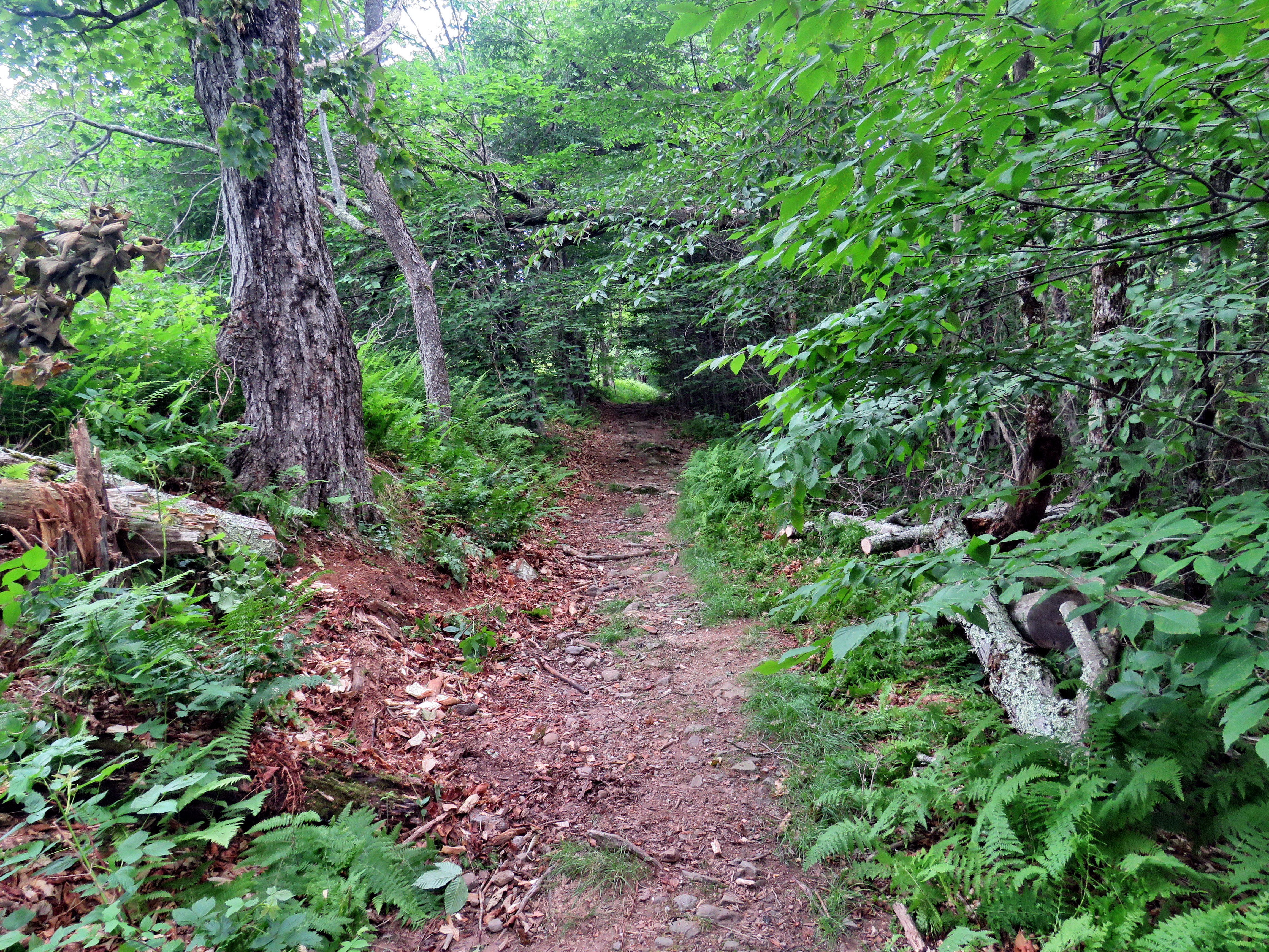 The trail was completely dry but did have a few sticks and pieces of wood here and there and these we removed. We walked toward the register and we looked up and ahead to see a tree across the trail just after the register box. The tree arched over the trail and we would have to wait for it to fall before attempting to remove it. A short distance after the register was a tree down across the trail. The central trunk was about 9 inches in diameter and there were quite a few branches that were tangled with each other and some other trees. I knew I would have to make at least two cuts, one on each side of the trail. I has unsure whether or not I would have to make a third cut to enable us to get the section we removed off the trail. I took a few pictures before starting the work. Before starting to cut, Cindy and I removed all the loose branches including a rather larger one hanging over the work area. I also pushed over a large rotting trunk so that it would not fall on us as we worked. I used the Sugowaza saw to start to cut and remove small branches and then larger ones. I made some cuts off the trail to separate the top of the tree from the main trunk. I also cut another large branch so that only the main trunk remained. I decided to use the Fiskars ax to cut the main trunk off the trail to produce one large section. I hoped we could move that large section without making another cut. After making the first couple of cuts with the ax, I checked to see if it was sharp. The ax was sharp but the wood was cherry and a little harder than I thought. I tried to keep the cut wide but, as usual, it narrowed quickly. I thought I would have to finish with the saw but was able to cut all the way through with the ax. Cindy and I were able to move this large section off the trail. I took my final "after" pictures and the we packed up all the tools and headed on up the trail. It had taken over 45 minutes to do this work.
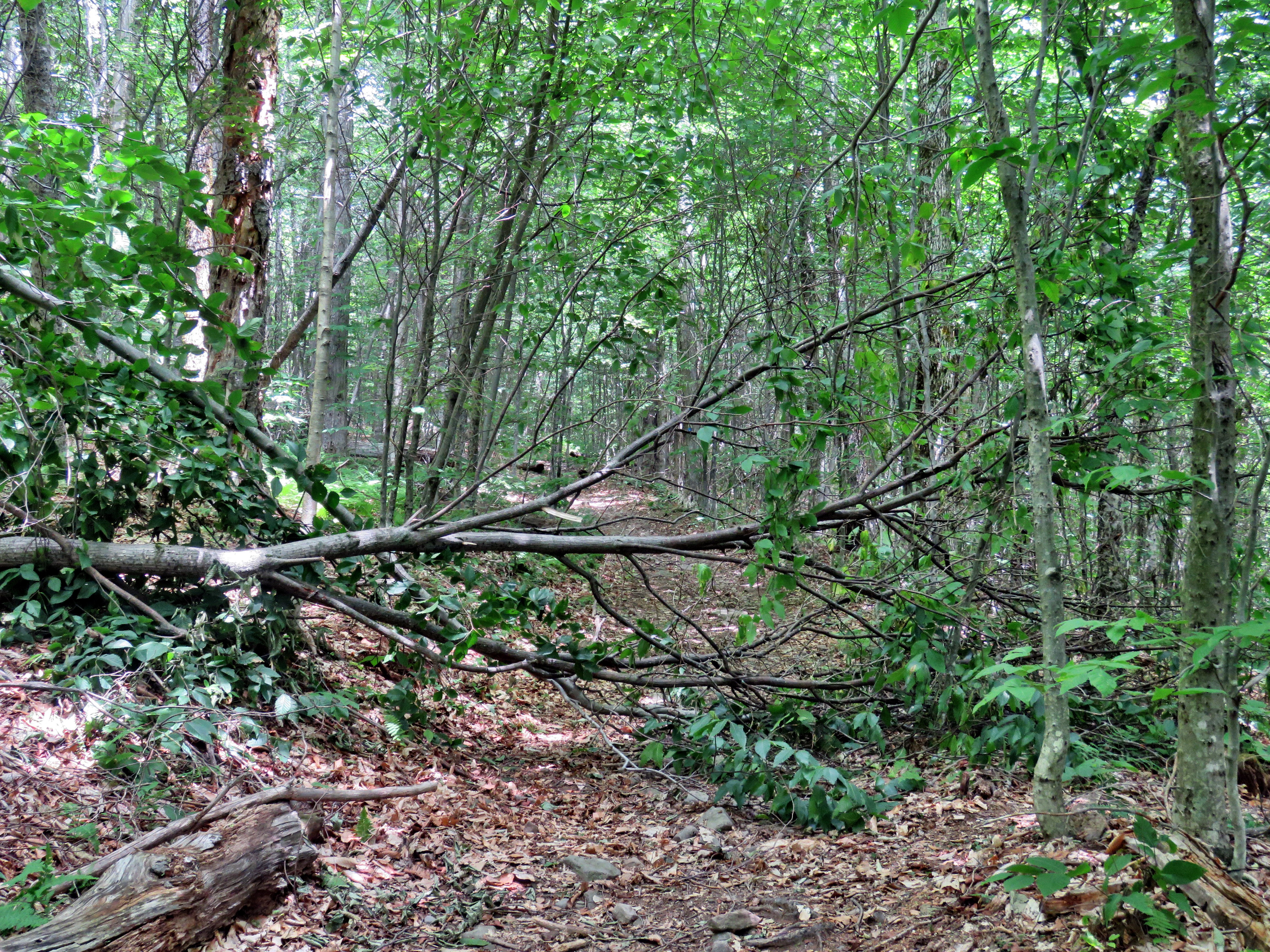 As we walked, we came to several places where branches were sticking out into the trail. We had not brought a pair of loppers but I used the saw to trim these branches as Cindy moved them off the trail. We kept walking but did not see another blowdown. I decided we would go as far as the first trail junction and then turn around. As soon as this decision was made, we saw another blowdown ahead. This was a tall tree with a smaller diameter that had fallen across the trail taking some other small trees with it. I dropped my pack and got out the camera to take some "before" pictures. I grabbed the Sugowaza and began to cut the small branches which Cindy piled off the trail. This wood was much softer and the cuts went quickly. I cut one of the smaller trees and dragged the top away and the turned my attention to the main trunk. I cut the top off and dragged it way before turning my attention to the main trunk. Since it was a small diameter and a less dense wood, I was pretty sure I could make one cut and then move the section off the trail. The trunk was close to the ground so I chose to use the axe to cut through the wood. The work went quickly and I was able to drag and roll the section off the trail. I took my "after" pictures and the we packed up all the tools and headed on up the trail. I decided we would walk as far as the first trail junction before heading back to the car.
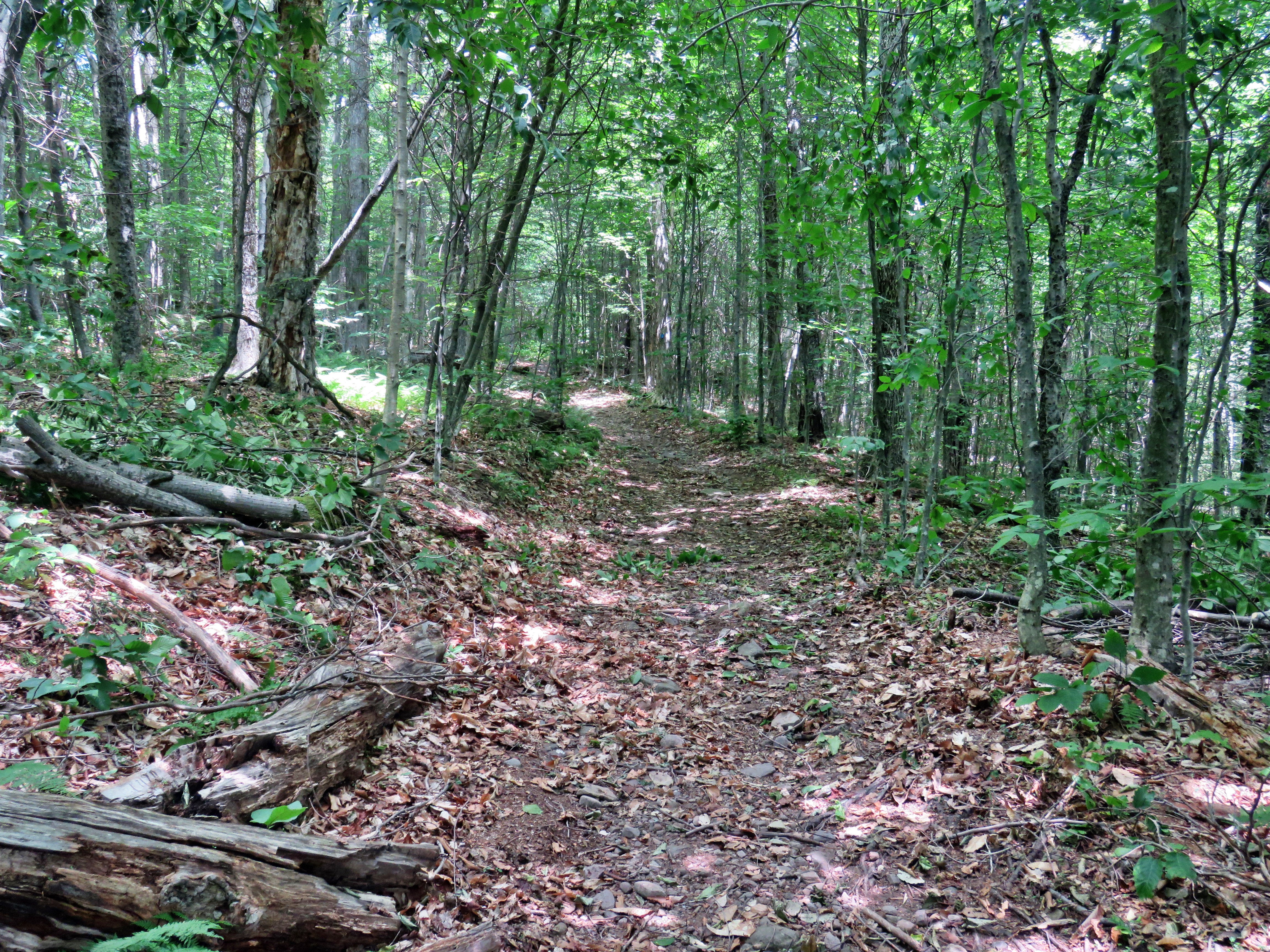 A short distance up the trail we came to two tree that had fallen so that were arching over the trail. One was pretty high above the trail but the other was a head height. I remembered doing a rescue on the Balsam Lake Mountain trail and how these kinds of blowdowns hindered our response as we had to remove them to allow the fire department UTV to pass. I took some shots and then got to work. My plan was to use the ax to cut the tree near the base just off the trail. This, I hoped, would drop the tree low enough to make one cut off the trail near the top. I used the ax to quickly cut through the trunk which dropped just as I planned. I the used the saw to make the cut off the trail on the other side. The center section dropped to the ground and the upper section dropped and pivoted off the trail. It is not often that plans like this work perfectly! I was able to move the center section off the trail and finish the work. I took my "after" pictures and the we packed up all the tools and headed on up the trail toward the trail junction. Sheila and I were moving quickly with Cindy a little behind. When I got to the junction, I turned left and started up the mountain just to check there were no more blowdowns nearby. There were none so I returned to the junction and walked a short distance further on the Dry Brook Ridge trail. I found no more blowdowns so I returned to the junction. We met up with Cindy and started back toward the parking area. This part of the hike is almost all downhill and we set a quick pace. I had been feeling tired but now was feeling refreshed with a sense of accomplishment. Along the way we noticed some more branches hanging in the trail but I decided I would return with a set of loppers at a later date. We were back at the car at 2:00 PM after hiking 2 miles and removing 3 blowdowns in 2 hours and 45 minutes.
![]()
![]()
![]()
![]() On Friday, July 8th I went to my church early in the morning to prepare some material for my first Sunday service there. As an added bonus the telephone company came to fix the phone. The repairman turned out to be one of my students from almost 30 year ago! When I got home at noon, I did some work around the house and hung out to cover ambulance calls. By 5:00 PM I knew I had to take a short walk so I decided to go across the street with Sheila. I didn't even ask Cindy as I knew she would not want to go out as the temperature was still 80 degrees. I am lucky that I have a place so close to hike but it has become very familiar. I have found that even a short hike helps to keep my blood pressure in check and I am hoping I can get my weight down also. Sheila was ready to go as she really likes to hike but she was being a good dog and just whining a little bit. It was warm enough that I decided to just put on a short-sleeved NYNJTC cotton shirt. I wore my Railriders hiking pants which are expensive but last along time and have features like deep pockets and a generous cut which I really like. The pants have Velcro closures at the ankles. I decided to wear my newer Keen Cascade hiking boots with a new pair of Fulton cork insoles. I felt I need more foot support as I was having some pain especially in my Achilles' Tendons. I grabbed a pair of Leki external lock poles I have been using for some time. At 5:00 PM we walked out the door to start the hike. I grabbed Sheila's leash from the car and we walked up the driveway. I thought we could hike our usual two figure 8's which would give us about an hour of exercise.
On Friday, July 8th I went to my church early in the morning to prepare some material for my first Sunday service there. As an added bonus the telephone company came to fix the phone. The repairman turned out to be one of my students from almost 30 year ago! When I got home at noon, I did some work around the house and hung out to cover ambulance calls. By 5:00 PM I knew I had to take a short walk so I decided to go across the street with Sheila. I didn't even ask Cindy as I knew she would not want to go out as the temperature was still 80 degrees. I am lucky that I have a place so close to hike but it has become very familiar. I have found that even a short hike helps to keep my blood pressure in check and I am hoping I can get my weight down also. Sheila was ready to go as she really likes to hike but she was being a good dog and just whining a little bit. It was warm enough that I decided to just put on a short-sleeved NYNJTC cotton shirt. I wore my Railriders hiking pants which are expensive but last along time and have features like deep pockets and a generous cut which I really like. The pants have Velcro closures at the ankles. I decided to wear my newer Keen Cascade hiking boots with a new pair of Fulton cork insoles. I felt I need more foot support as I was having some pain especially in my Achilles' Tendons. I grabbed a pair of Leki external lock poles I have been using for some time. At 5:00 PM we walked out the door to start the hike. I grabbed Sheila's leash from the car and we walked up the driveway. I thought we could hike our usual two figure 8's which would give us about an hour of exercise.
We began the ascent of the steepest hill behind the church and continued directly up the hill to the trailhead. The hill is short but gets the circulation pumping and is the steepest and longest climb on the "trail." My goal was to make it all the way up the hill without stopping. At the top of the hill we turned left and entered the woods to begin our hike. The trailhead was very dry and that continued as we entered the woods. I was not surprised that the trails were so completely dry as we had not had any significant rain for a few days. I followed Sheila as she turned right and started up the woods road which has the gentler approach of the two. There was a slight breeze which cooled us off and Sheila was panting while I was feeling a little dry. We reached the end of the woods road and turned left up the hill on the trail. We continued up the trail to the first trail junction with the upper blue trail. We turned left and walked the yellow trail along the vase of Round Top to the next junction with the blue trail. Here returned right on the blue trail and started to climb the hill. I began to think about my new church and the hiking went very quickly. We turned right on the switchback in the blue trail which I had constructed to ease the erosion on the main trail and allow people to have a slightly more gentle climb. At the end of the switchback we turned right on the main blue trail and passed the white crossover trail on the way to the summit. We crossed over the summit and started down the blue rail on the other side. We again passed the white crossover trail continuing on to the yellow trail. We turned right and again walked along the yellow trail to the next junction with the blue trail. This time we turned left and headed down toward the lookout. The trail bed was clear but some ferns were beginning to encroach on the trail. The forest here was a sea of ferns gently waving in the breeze. When we reached the viewpoint, I noticed that the view was almost completely blocked by the trees. I made a note to contact the town supervisor to see if we could work something out. We followed the yellow trail as it turned left and descended to the first trail junction. We had completed a figure 8 and were ready to start another.
We immediately turned around and started back up the short but steep hill to the lookout. The trip back up the hill to the lookout was pretty easy which, again, surprised me because I am not yet in very good shape. At the top of the hill we turned right to follow the yellow trail to the first junction with the blue trail. We turned right to follow the yellow trail around the base of Round Top. At the next junction with the blue trail, we turned left and started uphill toward the summit. We bypassed the white crossover the trail and continued to the summit. I did think the climb was a little steep but we did not slow down. We continued over the summit and darted down the other side of the hill. We ignored the white crossover trail but turned left on the switchback in the blue trail. We followed the switchback out and back to the main trail and turned right to walk down to the yellow trail. We turned left and followed the yellow trail along the base of Round Top. At the next junction with the bile trail, we turned right on the yellow trail and followed it downhill to the wood road. We walked down the woods road to the first trail junction. This time we turned left and walked out to the trailhead. We turned right and walked down the hill to the church parking lot. We crossed the parking lot and Rock Avenue to get to our driveway. It was 6:05 PM and we had hiked just around 2 miles in an hour and 5 minutes.
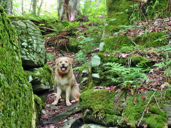
![]()
![]()
![]()
![]()
![]() On Wednesday, July 6th I wanted to get out for a longer hike not too far from home. The forecast was for temperatures in the mid to high 80's with high humidity so I knew Cindy would not be interested in going. I decided to go to Big Pond for a hike to Little Pond and back. I had several possibilities to complete this loop including staying on the trails, walking back on the roads and making a side trip to Cabot Mountain. The temperature was in the high 70's in the morning but we knew it would get warmer in the afternoon. I started to get ready at 11:30 AM by putting on my White Sierra long-sleeved crew top without a baselayer as it was so warm. a short-sleeved base layer. I put on a pair of RailRiders hiking pants which are expensive but last a long time and have features like deep pockets and a generous cut which I really like. I decided to put on my Keen Cascade hiking boots which fit well and are newer than what I have been wearing. I added a new pair of Fulton insoles which are cork based and seem to be molding nicely to my feet. I decided to take my Leki poles with external locks as the internal twist locks sometimes fail. I added my OR floppy hat which I have decided shields me from the sun and allows me to spray some insect repellant on it rather than on me. I slipped by Silky Sugowaza saw in my pack to ate care of small brush along the way. I put my gear in the back and Sheila in the backseat and pulled out of Livingston Manor at 11:45 AM. I drove toward Roscoe on Old Route 17 and turned right on Beaverkill Road after 1.3 miles. I continued north on Beaverkill Road for 10.8 miles passing through Lew Beach. As the Beaverkill Road turned right, I turned left onto Barkaboom Road and drove .8 miles to the parking area for Big Pond on the right. There were two vehicles parked in the lot. I got ready to hike by setting my GPS. The temperature was 81 degrees and the humidity was palpable.
On Wednesday, July 6th I wanted to get out for a longer hike not too far from home. The forecast was for temperatures in the mid to high 80's with high humidity so I knew Cindy would not be interested in going. I decided to go to Big Pond for a hike to Little Pond and back. I had several possibilities to complete this loop including staying on the trails, walking back on the roads and making a side trip to Cabot Mountain. The temperature was in the high 70's in the morning but we knew it would get warmer in the afternoon. I started to get ready at 11:30 AM by putting on my White Sierra long-sleeved crew top without a baselayer as it was so warm. a short-sleeved base layer. I put on a pair of RailRiders hiking pants which are expensive but last a long time and have features like deep pockets and a generous cut which I really like. I decided to put on my Keen Cascade hiking boots which fit well and are newer than what I have been wearing. I added a new pair of Fulton insoles which are cork based and seem to be molding nicely to my feet. I decided to take my Leki poles with external locks as the internal twist locks sometimes fail. I added my OR floppy hat which I have decided shields me from the sun and allows me to spray some insect repellant on it rather than on me. I slipped by Silky Sugowaza saw in my pack to ate care of small brush along the way. I put my gear in the back and Sheila in the backseat and pulled out of Livingston Manor at 11:45 AM. I drove toward Roscoe on Old Route 17 and turned right on Beaverkill Road after 1.3 miles. I continued north on Beaverkill Road for 10.8 miles passing through Lew Beach. As the Beaverkill Road turned right, I turned left onto Barkaboom Road and drove .8 miles to the parking area for Big Pond on the right. There were two vehicles parked in the lot. I got ready to hike by setting my GPS. The temperature was 81 degrees and the humidity was palpable.
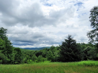 We crossed the road at 12:10 PM to begin our hike up Touch-Me-Not Mountain on the Touch-Me-Not Trail which is part of the Finger Lakes Trail. The first part of the trail is an old woods road, and it is pretty easy to follow. I let Sheila off her leash as we walked up the first hill passing the trail register. The trail was completely dry without any dampness or mud. I maintain the section of trail from Alder Lake to Beech Hill Road so I immediately began to remove sticks, rocks, branches and a few small tree trunks from the trail. I noticed there were little pieces of garbage on the trail including a lot of broken glass. This is a phenomenon that both puzzles and annoys me! The first mile of the trail gains about 775 feet with an average grade of 15%. Some places are almost flat which means there are a few steeper places. I began to notice that the blazing of the trail could be better. Volunteers used to be able to put up trail markers, but the DEC decided that a forester must now do this. Most of the time I just follow Sheila who seems to be able to find the right direction no matter what. It was obvious in several areas that there had been significant rain at some point as the trail was badly eroded. The further we walked the more nettles I began to see. I am loathe to make a trip with my Stihl string trimmer which does a great job of eliminating this problem but is a beast to carry. Along the way there were three or four large blowdowns. Some were on the ground and easy to step over but at least one blocked the trail at just the wrong height. I cut a few small trees that were across the trail. In a few places, the trail traveled along the side of the hill, and this made for some tricky footing. Despite the incline and the heat, we made good time and at 1:10 PM we had hiked 1.1 miles to the highest point on the trail on the shoulder of Touch-Me-Not Mountain. After a slight descent, we came to a large blowdown that had once blocked the trail. A good piece of the trunk had been cut away to provide an easy path. We walked down the hill to the next trail junction and turned right on the yellow loop trail around Little Pond.
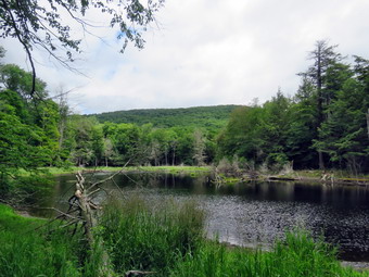 The loop trail is very popular with campers during the season and the trail bed was a little more obvious. At one point the trail passed between two large boulders forming a sort of rock cut. I asked Sheila to pose and I took several shots of her between the boulders. I also took some shots of the rock ledges but the sun was very bright which limited the possibilities. We continued along the trail descending another rocky area to find a large tree across the trail. It was obvious hikers had been walking to the left around the butt end of the tree which is what we did. At 1.6 miles we had finally arrived at the cutoff to Cabot Mountain. I thought about summiting Cabot or at least going as far as the field of nettles to scope them out. In the end I decided not to do this as it was very warm and humid and the skies were getting darker with a definite wind. We continued our hike by bearing left to stay on the loop trail. There were several blowdowns in this area that would require tools to remove. I fought about removing them but Te trail is supposed to be DEC maintained so I decided to give the ranger for the area a call before doing any work. After a short walk, we came to a large, flat stone on the right side of the trail. I remembered taking pictures of our grand children there. As we passed by, I realized how much I missed my grandchildren. At 1.8 miles we arrived in the clearing that acts as a viewpoint. It is hard to see Little Pond from this lookout since the trees have grown up. This is a place that holds many memories as we hiked the loop many times when I was younger. We stopped, and I got out the camera to take pictures of the hills and the blue sky. The scene kept changing as the light played off the hills in different ways and reflected off the haze. The clouds were getting darker and it certainly looked like a storm was brewing! I packed up, and we continued the hike passing the small foundation of a long-forgotten homestead cabin. I noticed the pond to the right of the trail but decided not to inspect it on this trip. The main trail which is often covered in water from the outlet of the pond was absolutely dry. Ahead of us on the trail was one of the biggest blowdowns I had seen in some time. A huge tree with three different trunks had completely blocked the trail. The DEC sawyers had been through and cleared a path through this monster. The main trail soon turned left off the woods road.
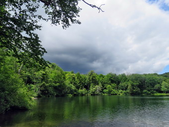 The trail headed down through the forest and was bone dry and dusty but extremely eroded making the walk difficult. We walked downhill encountering another large blowdown that blocked the trail near a large beaver pond but had been cut. We stopped at the shore of the beaver pond to take some pictures. The skies were dark and the scene was bleaker than usual. I picked up and as we walked the short distance to the loop trail around Little Pond I could see that there was almost no water in the inlet stream. At the pond, we turned right to walk around the western shore of Little Pond. As we walked along the shore to the boat launch area, we could see Touch-Me-Not Mountain where we had been a short time ago. We stopped at the boat launch area, and I took some photos of Touch-Me-Not Mountain and the pond. Directly across from us there was blue sky and sun over Touch-Me-Not Mountain. To the left over Cabot Mountain the sky was dark with billowing gray clouds. Sheila decided to go wading. I took a pictures of her swimming before we continued the hike. As we walked along the road, several of the campsites were occupied and there were a few people on the beach. We turned left on the path to the bridge and crossed the outlet end of the pond. I dropped my pack to take a few pictures before leaving the Little Pond area. I considered sitting in the aviation just in case it rained but the skies over us remained blue. The parking area had a half dozen cars in the lot. We now had a choice to return on the roads or hike back up Touch-Me-Not Mountain on the Campground Trail. I had planned the trail hike but thought better of it and decided to leave it for another day. I decided we would walk back to Big Pond using the access road and Barkaboom Road. We walked over to the parking area and turned right to walk out the access road. We walked out to the gatehouse and I saw that there was an attendant there. We started down the hill toward Barkaboom Road with Sheila on her leash. She walks very well on her leash although her pace is a little fast for me! The walk was very peaceful as there were only a few cars going to the campgrounds. We walked a little less than a mile down to Barkaboom Road and turned left to hike up the road back to Big Pond. The hike back to the car was about .6 miles and it is all uphill so I appreciated Sheila's pull. The stream beside the road had some water but the level was low. We walked up the hill and back to the car in the parking area. I put Sheila in the car and walked down to the shore of Big Pond to take some pictures. Getting pictures of the pond without the people proved challenging. I walked back up to the car and turned on the air conditioning. We were back at the car at 2:55 PM having hiked 4.8 miles in 2 hours and 40 minutes. The elevation gain was about 1000 feet.
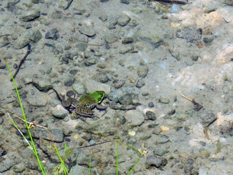
![]()
![]()
![]()
![]()
![]() On Friday, July 1st I wanted to clear a large blowdown on the Flynn trail northwest of Hodge Pond. I wasn't sure I could get it completed with hand tools as some of the trunks were pretty large. I knew that my grandson Bryce would be at the house around 9:00 AM and that he would be willing to go. Bryce is now 11 years old but is tall and strong which was just what I needed. Bryce arrived a little after 9:00 AM and we completed some tasks around the house before starting to get ready at 9:45 AM. There were blue skies and white clouds but the temperature was already 80 degrees which is not ideal for a work day. I put on my White Sierra long-sleeved crew top without a baselayer as it was so warm. a short-sleeved base layer. I put on a pair of RailRiders hiking pants which are expensive but last a long time and have features like deep pockets and a generous cut which I really like. I decided to put on my Keen Cascade hiking boots which fit well and are newer than what I have been wearing. I added a new pair of Fulton insoles which are cork based and seem to be molding nicely to my feet. I decided to take my Leki poles with external locks as the internal twist locks sometimes fail. I knew Bryce could carry some of the equipment so that I could use my poles as I prefer. I added my OR floppy hat which I have decided shields me from the sun and allows me to spray some insect repellant on it rather than on me. I put my Silky Sugowaza saw and two felling wedges in my pack and gave Bryce the Fiskars pack ax and Silky Katana Boy saw. We put our gear in the car and Sheila in the back seat at 10:10 AM. I drove out the Debruce Road about 6 miles with Bryce in the passenger's seat. I turned left onto Mongaup Pond Road and continued to where the road split. At the split, I turned left onto Beech Mountain Road, and drove to the parking areas at the Frick Pond. There were a few cars parked in both parking lots as I pulled into the smaller area. I showed Bryce that some of the trees around the parking areas had been cut but that most of them were rotten. The thermometer read 80 degrees as I set my GPS but the sun was our and it felt warmer. I hoped that being under the trees would be cooler! There did not seem too be many insects so we skipped the repellant. At 10:30 AM we started our hike by crossing the road to start out on the Flynn Trail. There were a few trees that had been cut but they were not in the trail. At the end of the trail through the woods we turned right on the woods road that was once the extension of Beech Mountain Road. I had intended to hike at a relaxed pace but Bryce was leading the way and he wasn't wasting any time! The trail was mostly dry but there were a few damp areas. It was obvious that a pickup truck had been driven up trail and I pointed this out to Bryce. The Flynn Trail ascends 1.7 miles to the Big Rock Trail junction gaining 600 feet. We approached the large hemlock tree across the trail where Cindy and I had cut a "tunnel" through the branches. I showed Bryce how it had been completely cut away. I explained to him that this was agood thing as it allowed access for emergency vehicles. At 1.1 miles, we came to the area where there is a clearing to the right of the trail. I decided that we would bypass a visit to this area and continued on the main trail.
On Friday, July 1st I wanted to clear a large blowdown on the Flynn trail northwest of Hodge Pond. I wasn't sure I could get it completed with hand tools as some of the trunks were pretty large. I knew that my grandson Bryce would be at the house around 9:00 AM and that he would be willing to go. Bryce is now 11 years old but is tall and strong which was just what I needed. Bryce arrived a little after 9:00 AM and we completed some tasks around the house before starting to get ready at 9:45 AM. There were blue skies and white clouds but the temperature was already 80 degrees which is not ideal for a work day. I put on my White Sierra long-sleeved crew top without a baselayer as it was so warm. a short-sleeved base layer. I put on a pair of RailRiders hiking pants which are expensive but last a long time and have features like deep pockets and a generous cut which I really like. I decided to put on my Keen Cascade hiking boots which fit well and are newer than what I have been wearing. I added a new pair of Fulton insoles which are cork based and seem to be molding nicely to my feet. I decided to take my Leki poles with external locks as the internal twist locks sometimes fail. I knew Bryce could carry some of the equipment so that I could use my poles as I prefer. I added my OR floppy hat which I have decided shields me from the sun and allows me to spray some insect repellant on it rather than on me. I put my Silky Sugowaza saw and two felling wedges in my pack and gave Bryce the Fiskars pack ax and Silky Katana Boy saw. We put our gear in the car and Sheila in the back seat at 10:10 AM. I drove out the Debruce Road about 6 miles with Bryce in the passenger's seat. I turned left onto Mongaup Pond Road and continued to where the road split. At the split, I turned left onto Beech Mountain Road, and drove to the parking areas at the Frick Pond. There were a few cars parked in both parking lots as I pulled into the smaller area. I showed Bryce that some of the trees around the parking areas had been cut but that most of them were rotten. The thermometer read 80 degrees as I set my GPS but the sun was our and it felt warmer. I hoped that being under the trees would be cooler! There did not seem too be many insects so we skipped the repellant. At 10:30 AM we started our hike by crossing the road to start out on the Flynn Trail. There were a few trees that had been cut but they were not in the trail. At the end of the trail through the woods we turned right on the woods road that was once the extension of Beech Mountain Road. I had intended to hike at a relaxed pace but Bryce was leading the way and he wasn't wasting any time! The trail was mostly dry but there were a few damp areas. It was obvious that a pickup truck had been driven up trail and I pointed this out to Bryce. The Flynn Trail ascends 1.7 miles to the Big Rock Trail junction gaining 600 feet. We approached the large hemlock tree across the trail where Cindy and I had cut a "tunnel" through the branches. I showed Bryce how it had been completely cut away. I explained to him that this was agood thing as it allowed access for emergency vehicles. At 1.1 miles, we came to the area where there is a clearing to the right of the trail. I decided that we would bypass a visit to this area and continued on the main trail.
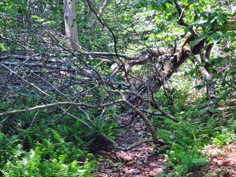 By 11:30 AM we had hiked the 1.7 miles to the junction with the Big Rock Trail. We were moving slower than I had on my last trip a few days earlier but it was hotter and we were carrying equipment. I pointed out a sign on the right side to Bryce. The sign indicated the Big Rock Trail continued over the hill toward Mongaup Pond. I am becoming accustomed to mistakes on DEC signs but that doesn't make them acceptable. The Big Rock Trail only turns left! The trail to the right is a snowmobile trail. We continued straight ahead staying on the Flynn Trail heading toward Hodge Pond. The trail seemed drier than the last time I was here. We passed through the gate that separates state land from the Beaverkill Land Trust, formerly OSI property and were soon at the next trail junction where we stayed to the left on the Flynn Trail to Hodge Pond. The downhill walk went quickly and were soon in the clearing at the outlet end of the pond. We walked over to the shore of the pond where I dropped the pack to get out the camera. The leaves were bright green which contrasted with the blue sky and white clouds. I took some shots and the returned to my pack. Sheila jumped into the water to swim and she stopped in the water seeming to invite me to take pictures which I did. We got a drink and decided to put on some insect repellant before heading back to the Flynn Trail. It was nice to be in the shade again but both of use were feeling the heat. We followed the Flynn Trail along the west side of Hodge Pond. To this point the trail had been relatively dry but as we continued on the west side of Hodge Pond the Flynn Trail began to be wetter and a little muddy. At one time this part of the trail was heavily sodded and drained well. OSI had decided for some reason to rake a way the sod and run large tractors through to mow. This causes deep ruts in the mud which results in a real mess. As we walked along the western shore, we came to a spot where we could turn left or right. We turned left to stay on the Flynn Trail and began a slight up hill climb toward the gate where the trail turns to the left. Just after we turned, we found a small tree across the trail.
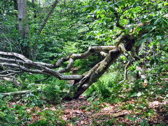 I put down my pack and took some "before" pictures. I used the saw to clear a few small saplings that were in the way. I then used the saw to cut down the larger blowdown. Bryce grabbed the butt end of the tree and dragged it off the trail for some distance all by himself! I took my "after" shots and then we continued up the trail to the gate where we turned left. Immediately we ran into the large blowdown which was bigger and gnarlier than I remembered. Hikers had been walking around the blowdown which must have been there for some time as the workaround was worn in. I put down my pack and took a few pictures of the blowdown so that I could document its demise. Both Bryce and U were already hot and tired but we started our work. I gave Bryce the smaller saw and he began cutting the smaller branches that were in the way while I swamped for him! It took about 30 minutes to get all the small branches cut ad removed as we worked on both side of the blowdown. Many of the branches where I would like to have used the ax were too far up in the air. At times using the saw was difficult because of the twist branches and trunks. We worked for another 30 minutes until I felt exhausted. I knew we had almost 4 miles to hike back to the car so we called it quits. Most of the rest of the blowdown would require a chainsaw or a cooler day to work. Everything left COULD be removed with hand tools but the multiple cuts would be made more easily with a power saw. I took some final pictures and we shared some water. We continued our walk along the Flynn Trail which is pretty flat in this area. The trail is often the lowest point which allows water to collect with nowhere to go. The trail was wet and a little muddy in spots. Despite this the trail was not as wet as it sometimes can be and was drier than a few days before. Hiking with Bryce is always a pleasure as we have interesting discussions as he tells me about the books he is reading. Bryce noticed that Sheila was pretty careful to walk around the muddy areas as I had trained her to do. There were a few branches on the trails which I removed as we walked but I had no real enthusiasm. We arrived at Junkyard Junction at 1:20 PM about 3.3 miles into the hike. From here, the rest of the hike is primarily downhill with a few small hills along the way. We turned left on the red Quick Lake Trail and found it damp in spots. Some section of the trail are washed out leaving a lot of rocks behind and making the downhill hiking not as much fun as it could be. There were at least two large trunks down across the trail which would require tools. At about 3.8 miles the trail turned due south and we continued downhill. There wasn't much to see so we hiked quickly enough that I missed the junction with the snowmobile trail.
 We arrived at Iron Wheel Junction at 2:00 PM after hiking 4.9 miles. I gave Bryce the last water which seemed to keep his spirits up. We turned right to stay on the Quick Lake Trail. At this point the yellow Logger's Loop continued straight ahead. The trail here was muddier than in any other section and the mud continued for some time. We continued on the trail and soon came to the little stream in the woods. The stream was not very high as I had cleared a blockage downstream which allowed a better flow. Sheila did wade in to get a drink. We crossed the stream and continued toward Frick Pond. There were some blowdowns lying flat on the ground which were large and easy to step over. We easily stepped over the large tree that lies across the trail. Cindy and I had cleared some branches the last time we passed by making the crossing easier. This is another blowdown that would be easier to cut with a chainsaw. There were a few wet and muddy spots on the rest of the trail but most were drier than I expected. We passed the junction with the Big Rock Trail that goes around the north end of Frick Pond and walked toward the bridge across the outlet of the pond. We crossed the bridge and I dropped my pack to take out my camera so that I could take some pictures. The beavers had started to rebuild their dam but I know the fish hatchery will send someone to tear it out. I packed up and we continued back on the Quick Lake Trail toward the trail register. The brush along the trails was starting to grow into the trails and I hoped that my maintainer would be making a trip. There were some wet and muddy spots along the way. I noticed that the Lobdell Memorial was still standing and I debated whether or not to trim the short path to it. As we headed for the register, Sheila alerted and we could see a man with three dogs coming toward us. Fortunately, all the dogs were in leashes! The trail to the register was wet but the drainage work we had done seemed to be working. At the trail register we continued straight ahead on the woods road to the smaller parking area. It was 2:40 PM and we had hiked 6.3 miles in 4 hours and 10 minutes with an elevation gain of 890 feet. We had stopped for 1 hour and 25 minutes. The temperature was 87 degrees but it felt much warmer. We sat in the air conditioned car to relax for a few minutes before I drove home.
![]()
![]()
![]()
![]()
![]() On Thursday, June 30th, I had planned to hike Giant Ledge and probably throw in Panther. I wanted to do a 3500 foot peak and the parking lot at Giant Ledge was almost empty the day before. I was getting ready at about 9:00 AM when I found out my grandson Bryce was across the street with my son Karl. I called Karl and asked if Bryce was available and he sent him across the street. We decided we would get some work done and then do a shorter walk together. We loaded the car with recyclables and then went to the ambulance building to clean it out. I had recently order a lot of supplies and the boxes were piled in the meeting room. It took some effort but we were able to get all of the boxes into the car and deliver them to the transfer station. By the time we got home it was time for lunch and Bryce never misses a meal. I started getting ready at 12:30 PM with the temperature at 80 degrees under sunny skies. As usual, Sheila was excited but was trying to be the "good dog". I got dressed in my White Sierra long-sleeved crew top but decided against a baselayer. I wore my Railriders hiking pants which are expensive but last along time and have features like deep pockets and a generous cut which I really like. The pants have Velcro closures at the ankles. I decided to wear my Keen Cascade hiking boots which are pretty new. I also made sure I had a pair of Fulton cork insoles installed to help support my feet. I grabbed my Leki external lock poles which I have been using since twist locks have proved unreliable. I put my gear in the back of the car and Sheila in the back seat with Bryce riding beside me. We left the house at 12:55 PM as I drove out Old Route 17 toward Roscoe and turned right on Beaverkill Road. As we started the descent into the Beaverkill Valley, I turned left on Campsite Road and followed it down to the parking area near the Beaverkill Covered Bridge. There were a few cars parked in the lot with people swimming at the beaches below the bridge. A glance at the river showed that the level had dropped quite a bit since my last visit. The last time I had been here the had water covered the sandy beach and the rock I usually stand on to take pictures was underwater. Today, both of these were exposed.
On Thursday, June 30th, I had planned to hike Giant Ledge and probably throw in Panther. I wanted to do a 3500 foot peak and the parking lot at Giant Ledge was almost empty the day before. I was getting ready at about 9:00 AM when I found out my grandson Bryce was across the street with my son Karl. I called Karl and asked if Bryce was available and he sent him across the street. We decided we would get some work done and then do a shorter walk together. We loaded the car with recyclables and then went to the ambulance building to clean it out. I had recently order a lot of supplies and the boxes were piled in the meeting room. It took some effort but we were able to get all of the boxes into the car and deliver them to the transfer station. By the time we got home it was time for lunch and Bryce never misses a meal. I started getting ready at 12:30 PM with the temperature at 80 degrees under sunny skies. As usual, Sheila was excited but was trying to be the "good dog". I got dressed in my White Sierra long-sleeved crew top but decided against a baselayer. I wore my Railriders hiking pants which are expensive but last along time and have features like deep pockets and a generous cut which I really like. The pants have Velcro closures at the ankles. I decided to wear my Keen Cascade hiking boots which are pretty new. I also made sure I had a pair of Fulton cork insoles installed to help support my feet. I grabbed my Leki external lock poles which I have been using since twist locks have proved unreliable. I put my gear in the back of the car and Sheila in the back seat with Bryce riding beside me. We left the house at 12:55 PM as I drove out Old Route 17 toward Roscoe and turned right on Beaverkill Road. As we started the descent into the Beaverkill Valley, I turned left on Campsite Road and followed it down to the parking area near the Beaverkill Covered Bridge. There were a few cars parked in the lot with people swimming at the beaches below the bridge. A glance at the river showed that the level had dropped quite a bit since my last visit. The last time I had been here the had water covered the sandy beach and the rock I usually stand on to take pictures was underwater. Today, both of these were exposed.
 We started out at 1:15 PM by walking out of the parking lot to the bridge with the temperature at 82 degrees. The skies were bright blue with puffy white clouds. When we got to the other side, I was surprised to see that the gate just off the road was fully open! I looked at the trail and saw that it was very dry. We turned left on a woods road that parallels the river and started down a short hill. We passed the spring house and continued on the deserted woods road where I could detect no recent footprints. We came to an area with a little path down to the river. Just passed this area the trail had been eroding due to the water running down the bank. The DEC had replaced a culvert pipe and installed a second. They had also brought in fill and packed it to reconstruct the path. I found this interesting as the campsites along this path are no longer used and are abandoned. I walked down to the edge of the river very carefully as the rocks were slippery and the water looked deep and cold. I took some pictures downstream and some upstream to the bridge. There were several places where trees at the edge of the river had fallen into the water testifying to the power of the river when it is high. When I was done, we got back on the trail and passed several areas with unused picnic tables. The state had mowed around many of the tables so that they could be used by people who wanted to picnic. Others sit unused and rotting along the road, a testimony to better days. We walked by these tables which had not been used in many years. A little later we came to what was once a bathroom for some campsites that had long since disappeared. There were more tables in this area. There was a path over to the river so I walked over and found the water was sparkling in the sun and was very clear. I took some pictures of the sun reflecting off the water both upstream and downstream.
 At about .7 miles the woods road met the paved road that serves the campsites. We continued on the road through the campsites and along the river. Many of the campsites were occupied by campers using everything from tents and awnings to trailers and RVs. It was obvious that some crews had been working to clear downed trees and those that had deteriorated. The trees had been sectioned and piled and they lined the road. We walked to the last campsite where the trail ends and walked down to the edge of the river. I was careful to watch where I was walking but the water was low and warm. I stopped to take some pictures of the river especially downstream. Sheila decided to take a dip in the water and I took some shots of her. Bryce walked out on some rocks and I took shots of them. We continued a little further passed the last campsite and then turned around. The water was very clear with a slight greenish tint from looking through to the bottom. As we walked back passed the last campsite, we stayed to the left of the last bathroom to walk back on the other paved road through the campsites. This road parallels the one we walked out on to make a sort of loop. We retuned the way we had come although at a quicker pace. As we approached the bridge, I saw that there was a large group of people on the beach by the bridge and more cars parked in the lot. I had thought about taking some pictures of the bridge but gave up that idea. We walked through the bridge and turned right to go back to the car. We were back at the car at 2:10 PM having hiked 2.7 miles in 55 minutes. The car's thermometer read 82 degrees.
![]()
![]()
![]()
![]()
![]() On Wednesday, June 29th I had planned to hike Giant Ledge and probably throw in Panther. I wanted to do a 3500 foot peak and Giant Ledge has a great view of many of the high peaks. I slept in after an ambulance call the evening before and then had some work to do around the house. I decided to asked Cindy if she wanted to do a more local hike like Huggins Lake but she declined. I began to get ready at 12:30 PM when the temperature was 74 degrees. As soon as I started to get ready, Sheila began to run around and bark anticipating getting out of the house. I got dressed in my White Sierra long-sleeved crew top but decided against a baselayer. I put on a pair of RailRiders hiking pants which are expensive but last along time and have features like deep pockets and a generous cut which I really like. The pants have Velcro closures at the ankles. I decided not to add gaiters. I have not seen as many ticks as in the past but I know they are out there. I decided to wear my Keen Cascade hiking boots which fit well and are very comfortable. I made sure I had a pair of Fulton cork insoles in the shoes to support my arches. I grabbed a pair of Leki external lock poles I have been using lately. I got my gear in the car and Sheila in the backseat. We left Livingston Manor at 12:50 PM and drove north on Old Route 17. I turned right on the Beaverkill Road and left on Campsite Road. At the bottom of the hill I turned right and drove down to the campgrounds parking area and across the Beaverkill Covered Bridge. At the end of the road I turned right and followed Berry Brook Road to the trailhead for Huggins Lake. We arrived at the road to the parking area to find it very rough with a lot erosion. There was a car parked on the road with the driver sitting in it. I guessed he thought the access road was too rough. I decided to give it a try and was able to get to the parking lot. I got my equipment ready and I set my GPS as we started off at 1:10 PM. The sun had been out all day and the sky was a beautiful blue with white clouds. The temperature was 76 degrees as we headed out on the wide woods road to the lake but a slight breeze made it feel cooler. The hike isn't long, less than 4 miles, and the trail is maintained by the DEC although we did see a few blowdowns along the way.
On Wednesday, June 29th I had planned to hike Giant Ledge and probably throw in Panther. I wanted to do a 3500 foot peak and Giant Ledge has a great view of many of the high peaks. I slept in after an ambulance call the evening before and then had some work to do around the house. I decided to asked Cindy if she wanted to do a more local hike like Huggins Lake but she declined. I began to get ready at 12:30 PM when the temperature was 74 degrees. As soon as I started to get ready, Sheila began to run around and bark anticipating getting out of the house. I got dressed in my White Sierra long-sleeved crew top but decided against a baselayer. I put on a pair of RailRiders hiking pants which are expensive but last along time and have features like deep pockets and a generous cut which I really like. The pants have Velcro closures at the ankles. I decided not to add gaiters. I have not seen as many ticks as in the past but I know they are out there. I decided to wear my Keen Cascade hiking boots which fit well and are very comfortable. I made sure I had a pair of Fulton cork insoles in the shoes to support my arches. I grabbed a pair of Leki external lock poles I have been using lately. I got my gear in the car and Sheila in the backseat. We left Livingston Manor at 12:50 PM and drove north on Old Route 17. I turned right on the Beaverkill Road and left on Campsite Road. At the bottom of the hill I turned right and drove down to the campgrounds parking area and across the Beaverkill Covered Bridge. At the end of the road I turned right and followed Berry Brook Road to the trailhead for Huggins Lake. We arrived at the road to the parking area to find it very rough with a lot erosion. There was a car parked on the road with the driver sitting in it. I guessed he thought the access road was too rough. I decided to give it a try and was able to get to the parking lot. I got my equipment ready and I set my GPS as we started off at 1:10 PM. The sun had been out all day and the sky was a beautiful blue with white clouds. The temperature was 76 degrees as we headed out on the wide woods road to the lake but a slight breeze made it feel cooler. The hike isn't long, less than 4 miles, and the trail is maintained by the DEC although we did see a few blowdowns along the way.
 The first 1.2 miles is all uphill and gains almost 700 feet. Sheila was running up and down the trail following game paths into the woods. I often wonder how many miles she puts on. I was deep in thought about pastoring my new church and it seemed that we were setting a fast pace. The ascent has several spots which appear to be the top of the climb but are not. After the initial climb, the trail descends, levels some and then climbs again until the final descent to Huggins Lake. As we continued, the trail made a sharp turn from southeast to north at about 1.6 miles. We enjoyed the downhill trek to the shores of the pond even though we had to walk around some blowdowns on the trail. I have found the maintenance on the woods road to be spotty at best. I knew we would soon have to turn around and climb back up the hill. When we arrived at the lake, I noticed that the water level was high. I dropped my pack and got out my camera to take pictures of the lake. The sky was almost perfect and the lighting very good. I took some pictures of the lake and the hills that surround it. At the outlet I could immediately see that the beavers had dammed the water flow and that reeds had grown to all but block the outlet flow. Sheila took a dip in the water. I found an area where there were some salamanders swimming and I took some pictures which turned out well. I took a few more pictures of the lake before returning to my pack and stowing the camera. Sheila had already taken a dip in the water and had taken a drink! We spent about 10 minutes at the lake and then packed up at 2:15 PM and started up the hill and back to the car. The only negative point about Huggins Lake is that there is only one trail and so there are no variations available. I had thought about bushwhacking around the lake but the ascent on the other side is very steep. The ascent on the woods road went smoothly for the most part as we climbed the hill back to the highest point on the trail. From there we started down the other side of the hill on the trail. Downhill was definitely easier than uphill! Sheila seemed very interested in following game trails off the main trail and I had to keep calling her back. It was all downhill to the car. We arrived back at the car at 3:00 PM after hiking 3.9 miles in 1 hour and 50 minutes with a total elevation gain of 920 feet.
![]()
![]()
![]()
![]()
![]() On Sunday, June 26th I wanted to get in a longer hike than just the trails on Round Top across the street. After returning from church and eating unch1, I was not as enthusiastic. By 2:15 PM I was feeling like I should not waste the beautiful day and I started to get ready to go to Frick Pond to hike the "big loop" up the Flynn Trail to Hodge Pond and then back passing Frick Pond. I started to get ready with blue skies and white clouds with the temperature around 86 degrees. I put on my White Sierra long-sleeved crew top without a baselayer as it was so warm. a short-sleeved base layer. I put on a pair of RailRiders hiking pants which are expensive but last a long time and have features like deep pockets and a generous cut which I really like. I decided to put on my Keen Cascade hiking boots which fit well and are newer than what I have been wearing. I added a new pair of Fulton insoles which are cork based and seem to be molding nicely to my feet. I decided to take my Leki poles with external locks as the internal twist locks sometimes fail. I donned a pair of OR Bugout gaiters to combat the ticks. I also added my OR floppy hat which I have decided shields me from the sun and allows me to spray some insect repellant on it rather than on me. I put my gear in the car and Sheila in the back seat at 2:45 PM and drove out the Debruce Road about 6 miles. I turned left onto Mongaup Pond Road and continued to where the road split. At the split, I turned left onto Beech Mountain Road, and drove to the parking areas at the Frick Pond. There were a few cars parked in both parking lots as I pulled into the smaller area. I noticed that some of the trees around the parking areas had been cut but that most of them were rotten. I wondered if the DEC crews had been out in the trails. The NYNJTC maintainers are supposed to e-mail the forester to announce when they are working but the DEC never notifies us when their crews go out. The thermometer read 81 degrees as I set my GPS. The sun was still shining but the clouds had increased and there was a slight breeze blowing which made things a little cooler. There did not seem to be many insects so I skipped the repellant. At 3:05 PM we started our hike by crossing the road to start out on the Flynn Trail. There were a few trees that had been cut but they were not in the trail. At the end of the trail through the woods we turned right on the woods road that was once the extension of Beech Mountain Road. I had intended to hike at a relaxed pace but instead set a quick pace with Sheila roving out ahead kicking up a few birds as we hiked. The trail was mostly dry but there were a few wet areas. It was obvious that a pickup truck had been driven up trail and I assumed this was the DEC crew. The Flynn Trail ascends 1.7 miles to the Big Rock Trail junction gaining 600 feet. We approached the large hemlock tree across the trail where Cindy and I had cut a "tunnel" through the branches. The tree had been completed cut away as I had suspected! At first I was annoyed but then I realized it would allow better access for emergency vehicles. I took a few pictures before we continued to set a quick pace up the trail. At 1.1 miles, we came to the area where there is a clearing to the right of the trail. I decided that we would bypass a visit to this area and continued on the main trail. I didn't see much more work done by the DEC crew. They did cut a few more inches off a blowdown I had already cleared. In the same area they cut up the brush piles I had made. I did not see the benefit of either of these. By 3:50 PM we had hiked the 1.7 miles to the junction with the Big Rock Trail. This meant the trip had only taken us 40 minutes of moving time which was a new record for us! I noticed a sign on the right side of the trail indicating the Big Rock Trail continued over the hill toward Mongaup Pond. I am becoming accustomed to mistakes on DEC signs but that doesn't make them acceptable. The Big Rock Trail only turns left! The trail to the right is a snowmobile trail. We continued straight ahead staying on the Flynn Trail heading toward Hodge Pond. The trail seemed dry but the layer of leaves covered some wet and muddy areas. We passed through the gate that separates state land from the Beaverkill Land Trust, formerly OSI property and were soon at the next trail junction where we stayed to the left on the Flynn Trail to Hodge Pond.
On Sunday, June 26th I wanted to get in a longer hike than just the trails on Round Top across the street. After returning from church and eating unch1, I was not as enthusiastic. By 2:15 PM I was feeling like I should not waste the beautiful day and I started to get ready to go to Frick Pond to hike the "big loop" up the Flynn Trail to Hodge Pond and then back passing Frick Pond. I started to get ready with blue skies and white clouds with the temperature around 86 degrees. I put on my White Sierra long-sleeved crew top without a baselayer as it was so warm. a short-sleeved base layer. I put on a pair of RailRiders hiking pants which are expensive but last a long time and have features like deep pockets and a generous cut which I really like. I decided to put on my Keen Cascade hiking boots which fit well and are newer than what I have been wearing. I added a new pair of Fulton insoles which are cork based and seem to be molding nicely to my feet. I decided to take my Leki poles with external locks as the internal twist locks sometimes fail. I donned a pair of OR Bugout gaiters to combat the ticks. I also added my OR floppy hat which I have decided shields me from the sun and allows me to spray some insect repellant on it rather than on me. I put my gear in the car and Sheila in the back seat at 2:45 PM and drove out the Debruce Road about 6 miles. I turned left onto Mongaup Pond Road and continued to where the road split. At the split, I turned left onto Beech Mountain Road, and drove to the parking areas at the Frick Pond. There were a few cars parked in both parking lots as I pulled into the smaller area. I noticed that some of the trees around the parking areas had been cut but that most of them were rotten. I wondered if the DEC crews had been out in the trails. The NYNJTC maintainers are supposed to e-mail the forester to announce when they are working but the DEC never notifies us when their crews go out. The thermometer read 81 degrees as I set my GPS. The sun was still shining but the clouds had increased and there was a slight breeze blowing which made things a little cooler. There did not seem to be many insects so I skipped the repellant. At 3:05 PM we started our hike by crossing the road to start out on the Flynn Trail. There were a few trees that had been cut but they were not in the trail. At the end of the trail through the woods we turned right on the woods road that was once the extension of Beech Mountain Road. I had intended to hike at a relaxed pace but instead set a quick pace with Sheila roving out ahead kicking up a few birds as we hiked. The trail was mostly dry but there were a few wet areas. It was obvious that a pickup truck had been driven up trail and I assumed this was the DEC crew. The Flynn Trail ascends 1.7 miles to the Big Rock Trail junction gaining 600 feet. We approached the large hemlock tree across the trail where Cindy and I had cut a "tunnel" through the branches. The tree had been completed cut away as I had suspected! At first I was annoyed but then I realized it would allow better access for emergency vehicles. I took a few pictures before we continued to set a quick pace up the trail. At 1.1 miles, we came to the area where there is a clearing to the right of the trail. I decided that we would bypass a visit to this area and continued on the main trail. I didn't see much more work done by the DEC crew. They did cut a few more inches off a blowdown I had already cleared. In the same area they cut up the brush piles I had made. I did not see the benefit of either of these. By 3:50 PM we had hiked the 1.7 miles to the junction with the Big Rock Trail. This meant the trip had only taken us 40 minutes of moving time which was a new record for us! I noticed a sign on the right side of the trail indicating the Big Rock Trail continued over the hill toward Mongaup Pond. I am becoming accustomed to mistakes on DEC signs but that doesn't make them acceptable. The Big Rock Trail only turns left! The trail to the right is a snowmobile trail. We continued straight ahead staying on the Flynn Trail heading toward Hodge Pond. The trail seemed dry but the layer of leaves covered some wet and muddy areas. We passed through the gate that separates state land from the Beaverkill Land Trust, formerly OSI property and were soon at the next trail junction where we stayed to the left on the Flynn Trail to Hodge Pond.
 The downhill walk went quickly and were soon in the clearing at the outlet end of the pond. We walked over to the shore of the pond where I dropped the pack to get out the camera. The leaves were bright green which contrasted with the blue sky and white clouds. I thought that the overcast might have ruined the view but the scene was beautiful. I took some shots and the returned to my pack. Sheila jumped into the water to swim and she stopped in the water seeming to invite me to take pictures which I did. I threw a stick and Sheila retried it a couple of times before losing interest. I got a drink and then we headed back to the Flynn Trail and turned right to follow it along the west side of Hodge Pond. To this point the trail had been relatively dry but as we continued on the west side of Hodge Pond the Flynn Trail began to be wetter and a little muddy. At one time this part of the trail was heavily sodded and drained well. OSI had decided for some reason to rake a way the sod and run large tractors through to mow. This causes deep ruts in the mud which results in a real mess. As we walked along the western shore, we came to a spot where we could turn left or right. We turned left to stay on the Flynn Trail and began a slight up hill climb toward the gate where the trail turns to the left. Just after the gate, we ran into a large blowdown which would require a saw and ax to clear. Hikers have been walking around the blowdown which must have been there for some time as the workaround was worn in. I took a few pictures of the blowdown so that I could plan its demise. We continued our walk along the Flynn Trail which is pretty flat in this area. The trail is often the lowest point which allows water to collect with nowhere to go. The trail was wet and a little muddy in spots. Despite this the trail was not as wet as it sometimes can be. I noticed that Sheila was pretty careful to walk around these areas as I had encouraged her. There were a few branches on the trails which I removed as we walked. We arrived at Junkyard Junction at 4:30 PM about 3.3 miles into the hike. From here, the rest of the hike is primarily downhill with a few small hills along the way. We turned left on the red Quick Lake Trail and found it damp in spots. Some section of the trail are washed out leaving a lot of rocks behind and making the downhill hiking not as much fun as it could be. There were at least two large trunks down across the trail which would require tools. Another blowdown had several branches that were hard to get through. I realized that most of these branches were loose and spent a few minutes moving them out of the way. At about 3.8 miles the trail turned due south and we continued downhill.
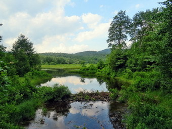 There wasn't much to see so we hiked quickly passing the junction with the snowmobile trail. We arrived at Iron Wheel Junction at 5:15 PM after hiking 4.9 miles. We turned right to stay on the Quick Lake Trail. At this point the yellow Logger's Loop continued straight ahead. The trail here was muddier than in any other section and the mud continued for some time. We continued on the trail and soon came to the little stream in the woods. The stream was not very high as I had cleared a blockage downstream which allowed a better flow. Sheila did wade in to get a drink. We crossed the stream and continued toward Frick Pond. There were some blowdowns lying flat on the ground which were large and easy to step over. I easily stepped over the large tree that lies across the trail. Cindy and I had cleared some branches the last time we passed by making the crossing easier. There were a few wet and muddy spots on the rest of the trail but most were drier than I expected. We passed the junction with the Big Rock Trail that goes around the north end of Frick Pond and walked toward the bridge across the outlet of the pond. We crossed the bridge and I dropped my pack to take out my camera so that I could take some pictures. The beavers had started to rebuild their dam but I know the fish hatchery will send someone to tear it out. Anyone else that did this would be ticketed for disturbing a wetland! I packed up and we continued back on the Quick Lake Trail toward the trail register. The brush along the trails was starting to grow into the trails and I hoped that my maintainer would be making a trip. There were some wet and muddy spots along the way. I noticed that the Lobdell Memorial was still standing and I debated whether or not to trim the short path to it. The trail to the register was wet but the drainage work we had done seemed to be working. At the trail register we continued straight ahead on the woods road to the smaller parking area. It was 5:55 PM and we had hiked 6.3 miles in 2 hours and 50 minutes with an elevation gain of 890 feet. The temperature was 82 degrees.
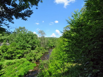
![]()
![]()
![]()
![]()
![]() On Friday, June 24th I wanted to get out for hike after taking acre of some business for most of the day. Around 3:15 PM I asked Cindy if she would like to at Frick Pond but she indicated, as usual, that she would like a flatter and shorter route. We decided to go to hike the Parksville Rail Trail as it fits that description. The walk is less than 3 miles round trip and almost completely flat. It does have a few limited views and a nice waterfall. It was 75 degrees when we started to get ready and the skies were blue with some nice white clouds. Sheila's expectant gaze and sharp bark "encouraged" me to continue the hiking plans. It was warm and I did not expected a lot of water or mud on the trail so I dressed accordingly. I put on my White Sierra long-sleeved crew top without a baselayer as it was so warm. a short-sleeved base layer. I put on a pair of RailRiders hiking pants which are expensive but last a long time and have features like deep pockets and a generous cut which I really like. I decided to put on my Keen Cascade hiking boots which fit well and are newer than what I have been wearing. I added a new pair of Fulton insoles which are cork based and seem to be molding nicely to my feet. I decided to take my Leki poles with external locks as the internal twist locks sometimes fail. I donned a pair of OR Bugout gaiters to combat the ticks. I also added my OR floppy hat which I have decided shields me from the sun and allows me to spray some insect repellant on it rather than on me. At 3:30 PM we put our gear in the car and Sheila in the back seat. I headed out Old Route 17 across the Flats and then took Old Route 17 and Service Road to the point where they meet Fox Mountain Road. Just after this intersection is the western parking area for the rail trail. The parking lot had one car parked. As we were getting ready, a forest ranger pulled up and got out of his truck. It was Ricky Franke who I knew from his time as a student at Liberty HS. We talked for a while as Cindy took Sheila and started slowly up the trail.
On Friday, June 24th I wanted to get out for hike after taking acre of some business for most of the day. Around 3:15 PM I asked Cindy if she would like to at Frick Pond but she indicated, as usual, that she would like a flatter and shorter route. We decided to go to hike the Parksville Rail Trail as it fits that description. The walk is less than 3 miles round trip and almost completely flat. It does have a few limited views and a nice waterfall. It was 75 degrees when we started to get ready and the skies were blue with some nice white clouds. Sheila's expectant gaze and sharp bark "encouraged" me to continue the hiking plans. It was warm and I did not expected a lot of water or mud on the trail so I dressed accordingly. I put on my White Sierra long-sleeved crew top without a baselayer as it was so warm. a short-sleeved base layer. I put on a pair of RailRiders hiking pants which are expensive but last a long time and have features like deep pockets and a generous cut which I really like. I decided to put on my Keen Cascade hiking boots which fit well and are newer than what I have been wearing. I added a new pair of Fulton insoles which are cork based and seem to be molding nicely to my feet. I decided to take my Leki poles with external locks as the internal twist locks sometimes fail. I donned a pair of OR Bugout gaiters to combat the ticks. I also added my OR floppy hat which I have decided shields me from the sun and allows me to spray some insect repellant on it rather than on me. At 3:30 PM we put our gear in the car and Sheila in the back seat. I headed out Old Route 17 across the Flats and then took Old Route 17 and Service Road to the point where they meet Fox Mountain Road. Just after this intersection is the western parking area for the rail trail. The parking lot had one car parked. As we were getting ready, a forest ranger pulled up and got out of his truck. It was Ricky Franke who I knew from his time as a student at Liberty HS. We talked for a while as Cindy took Sheila and started slowly up the trail.
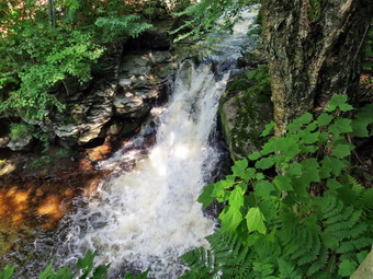 After ending my conversation with Ranger Franke, I started out on the trail to catch up with Cindy and Sheila. As we entered the shade of the trees, it immediately seemed a little cooler. The stream volume looked a little higher than average. I knew the falls would have enough water to be interesting. Sheila was taking her own route and following her nose. Just after entering the woods we came to a muddy area although the rest of the trail had been dry. The few wet and muddy areas we would find on the trail were easily circumvented. We were soon at the wooden walkways where I stopped, put my pack down and took out the camera. I took some shots of the stream below with nice blue skies and white clouds. I put away the camera and picked up my pack to continue over the walkways. The wooden surface was dey but had a coating of dried mud. The problem is that a rock slide has blocked the culvert under the small bridge causing water, mud and stones to be diverted over the walkway. Unblocking the culvert and covering the walkways with some screening would help. There was some water running down the hill and over the area between the bridge and the walkways. We continued on the trail and soon heard the noise of a dirt bike coming toward us. The rider flew by us heading in the opposite direction. I don't think motorized vehicles are allowed on the trail but I didn't think I had a chance of communicating that to the rider!
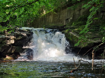 We continued on the trail and came to the falls. I wanted to get down to the streambed so that I could take pictures from in front of the falls. It was relatively easy to work my way down the bank to the streambed. I got out the camera and took some shots down stream and the turned my attention to the falls. I took numerous pictures of the falls and the area in front. The water was very clear and the red rock beneath the water really showed through. Sheila, of course, decided to jump in and cool off so I took some shots of her. When I was done, we worked our way back up the bank. I took a few pictures of the falls from the edge of the trail where I had a good view. As we were preparing to leave, two men came walking by and we said "Hello" as we went in opposite directions. We continued on the trail to a bench where a path leads down to the stream. I left my pack on the bench and took the camera with me to the stream's edge. I took shots upstream and downstream with some close-ups right in front of me. I repositioned myself and took some more pictures downstream toward the falls. I finished and walked back to the bench to stow the camera. The trail had been wet and a little muddy in places but we managed to walk around them. From the falls to the other end of the trail there were a few wet areas and some mud. We set a quick pace for the rest of the hike to the Parksville end of the trail. Just after the gate at that end, we stopped to read the sign which outlined the milk that the O&W transported. The sign also mentioned the large number of hotels that had been in the area. We turned around and headed back to the car. In a short distance, we met the two men that had passed by before and we stopped for a short conversation. They were from liberty and said they often hiked the rail trail there. When we parted, Cindy and I continued back to the car without stopping and without seeing any other people except for the dirt bike on the return trip. We were back at the car at 5:20 PM after hiking 2.8 miles in 1 hour and 30 minutes including the stopped time for pictures. There is virtually no elevation gain on the hike except the short trips down to the streambed.
![]()
![]()
![]()
![]() On Tuesday, June 21st I planned to go for my first hike of the summer! I had a hike planned to Giant Ledge and Panther but an ambulance call in the morning got in the way. When I returned I decided that the weather look unfavorable for a longer hike. I decided to again to go across the street and hike a few loops on Round Top. Cindy did not favor this idea but I knew Sheila would be eager to go! I am lucky that I have a place so close to hike but it has become very familiar. I have found that even a short hike helps to keep my blood pressure in check and I am hoping I can get my weight down also. As I started to get ready just before 1:00 PM, the temperature was 70 degrees but overcast without much direct sun. The forecast was for afternoon showers and a few drops had already fallen. Sheila was ready to go as she really likes to hike and we had not been out for some time. She was very vocal about hurrying me along. It was warm enough that I decided to just put on a short-sleeved NYNJTC cotton shirt. I wore my Railriders hiking pants which are expensive but last along time and have features like deep pockets and a generous cut which I really like. The pants have Velcro closures at the ankles. I decided to wear my newer Keen Cascade hiking boots with a new pair of Fulton cork insoles. I felt I need more foot support as I was having some pain especially in my Achilles' Tendons. I grabbed a pair of Leki external lock poles I have been using for some time. At 1:15 PM we walked out the door to start the hike. I grabbed Sheila's leash from the car and we walked up the driveway. I thought we could hike two big and two small loops which I had not done in some time. We walked out the driveway and crossed the street to walk along the street to the parking lot of the Presbyterian Church.
On Tuesday, June 21st I planned to go for my first hike of the summer! I had a hike planned to Giant Ledge and Panther but an ambulance call in the morning got in the way. When I returned I decided that the weather look unfavorable for a longer hike. I decided to again to go across the street and hike a few loops on Round Top. Cindy did not favor this idea but I knew Sheila would be eager to go! I am lucky that I have a place so close to hike but it has become very familiar. I have found that even a short hike helps to keep my blood pressure in check and I am hoping I can get my weight down also. As I started to get ready just before 1:00 PM, the temperature was 70 degrees but overcast without much direct sun. The forecast was for afternoon showers and a few drops had already fallen. Sheila was ready to go as she really likes to hike and we had not been out for some time. She was very vocal about hurrying me along. It was warm enough that I decided to just put on a short-sleeved NYNJTC cotton shirt. I wore my Railriders hiking pants which are expensive but last along time and have features like deep pockets and a generous cut which I really like. The pants have Velcro closures at the ankles. I decided to wear my newer Keen Cascade hiking boots with a new pair of Fulton cork insoles. I felt I need more foot support as I was having some pain especially in my Achilles' Tendons. I grabbed a pair of Leki external lock poles I have been using for some time. At 1:15 PM we walked out the door to start the hike. I grabbed Sheila's leash from the car and we walked up the driveway. I thought we could hike two big and two small loops which I had not done in some time. We walked out the driveway and crossed the street to walk along the street to the parking lot of the Presbyterian Church.
We began the ascent of the steepest hill behind the church and continued directly up the hill to the trailhead. The hill is short but gets the circulation pumping and is the steepest and longest climb on the "trail." My goal was to make it all the way up the hill without stopping. At the top of the hill we stopped to look around but there wasn't much to see that I hadn't seen before. We turned left and entered the woods to begin our hike. The trailhead was very dry and that continued as we entered the woods. I was not surprised that the trails were so completely dry. Just before the first trail junction there was a small tree that had broken off. It had been hanging into the trail but someone had bent it back off the trail and secured it being another tree. I made a note to bring a saw to remove it completely. I followed Sheila as she turned right and started up the woods road which has the gentler approach of the two. There was a slight breeze which cooled us off and Sheila was panting while I was feeling a little dry. We reached the end of the woods road and turned left up the hill on the trail. We continued up the trail to the first trail junction with the upper blue trail and continued straight ahead toward the top of the hill. On the way up we bypassed the white crossover trail and instead took the blue trail over the summit. We started down the other side bypassing the white crossover trail again. We turned left on the switchback in the blue trail and followed it out and back to the main blue trail. People were slowly beginning to use the switchback which I put in to avoid erosion on the main trail that used to continue straight up the hill. When the switchback came back to the main trail, we turned left and headed downhill to the yellow trail. At the trail junction, we continued straight ahead on the yellow trail toward the lookout. When we reached the viewpoint, we followed the yellow trail as it turned left and descended to the first trail junction. We had completed a big loop rather than a figure 8 which I usually do.
We immediately turned around and started back up the short but steep hill to the lookout. The trip back up the hill to the lookout was pretty easy which, again, surprised me because I am not yet in very good shape. At the top of the hill we turned right to follow the yellow trail to the first junction with the blue trail. We turned right to follow the yellow trail around the base of Round Top. At the next junction with the blue trail, we turned right and headed down the yellow trail to the woods road. The yellow trail follows the woods road downhill and back to the first trail junction. The trail remained dry and easy to hike. When we reached the first trail junction we had completed a small loop and, again, turned around and headed back up the woods road on the yellow trail. At the junction with the blue trail we stayed on the yellow by turning right and walking along the base of Round Top. At the second junction with the blue trail we again turned right and walked the yellow trail downhill to the viewpoint. We turned left and followed the yellow trail back down to the first trail junction. That completed another small loop so that we had done a large loop and two small loops. I decided to get in another large loop although Sheila was headed for the trailhead! We turned around and headed up the short but steep hill to the viewpoint. We continued on the yellow trail as it turned right and headed uphill through the fern forest. At the first junction with the blue trail we stayed straight ahead on the blue trail. Not too far up the hill we turned right on the switchback in the blue trail and then right again at the end of the switchback on the main blue trail. I thought about turning right on the white crossover trail but continued straight ahead on the blue trail over the summit of Round Top. We descended the other side of the hill to the yellow trail. To complete the last big loop, we continued straight ahead on the yellow trail and walked downhill to the woods road. The woods road brought as back to the first trail junction. This time we turned left and walked out to the trailhead. We turned right and walked down the hill to the church parking lot. We crossed the parking lot and Rock Avenue to get to our driveway. It was 2:45 PM and we had hiked just 3 miles in an hour and a half.