
What You Missed
Summer 2020
Summer 2020
![]()
![]()
![]()
![]()
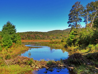
![]() On Monday, September 21st I wanted to get out for a longer hike after pitting in only a few miles over the weekend. I asked Cindy and she agreed to go along. I had some things to take care of in the morning so I didn't start to get ready until 11:00 AM. When I looked outside, the skies were blue but cloudless and the temperature was only 50 degrees. . I decided to go to Frick Pond to do the Frick Pond to Hodge Pond loop on the Quick Lake and Flynn Trails which is a little over 6 miles. I started to get ready with Sheila watching my every move. I got dressed in my White Sierra long-sleeved crew top with a short-sleeved baselayer. The shirt has an insect repellent built-in which I knew I would appreciate as I anticipated a swarm on Mat flies. I put on a pair of RailRiders hiking pants which are expensive but last along time and have features like deep pockets and a generous cut which I really like. The pants have Velcro closures at the ankles to discourage sticks and gravel from getting into my shoes and also combat ticks. I decided to wear my Keen Targhee II hiking boots which fit well and have been discontinued. I grabbed a pair of Leki external lock poles I have been using lately. I also added a new OR floppy hat which was another present from Cindy. I have decided it shields me from the sun and allows me to spray some insect repellant on it rather than on me. I also wore my Mammut hoody knowing I could take it off at the trailhead or put it in my pack. I packed a light OR windbreaker, a pair of light gloves and a light hat. Sheila in particular was anxious to get out as we had only hiked 3 miles two days before. I put our gear in the back and Sheila in the backseat and drove out the Debruce Road about 6 miles. I turned left onto Mongaup Pond Road and continued to where the road split. I turned left onto Beech Mountain Road, and drove to the parking areas at the Frick Pond. There was only one car in the smaller lot and two in the larger one as I parked in the smaller. No one was in sight as we got ready to hike. The thermometer read 51 degrees as I set my GPS but I removed my hoody as I thought I would be too warm. . The skies were blue with no clouds. As we were almost ready to start, two women came walking up the woods road to the parking lot. They commented on the beautiful day and said they had hiked around Frick Pond. At 11:50 AM we headed out the woods road to the Quick Lake Trail.
On Monday, September 21st I wanted to get out for a longer hike after pitting in only a few miles over the weekend. I asked Cindy and she agreed to go along. I had some things to take care of in the morning so I didn't start to get ready until 11:00 AM. When I looked outside, the skies were blue but cloudless and the temperature was only 50 degrees. . I decided to go to Frick Pond to do the Frick Pond to Hodge Pond loop on the Quick Lake and Flynn Trails which is a little over 6 miles. I started to get ready with Sheila watching my every move. I got dressed in my White Sierra long-sleeved crew top with a short-sleeved baselayer. The shirt has an insect repellent built-in which I knew I would appreciate as I anticipated a swarm on Mat flies. I put on a pair of RailRiders hiking pants which are expensive but last along time and have features like deep pockets and a generous cut which I really like. The pants have Velcro closures at the ankles to discourage sticks and gravel from getting into my shoes and also combat ticks. I decided to wear my Keen Targhee II hiking boots which fit well and have been discontinued. I grabbed a pair of Leki external lock poles I have been using lately. I also added a new OR floppy hat which was another present from Cindy. I have decided it shields me from the sun and allows me to spray some insect repellant on it rather than on me. I also wore my Mammut hoody knowing I could take it off at the trailhead or put it in my pack. I packed a light OR windbreaker, a pair of light gloves and a light hat. Sheila in particular was anxious to get out as we had only hiked 3 miles two days before. I put our gear in the back and Sheila in the backseat and drove out the Debruce Road about 6 miles. I turned left onto Mongaup Pond Road and continued to where the road split. I turned left onto Beech Mountain Road, and drove to the parking areas at the Frick Pond. There was only one car in the smaller lot and two in the larger one as I parked in the smaller. No one was in sight as we got ready to hike. The thermometer read 51 degrees as I set my GPS but I removed my hoody as I thought I would be too warm. . The skies were blue with no clouds. As we were almost ready to start, two women came walking up the woods road to the parking lot. They commented on the beautiful day and said they had hiked around Frick Pond. At 11:50 AM we headed out the woods road to the Quick Lake Trail.
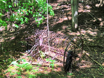
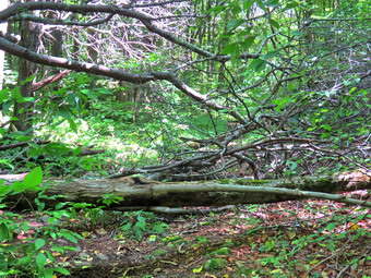
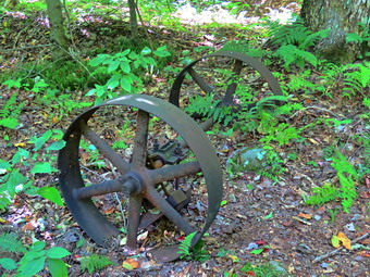 Once we passed the register on the Quick Lake Trail the trail was drier than it had been for some time. There are a few muddy spots but none of the running or standing water I had encountered on recent hikes. At Gravestone Junction, we turned left to stay on the Quick Lake Trail and head down to Frick Pond. This short piece of trail1 had been a mud pit but was now barely damp. We stopped at the bridge across the outlet to Frick Pond and I took some shots of the pond and Flynn's Point. I noticed that the beaver dam had been partly destroyed but was being reconstructed and that the water level was rising. I hoped that no one would tear it down again as has happened in the past. We didn't stay long and were soon walking along the west side of Frick Pond which was easier as there was so little water and mud. We came to the tree that someone had cut for no reason. I inspected the tree and became more convinced it had been cut with some kind of machete. I had asked Ranger Eric Stratton to take a look but he had not gotten back to me. We continued on the trail and at the junction with the Big Rock Trail, we stayed to the left as we wanted to keep hiking the Quick Lake Trail. The first part of this section was dry and the next section was about the same with only a few damp areas. We entered the evergreen tunnel where the trail continued to be in good shape. When we came to the small stream across the trail, we found that the water level was low enough that we could simply walk across it on some stones. We continued to push toward Iron Wheel Junction and made good time as we were not hampered by having to take detours around muddy areas on the trail. We stopped briefly at Iron Wheel Junction as I took a few shots of the iron wheels which I had not done in some time. We reached Iron Wheel junction at 12:40 PM after hiking 1.5 miles.
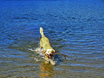
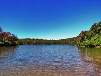 We turned left at the junction to stay on the Quick Lake Trail and head for Junkyard Junction and the Flynn Trail. The temperature had warmed up a few degrees. The next mile of trail is all uphill and the grade only averages around 8%. At times this can seem like a long slog but on this day it seemed to go quickly. I attributed this to the fact that Cindy and I were having a good conversation which made time pass more quickly. We hit the flatter ground and started downhill toward Junkyard Junction where we arrived at 1:25 PM after hiking 3.1 miles. We turned right to start out on the Flynn Trail and almost immediately I noticed that the trail was much drier than it had been in several trips. This trail is often wet as it is fairly flat and lower than much of the surrounding ground. We worked our way along the trail removing a few branches along the way. We arrived at the gate which separates the state land from the Open Spaces Institute land around Hodge Pond. We continued on the Flynn Trail by turning right and following the trail downhill to an area near the shore of Hodge Pond. We turned right to stay on the Flynn Trail and walked through a field and to the point where the Flynn Trail enters a clearing at the outlet end of Hodge Pond. We walked over to the shore of the pond where three other hikers were stopped with their dog. The small dog kept barking but Sheila showed little interest. The sky was a flat blue without any clouds. I took some pictures of the pond and a few of Sheila swimming before packing up and heading back across the field to the point where the Flynn Trail entered the forest. We began the walk up the hill on the Flynn Trail which was the last climb before the long downhill back to the car. Just as we started up the hill we could see another hoer coming down the hill toward us. I immediately recognized Ranger Eric Stratton. I put Sheila on her leash and we stopped to talk. He felt the tree on the west side of Frick Pond was cut with a machete and that it was an isolated incident. We talked about trail maintenance in the area before parting company.
 The walk up this hill often seems tedious but on this day it went quickly and we were soon at the top of the hill. I was pretty sure the rest of the trail would also be dry and that seemed to be the case. We walked along the flat trail under the trees passing through the other gate and arriving at the junction with the Big Rock trail at 2:20 PM after hiking 4.8 miles. We continued straight ahead on the Flynn Trail setting a fast pace over the flat part of the trail before starting the downhill. I much prefer walking up the Flynn Trail but like to vary the route from time to time. In any case the 1.7 miles back to the parking area can be slow as there is not much to see. We reached the spot where there is an interesting to the left of the trail but we had been there recently and stayed on the main trail. We continued on the trail and soon were passing through the tunnel we had cut in a large spruce tree that had fallen across the trail. We turned left on the trail to avoid the private property around the cabin. When we got back to the parking area, there was one car in the small lot and two in the larger. It was 3:00 PM when we got back to the car after hiking 6.3 miles in 3 hours with an elevation gain of 905 feet. We had maintained an overall speed of 2.1 mph with a moving average of 2.5 mph. The temperature was 58 degrees and we were both ready to go home.
![]()
![]()
![]()
![]()
![]() On Saturday, September 19th, I wanted to try one of the many bushwhacks I had lined up. I asked Cindy if she would like to go hike along a stream and up a hill and she agreed. I wanted to go to the Westkill area and hike in the Vinegar Hill Wildlife Management Area, Roarback Brook DEP Parcel and the DEC Westkill Unit along Schoharie Creek. The temperature overnight was 30 degrees and I needed to catch up on some sleep so we got a late start. As I began to get ready at 10:30 AM the temperature was still only 48 degrees. Sheila was watching me carefully in case I forgot she wanted to go hiking. I got dressed in a White Sierra long-sleeved crew top with a short-sleeved baselayer. I put on a pair of RailRiders hiking pants which are expensive but last along time and have features like deep pockets and a generous cut which I really like. These pants have Velcro closures at the ankles to discourage sticks and gravel from getting into my shoes and to combat ticks. I decided to wear my Keen Targhee II hiking boots which fit well and have been discontinued. Since most of the hike would be a bushwhack, I also put on my OR Bugout gaiters which are treated to repel insects. I also added my OR floppy hat which I have decided shields me from the sun and allows me to spray some insect repellant on it rather than on me. I also put a warmer hat and a pair of gloves in my pack. I grabbed a pair of Leki external lock poles I have been using lately. I put on my Mammut hoody which I knew I could put in my pack at any time. I put our gear in the back of the car and Sheila in the backseat and we left Livingston Manor at 11:00 AM. The skies were blue but there were no clouds. I headed out DeBruce Road and turned left at the end on Route 47 to head toward Big Indian and Route 28. The work on the Neversink River looked almost complete and I wondered if it would hold back the mudslides once the river was at full capacity or beyond. There was a group ready to leave for a hike at the Biscuit Brook parking area. The Slide Mountain parking area was full and cars were illegally parked along the road. The same was true of the parking for Giant Ledge and Panther. As we passed these spots where we have hiked before Sheila would "moan" as if she was asking me if we could stop and hike. I turned right on Route 28 and then left on Route 42 to head toward Spruceton. There were several cars at the Halcott parking area. I passed by Spruceton Road and drove until we came to the new parking area on the left of Route 42 near Roarback Brook. There were three cars parked in the small lot. We got out of the car and I checked the trail mowed through the grass behind the kiosk. I went back to the car and set my GPS. It was 51 degrees when we headed through the field at 12:15 PM. The view was so pretty I decided to stop and take a few shots.
On Saturday, September 19th, I wanted to try one of the many bushwhacks I had lined up. I asked Cindy if she would like to go hike along a stream and up a hill and she agreed. I wanted to go to the Westkill area and hike in the Vinegar Hill Wildlife Management Area, Roarback Brook DEP Parcel and the DEC Westkill Unit along Schoharie Creek. The temperature overnight was 30 degrees and I needed to catch up on some sleep so we got a late start. As I began to get ready at 10:30 AM the temperature was still only 48 degrees. Sheila was watching me carefully in case I forgot she wanted to go hiking. I got dressed in a White Sierra long-sleeved crew top with a short-sleeved baselayer. I put on a pair of RailRiders hiking pants which are expensive but last along time and have features like deep pockets and a generous cut which I really like. These pants have Velcro closures at the ankles to discourage sticks and gravel from getting into my shoes and to combat ticks. I decided to wear my Keen Targhee II hiking boots which fit well and have been discontinued. Since most of the hike would be a bushwhack, I also put on my OR Bugout gaiters which are treated to repel insects. I also added my OR floppy hat which I have decided shields me from the sun and allows me to spray some insect repellant on it rather than on me. I also put a warmer hat and a pair of gloves in my pack. I grabbed a pair of Leki external lock poles I have been using lately. I put on my Mammut hoody which I knew I could put in my pack at any time. I put our gear in the back of the car and Sheila in the backseat and we left Livingston Manor at 11:00 AM. The skies were blue but there were no clouds. I headed out DeBruce Road and turned left at the end on Route 47 to head toward Big Indian and Route 28. The work on the Neversink River looked almost complete and I wondered if it would hold back the mudslides once the river was at full capacity or beyond. There was a group ready to leave for a hike at the Biscuit Brook parking area. The Slide Mountain parking area was full and cars were illegally parked along the road. The same was true of the parking for Giant Ledge and Panther. As we passed these spots where we have hiked before Sheila would "moan" as if she was asking me if we could stop and hike. I turned right on Route 28 and then left on Route 42 to head toward Spruceton. There were several cars at the Halcott parking area. I passed by Spruceton Road and drove until we came to the new parking area on the left of Route 42 near Roarback Brook. There were three cars parked in the small lot. We got out of the car and I checked the trail mowed through the grass behind the kiosk. I went back to the car and set my GPS. It was 51 degrees when we headed through the field at 12:15 PM. The view was so pretty I decided to stop and take a few shots.
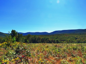
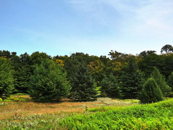
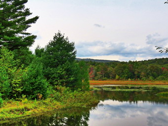
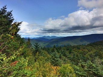
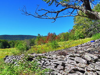 We continued on the trail which turned slightly to the left as we came to the tree line. We walked a short distance and then turned right into the forest just before reaching Roarback Brook. We immediately began to see old farm equipment so I stopped and took some pictures of wheels and harrows and even an old saw blade. When we got back on the woods road, we began walking uphill to the northwest for about a half mile. The woods road passed through a combination of evergreens and hard woods. Along the way we met a group of 4 people and 2 dogs who said they had walked up the woods road but had not "done the whole thing". At .8 miles the trail leveled and I walked down to the brook to take a few pictures. When I walked back up from the brook, we continued through some grass and brush toward a rocky area. The ground was pretty wet in this area but we soon arrived at an area where there was a stone wall and other discarded stones. It was hard to tell whether this was a quarry or an old foundation. I took some shots and walked a little farther to take a few more pictures of the open field and Beech Ridge beyond. I wanted to walk a little more to the west and northwest to explore the field and take in as much of the area as possible. Cindy, on the other hand, had another plan. She suggested we walk more to the north. Despite the fact that I had the GPS and the maps, I followed her almost due north. I knew this would cut off part of the hike but it was easier than arguing. We made our way slowly uphill until we reached a stone wall bordering a field. At this point Cindy no longer wanted to lead and I took over. I could see that it was a short hike uphill to the powerline and that there was a rock that would offer a great view. The problem was that I did not want to walk through the field of prickers to get to that view. I led us up the side of the stone wall through some trees, crossed over the stone wall and found road on the powerline right-of-way. I walked along the road to the rock I wanted to use as a viewpoint. The view was amazing with 270 degrees of mountains and ridges. I took out my camera and snapped shots in all directions.
 When I was done taking pictures, I put my camera back and consulted my maps. It was clear from where we were we would have to travel almost due east to Vinegar Hill. I also knew that the summit was on private poetry which I wanted to avoid. Conveniently, there was a woods road heading in that direction so Cindy and I started off on the road. As we walked I was a little disappointed that the road seemed to head a little too much to the southeast. This problem was solved as the road split several times and we took the left fork which ended up putting us just south of the summit. I saw a paint blaze which I knew could mark a property line and I consulted my Avenza app which confirmed we were close. Since the road had ended, we started off through the woods which at first was pretty open. I headed to the southeast to avoid private property and ran into an area where a lot of trees had been cut down. I was aiming to meet the DEC Westkill parcel at which point we would head north along the side of the hill. Eventually I planned to walk down to Schoharie Creek and then walk along the creek to Louckes Road. I planned to walk that rood and Route 2 back to the car. We walked down a pretty steep slope through the downed trees and I began to hear grumbling from behind me. I knew that my plan would have to change as Cindy would not make it through what I wanted to do. I saw what looked like a woods road and worked my way down to it. We turned southeast right where I had planned to turn northwest. The new plan was to walk back to the route we had taken on the way in and follow it back to the car. We followed this road for only about .2 miles when it turned northwest. I decided we would head due south and bushwhack through the woods since I could control our direction that way. I found a relatively clear path and we walked downhill and due south for .2 miles. Because of the terrain and the brush, I turned a little to the southeast and found a steep but decent route downhill for another .2 miles. At this point we walked out into a field .1 miles from the parking area. We turned left and walked back to the lot which now only had one car. It was 2:45 Pm and we had hiked 3.2 miles in 2.5 hours. Our elevation gain was only 775 feet. I was a little disappointed as I was still fresh and ready to go and had not executed the plan I had. To get home I drove west on Route 23A and then south on Route 30. We ended up at the northern end of the Dunraven bridge across the Pepacton Reservoir. We stopped in the parking area to pick up dinner from a barbecue vendor named "Mary's Cookin' Again" out of Roxbury. The $15 price tag for a meat and two sides was reasonable especially because the portions were huge!
![]()
![]()
![]()
![]()
![]() On Thursday, September 17th I had a meeting with Kendra from the NYNJTC to be "onboarded" as the Trail Supervisor for the Willowemoc Wild forest and part of the Big Indian Wilderness. I returned from an early morning men's fellowship meeting at church and decided to get some work done rather than taking a "nap". At 9:45 I decided to get dressed to hike so that Kendra and I could go directly from our meeting to hiking at Frick Pond. As I was getting ready I knew that Sheila, who was watching me intently, would be disappointed when I left to go to my meeting without her. The temperature was still in the low 50's and there was fog and haze in the valley. I got dressed in a White Sierra long-sleeved crew top with a short-sleeved baselayer. I put on a pair of RailRiders hiking pants which are expensive but last along time and have features like deep pockets and a generous cut which I really like. These pants have Velcro closures at the ankles to discourage sticks and gravel from getting into my shoes and to combat ticks. I decided to wear my Keen Targhee II hiking boots which fit well and have been discontinued. I also added my OR floppy hat which I have decided shields me from the sun and allows me to spray some insect repellent on it rather than on me. I grabbed a pair of Leki external lock poles I have been using lately. I put my gear in the back of the car and drove down to the ambulance building for my 10:30 AM meeting. Kendra arrived right on time and carefully outlined my duties and responsibilities. She also introduced me to the paperwork involved. We finished at 11:45 AM and got ready to go to hike at Frick Pond. I asked her if I could bring my dog and she readily agreed. She followed me to my house where I picked up a worried but excited Sheila. I drove out the Debruce Road with Kendra following me. At about 6 miles I turned left onto Mongaup Pond Road and continued to where the road split. I turned left onto Beech Mountain Road, and drove to the parking areas at Frick Pond. There were two cars parked in the larger lot but none in the small lot. We pulled into the small lot and parked. The car thermometer read 62 degrees as I set my GPS. The skies were overcast but it seemed to be warming up with no threat of rain. The dog from the cabin at the end of the road was again running loose but seemed happy to stay on his own property. Sheila seemed to be happy that Kendra was hiking with us. Kendra has a 5 month old labradoodle and was looking for tips on training her dog. At 12:15 PM we started our hike by crossing the road to start out on the Flynn Trail. I pointed out the erosion of the trail to Kendra and we talked about possible remedies. We noticed that two small saplings appeared Ti have been cut but did not think much of it. When we got to the end of the trail through the woods, we turned right on the woods road that was once the extension of Beech Mountain Road. I described some of the history of the area to Kendra as we walked. At 1 mile we walked off the trail to the right and up to the open field. No one seems to know exactly why the clearing is there but it was a nice place to stop for lunch. I took some pictures while Kendra ate and then I had a bar and a drink.
On Thursday, September 17th I had a meeting with Kendra from the NYNJTC to be "onboarded" as the Trail Supervisor for the Willowemoc Wild forest and part of the Big Indian Wilderness. I returned from an early morning men's fellowship meeting at church and decided to get some work done rather than taking a "nap". At 9:45 I decided to get dressed to hike so that Kendra and I could go directly from our meeting to hiking at Frick Pond. As I was getting ready I knew that Sheila, who was watching me intently, would be disappointed when I left to go to my meeting without her. The temperature was still in the low 50's and there was fog and haze in the valley. I got dressed in a White Sierra long-sleeved crew top with a short-sleeved baselayer. I put on a pair of RailRiders hiking pants which are expensive but last along time and have features like deep pockets and a generous cut which I really like. These pants have Velcro closures at the ankles to discourage sticks and gravel from getting into my shoes and to combat ticks. I decided to wear my Keen Targhee II hiking boots which fit well and have been discontinued. I also added my OR floppy hat which I have decided shields me from the sun and allows me to spray some insect repellent on it rather than on me. I grabbed a pair of Leki external lock poles I have been using lately. I put my gear in the back of the car and drove down to the ambulance building for my 10:30 AM meeting. Kendra arrived right on time and carefully outlined my duties and responsibilities. She also introduced me to the paperwork involved. We finished at 11:45 AM and got ready to go to hike at Frick Pond. I asked her if I could bring my dog and she readily agreed. She followed me to my house where I picked up a worried but excited Sheila. I drove out the Debruce Road with Kendra following me. At about 6 miles I turned left onto Mongaup Pond Road and continued to where the road split. I turned left onto Beech Mountain Road, and drove to the parking areas at Frick Pond. There were two cars parked in the larger lot but none in the small lot. We pulled into the small lot and parked. The car thermometer read 62 degrees as I set my GPS. The skies were overcast but it seemed to be warming up with no threat of rain. The dog from the cabin at the end of the road was again running loose but seemed happy to stay on his own property. Sheila seemed to be happy that Kendra was hiking with us. Kendra has a 5 month old labradoodle and was looking for tips on training her dog. At 12:15 PM we started our hike by crossing the road to start out on the Flynn Trail. I pointed out the erosion of the trail to Kendra and we talked about possible remedies. We noticed that two small saplings appeared Ti have been cut but did not think much of it. When we got to the end of the trail through the woods, we turned right on the woods road that was once the extension of Beech Mountain Road. I described some of the history of the area to Kendra as we walked. At 1 mile we walked off the trail to the right and up to the open field. No one seems to know exactly why the clearing is there but it was a nice place to stop for lunch. I took some pictures while Kendra ate and then I had a bar and a drink.
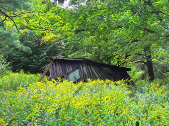 We walked back down to the Flynn Trail and turned right to walk toward the junction with the Big Rock Trail. The Flynn Trail ascends 1.7 miles to the Big Rock Trail junction gaining 600 feet. The more I hike the quicker I can hike and easier it seems. By 1:25 PM we had hiked the 1.9 miles to the junction with the Big Rock Trail. We continued straight ahead staying on the Flynn Trail heading toward Hodge Pond. We passed through the gate that marks the OSI property and soon were at the next trail junction where we turned right on the woods road to head towards the Beach Mountain Boy Scout Camp Pond. We walked passed the road down to Hodge Pond and continued to the next left. We turned onto the road and walked a short distance to the remaining cabins from the Boy Scout camp. I was surprised to see that several of the cabins had collapsed. We took some pictures and then turned around and headed back the way we came. This time we turned right and walked down the hill toward Hodge Pond. At the next junction we turned right to walk down the road to the clearing at the end of the Hodge Pond. Sheila alerted and I could see three hikers at the fire ring. I put Sheila on her leash and we walked down to the shores of the pond. We said "hello" to the others hikers and they responded. I let Sheila off her leash and she headed for the water to swim. I took some pictures of the pond which weren't too interesting as the sky was still overcast. Kendra found a stick and I threw it into the water so that she could retrieve it. I retuned the camera to my pack and we walked to the point where the Flynn Trail enters the woods. This section of trail climbs a hill and can seem long but having someone to talk to made this trip seem short. We continued on the flat section of the Flynn Trail back to the junction with the Big Rock Trail. There always seems to be a lot of mosquitoes in this area but on this day there were none. The hike can seem long as there are several places that make it seem as if you have reached the bottom of the hill at Times Square. On this day, we set a quick pace and talked to each other as we walked. We made it down the hill in what seemed like record time.
 At Times Square we walked straight across to stay on the Big Rock Trail. This area was damp with a little mud but it was easy to avoid those spots. We passed over the bridges over the inlet streams. The large hemlock I had worked on was still there but much easier to get over. Kendra was impressed by the progress I had made with hand tools. We could smell campfire smoke and saw a tent pitched on the right side of the trail. We walked through the beautiful area of pines and over the wooden walkways. I pointed out to Kendra that these walkways were deteriorating and that they could use repair or replacement before they become useless. Just before the end of the Big Rock Trail, we were surprised by a couple of hikers sitting under a tree resting and eating a sank. At the end of the Big Rock Trail, we turned left on the Quick Lake Trail and walked toward the bridge across the outlet of Frick Pond. We saw a tree in the trail ahead and I made a note to come remove it. When we got to the tree, we noticed that it appeared not to have fallen from "natural causes". I could not determine how it was felled and decided I would call the local forest ranger so that he could take a look at it. At the bridge, I dropped my pack and took shots of the pond and Flynn's Point. I did not see any wildlife but was glad the beaver dam was still intact. I packed up and we walked up the hill to Gravestone Junction. I told Kendra the story of the two children who had died in the fire and of the memorial gravestone close to the junction. We followed the Quick Lake Trail and the woods road back to the car. The trail was mostly dry with only a few damp spots. We were back at the car at 3:30 PM after hiking 6.0 miles in 3 hours and 10 minutes with an elevation gain of 930 feet. Our moving average was 2.2 mph with 30 minutes of stopped time.
![]()
![]()
![]()
![]()
![]() On Tuesday, September 15th, I wanted to get in a hike close to home with Cindy and my grandson Bryce. I suggested a hike of the Parksville Rail Trai since it is flat and short but has a nice waterfall. Bryce arrived at 9:00 AM and shortly after that the ambulance pager sounded. I responded to the call but we were cancelled and I returned home. Bryce and I did some chores and then started to get ready at 11:00 AM. As we started to get ready, the temperature on the back porch was still only 60 degrees. I got dressed in a White Sierra long-sleeved crew top with a short-sleeved baselayer. I put on a pair of RailRiders hiking pants which are expensive but last along time and have features like deep pockets and a generous cut which I really like. These pants have Velcro closures at the ankles to discourage sticks and gravel from getting into my shoes and to combat ticks. I decided to wear my Keen Targhee II hiking boots which fit well and have been discontinued. I also added my OR floppy hat which I have decided shields me from the sun and allows me to spray some insect repellant on it rather than on me. I grabbed a pair of Leki external lock poles I have been using lately. We put our gear in the back of the car and Sheila and Bryce in the back seat. We left Livingston Manor at 11:30 AM and drove out Old Route 17 toward Parksville. Just after Fox Mountain Road, I pulled into the parking area on the right side of the road at 11:40 PM. There were no cars in the lot and as we began to get ready. I decided to take my pack since it is the easiest way to carry my camera. I set my GPS but left my poles in the car as it is a short hike. The car thermometer reading 64 degrees as we started out on the trail.
On Tuesday, September 15th, I wanted to get in a hike close to home with Cindy and my grandson Bryce. I suggested a hike of the Parksville Rail Trai since it is flat and short but has a nice waterfall. Bryce arrived at 9:00 AM and shortly after that the ambulance pager sounded. I responded to the call but we were cancelled and I returned home. Bryce and I did some chores and then started to get ready at 11:00 AM. As we started to get ready, the temperature on the back porch was still only 60 degrees. I got dressed in a White Sierra long-sleeved crew top with a short-sleeved baselayer. I put on a pair of RailRiders hiking pants which are expensive but last along time and have features like deep pockets and a generous cut which I really like. These pants have Velcro closures at the ankles to discourage sticks and gravel from getting into my shoes and to combat ticks. I decided to wear my Keen Targhee II hiking boots which fit well and have been discontinued. I also added my OR floppy hat which I have decided shields me from the sun and allows me to spray some insect repellant on it rather than on me. I grabbed a pair of Leki external lock poles I have been using lately. We put our gear in the back of the car and Sheila and Bryce in the back seat. We left Livingston Manor at 11:30 AM and drove out Old Route 17 toward Parksville. Just after Fox Mountain Road, I pulled into the parking area on the right side of the road at 11:40 PM. There were no cars in the lot and as we began to get ready. I decided to take my pack since it is the easiest way to carry my camera. I set my GPS but left my poles in the car as it is a short hike. The car thermometer reading 64 degrees as we started out on the trail.
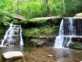
 Once we were on the trail and sheltered by the trees it was even a little cooler and I was glad I had worm long sleeves. The trail was almost completely dry except for a few wet and muddy places. We came to a nice view down to the Little Beaverkill and I stopped to take a few shots. Just after this point was a boardwalk and bridge and I again took some pictures. The day was sunny and the sky was very blue but there were no white clouds. We passed several benches placed for people to rest. As we walked, we talked about chemistry and other science topics which made the time go faster. Soon, I could hear an increase in the noise from the stream and I knew the falls was just ahead. We stopped to look at the falls which had a good amount of water passing over it. I walked down the bank and worked my way to the area directly in front of the falls. I took some shots and then repositioned to take a few more. There are two drops to the falls but from the bottom of the lower falls it is hard to see the upper drop. I walked back up the bank and took a picture from above the falls. We walked down the trail a short distance where another path led down to the creek. I walked down the trail and then carefully made my way along a narrow band of mossy rocks. These rocks lie up against a wall that holds back the earth from entering the creek. The rocks were slippery but I made my way to a ledge above the lower falls. From here I could take pictures of the lower falls from the top to the bottom. I also took shots of the upper drop further upstream. I was even able to get an image of the two falls in one frame. When I was done, I carefully walked back up to the main trail where Cindy and Bryce were waiting. We continued on the trail toward Parksville, As we approached the end of the trail, I put Sheila on her leash. I was happy to see that at least one property owner was cleaning up the mess just across the stream. We passed some buildings on the left side of the trail that were ruined and falling down. On the Parksville end of the trail we stopped at the small garden which has a very informative sign. The sign listed the businesses and hotels that existed in Parksville during its heyday. The Young's Gap Hotel had room for 600 guests! The sign also explained the role of the railroad in the dairy industry which was a thriving one in all of Sullivan County. I had Bryce read the sign and we discussed some of the information especially the comment that the area produced 9 million cans of milk annually. After a brief pause, we decided to walk back on the trail as it was in such good shape. The return trip was uneventful and we were soon back at the car. We were back at the car at 1:05 PM after hiking 3.0 miles in 1 hour and 30 minutes. Our moving average was 2.3 mph and the elevation gain was 280 feet which I doubted.
![]()
![]()
![]()
![]()
![]() On Monday, September 14th, I was ready to do a more challenging hike after two days off over the weekend for family commitments. I thought about Windham from the Batavia Kill parking area but didn't like the long ride. Finally, I chose Westkill because of Diamond Notch Falls and the Buck Ridge Lookouts. Westkill is a special place for me as I spread the ashes of a previous hiking partner, Sheba, at the Buck Ridge lookouts. When I initially woke up at 6:30 AM the temperature was only 46 degrees and it was very foggy so I decided to wait a little longer. As I began to get ready at 8:20 AM the temperature was still only 58 degrees with a slight breeze. Sheila was watching me carefully as we had not been out in two days. I got dressed in a White Sierra long-sleeved crew top with a short-sleeved baselayer. I put on a pair of RailRiders hiking pants which are expensive but last along time and have features like deep pockets and a generous cut which I really like. These pants have Velcro closures at the ankles to discourage sticks and gravel from getting into my shoes and to combat ticks. I decided to wear my Keen Targhee II hiking boots which fit well and have been discontinued. I also added my OR floppy hat which I have decided shields me from the sun and allows me to spray some insect repellant on it rather than on me. I grabbed a pair of Leki external lock poles I have been using lately. I took my Mammut hoody with me and packed a light windbreaker. I put my gear in the back of the car and Sheila in the backseat and left Livingston Manor at 8:45 AM. The skies were overcast with some areas of blue and there was a breeze blowing. I headed out DeBruce Road and turned left at the end on Route 47 to head toward Big Indian and Route 28. The work on the Neversink River looked almost complete and I wondered if it would hold back the mudslides once the river was at full capacity or beyond. There were a few cars at the Biscuit Brook parking area with some bucket trucks that looked like they were getting ready to work on some trees. The Slide Mountain parking area had a few more cars but was almost empty compared to the summer. The same was true of the parking for Giant Ledge and Panther. As we passed these spots where we have hiked before Sheila would "moan" as if she was asking me if we could stop and hike. I turned right on Route 28 and then left on Route 42 to head toward Spruceton. There was one car at the Halcott parking area. I turned right on the Spruceton Road and drove until we came to the point where the road turns to dirt. To my surprise there seemed to be work going on to replace one of the bridges across the Westkill. Along the road we passed the Spruceton Inn which was gained a nice reputation and also the West Kill Brewery where I had stopped on a previous trip. I drove almost to the end of the road and parked at the lot for Westkill. The temperature was 59 degrees and a slight breeze was blowing. making it seem just a little cool. I set my GPS and we headed up the Spruceton Road to the trail at 10:05 AM.
On Monday, September 14th, I was ready to do a more challenging hike after two days off over the weekend for family commitments. I thought about Windham from the Batavia Kill parking area but didn't like the long ride. Finally, I chose Westkill because of Diamond Notch Falls and the Buck Ridge Lookouts. Westkill is a special place for me as I spread the ashes of a previous hiking partner, Sheba, at the Buck Ridge lookouts. When I initially woke up at 6:30 AM the temperature was only 46 degrees and it was very foggy so I decided to wait a little longer. As I began to get ready at 8:20 AM the temperature was still only 58 degrees with a slight breeze. Sheila was watching me carefully as we had not been out in two days. I got dressed in a White Sierra long-sleeved crew top with a short-sleeved baselayer. I put on a pair of RailRiders hiking pants which are expensive but last along time and have features like deep pockets and a generous cut which I really like. These pants have Velcro closures at the ankles to discourage sticks and gravel from getting into my shoes and to combat ticks. I decided to wear my Keen Targhee II hiking boots which fit well and have been discontinued. I also added my OR floppy hat which I have decided shields me from the sun and allows me to spray some insect repellant on it rather than on me. I grabbed a pair of Leki external lock poles I have been using lately. I took my Mammut hoody with me and packed a light windbreaker. I put my gear in the back of the car and Sheila in the backseat and left Livingston Manor at 8:45 AM. The skies were overcast with some areas of blue and there was a breeze blowing. I headed out DeBruce Road and turned left at the end on Route 47 to head toward Big Indian and Route 28. The work on the Neversink River looked almost complete and I wondered if it would hold back the mudslides once the river was at full capacity or beyond. There were a few cars at the Biscuit Brook parking area with some bucket trucks that looked like they were getting ready to work on some trees. The Slide Mountain parking area had a few more cars but was almost empty compared to the summer. The same was true of the parking for Giant Ledge and Panther. As we passed these spots where we have hiked before Sheila would "moan" as if she was asking me if we could stop and hike. I turned right on Route 28 and then left on Route 42 to head toward Spruceton. There was one car at the Halcott parking area. I turned right on the Spruceton Road and drove until we came to the point where the road turns to dirt. To my surprise there seemed to be work going on to replace one of the bridges across the Westkill. Along the road we passed the Spruceton Inn which was gained a nice reputation and also the West Kill Brewery where I had stopped on a previous trip. I drove almost to the end of the road and parked at the lot for Westkill. The temperature was 59 degrees and a slight breeze was blowing. making it seem just a little cool. I set my GPS and we headed up the Spruceton Road to the trail at 10:05 AM.
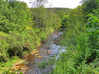
 We passed through the gate and started out on the trail toward the falls. The trail was wet in places with some standing water and some streams running across the trail. I was surprised that the level of the stream was pretty high and running well. The stream was beautiful and I was tempted to stop several times to take pictures. I decided to put this off until the return trip. At the falls, we turned right on the Devil's Path and then right again at the end of the bridge. We looked at the sign there and laughed. The distances given were to the hundredth and they were obviously wrong. The sign put the Buck Ridge Lookouts beyond the summit. It is too bad that this is not the only mistake I have seen on DEC signs. I was again tempted to take pictures but decided to wait until the trip back. As we continued to follow the trail it began to get steeper and wetter in a few spots which made it slipperier. Many of the rocks had some condensation which also made the going difficult. It was also obvious that the trail was more well-used than usual which reflected the overall increase in trail use. I was beginning to get warmer and was glad I had left the hoody in the car. As we continued the ascent, I began to remember that the ascent was long and steep in some places and that the hardest part was right at the beginning of the climb. We came to a section of trail that requires some side-hilling but found it was much more worn in than I remembered. Sheila visited a spring to get a drink and found it running. I was feeling surprisingly fresh which reflects the fact that I have been climbing more mountains lately. I was walking and thinking and soon we were at the spot where there is a near vertical climb. This is a short ascent but leads to a longer one. In the winter this is often a sheet of ice and can be exciting on the way up and the way down. Sheila scrambled up without much trouble and I followed making use of the roots as handholds. Once we passed this point there were still some steep areas to conquer. The mile climb from just after the falls to where the trail begins to level averages a 20% grade and can be very tiring.
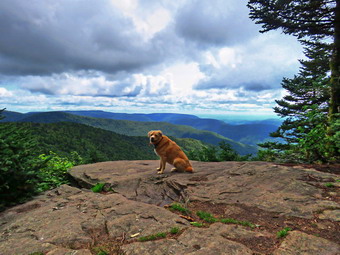
 Once we got to the more level part there were still some small climbs and a few descents but the going was easier. From that point to Buck Ridge and the summit is still well over a mile. On our way to the rock overhang or "cave" we passed the 3500 foot sign. I could have sworn the sign used to be just above the overhand but I checked my GPS and the new placement seems more correct. When we arrived at the cave, it was larger than I remembered but I decided to pass by and head for the summit. We were soon above the "cave" and after this the trail turns almost due west and levels off slightly. This section of trail along the ridge is long and a little boring. We finally came to the little descent before the final ascent to the Buck Ridge Lookouts. We worked our way down and were soon at the base of the final ascent. We climbed up to Buck Ridge arriving at 12:05 PM. It had taken us 2 hours to hike 3 miles! So much for keeping a good pace. We continued on the Devil's Path heading toward the summit which is a short trip and serves no purpose other than to allow a hiker to claim they got to the summit. It is only about .1 miles and it took us about 15 minutes to get up and back to the lookouts. There is still a sign at the summit that says "Westkill Mt. Summit" but the large stone cairn had been dismantled. I took a few shots of Sheila, the sign and the cairn before we turned around and walked back to the lookouts. I took pictures from the lookout to the south and then walked a little farther west to another lookout to take some more shots. I also took some pictures Sheila sitting on the ledge with the mountains in the background. We walked over to the lookout to the north where I had taken my favorite picture of Sheba. There was no view from the large boulder as it is completely blocked by trees now. I took a few shots of the boulder and then we walked back to my pack and started back down the trail from Buck Ridge at 12:30 PM.
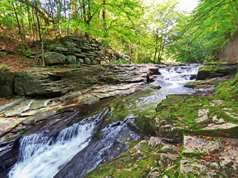
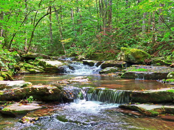 We tried to keep a quick pace on the way down without stopping but the going was not easy in some of the steeper spots. The trail has lots of rocks and roots on the upper part which slowed me down. We continued down the trail which was certainly easier than hiking up! We met no more hikers coming up. Just before the falls we walked down to the stream bed and I took a number of pictures from that angle. Rather than walk up to the bridge, we crossed the stream. I took more pictures from that angle and then decided to walk up the bank and head back. Before leaving, Sheila took several dips in the cool water and then began to dash madly around. The stream has actually changed its course slightly and now flows more on the left rather than the right side of the bed. We continued hiking back toward the car. There were two places where there were small rapids in succession. Some fallen leaves dotted these areas and I knew the right pictures would be beautiful. I stopped at the first and then the second. Both times I walked down to rocks in the stream just in front of the rapids to take pictures. I made sure I had a few at the automatic setting and a few that give the water the wispy appearance that some people enjoy. As we walked back to the car, a young couple came walking toward us. I took Sheila off the trail and said "Hello" to the hikers as they passed. We were back at the car at 2:35 PM after hiking 6.2 miles in 4 hours and 30 minutes with 45 minutes of stopped time. Our moving speed was 1.6 mph. The total ascent was 2080 feet. I was tired but glad we had made the trip. The hike did point out that I am getting in better shape.
![]() On Friday, September 11th, I had not really planned a hike as I was still sore from a fall I had taken. Around noon I decided I wanted to do something and settled on going to Alder Lake to cut some blowdowns on the Millbrook Ridge Trail. As I started to get ready the temperature was 70 degrees but a slight breeze made it feel cooler. The skies were blue but without many white clouds to make it interesting. I got dressed in a short-sleeved crew top with a short-sleeved baselayer. I put on a pair of RailRiders hiking pants which are expensive but last along time and have features like deep pockets and a generous cut which I really like. These pants have Velcro closures at the ankles which keeps the sticks and ticks out. I decided to wear my Keen Targhe II hiking boots which fit reasonably well but have been discontinued. I left the poles home as I knew I would be carrying tools. I added my OR floppy hat which I have decided shields me from the sun and allows me to spray some insect repellant on it rather than on me. I packed my Silky Sugowaza saw which is a 17" curved and fixed blade which fits in a scabbard. It is remarkably sharp and can take care of trees larger than one would think. I also took my Fiskars pack axe and two felling wedges. The Fiskars axe is light but cuts well and is easier to carry than a full-sized felling ax. I put our gear in the car and Sheila in the backseat and we left Livingston Manor at 12:40 PM. I drove out the driveway and got on Old Route 17 headed north toward Roscoe. At the Beaverkill Road, I turned right and continued through Lew Beach and Turnwood toward Alder Creek Road. Here I made a left and rove toward Alder Lake. The road had almost washed out in a recent storm and there was still construction work in progress. After a brief stop, we continued to the end where I turned right onto the access road for Alder Lake. I drove to the Alder Lake parking lot and pulled into a spot. There were six other vehicles in the lot by the lake including a forest ranger's truck. Two hikers were sorting out a heap of camping. By the noise, there seemed to be a good volume of water flowing down Alder Creek. The temperature was 72 degrees with a slight breeze and low humidity. The skies were still blue but cloudless. At 1:05 PM we headed down to the "lawn" passing by the stone foundations which marked the last remnants of the Coykendall Mansion. The lawn had not been mowed and we could barely see the picnic tables through the high grass. This is such a beautiful place and it is a shame the DEC does not keep it maintained. We walked toward the trail around the left side of the lake and walked along the trail. I kept an eye out for any bears that might be enjoying the berries. Brush and branches had overgrown the trail and needed some pruning. Sheila was happy to be out and ran ahead and then returned.
On Friday, September 11th, I had not really planned a hike as I was still sore from a fall I had taken. Around noon I decided I wanted to do something and settled on going to Alder Lake to cut some blowdowns on the Millbrook Ridge Trail. As I started to get ready the temperature was 70 degrees but a slight breeze made it feel cooler. The skies were blue but without many white clouds to make it interesting. I got dressed in a short-sleeved crew top with a short-sleeved baselayer. I put on a pair of RailRiders hiking pants which are expensive but last along time and have features like deep pockets and a generous cut which I really like. These pants have Velcro closures at the ankles which keeps the sticks and ticks out. I decided to wear my Keen Targhe II hiking boots which fit reasonably well but have been discontinued. I left the poles home as I knew I would be carrying tools. I added my OR floppy hat which I have decided shields me from the sun and allows me to spray some insect repellant on it rather than on me. I packed my Silky Sugowaza saw which is a 17" curved and fixed blade which fits in a scabbard. It is remarkably sharp and can take care of trees larger than one would think. I also took my Fiskars pack axe and two felling wedges. The Fiskars axe is light but cuts well and is easier to carry than a full-sized felling ax. I put our gear in the car and Sheila in the backseat and we left Livingston Manor at 12:40 PM. I drove out the driveway and got on Old Route 17 headed north toward Roscoe. At the Beaverkill Road, I turned right and continued through Lew Beach and Turnwood toward Alder Creek Road. Here I made a left and rove toward Alder Lake. The road had almost washed out in a recent storm and there was still construction work in progress. After a brief stop, we continued to the end where I turned right onto the access road for Alder Lake. I drove to the Alder Lake parking lot and pulled into a spot. There were six other vehicles in the lot by the lake including a forest ranger's truck. Two hikers were sorting out a heap of camping. By the noise, there seemed to be a good volume of water flowing down Alder Creek. The temperature was 72 degrees with a slight breeze and low humidity. The skies were still blue but cloudless. At 1:05 PM we headed down to the "lawn" passing by the stone foundations which marked the last remnants of the Coykendall Mansion. The lawn had not been mowed and we could barely see the picnic tables through the high grass. This is such a beautiful place and it is a shame the DEC does not keep it maintained. We walked toward the trail around the left side of the lake and walked along the trail. I kept an eye out for any bears that might be enjoying the berries. Brush and branches had overgrown the trail and needed some pruning. Sheila was happy to be out and ran ahead and then returned.
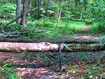 We crossed the bridges on the trail and I saw the ranger walking toward us. It was Eric Startton and we stopped to talk. Eric is often out hiking and has also helped us train with the fire department for rope rescues. We talked about the Willowemoc Wild Forest and the Neversink Unique Area both of which have some problems. After our conversation, we continued in our separate directions. At about .8 miles we turned left to head up the Millbrook Ridge Trail. The trail was wet and muddy in several places. The trail tread was obvious and it looked like people had been using it. There were quite a few nettles but they were far enough back from the trail that we passed through without any "encounters". I had a particular blowdown in mind to clear but we stopped at a smaller white birch that was encroaching on the trail. I took some shots and then used the saw to start dissecting the blowdown. As I cut each piece I threw it off the trail. I finished the job by using the axe to sever the last piece. After making the last cut, I took some final pictures and we moved on. At 1.1 miles we came to the blowdown I wanted to clear. Someone had cut some of the branches but had left them in place. They also had failed to clear enough branches to allow most people to pass through the blowdown. Because of this hikers had begun to walk around the blowdown creating another "trail". I roped my pack and got out the camera to take some "before" pictures and then surveyed the work. I first pulled out all the loose branches and piled them where hikers had started to walk. I felt this committed me to finishing the work. I had to use the saw several times to cut intertwined branches to free them. This took longer than I expected because there were quite q few of them.
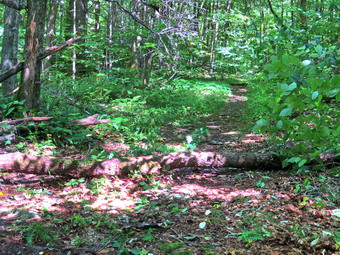 After clearing all the smaller branches, I turned my attention to some larger ones. I started cutting with the saw and was able to cut branches up to six inches in diameter without much problem. After cutting each one, I had to pick it up and put it on the pile which was growing larger. I continued to cut and stack even though some aches and pains were showing up. I was able to drag a large trunk that had fallen just beyond the main blowdown off the trail. This took some effort as it was heavy and long but I did not want to cut it. I was finally left with one smaller trunk laying on the trail. This one was easy to step over. A larger trunk was across the trail and was at a height that made it difficult to negotiate. I knew I should make three cuts but decided on two. One cut would be through the upper part of the trunk where it was about 8 inches in diameter. The second cut would be lower and closer to the butt end where the diameter was between 10 and 12 inches. I grabbed the axe and started cutting. I found that this maple was hard! I always have to remember to make the initial cut wide so that it stays wide enough as I taper down to the final cut. The light Fiskars axe works against me since there is not as much momentum when I swing it. It took me some time but I cut all the way through. I now knew that the second cut would be that much more difficult. I started in making sure I made a wide cut. As I was chopping Sheila alerted as a family group approached us. The two men in the group genuinely offered to help chop but I knew that was not a good idea due to insurance concerns. I turned them down and they moved on. I got back to chopping and eventually got through the log. I was very happy to hear the last gasp of the wood as it fell to the ground. I went over to lift the smaller end and found it was heavier than I thought. My idea was to pivot the upper end off the trail but I wasn't sure I could even do that. I kept moving it little by little and was even able to lift it over the trunk that was still on the ground. I got it to a position where it would not roll and was happy with a job well done. I took my "after" pictures and then looked at the remaining trunk. I decided I was done for the day and we headed back to the car the way we came. We were back at the car at 3:25 PM after hiking 2.1 miles in 2 hours and 20 minutes with a modest 170 foot elevation gain. We had stopped for 1 and a half hours for me to do the work!
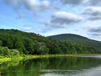
![]()
![]()
![]()
![]()
![]() On Wednesday, September 9th, I had planned to do a longer hike taking in some 3500 foot peaks. As I was getting ready an ambulance call for a motor vehicle accident came in. By the time I returned I decided to ask Cindy if she wanted to go somewhere which I knew would be a shorter hiked than I had planned. She decided on Alder Lake which was okay with me even though I had been there recently. When I got up at 6:30 AM it was 54 degrees but the humidity seemed high. I knew the forecast was for highs in the high 70's and high humidity. I got dressed in a short-sleeved crew top with a short-sleeved baselayer. I put on a pair of RailRiders hiking pants which are expensive but last along time and have features like deep pockets and a generous cut which I really like. These pants have Velcro closures at the ankles which keeps the sticks and ticks out. I decided to wear my Keen Targhe II hiking boots which fit reasonably well but have been discontinued. I grabbed a pair of Leki external lock poles I have been using lately. I also added my OR floppy hat which I have decided shields me from the sun and allows me to spray some insect repellant on it rather than on me. I put our gear in the car and Sheila in the backseat and we left Livingston Manor at 11:00 AM. I drove out the driveway, drove out Old Route 17 and headed up the Beaverkill Road. I continued through Lew Beach and Turnwood toward Alder Creek Road where I made a left. Alder Creek Road had almost washed out in the last storm and there was still construction work in progress. After a brief stop, we continued to the end where I turned right onto the access road for Alder Lake. I drove to the Alder Lake parking lot and pulled into a spot. There were two other vehicles in the lot by the lake and one hiker was just heading out. By the noise, there seemed to be a good volume of water flowing down Alder Creek. The temperature was 70 degrees with a slight breeze but relatively high humidity. The skies were overcast with just a little blue. At 11:40 AM we headed down to the "lawn" passing by the stone foundations which marked the last remnants of the Coykendall Mansion. The lawn had not been mowed and we could barely see the picnic tables through the high grass. This is such a beautiful place and it is a shame the DEC does not keep it maintained. We walked toward the trail around the left side of the lake but I decided to stop and take some pictures. I took shots of the lake including Millbrook Ridge and Cradle Rock Ridge. We then headed over to the trail and as we walked along the trail I kept an eye out for any bears that might be enjoying the berries. Brush and branches had overgrown the trail and needed some pruning. Sheila was happy to be out and ran ahead and then returned to us. We stopped once on this section of trail so that I could take some pictures of Cradle Rock Ridge. As I took those pictures I noticed some ducks diving on the lake. I zoomed in to see that they were grebes but I could never really get a good shot.
On Wednesday, September 9th, I had planned to do a longer hike taking in some 3500 foot peaks. As I was getting ready an ambulance call for a motor vehicle accident came in. By the time I returned I decided to ask Cindy if she wanted to go somewhere which I knew would be a shorter hiked than I had planned. She decided on Alder Lake which was okay with me even though I had been there recently. When I got up at 6:30 AM it was 54 degrees but the humidity seemed high. I knew the forecast was for highs in the high 70's and high humidity. I got dressed in a short-sleeved crew top with a short-sleeved baselayer. I put on a pair of RailRiders hiking pants which are expensive but last along time and have features like deep pockets and a generous cut which I really like. These pants have Velcro closures at the ankles which keeps the sticks and ticks out. I decided to wear my Keen Targhe II hiking boots which fit reasonably well but have been discontinued. I grabbed a pair of Leki external lock poles I have been using lately. I also added my OR floppy hat which I have decided shields me from the sun and allows me to spray some insect repellant on it rather than on me. I put our gear in the car and Sheila in the backseat and we left Livingston Manor at 11:00 AM. I drove out the driveway, drove out Old Route 17 and headed up the Beaverkill Road. I continued through Lew Beach and Turnwood toward Alder Creek Road where I made a left. Alder Creek Road had almost washed out in the last storm and there was still construction work in progress. After a brief stop, we continued to the end where I turned right onto the access road for Alder Lake. I drove to the Alder Lake parking lot and pulled into a spot. There were two other vehicles in the lot by the lake and one hiker was just heading out. By the noise, there seemed to be a good volume of water flowing down Alder Creek. The temperature was 70 degrees with a slight breeze but relatively high humidity. The skies were overcast with just a little blue. At 11:40 AM we headed down to the "lawn" passing by the stone foundations which marked the last remnants of the Coykendall Mansion. The lawn had not been mowed and we could barely see the picnic tables through the high grass. This is such a beautiful place and it is a shame the DEC does not keep it maintained. We walked toward the trail around the left side of the lake but I decided to stop and take some pictures. I took shots of the lake including Millbrook Ridge and Cradle Rock Ridge. We then headed over to the trail and as we walked along the trail I kept an eye out for any bears that might be enjoying the berries. Brush and branches had overgrown the trail and needed some pruning. Sheila was happy to be out and ran ahead and then returned to us. We stopped once on this section of trail so that I could take some pictures of Cradle Rock Ridge. As I took those pictures I noticed some ducks diving on the lake. I zoomed in to see that they were grebes but I could never really get a good shot.
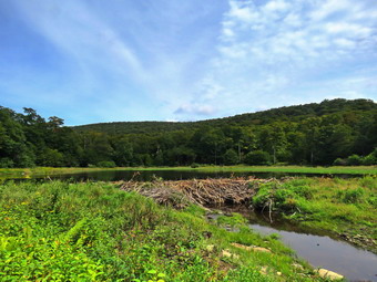 As we crossed the bridges on the trail, I pointed out to Cindy the remnants of the beaver dams that the DEC had opened up when they relocated the beavers. I showed her where the water had backed up so much that the trail had been flooding. We continued on the trail toward the junction with the Millbrook Ridge Trail. I looked ahead and saw a couple with a dog at the trail junction. As we approached, I put Sheila on her leash. The couple asked which way we were going and I indicated that we were head out on the Millbrook Ridge Trail. The couple let us pass and then head in a different direction. I felt bad as we never saw them again. At about .8 miles we turned left to head toward the lean-to on the Millbrook Ridge Trail. The trail was wet and muddy in several places and there were a few blowdowns to contend with. Some of the blowdowns had been cut but whoever did the cutting left what they cut in the trail! Others were cut in several, places but the job was left incomplete. The trail tread was obvious and it looked like people had been using it. There were quite a few nettles but they were far enough back from the trail that we passed through without any "encounters". For the next 1.5 miles the trail climbed and then leveled off several times. The elevation gain is several hundred feet but the grade is never more than 12% and averages around 6%. There isn't too much to see along the way but this day was very pleasant. I enjoyed the sounds and sights of Alder Creek as it flows parallel to the trail much of the way. Hiking with Cindy is always a pleasure as we can talk about various subjects and Sheila really enjoys it when we hike together. At one point the hiker that we had seen in the parking lot came up behind us and passed us. We passed by a beaver meadow on the right side of the trail. At 1.85 miles we began the last climb and soon arrived at the beaver pond. Where there had once been a beaver meadow, there was now a pond with a dam and a beaver lodge. We walked out to the shore of the pond just downstream of the dam. The shore was cleaned back at least 10 feet of all trees but the brush and weeds had begun to grow back. I took pictures of the whole scene and then more shots of the dam and the pond. When I finished, I returned my camera to my pack and we walked back out to the main trail to the lean-to. I dropped my pack and got out the camera to take a few shots. I noticed that the privy was now completely torn apart by thoughtless campers looking for some firewood. One person starts the vandalism and the rest join in! We got a drink and a snack. The lean-to has been in need of repair for some time but I know of no plan to upgrade this popular spot.
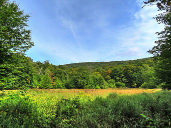 We walked back out to the main trail and turned right to walk along the main trail to the next beaver meadow. After .1 miles and some climbing over large blowdowns, we were at the beaver meadow. I took some pictures and we got a bar and a drink. We turned around and started to walk back toward Alder Lake. When we arrived at the area of the lean-to, I turned right and walked a few hundred feet to the spring. The piped spring was running slowly but it would fill a waterborne in a short time. I retuned to the main trail and we continued to walk back toward the parking area. We both realized that the return trip would be much easier as it was almost all downhill. We were soon at the loop trail around Alder Lake where we turned left to complete the loop around the lake. We walked over the bridge and continued on the main loop trail which was muddy in spots. We saw an older couple ahead of us and I put Sheila on her leash. We walked by the two hikers on the opposite side of the trail and greeted them as we passed. As we continued along the woods road toward the dam, we came to a path that I thought might lead to Cradle Rock Ridge. I turned left on the path but only found a campsite at the end. I returned to the trail which ascends some as it approaches the dam but the slope is gentle and then there is a descent. We came to a deep ravine cut by a small stream where a bridge across the stream had been replaced. We continued to walk on the trail coming out of the woods in a small clearing very near the dam. The trail here was wet and muddy. We walked up to the dam and crossed it. I stopped to take a few pictures and then headed up the hill toward the parking area. There were quite a few people on the shores of the lake and one person swimming a distance out in the pond. We arrived at the car at 2:30 PM after hiking 5.0 miles in 2 hours and 45 minutes with an elevation gain of 725 feet. The temperature was now 78 degrees.
On Tuesday, September 8th, my grandson Bryce was scheduled to be at my house and the weather report was for sun all day. I thought this would be a great day to finish marking the Round Top trails. We had repainted the marking on the yellow trail. Now we had to blaze the new crossover trail with white paint and the switchback on the upper trail with blue. I also wanted to remove the blazes on the steepest part of the blue trail which I hope to elemental with the switchback. I also hoped to have time to touch up the blazes on the rest of the blue trail. Bryce arrived a little after 9:00 AM. I had to pick up something for the ambulance corps in Liberty so I left to get that task accomplished. When I return, Bryce and I packed up the recyclables and garbage and I visited the transfer station. It was close to lunchtime so we ate and started to get ready to go across the street and paint. Sheila seemed interested in going as she lay watching every move I made. I wore a short-sleeved hiking crew with no baselayer as the temperature was 84 degrees. I put on a pair of RailRiders hiking pants which are expensive but last along time and have features like deep pockets and a generous cut which I really like. These pants have Velcro closures at the ankles which help keep the sticks and stones out of my shoes and the ticks at bay. I decided to wear my Vasque Taku hiking boots which still fit reasonably well but have been discontinued. I knew I would not need poles and decided against gaiters. I also added my OR floppy hat which I have decided shields me from the sun and allows me to spray some insect repellant on it rather than on me. I packed my LT Wright Overland machete. The machete is great for trimming brush and hacking small trees. In this case I would need it to scrape the area on the trees that I was painting and to cut brush that block the view of any blazes. I put the paint and bushes and the machete in the back of the car. Sheila and Bryce were in the back seat and Cindy, who had decided to go, sat in the front passenger seat. I usually just walk across the road to hike or do work but there was a little too much to carry. I drove out the driveway and to the highest part of the cemetery to the trailhead. We started out at 1:00 PM by walking into the woods with each of us carrying some gear. When we got to the first trail junction, Sheila continued straight ahead toward the lookout so we followed her. At the lookout, we followed the trail as it turned right. We arrived at the junction with the blue trail and turned left to start up the hill. When we arrived at the new crossover trail, I asked Cindy if she could remove all the old ribbons. I would paint and Bryce would hand me the machete when needed. We walked along the trail painting blazes and clearing some brush as needed. Some of the blades had to be put on small trees as there were no larger trees in the right spots. It did not take us long to finish the trail. I made sure to put blazes indicating the beginning and end of the trail. We walked back to where we had started and walked downhill a few feet to the crossover trail. I switched paint colors and we used the same procedure to mark this trail. Once we were back at the main blue trail we walked downhill to the trail junction. Cindy decided to leave and let Bryce and I finish the job. Sheila was torn between leaving and staying but I convinced her to stay. Bryce and I started back up the blue trail repainting the existing blazes. Bryce was dragging a little from the heat but we got the job done. When we reached the switchback I used the machete to scrape the paint of the trees on the main trail as I want people to use the switchback. At the other end of the switchback, a little higher on the hill, I again started touching up the blue blazes. I had to clear some brush along the way but we still made good time. As we started down the hill, two women came walking over the summit and passed by with a "Hello". We worked our way down the fill to the junction with the yellow trail. At this point, I saw that Bryce did not have a paintbrush I had given him and I knew just where he had dropped it. I told him to stay put as Sheila and I walked quickly all the way back up to the summit. I picked up the brush and headed back to Bryce. We walked down the yellow trail to the woods road that took us back to the first trail junction. We walked back out to the car and put our tools in the back. It was 3:00 PM when I drove down the hill and back home. I though the 2 hours was time well spent.
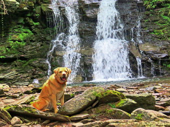
![]()
![]()
![]()
![]()
![]() On Monday, September 7th, I was planning to hike Table and Peekamoose from Denning. As often happens, an early morning ambulance call came in and I did not return home until 8:00 AM. I decided that I would leave immediately for a hike but reconsidered my destination. I really wanted to hike Table and Peekamoose from Peekamoose Road because of the views from the lookouts south of the summit. It was also very hazy and I did not know when the haze would clear. I decided to go to Trout Pond and hike a slightly longer version of the hike I normally do. I thought I would take along my LT Wright Overland machete to cut some knot weed and any branches that might be in the trail. It was 55 degrees when I started to get ready at 8:00 AM. Sheila got wind of what was going on and began running around the house barking. I got dressed in a White Sierra long-sleeved crew top with a short-sleeved baselayer. I put on a pair of RailRiders hiking pants which are expensive but last along time and have features like deep pockets and a generous cut which I really like. These pants have Velcro closures at the ankles to discourage sticks and gravel from getting into my shoes and to combat ticks. I decided to wear my Keen Targhee II hiking boots which fit well and have been discontinued. I also added my OR floppy hat which I have decided shields me from the sun and allows me to spray some insect repellant on it rather than on me. I packed my LT Wright Overland machete. The machete is great for trimming brush and hacking small trees. I grabbed a pair of Leki external lock poles I have been using lately. I put our gear in the back of the car and Sheila in the backseat and left Livingston Manor at 8:45 AM. The skies were completely overcast and there was a breeze blowing. I headed to Roscoe on State Route 17, got off at exit 94 and got on Route 206. I followed it across the Delaware County line to Morton Hill Road. After a left turn on Morton Hill Road, I drove to the intersection with Russell Brook Road. I turned around and parked on the side of the road to avoid the parking area which is private. I set my GPS and put Sheila on her leash as we began our hike down Russell Brook Road at 9:10 AM. The temperature was 59 degrees, a breeze was blowing and the humidity was very low. There were two cars parked in the lot. As we started to walk down Russell Brook Road, I saw there were people camped at the illegal camping spot on the right. Russell Brook Road was damp and just a little muddy as we continued on down the road to the overlook over the upper falls. There was enough water in the stream to make the upper falls interesting so I decided to take some pictures as the light seemed just right. We walked down to the overlook and I put down my pack and got out the camera. I took some shots and the packed up to continue the hike. We continued down toward the parking area where there were six cars already parked.
On Monday, September 7th, I was planning to hike Table and Peekamoose from Denning. As often happens, an early morning ambulance call came in and I did not return home until 8:00 AM. I decided that I would leave immediately for a hike but reconsidered my destination. I really wanted to hike Table and Peekamoose from Peekamoose Road because of the views from the lookouts south of the summit. It was also very hazy and I did not know when the haze would clear. I decided to go to Trout Pond and hike a slightly longer version of the hike I normally do. I thought I would take along my LT Wright Overland machete to cut some knot weed and any branches that might be in the trail. It was 55 degrees when I started to get ready at 8:00 AM. Sheila got wind of what was going on and began running around the house barking. I got dressed in a White Sierra long-sleeved crew top with a short-sleeved baselayer. I put on a pair of RailRiders hiking pants which are expensive but last along time and have features like deep pockets and a generous cut which I really like. These pants have Velcro closures at the ankles to discourage sticks and gravel from getting into my shoes and to combat ticks. I decided to wear my Keen Targhee II hiking boots which fit well and have been discontinued. I also added my OR floppy hat which I have decided shields me from the sun and allows me to spray some insect repellant on it rather than on me. I packed my LT Wright Overland machete. The machete is great for trimming brush and hacking small trees. I grabbed a pair of Leki external lock poles I have been using lately. I put our gear in the back of the car and Sheila in the backseat and left Livingston Manor at 8:45 AM. The skies were completely overcast and there was a breeze blowing. I headed to Roscoe on State Route 17, got off at exit 94 and got on Route 206. I followed it across the Delaware County line to Morton Hill Road. After a left turn on Morton Hill Road, I drove to the intersection with Russell Brook Road. I turned around and parked on the side of the road to avoid the parking area which is private. I set my GPS and put Sheila on her leash as we began our hike down Russell Brook Road at 9:10 AM. The temperature was 59 degrees, a breeze was blowing and the humidity was very low. There were two cars parked in the lot. As we started to walk down Russell Brook Road, I saw there were people camped at the illegal camping spot on the right. Russell Brook Road was damp and just a little muddy as we continued on down the road to the overlook over the upper falls. There was enough water in the stream to make the upper falls interesting so I decided to take some pictures as the light seemed just right. We walked down to the overlook and I put down my pack and got out the camera. I took some shots and the packed up to continue the hike. We continued down toward the parking area where there were six cars already parked.
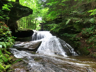 We got on the woods road that goes down to the bridge that crosses the brook. I decided to walk to the falls since I could see there were no people there at the time. The Japanese knotweed had regrown and was in full flower encroaching on the path. The informal path to the falls was also overgrown and I thought about coming back on another day to do some trail clearing. We walked along the path and then down the bank to the streambed. The falls had a reduced flow even though there had been some rain. I was happy to see there were no ridiculous rock stacks (RRS) anywhere in sight. I took some shots including some of Sheila who posed in front of the falls. When I was done, we headed back up the bank. I decided to walk up the hill to the area above the upper falls. I had not been there in some time and it is really pretty. I took off my pack and got out the camera. I worked my way down the narrow path to the bottom of the falls. I found one RRS which I dismantled. I took pictures of the top of the lower falls and then some of the upper falls from right in front of it. I climbed back up the path to my pack and stowed the camera. We walked back down the path to the main trail. We turned right and at the trail junction, we turned to the left to climb the steeper hill toward Mud Pond. The trail was damp and slightly muddy. The outlet stream from Trout Pond was at low volume but I could see that someone had tried to dam the stream with rocks. The water was flowing over and around the rocks so I decided to leave them there until another trip. I was surprised that no one had claimed the large camping site on the right side of the trail. We started to climb the hill and I removed a few small branches from the trail. The ascent went quickly and I could feel how much fitter I was getting with each hike. We reached the top of the hill at 10:10 AM after hiking 1.9 miles. The woods road was also wet and muddy in spots. At 2.1 miles we arrived at the trail junction where we normally turn right on the Mud Pond Trail to start over the trail to Trout Pond. I decided we should continue straight ahead on the Mud Pond Trail to visit the dam at the outlet end of Mud Pond. I remembered that the hike to the dam was longer than it seems but I forgot how far it was.
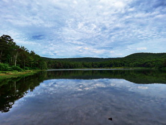 We passed one designated camping area which was occupied and some ruins on the left side of the trail. We began to walk uphill slightly to find very wet and very muddy areas. I tried to avoid them as much as possible but the mud spanned the trail in several places. At 2.5 miles the trail turned south at the point where a snowmobile trail started off to the right. The trail became a little drier and less muddy. We crossed several streams and passed by a second designated campsite which was also occupied. I checked Avenza to make sure I had not passed the turn. At 2.9 miles the third designated campsite appeared on the left and we turned onto the trail to walk down to the campsite and the dam. I put down my pack and got out the camera. The skies were still overcast but I took pictures of the pond and zoomed in on some features I found interesting. I took some pictures of the dam and the fire ring and then packed up to go. We walked back up to the main trail and turned right to return the way we had come. The walk back on the trail seemed to go much more quickly than the walk out. On the way back I stopped at the ruins and took pictures of the foundations and walls which were much more extensive than I realized. As I was taking my shots, three women walked by heading out on the Mud Pond Trail. I went back to my pack, stored my camera and continued on the trail. When we reached the junction with the snowmobile trail, we turned left to stay on the Mud Pond Trail. As we walked along the trail, I was surprised to see that the three women were now coming up the trail behind us. As I was moving a trunk off the trail, the women passed us. I said "Hello" and they complimented Sheila on her behavior and appearance. After clearing the trail, we continued to hike and soon caught up to the female hikers.
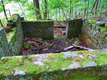 We stopped for a few minutes and conversed. I found out they were from Catskill, NY and were out for a hike and a swim away from places were there were too many people. We passed the three hikers and continued up the trail which continued to be wet in spots. I stopped to remove another tree trunk from the trail and the three hikers caught up to us. One of them helped me remove a trunk and then they passed us. A part of the trunk remained on the trail but I could not remove it. I wanted to cut off the part that what still in the trail but had not brought a saw. The only tool I had was my machete so I decided to try that. It took me some time and more swings than I would like but I eventually cut through the trunk and removed it from the trail. I took a few pictures and then continued on our hike. We continued to walk uphill passing through some briars and areas where I had previously cleared blowdowns. At 5.1 miles we hit the highest point on the hike on the shoulder of Cherry Ridge and started our descent. The descent went quickly and at 5.3 miles we followed the trail as it turned east toward Trout Pond. I looked ahead and saw a tree blocking the trail with a lot of leafy branches. Hikers had formed a path walking around the tree. I looked at the branches and thought I could clear it with the machete. I put my pack down. took a picture and then started in with the machete. I cut away the smallest branches first and kept cutting larger ones until everything was cleared. I took another picture and then we continued on our way. It didn't take long until we were at Trout Pond where we turned left on walked to the bridge over the inlet stream.
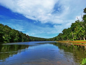 I decided to stop and take some pictures even though the skies were still overcast. Neither lean-to was occupied and the other camping site was also empty. When I was done, we continued on the main trail toward the outlet end of the pond. This part of the trail did have a few wet and muddy places. At the lower end of the pond, we turned right and walked out to the beach. I again stopped to take pictures of a scene I had photographed many times! The water level in the pond was much lower than I expected. The skies were a little more blue with many clouds. On this day Sheila started to swim on her own. I threw a stick several times into deeper water and she retrieved it each time. There were some people at the dam and they were leaving so I packed up and headed out to the trail. The hike from the outlet to the trail junction is all downhill and was slightly wet and muddy. About halfway down, we met a young couple carry a young child up the hill toward the pond. I was pretty sure that the pond was as far as they would make it! We met two more groups of hikers coming up the trail. By 1:15 PM we had hiked 7.25 miles and were back at the trail junction and register box. We continued on the main trail to hike back to the car. I could hear quite a few people at the falls. We walked up to the lower parking area which was now completely filled with at least one car parked along the road above the lot. I was amazed that it was early afternoon on Monday and the area was so busy. As we walked up the road back to the car, I could see quite a few people down at the falls and was glad we had visited it at the beginning of the hike. We continued up the road and one car headed down while four cars drove passed us toward Morton Hill Road. We continued to walk back up the road to the back to the car. When we arrived, I informed one group that they were parking on private property. We arrived back at 1:30 PM having covered 7.9 miles and 1424 vertical feet in 4 hours and 20 minutes. The temperature was 71 degrees as I pulled away.
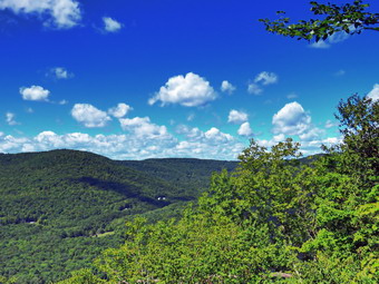
![]()
![]()
![]()
![]()
![]() On Saturday, September 5th I had planned to hike all the trails on the Shavertown Parcel. The Catskill Mountain Club created the trails in this area and recently added an additional trail with a lookout over the Tremperskill Valley. I wanted to produce a geospatial PDF that can be used in the Avenza app as the club has not made one available. I asked Cindy if she would like to go the night before and she agreed. Once again my plans were modified by a 5:00 AM ambulance call. When I returned, it was still very foggy and I decided I would try to get a little more sleep. The fire siren went off at around 10:00 AM and I decided to get up even though it did not result in and ambulance call. By this time the fog had disappeared and the skies were blue and sunny with some nice white clouds. The temperature was sill only 66 degrees but I knew it would warm up as the sun came out. As we began to get ready at 11:00 AM, Sheila, lay quietly on my floor but her eyes watched every movement I made. I got dressed in a short-sleeved crew top with a short-sleeved baselayer. I put on a pair of RailRiders hiking pants which are expensive but last along time and have features like deep pockets and a generous cut which I really like. These pants do not have Velcro closures at the ankles as some do to discourage sticks and gravel from getting into my shoes and to combat ticks. I decided to wear my Keen Targhee II hiking boots which fit well and have been discontinued. I grabbed a pair of Leki external lock poles I have been using lately. I put our gear in the back of the car and Sheila in the backseat and left Livingston Manor at 11:30 AM. I headed north on the Quickway and got off at exit 94 for Roscoe. I drove through Roscoe and across the Rockland Flats on Route 206. I continued on Route 206 to the Pepacton Reservoir. Along the way we seemed to get behind people who wanted to travel well below the speed limit! At the Pepacton, I turned right on Route 30 to drive toward the bridge across the reservoir. After 12 miles, I turned left onto the bridge. At the other end of the bridge, I turned left and left again into the parking area. The lot was almost filled but I parked on the grass at the end of the line of cars. I hoped all of the people were not hiking the trail. Just as we were about to leave a group of six people and a dog started out toward the trailhead. I set my GPS and we headed north on CR 1 toward the trailhead which is only .1 miles ROM the parking area.
On Saturday, September 5th I had planned to hike all the trails on the Shavertown Parcel. The Catskill Mountain Club created the trails in this area and recently added an additional trail with a lookout over the Tremperskill Valley. I wanted to produce a geospatial PDF that can be used in the Avenza app as the club has not made one available. I asked Cindy if she would like to go the night before and she agreed. Once again my plans were modified by a 5:00 AM ambulance call. When I returned, it was still very foggy and I decided I would try to get a little more sleep. The fire siren went off at around 10:00 AM and I decided to get up even though it did not result in and ambulance call. By this time the fog had disappeared and the skies were blue and sunny with some nice white clouds. The temperature was sill only 66 degrees but I knew it would warm up as the sun came out. As we began to get ready at 11:00 AM, Sheila, lay quietly on my floor but her eyes watched every movement I made. I got dressed in a short-sleeved crew top with a short-sleeved baselayer. I put on a pair of RailRiders hiking pants which are expensive but last along time and have features like deep pockets and a generous cut which I really like. These pants do not have Velcro closures at the ankles as some do to discourage sticks and gravel from getting into my shoes and to combat ticks. I decided to wear my Keen Targhee II hiking boots which fit well and have been discontinued. I grabbed a pair of Leki external lock poles I have been using lately. I put our gear in the back of the car and Sheila in the backseat and left Livingston Manor at 11:30 AM. I headed north on the Quickway and got off at exit 94 for Roscoe. I drove through Roscoe and across the Rockland Flats on Route 206. I continued on Route 206 to the Pepacton Reservoir. Along the way we seemed to get behind people who wanted to travel well below the speed limit! At the Pepacton, I turned right on Route 30 to drive toward the bridge across the reservoir. After 12 miles, I turned left onto the bridge. At the other end of the bridge, I turned left and left again into the parking area. The lot was almost filled but I parked on the grass at the end of the line of cars. I hoped all of the people were not hiking the trail. Just as we were about to leave a group of six people and a dog started out toward the trailhead. I set my GPS and we headed north on CR 1 toward the trailhead which is only .1 miles ROM the parking area.
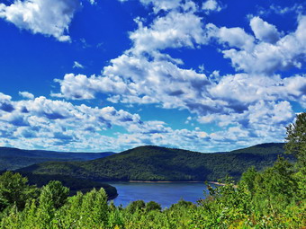 We turned right off the road and onto the trail. My first reaction was that it looked much more "used" than the last time I hiked it. The trail was mostly dirt with a few rocks and roots toward the upper end. There was some mud in spots and two or three small streams crossing the trail. In .25 miles the trail gains 220 feet at a 16% grade which is a good way to get started. This section of trail ends on a road and there is a set of signs just across the road that direct hikers. We chose to cross the road and head toward the "Overlook". The trail we were on now was one that Cindy and I had helped create when the DEP closed the road that was being used to get to Snake Pond because of a logging project. This part of the trail was also worn in and was covered in pine needles or leaves. There was at least one small stream that crossed the trail but proved to be no obstacle. After .1 miles or .5 miles into the hike, we came to a sign that indicated that the new trail to the overlook turned to the left. We made the turn and started heading north gaining a little elevation as we continued along the trail. The trail was obviously new and not as well-worm as the other, older trail sections. It was a little rough in places and a few more trail markers could make the route easier to follow. At .7 miles the trail began to gain elevation more seriously. At times the trail followed old woods roads but only briefly. We were now meeting several groups of people coming toward us and one group told us the trail became "very steep". Over the next half mile we continued to travel north gaining 350 feet. This is an average 14% grade but the last ascent is 26%. Just after the last scent the trail turns west and descends slightly to a large rock shelf that serves as the overlook. The overlook gives a nice view of the Pepacton to the southwest and the Tremperskill valley to the northwest. I dropped my pack and took out the camera. I took quite a few pictures of the scenery and one of Cindy and Sheila sitting on the rock. We got a bar and a drink and the started back down the trail. The return trip went quickly and would have been even faster except for the number of people we met! Each time I saw a group coming, I walked off the trail with Sheila. We did get many compliments on a well-behaved and beautiful dog! I agree.
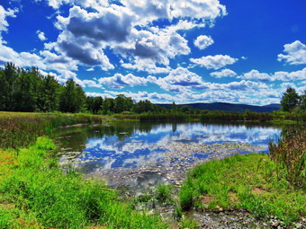 When we arrived back at the trail to the pond, we turned left and began to climb a little more. Cindy was a little tired of climbing but I slowed down and started to talk to her. The hike up to the pond was only .2 miles but we did gain another 155 feet. We emerged at the bench just below the pond where Cindy decided to rest as I walked around the pond taking picture. I took my camera and Sheila on her leash and hiked up to the shore of the pond. As we crested the little hill I saw two young women and a large German shepherd. The dog was not on a leash and came bounding toward us with the owner yelling "He is friendly" and me responding "Mine is not". The shepherd was beautiful and only 4 years old. The owner took him over to the pond where he took a swim. I snapped some shots of the reservoir and the pond and then started walking clockwise around the pond. I stopped in several spots to take pictures. As we walked around the back of the pond, I noticed that the earthen bank that contained the water in the pond had been rebuilt. This meant that the trail around the back of the pond was in much better shape. I let Sheila off her leash and she took a quick swim while I took some more pictures. There was also a new crushed stone road which headed up the hill toward the road that we would use to return to the car. We hiked up the road and turned right to walk back to Cindy at the bench. When we returned to where we started, I realized that I had not carried my GPS and would have to repeat the walk around the pond to get a track. I picked up my pack and we all headed back up to the pond. We encountered the other dog again but this time I knew what to expect. We walked around the pond and then up the road to the area above the pond. I gave Cindy Sheila's leash and hurried down to the bench to complete the track. I immediately turned around and walked back up to Cindy. We started to walk down the road to get back to the car. The road was paved with large crushed stones and shortly opened up into a large field. The clouds were so outstanding that I decided to stop and take a few shots. A little further down the road, I stopped again to take some more pictures of the clouds and some of the meteorology equipment in the field. We continued our walk down the road entering the trees. We met a young couple with their baby hiking up toward the pond. At 2.9 miles we turned left on the trail which was well-marked with a large sign. The weather was still nice with a slight breeze blowing. The trip down the trail was much quicker than the trip up. We did meet two people coming up the trail even though it was late in the afternoon. When we reached the road we turned left and walked back to the car. It was 2:20 PM and we had hiked 3.3 miles in 2 hours and 20 minutes with 30 minutes of stopped time. The elevation gain was 1030 feet. We drove across the road to a barbecue vendor named "Mary's Cookin' Again" out of Roxbury. The $15 price tag for a meat and two sides was reasonable especially because the portions were huge!
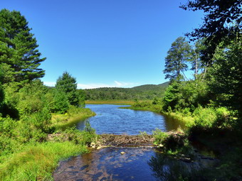
![]()
![]()
![]()
![]()
![]() On Friday, September 4th, I was ready to get a hike with some maintenance included. Cindy and I had hiked around Frick and Hodge Ponds the day before and we had found many small and some larger blowdowns. I find that hiking relieves stress but swinging an axe relieves even MORE stress! It wasn't quite 60 degrees when I got up at 7:00 AM but the temperature was going up. I wanted to get an early start but had various tasks to accomplish in the morning so I didn't start getting ready until 11:30 AM. I started gathering my equipment and getting dressed. Sheila had been very quiet but did not let me out of her sight as I was getting ready. I got dressed in a White Sierra long-sleeved crew top with a short-sleeved baselayer. I put on a pair of RailRiders hiking pants which are expensive but last along time and have features like deep pockets and a generous cut which I really like. These pants do not have Velcro closures at the ankles to discourage sticks and gravel from getting into my shoes and to combat ticks. I decided to wear my Vasque Taku hiking boots which fit well and have been discontinued. I also added my OR floppy hat which I have decided shields me from the sun and allows me to spray some insect repellant on it rather than on me. I packed my Silky Sugowaza saw, LT Wright Overland machete and Fiskars axe. The Sugowaza is a 17" curved and fixed blade which fits in a scabbard. It is remarkably sharp and can take care of trees larger than one would think. The machete is great for trimming brush and hacking small trees. The Fiskars axe is light but cuts well and is easier to carry than a full-sized felling ax. I left my poles at home knowing I would be carrying the tools the whole way to do trail work. I got my gear in the car and Sheila in the backseat and left Livingston Manor at noon. I drove out the DeBruce Road about 6 miles to Mongaup Road and turned left to continue up the road to the point where it splits. I stayed left on Beech Mountain Road and drove to the Frick Pond trailhead. I pulled into the smaller parking area where two cars were already parked. There was only one car in the larger lot. There were only a few insects and the temperature had risen to about 74 degrees with virtually no humidity in the air. I set my GPS and we walked out the woods road to the Quick Lake Trail at the register. The trail was as wet and muddy as it had been the day before. As we walked along the trail, Sheila alerted and we saw three hikers coming toward us followed by another hikers a little farther behind. The first three hikers had a dog and I pulled Sheila off the trail as they passed. They thanked me as they passed and Sheila and I continued toward Gravestone Junction. We turned left to walk down to the pond. The spot near the junction where we had placed stepping stones was wet and muddy as was the rest of the flat section of trail. At the bridge over the outlet I dropped my pack to take some pictures even though I have hundreds from the same spot and had taken some the day before. The water in the pond seemed high probably due to the rain we had gotten over the last few days. After taking some shots, I packed up and we continued around the west shore of the pond. It was wet and muddy with a large puddle in one spot. At the next trail junction we stayed left on the Quick Lake trail heading toward Iron Wheel Junction.
On Friday, September 4th, I was ready to get a hike with some maintenance included. Cindy and I had hiked around Frick and Hodge Ponds the day before and we had found many small and some larger blowdowns. I find that hiking relieves stress but swinging an axe relieves even MORE stress! It wasn't quite 60 degrees when I got up at 7:00 AM but the temperature was going up. I wanted to get an early start but had various tasks to accomplish in the morning so I didn't start getting ready until 11:30 AM. I started gathering my equipment and getting dressed. Sheila had been very quiet but did not let me out of her sight as I was getting ready. I got dressed in a White Sierra long-sleeved crew top with a short-sleeved baselayer. I put on a pair of RailRiders hiking pants which are expensive but last along time and have features like deep pockets and a generous cut which I really like. These pants do not have Velcro closures at the ankles to discourage sticks and gravel from getting into my shoes and to combat ticks. I decided to wear my Vasque Taku hiking boots which fit well and have been discontinued. I also added my OR floppy hat which I have decided shields me from the sun and allows me to spray some insect repellant on it rather than on me. I packed my Silky Sugowaza saw, LT Wright Overland machete and Fiskars axe. The Sugowaza is a 17" curved and fixed blade which fits in a scabbard. It is remarkably sharp and can take care of trees larger than one would think. The machete is great for trimming brush and hacking small trees. The Fiskars axe is light but cuts well and is easier to carry than a full-sized felling ax. I left my poles at home knowing I would be carrying the tools the whole way to do trail work. I got my gear in the car and Sheila in the backseat and left Livingston Manor at noon. I drove out the DeBruce Road about 6 miles to Mongaup Road and turned left to continue up the road to the point where it splits. I stayed left on Beech Mountain Road and drove to the Frick Pond trailhead. I pulled into the smaller parking area where two cars were already parked. There was only one car in the larger lot. There were only a few insects and the temperature had risen to about 74 degrees with virtually no humidity in the air. I set my GPS and we walked out the woods road to the Quick Lake Trail at the register. The trail was as wet and muddy as it had been the day before. As we walked along the trail, Sheila alerted and we saw three hikers coming toward us followed by another hikers a little farther behind. The first three hikers had a dog and I pulled Sheila off the trail as they passed. They thanked me as they passed and Sheila and I continued toward Gravestone Junction. We turned left to walk down to the pond. The spot near the junction where we had placed stepping stones was wet and muddy as was the rest of the flat section of trail. At the bridge over the outlet I dropped my pack to take some pictures even though I have hundreds from the same spot and had taken some the day before. The water in the pond seemed high probably due to the rain we had gotten over the last few days. After taking some shots, I packed up and we continued around the west shore of the pond. It was wet and muddy with a large puddle in one spot. At the next trail junction we stayed left on the Quick Lake trail heading toward Iron Wheel Junction.
 This part of the trail was wet and muddy for the entire length until it again entered the trees. I removed a couple of branches on the trail and cut a few branches with the ax. We came across our first job which consisted of small tree arched low across the trail followed by another just after it. I took some before pictures and then used the ax to fell the small tree which was surprisingly easy. I sued the saw to cut the trunk at one end then pivoted the trunk off the trail. I cleaned up a few more pieces and then moved up the trail a little to the other blowdown. This one was a little larger and a little trickier to fell. I experimented by shaking the trunk a little and the trunk crashed to the ground. I cut the trunk and dragged it off the trail. I took my "after" pictures and packed up to move on down the trail. We passed through a wet area and I saw another very small tree to cut down. Another group of family group of hikers was approaching so I took Sheila with me to the other side of the trail. I cut the small tree before the hikers arrived and dragged it off the trail. I waited until they passed and then packed up and continued on the trail.
We entered the "spruce tunnel" and came to another more substantial trunk across the trail. This tree had been dead for some time but was solid and water logged. I took a picture and then used the ax to cut the trunk on one end. It took some time to finish the cut. I tried rotating the trunk off the trail in one direction and when that did not work I tried rotating it in the other direction which did work. I took the after pictures and then we started back up the trail. We walked to the stream through the woods over a section of trail that was, like many others, wet and muddy. The water level was high so we walked upstream to cross. As we walked up the trail, we came to a large branch lying by the side of the trail. The branch really wasn't blocking the trail but the look did not please me. I always use the same method which means I cut away the branches that are in the way and drag them off the trail before cutting the main trunks of the tree. This took a little longer than I expected as there were more branches and they were intertwined. I finally got them all cut and took some after pictures. I collected my gear and we continued to walked along the trail. I pulled down a few low-hanging branches and cut them off to clear the trail. We came to another single trunk across the trail. I took pictures and then used the ax to cut the 8 inch trunk on the left side of the trail. I went to the other side of the trail and used the ax to cut the trunk on that end. After finishing the cut, I was able to move the main piece of the trunk off the trail. I took a picture and we continued on to Iron Wheel Junction where we turned right onto the Logger's Loop.
This part of the trail was wet and muddy for the entire length until it again entered the trees. I removed a couple of branches on the trail and cut a few branches with the ax. We came across our first job which consisted of small tree arched low across the trail followed by another just after it. I took some before pictures and then used the ax to fell the small tree which was surprisingly easy. I sued the saw to cut the trunk at one end then pivoted the trunk off the trail. I cleaned up a few more pieces and then moved up the trail a little to the other blowdown. This one was a little larger and a little trickier to fell. I experimented by shaking the trunk a little and the trunk crashed to the ground. I cut the trunk and dragged it off the trail. I took my "after" pictures and packed up to move on down the trail. We passed through a wet area and I saw another very small tree to cut down. Another group of family group of hikers was approaching so I took Sheila with me to the other side of the trail. I cut the small tree before the hikers arrived and dragged it off the trail. I waited until they passed and then packed up and continued on the trail.
We entered the "spruce tunnel" and came to another more substantial trunk across the trail. This tree had been dead for some time but was solid and water logged. I took a picture and then used the ax to cut the trunk on one end. It took some time to finish the cut. I tried rotating the trunk off the trail in one direction and when that did not work I tried rotating it in the other direction which did work. I took the after pictures and then we started back up the trail. We walked to the stream through the woods over a section of trail that was, like many others, wet and muddy. The water level was high so we walked upstream to cross. As we walked up the trail, we came to a large branch lying by the side of the trail. The branch really wasn't blocking the trail but the look did not please me. I always use the same method which means I cut away the branches that are in the way and drag them off the trail before cutting the main trunks of the tree. This took a little longer than I expected as there were more branches and they were intertwined. I finally got them all cut and took some after pictures. I collected my gear and we continued to walked along the trail. I pulled down a few low-hanging branches and cut them off to clear the trail. We came to another single trunk across the trail. I took pictures and then used the ax to cut the 8 inch trunk on the left side of the trail. I went to the other side of the trail and used the ax to cut the trunk on that end. After finishing the cut, I was able to move the main piece of the trunk off the trail. I took a picture and we continued on to Iron Wheel Junction where we turned right onto the Logger's Loop.
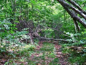 As we walked we continued to clear some small branches. I did not intend to do too much work as it was getting late and I was a little tired. Shortly after the turn, we ran into another small tree leaning diagonally across the trail. I began by taking pictures and then using the saw to cut the tree on the right side of the trail near the butt end. After making this cut, I was able to drag the upper end of the trunk off the trail. I took my final pictures and packed up. A little farther down the trail, we ran into an almost identical small tree across the trail and treated it much the same way. After clearing this tree, we walked for some time before running into the most complex blowdown of the day. A large cherry tree had broken off high up and fallen so that it was arching across the trail. This tree was not blocking the trail but it had brought down others that were. I took a careful look at the large cherry and it was clear it was not coming down soon. I turned my attention to the other trees and took a before picture. I then dragged off all the loose branches. I then began to apply the same method which means I cut away the branches that are in the way and drag them off the trail before cutting the main trunks of the tree.
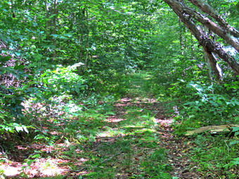 This took a little longer than I expected as there were more branches and they were intertwined. I finally got them all cut and dragged off the trail. I cut the main trunk and was able to pivot it off the trail which saved time making other cuts. I took some after pictures, collected my gear and continued to walk along the trail. We continued to Times Square and found no more blowdowns. We passed through Times Square which was as wet as always with plenty of mud. The problem of properly draining this area has escaped me as there is surface runoff after it rains and some spring which keep things wet. We continued straight head on the Logger's Loop and up a slight hill. After cresting the hill, we continued out to Gravestone Junction. By now there were some nice puffy white clouds in the sky so I stopped to take a few pictures. We turned left at the Gravestone Junction and headed back to the car. At the trail register, we turned right to stay on the Quick Lake Trail so that I could check to see if there were any blowdowns. We found no problems on the trail. When we reached the parking area, we walked out to the road and over to the smaller parking area. There was a family group of three with their dog so I quickly got Sheila in the car. It was 3:30 PM and we had spent 3 hours hiking 4.1 miles and doing a lot of trail work. The elevation gain was a modest 410 feet. The temperature was 78 degrees as I pulled away from the parking area.
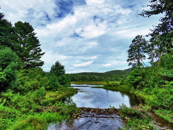
![]()
![]()
![]()
![]()
![]() On Thursday, September 3rd I planned to do a hike close home but a little easier and flatter than the Becker Hollow hike I had done on Monday. It had been two days since I hiked and I was ready to get out. I knew that the trails might be wet and muddy as it had rained the day before. I had some calls to make and some work to do so I didn't start thinking about getting ready until noon. I asked Cindy if she would like to hike and she said "Yes" and I suggested the Frick and Hodge Pond loop. Cindy agreed and we began to get ready to hike with the temperature at 80 degrees. Sheila had been very quiet but did not let me out of her sight as I was getting ready. I got dressed in a White Sierra long-sleeved crew top with a short-sleeved baselayer. I put on a pair of RailRiders hiking pants which are expensive but last along time and have features like deep pockets and a generous cut which I really like. These pants do not have Velcro closures at the ankles to discourage sticks and gravel from getting into my shoes and to combat ticks. I decided to wear my Keen Targhee II hiking boots which fit well and have been discontinued. I grabbed a pair of Leki external lock poles I have been using lately. I also added my OR floppy hat which I have decided shields me from the sun and allows me to spray some insect repellant on it rather than on me. I put my gear in the back and Sheila in the backseat and I pulled out of Livingston Manor at 11:35 AM. I drove out DeBruce Road about 6 miles and turned left on Mongaup Pond Road. When the road split, I stayed left on Beech Mountain Road to the Frick Pond trailhead. There were six cars parked in the larger lot so I chose the smaller lot where no one was parked. I set my GPS and we started out on the woods road toward Frick Pond at 12:55 PM. The trail was muddy and as soon as we passed the register it was covered with water. There was also water running across the trail in several places. As we neared Gravestone Junction, Sheila alerted and I could see three hikers coming toward us. I took Sheila off the trail as the hikers passed. One of them complimented Sheila on her looks and her calm behavior! At Gravestone Junction, we stayed to the left and walked along the wet and muddy trail down to the bridge at the outlet of Frick Pond. The skies were almost completely overcast and I did not plan to stop but this scene always mesmerizes me. I took off my pack and got out the camera and took shots of the pond and Beech Mountain. As I was clicking some shots, some more hikers came by and I pulled Sheila aside. After a short pause, I packed up, and we continued our hike. We walked along the west side of the pond where the trail was very wet and muddy.
On Thursday, September 3rd I planned to do a hike close home but a little easier and flatter than the Becker Hollow hike I had done on Monday. It had been two days since I hiked and I was ready to get out. I knew that the trails might be wet and muddy as it had rained the day before. I had some calls to make and some work to do so I didn't start thinking about getting ready until noon. I asked Cindy if she would like to hike and she said "Yes" and I suggested the Frick and Hodge Pond loop. Cindy agreed and we began to get ready to hike with the temperature at 80 degrees. Sheila had been very quiet but did not let me out of her sight as I was getting ready. I got dressed in a White Sierra long-sleeved crew top with a short-sleeved baselayer. I put on a pair of RailRiders hiking pants which are expensive but last along time and have features like deep pockets and a generous cut which I really like. These pants do not have Velcro closures at the ankles to discourage sticks and gravel from getting into my shoes and to combat ticks. I decided to wear my Keen Targhee II hiking boots which fit well and have been discontinued. I grabbed a pair of Leki external lock poles I have been using lately. I also added my OR floppy hat which I have decided shields me from the sun and allows me to spray some insect repellant on it rather than on me. I put my gear in the back and Sheila in the backseat and I pulled out of Livingston Manor at 11:35 AM. I drove out DeBruce Road about 6 miles and turned left on Mongaup Pond Road. When the road split, I stayed left on Beech Mountain Road to the Frick Pond trailhead. There were six cars parked in the larger lot so I chose the smaller lot where no one was parked. I set my GPS and we started out on the woods road toward Frick Pond at 12:55 PM. The trail was muddy and as soon as we passed the register it was covered with water. There was also water running across the trail in several places. As we neared Gravestone Junction, Sheila alerted and I could see three hikers coming toward us. I took Sheila off the trail as the hikers passed. One of them complimented Sheila on her looks and her calm behavior! At Gravestone Junction, we stayed to the left and walked along the wet and muddy trail down to the bridge at the outlet of Frick Pond. The skies were almost completely overcast and I did not plan to stop but this scene always mesmerizes me. I took off my pack and got out the camera and took shots of the pond and Beech Mountain. As I was clicking some shots, some more hikers came by and I pulled Sheila aside. After a short pause, I packed up, and we continued our hike. We walked along the west side of the pond where the trail was very wet and muddy.
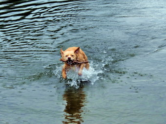 At the junction with the Big Rock Trail, we turned left to stay on the Quick Lake Trail. We followed the trail which was wet and muddy for its entire length. I removed some blowdowns from the trail and checked on some trees arching over the trail. We walked through the "spruce tunnel" and came to the small stream through the woods. It was flowing freely with a greater volume than I had seen in a long time. I stopped to take a few pictures of the stream and Sheila who had decided to wade in the water. We walked upstream to cross in a shallower and more narrow area. After crossing we continued on the Quick Lake Trail to Iron Wheel Junction. This part of the trail showed signs that the heavy rains had eroded parts of the trail and there were still pools of water and muddy spots. At Iron Wheel Junction, we turned left to stay on the Quick Lake Trail. When we came to the junction where the snowmobile trail turns left, I noticed that there was some indication that people had walked on the trail. It is 1.6 miles from Iron Wheel Junction to Junkyard Junction with an elevation gain of almost 500 feet. This walk often seems long and this was one of those days since the water and the mud slowed us down. The trail was eroded in many places showing the power of the water that had run down the trail. Along the way, Cindy's phone rang and she answered as it was her sister. After a video conversation, we continued on our way setting a slightly faster pace as the skies were getting even cloudier. When we came to Junkyard Junction, we turned right onto the Flynn Trail and started toward Hodge Pond. This trail was wet and muddy along its entire length and was a miserable hike. The Flynn Trail from Junkyard Junction to Hodge Pond is .85 miles and drops 165 feet to the shores of the pond. After passing through the gate that marks the boundary with the OSI property, we walked down the hill toward the pond and turned right to stay on the Flynn Trail. This part of the trail was also wet and muddy but not as bad as some of the trails up to this point. We soon left the trees and entered a field. As we crossed this open area, I noticed a woman kneeling in the field. She looked like she was picking something. She said "Hello" and gave Sheila her second compliment of the day.
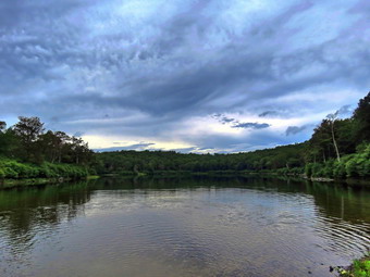 We continued on the trail to the clearing at the south end of Hodge Pond. We walked over to the shores of the pond where I put down my pack and got out the camera. The skies had grown darker but I took some pictures of the pond. Sheila went wading so I threw a stick for her to retrieve. The water in the pond was so shallow that Sheila did not have to swim much to get the stick. After a short time, I ate a bar, we took some water and packed up to continue on the Flynn Trail.We walked back to the Flynn Trail to the point where it re-entered the woods and began the walk up the hill. This part of the trail was almost dry with only a few spots of mud here and there. The Flynn Trail is relatively flat to the junction with the Big Rock Trail at 4.8 miles into the hike. We passed through the gate marking the border with the OSI property and soon after arrived at the junction with the Big Rock Trail. The Flynn Trail continued straight ahead and we continued in that direction. At least the Flynn Trail either descends or is flat all the way back to the car. The walk on this day seemed to go quickly as we set a fast pace brought on by the gathering clouds. At 5.4 miles we came to the path to the clearing on the east side of the trail. At this point the rain began to fall as a few drops. I decided to put my pack cover on as I knew it would deter the rain. We continued on down the trail at an accelerated pace as the rain began to fall a little harder. It seemed as if the "tunnel" that Cindy and I had cut in the large spruce tree came up sooner than I expected. Just before the gate we turned left to follow the Flynn Trail and to avoid the private property around the cabin. We continued on the trail passing the register box and crossing the road to the car. The trail from the road to the register box was very eroded and each rain erodes the area more. I have no ideas how to fix this problem. When we arrived back at the parking lot, there was one other car present in the small lot and one in the larger lot. We were back at the car by 4:15 PM having covered 6.5 miles in 3 hours and 20 minutes with 25 minutes of stopped time. The elevation gain was 920 feet. Our moving speed was 2.2 mph with an overall speed of 2.0 mph.
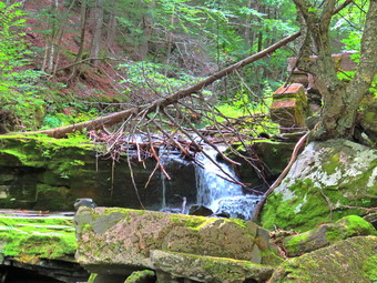
![]()
![]()
![]()
![]()
![]() On Monday, August 31st the weather forecast called for partly cloudy skies, cooler temperatures, low humidity and no rain. I knew these would be excellent conditions for hiking a mountain with a view. I decided to take a long, grueling hike up Hunter Mountain to the fire tower using the Becker Hollow Trail. My intention was to return by the Hunter Mountain Trail and the Devil's Path to Notch lake. A 1.5 mile walk on the road would get us back to the car. I planned to get an early start in the morning but as so often happens and ambulance call around 7:00 AM set me back. When I got home, I almost decided not to go but I stayed with my plan. I started to get ready at 9:30 AM when the temperature was only 58 degrees. As I was getting ready Sheila knew something was "up" and stayed close to me as I got dressed and got the gear together. I got dressed in a White Sierra long-sleeved crew top with a short-sleeved baselayer. I put on a pair of RailRiders hiking pants which are expensive but last along time and have features like deep pockets and a generous cut which I really like. These pants have a Velcro closures at the ankles to discourage sticks and gravel from getting into my shoes and to combat ticks. I decided to wear my Keen Targhee II hiking boots which fit well and have been discontinued. I grabbed a pair of Leki external lock poles I have been using lately. I also added my OR floppy hat which I have decided shields me from the sun and allows me to spray some insect repellant on it rather than on me. I put my gear in the back and Sheila in the backseat and I pulled out of Livingston Manor at 11:00 AM. I drove out DeBruce Road to the end of the road and turned left on Route 47 to drive passed the Frost Valley YMCA Camp. I noticed that there were 6 vehicles parked at Biscuit Brook which surprised me a little. There were 8 cars at the Slide Mountain parking area and the same number at the parking area for Giant Ledge. I continue on the road to the junction with Route 28. I turned right and drove to the turn for Phoenicia where I turned left. I made another left turn on Route 214 and headed north passing the Devil's Tombstone Campsite and Notch Lake. In another 1.6 miles I pulled into the Becker Hollow parking area. There were already seven cars parked already with one group returning and another pair of hikers getting ready to leave. I parked and got Sheila out of the car and on her leash. I set my GPS and we started out on the trail at 11:25 AM by passing through the stone columns at the beginning of the trail.
On Monday, August 31st the weather forecast called for partly cloudy skies, cooler temperatures, low humidity and no rain. I knew these would be excellent conditions for hiking a mountain with a view. I decided to take a long, grueling hike up Hunter Mountain to the fire tower using the Becker Hollow Trail. My intention was to return by the Hunter Mountain Trail and the Devil's Path to Notch lake. A 1.5 mile walk on the road would get us back to the car. I planned to get an early start in the morning but as so often happens and ambulance call around 7:00 AM set me back. When I got home, I almost decided not to go but I stayed with my plan. I started to get ready at 9:30 AM when the temperature was only 58 degrees. As I was getting ready Sheila knew something was "up" and stayed close to me as I got dressed and got the gear together. I got dressed in a White Sierra long-sleeved crew top with a short-sleeved baselayer. I put on a pair of RailRiders hiking pants which are expensive but last along time and have features like deep pockets and a generous cut which I really like. These pants have a Velcro closures at the ankles to discourage sticks and gravel from getting into my shoes and to combat ticks. I decided to wear my Keen Targhee II hiking boots which fit well and have been discontinued. I grabbed a pair of Leki external lock poles I have been using lately. I also added my OR floppy hat which I have decided shields me from the sun and allows me to spray some insect repellant on it rather than on me. I put my gear in the back and Sheila in the backseat and I pulled out of Livingston Manor at 11:00 AM. I drove out DeBruce Road to the end of the road and turned left on Route 47 to drive passed the Frost Valley YMCA Camp. I noticed that there were 6 vehicles parked at Biscuit Brook which surprised me a little. There were 8 cars at the Slide Mountain parking area and the same number at the parking area for Giant Ledge. I continue on the road to the junction with Route 28. I turned right and drove to the turn for Phoenicia where I turned left. I made another left turn on Route 214 and headed north passing the Devil's Tombstone Campsite and Notch Lake. In another 1.6 miles I pulled into the Becker Hollow parking area. There were already seven cars parked already with one group returning and another pair of hikers getting ready to leave. I parked and got Sheila out of the car and on her leash. I set my GPS and we started out on the trail at 11:25 AM by passing through the stone columns at the beginning of the trail.
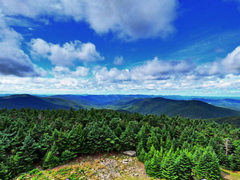 The trail at the bottom is wide and flat without many stones or roots. This part is an old woods road as is easy walking. I walked off trail to take some pictures of some stone foundations. The trail parallels a stream and we could hear the water running in it. I walked over to get a view but there was more noise than water. We stopped at a "new" bridge that had been constructed to cross the stream and I toke some pictures of the bridge. I also took a few pictures of the stream but the lighting was not the best. After a short distance a dam appeared on the left and we walked off the trail just below the dam so that I could take some pictures of the small waterfall created by the dam. We walked back up to the trail and I took some pictures of the rather long concrete dam. At this point the sun was very bright, almost too bright to take good pictures! The trail began to narrow and gain elevation at this point. There were also several brooks running across the trail and despite the fact that most of the trail was dry or just damp, these areas were wet. This was surprising since most hikes streams on my latest hikes had been dry or at least reduced to a very low volume. There was enough water in many places to support a healthy and thriving crop of nettles! Fortunately the trail was wide enough to prevent any close encounters. These streams also allowed Sheila to get a drink. The trail starts ascending right from the beginning and the ascent does let up for 2.2 miles when it gets to the summit plateau. At about .7 miles the ascent begins in earnest with a 22% grade for about .5 miles. It was in this area that we passed two hikers taking a break on the climb. They started to hike again just after we passed them and I thought they would arch us but we never saw them again.
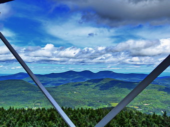 I was surprised that the trail was in such poor shape with a lot of erosion which exposed many rocks and roots. It had been some time since I had hiked this route and I suppose that time and increased usage are responsible for the poor condition of the trail surface. At 1.2 miles the trail leveled a little but than began to climb again at a 31% grade. We met several groups coming back down the trail and the way they were traversing convinced me that we would not be returning this way! At 1.65 miles the trail again leveled just enough to give me some hope and then continued its steep climb with some areas at a 35% grade. The ascent is challenging up to 3500 feet which occurs at about 1.85 miles from the trailhead but then it gets even steeper. At this point the trail becomes rockier with looses stones and dirt. This is cruel since my legs are already tired from the climb up to this point! From 3500 feet there is still over 500 feet to ascend. The trail in this area was once open and exposed to the sun which offered some great views. The trees have now formed a canopy in most places which shades the trail but also blocks the views. at 2 miles we arrived at the trail junction with the yellow spur trail that is the most direct route to the fire tower. I turned right on the spur trail but then decided I wanted to complete the Becker Hollow Trail. Once we started to climb the last .2 miles to the summit plateau I began to regret the decisions. The first .1 miles averaged a 35% grade! I breathed an audible sigh of relief when we reached the top. We turned right and began the .4 mile hike to the fire tower which was longer than I had remembered although several times I have simply taken the spur trail. The flat trail to the tower was very muddy in many spots so the trip was less than enjoyable. At 2.45 miles we finally reached the clearing at the summit with the tower and cabin.
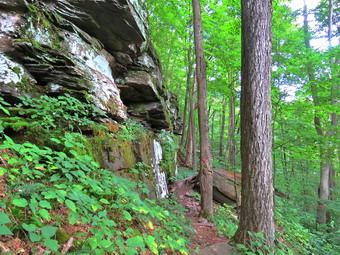 I took off my pack and leashed Sheila to the structure used for mounting horses as there were other people present and at least one dog. Sheila did not like being left behind as I walked over to climb the tower. The sun was still shining and there wasn't very much wind even when I cleared the treetops and continued climbing to the landing just below the cab. There was almost no haze hanging over the surrounding mountains and valleys which meant I took quite a few pictures using different angles and zooms. It took me a minute to get oriented but seeing the ski slopes below gave me a "north: orientation. I took pictures of the Blackhead Range, Kaaterskill High Peak, the rest of the Devil's Path and all the other mountains. I even took several shots down at Sheila and some through the supports of the tower. I returned to the base of the tower and walked a short distance away to get pictures of the tower and the cabin before returning to my pack. I talked to a pair of hikers that had been ahead of us on the trail and they said they were going to return by Becker Hollow. I told them my plan to make a loop by taking the long way down the Hunter Mountain Trail and Devil's Path to Notch Lake and then walking back on the road. They left and I got a drink and a bar before leaving the clearing and walking the .4 miles back to the junction with the Becker hollow Trail. For some reason the mud on the way back did not seem to be as much of a problem. As we were hiking down the Hunter Mountain Trail we met several groups of people headed up including two young men running up the trail. I though it was late but there was still plenty of hours of daylight left. This trail was wet in spots with running water and was very rocky and eroded. The trail was a deep channel and hard to walk so hikers had been walking on the elevated sides which causes further erosion. We continued down to the trail junction with the Devil's Path where a couple were having a long discussion about where they should hike. I waited for them to pass but finally gave up and turned left on the Devil's Path at 4.1 miles to head down to Notch Lake.
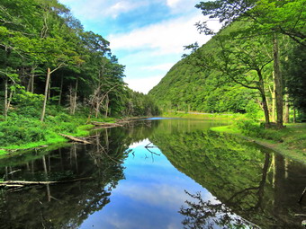 I had already decided to forgo the side-trip to Leavitt Peak and had no reason to visit the Devil's Acre Lean-to which was just a short distance in the other direction. I had only a vague memory of this trail as I had been hiking Hunter from Spruceton. The first part of the Devil's Path is nearly level although narrow in places. The part that is almost flat but with a gentle descent lasts for about .7 miles before the real descent begins. At times the descent is so steep that I wondered how some hikers could make it without using poles. I could catch glimpses of Plateau as we descended and I could swear that the view didn't change even though it was obvious we were losing elevation! We did meet two different solo hikers headed up the mountain. For .6 miles the trail descended at a relatively moderate 18% grade. We then followed a series of switchbacks that helped to moderate the descent through a series of rock ledges. There were several spots where there were some interesting rock scrambles to negotiate. After the switchbacks the trail continued to descend for another .4 miles to the flatter area near Notch Lake. In this stretch the trail passes over, around and through some interesting boulders and bedrock formations. One large rock seems to have been split down the middle. I took some pictures and then we continued on to the lake. This section of the Devil's Path was in poor shape with many eroded sections exposing rocks and roots that made hiking unpleasant. We stopped at the lake and I took more pictures of the lake and the dam. We crossed the bridge and walked up to Route 214. We turned left and started the 1.6 mile road walk back to the car. Sheila still had enough energy to pull me along in the leash which helped me up the hills and kept me moving on the flats. We were back at the car at 4:50 PM having hiked 7.8 miles in 5 hours and 25 minutes. We had stopped for almost an hour and our overall average speed was just 1.5 mph with a moving speed of 1.75 mph. The overall elevation gain was 2424 feet. This was by far the most challenging hike I had done in some time.
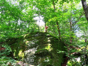
![]()
![]()
![]()
![]()
![]() On Friday, August 28th my plan was to hike from Flugertown Road near Long Pond over the Beaverkill Ridge Long Pond Trail to the Mongaup Hardenburgh Trail and the west to Mongaup Pond. From here I would take the snowmobile trails and Mongaup Willowemoc Trail back to the car. This is an almost 10 mile hike over trails that I knew had not been maintained in some time. I recently found out that I will be appointed the position of Trail Supervisor for the Willowemoc Wild Forest and part of the Big Indian Wilderness area. After a meeting with the Trail Conference representatives, I will be able start to coordinate the efforts of the trail maintainers in this area. I was concerned that these trails needed to be maintained since the last time I was on them they were in poor shape. I had already been on the Mongaup Willowemoc Trail and found it in good shape so I asked Cindy if she would help me spot a car at the junction of Mongaup Road and Beech Mountain Road. In this way I could hike out the park roads and back to the car. The hike would be a little shorter and hiking the roads would be much easier than returning on the Mongaup Willowemoc Trail. Cindy agreed but wanted to shop downtown before we left. I began to get ready at 10:00 AM when the temperature was only 66 degrees. As I was getting ready Sheila knew something was "up" and stayed close to me as I got dressed and got the gear together. I got dressed in a White Sierra long-sleeved crew top with a short-sleeved baselayer. I put on a pair of RailRiders hiking pants which are expensive but last along time and have features like deep pockets and a generous cut which I really like. These pants have a Velcro closures at the ankles to discourage sticks and gravel from getting into my shoes and to combat ticks. I decided to wear my Keen Targhee II hiking boots which fit well and have been discontinued. I grabbed a pair of Leki external lock poles I have been using lately. I also added my OR floppy hat which I have decided shields me from the sun and allows me to spray some insect repellant on it rather than on me. I decided to wear my OR Bugout gaiters as I knew the trails in many places were more like bushwhacks. I put our gear in the back and Sheila in the backseat and Cindy and I pulled out of Livingston Manor in separate cars at 10:15 AM. We drove out DeBruce Road for 6 miles where we turned left on Mongaup Pond Road. We drove to the small pulloff just after the intersection of Mongaup Pond and Beech Mountain Road. I parked my car there and hopped in Cindy car to drive to Flugertiwn Road in Willowemoc. I turned left on Flugertown Road and passed the parking area on the right and continued to drive until the road turned to gravel. The gravel road was in good shape and I continued to drive to the point where the Long Pond Beaverkill Ridge Trail and Mongaup Willowemoc Trail meet the road, a total of 2.4 miles from the main road. I turned around and pulled over to the side of the road where I let Sheila out of the car and got my gear out of the back. I set my GPS and we started off at 11:50 AM as Cindy pulled away. The temperature was still only 68 degrees but it felt good although I was glad at this point that I wore long sleeves.
On Friday, August 28th my plan was to hike from Flugertown Road near Long Pond over the Beaverkill Ridge Long Pond Trail to the Mongaup Hardenburgh Trail and the west to Mongaup Pond. From here I would take the snowmobile trails and Mongaup Willowemoc Trail back to the car. This is an almost 10 mile hike over trails that I knew had not been maintained in some time. I recently found out that I will be appointed the position of Trail Supervisor for the Willowemoc Wild Forest and part of the Big Indian Wilderness area. After a meeting with the Trail Conference representatives, I will be able start to coordinate the efforts of the trail maintainers in this area. I was concerned that these trails needed to be maintained since the last time I was on them they were in poor shape. I had already been on the Mongaup Willowemoc Trail and found it in good shape so I asked Cindy if she would help me spot a car at the junction of Mongaup Road and Beech Mountain Road. In this way I could hike out the park roads and back to the car. The hike would be a little shorter and hiking the roads would be much easier than returning on the Mongaup Willowemoc Trail. Cindy agreed but wanted to shop downtown before we left. I began to get ready at 10:00 AM when the temperature was only 66 degrees. As I was getting ready Sheila knew something was "up" and stayed close to me as I got dressed and got the gear together. I got dressed in a White Sierra long-sleeved crew top with a short-sleeved baselayer. I put on a pair of RailRiders hiking pants which are expensive but last along time and have features like deep pockets and a generous cut which I really like. These pants have a Velcro closures at the ankles to discourage sticks and gravel from getting into my shoes and to combat ticks. I decided to wear my Keen Targhee II hiking boots which fit well and have been discontinued. I grabbed a pair of Leki external lock poles I have been using lately. I also added my OR floppy hat which I have decided shields me from the sun and allows me to spray some insect repellant on it rather than on me. I decided to wear my OR Bugout gaiters as I knew the trails in many places were more like bushwhacks. I put our gear in the back and Sheila in the backseat and Cindy and I pulled out of Livingston Manor in separate cars at 10:15 AM. We drove out DeBruce Road for 6 miles where we turned left on Mongaup Pond Road. We drove to the small pulloff just after the intersection of Mongaup Pond and Beech Mountain Road. I parked my car there and hopped in Cindy car to drive to Flugertiwn Road in Willowemoc. I turned left on Flugertown Road and passed the parking area on the right and continued to drive until the road turned to gravel. The gravel road was in good shape and I continued to drive to the point where the Long Pond Beaverkill Ridge Trail and Mongaup Willowemoc Trail meet the road, a total of 2.4 miles from the main road. I turned around and pulled over to the side of the road where I let Sheila out of the car and got my gear out of the back. I set my GPS and we started off at 11:50 AM as Cindy pulled away. The temperature was still only 68 degrees but it felt good although I was glad at this point that I wore long sleeves.
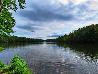 The trail began as a very wide snowmobile trail that was clear of blowdowns and had only a few sticks in the way. I had not been on these trails in some time and forgot that it was all uphill to the trail junction at .4 miles. I found my self getting warmer and breathing a little harder until we turned right to get on the Long Pond Beaverkill Ridge Trail. This trail had been almost impossible to find the last time we hiked but now seemed in a little better shape. It was obvious that its had not been trimmed or maintained in nay way but the tread was more noticeable. The AllTrails Challenge from the Catskill Mountain Club has gotten more people to walk trails they never would have tried before! For about .4 miles the trail rolled a little until we got to the 1.0 mile mark where the climb started. This was also the point where we began to run into some very large trees across the trail. Of course, any tree can be removed with hand tools but I made a note to contact the local forest ranger or the DEC forester for the area to ask about getting a sawyer crew in to work on the many large blowdowns. We worked our way passed the blowdowns and continued to follow the blazes. In place where I could not find blazes, I followed Sheila who always seems to be on the trail. Over the next .7 miles we gained 470 feet heading north to a bump. The grade was about 12% which seemed easy compared to some other I had done recently. From here there was a slight and a flat area before we started the next climb at 2.1 miles. We continued to ascend for the next .8 miles through some interesting rock formations. When Sheila climbed to the top of one of the rocks, I stopped to take a picture of her and the rock. I was also noticing some very large maple, cherry and beech trees along the way. As the climb went on, I stopped once to check my Avenza app since I did not remember that the climb was as long as it was. We were right on the trail and close to the trail junction. At 2.9 miles we hit the top of one of the peaks on the Beaverkill Ridge and turned left on the blue-blazed Mongaup Hardenburgh Trail.
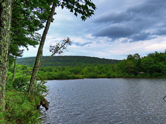 I could immediately see that this trail also poorly maintained and need all the brush to be cut back to expose the tread. Many of the blowdowns on this trail had a lot of branches which obscured the trail. Hikers had already created small detours but these blowdowns could be removed with hand tools. We were now headed west in a descent from one peak. We hit a flat area and then climbed the last bump on The Beaverkill Ridge. At 3.6 miles we began a serious descent that lasted for half a mile and lost 380 feet. The overall average grade was 13% but some areas were more than 20%. At 4.1 miles we began our last scent of the hike by starting up the easternmost Mongaup Mountain. On the way up we ran into two or three large blowdowns that completely blocked the trail. Sheila showed me a way around that other hikers had been following. The ascent lasted less than half a mile but gained 430 feet making the average grade 18% with some sections well over 20%. We stopped at the top of the mountain to get a drink before starting down the trail to the shores of Mongaup Pond. The trail turned south and we descended 1.4 miles to the shores of the pond losing 850 feet in the process. We took a break at the shore as I took some pictures of Sheila swimming and of the pond. I sky was completely overcast but the scene was still interesting. I zoomed in on what I thought was a duck but it was not moving. I took some shots and had myself almost convinced it was a rock. I moved closer and it swam away! We left the shore and continued to walk the Mongaup Hardenburgh Trail until it met the campground road. I put Sheila on her leash and we set a quick pace back toward the car. Many of the campsites were occupied and the size of some of the campers was impressive. Just off the road on the north end of the large part of the pond is a bench and a nice viewpoint. We took the time to walk over so that I could take a few more shots and then we quickly got back on the road. At 7.5 miles we passed through the entrance to the campgrounds and headed out the access road back to the car. We hiked the last 1.1 miles in 22 minutes which is 3 mph. We were back at the car at 4:40 PM after hiking 8.6 difficult miles in 4 hours and 45 minutes with 30 minutes of stopped time. This was a moving speed of only 2 mph which I considered good for the terrain we were hiking. The elevation gain was 1800 feet.
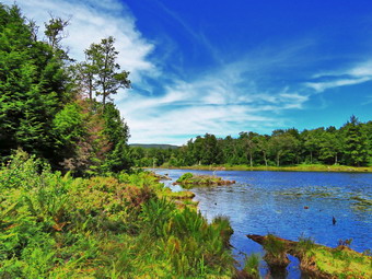
![]()
![]()
![]()
![]()
![]() On Wednesday, August 26th my plan was to hike to Ashokan High Point with my friend Kevin after a 9:00 AM telephone call with the NYNJTC. The call ended with me being appointed the Trail Supervisor for the Willowemoc Wild Forest and Big Indian Wilderness area. After a meeting with the Trail Conference representatives, I will be able start to coordinate the efforts of the trail maintainers in this area. An over night ambulance call had tempered my resolve to hike AHP and I decided to ask Kevin if he wanted to hike to Tunis Pond from Black Bear Road. This is a flatter hike of a little over 7 miles. The hike parallels Fall Creek and the Beaverkill passing by the Fall Creek Lean-to, the headwaters of the Beaverkill and ending at Tunis Pond. I began to get ready at 9:30 AM when the temperature was only 62 degrees. As I was getting ready Sheila knew something was "up" and stayed close to me as I got dressed and got the gear together. I got dressed in a White Sierra long-sleeved crew top with a short-sleeved baselayer. I put on a pair of RailRiders hiking pants which are expensive but last along time and have features like deep pockets and a generous cut which I really like. These pants have a Velcro closures at the ankles to discourage sticks and gravel from getting into my shoes and to combat ticks. I decided to wear my Keen Targhee II hiking boots which fit well and have been discontinued. I grabbed a pair of Leki external lock poles I have been using lately. I also added my OR floppy hat which I have decided shields me from the sun and allows me to spray some insect repellant on it rather than on me. I put our gear in the back and Sheila in the backseat and waited for Kevin to arrive. When Kevin pulled in the driveway, I told him my plan and he agreed. We pulled out of Livingston Manor at 10:15 AM. I drove out DeBruce Road for 15 miles to Round Pond and turned left on Wild Meadow Road. I drove to the end of the road and pulled the car over to park. There is some question about where it is legal to park along the road. I decided that no one would bother me if I was the only car at the end of a dead end road. I set my GPS and we left on our hike at 10:45 AM with the temperature at 68 degrees. We started by walking out the woods road toward the hunting camp on the Hardenburgh Neversink Trail. The road was in good shape and dry in most places except for a few muddy areas. I was actually a little cool even though I was wearing a long-sleeved top but keeping a fast pace helped warm me up.
On Wednesday, August 26th my plan was to hike to Ashokan High Point with my friend Kevin after a 9:00 AM telephone call with the NYNJTC. The call ended with me being appointed the Trail Supervisor for the Willowemoc Wild Forest and Big Indian Wilderness area. After a meeting with the Trail Conference representatives, I will be able start to coordinate the efforts of the trail maintainers in this area. An over night ambulance call had tempered my resolve to hike AHP and I decided to ask Kevin if he wanted to hike to Tunis Pond from Black Bear Road. This is a flatter hike of a little over 7 miles. The hike parallels Fall Creek and the Beaverkill passing by the Fall Creek Lean-to, the headwaters of the Beaverkill and ending at Tunis Pond. I began to get ready at 9:30 AM when the temperature was only 62 degrees. As I was getting ready Sheila knew something was "up" and stayed close to me as I got dressed and got the gear together. I got dressed in a White Sierra long-sleeved crew top with a short-sleeved baselayer. I put on a pair of RailRiders hiking pants which are expensive but last along time and have features like deep pockets and a generous cut which I really like. These pants have a Velcro closures at the ankles to discourage sticks and gravel from getting into my shoes and to combat ticks. I decided to wear my Keen Targhee II hiking boots which fit well and have been discontinued. I grabbed a pair of Leki external lock poles I have been using lately. I also added my OR floppy hat which I have decided shields me from the sun and allows me to spray some insect repellant on it rather than on me. I put our gear in the back and Sheila in the backseat and waited for Kevin to arrive. When Kevin pulled in the driveway, I told him my plan and he agreed. We pulled out of Livingston Manor at 10:15 AM. I drove out DeBruce Road for 15 miles to Round Pond and turned left on Wild Meadow Road. I drove to the end of the road and pulled the car over to park. There is some question about where it is legal to park along the road. I decided that no one would bother me if I was the only car at the end of a dead end road. I set my GPS and we left on our hike at 10:45 AM with the temperature at 68 degrees. We started by walking out the woods road toward the hunting camp on the Hardenburgh Neversink Trail. The road was in good shape and dry in most places except for a few muddy areas. I was actually a little cool even though I was wearing a long-sleeved top but keeping a fast pace helped warm me up.
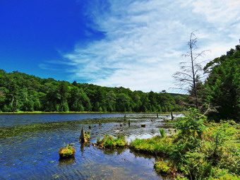 We made it to the hunting camp in just over 10 minutes and passed by it to continue on the road/trail. I have never been passed the camp when the "lawn" was not perfectly mowed. The trail continued to be mostly dry with a few wet spots. In some areas the trail was very rocky and in others it was almost flat. We crossed over a brook and headed up a little gaining some elevation. It took us 50 minutes to get to the Fall Brook lean-to which is 1.8 miles into the hike. We stopped for a minute to inspect the lean-to and then continued on the trail. As we walked along the trail Sheila alerted and I saw a hiker coming toward us. The young man wore a t-shirt that said "Horseheads Cross Country" so we talked for a minute about possibilities for the season. We walked on in our separate directions. Soon a swampy area appeared on the right of the trail which led into a series of beaver ponds and beaver meadows. Doubletop was in the background and I can remember hiking THROUGH the beaver ponds with Harry Rampe on my first bushwhack. In this area, the water than flows south is part of Fall Creek and the water that goes north forms the Beaverkill. I stopped to take some pictures before continuing on the trail. It paralleled the Beaverkill for a short distance and then ended at the edge of the stream. I checked the map and it showed that the trail crossed the stream a little further down. I was able to pick up the yellow trail markers ahead. The stream had simply eroded away the trail so we bushwhacked along and then up the bank and back down following the trail. When we reached the area where the trail crossed the stream, it was relatively easy for us to cross. We picked up the trail on the other side. Since my last time on the trail, it had been rerouted to the right to avoid a very narrow portion that clung to the bank of the stream. We met two more hikers headed in our direction and I walked off the trail with Sheila on her leash. They stopped and we talked for a minute. They said they could not find Tunis Pond and had walked on to camp near Vly Pond. I found this strange since they seemed to know what they were doing but obviously had not planned ahead and did not have a map. At 3.15 miles we found an interesting primitive campsite on the right side of the trail with a fire ring and a "bench" made up of an iron beam. The fire ring had ashes that were warm! It was obvious that the men we had met had camped here and really had no idea where they were. I wondered where the iron beam had come from and as we left I walked over to the stream. It was clear that a road crossed here and that there had been a bridge.
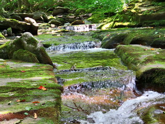 We continued down the woods road until I began to recognize some landmarks and knew it was time to head to the right of the trail and climb a little hill to get to Tunis Pond. The climb was steep but short but we had to head a little more northwest to avoid some dense areas of brush. We arrived on the shore of the pond and I dropped my pack to get out my camera. I took pictures of the hills to the northwest and some of the beaver lodges in the pond. The colors seemed vibrant and I had trouble pulling myself away. The water was very blue and the secluded pond was quiet. I packed up and got out a bar. We headed back out to the trail by a slightly different route. I decided to head almost directly south and down the hill which was more direct line to the main trail. It seemed we were taking too long to get back to the trail but I could see Sheila up ahead walking along the trail! When we got to the trail, we turned left and began the walk back. We had now hiked 3.75 miles. On the way back we stuck to the path that put us closer to the river. This path narrowed to almost nothing in a few spots but it was nice being nearer to the water. I stopped in several places and lowered myself into the stream bed to take pictures. Trying to take shots was difficult as the light was against me. Sheila took to swimming in the stream and at one point got the "zoomies" which seemed to entertain Kevin. We reached the spot where we had crossed and again made it over the water with no problem. The walk back on an out and back can be boring but we were talking which made it go faster. We set a good pace as we had no reason to stop and eventually crossed the small stream near the hunting camp where Sheila took a last dip. At this point two young men and two young women came hiking toward us so I stepped off the trail with Sheila. They stopped to talk briefly and we found they were going to camp near Tunis Pond. Soon we were at the hunting camp and walked the last part of the trail back to the car. It was 3:00 Pm and we had hiked 7.3 miles in 4 hours and 15 minutes with an elevation gain of only 680 feet. The temperature was still only 72 degrees.
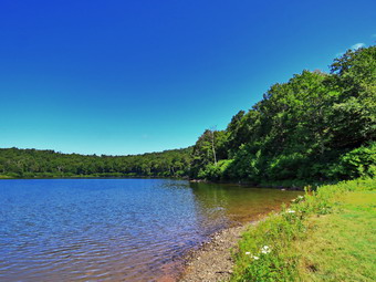
![]()
![]()
![]()
![]()
![]() On Thursday, August 24th I had planned to hike a longer hike from Long Pond to Mongaup Pond and then over the Mongaup Hardenburgh Trail to the Beaverkill Ridge Long Pond Trail. I wanted to evaluate the trail conditions to help the trail maintainer make plans to improve these trails. The forecast was for thunderstorms in the afternoon so I decided to go to Frick Pond for a shorter hike so that I was sure to be done by 1:00 PM when the storms were forecast to start. As I began to get ready at 10:15 Am, the temperature was 76 degrees and the humidity seems high. I had not hiked UP the Flynn Trail to Hodge Pond in some time and made that my intended route. As I began to get ready, Sheila, lay quietly on my floor but her eyes watched every movement I made. I got dressed in a short-sleeved crew top with a short-sleeved baselayer. I put on a pair of RailRiders hiking pants which are expensive but last along time and have features like deep pockets and a generous cut which I really like. These pants do not have Velcro closures at the ankles as some do to discourage sticks and gravel from getting into my shoes and to combat ticks. I decided to wear my Keen Targhee II hiking boots which fit well and have been discontinued. I grabbed a pair of Leki external lock poles I have been using lately. I put my gear in the back of the car and Sheila in the backseat and drove out the Debruce Road about 6 miles. I turned left onto Mongaup Pond Road and continued to where the road split. I turned left onto Beech Mountain Road, and drove to the parking areas at Frick Pond. There was one car parked in the small lot but none in the large lot. The thermometer read 72 degrees as I set my GPS. The skies were blue with plenty of sun and lots of billowing white clouds. There was a slight breeze which seemed to be dispersing the insects but they were still numerous. I did not spray any insect repellant as I do not like the smell. Just as I was about to start my hike, A car with a family of 6 pulled in and parked at the far end of the small lot. Another car with a young woman and her dog also parked and they started out on the Flynn Trail almost immediately. I noted that the dog was not on a leash which is inconsiderate of others. At 10:45 AM we started our hike by crossing the road to start out on the Flynn Trail. The family was looking at the map on the trailhead kiosk so I asked them if they needed help. I gave them directions for the short hike around Frick Pond and they thanked me. When Sheila and I got to the end of the trail through the woods we turned right on the woods road that was once the extension of Beech Mountain Road. I expected that the young woman and her dog to have a good lead as they had started out quickly. To my surprise the two were just ahead of us hiking at just a slightly slower pace. The dog was wandering in the forest and would come out behind us and run passed. The dog seemed to be oblivious to Sheila but Sheila certainly wanted to "meet" the other dog. I kept a quick pace with Sheila pulling me along on her leash. Finally the other hiker pulled to the side of the trail and we passed her with a "Hello". Sheila and I sped up to stay ahead of them and I let Sheila off her leash. As we neared the top, I looked around and could not see the other hiker. The Flynn Trail ascends 1.7 miles to the Big Rock Trail junction gaining 600 feet. The more I hike the quicker I can hike and easier it seems. By 11:25 AM we had hiked the 1.7 miles to the junction with the Big Rock Trail. We continued straight ahead staying on the Flynn Trail heading toward Hodge Pond. We passed through the gate and soon were at the next trail junction where we stayed to the left to keep on the Flynn Trail to Hodge Pond.
On Thursday, August 24th I had planned to hike a longer hike from Long Pond to Mongaup Pond and then over the Mongaup Hardenburgh Trail to the Beaverkill Ridge Long Pond Trail. I wanted to evaluate the trail conditions to help the trail maintainer make plans to improve these trails. The forecast was for thunderstorms in the afternoon so I decided to go to Frick Pond for a shorter hike so that I was sure to be done by 1:00 PM when the storms were forecast to start. As I began to get ready at 10:15 Am, the temperature was 76 degrees and the humidity seems high. I had not hiked UP the Flynn Trail to Hodge Pond in some time and made that my intended route. As I began to get ready, Sheila, lay quietly on my floor but her eyes watched every movement I made. I got dressed in a short-sleeved crew top with a short-sleeved baselayer. I put on a pair of RailRiders hiking pants which are expensive but last along time and have features like deep pockets and a generous cut which I really like. These pants do not have Velcro closures at the ankles as some do to discourage sticks and gravel from getting into my shoes and to combat ticks. I decided to wear my Keen Targhee II hiking boots which fit well and have been discontinued. I grabbed a pair of Leki external lock poles I have been using lately. I put my gear in the back of the car and Sheila in the backseat and drove out the Debruce Road about 6 miles. I turned left onto Mongaup Pond Road and continued to where the road split. I turned left onto Beech Mountain Road, and drove to the parking areas at Frick Pond. There was one car parked in the small lot but none in the large lot. The thermometer read 72 degrees as I set my GPS. The skies were blue with plenty of sun and lots of billowing white clouds. There was a slight breeze which seemed to be dispersing the insects but they were still numerous. I did not spray any insect repellant as I do not like the smell. Just as I was about to start my hike, A car with a family of 6 pulled in and parked at the far end of the small lot. Another car with a young woman and her dog also parked and they started out on the Flynn Trail almost immediately. I noted that the dog was not on a leash which is inconsiderate of others. At 10:45 AM we started our hike by crossing the road to start out on the Flynn Trail. The family was looking at the map on the trailhead kiosk so I asked them if they needed help. I gave them directions for the short hike around Frick Pond and they thanked me. When Sheila and I got to the end of the trail through the woods we turned right on the woods road that was once the extension of Beech Mountain Road. I expected that the young woman and her dog to have a good lead as they had started out quickly. To my surprise the two were just ahead of us hiking at just a slightly slower pace. The dog was wandering in the forest and would come out behind us and run passed. The dog seemed to be oblivious to Sheila but Sheila certainly wanted to "meet" the other dog. I kept a quick pace with Sheila pulling me along on her leash. Finally the other hiker pulled to the side of the trail and we passed her with a "Hello". Sheila and I sped up to stay ahead of them and I let Sheila off her leash. As we neared the top, I looked around and could not see the other hiker. The Flynn Trail ascends 1.7 miles to the Big Rock Trail junction gaining 600 feet. The more I hike the quicker I can hike and easier it seems. By 11:25 AM we had hiked the 1.7 miles to the junction with the Big Rock Trail. We continued straight ahead staying on the Flynn Trail heading toward Hodge Pond. We passed through the gate and soon were at the next trail junction where we stayed to the left to keep on the Flynn Trail to Hodge Pond.
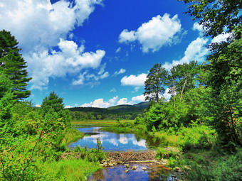 As we walked down the hill, I noticed it seemed warmer and more humid but that there was a slight breeze. As we approached the pond, I looked at the scene and decided to walk over to the shore of the pond. Sheila immediately jumped into the pond to get wet and swim around. I took some pictures of her and then turned my attention to taking some shots of the pond. I took some shots even though there were no clouds over the pond. I also turned 180 degrees and took a few more shots as the sky in that direction were filled with clouds. We headed up the hill to the right of the pond on the jeep trail. Where the trail split we kept top the right and walked up the steeper slope to the woods road near the ruins of the Beech Mountain Boy Scout Camp. We turned right at the top of the hill and headed back toward the Flynn Trail. At the Flynn Trail we turned left and walked the for a long time section through the gate to the junction with the Big Rock Trail. We turned right to head down the Big Rock Trail. For some reason there always seems to be a lot of mosquitoes in this area. In addition, the hike can seem long as there are several places that make it seem as if you have reached the bottom of the hill at Times Square. On this day, Sheila and I set a quick pace and made it down the hill in what seemed like record time. At Times Square we walked straight across to stay on the Big Rock Trail. This are was the wettest and muddiest we had seen but it was easy to avoid those spots. We passed over the bridges over the inlet streams. The large hemlock I had worked on was still there but much easier to get over. We walked through the beautiful area of pines and over the wooden walkways. At the end of the Big Rock Trail, we turned left on the Quick Lake Trail and walked to the bridge across the outlet of Frick Pond. I dropped my pack and took a shot of Sheila on the bridge and several more of the pond. I did not see any wildlife but did not the beaver dam was still intact. I packed up and we walked up the hill to Gravestone Junction. From there we followed the Quick lake Trail and the woods road back to the car. The trail was mostly dry with only a few damp spots. We were back at the car at 1:00 PM after hiking 5.5 miles in 2 hours and 10 minutes with an elevation gain of 850 feet. Our moving average was 2.7 mph with and overall speed of 2.5 mph. I was disappointed that we had not tried the longer hike as I felt fresh and there was no hint of the thunderstorms that had been predicted.
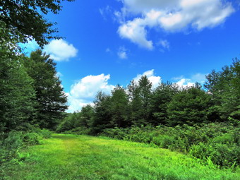
![]()
![]()
![]()
![]()
![]() On Saturday, August 22nd I had planned to do a 10 mile loop from Long Pond to Mongaup Pond and over the Mongaup Mountains. When I got up in the morning I wasn't really feeling it and Cindy expressed a desire to hike. I asked her where she wanted to go and she eventually responded with "bear Spring". Her requirements were that she didn't want to hike for too long and wanted to avoid hiking hills. This is not easy in an area which has valleys and ridges. I decided we would park on East Trout Brook Road right off Route 206. From here we could hike the eastern ridge and down to Launt Pond using the roads to return to the car. As we were getting ready Sheila knew something was "up" and stayed close to me as I got dressed and got the gear together. I got dressed in a Columbia short-sleeved crew top with a short-sleeved baselayer. I put on a pair of RailRiders hiking pants which are expensive but last along time and have features like deep pockets and a generous cut which I really like. These pants do not have the Velcro closures at the ankles like some styles to discourage sticks and gravel from getting into my shoes and to combat ticks. I decided to wear my Keen Targhee II hiking boots which fit well and have been discontinued. I grabbed a pair of Leki external lock poles I have been using lately. I also added my OR floppy hat which I have decided shields me from the sun and allows me to spray some insect repellant on it rather than on me. I put our gear in the back and Sheila in the backseat and pulled out of Livingston Manor at 12:00 PM. The skies were blue with puffy white clouds with plenty of sun. I drove north and west on State Route 17 and got off at Exit 94. From here I drove north toward Downsville on Route 206. At the Pepacton Reservoir, I turned left to head towards Downsville. We passed through Downsville and headed up the mountain toward Walton. Near the top of the hill I turned left on East Trout Brook Road and parked in the lot on the left at 12:30 PM. We immediately got out of our cars and got our gear ready. I set my Garmin GPSmap 64st handheld unit and we started out uphill on the snowmobile trail that parallels the road. The temperature was 72 degrees and there was a slight breeze. At .4 miles we hit the top of the hill and walked downhill to the next snowmobile trail where we turned right at .6 miles. This trail follows a woods road along what used to be a clear cut on the hillside. The clear cut area was ugly but it provided great views across to the next ridge and down the valley. The clear cut is now grown up and there are no views. As we walked along we found some interesting mushrooms and I took a few pictures of them. I also stopped to take a few pictures of the trail under sunny blue skies. Eventually we entered the woods again but stayed on the wide woods road.
On Saturday, August 22nd I had planned to do a 10 mile loop from Long Pond to Mongaup Pond and over the Mongaup Mountains. When I got up in the morning I wasn't really feeling it and Cindy expressed a desire to hike. I asked her where she wanted to go and she eventually responded with "bear Spring". Her requirements were that she didn't want to hike for too long and wanted to avoid hiking hills. This is not easy in an area which has valleys and ridges. I decided we would park on East Trout Brook Road right off Route 206. From here we could hike the eastern ridge and down to Launt Pond using the roads to return to the car. As we were getting ready Sheila knew something was "up" and stayed close to me as I got dressed and got the gear together. I got dressed in a Columbia short-sleeved crew top with a short-sleeved baselayer. I put on a pair of RailRiders hiking pants which are expensive but last along time and have features like deep pockets and a generous cut which I really like. These pants do not have the Velcro closures at the ankles like some styles to discourage sticks and gravel from getting into my shoes and to combat ticks. I decided to wear my Keen Targhee II hiking boots which fit well and have been discontinued. I grabbed a pair of Leki external lock poles I have been using lately. I also added my OR floppy hat which I have decided shields me from the sun and allows me to spray some insect repellant on it rather than on me. I put our gear in the back and Sheila in the backseat and pulled out of Livingston Manor at 12:00 PM. The skies were blue with puffy white clouds with plenty of sun. I drove north and west on State Route 17 and got off at Exit 94. From here I drove north toward Downsville on Route 206. At the Pepacton Reservoir, I turned left to head towards Downsville. We passed through Downsville and headed up the mountain toward Walton. Near the top of the hill I turned left on East Trout Brook Road and parked in the lot on the left at 12:30 PM. We immediately got out of our cars and got our gear ready. I set my Garmin GPSmap 64st handheld unit and we started out uphill on the snowmobile trail that parallels the road. The temperature was 72 degrees and there was a slight breeze. At .4 miles we hit the top of the hill and walked downhill to the next snowmobile trail where we turned right at .6 miles. This trail follows a woods road along what used to be a clear cut on the hillside. The clear cut area was ugly but it provided great views across to the next ridge and down the valley. The clear cut is now grown up and there are no views. As we walked along we found some interesting mushrooms and I took a few pictures of them. I also stopped to take a few pictures of the trail under sunny blue skies. Eventually we entered the woods again but stayed on the wide woods road.
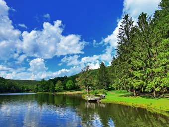 We walked and talked which made the walking go quicker. There wasn't much to see along the trail but everything was very green and it was peaceful. At around 1.8 miles we began to climb a hill and shortly after a trail turned off to the right. This trail is a spur trail that leads down to Launt Pond and I knew we wanted to continue to the next trail. At 2.5 miles we came to a snowmobile trail that comes out at a parking area on East Trout Brook Road just south of Launt Pond. The trail heads downhill and south but at 2.6 miles it makes nearly a 180 degree turn and parallels the upper woods road that we had come in on for almost a mile. At first the trail did not seem familiar but I began to recognize certain features. There were quite a few new blowdowns on the trail which I assumed the snowmobile club would clear. The descent went quickly as it is all downhill and because we pushed the pace. At 3.75 miles we arrived at the parking area on East Trout Brook Road just south of Launt Pond. From our highest point on the ridge we had descended 650 feet in 1.5 miles. We walked out to the road and turned right to head north. I put Sheila on her leash and she still had enough energy to help pull me up the hill. When we got to Launt Pond, I told Cindy I wanted to stop to take a few pictures. Sheila and I turned into the lower entrance and walked over to the dam. I took some shot of the pond and the clouds. I also took a few pictures of the beach where there were a few people swimming and playing. I got ready to leave but I did not see Cindy. I assumed she had followed us so that she could rake a break on one of the benches. As we started to walk out the upper entrance, I saw Cindy standing on the road. We joined her and turned left to head north on the road. I had hiked from Launt Pond to Route 206 several times and it is not an easy walk at the end of a hike. It is .9 miles and the elevation gain is 270 feet which is only a 6% grade and on this day we could walk in the shade. I was surprised that it took us less than 15 minutes to arrive at the car. It was 3:05 PM when we got to the car after hiking 5 miles in 2.5 hours. Our elevation gain was 875 feet and our overall speed was 2 mph with a moving average of 2.4 mph. I was happy Cindy and I could hike together and our 5 mile adventure was satisfying enough for me.
On Thursday, August 20th, I agreed to do a car shuttle for two hikers working on the Finger Lakes Trail. I picked the two women up at Alder Lake at 7:30 AM and drove them to Big Pond on Barkaboom Road. I had transported the same two people the day before. Signs said that the road was closed and we found that the first bridge was in the process of being replaced. There was a detour around the construction so we were only delayed for a few minutes. Even though the trail starts in the upper parking lot I dropped the hikers at Big Pond since it would be the most scenic place on their hike back to Alder Lake. They thanked me and I wished them good luck as I drove away at 8:00 AM. I returned home and did some work around the house as I had a 1:00 PM appointment in Liberty. I was home from that appointment by 2:30 PM and decided to go over to Round Top to do some more work on the trails there. The new crossover trail and the switchback on the trail to the summit needed to be trimmed a little more. There were also some rocks and roots and stumps that needed to be removed. Sheila seemed interested in going as she lay watching every move I made. I wore a cotton T-shirt as I knew whatever I wore would be covered in pieces of vegetation or dirt. I put on a pair of RailRiders hiking pants which are expensive but last along time and have features like deep pockets and a generous cut which I really like. These pants have Velcro closures at the ankles which help keep the sticks and stones out of my shoes and the ticks at bay. I decided to wear my Vasque Taku hiking boots which still fit reasonably well but have been discontinued. I knew I would not need poles and decided against gaiters and a hat. I took my Fiskars ax, Silky Sugowaza saw, Corona loppers and Overland machete. I also took a short round pointed shovel and a pick-mattocks to deal with the rocks and roots. I put everything in the car and Sheila and in the back seat. I drove to the trailhead at the top of the cemetery. I don't normally park here as we try to encourage others not to but I had too much equipment to carry over from the house. I couldn't take all the tools so I settled on the shovel, pick and Silky saw. We entered the trails at about 3:00 PM so that I could begin the work. I removed a few roots that were "looping" on the trail and cut some small stumps. I then turned my attention to two large stones that were right on the edge of the trail. With the leverage of the pick I was able to lift one and flip another well off the trail. I filled the divots that were left behind. My last effort on the first piece of trail was to remove a capstone that somebody had placed on the trail in a muddy spot to "help". The problem was that the stone created a lip on the trail which increased the chances someone would trip. The stone was thin and had broken so I was able to easily remove it. Sheila and I walked to the first trail junction and turned right on the woods road. I stopped at an spot where a tree had fallen off to the right of the trail. The tree was not in the way but its roots had broken the ground and were now causing a hazard. I dug around the root and removed all the dirt and stones before using the Silky saw to cut up from the bottom and sever the root in two places. As I was working I saw a group of six people headed up the trail toward the lookout. I used the dirt I had removed plus some from off the trail to fill in the hole left behind by the root removal. We continued up the woods road and turned left where the trail turned toward the junction with the blue trail. I sawed off a couple of stumps and removed some more roots At the junction we continued straight ahead on the blue trail where I removed a few more branches encroaching on the trail. When we reached the new crossover trail I dropped the shovel and pick and started to use the saw to trim back some branches and small trees to finish the trail. I was able to get everything trimmed back for the entire length of the trail even though the loppers would have been a better choice for most of the small branches. I noticed that there was some side-hilling in places but only for short stretches. When we got to the blue trail on the other side of the hill, I dropped the saw and went back to retrieve the shovel and pick. As we walked back, I used the pick to pry up a couple of old blowdowns and move them off the trail. When we arrived at the blue trail, we turned left and walked a few steps to the switchback where we turned left. I cut a few branches and small trees that were in the trail. Just before the turn on the switch back I used the pick to remove most of an old, rotten stump from the middle of the trail. We made the turn and I started to cut quite a few branches to open up the trail. I had been worried about a few holes and rocks on the trail but I was able to move the tread a few feet uphill and avoid those spots. The switchback is short and I finished it quickly. I picked up all the tools and headed down to the junction with the yellow trail. We continued straight ahead and walked down to the lookout. I cut one stump along the way. At the lookout we turned left to follow the yellow trail down to the first trail junction and out to the car at the trailhead. It was 4:30 when we finished another 1.5 miles on the trails. The last step will be to paint blazes on the two new trails and to repaint any fading blazes on the blue trail.
On Wednesday, August 19th, I agreed to do a car shuttle for two hikers working on the Finger Lakes Trail. I picked the two women up at Alder Lake at 7:30 AM and drove them to the Balsam Lake Mountain trailhead on Beaverkill Road arriving at 8:00 AM. Along the way we got acquainted and I found out they are from Yates County and live on the northern end of Keuka Lake. We talked about the trail from the parking area to the summit and I suggested that they visit the fire tower although it is technically not on the FLT. I also mentioned the lookout over Beecher Lake and the Beaver Meadow Lean-to which now had a beaver pond. After dropping them off, I returned to Livingston Manor and ate breakfast at Caf� 43. When I returned home at 10:00 AM, my grandson Bryce was there. I planned to do a little trail work with Bryce in the afternoon but got a little extra rest first. Around 1:30 Bryce and I started to get dressed and get the tools we would need together. I wore a cotton T-shirt as I knew whatever I wore would be covered in pieces of vegetation or paint scale. I put on a pair of RailRiders hiking pants which are expensive but last along time and have features like deep pockets and a generous cut which I really like. These pants have Velcro closures at the ankles which help keep the sticks and stones out of my shoes and the ticks at bay. I decided to wear my Vasque Taku hiking boots which still fit reasonably well but have been discontinued. I knew I would not need poles and decided against gaiters and a hat. My main interest was to repaint the markers on the yellow trail. I found the yellow paint but it was at least two years old and unusable. The blue paint was newer and seemed good but I knew I would eventually need one more color for the new crossover trail. We put everything in the car and Sheila and Bryce got in the back seat. I drove to the hardware store in town and bought a quart of yellow paint, a quart of white paint and some sponge brushes. I then drove to the trailhead at the top of the cemetery. I don't normally park here as we try to encourage others not to but I had too much equipment to carry over from the house. I poured some yellow paint into a container and got a new sponge brush. I gave Bryce the Overland machete which I would use to scrape the old blazes and cut any branches that block a view of the blazes. As we started out, a mother a daughter were sitting on the steps and did not seem willing to move but finally allowed us to get through. Bryce and I began the process of stopping at every blaze that we could find. Bryce would hand me the machete and I would scrape the old paint off and also get rid of any loose bark. I would then repaint the blaze on both side of the tree. I tried to get the blazes at around eye height and all the same sized rectangle. As we reached the second set of blazes, the mother a daughter passed us and headed up to the lookout. Shortly after that a group of four hikers did the same thing. When we got to the first trail junction, Bryce started up the hill toward the lookout and I followed. Sheila was being very good and following us as we went even though it was slow going. I don't pay much attention to the blazes when I hike so I was surprised that the blazes were in such poor shape. We made the turn at the lookout and headed up through the woods. Looking ahead it was hard to find the blazes but looking behind us we could see the new, bright yellow markers. We turned right at the junction with the blue trail and continued to mark the trail. I used the machete in several places to clear brush and branches that were blocking the paint blazes. At the next junction we again turned right to follow the yellow trail down the trail. I cut back some brush on the trail and we were soon at the woods road that would take us back to the first trail junction. I was surprised how long it took us to do a good job on every blaze. I identified a few issues along the trail including some large stones in the trail, a few stumps sticking up and some roots that could trip hikers. We retuned to the car and made sure the paint was securely covered. I drove down the steep hill and back to the house. We were back at 4:00 PM after spending 2 hours working on the trails.
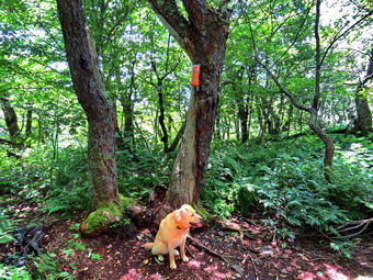
![]()
![]()
![]()
![]()
![]() On Tuesday, August 18th, I wanted to get in another 3500 foot peak so I decided to go for two and hike Vly and Bearpen. The weather forecast called for temperatures in the low 70's but more importantly there was close to a 0% chance of rain. I checked my hiking log and found that I had not been on these peaks for almost 10 years! When I got up at 7:00 AM, the temperature was 65 degrees. I had a few chores to do before leaving but the temperature did not increase very much. I started to get ready to go at 9:30 Am with Sheila keeping a close watch on everything I did. I got dressed in my White Sierra long-sleeved crew top with a short-sleeved baselayer. The White Sierra top has InsectShield which does tend to repel insects without spraying on any chemicals. I put on a pair of RailRiders hiking pants which are expensive but last along time and have features like deep pockets and a generous cut which I really like. These pants have Velcro closures at the ankles which help keep the sticks and stones out of my shoes and the ticks at bay. I decided to wear my Keen Targhe II hiking boots which fit reasonably well but have been discontinued. I grabbed a pair of Leki external lock poles I have been using lately. I also added my OR floppy hat which I have decided shields me from the sun and allows me to spray some insect repellant on it rather than on me. I decided that since these two peaks are not really trailed I would wear my OR Bugout gaiters which are treated with insect repellent. By 9:55 AM I was ready to go and we left Livingston Manor to head toward Fleischmanns. Although both the Peekamoose Road and Route 47 passed Frost Valley were open, I decided it would be easiest to go through Roscoe and take Route 30 around the Pepacton Reservoir. When we got to Route 28, I turned right and drove through Margaretville and Arkville to get to Fleischmanns. Once in town, I turned left on Breezy Hill Road to head toward Halcott Center. I sometimes have trouble remembering the various turns but not this day. I continued to follow Route 3 and at the final Y I stayed to the right instead of going left on Johnson Hollow Road. I drove to the end of the paved road and parked in the snowplow turnaround just after 11:00 AM. There were no other cars.
On Tuesday, August 18th, I wanted to get in another 3500 foot peak so I decided to go for two and hike Vly and Bearpen. The weather forecast called for temperatures in the low 70's but more importantly there was close to a 0% chance of rain. I checked my hiking log and found that I had not been on these peaks for almost 10 years! When I got up at 7:00 AM, the temperature was 65 degrees. I had a few chores to do before leaving but the temperature did not increase very much. I started to get ready to go at 9:30 Am with Sheila keeping a close watch on everything I did. I got dressed in my White Sierra long-sleeved crew top with a short-sleeved baselayer. The White Sierra top has InsectShield which does tend to repel insects without spraying on any chemicals. I put on a pair of RailRiders hiking pants which are expensive but last along time and have features like deep pockets and a generous cut which I really like. These pants have Velcro closures at the ankles which help keep the sticks and stones out of my shoes and the ticks at bay. I decided to wear my Keen Targhe II hiking boots which fit reasonably well but have been discontinued. I grabbed a pair of Leki external lock poles I have been using lately. I also added my OR floppy hat which I have decided shields me from the sun and allows me to spray some insect repellant on it rather than on me. I decided that since these two peaks are not really trailed I would wear my OR Bugout gaiters which are treated with insect repellent. By 9:55 AM I was ready to go and we left Livingston Manor to head toward Fleischmanns. Although both the Peekamoose Road and Route 47 passed Frost Valley were open, I decided it would be easiest to go through Roscoe and take Route 30 around the Pepacton Reservoir. When we got to Route 28, I turned right and drove through Margaretville and Arkville to get to Fleischmanns. Once in town, I turned left on Breezy Hill Road to head toward Halcott Center. I sometimes have trouble remembering the various turns but not this day. I continued to follow Route 3 and at the final Y I stayed to the right instead of going left on Johnson Hollow Road. I drove to the end of the paved road and parked in the snowplow turnaround just after 11:00 AM. There were no other cars.
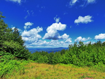 I set my GPS and we started to hike up the road which is the beginning of the trail at 11:10 AM. Sheila, as always, was very glad to be out of the house and on a trail she had not been on before. As we walked up the road, I realized that it was a little steeper and longer than I remembered. What I did remember was that there were a lot of large, round stones and each step was a potential turned ankle. After about .9 miles and 25 minutes, we were at the hunter's shack in the col between the two mountains. I decided that Vly was a bit harder and turned right onto the herd path which was very clear. Sheila was off and seemed to have no problem following the path as it looked like a well maintained trail "blazed" my the blue property line paint markers. There had been some rain the night before and some of the dirt was loose which made several of the sections of the trail a little tricky. As I remembered the herd path had three sections. The first section was a steep section of rock scrambles followed by a flatter section and then another steeper piece. We made our way through a few rock scrambles over .2 miles gaining about 230 feet for an average of a 24% grade. The flatter section lasted only .2 miles and bent a little to the east form the southerly path we had been on. I remember getting "lost" in this section but now the path was so clear it was not a problem. We started the final climb at 1.3 miles We started up the final climb to Vly which was longer than I remembered and had several places that looked like the summit. After hiking .3 miles and gaining 450 feet we reached the flat summit plateau. I was a little tired as the climb averaged 28% and had some very slippery patches. I had stopped to take a few pictures of the rocks and Sheila on the final climb but the light was far from ideal. We reached top and walked a short distance to the canister. It was 12:20 PM and we had covered about 1.6 miles.
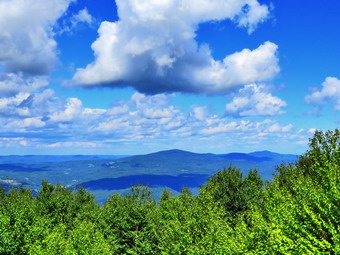 I reached up and got the book out of the canister and signed my name and wrote a short note about conditions. There was a slight wind blowing that made it a little bit cooler at the top. I took a picture of the canister and of Sheila. I decided to walk around looking for a viewpoint and headed first to the east. There didn't seem to be any lookout available and I did not want to go any further. We went back to the canister and headed west through some briars. I found the small boulder with blue boundary paint that serves as a lookout but the view was blocked by the trees. We headed back to the canister where I packed up. I got a drink and a bar before heading down the mountain. The trip down actually went very quickly although there were a few slips and slides. As we approached the hunter's shack, we began to hear engines. We made it down the mountain by 1:10 PM after covering about 2.5 miles. When we reached the hunting shack, there were two ATVs present. There was one young woman riding the first machine and another young couple on the second. I stopped to talk to them for a minute knowing that they were ignoring the rules that prohibited ATV riding in the area! Sheila and I continued on our hike by starting on the woods roads and snowmobile trails that lead to the summit of Bearpen. The series of roads and snowmobile that can be confusing and I intended to take a "shortcut" that is the way I have approached the peak in the past. The first part of the trail is flat but then we made a left turn where the road quickly gets steeper. At a hairpin turn another trail turned off the main snowmobile trail but I knew this was not the one I wanted to use. At this point the ATVs caught up to us and I told them to continue on the snowmobile trails. I got a drink and started to walk up to the next turn and the next trail. Very quickly the riders returned so I knew they had not found the summit. I showed them my Avenza app which seemed to help and I sent them on their way. We walked up the hill a little father and at 3.1 miles I found the "shortcut" on the left. After a short distance, the trail turned left and began to ascend the mountain. The last time I was on this trail it was a newly cut snowmobile trail and there were still some markers along then way. The trail apparently had been abandoned as it was narrow and clogged with weeds and briars.
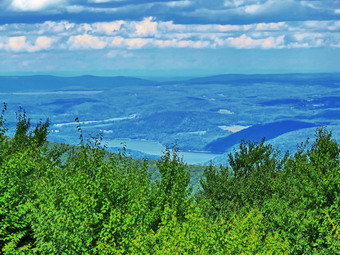 After about .6 miles and a gain of 300 feet the trail ended at a snowmobile trail that I recognized. We turned right on the snowmobile trail to walk toward the summit and the viewpoint to the north. The snowmobile trail gained a few more feet of elevation as we walked northwest. We had to avoid four separate mudholes caused by the illegal ATV use! At 2:05 PM after hiking a total of 4 miles we passed the summit and arrived at the lookout. The ATVs had already left so we had the place to ourselves. I took pictures to the north of the Schoharie Reservoir, Huntersfield, Richmond and Ashland Pinnacle. The clouds in that direction were towering an very interesting. I also took a shot of the fire ring and then walked over to the old rope tow for the ski area. After this we, got a drink and then started back. I decided to simply retrace our route from the way up as it seemed to be the shortest way back. The hike back went quickly as the trail was easy to negotiate and the snowmobile trails were manageable. We arrived back at the shack in the col at 2:55 PM about 5.5 miles into the hike. We turned right down the road and hiked the .9 miles back to the car. The hike back to the car was the worst part of the return trip because of the many rocks and my impatience. We arrived in the parking area at 3:15 PM after hiking 6.4 mile hike in about 4 hours and 5 minutes. Our elevation gain was 2150 feet and we had stopped for 35 minutes The temperature at the car was still only 73 degrees.
On Sunday, August 16th, I returned from church and called Lisa to ask her opinion on the construction of the switchback and new trail on Round Top. Lisa said she would be available at 4:00 PM after her shop closed. I told her that I might go over a little earlier and cut the grass, weds Na brush on the new sections to expose the tread. This would allow us to see what was underneath and expose any work that needed to be done. Lisa agreed this would be a good idea. I looked at the weather forecast which indicated a chance of rain at 4:00 PM> I decided not wait and decided to go over to Round Top to get my work done. At 2:00 PM I got dressed in modified hiking attire. I wore a cotton T-shirt as I knew whatever I wore would be covered in pieces of vegetation. I put on a pair of RailRiders hiking pants which are expensive but last along time and have features like deep pockets and a generous cut which I really like. These pants have Velcro closures at the ankles which help keep the sticks and stones out of my shoes and the ticks at bay. I decided to wear my Keen Targhe II hiking boots which fit reasonably well but have been discontinued. I grabbed a pair of Leki external lock poles I have been using lately. I also added my OR floppy hat which I have decided shields me from the sun and allows me to spray some insect repellant on it rather than on me. I also wore my OR Bugout gaiters which are treated with insect repellent. I prepared my Stihl 135R trimmer by fueling it and checking the line. I put the fuel container and a roll of line in my pack just in case I needed more of either while I was cutting. I put my gear in the car and headed across the street with Sheila in the back seat. Sheila would not take "No" for an answer. I parked at the trailhead at 2:30 PM and headed out on the trails at 2:30 PM. At the first trail junction we turned left and headed up the woods road which is the first part of the trail. We turned up the hill and I used the trimmer to cut some weeds and bush that were encroaching in the trail. At the junction with the upper blue trail we continued straight ahead on the blue trail toward the summit. I again fired up the trimmer and cut out the trail in a few places. When we came to the new trail, I dropped my pack. We turned left and I began to cut the weeds, ferns and small branches on the trail. I had intended to tie Sheila to a tree but she seemed to be able to stay out safe without wandering too far away. The cutting went more quickly than I thought it would since quite a few people had been walking the trail. There were a few branches that would require some loppers and a saw but the trail was much more distinct when I was done. I also noticed a few holes on the trail and several places that might require a little work with the shovel. When I finished the new trail I was on the other side of the hill on the blue trail. I turned left and in a short distance reached the switchback trail which will replace a section of the main trail. This section is becoming eroded as it goes straight up the hill and more and more people are using the trail. I gave this trail the same treatment as the other trail and was soon back on the blue trail further down the hill. Since I needed to pick up my pack, we turned right and headed up the blue trail to the summit. I cut a few briars on the summit before heading down the blue trail. I pick up the pack and we continued won the blue trail to the junction with the yellow trail. We continued straight ahead on the yellow trail and the woods road back to the first trail junction. At the first junction, we turned left and walked back out to the car. At 3:40 PM, I loaded up the gear and drove downtown to Lisa's shop. She said they had been swamped for the whole day and we agreed to put any more work off until another day. Lisa did go and walk the trails after work and approved of what I had done.
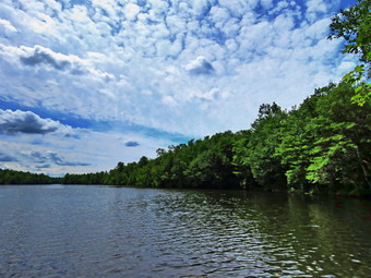
![]()
![]()
![]()
![]()
![]() On Saturday, August 15th, I wanted to hike but knew I would have to pick a route that was not popular to avoid the crowds. I decided to go to the Mongaup Pond area and hike around the pond on the snowmobile trails and then return on the Flynn Trail or the roads. It was 70 degrees when I started to get ready just after 10:00 AM. Sheila knew that we were going to hike but was relatively quiet watching my every move. I got dressed in a Columbia short-sleeved crew top with a short-sleeved baselayer. I put on a pair of RailRiders hiking pants which are expensive but last along time and have features like deep pockets and a generous cut which I really like. These pants have Velcro closures at the ankles to discourage sticks and gravel from getting into my shoes and to combat ticks. I decided to wear my Keen Targhee II hiking boots which fit well and have been discontinued. I grabbed a pair of Leki external lock poles I have been using lately. I also added my OR floppy hat which I have decided shields me from the sun and allows me to spray some insect repellant on it rather than on me. I put my gear in the back and Sheila in the backseat and pulled out of Livingston Manor at 10:30 AM. The skies were blue with puffy white clouds with plenty of sun. I drove out the Debruce Road about 6 miles and turned left onto Mongaup Pond Road. I continued to where the road split and stayed to the right on Mongaup Pond Road. I pulled into one of the spaces in the small pulloff on the right and was surprised to see no cars parked there or at the falls. The thermometer read 70 degrees as I set my GPS. The skies were blue with plenty of sun and white, puffy clouds. There was a slight breeze. I did not spray any insect repellant as I do not like the smell and there were no swarms of insects around me. At 10:50 AM we walked back toward the intersection and turned left down the woods road that used to be Hunter Road. Hunter Road connected to Terwilliger Road at one time so there is a small bridge across the outlet creek from Mongaup Pond. I could hear the falls to the right but they were not my objective on this day.
On Saturday, August 15th, I wanted to hike but knew I would have to pick a route that was not popular to avoid the crowds. I decided to go to the Mongaup Pond area and hike around the pond on the snowmobile trails and then return on the Flynn Trail or the roads. It was 70 degrees when I started to get ready just after 10:00 AM. Sheila knew that we were going to hike but was relatively quiet watching my every move. I got dressed in a Columbia short-sleeved crew top with a short-sleeved baselayer. I put on a pair of RailRiders hiking pants which are expensive but last along time and have features like deep pockets and a generous cut which I really like. These pants have Velcro closures at the ankles to discourage sticks and gravel from getting into my shoes and to combat ticks. I decided to wear my Keen Targhee II hiking boots which fit well and have been discontinued. I grabbed a pair of Leki external lock poles I have been using lately. I also added my OR floppy hat which I have decided shields me from the sun and allows me to spray some insect repellant on it rather than on me. I put my gear in the back and Sheila in the backseat and pulled out of Livingston Manor at 10:30 AM. The skies were blue with puffy white clouds with plenty of sun. I drove out the Debruce Road about 6 miles and turned left onto Mongaup Pond Road. I continued to where the road split and stayed to the right on Mongaup Pond Road. I pulled into one of the spaces in the small pulloff on the right and was surprised to see no cars parked there or at the falls. The thermometer read 70 degrees as I set my GPS. The skies were blue with plenty of sun and white, puffy clouds. There was a slight breeze. I did not spray any insect repellant as I do not like the smell and there were no swarms of insects around me. At 10:50 AM we walked back toward the intersection and turned left down the woods road that used to be Hunter Road. Hunter Road connected to Terwilliger Road at one time so there is a small bridge across the outlet creek from Mongaup Pond. I could hear the falls to the right but they were not my objective on this day.
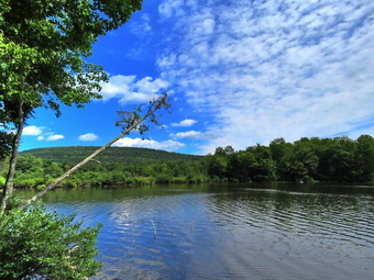 We crossed the creek on the small "bridge" that is still present and began to climb a little hill. The hill was a lot of rocks and gravel but on this day there was almost no water running down. As we started up the hill, Sheila alerted and I could hear someone coming toward us. It was a family group of 5 hiking from their campsite at Mongaup Pond. We passed each other with a "Hello". After .4 miles of climbing the little hill, we came to a trail junction where we continued straight ahead on the snowmobile trail. I was amazed to see that the Japanese knotweed was almost blocking the trail. We descended a little to swampy area and then started to climb and other rocky hill. After another .5 miles, we came to the junction with a snowmobile trail on the left. I stopped and applied some insect repellent as the mosquitoes had been biting viciously. We turned left and walked through an open area of ferns before entering the forest. It didn't seem very warm but it was humid. I was grateful that there was a breeze every now and then. The trail headed northeast and starting at 1.4 miles we walked uphill for 1.3 miles with the trail turning sharply southeast at 2.35 miles. From the top of this hill we began to descend following the trail as it again turned northeast at 2.9 miles. The trails were drier than I expected and we only had to walk around a few wet and muddy areas. There were obvious ATV tracks on the trail and I hoped they were from someone removing blowdowns. After walking around several blowdowns, I concluded that someone was simply breaking the rules! The total descent was about 1.2 miles and we lost 360 feet which is a gentle grade. I knew, however, that we would have to regain all of that elevation on the way back. At 3.8 miles we came to a trail junction where we turned left on the Mongaup Willowemoc Trail. Almost immediately we began a .5 mile climb heading northwest. The trail was eroded and very rocky. I noticed the heat and humidity but almost immediately a breeze started to blow. I looked up to see three hikers coming toward us. I walked off the trail with Sheila. As the hikers passed, I asked them where they were going. They said they were headed for the falls and had not made the turn back near the campgrounds. I gave them directions since they seemed to want to continue the way they were going. I am always amazed that people go walking in the woods without any idea of what they are doing and with no map and compass!
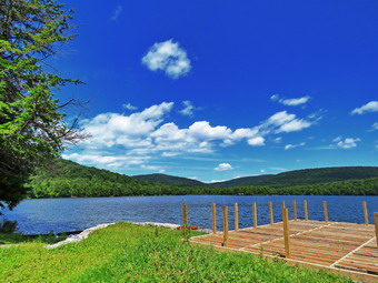 Once we came to the top of the hill, we started downhill for .65 miles to the junction with a snowmobile trail. This area is always very wet but on this day it was only damp and we easily avoided the mud. I could hear some people behind this and they seemed to be headed in our direction so we set a quick pace. We were now headed north and still walking downhill. We crossed three or four bridges and lost the other hikers. At 5.5 miles we came to the junction with the Mongaup Hardenburgh Trail and stopped at the head of the pond. Sheila jumped in the pond as I got my camera out to take some pictures. After taking a few shots, I got a bar and we continued around the pond on the trail. We met another group of four people hiking toward us and passed a couple and their dog sitting near the shore of the pond. We continued out to the campsite loop road where we turned right to walk out to the main road around the pond. I had decided that we would walk the roads back to the car at this point as I knew it would be a little more than 8 miles. I was surprised that so many of the campsites were occupied and that the bathrooms appeared to be open. When I got home I checked the website and found that they were now accepting new reservations but that all the campsites were reserved for most dates. We came to an area where I like to walk to the shore of the pond to take pictures and where there is a small bench. A pickup truck was illegally parked on the side of the road. When I walked toward the bench, I could see that there were people there and then their two dogs began to bark. I stayed away from the bench and walked to the shore with Sheila. The dogs continued to keep barking despite the owners efforts to quiet them. Sheila behaved herself by lying down as I took pictures of the pond, the mountains and the clouds. We walked back out to the road with the dogs still barking at turned left to walk south along the west side of the pond. We stopped one more time at the observation deck which was been in the process of reconstruction for some time. I took a few shots and then we got back to walking. I decided we would hike as fast as we could from the park entrance to the car. It took us 21 minutes to hike 1.1 miles which is 3 mph and I thought we could have gone faster. We were back at the car at 2:20 PM after hiking 8.1 miles with an elevation gain of 1200 feet. Our average speed was 2.3 mph with a moving average of 2.5 mph. On the way back home I drove of Beech Mountain Road to check out how many cars were parked at the Frick Pond trailhead. The parking lots were almost full with a total of 15 cars!
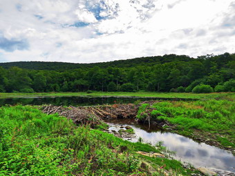
![]()
![]()
![]()
![]()
![]() On Thursday, August 13th, I had planned to hike with my friend Kevin somewhere in the Livingston Manor area. I looked up our past hikes and found he had never been to Alder Lake. We agreed that he would be at my house at 9:00 AM and that we would take my car to Alder Lake to hike. When I got up at 6:30 AM it was 56 degrees and the humidity was low although I knew the forecast was for highs in the low 80's. I got dressed in my White Sierra long-sleeved crew top with a short-sleeved baselayer. The White Sierra top has InsectSjeild which does tend to repel insects without spraying on any chemicals. I put on a pair of RailRiders hiking pants which are expensive but last along time and have features like deep pockets and a generous cut which I really like. These pants do not have Velcro closures at the ankles which are on some models. I decided to wear my Keen Targhe II hiking boots which fit reasonably well but have been discontinued. I grabbed a pair of Leki external lock poles I have been using lately. I also added my OR floppy hat which I have decided shields me from the sun and allows me to spray some insect repellant on it rather than on me. Kevin arrived just before 9:00 AM so I put our gear and Sheila in the car. When Kevin tried to get into the car, Sheila greeted him with a bark until I explained to her that she should knock it off! I drove out the driveway and headed up the Beaverkill Road somewhere around 9:10 AM. I headed toward Turnwood and Alder Creek Road where I made a left. Alder Creek Road had almost washed out in the last storm and there was still construction work in progress. After a brief stop, we continued to the end where I turned right onto the access road for Alder lake. I drove to the Alder Lake parking lot and pulled into a spot. There were a few other vehicles in the lot by the lake but no elope were in sight. By the noise, there seemed to be a good volume of water flowing down Alder Creek. The temperature was 72 degrees with a slight breeze but relatively high humidity. The skies were blue with some white clouds. At 9:40 AM we headed down to the "lawn" passing by the stone foundations which marked the last remnants of the Coykendall Mansion. The lawn had not been mowed and we could barely see the picnic tables through the high grass. This is such a beautiful place and it is a shame the DEC does not keep it maintained. We walked toward the trail around the left side of the lake but when I saw the clouds over the lake I decided to stop and take some pictures. I took shots of the lake including Millbrook Ridge and Cradle Rick Ridge. We then headed over to the trail and as we walked along the trail I kept an eye out for the occupants of the vehicles in the parking area. Brush and branches were beginning to grow into the trail and they needed some pruning. Sheila was happy to be out. One or two of the campsites had tents set up.
On Thursday, August 13th, I had planned to hike with my friend Kevin somewhere in the Livingston Manor area. I looked up our past hikes and found he had never been to Alder Lake. We agreed that he would be at my house at 9:00 AM and that we would take my car to Alder Lake to hike. When I got up at 6:30 AM it was 56 degrees and the humidity was low although I knew the forecast was for highs in the low 80's. I got dressed in my White Sierra long-sleeved crew top with a short-sleeved baselayer. The White Sierra top has InsectSjeild which does tend to repel insects without spraying on any chemicals. I put on a pair of RailRiders hiking pants which are expensive but last along time and have features like deep pockets and a generous cut which I really like. These pants do not have Velcro closures at the ankles which are on some models. I decided to wear my Keen Targhe II hiking boots which fit reasonably well but have been discontinued. I grabbed a pair of Leki external lock poles I have been using lately. I also added my OR floppy hat which I have decided shields me from the sun and allows me to spray some insect repellant on it rather than on me. Kevin arrived just before 9:00 AM so I put our gear and Sheila in the car. When Kevin tried to get into the car, Sheila greeted him with a bark until I explained to her that she should knock it off! I drove out the driveway and headed up the Beaverkill Road somewhere around 9:10 AM. I headed toward Turnwood and Alder Creek Road where I made a left. Alder Creek Road had almost washed out in the last storm and there was still construction work in progress. After a brief stop, we continued to the end where I turned right onto the access road for Alder lake. I drove to the Alder Lake parking lot and pulled into a spot. There were a few other vehicles in the lot by the lake but no elope were in sight. By the noise, there seemed to be a good volume of water flowing down Alder Creek. The temperature was 72 degrees with a slight breeze but relatively high humidity. The skies were blue with some white clouds. At 9:40 AM we headed down to the "lawn" passing by the stone foundations which marked the last remnants of the Coykendall Mansion. The lawn had not been mowed and we could barely see the picnic tables through the high grass. This is such a beautiful place and it is a shame the DEC does not keep it maintained. We walked toward the trail around the left side of the lake but when I saw the clouds over the lake I decided to stop and take some pictures. I took shots of the lake including Millbrook Ridge and Cradle Rick Ridge. We then headed over to the trail and as we walked along the trail I kept an eye out for the occupants of the vehicles in the parking area. Brush and branches were beginning to grow into the trail and they needed some pruning. Sheila was happy to be out. One or two of the campsites had tents set up.
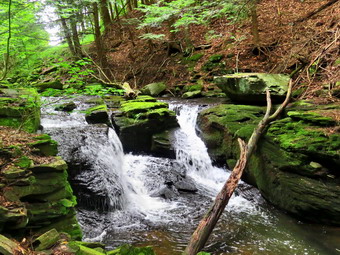 As we crossed the bridges on the trail, I pointed out to Kevin the remnants of the beaver dams that the DEC had opened up when they relocated the beavers. I showed him where the water had backed up so much that the trail had been flooding. We continued on the trail toward the junction with the Millbrook Ridge Trail. At about .8 miles we turned left to head toward the lean-to on the Millbrook Ridge Trail. The trail was wet and muddy in many places and there were a few blowdowns to contend with. Some of the blowdowns had been cut but whoever did the cutting left what they cut in the trail! Others were cut in several, places but the job was left incomplete. The trail tread was obvious and it looked like people had been using it. There were quite a few nettles but they were far enough back from the trail that we passed through without any "encounters". For the next 1.5 miles the trail climbed and then leveled off several times. The elevation gain is several hundred feet but the grade is never more than 12% and averages around 6%. There isn't too much to see along the way but this day was very pleasant. I enjoyed the sounds and sights of Alder Creek as it flows parallel to the trail much of the way. Hiking with Kevin is always a pleasure as we have things in common but also have divergent interests. I kept thinking we would meet some other hikers but we did not. Kevin began to point out various fungi and mushrooms as we walked. We must have seen over a dozen different species and Kevin took pictures of most of them. I was interested that I never really look for fungi on hikes but I became pretty adept at spotting them. We passed by a beaver meadow on the right side of the trail. At 1.85 miles we began the last climb and soon arrived at the beaver pond. Where there had once been a beaver meadow, there was now a pond with a dam and a beaver lodge. We walked out to the shore of the pond just downstream of the dam. The shore was cleaned back at least 10 feet of all trees but the brush and weeds had begun to grow back. I took pictures of the whole scene and then more shots of the dam, the beaver lodge and the pond. When I finished, I returned my camera to my pack and we walked along the shore and then back out to the main trail to the lean-to. I dropped my pack and got out the camera to take a few shots. I noticed that the privy was now completely torn apart by thoughtless campers looking for some firewood. One person starts the vandalism and the rest join in! We got a drink and a snack. The lean-to has been in need of repair for some time but I know of no plan to upgrade this popular spot.
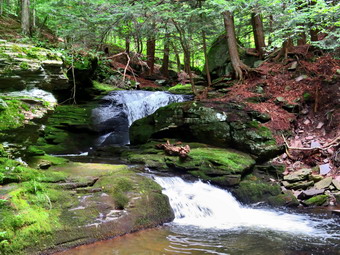 We walked back out to the main trail and turned left to start back to the car. Once we turned around, we both realized that the return trip would be much easier as it was almost all downhill. We did stop a few times to inspect some interesting mushrooms but otherwise kept a quick pace. We were soon at the loop trail around Alder Lake where we turned left to complete the loop around the lake. Shortly after the turn we came to the bridge where than was a young man in the creek. We said "Hello" and continued on our way. We walked on the main loop trail which was muddy in spots and sported some more mushrooms to examine. We finally saw a family group of hikers headed toward us with a Great Pyrenees. I stepped off the trail with Sheila so that they could pass. I talked to the group who said they were walking around the lake and suggested a trip to the beaver pond. As we continued along the woods road toward the dam, we noticed more capers at sites near the ale and more sites on the left of the trail. One path was rather evident without a campsite designation. It looked like the area where I usually start to climb Cradle Rock Ridge and I thought about exploring it some other day. The trail ascends some as it approaches the dam but the slope is gentle and then there is a decent We came to a deep ravine cut by a small stream where a bridge across the stream had been replaced. We continued to walk on the trail coming out of the woods in a small clearing very near the dam. The trail here was very wet as we walked up to the dam and across it. We passed by the remains of the mansion and I asked Kevin if he had some time to explore the waterfalls below the dam. He said he had the time.
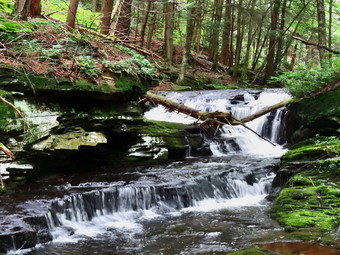 We walked down the trail toward the spring and then took a path to a woods road that runs parallel to the creek. The paths were much more well defined than ever before. This is becoming a theme as more and more people are hiking everywhere in the Catskills! Very soon I could see the first real falls and we walked down to the edge of the stream. I took some pictures with different settings. Having Kevin with me was a little embarrassing as he is a professional ,photographer and I use a point and shoot camera! We walked along the bank to the second falls which I had also photographed before. I took some pictures from a rock that gave me a head-on view from above the falls. I noticed a way to get down to stream level and I climbed down as Kevin went to investigate a patch of mushrooms. From my new vantage point, I took some more pictures of the falls which I could now knew had two drops. After completing my photography, I walked to the mushroom patch but Kevin had already moved downstream to another falls! Kevin was standing at the top of the falls and Sheila was dashing back and forth from the brink of the falls around me and back. From where Kevin was standing it was hard to get a picture of the falls so knew I had to move downstream again. Kevin decided to wait for me on the hillside as I descended to a point in front of the falls. I took my shots and then decided it was time to return to the car. I put away the camera and shoulder my pack to climb the step bank. When we reached the woods road, we turned left and followed it to where it met the access road. We headed right on the access road and walks back to the car. We arrived at the car at 1:10 PM after hiking 5.3 miles in 3.5 hours with an elevation gain of 795 feet. Kevin said he enjoyed the hike and would like to join me again.
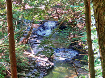
![]()
![]()
![]()
![]()
![]() On Tuesday, August 11th I had planned to travel to Salt Spring State Park near Montrose, Pennsylvania on an adventure to explore the park. The drive was about 1.5 hours and I didn't know much about the park. I did know it had three water falls and that was a good start! Cindy said she wanted to go and we agreed we would try to leave at about 8:30 AM. When I got up at 6:30 AM it was only 57 degrees and seemed quite comfortable but I knew the forecast for Montrose was for highs in the high 80's. Fortunately, the ambulance pager remained quiet as we prepared to hike at around 8:00 AM. Sheila is always excited about going but gets particularly worked up when Both Cindy and I are going. I got dressed in a Columbia short-sleeved crew top with a short-sleeved baselayer. I put on a pair of RailRiders hiking pants which are expensive but last along time and have features like deep pockets and a generous cut which I really like. These pants do not have Velcro closures at the ankles as some do to discourage sticks and gravel from getting into my shoes and to combat ticks. I decided against wearing my OR Bugout gaiters. I decided to wear my Keen Targhee II hiking boots which fit well and have been discontinued. I grabbed a pair of Leki external lock poles I have been using lately. I also added my OR floppy hat which I have decided shields me from the sun and allows me to spray some insect repellant on it rather than on me. I put my gear in the back of the car and Sheila in the backseat and headed west on State Rout 17 toward Binghamton at 9:00 AM. I drove 70 miles to exit 75 which took me to I-81 South. We were on I-81 for about 5 miles before getting off at exit 1. We turned right off the exit and after a short distance turned left on NY-7 South and then west for 3 miles. I turned right on PA-29 South and drove 6.4 miles to State Route 4008. I turned right and after a short distance left into the park. There were already quite a few cars in the lots and people had obviously been hiking and swimming. We parked and I note the temperature was already 78 degrees at 10:30 AM. I set my GPS and put Sheila on her leash as we walked out to find the trails I wanted to hike. We walked around on one side of Falls Brook but I wanted to be on the other side. We saw no way to get over to the other side so we walked around some more. Eventually I gave up and decided we would walk on the west side of the brook on the Gorge Trail. I finally saw a trail that looked like it headed up the to the rim of the gorge. As we started out on the trail, I finally saw the sign "Gorge Trail"! This continued to be a problem throughout the day. The area is beautiful and heavily used nut the trails are poorly marked and poorly maintained. The high usage means that people walk in many different places so there is no one tread to follow.
On Tuesday, August 11th I had planned to travel to Salt Spring State Park near Montrose, Pennsylvania on an adventure to explore the park. The drive was about 1.5 hours and I didn't know much about the park. I did know it had three water falls and that was a good start! Cindy said she wanted to go and we agreed we would try to leave at about 8:30 AM. When I got up at 6:30 AM it was only 57 degrees and seemed quite comfortable but I knew the forecast for Montrose was for highs in the high 80's. Fortunately, the ambulance pager remained quiet as we prepared to hike at around 8:00 AM. Sheila is always excited about going but gets particularly worked up when Both Cindy and I are going. I got dressed in a Columbia short-sleeved crew top with a short-sleeved baselayer. I put on a pair of RailRiders hiking pants which are expensive but last along time and have features like deep pockets and a generous cut which I really like. These pants do not have Velcro closures at the ankles as some do to discourage sticks and gravel from getting into my shoes and to combat ticks. I decided against wearing my OR Bugout gaiters. I decided to wear my Keen Targhee II hiking boots which fit well and have been discontinued. I grabbed a pair of Leki external lock poles I have been using lately. I also added my OR floppy hat which I have decided shields me from the sun and allows me to spray some insect repellant on it rather than on me. I put my gear in the back of the car and Sheila in the backseat and headed west on State Rout 17 toward Binghamton at 9:00 AM. I drove 70 miles to exit 75 which took me to I-81 South. We were on I-81 for about 5 miles before getting off at exit 1. We turned right off the exit and after a short distance turned left on NY-7 South and then west for 3 miles. I turned right on PA-29 South and drove 6.4 miles to State Route 4008. I turned right and after a short distance left into the park. There were already quite a few cars in the lots and people had obviously been hiking and swimming. We parked and I note the temperature was already 78 degrees at 10:30 AM. I set my GPS and put Sheila on her leash as we walked out to find the trails I wanted to hike. We walked around on one side of Falls Brook but I wanted to be on the other side. We saw no way to get over to the other side so we walked around some more. Eventually I gave up and decided we would walk on the west side of the brook on the Gorge Trail. I finally saw a trail that looked like it headed up the to the rim of the gorge. As we started out on the trail, I finally saw the sign "Gorge Trail"! This continued to be a problem throughout the day. The area is beautiful and heavily used nut the trails are poorly marked and poorly maintained. The high usage means that people walk in many different places so there is no one tread to follow.
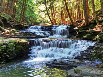 The Gorge Trail started out with a very steep climb as evidenced by a rope on the side of the trail. I had left my poles in the car as I had Sheila on her leash but she helped pull my up the trail. This first climb was only .1 miles but it had a 20% grade. I was looking for three different falls near the beginning of the trail. I could hear a the first falls and I could get a glimpse of it from the rim but I could not get any shots. We walked a little farther and the same thing happened at the second falls but this time took a picture through a break in the trees. Finally, at about half a mile we came to the third falls which didn't seem quite as high as the first two. It had two drops and a good volume. I tried taking some pictures from the side of the falls but could only get the upper drop and the wrong angle. I decided to work my way down to a rock shelf below the first drop. I let Sheila off her leash as there was no one else around and I wanted her to be able to follow me. I started down the rocks at the side of the falls which looked easy until I realized how slippery they were. I made it to a good vantage point without incident and found it was worth the trouble. I was almost directly in front of the falls and was able to get some great shots. I tried several settings while attempting to avoid the bright sunlight. I snapped both drops together and then individually. I wondered how it would be going back up the bank but it was easier than going down. I packed up and we walked along the edge of the stream avoiding places were people were swimming. I could see people walking downstream on the other side but was not sure how or if they had crossed the stream. Finally, I asked a pair of hikers and they told us there was a road a little father upstream and we could cross on the bridge. We walked away from the stream and found a blazed path that took us up to a field. We walked along the edge of the field briefly and then headed back down toward the stream. Within a short distance, we saw the road and the bridge. This was much farther downstream than where I had planned to cross but the upstream crossing did not seem to have a bridge. I decided we could lengthen the hike in other ways which proved to be wrong. We turned left on the road, walked across the bridge and looked for a trail. There did not seem to be a trail and there were certainly no blazes or signs. I turned left onto a sort of path and walked in through the weeds. I almost turned around but then saw trail red blazes. We followed this trail until it abruptly ended.
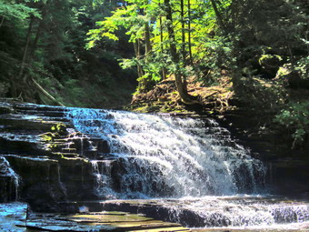 There was an informal path that led up the steep bank so we hiked up and found another trail although this one was also not marked. Cindy saw a bench a little higher up and headed for it. Sheila and I walked the path which ran above the creek until we saw a viewing platform. We climbed the hill to get to the platform where Cindy joined us. The platform had a sign that explained the gorge but there was no view! We walked on a boardwalk until we found a white blazed path which I think was part of the Hemlock Trail. There are some hemlocks in this forest that are estimated to be 500 years old. Like all hemlocks in the northeast they are threatened by the hemlock woolly adelgid. We continued on the trail as it descend to the stream again. I walked over to another interpretive sign placed next to a "pool". This was one of the salt springs that gave the park its name. The sign explained that the spring had been frequented by native Americans and by white settlers. It was enthalpy turned into a commercial venture. Today the spring has seen better days but does have some water bubbling up from far below the ground. We decided to try to walk along the eastern bank to the first falls. This trip was not easy as the rocks were slippery and there was only Avery informal path. Eventually I made it to a point almost in front of the first falls. Unfortunately there were quite a few people who decided to walk in from of the falls and one group who thought it would be a good idea to climb the slippery rock. I took pictures anyway trying to avoid people. I did take a few of the people climbing the falls to show people what not to do! After taking pictures, we looked for a way to cross to the other side but gave up and walked back the way we came. Cindy wanted to sit and get a drink and a bar so we found a picnic table. I began to plan another loop as we had hiked only about 2 miles. At this point Cindy informed me that she could not climb any hills. I should have know that this was the end of our hiking but I tried to find a for a long time trail to try. We crossed the creek on some very large stepping stones that had a rope to grip. I noticed that there were some bridge abutments indicating there had once been another way to cross. We walked out toward the parking area and to the west through a field as I tried to find the Silver Creek Trail. We finally walked toward the creek and found the red trail blazes. These continued for a few hundred feet and then disappeared. I decided that there was nothing else to do but return to the car and go home. We were back at the car at 12:30 PM after hiking 2.5 miles in 2 hour with and elevation gain of only 360 feet. I was very disappointed that and adventure had again turned to frustration with a 3 hour drive to hike 2.5 miles. I decided I would return at some point explore the other 12 miles of trails that I had missed.
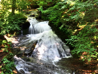
![]()
![]()
![]()
![]()
![]() On Monday, August 10th I wanted to get out for a hike locally as I planned to go to a state park in Pennsylvania the next day. When I got up at 6:30 AM it was only 60 degrees and seemed quite comfortable but I knew the forecast was for highs in the high 80's. I decided to go hiking at Trout Pond to see how Russell Brook Falls had fared after the storm the previous week. I responded to an ambulance call which delayed my departure but by 10:30 AM I started to get ready to leave. Sheila was especially excited as I began to dress as we had not really been hiking in two days so she watched every move I made. I got dressed in a short-sleeved crew top with a short-sleeved baselayer. I put on a pair of RailRiders hiking pants which are expensive but last along time and have features like deep pockets and a generous cut which I really like. These pants do not have Velcro closures at the ankles as some do to discourage sticks and gravel from getting into my shoes and to combat ticks. I decided against wearing my OR Bugout gaiters. I decided to wear my Keen Targhee II hiking boots which fit well and have been discontinued. I grabbed a pair of Leki external lock poles I have been using lately. I also added my OR floppy hat which I have decided shields me from the sun and allows me to spray some insect repellant on it rather than on me. I put my gear in the back of the car and Sheila in the backseat and headed for Roscoe on the Quickway at just after 11:00 AM. I got off at exit 94, turned left and drove out the Rockland Flats on Route 206. Just after the Roscoe Nursing Home I turned left on Morton Hill Road and followed it for 3 miles to the intersection with Russell Brook Road. I turned around and parked on the shoulder of the road to avoid parking in the private lot. The temperature was 78 degrees and it seemed a little humid!
On Monday, August 10th I wanted to get out for a hike locally as I planned to go to a state park in Pennsylvania the next day. When I got up at 6:30 AM it was only 60 degrees and seemed quite comfortable but I knew the forecast was for highs in the high 80's. I decided to go hiking at Trout Pond to see how Russell Brook Falls had fared after the storm the previous week. I responded to an ambulance call which delayed my departure but by 10:30 AM I started to get ready to leave. Sheila was especially excited as I began to dress as we had not really been hiking in two days so she watched every move I made. I got dressed in a short-sleeved crew top with a short-sleeved baselayer. I put on a pair of RailRiders hiking pants which are expensive but last along time and have features like deep pockets and a generous cut which I really like. These pants do not have Velcro closures at the ankles as some do to discourage sticks and gravel from getting into my shoes and to combat ticks. I decided against wearing my OR Bugout gaiters. I decided to wear my Keen Targhee II hiking boots which fit well and have been discontinued. I grabbed a pair of Leki external lock poles I have been using lately. I also added my OR floppy hat which I have decided shields me from the sun and allows me to spray some insect repellant on it rather than on me. I put my gear in the back of the car and Sheila in the backseat and headed for Roscoe on the Quickway at just after 11:00 AM. I got off at exit 94, turned left and drove out the Rockland Flats on Route 206. Just after the Roscoe Nursing Home I turned left on Morton Hill Road and followed it for 3 miles to the intersection with Russell Brook Road. I turned around and parked on the shoulder of the road to avoid parking in the private lot. The temperature was 78 degrees and it seemed a little humid!
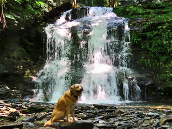 We got out of the car, I set my Garmin GPS unit and put Sheila on her leash. We started down Russell Brook Road as I planned to make the upper falls our first stop. There were campers occupying the first campsite on the right with three vehicles parked. I thought I recognized the tents from the previous week. I am not sure the campsite is legal since it is very close to the water and is not designated but the rangers never seem to ask people to move. I road was fairly dry and we made good time hiking downhill. There were no campers at the next site on the left of the trail although several cars were parked along the road. I assumed they just didn't know any better or were too lazy to park in the lot. We continued to walk quickly downhill to the path down to the viewpoint above the falls. We turned down the path to the upper falls, and I put down my pack and got out the camera. There was more water going over the falls than I thought there might be as I took several shots with differing settings. Once I finished the photography, I packed up, and we walked back up to the road. As we turned right and started down to the parking area, a car stopped and asked us about the area. After answering some questions, we continued down the road to the lower parking area. The lot was over half filled which surprised me for a Monday. We avoided several groups of people who were gathering and walked down the woods road to cross Russell Brook. We crossed the bridge and found that the Japanese knotweed was starting to encroach again on the trail despite the fact that I had cut it back several weeks before. We turned right on the informal path to the falls which I had cut wide enough so at least it was visible. We walked the path until we came to the path down the bank. Sheila and I walked down the bank to the streambed and carefully descended to the brook. The falls were flowing with a good volume as high as I had seen it during the summer. I immediately noticed that someone had again decided to improve on nature and build some stacks of rocks in the stream. I was happy there were no other people present as I carefully dismantled them. I made sure to move most of the rocks onto the top of other rocks so as not to further damage the microcomputer of the brook. The doctrine of Leave No Trace says that as much as possible we should visit nature and leave it as we found it. I even wonder sometimes about clearing and marking trails. I took some pictures of the falls and then some of the stream. I took a few more pictures of the falls and a few of Sheila sitting in front of it. When I was done I stowed the camera and we walked back up the stream bank and out to the main trail.
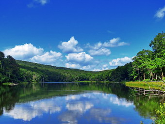 We stayed to the right at the trail junction just after the register and continued straight ahead to walk up to Trout Pond. The trail was damp in a few places with some muddy patches. As we walked up the trail, I noticed a family ahead of us stopped on the trail. They moved to one side and we passed them on the other with a brief "Hello". I removed some small branches as we went and took the time to take a few larger ones off the trail. I spotted a young couple ahead of us with a child in a backpack carrier but they were moving fast enough to stay ahead of us. When we arrived at the pond, we turned left and walked out to the "beach" at the outlet end of the pond. The level of the pond was high enough to allow some water to pass over the outlet which had not happened all season. The skies were very blue with some white clouds. As Sheila took a dip, I took out my camera and took some shots of the pond. I took some pictures of the whole scene and then zoomed in on different parts. Sheila swam around some and retrieved a stick I threw in the water and I got a few pictures of her. After getting a drink and a snack, I packed up and we headed back to the main trail. We turned left and continued on the main trail on the east side of Trout Pond walking toward the inlet end and the lean-tos. The trail was wet in spots with some mud. No one was camping at the large campsite on the right side of the trail before the lean-tos or at the lean-tos themselves. There were two people sitting in lawn chairs and fishing from the shore just after the bridge. As we crossed the bridge at the inlet end of the pond, I noticed that the inlet stream was high. I stopped to take some pictures of the pond from the bridge. We continued on the trail by turning right and starting up a hill which is the shoulder of Cherry Ridge. At the turn, the trail was almost dry but as we walked there was some dampness on the trail which made the stones slippery. We easily walked up the hill and I noticed it was easier than earlier in the year. Not very far from the turn was a new large blowdown partly blocking the trail. People had simply walked over the top of the branches. We stopped and I removed all the loose branches which were covered with leaves and some dirt. It was obvious in this and several other places that there had been a lot of water flowing down the trails during the tropical storm. The remaining part of the blowdown was a large cherry trunk which had broken off high up and fallen with the butt on Te trail. It ws fitly wedged up above and I knew it would not be safe to cut it. As we continued to hike we kept running into blowdowns from the recent storm. All of these were new since I had been through about two weeks before and cut everything. Soon we were at the highest point on Cherry Ridge and starting down the other side.
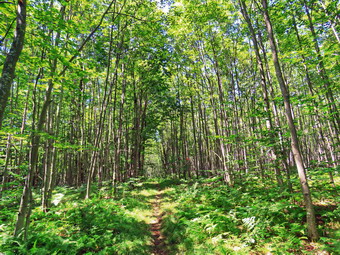 I anticipated that the trail would have quite a bit of water and there were places that had some standing water and some flowing like a stream but these were few. At one point a family was coming toward us and we recognized each other. They were the ones who had stopped and talked to me at the beginning of the hike. We talked for a few minutes and I found they were from New Jersey. I gave them some places they might like to hike in New Jersey and then we continued our hikes. We passed by several spots where I had cleared blowdowns and then ran into a large tree across the trail. It was easy enough to walk around one end but I thought I might come back and remove it from the trail. We continued on the trail to the point where we were ascending to the area where there is a forest of small birch trees. I stopped to take a few quick shots before continuing. Sooner than I thought we were at the woods road and snowmobile trail that runs by Mud Pond. We turned left and started the short walk uphill. This part of the trail was also a little wet and muddy. At the top of the hill, we began the long descent back to the trail junction where we had started. The descent lasts for .7 miles and drops 385 feet to a bridge that crosses the outlet stream from Trout Pond. This part of the trail was also wet with several small streams running across the trail. As we descended, we came to a spot where a small stream crosses. This time there was a good flow in the stream when before it had been only a trickle. We met two more groups of people as we continued down the hill on the main trail toward the campsite at the bottom of the hill on the left side of the trail. This campsite was also empty. I looked around for trash but it was very clean. We continued on the trail crossing the bridge over the stream and walking back out to the trail register. We turned right and headed back toward the lower parking area on the main trail. We walked up the short path to the lower parking area which was now packed with cars. As we continued up the road to the car, I was surprised I could not see any people down at the falls. The hike up the hill to the car proved to be les of a challenge that last time. We arrived back at the car at 2:10 PM after hiking 5.7 miles in 2 hours and 45 minutes with a 1145 foot total ascent. The temperature on the car thermometer was 86 degrees and the humidity seemed higher.
![]()
![]()
![]()
![]() On Friday, August 7th I started the day with an ambulance call and then had two more throughout the day. By the time the afternoon rolled around, I had decided that I was going to take a day off. I changed my mind when my granddaughter Ariana who was staying asked to go for a hike. I decided we would go across the street and hike the "new trails" on Round Top. I wanted to see how many people had chosen to walk these newly marked trails and I was sure Ariana would like the hike. Sheila was always near but not too near to be considered under foot. I got dressed in a cotton short-sleeved t-shirt as all my hiking apparel was in the wash and I knew the hike was short. I put on a pair of light Columbia nylon pants which I don't usually use for hiking. I decided against wearing my OR Bugout gaiters. I put my Merrell Moab 2 mid hiking boots which are actually a little too wide but would be acceptable for this hike. I grabbed a pair of Leki external lock poles I have been using lately. I also added a new OR floppy hat which I have decided shields me from the sun and allows me to spray some insect repellant on it rather than on me. We stepped out of the house at 2:30 PM and I grabbed Sheila's leash from the car. We walked up the driveway and crossed the street. I decided we would try to do just two figure 8's which would allow us to cover all the trails. We walked to the parking area by the Presbyterian Church and to the back of the church. We began the ascent of the steepest hill behind the church. The hill is short but gets the circulation pumping and is the steepest and longest climb on the "trail." Sheila helped me along by pulling me up the hill. Cindy had not hike hills in some time so I waited at the top for her and Ariana to catch up. When we got to the top of the hill, we stopped to look around at the hills around town. A breeze had begun to blow which made it a little cooler and I hoped would keep away the insects. We started on the trail by turning left at the trailhead. I let Sheila off her leash so that she could explore. The trail bed is becoming worn it which means that at least a few people are using the trail. I am always happy to see that someone else uses the trails.
On Friday, August 7th I started the day with an ambulance call and then had two more throughout the day. By the time the afternoon rolled around, I had decided that I was going to take a day off. I changed my mind when my granddaughter Ariana who was staying asked to go for a hike. I decided we would go across the street and hike the "new trails" on Round Top. I wanted to see how many people had chosen to walk these newly marked trails and I was sure Ariana would like the hike. Sheila was always near but not too near to be considered under foot. I got dressed in a cotton short-sleeved t-shirt as all my hiking apparel was in the wash and I knew the hike was short. I put on a pair of light Columbia nylon pants which I don't usually use for hiking. I decided against wearing my OR Bugout gaiters. I put my Merrell Moab 2 mid hiking boots which are actually a little too wide but would be acceptable for this hike. I grabbed a pair of Leki external lock poles I have been using lately. I also added a new OR floppy hat which I have decided shields me from the sun and allows me to spray some insect repellant on it rather than on me. We stepped out of the house at 2:30 PM and I grabbed Sheila's leash from the car. We walked up the driveway and crossed the street. I decided we would try to do just two figure 8's which would allow us to cover all the trails. We walked to the parking area by the Presbyterian Church and to the back of the church. We began the ascent of the steepest hill behind the church. The hill is short but gets the circulation pumping and is the steepest and longest climb on the "trail." Sheila helped me along by pulling me up the hill. Cindy had not hike hills in some time so I waited at the top for her and Ariana to catch up. When we got to the top of the hill, we stopped to look around at the hills around town. A breeze had begun to blow which made it a little cooler and I hoped would keep away the insects. We started on the trail by turning left at the trailhead. I let Sheila off her leash so that she could explore. The trail bed is becoming worn it which means that at least a few people are using the trail. I am always happy to see that someone else uses the trails.
At the first trail junction, we followed Sheila as she turned right on the woods road which is the shallower approach to the trail system. We continued to follow the yellow trail to the first junction where we turned left and followed it to the next trail junction. It was obvious that the warm weather and rain had caused an explosion of growth and the trails were beginning to get overgrown with brush and high grass. This was despite the fact that I had trimmed back the trail with the Stihl trimmer. At the second junction with the blue trail, we turned right and started up the steep blue trail that leads over the summit of Round Top. Walking uphill we passed through a sea of green brought on by the warm weather and frequent rain showers. Just before the steepest section Ariana and I turned right on the switchback trail marked with yellow ribbon while Cindy continued up the "old" trail. We continued to follow these ribbons as they made a sharp left turn and headed back to the blue trail where we met Cindy. We turned right on the blue trail and almost immediately turned right on the orange crossover trail. We walked this trail and I noticed there was a little sidehilling which might have to be mitigated. I also noticed that the trail was beaten down indicating others had walked it. We walked out to the blue trail and turned right. We walked down the blue trail to the yellow trail and turned right. We continued on the yellow trail along the base of Round Top and turned left at the second junction. We walked down to the lookout where we got a good view of town except for the lone tree in the middle of the view. Ariana wanted to go down to the lower part of the lookout and I followed her with Cindy waiting above. I mentioned to Ariana that there was a "cave" below the lookout and we decided to go down to take a look at it. The rocks were slippery but we made it down and looked around. I had though we would continue to walk around the rocks and back up to the trail but I found several blowdowns and a lot of weeds in the way. I decided we would go back the way we came which was easier than I expected. When we got to the top, Cindy was not there so I assumed she had walked won the trail some. We followed the yellow trail as it headed downhill toward the first trail junction but we did not see her! I was pretty sure she had walked home without telling us but we decided to do another loop in the other direction just to make sure. As we were walking down the trail toward the first trail junction, several young people appeared at the bottom of the hill. Before I could out Sheila on her leash, she went to greet them. I called her back and informed her that she had to listen.
The young people turned on the woods road and Ariana and I continued to the first trail junction. We turned around and walked back up the yellow trail to the lookout and followed it as it turned right. As we started up the hill some more young people started up behind us. I let Sheila off her leash as we walked uphill through a sea of ferns to the first junction with the blue trail. We turned right and walked the yellow rail along the base of Round Top to the next junction with the blue trail. We turned left and headed up toward the summit. We continued on the existing blue trail over the summit and started down the other side. As we started downhill, I wondered out loud why we had not scene any other others on the trail. Almost immediately they appeared ahead of us walking down the hill. We followed the blue trail to the junction and turned left to again walk the yellow trail to the next trail junction. The young people continued straight ahead toward the lookout. At the next junction with the blue trail, we turned right and followed the yellow trail down to the woods road that took us back to the first trail junction. This time we turned left and walked back out to the trailhead. There was a car with a Maine license plate parked so that the road was completely blocked. I did not have paper and pen to leave a note but thought about putting as sign on the map asking people not to park at the trailhead. I put Sheila on her leash and we walked down the cemetery hill toward the church parking lot. We walked across the parking area to the driveway and were home just after 4:00 PM. We were glad that Cindy was at home. From walking the "new" trails several times now it is obvious that it is time to cut them out. When we marked these trails with paint blazes, we will also remark the other trails although it would be hard to get lost!
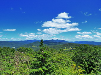
![]()
![]()
![]()
![]()
![]() On Wednesday, August 5th, Lisa and I had finished exploring the out end of Trout Creek where it enters the Rondout Reservoir and decided to head for the Red Hill fire tower. We drove back toward Grahamsville on Route 55A but turned right after crossing the reservoir. Almost immediately after that, I turned left on Sugarloaf Road and drove almost 4 miles to near the top of a hill. On the drive I got behind someone who felt the speed limit was 25 mph but I tried to enjoy the scenery. I turned left of Red Hill Road and then almost immediately right on Dinch-Coons Road. This is a gravel road that becomes a seasonal road after the top of the hill. As I started downhill toward the trailhead, I was surprised to find that he road was in the best shape I had ever seen. When I pulled into the parking area at 12:25 PM there was only one car in the lot and the temperature was still in the low 70's. Lisa pulled in right after me and we were both happy there would be no crowding on the hike. I set my GPS and we started to hike at 12:30 PM by heading off on the trail at a relaxed pace talking as we hiked. Lisa signed in at the trail register and then we continued along the trail. We could hear the small stream cascading through the woods making a bit of noise. There was some water in the stream but we crossed it without any problems and continued along the trail. Lisa commented about the tree roots and the rocks making it a little more difficult hike even though the distance round trip is under 3 miles. I agreed as we hit the first little steep section at the beginning which ends with a rock field to negotiate. We removed some branches as we walked and I am always surprised that other hikers will simply ignore these branches as if they were not there! The trail has a few steep spots at the beginning but then levels out a little before beginning the final climb. I was happy that we did not have to stop for me to catch my breath since I have been hiking more and throwing in few 3500 foot mountains. The weather conditions were almost ideal and there was even a slight breeze blowing. I kept looking for Sheila ahead on the trail but when there are two people on a hike she tends to follow me.
On Wednesday, August 5th, Lisa and I had finished exploring the out end of Trout Creek where it enters the Rondout Reservoir and decided to head for the Red Hill fire tower. We drove back toward Grahamsville on Route 55A but turned right after crossing the reservoir. Almost immediately after that, I turned left on Sugarloaf Road and drove almost 4 miles to near the top of a hill. On the drive I got behind someone who felt the speed limit was 25 mph but I tried to enjoy the scenery. I turned left of Red Hill Road and then almost immediately right on Dinch-Coons Road. This is a gravel road that becomes a seasonal road after the top of the hill. As I started downhill toward the trailhead, I was surprised to find that he road was in the best shape I had ever seen. When I pulled into the parking area at 12:25 PM there was only one car in the lot and the temperature was still in the low 70's. Lisa pulled in right after me and we were both happy there would be no crowding on the hike. I set my GPS and we started to hike at 12:30 PM by heading off on the trail at a relaxed pace talking as we hiked. Lisa signed in at the trail register and then we continued along the trail. We could hear the small stream cascading through the woods making a bit of noise. There was some water in the stream but we crossed it without any problems and continued along the trail. Lisa commented about the tree roots and the rocks making it a little more difficult hike even though the distance round trip is under 3 miles. I agreed as we hit the first little steep section at the beginning which ends with a rock field to negotiate. We removed some branches as we walked and I am always surprised that other hikers will simply ignore these branches as if they were not there! The trail has a few steep spots at the beginning but then levels out a little before beginning the final climb. I was happy that we did not have to stop for me to catch my breath since I have been hiking more and throwing in few 3500 foot mountains. The weather conditions were almost ideal and there was even a slight breeze blowing. I kept looking for Sheila ahead on the trail but when there are two people on a hike she tends to follow me.
 We had been hiking southwest but at 1 mile the trail turns south and then southeast. The last .3 miles averages a little over an 20% grade is challenging. On the way up we met a solo male hiker coming down the trail. I pulled Sheila to the side to let him pass and we exchanged greetings as he went by. As we approached the tower we could see there were quite a few leaves on the ground from the wind the day before. There was also a patch of dead trees to our left which neither of us remembered seeing before. At 1:25 PM we arrived at the tower clearing and I walked over to the first picnic table in the clearing. I dropped my pack and got out my camera to take some pictures of the tower. Sometimes I tether Sheila to the picnic table but this time I did not as there was no one else at the summit. Unlike some dogs, Sheila has no problem climbing up and down the open steps and I didn't care if she wanted to follow us to the top. Lisa and I started to climb the tower with Sheila following close behind. Without looking, I could tell when we were above the treeline as the wind hit us. We eventually made it to the landing below the cab. I began to take pictures of the surrounding scenery and Shiela. There was no haze in any direction and the views were the best I had seen in years! When there is no haze or fog, the views of the Catskill peaks from this tower are spectacular. We descended the tower, got a drink and a bar and started the hike back. The trip down went fast even though we had to be careful of the wet and slippery rocks. As the trail flattened near the bottom a family of our approached and I took Sheila off the trail so that they could pass. Just before the stream we heard some noise ahead and saw another family of 8 approaching. The kids looked like they were having fun but the mom asked "Is it much farther?" after hiking a quarter of a mile at the most. I wished them well and we continued across the stream and out to the parking area. Just as we arrived another car pulled in with a dog so I put Sheila in the car immediately. It was 2:30 Pm and we had hiked 2.6 miles in 2 hours with 20 minutes of stopped time. Our elevation gain was 800 feet. As I pulled out of the parking lot, I thought about visiting another waterfall but decided to just go home by way of DeBruce Road.
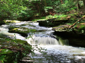
![]() On Wednesday, August 5th Lisa and I planned to visit some waterfalls after Tuesday's tropical storm dumped 5 inches of rain on the Catskills. My plan was to go to Angel Falls on Trout Creek in Yagerville first and the decide where to go from there. I planned to get up around 8:00 AM which was good since that is when the ambulance pager went off! I texted Lisa and she said she would wait until I got back. By the time I finished the call and paperwork it was almost 10:00 AM. I went home and quickly got ready to hike with Sheila watching my every move. The temperature was still in the high 60's with very low humidity. I got dressed in a short-sleeved crew top with a short-sleeved baselayer. I put on a pair of RailRiders hiking pants which are expensive but last a long time and have features like deep pockets and a generous cut which I really like. The pants have Velcro closures at the ankles that fend off ticks and detritus that can get into hiking boots. I put an old pair of Vasque Taku hiking boots which I wear when I know I may get my feet wet. I put on a pair of OR Bugout gaiters for some mud and tick protection. and grabbed a pair of Leki external lock poles I have been using lately. I also added a new OR floppy hat which shields me from the sun and allows me to spray some insect repellant on it rather than on me. Sheila would not leave my side as I was getting ready as she wanted to make sure she was going too! I called Lisa and we agreed to meet at the TriValley School as soon as possible. I got Sheila and my gear in the car and drove east on State Route 17 to Liberty and then got on Route 55 to Grahamsville. As I approached the school there were several trees down and there were crews cleaning them up. Lisa was already at the school and she said she would follow me. I turned left on Route 55 and left onto Route 55A just after the school. I followed RT 55A as it turned right and crossed the Rondout Reservoir. I drove toward Yagerville Road but when we arrived we found the road blocked with cones. I assumed there were more trees down and blocking the road. We turned around and pulled into the parking area on the opposite side of the road. After some discussion, we agreed to walk down to Tout creek upstream of the bridge to take a look at Trout Creek. At 10:30 AM, We walked across the road and found an informal path down to the stream.
On Wednesday, August 5th Lisa and I planned to visit some waterfalls after Tuesday's tropical storm dumped 5 inches of rain on the Catskills. My plan was to go to Angel Falls on Trout Creek in Yagerville first and the decide where to go from there. I planned to get up around 8:00 AM which was good since that is when the ambulance pager went off! I texted Lisa and she said she would wait until I got back. By the time I finished the call and paperwork it was almost 10:00 AM. I went home and quickly got ready to hike with Sheila watching my every move. The temperature was still in the high 60's with very low humidity. I got dressed in a short-sleeved crew top with a short-sleeved baselayer. I put on a pair of RailRiders hiking pants which are expensive but last a long time and have features like deep pockets and a generous cut which I really like. The pants have Velcro closures at the ankles that fend off ticks and detritus that can get into hiking boots. I put an old pair of Vasque Taku hiking boots which I wear when I know I may get my feet wet. I put on a pair of OR Bugout gaiters for some mud and tick protection. and grabbed a pair of Leki external lock poles I have been using lately. I also added a new OR floppy hat which shields me from the sun and allows me to spray some insect repellant on it rather than on me. Sheila would not leave my side as I was getting ready as she wanted to make sure she was going too! I called Lisa and we agreed to meet at the TriValley School as soon as possible. I got Sheila and my gear in the car and drove east on State Route 17 to Liberty and then got on Route 55 to Grahamsville. As I approached the school there were several trees down and there were crews cleaning them up. Lisa was already at the school and she said she would follow me. I turned left on Route 55 and left onto Route 55A just after the school. I followed RT 55A as it turned right and crossed the Rondout Reservoir. I drove toward Yagerville Road but when we arrived we found the road blocked with cones. I assumed there were more trees down and blocking the road. We turned around and pulled into the parking area on the opposite side of the road. After some discussion, we agreed to walk down to Tout creek upstream of the bridge to take a look at Trout Creek. At 10:30 AM, We walked across the road and found an informal path down to the stream.
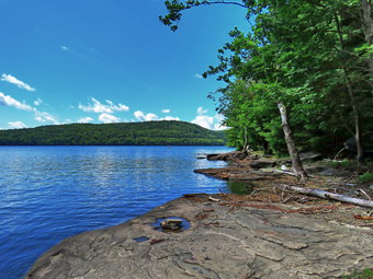 The water level in the stream was higher than I would expect in the summer but not quite as high as I thought it would be after the rainfall the day before. This simply attested to the fact that it ground had been very dry. We walked along the stream which offered plenty of opportunities to take pictures from the bank of from rocks jutting out into the stream. I was careful to watch my footing on the rocks and to restrain Sheila who wanted to swim. There was a least one waterfall and some nice rapids and it was fun being somewhere I had not explored before. The path led us under the road bridge where I stopped to take a few shots of the bridge and the Rondout Reservoir beyond. On the other side the path led us down to the shore of the reservoir where Sheila again had to swim. I took pictures and then we continued on a path that paralleled the shore. There were numerous rowboats on shore and most were not chained or locked. At several spots we stopped and I took pictures of the rocky shore and the hills on the other side of the reservoir. I even took some shots of the powerhouse at the other end! We rounded one point to find a sandy beach with a few boats. We could have continued to walk for some time but there was a path through the woods which we decided to follow back to the parking area. Along the way I took some shots of a nice stone wall. We are back at the cars by noon. Lisa suggested we go to hike to the Red Hill fire tower. I was reluctant since I had planned on visiting more falls but agreed and we set off.
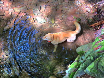
![]()
![]()
![]()
![]()
![]() On Monday, August 3rd I had planned to get up rather early and hike Vly and Bearpen as a two-for-one 3500 foot peak hike. These peaks are both bushwhacks with well-defined path to each peak. Vly even has a canister! I got up much earlier than I expected as the ambulance pager went off at 5:15 AM. By the time I got home I was tired and knew I would need a little more sleep before going out to hike. When I did get up for the second time, I decided to ask Cindy if she wanted to go on a shorter hike and postpone the "double" for another day. I thought that hiking a figure 8 at Kelly Hollow would be fun and Cindy agreed. The hike is only about 4 miles but there are some interesting sites including a stream that runs between the trail out and the trail back. There is also a beaver pond on the trail with a lean-to. The temperatures were forecast to be a little cooler than they had been and as I go ready it was only 68 degrees with lower humidity. I got dressed in a short-sleeved crew top with a short-sleeved baselayer. I put on a pair of RailRiders hiking pants which are expensive but last a long time and have features like deep pockets and a generous cut which I really like. The pants have Velcro closures at the ankles that fend off ticks and detritus that can get into hiking boots. I put a new pair of Merrell Moad 2 mid hiking boots that I wanted to try out. I got the wide version as I need it in most models but they almost seemed too wide. I grabbed a pair of Leki external lock poles I have been using lately. I also added a new OR floppy hat which shields me from the sun and allows me to spray some insect repellant on it rather than on me. Sheila would not leave my side as I was getting ready as she wanted to make sure she was going too! We got Sheila and our gear in the car and headed north on State Route 17 toward Roscoe at 10:40 AM. I prefer using the Beaverkill and Barkaboom Roads which saves 5 miles but Cindy prefers fewer back roads. I took exit 94 and drove north toward the Pepacton Reservoir on Route 206. At the junction with Route 30, I turned left and followed Route 30 to the Dunraven Bridge. Here I turned right and the BWS roads until reaching the junction with the Barkaboom Road. I turned left on BWS 9. After 4.5 miles, I turned right on Millbrook Road and continued 5.25 miles to the parking lot for Kelly Hollow on the right. We parked at 11L30 AM with three other cars in the lot. I took a moment to set my GPS before starting our hike by heading out on the trail marked with yellow XC skiing blazes. The temperature was 73 degrees and the humidity was very low. The skies were blue with numerous puffy white clouds. My plan was to walk the trail in a figure 8 which is something I had done several times before. We followed the trail as it crossed a small stream and then turned right on the woods road heading south and ascending slightly passing through a gate. Along the way the trail was wet and muddy in spots.
On Monday, August 3rd I had planned to get up rather early and hike Vly and Bearpen as a two-for-one 3500 foot peak hike. These peaks are both bushwhacks with well-defined path to each peak. Vly even has a canister! I got up much earlier than I expected as the ambulance pager went off at 5:15 AM. By the time I got home I was tired and knew I would need a little more sleep before going out to hike. When I did get up for the second time, I decided to ask Cindy if she wanted to go on a shorter hike and postpone the "double" for another day. I thought that hiking a figure 8 at Kelly Hollow would be fun and Cindy agreed. The hike is only about 4 miles but there are some interesting sites including a stream that runs between the trail out and the trail back. There is also a beaver pond on the trail with a lean-to. The temperatures were forecast to be a little cooler than they had been and as I go ready it was only 68 degrees with lower humidity. I got dressed in a short-sleeved crew top with a short-sleeved baselayer. I put on a pair of RailRiders hiking pants which are expensive but last a long time and have features like deep pockets and a generous cut which I really like. The pants have Velcro closures at the ankles that fend off ticks and detritus that can get into hiking boots. I put a new pair of Merrell Moad 2 mid hiking boots that I wanted to try out. I got the wide version as I need it in most models but they almost seemed too wide. I grabbed a pair of Leki external lock poles I have been using lately. I also added a new OR floppy hat which shields me from the sun and allows me to spray some insect repellant on it rather than on me. Sheila would not leave my side as I was getting ready as she wanted to make sure she was going too! We got Sheila and our gear in the car and headed north on State Route 17 toward Roscoe at 10:40 AM. I prefer using the Beaverkill and Barkaboom Roads which saves 5 miles but Cindy prefers fewer back roads. I took exit 94 and drove north toward the Pepacton Reservoir on Route 206. At the junction with Route 30, I turned left and followed Route 30 to the Dunraven Bridge. Here I turned right and the BWS roads until reaching the junction with the Barkaboom Road. I turned left on BWS 9. After 4.5 miles, I turned right on Millbrook Road and continued 5.25 miles to the parking lot for Kelly Hollow on the right. We parked at 11L30 AM with three other cars in the lot. I took a moment to set my GPS before starting our hike by heading out on the trail marked with yellow XC skiing blazes. The temperature was 73 degrees and the humidity was very low. The skies were blue with numerous puffy white clouds. My plan was to walk the trail in a figure 8 which is something I had done several times before. We followed the trail as it crossed a small stream and then turned right on the woods road heading south and ascending slightly passing through a gate. Along the way the trail was wet and muddy in spots.
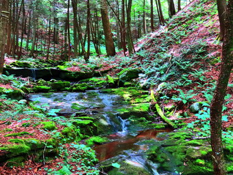 At .3 miles we came to the short spur trail to a designated campsite but I knew there was not much to see so we continued on the main trail. At .6 miles we came to the cutoff to the right for the Short Loop hike. We turned right to walk down the cutoff trail to the bridge where Sheila immediately found the deepest spot to frolic and get a drink. I took some pictures of Sheila and the stream before we crossed the ridge and headed up the trail to the main loop trail on the other side. After Sheila went "swimming" in the stream, she ran up the bank dashing back and forth madly. As we ascended to the loop trail we could hear and the see people with a dog at top of the hill. Once we arrived at the main trail, we could see they were descending toward the parking areas. We turned left on the loop trail heading southwest and then south toward the beaver pond and lean-to. Over the next .4 miles we gained almost 300 feet for a 12% grade. Although this is not a steep climb it was more than I remembered. Along the way, we met a family of four coming toward us with their dog on a leash and we said "Hello" as we passed. At 1.3 miles we were at the beaver pond which had more water in it than I had seen in some time. I did not see any increased beaver activity so I do not think there are any beavers in the area. There were some nice puffy white clouds in the blue sky so I took some pictures before we continued around the pond. The grass and briars were beginning to completely take over the trail and I had to push my way through in several places. We stopped again on the other side and I took a few more pictures before continuing on to the lean-to in the woods. The lean-to was in good shape except for a dirty seat but it is beginning to deteriorate. I don't know who maintains this area but the trails need some care and the privy could use some cleaning. There is a project to rebuild some lean-tos and this one could use some care. After a break, we continued on the trail now heading northeast and downhill. The trail made a turn so that we were heading southeast and we crossed a few bridges over small streams. At one point we started to walk through a grove of pines and I stopped to take a few shots including a couple straight up. At 2 miles we came to the spot where I had bushwhacked up to Millbrook Ridge to look down on Alder Lake. At 2.3 miles we made and almost 180 degree turn and started heading north. I noted that this would be a good place to try another bushwhack as it was only .7 miles to the trail that runs along Millbrook Ridge but the contours show a steep climb. We continued north on the trail still descending. We were headed toward the crossover trail which we would again use to finish or figure 8.
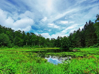 After talking, we continued in opposite directions. At 3 miles we again came to the crossover trail and turned left to cross the middle of the figure 8. We crossed the bridge and walked up the hill on the other side to the main trail. This time we turned right and started to walk 1.1 miles back to the car. The day was very pleasant with a slight breeze blowing and walking downhill made a big difference. This part of the trail was not well marked but the path was pretty obvious as it followed a woods road. This section of trail was also wet and muddy. At 3.9 miles we came to the Middletown Cemetery which I have explored several times. Several gravestone have special markers designated the interred as Civil War veterans. One grave has a marker indicating the deceased had fought in the Revolution and had died in 1792! We continued by walking into the camping area to find the trail back to the car. There was one car with one man camping. We did not want to bother him so we decided to walk out the access road to Millbrook Road. This road was very muddy so I took Sheila off it into the woods to walk around those areas. We turned right on Millbrook Road and walked the final .3 miles back to the car. I was in the lead with Sheila and had the choice of keeping her pace or pulling on her leash. We made it back to the car a few minutes ahead of Cindy. One more care was parked in the lot and the temperature was 81 degrees. It was 1:50 PM and we had spent 2 hours and 20 minutes hiking 4.2 miles with an elevation gain of 700 feet. We had paused for only 7 minutes! I asked Cindy if she wanted to do anything else and what route she wanted to take back but she didn't seem to care. I thought about visiting the covered bridge on Millbrook Road or stopping by Tompkins Falls. I decided against this as I planned to visit falls on Wednesday after the remains of a tropical storm passed through on Tuesday! On the way back I decided to take the same route I had on the way to the hike. I was disappointed in the Merrell Moab 2 mid hiking boots as my feet seemed to slip around a lot despite heavy socks and tight lacing. I felt they would be good on walks but not climbing mountains.
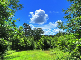
![]()
![]()
![]()
![]()
![]() On Saturday, August 1st I wanted to get out for a hike but knew it would be best to avoid the more popular areas including many of the high peaks. After considering several options, I decided to go to Bear Spring WMA between Downsville and Walton to hike a 9 mile loop on the central and eastern ridge. I knew this would be good exercise and good training for hiking multiple 3500 foot peaks. The area has many snowmobile and horse trails that are wide and grassy. The trails have a good surface and there are no major mountains but the climbs to the ridges can be challenging. When I got up in the morning, the temperature was a cool 57 degrees but I knew that would rise rapidly. As I started to get ready. Sheila started to get excited but was controlling herself as best she could. I got dressed in a short-sleeved Columbia crew top with a short-sleeved baselayer. I put on a pair of RailRiders hiking pants which are expensive but last a long time and have features like deep pockets and a generous cut which I really like. The pants do not have Velcro closures at the ankles that some models have to fend off ticks and detritus that can get into hiking boots. I put a pair of Keen Targhee II boots which fit nicely and have been discontinued! I did add my OR Bugout gaiters for extra tick and mud protection. I grabbed a pair of Leki external lock poles I have been using lately. I also added a new OR floppy hat which shields me from the sun and allows me to spray some insect repellant on it rather than on me. I got my gear in the car and put Sheila in the back seat. I drove to Roscoe and then took County Route 206 through Downsville to the top of Bear Spring Mountain near Walton, NY. As we started out of Downsville, I noticed a small waterfall on the left side of the road and thought we might stop on the way back. Further up the mountain, we passed Bear Cub Pond also on the left side of the road. I had often thought I might stop there but never had. I decided this could be another stop on the way home. As we neared the top of the mountain, I continued past East Trout Brook Road and turned left on West Trout Brook Road near the top of the hill. I parked in the large main lot on the left side of the road at 10:25 PM. The temperature was 68 degrees with a slight breeze blowing. There was a pickup truck in the lot but we have hiked here many times and seldom see anyone on the trails. I set my GPS and we got right on the trail.
`
On Saturday, August 1st I wanted to get out for a hike but knew it would be best to avoid the more popular areas including many of the high peaks. After considering several options, I decided to go to Bear Spring WMA between Downsville and Walton to hike a 9 mile loop on the central and eastern ridge. I knew this would be good exercise and good training for hiking multiple 3500 foot peaks. The area has many snowmobile and horse trails that are wide and grassy. The trails have a good surface and there are no major mountains but the climbs to the ridges can be challenging. When I got up in the morning, the temperature was a cool 57 degrees but I knew that would rise rapidly. As I started to get ready. Sheila started to get excited but was controlling herself as best she could. I got dressed in a short-sleeved Columbia crew top with a short-sleeved baselayer. I put on a pair of RailRiders hiking pants which are expensive but last a long time and have features like deep pockets and a generous cut which I really like. The pants do not have Velcro closures at the ankles that some models have to fend off ticks and detritus that can get into hiking boots. I put a pair of Keen Targhee II boots which fit nicely and have been discontinued! I did add my OR Bugout gaiters for extra tick and mud protection. I grabbed a pair of Leki external lock poles I have been using lately. I also added a new OR floppy hat which shields me from the sun and allows me to spray some insect repellant on it rather than on me. I got my gear in the car and put Sheila in the back seat. I drove to Roscoe and then took County Route 206 through Downsville to the top of Bear Spring Mountain near Walton, NY. As we started out of Downsville, I noticed a small waterfall on the left side of the road and thought we might stop on the way back. Further up the mountain, we passed Bear Cub Pond also on the left side of the road. I had often thought I might stop there but never had. I decided this could be another stop on the way home. As we neared the top of the mountain, I continued past East Trout Brook Road and turned left on West Trout Brook Road near the top of the hill. I parked in the large main lot on the left side of the road at 10:25 PM. The temperature was 68 degrees with a slight breeze blowing. There was a pickup truck in the lot but we have hiked here many times and seldom see anyone on the trails. I set my GPS and we got right on the trail.
`
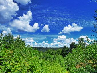 We crossed the road and got on trail 7 to start a short uphill. The trail had quite a few weeds and several deep puddles which were very muddy. It looked to me as if the state workers had used a large tractor with a gang mower to cut the grass. It was nice not to have to walk in waist high vegetation but this was negated by the damage to the trails. I also noticed that my boots were getting wet from the dew and the Keen Dri was pretty much useless like most other waterproof linings. The trail leveled and at .5 miles we crossed Beers Brook Road. Since the trail is offset, it to me a moment to remember to turn left and re-enter the woods, staying on trail 7. We continued hiking slightly uphill to 1.1 miles where we came to a T. Since I had not hiked here for some time and never in this direction, I was not sure which way to turn. I turned right but after a short distance I realized we were headed toward Houck Mountain. We turned around and headed the other way and soon crossed West Trout Brook Road. We were now on Trail 5 which would take us along the central ridge toward Fork Mountain. The clouds were spectacular although there was not much else to see. I did take a few shots as I knew this would not change. The trail continued south ascending and descending some small hills. We continued to walk through wet grass and weeds and had to avoid ruts and large puddles. I knew I was looking for trail 4 on the left which would allow us to descend off the central ridge. At one point, a trail appeared on the left but it was not labeled as trail 4 and I chose to keep going. There were a lot flies buzzing around us and I finally decided to stop and apply some repellent. The flies continued to buzz around but fewer were landing. At 2.85 miles we passed the shoulder of Fork Mountain and started a little descent which made me believe that the trail I was looking for would be coming up soon. The walk was longer than I though but at 3.7 miles the trail appeared on the left and we turned onto it.
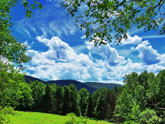 It immediately became clear that few people had used this trail and it was not being maintained by the state. The first part was covered by nettles and there was no path through them. I managed to follow Sheila as she made a small opening. This continued for some time and then the nettles gave way to briars. I did stop once to take some pictures of the clouds hanging over the eastern ridge. As I looked at that ridge and its elevation, I realized that we would have to regain all of the elevation we were losing to get to that ridge! The trail became a little less cluttered with weeds but it was wet making it slippery. At 4.7 miles we crossed East Trout Brook Road and found one car parked in the lot. We walked down trail 2 to the bridge over the dam that impounds Middle Pond. Sheila immediately went into the water while I took a few pictures of the pond. I got a drink and gave Sheila one. I took out a bar and packed up to begin the climb to the eastern ridge. I knew I had several options including simply hiking up East Trout Brook Road. I decided tom stay with the original plan but as we started up trail 2 I wondered if my decision was wise. I was beginning to fell very warm and my legs were tired as we climbed. It didn't help that we were walking in and out of the shade. Walking in the sun was much warmer so I tried to stay in the shade. As we made our way up the hill, two hikers about my age came walking downhill toward us. I pulled Sheila over to the side of the trail as they passed. We said "Hello" and they complimented Sheila's behavior. On our way up the hill there continued to be some nice views of the valley and the clouds so I stopped once to take some shots. At 5.4 miles, trail 2 turned slightly to the right but we stayed to the left on trail 3, the McCoy Hill Cutoff. Just before the trail entered the woods, I stopped to take a few pictures. I looked down to see Sheila laid out in the sun by my pack. My first thought was she was in trouble from being too warm but as soon as I said her name she jumped up and ran up the trail. Being in the shade again was great and made me feel much better. What was discouraging was that this trail was much longer than I remembered and my legs were definitely tired. I kept thinking we were at the top and then there would be another climb.
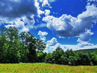 At 6.2 miles we were finally at the top of the hill! We had climbed 730 feet in 1.3 miles from Middle Pond. As we walked along the edge of the field, Sheila ran ahead chasing some turkeys. I called Sheila back and we both had a drink. We turned left on trail 2 to walk west and then northwest along the eastern ridge. The grass was drier now and there were fewer mudholes along the way. Over the next 2.1 miles the trail rolled over some bumps. We finally came to what had been a clear cut on the right side of the trail but was now all grown in. I did take a couple more shots of the clouds. At 8.25 miles we arrived at the junction with trail 1 which would take use back to the parking area and the car. I had thought about hiking back on the road but we turned left on trail 1 and started a short hike up a hill. When the trail split, we stayed to the right on trail 1 and started a downhill walk to East Trout Brook Road. Along the way I picked up some garbage to take home with me. We crossed the road and started up another long but gradual ascent as the trail left the woods and crossed a field. There was no path in the field indicating to me that no one had been using the trail. Once we entered the woods, I knew we were close to the car. There was one more mudhole to negotiate and then we were in the parking lot. It was 2:40 PM and we had hiked 9.3 miles in 4 hours and 15 minutes with 20 minutes if stopped time. Our elevation gain was 1515 feet and our overall pace was 2.2 mph which I thought was rather good.
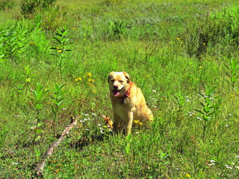
![]()
![]()
![]()
![]()
![]() On Friday, July 31st, my grandson Bryce was coming to my house and I knew we would be going for a hike. I had an appointment in the afternoon so I Laos knew it would have to be a quick hike. Bryce arrived at 9:15 AM and we discussed where we should hike after I did a few chores. We agreed that we would go to Frick Pond as it was close. I began to get ready to hike and as I gathered my clothing Sheila got wind of what was going on and began running around the house barking. I got dressed in a short-sleeved crew top with a short-sleeved baselayer. I put on a pair of RailRiders hiking pants which are expensive but last a long time and have features like deep pockets and a generous cut which I really like. The pants do not have Velcro closures at the ankles that some models have to fend off ticks and detritus that can get into hiking boots. I put a pair of Keen Targhee II boots which fit nicely and have been discontinued! I did add my OR Bugout gaiters for extra tick and mud protection. I grabbed a pair of Leki external lock poles I have been using lately. I also added a new OR floppy hat which shields me from the sun and allows me to spray some insect repellant on it rather than on me. I put Bryce and Sheila in the back seat and we left Livingston Manor at 10:25 AM with the temperature reading 68 degrees. I drove out the DeBruce Road about 6 miles to Mongaup Road and turned left. I continued up the road to the point where it splits and stayed left on Beech Mountain Road. It was a shirt drive to the parking areas on the left. I pulled into the smaller parking area next to one other car. I set my GPS and we got ready to head out on the Flynn Trail. The plan was to hike up the Flynn Trail and then descend the Big Rock Trail to Times Square. From the trail junction we would continue straight across to the end of the Big Rock Trail and then take the Quick Lake Trail back to the car.
On Friday, July 31st, my grandson Bryce was coming to my house and I knew we would be going for a hike. I had an appointment in the afternoon so I Laos knew it would have to be a quick hike. Bryce arrived at 9:15 AM and we discussed where we should hike after I did a few chores. We agreed that we would go to Frick Pond as it was close. I began to get ready to hike and as I gathered my clothing Sheila got wind of what was going on and began running around the house barking. I got dressed in a short-sleeved crew top with a short-sleeved baselayer. I put on a pair of RailRiders hiking pants which are expensive but last a long time and have features like deep pockets and a generous cut which I really like. The pants do not have Velcro closures at the ankles that some models have to fend off ticks and detritus that can get into hiking boots. I put a pair of Keen Targhee II boots which fit nicely and have been discontinued! I did add my OR Bugout gaiters for extra tick and mud protection. I grabbed a pair of Leki external lock poles I have been using lately. I also added a new OR floppy hat which shields me from the sun and allows me to spray some insect repellant on it rather than on me. I put Bryce and Sheila in the back seat and we left Livingston Manor at 10:25 AM with the temperature reading 68 degrees. I drove out the DeBruce Road about 6 miles to Mongaup Road and turned left. I continued up the road to the point where it splits and stayed left on Beech Mountain Road. It was a shirt drive to the parking areas on the left. I pulled into the smaller parking area next to one other car. I set my GPS and we got ready to head out on the Flynn Trail. The plan was to hike up the Flynn Trail and then descend the Big Rock Trail to Times Square. From the trail junction we would continue straight across to the end of the Big Rock Trail and then take the Quick Lake Trail back to the car.
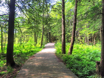 We crossed the road at 10:40 AM and got on the Flynn Trail to walk around the private property around the cabin at the end of the road. The beginning of the trail continues to erode with each rainstorm but it is hard to develop a way to fix the problem. At the end of the woods trail we turned right on a woods road which is sited along what was once the Beech Mountain Road. This road was the access for the Beech Mountain Boy Scout Camp. We began the ascent on the trail which was a narrow path through grass and weeds beaten down some by hikers passing through. Everything was very green and a little wet from the dew and the rain the night before. The trail gains a little over 600 feet in 1.75 miles to the highest point at the junction with the Big Rock Trail. We passed through the arch Cindy and I had cut through an enormous hemlock that had fallen across the trail. We walked up the trail without stopping as green is not my favorite color and we wanted to finish the hike quickly. When we came to the clearing on the right, I decided to take a quick visit since I had not been there is some time. We walked through the weeds and up the steep bank to the clearing which, like everything else, was very green. No one I have spoken to really knows why this clearing exists. There is a very thin layer of soil on top of bedrock and a road leads from the main woods road to the southern end of the clearing. My assumption is that dirt was removed from this area to build the original Beech Mountain Road. I took some pictures and then we returned to the main trail. As we neared the highest point on the trail, I could also feel my legs beginning to get just a little tired and I new they would appreciate the long downhill coming up. We reached the junction with the Big Rock Trail and turned left to descend to Times Square. We had hiked the 1.7 miles uphill to the junction and now would have over a mile descent.
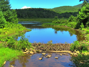 We set a faster pace as we descended the trail passing through the various twists and turns that often make it seem like the bottom of the hill is close. I was glad I had chosen a shorter hike so that I would have time to get ready for my afternoon appointment. On the way down the hill we ran into clouds of mosquitoes that were so bad that we considered stopping to put on repellent. In the end we decided to out run them and we were soon at Times Square. We continued straight across to stay on the Big Rock Trail. As we hiked around the back of the pond, we met a group of six hikers who seemed to be part of the same family. We crossed the bridges over the streams that feed Frick Pond where there was some water flowing under both the bridges. The large spruce log that had fallen across the trail was still intact except for the large notch I had put in it. I took a few shots as we passed over the series of wooden walkways which continue to deteriorate. At the end of the Big Rock Trail, we turned left on the Quick Lake Trail and walked to the bridge over the outlet stream. The beaver dam was still intact which was surprising as the manager of the fish hatchery often has some of his workers dismantle it to supply more water for the hatchery. I took some pictures of the dam and the pond. It was odd that while driving to the hike the skies had been filled with puffy white clouds and now there was only one small cloud in the sky. I packed up and we continued up the hill to Gravestone Junction where I could hear hikers approaching on the Logger's Loop. We continued on the trail and back out to the car. The Quick Lake Trail back to the parking area was wet nad muddy in spots. We arrived at the car at 12:30 PM after hiking 4.0 miles in 1 hour and 50 minutes. The elevation gain was709 feet.
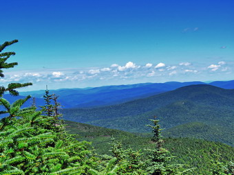
![]()
![]()
![]()
![]()
![]() On Wednesday, July 29th, I decided I wanted to hike Slide Mountain as I had not been there in almost two years and I recently had started to become interested in hiking the 3500 foot peaks again. I like to throw in a 3500 foot peak every now and then for the challenge and to prove to myself I can still hike elevation as well as distance. When I woke up at 8:00 AM it was 66 degrees outside but I knew the temperature would increase throughout the day. I started to get ready at 8:30 AM and Sheila was very excited indicating she didn't care where we went as long as we got out of the house. I got dressed in a short-sleeved crew top with a short-sleeved baselayer. I put on a pair of RailRiders hiking pants which are expensive but last along time and have features like deep pockets and a generous cut which I really like. The pants have Velcro closures at the ankles which I hoped would fend off the ticks which have been very numerous so far this season. I put a pair of Keen Targhee II boots which fit nicely and have been discontinued! I did ad my OR Bugout gaiters for extra tick and mud protection. I grabbed a pair of Leki external lock poles I have been using lately. I also added a new OR floppy hat which shields me from the sun and allows me to spray some insect repellant on it rather than on me. I headed out the DeBruce Road at about 9:00 AM and found that road crews were beginning to pave sections of the road. We had to wait about 5 minutes and then ran into another road repair project just before passing Round Pond. I drove down the hill to Route 47 and turned left to drive toward Frost Valley. Almost immediately we ran into construction crews working in the river to remove some tree trunks and improve the water flow in the east branch of the Neversink River. I drove by the Frost Valley YMCA camp and the Biscuit Brook parking area which had only one car in it. I wondered if Slide would be crowded. I pulled in just at 9:50 AM and found five cars in the lot. I set my Garmin GPS unit and we got on the trail right away. Starting out on the main trail we immediately came to the Neversink River which was completely dry so that the rocks in the river bed were not even wet. Despite the dryness of the stream bed, the trail was damp and muddy in many places but initially there was no water on the trail. We crossed two more small streams which had some water running in them and were soon climbing through a very rocky area. This reminded me of the biggest problem with liming Slide! In 20 minutes we covered just less than half a mile and had worked our way through the rocky ascent and turned right on the woods road.
On Wednesday, July 29th, I decided I wanted to hike Slide Mountain as I had not been there in almost two years and I recently had started to become interested in hiking the 3500 foot peaks again. I like to throw in a 3500 foot peak every now and then for the challenge and to prove to myself I can still hike elevation as well as distance. When I woke up at 8:00 AM it was 66 degrees outside but I knew the temperature would increase throughout the day. I started to get ready at 8:30 AM and Sheila was very excited indicating she didn't care where we went as long as we got out of the house. I got dressed in a short-sleeved crew top with a short-sleeved baselayer. I put on a pair of RailRiders hiking pants which are expensive but last along time and have features like deep pockets and a generous cut which I really like. The pants have Velcro closures at the ankles which I hoped would fend off the ticks which have been very numerous so far this season. I put a pair of Keen Targhee II boots which fit nicely and have been discontinued! I did ad my OR Bugout gaiters for extra tick and mud protection. I grabbed a pair of Leki external lock poles I have been using lately. I also added a new OR floppy hat which shields me from the sun and allows me to spray some insect repellant on it rather than on me. I headed out the DeBruce Road at about 9:00 AM and found that road crews were beginning to pave sections of the road. We had to wait about 5 minutes and then ran into another road repair project just before passing Round Pond. I drove down the hill to Route 47 and turned left to drive toward Frost Valley. Almost immediately we ran into construction crews working in the river to remove some tree trunks and improve the water flow in the east branch of the Neversink River. I drove by the Frost Valley YMCA camp and the Biscuit Brook parking area which had only one car in it. I wondered if Slide would be crowded. I pulled in just at 9:50 AM and found five cars in the lot. I set my Garmin GPS unit and we got on the trail right away. Starting out on the main trail we immediately came to the Neversink River which was completely dry so that the rocks in the river bed were not even wet. Despite the dryness of the stream bed, the trail was damp and muddy in many places but initially there was no water on the trail. We crossed two more small streams which had some water running in them and were soon climbing through a very rocky area. This reminded me of the biggest problem with liming Slide! In 20 minutes we covered just less than half a mile and had worked our way through the rocky ascent and turned right on the woods road.
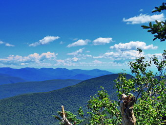 I had thought about turning left on the woods road and taking the Dutcher Step Trail up Slide. This trail is right on the boundary of Winisook Club property and state land and I usually call for permission first. The trail was the first trail cut in the 1870�s by James Dutcher, a local guide. It was some beautiful features and is far less rocky than the usual ascent we now use. Dutcher was the only guide and had a boarding house on the slopes of Panther Mountain. He would guide his boarders up Slide and show them the view from the summit tower he built. I decided I wanted to take the "usual" trail to see if it had changed much in two years. Almost immediately the trail became wet with some standing and running water. There were also a few blowdowns that had not been cleared. Hikers had been making their own detours around these problem areas which widens the trail and increases the erosion. At .7 miles we turned left and started up the main trail to Slide Mountain which, according to the sign, was 2 miles away. The trailhead for Slide has a relatively high elevation so, although it is the highest peak in the Catskills, the elevation gain and grade are relatively modest. The temperature seemed high as did the humidity and I was feeling a little down but I made up my mind to take it easy and enjoy the hike. We continued up the trail working around the wet areas. We passed by the designated campsite to the right of the trail and as we started up the steeper climb Sheila alerted. A young couple was coming up behind us and I pulled over to let them pass. They said "Hello" as they walked by with one small water bottle each. I got a drink and gave Sheila one before starting up again. I was surprised that the drink and short rest bade me feel so much better. The trail was every bit as rocky as it ever was which makes ascending difficult and descending worse. I kept looking for the 3500 foot sign but did not see it. Soon we started to enter the transition zone from hardwoods to evergreens and I knew we were passed 3500 feet. I could smell the strong odor of balsam fir and we noticed that the temperature had dropped a little and there was a slight breeze.
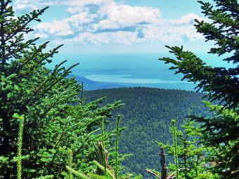 At 1.7 miles the trail started to level some as the grade became more shallow and all these factors combined to raise my spirits. The trail here has a layer of sand and small rocks. The glimpses I could get of the sky showed bright blue with white clouds and plenty of sun. We continued up the trail and I began to notice that some blowdowns had been cleared from the trail by chainsaw. There were still quiet a few trees leaning over the trail which I do not think is a good situation. There were several lookouts along the way that hikers had created on their own but most were not interesting. There were one or two that did have possibilities but I decided to wait until the return trip to take any pictures. We met one woman descending with her dog and then another two hikers headed down. Sheila was very well-behaved and seemed more interested in the walk than the people or the dogs. Soon the trail leveled again as we had done most of the climbing. At 2 miles we passed the Curtis-Ormsbee Trail as it came in from the left from the Denning trailhead. The trail leveled some here and I enjoyed walking along the path strewn with pine needles. The trail continued to have a few muddy spots. Soon we were tackling the last real climb. At 2.3 miles we were at the viewpoint toward Panther and Giant Ledge. I decided to stop and take some pictures since some of the trees that had obscured the viewpoint had been removed. I could easily see Giant Ledge and Panther but Cornell and Wittenberg were also visible. I took my shots as a group of six to eight young people passed by with a dog. Two more people wanted to use the lookout so I packed up to leave.We returned to the main trail and soon were passing by the highest point on Slide. Cement blocks mark the location where a fire tower once stood. We continued to the rock outcropping to find the group of young people spread out. The views were clear but the trees blocked most of the views. I did attempt to take some pictures of the Ashokan Reservoir and Cornell and Wittenberg. As I was angling for my shots some of the young people moved out of my way which was very thoughtful. I decided to go down to the spring to see if it was flowing and to see if there were any more viewpoints. I knew there were some rough climbs and I did not know how they had fared with more and more people hiking.
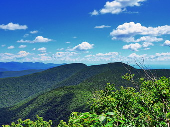 We walked around the rock outcrop and headed down passed the Burroughs plaque. The trail was very rough and many branches and blowdowns had been trimmed back. I tried to find a decent viewpoint but many that had been acceptable were now blocked by trees. I worked my way down through two difficult areas and still could not find any lookouts. We came to the wooden steps and started to descend them. I took a few pictures of Sheila on the steps but the light was not very good. After descending the second set of steps, we were at the spur trail to the spring. I could hear voices and we found a young couple getting water from the spring which had a good flow. I talked to them for a few minutes while I took in a beautiful view of Cornell and Wittenberg. I had found my viewpoint! The couple was backpacking the Burroughs Loop and had spent the previous night camping between Slide and Cornell. We talked about their experiences and other hikes in the Catskills. I took quite a few shots and then packed up to start back.Sheila seemed to really want to take a trip over to Cornell but I decided I simply wanted to return to the car. The climb back up to the summit is only .2 miles but I found it was tiring for my leg muscles. Several times Sheila bounded almost straight up the rocks only to return and go back up an easier way. I knew she was "leading" me as she has done this before. At 12:30 PM we were back at the summit and ready to start our trip down. The young people had cleared off the rock outcrop and two older men were talking to a younger hiker. Sheila and I started back down which, I am glad to say, seemed much easier than the hike up. I did have to be careful to watch my footing as there are lots of loose rocks and dry dirt and gravel on the trail. I tried to think of other things to keep my mind off the descent. No one passed us on the way down but there were several small groups of the people headed up. Each time Sheila and I moved off the trail so that she did not bother anyone and so that my lack of a mask did not offend anyone. We did meet some people who were wearing masks and I hoped they had slipped them on when they saw us and were not wearing them for the entire hike. At 5.1 miles we hit the Phoenicia-East Branch Trail and turned right. Walking this section of flat trail was a relief even though it was wet. At 5.3 miles we turned left to follow the trail and had another short descent through a boulder field. I was glad when we were finally down to the short, flat section of trail that led back to the car. We were back at the car at 2:05 OM after hiking 6 miles in 4 hours and 15 minutes with 35 minutes of stopped time. Our elevation gain was 2060 feet. The temperature on my car as I drove away was 86 degrees.
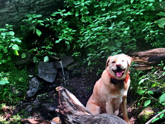
![]()
![]()
![]()
![]()
![]() On Monday, July 27th, I wanted to get in a hike after taking two days off and knowing the weather on Tuesday called for heavy thunderstorms. I thought about climbing Table and Peekamoose in some combination but realized I had not hiked a 3500 foot peak in almost a year.For some reason I now feel like I would like to do some of the high peaks. I decided to start out with Balsam Lake Mountain which is close to where I live and has a fire tower as an extra goal. When I got up in the morning at 6:30 AM it was already 68 degrees and the forecast was for a high near 90 degrees. I started to make excuses and did some things around the house until I decided at 9:30 AM that I would go. By this time the temperature was using 80 degrees but I hoped it would be cooler in the woods. I got dressed in a Columbia short-sleeved crew top with a short-sleeved baselayer. I put on a pair of RailRiders hiking pants which are expensive but last along time and have features like deep pockets and a generous cut which I really like. These pants do not have the Velcro closures at the ankles to discourage sticks and gravel from getting into my shoes and to combat ticks but we would be hiking on trails most of the time. I decided to wear my Keen Targhee II hiking boots which fit me well but have been discontinued. I grabbed a pair of Leki external lock poles I have been using lately. I also added a new OR floppy hat which shields me from the sun and allows me to spray some insect repellant on it rather than on me. At 10:05 AM I put my equipment in the car and Sheila in the backseat and headed out the driveway. I headed toward Roscoe on Old Rt 17 and I turned right on the Beaverkill Road. I headed north toward Lew Beach and Turnwood. Just before Hew Beach I got behind a logging truck which was traveling at 35 mph but I was in a good mood and didn't mind the slower speed. The truck pulled over near Barkaboom Road in Turnwood and waived me passed and I began to make better time. The Beaverkill Falls were flowing but with a reduced volume nicely and I thought I might stop on the way back for a few shots. The road conditions were pretty good even when the pavement ended except everything was dry and dusty. Just before the Buddhist monastery a car approached from the other direction. The driver seemed to want the middle of the road so I got as far over to the right as I could. The farther I moved to the right, the farther the other driver moved to his left until I though a head on collision was inevitable. I was already in the ditch so I leaned on my horn and the other driver finally moved to the right. As he passed I could see a look of confusion on his face. The only explanation I could think of was that he was used to driving in a country where they drive on the left side of the road! I continued on and let the beautiful day calm my pulse and blood pressure. Toward the end the road becomes very narrow and I was glad I did not meet any more cars. We arrived at the parking area at 10:45 AM and found no other cars in the lot. I was surprised since I had assumed all the 3500 foot peaks would have visitors. I can only assume that the remote location of the parking area and the weather forecast had something to do with the lack of cars.
On Monday, July 27th, I wanted to get in a hike after taking two days off and knowing the weather on Tuesday called for heavy thunderstorms. I thought about climbing Table and Peekamoose in some combination but realized I had not hiked a 3500 foot peak in almost a year.For some reason I now feel like I would like to do some of the high peaks. I decided to start out with Balsam Lake Mountain which is close to where I live and has a fire tower as an extra goal. When I got up in the morning at 6:30 AM it was already 68 degrees and the forecast was for a high near 90 degrees. I started to make excuses and did some things around the house until I decided at 9:30 AM that I would go. By this time the temperature was using 80 degrees but I hoped it would be cooler in the woods. I got dressed in a Columbia short-sleeved crew top with a short-sleeved baselayer. I put on a pair of RailRiders hiking pants which are expensive but last along time and have features like deep pockets and a generous cut which I really like. These pants do not have the Velcro closures at the ankles to discourage sticks and gravel from getting into my shoes and to combat ticks but we would be hiking on trails most of the time. I decided to wear my Keen Targhee II hiking boots which fit me well but have been discontinued. I grabbed a pair of Leki external lock poles I have been using lately. I also added a new OR floppy hat which shields me from the sun and allows me to spray some insect repellant on it rather than on me. At 10:05 AM I put my equipment in the car and Sheila in the backseat and headed out the driveway. I headed toward Roscoe on Old Rt 17 and I turned right on the Beaverkill Road. I headed north toward Lew Beach and Turnwood. Just before Hew Beach I got behind a logging truck which was traveling at 35 mph but I was in a good mood and didn't mind the slower speed. The truck pulled over near Barkaboom Road in Turnwood and waived me passed and I began to make better time. The Beaverkill Falls were flowing but with a reduced volume nicely and I thought I might stop on the way back for a few shots. The road conditions were pretty good even when the pavement ended except everything was dry and dusty. Just before the Buddhist monastery a car approached from the other direction. The driver seemed to want the middle of the road so I got as far over to the right as I could. The farther I moved to the right, the farther the other driver moved to his left until I though a head on collision was inevitable. I was already in the ditch so I leaned on my horn and the other driver finally moved to the right. As he passed I could see a look of confusion on his face. The only explanation I could think of was that he was used to driving in a country where they drive on the left side of the road! I continued on and let the beautiful day calm my pulse and blood pressure. Toward the end the road becomes very narrow and I was glad I did not meet any more cars. We arrived at the parking area at 10:45 AM and found no other cars in the lot. I was surprised since I had assumed all the 3500 foot peaks would have visitors. I can only assume that the remote location of the parking area and the weather forecast had something to do with the lack of cars.
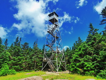 The temperature was 76 degrees and when I stepped out of the car but the humidity seemed high. Fortunately, the skies were blue with some nice white clouds and there was a slight breeze blowing. I set my GPS and we were off at 10:45 AM. As we got on the trail it was obvious that no one had been out to maintain the trail as the weeds were beginning to close in. The trail register was in pieces with the door lying on the ground. As we walked up the trail there were numerous blowdowns on the trail. Most of these were old and where there were ones that blocked the trail hikers had created detours which were rather well worn. There were a few damp areas but these were easily avoided. We headed toward the first trail junction where I intended to turn left and hike up the steep side of the mountain. The approach seemed longer than I remembered and I was getting very warm as we hiked. We finally made the trail junction at .9 miles at 11:10 AM. We turned left up the mountain without stopping as I was wondering how I would do on the steep but short climb. The first part of the trail is a gentle climb and I was feeling pretty good without stopping to rest. Over the next half mile the trail gains about 750 feet before leveling off which means an average of around a 28% grade! The trail was dry with loose gravel and dirt but no blowdowns or blanches across the trail. I began to breathe heavily but was able to continue without stopping even though the water was dripping off me! I kept moving along with Sheila always ahead of me but not too far which encouraged me. The climb seemed much longer than I remembered and several times I thought we were near the trail to the lean-to but had another steep section to climb. A slight braze at times kept things bearable and I did not want to stop until we were at the spring. Finally we reached the trail to the lean-to and we continued straight up the hill through a steep climb. We passed the 3500 foot sign and arrived at the spring where I stopped to get a drink and take a few pictures. We climbed the stone steps to the summit plateau where the trail flatten a little. I felt much better now that I was not climbing and gave up the idea of returning the same way we had come. There were a few damp spots on the trail but soon we were passing the Millbrook Ridge Trail to Alder Lake.
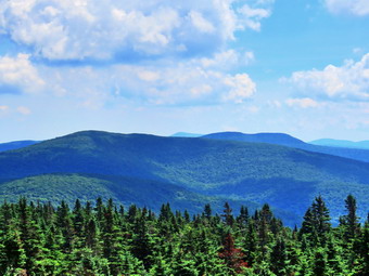 We arrived at the tower clearing at 11:55 AM after hiking 1.7 miles. The skies were blue with white clouds and I knew that pictures from the tower would be nice. I took pictures of the clearing and the tower and then tied Sheila to the picnic table where she would have some shade. Sheila is the only dog I have seen that will willing climb the towers and then easily descend. I walked over to the tower with my camera and noticed a pile of boards near the base of the tower. I knew these were to replace the steps and the landings and that the tower would not be open unless it was safe but they did make me pause for a moment. As I rose above the treeline, the wind hit me which felt good but was certainly cooling. I stopped on the landing just below the cab and looked around. The scene was beautiful and, as always, I knew that pictures could not do it justice. I took a number of shots of the trees and cabin below and then turned my attention to the mountains. I took shots in all directions getting pictures of the Devil's Path to the north and some of Graham. Eventually I was satisfied I had enough pictures and wanted to get out of the wind. On the way down I took a few shots of Sheila under the picnic table. I walked back to my pack and put away my camera, took a drink and got out a bar. We headed down the Millbrook side of the mountain at 12:15 PM. We walked down the trail on the other side of the mountain passing the cabin. Walking down the mountain seemed MUCH easier than the climb up the other side. Just after the cabin I looked up to see four hikers coming toward us. I put Sheila on her leash and walked off the trail. The other hikers had two small dogs and one was very loud. We said "hello" to each other as they passed. They were all wearing masks and I hoped they would not wear the for the whole hike. The trail was tricky in some place as it was dry and covered with loose dirt and stones. Soon we were approaching the junction with the trail that connects Millbrook Road to the Beaverkill Road. There is a gate at the bottom of the trail and just after this gate was a pile of materials which I knew would have to be transported to the top of the mountain. We came to the trail junction with Sheila in the lead and I said to her "Back to the car" without making any signal. Sheila immediately turned right and walked down the trail! The trail was obviously more travels than it had been in the past. There were a few branches hanging into the trail and a few blowdowns. The sun was still out and it was hot but walking downhill made things easier. I looked down into the Gulf of Mexico several times but did not see or hear any water. After just less than a mile, we were back at the trail junction where we had turned up the mountain earlier. We continued on toward the car by retracing our steps. We had been blessed with blue skies and sun all the way back from the summit and the trip had seemed to go quickly. We had met no other hikers. We were back in the parking area at 1:25 PM after hiking 4.3 miles in 2 hours and 40 minutes with 25 minutes stopped time. We had climbed 1180 feet in elevation in hot and humid conditions. The temperature at the car was 84 degrees.
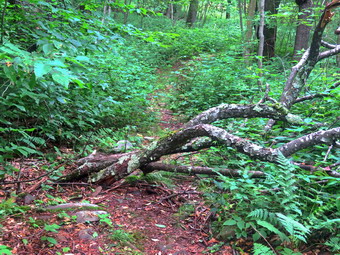
![]()
![]()
![]()
![]()
![]() On Thursday, July 24th, I decided to go to Trout Pond and remove some of the blowdowns especially on the trail that leads up Cherry Ridge on the west side of the pond. When I got up in the morning, the skies were overcast and despite a temperature in the mid 70's the humidity made it feel like it was over 80 degrees. I started to get ready at 10:00 AM and tried to convince Cindy to come with me. She did not want to go because of the heat but I knew I could count on Sheila to be enthusiastic about getting out. I got dressed in a short-sleeved crew top with a short-sleeved a baselayer. I put on a pair of RailRiders hiking pants which are expensive but last along time and have features like deep pockets and a generous cut which I really like. These pants have Velcro closures at the ankles to discourage sticks and gravel from getting into my shoes and to combat ticks. I decided to put on my Keen Targhee II hiking boots which fit well and have been discontinued. I did not bring poles as I would have carry my ax. I wedged my Silky Sugowaza in my pack Wong with two felling wedges. I also got my Fiskars ax which I have found is a nice balance of light and capable of getting the job done. I decided to quickly sharpen the ax which already had a good edge. I also added a new OR floppy hat which I have decided shields me from the sun and allows me to spray some insect repellant on it rather than on me. I put my gear in the back and Sheila in the backseat and pulled out of Livingston Manor at 11:20 AM. The skies were overcast with some blue showing in spots. I headed to Roscoe on State Route 17, got off at exit 94 and got on Route 206. I followed it across the Delaware County line to Morton Hill Road. After a left turn on Morton Hill Road, I drove to the intersection with Russell Brook Road. I turned left on Russell Brook Road and drove down to the lower parking area where there were four cars parked. There were no people present so I kept Sheila off her leash as we walked down the woods road to the bridge across Russell Brook. As we approached the trail register, two young people were reading the signs at the trail junction. I was glad they continued toward Trout Pond since Sheila and I were turning left to start the climb toward Mud Pond.
On Thursday, July 24th, I decided to go to Trout Pond and remove some of the blowdowns especially on the trail that leads up Cherry Ridge on the west side of the pond. When I got up in the morning, the skies were overcast and despite a temperature in the mid 70's the humidity made it feel like it was over 80 degrees. I started to get ready at 10:00 AM and tried to convince Cindy to come with me. She did not want to go because of the heat but I knew I could count on Sheila to be enthusiastic about getting out. I got dressed in a short-sleeved crew top with a short-sleeved a baselayer. I put on a pair of RailRiders hiking pants which are expensive but last along time and have features like deep pockets and a generous cut which I really like. These pants have Velcro closures at the ankles to discourage sticks and gravel from getting into my shoes and to combat ticks. I decided to put on my Keen Targhee II hiking boots which fit well and have been discontinued. I did not bring poles as I would have carry my ax. I wedged my Silky Sugowaza in my pack Wong with two felling wedges. I also got my Fiskars ax which I have found is a nice balance of light and capable of getting the job done. I decided to quickly sharpen the ax which already had a good edge. I also added a new OR floppy hat which I have decided shields me from the sun and allows me to spray some insect repellant on it rather than on me. I put my gear in the back and Sheila in the backseat and pulled out of Livingston Manor at 11:20 AM. The skies were overcast with some blue showing in spots. I headed to Roscoe on State Route 17, got off at exit 94 and got on Route 206. I followed it across the Delaware County line to Morton Hill Road. After a left turn on Morton Hill Road, I drove to the intersection with Russell Brook Road. I turned left on Russell Brook Road and drove down to the lower parking area where there were four cars parked. There were no people present so I kept Sheila off her leash as we walked down the woods road to the bridge across Russell Brook. As we approached the trail register, two young people were reading the signs at the trail junction. I was glad they continued toward Trout Pond since Sheila and I were turning left to start the climb toward Mud Pond.
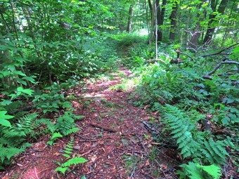 We crossed the outlet stream from Trout Pond on the bridge and passed by the large campsite on the right. The campsite was empty and there was no garbage left behind. The trail began to climb the hill and in .6 miles we gained over 350 feet. Along the way I removed some loose branches and moved at least one trunk to the side of the trail. The climb is little steep at times but soon we were at the top of the hill and began a slight descent toward the trail junction. Sheila alerted and ahead I could see a group of six people stopped at the junction. They seemed to be looking at maps and soon were headed away from us on the Mud Pond trail which leads to Mud Pond and a trailhead on Russell Brook. The trail was wet in places from the storms the previous night which had tracked north of Livingston Manor. When we reached the trail junction, we turned right on the Trout Pond Trail and started a long climb. In a short distance we ran into the first blowdown which was a single medium sized trunk across the trail. I took a before picture and then got to work. It did not take long to make a cut with the axe and drag the upper portion of the tree off the trail. After another picture, we wee on our way. I immediately noticed that even a small amount of work made me sweat quite a bit in the high humidity. Almost immediately we came to another, smaller trunk across the trail which I dispatched easily. As we walked I continued to clear small branches and, in a few cases, used the ax to clear some larger ones. The next one was a medium sized cherry tree that had fallen across the trail and wedged in another tree. I cut through it with the ax and was able to pivot the portion near the roots off the trail. The other piece was still hung up in the other tree and was still encroaching on the trail. I knew that I could easily cut through this piece with the saw since it would fall away without binding. As I was contemplating this, Sheila alerted and I looked up to see two hikers coming toward us. I led Sheila off the trail as they passed. I noticed both hikers raised their masks even though Sheila and I were more than 10 feet off the trail. They did say "thank you." I made the cut and wrestled this piece off the trail. I cleaned up some more loose branches and we were off.
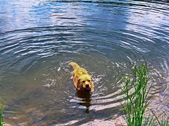 The next obstacle was a few large branches that seemed they might be a bigger problem than they turned out to be. I used the ax and the saw to make some cuts and then dragged the tops off the trail. Dragging these long branches far enough off the trail turned out to be the biggest problem. The next situation involved a larger tree with many branches that had blocked the trail long enough for hikers to create detour to the left. I looked at was once the main trail and I looked at the detour and decided the detour looked like better footing. I spent some time trimming smaller branches on this "new" trail and then cut some small blowdowns. When I looked at the result, I was pleased. As we moved on I noticed that I was very wet and I was getting tired. I made sure to drink and also to give Sheila some water. As I get tired it seems that every action takes ore out of me and I have to be very deliberate so that I maintain safety. As we continued on the trail, there was a loud coach to our left and I assumed a tree or some branches had fallen. Sheila was not happy so we moved on quickly. The next blowdown was similar to the last in that a detour had been created and it had better footing than the main trail. I cleared the detour including one medium sized trunk. I was pretty sure this was the last blowdown and was happy to be able to just finish the hike and get back to the car. Almost immediately we came to another small tree across the trail which I knew I had to eliminate and right after it was another which also succumbed to the ax. We walked what I knew was the last hill through some briars and found another blowdown consisting of two large branches from a cherry tree. I put down my pack, took pictures, and then got out my saw. I was able to cut away smaller branches from the larger ones and dispose of them. Eventually only the two larger branches remained. I pivoted one off the trail but it rolled back and smacked me in the shoulder. After checking to make sure I was only bruised, I reconsidered my plan and was able to roll that branch and keep it off the trail. I dragged the other branch off the trail and I was done in more way than one! I packed up and we continued to the top of the hill. I was glad the rest of the hike was downhill or flat.
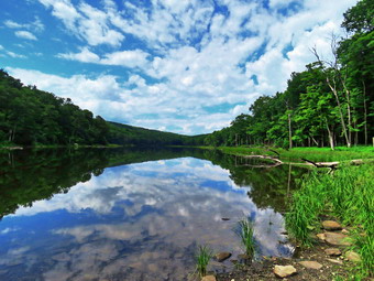 The descent from the highest point on the hike to the outlet bridge is .7 miles and loses 455 feet in elevation. Along the way I picked up a few more branches and used the ax to trim some that were in the trail. We also encountered two more couples who were hiking toward us with their dogs. We arrived at the bridge and I took a few pictures of the pond while Sheila went down to the stream to get wet. The overcast had cleared and there was some blue sky with white clouds. We continued along the trail finding no one at either lean-to or the large campsite on the left of the trial. The trail was wet and muddy but the center was dry enough that walking was not problem. At one point Sheila walked off the trail to take a dip and I decided to take some pictures of her and of the pond. I had thought that I would not stop at the beach but as we approached the outlet end I decided to walk over to take some shots. We turned right and walked over to the beach. Sheila did not want to swim again but I did get out my camera to take some more shots of the pond. We walked back to the main trail and turned right to descend the trail to the trail register. The trail descends gently losing 260 feet over .7 miles on a wide woods road. Along the way we met two more couples both of which had a dog on a leash. I walked off the trail with Sheila in both cases as the other hikers passed by. We continued on the trail and back to the car. We arrived at 3:20 PM after walking and working for 4.8 miles and 3 hours and 40 minutes. The elevation gain was about 850 feet. I was glad to be in the air-conditioned car and I was definitely tired.
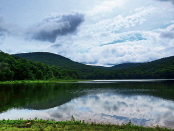
![]()
![]()
![]()
![]()
![]() On Thursday, July 23rd, I wanted to get in a hike locally since it was my 68th birthday! The night before I found out my grandson Bryce would be visiting which would make the hike even more special. Bryce arrived at 9:00 AM and we talked about where we would hike. The weather seemed unsettled and the skies were overcast so I didn't want to plan something too long. I decided we would go to Alder Lake and hike to the lean-to and the beaver pond. The temperature was in the high 70's and it was humid as we began to get ready at 10:00 AM. Sheila was ready to go and stayed close to me to make sure she was going along. I got dressed in a short-sleeved crew top with a short-sleeved baselayer. I put on a pair of RailRiders hiking pants which are expensive but last along time and have features like deep pockets and a generous cut which I really like. These pants do not have the Velcro closures at the ankles to discourage sticks and gravel from getting into my shoes and to combat ticks but we would be hiking on trails most of the time. I decided to wear my Keen Targhee II hiking boots which fit me well but have been discontinued. I also added a new OR floppy hat which shields me from the sun and allows me to spray some insect repellant on it rather than on me. I grabbed a pair of Leki external lock poles I have been using lately. At 11:15 AM I put our equipment in the car and Bryce and Sheila in the backseat and headed out the driveway. I drove north and west on Old Route 17 and turned right on Beaverkill Road heading toward Lew Beach. I passed through Lew Beach and followed the road as it passed through Turnwood. A little farther along, I turned left on Alder Creek Road and drove toward the junction with Cross Mountain Road and the access road to Alder Lake. About halfway up the road the Ulster County DPW was working on what looked like a washout of the road on the right side. Livingston Manor had gotten very little rain from the storms the night before but quite a bit fell in a short period of time to the north. I assumed that the rain combined with previous undercutting had caused the road to collapse. I started to make other plans but one of the workers assured me that we could pass within 5 minutes. Soon we were on our way and I turned right on the access road to Alder Lake and drove to the parking area. The lot had four cars parked as I pulled in. I set my GPS unit and put Sheila on her leash as there were some people coming back to the parking lot. We started our hike at 11:40 AM by walking out the path passing the remains of the Coykendall mansion. We to walked down to the lakeshore and found some geese swimming near the shore with three goslings. I took some pictures of them and then a few of the lake even though the skies were overcast. I took some of the entire lake and then zoomed in for some more. There was quite a bit of water going over the dam and I thought we might visit the waterfalls on the creek downstream from the dam when we returned from the beaver pond.
On Thursday, July 23rd, I wanted to get in a hike locally since it was my 68th birthday! The night before I found out my grandson Bryce would be visiting which would make the hike even more special. Bryce arrived at 9:00 AM and we talked about where we would hike. The weather seemed unsettled and the skies were overcast so I didn't want to plan something too long. I decided we would go to Alder Lake and hike to the lean-to and the beaver pond. The temperature was in the high 70's and it was humid as we began to get ready at 10:00 AM. Sheila was ready to go and stayed close to me to make sure she was going along. I got dressed in a short-sleeved crew top with a short-sleeved baselayer. I put on a pair of RailRiders hiking pants which are expensive but last along time and have features like deep pockets and a generous cut which I really like. These pants do not have the Velcro closures at the ankles to discourage sticks and gravel from getting into my shoes and to combat ticks but we would be hiking on trails most of the time. I decided to wear my Keen Targhee II hiking boots which fit me well but have been discontinued. I also added a new OR floppy hat which shields me from the sun and allows me to spray some insect repellant on it rather than on me. I grabbed a pair of Leki external lock poles I have been using lately. At 11:15 AM I put our equipment in the car and Bryce and Sheila in the backseat and headed out the driveway. I drove north and west on Old Route 17 and turned right on Beaverkill Road heading toward Lew Beach. I passed through Lew Beach and followed the road as it passed through Turnwood. A little farther along, I turned left on Alder Creek Road and drove toward the junction with Cross Mountain Road and the access road to Alder Lake. About halfway up the road the Ulster County DPW was working on what looked like a washout of the road on the right side. Livingston Manor had gotten very little rain from the storms the night before but quite a bit fell in a short period of time to the north. I assumed that the rain combined with previous undercutting had caused the road to collapse. I started to make other plans but one of the workers assured me that we could pass within 5 minutes. Soon we were on our way and I turned right on the access road to Alder Lake and drove to the parking area. The lot had four cars parked as I pulled in. I set my GPS unit and put Sheila on her leash as there were some people coming back to the parking lot. We started our hike at 11:40 AM by walking out the path passing the remains of the Coykendall mansion. We to walked down to the lakeshore and found some geese swimming near the shore with three goslings. I took some pictures of them and then a few of the lake even though the skies were overcast. I took some of the entire lake and then zoomed in for some more. There was quite a bit of water going over the dam and I thought we might visit the waterfalls on the creek downstream from the dam when we returned from the beaver pond.
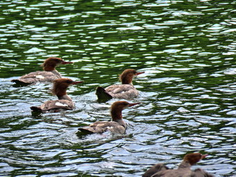 I put away my camera. picked up my pack and we headed out on the trail along the north shore of the lake. We kept up a good pace and passed the campsites which were unoccupied. The first part of the trail had a lot of weeds and briars encroaching on the trail and I was not sure anyone was going to trim them. The trail was wet with some muddy spots along the way. At one point I stopped I take some pictures of the lake and Cradle Rock Ridge across the lake. I noticed some brown-headed ducks sitting on a log and took some pictures of them as they slipped into the water. We heard some people on the far side of the lake at one of the campsites. We continued on the trail and crossed the first bridge. The beaver dams that had been backing up water over the trail had been removed. I like beavers and don't like to see their work destroyed but this step was necessary. We crossed the second bridge and shortly after turned left to head toward the lean-to on the Millbrook Ridge Trail. The trail was very wet and muddy in many places. There were several blowdowns along the way which almost blocked the trail although some had been cut just enough to allow passage. All of the streams crossing the trail were running but not with as much water as I had expected. As we walked, we could hear Alder Creek to the right of us but a quick look showed there was very little water. We began to climb one of the ascents which did not seem much of a challenge at all. We stopped at the first beaver meadow but one look told me the scene was not worth getting wet! We came to a large blowdown blocking the trail and turned right on the detour that had been created. Fortunately the detour was not very wet. For the next 1.5 miles the trail climbed and then leveled off several times. The elevation gain is several hundred feet but the grade is never more than 12% and averages around 6%. There isn't too much to see along the way but this day was very pleasant and I had Bryce to talk to. We enjoyed the sounds and sights of Alder Creek as it flows parallel to the trail much of the way. There were several large blowdowns across the trail which would have been easy to clear with a chainsaw but nothing had been touched. We walked over or around these blowdowns. The trail in this area was very wet and muddy. As we approached the lean-to, we saw the beaver pond where there had been a beaver meadow. We walked out to the shore of the pond just downstream of the dam. The shore was cleaned back at least 10 feet of all trees but the brush and weeds had begun to grow back. I took pictures of the whole scene and then more shots of the dam, the beaver lodge and the pond. When I finished, I returned my camera to my pack and we walked back put to the main trail to the lean-to.
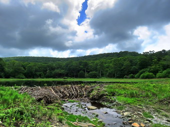 It had taken an hour and 30 minutes to get to the lean-to which was a decent pace given the times I stopped to take pictures. There was no garbage at he lean-to which pleased me as I did not want to carry it back to the car. The lean-to itself is in poor shape and has needed repair or reconstruction for some time. The privy has been destroyed and there doesn't seem to be much concern about fixing the situation. I started to walk out to the edge of the beaver pond to take pictures but was stopped by the high weeds. I took some shots from where I was including some of the pond and the beaver lodge. I looked for some wildlife hoping to see beavers but everything was quiet. After we got a drink and I ate a bar, we walked back to the main trail and turned left to head back to the car. The walk back seemed to go very quickly as Bryce told me everything there is to know about Minecraft! When we came to the loop trail around the lake, we turned right. Almost immediately we saw a young couple coming toward us. We moved to the side of the trail and took Sheila by the collar. The couple thanked us and told me they are just hiking around the lake. We continued on the trail passing the many unoccupied campsites. As we walked up the trail to the Coykendall Mansion a young couple was sitting at one of the picnic tables with a young child. I thought is was a shame that the state no linear maintained the "lawn" as this is a beautiful place to visit. On the way back I was attracted to the noise Alder Creek was making. I wanted to go down to the creek and explore the waterfalls I had found there. We walked out the access road as I tried to find a place that did not require us to walk through waist high weeds. I could not find a spot and gave up on the idea of hiking down to the spring and following the creek. We walked back to the car and I noticed that a car was parked blocking the gate despite many free spaces in the lot. This car would be in the way of any emergency vehicles that might need to get to the lake. I wrote a short message on a piece of medical tape that I had and placed it on the car's driver side window. We were back at 1:25 PM having covered 4.8 miles in 2 hours and 40 minutes total time. The total elevation gain was 720 feet.
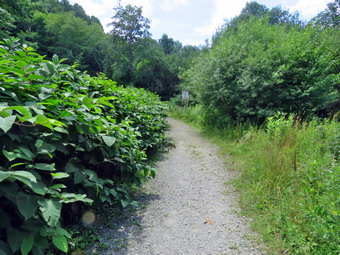
![]() On Tuesday, July 21st, I was very tired from a string of ambulance alls including one in the middle of the night. I decided to sleep in, do some work around the house and forego the hiking for a day. This plan was disrupted by an ambulance call at the clinic in town at around 9"00 AM. I was the only responder from Livingston Manor do I took the ambulance to first respond until Roscoe arrived to take the call. When I returned home I did some chores including cleaning and lubricating my Stihl trimmer. This got me thinking about the knotweed encroaching on the trails near Russell Brook Falls. I did not want to haul my trimmer up there but decided to take Sheila and head up to Trout Pond to start the trimming knowing I could finish it on another day. I put my two machetes in my pack and made sure I had water as the temperatures was already in the low 80's. Sheila got wind of what was going on and began running around the house barking. I got dressed in a Columbia short-sleeved crew top with a short-sleeved baselayer. I put on a pair of RailRiders hiking pants which are expensive but last along time and have features like deep pockets and a generous cut which I really like. These pants have the Velcro closures at the ankles to discourage sticks and gravel from getting into my shoes and to combat ticks. I decided to wear my Vasque Taku hiking boots which I don't wear for serious hikes anymore but are perfect for work. I knew I would not need hiking poles as work was the order of the day not hiking. I also added a new OR floppy hat which shields me from the sun and allows me to spray some insect repellant on it rather than on me. I put my gear in the back and Sheila in the backseat and pulled out of Livingston Manor at 1:00 PM. The skies were blue with towering puffy white clouds with plenty of sun. I headed to Roscoe on State Route 17, got off at exit 94 and got on Route 206. I followed it across the Delaware County line to Morton Hill Road. After a left turn on Morton Hill Road, I drove to the intersection with Russell Brook Road. I turned left on Russell Brook Road and drove down to the lower parking area where there were a few free spaces. There were quite a few people milling around. Some were getting in their cars to leave while other were getting ready to start out. The temperature was 82 degrees and the humidity seemed high. I out Sheila on her leash and we walked down the woods road to the bridge across Russell Brook. We walked a little farther and I tied Sheila to a tree with plenty of shade. I took "before" pictures of the knotweed encroaching on the road. I also took pictures of the path to the falls which was almost completely blocked.
On Tuesday, July 21st, I was very tired from a string of ambulance alls including one in the middle of the night. I decided to sleep in, do some work around the house and forego the hiking for a day. This plan was disrupted by an ambulance call at the clinic in town at around 9"00 AM. I was the only responder from Livingston Manor do I took the ambulance to first respond until Roscoe arrived to take the call. When I returned home I did some chores including cleaning and lubricating my Stihl trimmer. This got me thinking about the knotweed encroaching on the trails near Russell Brook Falls. I did not want to haul my trimmer up there but decided to take Sheila and head up to Trout Pond to start the trimming knowing I could finish it on another day. I put my two machetes in my pack and made sure I had water as the temperatures was already in the low 80's. Sheila got wind of what was going on and began running around the house barking. I got dressed in a Columbia short-sleeved crew top with a short-sleeved baselayer. I put on a pair of RailRiders hiking pants which are expensive but last along time and have features like deep pockets and a generous cut which I really like. These pants have the Velcro closures at the ankles to discourage sticks and gravel from getting into my shoes and to combat ticks. I decided to wear my Vasque Taku hiking boots which I don't wear for serious hikes anymore but are perfect for work. I knew I would not need hiking poles as work was the order of the day not hiking. I also added a new OR floppy hat which shields me from the sun and allows me to spray some insect repellant on it rather than on me. I put my gear in the back and Sheila in the backseat and pulled out of Livingston Manor at 1:00 PM. The skies were blue with towering puffy white clouds with plenty of sun. I headed to Roscoe on State Route 17, got off at exit 94 and got on Route 206. I followed it across the Delaware County line to Morton Hill Road. After a left turn on Morton Hill Road, I drove to the intersection with Russell Brook Road. I turned left on Russell Brook Road and drove down to the lower parking area where there were a few free spaces. There were quite a few people milling around. Some were getting in their cars to leave while other were getting ready to start out. The temperature was 82 degrees and the humidity seemed high. I out Sheila on her leash and we walked down the woods road to the bridge across Russell Brook. We walked a little farther and I tied Sheila to a tree with plenty of shade. I took "before" pictures of the knotweed encroaching on the road. I also took pictures of the path to the falls which was almost completely blocked.
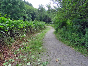 I put my camera away and got out my LT Wright Overland machete. This is almost the perfect tool for cutting the knotweed. I had not remembered sharpening it in some time but when I ran my finger across the blade it was very sharp. I didn't know how long I would work or how far I would get but I knew I could always come back and finish the job. I started cutting at the end nearest the bridge and started to develop a rhythm almost immediately. After I cut some stalks, I had to pile them which increased the time. I established a pile on the other side of the road and continued to pile the cut stalks there for some time before establishing the next pile. I made sire to cut back further than seemed necessary as the remaining stalks often lean over into the path and new stalks tend to grow back. Every now and then I would evaluate my work and cut a few more that I had missed. I kept working and soon found an hour had passed. I gave Sheila ad rink and got one myself. I then continued to trim making my goal to cut all the knotweed up to the path to the falls. I could then come back the next day and trim that path. As I worked several groups of people cam by with some heading out and some returning. Each group thanked me for my work with some enquiring if I was a volunteer. I gave them a quick lesson on who maintains the trails in the Catskills and on the history of the area. After two hours, I was at the path to the falls. I still had some energy and didn't want to leave without finishing. I made sure Sheila had water and got a drink myself. I the started to attack the path. The problem was that the path was blocked by both knotweed and other weeds and briars. I cut the knotweed on the one side and then sliced into some of the weeds on the other side. Some weeds required I grab them with one hand while slicing with the other. I was very careful to pay attention to what I was doing to avoid a conflict between body parts and machete. Dragging away the briars was probably the worst part of the job. After 2 hours and a half hours I had completed what I wanted to finished on the path. I cut a few more stalks that were hanging over the road and then packed up. Sheila had been very patient the whole time but seemed to be eager to leave. As we walked to the end of the bridge, I noticed a few stalks that needed to be removed. It did not take long to eliminate them. As I was finishing, a woman came by and we struck up a conversation while walking back up the hill to the parking lot. We were back at the car at 3:50 PM after spending 2 and a half hours of work. The temperature was 86 degrees with high humidity.
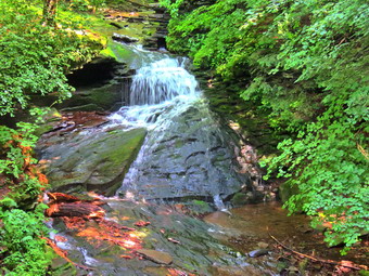
![]()
![]()
![]()
![]()
![]() On Monday, July 20th my grandson Bryce was going to be at the house and I wanted to get a hike in with him. I had a doctor's appointment at 9:00 AM in Monroe but it was a quick checkup and I was able to leave by 9:20 AM. When I arrived home a little after 10:30 AM, Bryce was there and I decided we would go to hike at Trout Pond. I wanted to see if the recent rains had augmented Russell Brook Falls and Bryce was ready to go. Sheila was especially excited as I began to dress as we had not really been hiking in three days so she watched every move I made. I got dressed in a Columbia short-sleeved crew top with a short-sleeved baselayer. I put on a pair of RailRiders hiking pants which are expensive but last along time and have features like deep pockets and a generous cut which I really like. These pants do not have Velcro closures at the ankles as some do to discourage sticks and gravel from getting into my shoes and to combat ticks. I decided against wearing my OR Bugout gaiters. I decided to wear my Keen Targhee II hiking boots which fit well and have been discontinued. I grabbed a pair of Leki external lock poles I have been using lately. I also added my OR floppy hat which I have decided shields me from the sun and allows me to spray some insect repellant on it rather than on me. I put my gear in the back of the car and Bryce and Sheila in the backseat and headed for Roscoe on the Quickway at 10:45 AM. I got off at exit 94, turned left and drove out the Rockland Flats on Route 206. Just after the Roscoe Nursing Home I turned left on Morton Hill Road and followed it for 3 miles to the intersection with Russell Brook Road. I turned around and parked on the shoulder of the road to avoid parking in the private lot. The temperature was 78 degrees and it seemed a little humid!
On Monday, July 20th my grandson Bryce was going to be at the house and I wanted to get a hike in with him. I had a doctor's appointment at 9:00 AM in Monroe but it was a quick checkup and I was able to leave by 9:20 AM. When I arrived home a little after 10:30 AM, Bryce was there and I decided we would go to hike at Trout Pond. I wanted to see if the recent rains had augmented Russell Brook Falls and Bryce was ready to go. Sheila was especially excited as I began to dress as we had not really been hiking in three days so she watched every move I made. I got dressed in a Columbia short-sleeved crew top with a short-sleeved baselayer. I put on a pair of RailRiders hiking pants which are expensive but last along time and have features like deep pockets and a generous cut which I really like. These pants do not have Velcro closures at the ankles as some do to discourage sticks and gravel from getting into my shoes and to combat ticks. I decided against wearing my OR Bugout gaiters. I decided to wear my Keen Targhee II hiking boots which fit well and have been discontinued. I grabbed a pair of Leki external lock poles I have been using lately. I also added my OR floppy hat which I have decided shields me from the sun and allows me to spray some insect repellant on it rather than on me. I put my gear in the back of the car and Bryce and Sheila in the backseat and headed for Roscoe on the Quickway at 10:45 AM. I got off at exit 94, turned left and drove out the Rockland Flats on Route 206. Just after the Roscoe Nursing Home I turned left on Morton Hill Road and followed it for 3 miles to the intersection with Russell Brook Road. I turned around and parked on the shoulder of the road to avoid parking in the private lot. The temperature was 78 degrees and it seemed a little humid!
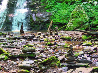 We got out of the car, I set my Garmin GPS unit and put Sheila on her leash. We started down Russell Brook Road toward the upper falls. I was expecting everything to be very wet but the road was pretty dry and we made good time walking downhill. There were campers occupying the first campsite on the right and another large group at the campsite further down the road on the left. There were also several cars parked along the road and I assumed they just didn't know any better or were too lazy to park in the lot. We continued to walk quickly downhill to the path down to the viewpoint above the falls. We turned down the path to the upper falls, and I put down my pack and got out the camera. There was less water going over the falls than I thought as I took several shots with differing settings. I remembered how dry it had been before the recent rain and how the rain did not last very long. Once I finished the photography, I packed up, and we walked down the road to the lower parking area. The lot was over half filled which surprised me for a Monday. We walked down the woods road to cross Russell Brook. We crossed the bridge and found that the Japanese knotweed was now encroaching on the trail and I knew I would have to make an "emergency" trip to cut it back. We continued on the road and arrived at the informal path to the falls. The path was almost invisible and was blocked by knotweed, other weeds and briars. We turned right on the path to the falls and pushed our way through the mess. We walked over to the path down the bank. Sheila, Bryce and I walked down the bank to the streambed and carefully descended to the brook. The falls were flowing with a good volume but not as much as I had anticipated. We immediately noticed that someone had decided to improve on nature and build some stacks of rocks in the stream. I took a picture of the cairns before Bryce and I dismantled them. I also moved rocks that someone had placed to dam up the stream. The doctrine of Leave No Trace says that as much as possible we should visit nature and leave it as we found it. I even wonder sometimes about clearing and marking trails. I took some pictures of the falls and then some of the stream. I took a few more pictures of the falls and a few of Sheila sitting in front of it. I also took a picture of Sheila and Bryce together in front of the falls. Bryce, Sheila and I walked back up the stream bank and out to the main trail.
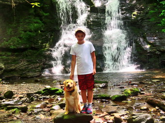 We turned right and at the trail junction just after the register, we continued straight ahead to walk up to Trout Pond. The trail was damp in a few places but there was almost no mud. As we walked up the trail, I noticed a couple hiking behind us but they turned to the left to hike toward Mud Pond. Bryce and I picked up small branches as we went. In Ione spot we stopped and were able to drag a large branch which partially blocked the trail off to the side. When we arrived at the pond, we turned left and walked out to the "beach" at the outlet end of the pond. The level of the pond was very low and much of the beach was exposed. A young couple with a young child were exploring the area by the dam. The skies were very blue with towering white clouds. As Sheila took a dip, I took out my camera and took some shots of the pond. I took some panoramic pictures and then zoomed in on different parts of the scene. Sheila didn't seem to want to swim much even when I threw a stick in the water. After getting a drink and a snack, I packed up and we headed back to the main trail. We turned left and continued on the main trail on the east side of Trout Pond walking toward the inlet end and the lean-tos. The trail was wet in spots with some mud. No one was camping at the large campsite on the right side of the trail before the lean-tos or at the lean-tos themselves. As we crossed the bridge at the inlet end of the pond, I noticed that the inlet stream was not very high. I stopped to take some pictures of the pond from the bridge. We continued on the trail by turning right and starting up a hill which is the shoulder of Cherry Ridge. At the turn, the trail was almost dry, and we easily walked up the hill. I had to admit that I was beginning to get tired and the humidity seemed oppressive. Not very far from the turn was a large blowdown along the side of the trail which had been cleared since my last hike. After we had walked for some time, As we continued to hike we kept running into blowdowns from the recent storms. Some of these were older and some newer. Some could be easily stepped over while other required more effort to bypass. I knew it was time too bring my tools to hike the loop. Soon we were at the highest point on Cherry Ridge and starting down the other side.
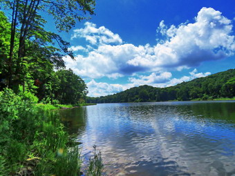 I anticipated that the trail would have quite a bit of water, but there was little even in places that are often under water. We continued on the trail ascending to the area where there is a forest of small birch trees. Some of these trees were blown down across the trail. Soon we were at the woods road and snowmobile trail that runs by Mud Pond. We turned left and started the short walk uphill. This part of the trail was also completely dry. At the top of the hill, we began the long descent back to the trail junction where we had started. The descent lasts for .7 miles and drops 385 feet to a bridge that crosses the outlet stream from Trout Pond. This part of the trail was just as dry as the other sections. As we descended, we came to a spot where a small stream crosses and this time it was just a trickle. We continued down the hill on the main trail toward the campsite at the bottom of the hill on the left side of the trail. This campsite was also empty. We continued on the trail crossing the bridge over the stream and walking back out to the trail register. We turned right and headed back toward the lower parking area on the main trail. We walked up the short path to the lower parking area and then up the road to the car. There were several cars in the parking area and I could see people down at the falls. The hike up the hill to the car proved to be a challenge for me but Bryce, as he had for the entire hike, had no problem. We arrived back at the car at 2:15 PM after hiking 5.7 miles in 3 hours and 5 minutes with a 1130 foot total ascent. The temperature on the car thermometer was 82 degrees.
![]()
![]()
![]()
![]() On Saturday, July 18th I wanted to go to Round Top to get in a short hike between ambulance calls and family commitments. Brad and I started to get ready around 10:30 AM. Sheila was always near but not too near to be considered under foot and we got ready. She was obviously excited since we had not been out in two days! I got dressed in a short-sleeved crew top but decided against a baselayer as the temperature was in the low 80's. I put on a pair of RailRiders hiking pants which are expensive but last along time and have features like deep pockets and a generous cut which I really like. These pants have Velcro closures at the ankles to discourage sticks and gravel from getting into my shoes and to combat ticks. I decided against wearing my OR Bugout gaiters. I decided to put on my Keen Targhee II hiking boots which fit well and have been discontinued. I also picked out a pair of external lock Leki hiking poles. I also added a new OR floppy hat which I have decided shields me from the sun and allows me to spray some insect repellant on it rather than on me. We stepped out of the house at 11:00 AM and grabbed Sheila's leash from the car. We walked up the driveway and crossed the street. We walked to the parking area by the Presbyterian Church and to the back of the church. We began the ascent of the steepest hill behind the church. The hill is short but gets the circulation pumping and is the steepest and longest climb on the "trail." Sheila helped me along by pulling me up the hill. As we neared the top, I realized that there was burial taking place and I kept Sheila near as we started on the trail by turning left at the trailhead. I let Sheila off her leash so that she could explore. The trail bed is becoming worn it which means that at least a few people are using the trail. I am always happy to see that someone else uses the trails.
On Saturday, July 18th I wanted to go to Round Top to get in a short hike between ambulance calls and family commitments. Brad and I started to get ready around 10:30 AM. Sheila was always near but not too near to be considered under foot and we got ready. She was obviously excited since we had not been out in two days! I got dressed in a short-sleeved crew top but decided against a baselayer as the temperature was in the low 80's. I put on a pair of RailRiders hiking pants which are expensive but last along time and have features like deep pockets and a generous cut which I really like. These pants have Velcro closures at the ankles to discourage sticks and gravel from getting into my shoes and to combat ticks. I decided against wearing my OR Bugout gaiters. I decided to put on my Keen Targhee II hiking boots which fit well and have been discontinued. I also picked out a pair of external lock Leki hiking poles. I also added a new OR floppy hat which I have decided shields me from the sun and allows me to spray some insect repellant on it rather than on me. We stepped out of the house at 11:00 AM and grabbed Sheila's leash from the car. We walked up the driveway and crossed the street. We walked to the parking area by the Presbyterian Church and to the back of the church. We began the ascent of the steepest hill behind the church. The hill is short but gets the circulation pumping and is the steepest and longest climb on the "trail." Sheila helped me along by pulling me up the hill. As we neared the top, I realized that there was burial taking place and I kept Sheila near as we started on the trail by turning left at the trailhead. I let Sheila off her leash so that she could explore. The trail bed is becoming worn it which means that at least a few people are using the trail. I am always happy to see that someone else uses the trails.
At the first trail junction, we continued straight ahead on the yellow trail as it took us up the hill to the lookout over town. We took a quick look at the viewpoint and found it becoming blocked by some trees that need to be eliminated. We turned right and followed the yellow trail uphill through a sea of green ferns. At the junction with the blue trail we turned right to stay on the yellow trail and walk along the base of Round Top. At the next junction with the blue trail, we turned left and started up the hill to the summit. We passed by the new crossover trail which is marked with orange ribbon. We passed over the top an found there were very few branches leaning into the trail. We started down the steep part of the trail and passed the other end of the crossover trail. Just after the orange ribbon, we turned left on the switchback trail which will replace the steepest part of the trail to the summit which is eroding. We followed the blue ribbons of the switchback and it was obvious that others had been doing the same. As we hiked this short section on trail it seemed that we riled up a swarm of mosquitoes as I started to swat them as they bit me. We continued on the blue trail back to the yellow trail and turned left to again follow it along the base of Round Top. At the junction with the blue trail, we turned right this time to follow the yellow trail down to the woods road. We continued along the woods road back to the very first trail junction. We turned around and started back up the woods road as I wanted to get in at least one more figure 8. At the first junction with the blue trail we turned left and walked the yellow trail along the base of Round Top to the second junction. We turned right on the blue trail and headed toward the summit by passing the switchback trail this time. At the orange ribbons we turned right to follow the new crossover trail. We walked along the trail heading toward the blue trail on the other side and bypassing the summit. I did notice that there was a little more schilling on this route than I wanted but I knew that could be adjusted as we finalize the trail. Soon we were at the blue trail where we turned right. We followed the yellow trail along the base of Round Top and turned left at the next junction with the blue trail. We followed the yellow trail down to the overlook where we turned left and followed the trail back to the first trail junction. It was almost noon which was our deadline so we continued straight out to the trailhead. We turned right and I put Sheila on her leash as we descended the hill to the church parking lot. We crossed the street to the driveway and walked to the house. We had covered a little over 2 miles in 1 hour.
![]()
![]()
![]()
![]() On Wednesday, July 15th I wanted to get in a longer hike close to home after a late morning coaches' meeting. Lisa contacted me and wanted to hike from Big Pond toward Alder Lake doing some trimming as we went. I told her that Brad and I had been working on the last few hikes and I would rather just hike. She agreed and I told her we would meet her at Big Pond at 12:30 PM. When I got up at 7:30 AM, the temperature was still in the high 60's. I did some things around the house and retrieved the mail. The meeting began at 10:30 AM and most coaches were present. During the meeting, we discussed the possibilities for the fall sports season. We came away with the idea that we will have to wait and see what the state has in store for a reopening to school. The meeting ended at 11:30 AM and I began to get ready to hike. I got dressed in a Columbia short-sleeved crew top with a short-sleeved baselayer. I put on a pair of RailRiders hiking pants which are expensive but last along time and have features like deep pockets and a generous cut which I really like. These pants have Velcro closures at the cuffs as some do to discourage sticks and gravel from getting into my shoes and to combat ticks. I decided to wear my Vasque Taku hiking boots which are on their last legs but still fit well. I knew the route we were taking could be very wet and muddy and these shoes were a good solution. I grabbed a pair of Leki external lock poles I have been using lately. I also added my OR Bugout gaiters to fight off the mud and the ticks. We put our gear in the back of the car and Sheila in the backseat and drove out Old Rt 17 to the Beaverkill Road where I turned right. I drove through Lew Beach toward Turnwood. At the intersection with the Barkaboom Road I stayed to the left on Barkaboom Road until I came to the access road to the upper parking area at Big Pond. I decided to check for Lisa at the lower Big Pond parking lot and she was there. I told her we were going to park at the upper lot and turned around. I turned left on the access road and drove to the parking area which was filled. I turned around and parked off the side of the road. As we were getting ready just before 12:40 AM the temperature was 78 degrees with a slight breeze. Lisa came up the road and parked in front of us and Sheila greeted her enthusiastically and started running around.
On Wednesday, July 15th I wanted to get in a longer hike close to home after a late morning coaches' meeting. Lisa contacted me and wanted to hike from Big Pond toward Alder Lake doing some trimming as we went. I told her that Brad and I had been working on the last few hikes and I would rather just hike. She agreed and I told her we would meet her at Big Pond at 12:30 PM. When I got up at 7:30 AM, the temperature was still in the high 60's. I did some things around the house and retrieved the mail. The meeting began at 10:30 AM and most coaches were present. During the meeting, we discussed the possibilities for the fall sports season. We came away with the idea that we will have to wait and see what the state has in store for a reopening to school. The meeting ended at 11:30 AM and I began to get ready to hike. I got dressed in a Columbia short-sleeved crew top with a short-sleeved baselayer. I put on a pair of RailRiders hiking pants which are expensive but last along time and have features like deep pockets and a generous cut which I really like. These pants have Velcro closures at the cuffs as some do to discourage sticks and gravel from getting into my shoes and to combat ticks. I decided to wear my Vasque Taku hiking boots which are on their last legs but still fit well. I knew the route we were taking could be very wet and muddy and these shoes were a good solution. I grabbed a pair of Leki external lock poles I have been using lately. I also added my OR Bugout gaiters to fight off the mud and the ticks. We put our gear in the back of the car and Sheila in the backseat and drove out Old Rt 17 to the Beaverkill Road where I turned right. I drove through Lew Beach toward Turnwood. At the intersection with the Barkaboom Road I stayed to the left on Barkaboom Road until I came to the access road to the upper parking area at Big Pond. I decided to check for Lisa at the lower Big Pond parking lot and she was there. I told her we were going to park at the upper lot and turned around. I turned left on the access road and drove to the parking area which was filled. I turned around and parked off the side of the road. As we were getting ready just before 12:40 AM the temperature was 78 degrees with a slight breeze. Lisa came up the road and parked in front of us and Sheila greeted her enthusiastically and started running around.
I set my GPS unit and we started out on the trail toward Alder Creek Road. The initial part of the trail is pretty flat for a long time and passes several campsite areas before descending a little. The grass was pretty high but the trail was well worn from the increased use. After the campsites, the trail begins to ascend on an old woods road. This part of the trail was pretty dry but there were several blowdowns that we would need to return to remove with tools. At .5 miles the trail turns off the woods road but continues to ascend until about 1 mile gaining 450 feet at a 10% grade. This isn't very steep but we were keeping a fast pace and I was getting winded. We removed a few branches along the way and rolled some larger trunks off the trail. On the way up the trail, we met a young couple coming toward us with camping gear. I took Sheila off the trail as they passed ny. They stopped a minute to talk and told us they had parked at Big Pond the day before and hiked to Alder Lake to camp. They were no headed back to their car. They said the trail was in pretty good shape except for one area of briars. The trail passed through an evergreen forest and then broke out into the sunlight. The trail now was overgrown with brush and briars. I knew this would need to be cleared and that the easiest way was with my Stihl trimmer. The problem with using the trimmer is carrying it the distance needed to do the rimming! This area of trail also had some major blowdown across the trail which were too big for hand tools. After about the 1 mile mark, the trail flattens and then begins to descend into a little valley cut by a seasonal stream. After we left the briars, the nettles began to appear as the trail got a lot wetter. There were several wet and muddy areas caused by drainage from the high ridge to our left. One area was very wet and muddy and was the reason that I wore the Taku shoes. We passed an old foundation and several extensive stone walls. I knew then that we were headed down to the small stream. It was nice to be hiking downhill but the nettles began to increase and there were a few more blowdowns. When we got to the stream, I was surprised to find that there was no water. It was 1:40 PM and Lisa decided to return to her car as she had some things to do.
Brad and I continued across the stream and started walked uphill on a woods road toward the beaver meadow. The uphill walk was a little tiring but we were soon at the beaver meadow after hiking about 2 miles. We came to the beaver meadow but I decided not to take any pictures and we continued on the trail. At 2.2 miles we turned east and completed the climb to the top of the hill. Once again we began to descend a hill as we headed for Alder Creek Road and I thought about the climb back up the hills! Eventually the trail flattened out and we walked across a flat area before starting down again. We passed by some interesting rock ledges on the left with some large rocks and boulders on the right. The trail continued to descend again on a woods road and at 2.75 miles turned left as the descent continued. At the base of the hill the trail flattened and we followed it to Alder Creek.As Sheila got a drink Brad and I crossed it easily and walked up to the road where we turned around at 2:15 PM to retrace our steps to the car. We now had to walk up all the hills we walked down on the way out! We set a pretty fast pace and did not stop for pictures. At 3.6 miles we descended a hill and made a left turn to head south passed the beaver meadow. After crossing the stream, we began another long hike uphill. The hike from the stream to the top of the hill was .8 miles and gained over 300 feet but seemed easier than I thought it might. We crossed the wet and muddy spots quickly and then had to walk uphill through the briars. Walking uphill seemed to be more difficult than walking downhill through them. At 4.8 miles we hit the top of the last hill and I was glad that the rest of the trip was downhill. At one point, I looked up to see a young woman hiker coming toward us. I moved Sheila off the trail so that she could pass. She told us she had parked at Alder Lake and hiked to Big Pond the day before. She camped at Big Pond and was walking back to Alder Lake to her car. As we started up the last small hill toward the campsite a young man came walking down the hill. We said "hello" as we passed. Brad and I looked at each other because the hiker had no gear at all including no water! We were back at the car at 3:50 PM after hiking 5.8 miles in 3 hours and 15 minutes. The total elevation gain was 1400 feet. The temperature was now 84 degrees. Many of the cars were gone from the parking area but they had been replaced by others. I had thought about going to Alder Lake to explore the waterfalls on Alder Creek but I was tired and wanted to just go home.
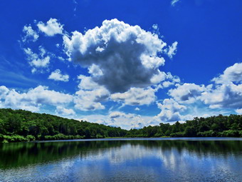
![]()
![]()
![]()
![]()
![]() On Monday, July 13th, Brad was in town for a week so I planned to go for a hike in Frick and Hodge Pond area to clear some blowdowns from the trails. My plan was to hike to Hodge Pond on the Flynn Trail and then return to the junction with the Big Rock Trail. From here I would hike to the end of the Big Rock Trail around the back of Frick Pond and then on the Quick Lake Trail back to the parking area. As often happens the ambulance pager sounded at 0830 and Brad and I were off on a call. When we returned we decided to get ready to go. As I got my gear together at 11:15 AM, Sheila seemed to be in complete agreement with our decision as she followed me around as I was dressing. The temperature was in the low 70's and it felt at least that warm with pretty high humidity. I got dressed in a Columbia short-sleeved crew top with a short-sleeved baselayer. I put on a pair of RailRiders hiking pants which are expensive but last along time and have features like deep pockets and a generous cut which I really like. These pants have Velcro closures at the cuffs as some do to discourage sticks and gravel from getting into my shoes and to combat ticks. I decided to wear my Keen Targhee II hiking boots which fit well and have been discontinued. I grabbed a pair of Leki external lock poles I have been using lately. I also added my OR floppy hat which I have decided it shields me from the sun and allows me to spray some insect repellant on it rather than on me. We put my gear in the back of the car and Sheila in the backseat and drove out the Debruce Road about 6 miles. I turned left onto Mongaup Pond Road and continued to where the road split. I turned left onto Beech Mountain Road, and drove to the parking areas at the Frick Pond. There were several cars parked in the larger lot but only one in the small lot where I parked. The thermometer read 72 degrees. I found I had left my GPS home but I knew we would my hiking a route I had hiked before. The skies were blue with plenty of sun and lots of billowing white clouds. There was a slight breeze which seemed to be dispersing the insects but they were still numerous. I did not spray any insect repellant as I do not like the smell.
On Monday, July 13th, Brad was in town for a week so I planned to go for a hike in Frick and Hodge Pond area to clear some blowdowns from the trails. My plan was to hike to Hodge Pond on the Flynn Trail and then return to the junction with the Big Rock Trail. From here I would hike to the end of the Big Rock Trail around the back of Frick Pond and then on the Quick Lake Trail back to the parking area. As often happens the ambulance pager sounded at 0830 and Brad and I were off on a call. When we returned we decided to get ready to go. As I got my gear together at 11:15 AM, Sheila seemed to be in complete agreement with our decision as she followed me around as I was dressing. The temperature was in the low 70's and it felt at least that warm with pretty high humidity. I got dressed in a Columbia short-sleeved crew top with a short-sleeved baselayer. I put on a pair of RailRiders hiking pants which are expensive but last along time and have features like deep pockets and a generous cut which I really like. These pants have Velcro closures at the cuffs as some do to discourage sticks and gravel from getting into my shoes and to combat ticks. I decided to wear my Keen Targhee II hiking boots which fit well and have been discontinued. I grabbed a pair of Leki external lock poles I have been using lately. I also added my OR floppy hat which I have decided it shields me from the sun and allows me to spray some insect repellant on it rather than on me. We put my gear in the back of the car and Sheila in the backseat and drove out the Debruce Road about 6 miles. I turned left onto Mongaup Pond Road and continued to where the road split. I turned left onto Beech Mountain Road, and drove to the parking areas at the Frick Pond. There were several cars parked in the larger lot but only one in the small lot where I parked. The thermometer read 72 degrees. I found I had left my GPS home but I knew we would my hiking a route I had hiked before. The skies were blue with plenty of sun and lots of billowing white clouds. There was a slight breeze which seemed to be dispersing the insects but they were still numerous. I did not spray any insect repellant as I do not like the smell.
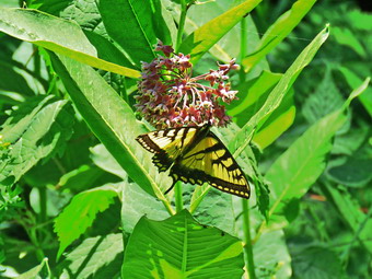 At 11:10 AM we started our hike by crossing the road to start out on the Flynn Trail. At the end of the trail through the woods, we turned right on the woods road that was once the extension of Beech Mountain Road. We kept a quick pace with Sheila roving out ahead kicking up a few birds as we hiked. Along the way we cleared a few branches off the trail. The Flynn Trail ascends 1.7 miles to the Big Rock Trail junction gaining 600 feet. The more I hike the quicker I can hike and easier it seems. As we neared the highest point on the hike, we ran into the first of three small blowdowns and stopped to remove it from the trail. Brad used the ax to cut this small trunk into two pieces while I cut off some smaller branches and dragged them off the trail. Brad was able to pivot the top half of the trunk off the trail and we were done. We picked up and found the next one a short distance away. This one had broken up high but was still hung up. I cut the trunk in the middle and the part attached to the standing trunk pivoted easily off the trail. Brad dragged the upper part of the trail and we were off again. The last blowdown before the junction was a small tree. I made a cut and Brad dragged away the upper part while I trimmed what was left. We continued on the Flynn Trail passing through the junction with the Big Rock Trail and heading toward the gate that separates state land from land owned by OSI. Just after the gate we cut another small blowdown and then dispatched anther just after that. I asked Brad if he would mind making a loop around Hodge Pond. Since he had no objection, we continued on the Flynn Trail to the next junction. The Flynn Trail turned left and descended to Hodge Pond. We turned right and walked the woods road toward the ruins of the Beech Mountain Boy Scout Camp. At the next junction, we turned left on a road that headed down toward the shores of the pond. When we reached the jeep trail, we turned right to loop around the back of the pond. We found the path that leads down to the shore and turned left. Sheila immediately ran to jump in the pond and I got out my camera. I was able to get some pictures of her in the water and then took more shots of the pond. There were some very nice puffy white clouds at the outlet end of the pond. I also took pictures of the water which was clear enough to reveal the sandy bottom. I picked up and we continued around the pond. At the Flynn Trail we turned left to confine along the west side of the pond. This trail was wet and muddy but we avoid those areas with no problem. We crossed the field where the main mess hall for the camp had stood and passed under some trees. When we reached the clearing at the outlet end of the pond, we turned left and walked to the shore of the pond. I dropped my pack and got out the camera to take some pictures. I captured shots of the pond from several angles and then out the camera back in the pack.
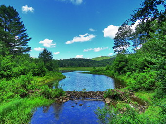 I got a drink and a bar before we turned around and headed for the point where then Flynn Trail entered the woods and headed uphill. The walk up this hill sometimes deems long even though the grade is moderate. On this day we set a quick pace and kept talking which made the hike go faster. At the top of the hill we turned right to stay on the Flynn Trail. We hiked back to the junction with the Big Rock Trail where we turned right. Walking downhill seemed so easy that we were almost running at times. We stopped only once to remove a small branch that was encroaching on the trail. We kept descending passing the larger blowdown I had removed the previous time I had done maintenance. The mosquitoes became unbearable so we stopped and sprayed on some repellant which seemed to help. We came to Times Square, which was wetter than it had been in some time, and continued straight ahead on the Big Rock Trail around the upper end of Frick Pond. The trail was wet and muddy in spots but soon we were at the bridges over the inlet streams. Just after the bridges I showed Brad the large spruce tree that had blocked the trail and the work I had been doing on it. We continued on the Big Rock Trail and over the wooden walkways. We avoided a few muddy spots and came to the junction with the Quick Lake Trail. I knew of one more blowdown that was across the Quick Lake Trail so we turned right and started to walk north. The trail was the wettest we had walked yet and we had to get creative to walk around some of the spots. It wasn't long before we came to the blowdown that partially blocked the trail. I cut the trunk in one spot and as the pieces separated the piece attached to the standing trunk tore away. Brad dragged the other piece off the trail and we were done. We turned around and on the way back we removed one more small tree. At the junction with the Big Rock Trail, we continued straight ahead on the Quick Lake Trail. We stopped at the bridge over the outlet stream and I dropped my pack to take out the camera. Brad pointed out that he thought he saw the blue heron standing completely still in the pond. I zoomed in with the camera and four he was right! I took pictures of the horn and of the pond. I also got pictures of Flynn' Point and of the beaver dam which was till intact. By this time I was hot, sticky and tired. We walked up the hill to Gravestone Junction and continued straight ahead on the Quick Lake Trail back to the car. This part of the trail had some water but it was easily avoided. We were back at the car by 2:25 PM having hiked 6.2 miles in 3 hours and 15 minutes with an elevation gain of 915 feet. I found a note on my car from my brother-ion-law Jeff stating that he had brought his daughter's family to hike and was parked next to my car! The temperature was now 78 degrees and the humidity was oppressive.
![]()
![]()
![]()
![]() On Saturday, July 11th I wanted to go to Round Top to trim some brush that was encroaching on the trail and one tree that had was arching over the trail. My son-in-law Brad was in town and wanted to go with me. Sheila was always near but not too near to be considered under foot and we got ready. I got dressed in a short-sleeved crew top but decided against a baselayer as the temperature was in the low 80's. I put on a pair of RailRiders hiking pants which are expensive but last along time and have features like deep pockets and a generous cut which I really like. These pants have Velcro closures at the ankles to discourage sticks and gravel from getting into my shoes and to combat ticks. I decided against wearing my OR Bugout gaiters. I decided to put on my Keen Targhee II hiking boots which fit well and have been discontinued. I decided to forego bringing poles as I would have carry my maintenance gear and I knew the hike would be short. I wedged my Silky Sugowaza and LTW Overland machete in my pack. I also got my Fiskars ax which I have found is a nice balance of light and capable of getting the job done. I decided to quickly sharpen my Corona loppers and bring them along. I also added a new OR floppy hat which I have decided shields me from the sun and allows me to spray some insect repellant on it rather than on me. We stepped out of the house at 12:30 PM and I grabbed Sheila's leash from the car. We walked up the driveway and crossed the street. We walked to the parking area by the Presbyterian Church and to the back of the church. We began the ascent of the steepest hill behind the church. The hill is short but gets the circulation pumping and is the steepest and longest climb on the "trail." Sheila helped me along by pulling me up the hill. When we got to the top of the hill, I stopped to look around at the hills around town. We started on the trail by turning left at the trailhead. I let Sheila off her leash so that she could explore. The trail bed is becoming worn it which means that at least a few people are using the trail. I am always happy to see that someone else uses the trails. As we approached the first trail junction, a family of four came toward us. They had done the lower loop and seemed very happy to be out together.
On Saturday, July 11th I wanted to go to Round Top to trim some brush that was encroaching on the trail and one tree that had was arching over the trail. My son-in-law Brad was in town and wanted to go with me. Sheila was always near but not too near to be considered under foot and we got ready. I got dressed in a short-sleeved crew top but decided against a baselayer as the temperature was in the low 80's. I put on a pair of RailRiders hiking pants which are expensive but last along time and have features like deep pockets and a generous cut which I really like. These pants have Velcro closures at the ankles to discourage sticks and gravel from getting into my shoes and to combat ticks. I decided against wearing my OR Bugout gaiters. I decided to put on my Keen Targhee II hiking boots which fit well and have been discontinued. I decided to forego bringing poles as I would have carry my maintenance gear and I knew the hike would be short. I wedged my Silky Sugowaza and LTW Overland machete in my pack. I also got my Fiskars ax which I have found is a nice balance of light and capable of getting the job done. I decided to quickly sharpen my Corona loppers and bring them along. I also added a new OR floppy hat which I have decided shields me from the sun and allows me to spray some insect repellant on it rather than on me. We stepped out of the house at 12:30 PM and I grabbed Sheila's leash from the car. We walked up the driveway and crossed the street. We walked to the parking area by the Presbyterian Church and to the back of the church. We began the ascent of the steepest hill behind the church. The hill is short but gets the circulation pumping and is the steepest and longest climb on the "trail." Sheila helped me along by pulling me up the hill. When we got to the top of the hill, I stopped to look around at the hills around town. We started on the trail by turning left at the trailhead. I let Sheila off her leash so that she could explore. The trail bed is becoming worn it which means that at least a few people are using the trail. I am always happy to see that someone else uses the trails. As we approached the first trail junction, a family of four came toward us. They had done the lower loop and seemed very happy to be out together.
At the first trail junction, we turned right on the woods road which is the shallower approach to the trail system. We continued to follow the yellow trail to the first next junction with the blue trail. The trail was wet and muddy in spots from the rain that had fallen. When we turned left from the woods road onto the trail, we trimmed a few branches that were hanging into the trail. This was despite the fact that I had trimmed back the trail with the Stihl trimmer. At the trail junction we continued straight ahead on the blue trail. We trimmed some branches and brush until we arrived at a medium sized white birch that was broken and arched over the trail. I took a look and decided to notch it with the ax and them cut through with the Silky Sugowaza. The cutting with the ax went quickly as did the cut with the saw. Brad helped pull it down. Rather than make another cut, we were able to split the trunk where it was cracked. We then lifted both parts of the trunk well off the trail. We continued up the trail toward the summit trimming as we went. I pointed out the orange ribbons marking the new crossover trail to Brad. We walked across the summit and found only a few branches to cut. As we walked down the steeper section of the blue trail we trimmed a few branches. I pointed out the other end of the crossover trail to Bard and both ends of the switchback trail. The steepest part of the trail was wet, muddy and slippery and I found it tricky to negotiate without poles. At the bottom of the hill we turned left on the yellow trail and started along the base of Round Top. There were quite a few branches leaning into the trail and we cut them off and threw them off the trail. We continued along the trail trimming as we went. As we approached the junction with the blue trail, Brad got a phone call. It was Cindy telling us we had an ambulance call at the brewery in Roscoe and no one else was responding. I called EMS control to tell them we were going and they told me it was a BLS call. Brad and I began running down the trail at a pretty good pace being careful to avoid the slippery places. Sheila seemed to enjoy the pace! We continued to jog out to the trailhead and down to the church parking lot. We crossed the street to the driveway and took a moment at the house to get ready to go. I drove down to the building and we headed for Roscoe. It only took us 5 minutes more to respond than usual! The injured party at the brewery did not want to go to the hospital so we returned to base.
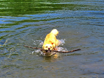
![]()
![]()
![]()
![]()
![]() On Thursday, July 9th I had planned to hike a longer hike early at Bear Spring since the forecast called for rain in the afternoon. When I got up at 9:30 AM, I changed my mind and decided to do a loop of about 6 miles at Hodge and Frick Ponds. I had not hiked UP the Flynn Trail to Hodge Pond in some time and made that my intended route. I got dressed in a Columbia short-sleeved crew top with a short-sleeved baselayer. I put on a pair of RailRiders hiking pants which are expensive but last along time and have features like deep pockets and a generous cut which I really like. These pants do not have Velcro closures at the ankles as some do to discourage sticks and gravel from getting into my shoes and to combat ticks. I put on my OR Bugout gaiters just in case the ticks were active. I decided to wear my Keen Targhee II hiking boots which fit well and have been discontinued. I grabbed a pair of Leki external lock poles I have been using lately. I also added a new OR floppy hat which was another present from Cindy. I have decided it shields me from the sun and allows me to spray some insect repellant on it rather than on me. I put my gear in the back of the car and Sheila in the backseat and drove out the Debruce Road about 6 miles. I turned left onto Mongaup Pond Road and continued to where the road split. I turned left onto Beech Mountain Road, and drove to the parking areas at the Frick Pond. There were three cars parked in the larger lot but none in the small lot where I parked. The thermometer read 72 degrees as I set my GPS. The skies were blue with plenty of sun and lots of billowing white clouds. There was a slight breeze which seemed to be dispersing the insects but they were still numerous. I did not spray any insect repellant as I do not like the smell. At 10:30 AM we started our hike by crossing the road to start out on the Flynn Trail. At the end of the trail through the woods we turned right on the woods road that was once the extension of Beech Mountain Road. I kept a quick pace with Sheila roving out ahead kicking up a few birds as we hiked. The Flynn Trail ascends 1.7 miles to the Big Rock Trail junction gaining 600 feet. The more I hike the quicker I can hike and easier it seems. as we neared the highest point on the hike, we ran into four small blowdowns and I made note that I would handle them on the next hike. By 11:15 AM we had hiked the 1.7 miles to the junction with the Big Rock Trail. We continued straight ahead staying on the Flynn Trail heading toward Hodge Pond. We passed through the gate and found a few more small blowdowns. We soon were at the next trail junction where we stayed to the left to stay on the Flynn Trail to Hodge Pond.
On Thursday, July 9th I had planned to hike a longer hike early at Bear Spring since the forecast called for rain in the afternoon. When I got up at 9:30 AM, I changed my mind and decided to do a loop of about 6 miles at Hodge and Frick Ponds. I had not hiked UP the Flynn Trail to Hodge Pond in some time and made that my intended route. I got dressed in a Columbia short-sleeved crew top with a short-sleeved baselayer. I put on a pair of RailRiders hiking pants which are expensive but last along time and have features like deep pockets and a generous cut which I really like. These pants do not have Velcro closures at the ankles as some do to discourage sticks and gravel from getting into my shoes and to combat ticks. I put on my OR Bugout gaiters just in case the ticks were active. I decided to wear my Keen Targhee II hiking boots which fit well and have been discontinued. I grabbed a pair of Leki external lock poles I have been using lately. I also added a new OR floppy hat which was another present from Cindy. I have decided it shields me from the sun and allows me to spray some insect repellant on it rather than on me. I put my gear in the back of the car and Sheila in the backseat and drove out the Debruce Road about 6 miles. I turned left onto Mongaup Pond Road and continued to where the road split. I turned left onto Beech Mountain Road, and drove to the parking areas at the Frick Pond. There were three cars parked in the larger lot but none in the small lot where I parked. The thermometer read 72 degrees as I set my GPS. The skies were blue with plenty of sun and lots of billowing white clouds. There was a slight breeze which seemed to be dispersing the insects but they were still numerous. I did not spray any insect repellant as I do not like the smell. At 10:30 AM we started our hike by crossing the road to start out on the Flynn Trail. At the end of the trail through the woods we turned right on the woods road that was once the extension of Beech Mountain Road. I kept a quick pace with Sheila roving out ahead kicking up a few birds as we hiked. The Flynn Trail ascends 1.7 miles to the Big Rock Trail junction gaining 600 feet. The more I hike the quicker I can hike and easier it seems. as we neared the highest point on the hike, we ran into four small blowdowns and I made note that I would handle them on the next hike. By 11:15 AM we had hiked the 1.7 miles to the junction with the Big Rock Trail. We continued straight ahead staying on the Flynn Trail heading toward Hodge Pond. We passed through the gate and found a few more small blowdowns. We soon were at the next trail junction where we stayed to the left to stay on the Flynn Trail to Hodge Pond.
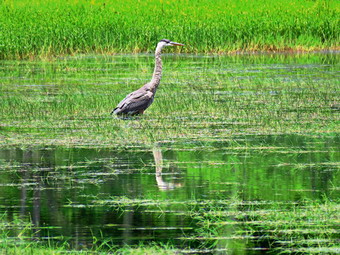 As we approached the pond, I looked at the scene and decided to walk over to the shore of the pond. Sheila immediately jumped into the pond to get wet and swim around. I took some pictures of her and then threw a stick for her to retrieve. I then turned my attention to taking some shots of the pond. When I was done, I got a drink and packed up. We headed back to the Flynn Trail and turned right to follow the trail along the west side of Hodge Pond. To this point the trail had been relatively dry but as we continued on the west side of Hodge Pond the Flynn Trail began to be muddy. As we walked along the western shore, we came to a spot where we could turn left or right. We turned left to stay on the Flynn Trail and began a slight up hill climb to the gate where the trail turns to the left. This part of the Flynn Trail is pretty flat and the trail is often the lowest point which allows water to collect with nowhere to go. The rain earlier in the week had made the trail wet and I had to walk around several wet and muddy areas. Despite this the trail was not as wet as it sometimes is and not as wet as I thought it would be given the rain that had fallen. I noticed that Sheila was pretty careful to walk around these areas as I had encouraged her. There were a few branches on the trails which I removed as we walked. We arrived at Junkyard Junction at noon about 3.3 miles into the hike. From here the rest of the hike is primarily downhill with a few small hills along the way. We turned left on the red Quick Lake Trail and found it was also wet and muddy in spots. Some section of the trail are washed out leaving a lot of rocks behind and making the downhill hiking not as much fun as it could be. At about 3.8 miles the trail turned due south and we continued downhill. There was a crash to the right side of the trail which caught the attention of us both. My first thought was that it was a bear cub or another animal that had fallen out of a tree! I quickly realized it was more likely that a tree or branch had fallen. In any case, I told Sheila to stay with me and we quickened our pace.
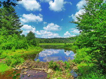 There wasn't much to see so we hiked quickly passing the junction with the snowmobile trail. We arrived at Iron Wheel Junction at 12:40 PM after hiking 5.0 miles. We turned right to stay on the Quick Lake Trail since the yellow Logger's Loop continued straight ahead. The trail continued to be muddy but we made good time. At one point I looked up an saw two people approaching us with a dog. The dog was very small and did not look like it was happy on the trail. The owner of the dog asked me how much further it was to the Flynn Trail. When I said it was about 2 miles, he seemed discouraged. I did not tell him that they would then have another 3 miles to complete the loop! We continued on the trail and soon were crossing the little stream in the woods. The stream was easy to cross and there were some stepping stones to help. I looked upstream and could not see any running water. We continued toward Frick Pond and found several more blowdowns. One of these I was able to pivot off the trail but the other would require tools. There were a few wet and muddy spots but most were drier than I expected. We passed the junction with the Big Rock Trail that goes around the north end of Frick Pond and walked to the bridge across the outlet of the pond. As we approached the bridge, Sheila went ahead to take a quick dip and I noticed movement in the pond. I called Sheila and looked to see a great blue heron standing in the water not very far away. I kept Shiela with me and dropped my pack. I took out my camera and walked to the bridge to take some pictures. I was disappointed to find the heron had move farther out in the pond but I was still able to get some shots. I also took pictures of the pond as the sky was blue with puffy white clouds. I got a drink and gave Sheila one as I was sweating profusely. I picked up and we continued back on the Quick Lake Trail toward the trail register. Along the way I saw two people coming toward us so I put Sheila on her leash and moved off the trail. The two gentleman had on masks and said "Hello". One of them complimented Sheila and I thanked him. We continued on our way. At the trail register we continued straight ahead on the woods road to the smaller parking area. There was one car parked next to my car and several parked in the larger lot. It was 1:20 PM and we had hiked 6.4 miles in 2 hours and 45 minutes with an elevation gain of 900 feet. The temperature was 83 degrees and the humidity was still oppressive.
![]()
![]()
![]()
![]() On Tuesday, July 7th Lisa and I decided to go to Frick Pond to pick up and garbage left behind by campers and to do some lopping on the trail around Frick Pond. Lisa had asked me to go down to the community garden and do some weed whacking. I wanted to get down to the garden early but a middle of the night ambulance call kept me in bed until almost 9:00 AM. I got up and immediately dressed to whack. I grabbed my Stihl weed whacker and headed down to the garden. The weeds Lisa had be cut had pretty woody stems and it hurt a little as I wore short sleeves. I talked to Lisa and we agreed to meet at the Frick Pond parking at 11:00 AM. I went home and cleaned up a little. As I started to get ready at 10:15 AM, Sheila was watching my every move but was doing so quitely. The temperature was already in the mid 70's and it was very humid. I got dressed in a short-sleeved crew top with a short-sleeved baselayer. I put on a pair of RailRiders hiking pants which are expensive but last along time and have features like deep pockets and a generous cut which I really like. These pants have Velcro closures at the ankles to discourage sticks and gravel from getting into my shoes and to combat ticks. I hoped this would be enough so that I would not have to wear gaiters. I decided to wear my Keen Targhee II hiking boots which fit well and have been discontinued. I decided to forego bringing poles as I would have carry my maintenance gear and I knew the hike would be short. I wedged my Silky Sugowaza in my pack and added two plastic felling wedges. I also got my Corona loppers which have extendible handles which allow me to reach higher and get more leverage. I put all my gear in the back of the car and put Sheila in the backseat. I headed out DeBruce Road and after six miles I turned left on Mongaup Pond Road. We caught up to a car and I realized it was Lisa. What was funny was that Sheila began to get excited as she recognized the car also! At the fork in the road I stayed left on Beech Mountain Road. The smaller parking lot had one car and the larger lot was empty. Lisa and I both parked in the smaller lot and got ready to hike. At 11:00 AM we began the hike by walking out the woods road to the register on the Quick Lake Trail. Our plan was to hike out to Gravestone Junction without doing any work. We would then hike clockwise around the pond lopping branches and visiting some campsites to pick up any trash.
On Tuesday, July 7th Lisa and I decided to go to Frick Pond to pick up and garbage left behind by campers and to do some lopping on the trail around Frick Pond. Lisa had asked me to go down to the community garden and do some weed whacking. I wanted to get down to the garden early but a middle of the night ambulance call kept me in bed until almost 9:00 AM. I got up and immediately dressed to whack. I grabbed my Stihl weed whacker and headed down to the garden. The weeds Lisa had be cut had pretty woody stems and it hurt a little as I wore short sleeves. I talked to Lisa and we agreed to meet at the Frick Pond parking at 11:00 AM. I went home and cleaned up a little. As I started to get ready at 10:15 AM, Sheila was watching my every move but was doing so quitely. The temperature was already in the mid 70's and it was very humid. I got dressed in a short-sleeved crew top with a short-sleeved baselayer. I put on a pair of RailRiders hiking pants which are expensive but last along time and have features like deep pockets and a generous cut which I really like. These pants have Velcro closures at the ankles to discourage sticks and gravel from getting into my shoes and to combat ticks. I hoped this would be enough so that I would not have to wear gaiters. I decided to wear my Keen Targhee II hiking boots which fit well and have been discontinued. I decided to forego bringing poles as I would have carry my maintenance gear and I knew the hike would be short. I wedged my Silky Sugowaza in my pack and added two plastic felling wedges. I also got my Corona loppers which have extendible handles which allow me to reach higher and get more leverage. I put all my gear in the back of the car and put Sheila in the backseat. I headed out DeBruce Road and after six miles I turned left on Mongaup Pond Road. We caught up to a car and I realized it was Lisa. What was funny was that Sheila began to get excited as she recognized the car also! At the fork in the road I stayed left on Beech Mountain Road. The smaller parking lot had one car and the larger lot was empty. Lisa and I both parked in the smaller lot and got ready to hike. At 11:00 AM we began the hike by walking out the woods road to the register on the Quick Lake Trail. Our plan was to hike out to Gravestone Junction without doing any work. We would then hike clockwise around the pond lopping branches and visiting some campsites to pick up any trash.
As we hiked out, we saw several branches that we knew we would try to trim on the way back. We turned left at Gravestone Junction and headed down to the bridge at the outlet end of the pond. The beaver dam was still intact and the water level in the pond was elevated without much outflow. I declined to take pictures as the skies were overcast and I have many pictures from this spot. As we continued on the QuickLake Trail on the west side of the pond, we began to lop a lot of branches sticking out into the trail or hanging down. I like to trim back a little further than is absolutely necessary so that the taming needs to be done less often. I also like to trim pretty high up since these trails are used to snowshoe in the winter. At the junction with the Big Rock Trail I pointed out to Lisa the tree Bryce and I had cut. We continue on the trail and did not have to do too much trimming. At one point we walked off the trail to the left and came upon a fire ring and campsite where I had seen people camping over the weekend. We were ready to pickup trash but there was none! We took a slightly different route back to the wooden walkways and continued around the pond. We came to the large spruce log across the trail. I had put a notch in the log to make it easier for hikers to get over it. As I looked at the log this time, I could see it would not take too much to get all the way through it. We continued on the Bog Rock Trail around the upper end of the pond. There wasn't much trimming to do so we continued to Times Square. At Times Square we noticed how dry this normally wet area was. We turned right on the Logger's Loop and began walking uphill. The first part of the trail did not need much trimming but as the trail narrowed we began to trim again. We cut quite a few branches on the sides of the trail and overhead. We also had to move the branches off the trail which slowed us down a little. We continued on the trail to the point where a path leads off to the right and goes to another fire rind and campsite. We did a little trimming to get to the campsite. We again looked for trash but could not find any although it was clear people had recently camped there. We walked back out to the main trail to Gravestone Junction, We turned left and started back to the cars. On the way back we did quite a bit of trimming but I knew it would be necessary to bring my Stihl to completely trim the area. We were back at the parking area at 12:45 PM after hiking 2.2 miles in 1 hour and 45 minutes. Our stopped time was 30 minutes although I suspect it was a little more.
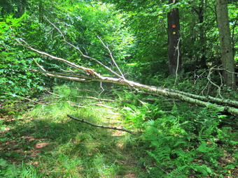
![]()
![]()
![]()
![]()
![]() On Sunday, July 5th I decided I wanted to go to Frick Pond to work on some trail maintenance on the Big Rock Trail after church. When I returned from church around 10"30 AM the temperature was 80 degrees and the humidity was high. The forecast indicated that the weather would only get more uncomfortable during the day and throughout the week. As I started to get ready Sheila was watching my every move but was doing so quitely. I got dressed in a short-sleeved crew top with a short-sleeved baselayer. I put on a pair of RailRiders hiking pants which are expensive but last along time and have features like deep pockets and a generous cut which I really like. These pants have Velcro closures at the ankles to discourage sticks and gravel from getting into my shoes and to combat ticks. I hoped this would be enough so that I would not have to wear gaiters. I decided to wear my Keen Targhee II hiking boots which fit well and have been discontinued. I decided to forego bringing poles as I would have carry my maintenance gear and I knew the hike would be short. I wedged my Silky Sugowaza and Katanaboy in my pack and added two plastic felling wedges. I also got my Fiskars ax which I have found is a nice balance of light and capable of getting the job done. I put all my gear in the back of the car and put Sheila in the backseat. I headed out DeBruce Road and after six miles I turned left on Mongaup Pond Road. At the fork in the road I stayed left on Beech Mountain Road. The smaller parking lot was filled and the larger lot was almost filled. I parked on the very end of the lot and made sure others could get by my car. At 11:30 AM we began the hike by walking out the Quick Lake Trail. Almost immediately I found a trunk across the trail. It looked like I could pivot it off the trail without cutting so I drop my pack. I was able to lift the upper and lighter end and get it off the trail in a secure location. I shoulder my pack and we continued to walk out the trail. I could hear that another car had parked in the lot and I wanted to stay ahead of this group. I found another, larger trunk protruding into the trail but with plenty of room to walk around it. I decided to leave this one for the return trip and we walked out to the trail register. The trail which had been wet from the rains was now barely damp. We walked out the Quick Lake Trail toward Gravestone Junction and met a family of three coming toward us with a dog. I pulled Sheila over to the side of the trail so that they could pass. We said "Hello" and then Sheila and I continued on the trail. Almost immediately another group of people came walking toward us from Frick Pond. There were six of them and most were carrying coolers or some other forms of party equipment. They all said "Hi" and I wondered if they had camped overnight. At Gravetsone Junction, we turned to the right on the Logger's Loop.
On Sunday, July 5th I decided I wanted to go to Frick Pond to work on some trail maintenance on the Big Rock Trail after church. When I returned from church around 10"30 AM the temperature was 80 degrees and the humidity was high. The forecast indicated that the weather would only get more uncomfortable during the day and throughout the week. As I started to get ready Sheila was watching my every move but was doing so quitely. I got dressed in a short-sleeved crew top with a short-sleeved baselayer. I put on a pair of RailRiders hiking pants which are expensive but last along time and have features like deep pockets and a generous cut which I really like. These pants have Velcro closures at the ankles to discourage sticks and gravel from getting into my shoes and to combat ticks. I hoped this would be enough so that I would not have to wear gaiters. I decided to wear my Keen Targhee II hiking boots which fit well and have been discontinued. I decided to forego bringing poles as I would have carry my maintenance gear and I knew the hike would be short. I wedged my Silky Sugowaza and Katanaboy in my pack and added two plastic felling wedges. I also got my Fiskars ax which I have found is a nice balance of light and capable of getting the job done. I put all my gear in the back of the car and put Sheila in the backseat. I headed out DeBruce Road and after six miles I turned left on Mongaup Pond Road. At the fork in the road I stayed left on Beech Mountain Road. The smaller parking lot was filled and the larger lot was almost filled. I parked on the very end of the lot and made sure others could get by my car. At 11:30 AM we began the hike by walking out the Quick Lake Trail. Almost immediately I found a trunk across the trail. It looked like I could pivot it off the trail without cutting so I drop my pack. I was able to lift the upper and lighter end and get it off the trail in a secure location. I shoulder my pack and we continued to walk out the trail. I could hear that another car had parked in the lot and I wanted to stay ahead of this group. I found another, larger trunk protruding into the trail but with plenty of room to walk around it. I decided to leave this one for the return trip and we walked out to the trail register. The trail which had been wet from the rains was now barely damp. We walked out the Quick Lake Trail toward Gravestone Junction and met a family of three coming toward us with a dog. I pulled Sheila over to the side of the trail so that they could pass. We said "Hello" and then Sheila and I continued on the trail. Almost immediately another group of people came walking toward us from Frick Pond. There were six of them and most were carrying coolers or some other forms of party equipment. They all said "Hi" and I wondered if they had camped overnight. At Gravetsone Junction, we turned to the right on the Logger's Loop.
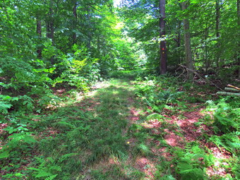 We walked out the Logger's Loop toward Times Square clearing one large branch on the way. This section of trail was a little wetter with some muddy areas but we easily avoided them. At the trail junction, we turned right and started up the Big Rock Trail. The pack I was carrying was several pounds heavier due to the tools and I did not have poles to help me up the hill. In addition, the temperature had increased and I could feel the humidity. There was one blowdown blocking the trail that I wanted to clear but I was not sure how far up the trail it was. We walked up the first incline and then across a more level area before starting up the next ascent. Near the top of the ascent after about .65 miles and 300 feet of climb we reached the blowdown. I took some "before" pictures and then got down to work. The blowdown blocked the trail effectively and hikers had begun to work around their way around it. I cleared some loose branches and then began to make some cuts of the smaller branches with the Sugowaza. The cuts went quickly and I took the time to drag the branches off the trail and into the woods. Eventually I was left with two pieces of larger trunk to eliminate. I used the ax to cut one and flipped it end for end off the trail. The last trunk was a little smaller and I used the saw to cut it and then moved it off the trail. I cleaned up a little bit and then took some "after" pictures.
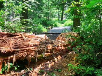 We turned around and hiked back down the Big Rock Trail to Tomes Square. I had to admit it was much easier going downhill! At Times Square we continued straight ahead on the Big Rock Trail around the head end of Frick Pond. The trail had a few muddy patches but we were soon at the bridges over the inlet streams. Just beyond the second bridge was the large spruce tree blocking the trial. I had worked on this tree a few days earlier creating a notch to make it easier for hikers to get over the log. My plan was to cut the notch deeper and wider. I eventually hoped to be able to cut through the entire trunk and remove most of it from the trail. I started to chip away at the trunk with the ax and found the going easier now that the trunk was dried out. I got out the Katanaboy and made a couple of cuts on the side of the log. This allowed me to use the ax to chip off a large section. As I was working two men came toward us from the direction of the Frick Pond bridge. They complimented me on my work and thanked me. I continued to work a little longer and then decided I was tired and that I did not want to cut any further as it might collapse the log.
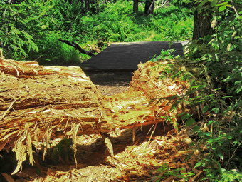 When I stepped back to take some pictures, it was clear I was more than halfway through! As I was packing up my tools, A young couple came walking toward us from the outlet end of Frick Pond. Sheila immediately seemed very interested and I saw they had a dog. I walked Sheila off the trail and let them pass. I finished packing and then we continued on the Big Rock Trail over the wooden walkways. We arrived at the Quick Lake Trail and turned left to head toward the bridge at the outlet end of Frick Pond. We crossed the bridge and I took a look at the scene. I decided it was not spectacular and that I did not want to stop to take out my camera. We walked up the hill to Gravestone Junction and continued out the trail toward the register. At the register we turned right to follow the Quick Lake Trail to the parking area. We were back at the car at 1:50 PM. We had covered 3.5 miles in 2 hours and 20 minutes with almost an hour of stopped time. The elevation gain was 460 feet with a moving average of 2.6 mph. The temperature at the car was 82 degrees and I was glad to be headed home.
![]()
![]()
![]()
![]() On Friday, July 3rd I was going to take a day off but decided it was such a nice day that I would go across the street and hike the "new trails" on Round Top. I wanted to see how many people had chosen to walk these newly marked trails. Sheila was always near but not too near to be considered under foot. I got dressed in a Columbia short-sleeved crew top with a short-sleeved baselayer. I put on a pair of RailRiders hiking pants which are expensive but last along time and have features like deep pockets and a generous cut which I really like. These pants have Velcro closures at the ankles to discourage sticks and gravel from getting into my shoes and to combat ticks. Despite this I decided against wearing my OR Bugout gaiters. I decided to wear my Keen Targhee II hiking boots which fit well and have been discontinued. I grabbed a pair of Leki external lock poles I have been using lately. I also added a new OR floppy hat which I have decided shields me from the sun and allows me to spray some insect repellant on it rather than on me. We stepped out of the house at 12:30 PM and I grabbed Sheila's leash from the car. We walked up the driveway and crossed the street. I decided we would try to do just two figure 8's which would allow me to cover all the trails. We walked to the parking area by the Presbyterian Church and to the back of the church. We began the ascent of the steepest hill behind the church. The hill is short but gets the circulation pumping and is the steepest and longest climb on the "trail." Sheila helped me along by pulling me up the hill. When we got to the top of the hill, I stopped to look around at the hills around town. A breeze had begun to blow which made it a little cooler and I hoped would keep away the insects. We started on the trail by turning left at the trailhead. I let Sheila off her leash so that she could explore. The trail bed is becoming worn it which means that at least a few people are using the trail. I am always happy to see that someone else uses the trails.
On Friday, July 3rd I was going to take a day off but decided it was such a nice day that I would go across the street and hike the "new trails" on Round Top. I wanted to see how many people had chosen to walk these newly marked trails. Sheila was always near but not too near to be considered under foot. I got dressed in a Columbia short-sleeved crew top with a short-sleeved baselayer. I put on a pair of RailRiders hiking pants which are expensive but last along time and have features like deep pockets and a generous cut which I really like. These pants have Velcro closures at the ankles to discourage sticks and gravel from getting into my shoes and to combat ticks. Despite this I decided against wearing my OR Bugout gaiters. I decided to wear my Keen Targhee II hiking boots which fit well and have been discontinued. I grabbed a pair of Leki external lock poles I have been using lately. I also added a new OR floppy hat which I have decided shields me from the sun and allows me to spray some insect repellant on it rather than on me. We stepped out of the house at 12:30 PM and I grabbed Sheila's leash from the car. We walked up the driveway and crossed the street. I decided we would try to do just two figure 8's which would allow me to cover all the trails. We walked to the parking area by the Presbyterian Church and to the back of the church. We began the ascent of the steepest hill behind the church. The hill is short but gets the circulation pumping and is the steepest and longest climb on the "trail." Sheila helped me along by pulling me up the hill. When we got to the top of the hill, I stopped to look around at the hills around town. A breeze had begun to blow which made it a little cooler and I hoped would keep away the insects. We started on the trail by turning left at the trailhead. I let Sheila off her leash so that she could explore. The trail bed is becoming worn it which means that at least a few people are using the trail. I am always happy to see that someone else uses the trails.
At the first trail junction, I followed Sheila as she turned right on the woods road which is the shallower approach to the trail system. We continued to follow the yellow trail to the first junction where we turned left and followed it to the next trail junction. It was obvious that the warm weather and rain had caused an explosion of growth and the trails were beginning to get overgrown with brush and high grass. This was despite the fact that I had trimmed back the trail with the Stihl trimmer. I set a quicker pace than usual as I did not plan to hike for very long. At the second junction with the blue trail, we turned right and started up the steep blue trail that leads over the summit of Round Top. Walking uphill we passed through a sea of green brought on by the warm weather and frequent rain showers. Just before the steepest section we turned right on the switchback trail marked with yellow ribbon. We continued to follow these ribbons as they made a sharp turn and headed back to the blue trail. We turned right on the blue trail and almost immediately turned right on the orange crossover trail. We walked this trail and I noticed there was a little sidehilling which might have to be mitigated. I also noticed that the trail was beaten down indicating others had walked it. As we approached the blue trail coming down from the summit , In such a way there was a family of five coming down the trail. I put Sheila on her leash and we walked out to the blue trail and turned right. We walked down the blue trail to the yellow trail and turned right. We continued on the yellow trail along the base of Round Top and turned left at the second junction. We walked down to the lookout and followed the yellow trail as it turned left and headed downhill to the first trail junction. To get a real feel for the new trails, we turned around and walked back up the yellow trail to the lookout and followed it as it turned right. We walked uphill through a sea of ferns to the first junction with the blue trail. We trend right and walked the yellow rail along the base of Round Top to the next junction with the blue trail. We turned left and headed up toward the summit. As we neared the summit we turned left on the trail marked with orange ribbon and followed it across OT the blue trail. We walked downhill but immediately turned left on the switchback and followed it back to where it joined the blue trail. We followed the blue trail to the junction and turned left to again walk the yellow trail to the next trail junction. This time we turned right and followed the yellow trail down to the woods road that took us back to the first trail junction. This time we turned left and walked back out to the trailhead. I put Sheila on her leash and walked won the cemetery hill toward the church parking lot. Two unleashed dogs were running around but a few stern commands made them back off. We walked across the parking area to the driveway and were home just after 1:30 PM.
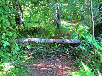
![]()
![]()
![]()
![]()
![]() On Thursday, July 2nd I decided I wanted to go to Frick Pond to work on some trail maintenance on the Big Rock Trail. I found out that my grandson Bryce would be coming around 9:30 AM and I looked forward to him helping me. I got up at 5:00 AM to go to my men's group at the church at 6:15 AM. I returned to Manor, ate breakfast at Caf� 43 and returned home. Bryce arrived and I decide we should get ready to go immediately as the temperature was 75 degrees and the humidity was high. The forecast indicated that the weather would only get more uncomfortable. As I started to get ready Sheila was watching my every move but was doing so quitely. I got dressed in a Columbia short-sleeved crew top with a short-sleeved baselayer. I put on a pair of RailRiders hiking pants which are expensive but last along time and have features like deep pockets and a generous cut which I really like. These pants have Velcro closures at the ankles to discourage sticks and gravel from getting into my shoes and to combat ticks. I hoped this would be enough so that I would not have to wear gaiters. I decided to wear my Keen Targhee II hiking boots which fit well and have been discontinued. They were a little wet from the hike the day before when we had encountered some rain showers. I decided to forego bringing poles as I would have carry my maintenance gear and I knew the hike would be short. I wedged my Silky Sugowaza and Katanaboy in my pack and added two plastic felling wedges. I checked the edge on the Fiskars ax and decided it needed to be sharper. I couldn't find the sharpener that came with it so I used a round stone that I had and was surprised at how quickly I could put an edge on it. I put all my gear in the back of the car and got Bryce and Sheila in the backseat. I headed out DeBruce Road and after six miles I turned left on Mongaup Pond Road. At the fork in the road I stayed left on Beech Mountain Road and parked in the smaller lot where only a motorcycle was parked. The other lot was empty. At 10:30 AM we began the hike by walking out the wood road to the trail register on the Quick Lake Trail. The trail was still wet from the rains but the water was only on the surface and there was very little mud. We walked down the hill to the bridge over the outlet stream. I did not bother to take pictures as I had done that the day before. We continued along the west side of the pond to the junction with the Big Rock Trail. The trail was blocked by a tree that had fallen across the Big Rock and Quick Lake Trails. I dropped my pack and took a "before" picture and then got down to work.
On Thursday, July 2nd I decided I wanted to go to Frick Pond to work on some trail maintenance on the Big Rock Trail. I found out that my grandson Bryce would be coming around 9:30 AM and I looked forward to him helping me. I got up at 5:00 AM to go to my men's group at the church at 6:15 AM. I returned to Manor, ate breakfast at Caf� 43 and returned home. Bryce arrived and I decide we should get ready to go immediately as the temperature was 75 degrees and the humidity was high. The forecast indicated that the weather would only get more uncomfortable. As I started to get ready Sheila was watching my every move but was doing so quitely. I got dressed in a Columbia short-sleeved crew top with a short-sleeved baselayer. I put on a pair of RailRiders hiking pants which are expensive but last along time and have features like deep pockets and a generous cut which I really like. These pants have Velcro closures at the ankles to discourage sticks and gravel from getting into my shoes and to combat ticks. I hoped this would be enough so that I would not have to wear gaiters. I decided to wear my Keen Targhee II hiking boots which fit well and have been discontinued. They were a little wet from the hike the day before when we had encountered some rain showers. I decided to forego bringing poles as I would have carry my maintenance gear and I knew the hike would be short. I wedged my Silky Sugowaza and Katanaboy in my pack and added two plastic felling wedges. I checked the edge on the Fiskars ax and decided it needed to be sharper. I couldn't find the sharpener that came with it so I used a round stone that I had and was surprised at how quickly I could put an edge on it. I put all my gear in the back of the car and got Bryce and Sheila in the backseat. I headed out DeBruce Road and after six miles I turned left on Mongaup Pond Road. At the fork in the road I stayed left on Beech Mountain Road and parked in the smaller lot where only a motorcycle was parked. The other lot was empty. At 10:30 AM we began the hike by walking out the wood road to the trail register on the Quick Lake Trail. The trail was still wet from the rains but the water was only on the surface and there was very little mud. We walked down the hill to the bridge over the outlet stream. I did not bother to take pictures as I had done that the day before. We continued along the west side of the pond to the junction with the Big Rock Trail. The trail was blocked by a tree that had fallen across the Big Rock and Quick Lake Trails. I dropped my pack and took a "before" picture and then got down to work.
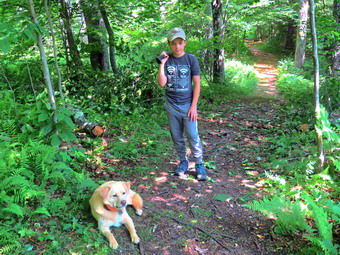 Bryce and I cleared the loose branches and threw them as far as possible off the trail. I cut some more of the small branches the fallen tree had brought down. I was trying to clear the trail and a spot so that I could safely use the ax to cut the tree trunk on the trail. Bryce and I worked together until the branches were cleared. As we were working a woman came strolling down the trail from the north end of the pond. We greeted each other as she passed. I used the ax to cut the tree trunk near the edge of the trail. I then cut the trunk on the other side of the trail.I pivoted the piece of trunk off the side of the trail which left only a few branches to clear to get the trail cleared. Bryce and I then worked to clear the rest of the tree off the Quick Lake Trail. We tried to pivot it off the trail but it was too long. I used the saw to make a cut and then threw the piece I had cut off the trail. We were almost down when the woman came strolling back in the opposite direction headed back toward the north end of the pond. Both Bryce and I wondered if she was lost! We finished cleaning up and I took my "after" pictures. I packed up my tools and we continued on the Big Rock Trail toward Times Square.
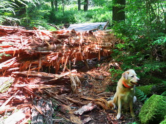 As we passed over the wooden walkways, I warned Bryce about the fact that they could be slippery. I did have to worry as the walkways were dry. At one point we heard a noise on the side of the trail away from the pond. We looked over to see the woman that had been walking the trail next to a tent in a small campsite. I could not see whether she was alone or had a companion. Bryce and I arrived at the large tree that was blocking the trail. Bryce was impressed and I agreed as the tree was larger than I remembered. The trunk was a least 2 feet in diameter and was probably a spruce. Most of the wood appeared rotten and was coming off the trunk in shreds. I put down my pack and got out my camera to take my "before" pictures. My plan was to clear as much of the shredded wood and bark off the trail as possible. I didn't think it would be possible to cut through the trunk with hand tools, at least not in one session. I decided I would be happy to cut a notch in the trunk and remove any sharp branches that were sticking out.
 Bryce and I began removing the mess that was already on the trail. I took the saw and began to remove some sharp branches that were sticking out of the trunk. I then grabbed the ax and began the long process of removing an area about 14 inches long on the trunk. Some of the wood was very rotten and came off easily. Other parts of the trunk were more solid and took more effort to remove. After chopping for a while, I stopped and Bryce and I cleared what I had cut. It was tedious work and I could tell that the temperature and humidity had both increased. I continued to make cuts and eventually had an obvious notch which provided a flatter and more stable surface for hikers trying to get over the trunk. I cleaned it off and decided to call it a day. I thought I might return and try using a saw to score the wood and then remove it with the ax. I took some "after" pictures and then packed up to go. All the time I was working, Sheila was curled up in the shade waiting. I decided we would head around the pond to complete the loop. Bryce and I walked the Big Rock Trail to Times Square where we turned right on the Logger's Loop. This trail was wet and muddy in spots but there were no blowdowns. We walked to the side of the trail in some spots as we continued uphill. The trail flattened and we were soon at Gravestone Junction. We turned left on the Quick Lake Trail and walked back out to the parking area. We had walked 2.2 miles and done almost 2 hours of maintenance. The temperature was 82 degrees and the humidity was palpable.
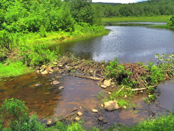
![]()
![]()
![]()
![]()
![]() On Wednesday, July 1st I had almost decided to take another day off since the forecast was calling for showers and thunderstorms throughout the day. Around 11:00 AM I stepped outside and it was such a beautiful day with blue skies and white clouds that I decided to go across the street to hike on Round Top. It was 75 degrees with somewhat high humidity as I began to get ready to hike. As I started to get ready Sheila was watching my every move but was doing so quitely. I got dressed in a Columbia short-sleeved crew top with a short-sleeved baselayer. I put on a pair of RailRiders hiking pants which are expensive but last along time and have features like deep pockets and a generous cut which I really like. These pants do not have Velcro closures at the ankles as some do to discourage sticks and gravel from getting into my shoes and to combat ticks. Despite this I decided against wearing my OR Bugout gaiters. I decided to wear my Keen Targhee II hiking boots which fit well and have been discontinued. I grabbed a pair of Leki external lock poles I have been using lately. I also added a new OR floppy hat which was another present from Cindy. I have decided it shields me from the sun and allows me to spray some insect repellant on it rather than on me. When I stepped out the door, it was so nice I decided to change plans and head to the Frick Pond area for a slightly longer hike. I went inside which confused Sheila. I picked up my pack and went back outside. I put my gear in the back and Sheila in the backseat and drove out the Debruce Road about 6 miles. I turned left onto Mongaup Pond Road and continued to where the road split. I turned left onto Beech Mountain Road, and drove to the parking areas at the Frick Pond. There were two cars parked in the smaller lot and I pulled in beside them. The thermometer read 72 degrees as I set my GPS. The skies were blue with plenty of sun and lots of billowing white clouds but the sky to the west was looking a little dark. There was a slight breeze which seemed to be dispersing the insects. I did not spray any insect repellant as I do not like the smell and there were no swarms of insects around me. At 12:10 PM we started our hike by heading out the short woods road that leads to the Quick Lake Trail even though I had not decided on our exact route.
On Wednesday, July 1st I had almost decided to take another day off since the forecast was calling for showers and thunderstorms throughout the day. Around 11:00 AM I stepped outside and it was such a beautiful day with blue skies and white clouds that I decided to go across the street to hike on Round Top. It was 75 degrees with somewhat high humidity as I began to get ready to hike. As I started to get ready Sheila was watching my every move but was doing so quitely. I got dressed in a Columbia short-sleeved crew top with a short-sleeved baselayer. I put on a pair of RailRiders hiking pants which are expensive but last along time and have features like deep pockets and a generous cut which I really like. These pants do not have Velcro closures at the ankles as some do to discourage sticks and gravel from getting into my shoes and to combat ticks. Despite this I decided against wearing my OR Bugout gaiters. I decided to wear my Keen Targhee II hiking boots which fit well and have been discontinued. I grabbed a pair of Leki external lock poles I have been using lately. I also added a new OR floppy hat which was another present from Cindy. I have decided it shields me from the sun and allows me to spray some insect repellant on it rather than on me. When I stepped out the door, it was so nice I decided to change plans and head to the Frick Pond area for a slightly longer hike. I went inside which confused Sheila. I picked up my pack and went back outside. I put my gear in the back and Sheila in the backseat and drove out the Debruce Road about 6 miles. I turned left onto Mongaup Pond Road and continued to where the road split. I turned left onto Beech Mountain Road, and drove to the parking areas at the Frick Pond. There were two cars parked in the smaller lot and I pulled in beside them. The thermometer read 72 degrees as I set my GPS. The skies were blue with plenty of sun and lots of billowing white clouds but the sky to the west was looking a little dark. There was a slight breeze which seemed to be dispersing the insects. I did not spray any insect repellant as I do not like the smell and there were no swarms of insects around me. At 12:10 PM we started our hike by heading out the short woods road that leads to the Quick Lake Trail even though I had not decided on our exact route.
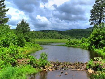 The grass on the trail was wet and there was plenty of mud. As we passed the register the trail became wetter but most of the water remained on the surface and there wasn't too much mud. As we approached Gravestone Junction, I noticed that the trail could use some lopping and the grass could be cut back. At the junction, we stayed to the left on the Quick Lake Trail to walk down to the bridge at the outlet of Frick Pond. This section was wet but lacked the mud that had been there in the spring. I dropped my pack and got out the camera to take some pictures of the pond. I noticed that the beaver dam was being reconstructed by the beavers even though someone keeps destroying it. I took some pictures and then packed up to leave. We crossed the bridge and walked the trail along the west side of the pond. Again, it was wet but not too muddy. At the junction with the Big Rock Trail, we turned right on the Big Rock Trail to get to Times Square. The wooden walkways were wet and very slippery and continuing to show their age. I have done my best to repair and shore them up but the DEC needs to do major repairs or a replacement. I stopped to take a few pictures of the walkways. We continued on the trail and found an enormous tree trunk blocking the trail just before the first small bridge. The trunk was rotten but I knew it would take a lot of effort with hand tools to whittle it down and more to remove it. I straddled it to get to the other side and found it was soaked which soaked me. We continued on the trail to Times Square. This area is always wet but on this day it was just damp. We continued straight ahead up the hill toward the Flynn Trail. The trail from Times Square to the Flynn Trail stretches 1.1 miles and gains almost 600 feet. Along the way there are three places that are much the same and seem to signal the junction with the Flynn Trail. As we hiked up the trail it began to rain. At first it was just a few drops but this changed to more of a shower. I stopped to put on my pack cover thinking this would surely stop the rain! I was immediately surrounded by hungry insects so I sprayed some repellant before covering up my pack. The rain did not stop and even became a little heavier as we ascended. There were two blowdowns that encroached on the trail but could easily be removed with hand tools. The ascent went very quickly as I had been hiking more. At 1:10 PM we had hiked 2.3 miles and were at the junction with the Flynn Trail.
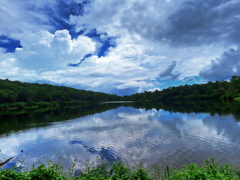 The rain had diminished to just a few drops and the skies to the east and south looked blue. The skies to the west and north were overcast and darker. I considered my options as I wanted to lengthen the hike by walking around Hodge Pond but did not want to get caught in a thunderstorm. I turned left and started toward Hodge and the turned around. I finally decided that I was wet already and that I should go for Hodge. We hiked out the Flynn Trail passing through the gate that separates state land from the OSI property. There were one or two blowdowns which were easily avoided but that I would remove with hand tools. At the next junction with a woods road, we stayed left and followed the Flynn Trail down toward Hodge Pond. It began to rain harder and as we approached the pond I could hear the rain pounding on the canopy above. When we cleared the trees and walked into the clearing at the end of the pod, the rain was really coming down. I looked across the pond and could see the rain falling while on the other side the skies were clear and blue. I wanted that picture but knew there was no way to get it. We turned left and followed the Flynn Trail along the west side of Hodge Pond. The trail was wet but we soon arrived at the jeep trail around the back of the pond. We stayed to the right to follow the jeep trail around the back of the pond. As we walked I heard a peal of thunder in the =distance which reminded me that I did not want to get caught in a real thunderstorm. I walked down to the sore of the pond and found that someone had enlarged the clearing there into a campsite. Sheila took a quick dip in the pond while I snapped a few shots of the pond. I packed up and we walked back up to the jeep trail. We turned right and walked to the next junction where we turned left. We walked up the hill to the woods road and turned right to walk back to the Flynn trail. At the Flynn Trail we turned left to complete the loop and walked back to the junction with the Big Rock Trail. At the junction we continued straight ahead on the Flynn Trail. The grass was wet and I began to notice a lot of red efts on the trail. I tried to avoid them which kept my mind off what can be a long walk down the trail to the parking area. The Flynn Trail descends 1.7 miles to the parking area losing a little 600 feet. The rain had stopped but the grass was still very wet. Before I knew it we were walking through the arch in the large spruce tree just before the first gate. We turned left into the woods to follow the Flynn Trail and avoid the private property around the cabin. We were back at the parking area at 2:30 PM after hiking 6.0 miles in 2 hours and 20 minutes. The elevation gain was 900 feet most of which was on the ascent of the Big Rock Trail.
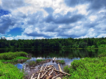
![]()
![]()
![]()
![]()
![]() On Monday, June 29th I thought I might go to Bear Spring to hike between 9 and 10 miles on the ridges. I asked Cindy if she wanted to hike she said "Yes" and I knew I would have to scale back by hiking distance. We talked about some loop at Frick Pond as we got ready at 9:45 AM. The temperature was 68 degrees but I thought it might rise a little. There was also the possibility of a thunderstorm. I started to get ready and Sheila was there to watch our every move. I got dressed in my White Sierra long-sleeved crew top with a short-sleeved baselayer. The shirt has an insect repellent built-in which I knew I would appreciate as I anticipated a swarm on Mayflies. I put on a pair of RailRiders hiking pants which are expensive but last along time and have features like deep pockets and a generous cut which I really like. These pants do not have Velcro closures at the ankles as some do to discourage sticks and gravel from getting into my shoes and to combat ticks. To make up for this I put on a pair of OR Bugout gaiters which are also insect resistant. I decided to wear my Keen Traghee II hiking boots which fit well and have been discontinued. I grabbed a pair of Leki external lock poles I have been using lately. I also added a new OR floppy hat which was another present from Cindy. I have decided it shields me from the sun and allows me to spray some insect repellant on it rather than on me. Sheila kept me in sight as I got ready to go making sure she would not be forgotten. We put our gear in the back of the car and Sheila in the back seat as we left Livingston Manor at 11:10 AM with skies that were blue with puffy white clouds and just the right amount of sun. As we headed out DeBruce Road, I got the idea that we should go to Long Pond since it was pretty flat and the loop was about 6 miles. Cindy agreed so I drove for about 8 miles to Flugertown Road where I made a left. I drove up the road and parked in the lot a short distance up the road on the right where one other car was parked. I pulled into the lot and started to get ready by setting my GPS. I thought we might start by hiking up the road but Cindy wanted to hike under the trees and up a rather steep little hill. We got started on the trail by crossing the first bridge at 11:30 AM. I hoped we could set a quick pace but we immediately ran into wet and muddy trails which surprised me a little. The trails had been very dry and I did not think the rain we had gotten the day before would make the trails as wet as they were. The first .6 miles gains about 350 feet to the highest point on the hike. It isn't very steep but does act as a nice warm-up! Once the trail leveled it was easier walking but the trail sayed wet and muddy. At 1.1 miles we were at the spur trail that leads down to the shore of Long Pond. We turned right and went down to the pond so that I could take some pictures. At the shores of the pond I dropped my pack and got out my camera to take some pictures. Sheila tried to follow me through the mud but I discouraged her. The skies were blue with a puffy white clouds. I took quite a few pictures of all angles of the pond. I returned to my pack where I got a drink and a bar before returning to the main trail. We turned right and were soon at the first trail junction. We turned right at the junction at 1.3 miles. We continued to find wet and muddy places on the trail and some were very deep but most were easily avoided. By 12:35 PM we had walked 1.8 miles and were passing the yellow spur trail to the lean-to.
On Monday, June 29th I thought I might go to Bear Spring to hike between 9 and 10 miles on the ridges. I asked Cindy if she wanted to hike she said "Yes" and I knew I would have to scale back by hiking distance. We talked about some loop at Frick Pond as we got ready at 9:45 AM. The temperature was 68 degrees but I thought it might rise a little. There was also the possibility of a thunderstorm. I started to get ready and Sheila was there to watch our every move. I got dressed in my White Sierra long-sleeved crew top with a short-sleeved baselayer. The shirt has an insect repellent built-in which I knew I would appreciate as I anticipated a swarm on Mayflies. I put on a pair of RailRiders hiking pants which are expensive but last along time and have features like deep pockets and a generous cut which I really like. These pants do not have Velcro closures at the ankles as some do to discourage sticks and gravel from getting into my shoes and to combat ticks. To make up for this I put on a pair of OR Bugout gaiters which are also insect resistant. I decided to wear my Keen Traghee II hiking boots which fit well and have been discontinued. I grabbed a pair of Leki external lock poles I have been using lately. I also added a new OR floppy hat which was another present from Cindy. I have decided it shields me from the sun and allows me to spray some insect repellant on it rather than on me. Sheila kept me in sight as I got ready to go making sure she would not be forgotten. We put our gear in the back of the car and Sheila in the back seat as we left Livingston Manor at 11:10 AM with skies that were blue with puffy white clouds and just the right amount of sun. As we headed out DeBruce Road, I got the idea that we should go to Long Pond since it was pretty flat and the loop was about 6 miles. Cindy agreed so I drove for about 8 miles to Flugertown Road where I made a left. I drove up the road and parked in the lot a short distance up the road on the right where one other car was parked. I pulled into the lot and started to get ready by setting my GPS. I thought we might start by hiking up the road but Cindy wanted to hike under the trees and up a rather steep little hill. We got started on the trail by crossing the first bridge at 11:30 AM. I hoped we could set a quick pace but we immediately ran into wet and muddy trails which surprised me a little. The trails had been very dry and I did not think the rain we had gotten the day before would make the trails as wet as they were. The first .6 miles gains about 350 feet to the highest point on the hike. It isn't very steep but does act as a nice warm-up! Once the trail leveled it was easier walking but the trail sayed wet and muddy. At 1.1 miles we were at the spur trail that leads down to the shore of Long Pond. We turned right and went down to the pond so that I could take some pictures. At the shores of the pond I dropped my pack and got out my camera to take some pictures. Sheila tried to follow me through the mud but I discouraged her. The skies were blue with a puffy white clouds. I took quite a few pictures of all angles of the pond. I returned to my pack where I got a drink and a bar before returning to the main trail. We turned right and were soon at the first trail junction. We turned right at the junction at 1.3 miles. We continued to find wet and muddy places on the trail and some were very deep but most were easily avoided. By 12:35 PM we had walked 1.8 miles and were passing the yellow spur trail to the lean-to.
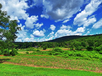 After passing the trail to the lean-to, we continued to find wet and muddy places on the trail. There isn't much to see on this section of trail but I kept "busy" by avoiding the muddy spots, thinking about several issues and talking to Cindy. We continued on the main trail to the point where it intersects a woods road at 2.6 miles. Both Cindy and I commented that the walk had seemed a little longer than usual. We turned left on the woods road and found it to be very wet with some mud. We followed the road until the intersection with Basily Road at 2.85 miles where we continued on Basily Road by bearing left. This section of road was also wet and muddy but it did not slow us down much. Sheila took advantage of the water in one of the small streams to get a drink and play in the water. It did seem to get getting warmer and the humidity was high. I also noticed that the Mayflies were beginning to appear in greater numbers. As we approached the Peters Hunting Camp, I got ready to put Sheila on her leash. The beaver pond was full of water as was the road. For the first time I can remember the water was also right at the level of the footbridge. I assumed the beavers had been at work both on the main dam and on a secondary dam further downstream. I stopped to take a few pictures. The skies were still very blue with high, billowing, white clouds. I took pictures of the beaver pond, the flooded road and clouds in the blue sky. We continued on the trail to the bridge over the stream near the camp. The bridge is showing signs of wear from snowmobiles passing over it even though there is a sign that states "Private Bridge". I have secured permission to hike across this land in the past and "Stay on the trail" signs seem to indicate that the owners will allow hikers. I assume the "Private Bridge - No thru traffic" refers to motorized vehicles and not hikers. We crossed the bridge to continue the trip back to the car and started up the little hill from the hunting camp. We stopped again so that I could take a few shots of the valley which looked peaceful with the nice skies behind it. Once we started walking again we kept a fast pace despite some water and mud. As we hiked, I noticed two tents on the right side of the road. Further along, we could hear noises coming from the left side of the road and saw several cars and tents creating a large campsite. I wondered whether this was legal since the canister was not designated and was right next to the stream. No one seems to know the rules or to obey them when they know what they tare. We continued down the road toward the parking area and our car. On the way a car and a pickup truck passed us which surprised me since I rarely see anyone on this hike. We arrived at the place where the road is paved and stopped so that I could take a few more shots. We walked down the road to a bridge over a stream and noticed that the large beaver dam downstream to the right was no longer there. We continued at an accelerated pace back to the parking area. We were back at the car at 2:20 PM having hiked 6.0 miles in 2 hours and 50 minutes with 15 minutes of stopped time. The elevation gain was only about 550 feet most of which was at the beginning of the hike.
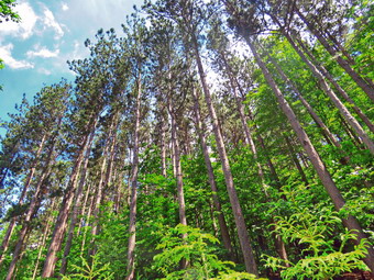
![]()
![]()
![]()
![]()
![]() On Friday, June 26th I wanted to get away from Livingston Manor for a hike and Cindy and Sheila agreed. Of course, Sheila always agrees as long as we are going outside! I had considered doing a longer loop at Bear Spring WMA but knew it would be too long for Cindy. I suggested we go to Huntersfield Mountain just north of Prattsville. When I got up at 7:00 AM, the temperature was in the high 50's. I had wanted to get an early started but just wasn't motivated to get moving. I decided we would hike from the parking area just off Huntersfield Road and return using some woods roads that would make the walking much easier. Cindy and I had done this route more than two years ago and I remembered it was interesting. The Long Path used to go over Huntersfield but has been rerouted to avoid a "dead end" that occurred when the Long Path came to some private property on nearby Sickler's Mountain. I got dressed in a Columbia short-sleeved crew top with a short-sleeved baselayer. I put on a pair of RailRiders hiking pants which are expensive but last along time and have features like deep pockets and a generous cut which I really like. These pants have the Velcro closures at the ankles to discourage sticks and gravel from getting into my shoes and to combat ticks. I decided to wear my Keen Targhee II hiking boots which fit well and have been discontinued. I put on a pair of OR Bugout gaiters which are also insect resistant. I grabbed a pair of Leki external lock poles I have been using lately. I also added a floppy OR hat which keeps the sun off my head and allows me to spray insect repellant on it rather than on me. We left Livingston Manor at 10:30 AM and headed toward Roscoe where we picked up Route 206 toward the Pepacton Reservoir. At the reservoir I turned right on Route 30 and headed toward Margaretville on the BWS roads. In Margaretville I picked up Route 30 north through Roxbury and Grand Gorge where I got on Route 23 to Prattsville. Although I had not been to Huntersfield in some time, I remembered the route without any problems. I turned left onto Washington Street which soon became Route 10. I drove up and through some impressive mountains and at the Y and I turned left on Route 11. Route 11 turned into Marv Rion Road and at the end I turned right on Huntersfield Road. We passed by the Huntersfield Christian Training Center which has some beautiful views of mountains to the south. The paved road ends at a "DEAD END" sign and the dirt road begins. The dirt road was not in very good condition but I knew the drive was very short. My new Mitsubishi Eclipse Cross sits higher than my Lancer and we had no problems driving up to where I wanted to park. I turned around and parked the car. To get ready to hike I set my GPS and shouldered my pack. We set off at noon under sunny, blue skies with puffy white clouds
On Friday, June 26th I wanted to get away from Livingston Manor for a hike and Cindy and Sheila agreed. Of course, Sheila always agrees as long as we are going outside! I had considered doing a longer loop at Bear Spring WMA but knew it would be too long for Cindy. I suggested we go to Huntersfield Mountain just north of Prattsville. When I got up at 7:00 AM, the temperature was in the high 50's. I had wanted to get an early started but just wasn't motivated to get moving. I decided we would hike from the parking area just off Huntersfield Road and return using some woods roads that would make the walking much easier. Cindy and I had done this route more than two years ago and I remembered it was interesting. The Long Path used to go over Huntersfield but has been rerouted to avoid a "dead end" that occurred when the Long Path came to some private property on nearby Sickler's Mountain. I got dressed in a Columbia short-sleeved crew top with a short-sleeved baselayer. I put on a pair of RailRiders hiking pants which are expensive but last along time and have features like deep pockets and a generous cut which I really like. These pants have the Velcro closures at the ankles to discourage sticks and gravel from getting into my shoes and to combat ticks. I decided to wear my Keen Targhee II hiking boots which fit well and have been discontinued. I put on a pair of OR Bugout gaiters which are also insect resistant. I grabbed a pair of Leki external lock poles I have been using lately. I also added a floppy OR hat which keeps the sun off my head and allows me to spray insect repellant on it rather than on me. We left Livingston Manor at 10:30 AM and headed toward Roscoe where we picked up Route 206 toward the Pepacton Reservoir. At the reservoir I turned right on Route 30 and headed toward Margaretville on the BWS roads. In Margaretville I picked up Route 30 north through Roxbury and Grand Gorge where I got on Route 23 to Prattsville. Although I had not been to Huntersfield in some time, I remembered the route without any problems. I turned left onto Washington Street which soon became Route 10. I drove up and through some impressive mountains and at the Y and I turned left on Route 11. Route 11 turned into Marv Rion Road and at the end I turned right on Huntersfield Road. We passed by the Huntersfield Christian Training Center which has some beautiful views of mountains to the south. The paved road ends at a "DEAD END" sign and the dirt road begins. The dirt road was not in very good condition but I knew the drive was very short. My new Mitsubishi Eclipse Cross sits higher than my Lancer and we had no problems driving up to where I wanted to park. I turned around and parked the car. To get ready to hike I set my GPS and shouldered my pack. We set off at noon under sunny, blue skies with puffy white clouds
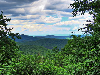 We started out almost immediately with the air temperature in the low 70's nut somehow high humidity. The trail was poorly marked which unfortunately has become common lately. The DEC decided that volunteers were no longer allowed to post trail markers which would have to be done by DEC foresters. Since the DEC foresters never get out to mark the trails, the result is poorly marked trails. This is not the fault of the foresters who are busy doing many other jobs. The first part of the trail paralleled a small stream and then crossed it. The trail did not appear to be much used with a few branches here and there. The trail was mostly dry but there were a few wet and muddy places. In a very short distance we turned left onto a woods road and entered a red pine plantation. The thought crossed my mind that bushwhacking a direct route would be quicker but I decided to stay on woods road to respect property rights and the environment. The trees were very tall and the road well defined but without many blazes. I stopped to take a few pictures of the trees and the continued. There were several large puddles on the trail but they were easy to walk around. I was afraid there might be a lot of insects but there were far less than I expected. At about 1.1 mile into the hike, the trail turned right into the woods. We had been hiking almost due north and the grade was about 5% which made it an easy walk. Now the trail started to head east and southeast up a ridge leading to the summit and the grade became steeper with section of 17%. The walking was definitely more challenging but at least there only a few wet patches along the way. We worked our way over some rocks and the lack of appropriate blazes was, at times, puzzling. At 1.25 miles I saw a viewpoint to the right and walked over to take a look. There was a view to the south and west but it was mostly blocked by the leaves on the trees. I took some pictures of the mountains in that direction. As we hiked up the trail there were many good views through the trees but none that offered photographic opportunities. All along the way I looked for other viewpoints but none seemed evident but I knew that some were available from points on the summit. We passed several rock outcroppings and ledges and intersected at least one woods road. Several times Cindy and I both thought we were near the top only to find there was some more climbing to do. I had not been on the mountain in some time and the climbs were steeper and longer than I remembered
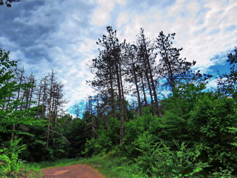 Eventually we reached the flat and wooded summit of the mountain and continued to walk over the top. Cindy was a little behind me so I stopped when I found the USGS benchmark and took a picture. We continued across the summit to the junction with the yellow trail to the lean-to. The red trail continued east toward Ashland Pinnacle and looked to be in good shape. We turned right on the yellow trail and almost immediately came across a viewpoint to the east. We stopped so that I could take some pictures toward the Ashland Pinnacle and Richmond Mountain. By now the skies had darkened and a wind had blown up. It was odd because to the east where I was photographing there was still plenty of sunlight. We returned to the trail and were at the lean-to in only a few minutes. Rain began to fall. There were only a few drops at the beginning but then more began to fall. The view at the lean-to was to the south into the heart of the Catskills. The mountains of the Devil's Path were clearly visible but Slide Mountain in the distance dominated the view. From here it looked more impressive than ever. I took several pictures and we got a drink and a snack while waiting to see what the rain would do. I suggested we start hiking back as the rain was very light. We continued on the yellow trail passed the lean-to and started downhill. It wasn't long before the yellow trail turned right off the woods road but we contused straight ahead. We continued on the woods road with only a few drops of rain falling and blue skies ahead of us. The walk was easy on the wide woods road and it was all downhill! The grade was around 10% and in 1.25 miles we lost 625 feet heading southwest. At 3.5 miles we came to a large pile of red shale and walked out to a dirt road. We were at the junction of Jim Cleveland Road coming up from the south and Huntersfield Road. I took a few shots of the "quarry" as the rain had stopped. We turned right to walk the woods road back to the car. The road was in good shape and I knew that I could have driven my car on it. We continued to follow the woods road northest and at 4.1 miles it turned west and continued a steep descent. It wasn't long until we spotted the car. We were back at the car at 2:40 PM after hiking 4.5 miles in 2 hours and 40 minutes with 25 minutes of stopped time. The elevation gain was 1220 feet and our moving average speed was 2 mph. The ascent had taken 1 hour and 40 minutes while the descent, which was the same length, had taken 1 hour. I though new might do another short hike but Cindy declined. This was Ok with me as I had to be home to participate with the ambulance corps in a graduation parade at 5:00 PM.
On Monday, June 22nd my grandson, Bryce, was at our house for the afternoon. When I returned from an ambulance call, I suggested we go across the street and clean up the new trails Lisa and I had marked on Round Top. I had already remarked the switchback trail and crossover trail in different colors but I now wanted to make it easier for people to hike the paths and give us some feedback. Around 2:00 PM Bryce and I started to get ready to go across the street to do the work. I got dressed in a Columbia short-sleeved crew top with no baselayer. I put on a pair of RailRiders hiking pants which are expensive but last along time and have features like deep pockets and a generous cut which I really like. These pants do not have the Velcro closures at the ankles to discourage sticks and gravel from getting into my shoes and to combat ticks. I decided to wear my Keen Targhee II hiking boots which fit well and have been discontinued. I put on a pair of OR Bugout gaiters which are also insect resistant. I grabbed a pair of Leki external lock poles I have been using lately. I also added a floppy OR hat which keeps the sun off my head and allows me to spray insect repellant on it rather than on me. I grabbed my Corona loppers from the house and Sheila's leash from the car. I put Sheila on her leash and we walked out the driveway and across the street to the Presbyterian Church. We walked in back of the church and started up the highest hill in the cemetery where the trailhead is located. Sheila helped me by pulling me up the hill. At the trailhead, we turned left to get on the trails. I released Sheila from her leash and we walked to the first trail junction. We continued straight ahead up to the lookout. As we walked, I showed Bryce which branches to lop and he cut them. I threw the branches to the side of the trail and we the followed the yellow trail as it turned to the right at the viewpoint. We walked through a sea of ferns heading slightly uphill to the junction with the blue trail. As we waled we continued to cut branches. We cut a few roots that had become exposed on the trail and were ready to trip people. We also took some loose rock off the trail in one spot. We walked straight ahead at the first junction with the blue trail. I watched for the yellow ribbon that I had used to mark the switchback trail. We turned right off the trail at the yellow ribbon and began to clean up the switchback path. We did not want to completely clear the trail so we cut only a few branches that were blocking a walk-through of the path. We also cleared any branches that were on switchback so that people exploring would not trip. At one point we noticed that people had cut the switchback a little short. I piled some branches on the route they had taken. We continued to trim a few branches here and there. We also walked over some sections more than once to make the path more obvious. We eventually reached the main trail just above the section we needed to close down because of the erosion. Just above the switchback we came to the orange ribbon I had placed to mark the crossover trail. Bryce and I used the same treatment on this path that we had on the other. We followed the ribbons cutting a few branches and cleaning fallen branches off the path. Near the end of the crossover, we did have to cut a few extra branches to allow people to pass more easily. Once we reached the trail coming down from the summit, we turned right and headed down toward the junction with the yellow trail. We continued to trim branches and move them off the trail. At the junction we turned right and walked the "middle" trail back toward the other junction with the blue trail. Cindy and I had cleared out this area but there were still a few branches to clip and remove. At the next junction, Bryce and I turned right and walked up the steep trail to the summit of Round Top. We cut a few branches especially across the top of the hill and down the other side to the spot where the orange trail meets the blue trail. At the yellow trail we continued straight ahead on the trail walking down to the woods road. We walked the wood road back to the first trail junction. We turned left and walked out to the trailhead. We turned right, I put Sheila or her leash and we all walked back to our driveway and home.
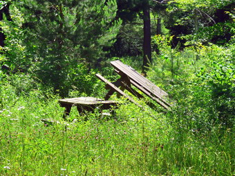
![]()
![]()
![]()
![]()
![]() On Wednesday, June 24th, the weather was beautiful and I wanted to take advantage of the lower temperatures and humidity. I asked Cindy if she wanted to hike and she agreed but she wanted to do a much shorter hike than I was ready to do. I wanted to do between 6 and 8 miles and Cindy suggested we go to the Beaverkill Campgrounds to hike 2.5 miles. So, I agreed to go to the Beaverkill Campgrounds. We started to get ready just before 11:00 AM with the temperature at 70 degrees and a strong breeze blowing. I got dressed in a Columbia short-sleeved crew top with a short-sleeved baselayer. I put on a pair of RailRiders hiking pants which are expensive but last along time and have features like deep pockets and a generous cut which I really like. These pants do not have the Velcro closures at the ankles to discourage sticks and gravel from getting into my shoes and to combat ticks. I decided to wear my Keen Targhee II hiking boots which fit well and have been discontinued. I put on a pair of OR Bugout gaiters which are also insect resistant. I grabbed a pair of Leki external lock poles I have been using lately. I also added a floppy OR hat which keeps the sun off my head and allows me to spray insect repellant on it rather than on me. We put our gear in the back of the car and Sheila in the back seat and left the house at 11:10 AM. I drove out Old Route 17 toward roscoe and turned right on Beaverkill Road. As we started the descent into the Beaverkill Valley, I turned left on Campsite Road and followed it down to the parking area near the Beaverkill Covered Bridge. As I parked, there were already 5 cars in the lot and people spread out across the near shore of the stream. The river was not as high as it had been earlier in the year but there was still a good volume. As we were getting ready, several more vehicles pulled into the lot so I immediately put Sheila on her leash and we got ready to leave.
On Wednesday, June 24th, the weather was beautiful and I wanted to take advantage of the lower temperatures and humidity. I asked Cindy if she wanted to hike and she agreed but she wanted to do a much shorter hike than I was ready to do. I wanted to do between 6 and 8 miles and Cindy suggested we go to the Beaverkill Campgrounds to hike 2.5 miles. So, I agreed to go to the Beaverkill Campgrounds. We started to get ready just before 11:00 AM with the temperature at 70 degrees and a strong breeze blowing. I got dressed in a Columbia short-sleeved crew top with a short-sleeved baselayer. I put on a pair of RailRiders hiking pants which are expensive but last along time and have features like deep pockets and a generous cut which I really like. These pants do not have the Velcro closures at the ankles to discourage sticks and gravel from getting into my shoes and to combat ticks. I decided to wear my Keen Targhee II hiking boots which fit well and have been discontinued. I put on a pair of OR Bugout gaiters which are also insect resistant. I grabbed a pair of Leki external lock poles I have been using lately. I also added a floppy OR hat which keeps the sun off my head and allows me to spray insect repellant on it rather than on me. We put our gear in the back of the car and Sheila in the back seat and left the house at 11:10 AM. I drove out Old Route 17 toward roscoe and turned right on Beaverkill Road. As we started the descent into the Beaverkill Valley, I turned left on Campsite Road and followed it down to the parking area near the Beaverkill Covered Bridge. As I parked, there were already 5 cars in the lot and people spread out across the near shore of the stream. The river was not as high as it had been earlier in the year but there was still a good volume. As we were getting ready, several more vehicles pulled into the lot so I immediately put Sheila on her leash and we got ready to leave.
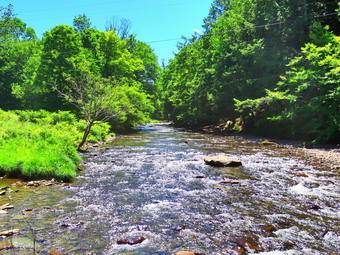 I set my GPS and we started our hike at 11:30 AM by crossing the bridge to the west side of the river. As we exited the bridge, we turned left on a woods road that parallels the river. We walked passed a spring house and continued on the desert woods road. I also noticed some water on the other side of the road which was covered in what looked like floating duckweed. Soon we came to a picnic table surrounded by high grass and weeds. I decided to take pictures that showed the deserted campgrounds. I took pictures of the picnic tables and, a little later, what was once a bathroom for some campsites that had long since disappeared. At the next bathroom we stopped so that I could take some more pictures. There was a picnic table near the river so I took some pictures of table and then walked down to the river. I took some pictures of the sun reflecting off the water. In several areas the DEC had placed large rocks along the shore and covered them with heavy wire to reduce erosion. Before leaving I also took pictures of the deteriorating bathrooms. At about .7 miles the woods road met the paved road that serves the campsites and we continued along the river. We could hear someone using a string trimmer to maintain the campsites. We both wondered why they were doing the work if they did not intend to open! The campsites each had a cement block fireplace with a grill but were very close together. Everything was very quiet except for the maintenance worker. This was not surprising as the campsites are closed. I took some pictures of all the empty campsites. We walked to the last campsite where the trail ends and then turned around to start back. I noticed another set of campsites to our left and we walked over to them. We did a short loop and walked back out to the main road through the campgrounds. We did walk the other road through the campsites which parallels the one we walked out on makes a sort of loop. We stopped again so that I could take some pictures of a group of picnic tables randomly arranged. I had thought we might walk up the hill and take the road back but we decided it would be nicer to stay on the wood road. We retuned the way we had come crossing the river on the bridge.
 Instead of stopping at the car we walked out the far end of the parking lot passing the bathhouse and following a path. Cindy and I both remembered a ford that crossed the river many years ago but we had not been able to locate it. As we walked we came to a depression which was an old stream channel and this channel had concrete paving across it. This was the ford that we remembered and it crossed a branch of the river which is now dry. We continued our walk and soon came to a series of palettes with stone piled on them. This was obviously stone that was to be used to constructed fireplaces or walls but it did not look like it had been accessed in some time. The path we are on passed through a grove of tall evergreens and seemed to end at a stone bench. The bench was formed from an enormous lab of stone mounted on cement blocks. The stone had visible drill marks on it and we both wondered where it had been quarried. I took some pictures of the bench and a few of the river. When I was done, we retraced our steps following the route we had used on the way out. We were back at the car at 1:00 PM having hiked 2.6 miles in 1 hour and 25 minutes with 20 minutes of stopped time. The elevation gain was 200 feet but it was hardly noticeable. The car's thermometer read 78 and the humidity seemed to be rising. The parking lots now had 17 cars in them which meant there were a lot of people around the stream. One young man asked me about hiking and I directed him to the other side of the stream.
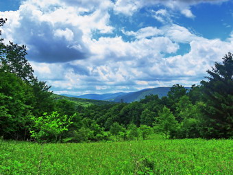
![]()
![]()
![]()
![]()
![]() On Tuesday, Jun 23rd I wanted to get out for a longer hike not too far from home. The forecast was for temperatures in the mid to high 80's with high humidity so I knew Cindy would not be interested in going. I decided to go to Big Pond for a hike to Little Pond and back. I had several possibilities to complete this loop including staying on the trails, walking back on the roads and making a side trip to Cabot Mountain. The temperature was in the high 70's in the morning but we knew it would get warmer in the afternoon. I had planned on betting an early start but the ambulance pager went off at 6:30 AM so I knew we would be hiking in the heat! When I got home I began to get my gear together which pleased Sheila. I got dressed in a Columbia short-sleeved crew top with a short-sleeved baselayer. I put on a pair of RailRiders hiking pants which are expensive but last along time and have features like deep pockets and a generous cut which I really like. These pants do not have the Velcro closures at the ankles to discourage sticks and gravel from getting into my shoes and to combat ticks. I decided to wear my Keen Targhee II hiking boots which fit well and have been discontinued. I put on a pair of OR Bugout gaiters which are also insect resistant. I grabbed a pair of Leki external lock poles I have been using lately. I put my gear in the back and Sheila in the backseat and pulled out of Livingston Manor at 9:45 AM. I drove toward Roscoe on Old Route 17 and turned right on Beaverkill Road after 1.3 miles. I continued north on Beaverkill Road for 10.8 miles passing through Lew Beach. As the Beaverkill Road turned right, I turned left onto Barkaboom Road and drove .8 miles to the parking area for Big Pond on the right. There were two vehicles parked in the lot. One was a convertible with the top down which I though took real nerve! I got ready to hike by setting my GPS. The temperature was 83 degrees and the humidity was palpable. Some Mayflies were starting to gather but I hoped they would stay away.
On Tuesday, Jun 23rd I wanted to get out for a longer hike not too far from home. The forecast was for temperatures in the mid to high 80's with high humidity so I knew Cindy would not be interested in going. I decided to go to Big Pond for a hike to Little Pond and back. I had several possibilities to complete this loop including staying on the trails, walking back on the roads and making a side trip to Cabot Mountain. The temperature was in the high 70's in the morning but we knew it would get warmer in the afternoon. I had planned on betting an early start but the ambulance pager went off at 6:30 AM so I knew we would be hiking in the heat! When I got home I began to get my gear together which pleased Sheila. I got dressed in a Columbia short-sleeved crew top with a short-sleeved baselayer. I put on a pair of RailRiders hiking pants which are expensive but last along time and have features like deep pockets and a generous cut which I really like. These pants do not have the Velcro closures at the ankles to discourage sticks and gravel from getting into my shoes and to combat ticks. I decided to wear my Keen Targhee II hiking boots which fit well and have been discontinued. I put on a pair of OR Bugout gaiters which are also insect resistant. I grabbed a pair of Leki external lock poles I have been using lately. I put my gear in the back and Sheila in the backseat and pulled out of Livingston Manor at 9:45 AM. I drove toward Roscoe on Old Route 17 and turned right on Beaverkill Road after 1.3 miles. I continued north on Beaverkill Road for 10.8 miles passing through Lew Beach. As the Beaverkill Road turned right, I turned left onto Barkaboom Road and drove .8 miles to the parking area for Big Pond on the right. There were two vehicles parked in the lot. One was a convertible with the top down which I though took real nerve! I got ready to hike by setting my GPS. The temperature was 83 degrees and the humidity was palpable. Some Mayflies were starting to gather but I hoped they would stay away.
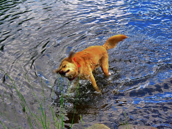 We crossed the road at 10:10 AM to begin our hike up Touch-Me-Not Mountain on the Touch-Me-Not Trail which is part of the Finger Lakes Trail. The first part of the trail is an old woods road, and it is pretty easy to follow. I let Sheila off her leash as we walked up the first hill passing the trail register. The trail was completely dry without any dampness or mud. I maintain the section of trail from Alder Lake to Beech Hill Road so I immediately began to remove sticks, rocks, branches and a few small tree trunks from the trail. The first mile of the trail gains about 775 feet with an average grade of 15%. Some places are almost flat which means there are a few steeper places. I began to notice that the blazing of the trail could be better. Volunteers used to be able to put up trail markers, but the DEC decided that a forester must now do this. I made a note to call Stamford to tell them that they needed to have someone add markers before winter when it would be harder to find the trail. Most blazes were too far apart. Some were very old and faded with others grown into the trees. A few were on the side of the tree meaning they were not visible from either direction on the trail. Several times I just followed Sheila who seems to be able to find the right direction no matter what. It was obvious in several areas that there had been significant rain at some point as the trail was badly eroded. The further we walked the more nettles I began to see. I knew that this would mean a trip with my Stihl string trimmer which does a great job of eliminating this problem. In a few places, the trail traveled along the side of the hill, and this made for some tricky footing. Despite the incline and the heat, we made good time and at 10:50 AM we had hike 1.1 miles to the highest point on the trail on the shoulder of Touch-Me-Not Mountain. After a slight descent, we came to a large blowdown that had once blocked the trail. A good piece of the trunk had been cut away to provide an easy path. We walked down the hill to the next trail junction and turned right on the yellow loop trail around Little Pond.
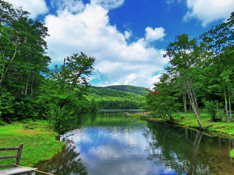 The loop trail is very popular with campers during the season and the trail bed was a little more obvious. At one point the trail passed between two large boulders forming a sort of rock cut. In April there had been some snow piled up in the shade but it had LONG since disappeared with the 80+ degree temperatures. We continued along the trail descending another rocky area to find a large tree across the trail. It was obvious hikers had been walking to the left around the butt end of the tree which is what we did. At 1.6 miles we had finally arrived at the cutoff to Cabot Mountain. I thought about submitting Cabot or at least going as far as the field of nettles to scope them out. In the end I decided not to do this as it was very warm and humid and the skies were getting darker with a definite wind. We continued our hike by bearing left to stay on the loop trail. There were several blowdowns in this area that would require tools to remove. After a short walk, we came to a large, flat stone on the right side of the trail. I remembered taking pictures of our grand children there. As we passed by, I realized how much I missed my grandchildren. At 1.8 miles we arrived in the clearing that acts as a viewpoint. It is hard to see Little Pond from this lookout since the trees have grown up. This is a place that holds many memories as we hiked the loop many times when I was younger. We stopped, and I got out the camera to take pictures of the hills and the blue sky. The scene kept changing as the light played off the hills in different ways and reflected off the haze. I packed up, and we continued the hike passing the small foundation of a long-forgotten homestead cabin. I noticed the pond to the right of the trail and decided to inspect it although I could see that the water level was very low. The pond used to be very small but had gotten larger over the years. It is obvious that it is fed mostly by runoff which is why the water level had dropped so much. I took some shots and notice the flies were now congregating so we move on. The main trail which is often covered in water from the outlet of the pond was absolutely dry. Ahead of us on the trail was one of the biggest blowdowns I had seen in some time. A huge tree with three different trunks had completely blocked the trail. I stood in awe for a minute planning how I might cut it with hand tools! We walked around to the right of the tree and then back out to the main trail which soon turned left off the woods road.
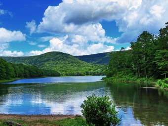 The trail headed down through the forest and was bone dry and dusty but extremely eroded making the walk difficult. We walked downhill encountering a large blowdown that blocked the trail near a large beaver pond. I wanted to stop at the shore of the beaver pond to take some pictures but the insects were swarming and I knew stopping would make it unbearable! As we walked the short distance to the loop trail around Little Pond I could see that there was almost no water in the inlet stream. At the pond, we turned right to walk around the western shore of Little Pond. As we walked along the shore to the boat launch area, we could see Touch-Me-Not Mountain where we had been a short time ago. We stopped at the boat launch area, and I took some photos of Touch-Me-Not Mountain and the pond. Sheila decided to go wading. I took a pictures of her swimming and then threw a stick and took some more pictures. As we walked along the road, I began to see picnic tables leaning on the fireplaces at the campsites. Just before we turned left on a trail to head for the bridge at the outlet of Little Pond there was an occupied campsite! I was supplied as it was the first I had seen at any of the local DEC campsites. We came to and crossed the bridge at the outlet end of the pond. I dropped my pack to take a few pictures before leaving the Little Pond area. The parking area had cones to space the cars properly but there were a half dozen cars in the lot. We now had choice to return on the roads or hike back up Touch-Me-Not Mountain on the Campground Trail. I had planned the trail hike but thought better of it and decided to leave it for another day. I decided we would walk back to Big Pond using the access road and Barkaboom Road. We walked over to the parking area and turned right to walk out the access road. We walked out to the gatehouse and I saw that there was an attendant there. She said that the campgrounds were open for day use and to those who had made reservations before the COVID pandemic. We started down the hill toward Barkaboom Road with Sheila on her leash. She walks very well on her leash although her pace is a little fast for me! The walk was very peaceful as there were no cars going to the campgrounds. We walked a little less than a mile down to Barkaboom Road and turned left to hike up the road back to Big Pond. There were some contractors working to trim trees on the road. The hike back to the car was about .6 miles and it is all uphill so I appreciated Sheila's pull. The stream beside the road had some water but the level was far below what I had seen in April. We walked up the hill and back to the car in the parking area. The lot was no filled with many people going down to Big Pond to wade and swim or to boat. I put Sheila in the car and walked down to the shore of Big Pond to take some pictures. Getting pictures of the pond without the people proved challenging. I walked back up to the car and turned on the air conditioning. We were back at the car at the car at 12:30 PM having hiked 4.8 miles in 2 hours and 20 minutes. The elevation gain was about 1000 feet.
On Monday, June 22nd I returned from a hike with Cindy on the Parksville Railtrail. Sheila and I both had some energy left so I decided we would head over to Round Top to reblaze the switchback and the new crossover trail Lisa and I had laid out. We had marked both trails in a bright green which caused two problems. The color blends easily with the leaves and the fact that we used the same color did not let us distinguish one trail from the other. We wanted to collect some feedback from people about the trail so I needed to use different, visible colors. My neighbor gave me some orange ribbon and I bough a roll of hello from the local hardware store. I decided to take justice two rolls of tape and Sheila. I put the tape in my pocket and grabbed Sheila's Leah from the car. I put Sheila on her leash and we walked out the driveway and across the street to the Presbyterian Church. We walked in back of the church and started up the highest hill in the cemetery where the trailhead is located. Sheila helped me by pulling me up the hill. At the trailhead, we turned left to get on the trails. I released Sheila from her leash and we walked to the first trail junction. We continued straight ahead up to the lookout and the followed the yellow trail as it turned to the right. We walked through a sea of ferns heading slightly uphill to the junction with the blue trail. The steepest section of this trail is showing some erosion because of increased use and because it goes straight up the hill. Lisa and I planned out a switchback to alleviate the problem. I watched for the green ribbon carefully and found it just before the steep section. I marked the tree on the trail near the start wit yellow ribbon and then started to follow the green ribbons. Now that there were ribbons to follow, I could see that some were placed so that they were hidden by trees or brush. I used the yellow ribbon to replace the green ribbon or to place new ribbons where they could more easily be seen. After heading away from the "main" trail for a while, I followed the green ribbons as they turned left and headed back. The uphill was much easier and offered a few more "attractions" than heading straight up the hill. Soon I was back at the main trail above the steep section where I marked a tree with the yellow ribbon. The crossover trail begins less than 20 feet above the end of the switchback and I quickly found the beginning. I marked the tree on the trail with orange ribbon and then started to follow the green ribbons using the same procedure I had used for the other trail. Even though we had only walked this path twice, it was easy enough to follow. I made sure the orange ribbons weren't hidden and placed a few extra. As I went I also removed some brush and small trees from the path to make it easier to follow. We eventually ended up on the other side of the hill where I tied a n orange ribbon on a tree. Sheila and I turned right and walked down the trail to the junction with the yellow trail. We continued straight ahead to the woods road that leads to the first trail junction. We turned left at the junction and walked out to the trail head. We turned right, I put Sheila or her leash and we walked back to our driveway and home. The next step will be to clear the paths a little and then get feedback from some of the people who actively use the trail. Once the routes are set we will clear the trails and mark them with paint. The Yellow and blue trails also need some reblazing since the paint has been up for two years.
![]()
![]()
![]()
![]() On Monday, June 22nd, I wanted to get in a hike close to home on a day that was slated to be very hot and humid. I though about a loop from Big Pond To Little Pond but I knew there was no chance Cindy would do that. When I suggested a hike at the Beaverkill Campgrounds, Cindy made a counteroffer of the Parksville Railtrail. Since it would be a short hike anyway, I really didn't care and agreed I to go to Parksville. I would have preferred to wait until 3:00 PM when it would be hottest but Cindy wanted to go as soon as possible so we started getting ready at noon. As we started to get ready, the temperature on the back porch was nearing 90 degrees with high humidity. I got dressed in a short-sleeved Columbia crew top with a short-sleeved baselayer. I put on a pair of RailRiders hiking pants which are expensive but last along time and have features like deep pockets and a generous cut which I really like. These pants do not have the Velcro closures at the ankles which some models have to dissuade ticks but we would be on trails the whole time. I decided to wear my Keen Targhee II hiking boots which fit well and have been discontinued. I grabbed a pair of Leki external lock poles I have been using lately. I also added a floppy OR hat which keeps the sun off my head and allows me to spray insect repellant on it rather than on me. We put our gear in the back of the car and Sheila in the back seat. We left Livingston Manor at 12:20 PM and drove out Old Route 17 toward Parksville. Just after Fox Mountain Road, I pulled into the parking area on the right side of the road at 12:35 PM. There were no cars in the lot and as we began to get ready. II decided not to take my pack, GPS or poles as the hike is so short. We left the car at 12:40 PM with the car thermometer reading 84 degrees.
On Monday, June 22nd, I wanted to get in a hike close to home on a day that was slated to be very hot and humid. I though about a loop from Big Pond To Little Pond but I knew there was no chance Cindy would do that. When I suggested a hike at the Beaverkill Campgrounds, Cindy made a counteroffer of the Parksville Railtrail. Since it would be a short hike anyway, I really didn't care and agreed I to go to Parksville. I would have preferred to wait until 3:00 PM when it would be hottest but Cindy wanted to go as soon as possible so we started getting ready at noon. As we started to get ready, the temperature on the back porch was nearing 90 degrees with high humidity. I got dressed in a short-sleeved Columbia crew top with a short-sleeved baselayer. I put on a pair of RailRiders hiking pants which are expensive but last along time and have features like deep pockets and a generous cut which I really like. These pants do not have the Velcro closures at the ankles which some models have to dissuade ticks but we would be on trails the whole time. I decided to wear my Keen Targhee II hiking boots which fit well and have been discontinued. I grabbed a pair of Leki external lock poles I have been using lately. I also added a floppy OR hat which keeps the sun off my head and allows me to spray insect repellant on it rather than on me. We put our gear in the back of the car and Sheila in the back seat. We left Livingston Manor at 12:20 PM and drove out Old Route 17 toward Parksville. Just after Fox Mountain Road, I pulled into the parking area on the right side of the road at 12:35 PM. There were no cars in the lot and as we began to get ready. II decided not to take my pack, GPS or poles as the hike is so short. We left the car at 12:40 PM with the car thermometer reading 84 degrees.
In the direct sunlight it felt like the temperature was over 90 degrees and the high humidity did not help! Once we were on the trail and sheltered by the trees it was a little cooler but still warm. The trail was almost completely dry except for two places which were damp. It was obvious someone had been in to clear some blowdowns and install new picnic tables and benches. I had made the decision not to take any pictures and that decision proved to be a good one as not much had changed from the last few times e had hiked this trail. The day was sunny and the sky was very blue with towering white clouds. We passed several benches placed for people to rest in warmer weather. As we walked, I could hear an increase in the noise from the stream and I knew the falls was just ahead. We stopped briefly to look at the falls which had a good amount of water passing over it. Soon we were nearing the Parksville end of the trail and I was happy to see that at least one property owner was cleaning up the mess just across the stream. We passed some buildings on the left side of the trail that were ruined and falling down. On the Parksville end of the trail we found a small garden and a very informative sign. The sign listed the businesses and hotels that existed in Parksville during its heyday. The Young's Gap Hotel had room for 600 guests! The sign also explained the role of the railroad in the dairy industry which was a thriving one in all of Sullivan County. After a brief pause, we decided to walk back on the trail as it was in such good shape. The return trip was uneventful. We met a woman with two young children. They appeared to be heading to a place to swim. Just before we were back at the car we met a young woman walking toward us. I said "hello" and she returned the greeting. I could not understand why she was wearing a mask! We were back at the car at 1:34 PM after hiking 2.5 miles in 56 minutes. Our moving average was 2.7 mph and the elevation gain was 230 feet which I doubted.
![]()
![]()
![]()
![]()
![]() On Saturday, June 20th, I had planned to take a day off from hiking but then found out it was the summer solstice, the first day of summer. I decided I wanted to a longer and harder hike than the day before. I knew that trying to go to any of the molecular places on a Saturday would be a disaster since they would all be overrun with people so I decided to go to the Mongaup Pond area and hike around the pond on the snowmobile trails and then return on the Flynn Trail. This was a hike I had tried the week before with Cindy but had to change and walk back on the local roads. It was 70 degrees when I started to get ready just before 10:00 AM. Sheila knew that we were going to hike but was relatively quiet watching my every move. I got dressed in a Columbia short-sleeved crew top with a short-sleeved baselayer. I put on a pair of RailRiders hiking pants which are expensive but last along time and have features like deep pockets and a generous cut which I really like. These pants do not have the Velcro closures at the ankles to discourage sticks and gravel from getting into my shoes and to combat ticks. I decided to wear my Keen Targhee II hiking boots which fit well and have been discontinued. I put on a pair of OR Bugout gaiters which are also insect resistant. I grabbed a pair of Leki external lock poles I have been using lately. I put my gear in the back and Sheila in the backseat and pulled out of Livingston Manor at 10:10 AM. The skies were blue with towering puffy white clouds with plenty of sun. I drove out the Debruce Road about 6 miles and turned left onto Mongaup Pond Road. I continued to where the road split and stayed to the right on Mongaup Pond Road. I pulled into one of the spaces in the small pulloff on the right and was surprised to see no cars parked there or at the falls. The thermometer read 72 degrees as I set my GPS. The skies were blue with plenty of sun and white, puffy clouds. There was a slight breeze. I did not spray any insect repellant as I do not like the smell and there were no swarms of insects around me. At 10:30 AM we walked back toward the intersection and turned left down the woods road that used to be Hunter Road. Hunter Road connected to Terwilliger Road at one time so there is a small bridge across the outlet creek from Mongaup Pond. I could hear the falls to the right but they were not my objective on this day.m and down the woods road toward the falls.
On Saturday, June 20th, I had planned to take a day off from hiking but then found out it was the summer solstice, the first day of summer. I decided I wanted to a longer and harder hike than the day before. I knew that trying to go to any of the molecular places on a Saturday would be a disaster since they would all be overrun with people so I decided to go to the Mongaup Pond area and hike around the pond on the snowmobile trails and then return on the Flynn Trail. This was a hike I had tried the week before with Cindy but had to change and walk back on the local roads. It was 70 degrees when I started to get ready just before 10:00 AM. Sheila knew that we were going to hike but was relatively quiet watching my every move. I got dressed in a Columbia short-sleeved crew top with a short-sleeved baselayer. I put on a pair of RailRiders hiking pants which are expensive but last along time and have features like deep pockets and a generous cut which I really like. These pants do not have the Velcro closures at the ankles to discourage sticks and gravel from getting into my shoes and to combat ticks. I decided to wear my Keen Targhee II hiking boots which fit well and have been discontinued. I put on a pair of OR Bugout gaiters which are also insect resistant. I grabbed a pair of Leki external lock poles I have been using lately. I put my gear in the back and Sheila in the backseat and pulled out of Livingston Manor at 10:10 AM. The skies were blue with towering puffy white clouds with plenty of sun. I drove out the Debruce Road about 6 miles and turned left onto Mongaup Pond Road. I continued to where the road split and stayed to the right on Mongaup Pond Road. I pulled into one of the spaces in the small pulloff on the right and was surprised to see no cars parked there or at the falls. The thermometer read 72 degrees as I set my GPS. The skies were blue with plenty of sun and white, puffy clouds. There was a slight breeze. I did not spray any insect repellant as I do not like the smell and there were no swarms of insects around me. At 10:30 AM we walked back toward the intersection and turned left down the woods road that used to be Hunter Road. Hunter Road connected to Terwilliger Road at one time so there is a small bridge across the outlet creek from Mongaup Pond. I could hear the falls to the right but they were not my objective on this day.m and down the woods road toward the falls.
 We crossed the creek on the small "bridge" that is still present and began to climb a little hill. The hill was a lot of rocks and gravel but on this day there was almost no water running down. After .4 miles of climbing the little hill, we turned left on the snowmobile trail. I was amazed to see that the Japanese knotweed was almost blocking the trail. The first part of this trail passes through some pines and it was relatively dry. As we continued to walk the trail I expected the trail to be wet but found it mostly dry with a few damp and muddy spots that were easily avoided. became very wet and muddy and it was difficult to find a way to stay dry. Even the section the cliffs and ledges to the right was remarkably free of the water which drains onto the trail and then to a swampy area on the left of the trail. At 1.95 miles we came to the point where the trail turns to the right. To the left is a short trail that runs out to the campgrounds. We turned right and I knew the area that lay ahead is usually the wettest and muddiest. What we found was almost dry trail with a few damagers that were easily avoided. We continued to 2.6 miles where the Mongaup Willowemoc Trail came in from the right. We walked straight ahead and downhill toward the head end of the pond. The trail crossed four different bridges and at one point we met a couple coming up from the pond carrying a baby. We said "hello" as we passed them and at 3.1 miles we arrived at the junction with the Mongaup Hardenburgh Trail on the right. Sheila ran toward the pond and jumped in to swim. I walked down to the shore and took some pictures of the pond and of Sheila while she was swimming. The couple caught up to us and passed us as we were stopped at the viewpoint. I go a drink and a bar and noticed that it was hotter than when we started out. I picked up and we continued around the head of the pond on the blue trail. We caught up to the couple and they stepped aside to let us passed. We walked the trail out to the road and turned right to start to walk down the west side of the pond.
 We walked a little more than a tenth of a mile and then turned right into a campsite to pick up the snowmobile trail that would take us over the hill to the Flynn Trail. The trail initially passed by a swamp and can be very wet. On this day there was only a trickle of water flowing and we easily bypassed it to head up the hill. I had no recollection and no record of every having hiked in this direction before and I did not know what I was in for! The snowmobile trail meanders for 1.8 miles starting out to the northwest, then heading due south before turning west and then north again to the highest point on the hike. In the process it gains over 700 feet and averages a 7.5% grade with some much steeper spots. The climb is constant and I had no clues as to when it would end. Several times I was fooled into thinking we were at the top only to find more hill. The trail is eroded and covered in sticks and rocks to make the walking even more fun. At 12:55 PM we had hiked 5.5 miles and were at the highest point with an elevation of 2880 feet. I stopped to get a drink as I was dripping with sweat. I also gave Sheila drink since her last drink was at the pond. She wandered off into some ferns so I thought it would be nice to take a few shots. When I was done, I packed up and we headed downhill to the Flynn Trail at the junction with the Big Rock Trail. We turned left on the Flynn Trail and started downhill back to the car. I often think that the Flynn Trail takes a long time to hike. Even though it is only 1.7 miles it sometimes drags. After the 1.8 mile ascent, the Flynn Trail was such a relief it felt like we were running! In fact, it did take only 40 minutes to get to the Frick Pond parking area. Toward the end we walked off the woods road and followed the Flynn Trail into the woods to avoid the private property around the cabin. The trails continued to be dry and dusty. When we arrived at the Frick Pond parking area, there were 2 cars in the smaller lot and 5 in the larger. We were not quite done as we turned left and hiked down Beech Mountain Road for .3 miles back to the car. We arrived at 1:50 PM after hiking 7.8 miles in 3 hours and 20 minutes. We gained 1150 feet of elevation and our moving average was 2.4 mph. The temperature at the car had risen 10 degrees to 82 degrees and it also seemed more humid.