
What You Missed
Fall 2020
Fall 2020
![]()
![]()
![]()
![]()
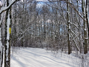
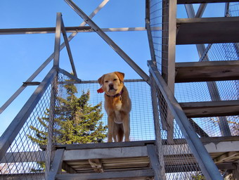
![]() On Saturday, December 19th I was ready to go out for a hike to take advantage of the 16 inches of snow that had fallen two days before. I decided to go to Frick Pond to hike a route which I thought might be a variation of the Loggers' Loop. The temperature at 6:00 AM was -3 degrees so I was in now hurry to get out the door. By 8:00 AM I was thinking about getting ready but at that point the ambulance page sounded and I was off on a call. When I returned at 10:00 AM, it was still cold so I delayed a little longer. I finally started to get ready at 11:45AM as the temperature had just hit 20 degrees. I asked Cindy of she wanted to go but she thought it was too cold! I did not have to ask Sheila as she is always ready to hike. I put on my long-sleeved Patagonia zip top with a light long-sleeved baselayer underneath. I decided to wear my Columbia Titanium insulated pants to keep the chill away but decided to forego wearing tights underneath. I wore my Salomon B-52 insulated boots as they keep my feet warm and dry and work well with snowshoes. I grabbed a pair of Leki poles I have been using all season. I also put on my OR Crocodile gaiters. Finally, I donned my Mammut hoody which blocks the wind and keeps me warm but has enough zippers to dump heat when needed. I decided to wear my Tubbs Alp Flex VTR snowshoes. The Boa binding on these uses a thin steel cable system and a ratchet which tightens it to give a custom fit and a secure binding. These snowshoes also have a televator to elevate the hiker's heel on ascents. This is a feature that you didn't know you needed until you try it and then it is hard to live without it! As I was getting ready Sheila stayed near me so that I would not "forget" her but was being a very well-behaved dog. I put my gear in the car and Sheila in the back seat. She was happy to be going anywhere and crouched in the back seat with her head on the console. At 12:10 AM I headed out the DeBruce Road. After about 6 miles, I turned left on Mongaup Pond Road and stayed left where the road split falling Beech Mountain Road to the trailhead. When we arrived at the parking area, there was only one car parked in the smaller lot with three more in the larger lot.
On Saturday, December 19th I was ready to go out for a hike to take advantage of the 16 inches of snow that had fallen two days before. I decided to go to Frick Pond to hike a route which I thought might be a variation of the Loggers' Loop. The temperature at 6:00 AM was -3 degrees so I was in now hurry to get out the door. By 8:00 AM I was thinking about getting ready but at that point the ambulance page sounded and I was off on a call. When I returned at 10:00 AM, it was still cold so I delayed a little longer. I finally started to get ready at 11:45AM as the temperature had just hit 20 degrees. I asked Cindy of she wanted to go but she thought it was too cold! I did not have to ask Sheila as she is always ready to hike. I put on my long-sleeved Patagonia zip top with a light long-sleeved baselayer underneath. I decided to wear my Columbia Titanium insulated pants to keep the chill away but decided to forego wearing tights underneath. I wore my Salomon B-52 insulated boots as they keep my feet warm and dry and work well with snowshoes. I grabbed a pair of Leki poles I have been using all season. I also put on my OR Crocodile gaiters. Finally, I donned my Mammut hoody which blocks the wind and keeps me warm but has enough zippers to dump heat when needed. I decided to wear my Tubbs Alp Flex VTR snowshoes. The Boa binding on these uses a thin steel cable system and a ratchet which tightens it to give a custom fit and a secure binding. These snowshoes also have a televator to elevate the hiker's heel on ascents. This is a feature that you didn't know you needed until you try it and then it is hard to live without it! As I was getting ready Sheila stayed near me so that I would not "forget" her but was being a very well-behaved dog. I put my gear in the car and Sheila in the back seat. She was happy to be going anywhere and crouched in the back seat with her head on the console. At 12:10 AM I headed out the DeBruce Road. After about 6 miles, I turned left on Mongaup Pond Road and stayed left where the road split falling Beech Mountain Road to the trailhead. When we arrived at the parking area, there was only one car parked in the smaller lot with three more in the larger lot.
 \ The temperature was 20 degrees with a slight breeze but the sun made it feel a little warmer. I noticed that the woods road out to the register had a snowshoe track broken. I set my GPS and we headed out the woods road to the Quick Lake Trail at 12:35 PM. I immediately noticed that there were two tracks and some obvious boot prints. I know that there isn't one way to hike in the winter but I wonder if some people lack common sense or are ignorant of basic hiking principles. Developing one well-constructed snowshoe track is the best idea. Wearing snowshoes in more than 8 inches of snow makes a hike more enjoyable for the wearer and shows concern for other hikers. We passed the trail register and headed toward Frick Pond. The trail was snow-covered with some water underneath in a few places. As we approached Gravestone Junction, I could see a couple approaching us with a small dog on a leash. I pulled up my buff and walked off the trail with Sheila. The couple passed and they were not wearing snowshoes making the score 0 for 1. We got back on the trail and at Gravestone Junction we turned right to get on the yellow Logger's Loop heading toward Times Square. There was a snowshoe track broken on the Logger's Loop which made me happy as it makes the hiking much easier. We headed out the trail which had a bout a foot of snow. There were some wet spots and I found that the snow was beginning to pack on my snowshoes as they got wet. I had to stop several times to tip up my snowshoes and knock the snow of the bottom. Soon we were hiking downhill toward Times Square still following the snowshoe track that had been set. At Times Square I had to make a decision whether to continue around Frick Pond on the Big Rock Trail or to continue straight ahead on the Logger's Loop. The Logger's Loop was pristine with no trail but I decided to try it any way knowing I could turn around at any time. We continued straight ahead on the Logger's Loop starting a slight uphill climb on the snow-covered trail. Hiking uphill and breaking trail almost made me regret my decision. My hips and inner thighs began to ache but a brief rest quickly refreshed me. S we continued the slight ascent, I looked up to see a young man approaching. I hailed him but he seemed very intent on what he was doing. I again pulled up by buff and walked off the trail with Sheila. As he passed, I noticed although he had poles he was not wearing snowshoes. Was he a newbie or somebody who just didn't care about others? The score was now 0 for 2!
 We continued our hike as the trail flattened a little which made my muscles much happier. The trail was covered in snow but there seemed to be less than on Round Top with my estimate being about 12 inches. We continued our walk along the trail trying to avoid the wet spots which made the snow cling to the snowshoes. I looked up to see another young man coming toward us with no poles and no snowshoes. We said "hello" as I moved off the trail with Sheila. I mentioned that he did not have snowshoes and he responded by saying he wished he had them. I informed him about the damage he was doing to the track and that Morgan Outdoors would rent snowshoes and poles at a reasonable price. He seemed interested but the score was now 0 for 3. It wasn't long before we were walking downhill and the climbing a small hill to Iron Wheel Junction. I was happy to find a trail broken by the two barebooters and someone who was on snowshoes. I was surprised that the track turned up the Quick Lake Trail! We turned left to head back toward Frick Pond on the Quick Lake Trail. The trail is slightly downhill which allowed us to keep up a good pace even which was further augmented by the existing track. There were few wet spots which I tried to avoid to prevent snow from clumping on the snowshoes. I was a little surprised that the set track was so narrow that had no choice but to widen it. I began to suspect that the track was set by a cross country skier. We came to the small stream in the woods which had a little too much water to cross on the trail. We walked upstream a little and found a narrower spot to cross where others had previously crossed. When we walked back out to the main trail, I could see the marks of skis confirming by assumption. Walking through the "spruce tunnel" was easier than on the rest of the trail as there was less snow. Eventually we walked out the other side where the trail was again covered in snow. I stopped at one point to take a few shots and then we continued toward Frick Pond. We arrived at the junction with the Big Rock Trail and found the trail even more packed but there were still two tracks in most places. We continued on the Quick Lake Trail to the bridge across the outlet of Frick Pond. As we approached the bridge, I heard voices so I pulled up the buff and put Sheila on her leash. There were two hikers on the bridge taking pictures. Since they did not seem to want to move, we walked by them. They did not have snowshoes on their feet so the final score was 0 for 4! I stopped at the other side of the bridge and dropped my pack to get out the camera despite the fact that I have taken hundreds of pictures from this location. The skies were blue with some clouds and the scene was a little "warmer" than the temperature. I also took shots of the pond and of Beech Mountain. I took a few more pictures of the ice and snow crystals in the outlet stream. I packed up and we continued up the hill and back to Gravestone Junction. At Gravestone Junction we continued out the Quick Lake Trail and back to the car without seeing another person. We arrived at the car at 3:00 PM having hike 3.8 miles in 2 hours and 25 minutes with an elevation gain of 380 feet. The temperature was 21 degrees but felt much warmer.
![]()
![]()
![]()
![]()
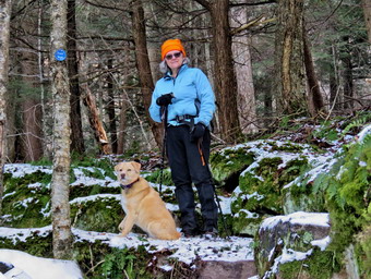
![]() On Thursday, December 17th an overnight snowstorm had dumped 15 inches of snow on Livingston Manor. Even more amazing than this was that there had been no ambulance calls in the middle of the storm. I got up at 7:30 AM and got dressed to go out to shovel. By the time I got outside, my neighbor had used his snowblower to clear, all the walkways, most of the parking area and the whole driveway! His snowblower is the largest I have ever seen and he does a great job with it but it is a beast to control. I worked on digging out my car and then turned my attentions to the front steps. The steps lead down to the street and the snowplows that go by really pack the snow against them. After I finished the steps, I drove down to the ambulance building to make sure we could get the rig out. I was expecting to have to do a lot of shoveling but the town had done a great job of plowing the parking area and in front of the bay doors. I did make sure the entrance door was cleared and I removed the remaining snow from in front of the bay doors. I returned home at 9:15 AM debating whether I should go out for a hike immediately or wait. I decided I wanted to go right away and asked Cindy. She wanted to do a snowshoe that was flat and I could not think of any nearby. When I settled on visiting Round Top, she declined because of the hills. I did not want to go anywhere that required parking in a lot as I knew they would probably not be plowed. At 9:30 AM, I started to get ready with the temperature hanging at 25 degrees and overcast skies with some light snow still hanging around. I got dressed in a long-sleeved Patagonia wool zip top but decided I did not need a baselayer. I put on a pair of RailRiders hiking pants which are expensive but last along time and have features like deep pockets and a generous cut which I really like. These pants have a Velcro closures at the ankles to discourage sticks and gravel from getting into my shoes. I thought about getting out a pair of winter pants but knew I wouldn't need them on this day. I also decided against wearing tights even though the temperature seemed cold enough since I knew it would be a relatively short hike. I did put on my OR Crocodile gaiters to keep my lower legs dry and a little warmer. I decided to wear my Salomon B-52 winter hiking boots which fit well but have been discontinued. I grabbed a pair of Leki external lock poles I have been using lately. I also added a blaze orange fleece hat for visibility and warmth. My final layer was my Mammut hoody which is light but blocks the wind and was pitzips to dump heat. I also wore a pair of light gloves. Sheila kept me in sight as I got ready to go making sure she would not be forgotten. I took my pack with me as it is the easiest way to carry my camera. We stepped out of the house at 9:45 PM. I grabbed Sheila's leash from the car and put it on her to safely cross the street. We walked up the driveway and crossed the street. I tried to mount the snow bank left by the plow but was unsuccessful so we walked down the street to the parking lot at the Presbyterian Church. Someone had partly cleared the lot and it was not until I stepped into the snow at the back of the church that I realized that there was a lot of snow. We began the ascent of the steepest hill behind the church. The hill is short but gets the circulation pumping and is the steepest and longest climb on the "trail." I let Sheila off her leash so that I could use my poles to get up the hill. Sheila immediately began to bound up the hill with me following close behind. The going was more difficult than I had expected and I had to pause a few times. We stopped in the middle of the hill so that I could take pictures toward the "Flats" to the southeast. The cemetery was covered in snow and all the trees on the surrounding hills were snow clad. When we got to the top of the hill, we stopped to look around at the hills around town. I took some more pictures across the valley to "Beer Mountain" and some to the north and west. We started on the trail by turning left at the trailhead. There were no tracks on the trails as we were the first ones out to hike.
On Thursday, December 17th an overnight snowstorm had dumped 15 inches of snow on Livingston Manor. Even more amazing than this was that there had been no ambulance calls in the middle of the storm. I got up at 7:30 AM and got dressed to go out to shovel. By the time I got outside, my neighbor had used his snowblower to clear, all the walkways, most of the parking area and the whole driveway! His snowblower is the largest I have ever seen and he does a great job with it but it is a beast to control. I worked on digging out my car and then turned my attentions to the front steps. The steps lead down to the street and the snowplows that go by really pack the snow against them. After I finished the steps, I drove down to the ambulance building to make sure we could get the rig out. I was expecting to have to do a lot of shoveling but the town had done a great job of plowing the parking area and in front of the bay doors. I did make sure the entrance door was cleared and I removed the remaining snow from in front of the bay doors. I returned home at 9:15 AM debating whether I should go out for a hike immediately or wait. I decided I wanted to go right away and asked Cindy. She wanted to do a snowshoe that was flat and I could not think of any nearby. When I settled on visiting Round Top, she declined because of the hills. I did not want to go anywhere that required parking in a lot as I knew they would probably not be plowed. At 9:30 AM, I started to get ready with the temperature hanging at 25 degrees and overcast skies with some light snow still hanging around. I got dressed in a long-sleeved Patagonia wool zip top but decided I did not need a baselayer. I put on a pair of RailRiders hiking pants which are expensive but last along time and have features like deep pockets and a generous cut which I really like. These pants have a Velcro closures at the ankles to discourage sticks and gravel from getting into my shoes. I thought about getting out a pair of winter pants but knew I wouldn't need them on this day. I also decided against wearing tights even though the temperature seemed cold enough since I knew it would be a relatively short hike. I did put on my OR Crocodile gaiters to keep my lower legs dry and a little warmer. I decided to wear my Salomon B-52 winter hiking boots which fit well but have been discontinued. I grabbed a pair of Leki external lock poles I have been using lately. I also added a blaze orange fleece hat for visibility and warmth. My final layer was my Mammut hoody which is light but blocks the wind and was pitzips to dump heat. I also wore a pair of light gloves. Sheila kept me in sight as I got ready to go making sure she would not be forgotten. I took my pack with me as it is the easiest way to carry my camera. We stepped out of the house at 9:45 PM. I grabbed Sheila's leash from the car and put it on her to safely cross the street. We walked up the driveway and crossed the street. I tried to mount the snow bank left by the plow but was unsuccessful so we walked down the street to the parking lot at the Presbyterian Church. Someone had partly cleared the lot and it was not until I stepped into the snow at the back of the church that I realized that there was a lot of snow. We began the ascent of the steepest hill behind the church. The hill is short but gets the circulation pumping and is the steepest and longest climb on the "trail." I let Sheila off her leash so that I could use my poles to get up the hill. Sheila immediately began to bound up the hill with me following close behind. The going was more difficult than I had expected and I had to pause a few times. We stopped in the middle of the hill so that I could take pictures toward the "Flats" to the southeast. The cemetery was covered in snow and all the trees on the surrounding hills were snow clad. When we got to the top of the hill, we stopped to look around at the hills around town. I took some more pictures across the valley to "Beer Mountain" and some to the north and west. We started on the trail by turning left at the trailhead. There were no tracks on the trails as we were the first ones out to hike.
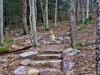
 At the first trail junction, I continued straight ahead up the hill toward the viewpoint. Again, the climb up the hill was pretty tiring especially since I only had Sheila to break trail ahead of me. At the viewpoint, we headed to the left an walked out to the overhanging rock shelf that forms the lookout. I took pictures of town and the school. I also took some shots of the hills around town. My final pictures were of Sheila sitting in the snow on the trail. We walked back up to the main trail and followed the yellow trail as it turned right and headed up the gentle hill through the hardwood forest with trees encased in snow. There was no wind and everything was very still. At the first trail junction with the blue trail we stopped so that I could take some pictures of the pristine trails along the base of Round Top and up the hill toward the summit. We turned right and followed the yellow trail along the base of Round Top. This section was easier, even though the snow was a little deeper, as it was flat. At the next junction I had to make a decision whether we would just do a small loop or go for the figure 8. I decided we would do the figure 8 so we turned left and started up the hill to the summit. We bypassed the white crossover trail and continued up and over the summit. When we started down the other side, I decided we would skip the new switchback on the blue trail and just continue down the hill. I was able to get a pretty good glide on the snow but I had to watch my speed and balance. The steepest part of the hill was tricky but the poles helped me to keep my balance and get down without falling. At the bottom of the hill we turned left on the yellow trail, walked along the base of Round Top and then turned right to walk down to the woods road. I was surprised at how much easier it was walking in the trail I had just broken. It was also a snap to walk downhill and out the woods road. It was obvious Sheila felt the same way as she was running and bounding ahead of me. We walked the woods road out to the first trail junction. By the time it took to hike this figure 8, the difficulty was twice that of the same route without snow. We walked out to the trailhead and down the hill. I put Sheila on her leash in the church parking lot and we crossed the street to our driveway. We were home by 11:15 AM after hiking a mile in an hour and a half!
![]()
![]()
![]()
![]() On Wednesday, December 16th I knew that My grandson Bryce would be with us and that he might like to hike. I thought we might go to the Frick Pond area to hike before the storm that was forecast for Thursday dumped more than a foot of snow on our area. When Bryce arrived at 9:00 Am, he immediately had to join a remote session for school. When he was done, he told me he had other sessions at 11:00 AM and 3:00 PM so I knew that going top Frick Pond would not work out. We decided to go cross the street after is 11:00 AM session to hike on Round Top. It turned out that his 11:00 AM session was over by 11:30 AM and we were able to start to get ready for our hike. Bryce had a nice warm jacket which was good as the temperature was in the mid-20's with a slight breeze. The pants he had, however, were a little less approbate so I was glad we were just going across the street. Sheila could hardly contain herself as she ran around barking with excitement that Bryce was going with us. I got dressed in a long-sleeved Patagonia wool zip top but decided I did not need a baselayer. I put on a pair of RailRiders hiking pants which are expensive but last along time and have features like deep pockets and a generous cut which I really like. These pants have a Velcro closures at the ankles to discourage sticks and gravel from getting into my shoes. I thought about getting out a pair of winter pants but knew I wouldn't need them on this day. I also decided against wearing tights even though the temperature seemed cold enough since I knew it would be a relatively short hike. I did add my OR Crocodile gaiters which add some warmth to my lower legs and prevent snow from getting in my boots when the pants don't. I decided to wear my Salomon B-52 winter hiking boots which fit well but have been discontinued. I grabbed a pair of Leki external lock poles I have been using lately. I also added a blaze orange fleece hat for visibility and warmth. My final layer was my Mammut hoody which is light but blocks the wind and was pitzips to dump heat. I also took with me a pair of light gloves. Sheila kept me in sight as I got ready to go making sure she would not be forgotten. We stepped out of the house at 11:45 PM and I grabbed Sheila's leash from the car. We walked up the driveway and I realized I had forgotten my poles. I chose not to go back for them and we continued up the driveway and crossed the street. We walked to the parking area by the Presbyterian Church and to the back of the church. We began the ascent of the steepest hill behind the church. The hill is short but gets the circulation pumping and is the steepest and longest climb on the "trail." Sheila helped me along by pulling me up the hill but I noticed the hill seemed easier as I have been hiking more. When we got to the top of the hill, we stopped to look around at the hills around town. Most of the snow that had fallen on Monday was now gone but some was still visible on the hills around town. We started on the trail by turning left at the trailhead. I let Sheila off her leash so that she could explore.
On Wednesday, December 16th I knew that My grandson Bryce would be with us and that he might like to hike. I thought we might go to the Frick Pond area to hike before the storm that was forecast for Thursday dumped more than a foot of snow on our area. When Bryce arrived at 9:00 Am, he immediately had to join a remote session for school. When he was done, he told me he had other sessions at 11:00 AM and 3:00 PM so I knew that going top Frick Pond would not work out. We decided to go cross the street after is 11:00 AM session to hike on Round Top. It turned out that his 11:00 AM session was over by 11:30 AM and we were able to start to get ready for our hike. Bryce had a nice warm jacket which was good as the temperature was in the mid-20's with a slight breeze. The pants he had, however, were a little less approbate so I was glad we were just going across the street. Sheila could hardly contain herself as she ran around barking with excitement that Bryce was going with us. I got dressed in a long-sleeved Patagonia wool zip top but decided I did not need a baselayer. I put on a pair of RailRiders hiking pants which are expensive but last along time and have features like deep pockets and a generous cut which I really like. These pants have a Velcro closures at the ankles to discourage sticks and gravel from getting into my shoes. I thought about getting out a pair of winter pants but knew I wouldn't need them on this day. I also decided against wearing tights even though the temperature seemed cold enough since I knew it would be a relatively short hike. I did add my OR Crocodile gaiters which add some warmth to my lower legs and prevent snow from getting in my boots when the pants don't. I decided to wear my Salomon B-52 winter hiking boots which fit well but have been discontinued. I grabbed a pair of Leki external lock poles I have been using lately. I also added a blaze orange fleece hat for visibility and warmth. My final layer was my Mammut hoody which is light but blocks the wind and was pitzips to dump heat. I also took with me a pair of light gloves. Sheila kept me in sight as I got ready to go making sure she would not be forgotten. We stepped out of the house at 11:45 PM and I grabbed Sheila's leash from the car. We walked up the driveway and I realized I had forgotten my poles. I chose not to go back for them and we continued up the driveway and crossed the street. We walked to the parking area by the Presbyterian Church and to the back of the church. We began the ascent of the steepest hill behind the church. The hill is short but gets the circulation pumping and is the steepest and longest climb on the "trail." Sheila helped me along by pulling me up the hill but I noticed the hill seemed easier as I have been hiking more. When we got to the top of the hill, we stopped to look around at the hills around town. Most of the snow that had fallen on Monday was now gone but some was still visible on the hills around town. We started on the trail by turning left at the trailhead. I let Sheila off her leash so that she could explore.
At the first trail junction, we continued straight ahead up the hill toward the viewpoint. At the viewpoint, we headed to the left an walked out to the overhanging rock shelf that forms the lookout. I pointed out various buildings in town to Bryce. We walked back up to the main trail and I pointed out the crevice that almost splits the trail. I have removed the blazes leading to the viewpoint to avoid leading people to a place that might be tricky to cross. We were going to follow the yellow trail as it turned right and headed up the gentle hill but I mentioned to Bryce that I was bored with hiking the same trails over and over. Bryce readily agreed so I made a sharp right and began to bushwhack along the top of the ledges. The ledges are really impressive and there are several different levels each with its own interesting places to explore. We came to a large tree that had broken off one of two stumps. The tree had a crossarm on it so we looked around us to see if there were any other trees equipped in this way. We could not find any and began to inspect the stump. In one stump we found a metal bracket that was sued to hold a glass insulator to which wire was affixed. I knew that, at one time, there was a TV antennae on Round Top that was hared by many families in Livingston Manor. I thought this might have been part of that system. We continued to wander along the ledges until we were almost to the trail. This final ledge has an enormous flat rock that slid off the ledge and forms a "cave" or shelter underneath. Both sides of the opening have rock walls piled up but I do not know how old they are. When we hit the Yellow trail that runs along the base of Round Top we crossed it and continued to bushwhack up toward the summit. We passed a few large rocks and small ledges and were soon at the blue trail that passes over the summit. We crossed the blue trail and headed down the hill toward the Quickway. When we reached a line of "posted" signs we turned more to the north and followed that property line until we were back at the yellow trail as it descended toward the lookout. We crossed the trail and walked down through the woods to the area where we had started the bushwhack.
We decided we needed a little more adventure so we crossed the trail and descended a short but steep and slippery incline near the ledges that make up the viewpoint. My intention was to walk below the overhang and then up the crevice on the other side. We started to sidehill across to the ledges. This was quite an adventure as the ground was frozen and icy. We walked along the bottom of one of the ledges and found a crevice that was sketchy but looked like it could be climbed. Bryce went up first, almost on his hands and knees, and only had a little trouble right at the top. I followed and found the going difficult. When I reached the point where Bryce had difficulties, I was unable to get myself up. I was faced with descending the slippery ground to the bottom of the crevice. I managed this and them continued the traverse along the base of the ledges. There was some snow and ice but I made it to the large "cave" underneath the viewpoint. I continued to traverse as I knew there was another crevice on the other side which I hoped I could negotiate. I found the area where I wanted to ascended and watch as Sheila went up through it with ease. I followed her somewhat more slowly until we were standing on the lookout. I thought that I would see Bryce but he was not there. I yelled his name and the response came from below! Bruce had decided to climb back down by himself and do the traverse without me! I was not too happy about him being alone but I realized I had not specified what he should do while waiting for me. Pretty soon Bryce's head popped out of the crevice to the right on the lookout. We walked back out to the main trail and down the yellow trail to the first trail junction. We walked out to the trailhead where I put Sheila ion her leash. We walked down the hill and across the street to our driveway. We were home by 1:15 PM after hiking an hour and a half which I estimated was a little more than 2 miles.
![]()
![]()
![]()
![]()
![]() On Monday, December 14th I was getting ready to go hike a loop at Frick Pond to take in the snow that was still falling. At that moment the ambulance pager sounded and I was off on two calls. This set me back in my schedule and I was a little tired by the time I got home. Despite my lethargy, I decided to take Sheila and go across the street to hike and take some pictures on Round Top. At 1:30 PM, I started to get ready with the temperature hanging at 33 degrees and overcast skies with light snow. We had not hiked for two days so Sheila could hardly contain herself as she ran around barking. I got dressed in a long-sleeved Patagonia wool zip top but decided I did not need a baselayer. I put on a pair of RailRiders hiking pants which are expensive but last along time and have features like deep pockets and a generous cut which I really like. These pants have a Velcro closures at the ankles to discourage sticks and gravel from getting into my shoes. I thought about getting out a pair of winter pants but knew I wouldn't need them on this day. I also decided against wearing tights even though the temperature seemed cold enough since I knew it would be a relatively short hike. I decided to wear my Salomon B-52 winter hiking boots which fit well but have been discontinued. I grabbed a pair of Leki external lock poles I have been using lately. I also added a blaze orange fleece hat for visibility and warmth. My final layer was my Mammut hoody which is light but blocks the wind and was pitzips to dump heat. I also took with me a pair of light gloves. Sheila kept me in sight as I got ready to go making sure she would not be forgotten. I took my pack with me as it is the easiest way to carry my camera. We stepped out of the house at 1:45 PM and I grabbed Sheila's leash from the car. We walked up the driveway and crossed the street. I decided we would probably just do two figure 8's which would allow me to get a variety of pictures and would be enough exercise. We walked to the parking area by the Presbyterian Church and to the back of the church. We began the ascent of the steepest hill behind the church. The hill is short but gets the circulation pumping and is the steepest and longest climb on the "trail." Sheila helped me along by pulling me up the hill but I noticed the hill seemed easier as I have been hiking more. We stopped in the middle of the hill so that I could take pictures toward the "Flats" to the southeast. The cemetery was covered in snow and all the trees on the surrounding hills were snow clad. When we got to the top of the hill, we stopped to look around at the hills around town. I took some more pictures across the valley to "Beer Mountain" and some to the north and west. We started on the trail by turning left at the trailhead. I let Sheila off her leash so that she could explore. There were no tracks on the trails as we were the first ones out to hike.
On Monday, December 14th I was getting ready to go hike a loop at Frick Pond to take in the snow that was still falling. At that moment the ambulance pager sounded and I was off on two calls. This set me back in my schedule and I was a little tired by the time I got home. Despite my lethargy, I decided to take Sheila and go across the street to hike and take some pictures on Round Top. At 1:30 PM, I started to get ready with the temperature hanging at 33 degrees and overcast skies with light snow. We had not hiked for two days so Sheila could hardly contain herself as she ran around barking. I got dressed in a long-sleeved Patagonia wool zip top but decided I did not need a baselayer. I put on a pair of RailRiders hiking pants which are expensive but last along time and have features like deep pockets and a generous cut which I really like. These pants have a Velcro closures at the ankles to discourage sticks and gravel from getting into my shoes. I thought about getting out a pair of winter pants but knew I wouldn't need them on this day. I also decided against wearing tights even though the temperature seemed cold enough since I knew it would be a relatively short hike. I decided to wear my Salomon B-52 winter hiking boots which fit well but have been discontinued. I grabbed a pair of Leki external lock poles I have been using lately. I also added a blaze orange fleece hat for visibility and warmth. My final layer was my Mammut hoody which is light but blocks the wind and was pitzips to dump heat. I also took with me a pair of light gloves. Sheila kept me in sight as I got ready to go making sure she would not be forgotten. I took my pack with me as it is the easiest way to carry my camera. We stepped out of the house at 1:45 PM and I grabbed Sheila's leash from the car. We walked up the driveway and crossed the street. I decided we would probably just do two figure 8's which would allow me to get a variety of pictures and would be enough exercise. We walked to the parking area by the Presbyterian Church and to the back of the church. We began the ascent of the steepest hill behind the church. The hill is short but gets the circulation pumping and is the steepest and longest climb on the "trail." Sheila helped me along by pulling me up the hill but I noticed the hill seemed easier as I have been hiking more. We stopped in the middle of the hill so that I could take pictures toward the "Flats" to the southeast. The cemetery was covered in snow and all the trees on the surrounding hills were snow clad. When we got to the top of the hill, we stopped to look around at the hills around town. I took some more pictures across the valley to "Beer Mountain" and some to the north and west. We started on the trail by turning left at the trailhead. I let Sheila off her leash so that she could explore. There were no tracks on the trails as we were the first ones out to hike.
 At the first trail junction, I continued straight ahead up the hill toward the viewpoint. At the viewpoint, we headed to the left an walked out to the overhanging rock shelf that forms the lookout. I took pictures of town and the school. I also took some shots of the hills around town. My final pictures were of Sheila posed on a rock looking regal. We walked back up to the main trail and followed the yellow trail as it turned right and headed up the gentle hill through the hard wood forest with trees encased in snow. There was no wind and everything was very still. At the first trail junction with the blue trail we turned right and followed the yellow trail along the base of Round Top. At the next junction we turned left and started up the hill to the summit. We bypassed the white crossover trail and continued up and over the summit. When we started down the other side, I decided we would skip the new switchback on the blue trail and just continue down the hill. The steepest part of the hill was tricky but the poles helped me to get down without falling. At the bottom of the hill we turned left on the yellow trail, walked along the base of Round Top and then turned right to walk down to the woods road. We walked the woods road out to the first trail junction. I wanted a little more exercise so we turned around and walked back up the woods road and the yellow trail. At the junction with the blue trail, we turned left and walked along the base of Round Top. At the next junction, we turned right and climbed the blue trail straight up and over the summit. Going up was easier than coming down! We descended the blue trail on the other side of the hill and turned right on the yellow trail. We walked along the base of Round Top and turned left at the next junction following the yellow trail down to the viewpoint. We turned left and descended the hill to the first trail junction. This time we walked out to the trailhead where I put Sheila ion her leash. We walked down the hill and across the street to our driveway. We were home by 3:00 PM after hiking 2 miles in a little more than an hour.
![]()
![]()
![]()
![]()
![]() Note: As of December 7, 2020, this trail has not officially opened. The DEC would prefer that hikers wait to hike this trail until it officially opens. It I supposed to be a "secret" until that time. If you read this, please DO NOT tell others!
On Friday, December 11th, I wanted to go back to Red Hill to get a better GPS track than I got on a previous trip. The trail is a one to the Red Hill fire tower that eliminates the trip down an unmaintained dirt road to the trailhead on Dinch-Coons Road. The access in the winter is difficult as the road is not cleared and it is a long downhill to the trailhead. The return trip can be nearly impossible if there is ice or packed snow on the road. Many people park at the top of the hill and walk a little more than half a mile to the trailhead parking lot. The new trailhead and parking area is on Denning Road a little less than 2 miles from the Claryville Post Office. I knew the trail had not officially opened but there is nothing that says the trail is closed. Cindy and I both had dental appointments in the morning so any hiking would have to take place after noon. When Cindy arrived home, she said she would like to come along so we started to get ready with the temperature at 42 degrees. I began to get ready with Sheila keeping a close watch on my movements. I got dressed in a long-sleeved Mammut crew top and a long-sleeved baselayer. I put on a pair of RailRiders hiking pants which are expensive but last along time and have features like deep pockets and a generous cut which I really like. These pants have a Velcro closures at the ankles to discourage sticks and gravel from getting into my shoes. I thought about getting out a pair of winter pants but knew I wouldn't need them on this day. I decided to wear my Salomon B-52 winter hiking boots which fit well but have been discontinued. I made sure to pack my microspikes as I did not know how much snow would be present on the hill. I grabbed a pair of Leki external lock poles I have been using lately. I also added a blaze orange fleece hat for visibility and warmth. My final layer was my Mammut hoody which is light but blocks the wind and was pitzips to dump heat. I put our gear in the car and Sheila in the backseat and headed out the DeBruce Road. At the end of the road I turned right on Route 47 and drove out to the Denning Road. Here I turned left and drove through Claryville. Two miles after the Claryville Post Office, we came to the new parking area on the right side of the road and I pulled into the lot. There was still no sign hanging from the support on the side of the road and the kiosk was empty. To make sure I got a good GPS track I had my Suunto GPS watch, the Avenza app on my iPhone and my Garmin GPS handheld unit. I set all my GPS units and then realized I had forgotten to bring my light gloves. It was a little too cold to go barehanded so I took out a pair of Gordini mittens. Cindy had already begun to walk up the trail to generate some heat and I followed beginning the hike at 1:10 PM. The temperature was 37 degrees but it felt a little cooler in the shade of the mountain.
Note: As of December 7, 2020, this trail has not officially opened. The DEC would prefer that hikers wait to hike this trail until it officially opens. It I supposed to be a "secret" until that time. If you read this, please DO NOT tell others!
On Friday, December 11th, I wanted to go back to Red Hill to get a better GPS track than I got on a previous trip. The trail is a one to the Red Hill fire tower that eliminates the trip down an unmaintained dirt road to the trailhead on Dinch-Coons Road. The access in the winter is difficult as the road is not cleared and it is a long downhill to the trailhead. The return trip can be nearly impossible if there is ice or packed snow on the road. Many people park at the top of the hill and walk a little more than half a mile to the trailhead parking lot. The new trailhead and parking area is on Denning Road a little less than 2 miles from the Claryville Post Office. I knew the trail had not officially opened but there is nothing that says the trail is closed. Cindy and I both had dental appointments in the morning so any hiking would have to take place after noon. When Cindy arrived home, she said she would like to come along so we started to get ready with the temperature at 42 degrees. I began to get ready with Sheila keeping a close watch on my movements. I got dressed in a long-sleeved Mammut crew top and a long-sleeved baselayer. I put on a pair of RailRiders hiking pants which are expensive but last along time and have features like deep pockets and a generous cut which I really like. These pants have a Velcro closures at the ankles to discourage sticks and gravel from getting into my shoes. I thought about getting out a pair of winter pants but knew I wouldn't need them on this day. I decided to wear my Salomon B-52 winter hiking boots which fit well but have been discontinued. I made sure to pack my microspikes as I did not know how much snow would be present on the hill. I grabbed a pair of Leki external lock poles I have been using lately. I also added a blaze orange fleece hat for visibility and warmth. My final layer was my Mammut hoody which is light but blocks the wind and was pitzips to dump heat. I put our gear in the car and Sheila in the backseat and headed out the DeBruce Road. At the end of the road I turned right on Route 47 and drove out to the Denning Road. Here I turned left and drove through Claryville. Two miles after the Claryville Post Office, we came to the new parking area on the right side of the road and I pulled into the lot. There was still no sign hanging from the support on the side of the road and the kiosk was empty. To make sure I got a good GPS track I had my Suunto GPS watch, the Avenza app on my iPhone and my Garmin GPS handheld unit. I set all my GPS units and then realized I had forgotten to bring my light gloves. It was a little too cold to go barehanded so I took out a pair of Gordini mittens. Cindy had already begun to walk up the trail to generate some heat and I followed beginning the hike at 1:10 PM. The temperature was 37 degrees but it felt a little cooler in the shade of the mountain.
 As we began the walk up the trail, it was obvious that the trail was going to be frozen and snow covered most of the way. I had to set a fast pace to catch up with Cindy and was out of breath by the time I ascended the set of stone steps and the first part of the hill. It was getting late in the day and I did not know how long it would take to complete the hike with Cindy who usually is a little slower than I am. Because of this I had decided to concentrate showing the trail to Cindy and getting my GPS track rather than taking pictures. We continued on the trail which is new but looks as if it has been in place and used for several years. The treadway was wide and flat with few obstacles. There were several switchbacks and it was obvious that one requirement of the construction was a moderate grade. The forest at these lower elevations was primarily evergreen which is unusual in the Catskills. At .4 miles the trail turned sharply to the left in one of its many switchback and we entered an area of hardwoods. There was a small stream that ran across the trail and the construction crew had create a deep ditch along the side of the trail. The ditch directed the water across the trail and at that point there was a stone construction to allow the water to cross the trail and hikers to easily cross the water. This was repeated several other times on the trail. Shortly, we ran into the one wet spot on the trail but it was easily avoided. At .7 miles there was a series of ledges and stone steps that passed between them. The first time I hiked this trail, it seemed that it was heading too far to the east but that was before I realized the way the trail had been sited. At about 1.3 miles, there was an enormous boulder on the right side of the trail and I knew we were near the trail junction. Almost immediately we came to a trail junction with new signs. The trail to the left goes to the Dinch Road trailhead. Trial to the right goes to the fire tower in .6 miles. We turned right and headed toward the fire tower. The grade of the trail started to increase and I knew Cindy might not be able to make the summit.
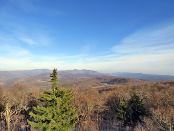
 As we hiked along the trail, I noticed that there was more snow on the trail. Cindy began to slow down and told me to go for the summit. I have tried in the past to encourage her usually to no avail. I started up the hill at an increased pace. After walking about quarter mile, there was a spur trail to a spring on the right side of the trail and then a short switchback. The grade continued to increase from a consistent 10% to a steeper 20% and I could feel it. As the snow had increased on the trail it began to get slipperier and I wondered about the return trip down the hill. There was some sun in the sky which made me feel better if not warmer. The last .3 miles averages a little over a 20% grade and is challenging but did not seem too bad compared to other trips I had made. At 2:20 PM we arrived at the tower clearing and I walked over to a picnic table in the clearing. I dropped my pack and got out my camera to take some pictures of the tower. I had not intended to stop for pictures but I had made good time and hoped to find the surrounding hills covered in snow! I did not tether Sheila to the picnic table but gave her a "Stay" instruction at the bottom of the tower. Unlike some dogs, Sheila has no problem climbing up and down the open steps and I thought it might be slippery. I started to climb the tower with Sheila starting to whine at the bottom of the stairs. There was almost no snow on the steps and only a little on the landings. Above the treeline there is normally a breeze but on this day it was very still. I eventually made it to the landing below the cab and was disappointed that the scene was not much different than a few days before. There was little or no snow on the hills and there was some haze that had not bee there on the previous trip. I began to take pictures of the surrounding scenery. The views of the Catskill peaks from this tower are spectacular. I also took some shots of a reservoir and the cabin at the summit. As I descended the tower, I called Sheila up so that I could take some pictures of her on the tower. We descended the tower and walked back over to the picnic table. I got a quick drink and we started the hike back down the mountain. I did not know whether Cindy had stopped to wait for us or had started back down so I wanted to move as quickly as possible. I had to be careful because the melting snow on the steep slope was slippery. About half way to the intersection of the trails, Sheila alerted and I saw Cindy ahead. I gave Sheila permission to leave me and she immediately ran down the trail to her. Cindy had put on her microspikes but I elected to continue to bareboot. We continued down the trail and made the left turn onto the new trail. We continued to keep a fast pace. The excellent trail surface allowed us to keep moving. As we passed through some of the ledges, I asked Cindy to pose with Sheila and I took a few shots. As we descended the last few steps to the parking area, I saw that only our car was in the lot. We walked over to the car and I stopped all the GPS units. I put our gear in the back of the car and Sheila in the back seat. It was 3:30 PM and we had hiked 3.7 miles in 2 hours and 25 minutes with 25 minutes of stopped time. Our elevation gain was 1205 feet. From what I could see on the GPS units, I had several good GPS tracks.
![]()
![]()
![]()
![]() On Thursday, December 10th I was tired from several days and nights of ambulance calls so I decided I would wait until the next day to hike. After noon, I came to the realization that I would often be tired and would not want to go out but that going out would make me feel better. I asked Cindy if she would like to go across the street to hike on Round Top and she agreed. At 2:00 PM we started to get ready with the temperature hovering in the high 30's with some mist in the air. We had not hiked for several days and Sheila was anxious to get out. I got dressed in my Mammut long-sleeved crew top and put on a long-sleeved baselayer. I put on a pair of RailRiders hiking pants which are expensive but last along time and have features like deep pockets and a generous cut which I really like. These pants have a Velcro closures at the ankles to discourage sticks and gravel from getting into my shoes. I decided to wear my Salomon B-52 winter hiking boots which fit well and have been discontinued. I grabbed a pair of Leki external lock poles I have been using lately. I also added a blaze orange fleece hat for visibility and warmth and a pair of light gloves. My final layer was my Mammut hoody which is light but blocks the wind and was pitzips to dump heat. Sheila kept me in sight as I got ready to go making sure she would not be forgotten. We stepped out of the house at 1:45 PM and I grabbed Sheila's leash from the car. We walked up the driveway and crossed the street. I decided we would probably do at least two figure 8's to cover all the trails and tire me out a little. We walked to the parking area by the Presbyterian Church and to the back of the church. We began the ascent of the steepest hill behind the church. The hill is short but gets the circulation pumping and is the steepest and longest climb on the "trail." Sheila helped me along by pulling me up the hill but I noticed the hill seemed easier as I have been hiking more. When we got to the top of the hill, we stopped to look around at the hills around town. There was some snow in the woods and some on the surrounding hills. We started on the trail by turning left at the trailhead. I let Sheila off her leash so that she could explore. I could see some boot prints in the snow meaning at least one person had been out on the trails since the snow fell.
On Thursday, December 10th I was tired from several days and nights of ambulance calls so I decided I would wait until the next day to hike. After noon, I came to the realization that I would often be tired and would not want to go out but that going out would make me feel better. I asked Cindy if she would like to go across the street to hike on Round Top and she agreed. At 2:00 PM we started to get ready with the temperature hovering in the high 30's with some mist in the air. We had not hiked for several days and Sheila was anxious to get out. I got dressed in my Mammut long-sleeved crew top and put on a long-sleeved baselayer. I put on a pair of RailRiders hiking pants which are expensive but last along time and have features like deep pockets and a generous cut which I really like. These pants have a Velcro closures at the ankles to discourage sticks and gravel from getting into my shoes. I decided to wear my Salomon B-52 winter hiking boots which fit well and have been discontinued. I grabbed a pair of Leki external lock poles I have been using lately. I also added a blaze orange fleece hat for visibility and warmth and a pair of light gloves. My final layer was my Mammut hoody which is light but blocks the wind and was pitzips to dump heat. Sheila kept me in sight as I got ready to go making sure she would not be forgotten. We stepped out of the house at 1:45 PM and I grabbed Sheila's leash from the car. We walked up the driveway and crossed the street. I decided we would probably do at least two figure 8's to cover all the trails and tire me out a little. We walked to the parking area by the Presbyterian Church and to the back of the church. We began the ascent of the steepest hill behind the church. The hill is short but gets the circulation pumping and is the steepest and longest climb on the "trail." Sheila helped me along by pulling me up the hill but I noticed the hill seemed easier as I have been hiking more. When we got to the top of the hill, we stopped to look around at the hills around town. There was some snow in the woods and some on the surrounding hills. We started on the trail by turning left at the trailhead. I let Sheila off her leash so that she could explore. I could see some boot prints in the snow meaning at least one person had been out on the trails since the snow fell.
At the first trail junction, we followed Sheila as she turned right on the woods road which is the shallower approach to the trail system. We continued to follow the yellow trail toward the first junction. The snow was slippery but we were able to manage without too much of a problem. At the junction, we turned left and followed it to the next trail junction. Along the way we picked up or removed many small branches and dragged several large ones off the trail. At the second junction with the blue trail, we turned right and started up the steep blue trail that leads over the summit of Round Top. Walking uphill we passed through what remained of the ferns of the summer all with brown edges. Just before the steepest section we turned right on the switchback trail now marked with blue paint blazes. We continued to follow these blazes as they made a sharp right turn and headed back to the main blue trail. We turned right on the blue trail and continued up the blue trail. Within a few feet, we passed the white crossover trail and continued on the original blue trail to the summit. We walked up and over the top and started down the other side from the summit. We turned right on the yellow trail and walked along the base of Round Top. This time we turned left at the junction with the blue trail and walked down to the lookout. We followed the yellow trail as it turned left and descended the hill to the first trail junction. At this point, Cindy decided she would walk home. Sheila and I immediately turned around and walked back up the hill to the lookout and followed the yellow trail as it turned right. We followed the trail as it made a gentle ascent through the brown ferns to the junction with the blue trail. We continued to follow the yellow trail by turning right and following along the base of Round Top. At the second junction with the blue trail, we turned left and started the ascent of the hill. When the white crossover trail came up and the left, we continued straight ahead on the blue trail and passed over the summit of Round Top. We continued downhill on the blue trail ignoring the crossover trail but turning left on the switchback trail. We followed the switchback to the main blue trail where we turned left and finished the walk downhill. At the yellow trail we turned left, walked back along the base of Round Top and turned right at the next junction. We walked down to the woods road that took us back to the first trail junction.
I decided I wanted a longer hike so we turned around and started back up the woods road. At the top of the hill, we turned left on the yellow trail and walked to the next junction with the blue trail. We walked up the hill taking the switchback and the turning right on the white crossover trail. We walked the crossover trail to the blue trail on the other side of the hill. Both the switchback and the crossover are relatively new and I noticed that in some areas where there was sidehilling the trail was very slippery. I knew that in the spring we would have to cut out these trails to make the walking easier. At the blue trail we turned right and walked down to the yellow trail. We turned right and walked to the junction with the blue trail. This time we turned left and walked down to the viewpoint. We followed the yellow trail as it turned left and headed downhill to the first trail junction. I debated going back to the house but decided to try one more figure 8. We turned around and walked back up the hill to the viewpoint where we followed the yellow trail as it turned right. We walked uphill to the trail junction with the blue trail. We stayed on the yellow trail by turning right and walked around the base of Round Top to the next junction with the blue trail. Here we turned left and walked up the hill to the point where the white crossover trail began. We turned left and followed the crossover trail to the blue trail on the other side of the hill. Here we turned left and almost immediately left again to follow the switchback trail down to the yellow trial. We turned left and the right at the next junction to take the trail down to the woods road. We followed the woods road back down to the first trail junction. This time we turned left and walked out to the trailhead where I put Sheila on her leash. We walked down the hill to the parking lot and across the road to our driveway. We were home by 3:30 PM after hiking more than 3 miles in a an hour and 45 minutes.
![]()
![]()
![]()
![]()
![]() Note: As of December 7, 2020, this trail has not officially opened. The DEC would prefer that hikers wait to hike this trail until it officially opens. It I supposed to be a "secret" until that time. If you read this, please DO NOT tell others!
On Monday, December 7th, I wanted to get out for a hike which was a little harder than Round Top that I had hike the day before. I was just beginning to hike again after taking a week off to recover from a bad cold. I was still felling a little sick but wanted to see how I fared on a more difficult hike. Someone I know in Grahamsville had told me of a new trail to the Red Hill fire tower and that same trail was mentioned on a blog I read. The trailhead on Dinch-Coons Road is difficult to access in the winter as the road is not cleared and it is a long downhill to the trailhead. The return trip can be nearly impossible if there is ice or packed snow on the road. Many people park at the top of the hill and walk a little more than half a mile to the trailhead parking lot. The new trailhead and parking area is on Denning Road a little less than 2 miles from the Claryville Post Office. I knew the trail had not officially opened but I though I would go to find out where it was and if I could hike it. When I awoke, the temperature was still in the mid 20's so I did not hurry to get ready immediately as I had some things to do around the house. At 11:00 AM I began to get ready with Sheila keeping a close watch on my movements. I got dressed in a long-sleeved Patagonia wool zip top a long-sleeved baselayer. I put on a pair of RailRiders hiking pants which are expensive but last along time and have features like deep pockets and a generous cut which I really like. These pants have a Velcro closures at the ankles to discourage sticks and gravel from getting into my shoes. I thought about getting out a pair of winter pants but knew I wouldn't need them on this day. I decided to wear my Keen Traghee II hiking boots which fit well but are beginning to show too much wear. I grabbed a pair of Leki external lock poles I have been using lately. I also added a blaze orange fleece hat for visibility and warmth. My final layer was my Mammut hoody which is light but blocks the wind and was pitzips to dump heat. I also took with me a pair of light gloves and packed a pair of mittens. I put my gear in the car and Sheila in the backseat and headed out the DeBruce Road. At the end of the road I turned right on Route 47 and drove out to the Denning Road. Here I turned left and drove through Claryville. Two miles after the Claryville Post Office, I came to a new parking area on the right side of the road and pulled into the lot. There was no sign hanging from the support on the side of the road and the kiosk was empty. I did not see anything that indicated I could not hike but I did see a trail sign and clear blue markers for the trail. I decided we would attempt the hike so I took some pictures of the parking area and then set my GPS. I realized I had forgotten to put my spikes in my pack and considered bringing the Stabilicers that were in my car. I left them where they were and we walked to the back of the parking area and started up the trail at 11:55 AM with the temperature standing at 32 degrees.
Note: As of December 7, 2020, this trail has not officially opened. The DEC would prefer that hikers wait to hike this trail until it officially opens. It I supposed to be a "secret" until that time. If you read this, please DO NOT tell others!
On Monday, December 7th, I wanted to get out for a hike which was a little harder than Round Top that I had hike the day before. I was just beginning to hike again after taking a week off to recover from a bad cold. I was still felling a little sick but wanted to see how I fared on a more difficult hike. Someone I know in Grahamsville had told me of a new trail to the Red Hill fire tower and that same trail was mentioned on a blog I read. The trailhead on Dinch-Coons Road is difficult to access in the winter as the road is not cleared and it is a long downhill to the trailhead. The return trip can be nearly impossible if there is ice or packed snow on the road. Many people park at the top of the hill and walk a little more than half a mile to the trailhead parking lot. The new trailhead and parking area is on Denning Road a little less than 2 miles from the Claryville Post Office. I knew the trail had not officially opened but I though I would go to find out where it was and if I could hike it. When I awoke, the temperature was still in the mid 20's so I did not hurry to get ready immediately as I had some things to do around the house. At 11:00 AM I began to get ready with Sheila keeping a close watch on my movements. I got dressed in a long-sleeved Patagonia wool zip top a long-sleeved baselayer. I put on a pair of RailRiders hiking pants which are expensive but last along time and have features like deep pockets and a generous cut which I really like. These pants have a Velcro closures at the ankles to discourage sticks and gravel from getting into my shoes. I thought about getting out a pair of winter pants but knew I wouldn't need them on this day. I decided to wear my Keen Traghee II hiking boots which fit well but are beginning to show too much wear. I grabbed a pair of Leki external lock poles I have been using lately. I also added a blaze orange fleece hat for visibility and warmth. My final layer was my Mammut hoody which is light but blocks the wind and was pitzips to dump heat. I also took with me a pair of light gloves and packed a pair of mittens. I put my gear in the car and Sheila in the backseat and headed out the DeBruce Road. At the end of the road I turned right on Route 47 and drove out to the Denning Road. Here I turned left and drove through Claryville. Two miles after the Claryville Post Office, I came to a new parking area on the right side of the road and pulled into the lot. There was no sign hanging from the support on the side of the road and the kiosk was empty. I did not see anything that indicated I could not hike but I did see a trail sign and clear blue markers for the trail. I decided we would attempt the hike so I took some pictures of the parking area and then set my GPS. I realized I had forgotten to put my spikes in my pack and considered bringing the Stabilicers that were in my car. I left them where they were and we walked to the back of the parking area and started up the trail at 11:55 AM with the temperature standing at 32 degrees.
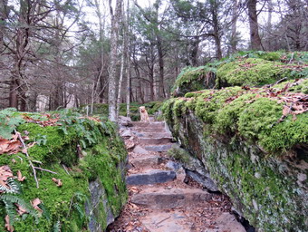 As we began the walk up the trail, it was obvious that the trail was dry or at least frozen and I hoped it stayed that way. We almost immediately came to a set of stone steps. They were well constructed and in just the right place to help out hikers. I took some pictures including some of Sheila sitting in the steps. She has trained herself to stop and sit on the trail whenever I get out my camera. I also noticed that a woods road ran off to the right and I assumed this could be the old jeep road to the fire tower. We continued on the trail which was new but looked as if it had been in placed and used for several years. The treadway was wide and flat with few obstacles. There were several switchbacks and it was obvious that one requirement of the construction was a moderate grade. The forest at these lower elevations was primarily evergreen which is unusual in the Catskills. At .4 miles the trail turned sharply to the left in one of its many switchback and we entered an area of hardwoods. There was a small stream that ran across the trail and the construction crew had create a deep ditch along the side of the trail. The ditch directed the water across the trail and at that point there was a stone construction to allow the water to cross the trail and hikers to easily cross the water. This was repeated several other times on the trail. I took some pictures of the construction and of the trail stretching out ahead and then we continued. Shortly, we ran into the one wet spot on the trail but it was easily avoided. At .7 miles I could see a series of ledges ahead and stone steps that wound between them. I stopped to take some pictures not realizing that this would be repeated several more times over the next quarter mile. Each time I stopped to take pictures and each time Sheila posed nicely for some shots. As we continued on the trail, it seemed that we were heading too far to the east and were definitely on the north side of the mountain. By the time we had walked 1.3 miles there was a good dusting of snow in the woods but none on the trail. A little further on the snow got a little deeper and there was an enormous boulder on the right side of the trail. I stopped and took some pictures of the rock and the trail and then started up the trail again. Almost immediately we came to a trail junction with new signs. One sign indicated the Dinch Road trailhead was .8 miles to the left and the fire tower was .6 miles to the right. After taking a few pictures, we turned right and headed toward the fire tower.
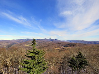 As we hiked along the trail, I noticed that there was more snow on the trail and that things were looking a little familiar. After walking about quarter mile, there was a spur trail to a spring on the right side of the trail and then a short switchback. I finally realized that we had turned off the new trail onto the existing trail. The grade had also increased from a consistent 10% to a steeper 20% and I could feel it. Fortunately, even though the snow had increased the trail did not seem very slippery. There was also some sun in the sky which made me feel better if not warmer. The last .3 miles averages a little over an 20% grade is challenging but did not seem too bad compared to other trips I had made. At 1:20 PM we arrived at the tower clearing to find a couple of hikers sitting on one of the picnic tables. We exchanged greetings and I walked over to another picnic table in the clearing. I dropped my pack and got out my camera to take some pictures of the tower. I tethered Sheila to the picnic table this time as I did not want her following me up the tower. Unlike some dogs, Sheila has no problem climbing up and down the open steps and I thought it might be slippery. I started to climb the tower with Sheila starting to whine below. There was some snow on the steps but I used the railing and had no problems. Without looking, I could tell when I was above the treeline as the breeze hit me. I eventually made it to the landing below the cab. I began to take pictures of the surrounding scenery and Shiela and the ground below. There was no haze in any direction and the views were the best I had seen in years! When there is no haze or fog, the views of the Catskill peaks from this tower are spectacular. I also took some shots of the Ashokan Reservoir and the cabin at the summit. I descended the tower, released Sheila and got out a Dang bar for the trip back. I like Quest bars but they freeze solid on cold days. The Dang bar has a higher fat content and did not seem to be effected by the cold. We started the hike back down the mountain and made good time though I had to be careful of the snow and slippery rocks. We made the left turn onto the new trail and continued to keep a fast pace. The excellent trail surface and lack of snow allowed us to keep moving. As we descended the last few steps to the parking area, I saw a truck parked in the lot. I walked Sheila over to the car and out her in the backseat. It was 2:30 PM and we had hiked 4.0 miles in 2 hours and 30 minutes with 40 minutes of stopped time. Our elevation gain was 1200 feet. I noticed that there was a man at the truck and I said "Hello" and he responded. He was getting ready to go out hunting but we had a short conversation before heading our separate ways.
![]()
![]()
![]()
![]() On Sunday, December 6th I finally got out for my first hike of December. My plan was to hike my first December hike on December 1 and make it a substantial one. As it turned out, I came down with a head and chest cold that out me out of action for an entire week. In the past I have ignored being ill and have hiked anyway. This made me feel psychologically better but pronged the sickness. By Sunday, after seven days without hiking I felt well enough to go for a short hike on Round Top. At noon, when I returned from church, the skies were bright and sunny but the temperature was only 38 degrees. I decided I would go across the street to hike on Round Top for some exercise. I asked Cindy if she wanted to go across the street to Round Top and she declined as she also had the cold I had contracted. At 12:15 PM I started to get ready. We had not hiked for a week so Sheila could hardly contain herself as she ran around barking. I got dressed in a long-sleeved Patagonia wool zip top but decided I did not need a baselayer. I put on a pair of RailRiders hiking pants which are expensive but last along time and have features like deep pockets and a generous cut which I really like. These pants have a Velcro closures at the ankles to discourage sticks and gravel from getting into my shoes. I thought about getting out a pair of winter pants but knew I wouldn't need them on this day. I decided to wear my Keen Traghee II hiking boots which fit well but are beginning to show too much wear. I grabbed a pair of Leki external lock poles I have been using lately. I also added a blaze orange fleece hat for visibility and warmth. My final layer was my Mammut hoody which is light but blocks the wind and was pitzips to dump heat. I also took with me a pair of light gloves. Sheila kept me in sight as I got ready to go making sure she would not be forgotten. We stepped out of the house at 12:30 PM and I grabbed Sheila's leash from the car. We walked up the driveway and crossed the street. I decided we would probably do some different loops this time as I was tiring of my regular figure 8's. We walked to the parking area by the Presbyterian Church and to the back of the church. We began the ascent of the steepest hill behind the church. The hill is short but gets the circulation pumping and is the steepest and longest climb on the "trail." Sheila helped me along by pulling me up the hill but I noticed the hill seemed easier as I have been hiking more. When we got to the top of the hill, we stopped to look around at the hills around town. We started on the trail by turning left at the trailhead. I let Sheila off her leash so that she could explore. The trail bed is becoming worn it which means that at least a few people are using the trail. I am always happy to see that someone else uses the trails.
On Sunday, December 6th I finally got out for my first hike of December. My plan was to hike my first December hike on December 1 and make it a substantial one. As it turned out, I came down with a head and chest cold that out me out of action for an entire week. In the past I have ignored being ill and have hiked anyway. This made me feel psychologically better but pronged the sickness. By Sunday, after seven days without hiking I felt well enough to go for a short hike on Round Top. At noon, when I returned from church, the skies were bright and sunny but the temperature was only 38 degrees. I decided I would go across the street to hike on Round Top for some exercise. I asked Cindy if she wanted to go across the street to Round Top and she declined as she also had the cold I had contracted. At 12:15 PM I started to get ready. We had not hiked for a week so Sheila could hardly contain herself as she ran around barking. I got dressed in a long-sleeved Patagonia wool zip top but decided I did not need a baselayer. I put on a pair of RailRiders hiking pants which are expensive but last along time and have features like deep pockets and a generous cut which I really like. These pants have a Velcro closures at the ankles to discourage sticks and gravel from getting into my shoes. I thought about getting out a pair of winter pants but knew I wouldn't need them on this day. I decided to wear my Keen Traghee II hiking boots which fit well but are beginning to show too much wear. I grabbed a pair of Leki external lock poles I have been using lately. I also added a blaze orange fleece hat for visibility and warmth. My final layer was my Mammut hoody which is light but blocks the wind and was pitzips to dump heat. I also took with me a pair of light gloves. Sheila kept me in sight as I got ready to go making sure she would not be forgotten. We stepped out of the house at 12:30 PM and I grabbed Sheila's leash from the car. We walked up the driveway and crossed the street. I decided we would probably do some different loops this time as I was tiring of my regular figure 8's. We walked to the parking area by the Presbyterian Church and to the back of the church. We began the ascent of the steepest hill behind the church. The hill is short but gets the circulation pumping and is the steepest and longest climb on the "trail." Sheila helped me along by pulling me up the hill but I noticed the hill seemed easier as I have been hiking more. When we got to the top of the hill, we stopped to look around at the hills around town. We started on the trail by turning left at the trailhead. I let Sheila off her leash so that she could explore. The trail bed is becoming worn it which means that at least a few people are using the trail. I am always happy to see that someone else uses the trails.
At the first trail junction, I continued straight ahead up the hill toward the viewpoint. On the way up, Sheila alerted and we could see a young couple and their large dog headed down the hill. Fortunately, they had their dog on a leash and we passed each other with a quick "Hello". At the viewpoint, we followed the yellow trail as it turned right and headed up the gentle hill through the brown remains of the once green ferns. The wind was blowing strongly but we were sheltered by the trees. At the first trail junction with the blue trail we continued straight ahead up the steeper side of Round Top. When we came to the new switchback on the blue trail, we continued straight ahead on the steeper, original trail. We also bypassed the new white crossover trail and headed directly to the summit of Round Top. We walked over the top of the hill and started down the other side staying on the blue trail as we passed the opposite end of the crossover trail. At the junction with the blue trail, we turned right and followed the yellow trail along the base of Round Top back to the first junction with the blue trail. We turned right to headed up the hill but this time took the switchback trail which is becoming more and more the trail of choice as I had hoped. When the switchback rejoined the main blue trail, we turned right and almost immediately turned right on the white crossover trail. We followed this trail back to the blue trail and turned left to head back over the summit. I had decided to do some multiple loops on the upper trails instead of the figure 8's I normally walk. We walked over the top of Round Top and started down the other side. This time we turned left on the switchback trail and followed it back to the main blue trail. We turned left and walked down to the yellow trial. I decided to turn left and hike the yellow trail along the base of Round Top and back to the junction with the blue trail. We turned left and started up the blue trail turning left on the white crossover trail. When the crossover trail came to the main blue trail we turned left and headed downhill staying on the main blue trail. At the junction with the yellow trail we turned left and walked back to the next junction with the blue trail. This time We turned right on the yellow trail and walked down t the woods road and then back to the very first trail junction. I was surprised at how good I was feeling but decided not to press my luck. We turned left and walked out to the trailhead where I put Sheila on her leash. We walked down the hill to the parking lot and across the road to our driveway. We were home by 1:30 PM after hiking 2 miles in an hour.
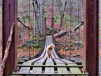
![]()
![]()
![]()
![]()
![]() On Saturday, November 28th, Brad, my son-in-law, and I planned to hike the Mongaup-Hardenburgh Trail from the Beaverkill Road to the junction with the Long Pond-Beaverkill Ridge Trail to check out the maintenance status of the trail. I am the trail supervisor for the NYNJTC that covers this trail and the maintainer was unable to make a fall trip. I had not been on the trail in some time and thought we might hit Willowemoc Mountain and Sand Pond Mountain while we were there. These two peaks are on the Catskill Highest Hundred list. Willowemoc Mountain has sort of a view but Sand Pond Mountain does not. I had hoped to leave the house by 9:30 AM to get a started on the trial at around 10:00 AM but my plans were changed as Brad and I covered two ambulance class. The evening call took us to Garnet Medical Center in Middletown but we were back by 11:00 PM. The second call came in around 3:00 AM and we did not get back from Garnet Catskills until 5:00 AM. Needless to say we both slept in and did not start to get ready until 11:00 AM. The skies were overcast and there was some precipitation but we decided to go any way. Sheila was happy we would be getting out and stayed near me to make sure I knew she wanted to go. I got dressed in a my Mammut crew neck shirt with a long-sleeved baselayer. I put on a pair of RailRiders hiking pants which are expensive but last along time and have features like deep pockets and a generous cut which I really like. These pants have Velcro closures at the ankles to discourage sticks and gravel from getting into my shoes and to combat ticks. I hoped this would be enough so that I would not have to wear gaiters. I decided to wear my Keen Targhee II hiking boots which fit well and have been discontinued. I grabbed a pair of Leki external lock poles I have been using since spring. The external locks have not failed me yet and the cork handles really do allow a good grip. I put on my Mammut hoody and brought a pair of light gloves. I also donned a blaze orange fleece hat for warmth and for visibility. I put my Silky Sugowaza saw in my pack along with two plastic wedges. I also brought the Fiskars pack ax. We put all the gear in the back of the car and Sheila in the back seat and drove out the driveway at noon.
On Saturday, November 28th, Brad, my son-in-law, and I planned to hike the Mongaup-Hardenburgh Trail from the Beaverkill Road to the junction with the Long Pond-Beaverkill Ridge Trail to check out the maintenance status of the trail. I am the trail supervisor for the NYNJTC that covers this trail and the maintainer was unable to make a fall trip. I had not been on the trail in some time and thought we might hit Willowemoc Mountain and Sand Pond Mountain while we were there. These two peaks are on the Catskill Highest Hundred list. Willowemoc Mountain has sort of a view but Sand Pond Mountain does not. I had hoped to leave the house by 9:30 AM to get a started on the trial at around 10:00 AM but my plans were changed as Brad and I covered two ambulance class. The evening call took us to Garnet Medical Center in Middletown but we were back by 11:00 PM. The second call came in around 3:00 AM and we did not get back from Garnet Catskills until 5:00 AM. Needless to say we both slept in and did not start to get ready until 11:00 AM. The skies were overcast and there was some precipitation but we decided to go any way. Sheila was happy we would be getting out and stayed near me to make sure I knew she wanted to go. I got dressed in a my Mammut crew neck shirt with a long-sleeved baselayer. I put on a pair of RailRiders hiking pants which are expensive but last along time and have features like deep pockets and a generous cut which I really like. These pants have Velcro closures at the ankles to discourage sticks and gravel from getting into my shoes and to combat ticks. I hoped this would be enough so that I would not have to wear gaiters. I decided to wear my Keen Targhee II hiking boots which fit well and have been discontinued. I grabbed a pair of Leki external lock poles I have been using since spring. The external locks have not failed me yet and the cork handles really do allow a good grip. I put on my Mammut hoody and brought a pair of light gloves. I also donned a blaze orange fleece hat for warmth and for visibility. I put my Silky Sugowaza saw in my pack along with two plastic wedges. I also brought the Fiskars pack ax. We put all the gear in the back of the car and Sheila in the back seat and drove out the driveway at noon.
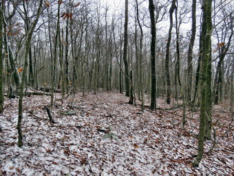 I headed north toward Roscoe on Old Route 17 and turned right on the Beaverkill Road. I drove about 18 miles on the road passed the point where it turns from pavement to packed dirt. We arrived in the parking area just before 12:30 PM. There was one other vehicle in the lot and as we began to get ready I discovered I had left my GPS unit at home. I was annoyed as I like to record a track for each hike but I knew it would not effect what we had to do. The air temperature was 36 degrees and a slight breeze was blowing as we darted out on the trail. We walked down the steep trail to the suspension bridge over the Beaverkill and stopped so that I could take some pictures of this interesting structure. The bridge consists of two towers at either end constructed of steel beams. The wooden decking is placed longitudinally on the bridge rather than crossways. The decking is suspended from several steel cables strung between the towers. The bridge sways considerably as you walk across it but I stopped to get a few spots from mid span. I am never too happy about walking across the bridge but Sheila had no problem going across and coming back several times. We finally crossed the bridge and started up the ascent to the ridge. I did notice that a few of the boards on the bridge should be repaired and that one of the cables was broken! The bridge was slippery as the boards were wet and the trail was covered in slippery, wet leaves. From the bridge the trail gains 750 feet over .7 miles at about a 20% grade. I did not remember this climb and it was a little tiring for me. As we walked along the trail we removed random small branches that had fallen on the trail. We also stopped a few times to remove some large branches and trunks and even had to break out the ax and saw. There were quite a few large and old blowdowns either on the ground or elevated across the trail. All of these were too large for us to cut and I knew I would have to see if Andy Garrison or the local ranger could come to cut them with a chainsaw in the spring.
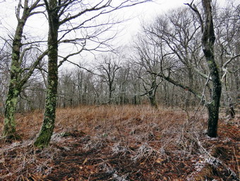 Over the next mile the trail gains about 250 feet as it flattens some and then climbs once again. The skies began to get more and more overcast until sleet began to falls. The sleet fell for a few minutes and then turned to snow. We decided to continue as it was now cold enough that the precipitation was not melting on our clothing. The snow stick to the trail making for an interesting sight and a more slippery trail. At 2 miles into the hike we passed by Willowemoc Mountain which was off the trail to our left. We decided to leave a climb to the summit for the trip back if there was time. We continued on the trail heading toward the junction with the Long Pond-Beaverkill Ridge Trail. Over the next .5 miles we dropped over 350 feet. Now that we had "gone over the hill" and were on the south side of the ridge, there was much less snow. At some points the trail was poorly marked. It was 3:00 PM and I knew our time was short. The trip back would probably take less time since it was mostly flat and downhill but I didn't want to hike out in the dark. It had taken us 2 hours to hike the 2.5 miles out. Now we had to turn around a hike back up the hill we had just descended! We stopped in a couple of places so that I could take some pictures of interesting trees and the snow on the princess pine on the forest floor. There was also a clearing at the top of the climb that defined "bleak" and I took a few shots there. The temperature had increased just slightly so that the snow that had fallen on the north side of the ridge had all but disappeared. We encountered the same blowdowns on the way back but they didn't slow us down much. I took a few shots of the trail without the snow and of some other interesting trees. We tried to push the pace on the flat ground near the top of Willowemoc Mountain. On the final descent I used my poles to avoid slipping and falling on the wet leaves. The descent seemed to take too long but we finally made it to the bridge and scooted across to the car. It was 4:00 PM and we had hiked 5 miles in 3.5 hours which was a slow pace but included the time we spent to remove blowdowns and for me to take pictures. The elevation gain was 1495 feet. The sun was setting and it was getting dark as I drove home.
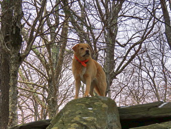
![]()
![]()
![]()
![]()
![]() On Tuesday, November 24th, I wanted to try once more to hike Giant Ledge and Panther. Panther Mountain itself has limited views but to get there from Route 47 the trail passes over Giant ledge which was a great view of Panther Mountain, the entire Burroughs Range and the valleys below. Every time I had planned to do this hike lately, the parking area was filled by 9:00 AM. My plan was to arrive at the parking area around 9:00 AM and hope that it would not be mobbed. When I got up at 8:00 AM, the temperature was 31 degrees. I knew that the temperature was supposed to rise throughout the day but that it would be colder on a 3500 foot peak. I also was aware that the recent rains would make the trails wet but that snow may have fallen at the higher elevations. I got dressed in a my Mammut crew neck shirt with a long-sleeved baselayer. I put on a pair of RailRiders hiking pants which are expensive but last along time and have features like deep pockets and a generous cut which I really like. These pants have Velcro closures at the ankles to discourage sticks and gravel from getting into my shoes and to combat ticks. I hoped this would be enough so that I would not have to wear gaiters. I decided to wear my Keen Targhee II hiking boots which fit well and have been discontinued. I grabbed a pair of Leki external lock poles I have been using since spring. The external locks have not failed me yet and the cork handles really do allow a good grip. I put on my Mammut hoody and brought a pair of light gloves. I also donned a blaze orange fleece hat for warmth and for visibility. As I was getting ready, Sheila quietly watched me positioned so that I could not get by her without falling over her. I put my gear in the car and Sheila in the backseat. I drove out the DeBruce Road and eventually passed Round Pond. At the end of the road, I turned left on Route 47 and drove passed the Frost Valley YMCA. There were no cars parked at the Biscuit Brook trailhead and only four at the Slide Mountain trailhead. When we arrived at the parking area for Giant Ledge and Panther on Route 47 at 9:10 AM there were only two cars parked as I pulled in. Another car pulled in as we were getting ready so we got started pretty quickly by crossing the road and headed out on the trail at 9:15 AM. The temperature was 34 degrees and a wind was blowing making me feel very cool. As I suspected, the trail was pretty wet from the rains the previous few days and there were definitely areas of deep mud. I let Sheila off the leash almost immediately after crossing the road and she was behaving by staying on the trail.
On Tuesday, November 24th, I wanted to try once more to hike Giant Ledge and Panther. Panther Mountain itself has limited views but to get there from Route 47 the trail passes over Giant ledge which was a great view of Panther Mountain, the entire Burroughs Range and the valleys below. Every time I had planned to do this hike lately, the parking area was filled by 9:00 AM. My plan was to arrive at the parking area around 9:00 AM and hope that it would not be mobbed. When I got up at 8:00 AM, the temperature was 31 degrees. I knew that the temperature was supposed to rise throughout the day but that it would be colder on a 3500 foot peak. I also was aware that the recent rains would make the trails wet but that snow may have fallen at the higher elevations. I got dressed in a my Mammut crew neck shirt with a long-sleeved baselayer. I put on a pair of RailRiders hiking pants which are expensive but last along time and have features like deep pockets and a generous cut which I really like. These pants have Velcro closures at the ankles to discourage sticks and gravel from getting into my shoes and to combat ticks. I hoped this would be enough so that I would not have to wear gaiters. I decided to wear my Keen Targhee II hiking boots which fit well and have been discontinued. I grabbed a pair of Leki external lock poles I have been using since spring. The external locks have not failed me yet and the cork handles really do allow a good grip. I put on my Mammut hoody and brought a pair of light gloves. I also donned a blaze orange fleece hat for warmth and for visibility. As I was getting ready, Sheila quietly watched me positioned so that I could not get by her without falling over her. I put my gear in the car and Sheila in the backseat. I drove out the DeBruce Road and eventually passed Round Pond. At the end of the road, I turned left on Route 47 and drove passed the Frost Valley YMCA. There were no cars parked at the Biscuit Brook trailhead and only four at the Slide Mountain trailhead. When we arrived at the parking area for Giant Ledge and Panther on Route 47 at 9:10 AM there were only two cars parked as I pulled in. Another car pulled in as we were getting ready so we got started pretty quickly by crossing the road and headed out on the trail at 9:15 AM. The temperature was 34 degrees and a wind was blowing making me feel very cool. As I suspected, the trail was pretty wet from the rains the previous few days and there were definitely areas of deep mud. I let Sheila off the leash almost immediately after crossing the road and she was behaving by staying on the trail.
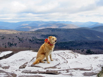 As we crossed the bridge over the small stream, there was a good volume of water running in the stream. The bridge had a light coating of snow and ice which proved to be an indication of what was to come. I forgot how annoying the many rocks that cover the trail to the turnoff can be! In addition, there are several short climbs and each one seems to be the last. Despite the fact that I had been hiking, I noticed that making good time up the climbs was tiring although I enjoyed the elevation gain. There were a few streams running across the trail down low but there were not too many wet areas through the rocky climbs. I did have to watch for a few icy areas and areas with wet, slippery leaves. We finished the sixth short climb and arrived at the turn to Giant Ledge and Panther at about 9:50 AM. I didn't feel like we were going slow but it took 35 minutes to walk the .8 miles from the road, one of our slower times. We turned left to head toward Giant Ledge. The trail after the turn was also wet and muddy in most spots but we made use of the stepping stones along the way. The temperature felt like it was dropping and the increase in frozen mud seemed to bear this out. I was beginning to get warm so I opened the pitzips on my hoody. When the climb began, I pushed my pace as best I could to keep up with Sheila. When she alerted, I turned around to find a younger hiker closing in on us. We walked a little father and then I pulled over to the slide with Sheila to allow him to pass. As we continued, I noticed some areas where there are limited views of Slide which are better when the leaves are not on the trees. When we got to the last field of rocks with the a rocky climb after it, I had to be careful as the snow and ice had increased making every foot placement an adventure. Sheila was doing a good job of picking just the right path for me despite her ability to climb almost anything. We climbed up the last rocky ascent and walked to the first lookout arriving at about 10:30 AM after the 1.5 mile climb. There were no hikers on the first viewpoint so I walked out to take some pictures. Sheila was right on my heals as she has no fear of heights! The skies were still overcast with just a little sun peaking through. This created a pattern of light and shadows on the scene in front of m which my camera had trouble capturing. and full of puffy white clouds. I took variety of pictures and then took a few of Sheila sitting on the ledge with the mountains behind here. The whole Burroughs Range is visible to the right with Friday visible as a "bump" between Slide and Cornell is Friday. Panther is all the way to the left and I could see the north side was covered in snow.
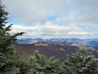 We got a drink and then I had to make a decision. My shoes were water resistant but were proving not to be water proof. I really wasn't "feeling it" as far as climbing Panther and had a few other excuses. I deiced to put these away and at least make the attempt at Panther. I hoped the wind would die down or we would be bore protected on the climb. We left the first lookout to go back to the main trail along the ledges. Sheila is fearless about heights and sometimes scares me a little when she walks right to the edge of the cliffs and looks down! As we hiked along the ledges, I decided not to stop at any more of the lookouts as I wanted to concentrate ny efforts on climbing Panther. Sheila walked to the edge of most of the lookouts. Descending into the col between Giant Ledge and Panther proved to be a challenge as many of the rocks had just enough ice to make things interesting. Along the way we met a hiker coming back from Panther and we greeted each other as we passed. We walked through the relatively flat area of the col for a little while and then started the climb up Panther. Parts of the Panther trail get a little steep at times but there always seems to be a switchback or flatter area. All of the climbs had rocks covered in ice and I was glad I had brought my Stabilicers for the return trip. Where the trail flattened, there were vast areas of mud across the trail and beyond. There were two areas in particular that seemed to offer no good way to avoid the mud. A fee slips resulted in even wetter feet! We continued up the trail with Sheila checking out some of the paths that lead to limited viewpoints along the way. We stopped at one and walked out to a rock which had a good view of Giant Ledge and Slide with no trees in the way. I took some pictures before we went back to the main trail. We were soon up the steeper climbs with only a final, short ascent of Panther to go. The last part of the ascent on Panther isn't too long or steep but it was all I could manage as it was also covered in ice and a light layer of snow. As the trail flattened near the top, we had to avoid some areas of mud. We passed the lookout just before the summit, and continued on to the flat rock that marks the top of the mountain. We arrived at the summit of Panther at 12:00 PM after hiking 3.3 miles. The view from the summit has been improved by the removal of some of the trees blocking the view. I took a couple of shots of the scenery. We walked back to the viewpoint just below the summit and ascended the rock which acts as the lookout. I took a few shots of the scenery which had the same dappled appearance as the view from Giant Ledge. As we were getting ready to leave two young me passed by and then another group of three hikers. We turned around and started to head back down the mountain. The sun came out just as we started down which improved my mood and even seemed to make my feet feel warmer. As we descended Panther, Sheila alerted and I saw one woman headed toward with a young girl. I walked off the trail to allow them to pass by and both complimented Sheila on her good looks and exemplary behavior. These were comments that were repeated many times during the day. I tried to keep a good pace but found the descent almost as difficult as the climb up! I had to watch that I did not slip as falling down a mountain is worse than falling up.
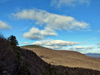 Sheila alerted and the hiker that had passed us coming up Giant Ledge was right behind us. I again pulled over and let him pass. He told me he was from Connecticut and had come all the way just to hike Panther. He was without poles but was setting a fast pace. We gain had to negotiate the muddy areas and a few more slippery rocks on the way to the col. We finally made it down to the col and negotiated the muddy areas. The ascent proved easier than I thought it might be as I could see the icy areas and avoid them. When we had finally made the ascent to Giant Ledge, I was happy because I knew that everything else was down or flat. On our way across the ledge, we met a couple at one of the viewpoints. By their comments, they were very impressed with the views. As we cam to the first lookout, I could see there was nobody there and I decided to go down to take a look. The sun was now out and the area was fully illuminated, so I took a few more shots.Now I really wanted to just get back to the car. As we walked back up to the main trail and the toward the steep descent, we net a couple with a small dog on a leash. We finally got to the descent off the Ledge and I could see a woman ahead of us with a small dog and no leash. When Sheila met this dog, she behaved well as did the other dog. We passed them and continued down the rocky slope. A little father along, I looked up to see a big, black dog but no owner! Seconds later, another big black dog came up the trail followed closely by the owners. These owners seemed like nice people who had never heard of a dog leash. They though they could control their dogs but they could not. The dogs came over to "visit" Sheila who let them know she was not in the mood. We passed by and continued our descent. The flatter portion of the trail seemed to last a long time as we used the stepping stones to avoid the mud as much as possible. There was a group of younger hikers behind us and I was determined not to let them catch up! I looked up to see a group of six women and girls coming toward us. Several had sticks they were using for walking and one was carrying what looked like a tree trunk! We finally made it to the right turn in the trail and started down the numerous rocky descents. By this time my feet were damp but not very cold and I concentrated on picking the best and quickest route for the descent. The descent went more quickly than the ascent but I had several close calls. As we neared the bridge over the small stream, we met two young women with a small dog that looked like a fox on a leash. We crossed the bridge, and walked out to the road. We crossed to the parking lot which was now full. We were back at the car at 2:15 PM having covered 6.5 miles in 5 hours including numerous stops adding up to almost an hour. The elevation gain was 2150 feet. I was satisfied at the accomplishment but it reminded me to take my own advice that conditions at the summit may not match conditions at the trailhead. Now I need to find a pair of my insulated and waterproof boots.
![]()
![]()
![]()
![]() On Monday, November 23rd the weather was lousy and I decided I would wait until the next day to hike since the weather forecast was better. After noon, I came to the realization that the weather going forward would be cold, sometimes overcast and never really ideal for hiking. This means I had to get used to hiking in these conditions or give up hiking for four months or so. I decided I would go across the street to hike on Round Top for some exercise. I asked Cindy if she wanted to go across the street to Round Top and she agreed. At 1:00 PM I started to get ready with the temperature hovering in the high 30's with some mist in the air and a slight breeze. We had not hiked for several days and Sheila was anxious to get out. I got dressed in my Mammut long-sleeved crew top but decided I did not need a baselayer. I put on a pair of RailRiders hiking pants which are expensive but last along time and have features like deep pockets and a generous cut which I really like. These pants have a Velcro closures at the ankles to discourage sticks and gravel from getting into my shoes and to combat ticks. I decided to wear my Keen Traghee II hiking boots which fit well and have been discontinued. I grabbed a pair of Leki external lock poles I have been using lately. I also added a blaze orange fleece hat for visibility and warmth. My final layer was my Mammut hoody which is light but blocks the wind and was pitzips to dump heat. Sheila kept me in sight as I got ready to go making sure she would not be forgotten. We stepped out of the house at 1:15 PM and I grabbed Sheila's leash from the car. We walked up the driveway and crossed the street. I decided we would probably do two figure 8's to cover all the trails and tire me out a little. We walked to the parking area by the Presbyterian Church and to the back of the church. We began the ascent of the steepest hill behind the church. The hill is short but gets the circulation pumping and is the steepest and longest climb on the "trail." Sheila helped me along by pulling me up the hill but I noticed the hill seemed easier as I have been hiking more. When we got to the top of the hill, we stopped to look around at the hills around town. We started on the trail by turning left at the trailhead. I let Sheila off her leash so that she could explore. The trail bed is becoming worn it which means that at least a few people are using the trail. I am always happy to see that someone else uses the trails.
On Monday, November 23rd the weather was lousy and I decided I would wait until the next day to hike since the weather forecast was better. After noon, I came to the realization that the weather going forward would be cold, sometimes overcast and never really ideal for hiking. This means I had to get used to hiking in these conditions or give up hiking for four months or so. I decided I would go across the street to hike on Round Top for some exercise. I asked Cindy if she wanted to go across the street to Round Top and she agreed. At 1:00 PM I started to get ready with the temperature hovering in the high 30's with some mist in the air and a slight breeze. We had not hiked for several days and Sheila was anxious to get out. I got dressed in my Mammut long-sleeved crew top but decided I did not need a baselayer. I put on a pair of RailRiders hiking pants which are expensive but last along time and have features like deep pockets and a generous cut which I really like. These pants have a Velcro closures at the ankles to discourage sticks and gravel from getting into my shoes and to combat ticks. I decided to wear my Keen Traghee II hiking boots which fit well and have been discontinued. I grabbed a pair of Leki external lock poles I have been using lately. I also added a blaze orange fleece hat for visibility and warmth. My final layer was my Mammut hoody which is light but blocks the wind and was pitzips to dump heat. Sheila kept me in sight as I got ready to go making sure she would not be forgotten. We stepped out of the house at 1:15 PM and I grabbed Sheila's leash from the car. We walked up the driveway and crossed the street. I decided we would probably do two figure 8's to cover all the trails and tire me out a little. We walked to the parking area by the Presbyterian Church and to the back of the church. We began the ascent of the steepest hill behind the church. The hill is short but gets the circulation pumping and is the steepest and longest climb on the "trail." Sheila helped me along by pulling me up the hill but I noticed the hill seemed easier as I have been hiking more. When we got to the top of the hill, we stopped to look around at the hills around town. We started on the trail by turning left at the trailhead. I let Sheila off her leash so that she could explore. The trail bed is becoming worn it which means that at least a few people are using the trail. I am always happy to see that someone else uses the trails.
At the first trail junction, we followed Sheila as she turned right on the woods road which is the shallower approach to the trail system. We continued to follow the yellow trail toward the first junction. At the junction, we turned left and followed it to the next trail junction. Along the way we picked up or removed many small branches and dragged several large ones off the trail. At the second junction with the blue trail, we turned right and started up the steep blue trail that leads over the summit of Round Top. Walking uphill we passed through what remained of the ferns of the summer all with brown edges. The trails were damp from the light rain overnight and the leaves made some places slippery. Just before the steepest section we turned right on the switchback trail now marked with blue paint blazes. We continued to follow these blazes as they made a sharp right turn and headed back to the main blue trail. We turned right on the blue trail and continued up the blue trail. Within a few feet, we passed the white crossover trail and continued on the original blue trail to the summit. We walked up and over the top and encounter a small blowdown halfway across the trail. We started down the other side from the summit and turned right on the yellow trail. We turned right to walk along the base of Round Top. This time we turned left at the junction with the blue trail and walked down to the lookout. We followed the yellow trail as it turned left and descended the hill to the first trail junction. At this point, Cindy decided she would walk home. Sheila and I immediately turned around and walked back up the hill to the lookout and followed the yellow trail as it turned right. We followed the trail as it made a gentle ascent through the brown ferns to the junction with the blue trail. We continued to follow the yellow trail by turning right and following along the base of Round Top. At the second junction with the blue trail, we turned left and started the ascent of the hill. When the white crossover trail came up and the left, we continued straight ahead on the blue trail and passed over the summit of Round Top. We continued downhill on the blue trail ignoring the crossover trail but turning left on the switchback trail. We followed the switchback to the main blue trail where we turned left and finished the walk downhill. At the yellow trail we turned left, walked back along the base of Round Top and turned right at the next junction. We walked down to the woods road that took us back to the first trail junction. This time we turned left and walked out to the trailhead where I put Sheila on her leash. We walked down the hill to the parking lot and across the road to our driveway. We were home by 2:30 PM after hiking more than 2 miles in a little over an hour.
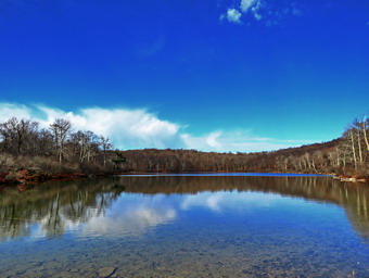
![]()
![]()
![]()
![]()
![]() On Friday, November 20th I had planned to hike a longer hike early Possibly to Giant Ledge and Panther Mountain. I needed to catch up on some lost sleep and did not get up until 9:30 AM! I knew that the parking at Giant Ledge would probably be an issue so I changed my mind and decided to do a loop of about 6 miles at Hodge and Frick Ponds. I had not hiked UP the Flynn Trail to do the big loop around Hodge Pond in some time and made that my intended route. The temperature was 55 degrees as I was getting ready but I knew it could be a little cooler at the trailhead. I got dressed in a my Mammut crew neck shirt with a long-sleeved baselayer. I put on a pair of RailRiders hiking pants which are expensive but last along time and have features like deep pockets and a generous cut which I really like. These pants have Velcro closures at the ankles to discourage sticks and gravel from getting into my shoes and to combat ticks. I hoped this would be enough so that I would not have to wear gaiters. I decided to wear my Keen Targhee II hiking boots which fit well and have been discontinued. I grabbed a pair of Leki external lock poles I have been using since spring. The external locks have not failed me yet and the cork handles really do allow a good grip. I put on my Mammut hoody and brought a pair of light gloves. I also donned a blaze orange fleece hat for warmth and for visibility. I also decided to bring my Silky Sugowaza saw as I remembered several small trees that should be removed from the trail. I put my gear in the car and Sheila in the back seat and drove out the Debruce Road about 6 miles. I turned left onto Mongaup Pond Road and continued to where the road split. Along the way the temperature continued to drop until it was 48 degrees at the fish hatchery. At the split, I turned left onto Beech Mountain Road, and drove to the parking areas at the Frick Pond. There were no cars parked in either parking lot as I pulled into the smaller area. I was surprised since lately there had been a few people at the trailhead no matter the day or time. The thermometer read 50 degrees as I set my GPS. The skies were blue in some areas with plenty of sun and lots of billowing white clouds. Other parts of the sky were more overcast and there wasn't much sun. There was also a breeze blowing which made things a little cooler. At 11:00 AM we started our hike by crossing the road to start out on the Flynn Trail. At the end of the trail through the woods we turned right on the woods road that was once the extension of Beech Mountain Road. I had intended to hike at a relaxed pace but instead set a quick pace with Sheila roving out ahead kicking up a few birds as we hiked. The Flynn Trail ascends 1.7 miles to the Big Rock Trail junction gaining 600 feet. The more I hike the quicker I can hike and easier it seems. As we neared the highest point on the hike, we ran into two small blowdowns so I stopped, removed my pack and started to make some cuts to remove them. I usually take before and after pictures but these small trees were not worth the effort. Just after the 1 mile mark was another blowdown which also went quickly. By 11:55 AM we had hiked the 1.7 miles to the junction with the Big Rock Trail. We continued straight ahead staying on the Flynn Trail heading toward Hodge Pond. The trail seemed dry but the thick layer of leaves covered some wet and muddy areas. We passed through the gate that separates state land from the OSI property were soon at the next trail junction where we stayed to the left to stay on the Flynn Trail to Hodge Pond.
On Friday, November 20th I had planned to hike a longer hike early Possibly to Giant Ledge and Panther Mountain. I needed to catch up on some lost sleep and did not get up until 9:30 AM! I knew that the parking at Giant Ledge would probably be an issue so I changed my mind and decided to do a loop of about 6 miles at Hodge and Frick Ponds. I had not hiked UP the Flynn Trail to do the big loop around Hodge Pond in some time and made that my intended route. The temperature was 55 degrees as I was getting ready but I knew it could be a little cooler at the trailhead. I got dressed in a my Mammut crew neck shirt with a long-sleeved baselayer. I put on a pair of RailRiders hiking pants which are expensive but last along time and have features like deep pockets and a generous cut which I really like. These pants have Velcro closures at the ankles to discourage sticks and gravel from getting into my shoes and to combat ticks. I hoped this would be enough so that I would not have to wear gaiters. I decided to wear my Keen Targhee II hiking boots which fit well and have been discontinued. I grabbed a pair of Leki external lock poles I have been using since spring. The external locks have not failed me yet and the cork handles really do allow a good grip. I put on my Mammut hoody and brought a pair of light gloves. I also donned a blaze orange fleece hat for warmth and for visibility. I also decided to bring my Silky Sugowaza saw as I remembered several small trees that should be removed from the trail. I put my gear in the car and Sheila in the back seat and drove out the Debruce Road about 6 miles. I turned left onto Mongaup Pond Road and continued to where the road split. Along the way the temperature continued to drop until it was 48 degrees at the fish hatchery. At the split, I turned left onto Beech Mountain Road, and drove to the parking areas at the Frick Pond. There were no cars parked in either parking lot as I pulled into the smaller area. I was surprised since lately there had been a few people at the trailhead no matter the day or time. The thermometer read 50 degrees as I set my GPS. The skies were blue in some areas with plenty of sun and lots of billowing white clouds. Other parts of the sky were more overcast and there wasn't much sun. There was also a breeze blowing which made things a little cooler. At 11:00 AM we started our hike by crossing the road to start out on the Flynn Trail. At the end of the trail through the woods we turned right on the woods road that was once the extension of Beech Mountain Road. I had intended to hike at a relaxed pace but instead set a quick pace with Sheila roving out ahead kicking up a few birds as we hiked. The Flynn Trail ascends 1.7 miles to the Big Rock Trail junction gaining 600 feet. The more I hike the quicker I can hike and easier it seems. As we neared the highest point on the hike, we ran into two small blowdowns so I stopped, removed my pack and started to make some cuts to remove them. I usually take before and after pictures but these small trees were not worth the effort. Just after the 1 mile mark was another blowdown which also went quickly. By 11:55 AM we had hiked the 1.7 miles to the junction with the Big Rock Trail. We continued straight ahead staying on the Flynn Trail heading toward Hodge Pond. The trail seemed dry but the thick layer of leaves covered some wet and muddy areas. We passed through the gate that separates state land from the OSI property were soon at the next trail junction where we stayed to the left to stay on the Flynn Trail to Hodge Pond.
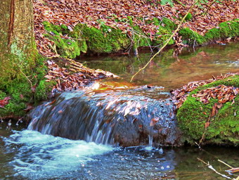 As we approached the pond, I looked at the scene and decided to walk over to the shore of the pond. Sheila did not jump into the water to swim as she has a good sense of when it is too cold. I turned my attention to taking some shots of the pond. The scene was somewhat bleak looking like winter but without the snow. By now there was some blue sky and the sun was out. When I was done, I got a drink and packed up. We headed back to the Flynn Trail and turned right to follow the trail along the west side of Hodge Pond. To this point the trail had been relatively dry but as we continued on the west side of Hodge Pond the Flynn Trail began to be muddy. As we walked along the western shore, we came to a spot where we could turn left or right. We turned left to stay on the Flynn Trail and began a slight up hill climb toward the gate where the trail turns to the left. We ran into another blowdown and I decided to clear it. This one was a little larger than the others but only required two cuts and some energetic dragging to get it off the trail. We continued our walk up the hill and through the gate. This part of the Flynn Trail is pretty flat and the trail is often the lowest point which allows water to collect with nowhere to go. The rain earlier in the week had made the trail wet and I had to walk around several wet and muddy areas. Despite this the trail was not as wet as it sometimes is and not as wet as I thought it would be given the rain that had fallen. I noticed that Sheila was pretty careful to walk around these areas as I had encouraged her. There were a few branches on the trails which I removed as we walked. We arrived at Junkyard Junction at 12:45 PM about 3.4 miles into the hike. From here the rest of the hike is primarily downhill with a few small hills along the way. We turned left on the red Quick Lake Trail and found it was also wet and muddy in spots. Some section of the trail are washed out leaving a lot of rocks behind and making the downhill hiking not as much fun as it could be. There were several large puddles on the trail which were frozen over. When I probed the ice on one, I found it was almost half an inch thick. At about 3.8 miles the trail turned due south and we continued downhill.
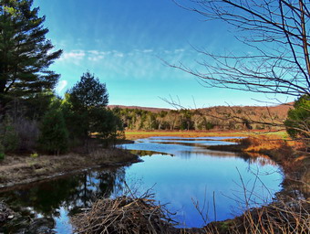 There wasn't much to see so we hiked quickly passing the junction with the snowmobile trail. We arrived at Iron Wheel Junction at 1:35 PM after hiking 5.0 miles. We turned right to stay on the Quick Lake Trail since the yellow Logger's Loop continued straight ahead. The trail continued to be muddy but we made good time. We continued on the trail and soon came to the little stream in the woods. The stream was not as high as the last time I had walked the trail but I had to go stream to get across. I stopped to take a shot of the small waterfall just above the point where I crossed. I noticed that Sheila had simply waded across the stream! We continued toward Frick Pond and found several more blowdowns which were large and easy to step over. There were a few wet and muddy spots but most were drier than I expected. I had been noticing new ruts on the trail and could not figure out what made them. It almost looked like a dirt bike of some kind. We passed the junction with the Big Rock Trail that goes around the north end of Frick Pond and walked toward the bridge across the outlet of the pond. As we approached the bridge, Sheila alerted and I could see there were three men at the bridge with two dogs. I put Sheila on her leash and one of the men called the other dogs. I continued toward the bridge but the other dogs did not go to the man who was calling but approached us. He eventually grabbed their collars but did not seem to have leashes for them. This is becoming a common occurrence of inconsiderate dog owners owning some really nice dogs. I crossed the bridge and tied Sheila to a tree so I could take some pictures. The sun was a little low in the sky and the pictures looked like they were being taken at sunset. All the while I was taking these shots, the owner of the dog was hanging onto them. All three men had hunting gear and I assumed they would camp out for the first day of deer season on Saturday. I wondered how they expected to hunt legally with dogs along! I packed up and we continued back on the Quick Lake Trail toward the trail register. At the trail register we continued straight ahead on the woods road to the smaller parking area. There was one pickup parked in the larger lot which I assumed belonged to the hunters. It was 2:05 PM and we had hiked 6.5 miles in 3 hours with an elevation gain of 900 feet. The temperature was 54 degrees.
![]()
![]()
![]()
![]() On Thursday, November 20th I returned from by men's fellowship group at church and ate breakfast at Caf� 43. I had some work to do around the house and was waiting for Cindy to get home from church. When she returned at noon we ate lunch and I asked if she wanted to go across the street to do a short hike on Round Top. She declined so I decided Sheila and I would go. At 1:00 PM I started to get ready with the temperature hovering in the mid 40's which was almost 20 degrees warmer than the day before. We had not hiked for several days and Sheila was anxious to get out. I got dressed in my Mammut long-sleeved crew top but decided I did not need a baselayer. I put on a pair of RailRiders hiking pants which are expensive but last along time and have features like deep pockets and a generous cut which I really like. These pants have a Velcro closures at the ankles to discourage sticks and gravel from getting into my shoes and to combat ticks. I decided to wear my Keen Traghee II hiking boots which fit well and have been discontinued. I grabbed a pair of Leki external lock poles I have been using lately. I also added a blaze orange fleece hat for visibility and warmth. Sheila kept me in sight as I got ready to go making sure she would not be forgotten. We stepped out of the house at 1:15 PM and I grabbed Sheila's leash from the car. We walked up the driveway and crossed the street. I decided we would probably do two figure 8's to cover all the trails and tire me out a little. We walked to the parking area by the Presbyterian Church and to the back of the church. We began the ascent of the steepest hill behind the church. The hill is short but gets the circulation pumping and is the steepest and longest climb on the "trail." Sheila helped me along by pulling me up the hill but I noticed the hill seemed easier as I have been hiking more. When we got to the top of the hill, we stopped to look around at the hills around town. We started on the trail by turning left at the trailhead. I let Sheila off her leash so that she could explore. The trail bed is becoming worn it which means that at least a few people are using the trail. I am always happy to see that someone else uses the trails.
On Thursday, November 20th I returned from by men's fellowship group at church and ate breakfast at Caf� 43. I had some work to do around the house and was waiting for Cindy to get home from church. When she returned at noon we ate lunch and I asked if she wanted to go across the street to do a short hike on Round Top. She declined so I decided Sheila and I would go. At 1:00 PM I started to get ready with the temperature hovering in the mid 40's which was almost 20 degrees warmer than the day before. We had not hiked for several days and Sheila was anxious to get out. I got dressed in my Mammut long-sleeved crew top but decided I did not need a baselayer. I put on a pair of RailRiders hiking pants which are expensive but last along time and have features like deep pockets and a generous cut which I really like. These pants have a Velcro closures at the ankles to discourage sticks and gravel from getting into my shoes and to combat ticks. I decided to wear my Keen Traghee II hiking boots which fit well and have been discontinued. I grabbed a pair of Leki external lock poles I have been using lately. I also added a blaze orange fleece hat for visibility and warmth. Sheila kept me in sight as I got ready to go making sure she would not be forgotten. We stepped out of the house at 1:15 PM and I grabbed Sheila's leash from the car. We walked up the driveway and crossed the street. I decided we would probably do two figure 8's to cover all the trails and tire me out a little. We walked to the parking area by the Presbyterian Church and to the back of the church. We began the ascent of the steepest hill behind the church. The hill is short but gets the circulation pumping and is the steepest and longest climb on the "trail." Sheila helped me along by pulling me up the hill but I noticed the hill seemed easier as I have been hiking more. When we got to the top of the hill, we stopped to look around at the hills around town. We started on the trail by turning left at the trailhead. I let Sheila off her leash so that she could explore. The trail bed is becoming worn it which means that at least a few people are using the trail. I am always happy to see that someone else uses the trails.
At the first trail junction, we followed Sheila as she turned right on the woods road which is the shallower approach to the trail system. We continued to follow the yellow trail toward the first junction. At the junction, we turned left and followed it to the next trail junction. Along the way we picked up or removed many small branches and dragged several large ones off the trail. At the second junction with the blue trail, we turned right and started up the steep blue trail that leads over the summit of Round Top. Walking uphill we passed through what remained of the ferns of the summer all with brown edges. The trails were damp from the light rain overnight and the leaves made some places slippery. Just before the steepest section we turned right on the switchback trail now marked with blue paint blazes. We continued to follow these blazes as they made a sharp left turn and headed back to the main blue trail. We turned right on the blue trail and continued up the blue trail. Within a few feet we turned right on the white crossover trail and I noticed that this trail was getting more use than the original blue trail to the summit. When the white trail met the blue trail Ming down from the summit we turned right and continued downhill to the yellow trail. We turned right to walk along the base of Round Top. This time we turned left at the junction with the blue trail and walked down to the lookout. We followed the yellow trail as it turned left and descended the hill to the first trail junction. We immediately turned around and walked back up the hill to the lookout and followed the yellow trail as it turned right. We followed the trail as it made a gentle ascent trough the brown ferns to the junction with the blue trail. We continued to follow the yellow trail by turning right and following along the base of Round Top. At the second junction with the blue trail, we turned left and started the ascent of the hill. When the white crossover trail came up and the left, we continued straight ahead on the blue trail and passed over the summit of Round Top. We continued downhill on the blue trail ignoring the crossover and switchback trails. At the yellow trail we turned left, walked back along the base of Round Top and turned right at the next junction. We walked down to the woods road that took us back to the first trail junction. This time we turned left and walked out to the trailhead where I put Sheila on her leash. We walked down the hill to the parking lot and across the road to our driveway. We were home by 2:15 PM after hiking around 2 miles in a little over an hour.
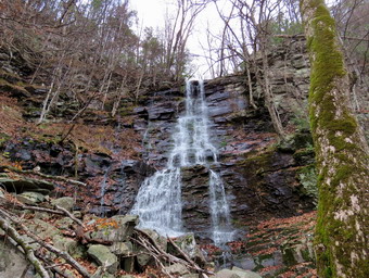
![]() On Monday, November 16th, we had hiked the new trail on Ticetonyk Mountain and the Ashokan Quarry trail. I drove back toward Boiceville on Route 28A and the turned left on the Peekamoose Road. I followed the road as it passed Moonhaw Road and then wound its way up the hill passing the parking area for Ashokan High Point. This reminded me that this would be a good hike one of these days especially now that the leaves were down. Eventually I came to a falls on the right side of the road tucked back in the woods. I found a place to park and walked back to take pictures of the falls. The water simply cascades down a rock face and on this day the recent rains had provided plenty of water. I returned to the car and drove to the next falls. I repeated the routine of finding a place to park and walking back on the road to the falls. I stood at the roadside and took my shots. A woman was walking her dog and asked said to me "Please don't jump in!" I was not sure what she meant but I surmised she meant that I should respect the private property signs. I walked back to the car to continue my drive.
On Monday, November 16th, we had hiked the new trail on Ticetonyk Mountain and the Ashokan Quarry trail. I drove back toward Boiceville on Route 28A and the turned left on the Peekamoose Road. I followed the road as it passed Moonhaw Road and then wound its way up the hill passing the parking area for Ashokan High Point. This reminded me that this would be a good hike one of these days especially now that the leaves were down. Eventually I came to a falls on the right side of the road tucked back in the woods. I found a place to park and walked back to take pictures of the falls. The water simply cascades down a rock face and on this day the recent rains had provided plenty of water. I returned to the car and drove to the next falls. I repeated the routine of finding a place to park and walking back on the road to the falls. I stood at the roadside and took my shots. A woman was walking her dog and asked said to me "Please don't jump in!" I was not sure what she meant but I surmised she meant that I should respect the private property signs. I walked back to the car to continue my drive.
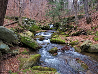 I looked at the next falls where I usually stop but, for some reason, there was not much water flowing over them so I drove on to Buttermilk Falls. I parked in the lot for the falls and was surprised I was the only car. I took my camera and walked to the road bridge to take pictures of the falls. I decided not to walk to the base of the falls as the pictures from the road were good. Once again I returned to the car thinking I was finally done. I drove passed the Blue Hole and the parking area for Peekamoose. When I passed Bear Hole Brook, the scene looked so nice I pulled into a lot and got out my camera. I though Sheila might burst if I did not take her this time so I got out her leash. We walked back up the road to the brook and trough the ugly barriers and caution tape. These measures were necessary as inconsiderate people were parking wherever they wanted along the road. We walked out the path to the first little falls and I took shots of this falls and the brook further upstream. We walked down to the brook near the road bridge and while Sheila got a drink, I took a few more pictures. We returned to the car and this time I drove all the way home.
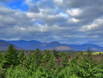
![]()
![]()
![]()
![]()
![]() On Monday, November 16th, we had hiked the new trail on Ticetonyk Mountain and were ready for another adventure on the Ashokan Quarry Trail. I retraced the route I had used to get from Route 28 to Ticetonyk. At Route 28 I tuned left and then almost immediately right onto Route 28A. I wasn't sure how far I had to drive on Route 28A but I knew the parking area was just after Acorn Hill Road (Route 3). The trip was only 7.8 miles but seemed longer. When I pulled into the parking lot, there were half a dozen cars already there. The parking lot is very well done and can accommodate at least 10 cars. I set my GPS and we were off on the trail at 11:35 AM. The first part of the trail was covered in angular stones which I found uncomfortable. Just before the first trail junction at .3 miles, there was an interesting foundation on the left side of the trail. Most stone foundations are laid up from field stone but this one was obviously constructed of quarried stone. As I was taking some pictures, two men walked by with small dogs on leashes. When I was finished taking photographs, I packed up and returned to the trail. We turned left at the first trail junction and started a slight uphill walk. At about .6 miles we came to a nice viewpoint. There were views to the north and west and into the quarry below. The Yale Quarry was used to obtain stone for the building of the dam for the Ashokan Reservoir. There were two people sitting at the lookout and they gave up their spot so that I could get some better angles for my shots. After a short stop, we continued along the top of the quarry and dropped down to another level. I walked to the edge of the "cliff" and found a pair of hiking poles. This bothered me as I had to wonder whether the owner had fallen or gotten lost. I surveyed the quarry floor below and did not see a body. I debated whether to take the poles or leave them but in the end I picked them up and took them with me.
On Monday, November 16th, we had hiked the new trail on Ticetonyk Mountain and were ready for another adventure on the Ashokan Quarry Trail. I retraced the route I had used to get from Route 28 to Ticetonyk. At Route 28 I tuned left and then almost immediately right onto Route 28A. I wasn't sure how far I had to drive on Route 28A but I knew the parking area was just after Acorn Hill Road (Route 3). The trip was only 7.8 miles but seemed longer. When I pulled into the parking lot, there were half a dozen cars already there. The parking lot is very well done and can accommodate at least 10 cars. I set my GPS and we were off on the trail at 11:35 AM. The first part of the trail was covered in angular stones which I found uncomfortable. Just before the first trail junction at .3 miles, there was an interesting foundation on the left side of the trail. Most stone foundations are laid up from field stone but this one was obviously constructed of quarried stone. As I was taking some pictures, two men walked by with small dogs on leashes. When I was finished taking photographs, I packed up and returned to the trail. We turned left at the first trail junction and started a slight uphill walk. At about .6 miles we came to a nice viewpoint. There were views to the north and west and into the quarry below. The Yale Quarry was used to obtain stone for the building of the dam for the Ashokan Reservoir. There were two people sitting at the lookout and they gave up their spot so that I could get some better angles for my shots. After a short stop, we continued along the top of the quarry and dropped down to another level. I walked to the edge of the "cliff" and found a pair of hiking poles. This bothered me as I had to wonder whether the owner had fallen or gotten lost. I surveyed the quarry floor below and did not see a body. I debated whether to take the poles or leave them but in the end I picked them up and took them with me.
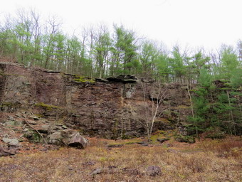 We followed the trail along the edge of the quarry and then around the end as it dropped down toward the quarry floor. At .9 miles, we turned left on a spur trail that ran down to a stone loading platform and some other interesting ruins. The quarried stone was loaded onto railroad cars to be transported to the site of the dam. I took pictures of everything and then walked back up to the main trail. We turned left and almost immediately came to the floor of the quarry. I put down my pack and got out the camera to take pictures of the vernal pool that had formed in the quarry. I also took pictures of the high "walls" that were formed as the stone was removed. We got back on the trail and began passing through an area where there were piles of discarded stone and the dust formed as the stone was quarried. Of course, I had to take more pictures in this area. As we continued along the trail, I noticed that there were no markers and wondered if I had gotten off the trail. Shortly after that the markers reappeared. Just before we reached the first trail junction, a large stone massif appeared on the right side of the trail. I took a couple of shots and then we walked back to the parking area. It was 12:45 PM and we had hiked 2 miles in 1 hour and 10 minutes. The elevation gain was only 280 feet. The hike was short but the historic interest was worth it. I though about combining this hike with the Tanbark Trail in Phoenicia which is also a very historic trail. I left a note at the trailhead kiosk about the pair of poles I had found. I decided we would return home using the Peekamoose Road as it would allow me to check out the falls along the way.
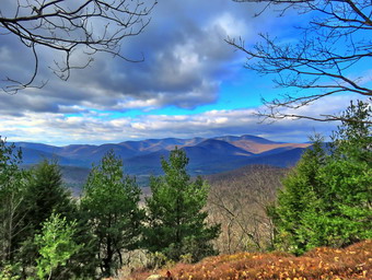
![]()
![]()
![]()
![]()
![]() On Monday, November 16th, I had promised to give an FLT hiker a ride from Capmbell Mountain Road to the Horse Camp on East Trout Brook Road in the area of Bear Spring WMA. I was to pick her up at 7:00 AM and I decided that I would take along Sheila and my hiking gear so that we could go on a hike after I dropped off the hiker. When I got up at 6:00 AM it was 30 degrees but a stiff breeze was blowing. The forecast for the day called for temperatures in the low 40's but with windchills in the low 20's. I decided to dress warmly knowing I could always removed clothing if needed. Sheila was happy to be included but seemed confused that we were getting ready so early. I got dressed in a medium-weight Patagonia wool top with a long-sleeved baselayer. I put on a pair of RailRiders hiking pants which are expensive but last along time and have features like deep pockets and a generous cut which I really like. These pants have Velcro closures at the ankles to discourage sticks and gravel from getting into my shoes and to combat ticks. I hoped this would be enough so that I would not have to wear gaiters. I decided to wear my Keen Targhee II hiking boots which fit well and have been discontinued. I grabbed a pair of Leki external lock poles I have been using since spring. The external locks have not failed me yet and the cork handles really do allow a good grip. I put on my Mammut hoody and brought a pair of light gloves. I also donned a blaze orange fleece hat for warmth and for visibility. I put my gear in the car and Sheila in the back seat and headed out the driveway 6:30 AM. I drove north on State Route 17 getting off at exit 95 for Roscoe. I headed north on Route 206 through Roscoe and Rockland and up Brock Mountain. I turned left on Jug Tavern and then right on Campbell Mountain Road. When I arrived at the trailhead, my passenger was there and ready to go. We loaded her pack in my car and I headed back out the same way I had come to Route 206. At the Pepacton Reservoir I turned left to stay on Route 206 through Downsville. Soon we were headed up Bear Spring Mountain. Near the top I turned left on East Trout Brook Road and drove all the way south to the Horse Camp. I let my passenger out and wished her good luck. I considered my options for hiking. I was not feeling my best but knew that hiking would make me feel better. I decided we would go to Ticetonyk Mountain to try the new trail that the Catskill Mountain Club had constructed on DEP land. I thought after we completed that hike we might go to the Ashokan Quarry Trail.
On Monday, November 16th, I had promised to give an FLT hiker a ride from Capmbell Mountain Road to the Horse Camp on East Trout Brook Road in the area of Bear Spring WMA. I was to pick her up at 7:00 AM and I decided that I would take along Sheila and my hiking gear so that we could go on a hike after I dropped off the hiker. When I got up at 6:00 AM it was 30 degrees but a stiff breeze was blowing. The forecast for the day called for temperatures in the low 40's but with windchills in the low 20's. I decided to dress warmly knowing I could always removed clothing if needed. Sheila was happy to be included but seemed confused that we were getting ready so early. I got dressed in a medium-weight Patagonia wool top with a long-sleeved baselayer. I put on a pair of RailRiders hiking pants which are expensive but last along time and have features like deep pockets and a generous cut which I really like. These pants have Velcro closures at the ankles to discourage sticks and gravel from getting into my shoes and to combat ticks. I hoped this would be enough so that I would not have to wear gaiters. I decided to wear my Keen Targhee II hiking boots which fit well and have been discontinued. I grabbed a pair of Leki external lock poles I have been using since spring. The external locks have not failed me yet and the cork handles really do allow a good grip. I put on my Mammut hoody and brought a pair of light gloves. I also donned a blaze orange fleece hat for warmth and for visibility. I put my gear in the car and Sheila in the back seat and headed out the driveway 6:30 AM. I drove north on State Route 17 getting off at exit 95 for Roscoe. I headed north on Route 206 through Roscoe and Rockland and up Brock Mountain. I turned left on Jug Tavern and then right on Campbell Mountain Road. When I arrived at the trailhead, my passenger was there and ready to go. We loaded her pack in my car and I headed back out the same way I had come to Route 206. At the Pepacton Reservoir I turned left to stay on Route 206 through Downsville. Soon we were headed up Bear Spring Mountain. Near the top I turned left on East Trout Brook Road and drove all the way south to the Horse Camp. I let my passenger out and wished her good luck. I considered my options for hiking. I was not feeling my best but knew that hiking would make me feel better. I decided we would go to Ticetonyk Mountain to try the new trail that the Catskill Mountain Club had constructed on DEP land. I thought after we completed that hike we might go to the Ashokan Quarry Trail.
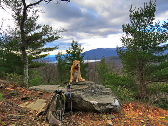 I drove back to Downsville and around the reservoir on Route 30. At the Dunraven Bridge I stayed to the right and took the BWS road to Route 28 near Margaretville. I continued on Route 28 all the way to Boiceville where I turned left on Upper Boiceville Road just after Onteora High School. The next turn was a left onto Bostock Road and then another left onto Peck Road. After passing the YMCA Camp at .25 miles, I turned left into the small parking area for the new Ticetonyk Mountain trail. The parking area is only big enough for three or four cars and two cars were already parked. It was 9:15 AM when I set my GPS and we started out on the trail heading first northeast and then northwest. It was much warmer than I had anticipated and there was almost no wind and I suspected I would get warmer when we started to climb the mountain. I met one hiker on the flat part of the trail heading back to his car. The trail passed in back of the YMCA camp and I could see some of their buildings. At .65 miles two things happened. The trail turned northeast and the climb began. Over the next .7 miles the trail gained 720 feet with an average grade of 21%. Most of the trail was in good shape and relatively dry. There were a few areas that were rocky especially near the top just before the trail leveled some. The biggest problem was the slippery oak leaves and I was glad I had my poles. After a bit of climbing, I noticed that I was very warm and I decided to remove the wool top and stow it in my pack. I zipped the zippers on the hoody but after a little more of the ascent I unzipped them again. I met the second hiker coming down the mountain and we passed with a quick "Hello".
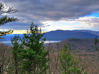 At 1.3 miles the trail began to level as we reached the highest point on the trail. Several paths branched off but were blocked while the blazed trail turned to the left and headed west. It descended slightly to a rocky lookout with view of the mountains to the west and the Ashokan Reservoir. I immediately sat down on the rock to take off the tights which it was clear I did not need. I took pictures from the rock and a little farther up the trail. Sheila jumped up on the rock to pose so I took some shots of her. When I parked the car the skies were overcast but the further up the mountain we hiked, the clearer the sky became. I knew this lookout was not the one I had visited when hiking from the DEC parking area a little further along Peck Road. The sky was now blue with white clouds and the sun cast interesting patterns on the landscape. When we were ready to leave, I decided to follow one of the paths which lead north. After a short distance, the paths started to lead down the mountain and I turned around a returned to the place where we had started. From there it was just a matter of reversing the route we had used to ascend the mountain. We met only one hiker coming up the trail and he had his dog with him. Sheila was very good at ignoring the other dog as we passed. We were back down the mountain and at the car at 11:10 AM after hiking a total of 3.2 miles or 2.8 miles on the trail. The total elevation gain on the trail was 945 feet. I decided I had enough time and enough energy to hike the Ashokan Quarry Trail.
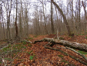
![]()
![]()
![]()
![]()
![]() On Saturday, November 14th, I was scheduled to meet one of my trail maintainers, Christopher, at the Balsam Lake Mountain Beaverkill trailhead. I like to meet all of my maintainers and get to know them and this was the first opportunity I had to meet Christopher. He maintains the Dry Brook Ridge Trail to the south junction with the Balsam Lake Mountain Trail and the Balsam Lake Mountain Trail to the junction with the Millbrook Ridge Trail. He lives and teaches on Long Island and we had agreed to meet at the trailhead at 9:00 AM which made me wonder how early he would have to get up! Fortunately, the ambulance pager did not go off over night so I was able to sleep until 7:00 AM. When I got up the temperature was 33 degrees in town and I thought it might be colder at the trailhead even though we were meeting later in the day. Sheila was waiting and ready to go as I got dressed and gathered my gear. I got dressed in my Mammut long-sleeved crew top with a long-sleeved baselayer. I put on a pair of light tights and then a pair of RailRiders hiking pants which are expensive but last along time and have features like deep pockets and a generous cut which I really like. These pants have Velcro closures at the ankles to discourage sticks and gravel from getting into my shoes and to combat ticks. I hoped this would be enough so that I would not have to wear gaiters. I decided to wear my Keen Targhee II hiking boots which fit well and have been discontinued. Before putting on the shoes I tapped the back of my right heel just to make sure I did not get a repeat experience with blisters. I decided to bring a pair of external lock Leki poles even though I would have to carry my maintenance gear since I did not want to climb the steep trail on Balsam Lake Mountain without them. I put on my Mammut hoody and brought a pair of light gloves. I also donned a blaze orange fleece hat for warmth and for visibility. I decided to bring my Silky Sugowaza saw, Fiskars pack ax, LT Wright Overland machete, a round point shovel and a pick mattocks. I put my gear in the car and Sheila in the back seat and headed out Old Route 17 toward the Beaverkill Road at 8:15 AM. I turned right on the Beaverkill Road and headed north toward Lew Beach and Turnwood. The Beaverkill Falls were flowing with a good volume from recent rains and I thought I might stop on the way back for a few shots. The road conditions were pretty good even when the pavement ended. I continued on the road under beautiful blue skies with white clouds. Toward the end the road becomes very narrow and I was glad I did not meet any cars. We arrived at the parking area at 8:45 AM which meant the 45 minute drive had only taken us 30 minutes. There were 4 other cars in the lot and I was pretty sure more would be arriving given the beautiful weather. Christopher pulled in just before 9:00 AM and we greeted each other. He has a place near Stamford so the trip was short than it would have been from Long Island. We talked for a few minutes as we got ready to go and decided on the tools each of us would carry. I was surprised that Sheila immediately accepted Christopher and allowed him to pet her without protest.
On Saturday, November 14th, I was scheduled to meet one of my trail maintainers, Christopher, at the Balsam Lake Mountain Beaverkill trailhead. I like to meet all of my maintainers and get to know them and this was the first opportunity I had to meet Christopher. He maintains the Dry Brook Ridge Trail to the south junction with the Balsam Lake Mountain Trail and the Balsam Lake Mountain Trail to the junction with the Millbrook Ridge Trail. He lives and teaches on Long Island and we had agreed to meet at the trailhead at 9:00 AM which made me wonder how early he would have to get up! Fortunately, the ambulance pager did not go off over night so I was able to sleep until 7:00 AM. When I got up the temperature was 33 degrees in town and I thought it might be colder at the trailhead even though we were meeting later in the day. Sheila was waiting and ready to go as I got dressed and gathered my gear. I got dressed in my Mammut long-sleeved crew top with a long-sleeved baselayer. I put on a pair of light tights and then a pair of RailRiders hiking pants which are expensive but last along time and have features like deep pockets and a generous cut which I really like. These pants have Velcro closures at the ankles to discourage sticks and gravel from getting into my shoes and to combat ticks. I hoped this would be enough so that I would not have to wear gaiters. I decided to wear my Keen Targhee II hiking boots which fit well and have been discontinued. Before putting on the shoes I tapped the back of my right heel just to make sure I did not get a repeat experience with blisters. I decided to bring a pair of external lock Leki poles even though I would have to carry my maintenance gear since I did not want to climb the steep trail on Balsam Lake Mountain without them. I put on my Mammut hoody and brought a pair of light gloves. I also donned a blaze orange fleece hat for warmth and for visibility. I decided to bring my Silky Sugowaza saw, Fiskars pack ax, LT Wright Overland machete, a round point shovel and a pick mattocks. I put my gear in the car and Sheila in the back seat and headed out Old Route 17 toward the Beaverkill Road at 8:15 AM. I turned right on the Beaverkill Road and headed north toward Lew Beach and Turnwood. The Beaverkill Falls were flowing with a good volume from recent rains and I thought I might stop on the way back for a few shots. The road conditions were pretty good even when the pavement ended. I continued on the road under beautiful blue skies with white clouds. Toward the end the road becomes very narrow and I was glad I did not meet any cars. We arrived at the parking area at 8:45 AM which meant the 45 minute drive had only taken us 30 minutes. There were 4 other cars in the lot and I was pretty sure more would be arriving given the beautiful weather. Christopher pulled in just before 9:00 AM and we greeted each other. He has a place near Stamford so the trip was short than it would have been from Long Island. We talked for a few minutes as we got ready to go and decided on the tools each of us would carry. I was surprised that Sheila immediately accepted Christopher and allowed him to pet her without protest.
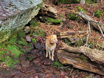 At 9: 30 AM we headed out on the trail. There were some wet and muddy spots right at the beginning of the trail but there was no way to fix them. We found several branches hanging over the trail but we were able to pull them down and throw them off the trail. We continued along the trail picking up a few branches as we went. This part of the trail has some large and very old trunks on the trail. They do not block the trail but should be removed. These trunks are large enough that they will need a chainsaw to remove the. Chris and I finally came to a tree that was interfering with passage on the trail. Someone had cut a few branches but had then left the branches on the trail creating quite a mess. We set down our packs and I took some "before" pictures after which we assessed the job. We cleared some branches that were loose and then went to work cutting some smaller branches that were attached to a larger trunk. As we were working a few groups of people walked passed and thanked us for our work. I was happy that Sheila simply sat by my pack and behaved herself. Chris and I set to working with our saws to cut off and drag away larger branches. When we were done, only the larger trunk remained and I knew we could not cut it with the tools we had. After taking some "after" shots, we picked up and moved on. We cleared a few more small trees and branches that were hanging over the trail. We arrived at the turn to the left up the mountain. There was a group ahead of us with a dog and they turned up the mountain at a good pace. We continued up the mountain which averages over a 25% grade. I was glad I had brought my poles. We had lots of time to talk as there was almost no work to do on the trail. I found Chris very easy to talk to and we worked through many topics. It helped that I had spent 11 years on Long Island between college and teaching. Soon we were passing the spur trail to the lean-to on the right. Just passed the spur trail we started the last steep climb where we found the 3500 foot sign. We stopped at the spring so that I could take a few more pictures and while we were there some more people passed us. We soon continued up the stone "steps" to the summit plateau. There was a tree with some branches hanging down in the trail so we used the loppers to cut them. As we walked toward the tower, we came to the junction with the Millbrook Ridge Trail which is the end of Chris' responsibility. We decided to go to the tower and then turn around and retrace our steps to the car.
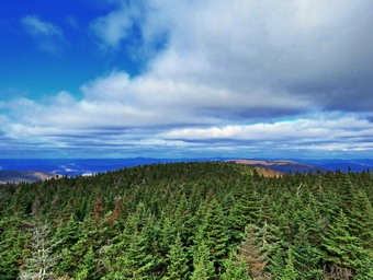 We worked our way along the trail toward the tower and I was reminded that this section is always a little longer than I think. We did find one tree leaning over the trail and I cut it and dragged it off the trail with the help of a passing hiker. When we arrived at the tower clearing, there were about a dozen people in various places. I dropped my pack and leashed Sheila to a tree as there were people and other dogs around. She was not happy as she likes to climb the tower with me! I waited until the tower was clear and then began the climb with my camera. Although the sun was out making the clearing seem warm there was a breeze blowing. As I rose to a level above the tree line, the force of the wind was a little surprising. I climbed to just below the cab and began to take pictures. My fingers immediately began to feel cold but I continued to snap shots. I zoomed in a little as the sunlight changed and took some more photos. Eventually my fingers and the people waiting below convinced me to descend. I took several shots of the tower and then returned to my pack. I got a bar from my pack then shouldered the pack and retrieved Sheila. We headed back down the trail. I had not descended the steep side of the mountain in some time as I prefer to do a loop. Descending I was glad I had decide to bring poles as the slippery leaves made the trail slippery. We passed several people on the way down and we stopped for a minute to talk to them. Chris has been a trail maintainer for 3 years and has volunteered at the tower for 15 years so together we have a lot of advice we can offer. I was happy when I saw the trail junction ahead. At the junction we turned right to head back to the parking area. We passed a few people on the way back. We arrived in the parking area at 1:00 PM after hiking 3.4 miles and doing trail work in 3.5 hours. The elevation gain was 1180 feet. The parking area was filled with cars with some overflow parking on the road below. On the way home I considered stopping at Beaverkiil Falls but I found I was more interested in getting home.
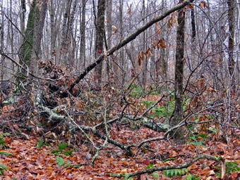
![]()
![]()
![]()
![]()
![]() On Thursday, November 12th, I wanted to go to Long Pond to remove a rather large blowdown on the Long Pond Beaverkill Ridge Trail where we had already cleared the trail with a chainsaw. The blowdown came down with the wind from a recent storm and was blocking the trail which was otherwise clear. I attended a men's fellowship meeting at y church at 6:15 AM. The temperature had dropped from 60 degrees at 10:00 PM the night before to 34 degrees in the morning and it was still raining. When I returned from church, I ate breakfast at Caf� 43 and then went home. The forecast was for rain through 10:00 AM so I found some things to do around the house. I was recovering from some heel blister that I had gotten wearing a pair of shoes that I have used for some time.so I did not plan on hiking very far. The blowdown was only about .75 miles from the road so that was a perfect situation. When I started getting ready just before 11:00 AM the temperature was 48 degrees. Sheila was anxious to get out as we had not hiked for four days! I got dressed in my Mammut long-sleeved crew top with a long-sleeved baselayer. I put on a pair of RailRiders hiking pants which are expensive but last along time and have features like deep pockets and a generous cut which I really like. These pants have Velcro closures at the ankles to discourage sticks and gravel from getting into my shoes and to combat ticks. I hoped this would be enough so that I would not have to wear gaiters. I decided to wear my Keen Targhee II hiking boots which fit well and have been discontinued. I decided to forego bringing poles as I would have carry my maintenance gear. I put on my Mammut hoody and brought a pair of light gloves. I also donned a blaze orange fleece hat for warmth and for visibility. I decided to bring my Silky Sugowaza saw, Silky Katanaboy 500 saw, Fiskars pack ax, Council Tools felling axe and two felling wedges. I put my gear in the car and Sheila in the back seat and headed out DeBruce Road at 11:10 AM. I passed through DeBruce and then Willowemoc and turned left on Flugertown Road. I drove out Flugertown Road and passed the trailhead on the left. After crossing the small bridge, I parked at one of the empty campsites on the right side of the road where there was already a small camper parked. There were also campers using the site on the other side of the road. I decided to take both saws but only the larger ax. At 11:30 AM the temperature was 44 degrees as we walked back down the road a short distance and turned right onto the trail. The trail climbs a little and then descends only to climb again to the trail junction at .4 miles. At .4 miles we turned right to stay on the Long Pond-Beaverkill Ridge Trail.
On Thursday, November 12th, I wanted to go to Long Pond to remove a rather large blowdown on the Long Pond Beaverkill Ridge Trail where we had already cleared the trail with a chainsaw. The blowdown came down with the wind from a recent storm and was blocking the trail which was otherwise clear. I attended a men's fellowship meeting at y church at 6:15 AM. The temperature had dropped from 60 degrees at 10:00 PM the night before to 34 degrees in the morning and it was still raining. When I returned from church, I ate breakfast at Caf� 43 and then went home. The forecast was for rain through 10:00 AM so I found some things to do around the house. I was recovering from some heel blister that I had gotten wearing a pair of shoes that I have used for some time.so I did not plan on hiking very far. The blowdown was only about .75 miles from the road so that was a perfect situation. When I started getting ready just before 11:00 AM the temperature was 48 degrees. Sheila was anxious to get out as we had not hiked for four days! I got dressed in my Mammut long-sleeved crew top with a long-sleeved baselayer. I put on a pair of RailRiders hiking pants which are expensive but last along time and have features like deep pockets and a generous cut which I really like. These pants have Velcro closures at the ankles to discourage sticks and gravel from getting into my shoes and to combat ticks. I hoped this would be enough so that I would not have to wear gaiters. I decided to wear my Keen Targhee II hiking boots which fit well and have been discontinued. I decided to forego bringing poles as I would have carry my maintenance gear. I put on my Mammut hoody and brought a pair of light gloves. I also donned a blaze orange fleece hat for warmth and for visibility. I decided to bring my Silky Sugowaza saw, Silky Katanaboy 500 saw, Fiskars pack ax, Council Tools felling axe and two felling wedges. I put my gear in the car and Sheila in the back seat and headed out DeBruce Road at 11:10 AM. I passed through DeBruce and then Willowemoc and turned left on Flugertown Road. I drove out Flugertown Road and passed the trailhead on the left. After crossing the small bridge, I parked at one of the empty campsites on the right side of the road where there was already a small camper parked. There were also campers using the site on the other side of the road. I decided to take both saws but only the larger ax. At 11:30 AM the temperature was 44 degrees as we walked back down the road a short distance and turned right onto the trail. The trail climbs a little and then descends only to climb again to the trail junction at .4 miles. At .4 miles we turned right to stay on the Long Pond-Beaverkill Ridge Trail.
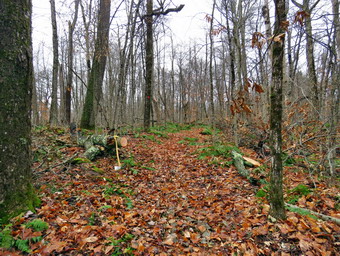 The trail was in good shape as we had worked on it in late September. The wind storms that had occurred since then had brought down a few branches and I picked up most of them as we walked along. Within a short distance, we came to the blowdown I wanted to clear. It was a rather large tree down across the trail with quite a few branches. The main trunk was about 14 inches in diameter and it looked like I would have to cut it twice. At 11:50 AM, I took my "before" pictures and then got to work. I cleared all the loose branches on both sides of the blowdown and then started to use the Sugowaza to remove smaller branches. I cleared all the branches as I went and then started to cut larger branches. When I had reduced the blowdown to the larger diameter branches and trunks, I took some more pictures. I cut the larger branches with the Sugowaza and cut down one small tree that was in the middle of the mess. Somehow as I was clearing, I grabbed a piece of wood which slipped out of my hand leaving a laceration behind. I took a minute to wrap some tape around my hand and then continued to work. I thought it ironic that I was using some sharp tools and was cut by some wood! I was finally down to the large trunk so I took a picture and began cutting. I sued the ax to cut a length off the upper part of the trunk. This large ax is too heavy to carry very far into the woods but it does a great job of biting through large trunks of hard wood. I rolled and flipped the piece of the rail and then looked at what remained. I decided to use the saws to cut the 14 inch diameter trunk. I started wit the large, straight Katanboy which certainly got things going. This saw takes a lot of muscle and endurance to use so I thought I would try switching to the smaller saw. Since the saw is 17 inches, I reasoned I might be able to cut through the trunk with it. The curved design of this fixed blade works best for me. The trunk didn't give up easily so I opened the kerf with a wedge. This did the trick and the piece fell to the ground. I took a quick shot and the tried to get that piece off the trail. It was a little longer and heavier than I thought but I eventually rolled and flipped it off the trail. I took my "after" pictures of the totally cleared and then put away all the tools. It was 12:50 PM when we turned around and started back under overcast skies with just a hint of sun. It had taken an hour to clear the blowdown which I thought was reasonable. The trip back went quickly as it was all downhill or flat. We were back at the car at 1:10 PM.
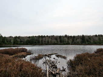 I was a little tired and I did not want to overwork my foot where I had the blisters. I did not have poles and didn't really feel like hiking around Long Pond. In the end, I decided not to give into the excuses and to hike the short loop to Long Pond. At 1:15 PM I set my GPS and we walked back down the road to turn left on the Long Pond Beaverkill Ridge Trail toward Long Pond. The trail crosses two bridges over the creek and then, in .2 miles, climbs 125 feet at a 20% grade. I was feeling the fact that I did not have poles! After that the trail still climbs but much more gently. Along the way there were several very wet and muddy spots which we worked around until we were at a trail junction at .75 miles. We turned right on the snowmobile trail and hiked a short distance to where the spur trail goes down to the shore of Long Pond. I took a minute to sit on the remains of an old fireplace and tape the back of my right heel. There was no pain or hint of a blister but I did not want to take any chances. We walked down to the shore of the pond and I told Sheila to "Stay!" as I walked out to take a few pictures. The skies were still overcast so I only took a few shots. The atmosphere was the definition of "bleak". I went back to my pack to stow the camera and we walked back up to the main trail We turned left and walked slightly uphill on the snowmobile trail. There continued to be several wet and muddy areas until we started to descend the hill to the large parking area at 1.5 miles. The hill was a little drier but was covered in slippery leaves. Over .6 miles we lost 340 feet to the parking lot. From the lot we walked out to Flugertown Road where I put Sheila on her leash. We turned right and started the 1.6 mile walk back to the car. My GPS shows that this walk is slightly up hill but it is not very noticeable. At 2.6 miles we came to the point where the pavement ends but I decided to keep Sheila on her leash. I did stop once to take a few shots of the road before hurrying back to the car. At 2:45 PM we were back at the car after hiking 3.8 miles in 1.5 hours with a 450 foot elevation gain. Our overall speed was 2.6 mph with a moving average of 2.8 mph. The temperature had dropped to 42 degrees and the breeze was blowing harder. I was pleased that I was able to clear the blowdown and get in a hike.
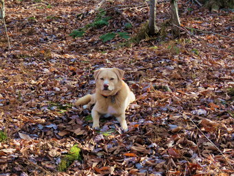
![]()
![]()
![]()
![]()
![]() On Saturday, November 7th, I wanted to go to Long Pond to survey the entire Long Pond Beaverkill Ridge Trail for blowdowns so that I could let Andy Garrison know if we should schedule a chainsaw trip. We had already worked on some of the worst blowdowns on the lower part of the trail and there were some big ones. The trail has not had a maintainer for some time and the area has lack a trail supervisor until I took over at the beginning of the fall. I had planned on getting up early to have as much time as possible to survey the trail and clear as much as I could. An early morning ambulance call changed my plans as I needed to catch up on my sleep. When I got up, I spent some time gathering garbage and recyclables to take to the transfer station. It was just before 11:00 AM when I started to get ready with the temperature at 58 degrees. Sheila was watching my every move but was doing so quitely. I got dressed in my White Sierra long-sleeved crew top with a short-sleeved baselayer. I put on a pair of RailRiders hiking pants which are expensive but last along time and have features like deep pockets and a generous cut which I really like. These pants have Velcro closures at the ankles to discourage sticks and gravel from getting into my shoes and to combat ticks. I hoped this would be enough so that I would not have to wear gaiters. I decided to wear my Vasque Taku hiking boots which fit well and have been discontinued. I decided to forego bringing poles as I would have carry my maintenance gear. I did pack a light windbreaker but I expected the temperature to rise throughout the day. I decided to bring my Silky Sugowaza, Fiskars pack ax and two felling wedges. I put my gear in the car and Sheila in the back seat and headed out DeBruce Road at 11:15 AM. As I approached DeBruce a small dark animal ran across the road and I assumed it was a large black squirrel. It stopped on the other side of the road and I could see it was a mink! I passed through DeBriuce and then Willowemoc and turned left on Flugertown Road. I drove out Flugertown Road and passed the trailhead on the left. After crossing the small bridge, I parked at one of the empty campsites on the right side of the road. I was surprised that there were no campers using the site. I set my Garmin GPS and we walked back down the road a short distance and turned right onto the trail. The trail climbs a little and then descends only to climb again to the trail junction at .4 miles. I cleared a few branches but left other for the return trip as my plan was to get to the top of the ridge as soon as possible. At .4 miles we turned right to stay on the Long Pond-Beaverkill Ridge Trail.
On Saturday, November 7th, I wanted to go to Long Pond to survey the entire Long Pond Beaverkill Ridge Trail for blowdowns so that I could let Andy Garrison know if we should schedule a chainsaw trip. We had already worked on some of the worst blowdowns on the lower part of the trail and there were some big ones. The trail has not had a maintainer for some time and the area has lack a trail supervisor until I took over at the beginning of the fall. I had planned on getting up early to have as much time as possible to survey the trail and clear as much as I could. An early morning ambulance call changed my plans as I needed to catch up on my sleep. When I got up, I spent some time gathering garbage and recyclables to take to the transfer station. It was just before 11:00 AM when I started to get ready with the temperature at 58 degrees. Sheila was watching my every move but was doing so quitely. I got dressed in my White Sierra long-sleeved crew top with a short-sleeved baselayer. I put on a pair of RailRiders hiking pants which are expensive but last along time and have features like deep pockets and a generous cut which I really like. These pants have Velcro closures at the ankles to discourage sticks and gravel from getting into my shoes and to combat ticks. I hoped this would be enough so that I would not have to wear gaiters. I decided to wear my Vasque Taku hiking boots which fit well and have been discontinued. I decided to forego bringing poles as I would have carry my maintenance gear. I did pack a light windbreaker but I expected the temperature to rise throughout the day. I decided to bring my Silky Sugowaza, Fiskars pack ax and two felling wedges. I put my gear in the car and Sheila in the back seat and headed out DeBruce Road at 11:15 AM. As I approached DeBruce a small dark animal ran across the road and I assumed it was a large black squirrel. It stopped on the other side of the road and I could see it was a mink! I passed through DeBriuce and then Willowemoc and turned left on Flugertown Road. I drove out Flugertown Road and passed the trailhead on the left. After crossing the small bridge, I parked at one of the empty campsites on the right side of the road. I was surprised that there were no campers using the site. I set my Garmin GPS and we walked back down the road a short distance and turned right onto the trail. The trail climbs a little and then descends only to climb again to the trail junction at .4 miles. I cleared a few branches but left other for the return trip as my plan was to get to the top of the ridge as soon as possible. At .4 miles we turned right to stay on the Long Pond-Beaverkill Ridge Trail.
 The trail was in good shape as we had worked on it in late September. The wind storms that had occurred since then had brought down a few branches and I picked up most of them as we walked along. Within a short distance, we came to a rather large tree down across the trail. There were quite a few branches and the trunks were a good size. We found a way to walk around the mess and continued on the trail. I thought I might tackle the blowdown on the way back or come back another day. I knew it would be challenging to cut the trunks but I knew I could do it with my big ax and saw. As we walked along the trail we passed by the trees Andy and I had cut and I was really impressed with the diameter of several of them. I followed Sheila as she followed the trail and her ability is uncanny even on little used trails like this one. At 1.25 miles we came to the base of the climb up to the ridge. The trail turned almost 90 degrees to the right heading northeast. At 1.4 miles we came to the place where Andy and I had stopped cutting. This is also the boundary between the Willowemoc Wild Forest and the Big Indian Wilderness. In the next .5 miles we gained 400 feet with an average of a 15% grade. I was feeling the climb as I was hiking without poles which really made a difference on the little traveled trail with uneven ground. At 1.6 miles the trail turned almost due west and then at 1.7 miles it headed north. I didn't find many blowdowns on the climb and the few that were present were small or easy to step over or around. At 1.8 miles we hit a high point and started a little descent to 2.1 miles where we started to climb again. Over the next .8 miles the trail continued ascend but was always headed north. The grade averaged only 6% but the walk was longer than I remembered. Along the way we hit a variety of problems. There were areas where the trail was poorly marked and I was lucky have Sheila who is flawless. In other places there were blowdowns that had been there for some time and had caused hikers to reroute the trail. There were a couple of blowdowns that were large and difficult to get over or under. My plan was to continue to the trail junction and then clear some of the small blowdowns on the return trip and take pictures of others. The marking of the trail was also confusing as someone had placed new markers above or below existing markers. Two markers stacked means a turn but there were no turns! At 1:30 PM we arrived at the trail junction which, ironically, was blocked by a blowdown with trail markers.
 As we turned to start back, I was concerned about two things. I did not want to walk out using a headlamp although both of mine were working. My second concern was a stinging sensation coming from my right heel which I assumed was a blister. I took a picture of the blowdown at the junction which was the first of many. As we started back, I started to removed blowdowns that were in the trail, hanging over the trail or would trip up hikers. I started to count but lost track after 15! Most of these were simply moving things of the trail or making a few cuts with the saw or ax. I did clear two blowdowns that had many small branches blocking the trail in two different spots. In these cases I took before and after pictures which showed some good results. I also took pictures of some of the blowdowns that were blocking the trail that I could not cut. I finally stopped to take a look at my right heel which did have a broken blister. I taped over it with medical tape which did a better job than I expected. After this we set a faster pace and I noticed going down hill hurt my heel less and was easier than I anticipated without poles. I realized how lucky I am to be able to use CPS (canine positioning system) as all I have to do is watch Sheila and follow her. Soon we were making the final descent off the ridge. It was 3:30 PM when we crossed over to the Willowemc Wild Forest and the sun was beginning to dip low behind the trees. When we finally reached the new blowdown, I just took a picture and decided to leave it for later. At 4:00 PM and 5.6 miles we reached the left turn to take us back to Flugertown Road. On the way back down the hill, I did take the time to remove two larger blowdowns. Just as we were starting to descend the last hill, Sheila alerted and I looked up to see the outline of a dog's head on the right side of the trail ahead. I put Sheila on her leash and watched the head but it did not love. As we approached, I could see it was a stump with two upward pointing projections that looked like ears. I think Sheila saw it at the same time. When we hit the road, we turned left and I could see there were now people at the campsite. We were immediately greeted by a small, yipping dog that was not on a leash. I yelled for the owners to control their dog which would not have been necessary if the had it on a leash! We were back at the car at 4:15 PM after hiking 6.1 miles in 4 hours and 35 minutes with an elevation gain of 1180 feet. We had been stopped for 1 hour and 20 minutes to do trail maintenance.
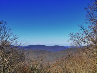
![]()
![]()
![]()
![]()
![]() On Friday, November 6th, I planned to hike from the Frick Pond Trailhead along the Flynn Trail to the highest Mongaup Mountain and then to the Hodge Pond Lookout. I had planned this hike several times but on this day I hoped may plan would come to completion. As I started to get ready at 9:00 AM, the temperature was still in the low 40's but the sun made it feel much warmer. As I got my gear together, Sheila seemed very excited even though we had been hiking during the week. I put on my long-sleeved Mammut crew top and a short-sleeved baselayer. I put on a pair of RailRiders hiking pants which are expensive but last a long time and have features like deep pockets and a generous cut which I really like. The pants have Velcro closures at the ankles. I decided to wear my Keen Targhee II boots which are supportive, surprisingly roomy and have been discontinued. I grabbed a pair of Leki external lock poles I have been using since spring. The external locks have not failed me yet and the cork handles really do allow a good grip. I also added a blaze orange fleece hat for warmth and visibility. I put my gear in the car and Sheila in the backseat at which point the ambulance pager went off. I let Sheila back out of the car and went on the call. I returned at 10:00 AM and again got ready to hike. I once again put Sheila in the car and drove out DeBruce Road at 10:15 AM. After 6 miles, I turned left on Mongaup Road and continued to where the road split. I stayed to the left on Beech Mountain Road to the parking areas for Frick Pond. I parked in the small lot where there was one other car. This was a big improvement over the last few times when the lots were almost full. I set my GPS and we crossed the road to get on the Flynn Trail to start our hike at 10:40 AM with the temperature at 55 degrees. There were lots of leaves on the trail and no leaves left on the trees.
On Friday, November 6th, I planned to hike from the Frick Pond Trailhead along the Flynn Trail to the highest Mongaup Mountain and then to the Hodge Pond Lookout. I had planned this hike several times but on this day I hoped may plan would come to completion. As I started to get ready at 9:00 AM, the temperature was still in the low 40's but the sun made it feel much warmer. As I got my gear together, Sheila seemed very excited even though we had been hiking during the week. I put on my long-sleeved Mammut crew top and a short-sleeved baselayer. I put on a pair of RailRiders hiking pants which are expensive but last a long time and have features like deep pockets and a generous cut which I really like. The pants have Velcro closures at the ankles. I decided to wear my Keen Targhee II boots which are supportive, surprisingly roomy and have been discontinued. I grabbed a pair of Leki external lock poles I have been using since spring. The external locks have not failed me yet and the cork handles really do allow a good grip. I also added a blaze orange fleece hat for warmth and visibility. I put my gear in the car and Sheila in the backseat at which point the ambulance pager went off. I let Sheila back out of the car and went on the call. I returned at 10:00 AM and again got ready to hike. I once again put Sheila in the car and drove out DeBruce Road at 10:15 AM. After 6 miles, I turned left on Mongaup Road and continued to where the road split. I stayed to the left on Beech Mountain Road to the parking areas for Frick Pond. I parked in the small lot where there was one other car. This was a big improvement over the last few times when the lots were almost full. I set my GPS and we crossed the road to get on the Flynn Trail to start our hike at 10:40 AM with the temperature at 55 degrees. There were lots of leaves on the trail and no leaves left on the trees.
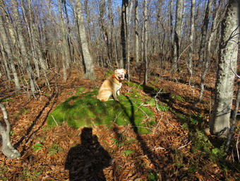 At the end of the trail we turned right to continue our hike on the Flynn Trail which, in this area, follows the old Beech Mountain Road. I thought I was feeling tired but as soon as we started up the trail I began to feel fresh and set a good pace. We passed through the "tunnel" Cindy and I had cut in a huge spruce tree that fell across the trail. I had no one to talk to so I was lost in my thoughts which seems to make the hike go faster. I kept noticing that a breeze was blowing but that the sun was shining brightly. The rest of the sky was blue with puffy white clouds. At .7 miles I noticed a bright pink ribbon to the right of the trail at the start of a woods road that parallels the Flynn Trail. I decided to follow the woods road which I knew would hit a high point and then come back down to the trail. As I hiked along the road, I continued to find a path of pink ribbons. My first thought was to remove them since I could not imagine why they had been placed there. I decided to contact the local forest ranger first to see if he knew the meaning of flagging. At .9 miles we hit the high point and I stopped to take some pictures of the road, the ledges and the stone structure that was constructed to support the road. From here we walked back down to the Flynn Trail at 1.0 miles. At 11:35 AM we were at the junction with the Big Rock Trail after hiking 1.75 miles in an hour. We continued straight ahead on the Flynn Trail and passed through the gate that separates state land from the OSI Beech Mountain Nature Preserve. When the trails split after the gate, we turned right. We followed the woods road passed the turn to the old Beech Mountain Boy Scout Camp and started up the hill toward the top of the hill. The road is dirt and rocks and was covered with fallen leaves. Over the next .4 miles we gained 450 feet which is only a 12% grade and sometimes leaves me tired. On this day I was still feeling great. At 2.7 miles we stopped at a viewpoint to the west. I got out my camera and could see that there were very few leaves remaining on the trees and those had very little color. We got a drink and then headed up the hill to a high point before starting down the other side.
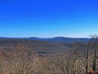 At the base of the short descent the road turned to the right but we went left. The highest Mongaup Mountain, the one on the CHH list, is almost due north of this point and we headed in that direction. Every time I have done this hike it was a bushwhack although a rather easy and obvious one. The route travels along a line of ledges on the right and eventually follows a crest or ridge that points to the summit of Mongaup Mountain. I was surprised to find that the path was now as clear as most trails and that there were some markers along the way. I was disappointed as this really spoils the bushwhack feel of the trip. We walked along the path which was impossible to miss and several landmarks looked familiar. Twice I walked up to a higher point to the right of the path to see if there was a viewpoint but there was not. One spot was so convincing I even hit it on the way back! At about 3.5 miles the path started to head west but I could see higher ground straight ahead to the north. We continued through the woods and up on a true bushwhack. I kept heading for higher ground and eventually found a moss-covered rock which seemed like the highest ground. I took a picture of Sheila on the rock. We got a drink and then headed a little farther north as I remembered a viewpoint. We wandered around a little but I finally decided to give up and head south. Our rout back was a little more to the west so I turned southeast and ran into the route we had followed up. Along the way we found a very large tree with two large trunks so I took a picture. The walk back went quickly and at 1:05 PM we had hiked 4.6 miles and were back at the woods road.
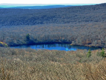 I decided to walk straight ahead aiming to walk around clockwise Beech Mountain on the trail. In a short distance we came to a cleared area with a great view to the east. I had been here recently when the leaves were on the trees and there was some color. I stopped to take a few pictures and the continued up a short hill to the trail that surrounds Beech Mountain, We turned left and headed south around that end of the summit. There are some fanatic ledges and cliffs here but it is hard to get a good picture through the trees. The woods road seems wider and more well-maintained every time I use it. The walk to the Hodge Pond Lookout was short so we were there very quickly. I put my pack down and got out my camera. As I stepped out onto the rock ledge that forms the viewpoint, I was glad that someone had cut some trees and brush to open up the view. I could see the trees that had been cut at the base of the viewpoint so I took a shot of them. I took pictures of Hodge Pond and the hills beyond even though the trees were mostly bare. I put my camera away and gave Sheila a drink and got one for myself. We continued on the trail that surrounds the summit of Beech Mountain traveling in a clockwise direction. We were soon back at the woods road that comes up the hill where we made a left and started back down toward the ruins of the Boy Scout camp. When we arrived at the junction near the old Boy Scout camp, we continued straight ahead on the woods road. At the junction with the Flynn Trail, we turned left. I felt pretty good since I knew the rest of the hike was downhill or flat. We passed through the gate and were soon at the junction with the Big Rock Trail. We set a fast pace down the Flynn Trail which we had all to ourselves. I had to call Sheila back a few times as she is much faster than I am and she was distracted by some animals off the trail. There was one small blowdown that I tried to pull off the trail. I found it would need to be cut so that it could be removed. Soon we passed through the "tunnel" and arrived at the gate. We turned left on the Flynn Trail to avoid the private property around the cabin. As we emerged from the Flynn Trail, we found there were now three cars parked in the small lot and only one in the large lot. We arrived back at the car at 2:30 PM after hiking 8.0 miles in 3 hours and 45 minutes which was an average speed of 2.1 mph. The elevation gain was 1325 feet.
![]()
![]()
![]()
![]() On Thursday, November 5th I had planned to do a longer hike to the Mongaup Mountain on the CHH list with a possible trip to Hodge Pond Mountain. Events conspired to make this plan impossible. I was contacted by a woman who needed a ride from the Slide Mountain trailhead to the trailhead on Campbell Mountain Road. She was hiking the Finger Lakes Trail and had gotten a price of $150 for the ride. I volunteered to do it for much less. Whenever I volunteer to help someone out, I do not take any money. We agreed to meet at noon and I knew it would take about an hour to make the trip. My day began with an ambulance call at 5:00 AM. I returned home at 6:05 AM which left me just enough time to get to my men's fellowship group at my church. I returned to Livingston Manor at 7:45 AM, ate breakfast at Caf� 43 and finished the paperwork from the ambulance call. When I returned home, I did some work around the house until I got ready to leave the house to go to Slide Mountain. I arrived at the trailhead to find the hiker I was transporting already there. We left almost immediately and as I drove we talked. The trip seemed to go quickly and by 1:10 PM we were at the Campbell Mountain Road trailhead. I said goodbye to the hiker and wished her well in her 4 day trip back to Slide Mountain. I returned home arriving at 2:00 PM. Sheila seemed to remember that I had promised that we would go out when I got home. She was running madly around the house and barking at me. I asked Cindy if she wanted to go across the street to hike a couple of loops on Round Top and she agreed. We started to get ready with the temperature a surprisingly warm 63 degrees. I got dressed in my White Sierra long-sleeved crew top but decided I did not need a baselayer. I put on a pair of RailRiders hiking pants which are expensive but last along time and have features like deep pockets and a generous cut which I really like. These pants have a Velcro closures at the ankles to discourage sticks and gravel from getting into my shoes and to combat ticks. I decided to wear my Vasque Taku hiking boots which fit well and have been discontinued. I grabbed a pair of Leki external lock poles I have been using lately. Sheila kept me in sight as I got ready to go making sure she would not be forgotten. We stepped out of the house at 2:30 PM and I grabbed Sheila's leash from the car. We walked up the driveway and crossed the street. I decided we would probably do two figure 8's to cover all the trails and tire me out a little. We walked to the parking area by the Presbyterian Church and to the back of the church. We began the ascent of the steepest hill behind the church. The hill is short but gets the circulation pumping and is the steepest and longest climb on the "trail." Sheila helped me along by pulling me up the hill but I noticed the hill seemed easier as I have been hiking more. Two small dogs came running at us from one of the houses because the owner does not know about leashes! When we got to the top of the hill, we stopped to look around at the hills around town. We started on the trail by turning left at the trailhead. I let Sheila off her leash so that she could explore. The trail bed is becoming worn it which means that at least a few people are using the trail. I am always happy to see that someone else uses the trails. I showed Cindy the large blowdown I had cut removed and then cut again to eliminate it from the trail.
On Thursday, November 5th I had planned to do a longer hike to the Mongaup Mountain on the CHH list with a possible trip to Hodge Pond Mountain. Events conspired to make this plan impossible. I was contacted by a woman who needed a ride from the Slide Mountain trailhead to the trailhead on Campbell Mountain Road. She was hiking the Finger Lakes Trail and had gotten a price of $150 for the ride. I volunteered to do it for much less. Whenever I volunteer to help someone out, I do not take any money. We agreed to meet at noon and I knew it would take about an hour to make the trip. My day began with an ambulance call at 5:00 AM. I returned home at 6:05 AM which left me just enough time to get to my men's fellowship group at my church. I returned to Livingston Manor at 7:45 AM, ate breakfast at Caf� 43 and finished the paperwork from the ambulance call. When I returned home, I did some work around the house until I got ready to leave the house to go to Slide Mountain. I arrived at the trailhead to find the hiker I was transporting already there. We left almost immediately and as I drove we talked. The trip seemed to go quickly and by 1:10 PM we were at the Campbell Mountain Road trailhead. I said goodbye to the hiker and wished her well in her 4 day trip back to Slide Mountain. I returned home arriving at 2:00 PM. Sheila seemed to remember that I had promised that we would go out when I got home. She was running madly around the house and barking at me. I asked Cindy if she wanted to go across the street to hike a couple of loops on Round Top and she agreed. We started to get ready with the temperature a surprisingly warm 63 degrees. I got dressed in my White Sierra long-sleeved crew top but decided I did not need a baselayer. I put on a pair of RailRiders hiking pants which are expensive but last along time and have features like deep pockets and a generous cut which I really like. These pants have a Velcro closures at the ankles to discourage sticks and gravel from getting into my shoes and to combat ticks. I decided to wear my Vasque Taku hiking boots which fit well and have been discontinued. I grabbed a pair of Leki external lock poles I have been using lately. Sheila kept me in sight as I got ready to go making sure she would not be forgotten. We stepped out of the house at 2:30 PM and I grabbed Sheila's leash from the car. We walked up the driveway and crossed the street. I decided we would probably do two figure 8's to cover all the trails and tire me out a little. We walked to the parking area by the Presbyterian Church and to the back of the church. We began the ascent of the steepest hill behind the church. The hill is short but gets the circulation pumping and is the steepest and longest climb on the "trail." Sheila helped me along by pulling me up the hill but I noticed the hill seemed easier as I have been hiking more. Two small dogs came running at us from one of the houses because the owner does not know about leashes! When we got to the top of the hill, we stopped to look around at the hills around town. We started on the trail by turning left at the trailhead. I let Sheila off her leash so that she could explore. The trail bed is becoming worn it which means that at least a few people are using the trail. I am always happy to see that someone else uses the trails. I showed Cindy the large blowdown I had cut removed and then cut again to eliminate it from the trail.
At the first trail junction, we followed Sheila as she continued straight ahead up the hill toward the lookout. The trail was covered in a thick blanket of leaves which were slippery and made the climb more difficult. We turned right at the top of the hill following yellow trail up the hill. The trees were devoid of leaves which were now on the ground but the scene was still interesting with the sun filtering through the trees. At the next trail junction with the blue trail, we turned right following the yellow trail along the base of Round Top. At the second junction, we turned left and started up the hill toward the summit. When we arrived at the white crossover trail, we turned left and followed the new crossover trail to the blue trail as it came down off the summit of Round Top. We started downhill but almost immediately turned left onto the new switchback that we had created for the blue trail. The switchback moderates the steepness of the blue trail and reduces the erosion that has occurred as more people walk the trail. The switchback is short and at the end we turned left to follow the blue trail back to the trail junction with the yellow trail. We turned left and again walked along the base of Round Top to the second trail junction. This time we turned right and continued downhill to the woods road that returned us to the very first trail junction. We immediately turned around and started back up the woods road which is the shallower approach to the trail system. We continued to follow the yellow trail toward the first junction and when we reached it we turned left and followed it to the next trail junction. At the second junction with the blue trail, we turned right and started up the steep blue trail that leads over the summit of Round Top. Walking uphill we passed through what remained of the ferns of the summer all with brown edges. Just before the steepest section we came to the turn for the switchback but we continued straight up the hill. It was obvious that fewer people were taking this section of the trail by the lack of a defined treadway. We continued over the top of the hill and started down the other side. We passed by the white crossover trail and came to the junction with the yellow trail. Here we turned right to walk along the base of Round Top. This time we turned left at the junction with the blue trail and walked down to the lookout. We followed the yellow trail as it turned left and descended the hill to the first trail junction. This time we turned left and walked out to the trailhead where I put Sheila on her leash. We walked down the hill to the parking lot and across the road to our driveway. We were home by 3:45 PM after hiking around 2 miles.
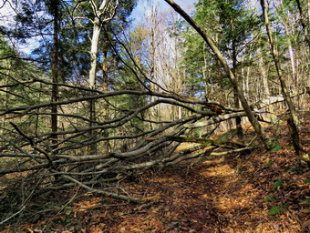
![]() On Tuesday, November 3rd, I wanted to go to Trout Pond to cut a blowdown that was blocking the trail to Trout Pond. I emailed one of foresters for Region 4 on Monday
about doing the work but got no answer. In the past it has been just a matter of notifying the Dec but this is not by assigned area so I was not sure how to proceed. I decided to go and do enough work to clear the trail so hikers could get through the rather complex blowdown. I started getting ready at 11:15 AM when the temperature was 39 degrees. The wind was blowing harder than predicted but the skies were clear and the sun was out. We had not been out in two days so Sheila had her eyes glued on me as I got dressed. I put on my long-sleeved Mammut crew top and a long-sleeved baselayer. I wore a pair of RailRiders hiking pants which are expensive but last a long time and have features like deep pockets and a generous cut which I really like. The pants have Velcro closures at the ankles. I decided not to wear a pair of tights under the pants. I put on my Vasque Taku boots which are supportive enough, surprisingly roomy and have been discontinued. I wore these because I did not expect any snow or ice and my winter boots have less support. I also added a blaze orange fleece hat for both warmth and visibility. I put on my Mammut hoody which has plenty of zippers to dump heat when I get warm. I knew I would not need poles on this short hike and that I could not carry them and my maintenance gear. I grabbed my Fiskars pack, Council Tools Velvicut Felling ax, Silky Sugowaza saw, Silky Katanaboy 500 and two felling wedges. I put my gear in the back and Sheila in the back seat. At 11:40, I headed to Roscoe on State Route 17, got off at exit 94 and got on Route 206. I followed it across the Delaware County line to Morton Hill Road. After a left turn on Morton Hill Road, I drove to the intersection with Russell Brook Road. I decided to drive down to the trailhead parking to make carrying my gear easier. As I drove down the road, I could see a forest ranger's truck ahead. I decided this was good fortune as I could ask the ranger about cutting the blowdown. We both parked in the empty lot. I left Sheila in the car and got out to talk to the ranger. The ranger was, Steven Ellis, who works out of the Stamford substation and who I had met before several times. He was unsure about me cutting the blowdown in an area where I was not assigned. Although he had simply come to hike the trails, he quickly volunteered to cut the blowdown with his chainsaw. I asked if I could help and he agreed. Ranger Ellis began to get his equipment ready and we chatted as he did. He will have been in the area for only a year this December after transferring from the Tupper Lake area. Before becoming a forest ranger, he worked as an instructor at Paul Smith's College and coached the Timbersports team! I decided to let Sheila out of the car and she began to roam around. She passed by the ranger several times and was well-behaved despite his uniform and hat. This behavior continued throughout the day with Sheila actually showing that she liked him! I shouldered my pack but left my equipment behind as we started out on the trail. We started up the hill toward Trout Pond and very shortly ran into the blowdown.
On Tuesday, November 3rd, I wanted to go to Trout Pond to cut a blowdown that was blocking the trail to Trout Pond. I emailed one of foresters for Region 4 on Monday
about doing the work but got no answer. In the past it has been just a matter of notifying the Dec but this is not by assigned area so I was not sure how to proceed. I decided to go and do enough work to clear the trail so hikers could get through the rather complex blowdown. I started getting ready at 11:15 AM when the temperature was 39 degrees. The wind was blowing harder than predicted but the skies were clear and the sun was out. We had not been out in two days so Sheila had her eyes glued on me as I got dressed. I put on my long-sleeved Mammut crew top and a long-sleeved baselayer. I wore a pair of RailRiders hiking pants which are expensive but last a long time and have features like deep pockets and a generous cut which I really like. The pants have Velcro closures at the ankles. I decided not to wear a pair of tights under the pants. I put on my Vasque Taku boots which are supportive enough, surprisingly roomy and have been discontinued. I wore these because I did not expect any snow or ice and my winter boots have less support. I also added a blaze orange fleece hat for both warmth and visibility. I put on my Mammut hoody which has plenty of zippers to dump heat when I get warm. I knew I would not need poles on this short hike and that I could not carry them and my maintenance gear. I grabbed my Fiskars pack, Council Tools Velvicut Felling ax, Silky Sugowaza saw, Silky Katanaboy 500 and two felling wedges. I put my gear in the back and Sheila in the back seat. At 11:40, I headed to Roscoe on State Route 17, got off at exit 94 and got on Route 206. I followed it across the Delaware County line to Morton Hill Road. After a left turn on Morton Hill Road, I drove to the intersection with Russell Brook Road. I decided to drive down to the trailhead parking to make carrying my gear easier. As I drove down the road, I could see a forest ranger's truck ahead. I decided this was good fortune as I could ask the ranger about cutting the blowdown. We both parked in the empty lot. I left Sheila in the car and got out to talk to the ranger. The ranger was, Steven Ellis, who works out of the Stamford substation and who I had met before several times. He was unsure about me cutting the blowdown in an area where I was not assigned. Although he had simply come to hike the trails, he quickly volunteered to cut the blowdown with his chainsaw. I asked if I could help and he agreed. Ranger Ellis began to get his equipment ready and we chatted as he did. He will have been in the area for only a year this December after transferring from the Tupper Lake area. Before becoming a forest ranger, he worked as an instructor at Paul Smith's College and coached the Timbersports team! I decided to let Sheila out of the car and she began to roam around. She passed by the ranger several times and was well-behaved despite his uniform and hat. This behavior continued throughout the day with Sheila actually showing that she liked him! I shouldered my pack but left my equipment behind as we started out on the trail. We started up the hill toward Trout Pond and very shortly ran into the blowdown.
 I took some before pictures and then Ranger Ellis began to assess the blowdown. He developed a plan and began to dissect the tree that was not supporting the rest of the mess. I could tell that he was an expert with the saw because he cut quickly and confidently but carefully. As soon as piece started to come off and it was safe, I began to move them well off the trail. The first trunk went quickly and we turned our attentions to the other branches from the larger tree that were blocking the trail. It became obvious that we would only be able to open up a path for hiking and that the rest of the blowdown would have to be removed by an operations crew. Cutting some of the blowdown would require a powerhead on a pole to safely cut overhead. Ranger Ellis began cutting one of the branches that was under stress using a scoring technique I had never seen before. At one point the saw got pinched and there was no way to easily release it. Neither of us had brought a hand saw so we walked the short distance back to the parking lot to get them. Our trip to the parking lot gave us more time to exchange information. When we got back to the blowdown, Ranger Ellis removed the powerhead from the saw. I made one cut on the branch which freed the bar. As he put the saw back together I used my handsaw to trim a few branches and to clear everything that had been cut out of the way. Once the chainsaw was in operation again the last part of the work went quickly. Ranger Ellis cut and I removed what he cut until we had cut everything that was safe to cut. We spent a little more time trimming a few branches and cleaning up what was left. While we were working two hikers went by and thanked us for the work. We finished up around 1:15 PM and spent a few more minutes talking before heading back to the parking area. The work done was exactly what I wanted to accomplish but went much faster than if I had done it alone with hand tools. I also got to work with an interesting sawyer who taught me several things. Back at the parking area Ranger Ellis gave me his card so that I could get in touch with him. I left the parking area at about 1:30 PM after spending a little over 2 hours walking and working. Ranger Ellis was putting away his gear and intended to go back and mark the blowdown with some bright colored flagging so that hikers would not run into any of the remaining branches.
![]()
![]()
![]()
![]()
![]() On Saturday, October 31st, I wanted to get out for a hike as the next two days had rain in the forecast. I had some things to do around the house in the morning which didn't bother me as the temperature was 20 degrees at 7:00 AM. I began to get organized around 11:30 AM when I asked Cindy if she wanted to hiked. Cindy declined but Sheila came running when I called. I decided to go to Trout Pond and hike the loop in a clockwise direction with a possible redirection to Campbell Mountain and Morton Hill Road. It was 37 degrees when I started to get ready at 11:30 AM. Sheila got wind of what was going on and began running around the house barking. I put on my long-sleeved Mammut crew top and a long-sleeved baselayer. I wore a pair of RailRiders hiking pants which are expensive but last a long time and have features like deep pockets and a generous cut which I really like. The pants have Velcro closures at the ankles. I decided to wear a pair of tights under the pants. I put on my Keen Targhee II boots which are supportive enough, surprisingly roomy and have been discontinued. I wore these because I did not expect any snow or ice and my winter boots have less support. I also added a blaze orange fleece hat for both warmth and visibility. I put on my Mammut hoody which has plenty of zippers to dump heat when I get warm. I grabbed a pair of Leki external lock poles I have been using lately. I put my gear in the back and Sheila in the back seat. I headed to Roscoe on State Route 17, got off at exit 94 and got on Route 206. I followed it across the Delaware County line to Morton Hill Road. After a left turn on Morton Hill Road, I drove to the intersection with Russell Brook Road. I turned around and parked on the side of the road to avoid the parking area which is private. As I was getting ready to leave, two ATVs came up from the first house on the left of Russell Brook Road. One ATV stopped and I talked to the rider who owns the property at the intersection which looks like a public parking area. He confirmed that it is private property and he would prefer people not park there. He also gave me permission to park along the side of the road which I don't think is his call but made me happy that I was not bothering him. I set my GPS and put Sheila on her leash as we began our hike down Russell Brook Road at 12:20 PM. The temperature was 34 degrees but the sun was shining brightly which made it feel almost warm. There were several tents set up at the illegal campsite on the right side of the road playing loud music. Russell Brook Road was wet with a thin layer of slippery mud but I did not see any snow. As we walked along the road, something was falling around us on the ground. I looked up to see that there was till some snow and ice on the trees which was coming down with the increased temperature and a slight breeze. We met one man walking a noisy little poodle up the road which would become a theme for the day. The campsite on the left was also set up and loud music emanated from one tent. I have trouble understanding why you would come to a remote campsite and disturb the quiet. We continued on down Russell Brook Road to the overlook over the upper falls. There was a good amount of water going over the falls but not as much I expected from the two days of rain during the week. We walked down to the overlook and I put down my pack and got out the camera. I took some shots and then packed up to continue the hike. I put Sheila on her leash as we continued down toward the parking area where there were several cars already parked. There were two men who looked like hunters who had returned to their truck. I said "Hello" as we walked passed them and down the woods road toward the falls.
On Saturday, October 31st, I wanted to get out for a hike as the next two days had rain in the forecast. I had some things to do around the house in the morning which didn't bother me as the temperature was 20 degrees at 7:00 AM. I began to get organized around 11:30 AM when I asked Cindy if she wanted to hiked. Cindy declined but Sheila came running when I called. I decided to go to Trout Pond and hike the loop in a clockwise direction with a possible redirection to Campbell Mountain and Morton Hill Road. It was 37 degrees when I started to get ready at 11:30 AM. Sheila got wind of what was going on and began running around the house barking. I put on my long-sleeved Mammut crew top and a long-sleeved baselayer. I wore a pair of RailRiders hiking pants which are expensive but last a long time and have features like deep pockets and a generous cut which I really like. The pants have Velcro closures at the ankles. I decided to wear a pair of tights under the pants. I put on my Keen Targhee II boots which are supportive enough, surprisingly roomy and have been discontinued. I wore these because I did not expect any snow or ice and my winter boots have less support. I also added a blaze orange fleece hat for both warmth and visibility. I put on my Mammut hoody which has plenty of zippers to dump heat when I get warm. I grabbed a pair of Leki external lock poles I have been using lately. I put my gear in the back and Sheila in the back seat. I headed to Roscoe on State Route 17, got off at exit 94 and got on Route 206. I followed it across the Delaware County line to Morton Hill Road. After a left turn on Morton Hill Road, I drove to the intersection with Russell Brook Road. I turned around and parked on the side of the road to avoid the parking area which is private. As I was getting ready to leave, two ATVs came up from the first house on the left of Russell Brook Road. One ATV stopped and I talked to the rider who owns the property at the intersection which looks like a public parking area. He confirmed that it is private property and he would prefer people not park there. He also gave me permission to park along the side of the road which I don't think is his call but made me happy that I was not bothering him. I set my GPS and put Sheila on her leash as we began our hike down Russell Brook Road at 12:20 PM. The temperature was 34 degrees but the sun was shining brightly which made it feel almost warm. There were several tents set up at the illegal campsite on the right side of the road playing loud music. Russell Brook Road was wet with a thin layer of slippery mud but I did not see any snow. As we walked along the road, something was falling around us on the ground. I looked up to see that there was till some snow and ice on the trees which was coming down with the increased temperature and a slight breeze. We met one man walking a noisy little poodle up the road which would become a theme for the day. The campsite on the left was also set up and loud music emanated from one tent. I have trouble understanding why you would come to a remote campsite and disturb the quiet. We continued on down Russell Brook Road to the overlook over the upper falls. There was a good amount of water going over the falls but not as much I expected from the two days of rain during the week. We walked down to the overlook and I put down my pack and got out the camera. I took some shots and then packed up to continue the hike. I put Sheila on her leash as we continued down toward the parking area where there were several cars already parked. There were two men who looked like hunters who had returned to their truck. I said "Hello" as we walked passed them and down the woods road toward the falls.
 We got on the woods road that goes down to the bridge that crosses the brook. The bridge was in the shade and still had a coating of ice covering much of the bridge. The Japanese knotweed was brown and shriveled and I stopped to take some pictures. I decided to walk to the falls since I could see there were no people there at the time. The informal path to the falls was pretty clear as I had cut back the vegetation earlier in the season. We walked along the path and then down the bank to the streambed. The falls were flowing freely and the water looked cold. I took some shots including some of Sheila who "automatically" posed in front of the falls. I was happy to see that there were no rock piles in the area below the falls. When I was done, we headed back up the bank and out to the main trail. We turned right and then at the trail junction, we turned to the left to climb the steeper hill toward Mud Pond. The trail was wet and muddy with a layer of leaves and the outlet stream from Trout Pond was high. I was surprised that no one had claimed the large camping site on the right side of the trail. The sun was out and as soon as we started to climb the hill, I felt warm and opened some zippers on my hoody. Just as we started up the trail we passed a woman and her two children going down the hill. The youngest looked to be about 5 years old and was sitting in the trail as his mother encouraged him to walk! We reached the top of the hill at 1:10 PM after hiking 1.5 miles. The woods road down the other side was also wet but not as wet as I expected. I began to see some snow on the trail and in the woods. At 1.7 miles we made a right to follow the trail up to the shoulder of Cherry Ridge. When we started on the trail, I again noticed that there was water even in places that are had been dry all season. We walked through the forest of small birch trees and down the other side. There were also a few small blowdowns along the trail that needed to be cleared. Most of these could easily be removed with hand tools. There were also several large trunk on and across the trail but they were not really blocking hikers. The ascent continued for the next 1.2 miles and the amount of snow increased dramatically. I stopped several times to take pictures of the snow on the trail and in the woods. At 2.7 miles into the hike we were at the highest point and ready to start the descent to Trout Pond. The trail was now completely covered in snow which made the descent tricky and my feet a little cold.
 The descent of the trail went more quickly than I had thought. We did come across one large trunk that had broken off and planted itself upright on the trail. As we were approaching the pond I could hear a commotion at the upper lean-to and see a group of people headed toward the lower one. When we arrived at the bridge at the inlet end of the pond, I decided to stop and take some pictures as the clouds were nice and there were some reflections in the water. The group of hikers had left the lean-to and were headed toward us. They stopped to allow Sheila and I to pass and we exchanged greetings. The group was obviously a family and were dressed in sort of retro hiking outfits and carrying heavy wooden walking sticks. The lower lean-to was not occupied and the other camping site a little further along the trail was also empty. When I was done, we continued on the main trail toward the outlet end of the pond. We had been hearing barking dogs near the outlet end for some time and it sounded like a whole pack based on the amount of noise. This part of the trail had a few wet and muddy places but no more than usual. By this time the snow had completely disappeared and it looked more like fall again. As we approached the outlet end of the pond, a dog without a collar or leash came running toward us. He backed off when I yelled and right behind him were the owners and another dog with no leash. Since the owners were not concerned about their dogs I requested that they control them. The young man begrudgingly called the dog and the asked me if I was going to stay on the trail. I told him I was and he took the dogs off the trail into the woods. This is the second day in a row that I have met people with beautiful dogs that were uncollared and without leashes. Not only in this completely inconsiderate of other hikers but it makes me questions whether they deserve to own dogs! At the lower end of the pond, I could hear more barking. We turned right and walked out toward the beach where there were two dogs on leashes.
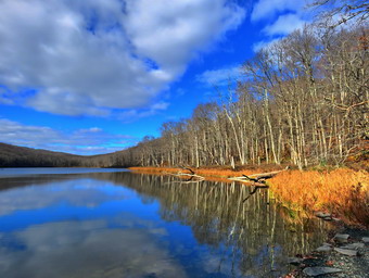 The first dog was very muscular and very vocal. The owner was having trouble controlling the dog but asked "Do you mind if he says Hello?". I said "Yes" as I did not want the dog anywhere near Sheila. The owner proceeded to allow her dog to get near Sheila as she apparently could not understand my answer. I pulled Sheila away and repeated by intentions. The owners left with their dogs and headed back down the trail toward the trailhead. Sheila and I walked over to the shore so that I could take some pictures of the pond. There were some nice reflections on the clouds in the water and the fall conditions contrasted sharply with the snow on Cherry Ridge. I snapped a few shots and then out Sheila on her leash as we headed back to the main trail. The hike from the outlet to the trail junction is all downhill but on this day it was wet. I set a quick pace and we started to catch up with the dogs that had left ahead of us. About halfway down, we met a young couple with a dog that was not on a leash. Fortunately, this dog had no interest in me or in Sheila. As we neared the trail register and trail junction, we came to at least two trees that almost blocked the trail. I was able to work my way through them but it was not easy. I stopped on the other side to examine how I might remove enough of the blowdown to make the trip easier. By 2:55 PM we had hiked 4.9 miles and were back at the trail junction and register box. We continued on the main trail to hike back to the car. The bridge over Russell Brook was still icy. We walked up to the lower parking area which was now almost completely filled. As we walked up the road back to the car, I could see there were only a few people down at the falls. I was glad we had visited it at the beginning of the hike. We continued up the road passing both of the occupied campsites blaring their music. We continued to walk back up the road to the car. We arrived back at 3:10 PM having covered 5.6 miles and 1127 vertical feet in 2 hours and 50 minutes. The temperature was 44 degrees as I pulled away.
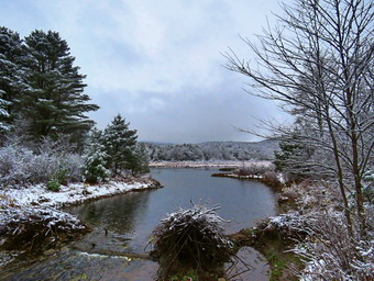
![]()
![]()
![]()
![]()
![]() On Friday, October 30th my plan was to get up and hike a medium to long distance hike somewhere relatively close to home. As often happens, the ambiance pager sounded at 5:00 AM but the call was cancelled before I got to the building. I was a little disappointed as we were supposed to get snow and it was still raining. Once I got back to sleep, I knew I would need to rest until I woke up again. Once again the pager went off and this time it was for a water rescue at Mongaup Pond. This time we got about smile from the turn onto Mongaup Pond Road and were again cancelled. A hunter in a kayak had overturned in the pond which brought many questions to mind. Fortunately, he was out of the water and being transported by private vehicle. By now the rain had changed to snow and several inches had fallen. The trees on the hills were covered in snow and I wanted to get out for a hike and to take pictures. When I got home, I asked Cindy if she wanted to go for a walk and she agreed. We decided to go to the Frick Pond area to hike around Frick Pond using the Logger's Loop and returning on the Big Rock Trail. We began to gather get read at 10:45 AM with Sheila making sure we could not forget her. We had not been out in two days due to the weather and Sheila was more than ready to venture out in the snow even though the temperature was only 36 degrees. I put on my long-sleeved Mammut crew top and a long-sleeved baselayer. I wore a pair of RailRiders hiking pants which are expensive but last a long time and have features like deep pockets and a generous cut which I really like. The pants have Velcro closures at the ankles. I decided to wear a pair of tights under the pants. I put on my Salomon B52 winter boots which are supportive enough, surprisingly roomy and have been discontinued. I also added a blaze orange fleece hat for both warmth and visibility. I put on my Mammut hoody which has plenty of zippers to dump heat when I get warm. For protection from the snow and mud I added a pair of OR Crocodile gaiters. I grabbed a pair of Leki external lock poles I have been using lately. I put our gear in the car and drove out DeBruce Road at 11:00 AM. After 6 miles, I turned left on Mongaup Road and continued to where the road split. I stayed to the left on Beech Mountain Road to the parking areas for Frick Pond. I pulled into the smaller lot as there were no other cars in sight. The temperature was 34 degrees at the trailhead and a slight breeze was blowing. I took some pictures of the snow on the road and in the parking areas. I then set my GPS as we started out on the woods road that leads to the Quick Lake Trail.
On Friday, October 30th my plan was to get up and hike a medium to long distance hike somewhere relatively close to home. As often happens, the ambiance pager sounded at 5:00 AM but the call was cancelled before I got to the building. I was a little disappointed as we were supposed to get snow and it was still raining. Once I got back to sleep, I knew I would need to rest until I woke up again. Once again the pager went off and this time it was for a water rescue at Mongaup Pond. This time we got about smile from the turn onto Mongaup Pond Road and were again cancelled. A hunter in a kayak had overturned in the pond which brought many questions to mind. Fortunately, he was out of the water and being transported by private vehicle. By now the rain had changed to snow and several inches had fallen. The trees on the hills were covered in snow and I wanted to get out for a hike and to take pictures. When I got home, I asked Cindy if she wanted to go for a walk and she agreed. We decided to go to the Frick Pond area to hike around Frick Pond using the Logger's Loop and returning on the Big Rock Trail. We began to gather get read at 10:45 AM with Sheila making sure we could not forget her. We had not been out in two days due to the weather and Sheila was more than ready to venture out in the snow even though the temperature was only 36 degrees. I put on my long-sleeved Mammut crew top and a long-sleeved baselayer. I wore a pair of RailRiders hiking pants which are expensive but last a long time and have features like deep pockets and a generous cut which I really like. The pants have Velcro closures at the ankles. I decided to wear a pair of tights under the pants. I put on my Salomon B52 winter boots which are supportive enough, surprisingly roomy and have been discontinued. I also added a blaze orange fleece hat for both warmth and visibility. I put on my Mammut hoody which has plenty of zippers to dump heat when I get warm. For protection from the snow and mud I added a pair of OR Crocodile gaiters. I grabbed a pair of Leki external lock poles I have been using lately. I put our gear in the car and drove out DeBruce Road at 11:00 AM. After 6 miles, I turned left on Mongaup Road and continued to where the road split. I stayed to the left on Beech Mountain Road to the parking areas for Frick Pond. I pulled into the smaller lot as there were no other cars in sight. The temperature was 34 degrees at the trailhead and a slight breeze was blowing. I took some pictures of the snow on the road and in the parking areas. I then set my GPS as we started out on the woods road that leads to the Quick Lake Trail.
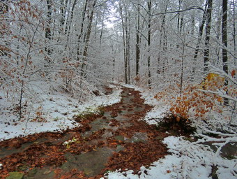 The trees were covered in snow and many branches were bending low. I knew it would be a long hike as I love taking pictures in the snow. The woods road to Frick Pond had some snow but also had a lot of water even in places that had been dry all fall. This was due to the rain the day and night before. There was standing water and running water. I stopped in one spot just before Gravestone Junction to take some pictures and remove some leaves to allow the water to drain. We stayed to the left at Gravestone Junction to keep on the Quick Lake Trail to the bridge at the outlet end of Frick Pond. The snow on the trees around the pond and on Beech Mountain was dramatic and I took quite a few pictures. The first I took was of the bridge which was pristine. The only problem is that the skies were overcast and there was some haze or fog in the air. I picked up my pack and we continued along the west side of the pond. There were many muddy areas and many where water had collected and it wasn't easy to avoid all of them. At the junction with the Big Rock Trail, we stayed to the left on the Quick Lake Trail. This trail also had snow covered trees and lots of wet and muddy places! I could not resist taking pictures here and there of the trail and the snow on the trees. When we arrived at the stream through the woods, we found that the water level was very high so while I took some pictures, Cindy walked upstream to find a crossing. When I was done I walked up to the point just below a small "waterfall" and crossed the stream without any problems. We continued up the trail working our way around pools of water and muddy areas. The trees continued to be covered in snow. As we were walking, I began to get warm so I opened some of the zippers on the hoody. We continued until we reached Iron Wheel Junction where I took some pictures of the namesake and of the snow-covered trees and trails. We turned right and started out on the Logger's Loop where I almost immediately stopped to take some pictures. The scene showed there was even more snow and many of the pictures looked black and white except for some moss on the rocks and some trail markers. We hiked along the trail until we came to a large culvert where I again took some pictures of the stream and some water falling off the bank on the left side of the trail. This area had a lot of water as the culverts and ditches were blocked with leaves.
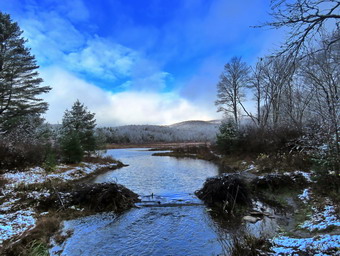 We walked up a small hill and down the other side and found not a trail but a small stream instead. Once again the path that the water could follow across the trail was blocked so the water took the path of least resistance downhill on the trail. Cindy and I spent at least 15 minutes clearing the leaves and some rocks to open up a better drainage directly across the trail. I was surprised that when we were done we could actually see the difference in the water flow. After some more pictures, we continued on the trail passing the area where there is sometimes a small, seasonal pond on the left. This area was dry so we continued on down the hill to Times Square. I considered simply following the Logger's Loop but finally decided to turn right on the Big Rock trail. We both like the wooden walkways on the west side of Frick Pond. We walked on the trail which was wet and muddy and continued through the evergreen forest. I took a few shots as this is a beautiful area. I pointed out the large spruce log that I had cut and that the crew had removed on our last trip. I had intended to take pictures of the snow-covered walkways but the temperature was rising and they were mostly wet. Both Cindy and I almost slipped and fell several times of the walkways. We continued along the trail to the junction with the Quick Lake Trail where we turned left. We walked back along the west side of the pond to the bridge. I had not intend to stop but the skies were now lighter and very blue. I took a number of shots which contrasted with what I had taken earlier. We walked up the hill to Gravestone Junction and then started back along the woods road to the car. Along the way Sheila alerted and I saw a couple coming toward us with two dogs. I put Sheila on her leash as a courtesy but neither of the other dogs were on a leash and one did not even have a collar! Both dogs were beautiful animals and I had intended to talk to the owners until I realized they could not control their dogs! We passed by them as fast as possible. I thought they were perhaps the most irresponsible dog owners I had ever met and did not deserve to have those dogs. Cindy and I walked out the woods road to our car. We looked over at the other parking area and saw a large SUV parked in the MIDDLE of the lot. It did not surprise us! It was 1:45 Pm and we had hiked 3.8 miles in 2 hours and 25 minutes with 45 minutes of stopped time. Our overall average was only 1.6 mph but our moving speed was 2.2 mph which reflected my photography and the time we took for maintenance.
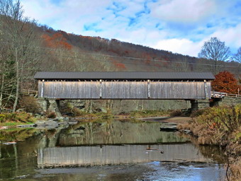
![]()
![]()
![]()
![]()
![]() On Tuesday, October 27th, Bryce, our grandson, was at our house. After he finished his school work, we decide to go for a walk. I had worked with Andy Garrison the day before for over 7 hours clearing blowdowns. I am not ashamed to say I saw still tired and a little sore. We decided to go to the Beaverkill State Campgrounds which is only a 3 mile walk but is beautiful. The weather was cool but the skies were blue which was a sharp contrast to the overcast and rainy day the day before. I asked Cindy if she wanted to hike and she agreed. We started to get ready at 11:15 AM with the temperature at 45 degrees under sunny skies. The first thing I had to do was put my pack back together. It had been pretty damp from the day before and I had emptied it to let it dry out. I got dressed in a White Sierra long-sleeved crew top with a short-sleeved baselayer. I put on a pair of RailRiders hiking pants which are expensive but last along time and have features like deep pockets and a generous cut which I really like. These pants have Velcro closures at the ankles to discourage sticks and gravel from getting into my shoes and to combat ticks. I decided to wear my Vasque Taku hiking boots as my Keen Targhee II hiking boots were drying out from the day before. I grabbed a pair of Leki external lock poles I have been using lately. I also added a fleecy orange hat. I donned my Mammut Hoody on top of everything as it has enough zippers to dump heat when I get too warm. As I stepped out of the house the temperate was only 48 degrees but it felt much warmer in the sun. We put our gear in the back of the car and Bryce and Sheila in the back seat and left the house at 11:35 AM. I drove out Old Route 17 toward Roscoe and turned right on Beaverkill Road. As we started the descent into the Beaverkill Valley, I turned left on Campsite Road and followed it down to the parking area near the Beaverkill Covered Bridge. As I parked, there were no other cars in the lot which was a sharp departure from the crowds this summer. The river was higher than I thought it might be. As we were getting ready, a car pulled into the lot. We walked down to the river downstream of the bridge so that I could take some pictures.
On Tuesday, October 27th, Bryce, our grandson, was at our house. After he finished his school work, we decide to go for a walk. I had worked with Andy Garrison the day before for over 7 hours clearing blowdowns. I am not ashamed to say I saw still tired and a little sore. We decided to go to the Beaverkill State Campgrounds which is only a 3 mile walk but is beautiful. The weather was cool but the skies were blue which was a sharp contrast to the overcast and rainy day the day before. I asked Cindy if she wanted to hike and she agreed. We started to get ready at 11:15 AM with the temperature at 45 degrees under sunny skies. The first thing I had to do was put my pack back together. It had been pretty damp from the day before and I had emptied it to let it dry out. I got dressed in a White Sierra long-sleeved crew top with a short-sleeved baselayer. I put on a pair of RailRiders hiking pants which are expensive but last along time and have features like deep pockets and a generous cut which I really like. These pants have Velcro closures at the ankles to discourage sticks and gravel from getting into my shoes and to combat ticks. I decided to wear my Vasque Taku hiking boots as my Keen Targhee II hiking boots were drying out from the day before. I grabbed a pair of Leki external lock poles I have been using lately. I also added a fleecy orange hat. I donned my Mammut Hoody on top of everything as it has enough zippers to dump heat when I get too warm. As I stepped out of the house the temperate was only 48 degrees but it felt much warmer in the sun. We put our gear in the back of the car and Bryce and Sheila in the back seat and left the house at 11:35 AM. I drove out Old Route 17 toward Roscoe and turned right on Beaverkill Road. As we started the descent into the Beaverkill Valley, I turned left on Campsite Road and followed it down to the parking area near the Beaverkill Covered Bridge. As I parked, there were no other cars in the lot which was a sharp departure from the crowds this summer. The river was higher than I thought it might be. As we were getting ready, a car pulled into the lot. We walked down to the river downstream of the bridge so that I could take some pictures.
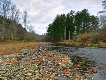 We returned to the car where I set my GPS and we started our hike at 11:55 AM by crossing the bridge to the west side of the river. As we exited the bridge, we turned left on a woods road that parallels the river. We walked passed a spring house and continued on the deserted woods road. We came to an area with a little path down to the river. I walked down to the edge of the river and took some pictures downstream and some upstream which included the bridge. Soon we came to a picnic table surrounded by high grass and weeds. I decided to take pictures that showed the deserted campgrounds which was even more dramatic now that the leaves were off the trees. I took pictures of the picnic tables and, a little later, what was once a bathroom for some campsites that had long since disappeared. At the next bathroom we stopped so that I could take some more pictures. There was a picnic table near the river so I took some pictures of table and then walked down to the river. I took some pictures of the sun reflecting off the water. In several areas the DEC had placed large rocks along the shore and covered them with heavy wire to reduce erosion. Before leaving I also took pictures of the deteriorating bathrooms. At about .7 miles the woods road met the paved road that serves the campsites and we continued along the river. Many of the campsites had a cement block fireplace with a grill but some were upgraded to poured concrete. Everything was very quiet except for the water in the river. This was not surprising as the campsites are closed. I took some pictures of all the empty campsites. As we walked we all talked to each other as Bryce is very bright and talkative. We walked to the last campsite where the trail ends and continued out on a path to a point were the river bends almost 90 degrees to the left. I stopped and tool some pictures. I worked my way out to a rock that jutted into the river and took some more shots up and down the stream.
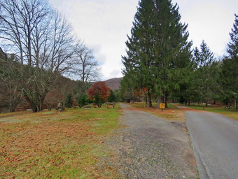 We turned around to start back and I pointed to Bryce another set of campsites to our left. As we walked back the way we came, we did walk the other road through the campsites which parallels the one we walked out on makes a sort of loop. We stopped again so that I could take some pictures of a group of picnic tables randomly arranged and another group stacked against each other. I had thought we might walk up the hill and take the road back but we decided it would be nicer to stay on the wood road. We retuned the way we had come crossing the river on the bridge. Instead of stopping at the car we walked out the far end of the parking lot passing the bathhouse and following a path. Cindy and I both remembered a ford that crossed the river many years ago and we had located it on our last visit. As we walked and came to the depression which was an old stream channel. I pointed out this channel and the concrete paving to Bryce. This was the ford that we remembered and it crossed a branch of the river which is now dry. We continued our walk and soon came to a series of palettes with stone piled on them. This was obviously stone that was to be used to constructed fireplaces or walls but it did not look like it had been accessed in some time. The path we are on passed through a grove of tall evergreens and ended at a stone bench. The bench was formed from an enormous slab of stone mounted on cement blocks. The stone had visible drill marks on it and we both wondered where it had been quarried. I took some pictures of the bench and a few of the river. Bryce, Sheila and Cindy sat on the bench and I took a few pictures. When we were done, we retraced our steps following the route we had used on the way out. We were back at the car at 1:40 PM having hiked 2.9 miles in 1 hour and 45 minutes with 30 minutes of stopped time. The elevation gain was 240 feet but it was hardly noticeable. The car's thermometer read 52 degrees.
![]() On Monday, October 26th, I had agreed to help Andy Garrison clear some blowdowns on the Pine Hill-West Branch and Curts-Ormsbee Trails. Andy had three days scheduled in the Slide Mountain Wilderness and I knew his schedule was tight. Andy asked me to meet him at 8:30 AM at the Denning trailhead which I knew was about 45 minutes from my house. When I awoke at 7:00 AM it was 39 degrees and raining. I called Andy and he was ready to go if I was so I agreed. As I began to get dressed I tried to distract Sheila by sending her upstairs to Cindy which seemed to work. I didn't want to take her since we would be using a chainsaw but I knew she would want to go. I decided to make sure I was dressed warmly as I could always take something off if I was properly layered. I got dressed in a long-sleeved Mammut crew top which is a little heaver than what I have been wearing. I put on a long-sleeved baselayer. I wore a pair of RailRiders hiking pants which are expensive but last along time and have features like deep pockets and a generous cut which I really like. The pants have Velcro closures at the ankles. I wore a light pair of tights underneath the pants. I decided to wear my Keen Targhee II hiking boots which fit well and, of course, have been discontinued. I put on OR Bugout gaiters to combat the sticks and the mud. On top of all this I wore my Mammut Hoody which is at least rain resistant. I grabbed and orange fleece hat for its warmth and a pair of fleece lined work gloves. Sadly, I left behind my hiking poles as I knew Andy would have things for me to carry. I packed a rain jacket and a pair of lighter gloves and took along a pair of mittens and a heavier wool top. When I stepped out the door, I realized it was cool but not cold and I would probably be overdressed for working. I loaded my gear into my car and left Livingston Manor and 7:45 AM. I headed out the DeBruce Road all the way to Round Pond and at the end I turned right onto Route 47. I drove out to the Claryville Road and turned left to go to the Denning trailhead. I drove through Claryville and on toward the end of the road. I arrived at the trailhead parking area at 8:20 AM. Andy was already there getting all his equipment ready for the day. It was 42 degrees, misty and there was a breeze blowing. There was only one other car in the lot. We got our gear ready and set out on the trail at 8:40 AM. I had decided to leave my GPS and camera at home and also left behind my phone. Andy was carrying the saw and related equipment. I had the oil, gas and, most important, a complete first aid kit! As we started out in the trail three young men who had camped out overnight approached the trail register. One of the young men asked Andy how to get involved with trail, maintenance and indicated he had the required chainsaw certification. Andy immediately gave him his e-mail as this was too good to pass up! The first 1.3 miles of the trail is almost flat rolling a little along a woods road. The trail was very wet with both standing and running water. Andy and I talked to each other and the walk to the intersection with the long path went quickly. Soon we were at the intersection which still has the sign that designates the eastern terminus of the Finger Lakes Trail. I thought this had been moved to the top of Slide Mountain but that may not be official yet.
On Monday, October 26th, I had agreed to help Andy Garrison clear some blowdowns on the Pine Hill-West Branch and Curts-Ormsbee Trails. Andy had three days scheduled in the Slide Mountain Wilderness and I knew his schedule was tight. Andy asked me to meet him at 8:30 AM at the Denning trailhead which I knew was about 45 minutes from my house. When I awoke at 7:00 AM it was 39 degrees and raining. I called Andy and he was ready to go if I was so I agreed. As I began to get dressed I tried to distract Sheila by sending her upstairs to Cindy which seemed to work. I didn't want to take her since we would be using a chainsaw but I knew she would want to go. I decided to make sure I was dressed warmly as I could always take something off if I was properly layered. I got dressed in a long-sleeved Mammut crew top which is a little heaver than what I have been wearing. I put on a long-sleeved baselayer. I wore a pair of RailRiders hiking pants which are expensive but last along time and have features like deep pockets and a generous cut which I really like. The pants have Velcro closures at the ankles. I wore a light pair of tights underneath the pants. I decided to wear my Keen Targhee II hiking boots which fit well and, of course, have been discontinued. I put on OR Bugout gaiters to combat the sticks and the mud. On top of all this I wore my Mammut Hoody which is at least rain resistant. I grabbed and orange fleece hat for its warmth and a pair of fleece lined work gloves. Sadly, I left behind my hiking poles as I knew Andy would have things for me to carry. I packed a rain jacket and a pair of lighter gloves and took along a pair of mittens and a heavier wool top. When I stepped out the door, I realized it was cool but not cold and I would probably be overdressed for working. I loaded my gear into my car and left Livingston Manor and 7:45 AM. I headed out the DeBruce Road all the way to Round Pond and at the end I turned right onto Route 47. I drove out to the Claryville Road and turned left to go to the Denning trailhead. I drove through Claryville and on toward the end of the road. I arrived at the trailhead parking area at 8:20 AM. Andy was already there getting all his equipment ready for the day. It was 42 degrees, misty and there was a breeze blowing. There was only one other car in the lot. We got our gear ready and set out on the trail at 8:40 AM. I had decided to leave my GPS and camera at home and also left behind my phone. Andy was carrying the saw and related equipment. I had the oil, gas and, most important, a complete first aid kit! As we started out in the trail three young men who had camped out overnight approached the trail register. One of the young men asked Andy how to get involved with trail, maintenance and indicated he had the required chainsaw certification. Andy immediately gave him his e-mail as this was too good to pass up! The first 1.3 miles of the trail is almost flat rolling a little along a woods road. The trail was very wet with both standing and running water. Andy and I talked to each other and the walk to the intersection with the long path went quickly. Soon we were at the intersection which still has the sign that designates the eastern terminus of the Finger Lakes Trail. I thought this had been moved to the top of Slide Mountain but that may not be official yet.
From this point on the trail consisted of a covering of leaves over loose rock which made the hiking difficult. The next 1.7 miles to the junction with the Curtiss-Ormsbee Trail gains 780 feet and averages about a 9% grade. This is where we did the majority of the work cutting six large blowdowns on the way up the trail. We left a few smaller ones for the trip back. Our procedure for each blowdown was the same. Andy would size up the cutting always removing branches to clear the way for the main cuts. I was the "swamper" and my job was to remove everything Andy cut. One blowdown was a spruce that was at least 18 inches in diameter. Another was an even larger birch which was followed by a cherry that was just as large. I kept throwing branches off the trail and rolling or flipping the pieces of trunk so that they were out of the way. Andy and I work well together and I learn to anticipate what he is about to do. The chainsaw got hung up pretty badly one but we were able to free it with wedges and a hand saw. I had not hiked this trail in a long time and was surprised when we came to a deep gully where we had to walk down into the gully and up the other side. I remembered a stone culvert or bridge at that site and Andy said it was washed out in the storms of 2011! Between the fast hiking and working I had to open the zippers on my hoody and remove the Mammut shirt that I was wearing. As we began the final hike up to the Curtiss-Ormsbee Trail we stopped for lunch which is something I seldom do. I had to close the zippers on my hoody as standing around made me cold. I ate a bar as I normal do but Andy had a nice 3 course lunch! The precipitation had been varying from a heavy mist to a drizzle to outright rain. When we got to the trail junction we turned right and almost immediately ran into a blowdown. Andy used his phone to confirm that this one was not the one he had intended to clear but we would do it anyway. As we were planning the attack, the only hiker we met for the whole day walked by. He acted more like we were in his way than anything else and barely greeted us. It took some time to clear the complicated blowdown but soon it was gone. We picked up and started off in search of the last blowdown which Andy thought was about a quarter mile up the trail. Andy was fresher than I was and got a pretty good lead on me. The trail proceeded up through some ledges and then kept climbing at about a 15% grade. I could not see Andy and had no idea how far I would have to go. Just as I was considering whether I would continue, I saw another climb ahead with a tree across the trail and Andy "hiding" behind it. This tree was not the biggest we had cut but it had several parts and was in a difficult place. Fortunately, as Andy cut pieces off the trunks they tended to roll downhill which made my job easier. Andy finally declared the end of our work and I was very happy until I realized we had a 3.5 mile hike back! Walking down the trail to the junction was tricky especially without my poles and with both hands full. I had already fallen once on the slippery rocks while clearing the last blowdown so I was very careful on the descent. At the trail junction, we turned left and started down the leaf-covered trail with the loose rocks. We cut two more blowdowns on the way down and removed a number of loose logs until, finally, Andy took off his chaps indicating the real end of the work. It seemed like forever to get to the junction with the trail to Table Mountain. Just after the junction the trail flattened and the surface became easier to walk on. We arrived in the parking lot at 3:55 PM. There were now two new cars in the lot and the one that had been parked was gone. The temperature had risen to 48 degrees but the drizzle and the breeze were still present. We had spent 7 hours and 15 minutes hiking 7 miles and clearing at least 10 blowdowns. I was tired and sore and glad to be going home. Andy pronounced it an average day. He will be returning to the area tomorrow to hike over Table and Peekamoose with his saw and some other helpers to clear the blowdowns on the trail.
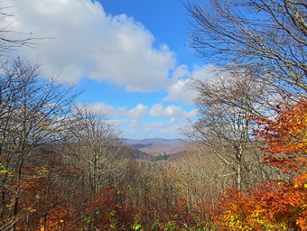
![]()
![]()
![]()
![]()
![]() On Friday, October 23rd, I planned to hike from the Frick Pond Trailhead to the Hodge Pond Lookout and to see if I could find a lookout from Beech Mountain to the east. I thought I might also hike to Mongaup Mountain if I had time as it also has a viewpoint. I had some things to do at home so I did not get start to get ready until 10:30 PM when the temperature was already 65 degrees. As I got my gear together, Sheila seemed very excited even though we had been hiking during the week. I put on a long-sleeved White Sierra crew top and a short-sleeved baselayer. I put on a pair of RailRiders hiking pants which are expensive but last a long time and have features like deep pockets and a generous cut which I really like. The pants have Velcro closures at the ankles. I decided to wear my Keen Targhee II boots which are supportive, surprisingly roomy and have been discontinued. I grabbed a pair of Leki external lock poles I have been using since spring. The external locks have not failed me yet and the cork handles really do allow a good grip. I also added a wide-brimmed, floppy OR hat which protects me from the sun. I decided I did not need a jacket but I packed a waterproof top as the various weather forecasts differed on whether or not there would be rain showers. I put my gear in the car and Sheila in the backseat and drove out DeBruce Road at 10:50 AM. After 6 miles, I turned left on Mongaup Road and continued to where the road split. I stayed to the left on Beech Mountain Road to the parking areas for Frick Pond. I parked in the small lot where there was one other car. This was a big improvement over the last few times when the lots were almost full. I set my GPS and we crossed the road to get on the Flynn Trail to start our hike at 11:10 AM with the temperature at 68 degrees. There were a lot of leaves on the trail and the leaves left on the trees were mostly yellow, orange or brown
On Friday, October 23rd, I planned to hike from the Frick Pond Trailhead to the Hodge Pond Lookout and to see if I could find a lookout from Beech Mountain to the east. I thought I might also hike to Mongaup Mountain if I had time as it also has a viewpoint. I had some things to do at home so I did not get start to get ready until 10:30 PM when the temperature was already 65 degrees. As I got my gear together, Sheila seemed very excited even though we had been hiking during the week. I put on a long-sleeved White Sierra crew top and a short-sleeved baselayer. I put on a pair of RailRiders hiking pants which are expensive but last a long time and have features like deep pockets and a generous cut which I really like. The pants have Velcro closures at the ankles. I decided to wear my Keen Targhee II boots which are supportive, surprisingly roomy and have been discontinued. I grabbed a pair of Leki external lock poles I have been using since spring. The external locks have not failed me yet and the cork handles really do allow a good grip. I also added a wide-brimmed, floppy OR hat which protects me from the sun. I decided I did not need a jacket but I packed a waterproof top as the various weather forecasts differed on whether or not there would be rain showers. I put my gear in the car and Sheila in the backseat and drove out DeBruce Road at 10:50 AM. After 6 miles, I turned left on Mongaup Road and continued to where the road split. I stayed to the left on Beech Mountain Road to the parking areas for Frick Pond. I parked in the small lot where there was one other car. This was a big improvement over the last few times when the lots were almost full. I set my GPS and we crossed the road to get on the Flynn Trail to start our hike at 11:10 AM with the temperature at 68 degrees. There were a lot of leaves on the trail and the leaves left on the trees were mostly yellow, orange or brown
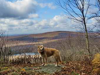 At the end of the trail we turned right to continue our hike on the Flynn Trail which, in this area, follows the old Beech Mountain Road. I was a little tired from the trail maintenance work I had done the day before but we still set a pretty fast pace. We passed through the "tunnel" Cindy and I had cut in a huge spruce tree that fell across the trail. I had no one to talk to so I was lost in my thoughts which seems to make the hike go faster. I kept noticing that a breeze was blowing and the sun seemed to be under a cloud. The rest of the sky was blue with puffy white clouds. At 11:50 PM we were at the junction with the Big Rock Trail after hiking 1.7 miles in 40 minutes. We continued straight ahead on the Flynn Trail. We passed through the gate that separates state land from the OSI Beech Mountain Nature Preserve. When the trails split after the gate, we turned right. We followed the woods road passed the turn to the old Beech Mountain Boy Scout Camp and started up the hill toward the Hodge Pond Lookout. The road is dirt and rocks covered with fallen leaves. Over the next .4 miles we gained 450 feet which is only a 12% grade but I was feeling tired. At 2.65 miles we stopped at a viewpoint to the west. I got out my camera and could see that there was little color left in the leaves and the distant hills since most of the leaves had fallen. The leaves around me were colorful so I took some pictures of them before continuing on the hike. We got a drink and then headed a short distance up the hill before turning right on a woods road.
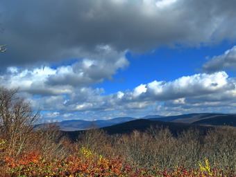 The woods road seems wider and more well-maintained every time I use it. The walk to the Hodge Pond Lookout is only a quarter mile so we were there very quickly. I put my pack down and got out my camera. As I stepped out onto the rock ledge that forms the viewpoint, I was glad that someone had cut some trees and brush to open up the view. I could see the trees that had been cut at the base of the viewpoint. I took pictures of Hodge Pond and the hills beyond even though the trees were mostly bare. Sheila posed the rock ledge so I took some pictures of her. I put my camera away and gave Sheila a drink and got one for myself. We continued on the trail that surrounds the summit of Beech Mountain traveling in a counterclockwise direction. As we came to the south side of the mountain, we walked off the trail and I began to look for a viewpoint. We bushwhack quite a bit heading southeast. When I didn't see anything that looked like a viewpoint I headed a little more northeast walking along another set of impressive ledges. At 3.2 miles into the hike we climbed some ledges to our left and walked north a short distance. Again, I saw nothing interesting so, we climbed another set of ledges and found a trail. I thought this was the trail I usually take around Beech Mountain but I quickly realized it was one that branches to the right off that trail. I have always wanted to see where it led. I followed this road until it opened up to a viewpoint facing east. There was a fantastic view of many of the Catskills and the view seemed to go on forever. I took quite a few pictures and tried to distinguish which mountains I was seeing. There were very few leaves left but the view was still breathtaking. I could only imagine what it looked like when the leaves were at peak color. When I was done, I packed up the camera we headed out the road and started up a hill. On the right, as we turned up the hill, I noticed a familiar area that I beloved was the way to Mongaup Mountain. I found a path and started to walk out on it. The path was very prominent and quite wide. I decided I did not have enough time to do Mongaup Mountain and would save it for another day.
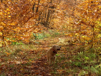 We walked up the hill and passed the trail I normally use to walk around Beech Mountain. We walked over the hill and in a short distance we were back at the trail we had used to go to the Hodge Pond Lookout. We began to walk down the hill which was not as easy as it could have been due to the presence of so many wet leaves. When we arrived at the junction near the old Boy Scout camp, we continued straight ahead on the woods road. At the junction with the Flynn Trail, we turned left. I felt pretty good since I knew the rest of the hike was downhill or flat. We passed through the gate and were soon at the junction with the Big Rock Trail. The leaves were so colorful in this are that I stopped to take a few pictures before continuing down the Flynn Trail. We set a fast pace down the Flynn Trail which we had all to ourselves. There was one small blowdown that I tried to pull off the trail. I found it would need to be cut so that it could be removed. Soon we passed through the "tunnel" and arrived at the gate. We turned left on the Flynn Trail to avoid the private property around the cabin. As we emerged from the Flynn Trail, we found there were now no cars parked in the small lot and only two in the large lot. Two hikers were emerging from the woods road that leads to Frick Pond. We arrived back at the car at 2:10 PM after hiking 6.5 miles in 3 hours. The elevation gain was 1150 feet.
On Thursday, October 22nd I decided to go to Round Top to remove a blowdown that I had noticed the day before. When I returned from church, there was still some fog and mist so I decided to do some work around the house. After noon, the weather had cleared and the temperature had risen to 70 degrees. Before going across the street, I decided to remove a tree that had fallen next to our house. I picked up the branches that had broken off when the tree fell and was even able to remove part of the trunk. The rest of the trunk was solid and would need to be cut. I used my Fiskars ax to cut a length from the top of the trunk and removed that piece I piled everything in a neat pile so that I could load it onto Karl's truck. This left a rather large piece of the trunk that has quite heavy. I was able to drag the piece up the bank and was contemplating how to cut it up when the ambulance pager sounded. The call was rather short as the patient did not want to go to the hospital. When I returned home, I found Karl had parked his truck in our driveway and he had moved the trunk near the trunk. My neighbor volunteered to use his chainsaw to cut up the trunk while I had an online coaches meeting. When I was done at about 3:30, I went back outside to find the trunk neatly cut into 4 pieces. I loaded them on the truck and made the necessary trips to load the rest of the branches. I was tired when I finished but still decided I would go across the street to do the work I had planned. Somehow Sheila knew my plans an pestered me unceasingly as I began to get ready. I got dressed in a short-sleeved crew top but decided I did not need a baselayer. I put on a pair of RailRiders hiking pants which are expensive but last along time and have features like deep pockets and a generous cut which I really like. These pants have a Velcro closures at the ankles to discourage sticks and gravel from getting into my shoes and to combat ticks. I decided to wear my Keen Traghee II hiking boots which fit well and have been discontinued. I knew I would not need poles as I would be carrying axes and saws for a short distance. Sheila kept me in sight as I got ready to go making sure she would not be forgotten. I grabbed my Fiskars pack, Council Tools Velvicut Felling ax and Silky Sugowaza saw. We stepped out of the house at 4:00 PM and put the tools in the back of the car and Sheila in the back seat. I drove across the street and through the cemetery to the road to the trailhead. Unfortunately, someone had parked blocking the road so I drove to the base of the hill and backed all the way up to the trailhead. I parked here on the side of the road and let Sheila out of the back seat. I grabbed my tools and we started out on the trail.
As we walked along the first part of the trail, two people with two dogs came walking toward us. One of the women picked up one dog but the other came toward us off leash. Once again it is not the dog's fault but the fault of the owners. As they passed, I asked if they had parked their car in the cemetery and they said "yes". I asked them not to do that again and made suggestions on where they could park. Despite my admonishment, they both thanked me for maintaining the trails. Sheila and I walked passed the tree I had cut last time and turned right at the first trail junction. We walked uphill on the woods road. We continued as the trail turned left and immediately ran into the blowdown. At first, I thought it was a little smaller than I remembered. I decided to cut the trunk on one side of the trail and hope that I could roll the section off the trail. I used the heavy felling axe to make the cut. I need practice with the heavier axe but when used correctly it is a beast! After the cut was completed and the section of trunk dropped to the ground, I tried lifting the section. It was clear that I would have to make another cut so I got to it. This cut went quickly and I was able to remove the two sections from the trail leaving it completely clear. I picked up my tools and we walked back down the woods road back to the first trail junction. We turned left here and were soon at the trees that I had cut recently to clear the trail. Even though I was tired, I decided to remove two trunks that were encroaching on the trail. I used the heavy ax to cut through the first making a rather long section that I knew I could not left. When I was done, I was able to pick up one end of the log and pivot it off the trail. I used the same technique on the second trunk which gave me some problems but succumbed in the end. I also was able to pivot this section off the trail. I picked up the tools and we walked back to the car at the trailhead. I put the tools and Sheila in the car and drove back home. We were back at 5:30 PM after spending almost and hour and a half clearing the trails.
![]()
![]()
![]()
![]() On Wednesday, October 21st I had planned to do a longer hike with my grandson Bryce but the rain persisted throughout the morning contradicting the forecast. At noon we decided to go across the street and hike a few figure 8's on Round Top since Bryce had to be back by 3:00 PM for an online conference with his teacher and class. We started to get ready with the temperature a surprisingly warm 59 degrees. We had not hiked for several days and Sheila was anxious to get out. I got dressed in my White Sierra long-sleeved crew top but decided I did not need a baselayer. I put on a pair of RailRiders hiking pants which are expensive but last along time and have features like deep pockets and a generous cut which I really like. These pants have a Velcro closures at the ankles to discourage sticks and gravel from getting into my shoes and to combat ticks. I decided to wear my Keen Traghee II hiking boots which fit well and have been discontinued. I grabbed a pair of Leki external lock poles I have been using lately. I also added my OR floppy hat. Sheila kept me in sight as I got ready to go making sure she would not be forgotten. We stepped out of the house at 12:45 PM and I grabbed Sheila's leash from the car. We walked up the driveway and crossed the street. I decided we would probably do two figure 8's to cover all the trails and tire me out a little. We walked to the parking area by the Presbyterian Church and to the back of the church. We began the ascent of the steepest hill behind the church. The hill is short but gets the circulation pumping and is the steepest and longest climb on the "trail." Sheila helped me along by pulling me up the hill but I noticed the hill seemed easier as I have been hiking more. Bryce, of course, was right with me but he was able to talk normally the whole way up the hill. When we got to the top of the hill, we stopped to look around at the hills around town. There was some mist still hanging in the valley and it was clear that the leaves in our area were far past their prime. We started on the trail by turning left at the trailhead. I let Sheila off her leash so that she could explore. The trail bed is becoming worn it which means that at least a few people are using the trail. I am always happy to see that someone else uses the trails. I showed Bryce the large blowdown I had cut the last time and mentioned I might have to cut once or twice more.
On Wednesday, October 21st I had planned to do a longer hike with my grandson Bryce but the rain persisted throughout the morning contradicting the forecast. At noon we decided to go across the street and hike a few figure 8's on Round Top since Bryce had to be back by 3:00 PM for an online conference with his teacher and class. We started to get ready with the temperature a surprisingly warm 59 degrees. We had not hiked for several days and Sheila was anxious to get out. I got dressed in my White Sierra long-sleeved crew top but decided I did not need a baselayer. I put on a pair of RailRiders hiking pants which are expensive but last along time and have features like deep pockets and a generous cut which I really like. These pants have a Velcro closures at the ankles to discourage sticks and gravel from getting into my shoes and to combat ticks. I decided to wear my Keen Traghee II hiking boots which fit well and have been discontinued. I grabbed a pair of Leki external lock poles I have been using lately. I also added my OR floppy hat. Sheila kept me in sight as I got ready to go making sure she would not be forgotten. We stepped out of the house at 12:45 PM and I grabbed Sheila's leash from the car. We walked up the driveway and crossed the street. I decided we would probably do two figure 8's to cover all the trails and tire me out a little. We walked to the parking area by the Presbyterian Church and to the back of the church. We began the ascent of the steepest hill behind the church. The hill is short but gets the circulation pumping and is the steepest and longest climb on the "trail." Sheila helped me along by pulling me up the hill but I noticed the hill seemed easier as I have been hiking more. Bryce, of course, was right with me but he was able to talk normally the whole way up the hill. When we got to the top of the hill, we stopped to look around at the hills around town. There was some mist still hanging in the valley and it was clear that the leaves in our area were far past their prime. We started on the trail by turning left at the trailhead. I let Sheila off her leash so that she could explore. The trail bed is becoming worn it which means that at least a few people are using the trail. I am always happy to see that someone else uses the trails. I showed Bryce the large blowdown I had cut the last time and mentioned I might have to cut once or twice more.
At the first trail junction, we followed Sheila as she turned right on the woods road which is the shallower approach to the trail system. As we continued to follow the yellow trail toward the first junction, we came to a blowdown across the trail. The trunk was 6 to 8 inches in diameter and would take some work with axe and saw to remove it. We stepped over the blowdown and continued on to the first trail junction. We turned left and followed it to the next trail junction. Along the way we picked up or removed many small branches and dragged several large ones off the trail. At the second junction with the blue trail, we turned right and started up the steep blue trail that leads over the summit of Round Top. Walking uphill we passed through what remained of the ferns of the summer all with brown edges. The trails were damp from the light rain overnight and Bryce kept slipping. Just before the steepest section we turned right on the switchback trail now marked with blue paint blazes. We continued to follow these blazes as they made a sharp left turn and headed back to the main blue trail. We turned right on the blue trail and continued up the blue trail to the summit of Round Top eschewing the white crossover trail this time. We walked down to the yellow trail and turned right to walk along the base of Round Top. This time we turned left at the junction with the blue trail and walked down to the lookout. We followed the yellow trail as it turned left and descended the hill to the first trail junction. We immediately turned around and walked back up the hill to the lookout and followed the yellow trail as it turned right. We followed the trail as it made a gentle ascent trough the brown ferns to the junction with the blue trail. We continued to follow the yellow trail by turning right and following along the base of Round Top. At the second junction with the blue trail, we turned left and started the ascent of the hill. When the white crossover trail came up and the left, we turned and followed it back to the blue trail on the other side of the hill. We turned left and continued straight ahead on the blue trail we walked down to the yellow trail. We turned left, walked back along the base of Round Top and turned right at the next junction. We walked down to the woods road that took us back to the first trail junction again stepping over the blowdown. This time we turned left and walked out to the trailhead where I put Sheila on her leash. We walked down the hill to the parking lot and across the road to our driveway. We were home by 2:30 PM after hiking around 2 miles.
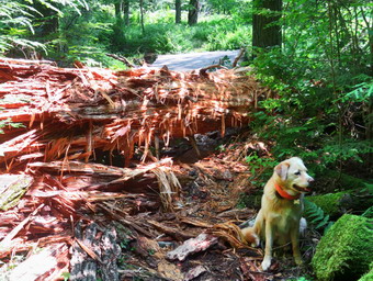
![]()
![]()
![]()
![]()
![]() On Saturday, October 18th my plan was to go to Frick Pond to at 1:00 PM to meet a small group of people who wanted to do some trail work. The "event" has to pass through the NYNJTC and the DEC with a few more steps than in the past due to COVID-19. With The cooperation of Olivia Sohn of the trail conference and DEC Region 3 Forester Ian Dunn we were able to host this event. When I returned from church at noon, I began to gather my clothing and trail maintenance gear. The temperature was still only 54 degrees with a slight breeze blowing but with plenty of sun. Sheila was watching me get ready but I had to explain to her that she could not go this time. A few extra bones helped soften the blow. I put on a long-sleeved White Sierra crew top and a short-sleeved baselayer. I put on a pair of RailRiders hiking pants which are expensive but last a long time and have features like deep pockets and a generous cut which I really like. The pants have Velcro closures at the ankles. I decided to wear my Keen Traghee II boots which are supportive, surprisingly roomy and have been discontinued. I also added a wide-brimmed, floppy OR hat which protects me from the sun. I also put on my Mammut hoody which has plenty of zippers to dump heat when I get warm. I decided to forego my hiking poles as the hike would be short and I would carrying maintenance gear. I decided to take along a variety of tools to show the participants including my Silky Sugowaza saw, Silky Katanaboy 500, Fiskar chopping axe, Corona loppers and LT Wright Overland machete. I put my gear in the car and drove out DeBruce Road at 12:45 PM. After 6 miles, I turned left on Mongaup Road and continued to where the road split. I stayed to the left on Beech Mountain Road to the parking areas for Frick Pond. I suspected there would be some people in the area and both lots were almost filled. I pulled into the smaller lot right next to Lisa Lyons. Don, Alyce, Eva and Kate, the four participants, gathered with Lisa and I at my car. We took care of some paperwork and the introductions before walking over to the trail kiosk to take a look at our route. After a few minutes we start out on the Quick Lake Trail at 1:05 PM.
On Saturday, October 18th my plan was to go to Frick Pond to at 1:00 PM to meet a small group of people who wanted to do some trail work. The "event" has to pass through the NYNJTC and the DEC with a few more steps than in the past due to COVID-19. With The cooperation of Olivia Sohn of the trail conference and DEC Region 3 Forester Ian Dunn we were able to host this event. When I returned from church at noon, I began to gather my clothing and trail maintenance gear. The temperature was still only 54 degrees with a slight breeze blowing but with plenty of sun. Sheila was watching me get ready but I had to explain to her that she could not go this time. A few extra bones helped soften the blow. I put on a long-sleeved White Sierra crew top and a short-sleeved baselayer. I put on a pair of RailRiders hiking pants which are expensive but last a long time and have features like deep pockets and a generous cut which I really like. The pants have Velcro closures at the ankles. I decided to wear my Keen Traghee II boots which are supportive, surprisingly roomy and have been discontinued. I also added a wide-brimmed, floppy OR hat which protects me from the sun. I also put on my Mammut hoody which has plenty of zippers to dump heat when I get warm. I decided to forego my hiking poles as the hike would be short and I would carrying maintenance gear. I decided to take along a variety of tools to show the participants including my Silky Sugowaza saw, Silky Katanaboy 500, Fiskar chopping axe, Corona loppers and LT Wright Overland machete. I put my gear in the car and drove out DeBruce Road at 12:45 PM. After 6 miles, I turned left on Mongaup Road and continued to where the road split. I stayed to the left on Beech Mountain Road to the parking areas for Frick Pond. I suspected there would be some people in the area and both lots were almost filled. I pulled into the smaller lot right next to Lisa Lyons. Don, Alyce, Eva and Kate, the four participants, gathered with Lisa and I at my car. We took care of some paperwork and the introductions before walking over to the trail kiosk to take a look at our route. After a few minutes we start out on the Quick Lake Trail at 1:05 PM.
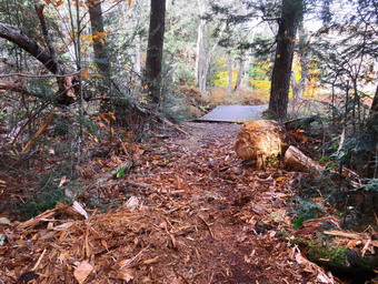 The trails around Frick Pond already have a maintainer assigned so we did not have to do any work. We set a quick pace to Frick Pond staying to the left at Gravestone Junction to keep on the Quick Lake Trail. We crossed the bridge at the outlet end of Frick Pond and continued along the west side of the pond. There were a few muddy areas and some where water had collected but we easily avoided them. At the junction with the Big Rock Trail, we stayed to the left on the Quick Lake Trail. We started to trim some branches and cut a few saplings that were in the trail. As we worked and walked we also talked to learn more about each other. We moved a few larger branches and small trunks off the trail and then entered the hemlock tunnel. There were a few big blowdowns along the trail but they were on the ground and easy to step over. When we arrived at the stream through the woods, we found that it had some water flowing but we were able to use some stepping stones to get across. We continued up the trail lopping branches and removing blowdowns from the trail. We came across a large, water-logged trunk at one point and decided to eliminate it. It was too heavy for all of us to lift so I decided to cut it with the axe. The log was rotten in some places but still solid in others Don and I worked on it for about 15 minutes. Once we had broken through we were able to pivot the log off the trail with the help of Kate and Alyce. We continued cutting here and there until we reached Iron Wheel Junction. Here we turned right and started out on the Logger's Loop. Almost immediately we came to a tree whose branches were protruding into the trail. We decided to trim it back en though we knew the snowmobile club would be out soon to maintain the trail. When we were finished, we continued along the trail but there was very little work to do. We passed the area on the left of the trail which, in wetter times, holds a small pond. From there we continued downhill to Times Square.
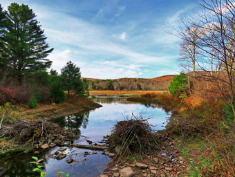 We turned right on the Big Rock Trail as there was one more project I wanted to work on. All along the trail there had been leaves covering the ground and the Big Rock Trail was no exception. We crossed the two bridges over the inlet streams and came to the remains of a large tree that had blocked the trail. I had spent several hours on different trips cutting completely through the trunk in two places and removing the wood. Part of the trunk still infringed on the trail and I wanted to see if we could remove it. I used the axe to split of sections to remove. Dion pointed out that one side was almost split off and a few swings of the axe removed a large section. Eventually the trunk seemed small enough for us to move. Don, Alyce and I were able to move it off the trail but not without some trouble. We all helped remove some of the remaining wood and I pronounced the project completer. I did not take any "before" pictures bout I had them from previous trips. I did take some "after" shots to commemorate a job well done. We continued our hike out by walking over the wooden walkways and back to the Quick Lake Trail. We turned left and walked to the bridge where we stopped for a moment. I took some shots of the pond as did some others. After a short break, we walked up the hill to Gravestone Junction. From there we walked back out the Quick Lake Trail to the parking areas. Along the way we met two groups of people hiking toward the pond. We were back at the cars at 4:00 Pm after hiking 4 miles in 2 hours and 50 minutes. Our elevation gain was only 360 feet, Our overall pace was not fast but we had stopped for 50 minutes to work. The other members of the group asked when the next event was taking place so I count the work and the will to do more a success.
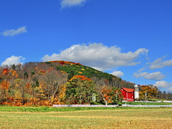
![]()
![]()
![]()
![]()
![]() On Saturday, October 17th, I had planned to get up early an hike either a long trail hike or a bushwhack. I was wary of a bushwhack because of the hunting season now in progress. I also knew that most trails, especially those to the high peaks, would be busy as people tried to get in some final views of the leaf colors. I was tired and went back to sleep to catch up some after a number of ambulance calls over the week. When I got up at 10:00 AM, it was still only 49 degrees. I asked Cindy if she wanted to hike and she said "Yes". We began to debate where we should go. I thought we could stay local and hike Huggins Lake or some other more remote hike. Cindy suggested going to hike the Catskill Scenic Trail which is a railtrail that runs between Bloomville and Roxbury in Delaware County. I though there might be some nice color but I am not thrilled with the flat terrain unless it is a long section. This rail trail follows the route of the old O&W and other lines for 26 miles from Bloomville to Roxbury. As I got my gear together, Sheila seemed very excited since we had not hiked the day before because of the rain. I put on a long-sleeved White Sierra crew top and a short-sleeved baselayer. I put on a pair of RailRiders hiking pants which are expensive but last a long time and have features like deep pockets and a generous cut which I really like. The pants have Velcro closures at the ankles. I decided to wear my Keen Traghee II boots which are supportive, surprisingly roomy and have been discontinued. I grabbed a pair of Leki external lock poles I have been using since spring. The external locks have not failed me yet and the cork handles really do allow a good grip. I also added a wide-brimmed, floppy OR hat which protects me from the sun. I also put on my Mammut hoody which has plenty of zippers to dump heat when I get warm. I also packed a light windbreaker. We put our gear in the car and Sheila in the backseat and drove north on State Route 17 toward Roscoe. I got off at exit 94 and headed north on Route 206. On the way, Cindy and I started to talk and she wanted to change our plans and go to Bramley Mounatain so that we could get a view down into the valleys. I thought it would be too crowded but did not argue. When we reached the Pepacton Reservoir, I turned right on Route 30 and drove toward the Dunraven Bridge. At the end of the bridge I turned left on Tremperskill Road and followed it into Andes where I turned left on Route 28 North. After 5.8 miles, I turned right on Lee Hollow Road which turned into Bramley Mountain Road. I soon realized I was on the wrong road! At CR-18 I turned left and drove to GlenBurnie Road. I drove up the road for .7 miles to the parking area which, as I had suspected, was filled with cars parking on the road. I turned around, drove back down to Cr-18, turned left and drove to Fitches Bridge. I turned right on the bridge and the right on Route 10. I drove 5 miles north on Route 10 to Bloomville and pulled into the parking area for the Catskiil Scenic Trail.
On Saturday, October 17th, I had planned to get up early an hike either a long trail hike or a bushwhack. I was wary of a bushwhack because of the hunting season now in progress. I also knew that most trails, especially those to the high peaks, would be busy as people tried to get in some final views of the leaf colors. I was tired and went back to sleep to catch up some after a number of ambulance calls over the week. When I got up at 10:00 AM, it was still only 49 degrees. I asked Cindy if she wanted to hike and she said "Yes". We began to debate where we should go. I thought we could stay local and hike Huggins Lake or some other more remote hike. Cindy suggested going to hike the Catskill Scenic Trail which is a railtrail that runs between Bloomville and Roxbury in Delaware County. I though there might be some nice color but I am not thrilled with the flat terrain unless it is a long section. This rail trail follows the route of the old O&W and other lines for 26 miles from Bloomville to Roxbury. As I got my gear together, Sheila seemed very excited since we had not hiked the day before because of the rain. I put on a long-sleeved White Sierra crew top and a short-sleeved baselayer. I put on a pair of RailRiders hiking pants which are expensive but last a long time and have features like deep pockets and a generous cut which I really like. The pants have Velcro closures at the ankles. I decided to wear my Keen Traghee II boots which are supportive, surprisingly roomy and have been discontinued. I grabbed a pair of Leki external lock poles I have been using since spring. The external locks have not failed me yet and the cork handles really do allow a good grip. I also added a wide-brimmed, floppy OR hat which protects me from the sun. I also put on my Mammut hoody which has plenty of zippers to dump heat when I get warm. I also packed a light windbreaker. We put our gear in the car and Sheila in the backseat and drove north on State Route 17 toward Roscoe. I got off at exit 94 and headed north on Route 206. On the way, Cindy and I started to talk and she wanted to change our plans and go to Bramley Mounatain so that we could get a view down into the valleys. I thought it would be too crowded but did not argue. When we reached the Pepacton Reservoir, I turned right on Route 30 and drove toward the Dunraven Bridge. At the end of the bridge I turned left on Tremperskill Road and followed it into Andes where I turned left on Route 28 North. After 5.8 miles, I turned right on Lee Hollow Road which turned into Bramley Mountain Road. I soon realized I was on the wrong road! At CR-18 I turned left and drove to GlenBurnie Road. I drove up the road for .7 miles to the parking area which, as I had suspected, was filled with cars parking on the road. I turned around, drove back down to Cr-18, turned left and drove to Fitches Bridge. I turned right on the bridge and the right on Route 10. I drove 5 miles north on Route 10 to Bloomville and pulled into the parking area for the Catskiil Scenic Trail.
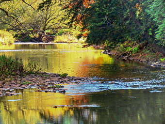 It was 1:30 PM when we pulled into the lot and I was surprised that there were only four cars in the lot. The temperature was 54 degrees with a slight breeze and I set my GPS and we started off on the trail. We could see that the trail was in great shape with hard packed with cinder and some short grass here and there. There were a few wet and muddy spots but the were far between. After a short distance, a large, round foundation appeared on the left of the trail and I had to take some pictures. It looked to me like it might have been a turntable for a roundhouse but it was off the track. A little farther along was a stone marker the had K 86 engraved on it indicating 86 miles to Kingston, New York. I took more pictures and then quickly packed up as we continued on the trail. The leaves along the trail were bright and colorful. The trail was mostly shaded but at .75 miles it broke out into the open and I could see this would continue for some time. The leaves on the surrounding hills were colorful and I did take some pictures of the farm fields and the hills as I thought it all very bucolic. I packed up and we headed for a bridge over a small stream where some trees put us in the shade again. We began to meet people walking toward us on the trail. There were also a number of people riding bicycles with some traveling toward us and others coming up behind. In each case I pulled Sheila off the trail so she would not interfere with others. I kept trying to pick up the pace since I knew my stopping to take pictures were slowing us down. I was wondering where the farm animals were and soon some cows appeared in a field on the right side of the trail. I took some pictures before continuing on the trail. At 1.6 miles the West Branch of the Delaware River came close to the trail but it was muddy and shallow. At 2 miles we came to the first of three bridges over the river within a short distance. The builders had used the original train bridge as a support structure but had built a new treadway and handrails on top of it. I took some pictures of the bridge and the river. I also asked Cindy to sit on a nearby bench with Sheila and I took a few pictures of them.
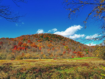 We started back on the trail but at 2.2 miles a sand and gravel pit appeared on the right of the trail. I walked off the trail to the berm that surrounded the pond that the mining had created. I took pictures of the pond and the machinery with the colorful trees behind them. Back on the trail we continued to encounter a number of hikers and bikers but they were well spaced and we were all very polite. We noticed that some people had passed us in one direction and were no going in the other direction. I continued to stop and take picture since each new view had something different than the one before. We were making good time despite my photography and I asked Cindy if she would like to try to make it to South Kortright. I was surprised but pleased when she agreed. We crossed the third bridge at 2.7 miles and at about 3.2 miles we came out of the trees to a long stretch of trail across open fields. We were only about 1.1 miles from South Kortright but Cindy announced she wanted to turn around. I was disappointed but not really surprised! I walked to a point where the trail intersected a small dirt road. I took some pictures of the next part of the trail which was sheltered by trees. I also made sure to take pictures of the surrounding hills which were lit up with beautiful colors. We turned around and set a very fast pace back toward Bloomville and our car. Cindy kept pace most of the time and I only stopped once to wait for her. I mostly kept my head down and put on the speed as I was afraid I would see something else to photograph. A we neared Bloomville, I looked up to see three side by side UTVs coming toward us on the trail! I was pretty sure this was illegal. The three machine came out of a section covered by trees and pulled over in a field. The occupants looked like people who should no better but I hoped they might be involved with trail maintenance. I thought about asking them what they were doing but thought better of it. We entered the tree-covered section and continued our fast pace. A moment later I looked up see another UTV headed toward us. I stayed in the middle of the trail until the last minute as the driver pulled over and slowed down. As we passed he revved his engine and sped away. We continued back to our car arriving at 4:25 PM after hiking 7 miles in 2 hours and 50 minutes. Our overall speed was 2.4 mph with a moving average of 3.1 mph. Our trip out took 1 hour and 45 minutes but the trip back was just over a hour! We decided to return through Delhi and use Telford Hollow Road as a shortcut to Downsville. As we ascended Telford Hollow the sun was hitting the trees at just the right angle. I pulled over to take a few final shots!
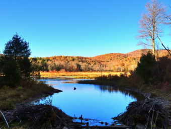
![]()
![]()
![]()
![]()
![]() On Thursday, October 15th I met the trail maintainer for the Frick Pond Loop, Deanna, at the Quick Lake trailhead. Since I am the new Trail Supervisor for the NYNJTC in the area I wanted to meet all the experienced and new trail maintainers in my area. Our purpose in meeting was to get acquainted and to hike the Frick Pond loop looking for problem areas and clearing any small problems we found. Deanna arrived at 4:20 PM and we spent a few minutes in the parking area getting acquainted and oriented. I had already been hiking twice but those were short and the Frick pond loop is just over two miles. I was dressed in my long-sleeved White Sierra crew top and a short-sleeved baselayer. I had on a pair of RailRiders hiking pants which are expensive but last a long time and have features like deep pockets and a generous cut which I really like. The pants have Velcro closures at the ankles. I wore my Keen Traghee II boots which are supportive, surprisingly roomy and have been discontinued. I had a pair of Leki external lock poles I have been using since spring in the car. The external locks have not failed me yet and the cork handles really do allow a good grip. I elected not to bring them as we would be doing some trail work. I still had on my Mammut hoody which has lots of zippers to dump heat. I had my Silky Sugowaza saw and LT Wright Overland machete in my pack in case we needed them for any trail work. We started the hike by walking out the back of the larger parking area on the Quick Lake Trail. The section of the trail all the way to the trail register had only a few small sticks to remove. Sheila seemed to be okay with Deanna which made me happy. At the trail register we turned left to stay on the Quick Lake Trail toward Gravestone Junction.
On Thursday, October 15th I met the trail maintainer for the Frick Pond Loop, Deanna, at the Quick Lake trailhead. Since I am the new Trail Supervisor for the NYNJTC in the area I wanted to meet all the experienced and new trail maintainers in my area. Our purpose in meeting was to get acquainted and to hike the Frick Pond loop looking for problem areas and clearing any small problems we found. Deanna arrived at 4:20 PM and we spent a few minutes in the parking area getting acquainted and oriented. I had already been hiking twice but those were short and the Frick pond loop is just over two miles. I was dressed in my long-sleeved White Sierra crew top and a short-sleeved baselayer. I had on a pair of RailRiders hiking pants which are expensive but last a long time and have features like deep pockets and a generous cut which I really like. The pants have Velcro closures at the ankles. I wore my Keen Traghee II boots which are supportive, surprisingly roomy and have been discontinued. I had a pair of Leki external lock poles I have been using since spring in the car. The external locks have not failed me yet and the cork handles really do allow a good grip. I elected not to bring them as we would be doing some trail work. I still had on my Mammut hoody which has lots of zippers to dump heat. I had my Silky Sugowaza saw and LT Wright Overland machete in my pack in case we needed them for any trail work. We started the hike by walking out the back of the larger parking area on the Quick Lake Trail. The section of the trail all the way to the trail register had only a few small sticks to remove. Sheila seemed to be okay with Deanna which made me happy. At the trail register we turned left to stay on the Quick Lake Trail toward Gravestone Junction.
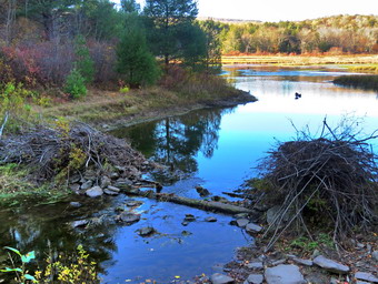 The woods road was covered in leaves as we walked but there was no work to do. Some places were a little damp under the leaves and Deanna pointed out some wet spots which I already knew about. At Gravestone Junction stayed to the left to follow the Quick Lake Trail down to the bridge at the outlet end of Frick Pond. We stopped at the bridge and talked about the fact that the water level was so low as someone had vandalized the beaver dam. Deanna remarked that the beavers had been "aggressive" toward some people and I told her that people should be advised to stay clear of the wildlife. I took some pictures even though it was beginning to get dark in the area s the sun dropped lower in the sky. The leaves which had been so brilliant the week before were no longer on the trees. We continued around the pond stopping to inspect a tree that someone keeps vandalizing with a machete. I am at a loss to explain these senseless acts. We inspected the two bridges on the west side of the pond and agreed that they need some repair work before they have to be replaced. At the junction with the Big Rock Trail, we turned right on the Big Rock Trail and continued along the west side of the wetlands at the head of the pond. We both agreed that the wooden walkways also need repair, a fact we have mentioned to both the DEC and the NYNJTC. Repairing them now will be much easier than replacing them later!
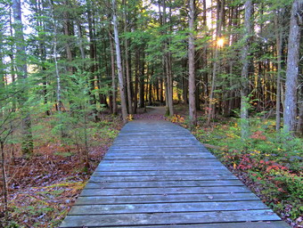 Deanna complimented me on the large spruce tree that I had cut a path through. It seems to me that more can be removed when we do our trail work with the Willowemoc Trail Crew. The next two bridges are also in poor shape as the flooding in the summer is washing away their support at either end. The north end of the pond was damp in places but not too bad. I was enjoying talking to Deanna about her concerns and her hiking experience. We stopped at Times Square to remove some branches and then turned right to complete the loop around Frick Pond on the Logger's Loop. This trail is a very gentle climb and then a slight descent to Gravestone Junction to complete the loop. This trail had nothing much to remove but we did look at several wet areas. Deanna voiced a concern about some logs that had been installed to cross the mud as she felt they were holding back the water. We continue along the trail and were soon back at Gravestone Junction where we turned left. We walked the Quick Lake Trail back to the trail register. At this point we said goodbye and I walked the woods road back out to the small lot where my car was parked. It was 5:10 PM and we had hiked the 2.2 miles in1 hour and 15 minutes with an elevation gain for 200 feet.
![]() On Thursday, October 15th I had two different hikes planned. After finishing at Walnut Mountain at 10:00 AM, I returned to Livingston Manor and ate breakfast before returning home. I thought I might go out immediately for a hike but I was pretty tired. I did some work at home but by 2:00 PM I decided to go to the Frick Pond area to visit Mongaup Falls and get in a hike before my 4:30 PM meet with my trail maintainer. I got dressed again by putting on a long-sleeved White Sierra crew top and a short-sleeved baselayer. I put on a pair of RailRiders hiking pants which are expensive but last a long time and have features like deep pockets and a generous cut which I really like. The pants have Velcro closures at the ankles. I decided to wear my Vasque Taku boots which are supportive, surprisingly roomy and have been discontinued. I grabbed a pair of Leki external lock poles I have been using since spring. The external locks have not failed me yet and the cork handles really do allow a good grip. I also packed a light hat and a light pair of gloves as it was only 40 degrees on the back porch. I put on my Mammut hoody which has lots of zippers to dump heat. I put my gear in the car and Sheila in the backseat and drove out DeBruce Road at 2:40 PM. After 6 miles, I turned left on Mongaup Road and continued to where the road split. I stayed to the right and immediately pulled into the small parking area on the right side of the road where one car was already parked. I got my gear ready and Sheila and I walked back toward the intersection and then turned left to walk down to the stream. We crossed the old bridge and walked along the edge of the stream toward the falls. There was water in the creek but it was low.
On Thursday, October 15th I had two different hikes planned. After finishing at Walnut Mountain at 10:00 AM, I returned to Livingston Manor and ate breakfast before returning home. I thought I might go out immediately for a hike but I was pretty tired. I did some work at home but by 2:00 PM I decided to go to the Frick Pond area to visit Mongaup Falls and get in a hike before my 4:30 PM meet with my trail maintainer. I got dressed again by putting on a long-sleeved White Sierra crew top and a short-sleeved baselayer. I put on a pair of RailRiders hiking pants which are expensive but last a long time and have features like deep pockets and a generous cut which I really like. The pants have Velcro closures at the ankles. I decided to wear my Vasque Taku boots which are supportive, surprisingly roomy and have been discontinued. I grabbed a pair of Leki external lock poles I have been using since spring. The external locks have not failed me yet and the cork handles really do allow a good grip. I also packed a light hat and a light pair of gloves as it was only 40 degrees on the back porch. I put on my Mammut hoody which has lots of zippers to dump heat. I put my gear in the car and Sheila in the backseat and drove out DeBruce Road at 2:40 PM. After 6 miles, I turned left on Mongaup Road and continued to where the road split. I stayed to the right and immediately pulled into the small parking area on the right side of the road where one car was already parked. I got my gear ready and Sheila and I walked back toward the intersection and then turned left to walk down to the stream. We crossed the old bridge and walked along the edge of the stream toward the falls. There was water in the creek but it was low.
 We walked to the top of the first drop of the falls and I put my pack down and got out my camera. I was able to get almost in front of the falls and took a number of shots with different settings. The sun was bright and that made it difficult to get the right shot. When I was done, I moved along the rocks and carefully worked my way down the side of the lower falls. I was able to get to a rock right in front of the falls. I took more shots trying to get a good one at a longer exposure to get the silky quality. I worked my way back to solid ground and then up the side of the falls. I stowed the camera and shouldered the pack. We walked back to the bridge and, realizing I had a lot of time left, I decided to walk up the side of the stream near the road just to see what I could see. After a short distance, we came to a small stone foundation and another stone structure. I took some shots and then we continued along the stream. At several different spots I took some pictures of the stream. At one point the stream was so close to the road that we walked on the road until it swung back into the woods. Eventually the banks of the stream were too steep and we walked up to the road. I decided at this point to turn around and walk back to the car. We set a quick pace and were soon back at the car. I drove up to the Frick Pond lots where I parked with two other cars in the smaller lot.
 It was only 3:45 PM so I decided to walk the first part of the Flynn Trail and do a little trimming. I took my pack when in reality all I needed was the machete. I used the machete to cut a large branch lying partly on the trail and moved it to the side. I cut some branches off the small trees near the trail and also cut a few small saplings. We moved on down the trail to where a large branch was encroaching on the trail. I tried to drag it off the trail but it was very large and I thought I would have to cut it. When I was about to give up, it broke and I was able to drag each piece off the trail separately. I heard some car doors slam and shortly three hikers came walking toward us. I took Shiela off the trail and waited until they passed with a "Hello". I continued up the trail cutting branches as I went until I reached the other end. I started back to where I had left my pack and noticed a young couple coming toward us. Once again I took Sheila to the side so hath they could pass. We greeted each other and as the young woman passed I smelled smoke. She was smoking a cigarette on a hike! I suppose this was once more common but it was the first time it had happened all year! I shouldered my pack and we walked back to the car. I noticed that there was now a car in the larger lot and it was 4:20 PM. I put Sheila on her leash and we walked over to meet my trail maintainer, Deanna.
![]() On Thursday, October 15th I had two different hikes planned. The first was at 8:00 AM at Walnut Mountain where I was to meet two members of the Sullivan County Retired Teachers Association who wanted to start walking and hiking. The second hike was at 4:30 PM when I was scheduled to meet one of my Trail maintainers, Deanna, at Frick Pond. I am the new Trail Supervisor in that area and I wanted to get to meet the experienced trail maintainers and those that are just starting. I start each Thursday be leading a men's Bible study group at our church from 6:15 to 7:15 AM. This meant I would have to be dressed in my hiking clothes to go from the church to Walnut Mountain. I put on a long-sleeved White Sierra crew top and a short-sleeved baselayer. I put on a pair of RailRiders hiking pants which are expensive but last a long time and have features like deep pockets and a generous cut which I really like. The pants have Velcro closures at the ankles. I decided to wear my Vasque Taku boots which are supportive, surprisingly roomy and have been discontinued. I grabbed a pair of Leki external lock poles I have been using since spring. The external locks have not failed me yet and the cork handles really do allow a good grip. I also packed a light hat and a light pair of gloves as it was only 40 degrees on the back porch. I put on my Mammut hoody which has lots of zippers to dump heat. At 5:45 AM, I put my gear in the car and drove to my church in Liberty. When my men's group was done I lingered for a few minutes and then headed over to the West Lake Street parking area for Walnut Mountain Park. When I pulled into the paring area, Mike and Joan were waiting for me. We talked for a minute as I set my GPS and then we walked through the gate to start our hike. I suggested we aim for the lookout on Walnut Mountain and they agreed. We continued straight ahead on the wide carriage road heading south and uphill toward the main complex of the park. The temperature had risen as the sun had come out. It was a beautiful day and I was beginning to feel warm as we exited the woods at about .45 miles. We were keeping a slow but steady pace so that we could talk and get acquainted. We walked to the entrance road and then turned right to walk up to the parking area.
On Thursday, October 15th I had two different hikes planned. The first was at 8:00 AM at Walnut Mountain where I was to meet two members of the Sullivan County Retired Teachers Association who wanted to start walking and hiking. The second hike was at 4:30 PM when I was scheduled to meet one of my Trail maintainers, Deanna, at Frick Pond. I am the new Trail Supervisor in that area and I wanted to get to meet the experienced trail maintainers and those that are just starting. I start each Thursday be leading a men's Bible study group at our church from 6:15 to 7:15 AM. This meant I would have to be dressed in my hiking clothes to go from the church to Walnut Mountain. I put on a long-sleeved White Sierra crew top and a short-sleeved baselayer. I put on a pair of RailRiders hiking pants which are expensive but last a long time and have features like deep pockets and a generous cut which I really like. The pants have Velcro closures at the ankles. I decided to wear my Vasque Taku boots which are supportive, surprisingly roomy and have been discontinued. I grabbed a pair of Leki external lock poles I have been using since spring. The external locks have not failed me yet and the cork handles really do allow a good grip. I also packed a light hat and a light pair of gloves as it was only 40 degrees on the back porch. I put on my Mammut hoody which has lots of zippers to dump heat. At 5:45 AM, I put my gear in the car and drove to my church in Liberty. When my men's group was done I lingered for a few minutes and then headed over to the West Lake Street parking area for Walnut Mountain Park. When I pulled into the paring area, Mike and Joan were waiting for me. We talked for a minute as I set my GPS and then we walked through the gate to start our hike. I suggested we aim for the lookout on Walnut Mountain and they agreed. We continued straight ahead on the wide carriage road heading south and uphill toward the main complex of the park. The temperature had risen as the sun had come out. It was a beautiful day and I was beginning to feel warm as we exited the woods at about .45 miles. We were keeping a slow but steady pace so that we could talk and get acquainted. We walked to the entrance road and then turned right to walk up to the parking area.
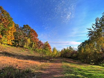 From the parking area at .65 miles, we began to walk up the Mountain Overlook which is also a carriageway. The trail winds a little as it ascends to a junction with the West Lake West trail which continues straight ahead. We paused a minute before turning left at .9 miles. The Mountain Overlook Trail was now headed southwest as it continued its gentle climb. At 1.25 miles we passed a trail unction and continued straight ahead to the overlook. The trees around the overlook had been cut down and the brush cleared. The view from the overlook was much more open and it was easy to see down to Swam Lake. The leaves were colorful and the sky was blue with some interesting clouds. I dropped my pack and took out my camera. I took some pictures of the lookout and the turned my attention to the view. I took numerous pictures of the landscapes and some of the sky. After I had finished, we turned around and started back the way we had come. In a short distance, at the trail junction, we turned right so that we could take a different route back on the West Lake East Trail. We walked down the carriageway to a wide-open field. The sun was bright as we continued along the edge of the field to pick up the trail which turned left at 1.6 miles heading north. The trail descended to a flat area next to the disc golf course. I took a few more pictures here and then packed up to finish the hike. We continued straight ahead through an old quarry and then entered the woods. After a short walk through the woods, we came to the playground and walked out to the parking area. From here we walked along the edge of the baseball field back down to the trail we had used to walk in on. We turned left and walked on the carriageway to the point where we entered the trees. The walk was now downhill through the trees and we were soon back at the parking area. It was 9:45 AM and we had hiked 2.7 miles in 1 hour and 50 minutes. Our elevation gain was a modest 445 feet and our moving average was 1.7 mph but it was an enjoyable trip one the less.
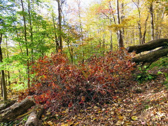
![]() On Wednesday, October 14th I had planned a day of hiking with my grandson Bryce as he is at our house Tuesdays and Wednesdays. I got a call to be the substitute for the Liberty HS nurse which put and end to hiking for the entire day. I did plan to get home as soon as possible sleep and hike for a short time on Round Top. I was anxious to get out and so was Sheila as we had not been hiking since Saturday! When I got home at 3:15 PM the temperature was in the high 60's and I decided I would quickly change my cloths and get across the street. Bryce and Cindy were ready to go and Sheila was jumping around like we hadn't been out all fall! I got dressed in my White Sierra long-sleeved crew top but decided I did not need a baselayer. I put on a pair of RailRiders hiking pants which are expensive but last along time and have features like deep pockets and a generous cut which I really like. These pants do not have the Velcro closures at the ankles to discourage sticks and gravel from getting into my shoes and to combat ticks but I thought they would do for a short hike. I decided to wear my Vasaue Taku hiking boots which fit well and have been discontinued. I grabbed a pair of Leki external lock poles I have been using lately. We stepped out of the house at 3:35 PM and I grabbed Sheila's leash from the car. We walked up the driveway and crossed the street. I decided we would do enough loops to cover all the trails and tire me out a little. We walked to the parking area by the Presbyterian Church and to the back of the church. We began the ascent of the steepest hill behind the church with Cindy and I using our poles and Bryce managing Sheila on her leash. The hill is short but gets the circulation pumping and is the steepest and longest climb on the "trail." I noticed the hill seemed easier as I have been hiking more. Bryce, of course, was right with me but he was able to talk normally the whole way up the hill. When we got to the top of the hill, we stopped to look around at the hills around town and I commented that the leaves were past their prime. We started on the trail by turning left at the trailhead. I let Sheila off her leash so that she could explore. The trail bed is becoming worn it which means that at least a few people are using the trail. I am always happy to see that someone else uses the trails.
On Wednesday, October 14th I had planned a day of hiking with my grandson Bryce as he is at our house Tuesdays and Wednesdays. I got a call to be the substitute for the Liberty HS nurse which put and end to hiking for the entire day. I did plan to get home as soon as possible sleep and hike for a short time on Round Top. I was anxious to get out and so was Sheila as we had not been hiking since Saturday! When I got home at 3:15 PM the temperature was in the high 60's and I decided I would quickly change my cloths and get across the street. Bryce and Cindy were ready to go and Sheila was jumping around like we hadn't been out all fall! I got dressed in my White Sierra long-sleeved crew top but decided I did not need a baselayer. I put on a pair of RailRiders hiking pants which are expensive but last along time and have features like deep pockets and a generous cut which I really like. These pants do not have the Velcro closures at the ankles to discourage sticks and gravel from getting into my shoes and to combat ticks but I thought they would do for a short hike. I decided to wear my Vasaue Taku hiking boots which fit well and have been discontinued. I grabbed a pair of Leki external lock poles I have been using lately. We stepped out of the house at 3:35 PM and I grabbed Sheila's leash from the car. We walked up the driveway and crossed the street. I decided we would do enough loops to cover all the trails and tire me out a little. We walked to the parking area by the Presbyterian Church and to the back of the church. We began the ascent of the steepest hill behind the church with Cindy and I using our poles and Bryce managing Sheila on her leash. The hill is short but gets the circulation pumping and is the steepest and longest climb on the "trail." I noticed the hill seemed easier as I have been hiking more. Bryce, of course, was right with me but he was able to talk normally the whole way up the hill. When we got to the top of the hill, we stopped to look around at the hills around town and I commented that the leaves were past their prime. We started on the trail by turning left at the trailhead. I let Sheila off her leash so that she could explore. The trail bed is becoming worn it which means that at least a few people are using the trail. I am always happy to see that someone else uses the trails.
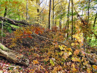 As we approached the first trail junction, we found that the trail was blocked by several large trees that had fallen across the trail. This was near a set of large trees I had cut some time ago and there was really no convenient way to get around the mess. Hikers had been ducking under some low logs but this is not for everyone. I decided I would go back to the house and get tools to remove the blowdown while Cindy and Bryce would continue to hike. They agreed to do a figure 8 to walk most of the trails to see if there were any other blowdowns. I walked home as fast as I could and gathered the tools I might need. I took my Silky Sugowaza and Silky Katanaboy 500 saws. The Sugowaza is a 17" curved and fixed blade which fits in a scabbard. The KatanaBoy is almost two feet long and is a folding saw with a nylon carrier. Both are remarkably sharp and can take care of some large tree trunks. I brought along my light Fiskars X27 axe leaving and the full-sized Council Tools Velvicut. The latter has a 4 pound head so I don't bring it unless I don't have to carry it very far and this blowdown was almost at the trailhead. I also remembered to bring my camera to take some pictures. I put all the tools in the back of the car and drove across the street and parked near the trailhead. I grabbed the camera, the Sugowaza and the Council Tools ax and walked on the trail to the blowdown. I took a few pictures of the whole mess and then ducked under the trunks to the other side where I took a few more shots.
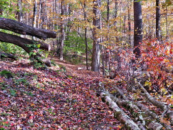 I began at 4:10 PM by using the saw to remove a lot of small branches which I threw far off the trail with the other branches that were loose. Cindy and Bryce returned from their loop and reported one small tree down above the lookout. Bryce started to help me remove the larger branches I was now cutting. There was actually more work to do than I initially though and the main trunks were not small. We continued to work with me cutting and Bryce removing branches until most of the smaller branches had been removed and it was time for Bryce and Cindy to leave. I leashed Sheila to a tree off the trail as I could hear voices approaching from further up the trail. I cut and removed a few more bigger branches with the saw until the hikers arrived, It was a younger man and an older man who immediately thanked me for the work. As I cut a branch, they asked me about my tools and we got into a long discussion about saws and axes. It was very interesting and they eventually moved on and I got back to work. I took some intermediate pictures after removing the leafiest branches. I started to use the axe to cut off the largest branches and small trunks. This axe is a best but it can be hard to control. The momentum really helps it bite into the wood but I have to be careful to strike accurately and take it easy when I am about to finish a cut. As I was working a man and woman approached from the trailhead and started up the trail to the lookout. I had the impression that the viewpoint was their destination. I removed almost everything from the trail making it almost as wide as it had been. I used the saw again to remove a few more branches and then decided I was done. I took some "after" pictures and was pleased with the work I had done. At this point the couple who had walked up the trail came back and thanked me for what I had done. I could also see someone parking at the trailhead and starting out on the trail. I cleaned up a little more and as she came by I asked her not to park at the trailhead in the future. I looked at my watch and was surprised it was already 5:30 PM.
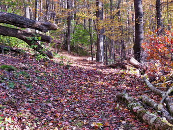 I decided we would go cut the other tree off the trail Cindy and Bryce both said it was between the lookout and the junction with the blue trail. They both agreed it was small. I was tired but I hid the axe and grabbed the camera and saw and started up toward the lookout. I did not see the young lady who had walked by and thought she might have taken the woods road to the right. We followed the yellow trail to the viewpoint and to the left where it turns up the hill. I did not see any trees down in the path and was about to turn around. At the last minute I spotted a small tree across the path. It was indeed much smaller than the other I had work on. I made two cuts with the saw and then dragged the branches off the trail. We turned round and moved quickly back down the trail. I picked up the axe and we started out to the trailhead. A woman was just entering the trail with her Yellow Labrador puppy. She had a leash but her dog was not on the leash. I had Sheila sit at the side of the trail but the puppy came at her full force. Sheila let the puppy know she was not pleased. The woman came and retrieved her dog and we went our separate ways. I will never understand people who cannot control their dogs and do not have them on a leash around other digs and people! We walked out to the car where I loaded the tools and rove back to the house. It was 5:55 PM and I was just in time for my ambulance shift.
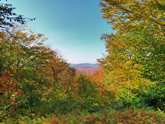
![]()
![]()
![]()
![]()
![]() On Saturday, October 10th, I planned to hike from the Frick Pond Trailhead to the Hodge Pond Lookout. I also wanted to hike to the Sullivan County High Point on Beech Mountain and look for a viewpoint from Beech Mountain to the east. I had some things to do at home so I did not get start to get ready until 12:45 PM when the temperature was 62 degrees. I asked Brad if he wanted to go and he said "Yes". As I got my gear together, Sheila seemed very excited even though we had done a big hike the day before. I put on a long-sleeved White Sierra crew top and a short-sleeved baselayer. I put on a pair of RailRiders hiking pants which are expensive but last a long time and have features like deep pockets and a generous cut which I really like. The pants have Velcro closures at the ankles. I decided to wear my Vasque Taku boots which are supportive, surprisingly roomy and have been discontinued. I grabbed a pair of Leki external lock poles I have been using since spring. The external locks have not failed me yet and the cork handles really do allow a good grip. I also added a wide-brimmed, floppy OR hat which protects me from the sun. I decided I did not need a jacket but I packed a light windbreaker. We put our gear in the car and Sheila in the backseat and drove out DeBruce Road at 1:10 PM. I got behind one car whose driver did not go over 35 mph! After 6 miles, I turned left on Mongaup Road and continued to where the road split. I stayed to the left on Beech Mountain Road to the parking areas for Frick Pond. I suspected there would be some people in the area on a beautiful Columbus Day weekend. I did not expected to find the small lot filled and only three spots left in the larger lot! I pulled into a spot right next to the slower driver I had followed from Livingston Manor. There appeared to be some people getting ready to leave the lot so Bard and I got ready to get out in front of them. I set my GPS and we crossed the road to get on the Flynn Trail to start our hike at 1:30 PM with the temperature at 66 degrees. There were a lot of leaves on the trail but the leaves left on the trees were mostly green.
On Saturday, October 10th, I planned to hike from the Frick Pond Trailhead to the Hodge Pond Lookout. I also wanted to hike to the Sullivan County High Point on Beech Mountain and look for a viewpoint from Beech Mountain to the east. I had some things to do at home so I did not get start to get ready until 12:45 PM when the temperature was 62 degrees. I asked Brad if he wanted to go and he said "Yes". As I got my gear together, Sheila seemed very excited even though we had done a big hike the day before. I put on a long-sleeved White Sierra crew top and a short-sleeved baselayer. I put on a pair of RailRiders hiking pants which are expensive but last a long time and have features like deep pockets and a generous cut which I really like. The pants have Velcro closures at the ankles. I decided to wear my Vasque Taku boots which are supportive, surprisingly roomy and have been discontinued. I grabbed a pair of Leki external lock poles I have been using since spring. The external locks have not failed me yet and the cork handles really do allow a good grip. I also added a wide-brimmed, floppy OR hat which protects me from the sun. I decided I did not need a jacket but I packed a light windbreaker. We put our gear in the car and Sheila in the backseat and drove out DeBruce Road at 1:10 PM. I got behind one car whose driver did not go over 35 mph! After 6 miles, I turned left on Mongaup Road and continued to where the road split. I stayed to the left on Beech Mountain Road to the parking areas for Frick Pond. I suspected there would be some people in the area on a beautiful Columbus Day weekend. I did not expected to find the small lot filled and only three spots left in the larger lot! I pulled into a spot right next to the slower driver I had followed from Livingston Manor. There appeared to be some people getting ready to leave the lot so Bard and I got ready to get out in front of them. I set my GPS and we crossed the road to get on the Flynn Trail to start our hike at 1:30 PM with the temperature at 66 degrees. There were a lot of leaves on the trail but the leaves left on the trees were mostly green.
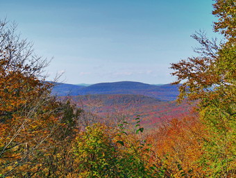 At the end of the trail we turned right to continue our hike on the Flynn Trail which, in this area, follows the old Beech Mountain Road. I was a little tired from the hike the day before but we still set a pretty fast pace. We passed through the "tunnel" Cindy and I had cut in a huge spruce tree that fell across the trail. Brad and I walked and talked which helped to make the hike seem shorter. We noticed a father and son with camping gear ahead of us. They seemed to be hiking quickly and then stopping and this kept them just ahead of us. Sheila alerted as a young couple approached us from behind. They stopped to talk to us and, since it was their first time in the area, I gave them some suggestions on routes they might take. They continued ahead of us and as we approached the 1 mile point we passed a hiker who was stopped and appeared a little tired. His friend was a little farther ahead and we said "hello" as we passed. At 2:15 PM we were at the junction with the Big Rock Trail after hiking 1.7 miles. There were two hikers at the junction and they commented on the well-maintained trails. I told them I was the trail supervisor for the area MD thanked them for noticing the trail work. We continued straight ahead on the Flynn Trail still trailing the father and son by a little. We passed through the gate that separates state land from the OSI Beech Mountain Nature Preserve. When the trails split, the father and son stayed on the Flynn Trail by going left while Brad and I turned right. We followed the woods road passed the turn to the old Beech Mountain Boy Scout Camp and started up the hill toward the Hodge Pond Lookout and the Sullivan county High Point. The road is dirt and rocks covered with fallen leaves. Over the next .4 miles we gained 450 feet which is only a 12% grade but I was feeling tired. At 2.65 miles we stopped at a viewpoint to the west. I got out my camera and could see that there was some color in the leaves. We got a drink and then headed a short distance up the hill before turning right on a woods road.
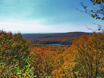 The woods road seems wider and more well-maintained every time I use it. The walk to the Hodge Pond Lookout is only a quarter mile so we were there very quickly. I put my pack down and got out my camera. As I stepped out onto the rock ledge that forms the viewpoint, I was surprised that it was more open than the last time I was there. I could see the trees that had been cut at the base of the viewpoint. I took pictures of Hodge Pond and the hills beyond. I put my camera away and Brad and I looked for a way up to the top of Beech Mountain. We finally decided just to pick a spot and go up. This worked out pretty well although the climb was steep. Once we got to the summit plateau we walked to the highest point at 3118 feet and then walked to the eastern edge of the plateau. I was looking for a viewpoint which someone had mentioned. We walked north along the eastern edge but could find no views. We turned around and walked back to the spine, over the high point and back to the eastern edge. This time we walked south but still could not find any views. I picked a point to descend and we walked down to the woods road around Beech Mountain. We turned left to walk around the mountain in a counterclockwise direction. We kept looking to our right or to the east for some light. Brad and I both saw a spot where there seemed to be a gap in the trees. We walked out to this spot to find a cabin. I knew this was private property so we retreated back to the woods road. The road eventually ended at the road we had come up so we turned left, walked up a slight hill and then started the long downhill hike. We passed the viewpoint to the west and kept a fast pace on the descent.
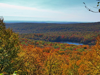 When we arrived at the junction near the old Boy Scout camp, we continued straight ahead on the woods road. At the junction with the Flynn Trail, we turned left. I felt pretty good since I knew the rest of the hike was downhill or flat. We set a fast pace down the Flynn Trail which was only interrupted by groups of hikers coming up the trail. At the point where there was about a mile left, we met the hiker who we had seen on the way out. He was stopped and still looked tired but did say "Hello". Talking to Brad on the return trip certainly helped the time to pass as the return on and out and back can be boring. As we approached the gate where we would turn left, we could see someone standing on the trail. I put Sheila on her leash and I immediately recognized the person as the "friend" of the man who was obviously having some trouble completing the hike. We spoke briefly and then turned left to stay on the Flynn Trail. Both Brad and I remarked that a hiking "friend" would stay with their partner to encourage them! As we emerged from the Flynn Trail, we found there were now cars parked along the road which I have never seen before. We walked over to our car and found the driver of the car next to us had also finished his hike. He mentioned that there were a dozen people camping at Hidge Pond. Camping there is permitted but must be 150 feet from water and 150 from the trail. I hope these people are considerate and pick up their trash.We arrived back at the car at 4:35 PM after hiking 6.5 miles in 3 hours and 5 minutes. The elevation gain was 1180 feet. After looking at the maps, I realized where the viewpoint I was looking for might be located.
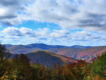
![]()
![]()
![]()
![]()
![]() On Friday, October 9th, I planned to go to Giant Ledge and Panther Mountain to catch some of the last colorful leaves. I knew I should get started early so I got up at 8:00 AM and started to get ready. The temperature was only 36 degrees but the forecast was for highs in the low 60's. As I got my gear together , Sheila seemed to be in complete agreement with my decision as she followed me around as I was dressing. I put on a long-sleeved White Sierra crew top and a short-sleeved baselayer. I put on a pair of RailRiders hiking pants which are expensive but last a long time and have features like deep pockets and a generous cut which I really like. The pants have Velcro closures at the ankles. I decided to wear my Vasque Taku boots which are supportive, surprisingly roomy and have been discontinued. I grabbed a pair of Leki external lock poles I have been using since spring. The external locks have not failed me yet and the cork handles really do allow a good grip. I also added a bright orange hat to keep my head warm and to signal hunters I was not their prey. I put on my Mammut hoody which has lots of zippers to dump heat. I also packed a light windbreaker in case I needed less warmth. I put my gear in the car and Sheila in the backseat and drove out DeBruce Road at 8:30 AM. I continued all the way to the end of the road where I turned left on Route 47. I passed by the Frost Valley YMCA camp and came to the Biscuit Brook parking area which had three cars. The next parking area was Slide Mountain where there were over a dozen cars parked. I began to wonder if I would find a place to park for Giant Ledge. I soon got my answer as the parking area was already full and some cars were parked along the road. I thought about parking further up the hill and walking out on the easement from the Winnisook Club. I decided against this as we would still have to deal with too many people. I decided we would go to hike Belleayre from Giggle Hollow. I continued to the intersection with Route 28 where I turned left and drove 2.1 miles and turned left off Route 28 on the access road to Belleayre Beach. The area was closed so I parked on the gravel at the side of the road at 9:45 AM. The temperature was only 45 degrees so I decided to leave my Mammut hoody on. I promptly set my GPS unit to get ready for the hike.
On Friday, October 9th, I planned to go to Giant Ledge and Panther Mountain to catch some of the last colorful leaves. I knew I should get started early so I got up at 8:00 AM and started to get ready. The temperature was only 36 degrees but the forecast was for highs in the low 60's. As I got my gear together , Sheila seemed to be in complete agreement with my decision as she followed me around as I was dressing. I put on a long-sleeved White Sierra crew top and a short-sleeved baselayer. I put on a pair of RailRiders hiking pants which are expensive but last a long time and have features like deep pockets and a generous cut which I really like. The pants have Velcro closures at the ankles. I decided to wear my Vasque Taku boots which are supportive, surprisingly roomy and have been discontinued. I grabbed a pair of Leki external lock poles I have been using since spring. The external locks have not failed me yet and the cork handles really do allow a good grip. I also added a bright orange hat to keep my head warm and to signal hunters I was not their prey. I put on my Mammut hoody which has lots of zippers to dump heat. I also packed a light windbreaker in case I needed less warmth. I put my gear in the car and Sheila in the backseat and drove out DeBruce Road at 8:30 AM. I continued all the way to the end of the road where I turned left on Route 47. I passed by the Frost Valley YMCA camp and came to the Biscuit Brook parking area which had three cars. The next parking area was Slide Mountain where there were over a dozen cars parked. I began to wonder if I would find a place to park for Giant Ledge. I soon got my answer as the parking area was already full and some cars were parked along the road. I thought about parking further up the hill and walking out on the easement from the Winnisook Club. I decided against this as we would still have to deal with too many people. I decided we would go to hike Belleayre from Giggle Hollow. I continued to the intersection with Route 28 where I turned left and drove 2.1 miles and turned left off Route 28 on the access road to Belleayre Beach. The area was closed so I parked on the gravel at the side of the road at 9:45 AM. The temperature was only 45 degrees so I decided to leave my Mammut hoody on. I promptly set my GPS unit to get ready for the hike.
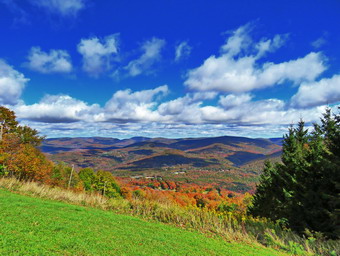 We walked across the covered bridge to the parking area near the pavilions and then walked uphill toward the pavilions. I found the blue blazed Giggle Hollow Trail where it leaves the upper end of the area near the pavilions heading south. I had been on this trail before but had never hiked all the way to Belleayer from it. Just at the start of the hike the trail passes under some railroad tracks so I stopped to take some pictures. I packed up and we started back on the trail which immediately started to climb steeply. The trail is sited along a woods road so is easy to follow but I was surprised at the lack of blazes. In several places there were blowdowns and it did not look like there had been any maintenance for some time. There were also spots where other roads or paths turned off the road we were on and there were no markers to emphasize the direction to go. The trail is steep at times and then levels until it is steep again. At one point it crossed a small stream but there was almost no water. The trail initially heads southwest but at 1.1 miles it started a switch back to the southeast and then another at 1.5 miles so that it is heading west. The climb continued for the entire 1.8 miles of the trail gaining 1355 feet for an average 14% grade. I was glad Sheila was along to help support me and to encourage me as I wanted to take a break several times. As we neared the junction with the blue blazed Pine Hill-West Branch Trail the markers became even sparser and the trail was not well trimmed. We turned left at the end of the trail heading west toward the Belleayre summit at 2.8 miles. Just after this the Lost Clove trail came up on the left but we stayed to the right on the blue blazed trail. I forgot that the trail continues to climb and I was glad the grade was more moderate. At 2.4 miles we came to the Belleayer Mountain lean-to located on the right of the trail. We stopped and I took a few quick shots. At 2.8 miles the Pine Hill-West Branch Trail turned south toward Balsam Mountain. This was once the site of a fire tower and the remains of the anchors can be seen. There is also a USGS marker to mark the summit. We stopped and I took some pictures and noticed that the leaves were vibrant and mostly still on the trees. I put the camera away and we walked straight ahead to pick up the red blazed Belleayer Ridge Trail that continues northwest to the ski area. The trail ascended some and as we approached the Cathedral Glen Trail I saw a hiker coming toward us. I put Sheila on her leash and waited for the hiker to pass by but he stopped. We approached and I struck up a conversation. He said he had hiked up one of the ski slopes and would probably go back the same way. I told him my route and that I planned to take the Cathedral Glen Trail back. As we closed our conversation, I noticed that the hiker was pointing toward the side of the trail. It wasn't until I passed that I realized he was pointing to the Cathedral Glen Trail! I knew right where the trail was but wanted to visit the ski area first to take in the views and, I hoped, some colorful leaves.
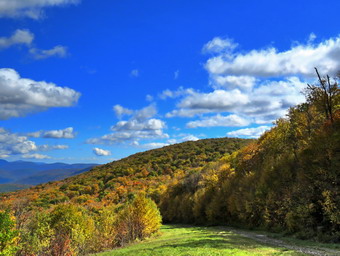 We continued our hike and at 3.25 miles there was another shelter on the right of the trail. I walked over and took a few pictures before returning to the trail. We reached the ski area which appeared to be almost deserted. We walked over to the concession which was closed and found a young couple on the deck. They said "Hello" and commented on how well-behaved Sheila was acting. I was very happy when I looked out across to the surrounding peaks. The leaves were bright and numerous so I got out my camera to capture what I could. I find that no matter how I try I cannot take pictures that match the beauty of being there. There were views here to the west, southwest and south. When I was done, we walked to the left of the ski lift and found a group of six young people relaxing and taking pictures. The colors on this side were even nicer than on the other. The trees were especially bright in the alley around Pine Hill. I took numerous shots including some of the interesting cloud formations. I kept the camera out as we walked back up toward the ski lift. I took some shot of the lift, the concession building and the ski patrol facility. I out the camera away before continuing back along the ridge. We stopped again at another spot where the views were slightly different. I decided not to take the trail back to the Cathedral Glen Trail as I knew I could walk down one of the access roads and pick it up further down the hill. We stayed to the left on the gravel road that heads down the mountain parallel to the trail but slightly farther north. There were great views from here also and I stepped to take more pictures. The group of young people passed us just as I was putting the camera away. Sheila and I set a fast pace down the road and passed the group. Where the road made a sharp left turn we continued straight ahead to the Cathedral Brook ski slope where the Cathedral Glen Trail is located. The trail was marked with blue blazes along the side of the slope and was very steep averaging a 21% grade for some distance. When in doubt, I headed right on the descent and watched to see if the blazes entered the woods. This is a trail I have been up but never down! When we got to the bottom of the steep upper section, I pulled out the camera to try to capture how steep the trail was that we had just descended. Eventually the trail came to a sort of clearing and then entered the forest. There was a where there is an "Out of Bounds" sign for skiers at this point. The trail now was more of a trail and paralleled the stream which had just enough water to make some noise. The gorge it had cut was deep but I wondered if it would be worth investigating some other time. As the trail began to level off near the end, I could see a body of water down the bank on the left.
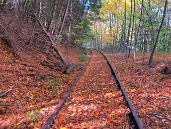 We passed through some big evergreen trees and at 6.1 miles the trail ended at some railroad tracks. We turned right and started to walk on the level tracks. Most of these rail trails have had both the tracks and ties removed but this section had both intact. As we walked, I stopped several times to take pictures of the tracks. It wasn't hard to imagine a time when the railroad was in use and engine pulling cars would pass through. After walking the tracks for .6 miles, we came to the streets of Pine Hill. We walked straight ahead off the tracks and then turned left on Mill Street. Almost immediately we walked under a railroad bridge and I took a moment to inspect it by walking up the bank. The weeds had overgrown the tracks and the light was wrong so we continued won Mill Street to Bonnie View Avenue where we turned right. At the next intersection, we turned right on Main Street. As we walked, I took the time to read the menus on several small restaurants and became very hungry. We continued on Mains Street heading toward Route 28 when a man and his dog approached us. The German Shepherd was young and was not on a leash. He came over to say "Hello" to us and ignored his owner calling him. I stopped until the owner got the dog under control. Another dog that is smarter than his person. We continued on Main Street until just before it started up to Route 28. I turned right on Lake Street and followed it to the dead end. We turn right and walked down to a stream. I thought I remembered abridge but could not find it. The best option was just to walk out to Route28 so I decided to walk across a cement culvert holding on to the rails! Once on the other side we walked to the pond where I took some more pictures. I decided we would walk clockwise around the pond on the wide berm. When we got to some picnic tables, I stopped to take a few more shots of the pond including the ducks swimming on it. We walked up to the parking lot and down to the covered bridge. After taking a few pictures of the bridge, we walked back to the car. We arrived at the car at 2:20 Pm having hiked 8.0 miles in 4.5 hours gaining 2335 feet along the way. We had stopped for 40 minutes but our moving average speed was over 2 mph so I was pleased.
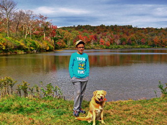
![]()
![]()
![]()
![]()
![]() On Wednesday, October 7th, I planned to go for a hike with my grandson Bryce who comes to our house Tuesdays and Wednesdays since these are days he is not in school. I wanted to get an early start as Bryce would arrive at 9:00 AM and had no school work to do but the ambulance pager went off at 8:00 AM and I responded. I returned just after 9:30 AM to find the school had called to see if I could come in as the nurse. I scrapped the idea of hiking and started to get dressed to go to school. The school called to cancel me and I told Bryce we would be leaving to hike as soon as possible before anything else happened. I had thought we would to the Frick Pond area and hike to the Hodge Pond lookout where I thought there might be some colorful views. A rather extensive rainstorm was due to pass through at 2:00 PM so we would have to move fast. As I got my gear together at 10:00 AM, Sheila seemed to be in complete agreement with my decision as she followed me around as I was dressing. The temperature was in the high 50's and it felt at least that warm because of the bright sun. I put on a long-sleeved White Sierra crew top and a short-sleeved baselayer. I put on a pair of RailRiders hiking pants which are expensive but last a long time and have features like deep pockets and a generous cut which I really like. The pants have Velcro closures at the ankles. I decided to wear my Keen Targhee II boots which are supportive, surprisingly roomy and discontinued by Keen. I grabbed a pair of Leki external lock poles I have been using since spring. The external locks have not failed me yet and the cork handles really do allow a good grip. I also added a new OR floppy hat which shields me from the sun and rain.I put a very light windbreaker in my pack in case I needed an added layer. I put my gear in the car and Bryce and Sheila in the backseat and drove out DeBruce Road at 10:30 AM. After 6 miles I turned left on Mongaup Road. Where the road splits, I stayed left on Beech Mountain Road and parked in the smaller lot with two other cars at 10:45 AM. There were two more cars in the other, larger lot. I promptly set my GPS unit to get ready for the hike.
On Wednesday, October 7th, I planned to go for a hike with my grandson Bryce who comes to our house Tuesdays and Wednesdays since these are days he is not in school. I wanted to get an early start as Bryce would arrive at 9:00 AM and had no school work to do but the ambulance pager went off at 8:00 AM and I responded. I returned just after 9:30 AM to find the school had called to see if I could come in as the nurse. I scrapped the idea of hiking and started to get dressed to go to school. The school called to cancel me and I told Bryce we would be leaving to hike as soon as possible before anything else happened. I had thought we would to the Frick Pond area and hike to the Hodge Pond lookout where I thought there might be some colorful views. A rather extensive rainstorm was due to pass through at 2:00 PM so we would have to move fast. As I got my gear together at 10:00 AM, Sheila seemed to be in complete agreement with my decision as she followed me around as I was dressing. The temperature was in the high 50's and it felt at least that warm because of the bright sun. I put on a long-sleeved White Sierra crew top and a short-sleeved baselayer. I put on a pair of RailRiders hiking pants which are expensive but last a long time and have features like deep pockets and a generous cut which I really like. The pants have Velcro closures at the ankles. I decided to wear my Keen Targhee II boots which are supportive, surprisingly roomy and discontinued by Keen. I grabbed a pair of Leki external lock poles I have been using since spring. The external locks have not failed me yet and the cork handles really do allow a good grip. I also added a new OR floppy hat which shields me from the sun and rain.I put a very light windbreaker in my pack in case I needed an added layer. I put my gear in the car and Bryce and Sheila in the backseat and drove out DeBruce Road at 10:30 AM. After 6 miles I turned left on Mongaup Road. Where the road splits, I stayed left on Beech Mountain Road and parked in the smaller lot with two other cars at 10:45 AM. There were two more cars in the other, larger lot. I promptly set my GPS unit to get ready for the hike.
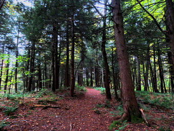 We crossed the road and started out on the Flynn Trail which was badly eroded just off the road. We knew that the rain might start at any time so we set a fast pace on the trail through the woods. At the end of the trail we turned right on what was once Beech Mountain Road and started the long but gentle ascent to the junction with the Big Rock Trail. There was a slight breeze blowing which made us feel a little cool at first but this feeling disappeared as we hiked. The sky was blue with white clouds and all the trees were changing color to some degree. The trail was only damp in places which made keeping a fast pace easier. Bryce and I talked about many different subjects from books he was reading to Bible stories. I was trying to make the junction as quickly as possible and it took us only 40 minutes to hike the 1.7 miles to the junction. The sky was now completely overcast and I considered turning left of the Big Rock Trail. Bryce and I decided we could make Hodge Pond and then turn around and retrace our steps. I really wanted to get to the lookout and a viewpoint on Beech Mountain but they would have to wait for another day. We did not stop at the trail junction but continued straight ahead toward Hodge Pond. This section of the trail is almost flat and we passed through the gate separating state land from OSI property. At the split in the trail, we stayed to the left and followed the Flynn Trail down to the shores of the pond. I chose to do this since the walk back up this hill always seems long even though the slope is gradual. When we broke out into the clearing at the outlet end of Hodge Pond we could see that clouds had begun to gather over Hodge Pond and the wind was blowing harder. I set my pack down and took out my camera to take some pictures of the pond. I took pictures of the trees around the pond which did not look very bright as there was no sun. I also took some shots of the clouds over the pond. Sheila walked to the edge of the water but did not seem interested in jumping into the pond. After taking some more pictures, I packed up and we turned around to follow the Flynn Trail back the way we had come. The hike up the hill seemed easy and short. I attributed this to the discussion I was having with Bryce and the fact that I have been hiking more. At the top of the hill we stayed to the right to follow the Flynn Trail back to the junction with the Big Rock Trail.
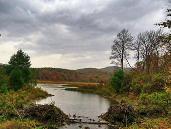 At the junction, we turned right and started down the Big Rock Trail toward Times Square. The downhill walk went quickly although I still am fooled by the three different descent all of which look like the last! When we arrived at Times Square, we continued straight across on the Big Rock Trail. I was surprised that the area was much drier than when we had worked on the drainage several trips ago. The trail here was covered in leaves which was true of the rest of the hike but was accentuated here. The trail around the back of the pond was damp and slightly muddy in spots. We entered the spruce trees where I stopped to take a few pictures of the moody landscape. As we crossed the wooden walkways, drops of rain began to fall. We hurried over the rest of the trail. At the end of the Big Rock Trail, we turned left on the Quick Lake Trail to continue on to the bridge over the outlet stream from Frick Pond. Along the way we passed a tree that had been vandalized by someone with what looked like a machete. They had felled the tree to block the trail and I had removed it from the trail. Now the remaining trunk showed more cuts of the same kind! I thought about mounting a game camera as I would really like to catch this idiot. At the bridge, we stopped and I took off my pack to take a few more pictures. I have many pictures from this spot but can never resist taking a few shots. I find this one of the most beautiful places in the Catskills. This time I was again annoyed as someone had vandalized the beaver dam by completely tearing it up! The manager of the Debruce Fish Hatchery has done this in the past but I have never been able to confirm that he has permission to do so. I know that if I waded in a did this I would be fined. When I was finished taking pictures, I packed up and we continued on the Quick Lake Trail through Gravestone Junction. The woods road back to the car was damp and covered in leaves. Along the way we met a young couple and their dog headed toward Frick Pond. We pulled off the trail with Sheila as they passed with their dog on a leash. We set a quick pace as the drops turned to a rain shower. We arrived back at the car at 1:00 PM after hiking 5.4 miles in 2 hours and 10 minutes. The elevation gain was 855 feet.
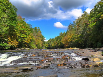
![]()
![]()
![]()
![]()
![]() On Monday, October 5th, I wanted to get in a hike as the forecast was calling for rain during the week. I thought something with a waterfall might be nice and I hoped to see some colorful leaves. I asked Cindy for some ideas but she was not enthusiastic about hiking. I suggested the Neversink Unique Area loop that includes Denton and Mullet Brook Falls. The loop is less than 5 miles but Cindy didn't seem interested and I knew from experience that it would be a bad idea to try and convince her. I started getting ready at 10:30 AM when the temperature was 55 degrees with partly sunny skies. I decided to wear my White Sierra long-sleeved crew top with a short-sleeved baselayer. I put on a pair of RailRiders hiking pants which are expensive but last along time and have features like deep pockets and a generous cut which I really like. The pants have Velcro closures at the ankles which I hoped would mean I could fend off the ticks which have been very numerous so far this season. I put on my Keen Targhee II hiking boots which have become my "go to" boots which Keen has discontinued. I grabbed a pair of Leki external lock poles I have been using since spring. The external locks have not failed me yet and the cork handles really do allow a good grip. I thought about taking my Mammut hoody knowing I could take it off at any time but in the end I decided to leave it home although I packed a light windbreaker. I put my gear in the back and Sheila in the back seat and we left Livingston Manor a little after 11:00 AM. I got on Route 17 and started for Rock Hill. I got off the Quickway at exit 109 and turned right on Katrina Falls Road to drive to the end of the road. I parked at 11:30 AM in the small parking area which was already almost full. It looked like a car had just left so I pulled into the vacant spot. As I set my GPS, a young man started off on Te trail to begin his hike. Despite the cars in the lot, I did not expect to see many people as the area is large. The trail was dry with only a few muddy spots here and there.
On Monday, October 5th, I wanted to get in a hike as the forecast was calling for rain during the week. I thought something with a waterfall might be nice and I hoped to see some colorful leaves. I asked Cindy for some ideas but she was not enthusiastic about hiking. I suggested the Neversink Unique Area loop that includes Denton and Mullet Brook Falls. The loop is less than 5 miles but Cindy didn't seem interested and I knew from experience that it would be a bad idea to try and convince her. I started getting ready at 10:30 AM when the temperature was 55 degrees with partly sunny skies. I decided to wear my White Sierra long-sleeved crew top with a short-sleeved baselayer. I put on a pair of RailRiders hiking pants which are expensive but last along time and have features like deep pockets and a generous cut which I really like. The pants have Velcro closures at the ankles which I hoped would mean I could fend off the ticks which have been very numerous so far this season. I put on my Keen Targhee II hiking boots which have become my "go to" boots which Keen has discontinued. I grabbed a pair of Leki external lock poles I have been using since spring. The external locks have not failed me yet and the cork handles really do allow a good grip. I thought about taking my Mammut hoody knowing I could take it off at any time but in the end I decided to leave it home although I packed a light windbreaker. I put my gear in the back and Sheila in the back seat and we left Livingston Manor a little after 11:00 AM. I got on Route 17 and started for Rock Hill. I got off the Quickway at exit 109 and turned right on Katrina Falls Road to drive to the end of the road. I parked at 11:30 AM in the small parking area which was already almost full. It looked like a car had just left so I pulled into the vacant spot. As I set my GPS, a young man started off on Te trail to begin his hike. Despite the cars in the lot, I did not expect to see many people as the area is large. The trail was dry with only a few muddy spots here and there.
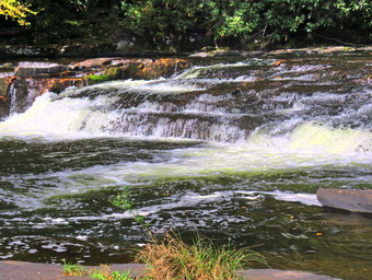 At the bottom of the hill we turned left to stay on the main blue trail. At this point a yellow spur trail goes down to the river. All of the yellow trails in the area branch off the main blue and red trail, go to a destination like the Neversink River and the return. Just after the turn we came to a small bridge over Wolf Brook. The water in the brook was flowing freely but was lower than the previous week. I decided to stop and take some pictures. After taking my shots, we crossed the bridge and hiked up a small hill. I noticed the condition of the bridge had deteriorated even more than on previous trips and looked like it would soon collapse. I hope the DEC will fix before it collapses as its present condition does not allow the use of a UTV to transport injured hikers. At the next trail junction, at the top of the short hill, we stayed to the right on the blue trail and descended through before starting up another small hill. At 1.2 miles another yellow spur trail headed down to the river but we stayed on the blue trail. As we approached a bridge, we met two different groups of people coming toward us so I stepped off the trail with Sheila. Both groups complimented Sheila on her behavior and good looks! At 1.4 miles we came to the lower bridge across Mullet Brook. The old bridge which was falling apart had been replaced with one based on steel i-beams. I had planned to take some pictures but there was nothing remarkable in the scene. Almost immediately after crossing the bridge, we turned right on the yellow spur trail that goes down to the river at Denton Falls. The trail down to the river is steep in spots and was slippery from the dampness. The blazes are few and far between so hikers had been forging there won routes causing excessive erosion in places. Since maintainers are now prevented by the DEC from placing markers, they must be paced by forest rangers or foresters. This regulation means that trails are not as well marked as they should be. when the trail leveled and began to follow the land contours, we ran across several extremely muddy areas which were being widened as more and more hikers tried to find their way around these mud pits. I was careful to keep my footing and walk around the wettest places. At 12:25 PM we had hiked 1.65 miles and we were at the edge of the river.
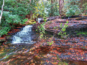 There were two hikers who had established themselves on the rock I usually use as a base so I moved downstream a little and took off my pack. We walked out onto the rocks by the river and I called Sheila to make sure she did not jump into the river and did not bother the other hikers. The level of water in the river was lower than I had expected but there was enough to make the falls interesting. I grabbed my camera and took pictures upstream and downstream. I was a little disappointed that the leaf colors were not more brilliant. I then worked my way to the rocks below and right in front of the falls where I was able to take pictures of the falls and a few more downstream. I had Sheila pose on some rocks and took some pictures with the river in the background. Before we left the river, we made sure to get a drink. The other hikers had left ahead of us. We walked back up the steep trail to the main blue trail and the ascent seemed easier than the descent. When we got to the main trail, a hiker was standing there looking at the trail markings. He asked me several questions about the colors for the trails. I told him that the yellow trails were always out-and-back trails that led from the main red and blue trails to some destination. He thanked me as Sheila and I turned right to continue the loop back to the car. At the top of the hill I briefly thought about going to High Falls but knew that the scenery would not be much different. We stayed to the left to start up the hill. After a brief walk uphill of .15 miles, we turned left onto the short trail down to Mullet Brook Falls. I was wondering what Mullet Brook Falls might look like since there had been rain last week but none since. As we approached the falls, we could hear the water falling. We also saw ahead of us the young woman who had been at Denton Falls. She walked to a point in front of the falls to take some pictures while I dropped my pack and got out my camera. The water coming over the falls was not a trickle but was far from a deluge. The water comes from a large swamp further upstream and is full of tannins which give it a brown color. I worked my way up the right side of the rocks below the waterfalls to an area where I could take pictures. I then moved over to a point in front of the falls and took some more shots. I took some pictures of the falls and then posed Sheila for a few more. I took a few more shots of the falls using settings to soften the water falling over the rocks. We headed back to where I had left my pack where I put away my camera and shouldered my pack. I decided we would try climbing up the rocks to the right of the falls. I had descended these rocks before but had never climbed up them and never when they were damp. We started up the rocks with Sheila leading the way and is was not as difficult as I thought.
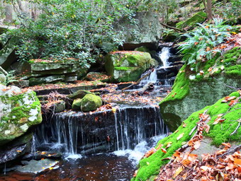 At the top it took a few minutes and some twists but I eventually got to the top of the falls. I put my pack down and took some shots of a small falls just above the main falls. I also walked closer to the top of the falls and took some pictures. I packed up and we started to work our way up the stream. My object was to bushwhack the entire length of the stream the upper bridge which I had never done. We walked along the edge of the stream stopping in several spots so that I could take shots of several smaller waterfalls and rapids. In some places we had to move away from the stream but we always came back. In one spot, we could hear and then see people on the trail. After a while, I began to look for the bridge and soon I could see it ahead crossing the stream. It was even more visible than usual as it had several bright orange caution tapes on it! We walked up to the point where the red trail crossed the bridge and I found pieces of bridge and pieces of tree. I assume a tree had fallen across the bridge breaking both handrails. The logs that acted as supports looked like they might be slightly cracked but they held our weight with no problem. We turned left and crossed the bridge and I picked up my pace. I did not expect much excitement on the return trip as it is all on trail and mostly downhill. After a brief walk, we were at a trail junction 3 miles into the hike. Walking straight ahead on the trail leads to the Wolf Lake Multiple Use Area. We turned left and began to descend off the ridge. As we started to walk downhill, we met several more groups hiking in the opposite direction. Each time I pulled Sheila to the side of the trail and made her sit. Several groups had young who asked if they could pet her but I politely declined. As we continued to hike downhill, I noticed that the trail had been cleared since my last visit and that it was wide open and easy to walk. All the blowdowns had also been removed. We walked downhill for some time and eventually came to the trail junction near the bridge over Wolf Creek where we had started the loop earlier. There were several more large groups of people coming toward us. I asked them if they knew where they were going and the most common answer was "Not exactly." I spoke to each group about the number of people who have gotten lost over the summer and I gave them specific directions to complemented hike. We continued to walk straight ahead over the bridge to return to the parking area. Once on the other side of the brook we made the right turn on the woods road back to the car. We continued to meet small groups of people heading out on a hike without a real idea of where they were going. We arrived at the parking area at 2:25 PM having hiked 4.5 miles in 2 hours and 50 minutes including the stops at the two falls and the bushwhack up the stream. The vertical gain was only about 980 feet. There was a group of four young men at the kiosk looking at the maps. I asked if they had any questions and they did. We determined that they wanted to hike as far as High Falls and I gave them some hints. I especially mentioned turning left when coming up from High Falls so that they did not end up lost!
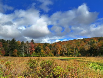
![]()
![]()
![]()
![]()
![]() On Saturday, October 3rd, I was scheduled to meet a new trail maintainer, Molly, at the Balsam Lake Mountain trailhead at the end of Beaverkill Road. Her trail assignment was from the parking area to the Beaverkill on the Neversink Hardenburgh Trail. When I got up in the morning at 5:30 AM, it was only 42 degrees and the forecast was for a high of 58 degrees. I did some things around the house until I began to get ready at 8:30 AM. By this time the temperature was still only 45 degrees and I knew it would be cooler in the woods. I asked Cindy if she would like to go and she agreed. Sheila had not been feeling well but she seemed better and I knew getting out for a hike would make her feel better. I got dressed in a White Sierra long-sleeved crew top with a short-sleeved baselayer. I put on a pair of RailRiders hiking pants which are expensive but last along time and have features like deep pockets and a generous cut which I really like. These pants have Velcro closures at the ankles to discourage sticks and gravel from getting into my shoes and to combat ticks. I decided to wear my Keen Targhee II hiking boots which fit me well but have been discontinued. I grabbed a pair of Leki external lock poles I have been using lately but knew I would probably not use them as I would be carrying trail maintenance tools. I also added a new OR floppy hat which shields me from the sun and allows me to spray some insect repellant on it rather than on me. I put on my Mammut hoody knowing I could take it off at any time. At 9:15 AM I put our equipment in the car including my Fiskars axe, Silky Sugowaza saw, Silky Katanaboy saw, LT Wright Overland machete, Corona loppers, Fiskars loppers and two Oregon splitting wedges. I knew we would not use all of these but I wanted to show Molly the variety of tools that can be sued. Sheila jumped into the backseat with some enthusiasm and we headed out the driveway. I headed toward Roscoe on Old Rt 17 and I turned right on the Beaverkill Road. I continued north toward Lew Beach and Turnwood. The Beaverkill Falls were flowing with a good volume from the recent rains and I thought we might stop on the way back for a few shots. The road conditions were pretty good even when the pavement ended. I laughed when I saw the "Rough Road" sign! Toward the end the road becomes very narrow and I was glad I did not meet any more cars. We arrived at the parking area at 9:50 AM and found two other cars in the lot. There were also three cars parked in the snowplow turnaround on the road which I did not understand. I expected Molly at 10:00 AM but when I checked my texts I found one from her saying that she was running late. As we were waiting several more cars pulled in with people getting ready to go to the fire tower. I took out my camera and walked over to a point where I could get a view of Balsam Lake Mountain. I was a little disappointed by the lack of color in the leaves but I took a few shots before returning to the car. Molly pulled into the parking lot at 10:20 AM with a friend, Gabe. I gave her some "gifts" from the NYNJTC and showed her and Gabe the tools that I had. I put the Sugowaza in my pack along with the machete and wedges. Molly had her own saw and Cindy carried the Fiskars clippers. I gave Gabe the Corona loppers to carry.
On Saturday, October 3rd, I was scheduled to meet a new trail maintainer, Molly, at the Balsam Lake Mountain trailhead at the end of Beaverkill Road. Her trail assignment was from the parking area to the Beaverkill on the Neversink Hardenburgh Trail. When I got up in the morning at 5:30 AM, it was only 42 degrees and the forecast was for a high of 58 degrees. I did some things around the house until I began to get ready at 8:30 AM. By this time the temperature was still only 45 degrees and I knew it would be cooler in the woods. I asked Cindy if she would like to go and she agreed. Sheila had not been feeling well but she seemed better and I knew getting out for a hike would make her feel better. I got dressed in a White Sierra long-sleeved crew top with a short-sleeved baselayer. I put on a pair of RailRiders hiking pants which are expensive but last along time and have features like deep pockets and a generous cut which I really like. These pants have Velcro closures at the ankles to discourage sticks and gravel from getting into my shoes and to combat ticks. I decided to wear my Keen Targhee II hiking boots which fit me well but have been discontinued. I grabbed a pair of Leki external lock poles I have been using lately but knew I would probably not use them as I would be carrying trail maintenance tools. I also added a new OR floppy hat which shields me from the sun and allows me to spray some insect repellant on it rather than on me. I put on my Mammut hoody knowing I could take it off at any time. At 9:15 AM I put our equipment in the car including my Fiskars axe, Silky Sugowaza saw, Silky Katanaboy saw, LT Wright Overland machete, Corona loppers, Fiskars loppers and two Oregon splitting wedges. I knew we would not use all of these but I wanted to show Molly the variety of tools that can be sued. Sheila jumped into the backseat with some enthusiasm and we headed out the driveway. I headed toward Roscoe on Old Rt 17 and I turned right on the Beaverkill Road. I continued north toward Lew Beach and Turnwood. The Beaverkill Falls were flowing with a good volume from the recent rains and I thought we might stop on the way back for a few shots. The road conditions were pretty good even when the pavement ended. I laughed when I saw the "Rough Road" sign! Toward the end the road becomes very narrow and I was glad I did not meet any more cars. We arrived at the parking area at 9:50 AM and found two other cars in the lot. There were also three cars parked in the snowplow turnaround on the road which I did not understand. I expected Molly at 10:00 AM but when I checked my texts I found one from her saying that she was running late. As we were waiting several more cars pulled in with people getting ready to go to the fire tower. I took out my camera and walked over to a point where I could get a view of Balsam Lake Mountain. I was a little disappointed by the lack of color in the leaves but I took a few shots before returning to the car. Molly pulled into the parking lot at 10:20 AM with a friend, Gabe. I gave her some "gifts" from the NYNJTC and showed her and Gabe the tools that I had. I put the Sugowaza in my pack along with the machete and wedges. Molly had her own saw and Cindy carried the Fiskars clippers. I gave Gabe the Corona loppers to carry.
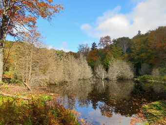 We started out on the Neversink Hardenburgh Trail at 10:30 AM with the temperature at just 50 degrees. My intention was to walk out to the end of the trail section and do the work on the way back but we immediately ran into a few branches hanging down into trail which we cleared. The first half mile of the trail loses about 200 feet to a bridge that crosses Black Brook. We walked and talked clearing some branches and blowdowns as we hiked. We left some blowdowns that were on the ground for the return trip. From Black Brook we began a climb gaining back the elevation we had lost over .35 miles. Just after we hit this high point, we heard voices behind us so I took Sheila off the trail. Two young girls came hiking by with enough equipment for a night out. Behind them was another young girl followed by their father. He had and enormous pack and confirmed that they were headed to a primitive campsite near Tunis Pond. We continued to clear the trail which was in decent shape for not having a maintainer several years. There were some large blowdowns. Some were on the round and easier to step over. Some were hanging over the trail but were easy to duck under. Others were very large and hikers had created appropriate detours around them. The trail rolled a little and then descended to Gulf of Mexico Brook which we crossed on a nice bridge. We again heard voices behind us and I saw two young men coming our way. As they passed I asked them where they were going and they said they were going to camp near Tunis Pond. They were also interested in doing some fishing. At 1.5 miles we came to the outlet stream from Vly Pond. I explained to the others that I wanted to bushwhack a few hundred feet upstream to the pond and they agreed. The bushwhack was easy and we were soon at the beaver dam that impounds Vly Pond. The dam was in disrepair and I did not see any indication of beaver activity. I took some picture of the pond and of Doubletop in the background. I had hoped for brilliant colors but they were muted. We returned to the main trail and turned left to continue on our mission.
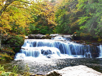 From the Vly outlet brook we climbed some and the started to drop down. As we approached 2.3 miles, we could see a small body of water on the left side of the trail. We followed a path to the little pond which I had never seen before. This pond was new and there were signs of recent beaver activity on a nice dam. There were some dead pine trees in the middle of the pond which created an eerie effect as they were very white against the colorful leaves. I took some pictures of the pond before packing up and walking back out to the main trail I knew we were close to the turnaround point as we turned left and advanced along the trail. At 2.5 miles we crossed a small stream and almost immediately after came to the Beaverkill. The trail turned left and paralleled the stream. It was very eroded which I assume came from a period of flooding. We walked along the stream to 2.6 miles where I took a few shots of the Beaverkill. We turned around a began our trip back. I had not enticed that the sky had become overcast and that clouds were gathering. There was inly a 10% chance of rain but it began to fall. At first it was a few drops but that progressed to a shower. There wasn't too much getting through the trees until the rain stepped up another notch! I stopped and put on my pack cover to protect my camera. We continued our walk and even cleared few blowdowns and branches despite the rain. The Fiskars ax proved invaluable as I was able to dispatch several blowdowns with only a few blows. Even though we were clearing as we walked, we were keeping a fast pace and were soon passing the trail register. As we came to the flat part of the trail near the parking area, we cleared a few branches that were hanging in the trail. As we walked out to the parking area, we were all surprised that every spot was filled and cars were parked out on the road! Molly said that she enjoyed the trip and Gabe asked if there was a section of trail open that he could adopt! This made me feel that the whole trip was worthwhile. We left the parking area as soon as possible and I was glad that we did not meet any cars until the road widened. I stopped at the Beaverkill Falls because it had a nice volume flowing. I took a few quick shots before heading home.
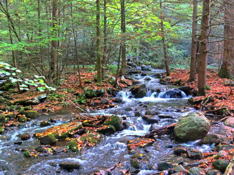
![]()
![]()
![]()
![]()
![]() On Thursday, October 1st I was scheduled to hike the Neversink Unique Area trails and paths from the Katrina Falls trailhead to the trailhead at Skinners Road near Westerbrookville. I had been asked to do this hike by Alex Rau of the Sullivan County Emergency Services Control Center to test radio coverage in the gorge area. There were several instances of hikers getting lost in this area over the summer and radio coverage was an issue. Alex wanted to test a setup of portable repeater stations for the gorge. I and one of his assistants would hike through the gorge with pa radio and periodically check communications to determine any "dead" areas. I was excited to do the hike as I had never hiked all the way through the gorge since the one-way distance is over 8 miles! The plan was for us to be picked up and Skinners Road when we finished the hike. Below High Falls there are no marked trails. There are old paths and woods roads but these can appear and disappear causing hikers have to bushwhack and get lost. The southern end had more defined woods roads. I was able to create a route from previous tracks and I turned it into a geospatial PDF that I could use with the Avenza app. I attended my men's group meeting at our church at 6:15 AM and the returned home at 7:45 AM. I did some work around the house and started to get ready to hike at 9:15 AM when the temperature was 60 degrees. It had rained the day before and overnight but the skies were blue with some puffy white clouds. I knew that we would not be visiting any of the falls on this hike as that would only lengthen what was already a challenging trip. As I started to get ready, Sheila was watching my every move but was doing so quitely. She had not been feeling well lately and I had decided to let her stay home and rest. I got dressed my long-sleeved White Sierra crew top with a short-sleeved baselayer. I put on a pair of RailRiders hiking pants which are expensive but last along time and have features like deep pockets and a generous cut which I really like. These pants have Velcro closures at the ankles to discourage sticks and gravel from getting into my shoes and to combat ticks. I decided to wear my Keen Targhee II hiking boots which fit well and have been discontinued. I grabbed a pair of Leki external lock poles I have been using lately. I also added my OR floppy hat. I have decided it shields me from the sun and allows me to spray some insect repellant on it rather than on me. I put all my gear in the back of the car and headed east on State Route 17 at 9:45 AM. I drove to Rock Hill and got off at exit 109. I turned right off the exit and drove to the parking area at the end of Katrina Falls Road. There was one narrow spot left in the lot when I arrived at 10:30 AM. A young woman was looking at the maps on the kiosk and I asked her if she needed some help. She said "Yes" and I made some suggestions to fit her requirements. Alex had sent me a text indicating he would be a little late s so I waited until 10:45 AM when he and Erin pulled into the parking area. Erin took the radio and I set my GPS as we set off down the woods road at 10:50 AM.
On Thursday, October 1st I was scheduled to hike the Neversink Unique Area trails and paths from the Katrina Falls trailhead to the trailhead at Skinners Road near Westerbrookville. I had been asked to do this hike by Alex Rau of the Sullivan County Emergency Services Control Center to test radio coverage in the gorge area. There were several instances of hikers getting lost in this area over the summer and radio coverage was an issue. Alex wanted to test a setup of portable repeater stations for the gorge. I and one of his assistants would hike through the gorge with pa radio and periodically check communications to determine any "dead" areas. I was excited to do the hike as I had never hiked all the way through the gorge since the one-way distance is over 8 miles! The plan was for us to be picked up and Skinners Road when we finished the hike. Below High Falls there are no marked trails. There are old paths and woods roads but these can appear and disappear causing hikers have to bushwhack and get lost. The southern end had more defined woods roads. I was able to create a route from previous tracks and I turned it into a geospatial PDF that I could use with the Avenza app. I attended my men's group meeting at our church at 6:15 AM and the returned home at 7:45 AM. I did some work around the house and started to get ready to hike at 9:15 AM when the temperature was 60 degrees. It had rained the day before and overnight but the skies were blue with some puffy white clouds. I knew that we would not be visiting any of the falls on this hike as that would only lengthen what was already a challenging trip. As I started to get ready, Sheila was watching my every move but was doing so quitely. She had not been feeling well lately and I had decided to let her stay home and rest. I got dressed my long-sleeved White Sierra crew top with a short-sleeved baselayer. I put on a pair of RailRiders hiking pants which are expensive but last along time and have features like deep pockets and a generous cut which I really like. These pants have Velcro closures at the ankles to discourage sticks and gravel from getting into my shoes and to combat ticks. I decided to wear my Keen Targhee II hiking boots which fit well and have been discontinued. I grabbed a pair of Leki external lock poles I have been using lately. I also added my OR floppy hat. I have decided it shields me from the sun and allows me to spray some insect repellant on it rather than on me. I put all my gear in the back of the car and headed east on State Route 17 at 9:45 AM. I drove to Rock Hill and got off at exit 109. I turned right off the exit and drove to the parking area at the end of Katrina Falls Road. There was one narrow spot left in the lot when I arrived at 10:30 AM. A young woman was looking at the maps on the kiosk and I asked her if she needed some help. She said "Yes" and I made some suggestions to fit her requirements. Alex had sent me a text indicating he would be a little late s so I waited until 10:45 AM when he and Erin pulled into the parking area. Erin took the radio and I set my GPS as we set off down the woods road at 10:50 AM.
 We followed the blue trail which runs parallel to the river. At the first junction we stayed on the blue trail rather than turn on the yellow trail which goes down to the river. The blue and red trails cover the bulk of the hiking routes with the yellow trails being spur trails. We stopped for a minute where an old bridge crosses Wolf Brook as I wanted to take a few pictures. The water was higher than I expected And the brook was very pretty. I packed up and we started up the trail trying to avoid the water that was flowing on the trail since the brook was clogged with debris and had not been cleared. We walked up the hill and stayed to the right at the next junction to take the blue instead of the red trail. The trails are on wide woods roads so the walking was pretty easy. Erin did a couple of radio checks as we passed by two more spur trails that go down to the river. At 1.4 miles we crossed Mullet Brook on the bridge. I had planned to take a few shots here but there was nothing of interest to photograph. Just after the bridge we came to the trail to Denton falls and Erin checked in. After this we arrived at the junction with the red trail that forms a loop back to the parking area. Since we wanted to hike to Nigh Falls and Beyond, we stayed to the right on the blue trail. This trail is more of a trail than a woods road but that didn't slow us down much. The trail descends a little at first and then climbs before descending again. All the while it roughly parallels the river and we could hear the water. The trail is rough in most spots with many stones and roots. I was surprised that we met several hikers coming back from high falls including a couple with a very noisy dog. The hike from the trail junction to the end of the blue trail is 1.8 miles. There is a yellow spur trail down to the falls. Someone was placed some laminated paper signs to help hikers but there was no "To the Parking area" sign for hikers returning from the falls! Erin did a road check before we started the adventure part of the hike. At this point we had hiked 3.3 miles in 1 hour and 30 minutes for a moving average of 2.3 mph!
 We continued passed the sign that said "End of Blue Trail" knowing we would now have to be careful to look for woods roads and paths and rely a little more on my Avenza GPS track. The path that we started out on was indistinguishable from the trail we had left except there were no blazes. At 3.6 miles the path headed toward the river and I followed it. I commented to Erin that had been some time since I had been in this area and that the path did not look familiar. As we neared the river, I realized that it did not look familiar since it was the wrong path. We back tracked a little and found what looked like a woods road so we followed it. Over the next .8 miles we lost and found the road several times and were generally following the route I had on Avenza. At 4.6 miles we lost the road and began to wander toward the river. We bushwhacked across a drainage and then came to a stream with very steep banks. We started to walk up the near bank looking for a way to cross but the opposite bank was steep. I ended up walking up the stream until I began to recognize where we were. A few hundred feet up the stream was a woods road that I recognized and I called to Erin to come to meet me. Erin was great about doing radio checks which was the whole point of the hike. We set off on this well-define woods road and were able to pick up our pace again. Every now and then there was something in the path and our biggest bane became the numerous and large spider webs! At 5.3 miles we came to a hunter's cabin which was collapsing. I took a few pictures. The road splits here with a left turn heading up the ridge. We continued straight ahead knowing we would have to make the ascent later in the hike.
 The road was even more open and almost flat in this area and we made good time. We began to have some trouble communicating with Alex at the Katrina Falls trailhead and Chris at Skinner's Road. I gave Erin the GPS coordinates and she wrote them down to have a record. At 6 miles we came to a sign that said "Peterson's Turnpike" and marked the point where we would turn to climb up to the top of the ridge. I considered walking straight out to Griffin Road which was about the same distance but did not involved a climb but both Erin and I agreed we would stick to the original plan. We made the turn ad started to climb. The road was wide but rocky in many places and it varied from a gentle ascent to a steeper climb. At 6.5 miles the climb as almost complete as the terrain leveled off. We had climbed 445 feet in .5 miles for an average grade of 17%. The road turned to the right and headed southeast. Although the road was now either flat or on a slight descent I knew we still had some hiking to do to get to the trailhead and our ride. At 6.9 miles we passed by the southern end of Bear Swamp but the road remained dry and we could barely see the swamp. We were passing through mostly hardwood forest but the color of the leaves was only average. We did walk through some interesting stand of evergreen trees with a lot of smaller and younger trees and a few enormous, older trunks. There was also a nice meadow on the right side of the trail but I just wanted to get to the trailhead. At 7.7 miles we passed the southern end of Ash Swamp and came to a clearing with roads going right and left. We chose left which was the correct choice. The road continued heading downhill and southeast to 8.2 miles where it turned east. At this point I realized that we were almost at the trailhead and in a few hundred feet we passed the trail register, walked through the gate and found Chris and his truck. It was 3:05 PM and we had hiked 8.8 miles in 4 hours and 15 minutes for a moving average speed of 2.2 mph. Our elevation gain was 1360 feet and the elevation of the Skinners Road trailhead was almost the same as the Katrina Falls Road trailhead. The ride back up Skinner's Road was bumpy. We stopped to break down the repeater station which Chris had placed in a field. It was a pleasure to ride the roads back to the Katrina Falls Road trailhead and my car.
![]()
![]()
![]()
![]() On Tuesday, September 29th I had planned to sleep in after a night of ambulance calls. Unfortunately, a call came in at 8:00 AM and I was on the run again. I returned home from the call at about 9:45 AM to find my grandson Bryce waiting for me. He had just finished some work and we decided to go across the street to hike on Round Top even though the heavy mist outside was developing into a light rain. We started to get ready with the temperature a surprisingly cool 64 degrees. I got dressed in my White Sierra long-sleeved crew top but decided I did not need a baselayer. I put on a pair of RailRiders hiking pants which are expensive but last along time and have features like deep pockets and a generous cut which I really like. These pants have a Velcro closures at the ankles to discourage sticks and gravel from getting into my shoes and to combat ticks. I decided to wear my Keen Traghee II hiking boots which fit well and have been discontinued. I grabbed a pair of Leki external lock poles I have been using lately. I also added my OR floppy hat. I have decided it shields me from the sun and allows me to spray some insect repellant on it rather than on me. Sheila kept me in sight as I got ready to go making sure she would not be forgotten. We stepped out of the house at 11:45 AM and I grabbed Sheila's leash from the car. We walked up the driveway and crossed the street. I decided we would do enough loops to cover all the trails and tire me out a little. We had recently finished creating a switchback on the steepest trail and a crossover trail to let hikers avoid the summit and to allow for some variations. We walked to the parking area by the Presbyterian Church and to the back of the church. We began the ascent of the steepest hill behind the church. The hill is short but gets the circulation pumping and is the steepest and longest climb on the "trail." Sheila helped me along by pulling me up the hill but I noticed the hill seemed easier as I have been hiking more. Bryce, of course, was right with me but he was able to talk normally the whole way up the hill. When we got to the top of the hill, we stopped to look around at the hills around town. We started on the trail by turning left at the trailhead. I let Sheila off her leash so that she could explore. The trail bed is becoming worn it which means that at least a few people are using the trail. I am always happy to see that someone else uses the trails.
On Tuesday, September 29th I had planned to sleep in after a night of ambulance calls. Unfortunately, a call came in at 8:00 AM and I was on the run again. I returned home from the call at about 9:45 AM to find my grandson Bryce waiting for me. He had just finished some work and we decided to go across the street to hike on Round Top even though the heavy mist outside was developing into a light rain. We started to get ready with the temperature a surprisingly cool 64 degrees. I got dressed in my White Sierra long-sleeved crew top but decided I did not need a baselayer. I put on a pair of RailRiders hiking pants which are expensive but last along time and have features like deep pockets and a generous cut which I really like. These pants have a Velcro closures at the ankles to discourage sticks and gravel from getting into my shoes and to combat ticks. I decided to wear my Keen Traghee II hiking boots which fit well and have been discontinued. I grabbed a pair of Leki external lock poles I have been using lately. I also added my OR floppy hat. I have decided it shields me from the sun and allows me to spray some insect repellant on it rather than on me. Sheila kept me in sight as I got ready to go making sure she would not be forgotten. We stepped out of the house at 11:45 AM and I grabbed Sheila's leash from the car. We walked up the driveway and crossed the street. I decided we would do enough loops to cover all the trails and tire me out a little. We had recently finished creating a switchback on the steepest trail and a crossover trail to let hikers avoid the summit and to allow for some variations. We walked to the parking area by the Presbyterian Church and to the back of the church. We began the ascent of the steepest hill behind the church. The hill is short but gets the circulation pumping and is the steepest and longest climb on the "trail." Sheila helped me along by pulling me up the hill but I noticed the hill seemed easier as I have been hiking more. Bryce, of course, was right with me but he was able to talk normally the whole way up the hill. When we got to the top of the hill, we stopped to look around at the hills around town. We started on the trail by turning left at the trailhead. I let Sheila off her leash so that she could explore. The trail bed is becoming worn it which means that at least a few people are using the trail. I am always happy to see that someone else uses the trails.
At the first trail junction, we followed Sheila as she turned right on the woods road which is the shallower approach to the trail system. We continued to follow the yellow trail to the first junction where we turned left and followed it to the next trail junction. At the second junction with the blue trail, we turned right and started up the steep blue trail that leads over the summit of Round Top. Walking uphill we passed through a sea of green with some brown edges from the recent frosts. The trails were damp from the light rain overnight. Just before the steepest section Ariana we turned right on the switchback trail now marked with blue paint blazes. We continued to follow these blazes as they made a sharp left turn and headed back to the main blue trail. We turned right on the blue trail and almost immediately turned right on the white blazed crossover trail. This trail is showing more wear in the tread which means people are actually using it. When the trail intersected the blue trail we turned right and walked down to the yellow trail. We turned right to walk along the base of Round Top and this time we turned left at the junction with the blue trail. We walked down to the lookout and followed the yellow trail as it turned left and descended the hill to the first trail junction. We immediately turned around and walked back up the hill to the lookout and followed the yellow trail as it turned right. We followed the trail as it made a gentle ascent trough the now brown ferns to the junction with the blue trail. We continued to follow the yellow trail by turning right and following along the base of Round Top. At the second junction with the blue trail, we turned left and started the ascent of the hill. When the white crossover trail came up and the left, we turned and followed it back to the blue trail on the other side of the hill. We turned left and then left again to stay on the blue trail as the switchback took use into the woods and back out to the blue trail. We turned left again and walked down to the yellow trail. We turned left, walked back along the base of Round Top and turned right at the next junction. We walked down to the woods road that took us back to the first trail junction. This time we turned left and walked out to the trailhead where I put Sheila on her leash. We walked down the hill to the parking lot and across the road to our driveway. We were home by 1:00 PM after hiking around 2 miles.
![]() On Monday, September 28th I was scheduled to work with Andy Garrison and some other volunteers clearing the Long Pond-Beaverkill Ridge Trail. This trail had not been maintained for many years and had numerous blowdowns. It also needed a good trimming and lopping. I hoped the new work that we planned would give the new maintainer a head start on keeping the trail cleared. Unfortunately, the ambulance pager went off early which meant I would be late. It turned out that the call was only for a lift assist and I was able to scurry around the house after I returned to try to get to the meeting at Long Pond on time. As I started to get ready at 8:20 AM, Sheila was watching my every move but was doing so quitely. I had bad news for her though as I could not take her where chainsaws were being used. The temperature was already 65 degrees but it was raining. I hoped the rain would stop as we hot ready to do the work but I knew it would still be damp in the forest. I got dressed in my White Sierra long-sleeved crew top with a short-sleeved baselayer. I put on a pair of RailRiders hiking pants which are expensive but last along time and have features like deep pockets and a generous cut which I really like. These pants have Velcro closures at the ankles to discourage sticks and gravel from getting into my shoes and to combat ticks. I hoped this would be enough so that I would not have to wear gaiters. I decided to wear my Vasque Taku hiking boots which fit well and have been discontinued. I decided to forego bringing poles as I would have carry some gear for the team. I put my gear in the car with a dejected Sheila watching me. I headed out DeBruce Road at 8:40 AM hoping I could meet the group at the large parking area on Flugertown Road. I passed through Willowemoc and turned left on Flugertown Road. I drove to the parking area and found a group of people gathered. Andy was there and told me that another sawyer and at least two volunteers were no-shows. I met Melissa Cascini who is the new New York Program Coordinator for the NYNJTC. Also present were Patrick and Claire who are part of AmeriCorps and acted as stewards this summer of Slide Mountain and Giant Ledge. After introductions, we got in our cars and drove out Flugertown Road to the trailhead. We parked at one of the empty campsites along the road and Andy distributed some equipment. Andy and I would cut the big blowdowns with Andy operating the chainsaw and me acting as his swamper. The other three volunteers would lop and trim branches on the trail. I out my pack cover on but took out the GPS and camera so they would not get wet as it was still raining. We walked back down the road a short distance and turned right onto the trail. The trail climbs a little and then descends only to climb again to the trail junction at .4 miles. We cleared a few branches from the trail but knew the snowmobile club would get what we missed. At .4 miles we turned right to stay on the Long Pond-Beaverkill Ridge Trail. Andy and I started to walk up the trail looking for blowdowns as the other began trimming. The trail begins as almost flat but soon starts to gain elevation.
On Monday, September 28th I was scheduled to work with Andy Garrison and some other volunteers clearing the Long Pond-Beaverkill Ridge Trail. This trail had not been maintained for many years and had numerous blowdowns. It also needed a good trimming and lopping. I hoped the new work that we planned would give the new maintainer a head start on keeping the trail cleared. Unfortunately, the ambulance pager went off early which meant I would be late. It turned out that the call was only for a lift assist and I was able to scurry around the house after I returned to try to get to the meeting at Long Pond on time. As I started to get ready at 8:20 AM, Sheila was watching my every move but was doing so quitely. I had bad news for her though as I could not take her where chainsaws were being used. The temperature was already 65 degrees but it was raining. I hoped the rain would stop as we hot ready to do the work but I knew it would still be damp in the forest. I got dressed in my White Sierra long-sleeved crew top with a short-sleeved baselayer. I put on a pair of RailRiders hiking pants which are expensive but last along time and have features like deep pockets and a generous cut which I really like. These pants have Velcro closures at the ankles to discourage sticks and gravel from getting into my shoes and to combat ticks. I hoped this would be enough so that I would not have to wear gaiters. I decided to wear my Vasque Taku hiking boots which fit well and have been discontinued. I decided to forego bringing poles as I would have carry some gear for the team. I put my gear in the car with a dejected Sheila watching me. I headed out DeBruce Road at 8:40 AM hoping I could meet the group at the large parking area on Flugertown Road. I passed through Willowemoc and turned left on Flugertown Road. I drove to the parking area and found a group of people gathered. Andy was there and told me that another sawyer and at least two volunteers were no-shows. I met Melissa Cascini who is the new New York Program Coordinator for the NYNJTC. Also present were Patrick and Claire who are part of AmeriCorps and acted as stewards this summer of Slide Mountain and Giant Ledge. After introductions, we got in our cars and drove out Flugertown Road to the trailhead. We parked at one of the empty campsites along the road and Andy distributed some equipment. Andy and I would cut the big blowdowns with Andy operating the chainsaw and me acting as his swamper. The other three volunteers would lop and trim branches on the trail. I out my pack cover on but took out the GPS and camera so they would not get wet as it was still raining. We walked back down the road a short distance and turned right onto the trail. The trail climbs a little and then descends only to climb again to the trail junction at .4 miles. We cleared a few branches from the trail but knew the snowmobile club would get what we missed. At .4 miles we turned right to stay on the Long Pond-Beaverkill Ridge Trail. Andy and I started to walk up the trail looking for blowdowns as the other began trimming. The trail begins as almost flat but soon starts to gain elevation.
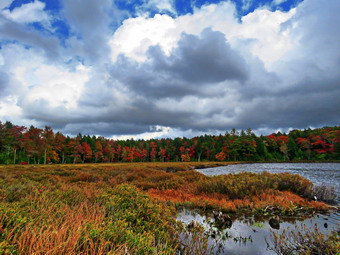 The first couple of trees that we removed went rather easily as Andy cut and I removed what he cut. I have worked with several different sawyers under different conditions but Andy is an expert. He made just right cuts and was able to anticipate what would happen when a cut was made. I appreciated that he cut pieces small enough that I could roll, flip or lift them off the trail. It continued to rain for some time and then the rain tapered off and the sun came out. As we walked farther along the trail the blowdowns began to get larger and more complex. Around 10:45 AM we ran into a monster with several different trunks. The main trunk's diameter was over twice the length of the chainsaw bar! Andy cut away all of the surrounding branches and then got to work on the main trunk. He had to cut from one side and then the other to make it through the tree. He began to cut chunks that I could roll off the trail. When this log had finally been dispatched, there was a pile of sawdust on the ground. There was also one more trunk which was almost buried in the ground. It was 11:30 AM so Andy and I decided to walk back to find the others and eat lunch. We found them not too far down the trail and walked back up the trail until we could find some logs to sit on. We had a good time spending about 45 minutes eating and talking. When we were done, Andy and I headed back to where we had left the chainsaw. We decided to leave the log in the ground for the return trip. We walked up the trail to another blowdown that had been in place for so long that hikers had created a detour. We decided to restore the original trail. This blowdown also had several parts and the biggest trunk was lying on a stone in such a way that we both knew it would slide once it was released. Andy was very careful to make cuts in a way that he and I would not be in danger. Eventually he cut the largest log and once it was released it slid off the rock as we knew it would. A few more cuts allowed me to move everything off the trail while Andy finished his work. We cleared a few more smaller blowdowns and walked to the point where the trail begins the real ascent to the ridge. In this area a tree with a 36 inch diameter was lying across the trail. Hikers had managed to work their way around it and we decided to follow the route they had chosen. Removing the huge blowdown was not impossible but would take too much time. We decided we had done a good amount of work and that we should head back. On our return trip, we removed the trunk that was partly buried in the dirt which made a nice, clear trail. We also cut one other blowdown. We were soon reunited with the others and we headed back to the cars.
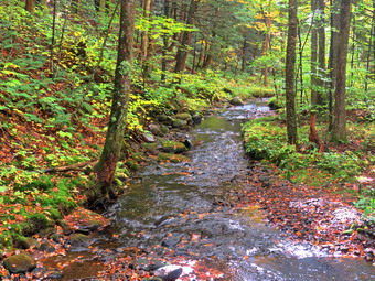 On the way, I suggested we take a walk over to Long Pond to see the status of the leaf colors. When we got back to the cars, Patrick decided to leave while the rest of us headed for Long Pond at about 2:00 PM. We walked down the road a short distance and then turned left on the Long Pond-Beaverkill Ridge Trail. After crossing the two bridges, the trail starts a short but steeps ascent and then levels off. From the top of the hill to the trail junction there are usually some very wet and muddy spots. I thought that since it had been dry this might not be the case but I was wrong. There were several very muddy areas but they were smaller than usual and we made it through with no problem. At the trail junction we turned right and walked the snowmobile trail until we came to the path on the left down to the shores of Long Pond. I was disappointed that the sun had disappeared and that the leaf colors were far less spectacular than at Frick Pond on Saturday. I did take a number of pictures before we turned around to retrace our steps to the cars. As we crossed the bridge, I stopped to take a few pictures of the creek. We walked back to the cars and I departed for home just after 3:00 PM. We had spent 6 hours walking working and hiking. The total distance was probably around 5 miles and the work we got done was priceless.
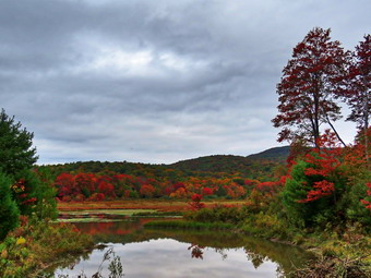
![]()
![]()
![]()
![]()
![]() On Saturday, September 26th I decided I wanted to go out on a short hike near home. I settled on going to Frick Pond to remove a tree I knew was on the trail and to work on a large blowdown that I had attacked several times before. As I started to get ready at 12:15M, Sheila was watching my every move but was doing so quitely. The temperature was already 71 degrees although it did not seem humid. The skies were overcast but there was no rain in the forecast. I got dressed in a short-sleeved crew top with a short-sleeved baselayer. I put on a pair of RailRiders hiking pants which are expensive but last along time and have features like deep pockets and a generous cut which I really like. These pants have Velcro closures at the ankles to discourage sticks and gravel from getting into my shoes and to combat ticks. I hoped this would be enough so that I would not have to wear gaiters. I decided to wear my Keen Targhee II hiking boots which fit well and have been discontinued. I decided to forego bringing poles as I would have carry my maintenance gear and I knew the hike would be short. I wedged my Silky Sugowaza, Silky Katnaboy and LT Wright Overland machete in my pack which really weighed it down. I put all my gear in the back of the car and put Sheila in the backseat. I headed out DeBruce Road at 12:30 PM and after six miles I turned left on Mongaup Pond Road. At the fork in the road I stayed left on Beech Mountain Road. The smaller parking lot had two cars in it and the larger lot had four. I parked in the smaller lot and got ready to hike by setting my GPS. At 12:20 PM we began the hike by walking out the woods road to the register on the Quick Lake Trail. My plan was to hike out to Frick Pond and then hike clockwise around the pond taking care of the two known obstructions as we went. The woods road was almost dry with just a dampness in some places. As we hiked by the memorial stone on the left side of the trail, I noticed that someone had cleared the briars. At Gravestone Junction, we stayed to the left and walked down the hill to the bridge at the outlet of Frick Pond. The skies were overcast without any blue but the color of the trees was beautiful. I dropped my pack and took out the camera. I took several shots complete surprised that the colors were already popping. I stowed the camera and picked up my pack and we walked over the bridge and almost immediately ran into the first job.
On Saturday, September 26th I decided I wanted to go out on a short hike near home. I settled on going to Frick Pond to remove a tree I knew was on the trail and to work on a large blowdown that I had attacked several times before. As I started to get ready at 12:15M, Sheila was watching my every move but was doing so quitely. The temperature was already 71 degrees although it did not seem humid. The skies were overcast but there was no rain in the forecast. I got dressed in a short-sleeved crew top with a short-sleeved baselayer. I put on a pair of RailRiders hiking pants which are expensive but last along time and have features like deep pockets and a generous cut which I really like. These pants have Velcro closures at the ankles to discourage sticks and gravel from getting into my shoes and to combat ticks. I hoped this would be enough so that I would not have to wear gaiters. I decided to wear my Keen Targhee II hiking boots which fit well and have been discontinued. I decided to forego bringing poles as I would have carry my maintenance gear and I knew the hike would be short. I wedged my Silky Sugowaza, Silky Katnaboy and LT Wright Overland machete in my pack which really weighed it down. I put all my gear in the back of the car and put Sheila in the backseat. I headed out DeBruce Road at 12:30 PM and after six miles I turned left on Mongaup Pond Road. At the fork in the road I stayed left on Beech Mountain Road. The smaller parking lot had two cars in it and the larger lot had four. I parked in the smaller lot and got ready to hike by setting my GPS. At 12:20 PM we began the hike by walking out the woods road to the register on the Quick Lake Trail. My plan was to hike out to Frick Pond and then hike clockwise around the pond taking care of the two known obstructions as we went. The woods road was almost dry with just a dampness in some places. As we hiked by the memorial stone on the left side of the trail, I noticed that someone had cleared the briars. At Gravestone Junction, we stayed to the left and walked down the hill to the bridge at the outlet of Frick Pond. The skies were overcast without any blue but the color of the trees was beautiful. I dropped my pack and took out the camera. I took several shots complete surprised that the colors were already popping. I stowed the camera and picked up my pack and we walked over the bridge and almost immediately ran into the first job.
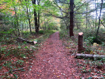 I dropped my pack and took out the camera to take some "before" pictures. Someone had used what seemed to be a machete to needlessly cut down a pine tree which was about six inches in diameter. The tree was bow across the trail. I decided to do everything with the axe as I did not want pine sap on the saws. I used the ax to remove the branches on the downed portion on the trunk. I then used the axe to cut through the trunk just off the trail. The cuts went quickly as the wood was very soft. I was able to flip the piece of trunk that I had cut off the trail without a problem. I took my "after" pictures and then cleaned everything up. We walked along the trail to the junction with the Big Rock Trail. We turned right and walked along the trail finding one of the few muddy spots her the beginning of the trail. We walked through the pine tunnel and over the wooden walkways to arrive at a large blowdown that had fallen across the trail.
 This blowdown was at peat 18 inches in diameter and probably approached 24 inches. It was very difficult to get over so I had initially cut a shallow step in it and then deepened it to make it even easier to get over the obstruction. I felt if I cut through the log without making it wider that it might collapse into the gap. This would be worse than leaving it as just a step. My plan was to widen the gap by making a cut in the log with the Katanaboy and the using the axe to remove pieces. I thought that doing this several times would make a wider step. I could then decide if I wanted to cut all the way through the log on both sides of the step and remove the resulting chunk. I put down the pack and got out the camera to take several "before" pictures. I began by using the big saw to make a cut on the left side of the step far enough away that the new step would be twice as wide. The cut went well and identified some dead areas that I next attacked with the axe. I was able to cut away a good amount of material but a problem arose. One area of the wood was hard to cut as there was a branch that formed a knot of harder wood. As I was contemplating what to do, a group of hikers approached and I stopped working to take Sheila off the trail. The hikers passed and commented that Sheila was beautiful and well-behaved. I kept using the axe to remove wood. Some areas were easy while other were more difficult. One axe stroke loosened and almost removed a huge chunk that contained the knot. I work on that piece until it came loose. I leveled out the new part of the step so that it matched the part I had cut on previous trips. The cutting at the left end of the step was going so well that I kept cutting with the axe and to my surprise I cut through the entire log! I took some pictures of what I hoped was an intermediate stage as my plan was to cut on the right side of the step to remove a section of the blowdown altogether. Cutting straight down with an axe is almost impossible so I got the Katanaboy and started to cut on the right side of the step.
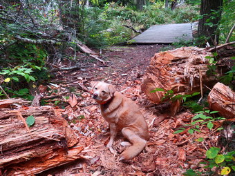 The wood here was much harder and none of it was rotten. The cutting was difficult and I alternated between cutting vertically on both sides and then almost straight across. I kept cutting and testing to see if the piece was ready to fall. It seemed I was almost all the way through but the chunk did not want to wall. I decided to get out the curved Sugowaza and try it out. It must be something about the curved blade but the smaller saw seemed to cut through the remaining wood in nothing flat. The chunk fell off and I was able to move it off the trail. As I was getting ready to take some shots, a group of hikers approached and I stopped working to take Sheila off the trail. The hikers passed and commented that Sheila was beautiful and the work I was doing was impressive. I talked to them about the history of the area. They asked me about where I thought they should hike and I suggested that they continue up the hill on the Big Rock trail and then return to their car on the Flynn Trail.I took some time to square up the ends. I wanted to remove some more of the pieces from the trail but I was a little too tired. I took my "after" pictures and then packed up. We continued around the pond on the Big Rock Trail to Times Square. We turned right on the Logger's Loop to complete the hike around Frick Pond. There were a few damp spots on the Big Rock Trail but the Logger's Loop was dry. The walk uphill on the Logger's Loop can sometimes be taxing but on this day it went quickly. As we started down toward Gravestone Junction, I could hear noise coming from the designated campsite on the right of the trail. As we approached the Junction, there were three people standing and waiting for their friends. They asked which way I was going and moved out of the way as we turned left to walk back to the car. We arrived at the car at 2:20 PM after hiking 2 hours and working for an hour and 15 minutes. As we were getting into the car, two men stopped to ask about the beginning of the Quick Lake Trail which I indicated was in the corner of the larger parking area. The temperature was 75 degrees as we left and the skies were even more overcast. It had been a busy day for the area. I had met at least 4 groups of hikers with between 3 and 5 hikers in each group!
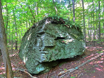
![]()
![]()
![]()
![]()
![]() On Friday, September 25 I wanted to take advantage of some beautiful weather and a favorable forecast to hike a 3500 foot peak. I had planned to hike to Windham High Peak from Big Hollow and maybe include Acra Point on the way back. When I asked Cindy if she wanted to go, she said "Yes" to my surprise. Cindy isn't too excited about climbing mountains but I thought this one was relatively easy and hoped for some nice views as a reward. I knew that what I had planned was to big a hike for Cindy so I decided we would hike from Peck Road. This trailhead starts at almost 2100 feet which is about 400 feet higher than Elm Ridge and it is also the shortest approach. The temperature was 58 degrees as we were getting ready at 9:15 AM. I started to get ready and Sheila was there to watch my every move. I got dressed in my White Sierra long-sleeved crew top with a short-sleeved baselayer. I put on a pair of RailRiders hiking pants which are expensive but last along time and have features like deep pockets and a generous cut which I really like. These pants have a Velcro closures at the ankles to discourage sticks and gravel from getting into my shoes and to combat ticks. I decided to wear my Keen Traghee II hiking boots which fit well and have been discontinued. I grabbed a pair of Leki external lock poles I have been using lately. I also added my OR floppy hat. I have decided it shields me from the sun and allows me to spray some insect repellant on it rather than on me. Sheila kept me in sight as I got ready to go making sure she would not be forgotten. We put our gear in the back of the car and Sheila in the back seat as we left Livingston Manor at 9:45 AM with skies that were blue with the puffy white clouds that make for good pictures. I drove out the DeBruce Road to the Frost Valley Road. I turned left on the Frost Valley Road and drove passed the YMCA camp and the parking for Big Indian, Slide Mountain and Giant Ledge. Each parking area already had quite few cars and hikers preparing to get on their way. I began to be worried that there would be no room at Peck Road which has a small parking area! I turned right on Route 28 in Big Indian and headed east to Route 42. I turned left to head north to Lexington where I took Route 23A east toward Hunter. I turned north on Route 296 and followed it North to Route 23C where I turned right. I knew the road I was looking for and knew it was marked by a giant American flag on the right. I found it and turned left on Route 40 which took me to Maplecrest. At the bottom of the hill I turned right on Big Hollow Road. I drove 1.8 miles and turned left on Peck Road.
On Friday, September 25 I wanted to take advantage of some beautiful weather and a favorable forecast to hike a 3500 foot peak. I had planned to hike to Windham High Peak from Big Hollow and maybe include Acra Point on the way back. When I asked Cindy if she wanted to go, she said "Yes" to my surprise. Cindy isn't too excited about climbing mountains but I thought this one was relatively easy and hoped for some nice views as a reward. I knew that what I had planned was to big a hike for Cindy so I decided we would hike from Peck Road. This trailhead starts at almost 2100 feet which is about 400 feet higher than Elm Ridge and it is also the shortest approach. The temperature was 58 degrees as we were getting ready at 9:15 AM. I started to get ready and Sheila was there to watch my every move. I got dressed in my White Sierra long-sleeved crew top with a short-sleeved baselayer. I put on a pair of RailRiders hiking pants which are expensive but last along time and have features like deep pockets and a generous cut which I really like. These pants have a Velcro closures at the ankles to discourage sticks and gravel from getting into my shoes and to combat ticks. I decided to wear my Keen Traghee II hiking boots which fit well and have been discontinued. I grabbed a pair of Leki external lock poles I have been using lately. I also added my OR floppy hat. I have decided it shields me from the sun and allows me to spray some insect repellant on it rather than on me. Sheila kept me in sight as I got ready to go making sure she would not be forgotten. We put our gear in the back of the car and Sheila in the back seat as we left Livingston Manor at 9:45 AM with skies that were blue with the puffy white clouds that make for good pictures. I drove out the DeBruce Road to the Frost Valley Road. I turned left on the Frost Valley Road and drove passed the YMCA camp and the parking for Big Indian, Slide Mountain and Giant Ledge. Each parking area already had quite few cars and hikers preparing to get on their way. I began to be worried that there would be no room at Peck Road which has a small parking area! I turned right on Route 28 in Big Indian and headed east to Route 42. I turned left to head north to Lexington where I took Route 23A east toward Hunter. I turned north on Route 296 and followed it North to Route 23C where I turned right. I knew the road I was looking for and knew it was marked by a giant American flag on the right. I found it and turned left on Route 40 which took me to Maplecrest. At the bottom of the hill I turned right on Big Hollow Road. I drove 1.8 miles and turned left on Peck Road.
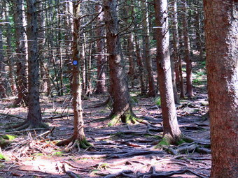 I drove to the end and was happy to find only one car parked. A man was standing by the car in a Civil War kepi and shirt. I said "Hello" and he looked at me but did not speak! He started out on his hike as we got ready to depart. I set my GPS and we headed out on the trail at 11:20 AM with the temperature at 68 degrees. It had been many years since I had hiked Windham from this trailhead so nothing really looked familiar. The lower part of the trail is flat and then it rises gently. The trail was completely dry and very dusty. There are some interesting rocks and ridges along the trail so I stopped to take a few pictures before moving on. Not too far along Te trail a blue trail branched to the left but we stayed on the yellow trail. I was sorry I had not brought a map as the trails in this area change as the mountain bikers add new ones. At about .6 miles the woods road we were on continued straight ahead but the yellow blazes headed off to the left. I decided to follow the yellow blazes although I was sure that the trail used to go straight ahead on the woods road. At .75 miles the trail began to climb and at 1 mile we came to another fork in the trail. This fork had a map and confirmed that there was a major trail junction just ahead. A few hundred feet ahead the yellow Elm Ridge Trail ended at the blue Escarpment Trail. There was a group of three hikers resting on a rock at the junction. We said "Hello" as we made the turn and started up the Escarpment Trail. A short distance up the trail, the Elm Ridge lean-to appeared on the right side of the trail. I was surprised that the lean-to had not been claimed for the weekend. Over the next mile we continued to walk uphill and through the "Enchanted Forest". The pine trees here have roots that are above ground making for an interesting hike. We walked over the puncheons at the end of this section although the were hardly needed since the ground was dry. The trail heads mostly east and at 1.75 miles the terrain flattened some before the climb began again at 2.1 miles. The trail from here became rockier and the grade began to increase as it headed south and the turned northwest at 2.5 miles.
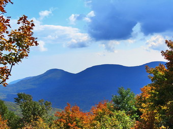 As we got into this climb I had to walk slower and slower as Cindy was lagging behind. I came to a point where the trail leveled a little and there was a nice big rock. I waited for Cindy and asked her if she wanted to wait for me and she agreed. As we were talking a young man came up the trail moving at a good pace and passed us. I gave Sheila a drink and left the bottle with Cindy so she could get a drink. I took off up the mountain with Sheila knowing it wasn't very far To the summit plateau. At 1:25 PM we passed the 3500 foot sign. The trail, rather than heading right up the ridge, hung on the edge of the ridge and slowly ascended to the top with a few short climbs. Along the way we met the man that we had seen at the trailhead. I again said "Hello" nut got no response. We climb over a rock at the top of the last climb and were finally on the summit plateau. We walked along the trail until the lookout toward the Blackhead Range came up on the right. We walked off the spur trail and I could see two young women sitting and eating lunch on the rock that has the best views. I put Sheila on her leash and tied her to a tree. I got out my camera and walked over to the viewpoint. I took some pictures although the sun had gone under a cloud and there was some haze on the mountains. The two young women went on with their conversation without speaking to me. Some other hikers arrived but seemed reluctant to approach more than one at a time. I put my camera back in my pack and released Sheila from the tree but kept her on her leash. I headed out to the main trail and heard the hikers discussing the view. I told them what they were looking at and they thanked me. I walked further to the east on the main trail passing over the summit to the lookout beyond. There was no one at the lookout to the north so I let Sheila go and took out the camera. On a clear day Albany is visible but there was too much haze for that. I took pictures of Burnt Knob to the east and some to the north and west. I wanted to get back to Cindy so I packed up and started back.
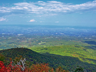 I passed over the USGS marker without taking a picture. I stopped by another lookout to the north but did not stay as the view was much the same. As I got back on the main trail, the sun came out so I stopped by the viewpoint toward the Blacks to take a few shots. I left the lookout and started a quick trip back to Cindy. On my way down, I passed the ladies I had talked to about the view. I also met several groups coming up the trail. Cindy was farther away than I remembered but I got there pretty quickly. She seemed refreshed and ready to go so we started own the mountain as fast as possible. We set a blistering pace and I had to slow down only a few times to let Cindy catch up. A few groups passed us going up the trail but soon we were at the bottom of the climbs near the lean-to. As we approached this area, I could hear some people talking loudly. There was a group of 10 young women stopped by the side of the trail. I encouraged Sheila to pass by and I followed her. Cindy stopped a moment to talk to them and they asked her how far they had to go. When she said at least an hour, they did not seem discouraged. Cindy and I advanced to the trail junction where there were three mountain bikers. We turned left and made good time following the yellow trail back to the parking area. We arrived at the car at 3:15 PM after hiking 6.5 miles in 4 hours with an elevation gain of 1695 feet. I felt like I could hike quite a bit more. The temperature was 75 degrees. I suggested we go to Pancho Villa's in Tannersville which is where we always eat when we hike in this area. Cindy said "No" which was very disappointing.
![]()
![]()
![]()
![]() On Thursday, September 24th I was going to take the day off but the weather was beautiful and Sheila kept staring at me. I asked Cindy if she would like to go across the street to Round Top to hike a few loops. She said "Yes" so we started to get ready with the temperature a surprisingly warm 71 degrees. I got dressed in a short-sleeved crew top but decided I did not need a with a short-sleeved baselayer. I put on a pair of RailRiders hiking pants which are expensive but last along time and have features like deep pockets and a generous cut which I really like. These pants have Velcro closures at the ankles which keeps the sticks and ticks out. I decided to wear my Keen Targhe II hiking boots which fit reasonably well but have been discontinued. I added my OR floppy hat which I have decided shields me from the sun and allows me to spray some insect repellant on it rather than on me. I grabbed a pair of Leki external lock poles I have been using lately. We stepped out of the house at 2:00 PM and I grabbed Sheila's leash from the car. We walked up the driveway and crossed the street. I decided we would do enough loops to cover all the trails and tire me out a little. We had recently finished creating a switchback on the steepest trail and a crossover trail to let hikers avoid the summit and to allow for some variations. We walked to the parking area by the Presbyterian Church and to the back of the church. We began the ascent of the steepest hill behind the church. The hill is short but gets the circulation pumping and is the steepest and longest climb on the "trail." Sheila helped me along by pulling me up the hill but I noticed the hill seemed easier as I have been hiking more. Cindy had not hike hills in some time so I waited at the top for her to catch up. When we got to the top of the hill, we stopped to look around at the hills around town. We started on the trail by turning left at the trailhead. I let Sheila off her leash so that she could explore. The trail bed is becoming worn it which means that at least a few people are using the trail. I am always happy to see that someone else uses the trails.
On Thursday, September 24th I was going to take the day off but the weather was beautiful and Sheila kept staring at me. I asked Cindy if she would like to go across the street to Round Top to hike a few loops. She said "Yes" so we started to get ready with the temperature a surprisingly warm 71 degrees. I got dressed in a short-sleeved crew top but decided I did not need a with a short-sleeved baselayer. I put on a pair of RailRiders hiking pants which are expensive but last along time and have features like deep pockets and a generous cut which I really like. These pants have Velcro closures at the ankles which keeps the sticks and ticks out. I decided to wear my Keen Targhe II hiking boots which fit reasonably well but have been discontinued. I added my OR floppy hat which I have decided shields me from the sun and allows me to spray some insect repellant on it rather than on me. I grabbed a pair of Leki external lock poles I have been using lately. We stepped out of the house at 2:00 PM and I grabbed Sheila's leash from the car. We walked up the driveway and crossed the street. I decided we would do enough loops to cover all the trails and tire me out a little. We had recently finished creating a switchback on the steepest trail and a crossover trail to let hikers avoid the summit and to allow for some variations. We walked to the parking area by the Presbyterian Church and to the back of the church. We began the ascent of the steepest hill behind the church. The hill is short but gets the circulation pumping and is the steepest and longest climb on the "trail." Sheila helped me along by pulling me up the hill but I noticed the hill seemed easier as I have been hiking more. Cindy had not hike hills in some time so I waited at the top for her to catch up. When we got to the top of the hill, we stopped to look around at the hills around town. We started on the trail by turning left at the trailhead. I let Sheila off her leash so that she could explore. The trail bed is becoming worn it which means that at least a few people are using the trail. I am always happy to see that someone else uses the trails.
At the first trail junction, we followed Sheila as she turned right on the woods road which is the shallower approach to the trail system. We continued to follow the yellow trail to the first junction where we turned left and followed it to the next trail junction. At the second junction with the blue trail, we turned right and started up the steep blue trail that leads over the summit of Round Top. Walking uphill we passed through a sea of green with some brown edges from the recent frosts. The trails were very dry as it had not rained for some time. Just before the steepest section Ariana we turned right on the switchback trail now marked with blue paint blazes. We continued to follow these blazes as they made a sharp left turn and headed back to the main blue trail. We turned right on the blue trail and passed the switchback trail which is marked with white paint blazes. We continue on the blue trail over the summit of Round Top and started down the other side. We walked down the blue trail, passed the other end of the switchback trail and came to the yellow trail where we turned right. We continued on the yellow trail along the base of Round Top and turned left at the second junction. We walked down to the lookout where we got a good view of town except for the lone tree in the middle of the view. We followed the yellow trail as it headed downhill toward the first trail junction. At this point, I turned around to hike another loop but Cindy decided to walk out to the trailhead and go home. Sheila and I walked back up the hill to the lookout and followed the yellow trail as it curved to the right. After a slight stretch of uphill, we came to the junction with the blue trail where we turned right to walk along the base of Round Top to the second trail junction. At this junction we turned left and started up the blue trail toward the summit. When we reached the crossover trail, we turned left to follow the white blazes over to the blue trail. The white trail was easy to follow and it seemed that more and more people were using it. When the crossover trail, met the blue trail, we turned left and walked down the hill to the yellow trail. We turned left and walked the yellow trail back to the junction with the blue trail. This time we turned right and followed the yellow trail down to the woods road and back to the first trail junction. I was still fresh So I decided we would do one more trip. We turned around and walked back up the woods road to the junction with the blue trail. We turned left and walked along the base of Round Top to the next junction. We turned right on the blue trail and walked up the hill. We followed the switchback trail until it came back to the main blue trail where we turned right. Almost immediately we turned right on the white crossover trail and walked it until we met the blue trail again. We turned right and followed the blue trail to the junction with the yellow trail. We turned right and followed the yellow trail to the junction with the blue trail. This time we turned left and followed the yellow trail down to the lookout and then down to the first trail junction. This time we walked out to the trailhead where I put Sheila on her leash. We walked down the hill to the parking lot and across the road to our driveway. We were home by 3:30 PM after hiking around 3 miles.
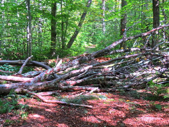
![]()
![]()
![]()
![]()
![]() On Wednesday, September 23rd I wanted to get out on a hike with my grandson Bryce who is at our house Tuesdays and Wednesdays. Bryce had a morning zoom meeting with his class and another one at 3:00 PM. I knew we would have enough time to go to Long Pond to remove at least one large blowdown that was obstructing the trail. The trail is a snowmobile trail but the club would not be out to clear it for another month. The temperature was 60 degrees as we were getting at 11:00 AM. I started to get ready and Sheila was there to watch my every move. I got dressed in my White Sierra long-sleeved crew top with a short-sleeved baselayer. I put on a pair of RailRiders hiking pants which are expensive but last along time and have features like deep pockets and a generous cut which I really like. These pants have a Velcro closures at the ankles to discourage sticks and gravel from getting into my shoes and to combat ticks. I decided to wear my Keen Traghee II hiking boots which fit well and have been discontinued. I grabbed a pair of Leki external lock poles I have been using lately. I also added a new OR floppy hat which was another present from Cindy. I have decided it shields me from the sun and allows me to spray some insect repellant on it rather than on me. I also packed my Silky Sugowaza saw, LT Wright Overland machete and two felling wedges. I let Bryce carry the Fiskars pack ax. The Silky Sugowaza saw is a 17" curved and fixed blade which fits in a scabbard. It is remarkably sharp and can take care of trees larger than one would think. The Fiskars axe is light but cuts well and is easier to carry than a full-sized felling ax. I put our gear in the back of the car and Sheila and Bryce in the back seat as we left Livingston Manor at 11:40 AM with skies that were blue but without the puffy white clouds that make for good pictures. We headed out DeBruce Road toward Long Pond for about 8 miles to Flugertown Road where I made a left. I drove up the road and parked in the lot a short distance up the road on the right where no other cars were parked. I pulled into the lot and started to get ready by setting my GPS. We got started on the trail by crossing the first bridge at noon. I hoped we could set a quick pace because the trails were much drier than they had been in some time and I wanted have as much time to spend on clearing the blowdowns as possible. The first .6 miles gains about 350 feet to the highest point on the hike. It isn't very steep but does act as a nice warm-up! Once the trail leveled it was easier walking with only a few wet and muddy spots. We kept up a running conversation which made the hike go very quickly. At .85 miles we came to the blowdown and it was larger and more complex than I thought.
On Wednesday, September 23rd I wanted to get out on a hike with my grandson Bryce who is at our house Tuesdays and Wednesdays. Bryce had a morning zoom meeting with his class and another one at 3:00 PM. I knew we would have enough time to go to Long Pond to remove at least one large blowdown that was obstructing the trail. The trail is a snowmobile trail but the club would not be out to clear it for another month. The temperature was 60 degrees as we were getting at 11:00 AM. I started to get ready and Sheila was there to watch my every move. I got dressed in my White Sierra long-sleeved crew top with a short-sleeved baselayer. I put on a pair of RailRiders hiking pants which are expensive but last along time and have features like deep pockets and a generous cut which I really like. These pants have a Velcro closures at the ankles to discourage sticks and gravel from getting into my shoes and to combat ticks. I decided to wear my Keen Traghee II hiking boots which fit well and have been discontinued. I grabbed a pair of Leki external lock poles I have been using lately. I also added a new OR floppy hat which was another present from Cindy. I have decided it shields me from the sun and allows me to spray some insect repellant on it rather than on me. I also packed my Silky Sugowaza saw, LT Wright Overland machete and two felling wedges. I let Bryce carry the Fiskars pack ax. The Silky Sugowaza saw is a 17" curved and fixed blade which fits in a scabbard. It is remarkably sharp and can take care of trees larger than one would think. The Fiskars axe is light but cuts well and is easier to carry than a full-sized felling ax. I put our gear in the back of the car and Sheila and Bryce in the back seat as we left Livingston Manor at 11:40 AM with skies that were blue but without the puffy white clouds that make for good pictures. We headed out DeBruce Road toward Long Pond for about 8 miles to Flugertown Road where I made a left. I drove up the road and parked in the lot a short distance up the road on the right where no other cars were parked. I pulled into the lot and started to get ready by setting my GPS. We got started on the trail by crossing the first bridge at noon. I hoped we could set a quick pace because the trails were much drier than they had been in some time and I wanted have as much time to spend on clearing the blowdowns as possible. The first .6 miles gains about 350 feet to the highest point on the hike. It isn't very steep but does act as a nice warm-up! Once the trail leveled it was easier walking with only a few wet and muddy spots. We kept up a running conversation which made the hike go very quickly. At .85 miles we came to the blowdown and it was larger and more complex than I thought.
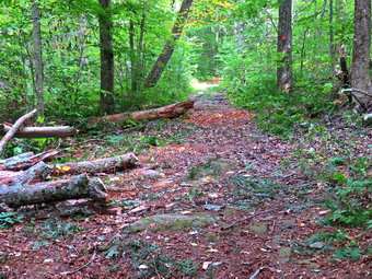 I took some pictures of the mess on the trail. I took some shots with Bryce and Sheila and some without. As we were getting started., Sheila alerted and a man with a small dog on a leash came toward us from the Long Pond direction. We said "Hello" as he passed by. We got down to work by removing all the loose branches that we could. Some of the branches seemed loose but were trapped under other, larger branches. It seemed that one large but forked trunk had come down taking another large trunk with it and several small ones. Bryce seemed eager to use the saw so I showed him how to make a cut. After the first cut, I was not sure he would be able to help much. When he started the next cut, his technique improved and he was very helpful cutting branches. He is also surprisingly strong and was able to help me lift and haul some very heavy branches well off the trail. We cut a lot of the smaller branches off the larger trunk before starting to cut the bigger stuff. I sued the saw to cut some larger limbs and the work we did was noticeable. I took some pictures when we were about half done. At this point another man came hiking from the direction of the parking area. He passed by us without saying much and I remarked to Bryce that I really appreciate a 'Thank you for your work'. There were mostly large trunks remaining so I used the axe to make some cuts. Sites the fact that the wood was hard, the work went quickly. Some of the pieces were longer than I thought and heavy but Bryce helped my remove them. I was able to cut all of the trunks and limbs back to clear enough room for hiking. The last chores was to cut a piece off a large but rotten trunk that protruded into the trail. It was cracked so I thought it would go easily but is was surprisingly resistant. When the work was finally done, I took some "after" pictures and we packed everything up for the return trip. When I looked at my GPS, I was surprised to see that we had "traveled" over a mile while working on the blowdown! Apparently the GPS was recording movement while it was sitting still in my pack. This was not particularly encouraging for its accuracy in other situations! It was 1:40 PM when we started back. I had considered trying to cut one more blowdown but I was tired and did not want Bryce to be late for his Zoom meeting. We hiked back to the car and arrived there at 2:00 PM. We had only hiked 1.7 miles but had worked on the blowdown for 1 hour and 30 minutes!
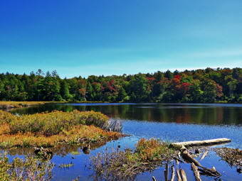
![]()
![]()
![]()
![]()
![]() On Tuesday, September 22nd I wanted to get out on a hike with my grandson Bryce who is at our house Tuesdays and Wednesdays. I had a morning doctor's appointment and Bryce had to be back by 3:00 PM for a zoom meeting. When I got home we decided to go to Long Pond as it is about 6 miles and isn't too far from our house. I asked Cindy if she wanted to hike and she said "Yes". The temperature was 58 degrees as we were getting at 11:00 AM. I started to get ready and Sheila was there to watch my every move. I got dressed in my White Sierra long-sleeved crew top with a short-sleeved baselayer. I put on a pair of RailRiders hiking pants which are expensive but last along time and have features like deep pockets and a generous cut which I really like. These pants have a Velcro closures at the ankles to discourage sticks and gravel from getting into my shoes and to combat ticks. I decided to wear my Keen Traghee II hiking boots which fit well and have been discontinued. I grabbed a pair of Leki external lock poles I have been using lately. I also added a new OR floppy hat which was another present from Cindy. I have decided it shields me from the sun and allows me to spray some insect repellant on it rather than on me. Sheila kept me in sight as I got ready to go making sure she would not be forgotten. We put our gear in the back of the car and Sheila in the back seat as we left Livingston Manor at 11:35 AM with skies that were blue but without the puffy white clouds that make for good pictures. We headed out DeBruce Road toward Long Pond for about 8 miles to Flugertown Road where I made a left. I drove up the road and parked in the lot a short distance up the road on the right where two other cars was parked. I pulled into the lot and started to get ready by setting my GPS. We got started on the trail by crossing the first bridge at noon. I hoped we could set a quick pace because the trails were much drier than they had been in some time. The first .6 miles gains about 350 feet to the highest point on the hike. It isn't very steep but does act as a nice warm-up! Once the trail leveled it was easier walking with only a few wet and muddy spots. We kept up a running conversation which made the hike go very quickly. At 1.1 miles we were at the spur trail that leads down to the shore of Long Pond. We turned right and went down to the pond so that I could take some pictures. At the shores of the pond I dropped my pack and got out my camera to take some pictures. Sheila tried to follow Bryce and I but I discouraged her because of the mud. The skies were a flat blue without any clouds. I took a few pictures of all angles of the pond. I returned to my pack where I got a bar before packing up as we returned to the main trail. We turned right and were soon at the first trail junction. We turned right at the junction at 1.3 miles. We continued to find wet and muddy places on the trail which were easily avoided. By 12:55 PM we had walked 1.8 miles and were passing the yellow spur trail to the lean-to.
On Tuesday, September 22nd I wanted to get out on a hike with my grandson Bryce who is at our house Tuesdays and Wednesdays. I had a morning doctor's appointment and Bryce had to be back by 3:00 PM for a zoom meeting. When I got home we decided to go to Long Pond as it is about 6 miles and isn't too far from our house. I asked Cindy if she wanted to hike and she said "Yes". The temperature was 58 degrees as we were getting at 11:00 AM. I started to get ready and Sheila was there to watch my every move. I got dressed in my White Sierra long-sleeved crew top with a short-sleeved baselayer. I put on a pair of RailRiders hiking pants which are expensive but last along time and have features like deep pockets and a generous cut which I really like. These pants have a Velcro closures at the ankles to discourage sticks and gravel from getting into my shoes and to combat ticks. I decided to wear my Keen Traghee II hiking boots which fit well and have been discontinued. I grabbed a pair of Leki external lock poles I have been using lately. I also added a new OR floppy hat which was another present from Cindy. I have decided it shields me from the sun and allows me to spray some insect repellant on it rather than on me. Sheila kept me in sight as I got ready to go making sure she would not be forgotten. We put our gear in the back of the car and Sheila in the back seat as we left Livingston Manor at 11:35 AM with skies that were blue but without the puffy white clouds that make for good pictures. We headed out DeBruce Road toward Long Pond for about 8 miles to Flugertown Road where I made a left. I drove up the road and parked in the lot a short distance up the road on the right where two other cars was parked. I pulled into the lot and started to get ready by setting my GPS. We got started on the trail by crossing the first bridge at noon. I hoped we could set a quick pace because the trails were much drier than they had been in some time. The first .6 miles gains about 350 feet to the highest point on the hike. It isn't very steep but does act as a nice warm-up! Once the trail leveled it was easier walking with only a few wet and muddy spots. We kept up a running conversation which made the hike go very quickly. At 1.1 miles we were at the spur trail that leads down to the shore of Long Pond. We turned right and went down to the pond so that I could take some pictures. At the shores of the pond I dropped my pack and got out my camera to take some pictures. Sheila tried to follow Bryce and I but I discouraged her because of the mud. The skies were a flat blue without any clouds. I took a few pictures of all angles of the pond. I returned to my pack where I got a bar before packing up as we returned to the main trail. We turned right and were soon at the first trail junction. We turned right at the junction at 1.3 miles. We continued to find wet and muddy places on the trail which were easily avoided. By 12:55 PM we had walked 1.8 miles and were passing the yellow spur trail to the lean-to.
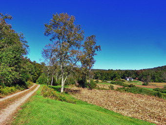 After passing the trail to the lean-to, we continued to find a few wet and muddy places on the trail but nothing compared to what is often present. There isn't much to see on this section of trail but we kept talking. We continued on the main trail to the point where it intersects a woods road at 2.6 miles. We turned left on the woods road and found it to be almost completely dry. We followed the road until the intersection with Basily Road at 2.85 miles where we continued on Basily Road by bearing left. This section of road was also wet and muddy in a few spots but it did not slow us down much. Sheila took advantage of the water in one of the small streams to get a drink and play in the water. It did seem to get getting warmer the longer we hiked. As we approached the Peters Hunting Camp, I got ready to put Sheila on her leash. The beaver pond was full of water as was the road and. We had seen this before and I assumed the beavers had been at work both on the main dam and on a secondary dam further downstream. I stopped to take a few pictures. I took pictures of the beaver pond and the flooded road. We continued on the trail and I stopped to take some more pictures of the beaver pond and the stands of corn near the hunting camp. We came to the bridge over the stream near the camp which is showing signs of wear from snowmobiles passing over it even though there is a sign that states "Private Bridge". I have secured permission to hike across this land in the past and "Stay on the trail" signs seem to indicate that the owners will allow hikers. I assume the "Private Bridge - No thru traffic" refers to motorized vehicles and not hikers. We crossed the bridge to continue the trip back to the car and started up the little hill from the hunting camp. We stopped again so that I could take a few shots of the valley which looked peacefully bucolic. Once we started walking again we kept a fast pace as we were a little behind schedule. The road is gravel until it breaks out of the forest where it is paved. We continued down the road toward the parking area and our car at a near record pace. We walked down the road to a bridge over a stream and noticed that an engineering firm was inspecting the bridge. We continued at an accelerated pace back to the parking area. We were back at the car at 2:30 PM having hiked 6.1 miles in 2 hours and 30 minutes with 5 minutes of stopped time. The elevation gain was only about 550 feet most of which was at the beginning of the hike.