
What You Missed
Fall 2018
Fall 2018
![]()
![]()
![]()
![]()
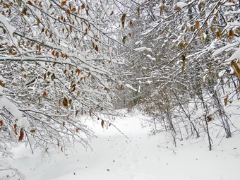
![]() On Friday, December 14th, I wanted to hike after a week of track and other commitments and a healthy dose of lousy weather. The early morning was dominated by freezing drizzle followed by heavy fog and light rain. I finally asked Cindy if she would like to go somewhere and she agreed suggesting Long Pond. I had avoided that area s it is heavily hunted but remembered that big game rifle season had ended and though it was a good choice . We began to get ready around 9:30 AM when the temperature had climbed above freezing. While we were getting ready, Sheila was always nearby making it very clear that she wanted to go by alternately checking on both of us. Because it was relatively warm in Livingston Manor, I got dressed in my Mammut pullover with a light, synthetic, long-sleeved baselayer. I put on my Columbia Omniheat hiking pants which have a reflective lining and are heavier than my "go to" Railriders pants. The pants have Velcro closures at the ankles. I also donned a pair of Outdoor Research Crocodile gaiters to keep my lower legs even warmer and to ward off any snow I might find. I put on a blaze orange light hat just in case and a pair of heavier gloves. I packed my microspikes knowing that snowshoes would not be needed. As always I chose to wear my Mammut Ultimate Hoody which is very light but very wind resistant with plenty of zippers to dump heat when needed. I wore my Salomon B-52 winter boots for their insulation and because they have relatively good support. I grabbed a pair of Leki poles with external locks that I have been using lately. We finished getting our gear together and put Sheila in the back seat and the gear in the way back. When we left the house at about 10:00 AM the skies were completely overcast and a light rain or heavy mist was hitting the windscreen. We headed out DeBruce Road for about 8 miles to Flugertown Road where I made a left and drove to the parking area on the right. I had not expected to find anybody in the lot but when we arrived there was a truck parked and the owner seemed to be getting ready to start out. I noticed his garb and his gun and knew he was going deer hunting with a muzzle-loader. I parked in the lot a short distance up the road on the right where we found one other car. When she saw the hunter, Sheila put up a fuss so I left her inside as I opened the trunk to get out my pack. It was still misting heavily and the fog was very heavy but we decided we would try to hike even if we did the shorter loop. I left my spikes in my pack and set the GPS. I took Sheila out of the car and put her on her leash at 10:20 AM. The hunter was just ahead of us starting up the hill. We caught up to him quickly as he stopped to let us pass. He explained he was headed for the lean-to which he would use as a base while he hunted. We wished him good luck and hurried up the hill. The first .6 miles gains about 350 feet to the highest point on the hike. It isn't very steep but does act as a nice warm-up! We had to be careful to avoid some icy spots which was easy. We both set a very quick pace up the hill hiking at a speed we usually can only keep on more level ground and on dry trails! Once the trail leveled it was easier walking but there was still a layer of a few inches of snow and not-quite-frozen puddles.
On Friday, December 14th, I wanted to hike after a week of track and other commitments and a healthy dose of lousy weather. The early morning was dominated by freezing drizzle followed by heavy fog and light rain. I finally asked Cindy if she would like to go somewhere and she agreed suggesting Long Pond. I had avoided that area s it is heavily hunted but remembered that big game rifle season had ended and though it was a good choice . We began to get ready around 9:30 AM when the temperature had climbed above freezing. While we were getting ready, Sheila was always nearby making it very clear that she wanted to go by alternately checking on both of us. Because it was relatively warm in Livingston Manor, I got dressed in my Mammut pullover with a light, synthetic, long-sleeved baselayer. I put on my Columbia Omniheat hiking pants which have a reflective lining and are heavier than my "go to" Railriders pants. The pants have Velcro closures at the ankles. I also donned a pair of Outdoor Research Crocodile gaiters to keep my lower legs even warmer and to ward off any snow I might find. I put on a blaze orange light hat just in case and a pair of heavier gloves. I packed my microspikes knowing that snowshoes would not be needed. As always I chose to wear my Mammut Ultimate Hoody which is very light but very wind resistant with plenty of zippers to dump heat when needed. I wore my Salomon B-52 winter boots for their insulation and because they have relatively good support. I grabbed a pair of Leki poles with external locks that I have been using lately. We finished getting our gear together and put Sheila in the back seat and the gear in the way back. When we left the house at about 10:00 AM the skies were completely overcast and a light rain or heavy mist was hitting the windscreen. We headed out DeBruce Road for about 8 miles to Flugertown Road where I made a left and drove to the parking area on the right. I had not expected to find anybody in the lot but when we arrived there was a truck parked and the owner seemed to be getting ready to start out. I noticed his garb and his gun and knew he was going deer hunting with a muzzle-loader. I parked in the lot a short distance up the road on the right where we found one other car. When she saw the hunter, Sheila put up a fuss so I left her inside as I opened the trunk to get out my pack. It was still misting heavily and the fog was very heavy but we decided we would try to hike even if we did the shorter loop. I left my spikes in my pack and set the GPS. I took Sheila out of the car and put her on her leash at 10:20 AM. The hunter was just ahead of us starting up the hill. We caught up to him quickly as he stopped to let us pass. He explained he was headed for the lean-to which he would use as a base while he hunted. We wished him good luck and hurried up the hill. The first .6 miles gains about 350 feet to the highest point on the hike. It isn't very steep but does act as a nice warm-up! We had to be careful to avoid some icy spots which was easy. We both set a very quick pace up the hill hiking at a speed we usually can only keep on more level ground and on dry trails! Once the trail leveled it was easier walking but there was still a layer of a few inches of snow and not-quite-frozen puddles.
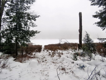
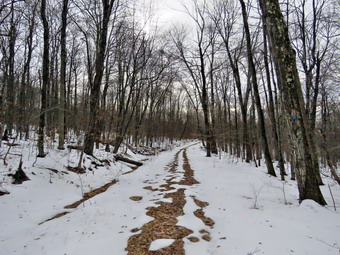
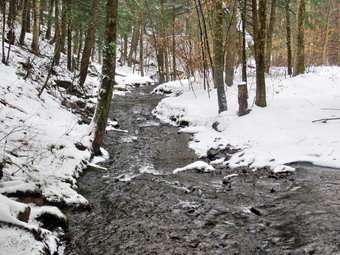 At 1.1 miles we were at the spur trail that leads down to the shore of Long Pond. I was slightly ahead of Cindy as I turned left and walked down to the edge of the pond with Sheila. At the shores of the pond I dropped my pack and got out my camera to take some pictures. Sheila walked out on the ice on the pond which supported her weight but did not look capable of holding my weight. The skies were completely overcast with dense fog everywhere. As I took picture my camera kept automatically shifting to close-up mode. I decided it was being fooled by the dense fog. I took a few shots anyway before going back to my pack. I noticed Cindy was not present and I hoped she was simply waiting back at the main trail. MY pack was getting wet so I pulled out and out on the pack cover after taking my camera. I returned to the main trail to find Cindy sitting and waiting. We debated what to do as a light rain was falling. We decided to hike to the next trail junction and decide. and arrived at the first trail junction. We turned right at the junction at 1.3 miles. The trail junction was only .2 miles ahead and we quickly covered that distance. It did not appear the rain would let up so we turned left to walk back to the road and complete a short loop. I hike for fun and fitness and this hike wasn't much fun! It is also close to our house so we didn't feel a need to continue on a day with unfavorable conditions. The hike back out to Flugertown Road is all flat or downhill so it went quickly. There were some areas where we had to skirt large puddles on the trail. The puddles had ice over them but it was not strong enough to bear our weight and the puddles were deep with mud underneath. We soon started to descend toward the creek and the road. This proved a little tricky as there was some ice and wet snow on the descent. I stopped at the first bridge to take some pictures of the snowy bridge and the stream. We continued on toward the second bridge where I considered taking some shot but realized it was much the same scene as the first. We walked out to the road and turned left to head back to the parking area. The road is designated as "seasonal maintenance" but had been plowed at some point. There was a layer of fresh, wet snow and no tire tracks indicating anyone had been on it recently. After a few minutes, we did stop so that could take a final set of pictures of the snowy road and the creek. After that, my sole purpose to get back to the car as quickly as possible. We hiked about a mile and at 3.1 miles the "seasonal maintenance" ended and we increased our pace even more. I kept Sheila off her leash the whole time on the road but directed her to follow closely behind me using the command "With". The walk back to the car is .5 miles and took us only 10 minutes. We were back at the car at noon after hiking 3.6 miles in 1 hour and 40 minutes. Our elevation gain was only 440 feet but our moving average was 2.5 mph Which is good for the conditions.
![]()
![]()
![]()
![]() On Thursday, December 13th I wanted to get out for a hike after several days of commitments and unfavorable weather. The forecast called for temperatures in the 30's but there was no precipitation on tap. I decided just to go across the street and hike some on Round Top since I had track practice in the afternoon. Sheila seemed excited to be going anywhere after several days of inactivity. I put on a long-sleeved base layer and wore my Mammut pullover which is heavier than most others I own. I put on a pair of Columbia Omniheat hiking pants which have a reflective lining and are heavier than my "go to" Railriders pants. The pants have Velcro closures at the ankles which means gaiters are not usually needed until the snow gets deeper. I donned my Mammut hoody which has enough zippers to dump heat if needed. I put on a blaze orange light hat and light gloves. I wore my Vasque Talus hiking boots instead of the Salomon B-52 winter boots since I knew that any remaining snow would be frozen and hard-packed. I wear regular hiking boots whenever I can as I feel they are a better fit and offer more support. I grabbed a pair of Leki poles with external locks that I have been using lately but chose to leave my microspikes at home. At 10:40 AM we walked out the door and up the driveway. I put Sheila on her leash, and she pulled me up the driveway knowing exactly where we were going. I decided we would try to do at least two figure 8's which might be enough given the conditions. I aimed to hike for about an hour. Sheila was happy to get out as we headed down the driveway and across the street. We crossed the street with Sheila on her leash and walked to the back of the church. We began the ascent of the steepest hill behind the church. The hill is short but gets the circulation pumping and is the steepest and longest climb on the "trail." There was almost no snow in the field and only a little on the ascent up the hill. Sheila helped me along by pulling me up the hill. When we got to the top of the hill, we started on the trail by turning left at the trailhead. I let Sheila off her leash, and she began to explore the trail with her nose. As we followed the trail, I noticed there was a fresh layer of fluffy snow over the frozen snow and ground underneath. At the first trail junction, I followed Sheila as she turned right on the woods road which is the shallower approach to the trail system. We continued to follow the yellow trail to the first junction where we turned left and followed it to the next trail junction.There was one blowdown across the trail which would require an axe to clear.
On Thursday, December 13th I wanted to get out for a hike after several days of commitments and unfavorable weather. The forecast called for temperatures in the 30's but there was no precipitation on tap. I decided just to go across the street and hike some on Round Top since I had track practice in the afternoon. Sheila seemed excited to be going anywhere after several days of inactivity. I put on a long-sleeved base layer and wore my Mammut pullover which is heavier than most others I own. I put on a pair of Columbia Omniheat hiking pants which have a reflective lining and are heavier than my "go to" Railriders pants. The pants have Velcro closures at the ankles which means gaiters are not usually needed until the snow gets deeper. I donned my Mammut hoody which has enough zippers to dump heat if needed. I put on a blaze orange light hat and light gloves. I wore my Vasque Talus hiking boots instead of the Salomon B-52 winter boots since I knew that any remaining snow would be frozen and hard-packed. I wear regular hiking boots whenever I can as I feel they are a better fit and offer more support. I grabbed a pair of Leki poles with external locks that I have been using lately but chose to leave my microspikes at home. At 10:40 AM we walked out the door and up the driveway. I put Sheila on her leash, and she pulled me up the driveway knowing exactly where we were going. I decided we would try to do at least two figure 8's which might be enough given the conditions. I aimed to hike for about an hour. Sheila was happy to get out as we headed down the driveway and across the street. We crossed the street with Sheila on her leash and walked to the back of the church. We began the ascent of the steepest hill behind the church. The hill is short but gets the circulation pumping and is the steepest and longest climb on the "trail." There was almost no snow in the field and only a little on the ascent up the hill. Sheila helped me along by pulling me up the hill. When we got to the top of the hill, we started on the trail by turning left at the trailhead. I let Sheila off her leash, and she began to explore the trail with her nose. As we followed the trail, I noticed there was a fresh layer of fluffy snow over the frozen snow and ground underneath. At the first trail junction, I followed Sheila as she turned right on the woods road which is the shallower approach to the trail system. We continued to follow the yellow trail to the first junction where we turned left and followed it to the next trail junction.There was one blowdown across the trail which would require an axe to clear.
At the second junction with the blue trail, we turned right and started up the steep blue trail that leads over the summit of Round Top. This section of the trail faces west and north so there was more snow but I was able to get a grip with little or no problem. We walked across the flat summit of Round Top and started down the other side. Descending on the snow and frozen ground proved to be more of a challenged than I had expected but we were soon back at the yellow trail. We turned right and walked the yellow trail to the next trail junction. Here we turned left and followed the yellow trail downhill to the lookout. There wasn't much to see at the lookout as the skies were overcast. We followed the yellow trail as it turned left and descended the hill to the first trail junction. The walk had gone quickly, so we turned around and started back up the hill back to the lookout. Sometimes Sheila resists another loop but this time she was in the lead. We followed the yellow trail uphill toward the next trail junction. At the junction, we turned right and followed the yellow trail which was covered in snow to the next junction. We turned left and started uphill on the blue trail. This side of the hill was slippery going up with frozen ground and hard-packed snow. We crested the hill and walked across the summit and started down the other side. I slipped and slid to the trail junction where we turned left. We walked along the yellow trail to the next trail junction where we turned right and walked down to the woods road and out to the first trail junction. I was feeling pretty fresh but decided to head back home as my feet were getting a little cold in the uninsulated boots. We had hiked for about an hour so I decided we would return home. Sheila was well-behaved and stayed with us most of the time. We walked out to the trailhead where I put Sheila on her leash, and we walked down the cemetery hill. We walked across the field to our driveway. It was 11:40 AM, and we had hiked about 2 miles.
![]()
![]()
![]()
![]()
![]() On Friday, December 7th, I had a dental checkup in the morning and by the time I got home it was well after 11:00 AM. I had in mind a hike to a Catskill 35 and chose Balsam Lake Mountain. I asked Cindy if she would like to go but she declined my offer. There were some problems with my choice. It was already late in morning and the temperature was still in the low 20's and I was not sure if the road would be cleared all the way to the Balsam Lake parking area. However, I had a track meet all day on Saturday and I knew Sunday would allow even less time for hiking. The following week looked busy so I decided to go ahead with my plan. I exchanged the TSL Symbioz snowshoes for a pair of Tubbs Alp Flex VTR snowshoes with the Boa binding. This binding uses a thin steel cable system and a ratchet which tightens it to give a custom fit and a secure binding. These shoes also have a televator to elevate the hiker's heel on ascents. This is a feature that you didn't know you needed until you try it and then it is hard to live without it! While we were getting ready, Sheila was always nearby making it very clear that she wanted to go. Because it was cold in Livingston Manor, I knew it would be even colder at the trailhead and on the mountain. I got dressed in a Patagonia wool top with a light, synthetic, long-sleeved baselayer. I put on a pair of light synthetic tights and my Columbia Omniheat hiking pants which have a reflective lining and are heavier than my "go to" Railriders pants. The pants have Velcro closures at the ankles. I also donned a pair of Outdoor Research Crocodile gaiters to keep my lower legs even warmer and to ward off the snow I might find at the higher elevations. I put on a blaze orange light hat and a pair of heavier gloves. I packed a pair of mittens and my microspikes just in case. As always I chose to wear my Mammut Ultimate Hoody which is very light but very wind resistant with plenty of zippers to dump heat when needed. I wore my Salomon B-52 winter boots for their insulation and because I was pretty sure I would be wearing the snow shoes at some time. I grabbed a pair of Leki poles with external locks that I have been using lately. I got my gear together and put Sheila in the back seat and the gear in the way back. I pulled out of Livingston Manor and headed toward Roscoe on Old Rt 17. I turned right on the Beaverkill Road and headed north toward Lew Beach and Turnwood. As I drove up Johnson Mountain the snow began to fall and the skies were completely clouded over. As I drove through Lew Beach the sky turned blue and there was even some sun and interesting clouds. The road was in good shape and I hoped it would stay that way for the whole drive. We reached Barkaboom Road where I followed the Beaverkill Road to the right. The Beaverkill Falls were flowing nicely and I thought I might stop on the way back for a few shots. The farther I drove the worse the road conditions became until it was almost completely covered in snow. We again ran into snow showers and cloudy skies as we hit the point where the road turns to gravel and passes the Buddhist monastery. Just after the last house on the road it became clear that the road had not been plowed after the storm that dumped a few inches of snow overnight. The last section of road is uphill and it was full of frozen ruts and there were several icy patches. I made it up without a problem but worried about the return trip.
On Friday, December 7th, I had a dental checkup in the morning and by the time I got home it was well after 11:00 AM. I had in mind a hike to a Catskill 35 and chose Balsam Lake Mountain. I asked Cindy if she would like to go but she declined my offer. There were some problems with my choice. It was already late in morning and the temperature was still in the low 20's and I was not sure if the road would be cleared all the way to the Balsam Lake parking area. However, I had a track meet all day on Saturday and I knew Sunday would allow even less time for hiking. The following week looked busy so I decided to go ahead with my plan. I exchanged the TSL Symbioz snowshoes for a pair of Tubbs Alp Flex VTR snowshoes with the Boa binding. This binding uses a thin steel cable system and a ratchet which tightens it to give a custom fit and a secure binding. These shoes also have a televator to elevate the hiker's heel on ascents. This is a feature that you didn't know you needed until you try it and then it is hard to live without it! While we were getting ready, Sheila was always nearby making it very clear that she wanted to go. Because it was cold in Livingston Manor, I knew it would be even colder at the trailhead and on the mountain. I got dressed in a Patagonia wool top with a light, synthetic, long-sleeved baselayer. I put on a pair of light synthetic tights and my Columbia Omniheat hiking pants which have a reflective lining and are heavier than my "go to" Railriders pants. The pants have Velcro closures at the ankles. I also donned a pair of Outdoor Research Crocodile gaiters to keep my lower legs even warmer and to ward off the snow I might find at the higher elevations. I put on a blaze orange light hat and a pair of heavier gloves. I packed a pair of mittens and my microspikes just in case. As always I chose to wear my Mammut Ultimate Hoody which is very light but very wind resistant with plenty of zippers to dump heat when needed. I wore my Salomon B-52 winter boots for their insulation and because I was pretty sure I would be wearing the snow shoes at some time. I grabbed a pair of Leki poles with external locks that I have been using lately. I got my gear together and put Sheila in the back seat and the gear in the way back. I pulled out of Livingston Manor and headed toward Roscoe on Old Rt 17. I turned right on the Beaverkill Road and headed north toward Lew Beach and Turnwood. As I drove up Johnson Mountain the snow began to fall and the skies were completely clouded over. As I drove through Lew Beach the sky turned blue and there was even some sun and interesting clouds. The road was in good shape and I hoped it would stay that way for the whole drive. We reached Barkaboom Road where I followed the Beaverkill Road to the right. The Beaverkill Falls were flowing nicely and I thought I might stop on the way back for a few shots. The farther I drove the worse the road conditions became until it was almost completely covered in snow. We again ran into snow showers and cloudy skies as we hit the point where the road turns to gravel and passes the Buddhist monastery. Just after the last house on the road it became clear that the road had not been plowed after the storm that dumped a few inches of snow overnight. The last section of road is uphill and it was full of frozen ruts and there were several icy patches. I made it up without a problem but worried about the return trip.
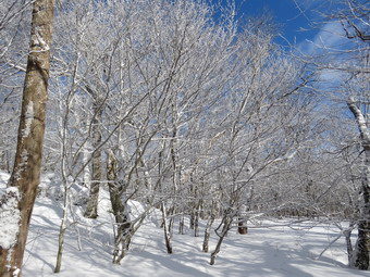
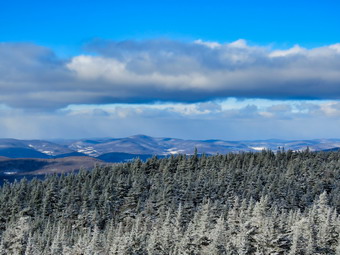
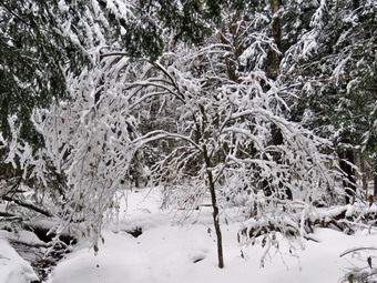
 We arrived at the parking area at 12:15 PM and found no other cars in the lot. The temperature was 20 degrees and when I stepped out of the car there was a pretty good wind blowing. I got out the snowshoes and decided I would rather wear them than carry them even though there was not much snow in the lot. I set my GPS and we were off at 12:20 PM. As we got on the trail it was obvious that snowshoes were not needed and were actually a nuisance since I kept hitting rocks lying just beneath the snow. Several times I though about removing them but hoped that there would be more snow as we gained elevation. We headed toward the first trail junction where I intended to turn left and hike up the steep side of the mountain. As we walked up the trail we found several blowdowns. Some were new and some were old. I continued to have problems with the snowshoes but stubbornly kept them on my feet. It wasn't long before I began to generate a lot of heat and opened some zippers on my Mammut hoody. We finally made the trail junction at .9 miles at 12:45 PM. We turned left up the mountain without stopping. I was disappointed that there still wasn't as much snow as I had hoped and there were still plenty of rocks just beneath the snow that was there. This first part of the trail is a gentle climb and I was feeling pretty good without stopping to rest. Over the next half mile the trail gains about 750 feet before leveling off which means an average of around a 28% grade! I began to struggle and had to stop frequently to catch my breath. I considered turning around but knew that would make me feel terrible! I kept slogging along with Sheila always ahead of me but not too far. This actually encouraged me to keep going. The climb seemed much longer than I remembered and several times I thought we were near the trail to the lean-to but had another steep section to climb. The weather kept alternating between overcast skies with snow and blue skies with sun. Finally we reached the trail to the lean-to and I stopped to get a drink and take a few pictures. I felt good until we started to climb again and ran into a few blowdowns that I had to work around. We passed the 3500 foot sign and were soon at the spring. It was hard to find the trail at this point but we eventually found the stone steps to the summit plateau. The trees were all now covered in ice and frozen snow which made a beautiful sight. I stopped to take pictures of the trees and the now blue sky. There was finally enough snow to make the snowshoes practical although not completely necessary. We continued on the trail and stopped several more times so that I could take some pictures. Our final stop was in the evergreens which were hanging into the trail covered in frozen snow.
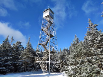
 We arrived at the tower clearing at 1:45 PM after hiking 1.7 miles. The skies were blue and the sun was out. The tower itself was not encrusted in snow but it was clear I would need traction to climb the tower. I took pictures of the clearing and the tower and then tried to decide if I should attempt the climb. I knew if I did not go up and take some pictures that I would regret it. I took off the snowshoes and put on the spikes which was quite an operation. I walked over to the tower with my camera and Sheila at my heels. I gave her strict instructions to stay and wait for me which she immediately violated as I began to go up the steps. The steps were tricky but the spikes were just the thing. As I rose above the treeline, the wind hit me and I was instantly uncomfortably cold. I stopped on a landing just below the cab and looked around. The scene was absolutely beautiful and I only regret was that pictures could not do it justice. I was able to operate my camera with my gloves on which was a relief. I took a great number of shots of the trees and cabin below and then turned my attention to the mountains. I TKO shots in all directions getting pictures of the Devil's Path to the north and some of Graham. Eventually I was satisfied I had enough pictures and wanted to get out of the wind. On the way down I met Sheila on a landing and took some pictures of her. I walked back to my pack and pout away my camera and took a drink. I exchanged spikes for snowshoes and headed down the Millbrook side of the mountain at 2:05 PM. We walked down the trail on the other side of the mountain passing the cabin. Walking down the mountain seemed MUCH easier than the climb up the other side. There wasn't too much snow under the trees but in the open there was enough to allow me to get a glide at times. In some places the drifts were almost 3 feet high! Soon we were approaching the junction with the trail that connects Millbrook Road to the Beaverkill Road. There is a gate at the bottom of the trail and just after this gate is the trail junction. We turned right at the trail junction to start back toward the car and I found that there wasn't very much snow on the trail itself and that I was again running into rocks underneath. I solved the problem by walking most of the way on the snow along the sides of the trail. This was much more enjoyable and I didn't sink down much into the frozen snow. There were quite a few branches hanging into the trail and a few blowdowns. The sun was still pretty high in the sky but was soon blocked by the mountain on the right. As I looked across the Gulf of Mexico, I could see the sun illuminating the side of the hill and wanted to take a few shots but knew it would be difficult to capture the scene. After just less than a mile, we were back at the trail junction where we had turned up the mountain earlier. We continued on toward the car by retracing our steps. I tried to walk along the sides of the trail in the deeper snow but eventually gave up. I stopped, took off the snowshoes and carried them the rest of the way back to the parking area. We had been blessed with blue skies all the way back from the summit and it was still light which would make it easier to negotiate the road. We were back in the parking area at 3:25 PM after hiking 4.3 miles in 3 hours. We had climbed 1200 feet in elevation in snowy and icy conditions. On the way home, the road did not prove to be a problem. Sheila slept in the back seat as I was happy we had completed the hike.
![]()
![]()
![]()
![]()
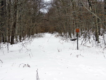
![]() On Wednesday, December 5th, I wanted to get in a hike a little farther from home after hiking in town on Round Top the day before. I thought about Balsam Lake Mountain or another more distant location but knew I would have afternoon track practice hanging over me. I decided to go to Frick Pond and hike a loop. I asked Cindy if she wanted to go and she said "Yes". My plan was to hike up the Flynn Trail and down the Big Rock Trail to Frick Pond. We would then return to the car on the Quick Lake trail for about a 4 mile hike. The temperature was in the high 20's with a good breeze which made it feel colder. While we were getting ready, Sheila was always nearby making it very clear that she wanted to go. Because it seemed cold, I got dressed in a Patagonia wool top with a light, synthetic, long-sleeved baselayer. I put on a pair of light synthetic tights and my Columbia Omniheat hiking pants which have a reflective lining and are heavier than my "go to" Railriders pants. The pants have Velcro closures at the ankles which means gaiters are not usually needed until the snow gets deeper. I put on a blaze orange light hat and light gloves. I wore my Vasque Talus hiking boots instead of the Salomon B-52 winter boots since I knew that any remaining snow would be frozen and hard-packed. I wear regular hiking boots whenever I can as I feel they are a better fit and offer more support. I grabbed a pair of Leki poles with external locks that I have been using lately. We decided not to wear snowshoes since I felt the snow would be frozen and hard-packed but we did put our microspikes in our packs. We got our gear in the car and put Sheila in the back seat. We left Livingston Manor at about 10:00 AM as I drove out the DeBruce Road about 6 miles to Mongaup Road. I turned left and continued up the road to the point where it splits. I stayed left on Beech Mountain Road and drove to the parking areas on the left. Where the road turned to dirt, there were some ruts frozen into the mud and we could see there was still quite a bit of snow. I pulled into the smaller parking area at 10:30 AM. There were no cars in either lot. I checked the beginning of the Flynn Trail which was icy but quickly became bare. We decided to carry the spikes in case we needed them. I set my GPS and we walked across the road to get on the Flynn Trail at 10:20 AM with the temperature in the mid 20's. This trail is sited along what used to be Beech Mountain Road which was the access for the Beech Mountain Boy Scout Camp. We walked the trail through the woods and then turned right on the woods road. There was one blowdown which was out of the way overhead and only a little snow under foot. The trail gains a little over 600 feet in 1.75 miles to the highest point at the junction with the Big Rock Trail. There was very little wind on the sheltered trail but the sun which had been out disappeared behind a solid layer of clouds. We passed through the arch Cindy and I had cut through an enormous hemlock that had fallen across the trail. On the way up the trail Cindy pointed out some woods roads that seemed to head up the hill on the right of the trail. These roads were accentuated by the snow and the lack of leaves on the trees. We talked about exploring these roads under better conditions and when we had more time.
On Wednesday, December 5th, I wanted to get in a hike a little farther from home after hiking in town on Round Top the day before. I thought about Balsam Lake Mountain or another more distant location but knew I would have afternoon track practice hanging over me. I decided to go to Frick Pond and hike a loop. I asked Cindy if she wanted to go and she said "Yes". My plan was to hike up the Flynn Trail and down the Big Rock Trail to Frick Pond. We would then return to the car on the Quick Lake trail for about a 4 mile hike. The temperature was in the high 20's with a good breeze which made it feel colder. While we were getting ready, Sheila was always nearby making it very clear that she wanted to go. Because it seemed cold, I got dressed in a Patagonia wool top with a light, synthetic, long-sleeved baselayer. I put on a pair of light synthetic tights and my Columbia Omniheat hiking pants which have a reflective lining and are heavier than my "go to" Railriders pants. The pants have Velcro closures at the ankles which means gaiters are not usually needed until the snow gets deeper. I put on a blaze orange light hat and light gloves. I wore my Vasque Talus hiking boots instead of the Salomon B-52 winter boots since I knew that any remaining snow would be frozen and hard-packed. I wear regular hiking boots whenever I can as I feel they are a better fit and offer more support. I grabbed a pair of Leki poles with external locks that I have been using lately. We decided not to wear snowshoes since I felt the snow would be frozen and hard-packed but we did put our microspikes in our packs. We got our gear in the car and put Sheila in the back seat. We left Livingston Manor at about 10:00 AM as I drove out the DeBruce Road about 6 miles to Mongaup Road. I turned left and continued up the road to the point where it splits. I stayed left on Beech Mountain Road and drove to the parking areas on the left. Where the road turned to dirt, there were some ruts frozen into the mud and we could see there was still quite a bit of snow. I pulled into the smaller parking area at 10:30 AM. There were no cars in either lot. I checked the beginning of the Flynn Trail which was icy but quickly became bare. We decided to carry the spikes in case we needed them. I set my GPS and we walked across the road to get on the Flynn Trail at 10:20 AM with the temperature in the mid 20's. This trail is sited along what used to be Beech Mountain Road which was the access for the Beech Mountain Boy Scout Camp. We walked the trail through the woods and then turned right on the woods road. There was one blowdown which was out of the way overhead and only a little snow under foot. The trail gains a little over 600 feet in 1.75 miles to the highest point at the junction with the Big Rock Trail. There was very little wind on the sheltered trail but the sun which had been out disappeared behind a solid layer of clouds. We passed through the arch Cindy and I had cut through an enormous hemlock that had fallen across the trail. On the way up the trail Cindy pointed out some woods roads that seemed to head up the hill on the right of the trail. These roads were accentuated by the snow and the lack of leaves on the trees. We talked about exploring these roads under better conditions and when we had more time.
 We were soon approaching the junction with the Big Rock Trail and I mentioned to Cindy that the trip so far had gone quickly. I suggested we extend our adventure to a walk around Hodge Pond but Cindy declined the offer. The trails in the area were all covered with frozen and hard-packed snow but we had not needed our spikes. I thought the trip down the Big Rock Trail might require spikes but the snow remain just soft enough to allow our boots to get a grip. Descending was much easier than the walk up the Flynn Trail and we made good time heading for Times Square. The hike down the trail went quickly and we were soon at Times Square. As we descended the amount of snow steadily decreased and the area around Times Square was almost devoid of any snow. We stopped for a moment so that I could take a few shots and then continued our hike by walking straight across Times Square to stay on the Big Rock Trail. There were a few areas of open water and mud but most of the ground was frozen. As we entered the trees, we found more snow on the ground. We crossed two small bridges over the inlets to the pond. I took a few pictures of the small stream from the second bridge as the water was high. As we continued to hike, I also took some more pictures in the area under the pines and then we started walking on the boardwalks. I took a few pictures of the snow still piled up on the wooden walkways. At the next trail junction we turned left on the Quick Lake Trail to head for the bridge across the outlet of Frick Pond. I decided not to stop at the bridge as the scene was bleak and I wanted to get home. We walked up the hill to Gravestone Junction and continued to the register on the trail. I was surprised that most of the water was now frozen with only a few "streams" running across the trail. At the register we continued straight ahead on the woods road back to the car. We arrived at the car at 1:30 PM having hiked 4 miles in 2 hours and 10 minutes with an elevation gain of 680 feet.
![]()
![]()
![]()
![]() On Tuesday, December 4th I wanted to get out for a hike after several days of commitments and cold, rainy weather. The forecast called for temperatures in the 30's but there was no precipitation on tap. I decided just to go across the street and hike some on Round Top since I had track practice in the afternoon. Sheila seemed excited to be going anywhere after several days of inactivity. I put on a long-sleeved base layer and wore my Mammut pullover which is heavier than most others I own. I put on a pair of Columbia Omniheat hiking pants which have a reflective lining and are heavier than my "go to" Railriders pants. The pants have Velcro closures at the ankles which means gaiters are not usually needed until the snow gets deeper. I donned my Mammut hoody which has enough zippers to dump heat if needed. I put on a blaze orange light hat and light gloves. I wore my Vasque Talus hiking boots instead of the Salomon B-52 winter boots since I knew that any remaining snow would be frozen and hard-packed. I wear regular hiking boots whenever I can as I feel they are a better fit and offer more support. I grabbed a pair of Leki poles with external locks that I have been using lately but chose to leave my microspikes at home. At 10:25 AM we walked out the door and up the driveway. I put Sheila on her leash, and she pulled me up the driveway knowing exactly where we were going. I decided we would try to do at least two figure 8's which might be enough given the conditions. I aimed to hike for about an hour. Sheila was happy to get out as we headed down the driveway and across the street. We crossed the street with Sheila on her leash and walked to the back of the church. We began the ascent of the steepest hill behind the church. The hill is short but gets the circulation pumping and is the steepest and longest climb on the "trail." There was almost no snow in the field and only a little on the ascent up the hill. Sheila helped me along by pulling me up the hill. When we got to the top of the hill, we started on the trail by turning left at the trailhead. I let Sheila off her leash, and she began to explore the trail with her nose. As we followed the trail, I noticed there was almost no snow and the dirt was frozen solid except for a few small patches. At the first trail junction, I followed Sheila as she turned right on the woods road which is the shallower approach to the trail system. We continued to follow the yellow trail to the first junction where we turned left and followed it to the next trail junction. As we climbed to the junction the amount of snow increased and the trail was almost completely covered after we made the left turn.
On Tuesday, December 4th I wanted to get out for a hike after several days of commitments and cold, rainy weather. The forecast called for temperatures in the 30's but there was no precipitation on tap. I decided just to go across the street and hike some on Round Top since I had track practice in the afternoon. Sheila seemed excited to be going anywhere after several days of inactivity. I put on a long-sleeved base layer and wore my Mammut pullover which is heavier than most others I own. I put on a pair of Columbia Omniheat hiking pants which have a reflective lining and are heavier than my "go to" Railriders pants. The pants have Velcro closures at the ankles which means gaiters are not usually needed until the snow gets deeper. I donned my Mammut hoody which has enough zippers to dump heat if needed. I put on a blaze orange light hat and light gloves. I wore my Vasque Talus hiking boots instead of the Salomon B-52 winter boots since I knew that any remaining snow would be frozen and hard-packed. I wear regular hiking boots whenever I can as I feel they are a better fit and offer more support. I grabbed a pair of Leki poles with external locks that I have been using lately but chose to leave my microspikes at home. At 10:25 AM we walked out the door and up the driveway. I put Sheila on her leash, and she pulled me up the driveway knowing exactly where we were going. I decided we would try to do at least two figure 8's which might be enough given the conditions. I aimed to hike for about an hour. Sheila was happy to get out as we headed down the driveway and across the street. We crossed the street with Sheila on her leash and walked to the back of the church. We began the ascent of the steepest hill behind the church. The hill is short but gets the circulation pumping and is the steepest and longest climb on the "trail." There was almost no snow in the field and only a little on the ascent up the hill. Sheila helped me along by pulling me up the hill. When we got to the top of the hill, we started on the trail by turning left at the trailhead. I let Sheila off her leash, and she began to explore the trail with her nose. As we followed the trail, I noticed there was almost no snow and the dirt was frozen solid except for a few small patches. At the first trail junction, I followed Sheila as she turned right on the woods road which is the shallower approach to the trail system. We continued to follow the yellow trail to the first junction where we turned left and followed it to the next trail junction. As we climbed to the junction the amount of snow increased and the trail was almost completely covered after we made the left turn.
At the second junction with the blue trail, we turned right and started up the steep blue trail that leads over the summit of Round Top. This section of the trail faces west and north so there was quite a bit of snow but I was able to get a grip with little or no problem. We walked across the flat summit of Round Top and started down the other side. Descending on the snow and frozen ground proved to be more of a challenged than I had expected but we were soon back at the yellow trail. We turned right and walked the yellow trail to the next trail junction. Here we turned left and followed the yellow trail downhill to the lookout. There wasn't much to see at the lookout as the skies were overcast. We followed the yellow trail as it turned left and descended the hill to the first trail junction. The walk had gone quickly, so we turned around and started back up the hill back to the lookout. Sometimes Sheila resists another loop but this time she was in the lead. We followed the yellow trail uphill toward the next trail junction. At the junction, we turned right and followed the yellow trail which was covered in snow to the next junction. We turned left and started uphill on the blue trail. This side of the hill was slippery going up with frozen ground and hard-packed snow. We crested the hill and walked across the summit and started down the other side. I slipped and slid to the trail junction where we turned left. We walked along the yellow trail to the next trail junction where we turned right and walked down to the woods road and out to the first trail junction. I was feeling pretty fresh and it was still less than an hour of hiking so I decided to do another figure 8. Sheila had other plans and was trotting out to the trailhead. I turned around to do another figure 8 and had to call her to me. Once she realized I was serious about extending the walk she ran ahead of me on the trail. We completed another figure 8 matching the first one we had done. This time when we reached the first trail junction I decided that I was finished. We had hiked for a little more than one hour so I decided we would return home. Sheila was well-behaved and stayed with us most of the time. We walked out to the trailhead where I put Sheila on her leash, and we walked down the cemetery hill. We walked across the field to our driveway. It was a little after 11:45 AM, and we had hiked well over 2 miles.
![]()
![]()
![]()
![]()
![]() On Thursday, November 29th, I was ready to get a hike in after several days of terrible hiking weather! There was no precipitation forecast for the day and the temperature was already 32 degrees when I returned from my men's bible study at 7:30 AM. I ate breakfast at Cafe 43 and the headed home to get ready to hike. I knew there would be some snow at Frick Pond but wasn't sure how much. After the previous trip without snowshoes, I decided to bring them this time. I have bee using my TSL Symbioz snowshoes which have a nice binding system and seem to shed snow well. I also knew that there would probably still be water on the trails from the rain that had fallen before the snow. I don't like these conditions very much but the forecast showed they would not change much over the next few days. Sheila would like to go out everyday and was more than ready to go for a hike. Around 9:15 AM I began to get ready to leave. I put on a long-sleeved base layer and wore my Mammut pullover which is heavier than most others I own. I put on a pair of Columbia Omniheat hiking pants which have a reflective lining and are heavier than my "go to" Railriders pants. The pants have Velcro closures at the ankles which means gaiters are not usually needed until the snow gets deeper. I donned my Mammut hoody which has enough zippers to dump heat if needed. I put on a blaze orange light hat and light gloves. I wore my Salomon B-52 boots which are old but fit well and are the boot I prefer for winter. I grabbed a pair of Leki poles with external locks that I have been using lately to go with the snowshoes. When I looked at the temperature it was still right around freezing. I got our gear in the car and put Sheila in the backseat before heading out the DeBruce Road. I turned left on the Mongaup Pond Road to head toward the Frick Pond trailhead. I stayed to the left where the road spilt and headed up Beech Mountain Road to the trailhead. This road had been plowed but beginning to get rutted. Both parking areas had been plowed at some time but the snow had drifted in and there was some frozen snow in both lots. This didn't matter too much as I was the only car in the lots. I was surprised when I stepped out of the car to find at least 4 inches of new snow. In addition, the temperature was only 30 degrees and the wind was blowing at least 15 mph making it seem colder. I put on my snowshoes and set my GPS before starting out on the woods road toward the trail register. There was some ice and hard-packed snow as well as the newly-fallen powder. The woods road from the register out to Gravestone Junction had snow but also several areas of standing and running water. We made the best of it by striding over the water or walking in the snow that remained on either side of the road. I actually headed off trail to the left several times to avoid the water. Each time Is stepped in some water and then back into the snow, I immediately got snow clumping on the bottom of the snowshoes! We stayed to the left at Gravestone Junction and walked down the hill to Frick Pond. By the time we got to the pond, the wind was blowing even harder. The view of the pond was much the same as always but Flynn's Point had a covering of frozen snow on the trees. I decided to atop and take some pictures. I was surprised that despite the temperature and the wind, I didn't feel too cold. After taking some shots, I packed up and we headed over the bridge to continue our hike. Sheila has not been out in several days and she was dashing around and really enjoying herself.
On Thursday, November 29th, I was ready to get a hike in after several days of terrible hiking weather! There was no precipitation forecast for the day and the temperature was already 32 degrees when I returned from my men's bible study at 7:30 AM. I ate breakfast at Cafe 43 and the headed home to get ready to hike. I knew there would be some snow at Frick Pond but wasn't sure how much. After the previous trip without snowshoes, I decided to bring them this time. I have bee using my TSL Symbioz snowshoes which have a nice binding system and seem to shed snow well. I also knew that there would probably still be water on the trails from the rain that had fallen before the snow. I don't like these conditions very much but the forecast showed they would not change much over the next few days. Sheila would like to go out everyday and was more than ready to go for a hike. Around 9:15 AM I began to get ready to leave. I put on a long-sleeved base layer and wore my Mammut pullover which is heavier than most others I own. I put on a pair of Columbia Omniheat hiking pants which have a reflective lining and are heavier than my "go to" Railriders pants. The pants have Velcro closures at the ankles which means gaiters are not usually needed until the snow gets deeper. I donned my Mammut hoody which has enough zippers to dump heat if needed. I put on a blaze orange light hat and light gloves. I wore my Salomon B-52 boots which are old but fit well and are the boot I prefer for winter. I grabbed a pair of Leki poles with external locks that I have been using lately to go with the snowshoes. When I looked at the temperature it was still right around freezing. I got our gear in the car and put Sheila in the backseat before heading out the DeBruce Road. I turned left on the Mongaup Pond Road to head toward the Frick Pond trailhead. I stayed to the left where the road spilt and headed up Beech Mountain Road to the trailhead. This road had been plowed but beginning to get rutted. Both parking areas had been plowed at some time but the snow had drifted in and there was some frozen snow in both lots. This didn't matter too much as I was the only car in the lots. I was surprised when I stepped out of the car to find at least 4 inches of new snow. In addition, the temperature was only 30 degrees and the wind was blowing at least 15 mph making it seem colder. I put on my snowshoes and set my GPS before starting out on the woods road toward the trail register. There was some ice and hard-packed snow as well as the newly-fallen powder. The woods road from the register out to Gravestone Junction had snow but also several areas of standing and running water. We made the best of it by striding over the water or walking in the snow that remained on either side of the road. I actually headed off trail to the left several times to avoid the water. Each time Is stepped in some water and then back into the snow, I immediately got snow clumping on the bottom of the snowshoes! We stayed to the left at Gravestone Junction and walked down the hill to Frick Pond. By the time we got to the pond, the wind was blowing even harder. The view of the pond was much the same as always but Flynn's Point had a covering of frozen snow on the trees. I decided to atop and take some pictures. I was surprised that despite the temperature and the wind, I didn't feel too cold. After taking some shots, I packed up and we headed over the bridge to continue our hike. Sheila has not been out in several days and she was dashing around and really enjoying herself.
 The trail on the west side of the pond was wet in places where it never is wet making the clumping of snow a continuing problem. At the next trail junction we stayed to the left to follow the Quick Lake Trail through the "Spruce Tunnel" to Iron Wheel Junction. I definitely felt that the snowshoes were giving me the grip I needed but I had to stop frequently to use my poles to knock the snow off the snowshoes. There was some water on the trail in this area which was hard to avoid. There was still quite a bit of snow in the woods away from the trail averaging from 4 to 6 inches. We stopped in the "Spruce Tunnel" where I took a few shots and then came to the small stream which was running freely with water from the rain. I could not cross where the trail crossed so I walked upstream where the stream is narrower. We continued up to Iron Wheel Junction still having to avoid water along the way. When we arrived at Iron Wheel Junction, I turned right to get on the Logger's Loop and head toward Times Square. The Logger's Loop is part of the snowmobile trail but there was not evidence that anyone had been out with a machine. The sign told us that Times Square was about 1.2 miles away but I knew that we would go through a series of ups and downs along the way before hitting the highest point at 1.8 miles. After a short distance, we stopped so that I could take a few pictures of the trail and the untouched snow further off in the woods. I also took some shots of the rocky ledges covered in snow on the north side of the trail. There continued to be long and wide stretches of water on the trail and constantly knocking the snow off the bottom on the snowshoes was getting tiresome. As we walked there were a few old blowdowns and several new ones. I knew the snowmobile club would clear these but I was hoping they would do it soon! Along the way it began to snow very lightly but I was worried it would turn to rain so I quickened our pace. Once we hit the high point it was all downhill to Times Square. At Times Square I took a quick look up the Big Rock Trail but decided to simply continue out the Logger's Loop. This part of the trail has a slight uphill but is probably the easiest way back to the parking area from Times Square. All along our hike I had been noticing the areas where I had cleared blowdowns. I also noted that there were areas that needed new trail markers which now can only be placed by the foresters. There was water on this part of the Loggers Loop but less than we had experienced on the way to Times Square. When we crested the small hill and started down to Gravestone Junction I was very happy as my legs had begun to ache a little as they always do on the first few snowshoe hikes. At Gravestone Junction we turned left on the Quick Lake Trail and began the walk back to the car. I was less particular about avoiding the water on the way back and got some very large clumps of snow on the snowshoes. We were back at the car at noon having taken 2 hours to hike 3.6 miles with an elevation gain of only 380 feet. Unfortunately, I discovered a major flaw in the TSL Symbioz bindings. The nylon strap used to adjust the bindings passes through a plastic buckle which does not have sharp teeth. This allows the strap to slide freely through the buckle which allows the strap to loosen. The bindings work OK for my shoe size but those with smaller feet would be in trouble! What a shame for expensive snow shoes that otherwise are well-constructed.
![]()
![]()
![]()
![]() On Saturday, November 24th I wanted to get out for a hike after several days or cold and then rainy weather. The forecast called for freezing rain starting at 11:00 AM so I decided just to go across the street and hike some on Round Top. Brad and Krista were visiting, and Brad agreed to go with me. We had a late night ambulance call and slept a little later than I expected. After a late breakfast, we began to get reading to hike at about 9:30 AM. Sheila seemed excited to be going anywhere. The temperature was only 25 degrees, but there was no breeze. The skies were overcast. I put on a short-sleeved base layer and wore my Mammut pullover which is heavier than most others I own. I put on a pair of Columbia Omniheat hiking pants which have a reflective lining and are heavier than my "go to" Railriders pants. The pants have Velcro closures at the ankles which means gaiters are not usually needed until the snow gets deeper. I donned my Mammut hoody which has enough zippers to dump heat if needed. I put on a blaze orange light hat and light gloves. I wore my Salomon B-52 boots which are old but fit well and are the boot I prefer for winter. I grabbed a pair of Leki poles with external locks that I have been using lately and put on my microspikes which I thought would be more useful than snowshoes. At 9:50 AM we walked out the door and up the driveway. I put Sheila on her leash, and she pulled me up the driveway knowing exactly where we were going. I decided we would try to do at least two figure 8's which might be enough given the conditions. I aimed to hike for about an hour. Sheila was happy to get out as we headed down the driveway and across the street. We crossed the street with Sheila on her leash and walked to the back of the church. We began the ascent of the steepest hill behind the church. The hill is short but gets the circulation pumping and is the steepest and longest climb on the "trail." The microspikes seemed to be helping on the packed and frozen snow. Sheila helped me along by pulling me up the hill. When we got to the top of the hill, we started on the trail by turning left at the trailhead. I let Sheila off her leash, and she began to explore the trail with her nose. As we followed the trail, I noticed it was covered with frozen snow with only a small amount of loose snow remaining. At the first trail junction, we followed Sheila as she turned right on the woods road which is the shallower approach to the trail system. We continued to follow the yellow trail to the first junction where we turned left and followed it to the next trail junction.
On Saturday, November 24th I wanted to get out for a hike after several days or cold and then rainy weather. The forecast called for freezing rain starting at 11:00 AM so I decided just to go across the street and hike some on Round Top. Brad and Krista were visiting, and Brad agreed to go with me. We had a late night ambulance call and slept a little later than I expected. After a late breakfast, we began to get reading to hike at about 9:30 AM. Sheila seemed excited to be going anywhere. The temperature was only 25 degrees, but there was no breeze. The skies were overcast. I put on a short-sleeved base layer and wore my Mammut pullover which is heavier than most others I own. I put on a pair of Columbia Omniheat hiking pants which have a reflective lining and are heavier than my "go to" Railriders pants. The pants have Velcro closures at the ankles which means gaiters are not usually needed until the snow gets deeper. I donned my Mammut hoody which has enough zippers to dump heat if needed. I put on a blaze orange light hat and light gloves. I wore my Salomon B-52 boots which are old but fit well and are the boot I prefer for winter. I grabbed a pair of Leki poles with external locks that I have been using lately and put on my microspikes which I thought would be more useful than snowshoes. At 9:50 AM we walked out the door and up the driveway. I put Sheila on her leash, and she pulled me up the driveway knowing exactly where we were going. I decided we would try to do at least two figure 8's which might be enough given the conditions. I aimed to hike for about an hour. Sheila was happy to get out as we headed down the driveway and across the street. We crossed the street with Sheila on her leash and walked to the back of the church. We began the ascent of the steepest hill behind the church. The hill is short but gets the circulation pumping and is the steepest and longest climb on the "trail." The microspikes seemed to be helping on the packed and frozen snow. Sheila helped me along by pulling me up the hill. When we got to the top of the hill, we started on the trail by turning left at the trailhead. I let Sheila off her leash, and she began to explore the trail with her nose. As we followed the trail, I noticed it was covered with frozen snow with only a small amount of loose snow remaining. At the first trail junction, we followed Sheila as she turned right on the woods road which is the shallower approach to the trail system. We continued to follow the yellow trail to the first junction where we turned left and followed it to the next trail junction.
At this junction, we turned right and started up the steep blue trail that leads over the summit of Round Top. The spikes tuned out to be a good choice as the trail was very slippery and the spikes gave us good traction. We walked across the flat summit of Round Top and started down the other side. The spikes again gave us good traction on the descent to the trail junction. We turned right and walked the yellow trail to the next trail junction. Here we turned left and followed the yellow trail downhill to the lookout. There wasn't much to see at the lookout as the skies were overcast and there was a fog hanging over the town. We followed the yellow as it turned left and descended the hill to the first trail junction. The walk had gone quickly, so we turned around and started back up the hill back to the lookout. We followed the yellow trail uphill toward the next trail junction. At the junction, we turned right and followed the yellow trail to the next junction. We turned left and started uphill on the blue trail. This side of the hill was slippery going up, and we were glad we had the spikes. We crested the hill and walked across the summit and started down the other side. We slipped and slid to the trail junction where we turned left. We walked along the yellow trail to the next trail junction where we turned right and walked down to the woods road and out to the first trail junction. We had hiked for a little more than one hour so I decided we would return home. Sheila was well-behaved and stayed with us most of the time. We turned left and walked out to the trailhead where I put Sheila on her leash, and we walked down the cemetery hill. We walked across the field to our driveway. It was a little after 11:15 AM, and we had hiked a little over 2 miles.
On Wednesday, November 21st I wanted to get out and hike with my grandson Bryce. The forecast included some snow around 1:00 PM so I didn't want to go too far and decided we would go to Frick Pond and try the Flynn Trail. I planned to go up the Flynn Trail to the Big Rock Trail and then descend the Big Rock Trail to Times Square. From there we could continue on the Big Rock Trail along the western edge of Frick Pond and complete the loop by taking the Quick Lake Trail back to the car. Bryce arrived a little after 9:00 Am and ate breakfast while I looked for his snowshoes. I eventfully found them, and we got ready to depart with Sheila looking very happy! The temperature was hanging right around freezing, but there was a slight breeze blowing. I put on a short-sleeved baselayer and wore my Mammut pullover which is heavier than most others I own. I put on a pair of Columbia Omniheat hiking pants which have a reflective lining and are heavier than my "go to" Railriders pants. The pants have Velcro closures at the ankles, but on this day I put on gaiters to make sure the snow stayed out of my boots. I donned my Mammut hoody which has enough zippers to dump heat if needed. I put on a blaze orange light hat and light gloves. I got my Salomon B52 boots out of the basement and chose a pair of TSL Symbioz snowshoe which I had been wearing on a few trips lately. The TSL snowshoes have a plastic deck which discourages clumping of snow. They have a ratcheting binding which securely holds the foot in place. I grabbed a pair of Leki poles with external locks that I have been using lately. I gave Bryce a blaze orange hat although his jacket was a bright blue. We got our gear in the car, and I got a seat for Bryce. I drove out DeBruce Road around 10:20 AM for 6 miles to Mongaup Pond Road where I turned left. I drove to where the road split and stayed left on Beech Mountain Road. When we arrived at the parking area, both the pull-off and the lot were plowed poorly, but it was easy enough to park. There were no other cars in the lots as we got ready to hike. I walked across the road to check the Flynn Trail and found that there was little snow and a lot of ice. Also, it was clear that the people who had used the trail had not worn snowshoes. I decided that using snowshoes would be difficult under the conditions, so we left them in the car. I set my GPS and noticed the breeze had become a wind which made the 33-degree temperature feel much colder. We started out on the Flynn Trail at 10:45 AM. Walking on the frozen snow with boot prints was difficult. At the end of the trail, we turned right on the woods road that was once the extension of Beech Mountain Road that ran to the Beech Mountain Boy Scout Camp. The Flynn Trail follows this road until it splits and the trail runs down to the Hodge Pond while the road continues to what remains of the camp. We continued on the trail as the walking was somewhat easier since there were only a few inches of snow. We tried to walk behind each other to pack a trail and to leave room for other hikers who might want to use shoe shoes later. As we gained elevation, I noticed that the snow was getting much deeper which made the walking much more difficult. Also, the wind was blowing steadily at around 20 mph with gusts of 30 mph at times. Some snow was blowing off the trees, and I began to worry that some branches might start to come down. We continued up the trail as the snow became between 8 and 10 inches deep in most places. Both Bryce and I were becoming tired. In talking to Bryce, I realized that he had only a pair of sweatpants on his legs and that his feet were wet. I checked my GPS and found we were almost at the trail junction. We continued on to the junction arriving there at 12:05 PM. I had planned to descend the Big Rock Trail, but I asked Bryce what he wanted to do. He indicated that he wanted to return the way we had come by way of the Flynn Trail. I thought he had made a good choice since we would have the trail we broke to follow on the way back. We turned around and started back. Since we were both tired, we tried to set a fast pace and did not talk very much. Descending was easier than ascending, but it was still tiring, and the wind was still blowing. I wasn't spent, but I was glad when I saw the spruce across the trail where Cindy and I had cut an opening. We were soon at the gate where we turned left and followed the Flynn Trail through the woods to avoid the private property around the cabin. We walked back to the car arriving at 1:00 PM. The ascent had taken 80 minutes while the descent had last only 55 minutes! We had hiked 3.5 miles in 2 hours and 10 minutes with an elevation gain of 600 feet. I had refrained from taking pictures as most would have been simply of snow on the trails.
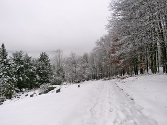
![]()
![]()
![]()
![]()
![]() On Friday, November 20th I was up at 6:30 AM and found that the trees were covered in a layer of frozen snow. The temperature was 33 degrees, and there was still a light mist falling. I decided that I would go across the street and take some pictures from Round Top. I didn't plan to hike much but just take some pictures and return home. I began to get ready as I knew that the snow would not remain on the trees with the temperature rising above freezing. Sheila seemed excited to be going anywhere and kept a watchful eye on me as I got dressed. I put on a short-sleeved baselayer and wore my Mammut pullover which is heavier than most others I own. I put on a pair of Columbia Omniheat hiking pants which have a reflective lining and are heavier than my "go to" Railriders pants. The pants have Velcro closures at the ankles, but on this day I put on gaiters to make sure the snow stayed out of my boots. I donned my Mammut hoody which has enough zippers to dump heat if needed. I put on a blaze orange light hat and light gloves. I got my Salomon B52 boots out of the basement and chose to wear only microspikes instead of snowshoes. The boots are old and no longer produced, but they fit well and seem water resistant. I grabbed a pair of Leki poles with external locks that I have been using lately. At 7:30 AM we walked out the door and up the driveway. I put Sheila on her leash, and she pulled me up the driveway knowing exactly where we were going. Sheila was happy to get out as we headed down the driveway and across the street. We crossed the street with Sheila on her leash and walked across the field to the back of the church to start the climb up the hill. We began the ascent of the steepest hill behind the church. The hill is short but really gets the circulation pumping and is the steepest and longest climb on the "trail." Sheila helped me along by pulling me up the hill through the snow. I was surprised that there were several inches of new snow on the ground and that snowshoes might have been the better choice. When we got to the top of the hill, we stopped so that I could take some pictures. I took off my pack, got out my camera and took shots in all directions. The snow on the trees was beautiful, and there was an interesting fog or layer of low clouds hanging over the valleys. The rising temperature was already beginning to cause some of the snow to fall from the trees. Despite the conditions, I decided that we would at least hike to the lookout before returning home. We started out on the trail by turning left at the trailhead and breaking trail through the fresh snow. The snow on the trees in the woods was even prettier than out in the open. I let Sheila off her leash, and she began to explore the trail with her nose sometimes burying it beneath the snow.
On Friday, November 20th I was up at 6:30 AM and found that the trees were covered in a layer of frozen snow. The temperature was 33 degrees, and there was still a light mist falling. I decided that I would go across the street and take some pictures from Round Top. I didn't plan to hike much but just take some pictures and return home. I began to get ready as I knew that the snow would not remain on the trees with the temperature rising above freezing. Sheila seemed excited to be going anywhere and kept a watchful eye on me as I got dressed. I put on a short-sleeved baselayer and wore my Mammut pullover which is heavier than most others I own. I put on a pair of Columbia Omniheat hiking pants which have a reflective lining and are heavier than my "go to" Railriders pants. The pants have Velcro closures at the ankles, but on this day I put on gaiters to make sure the snow stayed out of my boots. I donned my Mammut hoody which has enough zippers to dump heat if needed. I put on a blaze orange light hat and light gloves. I got my Salomon B52 boots out of the basement and chose to wear only microspikes instead of snowshoes. The boots are old and no longer produced, but they fit well and seem water resistant. I grabbed a pair of Leki poles with external locks that I have been using lately. At 7:30 AM we walked out the door and up the driveway. I put Sheila on her leash, and she pulled me up the driveway knowing exactly where we were going. Sheila was happy to get out as we headed down the driveway and across the street. We crossed the street with Sheila on her leash and walked across the field to the back of the church to start the climb up the hill. We began the ascent of the steepest hill behind the church. The hill is short but really gets the circulation pumping and is the steepest and longest climb on the "trail." Sheila helped me along by pulling me up the hill through the snow. I was surprised that there were several inches of new snow on the ground and that snowshoes might have been the better choice. When we got to the top of the hill, we stopped so that I could take some pictures. I took off my pack, got out my camera and took shots in all directions. The snow on the trees was beautiful, and there was an interesting fog or layer of low clouds hanging over the valleys. The rising temperature was already beginning to cause some of the snow to fall from the trees. Despite the conditions, I decided that we would at least hike to the lookout before returning home. We started out on the trail by turning left at the trailhead and breaking trail through the fresh snow. The snow on the trees in the woods was even prettier than out in the open. I let Sheila off her leash, and she began to explore the trail with her nose sometimes burying it beneath the snow.
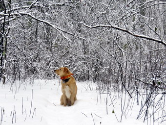 At the first trail junction, we continued straight ahead up the steep hill to the viewpoint. As we walked, we were being pelted by the snow dropping from the trees. The snow was light but wet and more annoying than anything else. The microspikes gave me good traction up the hill, but it confirmed that snowshoes would have been more useful. We followed the yellow blazes up to the viewpoint and turned left to walk out to the lower level which has a better view. I don't usually bother with the viewpoint, but I wanted some pictures of the town and the surrounding hills. I put down my pack and took out my camera to take some pictures. Getting good pictures of the school and the rest of town was difficult as the fog caused by the cold snow and warmer air filled the valley. When I was done, we walked back out the trail where I decided to turn left and walk a loop as long as we were already out. We continued on the yellow trail toward the next trail junction. Along the way, I stopped to take a few pictures of the woods. We continued up the small hill on the trail and continued straight ahead at the next trail junction to walk to the summit of Round Top. I stopped at the trail junction and took some pictures along the lower trail where the brush was covered in frozen snow. Sheila was ranging far and wide, and I had to keep calling her back. I think we have been on Round Top so many times that Sheila feels like it is home. The steep trail up to the summit was slippery, but the microspikes provided sufficient traction to take me up to the summit. We walked across the summit and started down the other side. The snow continued to fall from the trees making the walk "unfriendly." At the next trail junction, we continued straight ahead on the yellow trail down to the woods road which took us back to the first trail junction. I knew I could use some more exercise but was tired of the conditions. We turned left and walked back out to the trailhead where I put Sheila on her leash. The sky was still very overcast as we walked down the hill to the church. We walked across the field to our driveway. It was a little after 8:30 AM, and we had hiked a little over 1 mile in an hour.
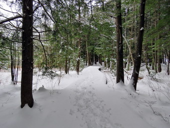
![]()
![]()
![]()
![]()
![]() On Saturday, November 17th I wanted to get out and snowshoe, but I knew the increasing temperatures would make the snow less than ideal. After some back and forth debate in my own mind, I asked Cindy if she would like to go to Frick Pond to do a loop and she agreed. It wasn't until the afternoon that we began to get ready to go. Sheila alternated between watching me get ready and running upstairs to amok sure Cindy was also coming. I put on a short-sleeved baselayer and wore my Mammut pullover which is heavier than most others I own. I put on a pair of Columbia Omniheat hiking pants which have a reflective lining and are heavier than my "go to" Railriders pants. The pants have Velcro closures at the ankles, but on this day I put on gaiters to make sure the snow stayed out of my boots. I donned my Mammut hoody which has enough zippers to dump heat if needed. I put on a blaze orange light hat and light gloves. I got my Salomon B52 boots out of the basement and chose a pair of TSL Symbioz snowshoe which I hadn't worn in some time. The boots are old and no longer produced, but they are great for use with snowshoes. The TSL snowshoes have a plastic deck which discourages clumping of snow. They have a ratcheting binding which securely holds the foot in place. I grabbed a pair of Leki poles with external locks that I have been using lately. When we arrived at the parking area, both the pull-off and the lot were plowed poorly, but it was easy enough to park. There was one car in the small lot and one in the bigger lot as we got ready to leave. I set my GPS and noticed a slight breeze which made the 40-degree temperature feel colder. We put on our snowshoes and started out on the wood road that leads to the Quick Lake Trail toward Frick Pond at 12:50 PM. The snow was wet as it was starting to melt and there were open areas of water on the trail. Some bare boot tracks were visible along with some snowshoe tracks. I knew there could easily be a mixture of hikers and hunters in the area. I had decided we would hike the loop around Frick Pond in a counterclockwise direction which is only about 2 miles. I felt this was a good compromise and would allow us to get some exercise without staying out too long in the less-than-ideal snow conditions. As we headed out on the trail, there were about 8 inches of snow in most places. The going was a little tough, but the snowshoes performed well. Sheila was ahead of us bounding through the snow, and the track she made was almost as good as another snowshoer breaking trail! Within minutes I was warm despite because of the relatively warm temperature and the work of hiking with snowshoes. When we got to the trail register, the trail along the woods road had been broken out by someone on snowshoes but also had many boot tracks which chopped up the trail. As we approached the trail junction with the yellow Loggers Loop Trail, Sheila alerted, and we looked up to see tow hunters. I put Sheila on her leash, and we stopped to talk to the hunters. They said they had seen plenty of tracks but no deer! We turned right to make the loop around the pond anticlockwise. The trail was broken out, and the walking was fairly easy as we headed out on the Loggers Loop. Sheila was still bounding along ahead of me but would occasionally take a break by following in my tracks. The skies were overcast and it almost looked like snow could be on the way! I do not often walk this loop anticlockwise and was surprised that it was a little uphill and a little longer than I thought. Soon we were walking downhill toward Times Square although it was still some work hiking through the snow. At 1:25 PM we arrived at Times Square after hiking almost exactly one mile. I was feeling great and suggested to Cindy that we either hike up the Big Rock Trail which is a long ascent or try the Logger's Loop. She declined my offer! We stuck to the plan and turned left to head around the back of Frick Pond on a trail partially broken by snowshoers. We crossed the two small bridges and entered the evergreen groves where there was quite a bit less snow on the ground. I stopped to take a few pictures under the trees and then stopped again to take some shots as we approached the longer sections of boardwalk. We continued on toward the outlet of Frick Pond and turned left on the Quick Lake Trail when the Big Rock Trail ended. We stopped at the bridge where I took a few shots of Frick Pond and Flynn's Point before heading back to the car. As we approached Gravestone Junction, we saw and heard a group of hikers at the junction. They read the sign and turned right to head out on the Logger's Loop. We noticed that they were all dressed in dark colors with no hint of blaze orange or any other bright color. None had snowshoes, and their coats looked like they would be more at home on city streets! We continued on the Quick Lake Trail which was an even bigger mess than when we had started out. We were back at 2:10 PM having hiked 2.2 miles in 1 hour and 20 minutes with only about 160 feet of elevation gain.
On Saturday, November 17th I wanted to get out and snowshoe, but I knew the increasing temperatures would make the snow less than ideal. After some back and forth debate in my own mind, I asked Cindy if she would like to go to Frick Pond to do a loop and she agreed. It wasn't until the afternoon that we began to get ready to go. Sheila alternated between watching me get ready and running upstairs to amok sure Cindy was also coming. I put on a short-sleeved baselayer and wore my Mammut pullover which is heavier than most others I own. I put on a pair of Columbia Omniheat hiking pants which have a reflective lining and are heavier than my "go to" Railriders pants. The pants have Velcro closures at the ankles, but on this day I put on gaiters to make sure the snow stayed out of my boots. I donned my Mammut hoody which has enough zippers to dump heat if needed. I put on a blaze orange light hat and light gloves. I got my Salomon B52 boots out of the basement and chose a pair of TSL Symbioz snowshoe which I hadn't worn in some time. The boots are old and no longer produced, but they are great for use with snowshoes. The TSL snowshoes have a plastic deck which discourages clumping of snow. They have a ratcheting binding which securely holds the foot in place. I grabbed a pair of Leki poles with external locks that I have been using lately. When we arrived at the parking area, both the pull-off and the lot were plowed poorly, but it was easy enough to park. There was one car in the small lot and one in the bigger lot as we got ready to leave. I set my GPS and noticed a slight breeze which made the 40-degree temperature feel colder. We put on our snowshoes and started out on the wood road that leads to the Quick Lake Trail toward Frick Pond at 12:50 PM. The snow was wet as it was starting to melt and there were open areas of water on the trail. Some bare boot tracks were visible along with some snowshoe tracks. I knew there could easily be a mixture of hikers and hunters in the area. I had decided we would hike the loop around Frick Pond in a counterclockwise direction which is only about 2 miles. I felt this was a good compromise and would allow us to get some exercise without staying out too long in the less-than-ideal snow conditions. As we headed out on the trail, there were about 8 inches of snow in most places. The going was a little tough, but the snowshoes performed well. Sheila was ahead of us bounding through the snow, and the track she made was almost as good as another snowshoer breaking trail! Within minutes I was warm despite because of the relatively warm temperature and the work of hiking with snowshoes. When we got to the trail register, the trail along the woods road had been broken out by someone on snowshoes but also had many boot tracks which chopped up the trail. As we approached the trail junction with the yellow Loggers Loop Trail, Sheila alerted, and we looked up to see tow hunters. I put Sheila on her leash, and we stopped to talk to the hunters. They said they had seen plenty of tracks but no deer! We turned right to make the loop around the pond anticlockwise. The trail was broken out, and the walking was fairly easy as we headed out on the Loggers Loop. Sheila was still bounding along ahead of me but would occasionally take a break by following in my tracks. The skies were overcast and it almost looked like snow could be on the way! I do not often walk this loop anticlockwise and was surprised that it was a little uphill and a little longer than I thought. Soon we were walking downhill toward Times Square although it was still some work hiking through the snow. At 1:25 PM we arrived at Times Square after hiking almost exactly one mile. I was feeling great and suggested to Cindy that we either hike up the Big Rock Trail which is a long ascent or try the Logger's Loop. She declined my offer! We stuck to the plan and turned left to head around the back of Frick Pond on a trail partially broken by snowshoers. We crossed the two small bridges and entered the evergreen groves where there was quite a bit less snow on the ground. I stopped to take a few pictures under the trees and then stopped again to take some shots as we approached the longer sections of boardwalk. We continued on toward the outlet of Frick Pond and turned left on the Quick Lake Trail when the Big Rock Trail ended. We stopped at the bridge where I took a few shots of Frick Pond and Flynn's Point before heading back to the car. As we approached Gravestone Junction, we saw and heard a group of hikers at the junction. They read the sign and turned right to head out on the Logger's Loop. We noticed that they were all dressed in dark colors with no hint of blaze orange or any other bright color. None had snowshoes, and their coats looked like they would be more at home on city streets! We continued on the Quick Lake Trail which was an even bigger mess than when we had started out. We were back at 2:10 PM having hiked 2.2 miles in 1 hour and 20 minutes with only about 160 feet of elevation gain.
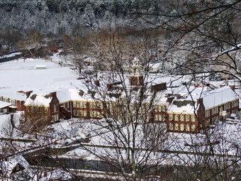
![]()
![]()
![]()
![]()
![]() On Friday, November 16th the first major snowstorm of the season hit the Catskills. When I got up, there were at least 8 inches of snow with a crusty layer on top, and more snow was still falling. I had several tasks to accomplish including shoveling snow and getting snow tires on our two ambulances. I got a text from Lisa asking if I wanted to snowshoe on Round Top which fit into my plans nicely. We agreed to meet at the Presbyterian Church, and I started to get ready at 8:40 AM forgetting how long it takes to get ready for a winter hike. Sheila seemed excited to be going anywhere and kept a watchful eye on me as I got dressed. The temperature was 30 degrees with an overcast sky. I put on a short-sleeved baselayer and wore my Mammut pullover which is heavier than most others I own. I put on a pair of Columbia Omniheat hiking pants which have a reflective lining and are heavier than my "go to" Railriders pants. The pants have Velcro closures at the ankles, but on this day I put on gaiters to make sure the snow stayed out of my boots. I donned my Mammut hoody which has enough zippers to dump heat if needed. I put on a blaze orange light hat and light gloves. I got my Salomon B52 boots out of the basement and chose a pair of TSL Symbioz snowshoe which I hadn't worn in some time. The boots are old and no longer produced, but they are great for use with snowshoes. The TSL snowshoes have a plastic deck which discourages clumping of snow. They have a ratcheting binding which securely holds the foot in place. I grabbed a pair of Leki poles with external locks that I have been using lately. At 9:00 AM we walked out the door and up the driveway. I put Sheila on her leash, and she pulled me up the driveway knowing exactly where we were going. I aimed to hike for about an hour. Sheila was happy to get out as we headed down the driveway and across the street. We crossed the street with Sheila on her leash and walked across the field to meet Lisa who was parked at the church. Sheila was straining at her leash, and when she saw Lisa, I had to let her go. Sheila enthusiastically greeted Lisa as I walked over to her car. I put Sheila back on her leash as Lisa put on her snowshoes. We began the ascent of the steepest hill behind the church. The hill is short but really gets the circulation pumping and is the steepest and longest climb on the "trail." Sheila helped me along by pulling me up the hill through the snow. When we got to the top of the hill, we stopped so that I could take some pictures. I took off my pack, got out my camera and took shots in all directions. The snow on the trees was beautiful, and the snow piled on the headstones was interesting. We started out on the trail by turning left at the trailhead and breaking trail through the fresh snow. The snow on the trees in the woods was even prettier than out in the open. I let Sheila off her leash, and she began to explore the trail with her nose sometimes burying it beneath the snow.
On Friday, November 16th the first major snowstorm of the season hit the Catskills. When I got up, there were at least 8 inches of snow with a crusty layer on top, and more snow was still falling. I had several tasks to accomplish including shoveling snow and getting snow tires on our two ambulances. I got a text from Lisa asking if I wanted to snowshoe on Round Top which fit into my plans nicely. We agreed to meet at the Presbyterian Church, and I started to get ready at 8:40 AM forgetting how long it takes to get ready for a winter hike. Sheila seemed excited to be going anywhere and kept a watchful eye on me as I got dressed. The temperature was 30 degrees with an overcast sky. I put on a short-sleeved baselayer and wore my Mammut pullover which is heavier than most others I own. I put on a pair of Columbia Omniheat hiking pants which have a reflective lining and are heavier than my "go to" Railriders pants. The pants have Velcro closures at the ankles, but on this day I put on gaiters to make sure the snow stayed out of my boots. I donned my Mammut hoody which has enough zippers to dump heat if needed. I put on a blaze orange light hat and light gloves. I got my Salomon B52 boots out of the basement and chose a pair of TSL Symbioz snowshoe which I hadn't worn in some time. The boots are old and no longer produced, but they are great for use with snowshoes. The TSL snowshoes have a plastic deck which discourages clumping of snow. They have a ratcheting binding which securely holds the foot in place. I grabbed a pair of Leki poles with external locks that I have been using lately. At 9:00 AM we walked out the door and up the driveway. I put Sheila on her leash, and she pulled me up the driveway knowing exactly where we were going. I aimed to hike for about an hour. Sheila was happy to get out as we headed down the driveway and across the street. We crossed the street with Sheila on her leash and walked across the field to meet Lisa who was parked at the church. Sheila was straining at her leash, and when she saw Lisa, I had to let her go. Sheila enthusiastically greeted Lisa as I walked over to her car. I put Sheila back on her leash as Lisa put on her snowshoes. We began the ascent of the steepest hill behind the church. The hill is short but really gets the circulation pumping and is the steepest and longest climb on the "trail." Sheila helped me along by pulling me up the hill through the snow. When we got to the top of the hill, we stopped so that I could take some pictures. I took off my pack, got out my camera and took shots in all directions. The snow on the trees was beautiful, and the snow piled on the headstones was interesting. We started out on the trail by turning left at the trailhead and breaking trail through the fresh snow. The snow on the trees in the woods was even prettier than out in the open. I let Sheila off her leash, and she began to explore the trail with her nose sometimes burying it beneath the snow.
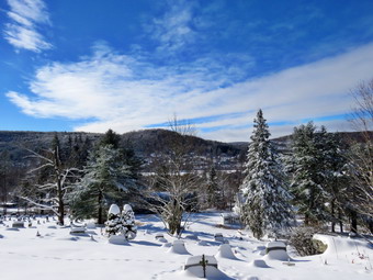 At the first trail junction, we continued straight ahead up the steep hill to the viewpoint. Even though Lisa was breaking trail, I found the going more difficult that I remembered. We followed the yellow blazes up to the viewpoint and turned left to walk out to the lower level which has a better view. I don't usually bother with the viewpoint, but I wanted some pictures of the town and the surrounding hills. I put down my pack and took out my camera to take some pictures. When I was done, we worked our way up the bank to the upper level of the lookout. Lisa decided she needed to return at this point, so Sheila and I continued on our own on the yellow trail. Breaking trail by myself was definitely a challenge. We stopped by a large rock on the left of the trail which acts as a natural bench for hikers. I took a few pictures of the rock without Sheila and then a few with her posed on the rock. I also took a few shots of the woods. We continued up a small hill on the trail and turned right at the next trail junction to walk along the base of Round Top. Sheila was ranging far and wide, and I had to keep calling her back. I think we have been on Round Top so many times that Sheila feels like it is home. At the next trail junction, we turned left and started out on the blue trail that leads over the summit of Round Top. We continued over the summit and down the other side. On the descent, I was able to pick up the tips of my snowshoes and glide. At the trail junction, we turned left and walked on the yellow trail along the base of Round Top. This part of the hike was easier as I had already walked over the trail once packing the snow. At the trail junction, we turned right and walked down the trail to the woods road and back to the first junction. We had only done one figure 8, but I was sufficiently tired to return home. We turned left and walked back out to the trailhead where I put Sheila on her leash. The sun had come out, and the snow was beginning to fall from the trees. I stopped to take a few pictures as the scene looked quite different than when we had started the hike. I put the camera away and picked up my pack to walk down the hill to the church. We walked across the field to our driveway. It was a little after 10:15 AM, and we had hiked a little over 1 mile in a little over one hour. This seemed like a short hike and a long time, but the snow definitely made a difference.
![]()
![]()
![]()
![]() On Thursday, November 15th I wanted to get out for a hike after my morning men's Bible study at the church. I went to Cafe 43 for breakfast and then returned home to do a few chores. I dropped my car at the local garage to have snow tires mounted. The forecast called for snow overnight on Thursday into Friday morning with ice coming at the end of the storm. I collected the recyclables and garbage to take them to the transfer station. When I finally returned home, I balked at the idea of hiking across the street on Round Top, but Sheila finally convinced me to go. I began getting ready at 9:30 AM and Sheila seemed excited to be going anywhere. The temperature was only 24 degrees with a breeze and some moisture in the air which made it feel even colder. I put on a long-sleeved base layer and wore my Mammut pullover which is heavier than most others I own. I put on a pair of Columbia Omniheat hiking pants which have a reflective lining and are heavier than my "go to" Railriders pants. The pants have Velcro closures at the ankles which means gaiters are not usually needed until the snow gets deeper. I donned my Mammut hoody which has enough zippers to dump heat if needed. I put on a blaze orange light hat and light gloves. I wore my new Keen Targhee II boots which are canvas and leather. They are lighter than most of my boots but are a little large. I grabbed a pair of Leki poles with external locks that I have been using lately. At 9:50 AM we walked out the door and up the driveway. I put Sheila on her leash, and she pulled me up the driveway knowing exactly where we were going. I decided we could do some loops instead of figure 8's just for the exercise and to take a look at the condition of the trails. I aimed to hike for about an hour. Sheila was happy to get out as we headed down the driveway and across the street. We crossed the street with Sheila on her leash and walked to the back of the church. We began the ascent of the steepest hill behind the church. The hill is short but gets the circulation pumping and is the steepest and longest climb on the "trail." Sheila helped me along by pulling me up the hill. When we got to the top of the hill, we started on the trail by turning left at the trailhead. I let Sheila off her leash, and she began to explore the trail with her nose. As we followed the trail, I noticed it was completely frozen and that there was some snow remaining. At the first trail junction, I followed Sheila as she continued straight ahead up the hill toward the lookout. We followed the yellow blazes up to the viewpoint and then turned right to follow the trail uphill a little toward the next trail junction. At the junction, we continued straight ahead on the blue trail up the steepest climb on the trail toward the summit of Round Top. We walked over the summit and down the other side to the next junction where we continued straight ahead on the yellow trail. At the bottom of the hill, we continued on the woods road as it turned right to take us back to the first trail junction. The walk had only taken a little more than 15 minutes.
On Thursday, November 15th I wanted to get out for a hike after my morning men's Bible study at the church. I went to Cafe 43 for breakfast and then returned home to do a few chores. I dropped my car at the local garage to have snow tires mounted. The forecast called for snow overnight on Thursday into Friday morning with ice coming at the end of the storm. I collected the recyclables and garbage to take them to the transfer station. When I finally returned home, I balked at the idea of hiking across the street on Round Top, but Sheila finally convinced me to go. I began getting ready at 9:30 AM and Sheila seemed excited to be going anywhere. The temperature was only 24 degrees with a breeze and some moisture in the air which made it feel even colder. I put on a long-sleeved base layer and wore my Mammut pullover which is heavier than most others I own. I put on a pair of Columbia Omniheat hiking pants which have a reflective lining and are heavier than my "go to" Railriders pants. The pants have Velcro closures at the ankles which means gaiters are not usually needed until the snow gets deeper. I donned my Mammut hoody which has enough zippers to dump heat if needed. I put on a blaze orange light hat and light gloves. I wore my new Keen Targhee II boots which are canvas and leather. They are lighter than most of my boots but are a little large. I grabbed a pair of Leki poles with external locks that I have been using lately. At 9:50 AM we walked out the door and up the driveway. I put Sheila on her leash, and she pulled me up the driveway knowing exactly where we were going. I decided we could do some loops instead of figure 8's just for the exercise and to take a look at the condition of the trails. I aimed to hike for about an hour. Sheila was happy to get out as we headed down the driveway and across the street. We crossed the street with Sheila on her leash and walked to the back of the church. We began the ascent of the steepest hill behind the church. The hill is short but gets the circulation pumping and is the steepest and longest climb on the "trail." Sheila helped me along by pulling me up the hill. When we got to the top of the hill, we started on the trail by turning left at the trailhead. I let Sheila off her leash, and she began to explore the trail with her nose. As we followed the trail, I noticed it was completely frozen and that there was some snow remaining. At the first trail junction, I followed Sheila as she continued straight ahead up the hill toward the lookout. We followed the yellow blazes up to the viewpoint and then turned right to follow the trail uphill a little toward the next trail junction. At the junction, we continued straight ahead on the blue trail up the steepest climb on the trail toward the summit of Round Top. We walked over the summit and down the other side to the next junction where we continued straight ahead on the yellow trail. At the bottom of the hill, we continued on the woods road as it turned right to take us back to the first trail junction. The walk had only taken a little more than 15 minutes.
I was feeling pretty fresh as we turned around and started back up the more gentle slope we had just descended. We followed the yellow blazes up the woods road to the next trail junction continuing on the blue trail over the summit of Round Top and down to the next trail junction. To complete this "big" loop, we continued on the yellow trail to the lookout. At the viewpoint, we turned left and walked downhill to the first trail junction. Since we had not yet hiked for one hour, we turned around and walked back up the steep slope to the viewpoint and followed the yellow trail up to the junction with the blue trail. This time we turned right and stayed on the yellow trail along the base of Round Top. At the next trail junction, we turned right and walked down to the woods road and back to the first trail junction to complete a "small" loop. To finish our hike we turned around to make one more small loop by walking up the woods road on the yellow trail to the next trail junction. We turned left and walked the yellow trail along the base of Round Top to the next trail junction. We turned left and followed the yellow trail downhill to the lookout. We followed the yellow trail as it turned left and took us back to the first trail junction. We had hiked for a little more than one hour so I decided we would return home. Sheila was well-behaved and stayed with me most of the time. We walked out to the trailhead where I put Sheila on her leash, and we walked down the cemetery hill. We walked across the field to our driveway. It was a little after 11:00 AM, and we had hiked a little over 2 miles in a little over one hour.
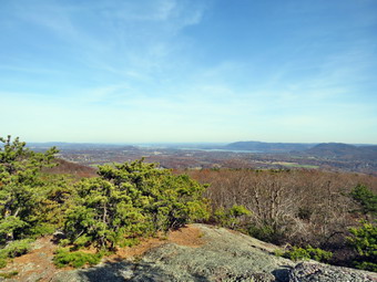
![]()
![]()
![]()
![]()
![]() On Monday, November 12th I wanted to get in a longer hike and decided to go to Schunemunk, the highest point in Orange County, to complete a loop over both ridges. The weather looked good, so I had invited my grandson Bryce along even though the hike is grueling as it passes over the rocky ridges. Bryce, although he is only seven years old, is a very able hiker, and I had no doubt he could handle the loop. I decided that I would pick Bryce up at his house and we would leave from there for the hike in Orange County. When I got up in the morning, it was 21 degrees, so I did not hurry to get ready but knew I wanted to leave a little after 8:00 AM. Sheila saw me getting ready and watched as I dressed. I put on a long-sleeved base layer and wore my Mammut pullover which is heavier than most others I own. I put on a pair of Columbia Omniheat hiking pants which have a reflective lining and are heavier than my "go to" Railriders pants. The pants have Velcro closures at the ankles which means gaiters are not usually needed until the snow gets deeper. I wore my Vasque Talus boots which are all leather and seem to be pretty waterproof. By adding a pair of Superfeet green insoles, the shoes have decent support. I donned my Mammut hoody which has enough zippers to dump heat if needed. I put on a blaze orange light hat and light gloves. I put my gear in the car with Sheila in the back seat and left Livingston Manor at about 8:15 AM. I drove to Bryce's house on Dr. Duggan Road in Bethel to pick up Bryce who was dressed and ready to go. We left the house at 9:00 AM and drove to Monticello to pick up State Route 17 south and east toward Middletown. I took exit 126 to pick up Route 94 through Chester to Washingtonville. I drove through Washingtonville and turned right on Orrs Mills Road in Salisbury Mills. After a short distance, I turned right on Clove Road and then left on Otterkill Road. When we arrived at the trailhead near the Moodna Train Trestle, I turned into the parking area on the left where there were a few cars already present. As we got ready to start our hike, we heard a strange humming noise which Bryce determined was a drone flying overhead! The temperature was in the mid 30's, but a slight breeze was blowing. Bryce was impressed by the train trestle as we walked out of the parking lot toward it with Sheila on her leash at 10:05 AM. We walked up the road and picked up the trail on the right just short of the trestle. We stayed on the white trestle trail as it climbed the 1.6 miles to the crest of the western ridge. Near the beginning of the hike we heard a train whistle, and soon four passenger cars and an engine appeared. It gave me the idea that it would be nice to ride the train over the trestle between the nearest two stops. The trail was wet and muddy in places and covered in slippery leaves. We stopped at one point, and I opened all the zippers on my hoody as the climb was making me very warm. Along the way, the trail alternates between steep areas and more level ones. In one place a short side trail leads to a viewpoint with a bench which allows the hiker to take a break. I snapped a few pictures of the countryside below and several of Bryce and Sheila on the bench. Back on the trail, we continued the climb to the junction with the red Barton Swamp Trail at 1.6 miles.
On Monday, November 12th I wanted to get in a longer hike and decided to go to Schunemunk, the highest point in Orange County, to complete a loop over both ridges. The weather looked good, so I had invited my grandson Bryce along even though the hike is grueling as it passes over the rocky ridges. Bryce, although he is only seven years old, is a very able hiker, and I had no doubt he could handle the loop. I decided that I would pick Bryce up at his house and we would leave from there for the hike in Orange County. When I got up in the morning, it was 21 degrees, so I did not hurry to get ready but knew I wanted to leave a little after 8:00 AM. Sheila saw me getting ready and watched as I dressed. I put on a long-sleeved base layer and wore my Mammut pullover which is heavier than most others I own. I put on a pair of Columbia Omniheat hiking pants which have a reflective lining and are heavier than my "go to" Railriders pants. The pants have Velcro closures at the ankles which means gaiters are not usually needed until the snow gets deeper. I wore my Vasque Talus boots which are all leather and seem to be pretty waterproof. By adding a pair of Superfeet green insoles, the shoes have decent support. I donned my Mammut hoody which has enough zippers to dump heat if needed. I put on a blaze orange light hat and light gloves. I put my gear in the car with Sheila in the back seat and left Livingston Manor at about 8:15 AM. I drove to Bryce's house on Dr. Duggan Road in Bethel to pick up Bryce who was dressed and ready to go. We left the house at 9:00 AM and drove to Monticello to pick up State Route 17 south and east toward Middletown. I took exit 126 to pick up Route 94 through Chester to Washingtonville. I drove through Washingtonville and turned right on Orrs Mills Road in Salisbury Mills. After a short distance, I turned right on Clove Road and then left on Otterkill Road. When we arrived at the trailhead near the Moodna Train Trestle, I turned into the parking area on the left where there were a few cars already present. As we got ready to start our hike, we heard a strange humming noise which Bryce determined was a drone flying overhead! The temperature was in the mid 30's, but a slight breeze was blowing. Bryce was impressed by the train trestle as we walked out of the parking lot toward it with Sheila on her leash at 10:05 AM. We walked up the road and picked up the trail on the right just short of the trestle. We stayed on the white trestle trail as it climbed the 1.6 miles to the crest of the western ridge. Near the beginning of the hike we heard a train whistle, and soon four passenger cars and an engine appeared. It gave me the idea that it would be nice to ride the train over the trestle between the nearest two stops. The trail was wet and muddy in places and covered in slippery leaves. We stopped at one point, and I opened all the zippers on my hoody as the climb was making me very warm. Along the way, the trail alternates between steep areas and more level ones. In one place a short side trail leads to a viewpoint with a bench which allows the hiker to take a break. I snapped a few pictures of the countryside below and several of Bryce and Sheila on the bench. Back on the trail, we continued the climb to the junction with the red Barton Swamp Trail at 1.6 miles.
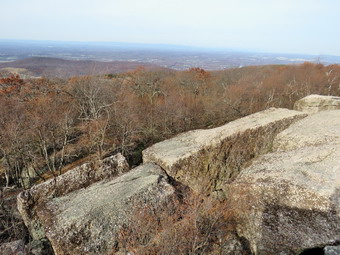 We turned left onto the red trail and enjoyed several viewpoints to the eastern ridge and the northeast before descending to the area between the ridges. The climb down was less than a quarter mile and drops only 200 feet, but the descent went slowly since there are several difficult areas. We stopped to take a few pictures of the rocky descent. We could hear the water of Baby Brook below, and it was loud. I thought it better to find out if we could cross this brook early in the hike rather than at the end. When we got to the brook, we found a tree across the brook that Bryce could use to get across and some stepping stones for me. I crossed the brook first and then took a short video of Bruce crossing on the log. We shared a bar and then walked to the next trail junction where we picked up the yellow Jessup Trail which ascends to the top of the eastern ridge. The eastern ridge is considerably higher than the western ridge, so the ascent is a long one although not quite so steep. The trail immediately began to ascend over the characteristic slabs and outcropping of conglomerates. The vegetation was predominantly scrub pine similar to the Gunks. As the trail ascends views of the western ridge and to the east become more prevalent. In .7 miles the elevation gain was over 400 feet. After this, the trail continues to ascend for some time before leveling somewhat. New views continue to appear, and on this day I stopped several times to take pictures. Along the way, we met three people and a dog who were headed toward us. We talked briefly before heading our separate ways. The trail starts to undulate and begin a series of excursions into hardwood stands slightly off the ridge before winding back to the edge of the ridge. In many places, the trail forced us to hike along narrow rock crests or slanted rock faces. These were damp in many places, and we had to be careful not to slip and fall. At 1:10 PM we were finally nearing the Megaliths after hiking 3.6 miles. I had wondered if we would ever reach this point and was beginning to questions my decision to start later in the day. At this point, there was no turning back, so we took the spur trail out toward these large blocks of rock. Descending across an open rock face that was damp was challenging. We entered the woods and quickly approached our goal. As we drew near, I watched for the vultures which often perch on these rocks but there were none. We climbed up onto the highest rock and I took some pictures of the landscape below and of the rocks themselves. We quickly returned to the trail and turned left to continue out the Jessup Trail still walking AWAY from the car. We walked the short distance to the Ridge to Ridge Trail and turned right on this blue marked trail.
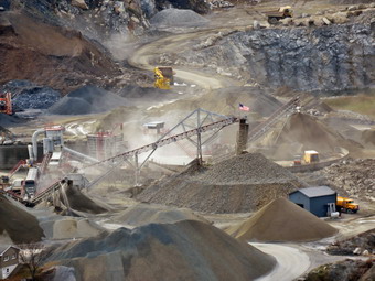 The trail continued southwest briefly before turning due north and beginning a descent into Barton Swamp between the two ridges. The descent is steep and required us to walk along narrow parts of the trail and hop over some boulders. Some of these narrow ledges were wet, and there was some ice. We stayed close to the brush and made it to the steep descent off the eastern ridge. Some parts of the descent require rather long drops over large boulders which is interesting when the rocks are dry. The dampness on the rocks and the wet leaves added a level of difficulty to this short but steep descent. Crossing the swamp was difficult as the water was high, but there were just enough old logs and high spots to allow us to get to the red Barton Swamp Trail. We turned right to briefly follow both trails through the swamp. In a short distance, the trails parted, and we followed the Ridge to Ridge Trail as it turned left and ascended to the top of the western ridge and the Western Ridge Trail. We followed the Western Ridge Trail as it ascended steeply to the top of the ridge. This ridge is lower in elevation, so we did not have to ascend as far as we had descended. The Western Ridge Trail was drier than the Jessup Trail on the Eastern Ridge, and I was familiar with it as I had been there with Cindy recently. The trail does undulate some but less so than the Jessup Trail. The trail does wander back and forth across the ridge offering alternating views to the west and toward the Eastern Ridge. We came to a nice lookout that had views of a sand and gravel operation We were walking faster now, and within 1.5 miles we arrived at the area where the Western Ridge Trail descends toward the Hil-Mar Lodge. We continued on the red Barton Swamp Trail until it met the white Trestle Trail.
Once on the Trestle Trail, we began to descend as quickly as we could reversing our steps from earlier in the day. It seemed that the trail went on forever and the cover of wet leaves slowed our progress. The trail is also rutted and eroded in places. It is covered for almost its entire length by loose rocks which roll underfoot. A layer of wet leaves on top makes the descent a difficult one since the trail is steep in many places. Soon we were finally back on the road and walking toward the car at the trailhead. We arrived back at 3:40 PM making the 7.4-mile round trip 5.5 hours with an elevation gain of 1962 feet. As we headed back home, both Bryce and I decided it would be a good idea to stop to eat at El Bandido in Middle town to eat.
The trail continued southwest briefly before turning due north and beginning a descent into Barton Swamp between the two ridges. The descent is steep and required us to walk along narrow parts of the trail and hop over some boulders. Some of these narrow ledges were wet, and there was some ice. We stayed close to the brush and made it to the steep descent off the eastern ridge. Some parts of the descent require rather long drops over large boulders which is interesting when the rocks are dry. The dampness on the rocks and the wet leaves added a level of difficulty to this short but steep descent. Crossing the swamp was difficult as the water was high, but there were just enough old logs and high spots to allow us to get to the red Barton Swamp Trail. We turned right to briefly follow both trails through the swamp. In a short distance, the trails parted, and we followed the Ridge to Ridge Trail as it turned left and ascended to the top of the western ridge and the Western Ridge Trail. We followed the Western Ridge Trail as it ascended steeply to the top of the ridge. This ridge is lower in elevation, so we did not have to ascend as far as we had descended. The Western Ridge Trail was drier than the Jessup Trail on the Eastern Ridge, and I was familiar with it as I had been there with Cindy recently. The trail does undulate some but less so than the Jessup Trail. The trail does wander back and forth across the ridge offering alternating views to the west and toward the Eastern Ridge. We came to a nice lookout that had views of a sand and gravel operation We were walking faster now, and within 1.5 miles we arrived at the area where the Western Ridge Trail descends toward the Hil-Mar Lodge. We continued on the red Barton Swamp Trail until it met the white Trestle Trail.
Once on the Trestle Trail, we began to descend as quickly as we could reversing our steps from earlier in the day. It seemed that the trail went on forever and the cover of wet leaves slowed our progress. The trail is also rutted and eroded in places. It is covered for almost its entire length by loose rocks which roll underfoot. A layer of wet leaves on top makes the descent a difficult one since the trail is steep in many places. Soon we were finally back on the road and walking toward the car at the trailhead. We arrived back at 3:40 PM making the 7.4-mile round trip 5.5 hours with an elevation gain of 1962 feet. As we headed back home, both Bryce and I decided it would be a good idea to stop to eat at El Bandido in Middle town to eat.
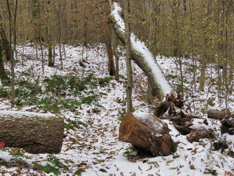
![]()
![]()
![]()
![]()
![]() On Saturday, November 10th I wanted to get out for a longer hike not too far from home. I thought about going to Balsam Lake Mountain to see how much snow was on the summit but Cindy did not want to climb a mountain. We decided we would go to Big Pond for a hike to Little Pond and back. I had several possibilities to complete this loop including staying on the trails, walking back on the roads and making a side trip to Cabot Mountain. I expected the temperature to be low in the morning and when I awoke the thermometer was 30 degrees, and the wind was blowing. By the time Cindy got up and did some things, she had to do it was 10:30 AM. The forecast was for some snow showers and lower temperatures later in the day. I started to get ready, and Sheila seemed happy that both Cindy and I were going hiking. I put on a short-sleeved baselayer and wore my Mammut pullover which is heavier than most others I own. I put on a pair of Columbia Omniheat hiking pants which have a reflective lining and are heavier than my "go to" Railriders pants. The pants have Velcro closures at the ankles which means gaiters are not usually needed until the snow gets deeper. I wore my Vasque Talus boots which are all leather and seem to be pretty waterproof. By adding a pair of Superfeet green insoles, the shoes have decent support. I donned my Mammut hoody although I thought it might be a little too light if the temperature decreased more than the forecast stated. I put on a blaze orange light hat and light gloves. We left Livingston Manor at 10:55 AM when the temperature had crept up to 34 degrees. I drove toward Roscoe on Old Route 17 and turned right on Beaverkill Road after 1.3 miles. I continued north on Beaverkill Road for 10.8 miles passing through Lew Beach. As the Beaverkill Road turned right, I turned left onto Barkaboom Road and drove .8 miles to the parking area for Big Pond on the right. There was another car parked in the lot, and two fishermen were getting ready to leave. Cindy and I got ready, and I set my GPS noticing that the temperature was 34 degrees with a wind blowing. I put Sheila on her leash, and we crossed the road at 11:15 Am to begin our hike up Touch-Me-Not Mountain on the Touch-Me-Not Trail which is part of the Finger Lakes Trail. The first part of the trail is an old woods road, and it is pretty easy to follow. I left Sheila on her leash for a while and let her pull me up the first hill passing the trail register. When I let her off her leash, she began running all over the place as we trudged up the trail. There was a good covering of snow in most places, and it felt like it might snow at any minute. One look at the clouds in the sky reinforced the possibility of some snow showers.
On Saturday, November 10th I wanted to get out for a longer hike not too far from home. I thought about going to Balsam Lake Mountain to see how much snow was on the summit but Cindy did not want to climb a mountain. We decided we would go to Big Pond for a hike to Little Pond and back. I had several possibilities to complete this loop including staying on the trails, walking back on the roads and making a side trip to Cabot Mountain. I expected the temperature to be low in the morning and when I awoke the thermometer was 30 degrees, and the wind was blowing. By the time Cindy got up and did some things, she had to do it was 10:30 AM. The forecast was for some snow showers and lower temperatures later in the day. I started to get ready, and Sheila seemed happy that both Cindy and I were going hiking. I put on a short-sleeved baselayer and wore my Mammut pullover which is heavier than most others I own. I put on a pair of Columbia Omniheat hiking pants which have a reflective lining and are heavier than my "go to" Railriders pants. The pants have Velcro closures at the ankles which means gaiters are not usually needed until the snow gets deeper. I wore my Vasque Talus boots which are all leather and seem to be pretty waterproof. By adding a pair of Superfeet green insoles, the shoes have decent support. I donned my Mammut hoody although I thought it might be a little too light if the temperature decreased more than the forecast stated. I put on a blaze orange light hat and light gloves. We left Livingston Manor at 10:55 AM when the temperature had crept up to 34 degrees. I drove toward Roscoe on Old Route 17 and turned right on Beaverkill Road after 1.3 miles. I continued north on Beaverkill Road for 10.8 miles passing through Lew Beach. As the Beaverkill Road turned right, I turned left onto Barkaboom Road and drove .8 miles to the parking area for Big Pond on the right. There was another car parked in the lot, and two fishermen were getting ready to leave. Cindy and I got ready, and I set my GPS noticing that the temperature was 34 degrees with a wind blowing. I put Sheila on her leash, and we crossed the road at 11:15 Am to begin our hike up Touch-Me-Not Mountain on the Touch-Me-Not Trail which is part of the Finger Lakes Trail. The first part of the trail is an old woods road, and it is pretty easy to follow. I left Sheila on her leash for a while and let her pull me up the first hill passing the trail register. When I let her off her leash, she began running all over the place as we trudged up the trail. There was a good covering of snow in most places, and it felt like it might snow at any minute. One look at the clouds in the sky reinforced the possibility of some snow showers.
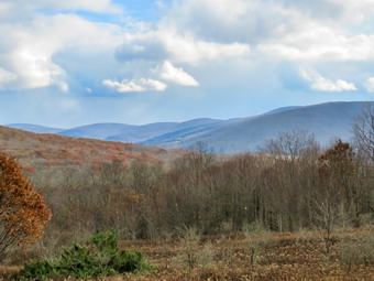 The first mile of the trail gains about 775 feet with an average grade of 15%. Some places are almost flat which means there are a few steeper places. I began to notice that the blazing of the trail could be better. This is a trail I maintain for the Finger Lakes Trail Conference from Big Pond all the way over Cabot Mountain to Beech Hill Road. Volunteers used to be able to put up trail markers, but the DEC decided that a forester must now do this. I made a note to call Stamford to tell them that they needed to have someone add markers before winter when it would be harder to find the trail. Most blazes were too far apart. Some were very old and faded with others grown into the trees. A few were on the side of the tree meaning they were not visible from either direction on the trail. Many of the turns were not properly marked. We had to stop and stare several times to find a marker and in other places simply continued in what I thought was the correct direction. Several times I just followed Sheila who seems to be able to find the right direction no matter what. In a few places, the trail travels along the side of the hill, and this made for some tricky footing. The trail started drier than I thought it would be but soon became wet and muddy. We found ourselves walking beside the trail which is not good as it simply widens the area for more erosion. There were several new blowdowns which would rehire tools to clear, but we removed a lot of branches as we walked. As we gained elevation, there was more snow which appareled as a frozen blanket on the ground. By 11:10 AM we had hike 1.1 miles to the highest point on the trail on the shoulder of Touch-Me-Not Mountain. After a slight descent, we came to a large blowdown that had blocked the trail. A good piece of the trunk had been cut away to provide an easy path. I realized that there were several other blowdowns on the trip up that were missing and assumed a DEC crew had been through since the early summer. I was puzzled as they had left two trees handing over the trail that they could have easily cut with a chainsaw! We walked down the hill to the next trail junction and turned right on the yellow loop trail around Little Pond. The loop trail is very popular with campers during the season, and I hoped it would be better marked than the trail from Big Pond. This trail was not as well marked as the other, but the trail bed was a little more obvious. By now it was snowing much harder, and the wind was blowing at 20 mph with gusts up to 30 mph. At 1.6 miles we had finally descended some interesting rock formations and had arrived at the cutoff to Cabot Mountain. I asked Cindy if she would like to climb to the summit to get the view of Little Pond from the vista. She said 'No' and I can't say I was disappointed. We continued our hike by bearing left to stay on the loop trail. At 1.8 miles we arrived in the clearing that acts as a viewpoint. It is hard to see Little Pond from this lookout since the trees have grown up. This is a place that holds many memories as we hiked the loop many times when I was younger. We stopped, and I got out the camera to take pictures of the snowy hills and the blue sky. The scene kept changing as the light played off the hills in different ways. I packed up, and we continued the hike passing the small foundation of a long-forgotten homestead cabin. We continued to walk out a woods road from the clearing now heading south passing a small pond on the right. Just after the pond, the trail became VERY wet and muddy which continued for more than half a mile.
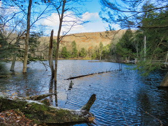 In a few hundred feet we turned left to head south to the northern shore of Little Pond. The trail continued to be wet with water in places where I had not seen any water before. We walked downhill encountering a large blowdown that blocked the trail near a large beaver pond. We bushwhacked around the tree and to avoid the flooded trail. I stopped at the shore of the beaver pond to take some pictures and then again at the dam. Both the pond and the dam were larger than I remembered! We walked a short distance to the loop trail around Little Pond. At the pond, we turned right to walk around the western shore of Little Pond. As we walked along the shore to the boat launch area, we could see snow on Touch-Me-Not Mountain that seemed to be heading our way. We stopped at the boat launch area, and I took some photos of Touch-Me-Not Mountain as the snow began to fall around me. I also took some pictures of the rest of the pond obscured by the snow. As we walked along the road, I began to see picnic tables leaning on the fireplaces at the campsites. We turned left on a trail to head for the bridge at the outlet of Little Pond. We crossed the bridge, and I dropped my pack to take a few last pictures. By now the wind had increased in intensity, so I was quick to take a few shots before moving on. I knew Cindy was not enthusiastic at the prospect of hiking back up the mountain and back down to Big Pond. I decided we would walk back to Big Pond using the access road and Barkaboom Road. We walked over to the parking area and turned right to walk out the access road. We walked out to the gatehouse and started down the hill toward Barkaboom Road. The road was closed at the second gate, and the walk was very peaceful. Just before the gate there was evince of a logging operation. We walked a little less than a mile down to Barkaboom Road and turned left to hike up the road back to Big Pond. I put Sheila on her leash for the .6 mile hike back to the car even though there was no traffic. The stream beside the road was full of water. I pointed out to Cindy an old foundation near the stream with what looked like a smaller stream running near it. I thought this might be the remnants of an old mill, so I took a few pictures. We walked up the hill and back to the car in the parking area. A new car was parked with a couple that had some questions for us. They asked about the hiking trails and said they planned to camp overnight at Big Pond. They thought they would canoe over to the campsite and stay the night. We were back at the car at the car at 1:55 PM having hiked 4.8 miles in 2 hours and 40 minutes. The elevation gain was about 1000 feet. I put Sheila in the car and stowed my gear except for the camera. I walked down to the shore of Big Pond and took a few pictures before heading back to the car and the drive home.
![]()
![]()
![]()
![]() On Friday, November 9th I wanted to get out for a hike after sleeping in to almost 10:00 AM. I had planned to get up earlier and go somewhere before the predicted rain or snow moved in for the afternoon. Unfortunately, we responded to three ambulance calls from the late evening into the early morning, and I needed the rest. By 10:30 AM the temperature had risen some and the sky was overcast, but rain did not seem imminent. I decided to go across the street and hike on Round Top to get some exercise. I put on a short-sleeved baselayer and wore my Mammut pullover which is heavier than most others I own. I put on a pair of RailRiders hiking pants which are expensive but last a long time and have features like deep pockets and a generous cut which I like. The pants have Velcro closures at the ankles which means gaiters are not usually needed. I wore my new Keen Targhee II boots which are canvas and leather. They are lighter than most of my boots but are a little large. I donned my Mammut hoody although I thought it might be a little too heavy if the temperature increased more than the forecast stated. I put on a blaze orange light hat and light gloves. As I was getting ready, I noticed that as I was getting dressed I was under the watchful eye of Sheila who is always near but not too near to be underfoot. Sheila was excited since she loves to be outside more than anything else. I grabbed a pair of Leki poles with external locks that I have been using lately. At 10:50 AM we walked out the door and up the driveway. I put Sheila on her leash, and she pulled me up the driveway knowing exactly where we were going. I decided we could do some figure 8's just for the exercise and to take a look at the condition of the trails. I aimed to do four figure 8's. Sheila was happy to get out as we headed down the driveway and across the street. We crossed the street with Sheila on her leash and walked to the back of the church. We began the ascent of the steepest hill behind the church. The hill is short but gets the circulation pumping and is the steepest and longest climb on the "trail." Sheila helped me along by pulling me up the hill. When we got to the top of the hill, we started on the trail by turning left at the trailhead. I let Sheila off her leash, and she began to explore the trail with her nose. As we followed the trail, I noticed it was muddy and wet from the recent rains. I could also see that one or two bikes had been on the trail. The trail is supposed to be used only for hiking as the use by bikes causes serious wear and tear on the trail. (1) At the first trail junction, I followed Sheila as she turned right on the more gentle ascent on an old woods road. We followed the yellow blazes as they turned left off the woods road and started up the hill to the next junction. We turned left and followed the trail along another woods road around the base of Round Top. At the next junction, we turned right on the blue trail which goes over the summit of Round Top. The trail was wet and muddy and was made slipperier by the fallen leaves. We continued up the steep trail to the summit and walked over the top and down the other side. The descent was a little tricky due to the wet and muddy conditions. At the trail junction at the base of the hill, we turned right on the yellow trail and again walked along the woods road at the base of Round Top. At the next junction, we turned left to follow the yellow trail down to the lookout. I took a glance from the viewpoint and could see that several trees partly blocked the scene. We turned left and walked down another steep but short hill to the first trail junction.
On Friday, November 9th I wanted to get out for a hike after sleeping in to almost 10:00 AM. I had planned to get up earlier and go somewhere before the predicted rain or snow moved in for the afternoon. Unfortunately, we responded to three ambulance calls from the late evening into the early morning, and I needed the rest. By 10:30 AM the temperature had risen some and the sky was overcast, but rain did not seem imminent. I decided to go across the street and hike on Round Top to get some exercise. I put on a short-sleeved baselayer and wore my Mammut pullover which is heavier than most others I own. I put on a pair of RailRiders hiking pants which are expensive but last a long time and have features like deep pockets and a generous cut which I like. The pants have Velcro closures at the ankles which means gaiters are not usually needed. I wore my new Keen Targhee II boots which are canvas and leather. They are lighter than most of my boots but are a little large. I donned my Mammut hoody although I thought it might be a little too heavy if the temperature increased more than the forecast stated. I put on a blaze orange light hat and light gloves. As I was getting ready, I noticed that as I was getting dressed I was under the watchful eye of Sheila who is always near but not too near to be underfoot. Sheila was excited since she loves to be outside more than anything else. I grabbed a pair of Leki poles with external locks that I have been using lately. At 10:50 AM we walked out the door and up the driveway. I put Sheila on her leash, and she pulled me up the driveway knowing exactly where we were going. I decided we could do some figure 8's just for the exercise and to take a look at the condition of the trails. I aimed to do four figure 8's. Sheila was happy to get out as we headed down the driveway and across the street. We crossed the street with Sheila on her leash and walked to the back of the church. We began the ascent of the steepest hill behind the church. The hill is short but gets the circulation pumping and is the steepest and longest climb on the "trail." Sheila helped me along by pulling me up the hill. When we got to the top of the hill, we started on the trail by turning left at the trailhead. I let Sheila off her leash, and she began to explore the trail with her nose. As we followed the trail, I noticed it was muddy and wet from the recent rains. I could also see that one or two bikes had been on the trail. The trail is supposed to be used only for hiking as the use by bikes causes serious wear and tear on the trail. (1) At the first trail junction, I followed Sheila as she turned right on the more gentle ascent on an old woods road. We followed the yellow blazes as they turned left off the woods road and started up the hill to the next junction. We turned left and followed the trail along another woods road around the base of Round Top. At the next junction, we turned right on the blue trail which goes over the summit of Round Top. The trail was wet and muddy and was made slipperier by the fallen leaves. We continued up the steep trail to the summit and walked over the top and down the other side. The descent was a little tricky due to the wet and muddy conditions. At the trail junction at the base of the hill, we turned right on the yellow trail and again walked along the woods road at the base of Round Top. At the next junction, we turned left to follow the yellow trail down to the lookout. I took a glance from the viewpoint and could see that several trees partly blocked the scene. We turned left and walked down another steep but short hill to the first trail junction.
(2) I was feeling pretty fresh as we turned around and started back up the steeper path to the viewpoint. I tried to set a quick pace to get some aerobic and cardio exercise into the workout. We followed the trail to the right and started the gentle climb through the woods. The trail was gorgeous and clear of branches as was most of the trail. When we reached the next trail junction, we stayed to the right to follow the lower trail around the base of Round Top to the next junction. At the next junction, we turned left and started up to the summit of Round Top on the steeper blue trail. We walked across the summit of Round Top and down the other side which is even steeper. When we got to the yellow trail, we turned left to follow it to the next trail junction. This time we turned right and followed the yellow trail back to the very first trail junction. As we came down the trail, we could both hear voices ahead, so I put Sheila on her leash. As we neared the first trail junction, I could see children and adults walking up the trail toward the viewpoint. As we approached the junction, I struck up a conversation with some of the adults. They were from New Jersey and had found the trail on Google! I gave them some information about the trail and the town walking tour. One person asked about waterfalls, so I gave them detailed directions to Russell Brook Falls. The group of four adults and eight children continued up to the viewpoint while Sheila and I turned around to start our third figure 8. (3) We retraced our steps taking the more gentle path this time. When the yellow trail turned left, we followed it to the next trail junction. Along the way, I thought about sending the group I had met to Mongaup Falls near Frick Pond. At the junction, I saw the group taking pictures of the kids posed on a rock. I described the directions to the falls and spoke to one of the adults about hiking in New Jersey. The group continued on the yellow trail while I turned around and started up the hill on the blue trail. As we headed toward the summit, a wind began to blow and white flakes began to fall! We walked over the top and down the other side to the yellow trail again. Snow continued to fall but only a few flakes at a time. We turned right and followed the trail along the base of Round Top. Where the yellow trail turned left, we followed it to the left and down to the lookout. From the lookout, we walked downhill to the first trail junction. Sheila was well-behaved and stayed with me most of the time. After finishing the third figure 8, we walked out to the trailhead. I put Sheila on her leash and we walked down the cemetery hill. I noticed that the people I met on the trail were parked on the side of the road through the cemetery. They were parked off the road allowing other cars to pass by but we are encouraging people to park in town at the municipal lot and walk to the trailhead! We walked across the field to our driveway. It was 12:35 PM and we had hiked a little over 2 miles in 1 hour and 45 minutes. It must have been a good workout as I was tired. Later in the day it began to rain, sleet and snow. There were no MVAs in our ambulance district but several around the county.
![]()
![]()
![]()
![]()
![]() On Wednesday, November 7th, I was ready to get out for a slightly longer hike that was NOT on Round Top! When I got up, the temperature was in the high 30's, and the sun was shiny with bright blue skies. This was a welcome change from the previous days which were cloudy and rainy. I ate breakfast and asked Cindy if she wanted to go for a hike. Initially, she declined but then decided it sounded like a good idea. We started to get ready at about 8:30 AM and Sheila made it clear she approved of our decision. I put on a short-sleeved base layer underneath my Mammut crew top. I put on a pair of RailRiders hiking pants which are expensive but last a long time and have features like deep pockets and a generous cut which I like. The pants have Velcro closures at the ankles which means gaiters are not usually needed. I decided to wear my new Vasque Talus boots but remembered to change the factory insoles for a pair Superfeet green to improve the support. To finish off, I put on my Mammut Ultimate hoody, a blaze orange hat and a pair of gloves. We left Livingston Manor a little after 9:00 AM. I put our gear in the trunk and an overjoyed Sheila in the back seat as we headed to Roscoe on State Route 17. I got on Route 206 and followed it across the Delaware County line to Morton Hill Road. After a left turn on Morton Hill Road, I drove to the intersection with Russell Brook Road. I turned left and drove carefully down the road toward the lower parking area. Cindy had an early afternoon appointment, and I knew this would save some time. I stopped on the road by the upper waterfall and got my camera out of my pack. I walked down the bank to the viewpoint for the upper falls. The water was flowing with a good volume but not quite as much as I expected. I took quite a few pictures with different settings. I returned to the car and drove down to park in the lower lot where one car was already parked. I set my GPS device, and we began our hike at 9:30 AM while the temperature was 45 degrees. The road was very wet and muddy in places. As we crossed the bridge and started on the trail, we passed the Japanese knotweed which was brown and hanging into the path. It looked completely dead, but I knew it would be back next spring. We turned right onto the path to the falls, and I worked my way down the bank to the streambed. The falls were roaring almost as high as during the spring flood season. I got out my camera and took quite a few shots of the falls and the stream. I walked up the bank and turned right to walk to the overlook for the lower falls. I took a few pictures and then put the camera away and headed out to the main trail. We turned right and walked to the trail register.
On Wednesday, November 7th, I was ready to get out for a slightly longer hike that was NOT on Round Top! When I got up, the temperature was in the high 30's, and the sun was shiny with bright blue skies. This was a welcome change from the previous days which were cloudy and rainy. I ate breakfast and asked Cindy if she wanted to go for a hike. Initially, she declined but then decided it sounded like a good idea. We started to get ready at about 8:30 AM and Sheila made it clear she approved of our decision. I put on a short-sleeved base layer underneath my Mammut crew top. I put on a pair of RailRiders hiking pants which are expensive but last a long time and have features like deep pockets and a generous cut which I like. The pants have Velcro closures at the ankles which means gaiters are not usually needed. I decided to wear my new Vasque Talus boots but remembered to change the factory insoles for a pair Superfeet green to improve the support. To finish off, I put on my Mammut Ultimate hoody, a blaze orange hat and a pair of gloves. We left Livingston Manor a little after 9:00 AM. I put our gear in the trunk and an overjoyed Sheila in the back seat as we headed to Roscoe on State Route 17. I got on Route 206 and followed it across the Delaware County line to Morton Hill Road. After a left turn on Morton Hill Road, I drove to the intersection with Russell Brook Road. I turned left and drove carefully down the road toward the lower parking area. Cindy had an early afternoon appointment, and I knew this would save some time. I stopped on the road by the upper waterfall and got my camera out of my pack. I walked down the bank to the viewpoint for the upper falls. The water was flowing with a good volume but not quite as much as I expected. I took quite a few pictures with different settings. I returned to the car and drove down to park in the lower lot where one car was already parked. I set my GPS device, and we began our hike at 9:30 AM while the temperature was 45 degrees. The road was very wet and muddy in places. As we crossed the bridge and started on the trail, we passed the Japanese knotweed which was brown and hanging into the path. It looked completely dead, but I knew it would be back next spring. We turned right onto the path to the falls, and I worked my way down the bank to the streambed. The falls were roaring almost as high as during the spring flood season. I got out my camera and took quite a few shots of the falls and the stream. I walked up the bank and turned right to walk to the overlook for the lower falls. I took a few pictures and then put the camera away and headed out to the main trail. We turned right and walked to the trail register.
 At the trail junction just after the register, we turned to the left to climb the steeper hill toward Mud Pond. The trail continued to be very wet and muddy, but we were able to work our way around the worst places. I had to stop at one point and open the zipper on my jacket as the temperature was rising and the effort of climbing was making me warm. There were some occasional branches on the trail which we picked up and moved off the trail. The skies remained bright and blue with few clouds and bright sun. On the ascent, we took a few breaks but it went quickly, and I was glad to see there were no major blowdowns on this part of the trail. We reached the top of the hill and walked down the wide woods road to the next trail junction at 1.6 miles. The trail continued to be wet and muddy. We made a right to follow the trail up to the shoulder of Cherry Ridge. This trail was, if possible, wetter that the sections of the trail we had covered. We continued to remove branches, but there were no major blockages. After passing through an area with many small diameter trees, we started a short descent. After that, there was an ascent which continued for the next 1.2 miles until at 2.7 miles into the hike when we were at the highest point and ready to start the descent to Trout Pond. I had found the climb tiring but fulfilling and knew the descent would be easier. As we descended toward Trout Pond, there were major blowdowns that would require an ax and saw to clear. The trail remained wet but a little less so in the descent. As we approached the bridge at the inlet end of the pond, there was a lot of water flowing down the trail and from the overflow of the stream. At the bridge, I decided to stop and take some pictures. The sun was bright, but I took some shots anyway before moving on. We continued on the main trail toward the outlet of the pond with some difficulty since there were areas of water that spanned the width of the trail. There were also deep ruts wide enough to indicate a pickup or some other kind of truck. At the lower end of the pond, we stopped so that I could take some pictures of a scene I had photographed many times! The sky was still bright blue, and there were a few white clouds. I took a few shots including one of Sheila and some of the outlet. The hike from the outlet to the trail junction is all downhill, and we were able to make pretty good time despite the wet conditions. We continued passed the trail register and crossed the bridge over Russell Brook. We walked up the hill to the parking area. We arrived back at the car by noon having covered 4.5 miles and 880 vertical feet in 2 hours and 35 minutes. The temperature was now 53 degrees!
![]() On Sunday, November 4th I led the church service at the Delhi Presbyterian Church. After services, Cindy and I went to her brother's house to eat lunch. After a delicious lunch and a nice visit, we left at 2:00 PM to return home. I had told Lisa that I would co-lead a sunset hike to Round Top on this the first day after the change back to standard time. We were to meet members of the town board and some of the people who had worked on the trails on Round Top. I was tired but at 3:30 PM I got dressed in my hiking clothes preparing to drive down to the municipal parking lot to begin the hike. All the time Sheila was looking at me expectantly, and I regretted not being able to take her with me. I grabbed my camera and drove down to the parking lot arriving at 4:00 PM. Lisa was there with four other people. Unfortunately, no one from the town board showed up for the walk. We began by walking up Pearl Street to the blinker and turning right on Rock Avenue. We turned right on Orchard Street and walked around the back of the church. We walked the middle road to the other end of the cemetery and turned left to walk to the trailhead at the highest point of the hill. At the trailhead, we turned right into the woods. It was beginning to get dark as we continued straight ahead at the first trail junction. We walked up the steep but short hill and turned left near the top to walk out to the lower lookout. The views were good except for one tree in the middle of the view which should be removed! I took some pictures of the school and the town while waiting for the sun to go down behind the hills. Once the sun disappeared, I took some pictures, but there were no brilliant colors which was disappointing. I put away my camera and walked to the upper lookout. We decided to continue our walk by finishing the lower loop. We followed the yellow blazes toward Round Top and turned right at the next trail junction. We followed the trail along the base of Round Top and turned right at the next junction. We walked downhill to the woods road and then out to the first trail junction. We turned left and walked out to the trailhead. At the trailhead, we turned right and walked down the hill to the church. From here we retraced our route back to the parking area.
On Sunday, November 4th I led the church service at the Delhi Presbyterian Church. After services, Cindy and I went to her brother's house to eat lunch. After a delicious lunch and a nice visit, we left at 2:00 PM to return home. I had told Lisa that I would co-lead a sunset hike to Round Top on this the first day after the change back to standard time. We were to meet members of the town board and some of the people who had worked on the trails on Round Top. I was tired but at 3:30 PM I got dressed in my hiking clothes preparing to drive down to the municipal parking lot to begin the hike. All the time Sheila was looking at me expectantly, and I regretted not being able to take her with me. I grabbed my camera and drove down to the parking lot arriving at 4:00 PM. Lisa was there with four other people. Unfortunately, no one from the town board showed up for the walk. We began by walking up Pearl Street to the blinker and turning right on Rock Avenue. We turned right on Orchard Street and walked around the back of the church. We walked the middle road to the other end of the cemetery and turned left to walk to the trailhead at the highest point of the hill. At the trailhead, we turned right into the woods. It was beginning to get dark as we continued straight ahead at the first trail junction. We walked up the steep but short hill and turned left near the top to walk out to the lower lookout. The views were good except for one tree in the middle of the view which should be removed! I took some pictures of the school and the town while waiting for the sun to go down behind the hills. Once the sun disappeared, I took some pictures, but there were no brilliant colors which was disappointing. I put away my camera and walked to the upper lookout. We decided to continue our walk by finishing the lower loop. We followed the yellow blazes toward Round Top and turned right at the next trail junction. We followed the trail along the base of Round Top and turned right at the next junction. We walked downhill to the woods road and then out to the first trail junction. We turned left and walked out to the trailhead. At the trailhead, we turned right and walked down the hill to the church. From here we retraced our route back to the parking area.
![]() On Friday, November 2nd I traveled with my lone cross country runner to Bear Mountain State Park for the Section 9 Cross Country Championship. The rain was falling hard in Sullivan County, but as we drove south and east on State Route 17, the rain ceased although the sky remained cloudy and overcast. We arrived at Bear Mountain for the first race at 10:30 AM, but my runner was not competing until 2:00 PM. As I watched the other races, I noticed that the leaves had some of the nicest colors I had seen this fall. I only had my iPhone, so I used it to take some pictures of the trees on Bear Mountain. There was some fog or a low cloud covering part of the mountain. I walked down to Hessian Lake and took some pictures there also. Throughout the day the sky grew darker, and I took a few more pictures. I want to return there to take some pictures on a hike if my schedule permits.
On Friday, November 2nd I traveled with my lone cross country runner to Bear Mountain State Park for the Section 9 Cross Country Championship. The rain was falling hard in Sullivan County, but as we drove south and east on State Route 17, the rain ceased although the sky remained cloudy and overcast. We arrived at Bear Mountain for the first race at 10:30 AM, but my runner was not competing until 2:00 PM. As I watched the other races, I noticed that the leaves had some of the nicest colors I had seen this fall. I only had my iPhone, so I used it to take some pictures of the trees on Bear Mountain. There was some fog or a low cloud covering part of the mountain. I walked down to Hessian Lake and took some pictures there also. Throughout the day the sky grew darker, and I took a few more pictures. I want to return there to take some pictures on a hike if my schedule permits.
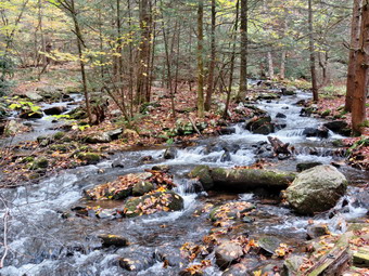
![]()
![]()
![]()
![]()
![]() On Wednesday, October 31st I wanted to hike a little farther away from home somewhere I had not been in a while. I had cross country price after school, so my time was limited. I had hiked on Monday and Tuesday to make up for the previous week when I had not been able to get out at all. Lisa texted me the night before, and we agreed to go to the Neversink Unique Area at the end of Katrina Falls Road in Rock Hill. There are several waterfalls which I knew would be roaring due to the recent rains. Lisa said she would be at my house at 8:30 AM. Cindy decided she did not want to go. At 6:30 AM the temperature was 28 degrees, and I texted Lisa suggesting we start at 9:30 AM. She agreed, and I hoped the temperature would be a little higher by the time we started to hike. As soon as Sheila found out we were going hiking, she would not leave my side. I got my clothing and gear together to prepare to leave. I decided that despite the forecast for highs in the 50's I would wear a short-sleeved base layer on top and my Mammut crew neck top which is slightly heavier than some others I own. I put on a pair of RailRiders hiking pants which are expensive but last a long time and have features like deep pockets and a generous cut which I really like. The pants have Velcro closures at the ankles which means gaiters are not usually needed. I wore my new Keen Glarus boots which are leather and, although a little heavier than some boots, fit well and provide the support I need. I wore my Mammut hoody and took a pair of light gloves and a light blaze orange hat. I got Sheila and my gear in the car. Lisa arrived at 9:30 AM and Sheila gave her a wildly joyous greeting. We left Livingston Manor and headed down State Route 17 toward Rock Hill. I took the Rock Hill exit and drove down Katrina Falls Road until I saw the Dead End sign. There was one pickup truck in the lot with a state DEC seal on the door. The temperature was 40 degrees, and there was a slight breeze. I turned on my GPS and reset it to start the hike. We set off down the woods road at 10:05 AM. The trail was covered in wet leaves which made it a little slippery but pretty in a way. At the first trail junction, we turned left to stay on the main trail. The trail straight ahead leads down to the Neversink River and was covered in pine needles. As we neared the small bridge that crosses Wolf Brook, we could hear the water rushing in the stream. We stopped to take a few pictures before continuing on the trail. We were soon headed up the small hill to the junction where the main trail splits. We turned left to make the loop in a clockwise direction since I had not used this route in some time. The trail started out flat but soon began to climb. There were many wet and muddy spots, but most could be avoided by walking on theses of the trail. Over the next .9 miles, we gained almost 400 feet. The ascent was never steep, but we maintained a good pace which elevated my heart rate and generated some body heat. There was evidence that the brush that had been overgrowing the trail had been trimmed back and several blowdowns had been cleared. At 1.6 miles we came to another trail junction. The trail to the left leads out to the Wolf Lake Multiple Use Area, so we turned right to continue on the main trail which from this point on is mostly flat or downhill. After making the turn, we were headed south and soon crossed Mullet Brook on the upper bridge. The stream had a larger than usual volume of water flowing out of the swamp. We stopped to take a few shots both upstream and downstream. I also walked downstream to a large rock where I took a few shots upstream toward the bridge. We continued on the trail, and at 1.8 miles we made another right turn heading almost due west starting a long descent toward the Neversink Gorge.
On Wednesday, October 31st I wanted to hike a little farther away from home somewhere I had not been in a while. I had cross country price after school, so my time was limited. I had hiked on Monday and Tuesday to make up for the previous week when I had not been able to get out at all. Lisa texted me the night before, and we agreed to go to the Neversink Unique Area at the end of Katrina Falls Road in Rock Hill. There are several waterfalls which I knew would be roaring due to the recent rains. Lisa said she would be at my house at 8:30 AM. Cindy decided she did not want to go. At 6:30 AM the temperature was 28 degrees, and I texted Lisa suggesting we start at 9:30 AM. She agreed, and I hoped the temperature would be a little higher by the time we started to hike. As soon as Sheila found out we were going hiking, she would not leave my side. I got my clothing and gear together to prepare to leave. I decided that despite the forecast for highs in the 50's I would wear a short-sleeved base layer on top and my Mammut crew neck top which is slightly heavier than some others I own. I put on a pair of RailRiders hiking pants which are expensive but last a long time and have features like deep pockets and a generous cut which I really like. The pants have Velcro closures at the ankles which means gaiters are not usually needed. I wore my new Keen Glarus boots which are leather and, although a little heavier than some boots, fit well and provide the support I need. I wore my Mammut hoody and took a pair of light gloves and a light blaze orange hat. I got Sheila and my gear in the car. Lisa arrived at 9:30 AM and Sheila gave her a wildly joyous greeting. We left Livingston Manor and headed down State Route 17 toward Rock Hill. I took the Rock Hill exit and drove down Katrina Falls Road until I saw the Dead End sign. There was one pickup truck in the lot with a state DEC seal on the door. The temperature was 40 degrees, and there was a slight breeze. I turned on my GPS and reset it to start the hike. We set off down the woods road at 10:05 AM. The trail was covered in wet leaves which made it a little slippery but pretty in a way. At the first trail junction, we turned left to stay on the main trail. The trail straight ahead leads down to the Neversink River and was covered in pine needles. As we neared the small bridge that crosses Wolf Brook, we could hear the water rushing in the stream. We stopped to take a few pictures before continuing on the trail. We were soon headed up the small hill to the junction where the main trail splits. We turned left to make the loop in a clockwise direction since I had not used this route in some time. The trail started out flat but soon began to climb. There were many wet and muddy spots, but most could be avoided by walking on theses of the trail. Over the next .9 miles, we gained almost 400 feet. The ascent was never steep, but we maintained a good pace which elevated my heart rate and generated some body heat. There was evidence that the brush that had been overgrowing the trail had been trimmed back and several blowdowns had been cleared. At 1.6 miles we came to another trail junction. The trail to the left leads out to the Wolf Lake Multiple Use Area, so we turned right to continue on the main trail which from this point on is mostly flat or downhill. After making the turn, we were headed south and soon crossed Mullet Brook on the upper bridge. The stream had a larger than usual volume of water flowing out of the swamp. We stopped to take a few shots both upstream and downstream. I also walked downstream to a large rock where I took a few shots upstream toward the bridge. We continued on the trail, and at 1.8 miles we made another right turn heading almost due west starting a long descent toward the Neversink Gorge.
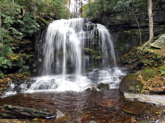 As we hiked, I was watching for the short spur trail to the right which goes down to Mullet Brook Falls. It was a little farther along than I thought it was, but at 2.25 miles we made the right turn and walked down to the falls. The falls were flowing freely, but the volume was not extraordinary. I dropped my pack and poles and took out the camera. As I worked my way toward the falls, Lisa decided to take a break. My usual route to the falls seems to have changed as some rocks were missing. I worked my way to the right and over some rocks to an area right in front of the falls. I was careful as all the rocks were wet and slippery. I took pictures of the falls and the pool below. I also took a few shots of the stream below the falls as it headed toward the Neversink. I had Sheila pose in front of the falls, and I took her picture. It was even harder working my way back to my pack, but I did so without incident. I put the camera back in the pack, and we headed back out to the main trail where we turned right. At 2.6 miles we arrived at the junction with the trail to the left that leads to High Falls. I would have liked to add the extra 4 miles round trip to our hike but my time was too limited. We turned right and almost immediately turned left on the spur trail down to Denton falls on the Neversink. The trail was clear all the way to the falls as we hiked about .3 miles losing 180 feet. As we approached the river, we were careful to watch for wet areas. The trail was very muddy, and the descent was more difficult than usual. As we started the final descent to the edge of the river, I noticed a man sitting on the rocks near the falls. He had on a yellow reflective best, and I thought he was probably the state worker that had parked his truck in the lot. I put Sheila on her leash which made descending the last few feet more difficult.
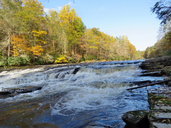 The rocks near the shore were relatively, and I dropped my pack near one of the boulders along the shore. I tried to make enough noise that the person near the falls could hear me but the water was loud. I leashed Sheila to a bush so that she would not bother anyone. I got out the camera and took some shots upstream and a few across the river. I also took some pictures of the falls. I worked my way down toward the falls passing the man sitting on the rock. I said "Hello," and he responded. I found a good viewpoint below the falls and took more pictures downstream and a lot of pictures of the falls. I returned to my pack and took a shot of Lisa and Sheila. Lisa went to talk to the man sitting on the rock. I got a bar and unleashed Sheila from the bush. After a few minutes, Lisa and the state worker approached Sheila and I. This made me a little nervous as the man got pretty close to Sheila and he was wearing a uniform and a hot. To her credit, Sheila remained quiet and well-behaved. I returned the camera to my pack and Sheila, and I started back up the hill toward the main trail. It took a few minutes, but Lisa followed us. She said that the man was a forestry tech who was recording GPS tracks for the trails. He had told her that the DEC will be creating a trail from the Westerbrookville parking area to High Falls. Currently, there are informal paths, but a marked trail would be a great addition. We continued up the trail, and at the top of the hill we turned left and headed for the lower bridge on Mullet Brook. We crossed the bridge and walked parallel to Mullet Brook and then turned right as the trail started to parallel the Neversink River. We could see the river far below as we walked downhill along the trail. The trail stayed flat for a long time and even descended a little as we passed the trail junction where we had started the loop earlier. At 4 miles we crossed the bridge over Wolf Brook. Just after that, we made the right turn to head back UP to the car. We had commented on the way down that the last half mile of the hike was all uphill. We were back at the car at 12:45 PM having hiked 4.7 miles in 2 hours and 40 minutes. We gained about 1032 feet along the way. This was certainly not the fastest I have hiked this route, but it was gratifying.
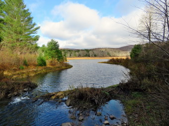
![]()
![]()
![]()
![]()
![]() On Tuesday, October 30th I decided to get out and hike somewhere close to home as I had cross country practice after school. The temperature in the morning was in the low 30's with a strong wind blowing, but I didn't want to wait too long to get started. I began to get ready a little after 9:00 AM as I had decided to go to Frick Pond and hike some loop there that I had not done in some time. As I got my gear together, Sheila seemed to be in complete agreement with my decision as she followed me around as I was dressing. Although the thermometer read right in the mid 30's, the wind made it feel much colder. I elected to put on a short-sleeved baselayer and my long-sleeved Mammut pullover. I put on a pair of RailRiders hiking pants which are expensive but last a long time and have features like deep pockets and a generous cut which I really like. The pants have Velcro closures at the ankles which means gaiters are not usually needed. I wore my new Vasque Talus boots which are leather and, although a little heavier than some boots, fit well and are as waterproof as any boot I have. I donned my Mammut hoody as it has pit zips which allow me to dump heat while still staying protected from the wind. I put on a blaze orange light hat and light gloves. I planned to hike the Quick Lake Trail to Iron Wheel Junction. From here we would hike the Logger's Loop to Times Square and then ascend the Big Rock Trail to the Flynn Trail to get back to the car. Sheila was happy to be going anywhere and crouched in the back seat with her head on the console. I drove out DeBruce Road just after 9:30 AM, and after 6 miles I turned left on Mongaup Road. Where the road splits, I stayed left on Beech Mountain Road and parked in the smaller lot at 9:55 AM. There were no other cars in the lot as I set my GPS unit to get ready for the hike. There was a light dusting of snow in the parking lot, so I took a few pictures. We started out the woods road that becomes the Quick Lake Trail at the register box. As we started to hike the temperature was only 36 degrees, and I felt a chill despite my layers because of the wind. Starting t the register the trail was very wet and muddy, and I found it hard to find a spot to walk. Even the sides of the trail were muddy and wet from people trying to avoid the mud and water on the trail. The woods road out to Frick Pond continued to be very wet, and the hiking was anything but pleasant. I stopped once or twice to take some pictures of the water on the trail and the snow in the woods. Just before Gravestone Junction, the trail was completely flooded. We stayed left at Graveyard Junction to stay on the Quick Lake Trail and found more water and mud. In fact, the trail was wetter than I had ever seen it! When we arrived at the bridge across the outlet, I decided to stop and take pictures even though I have hundreds from this location. The ground was still covered by a dusting of snow. The water level in the pond was moderately high, and the outlet stream was flowing freely. The sky was blue with some clouds, and the light on the trees and pond kept changing. I took some shots of the pond and Flynn Point as well as the bridge and downstream from the bridge.
On Tuesday, October 30th I decided to get out and hike somewhere close to home as I had cross country practice after school. The temperature in the morning was in the low 30's with a strong wind blowing, but I didn't want to wait too long to get started. I began to get ready a little after 9:00 AM as I had decided to go to Frick Pond and hike some loop there that I had not done in some time. As I got my gear together, Sheila seemed to be in complete agreement with my decision as she followed me around as I was dressing. Although the thermometer read right in the mid 30's, the wind made it feel much colder. I elected to put on a short-sleeved baselayer and my long-sleeved Mammut pullover. I put on a pair of RailRiders hiking pants which are expensive but last a long time and have features like deep pockets and a generous cut which I really like. The pants have Velcro closures at the ankles which means gaiters are not usually needed. I wore my new Vasque Talus boots which are leather and, although a little heavier than some boots, fit well and are as waterproof as any boot I have. I donned my Mammut hoody as it has pit zips which allow me to dump heat while still staying protected from the wind. I put on a blaze orange light hat and light gloves. I planned to hike the Quick Lake Trail to Iron Wheel Junction. From here we would hike the Logger's Loop to Times Square and then ascend the Big Rock Trail to the Flynn Trail to get back to the car. Sheila was happy to be going anywhere and crouched in the back seat with her head on the console. I drove out DeBruce Road just after 9:30 AM, and after 6 miles I turned left on Mongaup Road. Where the road splits, I stayed left on Beech Mountain Road and parked in the smaller lot at 9:55 AM. There were no other cars in the lot as I set my GPS unit to get ready for the hike. There was a light dusting of snow in the parking lot, so I took a few pictures. We started out the woods road that becomes the Quick Lake Trail at the register box. As we started to hike the temperature was only 36 degrees, and I felt a chill despite my layers because of the wind. Starting t the register the trail was very wet and muddy, and I found it hard to find a spot to walk. Even the sides of the trail were muddy and wet from people trying to avoid the mud and water on the trail. The woods road out to Frick Pond continued to be very wet, and the hiking was anything but pleasant. I stopped once or twice to take some pictures of the water on the trail and the snow in the woods. Just before Gravestone Junction, the trail was completely flooded. We stayed left at Graveyard Junction to stay on the Quick Lake Trail and found more water and mud. In fact, the trail was wetter than I had ever seen it! When we arrived at the bridge across the outlet, I decided to stop and take pictures even though I have hundreds from this location. The ground was still covered by a dusting of snow. The water level in the pond was moderately high, and the outlet stream was flowing freely. The sky was blue with some clouds, and the light on the trees and pond kept changing. I took some shots of the pond and Flynn Point as well as the bridge and downstream from the bridge.
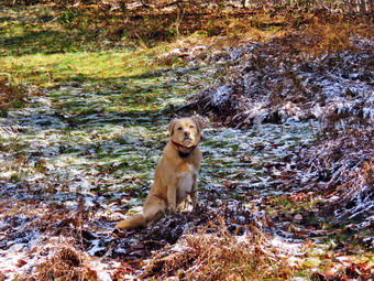 We continued on around the pond staying left at the trail junction to stay on the Quick Lake Trail. There was still plenty of water in this area which I tried to avoid. There were more branches along the trail, and I cleared as many as I could. There was also one blowdown which needed to be cleared with tools. We continued on our hike passing through the "Spruce Tunnel." The small stream through the woods was running freely and was very high. I stopped to take a few pictures and then Sheila, and I walked upstream to find an easier place to cross the stream. We encounter a few more blowdowns on the way to the next trail junction. By 10:40 AM we had walked the 1.5 miles to Iron Wheel Junction. At the trail junction, we turned right of the Loggers' Loop. The Logger's Loop is mostly downhill in this direction, and we made good time but encountered some more blowdowns along the way. This trail didn't have quite as much water but did have a little snow. Just before starting the descent to Times Square, we passed the small pond on the left side of the trail. I was surprised that the water level in the pond was much lower than I expected. This pond is seasonal but has been growing in size for several years, and I thought the recent rain would have filled it to overflowing. On the way down the hill to Times Square, there was one large blowdown that the snowmobile club will probably remove. By 11:15 AM we were at Times Square and about 2.7 miles into the hike. The area was wet as we made the left turn up the Big Rock Trail. I considered simply walking the Logger's Loop back to Gravestone Junction as I could see a blowdown I wanted to inspect. In the end, I opted to stick to the original plan and get a little more distance and difficulty by hiking up the Big Rock Trail. The Big Rock Trail gains 600 feet to the Flynn Trail over 1.1 miles. The average grade is only 10%, but the route has three different climbs and can seem long. We set a pretty fast pace on the climb, and I found that although my heart rate was elevated, I felt good. There was some snow in the woods along the trail most of the way. On the ascent, I noticed my right foot and upper leg began to hurt a little. I remembered that I had forgotten to put a pair of insoles in the shoes to provide proper support. Even the best hiking boots come with thin insoles that are totally inadequate for their intended use. There were several large blowdowns along the trail that had been cut and removed by the snowmobile club. We reached the Flynn Trail at 11:50 AM after hiking 3.9 miles, and we immediately turned right and began the descent back to the car. A light dusting of snow still covered the trail and could be seen in the woods. I stopped once or twice to take some shots of the snow. Sheila was still excited at this point and was running up the trail and back to me. She was taking a few excursions off the trail to follow animal tracks but was pretty close, so I let her explore. The trip down the Flynn Trail can seem long but this time it went quickly, and my muscles were glad I was going down! We soon passed through the tunnel that Cindy and I had made through a large spruce tree across the trail. We arrived at the gate that blocks Beech Mountain Road and turned left to stay on the Flynn Trail as it continues through the woods. This avoids the private property around the cabin. Some hikers cannot read the signs and have annoyed the property owner by trespassing! We continued down to the parking area on the trail. We were back at 12:30 PM having covered 5.6 miles in 2 hours and 35 minutes with a vertical gain of 900 feet.
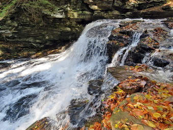 I pulled out of the parking area and drove down the Beech Mountain road to the Intersection with Mongaup Pond Road. It was still early, and I thought it might be nice to visit Mongaup Falls on the outlet stream for Mobcap Pond. I turned left and then pulled into a small parking area. I decided to take my pack but leave my poles behind. I set my GPS just to see the total distance for the hike. We walked back toward the road intersection and turned left down a path toward the stream. The path was once a road that connected Mongaup Pond Road and Terwilliger Road. We crossed the stream on a small bridge, and I noticed a sign that said "Road Closed." We turned right and followed the informal path along the stream. In several places, the path had shards of glass, and I tried to get Sheila to avoid them. I cannot understand why people have to spoil these beautiful areas for others by breaking bottles! It would be perfectly OK with me if they broke these bottles in their own backyards. We walked down the path to an area opposite the brink of the lower and higher falls. We had to cross some small streams along the way. I dropped my pack and got out the camera. I worked my way down the side of the falls which was very slippery. I took some shots from the side of the falls and then worked my way to the base of the falls. I took pictures from the stream bank with several different settings. After this, I saw a rock in the stream and decided to see if I could stand on it to take a few more photographs. Getting to the rock wasn't easy, but I was able to get some shots of the falls almost head-on. After taking all my pictures, I worked my way back up to the top of the falls and worked my way over to a view of the upper falls. Although the lower falls did not have the volume I expected, the upper falls seemed "frothier" than usual. I took pictures of the falls with different settings and then walked back to my pack. I stowed the camera, and we walked back to the car. The round trip hike was less than half a mile, but it pushed my total distance to over 6 miles!
![]()
![]()
![]()
![]() On Monday, October 29th I wanted to get out for a hike for the first time in seven days! Several days as the school nurse and many days of rain had kept me inside for longer than I liked. The rain was not forecasted, so it rained for a good part of the morning. By 11:30 AM the rain seemed to have stopped, and I got a call from my cross country runner indicating he could not practice. The skies still looked like it might rain, so I decided to go across the street and hike on Round Top. I put on a short-sleeved baselayer and wore my Mammut pullover which is heavier than most others I own. I put on a pair of RailRiders hiking pants which are expensive but last a long time and have features like deep pockets and a generous cut which I really like. The pants have Velcro closures at the ankles which means gaiters are not usually needed. I wore my new Keen Targhee II boots which are canvas and leather. They are lighter than most of my boots but are a little large. I donned my Mammut hoody although I thought it might be a little too heavy if the temperature increased more than the forecast stated. I put on a blaze orange light hat and light gloves. As I was getting ready, I noticed that as I was getting dressed I was under the watchful eye of Sheila who is always near but not too near to be considered underfoot. Sheila was excited since she loves to be outside and we had not been out for a week. I grabbed a pair of Leki poles with external locks that I have been using lately. At 12:20 PM we walked out the door and up the driveway. I put Sheila on her leash, and she pulled me up the driveway knowing exactly where we were going. I decided we could do some figure 8's just for the exercise and to take a look at the condition of the trails. I aimed to do four figure 8's. Sheila was happy to get out as we headed down the driveway and across the street. We crossed the street with Sheila on her leash and walked to the back of the church. We began the ascent of the steepest hill behind the church. The hill is short but really gets the circulation pumping and is the steepest and longest climb on the "trail." Sheila helped me along by pulling me up the hill. When we got to the top of the hill, we started out on the trail by turning left at the trailhead. I let Sheila off her leash, and she began to explore the trail with her nose.
On Monday, October 29th I wanted to get out for a hike for the first time in seven days! Several days as the school nurse and many days of rain had kept me inside for longer than I liked. The rain was not forecasted, so it rained for a good part of the morning. By 11:30 AM the rain seemed to have stopped, and I got a call from my cross country runner indicating he could not practice. The skies still looked like it might rain, so I decided to go across the street and hike on Round Top. I put on a short-sleeved baselayer and wore my Mammut pullover which is heavier than most others I own. I put on a pair of RailRiders hiking pants which are expensive but last a long time and have features like deep pockets and a generous cut which I really like. The pants have Velcro closures at the ankles which means gaiters are not usually needed. I wore my new Keen Targhee II boots which are canvas and leather. They are lighter than most of my boots but are a little large. I donned my Mammut hoody although I thought it might be a little too heavy if the temperature increased more than the forecast stated. I put on a blaze orange light hat and light gloves. As I was getting ready, I noticed that as I was getting dressed I was under the watchful eye of Sheila who is always near but not too near to be considered underfoot. Sheila was excited since she loves to be outside and we had not been out for a week. I grabbed a pair of Leki poles with external locks that I have been using lately. At 12:20 PM we walked out the door and up the driveway. I put Sheila on her leash, and she pulled me up the driveway knowing exactly where we were going. I decided we could do some figure 8's just for the exercise and to take a look at the condition of the trails. I aimed to do four figure 8's. Sheila was happy to get out as we headed down the driveway and across the street. We crossed the street with Sheila on her leash and walked to the back of the church. We began the ascent of the steepest hill behind the church. The hill is short but really gets the circulation pumping and is the steepest and longest climb on the "trail." Sheila helped me along by pulling me up the hill. When we got to the top of the hill, we started out on the trail by turning left at the trailhead. I let Sheila off her leash, and she began to explore the trail with her nose.
As we followed the trail, I noticed it was muddy and wet from the recent rains. I could also see that one or two bikes had been on the trail. The trail is supposed to be used only for hiking as the use by bikes causes serious wear and tear on the trail. (1) At the first trail junction, I followed Sheila as she turned right on the more gentle ascent on an old woods road. We followed the yellow blazes as they turned left off the woods road and started up the hill to the next junction. We turned left and followed the trail along another woods road around the base of Round Top. At the next junction, we turned right on the blue trail which goes over the summit of Round Top. The trail was wet and muddy and was made more slippery by the fallen leaves. We continued up the steep trail to the summit and walked over the top and down the other side. The descent was a little tricky due to the wet and muddy conditions. At the trail junction at the base of the hill, we turned right on the yellow trail and again walked along the woods road at the base of Round Top. At the next junction, we turned left to follow the yellow trail down to the lookout. I took a quick glance from the viewpoint and could see that the scene was partly blocked by several trees. We turned left and walked down another steep but short hill to the first trail junction. (2) I was feeling pretty fresh as we turned around and started back up the steeper path to the viewpoint. We followed the trail to the right and started the gentle climb through the woods. The trail was gorgeous and clear of branches as was most of the trail. The trail bed was lined with very green ferns and pretty clearly delineated. When we reached the next trail junction, we stayed to the right to follow the lower trail around the base of Round Top to the next junction. At the next junction, we turned left and started up to the summit of Round Top on the steeper blue trail. We walked across the summit of Round Top and down the other side which is even steeper. When we got to the yellow trail, we turned left to follow it to the next trail junction. This time we turned right and followed the yellow trail back to the very first trail junction. (3) At the first trail junction, we turned around and retraced our steps taking the more gentle path this time. When the yellow trail turned left, we followed it to the next trail junction where we turned right and headed up the blue trail to the summit. We walked over the top and down the other side to the yellow trail again. We turned right and followed the trail along the base of Round Top. Where the yellow trail turned left, we followed it to the left and down to the lookout. From the lookout we walked downhill to the first trail junction. (4) I was pretty tired at this point but my goal was to do four figure 8's so we turned around to start back up the hill. It takes us about 20 minutes to do one complete figure 8 from the first trail junction. We repeated the same figure 8's as the second with me taking time to think about various topics. Sheila was well-behaved and stayed with me most of the time. After finishing the last figure 8, we walked out to the trailhead. I put Sheila on her leash and we walked down the cemetery hill and across the field to our driveway. It was 2:05 PM and we had hiked about 3.3 miles in 1 hour and 45 minutes. It must have been a good workout as I was tired.
![]()
![]()
![]()
![]() On Monday, October 22nd I decided it was time to get out hiking after taking two days off for a cross country meet and church commitments. I had cross country practice in the afternoon, so I decided to stay local and hike at Frick and Hodge Ponds. I got up a little later than usual and finished some things around the house before getting ready to leave. The forecast was for cloudy skies with highs in the low 40's. It was only 38 degrees as I was getting ready to leave at 9:45 AM. Given the temperature, I put on a light short-sleeved baselayer and wore my Mammut pullover which is heavier than most others I own. I wore my new Vasque Talus boots which seem to be as waterproof as any I have. I donned my Mammut hoody although I thought it might be a little too heavy if the temperature increased more than the forecast stated. I grabbed a pair of Leki poles with external locks that I have been using lately. I put on a blaze orange light hat and light gloves. I got my gear ready, put Sheila in the car and left the house a little before 10:00 AM. When we arrived at the trailhead, there was one vehicle in the main lot. I thought I might start out on the Quick Lake Trail but decided to try a route that I had aborted on a previous visit. I set my electronics and at 10:15 AM we crossed the road and started out on the Flynn Trail. It was about 40 degrees but seemed cooler as there was a breeze blowing. There was no snow on the trail which was completely bare but still damp and muddy. When we got to the woods road, we turned right and followed the old Beech Mountain Road which serves as the Flynn Trail. We set a good pace as we headed for the junction with the Big Rock Trail. We walked through the "tunnel" Cindy, and I had created through the large spruce tree that was down across the trail. As I looked around, I decided that I would refrain from taking pictures unless something exciting appeared. We arrived at the junction with the Big Rock Trail at 10:55 AM and continued straight ahead through the intersection. We walked along the flat portion of the Flynn Trail and passed through the gate that marks the boundary of the state land and the land owned by Open Spaces. I again made note that my trail crew would have to do some work to move large boulders to block the gap between the gate and the trees to block the movement of snowmobiles and ATVs. At the next trail junction, we stayed left to stay on the Flynn Trail to Hodge Pond. The walk down to the pond went very quickly, and we were soon at the clearing at the southern end of the pond. One look at the pond told me that we should move on. We turned left on the Flynn Trail and started to walk clockwise around the pond.
On Monday, October 22nd I decided it was time to get out hiking after taking two days off for a cross country meet and church commitments. I had cross country practice in the afternoon, so I decided to stay local and hike at Frick and Hodge Ponds. I got up a little later than usual and finished some things around the house before getting ready to leave. The forecast was for cloudy skies with highs in the low 40's. It was only 38 degrees as I was getting ready to leave at 9:45 AM. Given the temperature, I put on a light short-sleeved baselayer and wore my Mammut pullover which is heavier than most others I own. I wore my new Vasque Talus boots which seem to be as waterproof as any I have. I donned my Mammut hoody although I thought it might be a little too heavy if the temperature increased more than the forecast stated. I grabbed a pair of Leki poles with external locks that I have been using lately. I put on a blaze orange light hat and light gloves. I got my gear ready, put Sheila in the car and left the house a little before 10:00 AM. When we arrived at the trailhead, there was one vehicle in the main lot. I thought I might start out on the Quick Lake Trail but decided to try a route that I had aborted on a previous visit. I set my electronics and at 10:15 AM we crossed the road and started out on the Flynn Trail. It was about 40 degrees but seemed cooler as there was a breeze blowing. There was no snow on the trail which was completely bare but still damp and muddy. When we got to the woods road, we turned right and followed the old Beech Mountain Road which serves as the Flynn Trail. We set a good pace as we headed for the junction with the Big Rock Trail. We walked through the "tunnel" Cindy, and I had created through the large spruce tree that was down across the trail. As I looked around, I decided that I would refrain from taking pictures unless something exciting appeared. We arrived at the junction with the Big Rock Trail at 10:55 AM and continued straight ahead through the intersection. We walked along the flat portion of the Flynn Trail and passed through the gate that marks the boundary of the state land and the land owned by Open Spaces. I again made note that my trail crew would have to do some work to move large boulders to block the gap between the gate and the trees to block the movement of snowmobiles and ATVs. At the next trail junction, we stayed left to stay on the Flynn Trail to Hodge Pond. The walk down to the pond went very quickly, and we were soon at the clearing at the southern end of the pond. One look at the pond told me that we should move on. We turned left on the Flynn Trail and started to walk clockwise around the pond.
As we walked to the clearing, I looked ahead and saw a surveyor's transit set up in the clearing. I put Sheila on her leash and continued our hike. Shortly after that, we approached a surveyor who said "Hello." We continued on the Flynn Trail along the west side of the pond and passed the surveyor's assistant who did not bother to acknowledge us. At the point where the Flynn Trial heads left, we stayed to the right on the jeep trail around the back of the pond. The hiking seemed to go very quickly as we passed a point where I could get a view of the pond. Again, it was clear that there was no reason to take any pictures. We walked up a small hill and turned left to continue up to the woods road which was once the Beech Mountain Road. At the top of this hill, we turned right and walked back to the Flynn Trail. We turned left on the Flynn Trail and walked back through the gate to the junction with the Big Rock Trail. Without stopping, we turned right on the Big Rock trail and started to descend to Times Square. Over 1.1 miles we dropped 600 feet in 25 minutes. Times Square was wet as usual as we crossed to stay on the Big Rock Trail. We followed the trail passing over two wooden bridges and under some large evergreen trees. The hike over the wooden walkways was pleasant but tricky since they were damp and covered with leaves! We continued the hike to the junction with the Quick Lake Trail. A left turn and a short walk brought us to the bridge over the outlet to Frick Pond. On the way, a few snowflakes fell, and I contemplated that it would be interesting to hike in a snow shower. After a few flakes, the snow stopped falling. There was nothing to photograph, so we continued up the hill to Graveyard Junction. At the junction, we continued straight ahead on the Quick Lake Trail back to the car. As we arrived at the parking lot, the other car was gone. It was 12:40 PM as we walked over to the car after hiking 6.0 miles in 2 hours and 25 minutes. The elevation gain was 880 feet, and the temperatures were still in the low 40's!

![]()
![]()
![]()
![]()
![]() On Friday, October 19th I wanted to get away from Livingston Manor and go to someplace I had not been for some time. Cindy wanted to pick up her sewing machine in Middletown, so we agreed to go to Schunnemunk Mountain to hike. I intend to hike from the Otterkill Road trailhead out the western ridge and back on the eastern ridge. The hike is only 6.5 miles but it has some steep climbs, and the walking along the exposed rock is difficult. We had done it several times before so I knew we would have no problem completing the hike. When I got up in the morning it as 25 degrees at 7:00 AM! I told Cindy we would wait until 9:00 AM to leave which would get us to the trailhead just after 10:00 AM when the temperature would be in the high 30's or low 40's. I began to get ready by putting on a pair of RailRiders hiking pants which are expensive but last a long time and have features like deep pockets and a generous cut which I really like. The pants have Velcro closures at the ankles which I hoped would mean I could fend off the ticks. I considered wearing a pair of Columbia pants that are insulated and have an Omniheat lining, but I thought These might be too warm. I put on a long-sleeved crew top with a short-sleeved baselayer. I wore my old Keen Glarus boots which fit well and Have been discontinued. I also put on my Mammut Hoody and a light hat and gloves. The Hoody has pit zips which allow me to dump heat when necessary. I got our gear and Sheila in the car at about 9:00 AM and got on State Route 17 and headed east toward Middletown. I got off at the Chester exit and took Route 94 toward Washingtonville. After the intersection with Route 208, I drove another 2.25 miles to Orrs Mills Road. I turned right and then drove a short distance to Clove Road and turned right. In .7 miles I turned left on Otterkill Road and started looking for the trailhead parking on the left. When I pulled into the lot at 10:10 AM, there were no other cars parked. I immediately took out my camera and photographed the Moodna Viaduct. The Moodna Trestle is visible from the parking area and is an impressive structure. It is the largest free-standing steel structure east of the Mississippi. By some rating systems, it is the biggest train trestle in the United States! After taking some shots, I set my GPS and put Sheila on her leash for the road walk to the point where the trail begins just short of the trestle. The temperature was in the low 40's, and the sky was bright blue with a few wispy clouds. When we reached the trail, we turned right and started our walk through the woods. I was surprised to find that there were several trees across the trail and that it did not seem that anyone had cared enough to clear them. Further along, there were several more of these blowdowns which did not block the trail but were difficult to get around. We followed the white blazes of the Trestle Trail as they led us up the climb. There were several wet and muddy spots, but most of the trail was dry. For .5 miles the trail is very steep averaging a 24% grade. After this, it levels out some but continues to climb. We stopped at a bench along the way which is located on a short spur trail on the right. This was a good place to rest and an excellent viewpoint. The views are expansive, and I took pictures, but they do not do justice to the scene.
On Friday, October 19th I wanted to get away from Livingston Manor and go to someplace I had not been for some time. Cindy wanted to pick up her sewing machine in Middletown, so we agreed to go to Schunnemunk Mountain to hike. I intend to hike from the Otterkill Road trailhead out the western ridge and back on the eastern ridge. The hike is only 6.5 miles but it has some steep climbs, and the walking along the exposed rock is difficult. We had done it several times before so I knew we would have no problem completing the hike. When I got up in the morning it as 25 degrees at 7:00 AM! I told Cindy we would wait until 9:00 AM to leave which would get us to the trailhead just after 10:00 AM when the temperature would be in the high 30's or low 40's. I began to get ready by putting on a pair of RailRiders hiking pants which are expensive but last a long time and have features like deep pockets and a generous cut which I really like. The pants have Velcro closures at the ankles which I hoped would mean I could fend off the ticks. I considered wearing a pair of Columbia pants that are insulated and have an Omniheat lining, but I thought These might be too warm. I put on a long-sleeved crew top with a short-sleeved baselayer. I wore my old Keen Glarus boots which fit well and Have been discontinued. I also put on my Mammut Hoody and a light hat and gloves. The Hoody has pit zips which allow me to dump heat when necessary. I got our gear and Sheila in the car at about 9:00 AM and got on State Route 17 and headed east toward Middletown. I got off at the Chester exit and took Route 94 toward Washingtonville. After the intersection with Route 208, I drove another 2.25 miles to Orrs Mills Road. I turned right and then drove a short distance to Clove Road and turned right. In .7 miles I turned left on Otterkill Road and started looking for the trailhead parking on the left. When I pulled into the lot at 10:10 AM, there were no other cars parked. I immediately took out my camera and photographed the Moodna Viaduct. The Moodna Trestle is visible from the parking area and is an impressive structure. It is the largest free-standing steel structure east of the Mississippi. By some rating systems, it is the biggest train trestle in the United States! After taking some shots, I set my GPS and put Sheila on her leash for the road walk to the point where the trail begins just short of the trestle. The temperature was in the low 40's, and the sky was bright blue with a few wispy clouds. When we reached the trail, we turned right and started our walk through the woods. I was surprised to find that there were several trees across the trail and that it did not seem that anyone had cared enough to clear them. Further along, there were several more of these blowdowns which did not block the trail but were difficult to get around. We followed the white blazes of the Trestle Trail as they led us up the climb. There were several wet and muddy spots, but most of the trail was dry. For .5 miles the trail is very steep averaging a 24% grade. After this, it levels out some but continues to climb. We stopped at a bench along the way which is located on a short spur trail on the right. This was a good place to rest and an excellent viewpoint. The views are expansive, and I took pictures, but they do not do justice to the scene.
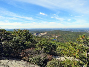 We continued to 1.7 miles where the Trestle Trail ended at the red Jessup Trail. We turned right and walked up and over some of the first open rock faces and down to the junction with the orange Western Ridge Trail which ascends from near the HilMar Lodge on Clove Road. We continued along that trail as it wound its way from one side of the ridge to the other. There were some lookouts to the left where we could see the eastern ridge. Eventually, we ascended to a high rock that gave us a nice view to the northwest. A sand and gravel operation is the major feature next to placid Lenni Lenape Lake. Beaver Dam Lake is also clearly visible from this lookout, and the Catskills can be seen far in the background. I took many pictures of all I could see before continuing on the Western Ridge Trail. We were keeping a rather slow pace, and I was concerned that we would take longer than I had anticipated finishing the hike. The trail heads back into the forest on top of the ridge where the trees vary from dwarf pines on the bare rock ridge to various hardwoods off the ridge. The geology of the ridges is interesting. As we hiked, we walked across much of the pink to red conglomerate that composes much of both ridges. The walking is interesting but difficult due to the open rock which is slippery and narrow in many places. I knew that Cindy was finding the walk difficult and might ask the question "How much longer will it be?" At any moment. At 12:30 PM after hiking for 2 hours and 15 minutes we had only traveled 2.8 miles but I knew we had only about .4 miles to go before we would head down to the area between the ridges and up to the eastern ridge. The Megaliths are one of my favorite spots, and I was looking forward to seeing them. At this point, Cindy asked the question "Are we halfway yet?" I knew this was the signal to turn around and head home. I considered explaining that turning around and continuing were about the same distance but decided against it. I was not looking forward to the trip back along the same route which we had just been on. I was also very disappointed that we would be failing to complete the hike I planned. Most of all I regretted not being able to visit the Megaliths that I had come to see. So I turned 180 degrees and began the long walk back. The trip across the relatively level ridge trail went rather quickly and by 1:00 PM we had walked the 1.1 miles back to the junction with the Jessup Trail. We quickly made our way back to the Trestle Trail and began the descent to Otterkill Road. The descent was easier than the ascent, but there were places where we had to slow down due got the loose gravel on the trail or the wet leaves. We continued on without stopping and at 2:00 PM we were back at Otterkill Road after hiking 2.8 miles. We turned left and hiked back to the car. We arrived back at the car at 2:05 PM after hiking 5.5 miles in 3 hours and 45 minutes. Our total elevation gain was 1412 feet. It had taken us 2 hours and 15 minutes to hike out and only 1 hour and 30 minutes to hike back!
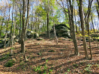
![]()
![]()
![]()
![]()
![]() On Wednesday, October 17th I wanted to get in a slightly longer hike close to home since the forecast for most of the area included showers in the early afternoon. When I got up the temperature was in the mid 30's so I decided to wait a little while to get started. Around 10:15 I decided to head to the Frick and Hodge Pond area to do some sort of hike. I thought I might hike the Flynn Trail to Hodge Pond, circle the pond and head back out the Flynn Trail. From there I would head down the Big Rock Trail to Frick Pond and back to the car on the Quick Lake Trail. I got dressed in a long-sleeved crew top with a short-sleeved base layer as the temperature in the low 40's. I put on a pair of RailRiders hiking pants which are expensive but last a long time and have features like deep pockets and a generous cut which I really like. The pants have Velcro closures at the ankles which I hoped would mean I could fend off the ticks. I put on my new Keen Targhee III boots which fit well and are lighter than all-leather boots. I also put on my Mammut Hoody and a light hat and gloves. I got my gear and Sheila in the car at about 10:30 AM and headed out the DevRuce Road to Mongaup Pond Road. I turned left and headed up toward Mongaup Pond but stayed to the left on Beech Mountain Road where the road forks. There were no cars in either lot as I parked in the smaller parking area. I set my GPS unit at the trailhead and crossed the road to start the hike at 10:45 AM. The skies had some blue, but the clouds were already gathering, and the wind was increasing in strength. On the first part of the trail through the woods, there was one large blowdown which we passed under. We turned right on the woods road which was once the extension of the Beech Mountain Road and started the 1.7 mile climb up the Flynn Trail to the junction with the Big Rock Trail. The grass was wet, and the rocks were slippery to step on with slippery mud in most places. Sheila was roaming around running up and down the rail, and I was lost in thought. We passed through the "tunnel" Cindy, and I had cut in a large hemlock tree that had fallen across the trail. A little farther along, I stopped at the point where there are some ledges on the right side of the trail. I took some pictures and then Sheila, and I walked up the bank to the ledges. Sheila posed for some pictures, and then we returned to the main trail. Along the way, at about 1 mile, I noticed that the area where a shrine had been erected had almost been reclaimed by the falling leaves. We hiked the 1.7 miles uphill in about 50 minutes. We continued on the Flynn Trail toward Hodge Pond and passed through the gate that marks the beginning of the OSI property. At the junction with the jeep trail, we turned right to walk the jeep trail toward the old Beech Mountain Boy Scout Camp. At 2.2 miles we turned left to walk down the hill toward Hodge Pond. After descending the short hill, we headed around the back of the Pond on the jeep trail. I had not intended to take pictures, but as we rounded the back of the pond, I could see the billowing clouds and decided to stop.
On Wednesday, October 17th I wanted to get in a slightly longer hike close to home since the forecast for most of the area included showers in the early afternoon. When I got up the temperature was in the mid 30's so I decided to wait a little while to get started. Around 10:15 I decided to head to the Frick and Hodge Pond area to do some sort of hike. I thought I might hike the Flynn Trail to Hodge Pond, circle the pond and head back out the Flynn Trail. From there I would head down the Big Rock Trail to Frick Pond and back to the car on the Quick Lake Trail. I got dressed in a long-sleeved crew top with a short-sleeved base layer as the temperature in the low 40's. I put on a pair of RailRiders hiking pants which are expensive but last a long time and have features like deep pockets and a generous cut which I really like. The pants have Velcro closures at the ankles which I hoped would mean I could fend off the ticks. I put on my new Keen Targhee III boots which fit well and are lighter than all-leather boots. I also put on my Mammut Hoody and a light hat and gloves. I got my gear and Sheila in the car at about 10:30 AM and headed out the DevRuce Road to Mongaup Pond Road. I turned left and headed up toward Mongaup Pond but stayed to the left on Beech Mountain Road where the road forks. There were no cars in either lot as I parked in the smaller parking area. I set my GPS unit at the trailhead and crossed the road to start the hike at 10:45 AM. The skies had some blue, but the clouds were already gathering, and the wind was increasing in strength. On the first part of the trail through the woods, there was one large blowdown which we passed under. We turned right on the woods road which was once the extension of the Beech Mountain Road and started the 1.7 mile climb up the Flynn Trail to the junction with the Big Rock Trail. The grass was wet, and the rocks were slippery to step on with slippery mud in most places. Sheila was roaming around running up and down the rail, and I was lost in thought. We passed through the "tunnel" Cindy, and I had cut in a large hemlock tree that had fallen across the trail. A little farther along, I stopped at the point where there are some ledges on the right side of the trail. I took some pictures and then Sheila, and I walked up the bank to the ledges. Sheila posed for some pictures, and then we returned to the main trail. Along the way, at about 1 mile, I noticed that the area where a shrine had been erected had almost been reclaimed by the falling leaves. We hiked the 1.7 miles uphill in about 50 minutes. We continued on the Flynn Trail toward Hodge Pond and passed through the gate that marks the beginning of the OSI property. At the junction with the jeep trail, we turned right to walk the jeep trail toward the old Beech Mountain Boy Scout Camp. At 2.2 miles we turned left to walk down the hill toward Hodge Pond. After descending the short hill, we headed around the back of the Pond on the jeep trail. I had not intended to take pictures, but as we rounded the back of the pond, I could see the billowing clouds and decided to stop.
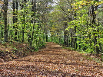 We walked down to the shore and Sheila went to the edge of the pond but did not jump into the water. Sheila seems to be able to determine the temperature of the water and does not choose to swim as the water gets colder. I took out the camera and took some shots of the pond and the towering clouds. The clouds were getting darker, and the wind was starting to blow. I decided to get moving and began to think about cutting the hike a little short to avoid the showers. Back on the main trail, we walked toward the Flynn Trail where we turned left to complete the loop around the pond. The woods road was a little drier than it had been and we emerged from the woods into the field. We continued on the Flynn Trail, and at the clearing near the outlet, we walked over toward the shore. I again stopped to take pictures of what was now a bleak scene with dark skies and only a little color in the remaining leaves. In the few minutes since we had left the upper end of the pond, the clouds had grown darker in some places, and the wind was turning the leaves over. I grabbed a bar, took a drink and then turned around to walk to the point where the Flynn Trail reentered the woods. The walk up the Flynn Trail can seem long, but I made an extra effort to hurry up the hill as the clouds gather a few drops fell. The trail was a little longer than I remembered but not as steep, and we were soon at the top of the hill. We continued straight ahead to the junction with the Big Rock Trail. We hiked passed the gate and by 12:25 PM we were back at the highest point on the hike. I had originally planned to head down the Big Rock Trail and then walk Big Rock Trail to Frick Pond to extend the distance of the hike. The skies were growing darker, and the wind was blowing so I decided to simply hike back down the Flynn Trail which would give me about 5.7 miles of hiking. Then Flynn Trail is all downhill on the way back, and I set a pretty fast pace. I did have to keep calling Sheila back as she was setting an even faster pace. As we were starting on the last part of the trail, it began to rain, and I feared it would continue in earnest. Fortunately, after a few minutes of raindrops, the shower ceased. Soon we were descending the last part of the hill to the gate. We followed the Flynn Trail through the woods and back to the car. The skies were dark, and the wind was blowing indicating to me that more rain was on the way. Surprisingly the descent had taken only a few minutes less than the ascent, and we had made no stops. We were back at the car at 1:05 PM having hiked 5.6 miles in 2 hours and 20 minutes gaining 825 feet along the way.
![]()
![]()
![]()
![]() On Tuesday, October 16th I had not been out hiking for a few days and wanted to get in a short hike before going to school to coach cross country. Lisa had called the night before, and I had tentatively promised to hike with her at 9:00 AM. When I got up, it was in the high 30's with a breeze and determined I was just too tired to hike. I let Lisa know that I wasn't up for a longer hike and would probably just go across the greet for a few loops. She accepted my decision but texted me back and offered to do some loops on Round Top with me. We agreed to meet at the church at 11:00 AM. As I started to get ready, Sheila was very interested in my every move. I got dressed in a long-sleeved crew top with a short-sleeved base layer as the temperature in the low 40's. I put on a pair of RailRiders hiking pants which are expensive but last a long time and have features like deep pockets and a generous cut which I really like. The pants have Velcro closures at the ankles which I hoped would mean I could fend off the ticks. I put on my new Vasque Talus boots which fit well and are all leather. I also put on my Mammut Hoody and a light hat and gloves. We crossed the street with Sheila on her leash and walked to the parking lot at the church to meet Lisa. Sheila could see someone was parked at the church and started to pull. At first, I thought she was going to bark, but she greeted Lisa enthusiastically as part of her "pack"! We began the ascent of the steepest hill behind the church which is short but really gets the circulation pumping. It is the steepest and longest climb on the "trail." Sheila responds well to the command "Pull," and the Siberian husky in her makes her well-suited for the job. When we got to the top of the hill, we started out on the trail by turning left at the trailhead. I let Sheila off her leash, and she bounded ahead of us. The trails were wet and muddy in spots. At the first trail junction, we followed Sheila as she turned right and continued up the less steep part of the trail. Everything was very green, but many of the leaves had fallen without showing any brilliant colors. We followed the blazes for the yellow trail up to the trail junction. As we walked, we talked about various topics. Lisa is spearheading an effort to get a walking brochure together starting at the stop light in town and including the trails. We turned left at the trail junction and followed the yellow trail along the base of Round Top. At the next trail junction, we turned right on the blue trail and headed up the steepest hill to the summit of Round Top. On the summit, we followed the trail over the top. We continued down the other side and at the yellow trail we turned right. At the next trail junction, we stayed left to head down to the lookout. At the lookout, we walked out to the upper lookout and got a view of the town and the school. Since there are still some trees blocking the upper viewpoint, we walked down to the lower viewpoint which has a much better view. From the viewpoint, we walked back out to the main trail and turned right to descend the hill to the first trail junction. The skies were bright blue, and there was some sun, but it was still cool with a breeze. This is not as demanding as some of the 3500-foot peaks I have been doing the grandson Bryce, but it is much better than sitting at home! We turned around and headed up the steep section of trail to the viewpoint and followed the yellow trail to the right on a more gentle grade. At the junction with the blue trail, we stayed to the right on the yellow. We walked along the base of Round Top to the next junction with the blue trail and turned left. We followed the blue trail up and over the summit of Round Top and down the other side. I noticed that the steeper descents were tricky due to the slippery ground. Constant, intermittent rain showers have kept the trails damp and muddy in places. At the junction with the yellow trail, we turned left and followed it to the next junction. This time we turned right and followed the yellow trail down to the woods road and back to the very first trail junction. Sheila was headed out to the trailhead, and we decided to follow her. We headed out to the trailhead. I put Sheila on her leash as we headed down the cemetery hill and out to the main road. We walked to our driveway and headed home. We had spent an hour hiking a little more than 2 miles at a good pace without stopping.
On Tuesday, October 16th I had not been out hiking for a few days and wanted to get in a short hike before going to school to coach cross country. Lisa had called the night before, and I had tentatively promised to hike with her at 9:00 AM. When I got up, it was in the high 30's with a breeze and determined I was just too tired to hike. I let Lisa know that I wasn't up for a longer hike and would probably just go across the greet for a few loops. She accepted my decision but texted me back and offered to do some loops on Round Top with me. We agreed to meet at the church at 11:00 AM. As I started to get ready, Sheila was very interested in my every move. I got dressed in a long-sleeved crew top with a short-sleeved base layer as the temperature in the low 40's. I put on a pair of RailRiders hiking pants which are expensive but last a long time and have features like deep pockets and a generous cut which I really like. The pants have Velcro closures at the ankles which I hoped would mean I could fend off the ticks. I put on my new Vasque Talus boots which fit well and are all leather. I also put on my Mammut Hoody and a light hat and gloves. We crossed the street with Sheila on her leash and walked to the parking lot at the church to meet Lisa. Sheila could see someone was parked at the church and started to pull. At first, I thought she was going to bark, but she greeted Lisa enthusiastically as part of her "pack"! We began the ascent of the steepest hill behind the church which is short but really gets the circulation pumping. It is the steepest and longest climb on the "trail." Sheila responds well to the command "Pull," and the Siberian husky in her makes her well-suited for the job. When we got to the top of the hill, we started out on the trail by turning left at the trailhead. I let Sheila off her leash, and she bounded ahead of us. The trails were wet and muddy in spots. At the first trail junction, we followed Sheila as she turned right and continued up the less steep part of the trail. Everything was very green, but many of the leaves had fallen without showing any brilliant colors. We followed the blazes for the yellow trail up to the trail junction. As we walked, we talked about various topics. Lisa is spearheading an effort to get a walking brochure together starting at the stop light in town and including the trails. We turned left at the trail junction and followed the yellow trail along the base of Round Top. At the next trail junction, we turned right on the blue trail and headed up the steepest hill to the summit of Round Top. On the summit, we followed the trail over the top. We continued down the other side and at the yellow trail we turned right. At the next trail junction, we stayed left to head down to the lookout. At the lookout, we walked out to the upper lookout and got a view of the town and the school. Since there are still some trees blocking the upper viewpoint, we walked down to the lower viewpoint which has a much better view. From the viewpoint, we walked back out to the main trail and turned right to descend the hill to the first trail junction. The skies were bright blue, and there was some sun, but it was still cool with a breeze. This is not as demanding as some of the 3500-foot peaks I have been doing the grandson Bryce, but it is much better than sitting at home! We turned around and headed up the steep section of trail to the viewpoint and followed the yellow trail to the right on a more gentle grade. At the junction with the blue trail, we stayed to the right on the yellow. We walked along the base of Round Top to the next junction with the blue trail and turned left. We followed the blue trail up and over the summit of Round Top and down the other side. I noticed that the steeper descents were tricky due to the slippery ground. Constant, intermittent rain showers have kept the trails damp and muddy in places. At the junction with the yellow trail, we turned left and followed it to the next junction. This time we turned right and followed the yellow trail down to the woods road and back to the very first trail junction. Sheila was headed out to the trailhead, and we decided to follow her. We headed out to the trailhead. I put Sheila on her leash as we headed down the cemetery hill and out to the main road. We walked to our driveway and headed home. We had spent an hour hiking a little more than 2 miles at a good pace without stopping.
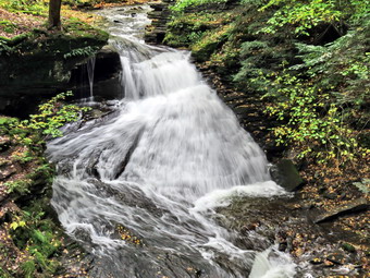
![]()
![]()
![]()
![]()
![]() On Friday, October 12th I wanted to get in a hike where there was a waterfall that might have been augmented by the recent rain. I had hiked the day before at Frick Pond where it was exceptionally wet. I asked Cindy if she wanted to go hiking in the Trout Pond area and she agreed. The forecast was calling for some morning fog and mist, so we decided to wait until 10:00 AM to leave even though I had a commitment in Liberty at 2:00 PM. We also knew that the trails in the Trout Pond area would probably be very wet due to the recent rains in the area. As I started to get ready, the temperature was only in the low 50's with a very stiff breeze. Sheila gets especially excited when both Cindy and I go on the hike, and as I got ready, she watched every move. I got dressed in a long-sleeved crew top with a short-sleeved baselayer. I put on a pair of RailRiders hiking pants which are expensive but last a long time and have features like deep pockets and a generous cut which I really like. The pants have Velcro closures at the ankles which fend off the ticks. I put my pair of Keen Glarus boots which fit even though they are getting worn. I also put on my Mammut Hoody which I knew might be too warm but would fend off the wind and is rain resistant. Cindy and I put our packs in the trunk and Sheila in the back seat and headed for Roscoe on the Quickway a little after 10:00 AM. I drove out the Rockland Flats on Route 206. Just after the Roscoe Nursing Home I turned left on Morton Hill Road and followed it for 3 miles to the intersection with Russell Brook Road. I turned into Russell Brook Road and drove down toward the parking area to the end of the road. I slowed as we passed the upper falls and started to pull over to get out and take pictures. Cindy objected, so I drove to the parking area and parked where there were no cars. We got out of the car, and I set my Garmin GPS unit and started up Russell Brook Road toward the upper falls. Cindy chose to stay at the car, but Sheila came with me. We walked very quickly uphill to the path down to the viewpoint above the falls. We turned down the path to the upper falls, and I put down my pack and got out the camera. There was less water going over the falls than I thought as I took several shots with differing settings. Once I finished the photography, I packed up, and we walked back down the road to the car. I met Cindy, and we left the parking area to continue down the road toward the stream. We crossed the bridge and found that the Japanese knotweed that I had cut down had not infringed on the trail enough to block it. We continued on the road turning right on the path to the falls walking between the tall grass and the knotweed. We walked over to the path down the bank to the streambed and carefully descended to the brook. The falls were flowing with a good volume but not as much as I had anticipated. The sun had finally broken through enough to give some light, but the skies to the west were still dark. I got out my camera and took some pictures of the falls and then some of the stream. I took a few more pictures of the falls and a few of Sheila sitting in front of it. I put the camera away and walked back up the stream bank out to the main trail.
On Friday, October 12th I wanted to get in a hike where there was a waterfall that might have been augmented by the recent rain. I had hiked the day before at Frick Pond where it was exceptionally wet. I asked Cindy if she wanted to go hiking in the Trout Pond area and she agreed. The forecast was calling for some morning fog and mist, so we decided to wait until 10:00 AM to leave even though I had a commitment in Liberty at 2:00 PM. We also knew that the trails in the Trout Pond area would probably be very wet due to the recent rains in the area. As I started to get ready, the temperature was only in the low 50's with a very stiff breeze. Sheila gets especially excited when both Cindy and I go on the hike, and as I got ready, she watched every move. I got dressed in a long-sleeved crew top with a short-sleeved baselayer. I put on a pair of RailRiders hiking pants which are expensive but last a long time and have features like deep pockets and a generous cut which I really like. The pants have Velcro closures at the ankles which fend off the ticks. I put my pair of Keen Glarus boots which fit even though they are getting worn. I also put on my Mammut Hoody which I knew might be too warm but would fend off the wind and is rain resistant. Cindy and I put our packs in the trunk and Sheila in the back seat and headed for Roscoe on the Quickway a little after 10:00 AM. I drove out the Rockland Flats on Route 206. Just after the Roscoe Nursing Home I turned left on Morton Hill Road and followed it for 3 miles to the intersection with Russell Brook Road. I turned into Russell Brook Road and drove down toward the parking area to the end of the road. I slowed as we passed the upper falls and started to pull over to get out and take pictures. Cindy objected, so I drove to the parking area and parked where there were no cars. We got out of the car, and I set my Garmin GPS unit and started up Russell Brook Road toward the upper falls. Cindy chose to stay at the car, but Sheila came with me. We walked very quickly uphill to the path down to the viewpoint above the falls. We turned down the path to the upper falls, and I put down my pack and got out the camera. There was less water going over the falls than I thought as I took several shots with differing settings. Once I finished the photography, I packed up, and we walked back down the road to the car. I met Cindy, and we left the parking area to continue down the road toward the stream. We crossed the bridge and found that the Japanese knotweed that I had cut down had not infringed on the trail enough to block it. We continued on the road turning right on the path to the falls walking between the tall grass and the knotweed. We walked over to the path down the bank to the streambed and carefully descended to the brook. The falls were flowing with a good volume but not as much as I had anticipated. The sun had finally broken through enough to give some light, but the skies to the west were still dark. I got out my camera and took some pictures of the falls and then some of the stream. I took a few more pictures of the falls and a few of Sheila sitting in front of it. I put the camera away and walked back up the stream bank out to the main trail.
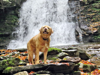 At the trail junction just after the register, we continued straight ahead to walk up to Trout Pond. The trail was wet and muddy in most places. Some small stream ran down the trail and others crossed it. When we arrived at the pond, we turned left and walked out to the "beach" at the outlet end of the pond. The level of the pond was high enough for water to be flowing over the spillway. The skies were blue toward the north with white clouds, so I knew I had to take some pictures. I took some panoramic pictures and then zoomed in on different parts of the scene. Sheila loves the water but chose not to jump into the pond. I believe she sensed it was too cold for a swim! I walked over to the spillway and took a few pictures. Sheila decided she would go into overdrive and began running around at breakneck speed. After getting a drink and a snack, we packed up and headed back to the main trail. We continued on the main trail on the east side of Trout Pond walking toward the inlet end and the lean-tos. The trail was not as wet as I had expected with most of the water confined to the ruts on either side of a "hump" in the middle. No one was camping at the large campsite on the right side of the rail before the lean-tos or at the lean-tos themselves. As we crossed the bridge at the inlet end of the pond, I noticed that the inlet stream was not very high. I stopped to take some pictures of the pond from the bridge and then continued on the trail. At this point, the trail turns right and starts up a hill which is the shoulder of Cherry Ridge. At the turn, the trail was almost dry, and we easily walked up the hill. In a few places, we had to walk on the sides of the trail to stay out of the water or mud on the trail. Walking was difficult as all the rocks were wet and everything was slippery. After we had walked for some time, I noticed a few large trees that had been cut with a chainsaw. I then remembered that there were places on the trail which previously had large blowdowns that were no longer present! I assumed a DEC crew had been sent through to clear the trail. Of course, since the crew had done there work there had been more storms, and there were several smaller blowdowns across the trail. Soon we were at the highest point on Cherry Ridge and starting down the other side.
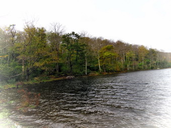 I anticipated that the trail would have quite a bit of water, but there was much less than I expected. There were areas where the trail was simply a stream that overflowed on either side making it difficult to find a dry place to walk but much of the trail was almost dry. In other places, there was standing water with pools over a foot deep. As we walked the trail, Sheila alerted, and we saw a man walking toward us. As he approached, I saw he was wearing wading boots used for fishing and carrying a fly fishing pole. We greeted each other as we passed. I thought afterward that I should have taken a picture of a man carrying a fishing pole on a trail that looked like a stream! We continued on the trail picking our way around the wet areas which wasn't always easy. Soon we were at the woods road and snowmobile trail that runs by Mud Pond. I had considered walking down to Mud Pond, but the walk on the wet trail was tiring. We turned left and started the short walk uphill. This part of the trail was also wet, but we found places to walk including places on the trail that were wet but with only a shallow covering of water. At the top of the hill, we began the long descent back to the trail junction where we had started. The descent lasts for .7 miles and drops 385 feet to a bridge that crosses the outlet stream from Trout Pond. This part of the trail was just as wet as the other sections. The water was spread across the trail in a shallow covering making for wet and muddy conditions. As we descended, we came to a spot where a small stream crosses. The stream is usually just a trickle and easy to cross but this time it was a small torrent. We decided just to cross even if it meant getting our feet a little wet. I was able to find one dry stepping stone and place my foot on another one with only a few inches of water. We continued down the hill on the main trail carefully picking our way. We crossed another small stream and walked toward the campsite at the bottom of the hill on the left side of the trail. We continued on the trail crossing the bridge over a stream and walking back out to the trail register. We turned right and headed back toward the lower parking area on the main trail. We walked up the short path to the lower parking area. We arrived back at the car at 1:05 PM after hiking 4.7 miles in 2 hours and 35 minutes with a 915-foot total ascent. The temperature on the car thermometer was 55 degrees, and the wind was still blowing.
![]()
![]()
![]()
![]()
![]() On Wednesday, October 10th I wanted to get in a longer hike close to home and chose to go to the Rick Pond area to hike a loop to Frick and Hodge Ponds using the Quick Lake and Flynn Trails. The temperature was in the high 60's at 9:30 AM as I got ready to depart. I got dressed in a long-sleeved light crew top with a short-sleeved baselayer. I put on a pair of RailRiders hiking pants which are expensive but last a long time and have features like deep pockets and a generous cut which I really like. The pants have Velcro closures at the ankles which I hoped would mean I could fend off the ticks. I got my gear ready and put it and Sheila in the car and headed out the DeBruce Road. Sheila had been very quiet but did not let me out of her sight as I was getting ready. After 6 miles, at Mongaup Pond Road, I turned left and continued to follow the road bearing left onto Beech Mountain Road at the fork. When we arrived in the parking area, there were no other cars in both lots. I parked in the larger lot as I planned to start at the beginning of the Quick Lake Trail. At 10:10 AM s we started out on the Quick Lake Trail from the back right corner of the parking area. I noticed that there was a carpet of leaves in the parking lot and on the trail. The leaves were partly green and partly yellow, but there were not many bright colors in the leaves still on the trees. We turned left at the register onto the woods road that leads to Frick Pond. Immediately it was clear that the hike would be a wet and muddy one! The woods road is often wet, but on this day it was a mass of standing water and deep mud. We walked along the sides of the trail avoiding most of the mud. At Gravestone Junction, we stayed to the left and walked through a muddy section of trail down to the bridge at the outlet of Frick Pond. There was some sunlight shining from a blue sky with white clouds. The colors of the leaves were not as bright as I had hoped and many had fallen. There was enough color to make pictures interesting, so I dropped my pack and got out the camera. I took pictures of Frick Pond as I have so many times before. I also photographed Flynn's Point and Sheila as she posed on the bridge. After a short pause, I packed up, and we continued our hike. We walked along the west side of the pond where the trail continued to be muddy. At the junction with the Big Rock Trail, we turned left to stay on the Quick Lake Trail. Immediately we ran into a few blowdowns across the trail, and I made a note to return later with tools to clear them before snowfall. The trail was wet until we entered the "spruce tunnel" where there was more mud. The small stream through the woods was flowing freely with a greater volume than I had seen this year. Sheila ran and jumped the stream with ease and then turned around to try it again and again. I took out my camera a too a few shots of the stream and the small "waterfall" that had formed upstream. I walked upstream and crossed to continue on the Quick Lake Trail to Iron Wheel Junction. This part of the trail was also wet and muddy with a few branches which needed to be removed.
On Wednesday, October 10th I wanted to get in a longer hike close to home and chose to go to the Rick Pond area to hike a loop to Frick and Hodge Ponds using the Quick Lake and Flynn Trails. The temperature was in the high 60's at 9:30 AM as I got ready to depart. I got dressed in a long-sleeved light crew top with a short-sleeved baselayer. I put on a pair of RailRiders hiking pants which are expensive but last a long time and have features like deep pockets and a generous cut which I really like. The pants have Velcro closures at the ankles which I hoped would mean I could fend off the ticks. I got my gear ready and put it and Sheila in the car and headed out the DeBruce Road. Sheila had been very quiet but did not let me out of her sight as I was getting ready. After 6 miles, at Mongaup Pond Road, I turned left and continued to follow the road bearing left onto Beech Mountain Road at the fork. When we arrived in the parking area, there were no other cars in both lots. I parked in the larger lot as I planned to start at the beginning of the Quick Lake Trail. At 10:10 AM s we started out on the Quick Lake Trail from the back right corner of the parking area. I noticed that there was a carpet of leaves in the parking lot and on the trail. The leaves were partly green and partly yellow, but there were not many bright colors in the leaves still on the trees. We turned left at the register onto the woods road that leads to Frick Pond. Immediately it was clear that the hike would be a wet and muddy one! The woods road is often wet, but on this day it was a mass of standing water and deep mud. We walked along the sides of the trail avoiding most of the mud. At Gravestone Junction, we stayed to the left and walked through a muddy section of trail down to the bridge at the outlet of Frick Pond. There was some sunlight shining from a blue sky with white clouds. The colors of the leaves were not as bright as I had hoped and many had fallen. There was enough color to make pictures interesting, so I dropped my pack and got out the camera. I took pictures of Frick Pond as I have so many times before. I also photographed Flynn's Point and Sheila as she posed on the bridge. After a short pause, I packed up, and we continued our hike. We walked along the west side of the pond where the trail continued to be muddy. At the junction with the Big Rock Trail, we turned left to stay on the Quick Lake Trail. Immediately we ran into a few blowdowns across the trail, and I made a note to return later with tools to clear them before snowfall. The trail was wet until we entered the "spruce tunnel" where there was more mud. The small stream through the woods was flowing freely with a greater volume than I had seen this year. Sheila ran and jumped the stream with ease and then turned around to try it again and again. I took out my camera a too a few shots of the stream and the small "waterfall" that had formed upstream. I walked upstream and crossed to continue on the Quick Lake Trail to Iron Wheel Junction. This part of the trail was also wet and muddy with a few branches which needed to be removed.
 At the junction, we turned left to stay on the Quick Lake Trail. As we walked along, I noticed that this part of the trail was slippery and wet, but there was less mud, and the walking was easier. It is 1.6 miles from Iron Wheel Junction to Junkyard Junction with an elevation gain of almost 500 feet. This walk often seems long, but I must have been lost in my thoughts as it seemed to go very quickly. As the trail flattened near Junkyard Junction, there were more muddy places and some standing water. We turned right onto the Flynn Trail at the junction and started toward Hodge Pond. The Flynn Trail from Junkyard Junction to Hodge Pond is .85 miles and drops 165 feet to the shores of the pond. The first part of the trail is flat and had several spots where there was standing water and mud. After passing through the gate that marks the boundary with the OSI property, we walked down the hill toward the pond and turned right to stay on the Flynn Trail. This part of the trail is, again, flat and is situated along a woods road that OSI cleared of all vegetation. The trail was muddy in spots until we left the trees and entered a field. The trees here were particularly bright, so I took a few pictures before continuing on the trail to the clearing at the south end of Hodge Pond. As we approached, I heard voices and put Sheila on her leash. When we emerged from the trees, a large black Labrador retriever approached us. The dog was not on a leash and would not listen to its owner. The dog had a disagreement with Sheila, but the owner eventually took hold of his collar and walked away with a "Sorry." I led Sheila over to the shores of the pond where I put down my pack and told her to stay. The skies had grown darker, and the leaf colors were less pronounced than at Frick Pond. I took some pictures and then threw a stick for Sheila to retrieve. After a short time, I ate a bar, took some water and packed up to continue on the Flynn Trail.
 We walked back to the Flynn Trail to the point where it re-entered the woods and began the walk up the hill. The .4 mile walk can seem much longer, but on this day this section went quickly. At the top of the hill, we stayed to the right to follow the Flynn Trail. A left turn follows a woods road out to what remains of the Beech Mountain Boy Scout Camp. The Flynn Trail is relatively flat to the junction with the Big Rock Trail at 4.7 miles. The trail was slippery with a layer of mud. We passed through the gate marking the border with the OSI property and soon after arrived at the junction with the Big Rock Trail. We continued on the Flynn Trail whose condition remained much the same with a slippery layer of mud. As we walked along, Sheila alerted, and I saw a shadowy, dark figure ahead on the trail. I immediately put Sheila on her leash thinking that it might be a bear. After looking carefully ahead, I saw that the "bear" was actually two forest rangers walking toward us. We stopped to talk, and I found that the Rangers were just out for a hike. We discussed the trails in the area, and one ranger introduced himself as Eric Stratton. He and Kelly Baker are two rangers who are relatively new to the area, and I was glad to meet him. After a few minutes, we went our separate ways, and I released Sheila from her leash although she stayed close to me. We passed by the path to the clearing on the left and continued down the hill. Once again Sheila alerted, and I looked up to see a group of figures ahead on the trail all dressed in what appeared to be white rain jackets. My first thought was that it was a group out on a hike perhaps sponsored by Morgan Outdoors. I put Sheila on her leash, and as we approached, I could hear signing and see that the figures were women dressed in white tunics and grey headdresses. There was about a dozen standing across the entire trail! I decided rather than disturbing them I would walk around them and we stayed to the left as we passed by. I assumed these sisters were from Our Lady of Lourdes Convent and I knew they had taken a vow of silence. I did wonder why they found it necessary to block the trail. We continued on down the trail, and I soon saw a pickup truck on the trail! The Rangers had decided to drive through the gate and a few hundred feet up the trail. I wondered why they found it necessary to do this as it left ruts on the trail. Just before the gate we turned left to follow the Flynn Trail and to avoid the private property around the cabin. On the final part of the Flynn Trail through the woods, I noticed an interesting white fungus on a tree. I took some shots of it before passing on toward the car. When we arrived back at the parking lot, there were only two other cars present. We were back at the car by 1:10 PM having covered 6.5 miles in 3 hours with an elevation gain of 910 feet.
![]()
![]()
![]()
![]() On Monday, October 8th I had not been out hiking for a few days and wanted to get in a short hike before the rain arrived as predicted in the forecast. My Son-in-law Brad was visiting and agreed to go with me. We decided to go out in the late morning after the fog had burned off and before the showers came. The skies were cloudy, but there was no rain, so we decided to head across the street to Round Top at 12:00 PM. We knew that if it did start to rain, we could make it back home quickly. As I started to get ready, Sheila was very interested in my every move. I got dressed in a long-sleeved crew top with no baselayer as the temperature in the mid 60's. I put on a pair of RailRiders hiking pants which are expensive but last a long time and have features like deep pockets and a generous cut which I really like. The pants have Velcro closures at the ankles which I hoped would mean I could fend off the ticks. I put on my Vasque Talus boots which fit well and have been discontinued. We crossed the street with Sheila on her leash and walked to the back of the church to begin the ascent of the steepest hill behind the church. The hill is short but really gets the circulation pumping and is the steepest and longest climb on the "trail." Sheila responds well to the command "Pull," and the Siberian husky in her makes her well-suited for the job. When we got to the top of the hill, we started out on the trail by turning left at the trailhead. I let Sheila off her leash, and she bounded ahead of us. The trails were wet and muddy in spots. At the first trail junction, I followed Sheila as she turned right and continued up the less steep part of the trail. Everything was very green, but many of the leaves had fallen without showing any brilliant colors. We followed the blazes for the yellow trail up to the trail junction. We turned left at the trail junction and followed the yellow trail along the base of Round Top. At the next trail junction, we turned right on the blue trail and headed up the steepest hill to the summit of Round Top. On the summit, we followed the trail over the top. We continued down the other side and at the yellow trail we turned right. At the next trail junction, we stayed left to head down to the lookout. At the lookout, we turned left and descended the hill to the first trail junction. The skies were still cloudy, and there was a heavy mist and some raindrops in the air. This is not as demanding as some of the 3500-foot peaks I have been doing the grandson Bryce, but it is much better than sitting at home! We turned around and headed up the steep section of trail to the viewpoint and followed the yellow trail to the right on a more gentle grade. At the junction with the blue trail, we stayed to the right on the yellow. We walked along the base of Round Top to the next junction with the blue trail and turned left. We followed the blue trail up and over the summit of Round Top and down the other side. I noticed that the steeper descents were tricky due to the slippery ground. Constant, intermittent rain showers have kept the trails damp and muddy in places. At the junction with the yellow trail, we turned left and followed it to the next junction. This time we turned right and followed the yellow trail down to the woods road and back to the very first trail junction. Sheila was headed out to the trailhead, and we decided to follow her. We headed out to the trailhead. I put Sheila on her leash as we headed down the cemetery hill and out to the main road. We walked to our driveway and headed home. We had spent an hour hiking a little more than 2 miles at a good pace without stopping.
On Monday, October 8th I had not been out hiking for a few days and wanted to get in a short hike before the rain arrived as predicted in the forecast. My Son-in-law Brad was visiting and agreed to go with me. We decided to go out in the late morning after the fog had burned off and before the showers came. The skies were cloudy, but there was no rain, so we decided to head across the street to Round Top at 12:00 PM. We knew that if it did start to rain, we could make it back home quickly. As I started to get ready, Sheila was very interested in my every move. I got dressed in a long-sleeved crew top with no baselayer as the temperature in the mid 60's. I put on a pair of RailRiders hiking pants which are expensive but last a long time and have features like deep pockets and a generous cut which I really like. The pants have Velcro closures at the ankles which I hoped would mean I could fend off the ticks. I put on my Vasque Talus boots which fit well and have been discontinued. We crossed the street with Sheila on her leash and walked to the back of the church to begin the ascent of the steepest hill behind the church. The hill is short but really gets the circulation pumping and is the steepest and longest climb on the "trail." Sheila responds well to the command "Pull," and the Siberian husky in her makes her well-suited for the job. When we got to the top of the hill, we started out on the trail by turning left at the trailhead. I let Sheila off her leash, and she bounded ahead of us. The trails were wet and muddy in spots. At the first trail junction, I followed Sheila as she turned right and continued up the less steep part of the trail. Everything was very green, but many of the leaves had fallen without showing any brilliant colors. We followed the blazes for the yellow trail up to the trail junction. We turned left at the trail junction and followed the yellow trail along the base of Round Top. At the next trail junction, we turned right on the blue trail and headed up the steepest hill to the summit of Round Top. On the summit, we followed the trail over the top. We continued down the other side and at the yellow trail we turned right. At the next trail junction, we stayed left to head down to the lookout. At the lookout, we turned left and descended the hill to the first trail junction. The skies were still cloudy, and there was a heavy mist and some raindrops in the air. This is not as demanding as some of the 3500-foot peaks I have been doing the grandson Bryce, but it is much better than sitting at home! We turned around and headed up the steep section of trail to the viewpoint and followed the yellow trail to the right on a more gentle grade. At the junction with the blue trail, we stayed to the right on the yellow. We walked along the base of Round Top to the next junction with the blue trail and turned left. We followed the blue trail up and over the summit of Round Top and down the other side. I noticed that the steeper descents were tricky due to the slippery ground. Constant, intermittent rain showers have kept the trails damp and muddy in places. At the junction with the yellow trail, we turned left and followed it to the next junction. This time we turned right and followed the yellow trail down to the woods road and back to the very first trail junction. Sheila was headed out to the trailhead, and we decided to follow her. We headed out to the trailhead. I put Sheila on her leash as we headed down the cemetery hill and out to the main road. We walked to our driveway and headed home. We had spent an hour hiking a little more than 2 miles at a good pace without stopping.
![]() On Friday, October 5th grandson Bryce and I were visiting some of the waterfalls in the Delaware Water Gap. I hoped they would be flowing with a high volume due to the recent rains. After visiting Buttermilk Falls on Mountain Road on the New Jersey side of the Water Gap, I drove back to Route 209 and turned right to head toward Milford. I decided we had just enough time to visit Shohola Falls on the other side of Milford. In Milford, I continued straight ahead on Route 6 West to the I-84 interchange. From here I drove 8.5 miles to a left-hand turn just before Shohola Lake. Left at the Shohola Inn and then a right into the parking area and we were there. There were a couple of cars in the lot, but as we were getting ready, the owners returned to their cars and departed. We could hear the falls from the parking lot and knew it was only a short walk, so I took only my camera as we walked toward the falls. The water was quite high, and the falls were flowing at full volume. From the first viewpoint, I could see down the creek and took some pictures of the falls from that angle. A path worked its way beside the creek, and the rocks were slick from the spray and recent rains. I told Bryce to stay in a safe place with Sheila as I worked my way out along the narrow and wet oath. The pool at the bottom was large, and there was an accumulation of thick foam. I could see a curved rock wall on the other side which was another viewpoint. The falls have a drop of about 70 feet and are probably that wide at their widest point. I went as far as I dared and then started taking pictures of the falls. This was an excellent vantage point. I also recorded a short video as I was impressed with the sound and the power of the falls. I worked my way back up the path to Bryce and Sheila and took a picture of them. We worked our way up the path, and I stopped to take a few pictures of a smaller falls near the top of the falls. We walked up to an open field to take a look at the dam, and I took a few pictures. We walked back to the parking area where I took some pictures of Shohola Lake with the zoom. We returned to the car for the 30 minutes drive to Bryce's house.
On Friday, October 5th grandson Bryce and I were visiting some of the waterfalls in the Delaware Water Gap. I hoped they would be flowing with a high volume due to the recent rains. After visiting Buttermilk Falls on Mountain Road on the New Jersey side of the Water Gap, I drove back to Route 209 and turned right to head toward Milford. I decided we had just enough time to visit Shohola Falls on the other side of Milford. In Milford, I continued straight ahead on Route 6 West to the I-84 interchange. From here I drove 8.5 miles to a left-hand turn just before Shohola Lake. Left at the Shohola Inn and then a right into the parking area and we were there. There were a couple of cars in the lot, but as we were getting ready, the owners returned to their cars and departed. We could hear the falls from the parking lot and knew it was only a short walk, so I took only my camera as we walked toward the falls. The water was quite high, and the falls were flowing at full volume. From the first viewpoint, I could see down the creek and took some pictures of the falls from that angle. A path worked its way beside the creek, and the rocks were slick from the spray and recent rains. I told Bryce to stay in a safe place with Sheila as I worked my way out along the narrow and wet oath. The pool at the bottom was large, and there was an accumulation of thick foam. I could see a curved rock wall on the other side which was another viewpoint. The falls have a drop of about 70 feet and are probably that wide at their widest point. I went as far as I dared and then started taking pictures of the falls. This was an excellent vantage point. I also recorded a short video as I was impressed with the sound and the power of the falls. I worked my way back up the path to Bryce and Sheila and took a picture of them. We worked our way up the path, and I stopped to take a few pictures of a smaller falls near the top of the falls. We walked up to an open field to take a look at the dam, and I took a few pictures. We walked back to the parking area where I took some pictures of Shohola Lake with the zoom. We returned to the car for the 30 minutes drive to Bryce's house.
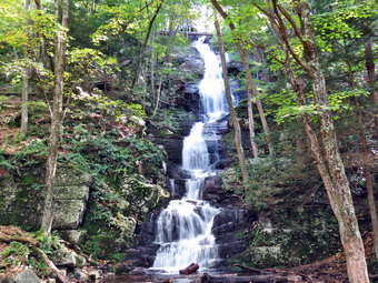
![]() On Friday, October 5th grandson Bryce and I were visiting some of the waterfalls in the Delaware Water Gap. I hoped they would be flowing with a high volume due to the recent rains. After failing to access Dingman's Falls because the NPS had closed the area, I decided we would cross the river and take a look at Buttermilk falls in New Jersey. I drove to the traffic light at Dingman's Ferry and turned right. We went across the "historic" Dingman's Ferry Bridge. The bridge is old and not quite two lanes wide! The toll is taken by a person standing on the yellow line! Across the bridge, we took Route 560 to Route 640 and then NPS 615 at the Peters Craft Village. In Walpack Center we turned left and then right after a short distance on an unmarked road which was Mountain Road. I was following another car that was driving VERY slowly, but the road was a series of potholes. We continued our slow drive along the rough unpaved road until a parking area on our right, and a falls on our left signaled we had arrived at Buttermilk Falls at around 2:15 PM. There were quite a few cars in the lot as Bryce, and I got out to go to the falls. I decided that I would not take Sheila as there were quite a few people and a series of steps next to the falls. The falls are high but and there was more water falling than I had seen before. I took only my camera with us as we walked across the road to the falls. I took some pictures at the base of the falls using both horizontal and vertical formats and with several different settings. We walked over to the steps and started up the steep stairs and pathways next to the falls. The pathways wound back and forth to make the going easier. We bypassed the first viewing platform as it had too many people. I had a hard time keeping up with Bryce as he practically ran up the stairs to the top. I took some pictures from the viewing platform at the top. We started back down the steps, and this time we stopped a the first viewing platform. This allowed me to get some pictures from the side of the water coming down the falls. We walked back down the steps and across the road to the car. I decided to continue out the road instead of turning around to reserve our route. The road seemed to be better on the way out until we came to the paved portion just after crossing a small bridge. I had to slow to a crawl to get through the deep potholes. At the end, I turned right on NPS 615 and followed it back to Walpack Center. From there I followed the route I had used on the way in. We crossed the Dingman's Bridge, and I turned right on Route 209 to head back to Milford.
On Friday, October 5th grandson Bryce and I were visiting some of the waterfalls in the Delaware Water Gap. I hoped they would be flowing with a high volume due to the recent rains. After failing to access Dingman's Falls because the NPS had closed the area, I decided we would cross the river and take a look at Buttermilk falls in New Jersey. I drove to the traffic light at Dingman's Ferry and turned right. We went across the "historic" Dingman's Ferry Bridge. The bridge is old and not quite two lanes wide! The toll is taken by a person standing on the yellow line! Across the bridge, we took Route 560 to Route 640 and then NPS 615 at the Peters Craft Village. In Walpack Center we turned left and then right after a short distance on an unmarked road which was Mountain Road. I was following another car that was driving VERY slowly, but the road was a series of potholes. We continued our slow drive along the rough unpaved road until a parking area on our right, and a falls on our left signaled we had arrived at Buttermilk Falls at around 2:15 PM. There were quite a few cars in the lot as Bryce, and I got out to go to the falls. I decided that I would not take Sheila as there were quite a few people and a series of steps next to the falls. The falls are high but and there was more water falling than I had seen before. I took only my camera with us as we walked across the road to the falls. I took some pictures at the base of the falls using both horizontal and vertical formats and with several different settings. We walked over to the steps and started up the steep stairs and pathways next to the falls. The pathways wound back and forth to make the going easier. We bypassed the first viewing platform as it had too many people. I had a hard time keeping up with Bryce as he practically ran up the stairs to the top. I took some pictures from the viewing platform at the top. We started back down the steps, and this time we stopped a the first viewing platform. This allowed me to get some pictures from the side of the water coming down the falls. We walked back down the steps and across the road to the car. I decided to continue out the road instead of turning around to reserve our route. The road seemed to be better on the way out until we came to the paved portion just after crossing a small bridge. I had to slow to a crawl to get through the deep potholes. At the end, I turned right on NPS 615 and followed it back to Walpack Center. From there I followed the route I had used on the way in. We crossed the Dingman's Bridge, and I turned right on Route 209 to head back to Milford.
On Friday, October 5th grandson Bryce and I were visiting some of the waterfalls in the Delaware Water Gap. I hoped they would be flowing with a high volume due to the recent rains. After finishing at Indian Ladder Falls, I drove back down Emery Road and passed the PEEC facility. I turned left on Route 209 and drove back toward the traffic light at Dingman's Ferry. Just before the light, I pulled over to a parking area on the left side of the road just before the access road to Dingman's Falls. The road was closed to traffic, but I thought we would walk down the road to see what the situation was at the Visitor's Center and the boardwalks. I really wanted to see the condition of the boardwalks. We passed through the gates and began to walk down the wide, paved road. As we walked down the road, we Egan to hear gunshots which seemed to be coming from a firing range to the left of the road. As we neared the Visitor's Center, we began to hear the noise of machinery and saw a mowing machine coming toward us. As we approached the operator opened the door and told us he didn't think we were allowed on the road. I apologized, and we turned around and walked back to the car. I was disappointed that the NPS had not done any work on one of the most popular attractions in the Water Gap! I decided we would cross over into New Jersey and visit Buttermilk Falls which is right on Mountain Road.
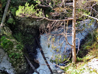
![]() On Friday, October 5th grandson Bryce and I were visiting some of the waterfalls in the Delaware Water Gap. I hoped they would be flowing with a high volume due to the recent rains. After finishing at Raymondskill Falls, we tried to visit the Childs Recreation Area and Tumbling Waters Falls, but both of these were closed by a large number of huge trees across the trails. From the Tumbling Waters parking area n Route 209 I turned around and drove back towards Dingman's Ferry. After about .6 miles, I turned left onto Brisco Mountain Road from Route 209 and headed north passed the PEEC. About two miles passed the PEEC the road crosses a small culvert over Hornbecks Creek, and I parked in a small pullout just on the other side at 12:35 PM. There was one other car parked there, and we immediately got out to start our hike. There was a path into the woods where the guidebook said it would be just a little to the right of the parking area. I got Sheila on her leash and shouldered my pack. The path quickly opened up to a wide path which was, at times, blocked by blowdowns. The blowdowns seemed old as hikers had made distinct paths around them. We followed the path along the creek and found the blowdowns had opened up some views that were blocked the last time I had hiked here. There were four different falls mentioned in the guidebook, and we soon came to the first side path that led down to the base of what I believed was the first falls. I was able to get some pictures from the side of the falls before turning around and walking back up to the main path. We turned right and in a short distance came to a point higher on the bank that gave a great view of the falls head on. I took some more pictures of the falls before confusing on the path along the creek.
On Friday, October 5th grandson Bryce and I were visiting some of the waterfalls in the Delaware Water Gap. I hoped they would be flowing with a high volume due to the recent rains. After finishing at Raymondskill Falls, we tried to visit the Childs Recreation Area and Tumbling Waters Falls, but both of these were closed by a large number of huge trees across the trails. From the Tumbling Waters parking area n Route 209 I turned around and drove back towards Dingman's Ferry. After about .6 miles, I turned left onto Brisco Mountain Road from Route 209 and headed north passed the PEEC. About two miles passed the PEEC the road crosses a small culvert over Hornbecks Creek, and I parked in a small pullout just on the other side at 12:35 PM. There was one other car parked there, and we immediately got out to start our hike. There was a path into the woods where the guidebook said it would be just a little to the right of the parking area. I got Sheila on her leash and shouldered my pack. The path quickly opened up to a wide path which was, at times, blocked by blowdowns. The blowdowns seemed old as hikers had made distinct paths around them. We followed the path along the creek and found the blowdowns had opened up some views that were blocked the last time I had hiked here. There were four different falls mentioned in the guidebook, and we soon came to the first side path that led down to the base of what I believed was the first falls. I was able to get some pictures from the side of the falls before turning around and walking back up to the main path. We turned right and in a short distance came to a point higher on the bank that gave a great view of the falls head on. I took some more pictures of the falls before confusing on the path along the creek.
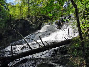 The second falls was hard to photograph as the views were blocked by trees and brush. I did try to get some shots of the falls deep down in the ravine from several angles. When I walked back up to the main path where Bryce and Sheila were waiting, I heard a rattling to the side of the trail. I was pretty sure it was a noise made by some insect, but I mentioned to Bryce that there could be rattlesnakes in the area. I was surprised that he seemed more interested than scared. I did put Sheila on her leash as a precaution. I probably could have worked my way down to the streambed, but it did not seem worth the work. The third falls was a little more exposed but, again, there did not seem to be an easy way to get down to the stream level. I took quite a few shots that showed some aspects of the falls. The creek runs through a gorge here at it may be possible to get to the other side for better views on another day. The final falls required a walk on a little-used, steep path covered by loose gravel. The stones on the path were slippery, and the path was steep. Further down the dirt and small rocks were loose, and it was hard to get a grip. I had Sheila on her leash, and she was trying to pull me downhill. The fourth falls is a wide 40-foot slide and cascade over rocks. It was difficult to get a good view of the entire falls from the shore but trying to rock hop to the middle of the creek seemed like a bad idea. I worked my way to the edge of the stream below the falls and took quite a few shots. A one point Sheila came rushing by me and jumped into the stream. The pool she jumped into was deep, and I think it surprised her! She jumped out of the pool onto a small log and seemed to be considering her options. She decided to launch herself back to shore falling just short and pulling herself onto the bank. Since she was very wet, she decided to shake herself off right behind me. Now I was very wet. I finished photographing, and we all walked back to the main path and started back up the steep hill. The climb was short and went quickly. We walked the trail back to the car. It was, so Bryce ate some of his lunch while I considered our next move.
On Friday, October 5th grandson Bryce and I were visiting some of the waterfalls in the Delaware Water Gap. I hoped they would be flowing with a high volume due to the recent rains. After finishing at Raymondskill Falls, I drove back down the road to Route 209 and turned right to head towards Dingman's Ferry. I wanted to visit George Childs Recreation area which has three nice waterfalls; Factory Falls, Fulmer Falls, and Deer Leap Falls. Some signs ha indicated that this area might be closed from damage in March 2018, but I hoped that they would be repaired. After driving 4.9 miles, I turned right at the traffic light in Dingman's Ferry onto Route 739. I drove for 1.2 miles and then turned left on Silver Lake Road. I continued along Silver Lake Road for a little over 1.5 miles until the parking area for the Childs Area came up on the left. The area was roped off, and a sign said CLOSED. I caught a glimpse down the creek and saw how many trees were still down and decided we would not violate the CLOSED AREA. I was very annoyed that after six months this area was not open! I drove back down Silver Lake Road to Route 739, turned right and drove back to the traffic light on route 209. I turned right and decided to drive to Tumbling Water Falls which is right off Route 209. I drove south about 5.5 miles to a large parking area on the right side of the road which looked like the one for Tumbling Waters. On the way, I drove passed Brisco Mountain Road where the Pennsylvania Environmental Education Center is located. The Indian Ladders Falls are near this location, and I made a note as we might visit them next. After parking, I walked into the woods passing a CLOSED AREA just to confirm I was in the right spot. I noticed a low stone building to the left of the trail and knew I was in the right spot. I went back to the car to get Bryce and Sheila, and we all started back into the woods. We walked along the trail for a few minutes until we began to run into many large trees that had fallen across the trail. We walked over and under a few of these until it became obvious that we would have no fun trying to get to the falls. We turned around and walked back to the car so I could make my next plan. I was disappointed that the trail was blocked and realized that since the trail is not "official" that it may NEVER be cleared!
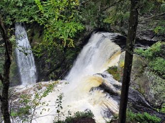
![]() On Friday, October 5th grandson Bryce had a day off from classes and wanted to hike somewhere. I planned a hike to Balsam Mountain and the Belleayre Ski Area so that Bryce could get another 3500 oft peak and so that we might find some fall colors. As luck would have it, there was rain on Thursday and some rain overnight. I knew the trail would be wet and slippery and that the leaf colors would probably not be very bright. I decided we would go to the Delaware Water Gap and visit some of the many waterfalls which would I hoped would be flowing with a high volume due to the recent rains. Bryce arrived at about 9:00 AM, but I delayed leaving until 9:35 AM. I got dressed in a long-sleeved crew top with a short-sleeved baselayer. I put on a pair of RailRiders hiking pants which are expensive but last a long time and have features like deep pockets and a generous cut which I really like. The pants have Velcro closures at the ankles which help to discourage ticks. I wore my Keen Glarus boots in a 9W which fit well and have been discontinued. I took along a light windbreaker which I could take off if I became too warm. Sheila would not leave my side as I was getting ready as she wanted to make sure she was going too! The guidebook I used was Pennsylvania Waterfalls by Scott E. Brown, The book is a GREAT guide giving accurate directions to all the falls, information about the hike to them, a description of the falls and photography tips! I decided to go to Raymondskill Falls first, so I got on State Route 17 heading east toward Monticello. I got off at exit 104, and I took Route 42 from Monticello to Port Jervis and then Route 209 over the river to Matamoras. I continued on Route 209 south into Milford where I turned left to stay on Route 209 toward the Delaware Water Gap National Recreation Area. I drove 3.25 miles watching for Raymondskill Road and the sign for Raymondskill Falls on the right. After turning right, I drove .7 miles to a parking area on the left, and I pulled in. Another parking area and a building with bathrooms are just up the road on the left. Before we started to hike, I spotted a sign that said the George Childs Recreation Area and Dingman's Falls were both closed because of damage in the March 2018 storms. I assumed these were old signs as the National Parks Service had six months to clean up this damage.
On Friday, October 5th grandson Bryce had a day off from classes and wanted to hike somewhere. I planned a hike to Balsam Mountain and the Belleayre Ski Area so that Bryce could get another 3500 oft peak and so that we might find some fall colors. As luck would have it, there was rain on Thursday and some rain overnight. I knew the trail would be wet and slippery and that the leaf colors would probably not be very bright. I decided we would go to the Delaware Water Gap and visit some of the many waterfalls which would I hoped would be flowing with a high volume due to the recent rains. Bryce arrived at about 9:00 AM, but I delayed leaving until 9:35 AM. I got dressed in a long-sleeved crew top with a short-sleeved baselayer. I put on a pair of RailRiders hiking pants which are expensive but last a long time and have features like deep pockets and a generous cut which I really like. The pants have Velcro closures at the ankles which help to discourage ticks. I wore my Keen Glarus boots in a 9W which fit well and have been discontinued. I took along a light windbreaker which I could take off if I became too warm. Sheila would not leave my side as I was getting ready as she wanted to make sure she was going too! The guidebook I used was Pennsylvania Waterfalls by Scott E. Brown, The book is a GREAT guide giving accurate directions to all the falls, information about the hike to them, a description of the falls and photography tips! I decided to go to Raymondskill Falls first, so I got on State Route 17 heading east toward Monticello. I got off at exit 104, and I took Route 42 from Monticello to Port Jervis and then Route 209 over the river to Matamoras. I continued on Route 209 south into Milford where I turned left to stay on Route 209 toward the Delaware Water Gap National Recreation Area. I drove 3.25 miles watching for Raymondskill Road and the sign for Raymondskill Falls on the right. After turning right, I drove .7 miles to a parking area on the left, and I pulled in. Another parking area and a building with bathrooms are just up the road on the left. Before we started to hike, I spotted a sign that said the George Childs Recreation Area and Dingman's Falls were both closed because of damage in the March 2018 storms. I assumed these were old signs as the National Parks Service had six months to clean up this damage.
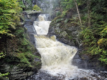 There was only one other car in the lot as we got out at 10:45 AM and started down the trail to the lower falls. The path was not long but dropped about 85 feet. A trail came in from the left and shortly after one came in from the right. The second trail led up to the visitors center, and I decided to investigate the other on the way back. The trail was wet, and the stone was slippery in some places. The walk to the falls was short, and I was soon at the lower viewing platform. There was plenty of water flowing over the falls which have a total drop of 180 feet. The water flows through a narrow slot a the top of the falls and then cascades into a pool below. To the left of the main falls was a smaller but very pretty horsetail falls from a tributary. I took pictures with several different zooms and settings. I took a couple of Bryce and Sheila and also shot a 40-second video to record the power of the falls. After taking many pictures, I walked back up to the path that led to the upper falls. Some steps were steep in places, but the walk was short. There was a small wooden deck where I took some pictures upstream including some of the foam that had collected. There is a nice pool here with dark green water. I leaned out over the railings and took some pictures down the falls to the plunge pool below. I also took a few of the lower viewing deck. We walked up the path to the bathrooms and then walked back on another path to the car. A group was just starting out on the walk to the falls, and I asked them about the closings of the Childs area and Dingman's Falls. One man said he was pretty sure they were still closed! I decided to find out for myself, but I was afraid he was right.
![]()
![]()
![]()
![]() On Monday, October 1st I knew that I had to get out for a short walk after more than a week of inactivity due to a nasty early fall cold and some commitments. I thought a few figure 8's across the street on Round Top would be a good idea and Cindy agreed to go with me. I started to get ready at about 10:15 AM when the temperature was still in the high 50's with an overcast sky. I got dressed in a long-sleeved Mammut crew top but decided to wear no base layer. I put on a pair of RailRiders hiking pants which are expensive but last a long time and have features like deep pockets and a generous cut which I really like. The pants have Velcro closures at the ankles. I wore a new pair of Vasque Talus boots in a 9W. They seemed a little narrow for wide shoes but comfortable none-the-less. They are all leather and will stretch some as they break in. I decided I would wear a light windbreaker which I could take off if I became too warm. Sheila would not leave my side as I was getting ready as she wanted to make sure she was going too! We left the house at 10:35 AM and crossed the street with Sheila on her leash. We walked to the back of the church to begin the ascent of the steepest hill behind the church. The hill is short but really gets the circulation pumping and is the steepest and longest climb on the "trail." Sheila responds well to the command "Pull," and the Siberian husky in her makes her well-suited for the job. As we climbed the hill, I looked up to see a flock of turkeys crossing the road. Sheila saw the tykes at about the same time I did and redoubled her efforts to "help" me up the hill. When we got to the top of the hill, we started out on the trail by turning left at the trailhead. I let Sheila off her leash, and she bounded ahead of us looking for the turkeys. I did not hear any commotion, and she soon came back to us on the trail. Whenever I pass by the first major blowdown that I cleared on the trail, I am proud that I was able to do the work by myself with only hand tools. At the first trail junction, we followed Sheila as she continued straight ahead on the steeper path to the viewpoint. At the lookout, I noted that there was no garbage and everything was in order. From the upper part of the lookout, the trees block most of the view despite the efforts of the Town of Rockland sawyer crew to cut down some trees. The leaves were just beginning to change color, but we noticed that many had already fallen from the trees and some trees were almost bare! I am hoping to be able to find some brilliant colors this fall before the leaves hit the ground. Getting to the lower lookout is a little difficult for the average person who causes an access problem.We followed the trail to the right and started the gentle climb through the woods. The trail was really beautiful and clear of most branches. The trail bed was lined with very green ferns and pretty clearly delineated.
On Monday, October 1st I knew that I had to get out for a short walk after more than a week of inactivity due to a nasty early fall cold and some commitments. I thought a few figure 8's across the street on Round Top would be a good idea and Cindy agreed to go with me. I started to get ready at about 10:15 AM when the temperature was still in the high 50's with an overcast sky. I got dressed in a long-sleeved Mammut crew top but decided to wear no base layer. I put on a pair of RailRiders hiking pants which are expensive but last a long time and have features like deep pockets and a generous cut which I really like. The pants have Velcro closures at the ankles. I wore a new pair of Vasque Talus boots in a 9W. They seemed a little narrow for wide shoes but comfortable none-the-less. They are all leather and will stretch some as they break in. I decided I would wear a light windbreaker which I could take off if I became too warm. Sheila would not leave my side as I was getting ready as she wanted to make sure she was going too! We left the house at 10:35 AM and crossed the street with Sheila on her leash. We walked to the back of the church to begin the ascent of the steepest hill behind the church. The hill is short but really gets the circulation pumping and is the steepest and longest climb on the "trail." Sheila responds well to the command "Pull," and the Siberian husky in her makes her well-suited for the job. As we climbed the hill, I looked up to see a flock of turkeys crossing the road. Sheila saw the tykes at about the same time I did and redoubled her efforts to "help" me up the hill. When we got to the top of the hill, we started out on the trail by turning left at the trailhead. I let Sheila off her leash, and she bounded ahead of us looking for the turkeys. I did not hear any commotion, and she soon came back to us on the trail. Whenever I pass by the first major blowdown that I cleared on the trail, I am proud that I was able to do the work by myself with only hand tools. At the first trail junction, we followed Sheila as she continued straight ahead on the steeper path to the viewpoint. At the lookout, I noted that there was no garbage and everything was in order. From the upper part of the lookout, the trees block most of the view despite the efforts of the Town of Rockland sawyer crew to cut down some trees. The leaves were just beginning to change color, but we noticed that many had already fallen from the trees and some trees were almost bare! I am hoping to be able to find some brilliant colors this fall before the leaves hit the ground. Getting to the lower lookout is a little difficult for the average person who causes an access problem.We followed the trail to the right and started the gentle climb through the woods. The trail was really beautiful and clear of most branches. The trail bed was lined with very green ferns and pretty clearly delineated.
When we reached the next trail junction, we stayed to the right to follow the lower trail around the base of Round Top to the next junction. At the next junction, we turned left and started up to the summit of Round Top on the steeper blue trail. This time the slightly steep but short uphill went quickly, but I was really sweating. I did notice that I was not as tired as I thought I might be after taking more than a week off. We walked across the summit of Round Top and down the other side which is also a little steep. I noticed that the new boots were performing well and prevented my toes from hitting the front of the toe box on the way down. Sheila was off in the woods, and suddenly a whitetail deer came running at full speed from our left. It flew passed Cindy within about six feet. Sheila came running from the same direction but wasn't really chasing the deer although I think she would have followed if I had not sternly called her back. When we got to the yellow trail, we turned left to follow it to the second trail junction. This time we turned right and followed the yellow trail back to the very first trail junction. At the trail junction, we turned around and retraced our steps taking the more gentle path this time. When the yellow trail turned left, we followed it to the next trail junction where we turned right and headed up the blue trail to the summit. We walked over the top and down the other side to the yellow trail again. We turned right and followed the trail along the base of Round Top. Where the yellow trail turned left, we followed it to the left and down to the lookout. Although I thought about making four loops, I decided not to tax my recovery and that two was enough! From the lookout, we walked downhill to the first trail junction. We walked out to the trailhead where I put Sheila on her leash, and we walked down the cemetery hill. We crossed the field and the street to our driveway. It was about 11:40 AM, and we had hiked a little less than 2 miles in slightly more than an hour.