Red Hill
| Quick Look - from Dinch Road trailhead | ||||
|---|---|---|---|---|
| Difficulty | Round trip | Total climb | Internet Maps | |
| 2.5 mi. | 800 ft. | AllTrails | ||

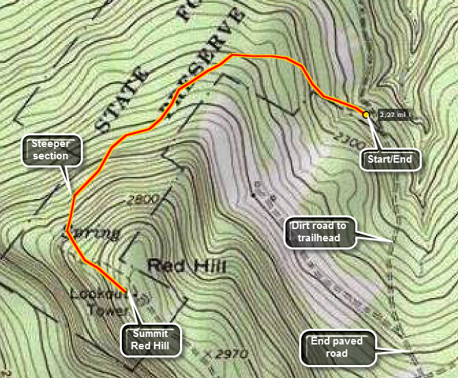
Turn onto Rt. 55A in Grahamsville near the Rondout Reservoir. After about 2.25 miles look for Sugarloaf Rd. on your left. Continue on Sugarloaf Rd. for about 4 miles and look for Red Hill Rd. on the left. Make this sharp turn. Dinch or Coons Rd. will be on your left almost immediately. Continue on this road for a little over one mile. The road is not paved. It is a dead end and it gets rough enough that an SUV or a pickup might be a good idea. Park at the trail head. Look for signs to the trail and follow the yellow markers. After about .56 miles the slope increases slightly and increases again at .75 miles. After about 1.2 miles you are at the summit. Climb the fire tower for some nice views. Reverse your route. A quick, relatively easy hike with a reward at the top.
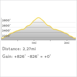
 (The image at the left shows the profile of the loop hiking route. Remember that all vertical profiles are
relative!)
| Quick Look - from Dening Road trailhead | ||||
|---|---|---|---|---|
| Difficulty | Round trip | Total climb | Internet Maps | |
| 4.0 mi. | 1200 ft. | Alltrails Map | ||
 Note: As of December 7, 2020, this trail has not officially opened. The DEC would prefer that hikers wait to hike this trail until it officially opens. It I supposed to be a "secret" until that time. If you read this, please DO NOT tell others!
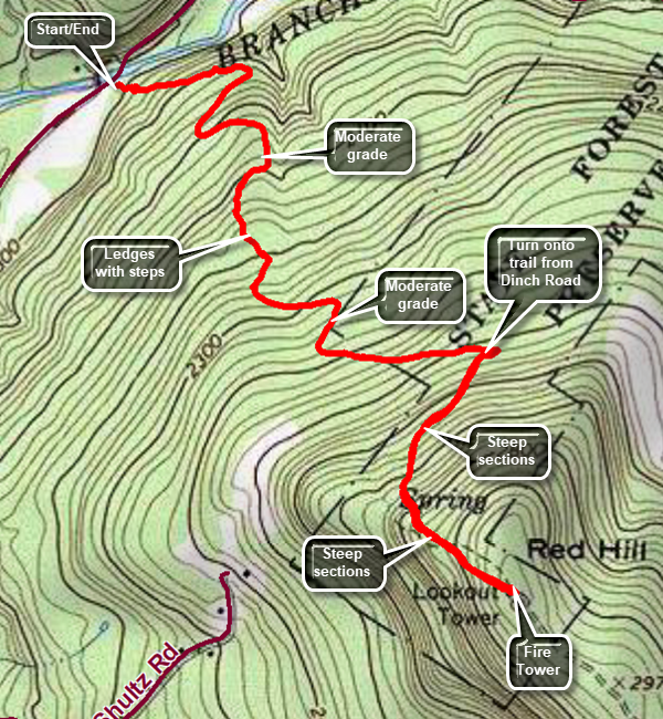
From Route 55 between Neversink and Grahamsville turn north onto Claryville Road. Claryville Road changes to Denning Road in Claryville. Drive a little less than 2 miles to the parking area on the right side of the road. The trail has been professionally constructed and averages a 10% grade for the first 1.4 miles with a wide and even tread. After a right turn toward the fire tower, the last .6 miles averages a 20% grade and the trail is a little rougher. From the parking area follow the blue trail blazes as the trail ascends through an evergreen forest. At about .4 miles, the forest changes to hardwoods but then reverts to evergreens. From about .7 to .9 miles there are a series of ledges and steps constructed by the trail designers. At 1.4 miles the trail meets another trail. A left turn will take you to another trailhead on Dinch Road after a .8 mile walk. Turn right and begin a steeper climb to the summit of Red Hill. After a quarter mile, there is a spur trail on the right that leads to a spring. At the summit clearing there is a cabin, privy, picnic tables and, of course, the fire tower. The tower is a 60 foot Aeromotor tower and allows views from a hill that otherwise would have none. From the top of the tower you can see the high peaks of the Catskills to the north. You can also see some of the New York city reservoirs to the south and east. This is a quick, relatively easy hike with a reward at the top. When you are done retrace your steps back to the car.
 (The image at the left shows the profile of the loop hiking route. Remember that all vertical profiles are
relative!)