
What You Missed
Winter 2023-2024
Winter 2023-2024
![]()
![]()
![]()
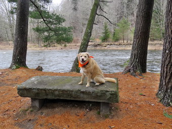
![]() On Saturday, March 16th I really wanted to get out for a hike after spending a good part of the day preparing for Sunday's church service. At 12:45 PM I decided it was time to get out. I though that Cindy had said she would go across the street to Round Top with us but it turned out I was wrong! I decided to go across the street to Round Top to hike with Shiela because the day was just so nice I could not resist. I intended to leave my phone home so that I could enjoy a hike without interruption. As we began to get ready, Sheila was keeping a careful eye on me as I dressed as she would hike every day. Sheila often examines and sniffs my clothing to make sure I am serious about hiking. I decided to wear my Mammut long-sleeved crew shirt with no baselayer as the temperature was 56 degrees on the back porch. I wore my Railriders hiking pants which I thought would be warm enough despite the temperature. They are expensive but last along time and have features like deep pockets and a generous cut which I really like. The pants have Velcro closures at the ankles. I decided to put on my Keen Durand hiking boots which I ordered a half size larger than the previous pair. These shoes fit well out of the box but get much tighter when I add a decent insole. Without the third party insole, by feet hurt from the lack of support. I added a new pair of Xstance insoles in an effort to find the best support and cushioning for my feet. These insoles have shock absorbing gel pads, TPU arch support, and memory foam cushioning all wrapped in a breathable fabric. The insoles have been hyped by their manufacturer and they really do seem to deliver. I decided to take my Leki poles with external locks as the internal twist locks sometimes fail. I wore my Mammut hoody to block the breezy and keep me warm. It has pit zips that open all the way to the lower hem. I decided against a hat, gloves, and gaiters. At 1:00 PM we walked out the door to start the hike. I grabbed Sheila's leash from my car and put it on her as we walked up the driveway. There was no snow to be seen but I wondered if there might still be dome in the woods. I aimed to hike for about an hour and complete two figure 8's. Sheila was happy to get out as we headed down the driveway and across the street. We crossed the street and walked to the parking lot next to the Presbyterian Church. We walked to the back of the church and began the ascent of the steepest hill behind the church. The hill is short but gets the circulation pumping and is the steepest and longest climb on the "trail." We did not stop until we reached the top of the hill and I felt the climb was easier than it had been in a long time. At the top we paused for a minute so I could look around at the hills that surround the hamlet of Livingston Manor. As we stood there a young couple and their child came walking toward us from the opposite direction. They had taken the more gentle approach to the hill. They walked to the map, at the trailhead and studied it for a moment. All of the snow was completely gone from the trail and surrounding forest and there was none I could see on the surrounding hills. We continued the hike by turning left at the trailhead and walking passed the family. We all said "hello" as we went by except for Sheila. The trail was damp in a few places but thee was no snow or ice or mud.
On Saturday, March 16th I really wanted to get out for a hike after spending a good part of the day preparing for Sunday's church service. At 12:45 PM I decided it was time to get out. I though that Cindy had said she would go across the street to Round Top with us but it turned out I was wrong! I decided to go across the street to Round Top to hike with Shiela because the day was just so nice I could not resist. I intended to leave my phone home so that I could enjoy a hike without interruption. As we began to get ready, Sheila was keeping a careful eye on me as I dressed as she would hike every day. Sheila often examines and sniffs my clothing to make sure I am serious about hiking. I decided to wear my Mammut long-sleeved crew shirt with no baselayer as the temperature was 56 degrees on the back porch. I wore my Railriders hiking pants which I thought would be warm enough despite the temperature. They are expensive but last along time and have features like deep pockets and a generous cut which I really like. The pants have Velcro closures at the ankles. I decided to put on my Keen Durand hiking boots which I ordered a half size larger than the previous pair. These shoes fit well out of the box but get much tighter when I add a decent insole. Without the third party insole, by feet hurt from the lack of support. I added a new pair of Xstance insoles in an effort to find the best support and cushioning for my feet. These insoles have shock absorbing gel pads, TPU arch support, and memory foam cushioning all wrapped in a breathable fabric. The insoles have been hyped by their manufacturer and they really do seem to deliver. I decided to take my Leki poles with external locks as the internal twist locks sometimes fail. I wore my Mammut hoody to block the breezy and keep me warm. It has pit zips that open all the way to the lower hem. I decided against a hat, gloves, and gaiters. At 1:00 PM we walked out the door to start the hike. I grabbed Sheila's leash from my car and put it on her as we walked up the driveway. There was no snow to be seen but I wondered if there might still be dome in the woods. I aimed to hike for about an hour and complete two figure 8's. Sheila was happy to get out as we headed down the driveway and across the street. We crossed the street and walked to the parking lot next to the Presbyterian Church. We walked to the back of the church and began the ascent of the steepest hill behind the church. The hill is short but gets the circulation pumping and is the steepest and longest climb on the "trail." We did not stop until we reached the top of the hill and I felt the climb was easier than it had been in a long time. At the top we paused for a minute so I could look around at the hills that surround the hamlet of Livingston Manor. As we stood there a young couple and their child came walking toward us from the opposite direction. They had taken the more gentle approach to the hill. They walked to the map, at the trailhead and studied it for a moment. All of the snow was completely gone from the trail and surrounding forest and there was none I could see on the surrounding hills. We continued the hike by turning left at the trailhead and walking passed the family. We all said "hello" as we went by except for Sheila. The trail was damp in a few places but thee was no snow or ice or mud.
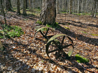
At the first trail junction, I followed Sheila as she continued straight ahead up the hill toward the lookout. The trail was well-worn as this is the most popular part of the hike. Some people simply hike up to the lookout over town and then back down. Sheila and I continued straight ahead passing the path to the lower lookout. I had tried blocking the trail with brush but people kept removing the obstacles. The problem is there is a growing chasm which could be difficult for some people to cross. At least the path is not marked as part of the trail system. We walked on the yellow trail as it headed uphill toward the next trail junction. As we walked up the trail, I removed a lot of loose branches that had fallen in the recent winds. There was no snow visible anywhere on the hill even in the shade. We passed the "sitting rock" and continued on the yellow trail to the first junction with the blue trail. At the junction we turned right and walked on the yellow trail along the base of Round Top. As we neared the next trail junction, we passed a medium-sized tree that had fallen across the trail. I had cleared that tree on our last trip. At the next junction with the blue trail, we turned left and started up toward the summit. The trail was just damp in spots which made it a little slippery but there was no snow or ice. We passed by the white crossover trail and walked over the summit. We continued down the blue trail on the other side until we turned left on the switchback in the blue trail. We passed some more branches that I had cut and removed from the trail. The switchback took us out into the woods before turning almost 180 degrees to take us back to the main blue trail. We turned left and walked downhill toward the yellow trail. The family we had met was waiting at the trail junction so I put Sheila on her leash so we could pass by them. We turned left and walked along the base of Round Top on the yellow trail. At the junction with the blue trail, we turned right to head down the trail to the woods road. I looked to the right to see the "cave" with a blue tarp covering the opening. It did not look like anybody was at home! We continued to follow the yellow blazes back to the first trail junction.
I decided I wanted to do another figure 8 so Sheila and I turned around and walked back up the woods road. At the end of the woods road, we followed the yellow trail as the blazes turned up the hill toward the junction with the blue trail. When we reached the junction with the blue trail, we turned left and walked the yellow trail along the base of Round Top. At the next junction, with the blue trail, we turned right and began to walk up the blue trail toward the summit. We walked straight up the blue trail rather than tuning right on the switchback. When we reached the switchback, I looked up to see that Sheila was walking straight up the trail as if she read my mind! We continued on blue trail and turned right on the white crossover trail so that I could say I checked all the trails. We walked the length of the white trail and then turned right on the main blue trail. We walked down the trail to the junction with the yellow trail where we turned right. We followed the yellow trail along the base of Round Top. At the next junction with the blue trail, we turned left and continued to follow the yellow trail downhill toward the lookout. We passed the "Sitting Rock" and soon came to the viewpoint. We followed the yellow trail as it turned left and started downhill to the first trail junction. When we reached the first junction, we continued straight ahead to the trailhead where I put Sheila on her leash. We turned right and walked down the road toward the parking lot of the Presbyterian Church. We continued down the hill and walked across Rock Avenue to our driveway. We were back at 2:05 PM after walking about two miles in 1 hour and 5 minutes which included the time needed to do some light trail maintenance. The temperature was 54 degrees on the back porch. The hike was perfect and there were no ambulance calls.
![]()
![]()
![]()
![]()
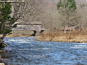
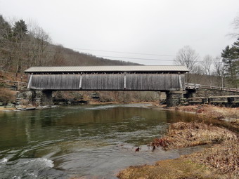
![]() On Thursday, March 14th, I wanted to get out for a short hike near home for the exercise and for the relaxation. I thought about going to the Beaverkill Campgrounds to see the level of the water in the stream after the snow melt and recent rain. I asked Cindy if she wanted to go and she agreed. As we started to get ready at 1:15 PM the temperature was 58 degrees on the back porch with sunny skies and some puffy white clouds. As usual, Sheila was excited but was trying to be the "good dog". I got dressed in my Mammut crew top but decided against a baselayer. I wore my Railriders hiking pants which are expensive but last along time and have features like deep pockets and a generous cut which I really like. The pants have Velcro closures at the ankles. I decided to put on my Keen Durand hiking boots which I ordered a half size larger than the previous pair. These shoes fit well out of the box but get much tighter when I add a decent insole. Without the third party insole, by feet hurt from the lack of support. I added a new pair of Xstance insoles in an effort to find the best support and cushioning for my feet. These insoles have shock absorbing gel pads, TPU arch support, and memory foam cushioning all wrapped in a breathable fabric. The insoles have been hyped by their manufacturer and they really do seem to deliver. I decided to take my Leki poles with external locks as the internal twist locks sometimes fail. I donned my Mammut hoody to block the breezy and keep me warm. It has pit zips that open all the way to the lower hem. I did put on a light hat and took a pair of light knitted gloves. I brought along my phone but resolved to leave it in the car as there was no service in the area anyway. I put our gear in the back of the car and Sheila in the back seat and we left the house at 1:20 PM. I drove out Old Route 17 toward Roscoe and turned right on Beaverkill Road. As we started the descent into the Beaverkill Valley, I turned left on Campsite Road and followed it down to the parking area near the Beaverkill Covered Bridge. It was then that I remebered that the Beaverkill Covered Bridge was closed since a car had impacted some of the supports. I decided to see what the bridge looked like inside. There was one car parked on the road that goes through the bridge but none in the parking lot! A glance at the river showed that the level was not as high as our last trip. The sandy beach was visible and the rock I usually stand on to take pictures was bare.
On Thursday, March 14th, I wanted to get out for a short hike near home for the exercise and for the relaxation. I thought about going to the Beaverkill Campgrounds to see the level of the water in the stream after the snow melt and recent rain. I asked Cindy if she wanted to go and she agreed. As we started to get ready at 1:15 PM the temperature was 58 degrees on the back porch with sunny skies and some puffy white clouds. As usual, Sheila was excited but was trying to be the "good dog". I got dressed in my Mammut crew top but decided against a baselayer. I wore my Railriders hiking pants which are expensive but last along time and have features like deep pockets and a generous cut which I really like. The pants have Velcro closures at the ankles. I decided to put on my Keen Durand hiking boots which I ordered a half size larger than the previous pair. These shoes fit well out of the box but get much tighter when I add a decent insole. Without the third party insole, by feet hurt from the lack of support. I added a new pair of Xstance insoles in an effort to find the best support and cushioning for my feet. These insoles have shock absorbing gel pads, TPU arch support, and memory foam cushioning all wrapped in a breathable fabric. The insoles have been hyped by their manufacturer and they really do seem to deliver. I decided to take my Leki poles with external locks as the internal twist locks sometimes fail. I donned my Mammut hoody to block the breezy and keep me warm. It has pit zips that open all the way to the lower hem. I did put on a light hat and took a pair of light knitted gloves. I brought along my phone but resolved to leave it in the car as there was no service in the area anyway. I put our gear in the back of the car and Sheila in the back seat and we left the house at 1:20 PM. I drove out Old Route 17 toward Roscoe and turned right on Beaverkill Road. As we started the descent into the Beaverkill Valley, I turned left on Campsite Road and followed it down to the parking area near the Beaverkill Covered Bridge. It was then that I remebered that the Beaverkill Covered Bridge was closed since a car had impacted some of the supports. I decided to see what the bridge looked like inside. There was one car parked on the road that goes through the bridge but none in the parking lot! A glance at the river showed that the level was not as high as our last trip. The sandy beach was visible and the rock I usually stand on to take pictures was bare.
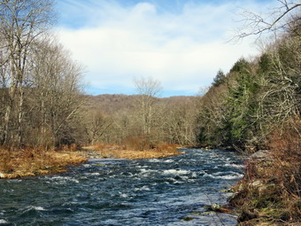
 We started our hike at 2:00 PM by walking out of the parking lot to the bridge with the temperature at 54 degrees. The bridge that had been closed after a car hit it and did some damage was now open. When we got to the other side, I looked at the trail and saw that it was still completely bare. We turned left on a woods road that parallels the river and started down the short hill. The trail was damp but there was no snow or ice. I had decided to take some pictures on the way out so when we got to the first culvert I followed a path down to the edge of the stream. I took some pictures upstream catching the bridge and the white water of the rapids. I took a few more shots with different zooms. I also took some pictures downstream and one of the water coming out of the culvert. When I was done, I packed away the camera and walked up to the woods road. We continued on the deserted woods road. We could hear the river and see the whitecaps on the water. Even though the landscape was bleak the sunlight and blue skies added an interesting demission. The whole area had a serene feel enhanced by the sound of the flowing water. On the trail we passed by several areas with unused picnic tables. They sit unused and rotting along the road, a testimony to better days. We walked by more tables which had not been used in years. A little later we came to what was once a bathroom for some campsites that had long since disappeared. There were more tables in this area. We stopped and I walked to the stream where rocks had been piled up and contained by wire screen. I walked to the edge and stood on some rocks to take more pictures of the stream in both directions. Sheila came over and stood on the wall to pose for some shots and I snapped a few. I took a few shots of the bathroom and the woods road before we contiuned on the woods road. At about .7 miles into the hike the woods road met the paved road that serves the campsites. I stopped to take some pictures of the campsites without any snow and with the lighting from the sun. We continued on the road through the campsites and along the river. Many of the campsites have a cement block fireplace with a grill but some were upgraded to poured concrete. Everything was very quiet except for the water in the river. This was not surprising as the campsites were closed.
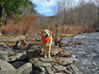
 We walked to the last campsite where the woods road ends and I walked down to the edge of the river. I was careful to watch where I was walking as I did not want to slip into the cold water. I stopped to take some pictures of the river especially downstream. Sheila did decided to take a dip. When she came out, she did not seem to be cold but did start to run around. We continued a little further passed the last campsite and walked a path along the river. I took some shots downstream where the river turned to the left. The water was very clear with a slight greenish tint from looking through to the bottom. As we walked back passed the last campsite, we continued on the campsite road toward the last bathroom. When the road split, we stayed to the left to walk the parallel section of road back through the campsites. This road parallels the one we walked out on to make a sort of loop. We stopped near the end of the road where it starts up to the Berry Brook Road. I wanted to explore the area along the ridge that parallels the road. It was clear to me that Cindy did not want to go on an adventure so we continued along the woods road. We returned the way we had come although at a quicker pace. We still had not seen any people on the trails and very few cars had passed by on the roads. We continued our hike and I began to look to the left where the land rose out of the valley to a ridge. I could see that the land leveled off part of the way up and then started up again. I had walked up a path to this area on our last hike and had no intention of trying it again. I had wanted to start further back but will save that for another time. We passed the spring house on the main campsite road. There were some brilliant green water plants in some pools near the spring house. The plants were floating in a small "stream" that extended from the spring house parallel to the trail. The plants appeared as an emerald green mass made all the more colorful by the rather bleak surroundings. We walked up the hill to the road and turned right to walk through the bridge. At the end of the bridge, we turned left and passed by the office building toward the stream.Sheila and I walked across the bank and down a path upstream. When the path ran out, I stopped and took some more pictures of an area that I visit less frequently than others. I put away the camera, turned around, and walked back up to the building and then to the car. We were back at the car at 3:30 PM having hiked 2.8 miles in 1 hour and 30 minutes with plenty of stopped time for pictures. The car's thermometer read 58 degrees.
![]()
![]()
![]()
![]()
![]() On Tuesday, March 12th, it was a beuaiful warm and sunny day. I wanted to go to Frick Pond to clean up two blowdowns which were blocking the Quick Lake trail close to the pond. I made sure I had a driver and EMT to cover ambulance calls so I could spend as much time as I wanted pr needed to complete the clean-up. At 11:15 PM I asked Cindy if she would like to go to Frick Pond and do the work. She agreedand we started to get ready with the temperature at 58 degrees on the back porch. As I was getting dressed, Sheila was very quiet but did not let me out of her sight. I got dressed in my Mammut crew top with a light long-sleeved baselayer. I wore my Railriders hiking pants which are expensive but last along time and have features like deep pockets and a generous cut which I really like. The pants have Velcro closures at the ankles. I decided to put on my Keen Durand hiking boots which I ordered a half size larger than the previous pair. These shoes fit well out of the box but get much tighter when I add a decent insole. Without the third party insole, by feet hurt from the lack of support. I added a new pair of Xstance insoles in an effort to find the best support and cushioning for my feet. These insoles have shock absorbing gel pads, TPU arch support, and memory foam cushioning all wrapped in a breathable fabric. The insoles have been hyped by their manufacturer and they really do seem to deliver. I decided to leave my poles home as the walk was short and I would be carrying tools. . I donned my Mammut hoody to block the breeze and keep me warm. It has pit zips that open all the way to the lower hem. I did put on a light hat and took a pair of light knitted gloves. I also donned my OR Crocodile gaiters as I expected plenty of water and mud! I brought along my phone but resolved to leave it in the car as there was no service in the area anyway. I put my Silky Sugowaza Sugowaza saw and Silky KatanaBoy 500 saw in my pack. The Sugowaza is a fixed blade in a scabbard and is great for branches and smaller trunks. The KatanaBoy has very large teeth and a lot of them and folds. I put our gear in the car and Sheila in the back seat and we left Livingston Manor at 11:30 AM. I drove out the DeBruce Road about 6 miles to Mongaup Road. I turned left to continue up the road to the point where it splits. I stayed left on Beech Mountain Road and drove to the Frick Pond trailhead. When we arrived at the parking areas, there were no cars parked in either lot. I pulled into the smaller lot and parked. The skies were sunny and blue with a few clouds and a slight breeze blowing. The temperature was right at 54 degrees which was about what I thought it might be. We started out the woods road to the register at 11:50 AM. As we walked out the woods road, I cleared some branches and one small trunk from the wet and muddy trail. At the register we continued straight ahead on the Quick Lake Trail. From the register the trail was wet with some standing water, some running water and plenty of mud. There seemed to be a little less water tan the last trip
On Tuesday, March 12th, it was a beuaiful warm and sunny day. I wanted to go to Frick Pond to clean up two blowdowns which were blocking the Quick Lake trail close to the pond. I made sure I had a driver and EMT to cover ambulance calls so I could spend as much time as I wanted pr needed to complete the clean-up. At 11:15 PM I asked Cindy if she would like to go to Frick Pond and do the work. She agreedand we started to get ready with the temperature at 58 degrees on the back porch. As I was getting dressed, Sheila was very quiet but did not let me out of her sight. I got dressed in my Mammut crew top with a light long-sleeved baselayer. I wore my Railriders hiking pants which are expensive but last along time and have features like deep pockets and a generous cut which I really like. The pants have Velcro closures at the ankles. I decided to put on my Keen Durand hiking boots which I ordered a half size larger than the previous pair. These shoes fit well out of the box but get much tighter when I add a decent insole. Without the third party insole, by feet hurt from the lack of support. I added a new pair of Xstance insoles in an effort to find the best support and cushioning for my feet. These insoles have shock absorbing gel pads, TPU arch support, and memory foam cushioning all wrapped in a breathable fabric. The insoles have been hyped by their manufacturer and they really do seem to deliver. I decided to leave my poles home as the walk was short and I would be carrying tools. . I donned my Mammut hoody to block the breeze and keep me warm. It has pit zips that open all the way to the lower hem. I did put on a light hat and took a pair of light knitted gloves. I also donned my OR Crocodile gaiters as I expected plenty of water and mud! I brought along my phone but resolved to leave it in the car as there was no service in the area anyway. I put my Silky Sugowaza Sugowaza saw and Silky KatanaBoy 500 saw in my pack. The Sugowaza is a fixed blade in a scabbard and is great for branches and smaller trunks. The KatanaBoy has very large teeth and a lot of them and folds. I put our gear in the car and Sheila in the back seat and we left Livingston Manor at 11:30 AM. I drove out the DeBruce Road about 6 miles to Mongaup Road. I turned left to continue up the road to the point where it splits. I stayed left on Beech Mountain Road and drove to the Frick Pond trailhead. When we arrived at the parking areas, there were no cars parked in either lot. I pulled into the smaller lot and parked. The skies were sunny and blue with a few clouds and a slight breeze blowing. The temperature was right at 54 degrees which was about what I thought it might be. We started out the woods road to the register at 11:50 AM. As we walked out the woods road, I cleared some branches and one small trunk from the wet and muddy trail. At the register we continued straight ahead on the Quick Lake Trail. From the register the trail was wet with some standing water, some running water and plenty of mud. There seemed to be a little less water tan the last trip
 On the way to Gravestone Junction, there were several branches that were hanging over into the trail and some on the trail which I cleared. I also pulled down a larger branch that was hungup on another. At Gravestone Junction we stayed left on the Quick Lake Trail heading toward the bridge at the outlet to Frick Pond. This area of the trail had more mud but it was minimal compared to what it sometimes looks like. We continue on the trail and soon arrived at the bridge. I looked at the scene and decided to take some shots on the way back if at all since I have hundreds from the same location. We continued around the west side of the pond where the trail was also wet and muddy. There were several small streams coming through the woods which usually are not there. Some of these passed over the trail adding to the water and mud. There was less water flowing than there had been 4 days before. At the junction with the Big Rock Trail, we headed left on the Quick Lake Trail which wet and muddy in places. We immediately ran into a small but tall birch tree that had come down across the trail taking some other branches with it. We walked around this mess as I really wanted to get to the large blowdown a few hundred feet along the trail. This complex blowdown consisted of five separate trunks with a maze of branches. We arrived at the blowdown at 12:13 PM. I took some "before" pictures and then we began to survey the blowdown for the best attack. Cindy and I had some different ideas about how to proceed and I found that a combination of ours strategies worked best. I thought I would attack the highest trunk first but then realized this would not be best. Working on the highest trunk would mean whatever we cut would fall on the trunks below complicating their removal. I started on one of the lower trunks that was forked. I started on the one that was about thigh high and used the saw to cut it into section I knew I could lift, drag or flop off the trail. Once I finished with that one we started to work on the other fork of the same trunk which was closer to the ground. I cut the top off the trail with the ax and then started sectioning the trunk. I decided to use the KatanaBoy allow I have always preferred the curved Sugowaza. This time the KatanaBoy seemed to work very well and even Cindy was able to make cuts which really helped. I had forgotten my wedges which made it critical that we not bind the saw. It wasn't long until we had finished with 2 out of 5 of the trunks.
 I took a moment to take some pictures of the work in progress and then removed most of the sections we had cut. One section was long and heavy but I was lucky enough to be able to pivot the upper end of the trail. It was now time to get to work on the uppermost trunk. Cindy suggested cutting it down at the butt end in one large section and then cutting it into smaller sections of the ground. This sounded like a good idea but I knew that on the ground I might have to use the axe a lot and I was not sure I was up to that. I decided to go to the other side of the trail and cut the stop off with the KatanaBoy. His meant I had to cut above my head but the trunk had the smallest diameter. I made the cut pretty quickly but as I finished I had to duck the upper section as it fell passed me. This was the largest trunk and I knew cutting just one more section would make it too big for me to move. We decided on a place to cut and I began just below eye level. Cindy began to spell me on the saw which let me rest while work was still being done. I fancied the cut and the section fell. I went to the butt end of the trunk to start on the largest diameter we would cut. This cut took a little longer but it was soon done. This section was shorter but the larger diameter made it heavy. I was not sure where I was going to be able to move it so we started in on the next trunk. I used the axe to make a cut near the top of the tree so that I could leave it where it was off the trail. We cut the remaining trunk into two section. I flipped those sections and some others off the trail. I was lucky to be able to pivot the heavy section from the upper trunk off the trail and get it to stay there. The last blowdown was a separate and smaller sapling that Cindy cut in half. I dragged both section well off the trail and we were done. I took my final set of pictures and packed up all the tools. We started back toward Frick Pond at 1:45 PM after spending and hour and a half clearing the trees.
 In minutes we were at the smaller blowdown which was blocking the trail more than the larger one we had just cleared. I took a few shots of the blowodwn and then took a look at the mess. I thought I might just fell the birch at its base but after a survey that was not the approach we took. I cleared and are of the trunk above my head and off the trail. I used the KatanaBoy to cut the trunk which went quickly. When this cut was made, I was able to drag it off the trail with some effort. The birch had brought down some other branches so I used the Sugowaza to cut them. I dragged these branches off the trail and tidied up. After taking a few after pictures, we continued on the trail toward the bridge. When we got to the bridge, I could not resist taking some shots. The day was beautiful and there was a contrast between the colors of the water, sky, evergreen trees, and other vegetation. Cindy walked ahead and I hurried to catch up. The little hill from the pond to the top let me know how tired I was. We walked along the Quick Lake Trail back to the parking area trying to avoid the mud and water. We were back at the car at 3:05 PM after spending 2 hours and 40 minutes hiking and clearing the blowdowns. The temperature was 58 degrees and the skies were still beautiful.
![]()
![]()
![]()
![]()
![]() On Friday, March 8th, I had wanted to get in a hike away from home as the weather was forecast to be beautiful and Saturday was supposed to be cold and rainy. The ambulance calls had been piling up and I wanted to get away if only for a few hours. At 11:30 PM I asked Cindy if she would like to go to Frick Pond and hike the Logger's Loop and she agreed. This hike is less than 4 miles and is relatively flat. I had not been on the trail for some time and I wanted to see how it had faired after some recent wind and rain storms. We started to get ready with the temperature at 54 degrees on the back porch. As I was getting dressed, Sheila was very quiet but did not let me out of her sight. I got dressed in my Mammut crew top with a light long-sleeved baselayer. I wore my Railriders hiking pants which are expensive but last along time and have features like deep pockets and a generous cut which I really like. The pants have Velcro closures at the ankles. I decided to put on my Keen Durand hiking boots which I ordered a half size larger than the previous pair. These shoes fit well out of the box but get much tighter when I add a decent insole. Without the third party insole, by feet hurt from the lack of support. I added a new pair of Xstance insoles in an effort to find the best support and cushioning for my feet. These insoles have shock absorbing gel pads, TPU arch support, and memory foam cushioning all wrapped in a breathable fabric. The insoles have been hyped by their manufacturer and they really do seem to deliver. I decided to take my Leki poles with external locks as the internal twist locks sometimes fail. I donned my Mammut hoody to block the breeze and keep me warm. It has pit zips that open all the way to the lower hem. I did put on a light hat and took a pair of light knitted gloves. I also donned my OR Crocodile gaiters as I expected plenty of water and mud! I brought along my phone but resolved to leave it in the car as there was no service in the area anyway. I thought about brining my Silky Sugowaza saw just in case there were a few branches to cut but in the end left it home. I put our gear in the car and Sheila in the back seat and we left Livingston Manor at 11:50 AM. I drove out the DeBruce Road about 6 miles to Mongaup Road. I turned left to continue up the road to the point where it splits. I stayed left on Beech Mountain Road and drove to the Frick Pond trailhead. When we arrived at the parking areas, there were no cars parked in either lot. I pulled into the smaller lot and parked. The skies were sunny and blue with a few clouds and a slight breeze blowing. The temperature was right at 54 degrees which was about what I thought it might be. We started out the woods road to the register at 12:10 PM. As we walked out the woods road, I cleared some branches and one small trunk from the wet and muddy trail. At the register we continued straight ahead on the Quick Lake Trail. From the register the trail was wet with some standing water, some running water and plenty of mud.
On Friday, March 8th, I had wanted to get in a hike away from home as the weather was forecast to be beautiful and Saturday was supposed to be cold and rainy. The ambulance calls had been piling up and I wanted to get away if only for a few hours. At 11:30 PM I asked Cindy if she would like to go to Frick Pond and hike the Logger's Loop and she agreed. This hike is less than 4 miles and is relatively flat. I had not been on the trail for some time and I wanted to see how it had faired after some recent wind and rain storms. We started to get ready with the temperature at 54 degrees on the back porch. As I was getting dressed, Sheila was very quiet but did not let me out of her sight. I got dressed in my Mammut crew top with a light long-sleeved baselayer. I wore my Railriders hiking pants which are expensive but last along time and have features like deep pockets and a generous cut which I really like. The pants have Velcro closures at the ankles. I decided to put on my Keen Durand hiking boots which I ordered a half size larger than the previous pair. These shoes fit well out of the box but get much tighter when I add a decent insole. Without the third party insole, by feet hurt from the lack of support. I added a new pair of Xstance insoles in an effort to find the best support and cushioning for my feet. These insoles have shock absorbing gel pads, TPU arch support, and memory foam cushioning all wrapped in a breathable fabric. The insoles have been hyped by their manufacturer and they really do seem to deliver. I decided to take my Leki poles with external locks as the internal twist locks sometimes fail. I donned my Mammut hoody to block the breeze and keep me warm. It has pit zips that open all the way to the lower hem. I did put on a light hat and took a pair of light knitted gloves. I also donned my OR Crocodile gaiters as I expected plenty of water and mud! I brought along my phone but resolved to leave it in the car as there was no service in the area anyway. I thought about brining my Silky Sugowaza saw just in case there were a few branches to cut but in the end left it home. I put our gear in the car and Sheila in the back seat and we left Livingston Manor at 11:50 AM. I drove out the DeBruce Road about 6 miles to Mongaup Road. I turned left to continue up the road to the point where it splits. I stayed left on Beech Mountain Road and drove to the Frick Pond trailhead. When we arrived at the parking areas, there were no cars parked in either lot. I pulled into the smaller lot and parked. The skies were sunny and blue with a few clouds and a slight breeze blowing. The temperature was right at 54 degrees which was about what I thought it might be. We started out the woods road to the register at 12:10 PM. As we walked out the woods road, I cleared some branches and one small trunk from the wet and muddy trail. At the register we continued straight ahead on the Quick Lake Trail. From the register the trail was wet with some standing water, some running water and plenty of mud.
 On the way to Gravestone Junction, there were several branches that were hanging over into the trail and some on the trail which I cleared. I also pulled down a larger branch that was hungup on another. At Gravestone Junction we stayed left on the Quick Lake Trail heading toward the bridge at the outlet to Frick Pond. This area of the trail had more mud but it was minimal compared to what it sometimes looks like. We continue on the trail and soon arrived at the bridge. I looked at the scene and decided to take some shots even though I have hundreds from the same location. The pond was higher than it had been for some time! I took pictures of the whole scene and some of Beech Mountain. We continued around the west side of the pond where the trail was also wet and muddy. There were several small streams coming through the woods which usually are not there. Some of these passed over the trail adding to the water and mud. The mud pit was manageable due to the work we had done to increase its drainage. At the junction with the Big Rock Trail, we headed left on the Quick Lake Trail which wet and muddy in places. I had been removing smaller branches but there were a few larger ones in this area that I managed to drag off the trail. A little farther along there was a complex blowdown across the trail. This consisted of five separate trunks with a maze of branches. I took some pictures and looked forward to coming back to clear the ness. As we walked through the spruce tunnel, we came to several older blowdowns across the trail which were easy to step over. There was one larger trunk across the trail that I had trimmed to remove most of the branches. This made it easier to get over the large diameter trunk. I knew that this one would require a sawyer and thought about calling Ranger Stratton. When we came to the small stream across the trail, we found that it was not so small. I took some pictures as the stream was as high as I ever remember it.It was impossible to cross on the trail so we walked upstream to a spot which is usually shallow enough to allow a crossing. This time the water was too deep to cross safely. We continued to walk upstream and I found a small trunk across the stream which I used to cross. Cindy did not feel confident so we continued further upstream until she found a place that suited her. Meanwhile Sheila was jumping back and forth across the water and then doing some wading in the cold clear water. We walked back downstream to the trail and turned left to continue on the Quick Lake Trail toward Iron Wheel Junction. Just after the stream was a new but small trunk across the trail. I was able to lift it and flip it off the trail. Only a few steps up the trail was another larger blowdown. This tree could be cleared with and hand tools but I knew that the local ranger would come and use a chainsaw which would make the job much easier. After the blowdown, the trail was wet and muddy for most of the way to Iron Wheel Junction. I cleared one more trunk across the trail before arriving at the trail junction but there were a few more that would require tools.
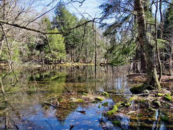 When we got to Iron Wheel Junction, we turned right on the Logger's Loop. Before continuing the hike, I took some pictured. There was no snow or ice anywhere on the trails. We started out on the Loggers Loop heading toward Times Square. The trail was muddy and wet in most places. There were some very large puddles that were almost small ponds with water several inches deep. We were able to bushwhack to avoid the largest stretches of water. A little farther along there was another blowdown that had fallen across the trail and would require tools to clear. The stream that runs under the trail through the large culvert had a good volume and I took some pictures as the light was just right. Just up the trail on the left side of the trail was a small waterfall which demanded some more shots. As we walked up the trail there were more muddy and wet areas. I always notice the ledges on the north Sid of the trail and promise myself that I would explore them. Today was not the day. There were some additional blowdowns and all the streams that flowed across the trail were running high. In many places there were streams with significant volumes that I could not remember ever having water in them. We passed a tricycle perched on a large rock that had been there for a very long time. The most amazing part of this is that it had been there for 20 years and no one had removed it! When we came to the seasonal pond on the left side of the trail, I could see that it was filled to the brim. I stopped to take some shots and wondered how they would turn out as the lighting was not the best. I had to avoid a large puddle on the way back out to the main trail. We continued on the trail and headed downhill to Times Square which was damp but relatively dry compared to the rest of the trail. I thought about turning left and climbing the Big Rock Trail to add mileage but I knew Cindy would not be impressed. We walked straight across Times Square to stay on the Logger's Loop and came to a stream which is often dry. This time the dream was, like many of the others, flowing deep and fast. I took more photographs both upstream and downstream before crossing using stepping stones and incredible balance. We started uphill and encountered more water and mud. Although the trail is slightly uphill we were setting a good pace. We continued walking on the trail trying to avoid the deep mud that was present in many areas. Soon we crested the hill and continued to walk out to Gravestone Junction. This was the driest section if trail with no water or mud. At the junction we turned left. We headed back to the car on the woods road. Until this point we had met no other hikers. On the way to the register, I looked up to see a hiker coming toward us wt his dog. I pulled Sheila off the side of the trail to wait for the hiker to pass. He put his dog on a leash and walked by as we greeted each other. Sheila ignored the lither dog who was barking loud and long. We walked back toward the register over the wet trail. At the register we continued straight ahead on the woods road back to the car. There was one car parked next to ours in the small lot and a pickup truck was in the larger lot. It was 2:55 PM and we had spent 2 hours and 50 minutes hiking 4.0 miles with an elevation gain was a modest 375 feet. Much of this time was spent taking pictures and clearing the trail. The temperature was now 58 degrees as we left the parking area. When we got home, I noticed we had one ambulance call but a crew had covered it.
![]()
![]()
![]()
![]()
![]() On Wednesday, March 6th, I wanted to get out for a short hike near home that was not on Round Top. I thought about going to the Beaverkill Campgrounds to see the level of the water in the stream after the snow melt and recent rain. I asked Cindy if she wanted to go and she agreed. As we started to get ready at 11:45 AM the temperature was 52 degrees on the back porch with cloudy and overcast skies. Rain was in the forecast and we wanted to get a hike in before the drops began to fall. As usual, Sheila was excited but was trying to be the "good dog". I got dressed in my Mammut crew top but decided against a baselayer. I wore my Railriders hiking pants which are expensive but last along time and have features like deep pockets and a generous cut which I really like. The pants have Velcro closures at the ankles. I decided to put on my Keen Durand hiking boots which I ordered a half size larger than the previous pair. These shoes fit well out of the box but get much tighter when I add a decent insole. Without the third party insole, by feet hurt from the lack of support. I added a new pair of Xstance insoles in an effort to find the best support and cushioning for my feet. These insoles have shock absorbing gel pads, TPU arch support, and memory foam cushioning all wrapped in a breathable fabric. The insoles have been hyped by their manufacturer and they really do seem to deliver. I decided to take my Leki poles with external locks as the internal twist locks sometimes fail. I donned my Mammut hoody to block the breezy and keep me warm. It has pit zips that open all the way to the lower hem. I did put on a light hat and took a pair of light knitted gloves. I brought along my phone but resolved to leave it in the car as there was no service in the area anyway. I put our gear in the back of the car and Sheila in the back seat and we left the house at 12:00 PM. I drove out Old Route 17 toward Roscoe and turned right on Beaverkill Road. As we started the descent into the Beaverkill Valley, I turned left on Campsite Road and followed it down to the parking area near the Beaverkill Covered Bridge. It was then that I remebered that the Beaverkill Covered Bridge was closed since a car had impacted some of the supports. I decided to see what the bridge looked like inside. There was one car parked on the road that goes through the bridge but none in the parking lot! A glance at the river showed that the level was high. The water covered the sandy beach and almost covered the rock I usually stand on to take pictures.
On Wednesday, March 6th, I wanted to get out for a short hike near home that was not on Round Top. I thought about going to the Beaverkill Campgrounds to see the level of the water in the stream after the snow melt and recent rain. I asked Cindy if she wanted to go and she agreed. As we started to get ready at 11:45 AM the temperature was 52 degrees on the back porch with cloudy and overcast skies. Rain was in the forecast and we wanted to get a hike in before the drops began to fall. As usual, Sheila was excited but was trying to be the "good dog". I got dressed in my Mammut crew top but decided against a baselayer. I wore my Railriders hiking pants which are expensive but last along time and have features like deep pockets and a generous cut which I really like. The pants have Velcro closures at the ankles. I decided to put on my Keen Durand hiking boots which I ordered a half size larger than the previous pair. These shoes fit well out of the box but get much tighter when I add a decent insole. Without the third party insole, by feet hurt from the lack of support. I added a new pair of Xstance insoles in an effort to find the best support and cushioning for my feet. These insoles have shock absorbing gel pads, TPU arch support, and memory foam cushioning all wrapped in a breathable fabric. The insoles have been hyped by their manufacturer and they really do seem to deliver. I decided to take my Leki poles with external locks as the internal twist locks sometimes fail. I donned my Mammut hoody to block the breezy and keep me warm. It has pit zips that open all the way to the lower hem. I did put on a light hat and took a pair of light knitted gloves. I brought along my phone but resolved to leave it in the car as there was no service in the area anyway. I put our gear in the back of the car and Sheila in the back seat and we left the house at 12:00 PM. I drove out Old Route 17 toward Roscoe and turned right on Beaverkill Road. As we started the descent into the Beaverkill Valley, I turned left on Campsite Road and followed it down to the parking area near the Beaverkill Covered Bridge. It was then that I remebered that the Beaverkill Covered Bridge was closed since a car had impacted some of the supports. I decided to see what the bridge looked like inside. There was one car parked on the road that goes through the bridge but none in the parking lot! A glance at the river showed that the level was high. The water covered the sandy beach and almost covered the rock I usually stand on to take pictures.
 As we were getting ready to start the hike, a FedEx truck came down Campsite Road heading for the bridge. I really thought the truck was going to go through the height restricter but it stopped short. I assume the drover was simply following his GPS. The truck backed up, turned around, amd headed back up Campsite Road. We started our hike at 12:00 PM by walking out of the parking lot to the bridge with the temperature at 52 degrees. I was surprised to see that the barriers and signs had been removed from the bridge and that it was open to traffic. When we got to the other side, I looked at the trail and saw that it was completely bare. We turned left on a woods road that parallels the river and started down the short hill. The trail was damp but there was no snow or ice. I had decided to wait until the return trip to take any pictures. We continued on the deserted woods road. We could hear the river and see the whitecaps on the water. The river was considerably higher than it had been for some time. Even though the landscape was bleak it had a serene feel enhanced by the sound of the flowing water. On the trail we passed by several areas with unused picnic tables. They sit unused and rotting along the road, a testimony to better days. We walked by more tables which had not been used in years. A little later we came to what was once a bathroom for some campsites that had long since disappeared. There were more tables in this area. We were keeping up a fast pace trying to stay ahead of the rain that I thought might be coming our way. At about .7 miles into the hike the woods road met the paved road that serves the campsites. We continued on the road through the campsites and along the river. Many of the campsites have a cement block fireplace with a grill but some were upgraded to poured concrete. Everything was very quiet except for the water in the river. This was not surprising as the campsites were closed. We found one small pile of snow where the campsites had been plowed otherwise the area was completely bare. The skies remained overcast but no rain was falling.
 We walked to the last campsite where the trail ends and I walked down to the edge of the river. I was careful to watch where I was walking as I did not want to slip into the cold water. I stopped to take some pictures of the river especially downstream. We continued a little further passed the last campsite and walked a path along the river. I took some shots downstream where the river turned to the left. The water was very clear with a slight greenish tint from looking through to the bottom. As we walked back passed the last campsite, we continued across the campsite road to another set of campsite. Several large trees ahd been cut and sectioned and were laying on the ground. Some trees were obviously rotten but others looked healthy. I took several pictures of the trees and even posed Sheila in one for perspective. When I was done we walked out to the last bathroom to walk back on the other paved road through the campsites. This road parallels the one we walked out on to make a sort of loop. I took some shots of the bare pavement and the tattered volleyball net. We stopped near the end of the road where it starts up to the Berry Brook Road. I took some pictures of the maintenance buildings and more shots of the campsites without a covering of snow. When I was done, I packed up my camera and we retuned the way we had come although at a quicker pace. We still had not seen any people on the trails and very few cars had passed by on the roads. When we came to the first bathroom, I walked over to the river where the DEC has installed some rocks held in place by wire netting. I stood on the rocks and took some pictures of the rapids downstream. I turned around and took shots upstream where the river splits. I returned to my pack and took some shots of the completely bare woods road. We continued our hike and I began to look to the left where the land rose out of the valley to a ridge. I could see that the land leveled off part of the way up and then started up again. I began to wonder if there was a reason that it leveled off. I looked for some paths up to that level but they were all very steep. I kept looking and found a path that was very distinct and headed diagonally up the hill. At the top I found what looked like a woods road. There were trees growing up in the road and others that fell across it. I turned right and followed the road which became more and more distinct as I walked along the ridge. The road started to drop to the area of the spring house on the main campsite road.
 Once we were back on the trail I took some pictures of the brilliant green water plants growing in the water along the trail. The plants were floating in a small "stream" that extended from the spring house parallel to the trail. The plants appeared as an emerald green mass made all the more colorful by the rather bleak surroundings. When I had gotten all the pictures I wanted, I walked back down the trail to the point where a small path led down to the river's edge. I worked my way down to a vantage point being careful not to fall in the swiftly moving and cold water. I snapped some photos downstream where there were whitecaps on the water. I turned upstream and took a few shots of the covered bridge. I finished my photography and walked back to my pack were I put away the camera. We walked up the hill to the road and turned right to walk through the bridge. We turned right to go back to the parking area. We decided to continue along the near side of the river to the bench near the edge of the river. We walked by the newest bathhouse and through a gate. In front of us was what looked like a cement sidewalk. An arm of the river used to pass through this area and the "sidewalk" was there so that cars could ford the shallow water. The section of river had been diverted and only the ford remained. As we walked on the woods road we came to some piles of stones used in the campsites. The large trunk that had lain across the trail had been removed. We continued to walk until we came to the stone bench. Sheila jumped up on it and I took a few pictures. We took a slightly different route back passing in back of the bathroom. There was one large blowdown on this route and I hoped the DEC would clear it in the spring. Before returning to the car, I walked to the left and down to the edge of the river. I took pictures of the bridge and the river flowing under it. There weren't many places to stand as the water was so high it covered the large flat rock I usually use as a viewpoint. When I was done, I walked over to the car. We were back at the car at 2:05 PM having hiked 2.8 miles in 1 hour and 40 minutes with plenty of stopped time for pictures. The car's thermometer read 58 degrees.
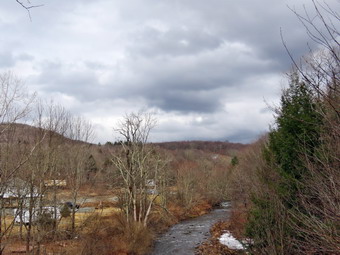
![]()
![]()
![]()
![]()
![]() On Monday, March 4th, I wanted to get in a hike for the first time this week! After six ambulance calls starting yesterday evening, I decided to take some time to hike on a warm and sunny day. It was late afternoon when I decided to just go to Parksville and hike the rail trail even though it is under three miles out and back. By the time I started to get ready at 3:45 PM the temperature was 58 degrees with a slight breeze. The skies were overcast and it almost looked like it would rain. I asked Cindy if she wanted to go and she surprised me by saying "Yes". I got dressed in my Mammut crew top but decided against a baselayer. I wore a pair of Bauer First Ascent pants which are insulated against the cold and are slightly water repellant. I knew these pants were overkill nut I had just washed my Railriders pants. I don't like the fit of these pants and have been looking for a replacement. I decided to put on my Keen Durand hiking boots which I ordered a half size larger than the previous pair. These shoes fit well out of the box but get much tighter when I add a decent insole. Without the third party insole, by feet hurt from the lack of support. I added a new pair of Xstance insoles in an effort to find the best support and cushioning for my feet. These insoles have shock absorbing gel pads, TPU arch support, and memory foam cushioning all wrapped in a breathable fabric. The insoles have been hyped by their manufacturer and they really do seem to deliver. I decided to take my Leki poles with external locks as the internal twist locks sometimes fail. I donned my Mammut hoody to block the breezy and keep me warm. It has pit zips that open all the way to the lower hem. I did put on a light hat and took a pair of light knitted gloves. I also put on my OR Crocodile gaiters as I thought there would be a mixture of ice and mud on the trail. I put our gear in the back of the car and Sheila in the back seat. We left Livingston Manor at 3:05 PM and drove out Old Route 17 toward Parksville. Just after Fox Mountain Road, I pulled into the parking area on the right side of the road. There were no cars parked in the lot as we were getting ready to hike. I left my phone in the car so that I could enjoy the hike. We started out on the trail at 3:15 PM with very little sun ender overcast skies.
On Monday, March 4th, I wanted to get in a hike for the first time this week! After six ambulance calls starting yesterday evening, I decided to take some time to hike on a warm and sunny day. It was late afternoon when I decided to just go to Parksville and hike the rail trail even though it is under three miles out and back. By the time I started to get ready at 3:45 PM the temperature was 58 degrees with a slight breeze. The skies were overcast and it almost looked like it would rain. I asked Cindy if she wanted to go and she surprised me by saying "Yes". I got dressed in my Mammut crew top but decided against a baselayer. I wore a pair of Bauer First Ascent pants which are insulated against the cold and are slightly water repellant. I knew these pants were overkill nut I had just washed my Railriders pants. I don't like the fit of these pants and have been looking for a replacement. I decided to put on my Keen Durand hiking boots which I ordered a half size larger than the previous pair. These shoes fit well out of the box but get much tighter when I add a decent insole. Without the third party insole, by feet hurt from the lack of support. I added a new pair of Xstance insoles in an effort to find the best support and cushioning for my feet. These insoles have shock absorbing gel pads, TPU arch support, and memory foam cushioning all wrapped in a breathable fabric. The insoles have been hyped by their manufacturer and they really do seem to deliver. I decided to take my Leki poles with external locks as the internal twist locks sometimes fail. I donned my Mammut hoody to block the breezy and keep me warm. It has pit zips that open all the way to the lower hem. I did put on a light hat and took a pair of light knitted gloves. I also put on my OR Crocodile gaiters as I thought there would be a mixture of ice and mud on the trail. I put our gear in the back of the car and Sheila in the back seat. We left Livingston Manor at 3:05 PM and drove out Old Route 17 toward Parksville. Just after Fox Mountain Road, I pulled into the parking area on the right side of the road. There were no cars parked in the lot as we were getting ready to hike. I left my phone in the car so that I could enjoy the hike. We started out on the trail at 3:15 PM with very little sun ender overcast skies.
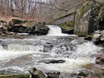 The first part of the trail was completely bare but a little soft from the rain during the week. Once we were on the trail and sheltered by the trees it was slightly cooler. The trail was wet and had mud in many places. We tried to avoid the water and mud which was possible in some spots but not in all. The rail trail runs parallel to the Little Beaverkill and the new section of State Route 17. It follows the route of the O&W railroad and is very flat. The water level in the stream was high and there was some ice in the stream in several places. We passed several benches placed for people to rest in warmer weather. I stopped at the area just before the wooden walkways and the bridge to take some pictures down to the stream. The stream looked very cold and was made even colder by the overcast skies. I also took pictures of the trail and the walkways. The trail and walkways were bare in both directions although there continued to be water and mud on the trails. As I walked over the walkways, I saw that the tree I had cut on the bridge had fallen off the bank into the ditch beside walkway. We came to the area where a mudslide had brought down earth and a number of trees onto the trail. There was also a covering of ice in this area which was very slippery. We hopped over the trunk and carefully walked along the edge of the ice. Once we were off the ice, I stopped to take some shots of the mess the mudslide had created. We continued on the trail heading toward the falls. As we walked, I could hear an increase in the noise from the stream and I knew the falls were just ahead. When we got to the falls, I debated whether or not I would descend the path to the streambed. I decided that the views were interesting enough to work my way down to the stream.
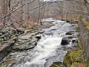 I carefully used my poles and various handholds to work my way down the path. There were a few slippery spots where there were leaves and mud on the path but I finally made it to the bottom. As I was getting out my camera out of my pack, Sheila came running full speed down the path! I took shots downstream and directly in front of me. I then turned my attention upstream to the falls. I took shots encompassing the entire scene and then several close-ups of the main falls and the rapids below it. I like the noise of the falls and the volume of water which I find peaceful. When I was finished, I packed up and we walked back up the path to the trail. I took some more pictures of the falls from above. I also took shots upstream where there was a nice contrast between the stream and the leaves on the ground. I packed up my camera and we continued on the trail toward Parksville. Soon we were nearing the Parksville end of the trail passing many rundown and dilapidated buildings which should be removed. Several of the buildings showed that work had been done on them. There seemed to be a major construction project encompassing several lots. On the Parksville end of the trail we found the small garden and a very informative sign. The sign listed the businesses and hotels that existed in Parksville during its heyday. The Young's Gap Hotel had room for 600 guests! The sign also explained the role of the railroad in the dairy industry which was a thriving one in all of Sullivan County. After the briefest pause, we turned around at 4:10 PM and started back to the car. We kept up a good pace as we knew where the softest spots were and could avoid them. We passed the falls and eventually came to the icy area by the mudslide. I decided to go off the trail to avoid the ice and mud. We continued over the bridge and the walkways and soon broke out of the trees. We eventually arrived back at the car at 4:40 PM after hiking 2.8 miles in 1 hour and 25 minutes. My phone showed there had been no ambulance calls.
![]()
![]()
![]()
![]() On Friday, March 1st I planned to get out for a hike nearby after doing some work at my church in the morning. At noon I began to get ready with the temperature at 48 degrees on the back porch with partly sunny skies. I decided I would take Sheila across the street to Round Top to hike. As we began to get ready, Sheila was keeping a careful eye on me as I dressed as she would hike every day. Sheila often examines and sniffs my clothing to make sure I am serious about hiking. I decided to wear my Mammut long-sleeved crew shirt with a light short-served baselayer. This combination is a little bit warmer and appropriate for the colder weather. I wore my Railriders hiking pants which are expensive but last along time and have features like deep pockets and a generous cut which I really like. The pants have Velcro closures at the ankles. I decided to put on my new Keen Durand hiking boots which I ordered a half size larger than the previous pair. These shoes fit well out of the box but get much tighter when I add a decent insole. Without the third party insole, by feet hurt from the lack of support. I added a new pair of Xstance insoles in an effort to find the best support and cushioning for my feet. These insoles have shock absorbing gel pads, TPU arch support, and memory foam cushioning all wrapped in a breathable fabric. The insoles have been hyped by their manufacturer and they really do seem to deliver. I did decide to wear my Mammut hoody to block the breeze and keep me warm. It has pit zips that open all the way to the lower hem. I did put on a fleecy hat and light knit gloves. I decided to take my Leki poles with external locks as the internal twist locks sometimes fail. I wore my OR Crocodile gaiters as I thought we might encounter some mud on the trails. I left my phone at home as I planned to hike quickly and relax a little instead of thinking about ambulance calls. At 12:30 PM we walked out the door to start the hike. I grabbed Sheila's leash from my car and put it on her as we walked up the driveway. I aimed to hike for about a little over an hour and complete two figure 8's as well as cut the blowdown. Sheila was happy to get out as we headed down the driveway and across the street. We crossed the street and walked to the parking lot next to the Presbyterian Church. We walked to the back of the church and began the ascent of the steepest hill behind the church. The hill is short but gets the circulation pumping and is the steepest and longest climb on the "trail." I did have to stop once on the way to the top of the hill. I could really feel the fact that I had not been hiking consistently. The hill was completely devoid of snow and ice. At the top we paused for a minute so I could look around at the hills that surround the hamlet of Livingston Manor. I could not see any snow on any of the surrounding hills. The skies were overcast with clouds and some sun and blue patches. We continued the hike by turning left at the trailhead. The trail was covered in leaves and muddy in a few places but there was no snow.
On Friday, March 1st I planned to get out for a hike nearby after doing some work at my church in the morning. At noon I began to get ready with the temperature at 48 degrees on the back porch with partly sunny skies. I decided I would take Sheila across the street to Round Top to hike. As we began to get ready, Sheila was keeping a careful eye on me as I dressed as she would hike every day. Sheila often examines and sniffs my clothing to make sure I am serious about hiking. I decided to wear my Mammut long-sleeved crew shirt with a light short-served baselayer. This combination is a little bit warmer and appropriate for the colder weather. I wore my Railriders hiking pants which are expensive but last along time and have features like deep pockets and a generous cut which I really like. The pants have Velcro closures at the ankles. I decided to put on my new Keen Durand hiking boots which I ordered a half size larger than the previous pair. These shoes fit well out of the box but get much tighter when I add a decent insole. Without the third party insole, by feet hurt from the lack of support. I added a new pair of Xstance insoles in an effort to find the best support and cushioning for my feet. These insoles have shock absorbing gel pads, TPU arch support, and memory foam cushioning all wrapped in a breathable fabric. The insoles have been hyped by their manufacturer and they really do seem to deliver. I did decide to wear my Mammut hoody to block the breeze and keep me warm. It has pit zips that open all the way to the lower hem. I did put on a fleecy hat and light knit gloves. I decided to take my Leki poles with external locks as the internal twist locks sometimes fail. I wore my OR Crocodile gaiters as I thought we might encounter some mud on the trails. I left my phone at home as I planned to hike quickly and relax a little instead of thinking about ambulance calls. At 12:30 PM we walked out the door to start the hike. I grabbed Sheila's leash from my car and put it on her as we walked up the driveway. I aimed to hike for about a little over an hour and complete two figure 8's as well as cut the blowdown. Sheila was happy to get out as we headed down the driveway and across the street. We crossed the street and walked to the parking lot next to the Presbyterian Church. We walked to the back of the church and began the ascent of the steepest hill behind the church. The hill is short but gets the circulation pumping and is the steepest and longest climb on the "trail." I did have to stop once on the way to the top of the hill. I could really feel the fact that I had not been hiking consistently. The hill was completely devoid of snow and ice. At the top we paused for a minute so I could look around at the hills that surround the hamlet of Livingston Manor. I could not see any snow on any of the surrounding hills. The skies were overcast with clouds and some sun and blue patches. We continued the hike by turning left at the trailhead. The trail was covered in leaves and muddy in a few places but there was no snow.
We passed by all the places where I had cut trees to remove them from the trail. At the first trail junction, I said "Right" and followed Sheila as she turned right and started up the woods road which has the gentler approach of the two. There were a number of small branches on the trail from the winds that had passed through the area. I removed these branches either by dragging them off the trail. It was a pleasure to walk on the trails and it was obvious more people were using them. We reached the end of the woods road and turned left up the hill on the trail. I could see the frame and tarps that covered the mouth of one of the "caves". They were looking like someone had cleaned up the area and might be using it again. We continued up the trail to the first trail junction with the upper blue trail where we turned left to follow the yellow trail along the base of Round Top. We continued on the yellow trail along the base of Round Top. We soon ran into a small tree that had fallen across the trail in the high winds the night before. It appeared I would need tools to remove the small tree across the trail. I began to think about completing one figure 8 and going home to get the tools. In the end, I decided to wait until the next day to remove it. We came to the next junction with the blue trail and turned right to head up the blue trail toward the summit. This trail also lacked any snow. When we got to the switchback, we turned right and followed it until it came back to the main blue trail. The fact that the switchback sidehills in places made the walk a little more difficult. We turned right and then continued straight ahead and up the hill toward the summit of Round Top bypassing the white crossover trail. As we walked over the high point, I removed a couple of branches from the trail. We continued over the summit and down the blue trail toward the junction with the yellow trail. On this side of the hill there was also no snow on the trail but the melting snow and rain the previous day left some muddy spots that made the descent a little tricky. We bypassed the white crossover trail again and continued down to the yellow trail. At the junction with the yellow trail we turned right and walked the yellow trail along the base of Round Top toward the next junction with the blue trail. As we came to the small tree across the trail, I decided to see if I could just drag it of the trail. I lifted the butt end and was able to pull it all the way off the trail although it was a little longer than I thought. At the next junxtion, we turned left and started slightly downhill toward the lookout over town. We passed the "sitting rock" and continued downhill.
When we reached the lookout, we followed the yellow trail as it turned left and walked down the hill to the first trail junction. We immediately turned around and started back up the trail. I could feel that I was out of shape but I did not have to stop to get up the hill. We ignored the trail to the lower lookout and followed the yellow trail. We followed the yellow trail as it turned right and headed uphill toward the junction with the blue trail. We hiked up a short but steep little hill and arrived at the trail junction. We turned right to follow the trail along the base of Round Top. Sheila was some distance behind when she came roaring passed me at full speed. She passed me, made a 180 degree turn, and came running back. She repeated this several times before I called her off. I was glad she shows so much energy at the age of 12. We arrived at the next junction with the blue trail after passing the point where I had moved the blowdown. We turned left to start the walk up the blue trail toward the summit. Sheila and I turned left on the white crossover trail as I wanted to inspect it. We almost immediately came to another small tree across the trail. I decided to pull it off the trail and was successful in my efforts. We continued to walk along the white trail until it met the main blue trail on the other side of the hill. We turned left and left again on the switchback in the blue trail. We followed the switchback out into the forest and then back to the main trail. We turned left and walked downhill to the yellow trail where a left turn again took us along the base of Round Top. At the junction, Sheila and I turned right and walked down the trail to the woods road. We followed the woods road downhill with the ledges to the right. At the first trail junction, we turned left and walked straight out to the trailhead. We turned right and walked downhill and crossed the parking lot to the road. We waited to cross the road as several cars went by and then crossed to the driveway to the house. It was 1:40 PM and we had hiked a little over 2 miles and done some trail maintenance in 1 hour and 10 minutes. It was a pleasant hike and when we got back I found there were no ambulance calls while I was gone!
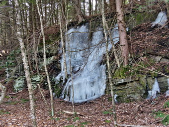
![]()
![]()
![]()
![]()
![]() On Tuesday, February 27th I wanted to get out for a longer hike than the one on Round Top. An early morning ambulance call meant that I slept until 10:00 AM. As often happens I had to do some work at home before thinking about hiking. I finished everything I had to do and was ready to hike at 12:45 PM at 60 degrees on the back porch. I took a chance and asked Cindy if she would like to hike and she declined. I decided to hike the Parksville Rail Trail from Parksville toward Livingston Manor. I started to get ready at 12:46 PM. I decided to wear my Mammut long-sleeved crew shirt with a light long-sleeved baselayer. This setup is a little bit warmer and appropriate for the cooler weather. I wore my Railriders hiking pants which I thought would be warm enough despite the temperature. They are expensive but last along time and have features like deep pockets and a generous cut which I really like. The pants have Velcro closures at the ankles. I decided to put on my new Keen Durand hiking boots which I ordered a half size larger than the previous pair. These shoes fit well out of the box but get much tighter when I add a decent insole. Without the third party insole, by feet hurt from the lack of support. I added a new pair of Xstance insoles in an effort to find the best support and cushioning for my feet. These insoles have shock absorbing gel pads, TPU arch support, and memory foam cushioning all wrapped in a breathable fabric. The insoles have been hyped by their manufacturer and they really do seem to deliver. I decided to take my Leki poles with external locks as the internal twist locks sometimes fail. I wore my Mammut hoody to block the breezy and keep me warm. It has pit zips that open all the way to the lower hem. I did put on a light hat and put a pair of light gloves in my pockets. I wore my OR Crocodile gaiters as I thought we might encounter snow and mud on the trail. At 1:05 PM I put my gear in the car and Sheila in the back seat. I headed out Old Route 17 across the Flats and then took Old Route 17 and Service Road to the point where they meet Fox Mountain Road. Just after this intersection is the western parking area for the rail trail. The parking lot was empty as I put Sheila on her leash for the short road walk to the beginning of the trail.
On Tuesday, February 27th I wanted to get out for a longer hike than the one on Round Top. An early morning ambulance call meant that I slept until 10:00 AM. As often happens I had to do some work at home before thinking about hiking. I finished everything I had to do and was ready to hike at 12:45 PM at 60 degrees on the back porch. I took a chance and asked Cindy if she would like to hike and she declined. I decided to hike the Parksville Rail Trail from Parksville toward Livingston Manor. I started to get ready at 12:46 PM. I decided to wear my Mammut long-sleeved crew shirt with a light long-sleeved baselayer. This setup is a little bit warmer and appropriate for the cooler weather. I wore my Railriders hiking pants which I thought would be warm enough despite the temperature. They are expensive but last along time and have features like deep pockets and a generous cut which I really like. The pants have Velcro closures at the ankles. I decided to put on my new Keen Durand hiking boots which I ordered a half size larger than the previous pair. These shoes fit well out of the box but get much tighter when I add a decent insole. Without the third party insole, by feet hurt from the lack of support. I added a new pair of Xstance insoles in an effort to find the best support and cushioning for my feet. These insoles have shock absorbing gel pads, TPU arch support, and memory foam cushioning all wrapped in a breathable fabric. The insoles have been hyped by their manufacturer and they really do seem to deliver. I decided to take my Leki poles with external locks as the internal twist locks sometimes fail. I wore my Mammut hoody to block the breezy and keep me warm. It has pit zips that open all the way to the lower hem. I did put on a light hat and put a pair of light gloves in my pockets. I wore my OR Crocodile gaiters as I thought we might encounter snow and mud on the trail. At 1:05 PM I put my gear in the car and Sheila in the back seat. I headed out Old Route 17 across the Flats and then took Old Route 17 and Service Road to the point where they meet Fox Mountain Road. Just after this intersection is the western parking area for the rail trail. The parking lot was empty as I put Sheila on her leash for the short road walk to the beginning of the trail.
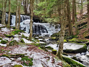 We started out at 1:20 PM with the temperature right at 58 degrees. A slight breeze was blowing but the skies were partly overcast with some sun and blue patches. We walked on Service Road toward Fox Mountain Road on took a left on Fox Mt Road. We walked to the intersection of Fox Mounatin Road and Benton Hollow Road and hopped the guard rail and immediately came to what was left of the trestle supports that carried the trail tracks over the stream. I noticed what remained of a painting on the trestle. I had seen this painting before but had not realized it was a memorial to NASCAR driver Davey Allison #28 who drove the Texaco-Havoline Ford car. Allison died in a helicopter crash in 1993. We walked up the trail to left to the top of the trestle. As we entered the shade of the trees, it immediately seemed a little cooler. The trail was well defined and stretched ahead for some distance. Like most rail trails it is very straight. The hope is to connect the Parksville Rail Trail to all the sections that stretch as far as Livingston Manor. We started to walk along the trail and I noticed there was quite a bit of traffic on the Quickway! The land dropped off steeply to the Little Beaverkill on the right. On the left were some "cliffs" which were the result of the railroad cutting a path for the tracks. The trail had some ice and snow in places. There was also a lot of wet spots with mud. We continued to walk along the well-defined trail. It was a pleasant walk but I had to be careful to avoid the ice and mud! I looked ahead and saw a white object on the trail which had not been there before. As we approached, I could see that it was a large chunk of snow about 18 inches on a side. I had trouble imagining what had formed this object. I stopped an took some pictures of the snow block and some with Sheila next to it. There were almost mo blowdowns on the trail but I did remove a few branches. There are two places along the trail where there are piles of garbage. It is hard to determine why they were there. Both piles have tarps over them which seemed to indicate someone once valued the items. A VW bug was just over the bank on the right after the first pile of debris. We soon came to a gate on the trail which was odd since it was state land. No one seems to know why the gate is there or who placed it. We walked around the gate and continued on the trail. There was a path to the left just after the gate that I knew led to the upper falls at Sonoma Falls as I had used it to return from there several times. I decided we would reverse our normal course and work down from top to bottom.
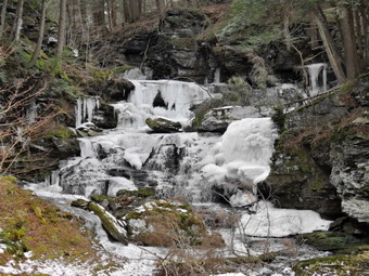 We turned left on the trail and started walking uphill following the trail as it turned right. After a short distance, we turned left and continued to climb following trail as it wound its way up through the woods. Eventually we turned right and started to approach the stream. I knew we were close as I could hear the noise of the falls.
I took some shots and of the lower falls and a few of the upper. We walked back to a path that continued uphill and I thought I remembered it from visits long ago. We turned right and followed the road to a junction with another woods road. There was a sign with colored markers in red, yellow, and blue indicating the different trails. We continued straight ahead as I wanted to get to the top of the last falls. A short walk brought us to the top of the falls where there was a bridge across the stream! To the left and upstream was a small pond with a dam but it was marked with "No Trespassing" signs. I walked to the bridge and took some pictures to the left of the dam. I then turned around and took some pictures of the top of the falls. I put the camera away and shouldered my pack to walk along the edge of the high bank. Sheila likes to get right to the edge and it drives me crazy. When the falls came into view it was obvious that they were still partly frozen and beautiful! I decided not to walk over to the wide, flat rocks that make up the brink of the falls as there was too much ice and snow covering them. I walked along the edge of the chasm and found a way to take some more pictures of the falls. When I had exhausted all the possible shots, I packed up and walked back to bridge. We began a bushwhack through the woods trying to find a path to the base of these frozen falls. I was able to find a path with almost no ice or snow until we were close to the bottom. I took a chance and managed to get to a good spot with only a few slips and one slide. I got out my camera and began to take picture of the biggest of five falls along this stream. There was a lot of ice but the water was flowing freely behind it. I wanted some pictures from further downstream so I put my camera in the pack and worked my way back up the slippery slope. As I was struggling my way back to the path, Sheila was running up and down the trails without a problem. Once I was on the path, I walked downstream until I could follow another path back upstream toward the falls. I took some more shots of these falls as they were so impressive.
We turned left on the trail and started walking uphill following the trail as it turned right. After a short distance, we turned left and continued to climb following trail as it wound its way up through the woods. Eventually we turned right and started to approach the stream. I knew we were close as I could hear the noise of the falls.
I took some shots and of the lower falls and a few of the upper. We walked back to a path that continued uphill and I thought I remembered it from visits long ago. We turned right and followed the road to a junction with another woods road. There was a sign with colored markers in red, yellow, and blue indicating the different trails. We continued straight ahead as I wanted to get to the top of the last falls. A short walk brought us to the top of the falls where there was a bridge across the stream! To the left and upstream was a small pond with a dam but it was marked with "No Trespassing" signs. I walked to the bridge and took some pictures to the left of the dam. I then turned around and took some pictures of the top of the falls. I put the camera away and shouldered my pack to walk along the edge of the high bank. Sheila likes to get right to the edge and it drives me crazy. When the falls came into view it was obvious that they were still partly frozen and beautiful! I decided not to walk over to the wide, flat rocks that make up the brink of the falls as there was too much ice and snow covering them. I walked along the edge of the chasm and found a way to take some more pictures of the falls. When I had exhausted all the possible shots, I packed up and walked back to bridge. We began a bushwhack through the woods trying to find a path to the base of these frozen falls. I was able to find a path with almost no ice or snow until we were close to the bottom. I took a chance and managed to get to a good spot with only a few slips and one slide. I got out my camera and began to take picture of the biggest of five falls along this stream. There was a lot of ice but the water was flowing freely behind it. I wanted some pictures from further downstream so I put my camera in the pack and worked my way back up the slippery slope. As I was struggling my way back to the path, Sheila was running up and down the trails without a problem. Once I was on the path, I walked downstream until I could follow another path back upstream toward the falls. I took some more shots of these falls as they were so impressive.
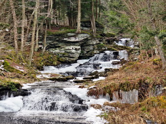 When I was done, we walked back out to the main trail and followed it to the next falls which was almost as impressive as the first. I found a viewpoint where I could take some pictures of the falls but it was blocked by some trees and brush. There was a small pond below the falls and I decided to walk to the other end of the pond to take some shots. We followed the trail down to the end of the pond where there is a dam that forms the pond. I walked out onto the dam and took some shots of the falls with the pond. I also took some pictures downstream of the falls formed by the dam. I stowed the camera and shouldered the pack. We walked along the bank of the stream to a point where I could take some better shots of the whole falls. After I was finished, we again walked along the bank to take picture of the next falls. Views of this falls were not as good as I would have liked as the angle was poor. We again walked along the bank and found a path down to the base of the falls. I took some shots of these falls from different zooms and angles. There was only one more falls so I packed up and we moved to the last falls near the main buildings. I stood on some rocks and took pictures of this smaller falls. In the background the second set of falls could be seen so I varied my composition to get some interesting picture. I decided that I was done taking pictures and wanted to get back to hiking before the rain started. I packed up and we headed back out to the rail trail. As we passed the buildings, I noticed that the buildings looked more run down. The smaller building had some graffiti painted on the windows on the inside! It is a shame that this beautiful location cannot be opened as a town park. I will never understand why people have to destroy places like this. We walked out to the rail trail and for the first time I realized the skies were now completely overcast. I had planned to walk out to the gate by Old Liberty Road and decided I would stick to the plan. We turned left and set a quick pace walking toward Old Liberty Road. The rail bed itself was very soft but in other places there were patches of ice and snow. Soon we were at the gate where we immediately turned around and start the walk back. Soon we came to a small pond on the left with a red building behind it. The building looked to be in good shape but the windows were all boarded up. There was a definite path between the pond on the left and the wetlands on the right of the trail. It looked like a beaver trail to me but I could not see any dam, lodge, or even any trees that the beavers had cut. We continued on the rail trail and were soon back at the gate on the rail trail. From this point we walked quickly back toward the other end of the trail. Several times I thought I felt some rain drops but nothing came of it. When we reached Fox Mt Road, we crossed over the guardrail where I put Sheila on her leash. We followed Fox Mt Road out to Service Road and to the parking area. We were back at the car at 3:20 PM having hiked 4.3 miles in 2 hours with some stopped time for photography. The ascent was 400 feet almost all of which was the climb to the waterfalls. I do hope the plans to connect the sections of the rail trails are successful! I also hope that someone reopens Sonoma Falls as it is a beautiful setting.
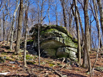
![]()
![]()
![]()
![]()
![]() On Saturday, May 13th, I wanted to get out for a longer hike after sticking to Round Top and trails near home for many walks. I had an overnight ambulance call and slept in until 8:30 AM. I knew that I was the only EMT available to answer calls but I also needed to take some time for myself and Sheila. Rather than travel too far I decided to go to Frick Pond and hike the Flynn Trail where I could hike some uphill miles. This would give me some choices of how far I wanted to hike and the route I would take. I also wanted to see if there were any trees that needed trimming to make hiking easier. As I started to get ready at 11:30 AM, the temperature on the back porch was 56 degrees with sunny skies! I put on my Mammut long-sleeved crew top with a light long-sleeved baselayer as I knew it would be cooler at the trailhead. This combination is a little bit warmer and appropriate for the cooler weather. I wore a pair of Bauer First Ascent pants which are insulated against the cold and are slightly water repellant. I don't like the fit of these pants and have been looking for a replacement. I decided to put on my Keen Durand hiking boots which I ordered a half size larger than the previous pair. These shoes fit well out of the box but get much tighter when I add a decent insole. Without the third party insole, by feet hurt from the lack of support. I added a new pair of Xstance insoles in an effort to find the best support and cushioning for my feet. These insoles have shock absorbing gel pads, TPU arch support, and memory foam cushioning all wrapped in a breathable fabric. The insoles have been hyped by their manufacturer and they really do seem to deliver. I decided to take my Leki poles with external locks as the internal twist locks sometimes fail. I donned my Mammut hoody to block the breezy and keep me warm. It has pit zips that open all the way to the lower hem. I did put on a fleecy hat and light knitted gloves. I also put on my OR Crocodile gaiters as I thought there would be a mixture of ice and snow on the trail. I put my gear in the back and Sheila in the backseat and headed out the DeBruce Road at 11:50 AM. After 6 miles, at Mongaup Pond Road, I turned left and continued to follow the road bearing left onto Beech Mountain Road at the fork. When we arrived in the parking area there were no cars parked in either lot. I pulled into the smaller lot with Sheila acting as if she hadn't hiked in a month as she ran around and headed for the trail. The temperature was 84 degrees and the skies were blue with white clouds. I was surprised by the amount of snow that I could see in the woods. We crossed the road and began our hike at 12:15 PM.
On Saturday, May 13th, I wanted to get out for a longer hike after sticking to Round Top and trails near home for many walks. I had an overnight ambulance call and slept in until 8:30 AM. I knew that I was the only EMT available to answer calls but I also needed to take some time for myself and Sheila. Rather than travel too far I decided to go to Frick Pond and hike the Flynn Trail where I could hike some uphill miles. This would give me some choices of how far I wanted to hike and the route I would take. I also wanted to see if there were any trees that needed trimming to make hiking easier. As I started to get ready at 11:30 AM, the temperature on the back porch was 56 degrees with sunny skies! I put on my Mammut long-sleeved crew top with a light long-sleeved baselayer as I knew it would be cooler at the trailhead. This combination is a little bit warmer and appropriate for the cooler weather. I wore a pair of Bauer First Ascent pants which are insulated against the cold and are slightly water repellant. I don't like the fit of these pants and have been looking for a replacement. I decided to put on my Keen Durand hiking boots which I ordered a half size larger than the previous pair. These shoes fit well out of the box but get much tighter when I add a decent insole. Without the third party insole, by feet hurt from the lack of support. I added a new pair of Xstance insoles in an effort to find the best support and cushioning for my feet. These insoles have shock absorbing gel pads, TPU arch support, and memory foam cushioning all wrapped in a breathable fabric. The insoles have been hyped by their manufacturer and they really do seem to deliver. I decided to take my Leki poles with external locks as the internal twist locks sometimes fail. I donned my Mammut hoody to block the breezy and keep me warm. It has pit zips that open all the way to the lower hem. I did put on a fleecy hat and light knitted gloves. I also put on my OR Crocodile gaiters as I thought there would be a mixture of ice and snow on the trail. I put my gear in the back and Sheila in the backseat and headed out the DeBruce Road at 11:50 AM. After 6 miles, at Mongaup Pond Road, I turned left and continued to follow the road bearing left onto Beech Mountain Road at the fork. When we arrived in the parking area there were no cars parked in either lot. I pulled into the smaller lot with Sheila acting as if she hadn't hiked in a month as she ran around and headed for the trail. The temperature was 84 degrees and the skies were blue with white clouds. I was surprised by the amount of snow that I could see in the woods. We crossed the road and began our hike at 12:15 PM.
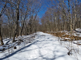 The Flynn Trail is sited along what used to be Beech Mountain Road which was the access for the Beech Mountain Boy Scout Camp. We walked the trail through the woods which was mostly amp with a little mud but no snow. We passed by several trees I had cut and removed from the trail. Some were cut with the help of local Ranger Eric Stratton. There was one new tree that had fallen across the trail which would require tools to remove. We continued on the Flynn Trail and turned right on the woods road and continued to set a good pace up the hill. The trail gains a little over 600 feet in 1.7 miles to the highest point at the junction with the Big Rock Trail. We passed the hemlock that used to form a tunnel but was cleared by the DEC. Just after this the the trail was covered in snow amounting to a couple of inches. I began to find some small branches on the trail which I removed. I was surprised that there weren't more large branches or trees across the trail as we have had several storms with high winds. The trail continued to alternate between areas that were completely clear to areas that were covered with several inches of snow. As we approached and the clearing to the right of the trail, we passed by some rock ledges on the right side of the trail. It was a beautiful day and the sun was shining in the rocks and the trail. I decided to stop and take a few shots of these ledges and the trail itself. I noticed that I was very relaxed and decided I needed to get out more as the other things that I do can be stressful. I thought about visiting the clearing but decided I wanted to stay on the main trail. We did run across a few small trees across the trails and one very large one. I worked to remove some of the branches around the large blowdown to clear a path for hikers. We kept walking uphill and we were soon at the junction with the Big Rock Trail. This junction was covered in several inches of snow in all four directions. We turned left to walk down the Big Rock Trail where the layer of snow continued for some time. The hike down the trail went well and more quickly than I expected. It was definitely easier than the uphill hike. This trail can be tricky as there are several levels that make it seem like the bottom of the hill. As we came to the bottom of the descent, the snow disappeared.
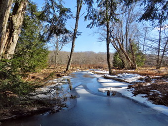 We were soon at Times Square and I thought about turning right to hike up and around the Logger's Loop to add some distance to our hike. I decided against this as it was getting late and we continued our hike by walking straight across Times Square to stay on the Big Rock Trail. I stopped for a few minutes to take pictures of the junction and the trails. All of the trails had some snow more or less. The Big Rock Trail around the back of Frick Pond can be very wet, but on this day it was mostly frozen and covered with snow. We passed the very large blowdown which Ranger Stratton and I had cleared. As we headed for the two small bridges on the trail, we ran into a lot of ice which made the trail very slippery for me. Sheila was having no problem with the ice and snow. We crossed the two small bridges over the inlets to the pond and I decided to stop to take pictures. The water under the first bridge was backed up from the wetlands amd was partly frozen. The area under the second bridge had a stream fowling but the volume was low. I took some pictures from the first bridge and then moved on. The sun was working its way up in the sky giving a warm feeling to the setting. When we got to the area that was covered by tall evergreens, I again ran into a lot of ice on the trail. To keep myself from slipping I walked on the snow and pine needles near the edges of the trail. The wooden boardwalks had some ice and snow and continue to show wear with many boards loose and other beginning to rot. Much of the boardwalk now "floats" in midair as the supports are rotting. I did stop to take a few pictures before continuing the hike.
 The rest of the trail was covered in snow to the trail junction. At the next trail junction we turned left on the Quick Lake Trail to head for the bridge across the outlet of Frick Pond. As we walked along the west side of Frick Pond to the bridge across the outlet of the pond, there was a lot of snow and some ice as the trail is shaded by trees and bushes. We crossed the bridge and I put down my pack and got out the camera. I took shots of the pond and of Beech Mountain from different angles. I also took some pictures of Sheila on the bridge. When I was done, I pack up the camera and started up the hill toward Gravestone Junction. The hill was covered in ice forcing me to the sides of the trail. At the top, we continued along the trail to Gravestone Junction. The junction is named for the memorial near the junction for a tragedy involving the Lobdells. The father of this family was the caretaker for the Frick popery and the family lived in a cabin along what is now the Quick Lake Trail, One night the cabin caught fire. The parents were able to get out but their two children were trapped inside and died in the flames. From Gravestone Junction we continued on the Quick Lake Trail and passed the Lobdell memorial marker. The trail back to the register was alternately covered in snow and ice or a combination of both. We passed the trail register heading toward the parking area. We continued straight ahead to follow the woods road out to the car in the small lot. We arrived at the car at 3:30 PM having hiked 4 miles in 2 hour and 20 minutes with an elevation gain of 690 feet. The temperature was 54 degrees at the car. There was a commercial van with Jersey plates parked next to my car. I backed out go the lot and headed home feeling a little tired but very relaxed. As we passed Mongaup Pond Road, I thought about stopping to go to Mongaup Falls but kept driving instead!
![]()
![]()
![]()
![]() On Saturday, February 24th I really wanted to get out for a hike after spending a good part of the day with ambulance corps business. I participated in a sendoff for the high school basketball team for a playof game in Chester. I was back home at 3:00 PM and started to get ready with the temperaure at 31 dgrees. I could see there was plenty of sunshine which made it look warmer out. I decided to go across the street to Round Top to hike. I intended to leave my phone home so that I could enjoy a hike without interruption. As we began to get ready, Sheila was keeping a careful eye on me as I dressed as she would hike every day. Sheila often examines and sniffs my clothing to make sure I am serious about hiking. I decided to wear my Mammut long-sleeved crew shirt with a light long-sleeved baselayer. This setup is a little bit warmer and appropriate for the cooler weather. I wore my Railriders hiking pants which I thought would be warm enough despite the temperature. They are expensive but last along time and have features like deep pockets and a generous cut which I really like. The pants have Velcro closures at the ankles. I decided to put on my new Keen Durand hiking boots which I ordered a half size larger than the previous pair. These shoes fit well out of the box but get much tighter when I add a decent insole. Without the third party insole, by feet hurt from the lack of support. I added a new pair of Xstance insoles in an effort to find the best support and cushioning for my feet. These insoles have shock absorbing gel pads, TPU arch support, and memory foam cushioning all wrapped in a breathable fabric. The insoles have been hyped by their manufacturer and they really do seem to deliver. I decided to take my Leki poles with external locks as the internal twist locks sometimes fail. I wore my Mammut hoody to block the breezy and keep me warm. It has pit zips that open all the way to the lower hem. I did put on a light hat and a pair of gloves. At 3:25 PM we walked out the door to start the hike. I grabbed Sheila's leash from my car and put it on her as we walked up the driveway. There was no snow to be seen but I wondered if there might still be dome in the woods. I aimed to hike for about an hour and complete two figure 8's. Sheila was happy to get out as we headed down the driveway and across the street. We crossed the street and walked to the parking lot next to the Presbyterian Church. We walked to the back of the church and began the ascent of the steepest hill behind the church. The hill is short but gets the circulation pumping and is the steepest and longest climb on the "trail." We did not stop until we reached the top of the hill. At the top we paused for a minute so I could look around at the hills that surround the hamlet of Livingston Manor. All of the snow was completely gone from the trail and surrounding forest. We continued the hike by turning left at the trailhead. The trail was muddy in a few places as the snow and melted and rain had fallen yesterday.
On Saturday, February 24th I really wanted to get out for a hike after spending a good part of the day with ambulance corps business. I participated in a sendoff for the high school basketball team for a playof game in Chester. I was back home at 3:00 PM and started to get ready with the temperaure at 31 dgrees. I could see there was plenty of sunshine which made it look warmer out. I decided to go across the street to Round Top to hike. I intended to leave my phone home so that I could enjoy a hike without interruption. As we began to get ready, Sheila was keeping a careful eye on me as I dressed as she would hike every day. Sheila often examines and sniffs my clothing to make sure I am serious about hiking. I decided to wear my Mammut long-sleeved crew shirt with a light long-sleeved baselayer. This setup is a little bit warmer and appropriate for the cooler weather. I wore my Railriders hiking pants which I thought would be warm enough despite the temperature. They are expensive but last along time and have features like deep pockets and a generous cut which I really like. The pants have Velcro closures at the ankles. I decided to put on my new Keen Durand hiking boots which I ordered a half size larger than the previous pair. These shoes fit well out of the box but get much tighter when I add a decent insole. Without the third party insole, by feet hurt from the lack of support. I added a new pair of Xstance insoles in an effort to find the best support and cushioning for my feet. These insoles have shock absorbing gel pads, TPU arch support, and memory foam cushioning all wrapped in a breathable fabric. The insoles have been hyped by their manufacturer and they really do seem to deliver. I decided to take my Leki poles with external locks as the internal twist locks sometimes fail. I wore my Mammut hoody to block the breezy and keep me warm. It has pit zips that open all the way to the lower hem. I did put on a light hat and a pair of gloves. At 3:25 PM we walked out the door to start the hike. I grabbed Sheila's leash from my car and put it on her as we walked up the driveway. There was no snow to be seen but I wondered if there might still be dome in the woods. I aimed to hike for about an hour and complete two figure 8's. Sheila was happy to get out as we headed down the driveway and across the street. We crossed the street and walked to the parking lot next to the Presbyterian Church. We walked to the back of the church and began the ascent of the steepest hill behind the church. The hill is short but gets the circulation pumping and is the steepest and longest climb on the "trail." We did not stop until we reached the top of the hill. At the top we paused for a minute so I could look around at the hills that surround the hamlet of Livingston Manor. All of the snow was completely gone from the trail and surrounding forest. We continued the hike by turning left at the trailhead. The trail was muddy in a few places as the snow and melted and rain had fallen yesterday.
At the first trail junction, I followed Sheila as she continued straight ahead up the hill toward the lookout. The trail was well-worn as this is the most popular part of the hike. Some people simply hike up to the lookout over town and then back down. Sheila and I continued straight ahead passing the path to the lower lookout. I had tried blocking the trail with brush but people kept removing the obstacles. The problem is there is a growing chasm which could be difficult for some people to cross. At least the path is not marked as part of the trail system. We walked on the yellow trail as it headed uphill toward the next trail junction. As we walked up the trail, I removed a few loose branches that had fallen in the recent winds. We began Ti run into patches of snow and ice which were slippery but easily avoided. We passed the "sitting rock" and continued on the yellow trail to the first junction with the blue trail. At the junction we turned right and walked on the yellow trail along the base of Round Top. There was also a small amount of snow on the trail. As we neared the next trail junction, we passed a medium-sized tree that had fallen across the trail. I had cleared that tree on our last trip. At the next junction with the blue trail, we turned left and started up toward the summit. The trail was wet and muddy in spots which made it slippery but there was no snow or ice. We passed by the white crossover trail and walked over the summit. We continued down the blue trail on the other side until we turned left on the switchback in the blue trail. We passed some more branches that I had cut and removed from the trail. The switchback took us out into the woods before turning almost 180 degrees to take us back to the main blue trail. We turned left and walked downhill to the yellow trail where we turned left again. We walked along the base of Round Top on the yellow trail. At the junction with the blue trail, we turned right to head down the trail to the woods road. I looked to the right to see the "cave" with a blue tarp covering the opening. It did not look like anybody was at home! We continued to follow the yellow blazes back to the first trail junction.
I decided I wanted to do another figure 8 so Sheila and I turned around and walked back up the woods road. At the end of the woods road, we followed the yellow trail as the blazes turned up the hill toward the junction with the blue trail. When we reached the junction with the blue trail, we turned left and walked the yellow trail along the base of Round Top. At the next junction, with the blue trail, we turned right and began to walk up the blue trail toward the summit. I had thought about walking straight up the blue trail rather than tuning right on the switchback. When we reached the switchback, I looked up to see that Sheila was walking straight up the trail as if she read my mind! We continued on blue trail and headed toward the summit. We walked over the top and then headed down the other side passing the white crossover trail. We walked down the trail to the junction with the yellow trail where we turned right. We followed the yellow trail along the base of Round Top. At the next junction with the blue trail, we turned left and continued to follow the yellow trail downhill toward the lookout. We passed the "Sitting Rock" and soon came to the viewpoint. We followed the yellow trail as it turned left and started downhill to the first trail junction. When we reached the first junction, we continued straight ahead to the trailhead where I put Sheila on her leash. We turned right and walked down the road toward the parking lot of the Presbyterian Church. We continued down the hill and walked across Rock Avenue to our driveway. We were back at 4:30 PM after walking about two miles in 1 hour and 5 minutes which included the time needed to do some light trail maintenance. The temperature was 32 degrees on the back porch. The hike was perfect as we met no other people and there were no ambulance calls.
![]()
![]()
![]()
![]()
![]() On Monday, February 19th, I wanted to get in a hike for the first time this wek! After a morning ambulance call, I decided to take some time to hike on a cold but sunny day. I decided to just go to Parksville and hike the rail trail even though it is under three miles out and back. By the time I started to get ready at 12:15 PM the temperature was right around 30 degrees with a slight breeze. The skies were blue with puffy white clouds and plenty of sun which made it seem warmer. I asked Cindy if she wanted to go and she surprised me by saying "Yes". I got dressed in my Mammut crew top with a long-sleeved baselayer. This combination is a little bit warmer and appropriate for the cooler weather. I wore a pair of Bauer First Ascent pants which are insulated against the cold and are slightly water repellant. I don't like the fit of these pants and have been looking for a replacement. I decided to put on my Keen Durand hiking boots which I ordered a half size larger than the previous pair. These shoes fit well out of the box but get much tighter when I add a decent insole. Without the third party insole, by feet hurt from the lack of support. I added a new pair of Xstance insoles in an effort to find the best support and cushioning for my feet. These insoles have shock absorbing gel pads, TPU arch support, and memory foam cushioning all wrapped in a breathable fabric. The insoles have been hyped by their manufacturer and they really do seem to deliver. I decided to take my Leki poles with external locks as the internal twist locks sometimes fail. I donned my Mammut hoody to block the breezy and keep me warm. It has pit zips that open all the way to the lower hem. I did put on a fleecy hat and light knitted gloves. I also put on my OR Crocodile gaiters as I thought there would be a mixture of ice and snow on the trail. I put our gear in the back of the car and Sheila in the back seat. We left Livingston Manor at 12:35 PM and drove out Old Route 17 toward Parksville. Just after Fox Mountain Road, I pulled into the parking area on the right side of the road. There were no cars parked in the lot as we were getting ready to hike. I left my phone in the car so that I could enjoy the hike. We started out on the trail at 12:50 PM with bright sunlight warming us.
On Monday, February 19th, I wanted to get in a hike for the first time this wek! After a morning ambulance call, I decided to take some time to hike on a cold but sunny day. I decided to just go to Parksville and hike the rail trail even though it is under three miles out and back. By the time I started to get ready at 12:15 PM the temperature was right around 30 degrees with a slight breeze. The skies were blue with puffy white clouds and plenty of sun which made it seem warmer. I asked Cindy if she wanted to go and she surprised me by saying "Yes". I got dressed in my Mammut crew top with a long-sleeved baselayer. This combination is a little bit warmer and appropriate for the cooler weather. I wore a pair of Bauer First Ascent pants which are insulated against the cold and are slightly water repellant. I don't like the fit of these pants and have been looking for a replacement. I decided to put on my Keen Durand hiking boots which I ordered a half size larger than the previous pair. These shoes fit well out of the box but get much tighter when I add a decent insole. Without the third party insole, by feet hurt from the lack of support. I added a new pair of Xstance insoles in an effort to find the best support and cushioning for my feet. These insoles have shock absorbing gel pads, TPU arch support, and memory foam cushioning all wrapped in a breathable fabric. The insoles have been hyped by their manufacturer and they really do seem to deliver. I decided to take my Leki poles with external locks as the internal twist locks sometimes fail. I donned my Mammut hoody to block the breezy and keep me warm. It has pit zips that open all the way to the lower hem. I did put on a fleecy hat and light knitted gloves. I also put on my OR Crocodile gaiters as I thought there would be a mixture of ice and snow on the trail. I put our gear in the back of the car and Sheila in the back seat. We left Livingston Manor at 12:35 PM and drove out Old Route 17 toward Parksville. Just after Fox Mountain Road, I pulled into the parking area on the right side of the road. There were no cars parked in the lot as we were getting ready to hike. I left my phone in the car so that I could enjoy the hike. We started out on the trail at 12:50 PM with bright sunlight warming us.
 The first part of the trail was barely covered in snow but there were a multitude of footprints. Once we were on the trail and sheltered by the trees it was much cooler. The trail was covered in snow with patches of ice underneath. It was cold enough that there was no water or mud anywhere. We tried to stay in the snow which was pretty easy in most places. We both had my spikes but elected not to stop to put them on. The rail trail runs parallel to the Little Beaverkill and the new section of State Route 17. It follows the route of the O&W railroad and is very flat. The water level in the stream was higher than the last time we had hiked along the trail and there was ice in the stream in many places. We passed several benches placed for people to rest in warmer weather. I stopped at the area just before the wooden walkways and bridge to take some pictures down to the stream. The stream looked very cold but the sun stood un contrast as it lit up the skies and trees. I also took pictures of the trail and the walkways. The trail and walkways were covered in snow in both directions. As I walked over the walkways, I saw that the tree I had cut on the bridge had fallen off the bank into the ditch beside walkway. There continued to be a layer of snow over ice on the trail. We came to the tree I had trimmed to allow hikers to pass. I wanted to clear the trunk itself but decided it would need a chainsaw. We hopped over the trunk and immediately ran into two other smaller trunks across the trail. We continued on the trail heading toward the falls. As we walked, I could hear an increase in the noise from the stream and I knew the falls were just ahead. When we got to the falls, I debated whether or not I would descend the path to the streambed as it was covered in snow and ice. I decided that the views were interesting enough to work my way down to the stream. I did not want to take time to put on my spikes so I carefully used my poles and various handholds to work my way down the path. There were a few slippery spots but I finally made it to the bottom. As I was getting out my camera out of my pack, Sheila came running full speed down the path! I took shots downstream and directly in front of me where there were large patches of ice in the stream. I then turned my attention upstream to the falls. I took shots encompassing the entire scene and then several close-ups of the main falls and the rapids below it. I like the noise of the falls and the volume of water which I find peaceful. When I was finished, I packed up and we walked back up the path to the trail. It was even more obvious on the way up the path that there was a large amount of ice under the thin layer of snow. I took some more pictures of the falls from above. I also took shots upstream where there was more ice in the water. I packed up my camera and we continued on the trail toward Parksville.
 Soon we were nearing the Parksville end of the trail passing many rundown and dilapidated buildings which should be removed. Several of the buildings showed that work had been done on them. On the Parksville end of the trail we found the small garden and a very informative sign. The sign listed the businesses and hotels that existed in Parksville during its heyday. The Young's Gap Hotel had room for 600 guests! The sign also explained the role of the railroad in the dairy industry which was a thriving one in all of Sullivan County. After the briefest pause, we turned around and started back to the car. It soon became obvious that Sheila had a problem with her front paws. She had been out in colder weather but not in some time so I thought that might be the problem. We picked up our speed with Cindy taking the lead. I had to keep "reminding" Sheila to stop licking her paws and to keep moving. For some reason Cindy kept increasing her speed which meant the gap between us was widening. This also meant that Sheila was running back and forth between us which was not helping per paws. I told her to go ahead with Cindy which she understood. I had no reason to race so I slowed down. I had really wanted to hike with someone as I spend a lot of time with Sheila on the trails. I eventually arrived back at the car at 2:30 PM after hiking 2.8 miles in 1 hour and 35 minutes. I checked Sheila's paws but they were not very cold and did not seem to have any injuries. My phone showed there had been one ambulance call but we had covered it.
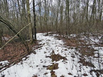
![]()
![]()
![]()
![]()
![]() On Tuesday, February 13th I planned to get out for a hike nearby as I had not been out in almost two weeks! I had promised myself that February would be different than my poor showing in January but had not kept that promise. At 1:00 PM I began to get ready with the temperature at 35 degrees on the back porch with mostly overcast skies. I asked Cindy if she wanyed to hike the Parksville Rail Trail and she made up enough excuse to equal a "no". I decided I would take Sheila across the street to Round Top to hike as and cut a blowdown that was across the trail. I decided to take my pack so that I could carry a saw to clear the blowdown. This would also allow me to carry my camera. I also decided to carry my Fiskars ax instead of hiking poles. As we began to get ready, Sheila was keeping a careful eye on me as I dressed as she would hike every day. Sheila often examines and sniffs my clothing to make sure I am serious about hiking. I decided to wear my Mammut long-sleeved crew shirt with a light short-served baselayer. This combination is a little bit warmer and appropriate for the colder weather. I wore my Railriders hiking pants which are expensive but last along time and have features like deep pockets and a generous cut which I really like. The pants have Velcro closures at the ankles. I decided to put on my new Keen Durand hiking boots which I ordered a half size larger than the previous pair. These shoes fit well out of the box but get much tighter when I add a decent insole. Without the third party insole, by feet hurt from the lack of support. I added a new pair of Xstance insoles in an effort to find the best support and cushioning for my feet. These insoles have shock absorbing gel pads, TPU arch support, and memory foam cushioning all wrapped in a breathable fabric. The insoles have been hyped by their manufacturer and they really do seem to deliver. I did decide to wear my Mammut hoody to block the breeze and keep me warm. It has pit zips that open all the way to the lower hem. I did put on a fleecy hat and light knit gloves. I put my Silky Sugowaza saw in my pack and made sure that I had my camera. I left my phone at home as I planned to hike quickly and relax a little instead of thinking about ambulance calls. At 1:15 PM we walked out the door to start the hike. I grabbed Sheila's leash from my car and put it on her as we walked up the driveway. I aimed to hike for about a little over an hour and complete two figure 8's as well as cut the blowdown. Sheila was happy to get out as we headed down the driveway and across the street. We crossed the street and walked to the parking lot next to the Presbyterian Church. We walked to the back of the church and began the ascent of the steepest hill behind the church. The hill is short but gets the circulation pumping and is the steepest and longest climb on the "trail." I did have to stop once on the way to the top of the hill. I could really feel the fact that had not hiked in some time and did not have my poles. The hill was completely devoid of snow and ice. At the top we paused for a minute so I could look around at the hills that surround the hamlet of Livingston Manor. I could not see any snow on any of the surrounding hills. The skies were overcast with clouds and some sun and blue patches. I decided to wait until the end of the hike. We continued the hike by turning left at the trailhead. The trail was covered in leaves and damp in a few places but there was no snow.
On Tuesday, February 13th I planned to get out for a hike nearby as I had not been out in almost two weeks! I had promised myself that February would be different than my poor showing in January but had not kept that promise. At 1:00 PM I began to get ready with the temperature at 35 degrees on the back porch with mostly overcast skies. I asked Cindy if she wanyed to hike the Parksville Rail Trail and she made up enough excuse to equal a "no". I decided I would take Sheila across the street to Round Top to hike as and cut a blowdown that was across the trail. I decided to take my pack so that I could carry a saw to clear the blowdown. This would also allow me to carry my camera. I also decided to carry my Fiskars ax instead of hiking poles. As we began to get ready, Sheila was keeping a careful eye on me as I dressed as she would hike every day. Sheila often examines and sniffs my clothing to make sure I am serious about hiking. I decided to wear my Mammut long-sleeved crew shirt with a light short-served baselayer. This combination is a little bit warmer and appropriate for the colder weather. I wore my Railriders hiking pants which are expensive but last along time and have features like deep pockets and a generous cut which I really like. The pants have Velcro closures at the ankles. I decided to put on my new Keen Durand hiking boots which I ordered a half size larger than the previous pair. These shoes fit well out of the box but get much tighter when I add a decent insole. Without the third party insole, by feet hurt from the lack of support. I added a new pair of Xstance insoles in an effort to find the best support and cushioning for my feet. These insoles have shock absorbing gel pads, TPU arch support, and memory foam cushioning all wrapped in a breathable fabric. The insoles have been hyped by their manufacturer and they really do seem to deliver. I did decide to wear my Mammut hoody to block the breeze and keep me warm. It has pit zips that open all the way to the lower hem. I did put on a fleecy hat and light knit gloves. I put my Silky Sugowaza saw in my pack and made sure that I had my camera. I left my phone at home as I planned to hike quickly and relax a little instead of thinking about ambulance calls. At 1:15 PM we walked out the door to start the hike. I grabbed Sheila's leash from my car and put it on her as we walked up the driveway. I aimed to hike for about a little over an hour and complete two figure 8's as well as cut the blowdown. Sheila was happy to get out as we headed down the driveway and across the street. We crossed the street and walked to the parking lot next to the Presbyterian Church. We walked to the back of the church and began the ascent of the steepest hill behind the church. The hill is short but gets the circulation pumping and is the steepest and longest climb on the "trail." I did have to stop once on the way to the top of the hill. I could really feel the fact that had not hiked in some time and did not have my poles. The hill was completely devoid of snow and ice. At the top we paused for a minute so I could look around at the hills that surround the hamlet of Livingston Manor. I could not see any snow on any of the surrounding hills. The skies were overcast with clouds and some sun and blue patches. I decided to wait until the end of the hike. We continued the hike by turning left at the trailhead. The trail was covered in leaves and damp in a few places but there was no snow.
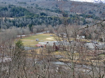 We passed by all the places where I had cut trees to remove them from the trail. At the first trail junction, I said "Right" and followed Sheila as she turned right and started up the woods road which has the gentler approach of the two. There were a few small branches on the trail from the winds that had passed through the area. I removed these branches either by dragging them off the trail. It was a pleasure to walk on the trails and it was obvious more people were using them. We reached the end of the woods road and turned left up the hill on the trail. I could see the frame and tarps that covered the mouth of one of the "caves". They were looking like someone had cleaned up the area and might be using it again. We continued up the trail to the first trail junction with the upper blue trail where we turned left to follow the yellow trail along the base of Round Top. We continued on the yellow trail along the base of Round Top. We soon ran into the small tree across the trail. The tree had been broken down a little from hikers walking over it. I took a few "before" pictures with my camera and then grabbed the saw. I ony had to make one cut cut to separate the trunk laying over the trail from the upright section. I used the ax on the other side of the trail to cut the top out of the tree. After a few swings of the ax, the central section dropped. I pulled the central section off the trail. I took the "after" shots with Sheila posing in her own way. We continued on the trail along the base of Round Top. I stopped to take a few shots of the only snow left on the trail. We came to the next junction with the blue trail and turned right to head up the blue trail toward the summit. This trail also lacked any snow. We almost immediately ran into a small dead tree across the trail which had fallen since my last trip. I took some shots with and without Sheila and then used the ax to cut the tree on the left side of the trail. The cuts went quickly and I was able to swing the cut section off the trail. I took some "after" pictures and then put the camera away to continue the hike. When we got to the switchback, we turned right and followed it until it came back to the main blue trail. The fact that the switchback sidehills in places made the walk a little more difficult. We turned right and then continued straight ahead and up the hill toward the summit of Round Top bypassing the white crossover trail. As we walked over the high point, I removed a couple of branches from the trail. We continued over the summit and down the blue trail toward the junction with the yellow trail. On this side of the hill there was also no snow on the trail. We bypassed the white crossover trail again and continued down to the yellow trail. At the junction with the yellow trail we turned right and walked the yellow trail along the base of Round Top to the next junction with the blue trail. We turned left and started slightly downhill toward the lookout over town. We passed the "sitting rock" and continued downhill.
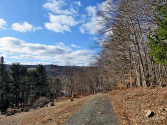 When we reached the lookout, we followed the yellow trail as it turned left and walked down the hill to the first trail junction. We immediately turned around and started back up the trail. I could feel that I was out of shape as I had to stop once to get up the hill. We detoured to the lower lookout to take pictures. I took out my camera and took shots of the school and the rest of town. I also snapped some pictures of the surrounding hills and the lookout itself. I had Sheila pose for some pictures on the upper part of the lookout. When I was done, I stowed the camera and we walked back out to the main trail. We turned left and followed the yellow trail as it turned right and headed uphill toward the junction with the blue trail. We hiked up a short but steep little hill and arrived at the trail junction. We turned right to follow the trail along the base of Round Top. Sheila was some distance behind when she came roaring passed me at full speed. She passed me, made a 180 degree turn, and came running back. She repeated this several times before I called her off. I was glad she was back to 100% after some shots at the on Friday had slows her down over the weekend. We arrived at the next junction with the blue trail after passing the point where I had cut the blowdown. We turned left to start the walk up the blue trail toward the summit. Sheila and I again passed the white crossover trail and continued toward the summit, We walked over the summit and stated down the long hill again bypassing the white crossover trail. We turned left on the switchback in the blue trail and followedit out into the forest and then back to the main trail. We turned left and walked downhill to the yellow trail where a left turn again took us along the base of Round Top. At the junction, Sheila and I turned right and walked down the trail to the woods road. We followed the woods road downhill with the ledges to the right. At the first trail junction, we turned left and walked straight out to the trailhead. We turned right and walked downhill and crossed the parking lot to the road. We waited to cross the road as several cars went by and then crossed to the driveway to the house. It was 2:35 PM and we had hiked a little over 2 miles and done some trail maintenance in 1 hour and 20 minutes. It was a pleasant hike and when we got back I found there were no ambulance calls while I was gone!
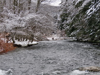
![]()
![]()
![]()
![]()
![]() On Tuesday, January 30th, I wanted to get out for a short hike near home that was not on Round Top. I though about going to the Beaverkill Campgrounds to see the level of the water in the stream and the snow and ice that was still clinging to the trees. As I started to get ready at 10:15 AM the temperature was 25 degrees on the back porch with cloudy and overcast skies. As usual, Sheila was excited but was trying to be the "good dog". I decided to wear my Mammut long-sleeved crew shirt with a light long-served baselayer. This combination is a little bit warmer and appropriate for the colder weather. I wore a pair of Bauer First Ascent pants which are insulated against the cold and are slightly water repellant. I don't like the fit of these pants and have been looking for a replacement. I decided to put on my old Salomon B52 winter boots which I have worn for many seasons. I noticed that they were dry and needed a coat of waterproofing. I decided to take my Leki poles with external locks as the internal twist locks sometimes fail. I did put on my Mammut hoody to block the breezy and keep me warm. It has pit zips that open all the way to the lower hem. I donned my OR Crocodile gaiters as I did not know the snow depth and because they keep my lower legs warm. I also made sure I had my spikes with my pack. I took along a fleecy hat and a pair of light gloves. I brought along my phone but resolved to leave it in the car as there was no service in the area anyway. I put my gear in the back of the car and Sheila in the back seat and we left the house at 10:45 AM. I drove out Old Route 17 toward Roscoe and turned right on Beaverkill Road. As we started the descent into the Beaverkill Valley, I turned left on Campsite Road and followed it down to the parking area near the Beaverkill Covered Bridge. It was then that I remebered that the Beaverkill Covered Bridge was closed since a car had impacted some of the supports. I decided to see what the bridge looked like inside. There was one car parked on the road that goes through the bridge but none in the parking lot! A glance at the river showed that the level was high. The water covered the sandy beach and almost covered the rock I usually stand on to take pictures.
On Tuesday, January 30th, I wanted to get out for a short hike near home that was not on Round Top. I though about going to the Beaverkill Campgrounds to see the level of the water in the stream and the snow and ice that was still clinging to the trees. As I started to get ready at 10:15 AM the temperature was 25 degrees on the back porch with cloudy and overcast skies. As usual, Sheila was excited but was trying to be the "good dog". I decided to wear my Mammut long-sleeved crew shirt with a light long-served baselayer. This combination is a little bit warmer and appropriate for the colder weather. I wore a pair of Bauer First Ascent pants which are insulated against the cold and are slightly water repellant. I don't like the fit of these pants and have been looking for a replacement. I decided to put on my old Salomon B52 winter boots which I have worn for many seasons. I noticed that they were dry and needed a coat of waterproofing. I decided to take my Leki poles with external locks as the internal twist locks sometimes fail. I did put on my Mammut hoody to block the breezy and keep me warm. It has pit zips that open all the way to the lower hem. I donned my OR Crocodile gaiters as I did not know the snow depth and because they keep my lower legs warm. I also made sure I had my spikes with my pack. I took along a fleecy hat and a pair of light gloves. I brought along my phone but resolved to leave it in the car as there was no service in the area anyway. I put my gear in the back of the car and Sheila in the back seat and we left the house at 10:45 AM. I drove out Old Route 17 toward Roscoe and turned right on Beaverkill Road. As we started the descent into the Beaverkill Valley, I turned left on Campsite Road and followed it down to the parking area near the Beaverkill Covered Bridge. It was then that I remebered that the Beaverkill Covered Bridge was closed since a car had impacted some of the supports. I decided to see what the bridge looked like inside. There was one car parked on the road that goes through the bridge but none in the parking lot! A glance at the river showed that the level was high. The water covered the sandy beach and almost covered the rock I usually stand on to take pictures.
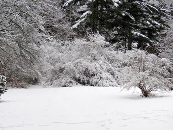 We started out at 11:00 AM by walking out of the parking lot to the bridge with the temperature at 27 degrees. I could see some footprints of people that had walked across the bridge and a peek inside showed no damage. I decided the CLOSED must mean closed to vehicular traffic. When we got to the other side, I looked at the trail and saw that it was covered in snow and ice. I thought about putting on my spikes but decided not to as I was pretty sure could get good footing with the help of my poles. We turned left on a woods road that parallels the river and started down the short hill. The ice was rough and I had no problems at all. When we came to the spring house, I decided to take a few shots and some more of the bright green water plants next to it. The plants were floating in a small "stream" that extended from the spring house parallel to the trail. We continued on the deserted woods road where I could detect a few faint footprints. We came to an area with a little path down to the river that was covered in snow and ice. I walked down to the edge of the river very carefully as the rocks were slippery and the water looked deep and cold. It was also high and swiftly! I took some pictures downstream and some upstream to the bridge. Even though the landscape was bleak it had a serene feel enhanced by the sound of the flowing water. When I was done, we got back on the trail and passed several areas with unused picnic tables. They sit unused and rotting along the road, a testimony to better days. I took some pictures of the tables and some of the trail ahead and behind us. We walked by more tables which had not been used in years. A little later we came to what was once a bathroom for some campsites that had long since disappeared. There were more tables in this area. I took the opportunity to take some more pictures of random picnic tables and the bathroom. There was a path to the river so I walked over and found the water was running high but was very clear. I took some pictures of the flowing water and the snow on the trees and shrubs. In several areas the DEC had placed large rocks along the shore and covered them with heavy wire to reduce erosion. At one point I noticed "scratches" in the light layer of snow of the ice. The scratches were thin and parallel but each set ran in different directions. Tree were no animal or bird footprints around so I was baffled about what created the. At about .7 miles into the hike the woods road met the paved road that serves the campsites. We continued on the road through the campsites and along the river. Many of the campsites have a cement block fireplace with a grill but some were upgraded to poured concrete. Everything was very quiet except for the water in the river. This was not surprising as the campsites were closed. I took some pictures of the empty campsites and the campsite road. I was surprised none of the roads were plowed as that has been the case in previous years. The skies were still overcast but that combined with the snow and ice to set the scene.
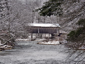 We walked to the last campsite where the trail ends and I walked down to the edge of the river. I was careful to watch where I was walking as I did not want to slip into the cold water. I stopped to take some pictures of the river especially downstream. We continued a little further passed the last campsite and walked a path along the river. I took some shots downstream where the river turned to the left. The water was very clear with a slight greenish tint from looking through to the bottom. As we walked back passed the last campsite, we stayed to the left of the last bathroom to walk back on the other paved road through the campsites. This road parallels the one we walked out on to make a sort of loop. I took some shots of the bathroom. We retuned the way we had come although at a quicker pace. We still had not seen any people on the trails and very few cars had passed by on the roads. We again walked through the bridge and turned right to go back to the car. I decided to continue along the near side of the river to the bench near the edge of the river. We walked by the newest bathhouse and through a gate. In front of us was what looked like a cement sidewalk. An arm of the river used to pass through this area and the "sidewalk" was there so that cars could ford the shallow water. The section of river had been diverted and only the ford remained. As we walked on the woods road we came to some piles of stones used in the campsites. The large trunk that had lain across the trail had been removed. We continued to walk until we came to the stone bench. Sheila jumped up on it and I took a few pictures. I also took some shots of the bushes loaded down with snow and ice. We took a slightly different route back passing in back of the bathroom. There was one large blowdown on this route and I hoped the DEC would clear it in the spring. Before returning to the car, we walked to the left and down to the edge of the river. I took pictures of the bridge and the river flowing under it. There weren't many places to stand as the water was so high. When I was done, we walked over to the car. We were back at the car at 12:45 PM having hiked 2.8 miles in 1 hour and 45 minutes with 20 minutes of stopped time. The car's thermometer read 29 degrees.
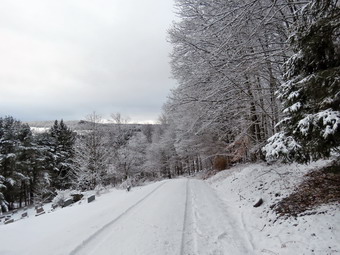
![]()
![]()
![]()
![]()
![]() On Monday, January 29th I wanted to get out for another hike as January had been a big disappointment. I especially wanted to go up to Round Top while the snow and ice were still frozen on the trees. There was a slight breeze but the snow and ice seemed to be clinging onto the branches. I began to get ready at 10:00 AM with the temperature at 30 degrees on the back porch. I decided to take my pack so that I could carry my camera and because it adds weight making the hike more challenging. As we began to get ready, Sheila was running around barking at my every move. Sheila often examines and sniffs my clothing to make sure I am serious about hiking. I decided to wear my Mammut long-sleeved crew shirt with a light short-served baselayer. This combination is a little bit warmer and appropriate for the colder weather. I wore my Railriders hiking pants which are expensive but last along time and have features like deep pockets and a generous cut which I really like. The pants have Velcro closures at the ankles. I put on my old Salomon B52 winter boots which I have worn for many seasons. I noticed that they were dry and needed a coat of waterproofing. I decided to take my Leki poles with external locks as the internal twist locks sometimes fail. I also made sure my spikes were attached to my pack. I did decide to wear my Mammut hoody to block the breeze and keep me warm. It has pit zips that open all the way to the lower hem. I did put on a fleecy hat and a pair of light gloves. I decided not to bring along my phone so I could enjoy the walk. At 10:15 AM we walked out the door to start the hike. I grabbed Sheila's leash from my car and put it on her as we walked up the driveway which was not shoveled or plowed. Sheila was happy to get out as we headed down the driveway and across the street. We crossed the street and walked to the parking lot next to the Presbyterian Church which was plowed. We walked to the back of the church and began the ascent of the steepest hill behind the church. The hill is short but gets the circulation pumping and is the steepest and longest climb on the "trail." The hill was completely covered in untouched snow. I was sad that no kids had been out to sled on the hill and no one else had decided to take a walk. I left Sheila on her leash as the husky in her makes her pull in the snow. O let her pull for a little while and then let her off the leash and used my poles. I did have to stop once on the way to the top of the hill. At the top we paused for a minute so I could look around at the hills that surround the hamlet of Livingston Manor. I took out my camera and took shots of the snow both near and far.
On Monday, January 29th I wanted to get out for another hike as January had been a big disappointment. I especially wanted to go up to Round Top while the snow and ice were still frozen on the trees. There was a slight breeze but the snow and ice seemed to be clinging onto the branches. I began to get ready at 10:00 AM with the temperature at 30 degrees on the back porch. I decided to take my pack so that I could carry my camera and because it adds weight making the hike more challenging. As we began to get ready, Sheila was running around barking at my every move. Sheila often examines and sniffs my clothing to make sure I am serious about hiking. I decided to wear my Mammut long-sleeved crew shirt with a light short-served baselayer. This combination is a little bit warmer and appropriate for the colder weather. I wore my Railriders hiking pants which are expensive but last along time and have features like deep pockets and a generous cut which I really like. The pants have Velcro closures at the ankles. I put on my old Salomon B52 winter boots which I have worn for many seasons. I noticed that they were dry and needed a coat of waterproofing. I decided to take my Leki poles with external locks as the internal twist locks sometimes fail. I also made sure my spikes were attached to my pack. I did decide to wear my Mammut hoody to block the breeze and keep me warm. It has pit zips that open all the way to the lower hem. I did put on a fleecy hat and a pair of light gloves. I decided not to bring along my phone so I could enjoy the walk. At 10:15 AM we walked out the door to start the hike. I grabbed Sheila's leash from my car and put it on her as we walked up the driveway which was not shoveled or plowed. Sheila was happy to get out as we headed down the driveway and across the street. We crossed the street and walked to the parking lot next to the Presbyterian Church which was plowed. We walked to the back of the church and began the ascent of the steepest hill behind the church. The hill is short but gets the circulation pumping and is the steepest and longest climb on the "trail." The hill was completely covered in untouched snow. I was sad that no kids had been out to sled on the hill and no one else had decided to take a walk. I left Sheila on her leash as the husky in her makes her pull in the snow. O let her pull for a little while and then let her off the leash and used my poles. I did have to stop once on the way to the top of the hill. At the top we paused for a minute so I could look around at the hills that surround the hamlet of Livingston Manor. I took out my camera and took shots of the snow both near and far.
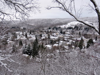 We entered the woods at the trailhead and continued on to the first junction. Sheila and I both seemed to have the same idea as I wanted to go straight up to the lookout and Sheila chose that path. Climbing the hill seemed easy but I did slip a few times. The slips were not enough to make me consider putting on my spikes. When we reached the top of the hill, we detoured to the left and walked out to the lower lookout which was covered in deep snow over some ice below. I took pictures of the lookout and the shots of the school and the town below. I took some pictures of Sheila as she sat in the snow and then directed her to go to the upper lookout where she posed for some pictures. I also took some close-ups of the bushes covered in layers of frozen snow and ice. I packed up my camera add we walked back out to the main yellow trail where we turned left to walk to the upper lookout. Where the trail turned right we followed it uphill through a winter wonderland. All the trees were covered in snow. I had noticed a set of footprints that were quite fresh but they had stopped at the lookout. Now, as we walked uphill toward the next unction, I saw a fainter set of prints in the snow. We passed the sitting rock which was piled high with the white stuff. We continued uphill to the junction with the blue trail. We turned right to follow the yellow trail along the base of Round Top. Before continuing I stopped to take some pictures of the snow frozen and hanging on the bushes. Many of the trees and bushes were so loaded with the snow that they were bending over into the trail almost blocking it. A few had broken and were laying in the trail. I knocked the snow off many of the bushes which allowed them to rebound significantly to allow us to pass. I tried to remove as many of the broken and fallen branches as possible. Before we got to the next junction, we ran into a larger tree which had fallen across the trail. I kicked it several times and then sat on it but the upper end, although broken, remained attached to the upright part of the trunk. I was pretty sure I could cut the trunk and remove it with hand tools.
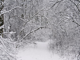 We continued to the next junction with the blue trail and turned left to climb the trail toward the summit. The trail had more snow than down lower and I slipped a little as the trail grew steeper. We passed by the white crossover trail and continued over the summit which was also beautiful with trees encased in snow. We started down the other side slipping a little and bypassing the white trail. We did turn left on the switchback in the blue trail. We followed it out into the woods and back again to the blue trail. The sidehilling with the snow and ice made getting a good foot placement important. We turned left on the main blue trail and walked downhill until we were back at the junction with the yellow trail. We turned left and again walked along the yellow trail to the next junction with the blue trail. This time we turned right and started to walk down the trail to the woods road. As we made the turn onto the road, I could see fresh footprints lead up to the shelter under one of the ledges. The blue tarp was also back in place. Sheila and I started down the woods road to the trail junction. At the first trail junction I decided we had been out for more than an hour and I wanted to go home. We turned left and headed toward the trailhead. At the trailhead we turned right and made short work of the downhill. We crossed the church parking lot to our driveway. We had covered about a mile and a half in a little over an hour. Much of that time was spent taking pictures and clearing the trail.
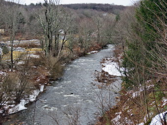
![]()
![]()
![]()
![]()
![]() On Saturday, January 27th, I wanted to get in a hike for the first time in 20 days! The ambulance calls which were plentiful in 2023 had not decreased in the New Year. In addition, the weather also had not cooperated with bitter cold for almost a week and another week of rain and ice. I wasn't sure There was another EMT available but I knew I had to get out for my own health. I decided to just go to Parksville and hike the rail trail even though it is under three miles out and back. By the time I started to get ready at 10:30 PM the temperature was right around 38 degrees. I got dressed in my Mammut crew top with a long-sleeved baselayer. This combination is a little bit warmer and appropriate for the cooler weather. I wore my Railriders hiking pants which are expensive but last along time and have features like deep pockets and a generous cut which I really like. The pants have Velcro closures at the ankles. I decided to put on my new Keen Durand hiking boots which I ordered a half size larger than the previous pair. These shoes fit well out of the box but get much tighter when I add a decent insole. Without the third party insole, by feet hurt from the lack of support. I added a new pair of Xstance insoles in an effort to find the best support and cushioning for my feet. These insoles have shock absorbing gel pads, TPU arch support, and memory foam cushioning all wrapped in a breathable fabric. The insoles have been hyped by their manufacturer and they really do seem to deliver. I decided to take my Leki poles with external locks as the internal twist locks sometimes fail. I donned my Mammut hoody to block the breezy and keep me warm. It has pit zips that open all the way to the lower hem. I did put on a fleecy hat and light knitted gloves. I also put on my OR Crocodile gaiters as I thought there would be a mixture of ice, water amd mud on the trail. I put my gear in the back of the car and Sheila in the back seat. We left Livingston Manor at just before 10:50 AM and drove out Old Route 17 toward Parksville. Just after Fox Mountain Road, I pulled into the parking area on the right side of the road. There were no cars parked in the lot as we were getting ready to hike. I left my phone and pager in the car so that I could enjoy the hike. We started out on the trail at 11:00 AM under cloudy skies with a slight breeze.
On Saturday, January 27th, I wanted to get in a hike for the first time in 20 days! The ambulance calls which were plentiful in 2023 had not decreased in the New Year. In addition, the weather also had not cooperated with bitter cold for almost a week and another week of rain and ice. I wasn't sure There was another EMT available but I knew I had to get out for my own health. I decided to just go to Parksville and hike the rail trail even though it is under three miles out and back. By the time I started to get ready at 10:30 PM the temperature was right around 38 degrees. I got dressed in my Mammut crew top with a long-sleeved baselayer. This combination is a little bit warmer and appropriate for the cooler weather. I wore my Railriders hiking pants which are expensive but last along time and have features like deep pockets and a generous cut which I really like. The pants have Velcro closures at the ankles. I decided to put on my new Keen Durand hiking boots which I ordered a half size larger than the previous pair. These shoes fit well out of the box but get much tighter when I add a decent insole. Without the third party insole, by feet hurt from the lack of support. I added a new pair of Xstance insoles in an effort to find the best support and cushioning for my feet. These insoles have shock absorbing gel pads, TPU arch support, and memory foam cushioning all wrapped in a breathable fabric. The insoles have been hyped by their manufacturer and they really do seem to deliver. I decided to take my Leki poles with external locks as the internal twist locks sometimes fail. I donned my Mammut hoody to block the breezy and keep me warm. It has pit zips that open all the way to the lower hem. I did put on a fleecy hat and light knitted gloves. I also put on my OR Crocodile gaiters as I thought there would be a mixture of ice, water amd mud on the trail. I put my gear in the back of the car and Sheila in the back seat. We left Livingston Manor at just before 10:50 AM and drove out Old Route 17 toward Parksville. Just after Fox Mountain Road, I pulled into the parking area on the right side of the road. There were no cars parked in the lot as we were getting ready to hike. I left my phone and pager in the car so that I could enjoy the hike. We started out on the trail at 11:00 AM under cloudy skies with a slight breeze.
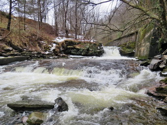 The first part of the trail was free of ice and snow but was very wet and soft. Once we were on the trail and sheltered by the trees it was a little cooler and the trail was about as I expected with ice, snow, and mud. TheSe alternated on the trail and I tried to stay in the snow. Several times I walked in the water where the ground was firmer. I also sunk several inches into the mud in a few spots. I had my spikes with me but elected not to stop to put them on. As I walked, I considered my hiking plan. I had thought I would hike out and back on the rail trail but now the trail conditions had made me think I might hike a loop returning by the road. I was going to ate pictures on the way back but change my mind and decided to take my shots on the way out. The rail trail runs parallel to the Little Beaverkill and the new section of State Route 17. It follows the route of the O&W railroad and is very flat. The water level in the stream was much higher than the last time we had hiked along the trail. We passed several benches placed for people to rest in warmer weather. I stopped at the area just before the wooden walkways and bridge to take some pictures down to the stream. The stream looked cold and the overcast skies contributed to the bleak appearance. I also took pictures of the trail and the walkways. The trail had areas of snow, ice and mud. I was surprised the walkways were free of ice and snow. The tree I had cut last time on the bridge had fallen off the bank into the ditch beside walkway. There was some ice before and after the bridge but I was able to walk around it. We came to the tree I had trimmed to allow hikers to pass. I wanted to clear the trunk itself but decided it would need a chainsaw. I hopped over the trunk and immediately ran into two other smaller trunks across the trail. We continued on the trail heading toward the falls. As we walked, I could hear an increase in the noise from the stream and I knew the falls was just ahead. When we got to the falls, I could see that I might need the spikes on the path to the bottom of the falls. I got out my spikes and sat on the bench to put them on. Sheila and I walked over to the path down to the streambed and began the descent. There was snow and ice but we made it down to the stream without any problems. I put my pack down and took out my camera. I took shots downstream and directly in front of me where the water was very clear. I then turned my attention upstream to the falls. I took shots encompassing the entire scene and then several close-ups of the main falls and the rapids below it. I like the noise of the falls and the volume of water so I took a video of the scene with some zooms and pans. When I was finished, I packed up and we walked back up the path to the trail. I took some more pictures of the falls from above and upstream. I packed up my camera but left my spikes on my feet as we continued on the trail. Walking with the spikes reminded me how much easier it is to hike with them!
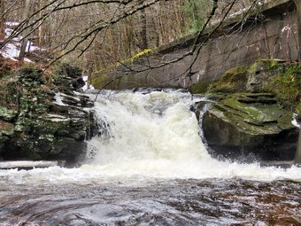 Soon we were nearing the Parksville end of the trail passing many rundown and dilapidated buildings which should be removed. Several of the buildings showed that work had been done on them. On the Parksville end of the trail we found the small garden and a very informative sign. The sign listed the businesses and hotels that existed in Parksville during its heyday. The Young's Gap Hotel had room for 600 guests! The sign also explained the role of the railroad in the dairy industry which was a thriving one in all of Sullivan County. After a brief pause, I removed my spikes and attached them to the outside of the pack. We walked the rest of the rail trail to the Main Street where we turned left. There are many interesting buildings along a short stretch of street but most are unoccupied and crumbling. There are a few residences and one small home had a Tesla in the driveway charging with no garage in sight. When we got to the access road, we passed the Dead End Caf� which brought back memories of when it was a thriving business. An OPEN sign still hung in the window. we turned left and walked on a gravel path that paralleled the road. We passed what was once the synagogue but is now the Parksville Arts Center with a Star of David on the front! The path continued to a parking area and then exited the other side. We continued on this path passing the building which once held Memories where I had bought several items at auction. The path ended in another parking area so we had to walk the shoulder of the road to get back to our car. There was more traffic on the road than I had expected but the shoulder was wide and the drivers considerate. We arrived back at the car at 12:30 PM after hiking 2.8 miles in 1 and a half hours. My pager and phone showed there had been no ambulance calls.
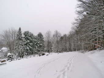
![]()
![]()
![]()
![]()
![]() On Sunday, January 7th I was awakened by an early morning ambulance call. I had to clear 6 inches of snow off my car and make my way down the drive way to respond. The call was cancelled and I returned home only to be called out on another call that was also cancelled! By 10:00 AM things had calmed down and I decided to go across the street and hike on Round top since I could still respond on calls. I wanted to take some pictures of the snow that had fallen. In particular I wanted to take some shots that were close to the ones I had taken two day before when there was no snow. I began to get ready with the temperature at 30 degrees on the back porch amd snow still falling. I decided to take my pack so that I could carry my camera and because it adds weight making the hike more challenging. As we began to get ready, Sheila was running around barking at my every move. Sheila often examines and sniffs my clothing to make sure I am serious about hiking. I decided to wear my Mammut long-sleeved crew shirt with a light short-served baselayer. This combination is a little bit warmer and appropriate for the colder weather. I wore a pair of Bauer First Ascent pants which are insulated against the cold and are slightly water repellant. I don't like the fit of these pants and have been looking for a replacement. I decided to put on my old Salomon b52 winter boots which I have worn for many seasons. I noticed that they were dry and needed a coat of waterproofing. I decided to take my Leki poles with external locks as the internal twist locks sometimes fail. I did decide to wear my Mammut hoody to block the breezy and keep me warm. It has pit zips that open all the way to the lower hem. I did put on a fleecy hat and a pair of light gloves. I brought along my phone in case there were any calls. My biggest decision was whether or not to wear snowshoes. I really wanted to use them but I knew they were not really need. In the end I left them home. At 10:15 AM we walked out the door to start the hike. I grabbed Sheila's leash from my car and put it on her as we walked up the driveway which was not shoveled or plowed. I aimed to hike for about a little over an hour and complete two figure 8's. Sheila was happy to get out as we headed down the driveway and across the street. We crossed the street and walked to the parking lot next to the Presbyterian Church. We walked to the back of the church and began the ascent of the steepest hill behind the church. The hill is short but gets the circulation pumping and is the steepest and longest climb on the "trail." The hill was completely covered in untouched snow. I was sad that no kids had been out to sled on the hill and no one else had decided to take a walk. I did have to stop once on the way to the top of the hill. At the top we paused for a minute so I could look around at the hills that surround the hamlet of Livingston Manor. I took out my camera and took shots of the snow both near and far. The snow that was still falling made it difficult to get good pictures. The snow was wet bad was beginning to wet my pack and jacket.
On Sunday, January 7th I was awakened by an early morning ambulance call. I had to clear 6 inches of snow off my car and make my way down the drive way to respond. The call was cancelled and I returned home only to be called out on another call that was also cancelled! By 10:00 AM things had calmed down and I decided to go across the street and hike on Round top since I could still respond on calls. I wanted to take some pictures of the snow that had fallen. In particular I wanted to take some shots that were close to the ones I had taken two day before when there was no snow. I began to get ready with the temperature at 30 degrees on the back porch amd snow still falling. I decided to take my pack so that I could carry my camera and because it adds weight making the hike more challenging. As we began to get ready, Sheila was running around barking at my every move. Sheila often examines and sniffs my clothing to make sure I am serious about hiking. I decided to wear my Mammut long-sleeved crew shirt with a light short-served baselayer. This combination is a little bit warmer and appropriate for the colder weather. I wore a pair of Bauer First Ascent pants which are insulated against the cold and are slightly water repellant. I don't like the fit of these pants and have been looking for a replacement. I decided to put on my old Salomon b52 winter boots which I have worn for many seasons. I noticed that they were dry and needed a coat of waterproofing. I decided to take my Leki poles with external locks as the internal twist locks sometimes fail. I did decide to wear my Mammut hoody to block the breezy and keep me warm. It has pit zips that open all the way to the lower hem. I did put on a fleecy hat and a pair of light gloves. I brought along my phone in case there were any calls. My biggest decision was whether or not to wear snowshoes. I really wanted to use them but I knew they were not really need. In the end I left them home. At 10:15 AM we walked out the door to start the hike. I grabbed Sheila's leash from my car and put it on her as we walked up the driveway which was not shoveled or plowed. I aimed to hike for about a little over an hour and complete two figure 8's. Sheila was happy to get out as we headed down the driveway and across the street. We crossed the street and walked to the parking lot next to the Presbyterian Church. We walked to the back of the church and began the ascent of the steepest hill behind the church. The hill is short but gets the circulation pumping and is the steepest and longest climb on the "trail." The hill was completely covered in untouched snow. I was sad that no kids had been out to sled on the hill and no one else had decided to take a walk. I did have to stop once on the way to the top of the hill. At the top we paused for a minute so I could look around at the hills that surround the hamlet of Livingston Manor. I took out my camera and took shots of the snow both near and far. The snow that was still falling made it difficult to get good pictures. The snow was wet bad was beginning to wet my pack and jacket.
 We entered the woods at the trailhead and continued on to the first junction. Sheila and I both seemed to have the same idea as I wanted to go straight up to the lookout and Sheila chose that path. Climbing the hill seemed ease but I did slip a few times.When we reached the top of the hill, we detoured to the left and walked out to the lower lookout which was covered in deep snow over some ice below. I knew there was ice because I took a spill which was, fortunately, far back from the edge of the viewpoint. I got out my camera and took pictures of the lookout and the shots of the school and the town below. I directed Sheila to go to the upper lookout but she was being very stubborn. Eventually she went up to the ledge and posed for some pictures. I packed up my camera amd walked back out to the main yellow trail where we turned left to walk to the upper lookout. Where the trail turned right we followed it uphill through a winter wonderland. All the trees were covered in snow and I love walking in snow that no one else as touched. We passed the sitting rock which was piled high with the white stuff. We continued uphill to the junction with the blue trail. We turned right to follow the yellow trail along the base of Round Top. I stopped to take some picture of the snow hanging on the bushes.
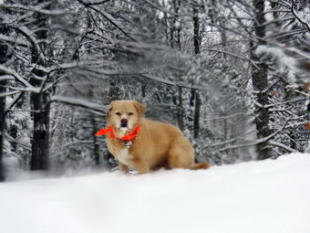 We continued to the next junction with the blue trail and turned right to climb the trail toward the summit. We passed by the white crossover trail and continued over the summit which was also beautiful with trees encased in snow. We started down the other side slipping a little and bypassing the white trail. We did turn left on the switchback in the blue trail. We followed it out into the woods and back again to the blue trail farther down the hill. We turned left on the main blue trail and walked downhill until we were back at the junction with the yellow trail. We turned left and again walked along the yellow trail to the next junction with the blue trail. This time we turned right and started to walk down the trail to the woods road. At this point my phone signaled an ambulance call so I called the control center to tell them I was responding. Sheila and I started down the woods road at a double quick pace with me trying not to fall. At the first trail junction, we turned left and headed toward the trailhead. At the trailhead we turned right and made short work of the downhill. We crossed the church parking lot to our driveway. I dropped Sheila inside amd grabbed my keys and wallet to go on the call. We responded to a motor vehicle accident. Half way to the accident we were again cancelled!
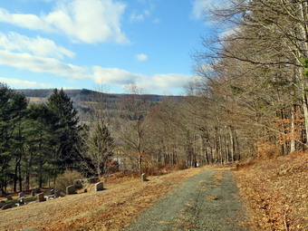
![]()
![]()
![]()
![]()
![]() On Friday, January 5th I planned to get out for a hike nearby as I was the only EMT around to cover calls. The New Year had not changed the number of ambulance calls we were covering! At 1:00 PM I began to get ready with the temperature at 28 degrees on the back porch with some sunshine and blue skies in between the clouds. I decided to go across the street to Round Top to hike as I could get back quickly if I was needed on an ambulance call. I decided to take my pack so that I could carry a saw to clear a blowdown. This would also allow me to carry my camera. As we began to get ready, Sheila was keeping a careful eye on me as I dressed as she would hike every day. Sheila often examines and sniffs my clothing to make sure I am serious about hiking. I decided to wear my Mammut long-sleeved crew shirt with a light short-served baselayer. This combination is a little bit warmer and appropriate for the colder weather. I wore my Railriders hiking pants which are expensive but last along time and have features like deep pockets and a generous cut which I really like. The pants have Velcro closures at the ankles. I decided to put on my new Keen Durand hiking boots which I ordered a half size larger than the previous pair. These shoes fit well out of the box but get much tighter when I add a decent insole. Without the third party insole, by feet hurt from the lack of support. I added a new pair of Xstance insoles in an effort to find the best support and cushioning for my feet. These insoles have shock absorbing gel pads, TPU arch support, and memory foam cushioning all wrapped in a breathable fabric. The insoles have been hyped by their manufacturer and they really do seem to deliver. I decided to take my Leki poles with external locks as the internal twist locks sometimes fail. I did decide to wear my Mammut hoody to block the breezy and keep me warm. It has pit zips that open all the way to the lower hem. I did put on a fleecy hat but eschewed gloves. I put my Silky Sugowaza saw in my pack and made sure that this time I had my camera. I brought along my phone in case there were any calls. At 1:20 PM we walked out the door to start the hike. I grabbed Sheila's leash from my car and put it on her as we walked up the driveway. I aimed to hike for about a little over an hour and complete two figure 8's. Sheila was happy to get out as we headed down the driveway and across the street. We crossed the street and walked to the parking lot next to the Presbyterian Church. We walked to the back of the church and began the ascent of the steepest hill behind the church. The hill is short but gets the circulation pumping and is the steepest and longest climb on the "trail." I did have to stop once on the way to the top of the hill. At the top we paused for a minute so I could look around at the hills that surround the hamlet of Livingston Manor. I could still see some snow especially in the shade of the surrounding hills. The skies were overcast with clouds and some sun and blue patches. We continued the hike by turning left at the trailhead. The trail was covered in leaves and damp in a few places but there was no snow.
On Friday, January 5th I planned to get out for a hike nearby as I was the only EMT around to cover calls. The New Year had not changed the number of ambulance calls we were covering! At 1:00 PM I began to get ready with the temperature at 28 degrees on the back porch with some sunshine and blue skies in between the clouds. I decided to go across the street to Round Top to hike as I could get back quickly if I was needed on an ambulance call. I decided to take my pack so that I could carry a saw to clear a blowdown. This would also allow me to carry my camera. As we began to get ready, Sheila was keeping a careful eye on me as I dressed as she would hike every day. Sheila often examines and sniffs my clothing to make sure I am serious about hiking. I decided to wear my Mammut long-sleeved crew shirt with a light short-served baselayer. This combination is a little bit warmer and appropriate for the colder weather. I wore my Railriders hiking pants which are expensive but last along time and have features like deep pockets and a generous cut which I really like. The pants have Velcro closures at the ankles. I decided to put on my new Keen Durand hiking boots which I ordered a half size larger than the previous pair. These shoes fit well out of the box but get much tighter when I add a decent insole. Without the third party insole, by feet hurt from the lack of support. I added a new pair of Xstance insoles in an effort to find the best support and cushioning for my feet. These insoles have shock absorbing gel pads, TPU arch support, and memory foam cushioning all wrapped in a breathable fabric. The insoles have been hyped by their manufacturer and they really do seem to deliver. I decided to take my Leki poles with external locks as the internal twist locks sometimes fail. I did decide to wear my Mammut hoody to block the breezy and keep me warm. It has pit zips that open all the way to the lower hem. I did put on a fleecy hat but eschewed gloves. I put my Silky Sugowaza saw in my pack and made sure that this time I had my camera. I brought along my phone in case there were any calls. At 1:20 PM we walked out the door to start the hike. I grabbed Sheila's leash from my car and put it on her as we walked up the driveway. I aimed to hike for about a little over an hour and complete two figure 8's. Sheila was happy to get out as we headed down the driveway and across the street. We crossed the street and walked to the parking lot next to the Presbyterian Church. We walked to the back of the church and began the ascent of the steepest hill behind the church. The hill is short but gets the circulation pumping and is the steepest and longest climb on the "trail." I did have to stop once on the way to the top of the hill. At the top we paused for a minute so I could look around at the hills that surround the hamlet of Livingston Manor. I could still see some snow especially in the shade of the surrounding hills. The skies were overcast with clouds and some sun and blue patches. We continued the hike by turning left at the trailhead. The trail was covered in leaves and damp in a few places but there was no snow.
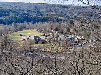 We passed by all the places where I had cut trees to remove them from the trail. At the first trail junction, I followed Sheila as she turned right and started up the woods road which has the gentler approach of the two. There were many small branches on the trail from the winds that had passed through the area. I removed these branches either by dragging them off the trail or by using my poles on the smaller ones. It was a pleasure to walk on the trails and it was obvious more people were using them. We reached the end of the woods road and turned left up the hill on the trail. I could see the frame and tarps that covered the mouth of one of the "caves". They were looking like someone had cleaned up the area and might be using it again. We continued up the trail to the first trail junction with the upper blue trail where we turned left to follow the yellow trail along the base of Round Top. We continued on the yellow trail along the base of Round Top. We soon ran into the small tree across the trail. The tree had been broken down a little from hikers walking over it. I took a few "before" pictures with my camera and then grabbed the saw. I ony had to make one cut cut to take the top out of the tree. I dragged the top off the trail and took the "after" shots. We continued on the trail along the base of Round Top. We came to the next junction with the blue trail and turned right to head up the blue trail toward the summit. This trail had a light covering of snow but a little walking showed it was not going to be a problem to get a grip. When we got to the switchback, we turned right and followed it until it came back to the main blue trail. This trail also had some snow as it faces north and west. The fact that the switchback sidehills in places made the walk a little more difficult especially with the snow. We turned right and then continued straight ahead and up the hill toward the summit of Round Top bypassing the white crossover trail. As we walked over the high point, I removed a couple of branches from the trail. We continued over the summit and down the blue trail toward the junction with the yellow trail. On this side of the hill there was no snow on the trail. We bypassed the white crossover trail again and continued down to the yellow trail. At the junction with the yellow trail we turned right and walked the yellow trail along the base of Round Top to the next junction with the blue trail. We turned left and started slightly downhill toward the lookout over town. We passed the "sitting rock" and continued downhill through a sea of sad ferns which were completely brown.
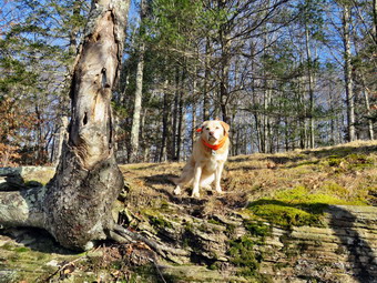 When we reached the lookout, we followed the yellow trail as it turned left and then detoured to the lower lookout to take pictures. I took out my camera and took shots of the school and the rest of town. I also snapped some pictures of the surrounding hills and the lookout itself. I had Sheila pose for some pictures on the upper part of the lookout. When I was done, I stowed the camera and we descended the steep hill back to the first trail junction. We immediately turned around and started up the steep hill back to the viewpoint. We followed the yellow trail as it turned right and headed uphill toward the junction with the blue trail. We hiked up a short but steep little hill and arrived at the trail junction. We turned right to follow the trail along the base of Round Top. Sheila was some distance behind when she came roaring passed me at full speed. She passed me, made a 180 degree turn, and came running back. She repeated this several times before I called her off. We arrived at the next junction with the blue trail after passing the point where I had cut the blowdown. We turned left to start the walk up the blue trail toward the summit. Sheila and I tuned left on the white crossover trail as I wanted to see if there was anything blocking this trail. We continued out to the main blue trail without finding any major blowdowns. We turned left on the main trail and left again on the switchback in the blue trail. We followed the switchback out into the forest and then back to the main trail. We turned left and walked downhill to the yellow trail where a left turn again took us along the base of Round Top. At the junction, Sheila and I turned right and walked down the trail to the woods road. We followed the woods road downhill with the ledges to the right. At the first trail junction, we turned left and walked straight out to the trailhead. We turned right and walked downhill and crossed the parking lot to the road. We waited to cross the road as several cars went by and then crossed to the driveway to the house. It was 2:40 PM and we had hiked a little over 2 miles and done some trail maintenance in 1 hour and 20 minutes. It was a pleasant hike and there were no ambulance calls to interrupt it!
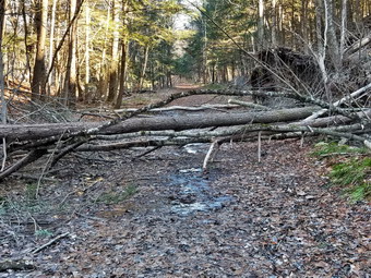
![]()
![]()
![]()
![]()
![]() On Tuesday, January 2nd I wanted to get out for a hike and to clear some blowdowns on the Parksville Rail Trail. At 6:30 M the temperature was 20 degrees on the back porch which was alright with me as I had some work to do. By 1:00 PM the temperature had risen to 30 degrees and I began to get dressed to hike. Sheila was asleep on the couch and I decided not to wake her until I was ready to go. The skies were cloudy but there were areas of blue sky and sun. The Parksville Rail Trail is about 2.5 miles out and back from the parking area near Fox Mountain Road with a beautiful waterfall. I decided to take my phone but leave it in the car so I could enjoy the hike and get some work done. I ask Sheila if she wanted to go and she said "Yes". I joped she would be able to help me clear the blowdowns. I decided to wear my Mammut long-sleeved crew shirt with a long-sleeved baselayer. This combination is a warmer than what I had been wearing and appropriate for the cooler weather. I wore my Railriders hiking pants which are expensive but last along time and have features like deep pockets and a generous cut which I really like. The pants have Velcro closures at the ankles. I decided to put on my Keen Durand hiking boots which I ordered a half size larger than the previous pair. These shoes fit well out of the box but get much tighter when I add a decent insole. Without the third party insole, by feet hurt from the lack of support. I added a new pair of Xstance insoles in an effort to find the best support and cushioning for my feet. These insoles have shock absorbing gel pads, TPU arch support, and memory foam cushioning all wrapped in a breathable fabric. The insoles have been hyped by their manufacturer and they really do seem to deliver. I decided to go without hiking poles as I would be carrying saws and an ax. I did decide to wear my Mammut hoody for warmth and to block the breeze. It has pit zips that open almost all the way to the lower hem. I donned a fleecy blaze orange hat and took along a pair of light knit gloves. I did not think to put on my OR Crocodile gaiters to deal with the mud that might be on the trail. I packed my Silky Sugowaza scabbard saw and my Silky KatanaBoy 500mm folding saw. I also took my Fiskars pack ax. I woke Sheila from her sleep and she immediately jumped down from the couch, sniffed my clothing, and ran for the back door!
On Tuesday, January 2nd I wanted to get out for a hike and to clear some blowdowns on the Parksville Rail Trail. At 6:30 M the temperature was 20 degrees on the back porch which was alright with me as I had some work to do. By 1:00 PM the temperature had risen to 30 degrees and I began to get dressed to hike. Sheila was asleep on the couch and I decided not to wake her until I was ready to go. The skies were cloudy but there were areas of blue sky and sun. The Parksville Rail Trail is about 2.5 miles out and back from the parking area near Fox Mountain Road with a beautiful waterfall. I decided to take my phone but leave it in the car so I could enjoy the hike and get some work done. I ask Sheila if she wanted to go and she said "Yes". I joped she would be able to help me clear the blowdowns. I decided to wear my Mammut long-sleeved crew shirt with a long-sleeved baselayer. This combination is a warmer than what I had been wearing and appropriate for the cooler weather. I wore my Railriders hiking pants which are expensive but last along time and have features like deep pockets and a generous cut which I really like. The pants have Velcro closures at the ankles. I decided to put on my Keen Durand hiking boots which I ordered a half size larger than the previous pair. These shoes fit well out of the box but get much tighter when I add a decent insole. Without the third party insole, by feet hurt from the lack of support. I added a new pair of Xstance insoles in an effort to find the best support and cushioning for my feet. These insoles have shock absorbing gel pads, TPU arch support, and memory foam cushioning all wrapped in a breathable fabric. The insoles have been hyped by their manufacturer and they really do seem to deliver. I decided to go without hiking poles as I would be carrying saws and an ax. I did decide to wear my Mammut hoody for warmth and to block the breeze. It has pit zips that open almost all the way to the lower hem. I donned a fleecy blaze orange hat and took along a pair of light knit gloves. I did not think to put on my OR Crocodile gaiters to deal with the mud that might be on the trail. I packed my Silky Sugowaza scabbard saw and my Silky KatanaBoy 500mm folding saw. I also took my Fiskars pack ax. I woke Sheila from her sleep and she immediately jumped down from the couch, sniffed my clothing, and ran for the back door!
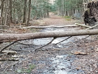 At 1:15 PM I put our gear in the car and Sheila in the back seat and headed out Old Route 17 and drove across the Flats. I took Old Route 17 and Service Road to the point where they meet Fox Mountain Road. There were no vehicles in the parking lot which was surprising for such a beautiful day. We departed the parking area at 1:25 PM with the temperature at 32 degrees with a light breeze blowing. The open trail just before the woods was frozen and much drier than I thought it might be. We moved on toward the wooded part of the trail. In the shade the trail was frozen even more than in the sun. We immediately ran into some mud pits but they were mostly frozen. One look down to the Little Beaverkill showed the stream volume was above average. I wondered about the condition of the falls but did not think we would be going that far today. Sheila was taking her own route and following her nose and getting very close to the edge of the trail where a steep drop led down to the river! We continued picking up some newly fallen branches and throwing them off the trail. It was obvious the recent wind had brought down many branches and small trees. We crossed several muddy areas which were both long and wide but frozen. We were soon at the wooden walkways and I decided not to take any pictures until the return trip, if at all. We continued over the wooden walkways and ran into the small tree with a double trunk which had fallen across the bridge. There was no damage to the bridge and I decided to leave this for the return trip. The walkway and bridges were mostly dry with some dried mud and leaves. This time the water from the small stream that flows off the roadway above was flowing in a channel it had cut in the far side of the bridge. The culvert under the bridge was completely blocked. After crossing the bridge, we ran into another large mud pit that had a layer of frozen water with a few stepping stones. Just after this we came to the very large and complex blowdown across the trail. A mudslide had brought down soil and several large trees. The trees came down as the soil was eroded away exposing their roots. There were several trunk and many branches intertwined making the job of clearing the blowdown harder. There was one main trunk that looked like it might be too big to cut with hand tools. Fortunately, the largest trees had fallen into the hill instead of across the trail.
 As I went to my pack to get my camera, I realized it was at home. I borrowed Cindy's phone and took some before shots. Cindy started to remove some of the smaller, loose branches. I used the silky Sugowaza to ger rid of some small branches and one small tree. We tried to get them as far off the trail as possible. I cut one small trunk on the left side of the trail with the saw and the used the axe to cut the other end as it was close to the ground. I had forgotten to bring wedges and did not want to take a chance on binding the saw. Once I had finished the cut, I grabbed the upper end of the trunk and dragged it off the trail and over the edge of the bank. I cut a few more branches and removed them before starting on the next trunk. I cut the top of the tree with the saw but had to use the ax on the end near the roots. The wood was very dry and hard and the trunk was almost on the ground. The cut went well and I was able to get rid of the trunk be dragging it over the bank. By this time I was pretty sure I would not be removing the largest trunk which would have to be cut multiple times. I saw a chainsaw in the future! I cut all of the small branches off the largest trunk so that anyone passing over it would not get hung up. After I was done, I hopped over the log and started to clear some chunks of wood and branches. I used the saw to clear a few odd branches sticking out into the trail. I also used the ax to clear another small trunk across the trail. By the time I was done Cindy was indicating her hands were cold. I used here phone to take some 'after' shots, picked up my tools and started back toward the car.
 When we came to the bridges, I asked Cindy if I could try to clear the two small trunks hanging over the walkway. Cindy assented but asked me to do it quickly. I took some pictures with her phone and then inspected the trunks to see what I should do. I cut the end of one trunk off with the saw without a problem. The end fell off the bridge and I was ready to continue. I made another cut in the same trunk which went well until the cut was complete! The piece I had cut fell out and the rest of the trunks slipped down further onto the walkway. As I was doing this Cindy's hands were getting colder so I sped up the process. I made one cut to remove the other trunk from the walkway and flipped the piece off the bridge. I made one more cut which cleared most of the trees from the walkway. I quickly took pictures with the phone and packed up my tools. We headed back toward the parking area where we arrived at 3:20 PM. I checked my phone to see if there had been any ambulance calls. There had been no notifications but as I was looking at the phone it started to sound an incoming call. I called in and started driving toward the ambulance building
![]()
![]()
![]()
![]() On Saturday, December 23rd I really wanted to get out for a first hike of the winter. An early morning ambulance call had me sleeping late to try to recover from several such calls during the week. It was cold overnight reaching into the low 20's but when I got up the temperature was in the high 20;s. At noon I began to get ready with the temperature at 30 degrees on the back porch with overcast skies and some sunshine peeking through. I decided to go across the street to Round Top to hike as I could get back quickly if I was needed on an ambulance call. As we began to get ready, Sheila was keeping a careful eye on me as I dressed as she would hike every day. Sheila often examines and sniffs my clothing to make sure I am serious about hiking. I decided to wear my Mammut long-sleeved crew shirt with a light long-sleeved baselayer. This setup is a little bit warmer and appropriate for the cooler weather. I wore my Railriders hiking pants which are expensive but last along time and have features like deep pockets and a generous cut which I really like. The pants have Velcro closures at the ankles. I decided to put on my new Keen Durand hiking boots which I ordered a half size larger than the previous pair. These shoes fit well out of the box but get much tighter when I add a decent insole. Without the third party insole, by feet hurt from the lack of support. I added a new pair of Xstance insoles in an effort to find the best support and cushioning for my feet. These insoles have shock absorbing gel pads, TPU arch support, and memory foam cushioning all wrapped in a breathable fabric. The insoles have been hyped by their manufacturer and they really do seem to deliver. I decided to take my Leki poles with external locks as the internal twist locks sometimes fail. I wore my Mammut hoody to block the breezy and keep me warm. It has pit zips that open all the way to the lower hem. I did put on a fleecy hat and a pair of light gloves. I did bring along my phone in case there were any calls. At 12:25 PM we walked out the door to start the hike. I grabbed Sheila's leash from my car and put it on her as we walked up the driveway. I aimed to hike for about an hour and complete two figure 8's. Sheila was happy to get out as we headed down the driveway and across the street. We crossed the street and walked to the parking lot next to the Presbyterian Church. We walked to the back of the church and began the ascent of the steepest hill behind the church. The hill is short but gets the circulation pumping and is the steepest and longest climb on the "trail." We did not stop until we reached the top of the hill. At the top we paused for a minute so I could look around at the hills that surround the hamlet of Livingston Manor. All of the snow was completely gone from the trail and surrounding forest. We continued the hike by turning left at the trailhead. The trail was covered in leaves and damp in a few places but there was no snow.
On Saturday, December 23rd I really wanted to get out for a first hike of the winter. An early morning ambulance call had me sleeping late to try to recover from several such calls during the week. It was cold overnight reaching into the low 20's but when I got up the temperature was in the high 20;s. At noon I began to get ready with the temperature at 30 degrees on the back porch with overcast skies and some sunshine peeking through. I decided to go across the street to Round Top to hike as I could get back quickly if I was needed on an ambulance call. As we began to get ready, Sheila was keeping a careful eye on me as I dressed as she would hike every day. Sheila often examines and sniffs my clothing to make sure I am serious about hiking. I decided to wear my Mammut long-sleeved crew shirt with a light long-sleeved baselayer. This setup is a little bit warmer and appropriate for the cooler weather. I wore my Railriders hiking pants which are expensive but last along time and have features like deep pockets and a generous cut which I really like. The pants have Velcro closures at the ankles. I decided to put on my new Keen Durand hiking boots which I ordered a half size larger than the previous pair. These shoes fit well out of the box but get much tighter when I add a decent insole. Without the third party insole, by feet hurt from the lack of support. I added a new pair of Xstance insoles in an effort to find the best support and cushioning for my feet. These insoles have shock absorbing gel pads, TPU arch support, and memory foam cushioning all wrapped in a breathable fabric. The insoles have been hyped by their manufacturer and they really do seem to deliver. I decided to take my Leki poles with external locks as the internal twist locks sometimes fail. I wore my Mammut hoody to block the breezy and keep me warm. It has pit zips that open all the way to the lower hem. I did put on a fleecy hat and a pair of light gloves. I did bring along my phone in case there were any calls. At 12:25 PM we walked out the door to start the hike. I grabbed Sheila's leash from my car and put it on her as we walked up the driveway. I aimed to hike for about an hour and complete two figure 8's. Sheila was happy to get out as we headed down the driveway and across the street. We crossed the street and walked to the parking lot next to the Presbyterian Church. We walked to the back of the church and began the ascent of the steepest hill behind the church. The hill is short but gets the circulation pumping and is the steepest and longest climb on the "trail." We did not stop until we reached the top of the hill. At the top we paused for a minute so I could look around at the hills that surround the hamlet of Livingston Manor. All of the snow was completely gone from the trail and surrounding forest. We continued the hike by turning left at the trailhead. The trail was covered in leaves and damp in a few places but there was no snow.
At the top of the hill we turned left and entered the woods to begin our hike. At the first trail junction, I followed Sheila as she continued straight ahead up the hill toward the lookout. The trail was well-worn as this is the most popular part of the hike. Some people simply hike up to the lookout over town and then back down. Sheila and I continued straight ahead passing the path to the lower lookout. I had tried blocking the trail with brush but people kept removing the obstacles. The problem is there is a growing chasm which could be difficult for some people to cross. At least the path is not marked as part of the trail system. We walked on the yellow trail as it headed uphill toward the next trail junction. As we walked up the trail, I removed a few loose branches from the trail. At one point there was a small tree across the trail but I was able to pick it up and throw it of the trail. We passed the "sitting rock" and continued on the yellow trail to the first junction with the blue trail. At the junction we turned right and walked on the yellow trail along the base of Round Top. As we neared the next trail junction, we found a small tree across the rail. Unfortunately, it was a little too big with a few too many branches to remove without tools. At the next junction with the blue trail, we turned left and started up toward the summit. The trails were covered in leaves that had fallen from the trees which made the trails slippery. We passed by the white crossover trail and walked over the summit. We continued down the blue trail on the other side until we turned left on the switchback in the blue trail. We passed some more branches that I had cut and removed from the trail. The switchback took us out into the woods before turning almost 180 degrees to take us back to the main blue trail. We turned left and walked downhill to the yellow trail where we turned left again. We walked along the base of Round Top on the yellow trail passing over and around the small tree in the trail. At the junction with the blue trail, we turned right to head down the trail to the woods road. We continued to follow the yellow blazes back to the first trail junction.
I decided I wanted to do another figure 8 so Sheila and I turned around and walked back up the woods road. At the end of the woods road, we followed the yellow trail as the blazes turned up the hill toward the junction with the blue trail. As I looked to the left I saw that the "cave" under the rock ledges seemed to have a fresh blue canvas and another white covering to enclose the area. I am not sure this is legal on public land nor do I know the purpose. When we reached the junction with the blue trail, we turned left and walked the yellow trail along the base of Round Top passing over the blowdown for the third time. At the next junction, with the blue trail, we turned right and began to walk up the blue trail toward the summit. We turned right on the switchback and walked out into the woods and back. We turned right on the blue trail and headed toward the summit. We walked over the top and then headed down the other side passing the white crossover trail. We walked down the trail to the junction with the yellow trail where we turned right. We followed the yellow trail along the base of Round Top encountering the blowdown for the fourth and final time. At the next junction with the blue trail, we turned left and continued to follow the yellow trail downhill toward the lookout. We passed the "Sitting Rock" and soon came to the viewpoint. We followed the yellow trail as it turned left and started downhill to the first trail junction. When we reached the first junction, we continued straight ahead to the trailhead where I put Sheila on her leash. We turned right and walked down the road toward the parking lot of the Presbyterian Church. We continued down the hill and walked across Rock Avenue to our driveway. We were back at 1:40 PM after walking about two miles in 1 hour and 15 minutes which included the time needed to do some light trail maintenance. The temperature was 32 degrees on the back porch. The hike was perfect as we met no other people and there were no ambulance calls.