
What You Missed
Summer 2021
Summer 2021
![]()
![]()
![]()
![]()
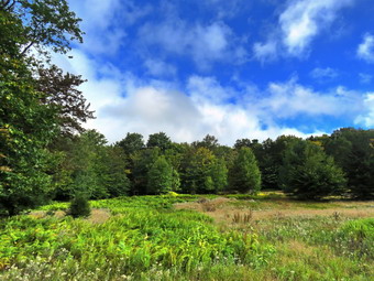
![]() On Tuesday, September 21st I wanted to get in a longer hike than just the trails on Round Top across the street. I knew this would be the last hike of the summer so I wanted it to be good. I was up by 8:30 AM and decided to head out to do a loop of about 6 miles at Hodge and Frick Ponds. I had not hiked UP the Flynn Trail to do the big loop around Hodge Pond in some time and made that my intended route. The temperature was 64 degrees as I was getting ready but I knew it could be a little cooler at the trailhead. I put on my White Sierra long-sleeved crew top with a short-sleeved base layer. I put on a pair of RailRiders hiking pants which are expensive but last a long time and have features like deep pockets and a generous cut which I really like. I decided to put on my Keen Targhee II hiking boots which fit well and have been discontinued. I decided to take my Leki poles with external locks as the internal twist locks sometimes fail. I donned a pair of OR Bugout gaiters to combat the ticks. I also added my OR floppy hat which I have decided shields me from the sun and allows me to spray some insect repellant on it rather than on me. I put my gear in the car and Sheila in the back seat at 9:00 AM and drove out the Debruce Road about 6 miles. I turned left onto Mongaup Pond Road and continued to where the road split. At the split, I turned left onto Beech Mountain Road, and drove to the parking areas at the Frick Pond. There were no cars parked in either parking lot as I pulled into the smaller area. I was surprised since lately there had been a few people at the trailhead no matter the day or time. The thermometer read 61 degrees as I set my GPS. It seemed a little cool but I knew I would warm up as I hiked. The skies were a little overcast with some blue in areas. Other parts of the sky were completely overcast and there wasn't much sun. There was also a breeze blowing which made things a little cooler. At 9:20 AM we started our hike by crossing the road to start out on the Flynn Trail. There were no large blowdowns in the woods but I did remove a few small branches. At the end of the trail through the woods we turned right on the woods road that was once the extension of Beech Mountain Road. I had intended to hike at a relaxed pace but instead set a quick pace with Sheila roving out ahead kicking up a few birds as we hiked. The trail was mostly dry but there were a few wet areas. The Flynn Trail ascends 1.7 miles to the Big Rock Trail junction gaining 600 feet. The more I hike the quicker I can hike and easier it seems. At 1.1 miles, we came to the area where there is a clearing to the right of the trail. I decided that we would go off the trail to visit the clearing as I had not done this in some time. We stopped at the edge of the clearing where I dropped my pack to get out the camera. I had hoped to see a little more color in the trees but I took some shots anyway. I packed up and we walked back down to the trail and continued toward Hodge Pond. By 10:10 AM we had hiked the 1.8 miles to the junction with the Big Rock Trail. I noticed a sign on the right side of the trail indicating the Big Rock Trail continued over the hill toward Mongaup Pond. I am becoming accustomed to mistakes on DEC signs but that doesn't make them acceptable. The Big Rock Trail only turns left! The trail to the right is a snowmobile trail. We continued straight ahead staying on the Flynn Trail heading toward Hodge Pond. The trail seemed dry but the layer of leaves covered some wet and muddy areas. We passed through the gate that separates state land from the Beaverkill Land Trust, formerly OSU, property and were soon at the next trail junction where we stayed to the left on the Flynn Trail to Hodge Pond.
On Tuesday, September 21st I wanted to get in a longer hike than just the trails on Round Top across the street. I knew this would be the last hike of the summer so I wanted it to be good. I was up by 8:30 AM and decided to head out to do a loop of about 6 miles at Hodge and Frick Ponds. I had not hiked UP the Flynn Trail to do the big loop around Hodge Pond in some time and made that my intended route. The temperature was 64 degrees as I was getting ready but I knew it could be a little cooler at the trailhead. I put on my White Sierra long-sleeved crew top with a short-sleeved base layer. I put on a pair of RailRiders hiking pants which are expensive but last a long time and have features like deep pockets and a generous cut which I really like. I decided to put on my Keen Targhee II hiking boots which fit well and have been discontinued. I decided to take my Leki poles with external locks as the internal twist locks sometimes fail. I donned a pair of OR Bugout gaiters to combat the ticks. I also added my OR floppy hat which I have decided shields me from the sun and allows me to spray some insect repellant on it rather than on me. I put my gear in the car and Sheila in the back seat at 9:00 AM and drove out the Debruce Road about 6 miles. I turned left onto Mongaup Pond Road and continued to where the road split. At the split, I turned left onto Beech Mountain Road, and drove to the parking areas at the Frick Pond. There were no cars parked in either parking lot as I pulled into the smaller area. I was surprised since lately there had been a few people at the trailhead no matter the day or time. The thermometer read 61 degrees as I set my GPS. It seemed a little cool but I knew I would warm up as I hiked. The skies were a little overcast with some blue in areas. Other parts of the sky were completely overcast and there wasn't much sun. There was also a breeze blowing which made things a little cooler. At 9:20 AM we started our hike by crossing the road to start out on the Flynn Trail. There were no large blowdowns in the woods but I did remove a few small branches. At the end of the trail through the woods we turned right on the woods road that was once the extension of Beech Mountain Road. I had intended to hike at a relaxed pace but instead set a quick pace with Sheila roving out ahead kicking up a few birds as we hiked. The trail was mostly dry but there were a few wet areas. The Flynn Trail ascends 1.7 miles to the Big Rock Trail junction gaining 600 feet. The more I hike the quicker I can hike and easier it seems. At 1.1 miles, we came to the area where there is a clearing to the right of the trail. I decided that we would go off the trail to visit the clearing as I had not done this in some time. We stopped at the edge of the clearing where I dropped my pack to get out the camera. I had hoped to see a little more color in the trees but I took some shots anyway. I packed up and we walked back down to the trail and continued toward Hodge Pond. By 10:10 AM we had hiked the 1.8 miles to the junction with the Big Rock Trail. I noticed a sign on the right side of the trail indicating the Big Rock Trail continued over the hill toward Mongaup Pond. I am becoming accustomed to mistakes on DEC signs but that doesn't make them acceptable. The Big Rock Trail only turns left! The trail to the right is a snowmobile trail. We continued straight ahead staying on the Flynn Trail heading toward Hodge Pond. The trail seemed dry but the layer of leaves covered some wet and muddy areas. We passed through the gate that separates state land from the Beaverkill Land Trust, formerly OSU, property and were soon at the next trail junction where we stayed to the left on the Flynn Trail to Hodge Pond.
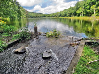
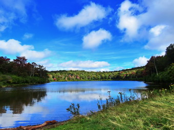 The downhill walk went quickly and were soon in the clearing at the outlet end of the pond. We walked over to the shore of the pond where I again dropped the pack to get out the camera. The leaves were just beginning to change and the sun was playing tricks. The sun would come out from behind the clouds and illuminate the trees and then quickly disappear again. I took my shots and the returned to my pack. Sheila had not jumped into the water to swim as it was a little cold. I got a drink and a bar as we headed back to the Flynn Trail and turned right to follow it along the west side of Hodge Pond. To this point the trail had been relatively dry but as we continued on the west side of Hodge Pond the Flynn Trail began to be muddy. At one time this part of the trail was heavily sodded and drained well. OSI had decided for some reason to rake a way the sod and run large tractors through to mow. This causes deep ruts in the mud which results in a real mess. As we walked along the western shore, we came to a spot where we could turn left or right. We turned left to stay on the Flynn Trail and began a slight up hill climb toward the gate where the trail turns to the left. We ran into blowdown which would require a saw and ax to clear. We continued our walk up the hill and through the gate. This part of the Flynn Trail is pretty flat and the trail is often the lowest point which allows water to collect with nowhere to go. The trail was wet and muddy and I had to walk around several areas where the mud looked to be above my boot tops. Despite this the trail was not as wet as it sometimes can be. I noticed that Sheila was pretty careful to walk around these areas as I had encouraged her. There were a few branches on the trails which I removed as we walked. We arrived at Junkyard Junction at 11:00 AM about 3.4 miles into the hike. From here the rest of the hike is primarily downhill with a few small hills along the way. We turned left on the red Quick Lake Trail and found it was also muddy in spots. Some section of the trail are washed out leaving a lot of rocks behind and making the downhill hiking not as much fun as it could be. There were at least two large trunks down across the trail which would require tools. Another blowdown had several branches that were hard to get through. I realized that most of these branches were loose and spent a few minutes moving them out of the way. At about 3.8 miles the trail turned due south and we continued downhill.
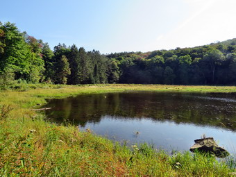
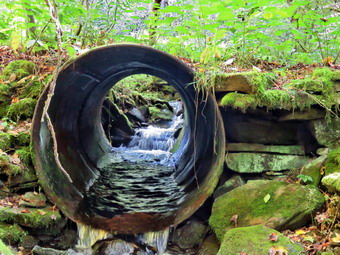
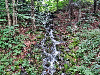
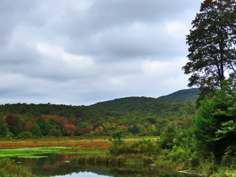 There wasn't much to see so we hiked quickly passing the junction with the snowmobile trail. We arrived at Iron Wheel Junction at 11:45M after hiking 5.0 miles. I stopped to take a few pictures as we turned right to stay on the Quick Lake Trail. At this point the yellow Logger's Loop continued straight ahead. The trail continued to be muddy but we made good time. We continued on the trail and soon came to the little stream in the woods. The stream was not very high as I had cleared a blockage downstream which allowed a better flow. Sheila did wade in to get a drink while I took a few pictures. I stopped to take a shot of the small waterfall just above the point where I crossed. We continued toward Frick Pond and found several more blowdowns which were large and easy to step over. There were a few wet and muddy spots but most were drier than I expected. We passed the junction with the Big Rock Trail that goes around the north end of Frick Pond and walked toward the bridge across the outlet of the pond. We crossed the bridge and I dropped my pack to take out my camera so that I could take some pictures. The trees around Frick Pond were showing some color but those on Beech Mountain were still green. I packed up and we continued back on the Quick Lake Trail toward the trail register. The brush along the trails was starting to grow into the trails and I hoped that my maintainer would be making a fall trip. I noticed that the Lobdell Memorial was still standing and I debated whether or not to trim the short path to it. The trail to the register was wet but the drainage work we had done seemed to be working. At the trail register we continued straight ahead on the woods road to the smaller parking area. It was 12:30 PM and we had hiked 6.4 miles in 3 hours and 10 minutes with an elevation gain of 930 feet. The temperature was 68 degrees.
![]()
![]()
![]()
![]() On Monday, September 20th I wanted to get out for a hike after a week of being away from the trails. A combination of cross country meets and ambulance calls had kept me away from the activity that relaxes me the most. After a week of hiking only once, I wanted to get in as many days in a row as possible. I slept a little late as we had two overnight ambulance calls. By the time I was ready to hike I knew that I only had time to go across the street to hike on Round Top. It was 11:15 AM by the time I started to get dressed with the temperature a rather "cool" 66 degrees. Sheila was ready to go as she really likes to hike and she was keeping a careful eye on me as we dressed. I put on my White Sierra long-sleeved crew top but decided against a baselayer. I put on a pair of RailRiders hiking pants which are expensive but last along time and have features like deep pockets and a generous cut which I really like. The pants have Velcro closures at the ankles. I decided to wear my Keen Cascade hiking boots which are new and all-leather which means they need some work to break them in. I decided to take my Leki poles with external locks as the internal twist locks sometimes fail. At 11:30 PM we walked out the door to start the hike. I grabbed Sheila's leash from the car and we walked up the driveway. I aimed to hike for about an hour. Sheila was happy to get out as we headed down the driveway and across the street. We crossed the street and walked to the parking area by the Presbyterian Church. We walked to the back of the church and began the ascent of the steepest hill behind the church. The hill is short but gets the circulation pumping and is the steepest and longest climb on the "trail." Sheila helped me along by pulling me up the hill. I looked at the many headstones that have tipped over and the holes developing. I hoped the town would take responsibility to do some repairs on the headstones that have fallen over and the holes that have developed. At the top of the hill we started on the trail by turning left at the trailhead where I let Sheila off her leash so that she could explore. The trail was mostly dry with a few muddy spots. The trail was worn showing that people had been using it.
On Monday, September 20th I wanted to get out for a hike after a week of being away from the trails. A combination of cross country meets and ambulance calls had kept me away from the activity that relaxes me the most. After a week of hiking only once, I wanted to get in as many days in a row as possible. I slept a little late as we had two overnight ambulance calls. By the time I was ready to hike I knew that I only had time to go across the street to hike on Round Top. It was 11:15 AM by the time I started to get dressed with the temperature a rather "cool" 66 degrees. Sheila was ready to go as she really likes to hike and she was keeping a careful eye on me as we dressed. I put on my White Sierra long-sleeved crew top but decided against a baselayer. I put on a pair of RailRiders hiking pants which are expensive but last along time and have features like deep pockets and a generous cut which I really like. The pants have Velcro closures at the ankles. I decided to wear my Keen Cascade hiking boots which are new and all-leather which means they need some work to break them in. I decided to take my Leki poles with external locks as the internal twist locks sometimes fail. At 11:30 PM we walked out the door to start the hike. I grabbed Sheila's leash from the car and we walked up the driveway. I aimed to hike for about an hour. Sheila was happy to get out as we headed down the driveway and across the street. We crossed the street and walked to the parking area by the Presbyterian Church. We walked to the back of the church and began the ascent of the steepest hill behind the church. The hill is short but gets the circulation pumping and is the steepest and longest climb on the "trail." Sheila helped me along by pulling me up the hill. I looked at the many headstones that have tipped over and the holes developing. I hoped the town would take responsibility to do some repairs on the headstones that have fallen over and the holes that have developed. At the top of the hill we started on the trail by turning left at the trailhead where I let Sheila off her leash so that she could explore. The trail was mostly dry with a few muddy spots. The trail was worn showing that people had been using it.
At the first trail junction, we followed Sheila as she turned right and started up the woods road which has the gentler approach of the two. We walked up the road to the first trail junction with the upper blue trail and turned left to follow the yellow trail along the base of Round Top. At the next junction with the blue trail we turned right and headed up the blue trail, toward the summit. When we got to the switchback, we turned right and followed it until it came back to the main blue trail. We turned right and passed by the white crossover trail. We passed over the summit and continued on the blue trail down the other side of the hill. We passed the white crossover trail and then turned right on the yellow trail. We again followed the yellow trail along the base of Round Top to the junction with the blue trail. This time we turned left and followed the yellow trail downhill passing the "Resting Rock" to the lookout. The forest was green but some of the ferns were starting to turn brown as fall was approaching and the nights ere getting cooler. At the viewpoint, we turned left and started to follow the yellow trail downhill to the first trail junction. I noticed that there was still some brush blocking the path to the viewpoint. People who are just trying to "help" sometimes clear the brush but it just means that I have to find branches and brush to throw on the path to block it. The path has a potentially dangerous gap especially in the winter. We started down the steep hill toward the first trail junction. At the bottom of the hill we turned around to start back up the hill to the viewpoint. At the top of the hill we followed the yellow trail as it turned right and started uphill. At the first junction with the blue trail, we turned right and followed the yellow trail along the base of Round Top. At the next junction with the blue trail, we turned left and headed up the blue trail toward the summit. We came to the white crossover trail again and turned left to take it over to the main blue trail. We turned left and then left again on the switchback. We walked the switchback toward the main blue trail. As we were almost back to the main trail. We continued downhill on the blue trail toward the junction with the yellow trail. We turned left and walked along the base of Round Top on the yellow trail to the next junction with the blue trail. This time we turned right and walked down the yellow trail to the woods road that took us back to the first trail junction. We turned left and walked out to the trailhead at the top of the cemetery hill. We walked down the hill and out to the road through the church parking lot. We walked over to the driveway and back to the house. It was 12:20 PM and we had hiked a little over 2 miles in a little more than an hour.
![]() On Monday, September 13th, I wanted to hike the Campbell Mountain Trail from Route 206 to the junction with the Little Spring Brook Trail. From there I planned to hike the Little Spring Brook Trail to Little Spring Brook Road. This is a little over 5 miles so I thought parking two cars and hiking point to point would be a good way to handle it since I needed to be back for cross country practice. I thought I had Cindy onboard for this adventure but in the end she bowed out. This left me with a dilemma. I wanted to hike the Little Spring Brook Trail as two of my maintainers tried to follow it on Saturday and lost the trail. When I woke up at 8:00 AM, it was already 66 degrees. I check my e-mail and found out that a friend from school had passed away which was a shock. I thought about giving up on the hike but knew I would feel better if I went out. I decided that I would hike the Little Spring Brook Trail out and back from Little Spring Brook Road. I started to get ready at 9:00 AM with Sheila staring at me the whole time. I put on my White Sierra long-sleeved crew top with a short-sleeved base layer. I put on a pair of RailRiders hiking pants which are expensive but last a long time and have features like deep pockets and a generous cut which I really like. I decided to put on my Keen Targhee II hiking boots which fit well and have been discontinued. I decided to take my Leki poles with external locks as the internal twist locks sometimes fail. I donned a pair of OR Bugout gaiters to combat the ticks. I also added my OR floppy hat which I have decided shields me from the sun and allows me to spray some insect repellant on it rather than on me. I put my gear in the back and Sheila in the backseat and pulled out of Livingston Manor at 9:15 AM. I headed to Roscoe on State Route 17, got off at exit 94 and got on Route 206. I followed it across the Delaware County line and drove north to Little Spring Brook Road. I turned right and drove along the road looking for my friend's property where I planned to park. I found the property but continued to the end of the road where I found a parking area not marked on the map. I decided to park there where the trail began. I set my GPS and started out on the trail at 9:35 Am with the temperature at 67 degrees
On Monday, September 13th, I wanted to hike the Campbell Mountain Trail from Route 206 to the junction with the Little Spring Brook Trail. From there I planned to hike the Little Spring Brook Trail to Little Spring Brook Road. This is a little over 5 miles so I thought parking two cars and hiking point to point would be a good way to handle it since I needed to be back for cross country practice. I thought I had Cindy onboard for this adventure but in the end she bowed out. This left me with a dilemma. I wanted to hike the Little Spring Brook Trail as two of my maintainers tried to follow it on Saturday and lost the trail. When I woke up at 8:00 AM, it was already 66 degrees. I check my e-mail and found out that a friend from school had passed away which was a shock. I thought about giving up on the hike but knew I would feel better if I went out. I decided that I would hike the Little Spring Brook Trail out and back from Little Spring Brook Road. I started to get ready at 9:00 AM with Sheila staring at me the whole time. I put on my White Sierra long-sleeved crew top with a short-sleeved base layer. I put on a pair of RailRiders hiking pants which are expensive but last a long time and have features like deep pockets and a generous cut which I really like. I decided to put on my Keen Targhee II hiking boots which fit well and have been discontinued. I decided to take my Leki poles with external locks as the internal twist locks sometimes fail. I donned a pair of OR Bugout gaiters to combat the ticks. I also added my OR floppy hat which I have decided shields me from the sun and allows me to spray some insect repellant on it rather than on me. I put my gear in the back and Sheila in the backseat and pulled out of Livingston Manor at 9:15 AM. I headed to Roscoe on State Route 17, got off at exit 94 and got on Route 206. I followed it across the Delaware County line and drove north to Little Spring Brook Road. I turned right and drove along the road looking for my friend's property where I planned to park. I found the property but continued to the end of the road where I found a parking area not marked on the map. I decided to park there where the trail began. I set my GPS and started out on the trail at 9:35 Am with the temperature at 67 degrees
 As we started out on the trail, I could immediately see that it was going to be a wet and muddy trip. The trail was lined with weeds and there was water running across it and down it with large muddy patches. The trail roughly followed an old woods road and paralleled Little Spring Brook. The trail markers were yellow but most were labeled New York State Department of Environmental Conservation Nature Trail which is a marker I had never seen before. I kept working my way along the trail. At one point there was a large culvert under the trail indicating that the road was once quite substantial. At .4 miles the markers disappeared and it was hard to tell where to walk. It look like there might be a trail through the woods but this was only a path. O continued to walk through the weeds finding some deep water and mud. The trail eventually came to a small but beautiful pond. I stopped to take some pictures and then we continued on the trail. The trial was drier after this as we walked through the woods and started up a small hill. I had been removing some small branches and trunks along the way and moved a few more in this area. At .7 miles we came to the junction with the Campbell Mountain Trail and the Pelnor Hollow Trail. I stopped for a moment and took some pictures of the signs at the intersection. The information on one sign was almost completely wrong. The sign pointed toward the Pelnor Hollow Trail but was labeled Little Spring Brook Trail. One line showed the Pelnor Hollow Trail was .6 miles away. It also showed the Campbell Mountain Trail was .6 miles in the same direction. This was odd as we were at the junction with those trails! The mistakes are confusing and it is sad that the DEC places these signs. We turned around and started back on the trail. As we neared the pond, I decided we would walk back through the woods along a stone wall. This was a much better route than the trail out and I am going to see if I can reroute the trail. I stopped at the culvert on the way back and took some pictures and also took some pictures of the stream where the water cascaded over some rocks. We continued back to the car walking through the water and mud again. I noticed that the sign at the trailhead said that Cat Hollow Road was 1.7 miles up the Little Spring Brook Trail! This was another mistake by the DEC. We were back at the car by 10:45 AM hiking 1.4 miles in 1 hour and 10 minutes. The elevation gain was 180 feet.
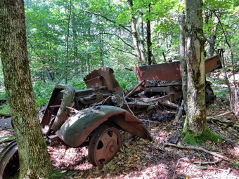 We left Little Spring Brook and drove out to Route 206. I turned right and drove over Cat Hollow to the parking area where the Finger lakes Trail crosses Route 206. I parked at 10:55 AM and set my GPS. We cross the road and started out on the trail. The trail was wet in a few spots and muddy in many spots. There were some trail markers missing but we were soon climbing Brock Mountain. This climb was a little steeper than I remembered. Over the first .5 miles we gain 440 feet at an average 17% grade. I could see higher ground on my left which I knew was Brock Mountain but could not remember where the quarry was located. At .5 miles the trail leveled and even descended a little. At .65 miles the trail began to ascend again for .25 miles at 17%. At 1 miles the trail turned right and headed south. At this point the road to the quarry was on the left. We walked up the road to the point where the quarry roads began. I dropped my pack and got out my camera and put my GPS unit in my pocket. We walked over to on old truck that had been used in the quarry and I took some pictures. I took some pictures of the stone left over after the quarrying. We then walked to the main part of the quarry where I took some pictures. We walked to the top of the quarry and I took a number of pictures as we walked along the edge. Soon we were back at the pack. I put the camera away and got a drink. I shouldered my pack and we headed back down the mountain to the car. As I walked along the trail, I had my mind in several things I had to get done during the day. Since I was not paying attention to my foot placement, I hot a muddy spot on a steep section and slipped. I fell pretty hard on my right side hitting my hip and knee. I picked myself up and had some pain but everything seemed to work. I brushed off some of the mud and started back down the trail. The rest of the trip was uneventful and we were back at the car at 12:15 PM after hiking 2.2 miles in 1 hour and 20 minutes. The elevation gain was 765 feet.
![]()
![]()
![]()
![]() On Wednesday, September 8th I wanted to get in a hike even though I had to leave early for an away cross country meet. I had planned to go for a slightly longer hike at Frick Pond but several ambulance calls overnight made me rethink my plans. I slept until 9:30 AM and decided I would go across the street and hike some loops on Round Top. I had a few things to get done around the house but finally started to get ready at 11:00 AM when the temperature was 75 degrees with a slight breeze blowing. Sheila was ready to go as she really likes to hike and she was keeping a careful eye on us as I dressed. I put on my White Sierra long-sleeved crew top but decided against a baselayer. I put on a pair of RailRiders hiking pants which are expensive but last along time and have features like deep pockets and a generous cut which I really like. The pants have Velcro closures at the ankles. I decided to wear my Keen Cascade hiking boots which are new and all-leather which means they need some work to break them in. I decided to take my Leki poles with external locks as the internal twist locks sometimes fail. At 11:20 AM we walked out the door to start the hike. I grabbed Sheila's leash from the car and we walked up the driveway. I aimed to hike for about an hour. Sheila was happy to get out as we headed down the driveway and across the street. We crossed the street and walked to the parking area by the Presbyterian Church. We walked to the back of the church and began the ascent of the steepest hill behind the church. The hill is short but gets the circulation pumping and is the steepest and longest climb on the "trail." Sheila helped me along by pulling me up the hill. Some workers were trimming the cemetery before mowing. I hope they can address some of the holes developing and right some of the headstones that have fallen over. At the top of the hill we started on the trail by turning left at the trailhead where I let Sheila off her leash so that she could explore. The trail was completely dry and showed that people had been using it.
On Wednesday, September 8th I wanted to get in a hike even though I had to leave early for an away cross country meet. I had planned to go for a slightly longer hike at Frick Pond but several ambulance calls overnight made me rethink my plans. I slept until 9:30 AM and decided I would go across the street and hike some loops on Round Top. I had a few things to get done around the house but finally started to get ready at 11:00 AM when the temperature was 75 degrees with a slight breeze blowing. Sheila was ready to go as she really likes to hike and she was keeping a careful eye on us as I dressed. I put on my White Sierra long-sleeved crew top but decided against a baselayer. I put on a pair of RailRiders hiking pants which are expensive but last along time and have features like deep pockets and a generous cut which I really like. The pants have Velcro closures at the ankles. I decided to wear my Keen Cascade hiking boots which are new and all-leather which means they need some work to break them in. I decided to take my Leki poles with external locks as the internal twist locks sometimes fail. At 11:20 AM we walked out the door to start the hike. I grabbed Sheila's leash from the car and we walked up the driveway. I aimed to hike for about an hour. Sheila was happy to get out as we headed down the driveway and across the street. We crossed the street and walked to the parking area by the Presbyterian Church. We walked to the back of the church and began the ascent of the steepest hill behind the church. The hill is short but gets the circulation pumping and is the steepest and longest climb on the "trail." Sheila helped me along by pulling me up the hill. Some workers were trimming the cemetery before mowing. I hope they can address some of the holes developing and right some of the headstones that have fallen over. At the top of the hill we started on the trail by turning left at the trailhead where I let Sheila off her leash so that she could explore. The trail was completely dry and showed that people had been using it.
At the first trail junction, I followed Sheila as she turned right and started up the woods road which has the gentler approach of the two. We walked up the road to the first trail junction with the upper blue trail and turned left to follow the yellow trail along the base of Round Top. At the next junction with the blue trail we turned right and headed up the blue trail, toward the summit. When we got to the switchback, we turned right and followed it until it came back to the main blue trail. We turned right and passed by the white crossover trail. We passed over the summit and continued on the blue trail down the other side of the hill. We passed the white crossover trail and then turned right on the yellow trail. We again followed the yellow trail along the base of Round Top to the junction with the blue trail. This time we turned left and followed the yellow trail downhill passing the "Resting Rock" to the lookout. The forest was very green as all the vegetation was in bloom. At the viewpoint, we turned left and started to follow the yellow trail downhill to the first trail junction. I noticed that there was still some brush blocking the path to the viewpoint. People who are just trying to "help" sometimes clear the brush but it just means that I have to find branches and brush to throw on the path to block it. The path has a potentially dangerous gap especially in the winter. There were two women with a young child coming up the trail so I put Sheila on her leash and we stepped off onto the path. As the other hikers passed by, I busied myself finding a few more branches to add to the pile. After a few moment, we started down the steep hill toward the first trail junction. At the bottom of the hill we turned around to start back up the hill to the viewpoint. At the top of the hill we followed the yellow trail as it turned right and started uphill. The other hikers had hiked down to the lower lookout from the upper and were enjoying. At the first junction with the blue trail we turned right and followed the yellow trail along the base of Round Top. At the next junction with the blue trail, we turned left and headed up the blue trail toward the summit. We came to the white crossover trail again and turned left to take it over to the main blue trail. We turned left and then left again on the switchback. We walked the switchback toward the main blue trail. As we were almost back to the main trail, the other hikers were headed up toward the summit. I told them the trail actually follows the switchback to avoid erosion. They turned onto the switchback and started hiking toward us. I pulled Sheila aside and asked the hikers if they had ever been to the area below the lookout. They said they had not been there and I described the "rock shelter" that was there. We continued downhill on the blue trail toward the junction with the yellow trail. We turned left and walked along the base of Round Top on the yellow trail to the next junction with the blue trail. This time we turned right and walked down the yellow trail to the woods road that took us back to the first trail junction. We turned left and walked out to the trailhead at the top of the cemetery hill. We walked down the hill and out to the road through the church parking lot. We walked over to the driveway and back to the house. It was 12:20 PM and we had hiked over 2 miles in an hour.
![]()
![]()
![]()
![]()
![]() On Monday, September 6th, I asked Cindy if she wanted to go hiking and she agreed. We decided to go to Trout Pond to walk the loop and visit Russell Brook Falls. When I got up at 8:00 AM, the skies were bright and sunny with a few white clouds. The temperature was in the mid 60's and the humidity seemed low although it had rained overnight. I started to get ready at 9:15 AM and tried to get Cindy not to wait too long as there was a forecast for rain in the afternoon. Sheila seemed to be very enthusiastic about getting out as she was running upstairs to check on Cindy and then back downstairs to me. I put on my White Sierra long-sleeved crew top with a short-sleeved base layer. I put on a pair of RailRiders hiking pants which are expensive but last a long time and have features like deep pockets and a generous cut which I really like. I decided to put on my Keen Targhee II hiking boots which fit well and have been discontinued. I decided to take my Leki poles with external locks as the internal twist locks sometimes fail. I donned a pair of OR Bugout gaiters to combat the ticks. I also added a new OR floppy hat which I have decided shields me from the sun and allows me to spray some insect repellant on it rather than on me. I put our gear in the back and Sheila in the backseat and pulled out of Livingston Manor at 9:40 AM. I headed to Roscoe on State Route 17, got off at exit 94 and got on Route 206. I followed it across the Delaware County line to Morton Hill Road. After a left turn on Morton Hill Road, I drove toward the intersection with Russell Brook Road. There were two cars ahead of us and I thought they might be going the same place we were headed. I wondered if the lower parking area might be full on Labor Day. The cars ahead of us turned left on Russell Brook Road and I followed them. We drove down to the lower parking area where there were only a few parking spaces left after the other two cars parked. There were several groups of people present so I put Sheila on her leash. I set my GPS and we started down the woods road to the bridge across Russell Brook at 10:00 AM.
On Monday, September 6th, I asked Cindy if she wanted to go hiking and she agreed. We decided to go to Trout Pond to walk the loop and visit Russell Brook Falls. When I got up at 8:00 AM, the skies were bright and sunny with a few white clouds. The temperature was in the mid 60's and the humidity seemed low although it had rained overnight. I started to get ready at 9:15 AM and tried to get Cindy not to wait too long as there was a forecast for rain in the afternoon. Sheila seemed to be very enthusiastic about getting out as she was running upstairs to check on Cindy and then back downstairs to me. I put on my White Sierra long-sleeved crew top with a short-sleeved base layer. I put on a pair of RailRiders hiking pants which are expensive but last a long time and have features like deep pockets and a generous cut which I really like. I decided to put on my Keen Targhee II hiking boots which fit well and have been discontinued. I decided to take my Leki poles with external locks as the internal twist locks sometimes fail. I donned a pair of OR Bugout gaiters to combat the ticks. I also added a new OR floppy hat which I have decided shields me from the sun and allows me to spray some insect repellant on it rather than on me. I put our gear in the back and Sheila in the backseat and pulled out of Livingston Manor at 9:40 AM. I headed to Roscoe on State Route 17, got off at exit 94 and got on Route 206. I followed it across the Delaware County line to Morton Hill Road. After a left turn on Morton Hill Road, I drove toward the intersection with Russell Brook Road. There were two cars ahead of us and I thought they might be going the same place we were headed. I wondered if the lower parking area might be full on Labor Day. The cars ahead of us turned left on Russell Brook Road and I followed them. We drove down to the lower parking area where there were only a few parking spaces left after the other two cars parked. There were several groups of people present so I put Sheila on her leash. I set my GPS and we started down the woods road to the bridge across Russell Brook at 10:00 AM.
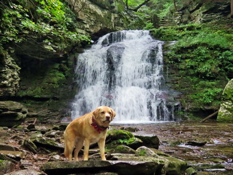
 We crossed the bridge and found that the Japanese knotweed had all but overgrown the path. It is a shame the DEC has not kept this trimmed back as the area is very popular and used by many people. We turned right on the path toward Russell Brook Falls and found it also had almost grown closed despite the traffic. We walked the path toward the falls. As we started down the bank, I could see a family in the streambed below the falls. I out Sheila on her leash and gave it to Cindy so that I could safely get down over the slippery rocks to the stream. After that, I took the leash and let Sheila come down followed by Cindy. I got out my camera and took pictures of the falls and the stream. The falls were flowing freely but the volume was not exceptional. I let Sheila loose and she went to pose in front of the falls. Two men were trying to get a drone to work but it didn't look like they were having much luck. I put Sheila on her leash in preparation for climbing back up the bank. Before we left, I noticed a fire ring and took the time to remove some wet wood, scatter the ashes and dismantle the stones. We walked up the bank and back out the main trail meeting a few people on the way. At the main trail we turned right. Where the trail split, we turned left on the Mud Pond Trail. We crossed the outlet stream from Trout Pond on the bridge and passed by the large campsite on the right. The campsite was empty and there was no garbage left behind. I was surprised since this is one of the most popular campsites. The trail began to climb the hill and in .6 miles we gained over 350 feet. Along the way I removed some loose branches and moved at least one trunk to the side of the trail. The climb is a little steep at times so we took a couple of breaks. Soon we were at the top of the hill and began a slight descent toward the trail junction. The trail was wet in places from the storm the previous night which had tracked north of Livingston Manor. When we reached the trail junction, we turned right on the Mud Pond Trail and started a long climb. We could see two people approaching the junction behind us but they contributed straight ahead on the Mud Pond Trail toward Mud Pond. I hoped they knew where they were going as the trail in that direction is very wet and muddy. In a short distance we ran into the first blowdown which was a single medium sized trunk across the trail. As we walked I continued to clear small branches and pulled some trunks off the trail. The trail was in good shape and I knew that a DEC sawyer and swamper had been through the last time I had visited. The climb seemed to go on for a long time and near the top there was another trunk across the trail. We continued to the top of the hill. I was glad the rest of the hike was downhill or flat.
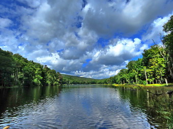
 The descent from the highest point on the hike to the outlet bridge is .7 miles and loses 455 feet in elevation. Along the way I picked up a few more branches and moved some more trunks. I noticed that several of the large blowdowns had been cut and moved by the DEC crew. We also encountered one more blowdown that would have to be cut and removed. On the final descent to the pond, Sheila alerted and I could see some people ahead on the trail. I took Sheila off the trail as they passed. There were at least 8 people and 3 dogs including some children. One dog was a young and beautiful Golden Doodle that was very "high energy". We arrived at the outlet end of the pond and I tried to find a place to walk out to the shore through the weeds. There was no good place so I walked over to the bridge and took a few pictures of the pond. The sky was blue with plenty of sun and some white puffy clouds. There were some people coming down the Mud Pond Trail so I packed up and we continued along the trail finding no one at either lean-to. We turned right on the Trout Pond Trail and found the large campsite on the left of the trail unused. The trail was wet and muddy but the center was dry enough that walking was not problem. At one point there was a place to walk off the trail to take some pictures of the pond. We continued down the trail and decided to stop at the beach to take some shots. We turned right and walked over to the beach. Sheila did not want to swim again but I did get out my camera to take some more shots of the pond. Sheila finally decided to take a dip and I took a picture. We walked back to the main trail and turned right to descend the trail to the trail register. Three hikers went by headed toward the upper end of the pond. The trail descends gently losing 260 feet over .7 miles on a wide woods road. Along the way we met a series of hikers coming up the trail including several dogs. As we neared the register, a man was approaching with a beautiful white dog. He pulled off the trail and I complimented his dog on the way by. He returned the favor. I was pretty sure the dog was a young White American Shepherd. Despite the dog being young and full of energy, it was very well-behaved. We continued on the trail and back to the car. We arrived at 12:45 PM after walking 4.5 miles in 2 hours and 45 minutes. The elevation gain was about 880 feet.
![]()
![]()
![]()
![]() On Friday, September 3rd I wanted to get out for a hike with my grandson Lukas and granddaughter Lilly who were coming to my house. Luke and Lilly are twins and I had never been out hiking with both of them. I did some work around the house but at 12:30 PM I asked them if they would like to go across the street to hike on Round Top. They both said "Yes" and we started to get ready to go. As I got ready, Sheila seemed very happy to be going out. I put on my White Sierra long-sleeved crew top with no base layer even though the temperature was only in mid 60's. I put on a pair of RailRiders hiking pants which are expensive but last a long time and have features like deep pockets and a generous cut which I really like. I wore my Vasque Taku hiking boots which are showing some serious wear but fit well. I decided to take my Leki poles with external locks as the internal twist locks sometimes fail. I donned a pair of OR Bugout gaiters to combat the ticks. We stepped out of the house at 12:55 PM. I grabbed Sheila's leash from the car and put it on her to safely cross the street. We walked up the driveway and crossed the street. We walked to the church parking lot and to the back of the church. As we started up the hill, we began the ascent of the steep hill behind the church. The hill is short but gets the circulation pumping and is the steepest and longest climb on the "trail". I was surprised that the twins practically skipped up the hill! I let Sheila pull me up the hill which she was willing to do. At the trailhead, I let Sheila off her leash and she immediately began to bound up the trail. We started on the trail by turning left at the trailhead. I knew that other people were using the trails from comments on Facebook and because there was one car parked at the bottom of the hill. The trails were becoming well-worn as more and more people use them. As we passed the trees that I had cut I pointed them out to the twins. In several places, Luke remembered what I had told him on a previous trip and repeated it to his sister.
On Friday, September 3rd I wanted to get out for a hike with my grandson Lukas and granddaughter Lilly who were coming to my house. Luke and Lilly are twins and I had never been out hiking with both of them. I did some work around the house but at 12:30 PM I asked them if they would like to go across the street to hike on Round Top. They both said "Yes" and we started to get ready to go. As I got ready, Sheila seemed very happy to be going out. I put on my White Sierra long-sleeved crew top with no base layer even though the temperature was only in mid 60's. I put on a pair of RailRiders hiking pants which are expensive but last a long time and have features like deep pockets and a generous cut which I really like. I wore my Vasque Taku hiking boots which are showing some serious wear but fit well. I decided to take my Leki poles with external locks as the internal twist locks sometimes fail. I donned a pair of OR Bugout gaiters to combat the ticks. We stepped out of the house at 12:55 PM. I grabbed Sheila's leash from the car and put it on her to safely cross the street. We walked up the driveway and crossed the street. We walked to the church parking lot and to the back of the church. As we started up the hill, we began the ascent of the steep hill behind the church. The hill is short but gets the circulation pumping and is the steepest and longest climb on the "trail". I was surprised that the twins practically skipped up the hill! I let Sheila pull me up the hill which she was willing to do. At the trailhead, I let Sheila off her leash and she immediately began to bound up the trail. We started on the trail by turning left at the trailhead. I knew that other people were using the trails from comments on Facebook and because there was one car parked at the bottom of the hill. The trails were becoming well-worn as more and more people use them. As we passed the trees that I had cut I pointed them out to the twins. In several places, Luke remembered what I had told him on a previous trip and repeated it to his sister.
At the first trail junction, we followed Sheila as she continued straight ahead up the hill toward the viewpoint. The climb up the hill was not particularly tiring and the cooler weather felt great. The brush we had been piling on the path to the viewpoint was still there. This path has a dangerous spot and we have piled brush on it to discourage people from using it. We walked down to the lower viewpoint from the upper one and looked out across Livingston Manor. In the winter when the leaves are off the trees there is a clearer view of the town. We had trouble seeing very much as the leaves blocked our view but the school and the "farm" on the opposite hill was visible. I Luke and Lilly if they would like to go down below the viewpoint and they agreed. We worked our way down with Luke in the lead. He really likes the rock scrambles and was surprised that there was a "cave" below the lookout. Lilly also enjoyed the descent to the path below the lookout. We went around the corner and the twins walked into the rock overhang. Luke peeked around the corner on the other side of the path and was impressed with the steepness of the path. We reversed our route and started back up. We worked our way back up to the main trail and continued to follow it as it headed up the gentle hill through the hardwood forest. The forest was very green and ferns covered the forest floor. Sheila was making her own way by staying on the trail sometimes and then running off-trail and chasing game trails. She was also picking up sticks and dragging them along and off the trail. We talked about their recent family vacation and I found out a few more of the places they had hiked. We continued to follow the yellow trail toward the first junction with the blue trail and the twins didn't seem to be slowing down at all. At the first trail junction with the blue trail, we turned right and followed the yellow trail along the base of Round Top. This section was in good shape without any blowdowns and I could now really notice what a good job I had done with my Stihl trimmer. At the next junction, we turned left and started up to the summit of Round Top on the blue trail. We bypassed the white crossover trail and continued up and over the summit. When we started down the other side, I decided we would skip the white crossover trail and the switchback on the blue trail. People seemed to be avoiding the crossover trail but the switchback looked more well-worn. At the bottom of the hill, we turned left on the yellow trail, walked along the base of Round Top. At the trail junction with the blue trail, we turned right to walk down to the woods road. It was a snap to walk downhill and out the woods road. It was obvious Sheila felt the same way as she was running and bounding ahead of us and then running back up the trail. I pointed out the rock ledges and shelters along the right side of the trail. We walked the woods road out to the first trail junction. I wanted to do a loop in the opposite direction so we turned round and headed back up the woods road to the junction with the blue trail. We turned right to walk along the base of Round Top to the next junction with the blue trail. Here we turned right and started uphill. When we came to the switchback, we turned right and followed it as it headed out and then turned back to the main trail. We turned right and then right again on the white crossover trail. We walked this trail to the other side of the hill and turned right on the main blue trail. At the bottom of the hill at the junction with the yellow trail, we turned right. We walked a short distance and then turned left off the trail to bushwhack along the top of the ledges. We found a pretty obvious herd path and followed it with a few "detours" to the edge of the ledges. We walked down a level and found a tree with a crossarm and another with a metal bracket. I think these were from the time when there was a TV antennae on Round Top that supplied reception for many people in town. We continued to walk through the woods until we reached a spot just above the trail to the viewpoint where Bryce and I had cut a tree off the trail. We walked down to the main trail and turned left to walk down to the first junction. We walked straight out to the trailhead and turned right to walk to the bottom of the hill. We headed across the church parking lot to the street. We crossed the street to our driveway and were home by 1:45 PM after hiking a little more than 2 miles in 1 hour and 50 minutes.
![]()
![]()
![]()
![]()
![]() On Thursday, September 2nd, I wanted to get in a hike close to home with Cindy. The ambulance pager had been going off almost twice a day and we had just had a whole day of torrential rain. I had cross country practice in the morning and returned home at 12:30 PM. I suggested a hike of the Parksville Rail Trail since it is flat and short but has a nice waterfall. Cindy agreed that she could handle this hike so we began to get ready at 1:00 PM. As we started to get ready, the temperature on the back porch was only 70 degrees but I knew the rail trail was shaded. I got dressed in a White Sierra long-sleeved crew top without a baselayer. I put on a pair of RailRiders hiking pants which are expensive but last along time and have features like deep pockets and a generous cut which I really like. These pants have Velcro closures at the ankles to discourage sticks and gravel from getting into my shoes and to combat ticks. I wore my Vasque Taku hiking boots which are showing some serious wear but fit well. I decided to take my Leki poles with external locks as the internal twist locks sometimes fail. I donned a pair of OR Bugout gaiters to combat the ticks. We put our gear in the back of the car and Sheila in the back seat. We left Livingston Manor at 1:25 PM and drove out Old Route 17 toward Parksville. Just after Fox Mountain Road, I pulled into the parking area on the right side of the road at 1:35 PM. There were no cars in the lot as we began to get ready. I decided to take my pack since it is the easiest way to carry my camera. I set my GPS and we set off on the trail with the car thermometer reading 69 degrees.
On Thursday, September 2nd, I wanted to get in a hike close to home with Cindy. The ambulance pager had been going off almost twice a day and we had just had a whole day of torrential rain. I had cross country practice in the morning and returned home at 12:30 PM. I suggested a hike of the Parksville Rail Trail since it is flat and short but has a nice waterfall. Cindy agreed that she could handle this hike so we began to get ready at 1:00 PM. As we started to get ready, the temperature on the back porch was only 70 degrees but I knew the rail trail was shaded. I got dressed in a White Sierra long-sleeved crew top without a baselayer. I put on a pair of RailRiders hiking pants which are expensive but last along time and have features like deep pockets and a generous cut which I really like. These pants have Velcro closures at the ankles to discourage sticks and gravel from getting into my shoes and to combat ticks. I wore my Vasque Taku hiking boots which are showing some serious wear but fit well. I decided to take my Leki poles with external locks as the internal twist locks sometimes fail. I donned a pair of OR Bugout gaiters to combat the ticks. We put our gear in the back of the car and Sheila in the back seat. We left Livingston Manor at 1:25 PM and drove out Old Route 17 toward Parksville. Just after Fox Mountain Road, I pulled into the parking area on the right side of the road at 1:35 PM. There were no cars in the lot as we began to get ready. I decided to take my pack since it is the easiest way to carry my camera. I set my GPS and we set off on the trail with the car thermometer reading 69 degrees.
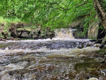 Once we were on the trail and sheltered by the trees it was a little cooler and the long sleeves did not seem too hot. The trail was very wet and muddy from the rain that was part of Hurricane Ida. There was standing water in some places and small stream running down the trail in others. I tried several times to get down close to the stream as it was flowing with a high volume. Once I did get down close to the stream I found it hard to get any really good shots through the trees. In one spot a large tree had fallen over taking a slightly smaller one with it. Someone had come through and cut the tree with a chainsaw clearing the trail. As we walked we removed sticks and branches from the trail. We came to a nice view down to the Little Beaverkill and I stopped to take a few shots. There were some nice puffy white clouds in the sky but the stream was a roiling and muddy mess. Just after this point was a boardwalk and bridge and I again took some pictures. There was a lot of water in this area and the heavy rain had carried dirt and rocks onto the bridge. This had also blocked the ability of the water to flow under the bridge which forced the water and mud onto the bridge and trail. The walkway had some leaves on it and was very slippery from the rain. The day was sunny and the sky was very blue with some white clouds. We passed several benches placed for people to rest. Soon, we could hear an increase in the noise from the stream and I knew the falls was just ahead. We stopped to look at the falls which had more water going over it than I had ever seen. The stream was very high which made the drop of the falls look shorter than usual. I walked down the bank and worked my way to an area in front of the falls. The water was brown with white caps. I took some shots and then repositioned to take a few more. There are two drops to the falls but from the bottom of the lower falls it is hard to see the upper drop. I walked back up the bank and took a picture from above the falls. We walked down the trail a short distance where another path led down to the creek. When the water is low this leads along the edge of the stream to just above the falls. On this day the stream was so high that the path lead just to the edge of the water and then ended. I walked down to this point and took a few pictures. I walked back up to the trail and then followed another short path to the edge of the stream for a few more shots. As we were getting ready to continue our hike, a couple of hikers approached us from Parksville. We said "Hello" and they responded as we continued to walk toward Parksville. As we approached the end of the trail, I put Sheila on her leash. I was happy to see that most property owners were cleaning up the mess just across the stream. We passed some buildings on the left side of the trail that were ruined and falling down. On the Parksville end of the trail we stopped at the small garden which has a very informative sign. The sign listed the businesses and hotels that existed in Parksville during its heyday. The Young's Gap Hotel had room for 600 guests! The sign also explained the role of the railroad in the dairy industry which was a thriving one in all of Sullivan County. The sign made the comment that the area produced 9 million cans of milk annually. After a brief pause, we began the walk back on the trail. The return trip was uneventful but we did meet the two hikers coming back. We were back at the car at 3:10 PM after hiking 2.9 miles in 1 hour and 30 minutes. Our moving average was 2.2 mph and the elevation gain was 240 feet which I doubted.
![]()
![]()
![]()
![]() On Monday, August 30th I wanted to get out for a hike after a weekend filled with ambulance calls. My grandson Bryce would be available to hike but I had to go to cross country practice at school first. I returned home at noon with the temperature at 75 degrees with high humidity. Bryce and I talked about where to hike and since we were both a little tired we just decided to go across the street and hike on Round Top. As I got ready, Sheila seemed very happy to be going out. I put on my White Sierra long-sleeved crew top with no base layer because the temperature was in the high 70's with high humidity. I put on a pair of RailRiders hiking pants which are expensive but last a long time and have features like deep pockets and a generous cut which I really like. I decided to wear my Keen Cascade hiking boots which are new and all-leather which means they need some work to break them in. I decided to take my Leki poles with external locks as the internal twist locks sometimes fail. We stepped out of the house at 1:15 PM. I grabbed Sheila's leash from the car and put it on her to safely cross the street. We walked up the driveway and crossed the street. We walked to the church parking lot and to the back of the church. As we started up the hill, there were two men starting up the hill. One man walked off the road and into the cemetery. The other man continued up the hill toward the trailhead. We began the ascent of the steep hill behind the church. The hill is short but gets the circulation pumping and is the steepest and longest climb on the "trail". I let Sheila pull me up the hill which she was willing to do but then gave the leash to Bryce so that I could use my poles. At the trailhead, I let Sheila off her leash and she immediately began to bound up the trail. We started on the trail by turning left at the trailhead. I knew that other people were using the trails from comments on Facebook and because the trails were becoming well-worn as more and more people use them.
On Monday, August 30th I wanted to get out for a hike after a weekend filled with ambulance calls. My grandson Bryce would be available to hike but I had to go to cross country practice at school first. I returned home at noon with the temperature at 75 degrees with high humidity. Bryce and I talked about where to hike and since we were both a little tired we just decided to go across the street and hike on Round Top. As I got ready, Sheila seemed very happy to be going out. I put on my White Sierra long-sleeved crew top with no base layer because the temperature was in the high 70's with high humidity. I put on a pair of RailRiders hiking pants which are expensive but last a long time and have features like deep pockets and a generous cut which I really like. I decided to wear my Keen Cascade hiking boots which are new and all-leather which means they need some work to break them in. I decided to take my Leki poles with external locks as the internal twist locks sometimes fail. We stepped out of the house at 1:15 PM. I grabbed Sheila's leash from the car and put it on her to safely cross the street. We walked up the driveway and crossed the street. We walked to the church parking lot and to the back of the church. As we started up the hill, there were two men starting up the hill. One man walked off the road and into the cemetery. The other man continued up the hill toward the trailhead. We began the ascent of the steep hill behind the church. The hill is short but gets the circulation pumping and is the steepest and longest climb on the "trail". I let Sheila pull me up the hill which she was willing to do but then gave the leash to Bryce so that I could use my poles. At the trailhead, I let Sheila off her leash and she immediately began to bound up the trail. We started on the trail by turning left at the trailhead. I knew that other people were using the trails from comments on Facebook and because the trails were becoming well-worn as more and more people use them.
At the first trail junction, we followed Sheila as she continued straight ahead up the hill toward the viewpoint. After the short walk from the house, I was already soaked in sweat from the humidity. The climb up the hill was a little more tiring than usual. At the viewpoint, I noticed that the brush that I had placed in the trail was still there but that someone had tried to "help" by removing some. Bryce and I spent some time piling the brush back on the trail and adding a few more pieces. This path has a dangerous spot and we have piled brush on it to discourage people from using it. We continued on the main trail and headed to the right to follow ot as it turned and headed up the gentle hill through the hardwood forest. The forest was green and the ferns covering the forest floor were still flourishing. Sheila was making her own way by staying on the trail sometimes and then running off-trail and chasing game trails. She was also picking up sticks and dragging them along and off the trail. We continued to follow the yellow trail toward the first junction with the blue trail. There were a few branches on the trail that we removed as we hiked. At the first trail junction with the blue trail, we turned right and followed the yellow trail along the base of Round Top. This section was in good shape without any blowdowns and I could now really notice what a good job I had done with my Stihl trimmer. At the next junction, we turned left and started up to the summit of Round Top on the blue trail. We bypassed the white crossover trail and continued up and over the summit. As we started down the other side, the man who had started out on the trails came hiking toward us. We said "Hello" as we passed. I decided we would skip the white crossover trail and the switchback on the blue trail. People seemed to be avoiding the crossover trail but the switchback looked more well-worn. At the bottom of the hill, we turned left on the yellow trail, and walked along the base of Round Top. At the trail junction with the blue trail, we turned right to walk down to the woods road. It was a snap to walk downhill and out the woods road. It was obvious Sheila felt the same way as she was running and bounding ahead of us and then running back up the trail. As we walked the woods road out to the first trail junction we found several small blowdowns across the trail. We took the time to remove these from the trail by carrying them off. At the first trail junction, we immediately turned around and started back up the woods road to the junction with the blue trail. We turned left and walked along the yellow trail following the base of the Round Top summit. At the next junction, we turned right and started up the steeper side of the hill on the blue trail. This time we again took the switchback in the blue trail. At the end of the switch, we turned right and right again on the white-blazed crossover trail. We continued on crossover trail to the blue trail on the other side of the hill. We turned right at the end and walked down to the yellow trail. We turned right on the yellow trail and followed it along the base of Round Top once again. At the junction with the blue trail, we turned to the left to stay on the yellow trail to the lookout. At the lookout, we followed the yellow trail as it turned left and descended to the first trail junction. By this time Bryce and I were both hot and drenched in sweat, so walked straight out to the trailhead. The skies were beginning to cloud over and a few drops of rain fell from the sky. We turned right to walk to the bottom of the hill. We headed across the church parking lot to the street. We crossed the street to our driveway and were home by 2:30 PM after hiking a little over 2 miles in 1 hour and 15 minutes. As we reached the house, the skies opened up and it began to pour!
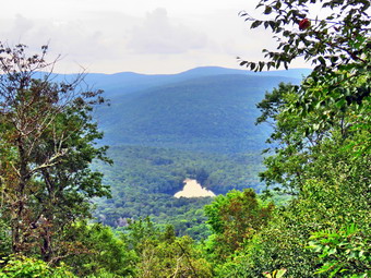
![]()
![]()
![]()
![]()
![]() On Friday, August 27th I planned to hike with Sharon on a hike sponsored by the Catskill Mountain Club and the ADK MidHudson Chapter. Sharon wanted to finish the trails from Beech Hill over Cabot Mountain and around Little Pond for the All rails Challenge. I agreed to meet the group sometime after 9:30 AM at the Beech Hill parking area where the Finger lakes Trail crosses Beech Hill Road. The night before I found out that my grandson Bryce would be able to join the hike which made me very happy. I was up at 7:30 AM and found the air already heavy with humidity and the temperature already at 68 degrees! Bryce arrived at just after 8:00 AM so we had some time before I wanted to leave at 9:00 Am. I was hoping that the ambulance pager would stay quiet! Bryce was ready to go except for the act he had not brought his hydration pack. We found him a large fanny pack and gave him two bottles of water. I started to get ready at 8:30 AM with the temperature at 71 degrees on the back porch. Sheila was watching my every move as I got ready and I think she was particularly happy that Bryce was going with us. I put on my White Sierra long-sleeved crew top which is insect-repellent with a short-sleeved baselayer. I put on a pair of RailRiders hiking pants which are expensive but last along time and have features like deep pockets and a generous cut which I really like. The pants have Velcro closures at the ankles I wore my Keen Targhee II hiking boots which are showing some serious wear but fit well. I decided to take my Leki poles with external locks as the internal twist locks sometimes fail. I decided to put my Silky Sugowaza saw in my pack just in case we ran into any blowdowns on the trails as I had not been on them in some time. I got my gear in the car while Sheila and Bryce got in the back seat at 9:00 AM. I had enough gas to get there and back twice but decided to fill up before leaving town which meant we headed out at 9:10 AM. I was not worried as I knew we would be the first ones there. I drove north toward Roscoe on Old Route 17 turning right on the Beaverkill Road. I continued up the Beaverkill Road passing through Lew Beach. A half mile after entering Ulster County I turned right on Beech Hill Road and drove 2.5 miles to the parking area on the right side of the road. We were the only car parked at 9:35 AM and I did not know how long we would have to wait for the others. I stepped out of the air conditioned car and was hit by the 76 degree air with very high humidity. The skies were mostly overcast and somewhat bland but I knew there was no rain in the forecast until the evening. The parking area had been mowed and there was a swathe of grass cut almost to where the trail entered the woods. Two other cars finally appeared at 10:00 AM and Bryce, Sheila and I got out to meet the others. Sharon was there with 5 other hikers from diverse geographic areas and backgrounds. We introduced ourselves and Sharon mentioned some of the "rules" of the hike. In particular, she emphasized that the pace would be relaxed and that we would all hike together. I set my GPS and we started off at 10:10 AM.
On Friday, August 27th I planned to hike with Sharon on a hike sponsored by the Catskill Mountain Club and the ADK MidHudson Chapter. Sharon wanted to finish the trails from Beech Hill over Cabot Mountain and around Little Pond for the All rails Challenge. I agreed to meet the group sometime after 9:30 AM at the Beech Hill parking area where the Finger lakes Trail crosses Beech Hill Road. The night before I found out that my grandson Bryce would be able to join the hike which made me very happy. I was up at 7:30 AM and found the air already heavy with humidity and the temperature already at 68 degrees! Bryce arrived at just after 8:00 AM so we had some time before I wanted to leave at 9:00 Am. I was hoping that the ambulance pager would stay quiet! Bryce was ready to go except for the act he had not brought his hydration pack. We found him a large fanny pack and gave him two bottles of water. I started to get ready at 8:30 AM with the temperature at 71 degrees on the back porch. Sheila was watching my every move as I got ready and I think she was particularly happy that Bryce was going with us. I put on my White Sierra long-sleeved crew top which is insect-repellent with a short-sleeved baselayer. I put on a pair of RailRiders hiking pants which are expensive but last along time and have features like deep pockets and a generous cut which I really like. The pants have Velcro closures at the ankles I wore my Keen Targhee II hiking boots which are showing some serious wear but fit well. I decided to take my Leki poles with external locks as the internal twist locks sometimes fail. I decided to put my Silky Sugowaza saw in my pack just in case we ran into any blowdowns on the trails as I had not been on them in some time. I got my gear in the car while Sheila and Bryce got in the back seat at 9:00 AM. I had enough gas to get there and back twice but decided to fill up before leaving town which meant we headed out at 9:10 AM. I was not worried as I knew we would be the first ones there. I drove north toward Roscoe on Old Route 17 turning right on the Beaverkill Road. I continued up the Beaverkill Road passing through Lew Beach. A half mile after entering Ulster County I turned right on Beech Hill Road and drove 2.5 miles to the parking area on the right side of the road. We were the only car parked at 9:35 AM and I did not know how long we would have to wait for the others. I stepped out of the air conditioned car and was hit by the 76 degree air with very high humidity. The skies were mostly overcast and somewhat bland but I knew there was no rain in the forecast until the evening. The parking area had been mowed and there was a swathe of grass cut almost to where the trail entered the woods. Two other cars finally appeared at 10:00 AM and Bryce, Sheila and I got out to meet the others. Sharon was there with 5 other hikers from diverse geographic areas and backgrounds. We introduced ourselves and Sharon mentioned some of the "rules" of the hike. In particular, she emphasized that the pace would be relaxed and that we would all hike together. I set my GPS and we started off at 10:10 AM.
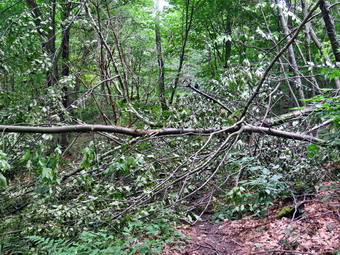 There were a few large branches on the trail as we entered the woods and Bryce and I took the time to remove them. The initial section of trail is flat and is usually wet and that was true on this day. We had to be careful stepping on the rocks as our feet were wet and the rocks were already slippery. After only .15 miles, we started to climb. The trail ws damp and we continued to find a few branches here and there which Bryce and I removed. We noticed that all of the other hikers simply stepped on or around the branches rather than remove them from the trail. I thought once again how much easier trail maintenance would be if each hiker did their part! The trail continued an unrelenting ascent for the next .6 miles still heading northeast. The average garde was 21% with several steeper areas. Sharon called a break every now and then to try to keep us all together as several people did not seem to understand the meaning of "relaxed". I was happy that Bryce and I did not have to cut any blowdowns but only had to move a few branches and trunks here and there. It was only .7 miles to the top of the main climb but seemed a little longer in the humidity. The trail turned a little to the east and then southeast before we began a final climb at 1.1 miles. his climb was only about 100 feet and then we descended to the "Beaverkill Vista" at 1.45 miles. The vista is a flat rock that looks down the Beaverkill Valley and has a great view of Little Pond. We stopped here for a break and I took some pictures. I gave Sheila a drink which she seemed to appreciate after which he started in again. The trail headed north briefly and then east. At 1.5 miles we began the initial descent of Cabot Mountain. This descent get as steep at 38% in places and has a lot of loose rock and dirt. On this day the rocks were slippery from the humidity and the descent seemed slower than the ascent. We stopped briefly at a rock overhang where I took some pictures of Bryce and Sheila before finishing the trip down. I knew there was a large tree across the trail. I found that the DEC had cut another smaller blowdown but had left the larger tree across the trail just above head height. They did slap a trail marker on it. Below this area there is usually a sea of nettles but the increased traffic on these trails has beaten them back. The trail out to the junction with the Little Pond Trail is litter with old large blowdowns which the DEC sawyers had cut. This made walking the trail much easier. We arrived at the trail junction and waited until all were gathered.
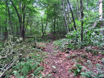 Sharon wanted to walk the Touch-Me-Not Trail to the junction with the Campground Trail and then turn around and walk back to the junction where we were standing. She needed this for the all Trail Challenge and I had no objection as it is a short section with some interesting rock formations. We continued straight ahead and almost immediately ran into a messy blowdown at 2.35 miles. There has a detour for to the right but it passed beneath a large trunk hanging by the bark. I decided Bryce and I would stay and remove the blowdown while the others hiked to the next trail junction. I took some 'before' pictures and then Bryce and I surveyed the work. We pulled away a few loose branches and the I started to use the Silky Sugowaza to cut up the blowdown. There were at least three trees intertwined and it was hard to figure out which to cut first. As I cut some large branches, Bryce dragged them away without requiring much help from me. We continued to cut and clear until there was just one small sapling left. I cut it and Bryce dragged it so that it was off the trail and blocked the detour. I was taking my 'after' pictures as then group returned. They were surprised we had cleared the blowdown so quickly! We walked back to the junction with the Little Pond Trail and turned left on the yellow blazed trail. This trail heads southwest and then south toward Little Pond. It is flat or downhill for its entire length. Somehow three of the group got ahead of us and did not seem to want to wait. I assumed Bryce was with them and I was not happy. We came to a point where the trail passes through a clearing with a nice view of the valley and surrounding hills. I stopped to take some pictures and the we continued on. We spent a few minutes inspecting an old house foundation and then passed by a small pond to the right of the trail. All the time there was no sign of Bryce or the rest of the group.
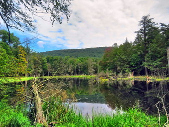 The trail followed an old woods road and there was a very large blowdown blocking it which had been there for some time. As we approached the blowdown, I could see that it had been cut so that hikers could pass through. Shortly after this point, the trail turns left off the road and descends through some pines. The trail was wet and very slippery. The walk to the beaver pond went quickly. The pond and the dam are very impressive but I could not see any new work. I took some pictures and we continued without any sight of the rest of our group or Bryce. We walked downhill along the stream to the trail that runs around Little Pond. Since the trail splits here, I was sure the group would have waited for us. They did not! We turned left and walked back to the parking lot. I was very worried that Bryce would not be there but as we approached I could see him with the rest of the group. I decided to walk to the dam to take some pictures of Little Pond and Cabot Mountain and to cool off a little before I spoke to Bryce. I took my pictures and then walked over to the cars. Before I could speak, Bryce, realizing he had made a mistake, explained that they had just gotten out ahead of us. I explain calmly why this was not acceptable. Sharon gave us a ride back to our car on Beech Hill Road. I thanked her for good hike. The temperature on the car thermometer read 82 degrees as we pulled away. The clouds along Beech Hill Road were so impressive I stopped to take a few shots. We ended our hike at 1:45 PM after covering 4.1 miles in 3 hours and 35 minutes with 1 hour and 15 minutes of stopped time. The elevation gain was only 910 feet!
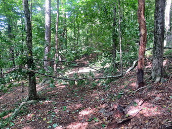
![]() On Thursday, August 26th I had planned to visit four different waterfalls in the Evansville area. When I returned from cross country practice just before noon the temperature was 90 degrees and it was very humid. Cindy was not enthusiastic about going out and I reasoned that the children who were still on summer break might be at these falls. Since I wanted a view of these falls without the people, I decided to put it off for another day. I decided that I would take Sheila and go across the street to Round Top and hike a few loops. I began to get ready at 1:00 PM with the skies starting to darken a little. As I got ready, Sheila seemed very happy to be going out even though it was hot. I put on my White Sierra long-sleeved crew top with no base layer because of the temperature and high humidity. I put on a pair of RailRiders hiking pants which are expensive but last a long time and have features like deep pockets and a generous cut which I really like. I decided to wear my Keen Cascade hiking boots which are new but seem to be broken in. I put Sheila on her leash and we headed out the driveway at 1:30 PM. We crossed the street and walked across the field by the Presbyterian Church. We started up the hill behind the church on the border of the cemetery. This hill is the steepest part of the hike to Round Top and can really get the blood pumping! Sheila was pulling me up the hill which made it a much easier walk. At the trailhead we turned left and I let Sheila off her leash. We started out on the trail and immediately ran into a small tree blocking the trail. It had been less than a week since I had cleared a large blowdown just passed this point. This emphasized to me that maintainers can go out and clear a trail and the next day it can be ruined by a storm. We turned around and walked back out to the trailhead. I put Sheila on a leash and we walked down the hill to the church. We walked across the parking lot, crossed the street and walked back down the driveway. I put Shiela in the car and walked inside to get some tools. I got my Silky Sugowaza saw and Fiskars pack ax. I shouldered my pack with my camera and two Oregon plastic felling wedges. I put my gear in the back of the car with Sheila in the back seat. I drove out the driveway and across the street to the cemetery. I parked at the trailhead, grabbed the Sugowaza saw and my pack and walked only a few feet to the small blowdown. I dropped my pack and got out the camera to take pictures of the blowdown from several different angles. I returned the camera to my pack and retrieved the Sugowaza. I removed some loose branches and then used the Sugowaza to cut branches. It did not take me long to strip away the smaller branches leaving the trunk. I cut the trunk off the trail and dragged it off the trail. I took my 'after' pictures and packed everything up and returned to the car. It had taken be about 20 minutes to do all the work.
On Thursday, August 26th I had planned to visit four different waterfalls in the Evansville area. When I returned from cross country practice just before noon the temperature was 90 degrees and it was very humid. Cindy was not enthusiastic about going out and I reasoned that the children who were still on summer break might be at these falls. Since I wanted a view of these falls without the people, I decided to put it off for another day. I decided that I would take Sheila and go across the street to Round Top and hike a few loops. I began to get ready at 1:00 PM with the skies starting to darken a little. As I got ready, Sheila seemed very happy to be going out even though it was hot. I put on my White Sierra long-sleeved crew top with no base layer because of the temperature and high humidity. I put on a pair of RailRiders hiking pants which are expensive but last a long time and have features like deep pockets and a generous cut which I really like. I decided to wear my Keen Cascade hiking boots which are new but seem to be broken in. I put Sheila on her leash and we headed out the driveway at 1:30 PM. We crossed the street and walked across the field by the Presbyterian Church. We started up the hill behind the church on the border of the cemetery. This hill is the steepest part of the hike to Round Top and can really get the blood pumping! Sheila was pulling me up the hill which made it a much easier walk. At the trailhead we turned left and I let Sheila off her leash. We started out on the trail and immediately ran into a small tree blocking the trail. It had been less than a week since I had cleared a large blowdown just passed this point. This emphasized to me that maintainers can go out and clear a trail and the next day it can be ruined by a storm. We turned around and walked back out to the trailhead. I put Sheila on a leash and we walked down the hill to the church. We walked across the parking lot, crossed the street and walked back down the driveway. I put Shiela in the car and walked inside to get some tools. I got my Silky Sugowaza saw and Fiskars pack ax. I shouldered my pack with my camera and two Oregon plastic felling wedges. I put my gear in the back of the car with Sheila in the back seat. I drove out the driveway and across the street to the cemetery. I parked at the trailhead, grabbed the Sugowaza saw and my pack and walked only a few feet to the small blowdown. I dropped my pack and got out the camera to take pictures of the blowdown from several different angles. I returned the camera to my pack and retrieved the Sugowaza. I removed some loose branches and then used the Sugowaza to cut branches. It did not take me long to strip away the smaller branches leaving the trunk. I cut the trunk off the trail and dragged it off the trail. I took my 'after' pictures and packed everything up and returned to the car. It had taken be about 20 minutes to do all the work.
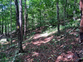 I decided we would hike a couple of figure 8's for the exercise and to see if there were any other messes to clean up. We started out on the trail again and at the first trail junction, we turned right to walk up the more shallow approach to Round Top on the wide woods road. The trails were surprisingly dry as it had not rained for several days. I had trimmed the trail pretty wide the last time I had done trail work and that had kept the brush and weeds off the trail. There were a few branches to pick up that were newly deposited on the trail. At the first junction with the blue trail, we turned left and continued on the yellow trail along the base of Round Top. The grass and weeds were under control and even the brush was well back from the trail. There were one or two larger branches on the trail so I picked them up and disposed of them. At the second junction with the blue trail, we turned right and headed up the steep side of the hill. I decided to walk straight up the hill to the summit avoiding both the switchback on the blue trail and the white crossover trail. We followed the blue trail over the summit and then walked down the other side. We again bypassed the white crossover trail and continued down the blue trail to the junction with the yellow trail. We turned right on the yellow trail to once again walk along the base of Round Top. This time when we reached the second junction with the blue trail we turned left on the yellow trail and followed that downhill to the viewpoint over town. We followed the yellow trail as it turned left to go back down to the first trail junction. I found that the brush I had placed in the path was still in place. I put the brush in the path to discourage people from walking along the path. This path can be dangerous for some and I wanted it blocked to discouraged its use. We continued down the hill to the very first trail junction completing our first figure 8. We immediately turned around and hiked back up the steeper trail to the viewpoint. We followed the yellow trail as it turned right and began the long but gentle climb to the first junction with the blue trail. At the junction we turned right to follow the yellow trail along the base of Round Top to the second junction with the blue trail. We turned left and followed the blue trail to the white crossover trail. We turned left and followed the trail along the side of the hill to the junction with the blue trail. We turned left and left again on the switchback and followed it back to the main the blue trail. We walked straight down the hill to the junction with the yellow trail. By this time I was beginning to sweat and despite the breeze it felt warmer. We turned left on the yellow trail and again followed it to the next junction with the blue trail. This time we turned right and followed the yellow trail down to the wide woods road that brought us back to the first trail junction. I decided we would return to the house. We walked out to the trailhead and got in the car. I drove home with the air conditioning turned on high. We were home by 3:45 PM after doing the initial trail maintenance and then hiking 2 miles in 1 hour and 15 minutes.
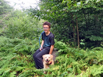
![]()
![]()
![]()
![]()
![]() On Tuesday, August 24th I planned to hike with my grandson Bryce after I returned from cross country practice. When I got home Bryce was waiting, so I started to get ready at 11:50 AM with the temperature at 79 degrees on the back porch. Sheila was watching my every move as I got ready. I put on my White Sierra long-sleeved crew top which is insect-repellent with a short-sleeved baselayer. I put on a pair of RailRiders hiking pants which are expensive but last along time and have features like deep pockets and a generous cut which I really like. The pants have Velcro closures at the ankles I wore my new Keen Cascade all-leather boots which so far seem to fit well and support my feet. I decided to take my Leki poles with external locks as the internal twist locks sometimes fail. I decided to carry my Silky Sugowaza saw just in case we ran into any blowdowns from the last few days of storms. I got my gear in the car while Sheila and Bryce got in the back seat. Bryce was dressed for hiking and had his own hydration pack with him. I drove out the DeBruce Road toward Frick Pond at 12:15 PM. After about 6 miles, I turned left on the Mongaup Pond and stayed left on Beech Mountain Road at the fork. There were several cars parked in the small lot and as I pulled in at 12:35 PM. I set my GPS and we started our hike by crossing the road and headed out on the Flynn Trail toward Hodge Pond. When we hit the wide woods road that is the Flynn Trail, we turned right and noticed that the grass was wet and that there was evidence that a lot of water had run down the trail. It was 75 degrees but humid. The sun was out and there were a few white, puffy clouds in the sky. We were keeping a pretty fast pace but it didn't seem to bother me or Bryce. At 1.2 miles we passed the clearing of the right side of the trail. I have never heard a definitive explanation for the existence of the clearing but I suspect it was stripped of dirt to build Beech Mountain Road. We continued to walk toward the junction with the Big Rock Trail. I like to hike with Bryce because even though he is 10 years old he is very well informed and very bright. We talked about school and COVID and later about the genetics of blood types. It took us 50 minutes to reach the first trail junction with the Big Rock Trail at 1.7 miles into the hike.
On Tuesday, August 24th I planned to hike with my grandson Bryce after I returned from cross country practice. When I got home Bryce was waiting, so I started to get ready at 11:50 AM with the temperature at 79 degrees on the back porch. Sheila was watching my every move as I got ready. I put on my White Sierra long-sleeved crew top which is insect-repellent with a short-sleeved baselayer. I put on a pair of RailRiders hiking pants which are expensive but last along time and have features like deep pockets and a generous cut which I really like. The pants have Velcro closures at the ankles I wore my new Keen Cascade all-leather boots which so far seem to fit well and support my feet. I decided to take my Leki poles with external locks as the internal twist locks sometimes fail. I decided to carry my Silky Sugowaza saw just in case we ran into any blowdowns from the last few days of storms. I got my gear in the car while Sheila and Bryce got in the back seat. Bryce was dressed for hiking and had his own hydration pack with him. I drove out the DeBruce Road toward Frick Pond at 12:15 PM. After about 6 miles, I turned left on the Mongaup Pond and stayed left on Beech Mountain Road at the fork. There were several cars parked in the small lot and as I pulled in at 12:35 PM. I set my GPS and we started our hike by crossing the road and headed out on the Flynn Trail toward Hodge Pond. When we hit the wide woods road that is the Flynn Trail, we turned right and noticed that the grass was wet and that there was evidence that a lot of water had run down the trail. It was 75 degrees but humid. The sun was out and there were a few white, puffy clouds in the sky. We were keeping a pretty fast pace but it didn't seem to bother me or Bryce. At 1.2 miles we passed the clearing of the right side of the trail. I have never heard a definitive explanation for the existence of the clearing but I suspect it was stripped of dirt to build Beech Mountain Road. We continued to walk toward the junction with the Big Rock Trail. I like to hike with Bryce because even though he is 10 years old he is very well informed and very bright. We talked about school and COVID and later about the genetics of blood types. It took us 50 minutes to reach the first trail junction with the Big Rock Trail at 1.7 miles into the hike.
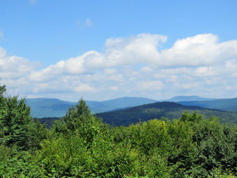 We continued straight ahead on the Flynn Trail passing through the gate that separates state land from what is now Beaverkill Land Trust property. After walking for a relatively short time, we arrived at the point where the Flynn Trail bears left down to Hodge Pond. We turned right on a woods road to hike toward the Boy Scout camp and the lookout over the pond. The woods road we were walking on was once Beech Mountain Road leading to the Beech Mountain Boy Scout Camp. I was surprised that we had not run into any blowdowns and only had to remove a few branches from the trail. After a short walk, a trail turned off to the left to go down to the pond and the road we were on continued straight ahead. There was a new road heading off to the left between the two. I found out on my last trip that this road led to what used to be some of the remaining buildings from the Beech Mountain Boy Scout Camp. The buildings have been bulldozed and removed by the Beaverkill Land Trust. I know that this was probably necessary as the building were in such disrepair but I was disappointed that they had removed this last bit of history from the area. We continued straight ahead on the road and walked uphill toward the lookout. We passed a spring house on the right and Sheila stopped to get a drink. She must have been warm as she splashed around a "dug" in the water for several minutes. There was more water coming out of the spring than I have seen in some time. The grade became steeper as we climbed the hill and at about 2.7 miles the road made a sharp turn to the right. We stopped so that I could take some pictures from a small viewpoint. Like many lookouts, this one was growing in and the view was all but obscured. We continued on the road. As the road made another sharp turn, this time to the left, a trail went off to the right. This trail goes to the lookout but I decided we would continue on the main road and make a loop back to the lookout. We topped the hill and then walked downhill to another nice lookout just after the road turned to the right. This lookout has views of the Burrough's Range and other major peaks. I took some shots and then we continued our hike by walking uphill and around the base of Flynn's Point on Beech Mountain. This is the highest spot in Sullivan County and there were some interesting ledges. We continued around the south end and came to the lookout over Hodge Pond. The lookout is a flat rock ledge that has been cut out and offers a good view of the Hodge Pond. The path did have a "DANGER" sign posted. We walked out to the viewpoint and I took some pictures. I had Bryce and Sheila pose and I took some shots of them. We got a drink and the started out again on the trail.
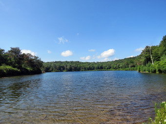 We were soon back at the road that we had hiked up the hill. We turned left and set a quick pace down the hill. Sheila again stopped at the spring and this time dug at the opening to the culvert until water was freely flowing through it. At the base of the hill, we turned right on the woods road that leads down to Hodge Pond. We turned left when the road intersected a jeep trail and ended up at the outlet end of Hodge Pond. We walked over to the shore of the pond where I dropped my pack and got out the camera. Sheila decided to go swimming. I too some shots of the pond since the sky was blue with puffy, white clouds. Bryce got a stick and threw it into the water for her to retrieve. I took some pictures as we threw the stick for her several times. When we were done, we picked up and walked to where the Flynn Trail enters the woods and started climbing the hill back to the junction where we had turned right some time before. At the top of the hill we stayed to the right on the Flynn Trail and followed the route we had taken out. We passed through the gate and were soon approaching the junction with the Big Rock Trail. Sheila alerted and I looked up to see a couple coming toward us. We exchanged greetings and continued on our separate ways. I thought about turning right on the Big Rock Trail but checked my watch and knew the quickest way was to return on the Flynn Trail. This was as far as I had hiked in the Keen Cascades and they were beginning to cause a hotspot on my right foot. I took a moment to put some tape on my foot which made it feel much better. We set a very quick pace down the Flynn Trail and continued to converse which made the trip go even faster. By 4:20 PM we were back at the cars after hiking 6.9 miles in 3 hours and 40 minutes with 20 minutes of stopped time. This was good for a moving 2.0 mph pace. We also gained 1240 feet of elevation.
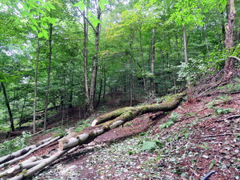
![]() On Saturday, August 21st I planned to go back to Round Top to complete the removal of a large blowdown that had fallen across the trail not far in from the trailhead. Krista and I had worked on it the day before and had removed all the smaller branches and trunks leaving just the biggest trunk on the trail. My son-in-law Brad was coming up from Pennsylvania and I planned to wait for him as it was a two person project. At noon we started getting ready to go with the temperature at 76 degrees and humidity high enough to make the air feel heavy. As we got ready, Sheila seemed very happy to be going out. I put on a Mountain Hardwear long-sleeved crew top with no base layer because of the temperature and high humidity. I put on a pair of RailRiders hiking pants which are expensive but last a long time and have features like deep pockets and a generous cut which I really like. I wore my Keen Targhee II hiking boots which are showing some serious wear but fit well. I got my Silky Sugowaza saw, Silky KatanaBoy 500 saw , Fiskars pack ax and Council Tools Felling ax even though I didn't think we would need them all. I also brought my pack which is the easiest way to carry my camera, first aid supplies and plastic felling wedges. We put all our gear in the back of the car and Sheila in the back seat. I put my gear in the back of the car with Sheila in the back seat. I drove out the driveway and across the street to the cemetery. I parked at the trailhead and put a sign on the windshield indicating we were parked to maintain trails. I grabbed the Sugowaza Katanaboy and Fiskars ax and shouldered my pack as we started out on the trail at 12:15 PM. We walked up the trail to the blowdown where I dropped my pack. I had already taken "before" pictures which were the "after" pictures from the day before. Brad and I looked over the blowdown and decided to cut off a few pieces. These pieces would make the rest of the trunk lighter and easier to move. Brad used the saw to cut off two pieces and I moved them off the trail. We also cut off a smaller piece of the trunk which I thought was supporting the weight of the rest of the blowdown but it came away easily. All that was left now was the main trunk. We decided to make two cuts even though this would leave two large sections. We used the saw to start a cut off the trail on the end of the trunk near the roots. The diameter of the trunk here was 14" to 16" but we took turns using the Katanaboy to cut the trunk. As we were cutting a couple came hiking toward us from the trailhead. They paused and asked if they could walk passed us. We suspended our cutting and they continued their hike. Brad and I continued to cut alternating between the top of the trunk and the bottom. It took a little while but as I was cutting down from the top I heard a crack and the section I was cutting fell away. I was happy that the cut did not close up and bind the saw. We now had to cut the remaining section into two we could move off the trail. I decided to start to make the cut with the ax. The Fiskars ax bit well into the hardwood and I was soon almost three-quarters of the way through. Brad finished the cut with the saw and all we had to do is see if we could move the two sections off the trail. We were able to move the thinner section off the trail without too much trouble. The remaining section was the largest and had some "bumps" which might have prevented it from rolling. We looked for a lever to help work the section off the trail but gave up. Together we were able to skid, roll, and lift the section off the trail after which it rolled down the hill. We replaced some of the stone along the side of the woods road. It was 1:45 PM as we started to pack up and head out to the trailhead. When we got to the car and stowed our equipment. I realized I had forgotten to take the "after" shots. I asked Brad if he wanted to walk a figure 8 to check the rest of the trails. This way I could inspect the other trails for blowdowns and get in a little more hiking. I decided to take my pictures when we returned.
On Saturday, August 21st I planned to go back to Round Top to complete the removal of a large blowdown that had fallen across the trail not far in from the trailhead. Krista and I had worked on it the day before and had removed all the smaller branches and trunks leaving just the biggest trunk on the trail. My son-in-law Brad was coming up from Pennsylvania and I planned to wait for him as it was a two person project. At noon we started getting ready to go with the temperature at 76 degrees and humidity high enough to make the air feel heavy. As we got ready, Sheila seemed very happy to be going out. I put on a Mountain Hardwear long-sleeved crew top with no base layer because of the temperature and high humidity. I put on a pair of RailRiders hiking pants which are expensive but last a long time and have features like deep pockets and a generous cut which I really like. I wore my Keen Targhee II hiking boots which are showing some serious wear but fit well. I got my Silky Sugowaza saw, Silky KatanaBoy 500 saw , Fiskars pack ax and Council Tools Felling ax even though I didn't think we would need them all. I also brought my pack which is the easiest way to carry my camera, first aid supplies and plastic felling wedges. We put all our gear in the back of the car and Sheila in the back seat. I put my gear in the back of the car with Sheila in the back seat. I drove out the driveway and across the street to the cemetery. I parked at the trailhead and put a sign on the windshield indicating we were parked to maintain trails. I grabbed the Sugowaza Katanaboy and Fiskars ax and shouldered my pack as we started out on the trail at 12:15 PM. We walked up the trail to the blowdown where I dropped my pack. I had already taken "before" pictures which were the "after" pictures from the day before. Brad and I looked over the blowdown and decided to cut off a few pieces. These pieces would make the rest of the trunk lighter and easier to move. Brad used the saw to cut off two pieces and I moved them off the trail. We also cut off a smaller piece of the trunk which I thought was supporting the weight of the rest of the blowdown but it came away easily. All that was left now was the main trunk. We decided to make two cuts even though this would leave two large sections. We used the saw to start a cut off the trail on the end of the trunk near the roots. The diameter of the trunk here was 14" to 16" but we took turns using the Katanaboy to cut the trunk. As we were cutting a couple came hiking toward us from the trailhead. They paused and asked if they could walk passed us. We suspended our cutting and they continued their hike. Brad and I continued to cut alternating between the top of the trunk and the bottom. It took a little while but as I was cutting down from the top I heard a crack and the section I was cutting fell away. I was happy that the cut did not close up and bind the saw. We now had to cut the remaining section into two we could move off the trail. I decided to start to make the cut with the ax. The Fiskars ax bit well into the hardwood and I was soon almost three-quarters of the way through. Brad finished the cut with the saw and all we had to do is see if we could move the two sections off the trail. We were able to move the thinner section off the trail without too much trouble. The remaining section was the largest and had some "bumps" which might have prevented it from rolling. We looked for a lever to help work the section off the trail but gave up. Together we were able to skid, roll, and lift the section off the trail after which it rolled down the hill. We replaced some of the stone along the side of the woods road. It was 1:45 PM as we started to pack up and head out to the trailhead. When we got to the car and stowed our equipment. I realized I had forgotten to take the "after" shots. I asked Brad if he wanted to walk a figure 8 to check the rest of the trails. This way I could inspect the other trails for blowdowns and get in a little more hiking. I decided to take my pictures when we returned.
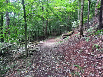 We started at the trailhead and walked the trail passed what we had cut to the first trail junction. We followed Sheila as she continued straight ahead up the hill toward the viewpoint. The climb up the hill was not particularly tiring. We met the couple that had hiked passed us as we were cutting and they reported they had seen no other trees down on the loop over the summit. They also thanked us for our work. The trees I had put across the path to the viewpoint were still there. This path has a dangerous spot and I have piled brush on it to discourage people from using it. We continued to follow the yellow trail as it turned right and headed up the gentle hill through the hardwood forest. The forest was very green and ferns covered the forest floor. Sheila was making her own way by staying on the trail sometimes and then running off-trail and chasing game trails. She was also picking up sticks and dragging them along and off the trail. Brad and I talked about EMS calls and related topics. We continued to follow the yellow trail toward the first junction with the blue trail. At the first trail junction with the blue trail, we turned right and followed the yellow trail along the base of Round Top. This section was in good shape but there was one small tree on the ground. Fortunately, the tree was completely broken off and we were able to easily move it off the trail. At the next junction, we turned left and started up to the summit of Round Top on the blue trail. Whence came to the white crossover trail there were two small trees lying in the trail. We moved both of them off the trail and continued up the hill and over the summit. When we started down the other side, I decided we would skip the white crossover trail but take the switchback on the blue trail. People seemed to be avoiding the crossover trail but the switchback looked more well-worn. There were no blowdowns on the switchback and at the end of the switchback we turned left onto the main blue trail. I could hear people walking on the trails below us and see them through the trees. At the bottom of the hill, we turned left on the yellow trail and walked along the base of Round Top. At the trail junction with the blue trail, we turned right to walk down to the woods road. It was a snap to walk downhill and out the woods road. As we walked down the trail, we met another couple walking toward us. I was a little surprised and very happy that so many people were using the trails. It was obvious Sheila felt the same way as she was running and bounding ahead of us and then running back up the trail. We walked the woods road out to the first trail junction. We turned left and walked out to the trailhead. I grabbed my camera and headed back to where we had cut the blowdown. I took a few shots and returned to the car. There was a car parked behind us and I wanted to leave a not to tell them parking on the hill was prohibited but I did not have a piece of paper. We got in the car and I drove home arriving at 2:30 PM>
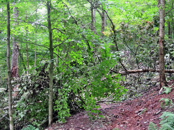
![]() On Friday, August 20th I had planned to go on a hike at Frick and Hodge Ponds or perhaps drive to some waterfalls. When I got up at 9:00 AM, the temperature was 72 degrees and the skies were overcast and looking like it might rain. I had some things to do around the house but decided I would take the dogs across the street to hike on Round Top. Sheila always goes with me but I thought I would take Pierce, my daughter Krista's dog. Pierce is a little larger than Sheila and is a mix breed Labrador Retriever - Husky. He is not used to hiking so I would have to keep him on a leash. At 10:30 AM I started getting ready to go with the temperature at 74 degrees and humidity high enough to make the air feel heavy. As I got ready, Sheila seemed very happy to be going out but Pierce was oblivious to what was in store. I put on my White Sierra long-sleeved crew top with no base layer because of the temperature and high humidity. I put on a pair of RailRiders hiking pants which are expensive but last a long time and have features like deep pockets and a generous cut which I really like. I decided to wear my Keen Cascade hiking boots which are new but seem to be broken in. I put Sheila and Pierce on their leashes and we headed out the driveway at 10:45 AM. Sheila was behaving well but Pierce seemed overwhelmed by the experience. We crossed the street and walked across the field by the Presbyterian Church. We started up the hill behind the church on the border of the cemetery. This hill is the steepest part of the hike to Round Top and can really get the blood pumping! The dogs were pulling me up the hill which made it a much easier walk. At the trailhead we turned left and I let Sheila off her leash. I put Sheila's leash on Pierce as I thought it would be easier to walk him that way. We started out on the trail and almost immediately ran into several large trees blocking the trail. It had only been a week but people were starting to reroute the trail up the bank around the blowdown. I knew this would disturb the vegetation and cause erosion onto the trail. I thought we would walk a figure 8 and then go back to the house. By the time we got to the lookout, I was tired from trying to control Pierce and wanted to get started on the blowdown. We turned around and walked back out to the trailhead. I put Sheila on a leash and we walked down the hill to the church. We walked across the parking lot, crossed the street and walked back down the driveway. I put Shiela in the car and walked Pierce inside.
On Friday, August 20th I had planned to go on a hike at Frick and Hodge Ponds or perhaps drive to some waterfalls. When I got up at 9:00 AM, the temperature was 72 degrees and the skies were overcast and looking like it might rain. I had some things to do around the house but decided I would take the dogs across the street to hike on Round Top. Sheila always goes with me but I thought I would take Pierce, my daughter Krista's dog. Pierce is a little larger than Sheila and is a mix breed Labrador Retriever - Husky. He is not used to hiking so I would have to keep him on a leash. At 10:30 AM I started getting ready to go with the temperature at 74 degrees and humidity high enough to make the air feel heavy. As I got ready, Sheila seemed very happy to be going out but Pierce was oblivious to what was in store. I put on my White Sierra long-sleeved crew top with no base layer because of the temperature and high humidity. I put on a pair of RailRiders hiking pants which are expensive but last a long time and have features like deep pockets and a generous cut which I really like. I decided to wear my Keen Cascade hiking boots which are new but seem to be broken in. I put Sheila and Pierce on their leashes and we headed out the driveway at 10:45 AM. Sheila was behaving well but Pierce seemed overwhelmed by the experience. We crossed the street and walked across the field by the Presbyterian Church. We started up the hill behind the church on the border of the cemetery. This hill is the steepest part of the hike to Round Top and can really get the blood pumping! The dogs were pulling me up the hill which made it a much easier walk. At the trailhead we turned left and I let Sheila off her leash. I put Sheila's leash on Pierce as I thought it would be easier to walk him that way. We started out on the trail and almost immediately ran into several large trees blocking the trail. It had only been a week but people were starting to reroute the trail up the bank around the blowdown. I knew this would disturb the vegetation and cause erosion onto the trail. I thought we would walk a figure 8 and then go back to the house. By the time we got to the lookout, I was tired from trying to control Pierce and wanted to get started on the blowdown. We turned around and walked back out to the trailhead. I put Sheila on a leash and we walked down the hill to the church. We walked across the parking lot, crossed the street and walked back down the driveway. I put Shiela in the car and walked Pierce inside.
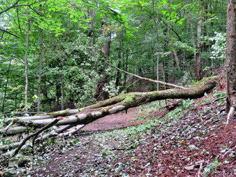 I got my Silky Sugowaza saw, Silky KatanaBoy 500 saw , Fiskars pack ax and Council Tools Felling ax. I shouldered my pack with my camera and two Oregon plastic felling wedges. I put my gear in the back of the car with Sheila in the back seat. I drove out the driveway and across the street to the cemetery. I parked at the trailhead, grabbed the Sugowaza saw and Fiskars ax and we started out on the trail at 11:15 AM. We walked up the trail to the blowdown where I dropped my pack and got out the camera. I took pictures of the blowdown from several different angles and the walked to the other side and took more pictures. I returned the camera to my pack and retrieved the Sugowaza. I removed some loose branches and began a pile on the reroute of the trail. I used the Sugowaza to cut branches and as I cut them I removed them to the pile. It did not take me long to strip away the smaller branches leaving larger branches and the trunks. I stepped off the trail to cut the top off a small trunk so that I could drag the rest of it off the trail. The trunk looked like it might rotate when I cut it but I went ahead. As I finished the cut, the trunk rotated and a lower branch I had not seen smacked me in the side of the head. I was stunned for a second and then felt the side of my head. My face and head seemed to be alright except for some cuts inside my mouth. My glasses were missing and I tried looking around for them without stepping on them. I decided that I could use some help so I put Sheila on her leash and headed home. I explained the situation to Cindy and Krista and Krista got ready to return with me. I guess I didn't look too bad as they did not mention anything but a scrape on my face. Krista and I walked back across the street with me thinking of the problems my missing glasses would cause. We walked up the hill and turned onto the trail. I showed Krista where I had been standing and she carefully started looking. It was only a few minutes before she found my glasses unscathed! I was relieved and decided to stay on to cut as much of the blowdown as possible. Krista afraid she would stay with me to help out which made me very happy.
Krista and I cleared a few more branches and the small trunk. What remained in the main blowdown were some pretty big trunks so we turned our attention to a smaller tree just beyond the main mess. The tree spanned the trail and was hung up in another tree. We tried to shake it loose but it would not budge. I decided to cut the trunk in the middle so that we could putt the top out of the other tree. As I was planning the cut a solo female hiker approached us. She started to cross the blowdown and I asked her to wait until I had made the cut. I made the cut without a problem and Krista and I were able to pull the tree top down. I told the hiker she should continue and she passed by us. I cut off a few branches and we piled them off the trail. We threw the upper trunk off the trail and turned our attention to the main trunk. I cut the tree near the base and together we were able to pick up the trunk and move it off the trail. At this point I considered waiting to remove the rest of the blowdown until Brad, my son-in-law, arrived Saturday morning. I decided to make a few more cuts. I grabbed the ax and started to cut one of the larger trunks. Even though the Fiskars ax isn't very heavy it cuts very well. I started a wide cut so that I could get through the whole 10 inch diameter. As I was doing this a young couple approached and said "Hello" as they continued up the trail. When I saw almost done , I used the Sugiwaza to cut the remaining bark and to smooth the cut. Krista and I were able to push and roll the large section of the trail. I used the ax again to cut off a branch that was bearing most of the weight. I moved what I had cut and the looked for some other sections to cut. I used a combination of saw and ax to cut two more large branches connected to the blowdown off the trail. This left another large trunk to cut and I decided we would use the KatanaBoy 500 to make the cut. Krista and I took turns cutting and made good progress. At one point the saw seemed to get hung up and I checked the blade. One of the teeth was out of place having cracked and bent! I was disappointed as we had not hit a stone and had only been using it on wood! I used the poll of the ax to straighten the tooth and we continued the cut. When we finished we had a nice, clean cut and we were able to move the section we cut off the trail. It was almost 2:00 PM and there was not much else we could cut easily. We picked up the tools and I got out the camera to take the "after" pictures. After taking the pictures, we packed up and carried the tools out to the car. I drove home feeling lucky and satisfied.
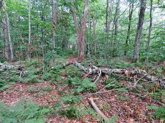
![]()
![]()
![]()
![]()
![]() On Monday, August 16th, I planned to go out for a long day of trail maintenance on the Mongaup Hardenburgh Trail starting at Mongaup Pond. My son-on-law Brad was at the house and I knew he wouldn't mind combining business with pleasure. The forecast for the rest of the week was questionable but the one for Tuesday looked good except for higher temperatures in the afternoon. At Least, there was no chance of showers. My plan was disrupted by a mutual aid call in Liberty for MobileMedic in the middle of the night. I slept in until after 10:00 AM and questioned whether we should just go for a hike or try to get some work done. In the end I decided we would try to work on the trail as two people can get more than twice as much done. The maintainer for the trail said that he had been out but I had surveyed the trail and found many places for improvement. I started to finally get ready at 12:45 PM with the temperature at 76 degrees. I put on my White Sierra long-sleeved crew top with a short-sleeved baselayer. I put on a pair of RailRiders hiking pants which are expensive but last along time and have features like deep pockets and a generous cut which I really like. I wore my Keen Targhee II hiking boots which are showing some serious wear but fit well. I decided to take my Leki Makalu carbon poles with the internal twist locks as they are light and not a problem on most trails. I also put on my OR floppy hat which keeps the insects off and protects me from the sun. I stowed my Silky Segovia saw in my pack and also threw in two Oregon plastic splitting wedges and a pair of Fiskars hand clippers. Brad said he could carry the Fiskars ax and Corona loppers so I could use y poles. We put our gear in the back of the car and Sheila in the back seat. We left Livingston Manor at 1:15 PM as I drove out the DeBruce Road about 6 miles to Mongaup Road. I turned left and continued up the road to the point where it splits. I stayed right on Mongaup Pond Road to head for the campgrounds. When I entered the campgrounds I pulled over and parked on the right. I went to the booth and explained to the attendant that I was the trail supervisor and wanted to enter without paying a fee and park on the side of the road near the trailhead. I presented my card from the trail conference which made things easier and also showed him Sheila's rabies certificate. After signing in, the attendant told me to park in the field near campsite 161 which was near the trailhead. I followed his directions and parked my car. The weather was beautiful although warm at 74 degrees with a slight breeze that kept the insects away. I set my GPS unit and we started out on the campsite roads at 1:40 PM. we walked out to the road and turned left to walk to the beginning of the Mongaup Hardenburgh Trail.
On Monday, August 16th, I planned to go out for a long day of trail maintenance on the Mongaup Hardenburgh Trail starting at Mongaup Pond. My son-on-law Brad was at the house and I knew he wouldn't mind combining business with pleasure. The forecast for the rest of the week was questionable but the one for Tuesday looked good except for higher temperatures in the afternoon. At Least, there was no chance of showers. My plan was disrupted by a mutual aid call in Liberty for MobileMedic in the middle of the night. I slept in until after 10:00 AM and questioned whether we should just go for a hike or try to get some work done. In the end I decided we would try to work on the trail as two people can get more than twice as much done. The maintainer for the trail said that he had been out but I had surveyed the trail and found many places for improvement. I started to finally get ready at 12:45 PM with the temperature at 76 degrees. I put on my White Sierra long-sleeved crew top with a short-sleeved baselayer. I put on a pair of RailRiders hiking pants which are expensive but last along time and have features like deep pockets and a generous cut which I really like. I wore my Keen Targhee II hiking boots which are showing some serious wear but fit well. I decided to take my Leki Makalu carbon poles with the internal twist locks as they are light and not a problem on most trails. I also put on my OR floppy hat which keeps the insects off and protects me from the sun. I stowed my Silky Segovia saw in my pack and also threw in two Oregon plastic splitting wedges and a pair of Fiskars hand clippers. Brad said he could carry the Fiskars ax and Corona loppers so I could use y poles. We put our gear in the back of the car and Sheila in the back seat. We left Livingston Manor at 1:15 PM as I drove out the DeBruce Road about 6 miles to Mongaup Road. I turned left and continued up the road to the point where it splits. I stayed right on Mongaup Pond Road to head for the campgrounds. When I entered the campgrounds I pulled over and parked on the right. I went to the booth and explained to the attendant that I was the trail supervisor and wanted to enter without paying a fee and park on the side of the road near the trailhead. I presented my card from the trail conference which made things easier and also showed him Sheila's rabies certificate. After signing in, the attendant told me to park in the field near campsite 161 which was near the trailhead. I followed his directions and parked my car. The weather was beautiful although warm at 74 degrees with a slight breeze that kept the insects away. I set my GPS unit and we started out on the campsite roads at 1:40 PM. we walked out to the road and turned left to walk to the beginning of the Mongaup Hardenburgh Trail.
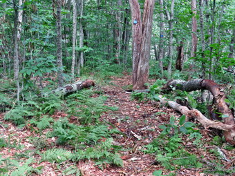 We turned left onto the trail and walked toward the pond following the trail as it turned north along the shore. As we continued along this section of the trail, we could already see that there was some trimming needed to make the trail easier to travel. We decided to leave that for the end of the hike or for another trip. At the north end of the pond we turned left at .4 miles to stay on the blue blazed Mongaup Hardenburgh Trail. There was a group of people at the trail junction debating what they should do. They didn't look like long distance hikers to me but I answered their questions as we started up the trail. The trail heads north to Mongaup Mountain and gains 830 feet over 1.5 miles with an average grade of 11%. We began removing some small and large branches from the trail. There were also some old trunk across or intruding on the trail and we were able to remove many of these. Not very far along we came to a set of roots and began to work on them. Brad did a great job of cutting them away until almost nothing was left. As we were working the group came along and passed by excusing themselves. In a few places, we had to be satisfied with walking around or climbing over large blowdowns that would require a chainsaw. In other spots we used the ax and saw to remove large branches and trunks to make the hiking experience more enjoyable for others. Most of the trail was well defined but some markers needed to be replaced. At 2:225 Pm we came to a large white birch across the trail. It was too large for us to remove it completely but we improved the area and then moved on. At 1 mile we used the ax to remove an old blowdown and open up the trail. The large trunk at 1.15 miles was on the side of the trail but we decided to use the ax again. We cut it once and then we were able to move it off of the trail completely. I always try to take before and after pictures. Sheila has now gotten in the habit of posing in the after pictures.
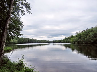 We passed the group of hikers and then they repassed us while we were working. At 1.35 miles another large blowdown fell under the ax. Somewhere along the way my phone sounded and I found a message that said we had an ambulance call which sounded serious. I was happy that we covered the call which can be hard to do during the day. A little farther on we confronted another small trunk which Brad dispatched quickly. I noticed that Brad get Te ax head moving very quickly and I tried to get a few action shots. We had passed the hiking group on the final ascent to Mongaup Mountain and it looked like they might turn a round.We hit the summit of Mongaup Mountain at 1.8 miles and found a mess. There were two separate set of trees down with one almost blocking the trail. I took my before shots and we began to clear away all the loose branches from the one that was farthest north. Brad was able to rotate the large trunk but could not get it quite off the trail. I used the saw to cut out the top and remove it. This allowed us to rotate the large trunk off the trail and remove a smaller one lying beneath it. We turned our attention to the other, large trunk. The main trunk was on the ground but too large for us to cut. I cut a smaller tree and then removed a branch from the large trunk. One more cut with the saw left just the trunk which was easy to step over. We also removed another trunk. By this time it was 4:05 PM and although we had not gotten to the worst part of the trail I knew it was time to turn around. On the way back we tried to keep a fast pace and ignore anything on the trail. We tried hard but stopped briefly a few times. At 4:55 PM we were on the shores of Mongaup Pond. Sheila took a dip and I took some pictures. The weather had changed and the skies were now overcast. We continued along the trail and roads back to the car. We were at the car at 5:05 PM after hiking only 3.6 miles in 3 hours and 25 minutes. However, we had done a lot of work and had stopped for 1 hour and 25 minutes. The elevation gain was 925 feet. As we left the temperature was reading 78 degrees.
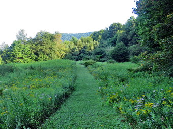
![]()
![]()
![]()
![]()
![]() On Friday, August 13th, I had committed to giving Jennifer Jane, an FLT hiker, a ride from her car at the Bear Spring Horse Camp on map 29 to the beginning of her hike at the intersection of Dryden and Faulkner Roads at the western end of map 28. She planned to hike the 25 miles in one day despite the heat. It is not something I could do but she is a stronger hiker than I am and has done some incredible hikes. I was going to pick her up at 7:00 AM which meant I needed to get up around 5:30 AM. I decided I would dress for hiking and take Sheila with me. I thought I might hike to the Rock Rift fire tower or maybe at Bear Spring. I wanted to be done no later than 1:00 PM to avoid the heat and humidity in the afternoon. When I got up at 5:30 AM it was already 68 degrees and I could feel the humidity in the air. I started to get ready but had to call Sheila to come downstairs as we seldom go out early. I put on a Columbia short-sleeved crew top with a short-sleeved baselayer in anticipation of the heat later in the day. I wore a pair of RailRiders hiking pants which are expensive but last a long time and have features like deep pockets and a generous cut which I really like. I wore my Keen Targhee II hiking boots which are showing some serious wear but fit well. I decided to take my Leki Makalu carbon poles with the internal twist locks as they are light and not a problem on most trails. I also put on my OR floppy hat which keeps the insects off and protects me from the sun. I donned a pair of OR Bugout gaiters to combat the ticks. I got my gear and Sheila in the car and headed north and west on State Route 17 at 6:15 AM. I took exit 94 and followed Route 206 through Downsville to the top of Bear Spring. I turned left on East Trout Brook Road and drove south to the Horse Camp. I turned into the parking area where Jennifer Jane was parked and said "hello". We put her gear in the back of the car and I introduced her to Sheila. I drove back to Route 206 and turned left to head toward Walton. In Walton I got on Route 10 South to head toward the Cannonsville Reservoir. When I left the house, there was a lot of fog but this had cleared and the skies were sunny with a few clouds. I drove to Dryden Road and turned right. It was a short drive to Faulkner Road where I dropped Jennifer Jane off making sure she had my cell number just in case. I decided Sheila and I would hike to the fire tower from the Apex Bridge so I headed north on Route 10 and pulled into the parking area at 7:30 AM. When I got out of the air-conditioned car, I was glad I had put on a short sleeved shirt as the hot and humid air almost took my breath away! I set my GPS and we headed across the road to start our hike at 7:35 AM with the temperature at 72 degrees.
On Friday, August 13th, I had committed to giving Jennifer Jane, an FLT hiker, a ride from her car at the Bear Spring Horse Camp on map 29 to the beginning of her hike at the intersection of Dryden and Faulkner Roads at the western end of map 28. She planned to hike the 25 miles in one day despite the heat. It is not something I could do but she is a stronger hiker than I am and has done some incredible hikes. I was going to pick her up at 7:00 AM which meant I needed to get up around 5:30 AM. I decided I would dress for hiking and take Sheila with me. I thought I might hike to the Rock Rift fire tower or maybe at Bear Spring. I wanted to be done no later than 1:00 PM to avoid the heat and humidity in the afternoon. When I got up at 5:30 AM it was already 68 degrees and I could feel the humidity in the air. I started to get ready but had to call Sheila to come downstairs as we seldom go out early. I put on a Columbia short-sleeved crew top with a short-sleeved baselayer in anticipation of the heat later in the day. I wore a pair of RailRiders hiking pants which are expensive but last a long time and have features like deep pockets and a generous cut which I really like. I wore my Keen Targhee II hiking boots which are showing some serious wear but fit well. I decided to take my Leki Makalu carbon poles with the internal twist locks as they are light and not a problem on most trails. I also put on my OR floppy hat which keeps the insects off and protects me from the sun. I donned a pair of OR Bugout gaiters to combat the ticks. I got my gear and Sheila in the car and headed north and west on State Route 17 at 6:15 AM. I took exit 94 and followed Route 206 through Downsville to the top of Bear Spring. I turned left on East Trout Brook Road and drove south to the Horse Camp. I turned into the parking area where Jennifer Jane was parked and said "hello". We put her gear in the back of the car and I introduced her to Sheila. I drove back to Route 206 and turned left to head toward Walton. In Walton I got on Route 10 South to head toward the Cannonsville Reservoir. When I left the house, there was a lot of fog but this had cleared and the skies were sunny with a few clouds. I drove to Dryden Road and turned right. It was a short drive to Faulkner Road where I dropped Jennifer Jane off making sure she had my cell number just in case. I decided Sheila and I would hike to the fire tower from the Apex Bridge so I headed north on Route 10 and pulled into the parking area at 7:30 AM. When I got out of the air-conditioned car, I was glad I had put on a short sleeved shirt as the hot and humid air almost took my breath away! I set my GPS and we headed across the road to start our hike at 7:35 AM with the temperature at 72 degrees.
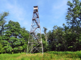 The beginning of the trail is just a little south of the parking area and we turned right to get on the trail. The beginning of the trail was rather steep with a few branches in the trail and a muddy area where a small spring kept the ground damp. At .2 miles the trail leveled off and began to descend a little. The trail rolled through some gullies and I noticed that the damp areas were bringing out the mosquitoes. I stopped to put on some repellent and found I was not wearing my hat! The repellent seemed to help some although the insects were still buzzing. At .85 miles we crossed road and followed the trail to a field that had been mowed. The trail was mowed also and a stake in the middle held a trail marker. When we reached the other side of the filed, I stopped to take few shots. The trail entered the woods and then descended to a small stream where Sheila cooled off and got a drink. Coming up from the stream the trail was unclear and there were no markers. We walked up the hill and found a white blaze. The trail had several large blowdowns and many smaller ones. Most could be walked around or over but the trail needs to be cleared. Finally at 1.2 miles we turned left onto the woods road that once acted as an access road to the tower when it was active for fire observation. I knew that the climb to the tower was steep in places but that the crew who had constructed the trail built in a few switchbacks to help. On this day the trail was pretty dry with only a few muddy spots here and there. What I did notice was that there were still plenty of biting insects! Sheila and I climbed the familiar trail keeping a pretty steady pace despite the steep sections. The trail was littered with branches and had a lot of blowdowns. Over the next 1.5 miles we headed due north gaining a total of over 1100 feet from the turn. Several ascents were more than a 25% grade. I was beginning to get tired and I was sweating profusely. I stopped to get a drink and gave some water to Sheila also. We followed the switchbacks on the final ascent which made the walk a little easier than walking straight up the fountain. At about 2.5 miles the trail reached the top of the steepest ascent and continued to climb but at a grade that felt almost flat. We were walking through some weeds and grass along a path that someone had made. I looked up to see Jennifer Jane coming toward us. We stopped to talk for a minute and she told me that the trail coming up the other side was also in poor shape. We parted heading in opposite direction. By 9:20 AM we had hiked 2.7 miles are were at the base of the tower. I dropped my pack and got out the camera to take a few pictures. The bottom flight of stairs have been removed from the tower to discourage anyone from ascending and the cab is in disrepair. I took a few shots from under the tower that looked interesting. There is a plan to restore the tower which would be a wonderful project. When I stowed my camera, I got us a drink and a snack and spread insect repellant liberally.
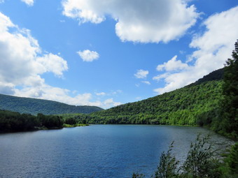 I felt considerably better than I did on the scent but decided we would return the way we came. We turned around and started back on the trail. Descending was much easier than ascending with only problem being the "toe ham" especially on my right foot. On the way down I did notice that there were many small stumps in the trail that were perfect for tripping hikers. When we reached the turn for the trail back to the bridge, I decided we would walk down to the road and walk back on Route 10. The trip down to the road went quickly and when we reached Route 10 we turned right heading south toward the bridge. Sheila wanted to pull me along as she always does but I wondered if her feet were too warm on the pavement. Every chance I got I let her walk on the grass. It was only a mile to the bridge and the road rolled only slightly. As we approached the parking area, I saw a car pull up to the kiosk. People got out of the car and started to read the postings. We were back at the car at 10:45 Am after hiking 5.3 miles in 3 hours and 5 minutes with only 15 minutes of stopped time. This was a speed of 1.7 mph overall and 1.85 mph moving. The elevation gain was 1510 feet. Jennifer Jane was also in the parking area taking a break before walking across the bridge to continue her hike. I wished her "Good Luck" as she started out again. I took a few pictures of the Cannonsville Reservoir from the bridge before getting into the car. I drove over the bridge and headed toward State Route 17 which is the quickest way home. I hadn't been home for too long before I got a text from Jennifer Jane. She asked if I could pick her up because the heat was just too much. I agreed and left the house almost immediately. I was concerned that she had already overheated but when I picked her up on Chase Brook Road she said she had plenty to drink. I drove back through Walton and dropped her at her car in the Horse Camp parking area. I think she made the right decision and I know it takes a lot of hiking savvy to make that decision.
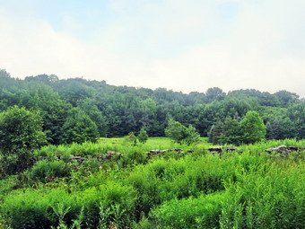
![]()
![]()
![]()
![]()
![]() On Wednesday, August 11th, I planned to meet with a prospective trail maintainer for the section of the FLT from Berry Brook Road to Little Spring Brook Road. We were scheduled to meet on Berry Brook Road at 10:00 AM and hike out and back on the trail as it would be less than 5 miles. We both agreed to bring some trail maintaining equipment to work on the trail as I did not know when it had last been trimmed. The forecast for the day included a heat advisory but I though that we would be done in time to avoid the worst. I got up at 8:30 AM and did a few things before starting to get ready at 9:00 AM hen the temperature was already 75 degrees and the humidity was high. I put on my White Sierra long-sleeved crew top with a short-sleeved baselayer. I put on a pair of RailRiders hiking pants which are expensive but last a long time and have features like deep pockets and a generous cut which I really like. I wore my Keen Targhee II hiking boots which are showing some serious wear but fit well. I decided to take my Leki Makalu carbon poles with the internal twist locks as they are light and not a problem on most trails. I also put on my OR floppy hat which keeps the insects off and protects me from the sun. I put on my OR Bugout gaiters to combat the ticks. I put my gear in the back of the car including my Fiskars ax, Silky Sugowaza saw, LT Wright Overland machete and 2 plastic felling wedges. Sheila jumped into the back seat as we left Livingston Manor at 9:30 AM as I drove north on Old Rt 17 toward Roscoe. I turned right on the Beaverkill Road and drove as far as Campground Road where I turned left. At the T, I stayed right and drove across the covered bridge and continued to Berry Brork Road. T turned right drove 3.6 miles north to the point where the FLT crosses the road. I pulled into the lot at 9:55 AM wit the temperature at 78 degrees. When I got out of the car, I could immediately feel the humidity. By 10:00 AM my prospective maintainer had not showed up. I waited until 10:10 Am and the decided to start out on the trail. There is no cell service at the trailhead but I hoped he would catch up with me at some point on the trail. I set my GPS unit and Sheila and I crossed the road leaving the ax in the car. The trail starts out through a stand of trees and then intersects a power line right of way. The trail was in good shape and at least one small blowdown had been cut with a chainsaw. There were a few muddy patches but they were drying up. When we came to the right of way, I dropped my pack and go out the camera to take a few shots. The skies were overcast and hazy but the view was interesting. I could hear the distinct crackle and snap of the power line overhead.
On Wednesday, August 11th, I planned to meet with a prospective trail maintainer for the section of the FLT from Berry Brook Road to Little Spring Brook Road. We were scheduled to meet on Berry Brook Road at 10:00 AM and hike out and back on the trail as it would be less than 5 miles. We both agreed to bring some trail maintaining equipment to work on the trail as I did not know when it had last been trimmed. The forecast for the day included a heat advisory but I though that we would be done in time to avoid the worst. I got up at 8:30 AM and did a few things before starting to get ready at 9:00 AM hen the temperature was already 75 degrees and the humidity was high. I put on my White Sierra long-sleeved crew top with a short-sleeved baselayer. I put on a pair of RailRiders hiking pants which are expensive but last a long time and have features like deep pockets and a generous cut which I really like. I wore my Keen Targhee II hiking boots which are showing some serious wear but fit well. I decided to take my Leki Makalu carbon poles with the internal twist locks as they are light and not a problem on most trails. I also put on my OR floppy hat which keeps the insects off and protects me from the sun. I put on my OR Bugout gaiters to combat the ticks. I put my gear in the back of the car including my Fiskars ax, Silky Sugowaza saw, LT Wright Overland machete and 2 plastic felling wedges. Sheila jumped into the back seat as we left Livingston Manor at 9:30 AM as I drove north on Old Rt 17 toward Roscoe. I turned right on the Beaverkill Road and drove as far as Campground Road where I turned left. At the T, I stayed right and drove across the covered bridge and continued to Berry Brork Road. T turned right drove 3.6 miles north to the point where the FLT crosses the road. I pulled into the lot at 9:55 AM wit the temperature at 78 degrees. When I got out of the car, I could immediately feel the humidity. By 10:00 AM my prospective maintainer had not showed up. I waited until 10:10 Am and the decided to start out on the trail. There is no cell service at the trailhead but I hoped he would catch up with me at some point on the trail. I set my GPS unit and Sheila and I crossed the road leaving the ax in the car. The trail starts out through a stand of trees and then intersects a power line right of way. The trail was in good shape and at least one small blowdown had been cut with a chainsaw. There were a few muddy patches but they were drying up. When we came to the right of way, I dropped my pack and go out the camera to take a few shots. The skies were overcast and hazy but the view was interesting. I could hear the distinct crackle and snap of the power line overhead.
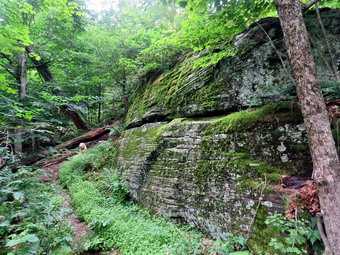 We crossed the right of way, and headed for a small back on white arrow that guided us through some high weeds and back into the forest. I thought about coming back at some time and using my Stihl line trimmer to cut a swath through the weeds. The trail through the forest showed signs that water had been running freely at some point. There were a few small branches for me to flick off the trail and a rotten trunk to move here and there. The trail began to climb and over the next .9 miles we gain 495 feet to the junction with the Pelnor Hollow trail. There were areas that were almost flat and some with a grade of 17% as we headed mostly southwest. Along the way there were some interesting rock formations and I stopped several times to take some pictures. We did run into several trees that were leaning over the trail. They were all too large and too difficult to cut safely. As we approached the trail junction, I heard a voice from behind call my name. It was Matt who had gone to the wrong trailhead but had caught up with me anyway! We said "Hello" and then continued to hike and talked as we walked. Matt works at the Catskill Fly Fishing Cneter and has experience creating and maintaining trails. He also has hiked extensively in the Catskills and beyond. The trail continued to be in great shape as we came to the junction with the Pelnor Hollow Trail at 1.1 miles. The trail to the left toward Pelnor Hollow is maintained by the DEC and looked like it was in good shape. I knew that the DEC planned to send a crew through to clear the whole trail. We turned right and started downhill toward the Split Rock Lookout. In .12 miles the trail dropped 150 feet at a 26% grade. Along the way there were some more interesting facial erratics and I made sure to take s few shots. When we reached the lookout the view was better than I expected but there was a lot of haze. I took some shots and then made my way out onto another level of the lookout. The rocks were slippery and the view was not much better! We returned to the main trail and continued north and then northeast. We came to one blowdown that I thought we might cut but Matt muscled it off the trail. At 1.6 miles the trail turned abruptly south and continued to descend. We found some more trees leaning over the trail but the were high enough to easily walk under. The trail was wet in spots and showed signs that a lot of water had run down the trail. Some sections were highly eroded. We continued to remove a few small branches and an occasional large branch or trunk. At 1.8 miles the trail turned 90 degrees to head WNW but it continued to descend as we headed for the trail junction with the Little Spring Brook Trail.
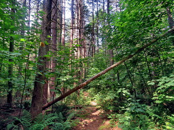 We had been hiking through primarily hardwood for but entered and area that had some red pines which appear to have been planted. There was one small tree leaning across the trail which I thought we might cut on the way back. The trail began to get grassy and a little damp. I knew that the last time I had hiked this trail the junction was not well marked so I check Avenza to make sure of where we were. The map showed us that we had only a few hundred feet to go! When we reached the junction, I was happy to see some new signs until we looked at them carefully! The sign indicated that the Pelnor Hollow Trail was .6 miles back the way we had come but it was the Pelnor Hollow Trail that we had been on that got us to the intersection. The sign also stated that the Campbell Mountain Trail was .6 miles back the way we had come when that trail goes in the opposite direction and starts right where the sign was posted. The other two signs at the junction seemed to be correct but I was again disappointed at the confusion and official DEC sign could cause! I took pictures of the signs and we turned around to start back at 12:15 PM. It was definitely hotter and more humid but we were in the shade and a slight breeze was blowing. To get to the point we were at we had 1.25 miles and dropped 650 feet from the junction with ten Mary Smith Hill Trail. I knew this meant the first part of the return trip would be all uphill. On the way back we stopped at one small leaner and Matt cut through it quickly and we got it off the trail. We walked and talked which made the trip easier. I stopped a couple times for a quick break and made sure to get a drink and give one to Sheila. Matt and I talked about diverse topics which made for an interesting trip. I was happy when we reached the junction with the Mary Smith Hill Trail as I knew it was all downhill after that. In this case that is a good thing. We stopped again at the right of way since there was less haze but the pictures were much the same. We were back ay the car at 1:55 PM after hiking 4.6 miles in 3 hours and 40 minutes including 45 minutes of stopped time. The total elevation gain was 1205 feet and the temperature was 84 degrees! I had great fun hiking with Matt and best of all he agreed to maintain that section of trail for the FLT.
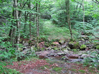
![]()
![]()
![]()
![]()
![]() On Tuesday, August 10th, I wanted to complete the trail maintenance on the Neversink Hardenburgh Trail. I had gone in from the north and south with other people and had cleared the trail except for about 1.2 miles right in the center. After trying the trail from both ends, I decided it would be easier to approach this task from the Balsam Lake Parking area at the end of the Beaverkill Road. The section of this trail up to the Beaverkill was adopted last year by a new maintainer who seemed very enthusiastic. I went out with her last October and showed her the trail and what was expected of her as a maintainer. Since then she has failed to contact me or respond to any e-mails. This was a big disappointment. As the trail supervisor, I have been told I do not have to maintain the trails when other maintainers fail to do their work but I feel responsible. As I started to get ready at 9:30 Am the temperature was already in the low 70's but the humidity was manageable. Sheila was playing the good dog but watching our every move. As we started to get ready the temperature was 70 degrees and the humidity was uncharacteristically low. I got dressed in a White Sierra long-sleeved crew top with a short-sleeved baselayer. I put on a pair of RailRiders hiking pants which are expensive but last a long time and have features like deep pockets and a generous cut which I really like. These pants have Velcro closures at the ankles to discourage sticks and gravel from getting into my shoes and to combat ticks. I decided to wear my Keen Targhee II hiking boots which fit me well but have been discontinued. I decided to take my Leki Makalu carbon poles with the internal twist locks as they are light and not a problem on most trails. The hike was long enough that I would for the ax and large loppers for the poles. I also added a new OR floppy hat which shields me from the sun and allows me to spray some insect repellant on it rather than on me. I donned my OR Bugout gaiters to combat the ticks and mud that I expected to find. At 9:50 AM I put my equipment in the car including my Silky Sugowaza saw, Fiskars loppers and two Oregon splitting wedges. Sheila jumped into the backseat with some enthusiasm and we headed out the driveway. I headed toward Roscoe on Old Rt 17 and I turned right on the Beaverkill Road. I continued north toward Lew Beach and Turnwood. The Beaverkill Falls were flowing but just barely as there had been no significant rain for some days. The road conditions were pretty good even when the pavement ended. I laughed when I saw the "Rough Road" sign! The town of Hardenburgh had been working on the dirt road by smoothing it with a scraper and widening it slightly. Toward the end the road becomes very narrow and I was glad I did not meet any cars. We arrived at the parking area at 10:35 AM and found four other cars in the lot. I set my GPS and we started out on the trail with the Sugowaza, wedges and Fiskars clippers in my pack and the temperature was at 72 degrees.
On Tuesday, August 10th, I wanted to complete the trail maintenance on the Neversink Hardenburgh Trail. I had gone in from the north and south with other people and had cleared the trail except for about 1.2 miles right in the center. After trying the trail from both ends, I decided it would be easier to approach this task from the Balsam Lake Parking area at the end of the Beaverkill Road. The section of this trail up to the Beaverkill was adopted last year by a new maintainer who seemed very enthusiastic. I went out with her last October and showed her the trail and what was expected of her as a maintainer. Since then she has failed to contact me or respond to any e-mails. This was a big disappointment. As the trail supervisor, I have been told I do not have to maintain the trails when other maintainers fail to do their work but I feel responsible. As I started to get ready at 9:30 Am the temperature was already in the low 70's but the humidity was manageable. Sheila was playing the good dog but watching our every move. As we started to get ready the temperature was 70 degrees and the humidity was uncharacteristically low. I got dressed in a White Sierra long-sleeved crew top with a short-sleeved baselayer. I put on a pair of RailRiders hiking pants which are expensive but last a long time and have features like deep pockets and a generous cut which I really like. These pants have Velcro closures at the ankles to discourage sticks and gravel from getting into my shoes and to combat ticks. I decided to wear my Keen Targhee II hiking boots which fit me well but have been discontinued. I decided to take my Leki Makalu carbon poles with the internal twist locks as they are light and not a problem on most trails. The hike was long enough that I would for the ax and large loppers for the poles. I also added a new OR floppy hat which shields me from the sun and allows me to spray some insect repellant on it rather than on me. I donned my OR Bugout gaiters to combat the ticks and mud that I expected to find. At 9:50 AM I put my equipment in the car including my Silky Sugowaza saw, Fiskars loppers and two Oregon splitting wedges. Sheila jumped into the backseat with some enthusiasm and we headed out the driveway. I headed toward Roscoe on Old Rt 17 and I turned right on the Beaverkill Road. I continued north toward Lew Beach and Turnwood. The Beaverkill Falls were flowing but just barely as there had been no significant rain for some days. The road conditions were pretty good even when the pavement ended. I laughed when I saw the "Rough Road" sign! The town of Hardenburgh had been working on the dirt road by smoothing it with a scraper and widening it slightly. Toward the end the road becomes very narrow and I was glad I did not meet any cars. We arrived at the parking area at 10:35 AM and found four other cars in the lot. I set my GPS and we started out on the trail with the Sugowaza, wedges and Fiskars clippers in my pack and the temperature was at 72 degrees.
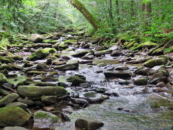 I immediately ran into a few branches hanging down into trail but decided to leave them as I wanted Ti get to the part of the trail which had not been cleared. We passed the register walking downhill and saw no new blowdowns. The same blowdowns we had left last time were still there and I made a note to get in contact with someone who could supply a sawyer. The first half mile of the trail loses about 200 feet to a bridge that crosses Black Brook. As I walked I cleared a few branches but the trail was still in good shape. From Black Brook we began a climb gaining back the elevation we had lost over .35 miles. There was at least one blowdown across the trail that we had to duck under and a few we had to climb over. Other blowdowns were very large and hikers had created appropriate detours around them. The trail rolled a little and then descended to Gulf of Mexico Brook which we crossed on a nice bridge. At 1.5 miles we came to the outlet stream from Vly Pond. I decided that on this day I did not want to bushwhack the few hundred feet upstream to the pond. The stream was a little lower than normal but the rocks looked slippery. I found a way to cross without falling and we continued our walk. From the Vly outlet brook we climbed some and then started to drop down. I knew that we were approaching the Beaverkill because there was a small pond on the left side of the trail which I remembered from my last trip. There was a very large and complex blowdown in the area of this pond but we were able to climb over it. This blowdown was one that will have to be cleared by a sawyer crew. At 2.0 miles we crossed a small stream and almost immediately after came to the Beaverkill. The trail turned left and paralleled the stream. It was very eroded which I assume came from a period of flooding. We walked along the stream to 2.1 miles where I had turned around last time. This is where the work began! As I began to walk up the trail, I immediately came to a blowdown that had been cut enough to allow hikers to pass. I stopped only a little farther up the trail at a blowdown that had been cut with an ax. It seemed to me that someone had walked along the trail with an ax making a few cuts here and there in blowdowns. It seems that this person had not removed anything that was cut and therefore did little good. I took a few shots and then used the saw to cut the blowdown and remove all the pieces from the trail. I took some 'after' pictures and then move along the trail.
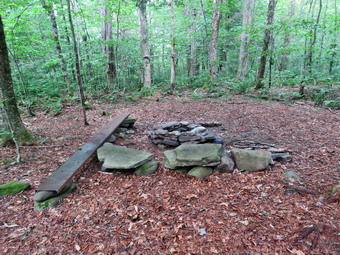 Not very far up the trail was a large trunk across the trail and this became a theme for the rest of this section. To really clear the trail will require a sawyer to cut these large trees. I kept walking and found another trunk across the trail. Fortunately, there was a walk around to allow hikers to pass. This was true of the next blowdown also which was a pine tree with several branches sticking up. I kept walking and found another large trunk with a smaller one right after it. I cut the smaller one to make it easier for hikers to pass by on the trail. The next one was a large tree arching over the trail which would be too dangerous to cut even with a chainsaw. Along the way we crossed a small bridge that was covered with moss. Many of the board on the bridge were missing and some gave me the impression they might break. At 12:30 PM we came to the primitive campsite near Tunis Pond. The campsite has a nice fire ring and benches so I took some pictures. We walked over to the Beaverkill to where a bridge used to cross the river. I took pictures of the area where the bridge used to cross and then walked down to the stream and took some more shots. When I was done, I stowed the camera and then continued on the trail toward the place where the trail for the river. The trail followed the river and then started up a hill when the land ran out. The rest of the trail to the for had a few small blowdowns and an area of brush encroaching on the trail. We pushed through and reached the for at 12:50 PM. I took a few pictures and then we started back. On the way back I got out the Fiskars clippers and trimmed some of the brush. I also removed the small blowdowns by dragging them off the trail sometimes using the saw. We were almost back to the spot where we started our work when we ran into a blowdown that I wanted to clear. The birch trees were pretty thick but I cut them and moved them off the trail. I took pictures before and after. When we were done, we started the walk back and did not top until we got to the car at 2:35 PM after hiking 6.1 miles in 4 hours with 50 minutes of stopped time. The elevation gain was 1000 feet. As we left the parking area, the temperature was 82 degrees.
![]()
![]()
![]()
![]() On Monday, August 9th I had plans to get out and complete some trail maintenance on the Neversink Hardenburgh Trail starting at the Balsam Lake Mountain parking area. After a rough night, I decided to sleep in and take a hike with my 5 year old granddaughter Brynn. I did some work around the house before starting to get ready at 12:30 PM. I decided I would take Sheila and Brynn and go across the street to hike on Round Top just to get out of the house. The temperature was 82 degrees as we got ready. Sheila was watching me and seemed very happy to be finally going out. I put on my White Sierra long-sleeved crew top with no baselayer because of the temperature and humidity. I put on a pair of RailRiders hiking pants which are expensive but last a long time and have features like deep pockets and a generous cut which I really like. I decided to wear a new pair of Keen Cascade hiking boots so I could get an idea of how they felt on my feet. They are a little heavier than what I normally wear as they are all leather and more of a backpacking boot. I decided to take my Leki Makalu Lite poles which are made of aluminum with cork grips and external locks. I had been using a pair of Leki Makalu poles made from carbon fiber with internal twist locks and immediately noticed the poles with the external locks were heavier. I had recently replaced the tips on these poles and found out they were hard to get as they have a special antishock mechanism built in. The tips were slightly larger than suggested but seemed to be a good fit. Brynn always wears a dress but had brought pants and hiking shoes to go out with me. I was surprised that she had put her pants on under her dress but she looked ready to hike. We stepped out of the house at 12:45 PM. I grabbed Sheila's leash from the trunk of my car and we walked up the driveway. Brynn had told me she would not get tired on the hike but I had never been out with her before. Sheila was happy to get out as we headed down the driveway and across the street. We crossed the street and walked to the parking area by the Presbyterian Church. We walked to the back of the church and began the ascent of the steepest hill behind the church. The hill is short but gets the circulation pumping and is the steepest and longest climb on the "trail." Sheila helped me along by pulling me up the hill. When we got to the top of the hill, we stopped to look around at the hills around town. We started on the trail by turning left at the trailhead. I let Sheila off her leash so that she could run free. I knew that other people were using the trails from comments on Facebook. The trails was becoming well-worn as more and more people use them. Brynn did not seem at all tired after hiking up the hill and was ahead of me on the trail.
On Monday, August 9th I had plans to get out and complete some trail maintenance on the Neversink Hardenburgh Trail starting at the Balsam Lake Mountain parking area. After a rough night, I decided to sleep in and take a hike with my 5 year old granddaughter Brynn. I did some work around the house before starting to get ready at 12:30 PM. I decided I would take Sheila and Brynn and go across the street to hike on Round Top just to get out of the house. The temperature was 82 degrees as we got ready. Sheila was watching me and seemed very happy to be finally going out. I put on my White Sierra long-sleeved crew top with no baselayer because of the temperature and humidity. I put on a pair of RailRiders hiking pants which are expensive but last a long time and have features like deep pockets and a generous cut which I really like. I decided to wear a new pair of Keen Cascade hiking boots so I could get an idea of how they felt on my feet. They are a little heavier than what I normally wear as they are all leather and more of a backpacking boot. I decided to take my Leki Makalu Lite poles which are made of aluminum with cork grips and external locks. I had been using a pair of Leki Makalu poles made from carbon fiber with internal twist locks and immediately noticed the poles with the external locks were heavier. I had recently replaced the tips on these poles and found out they were hard to get as they have a special antishock mechanism built in. The tips were slightly larger than suggested but seemed to be a good fit. Brynn always wears a dress but had brought pants and hiking shoes to go out with me. I was surprised that she had put her pants on under her dress but she looked ready to hike. We stepped out of the house at 12:45 PM. I grabbed Sheila's leash from the trunk of my car and we walked up the driveway. Brynn had told me she would not get tired on the hike but I had never been out with her before. Sheila was happy to get out as we headed down the driveway and across the street. We crossed the street and walked to the parking area by the Presbyterian Church. We walked to the back of the church and began the ascent of the steepest hill behind the church. The hill is short but gets the circulation pumping and is the steepest and longest climb on the "trail." Sheila helped me along by pulling me up the hill. When we got to the top of the hill, we stopped to look around at the hills around town. We started on the trail by turning left at the trailhead. I let Sheila off her leash so that she could run free. I knew that other people were using the trails from comments on Facebook. The trails was becoming well-worn as more and more people use them. Brynn did not seem at all tired after hiking up the hill and was ahead of me on the trail.
At the first trail junction, we turned right to walk up the more shallow approach to Round Top on the wide woods road. The trails were surprisingly dry as it had not rained for several days. I had trimmed the trail pretty wide the last time I had done trail work and that had kept the brush and weeds off the trail. I taught Brynn about the meanings of the different trail blazes. Brynn made up hiking sings as we walked. At the first junction with the blue trail, we turned left and continued on the yellow trail along the base of Round Top. The grass and weeds were under control and even the brush was well back from the trail. Brynn asked me if I had cleared the trails. At the second junction with the blue trail, we turned right and headed up the steep side of the hill. I decided to turn right on the switchback on the blue trail. I explained the purpose of the switchback as we walked out and then back to the blue trail. We followed the blue trail over the summit, skipping the white crossover trail, and then walked down the other side. We again bypassed the white crossover trail and continued down the blue trail to the junction with the yellow trail. We turned right on the yellow trail to once again walk along the base of Round Top. Brynn seemed a little confused but soon caught on to the pattern we were walking. This time when we reached the second junction with the blue trail we turned left on the yellow trail and followed that downhill to the viewpoint over town. Brynn told me that her code for walking downhill was 'X Point down'! The forest floor was getting greener all the time as more and more ferns popped up. At the lookout we walked down the small ledge to the flat rocks that made up the viewpoint. We looked around at what we could see and I lifted Brynn briefly so that she could see more. When we were done, we walked the narrow path back out toward the yellow trail. I found that the brush I had placed in the path needed to be replaced as someone had "helpfully" removed it. I put the brush in the path to discourage people from walking along the path. This path can be dangerous for some and I wanted it blocked to discouraged its use. I replaced the brush that had been placed beside the trail and then went to find some more. By the time I was done there was about twice as much brush on the path. We continued down the hill to the very first trail junction completing our first figure 8. Brynn was showing no signs of getting tired and I had heard no complaints. We immediately turned around and hiked back up the steeper trail to the viewpoint. We followed the yellow trail as it turned right and began the long but gentle climb to the first junction with the blue trail. In several places Brynn was skipping or running. At the junction we turned right to follow the yellow trail along the base of Round Top to the second junction with the blue trail. We turned left and followed the blue trail to the white crossover trail. We turned left and followed the trail along the side of the hill to the junction with the blue trail. We turned left and followed the blue trail straight down the hill to the junction with the yellow trail. By this time I was beginning to sweat and despite the breeze it felt warmer. We turned left on the yellow trail and again followed it to the next junction with the blue trail. This time we turned right and followed the yellow trail down to the wide woods road that brought us back to the first trail junction. I got the feeling that Brynn was ready to go for at least one more round but I decided we would return to the house. We walked out to the trailhead where I put Sheila on her leash. We turned right to walk to the bottom of the hill and headed across the church parking lot to the street. We crossed the street to our driveway and were home by 2:00 PM after hiking 2 miles in 1 hour and 15 minutes.
![]()
![]()
![]()
![]() On Saturday, August 7th I had plans to get out and complete some trail maintenance on the Neversink Hardenburgh Trail starting at the Balsam Lake Mountain parking area. An ambulance call came in at 3:30 AM to lift a patient back into their chair. The call didn't take long but I had trouble getting back to sleep. I slept late and decided that I did not want to do the trail maintenance since the weather forecast included a chance of thunderstorms. At 1:30 PM I decided I would take Sheila and go across the street to hike on Round Top just to get out of the house. The temperature was 75 degrees as I got ready. Sheila was watching me and seemed very happy to be finally going out. I put on my White Sierra long-sleeved crew top with no baselayer because of the temperature and humidity. I put on a pair of RailRiders hiking pants which are expensive but last a long time and have features like deep pockets and a generous cut which I really like. I decided to wear a new pair of Keen Cascade hiking boots so I could get an idea of how they felt on my feet. They are a little heavier than what I normally wear as they are all leather and more of a backpacking boot. I decided to take my Leki Makalu Lite poles which are made of aluminum with cork grips and external locks. I had been using a pair of Leki Makalu poles made from carbon fiber with internal twist locks and immediately noticed the poles with the external locks were heavier. I had recently replaced the tips on these poles and found out they were hard to get as they have a special antishock mechanism built in. The tips were slightly larger than suggested but seemed to be a good fit. We stepped out of the house at 2:00 PM. I grabbed Sheila's leash from the trunk of my car and we walked up the driveway. I aimed to hike for at least two figure 8's but thought I might do four. Sheila was happy to get out as we headed down the driveway and across the street. We crossed the street and walked to the parking area by the Presbyterian Church. We walked to the back of the church and began the ascent of the steepest hill behind the church. The hill is short but gets the circulation pumping and is the steepest and longest climb on the "trail." Sheila helped me along by pulling me up the hill. When we got to the top of the hill, we stopped to look around at the hills around town. We started on the trail by turning left at the trailhead. I let Sheila off her leash so that she could run free. I knew that other people were using the trails from comments on Facebook. The trails was becoming well-worn as more and more people use them.
On Saturday, August 7th I had plans to get out and complete some trail maintenance on the Neversink Hardenburgh Trail starting at the Balsam Lake Mountain parking area. An ambulance call came in at 3:30 AM to lift a patient back into their chair. The call didn't take long but I had trouble getting back to sleep. I slept late and decided that I did not want to do the trail maintenance since the weather forecast included a chance of thunderstorms. At 1:30 PM I decided I would take Sheila and go across the street to hike on Round Top just to get out of the house. The temperature was 75 degrees as I got ready. Sheila was watching me and seemed very happy to be finally going out. I put on my White Sierra long-sleeved crew top with no baselayer because of the temperature and humidity. I put on a pair of RailRiders hiking pants which are expensive but last a long time and have features like deep pockets and a generous cut which I really like. I decided to wear a new pair of Keen Cascade hiking boots so I could get an idea of how they felt on my feet. They are a little heavier than what I normally wear as they are all leather and more of a backpacking boot. I decided to take my Leki Makalu Lite poles which are made of aluminum with cork grips and external locks. I had been using a pair of Leki Makalu poles made from carbon fiber with internal twist locks and immediately noticed the poles with the external locks were heavier. I had recently replaced the tips on these poles and found out they were hard to get as they have a special antishock mechanism built in. The tips were slightly larger than suggested but seemed to be a good fit. We stepped out of the house at 2:00 PM. I grabbed Sheila's leash from the trunk of my car and we walked up the driveway. I aimed to hike for at least two figure 8's but thought I might do four. Sheila was happy to get out as we headed down the driveway and across the street. We crossed the street and walked to the parking area by the Presbyterian Church. We walked to the back of the church and began the ascent of the steepest hill behind the church. The hill is short but gets the circulation pumping and is the steepest and longest climb on the "trail." Sheila helped me along by pulling me up the hill. When we got to the top of the hill, we stopped to look around at the hills around town. We started on the trail by turning left at the trailhead. I let Sheila off her leash so that she could run free. I knew that other people were using the trails from comments on Facebook. The trails was becoming well-worn as more and more people use them.
At the first trail junction, we turned right to walk up the more shallow approach to Round Top on the wide woods road. The trails were surprisingly dry as it had not rained for several days. I had trimmed the trail pretty wide the last time I had done trail work and that had kept the brush and weeds off the trail. At the first junction with the blue trail, we turned left and continued on the yellow trail along the base of Round Top. The grass and weeds were under control and even the brush was well back from the trail. At the second junction with the blue trail, we turned right and headed up the steep side of the hill. I decided to skip both the switchback on the blue trail and the white crossover trail as we headed directly for the summit. We followed the blue trail over the summit and down the other side. We again bypassed the white crossover trail and continued down the blue trail to the junction with the yellow trail. We turned right on the yellow trail to once again walk along the base of Round Top. This time when we reached the second junction with the blue trail we turned left on the yellow trail and followed that downhill to the viewpoint over town. The forest floor was getting greener all the time as more and more ferns popped up. At the lookout we turned left to follow the yellow trail back to the very first trail junction. I check the path to the viewpoint and found that the brush I had placed in the trail needed to be replaced to discourage people from walking along the path. This path can be dangerous for some and I wanted it blocked to discouraged its use. We continued down the hill to the very first trail junction completing our first figure 8. We immediately turned around and hiked back up the steeper trail to the viewpoint. We followed the yellow trail as it turned right and began the long but gentle climb to the first junction with the blue trail. At the junction we turned right to follow the yellow trail along the base of Round Top to the second junction with the blue trail. We turned left and followed the blue trail to the white crossover trail. We turned left and followed the trail along the side of the hill to the junction with the blue trail. We turned left and almost immediately turned left again on the switchback trail. We followed the switch back until it led as back to the main blue trail where we turned left. We followed the blue trail downhill to the junction with the yellow trail. By this time I was beginning to sweat profusely been though it did not seem to be too hot or humid. We turned left on the yellow trail and again followed it to the next junction with the blue trail. This time we turned right and followed the yellow trail down to the wide woods road that brought us back to the first trail junction.
Sheila seemed ready to go home but I had other ideas. We turned around and started back up the woods road turning left at the first junction with the blue trail. We turned left on the yellow trail and walked along the base of Round Top to the second junction with the blue trail. We turned right and started up the blue trail turning right on the switchback which we followed back to the main blue trail. We turned right and then almost immediately right on the white crossover trail. At the end of the white trail, we turned right on the blue trail and walked down to the junction with the yellow trail. We turned right and walked the yellow trail to the junction with the blue trail. We turned left and continued on the yellow trail to the lookout. We followed the yellow trail sit turned left to return us to the first trail junction. Sheila started out to the trailhead but I called her back as I wanted to do one more figure 8. We turned around and hiked back up the hill to the lookout with an increased pace. We followed the yellow trail as it turned right and continued up hill through the ferns. At the first junction with the blue trail, we turned right and once again followed the yellow trail along the base of Round Top. At the second junction with the blue trail we turned right and started up toward the summit. At the white crossover trail we turned left and followed it to the blue trail. We turned left and left again on the switchback which we followed until it came to the main blue trail. We turned left and walked down to the yellow trail. We turned right, followed it along the base of Round Top and turned right at the second junction with the blue trail. We followed the yellow trail down to the woods road and back out to the first trail junction. This time Sheila turned left and ran toward the trailhead with me following right behind. At the trailhead, I put Sheila on her leash and as we turned right to walk to the bottom of the hill. We headed across the church parking lot to the street. We crossed the street to our driveway and were home by 3:50 PM after hiking just under 4 miles in 1 hour and 50 minutes.
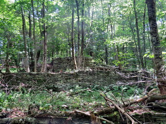
![]()
![]()
![]()
![]()
![]() On Friday, August 6th, I planned to survey the Finger Lakes Trail from Downsville going towards Route 206 with my grandson Bryce. I have recently become the Regional Trail Coordinator for the FLTC for the Eastern Catskills. This section of the trail runs from Downsville to Slide Mountain. Some sections are maintained by the FLTC and others by the NYNJTC. These news responsibilities overlap with my role as Trail Supervisor for the NYNJTC in the Balsam Lake Wild forest, Willowemoc Wild Forest and Big Indian Wilderness. Some hikers had reported some blowdowns on the trail and a lack of markers and I wanted to check out these reports. Although my primary purpose was to check out the trail, I decided to take along my Silky Sugowaza and Fiskars pack ax just in case we needed to cleanup something. My plan was to park on Mink Brook Road in Downsville and walk the FLT until it turns left off the snowmobile trail toward Route 206. This was the spot I turned around on a previous trip. Bryce arrived at my house shortly after 9:00 AM and I began to ready at 9:45 AM when the temperature was 72 degrees. While I was getting ready, Sheila was always nearby making it very clear that she wanted to go. I got dressed in a White Sierra long-sleeved crew top over a short-sleeved baselayer. I put on a pair of RailRiders hiking pants which are expensive but last a long time and have features like deep pockets and a generous cut which I really like. These pants have Velcro closures at the ankles to discourage sticks and gravel from getting into my shoes and to combat ticks. I decided to wear my Keen Targhee II hiking boots which fit me well but have been discontinued. I decided to take my Leki Makalu carbon poles with the internal twist locks as they are light and not a problem on most trails. I also my OR floppy hat which shields me from the sun and allows me to spray some insect repellant on it rather than on me. I donned my OR Bugout gaiters to combat the ticks and mud that I expected to find. I slid my Silky Sugowaza into my pack just in case I needed it and gave Bryce the Fiskars ax. At 10:10 AM I put our gear in the car and Sheila and Bryce in the backseat and left Livingston Manor. I drove west on State Route 17 getting of at exit 94 for Roscoe. I drove North on Route 206 to the Pepacton Reservoir and turned left on Route 30 toward Downsville. I had decided to see if I could park on Mink Brook Road so that we did not have to walk on the road from the covered bridge to the point where the FLT entered the woods. As I came down the hill passed the dam, I watched for Mink Brook Road and turned left. As I went up the road I turned left again into what looked like it might be a driveway. I drove to the end where I could see the FLT markers going through a clearing and into the woods. I put on a mask and knocked on the door of the house. A young man came to the door and I explained I wanted to park to do trail work. He graciously gave me permission to park. We parked at 10:40 AM when the temperature was 72 degrees. I set my GPS, out Sheila on her line, and handed Bryce the ax. We headed up through the clearing and watched to see where the FLT markers and arrows indicated that the trail entered the woods.
On Friday, August 6th, I planned to survey the Finger Lakes Trail from Downsville going towards Route 206 with my grandson Bryce. I have recently become the Regional Trail Coordinator for the FLTC for the Eastern Catskills. This section of the trail runs from Downsville to Slide Mountain. Some sections are maintained by the FLTC and others by the NYNJTC. These news responsibilities overlap with my role as Trail Supervisor for the NYNJTC in the Balsam Lake Wild forest, Willowemoc Wild Forest and Big Indian Wilderness. Some hikers had reported some blowdowns on the trail and a lack of markers and I wanted to check out these reports. Although my primary purpose was to check out the trail, I decided to take along my Silky Sugowaza and Fiskars pack ax just in case we needed to cleanup something. My plan was to park on Mink Brook Road in Downsville and walk the FLT until it turns left off the snowmobile trail toward Route 206. This was the spot I turned around on a previous trip. Bryce arrived at my house shortly after 9:00 AM and I began to ready at 9:45 AM when the temperature was 72 degrees. While I was getting ready, Sheila was always nearby making it very clear that she wanted to go. I got dressed in a White Sierra long-sleeved crew top over a short-sleeved baselayer. I put on a pair of RailRiders hiking pants which are expensive but last a long time and have features like deep pockets and a generous cut which I really like. These pants have Velcro closures at the ankles to discourage sticks and gravel from getting into my shoes and to combat ticks. I decided to wear my Keen Targhee II hiking boots which fit me well but have been discontinued. I decided to take my Leki Makalu carbon poles with the internal twist locks as they are light and not a problem on most trails. I also my OR floppy hat which shields me from the sun and allows me to spray some insect repellant on it rather than on me. I donned my OR Bugout gaiters to combat the ticks and mud that I expected to find. I slid my Silky Sugowaza into my pack just in case I needed it and gave Bryce the Fiskars ax. At 10:10 AM I put our gear in the car and Sheila and Bryce in the backseat and left Livingston Manor. I drove west on State Route 17 getting of at exit 94 for Roscoe. I drove North on Route 206 to the Pepacton Reservoir and turned left on Route 30 toward Downsville. I had decided to see if I could park on Mink Brook Road so that we did not have to walk on the road from the covered bridge to the point where the FLT entered the woods. As I came down the hill passed the dam, I watched for Mink Brook Road and turned left. As I went up the road I turned left again into what looked like it might be a driveway. I drove to the end where I could see the FLT markers going through a clearing and into the woods. I put on a mask and knocked on the door of the house. A young man came to the door and I explained I wanted to park to do trail work. He graciously gave me permission to park. We parked at 10:40 AM when the temperature was 72 degrees. I set my GPS, out Sheila on her line, and handed Bryce the ax. We headed up through the clearing and watched to see where the FLT markers and arrows indicated that the trail entered the woods.
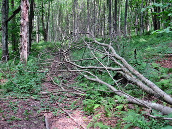 It had not occurred to me that we would be started our hike considerably lower than the other end of the trail on Route 206! After we entered the woods, the first .35 miles saw us gain 380 feet with a 21% grade. The trail was wet in several places with water running down and across the trail. The trail seems to roughly follow a set of wagon roads and snowmobile trails. Where there are large blowdowns, the trail was simply routed around them rather than cut the large and numerous tree trunks. There were some very large trees that had been cut but the work seemed to have been done some time ago. After about .5 miles we came to a large blowdown blocking the trail after passing by several that had been cut. This one was too big to cut so I took some pictures and moved on. Just passed this blowdown was another, larger one that had been neatly cut from the trail. This one was bigger than the last and I took a few shots before continuing. Bryce and I were both removing small branches, large branches and old tree trunks from the trail while trying to avoid the nettles. At .75 miles we found a single medium sized tree trunk across the trail and decided to remove it. I took my 'before' shots and then grabbed the saw to cut the top off the trunk. When I was dine, I switched to the ax and made another cut near the base of the tree. The wood was harder than I thought but I eventually cut through. The center piece I had cut out was heavier than I thought but I was able to move it out of the way. I took some pictures and we continued on the trail. The trail followed the deeply eroded wagon road until there were some major blowdowns and then moved to the elevated side of the trail or took a route through the woods. The markings and the trail were adequate but a few more would have been nice. Again at .85 miles there was a mess to clean up. Much of this was removing loose branches and trunks. We did cut off a sharp piece of wood sticking out at about head high! Around .9 miles a series of blowdowns completely block the woods road so the trail detoured through the woods to the left. We followed the trail as it snaked its way passed the mess and back up onto the road. This was repeated several times. We found another mess at 1.0 miles. This consisted of one trunk too large for us to cut and another, smaller one. We picked up some loose branches and removed the smaller trunk. We also cut and removed some other branches and the result was an improvement. Around 1.2 miles we came to two large trunks across the trail which had caused a reroute to the right. The problem was that a small trunk and some branches were now hanging low over the trail. We took a few minutes for me to use the saw and cut down the mess while Bryce dragged them away. At 10 years old Bryce is able to really contribute and seems to enjoy it.
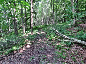 Not very far up the trail we ran into another two very large trunks which I could not cut. The problem was amplified by some branches that were in the way. We again took the time to improve the area before moving on. I was trying to keep track of how far we had to go to get to the point where I had turned around the last trip. I had not expected to have to stop so many times and had forgotten that the hike was all uphill. We passed by a rather branchy blowdown that blocked the trail and came to a huge structure constructed of stones on the right side of the trail. It was not a stone wall but it was also not a foundation. I took q few shots and began to think it might have been used to load logs on a wagon. Just beyond this area and up a hill we could see a clearing and we decided to investigate. We climb the hill and broke out into an open field. The grass was high and very green and the sky was blue with some white clouds. I took a few pictures and then we walked back down to the trail. I looked at the mileage and found that we would have to walk another 1.5 miles to get to the turnaround point. We talked about it and decided to turn around, cut the blowdown we had passed and then walk back to the car. We walked back to the blowdown where I took some 'before' shots. We then removed all the loose branches and I began to use the saw to cut the rest. There were some large branches that I cut which Bryce was able to handle. A few of the largest ones we worked together to move. When we finished, it was hard to tell the trail had ever been blocked. I took my final pictures and we packed up to start back to the car. On the way back there were several blowdowns we could have worked on but we stuck to our "pact" and kept hiking. The first half of the return trip went quickly but then we ran into the mud. Further down the trail we ran into the steepest section with wet and slippery rocks. We were back at the car at 2:45 PM after hiking only 2.7 miles but doing a lot of work along the way. We had taken 4 hours and 5 minutes but 1 hour and 45 minutes was hiking and 2 hours and 20 minutes was spent working. Our elevation gain was 915 feet.
![]()
![]()
![]()
![]() On Thursday, August 5th I wanted to get out for a hike with my grandson Bryce who was coming to my house. When the grandchildren arrived, I was surprised to find that it was 8 year old Lukas who had come. I had not taken Luke out to hike in a long time but I asked him if he would like to go across the street to hike on Round Top. He said "Yes" and I started to get ready to go. As I got ready, Sheila seemed very happy to be going out. I put on my White Sierra long-sleeved crew top with no base layer because the temperature was in the low 70's with high humidity. I put on a pair of RailRiders hiking pants which are expensive but last a long time and have features like deep pockets and a generous cut which I really like. I decided to wear a new pair of Keen Cascade hiking boots so I could get an idea of how they felt on my feet. They are a little heavier than what I normally wear as they are all leather and more of a backpacking boot. I decided to take my Leki Makalu carbon poles with the internal twist locks as they are light and not a problem on most trails. I also put on my OR Bugout gaiters to combat the ticks and the mud I knew would be on the trail. We stepped out of the house at 11:30 AM. I grabbed Sheila's leash from the car and put it on her to safely cross the street. We walked up the driveway and crossed the street. We walked to the church parking lot and to the back of the church. As we started up the hill, we began the ascent of the steep hill behind the church. The hill is short but gets the circulation pumping and is the steepest and longest climb on the "trail". I was surprised that Luke practically skipped up the hill! I let Sheila pull me up the hill which she was willing to do. At the trailhead, I let Sheila off her leash and she immediately began to bound up the trail. I started on the trail by turning left at the trailhead. I knew that other people were using the trails from comments on Facebook and because there was one car parked at the bottom of the hill. The trails were becoming well-worn as more and more people use them.
On Thursday, August 5th I wanted to get out for a hike with my grandson Bryce who was coming to my house. When the grandchildren arrived, I was surprised to find that it was 8 year old Lukas who had come. I had not taken Luke out to hike in a long time but I asked him if he would like to go across the street to hike on Round Top. He said "Yes" and I started to get ready to go. As I got ready, Sheila seemed very happy to be going out. I put on my White Sierra long-sleeved crew top with no base layer because the temperature was in the low 70's with high humidity. I put on a pair of RailRiders hiking pants which are expensive but last a long time and have features like deep pockets and a generous cut which I really like. I decided to wear a new pair of Keen Cascade hiking boots so I could get an idea of how they felt on my feet. They are a little heavier than what I normally wear as they are all leather and more of a backpacking boot. I decided to take my Leki Makalu carbon poles with the internal twist locks as they are light and not a problem on most trails. I also put on my OR Bugout gaiters to combat the ticks and the mud I knew would be on the trail. We stepped out of the house at 11:30 AM. I grabbed Sheila's leash from the car and put it on her to safely cross the street. We walked up the driveway and crossed the street. We walked to the church parking lot and to the back of the church. As we started up the hill, we began the ascent of the steep hill behind the church. The hill is short but gets the circulation pumping and is the steepest and longest climb on the "trail". I was surprised that Luke practically skipped up the hill! I let Sheila pull me up the hill which she was willing to do. At the trailhead, I let Sheila off her leash and she immediately began to bound up the trail. I started on the trail by turning left at the trailhead. I knew that other people were using the trails from comments on Facebook and because there was one car parked at the bottom of the hill. The trails were becoming well-worn as more and more people use them.
At the first trail junction, I followed Sheila as she continued straight ahead up the hill toward the viewpoint. After the short walk from the house, I was already soaked in sweat from the humidity. The climb up the hill was not particularly tiring. We moved a small tree that had blown down so that it was across the trail to the viewpoint. This trail has a dangerous spot and we have piled brush on it to discourage people from using it. Luke and I walked out to the viewpoint and looked out across Livingston Manor. In the winter when the leaves are off the trees there is a nice view of the town. We had trouble seeing very much as the leaves blocked our view. I asked Luke if he would like to go down below the viewpoint and he agreed. We worked our way down with Luke in the lead. He really likes the rock scrambles and was surprised that there was a "cave" bolo the lookout. Luke went around the corner and I heard a noise and saw some birds flying away. I think some doves have made their nest under the lookout and it certainly made for a bit of excitement. We reversed our route and started back up. Luke found and old medicine bottle with some fluid in it and carried it for the rest of the hike. We worked our way back up to the main trail and continued to follow it as it headed up the gentle hill through the hardwood forest. The forest was very green and ferns covered the forest floor. Sheila was making her own way by staying on the trail sometimes and then running off-trail and chasing game trails. She was also picking up sticks and dragging them along and off the trail. Luke and I talked about his recent vacation with the family and he gave me very detailed accounts of their hikes. We continued to follow the yellow trail toward the first junction with the blue trail. At the first trail junction with the blue trail, we turned right and followed the yellow trail along the base of Round Top. This section was in good shape without any blowdowns and I could now really notice what a good job I had done with my Stihl trimmer. At the next junction, we turned left and started up to the summit of Round Top on the blue trail. We bypassed the white crossover trail and continued up and over the summit. There were a few branches leaning over into the trail but I broke them off and made sure they no longer were in the way. When we started down the other side, I decided we would skip the white crossover trail but take the switchback on the blue trail. People seemed to be avoiding the crossover trail but the switchback looked more well-worn. At the bottom of the hill, we turned left on the yellow trail, walked along the base of Round Top. At the trail junction with the blue trail, we turned right to walk down to the woods road. It was a snap to walk downhill and out the woods road. It was obvious Sheila felt the same way as she was running and bounding ahead of us and then running back up the trail. We walked the woods road out to the first trail junction. I wanted to do a loop in the opposite direction but Luke seemed opposed to the idea. I decided I would provide a little more excitement for him so we hiked up the hill toward the lookout again. T the top of the hill we turned right and bushwhacked along the cliffs and ledges that overlook the trail. I showed Luke a crossarm on a tree and bracket. I think these were from the time when there was a TV antennae on Round Top that supplied reception for many people in town. We continued to walk through the woods with Luke taking every opportunity to climb up and over the rocks. We eventually came out on the yellow trail and turned left. At the junction with the blue trail we turned left again and walked back down to the lookout. We followed the yellow trail as it turned left and headed down the hill. By this time we were all hot so we walked straight out to the trailhead. We turned right to walk to the bottom of the hill. We headed across the church parking lot to the street. We crossed the street to our driveway and were home by 12:45 PM after hiking around 2 miles in 1 hour and 15 minutes.
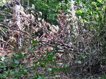
![]()
![]()
![]()
![]()
![]() On Tuesday, August 3rd, I wanted to survey the Finger Lakes Trail from Route 206 going towards Downsville. I have recently become the Regional Trail Coordinator for the FLTC for the Eastern Catskills. This section of the trail runs from Downsville to Slide Mountain. Some sections are maintained by the FLTC and others by the NYNJTC. These news responsibilities overlap with my role as Trail Supervisor for the NYNJTC in the Balsam Lake Wild forest, Willowemoc Wild Forest and Big Indian Wilderness. Some hikers had reported some blowdowns on the trail and a lack of markers and I wanted to check out these reports. Although my primary purpose was to check out the trail, I decided to take along my Silky Sugowaza just in case I needed to cleanup something. My plan was to park on Route 206 and walk the FLT until it turns right off the snowmobile trail toward Downsville. I needed to get some work done around the house so I started getting ready at 10:30 AM when the temperature was 68 degrees. While I was getting ready, Sheila was always nearby making it very clear that she wanted to go. I got dressed in a White Sierra long-sleeved crew top over a short-sleeved baselayer. I put on a pair of RailRiders hiking pants which are expensive but last a long time and have features like deep pockets and a generous cut which I really like. These pants have Velcro closures at the ankles to discourage sticks and gravel from getting into my shoes and to combat ticks. I decided to wear my Keen Targhee II hiking boots which fit me well but have been discontinued. I decided to take my Leki Makalu carbon poles with the internal twist locks as they are light and not a problem on most trails. I also my OR floppy hat which shields me from the sun and allows me to spray some insect repellant on it rather than on me. I donned my OR Bugout gaiters to combat the ticks and mud that I expected to find. I slid my Silky Sugowaza into my pack just in case I needed it. At 11:10 AM I put my gear in the car and Sheila in the backseat and left Livingston Manor. I drove west on State Route 17 getting of at exit 94 for Roscoe. I drove North on Route 206 for 9 miles to the point where the FLT crosses Route 206. I turned around and parked in the pulloff at 11:30 Am with the temperature still at 68 degrees. I set my GPS unit and we started off down the trail. The first part of the trail had some high grass and weeds ut these disappeared as we continued. The trail was wet in most places with some running water and some mud. Many of these trails are snowmobile trails so that they are well maintained at least from the early fall to the late winter. At other times the snowmobile club ignores the trails and the maintainer is responsible to keep it clear.
On Tuesday, August 3rd, I wanted to survey the Finger Lakes Trail from Route 206 going towards Downsville. I have recently become the Regional Trail Coordinator for the FLTC for the Eastern Catskills. This section of the trail runs from Downsville to Slide Mountain. Some sections are maintained by the FLTC and others by the NYNJTC. These news responsibilities overlap with my role as Trail Supervisor for the NYNJTC in the Balsam Lake Wild forest, Willowemoc Wild Forest and Big Indian Wilderness. Some hikers had reported some blowdowns on the trail and a lack of markers and I wanted to check out these reports. Although my primary purpose was to check out the trail, I decided to take along my Silky Sugowaza just in case I needed to cleanup something. My plan was to park on Route 206 and walk the FLT until it turns right off the snowmobile trail toward Downsville. I needed to get some work done around the house so I started getting ready at 10:30 AM when the temperature was 68 degrees. While I was getting ready, Sheila was always nearby making it very clear that she wanted to go. I got dressed in a White Sierra long-sleeved crew top over a short-sleeved baselayer. I put on a pair of RailRiders hiking pants which are expensive but last a long time and have features like deep pockets and a generous cut which I really like. These pants have Velcro closures at the ankles to discourage sticks and gravel from getting into my shoes and to combat ticks. I decided to wear my Keen Targhee II hiking boots which fit me well but have been discontinued. I decided to take my Leki Makalu carbon poles with the internal twist locks as they are light and not a problem on most trails. I also my OR floppy hat which shields me from the sun and allows me to spray some insect repellant on it rather than on me. I donned my OR Bugout gaiters to combat the ticks and mud that I expected to find. I slid my Silky Sugowaza into my pack just in case I needed it. At 11:10 AM I put my gear in the car and Sheila in the backseat and left Livingston Manor. I drove west on State Route 17 getting of at exit 94 for Roscoe. I drove North on Route 206 for 9 miles to the point where the FLT crosses Route 206. I turned around and parked in the pulloff at 11:30 Am with the temperature still at 68 degrees. I set my GPS unit and we started off down the trail. The first part of the trail had some high grass and weeds ut these disappeared as we continued. The trail was wet in most places with some running water and some mud. Many of these trails are snowmobile trails so that they are well maintained at least from the early fall to the late winter. At other times the snowmobile club ignores the trails and the maintainer is responsible to keep it clear.
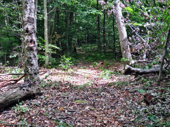 As the trail flattened out near the brook, we came to a tree that had collapsed across the trail. As the soil becomes saturated with water from the rains, some trees with shallow routes have fallen over. The tree had three good-sized trunks and hikers had already started to detour around it. I took some pictures and decided to simply clear out the detour. I only had to make a few cuts and remove a few loose branches and the job was done. I took my 'after' shots, packed up and continued along the trail. We walked on the trail as it paralleled the brook and then crossed on the foot bridge. The bridge was in poor repair and will need to be fixed or replaced in the near future. I took some pictures and we moved on. I began removing branches from the trail and, in some spots, took the time to lift some tree trunk off the trail. Many of these were old and many were broken and easy to pivot. After descending for about .7 miles, we began to climb and over the next .9 miles we gained about 600 feet of elevation. At 1.2 miles we came to the side trail to the Campbell Mountain lean-to and walked over to inspect it. The lean-to was in good shape but I could see light coming in between some of the logs. The privy was also in good shape. I took some pictures and we continued up the trail passing through some switchbacks. I knew that the FLT was co-aligned with the snowmobile that turned right near the top of the ascent. At 1.6 miles there was a back on white arrow pointing to the right and an FLT blaze. The trail was wide but not well marked and this continued the further we went. There were no FLT signs or blazes and the snowmobile markers were few and far between. For the most part this was not a problem on the first part of the trail which was either level or descending. We passed through some nice clearings some with laurel and some with ferns. Since this trail is lightly traveled, it was hard to see where it entered the woods on the other side of the clearing and the lack of markers did not help. There were also some very swampy sections but t5hey were short. At 2.35 miles the trail turned right and we were confronted by a large blowdown blocking the trail. There was the beginnings of a reroute to the right but I thought it would be better to see if I could remove this one. I looked it over and there were a lot of branches but none of them were more than 5" in diameter. I took some 'before' pictures and then began to remove the loose branches. Once I did that I began to use the saw to cut and the remove the other branches. Once I was down to a few reaming trunks, I took some pictures and then finished the work. Once I was done, I took some shots of the perfectly cleared trail and then packed up. It had taken 35 minutes to do the work.
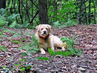 Soon we ascended slightly to the top of Campbell Mountain. The markings on the trail were now practically non-existent. We came upon some nice yellow signs warning about turns and a large blowdown that I had no intention on trying to clear. On the other side there were few FLT markers that led down the hill passing some nice rock ledges and the through some switchbacks. There was another blowdown that I was almost able to clear by taking the loose branches off the trail and pivoting the large trunk. By this time I had stopped counting the number of large branches and small trunks I had removed. We continued down the hill skipping a few blowdowns that I though I might remove on the way back. At 32. Miles the trail turned sharply to the right. At this point the turn was marked and a sign labeled "Campbell Mountain" pointed back in the direction that we had just come from. We turned right and walked only a short distance to a sign that said "Downsville" pointing to the right. Just after this sign were also a few confirming FLT markers. I admit that I knew what I was looking for but I thought the marking were adequate and that it would be hard to miss the. Having accomplished my objective, we turned around to start back at 2:35 PM after hiking 3.25 miles. We made the left turn and came to a few small blowdowns. I was a little tired and just wanted to get home but knew I would regret leaving these across the trail. It only took a few minutes on each one to get them out of the trail. We hiked up the hill and continued along the trail. There were still a few branches and trunks to remove here and there but the trail was looking much better. Once we were on the flatter part of the ridge the walk went quickly. Soon were making the left and turn onto the Campbell Mountain Trail. From this high point we dropped 640 feet in a little over a mile to the ascent from the stream up to the trailhead and the parking lot. We were back at the car at 4:30 PM after hiking 6.4 miles in 4 hours and 55 minutes with an elevation gain of 1390 feet. An hour and a half of the time was spent stopping to clear blowdowns.
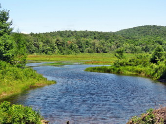
![]()
![]()
![]()
![]()
![]() On Saturday, July 31st, I wanted was torn between doing some more trail maintenance and taking a longer hike to reward myself. I decided on a longer hike in the Frick Pond area so that I could carry a saw to do any needed tree removal. I caught up on some sleep I had missed from ambulance class and then did a few things around the house. I started getting ready at 10:45 AM when the temperature on the back porch was 68 degrees with low humidity which felt very comfortable. While I was getting ready, Sheila was always nearby making it very clear that she wanted to go. I got dressed in a White Sierra long-sleeved crew top over a short-sleeved baselayer. I put on a pair of RailRiders hiking pants which are expensive but last a long time and have features like deep pockets and a generous cut which I really like. These pants have Velcro closures at the ankles to discourage sticks and gravel from getting into my shoes and to combat ticks. I decided to wear my Keen Targhee II hiking boots which fit me well but have been discontinued. I decided to take my Leki Makalu carbon poles with the internal twist locks as they are light and not a problem on most trails. I also my OR floppy hat which shields me from the sun and allows me to spray some insect repellant on it rather than on me. I donned my OR Bugout gaiters to combat the ticks and mud that I expected to find. I slid my Silky Sugowaza into my pack just in case I needed it. At 11:15 AM I put my equipment in the car and Sheila in the back seat. We left Livingston Manor and I drove out the DeBruce Road about 6 miles to Mongaup Road. I turned left and continued up the road to the point where it splits. I stayed left on Beech Mountain Road and drove to the parking areas on the left. I pulled into the smaller parking area which had three other cars parked. The larger lot also had a few cars in it and someone was shouting and playing loud music. I set my GPS unit and started out on the woods road that leads to the Quick Lake Trail at 11:30 AM with the temperature only 61 degrees. I was reminded of the problem of horses on the trail by a pile of manure on the trail. Horses are not supposed to be on foot trails but some people simply do not care. We joined the Quick Lake Trail at the trail register. The trail was damp with a few muddy spots but lacked the standing and running water if previous trips. The trail was beginning to close in as we approached Gravestone Junction and I knew I would be back to cleanup this part. The path to the Lobbdell Memorial stone was complete overgrown but when I peeked in I saw that someone had push it over! I inspected the base and it was not tilted so I knew it was vandalism. This kind of senseless act still surprises me but not as much as in the past. I think I am coming to expect these kinds of thoughtless acts by some people.
On Saturday, July 31st, I wanted was torn between doing some more trail maintenance and taking a longer hike to reward myself. I decided on a longer hike in the Frick Pond area so that I could carry a saw to do any needed tree removal. I caught up on some sleep I had missed from ambulance class and then did a few things around the house. I started getting ready at 10:45 AM when the temperature on the back porch was 68 degrees with low humidity which felt very comfortable. While I was getting ready, Sheila was always nearby making it very clear that she wanted to go. I got dressed in a White Sierra long-sleeved crew top over a short-sleeved baselayer. I put on a pair of RailRiders hiking pants which are expensive but last a long time and have features like deep pockets and a generous cut which I really like. These pants have Velcro closures at the ankles to discourage sticks and gravel from getting into my shoes and to combat ticks. I decided to wear my Keen Targhee II hiking boots which fit me well but have been discontinued. I decided to take my Leki Makalu carbon poles with the internal twist locks as they are light and not a problem on most trails. I also my OR floppy hat which shields me from the sun and allows me to spray some insect repellant on it rather than on me. I donned my OR Bugout gaiters to combat the ticks and mud that I expected to find. I slid my Silky Sugowaza into my pack just in case I needed it. At 11:15 AM I put my equipment in the car and Sheila in the back seat. We left Livingston Manor and I drove out the DeBruce Road about 6 miles to Mongaup Road. I turned left and continued up the road to the point where it splits. I stayed left on Beech Mountain Road and drove to the parking areas on the left. I pulled into the smaller parking area which had three other cars parked. The larger lot also had a few cars in it and someone was shouting and playing loud music. I set my GPS unit and started out on the woods road that leads to the Quick Lake Trail at 11:30 AM with the temperature only 61 degrees. I was reminded of the problem of horses on the trail by a pile of manure on the trail. Horses are not supposed to be on foot trails but some people simply do not care. We joined the Quick Lake Trail at the trail register. The trail was damp with a few muddy spots but lacked the standing and running water if previous trips. The trail was beginning to close in as we approached Gravestone Junction and I knew I would be back to cleanup this part. The path to the Lobbdell Memorial stone was complete overgrown but when I peeked in I saw that someone had push it over! I inspected the base and it was not tilted so I knew it was vandalism. This kind of senseless act still surprises me but not as much as in the past. I think I am coming to expect these kinds of thoughtless acts by some people.
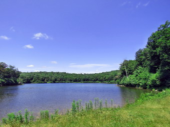 We continued to Gravestone Junction and veered to the left to stay on the Quick Lake Trail. The flat part of the trail before the decent to the pond had several very muddy spots. I took the time to cut and remove a few small trees leaning into the trail. When we reached the bridge over the outlet, the skies were cloudless and a little flat but I took pictures anyway. There was a nice breeze off the pond but the insects were starting to circle so I sprayed my hat and shirt and my exposed skin. We continued on the Quick Lake Trail passing by what was once a large mud pit on the west side of the pond. Some work by our trail crew had drained the area and placed stepping stones making it much easier to pass. At the junction with the Big Rock Trail, we stayed to the right to head toward Ironwheel Junction. This part of the trail is often very wet and muddy but it was now only damp. I removed several branches that were on the trail. We walked through the "spruce tunnel" to a small stream that crosses the trail. The stream level was rather low as I had improved the drainage. I took some pictures as Sheila took a dip and got a drink. We crossed the stream and continued up the trail. Sheila alerted and I could see a young couple approaching with two dogs that were not leashed. This is a consistent problem and I wish dog owners would be more responsible. I leashed Sheila and took her to the side of the trail. The young lady announced her dogs were "friendly" and I let her know that Sheila sometimes was not. They escorted their dogs passed us and we never saw them again. The rest of the trail to Ironwheel Junction was wet and muddy in most places. I took the time to remove some larger branches from the trail. At Ironwheel Junction we turned left and continued on the Quick Lake Trail. This section of trail was almost dry. I stopped to remove a larger blowdown which required the use of my saw. I made sure to document my efforts with pictures. Just after I finished another young couple approached us coming from the direction of Hodge Pond. We all said "Hello" as they passed. We continued on the trail walking uphill most of the time. I kept flicking small branches off the trail with my poles and stopping to remove a few bigger ones. At 1:10 PM we arrived at Junkyard Junction after hiking 3.1 miles.
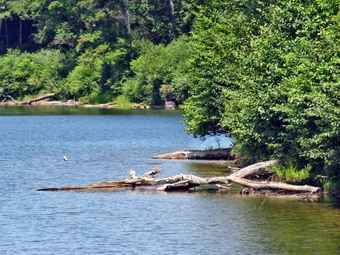 We turned right on the blue-blazed Flynn Trail and started the walk to Hodge Pond. I dreaded this part of the hike a little as this section of the Flynn Trail is flat and usually collects water. I was surprised as there were only a few muddy spots and none of the larger puddles I had encountered on the last hike. There were a few branches to move but not many. When we reached the gate on the trail, I noticed a new sign which said 'Entering Private Land - Please stay on the trail' and the name at the bottom was Beaverkill Land Trust. Previously this land had been in the care of the Open Spaces Institute and I wondered about this change and if it would have any effects on hiking. We follow the Flynn Trail to a point near the shore of Hodge Pond where it meets the jeep trail around the upper end of the pond. We turned right to walk along the trail which is sited on a woods road. This road was damp in spots with mud in a few others. We met and older couple who were walking toward us and exchanged a few words. Soon Sheila and I broke out of the woods into the field which once was the site of the dining hall for the Beech Mounatin Boy Scouts Camp. We continued across the field and re-entered the woods. After a short walk, e were in the clearing at the outlet end of Hodge Pond. As we started to walk over to the pond, we could see a man sanding in the water fly-fishing. I walked over to a spot near the pond and took off my pack to get out the camera. Sheila did not seem interested in the man and he had not spoken to use. I took some pictures which were rather ordinary due to the featureless sky. After a drink and a bar, we turned around and headed back to where the Flynn Trail enters the woods. The climb up the hill seemed easy and went quickly. I began to think of a way to logically lengthen the hike over the usual 6 miles. I decided we would use the snowmobile trails to hike to Mongaup Pond and return using the roads.
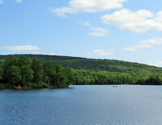 At the top of the hill, we stayed to the right on the Flynn Trail and walked toward the four-way junction with the Big Rock Trail and the snowmobile trail to Mongaup Pond. At the next gate there was another sign from the Beaverkill Land Trust outlining the do's and don'ts of using their land. We continued to the junction and turned left to start up the snowmobile trail. I stopped to inspect a DEC that indicated the snowmobile trail was the Big Rock Trail which it is not. The sign also stated Mongaup Pond was 1.8 miles away when it is really at least 2.3 miles. Mistakes on official signs like these are really inexcusable. It means that somebody had to supply the wrong information which the person making the sign did not check and the person posting the sign did not verify. Not having signs is bad but having incorrect signs is, I think worse. We walked to the top of the hill and I knew from that point on the hiking was downhill or slightly rolling. The snowmobile trail was pretty dry and in good shape but I could not help removing branches as I walked. Several large blowdowns had been cleared by chainsaw. Mongaup Pond is south-southwest of the trail junction but the snowmobile trail meanders quite a bit and even heads north before finally joining the loop roads at the campgrounds. As I was walking, I marveled at the fact that there were no special sights to Se but that everything was beautiful and that I could only hear the sounds of nature. By 3:00 PM we had hiked 7 miles and were at the loop road. The campgrounds seemed busy with the campsites full and people using the volleyball nets. There was one dog that was barking constantly at everything and I wondered how the other campers felt about it.
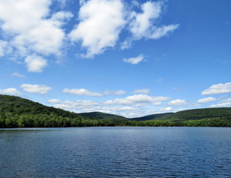 Sheila and I walked out to the main road and turned right. After a short distance, we walked off the road on a path to the left which brought us to the shore of the pond. The bench there was occupied by a young couple so I took my pack off and told Sheila to lie down by my pack. She did as I asked and never moved. I went to the shore and took pictures of the water, sky and trees. There were some ducks on the pond and I did my best to capture them. When I was done, I stowed my camera and we walked back out to the road. In another .6 miles we came to the newly reconstructed viewing platform and boat ramp. Nobody was there so we walked out onto the platform where I took some more pictures. There were a few young people around in canoes and kayaks and no one was wearing a PFD. I thought to myself that it had been a number of years since I had been to Mongaup Pond with the ambulance for a drowning! At this point, I really just wanted to be back at the car so Sheila and I set a fast pace on the road passing through the entrance and out the road to the intersection with Beech Mountain Road. A few cars passed us going both in and out. We were walking next to the outlet stream from Mongaup which is beautiful. I have stopped several times in the past to take pictures so this time I just kept walking. Soon we were at the intersection where we turned right and walked uphill to the car. It was 4:00 Pm and we had hiked 9.4 miles in 4 hours and 25 minutes with an elevation gain of 1265 feet. This eluted to a moving average of 2.3 mph with an overall speed of 2.1 mph.
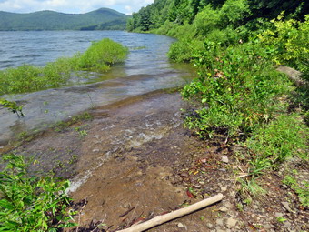
![]()
![]()
![]()
![]() On Friday, July 30th, I wanted to investigate a mysterious "Trail Closed" sign on the main Finger Lakes Trail near the Cannonsville Reservoir. The sign was at the junction of the main trail and the hunting bypass just north of the Apex Bridge at the junction of Route 268 and Route 10. The closure was not listed on the FLT website and no one in the organization seemed to know about it. Trying to contact the NYC DEP by phone or e-mail was useless so I planned to visit the DEO Police substation on Route 10 near Walton to see if I could speak to someone in person. I also thought I might get in some hiking in the area perhaps to the Rock Rift fire tower if the trail was open or in some other spot like Bear Spring. Cindy had agreed to go along and Sheila was playing the good dog but watching our every move. As we started to get ready, the temperature was 62 degrees and the humidity was uncharacteristically low. I got dressed in a White Sierra long-sleeved crew top with a short-sleeved baselayer. I put on a pair of RailRiders hiking pants which are expensive but last a long time and have features like deep pockets and a generous cut which I really like. These pants have Velcro closures at the ankles to discourage sticks and gravel from getting into my shoes and to combat ticks. I decided to wear my Keen Targhee II hiking boots which fit me well but have been discontinued. I decided to take my Leki Makalu carbon poles with the internal twist locks as they are light and not a problem on most trails. I also took my OR floppy hat which keeps the insects off and protects me from the sun. I put on my OR Bugout gaiters as we would be on trails that might be overgrown. I put our gear in the back of the car and Sheila in the back seat. We left Livingston Manor at 11:15 AM as I drove west on the Quickway towards Roscoe. I got off the Quickway at exit 87A for Cadosia and took Route 268 north toward Route 10 and the Cannonsville Reservoir. We crossed the Apex Bridge and I turned right on Route 10 to head toward Walton. I drove 6 miles toward Walton and turned into the DEP Police substation. I tried pishing all the buttons I could but no one would answer. Fortunately, a car pulled into the parking lot and an officer got out. He didn't know about the trail closure but took me inside to talk to the people who would not answer the doorbell! They were all very accommodating but didn't know anything about the sign. They tried to call someone who might know about the sign and the trail closure but got no answer. After about 20 minutes, I left knowing no more than I had when I got there! I decided to check to see if the sign was still there. I drove back to the Apex Bridge and then drove another 1.7 miles to a small parking pulloff on the left side of the road just after the Finger Lakes Trail bypass intersected the road.
On Friday, July 30th, I wanted to investigate a mysterious "Trail Closed" sign on the main Finger Lakes Trail near the Cannonsville Reservoir. The sign was at the junction of the main trail and the hunting bypass just north of the Apex Bridge at the junction of Route 268 and Route 10. The closure was not listed on the FLT website and no one in the organization seemed to know about it. Trying to contact the NYC DEP by phone or e-mail was useless so I planned to visit the DEO Police substation on Route 10 near Walton to see if I could speak to someone in person. I also thought I might get in some hiking in the area perhaps to the Rock Rift fire tower if the trail was open or in some other spot like Bear Spring. Cindy had agreed to go along and Sheila was playing the good dog but watching our every move. As we started to get ready, the temperature was 62 degrees and the humidity was uncharacteristically low. I got dressed in a White Sierra long-sleeved crew top with a short-sleeved baselayer. I put on a pair of RailRiders hiking pants which are expensive but last a long time and have features like deep pockets and a generous cut which I really like. These pants have Velcro closures at the ankles to discourage sticks and gravel from getting into my shoes and to combat ticks. I decided to wear my Keen Targhee II hiking boots which fit me well but have been discontinued. I decided to take my Leki Makalu carbon poles with the internal twist locks as they are light and not a problem on most trails. I also took my OR floppy hat which keeps the insects off and protects me from the sun. I put on my OR Bugout gaiters as we would be on trails that might be overgrown. I put our gear in the back of the car and Sheila in the back seat. We left Livingston Manor at 11:15 AM as I drove west on the Quickway towards Roscoe. I got off the Quickway at exit 87A for Cadosia and took Route 268 north toward Route 10 and the Cannonsville Reservoir. We crossed the Apex Bridge and I turned right on Route 10 to head toward Walton. I drove 6 miles toward Walton and turned into the DEP Police substation. I tried pishing all the buttons I could but no one would answer. Fortunately, a car pulled into the parking lot and an officer got out. He didn't know about the trail closure but took me inside to talk to the people who would not answer the doorbell! They were all very accommodating but didn't know anything about the sign. They tried to call someone who might know about the sign and the trail closure but got no answer. After about 20 minutes, I left knowing no more than I had when I got there! I decided to check to see if the sign was still there. I drove back to the Apex Bridge and then drove another 1.7 miles to a small parking pulloff on the left side of the road just after the Finger Lakes Trail bypass intersected the road.
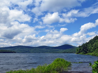 It was 12:15 PM when I set my GPS and we started out on the bypass trail with the temperature a comfortable 70 degrees. The trail was eroded and poorly marked with many of the paint blazes faded and hard to see. There were also several blowdowns. In .25 miles the trail gained 220 feet for an 18% grade. When we came to the trail intersection, the sign indicating that the area was closed ahead was still there. I copied down the phone number on the sign and we turned around and headed back down the hill to the road. We crossed the road to stay on the bypass trail that runs along the edge of the reservoir. The trail had not been maintained in some time so there were branches across the trail in some places and thick stands of nettles and briars in others. In a short distance we reached the shore of the reservoir and I walked out to take some pictures. I could see Clabber Peak, Little Clabber and Speedwell to the north and west. As I was taking my shots the wind picked up. Sheila tried getting a drink and taking a swim but the waves and whitecaps bothered her so much she came running away from the water. I packed up and we started along the trail again. Um about .5 miles the trail joined the old path of Route 10. We walked down toward the water, over some driftwood to the edge of the water. I took out my camera to take some more pictures of the reservoir and the surrounding hills. I also took pictures of the road disappearing beneath the water! We turned around and began to follow the trail which followed the old route of the road. The trail took us through a gravel storage area and then continued along the old road.
 We passed through some grassy and open areas and then entered the woods. At about 1.6 miles from the road, the trail turned left up the bank but we continued along the road where I had never been before. We passed some cliffs and areas where the edge of the road dropped straight down to the water. After less than a quarter mile there was no place to go so we turned around and walked back to the marked trail. We walked up the bank to Route 10 following the trail. When we got to the road, I wanted to complete the "trail" by walking on Route 10 to the Apex Bridge. Cindy did not want to walk along the road so she decided to go back to the car. Sheila and I turned right and almost jogged to the parking lot by the bridge. We immediately turned around and set a blistering pace back to the car arriving just as Cindy got there. I drove back to the parking lot by the bridge so that I could take some pictures. The view was even better from here than from the edge of the water. I found myself wishing I was kayaking on the water! I wanted to do a little more hiking on the FLT on the other side of the bridge since I remembered it was sited along an old railroad bed with some interesting cuts. Cindy was not interested which was a big disappointment to me but I have learned there is no point in arguing. We returned home. We had hiked 4.6 miles in 2 hours and 45 minutes with and elevation gain of 590 feet. Most of the elevation gain was on the first section of the hike as the part near the reservoir is almost flat. After all of this, I still had no more information about the trail "closure".
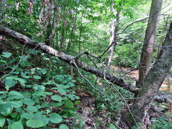
![]() On Tuesday, July 27th, I planned to go to do some trail maintenance in the Willowemoc Wild Forest with another hiker and hike leader. Marv is from New Jersey and has about a 3 hour drive. He had recently had no one sign up for a CMC hike on the Mongaup Hardenburgh Trail. He knew how much trail maintenance is needed in my area and volunteered to help. We were originally going to work on the south end of the Mongaup Hardenburgh Trail but I asked if we could switch to the south end of the Neversink Hardenburgh Trail as Cindy and I had done the north end last week. Marv was game and we agreed to meet at the large parking area on Wild Meadow Road. I did not sleep well and got up at 7:15 AM when the temperature was only 57 degrees. I knew the forecast was for temperatures in the mid 80's. I started to get ready at 8:00 AM. While I was getting ready, Sheila was always nearby making it very clear that she wanted to go. I got dressed in a White Sierra long-sleeved crew top with a short-sleeved baselayer. I put on a pair of RailRiders hiking pants which are expensive but last a long time and have features like deep pockets and a generous cut which I really like. These pants have Velcro closures at the ankles to discourage sticks and gravel from getting into my shoes and to combat ticks. I decided to wear my Keen Targhee II hiking boots which fit me well but have been discontinued. I decided to forego bringing any hiking poles as I would be carrying trail maintenance equipment. I also put on my OR floppy hat which shields me from the sun and allows me to spray some insect repellant on it rather than on me. I also wore my OR BugOut gaiters to deal with the mud and ticks that I was sure we would encounter. at 8:30 AM I put my equipment in the car including my Fiskars axe, Silky Sugowaza saw, Silky KatanaBoy saw, two Oregon splitting wedges and the Corona loppers. We left Livingston Manor and I drove out the DeBruce Road about 15 miles to Wild Meadow Road near Round Pond. I turned left and drove up the road to the large parking area on the right. I pulled in and there was only one car and it had a New Jersey license plate! I walked over to the car and introduced myself to Marv. He agreed to follow me to the end of the road where we would take a private road to a hunting camp. I had obtained permission from an owner of the camp to park at the camp and do trail work. As we started out on the private road, it was obvious that it was in much poorer condition than the last time I had been there. It was a little nerve wracking but we made it to the end and parked our cars. We got out and introduced ourselves and decided which tools we would bring. Marv had a KatanaBoy 650 and a pair of clippers. I brought the Silky Sugowaza, Fiskars ax and wedges. We both set our GPS units at AM with the temperature now in the low 70's.
On Tuesday, July 27th, I planned to go to do some trail maintenance in the Willowemoc Wild Forest with another hiker and hike leader. Marv is from New Jersey and has about a 3 hour drive. He had recently had no one sign up for a CMC hike on the Mongaup Hardenburgh Trail. He knew how much trail maintenance is needed in my area and volunteered to help. We were originally going to work on the south end of the Mongaup Hardenburgh Trail but I asked if we could switch to the south end of the Neversink Hardenburgh Trail as Cindy and I had done the north end last week. Marv was game and we agreed to meet at the large parking area on Wild Meadow Road. I did not sleep well and got up at 7:15 AM when the temperature was only 57 degrees. I knew the forecast was for temperatures in the mid 80's. I started to get ready at 8:00 AM. While I was getting ready, Sheila was always nearby making it very clear that she wanted to go. I got dressed in a White Sierra long-sleeved crew top with a short-sleeved baselayer. I put on a pair of RailRiders hiking pants which are expensive but last a long time and have features like deep pockets and a generous cut which I really like. These pants have Velcro closures at the ankles to discourage sticks and gravel from getting into my shoes and to combat ticks. I decided to wear my Keen Targhee II hiking boots which fit me well but have been discontinued. I decided to forego bringing any hiking poles as I would be carrying trail maintenance equipment. I also put on my OR floppy hat which shields me from the sun and allows me to spray some insect repellant on it rather than on me. I also wore my OR BugOut gaiters to deal with the mud and ticks that I was sure we would encounter. at 8:30 AM I put my equipment in the car including my Fiskars axe, Silky Sugowaza saw, Silky KatanaBoy saw, two Oregon splitting wedges and the Corona loppers. We left Livingston Manor and I drove out the DeBruce Road about 15 miles to Wild Meadow Road near Round Pond. I turned left and drove up the road to the large parking area on the right. I pulled in and there was only one car and it had a New Jersey license plate! I walked over to the car and introduced myself to Marv. He agreed to follow me to the end of the road where we would take a private road to a hunting camp. I had obtained permission from an owner of the camp to park at the camp and do trail work. As we started out on the private road, it was obvious that it was in much poorer condition than the last time I had been there. It was a little nerve wracking but we made it to the end and parked our cars. We got out and introduced ourselves and decided which tools we would bring. Marv had a KatanaBoy 650 and a pair of clippers. I brought the Silky Sugowaza, Fiskars ax and wedges. We both set our GPS units at AM with the temperature now in the low 70's.
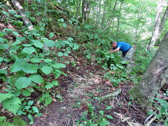 We started our hike at 9:25 AmM by walking across the lawn of the hunting camp to the yellow-blazed Neversink Hardenburgh Trail. As we entered the woods it immediately became obvious that the trail would be wet and muddy in many places. As we walked, Marv and I talked and found we had much in common. We are both right around 70 years old. Both of us are EMTs and volunteer with our local ambulance squads although Marv is relatively new and this is my 35th year. We also both worked for the Bell Telephone Company at some point. The first blowdown we cleared was a good warm up. It was an old birch and Marv made quick work of it with the KatanaBoy 650. We rolled it off the trail and crossed a small stream on stepping stones. Our next challenge was an old decaying log which we were able to pick apart and move off the trail. This happened several more times on our trip. We moved a few more trunks from the trail and then ran into another old and decaying trunk that we cut and removed. Parts of the trail were almost dry while others sections and standing or running water. The worst sections had deep mud and they were hard for me as I had no poles. Eventually we came to a swampy area with a view to Doubletop so I took a few shots. This area is also the headwaters of the Beaverkill and of Fall Brook which flow in opposite directions. At 11:45 AM we arrived at the Beaverkill and I stopped to take some pictures of the bee balm. We decided to cross and bushwhack some on the opposite side of the river eventually rejoining the trail. We crossed with no problem but had trouble finding a good route along the other shore. It occurred to us at about the same time that if we were doing trail maintenance we should not be avoiding the trail! We walked back to where we had crossed and recrossed the river.
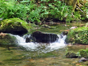 The trail is a little sketchy in this area due to years of neglect and erosion from the river. We followed the markers that led us over some rocks. We were impeded by some small tree lying in the trail so we cut them and removed them. Before we moved on, I saw some water insects skimming the river. They casts interesting shadows on the rocks under the water so I took some pictures. The trail climbed steeply up than bank ad at the top was a large birch which made staying on the trail difficult. It took several cuts and both of us working together to cut and remove this blowdown. We walked a short distance and found a large cherry across the trail. It had fallen from the bank above and was at a difficult angle to cut. Hikers had been ducking under but we decided we had to at least improve the situation. We cut off all the branches that were in the way. We then cut the end nearest the river and removed it. When we did this the rest of the tree moved down so that it was still in the trail. At ;east now, hikers could easily step over it. We decided to walk to the point where the trail crosses the river and then turn around. We found a few branches which we removed but no more blowdowns. I took some pictures at the ford and a few more of some interesting rapids a little farther upstream as we walked back. When we came to the cherry, we both though it was a good idea to try again. It took two more cuts through the cherry to make the trail completely clear. We then began the walk back. I was pretty tired and just wanted to get back to the car. Heading back raised my spirits but the unrelenting water and mud took a toll. At 2:35 PM we were back at the cars after hiking about 4.8 miles in 5 hours and 10 minutes. My GPS showed we had actually spent more time stopped than hiking although, upon reflection, this was not surprising. The elevation gain was only 390 feet. We decided that one the way out we would make sure that both of us made it over the rough road to Wild Meadow Road. I went first and drove very slowly. When I was about 2/3 of th way out, I saw headlights coming at me. We continued toward each other until the other car suddenly veered off the side of the road! I though for sure they would get stuck but when I looked back they were back on the road. I wondered if they were members of the hunting camp or just following their GPS direction! When I got out to the road, I waited a few minutes and Marv appeared behind me. I did not envy him his drive home but really appreciated his fine work and companionship. I still have to cover the "middle" part of the trail which will be easier from the north.
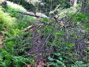
![]() On Monday, July 26th, I planned to go to do some trail maintenance on the Dry Brook Ridge Trail at Balsam Lake Mountain. The section I was looking at was between the south and north junctions with the Balsam Lake Mountain Trail. This is in the supervisory area and a trail maintainer is assigned but the maintainer failed to make a visit for the spring and I was getting reports of blowdowns on the trail. I was planning to leave Livingston Manor by 9:00 Am but the ambulance page got me up at 8:00 AM. I responded to the call and to a second one on the way back from the hospital. By the time I got home, I had almost given up on the idea but Sheila looked like she wanted to go so I began to get ready at 11:30 Am with th temperature at 78 degrees. The humidity was noticeable but even more noticeable was the smoke hanging in the air. The smoke was from fires burning in the west and in Canada and I could even smell it! While I was getting ready, Sheila was always nearby making it very clear that she wanted to go. I got dressed in a White Sierra long-sleeved crew top but did not put on a baselayer. I put on a pair of RailRiders hiking pants which are expensive but last a long time and have features like deep pockets and a generous cut which I really like. These pants have Velcro closures at the ankles to discourage sticks and gravel from getting into my shoes and to combat ticks. I decided to wear my Keen Targhee II hiking boots which fit me well but have been discontinued. I decided to forego brining any hiking poles as I would be carrying trail maintenance equipment. I also put on my OR floppy hat which shields me from the sun and allows me to spray some insect repellant on it rather than on me. Just before noon I put my equipment in the car including my Fiskars axe, Silky Sugowaza saw, Silky KatanaBoy saw, two Oregon splitting wedges and the Corona loppers. I headed toward Roscoe on Old Rt 17 and I turned right on the Beaverkill Road. I continued north toward Lew Beach and Turnwood. The Beaverkill Falls were flowing with a good volume from the recent rains and I thought we might stop on the way back for a few shots. The road conditions were pretty good even when the pavement ended. I laughed when I saw the "Rough Road" sign! Toward the end the road becomes very narrow and I was glad I did not meet any more cars. We arrived at the parking area at 12:30 PM and found only one other cars in the lot. We started out on the trail with the Sugowaza saws and wedges in my pack and me carrying the Fiskars ax. The first part of the trail was muddy in places and some spots could use some lopping but I had decided I was looking for the more difficult jobs! I did remove a few branches and old trunks along the way.
On Monday, July 26th, I planned to go to do some trail maintenance on the Dry Brook Ridge Trail at Balsam Lake Mountain. The section I was looking at was between the south and north junctions with the Balsam Lake Mountain Trail. This is in the supervisory area and a trail maintainer is assigned but the maintainer failed to make a visit for the spring and I was getting reports of blowdowns on the trail. I was planning to leave Livingston Manor by 9:00 Am but the ambulance page got me up at 8:00 AM. I responded to the call and to a second one on the way back from the hospital. By the time I got home, I had almost given up on the idea but Sheila looked like she wanted to go so I began to get ready at 11:30 Am with th temperature at 78 degrees. The humidity was noticeable but even more noticeable was the smoke hanging in the air. The smoke was from fires burning in the west and in Canada and I could even smell it! While I was getting ready, Sheila was always nearby making it very clear that she wanted to go. I got dressed in a White Sierra long-sleeved crew top but did not put on a baselayer. I put on a pair of RailRiders hiking pants which are expensive but last a long time and have features like deep pockets and a generous cut which I really like. These pants have Velcro closures at the ankles to discourage sticks and gravel from getting into my shoes and to combat ticks. I decided to wear my Keen Targhee II hiking boots which fit me well but have been discontinued. I decided to forego brining any hiking poles as I would be carrying trail maintenance equipment. I also put on my OR floppy hat which shields me from the sun and allows me to spray some insect repellant on it rather than on me. Just before noon I put my equipment in the car including my Fiskars axe, Silky Sugowaza saw, Silky KatanaBoy saw, two Oregon splitting wedges and the Corona loppers. I headed toward Roscoe on Old Rt 17 and I turned right on the Beaverkill Road. I continued north toward Lew Beach and Turnwood. The Beaverkill Falls were flowing with a good volume from the recent rains and I thought we might stop on the way back for a few shots. The road conditions were pretty good even when the pavement ended. I laughed when I saw the "Rough Road" sign! Toward the end the road becomes very narrow and I was glad I did not meet any more cars. We arrived at the parking area at 12:30 PM and found only one other cars in the lot. We started out on the trail with the Sugowaza saws and wedges in my pack and me carrying the Fiskars ax. The first part of the trail was muddy in places and some spots could use some lopping but I had decided I was looking for the more difficult jobs! I did remove a few branches and old trunks along the way.
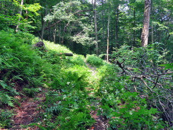 We were making good time but quickly ran into a blowdown across the trail, It was a single trunk about 8 inches in diameter and laying pretty close to the ground. I took some 'before' pictures and decided to use the ax to cut it on each side of the trail. Once I had made the cuts I would try to flip or roll the center section off the trail. I cleared a few branches that were in the way and then started in with the ax. Despite its small size the Fiskars ax does a good job and is much lighter than the Council Tools felling ax I sometimes employ. It took me less than 20 minutes to make the two cuts. I lifted one end of the center section and flipped it off the trail successfully but it was close! I took some 'after' pictures and packed up to continue our hike. In a few moments Sheila alerted and I saw a young lady hiking toward us. She might have gone right by us but I said "Hello" and she responded. I asked her if she had done the trail loop and she indicated she had gone out and back on the steeper slope. We continued on the trail passing the turn up the mountain so that we stayed on the Dry Brook Ridge Trail. It wasn't long before a real challenge presented itself. There was another trunk across the trail but this one was a little larger at about 10 inches. Just before this was another blowdown with a number of branches. Together they were making the trail harder than it needed to be. I took pictures and then planned my attack. First, I would use the Sugowaza to cut the branching blowdown throwing the branches down into the ravine in the right side of the trail. I cut and removed the branches one at a time until they were all gone which took a little over 20 minutes. I took some pictures of this first step of my handiwork and then took a look at the bigger trunk. It was higher off the ground than the previous one but I decided I would still use the ax to cut the trunk just off the trail on the right side which was toward the top of the tree. This went pretty well and when I finished the cut the trunk remained in the air supported by the roots. I decided hat I would use the saws to make the second cut. I broke out the KatanaBoy which is harder to use than the curved Sugowaza but does a great job. It seemed like the cut was going well and soon I was almost done. I finished with the Sugowaza and then rolled the large center section off the trail. I took my 'after' pictures of the entire project which was a job well done. This second part had taken almost 30 minutes to complete.
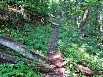 We continued our walk up the trail my intention was to walk to the north junction with the Balsam Lake Mountain Trail clearing as much as I could on the way. The next situation we ran into was a few small trees hanging down into the trail from a ledge. The trees would have been easy to cut if they had been close to the ground but to get to these I knew I would have to climb the steep bank, inch my way out onto the ledge and cut at and odd angle. I took some pictures and then grabbed the Sugowaza and then started up the bank to the ledge. I worked my way out to a spot where I could cut most of the small trees. It was a good thing the wood was soft as the angle was difficult. I cut all but one trunk and then went back down to the trail. I dragged away the material I had cut and then turned my attention to the remaining tree. I was able to pull it down with my left hand and cut it pretty high up. I removed it from the trail and took some shots showing the improvement. I was done in 20 minutes and we moved on. There were plenty of small branches to remove from the trail. The next blowdown was a very large and very old trunk. Hikers had walked around it and I knew I could not cut it easily. I did cut a few branches and removed a spine of wood sticking out into the path. We moved on and I cut a small tree that had fallen across the trail. The next blowdown was big and lying flat on the trail making it easy to step over. I cut a few branches and removed them to make the area a little cleaner. I knew that eventually I would remove this or get a sawyer crew to do so. Just after this blowdown was a series of three more old trees across the scale within a short distance. These were easy enough to walk around but very hard to cut which was another reason for me to sound out Forester Dunn or Andy Garrison for a chainsaw party. I was determined to reach the end of the trail and, for there were no more blowdowns. The trail was a little longer than I remembered and definitely had more elevation gain. It was a little after 3:00 PM when we turned around and started back. I promised myself that we would just hike on the way back but I managed to stop twice to clear some small trees. We were back at the parking area at 4:30 PM after spending 4 hours hiking 3.7 miles and doing a lot of work. The elevation gain was 800 feet.
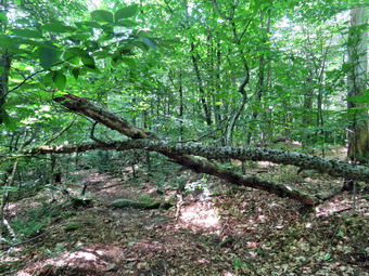
![]()
![]()
![]()
![]()
![]() On Friday, July 23rd, it was my birthday and I wanted to go to do some trail maintenance on the northern end of the Neversink Hardenburgh Trail from the Balsam Lake Parking area at the end of the Beaverkill Road to the Beaverkill. This section if trail was adopted last year by a new maintainer who seemed very enthusiastic. I went out with her last October and showed her the trail and what was expected of her as a maintainer. Since then she has failed to contact me or respond to any e-mails. This was a big disappointment. As the trail supervisor, I have been told I do not have to maintain the trails when other maintainers fail to do their work but I feel responsible. At 7:43 AM the ambulance pager sounded and I was off to a structure fire to standby and rehab firefighters. Fortunately, there were no injuries and I retired home by 10:15 AM ready to execute my plans. Cindy had agreed to go along and Sheila was playing the good dog but watching our every move. As we started to get ready the temperature was 70 degrees and the humidity was uncharacteristically low. I got dressed in a White Sierra long-sleeved crew top with a short-sleeved baselayer. I put on a pair of RailRiders hiking pants which are expensive but last a long time and have features like deep pockets and a generous cut which I really like. These pants have Velcro closures at the ankles to discourage sticks and gravel from getting into my shoes and to combat ticks. I decided to wear my Keen Targhee II hiking boots which fit me well but have been discontinued. I decided to forego brining any hiking poles as I would be carrying trail maintenance equipment. I also added a new OR floppy hat which shields me from the sun and allows me to spray some insect repellant on it rather than on me. I donned my OR Bugout gaiters to combat the ticks and mud that I expected to find. At 10:45 AM I put our equipment in the car including my Fiskars axe, Silky Sugowaza saw, Corona loppers, Fiskars loppers and two Oregon splitting wedges. Sheila jumped into the backseat with some enthusiasm and we headed out the driveway. I headed toward Roscoe on Old Rt 17 and I turned right on the Beaverkill Road. I continued north toward Lew Beach and Turnwood. The Beaverkill Falls were flowing with a good volume from the recent rains and I thought we might stop on the way back for a few shots. The road conditions were pretty good even when the pavement ended. I laughed when I saw the "Rough Road" sign! Toward the end the road becomes very narrow and I was glad I did not meet any more cars. We arrived at the parking area at 10:25 AM and found four other cars in the lot. There were also two cars parked in the snowplow turnaround on the road which I did not understand. I set my GPS and we started out on the trail with the Sugowaza and wedges in my pack and me carrying the Fiskars ax and Corona loppers. Cindy carried the Fiskars clippers.
On Friday, July 23rd, it was my birthday and I wanted to go to do some trail maintenance on the northern end of the Neversink Hardenburgh Trail from the Balsam Lake Parking area at the end of the Beaverkill Road to the Beaverkill. This section if trail was adopted last year by a new maintainer who seemed very enthusiastic. I went out with her last October and showed her the trail and what was expected of her as a maintainer. Since then she has failed to contact me or respond to any e-mails. This was a big disappointment. As the trail supervisor, I have been told I do not have to maintain the trails when other maintainers fail to do their work but I feel responsible. At 7:43 AM the ambulance pager sounded and I was off to a structure fire to standby and rehab firefighters. Fortunately, there were no injuries and I retired home by 10:15 AM ready to execute my plans. Cindy had agreed to go along and Sheila was playing the good dog but watching our every move. As we started to get ready the temperature was 70 degrees and the humidity was uncharacteristically low. I got dressed in a White Sierra long-sleeved crew top with a short-sleeved baselayer. I put on a pair of RailRiders hiking pants which are expensive but last a long time and have features like deep pockets and a generous cut which I really like. These pants have Velcro closures at the ankles to discourage sticks and gravel from getting into my shoes and to combat ticks. I decided to wear my Keen Targhee II hiking boots which fit me well but have been discontinued. I decided to forego brining any hiking poles as I would be carrying trail maintenance equipment. I also added a new OR floppy hat which shields me from the sun and allows me to spray some insect repellant on it rather than on me. I donned my OR Bugout gaiters to combat the ticks and mud that I expected to find. At 10:45 AM I put our equipment in the car including my Fiskars axe, Silky Sugowaza saw, Corona loppers, Fiskars loppers and two Oregon splitting wedges. Sheila jumped into the backseat with some enthusiasm and we headed out the driveway. I headed toward Roscoe on Old Rt 17 and I turned right on the Beaverkill Road. I continued north toward Lew Beach and Turnwood. The Beaverkill Falls were flowing with a good volume from the recent rains and I thought we might stop on the way back for a few shots. The road conditions were pretty good even when the pavement ended. I laughed when I saw the "Rough Road" sign! Toward the end the road becomes very narrow and I was glad I did not meet any more cars. We arrived at the parking area at 10:25 AM and found four other cars in the lot. There were also two cars parked in the snowplow turnaround on the road which I did not understand. I set my GPS and we started out on the trail with the Sugowaza and wedges in my pack and me carrying the Fiskars ax and Corona loppers. Cindy carried the Fiskars clippers.
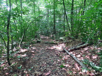 We started out on the Neversink Hardenburgh Trail at 11:35 AM with the temperature at just 67 degrees. We immediately ran into a few branches hanging down into trail which we cleared. Just after the register there was a blowdown which we cleared. The first half mile of the trail loses about 200 feet to a bridge that crosses Black Brook. We walked and talked clearing some branches and blowdowns as we hiked. I kept removing some old pieces of wood that had been left on the trail for some time but seemed to be potential hazards to trip up hikers. We left some blowdowns that were on the ground because they were easy to step over. From Black Brook we began a climb gaining back the elevation we had lost over .35 miles. We continued to clear the trail which was in decent shape for not being maintained since last fall. There was at least one trail across the trail that we had to duck under and a few we had to climb over. Most of these were large enough that I decided I would try to get a sawyer crew to work on them. Other blowdowns were very large and hikers had created appropriate detours around them. The trail rolled a little and then descended to Gulf of Mexico Brook which we crossed on a nice bridge. At 1.5 miles we came to the outlet stream from Vly Pond. I decided that on this day I did not want to bushwhack the few hundred feet upstream to the pond> The stream was a little higher than normal and I did not have my poles. I found a way to cross without falling and we continued our work. From the Vly outlet brook we climbed some and then started to drop down. I knew that we were approaching the Beaverkill because there was a small pond on the left side of the trail which I remembered from my last trip. There was a very large and complex blowdown in the area of this pond but we were able to climb over it. This blowdown was one that will have to be cleared by a sawyer crew. Since we were nearing the river, I decided to ignore some of the blowdowns in the way and handled them on the way back.
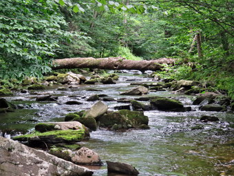 At 2.0 miles we crossed a small stream and almost immediately after came to the Beaverkill. Cindy decided to wait while Sheila and I went ahead to the river. The trail turned left and paralleled the stream. It was very eroded which I assume came from a period of flooding. We walked along the stream to 2.1 miles where I took a few shots of the Beaverkill. We turned around a began our trip back picking up Cindy on the way. We continued our walk and even cleared few blowdowns and branches. The Fiskars ax proved invaluable as I was able to dispatch several blowdowns with only a few blows. We cut a total of four obstructions on the way back with most of them being before the stream from Vly Pond. I had been making good decisions in clearing the blowdowns. The cuts went well and the pieces I cut were just the right size or me to move off the trail. Even though we were clearing as we walked, we were keeping a fast pace and were soon walking up the final hill. Carrying the loppers and ax without my poles was harder than I thought and I was happy to soon be passing the trail register. As we came to the flat part of the trail near the parking area, we cleared a few branches that were hanging in the trail. As we walked out to the parking area, there were only three cars left besides our own. We had not seen any other hikers on the trail all day! As I was putting our gear in the car, a young couple came from the direction of the trail to the mountain. I asked them about the condition of the trails in that direction and they reported that the conditions were good. Strangely, they had hiked up the steep side of the mountain and had come back the same way because they could not find the other trail! We left the parking area as soon as possible and I was glad that we did not meet any cars until the road widened.
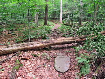
![]()
![]()
![]()
![]()
![]() On Thursday, July 22nd, I planned to go to the Frick Pond area to remove some blowdowns on The Flynn Trail and to inspect the Big Rock Trail. I had some things to get done around the house and did not start getting ready until 11:00 AM when the temperature was in the mid 70's which felt comfortable. While I was getting ready, Sheila was always nearby making it very clear that she wanted to go. I got dressed in a White Sierra long-sleeved crew top but did not put on a baselayer. I put on a pair of RailRiders hiking pants which are expensive but last a long time and have features like deep pockets and a generous cut which I really like. These pants have Velcro closures at the ankles to discourage sticks and gravel from getting into my shoes and to combat ticks. I decided to wear my Keen Targhee II hiking boots which fit me well but have been discontinued. I decided to forego brining any hiking poles as I would be carrying trail maintenance equipment. I also my OR floppy hat which shields me from the sun and allows me to spray some insect repellant on it rather than on me. I donned my OR Bugout gaiters to combat the ticks and mud that I expected to find. At 11:15 AM I put my equipment in the car including my Fiskars axe, Silky Sugowaza saw, Council Tools American Felling ax, and two Oregon splitting wedges. We left Livingston Manor and I drove out the DeBruce Road about 6 miles to Mongaup Road. On the way I ran into a crew painting lines on the road which lengthened the trip considerably. I turned left and continued up the road to the point where it splits. I stayed left on Beech Mountain Road and drove to the parking areas on the left. I pulled into the smaller parking area which had two other cars parked. The larger lot also had a few cars in it. We got ready to head out on the Flynn Trail to cut two blowdowns on the part of the trail just after the register. I took both axes and both saws with us and we soon arrived at the first and largest blowdown. I took some 'before' pictures and then got to work. I removed some smaller branches that were in the way. I used the Council Tools ax to cut the trunk off the trail in two places. This ax is much harder to use than the Fiskars but when used correctly makes short work of even the largest trunks. Even though the section I cut was large and heavy, I was able to pivot and roll it off the trail. I took my 'after' shots and then moved on to the next blowdown. This one was very small so I used the Fiskars ax to cut it in one place. I was able to drag the section I cut off the trail. We returned to the car and met a man signing in at the register. When we got to the car, I decided we would go for a short hike.
On Thursday, July 22nd, I planned to go to the Frick Pond area to remove some blowdowns on The Flynn Trail and to inspect the Big Rock Trail. I had some things to get done around the house and did not start getting ready until 11:00 AM when the temperature was in the mid 70's which felt comfortable. While I was getting ready, Sheila was always nearby making it very clear that she wanted to go. I got dressed in a White Sierra long-sleeved crew top but did not put on a baselayer. I put on a pair of RailRiders hiking pants which are expensive but last a long time and have features like deep pockets and a generous cut which I really like. These pants have Velcro closures at the ankles to discourage sticks and gravel from getting into my shoes and to combat ticks. I decided to wear my Keen Targhee II hiking boots which fit me well but have been discontinued. I decided to forego brining any hiking poles as I would be carrying trail maintenance equipment. I also my OR floppy hat which shields me from the sun and allows me to spray some insect repellant on it rather than on me. I donned my OR Bugout gaiters to combat the ticks and mud that I expected to find. At 11:15 AM I put my equipment in the car including my Fiskars axe, Silky Sugowaza saw, Council Tools American Felling ax, and two Oregon splitting wedges. We left Livingston Manor and I drove out the DeBruce Road about 6 miles to Mongaup Road. On the way I ran into a crew painting lines on the road which lengthened the trip considerably. I turned left and continued up the road to the point where it splits. I stayed left on Beech Mountain Road and drove to the parking areas on the left. I pulled into the smaller parking area which had two other cars parked. The larger lot also had a few cars in it. We got ready to head out on the Flynn Trail to cut two blowdowns on the part of the trail just after the register. I took both axes and both saws with us and we soon arrived at the first and largest blowdown. I took some 'before' pictures and then got to work. I removed some smaller branches that were in the way. I used the Council Tools ax to cut the trunk off the trail in two places. This ax is much harder to use than the Fiskars but when used correctly makes short work of even the largest trunks. Even though the section I cut was large and heavy, I was able to pivot and roll it off the trail. I took my 'after' shots and then moved on to the next blowdown. This one was very small so I used the Fiskars ax to cut it in one place. I was able to drag the section I cut off the trail. We returned to the car and met a man signing in at the register. When we got to the car, I decided we would go for a short hike.
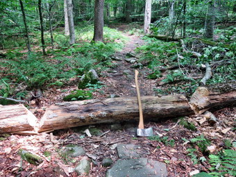 I set my GPS at 12:30 PM and we walked across the road to get on the Flynn Trail. This trail is sited along what used to be Beech Mountain Road which was the access for the Beech Mountain Boy Scout Camp. We walked the trail through the woods passing the new work that I had just done. We turned right on the woods road and set a quick pace up the hill. The trail gains a little over 600 feet in 1.7 miles to the highest point at the junction with the Big Rock Trail. The day was warm and a little humid but it was good to be just hiking. We passed through the arch Cindy and I had cut through an enormous hemlock that had fallen across the trail. There were some muddy places on the trail but we still were making good time. At one point Sheila alerted and I could see the man we had met at the register just ahead of us. When we caught up with him, we began to talk and walk together. Tom was from Otisville and worked in corrections for 25 years. He had been a Boy Scout and attended camp at the Beech Mountain Biy Scout Camp and was in the CIT program. We kept walking uphill and talking as we went. Hiking with someone always seems to make the time pass more quickly and we were soon at the junction with the Big Rock Trail. Tom was going on to Hodge Pond but I decided to stick with my original plan. We turned left to walk down the Big Rock Trail. The hike down the trail went quickly since we were setting a fast pace. This trail can be tricky as there are several levels that make it seem like the bottom of the hill. Along the way we ran into a cloud of mosquitoes and I chose to simply hurry along rather than stopping to put on repellent. We were soon at Times Square and I continued our hike by walking straight across Times Square to stay on the Big Rock Trail. The trail had some muddy spots in the low areas. We crossed the two small bridges over the inlets to the pond where the water was very high. Once we were back under the trees, I stopped to take some pictures of the boardwalks and the very green moss in the lower areas.
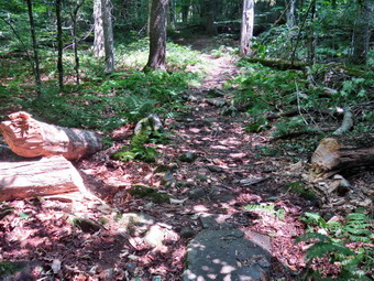 At the next trail junction we turned left on the Quick Lake Trail to head for the bridge across the outlet of Frick Pond. I stopped at the bridge to take a few shots even though I have hundreds from this same spot. We walked up the hill to Gravestone Junction and continued toward the trail register. On the way Sheila alerted and I looked up to see two horses coming toward us. I put Sheila on her leash and as we passed I said "Hello" to the riders who are from Livingston Manor. Horses are allowed in the Willowemoc Wild Forest but NOT on marked hiking trails. This means there are very few places that horses can legally be ridden. I like horses but they can be a problem on hiking trails. Heavy usage can increase trail erosion and riders never clean up what their mounts leave behind. I have told these riders this but they will not obey the rules. At the trail register we continued straight ahead to follow the woods road out to the car in the small lot. We arrived at the car at 2:30 PM having hiked 4 miles in 2 hours with an elevation gain of 680 feet. I was surprised that there was no horse trailer in the lots. I pulled out of the lot and started down the road. Within a short distance in such a way the horse trailer parked along the side of the road! As I made the right turn onto Mongaup Road, I saw two busses unloading at least 60 girls at Mongaup Falls. I was pretty sure that the camp did not have a permit and that the falls could not support this number of visitors at one time. Unfortunately, I finished my hike with two incidents that highlight how little people care for others. When I got home, I called the local forest ranger who confirmed that both of these incidents are against regulations and could result in fines.
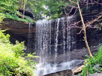
![]()
![]() On Monday, July 19th After visiting Delphi Falls in Delphi Falls County Park, I headed for Tinker Falls in the Labrador Hollow Unique Area which borders Morgan Hill State Forest in Cortland County. I was surprised that it was less than 20 minutes from Delphi Falls and the route took us through some more beautiful country. I wanted to Vist Tinker Falls as I was hoping it would have some volume after the recent rains. Every other time I have been there the falls have been only a trickle. I knew the walk was only about .3 miles from the parking area on Route 91 to the base of the falls. I though that we might hike to the hang glider lookout or maybe even go to hike the trails at the Labrador Hollow Unique Area. I have looked down on this area several times from the hang glider viewpoint but have never hiked there. We arrived at the parking area at 12:20 PM and found plenty of spaces to park. I put Sheila on her leash and crossed the road with just my camera in hand. The walk to the end of the path at the stream's edge went quickly. There are some benches along the trail and two at the end for people that don't want to cross the stream. There is a partial view of the falls from here and that partial view was a little disappointing. There was water going over the fall but just barely but this made it easier to cross the creek. Once across, we walked carefully over the wet and slippery rocks to the base of the falls. Two people were coming down the stone steps on the right side of the falls and they were doing so very carefully. I took pictures of the falls as a whole and then some shots of interesting parts. We climbed the steps for a short distance and I took a few more pictures. The trail continues up the steps, in back of the falls, and then up another set of steps to the top of the falls. From the top there are several hiking options. I decided I was OT interested in hiking somewhere I had already been and would rather hike the Labrador follow Unique Area. We turned around and hiked back down the steps and across the creek. We walked back out to the car. I drove north on Route 91 to Labrador Crossing Road and turned left. I drove down the road and pulled into the first lot on the left.
On Monday, July 19th After visiting Delphi Falls in Delphi Falls County Park, I headed for Tinker Falls in the Labrador Hollow Unique Area which borders Morgan Hill State Forest in Cortland County. I was surprised that it was less than 20 minutes from Delphi Falls and the route took us through some more beautiful country. I wanted to Vist Tinker Falls as I was hoping it would have some volume after the recent rains. Every other time I have been there the falls have been only a trickle. I knew the walk was only about .3 miles from the parking area on Route 91 to the base of the falls. I though that we might hike to the hang glider lookout or maybe even go to hike the trails at the Labrador Hollow Unique Area. I have looked down on this area several times from the hang glider viewpoint but have never hiked there. We arrived at the parking area at 12:20 PM and found plenty of spaces to park. I put Sheila on her leash and crossed the road with just my camera in hand. The walk to the end of the path at the stream's edge went quickly. There are some benches along the trail and two at the end for people that don't want to cross the stream. There is a partial view of the falls from here and that partial view was a little disappointing. There was water going over the fall but just barely but this made it easier to cross the creek. Once across, we walked carefully over the wet and slippery rocks to the base of the falls. Two people were coming down the stone steps on the right side of the falls and they were doing so very carefully. I took pictures of the falls as a whole and then some shots of interesting parts. We climbed the steps for a short distance and I took a few more pictures. The trail continues up the steps, in back of the falls, and then up another set of steps to the top of the falls. From the top there are several hiking options. I decided I was OT interested in hiking somewhere I had already been and would rather hike the Labrador follow Unique Area. We turned around and hiked back down the steps and across the creek. We walked back out to the car. I drove north on Route 91 to Labrador Crossing Road and turned left. I drove down the road and pulled into the first lot on the left.
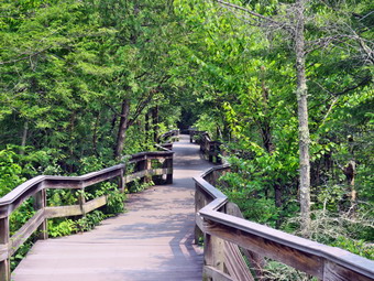 I had an Avenza map which showed I was in the right lot to begin a hike of the boardwalk or the other trails. When I parked, one other car pulled in behind us and there were two people with their motorcycle parked in the shade. I repeated the same thing I had done four times before on this day by putting Sheila on her leash and leaving the car with my camera. The Labrador Hollow Unique Area is 172 acres of land set aside to preserve and protect endangered and threatened species. It has a 100 acre pond which avenges only 4 feet in depth. The pond is surrounded by wetlands. An elevated boardwalk winds its way through these wetlands to the northern end of the pond. The boardwalk is well constructed and is a lollipop with a loop on the end near the kind. There are comfortable benches in several spots for people to reset of just take in the quiet beauty of the area. As we walked, we stopped several times so that I could take pictures of the boardwalk and the surrounding marshes and vegetation. When we reached the viewpoint over the pond, I was a little disappointed to find a haze hanging over the pond but it was till beautiful. To the east was the ridge that has the viewpoint over the pond from the hang gliding spot. I could easily see the opening on the ridge and when I zoomed in I could see a couple sitting and looking down at the kind! We continued our walk with me taking some additional pictures. We met the couple from the motorcycle and I stopped to talk to them for a few minutes. We went our separate ways with Sheila and I returning to the parking area. I investigated one of the other trails. It looked like a nice trail through the woods but I knew it was an Out and back with no options for a loop. It was 1:15 PM and I decided it was time to head for home. I did not have enough signal to use the phone's GPS but, fortunately, I knew my way home.
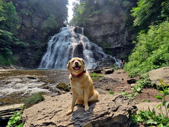
![]() On Monday, July 19th After visiting Pratts Falls At Pratts Falls County Park in Pompey, I headed for Delphi Falls County Park near Cazenovia. The hamlet is actually named Delphi Falls! The route took us through Cazenovia which is a beautiful college town which would be interesting to explore. It is on the shores of Cazenovia Lake which also was beautiful. Delphi Falls County Park is actually a new Madison County park which is just being developed. It opened to the public in August 2018 and contains two waterfalls, a house, a barn and surrounding woodland. Currently, the falls are accessible for viewing from the bottom via a newly created stone dust path and there are no other trails. The trip from Pratts Falls to Delphi Falls was less than 20 minutes. We arrived at 11:45 AM to find six cars in the parking lot. I parked and put Sheila on her leash taking on my camera with me. It looked to me that this was once a private residence with a barn and a beautiful house. I took some pictures of the house and grounds and imagined what it must have been like to have a waterfall in the backyard.
On Monday, July 19th After visiting Pratts Falls At Pratts Falls County Park in Pompey, I headed for Delphi Falls County Park near Cazenovia. The hamlet is actually named Delphi Falls! The route took us through Cazenovia which is a beautiful college town which would be interesting to explore. It is on the shores of Cazenovia Lake which also was beautiful. Delphi Falls County Park is actually a new Madison County park which is just being developed. It opened to the public in August 2018 and contains two waterfalls, a house, a barn and surrounding woodland. Currently, the falls are accessible for viewing from the bottom via a newly created stone dust path and there are no other trails. The trip from Pratts Falls to Delphi Falls was less than 20 minutes. We arrived at 11:45 AM to find six cars in the parking lot. I parked and put Sheila on her leash taking on my camera with me. It looked to me that this was once a private residence with a barn and a beautiful house. I took some pictures of the house and grounds and imagined what it must have been like to have a waterfall in the backyard.
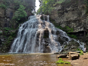 We walked along the stone dust path to the back of the house and found the falls with a good flow. The water fell over the rocks and into a pool below. Some other people were close to the falls taking picture so I let Sheila get a drink. Since the people were taking their time, I let Sheila off her leash and she immediately jumped into the stream. When the other people finally left, I put Sheila back on her leash and went to stand in front of the falls. I took some shots although there was really only one angle. I looked up the bank to see if there was a way to climb it but it was steep and it was obvious the county did not want anyone straying from the path. I look forward to the possibility that there will eventually be paths to the top of the falls. We walked back along the path to the parking area. It was just after noon and I wanted to visit Tinker Falls which is in the Labrador Hollow Unique Area in Cortland County. I enter this into my phone and was surprised to see that it was less than 20 minutes away! I pulled out of the parking area and followed the directions to our next destination.
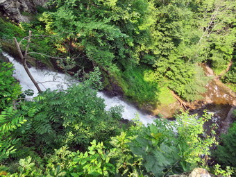
![]()
![]() On Monday, July 19th After visiting Chittenango Falls in Chittenango State Park, I headed for Pratts Falls. The route took us through Cazenovia which is a beautiful college town which would be interesting to explore. It is on the shores of Cazenovia Lake which also was beautiful. Pratts Falls Park is actually located in Pompey and is an Onondaga County park which asks for a $2 donation. There are scenic trails that lead to a 137' waterfall formed by retreating glaciers. The falls was the site of Onondaga County's first mill operation in 1796. The mill was built by Menoah Pratt and his business partner as a sawmill. We pulled into the parking area around 11:10 Am. By this time the temperature was 75 degrees and the humidity made the air feel heavy. Again, I put Sheila on her leash but only took my camera with me. We walked toward the sound of the falls and found the trail that led down to the stream below. The stone steps were wide and had a good handrail but they were rough and wet which made good footwear a must. The descent down the stairs was also steep in places. We took the section of trail that headed back upstream toward the falls and met a few people walking toward us. The trail ended at a lookout toward the falls. The views were partly blocked by the trees but I was able to get some good shots. There were some paths that led down toward the stream but these were clearly off limits. One young lady felt it was necessary to break the rules and head down one of these paths. I must admit I was tempted since I though I could get better pictures but I decided to practice what I preach.
On Monday, July 19th After visiting Chittenango Falls in Chittenango State Park, I headed for Pratts Falls. The route took us through Cazenovia which is a beautiful college town which would be interesting to explore. It is on the shores of Cazenovia Lake which also was beautiful. Pratts Falls Park is actually located in Pompey and is an Onondaga County park which asks for a $2 donation. There are scenic trails that lead to a 137' waterfall formed by retreating glaciers. The falls was the site of Onondaga County's first mill operation in 1796. The mill was built by Menoah Pratt and his business partner as a sawmill. We pulled into the parking area around 11:10 Am. By this time the temperature was 75 degrees and the humidity made the air feel heavy. Again, I put Sheila on her leash but only took my camera with me. We walked toward the sound of the falls and found the trail that led down to the stream below. The stone steps were wide and had a good handrail but they were rough and wet which made good footwear a must. The descent down the stairs was also steep in places. We took the section of trail that headed back upstream toward the falls and met a few people walking toward us. The trail ended at a lookout toward the falls. The views were partly blocked by the trees but I was able to get some good shots. There were some paths that led down toward the stream but these were clearly off limits. One young lady felt it was necessary to break the rules and head down one of these paths. I must admit I was tempted since I though I could get better pictures but I decided to practice what I preach.
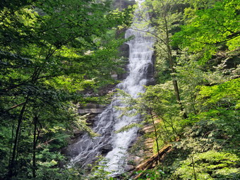 After taking a few more pictures, Sheila and I walked back up the stones steps and continued passed the steps that we had taken down to the trail. The path continued along the gorge but a good distance above the stream. It was a peaceful walk and continued for some distance. There were not as many people as I expected and I began to worry the other places I wanted to visit would be filling up. Just as we were about to head down a hill, I decided to turn around and return to the car. When we got to the lot, there still weren't many cars. We walked along the fence that runs along the edge of the gorge to the lookout over the falls. The viewpoint gave a nice view of the gorge and the hills beyond but the view of the falls was somewhat limited. I did take some pictures of the tall but thin waterfall. I could see the young lady who had walked beyond the barriers at the bottom of the falls! After I finished, we walked back to the car and took advantage of the air conditioning. I entered Delphi Falls into my phone and found they were less than 20 minutes away and that the phone was giving me the same directions I had printed from my computer. I pulled out of the parking area and followed the directions.
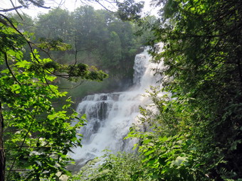
![]()
![]() On Monday, July 19th I planned to finally go north and visit some waterfalls in the area of Cazenovia. I thought I would get up early to avoid the crowds and the heat. When the ambulance pager went off before 5:00 AM, my first thought was 'This is too early!' We went on the call which sounded critical but got there just after another corps. The patient was not seriously injured and we were able to turn around and go back into service. By the time we got back and I finished my documentation it was 6:00 AM. I decided I would stay up and leave early as I had planned despite my lack of sleep. Cindy had jury duty so that left only Sheila to go with me. As I started to get ready at 8:00 AM it was 68 degrees with high humidity. I put on my White Sierra long-sleeved crew top with no baselayer as I did not expect to hike very much with my pack. I put on a pair of RailRiders hiking pants which are expensive but last a long time and have features like deep pockets and a generous cut which I really like. I wore my Keen Targhee II hiking boots which are showing some serious wear but fit well. I decided to take my Leki Makalu carbon poles with the internal twist locks as they are light and not a problem on most trails. I also took my OR floppy hat which keeps the insects off and protects me from the sun. I decided not to wear my OR Bugout gaiters as we would be on trails and would not be hiking much. I put my gear in the back of the car and Sheila in the back seat. We left Livingston Manor at 8:20 AM as I drove west on the Quickway towards Roscoe. When I got off the Roscoe exit, I took Route 206 to Downsville and then to Walton. After this, I just followed my phone's directions to Chittenango Saate Park a little northeast of Cazenovia. I suspected that my original driving directions from my computer were a more direct route but the phone GPS showed my some nice back roads and some beautiful scenery. I stopped once in Sidney to use the bathroom and get a snack and then continued on to the park. We arrived at the park at 10:15 AM and I could not find a way to pay the $5 fee so I assumed they were not collecting one on this day. We almost immediately got out to start our walk. I put Sheila on her leash and took only my camera with me.
On Monday, July 19th I planned to finally go north and visit some waterfalls in the area of Cazenovia. I thought I would get up early to avoid the crowds and the heat. When the ambulance pager went off before 5:00 AM, my first thought was 'This is too early!' We went on the call which sounded critical but got there just after another corps. The patient was not seriously injured and we were able to turn around and go back into service. By the time we got back and I finished my documentation it was 6:00 AM. I decided I would stay up and leave early as I had planned despite my lack of sleep. Cindy had jury duty so that left only Sheila to go with me. As I started to get ready at 8:00 AM it was 68 degrees with high humidity. I put on my White Sierra long-sleeved crew top with no baselayer as I did not expect to hike very much with my pack. I put on a pair of RailRiders hiking pants which are expensive but last a long time and have features like deep pockets and a generous cut which I really like. I wore my Keen Targhee II hiking boots which are showing some serious wear but fit well. I decided to take my Leki Makalu carbon poles with the internal twist locks as they are light and not a problem on most trails. I also took my OR floppy hat which keeps the insects off and protects me from the sun. I decided not to wear my OR Bugout gaiters as we would be on trails and would not be hiking much. I put my gear in the back of the car and Sheila in the back seat. We left Livingston Manor at 8:20 AM as I drove west on the Quickway towards Roscoe. When I got off the Roscoe exit, I took Route 206 to Downsville and then to Walton. After this, I just followed my phone's directions to Chittenango Saate Park a little northeast of Cazenovia. I suspected that my original driving directions from my computer were a more direct route but the phone GPS showed my some nice back roads and some beautiful scenery. I stopped once in Sidney to use the bathroom and get a snack and then continued on to the park. We arrived at the park at 10:15 AM and I could not find a way to pay the $5 fee so I assumed they were not collecting one on this day. We almost immediately got out to start our walk. I put Sheila on her leash and took only my camera with me.
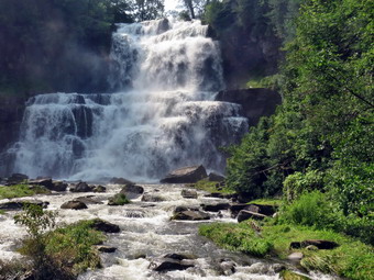 Chittenango Falls is a picturesque 167-foot waterfall that is the main attraction of Chittenango Falls State Park. Glacial sculpting over 400 million-year-old bedrock is responsible for this scenic feature. An interesting variety of both plants and wildlife may be found along the trails. We followed a sign that said "Falls Overlook" and when we got to the stream we headed upstream passing under the road bridge on a walkway. I took some pictures as we continued upstream until I decided to turn around. There was a lot of water in the creek and I hoped the falls would be impressive. We walked downstream on the sidewalks until we came to falls overlook. There was a pretty good view of the falls but it was from the side. I took pictures of the falls and a few upstream. The shots upstream showed an island in the middle of the stream with some trees. We continued on the path and soon found some stone steps that led down to the streambed below the falls. The steps were rough and wet which made them slippery. I would suggest that anybody walking this trail wear appropriate hiking shoes or boots. I did find another viewpoint that looked out at the side of the falls and I took some more shots. We continued down the steps and came across a small falls running of the rock ledges. The trail finally ended at a bridge across the stream. We walked out onto the bridge and were treated with a spectacular head-on view of the falls! The falls were roaring and I immediately took some pictures. I decided that a video would best show the power of the falls as it would capture the motion of the water and the sound it was making. I was having trouble with most on my lens even though we were pretty far away from the stream. I finished my photography and we started up the other side of the gorge. We followed the trail and came across another small falls. The trail looped back to the road bridge where it split. One section of the trail continued under the bridge to follow the water upstream. We took the left branch which led up to the road bridge. We stopped on the bridge so that I could take a few more shots and the walked back to the car. I was surprised there were only a few people at the falls but as we were getting ready to leave the lit was filling up. I entered Pratts Falls into by phone and got the same directions as I had from my computer printout.
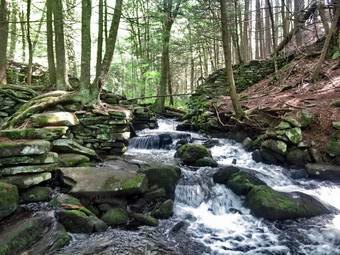
![]()
![]()
![]()
![]()
![]() On Friday, July 16th I planned to do some trail maintenance between Big Pond and Alder Lake. I went to bed early and slept late which allowed me to catch up on some much needed hours of sleep. We have had more ambulance calls than usual lately. I went on a call in Roscoe the day before and transported the patient to Wilson Hospital in Binghamton, more than an hours ridge each way! When I got up, the heat and humidity were already high and I decided I would wait to do the work. I also decided I wanted to go for a hike with Sheila that was not across the street, at Frick Pond or in the Trout Pond area. I settled on the Neversink Unique Area even though I knew it might be crowded. I planned to head for the end of Katrina Falls Road and if that was packed I could divert to the Wolf Lake MUA entrance. As I started to get ready at 10:15 AM it was 82 degrees with high humidity. I put on my White Sierra long-sleeved crew top with a short-sleeved baselayer. I put on a pair of RailRiders hiking pants which are expensive but last a long time and have features like deep pockets and a generous cut which I really like. I wore my Keen Targhee II hiking boots which are showing some serious wear but fit well. I decided to take my Leki Makalu carbon poles with the internal twist locks as they are light and not a problem on most trails. I also put on my OR floppy hat which keeps the insects off and protects me from the sun. I donned my OR Bugout gaiters to combat the ticks. I put my gear in the back of the car and Sheila in the back seat. We left Livingston Manor at 10:40 AM as I drove east on the Quickway towards Rock Hill. I drove to Rock Hill and got off at exit 109. I turned right off the exit and drove to the parking area at the end of Katrina Falls Road. I could see several cars parked along the road but I found one spot left in the lot when I arrived at 11:10 AM. I set my GPS and we got ready to start out on our hike at 11:15 AM with the temperature at 78 degrees and high humidity. The wide woods road was surprisingly dry and had been cleared of all the blowdowns that had been there the last time I had hiked. I could hear Wolf Brook roaring as we walked down the trail which parallels the brook. At .5 miles we came to a yellow spur trail on the right side of the main trail. A new sign indicated that this trail led to Hackeldam on the Neversink River. This was the area where a "swinging bridge" crossed the Neversink and was an important area of commerce and industry.
On Friday, July 16th I planned to do some trail maintenance between Big Pond and Alder Lake. I went to bed early and slept late which allowed me to catch up on some much needed hours of sleep. We have had more ambulance calls than usual lately. I went on a call in Roscoe the day before and transported the patient to Wilson Hospital in Binghamton, more than an hours ridge each way! When I got up, the heat and humidity were already high and I decided I would wait to do the work. I also decided I wanted to go for a hike with Sheila that was not across the street, at Frick Pond or in the Trout Pond area. I settled on the Neversink Unique Area even though I knew it might be crowded. I planned to head for the end of Katrina Falls Road and if that was packed I could divert to the Wolf Lake MUA entrance. As I started to get ready at 10:15 AM it was 82 degrees with high humidity. I put on my White Sierra long-sleeved crew top with a short-sleeved baselayer. I put on a pair of RailRiders hiking pants which are expensive but last a long time and have features like deep pockets and a generous cut which I really like. I wore my Keen Targhee II hiking boots which are showing some serious wear but fit well. I decided to take my Leki Makalu carbon poles with the internal twist locks as they are light and not a problem on most trails. I also put on my OR floppy hat which keeps the insects off and protects me from the sun. I donned my OR Bugout gaiters to combat the ticks. I put my gear in the back of the car and Sheila in the back seat. We left Livingston Manor at 10:40 AM as I drove east on the Quickway towards Rock Hill. I drove to Rock Hill and got off at exit 109. I turned right off the exit and drove to the parking area at the end of Katrina Falls Road. I could see several cars parked along the road but I found one spot left in the lot when I arrived at 11:10 AM. I set my GPS and we got ready to start out on our hike at 11:15 AM with the temperature at 78 degrees and high humidity. The wide woods road was surprisingly dry and had been cleared of all the blowdowns that had been there the last time I had hiked. I could hear Wolf Brook roaring as we walked down the trail which parallels the brook. At .5 miles we came to a yellow spur trail on the right side of the main trail. A new sign indicated that this trail led to Hackeldam on the Neversink River. This was the area where a "swinging bridge" crossed the Neversink and was an important area of commerce and industry.
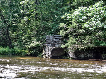 We turned right and walked about .2 miles down to the river where I put down my pack and got out the camera. We walked over to Wolf Brook where it enters the Neversink. There were stone walls and structures there indicating a mill. I took pictures and then walked out to a view of the river and took a few more. I picked up my pack and started back up the trail. I pink ribbon marked a path to the left and we took it. I was not sure of this had a historical significance or was just placed there by fisherman. We followed the ribbons to the river where I again put down the pack and got read to take a few shots. There were some rapids on the river and I took some pictures upstream and downstream. I repositioned a little bit upstream and took a few more shots. When I was done, I put the camera away, picked up my pack and followed the pink ribbons along the shore. We came to another spot on the river where the water was flowing fast and deep. I could see a structure across the river so I once again put down the pack and retrieved my camera. As I was doing this I heard a noise and turned around to see Sheila in the river hanging on to the shore with her front paws! I rushed over and grabbed her by the collar to help her onto shore. I talked to her at length about being safe and staying away from the river on this day! I took pictures of the rock structure on the other side of the river which matched another on my side. These were the anchor points for the bridge that crossed the Neversink. After finishing my photography, I packed up and we walked up a slippery rock ledge to the spur trail and then back to the main trail. At the main trail, we turned right and walked down to the small bridge that crosses Wolf Brook. I stopped to take some picture of the bridge and of the brook. The brook was flowing with good volume but it was not as high as I have seen it. The bridge had been patched which was nice but a replacement would have been better. After I completed my pictures, we walked up the trail crossing a place where the brook had overflowed across the trail. Some stepping stones here would make it easier for casual hikers to cross. At 1.3 miles we came to the split in the trails with the red trail going left and the blue trail heading right. There was a new sign at the junction showing that the red trail to the right was the Mullet Brook Trail Loop and the Wolf Brook Access. There was a concern that people were getting lost in the Neversink Gorge due to the lack of signs and this is a welcome addition. The problem is that no mileages are given and there is no sign that indicates anything about the blue trail! We stayed to the right on the blue trail which was well trimmed with only a few branches which I threw off the trail. The trail rolled up and down a little until we reached another yellow spur trail on the right at 1.85 miles. We turned right to head down toward the river which was only .25 miles away. The view of the river at the viewpoint wasn't much different than at the previous point but I could see downstream to Denton Falls. I took some shots in both directions and then we turned around and headed back up to the main trail.
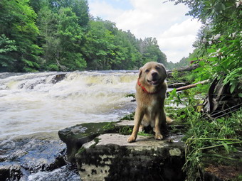 We turned right on the main trail and within .1 miles came to the lower bridge on Mullet Brook. I was going to take some pictures from the bridge but there wasn't anything interesting so I let Sheila get a drink and cool off in the stream before continuing. A short walk up the hill led to the next yellow spur trail which would take us down to Denton Falls. I had already decided we would not be going to High Falls so I wanted to go to Denton Falls to see a falls on the Neversink. There was a sign but, again, it had no mileage. We turned right and started down the trail to the falls. The trail was much more worn in but it was disappointing that the markers were few and far between. The missing markers cause hikers to make their own paths which makes the best path unclear. We followed a track down to the marked trail and then turned left to parallel the river. There are always some muddy spots on this section and the recent rains had made it worse. For someone had placed branches to act as corduroy is several places. When we got to the rocks "steps" that go down to the river we both could hear voices. We started down to the river and when I saw that there was a dog without a leash I put Sheila on hers. We walked out on the rocks and passed by the family that had all but camped out on the rocks by the river. I found a way to get downstream but the footing was very sketchy due to the high water and slippery rocks. I finally got to a point below the falls with good footing. I took pictures of the falls from several different angles and zooms. I also took shot downstream and upstream. I packed up and we started back toward the trail. On the way back I took a slightly different track which turned out to be a bad idea! I placed my foot on a rock and before I knew it I was heels over head with my body part on the rock and part on the water! I got up quickly and found that my left and hurt a little but that I was otherwise alright albeit a little wet. I did notice that the water ran off the Railriders pants very quickly without soaking them. I walked back onto the rock and as I passed the family they asked if I was okay. I said that I was and continued up the trail. I actually really appreciated their concern. We headed back up the trail following a slightly different path. At the main blue trail, we turned right and immediately ran into another trail junction. The blue trail continues to the right and parallels the river heading toward High Falls. The red trail turns left and heads over the hill back toward the parking area. There was a sign indicating the purpose of the red trail but none for the blue trail. As I was marveling at the signage, a couple came hiking up the blue trail from the direction of High Falls. I spoke to them and they said they had not gone to High Falls but thought the trail went to Mullet Brook Falls. I didn't say anything but I couldn't believe that even with signs people could get lost!
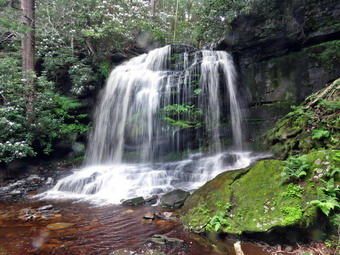 The couple turned right up the red trail and we turned left to follow them. They were actually moving pretty fast which was good as it created a buffer between us. I thought I could hear the family group behind us which quickened my pace. At 3.2 miles we turned left on the yellow spur trail to Mullet Brook Falls. We arrived at the falls just after the couple who had headed directly for the area in front of the falls. I put my pack down and got out the camera. I headed to the right side of the falls since I knew that was a good angle and the rock was drier. Once I was in position I took pictures of the falls with different settings and zooms. The sun angle was not as bad as I expected but there was not as much water going over the falls as I had hoped. I worked my way across the rocks to a point in front of the falls and took a few more shots. When I was done, we worked our way back to my pack. I got a drink and we headed back out the yellow trail to the main red trail. I was sweating profusely and when we turned left on the red trail and headed uphill I could tell I was tired. For a half mile we walked uphill gaining 250 feet. On the way we met three different groups of people coming down the hill toward us. Two groups had well-behaved dogs on leashes. As we approached the upper bridge over Mullet Brook, I could see two adults and a half dozen children on the bridge. I put Sheila on her leash and we walked across the bridge surprising some of the boys. As we continued on the trail, I heard one of the boys say he was going to destroy a large fungus he had found. I almost turned back to explain LNT but continued on the trail. At 4.2 miles we passed by the trail leading out to the parking area at the Wolf Brook MUA. The rest of the hike was downhill except for the hill back up to the parking area. For the next .85 miles we lost 400 feet. There were three large blowdowns across the trail which need to be removed but otherwise the trail was in good shape. We did meet another group coming up the trail. At 5.1 miles we were back at the junction with the blue trail. We turned right and walked across the bridge over Wolf Brook. We turned right to follow the trial up the hill to the parking area. The steepest section of the trail was less than 10% but I was really tired by this time. We met several groups coming down the trail and Sheila got more compliments. We were back at the car at 2:35 PM after hiking 5.7 miles in 3 hours and 20 minutes. We were stopped for 30 minutes and gained 1220 feet in elevation.
On Wednesday, July 14th my grandson Bryce was at my house and I thought we might get in a longer hike than we had the day before when we did trail maintenance on Round Top. As I was talking to Bryce about where we might hike, the ambulance pager sounded and I was off on a call. After delivering the patient to the hospital, your rig would not start. After waiting almost an hour, our assistance arrived and got the rig started. We delivered the rig to the local garage and then got a ride to our building. By the time I finished the documentation and got home it was 1:00 PM. I ate some lunch and asked Bryce if he wanted to go for a short hike at Frick Pond, He agreed and we decided to go up the Flynn Trail and return on the Big rock and Quick Lake Trails. I knew we might have to hike quickly as the forecast called for afternoon thunderstorms. While we were getting ready, Sheila was always nearby making it very clear that she wanted to go. I put on my White Sierra long-sleeved crew top with a short-sleeved baselayer. I put on a new pair of RailRiders hiking pants which are expensive but last a long time and have features like deep pockets and a generous cut which I really like. I wore my Keen Targhee II hiking boots which are showing some serious wear but fit well. I decided to take my Leki Makalu carbon poles with the internal twist locks as they are light and not a problem on most trails. I also put on my OR Bugout gaiters to combat the ticks and mud I was sure we would find. I put my gear in the back of the car and Sheila in the back seat and we left Livingston Manor at 1:30 PM. I drove out the Debruce Road about 6 miles and turned left onto Mongaup Pond Road. Where the road the split, I turned left onto Beech Mountain Road, and drove to the parking areas at the Frick Pond. There were no cars in either lot so I pulled into the smaller area with the thermometer reading 73 degrees as I set my GPS. The skies were blue in some areas with plenty of sun and lots of billowing white clouds. I took the time to spray both Bryce and ,self with insect repellent as the mosquitoes are usually prevalent in this area. As we were getting ready to leave, another car pulled up and parked in the same lot. Three people got out with a dog. The dog was on a leash and I had Bryce hold Sheila until I could put her on the leash. I hoped this group would head out to Frick Pond which they did as we crossed the road to head up the Flynn Trail at 1:50 PM. The recent rains had eroded the beginning of the trail even more than before. As we walked on the trail we removed a few branches and then came to a large blowdown across the trail. Fortunately, it was easy to step over. Unfortunately, it will be difficult to clear as it will have to be cut in two places. A little further along there were two smaller trunks across the trail. I was able to pivot one off the trail but the other was too big and will have to be cut. At the end of the trail through the woods we turned right on the woods road that was once the extension of Beech Mountain Road. As we started up the hill, we continued to remove a few branches but found no more large blowdowns. The Flynn Trail ascends 1.7 miles to the Big Rock Trail junction gaining 600 feet. The more I hike the quicker I can hike and the easier it seems. On this day Bryce was right with me. After we passed the big spruce tree that forms an arch over the trail, the trail was wet but did not seem very muddy. Sheila took the time to get a drink and play in the water flowing in the ditch alongside the trail. The wind began to pick up as we hiked and the sky seemed to get darker. As we neared the highest point on the hike, some rain began to fall and I weighed our options carefully. We hit the junction with the Big Rock Trail at 2:30 PM after hiking 1.7 miles and I decided we would turn around and go back down the Flynn Trail. The rain would not bother me but keeping my grandson out in a thunderstorm would. We turned around and began a quick decent of the trail. I don't think we were trying to set a speed record but we walked and talked and the hiking went quickly. Of course, the rain stopped and the skies became sunny! We did noticed that the trail was muddy and both of us slipped several times. As we neared the gate, we followed the trail through the woods to avoid private property. We were back at the car at 3:00 PM. We had hiked up the trail in 40 minutes and back in 30 minutes for a total of 1 hour and 10 minutes for 3.4 miles. There were now several other cars in the lot and the dog from the cabin was wandering around because the owners don't care enough to keep him inside of on a line! One group got out of the car with two dogs. Both dogs were on leashes but one owner was worried since her pit bull dos not get along with all other dogs. We left before any confrontations occurred, On the way out I thought we might stop at the Mongaup Falls as I thought they would be roaring after all the rain. Once I saw that the small pulloff had three cars and the one nearer the falls had four, I decided just to drive home.
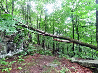
![]()
![]()
![]()
![]()
![]() On Tuesday, July 13th my grandson Bryce was at my house and I thought we might go across the street to Round Top to remove a difficult blowdown near the viewpoint on the yellow trail. Bryce is old enough to really help me do trail maintenance including removing brush and using my Silky saws. We spent much of the morning doing some chores around the house including a run to the landfill. At 1:20 PM we started getting ready to go with the temperature at 78 degrees and humidity high enough to make the air feel heavy. As we got ready, Sheila seemed very happy to be going out. I put on a Mountain Hardwear long-sleeved crew top with no base layer because of the temperature and high humidity. I put on a pair of RailRiders hiking pants which are expensive but last a long time and have features like deep pockets and a generous cut which I really like. I decided to wear my Keen Targhee II hiking boots which fit well and have been discontinued. I also put on my OR Bugout gaiters to combat the ticks and the mud I knew would be on the trail from the recent rains. I put my Silky Sugowaza and two felling wedges in my pack. I gave Bryce my Silky KatanaBoy 500 and Fiskars pack ax. We put our gear in the back of the car and Sheila in the back seat. Bryce is now old enough and big enough to ride in the front passenger's seat. I drove out the driveway and across the street to the cemetery. I parked at the trailhead and we started out on the trail at 1:40 PM. We walked up the trail and went straight ahead at the first trail junction up the hill toward the lookout. When we arrived, I had to admit that it was more complicated than I remembered. Bryce and I explored the blowdown which was anchored to a trunk on one side and had landed on a high rock ledge on the other side. This meant most of the trunk was above my head which made cutting it directly almost impossible. The situation was made more difficult since all the rocks were wet and slippery.
On Tuesday, July 13th my grandson Bryce was at my house and I thought we might go across the street to Round Top to remove a difficult blowdown near the viewpoint on the yellow trail. Bryce is old enough to really help me do trail maintenance including removing brush and using my Silky saws. We spent much of the morning doing some chores around the house including a run to the landfill. At 1:20 PM we started getting ready to go with the temperature at 78 degrees and humidity high enough to make the air feel heavy. As we got ready, Sheila seemed very happy to be going out. I put on a Mountain Hardwear long-sleeved crew top with no base layer because of the temperature and high humidity. I put on a pair of RailRiders hiking pants which are expensive but last a long time and have features like deep pockets and a generous cut which I really like. I decided to wear my Keen Targhee II hiking boots which fit well and have been discontinued. I also put on my OR Bugout gaiters to combat the ticks and the mud I knew would be on the trail from the recent rains. I put my Silky Sugowaza and two felling wedges in my pack. I gave Bryce my Silky KatanaBoy 500 and Fiskars pack ax. We put our gear in the back of the car and Sheila in the back seat. Bryce is now old enough and big enough to ride in the front passenger's seat. I drove out the driveway and across the street to the cemetery. I parked at the trailhead and we started out on the trail at 1:40 PM. We walked up the trail and went straight ahead at the first trail junction up the hill toward the lookout. When we arrived, I had to admit that it was more complicated than I remembered. Bryce and I explored the blowdown which was anchored to a trunk on one side and had landed on a high rock ledge on the other side. This meant most of the trunk was above my head which made cutting it directly almost impossible. The situation was made more difficult since all the rocks were wet and slippery.
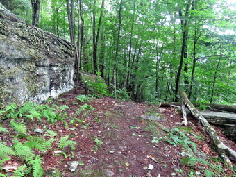 Bryce and I agreed that it would be best to try to cut the top of the tree on the rock ledge so that it would fall down onto the trail. If we could accomplish this, then we could cut the trunk on the ground. I took some before pictures of the scene. The first thing I did was to cut down a small beech that was intertwined with the tree that had fallen across the trail. It was bent over by the other tree and I did not want it spring back at me as we worked on the project. The tree came down easily and I used the ax to cut off some branches which we stacked on the path to the lookout to prevent people from walking out on it. We then climbed up the hill to the rock ledge and began to clear the smaller branches by cutting them off and dragging them away. It didn't take long to get everything cleaned up so that we could get a look at the main structure. I took some more pictures and continued to take shots as we progressed through the cleanup. I used the saw to cut one of three large branches. This first branch was not bearing any weight and I had a secure perch to anchor myself as I cut. I cut through the branch and Bryce dragged it away. The other two branches were harder to cut as I had to stand on the edge of the ledge and cut with one hand. I positioned myself and used the Sugowaza to cut one branch with some difficultly. It turned out that this branch was not holding much weight and I finished off the cut with the axe. I tried to cut the last branch as far out as I could hoping the trunk would then fall. I finished the cut and the trunk fell but only a few feet before the end hung up on the rock. I used the poll of the ax to beat on the branch until the trunk fell a few more feet. I walked down to the trail and cut one of the two remaining branches with the ax. After I cut through the branch and it fell, the trunk was still held up by the final branch jammed against the rock ledge. I decided that the ax had worked so well I would try it again. To my surprise the cut went easily and the trunk finally fell to the trail. Bryce and I celebrated but knew we weren't done yet. There was still a large trunk across the trail. I decided I would use the ax to cut the trunk near the stump end off the trail. This cut took a little more time but went pretty easily and I was able to finish it off with the ax. Bryce and I used a large piece of the braches we had cut as a lever to move the butt end of the trunk further off the trail. I was able to lift the remaining piece and roll and pivot it off the trail. The trail was now clear but I spent a few more minutes cutting the first tree I had felled close to the ground. I took a few shots of the cleared trail and then had Bryce and Sheila pose for a few more. We pack up the tool, s and started back toward the car at 3:10 PM having spent 1.5 hours working on the project. I was drenched in sweat and it was still hot and humid.
![]()
![]()
![]()
![]() On Monday, July 12th I wanted to get out for a hike after a weekend trip to Geneva, NY, to watch my son compete in his first Ironman 70.3 triathlon. This race consists of a 1.2 mile swim in Seneca Lake, a 56 mile bike leg and a 13.1 mile run. Karl placed 23 in his age group and I am very proud of him. Thunderstorms were in the for so I decided to go across the street to hike on Round Top so that I could control how long we were out hiking. As I got ready, Sheila seemed very happy to be going out. I put on my White Sierra long-sleeved crew top with no base layer because the temperature was in the high 70's with high humidity. I put on a pair of RailRiders hiking pants which are expensive but last a long time and have features like deep pockets and a generous cut which I really like. I decided to wear my Keen Targhee II hiking boots which fit well and have been discontinued. I decided to take my Leki Makalu carbon poles with the internal twist locks as they are light and not a problem on most trails. I also put on my OR Bugout gaiters to combat the ticks and the mud I knew would be on the trail from the recent rains. We stepped out of the house at 12:15 PM. I grabbed Sheila's leash from the car and put it on her to safely cross the street. We walked up the driveway and crossed the street. We walked to the church parking lot and to the back of the church. As we started up the hill, we began the ascent of the steep hill behind the church. The hill is short but gets the circulation pumping and is the steepest and longest climb on the "trail". I let Sheila pull me up the hill which she was willing to do. At the trailhead, I let Sheila off her leash and she immediately began to bound up the trail. I started on the trail by turning left at the trailhead. I knew that other people were using the trails from comments on Facebook and because there was one car parked at the bottom of the hill. The trails were becoming well-worn as more and more people use them.
On Monday, July 12th I wanted to get out for a hike after a weekend trip to Geneva, NY, to watch my son compete in his first Ironman 70.3 triathlon. This race consists of a 1.2 mile swim in Seneca Lake, a 56 mile bike leg and a 13.1 mile run. Karl placed 23 in his age group and I am very proud of him. Thunderstorms were in the for so I decided to go across the street to hike on Round Top so that I could control how long we were out hiking. As I got ready, Sheila seemed very happy to be going out. I put on my White Sierra long-sleeved crew top with no base layer because the temperature was in the high 70's with high humidity. I put on a pair of RailRiders hiking pants which are expensive but last a long time and have features like deep pockets and a generous cut which I really like. I decided to wear my Keen Targhee II hiking boots which fit well and have been discontinued. I decided to take my Leki Makalu carbon poles with the internal twist locks as they are light and not a problem on most trails. I also put on my OR Bugout gaiters to combat the ticks and the mud I knew would be on the trail from the recent rains. We stepped out of the house at 12:15 PM. I grabbed Sheila's leash from the car and put it on her to safely cross the street. We walked up the driveway and crossed the street. We walked to the church parking lot and to the back of the church. As we started up the hill, we began the ascent of the steep hill behind the church. The hill is short but gets the circulation pumping and is the steepest and longest climb on the "trail". I let Sheila pull me up the hill which she was willing to do. At the trailhead, I let Sheila off her leash and she immediately began to bound up the trail. I started on the trail by turning left at the trailhead. I knew that other people were using the trails from comments on Facebook and because there was one car parked at the bottom of the hill. The trails were becoming well-worn as more and more people use them.
At the first trail junction, I followed Sheila as she continued straight ahead up the hill toward the viewpoint. After the short walk from the house, I was already soaked in sweat from the humidity. The climb up the hill was not particularly tiring. Right at the top of the hill a large tree had fallen across the trail. It was still attached at the base and the upper branches rested on a rock ledge. It was easy to walk under the trunk but I spent a few minutes looking and planning how I might remove it. At the viewpoint, I noticed that the brush that I had placed in the trail was still there. This trail has a dangerous spot and we have piled brush on it to discourage people from using it. I could see some people walking down the yellow trail to the lookout so I put Sheila on her leash. I spoke to the group and asked them if they owned the car that was parked on private property. They said they did and apologized saying they did not know where to park. I suggested that they could park in town or at the church as long as it was not Sunday. Sheila and I continued on the main trail and headed to the right to follow ot as it turned right and headed up the gentle hill through the hardwood forest. The forest was becoming much greener and ferns covered the forest floor. Sheila was making her own way by staying on the trail sometimes and then running off-trail and chasing game trails. She was also picking up sticks and dragging them along and off the trail. We continued to follow the yellow trail toward the first junction with the blue trail. I had been noticing the trimming I had done on my last trip. At the first trail junction with the blue trail, we turned right and followed the yellow trail along the base of Round Top. This section was in good shape without any blowdowns and I could now really notice what a good job I had done with my Stihl trimmer. At the next junction, we turned left and started up to the summit of Round Top on the blue trail. We bypassed the white crossover trail and continued up and over the summit. There were a few branches leaning over into the trail but I broke them off and made sure they no longer were in the way. When we started down the other side, I decided we would skip the white crossover trail but take the switchback on the blue trail. People seemed to be avoiding the crossover trail but the switchback looked more well-worn. At the bottom of the hill, we turned left on the yellow trail, walked along the base of Round Top. At the trail junction with the blue trail, we turned right to walk down to the woods road. It was a snap to walk downhill and out the woods road. It was obvious Sheila felt the same way as she was running and bounding ahead of us and then running back up the trail. We walked the woods road out to the first trail junction where we immediately turned around and started back up the woods road to the junction with the blue trail. We turned left and walked along the yellow trail following the base of the Round Top summit. At the next junction, we turned right and started up the steeper side of the hill on the blue trail. This time we again took the switchback in the blue trail. At the end of the switch, we turned right and right again on the white-blazed crossover trail. We continued on crossover trail to the blue trail on the other side of the hill We turned right at the end and walked down to the yellow trail. We turned right on the yellow trail and followed it along the base of Round Top once again. At the junction with the blue trail, we turned to the left to stay on the yellow trail to the lookout. At the lookout, we followed the yellow trail as it turned left and descended to the first trail junction. By this time Sheila and I were both hot so walked straight out to the trailhead. We turned right to walk to the bottom of the hill. We headed across the church parking lot to the street. We crossed the street to our driveway and were home by 1:25 PM after hiking a little over miles in 1 hour and 10 minutes.
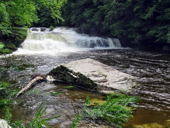
![]() On Friday, July 9th, I left the falls below Tompkins Falls and drove back to the Beaverkill Road. I turned left and drove through Turnwood. I drove by Quill Gordon Lodge and saw the Beaverkill Falls on the right. They were pumping out a good volume so I turned around and parked my car. I grabbed my camera and walked down the road to the path that leads to the falls. This land is private property so anyone visiting must get permission. I walked to a rock where I had a good view of the falls and took some pictures downstream and then some of the falls itself. The light was not quite right but the falls were impressive in their volume! The rocks were very slippery so I was careful to keep a solid footing. I took many pictures of the falls just upstream from our position and more pictures downstream. I walked back to the car and drove back home. All in all it was a successful day even though the hiking was short.
On Friday, July 9th, I left the falls below Tompkins Falls and drove back to the Beaverkill Road. I turned left and drove through Turnwood. I drove by Quill Gordon Lodge and saw the Beaverkill Falls on the right. They were pumping out a good volume so I turned around and parked my car. I grabbed my camera and walked down the road to the path that leads to the falls. This land is private property so anyone visiting must get permission. I walked to a rock where I had a good view of the falls and took some pictures downstream and then some of the falls itself. The light was not quite right but the falls were impressive in their volume! The rocks were very slippery so I was careful to keep a solid footing. I took many pictures of the falls just upstream from our position and more pictures downstream. I walked back to the car and drove back home. All in all it was a successful day even though the hiking was short.
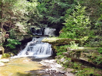
![]() On Friday, July 9th, I dropped Cindy and Sheila off at the house after we had hiked the Parksville Rail Trail. I then headed out to Tompkins Falls and the other falls on the same stream. I drove north on Old Rt 17 to the Beaverkill Road where I turned right. I drove through Lew Beach toward Turnwood. At the intersection with the Barkaboom Road I stayed to the left on Barkaboom Road and drove to the pulloff for Tompkins Falls which is near the end of the road. I grabbed y camera and walked down the road to the bank that overlooks the falls. The falls were flowing nicely nad I have walked down to the stream bed in the past. This requires a descent of a steep bank and a walk along a narrow concrete shelf. On this day I was happy to take pictures from the bank using the zoom. Back at the car I walked down to the top of the falls and took more pictures. Some of the views here were very nice and the water volume was high for the season but not as high as I expected after the rain storms. Some foundations and rock work were visible on the other side. Tompkins Falls was once dammed and was used to provide electrical power to Shavertown, Pepacton and Arena. These towns were flooded when the Pepacton Reservoir was created. After I finished taking, we returned to the car for the ride home.
On Friday, July 9th, I dropped Cindy and Sheila off at the house after we had hiked the Parksville Rail Trail. I then headed out to Tompkins Falls and the other falls on the same stream. I drove north on Old Rt 17 to the Beaverkill Road where I turned right. I drove through Lew Beach toward Turnwood. At the intersection with the Barkaboom Road I stayed to the left on Barkaboom Road and drove to the pulloff for Tompkins Falls which is near the end of the road. I grabbed y camera and walked down the road to the bank that overlooks the falls. The falls were flowing nicely nad I have walked down to the stream bed in the past. This requires a descent of a steep bank and a walk along a narrow concrete shelf. On this day I was happy to take pictures from the bank using the zoom. Back at the car I walked down to the top of the falls and took more pictures. Some of the views here were very nice and the water volume was high for the season but not as high as I expected after the rain storms. Some foundations and rock work were visible on the other side. Tompkins Falls was once dammed and was used to provide electrical power to Shavertown, Pepacton and Arena. These towns were flooded when the Pepacton Reservoir was created. After I finished taking, we returned to the car for the ride home.
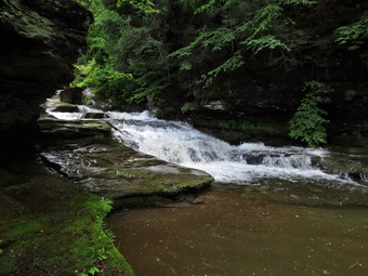 When I was finished at Tompkins Falls, I went back to the car and drove to the intersection with the BWS roads near the Pepacton Reservoir. I turned around and started slowly up the road looking for another set of falls. In a very short distance, I saw a pulloff and a path leading down to the stream. I pulled over and got out of the car taking my camera with me. I had heard about these falls but had never visited them. I walked down and could see that they were not as high as Tompkins Falls and That it would be hard to get downstream to get a good picture. I took some shots of the upper falls and then saw a way to descend the rocks by the stream to get closer to the "front" of the falls. In retrospect, this may not have been the best idea. The rocks were covered in moss and were wet and slippery. I did manage to get in front of and downstream from the falls but it was hard to get the entire galls in the picture. I took my shots and then started back up the slippery rocks. As is often the case, going back up is harder than coming down but I made it. I searched for another WY to get downstream but decided not to press my luck! I went back to the car and decided to visit Beaverkill Falls.
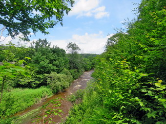
![]()
![]()
![]()
![]()
![]() On Friday, July 9th, I wanted to get in a hike close to home with Cindy. I had been out for two ambulance calls in the early morning hours so I went back to sleep when I got home and was up until 11:00 AM! I suggested a hike of the Parksville Rail Trai since it is flat and short but has a nice waterfall. Cindy agree that she could handle this hike so we began to get ready at 12:15 PM. As we started to get ready, the temperature on the back porch was already 80 degrees but I knew the rail trail was shaded. I got dressed in a White Sierra long-sleeved crew top with a short-sleeved baselayer. I put on a pair of RailRiders hiking pants which are expensive but last a long time and have features like deep pockets and a generous cut which I really like. These pants have Velcro closures at the ankles to discourage sticks and gravel from getting into my shoes and to combat ticks. I decided to wear my Keen Targhee II hiking boots which fit well and have been discontinued. I decided to take my Leki Makalu carbon poles with the internal twist locks as they are light and not a problem on most trails. We put our gear in the back of the car and Sheila in the back seat. We left Livingston Manor at 12:50 PM and drove out Old Route 17 toward Parksville. Just after Fox Mountain Road, I pulled into the parking area on the right side of the road at 1:05 PM. There were no cars in the lot as we began to get ready. I decided to take my pack since it is the easiest way to carry my camera. I set my GPS and we set off on the trail with the car thermometer reading 82 degrees.
On Friday, July 9th, I wanted to get in a hike close to home with Cindy. I had been out for two ambulance calls in the early morning hours so I went back to sleep when I got home and was up until 11:00 AM! I suggested a hike of the Parksville Rail Trai since it is flat and short but has a nice waterfall. Cindy agree that she could handle this hike so we began to get ready at 12:15 PM. As we started to get ready, the temperature on the back porch was already 80 degrees but I knew the rail trail was shaded. I got dressed in a White Sierra long-sleeved crew top with a short-sleeved baselayer. I put on a pair of RailRiders hiking pants which are expensive but last a long time and have features like deep pockets and a generous cut which I really like. These pants have Velcro closures at the ankles to discourage sticks and gravel from getting into my shoes and to combat ticks. I decided to wear my Keen Targhee II hiking boots which fit well and have been discontinued. I decided to take my Leki Makalu carbon poles with the internal twist locks as they are light and not a problem on most trails. We put our gear in the back of the car and Sheila in the back seat. We left Livingston Manor at 12:50 PM and drove out Old Route 17 toward Parksville. Just after Fox Mountain Road, I pulled into the parking area on the right side of the road at 1:05 PM. There were no cars in the lot as we began to get ready. I decided to take my pack since it is the easiest way to carry my camera. I set my GPS and we set off on the trail with the car thermometer reading 82 degrees.
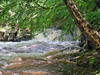 Once we were on the trail and sheltered by the trees it was a little cooler and the long sleeves did not seem too hot. The trail was very wet and muddy from two days of rain and thunderstorms. There was standing water in some places and small stream shunning down the trail in others. In one spot a large tree had fallen over taking a slightly smaller one with it. I judged that this mess might require a chainsaw. As we walked we removed sticks and branches from the trail. In several places branches were hanging into the trail and would require some trimming. We came to a nice view down to the Little Beaverkill and I stopped to take a few shots. Just after this point was a boardwalk and bridge and I again took some pictures. There was a lot of water in this area and the heavy rain had carried dirt and rocks onto the bridge. This had also blocked the culvert under the bridge forcing water and mud onto the bridge and trail. The walkway had some leaves on it and was very slippery from the rain. The day was sunny and the sky was very blue with some white clouds. We passed several benches placed for people to rest. Soon, we could hear an increase in the noise from the stream and I knew the falls was just ahead. We stopped to look at the falls which had more water going over it than I had ever seen. The stream was very high which made the drop of the falls look shorter than usual. I walked down the bank and worked my way to an area in front of the falls. The water was brown with white caps. I took some shots and then repositioned to take a few more. There are two drops to the falls but from the bottom of the lower falls it is hard to see the upper drop. I walked back up the bank and took a picture from above the falls. We walked down the trail a short distance where another path led down to the creek. When the water is low this leads along the edge of the stream to just above the falls. On this day the stream was so high that the path lead just to the edge of the water and then ended. As we were getting ready to continue our hike, three men approached us from Parksville. We said "Hello" and they asked about access to the stream. O told them about the path to the bottom of the falls and then we went in opposite directions. We continued on the trail toward Parksville and soon saw two women coming in our direction. One woman was enjoying the beautiful scenery by talking on her cell phone! As we approached the end of the trail, I put Sheila on her leash. I was happy to see that at least one property owner was cleaning up the mess just across the stream. We passed some buildings on the left side of the trail that were ruined and falling down. On the Parksville end of the trail we walked out to the trailhead and then turned around to begin the walk back. We stopped at the small garden which has a very informative sign. The sign listed the businesses and hotels that existed in Parksville during its heyday. The Young's Gap Hotel had room for 600 guests! The sign also explained the role of the railroad in the dairy industry which was a thriving one in all of Sullivan County. I had Bryce read the sign and we discussed some of the information especially the comment that the area produced 9 million cans of milk annually. After a brief pause, we decided began the back on the trail. The return trip was uneventful but we did meet the two women coming back and overtook the three men who were still looking for stream access. We were back at the car at 2:30 PM after hiking 2.9 miles in 1 hour and 25 minutes. Our moving average was 2.3 mph and the elevation gain was 280 feet which I doubted. I decided it might be good to visit some other waterfalls.
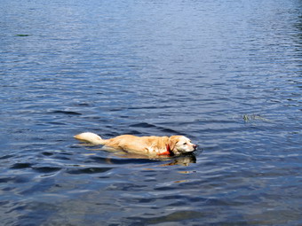
![]()
![]()
![]()
![]()
![]() On Wednesday, July 7th I planned to go hiking at Trout Pond after two days of trail maintenance. I decided I would park at the lower parking area and then hike the loop around Trout Pond counterclockwise. As I started to get ready at 10:45 AM it was 82 degrees with high humidity. I put on my White Sierra long-sleeved crew top with a short-sleeved baselayer. I put on a pair of RailRiders hiking pants which are expensive but last a long time and have features like deep pockets and a generous cut which I really like. I wore my Keen Targhee II hiking boots which are showing some serious wear but fit well. I decided to take my Leki Makalu carbon poles with the internal twist locks as they are light and not a problem on most trails. I also put on my OR floppy hat which keeps the insects off and protects me from the sun. I donned my OR Bugout gaiters to combat the ticks. I put my gear in the back of the car and Sheila in the back seat. We left Livingston Manor at 11:00 AM as I drove north on the Quickway towards Roscoe. I got off at exit 94 and headed north on Route 206 towards Downsville. After crossing the Rockland Flats and passing the Roscoe Nursing Home, I turned left on Morton Hill Road and drove to the intersection with Russell Brook Road. We turned left to drive down to the lower parking area and was pleased to find the road in pretty good shape. When we arrived at the lower parking area, it was almost filled but I found one space to park. I set my GPS and we got ready to start out on our hike at 11:25 AM with the temperature at 78 degrees and Hugh humidity.
On Wednesday, July 7th I planned to go hiking at Trout Pond after two days of trail maintenance. I decided I would park at the lower parking area and then hike the loop around Trout Pond counterclockwise. As I started to get ready at 10:45 AM it was 82 degrees with high humidity. I put on my White Sierra long-sleeved crew top with a short-sleeved baselayer. I put on a pair of RailRiders hiking pants which are expensive but last a long time and have features like deep pockets and a generous cut which I really like. I wore my Keen Targhee II hiking boots which are showing some serious wear but fit well. I decided to take my Leki Makalu carbon poles with the internal twist locks as they are light and not a problem on most trails. I also put on my OR floppy hat which keeps the insects off and protects me from the sun. I donned my OR Bugout gaiters to combat the ticks. I put my gear in the back of the car and Sheila in the back seat. We left Livingston Manor at 11:00 AM as I drove north on the Quickway towards Roscoe. I got off at exit 94 and headed north on Route 206 towards Downsville. After crossing the Rockland Flats and passing the Roscoe Nursing Home, I turned left on Morton Hill Road and drove to the intersection with Russell Brook Road. We turned left to drive down to the lower parking area and was pleased to find the road in pretty good shape. When we arrived at the lower parking area, it was almost filled but I found one space to park. I set my GPS and we got ready to start out on our hike at 11:25 AM with the temperature at 78 degrees and Hugh humidity.
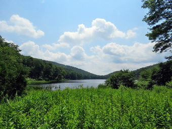 We started out on the Trout Pond Trail along a wide woods road that leads down to and across Russell Brook. As we crossed the bridge, I could see that the brook was not as high as I had expected. The sun was out and the sky was blue with puffy white clouds. I decided I just wanted to hike some and would leave the falls for the return trip. The Japanese knotweed was growing profusely and encroaching on the trail. I had brought my machete which does an excellent job on the knotweed but I decided to put that off until the end of the hike. As we continued passed the register box, we caught up with a couple who were reading the trail signs. They had on sneakers and were carrying a single bottle of water. I hoped they were planning a short hike to Trout Pond and back. We continued up the main trail toward Trout Pond. There was water on the trail and some mud which was isolated to several small areas. We caught up to and passed a group of 2 men and 3 women who were also casually dressed but better prepared than the couple. I noticed some fresh tire tracks on the trail but could not tell how fresh they were or the vehicle that made them. Soon we were at the outlet end of the pond and we walked over to the shore. I dropped my pack to take pictures of the lake with the blue sky overhead. The water was right up to the grass on the shoreline and was overflowing the dam. I took quite a few pictures looking for the contrast between the green trees, the blue sky with white clouds and the lake. Sheila waded in to take a dip and I took her picture. I threw a stick for her to retrieve but she did not seem interested. I heard the noise of an ATV coming down the trail and looked up to see it pass. The driver had on an orange hard hat and I assumed he was working for the DEC. I packed up and we returned to the main trail. We walked the flat woods road toward the inlet end of the pond which was wet and muddy in some spots. In some places it extended across the trail which made walking more difficult. We crossed the bridge that is just before the lower lean-to and inspected the old trout hatching box. At the trail junction near the lower lean-to we turned to the left on the blue blazed Mud Pond Trail which would take use over Cherry Ridge and form our loop back to the parking area. There were two men sitting at the lean-to. I looked to see if there was any work being done by the DEC on the lean-tos or bridge but none was visible. I took some pictures ROM the bridge and then from another point on the trail. There were several tents pitched too close to the shore just below the upper lean-to. He turned right and started up the Mud Pond Trail toward Cherry Ridge.
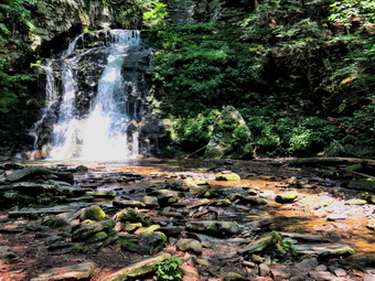 Even though we were gaining elevation, we continued at a good pace. Every now and then we would remove a small branch or a larger branch from the trail. This part of the trail showed that there had been some water running on the trail but was not very wet. From the bridge at the inlet we began a climb of 430 feet over the next .75 miles. The trail headed west from the inlet until turning sharply south at around 2 miles. As we started this ascent, a family of four came hiking down the trail toward us. They passed by and we exchanged "hellos". Along the way there were several blowdowns some of which were old and some that were new. Some of these were on the ground and easy to step over while others were interfering with walking on the trail. The highest point on the trail was at 2.2 miles after which most of the rest of the hike is downhill. As we gained elevation, I began to notice that I was getting warm and sweating profusely due to the humidity. The trail had some mud in spots but there was little standing or running water. At one point I could hear two men overtaking us and I stepped off the trail to let them pass. They had a small and noisy dog with them but at least he was on a leash. The place where I had pulled over had a very large fungus so I took done shots before moving on. At 3.4 miles we had descended 420 feet from Cherry Ridge to the snowmobile trail near Mud Pond. We turned left here to head east and ascended a small hill before starting downhill back toward the parking area. This section was a little muddy but I had seen far worse. The downhill was a little slippery because of the water and mud. The small streams flowing across the trail were almost dry. We dropped another 380 feet over the next .7 miles back to the trail junction by the register. We turned left on the path to Russell Brook Falls which was narrow due to the encroaching knotweed. We walked the path until it descended to the streambed. The family that we had met hiking was close to the falls and it did not seem like they were going to move. I took some pictures of the falls which had much less water flowing than I had expected. I was happy there were no piles of rocks in the stream but I did notice the boy was throwing stones at the falls! I almost said something about LNT and disturbing the ecosystem but decided against it. I packed up and we walked back out to the main trail. We turned left and walked to the bridge across Russell Brook. The history of this area is very interesting. Russell Brook Falls had been the site of a dam that impounded water for a waterwheel in Butternut Grove. The wheel was still there a few years ago. The area near the register box was the "landing zone" for loggers who cleared the evergreen trees, not for tanning but, for the production of wood alcohol. The trees were transported on narrow gauge railway that ran parallel to Russell Brook. The railway met the mainline O&W near Butternut Grove where the logs were unloaded. There were several acid factories in the area that produced wood alcohol. There was also a factory on the lower part of Russell Brook that produced khaki dye for the uniforms of American troops during World War I. We continued across the bridge and up the trail to the parking area. It was 1:55 PM and we had hiked 4.6 miles in 2 hours and 30 minutes with an elevation gain of 870 feet. We had stopped for a little over 20 minutes.
![]()
![]()
![]()
![]() On Tuesday, July 6th I had planned to go across the street and trim all the trails on Round Top with my Stihl gas-powered trimmer. I use four-cornered Rhino line and it will cut brush as big as my little finger! I wanted to get out early as the afternoon temperature was forecast to be in the low 90's. The ambulance pager went off early in the morning but no driver responded to the call. I had trouble getting back to sleep so I stayed in bed a little later than I had planned. At 9:30 Am I got up and immediately started to get ready with the temperature in the low 80's. Sheila was watching me as I was getting ready but I had to explain to her that she could not go which did not make her happy! I put on a Mountain Hardware long-sleeved crew top with no baselayer because of the temperature and humidity. I put on a pair of RailRiders hiking pants which are expensive but last a long time and have features like deep pockets and a generous cut which I really like. I wore my Vasque Taku hiking boots which are showing some serious wear but fit well. I grabbed my Corona loppers. Silky Sugowaza saw and LT Wright Overland machete and out them in the car. I loaded up the Stihl trimmer and the pack that has the gas-oil mixture and extra line. I pulled out of my driveway at 9:50 AM and drove across the street and up the cemetery hill. I parked at the top of the hill at the trailhead and parked putting my volunteer sign on the dashboard. I got out the trimmer and made sure it would start. I had just replaced the line but filled the fuel tank as I knew I would start trimming as soon as we hit the trails. I put on the pack and started out on the trails. There wasn't much to trim up to the first trail junction. At the junction I turned right and started up the trail. When the trail turned off the woods road, I began to run into weeds and brush to trim. I started the trimmer and began to cut weeds, ferns and brush. I trimmed several feet back from the tread so that it would stay that way for some time. At the next junction I turned left to stay on the yellow trail. I knew this is where the majority of the trimming would take place.
On Tuesday, July 6th I had planned to go across the street and trim all the trails on Round Top with my Stihl gas-powered trimmer. I use four-cornered Rhino line and it will cut brush as big as my little finger! I wanted to get out early as the afternoon temperature was forecast to be in the low 90's. The ambulance pager went off early in the morning but no driver responded to the call. I had trouble getting back to sleep so I stayed in bed a little later than I had planned. At 9:30 Am I got up and immediately started to get ready with the temperature in the low 80's. Sheila was watching me as I was getting ready but I had to explain to her that she could not go which did not make her happy! I put on a Mountain Hardware long-sleeved crew top with no baselayer because of the temperature and humidity. I put on a pair of RailRiders hiking pants which are expensive but last a long time and have features like deep pockets and a generous cut which I really like. I wore my Vasque Taku hiking boots which are showing some serious wear but fit well. I grabbed my Corona loppers. Silky Sugowaza saw and LT Wright Overland machete and out them in the car. I loaded up the Stihl trimmer and the pack that has the gas-oil mixture and extra line. I pulled out of my driveway at 9:50 AM and drove across the street and up the cemetery hill. I parked at the top of the hill at the trailhead and parked putting my volunteer sign on the dashboard. I got out the trimmer and made sure it would start. I had just replaced the line but filled the fuel tank as I knew I would start trimming as soon as we hit the trails. I put on the pack and started out on the trails. There wasn't much to trim up to the first trail junction. At the junction I turned right and started up the trail. When the trail turned off the woods road, I began to run into weeds and brush to trim. I started the trimmer and began to cut weeds, ferns and brush. I trimmed several feet back from the tread so that it would stay that way for some time. At the next junction I turned left to stay on the yellow trail. I knew this is where the majority of the trimming would take place.
For the first section of the trail I trimmed a lot of long grass and weeds and some brush on both sides of the trail. Eventually, I began trimming more brush and had to be careful to keep tapping the cutting head to release more line. I began to notice that my forearms were getting sore and that my hands were vibrating even when I wasn't holding the trimmer. I continued to trim along this trail until I reached the junction with the blue trail. I turned right and trimmed a little bit on the way up the hill. When the switchback turned right, I followed it and trimmed some grass and ferns. There wasn't much brush to trim on this section. When the switchback met the main blue trail, I turned left and started for the summit trimming as I went. I bypassed the white crossover trail and continued over the summit where I took down some brush and briars. I started down the hill and continued to trim a lot of brush both low and high. My firearms were burning but I made it to the yellow trail where I refueled the trimmer and headed back up the blue trail. This time I turned left on the white crossover trail and started to trim mostly ferns and weeds growing on the trail. This trail section is the one that is lest traveled and the trimming really made it more obvious. When the white trail came to the blue trail, I turned left and walked down the hill to the junction with the yellow trail. I continued straight ahead on the yellow trail as it started downhill toward the lookout. The trimming here started out as brush and weeds and then turned to mostly ferns. Along the way I came to a blowdown across the trail which I had intended to clear with my saw later. I looked at the tree and found it very long but loose at the base. I broke off the top and then went to the base of the truck and started to drag it off the trail. This went well and I was able to get it completely off the trail. I continued down the trail cutting ferns as I went. When we got to the lookout, I turned the trimmer off and walked down the steep trail to the first trail junction. I continued straight ahead and walked out to my car. I stowed the trimmer and prepared to leave. The temperature was 86 degrees and I had spent 2 hours and 30 minutes walking and trimming. I was very sweaty and covered in pieces of vegetation. I was looking forward to getting home to take a shower.
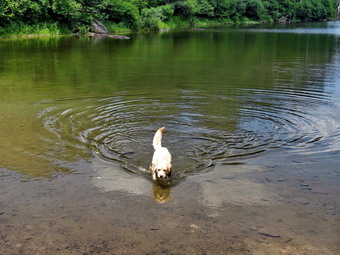
![]()
![]()
![]()
![]()
![]() On Monday, July 5th I had planned to hike a longer hike by going to Hodge and Frick Ponds to do some maintenance on The Flynn and Quick Lake Trails. I was up at 9:00 AM when the temperature was 73 degrees on the back porch. I had not hiked UP the Flynn Trail to do the big loop around Hodge Pond in some time and made that my intended route. While I was getting ready, Sheila was always nearby making it very clear that she wanted to go. I put on my White Sierra long-sleeved crew top with a short-sleeved baselayer. I put on a pair of RailRiders hiking pants which are expensive but last a long time and have features like deep pockets and a generous cut which I really like. I wore my Keen Targhee II hiking boots which are showing some serious wear but fit well. I decided not to take any poles as I would be carrying maintenance equipment. I also put on my OR floppy hat which keeps the insects off and protects me from the sun. I put on my OR Bugout gaiters to combat the ticks. I packed my Silky Sugowaza saw and brought along my Corona loppers which are large with extendible handles. I put my gear in the back of the car and Sheila in the back seat and we left Livingston Manor at 10:10 AM. I drove out the Debruce Road about 6 miles and turned left onto Mongaup Pond RoadWhere the road the split, I turned left onto Beech Mountain Road, and drove to the parking areas at the Frick Pond. There was one pickup parked in the larger lot but nothing parked in the smaller one. I pulled into the smaller area with the thermometer reading 68 degrees as I set my GPS. The skies were blue in some areas with plenty of sun and lots of billowing white clouds. There was a slight breeze blowing which made things a little cooler but did not keep the insect away. At 10:30 AM we started our hike by crossing the road to start out on the Flynn Trail. The recent rainstorms had eroded the beginning of the trail even more than before. At the end of the trail through the woods we turned right on the woods road that was once the extension of Beech Mountain Road. I could immediately tell that I would be missing my poles as I was carrying the loppers in my hand. I had intended to hike directly to the Flynn Trail between Hodge Pond and Jukyard Junction to begin my trail maintenance but there seemed to be a few branches encroaching on the trail as we hiked up the hill. The Flynn Trail ascends 1.7 miles to the Big Rock Trail junction gaining 600 feet. The more I hike the quicker I can hike and easier it seems. After we passed the big spruce tree that forms an arch over the trail, I began to trim branches from the sides of the trail. I also picked up sticks and branches off the trail. As we neared the highest point on the hike, we ran into two small blowdowns so I stopped, removed my pack and started to make some cuts to remove them. I usually take before and after pictures but these small trees were not worth the effort. Just after the 1 mile mark was another blowdown which also went quickly. By 11:35 AM we had hiked the 1.7 miles to the junction with the Big Rock Trail. We continued straight ahead staying on the Flynn Trail heading toward Hodge Pond. The trail had been wet and muddy in spots on the way to the junction but the flatter area was even wetter with more mud. I continued to clip branches making sure I cut them back to allow for growth and cut overhead to allow for taller hikers and snowshoers. We passed through the gate that separates state land from the OSI property and were soon at the next trail junction where we stayed to the left to stay on the Flynn Trail to Hodge Pond.
On Monday, July 5th I had planned to hike a longer hike by going to Hodge and Frick Ponds to do some maintenance on The Flynn and Quick Lake Trails. I was up at 9:00 AM when the temperature was 73 degrees on the back porch. I had not hiked UP the Flynn Trail to do the big loop around Hodge Pond in some time and made that my intended route. While I was getting ready, Sheila was always nearby making it very clear that she wanted to go. I put on my White Sierra long-sleeved crew top with a short-sleeved baselayer. I put on a pair of RailRiders hiking pants which are expensive but last a long time and have features like deep pockets and a generous cut which I really like. I wore my Keen Targhee II hiking boots which are showing some serious wear but fit well. I decided not to take any poles as I would be carrying maintenance equipment. I also put on my OR floppy hat which keeps the insects off and protects me from the sun. I put on my OR Bugout gaiters to combat the ticks. I packed my Silky Sugowaza saw and brought along my Corona loppers which are large with extendible handles. I put my gear in the back of the car and Sheila in the back seat and we left Livingston Manor at 10:10 AM. I drove out the Debruce Road about 6 miles and turned left onto Mongaup Pond RoadWhere the road the split, I turned left onto Beech Mountain Road, and drove to the parking areas at the Frick Pond. There was one pickup parked in the larger lot but nothing parked in the smaller one. I pulled into the smaller area with the thermometer reading 68 degrees as I set my GPS. The skies were blue in some areas with plenty of sun and lots of billowing white clouds. There was a slight breeze blowing which made things a little cooler but did not keep the insect away. At 10:30 AM we started our hike by crossing the road to start out on the Flynn Trail. The recent rainstorms had eroded the beginning of the trail even more than before. At the end of the trail through the woods we turned right on the woods road that was once the extension of Beech Mountain Road. I could immediately tell that I would be missing my poles as I was carrying the loppers in my hand. I had intended to hike directly to the Flynn Trail between Hodge Pond and Jukyard Junction to begin my trail maintenance but there seemed to be a few branches encroaching on the trail as we hiked up the hill. The Flynn Trail ascends 1.7 miles to the Big Rock Trail junction gaining 600 feet. The more I hike the quicker I can hike and easier it seems. After we passed the big spruce tree that forms an arch over the trail, I began to trim branches from the sides of the trail. I also picked up sticks and branches off the trail. As we neared the highest point on the hike, we ran into two small blowdowns so I stopped, removed my pack and started to make some cuts to remove them. I usually take before and after pictures but these small trees were not worth the effort. Just after the 1 mile mark was another blowdown which also went quickly. By 11:35 AM we had hiked the 1.7 miles to the junction with the Big Rock Trail. We continued straight ahead staying on the Flynn Trail heading toward Hodge Pond. The trail had been wet and muddy in spots on the way to the junction but the flatter area was even wetter with more mud. I continued to clip branches making sure I cut them back to allow for growth and cut overhead to allow for taller hikers and snowshoers. We passed through the gate that separates state land from the OSI property and were soon at the next trail junction where we stayed to the left to stay on the Flynn Trail to Hodge Pond.
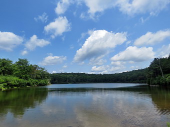 As we headed down toward the pond, I cut a few branches on the wide woods road. When we emerged into the clearing at the outlet end of the pond, I looked at the scene and decided to walk over to the shore of the pond. Before I could drop my pack, Sheila jumped into the water to swim and to get a drink. I took off my pack and took out the camera. I turned my attention to taking some shots of the pond. The scene was blue water and blue skies with puffy white clouds and green trees in all the shore. I took some shots of Sheila in the water and then quite a few of the pond. When I was done, I got a drink and packed up. We headed back to the Flynn Trail and turned right to follow the trail along the west side of Hodge Pond. As we continued on the west side of Hodge Pond, we found that the Flynn Trail was very muddy. OSI decided some years ago to bring in a road scarper to remove all the grass and sod that mode up this woods road. The sod had been able to absorb the water and the trail was seldom muddy. Scraping it down to dirt was a bad idea and now there are deep ruts on the road from the tractor OSI uses to mow. As we walked along the western shore, we came to a spot where we could turn left or right. We turned left to stay on the Flynn Trail and began a slight uphill climb toward the gate where the trail turns to the left. I continued to trim branches and moved a few older, rotten trunks off the trail. We continued our walk up the hill and through the gate. This part of the Flynn Trail is pretty flat and the trail is often the lowest point which allows water to collect with nowhere to go. The rain earlier in the week had made the trail wet and I had to walk through several wet and muddy areas. There were a few branches to trim but fewer than I though there might be. There were also a few blowdowns across the trail which I removed. There was one larger blowdown that was flat on the ground which would make it hard to cut with the saw. I decided I would have to leave it until next time when I could bring an ax. As I cleaned up a few branches, I noticed that the trunk was broken. I was able to drag one piece of the trunk off the trail and pivoted the other piece out of the way. I noticed that Sheila was pretty careful to walk around these areas as I had encouraged her. The last part of the trail approaching Junkyard Junction required a little more trimming. We arrived at Junkyard Junction at 1;05 PM about 3.4 miles into the hike. From here the rest of the hike is primarily downhill with a few small hills along the way. We turned left on the red Quick Lake Trail and found it was also wet and muddy. Some section of the trail are washed out leaving a lot of rocks behind and making the downhill hiking not as much fun as it could be. I had decided that I would not trim this trail but I was still had some energy and there were plenty of branches to trim. There were several large puddles on the trail and many muddy areas. At about 3.8 miles the trail turned due south and we continued downhill. There was one blowdown that required me to use the saw but it went quickly.
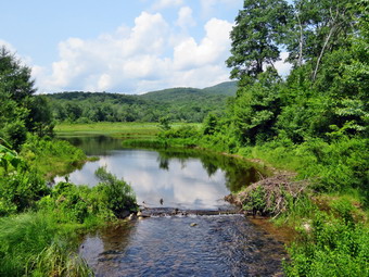 There wasn't much to see so we hiked passed the junction with the snowmobile trail. I cut a few more branches along the way to Iron Wheel Junction. We arrived at at 2:00 PM after hiking 4.9 miles. We turned right to stay on the Quick Lake Trail since the yellow Logger's Loop continued straight ahead. The trail was muddy and wet with a few branches to trim here and there. We continued on the trail passing through the clearing which was more like a swamp. We soon came to the little stream in the woods which was not as high as the last time I had walked the trail. I had cleaned out some leaves and brush which let the water flow more freely. I crossed on the stepping stones and did not stop to take pictures. I noticed that Sheila had simply waded across the stream getting a drink and cooling off! We continued toward Frick Pond and found several more blowdowns which were large and easy to step over. There were many wet and muddy spots which extended across the trail. I simply decided to walk through them as I was already wet. We passed the junction with the Big Rock Trail that goes around the north end of Frick Pond and walked toward the bridge across the outlet of the pond. The spot that had been a mud pit was almost dry after the work we had done on the last trail maintenance trip. We crossed the bridge and I put my pack down. I took pictures of the pond and the puffy white clouds in the blue sky. I packed up and we continued back on the Quick Lake Trail toward the trail register. The trail just before Graveyard Junction was muddy. We stayed to the right on the Quick Lake Trail which was becoming overgrown with grass and brush. The trail back to the car was wet but not very muddy. At the trail register we continued straight ahead on the woods road to the smaller parking area. The pickup was still parked in the larger lot along with one other car. It was 2:45 PM and we had hiked 6.4 miles in 4 hours and 29 minutes with an elevation gain of 900 feet. The temperature was 73 degrees.
![]()
![]()
![]()
![]() On Saturday, July 3rd I had plans to get out and hike a few miles after several days of torrential rain and numerous ambulance calls. The ambulance pager went off early in the morning and we were on our way to Middletown which takes almost 3 hours roundtrip. When I got home, I knew I wanted to get out but thought I would not have much time before more Iran started to fall. The temperature was cooler hovering in the low 60's so decided to go across the street and hike on Round Top. Sheila was watching me and seemed very happy to be finally going out. I put on my White Sierra long-sleeved crew top with no baselayer because of the temperature and humidity. I put on a pair of RailRiders hiking pants which are expensive but last a long time and have features like deep pockets and a generous cut which I really like. I wore my Keen Targhee II hiking boots which are showing some serious wear but fit well. I decided to take my Leki poles with the internal twist locks as they are good for most trails. We stepped out of the house at 10:40 AM. I grabbed Sheila's leash from the trunk of my car and we walked up the driveway. I aimed to hike for about an hour. Sheila was happy to get out as we headed down the driveway and across the street. We crossed the street and walked to the parking area by the Presbyterian Church. We walked to the back of the church and began the ascent of the steepest hill behind the church. The hill is short but gets the circulation pumping and is the steepest and longest climb on the "trail." Sheila helped me along by pulling me up the hill. When we got to the top of the hill, we stopped to look around at the hills around town. We started on the trail by turning left at the trailhead. I let Sheila off her leash so that she could run free. I knew that other people were using the trails from comments on Facebook. The trails was becoming well-worn as more and more people use them.
On Saturday, July 3rd I had plans to get out and hike a few miles after several days of torrential rain and numerous ambulance calls. The ambulance pager went off early in the morning and we were on our way to Middletown which takes almost 3 hours roundtrip. When I got home, I knew I wanted to get out but thought I would not have much time before more Iran started to fall. The temperature was cooler hovering in the low 60's so decided to go across the street and hike on Round Top. Sheila was watching me and seemed very happy to be finally going out. I put on my White Sierra long-sleeved crew top with no baselayer because of the temperature and humidity. I put on a pair of RailRiders hiking pants which are expensive but last a long time and have features like deep pockets and a generous cut which I really like. I wore my Keen Targhee II hiking boots which are showing some serious wear but fit well. I decided to take my Leki poles with the internal twist locks as they are good for most trails. We stepped out of the house at 10:40 AM. I grabbed Sheila's leash from the trunk of my car and we walked up the driveway. I aimed to hike for about an hour. Sheila was happy to get out as we headed down the driveway and across the street. We crossed the street and walked to the parking area by the Presbyterian Church. We walked to the back of the church and began the ascent of the steepest hill behind the church. The hill is short but gets the circulation pumping and is the steepest and longest climb on the "trail." Sheila helped me along by pulling me up the hill. When we got to the top of the hill, we stopped to look around at the hills around town. We started on the trail by turning left at the trailhead. I let Sheila off her leash so that she could run free. I knew that other people were using the trails from comments on Facebook. The trails was becoming well-worn as more and more people use them.
At the first trail junction, we turned right to walk up the more shallow approach to Round Top on the wide woods road. The trails were wet and muddy and the rain had caused some of the brush along the trails to grow and then lean over into the trails. I knew I would have to come and do some trimming. I began to break off some branches and I was surprised when they broke easily and allowed me to get them out of the way. At the first junction with the blue trail, we turned left and continued on the yellow trail along the base of Round Top. The grass and weeds were starting to grow up n the trail and I thought about bringing the string trimmer next tine. At the second junction with the blue trail we turned right and headed up the steep side of the hill. When the switchback turned to the right, we turned right and followed it as it wound up the hill. At the end of the switchback we turned right and started up the main blue trail to the summit. On the way we bypassed the white crossover trail. We followed the blue trail over the summit and down the other side. We again bypassed the white crossover trail and continued down the blue trail to the junction with the yellow trail. We turned right on the yellow trail to once again walk along the base of Round Top. This time when we reached the second junction with the blue trail we turned left on the yellow trail and followed that downhill to the viewpoint over town. The forest floor was getting greener all the time as ferns began to pop up with some interspersed windflowers. At the lookout we turned left to follow the yellow trail back to the very first trail junction. I check the path to the viewpoint and found that the brush I had placed in the trail needed to be replaced to discourage people from walking along the path. This path can be dangerous for some and I wanted it blocked to discouraged its use. We continued down the hill to the very first trail junction completing our first figure 8. We immediately turned around and hiked back up the steeper trail to the viewpoint. We followed the yellow trail as it turned right and began the long but gentle climb to the first junction with the blue trail. At the junction we turned right to follow the yellow trail along the base of Round Top to the second junction with the blue trail. We turned left and followed the blue trail to the white shortcut trail. We turned left and followed the trail along the side of the hill to the junction with the blue trail. We turned left and followed the blue trail downhill to the junction with the yellow trail. By this time there was a heavy mist in the air but I could not tell if it was actually raining. We turned left on the yellow trail and again followed it to the next junction with the blue trail. This time we turned right and followed the yellow trail down to the wide woods road that brought us back to the first trail junction. We turned left and walked back out to the trailhead. We turned right to walk to the bottom of the hill and headed across the church parking lot to the street. We crossed the street to our driveway and were home by 11:40 AM after hiking a little over 2 miles in an hour.
![]()
![]()
![]()
![]() On Tuesday, June 29th I wanted to get out for a short hike with my grandson Bryce even though the weather was oppressive. As we started to get easy at 10":45 AM the temperature was 82 degrees and the fee-like temperature was 103 degrees! We decided to go across the street and hike on Round Top. Sheila was watching me and seemed very happy to be going out. I put on my White Sierra long-sleeved crew top with no baselayer because of the temperature and humidity. I put on a pair of RailRiders hiking pants which are expensive but last a long time and have features like deep pockets and a generous cut which I really like. I wore my Zamberlain hiking shoes which are low cut and very light but supportive. Every time I wear them hiking I remember how comfortable and light they are. I decided to take my Leki poles with the internal twist locks as they are good for most trails. We stepped out of the house at 11:00 AM and immediately noticed the heat and high humidity. I grabbed Sheila's leash from the trunk of my car and we walked up the driveway. I aimed to hike for about an hour. Sheila was happy to get out as we headed down the driveway and across the street. We crossed the street and walked to the parking area by the Presbyterian Church. We walked to the back of the church and began the ascent of the steepest hill behind the church. The hill is short but gets the circulation pumping and is the steepest and longest climb on the "trail." I gave the leash to Bryce an Sheila helped him along by pulling him up the hill. I used my poles to help me up the hill. When we got to the top of the hill, we stopped to look around at the hills around town. We started on the trail by turning left at the trailhead. I let Sheila off her leash so that she could run free. I knew that other people were using the trails from comments on Facebook. The trails was becoming well-worn as more and more people use them.
On Tuesday, June 29th I wanted to get out for a short hike with my grandson Bryce even though the weather was oppressive. As we started to get easy at 10":45 AM the temperature was 82 degrees and the fee-like temperature was 103 degrees! We decided to go across the street and hike on Round Top. Sheila was watching me and seemed very happy to be going out. I put on my White Sierra long-sleeved crew top with no baselayer because of the temperature and humidity. I put on a pair of RailRiders hiking pants which are expensive but last a long time and have features like deep pockets and a generous cut which I really like. I wore my Zamberlain hiking shoes which are low cut and very light but supportive. Every time I wear them hiking I remember how comfortable and light they are. I decided to take my Leki poles with the internal twist locks as they are good for most trails. We stepped out of the house at 11:00 AM and immediately noticed the heat and high humidity. I grabbed Sheila's leash from the trunk of my car and we walked up the driveway. I aimed to hike for about an hour. Sheila was happy to get out as we headed down the driveway and across the street. We crossed the street and walked to the parking area by the Presbyterian Church. We walked to the back of the church and began the ascent of the steepest hill behind the church. The hill is short but gets the circulation pumping and is the steepest and longest climb on the "trail." I gave the leash to Bryce an Sheila helped him along by pulling him up the hill. I used my poles to help me up the hill. When we got to the top of the hill, we stopped to look around at the hills around town. We started on the trail by turning left at the trailhead. I let Sheila off her leash so that she could run free. I knew that other people were using the trails from comments on Facebook. The trails was becoming well-worn as more and more people use them.
At the first trail junction, we turned right to walk up the more shallow approach to Round Top on the wide woods road. The trails were mostly dry with a damp spot here and there. At the first junction with the blue trail, we turned left and continued on the yellow trail along the base of Round Top. The grass and weeds were starting to grow up n the trail and I thought about brining the string trimmer next tine. At the second junction with the blue trail we turned right and headed up the steep side of the hill. When the switchback turned to the right, we condoned straight up the hill. We followed the main blue trail up the hill to the summit. We followed the blue trail over the summit and down the other side. We bypassed the white crossover trail and continued down the blue trail to the junction with the yellow trail. We turned right on the yellow trail to once again walk along the base of Round Top. To take our minds off the conditions, I talked to Bryce about a variety of topics. This time when we reached the second junction with the blue trail we turned left on the yellow trail and followed that downhill to the viewpoint over town. The forest floor was getting greener all the time as ferns began to pop up with some interspersed windflowers. At the lookout we turned left to follow the yellow trail back to the very first trail junction. I check the path to the viewpoint and found that the brush I had placed in the trail was still there albeit sparse. The path can be dangerous for some and I wanted it blocked to discouraged its use. We continued down the hill to the very first trail junction completing our first figure 8. We immediately turned around and hiked back up the steeper trail to the viewpoint. We followed the yellow trail as it turned right and began the long but gentle climb to the first junction with the blue trail. At the junction we turned right to follow the yellow trail along the base of Round Top to the second junction with the blue trail. We turned left and followed the blue trail to the white shortcut trail. We turned left and followed the trail along the side of the hill to the junction with the blue trail. We turned left and followed the blue trail downhill to the junction with the yellow trail. We turned left on the yellow trail and again followed it to the next junction with the blue trail. This time we turned right and followed the yellow trail down to the wide woods road that brought us back to the first trail junction. We turned left and walked back out to the trailhead. We turned right to walk to the bottom of the hill and headed across the church parking lot to the street. We crossed the street to our driveway and were home by 12:20 PM after hiking a little over 2 miles in a little more than 1 hour.
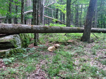
![]()
![]()
![]()
![]()
![]() On Sunday, June 27th I was leaving to go to church when the ambulance pager went off. I called in and changed and went to the building but no driver was available. When I got back home I decided it was too late to head to church. I decided instead to go do some trail maintenance from Big Pond toward Alder Lake on the Finger Lakes Trail. Someone let me know that another person had been working on this trail so I didn't know what work needed to be done. Sometimes well-meaning people go out and work on trails without being authorized to do so. This is against DEC policy and causes problems for the assigned trail maintainers. Anyone who wants to maintain trails should contact the FLTC or the NYNJTC so that a trail can be assigned to them. I began to get ready at 10:15 with the temperature reading 78 degrees and high humidity. While I was getting ready, Sheila was always nearby making it very clear that she wanted to go. I put on my White Sierra long-sleeved crew top with a short-sleeved baselayer. I put on a pair of RailRiders hiking pants which are expensive but last a long time and have features like deep pockets and a generous cut which I really like. I wore my Keen Targhee II hiking boots which are showing some serious wear but fit well. I decided not to take any poles as I would be carrying maintenance equipment. I also put on my OR floppy hat which keeps the insects off and protects me from the sun. I put on my OR Bugout gaiters to combat the ticks. I packed my Silky Sugowaza saw, my LT Wright Overland machete, and two plastic felling wedges. I also brought along a Fiskars ax which is light with a composite handle. I put my gear in the back of the car and Sheila in the back seat and we left Livingston Manor at about 10:30 AM. I drove north on Old Rt 17 to the Beaverkill Road where I turned right. I drove through Lew Beach toward Turnwood. At the intersection with the Barkaboom Road I stayed to the left on Barkaboom Road until I came to the access road to the upper parking area at Big Pond. I drove up to the parking lot and was able to find a spot although the lot was almost full. I set my GPS with the temperature at 79 degrees and the humidity still high. We started out on the trail toward Alder Creek Road at 10:50 PM.
On Sunday, June 27th I was leaving to go to church when the ambulance pager went off. I called in and changed and went to the building but no driver was available. When I got back home I decided it was too late to head to church. I decided instead to go do some trail maintenance from Big Pond toward Alder Lake on the Finger Lakes Trail. Someone let me know that another person had been working on this trail so I didn't know what work needed to be done. Sometimes well-meaning people go out and work on trails without being authorized to do so. This is against DEC policy and causes problems for the assigned trail maintainers. Anyone who wants to maintain trails should contact the FLTC or the NYNJTC so that a trail can be assigned to them. I began to get ready at 10:15 with the temperature reading 78 degrees and high humidity. While I was getting ready, Sheila was always nearby making it very clear that she wanted to go. I put on my White Sierra long-sleeved crew top with a short-sleeved baselayer. I put on a pair of RailRiders hiking pants which are expensive but last a long time and have features like deep pockets and a generous cut which I really like. I wore my Keen Targhee II hiking boots which are showing some serious wear but fit well. I decided not to take any poles as I would be carrying maintenance equipment. I also put on my OR floppy hat which keeps the insects off and protects me from the sun. I put on my OR Bugout gaiters to combat the ticks. I packed my Silky Sugowaza saw, my LT Wright Overland machete, and two plastic felling wedges. I also brought along a Fiskars ax which is light with a composite handle. I put my gear in the back of the car and Sheila in the back seat and we left Livingston Manor at about 10:30 AM. I drove north on Old Rt 17 to the Beaverkill Road where I turned right. I drove through Lew Beach toward Turnwood. At the intersection with the Barkaboom Road I stayed to the left on Barkaboom Road until I came to the access road to the upper parking area at Big Pond. I drove up to the parking lot and was able to find a spot although the lot was almost full. I set my GPS with the temperature at 79 degrees and the humidity still high. We started out on the trail toward Alder Creek Road at 10:50 PM.
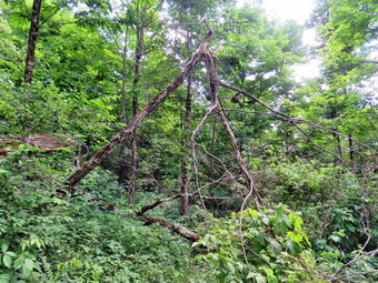 The initial part of the trail is pretty flat for a long time and passes several campsite areas before descending a little. I was glad to see that the path showed use and was easy to follow. After that the trail began to ascend on an old woods road. As I started up the trail, I noticed that several small trees had been cut and removed from the trail. This was done by the "helper" who is not assigned to the trail! At .5 miles we followed the trail as it turned off the woods road and continues to ascend through the hardwood forest. Just after this 90 degree turn, we came to a tree that had fallen across the trail. The tree was rather large and was at a height that made it impossible to get over but also difficult to get under. Hikers had started to walk around the tree which seemed the easiest approach. I cleared some of the branches on this reroute and also made note of the location to report it to the DEC. We continued to walk up the trail gaining elevation as we went and passing through some damp areas. There were several more trees that had been cut along the way. At the top of the hill the trail broke out into an open area which encouraged the growth of both briars and nettles. In this area there were also some old blowdowns that were easy enough to step over. The trail was clear but could have used some trimming. I considered dragging my Stihl trimmer up the trail to cut the briars and nettles that abound along the middle section of the trail. I had been removing branches along the way but now I found a tree that had fallen across the trail. I assumed that this was where the "helper" had stopped. I took some "before" pictures and then started to assess the mess. Since the area was n the sun, it seemed even warmer than under the trees. I thought I might just cut a few branches and leave the two larger trunks to step over. I used the saw to cut a small tree that was hanging in the trail and removed it. I cut a few more branches until only the trunks remained. I looked at those trunks and decided they needed to go. I started my first cut with the ax just a little off the trail. I started the cut wide but maybe not wide enough. I kept cutting until I was almost through the log and then switched to the saw. I completed the cut which freed the smaller trunk underneath. This part was rotten and I was able to break it and remove it from the trail. I now realized I would have to cut the larger trunk again as I could not muscle it of the trail by myself. The trunk forked on the other side of the trail so I used the ax again to cut both smaller branches. After this, I was able to move the larger piece of the trunk off the trail. I admired my work and took some "after" pictures. I got Sheila and I a drink and then packed up so that we could move on.
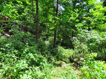 We walked through some more briars and then under the trees again. Almost immediately we ran into another blowdown blocking the trail. This one was old and I took some "before" shots before working on it. I gave the blowdown a kick and it fell to the ground! I did not want to leave this as a "step over" so I sued the saw to make a cut which went quickly enough. I removed all the parts from the trail and took my "after" shots. We moved on but didn't get too far before we came to another, smaller blowdown. I quickly cut the tree and dragged the two parts off the trail. I was starting to run low on water and the day seemed even hotter and more humid. I decided I would go no further than the stream which is about half way to Alder Lake. The trail again broke out into an open area and this time there was a good crop of nettles at least two feet high on each side of the trail. Since I wore pants, they really didn't bother me. There were a few small trees across the trail that I decided to leave until the return trip or another trip. As we walked the trail passed through several swampy areas that were wet despite the recent dry spell. I just walked across and ignored the mud. We passed by some foundations left from when the area was farmed. As we began the descent toward the stream, we came to another blowdown that was blocking the trail. This one was one large log with a lot of branches and some smaller trees that had been taken down. I took the "before" pictures and then got to work cleaning the branches that were loose. I moved on to use the saw to cut the rest of the branches and a small tree leaning into the trail. I also removed the stubs of some larger branches that were pointed as I did not anyone to fall onto them. After cleaning up, I had Sheila sit next to the log and I took the "after" shots. I looked down the trail and saw another mess so I walked a little further to inspect it. I lifted some an old trunk off the trail and decided it was time to turn back. I packed up and started back to the car. In a short distance Sheila alerted and I saw a man and woman hiking toward us. The man had on light hiking pants but the woman was wearing shorts. Their questions was 'Are there more nettles ahead?' Unfortunately, I had to confirm that there were! Sheila and I continued on the trail until we saw two more hikers coming toward us. It was a father and his daughter and I knew I had finally run into Jason Pelton and his daughter Luna. Luna has completed the 35's and the 35's in the winter and now is working on the CMC AllTrails Challenge. We stopped and talked for a little while and then went in our separate directions. We did not stop on the way back but I did admire my work on the way back. We were back at the car at 2:20 PM after hiking only 3.2 miles in 3.5 hours with and elevation gain of about 625 feet. This was one of the few times I spent more time stopped than I did hiking!
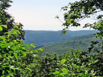
![]()
![]()
![]()
![]()
![]() On Friday, June 25th, my plan was to meet a hiking friend, Sharon, at Little Pond where she was camping. I would pick her up in my car and drive to the Finger Lakes trailhead on Berry Brook Road. We would then hike the Finger Lakes Trail back to Little Pond. I thought this might be a little ambitious as the distance was around 9 miles but with five significant climbs along the way. The forecast was for highs in the high 70's with increasing humidity but when I got up at 7:30 AM it was only 52 degrees. As I started to get ready at 8:00 AM the ambulance pager went off for a car fire. I responded with the rig but was cancelled on the way. By the time I got back to the house it was already 8:25 AM but I thought I had a good chance to make it to Little Pond by 9:00 AM if I hurried to get ready. I put on my White Sierra long-sleeved crew top with a short-sleeved baselayer. I put on a pair of RailRiders hiking pants which are expensive but last a long time and have features like deep pockets and a generous cut which I really like. I wore my Keen Targhee II hiking boots which are showing some serious wear but fit well. I decided to take my Leki Makalu carbon poles with the internal twist locks as they are light and not a problem on most trails. I also put on my OR floppy hat which keeps the insects off and protects me from the sun. I put on my OR Bugout gaiters to combat the ticks. I put my gear in the back of the car and Sheila in the back seat. We left Livingston Manor at 8:35 AM as I drove north on Old Rt 17 toward Roscoe. I turned right on the Beaverkill Road and immediately saw signs indicating that they were still working on the road. Ulster County had paved their portion of the road from outside Lew Beach north and had been finished for some time. Sullivan County chose the cheaper method of crushed gravel and oil which is an inferior solution. I drove up the road but was stopped at the junction with Campground Road. We waited there for at least 10 minutes and then were allowed through following a pilot truck. I though we were done but we were stopped again at the Beaverkill Valley Firehouse. After 5 minutes, the pilot truck appeared and guided us through. By this time it was 9:05 AM and I hoped Sharon would be waiting. I pulled up to the Little Pond gatehouse at 9:15 AM but did not see Sharon. As I was talking to the attendant, Sharon appeared and we were allowed to drive to the main parking area. We transferred Sharon's gear to my car and started the trip to Berry Brook Road. I decided that I did not want to wait for the construction so I turned right on Beech Hill Road and drove out to Route 30. The trip was longer than I expected but the scenery was beautiful. I turned left on Route 30 at the Pepacton Reservoir and drove to Holiday Brook Road. I turned left and drove until the parking area appeared on the left. There were no cars in the lot as I pulled in and parked. We got our gear ready and I set my GPS as we started our hike at 9:55 AM. I did notice that my GPS was detecting the maximum number of satellites but that the elevation was reading over 4100 feet! The temperature was now 62 degrees and I could feel the humidity.
On Friday, June 25th, my plan was to meet a hiking friend, Sharon, at Little Pond where she was camping. I would pick her up in my car and drive to the Finger Lakes trailhead on Berry Brook Road. We would then hike the Finger Lakes Trail back to Little Pond. I thought this might be a little ambitious as the distance was around 9 miles but with five significant climbs along the way. The forecast was for highs in the high 70's with increasing humidity but when I got up at 7:30 AM it was only 52 degrees. As I started to get ready at 8:00 AM the ambulance pager went off for a car fire. I responded with the rig but was cancelled on the way. By the time I got back to the house it was already 8:25 AM but I thought I had a good chance to make it to Little Pond by 9:00 AM if I hurried to get ready. I put on my White Sierra long-sleeved crew top with a short-sleeved baselayer. I put on a pair of RailRiders hiking pants which are expensive but last a long time and have features like deep pockets and a generous cut which I really like. I wore my Keen Targhee II hiking boots which are showing some serious wear but fit well. I decided to take my Leki Makalu carbon poles with the internal twist locks as they are light and not a problem on most trails. I also put on my OR floppy hat which keeps the insects off and protects me from the sun. I put on my OR Bugout gaiters to combat the ticks. I put my gear in the back of the car and Sheila in the back seat. We left Livingston Manor at 8:35 AM as I drove north on Old Rt 17 toward Roscoe. I turned right on the Beaverkill Road and immediately saw signs indicating that they were still working on the road. Ulster County had paved their portion of the road from outside Lew Beach north and had been finished for some time. Sullivan County chose the cheaper method of crushed gravel and oil which is an inferior solution. I drove up the road but was stopped at the junction with Campground Road. We waited there for at least 10 minutes and then were allowed through following a pilot truck. I though we were done but we were stopped again at the Beaverkill Valley Firehouse. After 5 minutes, the pilot truck appeared and guided us through. By this time it was 9:05 AM and I hoped Sharon would be waiting. I pulled up to the Little Pond gatehouse at 9:15 AM but did not see Sharon. As I was talking to the attendant, Sharon appeared and we were allowed to drive to the main parking area. We transferred Sharon's gear to my car and started the trip to Berry Brook Road. I decided that I did not want to wait for the construction so I turned right on Beech Hill Road and drove out to Route 30. The trip was longer than I expected but the scenery was beautiful. I turned left on Route 30 at the Pepacton Reservoir and drove to Holiday Brook Road. I turned left and drove until the parking area appeared on the left. There were no cars in the lot as I pulled in and parked. We got our gear ready and I set my GPS as we started our hike at 9:55 AM. I did notice that my GPS was detecting the maximum number of satellites but that the elevation was reading over 4100 feet! The temperature was now 62 degrees and I could feel the humidity.
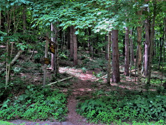 The first part of the trail passes through an easement on private property before it enters the forest. The trail seemed very well traveled and soon we were passing through some nettles and starting a climb. The trail heads northeast toward Mary Smith Hill. Over the next half mile we gained 500 feet for an average grade of 20%. Within this section some parts were approaching a 30% grade! We passed over the top of a small hill and descended the other side before starting the climb to the shoulder of Mary Smith Hill. At .9 miles we finished a climb as the trail turned 90 degrees and started heading southwest. We passed by the summit of Mary Smith Hill and continued to descend until we started up to the top of the next hill. The trail rolled a little but at 1.5 miles we began to climb in earnest. We passed by the summit of an unnamed hill at 2.2 miles and started a long descent. I find it interesting that this hill is 165 feet higher than Mary Smith Hill but has gone unnamed. Initially the descent was moderate and there was even a flat area but at 2.7 miles that changed. Over the next .4 miles we lost 480 feet of elevation without any switchbacks to moderate the descent. The was an average of a 23% grade and I was feeling it when we got to Mary Smith Hill Road at the bottom. Sharon is a hike leader for several different organizations and we were having an ongoing discussion about training hike leaders to handle medical problems on hikes. Sharon completed the Wilderness First Aid course but wanted to practice what she had learned and to know more. We talked about sponsoring a training session for hike leaders. We stopped for a few minutes to inspect the fire ring and primitive campsite before crossing the road to begin the next section of trail. The sign said it was 2 miles which seemed reasonable but signs can be deceiving. I was feeling pretty good as we started out even though the temperature was in the mid 70's and the humidity had increased.
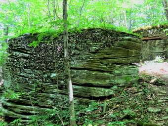 We walked a short distance and came to an interesting stone wall where we stopped to take a few pictures. After that the climb began forcing us to pass through another section of nettles. The nettles grow well in moist areas which also brings on the insects so we hurried to get through this section. As we eared the woods we stopped to apply some insect repellant which seemed to do the job. We were heading east when we came to a short climb up what almost looked like steps. The grade was 32% and we were glad when we got to the top. Near the top there was an interesting set of ledges and I tried to take some pictures but the bright sun was my enemy. There were also some outcroppings that very clearly showed sedimentary layers. I knew the climb wasn't over and for the next .35 miles we gained 400 feet at about a 20% grade. I began to wonder about climbing Cabot Mountain which would be our last section of the hike. This is a difficult climb with an equally difficult descent. I knew Sharon was feeling the effects of the climb and the heat and the humidity. My phone woke up and I asked Sharon if she wanted me to call my wife to pick us up on Beech Hill Road. She agreed and to my surprise I got trough to Cindy easily. She agreed to pick us up and I estimated we would be an hour. I thought this was good decision even though I was pretty sure I could have completed the hike. We knew we still had to descend Middle Mountain and then climb Beech Hill to get to our ride. Knowing that we would not have to hike another 3.5 miles up a mountain seemed to lift our spirits. We descended about 300 feet to the col between Middle Mountain and Beech Hill which seemed so easy after the ascent. Now we had to ascend only 150 feet to the top of Beech Hill after which it was all downhill. The decent off Beech Hill took us through several stands of nettles but we ignored them for the most part. In .6 miles we descended 500 feet to a dirt road. We walked out the dirt road to Beech Hill Road and turned right. Sheila and I set a fast pace as I was hoping Cindy was at the appointed meeting place. As we approached the trailhead, Cindy came walking toward us and Sheila took off running to meet her. We all piled into the car and I drive Sharon back to Little Pond. After dropping Sharon off, I drove back down the Beaverkill Road to Campground Road. We passed through the covered bridge and I drove out to Berry Brook Road where I turned right. I drove to the trailhead where my car was parked. I got into my car and Cindy followed me in hers. We drove to Roscoe and back to Livingston Manor on State Route 17.
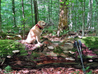
![]()
![]()
![]()
![]()
![]() On Wednesday, June 23rd, I wanted to get out for a longer hike on a day when the forecast looked perfect. There was no chance of showers and the temperature was not supposed to reach much more than 70 degrees with low humidity. My plan was to go to Mongaup Pond Campgrounds to check out the southern end of the Mongaup Hardenburgh Trai. I had been getting many reports that it was overgrown and hard to follow but the maintainer reported he had worked on the trail. I got up 8:15 AM with the temperature at 54 degrees on the back porch. I put on my White Sierra long-sleeved crew top with a short-sleeved baselayer. I put on a pair of RailRiders hiking pants which are expensive but last a long time and have features like deep pockets and a generous cut which I really like. I wore my Keen Targhee II hiking boots which are showing some serious wear but fit well. I decided to take my Leki Makalu carbon poles with the internal twist locks as they are light and not a problem on most trails. I also put on my OR floppy hat which keeps the insects off and protects me from the sun. I put on my OR Bugout gaiters to combat the ticks. I put my gear in the back of the car and Sheila in the back seat. We left Livingston Manor at 9:15 AM as I drove out the DeBruce Road about 6 miles to Mongaup Road. I turned left and continued up the road to the point where it splits. I stayed right on Mongaup Pond Road to head for the campgrounds. When I entered the campgrounds I pulled over and parked on the right. Leaving Sheila in the car, I went to the booth and waited some time for the person ahead of me to register for a campsite. I explained to the attendant that I was the trail supervisor and wanted to enter without paying a fee and park on the side of the road near the trailhead. I presented my card from the trail conference which made things easier and also showed him Sheila's rabies certificate. After signing in, the attendant told me to park in the field near campsite 161 which was near the trailhead. I followed his directions and parked my car. The weather was beautiful with a slight breeze that kept the insects away. I set my GPS unit and started out on the campsite roads at 9:45 AM. we walked out to the road and turned left to walk to the beginning of the Mongaup Hardenburgh Trail.
On Wednesday, June 23rd, I wanted to get out for a longer hike on a day when the forecast looked perfect. There was no chance of showers and the temperature was not supposed to reach much more than 70 degrees with low humidity. My plan was to go to Mongaup Pond Campgrounds to check out the southern end of the Mongaup Hardenburgh Trai. I had been getting many reports that it was overgrown and hard to follow but the maintainer reported he had worked on the trail. I got up 8:15 AM with the temperature at 54 degrees on the back porch. I put on my White Sierra long-sleeved crew top with a short-sleeved baselayer. I put on a pair of RailRiders hiking pants which are expensive but last a long time and have features like deep pockets and a generous cut which I really like. I wore my Keen Targhee II hiking boots which are showing some serious wear but fit well. I decided to take my Leki Makalu carbon poles with the internal twist locks as they are light and not a problem on most trails. I also put on my OR floppy hat which keeps the insects off and protects me from the sun. I put on my OR Bugout gaiters to combat the ticks. I put my gear in the back of the car and Sheila in the back seat. We left Livingston Manor at 9:15 AM as I drove out the DeBruce Road about 6 miles to Mongaup Road. I turned left and continued up the road to the point where it splits. I stayed right on Mongaup Pond Road to head for the campgrounds. When I entered the campgrounds I pulled over and parked on the right. Leaving Sheila in the car, I went to the booth and waited some time for the person ahead of me to register for a campsite. I explained to the attendant that I was the trail supervisor and wanted to enter without paying a fee and park on the side of the road near the trailhead. I presented my card from the trail conference which made things easier and also showed him Sheila's rabies certificate. After signing in, the attendant told me to park in the field near campsite 161 which was near the trailhead. I followed his directions and parked my car. The weather was beautiful with a slight breeze that kept the insects away. I set my GPS unit and started out on the campsite roads at 9:45 AM. we walked out to the road and turned left to walk to the beginning of the Mongaup Hardenburgh Trail.
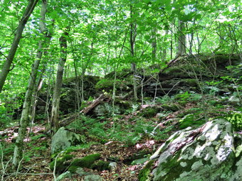 We turned left onto the trail and walked toward the pond following the trail as it turned north along the shore. As we passed one small clearing on the left, I saw a single whitetail deer just standing and eating some grass. I had Sheila on her leash in the campgrounds but the deer wasn't taking any chances and bolted for the woods. As we continued along this section of the trail, I could already see that there was some trimming needed to make the trail easier to travel. At the north end of the pond we turned left at .4 miles to stay on the blue blazed Mongaup Hardenburgh Trail. The trail headed north to Mongaup Mountain. We gained 830 feet over 1.5 miles with an average grade of 11%. The weather continued to be perfect and the climb was not very tiring. Most of the trail was well defined but some markers needed to be replaced. At .85 miles we ran into our first blowdown and I decided to mark them on my GPS which may have been a mistake. By the time we submitted Mongaup Mountain, I had marked 13 issues! To be fair, some of the issues like missing trail markers and very large blowdowns will have to be addressed by the DEC. There were other blowdowns that could be stepped over or walked around. I like to keep my trails free of all blowdowns but other maintainers are more "liberal" especially on backcountry trails. Still, there were some blowdowns that could easily be removed and I threw quite a number of large branches off the trail. I had not brought any tools as I was just doing a survey but I could already see that getting this trail in shape might require a crew. From the top of Mongaup Mountain the trail turned east and then southeast on the descent. The descent and the col between Mongaup and Middle Mongaup Mountains is an area I call "The Mess". There are numerous large blowdowns for hikers to climb over them or duck under them. Some hikers have started to walk around them and the trail markers are hard to find. This area needs some real help and I plan to hike through this area with DEC For Ian Dunn to get his opinion on the best course of action.
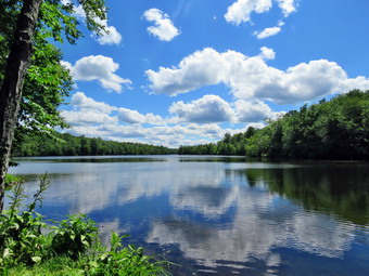 From the col between the mountains to the summit plateau of Middle Mongaup Mountain is a little over half a mile and the elevation gain is 380 feet for a modest 13% grade. Unfortunately, the trail has not been trimmed and markers are missing so the trail disappears in places making the experience feel more like a bushwhack. Fortunately for me, I travel by CPS, canine positioning system. Sheila always seems to be able to find the trail even when it is lightly traveled and nonexistent to my eyes. We walked across the summit plateau of Middle Mongaup for about .2 miles before we came to the descent. I had thought I would turn around here but consulted my maps and found the junction with the Long Pond Beaverkill Ridge Trail wasn't very far ahead. This junction marks the boundary between two different trail maintainers and I thought it would be a good place to turn a round. As we descended the blowdowns kept coming with some hidden by the brush that had not been cleared. The trail continued to be hard to find. At 3.3 miles we hit a flat spot that lasted for .2 miles until the climb up to the Beaverkill Ridge and the trail junction. As we started the climb I could find no trail markers at all! The climb was short, only .2 miles, and didn't gain too much elevation, only 140 feet, but parts of it were close to a 30% grade! When we came to the junction, I found a cairn to mark the turn. Ian Dunn said the signs are finished and that we would hike together to replace them in the near future. It was 12:50 PM when we turned around to start back making the "out" trip a 3 hour affair. I hoped that setting a faster pace and not having to mark all the blowdowns would make the trip back faster. We did set a fast pace on the way back but were slowed by the blowdowns and poor trail conditions. In the sketchy areas, I just followed Sheila which worked out well. I lost track of where we were at one point and was not sure if we were descending the last mountains or had one more to climb. I was also confused as the time seemed to indicate we had several miles to go. I decided just to hike and found we were descending Mongaup Mountain. The decent is not short but we were soon on the shore on Mongaup Pond. No one was around so I let Sheila take a dip while I snapped a few shots of the pond and the blue sky with white puffy clouds. I packed up and we headed back to the car. We were back at 2:55 PM which meant the return trip took only 2 hours! We had hiked 8.1 miles in 5 hours and 10 minutes with an elevation gain of 1925 feet. We had not seen another hiker all day. I was disappointed with the conditions of the trail especially the section after Mongaup Mountain. I had logged 32 issues which I will have to deal with to improve the trail. As I drove to the entrance of the campgrounds, I was surprised by the number of occupied campsites especially since it was the middle of the week.
![]()
![]()
![]()
![]() On Monday, June 21st I wanted to go to Mongaup Pond to check out the Mongaup Hardenburgh Trail which some hikers reported was in bad shape. I had my paperwork and Sheila's in order so that the attendants would let me enter the campgrounds without paying a fee and park near the trailhead. The forecast was for hot and humid weather with afternoon thunderstorms so I knew I had to get a relatively early start. When I got up at 8:00 AM it was already 74 degrees on the back porch and the humidity was over 50%. As I started to get ready, the ambulance pager sounded and I was off on a call. The call took longer than expected and I returned home just before 11:00 AM. I started to get ready immediately with the temperature at 84 degrees and the humidity at 60%. I decided to go across the street to hike on Round Top so that I could control how long we were out hiking. As I got ready, Sheila seemed very happy to be going out. I put on my White Sierra long-sleeved crew top with no base layer because of the temperature and humidity. I put on a pair of RailRiders hiking pants which are expensive but last a long time and have features like deep pockets and a generous cut which I really like. I wore my Zamberlain hiking shoes which are low cut and very light but supportive. Each time I wear them I realize how comfortable and light they are. I decided to take my Leki Makalu carbon poles with the internal twist locks as my other poles were waiting for replacement tips to arrive. We stepped out of the house at 11:25 AM. I grabbed Sheila's leash from the car and put it on her to safely cross the street. We walked up the driveway and crossed the street. We walked to the church parking lot and to the back of the church. As we started up the hill, we began the ascent of the steep hill behind the church. The hill is short but gets the circulation pumping and is the steepest and longest climb on the "trail". I let Sheila pull me up the hill which she was willing to do. At the trailhead, I let Sheila off her leash and she immediately began to bound up the trail. I started on the trail by turning left at the trailhead. I knew that other people were using the trails from comments on Facebook. The trails were becoming well-worn as more and more people use them.
On Monday, June 21st I wanted to go to Mongaup Pond to check out the Mongaup Hardenburgh Trail which some hikers reported was in bad shape. I had my paperwork and Sheila's in order so that the attendants would let me enter the campgrounds without paying a fee and park near the trailhead. The forecast was for hot and humid weather with afternoon thunderstorms so I knew I had to get a relatively early start. When I got up at 8:00 AM it was already 74 degrees on the back porch and the humidity was over 50%. As I started to get ready, the ambulance pager sounded and I was off on a call. The call took longer than expected and I returned home just before 11:00 AM. I started to get ready immediately with the temperature at 84 degrees and the humidity at 60%. I decided to go across the street to hike on Round Top so that I could control how long we were out hiking. As I got ready, Sheila seemed very happy to be going out. I put on my White Sierra long-sleeved crew top with no base layer because of the temperature and humidity. I put on a pair of RailRiders hiking pants which are expensive but last a long time and have features like deep pockets and a generous cut which I really like. I wore my Zamberlain hiking shoes which are low cut and very light but supportive. Each time I wear them I realize how comfortable and light they are. I decided to take my Leki Makalu carbon poles with the internal twist locks as my other poles were waiting for replacement tips to arrive. We stepped out of the house at 11:25 AM. I grabbed Sheila's leash from the car and put it on her to safely cross the street. We walked up the driveway and crossed the street. We walked to the church parking lot and to the back of the church. As we started up the hill, we began the ascent of the steep hill behind the church. The hill is short but gets the circulation pumping and is the steepest and longest climb on the "trail". I let Sheila pull me up the hill which she was willing to do. At the trailhead, I let Sheila off her leash and she immediately began to bound up the trail. I started on the trail by turning left at the trailhead. I knew that other people were using the trails from comments on Facebook. The trails were becoming well-worn as more and more people use them.
At the first trail junction, I followed Sheila as she continued straight ahead up the hill toward the viewpoint. The climb up the hill was not particularly tiring. At the viewpoint, I noticed that the brush that I had placed in the trail was still there. This trail has a dangerous spot and we have piled brush on it to discourage people from using it. We continued to the main trail and headed to the right to follow the main yellow trail as it turned right and headed up the gentle hill through the hardwood forest. The forest was becoming much greener and ferns covered the forest floor. Sheila was making her own way by staying on the trail sometimes and then running off-trail and chasing game trails. She was also picking up sticks and dragging them along and off the trail. We continued to follow the yellow trail toward the first junction with the blue trail. There was a slight breeze blowing which discouraged the insects and made the air feel cooler. The skies were cloudy with some bright sunlight. At the first trail junction with the blue trail, we turned right and followed the yellow trail along the base of Round Top. This section was in good shape without any blowdowns but needed some trimming which I knew I could do with my Stihl trimmer. At the next junction, we turned left and started up to the summit of Round Top on the blue trail. We bypassed the white crossover trail and continued up and over the summit. When we started down the other side, I decided we would skip the white crossover trail and the new switchback on the blue trail and just continue down the hill. The steepest part of the hill can be tricky but the poles helped me to keep my balance. People seemed to be avoiding the crossover trail but the switchback looked more well-worn. At the bottom of the hill, we turned left on the yellow trail, walked along the base of Round Top. At the trail junction with the blue trail, we turned right to walk down to the woods road. It was a snap to walk downhill and out the woods road. It was obvious Sheila felt the same way as she was running and bounding ahead of us and then running back up the trail. We walked the woods road out to the first trail junction where we immediately turned around and started back up the woods road to the junction with the blue trail. I had to call Sheila back as she was following game trails and inspecting the "caves". We turned left and walked along the yellow trail following the base of the Round Top summit. At the next junction, we turned right and started up the steeper side of the hill on the blue trail. This time we again avoided the switchback in the blue trail and continued up toward the summit. When we came to the white-blazed crossover trail, we continued past it toward the top. We continued on the main trail over the summit and then started down the other side to the junction with the yellow trail. We turned right on the yellow trail and followed it along the base of Round Top once again. At the junction with the blue trail, we turned to the left to stay on the yellow trail to the lookout. At the lookout, we followed the yellow trail as it turned left and descended to the first trail junction.
We normally end our hike at this point but I decided we would do two more figure 8's using the switchback and crossover trails. We turned around and started up the steep hill to the lookout. We followed the yellow trail as it turned to the right and started back up through the hardwood forest. We passed the "sitting rock" and continued up the slope to the junction with the blue trail. We turned right on the yellow trail and walked along the base of Round Top to the second junction with the blue trail. At the junction, we turned left on the blue trail heading toward the summit of Round Top. This time we turned left on the white switchback trail and followed it through the forest to the blue trail on the other side of the hill. This trail was not well-traveled but was covered in ferns. At the blue trail, we turned left and then almost immediately left again on the switchback on the blue trail. We followed the switchback to the blue trail and then turned left and walked the main blue trail to the junction with the yellow trail. We turned left and walked along the base of Round Top to the junction with the blue trail. This time we turned right and followed the yellow trail down the hill to the woods road. We walked on the woods road back out to the first trail junction. We immediately turned around and walked back up the woods road turning left at the top and walking the yellow trail to the second junction with the blue trail. Here we turned right and walked uphill to the switchback where we turned right. We walked the switchback to the main blue trail and turned right and then right again onto the white switchback trail. Where the deckchair trail met the blue trail we turned right and walked the blue trail down to the yellow trail. We turned right and followed the yellow trail along the base of Round Top. We turned left at the junction with the blue trail, walked downhill to the lookout, and then downhill to the first trail junction. By this time Sheila and I were both hot so walked straight out to the trailhead. We turned right to walk to the bottom of the hill. We headed across the church parking lot to the street. We crossed the street to our driveway and were home by 12:55 PM after hiking a around 4 miles in 1 hour and 30 minutes.