
What You Missed
Spring 2021
Spring 2021
![]()
![]()
![]()
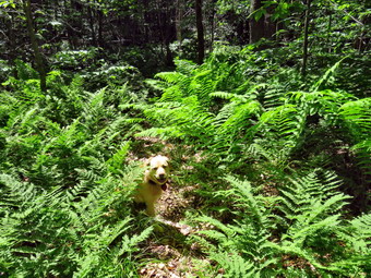
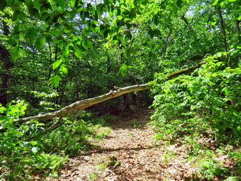
![]() On Friday, June 18th, I really wanted to get out for a longer hike after a Thursday packed with aggravation and meetings. I had an 11:15 AM appointment at the dentist so I knew I wouldn't get started until the afternoon. My plan was to come home and go to Mongaup Pond Campgrounds. I wanted to check out the southern end of the Mongaup Hardenburgh Trail as I had been getting many reports that it was overgrown and hard to follow. I got home just before 12:30 PM and immediately started to get dressed with the temperature at 78 degrees on the back porch. I put on my White Sierra long-sleeved crew top with a short-sleeved baselayer. I put on a pair of RailRiders hiking pants which are expensive but last along time and have features like deep pockets and a generous cut which I really like. I wore my Keen Targhee II hiking boots which are showing some serious wear but fit well. I decided to take my Leki Makalu carbon poles with the internal twist locks as my other poles were waiting for replacement tips to arrive. I also put on my OR floppy hat which keeps the insects off and protects me from the sun. I put on my OR Bugout gaiters to combat the ticks. I put my gear in the back of the car and Sheila in the back seat. We left Livingston Manor at 12:P5 AM as I drove out the DeBruce Road about 6 miles to Mongaup Road. I turned left and continued up the road to the point where it splits. I stayed right on Mongaup Pond Road to head for the campgrounds. When I entered the campgrounds I pulled over and parked ion the right. Leaving Sheila in the car, I went to the booth and explained that I was the trail supervisor and wanted to enter without paying a fee and park on the side of the road near the trailhead. I presented my card from the trail conference which made things easier. Everything was going well until the attendant spotted Shiela and asked for proof of a current rabies vaccination. Sheila's tag was for 2019 and although I was sure the vaccination was still good I was refused entrance. I was not happy but I understood so I decided to drive home to make sure I could find the certificate or get one at the veterinarian. As I arrived in my driveway, an ambulance call came in and I was off to respond. The call was short and I returned home. Cindy found a note from the doctor that said the rabies vaccine was good until July of 2022! I decided to go back to Mongaup Pond to make sure what I had was acceptable even though it was too late to do Te hike I had planned. A different attendant looked at the paperwork and said that it was OK. I decided to drive to Frick Pond and do a shorter hike and save the longer hike on the Mongaup Hardenburgh Trail for another day. I drove to the parking area at Frick Pond and was surprised to see no cars in either lot. It was 72 degrees when I set my GPS unit and started out toward Frick Pond at 3:10 PM.
On Friday, June 18th, I really wanted to get out for a longer hike after a Thursday packed with aggravation and meetings. I had an 11:15 AM appointment at the dentist so I knew I wouldn't get started until the afternoon. My plan was to come home and go to Mongaup Pond Campgrounds. I wanted to check out the southern end of the Mongaup Hardenburgh Trail as I had been getting many reports that it was overgrown and hard to follow. I got home just before 12:30 PM and immediately started to get dressed with the temperature at 78 degrees on the back porch. I put on my White Sierra long-sleeved crew top with a short-sleeved baselayer. I put on a pair of RailRiders hiking pants which are expensive but last along time and have features like deep pockets and a generous cut which I really like. I wore my Keen Targhee II hiking boots which are showing some serious wear but fit well. I decided to take my Leki Makalu carbon poles with the internal twist locks as my other poles were waiting for replacement tips to arrive. I also put on my OR floppy hat which keeps the insects off and protects me from the sun. I put on my OR Bugout gaiters to combat the ticks. I put my gear in the back of the car and Sheila in the back seat. We left Livingston Manor at 12:P5 AM as I drove out the DeBruce Road about 6 miles to Mongaup Road. I turned left and continued up the road to the point where it splits. I stayed right on Mongaup Pond Road to head for the campgrounds. When I entered the campgrounds I pulled over and parked ion the right. Leaving Sheila in the car, I went to the booth and explained that I was the trail supervisor and wanted to enter without paying a fee and park on the side of the road near the trailhead. I presented my card from the trail conference which made things easier. Everything was going well until the attendant spotted Shiela and asked for proof of a current rabies vaccination. Sheila's tag was for 2019 and although I was sure the vaccination was still good I was refused entrance. I was not happy but I understood so I decided to drive home to make sure I could find the certificate or get one at the veterinarian. As I arrived in my driveway, an ambulance call came in and I was off to respond. The call was short and I returned home. Cindy found a note from the doctor that said the rabies vaccine was good until July of 2022! I decided to go back to Mongaup Pond to make sure what I had was acceptable even though it was too late to do Te hike I had planned. A different attendant looked at the paperwork and said that it was OK. I decided to drive to Frick Pond and do a shorter hike and save the longer hike on the Mongaup Hardenburgh Trail for another day. I drove to the parking area at Frick Pond and was surprised to see no cars in either lot. It was 72 degrees when I set my GPS unit and started out toward Frick Pond at 3:10 PM.
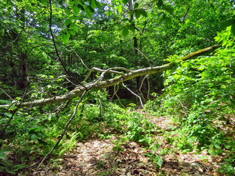
The woods road to the register was barely damp and the Quick Lake Trail from the register to Gravestone Junction was also pretty dry. There was no standing water and very little running across the trail. There were a few muddy areas as we made the turn to the left at the junction. We walked down the hill to the bridge at the outlet end of the pond. I usually stop here to take some pictures but n this day I was more interested in hiking quickly. My plan was to take the Big Rock Trail around the back of Frick Pond and then up the hill to the Flynn Trail. I would use the Flynn Trail to return to the car with 1.7 miles of downhill! The mud hole on the west side of Frick Pond was wet but easily crossed. At the junction with the Big Rock Trail we stayed right to get on the Big Rock Trail. We were setting a fast pace as we walked across the wooden walkways. I did find a large spruce tree that had fallen parallel to the trail. Some of the branches were encroaching on the trail and I could not leave them there. Fortunately, the branches were loose or easy to break off so it only took a few minutes to clear everything. We continued around the north end of the pond to Times Square passing a few damp areas. At Times Square, we headed up the hill toward the Flynn Trail. There are three different "tiers" to the trail and 1.1 miles to the top gains 600 feet. This part can sometimes go very slowly but this time we were at the top before I even thought about it. At 4:05 PM we hit the Flynn Trail and turned right after hiking 2.2 miles. Sheila had stayed with me most of the time but she was now ranging out to follow some game trails. I saw her run into the ferns and all of a sudden 4 grouse shot up. Sheila loves birds and almost had one. She has brought me grouse before but they have always been alive and in good shape. She continued to beat the bushes until I call her and we continued down hill. I did notice that there were a lot of biting flies and mosquitoes around but continuing to move discouraged them some. Before I knew it, we were approaching the gate that separates state land from private property. We stayed to the left at the gate to avoid the private property around the cabin. We arrived in the parking area at 4:40 PM with the temperature at 76 degrees and a noticeably higher humidity. We had covered 4.0 miles in 1 hour and 30 minutes with and elevation gain of 670 feet. On the trip down the Flynn Trail we had averaged 3 mph with an overall average of 2.6 mph.
![]()
![]()
![]()
![]()
![]() On Wednesday, June 16th, I had big plans to inspect some of the trails in my area. I planned to park a car at Mongaup Pond and then have my wife drop me at the beginning of the Mongaup Hardenburgh Trail on the Beaverkill Road. This would allow me to hike the whole trail and inspect its condition. When I woke up in the morning at 8:00 AM, I mentioned my plan to Cindy and she said she would like to hike as the temperature was only 57 degrees and the skies were completely clear. We decided that we would park on the Beaverkill Road at the beginning of the Mongaup Hardenburgh Trail and hike to the junction with the Long Pond Beaverkill Ridge Trail. This would allow me to check out the maintenance status of the trail and I could check the other half from Mongaup on another day. I had not been on the trail in some time and thought we might hit Willowemoc Mountain and Sand Pond Mountain while we were there. These two peaks are on the Catskill Highest Hundred list. Willowemoc Mountain has sort of a view but Sand Pond Mountain does not. Sheila was happy we would be getting out and stayed near me to make sure I knew she wanted to go. I started to get dressed at 8:45 AM. I put on my White Sierra long-sleeved crew top with a short-sleeved baselayer. I put on a pair of RailRiders hiking pants which are expensive but last along time and have features like deep pockets and a generous cut which I really like. I wore my Keen Targhee II hiking boots which are showing some serious wear but fit well. I decided to take my Leki Makalu carbon poles with the internal twist locks as my other poles were waiting for replacement tips to arrive. I also put on my OR floppy hat which keeps the insects off and protects me from the sun. I took along my Silky Sugowaza saw in my pack along with two plastic wedges. We put all the gear in the back of the car and Sheila in the back seat and drove out the driveway at 9:10 AM.
On Wednesday, June 16th, I had big plans to inspect some of the trails in my area. I planned to park a car at Mongaup Pond and then have my wife drop me at the beginning of the Mongaup Hardenburgh Trail on the Beaverkill Road. This would allow me to hike the whole trail and inspect its condition. When I woke up in the morning at 8:00 AM, I mentioned my plan to Cindy and she said she would like to hike as the temperature was only 57 degrees and the skies were completely clear. We decided that we would park on the Beaverkill Road at the beginning of the Mongaup Hardenburgh Trail and hike to the junction with the Long Pond Beaverkill Ridge Trail. This would allow me to check out the maintenance status of the trail and I could check the other half from Mongaup on another day. I had not been on the trail in some time and thought we might hit Willowemoc Mountain and Sand Pond Mountain while we were there. These two peaks are on the Catskill Highest Hundred list. Willowemoc Mountain has sort of a view but Sand Pond Mountain does not. Sheila was happy we would be getting out and stayed near me to make sure I knew she wanted to go. I started to get dressed at 8:45 AM. I put on my White Sierra long-sleeved crew top with a short-sleeved baselayer. I put on a pair of RailRiders hiking pants which are expensive but last along time and have features like deep pockets and a generous cut which I really like. I wore my Keen Targhee II hiking boots which are showing some serious wear but fit well. I decided to take my Leki Makalu carbon poles with the internal twist locks as my other poles were waiting for replacement tips to arrive. I also put on my OR floppy hat which keeps the insects off and protects me from the sun. I took along my Silky Sugowaza saw in my pack along with two plastic wedges. We put all the gear in the back of the car and Sheila in the back seat and drove out the driveway at 9:10 AM.
 I headed north toward Roscoe on Old Route 17 and turned right on the Beaverkill Road. I drove about 18 miles on the road passed the point near Quill Gordon Lodge where it turns from pavement to packed dirt. We arrived in the parking area at 9:50 AM with the temperature at 57 degrees. There were no other vehicles in the lot. As we began to get ready I discovered I had forgotten to put on my gaiters so I sprayed my pant legs with insect repellant. I set my GPS unit and we walked down the steep trail to the suspension bridge over the Beaverkill at 9:55 AM. The bridge consists of two towers at either end constructed of steel beams. The wooden decking is placed longitudinally on the bridge rather than crossways. The decking is suspended from several steel cables strung between the towers. The bridge sways considerably as you walk across and I am never too happy about walking across the bridge. Sheila on the other hand had no problem going across and coming back several times. I did notice that a few of the boards on the bridge should be repaired and that one of the cables was broken! We finally crossed the bridge and started up the ascent to the ridge. From the bridge the trail gains 750 feet over .7 miles at about a 20% grade. I did not remember this climb and it was a little tiring for Cindy. As we walked along the trail we removed random small branches that had fallen on the trail. We also stopped a few times to remove some large branches and trunks and even had to break out the saw. There were quite a few large and old blowdowns either on the ground or elevated across the trail. All of these were too large for us to cut and I knew I would have to see if Andy Garrison or the local ranger could come to cut them with a chainsaw in the spring. The other choice was to let them remain where they are since they can be negotiated with out too much of a problem. Along the way there were several climbs through rock ledges which were interesting and beautiful in their own way.
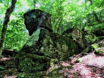
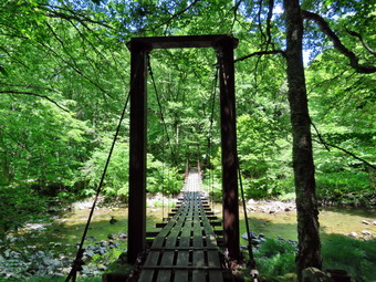 Over the next mile the trail gains about 250 feet as it flattens some and then climbs once again. I had been cool at the trailhead but the hiking and the climbing had warmed me up. At 2 miles into the hike we passed by Willowemoc Mountain which was off the trail to our left. We decided to leave a climb to the summit for the trip back if there was time. A short distance passed this point, Cindy announced she had gone as far as she could go. I had expected this but it was still disappointing. I decided to continue down the other side of Willowemoc Mountain just to get a little more ascent on the way back. As Sheila and I started down the other side we ran into some blowdowns but hikers had already detoured around them so I left them where they were. The descent was rocky and steep on the other side. The trail flattened and then descended again. After about 20 minutes, I decided to turn around as I did not want to leave Cindy waiting for too long. I knew the trip back would probably take less time since it was mostly flat and downhill. It had taken us 2 hours and 20 minutes to hike out. Sheila and I turned around and set a fast pace up the mountain and back to Cindy. I let Sheila go as we approached the top of the ascent and she made a beeline for Cindy. I told Cindy to start back along the main trail while I quickly bushwhacked to the highest point on Willowemoc Mountain. Once at the top, I looked around for some view but the foliage blocked any lookout. I retuned to the trail and caught up with Cindy. We tried to push the pace on the flat ground near the top of Willowemoc Mountain. At one point I looked ahead and saw the trail stretching almost straight for some distance. I was lost deep in my thoughts and we didn't talk much. Even so the trip back went quickly. We descended a ledge and stopped to take some pictures of the rock formations. Shortly after this we both could hear the river ahead. We descended to the bridge and Sheila went down to the river to get a drink. I took some pictures of the bridge. We crossed over the bridge and I stopped to take a few more shots of the bridge. I walked back up the hill to the car to join Cindy. It was 1:50 PM and we had hiked 5 miles in 3 hours and 50 minutes which was a slow pace but included the time we spent to remove blowdowns and for me to take pictures. The elevation gain was 1495 feet. The temperature at the car was 67 degrees.
![]()
![]()
![]()
![]() On Monday, June 14th I wanted to get out for a short hike after getting up later than usual. I did some work around the house and then started to get ready to go across the street and hike on Round Top at 11:00 AM. The temperature was 70 degrees and the humidity seemed reasonable. Sheila was watching me and seemed very happy to be going out. I put on my White Sierra long-sleeved crew top with no baselayer because of the temperature and humidity. I put on a pair of RailRiders hiking pants which are expensive but last along time and have features like deep pockets and a generous cut which I really like. I wore my Zamberlain hiking shoes which are low cut and very light but supportive. I had not worm them hiking in some time and had forgotten how comfortable and light they are. I also donned my OR BugOut gaiters to combat the ticks and are treated to resist insects. I decided to take my Leki poles with the internal twist locks as I was waiting to replace the tips on my Leki poles with external locks. I noticed that the tips on these poles were worn and made a note to buy new ones at Morgan Outdoors. We stepped out of the house at 11:30 AM. I grabbed Sheila's leash from the trunk of my car and we walked up the driveway. I aimed to hike for about an hour. Sheila was happy to get out as we headed down the driveway and across the street. We crossed the street and walked to the parking area by the Presbyterian Church. We walked to the back of the church and began the ascent of the steepest hill behind the church. The hill is short but gets the circulation pumping and is the steepest and longest climb on the "trail." Sheila helped me along by pulling me up the hill. I stopped to look at some of the headstones in the cemetery which have fallen over due to the steep angle of the hill and hillside creep. When we got to the top of the hill, I stopped to look around at the hills around town. We started on the trail by turning left at the trailhead. I let Sheila off her leash so that she could run free. I knew that other people were using the trails from comments on Facebook. The trails was becoming well-worn as more and more people use them.
On Monday, June 14th I wanted to get out for a short hike after getting up later than usual. I did some work around the house and then started to get ready to go across the street and hike on Round Top at 11:00 AM. The temperature was 70 degrees and the humidity seemed reasonable. Sheila was watching me and seemed very happy to be going out. I put on my White Sierra long-sleeved crew top with no baselayer because of the temperature and humidity. I put on a pair of RailRiders hiking pants which are expensive but last along time and have features like deep pockets and a generous cut which I really like. I wore my Zamberlain hiking shoes which are low cut and very light but supportive. I had not worm them hiking in some time and had forgotten how comfortable and light they are. I also donned my OR BugOut gaiters to combat the ticks and are treated to resist insects. I decided to take my Leki poles with the internal twist locks as I was waiting to replace the tips on my Leki poles with external locks. I noticed that the tips on these poles were worn and made a note to buy new ones at Morgan Outdoors. We stepped out of the house at 11:30 AM. I grabbed Sheila's leash from the trunk of my car and we walked up the driveway. I aimed to hike for about an hour. Sheila was happy to get out as we headed down the driveway and across the street. We crossed the street and walked to the parking area by the Presbyterian Church. We walked to the back of the church and began the ascent of the steepest hill behind the church. The hill is short but gets the circulation pumping and is the steepest and longest climb on the "trail." Sheila helped me along by pulling me up the hill. I stopped to look at some of the headstones in the cemetery which have fallen over due to the steep angle of the hill and hillside creep. When we got to the top of the hill, I stopped to look around at the hills around town. We started on the trail by turning left at the trailhead. I let Sheila off her leash so that she could run free. I knew that other people were using the trails from comments on Facebook. The trails was becoming well-worn as more and more people use them.
At the first trail junction, I turned right to walk up the more shallow approach to Round Top on the wide woods road. The trails were mostly dry with a damp spot here and there. At the first junction with the blue trail, we turned left and continued on the yellow trail along the base of Round Top. The grass and weeds were starting to grow up n the trail and I thought about brining the string trimmer next tine. At the second junction with the blue trail we turned right and headed up the steep side of the hill. When the switchback turned to the right, we followed it as it led us up the hill and back to the original route. This trail showed signs of use while the trail up the hill was starting to grow in. We turned right on the blue trail and headed toward the summit but almost immediately turned right on the white shortcut trail. This trail seemed almost unused as if people were avoiding it and heading up the blue trail and over the summit. We followed that trail across the hill to the blue trail coming down from the summit. We turned right to head back down the hill to the yellow trail. We turned right on the yellow trail to once again walk along the base of Round Top. This time when we reached the second junction with the blue trail we turned left on the yellow trail and followed that downhill to the viewpoint over town. The forest floor was getting greener all the time as ferns began to pop up with some interspersed windflowers. At the lookout we turned left to follow the yellow trail back to the very first trail junction. I check the path to the viewpoint and found that the brush I had placed in the trail was still there albeit sparse. The path can be dangerous for some and I wanted it blocked to discouraged its use. We continued down the hill to the very first trail junction completing our first figure 8. We immediately turned around and hiked back up the steeper trail to the viewpoint. We followed the yellow trail as it turned right and began the long but gentle climb to the first junction with the blue trail. At the junction we turned right to follow the yellow trail along the base of Round Top to the second junction with the blue trail. We turned left and followed the blue trail to the white shortcut trail. We turned left and followed the trail along the side of the hill to the junction with the blue trail. We turned left and almost immediately left again on the switchback. We followed the switchback back to the main blue trail and turned left to walk down to the lower yellow trail. We turned left on the yellow trail and again followed it to the next junction with the blue trail. This time we turned right and followed the yellow trail down to the wide woods road that brought us back to the first trail junction. We turned left and walked back out to the trailhead. We turned right to walk to the bottom of the hill and headed across the church parking lot to the street. We crossed the street to our driveway and were home by 12:30 PM after hiking a little over 2 miles in 1 hour.
![]()
![]()
![]()
![]() On Saturday, June 12th I wanted to get out for a longer hike after three days off for track meets and a few shorter hikes before that. I planned to get started early and did get up at 7:00 AM. However, I was tired from several ambulance calls the day before so I hung around the house for a while. The skies were completely overcast and the called for a chance of showers all day. I decided to get ready and go to the Frick Pond area to hike the Flynn Trail and the snowmobile trail to Mongaup Pond. From Mongaup Pond I would walk the roads back to the car with the possibility of lengthening the hike by going around the pond. A visit to the falls on the outlet creek was also a possibility. I began to get ready at 9:30 AM when the temperature was 66 on the back porch. Sheila was watching me very closely as I got dressed. I put on my White Sierra long-sleeved crew top with a short-sleeved baselayer to protect me from the biting insects often present at Frick Pond. I put on a pair of RailRiders hiking pants which are expensive but last along time and have features like deep pockets and a generous cut which I really like. I wore my Keen Targhee II hiking boots which are showing some serious wear but fit well. I also donned my OR BugOut gaiters to combat the ticks and are treated to resist insects. I decided to take my Leki Makalu carbon poles with the internal twist locks as my other poles were waiting for replacement tips to arrive. I decided to wear my OR floppy hat which keeps the insects off and protects me from the sun. I put my gear in the back and Sheila in the backseat and headed out the DeBruce Road a little after 10:00 AM. After 6 miles, at Mongaup Pond Road, I turned left and continued to follow the road bearing left onto Beech Mountain Road at the fork. When we arrived in the parking area there was one other cars parked in the small lot. I pulled into the smaller lot with Sheila was acting as if she hadn't hiked in a month as she ran around and headed for the trail. The temperature was 64 degrees and the skies were completely overcast but with a reasonable humidity. I got my gear ready to go and set my GPS unit. We headed across the road to get on the Flynn Trail at 10:25 AM. The grass on the Flynn Trail was wet from the rain the day before and from the dew but the trail was otherwise dry and very well defined. I once again noticed that although the Flynn Trail ascends to the junction with the Big Rock trail, it seemed much easier now that I have recently been hiking more. We passed through the tunnel Cindy and I had cut in the big spruce tree across the trail and continued on up the trail. At a mile we hit a high point and passed by the path on the right to a large clearing. The skies were still overcast and I wondered if it would rain. I was grateful that the insects were only bad when I stopped. Because of this, my plan was simply not to stop!
On Saturday, June 12th I wanted to get out for a longer hike after three days off for track meets and a few shorter hikes before that. I planned to get started early and did get up at 7:00 AM. However, I was tired from several ambulance calls the day before so I hung around the house for a while. The skies were completely overcast and the called for a chance of showers all day. I decided to get ready and go to the Frick Pond area to hike the Flynn Trail and the snowmobile trail to Mongaup Pond. From Mongaup Pond I would walk the roads back to the car with the possibility of lengthening the hike by going around the pond. A visit to the falls on the outlet creek was also a possibility. I began to get ready at 9:30 AM when the temperature was 66 on the back porch. Sheila was watching me very closely as I got dressed. I put on my White Sierra long-sleeved crew top with a short-sleeved baselayer to protect me from the biting insects often present at Frick Pond. I put on a pair of RailRiders hiking pants which are expensive but last along time and have features like deep pockets and a generous cut which I really like. I wore my Keen Targhee II hiking boots which are showing some serious wear but fit well. I also donned my OR BugOut gaiters to combat the ticks and are treated to resist insects. I decided to take my Leki Makalu carbon poles with the internal twist locks as my other poles were waiting for replacement tips to arrive. I decided to wear my OR floppy hat which keeps the insects off and protects me from the sun. I put my gear in the back and Sheila in the backseat and headed out the DeBruce Road a little after 10:00 AM. After 6 miles, at Mongaup Pond Road, I turned left and continued to follow the road bearing left onto Beech Mountain Road at the fork. When we arrived in the parking area there was one other cars parked in the small lot. I pulled into the smaller lot with Sheila was acting as if she hadn't hiked in a month as she ran around and headed for the trail. The temperature was 64 degrees and the skies were completely overcast but with a reasonable humidity. I got my gear ready to go and set my GPS unit. We headed across the road to get on the Flynn Trail at 10:25 AM. The grass on the Flynn Trail was wet from the rain the day before and from the dew but the trail was otherwise dry and very well defined. I once again noticed that although the Flynn Trail ascends to the junction with the Big Rock trail, it seemed much easier now that I have recently been hiking more. We passed through the tunnel Cindy and I had cut in the big spruce tree across the trail and continued on up the trail. At a mile we hit a high point and passed by the path on the right to a large clearing. The skies were still overcast and I wondered if it would rain. I was grateful that the insects were only bad when I stopped. Because of this, my plan was simply not to stop!
It didn't seem long at all until we were approaching the junction with the Big Rock Trail at 1.7 miles into the hike. By the time we were at the junction, we had already gained 600 feet and only had a little more elevation gain until we would start downhill. The trip up the Flynn Trail had only taken 40 minutes which was one of our fastest times. We turned right at the junction on the snowmobile trail and climbed another 120 feet to the highest point on the hike at a little over 1.9 miles. After hitting the high point, most of the rest of the hike was downhill. The Flynn Trail heads directly north from the trailhead but the snowmobile trail wanders first east, then south, the east, then north before finally heading southeast and south toward Mongaup Pond. As we descended from the high point we found evidence that there had been a stream of water flowing down most of the trail. The trail has become highly eroded and difficult to hike because of all the exposed rocks. Many of the rocks were covered with a thin film of water making them very slippery. Sheila was wandering off trail and then returning to us never getting very far away. On one descent, Sheila alerted and I looked up to see a mountain biker headed up the hill toward us. I pulled Sheila to the side of the trail and said "Hello" to the biker as he passed. He told me he would be heading back down after hitting the high point. At 3.1 miles we followed the trail as it turned southeast and then east still descending toward the pond. We finally hit a woods road and the trail leveled out. Just before getting to the roads that run through the campground we passed by a swamp on the left. There are usually a few small streams across the trail but on this day there were only a few damp spots. When we got to the campground roads, I put Sheila on her leash as I expected the campgrounds to be packed. Three kids passed us on bikes and rode out onto the main loop without stopping or looking for cars. We turned right and walked out to the main loop road. We turned right and immediately met a group of people walking on the road. One of them had a dog that was not on a leash and was heading straight for us. As the dog approached I put my poles in its face which slowed it down. The owner came running to grab the dog. I couldn't help thinking that simply obeying the campground rules and keeping the dog on a leash would avoid potential problems. We headed south on the loop road and after a short walk, we turned left and walked over to a bench near the shores of the pond. Sheila took a dip in the pond. I took a look at the scene and decided it was not interesting enough to take pictures. Sheila came out of the pond and shook off the water. We walked out to the loop road and continued heading south. After walking a little more than half a mile, we came to the observation deck which had been under construction but now was completed. We continued on the loop road out to the entrance of the campground. We walked out the access road to begin the walk back to the car. The access road is easy to walk but is always longer than I remember except on this day when it seemed short. From the booth at the campground entrance to the intersection with Beech Mountain Road it is only 1.1 miles and on this day it seemed shorter as we pushed the pace. At the intersection, I considered walking down to the falls but the clouds were gathering and I did not want to get wet. We turned right and walked up the hill for .3 miles to the car. One car that had been in the lot was gone but two other cars had appeared. It was 1:00 PM and we had spent 2 hours 35 minutes hiking 6.4 miles for an overall average speed of 2.6 mph and a total climb of 960 feet. The temperature was 66 degrees and as I drove home the skies were clearing.
![]()
![]()
![]()
![]() On Tuesday, June 8th I wanted to get out for a hike before track practice. I knew I would get out on Wednesday as we had a sectional track meet at home. Around 11:15 AM I decided to try to get across the street to hike on Round Top. As I began to get ready the temperature was 78 degrees and the moist air felt heavy. As I got ready, Sheila seemed very happy to be going out. I put on my White Sierra long-sleeved crew top with no baselayer because of the temperature and humidity. I put on a pair of RailRiders hiking pants which are expensive but last along time and have features like deep pockets and a generous cut which I really like. I wore my Zamberlain hiking shoes which are low cut and very light but supportive. I had not worn them hiking in some time and had forgotten how comfortable and light they are. I also donned my OR BugOut gaiters to combat the ticks and are treated to resist insects. I decided to take my Leki Makalu carbon poles with the internal twist locks as my other poles were waiting for replacement tips to arrive. We stepped out of the house at 11:45 AM. I grabbed Sheila's leash from the car and put it on her to safely cross the street. We walked up the driveway and crossed the street. We walked to the church parking lot and to the back of the church. As we started up the hill, we began the ascent of the steep hill behind the church. The hill is short but gets the circulation pumping and is the steepest and longest climb on the "trail". Someone had been working on the "road" that climbs the hill. They side of the road had been cleared back but the pavement was the worse for wear and I hoped the plan was to pave that stretch. I let Sheila pull me up the hill which she was willing to do. At the trailhead I let Sheila off her leash and she immediately began to bound up the trail. I started on the trail by turning left at the trailhead. I knew that other people were using the trails from comments on Facebook. The trails was becoming well-worn as more and more people use them.
On Tuesday, June 8th I wanted to get out for a hike before track practice. I knew I would get out on Wednesday as we had a sectional track meet at home. Around 11:15 AM I decided to try to get across the street to hike on Round Top. As I began to get ready the temperature was 78 degrees and the moist air felt heavy. As I got ready, Sheila seemed very happy to be going out. I put on my White Sierra long-sleeved crew top with no baselayer because of the temperature and humidity. I put on a pair of RailRiders hiking pants which are expensive but last along time and have features like deep pockets and a generous cut which I really like. I wore my Zamberlain hiking shoes which are low cut and very light but supportive. I had not worn them hiking in some time and had forgotten how comfortable and light they are. I also donned my OR BugOut gaiters to combat the ticks and are treated to resist insects. I decided to take my Leki Makalu carbon poles with the internal twist locks as my other poles were waiting for replacement tips to arrive. We stepped out of the house at 11:45 AM. I grabbed Sheila's leash from the car and put it on her to safely cross the street. We walked up the driveway and crossed the street. We walked to the church parking lot and to the back of the church. As we started up the hill, we began the ascent of the steep hill behind the church. The hill is short but gets the circulation pumping and is the steepest and longest climb on the "trail". Someone had been working on the "road" that climbs the hill. They side of the road had been cleared back but the pavement was the worse for wear and I hoped the plan was to pave that stretch. I let Sheila pull me up the hill which she was willing to do. At the trailhead I let Sheila off her leash and she immediately began to bound up the trail. I started on the trail by turning left at the trailhead. I knew that other people were using the trails from comments on Facebook. The trails was becoming well-worn as more and more people use them.
At the first trail junction, I followed Sheila as she continued straight ahead up the hill toward the viewpoint. The climb up the hill was not particularly tiring. At the viewpoint, I noticed that the brush that I had placed in the trail was still there. This trail has a dangerous spot and we have piled brush on it to discourage people from using it. We continued to the main trail and headed to the right to follow the main yellow trail as it turned right and headed up the gentle hill through the hardwood forest. The forest was becoming much greener and I saw many ferns rising from the for floor. Sheila was making her own way by staying on the trail some times and then running off trail and chasing game trails. She was also picking up sticks and dragging them along and off the trail. We continued to follow the yellow trail toward the first junction with the blue trail. There was a slight breeze blowing which discouraged the insects but made the air feel much cooler. At the first trail junction with the blue trail, we turned right and followed the yellow trail along the base of Round Top. This section was in good shape without any blowdowns but needed some trimming which I knew I could do with my Stihl trimmer. At the next junction, we turned left and started up to the summit of Round Top on the blue trail. We bypassed the white crossover trail and continued up and over the summit. When we started down the other side, I decided we would skip the white crossover trail and the new switchback on the blue trail and just continue down the hill. The steepest part of the hill can be tricky but the poles helped me to keep my balance. People seemed to be avoiding the crossover trail nut the switchback looked well-worn. At the bottom of the hill we turned left on the yellow trail, walked along the base of Round Top. At the trail junction with the blue trail, we turned right to walk down to the woods road. It was a snap to walk downhill and out the woods road. It was obvious Sheila felt the same way as she was running and bounding ahead of us and then running back up the trail. We walked the woods road out to the first trail junction where we immediately turned around and started back up the woods road to the junction with the blue trail. I had to call Sheila back as she was following game trails and inspecting the "caves". We turned left and walked along the yellow trail following the base of the Round Top summit. At the next junction we turned right and started up the steeper side of the hill on the blue trail. This time we again avoided the switchback in the blue trail and continued up toward the summit. When we came to the white-blazed crossover trail, we continued passed it toward the top. We continued on the moan trail over the summit and then started down the other side to the junction with the yellow trail. We turned right on the yellow trail and followed it along the base of Round Top once again. At the junction with the blue trail we turned to the left to stay on the yellow trail to the lookout. At the lookout we followed the yellow trail as it turned left and descended to the first trail junction. We walked straight out to the trailhead and turned right to walk to the bottom of the hill. We headed across the church parking lot to the street. We crossed the street to our driveway and were home by 12:40 PM after hiking a little over 2 miles in 55 minutes.
![]()
![]()
![]() On Sunday, June 6th I was not planning on doing any hiking after church as I was tired from previous days and had other work to do. On the way home I asked Cindy if she would like to go to Frick Pond to cut a blowdown that was blocking the Quick Lake Trail just after the snowmobile trail junction north of Iron Wheel Junction. To my surprise she said "Yes"! This was completely unexpected since she does not like to hike in the heat and it caught me off guard. I recovered and decided going to cut this tree would get us out of the house together. The tree had broken off about 10 feet up the trunk and was leaning over across the trail. My intent was to trim it, fell it and remove all of the tree from the trail. I dropped Cindy at home and went to the ambulance building to do a quick bit of documentation. When I returned home, Cindy was already dressed so I started to get ready at about 12:20 PM with the temperature at 85 degrees and with high humidity. Sheila was watching quietly but making sure that I did not leave without her. I put on my White Sierra long-sleeved crew top with a short-sleeved baselayer. I put on a pair of RailRiders hiking pants which are expensive but last along time and have features like deep pockets and a generous cut which I really like. I wore my Keen Targhee II boots which are wearing out but still have a few miles in them. I also donned my OR BugOut gaiters to combat the ticks and are treated to resist insects. I decided not to take my Leki poles since I would be carrying trail maintenance equipment. I did take my Silky Sugowaza saw, Fiskars pack axe, and two felling wedges. I put all the gear in the car and put Sheila in the backseat and started out the DeBruce Road at 12:45 PM. I drove about 6 miles before turning left onto Mongaup Pond Road and continued to where the road split. I turned left onto Beech Mountain Road, and drove to the parking areas at the Frick Pond. The larger lot was empty and there were only two cars in the smaller lot. I parked in the smaller lot as a couple of hikers walked over to the kiosk to look at the maps. I asked if they wanted some help and they said "Yes". They wanted to do the loop around Frick Pond so I directed them to the Quick Lake Trail that leaves the back of the larger lot. The car thermometer read 82 degrees as I set my GPS to get ready for the hike. At 1:05 PM we headed out the woods road toward the trail register. The woods road was damp with a few muddy places.
On Sunday, June 6th I was not planning on doing any hiking after church as I was tired from previous days and had other work to do. On the way home I asked Cindy if she would like to go to Frick Pond to cut a blowdown that was blocking the Quick Lake Trail just after the snowmobile trail junction north of Iron Wheel Junction. To my surprise she said "Yes"! This was completely unexpected since she does not like to hike in the heat and it caught me off guard. I recovered and decided going to cut this tree would get us out of the house together. The tree had broken off about 10 feet up the trunk and was leaning over across the trail. My intent was to trim it, fell it and remove all of the tree from the trail. I dropped Cindy at home and went to the ambulance building to do a quick bit of documentation. When I returned home, Cindy was already dressed so I started to get ready at about 12:20 PM with the temperature at 85 degrees and with high humidity. Sheila was watching quietly but making sure that I did not leave without her. I put on my White Sierra long-sleeved crew top with a short-sleeved baselayer. I put on a pair of RailRiders hiking pants which are expensive but last along time and have features like deep pockets and a generous cut which I really like. I wore my Keen Targhee II boots which are wearing out but still have a few miles in them. I also donned my OR BugOut gaiters to combat the ticks and are treated to resist insects. I decided not to take my Leki poles since I would be carrying trail maintenance equipment. I did take my Silky Sugowaza saw, Fiskars pack axe, and two felling wedges. I put all the gear in the car and put Sheila in the backseat and started out the DeBruce Road at 12:45 PM. I drove about 6 miles before turning left onto Mongaup Pond Road and continued to where the road split. I turned left onto Beech Mountain Road, and drove to the parking areas at the Frick Pond. The larger lot was empty and there were only two cars in the smaller lot. I parked in the smaller lot as a couple of hikers walked over to the kiosk to look at the maps. I asked if they wanted some help and they said "Yes". They wanted to do the loop around Frick Pond so I directed them to the Quick Lake Trail that leaves the back of the larger lot. The car thermometer read 82 degrees as I set my GPS to get ready for the hike. At 1:05 PM we headed out the woods road toward the trail register. The woods road was damp with a few muddy places.
 We continued straight ahead at the register and headed out the woods road toward Frick Pond. The trail was very wet with some standing and running water and some muddy places. The drainage work we had done seemed to have helped in some places but made little impact in others. At Gravestone Junction, we turned left to stay on the Quick Lake Trail toward the bridge across the outlet of Frick Pond. There were a few muddy spots going down to the bridge. We walked across the bridge and continued along the trail on the west side of Frick Pond. I decided that I might take pictures on the return trip. The mud pit that we had drained was still draining well and the stepping stones helped us make it across. At the junction with the Big Rock Trail, we stayed to the left as I wanted to keep hiking the Quick Lake Trail. The first part of the trail was damp and muddy and we had to walk through the mud in places. This is not an easy place to improve drainage as there is a lot of water and the edges of the woods road are higher than the trail. We entered the evergreen tunnel which was drier and had only a few damp areas. When we came to the small stream across the trail, Sheila easily jumped across the water and we used the stepping stones to get across. Sheila took a dip and a drink and played in the water for a few minutes. Clearing the leaves and branches downstream had made this possible. Just after this crossing we made our way up the bank and back on the trail. We continued to push toward Iron Wheel Junction and made good time even though the trail was wet and muddy most of the way. When we came to Iron Wheel Junction, we turned left to head toward Hodge Pond at 1:43 PM after hiking 1.4 miles. My pack was beginning to get heavy and the warm weather did not help much. We were soon at the junction with the snowmobile trail and just passed the junction was the blowdown I wanted to remove.
 I put down my pack a took a few "before" pictures of the tree which had a larger diameter than I remembered. I got out the Silky Sugowaza saw and started to remove the branches that were blocking the trail. This didn't take too long and Cindy help by holding some branches and removing a few small ones. The opening was sufficient for even the tallest hiker to get through. I looked at the trunk of the tree which was about a foot. I also found another tree behind it. I decided that the opening was large enough for the time being and that felling the tree would be a little too much for this day. I did cut a few more branches to clean things up a bit but none that supported the tree. I took a few "after" pictures and then we picked up and started back the way we had come. When we got to the stream through the woods, Sheila again dove in to get cool and then jumped out only to dive in again. We crossed on the stepping stones and Sheila began to run up and down the trail. We walked through the "spruce tunnel" and passed by the junction with the Big Rock Trail. We again crossed the mud pit and then the bridge. We stopped at the bridge and I took a few shots. I always stop here and always take pictures as if I am drawn to it. Cindy walked up the hill out of the heat while I practiced my photography. I packed up and walked up the hill to join Cindy. We walked back on the Quick Lake Trail passing Gravestone Junction and the Lobdell Memorial marker on the right. We continued back to the parking area arriving at 3:05 PM after hiking 3.3 miles in 2 hours. We had stopped for 35 minutes to clear the tree and our elevation gain was a modest 380 feet. The temperature at the car was 82 degrees.
![]()
![]() On Saturday, June 5th I was scheduled to meet one of my new maintainers, Dan, at the trailhead for the Long Pond Beaverkill Ridge Trail on Flugertown Road. We agreed we would meet around 10:00 AM at the trailhead. In the morning I got a call that he was running a little late. At 9:30 AM I started to get ready with the temperature at 72 degrees. Sheila was watching quietly but making sure that I did not leave without her. I put on my White Sierra long-sleeved crew top with no baselayer because of the temperature and humidity. I put on a pair of RailRiders hiking pants which are expensive but last along time and have features like deep pockets and a generous cut which I really like. I wore my Keen Targhee II boots which are wearing out but still have a few miles in them. I also donned my OR BugOut gaiters to combat the ticks and are treated to resist insects. I decided not to take my Leki poles since I would be carrying trail maintenance equipment. I did take most of the trail maintenance equipment that I use including a Silky Sugowaza saw, Silky Katanaboy saw, Fiskars pack axe, Corona loppers, LT Wright machete, and two felling wedges. I didn't intend to carry all of this on the hike but to see what Dan would bring and decide at that time. I put all the gear in the car and put Sheila in the backseat and started out the DeBruce Road at 10:00 AM. I drove 11 miles to Flugertown Road and turned left. As I drove I saw one car ahead of me with and ADK sticker. The car turned into the first large parking lot on the right but I had a feeling that it was the maintainer I was looking for I turned into the lot and spoke to the driver of the other car who was, in fact, the person I was meeting. I told him to follow me to the trailhead. We drove another 2 miles up Flugertown Road passing onto the seasonally maintained road. We drove across the first bridge and parked in a spot on the right side of the road. We got out of our cars and introduced ourselves. Dan had several pairs of clippers and loppers so I decided to take my Silky Sugowaza, Fiskars pack axe and felling wedges. I set my GPS unit and we began our hike at 10:20 AM by walking back down Flugertown Road to the point where the trail crosses the road.
On Saturday, June 5th I was scheduled to meet one of my new maintainers, Dan, at the trailhead for the Long Pond Beaverkill Ridge Trail on Flugertown Road. We agreed we would meet around 10:00 AM at the trailhead. In the morning I got a call that he was running a little late. At 9:30 AM I started to get ready with the temperature at 72 degrees. Sheila was watching quietly but making sure that I did not leave without her. I put on my White Sierra long-sleeved crew top with no baselayer because of the temperature and humidity. I put on a pair of RailRiders hiking pants which are expensive but last along time and have features like deep pockets and a generous cut which I really like. I wore my Keen Targhee II boots which are wearing out but still have a few miles in them. I also donned my OR BugOut gaiters to combat the ticks and are treated to resist insects. I decided not to take my Leki poles since I would be carrying trail maintenance equipment. I did take most of the trail maintenance equipment that I use including a Silky Sugowaza saw, Silky Katanaboy saw, Fiskars pack axe, Corona loppers, LT Wright machete, and two felling wedges. I didn't intend to carry all of this on the hike but to see what Dan would bring and decide at that time. I put all the gear in the car and put Sheila in the backseat and started out the DeBruce Road at 10:00 AM. I drove 11 miles to Flugertown Road and turned left. As I drove I saw one car ahead of me with and ADK sticker. The car turned into the first large parking lot on the right but I had a feeling that it was the maintainer I was looking for I turned into the lot and spoke to the driver of the other car who was, in fact, the person I was meeting. I told him to follow me to the trailhead. We drove another 2 miles up Flugertown Road passing onto the seasonally maintained road. We drove across the first bridge and parked in a spot on the right side of the road. We got out of our cars and introduced ourselves. Dan had several pairs of clippers and loppers so I decided to take my Silky Sugowaza, Fiskars pack axe and felling wedges. I set my GPS unit and we began our hike at 10:20 AM by walking back down Flugertown Road to the point where the trail crosses the road.
The first .4 miles of the trail are maintained by the snowmobile club and this section of trail was in good shape anyway. This short section of trail is an ascent with a 13% grade and I was feeling it. At .4 miles we turned right onto the Long Pond Beaverkill Ridge Trail and began to inspect the trail. This trail had not been maintained for many years until we got a crew together and worked on it last September. It had numerous blowdowns and also needed a good trimming and lopping. The crew had cleared about half the trail until it began to climb the ridge where we stopped. I had gone back and completed the rest of the trail finding numerous blowdowns and areas where the trail was very poorly marked. The DEC has decided that maintainers cannot put up trail markers any more but they do not get around to marking many trails. I hoped the work that we had done last year would give Dan, the new maintainer, a head start on keeping the trail cleared. As we walked along the trail, we talked to get acquainted. The work we had done last year had paid off as the trail only needed some branches lopped here and there. There were a few larger branches down on the trail. Most of these we could drag off but a couple required cutting with the saw or axe. We passed through a very nice grove of evergreen trees and then passed some of the large blowdowns Andy Garrison and I had removed. The trail markers began to become scarce so we followed Sheila who always seems to know the location of the trail. We came to the area where the trail starts up to the ridge and walked around a huge blowdown which was at least 3 feet in diameter. As we began the climb we had to walk through a narrow gap in another huge blowdown. I would like to enlarge the gap but the log is too big. As we worked our way up the trail, we continued to remove a few branches and clip others that intruded on the trail. To our left we could see some nice cliffs and ledges but the trail continued passed them. The last time I was on the trail there had been no leave son the trees so it looked very different. We came to some areas that required some serious trimming. We also found places where it was difficult to find any markers which made it feel like we were bushwhacking. Eventually we started to climb more steeply and reached a spot where the trail leveled. It was 12:45 PM and we had hiked 1.8 miles in almost 2 and a half hours. Dan had to leave by 2:00 PM so we decided to turn around. I knew the trip back would be faster than the trip out but I did not want to chance making Dan late. We turned around and Dan took the lead setting a quick pace. I was having a little trouble keeping up especially as I usually rely on my poles! Many of the rocks were wet and slippery but we were soon down to the flatter ground. We walked out continuing to talk about the many things we had in common. We were back at the cars at 1:30 PM after hiking 3.5 miles in 3 hours and 10 minutes. Of course, the pace was slow as we had spent over an hour stopped to work on the trail. Dan said he would be back to work on the upper half of the trail which still needs some work. As I pulled out of the parking lot the temperature was 82 degrees.
![]()
![]()
![]()
![]()
![]() On Friday, June 4th I wanted to go to Frick Pond to remove a blowdown my maintainer had reported on the Logger's Loop near Gravestone Junction. Rain was forecast in the afternoon and an early morning ambulance call had delayed our departure. We started getting ready at 12:15 PM when the temperature was up to 75 degrees with high humidity. Sheila was watching us quietly but making sure that we did not leave without her. I put on my White Sierra long-sleeved crew top with no baselayer because of the temperature and humidity. I put on a pair of RailRiders hiking pants which are expensive but last along time and have features like deep pockets and a generous cut which I really like. I wore my Keen Targhee II boots which are wearing out but still have a few miles in them. I also donned my OR BugOut gaiters to combat the ticks and are treated to resist insects. I decided not to take my Leki poles since I would be carrying trail maintenance equipment. I packed my Silky Sugowaza saw and two felling wedges and brought along my Fiskars pack axe. I got all our gear in the car and put Sheila in the backseat and drove out the Debruce Road at 12:35 PM. I drove about 6 miles before turning left onto Mongaup Pond Road and continued to where the road split. I turned left onto Beech Mountain Road, and drove to the parking areas at the Frick Pond. Both lots were empty so I parked in the smaller lot. The car thermometer read 72 degrees as I set my GPS to get ready for the hike. At 12:55 PM we headed out the woods road toward the trail register. The woods road was damp with a few muddy places.
On Friday, June 4th I wanted to go to Frick Pond to remove a blowdown my maintainer had reported on the Logger's Loop near Gravestone Junction. Rain was forecast in the afternoon and an early morning ambulance call had delayed our departure. We started getting ready at 12:15 PM when the temperature was up to 75 degrees with high humidity. Sheila was watching us quietly but making sure that we did not leave without her. I put on my White Sierra long-sleeved crew top with no baselayer because of the temperature and humidity. I put on a pair of RailRiders hiking pants which are expensive but last along time and have features like deep pockets and a generous cut which I really like. I wore my Keen Targhee II boots which are wearing out but still have a few miles in them. I also donned my OR BugOut gaiters to combat the ticks and are treated to resist insects. I decided not to take my Leki poles since I would be carrying trail maintenance equipment. I packed my Silky Sugowaza saw and two felling wedges and brought along my Fiskars pack axe. I got all our gear in the car and put Sheila in the backseat and drove out the Debruce Road at 12:35 PM. I drove about 6 miles before turning left onto Mongaup Pond Road and continued to where the road split. I turned left onto Beech Mountain Road, and drove to the parking areas at the Frick Pond. Both lots were empty so I parked in the smaller lot. The car thermometer read 72 degrees as I set my GPS to get ready for the hike. At 12:55 PM we headed out the woods road toward the trail register. The woods road was damp with a few muddy places.
 I had decided we would hike the loop around
We continued straight ahead at the register and headed out the woods road toward Frick Pond. The trail was very wet with some standing and running water and some muddy places. The drainage work we had done seemed to have helped in some places but made little impact in others. At Gravestone Junction, we turned right to get on the Logger's Loop heading toward Times Square. The grass was still wet but the rest of the trail was dry. The sky had some puffy white clouds but they were starting to gather and get darker. We walked passed the designated campsites looking for the blowdown the maintainer had reported. We followed the trail as it turned a little to the left to parallel the eastern shore of Frick Pond. There are some wet and muddy spots along the way and places where hikers had created detours around them. Eventually I could see pretty far ahead on the trail and there was no blowdown. I don't know what had been on the trail or where it was but there was nothing to remove. We walked downhill to Times Square which was wet with water running down the Logger's Loop. I suggested we walk up the Big Rock Trail or around the Logger's Loop to add a little distance but Cindy vetoed this. We turned left and started the short loop around Frick Pond which I knew was barely 2 miles. The Big Rock Trail had some muddy areas which are almost impossible to drain. We crossed the bridges over the outlet streams and then entered the spruce forest which is always a treat. The wooden walkways were almost dry and, therefore, not very slippery. When we reached the end of the Big Rock Trail, we turned left on the Quick Lake Trail to head toward the bridge across the outlet of Frick Pond. A hiker approached from the right and I stopped to talk to him. I noticed that he was hiking in bare feet! We discussed trail maintenance and I found that he was a trail supervisor in the Shawangunks. He told me the trails he had hiked were in good shape and I knew he was right as I had recently hiked them .The trail was damp until we got to the mud pit. The pit was wet but the water was draining well and the stepping stones we had placed allowed us to get across without a problem. At the bridge, I stopped and dropped my pack to take a few pictures. Since the clouds were getting darker, I put my camera away, shouldered my pack and we walked up the hill to Gravestone Junction. We walked back along the Quick Lake Trail and the woods road to the parking area. We were back at the car at 2:00 PM after hiking 2.1 miles in 1 hour. This made our overall speed 2.1 mph and our moving average 2.4 mph. The elevation gain was only 165 feet.
I had decided we would hike the loop around
We continued straight ahead at the register and headed out the woods road toward Frick Pond. The trail was very wet with some standing and running water and some muddy places. The drainage work we had done seemed to have helped in some places but made little impact in others. At Gravestone Junction, we turned right to get on the Logger's Loop heading toward Times Square. The grass was still wet but the rest of the trail was dry. The sky had some puffy white clouds but they were starting to gather and get darker. We walked passed the designated campsites looking for the blowdown the maintainer had reported. We followed the trail as it turned a little to the left to parallel the eastern shore of Frick Pond. There are some wet and muddy spots along the way and places where hikers had created detours around them. Eventually I could see pretty far ahead on the trail and there was no blowdown. I don't know what had been on the trail or where it was but there was nothing to remove. We walked downhill to Times Square which was wet with water running down the Logger's Loop. I suggested we walk up the Big Rock Trail or around the Logger's Loop to add a little distance but Cindy vetoed this. We turned left and started the short loop around Frick Pond which I knew was barely 2 miles. The Big Rock Trail had some muddy areas which are almost impossible to drain. We crossed the bridges over the outlet streams and then entered the spruce forest which is always a treat. The wooden walkways were almost dry and, therefore, not very slippery. When we reached the end of the Big Rock Trail, we turned left on the Quick Lake Trail to head toward the bridge across the outlet of Frick Pond. A hiker approached from the right and I stopped to talk to him. I noticed that he was hiking in bare feet! We discussed trail maintenance and I found that he was a trail supervisor in the Shawangunks. He told me the trails he had hiked were in good shape and I knew he was right as I had recently hiked them .The trail was damp until we got to the mud pit. The pit was wet but the water was draining well and the stepping stones we had placed allowed us to get across without a problem. At the bridge, I stopped and dropped my pack to take a few pictures. Since the clouds were getting darker, I put my camera away, shouldered my pack and we walked up the hill to Gravestone Junction. We walked back along the Quick Lake Trail and the woods road to the parking area. We were back at the car at 2:00 PM after hiking 2.1 miles in 1 hour. This made our overall speed 2.1 mph and our moving average 2.4 mph. The elevation gain was only 165 feet.
![]()
![]()
![]()
![]() On Wednesday, June 2nd I wanted to get out for a short hike after getting up later than usual. An early morning ambulance call for a tractor trailer that had run off the road had necessitated sleeping in. I also knew the rest of the week would be busy and that rain was in the forecast for most days. The temperature was 75 degrees and the humidity was very high so I decided to hike across the street on Round Top. Around noon I began to get ready with Sheila watching me and very happy to be going out. I put on my White Sierra long-sleeved crew top with no baselayer because of the temperature and humidity. I put on a pair of RailRiders hiking pants which are expensive but last along time and have features like deep pockets and a generous cut which I really like. I wore my Zamberlain hiking shoes which are low cut and very light but supportive. I had not worm them hiking in some time and had forgotten how comfortable and light they are. I also donned my OR BugOut gaiters to combat the ticks and are treated to resist insects. I decided to take my Leki poles with external locks as the internal twist locks fail. I noticed that the tips on the poles were worn and made a note to buy new ones at Morgan Outdoors. We stepped out of the house at 12:20 PM. I grabbed Sheila's leash from the trunk of my car and we walked up the driveway. I aimed to hike for about an hour. Sheila was happy to get out as we headed down the driveway and across the street. We crossed the street and walked to the parking area by the Presbyterian Church. We walked to the back of the church and began the ascent of the steepest hill behind the church. The hill is short but gets the circulation pumping and is the steepest and longest climb on the "trail." Sheila helped me along by pulling me up the hill. I stopped to look at some of the headstones in the cemetery which have fallen over due to the steep angle of the hill and hillside creep. Someone had been working on the "road" that climbs the hill. The side of the road had been cleared back but the pavement was the worse for wear and I hoped the plan was to pave that stretch. When we got to the top of the hill, I stopped to look around at the hills around town. We started on the trail by turning left at the trailhead. I let Sheila off her leash so that she could run free. I knew that other people were using the trails from comments on Facebook. The trails was becoming well-worn as more and more people use them.
On Wednesday, June 2nd I wanted to get out for a short hike after getting up later than usual. An early morning ambulance call for a tractor trailer that had run off the road had necessitated sleeping in. I also knew the rest of the week would be busy and that rain was in the forecast for most days. The temperature was 75 degrees and the humidity was very high so I decided to hike across the street on Round Top. Around noon I began to get ready with Sheila watching me and very happy to be going out. I put on my White Sierra long-sleeved crew top with no baselayer because of the temperature and humidity. I put on a pair of RailRiders hiking pants which are expensive but last along time and have features like deep pockets and a generous cut which I really like. I wore my Zamberlain hiking shoes which are low cut and very light but supportive. I had not worm them hiking in some time and had forgotten how comfortable and light they are. I also donned my OR BugOut gaiters to combat the ticks and are treated to resist insects. I decided to take my Leki poles with external locks as the internal twist locks fail. I noticed that the tips on the poles were worn and made a note to buy new ones at Morgan Outdoors. We stepped out of the house at 12:20 PM. I grabbed Sheila's leash from the trunk of my car and we walked up the driveway. I aimed to hike for about an hour. Sheila was happy to get out as we headed down the driveway and across the street. We crossed the street and walked to the parking area by the Presbyterian Church. We walked to the back of the church and began the ascent of the steepest hill behind the church. The hill is short but gets the circulation pumping and is the steepest and longest climb on the "trail." Sheila helped me along by pulling me up the hill. I stopped to look at some of the headstones in the cemetery which have fallen over due to the steep angle of the hill and hillside creep. Someone had been working on the "road" that climbs the hill. The side of the road had been cleared back but the pavement was the worse for wear and I hoped the plan was to pave that stretch. When we got to the top of the hill, I stopped to look around at the hills around town. We started on the trail by turning left at the trailhead. I let Sheila off her leash so that she could run free. I knew that other people were using the trails from comments on Facebook. The trails was becoming well-worn as more and more people use them.
At the first trail junction, I turned right to walk up the more shallow approach to Round Top on the wide woods road. The trails were mostly dry with a damp spot here and there. At the first junction with the blue trail, we turned left and continued on the yellow trail along the base of Round Top. The grass and weeds were starting to grow up n the trail and I thought about brining the string trimmer next tine. At the second junction with the blue trail we turned right and headed up the steep side of the hill. When the switchback turned to the right we followed it as it led us up the hill and back to the original route. This trail showed signs of use while the trail up the hill was starting to grow in. We turned right on the blue trail and headed toward the summit but almost immediately turned right on the white shortcut trail. This trail seemed almost unused as if people were avoiding it and heading up the blue trail and over the summit. We followed that trail across the hill to the blue trail coming down from the summit. We turned right to head back down the hill to the yellow trail. We turned right on the yellow trail to once again walk along the base of Round Top. This time when we reached the second junction with the blue trail we turned left on the yellow trail and followed that downhill to the viewpoint over town. The forest floor was getting greener all the time as ferns began to pop up with some interspersed windflowers. At the lookout we turned left to follow the yellow trail back to the very first trail junction. I check the path to the viewpoint and found someone had again "helped" by removing the brush I had placed in the trail. The path can be dangerous for some and I wanted it blocked to discouraged its use. I stopped to find some brush to throw onto the path. We continued down the hill top the very first trail junction completing our first figure 8. We immediately turned around and hiked back up the steeper trail to the viewpoint. We followed the yellow trail as it turned right and began the long but gentle climb to the first junction with the blue trail. At the junction we turned right to follow the yellow trail along the base of Round Top to the second junction with the blue trail. We turned left and followed the blue trail to the white shortcut trail. We turned left and followed the trail along the side of the hill to the junction with the blue trail. We turned left and almost immediately left again on the switchback. We followed the switchback back to the main blue trail and turned left to walk down to the lower yellow trail. We turned left on the yellow trail and again followed it to the next junction with the blue trail. This time we turned right and followed the yellow trail down to the wide woods road that brought us back to the first trail junction. We turned left and walked back out to the trailhead. We turned right to walk to the bottom of the hill and headed across the church parking lot to the street. We crossed the street to our driveway and were home by 1:20 PM after hiking a little over 2 miles in 1 hour.
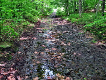
![]()
![]()
![]()
![]()
![]() On Tuesday, June 1st I wanted to get out for a longer hike after almost a week of track commitments and foul weather.I decided to go to Frick Pond to do the Frick Pond to Hodge Pond loop on the Quick Lake and Flynn Trails which is a little over 6 miles. I started to get ready just before 10:00 AM with the temperature hovering at 62 degrees with slightly overcast skies. Sheila sat watching my every move to make sure she would not be left behind. I put on my Mammut long-sleeved crew top with a short-sleeved baselayer for a little extra warmth as I did not intend to wear a jacket. I put on a pair of RailRiders hiking pants which are expensive but last along time and have features like deep pockets and a generous cut which I really like. The pants have Velcro closures at the ankles. I wore my Keen Targhee II boots which are wearing out but still have a few miles in them. I also donned my OR BugOut gaiters to combat the ticks and are treated to resist insects. I decided to take my Leki poles with external locks as the internal twist locks fail. I put my gear in the back and Sheila in the backseat and drove out the Debruce Road at 10:20 AM. I drive about 6 miles before turning left onto Mongaup Pond Road and continued to where the road split. I turned left onto Beech Mountain Road, and drove to the parking areas at the Frick Pond. Both lots were empty so I parked in the smaller lot. The car thermometer read 62 degrees as I set my GPS to get ready for the hike. At 10:40 AM we headed out the woods road toward the trail register. The woods road was damp with a few muddy places.
On Tuesday, June 1st I wanted to get out for a longer hike after almost a week of track commitments and foul weather.I decided to go to Frick Pond to do the Frick Pond to Hodge Pond loop on the Quick Lake and Flynn Trails which is a little over 6 miles. I started to get ready just before 10:00 AM with the temperature hovering at 62 degrees with slightly overcast skies. Sheila sat watching my every move to make sure she would not be left behind. I put on my Mammut long-sleeved crew top with a short-sleeved baselayer for a little extra warmth as I did not intend to wear a jacket. I put on a pair of RailRiders hiking pants which are expensive but last along time and have features like deep pockets and a generous cut which I really like. The pants have Velcro closures at the ankles. I wore my Keen Targhee II boots which are wearing out but still have a few miles in them. I also donned my OR BugOut gaiters to combat the ticks and are treated to resist insects. I decided to take my Leki poles with external locks as the internal twist locks fail. I put my gear in the back and Sheila in the backseat and drove out the Debruce Road at 10:20 AM. I drive about 6 miles before turning left onto Mongaup Pond Road and continued to where the road split. I turned left onto Beech Mountain Road, and drove to the parking areas at the Frick Pond. Both lots were empty so I parked in the smaller lot. The car thermometer read 62 degrees as I set my GPS to get ready for the hike. At 10:40 AM we headed out the woods road toward the trail register. The woods road was damp with a few muddy places.
 We continued straight ahead at the register and headed out the woods road toward Frick Pond. The trail was very wet with some standing and running water and some muddy places. The drainage work we had done seemed to have helped in some places but made little impact in others. There were a few spots where I cleared leaves from watercourses which seemed to get the water flowing. At Gravestone Junction, we turned left to stay on the Quick Lake Trail and head down to Frick Pond. The muddy area just after the junction was damp but the stepping stones helped. There was some more mud along the way but it was easy to negotiate. We stopped at the bridge across the outlet to Frick Pond and I took some shots of the pond and Flynn's Point. I always stop to take pictures even when the scene is not remarkable. I also took a shot of the outlet stream below the bridge. We didn't stay long and were soon walking along the west side of Frick Pond where there is a mud pit that had been almost impassable. We had worked to drain the water and put in stepping stones. Our work had paid off and the area was draining well and the stepping stones made an easy path across the area. There was one small muddy area along the trail. At the junction with the Big Rock Trail, we stayed to the left as I wanted to keep hiking the Quick Lake Trail. The first part of the trail was very wet and I had to jump over some wet spots and walk through the mud in others. This is not an easy place to improve drainage as there is a lot of water and the edges of the woods road are higher than the trail. We entered the evergreen tunnel which was drier and had only a few damp areas. When we came to the small stream across the trail, Sheila easily jumped across the water and I used the stepping stones to get across. Clearing the leaves and branches downstream had made this possible. Just after this crossing I made my way up the bank and back on the trail. We continued to push toward Iron Wheel Junction and made good time even though the trail was wet and muddy most of the way. When we came to Iron Wheel Junction, we turned left to head to Hodge Pond at 11:20 AM after hiking 1.5 miles.
 The sun was out which always makes me feel better but the insects were not as much of a problem as I anticipated. Sheila was having a great time staying on the trail with me most of the time with a few off-trail excursions. The next mile of trail is all uphill but the grade only averages around 8%. At times this can seem like a long slog but on this day it seemed to go quickly. There was a lot of water along the way flowing down the trail. The constant climb did begin to tire my legs and although the scenery was beautiful it began to get repetitive. We hit the flatter ground where there were some pools of water and muddy areas. As we made the right turn following the trail, we started downhill toward Junkyard Junction where we arrived at noon after hiking 3.1 miles. We turned right to start out on the Flynn Trail and almost immediately I noticed that the trail was very wet and muddy. Sheila and I worked our way along the trail through the water and the mud. I decided not to walk around the worst areas but through them. We arrived at the gate which separates the state land from the Open Spaces Institute land around Hodge Pond. We continued on the Flynn Trail by turning right and following the trail downhill to an area near the shore of Hodge Pond. The downhill stretch was very enjoyable and I was glad that the last 1.7 miles of the hike is all downhill on the Flynn Trail. We turned right to stay on the Flynn Trail and walked along the woods road which was in good shape. We walked through the forest and then out to the field where the sun was brightly shining. We walked back into the trees and I saw a couple hiking toward Hodge Pond. We continued to the point where the Flynn Trail enters a clearing at the outlet end of Hodge Pond. We turned left and walked over to the shore of the pond. The hikers were near the shore so I kept Sheila close to me. I said "Hello" to the hikers as they started back to the Flynn Trail to continue their hike in the opposite direction. I took some pictures of the pond and the surroundings despite the overcast and the flat sky. I got a bar and then we headed back across the field to the point where the Flynn Trail enters the forest and began the walk up the hill on the Flynn Trail. This was the last climb before the long downhill back to the car.
 The walk up this hill often seems tedious but on this day it went quickly. We were soon at the top of the hill. We walked along the flat trail under the trees passing through the other gate. This part of the trail was barely damp and there were no muddy areas. We arrived at the junction with the Big Rock trail at 12:45 PM after hiking 4.7 miles. We continued straight ahead on the Flynn Trail. The trail was in good shape with only few small blowdowns. I much prefer walking up the Flynn Trail but like to vary the route from time to time. We reached the spot where there is an interesting clearing to the left of the trail but I decided to stay on the main trail. We continued on the trail and soon were passing through the tunnel Cindy and I had cut in a large spruce tree that had fallen across the trail. At the gate at the bottom of the hill, we turned left on the trail to avoid the private property around the cabin. When we got back to the parking area, there were two cars in the small lot next to mine. It was 1:25 PM when we got back to the car after hiking 6.3 miles in 2 hours and 50 minutes with an elevation gain of 895 feet. We had maintained an overall speed of 2.2 mph with a moving average of 2.4 mph which I thought was good for the conditions. The temperature was 64 degrees and we were both ready to go home.
![]()
![]()
![]()
![]()
![]() On Wednesday, May 26th, I had so much to do that I had not planned to hike but this would be Bryce's last time to hike on Wednesday. Bryce's school is changing to 5 days of in-person instruction until the end of the year. Bryce had a morning class meeting so we began to get ready at 10:15 AM. We decided to head to Frick Pond to hike a shorter route. We started to get ready at 10:15 AM when the temperature was 75 degrees. As we started gathering our gear and getting dressed, Sheila was very quiet but did not let me out of her sight. I put on my White Sierra long-sleeved crew top which is insect-repellent. I put on a pair of RailRiders hiking pants which are expensive but last along time and have features like deep pockets and a generous cut which I really like. The pants have Velcro closures at the ankles I wore my Keen Targhee II boots which are wearing out but still have a few miles in them. I also donned my OR BugOut gaiters to combat the ticks and are treated to resist insects. I decided to take my Leki poles with external locks as the internal twist locks fail. I got our gear in the back of the car and Bryce and Sheila in the back seat and left Livingston Manor at 10:40 AM. I drove out the DeBruce Road about 6 miles to Mongaup Road and turned left to continue up the road to the point where it splits. I stayed left on Beech Mountain Road and drove to the Frick Pond trailhead. When we arrived at the parking areas, there were no cars parked in either lot. I pulled into the smaller lot and parked. The skies were sunny with a few clouds and a slight breeze. The temperature was right at 78 degrees which was cooler than I thought it might be. I set my GPS unit and we started out the woods road to the Quick Lake Trail at the register. At the register we turned left on the woods road which is the Quick Lake Trail. From the register the trail was only damp with very little standing or running water and some mud. As we walked along the trail, we check some of the work our crew had done the previous Sunday. It was hard to tell how successful we had been as there had not been much rain to test if our work had improves the drainage.
On Wednesday, May 26th, I had so much to do that I had not planned to hike but this would be Bryce's last time to hike on Wednesday. Bryce's school is changing to 5 days of in-person instruction until the end of the year. Bryce had a morning class meeting so we began to get ready at 10:15 AM. We decided to head to Frick Pond to hike a shorter route. We started to get ready at 10:15 AM when the temperature was 75 degrees. As we started gathering our gear and getting dressed, Sheila was very quiet but did not let me out of her sight. I put on my White Sierra long-sleeved crew top which is insect-repellent. I put on a pair of RailRiders hiking pants which are expensive but last along time and have features like deep pockets and a generous cut which I really like. The pants have Velcro closures at the ankles I wore my Keen Targhee II boots which are wearing out but still have a few miles in them. I also donned my OR BugOut gaiters to combat the ticks and are treated to resist insects. I decided to take my Leki poles with external locks as the internal twist locks fail. I got our gear in the back of the car and Bryce and Sheila in the back seat and left Livingston Manor at 10:40 AM. I drove out the DeBruce Road about 6 miles to Mongaup Road and turned left to continue up the road to the point where it splits. I stayed left on Beech Mountain Road and drove to the Frick Pond trailhead. When we arrived at the parking areas, there were no cars parked in either lot. I pulled into the smaller lot and parked. The skies were sunny with a few clouds and a slight breeze. The temperature was right at 78 degrees which was cooler than I thought it might be. I set my GPS unit and we started out the woods road to the Quick Lake Trail at the register. At the register we turned left on the woods road which is the Quick Lake Trail. From the register the trail was only damp with very little standing or running water and some mud. As we walked along the trail, we check some of the work our crew had done the previous Sunday. It was hard to tell how successful we had been as there had not been much rain to test if our work had improves the drainage.
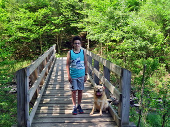 At Gravestone Junction, we stayed left on the Quick Lake Trail heading toward the bridge at the outlet to Frick Pond. This area of the trail was almost dry even thou we could see where it had been muddy as people had churned it up by walking around and widening the trail. When we arrived at the bridge, I thought I might simply continue but decided, as I often do, to take a few pictures. I snapped some shots of the pond and Flynn's Point on Beech Mountain. We continued around the west side of the pond where the crew had worked on the large mud pit which was the wettest area. We had widen the ditch that drains this pool and placed some stepping stones. Although there had not been much rain, it did look like the drainage had been a success. At the junction with the Big Rock Trail, we headed left on the Quick Lake Trail which was almost dry. We had been removing smaller branches but there were a few larger ones in this area that we managed to drag off the trail. We walked through the spruce tunnel and came to the small stream across the trail. The last time I had hiked I had cleared some leaves and branches that were holding back the water. The water level in the stream was now low enough to use the stepping stones to cross. Sheila decided to take a dip to cool off and then posed so that I could take a picture. I took a few more pictures and then moved on. We continued on up the Quick Lake Trail toward Iron Wheel Junction. This part of the trail is usually wet and muddy but this day was an exception which made the hiking much easier.
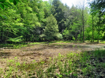 When we got to the junction, we turned right on the Logger's Loop. As we started out, the trail seemed to have almost no water and I was hopeful this would continue. We were lucky and the trail remained very dry for the entire length. Even the outlet stream from Hodge Pond was dry! We came to the large cherry tree that had broken off high up and fallen so that it was arching across the trail. This tree was not blocking the trail and it was clear it was not coming down soon. In a short time, we came to the seasonal pond on the left side of the trail and I walked over to it to see how full it was. The pond was beginning to dry out and looked more like a wetland. There was no wildlife present but I took a few shots despite the condition of the pond. We continued downhill to Times Square which was also almost dry. I thought about turning left and climbing the Big Rock Trail to add mileage but a check of my watch indicated that was a bad idea. We walked straight across Times Square to stay on the Logger's Loop and started uphill. Just before the beginning of the uphill was another streambed which we crossed and it was also dry. Although the trail is slightly uphill we were setting a fast pace. We continued walking on the trail and crested the hill to walk out to Gravestone Junction. We turned left at the Gravestone Junction and headed back to the car on the woods road. At the register, we continued on the woods road to the parking area. It was 12:40 PM and we had spent 1 hour and 40 minutes hiking 3.6 miles with an elevation gain was a modest 370 feet. The temperature had risen to 82 degrees.
![]()
![]()
![]()
![]() On Tuesday, May 25th I wanted to get in a hike even though I had to leave early for an away track meet. I asked Cindy if she would like to go and she said "Yes"> We decided to go across the street and hike some loops on Round Top. I was up at 8:00 AM but had some tasks to accomplish before I could hike. I finally started to get ready at 10:00 AM when the temperature was 68 degrees with a slight breeze blowing. Sheila was ready to go as she really likes to hike and she was keeping a careful eye on us as we dressed. I put on my White Sierra long-sleeved crew top which is insect-repellent. I put on a pair of RailRiders hiking pants which are expensive but last along time and have features like deep pockets and a generous cut which I really like. The pants have Velcro closures at the ankles I wore my Keen Targhee II boots which are wearing out but still have a few miles in them. I also donned my OR BugOut gaiters to combat the ticks and are treated to resist insects. I decided to take my Leki poles with external locks as the internal twist locks fail. At 10:35 AM we walked out the door to start the hike. I grabbed Sheila's leash from the car and we walked up the driveway. I aimed to hike for about an hour. Sheila was happy to get out as we headed down the driveway and across the street. We crossed the street and walked to the parking area by the Presbyterian Church. We walked to the back of the church and began the ascent of the steepest hill behind the church. The hill is short but gets the circulation pumping and is the steepest and longest climb on the "trail." Sheila helped me along by pulling me up the hill. Cindy and I stopped to look at some of the headstones in the cemetery which have fallen over due to the steep angle of the hill and hillside creep. At the top of the hill we started on the trail by turning left at the trailhead where I let Sheila off her leash so that she could explore. The trail was completely dry and showed that people had been using it.
On Tuesday, May 25th I wanted to get in a hike even though I had to leave early for an away track meet. I asked Cindy if she would like to go and she said "Yes"> We decided to go across the street and hike some loops on Round Top. I was up at 8:00 AM but had some tasks to accomplish before I could hike. I finally started to get ready at 10:00 AM when the temperature was 68 degrees with a slight breeze blowing. Sheila was ready to go as she really likes to hike and she was keeping a careful eye on us as we dressed. I put on my White Sierra long-sleeved crew top which is insect-repellent. I put on a pair of RailRiders hiking pants which are expensive but last along time and have features like deep pockets and a generous cut which I really like. The pants have Velcro closures at the ankles I wore my Keen Targhee II boots which are wearing out but still have a few miles in them. I also donned my OR BugOut gaiters to combat the ticks and are treated to resist insects. I decided to take my Leki poles with external locks as the internal twist locks fail. At 10:35 AM we walked out the door to start the hike. I grabbed Sheila's leash from the car and we walked up the driveway. I aimed to hike for about an hour. Sheila was happy to get out as we headed down the driveway and across the street. We crossed the street and walked to the parking area by the Presbyterian Church. We walked to the back of the church and began the ascent of the steepest hill behind the church. The hill is short but gets the circulation pumping and is the steepest and longest climb on the "trail." Sheila helped me along by pulling me up the hill. Cindy and I stopped to look at some of the headstones in the cemetery which have fallen over due to the steep angle of the hill and hillside creep. At the top of the hill we started on the trail by turning left at the trailhead where I let Sheila off her leash so that she could explore. The trail was completely dry and showed that people had been using it.
At the first trail junction, we followed Sheila as she turned right an started up the woods road which has the gentler approach of the two. We walked up the road to the first trail junction with the upper blue trail and turned left to follow the yellow trail along the base of Round Top. We could hear voices coming down from the summit. It sound like a family group with children that were having a lot of fun. At the next junction with the blue trail we turned right and headed up the blue trail, toward the summit. On the way up we passed by the switchback and the white crossover trail. We passed over the summit and continued on the blue trail down the other side of the hill. We passed the white crossover trail and then turned right on the yellow trail. We again followed the yellow trail along the base of Round Top to the junction with the blue trail. This time we turned left and followed the yellow trail downhill passed the "Resting Rock" to the lookout. The forest was very green as all the vegetation was in bloom. At the viewpoint, we turned left and started to follow the yellow trail downhill to the first trail junction. I noticed that someone had cleared the path to the lookout which has a potentially dangerous cleft. I know people are trying to "help" but it just meant that I had to find branches and bush to throw on the path to block it. At the bottom of the hill we turned around to start back up the hill to the viewpoint. At the top of the hill we followed the yellow trail as it turned right and started uphill. At the first junction with the blue trail we turned right and followed the yellow trail along the base of Round Top. At the next junction with the blue trail, we turned left and headed up the blue trail toward the summit. We passed by the white crossover trail again and continued over the summit. We passed over the summit and continued downhill on the blue trail toward the junction with the yellow trail. We passed by both the white crossover trail and the switchback. We continued down the steepest section of the blue trail to the junction with the yellow trail. We turned left and walked along the base of Round Top on the yellow trail to the next junction with the blue trail. This time we turned right and walked down the yellow trail to the woods road that took us back to the first trail junction. We turned left and walked out to the trailhead at the top of the cemetery hill. We walked down the hill and out to the road through the church parking lot. We walked over to the driveway and back to the house. It was noon and we had hiked over 2 miles in an hour and 15 minutes. Just as we entered the house the ambulance pager went off but that is another story.
On Sunday, May 23rd I planned to go to Frick Pond on a trail maintenance trip with the Willowemoc Trail Crew. Lisa had organized the trip through the NYNJTC and I was just along the help work and supervise. Our goal was to create some ditches to drain water off the Quick Lake Trail to Frick Pond. Unfortunately, the weather has been so hot that very little water remained on the trails so Lisa and I would have to rely on our memory. Our other goal was to work on the large mud pit just after the bridge across the outlet of Frick Pond. This spot is always wet and muddy and I was sure we could improve it in some way. I started getting ready at 12:15 PM and had to explain to Sheila that she could not go this time. I put on my White Sierra long-sleeved crew top which is insect-repellent. I put on a pair of RailRiders hiking pants which are expensive but last along time and have features like deep pockets and a generous cut which I really like. The pants have Velcro closures at the ankles I wore my Keen Targhee II boots which are wearing out but still have a few miles in them. I decided not to take my Leki poles as I would be carrying trail maintenance tools. I did put on my OR BugOut gaiters to combat the ticks and are treated to resist insects. I got my gear in the car including a plastic sled to move rocks, a pick and a short-handled round-pointed shovel. I drove out the DeBruce Road toward Frick Pond at 12:30 PM. After about 6 miles, I turned left on the Mongaup Pond and stayed left on Beech Mountain Road at the fork. There was only one car parked in the big lot and as I pulled in at 12:45 PM, I recognized Melissa. As Melissa and I talked, other people began to arrive including Lisa with all the required paperwork. I learned some names and where people lived as they filled out the VSA. We finally started out on the Quick Lake Trail at 1:15 PM. I decided not to apply any insect repellent and hoped I had made the right decision. Just after the trail register I began to point out places where we could clean out a few existing ditches and dig a few more. It was not easy without water actually being present but we did our best. Lisa took the rest of the group to work on the deep mud pit on the other side of the Frick Pond bridge. My group continued along the trail cleaning and improving existing waterways and creating a few new ones. As we continued toward the pond, we found Lisa and her group working hard on a long ditch by the side of the trail. I wanted to make sure we got to the mud pit and volunteered my crew to go work on that project. We walked to Gravestone Junction and then to the bridge and I was able to tell the group about some of the history of the area. When we got to the mud pit, I asked the others for ideas and we decided on a plan of action. I used my machete to expose a ditch that ran down toward the pond while others used various tools to clean out the ditch and place stepping stones across the pit. It wasn't long before I could see that the ditch suddenly dropped almost a foot which was good news as it would help to make our work easier. Some of the people in Lisa's group brought some stones from the old dam near the bridge and we used those for stepping stones. More than once the skies clouded over and at lest once some drops fell. We finished what we could do at about 3:30 PM so we picked up and got ready to start back. I took some pictures of our finished work but was annoyed I had not taken a few shots before we started. When we met Lisa's group, they were almost done so we decided to start back. On the way back to the parking area some rain fell but then stopped. We were back at the cars and ready to leave by 4:00 PM. This was one of the best groups I have ever worked with and their tireless efforts got the job done.
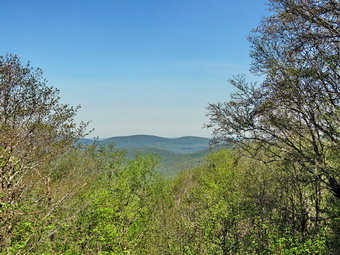
![]()
![]()
![]()
![]()
![]() On Friday, May 21st I had planned a hike with Melissa Cascini, the New York Program Coordinator for the New York New Jersey Trail Conference. Melissa is new to this job and wanted to get out to visit some areas in the Catskills. We agreed to meet at the Frick Pond trailhead at 9:00 AM. Melissa planned to be with us again on Sunday when we had a trail crew working on remediating water problems around Frick Pond so I wanted to hike a different route. I planned to hike the Flynn Trail to Hodge Pond including the lookout over the pond. I thought we might hike down the Big Rock Trail and along the western side of Frick Pond along the wooden walkways. From there we would take the Quick Lake Trail over the outlet bridge and back to the parking area. The original weather forecast included thunderstorms by 1:00 PM but that forecast had changed to include sun throughout the day with highs nearing 90 degrees. I started to get ready at 8:15 AM with Sheila watching my every move. She has gotten a lot better with other people on hikes and it is easier to bring her along now. I put on my White Sierra long-sleeved crew top which is insect-repellent. I put on a pair of RailRiders hiking pants which are expensive but last along time and have features like deep pockets and a generous cut which I really like. The pants have Velcro closures at the ankles I wore my Keen Targhee II boots which are wearing out but still have a few miles in them. I decided to take my Leki poles with external locks as the internal twist locks fail. I did put on my OR BugOut gaiters to combat the ticks and are treated to resist insects. I got my gear in the car and put an excited Sheila in the back seat as I drove out the DeBruce Road toward Frick Pond at 8:45 AM. After about 6 miles, I turned left on the Mongaup Pond and stayed left on Beech Mountain Road at the fork. There was only one car parked in the big lot and as I pulled in at 9:00 AM, I recognized Melissa. Melissa and I talked for a minute as I made sure she had several hours to hike. As I was driving up Mongaup Road, there were swarms of insects jotting my windshield, so I applied some insect repellent. I set my GPS and we started our hike by crossing the road and headed out on the Flynn Trail toward Hodge Pond. When we hit the wide woods road that is the Flynn Trail, we turned right and noticed that the grass was very dry. I described some of the history of the area to Melissa including the Frick homestead and the Beech Mountain Boy Scouts Camp. The camp was serviced by the extension of Beech Mountain Road which is now the Flynn Trail. The temperature was already in the 70's and I was glad I had worn a single layer and light, summer hiking pants. The sun was out but there were no white, puffy clouds in the sky. We were keeping a pretty fast pace but it didn't seem to bother me. At 1.2 miles we walked off the trail to the left and headed up to a clearing. There is a road that leads to the clearing but we simply walked the more direct route. We stopped at the edge of the clearing and I got out my camera to take some pictures. I have never heard a definitive explanation for the existence of the clearing but I suspect it was stripped of dirt to build Beech Mountain Road. In most placed there is very little topsoil and the bedrock is close to the surface. I also talked about the set of interesting ledges between the clearing an Mongaup Pond. We returned to the main trail and turned right to walk to the junction with the Big Rock Trail. It took us 55 minutes to reach the first trail junction with the Big Rock Trail at 1.7 miles into the hike.
On Friday, May 21st I had planned a hike with Melissa Cascini, the New York Program Coordinator for the New York New Jersey Trail Conference. Melissa is new to this job and wanted to get out to visit some areas in the Catskills. We agreed to meet at the Frick Pond trailhead at 9:00 AM. Melissa planned to be with us again on Sunday when we had a trail crew working on remediating water problems around Frick Pond so I wanted to hike a different route. I planned to hike the Flynn Trail to Hodge Pond including the lookout over the pond. I thought we might hike down the Big Rock Trail and along the western side of Frick Pond along the wooden walkways. From there we would take the Quick Lake Trail over the outlet bridge and back to the parking area. The original weather forecast included thunderstorms by 1:00 PM but that forecast had changed to include sun throughout the day with highs nearing 90 degrees. I started to get ready at 8:15 AM with Sheila watching my every move. She has gotten a lot better with other people on hikes and it is easier to bring her along now. I put on my White Sierra long-sleeved crew top which is insect-repellent. I put on a pair of RailRiders hiking pants which are expensive but last along time and have features like deep pockets and a generous cut which I really like. The pants have Velcro closures at the ankles I wore my Keen Targhee II boots which are wearing out but still have a few miles in them. I decided to take my Leki poles with external locks as the internal twist locks fail. I did put on my OR BugOut gaiters to combat the ticks and are treated to resist insects. I got my gear in the car and put an excited Sheila in the back seat as I drove out the DeBruce Road toward Frick Pond at 8:45 AM. After about 6 miles, I turned left on the Mongaup Pond and stayed left on Beech Mountain Road at the fork. There was only one car parked in the big lot and as I pulled in at 9:00 AM, I recognized Melissa. Melissa and I talked for a minute as I made sure she had several hours to hike. As I was driving up Mongaup Road, there were swarms of insects jotting my windshield, so I applied some insect repellent. I set my GPS and we started our hike by crossing the road and headed out on the Flynn Trail toward Hodge Pond. When we hit the wide woods road that is the Flynn Trail, we turned right and noticed that the grass was very dry. I described some of the history of the area to Melissa including the Frick homestead and the Beech Mountain Boy Scouts Camp. The camp was serviced by the extension of Beech Mountain Road which is now the Flynn Trail. The temperature was already in the 70's and I was glad I had worn a single layer and light, summer hiking pants. The sun was out but there were no white, puffy clouds in the sky. We were keeping a pretty fast pace but it didn't seem to bother me. At 1.2 miles we walked off the trail to the left and headed up to a clearing. There is a road that leads to the clearing but we simply walked the more direct route. We stopped at the edge of the clearing and I got out my camera to take some pictures. I have never heard a definitive explanation for the existence of the clearing but I suspect it was stripped of dirt to build Beech Mountain Road. In most placed there is very little topsoil and the bedrock is close to the surface. I also talked about the set of interesting ledges between the clearing an Mongaup Pond. We returned to the main trail and turned right to walk to the junction with the Big Rock Trail. It took us 55 minutes to reach the first trail junction with the Big Rock Trail at 1.7 miles into the hike.
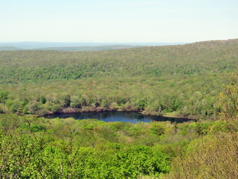 We continued straight ahead on the Flynn Trail passing through the gate that separates state land from OSI property. After walking for a relatively short time, we arrived at the point where the Flynn Trail bears left down to Hodge Pond. We turned right on a woods road to hike toward the Boy Scout camp and the lookout over the pond. The woods road we were walking on was once Beech Mountain Road leading to the Beech Mountain Boy Scout Camp. As we walked Melissa and I had both been removing small branches from the trail by habit. After a short walk, a trail turned off to the left to go down to the pond and the road we were on continued straight ahead. I was surprised to see another road that was completely new heading off to the left between the two. We walked to the left on this road and found it came to a dead end quite quickly. We walked passed the end of the road and came to the area where some of the of buildings from the Boy Scout camp had been. I was again surprised to see that the buildings had been bulldozed and removed! I know that this land is owned by OSI but I was disappointed that they had removed this last bit of history from the area! I took some pictures of the area. We walked back to the road that started up the hill and turned left to walk uphill toward the lookout. We passed a spring house on the right and Sheila stopped to get a drink. She must have been warm as she splashed around a "dug" in the water for several minutes. The grade became steeper as we climbed the hill and at about 2.7 miles the road made a sharp turn to the right. We stopped so that I could take some pictures from a small viewpoint and then continued on the road. As the road made another sharp turn, this time to the left, a trail went off to the right. This trail goes to the lookout but I decided we would continue on the main road and make a loop back to the lookout. We topped the hill and then walk downhill to another nice lookout just after the road turned to the right. This lookout has views of the Burrough's Range and other major peaks. I took some shots and then we continued our hike by walking uphill and around the base of Flynn's Point on Beech Mountain. This is the highest spot in Sullivan County and there were some interesting ledges. We continued around the south end and came to the lookout over Hodge Pond. Someone had moved a rock into the path out to the flat rock ledge that serves as a viewpoint. The rock did not block the path but did have a "DANGER" sign leaning against it. We walked out to the viewpoint and I took some pictures. I mentioned to Melissa that I would like the trail conference to contact OSI to see if they would allow us to blaze a trail to this lookout. We got a drink and the started out again on the trail.
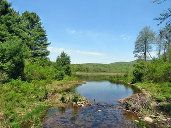 We were soon back at the road that we had hiked up the hill. We turned left and set a quick pace down the hill. Sheila again stopped at the spring and this time dug at the opening to the culvert until water was freely flowing through it. At the base of the hill, we turned right on the woods road that leads down to Hodge Pond. We turned left when the road intersected a jeep trail and ended up at the outlet end of Hodge Pond. We walked over to the shore of the pond where I dropped my pack and got out the camera. Sheila decided to go swimming. I too some shots of the pond but the sky was a for a long time blue without clouds. When I was done, we picked up and walked to where the Flynn Trail enters the woods and started climbing the hill back to the junction where we had turned right some time before. At the top of the hill we stayed to the right on the Flynn Trail and followed the route we had taken out. We passed through the gate and were soon approaching the junction with the Big Rock Trail. Sheila alerted and I looked up to see three hikers and their dog coming up the Flynn Trail. The dog was a male yellow lab and bigger than Sheila. He looked like he wanted to play but we declined the offer and we, after saying "Hello", turned right on the Big Rock Trail. The walk down the Big Rock Trail went quickly and I had time to brief Melissa about the walkways on the west side of Frick Pond. I also mentioned the muddy areas on the Balsam Lake Mountain Trail. These muddy areas are on the section of trail running from the tower down to the Dry Brook Ridge Trail that comes in from Millbrook Road. The problem is that people continue to walk around the edges making these areas wider. One solution is some kind of bridging but that would involved the DEC giving approval. We were soon at Times Square where we continued straight across to stay on the Big Rock Trail. Times Square which is usually wet and muddy was almost dry. There were a few muddy areas on the Big Rock Trail but they were minimal compared to several weeks ago. As we continued on the trail, we came to the two bridges over the inlet streams. The bridge abutments are beginning to deteriorate and I told Melissa that I hoped they were on a list for repair. As we continued to hike, we walked thought the beautiful spruce forest and over the wooden walkways which also need repair. We look at area where the walkways are poorly supported and where boards are coming loose. Soon we were at the junction with the Quick Lake Trail where we turned left toward the bridge at the outlet of Frick Pond. This trail had been a torrent of water a few weeks ago but now was dry. We did encounter a muddy pit that I knew the trail crew would try to fix. Once passed the muddy area, it wasn't long until we were at the bridge. Despite the fact that I have hundreds of pictures from this spot, I took a few more. When I pointed out Beech Mountain to Melissa, she was surprised that we had been that high in elevation. I finished my photography and we started up the hill to Gravestone Junction. I showed Melissa the memorial marker and told her the story of two children who died in the 1930's in a fire that consumed their cabin. As we walked along the Quick Lake Trail back to our cars, we noticed that the trail was almost dry. I knew this would make it harder to do the trail work as it was hard to see where the water had been collecting. At the trail register, we turned right to stay on the Quick lake Trail. By 12:45 PM we were back at the cars after hiking 7.5 miles in 3 hours and 45 minutes with 20 minutes of stopped time. This was good for an overall 2.0 mph pace. We also gained 1390 feet of elevation.
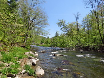
![]()
![]()
![]()
![]()
![]() On Wednesday, May 19th, I wanted to go for a hike with my grandson Bryce who comes to our house every Wednesday. He has Zoom meetings four his classes in the morning and afternoon so we had a short window from just before noon to just after noon. This meant we would have to do a hike closer to home and asked Cindy where she would like to go. Cindy chose the Beaverkill Campgrounds which was shorter than I had expected but I knew was scenic. I started to get ready at 10:45 AM with the temperature at 70 degrees on the back porch. As usual, Sheila was excited and even more so since Cindy and Bryce were going also. I put on my Mammut long-sleeved crew top with no baselayer since the temperature was already very warm. I put on a pair of RailRiders hiking pants which are expensive but last along time and have features like deep pockets and a generous cut which I really like. The pants have Velcro closures at the ankles I wore my Keen Targhee II boots which are wearing out but still have a few miles in them. I decided to take my Leki poles with external locks as the internal twist locks fail. I did put on my OR Crocodile gaiters to combat the ticks but made a note to retire these for the summer and get out my OR Bugout gaiters which are shorter and treated to resist insects. I put our gear in the back of the car and Bryce and Sheila in the back seat and left the house at 11:00 AM. I drove out Old Route 17 toward Roscoe and turned right on Beaverkill Road. As we started the descent into the Beaverkill Valley, I turned left on Campsite Road and followed it down to the parking area near the Beaverkill Covered Bridge. As I parked, there were three other cars in the lot which was a sharp departure from the crowds that were present last summer. The river was higher than I thought it might be.
On Wednesday, May 19th, I wanted to go for a hike with my grandson Bryce who comes to our house every Wednesday. He has Zoom meetings four his classes in the morning and afternoon so we had a short window from just before noon to just after noon. This meant we would have to do a hike closer to home and asked Cindy where she would like to go. Cindy chose the Beaverkill Campgrounds which was shorter than I had expected but I knew was scenic. I started to get ready at 10:45 AM with the temperature at 70 degrees on the back porch. As usual, Sheila was excited and even more so since Cindy and Bryce were going also. I put on my Mammut long-sleeved crew top with no baselayer since the temperature was already very warm. I put on a pair of RailRiders hiking pants which are expensive but last along time and have features like deep pockets and a generous cut which I really like. The pants have Velcro closures at the ankles I wore my Keen Targhee II boots which are wearing out but still have a few miles in them. I decided to take my Leki poles with external locks as the internal twist locks fail. I did put on my OR Crocodile gaiters to combat the ticks but made a note to retire these for the summer and get out my OR Bugout gaiters which are shorter and treated to resist insects. I put our gear in the back of the car and Bryce and Sheila in the back seat and left the house at 11:00 AM. I drove out Old Route 17 toward Roscoe and turned right on Beaverkill Road. As we started the descent into the Beaverkill Valley, I turned left on Campsite Road and followed it down to the parking area near the Beaverkill Covered Bridge. As I parked, there were three other cars in the lot which was a sharp departure from the crowds that were present last summer. The river was higher than I thought it might be.
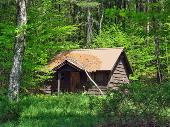 I set my GPS and put Sheila on her leash as we started our hike at 11:20 AM by crossing the bridge to the west side of the river. We turned left on a woods road that parallels the river and started down a short hill. We walked passed a spring house and continued on the deserted woods road. We came to an area with a little path down to the river. I walked down to the edge of the river which was really roaring and took some pictures downstream and some upstream. Just after this area, the trail was even more eroded by water running across and under the trail than during our last visit. There was an area with several picnic tables which sit unused and rotting along the road. This was just the first of several similar areas. I decided to take pictures that showed the deserted campgrounds which was even more dramatic now that there was not a single person in sight. I took pictures of the picnic tables and, a little later, what was once a bathroom for some campsites that had long since disappeared. At the next bathroom, we stopped so that I could take some more pictures. There was a path over to the river so I walked over and took some pictures of the sun reflecting off the water both upstream and downstream. In several areas the DEC had placed large rocks along the shore and covered them with heavy wire to reduce erosion. Just passed this spot was another place where the road had been washed away and the DEC had filled in with some gravel. The streambed next to the road was now dry but must have had a large volume of water to erode the road. I took some more pictures before we over on. At about .7 miles the woods road met the paved road that serves the campsites and we continued on the road through the campsites and along the river. Many of the campsites had a cement block fireplace with a grill but some were upgraded to poured concrete. Everything was very quiet except for the water in the river. This was not surprising as the campsites are closed. I took some pictures of the empty campsites and the campsite road.
 We walked to the last campsite where the trail ends and walked down to the edge of the river. There was a strip of sand that made a small "beach" and I stopped to take some pictures. I worked my way out to a rock that jutted into the river and took some more shots up and down the stream. Sheila decided to take dip but stayed close to shore out of the current. We continued out the path along the river after the last campsite. Once this path became too difficult to walk I stopped to take some pictures. We turned around to start back and walked the other road through the campsites which parallels the one we walked out on to make a sort of loop. We stopped again so that I could take some pictures of a group of picnic tables randomly arranged and another group stacked against each other. I also took a few shots of the roads. We retuned the way we had come crossing the river on the bridge. We still had not seen any people! We walked through the bridge and turned right to go back to the car. I decided to go down to the river to take some pictures and took Sheila with me. Unfortunately, there were some children down by the river so I had to walk around their gear that they had spread out on the path to the river. Sheila and I walked to the edge of the river and I took pictures of the bridge and the river flowing under it. We walked downstream a little but the view didn't change so we returned to the car. We were back at the car at 12:35 PM having hiked 2.3 miles in 1 hour and 15 minutes with 15 minutes of stopped time. The elevation gain was 190 feet but it was hardly noticeable. The car's thermometer read 78 degrees.
![]()
![]()
![]()
![]() On Monday, May 17th I knew I had to get out for a hike as the rest of the week only got busier. The forecast was for sun and comfortable temperatures so I decided to do some work around the house and then get out for a hike across the street on Round Top. Around 11:30 I began to get ready with the temperature at 60 degrees. As I got ready, Sheila seemed very happy to be going out. I put on my Mammut long-sleeved crew top with no baselayer. I put on a pair of RailRiders hiking pants which are expensive but last along time and have features like deep pockets and a generous cut which I really like. The pants have Velcro closures at the ankles I wore my Keen Targhee II boots which are wearing out but still have a few miles in them. I decided to take my Leki poles with external locks as the internal twist locks fail. We stepped out of the house at noon. I grabbed Sheila's leash from the car and put it on her to safely cross the street. We walked up the driveway and crossed the street. We walked to the church parking lot and to the back of the church. As we started up the hill, we began the ascent of the steep hill behind the church. The hill is short but gets the circulation pumping and is the steepest and longest climb on the "trail". Someone had been working on the "road" that climbs the hill. The side of the road had been cleared back but the pavement was the worse for wear and I hoped the plan was to pave that stretch. I let Sheila off her leash so that I could use my poles to get up the hill. Sheila immediately began to bound up the hill as I followed. When we got to the top of the hill, I stopped to look around at the hills around town. We started on the trail by turning left at the trailhead. I knew that other people were using the trails from comments on Facebook. The trails was becoming well-worn as more and more people use them.
On Monday, May 17th I knew I had to get out for a hike as the rest of the week only got busier. The forecast was for sun and comfortable temperatures so I decided to do some work around the house and then get out for a hike across the street on Round Top. Around 11:30 I began to get ready with the temperature at 60 degrees. As I got ready, Sheila seemed very happy to be going out. I put on my Mammut long-sleeved crew top with no baselayer. I put on a pair of RailRiders hiking pants which are expensive but last along time and have features like deep pockets and a generous cut which I really like. The pants have Velcro closures at the ankles I wore my Keen Targhee II boots which are wearing out but still have a few miles in them. I decided to take my Leki poles with external locks as the internal twist locks fail. We stepped out of the house at noon. I grabbed Sheila's leash from the car and put it on her to safely cross the street. We walked up the driveway and crossed the street. We walked to the church parking lot and to the back of the church. As we started up the hill, we began the ascent of the steep hill behind the church. The hill is short but gets the circulation pumping and is the steepest and longest climb on the "trail". Someone had been working on the "road" that climbs the hill. The side of the road had been cleared back but the pavement was the worse for wear and I hoped the plan was to pave that stretch. I let Sheila off her leash so that I could use my poles to get up the hill. Sheila immediately began to bound up the hill as I followed. When we got to the top of the hill, I stopped to look around at the hills around town. We started on the trail by turning left at the trailhead. I knew that other people were using the trails from comments on Facebook. The trails was becoming well-worn as more and more people use them.
At the first trail junction, I turned right to walk up the more shallow approach to Round Top on the wide woods road. The trails were mostly dry with a damp spot here and there. At the first junction with the blue trail, we turned left and continued on the yellow trail along the base of Round Top. At the second junction with the blue trail we turned right and headed up the steep side of the hill. When the switchback turned to the right we followed it as it led us up the hill and back to the original route. We turned right on the blue trail and headed toward the summit but almost immediately turned right on the white shortcut trail. We followed that trail across the hill to the blue trail coming down from the summit. We turned right to head back down the hill to the yellow trail. We turned right on the yellow trail to once again walk along the base of Round Top. This time when we reached the second junction with the blue trail we turned left on the yellow trail and followed that downhill to the viewpoint over town. The forest floor was getting greener all the time as ferns began to pop up with some interspersed windflowers. At the lookout we turned left and followed the yellow trail back to the very first trail junction completing our first figure 8. We immediately turned around and hiked back up the steeper trail to the viewpoint. We followed the yellow trail as it turned right and began the long but gentle climb to the first junction with the blue trail. At the junction we turned right to follow the yellow trail along the base of Round Top to the second junction with the blue trail. We turned left and followed the blue trail to the white shortcut trail. We turned left and followed the trail along the side of the hill to the junction with the blue trail. We turned left and almost immediately left again on the switchback. We followed the switchback back to the main blue trail and turned left to walk down to the lower yellow trail. We turned left on the yellow trail and again followed it to the next junction with the blue trail. This time we turned right and followed the yellow trail down to the wide woods road that brought us back to the first trail junction. We turned left and walked back out to the trailhead. We turned right to walk to the bottom of the hill and headed across the church parking lot to the street. We crossed the street to our driveway and were home by 1:05 PM after hiking a little over 2 miles in 1 hour and 5 minutes.
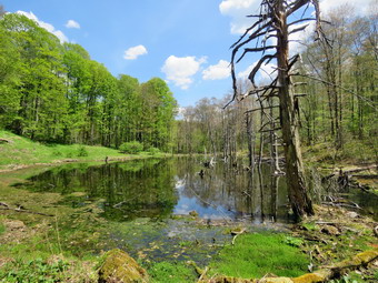
![]()
![]()
![]()
![]()
![]() On Saturday, May 15th, I had planned to get up early and do a longer hike away from home after several days of rain and track meets. I thought about hiking in Schoharie County and working on some of the Scary 19's. I was also considering going to Morgan Hill State Forest to hike a big loop there. Sharon Klein contacted me about a hike she was leading at Mud and Trout Ponds for the Mid-Hudson ADK Chapter. She invited me on the hike as I know some of the history of the area and I decided to go. We agreed to meet at the Russell Brook Trailhead parking area at 9:30 AM. Sharon also graciously said that I could bring Sheila. I was glad as I otherwise would have to declined the invitation. When I got up at 8:00 AM the temperature was already 52 degrees but I knew it might me cooler at the trailhead. I put on my Mammut long-sleeved crew top without a baselayer. I put on a pair of RailRiders hiking pants which are expensive but last along time and have features like deep pockets and a generous cut which I really like. The pants have Velcro closures at the ankles I decided to wear my Keen Traghee II hiking boots which fit well and have been discontinued. I also knew that parts of the trail might be very muddy and I don't mind getting these shoes dirty. I grabbed my Leki external lock poles which I have been using since the internal twist locks have proved unreliable. I also donned my Mammut hoody which was enough zippers to dump heat when needed. I put a light hat and a light pair of gloves in my pack. I also put on my OR Crocodile gaiters to deal with the mud and water that I knew would be present. I also remembered to make sure I had several concoctions to repel insects as I knew the mayflies were out. As I was getting ready Sheila stayed near me so that I would not "forget" her but was being a very well-behaved dog. I put my gear in the car and Sheila in the back seat. She was happy to be going anywhere and crouched in the back seat with her head on the console. We left Livingston Manor at 8:50 AM under blue skies with white puffy clouds and the temperature reading 54 degrees. I got on Route 17 heading west and got off at exit 94. I turned left and drove out the Rockland Flats on Route 206. Just after the Roscoe Nursing Home I turned left on Morton Hill Road and followed it for 3 miles to the intersection with Russell Brook Road. I turned left on Russell Brook Road and found it in good shape. I drove to the end of the drivable road to the parking area which was nearly full. There was one other hiker waiting for the group to assemble. I decided to walk down Russell Brook Road to see if I could locate the foundation of the Russell Brook School which was built for the children of the workers in the various industries that were in the Rea in the late 19th and early 20th centuries. I found the remains of the school on the left side of the road and returned to my car. Several cars pulled up. One was Sharon and the others held the rest of the for a total of seven hikers. I decided to remove my hoody as I was warm just standing in the parking lot! We spent a few moments getting ready and introducing ourselves. Before we began I told the group a little about the history of the area. I set my GPS and we started down the woods road toward Russell Brook at 9:45 AM. Sheila was extremely well-behaved and even let a few people pet her!
On Saturday, May 15th, I had planned to get up early and do a longer hike away from home after several days of rain and track meets. I thought about hiking in Schoharie County and working on some of the Scary 19's. I was also considering going to Morgan Hill State Forest to hike a big loop there. Sharon Klein contacted me about a hike she was leading at Mud and Trout Ponds for the Mid-Hudson ADK Chapter. She invited me on the hike as I know some of the history of the area and I decided to go. We agreed to meet at the Russell Brook Trailhead parking area at 9:30 AM. Sharon also graciously said that I could bring Sheila. I was glad as I otherwise would have to declined the invitation. When I got up at 8:00 AM the temperature was already 52 degrees but I knew it might me cooler at the trailhead. I put on my Mammut long-sleeved crew top without a baselayer. I put on a pair of RailRiders hiking pants which are expensive but last along time and have features like deep pockets and a generous cut which I really like. The pants have Velcro closures at the ankles I decided to wear my Keen Traghee II hiking boots which fit well and have been discontinued. I also knew that parts of the trail might be very muddy and I don't mind getting these shoes dirty. I grabbed my Leki external lock poles which I have been using since the internal twist locks have proved unreliable. I also donned my Mammut hoody which was enough zippers to dump heat when needed. I put a light hat and a light pair of gloves in my pack. I also put on my OR Crocodile gaiters to deal with the mud and water that I knew would be present. I also remembered to make sure I had several concoctions to repel insects as I knew the mayflies were out. As I was getting ready Sheila stayed near me so that I would not "forget" her but was being a very well-behaved dog. I put my gear in the car and Sheila in the back seat. She was happy to be going anywhere and crouched in the back seat with her head on the console. We left Livingston Manor at 8:50 AM under blue skies with white puffy clouds and the temperature reading 54 degrees. I got on Route 17 heading west and got off at exit 94. I turned left and drove out the Rockland Flats on Route 206. Just after the Roscoe Nursing Home I turned left on Morton Hill Road and followed it for 3 miles to the intersection with Russell Brook Road. I turned left on Russell Brook Road and found it in good shape. I drove to the end of the drivable road to the parking area which was nearly full. There was one other hiker waiting for the group to assemble. I decided to walk down Russell Brook Road to see if I could locate the foundation of the Russell Brook School which was built for the children of the workers in the various industries that were in the Rea in the late 19th and early 20th centuries. I found the remains of the school on the left side of the road and returned to my car. Several cars pulled up. One was Sharon and the others held the rest of the for a total of seven hikers. I decided to remove my hoody as I was warm just standing in the parking lot! We spent a few moments getting ready and introducing ourselves. Before we began I told the group a little about the history of the area. I set my GPS and we started down the woods road toward Russell Brook at 9:45 AM. Sheila was extremely well-behaved and even let a few people pet her!
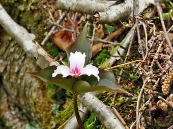 We crossed the bridge and I noticed that the Japanese knotweed was just beginning to show some green. I mentioned the invasive species problem and how the knotweed had to be cut back. I also told the group the story of Samuel Cable who bought 2000 acres of land in 1880 to begin a wood products factory. Cable built a narrow gauge railway to move his products from the factory to the O&W for transport. We continued our walk and stayed to the left at the register to walk the blue trail uphill to the Mud Pond Trail. In .7 miles the trail gains 375 which is only an 11% grade but Sharon was setting a good pace. The trail was dry in most places with only a little mud and some streams that crossed the trail. We topped the hill and started down the other side arriving at the Mud Pond Trail at 1.0 miles into the hike. Ahead we could see two hikers coming up from Mud Pond and continuing on the trail around Mud Pond. We continued passed the junction and started on the trail around Mud Pond. We passed by some foundations which I believe are from farms in the area. As we continued around the pond we ran into and area of mud that extended for some distance without letting up and in most places went from one side of the trail to the other. We did our best to walk through the mud or use a detour but the going was tough. At 1.4 miles the trail turned 90 degrees left and the =mud all but disappeared. The trail was drier now and easer to walk. We passed several designated campsites and at 1.85 miles came to the path down to the dam at the outlet end of Mud Pond. We decided to visit this area on our way back so we continued on the main trail. We now started a descent of .7 miles losing 435 feet at a 13% grade. The descent wasn't that hard but I knew we would have to come back up the hill! Along the way I noticed that there was a large volume of water in the outlet stream and this had produced several small cascades that I wanted to visit. I decided to take a look at the waterfalls on the way back. Toward the end of the decent there was a large amount of broken rock on the right side of the trail. It looked like tailings from a quarry but I have instigated the area and never found one. A little farther I saw a woods road on the right with built-up stonework to support it. I never remember seeing this before and put it on a list of things to investigate. The trail was now almost flat and we crossed a small creek that drains a beaver pond. When we got to the beaver pond, we found the dam to be sound but also found there was no new building going on. I took some pictures including some of a painted trillium which is hard to find. Just after the beaver pond there was a large hemlock down across the trail nut we found a way to climb over it. I had been removing branches as we hiked and noticing a lot of uncleared blowdowns. The trail needs a lot of maintenance as it is one of the least-used trails in the area. After another short but steep descent of .2 miles we were at the end of the Mud Pond Trail at what is left of Russell Brook Road. At one time the road was in good shape and passable by car. After several storms that washed away the road, the Town of Colchester decided not to repair it and the road is now more like a brook. This leaves the trailhead nearly inaccessible except as an out and back. We took a short rest here as it was noon and we had hiked 3.2 miles at this point. I told the group about the Beaver Kill Dye Works that was established just before World War I. A German Chemist named Hans Bruning bought the factory which produced most of the khaki dye for American military uniforms.
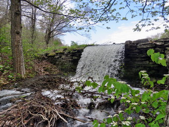 After taking a rest it was time to get started again. Some of the group was taking longer than others to get going so I decided to walk ahead to visit the cascades I had seen. On the way up the hill I met three different groups of hikers and Sheila behaved beautifully as I pulled her off the trail to let them go passed us. Just as we started up the hill, Sheila and I went off the trail to the right to visit some of the cascades. I was concerned that I did not see the others but I could hear them farther back on the trail. I took pictures of some of the waterfalls and then walked upstream to take a few more pictures. It was definitely the case that they were prettier in person that in the pictures! The group appeared on the main trail and we waived as they continued up the hill. When I was done, Sheila and I climbed the steep bank and had to hurry to catch up to the group. Just as we reached the top of the hill, we turned right on the path down o the outlet end of Mud Pond. The group decided to take another break here after hiking 4.4 miles with a long ascent. There is a nice fire ring here and another designated campsite on the other side of the dam. I took pictures of the pond from the dam from several angles. I noticed that the water leaving the pond was not going over the dam so I assume there is a culvert pipe under the dam. Sheila decided she wanted to swim so I threw a stick that she retrieved several times. Eventually, we had to leave knowing that we faced the muddy area on the way back! We worked our way back through the mud with one member of the group unfortunately taking a fall. We met two more group of hikers coming toward us through the mud. We continued on the trail and met another group of four young men headed out toward Mud Pond. At 1:45 PM we had hiked 5.25 miles and had arrived at the trail junction again. Our choice was to hike back the way we came or hike up Cherry Ridge and around Trout Pond. The group voted unanimously to turn left and take the longer route around Trout Pond. As we started out we met more hikers than I had ever seen in the area. Some hikers were solo, others were hiking as couples or family groups. The trail in this area was drier than it usually is and we made good time. At 2:20 PM we had hiked 6.4 miles and were at the highest point on our hike. It felt good to know the rest of the hike was downhill or flat. We continued as the trail turned east and headed downhill to the shores of Cable's Lake. I walked out to the shore and took some citers and then crossed the bridge. I took some more pictures from the bridge and then returned to my pack to et a bar and a drink. I noticed that there was a tent set up in the lean-to. This is discourteous and actually against the rules. I have seen ranger tell people to take down the tent and allow others to share the lean-to.
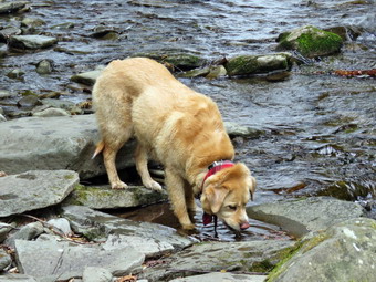 We walked the main trail down the east side of the lake to the outlet end. There were two people with a full-sized canoe at the beach. I commented that the canoe must be heavy but the owner lifted it with one hand. The canoe was entirely constructed of carbon fiber making it strong but light. I took picture of Trout Pond and noticed that the water was very high. I walked over to the dam and took some pictures of the high volume of water rushing out of the pond. I decided to walk to the area below the dam and took a few more pictures. I walked back up to the shore and joined the rest of the group. We walked back out to the main trail and started down toward the area of the falls. We passed several more groups of hikers on the trail. The camping area on the right of the trail was occupied and I noticed that there was a lot of water in the outlet stream. I had gotten ahead of the group so I waited a few minutes until they came down the trail. We continued down to the trail register where there were campers on the left of the trail. The campers had their music turned up as loud as possible making sure everyone else would hear it. I realize people come to have fun and relax but I don't think someone's fun should annoy others. We turned left on the path out to the falls. There were tow people down in the stream bed and a few others walking up the trail to the viewpoint over the falls. We walked down to the streambed where I put down my pack and got out my camera. I took pictures from the falls and some of Sheila in front of the falls. I told the group about the dams that had been created here to moderate the water flow. After a few group pictures, we walked back up the bank and then out to the main trail. We crossed the brook and walked up the trail to the parking area. It was 4:00 PM and we had hiked 8.7 miles in 6 hours and 10 minutes with an hour and a half of stopped time! This made our moving average 1.8 mph. Over the hike we gained 1620 feet of elevation. This was a sow pace for me as I seldom stop on a hike except for pictures but I really enjoyed hiking with the group.
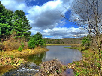
![]()
![]()
![]()
![]()
![]() On Tuesday, May 11th, I was ready to get some chores done around the house and then get out for a hike before going to track practice in the in afternoon. I like coaching but the afternoon practices limit my hiking options as I don't want to be late. I thought about Trout Pond and Cabot Mountain from Beech Hill Road but these involve longer drives than I wanted to make and I had been in both areas recently so I decided to once again head for the Frick Pond area. The forecast was for temperatures in the 50's but when I got up in the morning it was 38 degrees. I started to get ready at 9:45 AM when the temperature was up to 33 degrees. I put on my Mammut long-sleeved crew top with a light long-sleeved baselayer. I put on a pair of RailRiders hiking pants which are expensive but last along time and have features like deep pockets and a generous cut which I really like. The pants have Velcro closures at the ankles. I decided to wear my Keen Traghee II hiking boots which fit well and have been discontinued. I grabbed my Leki external lock poles which I have been using since the internal twist locks have proved unreliable. I also donned my Mammut hoody which was enough zippers to dump heat when needed. I put on a light hat and wore a light pair of gloves. I also put on my OR Crocodile gaiters to deal with the mud and water that I knew would be present. As I was getting ready Sheila stayed near me so that I would not "forget" her but was being a very well-behaved dog. I put my gear in the car and Sheila in the back seat. She was happy to be going anywhere and crouched in the back seat with her head on the console. We left Livingston Manor at 10:15 AM under blue skies with the temperature reading 56 degrees. I drove out the DeBruce Road about 6 miles to Mongaup Road and turned left. I continued up the road to the point where it splits and stayed left on Beech Mountain Road. It was a short drive to the parking areas on the left. There were no cars in either lot so I pulled into the smaller parking area. My plan was to hike up the Flynn Trail toward Hodge Pond and make a decision where to go when we reached the intersection with the Big Rock Trail. I set my GPS to get ready to hike with the temperature at 50 degrees and a slight breeze blowing.
On Tuesday, May 11th, I was ready to get some chores done around the house and then get out for a hike before going to track practice in the in afternoon. I like coaching but the afternoon practices limit my hiking options as I don't want to be late. I thought about Trout Pond and Cabot Mountain from Beech Hill Road but these involve longer drives than I wanted to make and I had been in both areas recently so I decided to once again head for the Frick Pond area. The forecast was for temperatures in the 50's but when I got up in the morning it was 38 degrees. I started to get ready at 9:45 AM when the temperature was up to 33 degrees. I put on my Mammut long-sleeved crew top with a light long-sleeved baselayer. I put on a pair of RailRiders hiking pants which are expensive but last along time and have features like deep pockets and a generous cut which I really like. The pants have Velcro closures at the ankles. I decided to wear my Keen Traghee II hiking boots which fit well and have been discontinued. I grabbed my Leki external lock poles which I have been using since the internal twist locks have proved unreliable. I also donned my Mammut hoody which was enough zippers to dump heat when needed. I put on a light hat and wore a light pair of gloves. I also put on my OR Crocodile gaiters to deal with the mud and water that I knew would be present. As I was getting ready Sheila stayed near me so that I would not "forget" her but was being a very well-behaved dog. I put my gear in the car and Sheila in the back seat. She was happy to be going anywhere and crouched in the back seat with her head on the console. We left Livingston Manor at 10:15 AM under blue skies with the temperature reading 56 degrees. I drove out the DeBruce Road about 6 miles to Mongaup Road and turned left. I continued up the road to the point where it splits and stayed left on Beech Mountain Road. It was a short drive to the parking areas on the left. There were no cars in either lot so I pulled into the smaller parking area. My plan was to hike up the Flynn Trail toward Hodge Pond and make a decision where to go when we reached the intersection with the Big Rock Trail. I set my GPS to get ready to hike with the temperature at 50 degrees and a slight breeze blowing.
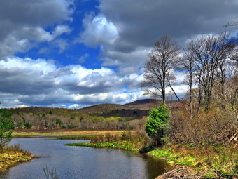 We crossed the road at 10:45 AM and got on the Flynn Trail to walk around the private property around the cabin at the end of the road. I immediately noticed a number of small and larger branches on the trail. I picked up the branches and removed them from the trail and thought how easy this would have been for other hikers to do the same. Many people seem to hike the trails without any thought about making them better. I know this is true because I was once one of those people. At the end of the trail through the woods we turned right on a woods road which is sited along what was once the Beech Mountain Road. This road was the access for the Beech Mountain Boy Scout Camp. We began the ascent on the trail following a well-worn track of the wide woods road. The day was crisp and clear with blue skies and plenty sun with some nice white clouds. The trail gains a little over 600 feet in 1.7 miles to the highest point at the junction with the Big Rock Trail. We passed through the arch Cindy and I had cut through an enormous hemlock that had fallen across the trail. We walked up the trail and I decided we would just walk as fast as we could without making any stops for pictures. The trail was almost dry with a few slick places but it was easy to set a fast pace. I notice lately that I start out with a really fast pace which makes me breathe heavily but then I seem to get used to it. I was thinking about a hike I was planning with Melissa Cascini the new New York Program Coordinator for the New York-New Jersey Trail Conference. She wanted to come hike in the area I supervise for the trail conference. I decided we would hike the Flynn Trail to the old Boy Scout camp and maybe to the viewpoint over Hodge Pond. When we came to the clearing on the right, we passed by as I wanted to stay on the main trail. The clearing is interesting as no one knows exactly why it was cleared. I think the dirt was used to help build Beech Mountain Road. After this point we began to run into a few small blowdowns that would require a saw to clear. As we neared the highest point on the trail at the junction with the Big Rock Trail, I looked at the time and decided to head down the Big Rock Trail and leave Hodge Pond for another day. We reached the junction after hiking 1.7 miles uphill in 45 minutes and now would have over a mile descent.
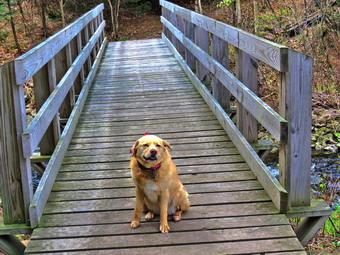 We turned left and started down the Big Rock Trail which was also mostly dry with a few damp spots. I was deep in thought as we kept a fast pace downhill but noticed Sheila straying at times to check out a game trail led by her nose. She is very good about coming back when I call her and I seldom have to remind her with the electronic collar. The walk down to Times Square is pretty but there are several places that always fool me into think we have arrived when there is another section if trail waiting. The trip downhill went quickly and we were soon at Times Square. We continued straight across to stay on the Big Rock Trail. The trails up to this point had been almost dry but this changed at Times Square. The Logger's Loop was very wet to the right with a lot of surface water draining down to the trail junction. The Big Rock trail ahead of us had numerous pools and puddles and muddy pits. I saw how some of these could be drained but others would prove much more difficult. We came to the bridges over the streams that feed Frick Pond where there was a large volume of water flowing under them. I was tempted to stop to take some shots but continued hiking instead. When we came to the large spruce log that had fallen across the trail, I was glad that I had been able to remove it because it made hiking the trail so much easier than having to climb over it. We walked along the trail under the spruce trees before crossing the wooden walkways that were wet and slippery in places. This is another spot I wanted to show Melissa as the DEC feels the walkways are in good shape and I feel differently. We used the detour to get around the mud pit on the Big Rock Trail and at the end turned left on the Quick Lake Trail. As we walked toward the bridge over the outlet stream, the trail was covered in running water with a large pool and mud pit between the two small bridges. This was new and added another job for the trail crew I addition to the large mud pit we are already planning on remediating. When we got to the bridge over the outlet, I could not resist the ire to stop and take a few shots. The skies were blue with puffy white clouds and the green of the new leaves. After taking the pictures, I took put a bar, packed up and we continued up the hill to Gravestone Junction. We continued on the trail and back out to the car. The Quick Lake Trail back to the parking area was very wet with standing water in some places and running water in others. There were also some very muddy places. At the register we continued straight ahead on the woods road. We arrived at the car at 12:30 PM after hiking 3.9 miles in 1 hours and 40 minutes which made our moving anaerobe 2.4 mph. The elevation gain was 670 feet. The temperature at the car was 51 degrees.
![]()
![]()
![]()
![]() On Monday, May 10th I knew I had to get out for a hike after too many days of rain, ambulance calls and family commitments. The forecast was for rain showers on and off throughout the day but around 11:30 Cindy and I decided to try to get across the street to hike on Round Top. As we began to get ready the temperature was 47 degrees and the moist air felt raw. As we got ready, Sheila seemed very happy to be going out. I put on my Mammut long-sleeved crew top with a light baselayer. I put on a pair of RailRiders hiking pants which are expensive but last along time and have features like deep pockets and a generous cut which I really like. The pants have Velcro closures at the ankles I wore my Keen Targhee II boots which are wearing out but still have a few miles in them. I decided to take my Leki poles with external locks as the internal twist locks fail. We stepped out of the house at noon. I grabbed Sheila's leash from the car and put it on her to safely cross the street. We walked up the driveway and crossed the street. We walked to the church parking lot and to the back of the church. As we started up the hill, we began the ascent of the steep hill behind the church. The hill is short but gets the circulation pumping and is the steepest and longest climb on the "trail". Someone had been working on the "road" that climbs the hill. The side of the road had been cleared back but the pavement was the worse for wear and I hoped the plan was to pave that stretch. I let Sheila off her leash so that I could use my poles to get up the hill. Sheila immediately began to bound up the hill as Cindy and I followed. When we got to the top of the hill, we stopped to look around at the hills around town. We started on the trail by turning left at the trailhead. I knew that other people were using the trails from comments on Facebook. The trails was becoming well-worn as more and more people use them.
On Monday, May 10th I knew I had to get out for a hike after too many days of rain, ambulance calls and family commitments. The forecast was for rain showers on and off throughout the day but around 11:30 Cindy and I decided to try to get across the street to hike on Round Top. As we began to get ready the temperature was 47 degrees and the moist air felt raw. As we got ready, Sheila seemed very happy to be going out. I put on my Mammut long-sleeved crew top with a light baselayer. I put on a pair of RailRiders hiking pants which are expensive but last along time and have features like deep pockets and a generous cut which I really like. The pants have Velcro closures at the ankles I wore my Keen Targhee II boots which are wearing out but still have a few miles in them. I decided to take my Leki poles with external locks as the internal twist locks fail. We stepped out of the house at noon. I grabbed Sheila's leash from the car and put it on her to safely cross the street. We walked up the driveway and crossed the street. We walked to the church parking lot and to the back of the church. As we started up the hill, we began the ascent of the steep hill behind the church. The hill is short but gets the circulation pumping and is the steepest and longest climb on the "trail". Someone had been working on the "road" that climbs the hill. The side of the road had been cleared back but the pavement was the worse for wear and I hoped the plan was to pave that stretch. I let Sheila off her leash so that I could use my poles to get up the hill. Sheila immediately began to bound up the hill as Cindy and I followed. When we got to the top of the hill, we stopped to look around at the hills around town. We started on the trail by turning left at the trailhead. I knew that other people were using the trails from comments on Facebook. The trails was becoming well-worn as more and more people use them.
At the first trail junction, we followed Sheila as she continued straight ahead up the hill toward the viewpoint. The climb up the hill was not particularly tiring. At the viewpoint, Cindy and I noticed that the brush that Bryce and I had placed in the trail was still there. This trail has a dangerous spot and we have piled brush on it to discourage people from using it. We continued to the main trail and headed to the right to follow the main yellow trail as it turned right and headed up the gentle hill through the hardwood forest. The forest was becoming much greener although I did not see any ferns rising. Sheila was making her own way by staying on the trail some times and then running off trail and chasing game trails. She was also picking up sticks and dragging them along and off the trail. We continued to follow the yellow trail toward the first junction with the blue trail. There was a slight breeze blowing which discouraged the insects but made the air feel much cooler. At the first trail junction with the blue trail, we turned right and followed the yellow trail along the base of Round Top. This section was in good shape without any blowdowns or need for trimming. At the next junction, we turned left and started up to the summit of Round Top on the blue trail. We bypassed the white crossover trail and continued up and over the summit. When we started down the other side, I decided we would skip the white crossover trail and the new switchback on the blue trail and just continue down the hill. The steepest part of the hill can be tricky but the poles helped Cindy and I to keep our balance. At the bottom of the hill we turned left on the yellow trail, walked along the base of Round Top. At the trail junction with the blue trail, we turned right to walk down to the woods road. It was a snap to walk downhill and out the woods road. It was obvious Sheila felt the same way as she was running and bounding ahead of us and then running back up the trail. We walked the woods road out to the first trail junction. We immediately turned around and started back up the woods road to the junction with the blue trail. I was happy that Cindy decided to come with us. I had to call Sheila back as she was following game trails and inspecting the "caves". We turned left and walked along the yellow trail following the base of the Round Top summit. At the next junction we turned right and started up the steeper side of the hill on the blue trail. This time we followed the switchback in the blue trail which was showing signs of use. We followed the switchback as it turned back toward the main trail. We turned right on the main trail and right again almost immediately on the white-blazed crossover trail. This trail was less used than the main trails and I had to look closely to find the track. On the other side of the hill we came to the main trail and turned right to hike downhill to the junction with the yellow trail. We turned right on the yellow trail and followed it along the base of Round Top once again. At the junction with the blue trail we turned to the left to stay on the yellow trail to the lookout. At the lookout we followed the yellow trail as it turned left and descended to the first trail junction. We walked straight out to the trailhead and turned right to walk to the bottom of the hill. We headed across the church parking lot to the street. We crossed the street to our driveway and were home by 12:55 PM after hiking a little over 2 miles in 1 hour and 5 minutes.
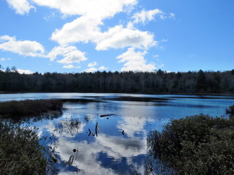
![]()
![]()
![]()
![]()
![]() On Thursday, May 6th I wanted to get out on a longer hike after several days of rainy weather. I had a men's fellowship at church in Liberty at 6:15 AM so I planned to get an early start. When I got home I decided to go to Long Pond as it is about 6 miles and isn't too far from my house. The temperature was 38 degrees as I was getting ready at 9:00 AM. As I started to get ready and Sheila was there to watch my every move. I decided I would dress warmly. Sheila was sitting quietly being a good dog. I put on my Mammut long-sleeved crew top with a long-sleeved baselayer. I decided to wear my Keen Traghee II hiking boots which fit well and have been discontinued. I grabbed my Leki external lock poles which I have been using since the spring since twist locks have proved unreliable. I also donned my Mammut hoody which was enough zippers to dump heat when needed. I put on a light hat and wore a light pair of gloves. I also put on my OR Crocodile gaiters to deal with the mud and water that I knew would be present. Sheila kept me in sight as I got ready to go making sure she would not be forgotten. I put my gear in the back of the car and Sheila in the back seat as we left Livingston Manor at 9:15 AM with skies that were blue but with a few puffy white clouds that make for good pictures. We headed out DeBruce Road toward Long Pond for about 8 miles to Flugertown Road where I made a left. I drove up the road and parked in the lot a short distance up the road on the right where no other cars was parked. After I pulled into the lot, I started to get ready by setting my GPS. We got started on the trail by crossing the first bridge at 9:40 AM. I hoped we could set a quick pace but knew that the water and mud I expected to find would slow us down. The first .6 miles gains about 350 feet to the highest point on the hike. It isn't very steep but does act as a nice warm-up! I set off very fast and found I was soon out of breath. We did run into one large blowdown that was almost blocking the trail. This trail is in the Willowemoc Wild Forest which I supervise but on a snowmobile trail not assigned to the NYNJTC. I knew I would have to contact the local forest ranger to see if I could get it removed. Once the trail leveled it was easier walking but there were many wet and muddy spots. At 1.1 miles we were at the spur trail that leads down to the shore of Long Pond. We turned right and went down to the pond so that I could take some pictures. At the shores of the pond I dropped my pack and got out my camera to take some pictures. The path to the actual shore of the pond was flooded with water and was very muddy. I told Sheila to stay where she was and she laid down to wait for me. The skies were a flat blue but there were a few clouds to make the scene more interesting. The clouds were right across the pond and were reflected in the water. I took a few pictures of all angles of the pond. I returned to my pack where I got a bar before packing up as we returned to the main trail. We turned right and were soon at the first trail junction. We turned right at the junction at 1.3 miles and continued to find wet and muddy places on the trail. Some of these spots ran from one side of the trail to the other and were hard to avoid. We ran into a few more blowdowns but these were on designated hiking trails so I could remove them. By 10:30 AM we had walked 1.8 miles and were passing the yellow spur trail to the lean-to.
On Thursday, May 6th I wanted to get out on a longer hike after several days of rainy weather. I had a men's fellowship at church in Liberty at 6:15 AM so I planned to get an early start. When I got home I decided to go to Long Pond as it is about 6 miles and isn't too far from my house. The temperature was 38 degrees as I was getting ready at 9:00 AM. As I started to get ready and Sheila was there to watch my every move. I decided I would dress warmly. Sheila was sitting quietly being a good dog. I put on my Mammut long-sleeved crew top with a long-sleeved baselayer. I decided to wear my Keen Traghee II hiking boots which fit well and have been discontinued. I grabbed my Leki external lock poles which I have been using since the spring since twist locks have proved unreliable. I also donned my Mammut hoody which was enough zippers to dump heat when needed. I put on a light hat and wore a light pair of gloves. I also put on my OR Crocodile gaiters to deal with the mud and water that I knew would be present. Sheila kept me in sight as I got ready to go making sure she would not be forgotten. I put my gear in the back of the car and Sheila in the back seat as we left Livingston Manor at 9:15 AM with skies that were blue but with a few puffy white clouds that make for good pictures. We headed out DeBruce Road toward Long Pond for about 8 miles to Flugertown Road where I made a left. I drove up the road and parked in the lot a short distance up the road on the right where no other cars was parked. After I pulled into the lot, I started to get ready by setting my GPS. We got started on the trail by crossing the first bridge at 9:40 AM. I hoped we could set a quick pace but knew that the water and mud I expected to find would slow us down. The first .6 miles gains about 350 feet to the highest point on the hike. It isn't very steep but does act as a nice warm-up! I set off very fast and found I was soon out of breath. We did run into one large blowdown that was almost blocking the trail. This trail is in the Willowemoc Wild Forest which I supervise but on a snowmobile trail not assigned to the NYNJTC. I knew I would have to contact the local forest ranger to see if I could get it removed. Once the trail leveled it was easier walking but there were many wet and muddy spots. At 1.1 miles we were at the spur trail that leads down to the shore of Long Pond. We turned right and went down to the pond so that I could take some pictures. At the shores of the pond I dropped my pack and got out my camera to take some pictures. The path to the actual shore of the pond was flooded with water and was very muddy. I told Sheila to stay where she was and she laid down to wait for me. The skies were a flat blue but there were a few clouds to make the scene more interesting. The clouds were right across the pond and were reflected in the water. I took a few pictures of all angles of the pond. I returned to my pack where I got a bar before packing up as we returned to the main trail. We turned right and were soon at the first trail junction. We turned right at the junction at 1.3 miles and continued to find wet and muddy places on the trail. Some of these spots ran from one side of the trail to the other and were hard to avoid. We ran into a few more blowdowns but these were on designated hiking trails so I could remove them. By 10:30 AM we had walked 1.8 miles and were passing the yellow spur trail to the lean-to.
 After passing the trail to the lean-to, we continued to find many wet and muddy places. There isn't much to see on this section of trail so I concentrated on avoiding the deep mud as much as possible without ruining the trail. We continued on the main trail to the point where it intersects a woods road at 2.6 miles. We turned left on the woods road and found it to be a maze of mud, standing water and running water. We followed the road until the intersection with Basily Road at 2.85 miles where we continued on Basily Road by bearing left. This section of road was also wet and muddy in most spots but it did not slow us down too much. Sheila took advantage of the water in one of the small streams to get a drink and play in the water. It did seem to get getting warmer the longer we hiked. As we approached the Peters Hunting Camp, I got ready to put Sheila on her leash. The beaver pond was as full of water as I had ever seen it. The road was flooded and the small foot bridge was covered. We had seen this before and I assumed the beavers had been at work both on the main dam and on a secondary dam further downstream. As I stepped on the bridge, I found it was floating but had no choice but to step across. Fortunately, I did not get very wet and I stopped to take a few pictures. I took pictures of the beaver pond and the flooded road. We continued on the trail and I stopped to take some more pictures of the beaver pond from the other side to get a different angle. We came to the bridge over the stream near the camp which is showing signs of wear from snowmobiles passing over it even though there is a sign that states "Private Bridge". I have secured permission to hike across this land in the past and "Stay on the trail" signs seem to indicate that the owners will allow hikers. I assume the "Private Bridge - No thru traffic" refers to motorized vehicles and not hikers. We crossed the bridge to continue the trip back to the car and started up the little hill from the hunting camp. We stopped again so that I could take a few shots of the valley which looked peacefully bucolic. Once we started walking again we kept a fast pace as the road now had less water and mud. The road is gravel until it breaks out of the forest where it is paved. There were several people camped along the road but we met only one person walking on the road. As we neared the end of the gravel road, I could not resist walking to the shore of the stream and taking some pictures. The water was high and the sunlight was sparkling off of the surface. After I finished my photography, we continued down the road toward the parking area and our car at a near record pace. We walked down the road to a bridge over a stream and saw the beavers had again been at work. We continued at an accelerated pace back to the parking area. We were back at the car at 12:10 PM having hiked 5.9 miles in 2 hours and 30 minutes with only 10 minutes of stopped time. The elevation gain was only about 550 feet most of which was at the beginning of the hike.
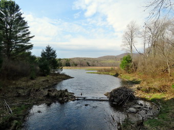
![]()
![]()
![]()
![]()
![]() On Sunday, May 2nd I did some much needed yard work around the house until about 3:45 PM. Lisa had contacted me wanting to hike after she closed her shop. I called her and we agreed to meet at the Frick Pond trailhead at 4:30 PM. The temperature was 74 degrees as I began to get ready. When I had finished hiking yesterday, the temperature was 37 degrees. This was quite a temperature swing in a 24 hour period! I put on my long-sleeved White Sierra crew top which is treated to repel insects. I decided to wear my RailRiders hiking pants which are expensive but last a long time and have features like deep pockets and a generous cut which I really like. The pants have Velcro closures at the ankles. I wore my Keen Traghee II boots which are supportive, surprisingly roomy and have been discontinued. I brought a pair of Leki external lock poles I have been using since spring as I have found internal twist locks are unreliable. The external locks have not failed me yet and the cork handles really do allow a good grip. I put on my OR Bugout gaiters which are treated to repel insects. I got my gear and Sheila in my car and left Livingston Manor at 4:20 PM. I drove out the DeBruce Road about 6 miles to Mongaup Road and turned left to continue up the road to the point where it splits. I stayed left on Beech Mountain Road and drove to the Frick Pond trailhead. When we arrived at the parking areas at 4:35 PM Lisa was parked in the smaller lot. There were one car parked in the larger lot and a woman and her yellow lab were returning from a hike The dog was not on a leash so he came to visit us and ignored his owner's calls. She got in her car and pulled out of the parking area with her dog running after the car. Lisa and I knew that the dog was the smarter of the two! The skies were sunny with a few clouds and a 15 mph wind blowing. The temperature right at 74 degrees but the breeze made it feel cool. I set my GPS unit and we started out the woods road to the register.
On Sunday, May 2nd I did some much needed yard work around the house until about 3:45 PM. Lisa had contacted me wanting to hike after she closed her shop. I called her and we agreed to meet at the Frick Pond trailhead at 4:30 PM. The temperature was 74 degrees as I began to get ready. When I had finished hiking yesterday, the temperature was 37 degrees. This was quite a temperature swing in a 24 hour period! I put on my long-sleeved White Sierra crew top which is treated to repel insects. I decided to wear my RailRiders hiking pants which are expensive but last a long time and have features like deep pockets and a generous cut which I really like. The pants have Velcro closures at the ankles. I wore my Keen Traghee II boots which are supportive, surprisingly roomy and have been discontinued. I brought a pair of Leki external lock poles I have been using since spring as I have found internal twist locks are unreliable. The external locks have not failed me yet and the cork handles really do allow a good grip. I put on my OR Bugout gaiters which are treated to repel insects. I got my gear and Sheila in my car and left Livingston Manor at 4:20 PM. I drove out the DeBruce Road about 6 miles to Mongaup Road and turned left to continue up the road to the point where it splits. I stayed left on Beech Mountain Road and drove to the Frick Pond trailhead. When we arrived at the parking areas at 4:35 PM Lisa was parked in the smaller lot. There were one car parked in the larger lot and a woman and her yellow lab were returning from a hike The dog was not on a leash so he came to visit us and ignored his owner's calls. She got in her car and pulled out of the parking area with her dog running after the car. Lisa and I knew that the dog was the smarter of the two! The skies were sunny with a few clouds and a 15 mph wind blowing. The temperature right at 74 degrees but the breeze made it feel cool. I set my GPS unit and we started out the woods road to the register.
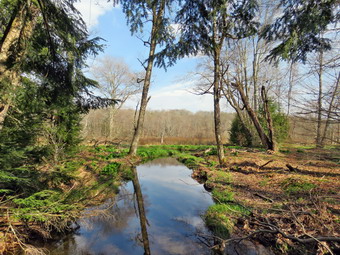 Our purpose was to walk around Frick Pond on the Quick Lake Trail, Big Rock Trail and Logger's Loop to evaluate the trail conditions for workday on May23rd with the Willowemoc Trail crew. There is a maintainer assigned to the trail so we would be working on drainage. Some of the trails can be wet and muddy and we like to try to keep them so that novice hikers can walk them without waterproof hiking boots. As we walked out the woods road to Frick Pond, we found a lot of water on the trail, and we talked about how we might encourage it to drain. We also discussed how many people might be needed for each task and the tools we would require. At Gravestone Junction, we stayed to the left on the Quick Lake Trail to go to the bridge at the outlet of Frick Pond. We stopped at the bridge so that I could take pictures as I always do. I snapped a few shots and then we continued around the west side of the pond. We came to a very wet and muddy spot and stopped a minute to analyze how we would try to alleviate the problem. We decided to drain as much water as we could and install some stepping stones. We continued on the trail to the junction with the Big Rock Trail. We turned right on the Big Rock Trail and found another muddy area but this one had a well-established reroute. We continued over the wooden walkways which are deteriorating. Neither Lisa nor I remember when these walkways were last repaired. We stopped at the bridges over the inlet streams and I took a few more pictures. We continued on the trail around the north end of the pond where there were a few wet areas. When we arrived at Times Square, we were surprised to find that it was one of the drier spots. We turned right on the Logger's Loop and continued our walk as the trail started uphill. Along the trail there were a few wet spots and we discussed how we might fix them. We walked to Gravestone Junction and turned left on the Quick Lake Trail. We walked back out to the parking area. It was 5:40 PM and we had hiked the 2.0 miles in 1 hour and 5 minutes with an elevation gain for 150 feet. Before we left to go home we discussed the size of the group we would assigned to each task. We also talked about the tools we would require from the NYNJTC.
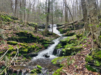
![]()
![]()
![]()
![]() On Saturday, May 1st I had planned to meet a friend, Sharon, for a one-way hike from Campbell Mountain Road to the parking area on Russell Brook Road. Sharon needed this for her All Trails Challenge and it had been some time since I was on this route. Sharon was brining along a friend of hers, Jill, who wanted to get out for a hike a her dog. I wondered how Sheila would handle new people and a dog but I knew we could make it work. We agreed to meet at the Russell Brook trailhead at 9:30 AM. Our plan was to ride in one car to Campbell Mountain Road and hike back to the Russell Brook trailhead. When I got up at 8:00 AM, it was 33 degrees and the wind was still blowing. I decided I would dress warmly. Sheila was sitting quietly being a good dog. I put on my Mammut long-sleeved crew top with a long-sleeved baselayer since the temperature was warm but I expected I might get wet. I decided to wear my Columbia Titanium insulated pants but didn't bother with a baselayer. I wore my Salomon B52 winter boots which are supportive, surprisingly roomy and discontinued. I had recently put a pair of Protalus insoles in these shoes and was anxious to see how they performed. The insoles in most hiking boots are a flimsy and flat piece of material. I also applied a new waterproofing and leather preservative which has proved very effective. I didn't expect to find any snow but these boots are getting pretty worn so I thought I would have to replace them before next winter. I grabbed my Leki external lock poles which I have been using since the spring since twist locks have proved unreliable. I also donned my Mammut hoody which was enough zippers to dump heat when needed. I put on a light hat and wore a light pair of gloves. I also put on my OR Crocodile gaiters to deal with the mud and water that I knew would be present. Just as I was about to step out the door, the ambulance pager sounded for a call in Roscoe. I debated what to do for a moment and, fortunately, Roscoe got a crew. I got my gear and Sheila in my car and left Livingston Manor at 9:10 AM. I got off at exit 94, turned left and drove out the Rockland Flats on Route 206. Just after the Roscoe Nursing Home I turned left on Morton Hill Road and followed it for 3 miles to the intersection with Russell Brook Road. I turned left on Russell Brook Road and found it in good shape. I drove to the parking area where there were already four cars parked. It was 9:30 AM and it wasn't long before Sharon and Jill arrived in separate cars. Sharon had not brought her dog which I knew would make things easier. We decided to get in Sharon's car and drive to Campbell Mountain Road. As we left the parking area, a few snowflakes were falling. Further up Morton Hill Road, we began to notice there was a layer of white covering the forest floor. We turned right on Campbell Brook Road and drove past Jug Tavern Road. Sharon pulled over at the parking spot on Campbell Brook Road. I too some pictures of the snow covering the ground and then set my GPS to began our hike at 9:55 AM with the temperature at 37 degrees.
On Saturday, May 1st I had planned to meet a friend, Sharon, for a one-way hike from Campbell Mountain Road to the parking area on Russell Brook Road. Sharon needed this for her All Trails Challenge and it had been some time since I was on this route. Sharon was brining along a friend of hers, Jill, who wanted to get out for a hike a her dog. I wondered how Sheila would handle new people and a dog but I knew we could make it work. We agreed to meet at the Russell Brook trailhead at 9:30 AM. Our plan was to ride in one car to Campbell Mountain Road and hike back to the Russell Brook trailhead. When I got up at 8:00 AM, it was 33 degrees and the wind was still blowing. I decided I would dress warmly. Sheila was sitting quietly being a good dog. I put on my Mammut long-sleeved crew top with a long-sleeved baselayer since the temperature was warm but I expected I might get wet. I decided to wear my Columbia Titanium insulated pants but didn't bother with a baselayer. I wore my Salomon B52 winter boots which are supportive, surprisingly roomy and discontinued. I had recently put a pair of Protalus insoles in these shoes and was anxious to see how they performed. The insoles in most hiking boots are a flimsy and flat piece of material. I also applied a new waterproofing and leather preservative which has proved very effective. I didn't expect to find any snow but these boots are getting pretty worn so I thought I would have to replace them before next winter. I grabbed my Leki external lock poles which I have been using since the spring since twist locks have proved unreliable. I also donned my Mammut hoody which was enough zippers to dump heat when needed. I put on a light hat and wore a light pair of gloves. I also put on my OR Crocodile gaiters to deal with the mud and water that I knew would be present. Just as I was about to step out the door, the ambulance pager sounded for a call in Roscoe. I debated what to do for a moment and, fortunately, Roscoe got a crew. I got my gear and Sheila in my car and left Livingston Manor at 9:10 AM. I got off at exit 94, turned left and drove out the Rockland Flats on Route 206. Just after the Roscoe Nursing Home I turned left on Morton Hill Road and followed it for 3 miles to the intersection with Russell Brook Road. I turned left on Russell Brook Road and found it in good shape. I drove to the parking area where there were already four cars parked. It was 9:30 AM and it wasn't long before Sharon and Jill arrived in separate cars. Sharon had not brought her dog which I knew would make things easier. We decided to get in Sharon's car and drive to Campbell Mountain Road. As we left the parking area, a few snowflakes were falling. Further up Morton Hill Road, we began to notice there was a layer of white covering the forest floor. We turned right on Campbell Brook Road and drove past Jug Tavern Road. Sharon pulled over at the parking spot on Campbell Brook Road. I too some pictures of the snow covering the ground and then set my GPS to began our hike at 9:55 AM with the temperature at 37 degrees.
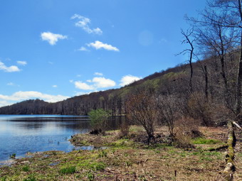 The first .3 miles of the trail dropped downhill heading southwest. The trail was wet and muddy and we expected this to continue for much of the hike. At .3 miles the trail began to climb and turned west. At .75 miles the trail headed south and then southeast. This trails follows old woods roads for almost its entire length and has been eroded by water in may places. On the climb I took the time to open some zippers as the exertion was warming me up quickly. At 1.4 miles we reached the top of the hill and began a descent which I found welcome. At 1.5 miles the trail headed south toward Campbell Brook Road. The last few hundred feet of the trail was very wet with water running down the middle. At the road we turned left and walked a short distance to the point where the trail entered the woods and passed through a gate. Once again we descended for about .3 miles and came to a bridge over a stream. The stream was flowing freely and there were a few small rapids. I walked off the trail to the stream and took out my camera. I took pictures of the stream and the bridge and some of the rapids. I kept my camera in hand and walked up to the bridge where I took some pictures upstream of the bridge. I put the camera away and we started up the trail. Looking to the left, we saw a nice waterfall and we decided to walk over to see it. When I arrived at the stream, I got out my camera and took a number of shots. I have been to this waterfall before but it emphasized how much the direction of travel on trails matters. Coming from the opposite direction the waterfalls is much less noticeable. We returned to the main trail which is an old woods road which was been highly eroded so that it has high sides. Walking on this trail almost has the feel of walking in a canal! The trail turned west in a switchback up the mountain until at 2.9 miles it headed south. At 3 miles we came to the top of the hill and past by the snowmobile trail on the left. There was less snow at the top of this hill as we began the descent to Trout Pond. The forest was very green and we saw many wildflowers and flowering trees. In many places the forest for was covered in what we used to call "princess pine". We came to a tree with an unusual formation near its base and I took a picture. I thought it looked like a particular body part but that is probably in the eye of the beholder! We continued down the hill until I could see the water of Trout Pond and the lower lean-to.
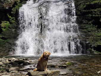 We walked over to the lean-to to take a break and found it was filled with camping supplies. Nobody was "home" so we took a break without disturbing anything. I took my camera over to the inlet end of the lake and took some pictures. The sky was blue with a few puffy white clouds which made the pictures more interesting. I returned to the lean-to and got out a bar to eat as we walked. Several groups of people and couples passed by the lean-to and we met several other groups as we headed down the trail to true outlet end of the lake. A majority of these groups had dogs but they were all leashed and well-behaved. At the outlet end of the lake, we walked off the trail to the right to the "beach". The water was high and looked cold but Sheila decided to wade and then swim. I took some pictures but there were no clouds and the sky looked very flat. I took some pictures of the area around the dam which showed some beaver activity. I threw a stick for Sheila to retrieve and she did it a couple of times. We packed up and returned to the main trail. The descent went quickly even though the trail was wet and muddy in spots. We met a few more hikers and noticed that the campsite to the right of the trail near the stream was occupied. When we reached the trail register, we turned left on the path to the waterfalls. Neither Sharon or Jill had been to the streambed below the falls and were pleasantly surprised. I took out my camera and took some shots even though I have hundreds from this location. I had been giving Sharon and Jill a history of the area including the wood alcohol and dye factories and the dams at the falls. We walked up the bank from the streambed and met a few more people. I turned right and headed uphill and upstream to show my hiking companions the upper falls. I took some pictures of the upper falls from a different angle while more people came up the path. We walked back down the path to the main trail and crossed the bridge to walk up to the parking area. The lot was almost filled with cars with a few spaces open. We were back at the cars at 1:40 PM after hiking 5.6 miles in 3 hours and 45 minutes with 45 minutes of stopped time. The elevation gain was 1040 feet but the elevation loss was 1430 feet! Jill's car was at the lot so Sharon and I said "Goodbye" as we got into my car for the ride to Sharon's car. I drove up to the intersection of Russell Brook Road and Morton Hill Road and noticed that at least half a dozen cars were illegal parked on private property at the clearing on the corner. The land is clearly posted but people insist on parking illegally. I know the owner is not pleased. This is an increasing problem in the Catskills where people do what pleases them without a thought for others. I dropped Sharon at her car and she followed me back into Roscoe. I usually hike only with Sheila but this hike showed me what I am missing hiking with others.
![]()
![]()
![]()
![]() On Wednesday, April 28th I knew I had to get out for a hike despite the fact that we had our first track meet in the afternoon. My grandson Bryce was at the house and had some school work to complete so we waited until 11:30 AM to start to get ready to work. We decided that we would go across the street and hike on Round Top. As we got ready, Sheila seemed very happy to be going out. The temperature was in the high 60's so I put on my Mammut long-sleeved crew top with a no baselayer. I put on a pair of RailRiders hiking pants which are expensive but last along time and have features like deep pockets and a generous cut which I really like. The pants have Velcro closures at the ankles I wore my Keen Targhee II boots which are wearing out but still have a few miles in them. I decided to take my Leki poles with external locks as the internal twist locks fail. We stepped out of the house at noon. I grabbed Sheila's leash from the car and put it on her to safely cross the street. We walked up the driveway and crossed the street. We walked to the church parking lot and to the back of the church. As we started up the hill, We began the ascent of the steep hill behind the church. The hill is short but gets the circulation pumping and is the steepest and longest climb on the "trail." I let Sheila off her leash so that I could use my poles to get up the hill. Sheila immediately began to bound up the hill as Bryce and I followed. When we got to the top of the hill, we stopped to look around at the hills around town. We started on the trail by turning left at the trailhead. I knew that other people were using the trails from comments on Facebook. The trails was becoming well-worn as more and more people use them.
On Wednesday, April 28th I knew I had to get out for a hike despite the fact that we had our first track meet in the afternoon. My grandson Bryce was at the house and had some school work to complete so we waited until 11:30 AM to start to get ready to work. We decided that we would go across the street and hike on Round Top. As we got ready, Sheila seemed very happy to be going out. The temperature was in the high 60's so I put on my Mammut long-sleeved crew top with a no baselayer. I put on a pair of RailRiders hiking pants which are expensive but last along time and have features like deep pockets and a generous cut which I really like. The pants have Velcro closures at the ankles I wore my Keen Targhee II boots which are wearing out but still have a few miles in them. I decided to take my Leki poles with external locks as the internal twist locks fail. We stepped out of the house at noon. I grabbed Sheila's leash from the car and put it on her to safely cross the street. We walked up the driveway and crossed the street. We walked to the church parking lot and to the back of the church. As we started up the hill, We began the ascent of the steep hill behind the church. The hill is short but gets the circulation pumping and is the steepest and longest climb on the "trail." I let Sheila off her leash so that I could use my poles to get up the hill. Sheila immediately began to bound up the hill as Bryce and I followed. When we got to the top of the hill, we stopped to look around at the hills around town. We started on the trail by turning left at the trailhead. I knew that other people were using the trails from comments on Facebook. The trails was becoming well-worn as more and more people use them.
At the first trail junction, we followed Sheila as she continued straight ahead up the hill toward the viewpoint. The climb up the hill was not particularly tiring. At the viewpoint, Bryce and I noticed that someone had "helped" clear the trail to the left to the lookout. This trail has a dangerous spot and we ha piled brush on it to discourage people from using it. Bryce and I replaced the brush. We returned to the main trail and headed to the right to follow the main yellow trail as it turned right and headed up the gentle hill through the hardwood forest. The forest was becoming much greener although I did not see any ferns rising. Sheila was making her own way by staying on the trail some times and then running off trail and chasing game trails. She was also picking up sticks and dragging them along and off the trail. We continued to follow the yellow trail toward the first junction with the blue trail. There was a slight breeze blowing which dissipated some of the heat. At the first trail junction with the blue trail, we turned right and followed the yellow trail along the base of Round Top. This section was in good shape without any blowdowns or need for trimming. At the next junction, we turned left and started up to the summit of Round Top on the blue trail. We bypassed the white crossover trail and continued up and over the summit. When we started down the other side, I decided we would skip the white crossover trail and the new switchback on the blue trail and just continue down the hill. The steepest part of the hill can be tricky but the poles helped me to keep my balance and Bryce and Sheila had no problems. At the bottom of the hill we turned left on the yellow trail, walked along the base of Round Top. At the trail junction with the blue trail, we turned right to walk down to the woods road. It was a snap to walk downhill and out the woods road. It was obvious Sheila felt the same way as she was running and bounding ahead of us and then running back up the trail. We walked the woods road out to the first trail junction. We immediately turned around and walked back up the woods road to the junction with the blue trail. I had to call Sheila back as she was following game trails and inspecting the "caves". We turned left and walked along the yellow trail following the base of the Round Top summit. At the next junction we turned right and started up the steeper side of the hill on the blue trail. This time we followed the switchback in the blue trail which was showing signs of use. We followed the switchback as it turned back toward the main trail. We turned right on the main trail and right again almost immediately on the white-blazed crossover trail. This trail was less used than the main trails and I had to look closely to find the track. On the other side of the hill we came to the main trail and turned right to hike downhill to the junction with the yellow trail. We turned right on the yellow trail and followed it along the base of Round Top once again. At the junction with the blue trail we turned to the left to stay on the yellow trail to the lookout. At the lookout we followed the yellow trail as it turned left and descended to the first trail junction. We walked straight out to the trailhead and turned right to walk to the bottom of the hill. We headed across the church parking lot to the street. We crossed the street to our driveway and were home by 1:15 PM after hiking a little over 2 miles in 1 hour and 15 minutes.
![]()
![]()
![]()
![]() On Tuesday, April 27th I had taken off several days from hiking. I was up at 8:00 AM but had some tasks to accomplish before I could hike. I finally started to get ready at 10:00 AM when the temperature was 52 degrees with a slight breeze blowing. I decided to take Sheila and cross the street to hike on Round Top. I thought we might do a couple of figure 8's using the newer switchback and crossover trails. Sheila was ready to go as she really likes to hike and she was keeping a careful eye on me as I dressed. I put on a cotton longsleeved T-shirt with no baselayer as I knew I would warm up on the hike. I put on a pair of RailRiders hiking pants which are expensive but last along time and have features like deep pockets and a generous cut which I really like. The pants have Velcro closures at the ankles I wore my Keen Targhee II boots which are wearing out but still have a few miles in them. I decided to take my Leki poles with external locks as the internal twist locks fail. Finally, I also donned my Mammut hoody which I knew might be unnecessary but has enough zippers to dump heat when needed. At 10:30 AM we walked out the door to start the hike. I grabbed Sheila's leash from the car and we walked up the driveway. I aimed to hike for about an hour. Sheila was happy to get out as we headed down the driveway and across the street. We crossed the street and walked to the parking area by the Presbyterian Church. We walked to the back of the church and began the ascent of the steepest hill behind the church. The hill is short but gets the circulation pumping and is the steepest and longest climb on the "trail." Sheila helped me along by pulling me up the hill. We started on the trail by turning left at the trailhead where I let Sheila off her leash so that she could explore. The trail was completely dry and showed that people had been using it.
On Tuesday, April 27th I had taken off several days from hiking. I was up at 8:00 AM but had some tasks to accomplish before I could hike. I finally started to get ready at 10:00 AM when the temperature was 52 degrees with a slight breeze blowing. I decided to take Sheila and cross the street to hike on Round Top. I thought we might do a couple of figure 8's using the newer switchback and crossover trails. Sheila was ready to go as she really likes to hike and she was keeping a careful eye on me as I dressed. I put on a cotton longsleeved T-shirt with no baselayer as I knew I would warm up on the hike. I put on a pair of RailRiders hiking pants which are expensive but last along time and have features like deep pockets and a generous cut which I really like. The pants have Velcro closures at the ankles I wore my Keen Targhee II boots which are wearing out but still have a few miles in them. I decided to take my Leki poles with external locks as the internal twist locks fail. Finally, I also donned my Mammut hoody which I knew might be unnecessary but has enough zippers to dump heat when needed. At 10:30 AM we walked out the door to start the hike. I grabbed Sheila's leash from the car and we walked up the driveway. I aimed to hike for about an hour. Sheila was happy to get out as we headed down the driveway and across the street. We crossed the street and walked to the parking area by the Presbyterian Church. We walked to the back of the church and began the ascent of the steepest hill behind the church. The hill is short but gets the circulation pumping and is the steepest and longest climb on the "trail." Sheila helped me along by pulling me up the hill. We started on the trail by turning left at the trailhead where I let Sheila off her leash so that she could explore. The trail was completely dry and showed that people had been using it.
At the first trail junction, I followed Sheila as she turned right an started up the woods road which has the gentler approach of the two. We walked up the road to the first trail junction with the upper blue trail and turned left to follow the yellow trail along the base of Round Top. At the next junction with the blue trail we turned right and headed up the blue trail, toward the summit. On the way up we passed by the switchback and the white crossover trail. We passed over the summit and continued on the blue trail down the other side of the hill. We passed the white crossover trail and then turned right on the yellow trail. We again followed the yellow trail along the base of Round Top to the junction with the blue trail. This time we turned left and followed the yellow trail downhill passed the "Resting Rock" to the lookout. At the viewpoint, we turned left and followed the yellow trail downhill to the very first trail junction. Sheila continued straight ahead but I called her back as we turned around to start back up the hill to the viewpoint. At the top of the hill we followed the yellow trail as it turned right and started uphill. At the first junction with the blue trail we turned right and followed the yellow trail along the base of Round Top. At the next junction with the blue trail, we turned left and headed up the blue trail toward the summit. We turned left on the white crossover trail and continued to the main blue trail on the other side. We turned left and almost immediately left again on the switchback trail. We followed the switchback to the main blue trail. We continued down the steepest section of the blue trail to the junction with the yellow trail. We turned left and walked along the base of Round Top on the yellow trail to the next junction with the blue trail. This time we turned right and walked down the yellow trail to the woods road that took us back to the first trail junction. We turned left and walked out to the trailhead at the top of the cemetery hill. We walked down the hill and out to the road through the church parking lot. We walked over to the driveway and back to the house. It was 11:15 AM and we had hiked just over 2 miles in an hour and 15 minutes.
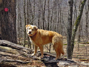
![]()
![]()
![]()
![]() On Saturday, April 24th I had planned to go to Schoharie County to work on the Scary 19 list. This plan was derailed by a request for the ambulance corps to participate in a send-off for the Roscoe/Livingston Manor football team. The team was headed to Pawling to compete in the Section IX 8-man football championship. I got back to the house at 10:15 AN and really wasn't feeling like a hike. I knew I would feel better if I went out and the anticipation in Shiela's look sealed the deal. I started to get ready with the temperature at 56 degrees. I got dressed in my Mammut crew top and decided that the temperature would probably go up so I would not wear a light baselayer. I decided to put on my Columbia Titanium insulated pants but knew I did not need a baselayer. I wore my Keen Targhee II boots which are wearing out but still have a few miles in them. I put on my OR Crocodile gaiters to keep the ticks off my legs. I decided to take my Leki poles with external locks as the internal twist locks fail. I grabbed a light hat and gloves to put in my pack. Finally, I donned my Mammut hoody which blocks the wind and keeps me warm but has enough zippers to dump heat when needed. Sheila kept me in sight as I got ready to go making sure she would not be forgotten. I put my gear in the back of the car and Sheila in the back seat as we left Livingston Manor at 10:50 AM. I had decided we would go to Big Pond and hike to Cabot Mt and then return by way of Little Pond. The trailhead is relatively close to home and the hike has some easy spots but some challenging ones also. This would also allow me to evaluate this trail that I maintain for the Finger Lakes Trail Conference for work I would have to do in the future. I drove up the Beaverkill Road with Sheila in the back seat more than ready to hike anywhere. We arrived at Big Pond at 11:05 AM to find the parking almost lot full of cars. I found a space at the end of the lot and pulled in. I looked in the lot by the pond and found a spot that must have been recently vacated and immediately pulled into it. I set my GPS and we crossed the road at 11:10 AM to get on the red Touch-Me-Not Trail to hike over the hill toward Cabot Mt. The trail starts with a nice little ascent to get the heart pumping and then levels off some.
On Saturday, April 24th I had planned to go to Schoharie County to work on the Scary 19 list. This plan was derailed by a request for the ambulance corps to participate in a send-off for the Roscoe/Livingston Manor football team. The team was headed to Pawling to compete in the Section IX 8-man football championship. I got back to the house at 10:15 AN and really wasn't feeling like a hike. I knew I would feel better if I went out and the anticipation in Shiela's look sealed the deal. I started to get ready with the temperature at 56 degrees. I got dressed in my Mammut crew top and decided that the temperature would probably go up so I would not wear a light baselayer. I decided to put on my Columbia Titanium insulated pants but knew I did not need a baselayer. I wore my Keen Targhee II boots which are wearing out but still have a few miles in them. I put on my OR Crocodile gaiters to keep the ticks off my legs. I decided to take my Leki poles with external locks as the internal twist locks fail. I grabbed a light hat and gloves to put in my pack. Finally, I donned my Mammut hoody which blocks the wind and keeps me warm but has enough zippers to dump heat when needed. Sheila kept me in sight as I got ready to go making sure she would not be forgotten. I put my gear in the back of the car and Sheila in the back seat as we left Livingston Manor at 10:50 AM. I had decided we would go to Big Pond and hike to Cabot Mt and then return by way of Little Pond. The trailhead is relatively close to home and the hike has some easy spots but some challenging ones also. This would also allow me to evaluate this trail that I maintain for the Finger Lakes Trail Conference for work I would have to do in the future. I drove up the Beaverkill Road with Sheila in the back seat more than ready to hike anywhere. We arrived at Big Pond at 11:05 AM to find the parking almost lot full of cars. I found a space at the end of the lot and pulled in. I looked in the lot by the pond and found a spot that must have been recently vacated and immediately pulled into it. I set my GPS and we crossed the road at 11:10 AM to get on the red Touch-Me-Not Trail to hike over the hill toward Cabot Mt. The trail starts with a nice little ascent to get the heart pumping and then levels off some.
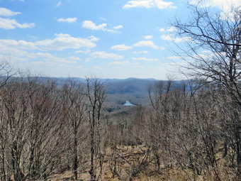 I was surprised to find the trails only damp with a few muddy spots. Immediately we came to a large tree blocking the trail almost completely. I dragged some loose branches away to make passing the blowdown a little easier. Although the tree was large it consisted of two trunks and I thought I would be able to remove it with hand tools. We walked around one end of the tree and continued on the trail. I started flicking branches aside with my poles and dragging larger ones off. We encountered another tree that had broken off 5 or 6 feet up the main trunk and then had fallen across the trail. This one was easy to walk underneath and close inspection showed it would be hard to cut. The trail remained almost dry and I continued to remove branches. Farther along, we began the real ascent up the mountain. In this area there was a very muddy spot where a small stream comes down the mountain and a spring originates near the edge of the trail. I started to clear some branches in the area and heard some voice to the right of the trail as Sheila alerted. I saw at least two people and after a moment I concluded they were harvesting ramps. I hoped if that was the case that they were doing it for personal use only. This area is also where the nettles begin but it was too early and it was nice walking the trail without them. The briars were also missing! As we started to climb I noticed I was breathing heavily but easily. Over the first mile we gained 790 feet to the shoulder of Touch-Me-Not Mountain where the trail starts a descent. I had come across some more blowdowns on the way up but most could be handled with hand tools or just by rolling them if the trail. As we started to descend we ran across a blowdown that had been there for some time. The DEC had cleared some of it but left a large trunk hanging over the trail. We continued to the junction with blue Campground Trail where Sheila alerted and we saw a hiker coming toward us on the Touch-Me-Not Trail. I stopped and stepped off the trail with Sheila. The hiker and I exchanged greetings and information about the trails. Sheila and I kept to the right on the Touch-Me-Not Trail and continued our descent. Along the way we descended through some slots between rocks and I decided not to stop as I had taken pictures there recently. There were some blowdowns along the trail and one large one that blocks the trail on a descent. Hikers have created a detour around this blowdown and it may have to stay like that as it is too large to cut easily with hand tools. At 1.6 miles, we reached the junction with the Little Pond Trail. The sign said "Beaverkill Vista .5 miles" but I knew it was more like .65 miles and that the climb was challenging. I wasn't too enthusiastic about the climb an felt a little tired but knew I needed the challenge. I was starting to get very warm and thought about taking off the Mammut jacket but decided instead to open it up as much as possible. I also got a drink and reminded myself that I needed to start carrying two water bottles or switching over to a reservoir.
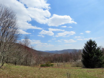 We continued straight ahead on the red trail to climb up Cabot Mountain. Sheila was all over the place looking for chipmunks, squirrels and, most of all, birds! The hike to the base of Cabot was littered with old blowdowns which had not been eliminated and I knew I would need to bring a crew to do the work. We walked about a quarter mile to the base of Cabot Mountain. This was another spot where nettles are thick when they are in season but in this day the trail was wide open. As we began the climb, I looked up to see a very large tree down across the trail. The tree looked like it was high enough to walk under but it had taken down other trees and branches to help block the trail. The vertical gain on the climb up Cabot is less than 500 feet but the horizontal distance is only .4 miles. The average grade is 25% with some areas over 30%. I climbed up the slopes with loose dirt, rocks and slippery leaves with the help of some trees I could grab and pull myself up. After the first climb, the trail leveled a little but I could see the next climb ahead. It had been a while since I had climbed something this steep but I knew it was short. Just when I thought my legs might give out, we reached the top of the steepest climbs where the trail levels off a little. We continued on the trail to the next short climb that leads to the plateau and the Vista. We climbed the last few feet and started walking along the flat trail to the lookout. As we approached, we could see that the Vista was empty and there was a good view. At the lookout, I took off my pack and got out my camera. I walked out to the lookout and was happy that not much had grown up where the viewpoint had been cut out. The view down to Little pond was clear and unobstructed and I could see the trees that had been cut below. I took some shots of Sheila on the lookout and then some of the view down to the pond. The best pictures from this viewpoint were probably those of the white, puffy clouds in the sky. After taking some more shots, I got a drink and gave Sheila one since there had been no water sources along the way. I ate a bar before I picked up my pack and reversed the course back down the mountain. We continued to the steeper part of the descent where I paused again to take some pictures of the massive rocks on the side of the trail. I posed Sheila several times to take a few pictures before we continued our descent. When we got to the trail junction, I thought about making it a true out and back. Since I didn't want to miss some of the views on the Little Pond Trail, we turned right on the yellow Little Pond Trail. After a short distance, we came to a large, flat rock that we had been to before with the whole family.
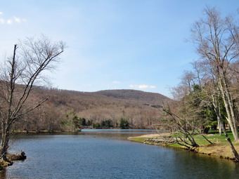 We continued on to an open field that was once part of a farm. We stopped again so that I could take some pictures of the surrounding hills and valleys from the vista supplied by the field. We continued on the trail and stopped for a few pictures at the foundation of what was once the farmhouse. As we continued our hike I looked to the right at the small pond but decided it was not very interesting. The outlet of the pond was completely dry and the rest of the trail had little or no mud. There was still a very large blowdown across the woods road and we followed the detour other hikers had used to the right of the tree. I began to wonder who was responsible for clearing this trail and why they were not doing it. At 3.5 miles we turned left off the woods road to follow the trail down toward Little Pond. This trail is usually muddy with streams of running water but on this day it too was dry. Just before the final trail section to the pond, we stopped at a large beaver pond and dam on the left side of the trail. I took a few pictures and then we walked down to the loop trail around the pond. We walked around the west side of the pond stopping once at a boat launch so that I could take pictures of Touch-Me-Not Mountain on the other side of the pond. I was surprised that Sheila decided to take a dip in the water. I took some more pictures of her in the water. We continued around the pond and followed the trail as it headed left off the road to cross the bridge at the outlet dam. I took a few pictures of the pond, Cabot Mountain and the campground buildings. There was no one in sight anywhere and all was peaceful. I came to the realization that I was taking pictures at the mountain and the viewpoint we had just left! We walked out the campground roads to the entrance and so no one. From the entrance, we started down the access road to get back to the car At Big Pond. When we were in the shade and a breeze was blowing, the temperature seemed much cooler. The upper gate was closed but, apparently, the lower gate was open as several cars drove up the road, turned around and drove back out. The walk to Barkaboom Road is about .9 miles and when we reached the road we turned left to walk another .6 miles back to the car. Sheila had been off her leash but at this point I put her on her leash. The walk from the entrance to the campgrounds seemed to go quickly and we were back ay the car by 3:00 PM after hiking 6.1 miles in 3 hours and 50 minutes. The elevation gain was 1585 feet and our moving average was 2 mph. There was now only one car in the parking area. I put Sheila in the car and walked to the shore of Big Pond to take a few pictures.
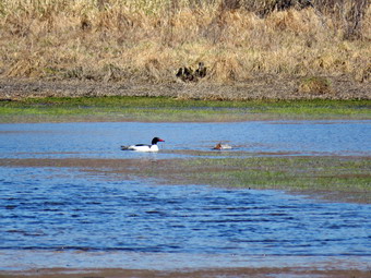
![]()
![]()
![]()
![]()
![]() On Friday, April 23rd, I had so much to do that I had not planned to hike. In the late morning, I decided I needed to get out and decided to head to Frick Pond to hike some shorter route. I started to get ready at 10:15 AM when the temperature was 48 degrees. As I started gathering my equipment and getting dressed, Sheila was very quiet but did not let me out of her sight. I put on my Mammut long-sleeved crew top with a light long-sleeved baselayer. I decided to wear my Columbia Titanium insulated pants but didn't bother with a baselayer. I wore my Keen Targhee II boots which are wearing out but still have a few miles in them. I grabbed my Leki external lock poles which I have been using lately since twist locks have proved unreliable. I also donned my Mammut hoody which was enough zippers to dump heat when needed. I put a light hat and a light pair of gloves in my pack. I also put on my OR Crocodile gaiters to deal with the mud and water that I knew would be present and to discourage the ticks. I got my gear and Sheila in my car and left Livingston Manor at 10:45 AM. I drove out the DeBruce Road about 6 miles to Mongaup Road and turned left to continue up the road to the point where it splits. I stayed left on Beech Mountain Road and drove to the Frick Pond trailhead. When we arrived at the parking areas, there were no cars parked in either lot. I pulled into the larger lot and parked. The skies were sunny with a few clouds and a 15 mph wind blowing. The temperature right at 52 degrees which was warmer than I thought it might be. I set my GPS unit and we started out the Quick Lake Trail to the register. At the register we turned left on the woods road which is the Quick Lake Trail. From the register the trail was only damp with very little standing or running water and some mud. There was a slight coating of snow along the trail and in the shady areas of the woods. Since this is a woods road, I was able to avoid most of the water and mud by picking my steps carefully.
On Friday, April 23rd, I had so much to do that I had not planned to hike. In the late morning, I decided I needed to get out and decided to head to Frick Pond to hike some shorter route. I started to get ready at 10:15 AM when the temperature was 48 degrees. As I started gathering my equipment and getting dressed, Sheila was very quiet but did not let me out of her sight. I put on my Mammut long-sleeved crew top with a light long-sleeved baselayer. I decided to wear my Columbia Titanium insulated pants but didn't bother with a baselayer. I wore my Keen Targhee II boots which are wearing out but still have a few miles in them. I grabbed my Leki external lock poles which I have been using lately since twist locks have proved unreliable. I also donned my Mammut hoody which was enough zippers to dump heat when needed. I put a light hat and a light pair of gloves in my pack. I also put on my OR Crocodile gaiters to deal with the mud and water that I knew would be present and to discourage the ticks. I got my gear and Sheila in my car and left Livingston Manor at 10:45 AM. I drove out the DeBruce Road about 6 miles to Mongaup Road and turned left to continue up the road to the point where it splits. I stayed left on Beech Mountain Road and drove to the Frick Pond trailhead. When we arrived at the parking areas, there were no cars parked in either lot. I pulled into the larger lot and parked. The skies were sunny with a few clouds and a 15 mph wind blowing. The temperature right at 52 degrees which was warmer than I thought it might be. I set my GPS unit and we started out the Quick Lake Trail to the register. At the register we turned left on the woods road which is the Quick Lake Trail. From the register the trail was only damp with very little standing or running water and some mud. There was a slight coating of snow along the trail and in the shady areas of the woods. Since this is a woods road, I was able to avoid most of the water and mud by picking my steps carefully.
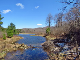 At Gravestone Junction, we stayed left on the Quick Lake trail heading toward the bridge at the outlet to Frick Pond. This area of the trail had more mud that had been churned up by recent use. When we arrived at the bridge, I noticed some movement and splashing on the pond. I put down my pack and got out the camera. I was able to zoom in on the area and saw two ducks diving on the pond. The wind gusts were buffeting the camera but I was able to get some shots. I snapped some shots of the rest of the pond and Flynn's Point on Beech Mountain. We continued around the west side of the pond where the wettest area had enlarged. I made mental note to bring a shovel and pick mattocks to deepen and widen the ditch that drains this pool but I was not sure that would solve the problem. At the junction with the Big Rock Trail, we headed left on the Quick Lake Trail which was almost dry. I had been removing smaller branches but there were a few larger ones in this area that I managed to drag off the trail. We walked through the spruce tunnel and came to the small stream across the trail. The last time I had hiked I had cleared some leaves and branches that were holding back the water. The water level in the stream was now low enough to use the stepping stones to cross. I took a few pictures and then moved on. We continued on up the Quick Lake Trail toward Iron Wheel Junction. This part of the trail is usually wet and muddy but this day was an exception which made the hiking much easier.
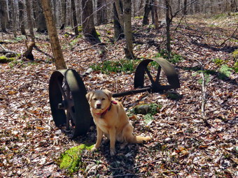 When we got to the junction, I took some pictures of the iron wheels with Sheila posing by them. I also took a quick shot of the sign before turning right on the Logger's Loop. As we started out, the trail seemed to have almost no water and I was hopeful this would continue. We were lucky and the trail remained very dry for the entire length. Even the outlet stream from Hodge Pond was dry! This was completely different than the last time I had hiked. We came to the large cherry tree that had broken off high up and fallen so that it was arching across the trail. This tree was not blocking the trail and it was clear it was not coming down soon. We came to the area where there had been a large tree that had fallen across the trail. I knew the snowmobile club would not be clearing this one soon so I had brought my son-in-law Brad on a previous hike to clear it. We came to the seasonal pond on the left side of the trail and I walked over to it to see how full it was. The pond was beginning to dry out and no wildlife was present. I took a few shots despite the condition of the pond. We continued downhill to Times Square which was also almost dry. I thought about turning left and climbing the Big Rock Trail to add mileage but a check of my watch indicated that was a bad idea. We walked straight across Times Square to stay on the Logger's Loop and started uphill. Just before the beginning of the uphill was another streambed which we crossed and it was also dry. Although the trail is slightly uphill Sheila and I were setting a fast pace. We continued walking on the trail and crested the hill to walk out to Gravestone Junction. We turned left at the Gravestone Junction and headed back to the car on the woods road. We immediately saw two hikers ahead of us also going toward the parking area. I put Sheila on her leash and we eventually passed them at the register. We talked for a few minutes and I suggested that they visit Mongaup Falls. I gave them directions and they seemed grateful. Sheila and I turned right at the register to walk the Quick Lake Trail back to the car. It was 12:45 PM and we had spent 1 hour and 40 minutes hiking 3.8 miles with an elevation gain was a modest 410 feet. The temperature had risen to 56 degrees.
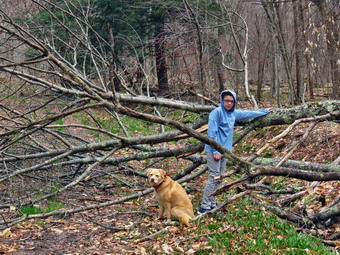
![]() On Wednesday, April 21st I wanted to go for a hike with my grandson Bryce. Bryce and I started to get ready to hike at 10:00 AM when the temperature was hovering around 50 degrees. I had decided we would go to the Frick Pond area and do some maintenance on the Flynn Trail. I got dressed in my Mammut crew top with a light baselayer. I decided to put on my Columbia Titanium insulated pants to keep the chill away but knew I did not need a baselayer. I wore my Keen Targhee II boots which are wearing out but still have a few miles in them. I put on my OR Crocodile gaiters to keep the ticks off my legs. I decided not to take my Leki poles as we would be carrying trail maintenance equipment. I grabbed a light hat and gloves to put in my pack. Finally, I donned my Mammut hoody which blocks the wind and keeps me warm but has enough zippers to dump heat when needed. Sheila kept me in sight as I got ready to go making sure she would not be forgotten. I brought along my Silky Sugowaza saw, Silky Katanaboy 500 saw, Fiskars pack ax, and two felling wedges. I put my gear in the back of the car and Bryce and Sheila in the back seat as we left Livingston Manor at 10:25 AM. I headed out the DeBruce Road to Mongaup Pond Road where I turned left and headed up toward Mongaup Pond. Where the road split, I stayed to the left on Beech Mountain Road where the road forks. When we arrived at the parking area, there were no cars in either lot. I parked in the smaller parking area and got ready to hike. I set my GPS unit at the trailhead and we crossed the road to start the hike at 10:40 AM. The skies were beginning to become overcast indicating the forecast storm was approaching. The first part of the trail through the woods was damp but there was no mud, snow or ice. We kept up a fast pace to the end of the trail through the woods. We turned right on the woods road which was once the extension of the Beech Mountain Road and started up the Flynn Trail. We began picking up loose branches that had fallen on the trail and continued to do so for most of the hike. The trail was damp in places with some mud but otherwise dry making the walking easy. Sheila was roaming around running up and down the trail. Just before we came to the "hemlock tunnel", we came to a small blowdown on the trail. I took some quick before pictures and then we got to work. The trunk was low to the ground so I used the axe to cut the blowdown. The cut went quickly and Bryce and I were able to easily remove it from the trail. After some after pictures, we moved on. Passing through the "tunnel" Cindy and I had cut in a large hemlock tree that had fallen across the trail.
On Wednesday, April 21st I wanted to go for a hike with my grandson Bryce. Bryce and I started to get ready to hike at 10:00 AM when the temperature was hovering around 50 degrees. I had decided we would go to the Frick Pond area and do some maintenance on the Flynn Trail. I got dressed in my Mammut crew top with a light baselayer. I decided to put on my Columbia Titanium insulated pants to keep the chill away but knew I did not need a baselayer. I wore my Keen Targhee II boots which are wearing out but still have a few miles in them. I put on my OR Crocodile gaiters to keep the ticks off my legs. I decided not to take my Leki poles as we would be carrying trail maintenance equipment. I grabbed a light hat and gloves to put in my pack. Finally, I donned my Mammut hoody which blocks the wind and keeps me warm but has enough zippers to dump heat when needed. Sheila kept me in sight as I got ready to go making sure she would not be forgotten. I brought along my Silky Sugowaza saw, Silky Katanaboy 500 saw, Fiskars pack ax, and two felling wedges. I put my gear in the back of the car and Bryce and Sheila in the back seat as we left Livingston Manor at 10:25 AM. I headed out the DeBruce Road to Mongaup Pond Road where I turned left and headed up toward Mongaup Pond. Where the road split, I stayed to the left on Beech Mountain Road where the road forks. When we arrived at the parking area, there were no cars in either lot. I parked in the smaller parking area and got ready to hike. I set my GPS unit at the trailhead and we crossed the road to start the hike at 10:40 AM. The skies were beginning to become overcast indicating the forecast storm was approaching. The first part of the trail through the woods was damp but there was no mud, snow or ice. We kept up a fast pace to the end of the trail through the woods. We turned right on the woods road which was once the extension of the Beech Mountain Road and started up the Flynn Trail. We began picking up loose branches that had fallen on the trail and continued to do so for most of the hike. The trail was damp in places with some mud but otherwise dry making the walking easy. Sheila was roaming around running up and down the trail. Just before we came to the "hemlock tunnel", we came to a small blowdown on the trail. I took some quick before pictures and then we got to work. The trunk was low to the ground so I used the axe to cut the blowdown. The cut went quickly and Bryce and I were able to easily remove it from the trail. After some after pictures, we moved on. Passing through the "tunnel" Cindy and I had cut in a large hemlock tree that had fallen across the trail.
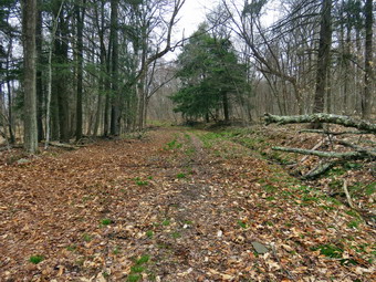 Not long after this there was another, larger blowdown which was the main object of the work I wanted to complete. I put down my pack and got out my camera. I took several before pictures including one of Bryce and Sheila near the blowdown. Bryce and I cleared any loose branches that were around and then considered how to best eliminate the large and bushy blowdown. I decided we would use the saw to remove branches and drag then away until the job was done. Bryce asked if he could use the saw so I showed him how. He really enjoyed it and was quite good at making the cuts. We alternated using the saw and dragging away the branches until almost nothing was left. Bryce was able to cut through the last large trunk and we helped each other drag it off the trail. I took the after pictures including one of Bryce and Sheila posing next to the last remains of the large tree. I put the camera away and we picked up our tools. It had taken about 40 minutes to clear the trail. By this time the wind had picked up and the skies were darker. I decided to continue up the trail and turn around at the top of the hill where there is a clearing on the right side of the trail. As we approached that goal, we found one more large trunk across the trail. I took my pictures and then we got busy clearing the trail. We cut down a small sapling on the right that was hanging into the trail. On the left, we cut a few more branches and saplings and then removed a dead trunk that had fallen and broken into pieces. The remaining trunk was dead but water-logged and close to the ground. I decided to use the axe. It wasn't easy but I soon cut through it. Bruce and I were able to stand it up and flip it off the trail. I took some pictures and then we packed up and walked to the top of the hill. We immediately turned around and started back down the hill as quickly as we could go. The wind was blowing and a few times raindrops fell. When we came to the gate we turned left and followed the Flynn Trail through the woods back to the car. We had hiked 2.2 miles in 2 hours and 10 minutes but 1 hour and 40 minutes was time we had stopped to remove blowdowns. I drove back to Livingstin Manor as the rain began to fall. Shortly after our return the temperature had dropped to 36 degrees and snow began to fall.
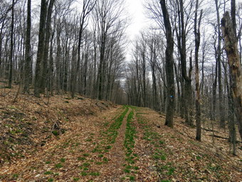
![]()
![]()
![]()
![]()
![]() On Monday, April 19th I wanted to get in another slightly longer hike close to home and decided to return to the Frick and Hodge Pond area. The temperature at 9:00 AM was 60 degrees on the back porch but I suspected it would cooler at the trailhead. At 9:50 AM I began to get ready and the temperature was still about 60 degrees. I got dressed in my Mammut crew top and decided that despite the temperature I would wear a light baselayer. I decided to put on my Columbia Titanium insulated pants to keep the chill away but knew I did not need a baselayer. I wore my Keen Targhee II boots which are wearing out but still have a few miles in them. I put on my OR Crocodile gaiters to keep the ticks off my legs. I decided to take my Leki poles with external locks as the internal twist locks fail. I grabbed a light hat and gloves to put in my pack. Finally, I donned my Mammut hoody which blocks the wind and keeps me warm but has enough zippers to dump heat when needed. Sheila kept me in sight as I got ready to go making sure she would not be forgotten. I put my gear in the back of the car and Sheila in the back seat as we left Livingston Manor at 10:10 AM. I headed out the DeBruce Road to Mongaup Pond Road where I turned left and headed up toward Mongaup Pond. Where the road split, I stayed to the left on Beech Mountain Road where the road forks. When we arrived at the parking area, there was one car in the smaller lot. I parked in the smaller parking area at 10:30 AM and got ready to hike. I decided to hike up the Flynn Trail to Hodge Pond and then do a loop around the pond before returning. I set my GPS unit at the trailhead and we crossed the road to start the hike at !0:35 AM. The skies were blue with a few white clouds in one direction and darker and overcast in another. The first part of the trail through the woods was damp but there was no mud, snow or ice. I kept up a fast pace and was a little winded when we got to the end of the trail. We turned right on the woods road which was once the extension of the Beech Mountain Road and started the 1.7 mile climb up the Flynn Trail to the junction with the Big Rock Trail. I began picking up loose branches that had fallen on the trail and continued to do so for most of the hike. The trail was damp in places with some mud but otherwise dry making the walking easy. Sheila was roaming around running up and down the trail. There was a small blowdown on the trail but it was too large to remove without tools. We passed through the "tunnel" Cindy, and I had cut in a large hemlock tree that had fallen across the trail. Not long after this there was another, larger blowdown which I knew I would have to return with tools to clear. At 1.1 miles we passed by the path to the clearing on the right of the trail. We continued on the Flynn Trail toward the junction with the Big Rock trail passing several smaller blowdowns that I would include on my next maintenance trip. We arrived at the junction at 11:15 AM taking only about 40 minutes to hike 1.7 miles.
On Monday, April 19th I wanted to get in another slightly longer hike close to home and decided to return to the Frick and Hodge Pond area. The temperature at 9:00 AM was 60 degrees on the back porch but I suspected it would cooler at the trailhead. At 9:50 AM I began to get ready and the temperature was still about 60 degrees. I got dressed in my Mammut crew top and decided that despite the temperature I would wear a light baselayer. I decided to put on my Columbia Titanium insulated pants to keep the chill away but knew I did not need a baselayer. I wore my Keen Targhee II boots which are wearing out but still have a few miles in them. I put on my OR Crocodile gaiters to keep the ticks off my legs. I decided to take my Leki poles with external locks as the internal twist locks fail. I grabbed a light hat and gloves to put in my pack. Finally, I donned my Mammut hoody which blocks the wind and keeps me warm but has enough zippers to dump heat when needed. Sheila kept me in sight as I got ready to go making sure she would not be forgotten. I put my gear in the back of the car and Sheila in the back seat as we left Livingston Manor at 10:10 AM. I headed out the DeBruce Road to Mongaup Pond Road where I turned left and headed up toward Mongaup Pond. Where the road split, I stayed to the left on Beech Mountain Road where the road forks. When we arrived at the parking area, there was one car in the smaller lot. I parked in the smaller parking area at 10:30 AM and got ready to hike. I decided to hike up the Flynn Trail to Hodge Pond and then do a loop around the pond before returning. I set my GPS unit at the trailhead and we crossed the road to start the hike at !0:35 AM. The skies were blue with a few white clouds in one direction and darker and overcast in another. The first part of the trail through the woods was damp but there was no mud, snow or ice. I kept up a fast pace and was a little winded when we got to the end of the trail. We turned right on the woods road which was once the extension of the Beech Mountain Road and started the 1.7 mile climb up the Flynn Trail to the junction with the Big Rock Trail. I began picking up loose branches that had fallen on the trail and continued to do so for most of the hike. The trail was damp in places with some mud but otherwise dry making the walking easy. Sheila was roaming around running up and down the trail. There was a small blowdown on the trail but it was too large to remove without tools. We passed through the "tunnel" Cindy, and I had cut in a large hemlock tree that had fallen across the trail. Not long after this there was another, larger blowdown which I knew I would have to return with tools to clear. At 1.1 miles we passed by the path to the clearing on the right of the trail. We continued on the Flynn Trail toward the junction with the Big Rock trail passing several smaller blowdowns that I would include on my next maintenance trip. We arrived at the junction at 11:15 AM taking only about 40 minutes to hike 1.7 miles.
 We continued straight ahead on the Flynn Trail passing through the gate that marks the beginning of the OSI property. A little further on, at the junction with the jeep trail, we turned left to walk the Flynn Trail toward Hodge Pond. At 2.4 miles we broke into the clearing at the southern end of Hodge Pond. We continued straight ahead to walk across the clearing to the shores of Hodge Pond. I dropped my pack and got out my camera to take pictures of the pond. The skies were completely overcast and the scene was bleak. Sheila decided not to walk out into the cold water or to take a swim so we packed up to leave. I decided to walk around the pond to the right and follow the jeep trail around the back of the pond to the junction with the Flynn Trail. We walked to the right of the pond and along the east side of the pond on the jeep trail. I was setting a pace that surprised even myself as we continued around the pond on the jeep trail. I had thought I might walk down to the shore of the pond to take some more pictures but looked up to find we were at the junction with the Flynn Trail. We turned left and began the walk back to Hodge Pond along the Flynn Trail. The trail was muddy in spots but there was a lot less mud than I had expected. We came to a clearing as we exited the woods which was once the site of the mess hall for the Beech Mountain Boy Scout Camp. We continued on the trail back to the clearing at the outlet end of Hodge Pond. To follow the Flynn Trail, we turned right and walked up the hill. The walk up the hill can sometimes seem long and tiring but on this day it went quickly. We followed the Flynn Trail back through the woods to the junction with the Big Rock Trail and continued straight ahead. The rest of the walk was mostly down hill. We walked down the trail and across the flats and soon reached the gate that marks the end of state land. We stayed to the left to continue on the Flynn Trail and to avoid the private property around the cabin. We were back at the car at 12:45 PM after hiking 5.7 miles in 2 hours and 15 minutes with only 5 minutes of stopped time. Our overall speed was 2.6 mph and our elevation gain was 860 feet.
On Saturday, April 17th I knew I would be busy most of the day covering a soccer game and football game at the local high school for my local volunteer ambulance corps. This is by 35th year as a volunteer EMT and we take pride in helping the community. We transported a soccer player to the ER for a painful chick to the lower leg and ended up covering another call during the football game. We returned to base tired at about 4:00 PM. As I was completing my documentation, the ambulance pager sounded for a hiker with a fractured ankle on Balsam Lake Mountain. Our ambulance corps covers the Beaverkill side of the mountain but the initial information implied the hiker was on the Millbrook side of the mountain. The hikers did not have cell service so one hiker left the injured hiker on the mountain, hike to the trailhead and drove to the Zen monastery where they were able to call 911 on a landline. The hiker then left and went back to the trailhead. Unfortunately, that hiker did not stay at the trailhead but went back to the injured hiker. We left our base and started up the Beaverkill road knowing that it was a 40 minute drive to the trailhead. As we were driving additional information convinced me that the hiker was on the Beaverkill side of the mountain on the red Balsam Lake Trail not very far up from the blue Dry Brook Ridge Trail. The Beaverkill Valley Fire Department was assembling at the trailhead and we met up with them there. They had already sent two members up the trail to assess the trail conditions and to find the exact location of the hiker. We put all our gear that we would need to treat the patient and stabilize his ankle in a UTV and started up the trail behind another ATV with fire-fighters and chainsaws. I was skeptical about the possibility of getting up the trail with the UTV but the driver did a great job and we made good progress until we ran into several large blowdowns. We decided to start to walk to try to access our patient as soon as possible as we though he had probably been sitting injured on the trail for around 2 hours. We reached the trail junction and turned left up the mountain and immediately contacted one of the fire-fighters who informed us the hiker was only a short distance up the trail and that his LEG was injured. This caused me some concern since I did not have the equipment necessary to splint a leg. We reached the patient and I quickly interviewed him finding him in pain but in rather good spirits. The two hikers had ascended the steep trail on the Beaverkill side and visited the fire tower. They had gone back the way they had come. The injured hiker had slipped on a wet rock just short of the trail junction. I removed a makeshift split and found that his lower leg was injured and would require splinting. The fire-fighters cut two tree branches which we used to splint his leg as I had brought what was needed to splint an ankle. As we were preparing to move the hiker it began to snow and rain. Fortunately, the snow and rain did not last very long. We placed the hiker in a Stokes basket and the fire-fighters carried him down the mountain to the trail junction. Carrying the Stokes basket out by hand would have taken more manpower than we had so we decided to use the UTV. I was again skeptical whether or not we could provide the hiker with a "smooth" ride but the UTV driver did an excellent job of driving along the rough woods road back to the trailhead. We loaded the hiker in the ambulance and stared the 1 hour trip to the hospital. We briefly stopped along the way to pick up a paramedic who could administer pain medication. We transported the hiker to the hospital, accepted his gratitude, and returned to our base.
I learned several lessons from this incident. Bad things can happen on hikes and anybody who says something like this would never happen to them is foolish. Most of the mountains and locations we hike are not right in town and most are covered by volunteer ambulance crops and fire departments. Not all locations have cell service so you may have to make hard decisions like leaving somebody behind to go to get help. It is very important that you know where the injured party is located and can communicate it clearly to the dispatcher. It is very important that you stay on the line with the dispatcher and answer as many questions as you can about the injury. The ambulance corps and the fire department worked very closely together to provide the best possible outcome. You often cannot transport all the equipment you will need so you sometimes have to improvise (tree branch splints) to get the job done. Clearing a woods road so that hikers can use it may not be sufficient if a rescue attempt must be made. Each situation is different but some trails need to be cleared with more than hiking in mind. Placing water bars using vertically placed rocks blocks the passage of emergency vehicles and slows rescue attempts.
![]()
![]()
![]()
![]()
![]() On Wednesday, April 14th I had planned to hike somewhere with Lisa. We decided that I would pick her up at her house at 11:00 AM to go to Huggins Lake. I had not hiked there for almost a year and it is a short but pretty hike. I began to get ready at 10:30 AM when the temperature was below 60 degrees. As soon as I started to get ready, Sheila began to run around and bark anticipating getting out of the house. I put on my Mammut long-sleeved crew top without a baselayer since it was warm already. I put on a pair of RailRiders hiking pants which are expensive but last along time and have features like deep pockets and a generous cut which I really like. The pants have Velcro closures at the ankles but I decided to add a pair of OR Bugout gaiters. I have not seen as many ticks as in the past but I know they are out there. I decided to wear my Vasque Taku hiking boots which fit well and have been discontinued. I made sure I had a pair of Protalus insoles in the shoes to support my arches. I grabbed a pair of Leki external lock poles I have been using lately. Finally, I also donned my Mammut hoody which blocks the wind but has enough zippers to dump heat when needed. I took a light hat and gloves but knew I would probably not need them. At the last minute I also put on my OR Crocodile gaiters as another ticket prevention measure. I got my gear in the car and Sheila in the backseat. We left Livingston Manor just before 11:00 AM and drove north on Old Route 17. I turned right on the Beaverkill Road and drove up Johnson Mountain to Lisa's House. As we approached Sheila, began to whine as she really like hiking with Lisa. Lisa was ready and hopped in the car to Sheila's delight. I drove down the Beaverkill Road and turned left on Campsite Road. At the bottom of the hill I turned right and drove down to the campgrounds. I drove across the covered bridge and at the end of the road I turned right and followed Berry Brook Road to the trailhead. We arrived at the road to the parking area to find it very rough with some new erosion. I easily made it to the small lot parking at 11:20 AM. There were no other vehicles in the parking area which was what I had expected. We got our equipment ready and I set my GPS as we started out at with the temperature at 62 degrees under increasingly cloudy skies.
On Wednesday, April 14th I had planned to hike somewhere with Lisa. We decided that I would pick her up at her house at 11:00 AM to go to Huggins Lake. I had not hiked there for almost a year and it is a short but pretty hike. I began to get ready at 10:30 AM when the temperature was below 60 degrees. As soon as I started to get ready, Sheila began to run around and bark anticipating getting out of the house. I put on my Mammut long-sleeved crew top without a baselayer since it was warm already. I put on a pair of RailRiders hiking pants which are expensive but last along time and have features like deep pockets and a generous cut which I really like. The pants have Velcro closures at the ankles but I decided to add a pair of OR Bugout gaiters. I have not seen as many ticks as in the past but I know they are out there. I decided to wear my Vasque Taku hiking boots which fit well and have been discontinued. I made sure I had a pair of Protalus insoles in the shoes to support my arches. I grabbed a pair of Leki external lock poles I have been using lately. Finally, I also donned my Mammut hoody which blocks the wind but has enough zippers to dump heat when needed. I took a light hat and gloves but knew I would probably not need them. At the last minute I also put on my OR Crocodile gaiters as another ticket prevention measure. I got my gear in the car and Sheila in the backseat. We left Livingston Manor just before 11:00 AM and drove north on Old Route 17. I turned right on the Beaverkill Road and drove up Johnson Mountain to Lisa's House. As we approached Sheila, began to whine as she really like hiking with Lisa. Lisa was ready and hopped in the car to Sheila's delight. I drove down the Beaverkill Road and turned left on Campsite Road. At the bottom of the hill I turned right and drove down to the campgrounds. I drove across the covered bridge and at the end of the road I turned right and followed Berry Brook Road to the trailhead. We arrived at the road to the parking area to find it very rough with some new erosion. I easily made it to the small lot parking at 11:20 AM. There were no other vehicles in the parking area which was what I had expected. We got our equipment ready and I set my GPS as we started out at with the temperature at 62 degrees under increasingly cloudy skies.
 The first 1.2 miles is all uphill and gains almost 700 feet. Sheila was running up and down the trail following game paths into the woods and then back out. Lisa and I were taking it slow as we had no reason to hurry. We both noted that the ascent has several spots which appear to be the top of the climb but are not. After the initial climb, the trail descends, levels some and then climbs again until the final descent to Huggins Lake. The trail was surprisingly dry with very little mud. There were a few blowdowns and Lisa and I kept removing small beaches from the trail. As we continued, the trail made a sharp turn from southeast to north at about 1.6 miles. We enjoyed the downhill trek to the shores of the pond but I knew we would soon have to turn around and climb back up the hill. When we arrived at the lake, I noticed that the water level was high. I dropped my pack and got out my camera to take pictures of the lake. Buds on the leaves were just starting to come out and most were red giving the landscape an interesting hue. The sky was now very cloudy and a slight breeze had started up. I took some pictures of the lake and then walked along the dam on the narrow path to take a few more shots. I could see a primitive campsite with a fire ring in the field southeast of the dam. At the outlet I could immediately see that the beavers had dammed the water flow but few of the sticks looked new. I took a few more pictures of the lake before returning to my pack and stowing the camera. Sheila had already taken several dips in the water and was now dashing back and for across the dam. At some point I got the idea that we should bushwhack around the lake and up the steep hill through the ledges to the trail. Lisa agreed and we started off around the pond counterclockwise. The last time I had tried this I ran into wet ground and thick brush. As we started around the pond, we found relatively dry ground and less brush with what seemed to be a path. The beavers had cut down much of the brush and small trees near the shore which made the walking easier.
 As we walked along the shore we came to an old beaver lodge and a designated campsite. I was surprised at the campsite as it was very primitive with two small fire rings and little flat ground. I took some pictures of the lake, the lodge and the campsite before moving on. At 2.3 miles we reached the northern end of the lake where we found the only stream that enters the lake. We continued around the lake heading counterclockwise and to the southwest. At 2.4 miles we found a fire ring with a pile of wood and some benches. I stopped to take some pictures of the campsite and the lake with heavy cloud cover. We found another old and smaller beaver lodge. I suggested we head up the hill as I knew if we continued the grade would become much steeper. Lisa wants to continued along the shore so we stayed low. We saw some waterfowl on the lake and came to a spring. The spring was obviously manmade with a wooden box outlining it. I took some shots of it and a few across the lake to the dam. At 2.6 miles we began to work our way up the hill toward the trail. I had been correct about the steepness of the grade! I followed Sheila as she worked her way up the hill. I cut back once or wince and had to really use my poles to dig in. Several times I grabbed trees and in other spots got on my hands and knees. The route was only .12 miles but gained 200 feet averaging between 30% and 35%!At thee top of the hill the ground leveled and within no more than 40 feet we were on the trail. We turned right and to walk downhill toward the trailhead. We picked up some garbage along the way and were soon back at the car. It was 2:00 PM and we had hiked 4.0 miles in 2 hours and 40 minutes with a total elevation gain of 955 feet. We had spent 40 minutes stopped with most of that time being at Huggins Lake. The bushwhack around the lake was definitely worth the effort.
![]()
![]()
![]()
![]() On Monday, April 12th I had taken off two days from hiking due to some family commitments. When I woke up, I realized I had promised to take the ambulance for service so I got dressed and went to the ambulance building and drove the rig to the local service station. When I returned home, I decided that if I was going to hike it should be immediately as rain was forecast for later in the morning. The temperature was in the high 40's but felt cooler due to the moisture in the air and the slight breeze blowing. I decided to take Sheila and cross the street to hike on Round Top. I thought we might do a couple of figure 8's without using the newer switchback and crossover trails. Sheila was ready to go as she really likes to hike and she was keeping a careful eye on me as I dressed. I put on a cotton longsleeved T-shirt with no baselayer as I knew I would warm up on the hike. I decided to wear my Columbia Titanium insulated pants without a baselayer. I wore my Vasque Taku boots since they were dry and light enough for hiking. I grabbed a pair of Leki poles with external locks that I have been using lately. Finally, I also donned my Mammut hoody which blocks the wind but has enough zippers to dump heat when needed. At 10:15 AM we walked out the door to start the hike. I grabbed Sheila's leash from the car and we walked up the driveway. I aimed to hike for about an hour. Sheila was happy to get out as we headed down the driveway and across the street. We crossed the street and walked to the parking area by the Presbyterian Church. We walked to the back of the church and began the ascent of the steepest hill behind the church. The hill is short but gets the circulation pumping and is the steepest and longest climb on the "trail." Sheila helped me along by pulling me up the hill. We started on the trail by turning left at the trailhead where I let Sheila off her leash so that she could explore. The trail was completely bare as all the snow had disappeared. There were a few spots of mud but the rest of the trail was dry.
On Monday, April 12th I had taken off two days from hiking due to some family commitments. When I woke up, I realized I had promised to take the ambulance for service so I got dressed and went to the ambulance building and drove the rig to the local service station. When I returned home, I decided that if I was going to hike it should be immediately as rain was forecast for later in the morning. The temperature was in the high 40's but felt cooler due to the moisture in the air and the slight breeze blowing. I decided to take Sheila and cross the street to hike on Round Top. I thought we might do a couple of figure 8's without using the newer switchback and crossover trails. Sheila was ready to go as she really likes to hike and she was keeping a careful eye on me as I dressed. I put on a cotton longsleeved T-shirt with no baselayer as I knew I would warm up on the hike. I decided to wear my Columbia Titanium insulated pants without a baselayer. I wore my Vasque Taku boots since they were dry and light enough for hiking. I grabbed a pair of Leki poles with external locks that I have been using lately. Finally, I also donned my Mammut hoody which blocks the wind but has enough zippers to dump heat when needed. At 10:15 AM we walked out the door to start the hike. I grabbed Sheila's leash from the car and we walked up the driveway. I aimed to hike for about an hour. Sheila was happy to get out as we headed down the driveway and across the street. We crossed the street and walked to the parking area by the Presbyterian Church. We walked to the back of the church and began the ascent of the steepest hill behind the church. The hill is short but gets the circulation pumping and is the steepest and longest climb on the "trail." Sheila helped me along by pulling me up the hill. We started on the trail by turning left at the trailhead where I let Sheila off her leash so that she could explore. The trail was completely bare as all the snow had disappeared. There were a few spots of mud but the rest of the trail was dry.
At the first trail junction, I followed Sheila as she turned right an started up the woods road which has the gentler approach of the two. We walked up the road to the first trail junction with the upper blue trail and turned left to follow the yellow trail along the base of Round Top. At the next junction with the blue trail we turned right and headed up the blue trail, toward the summit. On the way up we passed by the switchback and the white crossover trail. We passed over the summit and continued on the blue trail down the other side of the hill. We passed the white crossover trail and then turned right on the yellow trail. We again followed the yellow trail along the base of Round Top to the junction with the blue trail. This time we turned left and followed the yellow trail downhill passed the "Resting Rock" to the lookout. At the viewpoint, we turned left and followed the yellow trail downhill to the very first trail junction. Sheila continued straight ahead but I called her back as we turned around to start back up the hill to the viewpoint. At the top of the hill we followed the yellow trail as it turned right and started uphill. At the first junction with the blue trail we turned right and followed the yellow trail along the base of Round Top. At the next junction with the blue trail, we turned left and headed up the blue trail toward the summit. We again bypassed the crossover trail and continued over the summit on the blue trail. We followed the blue trail down the steepest section of the blue trail to the junction with the yellow trail. We turned left and walked along the base of Round Top on the yellow trail to the next junction with the blue trail. This time we turned right and walked down the yellow trail to the woods road that took us back to the first trail junction. We turned left and walked out to the trailhead at the top of the cemetery hill. We walked down the hill and out to the road through the church parking lot. We walked over to the driveway and back to the house. It was 11:15 AM and we had hiked just over 2 miles in an hour.
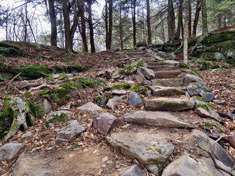
![]()
![]()
![]()
![]()
![]() On Friday, April 9th, I wanted to get out for a hike which was a little harder than I had been doing. I considered Balsam Lake Mountain but Cindy wanted to go with me and preferred something a little less challenging. I also had to be back to time a soccer game in the afternoon. We decided to hike to the Red Hill Fire Tower from the Denning Road trailhead. The trailhead on Dinch-Coons Road is difficult to access in the winter as the road is not cleared and it is equally different when it is muddy. Many people park at the top of the hill where there is limited parking. It is a half mile downhill to the trailhead parking lot. The return trip can be nearly impossible if there is ice, packed snow or mud on the road. The new trailhead and parking area is on Denning Road a little less than 2 miles from the Claryville Post Office. The trail is now officially open and the parking lot has a sign and a kiosk. When I awoke, the temperature was in the high 40's but the sun was finally out causing the temperature to rise. At 9:30 AM we began to get ready with Sheila keeping a close watch on my movements. I put on my Mammut long-sleeved crew top with a long-sleeved baselayer since the temperature was warm but I thought it might be cooler at the trailhead. I decided to wear my Columbia Titanium insulated pants but didn't bother with a baselayer. I decided to wear my Vasque Taku hiking boots which fit well and have been discontinued. I didn't expect to find any snow but thought there might be some mud. I grabbed my Leki external lock poles which I have been using since the spring since twist locks have proved unreliable. I also donned my Mammut hoody which was enough zippers to dump heat when needed. I packed a light hat and a pair of light gloves. I also put on my OR Crocodile gaiters to deal with the mud and water that I though would be present. I made sure my Microspikes were in my pack just in case they were needed. I got our gear and Sheila in my car and left Livingston Manor at 10:00 AM to head out the DeBruce Road. At the end of the road I turned right on Route 47 and drove out to the Denning Road. Here I turned left and drove through Claryville. Two miles after the Claryville Post Office, I came to the new parking area on the right side of the road and pulled into the lot. There was now a sign hanging from the support on the side of the road and the kiosk had a description and maps. There were no other cars parked. I set my GPS unit and we walked to the back of the parking area and started up the trail at 10:30 AM with the temperature standing at 54 degrees.
On Friday, April 9th, I wanted to get out for a hike which was a little harder than I had been doing. I considered Balsam Lake Mountain but Cindy wanted to go with me and preferred something a little less challenging. I also had to be back to time a soccer game in the afternoon. We decided to hike to the Red Hill Fire Tower from the Denning Road trailhead. The trailhead on Dinch-Coons Road is difficult to access in the winter as the road is not cleared and it is equally different when it is muddy. Many people park at the top of the hill where there is limited parking. It is a half mile downhill to the trailhead parking lot. The return trip can be nearly impossible if there is ice, packed snow or mud on the road. The new trailhead and parking area is on Denning Road a little less than 2 miles from the Claryville Post Office. The trail is now officially open and the parking lot has a sign and a kiosk. When I awoke, the temperature was in the high 40's but the sun was finally out causing the temperature to rise. At 9:30 AM we began to get ready with Sheila keeping a close watch on my movements. I put on my Mammut long-sleeved crew top with a long-sleeved baselayer since the temperature was warm but I thought it might be cooler at the trailhead. I decided to wear my Columbia Titanium insulated pants but didn't bother with a baselayer. I decided to wear my Vasque Taku hiking boots which fit well and have been discontinued. I didn't expect to find any snow but thought there might be some mud. I grabbed my Leki external lock poles which I have been using since the spring since twist locks have proved unreliable. I also donned my Mammut hoody which was enough zippers to dump heat when needed. I packed a light hat and a pair of light gloves. I also put on my OR Crocodile gaiters to deal with the mud and water that I though would be present. I made sure my Microspikes were in my pack just in case they were needed. I got our gear and Sheila in my car and left Livingston Manor at 10:00 AM to head out the DeBruce Road. At the end of the road I turned right on Route 47 and drove out to the Denning Road. Here I turned left and drove through Claryville. Two miles after the Claryville Post Office, I came to the new parking area on the right side of the road and pulled into the lot. There was now a sign hanging from the support on the side of the road and the kiosk had a description and maps. There were no other cars parked. I set my GPS unit and we walked to the back of the parking area and started up the trail at 10:30 AM with the temperature standing at 54 degrees.
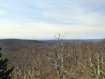 As we began the walk up the trail, it was obvious that the trail was pretty dry without any snow or ice. I wasn't sure this would continue to the summit. We almost immediately came to a set of stone steps. They were well constructed and in just the right place to help out hikers. I also noticed that a woods road ran off to the right and thought about walking up it some other time. We continued on the trail which was new but looked as if it had been in place and used for several years. The treadway was wide and flat with few obstacles. There were several switchbacks and it was obvious that one requirement of the construction was a moderate grade. The forest at these lower elevations was primarily evergreen which is unusual in the Catskills. At .4 miles the trail turned sharply to the left in one of its many switchback and we entered an area of hardwoods. There was a small stream that ran across the trail and the construction crew had create a deep ditch along the side of the trail. The ditch directed the water across the trail and at that point there was a stone construction to allow the water to cross the trail and hikers to easily cross the water. This was repeated several other times on the trail. Shortly, we ran into the one wet spot on the trail but it was easily avoided. At .7 miles I could see a series of ledges ahead and stone steps that wound between them. I stopped to take some pictures but knew that this would be repeated several more times over the next quarter mile. Each time I stopped to take pictures and each time Sheila posed nicely for some shots. We had encountered two very small patches of ice but nothing requiring us to break out the spokes. At 1.3 miles we came to a trail junction with the trail that comes in from the Dinch-Coons Road trailhead. There were new signs and one sign indicated the Dinch Road trailhead was .8 miles to the left and the fire tower was .6 miles to the right. We stopped for a few minutes to get a drink and for me to remove a layer. As we were getting ready to continue, a pair of hikers came toward us from the direction of the tower. They said they had parked at the Dinch Road trailhead and that the road was rough but not too muddy.
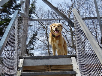 After walking about quarter mile, there was a spur trail to a spring on the right side of the trail and then a short switchback. The grade increased from a consistent 10% to a steeper 20% and I could feel it. Fortunately, there was still no snow or ice and very little mud. There was plenty of sun in the sky which made me feel good but was also contributing to some dehydration. The last .3 miles averages a little over a 20% grade and is challenging but did not seem too bad. At noon we arrived at the tower clearing which we had to ourselves. I asked Cindy if she wanted to climb the tower and she said she was not. I dropped my pack and got out my camera to take some pictures of the tower. I decided not to tether Sheila to a picnic table knowing she would follow me up the tower. Unlike some dogs, Sheila has no problem climbing up and down the open steps. I started to climb the tower with Sheila right behind me. Without looking, I could tell when I was above the treeline as the breeze hit me. I eventually made it to the landing below the cab. I began to take pictures of the surrounding scenery in all directions. There was no haze in any direction and the views were good in all directions. When there is no haze or fog, the views of the Catskill peaks from this tower are spectacular. I also took some shots of the Ashokan Reservoir and the cabin at the summit. I descended the tower and took a few pictures of Sheila on the steps. I also took a shot straight up through the tower. I got a drink and ate a bar as did Cindy. We started the hike back down the mountain at 12:15 PM. It had taken us 1.5 hours to hike to the summit and I hoped we would make the trip back go faster. We moved quickly down the steeper section of the trail to the junction. We made the left turn onto the new trail and continued to keep a fast pace. The excellent trail surface and lack of snow allowed us to keep moving. Soon we were descending the last few steps to the parking area. It was 1:10 PM and we had hiked 3.7 miles in 2 hours and 40 minutes with 35 minutes of stopped time. The return trip only took us 55 minutes. Our elevation gain was 1200 feet.
![]()
![]()
![]()
![]() On Wednesday, April 7th I had planned to get out and do a longer hike with Balsam Lake Mountain in mind. When I got up late, I knew I had some things to do before cross country practice in the afternoon so I scaled back my hike to Round Top which is just across the street. I started to get ready at 10:45 AM when the temperature was 50 degrees. My grandson Bryce was at our house and was ready to go with us. Sheila seemed very happy that we would be going out since we had skipped two days! I put on my Mammut long-sleeved crew without a baselayer. I put on a pair of RailRiders hiking pants which are expensive but last along time and have features like deep pockets and a generous cut which I really like. These pants have a Velcro closures at the ankles to discourage sticks and gravel from getting into my shoes. I decided to wear my Vasque Taku hiking boots which fit well and have been discontinued. I grabbed my Leki external lock poles which I have been using since the spring since twist locks have proved unreliable. I also donned my Mammut hoody which was enough zippers to dump heat when needed. I decided I did not need either gloves or a hat. I also put on my OR Crocodile gaiters to deal with ticks which I knew might be present. I decided not to bring my Kahtoola Microspikes as I was pretty sure all of the snow and ice was gone. Sheila kept me in sight as I got ready to go making sure she would not be forgotten. We stepped out of the house at 11:00 AM. I grabbed Sheila's leash from the car and put it on her to safely cross the street. We walked up the driveway and crossed the street. We walked up the road to the church and then through the parking lot to the back of the church. As we started up the hill behind the church, I let Sheila pull me about half way up and then let her off her leash so that I could use my poles the rest of the way. The hill is short but gets the circulation pumping and is the steepest and longest climb on the "trail." When we got to the top of the hill, we stopped to look around at the hills around town and I could only see no snow anywhere on the hills. We started on the trail by turning left at the trailhead.
On Wednesday, April 7th I had planned to get out and do a longer hike with Balsam Lake Mountain in mind. When I got up late, I knew I had some things to do before cross country practice in the afternoon so I scaled back my hike to Round Top which is just across the street. I started to get ready at 10:45 AM when the temperature was 50 degrees. My grandson Bryce was at our house and was ready to go with us. Sheila seemed very happy that we would be going out since we had skipped two days! I put on my Mammut long-sleeved crew without a baselayer. I put on a pair of RailRiders hiking pants which are expensive but last along time and have features like deep pockets and a generous cut which I really like. These pants have a Velcro closures at the ankles to discourage sticks and gravel from getting into my shoes. I decided to wear my Vasque Taku hiking boots which fit well and have been discontinued. I grabbed my Leki external lock poles which I have been using since the spring since twist locks have proved unreliable. I also donned my Mammut hoody which was enough zippers to dump heat when needed. I decided I did not need either gloves or a hat. I also put on my OR Crocodile gaiters to deal with ticks which I knew might be present. I decided not to bring my Kahtoola Microspikes as I was pretty sure all of the snow and ice was gone. Sheila kept me in sight as I got ready to go making sure she would not be forgotten. We stepped out of the house at 11:00 AM. I grabbed Sheila's leash from the car and put it on her to safely cross the street. We walked up the driveway and crossed the street. We walked up the road to the church and then through the parking lot to the back of the church. As we started up the hill behind the church, I let Sheila pull me about half way up and then let her off her leash so that I could use my poles the rest of the way. The hill is short but gets the circulation pumping and is the steepest and longest climb on the "trail." When we got to the top of the hill, we stopped to look around at the hills around town and I could only see no snow anywhere on the hills. We started on the trail by turning left at the trailhead.
At the first trail junction, we followed Sheila as she turned right on the woods road which is the shallower approach to the trail system. We followed the trail and Bryce and I started picking up branches. It was very obvious that many people had been using the trail. We continued to follow the yellow trail toward the first junction. At the junction, we turned left and followed the track to the next trail junction. At the second junction with the blue trail, we turned right and started up the steep blue trail that leads over the summit of Round Top. When we came to the steepest section of the trail, we continued straight ahead bypassing the switchback. A little farther up we also passed by the white crossover trail and contused to the summit on the blue trail. We passed over the summit and started down the other wide again avoiding the white crossover trail on the way down. At the bottom of the hill, we turned right on the yellow trail and walked along the base of Round Top to the next junction with the blue trail. This time we turned left and followed the yellow trail downhill to the lookout. We turned left and stopped at the section of trail that used to lead out to the lower viewpoint. I had removed the marking from this trail to discouraged people from using it due to a large cleft that runs almost all the way across the trail. Someone had removed some branches and brush I had sued to block the trail. Bryce and I took the time to put all the brush and branches back on the trail. We continued on the yellow trail back to the very first trail junction. We immediately turned around and headed back up the steep section of trail to the viewpoint. We followed the yellow trail as it turned right at the lookout and headed uphill toward the junction with the blue trail. At the junction, we turned right and walked along the base of Round Top to the next junction with the blue trail. At the junction, we turned left and started up the trail to the summit. This time we turned left on the white crossover trail and followed it to the blue trail on the other side. We turned left on the blue trail and almost immediately left again to take the switchback downhill. At the end of the switchback we turned left on the blue trail and walked down to the junction with the yellow trail. When we got to the bottom of the blue trail, we turned left on the yellow trail and walked to the next junction. We turned right and walked down the yellow trail to the woods road and out to the first trail junction. We turned left and walked out to the trailhead. The sun was out but the breeze had picked up. We made quick work of the downhill walking behind the church and across the field to our driveway. We were back at the house at 12:15 PM having walked a little over 2 miles in a little more than an hour.
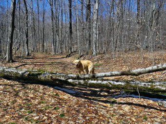
![]()
![]()
![]()
![]()
![]() On Saturday, April 3rd, I was ready to get in a longer hike and planned to go to Schoharie County to work on the Scary 19. My son-in-law Brad was visiting with his family and I knew he would be willing to go. As so often happens, Brad and I had an ambulance call in Liberty in the middle of the night so we slept in. Brad took his family to out church for an Easter egg hunt and a puppet show and was back around noon. We decided to stay local and hike and get some work done by clearing a tree that had fallen across the Loggers Loop at Frick Pond in the last wind storm. We started to get ready at 12:15 PM when the temperature was in the high 40's on the back porch. I suspected it would be cooler at the trailhead. As I started gathering my equipment and getting dressed, Sheila was very quiet but did not let me out of her sight. I put on my Mammut long-sleeved crew top with a long-sleeved baselayer since the temperature was warm in town but might be cooler at the trailhead. I decided to wear my Columbia Titanium insulated pants but didn't bother with a baselayer. I wore my Salomon B52 winter boots which are supportive, surprisingly roomy and discontinued. I had recently put a pair of Protalus insoles in these shoes and was anxious to see how they performed. The insoles in most hiking boots are a flimsy and flat piece of material. I also applied a new waterproofing and leather preservative which has proved very effective. I didn't expect to find any snow but these boots are getting pretty worn so I thought I would have to replace them before next winter. I decided against poles as I would be carrying trail maintenance tools. I also donned my Mammut hoody which was enough zippers to dump heat when needed. I put on a light hat and wore a light pair of gloves. I also put on my OR Crocodile gaiters to deal with the mud and water that I knew would be present. I made sure my Microspikes were in my pack just in case they were needed. I brought along my Silky Sugowaza saw, Silky Katanaboy 500 saw, Fiskars pack ax, Council Tools felling axe and two felling wedges. This represents only a part of the trail maintenance tools that I own! We got our gear and Sheila in my car and left Livingston Manor at 12:35 PM. I drove out the DeBruce Road about 6 miles to Mongaup Road and turned left to continue up the road to the point where it splits. I stayed left on Beech Mountain Road and drove to the Frick Pond trailhead. When we arrived at the parking areas, there were two cars parked in each lot. I pulled into the smaller lot and parked. The skies were completely bright and blue but there were no clouds.
On Saturday, April 3rd, I was ready to get in a longer hike and planned to go to Schoharie County to work on the Scary 19. My son-in-law Brad was visiting with his family and I knew he would be willing to go. As so often happens, Brad and I had an ambulance call in Liberty in the middle of the night so we slept in. Brad took his family to out church for an Easter egg hunt and a puppet show and was back around noon. We decided to stay local and hike and get some work done by clearing a tree that had fallen across the Loggers Loop at Frick Pond in the last wind storm. We started to get ready at 12:15 PM when the temperature was in the high 40's on the back porch. I suspected it would be cooler at the trailhead. As I started gathering my equipment and getting dressed, Sheila was very quiet but did not let me out of her sight. I put on my Mammut long-sleeved crew top with a long-sleeved baselayer since the temperature was warm in town but might be cooler at the trailhead. I decided to wear my Columbia Titanium insulated pants but didn't bother with a baselayer. I wore my Salomon B52 winter boots which are supportive, surprisingly roomy and discontinued. I had recently put a pair of Protalus insoles in these shoes and was anxious to see how they performed. The insoles in most hiking boots are a flimsy and flat piece of material. I also applied a new waterproofing and leather preservative which has proved very effective. I didn't expect to find any snow but these boots are getting pretty worn so I thought I would have to replace them before next winter. I decided against poles as I would be carrying trail maintenance tools. I also donned my Mammut hoody which was enough zippers to dump heat when needed. I put on a light hat and wore a light pair of gloves. I also put on my OR Crocodile gaiters to deal with the mud and water that I knew would be present. I made sure my Microspikes were in my pack just in case they were needed. I brought along my Silky Sugowaza saw, Silky Katanaboy 500 saw, Fiskars pack ax, Council Tools felling axe and two felling wedges. This represents only a part of the trail maintenance tools that I own! We got our gear and Sheila in my car and left Livingston Manor at 12:35 PM. I drove out the DeBruce Road about 6 miles to Mongaup Road and turned left to continue up the road to the point where it splits. I stayed left on Beech Mountain Road and drove to the Frick Pond trailhead. When we arrived at the parking areas, there were two cars parked in each lot. I pulled into the smaller lot and parked. The skies were completely bright and blue but there were no clouds.
 Before we could get started two people came up the woods road and walked to their car. Two more people came up the woods road with their dogs on leashes. They cut through the woods apparently oblivious to the fact that the Quick Lake Trail would have taken them there from the register. I set my GPS unit and we started out the woods road to the Quick Lake Trail at the register. From the register on the trail was wet with standing water and some mud with some running water across the trail. Since this is a woods road, we were able to avoid most of the water and mud by picking my steps carefully. At one point I looked off to the left of the trail and saw there was still a good covering of snow in the shade of the evergreens. At Gravestone Junction, we turned right to get on the yellow Logger's Loop heading toward Times Square. The trail was wet and muddy but not quite as bad as it had been a few days before. Soon we were hiking downhill toward Times Square. We crossed a stream that parallel's the Big Rock Trail and had a good volume of water. The source of the water is a mystery although I assume it must be from seasonal springs and runoff. At Times Square we continued straight ahead on the Logger's Loop which was wet but not as bad as I have seen it in the past. Just after Times Square there was a large tree that the snowmobile club had cut into sections and moved off the trail. We started a slight uphill climb on the trail but the hiking was relatively easy. The trail flattened and we came to the small, seasonal pond on the right side of the trail. The pond was very full and part of it that was in the shade was covered with ice. We passed by and continued our walk avoiding the water and the mud.
 I pointed out to Brad several large plastic culverts along the way. The DEC has started a project to replace the metal culverts and to install culverts were they were needed but did not exist. That project began at least two years ago but was not completed and the black culverts stand out like a sore thumb. At 1:40 PM we had hiked 1.6 miles and came to the blowdown we needed to clear. Unlike many trees that fall across the trail that have numerous smaller branches, this one was all trunk! The wood was maple and there were two distinct trunks with one that was forked. We laid out our tools and I leashed Sheila to a tree so she would not get in our way. I took my before pictures with the camera including some with Sheila and then we got to work. I grabbed the Sugowaza to work on the few smaller branches while Brad out The council Tools ax to work on the lower part of the largest trunk. When I was finished, Brad was still working so I used the Fiskars ax to cut through the upper part of the other trunk. I finished my cut with the Sugowaza and then moved what I had cut off the trail. Brad was still working on his cut and I helped him finish it up. Our problem was that the piece Brad had cut was large and hard to move. Brad found a sturdy branch to use as a lever and we rolled and slid the trunk off the trail. I started in with the Fiskars ax at the base of the other large trunk while Brad used the Sugowaza to cut up a smaller trunk that was underneath the others. When Brad finished, he used the Council Tools, ax to spell me on the cut I was making. Together the work went much faster and we finished the final cut with the Katanaboy. Brad used his lever again and we moved this large trunk off the trail. I started to cut the final small trunk and found it softer than the others. Brad finished it up and we moved it off the trail. I took my final pictures including a couple with Sheila and then checked my watch. It had taken us almost and hour and a half to finish the work. We clean up our tools and decided to complete the loop rather than walk back the way we came.
 The rest of the Loggers Loop to Iron Wheel Junction had several deep ponds that ran from one side of the trail to the other. We picked our way through them and it wasn't long before we were walking downhill and the climbing a small hill to Iron Wheel Junction. There was very little snow and the wheels were clearly visible. We turned left to head back toward Frick Pond on the Quick Lake Trail. The trail is slightly downhill which allowed us to keep up a good pace even though we had to work our way around the water and the mud. When we came to the small stream in the woods, we found the water level slightly lower than it had been several days ago. I pointed out to Brad the places I had cleared downstream to let the water flow more freely. We walked upstream and found a place to cross. We walked back to the main trail and found that there was a covering of snow in the shade. I took some pictures before we started back on the trail. Walking through the "spruce tunnel" was easier than some of the rest of the hike as there was little water and mud. Eventually we walked out the other side where the trail was again wet and muddy. We arrived at the junction with the Big Rock Trail and turned right to stay on the Quick Lake trail and head toward the bridge at Frick Pond. The trail was wet and there was one mud pit that I have been trying to drain. We continued on the Quick Lake Trail to the bridge across the outlet of Frick Pond. We crossed the bridge and stopped at the other side. I dropped my pack to get out the camera despite the fact that I have taken hundreds of pictures from this location. The skies were blue with no clouds but the scene was a little "warmer" than the temperature. I also took shots of the pond and of Beech Mountain. I took a few more pictures of the outlet stream which was sparking in the sunlight. I packed up and we continued up the hill and back to Gravestone Junction. This section of trail was also wet and muddy. At Gravestone Junction we continued out the Quick Lake Trail and back to the car. We arrived at the car at 3:50 PM having hiked 3.7 miles in 2 hours and 55 minutes with an elevation gain of 380 feet. Our time stopped was 1 hour and 20 minutes most of which was time spent working to clear the blowdown.
![]()
![]()
![]()
![]()
![]() On Wednesday, March 31st, I was ready to get in a longer hike and planned to go to Schoharie County to work on the Scary 19. After consulting the weather forecast I changed my mind. The forecast in that area called for rain and then snow. I did not feel like driving and hour and a half to hike in those conditions so I decided to stay local and hike. I had some chores to do around the house so I was not able to start to get ready until 9:45 AM. The rain was forecast to start around 1:00 PM so I hurried to get ready and go after deciding I would go to the Frick and Hodge Pond area. As I started to get ready, the temperature was 52 degrees but I suspected it would be cooler at the trailhead. As I started gathering my equipment and getting dressed, Sheila was very quiet but did not let me out of her sight. I put on my Mammut long-sleeved crew top with a long-sleeved baselayer since the temperature was warm but I expected I might get wet. I decided to wear my Columbia Titanium insulated pants but didn't bother with a baselayer. I wore my Salomon B52 winter boots which are supportive, surprisingly roomy and discontinued. I had recently put a pair of Protalus insoles in these shoes and was anxious to see how they performed. The insoles in most hiking boots are a flimsy and flat piece of material. I also applied a new waterproofing and leather preservative which has proved very effective. I didn't expect to find any snow but these boots are getting pretty worn so I thought I would have to replace them before next winter. I grabbed my Leki external lock poles which I have been using since the spring since twist locks have proved unreliable. I also donned my Mammut hoody which was enough zippers to dump heat when needed. I put on a light hat and wore a light pair of gloves. I also put on my OR Crocodile gaiters to deal with the mud and water that I knew would be present. I made sure my Microspikes were in my pack just in case they were needed. I got my gear and Sheila in my car and left Livingston Manor at 10:15 AM. I drove out the DeBruce Road about 6 miles to Mongaup Road and turned left to continue up the road to the point where it splits. I stayed left on Beech Mountain Road and drove to the Frick Pond trailhead. When we arrived at the parking areas, there were no cars parked in either lot. I pulled into the smaller lot and parked. The skies were completely overcast and a heavy mist was in the air and starting to fall. The temperature right at 50 degrees which was warmer than I thought it might be.
On Wednesday, March 31st, I was ready to get in a longer hike and planned to go to Schoharie County to work on the Scary 19. After consulting the weather forecast I changed my mind. The forecast in that area called for rain and then snow. I did not feel like driving and hour and a half to hike in those conditions so I decided to stay local and hike. I had some chores to do around the house so I was not able to start to get ready until 9:45 AM. The rain was forecast to start around 1:00 PM so I hurried to get ready and go after deciding I would go to the Frick and Hodge Pond area. As I started to get ready, the temperature was 52 degrees but I suspected it would be cooler at the trailhead. As I started gathering my equipment and getting dressed, Sheila was very quiet but did not let me out of her sight. I put on my Mammut long-sleeved crew top with a long-sleeved baselayer since the temperature was warm but I expected I might get wet. I decided to wear my Columbia Titanium insulated pants but didn't bother with a baselayer. I wore my Salomon B52 winter boots which are supportive, surprisingly roomy and discontinued. I had recently put a pair of Protalus insoles in these shoes and was anxious to see how they performed. The insoles in most hiking boots are a flimsy and flat piece of material. I also applied a new waterproofing and leather preservative which has proved very effective. I didn't expect to find any snow but these boots are getting pretty worn so I thought I would have to replace them before next winter. I grabbed my Leki external lock poles which I have been using since the spring since twist locks have proved unreliable. I also donned my Mammut hoody which was enough zippers to dump heat when needed. I put on a light hat and wore a light pair of gloves. I also put on my OR Crocodile gaiters to deal with the mud and water that I knew would be present. I made sure my Microspikes were in my pack just in case they were needed. I got my gear and Sheila in my car and left Livingston Manor at 10:15 AM. I drove out the DeBruce Road about 6 miles to Mongaup Road and turned left to continue up the road to the point where it splits. I stayed left on Beech Mountain Road and drove to the Frick Pond trailhead. When we arrived at the parking areas, there were no cars parked in either lot. I pulled into the smaller lot and parked. The skies were completely overcast and a heavy mist was in the air and starting to fall. The temperature right at 50 degrees which was warmer than I thought it might be.
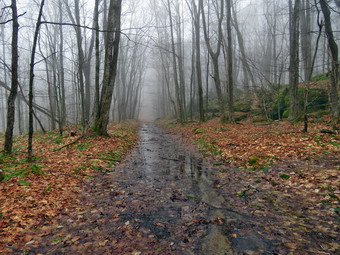 I set my GPS unit and we started out the woods road to the Quick Lake Trail at the register. From the register on the trail was wet with standing water and some mud with some running water across the trail. Since this is a woods road, I was able to avoid most of the water and mud by picking my steps carefully. At Gravestone Junction, we stayed left on the Quick Lake trail heading toward the bridge at the outlet to Frick Pond. This area of the trail had more mud that had been churned up by recent use. When we arrived at the bridge, I almost passed up taking some pictures but decided to stop as I always do and snap some shots. Beech Mountain was hidden behind a cloud and the mist was even heavier now. There was some snow remaining at the far end of the bridge so I took a picture of Sheila with the snow in the background.We continued around the west side of the pond where the wettest area had enlarged. I made mental note to bring a shovel and mattocks to deepen and widen the ditch that drains this pool. At the junction with the Big Rock Trail, we headed left on the Quick Lake Trail which was also very wet. Again, the trail was wide enough for me to avoid most of the water and mud. I had been removing smaller branches but there were a few larger ones in this area that I managed to drag off the trail. We walked through the spruce tunnel and came to the small stream across the trail. I walked upstream to cross as the stream was too wide for me to get across at the trail. I took a few pictures and then decided to see if I could clean out the stream a little. I used my hiking poles to clean out some leaves and then grabbed some branches and dragged them out of the stream. When I was done, I opened up some of the zippers on my hoody and put the cover on my pack as the mist had turned into a light rain. We continued on up the Quick Lake Trail toward Iron Wheel Junction. This part of the trail is always wet and muddy and this day was no exception. There were several large branches that I was able to remove from the trail without tools.
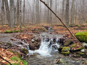 When we got to the junction, I took some pictures of the iron wheels and the sign before turning right on the Logger's Loop. As we started out, the trail seemed to have less water and I was hopeful this would continue. Unfortunately, this trail had more water than the other and in some places it spanned the entire width of the trail. I was able to work around the deep pools and even stopped to take some pictures of the impressive amount of water. The outlet stream from Hodge Pond was higher than I had ever seen it and I would have bushwhacked up it but the rain was getting more serious. We came to the large cherry tree that had broken off high up and fallen so that it was arching across the trail. This tree was not blocking the trail and it was clear it was not coming down soon. We came to a larger tree that had fallen across the trail. I knew the snowmobile club would not be clearing this one soon and began to make plans to get rid of it. We came to the seasonal pond on the left side of the trail and I walked over to it to see how full it was. The pond was as full as I have ever seen it so I took a few shots. I was a little disappointed there were no wildfowl on the pond. We continued downhill to Times Square which was not as wet as it has been in the past. We walked straight across Times Square to stay on the Logger's Loop and started uphill. Just before the beginning of the uphill was another stream which we crossed. I began to think about the origins of that stream and could not imagine where that much water came from. Although the trail is slightly uphill Sheila and I were setting a fast pace. We continued walking on the trail and crested the hill to walk out to Gravestone Junction. We turned left at the Gravestone Junction and headed back to the car on the woods road. About halfway to the register, I could see four hikers approaching us with two dogs on leashes. I pull off the trail with Sheila and waited until the other hikers passed. They complimented Sheila on her good behavior and I thanked them. At the trail register, we continued straight ahead on the woods road to return to our car. It was 12"30 PM and we had spent 1 hour and 50 minutes hiking 3.7 miles with an elevation gain was a modest 385 feet. The temperature had risen to 54 degrees.
![]()
![]()
![]()
![]() On Tuesday, March 30th I had planned to get out and do a longer hike with Balsam Lake Mountain in mind. When I got up late, I knew I had some things to do at the ambulance building so I scaled back my hike to Round Top which is just across the street. I started to get ready at 11:45 AM when the temperature was 46 degrees. Sheila seemed very happy that we would be going out since we had skipped two days! I put on a long-sleeved cotton shirt as I knew we would not be out for very long. I put on a pair of RailRiders hiking pants which are expensive but last along time and have features like deep pockets and a generous cut which I really like. These pants have a Velcro closures at the ankles to discourage sticks and gravel from getting into my shoes. I decided to wear my Vasque Taku hiking boots which fit well and have been discontinued. I grabbed my Leki external lock poles which I have been using since the spring since twist locks have proved unreliable. I also donned my Mammut hoody which was enough zippers to dump heat when needed. I put on a light hat and wore a light pair of gloves. I also put on my OR Crocodile gaiters to deal with ticks which I knew might be present. I knew I would not need snowshoes but I also decided not to bring my Kahtoola Microspikes as I was pretty sure all of the snow and ice was gone. Sheila kept me in sight as I got ready to go making sure she would not be forgotten. We stepped out of the house at 11:45 AM. I grabbed Sheila's leash from the car and put it on her to safely cross the street. We walked up the driveway and crossed the street. We walked up the road to the church and then through the parking lot to the back of the church. As we started up the hill behind the church, I let Sheila pull me about half way up and then let her off her leash so that I could use my poles the rest of the way. The hill is short but gets the circulation pumping and is the steepest and longest climb on the "trail." When we got to the top of the hill, we stopped to look around at the hills around town and I could only see a few spots of snow. We started on the trail by turning left at the trailhead and almost immediately ran into a family group with a dog on a leash. I pulled Sheila off the trail and waited until they passed by.
On Tuesday, March 30th I had planned to get out and do a longer hike with Balsam Lake Mountain in mind. When I got up late, I knew I had some things to do at the ambulance building so I scaled back my hike to Round Top which is just across the street. I started to get ready at 11:45 AM when the temperature was 46 degrees. Sheila seemed very happy that we would be going out since we had skipped two days! I put on a long-sleeved cotton shirt as I knew we would not be out for very long. I put on a pair of RailRiders hiking pants which are expensive but last along time and have features like deep pockets and a generous cut which I really like. These pants have a Velcro closures at the ankles to discourage sticks and gravel from getting into my shoes. I decided to wear my Vasque Taku hiking boots which fit well and have been discontinued. I grabbed my Leki external lock poles which I have been using since the spring since twist locks have proved unreliable. I also donned my Mammut hoody which was enough zippers to dump heat when needed. I put on a light hat and wore a light pair of gloves. I also put on my OR Crocodile gaiters to deal with ticks which I knew might be present. I knew I would not need snowshoes but I also decided not to bring my Kahtoola Microspikes as I was pretty sure all of the snow and ice was gone. Sheila kept me in sight as I got ready to go making sure she would not be forgotten. We stepped out of the house at 11:45 AM. I grabbed Sheila's leash from the car and put it on her to safely cross the street. We walked up the driveway and crossed the street. We walked up the road to the church and then through the parking lot to the back of the church. As we started up the hill behind the church, I let Sheila pull me about half way up and then let her off her leash so that I could use my poles the rest of the way. The hill is short but gets the circulation pumping and is the steepest and longest climb on the "trail." When we got to the top of the hill, we stopped to look around at the hills around town and I could only see a few spots of snow. We started on the trail by turning left at the trailhead and almost immediately ran into a family group with a dog on a leash. I pulled Sheila off the trail and waited until they passed by.
At the first trail junction, I followed Sheila as she turned right on the woods road which is the shallower approach to the trail system. I followed the trail picking up branches as I went. It was very obvious that many people had been using the trail. We continued to follow the yellow trail toward the first junction. At the junction, we turned left and followed the track to the next trail junction. At the second junction with the blue trail, we turned right and started up the steep blue trail that leads over the summit of Round Top. When we came to the steepest section of the trail, we continued straight ahead bypassing the switchback. A little farther up we also passed by the white crossover trail and contused to the summit on the blue trail. We passed over the summit and started down the other wide again avoiding the white crossover trail on the way down. At the bottom of the hill, we turned right on the yellow trail and walked along the base of Round Top to the next junction with the blue trail. This time we turned left and followed the yellow trail downhill to the lookout. We turned left and continued on the yellow trail back to the very first trail junction. We immediately turned around and headed back up the steep section of trail to the viewpoint. We followed the yellow trail as it turned right at the lookout and headed uphill toward the junction with the blue trail. At the junction, we turned right and walked along the base of Round Top to the next junction with the blue trail. At the junction, we turned left and started up the trail to the summit. This time we turned left on the white` crossover trail and followed it to the blue trail on the other side. We turned left on the blue trail and almost immediately left again to take the switchback downhill. At the end of the switchback we turned left on the blue trail and walked down to the junction with the yellow trail. When we got to the bottom of the blue trail, we turned left on the yellow trail and walked to the next junction. We turned right and walked down the yellow trail to the woods road and out to the first trail junction. We turned left and walked out to the trailhead. The sun was out but the wind had picked up. We made quick work of the downhill walking behind the church and across the field to our driveway. We were back at the house at 12:55 PM having walked a little over 2 miles in a little more than an hour.
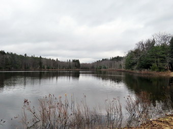
![]()
![]()
![]()
![]()
![]() On Saturday, March 27th, I wanted to return to Schoharie County to work on a few of the Scary 19 high points. This list was created by Jason Pelton who lives in Schoharie County and chose 19 high points in state forests. When I looked at the weather forecast, it showed that Schoharie County would have highs of near 50 degrees so I knew that most of the snow would be gone as the temperatures had also been high during the week. Cindy had said she would go along so I planned to try to get to NE Fulton Hill in Mallet Pond State Forest and Petersburg Mountain in Petersburg State Forest. These are the high points that are farthest away and I hope I could get to them both in one day. When Cindy awoke at 8:30 AM she told me that she was not feeling well and was not going. I started to get ready at 9:00 AM with the temperature still in the low 40's and overcast skies. Sheila was hanging around being a good dog but it was clear she was happy we were going outside. I put on my Mammut long-sleeved crew top with a long-sleeved baselayer since the temperature was cool. I decided to wear my Columbia Titanium insulated pants without a baselayer underneath. I wore my Salomon B52 winter boots which are supportive, surprisingly roomy and discontinued. I had recently put a pair of Protalus insoles in these shoes and was anxious to see how they performed. The insoles in most hiking boots are a flimsy and flat piece of material. I grabbed my Leki external lock poles which I have been using lately since twist locks have proved unreliable. I also donned my Mammut hoody which was enough zippers to dump heat when needed. I put on a light Mountain Hardwear hat and wore a light pair of gloves. I also put on my OR Crocodile gaiters which some almost to my knee to keep my lower legs warm and to deal with the mud I was sure we would find. I decided to take snowshoes and spikes as I did not know the snow conditions in the area. I knew the increasing temperatures would make any remaining snow soft. I decided to take our Tubbs Flex VRT which have the Boa binding. This system uses a thin steel cable system and a ratchet wheel which tightens it to give a custom fit and a secure binding. These snowshoes also have a televator to elevate the hiker's heel on ascents and take some strain off the calf muscles. This is a feature that you didn't know you needed until you try it and then it is hard to live without it! I brought my Kahtoola microspikes which I hoped would be enough.I got my gear and Sheila in the car and headed north on State Route 17 at 9:35 AM. I got off at exit 94 for Roscoe and headed north in Route 206 toward Downsville. Just passed the traffic light in Downsville, I turned right on Telford Hollow Road and followed it over the mountain to Route 10. I turned right and headed north on Route 10 passing through Delhi, Bloomville, South Kortright, Hobart, Stamford and Jefferson.
On Saturday, March 27th, I wanted to return to Schoharie County to work on a few of the Scary 19 high points. This list was created by Jason Pelton who lives in Schoharie County and chose 19 high points in state forests. When I looked at the weather forecast, it showed that Schoharie County would have highs of near 50 degrees so I knew that most of the snow would be gone as the temperatures had also been high during the week. Cindy had said she would go along so I planned to try to get to NE Fulton Hill in Mallet Pond State Forest and Petersburg Mountain in Petersburg State Forest. These are the high points that are farthest away and I hope I could get to them both in one day. When Cindy awoke at 8:30 AM she told me that she was not feeling well and was not going. I started to get ready at 9:00 AM with the temperature still in the low 40's and overcast skies. Sheila was hanging around being a good dog but it was clear she was happy we were going outside. I put on my Mammut long-sleeved crew top with a long-sleeved baselayer since the temperature was cool. I decided to wear my Columbia Titanium insulated pants without a baselayer underneath. I wore my Salomon B52 winter boots which are supportive, surprisingly roomy and discontinued. I had recently put a pair of Protalus insoles in these shoes and was anxious to see how they performed. The insoles in most hiking boots are a flimsy and flat piece of material. I grabbed my Leki external lock poles which I have been using lately since twist locks have proved unreliable. I also donned my Mammut hoody which was enough zippers to dump heat when needed. I put on a light Mountain Hardwear hat and wore a light pair of gloves. I also put on my OR Crocodile gaiters which some almost to my knee to keep my lower legs warm and to deal with the mud I was sure we would find. I decided to take snowshoes and spikes as I did not know the snow conditions in the area. I knew the increasing temperatures would make any remaining snow soft. I decided to take our Tubbs Flex VRT which have the Boa binding. This system uses a thin steel cable system and a ratchet wheel which tightens it to give a custom fit and a secure binding. These snowshoes also have a televator to elevate the hiker's heel on ascents and take some strain off the calf muscles. This is a feature that you didn't know you needed until you try it and then it is hard to live without it! I brought my Kahtoola microspikes which I hoped would be enough.I got my gear and Sheila in the car and headed north on State Route 17 at 9:35 AM. I got off at exit 94 for Roscoe and headed north in Route 206 toward Downsville. Just passed the traffic light in Downsville, I turned right on Telford Hollow Road and followed it over the mountain to Route 10. I turned right and headed north on Route 10 passing through Delhi, Bloomville, South Kortright, Hobart, Stamford and Jefferson.
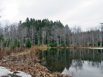 When I reached Summit, I turned right on Sawyer Hollow Road and a short distance later left on Rossman Fly Road. After 1.7 miles, I came to the beginning of the state forest and the end of any road maintenance. Last week the road was covered in snow and was impassable. The road still had some packed snow and ice but I decided to try driving on it. I made it through the first part without a problem and continued for .4 miles to Rossman Valley Road. Beyond this point Rossman Fly Road looked questionable so turned right on Rossman Valley Road and parked on the shoulder at 11:20 AM. The temperature was 43 degrees under overcast skies and there was no snow in sight. I decided to use bare boots until and if I needed spikes. I set my GPS and we started our hike by walking back up the road to Rossman Fly Road. When we came to the intersection, we turned right and walked down a steep hill on Rossman Fly Road toward Mallet Pond State Forest. The gravel road was soft but I was pretty sure I could have driven it with my car. At the bottom of the hill, we started to walk back uphill. The sides of the road had been lined with POSTED signs but now we began to see state forest markings. I wasn't quite sure how I was going to access NE Fulton Hill and was especially concerned about crossing any streams which I assumed would be high. At .6 miles we turned right onto a road that seemed to head down to Mallet Pond but after looking at the map I had, I decided this was not the best route. I had hoped to find the Rossman Cemetery that was marked on the map but I did not see it. We walked back to Rossman Fly Road and turned right. We walked downhill to .8 miles where another road led downhill to two smaller ponds. There was a gate that was closed after a short distance but it looked as if snowmobiles and ATVs simply bypassed it. I looked at the map and this appeared to be the best access so we walked the very muddy trail down to the first pond. The skies were overcast but the pond was still interesting and the trail was sited across the dam. I stopped to take a few pictures including some of the beaver lodge on the far shore. I put the camera away and shouldered my pack as we continued to walk along the dam until I could see that the earthen dam did not go all the way across. There was a beaver dam that was allowing water through and was about 20 feet long. It was too wet for me to walk cross! I looked back from where we had come and saw that the water collected into a deeper stream before emptying into another, larger one. We walked back and I was easily able to jump across the stream, walk the shore around to the other end of the dam and pick up the snowmobile trail.
 The level of water in the pond was almost as high as the shore and the water was overflowing the in some places. The trails continued to be very muddy and Sheila and I took to the forest in some spots. At 1.4 miles we came to an even smaller pond where I again stopped to take pictures. We could hear a cacophony of sound coming from a swampy area on the other side of the pond and I knew the "peepers" were out. We continued on the snowmobile trail and found a long stretch of it covered in packed snow and ice. I made my way to the end of this section and then stopped to take pictures of the trail with the ice. I then turned around and took pictures of the completely clear trail in the other direction. We walked slightly uphill through a pine plantation to 1.65 miles where the trail turned south. I had decided to continue east to work my way up to the ridge and the follow the ridge to the high point on NE Fulton Hill. The initial walk through the woods found me pushing through some brush and small pines following Sheila who always seems to pick a good route. As we gained the ridge the forest opened up a little and there were more hardwoods. We crossed several woods roads on the way up but none were going in our direction. At 1.85 miles we turned 90 degrees and started heading due south staying on the highest part of the ridge. We immediately began to run into a series of beautiful stone walls. I took pictures including some with Sheila posed on top. Each time I promised my self I would not get out the camera for the next one and each time I did! I tried to follow the highest part of the ridge without dipping down and eventually we came upon a woods road which seemed to head directly for the highest point. This gave out just short of the last small ascent so we continued south and I made sure we crossed the point given as the highest. I had intended to go back the way we had come or to follow the woods road we had found. Just ahead of us I saw another stone walls which I decided to investigate. It was the largest and most extensive one yet so more pictures ensued. When I was done with my photography, we turned west and started to work are way down what looked to be very steep ground on the map.
 In reality there were a few modest ledges but it would have been easy to ascend in this direction. It was only about .2 miles and we were again on the snowmobile trail. I took a few pictures and then we turned right heading north. The walk along the trail was easy until I stepped in one spot which almost swallowed my right foot in mud! After this I was more careful and at 2.9 miles we were back at the point we had left the snowmobile trail to ascend to the ridge. We followed our route back to Rossman Fly Road at 3.7 miles. We turned left to head west back to the car. I had every intention of hiking back to the car and heading over to Petersburg Mountain but as we neared the place that was marked as a cemetery on the map I decided to have another look. We turned left on the road we had turned on before and I scanned the woods. Almost immediately I saw a gravestone in the forest on the right side of the trail. We walked in that direction and saw a stone wall was surrounding perhaps 8 markers. I like the history contained in these places but am always a little sad that they are often in such disrepair as this one was. There was brush growing all over and a large tree had partially fallen into the cemetery. The gravestones were from the mid 19th century to the early 20th century and despite their age most were legible. I took some pictures and stopped to read the inscriptions and contemplate their meaning. When I was done, we walked back out to the road and turned left to head west back to the car. We set a fast pace even as we walked up the final steep hill. We were back at the car at 1:45 PM after hiking 4.5 miles in 2 hours and 25 minutes with 25 minutes of stopped time and 740 elevation gain. I thought about hiking in the area again some time by starting on Sawyer Hollow Road (Route 20) and hiking out and back. I knew I had enough time to at least investigate Petersburg Mountain. I drove out to Route 20 on Rossman Valley Road which was paved after a short distance. This is a better way to access the area that Rossman Fly Road. I turned left on Route 20 and headed east. I drove 3.8 miles to West Hilton where I turned right on West Futon Road. I started to drive north and had second thoughts. I knew I probably would not hike to Petersburg Mountain this day and it was a waste of time just to drive there and turn around. I reversed direction and drove out to Route 30 to head home.
![]()
![]()
![]()
![]()
![]() On Tuesday, March 23rd, I was ready to get out for my first hike of the spring before going to my first cross country meet of the season in the in afternoon. I like coaching but it limits my hiking options as I don't want to be late. Lisa had called me the night before and we agreed to meet at Frick Pond at 10:00 AM just to get out as she also had commitments. I though this was appropriate for a first of the season hike as I go there so often. My grandson Bryce would also be coming along and I expected him to arrive around 9:00 AM. As I started to get ready at 9:15 AM the temperature was up to 45 degrees. I put on my Mammut long-sleeved crew top with a long-sleeved baselayer as I like to be warm. I decided to wear my Columbia Titanium insulated pants without a baselayer underneath. I wore my Salomon B52 winter boots which are supportive, surprisingly roomy and discontinued. I had recently put a pair of Protalus insoles in these shoes and was anxious to see how they performed. The insoles in most hiking boots are a flimsy and flat piece of material. I grabbed my Leki external lock poles which I have been using since the spring since twist locks have proved unreliable. I also donned my Mammut hoody which was enough zippers to dump heat when needed. I put on a light Mountain Hardwear hat and wore a light pair of gloves. I decided against gaiters as it was warming up and I did not expect much snow. I decided not to take snowshoes but carried my microspikes as always. I did not have a pair for Bryce so I hoped he would not need them and that his poles would be sufficient. As I was getting ready Sheila stayed near me so that I would not "forget" her but was being a very well-behaved dog. Bryce had not appeared by 9:30 AM so I thought I might have to leave without him. Minutes later he showed up ready to go! I put our gear in the car and Sheila and Bryce in the back seat. Sheila was happy to be going anywhere and crouched in the back seat with her head on the console. We left Livingston Manor at 9:45 AM under blue skies with the temperature reading 48 degrees. I drove out the DeBruce Road about 6 miles to Mongaup Road and turned left. I continued up the road to the point where it splits and stayed left on Beech Mountain Road. It was a short drive to the parking areas on the left. There were no cars in either lot when we arrived at 10:00 AM which was stage since Lisa is usually early. I pulled into the smaller parking area and only had to wait a few minutes before Lisa drove in and parked. Our plan was to hike up the Flynn Trail toward Hodge Pond and then down the Big Rock Trail to Times Square. From here we would hike the Big Rock Trail back toward Frick Pond. I checked out the snow on the Flynn Trail and found much more than I had expected but it seemed to be supporting my weight. I put on my microspikes and set my GPS to get ready to hike. The dog from the cabin came to visit and I could hear a woman calling him. He listened to her about as well as he listens to the man that often calls him. Neither owner seems to have heard of a leash or, for that matter, of dog training.
On Tuesday, March 23rd, I was ready to get out for my first hike of the spring before going to my first cross country meet of the season in the in afternoon. I like coaching but it limits my hiking options as I don't want to be late. Lisa had called me the night before and we agreed to meet at Frick Pond at 10:00 AM just to get out as she also had commitments. I though this was appropriate for a first of the season hike as I go there so often. My grandson Bryce would also be coming along and I expected him to arrive around 9:00 AM. As I started to get ready at 9:15 AM the temperature was up to 45 degrees. I put on my Mammut long-sleeved crew top with a long-sleeved baselayer as I like to be warm. I decided to wear my Columbia Titanium insulated pants without a baselayer underneath. I wore my Salomon B52 winter boots which are supportive, surprisingly roomy and discontinued. I had recently put a pair of Protalus insoles in these shoes and was anxious to see how they performed. The insoles in most hiking boots are a flimsy and flat piece of material. I grabbed my Leki external lock poles which I have been using since the spring since twist locks have proved unreliable. I also donned my Mammut hoody which was enough zippers to dump heat when needed. I put on a light Mountain Hardwear hat and wore a light pair of gloves. I decided against gaiters as it was warming up and I did not expect much snow. I decided not to take snowshoes but carried my microspikes as always. I did not have a pair for Bryce so I hoped he would not need them and that his poles would be sufficient. As I was getting ready Sheila stayed near me so that I would not "forget" her but was being a very well-behaved dog. Bryce had not appeared by 9:30 AM so I thought I might have to leave without him. Minutes later he showed up ready to go! I put our gear in the car and Sheila and Bryce in the back seat. Sheila was happy to be going anywhere and crouched in the back seat with her head on the console. We left Livingston Manor at 9:45 AM under blue skies with the temperature reading 48 degrees. I drove out the DeBruce Road about 6 miles to Mongaup Road and turned left. I continued up the road to the point where it splits and stayed left on Beech Mountain Road. It was a short drive to the parking areas on the left. There were no cars in either lot when we arrived at 10:00 AM which was stage since Lisa is usually early. I pulled into the smaller parking area and only had to wait a few minutes before Lisa drove in and parked. Our plan was to hike up the Flynn Trail toward Hodge Pond and then down the Big Rock Trail to Times Square. From here we would hike the Big Rock Trail back toward Frick Pond. I checked out the snow on the Flynn Trail and found much more than I had expected but it seemed to be supporting my weight. I put on my microspikes and set my GPS to get ready to hike. The dog from the cabin came to visit and I could hear a woman calling him. He listened to her about as well as he listens to the man that often calls him. Neither owner seems to have heard of a leash or, for that matter, of dog training.
 We crossed the road at 10:10 AM, went up and over the snow bank and got on the Flynn Trail to walk around the private property around the cabin at the end of the road. I immediately noticed that there was a well defined icy crest surrounded by bare ground. This continued for most of the trail until just before we turned right onto the woods roads Here we initially encountered snow and then completely bare spots where there was plenty of sunlight. Not very far along the trail was covered in snow and this continued for most of the rest of the hike. The snow was firm where there had been a snowshoes track but I broke through several times when I moved branches off the trail and stepped off the track. We picked many small branches and moved a few larger ones off the trail. In a few place some large branches and small trunks needed tools and I knew I would return later. The woods road which was used for the Flynn Trail was once the Beech Mountain Road. This road was the access for the Beech Mountain Boy Scout Camp. The day was warm and sunny with blue skies but very few clouds. We passed through the arch Cindy and I had cut through an enormous hemlock that had fallen across the trail. We stopped a couple of times so that I could take some pictures of the snow-covered trail which was a big contrast to our Sunday hike on the Shavertown Trails where there was no snow. The trail gains a little over 600 feet in 1.75 miles to the highest point at the junction with the Big Rock Trail. When we came to the clearing on the right, we passed by as I wanted to stay on the main trail. Sheila was with us on the trail most of the time but several times I called her back to me as she had followed her nose off trail. As we neared the highest point on the trail at the junction with the Big Rock Trail, I looked at the time and decided to head down the Big Rock Trail and leave Hodge Pond for another day. We reached the junction after hiking 1.7 miles uphill and now would have over a mile descent.
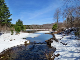 We turned left and started down the Big Rock Trail which was well-packed by snowmobiles. It was a little warmer now and the very top layer of snow on the trail was soft. Bryce had done well thither any traction on his feet and now used that to his advantage. He would take few quick steps and then "ski" down the trail. He did this pretty consistently keeping is balance quite well. The trail still had several inches of snow but it had been some time since snowmobiles or other hikers, for that matter, had used it. We set a faster pace as we descended the trail passing through the various twists and turns that often make it seem like the bottom of the hill is close. The trail was well packed by the snowmobiles and was even easier to hike than when there was no snow as it was very smooth. The trip downhill went quickly and we were soon at Times Square. We continued straight across to stay on the Big Rock Trail. There was still some snow on the trail but it was thinner and there were more places which were bare. There were some places where water was flowing across the trail in small streams. We came to the bridges over the streams that feed Frick Pond where there the water was flowing freely and most of the ice was gone. We stopped so that I could take a few pictures before continuing on. When we came to the large spruce log that had fallen across the trail, Bryce remarked about the act that it had been completely removed. I realized that the last time he had been in this route we worked to remove parts of the trunk but he had not seen it completely cleared. I was glad that I had been able to remove it because it made hiking the trail so much easier than having to climb over it. We walked along the trail under the spruce trees before crossing the wooden walkways that were laden with snow. At the end of the Big Rock Trail, we turned left on the Quick Lake Trail and walked to the bridge over the outlet stream. I took some pictures of the beaver dam, the pond and Flynn's Point on Beech Mountain as I often do. The snow that had drifted to almost cover the dam and the outlet stream had disappeared and there was no ice on the pond. After taking the pictures, I packed up and we continued up the hill to Gravestone Junction. We continued on the trail and back out to the car. The Quick Lake Trail back to the parking area was almost completely frozen over with a combination of packed snow and ice. The small streams that normally cross the trail were now flowing freely. At the register we continued straight ahead on the woods road. We arrived at the car at 12"30 PM after hiking 4.0 miles in 2 hours and 20 minutes. The elevation gain was 670 feet. The temperature at the car was 52 degrees.