
What You Missed
Spring 2020
Spring 2020
![]()
![]()
![]()
![]()
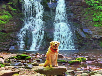
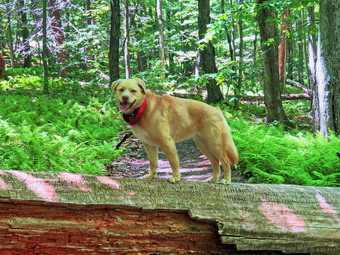
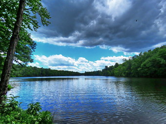
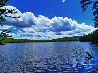
![]() On Friday, June 19th, I was ready to get out for a hike somewhere close to home as I had a scene department meeting scheduled for 2:00 PM. I knew I did not want to go to the Frick Pond area again so I decided to go to Trout Pond and hike the loop in a clockwise direction. It was 70 degrees when I started to get ready at 9:00 AM. Sheila got wind of what was going on and began running around the house barking. I got dressed in a Columbia short-sleeved drew top with a short-sleeved baselayer. I put on a pair of RailRiders hiking pants which are expensive but last along time and have features like deep pockets and a generous cut which I really like. These pants do not have the Velcro closures at the ankles to discourage sticks and gravel from getting into my shoes and to combat ticks. I put on a pair of OR Bugout gaiters which are also insect resistant. I decided to wear my Keen Targhee II hiking boots which fit well and have been discontinued. I grabbed a pair of Leki external lock poles I have been using lately. I also added a new OR floppy hat which shields me from the sun and allows me to spray some insect repellant on it rather than on me. I put my gear in the back and Sheila in the backseat and pulled out of Livingston Manor just before 10:00 AM. The skies were blue with towering puffy white clouds with plenty of sun. I put my gear in the back and Sheila in the back seat. I headed to Roscoe on State Route 17, got off at exit 94 and got on Route 206. I followed it across the Delaware County line to Morton Hill Road. After a left turn on Morton Hill Road, I drove to the intersection with Russell Brook Road. I turned around and parked on the side of the road to avoid the parking area which is private. I set my GPS and put Sheila on her leash as we began our hike down Russell Brook Road at 10:15 AM. The temperature was 75 degrees and the humidity seemed high. There was somebody camped at the spot on the right with a dog off-leash but it did not come out to bother us. Russell Brook Road was dry and dusty as we continued on down Russell Brook Road to the overlook over the upper falls. There was enough water in the stream to make the upper falls interesting so I decided to take some pictures as the light seemed just right. We walked down to the overlook and I put down my pack and got out the camera. I took some shots and the packed up to continue the hike. We continued down toward the parking area where There were several cars already parked. There were several groups of people milling around and at least one group had enough camping gear for a month! We said "Hello" as we walked passed them and down the woods road toward the falls.
On Friday, June 19th, I was ready to get out for a hike somewhere close to home as I had a scene department meeting scheduled for 2:00 PM. I knew I did not want to go to the Frick Pond area again so I decided to go to Trout Pond and hike the loop in a clockwise direction. It was 70 degrees when I started to get ready at 9:00 AM. Sheila got wind of what was going on and began running around the house barking. I got dressed in a Columbia short-sleeved drew top with a short-sleeved baselayer. I put on a pair of RailRiders hiking pants which are expensive but last along time and have features like deep pockets and a generous cut which I really like. These pants do not have the Velcro closures at the ankles to discourage sticks and gravel from getting into my shoes and to combat ticks. I put on a pair of OR Bugout gaiters which are also insect resistant. I decided to wear my Keen Targhee II hiking boots which fit well and have been discontinued. I grabbed a pair of Leki external lock poles I have been using lately. I also added a new OR floppy hat which shields me from the sun and allows me to spray some insect repellant on it rather than on me. I put my gear in the back and Sheila in the backseat and pulled out of Livingston Manor just before 10:00 AM. The skies were blue with towering puffy white clouds with plenty of sun. I put my gear in the back and Sheila in the back seat. I headed to Roscoe on State Route 17, got off at exit 94 and got on Route 206. I followed it across the Delaware County line to Morton Hill Road. After a left turn on Morton Hill Road, I drove to the intersection with Russell Brook Road. I turned around and parked on the side of the road to avoid the parking area which is private. I set my GPS and put Sheila on her leash as we began our hike down Russell Brook Road at 10:15 AM. The temperature was 75 degrees and the humidity seemed high. There was somebody camped at the spot on the right with a dog off-leash but it did not come out to bother us. Russell Brook Road was dry and dusty as we continued on down Russell Brook Road to the overlook over the upper falls. There was enough water in the stream to make the upper falls interesting so I decided to take some pictures as the light seemed just right. We walked down to the overlook and I put down my pack and got out the camera. I took some shots and the packed up to continue the hike. We continued down toward the parking area where There were several cars already parked. There were several groups of people milling around and at least one group had enough camping gear for a month! We said "Hello" as we walked passed them and down the woods road toward the falls.
 We got on the woods road that goes down to the bridge that crosses the brook. I decided to walk to the falls since I could see there were no people there at the time. The Japanese knotweed that was a brown patch several weeks ago was now green and already encroaching on the path. The informal path to the falls was also overgrown and I thought about coming back on another day to do some trail clearing. We walked along the path and then down the bank to the streambed. The falls was reduced to two streams of water flowing over the rock. I took some shots including some of Sheila who posed in front of the falls. When I was done, we headed back up the bank and out to the main trail. We turned right and at the trail junction, we turned to the left to climb the steeper hill toward Mud Pond. The trail was dry and the outlet stream from Trout Pond was at low volume. I was surprised that no one had claimed the large camping site on the right side of the trail. The sun was out and as soon as we started to climb the hill, I felt hotter and really began to sweat. The trail was very dry with no water or mud. The ascent went quickly and I could feel how much fitter I was getting with each hike. We reached the top of the hill at 10:55 AM after hiking 1.4 miles. The woods road was also very dry with no water. At 1.6 miles we made a right to follow the trail up to the shoulder of Cherry Ridge. When we started on the trail, I again noticed that there was no water even in places that are usually wet. There were also a lot of blowdowns along the trail that need to be cleared. Most of these could easily be removed with hand tools. The ascent continued for the next 1.2 miles and just before the highest point we met an older couple coming down the trail toward us. I pulled Sheila of the trail to let them by and we said "Hello" to each other as they passed. I noticed that both were wearing masks and I felt bad that I did not warm them of the problems this could cause. At 2.7 miles into the hike when we were at the highest point and ready to start the descent to Trout Pond. There were several small blowdowns across the trail which I could not clear without tools. I stopped to get a drink as I was dripping with sweat. I noticed a middle-aged couple walking up the trail toward us with a dog that was not on a leash. I leashed Sheila and pulled her to the side of the trail. The other dog decided to say hello and Sheila voiced her objections. We continued in our opposite directions.
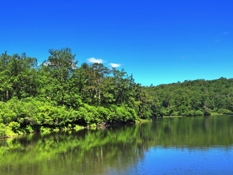
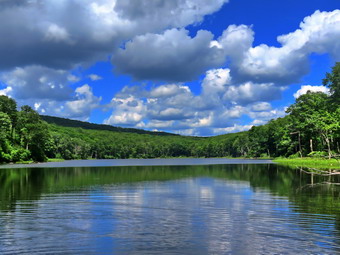 The trail remained dry which made the descent go quickly except for some more blowdowns. When we arrived at the bridge at the inlet end of the pond, I decided to stop and take some pictures as the clouds were really remarkable. Neither lean-to was occupied and the other camping site was also empty. When I was done, we continued on the main trail toward the outlet end of the pond. This part of the trail did have a few wet and muddy places. At the lower end of the pond, we turned right and walked out to the beach. I again stopped to take pictures of a scene I had photographed many times! The water level in the pond was much lower than it had been all spring. The skies were very blue and the clouds were towering. On this day Sheila started to swim on her own. I threw a stick several times into deeper water and she retrieved it each time. The hike from the outlet to the trail junction is all downhill and mostly dry. About halfway down, we met a young couple carry a young child up the hill toward the pond. I was pretty sure that the pond was as far as they would make it! By 12:30 PM we had hiked 4.8 miles and were back at the trail junction and register box. We continued on the main trail to hike back to the car. We walked up to the lower parking area which was now completely filled with at least one car parked along the road below the lot. I was amazed that it was early afternoon on Friday and the area was so busy. As we walked up the road back to the car, I could see quite a few people down at the falls And was glad we had visited it at the beginning of the hike. We continued up the road and a car stopped to ask about the falls. I told them where it was but that they might want to park at one of the upper spots as the lower lot was full. We continued to walk back up the road to the back to the car. We arrived back at 12:50 PM having covered 5.5 miles and 1110 vertical feet in 2 hours and 30 minutes. The temperature was 82 degrees as I pulled away.
![]()
![]()
![]()
![]()
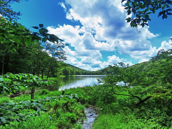
![]() On Wednesday, June 17th I was ready to do a longer hike a little farther away from home. I had been planning to go to Ashokan High Point for several weeks and thought this day might be a good day. I planned to hike the out-and-back route which is about 7.3 miles and to, perhaps, include a trip to Little Ashokan. I asked Cindy if she wanted to go and I was supplied when she said "Yes". The hike is difficult especially the last .9 miles to the High Point that averages 21%. Cindy had done this hike several times so I hoped she was serious about completing it but I knew that was unlikely. I checked my records I found I had not been there in almost two years! I knew from other reports that some of the old viewpoints had been cut out to restore them to their previous state. When I got up at 8:00 AM the temperature was in the high 60's and I knew the forecast called for it to rise even further with increasing humidity. The skies were completely blue with plenty of sun and almost no clouds. We began to get ready to leave at about 9:30 AM which is when Sheila began to watch my every move. I got dressed in my White Sierra long-sleeved crew top with a short-sleeved baselayer. The shirt has an insect repellent built-in which I knew I would appreciate as I anticipated a swarm on Mat flies. I put on a pair of RailRiders hiking pants which are expensive but last along time and have features like deep pockets and a generous cut which I really like. These pants have Velcro closures at the ankles to discourage sticks and gravel from getting into my shoes and to combat ticks. I decided to wear my Vasque Taku hiking boots which fit well and have been discontinued. I grabbed a pair of Leki external lock poles I have been using lately. I also added a new OR floppy hat which was another present from Cindy. I have decided it shields me from the sun and allows me to spray some insect repellant on it rather than on me. I put on a pair of OR Bugout gaiters which are also insect resistant. I put our gear in the back and Sheila in the backseat and pulled out of Livingston Manor at 11:00 AM. I headed to Liberty on Route 17 and took Route 55 toward Grahamsville passing over the Neversink dam where no water was going over the spillway. Just after the TriValley schools, I turned left on Route 55A and continued straight ahead on the Sundown Road. I continued on this road through Sundown and passed the Peekamoose parking area. There were a few cars parked there but I suspected more people were going to the Blue Hole to swim than were hiking the mountains. The Blue Hole has become so popular and overused that the DEC is now requiring free permits on weekends and holidays. The drive to the trailhead parking was longer than I remembered and there was a long descent which I had forgotten. I pulled into the Ashokan High Point parking area at about 11:00 AM and found two cars parked there. The parking area looked as if it had recently been enlarged and new gravel had been put down. A short trail at the far end led down to the road and to the trail on the other side. We got our gear ready and I set both my Garmin 64st handheld unit. I put Sheila on her leash and we quickly crossed the road to begin our hike. The temperature was 72 degrees but the humidity seemed a little high. We crossed Kanape Brook on the bridge and started up the trail. The trail is rocky and on this day it was almost completely dry. The trail parallels Kanape Brook and we could hear the water as it cascaded over the rocks. There was water in the stream but I had expected it to be much higher than it was. It was very pretty but I knew that pictures would not do it justice.
On Wednesday, June 17th I was ready to do a longer hike a little farther away from home. I had been planning to go to Ashokan High Point for several weeks and thought this day might be a good day. I planned to hike the out-and-back route which is about 7.3 miles and to, perhaps, include a trip to Little Ashokan. I asked Cindy if she wanted to go and I was supplied when she said "Yes". The hike is difficult especially the last .9 miles to the High Point that averages 21%. Cindy had done this hike several times so I hoped she was serious about completing it but I knew that was unlikely. I checked my records I found I had not been there in almost two years! I knew from other reports that some of the old viewpoints had been cut out to restore them to their previous state. When I got up at 8:00 AM the temperature was in the high 60's and I knew the forecast called for it to rise even further with increasing humidity. The skies were completely blue with plenty of sun and almost no clouds. We began to get ready to leave at about 9:30 AM which is when Sheila began to watch my every move. I got dressed in my White Sierra long-sleeved crew top with a short-sleeved baselayer. The shirt has an insect repellent built-in which I knew I would appreciate as I anticipated a swarm on Mat flies. I put on a pair of RailRiders hiking pants which are expensive but last along time and have features like deep pockets and a generous cut which I really like. These pants have Velcro closures at the ankles to discourage sticks and gravel from getting into my shoes and to combat ticks. I decided to wear my Vasque Taku hiking boots which fit well and have been discontinued. I grabbed a pair of Leki external lock poles I have been using lately. I also added a new OR floppy hat which was another present from Cindy. I have decided it shields me from the sun and allows me to spray some insect repellant on it rather than on me. I put on a pair of OR Bugout gaiters which are also insect resistant. I put our gear in the back and Sheila in the backseat and pulled out of Livingston Manor at 11:00 AM. I headed to Liberty on Route 17 and took Route 55 toward Grahamsville passing over the Neversink dam where no water was going over the spillway. Just after the TriValley schools, I turned left on Route 55A and continued straight ahead on the Sundown Road. I continued on this road through Sundown and passed the Peekamoose parking area. There were a few cars parked there but I suspected more people were going to the Blue Hole to swim than were hiking the mountains. The Blue Hole has become so popular and overused that the DEC is now requiring free permits on weekends and holidays. The drive to the trailhead parking was longer than I remembered and there was a long descent which I had forgotten. I pulled into the Ashokan High Point parking area at about 11:00 AM and found two cars parked there. The parking area looked as if it had recently been enlarged and new gravel had been put down. A short trail at the far end led down to the road and to the trail on the other side. We got our gear ready and I set both my Garmin 64st handheld unit. I put Sheila on her leash and we quickly crossed the road to begin our hike. The temperature was 72 degrees but the humidity seemed a little high. We crossed Kanape Brook on the bridge and started up the trail. The trail is rocky and on this day it was almost completely dry. The trail parallels Kanape Brook and we could hear the water as it cascaded over the rocks. There was water in the stream but I had expected it to be much higher than it was. It was very pretty but I knew that pictures would not do it justice.
 Within a short distance, we came to an elaborate stone retaining wall on the left side of the trail. The stone work was typical of old stone walls with great craftsmanship. Farther along there was a spring and a cistern used to collect water. We met a family of four with two young children coming toward us. I moved Sheila off the trail and said "Hello" to them as they passed. By the looks of their packs, I assumed they had camped overnight. I was surprised that the trail was so poorly maintained with many old blowdowns and several new ones. Some were relatively easy to step over but others block the trail and required a detour. This is becoming a real problem even on some of the more popular trails in the Catskills. At 1.5 miles the trail flattened a little and then started a somewhat steeper climb. We crossed another small bridge which was barely hanging together and in serious need of repair. It seems that the responsible parties had all but abandoned the trail! We entered a tunnel of pine trees. The ground was covered with small twigs broken from the trees and these formed a sort of carpet on the ground. We met one woman who was hiking back down the trail. I took Sheila off to the side and asked the hiker what the views were like at the top. She responded that she had turned around before the viewpoint and it crossed my mind that I hoped we would not do the same. From this point on the trail became much rockier as water flows on the trail eroding the soil between the stones. This trail is marked on some maps as the Kanape Jeep Trail. The trail began to narrow between laurel on either side and I knew we were near the turn to the High Point. At 2.7 miles we reached the turn to the left where the trail begins the 1 mile climb to the High Point. It was 12:40 PM and I asked Cindy if she wanted a drink. She said "No" and thought we could get a drink and a snack when we got to the top. It was then I realized she had no idea what was ahead of us. We made the turn and hiked for about a quarter mile. I stopped to get a drink an explained the situation to Cindy. She asked that we turned around. I knew enough not to argue so we turned shroud and started back. I thought that being prepared for the disappointment would make it easier but it did not. I had planned this hike for some time and stopped .7 miles short of the goal. When we reached the turn, I went to the left and walked to the campsites that are in that direction. After checking this out, I turned around and started back. I must admit that walking downhill was much easier than the ascent. On the way back we met three couples headed up. Most looked like they were going up and returning without camping. One couple had a single bottle of water between them. Another couple asked if there was an "overlook" ahead. On the way back I tried to find a view of some of the falls and rapids below but most were hidden by the leaves. I did get pictures of one falls but wondered what I could do with more time. When we came to the stone retaining wall, I also took some pictures of it before moving on. We came to the first bridge and crossed the creek to walk back up to the car. It was 2:25 PM and we had hiked 5.9 miles in 3 hours and 20 minutes. The vertical gain was 1180 feet and our moving average was 2.0 mph. I made a promise to myself that I would return soon to do the complete hike as planned. Cindy insisted that we drive out to Route 28 and return by way of Rt47 passing Slide Mountain. This route was 30 minutes longer than the more direct one we had taken in the morning and I thought it would never end.
![]()
![]()
![]()
![]() On Tuesday, June 16th I returned from a hike at Hodge and Frick Ponds at 2:00 PM and was ready to meet Lisa to look at some possible new trails on Round Top. After getting a drink and a short rest, I got a text from Lisa asking if I had any ribbon to mark the trails. I had not looked for ribbon as Lisa had volunteered to bring it. A quick search revealed no ribbon but my neighbor offered me a roll. At 2:55 PM I put Sheila on her leash and we walked down the driveway and across the street to meet Lisa in the church parking lot. Sheila was thrilled to see Lisa when we met her and started up the hill to the trailhead at the highest point in the cemetery. Sheila helped me by giving me a pull up the hill to the trailhead where I released her from the leash. We turned left and walked into the forest on the trail. At the first trail junction, we continued straight up the hill to the lookout. We followed the yellow trail as it turned to the right and began a gentle uphill climb. The trimmmi8ng Cindy and I had done two days before was evident. We arrived at a steep but short climb which was a lot of loose rocks. We tried to find a way around this but I decided I would try removing the rocks to make the trail more stable in that area. We continued to the junction with the blue trail where we continued straight ahead up the hill. As the trail becomes steeper, erosion is increasing as the trail is rather straight and the number of people using it has increased. Lisa and I were looking for a way to create a switchback to resolve this problem. We found an animal path and followed it across and up the hill until we could make a turn and walk back across and uphill slightly back to the trail. The point where we hit the trial again was above the section we wanted to replace so we decided to mark it with ribbon so that others could see it. Before doing that marking Lisa wanted to look for a way to create another trail that would leave the steep trail to the summit and join the trail coming down the other side. I was not sure this was a good idea but we set off to see what we could find. We were able to find a natural path that wound around the middle of the hill. Several times we had to move up or down the terrain but we soon met the trail that comes down the more shallow side of the hill. We decided to o back and flag the trail with ribbon. It was unfortunate that the ribbon was a bright lime green but it was what we had. We walked the switchback flagging with ribbon as we went. We had some slight variations from our first walk but came out at the same place on the trail we had before. Lisa and I then turned our attentions to the second trail. We followed our previous route typing ribbons on the trees to mark the route. As we came around the hill, we lost our previous path and Lisa when "high" and I went "low". We both ran into the trail coming down from the summit in about the same place. We decided to walk in to see if we could spot the last ribbon I had placed. It took a few minutes but then I spotted a ribbon ahead and flagged some other trees to complete the route out to the trail. We walked back over the summit and continued down to the yellow trail. We turned left and walked the yellow trail along the base of Round Top to the junction with the blue trail. Here we turned right and headed down the trail to the woods road that took us back to the first junction. We turned left and walked out to the trailhead and then down the hill to Lisa's car in the church lot. We agreed that the next step was to flag the trails with more visible ribbon and in different colors. I will create a form to allow people to give us feedback on the new trail and the switchback. The form will be emailed to some people who use the trails regularly along with an explanation of the need for the trails. A link will be posted at the trailhead.
On Tuesday, June 16th I returned from a hike at Hodge and Frick Ponds at 2:00 PM and was ready to meet Lisa to look at some possible new trails on Round Top. After getting a drink and a short rest, I got a text from Lisa asking if I had any ribbon to mark the trails. I had not looked for ribbon as Lisa had volunteered to bring it. A quick search revealed no ribbon but my neighbor offered me a roll. At 2:55 PM I put Sheila on her leash and we walked down the driveway and across the street to meet Lisa in the church parking lot. Sheila was thrilled to see Lisa when we met her and started up the hill to the trailhead at the highest point in the cemetery. Sheila helped me by giving me a pull up the hill to the trailhead where I released her from the leash. We turned left and walked into the forest on the trail. At the first trail junction, we continued straight up the hill to the lookout. We followed the yellow trail as it turned to the right and began a gentle uphill climb. The trimmmi8ng Cindy and I had done two days before was evident. We arrived at a steep but short climb which was a lot of loose rocks. We tried to find a way around this but I decided I would try removing the rocks to make the trail more stable in that area. We continued to the junction with the blue trail where we continued straight ahead up the hill. As the trail becomes steeper, erosion is increasing as the trail is rather straight and the number of people using it has increased. Lisa and I were looking for a way to create a switchback to resolve this problem. We found an animal path and followed it across and up the hill until we could make a turn and walk back across and uphill slightly back to the trail. The point where we hit the trial again was above the section we wanted to replace so we decided to mark it with ribbon so that others could see it. Before doing that marking Lisa wanted to look for a way to create another trail that would leave the steep trail to the summit and join the trail coming down the other side. I was not sure this was a good idea but we set off to see what we could find. We were able to find a natural path that wound around the middle of the hill. Several times we had to move up or down the terrain but we soon met the trail that comes down the more shallow side of the hill. We decided to o back and flag the trail with ribbon. It was unfortunate that the ribbon was a bright lime green but it was what we had. We walked the switchback flagging with ribbon as we went. We had some slight variations from our first walk but came out at the same place on the trail we had before. Lisa and I then turned our attentions to the second trail. We followed our previous route typing ribbons on the trees to mark the route. As we came around the hill, we lost our previous path and Lisa when "high" and I went "low". We both ran into the trail coming down from the summit in about the same place. We decided to walk in to see if we could spot the last ribbon I had placed. It took a few minutes but then I spotted a ribbon ahead and flagged some other trees to complete the route out to the trail. We walked back over the summit and continued down to the yellow trail. We turned left and walked the yellow trail along the base of Round Top to the junction with the blue trail. Here we turned right and headed down the trail to the woods road that took us back to the first junction. We turned left and walked out to the trailhead and then down the hill to Lisa's car in the church lot. We agreed that the next step was to flag the trails with more visible ribbon and in different colors. I will create a form to allow people to give us feedback on the new trail and the switchback. The form will be emailed to some people who use the trails regularly along with an explanation of the need for the trails. A link will be posted at the trailhead.
![]()
![]()
![]()
![]()
![]() On Tuesday, June 16th I wanted to get out for a longer hike after a few shorter ones in a row. Cindy decided not to go but I had to meet Lisa at 3:00 PM to scout out some new trails on Round Top. I decided to head out to the Frick Pond area to do some sort of longer loop. The temperature was 70 degrees as I began to get ready at 9:15 AM. I decided to head up the Flynn Trail to Hodge Pond a circle it before heading back to the Big Rock Trail. I would hike down the Big Rock Trail to Times Square and then hike the Loggers Loop to Iron Wheel Junction. From there I would walk the Quick Lake trail back to the car passing by the outlet to Frick Pond. As I started to get ready Sheila was watching my every move but was doing so quitely. I got dressed in my White Sierra long-sleeved crew top with a short-sleeved baselayer. The shirt has an insect repellent built-in which I knew I would appreciate as I anticipated a swarm on Mat flies. I put on a pair of RailRiders hiking pants which are expensive but last along time and have features like deep pockets and a generous cut which I really like. These pants do not have Velcro closures at the ankles as some do to discourage sticks and gravel from getting into my shoes and to combat ticks. To make up for this I put on a pair of OR Bugout gaiters which are also insect resistant. I decided to wear my Vasque Taku hiking boots which fit well and have been discontinued. I grabbed a pair of Leki external lock poles I have been using lately. I also added a new OR floppy hat which was another present from Cindy. I have decided it shields me from the sun and allows me to spray some insect repellant on it rather than on me. I put my gear in the back and Sheila in the backseat and drove out the Debruce Road about 6 miles. I turned left onto Mongaup Pond Road and continued to where the road split. I turned left onto Beech Mountain Road, and drove to the parking areas at the Frick Pond. There were no cars parked in either lot. The thermometer read 72 degrees as I set my GPS. The skies were blue with plenty of sun but without many clouds. There was a slight breeze. I did not spray any insect repellant as I do not like the smell and there were no swarms of insects around me. At 10:05 AM we crossed the road and started through the woods on the Flynn Trail.
On Tuesday, June 16th I wanted to get out for a longer hike after a few shorter ones in a row. Cindy decided not to go but I had to meet Lisa at 3:00 PM to scout out some new trails on Round Top. I decided to head out to the Frick Pond area to do some sort of longer loop. The temperature was 70 degrees as I began to get ready at 9:15 AM. I decided to head up the Flynn Trail to Hodge Pond a circle it before heading back to the Big Rock Trail. I would hike down the Big Rock Trail to Times Square and then hike the Loggers Loop to Iron Wheel Junction. From there I would walk the Quick Lake trail back to the car passing by the outlet to Frick Pond. As I started to get ready Sheila was watching my every move but was doing so quitely. I got dressed in my White Sierra long-sleeved crew top with a short-sleeved baselayer. The shirt has an insect repellent built-in which I knew I would appreciate as I anticipated a swarm on Mat flies. I put on a pair of RailRiders hiking pants which are expensive but last along time and have features like deep pockets and a generous cut which I really like. These pants do not have Velcro closures at the ankles as some do to discourage sticks and gravel from getting into my shoes and to combat ticks. To make up for this I put on a pair of OR Bugout gaiters which are also insect resistant. I decided to wear my Vasque Taku hiking boots which fit well and have been discontinued. I grabbed a pair of Leki external lock poles I have been using lately. I also added a new OR floppy hat which was another present from Cindy. I have decided it shields me from the sun and allows me to spray some insect repellant on it rather than on me. I put my gear in the back and Sheila in the backseat and drove out the Debruce Road about 6 miles. I turned left onto Mongaup Pond Road and continued to where the road split. I turned left onto Beech Mountain Road, and drove to the parking areas at the Frick Pond. There were no cars parked in either lot. The thermometer read 72 degrees as I set my GPS. The skies were blue with plenty of sun but without many clouds. There was a slight breeze. I did not spray any insect repellant as I do not like the smell and there were no swarms of insects around me. At 10:05 AM we crossed the road and started through the woods on the Flynn Trail.
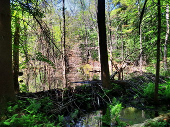
 The first thing I noticed was how dry the trail was as we walked through the forest to the woods road abet leads north toward Hodge Pond. At the end of the trail we turned right to stay on the Flynn Trail. This trail is sited on the old Beech Mountain Road that ran to the Beech Mountain Boy Scout Camp. We walked up the trail with ease although the grass was getting pretty long. The trail continued to be bone dry. All the vegetation was out and very green which completely changes the look of the trail compared to other seasons. I tried to set a quick pace without pushing too hard. At about a mile we walked passed the area where a path leads to a clearing on the right of the trail. The original of the large clearing is unclear although some speculate that dirt from this area was used to build the road. We passed by the path and descended a little before climbing again to the junction with the Big Rock trail at 1.7 miles. We passed through that junction and continued straight ahead on the Flynn Trail. We passed through the gate and found one blowdown still in the trail. At the next split in the trail, the Flynn Trail heads left to descend directly to Hodge Pond. We turned right on a woods road and walked a short distance to a road that descends toward the pond. We turned left here and walked down to the jeep road that runs around the back of the pond. We turned right on this road and walked around the upper end of the pond. About halfway around, we turned left on a path that led down to the shore. The weeds had grown up and were all but blocking the path. I dropped my pack to get out the camera to take some pictures of the pond. The sky was blue but lacking the white puffy clouds that make the best pictures. I took a shot OD Shiela in the water and then threw a stick for her to retrieve. I don't know why but Sheila was not interested in retrieving sticks! We packed up after getting a bar and a drink and headed back up to the jeep road. We turned left and continued around the pond where the jeep road meets the Flynn Trail again. We turned left and walked along the Flynn Trail through a field to the outlet end of the pond. We walked over to a point near the shore and I again took some more pictures of the pond.
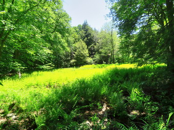
 When I was done with my photography, we turned around and entered the woods again on the Flynn Trail. The next .4 miles of the trail is all uphill and can seem long but I barely noticed it. At the top of the hill we turned right to walk back to the junction with the Big Rock Trail. At 3.9 miles we arrived at the four-way junction and turned right to start downhill on the Big Rock Trail. Hiking down this trail is much easier than hiking up. There are several different levels but they all went by quickly. There was one large blowdown nearly blocking the trail about halfway down. I thought about making another trip soon to cut these blowdowns out of the way. At 5 miles we reached Times Square which is the lowest point on the hike. I decided to add some more miles by turning right on the Loggers Loop. We started up the hill which seemed minimal on this day and at 5.3 miles we came to the little seasonal pond on the right side of the trail. I had decided not to stop but I thought it was remarkable that the area was almost devoid of water but filled with grasses and ferns. I took some pictures and though I could see a small puddle of water in the middle. After taking the pictures, we returned to the main trail and continued to hike toward Iron Wheel Junction. This trail did have a few damp spots but they were easily avoided. At 6.25 miles we arrived at Iron Wheel Junction and immediately turned left to start back to the car on the Quick Lake Trail. This trail is for a long time downhill or flat. This was the only trail we hiked that was wet and muddy in many places. When we reached the small stream through the woods, it seemed to be a little higher than during our last trip but was still easily crossed on stepping stones. We entered the spruce tunnel and walked almost to the end when I saw a man walking toward us. I took Sheila off to the side of the trail to allow the hiker to pass. We said "Hello" and began a conversation. Kyle is from Margaretville and regularly hikes Dry Brook Ridge. He has almost completed the All-Trails Challenge but needs the Kaaterskill Falls Trail which is presently closed. We parted and continued our hikes is opposite directions. The Quick Lake Trail continued to be wet and at 7 miles we were at the junction with the Big Rock Trail. We continued straight ahead crossing the two small bridges and finally arriving at the bridge over the outlet stream. I got out my camera and noticed that the level of the pond was lower. Someone had removed the dam the beavers were trying to construct as they had last year! The beavers had not given up and there were some fresh branches in place already. I am again going to report this to the forest ranger since I believe this kind of vandalism is illegal. After finishing taking my shots, we started up the hill to Gravestone Junction. The Quick Lake Trail was damp in places but not nearly as wet as on other trips. We were back at the car at 1:40 PM after hiking 7.7 miles in 3.5 hours. The elevation gain was 1105 feet and our moving speed averaged 2.4 mph which was quite snappy.
![]()
![]()
![]()
![]() On Sunday, June 14th I was ready to go to church for an "in-person" service for the first time since March 15. These plans were put on hold by an ambulance call at around 8:00 AM. When we returned from the call, I thought I might have just enough time to get to the church service. At that point we were paged for another call. By the time we returned from the hospital and I completed the paperwork it was around noon. I returned home and asked Cindy if she wanted to go across the street to trim the lower trail on Round Top. She agreed so we began to get ready. I knew that I would take my Stihl weed whacker with extra fuel and cutting line in a pack. Cindy would use a pair of loppers to cut anything that was too large for the string trimmer. I got dressed in my White Sierra long-sleeved crew top with no baselayer. The shirt has an insect repellent built-in which I knew I would appreciate as I could not rule out a swarm on May flies. I put on a pair of RailRiders hiking pants which are expensive but last along time and have features like deep pockets and a generous cut which I really like. The pants have Velcro closures at the ankles but I also put on my OR Bugout gaiters. The ticks have not been very numerous so far this season but a little prevention is always best. The gaiters would also keep whatever I cut from going into my boots. I decided to wear my Vasque Taku hiking boots which are now my "go to" hiking boots but have been discontinued. I also wore a new OR floppy hat which shields me from the sun and allows me to spray some insect repellant on it rather than on me. Sheila in particular was anxious to get out as we had not hiked the day before. Sheila was always near but not too near to be considered under foot. We put our gear in the car and Sheila in the backseat and we drove across the street to the cemetery. I tried to drive to the highest point of the cemetery where the trails begin but the road was blocked by a fallen tree. I drove to the base of the steep hill to drive to the trailhead. I decided that I would back up the hill which made Cindy very nervous. I parked the car at the trailhead with the temperature at 68 degrees. The sun was out but it felt very comfortable for trail work. I got out the Stihl and the pack with fuel and line. Cindy took the loppers. We started out on the trail to the first junction at 1:00 PM. There was little to trim along this section. When we arrived at the first trail junction, we turned right and walked the woods road uphill turning top the left to follow the yellow trail. We ran into some brush and grass to trim. Cindy went ahead to trim some heavier branches while I fired up the Stihl. It started right up and I began to trim the grass and brush on the trail. I followed Cindy cutting a few things she missed until I got to the junction with the blue trail. We turned left and I continued to cut brush and grass. I like to cut a rather wide swath so that the trail remains clear even when the brush and grasses start to grow back. This section of trail was a little longer than I though especially when carrying the trimmer. I remember when I was growing up that I always wanted to use the power tools. Now that I can use the power tools it isn't all that great! After using the Stihl for a short period of time, my hands get numb from the vibration. There was a lot to cut but we finally made it to the second junction with the blue trail.
On Sunday, June 14th I was ready to go to church for an "in-person" service for the first time since March 15. These plans were put on hold by an ambulance call at around 8:00 AM. When we returned from the call, I thought I might have just enough time to get to the church service. At that point we were paged for another call. By the time we returned from the hospital and I completed the paperwork it was around noon. I returned home and asked Cindy if she wanted to go across the street to trim the lower trail on Round Top. She agreed so we began to get ready. I knew that I would take my Stihl weed whacker with extra fuel and cutting line in a pack. Cindy would use a pair of loppers to cut anything that was too large for the string trimmer. I got dressed in my White Sierra long-sleeved crew top with no baselayer. The shirt has an insect repellent built-in which I knew I would appreciate as I could not rule out a swarm on May flies. I put on a pair of RailRiders hiking pants which are expensive but last along time and have features like deep pockets and a generous cut which I really like. The pants have Velcro closures at the ankles but I also put on my OR Bugout gaiters. The ticks have not been very numerous so far this season but a little prevention is always best. The gaiters would also keep whatever I cut from going into my boots. I decided to wear my Vasque Taku hiking boots which are now my "go to" hiking boots but have been discontinued. I also wore a new OR floppy hat which shields me from the sun and allows me to spray some insect repellant on it rather than on me. Sheila in particular was anxious to get out as we had not hiked the day before. Sheila was always near but not too near to be considered under foot. We put our gear in the car and Sheila in the backseat and we drove across the street to the cemetery. I tried to drive to the highest point of the cemetery where the trails begin but the road was blocked by a fallen tree. I drove to the base of the steep hill to drive to the trailhead. I decided that I would back up the hill which made Cindy very nervous. I parked the car at the trailhead with the temperature at 68 degrees. The sun was out but it felt very comfortable for trail work. I got out the Stihl and the pack with fuel and line. Cindy took the loppers. We started out on the trail to the first junction at 1:00 PM. There was little to trim along this section. When we arrived at the first trail junction, we turned right and walked the woods road uphill turning top the left to follow the yellow trail. We ran into some brush and grass to trim. Cindy went ahead to trim some heavier branches while I fired up the Stihl. It started right up and I began to trim the grass and brush on the trail. I followed Cindy cutting a few things she missed until I got to the junction with the blue trail. We turned left and I continued to cut brush and grass. I like to cut a rather wide swath so that the trail remains clear even when the brush and grasses start to grow back. This section of trail was a little longer than I though especially when carrying the trimmer. I remember when I was growing up that I always wanted to use the power tools. Now that I can use the power tools it isn't all that great! After using the Stihl for a short period of time, my hands get numb from the vibration. There was a lot to cut but we finally made it to the second junction with the blue trail.
We turned right and began to walk up the steep side of the hill toward the summit. The first section of the trail did not have did not have much to trim so I concentrated mostly on cutting some grass and ferns near the edges of the trail. The trail is becoming more and more distinct as more and more people use the trails. A little over half way up the hill, the brush began to close in and so Cindy moved a little farther ahead so that what I was cutting would not hit her. I bean to cut brush some of which was rather large. The larger the brush the quicker the line is used up. When I got to the top of the trail I continued to cut grass, ferns and brush across the summit. As we made the turn to start down the hill, the brush became even thicker and heavier. Cindy cut t5he biggest branches and I followed cutting the rest including some overhead. Even though using the Stihl is much easier than cutting everything by hand it is still tiring work. I was glad when we came to the trail junction. We turned right and walked across the yellow trail along the base of Round Top. At the junction with the blue trail, I stopped the trimmer to refuel it. I also checked the line and found it was almost out. Refilling the line means winding it manually and I had not done it since last year. The process is pretty straightforward and it all went quickly. Just before we started up again, a group of hikers with two dogs came up the trail from the lookout. They wanted to know a little about the trails and thanked us for clearing them. That made me feel good as Cindy and I have put in a lot of work. We turned left to follow the yellow trail down to the viewpoint. There was very little brush along the trail but I cut some of the ferns and grass that were encroaching on the trail. At the lookout we turned left and followed the yellow trail downhill and then back out to the trailhead. Cindy was ready to go home but I wanted to cut the grass and weeds on the steps and around the sign. Cindy put Sheila on her leash and started down the hill. I moved the car forward and then made sure I put on the parking brake. I had to refuel the Stihl and put more line on the spool before I could finish the job. It only took a few minutes to trim the trailhead. I packed everything into the car and drove home. It was 3:00 PM and we had spent about 2 hours making the trails better for others.
![]()
![]()
![]()
![]()
![]() On Friday, June 12th, I though I might go to Bear Spring WMA and hike a 9 mile loop on the central and eastern ridge. When I got up in the morning, I just wasn't feeling it so I asked Cindy if she wanted to go for a walk. She said "Yes" and I suggested we go to Mongaup Pond and hike a loop up the Flynn Trail over the snowmobile trail to the pond and then around the pond clockwise and back to the car on the snowmobile trails. I had some work to complete for school so we didn't begin to get ready until just before noon when the temperature in town was nearing 80 degrees! I got dressed in a Columbia crew top with a short-sleeved baselayer. I put on a pair of RailRiders hiking pants which are expensive but last along time and have features like deep pockets and a generous cut which I really like. The pants have Velcro closures at the ankles but I also put on my OR Bugout gaiters. The ticks have not been very numerous so far this season but a little prevention is always best. I decided to wear my Vasque Taku hiking boots which are now my "go to" hiking boots but have been discontinued. I grabbed a pair of Leki external lock poles I have been using lately. I also added a new OR floppy hat which shields me from the sun and allows me to spray some insect repellant on it rather than on me. I took along a light OR windbreaker although I knew it was doubtful I would need it. Sheila in particular was anxious to get out even though we had hiked the day before. I packed two bottles of water and loaded my gear into my pack under the watchful eye of Sheila who is always near but not too near to be considered under foot. I put our gear in the car and Sheila in the backseat an we finally pulled out of Livingston Manor at 12:15 PM. I drove out the Debruce Road about 6 miles and turned left onto Mongaup Pond Road. I had planned to hike up the Flynn Trail but Cindy didn't want to do that so I changed the plan. I continued to where the road split and stayed to the right. I pulled into one of the two spots just off the road on the right. The thermometer in the car read 72 degrees as I set my GPS. The skies were mostly bright and blue with some white clouds but there was a slight breeze. I hoped the breeze would discourage the insects as I do not like insect repellent. At 12:40 PM we headed down the road that leads to the creek. This road used to be a paved road that connected to Terwilliger Road.
On Friday, June 12th, I though I might go to Bear Spring WMA and hike a 9 mile loop on the central and eastern ridge. When I got up in the morning, I just wasn't feeling it so I asked Cindy if she wanted to go for a walk. She said "Yes" and I suggested we go to Mongaup Pond and hike a loop up the Flynn Trail over the snowmobile trail to the pond and then around the pond clockwise and back to the car on the snowmobile trails. I had some work to complete for school so we didn't begin to get ready until just before noon when the temperature in town was nearing 80 degrees! I got dressed in a Columbia crew top with a short-sleeved baselayer. I put on a pair of RailRiders hiking pants which are expensive but last along time and have features like deep pockets and a generous cut which I really like. The pants have Velcro closures at the ankles but I also put on my OR Bugout gaiters. The ticks have not been very numerous so far this season but a little prevention is always best. I decided to wear my Vasque Taku hiking boots which are now my "go to" hiking boots but have been discontinued. I grabbed a pair of Leki external lock poles I have been using lately. I also added a new OR floppy hat which shields me from the sun and allows me to spray some insect repellant on it rather than on me. I took along a light OR windbreaker although I knew it was doubtful I would need it. Sheila in particular was anxious to get out even though we had hiked the day before. I packed two bottles of water and loaded my gear into my pack under the watchful eye of Sheila who is always near but not too near to be considered under foot. I put our gear in the car and Sheila in the backseat an we finally pulled out of Livingston Manor at 12:15 PM. I drove out the Debruce Road about 6 miles and turned left onto Mongaup Pond Road. I had planned to hike up the Flynn Trail but Cindy didn't want to do that so I changed the plan. I continued to where the road split and stayed to the right. I pulled into one of the two spots just off the road on the right. The thermometer in the car read 72 degrees as I set my GPS. The skies were mostly bright and blue with some white clouds but there was a slight breeze. I hoped the breeze would discourage the insects as I do not like insect repellent. At 12:40 PM we headed down the road that leads to the creek. This road used to be a paved road that connected to Terwilliger Road.
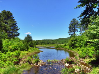
 We crossed the creek on the small "bridge" that is still present and began to climb a little hill. The hill was a lot of rocks and gravel and on this day there was a lot of water running down. We tried to avoid as much water as possible as we hiked the first .4 miles to the snowmobile trail. As we turned left on the snowmobile trail, I was amazed to see that the Japanese knotweed was almost blocking the trail. I had been through this trail less than two weeks before and the knotweed was brown and lying flat. The first part of this trail passes through some pines and it was relatively dry. As we continued to walk the trail became very wet and muddy and it was difficult to find a way to stay dry. This problem is caused by the cliffs and ledges to the right which drain onto the trail and then to a swampy area on the left of the trail. At 1.95 miles we came to the point where the trail turns to the right. To the left is a short trail that runs out to the campgrounds. We turned right and I knew there would be more wet areas to deal with. Sheila was doing a good job of staying out of the mud until she suddenly bolted up the trail and into the woods. I saw that she was chasing after two deer and called her back immediately. I knew she was only responding to the movement and meant no harm but I did not want her to develop bad habits. We continued to fight the poor trail conditions to 2.6 miles where the Mongaup Willowemoc Trail came in from the right. We continued straight ahead and began to walk downhill toward the head end of the pond. The trail crossed four different bridges and at 3.1 miles arrived at the junction with the Mongaup Hardenburgh Trail on the right. Sheila ran toward the pond and jumped in to swim. I walked down to the shore and took some pictures of the pond and of Sheila while she was swimming.
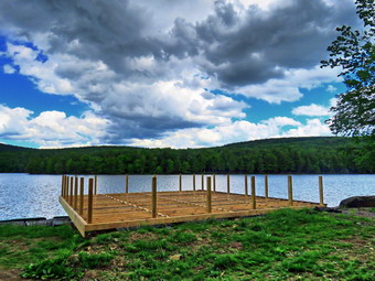 We got a drink and a snack and then continued around the pond on the trail. We could hear the sound of lawn mowers and weed whackers which gave me the impression that the campgrounds would be opening although no date has been set. We walked out to the road and turned right to walk toward the point where the snowmobile trail climbs the hill to the Flynn Trail. At 3.6 miles I started to turn right on the trail and Cindy asked what I was doing. I explained my intentions as I had explained them to her before we started the hike. She made it clear that she wanted to simply continue on the roads back to the car I HATE hiking on roads when nice trails are available and I HATE changing my plans but I knew I could not win! We continued on the roads and after a short distance I walked off to the left to a bench near the shores of the pond. The views from here are slightly different than from the head of the pond and I decided I might as well get some shots. The clouds were interesting as the low ones were illuminated by the sun and the higher ones were dark. After finishing my photography, I packed up and walked back out to the road. Cindy decided to spend a little more time by the pond so Sheila and I took off at a fast pace. I knew that I would stop at the boat launch for some more pictures which would let Cindy catch up. When I walk on the road, I usually set a fast pace as I just want to finish and it is the only way to get some exercise. We reached the boat launch at 4.4 miles and I took some shots of the incomplete deck and the pond. When Cindy reached us, I picked up and started out again. We passed through the entrance to the park at 4.6 miles. The walk back to the car along Mongaup Road can be pleasing as it run s parallel to the stream. On this day I just wanted to get it over with so I put my head down and allowed Sheila to pull me along. The first part of the walk undulates a little but the second part is mostly downhill. We were back at the car at 3:20 PM after hiking 5.7 miles in 2 hours and 40 minutes. The elevation gain was 570 feet and our moving speed was 2.3 mph.
![]()
![]()
![]()
![]() On Thursday, June 11th I was ready to get out for a hike after several days of poor weather and various commitments. I had planned for some time to hike Ashokan High Point but each time my plans were interrupted. This day was not different as the ambulance pager sounded as I was beginning to get ready. Once I returned home, I had some work to do which did not bother me as it was still raining. By 1:00 PM the rain had stopped but I had some work to finish. At 3:00 PM I was ready to go hike and decided I had enough time to go across the street on Round Top. The temperature was just 70 degrees but it was humid as I began to get dressed. Sheila began barking and running around frantically since we had not hiked since Sunday! I got dressed in a short-sleeved Columbia top without any baselayer. I put on a pair of RailRiders hiking pants which are expensive but last along time and have features like deep pockets and a generous cut which I really like. These pants do not have the Velcro closures at the ankles which some models have to dissuade ticks but I would be on trails the whole time. I decided to wear my Keen Targhee II hiking boots which fit well and have been discontinued. I grabbed a pair of Leki external lock poles I have been using lately. At 3:15 PM, we stepped out of the house and I grabbed Sheila's leash from the car. We walked up the driveway and crossed the street. I decided we would try to do just two figure 8's as the skies were beginning to get dark again. We walked to the parking area by the Presbyterian Church and to the back of the church. We began the ascent of the steepest hill behind the church. The hill is short but gets the circulation pumping and is the steepest and longest climb on the "trail." Sheila helped me along by pulling me up the hill. When we got to the top of the hill, I stopped to look around at the hills around town. A breeze had begun to blow and it was obvious that a storm was blowing in. We started on the trail by turning left at the trailhead. I let Sheila off her leash so that she could explore. The trail bed is becoming worn it which means that at least a few people are using the trail. I am always happy to see that someone else uses the trails.
On Thursday, June 11th I was ready to get out for a hike after several days of poor weather and various commitments. I had planned for some time to hike Ashokan High Point but each time my plans were interrupted. This day was not different as the ambulance pager sounded as I was beginning to get ready. Once I returned home, I had some work to do which did not bother me as it was still raining. By 1:00 PM the rain had stopped but I had some work to finish. At 3:00 PM I was ready to go hike and decided I had enough time to go across the street on Round Top. The temperature was just 70 degrees but it was humid as I began to get dressed. Sheila began barking and running around frantically since we had not hiked since Sunday! I got dressed in a short-sleeved Columbia top without any baselayer. I put on a pair of RailRiders hiking pants which are expensive but last along time and have features like deep pockets and a generous cut which I really like. These pants do not have the Velcro closures at the ankles which some models have to dissuade ticks but I would be on trails the whole time. I decided to wear my Keen Targhee II hiking boots which fit well and have been discontinued. I grabbed a pair of Leki external lock poles I have been using lately. At 3:15 PM, we stepped out of the house and I grabbed Sheila's leash from the car. We walked up the driveway and crossed the street. I decided we would try to do just two figure 8's as the skies were beginning to get dark again. We walked to the parking area by the Presbyterian Church and to the back of the church. We began the ascent of the steepest hill behind the church. The hill is short but gets the circulation pumping and is the steepest and longest climb on the "trail." Sheila helped me along by pulling me up the hill. When we got to the top of the hill, I stopped to look around at the hills around town. A breeze had begun to blow and it was obvious that a storm was blowing in. We started on the trail by turning left at the trailhead. I let Sheila off her leash so that she could explore. The trail bed is becoming worn it which means that at least a few people are using the trail. I am always happy to see that someone else uses the trails.
At the first trail junction, I followed Sheila as she turned right on the woods road which is the shallower approach to the trail system. We continued to follow the yellow trail to the first junction where we turned left and followed it to the next trail junction. It was obvious that the warm weather and rain had caused an explosion of growth and the trails were beginning to get overgrown with brush and high grass. I made a note that I would have to fire up my Stihl trimmer which would take care of everything from the grass to the heavy brush. The trails were wet with some muddy spots. I set a quicker pace than usual so that I we could finish our hike without getting wet. At the second junction with the blue trail, we turned right and started up the steep blue trail that leads over the summit of Round Top. Walking uphill we passed through a sea of green brought on by the warm weather and frequent rain showers. We walked across the flat summit of Round Top and started down the other side. All of these parts of the trail needed trimming although following the trail was no problem. I had not been out to trim the trail except for one trip to remove a tree leaning over the trail. Soon we were back at the yellow trail. We turned right and walked the yellow trail to the next trail junction. This time we turned left and followed the yellow trail downhill toward the lookout. There wasn't much to see from the viewpoint. We followed the yellow trail as it turned left and descended the hill to the first trail junction. The walk had gone quickly, so we turned around and started back up the hill back to the lookout. Sometimes Sheila resists another loop but this time she had no objection. I did notice that the breeze was still blowing and it was getting darker. We followed the yellow trail uphill toward the lookout and turned right to continue up to the next trail junction with the blue trail. At the trail junction, we turned right to stay on the yellow trail. At the next junction we turned left to climb the shallower side of the summit ascent. We again walked across the flat summit and descended the steeper trail. At the trail junction, we turned left and followed the yellow trail along the base of Round Top. At the next junction we turned right this time to follow the trail down to the woods road that leads out to the first trail junction. We completed the figure 8 ending up back at the very first trail junction. I decided it was time to go home so we turned left and walked out to the trailhead. As we approached the trailhead, I put Sheila on her leash as we walked out to the cemetery. Sheila and I walked down the hill and through the church parking lot to the road and to our driveway. It was 4:05 PM and we had hiked around 2 miles in about an hour and 5 minutes.
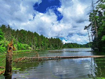
![]()
![]()
![]()
![]()
![]() On Sunday, June 7th, I asked Cindy if she wanted to go for a walk. She said "Yes" and I suggested we go for a hike that was a little farther from home. I suggested Morgan Hill State Forest and she agreed. I wanted to hike the eastern loop that goes by Shackham Pond and uses some dirt and gravel roads. Fortunately the heat wave had broken and the weather forecast was for sunny skies with highs only in the high 60's and much lower humidity. In fact, the temperature at 8:00 AM was 60 degrees and it seemed very comfortable. I remembered the directions to Morgan Hill and knew that the 130 mile trip would take a little over 2 hours. I wanted to get an early start but we seemed to be in slow motion as we ate breakfast and got ready. I got dressed in my White Sierra long-sleeved crew top with a short-sleeved baselayer. The shirt has an insect repellent built-in which I knew I would appreciate as I could not rule out a swarm on May flies. I put on a pair of RailRiders hiking pants which are expensive but last along time and have features like deep pockets and a generous cut which I really like. The pants have Velcro closures at the ankles but I also put on my OR Bugout gaiters. The ticks have not been very numerous so far this season but a little prevention is always best. I decided to wear my Vasque Taku hiking boots which are now my "go to" hiking boots but have been discontinued. I grabbed a pair of Leki external lock poles I have been using lately. I also added a new OR floppy hat which shields me from the sun and allows me to spray some insect repellant on it rather than on me. I took along a light OR windbreaker. Sheila in particular was anxious to get out as we had not hiked the day before. I packed two bottles of water and loaded my gear into my pack under the watchful eye of Sheila who is always near but not too near to be considered under foot. I put our gear in the car and Shea in the backseat an we finally pulled out of Livingston Manor just after 9:00 AM when the temperature was 62 degrees. The trip is pretty straightforward but I have not driven this far to hike in some time. I drove west and north on Route 17 to Binghamton and then north on I81 to exit 11. I turned right and headed north on Route 13 north which took us about 10 miles to Route 91 in Truxton. I turned left and after about 3.6 miles, right on Shackham Road in Morgan Hill State Forest. After about .5 miles, there is a pulloff at the side of the road where North Country Trail crosses but I knew this was the lower crossing so I continued to drive until I saw a large parking area on the right and a state forest sign on the left.
On Sunday, June 7th, I asked Cindy if she wanted to go for a walk. She said "Yes" and I suggested we go for a hike that was a little farther from home. I suggested Morgan Hill State Forest and she agreed. I wanted to hike the eastern loop that goes by Shackham Pond and uses some dirt and gravel roads. Fortunately the heat wave had broken and the weather forecast was for sunny skies with highs only in the high 60's and much lower humidity. In fact, the temperature at 8:00 AM was 60 degrees and it seemed very comfortable. I remembered the directions to Morgan Hill and knew that the 130 mile trip would take a little over 2 hours. I wanted to get an early start but we seemed to be in slow motion as we ate breakfast and got ready. I got dressed in my White Sierra long-sleeved crew top with a short-sleeved baselayer. The shirt has an insect repellent built-in which I knew I would appreciate as I could not rule out a swarm on May flies. I put on a pair of RailRiders hiking pants which are expensive but last along time and have features like deep pockets and a generous cut which I really like. The pants have Velcro closures at the ankles but I also put on my OR Bugout gaiters. The ticks have not been very numerous so far this season but a little prevention is always best. I decided to wear my Vasque Taku hiking boots which are now my "go to" hiking boots but have been discontinued. I grabbed a pair of Leki external lock poles I have been using lately. I also added a new OR floppy hat which shields me from the sun and allows me to spray some insect repellant on it rather than on me. I took along a light OR windbreaker. Sheila in particular was anxious to get out as we had not hiked the day before. I packed two bottles of water and loaded my gear into my pack under the watchful eye of Sheila who is always near but not too near to be considered under foot. I put our gear in the car and Shea in the backseat an we finally pulled out of Livingston Manor just after 9:00 AM when the temperature was 62 degrees. The trip is pretty straightforward but I have not driven this far to hike in some time. I drove west and north on Route 17 to Binghamton and then north on I81 to exit 11. I turned right and headed north on Route 13 north which took us about 10 miles to Route 91 in Truxton. I turned left and after about 3.6 miles, right on Shackham Road in Morgan Hill State Forest. After about .5 miles, there is a pulloff at the side of the road where North Country Trail crosses but I knew this was the lower crossing so I continued to drive until I saw a large parking area on the right and a state forest sign on the left.
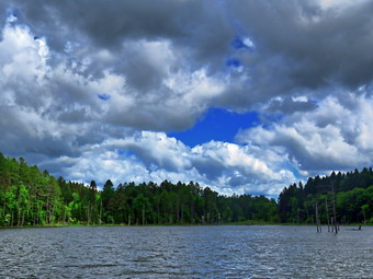 I drove a little farther up the road and within .5 miles found another pulloff on the right and signs for the North Country Trail. There were already a few cars parked at the side of the road. The North Country National Scenic Trail stretches approximately 4,600 miles from Crown Point on Lake Champlain in eastern New York to Lake Sakakawea State Park in central North Dakota in the United States. I parked the car at 11:20 AM and we were on the trail by 11:25 AM. Immediately I noticed signs that said "Hiker Warning: Flood Area Ahead" but without any more information. We headed east on the NCT and it was only a short distance to the shores of Shackham Pond. The pond was pretty and was surrounded by very green trees. The water was completely still and the trees and sky were reflected on the surface of the water. The skies had enormous, billowing, puffy white clouds! The beavers had been at work shoring up the dam that impounded water in the pond. I grabbed a pair of Leki external lock poles I have been using lately. I also added a new OR floppy hat which was another present from Cindy. I have decided it shields me from the sun and allows me to spray some insect repellant on it rather than on me. I did put on a pair of OR Bugout gaiters which are also insect resistant. I took along a light OR windbreaker. Sheila in particular was anxious to get out as we had only hiked 3 miles the day before. I took some pictures before we headed back to the main trail. Within a few hundred feet, the trail split and I stayed to the left to walk over a small hill and down to the shore. In a clearing we found the gravestones from the Hodgson family who once owned the property. I got my camera out and took a few more pictures. There was a group of people on the main trail on the dam but they were headed back out to the road. We walked out on the main trail to get a better view of the pond and I zoomed in on the Great Blue Heron nests on the far side of the pond. I was disappointed that the nests were not occupied. I took some more pictures of the pond before we moved on. There was a breeze blowing and I was actually a little cool. We passed across the top of the dam that creates the pond. At the end of the dam the trail was flooded by another beaver dam which explained the signs. We were easily able to work our way around this area and stay on the trail.
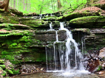 We resumed our hike by turning left heading north through mostly hardwood forest. We met one man walking toward us with one water bottle. We greeted each other as we passed. At about .7 miles we came to a well-maintained dirt road called Herlihy Road. At this point Cindy told me there was a light coming from my pack. My Mammut headlamp was lit and I could find no way to turn it off except to remove a battery. There was a small group of young hikers coming up behind us making quite a bit of noise. They crossed the road and continued north on the trail. I wanted to go in the same direction but Cindy suggested we turn right on the road. I pointed out that we would already be hiking a majority of the hike on roads but I knew it was useless to argue. We turned right on the dirt road and started walking northeast and uphill toward Morgan Hill Road. The dirt road connects Morgan Hill Road and Shackham Road and there was more traffic than I expected. Cars passed by us in both directions but Sheila stayed right by my side. We also encounters bikers and some other hikers. At 1.6 miles we came to Morgan Hill Road and turned sharply right to head south. The road also continued to the right but it is very rough and not easily traveled by vehicle. This is where we would have arrived if we had taken the trail. Walking on the road may not be excited but it is easy and the first part of it seemed pretty secluded. The road had been "paved" with rather large stones which tended to turn the ankle unless one paid close attention. It was almost like walking a woods road. We continued to meet cars coming in both directions and a few bikers and hikers. The day was beginning to get warmer especially since we were now walking in and out of the sunlight. A nice breeze helped keep us cool and the humidity was still low. From previous trips I knew that the hike on the road would be pretty long so I settled in and started to think about the beauty around me. At 4.2 miles Eaton Hill Road came in from the left and I knew it would be only a half mile or so until the trail would appear on the right. A car me toward us and stopped. An older couple was looking for a fire tower and a pond. I told them how to take Herlihy Road to Shackham Road to get to Shackham Pond. We continued on the road noticing the single track trails that paralleled and crossed the road in various places. At 4.25 miles the NCT came up on the right side of the road. We turned right into the forest and headed almost due east along a tributary of Shackham Brook. I started hiking quickly as the trail went downhill but had to wait for Cindy to catch up. We navigated a muddy section of trail on our way to a beautiful ravine. At 5.2 miles we walked down the trail into the ravine. The trail crossed the brook here but I could see a small waterfall just upstream but there was not enough water to bother visiting it this time.
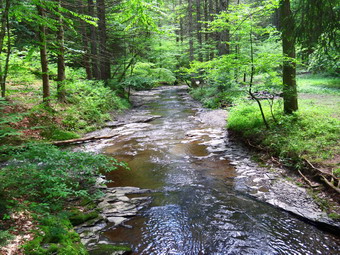 At 5.5 miles we came to a small cascade on a tributary to Shackham Brook. There wasn't much water but I stopped to take a few pictures. Sheila decided to race around running through the water and then back out. I got her to stay still for one picture. We moved on and met a couple with a dog coming toward us. I moved over to the side of the trail but they said they were turning around. The trail almost immediately met a woods road and followed it for some distance until the point where the trail turned to the right off the woods road and headed down. We started to walk parallel to the brook and I noticed several small waterfalls. At one point I saw a larger cascade and walked to the edge of the high bank. There were too many trees and too little water to make taking pictures worthwhile. We continued to walk parallel to the brook continuing on the trail toward Shackham Road. We met a few more people on the trail coming from the lower parking lot on the road and at least one had a dog. At 5.8 miles a nice footbridge crossed the stream and as I looked down I saw that the streambed was solid rock. Shackham Brook in this area flows for at least several hundred feet over solid bedrock. I took a few pictures of the stream and some of the bridge. There were two people waiting on the other side of the bridge so we crossed and worked our way up the steep bank and uphill Toward Shackham Road. It was a short walk to Shackham Road 5.9 miles into the hike at 2:20 PM. The car was still 1.5 miles up the road which is paved and mostly uphill! I would have continued on to Jones Hill and Tinker Falls but I knew Cindy was tired. Also, the falls are usually a disappointment unless there was been a recent, hard rainfall. I put Sheila on her leash as we turned right to start north and back to the car. As we walked, I saw a couple coming toward us with a beautiful German Shepherd. We stopped to talk for a few minutes and then continued in our separate directions. I was still feeling very good as Sheila and I set off heading north on Shackham Road at a good pace with Cindy keeping up. We were in the sunlight and walking uphill but the temperature was still only 66 degrees. The walk went quickly and we arrived back at the car at 2:55 PM after hiking 7.3 miles in 3.5 hours with an elevation gain of 950 feet. Despite over 20 minutes of stops we had averaged over 2 mph overall and 2.3 while moving.
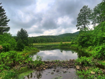
![]()
![]()
![]()
![]()
![]() On Friday, June 5th I wanted to get out for a longer hike after a week of poor weather. Cindy decided not to go so I thought about heading for Bear Spring to hike a loop. When I looked outside, it was very cloudy and looked like it might rain even though the forecast did not call for showers until evening. I decided to go to Frick Pond to do the Frick Pond to Hodge Pond loop on the Quick Lake and Flynn Trails which is a little over 6 miles. I started to get ready a little before 10:00 AM with Sheila watching my very move. The temperature was in the low 60's and I knew it would get warmer. I got dressed in my White Sierra long-sleeved crew top with a short-sleeved baselayer. The shirt has an insect repellent built-in which I knew I would appreciate as I anticipated a swarm on Mat flies. I put on a pair of RailRiders hiking pants which are expensive but last along time and have features like deep pockets and a generous cut which I really like. The pants have Velcro closures at the ankles to discourage sticks and gravel from getting into my shoes and also combat ticks. I decided to wear my Vasque Taku hiking boots which fit well and have been discontinued. I grabbed a pair of Leki external lock poles I have been using lately. I also added a new OR floppy hat which was another present from Cindy. I have decided it shields me from the sun and allows me to spray some insect repellant on it rather than on me. I did put on a pair of OR Bugout gaiters which are also insect resistant. I took along a light OR windbreaker. Sheila in particular was anxious to get out as we had only hiked 3 miles the day before. I put my gear in the back and Sheila in the backseat and drove out the Debruce Road about 6 miles. I turned left onto Mongaup Pond Road and continued to where the road split. I turned left onto Beech Mountain Road, and drove to the parking areas at the Frick Pond. There was only one car in the larger as I parked in the smaller one. No one was in sight as we got ready to hike. The thermometer read 70 degrees as I set my GPS. The skies were still overcast and there was a slight breeze. I did spray some insect repellant on my hat and hoped that would be enough to keep the insects away. At 10:35 AM we headed out the woods road to the Quick Lake Trail.
On Friday, June 5th I wanted to get out for a longer hike after a week of poor weather. Cindy decided not to go so I thought about heading for Bear Spring to hike a loop. When I looked outside, it was very cloudy and looked like it might rain even though the forecast did not call for showers until evening. I decided to go to Frick Pond to do the Frick Pond to Hodge Pond loop on the Quick Lake and Flynn Trails which is a little over 6 miles. I started to get ready a little before 10:00 AM with Sheila watching my very move. The temperature was in the low 60's and I knew it would get warmer. I got dressed in my White Sierra long-sleeved crew top with a short-sleeved baselayer. The shirt has an insect repellent built-in which I knew I would appreciate as I anticipated a swarm on Mat flies. I put on a pair of RailRiders hiking pants which are expensive but last along time and have features like deep pockets and a generous cut which I really like. The pants have Velcro closures at the ankles to discourage sticks and gravel from getting into my shoes and also combat ticks. I decided to wear my Vasque Taku hiking boots which fit well and have been discontinued. I grabbed a pair of Leki external lock poles I have been using lately. I also added a new OR floppy hat which was another present from Cindy. I have decided it shields me from the sun and allows me to spray some insect repellant on it rather than on me. I did put on a pair of OR Bugout gaiters which are also insect resistant. I took along a light OR windbreaker. Sheila in particular was anxious to get out as we had only hiked 3 miles the day before. I put my gear in the back and Sheila in the backseat and drove out the Debruce Road about 6 miles. I turned left onto Mongaup Pond Road and continued to where the road split. I turned left onto Beech Mountain Road, and drove to the parking areas at the Frick Pond. There was only one car in the larger as I parked in the smaller one. No one was in sight as we got ready to hike. The thermometer read 70 degrees as I set my GPS. The skies were still overcast and there was a slight breeze. I did spray some insect repellant on my hat and hoped that would be enough to keep the insects away. At 10:35 AM we headed out the woods road to the Quick Lake Trail.
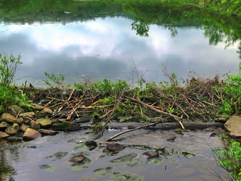 Once we passed the register on the Quick Lake Trail the trail was drier than it had been for some time. There are a few muddy spots but none of the running or standing water I had encountered on recent hikes. At Gravestone Junction, we turned left to stay on the Quick Lake Trail and head down to Frick Pond. This short piece of trail1 had been a mud pit but was now barely damp. We stopped at the bridge across the outlet to Frick Pond and I took some shots of the pond and Flynn's Point. I noticed that the beaver dam was being reconstructed and that the water level was rising. I hoped that no one would tear it down as has happened in the past. We didn't stay long and were soon walking along the west side of Frick Pond which was easier as there was so little water and mud. At the junction with the Big Rock Trail, we stayed to the left as we wanted to keep hiking the Quick Lake Trail. The first part of this section was dry and the next section was about the same with only a few damp areas. We entered the evergreen tunnel where the trail continued to be in good shape. When we came to the small stream across the trail, we found that the water level was low enough that we could simply walk across it on some stones. We continued to push toward Iron Wheel Junction but were hampered by having to take detours around muddy areas on the trail. This was by far the wettest spot we had so far encountered. As we walked along the trail, I heard a noise to the right and Sheila alerted. I did not immediately recognize the sound until I heard it again and saw the owl fly off to another tree. We reached Iron Wheel junction at 11:15 AM after hiking 1.5 miles.
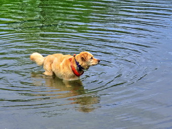 We turned left at the junction to stay on the Quick Lake Trail and head for Junkyard Junction and the Flynn Trail. The temperature had warmed up a few degrees but there was a breeze at times. The breeze kept us cool and drove away some of the flies. I noticed that I could see blue sky with white clouds instead of the overcast that had been present. The next mile of trail is all uphill and the grade only averages around 8%. At times this can seem like a long slog but on this day it seemed to go quickly. I attributed this to the fact that I had many things on my mind and was often lost in thought. We hit the flatter ground and started downhill toward Junkyard Junction where we arrived at noon after hiking 3.1 miles. We turned right to start out on the Flynn Trail and almost immediately I noticed that the trail was much drier than it had been in several trips. This trail is often wet as it is fairly flat and lower than much of the surrounding ground. By this time my feet were getting wet which was an uncomfortable feeling even though it was a warm day. We worked our way along the trail until we got to the gate which separates the state land from the Open Spaces Institute land around Hodge Pond. We continued on the Flynn Trail by turning right and following the trail downhill to an area near the shore of Hodge Pond. It is possible to turn in either direction at this point and I chose right to stay on the Flynn Trail. This part of the trail was also drier than usual and we made good time as we headed toward the outlet end of Hodge Pond. We walked through a field where the dining hall had been for the Beech Mountain Boy Scout Camp and then walked through a short stretch of woods to the clearing at the south end of Hodge Pond. Sheila and I walked to the shore of the pond where I dropped my pack to get out my camera. By this time the sky was blue with white clouds and I took pictures of the beautiful scene. Sheila was in and out of the water so I took some pictures of her. When we were done, I packed up and we headed to the point where the Flynn Trail entered the woods. We began the walk up the hill on the Flynn Trail which was the last climb before the long downhill back to the car.
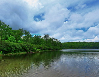 The walk up this hill often seems tedious but on this day it went quickly and we were soon at the top of the hill. I was pretty sure the rest of the trail would also be dry and that seemed to be the case. We walked along the flat trail under the trees passing through the other gate and arriving at the junction with the Big Rock trail at 12:45 PM after hiking 4.7 miles. We continued straight ahead on the Flynn Trail setting a fast pace over the flat part of the trail before starting the downhill. I much prefer walking up the Flynn Trail but like to vary the route from time to time. In any case the 1.7 miles back to the parking area can be slow as there is not much to see. We reached the spot where there is an interesting to the left of the trail but we had been there recently and stayed on the main trail. We continued on the trail and soon were passing through the tunnel we had cut in a large spruce tree that had fallen across the trail. We turned left on the trail to avoid the private property around the cabin. As we neared the end of the trail, I looked up to see a large dog coming toward us. Both the dog and Sheila seemed to want to meet but the other owner and I both restrained our dogs. She took her dog off the trail and we spoke briefly as Sheila and I passed. She said she was about to do the loop we had just completed but in the opposite direction. When we got back to the parking area, the only vehicle was a truck with a DEC symbol on the door indicating the other hiker probably worked at one of the campgrounds. It was 1:25 PM when we got back to the car after hiking 6.3 miles in 2 hours and 50 minutes with an elevation gain of 900 feet. We had maintain an overall speed of 2.3 mph. The temperature was 72 degrees and we were both ready to go home.
![]()
![]()
![]()
![]() On Thursday, June 4th, I wanted to get in a hike close to home after several morning commitments. I had men's Bible study at the church at 6:15 AM and Cindy had one at 10:30 AM. When I arrived home, I did some chores around the house knowing that I had a science department meeting online at 3:00 PM. Cindy did say she wanted to take a short walk so I waited until she was done with her class around noon. We decided to just go to Parksville and hike the rail trail even though it is under three miles out and back. By the time we started to get ready at 12:30 PM, the temperature was 70 degrees. I got dressed in a long-sleeved White Sierra crew top without any baselayer. The White Sierra top has InsectShield which helps keep the insects away. I put on a pair of RailRiders hiking pants which are expensive but last along time and have features like deep pockets and a generous cut which I really like. These pants do not have the Velcro closures at the ankles which some models have to dissuade ticks but I would be on trails the whole time. I decided to wear my Keen Targhee II hiking boots which fit well and have been discontinued. I grabbed a pair of Leki external lock poles I have been using lately. We put our gear in the back of the car and Sheila in the back seat. We left Livingston Manor at 12:50 PM and drove out Old Route 17 toward Parksville. Just after Fox Mountain Road, I pulled into the parking area on the right side of the road at 1:00 PM. One car was parked in the lot and as we began to get ready two women were returning to the car. They happened to be from Livingston Manor and we talked to them for a few minutes. I set my GPS and we started out on the trail at 1:08 PM.
On Thursday, June 4th, I wanted to get in a hike close to home after several morning commitments. I had men's Bible study at the church at 6:15 AM and Cindy had one at 10:30 AM. When I arrived home, I did some chores around the house knowing that I had a science department meeting online at 3:00 PM. Cindy did say she wanted to take a short walk so I waited until she was done with her class around noon. We decided to just go to Parksville and hike the rail trail even though it is under three miles out and back. By the time we started to get ready at 12:30 PM, the temperature was 70 degrees. I got dressed in a long-sleeved White Sierra crew top without any baselayer. The White Sierra top has InsectShield which helps keep the insects away. I put on a pair of RailRiders hiking pants which are expensive but last along time and have features like deep pockets and a generous cut which I really like. These pants do not have the Velcro closures at the ankles which some models have to dissuade ticks but I would be on trails the whole time. I decided to wear my Keen Targhee II hiking boots which fit well and have been discontinued. I grabbed a pair of Leki external lock poles I have been using lately. We put our gear in the back of the car and Sheila in the back seat. We left Livingston Manor at 12:50 PM and drove out Old Route 17 toward Parksville. Just after Fox Mountain Road, I pulled into the parking area on the right side of the road at 1:00 PM. One car was parked in the lot and as we began to get ready two women were returning to the car. They happened to be from Livingston Manor and we talked to them for a few minutes. I set my GPS and we started out on the trail at 1:08 PM.
In the direct sunlight it felt like the temperature was over 80 degrees! Once we were on the trail and sheltered by the trees it was a little cooler but still warm. The trail alternated between mostly dry areas and with only a few muddy ones. The trail was in about the same shape as when we hiked it in May. It was obvious someone had been in to clear some blowdowns and install new picnic tables and benches. I decided not to take pictures as nothing had changed too much since March when I had taking quite a few shots. The day was sunny and the sky was very blue. We passed several benches placed for people to rest in warmer weather. As we walked, I could hear an increase in the noise from the stream and I knew the falls was just ahead. We stopped briefly to look at the falls which had a good amount of water passing over it. Soon we were nearing the Parksville end of the trail and a group of eight hikers came toward us. Some were adults and some were teens and they seemed to be keeping a pretty good pace. We passed many rundown and dilapidated buildings on the left side of the trail and it seemed that many were being clean up. On the Parksville end of the trail we found a small garden and a very informative sign. The sign listed the businesses and hotels that existed in Parksville during its heyday. The Young's Gap Hotel had room for 600 guests! The sign also explained the role of the railroad in the dairy industry which was a thriving one in all of Sullivan County. After a brief pause, we decided to walk back on the trail as it was in such good shape. The return trip was uneventful until we came to the last third where we could see the group of hikers ahead of us. As we arrived in the parking lot, the group was there and stopped us to ask about other railtrails and hikes in the area. I gave them some ideas but it seemed they were from out of the area as they did not know the names of many places. We were back at the car at 2:04 PM after hiking 2.5 miles in 56 minutes. Our moving average was 2.7 mph and the elevation gain was 230 feet which I doubted.
![]()
![]()
![]()
![]() On Tuesday, June 2nd I was ready to get out for my first hike of the month of June. I had planned for some time to hike Ashokan High Point but each time my plans were interrupted. This day was not different as the ambulance pager sounded as I was beginning to get ready. Once I returned home, I had some work to do which did not bother me as it was raining. By 1:00 PM the rain had stopped and I was ready to go hike across the street on Round Top. The temperature was just 60 degrees as I began to get dressed. Sheila began barking and running around frantically even though we had been hiking regularly. I got dressed in a long-sleeved White Sierra crew top without any baselayer. The White Sierra top has InsectShield which helps keep the insects away. I put on a pair of RailRiders hiking pants which are expensive but last along time and have features like deep pockets and a generous cut which I really like. These pants do not have the Velcro closures at the ankles which some models have to dissuade ticks but I would be on trails the whole time. I decided to wear my Keen Targhee II hiking boots which fit well and have been discontinued. I grabbed a pair of Leki external lock poles I have been using lately. At 1:35 PM, we stepped out of the house and I grabbed Sheila's leash from the car. We walked up the driveway and across the street. I decided we would try to do four figure 8's to make up for the lack of hiking due to the predicted rain and thunderstorms. We walked to the parking area by the Presbyterian Church and to the back of the church. We began the ascent of the steepest hill behind the church. The hill is short but gets the circulation pumping and is the steepest and longest climb on the "trail." Sheila helped me along by pulling me up the hill. When we got to the top of the hill, I stopped to look around at the hills around town. We started on the trail by turning left at the trailhead. I let Sheila off her leash so that she could explore. The trail bed is becoming worn it which means that at least a few people are using the trail. I am always happy to see that someone else uses the trails.
On Tuesday, June 2nd I was ready to get out for my first hike of the month of June. I had planned for some time to hike Ashokan High Point but each time my plans were interrupted. This day was not different as the ambulance pager sounded as I was beginning to get ready. Once I returned home, I had some work to do which did not bother me as it was raining. By 1:00 PM the rain had stopped and I was ready to go hike across the street on Round Top. The temperature was just 60 degrees as I began to get dressed. Sheila began barking and running around frantically even though we had been hiking regularly. I got dressed in a long-sleeved White Sierra crew top without any baselayer. The White Sierra top has InsectShield which helps keep the insects away. I put on a pair of RailRiders hiking pants which are expensive but last along time and have features like deep pockets and a generous cut which I really like. These pants do not have the Velcro closures at the ankles which some models have to dissuade ticks but I would be on trails the whole time. I decided to wear my Keen Targhee II hiking boots which fit well and have been discontinued. I grabbed a pair of Leki external lock poles I have been using lately. At 1:35 PM, we stepped out of the house and I grabbed Sheila's leash from the car. We walked up the driveway and across the street. I decided we would try to do four figure 8's to make up for the lack of hiking due to the predicted rain and thunderstorms. We walked to the parking area by the Presbyterian Church and to the back of the church. We began the ascent of the steepest hill behind the church. The hill is short but gets the circulation pumping and is the steepest and longest climb on the "trail." Sheila helped me along by pulling me up the hill. When we got to the top of the hill, I stopped to look around at the hills around town. We started on the trail by turning left at the trailhead. I let Sheila off her leash so that she could explore. The trail bed is becoming worn it which means that at least a few people are using the trail. I am always happy to see that someone else uses the trails.
At the first trail junction, I followed Sheila as she turned right on the woods road which is the shallower approach to the trail system. We continued to follow the yellow trail to the first junction where we turned left and followed it to the next trail junction. The trails were completely dry with no mud. I set a slower pace than usual so that I could just enjoy the walk. At the second junction with the blue trail, we turned right and started up the steep blue trail that leads over the summit of Round Top. Walking uphill we passed through a sea of green brought on by the warm weather and frequent rain showers. We walked across the flat summit of Round Top and started down the other side. I had not been out to trim the trail except for one trip to remove a tree leaning over the trail. Soon we were back at the yellow trail. We turned right and walked the yellow trail to the next trail junction. This time we turned left and followed the yellow trail downhill toward the lookout. There wasn't much to see from the viewpoint. We followed the yellow trail as it turned left and descended the hill to the first trail junction. The walk had gone quickly, so we turned around and started back up the hill back to the lookout. Sometimes Sheila resists another loop but this time she had no objection. We followed the yellow trail uphill toward the lookout and turned right to continue up to the next trail junction with the blue trail. At the trail junction, we turned right to stay on the yellow trail. At the next junction we turned left to climb the shallower side of the summit ascent. We again walked across the flat summit and descended the steeper trail. At the trail junction, we turned left and followed the yellow trail along the base of Round Top. At the next junction we turned right this time to follow the trail down to the woods road that leads out to the first trail junction. We completed the figure 8 ending up back at the very first trail junction. I was still fresh and even though repeated figure 8's are a little boring. I decided to head up the woods road and repeat the first figure 8. Sheila only hesitated for a moment before bounding ahead of me. We completed the route and then turned around and did another one. After the fourth figure 8, we headed out toward the trailhead. As we approached the trailhead, I put Sheila on her leash as we walked out to the cemetery. Sheila and I walked down the hill and through the church parking lot to the road and to our driveway. It was 3:25 PM and we had hiked around 4 miles in about an hour and 50 minutes.
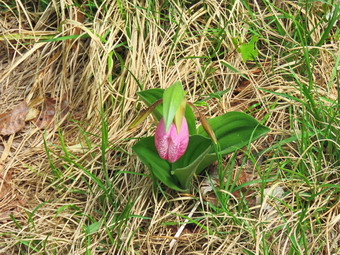
![]()
![]()
![]()
![]()
![]() The trail in this area are not always well marked and there are many logging roads and informal paths. I suggest you print out the map you find here. The description and distances given here are based on an actual hike. A corrected version of this without the extra explorations can be found in the "trails" section of this website.
On Sunday, May 31st I planned to get out of my normal local hiking area and head north to southwestern Schoharie County to Clapper Hollow just north of Jefferson. I was pretty sure there wouldn't be many people and that social distancing would not be a problem. I have been very good about "Hike Locally" but I just felt I had to stretch the limits some. I asked Cindy I she wanted to go since I was pretty sure the area was interesting but had not big hills. She said she would like to go along. The weather forecast was for temperature that would not break 60 degrees and low humidity which would make hiking more comfortable. I knew that this also meant the insects would be under control. When I got up in the morning, the temperature was in the mid 40's but it began to rise so that is was in the low 50's at 8:15 AM when I began to get ready. Sheila watched me very closely as I got dressed which always surprises me since I never go hiking without her. I got dressed in a long-sleeved White Sierra crew top with a short-sleeved baselayer. The White Sierra top has InsectShield which helps keep the May flies away. I put on a pair of RailRiders hiking pants which are expensive but last along time and have features like deep pockets and a generous cut which I really like. These pants do not have the Velcro closures at the ankles which some models have to dissuade ticks so I added my OR Bugout gaiters which are treated to repel insects. I have not seen many ticks this season but I know they are out there. I decided to wear my Vasque Taku hiking boots which fit well and have been discontinued. I wore an OR floppy hat. I like the hat as it shades me from the sun and allows me to spray insect repellant on it rather than on me. I also put on a light windbreaker since I knew I could remove it and stow it at any time. We got our gear and Sheila in the car and headed north on State Route 17 at 9:00 AM. I got off at exit 94 for Roscoe and headed north in Route 206 toward Downsville. Just passed the traffic light in Downsville, I turned right on Telford Hollow Road and followed it over the mountain to Route 10. I turned right and headed north on Route 10 passing through Delhi, Bloomville, South Kortright, Hobart and Stamford. When we reached Jefferson, I turned right to stay on Route 10. A little more than 2 miles out of town, I turned left on Route 15 and immediately right on Clapper Hollow Road. In a little less than a mile we came to the parking area on the right side of the road. When I pulled in at 10:40 Am there was only one other car. I was surprised to see that the sign read "Clapper Hollow Nordic Ski Trails" which was a first for me. I set my electronics and we started out on the trail at 10:50 AM.
The trail in this area are not always well marked and there are many logging roads and informal paths. I suggest you print out the map you find here. The description and distances given here are based on an actual hike. A corrected version of this without the extra explorations can be found in the "trails" section of this website.
On Sunday, May 31st I planned to get out of my normal local hiking area and head north to southwestern Schoharie County to Clapper Hollow just north of Jefferson. I was pretty sure there wouldn't be many people and that social distancing would not be a problem. I have been very good about "Hike Locally" but I just felt I had to stretch the limits some. I asked Cindy I she wanted to go since I was pretty sure the area was interesting but had not big hills. She said she would like to go along. The weather forecast was for temperature that would not break 60 degrees and low humidity which would make hiking more comfortable. I knew that this also meant the insects would be under control. When I got up in the morning, the temperature was in the mid 40's but it began to rise so that is was in the low 50's at 8:15 AM when I began to get ready. Sheila watched me very closely as I got dressed which always surprises me since I never go hiking without her. I got dressed in a long-sleeved White Sierra crew top with a short-sleeved baselayer. The White Sierra top has InsectShield which helps keep the May flies away. I put on a pair of RailRiders hiking pants which are expensive but last along time and have features like deep pockets and a generous cut which I really like. These pants do not have the Velcro closures at the ankles which some models have to dissuade ticks so I added my OR Bugout gaiters which are treated to repel insects. I have not seen many ticks this season but I know they are out there. I decided to wear my Vasque Taku hiking boots which fit well and have been discontinued. I wore an OR floppy hat. I like the hat as it shades me from the sun and allows me to spray insect repellant on it rather than on me. I also put on a light windbreaker since I knew I could remove it and stow it at any time. We got our gear and Sheila in the car and headed north on State Route 17 at 9:00 AM. I got off at exit 94 for Roscoe and headed north in Route 206 toward Downsville. Just passed the traffic light in Downsville, I turned right on Telford Hollow Road and followed it over the mountain to Route 10. I turned right and headed north on Route 10 passing through Delhi, Bloomville, South Kortright, Hobart and Stamford. When we reached Jefferson, I turned right to stay on Route 10. A little more than 2 miles out of town, I turned left on Route 15 and immediately right on Clapper Hollow Road. In a little less than a mile we came to the parking area on the right side of the road. When I pulled in at 10:40 Am there was only one other car. I was surprised to see that the sign read "Clapper Hollow Nordic Ski Trails" which was a first for me. I set my electronics and we started out on the trail at 10:50 AM.
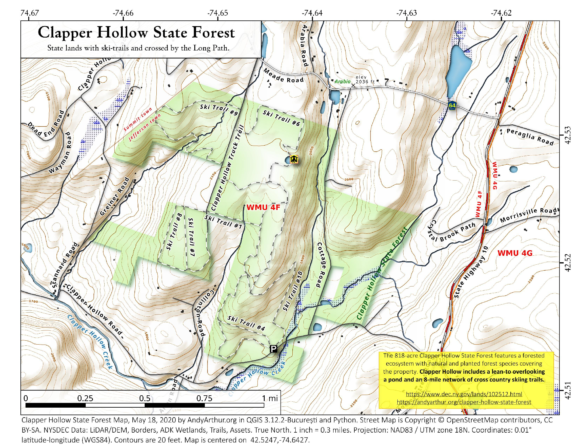
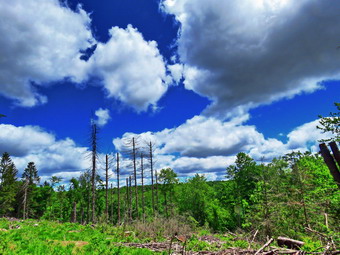 The trail we started out on was wide and generally "smooth" and dry. The signs designated it as Trail 4. Within a very short distance a trail seemed to go off to the right but it was not marked and was not well maintained. I was pretty sure this might be marked Trail 10 on the map but we continued on the trail we were on. The trail ascended through a hardwood forest and then started to descended. At .4 miles we came to a trail junction where we turned right or north on Trail 1. At .75 miles we came to another junction and, after inspecting some blazes, we decided to turn left to stay on Trail 1. Trying to follow the blazes proved fruitless as there were so few of them and because they eventually just stopped. We retraced our steps back to the previous junction where we got on Trail 3 heading east. (I thought our exploration on Trail 1 was taking us west but I was not paying attention and we had looped around to head east!) This was interesting as there was no Trail 3 marked on the map! Within a short distance we came to a junction with Trail 5. I really wanted to see the lean-to and pond that someone had mentioned was really beautiful. After consulting the map and my GPS, we decided to turn left and head north on Trail 5. This trail climbed continuously but gently for the next .8 miles through mixed hardwood and evergreen forests. The trail were generally wide and mostly dry which made the hiking easy. As we were hiking, I looked down at the trail and saw a lady slipper. I don't often see these so I steered Sheila away from it and too a picture. I then noticed that there were several more in the shade off the trail and I took some shots of them. We continued along the trail and at about 1.75 miles I saw a deer ahead in a clear cut and warned Sheila not to follow. We broke out into the clear cut and I got out my camera to take pictures. The sky was very blue with white clouds and the green leaves on the trees. These were in stark contrast to the clear cut which had a few dead trees pointing up toward the sky. After the clear cut, the trail passed through some nice evergreens and I took the opportunity to walk to another cut and take a few more pictures. Soon the Trail 5 brought us to another junction. I had the feeling we should turn right on Trail 6 and when I consulted the GPS it seemed I was right. We turned right on Trail 6 and followed it as it wound through the woods.
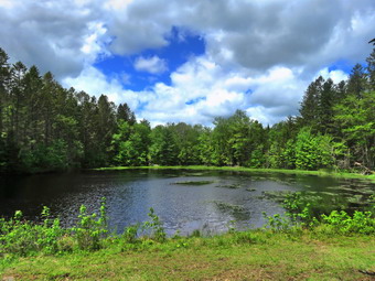 A short distance in the trail made a sharp right and it seemed to be taking too long to get to the pond. I began to doubt myself and then saw water through the trees on the left of the trail. We continued along the trail, made a sharp left and almost immediately saw the pond and the lean-to. We walked across a small bridge to the lean-to. I put down my pack and got out the camera to take pictures of Sheila in the pond and the lean-to. The lean-to had a tree down across its roof but looked none the worse for wear. I took pictures of the pond with a blue sky and clouds in the background. It was soon time to move on as I wanted to do a loop which included two more trails on the extreme northern end of this area. We left the lean-to heading away and first east then north. A logging road headed west but we followed the trail as it headed north. At 2.7 miles it turned northwest and then at 3 miles it turned southwest. Parts of this section of the trail were very wet and we had to walk on the sides to avoid getting wet. At 3.1 miles I realized we had not seen a trail marker and were starting to head east rather than west. We backtracked and found the spot where the trail headed west out to a truck road. I wanted to head north and hike Trail 9 but Cindy was getting tired and the clouds were getting dark. We turned left or south on the truck road and walked .3 miles to the junction with Trail 5. Unfortunately the truck road comes in from the north and dead ends shortly after this junction. We trend left and headed east on Trail 5 for .3 miles back to the junction where we had taken Trail 6 earlier. We turned right and started to retrace our route back the way we had come. I wanted to try taking Trail 2 south as is paralleled trail 5 but I missed the turn. As we approached the clear cut, I looked up to see four hikers approaching. I put Sheila on her leash as we met the four local teens who were hiking to the pond. They were very polite and I was glad to see them out hiking. We continued to walk south passing the junction where we had picked up Trail 5 earlier. At 4.7 miles we came to the junction with Trail 10 that heads back up the ridge and the drops quickly back down to an area near the parking lot. I knew Cindy would not want any "up" so I continued straight ahead on an informal path toward trail 1. At 4.9 miles we actually crossed one section of Trail 1 but I missed the turn and we continued straight ahead to do the bottom loop of the trail. This section of trail was in good shape with a few damp spots. It headed south and then east for a total of .6 miles to the parking area. We were back at the car at 2:00 PM having hiked 5.5 miles in 3 hours and 15 minutes with an elevation gain of 555 feet.
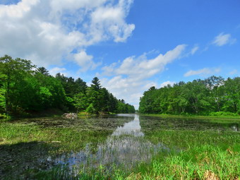
![]()
![]()
![]()
![]()
![]() On Friday, May 29th we got a text from Karl inviting us to go to Bethel to hike near Lake Superior with his family. Cindy and I wanted to hike and wanted to see our grandchildren so we readily agreed. We decided to meet at their house at 1:00 PM and then decide on the hike. We began to get my gear together at 12:15 PM which made Sheila watch me very closely. I got dressed in a long-sleeved White Sierra crew top with a short-sleeved baselayer. The White Sierra top has InsectShield which helps keep the May flies away. It was 70 degrees but I thought the long sleeves might dissuade the mosquitoes. I put on a pair of RailRiders hiking pants which are expensive but last along time and have features like deep pockets and a generous cut which I really like. These pants have Velcro closures at the ankles which dissuade ticks but I added my OR Bugout gaiters which also are treated to repel insects. I have not seen many ticks this season but I know they are out there. I decided to wear my Vasque Taku hiking boots which fit well and have been discontinued. I wore an OR floppy hat. I like the hat as it shades me from the sun and allows me to spray insect repellant on it rather than on me. We got our gear and Sheila in the car and headed out over Dahlia Road to White Sulphur Springs. From there we took the back roads through the Woodstock site to Route 17B. I took a left on 17B and then a right on Dr. Duggan Road. We arrived at Karl's house at 1:00 PM. Karl and the grandchildren came out to meet us and we said "Hello" keeping our distance. We decided to drive to a parking lot to begin our hike. We parked on Dr. Duggan Road by a small pond at 1:10 PM. I set by GPS and we started out by hiking over to the pond where I took a few pictures. The sun was out and the temperature was now 82 degrees with palpable humidity. The sky was blue with billowing white clouds. The forecast was for thunderstorms by 5:00 PM but I knew we would be finished hiking by then. We hiked up over a hill and through a field to Indian Field Road. Taking a right on the road we headed toward Indian Field. Just before the club's POSTED signs began on the right we turned onto a woods road which is the boundary between the club's private and the Lake Superior State Park. The Rocky Run Road is part of the old Newburgh-Cochecton Turnpike and we hiked it extensively when I was growing up on Dr. Duggan Road. The turnpike ran from Newburgh on the Hudson River to Cochecton on the Delaware River. The woods road was very prominent and showed traces of tracks. I remembered many of the twists and turns and the ridges that line the road in places. After about two miles, we came to the end of the public property. The woods road continues to meet Pucky Huddle Road but I did not want to walk across the private land.
On Friday, May 29th we got a text from Karl inviting us to go to Bethel to hike near Lake Superior with his family. Cindy and I wanted to hike and wanted to see our grandchildren so we readily agreed. We decided to meet at their house at 1:00 PM and then decide on the hike. We began to get my gear together at 12:15 PM which made Sheila watch me very closely. I got dressed in a long-sleeved White Sierra crew top with a short-sleeved baselayer. The White Sierra top has InsectShield which helps keep the May flies away. It was 70 degrees but I thought the long sleeves might dissuade the mosquitoes. I put on a pair of RailRiders hiking pants which are expensive but last along time and have features like deep pockets and a generous cut which I really like. These pants have Velcro closures at the ankles which dissuade ticks but I added my OR Bugout gaiters which also are treated to repel insects. I have not seen many ticks this season but I know they are out there. I decided to wear my Vasque Taku hiking boots which fit well and have been discontinued. I wore an OR floppy hat. I like the hat as it shades me from the sun and allows me to spray insect repellant on it rather than on me. We got our gear and Sheila in the car and headed out over Dahlia Road to White Sulphur Springs. From there we took the back roads through the Woodstock site to Route 17B. I took a left on 17B and then a right on Dr. Duggan Road. We arrived at Karl's house at 1:00 PM. Karl and the grandchildren came out to meet us and we said "Hello" keeping our distance. We decided to drive to a parking lot to begin our hike. We parked on Dr. Duggan Road by a small pond at 1:10 PM. I set by GPS and we started out by hiking over to the pond where I took a few pictures. The sun was out and the temperature was now 82 degrees with palpable humidity. The sky was blue with billowing white clouds. The forecast was for thunderstorms by 5:00 PM but I knew we would be finished hiking by then. We hiked up over a hill and through a field to Indian Field Road. Taking a right on the road we headed toward Indian Field. Just before the club's POSTED signs began on the right we turned onto a woods road which is the boundary between the club's private and the Lake Superior State Park. The Rocky Run Road is part of the old Newburgh-Cochecton Turnpike and we hiked it extensively when I was growing up on Dr. Duggan Road. The turnpike ran from Newburgh on the Hudson River to Cochecton on the Delaware River. The woods road was very prominent and showed traces of tracks. I remembered many of the twists and turns and the ridges that line the road in places. After about two miles, we came to the end of the public property. The woods road continues to meet Pucky Huddle Road but I did not want to walk across the private land.
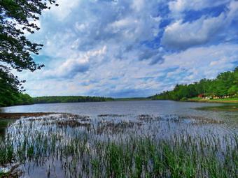 We turned around and began to walk back along the trail for about .8 miles where the trail came closest to the lake. We turned left and began a .3 mile bushwhack to the shore of the lake. We walked through some thick laurel and some equally thick brush until we finally descended to the shore of the lake. Sheila immediately dove into the lake with the children close behind. I dropped my pack. Got out the camera and began to take some pictures of Sheila in the water and some of the lake and sky. We spent some time in these pursuits and then moved on to walk along the lakeshore. The problem with hiking along the shore of the lake is that there are thick stands of laurel which are hard to push through. We would hike along the shore and then head away from the shore when confronted with the laurel. Several times we walked down to the shore to take pictures. The sky continued to be blue with magnificent, billowing clouds. Several spots along the shore looked like small campsites and I suspect people access these areas by boat. The closer we got to the outlet end of the lake the more prominent the path became. At the outlet I walked to the marshy land that separates the lake from the outlet stream. I took pictures of the lake spread out before me and a few down the stream. I also took a few shots of the beach area where a few people were walking. We continued to follow the small "stream" that connects the lake to the small pond where we had parked. This all brought back a lot of memories since my friends and I crossed and recrossed this area so many years ago. We ran across the large ant hills that I remembered. There were over two dozen of them with the largest being 4 feet in diameter and more than a foot high! As we approached the pond, the group separated from me as I wanted to move slowly and reminisce. I chose to take the "low road" and hike as near the shore as possible. There is also a path higher up that walks along the ridge above the pond. I stopped to take pictures of the pond and the dam at the outlet end. I met the rest of the family at a picnic table. We walked back to our vehicles arriving at 4:10 PM covering the 4.4 mile hike in 3 hours with an elevation gain of 355 feet.
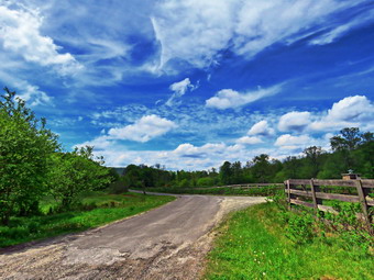
![]()
![]()
![]()
![]()
![]() On Wednesday, May 27th, I had planned to hike to Ashokan High Point as I had not been there for some time. When I mentioned this to Cindy, she said she would like to hike but I knew she would probably not be able to do the whole High Point hike especially since the temperature was supposed to reach into the high 70's. I suggested we stay even closer to home and Long Pond was the only place I had not been recently. When I got up at 8:00 AM, the temperature was already 70 degrees. I thought we should get ready to go immediately but then the ambulance pager sounded. I went on the call and returned around 10:00 AM. The temperature on the back porch read 86 degrees and Cindy took that as a reason to stay home. I knew the temperature was only 76 degrees but I also knew enough not to try to convince Cindy to go. Sheila could see I was getting ready to go and was finding it hard to contain her enthusiasm. I put on only a light short-sleeved crew top as the temperature was so warm but put a on a light baselayer also since it prevents my pack from irritating my back. I put on a pair of RailRiders hiking pants which are expensive but last along time and have features like deep pockets and a generous cut which I really like. The pants lack the Velcro closures at the ankles which some models have but I added my OR Bugout gaiters which are treated to repel insects. I have not seen many ticks this season but I know they are out there. I decided to wear my Vasque Taku hiking boots which fit well and have been discontinued. I also wore my OR floppy hat as it shades me from the sun and allows me to spray insect repellant on it rather than on me. I grabbed a pair of Leki external lock poles I have been using lately. At 10:35 AM I drove out the DeBruce Road and through Willowemoc to the Flugertown Road. I turned left and drove to the first parking area on the right. The temperature was 78 degrees when I got out of the car and I could feel that the humidity was rather high. As I was getting ready to hike, Sheila ran around the parking lot. A pickup pulled up at the side of the road opposite the parking lot and then two more cars joined it. I could not understand why they did not pull into the lot! I got my gear out of the car and set my electronics. I put Sheila on her leash and we left the parking area to start up Flugertown Road at 11:05 AM.
On Wednesday, May 27th, I had planned to hike to Ashokan High Point as I had not been there for some time. When I mentioned this to Cindy, she said she would like to hike but I knew she would probably not be able to do the whole High Point hike especially since the temperature was supposed to reach into the high 70's. I suggested we stay even closer to home and Long Pond was the only place I had not been recently. When I got up at 8:00 AM, the temperature was already 70 degrees. I thought we should get ready to go immediately but then the ambulance pager sounded. I went on the call and returned around 10:00 AM. The temperature on the back porch read 86 degrees and Cindy took that as a reason to stay home. I knew the temperature was only 76 degrees but I also knew enough not to try to convince Cindy to go. Sheila could see I was getting ready to go and was finding it hard to contain her enthusiasm. I put on only a light short-sleeved crew top as the temperature was so warm but put a on a light baselayer also since it prevents my pack from irritating my back. I put on a pair of RailRiders hiking pants which are expensive but last along time and have features like deep pockets and a generous cut which I really like. The pants lack the Velcro closures at the ankles which some models have but I added my OR Bugout gaiters which are treated to repel insects. I have not seen many ticks this season but I know they are out there. I decided to wear my Vasque Taku hiking boots which fit well and have been discontinued. I also wore my OR floppy hat as it shades me from the sun and allows me to spray insect repellant on it rather than on me. I grabbed a pair of Leki external lock poles I have been using lately. At 10:35 AM I drove out the DeBruce Road and through Willowemoc to the Flugertown Road. I turned left and drove to the first parking area on the right. The temperature was 78 degrees when I got out of the car and I could feel that the humidity was rather high. As I was getting ready to hike, Sheila ran around the parking lot. A pickup pulled up at the side of the road opposite the parking lot and then two more cars joined it. I could not understand why they did not pull into the lot! I got my gear out of the car and set my electronics. I put Sheila on her leash and we left the parking area to start up Flugertown Road at 11:05 AM.
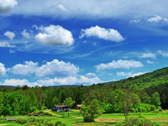 Everything was very green with blue skies and many puffy white clouds. The first part of the hike is virtually flat but then starts to climb very gently for some distance. The first .5 miles follows the paved portion of Flugertown Road. At the end of the paved portion, I stopped to take a few pictures of the countryside before moving on. Once we were on the unpaved, dirt road, I released Sheila from her leash as I felt the chance of meeting a vehicle was minimal. Sheila was good about staying on the road but she kept wandering to the other side to look at the stream. The road was shaded by the trees making it a little cooler than the road walk. It seemed to be getting warmer as we kept up a very fast pace passing the first trail junction and the informal campsites along the way. At the first set of campsites a few young people were gathered around their tents. We continued on to the point where Flugertown Road turns into Basily Road and heads over a small hill and down to the Peters Hunting Club. We stopped at the top of the hill where I dropped my pack and got out the camera. The bucolic scene was beautiful with the green leaves popping out fresh on the trees overhung by the blue sky. After taking some shots, I Packed up and we continued on the road toward the bunting camp. The hunting club has a private bridge over the creek and at one point denied access to hikers. The bridge is now open and the snowmobile trail passes over it so I have hiked it many times. The camp has also repaired some boards that were missing on the bridge. There was no one at the cabin as we continued across the bridge. It was noon and we had hiked 2.5 miles. We crossed the outlet to the beaver pond by walking on the small footbridge due to the fact that the road was flooded from the overflow of the beaver pond. The dam was well-constructed and sturdy but did not show much new work. From that point the road began to ascend slightly but we increased our efforts to keep up the pace. This part of the road was wetter than th rest had been so far. The water and mud on the road seemed to bring out the mosquitoes. I decided to simply keep walking rather than to stop on put on insect repellant. The skies were blue with some clouds and it was definitely warmer than when we had left the car.
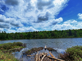 We came to the split in the road at 3.2 miles where Basily Road heads to the left and continues out to Wild Meadow Road. I realized that I had not been that way in some time but that it would require two cars to make that hike. We stayed to the right and soon were approaching the point were we would turn right onto the trail back to Long Pond. We made the right turn and started to hike back on the snowmobile trail. I was surprised that the gate on the trail was wide open! Parts of the trail were both wet and muddy which I found strange since the rest of the trail was so dry. There were also tire tracks but I could not tell how old they were. We walked along the trail ands Sheila did a good job for the most part of staying close. At one pint she veered quickly off the trail to chase a chipmunk. The chipmunk ran under a rock and Sheila put her nose to it as the chipmunk ran out the other side and up a tree. We passed the trail to the lean-to at 12:45 PM about 4.2 miles into the hike. It was only .4 miles to the junction with the trail that leads out to Flugertown Road. In only another .2 miles we were at the spur trail down to the shore of Long Pond. I let Sheila decide which way we would go and she turned left on the spur trail to the pond. When we arrived at the shores of the pond, I got out my camera and took a number of pictures of the pond and the surrounding area. The light was favorable and a beautiful blue sky hung over the water. I kept Sheila away from the pond as it was so muddy. Before leaving, I got a drink and gave Sheila one. We walked back out to the main trail and turned left to head back to the car. Immediately the trail began to climb for .35 miles on a very rocky and eroded section of the trail. At 5.25 miles we hit the highest point on the trail at 2250 feet and began a .65 mile downhill walk back to the car. The last part of the hike went quickly as we descended the hill back to the parking area. There were a few wet and muddy areas near the bottom of the hill but these we avoided. Over the last .7 miles we lost 370 feet. We were back at the car by 1:35 PM having covered 5.9 miles in 2 hours and 30 minutes with a 530 foot elevation gain. As we left the parking area, the temperature was 82 degrees.
![]()
![]()
![]()
![]() On Tuesday, May 26th I had decided to take a day off from hiking after two good hikes in a row. By early afternoon the temperature had risen to over 80 degrees and I decided to cross the street to hike on Round Top just to say I was out in the hot and humid weather. Sheila was ready to go as she really likes to hike and she was keeping a careful eye on me as I dressed. I put on only a light short-sleeved crew top as the temperature was so warm. I put on a pair of RailRiders hiking pants which are expensive but last along time and have features like deep pockets and a generous cut which I really like. The pants lack the Velcro closures at the ankles which some models have but I added my OR Bugout gaiters which are treated to repel insects. I have not seen many ticks this season but I know they are out there. I decided to wear my Keen Targhee II hiking boots which fit well and have been discontinued. I also wore my OR floppy hat as it shades me from the sun and allows me to spray insect repellant on it rather than on me. I grabbed a pair of Leki external lock poles I have been using lately. At 2:30 PM we walked out the door to find that it was raining. The shower was not forecast but was hard enough to make me turn around to wait in the house. By 2:50 PM we walked out the door to try to start the hike again and found the rain had stopped leaving behind an even higher level of humidity. I grabbed Sheila's leash from the car and we walked up the driveway. We aimed to hike for about an hour. Sheila was happy to get out as we headed down the driveway and across the street. We crossed the street and walked to the parking area by the Presbyterian Church. We walked to the back of the church and began the ascent of the steepest hill behind the church. The hill is short but gets the circulation pumping and is the steepest and longest climb on the "trail." Sheila helped me along by pulling me up the hill. We started on the trail by turning left at the trailhead where I let Sheila off her leash so that she could explore. The trail was completely dry and it was much cooler under the trees.
On Tuesday, May 26th I had decided to take a day off from hiking after two good hikes in a row. By early afternoon the temperature had risen to over 80 degrees and I decided to cross the street to hike on Round Top just to say I was out in the hot and humid weather. Sheila was ready to go as she really likes to hike and she was keeping a careful eye on me as I dressed. I put on only a light short-sleeved crew top as the temperature was so warm. I put on a pair of RailRiders hiking pants which are expensive but last along time and have features like deep pockets and a generous cut which I really like. The pants lack the Velcro closures at the ankles which some models have but I added my OR Bugout gaiters which are treated to repel insects. I have not seen many ticks this season but I know they are out there. I decided to wear my Keen Targhee II hiking boots which fit well and have been discontinued. I also wore my OR floppy hat as it shades me from the sun and allows me to spray insect repellant on it rather than on me. I grabbed a pair of Leki external lock poles I have been using lately. At 2:30 PM we walked out the door to find that it was raining. The shower was not forecast but was hard enough to make me turn around to wait in the house. By 2:50 PM we walked out the door to try to start the hike again and found the rain had stopped leaving behind an even higher level of humidity. I grabbed Sheila's leash from the car and we walked up the driveway. We aimed to hike for about an hour. Sheila was happy to get out as we headed down the driveway and across the street. We crossed the street and walked to the parking area by the Presbyterian Church. We walked to the back of the church and began the ascent of the steepest hill behind the church. The hill is short but gets the circulation pumping and is the steepest and longest climb on the "trail." Sheila helped me along by pulling me up the hill. We started on the trail by turning left at the trailhead where I let Sheila off her leash so that she could explore. The trail was completely dry and it was much cooler under the trees.
At the first trail junction, I followed Sheila as she continued straight up the hill toward the viewpoint. At the top of the hill, we continued on the trail turning right. We followed the trail as it gently gained elevation toward the junction with the blue trail. At the next trail junction, we turned right and walked along the base of Round Top Ti the next junction with the blue trail Here we turned left and began the ascent up the more shallow slope of the blue trail to the summit. We walked across the flat summit which was very green. The heat and the humidity had made the leaves pop out over the past several days. We continued on the blue trail down the steep hill to the junction with the yellow trail. Here we turned left and walked again along the base of Round Top to the junction with the blue trail. This time we turned right and walked downhill on the yellow trail to the wide woods road. On the way down we passed the tree that I had felled to clear the trail. The trip down the woods road went quickly and we were soon back at the first trail junction. All the trails had been completely dry. Sheila seemed to want to go back home but I turned around and started back up the gentle slope of the woods road. At the next trail junction with the blue trail, we turned left and walked along the base of Round Top to the next junction with the blue trail. Here we turned right and walked up the steep side of the hill to the summit. Again we crossed the summit and this time descended the more shallow slope to the yellow trail. We turned right and walked along the base of Round Top turning left at the next junction with the blue trail. We walked downhill to the lookout and followed the yellow trail as it turned left and descended to the first trail junction. This time Sheila and I were in agreement that we should return home. We walked back out to the trailhead. We turned right and continued down the hill. I put Sheila on her leash and walked out through the church parking lot to the road and our driveway. It was 4:00 PM and we had hiked 2 miles in just over an hour.
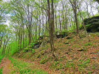
![]()
![]()
![]()
![]()
![]() On Monday, May 25th I wanted to get in a longer hike that was still close to home. I was running out of variations at my regular spots but chose to go to Frock Pond to hike a loop to Mongaup Pond. Cindy told me she did not want to go as we had hiked the day before. I slept in and then did some work around the house before starting to get ready to go for the hike. It had rained a few drops and the skies were overcast but I was hoping no more rain would fall. I began to get my gear together at 12:15 PM which made Sheila watch me very closely. I got dressed in a long-sleeved White Sierra crew top with a short-sleeved baselayer. The White Sierra top has InsectShield which helps keep the May flies away. It was 70 degrees but I thought the long sleeves might dissuade the mosquitoes. I put on a pair of RailRiders hiking pants which are expensive but last along time and have features like deep pockets and a generous cut which I really like. The pants lack the Velcro closures at the ankles which some models have but I added my OR Bugout gaiters which also are treated to repel insects. I have not seen many ticks this season but I know they are out there. I decided to wear my Vasque Taku hiking boots which fit well and have been discontinued. I also wore a light jacket and an OR floppy hat. I like the hat as it shades me from the sun and allows me to spray insect repellant on it rather than on me. I got my gear and Sheila in the car and headed out the DeBruce Road at 12:35 PM. After 6 miles, at Mongaup Pond Road, I turned left and continued to follow the road bearing left onto Beech Mountain Road at the fork. When we arrived in the parking areas they were both almost full but no hikers were in sight. I found a spot in the smaller lot and parked. Sheila was acting as if she hadn't hiked in a month as she ran around and headed for the trail. The temperature was 72 degrees and the skies were overcast with higher than normal humidity. I did notice that the skies were beginning to clear with the sun shining through the clouds and I knew the temperature would rise. I got my gear ready to go and set my electronics. We headed across the road to get on the Flynn Trail at 1:00 PM. The Flynn Trail through the woods was bone dry. At the end of that section we turned right onto the woods road that was once the access road to the Beech Mountain Boy Scout Camp. Within a few hundred feet, I saw a young couple approaching and walked off to the side of the trail as they passed. The trail continued to be dry but I was surprised that the leaves were almost completely out even compared to a few days before. At one point I stopped to take some pictures of the cliff and ledges and to remove my light jacket which was no longer needed. The sun was out now and I could see that most of the sky was blue. The Flynn Trail ascends for 1.7 miles to the junction with the Big Rock trail and gains 600 feet in the process. On this day the ascent seemed to go quickly as I have been hiking more frequently and am finally getting into better shape.
On Monday, May 25th I wanted to get in a longer hike that was still close to home. I was running out of variations at my regular spots but chose to go to Frock Pond to hike a loop to Mongaup Pond. Cindy told me she did not want to go as we had hiked the day before. I slept in and then did some work around the house before starting to get ready to go for the hike. It had rained a few drops and the skies were overcast but I was hoping no more rain would fall. I began to get my gear together at 12:15 PM which made Sheila watch me very closely. I got dressed in a long-sleeved White Sierra crew top with a short-sleeved baselayer. The White Sierra top has InsectShield which helps keep the May flies away. It was 70 degrees but I thought the long sleeves might dissuade the mosquitoes. I put on a pair of RailRiders hiking pants which are expensive but last along time and have features like deep pockets and a generous cut which I really like. The pants lack the Velcro closures at the ankles which some models have but I added my OR Bugout gaiters which also are treated to repel insects. I have not seen many ticks this season but I know they are out there. I decided to wear my Vasque Taku hiking boots which fit well and have been discontinued. I also wore a light jacket and an OR floppy hat. I like the hat as it shades me from the sun and allows me to spray insect repellant on it rather than on me. I got my gear and Sheila in the car and headed out the DeBruce Road at 12:35 PM. After 6 miles, at Mongaup Pond Road, I turned left and continued to follow the road bearing left onto Beech Mountain Road at the fork. When we arrived in the parking areas they were both almost full but no hikers were in sight. I found a spot in the smaller lot and parked. Sheila was acting as if she hadn't hiked in a month as she ran around and headed for the trail. The temperature was 72 degrees and the skies were overcast with higher than normal humidity. I did notice that the skies were beginning to clear with the sun shining through the clouds and I knew the temperature would rise. I got my gear ready to go and set my electronics. We headed across the road to get on the Flynn Trail at 1:00 PM. The Flynn Trail through the woods was bone dry. At the end of that section we turned right onto the woods road that was once the access road to the Beech Mountain Boy Scout Camp. Within a few hundred feet, I saw a young couple approaching and walked off to the side of the trail as they passed. The trail continued to be dry but I was surprised that the leaves were almost completely out even compared to a few days before. At one point I stopped to take some pictures of the cliff and ledges and to remove my light jacket which was no longer needed. The sun was out now and I could see that most of the sky was blue. The Flynn Trail ascends for 1.7 miles to the junction with the Big Rock trail and gains 600 feet in the process. On this day the ascent seemed to go quickly as I have been hiking more frequently and am finally getting into better shape.
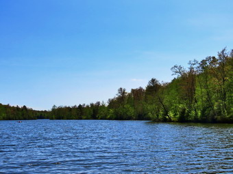 It didn't seem long at all until we were approaching the junction with the Big Rock Trail at 1.7 miles into the hike. By the time we were at the junction, we had already gained 600 feet and only had a little more elevation gain until we would start downhill. We turned right at the junction on the snowmobile trail and climbed another 120 feet to the highest point on the hike at a little over 1.9 miles. After hitting the high point, most of the rest of the hike was downhill. The Flynn Trail heads directly north from the trailhead but the snowmobile trail wanders first east, then south, then east, then north before finally heading southeast and south toward Mongaup Pond. As we descended from the high point we found evidence that there had been a stream of water flowing down most of the trail. The trail has become highly eroded and difficult to hike. There were also many blowdowns which had not been cleared as the snowmobile club had little snow to work with the past winter. The trail was completely dry as we headed down toward the pond except for one small damp spot. Sheila was wandering off trail and then returning to us never getting very far away. At 3.1 miles we followed the trail as it turned southeast and then east still descending toward the pond. We finally hit a woods road and the trail leveled out. Just before getting to the roads that runs through the campground we passed by the swamp on the left and crossed a few small streams across the trail and some standing water. This was the only spot on the trail so far that had been wet at all. When we got to the roads, I wondered whether I should put Sheila on her leash as the campgrounds were supposed to be open. We turned left on the road and began walking passed empty campsites. At 4.1 miles the blue Mongaup Hardenburgh Trail started on the left side of the road. We turned left here and began to head north toward the upper end of the pond. As we walked I could see and hear several groups of people on the pond in kayaks and canoes. When we arrived at the upper end of the pond, we walked to the edge of the water. A little further along on the shore was a large family group just getting ready to leave. I dropped my pack and took out the camera while Sheila walked out into the water. I took pictures of the pond but was disappointed that the blue sky had few if any white clouds. I threw a stick for Sheila but she did not seem very interested.
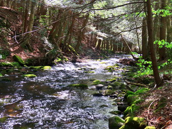 I packed up and we continued around the pond on a snowmobile trail as the Mongaup Hardenburgh Trail turned left and headed north. I had not decided whether we would continue on the snowmobile trails as we had last week or use the roads to return to the car. The half mile to the next trail junction was slightly uphill and a little muddier than the rest of the trail had been. We crossed three bridges with water running in small streams which allowed Sheila to get a drink of fresh water. At 4.9 miles we came to the junction with the Mongaup Willowemoc Trail. From this point on I knew the trail was very muddy in several places. As we walked, I found the trail drier than it had been a few days before but still wet. When we arrived at the junction with the trail to the falls, I decided to continue straight ahead and out to the campground roads. I knew it would be very warm walking the roads but the trail to the falls had been so muddy the last time I chose to avoid it. As we walked straight ahead, we immediately found a wet area where a stream crosses the trail and a culvert has been blocked for some time. We worked our way through this area and then out the campsite 38 where we picked up the campground roads. We walked out to the main loop road where we turned left. I put Sheila on her leash and we walked out toward the park entrance. Several people were wading in the water but there was no lifeguard. It did not seem that there were any canoe or kayak rentals. It did not seem much was different from the week before. We walked out the entrance of the campgrounds and started the hike back to the car on Mongaup Pond Road. The walking was not as hot as I thought it would be and the noise of the stream next to the road was pleasing. There was quite a bit of traffic on the road but is slowed when passing us. I stopped in two places to take some pictures of the stream. We reached the intersection with Beech Mountain Road at 7 miles and turned right. The final .3 miles was all uphill but Sheila helped by giving me a pull. We arrived back at the parking area at 4:15 PM having hiked 7.3 miles in 3 hours and 20 minutes. The elevation gain was 1030 feet. Two young women were looking at the map at the trailhead. I asked if they needed help but they responded that they had just returned from the loop hike around Frick and Hodge Ponds.
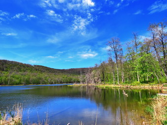
![]()
![]()
![]()
![]()
![]() On Sunday, May 24th Cindy and I had planned to go on a belated Mother's Day hike with Kurt and his family. They were to meet us at our house at noon and we would go to the trailhead from there. Cindy and I discussed possibilities for a hike knowing that any popular place would be mobbed because of the beautiful weather and the long weekend. We decided to hike to Huggins Lake which is less than 4 miles with some uphills. The lake at the end of the out and back hike is pretty. On Sunday morning we got a text from Kurt saying that they would be late which was not unexpected. Cindy came up with the idea of trying to go to the Beaverkill Campgrounds as the hiking would be flatter and easier since Kurt might have to carry Kaden who is very big for being 2 years old. I began to get ready at 12:30 PM when the temperature was just 70 degrees. As soon as I started to get ready, Sheila began to run around and bark anticipating getting out of the house. I got dressed in my White Sierra long-sleeved crew top that has InsectSheild and is quite light. I put on a pair of RailRiders hiking pants which are expensive but last along time and have features like deep pockets and a generous cut which I really like. The pants have Velcro closures at the ankles but I decided to add a pair of OR Bugout gaiters. I have not seen as many ticks as in the past but I know they are out there. I decided to wear my Vasque Taku hiking boots which fit well and have been discontinued. I made sure I had a pair of Protalus insoles in the shoes to support my arches. I grabbed a pair of Leki external lock poles I have been using lately. I took my OR floppy hat and put on a light jacket that would stow easily in my pack. Kurt and family arrived just before 1:00 PM and after a brief greeting we left for our hike. I got our gear in the car and Sheila in the backseat. We left Livingston Manor just after 1:00 PM and drove north on Old Route 17. I turned right on the Beaverkill Road and left on Campsite Road. At the bottom of the hill I turned right and drove down to the campgrounds parking area. To our disappointment the parking lot was completely filled with groups of people spread throughout the area. I drove across the covered bridge and at the end of the road I turned right and followed Berry Brook Road to the trailhead. We arrived at the road to the parking area to find it very rough with some erosion. We easily made it to the small lot parking at 1:25 PM. There were four vehicles in the parking area but I knew those people would be spread out over a 2 mile trail which is a wide woods road. We got our equipment ready and I set my GPS. Kurt put Kaden, who is a large child, in a child carrier. Sheila and Kurt's dog Ryder seemed to be getting along very well and neither needed to be on a leash. The sun was out and the temperature was 70 degrees as we headed out on the wide woods road to the lake. As we started out there continued to be lots of sun and the skies were blue as we climbed up the hill. The hike isn't long and the trail is well-maintained and it looked like some work had been done lately as there were no blowdowns along the way.
On Sunday, May 24th Cindy and I had planned to go on a belated Mother's Day hike with Kurt and his family. They were to meet us at our house at noon and we would go to the trailhead from there. Cindy and I discussed possibilities for a hike knowing that any popular place would be mobbed because of the beautiful weather and the long weekend. We decided to hike to Huggins Lake which is less than 4 miles with some uphills. The lake at the end of the out and back hike is pretty. On Sunday morning we got a text from Kurt saying that they would be late which was not unexpected. Cindy came up with the idea of trying to go to the Beaverkill Campgrounds as the hiking would be flatter and easier since Kurt might have to carry Kaden who is very big for being 2 years old. I began to get ready at 12:30 PM when the temperature was just 70 degrees. As soon as I started to get ready, Sheila began to run around and bark anticipating getting out of the house. I got dressed in my White Sierra long-sleeved crew top that has InsectSheild and is quite light. I put on a pair of RailRiders hiking pants which are expensive but last along time and have features like deep pockets and a generous cut which I really like. The pants have Velcro closures at the ankles but I decided to add a pair of OR Bugout gaiters. I have not seen as many ticks as in the past but I know they are out there. I decided to wear my Vasque Taku hiking boots which fit well and have been discontinued. I made sure I had a pair of Protalus insoles in the shoes to support my arches. I grabbed a pair of Leki external lock poles I have been using lately. I took my OR floppy hat and put on a light jacket that would stow easily in my pack. Kurt and family arrived just before 1:00 PM and after a brief greeting we left for our hike. I got our gear in the car and Sheila in the backseat. We left Livingston Manor just after 1:00 PM and drove north on Old Route 17. I turned right on the Beaverkill Road and left on Campsite Road. At the bottom of the hill I turned right and drove down to the campgrounds parking area. To our disappointment the parking lot was completely filled with groups of people spread throughout the area. I drove across the covered bridge and at the end of the road I turned right and followed Berry Brook Road to the trailhead. We arrived at the road to the parking area to find it very rough with some erosion. We easily made it to the small lot parking at 1:25 PM. There were four vehicles in the parking area but I knew those people would be spread out over a 2 mile trail which is a wide woods road. We got our equipment ready and I set my GPS. Kurt put Kaden, who is a large child, in a child carrier. Sheila and Kurt's dog Ryder seemed to be getting along very well and neither needed to be on a leash. The sun was out and the temperature was 70 degrees as we headed out on the wide woods road to the lake. As we started out there continued to be lots of sun and the skies were blue as we climbed up the hill. The hike isn't long and the trail is well-maintained and it looked like some work had been done lately as there were no blowdowns along the way.
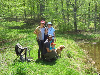 The first 1.2 miles is all uphill and gains almost 700 feet. Sheila and Ryder were running up and down the trail with Sheila following game paths into the woods. Kurt seemed to be doing well carrying Kaden and Ariana was walking with no problems. Cindy and I were both taking it slow as we had no reason to hurry. We both noted that the ascent has several spots which appear to be the top of the climb but are not. After the initial climb, the trail descends, levels some and then climbs again until the final descent to Huggins Lake. Along the way we met a group of 8 people coming toward us. I called Sheila and walked to the side of the trail and th rest of the group also allowed the others to pass. We exchanged greetings as they passed us. As we continued, the trail made a sharp turn from southeast to north at about 1.6 miles. We enjoyed the downhill trek to the shores of the pond but I knew we would soon have to turn around and climb back up the hill. When we arrived at the lake, I noticed that the water level was high. I dropped my pack and got out my camera to take pictures of the lake. The leaves had burst out over the last few days and the sky was blue with sun and a few white clouds. I took some pictures of the lake and then walked along the dam on the narrow path to take a few more shots. At this point I noticed a woman with a fishing pole sitting in a chair on the far side of the dam. I made sure to keep Sheila with me so we would not bother her. I could see a tent set up in the field southeast of the dam. At the outlet I could immediately see that the beavers had dammed the water flow and that reeds had grown to all but block the outlet flow. I took a few more pictures of the lake before returning to my pack and stowing the camera. Sheila had already taken several dips in the water and I threw a stick several times which she swam to retrieve. Kurt and Aimee took there kids along the dam to see the outlet. Sheila began to run back and forth on the trail with Ryder chasing her. I took a few pictures of the family as a group and we continued to enjoy ourselves for some time. It seemed that the longer we were there, the more the insects began to zero in on us. At 2:50 PM we packed up and started up the hill and back to the car. Kaden did not want to ride in the backpack so Kurt and Aimee took turns carrying him. The only negative point about Huggins Lake is that there is only one trail and so there are no variations available. The ascent went smoothly for the most part as we climbed the hill back to the highest point on the trail. From there we started down the other side of the hill on the trail. Downhill was definitely easier than uphill especially for Kurt and Aimee! Sheila seemed very interested in following game trails off the main trail and I had to keep calling her back. As we started down the last section of trail I could see two hikers coming toward us. I again took Sheila to the side of the trail as they passed. From this point it was all downhill to the car. We arrived back at the car at 3:50 PM after hiking 3.8 miles in 2 hours and 25 minutes with a total elevation gain of 955 feet. We had spent just under half an hour stopped with most of that time being at Huggins Lake.
![]()
![]()
![]()
![]() On Friday, May 22nd I had started out to drive upstate to see some new sites. I found out that I could not go it alone on this day and returned home. By 11:00 AM I was ready to go out on a local hike and chose to walk the snowmobile trails on the east side of Mongaup Pond. There isn't much to see there and the trails can be wet but at least I know the route and had not been there in some time. As I started to get ready the temperature on the back porch was 80 degrees and the skies were very blue with white clouds. There was no sign of the afternoon showers that were forecast. As soon as I started to get ready, Sheila began to run around and bark anticipating getting out of the house. I got dressed in my White Sierra long-sleeved crew top that has InsectSheild and is quite light. I put on a pair of RailRiders hiking pants which are expensive but last along time and have features like deep pockets and a generous cut which I really like. The pants have Velcro closures at the ankles but I decided to add a pair of OR Bugout gaiters. I have not seen as many ticks as in the past but I know they are out there. I decided to wear my Vasque Taku hiking boots which fit well and have been discontinued. I made sure I had a pair of Protalus insoles in the shoes to support my arches. I grabbed a pair of Leki external lock poles I have been using lately. I knew I would not need gloves but I did take my OR floppy hat. I also put on a light jacket that would stow easily in my pack. I got my gear in the car and Sheila, who had been uncharacteristically quiet, in the backseat. I started out the DeBruce Road at 11:35 AM and turned left after six miles on Mongaup Pond Road. As I drove up the road, I could see the sky was blue with white puffy clouds. At the split in the road I stayed to the right on Mongaup Pond Road and pulled into the small parking area on the right side of the road. There were no other cars in the lot and none parked at Mongaup Falls. The temperature on the car read 70 degrees and felt more comfortable than in town. As I got out of the car I could feel the humidity but it was not overpowering. What was bothersome was the cloud of insects swarming around my head. I don't like insect repellant but I decided it was needed in this case.
On Friday, May 22nd I had started out to drive upstate to see some new sites. I found out that I could not go it alone on this day and returned home. By 11:00 AM I was ready to go out on a local hike and chose to walk the snowmobile trails on the east side of Mongaup Pond. There isn't much to see there and the trails can be wet but at least I know the route and had not been there in some time. As I started to get ready the temperature on the back porch was 80 degrees and the skies were very blue with white clouds. There was no sign of the afternoon showers that were forecast. As soon as I started to get ready, Sheila began to run around and bark anticipating getting out of the house. I got dressed in my White Sierra long-sleeved crew top that has InsectSheild and is quite light. I put on a pair of RailRiders hiking pants which are expensive but last along time and have features like deep pockets and a generous cut which I really like. The pants have Velcro closures at the ankles but I decided to add a pair of OR Bugout gaiters. I have not seen as many ticks as in the past but I know they are out there. I decided to wear my Vasque Taku hiking boots which fit well and have been discontinued. I made sure I had a pair of Protalus insoles in the shoes to support my arches. I grabbed a pair of Leki external lock poles I have been using lately. I knew I would not need gloves but I did take my OR floppy hat. I also put on a light jacket that would stow easily in my pack. I got my gear in the car and Sheila, who had been uncharacteristically quiet, in the backseat. I started out the DeBruce Road at 11:35 AM and turned left after six miles on Mongaup Pond Road. As I drove up the road, I could see the sky was blue with white puffy clouds. At the split in the road I stayed to the right on Mongaup Pond Road and pulled into the small parking area on the right side of the road. There were no other cars in the lot and none parked at Mongaup Falls. The temperature on the car read 70 degrees and felt more comfortable than in town. As I got out of the car I could feel the humidity but it was not overpowering. What was bothersome was the cloud of insects swarming around my head. I don't like insect repellant but I decided it was needed in this case.
I got my GPS set and then let a frantic Sheila out of the car so that we could begin our hike at 11:55 AM. We walked back toward the intersection to turn left to hike down what used to be Hunter Road. We walked across the small bridge over the stream and continued up the rocky hill toward the snowmobile trails that make up most of this hiking loop. The road had water running down it in several places and I thought that this was not a good start to the hike. At .4 miles we passed by a snowmobile trail that we could use on the return trip. I knew this trail could be very wet and thought we might use the roads to walk back. After a short descent, we again began to climb on the rocky and rather wet woods road toward Terwilliger Road. At 1 mile we turned left as the snowmobile trail turned into the woods. Here the trail was much drier and the surface was flat which made walking go very quickly. I stopped in an open glade covered in ferns but decided not to take pictures. A little farther along a bridge crossed a small stream and Sheila got a quick drink. The trail dropped a little as we headed northeast and then at 1.4 miles we began to climb again. Somewhere around 2 miles ledges of rock began to appear on the left side of the trail and I knew that on the other side of the ledges was the return trail. I was still feeling a little off but decided I could not afford to give up twice in one day so we continued on the trail. At 2.35 miles we were still climbing as the trail headed southeast to reach the highest point on the trail at 2.7 miles. From here the trail began to descend and at 2.9 miles the trail again turned northeast and continued dropping in elevation. The trail had been wet and muddy in places but these were easily avoided. At 3.8 miles we reached the Mongaup Willowemoc Trail where we turned left and started heading northwest. We started climbing again over some very rocky terrain. I knew that this climb was coming up but that didn't make it any easier. We reached the top of a hill at 4.5 miles and started to descend the other side. There had been several blowdowns along the trail which were large and had been removed by the use of a chainsaw. There were several others that needed to be removed but these had been there for some time as hikers had started to create detours. It was getting much warmer and a little more humid so I stopped several times to get a drink. I had long ago removed and stowed my jacket. The trail was wet and muddy and showed evidence that there had been a lot of water flowing over them. There was also evidence that someone had been operating a large ATV on some of the trails which left ruts perfect for catching water. We continued our descent until at 5.2 miles the Mongaup Willowemoc Trail ended at a snowmobile trail.
Just before the junction, I caught sight of a man sitting on a log. I put Sheila on her leash as we approached and struck up a conversation. He said that he had come over from Flugertown Road and was going back on the same route. After a few minutes, I excused myself and Sheila and I continued on our hike. We turned left on the snowmobile trail which was wet and muddy in many places showing more ruts from prohibited vehicles. This trail is often very wet as it is lower than the land to the east and water draining from the higher land floods the trail. It was a short walk of around a half mile to another trail junction. The snowmobile trail turned left here to return to the area of Mongaup Falls. Continuing straight ahead would take us out to the campgrounds where we could walk the roads back to the car. As we had been hiking the skies had been getting darker with increasing clouds. Despite the negatives, I decided we would turn left and walk the snowmobile trail back to the car. After we made the turn, I almost immediately regretted the decision as this part of the trail was the wettest section we had been on. The wet and muddy spots alternated with places that were completely dry. There were two significant bumps along the trail but these went quickly. Soon I recognized that we were near the end of the trail. An old orchard appeared on the left followed by a pine plantation on the right. We broke out into a clearing and I followed Sheila as she walked out to the trail we had come in on more than 3 hours before. We turned right and began to walk down hill toward the falls. The rocky road was still wet and the rocks were slippery. As we neared the stream, I looked up to see a young couple coming toward us. I walked off the trail and held Sheila by her collar. As the couple approached, I asked where they were headed and they replied they were walking to the falls. I redirected them to the path that leads along the stream to the falls. Sheila and I crossed the bridge and walked up to the road. We were back at the car at 3:30 PM after hiking 7.7 miles in 3 and a half hours. The elevation gain was 1208 feet. I felt much better after hiking and knew I would try the upstate adventure soon!
On Friday, May 22nd I was ready to break with the "Hike Locally" protocol I had been following and go for an adventure further upstate that I had been planning for a week! The centerpiece of my plan was to head for Chittenango Falls State Park in Madison County near Cazenovia. The drive is 2 and a half hours but by all reports it would be worth the trip. To maximize the long drive I planned to visit Pratts Falls County Park in Onondaga County near Manlius. The drive from Chittenango Falls is only 20 minutes which I thought manageable. Finally, after leaving Pratts Falls, I planned to stop at Delphi Falls County Park in Madison County which is on the route back home. As I was finalizing these plans, I found out that the Gorge Trail at Chittenango Falls is closed for scaling and construction and may not open until August. This trail is the one that gives the best view of the falls and I did not want to drive so far and be disappointed. I looked at other areas and other falls in the same are but did not find anything very interesting. After looking at a few Facebook posts, I got the idea to go to Lake Ontario and Chimney Bluffs State Park. The features of the bluffs and the fact that it is on the lake sounded really interesting but I wondered about the 3 hour and 20 minute drive! I printed out the directions to Chimney Bluffs and then the directions to the other two waterfalls which would be on the way home. I was excited to present the plan to Cindy because I thought she would like to get away from Livingston Manor and visit some places we had not been together. I was disappointed when she said she did want to drive so far. I tried to point out how interesting it would be and that we were getting out of Sullivan County but she would not change her mind. I decided that if I was going to see these sites I would have to do it by myself. I got up at 6:15 AM and got ready to go. Th weather looked ideal and I dressed accordingly. Sheila was happy to be going but was well-behaved. I has pretty down as I did not want to go alone. I got my gear including an extra pair of socks and an extra shirt in the car. I put Sheila in the backseat and left Livingston Manor at 7:15 AM. I drove north on State Route 17 watching my GPS tick off the miles. The further I drove, the more I felt the sting of going alone. When I reached the Cook Falls exit, I got off, turned around and rove Mack to Livingston Manor. On the way I promised Sheila we would go out to hike later in the day. When we got home, I changed out of my hiking clothes and went upstairs to read a book still smarting from my change of plans. Around 11:00 AM I stopped feeling sorry for myself and made to decisions. It was time to get out for a hike and if I wanted to see the sites I had planned on seeing I would have to go alone!
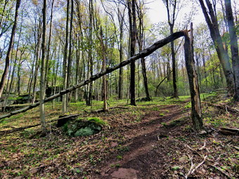
![]() On Wednesday, May 20th I woke up just after 6:00 AM and was not able to get to sleep. I decided to go across the street to Round Top to remove a blowdown that was on the trail. A tree at the edge of the trail had broken off about 7 feet above ground and the broken portion was hanging over the trail. I did not want to take the chance that it would fall on someone so my plan was to remove the part hanging over the trail and the standing portion. I knew that doing the work by myself would be tricky but I though I could safely do it. The temperature was just below 50 degrees as I began to get ready at 6:30 AM. I got dressed in a long-sleeved cotton T-shirt as I did not expect to be out very long. I put on a pair of RailRiders hiking pants which are expensive but last along time and have features like deep pockets and a generous cut which I really like. The pants have Velcro closures at the ankles to help deal with rocks that find their way into hiking boots and ticks. I decided to wear my Vasque Taku hiking boots which fit well and have been discontinued. I made sure I had a pair of Protalus insoles in the shoes to support my arches. I wore my OR floppy hat and also put on a light jacket. For tools I took my Fiskars chopping axe, two felling wedges and two Silky saws; the smaller, fixed Sugowaza and larger, folding Katanaboy 500. At 6:45 AM we walked out the door to start the hike to the work. I grabbed Sheila's leash from the car and we walked up the driveway. Sheila was happy to get out as we crossed the street and walked to the parking area by the Presbyterian Church. We walked to the back of the church and began the ascent of the steepest hill behind the church. The hill is short but gets the circulation pumping and is the steepest and longest climb on the "trail." Sheila helped me along by pulling me up the hill. When we got to the top of the hill, we started on the trail by turning left at the trailhead. I let Sheila off her leash so that she could explore. At the first trail junction, we turned right on the woods road and walked uphill to where the trail turned off the road and headed up the hill. Just after this turn was the tree I wanted to cut.
On Wednesday, May 20th I woke up just after 6:00 AM and was not able to get to sleep. I decided to go across the street to Round Top to remove a blowdown that was on the trail. A tree at the edge of the trail had broken off about 7 feet above ground and the broken portion was hanging over the trail. I did not want to take the chance that it would fall on someone so my plan was to remove the part hanging over the trail and the standing portion. I knew that doing the work by myself would be tricky but I though I could safely do it. The temperature was just below 50 degrees as I began to get ready at 6:30 AM. I got dressed in a long-sleeved cotton T-shirt as I did not expect to be out very long. I put on a pair of RailRiders hiking pants which are expensive but last along time and have features like deep pockets and a generous cut which I really like. The pants have Velcro closures at the ankles to help deal with rocks that find their way into hiking boots and ticks. I decided to wear my Vasque Taku hiking boots which fit well and have been discontinued. I made sure I had a pair of Protalus insoles in the shoes to support my arches. I wore my OR floppy hat and also put on a light jacket. For tools I took my Fiskars chopping axe, two felling wedges and two Silky saws; the smaller, fixed Sugowaza and larger, folding Katanaboy 500. At 6:45 AM we walked out the door to start the hike to the work. I grabbed Sheila's leash from the car and we walked up the driveway. Sheila was happy to get out as we crossed the street and walked to the parking area by the Presbyterian Church. We walked to the back of the church and began the ascent of the steepest hill behind the church. The hill is short but gets the circulation pumping and is the steepest and longest climb on the "trail." Sheila helped me along by pulling me up the hill. When we got to the top of the hill, we started on the trail by turning left at the trailhead. I let Sheila off her leash so that she could explore. At the first trail junction, we turned right on the woods road and walked uphill to where the trail turned off the road and headed up the hill. Just after this turn was the tree I wanted to cut.
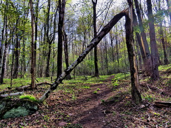 I put my pack and all my tools down and took a before picture of the tree. I began to inspect the situation and decided to cut the piece hanging over the trail. I would cut it on the opposite side of the trail hoping the remaining piece would help pull the trunk downhill when I cut through it. I grabbed my axe and quickly severed the branch. I swung the remaining piece up hill and then looked at how it was connected to the standing trunk. I thought I might be able to tear the piece free but it was attached by more than just bark. I thought for a moment that I would go home to get my pole saw but decided against it.
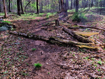 I got the axe and began to cut a notch on the downhill side of the standing trunk. I found that a part of the trunk was rotten and the cutting was easy. About a third of the way through I hit live wood which slowed me down. Each time I swung the axe I listened for a cracking noise as I was not sure of the stability of the trunk. When I thought I had cut enough, I dropped the axe and got my Katanaboy saw. I began to saw on the backside of the tree expecting the saw to bind but that did not happen. I removed the saw at one point and tried using the felling wedges to nudge the tree over. When that did not work, I went back to using the saw.
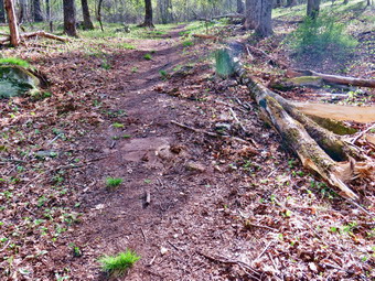 Eventually a couple of pushes on the trunk caused it lean well over. I realized that I should have cut a more angular notch but it had been some time since I had felled a tree. I went back to the saw and finally heard the cracking I desired. The trunk fell parallel to the trail but well off of it. The upper portion fell on the trail so I thought about sectioning it to remove it from the trail. After further consideration, I decided to try picking up the portion that lay across the trail. I tried lifting it and it proved heavier than I thought. Despite the weight, I was able to pivot it off the trail and lift it over the stump. I looked at the work that now appeared complete.
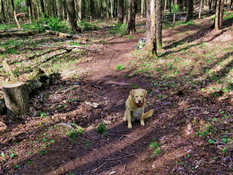 All the time I had been working on the tree, Sheila was lying quietly by my pack. I decided that she needed a reward so I pick up my pack and tools and started up the trail. We would complete a small loop on the lower, yellow trail and then head home. At the trail junction with blue trail we turned left and walked along the base of Round Top to the next junction. We turned left to stay on the yellow trail and headed downhill. When we arrived at the lookout, we turned left to follow the trail down to the first trail junction. We continued out to the trailhead where I put Sheila on her leash. We walked down the hill and out through the church parking to the driveway. We were home at 8:15 AM.
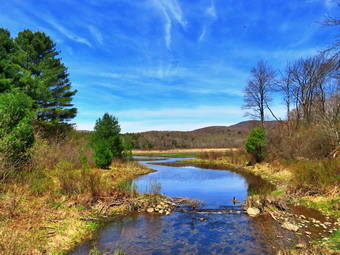
![]()
![]()
![]()
![]()
![]() On Tuesday, May 19th I planned to hike somewhere close to home after I had completed my school day around 3:00 PM. When I woke up in the morning, I was mentally exhausted and in a bad mood. I worked on some things around the house and on school work until about 2:15 PM when I started to get ready to hike. The temperature was just 60 degrees and it seemed very dry. The skies were blue with a few clouds and a slight breeze blowing. I asked Cindy but she did not think she wanted to hike. I got dressed in my White Sierra long-sleeved crew top that Cindy had gotten me for my birthday last year. The White Sierra top has InsectSheild and is quite light. I put on a pair of RailRiders hiking pants which are expensive but last along time and have features like deep pockets and a generous cut which I really like. The pants have Velcro closures at the ankles but I decided to add a pair of OR Bugout gaiters. I have not seen as many ticks as in the past but I know they are out there. I decided to wear my Vasque Taku hiking boots which fit well and have been discontinued. I made sure I had a pair of Protalus insoles in the shoes to support my arches. I grabbed a pair of Leki external lock poles I have been using lately. I knew I would not need gloves but I did take my OR floppy hat. I also put on a light jacket that would stow easily in my pack. I got my gear in the car and Sheila, who had been uncharacteristically quiet, in the backseat. I started out the DeBruce Road at 2:35 PM and turned left after six miles on Mongaup Pond Road. At the split in the road I stayed to the left on Beech Mountain Road following another car up to the parking areas. When we arrived, there was one SVU in the large parking lot which pleased me as I would rather hike deserted trails. I immediately noticed that the insects were swarming and considered putting on a repellant but did not because I hate the smell. I set my GPS and we got ready to hike just as another car pulled into the small lot where I was parked. A couple got out and began to get ready as we walked out the woods road toward Frick Pond at 2:50 PM. The first part of the trail was dry but by the time we got to the register it became wet and muddy in many places that had to be avoided. The woods road out to Frick Pond continued to be very wet with some areas of standing and running water. As we approached Gravestone Junction, a young man came walking toward us from the opposite direction. I walked off the trail with Sheila and he passed us wearing a bandana. I hoped he had not worn the bandana for the entire hike and wondered why he felt the need to pull it up when passing us. We stayed left at Graveyard Junction to stay on the Quick Lake Trail. When we arrived at the bridge across the outlet, I decided to stop and take pictures despite the fact that I have hundreds from this location. The water level in the pond was lower than it had been the week before after the rains. There was a very blue sky with some white clouds. I took some shots of the pond and the sky. We continued on around the pond staying left at the Big Rock Trail junction on the Quick Lake Trail. The trail was dry for a short distance and then was wet and muddy in spots. We continued on our hike passing through the "Spruce Tunnel". The small stream through the woods was running freely and was very high. Sheila simply jumped across but I walked upstream a little to a narrower and more shallow area to cross. By 3:35 PM we had walked the 1.5 miles to Iron Wheel Junction. We turned right and headed out on the Logger's Loop Trail which was almost completely dry.
On Tuesday, May 19th I planned to hike somewhere close to home after I had completed my school day around 3:00 PM. When I woke up in the morning, I was mentally exhausted and in a bad mood. I worked on some things around the house and on school work until about 2:15 PM when I started to get ready to hike. The temperature was just 60 degrees and it seemed very dry. The skies were blue with a few clouds and a slight breeze blowing. I asked Cindy but she did not think she wanted to hike. I got dressed in my White Sierra long-sleeved crew top that Cindy had gotten me for my birthday last year. The White Sierra top has InsectSheild and is quite light. I put on a pair of RailRiders hiking pants which are expensive but last along time and have features like deep pockets and a generous cut which I really like. The pants have Velcro closures at the ankles but I decided to add a pair of OR Bugout gaiters. I have not seen as many ticks as in the past but I know they are out there. I decided to wear my Vasque Taku hiking boots which fit well and have been discontinued. I made sure I had a pair of Protalus insoles in the shoes to support my arches. I grabbed a pair of Leki external lock poles I have been using lately. I knew I would not need gloves but I did take my OR floppy hat. I also put on a light jacket that would stow easily in my pack. I got my gear in the car and Sheila, who had been uncharacteristically quiet, in the backseat. I started out the DeBruce Road at 2:35 PM and turned left after six miles on Mongaup Pond Road. At the split in the road I stayed to the left on Beech Mountain Road following another car up to the parking areas. When we arrived, there was one SVU in the large parking lot which pleased me as I would rather hike deserted trails. I immediately noticed that the insects were swarming and considered putting on a repellant but did not because I hate the smell. I set my GPS and we got ready to hike just as another car pulled into the small lot where I was parked. A couple got out and began to get ready as we walked out the woods road toward Frick Pond at 2:50 PM. The first part of the trail was dry but by the time we got to the register it became wet and muddy in many places that had to be avoided. The woods road out to Frick Pond continued to be very wet with some areas of standing and running water. As we approached Gravestone Junction, a young man came walking toward us from the opposite direction. I walked off the trail with Sheila and he passed us wearing a bandana. I hoped he had not worn the bandana for the entire hike and wondered why he felt the need to pull it up when passing us. We stayed left at Graveyard Junction to stay on the Quick Lake Trail. When we arrived at the bridge across the outlet, I decided to stop and take pictures despite the fact that I have hundreds from this location. The water level in the pond was lower than it had been the week before after the rains. There was a very blue sky with some white clouds. I took some shots of the pond and the sky. We continued on around the pond staying left at the Big Rock Trail junction on the Quick Lake Trail. The trail was dry for a short distance and then was wet and muddy in spots. We continued on our hike passing through the "Spruce Tunnel". The small stream through the woods was running freely and was very high. Sheila simply jumped across but I walked upstream a little to a narrower and more shallow area to cross. By 3:35 PM we had walked the 1.5 miles to Iron Wheel Junction. We turned right and headed out on the Logger's Loop Trail which was almost completely dry.
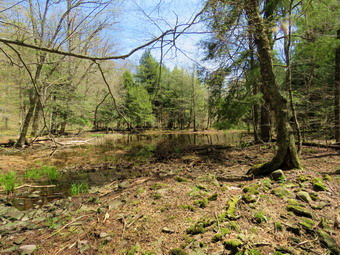 The Logger's Loop is mostly downhill in this direction and we made good time but occasionally encountered some small blowdowns along the way. The Logger's Loop really is a loop which starts north, turns east and eventually heads south towards Times Square. The walk went quickly and about two-thirds of the way along Sheila alerted. Ahead of us were two deer feeding ion the trail! I warned Sheila to stay by me and she did. I got out my camera and took some pictures before they noticed us and were gone. We continued to walk and just before starting the descent to Times Square we came to the area that is sometimes and pond and sometimes a wetland on the left side of the trail. This pond is seasonal but has been growing in size for several years. I stopped to take a few pictures as the pond was so much smaller than the last time I had been there. The area where I was standing had obviously dried. As I was standing there, the May flies began to swarm and I quickly packed up to leave. By 4:05 PM we were at Times Square and about 2.7 miles into the hike. The area was wet but we worked around the muddy areas and turned left to walk uphill on the Big Rock Trail. The Big Rock Trail gains 600 feet to the Flynn Trail over 1.1 miles for an average grade of only 10%. However, the route has three different climbs and can seem long. We set a pretty fast pace on the climb and I found that although my heart rate was elevated I felt good. We encountered two small blowdowns on the trail that would need tools to be cleared. In the middle of the final climb, I stopped, not because I was tired, because I wanted to. I leaned on my poles and closed my eyes. The only sounds I could hear was the wind blowing through the trees and the birds chirping softly. I don't normal stop like this but it was so very peaceful. We reached the Flynn Trail at 4:45 PM after hiking 3.8 miles and stopped for a drink. After a short break, we turned right and began the descent back to the car. I was glad to be hiking downhill but Sheila did not seem to care. She was still excited at this point and was running up the trail and back to me. She was taking a few excursions off the trail to follow animal tracks but was pretty close so I let her explore. The trip down the Flynn Trail went very quickly and we were soon at the arch Cindy and I had cut through a huge evergreen tree. We arrived at the gate that blocks Beech Mountain Road and turned left to stay on the Flynn Trail. The trail through the woods avoids the private property around the cabin. Some hikers cannot read the signs and have annoyed the property owner by trespassing! We continued down to the parking area on the trail. We were back at 5:25 PM having covered 5.5 miles in 2 hours and 35 minutes with a vertical gain of 895 feet. There were now 3 cars parked in the two parking areas but none were the same as when I had left! I had just enough time to get home for a live interview with WJFF.
![]()
![]()
![]()
![]() On Monday, May 18th I wanted to get in a light walk after taking a day off to let my foot improve from a mild case of plantar fasciitis. I waited until 2:30 to begin to get ready to go across the street to Round Top to hike. Cindy said she wanted to go and we kept watch on the weather as it looked like the forecast rain would come any minute. As we got ready the temperature was in the mid 60's with a slight breeze. I began to get ready and Sheila showed her appreciation by barking and running around. I got dressed in my White Sierra long-sleeved crew top that Cindy had gotten me for my birthday last year. The White Sierra top has InsectSheild and is quite light. I put on a pair of RailRiders hiking pants which are expensive but last along time and have features like deep pockets and a generous cut which I really like. The pants have Velcro closures at the ankles so I did not put on any gaiters. I have not seen as many ticks as in the past but I kW they are out there. I decided to wear my Vasque Taku hiking boots which fit well and have been discontinued. I made sure I had a pair of Protalus insoles in the shoes to support my arches. I grabbed a pair of Leki external lock poles I have been using lately. At 3:00 PM we walked out the door to start the hike. Immediately I noticed that the skies were beginning to become overcast particularly to the west. I grabbed Sheila's leash from the car and we walked up the driveway. I decided we would try to do some figure 8's on the Round Top Trails. I aimed to hike for about an hour. Sheila was happy to get out as we crossed the street and walked to the parking area by the Presbyterian Church. We walked to the back of the church and began the ascent of the steepest hill behind the church. The hill is short but gets the circulation pumping and is the steepest and longest climb on the "trail." Sheila helped me along by pulling me up the hill. When we got to the top of the hill, we started on the trail by turning left at the trailhead. I let Sheila off her leash so that she could explore.
On Monday, May 18th I wanted to get in a light walk after taking a day off to let my foot improve from a mild case of plantar fasciitis. I waited until 2:30 to begin to get ready to go across the street to Round Top to hike. Cindy said she wanted to go and we kept watch on the weather as it looked like the forecast rain would come any minute. As we got ready the temperature was in the mid 60's with a slight breeze. I began to get ready and Sheila showed her appreciation by barking and running around. I got dressed in my White Sierra long-sleeved crew top that Cindy had gotten me for my birthday last year. The White Sierra top has InsectSheild and is quite light. I put on a pair of RailRiders hiking pants which are expensive but last along time and have features like deep pockets and a generous cut which I really like. The pants have Velcro closures at the ankles so I did not put on any gaiters. I have not seen as many ticks as in the past but I kW they are out there. I decided to wear my Vasque Taku hiking boots which fit well and have been discontinued. I made sure I had a pair of Protalus insoles in the shoes to support my arches. I grabbed a pair of Leki external lock poles I have been using lately. At 3:00 PM we walked out the door to start the hike. Immediately I noticed that the skies were beginning to become overcast particularly to the west. I grabbed Sheila's leash from the car and we walked up the driveway. I decided we would try to do some figure 8's on the Round Top Trails. I aimed to hike for about an hour. Sheila was happy to get out as we crossed the street and walked to the parking area by the Presbyterian Church. We walked to the back of the church and began the ascent of the steepest hill behind the church. The hill is short but gets the circulation pumping and is the steepest and longest climb on the "trail." Sheila helped me along by pulling me up the hill. When we got to the top of the hill, we started on the trail by turning left at the trailhead. I let Sheila off her leash so that she could explore.
At the first trail junction, we followed Sheila as she turned right on the woods road which is the shallower approach to the trail system. The road was drier than I expected with only a few muddy areas. We continued to follow the yellow trail to the first junction where we turned left and followed it to the next trail junction. Along the way there was one new tree broken off and hanging over the trail. I knew I would have to remove that tree to make it safe for hikers. By the look of the trails more people were hiking them than ever. We kept a quick pace as we walked even an at the second junction with the blue trail, we turned right. We started up the steep blue trail that leads over the summit of Round Top. As we ascended the trail, I looked for a possible start for a switchback and found a game trail in a good place. I decided to follow the game trail as it wound its way up the hill. When the path no longer went in the direction I wanted, I walked over toward the trail to meet Cindy. We walked across the flat summit of Round Top and started down the other side. Descending was also rather easy as the trail was dry and well worn in. Soon we were back at the yellow trail where we turned right and walked to the next trail junction. This time we turned left and followed the yellow trail downhill toward the lookout. I stopped to take a look down to the school and town. I was surprised that there were very few cars in Peck's parking lot. We continued on the trail as it turned left and descended to the first trail junction. This part of the trail Was also worn in and dry. This section of trail gets the most traffic as some people simply walk up to the viewpoint and then back down. At the first trail junction, Cindy decided the May flies were too much and headed back home. Sheila and I turned around and started back up the hill toward the viewpoint. When the trail turned to the right, we followed it as it gained elevation to the junction with the blue trail. We turned right and continued to follow the yellow trail along the base of Round Top to the next junction with the blue trail. We turned left and walked up the blue trail to cross the summit of Round Top. The descent on the other side was tricky in places but we did make it down without incident. At the trail junction with the yellow trail we turned left and followed the trail along the base of Round Top again. At the next trail junction, we turned right and walked down the trail to the woods road and out to the first trail junction. There was an uncomfortable feeling in my right foot and I decided I did not need to push myself for any more distance. We walked out toward the trailhead where I put Sheila on her leash. We walked down the hill and through the church parking lot to the road and our driveway. It was 4:10 PM and we had hiked over 2 miles in a little over an hour with elevation gain of about 600 feet.
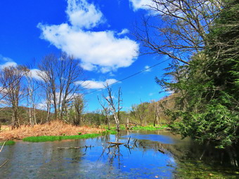
![]()
![]()
![]()
![]()
![]() On Saturday, May 16th, Cindy and I left the Lennox Forest on Arbor hill Road and headed north toward Delhi. I continued passed the golf course and after 2.5 miles parked on the left side of the road near the kiosk for the Smith Pond Trail. I got Sheila out of the car and set my GPS before we started off on the trail. The sign said follow the orange disks which I found difficult because there were so few of them. The trail a woods road or ATV track that I was familiar with from a previous trip. I remembered that the trail had been very wet in spots and was not looking forward to fighting the water and mud. There was grass on either side in most places and the trail was very close to the road which was above on the bank. Most parts of the trail were drier than I expected but there were a wet spots. The trail was mostly flat with a few ups and downs along the way. At .33 miles the orange markers left the road and headed into the woods and toward the river. It was obvious that someone was trying get the trail off the road and make it a more interesting walk. At one point the trail came very close to the river and then headed back up and through some evergreens. The trail did not seem to be very well used and needed a little more construction and maintenance. At .5 miles the trail rejoined the road and started downhill to Smith Pond. At the bottom of the hill was an intermittent stream that had a bridge that seemed unnecessary. Underneath the bridge was a beaver dam and to the right of the bridge was a pond. I stopped to take a few pictures of the pond with a nice blue sky behind it.
On Saturday, May 16th, Cindy and I left the Lennox Forest on Arbor hill Road and headed north toward Delhi. I continued passed the golf course and after 2.5 miles parked on the left side of the road near the kiosk for the Smith Pond Trail. I got Sheila out of the car and set my GPS before we started off on the trail. The sign said follow the orange disks which I found difficult because there were so few of them. The trail a woods road or ATV track that I was familiar with from a previous trip. I remembered that the trail had been very wet in spots and was not looking forward to fighting the water and mud. There was grass on either side in most places and the trail was very close to the road which was above on the bank. Most parts of the trail were drier than I expected but there were a wet spots. The trail was mostly flat with a few ups and downs along the way. At .33 miles the orange markers left the road and headed into the woods and toward the river. It was obvious that someone was trying get the trail off the road and make it a more interesting walk. At one point the trail came very close to the river and then headed back up and through some evergreens. The trail did not seem to be very well used and needed a little more construction and maintenance. At .5 miles the trail rejoined the road and started downhill to Smith Pond. At the bottom of the hill was an intermittent stream that had a bridge that seemed unnecessary. Underneath the bridge was a beaver dam and to the right of the bridge was a pond. I stopped to take a few pictures of the pond with a nice blue sky behind it.
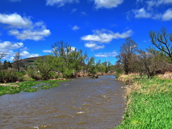 The trail took us through a rather wet area and to the edge of the river. I decided to take some shots of the river. While I was taking pictures, I heard some noise and noticed several kayaks coming downstream. The kayaking looked like fun and the people on the river confirmed it. We continued along the trail and not very much farther along it split. The trail headed left but many people seemed to be following the road. We followed the trail to the edge of a field and walked along the edge until the trail again entered the woods. As we reentered the woods, there were several large puddles and muddy areas to avoid. We began a short but steep climb which ended at Route 28 after passing a lean-to. I stopped long enough to take a picture of the lean-to which seemed to have been cleaned up since the last time I was on the trail. We walked up to the sign at the trailhead and then turned around to begin the trip back. After walking along the edge of the field, we stayed to the right and took the hiking trail and again stopped at the edge of the river. Once again a kayak came by and this time it spun around facing upstream. I though the occupants were inept but as I watch they began to try to paddle upstream. I gathered they were just practicing their paddling skills. We followed our route back to Smith Pond and uphill to the point where the trail branched off to the right. We followed the trail all the way back to the point where it joined the woods road. From there we followed the road back to the car. It was 2:15 PM and we had hiked 2.1 miles in 1 hour and 10 minutes with and elevation gain of 260 feet. Cindy wanted to go to Frog Pond Farm in Bainbridge and I called to see that they were open. We drove all the way to Bainbridge to find the place swamped by people with cars parked along the road. Cindy decided she didn't want to brave the crowd so I drove back to Walton and then home.
![]()
![]()
![]()
![]()
![]() On Saturday, May 16th, I woke up with a very sore right foot. I decided that I wanted to hike anyway and didn't care if I had to venture a little farther away from home. I asked Cindy and she suggested some trails around Delhi since we would be heading away from the invasion of hikers from other areas that has plagued the Catskills! I thought we might try the Lennox Forest and Smith Pond Trail since that would break our hiking into two sections and allow me to judge how my foot was feeling. The first hike has some hills but the second is almost flat. As we started to get ready at 10:30 AM the temperature was in the high 60's and the forecast was that it would rise. I got dressed in my White Sierra long-sleeved crew top that Cindy had gotten me for my birthday without a baselayer. The White Sierra top has InsectSheild and is quite light. I put on a pair of RailRiders hiking pants which are expensive but last along time and have features like deep pockets and a generous cut which I really like. The pants have Velcro closures at the ankles but I still added a pair of OR Bugout gaiters. The ticks have been very numerous so far this season especially farther south. I decided to wear my Vasque Taku hiking boots which fit well and have been discontinued. I made sure I had a pair of Protalus insoles in the shoes to support my arches. I grabbed a pair of Leki external lock poles I have been using lately. I took a light hat and light gloves which I did not think I would need. I also took along my Mammut hoody but wore a light windbreaker which was all I thought I would really need. We put my gear in the car and Sheila in the back seat. Sheila loves to get out an hike anywhere and she had kept her eye on both of us as we were getting ready. As we left Livingston Manor at 10:30 AM, the skies were blue and sunny with a few puffy white clouds. I drove north and west on State Route 17 to exit 94 (Roscoe) and headed north on Route 206 toward Downsville. From the top of Brock Mountain I could see that many of the valleys were still filled with fog or clouds. At the Pepacton Reservoir, I turned left to stay on Route206/30 and drove through Downsville heading toward Walton. Just after the light in Downsville, I turned right on Telford Hollow Road. After driving over the hill, I turned right at the bottom of the hill and drove out to Route 10. After passing through Hamden, I turned right toward Delancey and then left on Back River Road. After 4 miles, I turned right into the parking area for the John Lennox Memorial Forest.
On Saturday, May 16th, I woke up with a very sore right foot. I decided that I wanted to hike anyway and didn't care if I had to venture a little farther away from home. I asked Cindy and she suggested some trails around Delhi since we would be heading away from the invasion of hikers from other areas that has plagued the Catskills! I thought we might try the Lennox Forest and Smith Pond Trail since that would break our hiking into two sections and allow me to judge how my foot was feeling. The first hike has some hills but the second is almost flat. As we started to get ready at 10:30 AM the temperature was in the high 60's and the forecast was that it would rise. I got dressed in my White Sierra long-sleeved crew top that Cindy had gotten me for my birthday without a baselayer. The White Sierra top has InsectSheild and is quite light. I put on a pair of RailRiders hiking pants which are expensive but last along time and have features like deep pockets and a generous cut which I really like. The pants have Velcro closures at the ankles but I still added a pair of OR Bugout gaiters. The ticks have been very numerous so far this season especially farther south. I decided to wear my Vasque Taku hiking boots which fit well and have been discontinued. I made sure I had a pair of Protalus insoles in the shoes to support my arches. I grabbed a pair of Leki external lock poles I have been using lately. I took a light hat and light gloves which I did not think I would need. I also took along my Mammut hoody but wore a light windbreaker which was all I thought I would really need. We put my gear in the car and Sheila in the back seat. Sheila loves to get out an hike anywhere and she had kept her eye on both of us as we were getting ready. As we left Livingston Manor at 10:30 AM, the skies were blue and sunny with a few puffy white clouds. I drove north and west on State Route 17 to exit 94 (Roscoe) and headed north on Route 206 toward Downsville. From the top of Brock Mountain I could see that many of the valleys were still filled with fog or clouds. At the Pepacton Reservoir, I turned left to stay on Route206/30 and drove through Downsville heading toward Walton. Just after the light in Downsville, I turned right on Telford Hollow Road. After driving over the hill, I turned right at the bottom of the hill and drove out to Route 10. After passing through Hamden, I turned right toward Delancey and then left on Back River Road. After 4 miles, I turned right into the parking area for the John Lennox Memorial Forest.
 I parked and we got out of the car to find it was very warm and humid. I walked to the gate and found a sign that said "No Trespassing - Camp in Session" but the sign looked old. Another sign suggested calling the Cornell Cooperative Extension for permission to hike which I tried last time only to find the number disconnected. I started my GPS and we began the hike by passing through the gate and walking up a hill. Within less than a tenth of a mile the trail split and I decided to go to the right which was the path I had followed last time. The trail was a grassy woods road and I was surprised the grass was almost dry despite the heavy rains the night before. The trail continued to ascend as we headed south but at .3 miles it turned sharply left to head northeast as the ascent continued. At .5 miles we were again faced with a split in the trail. I chose to bear to the right on a woods road as we did the last time. It soon became obvious that someone had cleared the trail as it was much easier to walk than during my last trip. At .85 miles we came to another trail and turned right and almost immediately turned right again on the trail that would take us to the lean-to. I looked ahead and saw that the trail few much steeper without and end in sight. Cindy seemed game but I knew she would not be enthusiastic about the climb. We continued climbing the trail through beautiful evergreen forest heading north avoiding a few blowdowns that had not been cleared. I stopped to take a few pictures of some interesting rocks. There were a few places that had been cut out but not enough to expose clear views. At 1.1 miles the trail began to curl to the east. The trail continued to turn right until we were on the flat summit where we found a privy! We had climbed over 300 feet in .4 miles for an average grade of 14% but several sections approached 20%! As we walked around the top, I walked to the right where the trail went down to a lookout and a shelter. The lean-to was in good shape and had a fire ring on top of a large, flat rock. The viewpoint was mostly blocked with trees as are so many. Cutting out this viewpoint would be rather easy as the access to the trees is off the trail we had just climbed. I took a few pictures before we returned to the summit where I took a picture of the privy. After that, we started back down the mountain. When we arrived at the place where we turned up the hill at 1.8 miles, we turned right to complete a loop back to the parking area. The trail started out heading north bit almost immediately turned southwest. At that point, another woods road headed off to the right but I decided to leave that for another day. At 2.1 miles we were back at the trail junction where we had made our first turn at the beginning of the hike. We continued straight ahead through the gate and back to the car. It was 12:55 PM and we had hiked 2.1 miles in 1 hour and 20 minutes with and elevation gain of 620 feet. My foot was actually feeling better after the walk so I decided there was time to go to the Smith Pond Trail to hike.
![]()
![]()
![]()
![]()
![]() The pictures shown here are from March not May but the views were much the same.
On Thursday, May 14th, I wanted to get in a hike close to home as the day had not really gone as planned. I had men's Bible study by Zoom at 6:15 AM and Cindy had one at 10:30 AM. What I did not expect was the ambulance call at 9:30 AM which set back some of my plans! Cindy did say she wanted to take a short walk so I waited until she was done with her class around noon. We decided to just go to Parksville and hike the rail trail even though it is under three miles out and back. By the time we started to get ready at 12:30 PM the temperature was right around 60 degrees. I got dressed in my Mammut crew top but did not wear any baselayer. I decided to wear my Columbia Titanium insulated pants even though they would probably be too warm. I wore my Keen Targhee II boots since I didn't feel that I needed insulated boots. I did not wear gaiters even though I knew we might encounter some mud. I decided to take a pair of Leki poles with external locks as the internal twist locks fail. I grabbed a light hat and gloves. Finally, I donned my Mammut hoody which blocks the wind and keeps me warm but has enough zippers to dump heat when needed. We put our gear in the back of the car and Sheila in the back seat. We left Livingston Manor at just before 1:00 PM and drove out Old Route 17 toward Parksville. Just after Fox Mountain Road, I pulled into the parking area on the right side of the road at 1:10 PM. A small SVU was parked in the lot but left as we were getting ready. I set my GPS and we started out on the trail at 1:15 PM.
The pictures shown here are from March not May but the views were much the same.
On Thursday, May 14th, I wanted to get in a hike close to home as the day had not really gone as planned. I had men's Bible study by Zoom at 6:15 AM and Cindy had one at 10:30 AM. What I did not expect was the ambulance call at 9:30 AM which set back some of my plans! Cindy did say she wanted to take a short walk so I waited until she was done with her class around noon. We decided to just go to Parksville and hike the rail trail even though it is under three miles out and back. By the time we started to get ready at 12:30 PM the temperature was right around 60 degrees. I got dressed in my Mammut crew top but did not wear any baselayer. I decided to wear my Columbia Titanium insulated pants even though they would probably be too warm. I wore my Keen Targhee II boots since I didn't feel that I needed insulated boots. I did not wear gaiters even though I knew we might encounter some mud. I decided to take a pair of Leki poles with external locks as the internal twist locks fail. I grabbed a light hat and gloves. Finally, I donned my Mammut hoody which blocks the wind and keeps me warm but has enough zippers to dump heat when needed. We put our gear in the back of the car and Sheila in the back seat. We left Livingston Manor at just before 1:00 PM and drove out Old Route 17 toward Parksville. Just after Fox Mountain Road, I pulled into the parking area on the right side of the road at 1:10 PM. A small SVU was parked in the lot but left as we were getting ready. I set my GPS and we started out on the trail at 1:15 PM.
 Once we were on the trail and sheltered by the trees it was a little cooler but still warm. The trail alternated between mostly dry areas and with only a few muddy ones. The trail was in much better shape than when we had hiked it exactly two months ago. It was obvious someone had been in to clear some blowdowns and install new picnic tables and benches. I decided not to take pictures as nothing ha cabbaged too much since March excepted for the lack of ice! As we were walking I could see a runner approaching from Parksville. I got Sheila off the trail so that he could pass and tem resumed our hike. The rail trail runs parallel to the Little Beaverkill and the new section of State Route 17. It follows the route of the O&W railroad and is very flat. As I looked down toward the river, I saw several cement posts and I finally found a way to get down to inspect them. The posts were old and marked NY and I assumed they were assailed with the railroad in some way. I worked my way back up to the main trail and we continued our hike. I was surprised the water level in the stream was not much higher than it had been in March despite the recent rains. The day was sunny and the sky was very blue. We passed several benches placed for people to rest in warmer weather. As we walked, I could hear an increase in the noise from the stream and I knew the falls was just ahead. Near the falls we looked down to see a lone fisherman at the base of the falls. The runner that had passed us returned from the other end of the trail and Sheila made some objection to his presence.
 Soon we were nearing the Parksville end of the trail passing many rundown and dilapidated buildings which should be removed. On the Parksville end of the trail we found a small garden and a very informative sign. The sign listed the businesses and hotels that existed in Parksville during its heyday. The Young's Gap Hotel had room for 600 guests! The sign also explained the role of the railroad in the dairy industry which was a thriving one in all of Sullivan County. After a brief pause, we decided to walk back on the trail as it was in such good shape. The return trip was uneventful although we did see one couple walking ahead of us back to the parking area. We were back at the car at 2:15 PM after hiking 2.5 miles in 1 hour and 5 minutes. Our moving average was 2.5 mph and the elevation gain was 230 feet which I doubted. As I drove away from the parking area toward home, I tried to convince Cindy that we should go to another spot to get in a little more walking. She was unconvinced so I considered dropping her at the house and going on another hike. In the end I decided to go home. This proved to be a good decision as I was not home 5 minutes before the ambulance pager announced another call!
![]()
![]()
![]()
![]()
![]() On Tuesday, May 12th I wanted to do another "local" hike but was willing to travel a ,little distance to do it. I have hiked the most local hikes so many times I may never do them again. I decided to head to Rock Hill to hike the Neversink Unique Area. I asked Cindy but she did not want to go so I began to plan a longer hike which might encompass all three falls in the area. The early morning temperature was in the mid 30's but I had some work to do around the house. As I started to get ready around 11:30 AM the temperature was pushing 60 degrees but it still seemed cool outside due to a stiff breeze. The skies were sunny and blue with some nice white clouds. I put on my Mammut long-sleeved crew top with a light baselayer since the temperature felt cool. I decided to wear my Columbia Titanium insulated pants but decided against tights underneath. I wore my Vasque Taku boots which are supportive, surprisingly roomy and discontinued. I grabbed my Leki external lock poles which I purchased since twist locks have proved unreliable. I also donned my Mammut hoody which was enough zippers to dump heat when needed. I put on a light hat and wore a light pair of gloves. At the last minute, I put on my OR Crocodile gaiters to deal with the ticks and the mud which I was sure we would find. I got my gear in the car and put Sheila in the back seat. I drove to Rock Hill on State Route 17E and got off at exit 109. I turned right off the exit and drove to the parking area at the end of Katrina falls Road. The parking area was full and cars were parked on the side of the road. I decided I did not want to add to this crowd so I turned around and drove back .5 miles to Wolf Lake Road where I turned right. I drove another .5 miles and turned right on Powerline Road where there is a parking area for the Wolf Lake Multiple Use Are. I really wanted to drive to the end of the road since hiking along it is not particularly interesting. The gate was open but a DEC truck blocked the road. I got out of the car and walked over to talk to the forest ranger who was draining a large puddle off the bridge. I asked him if it was permitted to park at the upper end and he said "Yes". He immediately moved his truck and I drove to the end of the road where there is a small parking area. I set my GPS and noticed I did not have the remote for Sheila's collar. A quick call home revealed I had left it on my desk! As we were about to get on the trail, a group of four people entered the parking area from the trail accompanied by a beautiful German Shepherd. They continued down the road and I assumed they must have been one of the cars parked at the lower lot. Sheila and I got on the trail at 12:25 Pm to begin our hike.
`
On Tuesday, May 12th I wanted to do another "local" hike but was willing to travel a ,little distance to do it. I have hiked the most local hikes so many times I may never do them again. I decided to head to Rock Hill to hike the Neversink Unique Area. I asked Cindy but she did not want to go so I began to plan a longer hike which might encompass all three falls in the area. The early morning temperature was in the mid 30's but I had some work to do around the house. As I started to get ready around 11:30 AM the temperature was pushing 60 degrees but it still seemed cool outside due to a stiff breeze. The skies were sunny and blue with some nice white clouds. I put on my Mammut long-sleeved crew top with a light baselayer since the temperature felt cool. I decided to wear my Columbia Titanium insulated pants but decided against tights underneath. I wore my Vasque Taku boots which are supportive, surprisingly roomy and discontinued. I grabbed my Leki external lock poles which I purchased since twist locks have proved unreliable. I also donned my Mammut hoody which was enough zippers to dump heat when needed. I put on a light hat and wore a light pair of gloves. At the last minute, I put on my OR Crocodile gaiters to deal with the ticks and the mud which I was sure we would find. I got my gear in the car and put Sheila in the back seat. I drove to Rock Hill on State Route 17E and got off at exit 109. I turned right off the exit and drove to the parking area at the end of Katrina falls Road. The parking area was full and cars were parked on the side of the road. I decided I did not want to add to this crowd so I turned around and drove back .5 miles to Wolf Lake Road where I turned right. I drove another .5 miles and turned right on Powerline Road where there is a parking area for the Wolf Lake Multiple Use Are. I really wanted to drive to the end of the road since hiking along it is not particularly interesting. The gate was open but a DEC truck blocked the road. I got out of the car and walked over to talk to the forest ranger who was draining a large puddle off the bridge. I asked him if it was permitted to park at the upper end and he said "Yes". He immediately moved his truck and I drove to the end of the road where there is a small parking area. I set my GPS and noticed I did not have the remote for Sheila's collar. A quick call home revealed I had left it on my desk! As we were about to get on the trail, a group of four people entered the parking area from the trail accompanied by a beautiful German Shepherd. They continued down the road and I assumed they must have been one of the cars parked at the lower lot. Sheila and I got on the trail at 12:25 Pm to begin our hike.
`
 The first .6 miles of the trail is a spur trail that connects the parking area with the main trail system. The trail is all downhill and I knew that menat an uphill comb to get back to the car at the end of then hike. I was surprised to see that all the brush had been cut back and that there were no blowdowns along the way. We met another family of three coming toward us. It was nice to see people out but the five year old buy with this group was, for some reason, allowed to yell at the top of his voice! I pulled over to the side of the trail to let them pass before Sheila and I continued to the junction with the main trail. At the junction we turned left to begin our hike down to Mullet Brook Falls. Even though we were walking downhill, I was getting warm and opened up the zippers on my hoody. At .7 miles we came to the bridge over Mullet Brook where I sometimes stop to take pictures. On this day I was more interested on getting to the falls so we simply continued across the bridge. Just after the stream the trail turned sharply to the right and began heading west as it continued to descend. I looked up to see three women coming toward us and I again stepped to the side of the trail to let them pass. I enquired about people at the falls and they told me there were two groups; one large and one small. I wasn't thrilled to hear about large groups but decided to visit anyway. When we reached the spur trail to Mullet Brook Falls at 1.25 miles, we turned right and began the short walk to the falls. We saw no one on the trail and I could not hear any noise coming from the falls so I hoped that the people who had been there had moved on. When the falls came into sight, I was disappointed to see the two groups of people were still present. One "group" was three people sitting on the rocks near the far side of the falls. The other group was a different story! There were 8 to 10 young women sitting close together on a rock without any face masks. I began to understand at that moment the challenges that Sullivan County faces for the summer. I tied Sheila to a tree and got out my camera. I carefully walked over the rocks to a position in front of the falls where I could take pictures without seeing either group of people. I took multiple pictures of the falls from different zooms and slightly different angles and then walked back to my pack. I couldn't resist taking one more picture of the larger group before Sheila and I walked back out to the main trail. On the way out we met another family group consisting of two parents and two young children.
 At the main trail we turned right as I wanted to visit the other falls. I decided that it would be better to go to High Falls first as I thought there would be fewer people there. At the next trail junction at 1.65 miles, we turned left and started toward High Falls on the main Neversink River. The distance to the falls is a little over 2 miles and can be challenging although the destination is worth the trip. High Falls is only slightly higher and more impressive than Denton Falls and the latter is just off the main trail. This is why many people skip High Falls and simply visit Mullet Brook Falls and Denton Falls. As we continued toward High falls, I noticed that the trail was less well maintained with brush starting to close in and several large blowdowns across the trail. The first .2 miles of the trail were a slight downhill followed by .35 miles of uphill. As we hiked, I saw a family of three ahead of us traveling in the same direction. They moved over and allowed us to pass. I wondered if the young girl would be able to hike all the way to the falls and back. They kept up with me for some time and then I did not see them again. A little farther along an older man came walking toward us. We exchanged greetings and I asked if he had seen any more people. He said he had not which made me happy. I also asked him about the amount of water going over the falls. He gave me and odd look and then said that he had not gotten that far! The trail leveled briefly and then began the long descent to the river. Over the next 1.35 miles we dropped almost 500 feet to the edge of the river. Along the way the trail meanders back and forth to mitigate what would otherwise be a steep descent on the way out and an equally steep climb on the way back. At 2.7 miles the trail made a turn to the left and followed the river as it started to flow almost due south. As we approached the last and steepest descent to the river a path went off to the left. This path leads to informal paths and trails that continue south along the river to a parking area and trailhead near Westerbrookville. The distance to the southern parking area is another 4.7 miles with other routes possible. I also knew that another .85 miles to the south would put us at a point opposite the trail that leads to the river from Cold Spring Road in Monticello. Some tentative plans to connect and expand the trail system have been around for a while but nothing has come of them. We worked our way down to the falls which we could hear long before they came into sight. Once at the edge of the river, we were able to work our way along the rocks to a point at the side of the falls. I got out my camera and took a number of shots of the falls from different angles. I also took a one minute video to record the powerful sound of the water rushing downstream. I was able to safely work my way to some rocks in front of the falls and took a few more pictures. At 2:30 PM I packed up and we started the long walk back.
 Despite the fact that the walk back is mostly uphill, it seemed to go faster than the walk out which I can only attribute to the knowledge that we were headed back to the car. At 3:30 PM after hiking 5.7 miles, we were back at the trail junction with the main loop trail. I was tired but still feeling like I could hike a little more. I knew that I would not feel right unless I visited Denton Falls to complete the trilogy. I knew the walk down to the river was only .35 miles and that helped to convince me. We turned left to walk to the spur trail to the falls and met two men coming toward us. They said they had parked at the Wolf Lake parking area, had visited Mullet Brook Falls and were on there way back to the car. We discussed the carious falls in the area and then went our separate ways. I wondered about the route they had taken. We turned left on the spur trail and walked downhill to the falls. The trail had become much more well-worn from more people using it. There are several points that are usually damp but these spots were muddy pits which were hard to work around. There were also several highly eroded areas with protruding tree roots and rocks. We avoided any pitfalls and made it down to the river's edge without a problem. We worked our way along the rocks to a point in front of the falls. I took pictures of the falls and a few upstream as well. The view wasn't much different than the one at High Falls so we didn't stay very long. Once again, the trip back up seemed to go quickly and at the top of the hill we turned right on the main trail to continue the out-and-back hike. At the trail junction we stayed to the left to head back up the trail passed Mullet Brook Falls and eventually out to the car. I have to admit that I was tired now and the uphill was a battle. From the junction with the trail to High Falls to the junction with the spur trail to the parking area was 1.1 miles uphill gaining 550 feet in the process. This is by no means a really steep grade but I was warm and tired. We turned right onto the spur trail to the car and had the pleasure of walking the last half mile uphill. I am not that familiar with this trail and several times thought we were at the end. Sheila was a great help as she pulled me up the hills showing no sign of fatigue. We were back at the car at 4:45 PM after hiking at least 7.7 miles in 4 hours and 20 minutes with 20 minutes stopped for pictures. The elevation gain was 1690 feet. As I drove out the access road along the powerlines, we passed the two men we had meet just before we went down to Denton Falls.
![]()
![]()
![]()
![]()
![]() On Sunday, May 10th Cindy and I wanted to do another "local" hike after church and decided to head to Bear Spring Wildlife Management Area between Downsville and Walton on Route 206. The area has many snowmobile and horse trails that are wide and grassy. The trails have a good surface and there are no major mountains but the climbs to the ridges can be challenging. I planned a route from a parking area on East Trout Brook Road up to the ridge and then looping to near Launt Pond and then back to the car. As we started to get ready the temperature was in the mid 40's with a slight breeze gusting at times. I put on my Mammut long-sleeved crew top with a light baselayer since the temperature felt cool. I decided to wear my Columbia Titanium insulated pants but decided against tights underneath. I wore my Vasque Taku boots which are supportive, surprisingly roomy and discontinued. I grabbed my Leki external lock poles which I purchased since twist locks have proved unreliable. I also donned my Mammut hoody which was enough zippers to dump heat when needed. I put on a light hat and wore a light pair of gloves. At the last minute, I put on my OR Crocodile gaiters to deal with the ticks and the mud which I was sure we would find. We got our gear in the car and put Sheila in the back seat. I drove to Roscoe and then took County Route 206 through Downsville to the top of Bear Spring Mountain near Walton, NY. As we started out of Downsville, I noticed a small waterfall on the left side of the road and thought we might stop on the way back. Further up the mountain, we passed Bear Cub Pond also on the left side of the road. I had often thought I might stop there but never had. I decided this could be another stop on the way home. As we neared the top of the mountain, there was a significant amount of snow beneath the trees on the left side of the road. The elevation and the shade had combined to produce this effect. I turned left on East Trout Brook Road and drove south passed Launt Pond for another 1.3 miles. I parked on the left side of the road in the parking area at about 12:55 PM with no other cars in the lot. We have hiked here many times and seldom see anyone on the trails. I set my GPS and we got right on the trail.
`
On Sunday, May 10th Cindy and I wanted to do another "local" hike after church and decided to head to Bear Spring Wildlife Management Area between Downsville and Walton on Route 206. The area has many snowmobile and horse trails that are wide and grassy. The trails have a good surface and there are no major mountains but the climbs to the ridges can be challenging. I planned a route from a parking area on East Trout Brook Road up to the ridge and then looping to near Launt Pond and then back to the car. As we started to get ready the temperature was in the mid 40's with a slight breeze gusting at times. I put on my Mammut long-sleeved crew top with a light baselayer since the temperature felt cool. I decided to wear my Columbia Titanium insulated pants but decided against tights underneath. I wore my Vasque Taku boots which are supportive, surprisingly roomy and discontinued. I grabbed my Leki external lock poles which I purchased since twist locks have proved unreliable. I also donned my Mammut hoody which was enough zippers to dump heat when needed. I put on a light hat and wore a light pair of gloves. At the last minute, I put on my OR Crocodile gaiters to deal with the ticks and the mud which I was sure we would find. We got our gear in the car and put Sheila in the back seat. I drove to Roscoe and then took County Route 206 through Downsville to the top of Bear Spring Mountain near Walton, NY. As we started out of Downsville, I noticed a small waterfall on the left side of the road and thought we might stop on the way back. Further up the mountain, we passed Bear Cub Pond also on the left side of the road. I had often thought I might stop there but never had. I decided this could be another stop on the way home. As we neared the top of the mountain, there was a significant amount of snow beneath the trees on the left side of the road. The elevation and the shade had combined to produce this effect. I turned left on East Trout Brook Road and drove south passed Launt Pond for another 1.3 miles. I parked on the left side of the road in the parking area at about 12:55 PM with no other cars in the lot. We have hiked here many times and seldom see anyone on the trails. I set my GPS and we got right on the trail.
`
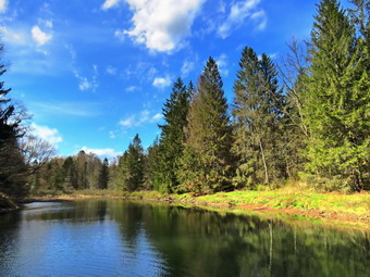 We walked down the wide path/road and across the dam that creates Middle Pond on East Trout Brook. I decided to take pictures on the way back so we continued straight up the hill. I pointed out to Cindy the sign to the right that said "New Trail". The "New Trail" is now several tears old! The trail that continues straight up the hill is a wide grassy snowmobile/horse trail. The sun was out and the skies were blue with a some interesting clouds in different directions. I knew that we could do a clockwise or anticlockwise loop and that I would leave that up to Cindy. The first left turn seemed to be a trail but I remembered from a previous trip that it ended in a small field. On one occasion I had simply bushwhacked along the brook which was easy in most spots with a few areas of dense brush. At .4 miles another trail came in from the left and I knew this was the trail we could take for a clockwise loop. Cindy elected to continue up the hill to get the major ascent in at the beginning of the hike. A little further up the hill there was an old orchard and I stopped to take some pictures of the gnarled, old trees with the blue sky and mountains behind them. The problem with stopping was that the May flies began to swarm. We continued up the hill to the area of a small pond where I took a few pictures and Sheila where Sheila decided to swim in the murky water. At .65 miles we came to the junction with the McCoy Hill Cutoff which is the most direct route to the ridge. We stayed to the right to follow the trail on the longer route to the top of the ridge.
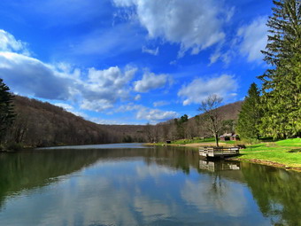 Over the next mile, the trail gained 480 feet with around a 10% grade. This seems reasonable but it was a challenging ascent. A short way up the trail we began to pass through some evergreens and we stopped so that I could take some pictures of the "tunnel" and some of the snow on the ground from the snowfall the night before. At 1.2 miles the trail split. I knew the right fork headed down to the horse camp so we stayed to the right which involved more climbing. We stopped several times on the way toward the highest point but at 1.6 miles the trail leveled and the began to roll a little over a few small bumps. It was nice to be on flatter ground but it also meant that there were wetter and muddier spots on the trail. Eventually we passed the point where a trail turns to the right to head down to Downsville. I knew that the next turn to the left would be the McCoy Hill Cutoff but OT was a little farther than I thought. At 3 miles we arrived at the cutoff but continued straight ahead for another .35 miles to a trail that would take us down to the East Trout parking area. We turned left and started down the hill which was a real pleasure. The trail has several switchbacks and follows, I assume, an old road up the ridge. At 3.6 miles one of those switches turned us northwest and headed away from our car. We walked for a little over a mile to a point just short of the parking area where another trail turned us almost 180 degrees so that we were heading southeast. This trail was almost flat and had some wet areas due to the drainage off the ridge. After walking about a mile, there was a split again in the trail at 5.5 miles and it was obvious the left fork was the correct direction. Unfortunately, this part of the trail had a steep ascent which was , fortunately, short. Once we hit the top of then hill it was only a quarter mile until we completed the loop and turned right at 5.9 miles to head back to the car. When we came to the bridge over the dam, we stopped for me to take a few pictures. The pond was lower than I had seen it. As I was taking some shots, Sheila decide to take one last swim in the murky water. We walked back up to the car arriving at 4:15 PM after hiking 6.3 miles in 3 hours and 15 minutes with a 1260 foot elevation gain. Both our overall and moving average speeds were around 2 mph.
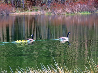 We left Middle pond and headed north toward Route 206. As we approached Launt Pond, I decided to pull over and walk to the pond to take a few shots. Cindy didn't care to go so Sheila and I walked over to the dam at the outlet end of the pond. There was a fisherman on the other end of the dam so I stopped on the near side and took some pictures of the pond and the surrounding hills. I also took pictures of the buildings and picnic tables. I though how sad it would be if the area could not open for the summer due to the COVID19 pandemic. Sheila and I walked back to the car and I drove to Route 206 where I turned right. I drove down the hill toward Downsville and remembered I had considered stopping at Brea cub Pond. I pulled over and got my camera. I could see two geese headed toward the pond so I decided to leave Sheila in the car. I walked the short road toward the edge of the pond and positioned myself to take a few pictures. The pond wasn't that interesting but I noticed that the Twp adult geese had four or five goslings in tow. I took a few sots of them before returning to the car. I continued to headed toward Downsville stopping just short of town to inspect the waterfalls on the right side of the road. I had driven by this areas dozens of times and had never spotted these falls. I got out to take some pictures and found a sign that gave the history of Tub Mill Falls. One point it made was that there were two drops to the falls with only one visible to the road. Since there were "Posted" signs I stayed on the edge of the road and walked to a pint opposite of the falls. I took some pictures and was able to position myself to see part of the upper drop. When I was done, I walked back to the car and drove home.
![]()
![]()
![]()
![]() On Saturday, May 9th I woke up to a little more than a dusting of snow on the ground and temperatures in the low 30's. I had a lot of school work and thought I might skip any hiking as the wind was making the temperature feel like it was in the 20's. This weather came after a Sunday when the temperatures were in the low 70's! Around 2:00 PM, the skies were blue even though the wind was still blowing so I decided to go across the street and hike Round Top. I asked Cindy if she wanted to go but she declined. I began to get ready and Sheila showed her appreciation by barking and running around. I put on my Mammut crew top without a baselayer even though it was still cold outside. I decided to wear my Columbia Titanium insulated pants to keep the chill away but decided against tights underneath. I wore my Keen Targhee II boots which are supportive and surprisingly roomy. I grabbed my Leki external lock poles which I purchased since twist locks have proved unreliable. I also donned my Mammut hoody which was enough zippers to dump heat when needed. I put on a light hat and wore a light pair of gloves. At 2:30 PM we walked out the door to start the hike. Immediately I noticed that the skies were beginning to become overcast particularly to the west which I knew meant there was more snow on the way. I decided to continue since I knew we could always turn around and return home quickly. I grabbed Sheila's leash from the car and we walked up the driveway. I decided we would try to do some figure 8's on the Round Top Trails. I aimed to hike for about an hour. Sheila was happy to get out as we crossed the street and walked to the parking area by the Presbyterian Church. We walked to the back of the church and began the ascent of the steepest hill behind the church. There was snow on the grass but the roadways were clear. The hill is short but gets the circulation pumping and is the steepest and longest climb on the "trail." Sheila helped me along by pulling me up the hill. When we got to the top of the hill, we started on the trail by turning left at the trailhead. I let Sheila off her leash so that she could explore. As we entered the woods, the snow storm hit and the wind increased.
On Saturday, May 9th I woke up to a little more than a dusting of snow on the ground and temperatures in the low 30's. I had a lot of school work and thought I might skip any hiking as the wind was making the temperature feel like it was in the 20's. This weather came after a Sunday when the temperatures were in the low 70's! Around 2:00 PM, the skies were blue even though the wind was still blowing so I decided to go across the street and hike Round Top. I asked Cindy if she wanted to go but she declined. I began to get ready and Sheila showed her appreciation by barking and running around. I put on my Mammut crew top without a baselayer even though it was still cold outside. I decided to wear my Columbia Titanium insulated pants to keep the chill away but decided against tights underneath. I wore my Keen Targhee II boots which are supportive and surprisingly roomy. I grabbed my Leki external lock poles which I purchased since twist locks have proved unreliable. I also donned my Mammut hoody which was enough zippers to dump heat when needed. I put on a light hat and wore a light pair of gloves. At 2:30 PM we walked out the door to start the hike. Immediately I noticed that the skies were beginning to become overcast particularly to the west which I knew meant there was more snow on the way. I decided to continue since I knew we could always turn around and return home quickly. I grabbed Sheila's leash from the car and we walked up the driveway. I decided we would try to do some figure 8's on the Round Top Trails. I aimed to hike for about an hour. Sheila was happy to get out as we crossed the street and walked to the parking area by the Presbyterian Church. We walked to the back of the church and began the ascent of the steepest hill behind the church. There was snow on the grass but the roadways were clear. The hill is short but gets the circulation pumping and is the steepest and longest climb on the "trail." Sheila helped me along by pulling me up the hill. When we got to the top of the hill, we started on the trail by turning left at the trailhead. I let Sheila off her leash so that she could explore. As we entered the woods, the snow storm hit and the wind increased.
At the first trail junction, I followed Sheila as she turned right on the woods road which is the shallower approach to the trail system. The road had a layer of snow and there were areas that were wet and muddy. We continued to follow the yellow trail to the first junction where we turned left and followed it to the next trail junction. We kept a quick pace as we walked even though the trail was wet and slippery in places. At the second junction with the blue trail, we turned right and started up the steep blue trail that leads over the summit of Round Top. As we ascended the trail, the amount of snow on the ground increased slightly. There were a few places where the trail was muddy and slippery but walking beside the trail to get traction was difficult. We walked across the flat, snowy summit of Round Top and started down the other side. Descending was also tricky as there was snow and some wet and slippery spots. Soon we were back at the yellow trail where we turned right and walked to the next trail junction. This time we turned left and followed the yellow trail downhill toward the lookout. I stopped to take a look down to the school and town. I was surprised that there were very few cars in Peck's parking lot. We continued on the trail as it turned left and descended to the first trail junction. This part of the trail had snow on it but the squall had stopped and the sun was out again. This section of trail gets the most traffic as some people simply walk up to the viewpoint and then back down. We turned around and started back up the hill toward the viewpoint. When the trail turned to the right, we followed it as it gained elevation to the junction with the blue trail. We turned right and continued to follow the yellow trail along the base of Round Top to the next junction with the blue trail. We turned left and walked up the blue trail to cross the summit of Round Top. As we ascended more snow it and was falling a little harder than before. The descent on the other side was tricky but we did make it down without incident. At the trail junction with the yellow trail we turned left and followed the trail along the base of Round Top again. At the next trail junction, we turned right and walked down the trail to the woods road and out to the first trail junction. I checked the time and determined that we should return home. As we walked out toward the trailhead the snow stopped. I put Sheila on her leash and we walked down the hill and through the church parking lot to the road and our driveway. It was 3:40 PM and we had hiked over 2 miles in a little over an hour with elevation gain of about 600 feet. Later in the day the snow really picked up several times. At one point the wind was blowing hard enough to create blizzard-like conditions.
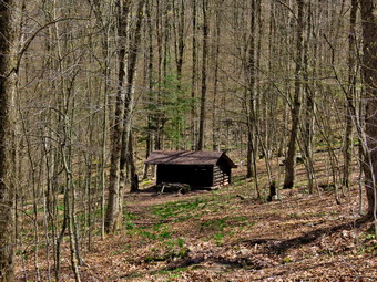
![]()
![]()
![]()
![]()
![]() On Thursday, May 7th I decided to get in some hiking close to home but at some location I had not frequented lately. With the COVID19 pandemic "Hike Local" suggestion. I had hiked most of the local locations several times. I decided to hike the Campbell Mountain Trail from Route 206 and make a loop by returning on the local roads. These roads are almost devoid of traffic except for the last half mile on Route 206. Cindy was not enthusiastic about going but Sheila, as usual, was ready to get out. The temperature in the early morning when I got up was 29 degrees but the forecast called for the temperature to rise. By the time I started to get ready to leave the house if was in the high 50's. I put on my Mammut long-sleeved crew top without a baselayer knowing that it would probably be too warm. I decided to wear my Columbia Titanium insulated pants even though I suspected my Railriders would have been a better choice. I wore my Vasque Taku boots which are supportive, surprisingly roomy and discontinued. I grabbed my Leki external lock poles which I purchased since twist locks have proved unreliable. I also donned my Mammut hoody which was enough zippers to dump heat when needed. I took along a light hat and a light pair of gloves. At the last minutes, I put on my OR Crocodile gaiters to deal with the ticks and the mud which I was sure we would find. I got my gear and Sheila in the car and left the house at 1:25 PM. I drove north and west on State Route 17 exiting at exit 94. I drive through Roscoe and Rockland on Route 206 and drove toward Downsville until we arrived at the pulloff on Route 206 at 1:40 PM. The temperature was in the low-60's with a bright blue, sunny sky with puffy white clouds. There was a slight breeze which helped blow away the gathering May flies. I put on some sect repellant and set my GPS. We got on the trail immediately and noticed that there was water o the trail and some mud. Within a few hundred feet, the trail became muddier and water was flowing across the trail and down it like a river. At the bottom of the hill the trail flattened and we crossed a small stream. This area has several different foundations but I had already explored most of tem. I did take some pictures of one foundation on the right of the trail since I did not remember seeing it before. The trail ran along the stream and then crossed it on a bridge. I stopped to take a few pictures of the bridge and the stream that flowed beneath it. After crossing the bridge, we immediately began the climb up Campbell Mountain. The trail is never very steep but gains over 700 feet in a little more than a mile gets the heart pumping. This part of the trail was drier than I expected even though it follows a highly eroded woods road that I though would make a stream. There were very few blowdowns blocking the trail and the walk was easier than I expected. At about 1.25 miles we came to the spur trail to the lean-to and I stopped to take a few pictures. I got a drink and we continued the climb. I knew the snowmobile trail branched off to the right a short distance after the lean-to. This is also the new route for the Finger Lakes Trail. When I hiked this route the last time, I was sure there had been a sign, trail blazes and a register box when we hiked it but I saw none of those this time.
On Thursday, May 7th I decided to get in some hiking close to home but at some location I had not frequented lately. With the COVID19 pandemic "Hike Local" suggestion. I had hiked most of the local locations several times. I decided to hike the Campbell Mountain Trail from Route 206 and make a loop by returning on the local roads. These roads are almost devoid of traffic except for the last half mile on Route 206. Cindy was not enthusiastic about going but Sheila, as usual, was ready to get out. The temperature in the early morning when I got up was 29 degrees but the forecast called for the temperature to rise. By the time I started to get ready to leave the house if was in the high 50's. I put on my Mammut long-sleeved crew top without a baselayer knowing that it would probably be too warm. I decided to wear my Columbia Titanium insulated pants even though I suspected my Railriders would have been a better choice. I wore my Vasque Taku boots which are supportive, surprisingly roomy and discontinued. I grabbed my Leki external lock poles which I purchased since twist locks have proved unreliable. I also donned my Mammut hoody which was enough zippers to dump heat when needed. I took along a light hat and a light pair of gloves. At the last minutes, I put on my OR Crocodile gaiters to deal with the ticks and the mud which I was sure we would find. I got my gear and Sheila in the car and left the house at 1:25 PM. I drove north and west on State Route 17 exiting at exit 94. I drive through Roscoe and Rockland on Route 206 and drove toward Downsville until we arrived at the pulloff on Route 206 at 1:40 PM. The temperature was in the low-60's with a bright blue, sunny sky with puffy white clouds. There was a slight breeze which helped blow away the gathering May flies. I put on some sect repellant and set my GPS. We got on the trail immediately and noticed that there was water o the trail and some mud. Within a few hundred feet, the trail became muddier and water was flowing across the trail and down it like a river. At the bottom of the hill the trail flattened and we crossed a small stream. This area has several different foundations but I had already explored most of tem. I did take some pictures of one foundation on the right of the trail since I did not remember seeing it before. The trail ran along the stream and then crossed it on a bridge. I stopped to take a few pictures of the bridge and the stream that flowed beneath it. After crossing the bridge, we immediately began the climb up Campbell Mountain. The trail is never very steep but gains over 700 feet in a little more than a mile gets the heart pumping. This part of the trail was drier than I expected even though it follows a highly eroded woods road that I though would make a stream. There were very few blowdowns blocking the trail and the walk was easier than I expected. At about 1.25 miles we came to the spur trail to the lean-to and I stopped to take a few pictures. I got a drink and we continued the climb. I knew the snowmobile trail branched off to the right a short distance after the lean-to. This is also the new route for the Finger Lakes Trail. When I hiked this route the last time, I was sure there had been a sign, trail blazes and a register box when we hiked it but I saw none of those this time.
 We made good time to the top of the mountain and I decided I would stick with the original plan. We continued over a short, flat piece of trail before descending. There were several interesting rocks at the top of the mountain so I stopped to take some pictures. The rocks were obviously sedimentary and had thin but well-defined layers. I packed up and we continued own the other side of the hill. The temperature seemed to be rising at times and cooling at others but I had long ago opened all the zippers on my jacket! The descent to Campbell Mountain Road was only .4 miles with a loss of 235 feet in elevation. We hit Campbell Mountain Road at about 3:05 PM after hiking 2.4 miles. We turned left and hiked slightly uphill toward the intersection with Jug Tavern Road. As we walked, we heard gunshots and then saw two men standing by a pickup shooting into the woods. I was apprehensive but continued on the road with Sheila on her leash. A motorcycle passed by us and the men saw us coming and stopped shooting. As we walked by them, we struck up a short conversation about the weather forecast. It didn't take long for us to hike the .7 miles to the intersection with Jug Tavern Road and the dirt road seemed almost like a trail. At the intersection we turned left and continued our hike toward Route 206. There are a few hunting cabins and second homes along the road and several permanent dwellings. One new home was being constructed and the builders were actively working to complete it. We did stop at one small pond hoping to see some wildlife like a blue heron but nothing presented itself. I did take a few pictures since I hoped to capture some of the blue sky and clouds. We kept up the quick pace which was enhanced since I had put Sheila on her leash and she was trotting along very quickly. At one point a truck pulled up from behind. It was Forest Ranger Stephen Ellis who we had met at Trout Pond in late April. He recognized us although I think he probably recognized Sheila rather than me. We talked for a few minutes before continuing on our way. We made the 1.5 miles or so in good time and turned left on Route 206 to complete the loop. It was less than a mile back to the car and we arrived at 4:15 PM. We had covered 5.4 miles in 2 hours and 30 minutes with an overall speed of 2.2 mph. The elevation gain was 1020 feet and strenuous enough to give me a good workout.
![]()
![]()
![]()
![]()
![]() On Tuesday, May 5th I planned to go hiking at Trout Pond with Cindy and Ed and Robin Sostak, the pastors from our church. The plan was for them to meet us at our house at 10:00 AM and then drive to the trailhead in separate cars. We had been waiting to do this for some time so the night before I decided to try to break my toe running into a chair. I didn't quite succeed but it was pretty sore in the morning. I decided we would park at the lower parking area and then hike the loop around Trout Pond counterclockwise. I knew we had done this hike before with the Sostaks but my record showed it had been 11 years ago! As I started to get ready at 9:30 AM it was just 40 degrees outside. I put on my Mammut long-sleeved crew top without a baselayer since the temperature was forecast to get warmer. I decided to wear my Columbia Titanium insulated pants but decided against tights underneath. I wore my Vasque Taku boots which are supportive, surprisingly roomy and discontinued. I grabbed my Leki external lock poles which I purchased since twist locks have proved unreliable. I also donned my Mammut hoody which was enough zippers to dump heat when needed. I put on a light hat and wore a light pair of gloves. At the last minutes, I put on my OR Crocodile gaiters to deal with the ticks and the mud which I was sure we would find. We got my gear and Sheila in the car and waited for our friends who arrived right on time. After a brief conversation from a "safe" distance, we headed up the Quickway towards Roscoe. We got off at exit 94 and headed north on Route 206 towards Downsville. After crossing the Rockland Flats and passing the Roscoe Nursing Home, we turned left on Morton Hill Road and drove to the intersection with Russell Brook Road. We turned left to drive down to the lower parking area and was pleased to find the road in pretty good shape. We arrived at 10:20 AM to find two other cars in the lot with no one in sight. I set my GPS and we got ready to start out on our hike. On the way down the road I slowed to look at Russell Brook and found the water level as high as I had ever seen!
On Tuesday, May 5th I planned to go hiking at Trout Pond with Cindy and Ed and Robin Sostak, the pastors from our church. The plan was for them to meet us at our house at 10:00 AM and then drive to the trailhead in separate cars. We had been waiting to do this for some time so the night before I decided to try to break my toe running into a chair. I didn't quite succeed but it was pretty sore in the morning. I decided we would park at the lower parking area and then hike the loop around Trout Pond counterclockwise. I knew we had done this hike before with the Sostaks but my record showed it had been 11 years ago! As I started to get ready at 9:30 AM it was just 40 degrees outside. I put on my Mammut long-sleeved crew top without a baselayer since the temperature was forecast to get warmer. I decided to wear my Columbia Titanium insulated pants but decided against tights underneath. I wore my Vasque Taku boots which are supportive, surprisingly roomy and discontinued. I grabbed my Leki external lock poles which I purchased since twist locks have proved unreliable. I also donned my Mammut hoody which was enough zippers to dump heat when needed. I put on a light hat and wore a light pair of gloves. At the last minutes, I put on my OR Crocodile gaiters to deal with the ticks and the mud which I was sure we would find. We got my gear and Sheila in the car and waited for our friends who arrived right on time. After a brief conversation from a "safe" distance, we headed up the Quickway towards Roscoe. We got off at exit 94 and headed north on Route 206 towards Downsville. After crossing the Rockland Flats and passing the Roscoe Nursing Home, we turned left on Morton Hill Road and drove to the intersection with Russell Brook Road. We turned left to drive down to the lower parking area and was pleased to find the road in pretty good shape. We arrived at 10:20 AM to find two other cars in the lot with no one in sight. I set my GPS and we got ready to start out on our hike. On the way down the road I slowed to look at Russell Brook and found the water level as high as I had ever seen!
 We started out on the Trout Pond Trail along a wide woods road that leads down to and across Russell Brook. As we crossed the bridge, I could see that the brook was very high. The sun was out and the sky was blue and we could feel the temperature increasing. We turned right on the path to walk over to the falls. We worked our way down the path to the streambed. I took pictures of the brook and then some more of the falls which was roaring. I managed to get Sheila to pose in front of the falls and took a picture of her. We left the falls and walked back out to the main trail turning right to head toward the register box. We continued passed the box and up the main trail toward Trout Pond. There was water on the trail and some mud which was isolated to several small areas. Cindy and Robin lead the way while Ed and I followed. It was a pleasure to have them along as we have so much in common on so many subjects. Soon we were at the outlet end of the pond and we walked over to the shore. I dropped my pack to take pictures of the lake with the blue sky overhead. The water was right up to the grass on the shoreline and was overflowing the dam. I took quite a few pictures looking for the contrast between bare trees, the blue sky and the lake. We returned to the main trail and walked the flat woods road toward the inlet end of the pond. This part of the trail was wet and muddy in most spots. In some places it extended across the trail which made walking most difficult. We crossed the bridge that is just before the lower lean-to and inspected the old trout hatching box. At the trail junction near the lower lean-to we turned to the left on the blue blazed Mud Pond Trail which would take use over Cherry Ridge and form our loop back to the parking area. Cindy and Robin went to inspect the outhouse while Ed and I stood on the bridge looking out at the pond. I took the opportunity to take a few ore pictures. When we were all together again, we continued on the trail.
 Even though we were gaining elevation, we continued at a good pace. Every now and then we would remove a small branch or a larger trunk from the trail. Since maintenance has been suspended, there were several branches and larger trees across the trail that would need tools to remove them. From the bridge at the inlet we began a climb of 430 feet over the next .75 miles. The trail headed west from the inlet until turning sharply south at around 2 miles. The highest point on the trail was at 2.3 miles after which most of the rest of the hike is downhill. As we gained elevation, I began to notice that I was getting very warm and stopped for a moment to open the zippers on my hoody. The trail had some mud in spots while other areas had standing or running water. At 3.5 miles we had descended 450 feet from Cherry Ridge to the snowmobile trail near Mud Pond. We turned left here to head east and ascended a small hill before starting downhill back toward the parking area. The downhill was a little slippery because of the water and leaves and there were several stream flowing across it. We dropped another 380 feet over the next .7 miles back to the trail junction. We stopped at the bridge across the outlet of Trout Pond and I related some of the history of the area. Russell Brook Falls had been the site of a dam that impounded water for a waterwheel in Butternut Grove. The wheel was still there a few years ago. The area near the register box was the "landing zone" for loggers who cleared the evergreen trees, not for tanning but, for the production of wood alcohol. The trees were transported on narrow gauge railway that ran parallel to Russell Brook. The railway met the mainline O&W near Butternut Grove where the logs were unloaded. There were several acid factories in the area that produced wood alcohol. There was also a factory on the lower part of Russell Brook that produced khaki dye for the uniforms of American troops during World War I. We continued on and turned right at the trail junction. We walked up to the parking area where there was one less car as when we had started. We never saw any other people. It was 1:20 Pm and we had hiked 4.5 miles in 2 hour and 52 minutes with an elevation gain of 870 feet. We had stopped for a little over 30 minutes. We talked for a few minutes and then got in our cars and left as two more cars were pulling in.
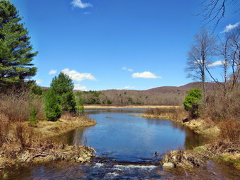
![]()
![]()
![]()
![]()
![]() On Sunday, May 3rd I wanted to get out for a longer hike after making barely a mile the day before. I originally was ordering the Huckleberry and Dry Brook Ridge Loop which is about 12 miles. I decided that jumping from 6 or 7 miles to 12 was not wise. I thought about going to Frick Pond to hike a loop that included some snowmobile trails that would lengthen the distance to over 8 miles. I asked Cindy if she wanted to hike and she scurried me by saying "Yes". I told her we could do the Frick Pond to Hodge Pond loop on the Quick Lake and Flynn Trails which is a little over 6 miles. We watched our church service together and then started to get ready at 11:30 AM. The temperature was already in the mid 60's and I knew it would get warmer so I decided to change my dress for the first time since late fall. I got dressed in my White Sierra long-sleeved crew top with a short-sleeved baselayer. The shirt has an insect repellent built-in which I knew I would appreciate as I anticipated a swarm on Mat flies. I put on a pair of RailRiders hiking pants which are expensive but last along time and have features like deep pockets and a generous cut which I really like. The pants have Velcro closures at the ankles to discourage sticks and gravel from getting into my shoes and also combat ticks. I decided to wear my Vasque Taku hiking boots which fit well and have been discontinued. I grabbed a pair of Leki external lock poles I have been using lately. I also added a new OR floppy hat which was another present from Cindy. I have decided it shields me from the sun and allows me to spray some insect repellant on it rather than on me. I did put on a pair of OR Bugout gaiters which are also insect resistant. I took along a light OR windbreaker. Sheila in particular was anxious to get out as we had only hiked a mile the day before while exploring waterfalls. We put our gear in the back and Sheila in the backseat and I drove out the Debruce Road about 6 miles. I turned left onto Mongaup Pond Road and continued to where the road split. I turned left onto Beech Mountain Road, and drove to the parking areas at the Frick Pond. There were only two cars in the smaller lot where I parked with another 5 or 6 in the larger lot. No one was in sight as we got ready to hike. Thermometer read 70 degrees as I set my GPS. The skies was clear and blue with plenty of sun. A slight breeze was blowing but the flies were gathering. We both sprayed on some insect repellant and headed out the woods road to the Quick Lake Trail. Just as we were leaving a couple were returning and they reported the trails were muddy. This was no surprise to us as we had gotten almost 5 inches of rain over the previous two day.
On Sunday, May 3rd I wanted to get out for a longer hike after making barely a mile the day before. I originally was ordering the Huckleberry and Dry Brook Ridge Loop which is about 12 miles. I decided that jumping from 6 or 7 miles to 12 was not wise. I thought about going to Frick Pond to hike a loop that included some snowmobile trails that would lengthen the distance to over 8 miles. I asked Cindy if she wanted to hike and she scurried me by saying "Yes". I told her we could do the Frick Pond to Hodge Pond loop on the Quick Lake and Flynn Trails which is a little over 6 miles. We watched our church service together and then started to get ready at 11:30 AM. The temperature was already in the mid 60's and I knew it would get warmer so I decided to change my dress for the first time since late fall. I got dressed in my White Sierra long-sleeved crew top with a short-sleeved baselayer. The shirt has an insect repellent built-in which I knew I would appreciate as I anticipated a swarm on Mat flies. I put on a pair of RailRiders hiking pants which are expensive but last along time and have features like deep pockets and a generous cut which I really like. The pants have Velcro closures at the ankles to discourage sticks and gravel from getting into my shoes and also combat ticks. I decided to wear my Vasque Taku hiking boots which fit well and have been discontinued. I grabbed a pair of Leki external lock poles I have been using lately. I also added a new OR floppy hat which was another present from Cindy. I have decided it shields me from the sun and allows me to spray some insect repellant on it rather than on me. I did put on a pair of OR Bugout gaiters which are also insect resistant. I took along a light OR windbreaker. Sheila in particular was anxious to get out as we had only hiked a mile the day before while exploring waterfalls. We put our gear in the back and Sheila in the backseat and I drove out the Debruce Road about 6 miles. I turned left onto Mongaup Pond Road and continued to where the road split. I turned left onto Beech Mountain Road, and drove to the parking areas at the Frick Pond. There were only two cars in the smaller lot where I parked with another 5 or 6 in the larger lot. No one was in sight as we got ready to hike. Thermometer read 70 degrees as I set my GPS. The skies was clear and blue with plenty of sun. A slight breeze was blowing but the flies were gathering. We both sprayed on some insect repellant and headed out the woods road to the Quick Lake Trail. Just as we were leaving a couple were returning and they reported the trails were muddy. This was no surprise to us as we had gotten almost 5 inches of rain over the previous two day.
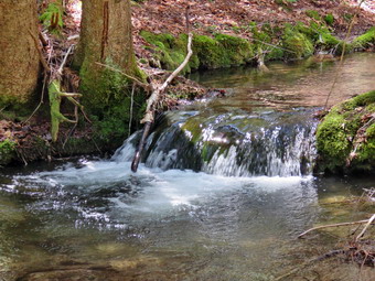 Once we passed the register on the Quick Lake Trail there was water everywhere and with the water came the mud. There was standing water on the trail and running water across and on the trail. The mud was particularly slippery and we had to watch our footing even on flat terrain. Just before we got to Gravestone Junction, we met a family of three and their dog. The dog was on a leash and I had put Sheila o hers. We stopped to talk a moment keeping our distance and then went in opposite directions. At Gravestone Junction, we turned left to stay on the Quick Lake Trail and head down to Frick Pond. This short piece of trail1 was a mud pit until we started down the hill. We stopped at the bridge across the outlet to Frick Pond and I took some shots of the pond and Flynn's Point. Snapping shots with all the flies around was challenging but I managed to get a few fly free photos. We didn't stay long and were soon walking along the west side of Frick Pond trying to avoid the water and mud. At the junction with the Big Rock Trail, we stayed to the left as we wanted to keep hiking the Quick Lake Trail. The first part of this section was dry but the next section made up for it. We entered the evergreen tunnel where the trail was only damp. Here wet met two women hiking toward us with masks. We kept our distance as did they but we did manage to exchange a few sentences before moving on. When we came to the small stream across the trail, we walked upstream to where we usually cross but found the water higher than we expected. After a quick look, it was still th best pace to cross and we did so without problems. I took a few shots of the stream and if the small "waterfall" the stream makes. We continued to push toward Iron Wheel Junction but were hampered by having to take detours around muddy areas and places where thee was water on the trail. We reached Iron Wheel junction at 1:20 PM after hiking 1.5 miles.
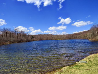 We turned left at the junction to stay on the Quick Lake Trail and head for Junkyard Junction and the Flynn Trail. The temperature had warmed up a few degrees and there was a breeze at times. The breeze kept us cool and drove away some of the flies. The next mile of trail is all uphill and although the grade only averages around 8% it seemed like a long slog in the heat. Cindy was lagging behind and seemed tired. We stopped briefly to rest and offered to turn around since we had not gotten half way but she decided to press on. We soon hit some flatter ground and started downhill toward Junkyard Junction. We arrived the junction at 2:15 PM after hiking 3.1 miles. We turned right to start out on the Flynn Trail and almost immediately ran into more mud and water than we had seen elsewhere. This trail is always wet as it is fairly flat and lower than much of the surrounding ground. By this time my feet were getting wet which was an uncomfortable feeling even though it was a warm day. We worked our way along the trail until we got to the gate which separates the state land from the Open Spaces Institute land around Hodge Pond. We continued on the Flynn Trail by turning right and following the trail downhill to an area near the shore of Hodge Pond. It is possible to turn in either direction at this point and Cindy chose right to stay on the Flynn Trail which was also my preference. As we turned two more people were coming our way so I stepped to the side of the trail to let them pass. This part of the trail was not quite as wet as other parts and we made good time as we headed toward the outlet end of Hodge Pond. We walked through a field where the dining hall had been for the Beech Mountain BoyScout camp and then walked through a short stretch of woods to the clearing at the south end of Hodge Pond. Sheila and I walked to the shore of the pond while Cindy hung back in the shade. I dropped my pack to get out my camera and took pictures of the beautiful blue sky with some white, puffy clouds. I decided to take a 360 degree set of shot to see if I could make a panorama of them. Sheila was in and out of the water so I threw a stick and took some pictures of her. When we were done, I packed up and we headed to where Cindy was waiting. We began the walk of the hill on the Flynn Trail which was the last climb before the long downhill back to the car.
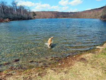 The walk up this hill often seems tedious but on this day we continued to talk to each other and were soon at the top of the hill. I was pretty sure the rest of the trail would seem dry compared to what we had already hiked and that seemed to be the case. We walked along the flat trail under threes passing through the other gate and arriving at the junction with the Big Rock trail at 3:05 PM after hiking 4.7 miles. We continued straight ahead on the Flynn Trail setting a fast pace over the flat part of the trail before jotting the downhill. I much prefer walking up the Flynn Trail while Cindy likes walking down it. In any case the 1.7 miles back to the parking area can be slow as there is not much to see. We reached the spot where there is an interesting to the left of the trail but we had been there recently and stayed on the main trail. I was somewhat lost in my thoughts when Cindy alerted me to a mountain biker coming up the trail. Bikes are legal on the trails but this is the very first time I have seen one in many trips to this area. The biker alerted us that there was another bike coming up the trail so I kept Sheila on her leash. As we approached the end of the trail, we saw three people ahead. A young girl was sitting in the middle of the trail but moved as we approached. A woman was sitting on the side of the trail with her feet in the cool water. All three looked as if they were ready to be finished hiking! We passed them and then ran into another member other party who seemed more fit and a little impatient. We continued won the trail and soon were passing through the tunnel we had cut in a large spruce tree that had fallen across the trail. We could see a group of three people standing where the trail turns off the woods road. As we approached, we all kept outdistance but they asked us some questions about the Flynn Trail. They had just come from trying to get to Frick Pond and found the trail too wet and muddy. We suggested they continue on the Flynn Trail to Hodge Pond and then turn around and come the same way. They thanked us and we moved on. We trend left on the trail to avoid the radiate property around the cabin. It was 3:50 Pm when we got back to the car after hiking 6.4 miles in 3 hours and 15 minutes with an elevation gain of 905 feet. Despite the water and the mud we had maintain an overall speed of 2.1 mph. The temperature was 72 degrees and we were both ready to go home.
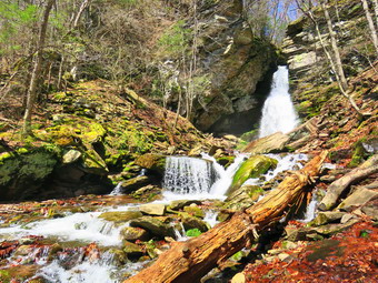
![]() On Saturday, May 2nd we visited Angel Falls on Sholam Road in Yagerville. When we had finished there, we decided to head to Peekamoose Road to visit Buttermilk Falls and the other waterfalls along the road. I drove up Sholam Road and turned right on Yagerville Road to head toward Sundown. As we crested a hill, I pulled over and parked on the right side of the road. I took out my camera and walked back down the road to take some pictures of the Shawangunks which are clearly visible form this viewpoint. As I gazed to my left which was easy, I saw a building on top of a ridge. I zoomed in confirmed my suspicions that it was the Smiley Tower at Mohonk. I took some more pictures but knew they would not do justice to the beautiful scene before me. As I turned around to go, I noticed an old house on the right side of the road. Although it was dilapidated and certainly had not been lived in for some time, I could see the character of the stone and remaining timbers. I took a few pictures and then returned to the car. We drove away and where the road split in Sundown, I turned right on Peekamoose Road. I drove 4.3 miles to the parking are for Buttermilk Falls on the left about a mile passed the parking area for Peekamoose Mountain and the Blue Hole. The Peekamoose parking are was full with some cars parking along the road. The previous parking areas for the camping spots had been cordoned off to allow extra space between cars. At Bear Hole Brook there were cars parked along the road and not in the parking area a few hundred feet down the road. I suspect these people were just too lazy to park in the designated areas. When I parked the car in we are happy to appeared to be the last available spot. We decided I would go zone to take a few shots. I got out of the car and walked to the falls and down to the stream bed. There were a few people around but I had an unimpeded view to the falls. I took my shots and then considered climbing to the top of the falls. I quickly decided against it as there were already people at the top and I knew the views were not that good.
On Saturday, May 2nd we visited Angel Falls on Sholam Road in Yagerville. When we had finished there, we decided to head to Peekamoose Road to visit Buttermilk Falls and the other waterfalls along the road. I drove up Sholam Road and turned right on Yagerville Road to head toward Sundown. As we crested a hill, I pulled over and parked on the right side of the road. I took out my camera and walked back down the road to take some pictures of the Shawangunks which are clearly visible form this viewpoint. As I gazed to my left which was easy, I saw a building on top of a ridge. I zoomed in confirmed my suspicions that it was the Smiley Tower at Mohonk. I took some more pictures but knew they would not do justice to the beautiful scene before me. As I turned around to go, I noticed an old house on the right side of the road. Although it was dilapidated and certainly had not been lived in for some time, I could see the character of the stone and remaining timbers. I took a few pictures and then returned to the car. We drove away and where the road split in Sundown, I turned right on Peekamoose Road. I drove 4.3 miles to the parking are for Buttermilk Falls on the left about a mile passed the parking area for Peekamoose Mountain and the Blue Hole. The Peekamoose parking are was full with some cars parking along the road. The previous parking areas for the camping spots had been cordoned off to allow extra space between cars. At Bear Hole Brook there were cars parked along the road and not in the parking area a few hundred feet down the road. I suspect these people were just too lazy to park in the designated areas. When I parked the car in we are happy to appeared to be the last available spot. We decided I would go zone to take a few shots. I got out of the car and walked to the falls and down to the stream bed. There were a few people around but I had an unimpeded view to the falls. I took my shots and then considered climbing to the top of the falls. I quickly decided against it as there were already people at the top and I knew the views were not that good.
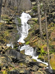 I returned to the car and drove further up the road to take a look at other two falls on the road side of the river. We could also see several seasonal falls on the other side of the river. I stopped just passed the next falls where there were no people and walked to the bridge to take some pictures. This waterfall had some logs blocking the water and the views were not great. I walked back to the car and drove a little farther up the road where there is another falls that I think is higher than Buttermilk. I drove passed the falls and turned around to park in a small pullover just before the falls. This time Cindy and I both got out to walk over to the falls which drove Sheila crazy. We both took some pictures of this falls which was easy since there were no other people. I was able to get a good angle by standing just off the road. As I walked back to the car, I also took some shots of the river. When we were I turned around and drove back toward Sundown. As we approached Bear Hole Brook I decided to pull over and take a few pictures. I again left Cindy and Sheila in the car and walked out the path to the small falls. This falls is more of a rapids but it is pretty. Two women were sitting in front of the falls and did not give any indication they would move so I took some shots anyway. I decided to walk back out to the road and walk on the path closer to the stream. By the time I did this, the two women had left th falls and I got some more good pictures. I went back to the car and suggested a few short hikes that we could do but Cindy was not interested. I was disappointed since we had hiked only about a mile but I knew I could hike on Sunday which would be an even nicer day. On the way home we tried to stop at McDonals at around 1:30 PM butt he line was up to the road so we headed home to support our local Chinese restaurant.
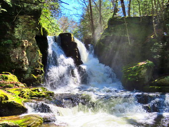
![]()
![]()
![]()
![]()
![]() On Saturday, May 2ndI wanted to get out of the house after two straight days of rainy weather. I asked Cindy if she would like to go see some waterfalls as I knew they should have a high volume after the recent rains. I suggested driving to Angel Falls on Sholam Road in Yagerville to hike to the upper and lower falls and then driving to Peekamoose Road to Buttermilk Falls and the other waterfalls along that road. Cindy agreed and we started to get ready around 9:00 AM. Sheila was frantic as she had not been out in several days and was running around the house splitting her time between us. The temperatures were forecast to be warm with highs in the 60's but as we were getting ready it was just 50 degrees. I put on my Mammut long-sleeved crew top without a baselayer since the temperature was already warm. I decided to wear my Columbia Titanium insulated pants but decided against tights underneath. I wore my Vasque Taku boots which are supportive, surprisingly roomy and discontinued. I grabbed my Leki external lock poles which I purchased since twist locks have proved unreliable. I also donned my Mammut hoody which was enough zippers to dump heat when needed. I put on a light hat and wore a light pair of gloves. At the last minutes, I put on my OR Crocodile gaiters to deal with the ticks and the mud which I was sure we would find. We got our gear and Sheila in my car and left Livingston Manor at around 9:45 AM after checking the mail. I drove east on State Route 17 to Liberty and then got on Route 55 to Grahamsville. I turned left onto Route 55A just after the Tri-Valley school and toward Sundown. I followed RT 55A as it turned right and crossed the Rondout Reservoir. I drove to Yagerville Road where I turned left and drove another 1.2 miles to Sholam Road. Here I turned right and drove to where the road dead ends. I parked under the powerlines at 10:30 AM and we got ready to hike. We noticed there were a great number of May flies so we both put on some repellant before starting the hike. I set my GPS and we started off down what used to be Sholam Road. The road is very eroded but makes a good trail which is why I was surprised to see the sign. The sign posted by the DEP stated that the road was seasonal use only and was not maintained. I found this funny since no one would think that this "road" was fit for any vehicle except for a four wheeler! I was pleased that I could hear a roar coming from the falls apparently indicating a good volume of water. We walked along the road passing the top of the falls and continuing upstream a little farther. There was a good volume of water so I walked over to the side of the stream and out onto a flat rock. This allowed me to take pictures upstream and downstream. I considered walking a little more along the stream or on what was left of the road but instead tuned around and walked back to the top of the falls. At the top of the falls I turned right on a path that parallels Trout Creek. I looked down at the falls and saw that it was higher than I had seen it in some time. Trout Creek is rather long extending around 5 miles from Balsam Swamp. Over its course it picks up a few tributaries.
On Saturday, May 2ndI wanted to get out of the house after two straight days of rainy weather. I asked Cindy if she would like to go see some waterfalls as I knew they should have a high volume after the recent rains. I suggested driving to Angel Falls on Sholam Road in Yagerville to hike to the upper and lower falls and then driving to Peekamoose Road to Buttermilk Falls and the other waterfalls along that road. Cindy agreed and we started to get ready around 9:00 AM. Sheila was frantic as she had not been out in several days and was running around the house splitting her time between us. The temperatures were forecast to be warm with highs in the 60's but as we were getting ready it was just 50 degrees. I put on my Mammut long-sleeved crew top without a baselayer since the temperature was already warm. I decided to wear my Columbia Titanium insulated pants but decided against tights underneath. I wore my Vasque Taku boots which are supportive, surprisingly roomy and discontinued. I grabbed my Leki external lock poles which I purchased since twist locks have proved unreliable. I also donned my Mammut hoody which was enough zippers to dump heat when needed. I put on a light hat and wore a light pair of gloves. At the last minutes, I put on my OR Crocodile gaiters to deal with the ticks and the mud which I was sure we would find. We got our gear and Sheila in my car and left Livingston Manor at around 9:45 AM after checking the mail. I drove east on State Route 17 to Liberty and then got on Route 55 to Grahamsville. I turned left onto Route 55A just after the Tri-Valley school and toward Sundown. I followed RT 55A as it turned right and crossed the Rondout Reservoir. I drove to Yagerville Road where I turned left and drove another 1.2 miles to Sholam Road. Here I turned right and drove to where the road dead ends. I parked under the powerlines at 10:30 AM and we got ready to hike. We noticed there were a great number of May flies so we both put on some repellant before starting the hike. I set my GPS and we started off down what used to be Sholam Road. The road is very eroded but makes a good trail which is why I was surprised to see the sign. The sign posted by the DEP stated that the road was seasonal use only and was not maintained. I found this funny since no one would think that this "road" was fit for any vehicle except for a four wheeler! I was pleased that I could hear a roar coming from the falls apparently indicating a good volume of water. We walked along the road passing the top of the falls and continuing upstream a little farther. There was a good volume of water so I walked over to the side of the stream and out onto a flat rock. This allowed me to take pictures upstream and downstream. I considered walking a little more along the stream or on what was left of the road but instead tuned around and walked back to the top of the falls. At the top of the falls I turned right on a path that parallels Trout Creek. I looked down at the falls and saw that it was higher than I had seen it in some time. Trout Creek is rather long extending around 5 miles from Balsam Swamp. Over its course it picks up a few tributaries.
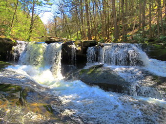 We walked along the path which was very wet and muddy from two days of rain. I was looking for a way down to the stream bed and found a steep and slippery path heading to the left and down to the creek bed. I was not sure this was the path I had used before as it was very steep. I was able to make my way down using my poles that were absolutely essential. I worked my way down the bank with Sheila leading the way but Cindy elected to stay on the upper path. We ended up at some rocks at the base of the falls. All the rocks were slippery which did not bother Sheila but concerned me. I was able to get out my camera and walk out on some of the rocks to get a good view of the falls. I took shots of the falls and some downstream. To capture the volume and character of the falls, I shot a short video before packing up and heading back up to the main trail. Although the trail isn't really maintained, someone had cut a few of the trees that had been across the trail. We continued down the path heading toward the lower falls. The trail can be overgrown with weeds but was relatively clear as this is a popular spot for people in the area. I was happy that there was almost no broken glass around the area. We walked to the top of the falls and I walked out on a flat rock shelf. The shelf allowed me to take pictures of the falls and upstream. I also took some more shots over the falls and downstream. We walked a little farer downstream where I found another flat rock that is just below the top of the falls and gives a view directly at the falls. I worked my way down to the rock by squeezing between some other rock outcroppings. I was able to take shots of the waterfalls head on. I also took some as the water flowed passed me and down to the lower pool. I worked my way back up to where I had left my pack and headed down the path to the base of the falls where there are some old foundations. I walked down to the creek bed and out onto some rocks which gave me a good view of the falls. This drop is not as high as the upper falls but is still pretty in its own way. After taking a few pictures. I carefully made my way back to my pack. I have always wanted to go to the other side if the stream as I have seen people there but I do not know how to get access. I took a few pictures of the foundations and then walked a little farther away from the stream to find an even larger set. After finishing, I headed up the hill Weber Cindy and Sheila were Waiting. We worked our way up a steep path back to Sholam Road and back to the car. It was 11:30 AM and we had hiked only .9 miles in about one hour with 200 feet of elevation gain.
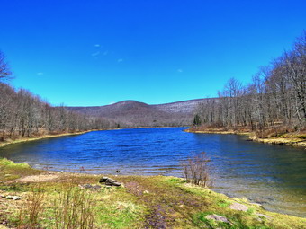
![]()
![]()
![]()
![]()
![]() On Tuesday, April 28th I wanted to get out for a longer hike not too far from home. I eked Cindy if she would like to go and she said "Yes, as long as its not too far or too hilly!" After some discussion, we decided we would go to Big Pond for a hike to Little Pond and back. I had several possibilities to complete this loop including staying on the trails, walking back on the roads and making a side trip to Cabot Mountain. The temperature was in the high 30's in the morning but we knew it would get warmer in the afternoon. We both had work to do so we did not start getting ready until1:30 PM when the temperatures was 54 degrees. I started to get ready, and Sheila seemed happy that both Cindy and I were going hiking. I put on my Mammut long-sleeved crew top without a baselayer since the temperature was already warm. I decided to wear my Columbia Titanium insulated pants but decided against tights underneath. I wore my Vasque Taku boots which are supportive, surprisingly roomy and discontinued. I grabbed my Leki external lock poles which I purchased since twist locks have proved unreliable. I also donned my Mammut hoody which was enough zippers to dump heat when needed. I put on a light hat and wore a light pair of gloves. At the last minutes, I put on my OR Crocodile gaiters to deal with the tick s and the mud which I was sure we would find. We left Livingston Manor at 1:55 PM and I drove toward Roscoe on Old Route 17. I turned right on Beaverkill Road after 1.3 miles and continued north on Beaverkill Road for 10.8 miles passing through Lew Beach. As the Beaverkill Road turned right, I turned left onto Barkaboom Road and drove .8 miles to the parking area for Big Pond on the right. There were two pickup trucks parked and it seemed the occupants were fishing from the shore. I grabbed my camera and walked down to the shore of the pond to take some pictures. The water was placid with blue skies overhead. The most striking discovery was that the south faces of the surrounding hills were covered in a white layer of snow! I returned to the car and Cindy and I got ready to hike. We noticed that there were quite a few cars passing by on this small back road and that many were from New Jersey! This once again proves the ignorance and selfishness of so many people. I set my GPS noticing that the temperature was 52 degrees with a slight breeze blowing. Some April flies were starting to gather and I hoped they would stay away.
On Tuesday, April 28th I wanted to get out for a longer hike not too far from home. I eked Cindy if she would like to go and she said "Yes, as long as its not too far or too hilly!" After some discussion, we decided we would go to Big Pond for a hike to Little Pond and back. I had several possibilities to complete this loop including staying on the trails, walking back on the roads and making a side trip to Cabot Mountain. The temperature was in the high 30's in the morning but we knew it would get warmer in the afternoon. We both had work to do so we did not start getting ready until1:30 PM when the temperatures was 54 degrees. I started to get ready, and Sheila seemed happy that both Cindy and I were going hiking. I put on my Mammut long-sleeved crew top without a baselayer since the temperature was already warm. I decided to wear my Columbia Titanium insulated pants but decided against tights underneath. I wore my Vasque Taku boots which are supportive, surprisingly roomy and discontinued. I grabbed my Leki external lock poles which I purchased since twist locks have proved unreliable. I also donned my Mammut hoody which was enough zippers to dump heat when needed. I put on a light hat and wore a light pair of gloves. At the last minutes, I put on my OR Crocodile gaiters to deal with the tick s and the mud which I was sure we would find. We left Livingston Manor at 1:55 PM and I drove toward Roscoe on Old Route 17. I turned right on Beaverkill Road after 1.3 miles and continued north on Beaverkill Road for 10.8 miles passing through Lew Beach. As the Beaverkill Road turned right, I turned left onto Barkaboom Road and drove .8 miles to the parking area for Big Pond on the right. There were two pickup trucks parked and it seemed the occupants were fishing from the shore. I grabbed my camera and walked down to the shore of the pond to take some pictures. The water was placid with blue skies overhead. The most striking discovery was that the south faces of the surrounding hills were covered in a white layer of snow! I returned to the car and Cindy and I got ready to hike. We noticed that there were quite a few cars passing by on this small back road and that many were from New Jersey! This once again proves the ignorance and selfishness of so many people. I set my GPS noticing that the temperature was 52 degrees with a slight breeze blowing. Some April flies were starting to gather and I hoped they would stay away.
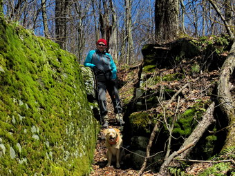 I put Sheila on her leash, and we crossed the road at 1:15 PM to begin our hike up Touch-Me-Not Mountain on the Touch-Me-Not Trail which is part of the Finger Lakes Trail. The first part of the trail is an old woods road, and it is pretty easy to follow. I let Sheila on her leash for a while and let her pull me up the first hill passing the trail register. When I let her off her leash, she began running all over the place as we trudged up the trail. The trail was pretty dry with a few areas of slippery mud. The first mile of the trail gains about 775 feet with an average grade of 15%. Some places are almost flat which means there are a few steeper places. I began to notice that the blazing of the trail could be better. This is a trail I maintain for the Finger Lakes Trail Conference from Big Pond all the way over Cabot Mountain to Beech Hill Road. Volunteers used to be able to put up trail markers, but the DEC decided that a forester must now do this. I made a note to call Stamford to tell them that they needed to have someone add markers before winter when it would be harder to find the trail. Most blazes were too far apart. Some were very old and faded with others grown into the trees. A few were on the side of the tree meaning they were not visible from either direction on the trail. Many of the turns were not properly marked. Several times I just followed Sheila who seems to be able to find the right direction no matter what. It was obvious in several areas that there had been significant rain as the trail was badly eroded. In several spots the water and mud on the trail forced us to work our way around them by walking off the trail. I was happy that there were only two small blowdowns which I knew I could remove myself. In a few places, the trail traveled along the side of the hill, and this made for some tricky footing. We found ourselves walking beside the trail which is not good as it simply widens the area for more erosion. We removed a lot of branches as we walked. We alternated times of conversation with periods when we were lost in our own thoughts. I WA surprised when at 2:05 PM we had hike 1.1 miles to the highest point on the trail on the shoulder of Touch-Me-Not Mountain. After a slight descent, we came to a large blowdown that had once blocked the trail. A good piece of the trunk had been cut away to provide an easy path. I realized that there were several other blowdowns on the trip up that were missing and assumed a DEC crew had been through since the early summer. We walked down the hill to the next trail junction and turned right on the yellow loop trail around Little Pond.
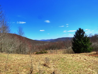 The loop trail is very popular with campers during the season and the trail bed was a little more obvious. At one point the trail passed between two large boulders forming a sort of Rick cut. I noticed some snow piled up in the shade and took some pictures. I went first through the "cut" and then has Cindy and Sheila pause for some shots. We continued along the trail descending another rocky area to find a large tree across the trail. It was obvious hikers had been walking to the left around the butt end of the tree which is what we did. At 1.6 miles we had finally arrived at the cutoff to Cabot Mountain. I asked Cindy if she would like to climb to the summit to get the view of Little Pond from the vista. She said 'No' and I can't say I was disappointed. We continued our hike by bearing left to stay on the loop trail. There were several blowdowns in this area that would require tools to remove. After a short walk, we came to a large, flat stone on the right side of the trail. I remembered taking pictures of our grand children there and had Cindy and Sheila poses fro some pictures. As we left, I realized how much I missed our grandchildren. At 1.8 miles we arrived in the clearing that acts as a viewpoint. It is hard to see Little Pond from this lookout since the trees have grown up. This is a place that holds many memories as we hiked the loop many times when I was younger. We stopped, and I got out the camera to take pictures of the hills and the blue sky. The scene kept changing as the light played off the hills in different ways. I packed up, and we continued the hike passing the small foundation of a long-forgotten homestead cabin. I noticed the pond to the right of the trail and decided to inspect it and take some pictures. The pond used to be very small and had gotten larger over the years. I took some shots and notice the flies were now congregating so we move on. The main trail was covered in water from the outlet of the pond but we crossed easily. Ahead of us on Te trail was one of the biggest blowdowns I had seen in some time. A huge tree with three different trunks had completely blocked the trail. I stood in awe for a minute planning how I might cut it with hand tools! As we walked around to the right of the tree, we both noticed a small building a little farther off the trail. I had seen this before and assumed it was an outhouse but decided to explore. I walked up to the building and confirmed it was an outhouse. I took a few pictures wondering why the outhouse was in an area with no other foundations. I walked back out to the main trail which soon turned left off the woods road.
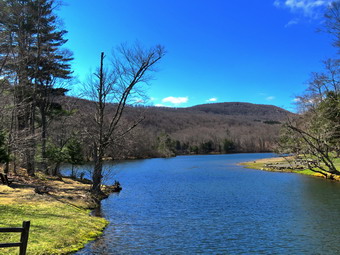 The trail headed down through the forest and was wet and extremely eroded making the walk difficult. We walked off trail to avoid the worst spots. The trail continued to be wet with water in places where I had not seen any water before. We walked downhill encountering a large blowdown that blocked the trail near a large beaver pond. We bushwhacked around the tree and to avoid the flooded trail. I stopped at the shore of the beaver pond to take some pictures and then again at the dam. Both the pond and the dam were larger than I remembered! We walked a short distance to the loop trail around Little Pond. At the pond, we turned right to walk around the western shore of Little Pond. As we walked along the shore to the boat launch area, we could see Touch-Me-Not Mountain where we had been a short time ago. We stopped at the boat launch area, and I took some photos of Touch-Me-Not Mountain and the pond. Sheila decided to go wading. I took a picture and the, for some reason, told her to sit. She started to sit in the cold water and thought better of it and came running out of the water. As we walked along the road, I began to see picnic tables leaning on the fireplaces at the campsites. We turned left on a trail to head for the bridge at the outlet of Little Pond. We crossed the bridge, and I dropped my pack to take a few last pictures before leaving the Little Pond area. We now had a choice to return on the roads or hike back up Touch-Me-Not Mountain on the Campground Trail. I knew Cindy was not enthusiastic at the prospect of hiking back up the mountain and back down the slippery trail to Big Pond. I decided we would walk back to Big Pond using the access road and Barkaboom Road. We walked over to the parking area and turned right to walk out the access road. We walked out to the gatehouse and started down the hill toward Barkaboom Road. Ahead, we could see a man cutting some trees that had fallen on the road. As we passed him we said "hello". He was the only person we saw except at the Big Pond parking area. The road was closed at the second gate, and the walk was very peaceful. We walked a little less than a mile down to Barkaboom Road and turned left to hike up the road back to Big Pond. I put Sheila on her leash for the .6 mile hike back to the car even though there was no traffic. The stream beside the road was full of water. I pointed out to Cindy an old foundation near the stream with what looked like a smaller stream running near it. I thought this might be the remnants of an old mill. We walked up the hill and back to the car in the parking area. We were back at the car at the car at 4:20 PM having hiked 4.8 miles in 3 hours and 5 minutes. The elevation gain was about 1000 feet. I put Sheila in the car, stowed my gear in the back and headed home.
![]()
![]()
![]()
![]() On Monday, April 27th it was still only in the mid 40's but there was some sun. I asked Cindy if she would like to hike across the street on Round Top and she agreed. We did some chores around the house and then started to get ready to hike at 11:30 AM. Sheila showed her appreciation by barking at me and running from where I was getting ready to Cindy. I put on my Mammut long-sleeved crew top without a baselayer since the temperature was rising slightly. I decided to wear my Columbia Titanium insulated pants to keep the chill away but decided against tights underneath. I wore my Keen Targhee II boots which are supportive and surprisingly roomy. I grabbed my Leki external lock poles which I purchased since twist locks have proved unreliable. I also donned my Mammut hoody which was enough zippers to dump heat when needed. I put on a light hat and wore a light pair of gloves. At noon we walked out the door to start the hike. Immediately I noticed that the skies were sunny and that it was warmer than I thought it would be. I grabbed Sheila's leash from the car and we walked up the driveway. I decided we would try to do some figure 8's on the Round Top Trails. I aimed to hike for about an hour. Sheila was happy to get out as we crossed the street and walked to the parking area by the Presbyterian Church. We walked to the back of the church and began the ascent of the steepest hill behind the church. There was no snow or ice anywhere which was not surprising since the temperatures had been a little warmer recently. The hill is short but gets the circulation pumping and is the steepest and longest climb on the "trail." Sheila helped me along by pulling me up the hill. When we got to the top of the hill, we started on the trail by turning left at the trailhead. I let Sheila off her leash so that she could explore.
On Monday, April 27th it was still only in the mid 40's but there was some sun. I asked Cindy if she would like to hike across the street on Round Top and she agreed. We did some chores around the house and then started to get ready to hike at 11:30 AM. Sheila showed her appreciation by barking at me and running from where I was getting ready to Cindy. I put on my Mammut long-sleeved crew top without a baselayer since the temperature was rising slightly. I decided to wear my Columbia Titanium insulated pants to keep the chill away but decided against tights underneath. I wore my Keen Targhee II boots which are supportive and surprisingly roomy. I grabbed my Leki external lock poles which I purchased since twist locks have proved unreliable. I also donned my Mammut hoody which was enough zippers to dump heat when needed. I put on a light hat and wore a light pair of gloves. At noon we walked out the door to start the hike. Immediately I noticed that the skies were sunny and that it was warmer than I thought it would be. I grabbed Sheila's leash from the car and we walked up the driveway. I decided we would try to do some figure 8's on the Round Top Trails. I aimed to hike for about an hour. Sheila was happy to get out as we crossed the street and walked to the parking area by the Presbyterian Church. We walked to the back of the church and began the ascent of the steepest hill behind the church. There was no snow or ice anywhere which was not surprising since the temperatures had been a little warmer recently. The hill is short but gets the circulation pumping and is the steepest and longest climb on the "trail." Sheila helped me along by pulling me up the hill. When we got to the top of the hill, we started on the trail by turning left at the trailhead. I let Sheila off her leash so that she could explore.
At the first trail junction, we followed Sheila as she turned right on the woods road which is the shallower approach to the trail system. The road had areas that were wet and very slippery with mud. We continued to follow the yellow trail to the first junction where we turned left and followed it to the next trail junction. We kept a quick pace as we walked even though the trail was wet and slippery in places. At the second junction with the blue trail, we turned right and started up the steep blue trail that leads over the summit of Round Top. As we ascended the trail, there were places where the trail was muddy and slippery but walking beside the trail to get traction was difficult. I began to think that my idea of putting in a switchback or two was a good idea. I saw that putting one to the left of the trail would not work as the terrain was even steeper there. I took a quick look to the right and saw a perfect place to divert the trail. We finished the ascent and walked across the flat summit of Round Top to start down the other side. Descending was also tricky as there were wet and slippery spots. I began to think that heading straight up the hill and straight down was not the best idea. Several different solutions came to mind including, once again, rerouting the trail to include a switchback or two. Soon we were back at the yellow trail where we turned right and walked to the next trail junction. This time we turned left and followed the yellow trail downhill toward the lookout. I stopped to take a look down to the school and town before continuing on the trail as it turned left and descended to the first trail junction. Even this part of the trail was a little muddy and slippery. This section of trail gets the most traffic as some people simply walk up to the viewpoint and then back down. At the first trail junction we turned around and started back up toad the viewpoint. We continued to follow the yellow trail as it turned right at the viewpoint and then gained elevation to the junction with the blue trail. We turned right and continued to follow the yellow trail along the base of Round Top to the next junction with the blue trail. We turned left and walked up the blue trail to cross the summit of Round Top. The ascent went well but we did have to watch for some muddy areas. The descent on the other side was tricky but we did make it down without incident. At the trail junction with the yellow trail we turned left and followed the trail along the base of Round Top again. At the next trail junction, we turned right this time and walked down the trail to the woods road and out to the first trail junction. I checked the time and determined that we should return home. We walked out toward the trailhead where I put Sheila on her leash. We walked down the hill and through the church parking lot to the road and to our driveway. It was 1:10 PM and we had hiked around 2 miles in a little over an hour with elevation gain of about 600 feet.
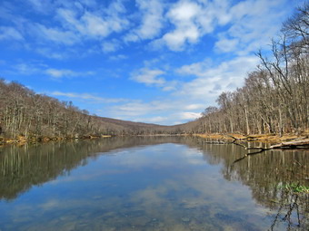
![]()
![]()
![]()
![]()
![]() On Saturday, April 25th, I had planned to hike locally but longer than some of the hikes I had been taking. I decided to hike at Trout Brook but to do a loop that was at least 7 miles long including a walk along Campbell Brook Road and Morton Hill Road. I got up late again after some ambulances calls the day before. I started to get ready at 11:00 AM when the temperature was already 51 degrees. We had missed a walk the day before so Sheila was more than ready to hike. I put on my Mammut crew top but decided to forego a baselayer as I knew the forecast called for warmer temperatures. I decided to wear my Columbia Titanium insulated pants without baselayer although I knew they might be too warm. I wore my Vasque Taku boots since they were dry and light enough for hiking. I grabbed a pair of Leki poles with external locks that I have been using lately. I also donned my Mammut hoody which blocks the wind but has enough zippers to dump heat when needed. Finally, I put on my OR Crocodile gaiters to deal with the mud and the ticks. I put my gear in the car and Sheila in the back seat as we left Livingston Manor at 11:30 AM to head toward Roscoe on Route 17. Sheila was happy since she was getting used to the increased number of hikes. I got off the Quickway at exit 94 and headed north on Route 206 through Roscoe and across the Rockland Flats. Just after entering Delaware County, I turned left on Morton Hill Road and drove to Russell Brook Road. I turned around and parked on the side of the road to avoid parking in the large lot which is on private property. When I got out of the car, the first thing I noticed was that there were a lot of April flies around my head. I checked my pack and found some repellent which sprayed on my face and neck. I let Sheila out of the care and put her on her leash as I could see a truck parked at the first camping area on Russell Brook Road. I set my GPS and we began our hike at 11:45 AM by starting down Russell Brook Road. We passed the camping area where there was country music blaring drowning out all the silence and sounds of the country. I let Sheila off her leash to run some as we continued down the road. We moved over twice to allow cars to pass. I decided I wanted to mostly hike and only take a few pictures, if any. As we passed the lookout over the upper falls, I took a look and found the water level was lower than the last time I had visited. I decided we would forego the falls. When we arrived at the lower parking area, there were at least 6 cars parked and two or three groups of people getting ready to hike. Several of the cars had New Jersey license plates! So much for 'Hike Locally'. Forest Ranger Stephen Ellis from the Region 4 Zone B office was in the parking area and I spoke to him for a couple of minutes before heading out on the trail.
On Saturday, April 25th, I had planned to hike locally but longer than some of the hikes I had been taking. I decided to hike at Trout Brook but to do a loop that was at least 7 miles long including a walk along Campbell Brook Road and Morton Hill Road. I got up late again after some ambulances calls the day before. I started to get ready at 11:00 AM when the temperature was already 51 degrees. We had missed a walk the day before so Sheila was more than ready to hike. I put on my Mammut crew top but decided to forego a baselayer as I knew the forecast called for warmer temperatures. I decided to wear my Columbia Titanium insulated pants without baselayer although I knew they might be too warm. I wore my Vasque Taku boots since they were dry and light enough for hiking. I grabbed a pair of Leki poles with external locks that I have been using lately. I also donned my Mammut hoody which blocks the wind but has enough zippers to dump heat when needed. Finally, I put on my OR Crocodile gaiters to deal with the mud and the ticks. I put my gear in the car and Sheila in the back seat as we left Livingston Manor at 11:30 AM to head toward Roscoe on Route 17. Sheila was happy since she was getting used to the increased number of hikes. I got off the Quickway at exit 94 and headed north on Route 206 through Roscoe and across the Rockland Flats. Just after entering Delaware County, I turned left on Morton Hill Road and drove to Russell Brook Road. I turned around and parked on the side of the road to avoid parking in the large lot which is on private property. When I got out of the car, the first thing I noticed was that there were a lot of April flies around my head. I checked my pack and found some repellent which sprayed on my face and neck. I let Sheila out of the care and put her on her leash as I could see a truck parked at the first camping area on Russell Brook Road. I set my GPS and we began our hike at 11:45 AM by starting down Russell Brook Road. We passed the camping area where there was country music blaring drowning out all the silence and sounds of the country. I let Sheila off her leash to run some as we continued down the road. We moved over twice to allow cars to pass. I decided I wanted to mostly hike and only take a few pictures, if any. As we passed the lookout over the upper falls, I took a look and found the water level was lower than the last time I had visited. I decided we would forego the falls. When we arrived at the lower parking area, there were at least 6 cars parked and two or three groups of people getting ready to hike. Several of the cars had New Jersey license plates! So much for 'Hike Locally'. Forest Ranger Stephen Ellis from the Region 4 Zone B office was in the parking area and I spoke to him for a couple of minutes before heading out on the trail.
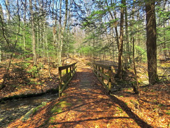 We turned right on the trail out of the parking area following a couple. We crossed the bridge and the couple decided to visit the falls while we continued straight ahead on the trail up to Trout Pond. A family of three as following us so I tried to set a quick pace to stay ahead of them. It seems that they would match our speed but we did not see them again so I assumed they turned left to hike up to Mud Pond. The trail was wet with some running and some standing water which generated some mud and made everything slippery. At one point Sheila alerted and I looked up to find father and son coming toward us with their dog. The dog was on a leash and the mother was just a little farther bind. As we passed, we said "Hello" and then continued in our opposite directions. As we approached the pond, I changed my mind about pictures and walked over to the beach. I got my camera out of the pack. I took few pictures of the pond since the sky had the puffy white clouds that I like on a background of bright blue. I got a bar and had a drink since I was very warm. I ha opened all the zippers on the hoody which helped a little. After a few minutes, we departed and continued toward the lean-tos at the upper end of the pond. The main trail was wet and muddy but we made good time. As we approached the upper end of the lake, I saw a young couple crossing the first bridge and then bearing to the right to continue up the Campbell Brook Trail. This was the route I intended to take but they were moving pretty fast so I hoped we would not catch them. When we arrived at the lower lean-to, I was surprised to find it unoccupied. We continued to the right of the lean-to and started to ascend the Campbell Brook Trail toward Campbell Brook Road. This trail was obviously less used than the trails around the pond and had a little more ascent than I remembered. A short distance up the trail there was a group of people stopped in the trail. As we approached they moved to the side. I could see it was the couple we had been following and three other young men. I stooped to talk keeping my distance. As we talked in seemed that none of them knew exactly we are happy to trail they were on or where they had parked! The couple said they had parked at the end of the snowmobile trail on Campbell Brook Road and had hiked that trail to the highest point. They said there was even some snow still in the woods. I thought that it was strange that they didn't have a map but I wished them well and moved on. Over the next .75 miles we gained 420 feet to the highest point on the hike at 2470 feet which was an average of a 10.5% grade. Near the top of the climb a snowmobile trail heads off to the right but I wanted to make sure we got in over 6 miles so we continued to the left on the Campbell Brook Trail. The sign at the top clearly stated Campbell Brook Road but the distance looked like it could be 1.0 miles or 1.9 miles! We immediately began to descend which was easier than the ascent and the trail was in much better shape than I remembered. In the next .75 miles we lost most of the elation we had gained at about the same grade. The trail went through a number of switchbacks which moderated the grade. Since there were still no leave son the trees it was easy to see the ridges and sky to the north. The sky was a bright blue and there was plenty of sun. At 3.5 miles we crossed and recrossed Campbell Brook on two good bridges. I stopped to take a few pictures of the bridges and the stream. We began a slight ascent and the trail, which had bee dry, began to get wet again. I looked ahead and could see what looked like a road with abrade black culvert.
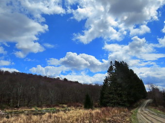 We hit Campbell Brook Road at 3.8 miles and immediately turned right to start the road walk back. I did not notice any cars in the small parking area. I left Sheila off her leash for the road walk but kept it in my pocket in case I needed it. Several vehicles did pass us but most slowed down and Sheila is very good about staying by my side. As we started walking east on Campbell Brook Road I checked at the trailhead for the snowmobile trail. No one was parked and there was no evidence a vehicle had been parked there. We walked along the road in the shade until there were no more trees and as we broke out into the sun the difference was noticeable. At 4.25 miles Campbell Mountain Road goes off to the left but we continued straight ahead on Morton Hill Road. The road continued to ascend until at 4.6 miles the road turned sharply south and started a long descent. There wasn't much to see along the road although the walk was pleasant. Several vehicles went by one way or the other including Footrest Range Stephen Ellis who stopped to talk. He also was puzzled by the couple I had met. We continued our walk until we came to a pond on the left side of the road at about 5.4 miles. I stopped to take some pictures but was immediately surrounded by a huge swarm of April flies. I tried to snap a few shots and them covered myself in insect repellent and took off. A slight breeze began to blow and that, coupled with our fast pace, seemed to keep the flies away. We contused south on Morton Hill Road until we again entered the shade of the trees. I knew we were close to the car. I could see a pickup truck pulled into the woods and almost off the road just ahead. Two people were walking back to the truck and called to me as we passed. They wanted to know about trailhead with fewer people than Trout Pond and I gave them some options. I noticed their New Jersey license plate but decided that asking questions would prove pointless. We moved on and soon were back at the car. At 2:45 PM we were back at the car after hiking 7 miles in 3 hours with an average speed of 2.4 mph and an elevation gain of 1163 feet. The temperature at the car was now 62 degrees. On the way home I stopped at Northern Farmhouse Pasta and scored some wild ramp ravioli and two kinds of pasta.
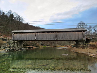
![]()
![]()
![]()
![]()
![]() On Thursday, April 23rd, the weather was horrendous with rain, snow and sleet all morning an temperatures below 40 degrees! I had almost decided to take a day off when I looked at the weather and saw that it was supposed to rain all day Friday! I asked Cindy if she wanted to hike and agreed but, like me, wanted to try something new. I had thought about going to the Beaverkill Valley and hiking a 6 mile road loop on Craigie Claire Road and Beaverkill Valley Road. I knew Cindy would not want to hike that far but would like a relatively flat route. I suggested we park at the Beaverkill State Campgrounds near the Beaverkill Covered Bridge and hike around the campgrounds. Cindy agreed but we both wanted to wait until there was a break in the weather. At 2:00 PM the break we were waiting for occurred although the forecast seemed to indicate it would be short. The temperature was 44 degrees but the dampness made it feel colder as we began to get ready. I got dressed in a wool Patagonia half zip top with no baselayer. This top is very warm but adjusts well to both cold and warm weather. It is very soft and comfortable. I decided to wear my Columbia Titanium insulated pants to keep the chill away but decided against wearing tights underneath. I wore my Vasque Taku boots which have been discontinued but were dry and offer good support. I decided not to wear gaiters as there was no snow and I expected we would be on roads are wide trails most of the time which reduced the chance of ticks. I decided to take my new pair of Leki poles with external locks as the internal twist locks fail. I grabbed a light hat and gloves. Finally, I also donned my Mammut hoody which blocks the wind and keeps me warm but has enough zippers to dump heat when needed. We put our gear in the back of the car and Sheila in the back seat and left the house at 2:45 PM. I drove out Old Route 17 toward roscoe and turned right on Beaverkill Road. As we started the descent into the Beaverkill Valley, I turned left on Campsite Road and followed it down to the parking area near the Beaverkill Covered Bridge. As I parked, there was only car in the lot. I grabbed my camera and walked over to an area downstream of the covered bridge to take some pictures. Sheila came with me and stayed close by as I took pictures of the bridge and a few downstream. The river was higher than usual from the recent rains. As we started back to the car, three more vehicles pulled into the lot so I immediately put Sheila on her leash.
On Thursday, April 23rd, the weather was horrendous with rain, snow and sleet all morning an temperatures below 40 degrees! I had almost decided to take a day off when I looked at the weather and saw that it was supposed to rain all day Friday! I asked Cindy if she wanted to hike and agreed but, like me, wanted to try something new. I had thought about going to the Beaverkill Valley and hiking a 6 mile road loop on Craigie Claire Road and Beaverkill Valley Road. I knew Cindy would not want to hike that far but would like a relatively flat route. I suggested we park at the Beaverkill State Campgrounds near the Beaverkill Covered Bridge and hike around the campgrounds. Cindy agreed but we both wanted to wait until there was a break in the weather. At 2:00 PM the break we were waiting for occurred although the forecast seemed to indicate it would be short. The temperature was 44 degrees but the dampness made it feel colder as we began to get ready. I got dressed in a wool Patagonia half zip top with no baselayer. This top is very warm but adjusts well to both cold and warm weather. It is very soft and comfortable. I decided to wear my Columbia Titanium insulated pants to keep the chill away but decided against wearing tights underneath. I wore my Vasque Taku boots which have been discontinued but were dry and offer good support. I decided not to wear gaiters as there was no snow and I expected we would be on roads are wide trails most of the time which reduced the chance of ticks. I decided to take my new pair of Leki poles with external locks as the internal twist locks fail. I grabbed a light hat and gloves. Finally, I also donned my Mammut hoody which blocks the wind and keeps me warm but has enough zippers to dump heat when needed. We put our gear in the back of the car and Sheila in the back seat and left the house at 2:45 PM. I drove out Old Route 17 toward roscoe and turned right on Beaverkill Road. As we started the descent into the Beaverkill Valley, I turned left on Campsite Road and followed it down to the parking area near the Beaverkill Covered Bridge. As I parked, there was only car in the lot. I grabbed my camera and walked over to an area downstream of the covered bridge to take some pictures. Sheila came with me and stayed close by as I took pictures of the bridge and a few downstream. The river was higher than usual from the recent rains. As we started back to the car, three more vehicles pulled into the lot so I immediately put Sheila on her leash.
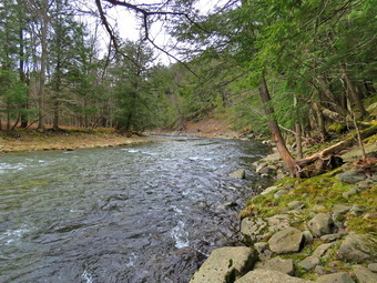 We started our hike at 3:05 PM as I set my GPS and headed out be crossing the bridge to the west side of the river. As we exited the bridge, we turned left on a woods road that parallels the river. We walked passed a spring house and I a short distance later we stopped so that I could take some shots of the river. I also noticed some water on the other side of the road which was covered in what looked like floating duckweed. I also took some pictures of it before continuing on. Soon we passed what was once a bathroom for campsites that had long since disappeared. At the next bathroom we stopped so that I could take some more pictures. There was a picnic table so I took some pictures of Sheila and Cindy and then some of the river which made a bend there. In several areas the DEC had placed large rocks along the shore and covered them with heavy wire to reduce erosion. Before leaving I also took pictures of the deteriorating bathrooms. At about .7 miles the woods road met the paved road that serves the campsites and we continued along the river. The campsite each ad a cement block fireplace with a grill but were very close together. Everything was very quiet as the campsites are closed. We walked to the last campsite where the trail ends and then continued a little farther on a path. Eventually the path ended and the way ahead became steeper with many rocks. I took a few shots as the river disappeared around a bend and then we started back the way we came. We did walk the other road through the campsites which parallels the one we walked out on makes a sort of loop. I had though we might walk up the hill and take the road back but we decided it would be nicer to stay on the wood road. We retuned the way we had come crossing the river on the bridge.
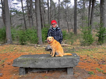 Instead of stopping at the car we walked out the far end of the parking lot passing the bathhouse and following a path. Cindy and I both remembered a ford that crossed the river many years ago but we had not been able to locate it. As we walked we came to a depression which was an old stream channel and this channel had concrete paving across it. This was the ford that we remembered and it crossed a branch of the river which is now dry. We continued our walk and soon came to a series of palettes with stone piled on them. This was obviously stone that was to be used to constructed fireplaces or walls but it did not look like it had been accessed in some time. The path we are on passed through a grove of tall evergreens and seemed to end at a Stine neck. The bench was formed from an enormous lab of stone mounted on cement blocks. The stone had visible drill marks on it and we both wondered where it had been quarried. I took some pictures of Cindy and Sheila and a few of the river. As we were about to turn around, a stone structure in the woods caught my eye. We walked away from the river and crossed a small stream to inspect the stone structure. It was a chimney now laying on its side with a stone base in place. There did not seem to be another foundation around. The chimney was in the shape of a pyramid tapering upward with stone sticking out as "shelves". It was also line with clay flue pipe. I took a lot of pictures before we headed back across the stream. We retraced our steps following the route we had used on the way out. We were back at the car at 4:45 PM having hiked 2.8 miles in 1 hour and 40 minutes with over 20 minutes of stopped time. The elevation gain was 225 feet but it was hardly noticeable. The weather had cooperated nicely and I thought it had gotten warmer as we hiked. The car's thermometer bore me out registering in the high 40's. In addition, we experienced no precipitation during any of the hike.
![]()
![]()
![]()
![]() On Wednesday, April 22nd I had taken off tow days from hiking due to some nasty weather. When I woke up, there was a fresh dusting of snow and it was windy with a temperature right around freezing. By early afternoon the temperature had risen to only 40 degrees and the wind was still blowing but I decided to take Sheila and cross the street to hike on Round Top. I wanted to find a different route and decided to do lollipops which would cover all of both trails. Sheila was ready to go as she really likes to hike and she was keeping a careful eye on me as I dressed. I put on my Mammut crew top but decided to forego a baselayer as I knew I would warm up on the hike. I decided to wear my Columbia Titanium insulated pants without baselayer despite the cool weather. I wore my Vasque Taku boots since they were dry and light enough for hiking. I grabbed a pair of Leki poles with external locks that I have been using lately. Finally, I also donned my Mammut hoody which blocks the wind but has enough zippers to dump heat when needed. At 1:30 PM we walked out the door to start the hike. I grabbed Sheila's leash from the car and we walked up the driveway. I aimed to hike for about an hour. Sheila was happy to get out as we headed down the driveway and across the street. We crossed the street and walked to the parking area by the Presbyterian Church. We walked to the back of the church and began the ascent of the steepest hill behind the church. The hill is short but gets the circulation pumping and is the steepest and longest climb on the "trail." Sheila helped me along by pulling me up the hill. We started on the trail by turning left at the trailhead where I let Sheila off her leash so that she could explore. The trail was completely bare as the snow had disappeared. There were a few spots of mud but the rest of the trail was dry.
On Wednesday, April 22nd I had taken off tow days from hiking due to some nasty weather. When I woke up, there was a fresh dusting of snow and it was windy with a temperature right around freezing. By early afternoon the temperature had risen to only 40 degrees and the wind was still blowing but I decided to take Sheila and cross the street to hike on Round Top. I wanted to find a different route and decided to do lollipops which would cover all of both trails. Sheila was ready to go as she really likes to hike and she was keeping a careful eye on me as I dressed. I put on my Mammut crew top but decided to forego a baselayer as I knew I would warm up on the hike. I decided to wear my Columbia Titanium insulated pants without baselayer despite the cool weather. I wore my Vasque Taku boots since they were dry and light enough for hiking. I grabbed a pair of Leki poles with external locks that I have been using lately. Finally, I also donned my Mammut hoody which blocks the wind but has enough zippers to dump heat when needed. At 1:30 PM we walked out the door to start the hike. I grabbed Sheila's leash from the car and we walked up the driveway. I aimed to hike for about an hour. Sheila was happy to get out as we headed down the driveway and across the street. We crossed the street and walked to the parking area by the Presbyterian Church. We walked to the back of the church and began the ascent of the steepest hill behind the church. The hill is short but gets the circulation pumping and is the steepest and longest climb on the "trail." Sheila helped me along by pulling me up the hill. We started on the trail by turning left at the trailhead where I let Sheila off her leash so that she could explore. The trail was completely bare as the snow had disappeared. There were a few spots of mud but the rest of the trail was dry.
At the first trail junction, I followed Sheila as she turned right an started up the woods road which has the gentler approach of the two. We walked up the road to the first trail junction with the upper blue trail and continued straight ahead on the blue trail to the summit. The climb was not difficult but I did have to watch out for a few muddy patches. We walked across the summit and started down the other side. Some people will tell you about difficult ascents and some are. In this case, the descent down the slippery path was tricky but a slip would probably mean muddy pants and no more. We made it down to the next trail junction and turned left on the yellow trail to walk along the base of Round Top back to the other junction with the blue trail. Here we turned right and walked back down the woods road to the very first junction. This formed a lollipop with the head being the loop over the summit and the stick being the woods road. This time we turned right and headed up the steeper part of the yellow trail to the lookout. There wasn't much to see at the viewpoint so we followed the yellow trail as it turned right and headed uphill slightly. We passed the Resting Rock" and continued to the junction with the blue trail. At the junction we continued straight ahead and ascended the steepest part of the trail to the summit. The slippery parts of the ascent were difficult but I ended going little off the trail to find an easier way up. We walked across the summit and won the other side to the junction with the yellow trail. We turned right and walked the yellow trail salon the base of Round Top. At the next junction, we followed the yellow trail to the left and downhill to the viewpoint. The trail turned left here so we followed it back to the first trail junction. I decided to do a big loop and a small loop so we turned left and walked back up the woods road on the yellow trail. We took the blue trail over the summit and back down the other side. Once again we continued straight ahead following the yellow trail downhill passed the viewpoint to the first trail junction. I checked my watch and concluded we were finished. We continued straight ahead and walked back out to the trailhead. We turned right and continued down the hill. We walked out through the church parking lot to the road and our driveway. It was 2:40 PM and we had hiked just over 2 miles in just over an hour.
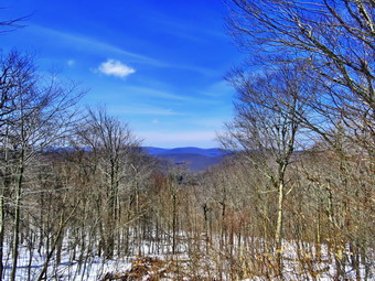
![]()
![]()
![]()
![]()
![]() On Sunday, April 19th, I had decided to take a day off until a text message from Lisa changed my mid. She wanted to hike the Flynn Trail at Frick Pond to the lookout over Hodge Pond. We agreed to meet at the trailhead at noon. When I got up at 6:20 AM it was 22 degrees which isn't that cold except for the fact it ia April! At 11:00 AM, when I started to get ready, the temperature was up to 40 degrees and the sun was shining. There was still a small amount of snow on the ground and I knew there could be more at the trailhead and that the temperate might be a little lower. Sheila was pretty calm as I started to get ready as we have been hiking a lot lately. I got dressed in my Mammut crew top with a long-sleeved baselayer. I decided to wear my Columbia Titanium insulated pants to keep the chill away but decided against wearing tights underneath. I wore my Salomon B-52 insulated boots which have been discontinued but are my favorite boots for winter. I put on a pair of OR Crocodile gaiters as I did not know the depth of snow we would encounter. I decided to take my new pair of Leki poles with external locks as the internal twist locks fail. I grabbed a light hat and gloves. Finally, I also donned my Mammut hoody which blocks the wind and keeps me warm but has enough zippers to dump heat when needed. I decided to carry my microspikes in case they were needed. I put my gear in the back of the car and Sheila in the back seat and left my house at 11:45 AM. I drove out the DeBruce Road about 6 miles to Mongaup Road and turned left. I continued up the road to the point where it splits and stayed left on Beech Mountain Road. It was a short drive to the parking areas on the left. Both parking areas had several cars already parked. I did not consider going to another trailhead as there are miles of trail in the area and I have seldom met any people. I parked in the small lot where Lisa was already parked and getting ready. There was some snow on the grass and in the woods but the roads were clear. I spoke to Lisa as she got ready and took the time to set my GPS> I could see the dog from the cabin was loose again but he stayed there. I did put Sheila on her leash as we crossed the road at 12:05 PM to start our hike.
On Sunday, April 19th, I had decided to take a day off until a text message from Lisa changed my mid. She wanted to hike the Flynn Trail at Frick Pond to the lookout over Hodge Pond. We agreed to meet at the trailhead at noon. When I got up at 6:20 AM it was 22 degrees which isn't that cold except for the fact it ia April! At 11:00 AM, when I started to get ready, the temperature was up to 40 degrees and the sun was shining. There was still a small amount of snow on the ground and I knew there could be more at the trailhead and that the temperate might be a little lower. Sheila was pretty calm as I started to get ready as we have been hiking a lot lately. I got dressed in my Mammut crew top with a long-sleeved baselayer. I decided to wear my Columbia Titanium insulated pants to keep the chill away but decided against wearing tights underneath. I wore my Salomon B-52 insulated boots which have been discontinued but are my favorite boots for winter. I put on a pair of OR Crocodile gaiters as I did not know the depth of snow we would encounter. I decided to take my new pair of Leki poles with external locks as the internal twist locks fail. I grabbed a light hat and gloves. Finally, I also donned my Mammut hoody which blocks the wind and keeps me warm but has enough zippers to dump heat when needed. I decided to carry my microspikes in case they were needed. I put my gear in the back of the car and Sheila in the back seat and left my house at 11:45 AM. I drove out the DeBruce Road about 6 miles to Mongaup Road and turned left. I continued up the road to the point where it splits and stayed left on Beech Mountain Road. It was a short drive to the parking areas on the left. Both parking areas had several cars already parked. I did not consider going to another trailhead as there are miles of trail in the area and I have seldom met any people. I parked in the small lot where Lisa was already parked and getting ready. There was some snow on the grass and in the woods but the roads were clear. I spoke to Lisa as she got ready and took the time to set my GPS> I could see the dog from the cabin was loose again but he stayed there. I did put Sheila on her leash as we crossed the road at 12:05 PM to start our hike.
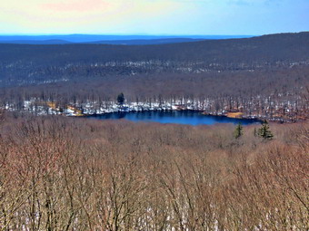 The first part of the trail near the road had become further eroded by the recent rains. After that, the walk through the woods was relatively easy although some areas may require a little work with a shovel. When we turned right onto what once was Beech Mountain Road, there was some snow with several sets of footprints. I only saw bare boots although one may have had traction devices. I saw no reason to put on my spikes so we continued up the trail. As we walked up the trail, I began to get warm immediately from the sun shining on my back. We set a moderate pace up the Flynn Trail which seemed to go quickly as we walked and talked. We did stop a couple of times so that I could take some pictures. The Flynn Trail is uphill all the way for the first 1.7 miles to the Big Rock Junction. There continued to be several inches of snow on the trail with a more open track where people had walked. We passed the mile mark around the point where there is a clearing to the right of the trail. We stopped so that I could take some shots of the snow and the bright blue sky. We were soon walking the final uphill section to the junction with the Big Rock Trail. It was 1:05 PM so we had covered the 1.7 mile distance in and hour. We continued through the junction and passed through the gate which is the boundary between state land and OSI property. It was a short walk to the point where the Flynn Trail heads downhill to Hodge Pond. Here we turned to the right on the woods road and walked along the "high road" to the junction of some roads above the pond. At this junction a road turns left to go down to the pond. Just a little further on the road splits with the left fork passing by the old Beech Mountain Boy Scout Camp and ending up on Shin Creek Road in Lew Beach. As we approached the junction, we heard a howling sound from ahead on the trail. It sounded much like a coyote although I had never seem them out and about in full daylight. I listened and was pretty sure I heard voices. We decided to continue up the hill toward the Hodge Pond Lookout which is just below Flynn's Point on Beech Mountain, the highest point in Sullivan County. As we walked, we could see fresh boot prints in the snow and a dogs paw prints. The road was a little steeper than I remembered and a little longer.
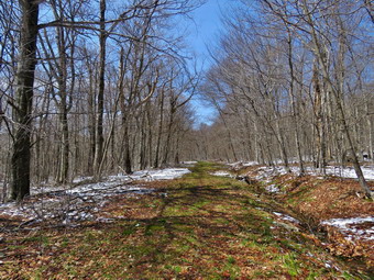 I wasn't really tired so we pushed the pace a little. We passed an old quarry where the trail leveled some. The road was slippery from a combination of snow and some mud underneath. The trail began to gain elevation again and we passed by a spring house on the right. There are several twists and turns along this road and it is sometimes hard for me to know exactly where I am. At 2.7 miles we came to a lookout on the left of the trail. The lookout had been "cut out" so that the hills and valleys beyond were much more visible. I decided to stop to take a few shots because my experience told me that the view could change by the time we returned. It was hard to take pictures as the bright sun made looking through the viewfinder difficult. There was almost no haze on the hills of in the valleys as I snapped several pictures. We followed the road uphill as it made a sharp right turn. Just after this the road turned to the left but another trail branched off to the right. The tracks we had been following turned left but we turned onto the trail on the right. Isa remarked that this trail was more distinct than the last time she had been on it. After a slight incline, the trail leveled. Snow covered the trail but there was two inches or less. There was a significant amount of water on this flat trail as it drains off the higher ground to the left. We walked along the trail following Sheila most of the time. At 2.9 miles we arrived at the Hodge Pond Lookout. This lookout had also been cut out giving a much better view than I had seen in years. I dropped my pack and took some pictures of the pond below and the hills in the distance. I also took some pictures of Sheila sitting on the lookout with the pond in the background. The view was as clear as I have seen it but the bright sun made using the viewfinder difficult. On the walk back, we tried to avoid the wettest spots. We passed the lookout on the road and followed the trail as it turned left and started downhill. The trip down was much quicker than the trip up but we had to avoid slipping by using our poles. When we reached the bottom of the hill, I thought about walking down to Hodge Pond but decided to make the hike a true out-and-back. We walked out to the Flynn Trail, turned left and were soon at the junction with the Big Rock Trail at 4.6 miles. As we continued on the Flynn Trail we noticed that the snow that had been there on the way up had disappeared! We walked a little farther and the stopped so that I could take some pictures of the now bare trail. The trip down the Flynn Trail can seem to take forever but on this day it went quickly. We continued to notice how much snow had disappeared in such a short time. The large hemlock across the trail came into sight and just after it the gate. We passed through the arch of the tree that Cindy and I had cut through the tree. Just before the gate, we turned left on the Flynn Trail to avoid the private property around the cabin. We walked the trail back to the car arriving at 3:15 PM. The vehicles in the lot were still there and as we put our gear in the car a small group of people began to hike the Flynn Trail. It looked like they had started to hike up the road to the cabin but turned around when they saw us on the trail. We had hiked 5.9 miles in 3 hours and 10 minutes gaining 1026 feet along the way. It was now 52 degrees which explained the melting snow.
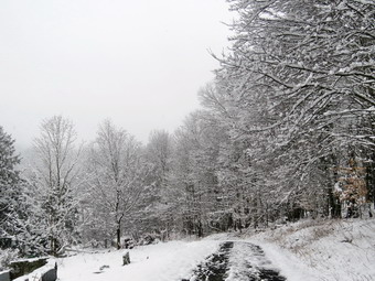
![]()
![]()
![]()
![]()
![]() On Saturday, April 18th I awoke at 7:00 AM to find that ablest 4 inches of snow had fallen overnight. The snow had accumulated on the grass and trees but had melted on the roads. It was still snowing a little and I decided I should get out to take some pictures before the weight of the snow and increasing temperatures caused the snow to fall. The temperature was 32 degrees but I knew it only had to warm a few degrees. I began to get ready and Sheila showed her appreciation by lying quietly on the floor following my every move. I put on my long-sleeved Patagonia wool top without a baselayer which I knew was probably too warm. I decided to wear my Columbia Titanium insulated pants to keep the chill away but decided against tights underneath. I wore my Salomon B52 boots which are as waterproof as any pair I have, insulated and surprisingly roomy. I grabbed my Leki external lock poles which I purchased since twist locks have proved unreliable. I also donned my Mammut hoody which was enough zippers to dump heat when needed. I put on a light hat and wore a light pair of gloves. I also shouldered my pack since this is the easiest way to Cary my camera. At 8:00 AM we walked out the door to start the hike. Immediately I noticed that it was still snowing and the skies were completely overcast. Everything was covered in snow which was quite beautiful. I grabbed Sheila's leash from the car and we walked up the driveway. I decided we would try to do some figure 8's on the Round Top Trails but my main object was to take pictures which I normally don't do when I hike Round Top. Sheila was happy to get out as we crossed the street and walked to the parking area by the Presbyterian Church. The road was just wet as all the snow had melted as it fell. We walked to the back of the church and began the ascent of the steepest hill behind the church.
On Saturday, April 18th I awoke at 7:00 AM to find that ablest 4 inches of snow had fallen overnight. The snow had accumulated on the grass and trees but had melted on the roads. It was still snowing a little and I decided I should get out to take some pictures before the weight of the snow and increasing temperatures caused the snow to fall. The temperature was 32 degrees but I knew it only had to warm a few degrees. I began to get ready and Sheila showed her appreciation by lying quietly on the floor following my every move. I put on my long-sleeved Patagonia wool top without a baselayer which I knew was probably too warm. I decided to wear my Columbia Titanium insulated pants to keep the chill away but decided against tights underneath. I wore my Salomon B52 boots which are as waterproof as any pair I have, insulated and surprisingly roomy. I grabbed my Leki external lock poles which I purchased since twist locks have proved unreliable. I also donned my Mammut hoody which was enough zippers to dump heat when needed. I put on a light hat and wore a light pair of gloves. I also shouldered my pack since this is the easiest way to Cary my camera. At 8:00 AM we walked out the door to start the hike. Immediately I noticed that it was still snowing and the skies were completely overcast. Everything was covered in snow which was quite beautiful. I grabbed Sheila's leash from the car and we walked up the driveway. I decided we would try to do some figure 8's on the Round Top Trails but my main object was to take pictures which I normally don't do when I hike Round Top. Sheila was happy to get out as we crossed the street and walked to the parking area by the Presbyterian Church. The road was just wet as all the snow had melted as it fell. We walked to the back of the church and began the ascent of the steepest hill behind the church.
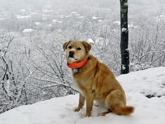 There was no snow on the paved surface but several inches everywhere else. The hill is short but gets the circulation pumping and is the steepest and longest climb on the "trail." Sheila helped me along by pulling me up the hill. When we got to the top of the hill, I dropped my pack and took out the camera. I took quite a few pictures of the trees covered in snow and several across to the other hills. The skies were overcast and very flat but I hoped I some of the pictures would be good. When I was done, we started on the trail by turning left at the trailhead. I let Sheila off her leash so that she could explore.Once we walked into the woods, I again took more shots of the snow on the trail and the trees. I was pretty sure we would be the first people on the trail which proved to be true although there were plenty of animal tracks. At the first trail junction, I started up toward the viewpoint as I wanted to make sure I got pictures of the school and town. Walking up the hill was not hard but it was slippery with the snow on top of some mud. At the spur trail to the lookout, we stayed to the left to get out to the lower rock ledge. I got out my camera and took some pictures of the trees above the ledge and some others that were covered in snow. I then turned my attentions to the view down to the school and the town. I took several pictures and then packed up. We hiked back out the spur trail and turned left to continue on the yellow blazed lower loop trail. As we walked up the trail I kept wanting to stop but realized one tree with snow is a lot like another. We did stop at one rock by the side of the trail which people often use as a seat to take a rest. I took some pictures and then we continued to the first trail junction with the upper blue rail. We turned right to stay on the yellow trail and walked along the base of Round Top. This part of the trail has quite a few bushes and they were covered in snow. Once again, I stopped to take some shots before continuing to the next trail junction. This time we turned left and headed up the trail to the summit. This side is not as steep as the other and my poles really helped.
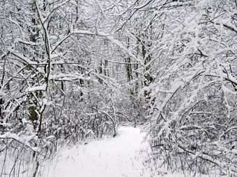 Once on the summit there was another time for some pictures and the we started the descent down the steeper side. This descent went better than I expected but there were a few tricky spots. When we reached the trail junction we turned left to retrace our steps across the middle of the figure 8. When we reached the trail junction this time, we turned right and headed downhill to the wide woods road that leads back to the very first junction. I stopped once to take more pictures and this time I focused on the cliffs and ledges. Once we are back at the first junction, I looked at the time and found it had taken 55 minutes to complete the first figure 8 which I knew was influenced by all the stops for photography. I decided we would do another and this time would concentrate on just hiking. We turned around and headed back p the woods road keeping an accelerated pace. I found that carrying my pack was a little more exercise but that I was not any more tired than when I don't carry the pack. When we reached the junction with the upper blue trail, we turned left and continued along the base of Round Top to the next junction with the upper trail. This time we turned right and started up the steepest section of the trail. There were some places where it was slippery enough that I was only able to stay on the trail by using my poles. We crossed the summit and started down the more gentle slope. At the trail junction we turned right and hiked the yellow trail all the way down to the viewpoint. A quick glance showed that the snow was falling off the trees and the skies were clearing a little. We turned left and followed the yellow trail back to the first trail junction. This time we continued straight ahead to the trailhead. I stopped to take a few "after" pictures and then continued won the hill. I put Sheila on her leash before we crossed the road to our driveway. At the house, I checked the GPS. It was 9:30 AM and we had hiked 2.1 miles in 1.5 hours with and elevation gain of about 600 feet.
![]()
![]()
![]()
![]() On Thursday, April 16th I was up early to meet with my men's Bible study group at 6:15 AM by Zoom. When this meeting concluded, I went back to bed to see if I could make up for some of the sleep I had lost throughout the week. When I got up it was still only in the mid 40's but there was some sun so I decided to go across the street to hike on Round Top. I asked Cindy if she wanted to go but she declined. I began to get ready and Sheila showed her appreciation by barking and running around. I put on my long-sleeved Patagonia wool top without a baselayer which I knew was probably too warm. I decided to wear my Columbia Titanium insulated pants to keep the chill away but decided against tights underneath. I wore my Keen Targhee II boots which are supportive and surprisingly roomy. I grabbed my Leki external lock poles which I purchased since twist locks have proved unreliable. I also donned my Mammut hoody which was enough zippers to dump heat when needed. I put on a light hat and wore a light pair of gloves. At 2:30 PM we walked out the door to start the hike. Immediately I noticed that the skies were beginning to become overcast which I knew was a forerunner of a storm coming in the overnight hours. I decided to continue since I knew we could always turn around and return home quickly. I grabbed Sheila's leash from the car and we walked up the driveway. I decided we would try to do some figure 8's on the Round Top Trails. I aimed to hike for about an hour. Sheila was happy to get out as we crossed the street and walked to the parking area by the Presbyterian Church. We walked to the back of the church and began the ascent of the steepest hill behind the church. There was no snow on the grass, roadway or in the forest. The hill is short but gets the circulation pumping and is the steepest and longest climb on the "trail." Sheila helped me along by pulling me up the hill. When we got to the top of the hill, we started on the trail by turning left at the trailhead. I let Sheila off her leash so that she could explore.
On Thursday, April 16th I was up early to meet with my men's Bible study group at 6:15 AM by Zoom. When this meeting concluded, I went back to bed to see if I could make up for some of the sleep I had lost throughout the week. When I got up it was still only in the mid 40's but there was some sun so I decided to go across the street to hike on Round Top. I asked Cindy if she wanted to go but she declined. I began to get ready and Sheila showed her appreciation by barking and running around. I put on my long-sleeved Patagonia wool top without a baselayer which I knew was probably too warm. I decided to wear my Columbia Titanium insulated pants to keep the chill away but decided against tights underneath. I wore my Keen Targhee II boots which are supportive and surprisingly roomy. I grabbed my Leki external lock poles which I purchased since twist locks have proved unreliable. I also donned my Mammut hoody which was enough zippers to dump heat when needed. I put on a light hat and wore a light pair of gloves. At 2:30 PM we walked out the door to start the hike. Immediately I noticed that the skies were beginning to become overcast which I knew was a forerunner of a storm coming in the overnight hours. I decided to continue since I knew we could always turn around and return home quickly. I grabbed Sheila's leash from the car and we walked up the driveway. I decided we would try to do some figure 8's on the Round Top Trails. I aimed to hike for about an hour. Sheila was happy to get out as we crossed the street and walked to the parking area by the Presbyterian Church. We walked to the back of the church and began the ascent of the steepest hill behind the church. There was no snow on the grass, roadway or in the forest. The hill is short but gets the circulation pumping and is the steepest and longest climb on the "trail." Sheila helped me along by pulling me up the hill. When we got to the top of the hill, we started on the trail by turning left at the trailhead. I let Sheila off her leash so that she could explore.
At the first trail junction, I followed Sheila as she turned right on the woods road which is the shallower approach to the trail system. The road had no snow but there are areas that were wet and muddy. We continued to follow the yellow trail to the first junction where we turned left and followed it to the next trail junction. We kept a quick pace as we walked even though the trail was wet and slippery in places. At the second junction with the blue trail, we turned right and started up the steep blue trail that leads over the summit of Round Top. As we ascended the trail, there were places where the trail was muddy and slippery but walking beside the trail to get traction was difficult. I began to think that my idea of putting in a switchback or two was a good idea. We walked across the flat summit of Round Top and started down the other side. Descending was also tricky as there were wet and slippery spots. I began to think that heading straight up the hill and straight down was not the best idea. Several different solutions came to mind including rerouting the trail to include a switchback or two on each side of the hill. Soon we were back at the yellow trail where we turned right and walked to the next trail junction. This time we turned left and followed the yellow trail downhill toward the lookout. I stopped to take a look down to the school and town before continuing on the trail as it turned left and descended to the first trail junction. Even this part of the trail was a little muddy and slippery. This section of trail gets the most traffic as some people simply walk up to the viewpoint and then back down. We continued to follow the yellow trail as it gained elevation to the junction with the blue trail. We turned right and continued to follow the yellow trail along the base of Round Top to the next junction with the blue trail. We turned left and walked up the blue trail to cross the summit of Round Top. The ascent went well but I did have to watch for some muddy areas. The descent on the other side was tricky but we did make it down without incident. At the trail junction with the yellow trail we turned left and followed the trail along the base of Round Top again. At the next trail junction, we turned right and walked down the trail to the woods road and out to the first trail junction. I checked the time and determined that we should return home. We walked out toward the trailhead where I put Sheila on her leash. We walked down the hill and through the church parking lot to the road and to our driveway. It was 3:45 PM and we had hiked around 2 miles in a little over an hour with elevation gain of about 600 feet.
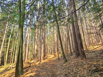
![]()
![]()
![]()
![]()
![]() On Tuesday, April 14th, I had some time to hike on what was forecast to be a much better day than the day before when rain and wind swept our area for an entire day. The day was forecast to be sunny but the highs would only be in the mid 40's. When I got up the temperature was only 33 degrees and the skies were overcast. I decided to do some work around the house and wait to see how the weather would develop. I asked Cindy if she wanted to go and she said "Yes". We decided to go to Margaretville and hike to the viewpoint on Dry Brook Ridge from Hill Road. I began to get ready with Sheila was on my heels the whole time sensing we would be going out. I put on my Mammut crew top with a light baselayer as the temperature was cool. I decided to wear my Columbia Titanium insulated pants without a baselayer as they are warm an hiking makes me even warmer. I wore my Vasque Taku boots since they were dry and light enough for hiking. I also decided to wear my OR Crocodile gaiters to deal with the mud and the ticks. I grabbed a pair of Leki poles with external locks that I have been using lately. Finally, I also donned my Mammut hoody which blocks the wind but has enough zippers to dump heat when needed. We got our gear in the car and Sheila in the backseat and left Livingston Manor. I knew Cindy wanted to avoid the back roads as much as possible so I headed toward Roscoe on State Route 17. I got off at the Roscoe exit and headed north toward Downsville on Route 206. The road was in good shape and we were soon at the Pepacton Reservoir. Here I turned right onto Route 30 and continued to the Shavertown Bridge. I turned right on BWS 8 and followed it until it became BWS 9. Where the road changed to BWS 10 at the intersection with Barkaboom Road, I turned left. I followed BWS 10 until it changed to Southside Road just outside Margaretville. I continued on Southside Road to Huckleberry Brook Road where I turned right. Shortly after the turn I turned left on Hill Road and drove 1.3 miles to the parking pulloff on the right. A road crew was actually sweeping the gravel off the road! There was no one else parked in the small lot which surprised me a little as I have often met people here before. The temperature was 45 degrees when I parked and there was a breeze blowing. The skies which had been blue with white clouds and plenty of sunshine were now overcast. We crossed the road and began our hike at 12:45 PM.
On Tuesday, April 14th, I had some time to hike on what was forecast to be a much better day than the day before when rain and wind swept our area for an entire day. The day was forecast to be sunny but the highs would only be in the mid 40's. When I got up the temperature was only 33 degrees and the skies were overcast. I decided to do some work around the house and wait to see how the weather would develop. I asked Cindy if she wanted to go and she said "Yes". We decided to go to Margaretville and hike to the viewpoint on Dry Brook Ridge from Hill Road. I began to get ready with Sheila was on my heels the whole time sensing we would be going out. I put on my Mammut crew top with a light baselayer as the temperature was cool. I decided to wear my Columbia Titanium insulated pants without a baselayer as they are warm an hiking makes me even warmer. I wore my Vasque Taku boots since they were dry and light enough for hiking. I also decided to wear my OR Crocodile gaiters to deal with the mud and the ticks. I grabbed a pair of Leki poles with external locks that I have been using lately. Finally, I also donned my Mammut hoody which blocks the wind but has enough zippers to dump heat when needed. We got our gear in the car and Sheila in the backseat and left Livingston Manor. I knew Cindy wanted to avoid the back roads as much as possible so I headed toward Roscoe on State Route 17. I got off at the Roscoe exit and headed north toward Downsville on Route 206. The road was in good shape and we were soon at the Pepacton Reservoir. Here I turned right onto Route 30 and continued to the Shavertown Bridge. I turned right on BWS 8 and followed it until it became BWS 9. Where the road changed to BWS 10 at the intersection with Barkaboom Road, I turned left. I followed BWS 10 until it changed to Southside Road just outside Margaretville. I continued on Southside Road to Huckleberry Brook Road where I turned right. Shortly after the turn I turned left on Hill Road and drove 1.3 miles to the parking pulloff on the right. A road crew was actually sweeping the gravel off the road! There was no one else parked in the small lot which surprised me a little as I have often met people here before. The temperature was 45 degrees when I parked and there was a breeze blowing. The skies which had been blue with white clouds and plenty of sunshine were now overcast. We crossed the road and began our hike at 12:45 PM.
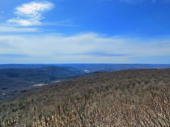 The first part of the hike is a nice wide trail that ascends through a red pine plantation. The ascent continues for about 1.9 miles when the trail levels off after gaining 1130 feet. I began to warm up immediately because of the climb and also found I was a little winded from the lack of hiking fast and on steeper trails. From the sound of Cindy's breathing she was having a similar reaction. As we walked, there were several blowdowns across the trail from near the bottom until the trail leveled. We moved some branches off the trail but others required tools to remove. It was also obvious that there had been a lot of rain on the trail as there were huge piles of pine needles in several spots. The trail had drained nicely and was almost dry on the steeper grades with some mud in a few places. The light through the pines was beautiful but the breeze kept the temperature down. After passing through the pines, we entered a predominantly hardwood forest before passing again through some pines. Sheila seemed to delight in racing away from us and then careening headlong back toward us. There were a lot of animal tracks along the trail and some crossing it and Sheila was busy investigating these tracks. The hike seemed longer than I remembered and the number of different ascents greater. After 1.9 miles, the trail leveled off and turned almost 90 degrees from northeast to southeast. We were glad the climbing was done at least for a few minutes. We walked across a flat area dipping down a little to the junction with the blue Dry Brook Ridge Trail at 2.3 miles. We stopped and got a much needed drink and a bar. As we turned right on this trail, I noticed that all the signs were in poor condition with some lying on the ground. Many still had incorrect distances. One sign that was broken in half said the Hill Road parking was 1.7 miles away. I had to laugh! I expect distances to vary some but .5 miles is a pretty big gap. Another sign stated it was 5.5 miles to Millbrook Road which is pretty close but also indicated that the lean-to was 3.3 miles away. This is about .8 miles short! We started along the ridge trail which follows the edge of the ledges until about 2.7 miles where it veers away and heads a little to the east and northeast. Initially the trail ascends a small bump and then descends the other side before leveling off for a while.
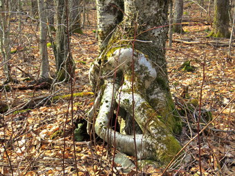 The level areas of the trail were very wet with standing water and mud and we had to negotiate around several of these areas. This would continue to be a problem for most of the rest of the way to the lookouts. As we approached the last few climbs to the lookout, Cindy decided she could not do any more climbing. I decided to go ahead and complete the hike as she seemed perfectly happy to sit on a log. Sheila and I continued over the first two ascents which were slippery from the rain and mud. Soon we were climbing the last of three short ascents to the area of the lookout. The total elevation gain from the trail junction to the lookouts is 285 feet. From 2.95 miles to the lookout the trail gains just under 200 feet in elevation and begins to follow the edge of the escarpment turning almost due south. Sheila and I continued on the main trail toward the spur trail to the viewpoint. When we arrived at the viewpoint at 3:05 PM, the breeze was blowing slightly but the sun had appeared to illuminate the landscape below. The sky was a mix of overcast and blue with puffy white clouds. Most of the hills and valleys were covered in a haze but the Pepacton Reservoir was clearly visible with a high volume of water. Everything was still bleak with only a little green showing but I got out my camera to take some pictures. I took a few of Sheila posed on the rock and then more in all directions. I got a drink and then started the walk back to the car which was all flat or downhill. We walked down the first few small descents and then came to the first major one. Sheila gave me an indication that she thought Cindy was at the bottom of the descent. I informed her of her error and we continued together. She did the same thing at the second descent. When we came to the third, I could see Cindy sitting below and I released Sheila who immediately dashed down the hill to Cindy. I walked down the steep descent and joined Cindy for the trip back. The trip back to the trail junction went more quickly than I had expected but avoiding the small ponds along the way was annoying. We didn't bother to stop again at the trail junction but simply turned left to head back down the trail to the parking area. The skies looked bluer and the sun was out which always improves my mood. We both set a very quick pace using our poles to maximum advantage because we both wanted to get back to the car. Despite the pace it seemed to be taking forever! We finally entered the last stand red pines which we both knew that the end of the hike was near. Near the end, I could see the road ahead and then caught sight of the parking lot with our car. We arrived back at the car at 5:00 PM. We had hiked 6.4 miles in 4 hours and 15 minutes with an elevation gain of 1640 feet. The trip down was about 30 minutes shorter than the trip up! I drove away from the parking area and started home on the same route we had used on the way out. When I got to Beech Hill Road, I turned left and followed it out to the Beaverkill Road.
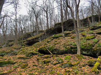
![]()
![]()
![]()
![]()
![]() On Sunday, April 12th I wanted to hike after listening to our church's Easter worship service. The weather forecast for Monday was horrible with rain, thunderstorms and highs winds predicted. I asked Cindy if she would like to go and she said "Yes". We had a long debate about where to go and the length of the hike. We finally decided to go to the Frick Lind area to hike up the Flynn Trail and then bushwhack down the ledges on the west side of Mongaup Pond. We would walk the roads back to our car. The thermometer read over 60 degrees but it was in the direct sun so I expected it was actually cooler. I began to get ready with Sheila was on my heels the whole time sensing we would be going out. I put on my Mammut crew top without a baselayer as the temperature was warm. I decided to wear my Columbia Titanium insulated pants despite the warm weather but knew I would not need tights underneath. I wore my Vasque Taku boots since they were dry and light enough for hiking. I also decided to wear my OR Crocodile gaiters to deal with the mud and the ticks. I grabbed a pair of Leki poles with external locks that I have been using lately. Finally, I also donned my Mammut hoody which blocks the wind but has enough zippers to dump heat when needed. We left the house at 12:20 PM to drive out DeBruce Road for about 6 miles to Mongaup Pond Road. I turned left and drove to where the road split and stayed left on Beech Mountain Road. When we arrived at the parking Rea there were four cars in each lot. Two of the cars had people in them and they did not seem to be doing anything except talking. I thought about leaving and parking at a different trailhead but I knew no one would be taking the route we would be taking. I parked in the remaining spot small lot and got ready to hike. I set my electronics and we started our hike by crossing the road at 12:45 PM. The trail was damping places with a little mud. As we walked through the woods we could hear voices ahead and I saw a family of four coming toward us. I put Sheila on her leash and walked off the trail as the family passed. We continued on the Flynn Trail to the woods road. We turned right on the woods road which was once an extension of Beech Mountain Road and started our climb. We kept up a quick pace talking as we walked until we came to the spot where there is a clearing a little off the trail on the right at 1.15 miles. We turned into the woods and walked a path up to the clearing. I took my pack off and got the camera to take some pictures of the clearing. No one seems to know eagerly why the clearing is there but some speculate the dirt was used to build the Beech Mountain Road up to the Boy Scout camp. The clearing has a thin layer of dirt over bedrock and is unusual since it supports a wide variety of plants. There is a thick layer of moss in most place and the moss represents several different species. The area is often quite wet but on this day it was fairly dry. I picked up my pack and walked toward the tree line trying to find a break where we could begin our bushwhack east to Mongaup Pond. I found a spot and we started walking through the mostly open woods heading east and slightly southeast.
On Sunday, April 12th I wanted to hike after listening to our church's Easter worship service. The weather forecast for Monday was horrible with rain, thunderstorms and highs winds predicted. I asked Cindy if she would like to go and she said "Yes". We had a long debate about where to go and the length of the hike. We finally decided to go to the Frick Lind area to hike up the Flynn Trail and then bushwhack down the ledges on the west side of Mongaup Pond. We would walk the roads back to our car. The thermometer read over 60 degrees but it was in the direct sun so I expected it was actually cooler. I began to get ready with Sheila was on my heels the whole time sensing we would be going out. I put on my Mammut crew top without a baselayer as the temperature was warm. I decided to wear my Columbia Titanium insulated pants despite the warm weather but knew I would not need tights underneath. I wore my Vasque Taku boots since they were dry and light enough for hiking. I also decided to wear my OR Crocodile gaiters to deal with the mud and the ticks. I grabbed a pair of Leki poles with external locks that I have been using lately. Finally, I also donned my Mammut hoody which blocks the wind but has enough zippers to dump heat when needed. We left the house at 12:20 PM to drive out DeBruce Road for about 6 miles to Mongaup Pond Road. I turned left and drove to where the road split and stayed left on Beech Mountain Road. When we arrived at the parking Rea there were four cars in each lot. Two of the cars had people in them and they did not seem to be doing anything except talking. I thought about leaving and parking at a different trailhead but I knew no one would be taking the route we would be taking. I parked in the remaining spot small lot and got ready to hike. I set my electronics and we started our hike by crossing the road at 12:45 PM. The trail was damping places with a little mud. As we walked through the woods we could hear voices ahead and I saw a family of four coming toward us. I put Sheila on her leash and walked off the trail as the family passed. We continued on the Flynn Trail to the woods road. We turned right on the woods road which was once an extension of Beech Mountain Road and started our climb. We kept up a quick pace talking as we walked until we came to the spot where there is a clearing a little off the trail on the right at 1.15 miles. We turned into the woods and walked a path up to the clearing. I took my pack off and got the camera to take some pictures of the clearing. No one seems to know eagerly why the clearing is there but some speculate the dirt was used to build the Beech Mountain Road up to the Boy Scout camp. The clearing has a thin layer of dirt over bedrock and is unusual since it supports a wide variety of plants. There is a thick layer of moss in most place and the moss represents several different species. The area is often quite wet but on this day it was fairly dry. I picked up my pack and walked toward the tree line trying to find a break where we could begin our bushwhack east to Mongaup Pond. I found a spot and we started walking through the mostly open woods heading east and slightly southeast.
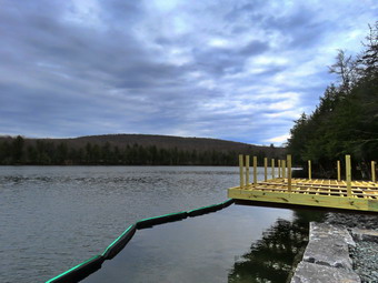 In less than a quarter mile from the clearing we came to the first series of ridges and found a path to descend through them. Just before I started down, I looked ahead and saw the water of Mongaup Pond ahead. I look at my GPS and we were only .4 miles away from the pond. I took a few shots of the rock ledges and some icicles on them. We continued to work our way down being careful of our steps as the wet leaves were slippery and there were plenty of loose rocks. The grade was pretty steep averaging about 18%. We worked our way down through another level and I took a few more pictures including some of interesting mosses and lichens. We continued to descend and turn a little more to the southeast. At one point I found a nice overgrown woods road heading southeast so we started to follow it. The road paralleled a drainage which conducts water down toward the pond. Sooner than I thought we were at the loop road around the pond. I took a few pictures of the deserted road until I realized some people were approaching from the north. We turned right and walked the road south until we came to the gate on the road just before the deck. A car pulled up and a man got out. He was looking for his friends but he was unsure about where they told him to meet them and what trail they would hike. After a brief conversation, he got in his car to drive off. I noticed as he left that he had a New Jersey license place. So much for hiking locally! The deck was being reconstructed so I took some pictures of the pond and the partially constructed deck. The skies were completely overcast and not very interesting. We continued our hike by walking along the shore until we were at the entrance to the campgrounds. We headed out Mongaup Road to complete our loop. The road walk went very quickly this time and didn't seem boring at all. We both noticed that the creek was quite far below the road level which is hard to notice from a car. Where the creek came closer to the road I stopped to take a few shots of a small rapids as it sparkled in what seemed like the only ray of sun. After 1.1 miles we were at the intersection of Beech Mountain Road and Mongaup Pond Road.
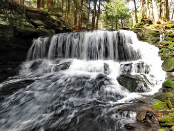 I wanted to visit the falls but Cindy's ankle was bothering her so she decided to go back to the car. There were two cars parked in the small pulloff but I decided to go down to the falls hoping they were not there. Sheila and I turned left and walked down the rocky woods road. The road used to be a town road that connected to Terwilliger Road but now it is abandoned. We crossed the small bridge and turned right to walk the path downstream. When we arrived at the top of the falls, I was relieved to find no one in sight. I dropped my pack and got out the camera. I also let Sheila off her leash so that she could explore a little. Sheila immediately went to get a drink and play in the rapidly moving water just above the falls! I decided to work my way down the bank to the area below the lower drop. The rocks were slippery but I made it down without mishap. I took pictures from the side of the falls and then stepped out onto a big rock a few feet away from the bank. From this vantage point I could take pictures of the falls from directly in front. Eventually, I hopped back to the bank and walked back up to my pack. I walked over to the lookout just below the upper drop and took some more pictures there. When I was finished, I returned my camera to the pack and we walked back along the stream and up the hill to the road. I out Sheila on her leash and we Aled back uphill to the car. I looked at some of the license plates and found a couple from New Jersey and one from Virginia and Pennsylvania. One group of people was tailgating and were shoulder to shoulder. I hope they were all from the same daily. The temperature at the car was 60 degrees which was only a few degrees warmer than when we had started. It was 3:25 PM and I had hiked 4.4 miles in two hours and 40 minutes with 35 minutes of stopped time. The total elevation gain of 805 feet. When I checked the GPS track at home I found our bushwhack almost exactly followed the route I had taken before!
![]()
![]()
![]()
![]() On Friday, April 10th I had planned to get out on a longer hike and was even thinking about Balsam Lake Mountain. It had rained and snowed on and off for two days and in the morning it was still cold and snowing. At 8:00 AM the ambulance pager sounded for a motor vehicle accident just outside of town. By the time I returned at 10:00 AM the snow showers had abated but the temperature was only 38 degrees. There was also a breeze blowing that made it seem even colder. I delayed a little before getting ready but by 11:00 AM I knew if I did not get started I would not go at all. I decided to go across the street since it was close and I could always return if conditions worsened. I asked Cindy if she wanted to go but she declined. I began to get ready and Sheila showed her appreciation by barking and running around. I put on my long-sleeved Mammut top without a baselayer. I decided to wear my Columbia Titanium insulated pants to keep the chill away but decided against tights underneath. I wore my Vasque Taku boots which are supportive and surprisingly roomy. I grabbed my Leki external lock poles which I purchased since twist locks have proved unreliable. I also donned my Mammut hoody which was enough zippers to dump heat when needed. I put on a light hat and wore a light pair of gloves. At 11:30 PM we walked out the door to start the hike. Immediately I noticed that the skies to the northwest looked snow-filled and that the wind was picking up. I decided to continue since I knew we could always turn around and return home quickly. I grabbed Sheila's leash from the car and we walked up the driveway. I decided we would try to do some figure 8's on the Round Top Trails. I aimed to hike for about an hour. Sheila was happy to get out as we crossed the street and walked to the parking area by the Presbyterian Church. We walked to the back of the church and began the ascent of the steepest hill behind the church. There was a light covering of snow on the grass but the roadway was only wet. The hill is short but gets the circulation pumping and is the steepest and longest climb on the "trail." Sheila helped me along by pulling me up the hill. When we got to the top of the hill, the snow hit and the wind picked up even more. We started on the trail by turning left at the trailhead. I let Sheila off her leash so that she could explore. The trees helped hold back some of the wind and snow. The woods were covered in snow with only a narrow track which was the trail bed.
On Friday, April 10th I had planned to get out on a longer hike and was even thinking about Balsam Lake Mountain. It had rained and snowed on and off for two days and in the morning it was still cold and snowing. At 8:00 AM the ambulance pager sounded for a motor vehicle accident just outside of town. By the time I returned at 10:00 AM the snow showers had abated but the temperature was only 38 degrees. There was also a breeze blowing that made it seem even colder. I delayed a little before getting ready but by 11:00 AM I knew if I did not get started I would not go at all. I decided to go across the street since it was close and I could always return if conditions worsened. I asked Cindy if she wanted to go but she declined. I began to get ready and Sheila showed her appreciation by barking and running around. I put on my long-sleeved Mammut top without a baselayer. I decided to wear my Columbia Titanium insulated pants to keep the chill away but decided against tights underneath. I wore my Vasque Taku boots which are supportive and surprisingly roomy. I grabbed my Leki external lock poles which I purchased since twist locks have proved unreliable. I also donned my Mammut hoody which was enough zippers to dump heat when needed. I put on a light hat and wore a light pair of gloves. At 11:30 PM we walked out the door to start the hike. Immediately I noticed that the skies to the northwest looked snow-filled and that the wind was picking up. I decided to continue since I knew we could always turn around and return home quickly. I grabbed Sheila's leash from the car and we walked up the driveway. I decided we would try to do some figure 8's on the Round Top Trails. I aimed to hike for about an hour. Sheila was happy to get out as we crossed the street and walked to the parking area by the Presbyterian Church. We walked to the back of the church and began the ascent of the steepest hill behind the church. There was a light covering of snow on the grass but the roadway was only wet. The hill is short but gets the circulation pumping and is the steepest and longest climb on the "trail." Sheila helped me along by pulling me up the hill. When we got to the top of the hill, the snow hit and the wind picked up even more. We started on the trail by turning left at the trailhead. I let Sheila off her leash so that she could explore. The trees helped hold back some of the wind and snow. The woods were covered in snow with only a narrow track which was the trail bed.
At the first trail junction, we followed Sheila as she turned right on the woods road which is the shallower approach to the trail system. The road had less snow that the other parts of the trail but there was a good covering of snow off the trail. We continued to follow the yellow trail to the first junction where we turned left and followed it to the next trail junction. We kept a quick pace as we walked even though the trail was wet and slippery in places. The narrow track of the trail was the only part of the woods that was not covered in snow. This ribbon of brown and green through the covering of white snow was quite beautiful. At the second junction with the blue trail, we turned right and started up the steep blue trail that leads over the summit of Round Top. The snow was even more pronounced here as the trail faces the north. As we ascended the trail, there were places where the trail was muddy and slippery but walking beside the trail to get traction was difficult evacuee of the snow. I began to think that my idea of putting in a switchback or two was a good idea. We walked across the flat summit of Round Top and started down the other side. Descending was also tricky as there were wet and slippery spots. I began to think that heading straight up the hill and straight down was not the best idea. Several different solutions came to mind including rerouting the trail to include a switchback or two on each side of the hill. Soon we were back at the yellow trail where we turned right and walked to the next trail junction. This time we turned left and followed the yellow trail downhill toward the lookout. I stopped to take a look down to the school and town both of which were covered in a thin layer of snow. We continued on the trail and followed it as it turned left and descended to the first trail junction. Even this part of the trail was a little muddy and slippery. This section of trail gets the most traffic as some people simply walk up to the viewpoint and then back down. Snow continued to fall as we turned around and walked back up the hill to the lookout. We continued to follow the yellow trail as it gained elevation to the junction with the blue trail. We turned right and continued to follow the yellow trail along the base of Round Top to the next junction with the blue trail. We turned left and walked up the blue trail to cross the summit of Round Top. The ascent went well but I did have to watch for some muddy areas. The descent on the other side was tricky but we did make it down without incident. At the trail junction with the yellow trail we turned left and followed the trail along the base of Round Top again. At the next trail junction, we turned right and walked down the trail to the woods road and out to the first trail junction. I checked the time and determined that we should return home. We walked out toward the trailhead where I put Sheila on her leash. The snow that had been on the grass was almost all gone as the temperature was rising and snow had stopped falling. We walked down the hill and through the church parking lot to the road and to our driveway. It was 12:45 PM and we had hiked around 2 miles in a little over an hour.
![]()
![]()
![]()
![]() On Tuesday, April 7th I had decided to take a day off from hiking after two good hikes in a row. By early afternoon the temperature had risen to nearly 60 degrees and Cindy and I decided to cross the street to hike on Round Top. I wanted to find a different route and decided to do lollipops which would cover all of both trails. Sheila was ready to go as she really likes to hike and she was keeping a careful eye on me as I dressed. I put on only a light baselayer as the temperature was so warm. I decided to wear my Columbia Titanium insulated pants despite the warm weather but knew I would not need tights underneath. I wore my Keen Targhee II boots since they were dry and light enough for hiking. I grabbed a pair of Leki poles with external locks that I have been using lately. Finally, I also donned my Mammut hoody which blocks the wind but has enough zippers to dump heat when needed. At 2:30 PM we walked out the door to start the hike. I grabbed Sheila's leash from the car and we walked up the driveway. We aimed to hike for about an hour. Sheila was happy to get out as we headed down the driveway and across the street. We crossed the street and walked to the parking area by the Presbyterian Church. We walked to the back of the church and began the ascent of the steepest hill behind the church. The hill is short but gets the circulation pumping and is the steepest and longest climb on the "trail." Sheila helped me along by pulling me up the hill. We started on the trail by turning left at the trailhead where I let Sheila off her leash so that she could explore. The trail was completely bare and mostly dry with a few spots of mud.
On Tuesday, April 7th I had decided to take a day off from hiking after two good hikes in a row. By early afternoon the temperature had risen to nearly 60 degrees and Cindy and I decided to cross the street to hike on Round Top. I wanted to find a different route and decided to do lollipops which would cover all of both trails. Sheila was ready to go as she really likes to hike and she was keeping a careful eye on me as I dressed. I put on only a light baselayer as the temperature was so warm. I decided to wear my Columbia Titanium insulated pants despite the warm weather but knew I would not need tights underneath. I wore my Keen Targhee II boots since they were dry and light enough for hiking. I grabbed a pair of Leki poles with external locks that I have been using lately. Finally, I also donned my Mammut hoody which blocks the wind but has enough zippers to dump heat when needed. At 2:30 PM we walked out the door to start the hike. I grabbed Sheila's leash from the car and we walked up the driveway. We aimed to hike for about an hour. Sheila was happy to get out as we headed down the driveway and across the street. We crossed the street and walked to the parking area by the Presbyterian Church. We walked to the back of the church and began the ascent of the steepest hill behind the church. The hill is short but gets the circulation pumping and is the steepest and longest climb on the "trail." Sheila helped me along by pulling me up the hill. We started on the trail by turning left at the trailhead where I let Sheila off her leash so that she could explore. The trail was completely bare and mostly dry with a few spots of mud.
At the first trail junction, we followed Sheila as she continued straight up the hill toward the viewpoint. At the top of the hill, we continued on the trail turning right. We followed the trail as it gently gained elevation toward the junction with the blue trail. At the next trail junction, we continued straight ahead up the steep hill on the blue trail. There were a few muddy and slippery spots on the trail but we had no problem making it to the top. We were soon passing over the top of the hill and starting down the other side. The trail continued to be slippery but I used my poles and we were soon back at the junction with the yellow trail. We turned right and walked on the yellow trail along the base of Round Top Back to the junction with the blue trail. We turned left and walked downhill to the viewpoint. At the lookout, we found a mother and her two daughters looking out over town. We said "Hello" as we continued one way and they the other. We followed the yellow trail as it turned to the left and took us back to the first trail junction. We immediately turned left and started up the gently sloped woods road to the junction with the blue trail. We continued straight ahead up the blue trail to the summit. As we were starting up the hill, the mother and her girls were coming along the yellow trail and talking about hiking the blue trail someday. We passed over the summit and began to work our way down the steep trail to the bottom. There were several spots on this side that were much trickier going down that they were going up. At the trail junction we turned left on the yellow trail and walked along the base of Round Top. At the trail junction, we turned right and walked back down the woods road to the first trail junction. At this point, we both decided that we would return home. We turned left and walked back out to the trailhead. We turned right and continued down the hill. We walked out through the church parking lot to the road and our driveway. It was 3:35 PM and we had hiked just under 2 miles in just over an hour.
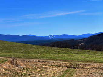
![]()
![]()
![]()
![]()
![]() On Monday, April 6th, Lisa had texted me the night before and asked about a hike a little farther from home. I thought about places that wouldn't have too many hikers and that would have a view as the forecast was for a sunny day. I asked Lisa if she would like to hike Bald Mountain in Stamford and she agreed. Our plan was to meet in front of my house at 10:00 AM. Cindy did not want go as we had hiked the day before. The mountain has many marked trails but no maps are available making the markings useless. There is an abandoned ski slope on the north face of the mountain which has great views. There are also several other places to get a view. I got up late and started to get ready at 9:30 AM with the temperature at 42 degrees which felt more like 50. Sheila seemed happy to be going out two days in a row as she hovered around my pack. Sheila being exceptional excited that we were both going. The temperature on the back porch was 60 degrees but I knew it would probably be a little colder at the trailhead. I put on my long-sleeved Mammut crew top without a baselayer. I decided to wear my Columbia Titanium insulated pants despite the warm weather but knew I would not need tights underneath. I wore my Vasque Taku boots since they were dry and light enough for hiking. I grabbed a pair of Leki poles with external locks that I have been using lately. I also donned my Mammut hoody which blocks the wind but has enough zippers to dump heat when needed. I decided to wear my OR Crocodile gaiters to deal with the mud on the trails and the ticks which has started to appear. I got Sheila and my gear in the car and drove around to meet Lisa in her car in front of my house. We spoke briefly about our route and then we got started just after 10:00 AM. We drove north and west on State Route 17 to exit 94 (Roscoe) and headed north on Route 206 toward Downsville. At the Pepacton Reservoir, we turned left to stay on Route206/30 and drove through Downsville heading toward Walton. Just after the light in Downsville, we turned right on Telford Hollow Road. We turned right at the bottom of the hill and drove out to Route 10. We turned right and drove through Delhi continuing on Route 10 north for 20 miles to the first traffic light in Stamford. We drove straight through the light continuing on Route 10 for 1 more mile before pulling into the parking area for Archibald Field. We pulled in to park at 11:30 and were surprised to see no other cars in the lot. I waited for Lisa to get ready and then set my GPS unit to start our hike at 11:40 AM.
On Monday, April 6th, Lisa had texted me the night before and asked about a hike a little farther from home. I thought about places that wouldn't have too many hikers and that would have a view as the forecast was for a sunny day. I asked Lisa if she would like to hike Bald Mountain in Stamford and she agreed. Our plan was to meet in front of my house at 10:00 AM. Cindy did not want go as we had hiked the day before. The mountain has many marked trails but no maps are available making the markings useless. There is an abandoned ski slope on the north face of the mountain which has great views. There are also several other places to get a view. I got up late and started to get ready at 9:30 AM with the temperature at 42 degrees which felt more like 50. Sheila seemed happy to be going out two days in a row as she hovered around my pack. Sheila being exceptional excited that we were both going. The temperature on the back porch was 60 degrees but I knew it would probably be a little colder at the trailhead. I put on my long-sleeved Mammut crew top without a baselayer. I decided to wear my Columbia Titanium insulated pants despite the warm weather but knew I would not need tights underneath. I wore my Vasque Taku boots since they were dry and light enough for hiking. I grabbed a pair of Leki poles with external locks that I have been using lately. I also donned my Mammut hoody which blocks the wind but has enough zippers to dump heat when needed. I decided to wear my OR Crocodile gaiters to deal with the mud on the trails and the ticks which has started to appear. I got Sheila and my gear in the car and drove around to meet Lisa in her car in front of my house. We spoke briefly about our route and then we got started just after 10:00 AM. We drove north and west on State Route 17 to exit 94 (Roscoe) and headed north on Route 206 toward Downsville. At the Pepacton Reservoir, we turned left to stay on Route206/30 and drove through Downsville heading toward Walton. Just after the light in Downsville, we turned right on Telford Hollow Road. We turned right at the bottom of the hill and drove out to Route 10. We turned right and drove through Delhi continuing on Route 10 north for 20 miles to the first traffic light in Stamford. We drove straight through the light continuing on Route 10 for 1 more mile before pulling into the parking area for Archibald Field. We pulled in to park at 11:30 and were surprised to see no other cars in the lot. I waited for Lisa to get ready and then set my GPS unit to start our hike at 11:40 AM.
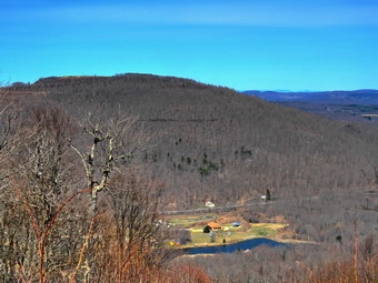 We started out on the gravel road that heads almost due east toward Bald Mountain. The mountain itself was not visible from the parking area but I remembered to head east and up! As we started our hike the temperature was in the low 50's but a breeze made me feel a little cool. The gravel and dirt road that ran along the south side of the fields. It became a woods road and crossed a footbridge over a stream as it entered the forest. This area had an old beaver dam and the water was high. We could hear peepers in all the ponds around us. As we walked, Lisa asked who owned the land and I had to answer that I did not know but that it was open for hiking. We continued east and took a right at the first junction passing several other trails along the way. As promised the trails were marked in various ways but the markings meant little without a map to follow. I am sure there are many different ways to get to the top of the mountain and the route I chose was meant to a combination of one I had taken before and some new trails. At .8 miles we turned right and headed almost due south. From what I could remember this was the route I had followed the last time. Along the way we met an older man hiking and I asked him if he knew who owned the land. He said "yes, I do. I own the land." His name was Doug Murphy and he explained that his family had owned the land for some time and that it was indeed open to hikers. He told me how I could find a rough map online and how I could contact him. I offered to restart an effort to accurately map and mark the trails. We parted and at 1 mile we passed a trail to the left that I knew would take us toward the summit. We continued up a short hill to an open field where I knew there was a great view. There was a small pond in the open field. To the east and south we could see Mount Utsayantha with the fire tower, Churchill Education Center and communication towers. To the north we could see more mountains. I dropped my pack and got out the camera and took quite a few shots of the scenery. As we were stopped a couple came walking up into the field and we said "hello" keeping a proper distance.
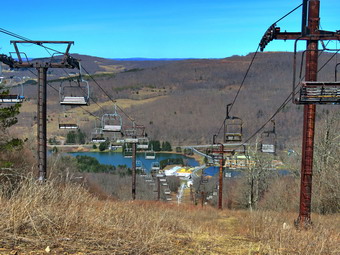 I decided we would return to the trail that ascended the mountain so we retraced our steps and turned right on the trail. The trail headed northeast and then turned east as it started to gain some elevation. We passed several side trails that I had used the last time to lengthen the hike. At 1.6 miles the trail up the mountain continued straight ahead but another trail veered off to the right. We followed this trail until it started to go downhill. Without a map both of us agreed to turn around and take the steeper trail up. We came to another woods road where we made a quick left then right to continue the march up the mountain. We continued up the steep trail which averaged over a 20% grade with some areas approaching 30%. At 2.2 miles we came to another woods road and met the couple we had encountered in the field. We turned right and continued toward the summit. At 2.4 miles we were at the top of the ski slopes where we met a couple of mountain bikers we had seen before. Lisa realized that she knew the woman. We chatted for a while and speculated about the snow we saw on a mountain to the east. The only area that fit was Windham with a second sighting a little further to the south being Hunter. I dropped my pack and got out my camera. I took pictures of the surrounding mountains to the east and then walked to a spot where I could get a view to the north. The ski area was called Scotch Valley or Deer Run and closed in 1998. The buildings at the base of the north slope were the site of the lodge and a bowling alley. I took pictures of the ski lifts and slopes and then walked back to my pack. I took some more shots including some of the ski-lifts and other equipment. We packed up and started back down the trail.
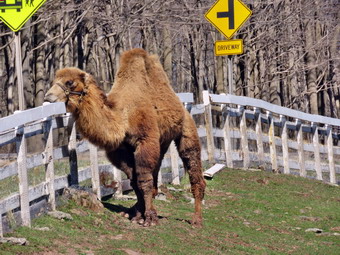 On the way down we continued straight ahead On the woods road that descended the mountain to the West and then turned southwest and south. We ended up approximately where we had started the steep climb. Instead of returning the same way by turning left we turned right and headed down a woods road to the north. The road continued to descend and head north. Since we did not have a map we decided to turn around and start back the way we came. We were back at the point where we had started the ascent at about 3.3 miles and continued back the way we had come until at 3.6 miles we were at the trail that led up to the field we had visited. At this point turning right would take us back the way we came to the parking area. I decided we should continue straight ahead and see where that trail took us. This woods road was very wide and well-maintained and skirted the edge of a very large field. We continued along for some time until I decided to check my GPS. The GPS showed we were headed southwest and away from Archibald Field. We were headed into Stamford and I knew we could walk the streets back to the cars. We decided to continue along the trail. Sheila alerted and I could see a woman coming toward us with a small black ball of fur in her arms. She confirmed that we were headed into Stamford. We passed each other but soon the black ball of fur was loose and chasing us. The puppy wanted to play by nipping at Sheila and I knew Sheila would only tolerate it for so long. The woman eventually grabbed her dog and in the process approached well within 6 feet. Once again I had met an ignorant dog owner who really didn't acre about their pet or others on the trail. We continued out to the end of the trail on Church Street. We turned right and then right again onto Route 23 at the end of the street. We walked a short distance to an intersection and then up a hill to Route 10. We turned right and walked north .8 miles to the cars. It was 3:15 PM and we had walked 5.9 miles in 3 hours and 35 minutes with 45 minutes of stopped time. The elevation gain was 1253 feet. I left the parking area and turned right on Route 10 to head toward Jefferson. After about 1.5 miles I turned onto what used to be called Scotch Valley Road that once lead to the ski resort. In the fields I saw a camel and some Highland cattle. I stopped to take their pictures and also included a few up the ski hill to the summit were I had been earlier.
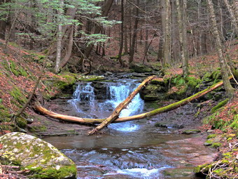
![]()
![]()
![]()
![]()
![]() On Sunday, April 5th I asked Cindy if she wanted to go for a hike and she agreed. We decided to go to Kelly Hollow although I wondered how many people would be at this ice weel-kept secret. In the morning the sky was overcast and there were some rain showers. By 11:30 Am I decided it was time to go no matter the forecast or the current weather. We began to get ready with Sheila being exceptional excited that we were both going. The temperature on the back porch was 60 degrees but I knew it would probably be a little colder at the trailhead. I put on my long-sleeved Mammut crew top without a baselayer. I decided to wear my Columbia Titanium insulated pants despite the warm weather but knew I would not need tights underneath. I wore my Vasque Taku boots since they were dry and light enough for hiking. I grabbed a pair of Leki poles with external locks that I have been using lately. I also donned my Mammut hoody which blocks the wind but has enough zippers to dump heat when needed. I decided to wear my OR Crocodile gaiters to deal with the mud on the trails and the ticks which has started to appear. We got Sheila and our gear in the car and headed north on State Route 17 toward Roscoe at noon. I prefer using the Beaverkill and Barkaboom Roads which saves some miles but Cindy prefers fewer back roads. I took exit 94 and drove north toward the Pepacton Reservoir on Route 206. At the junction with Route 30, I turned right and followed Route 30 to the Dunraven Bridge. I turned right on the BWS road and drove along these roads until reaching the junction with the Barkaboom Road. I turned left on BWS 9. After 4.5 miles, I turned right on Millbrook Road and continued 5.25 miles to the parking lots for Kelly Hollow on the right. I decided to park in the first area and do the figure 8 in the opposite direction I have used before. We parked at 12:50 PM with one other car in the lot. I didn't know how many cars might be in the other lot but knew that any hikers present would be spread over 4 miles of trail. I took a moment to set my GPS before starting our hike at 12:55 PM by heading out on the trail marked with yellow XC skiing blazes. This trail is the more to the west and heads southeast and then south. The temperature was 57 degrees under overcast skies. There was no ice or snow but the trail were wet and muddy in most places. The first .5 miles of the trail is a long uphill which gains about 200 feet of elevation and the levels a little. Along the way a young couple approached us from the opposite direction with what appeared to be a puppy on a leash. As we passed we exchanged greetings and the told us the puppy was 8 months old.
On Sunday, April 5th I asked Cindy if she wanted to go for a hike and she agreed. We decided to go to Kelly Hollow although I wondered how many people would be at this ice weel-kept secret. In the morning the sky was overcast and there were some rain showers. By 11:30 Am I decided it was time to go no matter the forecast or the current weather. We began to get ready with Sheila being exceptional excited that we were both going. The temperature on the back porch was 60 degrees but I knew it would probably be a little colder at the trailhead. I put on my long-sleeved Mammut crew top without a baselayer. I decided to wear my Columbia Titanium insulated pants despite the warm weather but knew I would not need tights underneath. I wore my Vasque Taku boots since they were dry and light enough for hiking. I grabbed a pair of Leki poles with external locks that I have been using lately. I also donned my Mammut hoody which blocks the wind but has enough zippers to dump heat when needed. I decided to wear my OR Crocodile gaiters to deal with the mud on the trails and the ticks which has started to appear. We got Sheila and our gear in the car and headed north on State Route 17 toward Roscoe at noon. I prefer using the Beaverkill and Barkaboom Roads which saves some miles but Cindy prefers fewer back roads. I took exit 94 and drove north toward the Pepacton Reservoir on Route 206. At the junction with Route 30, I turned right and followed Route 30 to the Dunraven Bridge. I turned right on the BWS road and drove along these roads until reaching the junction with the Barkaboom Road. I turned left on BWS 9. After 4.5 miles, I turned right on Millbrook Road and continued 5.25 miles to the parking lots for Kelly Hollow on the right. I decided to park in the first area and do the figure 8 in the opposite direction I have used before. We parked at 12:50 PM with one other car in the lot. I didn't know how many cars might be in the other lot but knew that any hikers present would be spread over 4 miles of trail. I took a moment to set my GPS before starting our hike at 12:55 PM by heading out on the trail marked with yellow XC skiing blazes. This trail is the more to the west and heads southeast and then south. The temperature was 57 degrees under overcast skies. There was no ice or snow but the trail were wet and muddy in most places. The first .5 miles of the trail is a long uphill which gains about 200 feet of elevation and the levels a little. Along the way a young couple approached us from the opposite direction with what appeared to be a puppy on a leash. As we passed we exchanged greetings and the told us the puppy was 8 months old.
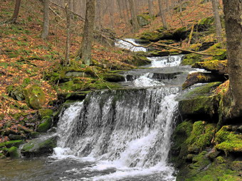 At .65 miles on the trail, I looked to the left toward the stream below. I could see an interesting waterfall on the stream below. The bank was steep but I started to make my way down to the stream bed with Sheila in the lead. I found a way to cross both streams and found another waterfall to the left on the other stream. I dropped my pack and took pictures on the first waterfall an different angles and zooms. As I turned my attention to the second waterfall, I could see a hiker and his dog on the trail above. The dog started down toward us but the owner immediately called it back. I took shots of the second waterfall and then crossed the streams again. Getting up the bank was much more difficult than getting down but I was soon back on the main trail. We continued south and up the hill to the crossover trail that allows hikers to make a short loop. We turned left on this trail and walked downhill toward the stream. This part of the trail was the wettest and slipperiest we had seen so far. We crossed then first bridge where I took some pictures upstream and then a few of Cindy and Sheila on the bridge. We continued to the second bridge and walked up the hill to the main trail on the east where we turned right and continued uphill heading southeast. Almost immediately Sheila alerted and I saw a family group coming toward us with their dogs. The dogs were on leashes and we passed each other with a few words of greeting. The trail continued to be wet and slippery but at least the skies had cleared a little. At 1.6 miles I looked down to the stream on the right and saw another waterfall. I immediately started to look for a way down to the stream bed. Sheila and I worked our way down following some paths but the bank was really steep. When we got to the bottom, I found a place to drop my pack and took out the camera. The falls had three tiers and I took pictures of all of them together and then individually. When I had finished my photography, I looked for a way up the bank. It seemed a lot steeper from the bottom and ascending was not easy. Eventually we were back up to the main trail where we continued south. We met another family group coming toward us. Again we passed by with a few words as the other hikers moved well off the trail. At 2 miles the trail crossed a stream and turned north northwest. From this point the Millbrook Ridge Trail that leaves Alder Lake is only .7 miles to the south southeast. I have bushwhacked to the ridge but never to the trail and out to Alder Lake. A direct route gains over 940 feet in less than a mile which is very steep. We continued to follow the trail as it turned first west and then southwest at 2.4 miles. This part of the trail was on contour and we got to take a break from ascending.
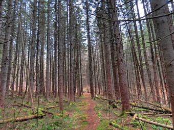 After a short ascent, we arrived at the lean-to at 2.8 miles. Cindy decided to take a short break so I waked out to the edge of the beaver pond. The pond showed no beaver activity and is now much smaller than it has ever been. I took some pictures of the pond, the old lodge and the surrounding forest. I noticed some people on the other side of the pond headed our way as Cindy walked up to me. We started around the pond but stopped for me to take a few more shots. I picked up my pack and walked off the trail so that the other hikers could pass. I walked along the trail to catch up to Cindy and we rounded the pond . I stopped to take a few more pictures and then was ready to quickly hike back downhill to the car. We were now heading north and then northeast downhill along the wet and muddy trail. At 3.4 miles we were approaching the crossover trail again and I noticed a group of hikers coming up the crossover trail toward us. This group had three dogs and only one was one a leash. One owner called his dog as it approached us but the dog did not listen! He finally lunged and grabbed the dog which growled at him. This also placed him less than three feet from us! We walked off the trail to avoid the others but there was still one dog that was not leashed. Once again it takes only one inconsiderate dog owner to sour an otherwise enjoyable hike! We walked down the wet and muddy trail to the bridge. As I started to cross the bridge I heard Cindy exclaim and turned to find her lying in the mud. She got up after a few minutes complaining mostly of right shoulder and elbow pain. We continued on the trail and crossed the second bridge. We walked up the hill to the main trail and turned left to get back to the car. This part of the trail was a slight downhill grade and we soon passed through the gate. We turned left and headed west crossing a small stream to get to the second parking lot. I was prepared to walk out to the road and use it to get back to the car. At this point I noticed a trail that headed west from the parking area through the woods. We followed this trail which brought us back to the frit parking area and our car. There were now several other cars in the area. I put my gear and Sheila in the car with Cindy. I had noticed a building a short distance in front of the car and decided to investigate. I found what looked like a relatively new privy and then returned to the car. It was 3:45 PM and we had hiked 4.5 miles in 2 hours and 50 minutes with an elevation gain of 745 feet.
![]()
![]()
![]()
![]() On Thursday, April 2nd I wanted to get in a quick hike after a morning of rain showers and ambulance calls. At 3:00 PM I decided to go across the street to hike. I asked Cindy if she wanted to go and she agreed. The temperature was right around 40 degrees with a wind of about 20 mph but some sun. Sheila was ready to go as she really likes to hike and she was keeping a careful eye on me as I dressed. Sheila misses the hiking as much as I do since I have returned to full-time teaching for the rest of this school year! I put on my long-sleeved Mammut crew top without a baselayer. I decided to wear my Columbia Titanium insulated pants despite the warm weather but knew I would not need tights underneath. I wore my Keen Targhee II boots since they were dry and light enough for hiking. I grabbed a pair of Leki poles with external locks that I have been using lately. Finally, I also donned my Mammut hoody which blocks the wind but has enough zippers to dump heat when needed. At 3:30 PM we walked out the door to start the hike. I grabbed Sheila's leash from the car and we walked up the driveway. I decided we would do some loops as I was tired of doing figure 8's. I aimed to hike for about an hour. Sheila was happy to get out as we headed down the driveway and across the street. We crossed the street and walked to the parking area by the Presbyterian Church. We walked to the back of the church and began the ascent of the steepest hill behind the church. The hill is short but gets the circulation pumping and is the steepest and longest climb on the "trail." Sheila helped me along by pulling me up the hill.
On Thursday, April 2nd I wanted to get in a quick hike after a morning of rain showers and ambulance calls. At 3:00 PM I decided to go across the street to hike. I asked Cindy if she wanted to go and she agreed. The temperature was right around 40 degrees with a wind of about 20 mph but some sun. Sheila was ready to go as she really likes to hike and she was keeping a careful eye on me as I dressed. Sheila misses the hiking as much as I do since I have returned to full-time teaching for the rest of this school year! I put on my long-sleeved Mammut crew top without a baselayer. I decided to wear my Columbia Titanium insulated pants despite the warm weather but knew I would not need tights underneath. I wore my Keen Targhee II boots since they were dry and light enough for hiking. I grabbed a pair of Leki poles with external locks that I have been using lately. Finally, I also donned my Mammut hoody which blocks the wind but has enough zippers to dump heat when needed. At 3:30 PM we walked out the door to start the hike. I grabbed Sheila's leash from the car and we walked up the driveway. I decided we would do some loops as I was tired of doing figure 8's. I aimed to hike for about an hour. Sheila was happy to get out as we headed down the driveway and across the street. We crossed the street and walked to the parking area by the Presbyterian Church. We walked to the back of the church and began the ascent of the steepest hill behind the church. The hill is short but gets the circulation pumping and is the steepest and longest climb on the "trail." Sheila helped me along by pulling me up the hill.
We started on the trail by turning left at the trailhead where I let Sheila off her leash so that she could explore. The trail was completely bare with no snow and I could see no snow in the woods. The trail was mostly dry with a few spots of mud in spots. At the first trail junction, I followed Sheila as she continued straight up the hill toward the viewpoint. At the top of the hill, we continued on the trail turning right. We followed the trail as it gently gained elevation toward the junction with the blue trail. The trail surface was a little slippery but there was still no snow. At the next trail junction, we continued straight ahead up the steep hill on the blue trail. There were a few muddy and slippery spots on the trail but we had no problem making it to the top. We were soon passing over the top of the hill and starting down the other side. The trail continued to be slippery but I used my poles and we were soon back at the junction with the yellow trail. We continued straight ahead on the yellow trail down to the woods road that took us downhill to the first trail junction. We turned around and walked back up the woods road to the junction with the blue trail. We turned left and walked along the base of Round Top on the yellow trail. At the next junction with the blue trail we turned left to continue downhill on the yellow trail to the viewpoint. We continued to the left on the yellow trail and walked back down the hill to the first trail junction. We had now completed a big loop and a small loop and Cindy was ready to return home. Sheila and I turned around and started back up the hill toward the viewpoint. At the top of the hill, we continued on the trail turning right. We followed the trail as it gently gained elevation toward the junction with the blue trail. I had intended to do another big loop, small loop combination. I changed my mind to doing a figure 8. At the next trail junction, we turned right to follow the yellow trail around the base of Round Top. At the next trail junction we turned left and headed up to the summit of Round Top on the blue trail. I had no problem making it to the top. We were soon passing over the top of the hill and starting down the other side. The trail continued to be slippery but I used my poles and we were soon back at the junction with the yellow trail. At the bottom of the hill we turn left to follow the yellow trail to the next trail junction. This time we turned right and followed the yellow trail down to the woods road that returned us to the first trail junction. All the time Sheila explored off-trail but stayed close enough to hear my voice. When we reached the first trail junction, I decided I wanted to go home We turned left and walked out toward the trailhead. We turned right and I put Sheila on her leash. We continued Down the hill and out through the church parking lot to the road and our driveway. It was 4:45 PM and we had hiked over 2 miles in just over an hour.
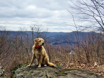
![]()
![]()
![]()
![]()
![]() On Wednesday, April 1st, Lisa contacted me to see if I wanted to hike. I agreed and we decided to meet on Beech Hill at the trailhead for Cabot Mountain. The round trip hike is only 3 miles but the initial uphill is long and steep. Our plans had to be revised as I was called out on a morning ambulance call that pushed our start time to 11:30 AM. I got home at 10:30 AM with the temperature showing 40 degrees in my car. I maintain the trails from Alder Lake to Big Pond over Touch-Me-Not Mountain and Cabot Mountain to Beech Hill Road for the Finger Lakes Trail Conference. These trails are part of the Fingers Lakes Trail that stretches across New York State. I got dressed in a medium weight Patagonia wool top but decided I would forego a baselayer. I decided to put on my Columbia Titanium insulated pants, again, without a baselayer. I wore my Salomam B52 boots which are all leather and insulated since I did not know if we would encounter any snow. I decided to wear my OR Crocodile gaiters to deal with the mud on the trails and the ticks which has started to appear. I decided to take my new pair of Leki poles with external locks as the internal twist locks fail. I grabbed a light hat and gloves. Finally, I donned my Mammut hoody which blocks the wind and keeps me warm but has enough zippers to dump heat when needed. I decided to carry my microspikes in case they were needed. I put my gear in the car and Sheila in the back seat. As we left Livingston Manor at 11:15 AM, the sun was peeking out from behind some clouds. Sheila was happy to be going anywhere and was standing in the backseat looking over my shoulder. I drove north on Old Route 17 before turning right on the Beaverkill Road. I passed through Lew Beach and turned left on Beech Hill Road Road. I drove up the road about 2.6 miles to the small pullout on the right side of the road at the beginning of the trail and pulled in to parking lot. Lisa was already there getting ready to hike. The temperature was cooler than in town and was around 38 degrees. When I got out of the car a slight breeze was blowing king it feel even cooler. Lisa and I talked as she got ready and then we were ready to start. I set my GPS unit and we started out on the hike by walking along the edge of an open field which was very wet. As we entered the forest, I noticed all the rocks were wet and there were muddy spots and pools of water everywhere.
On Wednesday, April 1st, Lisa contacted me to see if I wanted to hike. I agreed and we decided to meet on Beech Hill at the trailhead for Cabot Mountain. The round trip hike is only 3 miles but the initial uphill is long and steep. Our plans had to be revised as I was called out on a morning ambulance call that pushed our start time to 11:30 AM. I got home at 10:30 AM with the temperature showing 40 degrees in my car. I maintain the trails from Alder Lake to Big Pond over Touch-Me-Not Mountain and Cabot Mountain to Beech Hill Road for the Finger Lakes Trail Conference. These trails are part of the Fingers Lakes Trail that stretches across New York State. I got dressed in a medium weight Patagonia wool top but decided I would forego a baselayer. I decided to put on my Columbia Titanium insulated pants, again, without a baselayer. I wore my Salomam B52 boots which are all leather and insulated since I did not know if we would encounter any snow. I decided to wear my OR Crocodile gaiters to deal with the mud on the trails and the ticks which has started to appear. I decided to take my new pair of Leki poles with external locks as the internal twist locks fail. I grabbed a light hat and gloves. Finally, I donned my Mammut hoody which blocks the wind and keeps me warm but has enough zippers to dump heat when needed. I decided to carry my microspikes in case they were needed. I put my gear in the car and Sheila in the back seat. As we left Livingston Manor at 11:15 AM, the sun was peeking out from behind some clouds. Sheila was happy to be going anywhere and was standing in the backseat looking over my shoulder. I drove north on Old Route 17 before turning right on the Beaverkill Road. I passed through Lew Beach and turned left on Beech Hill Road Road. I drove up the road about 2.6 miles to the small pullout on the right side of the road at the beginning of the trail and pulled in to parking lot. Lisa was already there getting ready to hike. The temperature was cooler than in town and was around 38 degrees. When I got out of the car a slight breeze was blowing king it feel even cooler. Lisa and I talked as she got ready and then we were ready to start. I set my GPS unit and we started out on the hike by walking along the edge of an open field which was very wet. As we entered the forest, I noticed all the rocks were wet and there were muddy spots and pools of water everywhere.
 The first part of the trail is flat and we spent some time hopping over and walking around mud and pools. I had put up new red markers two of three years ago but the trail markings had faded. At .2 miles the trail begins to climb and in about half a mile it gains almost 600 feet averaging a 20% grade. This is not as steep as the other side but is plenty challenging. We continued up the trail which has a few switchbacks and several flatter areas. The climb seemed shorter and went faster than I expected. There were a few spots along the way that were slippery with mud and leaves. At about .7 miles the trail levels off and then rolls over several bumps to the Cabot Mountain Vista at 1.6 miles. Along the way we saw a tree on the left side of the trail. There were extensive wood chips at the base of the tree. There were several noles higher on the trunk where wood had been pulled out. Sheila was having a great time bounding ahead and them coming back to find us. She occasionally followed some game trail. As we reached the flatter summit area, I found a few small blowdowns. The trail also became muddy again in spots as the water does not drain well. The walk to the vista on Cabot Mountain seemed to take longer than I remembered but we arrived at the lookout at 12:55 PM. The skies had grown more overcast and the sun was hidden behind clouds. I wanted to get back for a conference call so we did not plan to stay long. I took a few pictures of Sheila sitting on the lookout and then a few more of Little Pond. I also took some shots of the clouds. I packed up and got a drink and a bar. I headed out while Lisa stayed a few more minutes at the viewpoint. I turned around at 1:05 PM and started to retrace my steps back to the car. The walk back to the descent went very quickly even though I stopped to take some pictures of the tree with the holes in Te trunk. We continued back on the trail to the steeper descent which proved to be tricky because of the dampness, mud and leaves. I slipped and nearly fell several times but we were soon on the flatter part of the trail. We worked our way around the wet and muddy spots and then walked the edge of the field back to the car, We were back at the car at 2:10 PM. We spent 2 hours and 35 minutes hiking 3.0 miles with an elevation gain of 890 feet! We had stopped for almost 30 minutes.
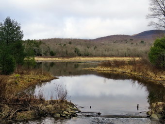
![]()
![]()
![]()
![]()
![]() On Tuesday, March 31st, I wanted to get out for a hike but a late night call required I sleep in until 10:00 AM. Karl had indicated he might be able to leave work early so I called him around 1:00 PM. He indicated he could be ready by 2:30 PM which made me happy as we do not get many opportunities to hike together. Cindy also agreed to go so I began to think of an appropriate hike to fit our time frame. I decided to go to Frick Pond and do the Logger's Loop in some form. We started to bet ready just after 2:00 PM and Karl showed up a little early at 2:15 PM. It was still only 38 degrees as we were getting ready to go but there was little or no wind. I got dressed in my Mammut crew top and decided I would forego a baselayer. I decided to put on my Columbia Titanium insulated pants, again, without a baselayer. I wore my Vasque Taku boots which are all leather and I did not think we would encounter much snow. I decided to wear my OR Crocodile gaiters to deal with the mud on the trails and the ticks which has started to appear. I decided to take my new pair of Leki poles with external locks as the internal twist locks fail. I grabbed a light hat and gloves. Finally, I donned my Mammut hoody which blocks the wind and keeps me warm but has enough zippers to dump heat when needed. I decided to carry my microspikes in case they were needed. Since Karl was with us, Sheila was more crazed than usual even though we had been out the last two days. We put our gear in the trunk and Karl and Sheila in the backseat as we left Livingston Manor just before 2:30 PM to head out the DeBruce Road. At six miles I turned left onto Mongaup Pond Road . Where the road split I stayed left on Beech Mountain Road to the parking areas. There were no cars in either lot so I pulled into the smaller one and parked. I set my electronics and we headed out the woods road to get on the Quick Lake Trail at the register. At the trail register we continued straight ahead on the wide woods road which in the Quick Lake Trail and leads to Frick Pond. The trail was muddy and wet with some standing water and plenty of water flowing down and across the trail.
On Tuesday, March 31st, I wanted to get out for a hike but a late night call required I sleep in until 10:00 AM. Karl had indicated he might be able to leave work early so I called him around 1:00 PM. He indicated he could be ready by 2:30 PM which made me happy as we do not get many opportunities to hike together. Cindy also agreed to go so I began to think of an appropriate hike to fit our time frame. I decided to go to Frick Pond and do the Logger's Loop in some form. We started to bet ready just after 2:00 PM and Karl showed up a little early at 2:15 PM. It was still only 38 degrees as we were getting ready to go but there was little or no wind. I got dressed in my Mammut crew top and decided I would forego a baselayer. I decided to put on my Columbia Titanium insulated pants, again, without a baselayer. I wore my Vasque Taku boots which are all leather and I did not think we would encounter much snow. I decided to wear my OR Crocodile gaiters to deal with the mud on the trails and the ticks which has started to appear. I decided to take my new pair of Leki poles with external locks as the internal twist locks fail. I grabbed a light hat and gloves. Finally, I donned my Mammut hoody which blocks the wind and keeps me warm but has enough zippers to dump heat when needed. I decided to carry my microspikes in case they were needed. Since Karl was with us, Sheila was more crazed than usual even though we had been out the last two days. We put our gear in the trunk and Karl and Sheila in the backseat as we left Livingston Manor just before 2:30 PM to head out the DeBruce Road. At six miles I turned left onto Mongaup Pond Road . Where the road split I stayed left on Beech Mountain Road to the parking areas. There were no cars in either lot so I pulled into the smaller one and parked. I set my electronics and we headed out the woods road to get on the Quick Lake Trail at the register. At the trail register we continued straight ahead on the wide woods road which in the Quick Lake Trail and leads to Frick Pond. The trail was muddy and wet with some standing water and plenty of water flowing down and across the trail.
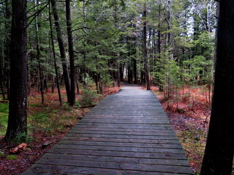 We stayed left at Gravestone Junction to walk down to the pond. At the bridge, I put my pack down and got out my camera and took pictures of the pond and Flynn's Point. We walked across the bridge and around the west edge of the pond. At the next trail junction, we turned right to get on the yellow-blazed Big Rock Trail and headed around the back of Frick Pond. This is one of Karl's favorite spots with hemlock groves and wooden walkways. I stopped to take some picture of the evergreens and of the walkways. The walkways were wet and very slippery as they often get even when there is no ice. After passing over the wooden walkways we came to a bridge where there was a good view of the wetlands at the head of the pond. We headed toward Time Square over the trail that was still wet and muddy. Times Square was wet and muddy in all directions. We have talked about improving drainage in this area but it is not easy to see how. We turned left on the Logger's Loop and tried to avoid the wettest spots as we began a climb the hill. The trail ascends a bit and then levels off. On the right side of the trail we could see the small pond that has formed. I stopped to take some pictures and was surprised to see Te water level looked lower than a few days before deposit the rain. We continued on the Logger's Loop toward Iron Wheel Junction as some rain began to fall. Soon we were at the trail junction where we turned left on the Quick Lake Trail to head back to Frick Pond. I took a few pictures of the iron wheels at the junction. The trail was wet and muddy but we had gotten accustomed to this. Walking downhill toward the little stream in the woods was easier than walking uphill or even on flat sections. When we arrived at the stream through the woods, I elected to walk upstream to cross as I did not want to chance stepping in the water which was wide and deep. We all crossed upstream and then walked back to the main trail. We walked through the "spruce tunnel" and then exited all the time walking around water and mud. We arrived at the junction with the Big Rock Trail and continued straight ahead. Soon we were back at the bridge over the outlet to Frick Pond where it was clear the rain had increased from the drops in the pond. We did not stop but crossed the bridge and walked up the hill to follow the Quick Lake Trail back to the register. At Gravestone Junction I checked to make sure the memorial stone was upright. We walked the woods road back out to register and continued straight ahead on the woods road to the car. We arrived back at 4:45 PM after hiking 3.8 miles in 2 hours. The overall elevation gain was a modest 350 feet.
![]()
![]()
![]()
![]() On Friday, April 10th I had planned to get out on a longer hike and was even thinking about Balsam Lake Mountain. It had rained and snowed on and off for two days and in the morning it was still cold and snowing. At 8:00 AM the ambulance pager sounded for a motor vehicle accident just outside of town. By the time I returned at 10:00 AM the snow showers had abated but the temperature was only 38 degrees. There was also a breeze blowing that made it seem even colder. I delayed a little before getting ready but by 11:00 AM I knew if I did not get started I would not go at all. I decided to go across the street since it was close and I could always return if conditions worsened. I asked Cindy if she wanted to go but she declined. I began to get ready and Sheila showed her appreciation by barking and running around. I put on my long-sleeved Mammut top without a baselayer. I decided to wear my Columbia Titanium insulated pants to keep the chill away but decided against tights underneath. I wore my Vasque Taku boots which are supportive and surprisingly roomy. I grabbed my Leki external lock poles which I purchased since twist locks have proved unreliable. I also donned my Mammut hoody which was enough zippers to dump heat when needed. I put on a light hat and wore a light pair of gloves. At 11:30 PM we walked out the door to start the hike. Immediately I noticed that the skies to the northwest looked snow-filled and that the wind was picking up. I decided to continue since I knew we could always turn around and return home quickly. I grabbed Sheila's leash from the car and we walked up the driveway. I decided we would try to do some figure 8's on the Round Top Trails. I aimed to hike for about an hour. Sheila was happy to get out as we crossed the street and walked to the parking area by the Presbyterian Church. We walked to the back of the church and began the ascent of the steepest hill behind the church. There was a light covering of snow on the grass but the roadway was only wet. The hill is short but gets the circulation pumping and is the steepest and longest climb on the "trail." Sheila helped me along by pulling me up the hill. When we got to the top of the hill, the snow hit and the wind picked up even more. We started on the trail by turning left at the trailhead. I let Sheila off her leash so that she could explore. The trees helped hold back some of the wind and snow. The woods were covered in snow with only a narrow track which was the trail bed.
On Friday, April 10th I had planned to get out on a longer hike and was even thinking about Balsam Lake Mountain. It had rained and snowed on and off for two days and in the morning it was still cold and snowing. At 8:00 AM the ambulance pager sounded for a motor vehicle accident just outside of town. By the time I returned at 10:00 AM the snow showers had abated but the temperature was only 38 degrees. There was also a breeze blowing that made it seem even colder. I delayed a little before getting ready but by 11:00 AM I knew if I did not get started I would not go at all. I decided to go across the street since it was close and I could always return if conditions worsened. I asked Cindy if she wanted to go but she declined. I began to get ready and Sheila showed her appreciation by barking and running around. I put on my long-sleeved Mammut top without a baselayer. I decided to wear my Columbia Titanium insulated pants to keep the chill away but decided against tights underneath. I wore my Vasque Taku boots which are supportive and surprisingly roomy. I grabbed my Leki external lock poles which I purchased since twist locks have proved unreliable. I also donned my Mammut hoody which was enough zippers to dump heat when needed. I put on a light hat and wore a light pair of gloves. At 11:30 PM we walked out the door to start the hike. Immediately I noticed that the skies to the northwest looked snow-filled and that the wind was picking up. I decided to continue since I knew we could always turn around and return home quickly. I grabbed Sheila's leash from the car and we walked up the driveway. I decided we would try to do some figure 8's on the Round Top Trails. I aimed to hike for about an hour. Sheila was happy to get out as we crossed the street and walked to the parking area by the Presbyterian Church. We walked to the back of the church and began the ascent of the steepest hill behind the church. There was a light covering of snow on the grass but the roadway was only wet. The hill is short but gets the circulation pumping and is the steepest and longest climb on the "trail." Sheila helped me along by pulling me up the hill. When we got to the top of the hill, the snow hit and the wind picked up even more. We started on the trail by turning left at the trailhead. I let Sheila off her leash so that she could explore. The trees helped hold back some of the wind and snow. The woods were covered in snow with only a narrow track which was the trail bed.
At the first trail junction, we followed Sheila as she turned right on the woods road which is the shallower approach to the trail system. The road had less snow that the other parts of the trail but there was a good covering of snow off the trail. We continued to follow the yellow trail to the first junction where we turned left and followed it to the next trail junction. We kept a quick pace as we walked even though the trail was wet and slippery in places. The narrow track of the trail was the only part of the woods that was not covered in snow. This ribbon of brown and green through the covering of white snow was quite beautiful. At the second junction with the blue trail, we turned right and started up the steep blue trail that leads over the summit of Round Top. The snow was even more pronounced here as the trail faces the north. As we ascended the trail, there were places where the trail was muddy and slippery but walking beside the trail to get traction was difficult evacuee of the snow. I began to think that my idea of putting in a switchback or two was a good idea. We walked across the flat summit of Round Top and started down the other side. Descending was also tricky as there were wet and slippery spots. I began to think that heading straight up the hill and straight down was not the best idea. Several different solutions came to mind including rerouting the trail to include a switchback or two on each side of the hill. Soon we were back at the yellow trail where we turned right and walked to the next trail junction. This time we turned left and followed the yellow trail downhill toward the lookout. I stopped to take a look down to the school and town both of which were covered in a thin layer of snow. We continued on the trail and followed it as it turned left and descended to the first trail junction. Even this part of the trail was a little muddy and slippery. This section of trail gets the most traffic as some people simply walk up to the viewpoint and then back down. Snow continued to fall as we turned around and walked back up the hill to the lookout. We continued to follow the yellow trail as it gained elevation to the junction with the blue trail. We turned right and continued to follow the yellow trail along the base of Round Top to the next junction with the blue trail. We turned left and walked up the blue trail to cross the summit of Round Top. The ascent went well but I did have to watch for some muddy areas. The descent on the other side was tricky but we did make it down without incident. At the trail junction with the yellow trail we turned left and followed the trail along the base of Round Top again. At the next trail junction, we turned right and walked down the trail to the woods road and out to the first trail junction. I checked the time and determined that we should return home. We walked out toward the trailhead where I put Sheila on her leash. The snow that had been on the grass was almost all gone as the temperature was rising and snow had stopped falling. We walked down the hill and through the church parking lot to the road and to our driveway. It was 12:45 PM and we had hiked around 2 miles in a little over an hour.
![]()
![]()
![]()
![]() On Sunday, March 29th the weather was overcast all day with rain showers on and off. I finally decided to go across the street and hike on Round Top. I began to get ready at 1:20 PM and Sheila showed her appreciation by barking and running around. The temperature was 42 degrees but the overcast and the moisture in the air made it feel colder. I put on my long-sleeved Mammut top without a baselayer. I decided to wear my Columbia Titanium insulated pants to keep the chill away but decided against tights underneath. I wore Keen Targhee III boots which are supportive and surprisingly roomy. I grabbed my Leki external lock poles which I purchased since twist locks have proved unreliable. I also donned my Mammut hoody which was enough zippers to dump heat when needed. I put on a light hat and wore a light pair of gloves. At 1:40 PM we walked out the door to start the hike. Immediately I noticed that there was a heavy mist bordering on rain. I considered going back in the house but decided both Sheila and I could use the workout. I grabbed Sheila's leash from the car and we walked up the driveway. I decided we would try to do some figure 8's on the Round Top Trails. I aimed to hike for about an hour. Sheila was happy to get out as we crossed the street and walked to the parking area by the Presbyterian Church. We walked to the back of the church and began the ascent of the steepest hill behind the church. There was no snow or ice to be seen anywhere. The hill is short but gets the circulation pumping and is the steepest and longest climb on the "trail." Sheila helped me along by pulling me up the hill. When we got to the top of the hill, we started on the trail by turning left at the trailhead. I let Sheila off her leash so that she could explore. The trail bed is becoming worn it which means that a few people are using the trail. I am always happy to see that someone else uses the trails. Once we entered the woods there was even more water falling on us but I decided it was probably from the trees and we continued.
On Sunday, March 29th the weather was overcast all day with rain showers on and off. I finally decided to go across the street and hike on Round Top. I began to get ready at 1:20 PM and Sheila showed her appreciation by barking and running around. The temperature was 42 degrees but the overcast and the moisture in the air made it feel colder. I put on my long-sleeved Mammut top without a baselayer. I decided to wear my Columbia Titanium insulated pants to keep the chill away but decided against tights underneath. I wore Keen Targhee III boots which are supportive and surprisingly roomy. I grabbed my Leki external lock poles which I purchased since twist locks have proved unreliable. I also donned my Mammut hoody which was enough zippers to dump heat when needed. I put on a light hat and wore a light pair of gloves. At 1:40 PM we walked out the door to start the hike. Immediately I noticed that there was a heavy mist bordering on rain. I considered going back in the house but decided both Sheila and I could use the workout. I grabbed Sheila's leash from the car and we walked up the driveway. I decided we would try to do some figure 8's on the Round Top Trails. I aimed to hike for about an hour. Sheila was happy to get out as we crossed the street and walked to the parking area by the Presbyterian Church. We walked to the back of the church and began the ascent of the steepest hill behind the church. There was no snow or ice to be seen anywhere. The hill is short but gets the circulation pumping and is the steepest and longest climb on the "trail." Sheila helped me along by pulling me up the hill. When we got to the top of the hill, we started on the trail by turning left at the trailhead. I let Sheila off her leash so that she could explore. The trail bed is becoming worn it which means that a few people are using the trail. I am always happy to see that someone else uses the trails. Once we entered the woods there was even more water falling on us but I decided it was probably from the trees and we continued.
At the first trail junction, I followed Sheila as she turned right on the woods road which is the shallower approach to the trail system. On the way up the old woods road, we came across several areas where I had cleared trees on previous trips. We continued to follow the yellow trail to the first junction where we turned left and followed it to the next trail junction. We kept a quick pace as we walked even though the trail was wet and slippery in places. At the second junction with the blue trail, we turned right and started up the steep blue trail that leads over the summit of Round Top. As we ascended the trail, there were places where the trail was muddy and slippery causing me to walk beside the trail to get traction. We walked across the flat summit of Round Top and started down the other side. Descending was also tricky as there were wet and slippery spots. I began to think that heading straight up the hill and straight down was not the best idea. Several different solutions came to mid including rerouting the trail to include a switchback or two on each side of the hill. Soon we were back at the yellow trail where we turned right and walked to the next trail junction. This time we turned left and followed the yellow trail downhill toward the lookout. We continued down to the lookout and followed the yellow trail as it turned left and descended the hill to the first trail junction. Even this part of the trail was a little muddy and slippery. This section of trail gets the most traffic as some people simply walk up to the viewpoint and then back down. The walk had gone quickly so I decided to do another figure 8 which pleased Sheila immensely. We turned around and walked back up the hill to the lookout. We continued to follow the yellow trail as it gained elevation to the junction with the blue trail. We turned right and continued to follow the yellow trail along the base of Round Top to the next junction with the blue trail. We turned left and walk up the blue trail to cross the summit of Round Top. The ascent went well but I did have to watch for some muddy areas. The descent on the other side was tricky but we did make it down without incident. At the trail junction with the yellow trail we turned left and followed the trail along the base of Round Top again. At the next trail junction, we turned right and walked down the trail to the woods road and out to the first trail junction. I checked the time and determined that we should return home given the time. We walked out toward the trailhead where I put Sheila on her leash. We walked down the hill and through the church parking lot to the road and to our driveway. It was 2:45 PM and we had hiked around 2 miles in a little over an hour.
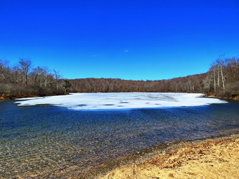
![]()
![]()
![]()
![]()
![]() On Friday, March 27th I got an e-mail from Lisa asking if I wanted to hike to Hodge Pond and then bushwhack the outlet stream. We had talked about this on our last trip in that area and I agreed it would be an interesting hike. The tracks posted here are only for the hike on the Flynn Trail to Hodge Pond. Everybody will bushwhack differently! The forecast called for rain in the morning so we agreed to meet at the trailhead at noon. As it turned out the rain did not fall and the sun came out so that the morning temperatures were in the high 40's. At 11:15 AM I began to get ready as the temperature was approaching 50 degrees. I got dressed in my Mammut crew top and decided that despite the temperature I would wear a light baselayer. I decided to put on my Columbia Titanium insulated pants to keep the chill away with light tights underneath. I wore my Salomon B52 boots as I did not now how much snow we would encounter. I decided to wear my OR Crocodile gaiters to deal with the mud on the trails and the ticks which has started to appear. I decided to take my new pair of Leki poles with external locks as the internal twist locks fail. I grabbed a light hat and gloves. Finally, I donned my Mammut hoody which blocks the wind and keeps me warm but has enough zippers to dump heat when needed. I decided to carry my microspikes in case they were needed. Sheila kept me in sight as I got ready to go making sure she would not be forgotten. I put my gear in the back of the car and Sheila in the back seat as we left Livingston Manor at 11:40 AM. I headed out the DeBruce Road to Mongaup Pond Road where I turned left and headed up toward Mongaup Pond. Where the road split, I stayed to the left on Beech Mountain Road where the road forks. When we arrived at the parking area there was one car in the big lot and one car in the small lot which was Lisa. We talked as Lisa got ready to hike. We decided to hike up the Flynn Trail to Hodge Pond. I set my GPS unit at the trailhead and we crossed the road to start the hike at 12:00 PM. The skies were blue with a few white clouds and plenty of sun. The first part of the trail through the woods was damp with some mud. We turned right on the woods road which was once the extension of the Beech Mountain Road and started the 1.7 mile climb up the Flynn Trail to the junction with the Big Rock Trail.
On Friday, March 27th I got an e-mail from Lisa asking if I wanted to hike to Hodge Pond and then bushwhack the outlet stream. We had talked about this on our last trip in that area and I agreed it would be an interesting hike. The tracks posted here are only for the hike on the Flynn Trail to Hodge Pond. Everybody will bushwhack differently! The forecast called for rain in the morning so we agreed to meet at the trailhead at noon. As it turned out the rain did not fall and the sun came out so that the morning temperatures were in the high 40's. At 11:15 AM I began to get ready as the temperature was approaching 50 degrees. I got dressed in my Mammut crew top and decided that despite the temperature I would wear a light baselayer. I decided to put on my Columbia Titanium insulated pants to keep the chill away with light tights underneath. I wore my Salomon B52 boots as I did not now how much snow we would encounter. I decided to wear my OR Crocodile gaiters to deal with the mud on the trails and the ticks which has started to appear. I decided to take my new pair of Leki poles with external locks as the internal twist locks fail. I grabbed a light hat and gloves. Finally, I donned my Mammut hoody which blocks the wind and keeps me warm but has enough zippers to dump heat when needed. I decided to carry my microspikes in case they were needed. Sheila kept me in sight as I got ready to go making sure she would not be forgotten. I put my gear in the back of the car and Sheila in the back seat as we left Livingston Manor at 11:40 AM. I headed out the DeBruce Road to Mongaup Pond Road where I turned left and headed up toward Mongaup Pond. Where the road split, I stayed to the left on Beech Mountain Road where the road forks. When we arrived at the parking area there was one car in the big lot and one car in the small lot which was Lisa. We talked as Lisa got ready to hike. We decided to hike up the Flynn Trail to Hodge Pond. I set my GPS unit at the trailhead and we crossed the road to start the hike at 12:00 PM. The skies were blue with a few white clouds and plenty of sun. The first part of the trail through the woods was damp with some mud. We turned right on the woods road which was once the extension of the Beech Mountain Road and started the 1.7 mile climb up the Flynn Trail to the junction with the Big Rock Trail.
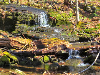 The trail was wet but there was no snow or ice and the sun on our backs felt very warm. Sheila was roaming around running up and down the trail. We passed through the "tunnel" Cindy, and I had cut in a large hemlock tree that had fallen across the trail. We were walking and talking which made the hike go fast. At 1.2 miles we crested a hill and passed by the path to a clearing on the fit. We continued on the Flynn Trail toward the junction with the Big Rock trail passing several blowdowns. We arrived at the junction at 1:00 PM taking about an hour to hike 1.7 miles. We continued straight ahead on the Flynn Trail passing through the gate that marks the beginning of the OSI property. A little further on, at the junction with the jeep trail, we turned left to walk the Flynn Trail toward Hodge Pond. Just after this intersection the expanse of snow we had seen on the previous hike was almost completely gone. At 2.4 miles we broke into the clearing at the southern end of Hodge Pond where there was no snow remaining from the drifts that come off the pond. We continued straight ahead to walk across the clearing to the shores of Hodge Pond. I dropped my pack and got out my camera to take pictures of the pond. Sheila decided to walk out into the cold water to get a drink. I took some pictures of her and then we packed up to leave. We walked over to the point where the Flynn Trail leaves the clearing and heads out along the west side of Hodge Pond. Lisa decided we should walk on different sides of the outlet stream so she headed down the left side and I walked down the right. Once I broke through some small beeches the walk was mostly open.
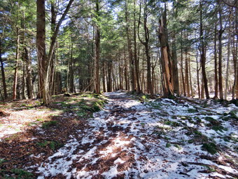 Almost immediately we came to a metal culvert pipe which was buried under some layers of stone and earth. It was obvious that a road had passed over this culvert and what remained of the road was clearly visible. I took some pictures before we continued downstream with both of us walking on the same side. We found another culvert similar to the first and a metal casing which may have been an old catch basin. We continued walking along the stream and it was obvious we were losing a lot of elevation. It was also clear that the stream had cut a rather large gorge. I tired to take some pictures from high on the bank but finally decided to work my way down to the streambed. Once I was at the stream, I took out my camera to take some pictures. I walked upstream along the edge of the stream and got to a point where I could take some pictures of the deep V the stream had cut. The sun was very bright which made taking shots difficult. I walked back to my pack and stowed the camera so that I could walk back up the bank to Lisa. We continued downstream where there were several small but pretty waterfalls. I took a few more pictures before the grade declined and became almost flat. At 2:20 PM, after hiking, 3.2 miles we were at the Logger's Loop where a culvert carried the stream under the trail. The bushwhack down the outlet stream was only about .6 miles. Lisa coded to turn right on the Logger's Loop while I continued downstream. The stream was fairly easy to follow for about .2 miles when it branched out into a wetland. I walked around for a little while but was unable to find the stream even with the aid of my GPS and Avenza app. I decided to head east to the Logger's Loop which was only 500 ft away.
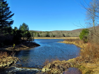 Once on the Logger's Loop, I turned right to head south toward Frick Pond. At 3.7 miles, we came to what is now a small pond on the left side of the trail. I was going to pass by but stopped to take a few pictures. I could hear peepers and see at least two pairs of ducks on this small body of water. I took pictures even though the sun was unfavorable and then went back to the trail. We walked downhill to Times Square where the trail was very wet and muddy. At Times Square we turned right on the Big Rocck Trail so that we could walk around Frick Pond. The trail was wet and muddy until we entered the area under the evergreen trees. This area still had some snow and ice so I stopped to take some pictures. We continued through the evergreens and over the bridges that span the two inlet streams. After that we walked over the wooden walkways which were free of snow despite some snow that still remained in the woods. The last section of the Big Rock Trail to the junction with the Quick Lake Trail was very muddy. We turned left onto the Quick Lake Trail and encountered more mud all the way to the bridge. We stopped at the bridge and I took some pictures of the pond, Flynn's Point and the outlet stream. By this time I was pretty tired, so I set a quick pace up the hill and out the Quick Lake Trail to the register box. This part of the trail had water flowing across the trail and down the trail and standing on the trail. Sat the register we continued straight ahead on the woods road back to the car. We arrived at the car at 3:35 PM having hiked 5.1 miles in 3 hours and 35 minutes with an elevation gain of 725 feet. The average moving speed was just under 2 mph but we were moving slowly on the bushwhack portion. Our stopped time was almost 1 hour!
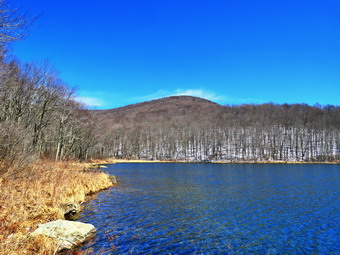
![]()
![]()
![]()
![]()
![]() On Thursday, March 26th, I wanted to get to hike locally. I asked Cindy if she wanted to go and she agreed suggesting Alder Lake. Cindy had not been to the lean-to since the beaver meadow had changed to a beaver pond and I thought she would enjoy it. The temperature was in the low 50's with plenty of sun and the conditions seemed perfect for a spring hike. We began to get ready at 1:10 PM with Sheila was ready to go and stayed close to me to make sure she was going along. I got dressed in my Mammut crew top and decided I would forego a baselayer. I decided to put on my Columbia Titanium insulated pants, again, without a baselayer. I wore my Vasque Taku boots which are all leather and I did not think we would encounter much snow. I decided to wear my OR Crocodile gaiters to deal with the mud on the trails and the ticks which has started to appear. I decided to take my new pair of Leki poles with external locks as the internal twist locks fail. I grabbed a light hat and gloves. Finally, I donned my Mammut hoody which blocks the wind and keeps me warm but has enough zippers to dump heat when needed. I decided to carry my microspikes in case they were needed. At 1:20 PM we put our equipment in the car and Sheila in the backseat and headed out the driveway. I drove north and west on Old Route 17 and turned right on Beaverkill Road heading toward Lew Beach. I passed through Lew Beach and followed the road as it passed through Turnwood. A little farther along, I turned left on Alder Creek Road and drove to the junction with Cross Mountain Road and the access road to Alder Lake. I turned right on the access road and drove to the parking area. The lot had four cars parked as I pulled in. I set my GPS unit and put Sheila on her leash as there were some people coming back to the parking lot. We started our hike at 1:40 PM by walking out the path passing the remains of the Coykendall mansion. I decided to walk down to the lakeshore and take some pictures. The sky was mostly blue but there were a few wispy clouds in the sky. It was very sunny but the sun was behind me so I decided to take some shots. I took my camera out of my pack and took some shots. I took some of the entire lake and then zoomed in for some more. There were some geese on the lake so I look some pictures of them. I noticed that although the immediate area had no snow there was plenty of snow on the hills especially those face north and west
On Thursday, March 26th, I wanted to get to hike locally. I asked Cindy if she wanted to go and she agreed suggesting Alder Lake. Cindy had not been to the lean-to since the beaver meadow had changed to a beaver pond and I thought she would enjoy it. The temperature was in the low 50's with plenty of sun and the conditions seemed perfect for a spring hike. We began to get ready at 1:10 PM with Sheila was ready to go and stayed close to me to make sure she was going along. I got dressed in my Mammut crew top and decided I would forego a baselayer. I decided to put on my Columbia Titanium insulated pants, again, without a baselayer. I wore my Vasque Taku boots which are all leather and I did not think we would encounter much snow. I decided to wear my OR Crocodile gaiters to deal with the mud on the trails and the ticks which has started to appear. I decided to take my new pair of Leki poles with external locks as the internal twist locks fail. I grabbed a light hat and gloves. Finally, I donned my Mammut hoody which blocks the wind and keeps me warm but has enough zippers to dump heat when needed. I decided to carry my microspikes in case they were needed. At 1:20 PM we put our equipment in the car and Sheila in the backseat and headed out the driveway. I drove north and west on Old Route 17 and turned right on Beaverkill Road heading toward Lew Beach. I passed through Lew Beach and followed the road as it passed through Turnwood. A little farther along, I turned left on Alder Creek Road and drove to the junction with Cross Mountain Road and the access road to Alder Lake. I turned right on the access road and drove to the parking area. The lot had four cars parked as I pulled in. I set my GPS unit and put Sheila on her leash as there were some people coming back to the parking lot. We started our hike at 1:40 PM by walking out the path passing the remains of the Coykendall mansion. I decided to walk down to the lakeshore and take some pictures. The sky was mostly blue but there were a few wispy clouds in the sky. It was very sunny but the sun was behind me so I decided to take some shots. I took my camera out of my pack and took some shots. I took some of the entire lake and then zoomed in for some more. There were some geese on the lake so I look some pictures of them. I noticed that although the immediate area had no snow there was plenty of snow on the hills especially those face north and west
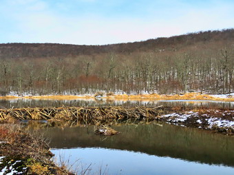 I put away my camera. picked up my pack and we headed out on the trail along the north shore of the lake. We kept up a good pace and passed the campsites which were unoccupied. The trail was very wet with many muddy spots along the way. At one point I stopped I take some pictures of the lake and Cradle Rock Ridge across the lake. I noticed some people on the far shoreline and then saw that they had set up camp. We continued on the trail and crossed the first bridge. The beaver dams that had been backing up water over the trail had been removed. I like beavers and don't like to see their work destroyed but this step was necessary. We crossed the second bridge and shortly after turned left to head toward the lean-to on the Millbrook Ridge Trail. The trail was very wet and muddy with a covering of snow which increased the longer we hiked. There were several blowdowns along the way which almost blocked the trail. There were areas of standing water and other places where the trail seemed like a stream. All of the streams crossing the trail were high and some were a little challenging to cross. As we walked, we could hear Alder Creek to the right of us and see the sun sparkling off the water. Almost immediately I could feel my shoes begin to leak which was only tolerable because the temperature was no over 50 degrees. As we began to climb one of the ascents, Sheila alerted and I saw a hiker coming toward us. I put Sheila on her leash but soon I realized the hiker was Lisa, the owner of Morgan Outdoors in Livingston Manor. We stopped to hike for a few minutes before continuing on the trail. Not much farther along we met three people hiking toward us with a dog on a leash. We passed by and had a short conversation. We stopped at the first beaver meadow to take a few pictures. After taking a few shots, I got back on the main trail and caught up to Cindy. We met two other hikers resting on a log and struck up a conversation. One hiker had been coming to the area since 1972 when we camped with the Boy Scouts. We didn't ask but we were both pretty sure they were from Long Island. For the next 1.5 miles the trail climbs and then levels off several times. The elevation gain is several hundred feet but the grade is never more than 12% and averages around 6%. There isn't too much to see along the way but this day was very pleasant. We enjoyed the sounds and sights of Alder Creek as it flows parallel to the trail much of the way. There were several large blowdowns across the trail which would have been easy to clear with a chainsaw but nothing had been touched. We walked over or around these blowdowns. The trail in this area was very wet and the snow was deeper. We had to find ways to avoid the mud. As we approached the lean-to, we saw the beaver pond where there had been a beaver meadow. Cindy walked directly toward the lean-to but I walked out to the shore of the pond just downstream of the dam. The shore was cleaned back at least 10 feet of all trees and brush. I took pictures of the whole scene and then more shots of the dam, the ledge and the lean-to. When I finished, I returned my camera to my pack and walked along the shore to the lean-to to meet Cindy.
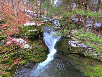 It had taken an hour and 45 minutes to get to the lean-to which was a decent pace given the snowy conditions and the times I stopped to take pictures. I walked out to the edge of the beaver pond and took pictures of the blue sky which now had some clouds. I included a series so that I could make a panorama. The sun was moving to the west and provided the light I needed to take pictures. I looked for some wildlife but everything was quiet. After I got a drink and ate a bar, we walked back to the main trail and turned left to head back to the car. At one point I noticed the water in the creek and wanted to head down the bank to Alder Creek to take a few picture. I decided against that as the time was growing late and the bank was covered in snow. At one point we followed the blazes that took us on a detour around the large tree that blocked the trail. The detour was clear on the way back but had been poorly marked on the way out. When we came to the loop trail around the lake, we turned right. We continued on the trail passing the many unoccupied campsites. When we got back to the lawn, I decided I would investigate a piece of Corrugated pipe we could see to the right of the stonework from the Coykendall Mansion. I walked to the right on a woods road to what looked like a piece of culvert pipe stick vertically in the ground. There was a handle on the pipe so I pulled on it. When the "door" opened, I found a toilet seat. I took some pictures of the pit privy which I had never noticed before. I walked back to the mansion to join Cindy as we walked back to the car. On the way back I was attracted to the noise Alder Creek was making. I decided to take Sheila down to the creek to explore but Cindy stayed in the car. Sheila and I walked down to the spring and then down to the creek. We walked along the edge of the creek to an area near the dam. I stopped to take some pictures of the dam before turning around and walking downstream. One spot had some nice rapids and some very green moss. I stopped to take a few shots there and then worked my way back up the bank. As we walked downstream, I could see the water from the creek drop suddenly. I discovered a nice waterfall of at least 15 feet. I regretted that I had not brought my poles but I worked my way down the slippery bank. I took some pictures of the falls from a rock outcropping and then again ascended the bank. I continued downstream to another waterfall and walked down a more shallow bank to a viewpoint right in front of the falls. This falls had two drops for a total of about 30 feet. There was also another small falls below the viewpoint. I took several pictures and then decided I was done. Sheila and I walked back up several levels to the parking lot and back to the car. We were back at 5:10 PM having covered 5.0 miles in 3.5 hours total time. The total elevation gain was 685 feet.
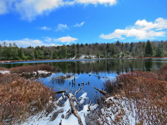
![]()
![]()
![]()
![]()
![]() On Tuesday, March 25th I decided I wanted to hike somewhere near home since the back roads were still snow covered from the storm the day before. It was almost 11:00 AM before I was prepared to get ready to hike! I asked Cindy if she wished to hike and she decided not go. I thought about different possibilities and decided to head for Long Pond to do the big loop which is about 6 miles. I had not been to Long Pond in some time so I was anxious to see how the trails had faired after the recent rains and snow. I started to get ready and Sheila was there to watch our every move. The temperature was in the high 30's as I was preparing to hike. I got dressed in my Mammut crew top and decided I would wear a light baselayer. I decided to put on my Columbia Titanium insulated pants to keep the chill away with light tights underneath. I wore my Salomon B52 winter boots which are all leather and seem to be waterproof with sufficient insulation. I decided to wear my OR Crocodile gaiters to deal with the mud on the trails and the ticks which has started to appear. I decided to take my new pair of Leki poles with external locks as the internal twist locks fail. I grabbed a light hat and gloves. Finally, I donned my Mammut hoody which blocks the wind and keeps me warm but has enough zippers to dump heat when needed. I decided to carry my microspikes in case they were needed. Sheila kept me in sight as I got ready to go making sure she would not be forgotten. We put our gear in the back of the car and Sheila in the back seat as we left Livingston Manor just before 11:30 PM with skies that were blue with puffy white clouds and just the right amount of sun. I got Sheila in the car and ut my gear in the trunk and headed out DeBruce Road for about 8 miles to Flugertown Road where I made a left. As I drove up the road, I saw two traffic cones ahead. Before I could see why the comes were there, I was driving through a patch of snow, ice and slush on the road where a ditch was overflowing across the pavement. I took my foot off the accelerator and did not brake which allowed me to drive through the mess. I parked in the lot a short distance up the road on the right where we found no other cars. I pulled into the unplowed lot and started to get ready. I took a few pictures, put Sheila on her leash and set my GarminGPS. We got started on the trail by crossing the first bridge at 11:45 AM. I hoped we could set a quick pace but the wet snow on the trail was very slippery and covered a significant amount of water in some places. The first .6 miles gains about 350 feet to the highest point on the hike. It isn't very steep but does act as a nice warm-up! Once the trail leveled it was easier walking but the trail became wetter and muddier beneath the snow. At 1.1 miles we were at the spur trail that leads down to the shore of Long Pond. We turned right and went down to the pond so that I could take some pictures. At the shores of the pond I dropped my pack and got out my camera to take some pictures. Sheila tried to follow me through the mud but I discouraged her. The skies were blue with a puffy white clouds. There was little or no ice on the pond and some color was beginning to show on the buds on the trees. I took quite a few pictures of all angles of the pond. I made sure to include a series of pictures I hoped to turn into a panorama. \I returned to my pack where I got a drink and a bar before returning to the main trail. We turned right and were soon at the first trail junction. We turned right at the junction at 1.3 miles. We found plenty of wet and muddy places on the trail but most were easily avoided. By 1:15 PM we had walked 1.8 miles and were passing the spur trail to the lean-to.
On Tuesday, March 25th I decided I wanted to hike somewhere near home since the back roads were still snow covered from the storm the day before. It was almost 11:00 AM before I was prepared to get ready to hike! I asked Cindy if she wished to hike and she decided not go. I thought about different possibilities and decided to head for Long Pond to do the big loop which is about 6 miles. I had not been to Long Pond in some time so I was anxious to see how the trails had faired after the recent rains and snow. I started to get ready and Sheila was there to watch our every move. The temperature was in the high 30's as I was preparing to hike. I got dressed in my Mammut crew top and decided I would wear a light baselayer. I decided to put on my Columbia Titanium insulated pants to keep the chill away with light tights underneath. I wore my Salomon B52 winter boots which are all leather and seem to be waterproof with sufficient insulation. I decided to wear my OR Crocodile gaiters to deal with the mud on the trails and the ticks which has started to appear. I decided to take my new pair of Leki poles with external locks as the internal twist locks fail. I grabbed a light hat and gloves. Finally, I donned my Mammut hoody which blocks the wind and keeps me warm but has enough zippers to dump heat when needed. I decided to carry my microspikes in case they were needed. Sheila kept me in sight as I got ready to go making sure she would not be forgotten. We put our gear in the back of the car and Sheila in the back seat as we left Livingston Manor just before 11:30 PM with skies that were blue with puffy white clouds and just the right amount of sun. I got Sheila in the car and ut my gear in the trunk and headed out DeBruce Road for about 8 miles to Flugertown Road where I made a left. As I drove up the road, I saw two traffic cones ahead. Before I could see why the comes were there, I was driving through a patch of snow, ice and slush on the road where a ditch was overflowing across the pavement. I took my foot off the accelerator and did not brake which allowed me to drive through the mess. I parked in the lot a short distance up the road on the right where we found no other cars. I pulled into the unplowed lot and started to get ready. I took a few pictures, put Sheila on her leash and set my GarminGPS. We got started on the trail by crossing the first bridge at 11:45 AM. I hoped we could set a quick pace but the wet snow on the trail was very slippery and covered a significant amount of water in some places. The first .6 miles gains about 350 feet to the highest point on the hike. It isn't very steep but does act as a nice warm-up! Once the trail leveled it was easier walking but the trail became wetter and muddier beneath the snow. At 1.1 miles we were at the spur trail that leads down to the shore of Long Pond. We turned right and went down to the pond so that I could take some pictures. At the shores of the pond I dropped my pack and got out my camera to take some pictures. Sheila tried to follow me through the mud but I discouraged her. The skies were blue with a puffy white clouds. There was little or no ice on the pond and some color was beginning to show on the buds on the trees. I took quite a few pictures of all angles of the pond. I made sure to include a series of pictures I hoped to turn into a panorama. \I returned to my pack where I got a drink and a bar before returning to the main trail. We turned right and were soon at the first trail junction. We turned right at the junction at 1.3 miles. We found plenty of wet and muddy places on the trail but most were easily avoided. By 1:15 PM we had walked 1.8 miles and were passing the spur trail to the lean-to.
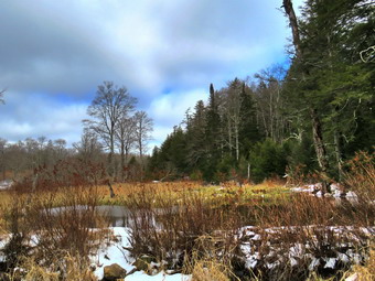 After passing the trail to the lean-to, we continued to find wet and muddy places on the trail. There isn't much to see on this section of trail but I kept "busy" by avoiding the muddy spots and thinking about several issues. At one point we found a lot of turkey tracks on the trail. Sheila had her nose to the ground when I looked up to see at lest two dozen turkeys crossing the trail. A moment later Sheila looked up and took off after the turkeys. I walked along the trail and called her until she finally reappeared. I don't like it she disappears but find it hard to scold her too much when she is after birds! We continued on the main trail to the point where it intersects a woods road at 2.6 miles. We turned left on the woods road and found it to be very wet and snow covered. We followed the road until the intersection with Basily Road at 2.85 miles where we continued on Basily Road by bearing left. This section of road was also wet and muddy but it did not slow us down much. As we approached the Peters Hunting Camp, I got ready to put Sheila on her leash. The area near the footbridge across the outlet to the beaver pond was full of flowing water and I stopped to take a few pictures. The skies had become overcast as we hiked toward the camp but were now blue again. We continued on the trail to the bridge over the stream near the camp. The bridge which is relatively new is already showing signs of wear from snowmobiles passing over it even though there is a sign that states "Private Bridge". I have secured permission to hike across this land in the past and "stay on the trail" signs seem to indicate that the owners will allow hikers. I assume the "Private Bridge - No thru traffic" refers to motorized vehicles and not hikers. We crossed the bridge to continue the trip back to the car and started up the little hill from the hunting camp. We stopped again so that I could take a few shots of the valley which looked peaceful with the nice skies behind it. Once we started walking again we kept a fast pace despite the mud and snow on the road. In the area where the Mongaup-Willowemoc Trail crosses the road, there was a single car pulled into a small parking area with a tent set up. Footprints led from the tent out to the Mongaup-Willowemoc Trail. We continued down the road toward the car. On the way a car and a pickup truck passed us which supplied me since I rarely see anyone on this hike. We arrived at the place where the road is paved and where there was no longer any snow on the road. We walked down the road to a bridge over a stream. We stopped since I wanted to take a picture of the stream which was flowing freely. Once I was done, I stowed my camera and we continued at an accelerated pace back to the parking area. We were back at the car at 2:35 PM having hiked 6.0 miles in 2 hours and 50 minutes with 15 minutes of stopped time. The elevation gain was only about 550 feet most of which was at the beginning of the hike.
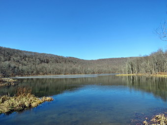
![]()
![]()
![]()
![]()
![]() On Sunday, March 22nd Cindy and I decided to go on the first hike of the spring the day before we were expected to get between 2 and 8 inches of snow! We watched our church service at 10:30 AM. The service was recorded with only six people present due to the Covid-19 pandemic and the striations in place for gatherings. We wanted to stay away from other hikers as much as possible and make the hike short as Cindy was still recovering from a respiratory infection. We chose to go to Huggins Lake off of Holiday Brook Road in the Beaverkill Valley. The hike is less than 4 miles but has some good uphills and the lake at the end of the out and back hike is pretty. The temperature was in the low 40's as we started getting ready at 12:30 PM. I got dressed in my Mammut crew top and decided I would wear a light baselayer. I decided to put on my Columbia Titanium insulated pants to keep the chill away with light tights underneath. I wore my Vasque Taku boots which are all leather and seem to be almost waterproof although not very warm. I decided to wear my OR Crocodile gaiters to deal with the mud on the trails and the ticks which has started to appear. I decided to take my new pair of Leki poles with external locks as the internal twist locks fail. I grabbed a light hat and gloves. Finally, I donned my Mammut hoody which blocks the wind and keeps me warm but has enough zippers to dump heat when needed. I decided to carry my microspikes in case they were needed. Sheila kept me in sight as I got ready to go making sure she would not be forgotten. We put our gear in the back of the car and Sheila in the back seat as we left Livingston Manor just before 1:00 PM. I drove north on Old Route 17 and then up the Beaverkill Road. I turned left on Campsite Road and stayed to the right at the bottom of the hill to cross the covered bridge. At the end of the road I turned right and followed Berry Brook Road to the trailhead. We arrived at the road to the parking area to find it very rough with some erosion and a few branches in the way. I chose to chance it and easily made it to the small lot parking at 1:10 PM. No one else was in the lot as we got our equipment ready and I set my GPS. The sun was out but the temperature was only 37 degrees as we headed out on the wide woods road to the lake. As we started out there continued to be some sun and the skies were mostly blue as we climbed up the hill. The hike isn't long and the trail is well-maintained and it looked like some work had been done lately as there were no blowdowns along the way. The first 1.2 miles is all uphill and gains almost 700 feet. Sheila was running up and down the trail and following game paths into the woods. Cindy and I were both taking it slow as we had no reason to hurry. We both noted that the ascent has several spots which appear to be the top of the climb but are not. After the initial climb, the trail descends, levels some and then climbs again until the final descent to Huggins Lake. The trail makes a sharp turn from southeast to north at about 1.6 miles. We enjoyed the downhill trek to the shores of the pond but I knew we would soon have to turn around and climb back up the hill.
On Sunday, March 22nd Cindy and I decided to go on the first hike of the spring the day before we were expected to get between 2 and 8 inches of snow! We watched our church service at 10:30 AM. The service was recorded with only six people present due to the Covid-19 pandemic and the striations in place for gatherings. We wanted to stay away from other hikers as much as possible and make the hike short as Cindy was still recovering from a respiratory infection. We chose to go to Huggins Lake off of Holiday Brook Road in the Beaverkill Valley. The hike is less than 4 miles but has some good uphills and the lake at the end of the out and back hike is pretty. The temperature was in the low 40's as we started getting ready at 12:30 PM. I got dressed in my Mammut crew top and decided I would wear a light baselayer. I decided to put on my Columbia Titanium insulated pants to keep the chill away with light tights underneath. I wore my Vasque Taku boots which are all leather and seem to be almost waterproof although not very warm. I decided to wear my OR Crocodile gaiters to deal with the mud on the trails and the ticks which has started to appear. I decided to take my new pair of Leki poles with external locks as the internal twist locks fail. I grabbed a light hat and gloves. Finally, I donned my Mammut hoody which blocks the wind and keeps me warm but has enough zippers to dump heat when needed. I decided to carry my microspikes in case they were needed. Sheila kept me in sight as I got ready to go making sure she would not be forgotten. We put our gear in the back of the car and Sheila in the back seat as we left Livingston Manor just before 1:00 PM. I drove north on Old Route 17 and then up the Beaverkill Road. I turned left on Campsite Road and stayed to the right at the bottom of the hill to cross the covered bridge. At the end of the road I turned right and followed Berry Brook Road to the trailhead. We arrived at the road to the parking area to find it very rough with some erosion and a few branches in the way. I chose to chance it and easily made it to the small lot parking at 1:10 PM. No one else was in the lot as we got our equipment ready and I set my GPS. The sun was out but the temperature was only 37 degrees as we headed out on the wide woods road to the lake. As we started out there continued to be some sun and the skies were mostly blue as we climbed up the hill. The hike isn't long and the trail is well-maintained and it looked like some work had been done lately as there were no blowdowns along the way. The first 1.2 miles is all uphill and gains almost 700 feet. Sheila was running up and down the trail and following game paths into the woods. Cindy and I were both taking it slow as we had no reason to hurry. We both noted that the ascent has several spots which appear to be the top of the climb but are not. After the initial climb, the trail descends, levels some and then climbs again until the final descent to Huggins Lake. The trail makes a sharp turn from southeast to north at about 1.6 miles. We enjoyed the downhill trek to the shores of the pond but I knew we would soon have to turn around and climb back up the hill.
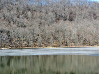 When we arrived at the lake, I noticed that the water level was high. We walked out along the dam on a narrow path through the weeds. The area around the lake looked a little desolate with no leaves on the trees and a flat blue sky. It was still sunny but cool with a breeze at times. I dropped my pack and got out the camera to take some pictures of the trees and the pond. I also got some shots of the outlet stream and the water around the lake. At the outlet I could immediately see that the beavers had dammed the water flow and that reeds had grown to all but block the outlet flow. I took a few more pictures of the lake before returning to my pack and stowing the camera. I made sure that Sheila did not dive into the pond as the water was cold with ice in places on the water. The only negative point about Huggins Lake is that there is only one trail and so there are no variations available. We though about hiking round the pond but Cindy was at her limit so we started back up the hill on the trail. The ascent went smoothly for the most part as we climbed the hill back to the highest point on the trail. From there Cindy started down the other side of the hill on the trail but I decided to take Sheila and bushwhack a little through the woods. I knew that I could easily get back to the trail and catch up with Cindy or meet her at the car. We explored the woods for a short time trying to find a high spot but the highest spot always seemed just a little farther away. I decided to turn back to the trail and we soon found it as the walk was all downhill. I was surprised that I had labored a little climbing the hill at the beginning of the hike but felt very fresh on the way back. Sheila seemed very interested in following game trails off the main trail and I had to keep calling her back. As we started down the last section of trail I could see Cindy ahead and Sheila took off to meet her. We walked back to the car together. As we approached the parking lot, we were surprised to see another car pull in. The occupants were also from Livingston Manor where they run the Brandenburg Bakery. We stood around talking about hiking for some time while the couple two daughters ran around. We retread to our car as they started out on their hike. We arrived back at the car at 3:25 PM after hiking 3.8 miles in 2 hours and 10 minutes with a total elevation gain of 995 feet. I was surprised to find that my bushwhack added almost nothing to the length of the hike. In looking at my maps I discovered that another 1.4 miles of hiking would have taken me over a hill with an elevation of 2880 feet and landed me on the trail to Mary Smith Hill! I will be doing this sometime in the near future.