
What You Missed
Fall 2022
Fall 2022
![]()
![]()
![]()
![]()
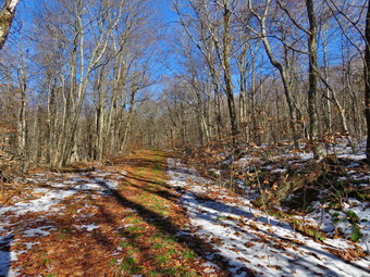
![]() On Friday, December 9th I hade hiked the Parksville Rail Trail from Fox Mountain Road to Parksville and back with my son Kurt. When we returned to the cars at 2:55 PM, Kurt and I said goodbye as he needed to get home. I decided that Sheila and I would hike in the opposite direction on the section of trail that was not quite prepared for hiking. I put Sheila on her leash as we headed out to the road and under the Quickway on Fox Mountain Road. We crossed the bridge over the Little Beaverkill and then turned right to step over the guard rail. There is a definite trail on the right which passes by the trestle supports that carried the trail tracks over the stream. The emblem on the trestle is faint but shows the #28 of Davey Allison and The Texaco Havoline star. We walked up the trail to the top of the trestle. As we entered the shade of the trees, it immediately seemed a little cooler but I was warm from hiking. The trail was well defined and stretched ahead for some distance. Like most rail trails it was very straight. Town of Liberty Supervisor Frank DeMayo had told me that this was state land and the town had an agreement from the state to use it. The hope is to connect the Parksville Rail Trail to all the sections that stretch as far as Livingston Manor. We started to walk along the trail and I noticed there was quite a bit of traffic on the Quickway! The land dropped off steeply to the Little Beaverkill on the right. On the left were some "cliffs" which were the result of the railroad cutting a path for the tracks. We continued to walk along the well-defined trail. It was a pleasant walk with less mud than the trail in the opposite direction. There were two places along the trail where there were piles of garbage. It was hard to determine why they were there. Both piles had tarps over them which seemed to indicate someone once valued the items. Over the bank on the left near the first pile was the rains of a VW bug. We came to one large blowdown across the trail which we had to walk around on the left. We soon came to a gate on the trail which was odd since it was state land. No one seems to know why the gate is there or who placed it. We walked around the gate and continued on the trail,
On Friday, December 9th I hade hiked the Parksville Rail Trail from Fox Mountain Road to Parksville and back with my son Kurt. When we returned to the cars at 2:55 PM, Kurt and I said goodbye as he needed to get home. I decided that Sheila and I would hike in the opposite direction on the section of trail that was not quite prepared for hiking. I put Sheila on her leash as we headed out to the road and under the Quickway on Fox Mountain Road. We crossed the bridge over the Little Beaverkill and then turned right to step over the guard rail. There is a definite trail on the right which passes by the trestle supports that carried the trail tracks over the stream. The emblem on the trestle is faint but shows the #28 of Davey Allison and The Texaco Havoline star. We walked up the trail to the top of the trestle. As we entered the shade of the trees, it immediately seemed a little cooler but I was warm from hiking. The trail was well defined and stretched ahead for some distance. Like most rail trails it was very straight. Town of Liberty Supervisor Frank DeMayo had told me that this was state land and the town had an agreement from the state to use it. The hope is to connect the Parksville Rail Trail to all the sections that stretch as far as Livingston Manor. We started to walk along the trail and I noticed there was quite a bit of traffic on the Quickway! The land dropped off steeply to the Little Beaverkill on the right. On the left were some "cliffs" which were the result of the railroad cutting a path for the tracks. We continued to walk along the well-defined trail. It was a pleasant walk with less mud than the trail in the opposite direction. There were two places along the trail where there were piles of garbage. It was hard to determine why they were there. Both piles had tarps over them which seemed to indicate someone once valued the items. Over the bank on the left near the first pile was the rains of a VW bug. We came to one large blowdown across the trail which we had to walk around on the left. We soon came to a gate on the trail which was odd since it was state land. No one seems to know why the gate is there or who placed it. We walked around the gate and continued on the trail,
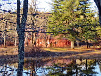
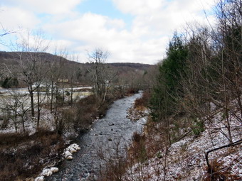
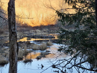 Soon we came to a small pond on the right with a red building behind it. The building looked to be in good shape but the windows were all boarded up. The sun was low in the sky giving the pond and building some interesting lighting. There was also a beaver slide across the trail as there was another small pond on the left side of the trail. There was also evidence of recent beaver activity. I took some pictures of the pond and the building before continuing on the trail. There was one large blowdown which was easy to walk through. After hiking about 1.3 miles, we came to a driveway on the left which leads to the Sonoma Falls property. I knew this was private land but two town supervisors had said it was alright to visit it. On this day I decided that it was getting late so we bypassed the area and continued on the trail. On the left, I could see that the beavers had dammed up the outlet to the pond and flooded the area. I decided I wanted to walk all the way out to Old Liberty Road and set a quick pace. The walk along the old road was interesting as there were some impressive rock cuts on the left and a very lazy river on the right. I stopped at one point as there were a series of dams or dikes created by the beavers. The lighting was interesting so I tool some shots. The walk to Old Liberty Road was about .4 miles which was a little longer than I thought. When we arrived at the gate on Old Liberty Road, I saw that the trail actually continued straight ahead parallel to the road. I decided to explore this part of the trail on another visit. Sheila and I turned around and walked back along the rail trail. We set a pretty fast pace on the way back and did not stop. For the 1.63 miles back we averaged about 3 mph. We were back at the car at 4:30 PM having hiked 3.4 miles in 21 hours and 35 minutes. I do hope the plans to connect the sections of the trails is successful!
![]()
![]()
![]()
![]()
![]() On Friday, December 9 I had planned to hike with a small group doing an out and back of the Mongaup Willowemoc Trail. Sharon was working to complete the All Trails challenge and the forecast was for the perfect day. An overnight call left me tired in the morning and another call caused me to cancel my trip. I was annoyed but Cindy promised to accompany me to Trout Pond which was an acceptable substitute. In the late morning I finally got up and soon after our son Kurt called. He had finally harvested a deer and wanted to come by to say "Hello". I knew this would mean we would not be going to Trout Pond which had me feeling down. Hiking keeps me in shape and relaxes me which is very important. Kurt arrived at around noon and stayed to eat lunch. I thought about doing a short hike and asked him if he had enough time to hike the Parksville rail Trail. He said he did and I asked Cindy if she wanted to come along. She said she did not so Kurt and I got ready to go. Sheila seemed a little reserved as I was getting dressed as she had gone absolutely bonkers when Kurt arrived. It was 35 degrees when we started to get ready at 1:15 PM and the skies were clear with a slight breeze. Because it was cool an windy and I did know how much water and mud there would be on the trail, I dressed accordingly. I put on my Mammut long-sleeved crew top with a long sleeved baselayer. I wore a pair of RailRiders hiking pants which are expensive but last a long time and have features like deep pockets and a generous cut which I really like. It will soon be time to permanently switch to a pair of insulated pants. I decided to put on my Keen Durand hiking boots which fit well and are newer than what I have been wearing. I added a new pair of Xstance insoles in an effort to find the best support and cushioning for my feet. These insoles have shock absorbing gel pads, TPU arch support, and memory foam cushioning all wrapped in a breathable fabric. The insoles have been hyped by their manufacturer and have lived up to that hype. I took my Leki poles with external locks as the internal twist locks sometimes fail. I wore a light hat, packed a pair of gloves, and put on my OR Crocodile gaiters because of the possibility of water and mud. I also donned my Mammut hoody which has enough zippers to dump heat when it is needed. At 1:30 PM I put my gear in the car and Sheila in the back seat. I headed out Old Route 17 with Kurt following me in his car. We drove across the Flats and then took Old Route 17 and Service Road to the point where they meet Fox Mountain Road. There were no cars in the parking lot when we started out on the trail at 1:40 PM.
On Friday, December 9 I had planned to hike with a small group doing an out and back of the Mongaup Willowemoc Trail. Sharon was working to complete the All Trails challenge and the forecast was for the perfect day. An overnight call left me tired in the morning and another call caused me to cancel my trip. I was annoyed but Cindy promised to accompany me to Trout Pond which was an acceptable substitute. In the late morning I finally got up and soon after our son Kurt called. He had finally harvested a deer and wanted to come by to say "Hello". I knew this would mean we would not be going to Trout Pond which had me feeling down. Hiking keeps me in shape and relaxes me which is very important. Kurt arrived at around noon and stayed to eat lunch. I thought about doing a short hike and asked him if he had enough time to hike the Parksville rail Trail. He said he did and I asked Cindy if she wanted to come along. She said she did not so Kurt and I got ready to go. Sheila seemed a little reserved as I was getting dressed as she had gone absolutely bonkers when Kurt arrived. It was 35 degrees when we started to get ready at 1:15 PM and the skies were clear with a slight breeze. Because it was cool an windy and I did know how much water and mud there would be on the trail, I dressed accordingly. I put on my Mammut long-sleeved crew top with a long sleeved baselayer. I wore a pair of RailRiders hiking pants which are expensive but last a long time and have features like deep pockets and a generous cut which I really like. It will soon be time to permanently switch to a pair of insulated pants. I decided to put on my Keen Durand hiking boots which fit well and are newer than what I have been wearing. I added a new pair of Xstance insoles in an effort to find the best support and cushioning for my feet. These insoles have shock absorbing gel pads, TPU arch support, and memory foam cushioning all wrapped in a breathable fabric. The insoles have been hyped by their manufacturer and have lived up to that hype. I took my Leki poles with external locks as the internal twist locks sometimes fail. I wore a light hat, packed a pair of gloves, and put on my OR Crocodile gaiters because of the possibility of water and mud. I also donned my Mammut hoody which has enough zippers to dump heat when it is needed. At 1:30 PM I put my gear in the car and Sheila in the back seat. I headed out Old Route 17 with Kurt following me in his car. We drove across the Flats and then took Old Route 17 and Service Road to the point where they meet Fox Mountain Road. There were no cars in the parking lot when we started out on the trail at 1:40 PM.
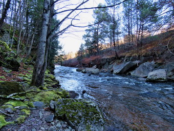
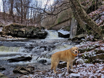
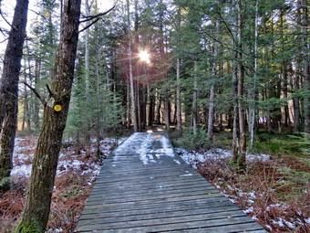
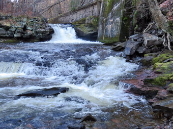 I did not bring my GPS unit as we had hiked the trail so many times before. The open trail just before the woods had quite a few branches hanging into the trail. We could both feel the wind which made the day seem much cooler than I thought it might be. Usually as we enter the shade of the trees, it seems a little cooler but on this day it was much cooler as the wind was somehow blowing right down the rail trail in our face. We immediately encountered some open water, mud and frozen mud and this would continue for the rest of the hike, One look down to the Little Beaverkill showed the stream volume was high from the recent rain. I wondered if the falls would be roaring as it had been on several visits. Sheila was taking her own route and following her nose. I was trying to do the hike quickly so that I had some time with Kurt but did not prevent him from returning home on time. I don't get to see Kurt often as he lives in Poughkeepsie and is very busy at work. Some of the muddy areas on the trail were not easily avoided as the water and mud extended across the trail. We were soon at the wooden walkways where we continued over the walkways without stopping for pictures. The wooden surface was covered in a thin layer ice and a few leaves making the footing slippery. The far end of the bridge had some running water and some ice. The problem is that a rock slide has blocked the culvert under the small bridge causing water, mud and stones to be diverted over the walkway. Unblocking the culvert and covering the walkways with some screening would help. On this day the water had been diverted to the bridge making the whole area a big mess. We continued on the trail and found a few blowdowns that should be cleared. As we approached the falls, we could hear the sound of the falls roaring.
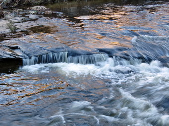 When we arrived at the falls, there was a high volume of very clear and cold water. I looked at the path down to the base of the falls and decided to just take my camera down to the edge of the stream. On some previous trips I was able to walk out onto rocks that were usually covered with water. On this trip these rocks were covered with water leaving a small strip of dry land along the edge of the stream. The path down was frozen and the rocks had a thin layer of ice! I took some shots down stream and then the turned my attention to the falls. I took numerous pictures of the area in front of falls and the falls themselves. The water was rolling over the rocks which were barely visible underneath the waves. When I was done, we worked our way back up the bank. I took some shots of the falls and the area upstream and then continued on the trail to a bench where a path leads down to the stream. I left my pack on the bench and we began to walk along a path at the edge of the stream. I didn't get very far as that path was now underwater. I stopped and took pictures downstream toward the falls and then upstream. I also took some pictures of the stream in front of me where the water was rolling over some rocks. I repositioned myself and took some more pictures downstream toward the falls. I finished and walked back to the bench to stow the camera. The trail continued to be wet and a little muddy in places with some ice but we managed to walk around them. From the falls to the other end of the trail there were a few wet areas and some mud. We set a quick pace for the rest of the hike toward the Parksville end of the trail. We continued to the Parksville end of the trail. Just after the gate at that end, we stopped at the sign which outlines the milk that the O&W transported. The sign also mentions the large number of hotels that had been in the area. I pointed out some of the more interesting facts to Kurt who was very interested. We turned around and headed back to the car. I knew I would not be taking any more pictures and we set a rapid return pace. Kurt and I continued back to the car without meeting any other people. We were back at the car at 2:55 PM after hiking 2.8 miles in 1 hour and 15 minutes including the stopped time for pictures. There is virtually no elevation gain on the hike except the short trips down to the streambed. Kurt headed home but I decided to hike the rail trail in the other direction toward Livingston Manor.
![]()
![]()
![]()
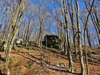
![]() On Monday, December 5th I had planned to go out for a longer hike after a few days off for indoor track coaching commitments and poor weather. I woke up at 8:00 AM with the temperature at 18 degrees and decided I would wait a little while before venturing out. I felt well rested as I did not have an overnight ambulance call to interrupt my sleep. By noon the temperate was 30 degrees and I decided to venture out. I had to leave home from track practice at 2:30 PM so I opted to just head across the street again to hike on Round Top. I started to get ready with Sheila quitely watching my every move. I decided to dress a little warmer than I had been. I decided to put on my Mammut long-sleeved crew top with a long-sleeved baselayer. I put on my Eddie Bauer First Ascent insulated pants to keep the chill away but knew I would not need tights underneath. I decided to put on my Keen Durand hiking boots which fit well and are newer than what I have been wearing. I added a new pair of Xstance insoles in an effort to find the best support and cushioning for my feet. These insoles have shock absorbing gel pads, TPU arch support, and memory foam cushioning all wrapped in a breathable fabric. The insoles have been hyped by their manufacturer and seem to live up to that hype. I almost always take my Leki poles with external locks as the internal twist locks sometimes fail. I put on a light hat and took a pair of medium-weight gloves. I did don my Mammut hoody as it has enough zippers to dump heat if needed. At 12:30 PM we walked out the door to start the hike. I looked around and saw that the sky was blue over Round Top with a few puffy white clouds. I grabbed Sheila's leash from the car and we walked up the driveway. We walked across the street and behind the Presbyterian Church.
On Monday, December 5th I had planned to go out for a longer hike after a few days off for indoor track coaching commitments and poor weather. I woke up at 8:00 AM with the temperature at 18 degrees and decided I would wait a little while before venturing out. I felt well rested as I did not have an overnight ambulance call to interrupt my sleep. By noon the temperate was 30 degrees and I decided to venture out. I had to leave home from track practice at 2:30 PM so I opted to just head across the street again to hike on Round Top. I started to get ready with Sheila quitely watching my every move. I decided to dress a little warmer than I had been. I decided to put on my Mammut long-sleeved crew top with a long-sleeved baselayer. I put on my Eddie Bauer First Ascent insulated pants to keep the chill away but knew I would not need tights underneath. I decided to put on my Keen Durand hiking boots which fit well and are newer than what I have been wearing. I added a new pair of Xstance insoles in an effort to find the best support and cushioning for my feet. These insoles have shock absorbing gel pads, TPU arch support, and memory foam cushioning all wrapped in a breathable fabric. The insoles have been hyped by their manufacturer and seem to live up to that hype. I almost always take my Leki poles with external locks as the internal twist locks sometimes fail. I put on a light hat and took a pair of medium-weight gloves. I did don my Mammut hoody as it has enough zippers to dump heat if needed. At 12:30 PM we walked out the door to start the hike. I looked around and saw that the sky was blue over Round Top with a few puffy white clouds. I grabbed Sheila's leash from the car and we walked up the driveway. We walked across the street and behind the Presbyterian Church.
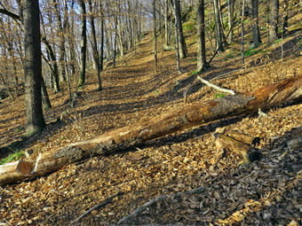
We began the ascent of the steepest hill behind the church and continued directly up the hill to the trailhead. The hill is short but gets the circulation pumping and is the steepest and longest climb on the "trail." My goal is always to make it all the way up the hill without stopping. At the top of the hill we stopped for minute so that I could take a look at the skies and hills all around us. We turned left and entered the woods to begin our hike. The trailhead was a little wet but was free from snow and this continued as we entered the woods. There was a thick layer of wet leaves on the ground. Just before the first trail junction, we came to the spot where a large tree had fallen across the trail. I had cut one end of the tree with my ax and saw. Brad and I had finished the job when he was staying for Thanksgovong. It was almost 2 feet in diameter and we had to cut it several times to move it off the trail. At the first trail junction, I followed Sheila as she continued straight ahead up the hill toward the lookout. When we reached the top of the trail, I stopped to take a look from the viewpoint. Now that the leaves were off the trees, the view was much clearer. We followed the yellow trail as it headed uphill through the fern glade. The ferns were all dead and brown. The woods attested to the fact that winter was approaching if not already present. We passed the "sitting rock" and continued on the yellow trail to the first junction with the blue trail. At the junction we turned right and walked the yellow trail along the base of Round Top to the next junction with the blue trail. We turned left on the blue trail and started up the hill. We bypassed the white crossover trail and continued on the blue trail across the summit of Round Top. As we began down the other side, we bypassed the white crossover trail and turned left on the switchback in the blue trail. We continued following the switchback as it took us out into the woods and then turned almost 180 degrees to bring us back to the main blue trail. We turned left and continued downhill on the blue trail. We followed the blue trail to the yellow trail. We turned left and walked on the yellow trail along the base of Round Top to the junction with the blue trail.
This time we turned right and walked down the yellow trail to the woods road. We walked along the woods road toward the first trail junction. Just before the first trail junction, I looked at the remains of the large blowdown I had cut and removed from the trail. Just passed this were the remains of a smaller blowdown I had cut up. This tree had hung over the trail for months but finally came down in the wind. We turned around at the first trail junction and started back up the woods road. We turned left when the yellow trail started up toward the first junction with the blue trail. We turned left and walked the yellow trail to the next junction with the blue trail. At the next trail junction we turned right on the blue trail and started up the hill. We turned right on the switchback and followed it out and back to the main blue trail. We almost immediately turned right on the white crossover trail and followed it along the shoulder of Round Top to the blue trail on the other side. There were no blowdowns blocking the trail. We turned right and walked down the other side to the junction with the yellow trail. At the junction with the yellow trail we turned right and again walked along the base of Round Top to the next junction with the blue trail. This time we turned left and continued on the yellow trail through the ferns and passed the "Sitting Rock" to the viewpoint. At the viewpoint we turned left and walked down the steep trail to the first trail junction. This time we continued out to the trailhead. At the trailhead we turned right and walked down the hill to the church parking lot. We crossed the parking lot and Rock Avenue to get to our driveway. When we arrived home, it was 1:45 PM and we had hiked a little more than 2 miles in an hour and 15 minutes.
![]()
![]()
![]()
![]()
![]() On Thursday, December 1 I wanted to get out for a hike even though it was cold and windy outside. I thought I might just go across the street to hike on Round Top as I can do different loops to make the hike longer or shorter. Instead, I asked Cindy if she would like to hike the Parksville Rail Trail for the first hike of December. She agreed as the walk is less than 3 miles round trip and almost completely flat. It does have a few limited views and a nice waterfall which I knew would be roaring ROM the recent rain. It was 33 degrees when we started to get ready at 10:15 AM and the skies were overcast. Sheila knew we were going and was trying to be a "good dog" by lying in my study and watching my every move. Because it was cold an windy and I did know how much water and mud there would be on the trail so I dressed accordingly. I put on my Mammut long-sleeved crew top with a long sleeved baselayer. I put on a pair of RailRiders hiking pants which are expensive but last a long time and have features like deep pockets and a generous cut which I really like. It will soon be time to permanently switch to a pair of insulated pants. I decided to put on my Keen Durand hiking boots which fit well and are newer than what I have been wearing. I added a new pair of Xstance insoles in an effort to find the best support and cushioning for my feet. These insoles have shock absorbing gel pads, TPU arch support, and memory foam cushioning all wrapped in a breathable fabric. The insoles have been hyped by their manufacturer and have lived up to that hype. I took my Leki poles with external locks as the internal twist locks sometimes fail. I wore a light hat, packed a pair of gloves, and put on my OR Crocodile gaiters because of the possibility of water and mud. I also donned my Mammut hoody which has enough zippers to dump heat when it is needed. At 10:45 AM we put our gear in the car and Sheila in the back seat. I headed out Old Route 17 across the Flats and then took Old Route 17 and Service Road to the point where they meet Fox Mountain Road. There were no cars in the parking lot when we started out on the trail at 11:00 AM.
On Thursday, December 1 I wanted to get out for a hike even though it was cold and windy outside. I thought I might just go across the street to hike on Round Top as I can do different loops to make the hike longer or shorter. Instead, I asked Cindy if she would like to hike the Parksville Rail Trail for the first hike of December. She agreed as the walk is less than 3 miles round trip and almost completely flat. It does have a few limited views and a nice waterfall which I knew would be roaring ROM the recent rain. It was 33 degrees when we started to get ready at 10:15 AM and the skies were overcast. Sheila knew we were going and was trying to be a "good dog" by lying in my study and watching my every move. Because it was cold an windy and I did know how much water and mud there would be on the trail so I dressed accordingly. I put on my Mammut long-sleeved crew top with a long sleeved baselayer. I put on a pair of RailRiders hiking pants which are expensive but last a long time and have features like deep pockets and a generous cut which I really like. It will soon be time to permanently switch to a pair of insulated pants. I decided to put on my Keen Durand hiking boots which fit well and are newer than what I have been wearing. I added a new pair of Xstance insoles in an effort to find the best support and cushioning for my feet. These insoles have shock absorbing gel pads, TPU arch support, and memory foam cushioning all wrapped in a breathable fabric. The insoles have been hyped by their manufacturer and have lived up to that hype. I took my Leki poles with external locks as the internal twist locks sometimes fail. I wore a light hat, packed a pair of gloves, and put on my OR Crocodile gaiters because of the possibility of water and mud. I also donned my Mammut hoody which has enough zippers to dump heat when it is needed. At 10:45 AM we put our gear in the car and Sheila in the back seat. I headed out Old Route 17 across the Flats and then took Old Route 17 and Service Road to the point where they meet Fox Mountain Road. There were no cars in the parking lot when we started out on the trail at 11:00 AM.
 I did not bring my GPS unit as we had hiked the trail so many times before. The open trail just before the woods had quite a few branches hanging into the trail. We could both feel the wind but Cindy had dressed much more warmly than I. Usually as we enter the shade of the trees, it seems a little cooler but on this day it actually felt warmer as the trees blocked the wind. We immediately encountered some mud and frozen mud and this would continue for the rest of the hike, One look down to the Little Beaverkill showed the stream volume was high. I wondered if the falls would be roaring or just at average volume. Sheila was taking her own route and following her nose. I stopped to take a few pictures of the stream through the trees including a small tributary. Some of the muddy areas on the trail were not easily avoided as the water and mud extended across the trail. We were soon at the wooden walkways where I stopped, put my pack down and took out the camera. I took some shots of the stream below and noticed that the skies had turned blue with some white clouds. It was easy to see that there was a lot of water in the stream as it was very clear with whitecaps. I put away the camera and picked up my pack to continue over the walkways. The wooden surface was covered in a thin layer of snow making the footing slippery. The far end of the bridge had some running water and some ice. The problem is that a rock slide has blocked the culvert under the small bridge causing water, mud and stones to be diverted over the walkway. Unblocking the culvert and covering the walkways with some screening would help. On this day the water had been diverted to the bridge making the whole area a big mess. We continued on the trail and found a few blowdowns that should be cleared. Some areas of the trail also had brush that needed trimming. Other areas of the trail had large branches and blowdowns that should be removed for aesthetic reasons. As we approached the falls, we could hear the sound of the falls roaring.
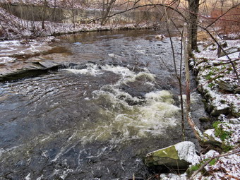 When we arrived at the falls, there was a high volume of water. I looks at the snow covered path down to the base of the falls and decided to keep my pack on and use my poles to get down the slippery trail. On some previous trips I was able to walk out onto rocks that were usually covered with water. On this trip these rocks were covered with water leaving a small strip of dry land along the edge of the stream. I took some shots down stream and a few of Sheila posing in front of the falls. She does a good job of posing even when she is distracted by Cindy above on the bank. I then the turned my attention to the falls. I took numerous pictures of the area in front of falls and the falls themselves. The water was roiled and rolling over the rocks which were barely visible underneath the waves. When I was done, we worked our way back up the bank. I took some shots of the falls and the area upstream and then continued on the trail to a bench where a path leads down to the stream. I left my pack on the bench and we began to walk along a path at the edge of the stream. I didn't get very far as that path was now underwater. I stopped and took pictures downstream toward the falls and then upstream. I also took some pictures of the stream in front of me where the water was rolling over some rocks. I repositioned myself and took some more pictures downstream toward the falls. I finished and walked back to the bench to stow the camera. The trail continued to be wet and a little muddy in places with some ice but we managed to walk around them. From the falls to the other end of the trail there were a few wet areas and some mud. We set a quick pace for the rest of the hike toward the Parksville end of the trail. We continued to the Parksville end of the trail. Just after the gate at that end, we stopped at the sign which outlines the milk that the O&W transported. The sign also mentions the large number of hotels that had been in the area.On this day the sign was covered in snow! We turned around and headed back to the car. I knew I would not be taking any more pictures and we set a rapid return pace. Cindy and I continued back to the car without meeting any other people. We were back at the car at 12:20 PM after hiking 2.8 miles in 1 hour and 20 minutes including the stopped time for pictures. There is virtually no elevation gain on the hike except the short trips down to the streambed.
![]()
![]()
![]()
![]()
![]() On Tuesday, November 29th I wanted to get out for a short hike that was not on Round Top. The day before I had responded to four ambulance calls and had slept in to recover. I asked Cindy if she would like to hike the Parksville Rail Trail but she declines. The walk is less than 3 miles round trip and almost completely flat. It does have a few limited views and a nice waterfall which I thought might be roaring due to the overnight rain. It was 35 degrees when I started to get ready at 11:30 AM but the skies were overcast and it looked like rain was possible. Sheila's expectant gaze and sharp bark "encouraged" me to continue the hiking plans. It was cool and O knew that walking under the trees might be a little colder so I dressed accordingly. I put on my Mammut long-sleeved crew top with a long-sleeved baselayer. I put on a pair of RailRiders hiking pants which are expensive but last a long time and have features like deep pockets and a generous cut which I really like. I decided to put on my Keen Durand hiking boots which fit well and are newer than what I have been wearing. I added a new pair of Xstance insoles in an effort to find the best support and cushioning for my feet. These insoles have shock absorbing gel pads, TPU arch support, and memory foam cushioning all wrapped in a breathable fabric. The insoles have been hyped by their manufacturer and I wondered if they would live up to that hype. I took my Leki poles with external locks as the internal twist locks sometimes fail. I wore a light hat and grabbed a pair of light gloves. I also donned my Mammut hoody which has enough zippers to dump heat when it is needed. At 11:45 AM I put my gear in the car and Sheila in the back seat. I headed out Old Route 17 across the Flats and then took Old Route 17 and Service Road to the point where they meet Fox Mountain Road. There were no vehicles in the parking lot when we started out on the trail at 12:00 PM. I did not bring my GPS unit as we had hiked the trail so many times before.
On Tuesday, November 29th I wanted to get out for a short hike that was not on Round Top. The day before I had responded to four ambulance calls and had slept in to recover. I asked Cindy if she would like to hike the Parksville Rail Trail but she declines. The walk is less than 3 miles round trip and almost completely flat. It does have a few limited views and a nice waterfall which I thought might be roaring due to the overnight rain. It was 35 degrees when I started to get ready at 11:30 AM but the skies were overcast and it looked like rain was possible. Sheila's expectant gaze and sharp bark "encouraged" me to continue the hiking plans. It was cool and O knew that walking under the trees might be a little colder so I dressed accordingly. I put on my Mammut long-sleeved crew top with a long-sleeved baselayer. I put on a pair of RailRiders hiking pants which are expensive but last a long time and have features like deep pockets and a generous cut which I really like. I decided to put on my Keen Durand hiking boots which fit well and are newer than what I have been wearing. I added a new pair of Xstance insoles in an effort to find the best support and cushioning for my feet. These insoles have shock absorbing gel pads, TPU arch support, and memory foam cushioning all wrapped in a breathable fabric. The insoles have been hyped by their manufacturer and I wondered if they would live up to that hype. I took my Leki poles with external locks as the internal twist locks sometimes fail. I wore a light hat and grabbed a pair of light gloves. I also donned my Mammut hoody which has enough zippers to dump heat when it is needed. At 11:45 AM I put my gear in the car and Sheila in the back seat. I headed out Old Route 17 across the Flats and then took Old Route 17 and Service Road to the point where they meet Fox Mountain Road. There were no vehicles in the parking lot when we started out on the trail at 12:00 PM. I did not bring my GPS unit as we had hiked the trail so many times before.
The open trail just before the woods had quite a few branches hanging into the trail. Usually as we enter the shade of the trees, it seems a little cooler but on this day I did not notice much change as there was no sun. One look down to the Little Beaverkill showed the stream volume was high due to the rains the night before. I wondered if the falls would be roaring or just at average volume. Sheila was taking her own route and following her nose. Just after entering the woods we came to an area which is normally muddy and this proved to be the case. This theme continued as most of the rest of the trail was wet with muddy spots. Some of these muddy areas on the trail were not easily avoided as the water and mud extended across the trail. We were soon at the wooden walkways where I stopped to look at the view. The skies were overcast and there was nothing I wanted to photograph. I made the decision that I would not take any pictures on this day and hike as fast as possible. It was easy to see that there was a lot of water in the stream as it was clear with whitecaps. We continued over the wooden bridges and found their surface covered in leaves which were damp making the footing slippery. The problem is that a rock slide has blocked the culvert under the small bridge causing water, mud and stones to be diverted over the walkway. Unblocking the culvert and covering the walkways with some screening would help. On this day the water had been diverted to the Parksville side of the bridge but was also running across the bridge making the whole area a big mess. We continued on the trail and found a few blowdowns that should be cleared. Some areas of the trail also had brush that needed trimming. Other areas of the trail had large branches and blowdowns that should be removed for aesthetic reasons. As we approached the falls, I could hear the sound of the falls roaring. When we arrived at the falls, there was a good volume and the water was clear. I took a brief look at the falls and the continued on the trail. We continued on the trail passing a bench where a path leads down to the stream. We simply continued on the trail walking around some frozen puddles and frozen mud. The trail continued to be wet and a little muddy in places but we managed to walk around them. From the falls to the other end of the trail there were a few wet areas and some mud. We set a quick pace for the rest of the hike toward the Parksville end of the trail. Just after the gate at that end, we turned around at the sign which outlined the milk that the O&W transported. The sign also mentioned the large number of hotels that had been in the area. It had taken only 30 minutes to walk the trail one way. We headed back to the car the way we came setting a rapid return pace. We were back at the car at 12:55 PM after hiking 2.6 miles in 55 minutes. The trip back took us 25 minutes. Our speed was around 2.8 mph! There is virtually no elevation gain on the hike.
![]()
![]()
![]()
![]()
![]() On Friday, October 21st, I wanted to get out for a longer hike after sticking to Round Top for several walks. My son-in-law Brad was visiting and I knew he would want to go. I was trying to reclaim some sleep from a string of ambulance calls and slept in until 10:00 AM. I did some work around the house and then decided to get ready and go. Rather than travel too far I decided we would go to Frick Pond and hike the Flynn Trail where we could hike some uphill miles. This would give us some choices of how far we wanted to hike and the route we would take. As we started to get ready at 11:45 AM, the temperature on the back porch was 49 degrees. I knew it might be colder at the trailhead so I decided to put on my Mammut long-sleeved crew top with a long-sleeved baselayer. I put on a pair of RailRiders hiking pants which are expensive but last a long time and have features like deep pockets and a generous cut which I really like. I decided to put on my Keen Durand hiking boots which fit well and are newer than what I have been wearing. I added a new pair of Xstance insoles in an effort to find the best support and cushioning for my feet. These insoles have shock absorbing gel pads, TPU arch support, and memory foam cushioning all wrapped in a breathable fabric. The insoles have been hyped by their manufacturer and I wondered if they would live up to that hype. I almost always take my Leki poles with external locks as the internal twist locks sometimes fail. I put on a blaze orange fleece hat for visibility and warmth. I did don my Mammut hoody as it has enough zippers to dump heat if needed. I also brought along a pair of medium-weight gloves. We put my gear in the back and Sheila in the backseat and headed out the DeBruce Road at 12:10 AM. After 6 miles, at Mongaup Pond Road, I turned left and continued to follow the road bearing left onto Beech Mountain Road at the fork. When we arrived in the parking area there was one car parked in the larger lot but the small lot had three cars in it. I pulled into the smaller lot with Sheila was acting as if she hadn't hiked in a month as she ran around and headed for the trail. The temperature was 45 degrees and the skies were blue with white clouds with a slight breeze blowing. I set my GPS as we got ready to head out on the Flynn Trail. We crossed the road and began our hike at 12:30 PM.
On Friday, October 21st, I wanted to get out for a longer hike after sticking to Round Top for several walks. My son-in-law Brad was visiting and I knew he would want to go. I was trying to reclaim some sleep from a string of ambulance calls and slept in until 10:00 AM. I did some work around the house and then decided to get ready and go. Rather than travel too far I decided we would go to Frick Pond and hike the Flynn Trail where we could hike some uphill miles. This would give us some choices of how far we wanted to hike and the route we would take. As we started to get ready at 11:45 AM, the temperature on the back porch was 49 degrees. I knew it might be colder at the trailhead so I decided to put on my Mammut long-sleeved crew top with a long-sleeved baselayer. I put on a pair of RailRiders hiking pants which are expensive but last a long time and have features like deep pockets and a generous cut which I really like. I decided to put on my Keen Durand hiking boots which fit well and are newer than what I have been wearing. I added a new pair of Xstance insoles in an effort to find the best support and cushioning for my feet. These insoles have shock absorbing gel pads, TPU arch support, and memory foam cushioning all wrapped in a breathable fabric. The insoles have been hyped by their manufacturer and I wondered if they would live up to that hype. I almost always take my Leki poles with external locks as the internal twist locks sometimes fail. I put on a blaze orange fleece hat for visibility and warmth. I did don my Mammut hoody as it has enough zippers to dump heat if needed. I also brought along a pair of medium-weight gloves. We put my gear in the back and Sheila in the backseat and headed out the DeBruce Road at 12:10 AM. After 6 miles, at Mongaup Pond Road, I turned left and continued to follow the road bearing left onto Beech Mountain Road at the fork. When we arrived in the parking area there was one car parked in the larger lot but the small lot had three cars in it. I pulled into the smaller lot with Sheila was acting as if she hadn't hiked in a month as she ran around and headed for the trail. The temperature was 45 degrees and the skies were blue with white clouds with a slight breeze blowing. I set my GPS as we got ready to head out on the Flynn Trail. We crossed the road and began our hike at 12:30 PM.
 The Flynn Trail is sited along what used to be Beech Mountain Road which was the access for the Beech Mountain Boy Scout Camp. We walked the trail through the woods which was damp and even muddy in places. I immediately noticed that although my Achilles tendons were aching with every step but the pain was les than it had been and we were keeping up a good pace. After a short walk we came to the first blowdown that I knew was present. The problem was that a large tree had fallen across the trail and its 2 foot diameter was more than I could handle, at least on this day. I had already cut the other trees that had been brought down and were encroaching on the trail or hanging over it. We hopped over the trunk and continued on the trail to the woods road. We turned right on the woods road and continued to set a good pace up the hill. The trail gains a little over 600 feet in 1.7 miles to the highest point at the junction with the Big Rock Trail. We passed the hemlock that used to form a tunnel but was recently cleared by the DEC. We began to find some small branches on the trail which we removed and continued to do so for the rest of the hike. The day was cool but beautiful with plenty of sun. I began to warm up so I unzipped the pit zips and main zipper on my hoody. On the way up the trail we came to the rock ledges on the right side of the trail. As we approached and the clearing to the right of the trail, I stopped to take some pictures of the rock ledges on the right side of the trail. It was a beautiful day and the sun was shining in the rocks and the trail. All of the leaves were down on the ground and there were traces of the snow that had fallen earlier in the week. I noticed that I was very relaxed and decided it was partly due to the sound of the leaves under foot. I thought about visiting the clearing but decided I wanted to stay on the main trail. We kept walking uphill and we again stopped so that I could take pictures of the trail with a layer of snow. We were soon at the junction with the Big Rock Trail. I thought about extending the hike to Hodge Pond but in the end we turned left to walk down the Big Rock Trail. The trail continued to be damp and just slightly muddy in places. The hike down the trail went well and more quickly than I expected. It was definitely easier than the uphill hike. This trail can be tricky as there are several levels that make it seem like the bottom of the hill.
 We were soon at Times Square and I thought about turning right to hike up and around the Logger's Loop to add some distance to our hike. I decided against this as it was getting late and we continued our hike by walking straight across Times Square to stay on the Big Rock Trail. Hiking goes quickly with Brad as we have interesting conversations especially about EMS. The Big Rock Trail around the back of Frick Pond can be very wet but on this day it was damp with a few muddy spots under the leaves. There was a very large blowdown across the trail which might require a chainsaw. I looked to see if I could trim anything to make getting over or around it easier but didn't see anything that would help. We chose to walk around the end of the blowdown and continue on the trail. We crossed the two small bridges over the inlets to the pond and I decided to stop to take a few pictures. The water under the first bridge was backed up from the wetlands. The area under the second bridge was now flowing but with a reduced volume. The sun was still out but slowly sinking giving a warm feeling to the setting. When we got to the area that was covered by tall evergreens, I pushed on through as I had taken pictures here very recently. The wooden boardwalks continue to show wear with many boards loose and other beginning to rot. Much of the boardwalk now "floats" in midair as the supports are rotting. There was a layer of snow on the walkways and I took a few more shots. The rest of the trail was damp with several wet and muddy spots. At the next trail junction we turned left on the Quick Lake Trail to head for the bridge across the outlet of Frick Pond. We walked along the west side of Frick Pond to the bridge across the outlet of the pond. The mudhole was wet and muddy but the drainage work and the stepping stones did their job. I stopped at the bridge for a minute and took a few more photographs before we walked up the hill toward Gravestone Junction. We continued to Gravestone Junction and passed the Lobdell memorial marker. The marker is a memorial to two children who died in the 1930's in a fire that consumed their cabin. The trail to the memorial was well-worn but the marker was standing intact. The trail back to the register was wet and muddy in spots. Sheila alerted and I looked up to see a young woman walking toward us. As she passed, we said "Hello". She was the only other person we saw for the day. We passed the trail register heading toward the parking area. We continued straight ahead to follow the woods road out to the car in the small lot. We arrived at the car at 2:45 PM having hiked 4.0 miles in 2 hours and 15 minutes with an elevation gain of 710 feet.
![]()
![]()
![]()
![]()
![]() On Wednesday, November 23rd I planned to go across the street to Round Top with Brad to cut a large blowdown and two other blowdowns. Just after 6:00 AM the ambulance pager sent us on a call. When we retuned, we were both tired. I did some chores around the house and then took a short nap. After lunch, I did some more work and then decided we had just enough time to get the job done. At 2:00 PM we started to get ready with the temperature at 43 degrees. Sheila was ready to go as she really likes to get outside and hike. She was lying on the floor with her front legs spread barking up a storm. I put on my White Sierra light crew top without a baselayer. I put on a pair of RailRiders hiking pants which are expensive but last a long time and have features like deep pockets and a generous cut which I really like. I decided to put on my Keen Durand hiking boots which fit well and are newer than what I have been wearing. I added a new pair of Xstance insoles in an effort to find the best support and cushioning for my feet. These insoles have shock absorbing gel pads, TPU arch support, and memory foam cushioning all wrapped in a breathable fabric. The insoles have been hyped by their manufacturer and I wondered if they would live up to that hype. I did not take poles as the walk was short and I would be carrying maintenance equipment. I put on a light hat for warmth. I did don my Mammut hoody as it has enough zippers to dump heat if needed. I also brought along a pair of medium-weight gloves. At 2:20 PM we walked out the door and put our equipment in the back of my car and Sheila in the back seat. I drove out the driveway and up into the cemetery on Orchard Street. As we started up the hill, we came to a car stopped in the middle of the road. Two men were standing by a grave. I waited for them to move their car but it became obvious they were not concerned about blocking the road. I backed up all the way to the bottom of the hill and started up the steepest hill behind the church. I continued directly up the hill to the trailhead and parked as far over on the side of the road as I could. Brad and I grabbed our tools and walked in on the trail to the blowdown which was just before the first trail junction. I took some before pictures and the Brad and I began to place some supports under the large trunk so it would not pinch the saw. Brad cut one end off and we rolled the piece down the hill. We repositioned the supports and Brad cut off another large section. This one was a little hard to roll off the trail but we managed it. We started to look at the remaining trunk and as we did the ambulance page sounded.
On Wednesday, November 23rd I planned to go across the street to Round Top with Brad to cut a large blowdown and two other blowdowns. Just after 6:00 AM the ambulance pager sent us on a call. When we retuned, we were both tired. I did some chores around the house and then took a short nap. After lunch, I did some more work and then decided we had just enough time to get the job done. At 2:00 PM we started to get ready with the temperature at 43 degrees. Sheila was ready to go as she really likes to get outside and hike. She was lying on the floor with her front legs spread barking up a storm. I put on my White Sierra light crew top without a baselayer. I put on a pair of RailRiders hiking pants which are expensive but last a long time and have features like deep pockets and a generous cut which I really like. I decided to put on my Keen Durand hiking boots which fit well and are newer than what I have been wearing. I added a new pair of Xstance insoles in an effort to find the best support and cushioning for my feet. These insoles have shock absorbing gel pads, TPU arch support, and memory foam cushioning all wrapped in a breathable fabric. The insoles have been hyped by their manufacturer and I wondered if they would live up to that hype. I did not take poles as the walk was short and I would be carrying maintenance equipment. I put on a light hat for warmth. I did don my Mammut hoody as it has enough zippers to dump heat if needed. I also brought along a pair of medium-weight gloves. At 2:20 PM we walked out the door and put our equipment in the back of my car and Sheila in the back seat. I drove out the driveway and up into the cemetery on Orchard Street. As we started up the hill, we came to a car stopped in the middle of the road. Two men were standing by a grave. I waited for them to move their car but it became obvious they were not concerned about blocking the road. I backed up all the way to the bottom of the hill and started up the steepest hill behind the church. I continued directly up the hill to the trailhead and parked as far over on the side of the road as I could. Brad and I grabbed our tools and walked in on the trail to the blowdown which was just before the first trail junction. I took some before pictures and the Brad and I began to place some supports under the large trunk so it would not pinch the saw. Brad cut one end off and we rolled the piece down the hill. We repositioned the supports and Brad cut off another large section. This one was a little hard to roll off the trail but we managed it. We started to look at the remaining trunk and as we did the ambulance page sounded.
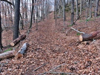 We called the control center to let them know we were responding and gathered our tools. We walked back out to the car at the trailhead. After getting the tools in the back and Sheila in the back seat, I drove down Pearl St. toward Main St. Krista came out to take Sheila and we continued on to the ambulance building. Our deice already had the ambulance pulled out and we quickly responded. The accident was west of exit 96 in the westbound lane. The vehicles involved were reported to be a car and a tractor trailer which sounded like it could be a problem. As we topped the hill and the scene came into sight, the control center let us know that we were canceled by law enforcement as there were no injuries. We check wit the officers on the scene and the returned to service. When we got back to the building, I quickly wrote up the documentation for the call. Brad and I too an ambulance and drove to the town barn to fill two pails with sand and two with salt to put in both ambulances. When we returned, we noticed the ambulances were dirty. We washed both rigs and the decided to go back to the trail so that I could take the 'after' pictures. I drove back up to the trailhead and we walked back to the blowdown. I took pictures of the cleared trail and a few of the woods as the sun was starting to go down.
![]()
![]()
![]()
![]() On Tuesday, November 22nd I planned to hike with Lisa in the late morning. I was able to sleep a little later than usual which allowed me to recover from an Daly morning ambulance call. Lisa and I planned to meet at the church across the street and hike Round Top as we both had commitments in the afternoon. I am lucky that I have a place so close to hike but it has become very familiar. I have found that even a short hike helps to keep my blood pressure in check and I am hoping I can get my weight down. I started to get ready at 10:30 AM while Sheila was already prepared to go as she really likes to hike. She was lying on the floor with her front legs spread barking up a storm. It was 28 degrees on the back porch so I decided to put on my Mammut long-sleeved crew top without a baselayer. I put on a pair of Bauer First Ascent insulated pants as my favorite my Columbia Titanium insulated pants need some repair. I wanted to keep the chill away but knew I would not need tights underneath. I decided to put on my Keen Durand hiking boots which fit well and are newer than what I have been wearing. I added a new pair of Xstance insoles in an effort to find the best support and cushioning for my feet. These insoles have shock absorbing gel pads, TPU arch support, and memory foam cushioning all wrapped in a breathable fabric. The insoles have been hyped by their manufacturer and I wondered if they would live up to that hype. I almost always take my Leki poles with external locks as the internal twist locks sometimes fail. I put on a blaze orange fleece hat for visibility and warmth. I did don my Mammut hoody as it has enough zippers to dump heat if needed. I also brought along a pair of medium-weight gloves. At 11:00 AM we walked out the door to start the hike. I looked around and saw that the sky was blue and filled with puffy cotton candy clouds. I grabbed Sheila's leash from the car and we walked up the driveway. We walked to the parking lot at the Presbyterian Church to meet Lisa who was already there. When Sheila saw Lisa, she started to pull me along to get to Lisa faster. I greeted Lisa and so did Sheila! We headed to the back of the church to the cemetery hill. We began the ascent of the steepest hill behind the church and continued directly up the hill to the trailhead. The hill is short but gets the circulation pumping and is the steepest and longest climb on the "trail." My goal was to make it all the way up the hill without stopping. At the top of the hill we stopped for minute so that we could observe the skies all around us. We turned left and entered the woods to begin our hike. The trailhead was damp from the snow showers and that continued as we entered the woods. The trail was covered in fallen leaves mixed with snow in nay places which made it a little slippery.
On Tuesday, November 22nd I planned to hike with Lisa in the late morning. I was able to sleep a little later than usual which allowed me to recover from an Daly morning ambulance call. Lisa and I planned to meet at the church across the street and hike Round Top as we both had commitments in the afternoon. I am lucky that I have a place so close to hike but it has become very familiar. I have found that even a short hike helps to keep my blood pressure in check and I am hoping I can get my weight down. I started to get ready at 10:30 AM while Sheila was already prepared to go as she really likes to hike. She was lying on the floor with her front legs spread barking up a storm. It was 28 degrees on the back porch so I decided to put on my Mammut long-sleeved crew top without a baselayer. I put on a pair of Bauer First Ascent insulated pants as my favorite my Columbia Titanium insulated pants need some repair. I wanted to keep the chill away but knew I would not need tights underneath. I decided to put on my Keen Durand hiking boots which fit well and are newer than what I have been wearing. I added a new pair of Xstance insoles in an effort to find the best support and cushioning for my feet. These insoles have shock absorbing gel pads, TPU arch support, and memory foam cushioning all wrapped in a breathable fabric. The insoles have been hyped by their manufacturer and I wondered if they would live up to that hype. I almost always take my Leki poles with external locks as the internal twist locks sometimes fail. I put on a blaze orange fleece hat for visibility and warmth. I did don my Mammut hoody as it has enough zippers to dump heat if needed. I also brought along a pair of medium-weight gloves. At 11:00 AM we walked out the door to start the hike. I looked around and saw that the sky was blue and filled with puffy cotton candy clouds. I grabbed Sheila's leash from the car and we walked up the driveway. We walked to the parking lot at the Presbyterian Church to meet Lisa who was already there. When Sheila saw Lisa, she started to pull me along to get to Lisa faster. I greeted Lisa and so did Sheila! We headed to the back of the church to the cemetery hill. We began the ascent of the steepest hill behind the church and continued directly up the hill to the trailhead. The hill is short but gets the circulation pumping and is the steepest and longest climb on the "trail." My goal was to make it all the way up the hill without stopping. At the top of the hill we stopped for minute so that we could observe the skies all around us. We turned left and entered the woods to begin our hike. The trailhead was damp from the snow showers and that continued as we entered the woods. The trail was covered in fallen leaves mixed with snow in nay places which made it a little slippery.
Lisa and I had not hiked together for some time so we kept up a conversation as Sheila roamed the woods next to the trail. Just before the first trail junction there was a large tree across the trail. I had cut one end but needed to return to cut the rest of the very large trunk. At the first trail junction, we followed Sheila as she turned right and started up the woods road which has the gentler approach of the two. We continued up the trail passing by the rather larger tree I had cut by hand and removed from the trail. We reached the end of the woods road and turned left up the hill on the trail. We continued up the trail to the first trail junction with the upper blue trail. We turned left and walked the yellow trail along the base of Round Top to the next junction with the blue trail. When we reached the junction, I told Sheila "right" and she turned right on the blue trail and started to climb the hill. There was still a good layer of snow in the woods and on the trail. We turned right on the switchback in the blue trail which I had constructed to ease the erosion on the main trail and allow people to have a slightly more gentle climb. At the end of the switchback we turned right on the main blue trail and passed the white crossover trail on the way to the summit. We crossed over the summit and started down the blue rail on the other side. We again passed the white crossover trail continuing on to the yellow trail. We had not run into any blowdowns blocking the trail but we had removed a few small branches. We turned right and again walked along the yellow trail to the next junction with the blue trail. This time we turned left and headed down toward the lookout. The trail bed had a little less snow in this area and a layer of snow covered the ferns that lined the trail. When we reached the viewpoint, we noticed that the view was better since all of the leaves had fallen. We continued to follow the yellow trail as it descended steeply from the lookout to the first trail junction. We immediately turned around and started back up the yellow trail to the lookout. When the yellow trail turned right, we followed it back up through the dead ferns and passed the "sitting rock". At the first junction with the blue trail we turned right and followed the yellow trail along the base of Round Top. At the next junction with the blue trail, we turned left and headed up the hill toward the summit. At the white crossover trail, we turned left and walked along the trail so that I could check for branches and blowdowns. When we hit the blue trail, we turned left and then left immediately to stay on the blue trail. The switchback took us out into the woods and then back to the main blue trail where we turned left. We walked down the hill to the yellow trail where we turned left to walk along the base of Round Top. At the junction with the blue trail, we turned right and walked down the trail to the woods road. We turned right on the woods road that took us downhill to the first trail junction. We turned left and walked out to the trailhead. We turned right and walked down the hill to the church parking lot. We said "Goodbye" to Lisa and then crossed the parking lot and Rock Avenue to get to our driveway. When we arrived home, it was 1:25 PM and we had hiked just over 2 miles in an hour and 15 minutes.
![]()
![]()
![]()
![]() On Monday, November 21st I had planned to go out for a longer hike after almost a week off because of indoor track coaching commitments and poor weather. I woke up at 8:00 AM with the temperature at 22 degrees and decided I would wait a little while before venturing out. I felt well rested as I did not have an overnight ambulance call to interrupt my sleep. By noon the temperate was 32 degrees and I decided to venture out. I had to leave home from track practice at 2:30 PM so I opted to just head across the street again to hike on Round Top. I started to get ready with Sheila quitely watching my every move. I decided to dress a little warmer than I had been. I decided to put on my Mammut long-sleeved crew top with a long-sleeved baselayer. I put on my Columbia Titanium insulated pants to keep the chill away but knew I would not need tights underneath. I decided to put on my Keen Durand hiking boots which fit well and are newer than what I have been wearing. I added a new pair of Xstance insoles in an effort to find the best support and cushioning for my feet. These insoles have shock absorbing gel pads, TPU arch support, and memory foam cushioning all wrapped in a breathable fabric. The insoles have been hyped by their manufacturer and I wondered if they would live up to that hype. I almost always take my Leki poles with external locks as the internal twist locks sometimes fail. I put on a blaze orange fleece hat for visibility and warmth. I did don my Mammut hoody as it has enough zippers to dump heat if needed. I also brought along a pair of medium-weight gloves. At 12:30 PM we walked out the door to start the hike. I looked around and saw that the sky was blue over Round Top with a many puffy white clouds. I grabbed Sheila's leash from the car and we walked up the driveway. We walked across the street and behind the Presbyterian Church.
On Monday, November 21st I had planned to go out for a longer hike after almost a week off because of indoor track coaching commitments and poor weather. I woke up at 8:00 AM with the temperature at 22 degrees and decided I would wait a little while before venturing out. I felt well rested as I did not have an overnight ambulance call to interrupt my sleep. By noon the temperate was 32 degrees and I decided to venture out. I had to leave home from track practice at 2:30 PM so I opted to just head across the street again to hike on Round Top. I started to get ready with Sheila quitely watching my every move. I decided to dress a little warmer than I had been. I decided to put on my Mammut long-sleeved crew top with a long-sleeved baselayer. I put on my Columbia Titanium insulated pants to keep the chill away but knew I would not need tights underneath. I decided to put on my Keen Durand hiking boots which fit well and are newer than what I have been wearing. I added a new pair of Xstance insoles in an effort to find the best support and cushioning for my feet. These insoles have shock absorbing gel pads, TPU arch support, and memory foam cushioning all wrapped in a breathable fabric. The insoles have been hyped by their manufacturer and I wondered if they would live up to that hype. I almost always take my Leki poles with external locks as the internal twist locks sometimes fail. I put on a blaze orange fleece hat for visibility and warmth. I did don my Mammut hoody as it has enough zippers to dump heat if needed. I also brought along a pair of medium-weight gloves. At 12:30 PM we walked out the door to start the hike. I looked around and saw that the sky was blue over Round Top with a many puffy white clouds. I grabbed Sheila's leash from the car and we walked up the driveway. We walked across the street and behind the Presbyterian Church.
We began the ascent of the steepest hill behind the church and continued directly up the hill to the trailhead. The hill is short but gets the circulation pumping and is the steepest and longest climb on the "trail." My goal is always to make it all the way up the hill without stopping. At the top of the hill we stopped for minute so that I could observe the skies and hills all around us. We turned left and entered the woods to begin our hike. The trailhead had some snow in spots and that continued as we entered the woods. Underneath the snow was a thick layer of leaves on the ground. Just before the first trail junction, we came to the large tree across the trail. I had cut one end of the tree but it would require at east two more cuts to remove it. I asked Brad to bring his chainsaw when visiting for Thanksgiving so that we might eliminate the blowdown. It was almost 2 feet in diameter and would have to be cut several times to move it off the trail. At the first trail junction, I followed Sheila as she continued straight ahead up the hill toward the lookout. When we reached the top of the trail, I stopped to take a look from the viewpoint. Now that the leaves were off the trees, the view was much clearer. We followed the yellow trail as it headed uphill through the fern glade. The ferns were all brown and covered in a layer of snow which became more apparent as we gained elevation. The woods attested to the fact that fall was in full swing and that winter was on the way! We passed the "sitting rock" and continued on the yellow trail to the first junction with the blue trail. At the junction we turned right and walked the yellow trail along the base of Round Top to the next junction with the blue trail. As I looked to my left and up the hill I could see a layer of snow on the ground from the storm the day before. We turned left on the blue trail and started up the hill. We bypassed the white crossover trail and continued on the blue trail across the summit of Round Top. As we began down the other side, we bypassed the white crossover trail and turned left on the switchback in the blue trail. We continued followed the switchback as it took us out into the woods and then turned almost 180 degrees to bring us back to the main blue trail. We turned left and continued downhill on the blue trail. We followed the blue trail to the yellow trail. We turned left and walked on the yellow trail along the base of Round Top to the junction with the blue trail.
 This time we turned right and walked down the yellow trail to the woods road. We walked along the woods road toward the first trail junction. Just before the first trail junction, I looked at the remains of the large blowdown I had cut and removed from the trail. I thought that if Brad brought his chainsaw, we could cut the ends of this blowdown further back from the trail. Just passed this were the remains of a smaller blowdown I had cut up. This tree had hung over the trail for months but finally came down in the wind. We turned around at the first trail junction and started back up the woods road. We turned left when the yellow trail started up toward the first junction with the blue trail. We turned left and walked the yellow trail to the next junction with the blue trail. At the next trail junction we turned right on the blue trail and started up the hill. We turned right on the switchback and followed it out and back to the main blue trail. We almost immediately trued right on the white crossover trail and followed it along the shoulder of Round Top to the blue trail on the other side. We turned right and walked down the other side to the junction with the yellow trail. At the junction with the yellow trail we turned right and again walked along the base of Round Top to the next junction with the blue trail. This time we turned left and continued on the yellow trail through the ferns and passed the "Sitting Rock" to the viewpoint. At the viewpoint we turned left and walked down the steep trail to the first trail junction. This time we continued out to the trailhead. At the trailhead we turned right and walked down the hill to the church parking lot. We crossed the parking lot and Rock Avenue to get to our driveway. When we arrived home, it was 1:45 PM and we had hiked a little more than 2 miles in an hour and 15 minutes.
![]()
![]()
![]()
![]() On Tuesday, November 15th I had planned to go out for a longer hike after three days off due to other commitments. When I woke up at 6:30 AM but shortly after the ambulance pager sounded and I was off on a two calls in Liberty. I finished the call and the documentation and went home. At around 12:30 PM I had to go to Liberty for a track meeting followed by practice. After the meeting, the school cancelled after school activities due to the forecast for several inches of snow. I went home and at 2:00 PM I decided I would go over to Round Top to hike. I also wanted to make sure the wind had not brought down any more trees or branches. I started to get ready with Sheila watching expectantly. It was 38 degrees on the back porch and the wind was blowing slightly so I decided to dress a little warmer than I had been. I decided to put on my Mammut long-sleeved crew top with a long-sleeved baselayer. I decided to wear my Columbia Titanium insulated pants to keep the chill away but knew I would not need tights underneath. I decided to put on my Keen Durand hiking boots which fit well and are newer than what I have been wearing. I added a new pair of Xstance insoles in an effort to find the best support and cushioning for my feet. These insoles have shock absorbing gel pads, TPU arch support, and memory foam cushioning all wrapped in a breathable fabric. The insoles have been hyped by their manufacturer and I wondered if they would live up to that hype. I decided to take my Leki poles with external locks as the internal twist locks sometimes fail. I put on a blaze orange fleece hat for visibility and warmth. I did don my Mammut hoody as it has enough zippers to dump heat if needed. I also brought along a pair of medium-weight gloves. At 2:30 PM we walked out the door to start the hike. I looked around and saw that the sky was blue over Round Top with a many puffy white clouds. I grabbed Sheila's leash from the car and we walked up the driveway. We walked across the street and behind the Presbyterian Church.
On Tuesday, November 15th I had planned to go out for a longer hike after three days off due to other commitments. When I woke up at 6:30 AM but shortly after the ambulance pager sounded and I was off on a two calls in Liberty. I finished the call and the documentation and went home. At around 12:30 PM I had to go to Liberty for a track meeting followed by practice. After the meeting, the school cancelled after school activities due to the forecast for several inches of snow. I went home and at 2:00 PM I decided I would go over to Round Top to hike. I also wanted to make sure the wind had not brought down any more trees or branches. I started to get ready with Sheila watching expectantly. It was 38 degrees on the back porch and the wind was blowing slightly so I decided to dress a little warmer than I had been. I decided to put on my Mammut long-sleeved crew top with a long-sleeved baselayer. I decided to wear my Columbia Titanium insulated pants to keep the chill away but knew I would not need tights underneath. I decided to put on my Keen Durand hiking boots which fit well and are newer than what I have been wearing. I added a new pair of Xstance insoles in an effort to find the best support and cushioning for my feet. These insoles have shock absorbing gel pads, TPU arch support, and memory foam cushioning all wrapped in a breathable fabric. The insoles have been hyped by their manufacturer and I wondered if they would live up to that hype. I decided to take my Leki poles with external locks as the internal twist locks sometimes fail. I put on a blaze orange fleece hat for visibility and warmth. I did don my Mammut hoody as it has enough zippers to dump heat if needed. I also brought along a pair of medium-weight gloves. At 2:30 PM we walked out the door to start the hike. I looked around and saw that the sky was blue over Round Top with a many puffy white clouds. I grabbed Sheila's leash from the car and we walked up the driveway. We walked across the street and behind the Presbyterian Church.
We began the ascent of the steepest hill behind the church and continued directly up the hill to the trailhead. The hill is short but gets the circulation pumping and is the steepest and longest climb on the "trail." My goal was to make it all the way up the hill without stopping. At the top of the hill we stopped for minute so that I could observe the skies and hills all around us. We turned left and entered the woods to begin our hike. The trailhead was damp in a few spots from some rain and that continued as we entered the woods. There was also a thick layer of leaves on the ground. Just before the first trail junction, we came to the large tree across the trail. I had cut one end of the tree but it would require at east two more cuts to remove it. I asked Brad to bring his chainsaw when visiting for Thanksgiving so that we might eliminate the blowdown. It was almost 2 feet in diameter and would have to be cut several times to move it off the trail. At the first trail junction, I followed Sheila as she continued straight ahead up the hill toward the lookout. When we reached the top of the trail, I stopped to take a look from the viewpoint. Now that the leaves were off the trees, the view was much clearer. We followed the yellow trail as it headed uphill through the fern glade. The ferns were all brown and most were lying on the ground. The woods attested to the fact that fall was in full swing as leaves had all fallen from the trees and were lying on the ground. We passed the "sitting rock" and continued on the yellow trail to the first junction with the blue trail. At the junction we turned right and walked the yellow trail along the base of Round Top to the next junction with the blue trail. The trail was still clear of brush but I thought about giving it another trim before winter. We turned left on the blue trail and started up the hill. We bypassed the white crossover trail and continued on the blue trail across the summit of Round Top. As we began down the other side, we bypassed the white crossover trail and the switchback in the blue trail. We continued downhill on what used to be the blue trail. I wanted to walk the trail as it had been and found that some others continued to use this route. We followed the blue trail to the yellow trail. We walked on the yellow trail along the base of Round Top to the junction with the blue trail.
This time we turned right and walked down the yellow trail to the woods road. We walked along the woods road toward the first trail junction. Just before the first trail junction, I looked at the remains of the large blowdown I had cut and removed from the trail. I thought that if Brad brought his chainsaw, we could cut the ends of this blowdown further back from the trail. Just passed this were the remains of a smaller blowdown I had cut up. This tree had hung over the trail for months but finally came down in the wind. We turned around at the first trail junction and started back up the woods road. We turned left when the yellow trail started up toward the first junction with the blue trail. We turned left and walked the yellow trail to the next junction with the blue trail. At the next trail junction we turned right on the blue trail and started up the hill. We again avoided the switchback and walked straight up the blue trail passing the white crossover trail and continuing on to the summit. We continued on the blue trail over the summit and down the other side to the junction with the yellow trail. At the junction with the yellow trail we turned right and again walked along the base of Round Top to the next junction with the blue trail. This time we turned left and continued on the yellow trail through the ferns and passed the "Sitting Rock" to the viewpoint. At the viewpoint we turned left and walked down the steep trail to the first trail junction. This time we continued out to the trailhead. At the trailhead we turned right and walked down the hill to the church parking lot. We crossed the parking lot and Rock Avenue to get to our driveway. When we arrived home, it was 3:15 PM and we had hiked a little more than 2 miles in an hour and 15 minutes.
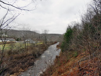
![]()
![]()
![]()
![]()
![]() On Saturday, November 12th I wanted to get out for a hike to some waterfalls as we had about 2 inches of rain overnight. I even considered driving to some falls and taking pictures. A morning ambulance call changed my plans a little! I thought I might just go across the street to hike on Round Top. I asked Cindy if she would like to hike the Parksville Rail Trail and she agreed. The walk is less than 3 miles round trip and almost completely flat. It does have a few limited views and a nice waterfall which I thought might be roaring due to the overnight rain. It was 53 degrees when we started to get ready at 12:15 PM but the skies were overcast. Sheila's expectant gaze and sharp bark "encouraged" me to continue the hiking plans. It was relatively warm and I did know there would be water and mud on the trail so I dressed accordingly. I put on my Mammut long-sleeved crew top without a baselayer. I put on a pair of RailRiders hiking pants which are expensive but last a long time and have features like deep pockets and a generous cut which I really like. I decided to put on my Keen Durand hiking boots which fit well and are newer than what I have been wearing. I added a new pair of Xstance insoles in an effort to find the best support and cushioning for my feet. These insoles have shock absorbing gel pads, TPU arch support, and memory foam cushioning all wrapped in a breathable fabric. The insoles have been hyped by their manufacturer and I wondered if they would live up to that hype. I decided to take my Leki poles with external locks as the internal twist locks sometimes fail. I wore a light hat and put on my OR Crocodile gaiters because of the possibility of water and mud. I also donned my Mammut hoody which has enough zippers to dump heat when it is needed. At 12:30 PM we put our gear in the car and Sheila in the back seat. I headed out Old Route 17 across the Flats and then took Old Route 17 and Service Road to the point where they meet Fox Mountain Road. There was one pickup truck in the parking lot when we started out on the trail at 12:45 PM.
On Saturday, November 12th I wanted to get out for a hike to some waterfalls as we had about 2 inches of rain overnight. I even considered driving to some falls and taking pictures. A morning ambulance call changed my plans a little! I thought I might just go across the street to hike on Round Top. I asked Cindy if she would like to hike the Parksville Rail Trail and she agreed. The walk is less than 3 miles round trip and almost completely flat. It does have a few limited views and a nice waterfall which I thought might be roaring due to the overnight rain. It was 53 degrees when we started to get ready at 12:15 PM but the skies were overcast. Sheila's expectant gaze and sharp bark "encouraged" me to continue the hiking plans. It was relatively warm and I did know there would be water and mud on the trail so I dressed accordingly. I put on my Mammut long-sleeved crew top without a baselayer. I put on a pair of RailRiders hiking pants which are expensive but last a long time and have features like deep pockets and a generous cut which I really like. I decided to put on my Keen Durand hiking boots which fit well and are newer than what I have been wearing. I added a new pair of Xstance insoles in an effort to find the best support and cushioning for my feet. These insoles have shock absorbing gel pads, TPU arch support, and memory foam cushioning all wrapped in a breathable fabric. The insoles have been hyped by their manufacturer and I wondered if they would live up to that hype. I decided to take my Leki poles with external locks as the internal twist locks sometimes fail. I wore a light hat and put on my OR Crocodile gaiters because of the possibility of water and mud. I also donned my Mammut hoody which has enough zippers to dump heat when it is needed. At 12:30 PM we put our gear in the car and Sheila in the back seat. I headed out Old Route 17 across the Flats and then took Old Route 17 and Service Road to the point where they meet Fox Mountain Road. There was one pickup truck in the parking lot when we started out on the trail at 12:45 PM.
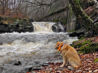 I did not bring my GPS unit as we had hiked the trail so many times before. The open trail just before the woods had quite a few branches hanging into the trail. It is not clear who is responsible for clearing the trail but the job is not being done. Usually as we enter the shade of the trees, it seems a little cooler but on this day I did not notice much change. One look down to the Little Beaverkill showed the stream volume was much higher than during our last visit due to the rains the night before. I wondered if the falls would be roaring or just at average volume. Sheila was taking her own route and following her nose. Just after entering the woods we came to an area which is normally muddy which proved to be the case. This theme continued as most of the rest of the trail was wet with muddy spots. Some of these muddy areas on the trail were not easily avoided as the water and mud extended across the trail. We looked up to see a young girl on a bicycle so I put Sheila on her leash. Further along there was a man walking with a small dog on a leash. A little further down the trail was another young girl on a bicycle. There was also a woman with a large Husky on a leash off the trail. I realized they were a family that had come in the pickup truck in the parking lot. We were soon at the wooden walkways where I stopped, put my pack down and took out the camera. I took some shots of the stream below even though the skies were overcast. It was easy to see that there was a lot of water in the stream as it was muddy with whitecaps. I put away the camera and picked up my pack to continue over the walkways. The wooden surface was covered in leaves which were damp making the footing slippery. The problem is that a rock slide has blocked the culvert under the small bridge causing water, mud and stones to be diverted over the walkway. Unblocking the culvert and covering the walkways with some screening would help. On this day the water had been diverted to the Parksville side of the bridge but was also running across the bridge making the whole area a big mess. We continued on the trail and found a few blowdowns that should be cleared. Some areas of the trail also had brush that needed trimming. Other areas of the trail had large branches and blowdowns that should be removed for aesthetic reasons. As we approached the falls, we could hear the sound of the falls roaring.
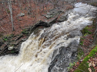 When we arrived at the falls, there was a much greater volume than in recent visits. I took a few shots from above the falls as the view was clear. I decided to go down to the streambed so that I could take pictures from in front of the falls. I had to be careful as the path down the bank was wet and covered in leaves. I kept my pack on and used my poles to help get me down the bank. On previous trips this summer I was able to walk out onto rocks that were usually covered with water. On this trip these rocks were covered with water leaving a small strip of dry land along the edge of the stream. I took some shots down stream and a few of Sheila posing in front of the falls. She does a good job of posing even when she is distracted by Cindy above on the bank. I then the turned my attention to the falls. I took numerous pictures of the area in front of falls and the falls themselves. The water was roiled and rolling over the rocks which were barely visible underneath the waves. I decided to take a 45 second video as it better showed the power of the water and the noise it made. When I was done, we worked our way back up the bank. We continued on the trail to a bench where a path leads down to the stream. I left my pack on the bench and we began to walk along a path at the edge of the stream. We didn't get very far as that path was now underwater. I stopped and took pictures downstream toward the falls and then upstream. I also took some pictures of the stream in front of me where the water was rolling over some rocks. I repositioned myself and took some more pictures downstream toward the falls. I finished and walked back to the bench to stow the camera. The trail continued to be wet and a little muddy in places but we managed to walk around them. From the falls to the other end of the trail there were a few wet areas and some mud. We set a quick pace for the rest of the hike toward the Parksville end of the trail. We continued to the Parksville end of the trail. Just after the gate at that end, we stopped to read the sign which outlined the milk that the O&W transported. The sign also mentioned the large number of hotels that had been in the area. We turned around and headed back to the car. I knew I would not be taking any more pictures and we set a rapid return pace. Just after the falls we met a young couple hiking toward us. We said "Hello" as we went in opposite directions. Cindy and I continued back to the car. We were back at the car at 2:05 PM after hiking 2.8 miles in 1 hour and 20 minutes including the stopped time for pictures. There is virtually no elevation gain on the hike except the short trips down to the streambed.
![]()
![]()
![]() On Wednesday, November 9th I planned to meet Andy Garrison and Raj in the Willowemoc Wild Forest to clear blowdowns on the Long Pond Beaverkill Ridge Trail. The first half of this trail is in the Willowemoc Wild Forest but the second half is in the Big Indian Wilderness. Using a chainsaw in a wild forest is permissible at any time as long as the sawyer is certified by the DEC. Working with a chainsaw in a wilderness area is only allowed in the spring and fall for a short period of time with a special permit. Andy had a permit and had already cut over 70 blowdowns on the Mongaup-Hardener Trail, a trail that had not seen a sawyer in 10 years! We agreed to meet at 9:00 AM in the snowmobile parking area on Flugertown Road. From there we would drive to the trailhead on the seasonal maintenance part of the road. When I got up at 6:30 AM the temperature was 25 degrees and the forecast called for highs only in the high 50's. At 8:15 AM I started to get ready with Sheila was watching quietly but making sure that I did not leave her behind. I put on my Mammut long-sleeved crew top with a long-sleeved baselayer since the temperature was so cool and I knew I could always remove layers later. I wore my Railriders hiking pants which are expensive but last along time and have features like deep pockets and a generous cut which I really like. The pants have Velcro closures at the ankles. I decided to put on my Keen Durand hiking boots which fit well and are newer than what I have been wearing. I added a new pair of Xstance insoles in an effort to find the best support and cushioning for my feet. These insoles have shock absorbing gel pads, TPU arch support, and memory foam cushioning all wrapped in a breathable fabric. The insoles have been hyped by their manufacturer and they really do seem to deliver. I decided to take my Leki poles with external locks as the internal twist locks sometimes fail. I did don my Mammut hoody as it has enough zippers to dump heat if needed. Before leaving the house, I decided to put on my OR Crocodile gaiters as there had been some showers. I also grabbed an older pack that was empty as I did not know what Andy would need me to carry. I put my the gear in the car and put Sheila in the backseat and started out the DeBruce Road at 8:40 AM. I drove 11 miles to Flugertown Road and turned left. I drove a short distance to the large snowmobile parking area on the right side of the road where Andy and Raj were already waiting. We said "Hello" and started the drive to the trailhead. We drove about 2 miles up Flugertown Road passing onto the seasonally maintained road. I drove across the first bridge and parked in a spot on the right side of the road. Andy and Raj pulled in a parked beside me. Andy gave me a can of fuel and the bottle of bar and chain oil so I decided to take my regular pack and just ditch my camera. I really wanted to take some pictures but I remembered how fast Andy moves and after you've seen one tree you have seen them all. This plan also allowed me to take my poles with me as I do not like to hike without them. We crossed the road at 9:15 AM and started to walk to the point where the trail crossed the road. When we got to the trail, we turned right and started up the trail.
On Wednesday, November 9th I planned to meet Andy Garrison and Raj in the Willowemoc Wild Forest to clear blowdowns on the Long Pond Beaverkill Ridge Trail. The first half of this trail is in the Willowemoc Wild Forest but the second half is in the Big Indian Wilderness. Using a chainsaw in a wild forest is permissible at any time as long as the sawyer is certified by the DEC. Working with a chainsaw in a wilderness area is only allowed in the spring and fall for a short period of time with a special permit. Andy had a permit and had already cut over 70 blowdowns on the Mongaup-Hardener Trail, a trail that had not seen a sawyer in 10 years! We agreed to meet at 9:00 AM in the snowmobile parking area on Flugertown Road. From there we would drive to the trailhead on the seasonal maintenance part of the road. When I got up at 6:30 AM the temperature was 25 degrees and the forecast called for highs only in the high 50's. At 8:15 AM I started to get ready with Sheila was watching quietly but making sure that I did not leave her behind. I put on my Mammut long-sleeved crew top with a long-sleeved baselayer since the temperature was so cool and I knew I could always remove layers later. I wore my Railriders hiking pants which are expensive but last along time and have features like deep pockets and a generous cut which I really like. The pants have Velcro closures at the ankles. I decided to put on my Keen Durand hiking boots which fit well and are newer than what I have been wearing. I added a new pair of Xstance insoles in an effort to find the best support and cushioning for my feet. These insoles have shock absorbing gel pads, TPU arch support, and memory foam cushioning all wrapped in a breathable fabric. The insoles have been hyped by their manufacturer and they really do seem to deliver. I decided to take my Leki poles with external locks as the internal twist locks sometimes fail. I did don my Mammut hoody as it has enough zippers to dump heat if needed. Before leaving the house, I decided to put on my OR Crocodile gaiters as there had been some showers. I also grabbed an older pack that was empty as I did not know what Andy would need me to carry. I put my the gear in the car and put Sheila in the backseat and started out the DeBruce Road at 8:40 AM. I drove 11 miles to Flugertown Road and turned left. I drove a short distance to the large snowmobile parking area on the right side of the road where Andy and Raj were already waiting. We said "Hello" and started the drive to the trailhead. We drove about 2 miles up Flugertown Road passing onto the seasonally maintained road. I drove across the first bridge and parked in a spot on the right side of the road. Andy and Raj pulled in a parked beside me. Andy gave me a can of fuel and the bottle of bar and chain oil so I decided to take my regular pack and just ditch my camera. I really wanted to take some pictures but I remembered how fast Andy moves and after you've seen one tree you have seen them all. This plan also allowed me to take my poles with me as I do not like to hike without them. We crossed the road at 9:15 AM and started to walk to the point where the trail crossed the road. When we got to the trail, we turned right and started up the trail.
The first .4 miles of the trail are maintained by the snowmobile club and this section of trail was in good shape with only a few branches. This section of trail is part of the snowmobile trail, Mongaup Willowemoc Trail and the Long Pond Beaverkill Ridge Trail. This short section of trail is an ascent with a 13% grade and I was feeling it as Andy led the way! Andy was carrying a large pack and had a 12 pound chainsaw on his shoulder but was setting a blazing pace while talking freely. At .4 miles the trail leveled and we turned right onto the Long Pond Beaverkill Ridge Trail and began to inspect the trail. The trail was in pretty good shape and we removed a few branches here and there. The trail has been cleared several times to the point where it begins to climb the ridge. Beyond that point I knew there was some serious clearing and marking to do! The DEC has decided that maintainers cannot put up trail markers any more but they do not get around to marking many trails. As we walked we began to run into all kinds of things to clear. There were a few small tree that went quickly. In other places Andy cut the ends of blowdowns that were already cut to make the gap wider and the trail easier to follow. The most difficult blowdowns were the large trunks sitting on or near the ground. Andy has done this for a long time and is able to quickly form a plan for these bigger trees. As we neared the point where the trail starts up the hill, we came to a point where the trail has been rerouted and hikers had walked around some blowdowns. We did our best to cut out the trail but we wanted to get started up the hill and into the wilderness area. We started up the hill and came to a large tree that had been in place for some time. Andy decided to cut off the end which protruded into the trail. After that cut he decided to cut some more of the very large trunk. I was doubtful but after a couple of cuts and some grunt work we were able to roll the pieces off the trail. Sheila was trying to be good but it was clear she was a little bored. We started up the hill and found nothing to cut until the trail leveled and then there were several blowdowns to remove. It was 12:15 PM so we decided to take a lunch break. The weather was warmer than the temperature would indicate and the work had warmed me up. I had long ago removed my Mammut crew top leaving only my baselayer beneath my hoody. I had also opened all the zippers on the hoody and I was still warm. It was a beautiful day with plenty of sun and just a slight breeze. When we finished lunch, we cut a half dozen blowdowns and then turned our attention to a large blowdown. Andy executed his plan and we were able to roll or flip the pieces off the trail. It was 1:30 PM and we had been out in the trail for 4 hours and 15 minutes. We were about to turn left to follow the trail up to the final plateau where I knew there were a lot of blowdowns. I had to be at a meeting at church in the late afternoon so I decided to return to my car. Andy and Raj would continue on the trail trying to make it to the junction with the Mongaup Hardenburgh Trail. I started back at 1:30 PM and was making very good time. I had not set my GPS but figured we had gone about 2 miles. Sheila was having fun as she was able to run free. The trail was easy to follow and we were soon making the last descent to Flugertown Road. We were back at the car at 2:15 PM which meant we had spent 4 hours and 15 minutes hiking and working on the way out and only 45 minutes on the way back! Andy and Raj made the junction and walked out in the dark under a bright moon. They cut 20 more blowdowns which meant Andy had cut a total of over 100 blowdowns in 3 trips in the area!
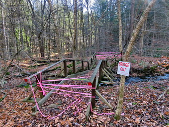
![]()
![]()
![]()
![]()
![]() On Monday, November 7th, I was set to meet a hiking friend, David, at 9:00 AM in Downsville to hike a section of the Finger Lakes Trail from Route 206 to Downsville. When I awoke at 7:00 AM the temperature was 57 degrees with the sun already shining brightly. The forecast was for highs in the high 60's which is remarkable for November. Our plan was to spot a car at the covered bridge in Downsville and drive another car to the parking area on Route 206. David had the mileage at 5.1 miles but my previous hikes put it at about 7 miles. I was still having heel pain but knew this route was mostly downhill after climbing Campbell Mountain. At 8:00 AM I began to get dressed for a warm day knowing that it might be cooler in the woods. I got dressed in my White Sierra light crew top with a short-sleeved baselayer. I wore my Railriders hiking pants which are expensive but last along time and have features like deep pockets and a generous cut which I really like. The pants have Velcro closures at the ankles. I decided to put on my Keen Durand hiking boots which fit well and are newer than what I have been wearing. I added a new pair of Xstance insoles in an effort to find the best support and cushioning for my feet. These insoles have shock absorbing gel pads, TPU arch support, and memory foam cushioning all wrapped in a breathable fabric. The insoles have been hyped by their manufacturer and they really do seem to deliver. I decided to take my Leki poles with external locks as the internal twist locks sometimes fail. I did don my Mammut hoody as it has enough zippers to dump heat if needed. Before leaving the house, I decided to put on my OR Crocodile gaiters as there had been some showers on Sunday. I left the house at 8:40 AM and drove north and west on State Route 17 getting off at the exit 94. I followed Route 206 through Roscoe and Rockland heading toward Downsville. When I reached the Pepacton Reservoir, I turned left and continued toward Downsville. At the bottom of the hill I turned left on River Road and right on Bridge Street. I drove through the covered bridge and turned left into the parking area where David was waiting for me. We greeted each other and decided to drive back to the Route 206 parking area in his car. I put my gear in his car and got in the front seat with Sheila at my feet. David drove back to Route 206 and parked at the pulloff. I set my GPS and we started out on the trail at 9:15 AM. It was warm and I thought about leaving my hoody in the car. In the end I kept the hoody on since I knew it might be cooler in the forest. We hiked down the trail from the road noting that it appeared little used. I expected the trail to be wet but it was barely damp. We did cross a small stream before following the trail along another, larger stream. The trail markings were well done but there were some blowdowns that needed to be removed. Many of the trails are snowmobile trails so that they are also maintained by the snowmobile club.
On Monday, November 7th, I was set to meet a hiking friend, David, at 9:00 AM in Downsville to hike a section of the Finger Lakes Trail from Route 206 to Downsville. When I awoke at 7:00 AM the temperature was 57 degrees with the sun already shining brightly. The forecast was for highs in the high 60's which is remarkable for November. Our plan was to spot a car at the covered bridge in Downsville and drive another car to the parking area on Route 206. David had the mileage at 5.1 miles but my previous hikes put it at about 7 miles. I was still having heel pain but knew this route was mostly downhill after climbing Campbell Mountain. At 8:00 AM I began to get dressed for a warm day knowing that it might be cooler in the woods. I got dressed in my White Sierra light crew top with a short-sleeved baselayer. I wore my Railriders hiking pants which are expensive but last along time and have features like deep pockets and a generous cut which I really like. The pants have Velcro closures at the ankles. I decided to put on my Keen Durand hiking boots which fit well and are newer than what I have been wearing. I added a new pair of Xstance insoles in an effort to find the best support and cushioning for my feet. These insoles have shock absorbing gel pads, TPU arch support, and memory foam cushioning all wrapped in a breathable fabric. The insoles have been hyped by their manufacturer and they really do seem to deliver. I decided to take my Leki poles with external locks as the internal twist locks sometimes fail. I did don my Mammut hoody as it has enough zippers to dump heat if needed. Before leaving the house, I decided to put on my OR Crocodile gaiters as there had been some showers on Sunday. I left the house at 8:40 AM and drove north and west on State Route 17 getting off at the exit 94. I followed Route 206 through Roscoe and Rockland heading toward Downsville. When I reached the Pepacton Reservoir, I turned left and continued toward Downsville. At the bottom of the hill I turned left on River Road and right on Bridge Street. I drove through the covered bridge and turned left into the parking area where David was waiting for me. We greeted each other and decided to drive back to the Route 206 parking area in his car. I put my gear in his car and got in the front seat with Sheila at my feet. David drove back to Route 206 and parked at the pulloff. I set my GPS and we started out on the trail at 9:15 AM. It was warm and I thought about leaving my hoody in the car. In the end I kept the hoody on since I knew it might be cooler in the forest. We hiked down the trail from the road noting that it appeared little used. I expected the trail to be wet but it was barely damp. We did cross a small stream before following the trail along another, larger stream. The trail markings were well done but there were some blowdowns that needed to be removed. Many of the trails are snowmobile trails so that they are also maintained by the snowmobile club.
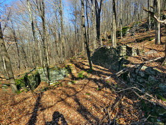 We walked on the trail as it paralleled the brook and soon came to the bridge. The bridge is closed as it has all but collapsed. The bridge has been in bad shape for several years but the DEC had not bothered to repair it. At this point it cannot be repaired but will have to be replaced. This follows and alarming trend by the DEC! Fortunately, on this day the brook was low enough to cross. There was another hiker on the ether side of the bridge who suggested we cross upstream. The hiker left ahead of us and we never saw him again! I walked down to the brook and found a place to cross. I took my first step and almost slipped on a wet and slippery rock! Once on the other side, I took a few pictures of the bridge before we continued on the trail. We began to climb as the trail headed up Campbell Mountain and over the next .9 miles we gained about 650 feet of elevation. The trail is very eroded in places and steep in others. There are several switchbacks that follow woods roads that mitigate the steepness of the climb. When there has been plenty of rain, there are several waterfalls on the left of the trail but the drought has eliminated them. I was beginning to get very warm as we climbed even though all my zippers were open. We passed the side trail to the Campbell Mountain lean-to and continued to ascend. I knew that the right turn onto the snowmobile trail was not far passed the lean-to. Just before we would have reached the summit of the mountain we turned right on the snowmobile trail at about 1.6 miles. The new section of trail started on a snowmobile trail which was wide but not well marked. There were a few FLT markers and directional signs but the snowmobile markers were few and far between. For the most part this was not a problem on the first part of the trail which was either level or descending. We passed through some nice clearings which made it hard, at times, to follow the trail. As usual, Sheila helped by being able to follow the trail despite the fact that it is not well used. We ascended slightly to the top of a hill on the Campbell Mountain ridge where the markings on the trail were almost non-existent. We came upon some nice yellow signs warning about turns and then as we started down a hill and I knew from past experience that there was a right-hand turn coming up soon.
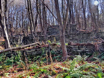 At about 3.25 miles, I looked up and saw a sign that said "Downsville". We turned right and followed the trail and the markers when we could find them. There was a rather long stretch of woods road and snowmobile trail which was straight and flat. As we looked to our right off the ridge, we could see the waters of the Pepacton Reservoir. Overhead we could hear a helicopter approaching and then we saw it fly be heading south. We continued our hike only to hear the helicopter coming by again heading in the same direction. This happened two more times. It was obvious the helicopter was circling but we did not know why. We came to an open area and hiked uphill through an extensive patch of weeds which was very wet and muddy. We found some FLT white blazes and followed them as they led to an old farmhouse foundation. I took some pictures. We realized the FLT markers were leading us back the way we had come because we had missed a turn off the woods road. We reversed our course and found some more FLT blazes headed north along a woods road and snowmobile trail. It was disconcerting that there were no FLT blazes but the further we continued on the snowmobile trail the more we were convinced it was the right trail. Eventually we saw the white blazes used for the FLT pointing off the snowmobile trail to the right. We tried to follow the blazes until we found that they were pointing down another old woods road which we followed for some time. The road was well eroded and filled with blowdowns. At several points the trail left the road to avoid some blowdown and then regained the road. Further down another set of blazes indicated that we should leave the road and descend to another woods road. This road paralleled a small brook that was making quite a bit of noise. At the base of the hill we crossed a spot where the brook was dry and walked through a backyard to a driveway and then down to Mink Brook Road. There were FLT blazes along the way and the owners of the property have generously allowed hiking across their property. We walked down Mink Brook Road to Back River Road. After walking along Back River Road, we turned right on Bridge Street near the cemetery so that we could cross over the Delaware River on the covered bridge. We stopped at the old Downsville Cemetery to read the historical description. We crossed the bridge and walked over to my car. We were back at the car by 1:30 PM after hiking 7.0 miles in 4 hours and 10 minutes with around 1050 feet of ascent but 1620 feet of descent. We got into my car and I drove back to David's car on Route 206.
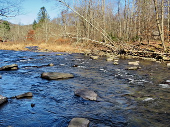
![]()
![]()
![]()
![]()
![]() On Thursday, November 3rd, I wanted to get in a hike with Cindy after a tiring trip on a section of the FLT the day before. Cindy likes short, flat hikes so I chose to go to the Beaverkill Campgrounds to hike along the river. The campground is closed for the winter and I thought it would be quite. I also hoped the recent rains would have swollen the stream to provide some interest. We started to get ready at 1:45 PM with the temperature at 60 degrees. Sheila certainly was happy to go hiking two days in a row. I got dressed in my White Sierra light crew top without a baselayer. I wore my Railriders hiking pants which are expensive but last along time and have features like deep pockets and a generous cut which I really like. The pants have Velcro closures at the ankles. I decided to put on my Keen Durand hiking boots which fit well and are newer than what I have been wearing. I added a new pair of Xstance insoles in an effort to find the best support and cushioning for my feet. These insoles have shock absorbing gel pads, TPU arch support, and memory foam cushioning all wrapped in a breathable fabric. The insoles have been hyped by their manufacturer and they really do seem to deliver. I decided to take my Leki poles with external locks as the internal twist locks sometimes fail. I did don my Mammut hoody as it has enough zippers to dump heat if needed. We left the house at 2:00 PM as I drove out Old Route 17 toward Roscoe and turned right on Beaverkill Road. As we started the descent into the Beaverkill Valley, I turned left on Campsite Road and followed it down to the parking area near the Beaverkill Covered Bridge. There was one car parked in the lot with a fisherman getting ready to go down to the river. A glance at the river showed that the level had risen slightly but was still below the usual level for the year. I put Sheila on her leash and shouldered my pack to begin our hike.
On Thursday, November 3rd, I wanted to get in a hike with Cindy after a tiring trip on a section of the FLT the day before. Cindy likes short, flat hikes so I chose to go to the Beaverkill Campgrounds to hike along the river. The campground is closed for the winter and I thought it would be quite. I also hoped the recent rains would have swollen the stream to provide some interest. We started to get ready at 1:45 PM with the temperature at 60 degrees. Sheila certainly was happy to go hiking two days in a row. I got dressed in my White Sierra light crew top without a baselayer. I wore my Railriders hiking pants which are expensive but last along time and have features like deep pockets and a generous cut which I really like. The pants have Velcro closures at the ankles. I decided to put on my Keen Durand hiking boots which fit well and are newer than what I have been wearing. I added a new pair of Xstance insoles in an effort to find the best support and cushioning for my feet. These insoles have shock absorbing gel pads, TPU arch support, and memory foam cushioning all wrapped in a breathable fabric. The insoles have been hyped by their manufacturer and they really do seem to deliver. I decided to take my Leki poles with external locks as the internal twist locks sometimes fail. I did don my Mammut hoody as it has enough zippers to dump heat if needed. We left the house at 2:00 PM as I drove out Old Route 17 toward Roscoe and turned right on Beaverkill Road. As we started the descent into the Beaverkill Valley, I turned left on Campsite Road and followed it down to the parking area near the Beaverkill Covered Bridge. There was one car parked in the lot with a fisherman getting ready to go down to the river. A glance at the river showed that the level had risen slightly but was still below the usual level for the year. I put Sheila on her leash and shouldered my pack to begin our hike.
 We started out at 2:15 PM by walking out of the parking lot to the bridge with the temperature at 62 degrees. The skies were bright blue with a few white clouds. When we got to the other side, the gate just off the road was closed as the campgrounds had closed September 5. I looked at the trail and saw that it was covered in a layer of damp leaves but it was not muddy. We turned left on a woods road that parallels the river and started down a short hill. We passed the spring house and continued on the deserted woods road and shortly the leaves ended and the pine needles started. We came to an area with a little path down to the river. Just passed this area the trail had been eroding due to the water running down the bank. The DEC had replaced a culvert pipe and installed a second. They had also brought in fill and packed it to reconstruct the path. I found this interesting as the campsites along this path are no longer used and are abandoned. I walked down to the edge of the river very carefully as the rocks were slippery and the water looked deep and cold. I took some pictures downstream and some upstream to the bridge. There were several places where trees at the edge of the river had fallen into the water testifying to the power of the river when it is high. The view of the bridge was almost blocked by the angle I had. Most of the leaves were off the trees but a few held onto some color. When I was done photographing, we got back on the trail and passed several areas with unused picnic tables. The state had mowed around many of the tables so that they could be used by people who wanted to picnic. Others sat unused and rotting along the road, a testimony to better days. We walked by these tables which had not been used in many years. A little later we came to what was once a bathroom for some campsites that had long since disappeared. I took some pictures of the bathroom before moving on. Further along on the road, there was another area with more picnic tables. There was a path over to the river so I walked over and found the water was sparkling in the sun and was very clear. I took some pictures of the sun reflecting off the water both upstream and downstream.
 We continue on and at about .7 miles the woods road met the paved road that serves the campsites. We continued on the road through the campsites and along the river. The campsites were all empty and I took pictures of the solitude. There were some colorful trees and I tried to capture them. We walked to the last campsite where the road ends and Sheila and I walked down to the edge of the river. I was careful to watch where I was walking as the water was a little high and looked cold. Sheila didn't seem to think the water was too cold as she jumped in to wade. I stopped to take some pictures of the river especially downstream. We continued along the shore a little further passed the last campsite and I took some more shots before walking up to the campsite and back to where Cindy was standing. I stowed my camera and picked up the pack. We walked back from the last campsite, staying to the left of the last bathroom to walk back on the other paved road through the campsites. This road parallels the one we walked out on to make a sort of loop. I stopped to take pictures of the road lined by pine trees and of a few more trees with colorful leaves. Along the way we saw another couple walking around the campsites but did not come near enough to speak to them. We retuned the way we had come although at a quicker pace passing Te other couple who had walked down to the stream. As we approached the bridge, I saw that there was only one car parked in the lot next to ours and that the fisherman had left. We walked through the bridge and turned right to go back to the car. Cindy got in the car and I put Sheila in the back seat. I put our poles and my pack in the car but took out my camera. I walked down to the stream and out onto a big rock that juts out into the stream. The sun was getting low in the sky but I was able to take some pictures downstream. I turned around and took multiple picture of the bridge and the abutments. I also took some shots of a few trees that still had leaves. I walked back to the car at 3:45 PM having hiked 2.7 miles in 1 hour and 30 minutes. The car's thermometer still read 62 degrees.
![]()
![]()
![]()
![]()
![]() On Wednesday, November 2nd I planned to hike the section of the FLT from Holiday Brook to Route 206 with David a hiker from the Finger Lakes region. The forecast for Wednesday was for a sunny day with no chance of rain. We agreed to meet between 9:00 Am and 9:30 AM at the parking area on Route 206 between Roscoe and the Pepacton Reservoir. The plan was to meet at the parking area and then drive one car to the trailhead on Holiday Brook Road where the Finger Lakes Trail crosses. We would then hike back to the car on Route 206 and drive back to the trailhead on Holiday Brook Road. The hike is about 6.4 miles and has two significant climbs. We also knew the trails would be damp from the rain during the week which fell on a layer of already slippery leaves. I hoped that the ambulance pager would not sound and call me away. I like to hike when I have enough sleep. When I awoke at 7:30 AM, I began to get ready to go, Sheila seemed pleased that we were hiking and stayed near me so that I would not "forget" to take her. Although the temperature was 42 degrees, it felt a little Warner outside. The temperatures were forecast to be warm with highs in the 60's. As it was cool, I got dressed in my Mammut crew top with a short-sleeved baselayer. I wore my Railriders hiking pants which are expensive but last along time and have features like deep pockets and a generous cut which I really like. The pants have Velcro closures at the ankles. I decided to put on my Keen Durand hiking boots which fit well and are newer than what I have been wearing. I added a new pair of Xstance insoles in an effort to find the best support and cushioning for my feet. These insoles have shock absorbing gel pads, TPU arch support, and memory foam cushioning all wrapped in a breathable fabric. The insoles have been hyped by their manufacturer and they really do seem to deliver. I decided to take my Leki poles with external locks as the internal twist locks sometimes fail. I put on a blaze orange hat for warmth and because various hunting seasons or in progress. I did don my Mammut hoody as it has enough zippers to dump heat if needed. I made sure I had a full bottle of water and got my gear and Sheila in the car. I left Livingston Manor at 8:45 AM and drove west and north on Route 17 to exit 94 for Roscoe. From here I drove north toward Downsville of Route 206. After passing over the top of Brock Mountain, the skies appeared to be dark and I wondered about the lack of rain in the forecast. I began watching for the place where the trail crosses the road just down the hill from Jug Tavern Road.
On Wednesday, November 2nd I planned to hike the section of the FLT from Holiday Brook to Route 206 with David a hiker from the Finger Lakes region. The forecast for Wednesday was for a sunny day with no chance of rain. We agreed to meet between 9:00 Am and 9:30 AM at the parking area on Route 206 between Roscoe and the Pepacton Reservoir. The plan was to meet at the parking area and then drive one car to the trailhead on Holiday Brook Road where the Finger Lakes Trail crosses. We would then hike back to the car on Route 206 and drive back to the trailhead on Holiday Brook Road. The hike is about 6.4 miles and has two significant climbs. We also knew the trails would be damp from the rain during the week which fell on a layer of already slippery leaves. I hoped that the ambulance pager would not sound and call me away. I like to hike when I have enough sleep. When I awoke at 7:30 AM, I began to get ready to go, Sheila seemed pleased that we were hiking and stayed near me so that I would not "forget" to take her. Although the temperature was 42 degrees, it felt a little Warner outside. The temperatures were forecast to be warm with highs in the 60's. As it was cool, I got dressed in my Mammut crew top with a short-sleeved baselayer. I wore my Railriders hiking pants which are expensive but last along time and have features like deep pockets and a generous cut which I really like. The pants have Velcro closures at the ankles. I decided to put on my Keen Durand hiking boots which fit well and are newer than what I have been wearing. I added a new pair of Xstance insoles in an effort to find the best support and cushioning for my feet. These insoles have shock absorbing gel pads, TPU arch support, and memory foam cushioning all wrapped in a breathable fabric. The insoles have been hyped by their manufacturer and they really do seem to deliver. I decided to take my Leki poles with external locks as the internal twist locks sometimes fail. I put on a blaze orange hat for warmth and because various hunting seasons or in progress. I did don my Mammut hoody as it has enough zippers to dump heat if needed. I made sure I had a full bottle of water and got my gear and Sheila in the car. I left Livingston Manor at 8:45 AM and drove west and north on Route 17 to exit 94 for Roscoe. From here I drove north toward Downsville of Route 206. After passing over the top of Brock Mountain, the skies appeared to be dark and I wondered about the lack of rain in the forecast. I began watching for the place where the trail crosses the road just down the hill from Jug Tavern Road.
 I pulled into the small parking area where David was waiting for me. He put his gear in my car and said "Hello" to Sheila. Sheila was very calm with a complete stranger. I drove south toward Roscoe until I could turn left on Beaverkill Valley Road. David and I talked about our hiking experiences and other topics. I pointed out Dundas Castle to David as we passed by. Without the leaves on the trees, it was easy to see the ruins of the castle. I continued along the road which turns into Berry Brook Road at the road the goes right to the covered bridge. I continued on the same road watching to the parking area in the right side of the road after about 8 miles. When I pulled into the trailhead parking, there were no other cars in the lot. As we got out of the car a rather stiff breeze was blowing and I was glad I had dressed a little warmer than usual. We got our gear ready and I set our GPS units before crossing the road to begin the hike at 9:40 AM. The trail was damp and covered fallen leaves which would set the theme for much of the hike! We continued on the trail and crossed a powerline right-of-way entering the woods and started to climb toward the Pelnor Hollow Trail. We encounter a few deer crossing the trail and at the time I did not realize that we would have several encounters. Sheila would chase the deer a short distance and then come back when called. In 1.1 miles the trail ascended over 500 feet to the top of a hill. Along the way we worked through some steeper areas and some rock scrambles. We began to notice that there were a lot of obstructions in the trail. There were some bushes leaning over and some weeds and nettles but mostly there were many trees lying across the trail. Some of these were easy to step over but others effectively blocked the trail requiring detours. I was disappointed as I am the FLT Regional Trail Coordinator for this section of trail. It was clear my maintainer needed to visit his trail and report the things he could not clear to me!
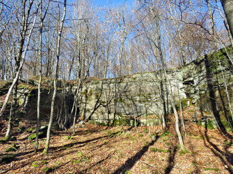 When we reached the Pelnor Hollow Trail at 10:20 AM, we turned right and began a steep descent to the Splitrock viewpoint. The descent was tricky as it is always steep but now was covered with wet and slippery leaves. At 1.3 miles we were at the lookout. I got out my camera as the view was hazy but much clearer than I expected. We stayed at the viewpoint long enough to get a drink and a quick snack and then headed out on the trail again. My feet were beginning to hurt as I have had problems especially with my heels were the Achille's tendon inserts. I was also a little tired and I knew we still had a lot of hike to go. Over the next 1.1 miles we descended 470 feet over some difficult ground to a trail junction. The signs at the junction were extensive but had several errors which could easily confuse inexperienced hikers. I knew we had to turn right on the blue Campbell Mountain Trail which is also a snowmobile trail. Unfortunately, there were very few trail markers which made finding the exact location of the trail difficult. Maintainers are no longer allowed by the DEC to place markers. Markers must be placed by rangers or foresters who are spread thin which means many trails are poorly marked. We found the blue trail but it was very eroded and covered in slippery, wet leaves. At times, we walked a route parallel to the trail and were soon at a point where the trail turned left heading northwest off the snowmobile trail. Just after the trail we began to ascend and eventually the trail swung to the south. At 3.9 miles we began a serious ascent toward the top of an unnamed hill gaining 470 feet over .7 miles. The trails were very uneven with rocks and roots which were covered with leaves making these obstacles hard to see. We also found numerous blowdowns which had not been reported to me as the RTC for the FLT. The forests varied between hardwood and evergreen trees with the two often mixed. At 4.2 miles we ascended to an open area called Flat Rock which lived up to its name.
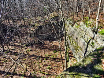 We continued on the trail reaching the highest point at 4.6 miles and then began to descend 300 feet over .5 miles heading northwest. When we reached 5.2 miles, we could see the beginnings of an old quarry on the right. There was a road that turned right off the trail to the quarry. There were obvious places where stone had been removed and I took a few shots. On the ascent to Brock Mountain we made a short but steep ascent through an area where the trail was completely obscured by brush emphasizing the need for some trail maintenance. There was also the remains of an old truck probably used in the quarrying effort. I took a few pictures of it. Sheila had been following various animal tracks off the trail for the whole hike and at this point she heard something below us and took off. I called her back and encouraged her to return with her electronic collar. She came back but kept heading back in that direction. We wandered around trying to find the main trail and finally decided to retrace our steps which soon put us back on the FLT. After returning to the trail, we began the last section out to Route 206. The trail was slightly serpentine but we were heading west and descending through mostly hardwood forest. Over the final 1.1 miles we lost a total of 670 feet traveling over well-maintained trail. We came to Route 206 and crossed the road to the parking area. It was 2:25 PM and we had hiked 6.5 miles in 4 hours and 45 minutes. Our overall speed was 1.4 mph with a moving average of 1.6 mph. This seemed slow but the trail was in very poor shape and the leaves did not help any. Our ascent was 1530 feet with a descent of 1800 feet. We got in David's car and he drove back to my car at the parking area on Holiday Brook Road.
![]()
![]()
![]()
![]() On Monday, October 31st I wanted get out for a short hike after a "no hike" weekend due to ambulance calls and church commitments. I wanted it to be short as I had to help set up for the "trunk or Treat" for the ambulance corps. I also planned to meet Any Garrison the next day to clear some blowdowns in the Big Indian Wilderness. I decided to hike on Round Top for some exercise. I am lucky that I have a place so close to hike but it has become very familiar. I have found that even a short hike helps to keep my blood pressure in check and I am hoping I can get my weight down also. I started to get ready at 12:30 PM while Sheila was already prepared to go as she really likes to hike. She was lying on the floor with her front legs spread barking up a storm. It was 53 degrees on the back porch so I got dressed in my White Sierra light crew top without a baselayer. I wore my Railriders hiking pants which are expensive but last along time and have features like deep pockets and a generous cut which I really like. The pants have Velcro closures at the ankles. I decided to put on my Keen Durand hiking boots which fit well and are newer than what I have been wearing. I added a new pair of Xstance insoles in an effort to find the best support and cushioning for my feet. These insoles have shock absorbing gel pads, TPU arch support, and memory foam cushioning all wrapped in a breathable fabric. The insoles have been hyped by their manufacturer and they really do seem to deliver. I decided to take my Leki poles with external locks as the internal twist locks sometimes fail. I did don my Mammut hoody as it has enough zippers to dump heat if needed. At 12:45 PM we walked out the door to start the hike. I looked around and saw that the sky was blue and filled with puffy cotton candy clouds. I grabbed Sheila's leash from the car and we walked up the driveway. We walked to the parking lot at the Presbyterian Church and headed to the back of the church to the cemetery hill. We began the ascent of the steepest hill behind the church and continued directly up the hill to the trailhead. The hill is short but gets the circulation pumping and is the steepest and longest climb on the "trail." My goal was to make it all the way up the hill without stopping. At the top of the hill we stopped for minute so that I could observe the skies all around us. We turned left and entered the woods to begin our hike. The trailhead was damp from the rain showers and that continued as we entered the woods. The trail was covered in fallen leaves which made it a little slippery.
On Monday, October 31st I wanted get out for a short hike after a "no hike" weekend due to ambulance calls and church commitments. I wanted it to be short as I had to help set up for the "trunk or Treat" for the ambulance corps. I also planned to meet Any Garrison the next day to clear some blowdowns in the Big Indian Wilderness. I decided to hike on Round Top for some exercise. I am lucky that I have a place so close to hike but it has become very familiar. I have found that even a short hike helps to keep my blood pressure in check and I am hoping I can get my weight down also. I started to get ready at 12:30 PM while Sheila was already prepared to go as she really likes to hike. She was lying on the floor with her front legs spread barking up a storm. It was 53 degrees on the back porch so I got dressed in my White Sierra light crew top without a baselayer. I wore my Railriders hiking pants which are expensive but last along time and have features like deep pockets and a generous cut which I really like. The pants have Velcro closures at the ankles. I decided to put on my Keen Durand hiking boots which fit well and are newer than what I have been wearing. I added a new pair of Xstance insoles in an effort to find the best support and cushioning for my feet. These insoles have shock absorbing gel pads, TPU arch support, and memory foam cushioning all wrapped in a breathable fabric. The insoles have been hyped by their manufacturer and they really do seem to deliver. I decided to take my Leki poles with external locks as the internal twist locks sometimes fail. I did don my Mammut hoody as it has enough zippers to dump heat if needed. At 12:45 PM we walked out the door to start the hike. I looked around and saw that the sky was blue and filled with puffy cotton candy clouds. I grabbed Sheila's leash from the car and we walked up the driveway. We walked to the parking lot at the Presbyterian Church and headed to the back of the church to the cemetery hill. We began the ascent of the steepest hill behind the church and continued directly up the hill to the trailhead. The hill is short but gets the circulation pumping and is the steepest and longest climb on the "trail." My goal was to make it all the way up the hill without stopping. At the top of the hill we stopped for minute so that I could observe the skies all around us. We turned left and entered the woods to begin our hike. The trailhead was damp from the rain showers and that continued as we entered the woods. The trail was covered in fallen leaves which made it a little slippery.
Just before the first trail junction there was a large tree across the trail. I had cut one end but needed to return to cut the rest of the very large trunk. At the first trail junction, I followed Sheila as she turned right and started up the woods road which has the gentler approach of the two. We continued up the trail and passing by the rather larger tree I had cut by hand and removed from the trail. We reached the end of the woods road and turned left up the hill on the trail. We continued up the trail to the first trail junction with the upper blue trail. We turned left and walked the yellow trail along the base of Round Top to the next junction with the blue trail. I was happy to see that the trail work Cindy and I had done was keeping the brush ay bay. We had trimmed back brush along this trail and removed a large blowdown. No more brush had fallen into the trail as I thought it might. When we reached the junction, I told Sheila "right" and she turned right on the blue trail and started to climb the hill. We turned right on the switchback in the blue trail which I had constructed to ease the erosion on the main trail and allow people to have a slightly more gentle climb. At the end of the switchback we turned right on the main blue trail and passed the white crossover trail on the way to the summit. We crossed over the summit and started down the blue rail on the other side. We again passed the white crossover trail continuing on to the yellow trail. We had not run into any blowdowns blocking the trail but we had removed a few small branches. We turned right and again walked along the yellow trail to the next junction with the blue trail. This time we turned left and headed down toward the lookout. The trail bed was clear but most of the ferns were turning brown. When we reached the viewpoint, I noticed that the view was better since so many of the leaves had fallen. We continued to follow the yellow trail as it descended steeply from the lookout to the first trail junction. We immediately turned around and started back up the yellow trail to the lookout. When the yellow trail turned right, we followed it back up through the dead ferns and passed the "sitting rock". At the first junction with the blue trail we turned right and followed the yellow trail along the base of Round Top. At the next junction with the blue trail, we turned left and headed up the hill toward the summit. At the white crossover trail, we turned left and walked along the trail so that I could check for branches and blowdowns. I did remove a large branch but otherwise the trail was clear. When we hit the blue trail, we turned left and then left immediately to stay on the blue trail. The switchback took us out into the woods and then back to the main blue trail where we turned left. We walked down the hill to the yellow trail where we turned left to walk along the base of Round Top. At the junction with the blue trail, we turned right and walked down the trail to the woods road. We turned right on the woods road that took us downhill to the first trail junction. We turned left and walked out to the trailhead. We turned right and walked down the hill to the church parking lot. We crossed the parking lot and Rock Avenue to get to our driveway. When we arrived home, it was 1:45 PM and we had hiked just under over 2 miles in an hour.
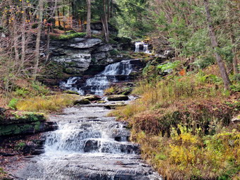
![]()
![]()
![]()
![]()
![]() On Friday, October 28th I wanted to get out for hike after a week of ambulance calls and rain! I took a chance and asked Cindy if she would like to hike and she, to my surprise, agreed. We decided to hike the Parksville Rail Trail from Parksville toward Livingston Manor. We started to get ready just before 11:30 AM with the temperature at 56 degrees on the back porch. I got dressed in my White Sierra light crew top with a short-sleeved baselayer. I wore my Railriders hiking pants which are expensive but last along time and have features like deep pockets and a generous cut which I really like. The pants have Velcro closures at the ankles. I decided to put on my Keen Durand hiking boots which fit well and are newer than what I have been wearing. I added a new pair of Xstance insoles in an effort to find the best support and cushioning for my feet. These insoles have shock absorbing gel pads, TPU arch support, and memory foam cushioning all wrapped in a breathable fabric. The insoles have been hyped by their manufacturer and they really do seem to deliver. I decided to take my Leki poles with external locks as the internal twist locks sometimes fail. I put on a blaze orange hat for warmth and because various hunting seasons or in progress. I did don my Mammut hoody as it has enough zippers to dump heat if needed. At 11:45 AM we put our gear in the car and Sheila in the back seat. I headed out Old Route 17 across the Flats and then took Old Route 17 and Service Road to the point where they meet Fox Mountain Road. Just after this intersection is the western parking area for the rail trail. The parking lot was empty as I put Sheila on her leash for the short road walk to the beginning of the trail.
On Friday, October 28th I wanted to get out for hike after a week of ambulance calls and rain! I took a chance and asked Cindy if she would like to hike and she, to my surprise, agreed. We decided to hike the Parksville Rail Trail from Parksville toward Livingston Manor. We started to get ready just before 11:30 AM with the temperature at 56 degrees on the back porch. I got dressed in my White Sierra light crew top with a short-sleeved baselayer. I wore my Railriders hiking pants which are expensive but last along time and have features like deep pockets and a generous cut which I really like. The pants have Velcro closures at the ankles. I decided to put on my Keen Durand hiking boots which fit well and are newer than what I have been wearing. I added a new pair of Xstance insoles in an effort to find the best support and cushioning for my feet. These insoles have shock absorbing gel pads, TPU arch support, and memory foam cushioning all wrapped in a breathable fabric. The insoles have been hyped by their manufacturer and they really do seem to deliver. I decided to take my Leki poles with external locks as the internal twist locks sometimes fail. I put on a blaze orange hat for warmth and because various hunting seasons or in progress. I did don my Mammut hoody as it has enough zippers to dump heat if needed. At 11:45 AM we put our gear in the car and Sheila in the back seat. I headed out Old Route 17 across the Flats and then took Old Route 17 and Service Road to the point where they meet Fox Mountain Road. Just after this intersection is the western parking area for the rail trail. The parking lot was empty as I put Sheila on her leash for the short road walk to the beginning of the trail.
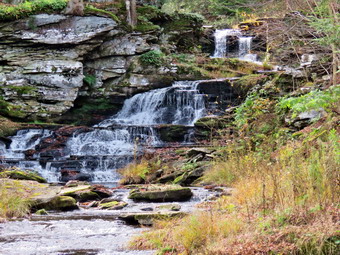 I set my GPS and we started out at 12:00 PM with the temperature right at 58 degrees. A slight breeze was blowing but the skies were bright and sunny. We walked under the Quickway on Fox Mountain Road and crossed the bridge over a stream. We stepped over the guard rail where I saw a definite trail on the right. Almost immediately we came what was left of the trestle supports that carried the trail tracks over the stream. I noticed what remained of a painting on the trestle. I had seen this painting before but had not realized it was a memorial to NASCAR driver Davey Allison #28 who drove the Texaco-Havoline Ford car. Allison died in a helicopter crash in 1993. We walked up the trail to the top of the trestle. As we entered the shade of the trees, it immediately seemed a little cooler but not cold. I was surprised to find that the trail was well defined and stretched ahead for some distance. Like most rail trails it was very straight. Town of Liberty Supervisor Frank DeMayo had told me that this was state land and the town had an agreement from the state to use it during the summer. The hope is to connect the Parksville Rail Trail to all the sections that stretch as far as Livingston Manor. We started to walk along the trail and I noticed there was quite a bit of traffic on the Quickway! The land dropped off steeply to the Little Beaverkill on the right. On the left were some "cliffs" which were the result of the railroad cutting a path for the tracks. We continued to walk along the well-defined trail. It was a pleasant walk without many insects. In one spot a large tree had come down and taken others with it. The trail was completely blocked but we found a way around by following Sheila. I though about coming back to cut the tree even though the trail is not official. There were two places along the trail where there were piles of garbage. It was hard to determine why they were there. Both piles had tarps over them which seemed to indicate someone once valued the items. A VW bug was just over the bank on the right after the first pile of debris. We soon came to a gate on the trail which was odd since it was state land. No one seems to know why the gate is there or who placed it. We walked around the gate and continued on the trail. There was a path to the left just after the gate. It looked interesting but we stayed on the rail trail.
 Soon we came to a small pond on the right with a red building behind it. The building looked to be in good shape but the windows were all boarded up. There was a definite oath between the pond on the right and the wetlands on the left of the trail. It looked like a beaver trail to me but I could not see any dam, lodge, or even any trees that the beavers had cut. We continued to walk and I spotted some trees that the beavers had felled. There was also an area where the water seemed to be backing up but we did not see the dam. After hiking about 1.3 miles, we came to a driveway on the left which leads to the Sonoma Falls property. I knew this was private land but two town supervisors had said it was alright to visit it. Cindy and I had visited in June which was the first time we had been there in more than 12 years. At one time there was a campground on the property. Some local business people bought the property and built a cider mill and market. They took the time to construct some hiking trails along the stream. I remember that the falls were very nice with at least five separate drops which increased in height the farther upstream one ventured. The business closed when not enough people would go out of their way to visit. We walked to the stream just behind the building and I got my first look at the falls. They had not changed much! There was a falls right in front and one visible farther upstream. I started taking the first of what would be a large number of pictures. I perched on some rocks and got a nice shot of three sets if falls. It was easier to see the falls with the leaves off the trees. In addition, the leaves added colorful accents to the pictures. We walked the trail up to the second falls but it was hard to get a clear shot. Getting down to the base of the falls looked a little dangerous but I found a way down and was glad I did! I got some very nice shots from the base of the falls before working my way back up to the trail. There are several areas where there is laid up stone which made me think there had been mills along the stream at some point. We walked a little farther upstream to the third set of falls and I worked my way down to the stream bed. I was able to get some good shots head on at the falls. After taking some more shots, Sheila and I walked back up the bank to where Cindy was standing. My wife does not like getting too close to the edge of the streams and prefers to admire from a safer distance. We continue to walk and came to a small pond at the base of the highest falls so far. I took some wide angle shots and some that were zoomed in. The sun was beginning to work its way into the pictures and trying to adjust for this was challenging. I wanted to get some shots of the upper falls so we walked up the path a short way. This time Cindy decided to come along so we continued up a steep hill to a point across from the upper falls.
 I took some shots and then climbed on a rock to get a better view. I got some nice shots but began to feel a little off balance so I climbed down quickly. Cindy did not want to climb the steep hill so we started back down. I found a way down to the base of the falls. I worked my way down to the stream bed followed by Shiela. I again got some very nice pictures of the falls from several angles and zoom. I also took a few shots downstream. I walked back the bank to Cindy and we began the walk back the way we had come. Just after we passed the little pond, there was a road to the right that seemed to go up the hill and I thought I remembered it from visits long ago. We turned right and followed the road to a junction with another woods road. There was a sign with colored markers in red, yellow, and blue indicating the different trails. We turned right as I wanted to get to the top of Te last falls. A short walk brought us to the top of the falls where there was a bridge across the stream! Beyond this was a small pond with a dam but it was marked with "No Trespassing" signs. We walked to the top of the last falls and I got out my camera to take pictures from the edge of the high bank. Sheila likes to get right to the edge and look down which drives Cindy crazy. I took some pictures and the walked over to the wide, flat rocks that make ho the brink of the falls. I was careful as the rocks were wet and covered in moss. I took pictures of the brink of the falls and then some downstream. I decided to see if I could find a way down to the base of these falls. I stowed my camera and shouldered my pack as I knew I would need my poles to make it down and back up. I found a fairly easy way to get to the base of the falls which were not as high as they seemed from the top. I took some shots and the moved to get a different angle.
 When I had exhausted all the possible shots, I packed up and walked back to the top of the falls. I took a few more pictures of the falls and several of the bridge. I packed up and met Cindy on the bridge. We crossed to the other side of the stream hoping to find a trail down that side which led back to the rail trail. We followed some blue markers along a woods road until the road continued but the markers did not. We turned around and walked back to the bridge. We continued across the bridge and back to the sign at the trail junction. Instead of turning right to follow the trails back the way we had come, we continued straight ahead following yellow markers. The markers followed another woods road and were pretty clear until I looked ahead and could not see the anymore. This was right at the point where another woods road turned left and also where I could find yellow markers. The yellow markers continued for a short distance down the hill until the woods road ended at another woods road. We had the choice of going left or right. I knew that turning left would take us back to the cider mill. I decided to turn right as I thought it might lead out to the rail trail. It wasn't very long before I found out that I was right as the path led to the rail trail at the point near the gate. This was the trail I had thought about exploring earlier. We turned right on the rail trail and began a fast-paced walk back to the car. Our only obstacle was the large blowdown which really did not slow us down. We were back at the car at 2:15 PM having hiked 3.5 miles in 2 hours and 15 minutes with 35 minutes of stopped time. The ascent was 330 feet almost all of which was the climb to the waterfalls. I do hope the plans to connect the sections of the rail trails is successful! I also hope that someone reopens Sonoma Falls as it is a beautiful setting.
![]()
![]()
![]()
![]()
![]() On Friday, October 21st, I wanted to get out for a longer hike after sticking to Round Top for several walks. I had an early morning ambulance call and slept in unit late morning. I did some work around the house and then decided to get ready and go. Rather than travel too far I decided to go to Frick Pond and hike the Flynn Trail where could hike some uphill miles. This would give me some choices of how far I wanted to hike and the route I would take. I also knew there were a few trees I could trim to make hiking easier while waiting for a sawyer to help me with the largest ones. As I started to get ready at 1:15 PM, the temperature on the back porch was 58 degrees. I put on my White Sierra long-sleeved crew top without a baselayer as it was fairly warm. I put on a pair of RailRiders hiking pants which are expensive but last along time and have features like deep pockets and a generous cut which I really like. I decided to put on my Keen Durand hiking boots which fit well and are newer than what I have been wearing. I added a new pair of Xstance insoles in an effort to find the best support and cushioning for my feet. These insoles have shock absorbing gel pads, TPU arch support, and memory foam cushioning all wrapped in a breathable fabric. The insoles have been hyped by their manufacturer and they really do seem to deliver. I decided to take my Leki poles with external locks as the internal twist locks sometimes fail. I put on a blaze orange hat for warmth and because various hunting seasons or in progress. I did don my Mammut hoody as it has enough zippers to dump heat if needed. I put my Silky Sugowaza saw in my pack as I can handle some pretty good sized branches and trunks with just this saw. I put my gear in the back and Sheila in the backseat and headed out the DeBruce Road at 1:30 PM. After 6 miles, at Mongaup Pond Road, I turned left and continued to follow the road bearing left onto Beech Mountain Road at the fork. When we arrived in the parking area there was one car parked in the larger lot but the small lot was empty. I pulled into the smaller lot with Sheila was acting as if she hadn't hiked in a month as she ran around and headed for the trail. The temperature was 55 degrees and the skies were blue with white clouds with a slight breeze blowing. I set my GPS as we got ready to head out on the Flynn Trail. We crossed the road and began our hike at 1:45 PM.
On Friday, October 21st, I wanted to get out for a longer hike after sticking to Round Top for several walks. I had an early morning ambulance call and slept in unit late morning. I did some work around the house and then decided to get ready and go. Rather than travel too far I decided to go to Frick Pond and hike the Flynn Trail where could hike some uphill miles. This would give me some choices of how far I wanted to hike and the route I would take. I also knew there were a few trees I could trim to make hiking easier while waiting for a sawyer to help me with the largest ones. As I started to get ready at 1:15 PM, the temperature on the back porch was 58 degrees. I put on my White Sierra long-sleeved crew top without a baselayer as it was fairly warm. I put on a pair of RailRiders hiking pants which are expensive but last along time and have features like deep pockets and a generous cut which I really like. I decided to put on my Keen Durand hiking boots which fit well and are newer than what I have been wearing. I added a new pair of Xstance insoles in an effort to find the best support and cushioning for my feet. These insoles have shock absorbing gel pads, TPU arch support, and memory foam cushioning all wrapped in a breathable fabric. The insoles have been hyped by their manufacturer and they really do seem to deliver. I decided to take my Leki poles with external locks as the internal twist locks sometimes fail. I put on a blaze orange hat for warmth and because various hunting seasons or in progress. I did don my Mammut hoody as it has enough zippers to dump heat if needed. I put my Silky Sugowaza saw in my pack as I can handle some pretty good sized branches and trunks with just this saw. I put my gear in the back and Sheila in the backseat and headed out the DeBruce Road at 1:30 PM. After 6 miles, at Mongaup Pond Road, I turned left and continued to follow the road bearing left onto Beech Mountain Road at the fork. When we arrived in the parking area there was one car parked in the larger lot but the small lot was empty. I pulled into the smaller lot with Sheila was acting as if she hadn't hiked in a month as she ran around and headed for the trail. The temperature was 55 degrees and the skies were blue with white clouds with a slight breeze blowing. I set my GPS as we got ready to head out on the Flynn Trail. We crossed the road and began our hike at 1:45 PM.
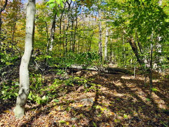 The Flynn Trail is sited along what used to be Beech Mountain Road which was the access for the Beech Mountain Boy Scout Camp. We walked the trail through the woods which was damp and even muddy in places. I immediately noticed that although my Achilles tendons were still aching with every step I was keeping up a good pace. After a short walk we came to the first blowdown that I knew was present. The problem was that a large tree had fallen across the trail and its 2 foot diameter was more than I could handle, at least on this day. The other trees that had been brought down were encroaching on Te trail or hanging over it. All in all I could have just left well enough alone but I really wanted to cut some and clean up the area. I took some "before" pictures and then got to work. I cut a few small live trees that were bocking part of the trail and then turned my attention to the branches of a larger tree. Most of the branches were pretty small and the cutting went quickly. I cut a few branches and then moved them before repeating the process. I was almost dome but noticed a branch hanging down in to the trail. When I tried to remove it, I could not as it was hung up above my head on a tree arched across the trail. I looked at the situation and decided the two trunks that were bent over the trail needed to go. The first was about 6 inches in diameter but it was bent and I did not know what forces would conspire to pinch my saw or throw a branch in my direction. I made some cuts and soon the trunk came down without too much fuss. I pulled on it a little and the rest came crashing down. I cut it up into pieces and hauled it away before starting on the smaller tree. The smaller tree went very quickly and I just needed to clean up a few loose branches. I took some "after" shots including some with Sheila and then packed the camera to move on. I noticed that I was tired after doing the work which felt good!
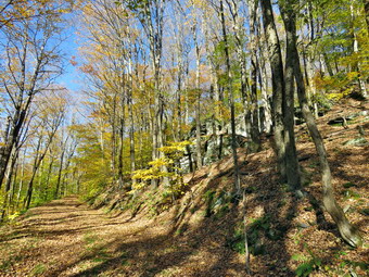 We turned right on the woods road and continued to set a good pace up the hill. The trail gains a little over 600 feet in 1.7 miles to the highest point at the junction with the Big Rock Trail. We passed the hemlock that used to form a tunnel but was recently cleared by the DEC. I began to find some small branches on the trail which I removed. I was surprised that there were no large branches or trees across the trail. At .35 miles I was no longer surprised as we came to two small trunks across the trail. I took pictures and then spent a moment looking at what I was going to cut. I got out my saw and quickly cut off a few small branches and cleared the. I cut the larger trunk and dragged away the top. I cut the smaller trunk and cleared it from the trail. I went back to the larger trunk and cut it twice which allowed by to drag away the middle section and flip the larger one off the trail. I took some shots of my work with Sheila's help and then continued on the trail. As we approached and the clearing to the right of the trail, I stopped to take some pictures of the rock ledges on the right side of the trail. It was a beautiful day and the sun was shining in the rocks and the trail. Most of the leaves were down on the ground but there were still enough on the trees to make them beautiful. I noticed that I was very relaxed and decided it was partly due to the sound of the leaves under foot. I thought about visiting the clearing but decided I wanted to stay on the main trail. We kept walking uphill and we were soon at the junction with the Big Rock Trail. We turned left to walk down the Big Rock Trail. The trail continued to be damp and just slightly muddy in places. The hike down the trail went well and more quickly than I expected. It was definitely easier than the uphill hike. This trail can be tricky as there are several levels that make it seem like the bottom of the hill.
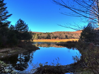 We were soon at Times Square and I thought about turning right to hike up and around the Logger's Loop to add some distance to our hike. I decided against this as it was getting late and we continued our hike by walking straight across Times Square to stay on the Big Rock Trail. This trail can be very wet but on this day it was damp with a few muddy spots under the leaves. There was a very large blowdown across the trail which might require a chainsaw. I looked to see if I could trim anything to make getting over or around it easier but didn't see anything that would help. I did take some pictures before moving on. We crossed the two small bridges over the inlets to the pond and this time I decided not to stop to take pictures. The water under the first bridge was backed up from the wetlands. The area under the second bridge was almost completely dry as was the area upstream of the bridge. The sun was still out but slowly sinking giving a warm feeling to the setting. When we got to the area that was covered by tall evergreens, I pushed on through as I had taken pictures here very recently. The wooden boardwalks continue to show wear with many boards loose and other beginning to rot. Much of the boardwalk now "floats" in midair as the supports are rotting. The rest of the trail was damp with several wet and muddy spots. At the next trail junction we turned left on the Quick Lake Trail to head for the bridge across the outlet of Frick Pond. We walked along the west side of Frick Pond to the bridge across the outlet of the pond. The mudhole was wet and muddy but the drainage work and the stepping stones did their job. I stopped at the bridge for a minute and took a few more photographs before we walked up the hill toward Gravestone Junction. We continued to Gravestone Junction and passed the Lobdell memorial marker. The marker is a memorial to two children who died in the 1930's in a fire that consumed their cabin. The trail to the memorial was well-worn but the marker was standing intact. The trail back to the register was wet and muddy in spots. We passed the trail register heading toward the parking area. We continued straight ahead to follow the woods road out to the car in the small lot. We arrived at the car at 4:45 PM having hiked 3.9 miles in 3 hours with an elevation gain of 690 feet. We had stopped to do maintenance for 1 hours and 5 minutes.
![]()
![]()
![]()
![]() On Thursday, October 20th I had planned to go out for a longer hike but and ambulance call interrupted those plans. By the time I finished the call I was not sure I even wanted to go out. At around 1:45 PM I decided I would go over to Round Top to begin to cut a large blowdown that had fallen and was blocking the trail. I started to get ready with Sheila watching expectantly. It was 55 degrees on the back porch and a breeze was blowing slightly so I decided to dress a little warmer. I decided to put on my White Sierra long-sleeved wicking shirt without a baselayer. I wore my Railriders hiking pants which are expensive but last along time and have features like deep pockets and a generous cut which I really like. The pants have Velcro closures at the ankles. I decided to put on my Keen Durand hiking boots which fit well and are newer than what I have been wearing. I added a new pair of Xstance insoles in an effort to find the best support and cushioning for my feet. These insoles have shock absorbing gel pads, TPU arch support, and memory foam cushioning all wrapped in a breathable fabric. The insoles have been hyped by their manufacturer and they have lived up to that hype. I decided not to take my hiking poles as I would be carrying saws and axes. I skipped wearing a hat as I knew I would be warm from the work. I did don my Mammut hoody as it has enough zippers to dump heat if needed. I put my Silky Sugowaza and Silky Katanaboy saws in my pack mad added two plastic felling wedges. I also brought along my Fiskars pack ax and Council Tools American felling ax. At 2:00 PM we walked out the door to start the hike. I put all my gear in the back of the car and Sheila in the back seat. I drove across the street and up through the cemetery to the trailhead. I parked off the side of the road and shouldered my pack. I grabbed the two axes and we started out on the trail.
On Thursday, October 20th I had planned to go out for a longer hike but and ambulance call interrupted those plans. By the time I finished the call I was not sure I even wanted to go out. At around 1:45 PM I decided I would go over to Round Top to begin to cut a large blowdown that had fallen and was blocking the trail. I started to get ready with Sheila watching expectantly. It was 55 degrees on the back porch and a breeze was blowing slightly so I decided to dress a little warmer. I decided to put on my White Sierra long-sleeved wicking shirt without a baselayer. I wore my Railriders hiking pants which are expensive but last along time and have features like deep pockets and a generous cut which I really like. The pants have Velcro closures at the ankles. I decided to put on my Keen Durand hiking boots which fit well and are newer than what I have been wearing. I added a new pair of Xstance insoles in an effort to find the best support and cushioning for my feet. These insoles have shock absorbing gel pads, TPU arch support, and memory foam cushioning all wrapped in a breathable fabric. The insoles have been hyped by their manufacturer and they have lived up to that hype. I decided not to take my hiking poles as I would be carrying saws and axes. I skipped wearing a hat as I knew I would be warm from the work. I did don my Mammut hoody as it has enough zippers to dump heat if needed. I put my Silky Sugowaza and Silky Katanaboy saws in my pack mad added two plastic felling wedges. I also brought along my Fiskars pack ax and Council Tools American felling ax. At 2:00 PM we walked out the door to start the hike. I put all my gear in the back of the car and Sheila in the back seat. I drove across the street and up through the cemetery to the trailhead. I parked off the side of the road and shouldered my pack. I grabbed the two axes and we started out on the trail.
The trailhead was damp in a few spots from some rain and that continued as we entered the woods. There was also a thick layer of leaves on the ground. Just before the first trail junction, we came to a large tree across the trail. I put down my pack and got out the camera to take a few "before" pictures. I put the camera away and began to inspect the tree trunk. At the base of the trunk I found some marks from an ax and a substantial saw kerf. I thought about extending these cuts but decided to make a cut off the trail on the other side. I started a wide cut by using the Council Tools ax. The ax is a heavy felling ax and takes some skill to use it. After some time I got a pretty deep cut and switched to the lighter Fiskars ax which gives me a better bite. The wood was dry and pretty hard but I made good progress. My cell phone rang and I found out that a family commitment had come up and I would have to suspend my activities. I did get out my Katanaboy saw and started a cut through the trunk. I finished the cut with the Silky Sugowaza. I took a few shots and then packed up all my tools so that I could return home. I knew there was still a lot of work to do and wondered if it would be better to arrange for someone to help clear the trunk with a chainsaw. We walked back out to the trailhead where I put the gear in the car. I drove home arriving at 3:15 PM.
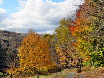
![]()
![]()
![]()
![]()
![]() On Tuesday, October 18th I had planned to go out for a longer hike after three days off due to other commitments and heavy rain on Monday. When I woke up at 6:30 AM but shortly after the ambulance pager sounded and I was off on a call in Liberty. I finished the call and the documentation and went home. At around 1:30 PM I decided I would go over to Round Top to hike and take some pictures of the leaves which were passed peak colors. The wind and rain had brought many leaves down but some were still clinging to the trees. I also wanted to make sure the wind had not brought down any trees or branches. I started to get ready with Sheila watching expectantly. It was 52 degrees on the back porch and the wind was blowing slight so I decided to dress a little warmer than I had been. I decided to put on my White Sierra long-sleeved wicking shirt without a baselayer. I wore my Railriders hiking pants which are expensive but last along time and have features like deep pockets and a generous cut which I really like. The pants have Velcro closures at the ankles. I decided to put on my Keen Durand hiking boots which fit well and are newer than what I have been wearing. I added a new pair of Xstance insoles in an effort to find the best support and cushioning for my feet. These insoles have shock absorbing gel pads, TPU arch support, and memory foam cushioning all wrapped in a breathable fabric. The insoles have been hyped by their manufacturer and I wondered if they would live up to that hype. I decided to take my Leki poles with external locks as the internal twist locks sometimes fail. I skipped wearing a hat as there was no sun and I feel more comfortable without one. I did don my Mammut hoody as it has enough zippers to dump heat if needed. I took my pack as it is teaser way to carry my camera. At 2:00 PM we walked out the door to start the hike. I looked around and saw that the sky was blue over Round Top with a many puffy white clouds. I grabbed Sheila's leash from the car and we walked up the driveway. We walked across the street and behind the Presbyterian Church.
On Tuesday, October 18th I had planned to go out for a longer hike after three days off due to other commitments and heavy rain on Monday. When I woke up at 6:30 AM but shortly after the ambulance pager sounded and I was off on a call in Liberty. I finished the call and the documentation and went home. At around 1:30 PM I decided I would go over to Round Top to hike and take some pictures of the leaves which were passed peak colors. The wind and rain had brought many leaves down but some were still clinging to the trees. I also wanted to make sure the wind had not brought down any trees or branches. I started to get ready with Sheila watching expectantly. It was 52 degrees on the back porch and the wind was blowing slight so I decided to dress a little warmer than I had been. I decided to put on my White Sierra long-sleeved wicking shirt without a baselayer. I wore my Railriders hiking pants which are expensive but last along time and have features like deep pockets and a generous cut which I really like. The pants have Velcro closures at the ankles. I decided to put on my Keen Durand hiking boots which fit well and are newer than what I have been wearing. I added a new pair of Xstance insoles in an effort to find the best support and cushioning for my feet. These insoles have shock absorbing gel pads, TPU arch support, and memory foam cushioning all wrapped in a breathable fabric. The insoles have been hyped by their manufacturer and I wondered if they would live up to that hype. I decided to take my Leki poles with external locks as the internal twist locks sometimes fail. I skipped wearing a hat as there was no sun and I feel more comfortable without one. I did don my Mammut hoody as it has enough zippers to dump heat if needed. I took my pack as it is teaser way to carry my camera. At 2:00 PM we walked out the door to start the hike. I looked around and saw that the sky was blue over Round Top with a many puffy white clouds. I grabbed Sheila's leash from the car and we walked up the driveway. We walked across the street and behind the Presbyterian Church.
 We began the ascent of the steepest hill behind the church and continued directly up the hill to the trailhead. The hill is short but gets the circulation pumping and is the steepest and longest climb on the "trail." My goal was to make it all the way up the hill without stopping. At the top of the hill we stopped for minute so that I could observe the skies and hills all around us. I took a number of pictures of the clouds and the trees even though the colors were muted and many leaves were on the ground. We turned left and entered the woods to begin our hike. The trailhead was damp in a few spots from some rain and that continued as we entered the woods. There was also a thick layer of leaves on the ground. Just before the first trail junction, I was surprised to find a large tree across the trail. The tree had not been there on my last trip. It was almost 2 feet in diameter and would have to be cut several times to move it off the trail. I began to think about who I could call that had a chainsaw! At the first trail junction, I followed Sheila as she continued straight ahead up the hill toward the lookout. Near the top of the trail we turned left on an informal path that leads to the rock shelf that is the lower lookout. I put down my pack and got out the camera to take pictures. The view was better than it had been as many of the leaves were off the trees. I took pictures of the school and town. I also got some shots of the hills around town. I took some shots of Sheila as she posed on the upper part of the lookout. I climbed to the upper lookout to take a look and then continued on the yellow trail. We followed the yellow trail as it headed uphill through the fern glade. The drought had contributed to many of the ferns dying and most were now brown and shriveled. The woods attested to the fact that fall was in full swing as leaves were falling from the trees or already were lying in the ground. We passed the "sitting rock" and continued on the yellow trail to the first junction with the blue trail. At the junction we turned right and walked the yellow trail along the base of Round Top to the next junction with the blue trail. The trail was still clear of brush but I thought about giving it another trim before winter. We turned left on the blue trail and started up the hill. We bypassed the white crossover trail and continued on the blue trail across the summit of Round Top. As we began down the other side, we again bypassed the white crossover trail. We immediately turned left on the switchback in the blue trail and followed it out and then back to the main trail. We turned left and followed the blue trail to the yellow trail. We again walked on the yellow trail to the junction with the blue trail.
This time we turned right and walked down the yellow trail to the woods road. We walked along the woods road toward the first trail junction. Just before the first trail junction, I looked at the remains of the large blowdown I had cut and removed from the trail. Just passed this were the remains of a smaller blowdown I had cut up. This tree had hung over the trail for months but finally came down in the wind. We turned around at the first trail junction and started back up the woods road. We turned left when the yellow trail started up toward the first junction with the blue trail. We turned left and walked the yellow trail to the next junction with the blue trail. At the next trail junction we turned right on the blue trail and started up the hill. We turned right on the switchback and walked out into the rest and then back to the blue trail. We turned right on the blue trail and then right again on the white crossover trail. I wanted to make sure I hiked all the trails to inspect for any blowdowns. We continued on the white trail until it met the blue trail where we turned right. We continued on the blue trail to the junction with the yellow trail. At the junction with the yellow trail we turned right and again walked along the base of Round Top to the next junction with the blue trail. This time we turned left and continued on the yellow trail through the ferns and passed the "Sitting Rock" to the viewpoint. At the viewpoint we turned left and walked down the steep trail to the first trail junction. This time we continued out to the trailhead. At the trailhead we turned right and walked down the hill to the church parking lot. We crossed the parking lot and Rock Avenue to get to our driveway. When we arrived home, it was 3:15 PM and we had hiked a little more than 2 miles in an hour and 15 minutes.
![]()
![]()
![]()
![]()
![]() On Friday, October 14th I wanted to get out for an easy hike so that my wife Cindy could go along and so that I could nurse my aching heels and Achilles tendons. Around 11:15 AM I asked Cindy if she would like to hike the Parksville Rail Trail and she agreed. The walk is less than 3 miles round trip and almost completely flat. It does have a few limited views and a nice waterfall. I was anxious to see what impact the recent rains had on the volume of the Little Beaverkill and the waterfalls. It was 54 degrees when we started to get ready and the skies were bright blue with some wispy clouds. The forecast had called for sunny skies and no chance of rain! Sheila's expectant gaze and sharp bark "encouraged" me to continue the hiking plans. It was relatively warm and I did not know whether to expect any water or mud on the trail so I dressed accordingly. I put on my White Sierra long-sleeved crew top with a short-sleeved baselayer. I put on a pair of RailRiders hiking pants which are expensive but last a long time and have features like deep pockets and a generous cut which I really like. I decided to put on my Keen Durand hiking boots which fit well and are newer than what I have been wearing. I added a new pair of Xstance insoles in an effort to find the best support and cushioning for my feet. These insoles have shock absorbing gel pads, TPU arch support, and memory foam cushioning all wrapped in a breathable fabric. The insoles have been hyped by their manufacturer and I wondered if they would live up to that hype. I decided to take my Leki poles with external locks as the internal twist locks sometimes fail. I skipped wearing a hat as there was no sun and I feel more comfortable without one. At 11:35 AM we put our gear in the car and Sheila in the back seat. I headed out Old Route 17 across the Flats and then took Old Route 17 and Service Road to the point where they meet Fox Mountain Road. Just after this intersection is the western parking area for the rail trail. Just as we were pulling into the parking area, my ambulance pager sounded and we headed back to Livingston Manor. Sheila was very disappointed! We finished the ambulance call and the documentation. I called Cindy from the building as she picked me up. I drive pack to the parking area so that we could complete our plans to hike.
On Friday, October 14th I wanted to get out for an easy hike so that my wife Cindy could go along and so that I could nurse my aching heels and Achilles tendons. Around 11:15 AM I asked Cindy if she would like to hike the Parksville Rail Trail and she agreed. The walk is less than 3 miles round trip and almost completely flat. It does have a few limited views and a nice waterfall. I was anxious to see what impact the recent rains had on the volume of the Little Beaverkill and the waterfalls. It was 54 degrees when we started to get ready and the skies were bright blue with some wispy clouds. The forecast had called for sunny skies and no chance of rain! Sheila's expectant gaze and sharp bark "encouraged" me to continue the hiking plans. It was relatively warm and I did not know whether to expect any water or mud on the trail so I dressed accordingly. I put on my White Sierra long-sleeved crew top with a short-sleeved baselayer. I put on a pair of RailRiders hiking pants which are expensive but last a long time and have features like deep pockets and a generous cut which I really like. I decided to put on my Keen Durand hiking boots which fit well and are newer than what I have been wearing. I added a new pair of Xstance insoles in an effort to find the best support and cushioning for my feet. These insoles have shock absorbing gel pads, TPU arch support, and memory foam cushioning all wrapped in a breathable fabric. The insoles have been hyped by their manufacturer and I wondered if they would live up to that hype. I decided to take my Leki poles with external locks as the internal twist locks sometimes fail. I skipped wearing a hat as there was no sun and I feel more comfortable without one. At 11:35 AM we put our gear in the car and Sheila in the back seat. I headed out Old Route 17 across the Flats and then took Old Route 17 and Service Road to the point where they meet Fox Mountain Road. Just after this intersection is the western parking area for the rail trail. Just as we were pulling into the parking area, my ambulance pager sounded and we headed back to Livingston Manor. Sheila was very disappointed! We finished the ambulance call and the documentation. I called Cindy from the building as she picked me up. I drive pack to the parking area so that we could complete our plans to hike.
 There were still no cars in the parking lot. We had thought we might do the longer hike toward Livingston Manor but decided to hike toward Parksville so that we could see the falls. I did not bring my GPS unit as we had hiked the trail so many times before. We quickly got ready to hike leaving the trailhead at 2:05 PM. The open trail just before the woods had quite a few branches hanging into the trail. It is not clear who is responsible for clearing the trail but the job is not being done. I stopped to take a picture of the trail as it entered the woods. Usually as we enter the shade of the trees, it seems a little cooler but on this day I did not notice much change. One look down to the Little Beaverkill showed the stream volume was much higher than during our last visit due to the rains the night before. I wondered if the falls would be roaring or just at average volume. Sheila was taking her own route and following her nose. Just after entering the woods we came to an area which is normally muddy but this area was only slightly damp. This was misleading as most of the rest of the trail was wet with some muddy spots. The few muddy areas we would find on the trail were easily avoided. We were soon at the wooden walkways where I stopped, put my pack down and took out the camera. I took some shots of the stream below with the blue skies in the background. I wished that there were some nice clouds but the sky was pretty flat. I put away the camera and picked up my pack to continue over the walkways. The wooden surface was covered in leaves which were damp making the footing slippery. The problem is that a rock slide has blocked the culvert under the small bridge causing water, mud and stones to be diverted over the walkway. Unblocking the culvert and covering the walkways with some screening would help. On this day the water had been diverted to the Parksville side of the bridge. We continued on the trail and found a few blowdowns that should be cleared. Some areas of the trail also had brush that needed trimming. Other areas of the trail had large branches and blowdowns that should be removed for aesthetic reasons. As we approached the falls, we could hear the sound of the falls roaring.
 When we arrived at the falls, there did seem to be a much greater volume than in recent visits. I took a few shots from above the falls as the view was clear. I decided to go down to the streambed so that I could take pictures from in front of the falls. I had to be careful as the path down the bank was wet and covered in leaves. On previous trips this summer I was able to walk out onto rocks that were usually covered with water. On this trip these rocks were covered with water leaving a small strip of dry land along the edge of the stream. I took some shots down stream and a few of Sheila posing in front of the falls. She does a good job of posing even when she is distracted by Cindy above on the bank. I then the turned my attention to the falls. I took numerous pictures of the area in front of falls and the falls themselves. The water was roiled and rolling over the rocks which were barely visible underneath the waves. When I was done, we worked our way back up the bank. We continued on the trail to a bench where a path leads down to the stream. I left my pack on the bench and we began to walk along a path at the edge of the stream. We didn't get very far as that path was now underwater. I stopped and took pictures downstream toward the falls and then upstream. I also took some pictures of the stream in front of me where the water was rolling over some rocks. I repositioned myself and took some more pictures downstream toward the falls. I finished and walked back to the bench to stow the camera. I noticed that the rocks someone had piled across the stream to form a sort of dam had disappeared with the increased volume. People just can't seem to leave nature natural but nature sometimes can recover. The trail continued to be wet and a little muddy in places but we managed to walk around them. From the falls to the other end of the trail there were a few wet areas and some mud. We set a quick pace for the rest of the hike toward the Parksville end of the trail. We continued to the Parksville end of the trail. Just after the gate at that end, we stopped to read the sign which outlined the milk that the O&W transported. The sign also mentioned the large number of hotels that had been in the area. We turned around and headed back to the car. I knew I would not be taking any more pictures and we set a rapid return pace. Cindy and I continued back to the car meeting only one walker coming toward us talking on her cell phone. We were back at the car at 3:35 PM after hiking 2.8 miles in 1 hour and 30 minutes including the stopped time for pictures. There is virtually no elevation gain on the hike except the short trips down to the streambed.
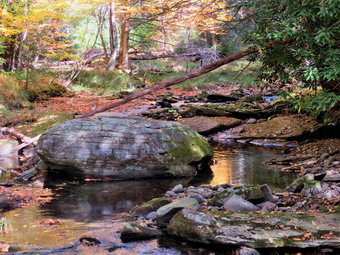
![]()
![]() On Wednesday, October 12thI had gotten a view of some fall colors from the Red hill Fire Tower and I wanted more! I decided to try Giant Ledge as it was the middle of the week and I thought there might not be the crowd that had plagued the area over the weekend. Unfortunately, I had an ambulance call in the middle of the night and slept in later than I had anticipated. By the time I started to get ready at 11:15 AM the temperature was 60 degrees. Sheila was well behaved but it was clear she was ready to go. I put on my White Sierra long-sleeved crew top and a short-sleeved baselayer. I wore a pair of RailRiders hiking pants which are expensive but last along time and have features like deep pockets and a generous cut which I really like. The pants have Velcro closures at the ankles I decided to put on my Keen Durand hiking boots which fit well and are newer than what I have been wearing. I added a new pair of Xstance insoles in an effort to find the best support and cushioning for my feet. These insoles have shock absorbing gel pads, TPU arch support, and memory foam cushioning all wrapped in a breathable fabric. The insoles have been hyped by their manufacturer and I wondered if they would live up to that hype. I decided to take my Leki poles with external locks as the internal twist locks fail. I also took a bright orange hat more for visibility than for the warmth. I also packed a light pair of gloves which I knew I would probably not use. I donned my Mammut hoody which has enough zippers to allow me to dump heat when I need to. I got my gear and Sheila in my car and left Livingston Manor at 11:45 AM. The skies were blue with some nice white clouds and plenty of sun. I drove out the Debruce Road to Round Pond and then descended the hill to Route 47. I turned left toward Frost Valley and drove passed both the Biscuit Brook and Slide Mountain trailheads where there were only a few cars. I continued down the hill passing Winisook Lake. As I made the sweeping left turn, I found to my dismay that the parking areas was full and at least 30 cars were parked on both sides of the road below the parking area. I drove down the road and saw at least one spot where I could pull off the road and park. I decided against this for two reasons. I do not think parking along the road is a good idea and have made that clear on social media. I also did not want to hike with a crowd. I turned around and headed back the way I had come. I was tired and thought I might just go home but Sheila convinced me to go somewhere to hike.
On Wednesday, October 12thI had gotten a view of some fall colors from the Red hill Fire Tower and I wanted more! I decided to try Giant Ledge as it was the middle of the week and I thought there might not be the crowd that had plagued the area over the weekend. Unfortunately, I had an ambulance call in the middle of the night and slept in later than I had anticipated. By the time I started to get ready at 11:15 AM the temperature was 60 degrees. Sheila was well behaved but it was clear she was ready to go. I put on my White Sierra long-sleeved crew top and a short-sleeved baselayer. I wore a pair of RailRiders hiking pants which are expensive but last along time and have features like deep pockets and a generous cut which I really like. The pants have Velcro closures at the ankles I decided to put on my Keen Durand hiking boots which fit well and are newer than what I have been wearing. I added a new pair of Xstance insoles in an effort to find the best support and cushioning for my feet. These insoles have shock absorbing gel pads, TPU arch support, and memory foam cushioning all wrapped in a breathable fabric. The insoles have been hyped by their manufacturer and I wondered if they would live up to that hype. I decided to take my Leki poles with external locks as the internal twist locks fail. I also took a bright orange hat more for visibility than for the warmth. I also packed a light pair of gloves which I knew I would probably not use. I donned my Mammut hoody which has enough zippers to allow me to dump heat when I need to. I got my gear and Sheila in my car and left Livingston Manor at 11:45 AM. The skies were blue with some nice white clouds and plenty of sun. I drove out the Debruce Road to Round Pond and then descended the hill to Route 47. I turned left toward Frost Valley and drove passed both the Biscuit Brook and Slide Mountain trailheads where there were only a few cars. I continued down the hill passing Winisook Lake. As I made the sweeping left turn, I found to my dismay that the parking areas was full and at least 30 cars were parked on both sides of the road below the parking area. I drove down the road and saw at least one spot where I could pull off the road and park. I decided against this for two reasons. I do not think parking along the road is a good idea and have made that clear on social media. I also did not want to hike with a crowd. I turned around and headed back the way I had come. I was tired and thought I might just go home but Sheila convinced me to go somewhere to hike.
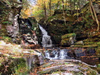 My "Plan B" was to go to Angel Falls on Trout Creek above the Rondout Reservoir. There are three different falls and an old mill that bake the area wry interesting and I seldom see anyone else hiking there. I continued on Route 47 passed Pole Road to the intersection with Claryville Road where I turned right. I drove to the end of Claryville road where it meets Route 55. I passed through Grahamsville and turned left onto Route 55A just after the Tri-Valley school and toward Sundown. I followed Rt 55A as it turned right and crossed the Rondout Reservoir. I drove to Yagerville Road where I turned left and drove another 1.2 miles to Sholam Road. I missed the turn the first time as the road is not maintained and covered in leaves. I turned around and easily found it the second time although the road sign is missing. I turned left and drove to where the road dead ends. I parked at the end of the road at 1:15 PM and got ready to hike. I set my GPS and we started off almost immediately down what used to be Sholam Road. The road is very eroded but makes a good trail which is why I was surprised to see the sign. The sign posted by the DEP stated that the road was seasonal use only and was not maintained. I found this funny since no one would think that this "road" was fit for any vehicle except for a four wheeler! I decided to wear my Mammut hoody as there was a slight breeze blowing with the temperature at 64 degrees. I was pleased that I could hear a roar coming from the falls apparently indicating that despite the drought that had plagued the area all summer the falls were still flowing. We walked along the road which was barely damp. We passed the top of the falls and continued upstream a little farther. I walked over to the side of the stream and out onto some rocks. The volume of the stream was very low and I was surprised at the noise coming from the falls with so little water. I took some pictures upstream and then walked downstream a little to take some more pictures. As I looked downstream, I could see that a bridge used to cross at this point. I wondered why I had never discovered this before in my many trips. I considered walking upstream a little more along the stream on what was left of the road but instead turned around and walked back to the top of the falls. At the top of the falls I turned left on a path that parallels Trout Creek. I looked down at the falls and saw that it was flowing but the volume was as low as I have ever seen it. Trout Creek is rather long extending around 5 miles from Balsam Swamp to the Rondout Reservoir. Over its course it picks up a few tributaries.
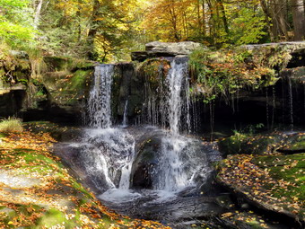 Sheila and I walked along the path which had a few wet spots but was nothing like I had seen before. I was looking for the way down to the stream bed and found the steep path heading to the left and down to the creek bed. I started down the path but which was wet and had some loose rocks. I always hike with poles and situations like this make me glad that I do! I was able to get down to the edge of the stream and since the water was low I could stand right in front of the falls. Sheila was leading the way and we ended up at some rocks near the base of the falls. The water was so low I could stand in places I had never been before. The bright sunlight made taking pictures difficult so I kept having to adjust my zoom and angle. I took a number of shots of the falls and some downstream. I even got a picture of Sheila in the cool water but the light was a problem. After finishing my photography, I packed up and headed back up the path to the main "trail". The trail isn't really maintained but sometimes the blowdowns are cut and cleared. On this day there were several blowdowns and some brush on the trail. We continued on the path heading toward the lower falls. I was happy that there was almost no broken glass around the area but there was some and I do not understand why. We walked to the top of the lower falls where I dropped my pack and got out the camera. I was able to walk to the brink of the falls to take pictures. I took shots upstream and over the brink of the falls. Again, the light was tricky but I tried my best to minimize the problem. I was able to walk downstream a little onto a rock shelf that is usually covered with water. I got some nice pictures from here and the returned to the path a large rock on the edge of the falls.
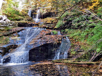 I worked my way down passed the large boulder and got a slightly different angle for pictures. I tried some settings to get the smooth effect on the water that some people like. I walked back up to my pack and the started down the path to the lowest falls. This area also has the ruins of an old mill and the ruins are quite large. I took some pictures of the foundations dotted with scattered leaves and then walked down to the streambed. There was a large tree trunk in the water which was partially blocking the falls but I was able to get some shots. After taking a few pictures, I carefully made my way downstream and saw a possible way to "rock hop" across the stream to the other side. I have always wanted to see the falls from the other side but could not find a way to access it. I decided to try and made it without much trouble. Sheila simply waded across the creek. Once we were on the other side, I still could not see any way to access the area which is surrounded by steep hillsides. I took a number of pictures from different zooms and angles to allow for the light. When I was done, I started back across the stream. I was unsure of one hop but found another and made it back without a problem. I walked up to the foundations and took some more pictures as the light where was better and I just didn't want to leave. We walked back up to my pack but before we left I noticed a large beech tree with four or five intertwined trunks. I took a few shots of this before packing up the camera and starting up the hill. We worked our way up a steep path back to Sholam Road and back to the car. It was 12:05 PM and we had hiked only .9 miles in about one hour with 200 feet of elevation gain. I decided I was happy with the outing and it was time to head home. I dove out Sholam Road and turned right on Yagerville Road to return a different way. As I was driving, I saw some of the best and brightest colors I had seen all season!
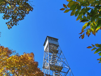
![]()
![]()
![]()
![]()
![]() On Tuesday, October 11th, I wanted to get out for a hike which was a little harder than I had been doing. I also wanted to get in some elevation gain to see the fall colors from above. I decided I would hike to the Red Hill fire tower from the newer trailhead on Denning Road. The trailhead on Dinch-Coons Road is difficult to access in the winter as the road is not cleared and it is equally difficult when it is muddy. Many people park at the top of the hill where there is limited parking. It is a half mile downhill to the trailhead parking lot. The return trip can be nearly impossible if there is ice, packed snow or mud on the road. The new trailhead and parking area is on Denning Road 1.7 miles from the Claryville Post Office. I asked Cindy if she wanted to go and she gave me a quick and emphatic "No". As I started to get ready at 11:00 AM I knew the trailhead and summit would be cooler but that hiking would warm me up. I began to get ready with Sheila keeping a close watch on my movements. The temperature was 48 degrees on the back porch with some sun but I knew it might be cooler at the trailhead. I put on my White Sierra long-sleeved crew top and a short-sleeved baselayer. I put on a pair of RailRiders hiking pants which are expensive but last along time and have features like deep pockets and a generous cut which I really like. The pants have Velcro closures at the ankles I decided to put on my Keen Durand hiking boots which fit well and are newer than what I have been wearing. I added a new pair of Xstance insoles in an effort to find the best support and cushioning for my feet. These insoles have shock absorbing gel pads, TPU arch support, and memory foam cushioning all wrapped in a breathable fabric. The insoles have been hyped by their manufacturer and I wondered if they would live up to that hype. I decided to take my Leki poles with external locks as the internal twist locks fail. I also added a bright orange hat more for visibility than for the warmth. I also packed a light pair of gloves. I donned my Mammut hoody which has enough zippers to allow me to dump heat when I need to. I put my gear in the back of the car and Sheila in the back seat and we left Livingston Manor at 11:15 AM. I headed out the DeBruce Road passing through DeBruce and Willowemoc. At the end of the road I turned right on Route 47 and drove out to the Denning Road. Here I turned left and drove through Claryville. I drove 1.7 miles from the Claryville Post Office, we came to the new parking area on the right side of the road and pulled into the lot. There is a sign hanging from the support on the side of the road to designate the parking area and a kiosk with a description and maps. There were no other cars parked in the lot which surprised me as I thought some hikers might have taken an extra day to take in the fall colors! I took some pictures of my car in the otherwise empty lot and then set my GPS unit. We walked to the back of the parking area and started up the trail at 11:45 AM with the temperature standing at 54 degrees.
On Tuesday, October 11th, I wanted to get out for a hike which was a little harder than I had been doing. I also wanted to get in some elevation gain to see the fall colors from above. I decided I would hike to the Red Hill fire tower from the newer trailhead on Denning Road. The trailhead on Dinch-Coons Road is difficult to access in the winter as the road is not cleared and it is equally difficult when it is muddy. Many people park at the top of the hill where there is limited parking. It is a half mile downhill to the trailhead parking lot. The return trip can be nearly impossible if there is ice, packed snow or mud on the road. The new trailhead and parking area is on Denning Road 1.7 miles from the Claryville Post Office. I asked Cindy if she wanted to go and she gave me a quick and emphatic "No". As I started to get ready at 11:00 AM I knew the trailhead and summit would be cooler but that hiking would warm me up. I began to get ready with Sheila keeping a close watch on my movements. The temperature was 48 degrees on the back porch with some sun but I knew it might be cooler at the trailhead. I put on my White Sierra long-sleeved crew top and a short-sleeved baselayer. I put on a pair of RailRiders hiking pants which are expensive but last along time and have features like deep pockets and a generous cut which I really like. The pants have Velcro closures at the ankles I decided to put on my Keen Durand hiking boots which fit well and are newer than what I have been wearing. I added a new pair of Xstance insoles in an effort to find the best support and cushioning for my feet. These insoles have shock absorbing gel pads, TPU arch support, and memory foam cushioning all wrapped in a breathable fabric. The insoles have been hyped by their manufacturer and I wondered if they would live up to that hype. I decided to take my Leki poles with external locks as the internal twist locks fail. I also added a bright orange hat more for visibility than for the warmth. I also packed a light pair of gloves. I donned my Mammut hoody which has enough zippers to allow me to dump heat when I need to. I put my gear in the back of the car and Sheila in the back seat and we left Livingston Manor at 11:15 AM. I headed out the DeBruce Road passing through DeBruce and Willowemoc. At the end of the road I turned right on Route 47 and drove out to the Denning Road. Here I turned left and drove through Claryville. I drove 1.7 miles from the Claryville Post Office, we came to the new parking area on the right side of the road and pulled into the lot. There is a sign hanging from the support on the side of the road to designate the parking area and a kiosk with a description and maps. There were no other cars parked in the lot which surprised me as I thought some hikers might have taken an extra day to take in the fall colors! I took some pictures of my car in the otherwise empty lot and then set my GPS unit. We walked to the back of the parking area and started up the trail at 11:45 AM with the temperature standing at 54 degrees.
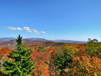 As we began the walk up the trail, I noticed that is was very dry and covered in a layer of fallen leaves. I decided we would get to the summit as quickly as possible and that I would forego any pictures on the way up. We almost immediately came to the first set of stone steps. They were well constructed and in just the right place to help out hikers. I also noticed that a woods road ran off to the right. I thought about walking up it some other time but realized this was DEP land and that hikers were asked to stay on the trails. We continued up the trail. We continued on the trail which was still in good shape even after it had been in place for several years. The treadway was wide and flat with few obstacles. There were several switchbacks and it was obvious that one requirement of the construction was a moderate grade. The forest at these lower elevations was primarily evergreen which is unusual in the Catskills. We did run across a few branches on the trail which I removed. At .4 miles the trail turned sharply to the left in one of its many switchback and we entered an area of hardwoods. There was a small stream that ran across the trail and the construction crew had create a deep ditch along the side of the trail. The ditch directed the water across the trail and at that point there was a stone construction to allow the water to cross the trail and hikers to easily cross the water. There was very little water flowing and the other similar constructions had no water flowing. At .7 miles I could see a series of ledges ahead and stone steps that wound between them. This would be repeated several more times over the next quarter mile. Getting up the steps was easy but in the winter it can be tricky. Sheila was walking the trail and then taking a few detours to follow her nose. The last set of steps was the most extensive and interesting. At 1.4 miles we came to a trail junction with the trail that comes in from the Dinch-Coons Road trailhead. The signs indicated the Dinch Road trailhead was .8 miles to the left and the fire tower was .6 miles to the right. We stopped for a few minutes to get a drink and then continued toward the tower. I could hear a few voices coming from behind us on the trail.
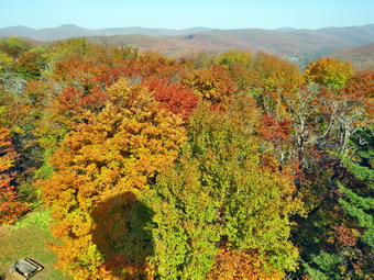 After walking a short distance, the trail began the ascent to the summit of Red Hill. The grade up to the trail junction had been 10% but now increased to 21% which I could feel! After about a quarter mile, there was a spur trail to a spring on the right side of the trail and then a short switchback. I had not climbed much on my recent hikes but this trip seemed to be easier than I had expected. There was plenty of sun which made me feel good but was also contributing to making me pretty warm. At 1:15 PM we arrived at the tower clearing where there were four hikers standing near the cabin. I walked over to one of the picnic tables, dropped my pack and got out my camera to take some pictures of the tower. I decided to tether Sheila to a picnic table knowing she would follow me up the tower or annoy the other hikers. Unlike some dogs, Sheila has no problem climbing up and down the open steps but I did not want to chance it on this day. As I walked over toward the tower, the other hikers left. I took a few pictures of the tower and then started to climb the steps. Without looking, I could tell when I was above the treeline as the breeze hit me. I eventually made it to the landing below the cab which was not open. I began to take pictures of the surrounding scenery in all directions. There was some haze to the south but none in the other directions. When there is no haze or fog, the views of the Catskill peaks from this tower are spectacular. The leaves to the south were not quite as far long as the ones in the other directions. I began to take pictures at different angles and zooms trying to capture the colors. I find that I can never get pictures that really reflect the beauty of God's creation. After taking quite a few shots, I descended the tower. I took some pictures of the cabin and a couple of Sheila who posed very nicely. I got a drink and gave Sheila one before starting the hike back down the mountain.
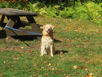 At 1:15 PM we started back down the trail. It had taken us 1 hour and 10 minutes to hike to the summit and I hoped we would make the trip back go faster. Not very far down the trail, we saw two hikers coming toward us with two dogs on leashes. I pulled Sheila over to the side of the trail to wait for them to pass. The hikers stopped to talk after I complimented them on their beautiful dogs. One was a merl collie and the other a tricolor collie. The hikers were from Unadilla which is considerably farther away than Livingston Manor! Eventually, we parted company and Sheila and I moved on down the trail. As we approached the spur trail to the spring, Shiela alerted and I looked up to see a hiker coming toward us. I again pulled Sheila off the trail so that we could pass. As he came near, I recognized the hiker as Doug, one of the volunteers that helps at the fire tower. Doug also recognized me and we spent some time talking. We eventually moved in our separate directions. The trail was dry which made it a little slippery but using poles really helped. As we had almost reached the trail, two more hikers came walking toward us. Once more I moved Sheila off the trail as the hikers started to walk by. They stopped and we talked for a few minutes. They wanted to know about the new Denning trailhead and I told them how to get to it. We continued our hikes and I hoped they were the last people I would meet. The walk to the junction went quickly and we made the left turn onto the bottom part of the trail. As we started through the bottom section, I began to think about driving over the hill from Sundown toward Yagerville. There is a nice view of the Shawangunks from that road and I thought about hiking to Angel Falls to get some pictures. We continued down the trail and were soon descending the last few steps to the parking area. It was 2:30 PM and we had hiked 3.7 miles in 2 hours and 50 minutes with 40 minutes of stopped time. Our elevation gain was 1190 feet. The temperature had risen to 64 degrees but some clouds were moving in.
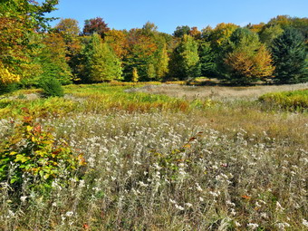
![]()
![]()
![]()
![]()
![]() On Saturday, October 2nd I wanted to get out for at least a 6 mile hike and see if I could find some colorful leaves. I decided to go to the Frick Pond area and hike to the lookouts of Beech Mountain. One viewpoint has a nice view of many of the Catskills high peaks looking to the east while the other looks west over Hodge Pond. I was disappointed that there was so much fog in the morning and thought about postponing the hike a day but the weather prediction for Saturday was for cool temperatures with winds gusting to 25 mph! By 9:30 AM the fog was clearing and the sun was breaking through so I decided to continue with my plans. I started to get ready at 9:45 AM with Sheila watching my every move. The temperature was 54 degrees on the back porch with some sun but I knew it might be cooler at the trailhead. I put on my White Sierra long-sleeved crew top and a short-sleeved baselayer. I put on a pair of RailRiders hiking pants which are expensive but last along time and have features like deep pockets and a generous cut which I really like. The pants have Velcro closures at the ankles I decided to put on my Keen Durand hiking boots which fit well and are newer than what I have been wearing. I added a new pair of Xstance insoles in an effort to find the best support and cushioning for my feet. These insoles have shock absorbing gel pads, TPU arch support, and memory foam cushioning all wrapped in a breathable fabric. The insoles have been hyped by their manufacturer and I wondered if they would live up to that hype. I decided to take my Leki poles with external locks as the internal twist locks fail. I also added a bright orange hat more for visibility than for the warmth. I also packed a light pair of gloves. I donned my Mammut hoody which has enough zippers to allow me to dump heat when I need to. I got my gear in the car and put an excited Sheila in the back seat as I drove out the DeBruce Road toward Frick Pond at 10:05 AM. After about 6 miles, I turned left on the Mongaup Pond and stayed left on Beech Mountain Road at the fork. There were no cars parked in either lot as I pulled in at 11:20 AM. I set my GPS and we immediately started our hike by crossing the road and heading out on the Flynn Trail toward Hodge Pond.
On Saturday, October 2nd I wanted to get out for at least a 6 mile hike and see if I could find some colorful leaves. I decided to go to the Frick Pond area and hike to the lookouts of Beech Mountain. One viewpoint has a nice view of many of the Catskills high peaks looking to the east while the other looks west over Hodge Pond. I was disappointed that there was so much fog in the morning and thought about postponing the hike a day but the weather prediction for Saturday was for cool temperatures with winds gusting to 25 mph! By 9:30 AM the fog was clearing and the sun was breaking through so I decided to continue with my plans. I started to get ready at 9:45 AM with Sheila watching my every move. The temperature was 54 degrees on the back porch with some sun but I knew it might be cooler at the trailhead. I put on my White Sierra long-sleeved crew top and a short-sleeved baselayer. I put on a pair of RailRiders hiking pants which are expensive but last along time and have features like deep pockets and a generous cut which I really like. The pants have Velcro closures at the ankles I decided to put on my Keen Durand hiking boots which fit well and are newer than what I have been wearing. I added a new pair of Xstance insoles in an effort to find the best support and cushioning for my feet. These insoles have shock absorbing gel pads, TPU arch support, and memory foam cushioning all wrapped in a breathable fabric. The insoles have been hyped by their manufacturer and I wondered if they would live up to that hype. I decided to take my Leki poles with external locks as the internal twist locks fail. I also added a bright orange hat more for visibility than for the warmth. I also packed a light pair of gloves. I donned my Mammut hoody which has enough zippers to allow me to dump heat when I need to. I got my gear in the car and put an excited Sheila in the back seat as I drove out the DeBruce Road toward Frick Pond at 10:05 AM. After about 6 miles, I turned left on the Mongaup Pond and stayed left on Beech Mountain Road at the fork. There were no cars parked in either lot as I pulled in at 11:20 AM. I set my GPS and we immediately started our hike by crossing the road and heading out on the Flynn Trail toward Hodge Pond.
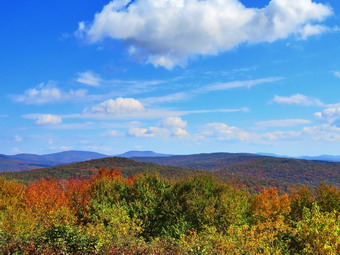 I was surprised to find a very large tree down across the trail. The tree was big enough that I knew I would have to call the local ranger to cut it with a chainsaw. I new I could cut the trunk with my hand tools but I also new it would require several cuts to get pieces that could be moved off the trail! When we hit the wide woods road that is the Flynn Trail, we turned right and noticed that the grass was only slightly damp as was the trail bed. The woods road once led to the Beech Mountain Boy Scouts Camp. The camp was serviced by the extension of Beech Mountain Road which is now the Flynn Trail. The temperature was in low 50's but I was getting warm already just from the exertion of hiking uphill. I made sure to open all the zippers on my hoody. The sun was out and there were white, puffy clouds in the blue sky. We were keeping a pretty fast pace but it didn't seem to bother me. We walked passed the large hemlock tree that a DEC crew had cleared from the trail. At 1.2 miles we came to the path to the clearing on the right side of the trail. I decided that I had not been there for some time so we turned right and walked uphill through the woods to the edge of the clearing. I have never heard a definitive explanation for the existence of the clearing but I suspect it was stripped of dirt to build Beech Mountain Road. In most places there is very little topsoil and the bedrock is close to the surface. I dropped my pack and took out the camera to snap some shots of the scene. The leaves on the trees had some color but the main attraction were several different kinds of wallflowers that covered the clearing. When I was done, we walked back out to the main trail and continued toward the junction with the Big Rock Trail. Along the way I removed some large branches and small trunks that had fallen on the trail. It took us 55 minutes to reach the first trail junction with the Big Rock Trail at 1.7 miles into the hike. This was faster than I expected especially with the side trip to the clearing!
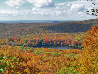 We continued straight ahead on the Flynn Trail passing through the gate that separates state land from Beaverkill Valley Land Trust property. After walking for a relatively short time, we arrived at the point where the Flynn Trail bears left down to Hodge Pond. We turned right and followed on the woods road toward the site of the Boy Scout camp and the lookouts I wanted to visit. The woods road we were walking on was once Beech Mountain Road leading to the Beech Mountain Boy Scout Camp. As we walked I had been removing small branches from the trail by habit. After a short walk, a trail turned off to the left to go down to the pond and the road we were on continued straight ahead. Another road was sandwiched in between the two and leads to the site of the former Boy Scout camp which has been leveled by the Beaverkill Valley Land Trust. We continued straight ahead on the road that started up the hill. The road was covered in leaves which were mostly brown and yellow. I could tell we were walking uphill again but I quickly adapted to the change in terrain. I was really warm now but did not want to stop to remove my hoody. We passed a spring house on the right and Sheila stopped to get a drink. She must have been warm as she splashed around and "dug" in the water for several minutes. The grade became steeper as we climbed the hill and at about 2.6 miles the road made a sharp turn to the right. We stopped so that I could take some pictures from a small viewpoint. There were some colors in the leafy landscape but it seemed they were still far from peak color. The viewpoint is beginning to grow in which limits the view. After I finished my photography, we continued on the road. As the road made another sharp turn, this time to the left, a trail went off to the right. We continued straight ahead on the road and came to the top of a little hill. Several woods roads lead upward and along the ridge to Flynn's Point of Beech Mountain which is the highest point in Sullivan County. We continued on the road walking downhill. As the road turned right, I noticed the path that leads toward Mongaup Mountain, one of the CHH peaks. I knew there was a nice viewpoint there but I did not want to take the time to bushwhack out to it. We turned right on the road and came to a beautiful lookout to the east with a view of many of the Catskill high peaks. There was still a haze in this direction and it was obvious that the leaves still needed some time to reach peak color. I knew this would probably be the case but was a little disappointed. I knew that the winds on Saturday might take down many of the leaves before they changed color. I took quite a few pictures before putting the camera away and continuing on the path that led up to the trail around Beech Mountain.
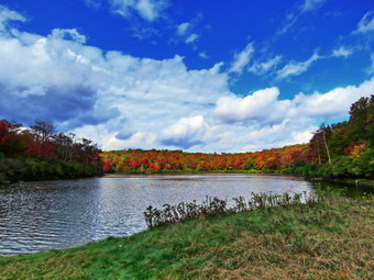 These paths and trails were marked with red markers placed by the Beaverkill Land Trust. I also noticed some very nice tent platforms near the trail. We continued around the mountain a circular direction passing some interesting ledges on the right. I had tried to take some pictures of these impressive stone formations in the past but the pictures never do them justice. We continued on the path around Flynn's Point on Beech Mountain until we came to the lookout over Hodge Pond on the left. When I walked out to the stone ledge that makes up the viewpoint, I could see some great color. Most of these colors were around Hodge Pond. I took several pictures at different zooms and at different angles. When I was done, I packed up ad we continued in a clockwise direction around Beech Mountain on the woods road. I considered bushwhacking up to the Sullivan County high point but decided to continue on down to Hodge Pond as the colors were so nice there. We walked out the trail to the road and turned left. We continued on the road and set a quick pace down the hill. Sheila again stopped at the spring and this time dug at the opening to the culvert until water was freely flowing through it. At the base of the hill, we turned right on the woods road that leads down to Hodge Pond. We turned left when the road intersected a jeep trail and ended up at the outlet end of Hodge Pond. We walked over to the shore of the pond where I dropped my pack and got out the camera. Sheila decided not to go wading as the water was a little cold. The colors I had seen from the lookout were even better from the level of the pond. The colors were not as bright as I had hoped but I looked forward to coming back in a week to see how they developed. I took some shots of the pond concentrating on the leaves. The sky was blue with puffy white clouds. When I was done, I ate a bar and got a drink before picking up and walking to where the Flynn Trail enters the woods. We started climbing the hill back to the junction where we had turned right some time before. This ascent can sometimes seem long but on this day it went quickly. We passed by several blowdowns that Cindy and I had cleared from the trail. At the top of the hill we stayed to the right on the Flynn Trail and followed the route we had taken out. We passed through the gate and continued on the trail.
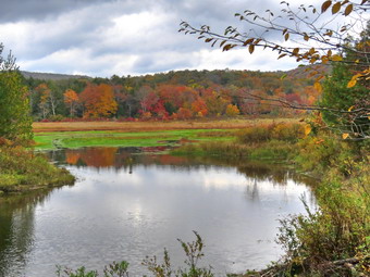 We were soon approaching the junction with the Big Rock Trail. I thought about whether to return on the Flynn Trail or add a little mileage by taking the Big Rock Trail. I decided on the Big Rock Trail even though the skies were beginning to darken since it would allow me to check out more trails. We turned right on the Big Rock Trail and started the long downhill hike. The walk down the Big Rock Trail went quickly even though there are several points where it seems the descent has ended only to continue toward Times Square. We were soon at Times Square where we continued straight across to stay on the Big Rock Trail. Times Square which is usually wet and muddy was barely damp. The trails had been almost completely dry up to this time but there were a few muddy areas on the Big Rock Trail. The skies were now darkening particularly in the west and a few drops of rain were beginning to fall. As we continued on the trail, we came to the two bridges over the inlet streams. The bridge abutments are beginning to deteriorate and really need to be replaced. I stopped at the first bridge to take some shots of the water under the bridge with some leaves floating on top. There were also some colorful trees so I snapped some pictures. As we continued to hike, we walked through the beautiful spruce forest and over the wooden walkways which also need repair. Some sections of the walkways are poorly supported and some have boards are coming loose. We avoided the mud pit just before the junction with the Quick Lake Trail by following the detour hikers have created. Soon we were at the junction with the Quick Lake Trail where we turned left toward the bridge at the outlet of Frick Pond. The large mud pit that the Willowemoc Trail crew had worked on was still easy to cross due to the increased drainage and stepping stones. Once passed the muddy area, it wasn't long until we were at the bridge at the outlet end of Frick Pond. Despite the fact that I have hundreds of pictures from this spot and the darkening skies, I took a few more. The trees around the pond were colorful but not quite as far along as the ones around Hodge Pond. I finished my photography and we started up the hill to Gravestone Junction. All of a sudden the sun came out and the clouds disappeared. I noticed that the Lobdell memorial marker was upright as we passed by. The marker is a memorial to two children who died in the 1930's in a fire that consumed their cabin. As we walked along the Quick Lake Trail back to our cars, I noticed that the trail was only damp without surface or some flowing water. The Willowemoc Trail Crew had done some work here but it is hard to drain the trail as it is the lowest spot in most areas. At the trail register, we continued straight ahead to return to the car in the smaller parking area. By 2:05 PM we were back at the car after hiking 7.3 miles in 3 hours and 45 minutes with 20 minutes of stopped time. This was good for an overall 2.0 mph pace. We also gained 1305 feet of elevation.
![]()
![]()
![]()
![]() On Tuesday, October 4th I finally had a little time to get out for a hike after days of ambulance corps and church commitments. After responding to ambulance calls, I concluded that my only choice was to again head across the street to Round Top and see if we could get in some hiking. I am lucky that I have a place so close to hike but it has become very familiar. I have found that even a short hike helps to keep my blood pressure in check and I am hoping I can get my weight down also. Sheila was ready to go as she really likes to hike but she was being a good dog and just whining a little bit while keeping an eye on me. It was 54 degrees on the back porch so I decided to put on my White Sierra long-sleeved wicking shirt without a baselayer. I wore my Railriders hiking pants which are expensive but last along time and have features like deep pockets and a generous cut which I really like. The pants have Velcro closures at the ankles. I decided to put on my Keen Durand hiking boots which fit well and are newer than what I have been wearing. I added a new pair of Xstance insoles in an effort to find the best support and cushioning for my feet. These insoles have shock absorbing gel pads, TPU arch support, and memory foam cushioning all wrapped in a breathable fabric. The insoles have been hyped by their manufacturer and I wondered if they would live up to that hype. I grabbed a pair of Leki external lock poles I have been using for some time. I also donned my Mammut hoody as I though it was a little too cool to go without a jacket. At 2:30 PM we walked out the door to start the hike. I looked around and saw that the sky was blue over Round Top with a few puffy white clouds. I grabbed Sheila's leash from the car and we walked up the driveway.
On Tuesday, October 4th I finally had a little time to get out for a hike after days of ambulance corps and church commitments. After responding to ambulance calls, I concluded that my only choice was to again head across the street to Round Top and see if we could get in some hiking. I am lucky that I have a place so close to hike but it has become very familiar. I have found that even a short hike helps to keep my blood pressure in check and I am hoping I can get my weight down also. Sheila was ready to go as she really likes to hike but she was being a good dog and just whining a little bit while keeping an eye on me. It was 54 degrees on the back porch so I decided to put on my White Sierra long-sleeved wicking shirt without a baselayer. I wore my Railriders hiking pants which are expensive but last along time and have features like deep pockets and a generous cut which I really like. The pants have Velcro closures at the ankles. I decided to put on my Keen Durand hiking boots which fit well and are newer than what I have been wearing. I added a new pair of Xstance insoles in an effort to find the best support and cushioning for my feet. These insoles have shock absorbing gel pads, TPU arch support, and memory foam cushioning all wrapped in a breathable fabric. The insoles have been hyped by their manufacturer and I wondered if they would live up to that hype. I grabbed a pair of Leki external lock poles I have been using for some time. I also donned my Mammut hoody as I though it was a little too cool to go without a jacket. At 2:30 PM we walked out the door to start the hike. I looked around and saw that the sky was blue over Round Top with a few puffy white clouds. I grabbed Sheila's leash from the car and we walked up the driveway.
We began the ascent of the steepest hill behind the church and continued directly up the hill to the trailhead. The hill is short but gets the circulation pumping and is the steepest and longest climb on the "trail." My goal was to make it all the way up the hill without stopping. At the top of the hill we stopped for minute so that I could observe the skies and hills all around us. We turned left and entered the woods to begin our hike. The trailhead was damp in a few spots from some rain and that continued as we entered the woods. I used my pole to poke at the dirt and found that the dirt was damp to some depth. At the first trail junction, I followed Sheila as she continued straight ahead up the hill toward the lookout. We stopped for a minute at the upper lookout and found the view partially blocked by the leaves on the trees. We followed the yellow trail as it turned right and headed uphill through the fern glade. The drought had contributed to many of the ferns dying and most were now brown an shriveled. The woods looked like fall was approaching with some leaves dying and falling from the trees because of the earlier drought. We passed the "sitting rock" and continued on the yellow trail to the first junction with the blue trail. At the junction we turned right and walked the yellow trail along the base of Round Top to the next junction with the blue trail. The trail was still clear of brush but I thought about giving it another trim before winter. We turned left on the blue trail and started up the hill. We bypassed the white crossover trail and continued on the blue trail across the summit of Round Top. As we began down the other side, we again bypassed the white crossover trail. We immediately turned left on the switchback in the blue trail and followed it out and then back to the main trail. We turned left and followed the blue trail to the yellow trail. We again walked on the yellow trail to the junction with the blue trail.
This time we turned right and walked down the yellow trail to the woods road. We walked along the woods road toward the first trail junction. Just before the first trail junction, I looked at the remains of the large blowdown I had cut and removed from the trail. Just passed this were the remains of a smaller blowdown I had cut up. This tree had hung over the trial for months but finally came down in the recent wind. We turned around at the first trail junction and started back p the woods road. We turned left when the yellow trail started up toward the first junction with the blue trail. We turned left and walked the yellow trail to the next junction with the blue trail. This part of the yellow trail remains clear without blowdowns or encroaching brush. At the next trail junction we turned right on the blue trail and started up the hill. We turned right on the switchback and walked out into the rest and then back to the blue trail. We turned right on the blue trail and then continued up the hill bypassing the white crossover trail. We continued over the summit and then down the other side to the junction with the yellow trail. At the junction with the yellow trail we turned right and again walked along the base of Round Top to the next junction with the blue trail. This time we turned left and continued on the yellow trail through the ferns to the viewpoint. At the viewpoint we turned left and walked down the steep trail to the first trail junction. This time we continued out to the trailhead. At the trailhead we turned right and walked down the hill to the church parking lot. We crossed the parking lot and Rock Avenue to get to our driveway. When we arrived home, it was 3:35 PM and we had hiked a little more than 2 miles in a little more than an hour.
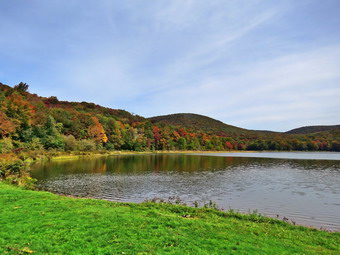
![]()
![]()
![]()
![]()
![]() On Friday, September 30th, I wanted to get out and do a longer hike after a slew of ambulance calls during the week. I decided that I wanted to go to Alder Lake to hike to the Beaver Meadow Lean-to which would be better named the Beaver Pond lean-to as the beavers have returned. They have built an impressive dam and there are at least two lodges. I knew I could extend the hike by going to the Millbrook Ridge high point or visiting the falls on Alder Creek below the lake. I have been having some pain in my heels and hiking both relieves and aggregates the problem. I asked Cindy if she would like to go but she declined. I started to get ready at 12:45 PM when the temperature was 60 degrees with some sun and blue skies. Sheila was hovering around me as she can always detect when I am getting ready for a hike. I decided to put on my long-sleeved White Sierra shirt with a short-sleeved baselayer. I wore my Railriders hiking pants which are expensive but last along time and have features like deep pockets and a generous cut which I really like. The pants have Velcro closures at the ankles. I thought about warmer pants but decided against it. I decided to put on my Keen Durand hiking boots which fit well. I added a new pair of Xstance insoles in an effort to find the best support and cushioning for my feet. These insoles have shock absorbing gel pads, TPU arch support, and memory foam cushioning all wrapped in a breathable fabric. The insoles have been hyped by their manufacturer and seemed to be living up to their claims. I grabbed a pair of Leki external lock poles I have been using for some time. I did don my Mammut hoody which has lots of zippers to dump heat. This jacket has a hood but I decided to wear a blaze orange hat as several hunting seasons are beginning. I did put on my OR Crocodile gaiters as I knew the trail might be wet and muddy from the recent rains. I got my gear and Sheila in my car and left Livingston Manor at 1:00 PM and drove north and west on Old Route 17 toward Roscoe. Just outside of town I turned right on the Beaverkill Road and headed north. I continued on the Beaverkill Road through Lew Beach and Turnwood toward Alder Creek Road where I made a left. I continued to the end on the road where I turned right toward Alder Lake. I drove up the access road very slowly as there are some very rough spots. When I got to the parking area there were five vehicles parked in the lot. The temperature was 58 degrees but the sun made it feel much warmer. The skies were bright and sunny with lots of blue but and some puffy white clouds to provide contrast. I set my GPS and we started out on the path toward the "lawn" at 1:25 PM.
On Friday, September 30th, I wanted to get out and do a longer hike after a slew of ambulance calls during the week. I decided that I wanted to go to Alder Lake to hike to the Beaver Meadow Lean-to which would be better named the Beaver Pond lean-to as the beavers have returned. They have built an impressive dam and there are at least two lodges. I knew I could extend the hike by going to the Millbrook Ridge high point or visiting the falls on Alder Creek below the lake. I have been having some pain in my heels and hiking both relieves and aggregates the problem. I asked Cindy if she would like to go but she declined. I started to get ready at 12:45 PM when the temperature was 60 degrees with some sun and blue skies. Sheila was hovering around me as she can always detect when I am getting ready for a hike. I decided to put on my long-sleeved White Sierra shirt with a short-sleeved baselayer. I wore my Railriders hiking pants which are expensive but last along time and have features like deep pockets and a generous cut which I really like. The pants have Velcro closures at the ankles. I thought about warmer pants but decided against it. I decided to put on my Keen Durand hiking boots which fit well. I added a new pair of Xstance insoles in an effort to find the best support and cushioning for my feet. These insoles have shock absorbing gel pads, TPU arch support, and memory foam cushioning all wrapped in a breathable fabric. The insoles have been hyped by their manufacturer and seemed to be living up to their claims. I grabbed a pair of Leki external lock poles I have been using for some time. I did don my Mammut hoody which has lots of zippers to dump heat. This jacket has a hood but I decided to wear a blaze orange hat as several hunting seasons are beginning. I did put on my OR Crocodile gaiters as I knew the trail might be wet and muddy from the recent rains. I got my gear and Sheila in my car and left Livingston Manor at 1:00 PM and drove north and west on Old Route 17 toward Roscoe. Just outside of town I turned right on the Beaverkill Road and headed north. I continued on the Beaverkill Road through Lew Beach and Turnwood toward Alder Creek Road where I made a left. I continued to the end on the road where I turned right toward Alder Lake. I drove up the access road very slowly as there are some very rough spots. When I got to the parking area there were five vehicles parked in the lot. The temperature was 58 degrees but the sun made it feel much warmer. The skies were bright and sunny with lots of blue but and some puffy white clouds to provide contrast. I set my GPS and we started out on the path toward the "lawn" at 1:25 PM.
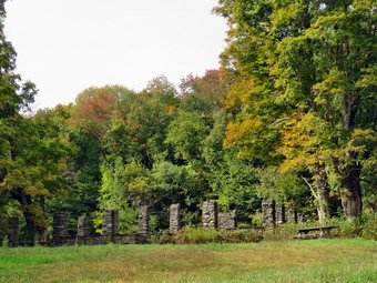 We walked along the path which passes by the stone foundations which marks the last remnants of the Coykendall Mansion. The house had been built as a large hunting lodge and then was gifted to the Boy Scouts of America. When the state took over the property, the mansion fell into disrepair with campers tearing boards away to use for campfires. The state added a fence but it did not deter people so the house was eventually burned to the ground. As we walked down the right side of the lawn, I noticed that the grass had been cut and the picnic tables that were present were easily accessible. I walked toward the dam and the "beach" where I normally take pictures. I took out my camera and snapped some shots of the lake and the hills around it. The lighting was almost perfect and there were interesting reflections in the lake. I was surprised that the trees around the lake were changing color more rapidly than in town. There were some nice yellows, oranges and even some reds! We walked across the lawn toward the trail around the left side of the lake and started walking east along the trail on the north side of the lake. The trail was a little damp with a few muddy spots but nothing like the ones that are often present. The brush and branches that had overgrown the trail were now dead and the walking was much easier but some still hung in the path. This reminded me that I should call my maintainer for this trail to see if he intended to work on it. The small streams that cross the trail had some water in them which was the first time in a long time. Sheila was happy to be out and ran ahead and then returned to me. I began to remove small branches from the trail and moved one larger one. As we approached the bridges, Sheila alerted and I could hear people at the head end of the lake and at the campsites on the other shore. Strangely, no one was camping in the sites on the north side of the lake.
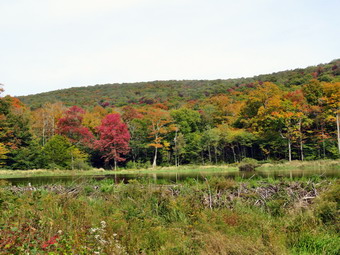 We continued on the trail and we crossed the bridges on the trail near the head end of the lake. I could see the beaver dam that impounded some water from the inlet streams was still intact. One of the bridges had several broken boards on the side and I wished that the DEC would take more interest in maintaining this well-used camping spot. We continued on the trail toward the junction with the Millbrook Ridge Trail. At the point where a path leads to the left to some primitive campsite, some large trees had fallen across the trail. We were able to step over them but it was not easy. I could cut them with my hand tools but it would take a long time! I made a note to call the local ranger to see if we could schedule a time to remove them with a chainsaw. At the trail junction, we turned left to head toward the lean-to on the Millbrook Ridge Trail. The trail was damp in some places and some of the nettles were still hanging on. Fortunately, the trail showed more use than I had expected and was relatively clear of blowdowns and branches. There were a few small blowdowns which I removed from the trail. There were also some older and rotten trunks that I was able to move and this continued for the rest of the hike. I did find a few blowdowns that I had cut and a few more that should be cut. We crossed some streams that were almost dry the last time I had visits in July but were now flowing nicely. Alder Creek had quite a bit of water and we could here it as it ran downstream over the rocks. We did find a few large, older blowdowns which would be hard to clear with hand tools so I thought about getting get a crew with a sawyer to remove some of the larger ones from trail. The trail is pretty obvious and the blazes easy to see in most places. For the next 1.5 miles the trail climbed and then leveled off several times. The elevation gain is several hundred feet but the grade is never more than 12% and averages around 6%. There isn't too much to see along the way but this day was very pleasant because of the temperature and my mood. My heels hurt but did not prevent me from pushing on.
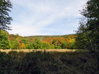 The trail leveled off at the first beaver meadow and we crossed a small stream that feeds it. Sheila took the time to get a drink and splash in the water. At 2.2 miles we began the last climb and I found that the going was easier than I thought it would be. As we started the climb, we came across a few more blowdowns. Soon we arrived at the beaver pond. Where there had once been a beaver meadow, there was now a pond with a dam and a beaver lodge. The pond was larger than the last time I had visited occupying the entire meadow. As we came to the spot on the trail opposite the beaver dam, we walked off the trail to the right and found a good viewpoint. I took pictures of the pond and the dam which I thought would be good as there were reflections in the pond and white clouds in the sky. The trees here were even more colorful than at Alder Lake! I also took some shots of the beaver lodge with the lean-to in the background. As I looked around I was overcome by the feeling of joy at seeing what God has created! I realized that the return trip would be much easier as it was almost all downhill. We walked over to the lean-to and found a new heavy-duty tarp had been attached to the roof. The lean-to has been largely ignored while others are repaired or entirely reconstructed. This is a popular spot but it is not near a 3500 foot peak. I took some pictures of what is now an open-air "outhouse" since the structure surrounding it was long ago torn down. The local ranger told me that this lean-to was scheduled for work this fall. I hope that the tarp on the roof is not the total extent of that work. I was not even sure the DEC had placed the trap or whether it had been added by some hikers. After I got a drink and ate a bar, I decided not to head to the Millbrrok Ridge high point as it was getting late. We walked out to the main trail and turned right as I wanted to visit the next beaver meadow. There were some very large blowdowns on the trail but we walked around them or made our way over them. We were soon at the beaver meadow where I had not been for some time. I took out my camera as there were some nice colors on the trees. After finishing my photography, I packed up my camera and we started back on the trail. On the way passed the lean-to, I turned right on the trail to the spring. It was a short walk and we found it flowing from the pipe. I took a few shots and the returned to the main trail. The walk did go quickly and we were soon at the loop trail around Alder Lake where we turned right to return the way we came.
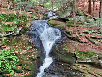 On the way to the bridges we met two men coming toward us. I ushered Sheila off the trail as the men approached. They told me they were headed to the lean-to and I told tem it was unoccupied. We headed in our opposite ways until the men called back to me. They wanted to be sure where the trails was that went to the lean-to! I told them but had to shake my head at people who come out with so little planning. We crossed the bridges an found an open view of Cradle Rock Ridge but the skies were now overcast. We continued on the trail toward the parking area and at one point Sheila alerted and I saw a couple hiking toward us. I pull Sheila off to the side of the trail so that they could pass. They took some time to walk passed us but thanked me as they did. We walked up the hill toward the ruins of the lodge and then toward the parking area. As we approached the parking area, I noted that it had taken all of 90 minutes to walk out the trail but only about 70 minutes to come back. I decided I had just enough time to walk down to Alder Creek to visit the waterfalls and take some pictures. We turned left on the trail that leads down to the spring and then right to walk downstream along the creek. I stopped when we came to the first small waterfall. I got out my camera and walked to the flat rocks along the streambed. I took some pictures of the raids upstream and then walked a little farther downstream. I was able to get some shots of a small falls and one that is about 10 feet tall. I went back to my pack, stowed the camera and walked back up the bank to one of the woods roads. We walked downstream on the woods road until I found a path that I knew led down to the stream. We walked down the path to a viewpoint over the highest falls which drops about 20 feet. There was plenty of water flowing in the creek and the lighting was not too bad. I took a number of pictures including some of a smaller falls below the main one. When I was done, I decided it was time to go back to the car. We walked back up the path and continued across two woods roads until I could see the main access road. The bank was steep so we paralleled the road unit we came to the trail to the springs. We turned left and walked up the bank and through the parking area to the car. We were back at the car at 4:30 PM after hiking 5.0 miles in 3 hours and 10 minutes with 25 minutes of stopped time. The elevation gain was 800 feet. Our moving speed was 2 MPH.
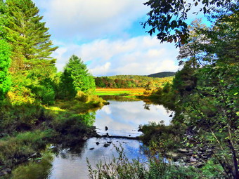
![]()
![]()
![]()
![]()
![]() On Monday, September 26th, I had planned to do some longer hike as the weekend had been filled with ambulance calls and church commitments. At about 4:00 AM the ambulance pager sounded and we responded to a call several districts away as there was no other rig available. I had planned to come home and get a few more hours of sleep but on the way I way hoe I realized I was not sleepy. I decided to go for a shorter hike so that I could finish before the rain in the forecast arrived. I asked Cindy if she would like to hike the Logger's Loop at Frick Pond and she agreed. This hike is less than 4 miles and is relatively flat. I had not been on the trail for some time and I wanted to see how it had faired after some recent wind storms. We started to get ready at 9:00 AM when the temperature was 62 degrees in the back porch in the sun. As I was getting dressed, Sheila was very quiet but did not let me out of her sight. I decided to put on my long-sleeved White Sierra shirt without a baselayer. I wore my Railriders hiking pants which are expensive but last along time and have features like deep pockets and a generous cut which I really like. The pants have Velcro closures at the ankles. I decided to put on my Keen Durand hiking boots which fit well and are newer than what I have been wearing. I added a new pair of Xstance insoles in an effort to find the best support and cushioning for my feet. These insoles have shock absorbing gel pads, TPU arch support, and memory foam cushioning all wrapped in a breathable fabric. The insoles have been hyped by their manufacturer and I wondered if they would live up to that hype. I grabbed a pair of Leki external lock poles I have been using for some time. I did don my Mammut hoody which has lots of zippers to dump heat. Because this jacket has a hood I decided not to wear my OR hat. I did put on my OR Crocodile gaiters as I knew the trail might be wet and muddy from the recent rains. I put our gear in the car and Sheila in the back seat and we left Livingston Manor at 9:30 AM. I drove out the DeBruce Road about 6 miles to Mongaup Road. I turned left to continue up the road to the point where it splits. I stayed left on Beech Mountain Road and drove to the Frick Pond trailhead. When we arrived at the parking areas, there were no cars parked in either lot. I pulled into the smaller lot and parked. The skies were sunny and blue with a few clouds and a slight breeze blowing. The temperature was right at 58 degrees which was about what I thought it might be. I set my GPS unit and we started out the woods road to the register. As we walked out the woods road, I cleared some branches and one small trunk from the very damp trail. At the register we continued straight ahead on the Quick Lake Trail. From the register the trail was wet with some standing and running water and mud.
On Monday, September 26th, I had planned to do some longer hike as the weekend had been filled with ambulance calls and church commitments. At about 4:00 AM the ambulance pager sounded and we responded to a call several districts away as there was no other rig available. I had planned to come home and get a few more hours of sleep but on the way I way hoe I realized I was not sleepy. I decided to go for a shorter hike so that I could finish before the rain in the forecast arrived. I asked Cindy if she would like to hike the Logger's Loop at Frick Pond and she agreed. This hike is less than 4 miles and is relatively flat. I had not been on the trail for some time and I wanted to see how it had faired after some recent wind storms. We started to get ready at 9:00 AM when the temperature was 62 degrees in the back porch in the sun. As I was getting dressed, Sheila was very quiet but did not let me out of her sight. I decided to put on my long-sleeved White Sierra shirt without a baselayer. I wore my Railriders hiking pants which are expensive but last along time and have features like deep pockets and a generous cut which I really like. The pants have Velcro closures at the ankles. I decided to put on my Keen Durand hiking boots which fit well and are newer than what I have been wearing. I added a new pair of Xstance insoles in an effort to find the best support and cushioning for my feet. These insoles have shock absorbing gel pads, TPU arch support, and memory foam cushioning all wrapped in a breathable fabric. The insoles have been hyped by their manufacturer and I wondered if they would live up to that hype. I grabbed a pair of Leki external lock poles I have been using for some time. I did don my Mammut hoody which has lots of zippers to dump heat. Because this jacket has a hood I decided not to wear my OR hat. I did put on my OR Crocodile gaiters as I knew the trail might be wet and muddy from the recent rains. I put our gear in the car and Sheila in the back seat and we left Livingston Manor at 9:30 AM. I drove out the DeBruce Road about 6 miles to Mongaup Road. I turned left to continue up the road to the point where it splits. I stayed left on Beech Mountain Road and drove to the Frick Pond trailhead. When we arrived at the parking areas, there were no cars parked in either lot. I pulled into the smaller lot and parked. The skies were sunny and blue with a few clouds and a slight breeze blowing. The temperature was right at 58 degrees which was about what I thought it might be. I set my GPS unit and we started out the woods road to the register. As we walked out the woods road, I cleared some branches and one small trunk from the very damp trail. At the register we continued straight ahead on the Quick Lake Trail. From the register the trail was wet with some standing and running water and mud.
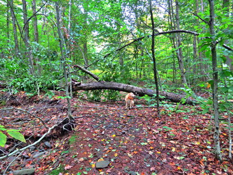 At Gravestone Junction, we stayed left on the Quick Lake trail heading toward the bridge at the outlet to Frick Pond. This area of the trail had more mud but it was minimal compared to what it usually looks like. When we arrived at the bridge, I looked at the scene and decided to take some shots even though I have hundreds from the same location. The pond was higher than it had been for some time! I took pictures of the whole scene and some of Beech Mountain. We continued around the west side of the pond where the trail was just damp with a small amount of mud here and there. At the junction with the Big Rock Trail, we headed left on the Quick Lake Trail which was almost wet and muddy in places. I had been removing smaller branches but there were a few larger ones in this area that I managed to drag off the trail. As we walked through the spruce tunnel, we came upon a rather large blowdown across the trail. Fortunately, I had trimmed most of the branches off it making it easier to get over the large diameter trunk. When we came to the small stream across the trail, we found the level higher than it had been and I took some shots before moving on. I did try to clean out some leaves and needles that were holding back the water in the stream. We continued on up the Quick Lake Trail toward Iron Wheel Junction. Just after the stream was a new and pretty large blowdown. I took some pictures with Sheila in view to give an idea of the size of the trunk. Any of these trees can be cleared with and tools but I began to think about contacting the local ranger as a chainsaw would make the job much easier. After the blowdown, the trail was wet and muddy in spots but not as bad as it can be.
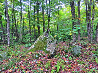 When we got to the junction, I took some pictures of the iron wheels that give the junction its name. we turned right on the Logger's Loop and started out toward Times Square. The trail seemed to have more water including some deep puddles. Fortunately, it was pretty easy to get around all of them. We did run across another large blowdown which Bryce and I had muscled off to the side of the trail on our last trip. A little farther along there was another large trunk that had fallen across the trail. This one was above head high and would be difficult to cut with hand tools. There had been a few other trunks lying on the ground and I thought again about getting the local ranger to tackle them with me. A few of the streams that run across the trail or under it were dry but several had water for the first time in at least a month. I stopped along the way to take a picture of a tricycle perched on a large rock . The most amazing part of this is that it had been there for 20 years! We came to the large cherry tree that had broken off high up and fallen so that it was arching across the trail. This tree was not blocking the trail and it was clear it was not coming down soon. We passed the seasonal pond on the left side of the trail and I could see that it was mostly dry. I thought about stopping to take some shots but the gathering clouds and the wind convinced me to move on quickly. We continued downhill to Times Square which was damp. I thought about turning left and climbing the Big Rock Trail to add mileage but I knew the rain was coming and that Cindy would not be impressed. We walked straight across Times Square to stay on the Logger's Loop and started uphill. Just before the beginning of the uphill was another streambed which we crossed and it was dry. Although the trail is slightly uphill we were setting a good pace. We could hear some hikers on the Big Rock Trail heading toward Times Square and I did not want them to catch up with us. We passed by another medium sized trunk which had been across the trail until we had removed it on one trip. We continued walking on the trail and crested the hill to walk out to Gravestone Junction. We turned left at the Gravestone Junction and headed back to the car on the woods road. My feet were bothering me and the highly eroded trail was not kind to them. At the register we continued straight ahead on the woods road back to the car. It was 11:45 AM and we had spent 2 hour hiking 3.7 miles with an elevation gain was a modest 375 feet. We had spent 10 minutes stopped to take pictures and clear the trail. The temperature had risen to 60 degrees and the first drops of rain were falling.
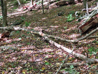
![]() On Friday, September 23rd I had planned to go out for a longer hike as the first hike of the fall as I had missed hiking the day before. When I woke up at 6:30 AM it was still raining but the biggest problem was the wind! The temperature was 42 degrees but with the windchill it was well into the mid 30's! I tend to be overly cautious about windy days as I have seen what falling branches can do. I worked around home waiting for the wind to abate which I thought would never happen. At around 1:30 PM the wind calmed down a little. I decided I would go over to Round Top to clean up some small blowdowns on the trails and to make sure the wind had not brought any more branches down. I asked Cindy if she would like to go and she agreed. We started to get ready with Sheila watching expectantly. It was 58 degrees on the back porch and the wind was still blowing so I decided to dress a little warmer than I had been. I decided to put on my White Sierra long-sleeved wicking shirt without a baselayer. I wore my Railriders hiking pants which are expensive but last along time and have features like deep pockets and a generous cut which I really like. The pants have Velcro closures at the ankles. I decided to put on my Keen Durand hiking boots which fit well and are newer than what I have been wearing. I added a new pair of Xstance insoles in an effort to find the best support and cushioning for my feet. These insoles have shock absorbing gel pads, TPU arch support, and memory foam cushioning all wrapped in a breathable fabric. The insoles have been hyped by their manufacturer and I wondered if they would live up to that hype. I did not intend to bring hiking poles as the walk is short and I would be carrying axes and saws. I did don my Mammut hoody for the first time since late spring. At 1:45 PM I started to put my gear in the car. I took my Fiskars pack ax and put my Silky Sugowaza saw in my pack. We put Sheila in the back seat and I drove across the street and up the hill on Orchard Street to the trailhead at the top of the cemetery. We got out of the car to start our hike at 2:00 PM. I carried the Fiskars ax as I did not bring my poles. We walked from the trailhead to the first trail junction and turned right. Almost immediately we ran into a small trunk that had been hanging over the trail for at least a year. I put my pack and tools down and got my camera out of my pack. I took a series of pictures of the blowdown from different angles.
On Friday, September 23rd I had planned to go out for a longer hike as the first hike of the fall as I had missed hiking the day before. When I woke up at 6:30 AM it was still raining but the biggest problem was the wind! The temperature was 42 degrees but with the windchill it was well into the mid 30's! I tend to be overly cautious about windy days as I have seen what falling branches can do. I worked around home waiting for the wind to abate which I thought would never happen. At around 1:30 PM the wind calmed down a little. I decided I would go over to Round Top to clean up some small blowdowns on the trails and to make sure the wind had not brought any more branches down. I asked Cindy if she would like to go and she agreed. We started to get ready with Sheila watching expectantly. It was 58 degrees on the back porch and the wind was still blowing so I decided to dress a little warmer than I had been. I decided to put on my White Sierra long-sleeved wicking shirt without a baselayer. I wore my Railriders hiking pants which are expensive but last along time and have features like deep pockets and a generous cut which I really like. The pants have Velcro closures at the ankles. I decided to put on my Keen Durand hiking boots which fit well and are newer than what I have been wearing. I added a new pair of Xstance insoles in an effort to find the best support and cushioning for my feet. These insoles have shock absorbing gel pads, TPU arch support, and memory foam cushioning all wrapped in a breathable fabric. The insoles have been hyped by their manufacturer and I wondered if they would live up to that hype. I did not intend to bring hiking poles as the walk is short and I would be carrying axes and saws. I did don my Mammut hoody for the first time since late spring. At 1:45 PM I started to put my gear in the car. I took my Fiskars pack ax and put my Silky Sugowaza saw in my pack. We put Sheila in the back seat and I drove across the street and up the hill on Orchard Street to the trailhead at the top of the cemetery. We got out of the car to start our hike at 2:00 PM. I carried the Fiskars ax as I did not bring my poles. We walked from the trailhead to the first trail junction and turned right. Almost immediately we ran into a small trunk that had been hanging over the trail for at least a year. I put my pack and tools down and got my camera out of my pack. I took a series of pictures of the blowdown from different angles.
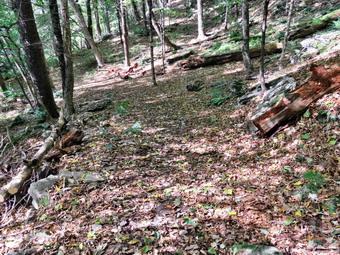 I began by removing some loose branches and then used the Silky Sugowaza to cut off two larger branches. I removed these two branches and threw them off the trail. I thought I would have to cut the remaining trunk but it was light enough for me lift it and throw it off to the side of the trail. This had all gone more quickly than I expected! I took some 'after' pictures and the stowed the camera. I looked up the trail and saw that Cindy was pretty far up the trail. I had wanted to show her the stations for the scavenger hunt but she had already passed by the first one. I started to walk up the trail removing small branches that Cindy had ignored. I also removed some branches from the side of the trail to make it look cleaner. When the woods road ended, I turned left following the yellow trail up the hill to the first junction with the blue trail. My plan was now to cover all the trails to make sure they were clear. I finally caught up with Cindy at the junction. We turned left and followed the yellow trail along the base of Round Top. I pointed out the second scavenger stop to Cindy. The trail was pretty clear except for the few branches we removed. At the next junction with the blue trail, we turned right and stared up the hill. The trail was pretty clear and we turned right on the switchback in the blue trail. We followed the switchback into the woods and then back to the main trail. We turned left on the blue trail and came to the start of the white crossover trail. I suggested Cindy take the right on the crossover trail while I continued on the blue trail. In this way we could cover all the trails. Cindy agreed and we started off. As I walked up the hill, I wondered which way Sheila would take. As I neared the top, I looked around and Sheila was right behind me. There was nothing to clear across the summit. I told Sheila to 'Find mom' and she took off ahead of me as if she had the trail map in her head! I walked down Te hill and found Sheila and Cindy at the intersection with the white trail. We continued down to the yellow trail and stopped so that I could cut a tree that was overhanging the trail just above head height.
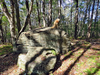 At the junction with the blue trail we turned right and walked back to the second junction. This time we turned left and walked the yellow trail downhill toward the lookout. When we got to the "Sitting Rock" which is the third scavenger station, I dropped my pack and took some pictures before I cleared some branches. I quickly dragged away the branches and brushed off the rock. I invite Sheila to get up on the lower rock to pose for pictures. She jumped up on the lower rock and jumped again to the higher one which is well over 6 feet above the ground. She made it look easy. I took some shots of her on the rock and then a few close-ups of her. Sheila took a close look at the jump down but made it easily. We continued down the trail to catch up with Cindy at the lookout. The view from the upper lookout is blocked by the leaves on the trees so I walked down to the rock shelf where the view is better. I took some pictures of the town and surrounding hills. I tried to get some pictures of the school but the trees have grown up quickly and the view is blocked. I walked back up to the upper lookout and then started down the trail toward the first trail junction. Cindy was waiting there and I showed her the fourth scavenger station which is a big rock covered in 'rock tripe'. This lichen can be eaten and is used in Asian cuisines after it is soaked in water and boiled with changes of water in between to remove the bitterness and purgative properties. I took some pictures and we continued our walk down the hill. I stopped to remove a few branches and noticed how beautiful the forest appeared. I took a few shots and then walked out to the trailhead. At the trailhead, the sun was shining and the sky was blue with puffy white clouds. Before leaving, I took some pictures across to Beer Mountain and the other hills. We put all our gear in the car and Sheila in the back seat/ I drove back to my house at 3:30 PM after spending a total of 1 hours and 30 minutes hiking and clearing the trails.