
What You Missed
Fall 2019
Fall 2019
![]()
![]()
![]()
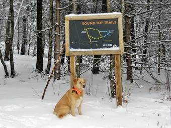
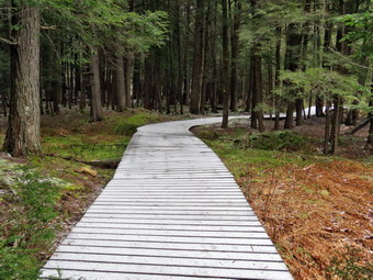
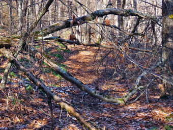
![]() On Tuesday, December 17th I had a day off from school because of a snow and ice storm that hit the area. By mid-morning the storm had let up leaving a sloppy mess on the roads. By 11:00 AM, there was still a mix of sleet and rain nut I decided to head across the street anyway since Sheila would not leave me alone. I wanted to get in a quick hike and knew I could cut it short if I was getting too wet. Sheila was ready to go as she really likes the snow and she was keeping a careful eye on me as I dressed. Sheila misses the hiking as much as I do since I have returned to full-time teaching for the rest of this school year! At 11:00 AM I started to get ready with the temperature hovering just below 30 degrees. I put on my long-sleeved Mammut crew top with a light long-sleeved baselayer underneath. I decided to wear my Columbia Titanium insulated pants to keep the chill away but decided against wearing tights underneath. I wore my Salomon B-52 insulated boots even though there was no snow as they keep my feet warm and are waterproof. I grabbed a pair of Leki poles with external locks that I have been using lately. Finally, I also donned my Mammut hoody which blocks the wind and keeps me warm but has enough zippers to dump heat when needed. I decided against snowshoes but did put on microspikes to make sure that I had some traction in the ice and snow. At 11:30 PM Sheila and I walked out the door to start the hike. I grabbed Sheila's leash from the car and we walked up the driveway. I decided we would try to do at least two figure 8's which might be enough given the situation. I aimed to hike for about an hour. Sheila was happy to get out as we headed down the driveway and across the street. We crossed the street and walked through the field to the back of the Presbyterian Church. The roads were a mess but the pre-treating seemed to be effective in limiting the ice. We walked to the back of the church and began the ascent of the steepest hill behind the church. The hill is short but gets the circulation pumping and is the steepest and longest climb on the "trail." Sheila helped me along by pulling me up the hill.
On Tuesday, December 17th I had a day off from school because of a snow and ice storm that hit the area. By mid-morning the storm had let up leaving a sloppy mess on the roads. By 11:00 AM, there was still a mix of sleet and rain nut I decided to head across the street anyway since Sheila would not leave me alone. I wanted to get in a quick hike and knew I could cut it short if I was getting too wet. Sheila was ready to go as she really likes the snow and she was keeping a careful eye on me as I dressed. Sheila misses the hiking as much as I do since I have returned to full-time teaching for the rest of this school year! At 11:00 AM I started to get ready with the temperature hovering just below 30 degrees. I put on my long-sleeved Mammut crew top with a light long-sleeved baselayer underneath. I decided to wear my Columbia Titanium insulated pants to keep the chill away but decided against wearing tights underneath. I wore my Salomon B-52 insulated boots even though there was no snow as they keep my feet warm and are waterproof. I grabbed a pair of Leki poles with external locks that I have been using lately. Finally, I also donned my Mammut hoody which blocks the wind and keeps me warm but has enough zippers to dump heat when needed. I decided against snowshoes but did put on microspikes to make sure that I had some traction in the ice and snow. At 11:30 PM Sheila and I walked out the door to start the hike. I grabbed Sheila's leash from the car and we walked up the driveway. I decided we would try to do at least two figure 8's which might be enough given the situation. I aimed to hike for about an hour. Sheila was happy to get out as we headed down the driveway and across the street. We crossed the street and walked through the field to the back of the Presbyterian Church. The roads were a mess but the pre-treating seemed to be effective in limiting the ice. We walked to the back of the church and began the ascent of the steepest hill behind the church. The hill is short but gets the circulation pumping and is the steepest and longest climb on the "trail." Sheila helped me along by pulling me up the hill.
There was a few inches of snow and then ice on top as we started on the trail by turning left at the trailhead. I let Sheila off her leash so that she could explore. The trail was completely covered in snow and ice. At the first trail junction, I followed Sheila as she continued straight up the hill toward the viewpoint. At the top of the hill, we continued on the trail turning right. We followed the trail as it gently gained elevation toward the junction with the blue trail. The trail surface was slippery but the spikes did a good job of giving me traction. Several places along the way I stopped to remove branches, some large and some small, from the trail. At the next trail junction, we turned right to follow the yellow trail around the base of Round Top. At the next trail junction we turned left and headed up to the summit of Round Top on the blue trail. I had no problem making it to the top. We were soon passing over the top of the hill and starting down the other side. The trail continued to be slippery but I used my poles and was soon back at the junction with the yellow trail. At the bottom of the hill we turn left to follow the yellow trail to the next trail junction. This time we turned right and followed the yellow trail down toward the woods road. Halfway down there was a large blowdown nearly blocking the trail. I removed some of the branches but it was clear I would need tools to completely clear the trail. We continued down the trail that returned us to the first trail junction. I decided that I was pretty wet but that I would go home and get an axe to come back and clear the blowdown. At the trail junction. we turned left and continued straight ahead toward the trailhead. I put Sheila on her leash and we walked down the hill, out through the church parking lot to the road and to our driveway. The rain and sleet was coming down harder and I was getting wet. When we arrived home, I decided NOT to return to clear the blowdown but to leave it for another day. It was 11:45 AM and we had hiked a little over a mile in just under an hour.
![]()
![]()
![]()
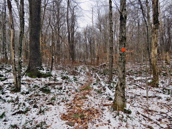
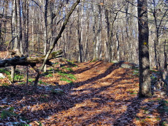
![]() On Sunday, December 15th I wanted to get in a quick hike after church since teaching, coaching timing sporting events had conspired to keep me off the trails. When I got home from church, I decided to make a quick run to Pecks and then get outside. Cindy was sick and I knew Sheila would be happy just getting outside, so I chose to go across the street for a couple of figure 8's on Round Top. The temperature was right around 32 degrees but the wind and intermittent precipitation made it1 feel much colder. Sheila was ready to go as she really likes the snow and she was keeping a careful eye on me as I dressed. Sheila misses the hiking as much as I do since I have returned to full-time teaching for the rest of this school year! I put on my long-sleeved Mammut crew top with a light long-sleeved baselayer underneath. I decided to wear my Columbia Titanium insulated pants to keep the chill away but decided against wearing tights underneath. I wore my Salomon B-52 insulated boots even though there was no snow as they keep my feet warm and are waterproof. I grabbed a pair of Leki poles with external locks that I have been using lately. Finally, I also donned my Mammut hoody which blocks the wind and keeps me warm but has enough zippers to dump heat when needed. At 1:30 PM Sheila and I walked out the door to start the hike. I grabbed Sheila's leash from the car and we walked up the driveway. I decided we would try to do at least two figure 8's which might be enough given the situation. I aimed to hike for about an hour. Sheila was happy to get out as we headed down the driveway and across the street. We crossed the street and walked to the parking area by the Presbyterian Church. The roads seemed clear with only water on the surface. We walked to the back of the church and began the ascent of the steepest hill behind the church. The hill is short but gets the circulation pumping and is the steepest and longest climb on the "trail." Sheila helped me along by pulling me up the hill.
On Sunday, December 15th I wanted to get in a quick hike after church since teaching, coaching timing sporting events had conspired to keep me off the trails. When I got home from church, I decided to make a quick run to Pecks and then get outside. Cindy was sick and I knew Sheila would be happy just getting outside, so I chose to go across the street for a couple of figure 8's on Round Top. The temperature was right around 32 degrees but the wind and intermittent precipitation made it1 feel much colder. Sheila was ready to go as she really likes the snow and she was keeping a careful eye on me as I dressed. Sheila misses the hiking as much as I do since I have returned to full-time teaching for the rest of this school year! I put on my long-sleeved Mammut crew top with a light long-sleeved baselayer underneath. I decided to wear my Columbia Titanium insulated pants to keep the chill away but decided against wearing tights underneath. I wore my Salomon B-52 insulated boots even though there was no snow as they keep my feet warm and are waterproof. I grabbed a pair of Leki poles with external locks that I have been using lately. Finally, I also donned my Mammut hoody which blocks the wind and keeps me warm but has enough zippers to dump heat when needed. At 1:30 PM Sheila and I walked out the door to start the hike. I grabbed Sheila's leash from the car and we walked up the driveway. I decided we would try to do at least two figure 8's which might be enough given the situation. I aimed to hike for about an hour. Sheila was happy to get out as we headed down the driveway and across the street. We crossed the street and walked to the parking area by the Presbyterian Church. The roads seemed clear with only water on the surface. We walked to the back of the church and began the ascent of the steepest hill behind the church. The hill is short but gets the circulation pumping and is the steepest and longest climb on the "trail." Sheila helped me along by pulling me up the hill.
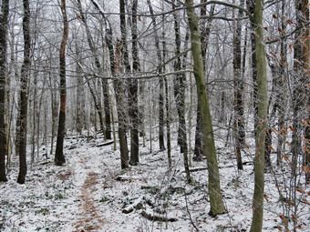
We started on the trail by turning left at the trailhead where I let Sheila off her leash so that she could explore. The trail was completely bare with no snow. It was wet and muddy in spots. There were a few small areas of snow in the woods.covered in snow but the path was obvious. At the first trail junction, I followed Sheila as she continued straight up the hill toward the viewpoint. At the top of the hill, we continued on the trail turning right. We followed the trail as it gently gained elevation toward the junction with the blue trail. The trail surface was a little slippery from the recent rain and some ice that had fallen. At the next trail junction, we turned right to follow the yellow trail around the base of Round Top. At the next trail junction we turned left and headed up to the summit of Round Top on the blue trail. I had no problem making it to the top. We were soon passing over the top of the hill and starting down the other side. The trail continued to be slippery but I used my poles and was soon back at the junction with the yellow trail. At the bottom of the hill we turn left to follow the yellow trail to the next trail junction. This time we turned right and followed the yellow trail down to the woods road that returned us to the first trail junction. All the time Sheila explored off-trail but stayed close enough to hear my voice. When we reached the first trail junction, we turned around and walked back up the woods road. At the first junction with the blue trail we turned left and followed the yellow trail along the base of Round Top. At the second junction, we turned right and walked up the blue trail to the summit of Round Top. We walked down the other side to the junction and turned right. We followed the yellow trail turning left and the next junction to walk down to the lookout. At the lookout we stayed to the left and walked down the hill to the first trail junction. I was satisfied that I had done enough. We continued straight ahead and walked out toward the trailhead. I put Sheila on her leash and we walked down the hill, out through the church parking lot to the road and to our driveway. It was 2:45 PM and we had hiked over 2 miles in just over an hour.
![]()
![]()
![]()
![]()
![]() On Saturday, December 7th, I wanted to get out and hike on snowshoes as the forecast seemed to indicate the snow would be gone or at least reduced by midweek. When I got up the temperature was in the low 20's but the sky was blue with many white, puffy clouds. I asked Cindy if she would like to go to Frick Pond and hike and she said "Yes". We decided to wait a little while so I didn't start to get dressed until 10:00 AM. As I gathered my clothing and equipment, Sheila got wind of what was going on and began running around the house barking. I got dressed in a Patagonia 1/4-zip wool long-sleeved top for some extra warmth. I also put on a long-sleeved baselayer. I decided to wear my Columbia Titanium insulated pants to keep the chill away with a pair of light tights underneath. I wore my Salomon B-52 insulated boots which have been discontinued but are my favorite boots for snowshoeing. I put on a pair of OR Crocodile gaiters as I did not know the depth of snow we would encounter. I grabbed a pair of Leki poles with external locks that I have been using lately. Finally, I also donned my Mammut hoody which blocks the wind and keeps me warm but has enough zippers to dump heat when needed. Both Cindy and I decided to use our Tubbs Alp Flex VTR snowshoes. The Boa binding on these uses a thin steel cable system and a ratchet which tightens it to give a custom fit and a secure binding. These snowshoes also have a televator to elevate the hiker's heel on ascents. This is a feature that you didn't know you needed until you try it and then it is hard to live without it! I put our gear in the back of the car and Sheila in the back seat. We left Livingston Manor at 10:10 AM as I drove out the DeBruce Road about 6 miles to Mongaup Road. I turned left and continued up the road to the point where it splits. I stayed left on Beech Mountain Road and drove to the parking areas on the left. I pulled into the smaller parking area and noticed that there were no other cars. The lots had been plowed after the major snowstorm but still had some snow in them. We put on our snowshoes and got ready to head out on the Flynn Trail with a slight breeze making the 25 degree temperature seem even colder. I had forgotten my GPS until but knew the route and the time it should take. The plan was to hike up the Flynn Trail and then descend the Big Rock Trail to Times Square. From the trail junction we would continue straight across to the end of the Big Rock Trail and then take the Quick lake Trail back to the car.
On Saturday, December 7th, I wanted to get out and hike on snowshoes as the forecast seemed to indicate the snow would be gone or at least reduced by midweek. When I got up the temperature was in the low 20's but the sky was blue with many white, puffy clouds. I asked Cindy if she would like to go to Frick Pond and hike and she said "Yes". We decided to wait a little while so I didn't start to get dressed until 10:00 AM. As I gathered my clothing and equipment, Sheila got wind of what was going on and began running around the house barking. I got dressed in a Patagonia 1/4-zip wool long-sleeved top for some extra warmth. I also put on a long-sleeved baselayer. I decided to wear my Columbia Titanium insulated pants to keep the chill away with a pair of light tights underneath. I wore my Salomon B-52 insulated boots which have been discontinued but are my favorite boots for snowshoeing. I put on a pair of OR Crocodile gaiters as I did not know the depth of snow we would encounter. I grabbed a pair of Leki poles with external locks that I have been using lately. Finally, I also donned my Mammut hoody which blocks the wind and keeps me warm but has enough zippers to dump heat when needed. Both Cindy and I decided to use our Tubbs Alp Flex VTR snowshoes. The Boa binding on these uses a thin steel cable system and a ratchet which tightens it to give a custom fit and a secure binding. These snowshoes also have a televator to elevate the hiker's heel on ascents. This is a feature that you didn't know you needed until you try it and then it is hard to live without it! I put our gear in the back of the car and Sheila in the back seat. We left Livingston Manor at 10:10 AM as I drove out the DeBruce Road about 6 miles to Mongaup Road. I turned left and continued up the road to the point where it splits. I stayed left on Beech Mountain Road and drove to the parking areas on the left. I pulled into the smaller parking area and noticed that there were no other cars. The lots had been plowed after the major snowstorm but still had some snow in them. We put on our snowshoes and got ready to head out on the Flynn Trail with a slight breeze making the 25 degree temperature seem even colder. I had forgotten my GPS until but knew the route and the time it should take. The plan was to hike up the Flynn Trail and then descend the Big Rock Trail to Times Square. From the trail junction we would continue straight across to the end of the Big Rock Trail and then take the Quick lake Trail back to the car.
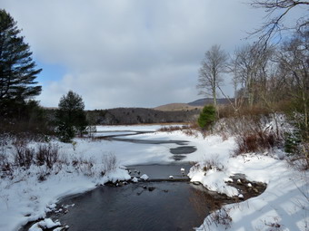 We crossed the road and got on the The Flynn Trail which is sited along what was once the Beech Mountain Road. This road was the access for the Beech Mountain Boy Scout Camp. There was only about 4 inches of snow as we walked through the woods. When we got to the woods road, we turned right and began the ascent on the trail. The trail gains a little over 600 feet in 1.75 miles to the highest point at the junction with the Big Rock Trail. We passed through the arch Cindy and I had cut through an enormous hemlock that had fallen across the trail. We walked up the trail stopping a few times so that I could take pictures of the snow on the trail and in the woods. The snows began to get deeper hovering around 8 inches with some drifts up to a foot. As we neared the top I could feel my legs beginning to get tired especially in the inner thighs. We reached the junction with the Big Rock Trail and decided we would continue with the plan and descend to Times Square. We had hiked the 1.7 miles uphill to the junction and now would have over a mile descent. We turned left to walk down the Big Rock Trail and immediately appreciated the downhill. We were able to take long strides and glide downhill in may places. We set a faster pace as we descended the trail passing through the various twists and turns that often make it seem like the bottom of the hill is close. We did stop a few times so that I could take some shots of the snow and sky. We were soon at Times Square and we continued straight across to stay on the Big Rock Trail. As we hiked around the back of the pond, I pointed out to Cindy a major blowdown I had cleared. We continued to the bridges over the streams that feed Frick Pond. There was some water flowing under both the bridges. We passed over the series of wooden walkways which continue to deteriorate. At the end of the Big Rock Trail, we turned left on the Quick Lake Trail and walked to the bridge over the outlet stream. There wa a nice flow of water coming out of the pond and the sun was forming an interesting pattern on the trees on the north side of the pond. By the time I put my pack down and got out the camera the lighting had changed but I took some pictures anyway. After a few minutes, I continued up the hill to Gravestone Junction where Cindy was waiting. We continued on the trail and back out to the car. The Quick Lake Trail back to the parking area was completely covered in snow and most of the water was frozen. We arrived at the car at 1:30 PM after hiking 4.0 miles in 2 hours and 45 minutes. The elevation gain was 670 feet.
![]()
![]()
![]()
![]()
![]() On Monday, December 2nd I had an extra day off from school due to the first big snowstorm of the winter. Although it was still snowing lightly in the morning, I decided to go across the street and hike on Round Top. My main objective was to get some pictures of the snow-covered trees but I knew getting some exercise would be a good idea also. Before I could go hiking, I had to shovel the walks and clean off my car. I was surprised to find only about 6 inches of accumulated snow. The bottom layer was frozen and packed making getting everything cleared a chore. When I was done I came inside to change into hiking clothes. The temperature was relatively warm at 32 degrees so I planned to dress accordingly. Sheila was ready to go as she really likes the snow and she was keeping a careful eye on me as I dressed. Sheila misses the hiking as much as I do since I have returned to full-time teaching for the rest of this school year! I put on my long-sleeved Mammut crew top with a light baselayer underneath. I decided to wear my Columbia Titanium insulated pants to keep the chill away with a pair of light tights underneath. I wore my Salomon B-52 insulated boots which have been discontinued but are my favorite boots for snow. I grabbed a pair of Leki poles with external locks that I have been using lately. Finally, I also donned my Mammut hoody which blocks the wind and keeps me warm but has enough zippers to dump heat when needed. I put on a blaze orange hat and wore a medium weight pair of gloves. I decided to wear my Columbia Titanium insulated pants to keep the chill away but did not put any tights underneath. I wore my Salomon B-52 insulated boots which have been discontinued but are my favorite boots for snow. I grabbed a pair of Leki poles with external locks that I have been using lately. Finally, I also donned my Mammut hoody which blocks the wind and keeps me warm but has enough zippers to dump heat when needed. I put on a blaze orange hat and wore a medium weight pair of gloves. I thought about wearing snowshoes or at least taking spikes but decided in the end they would not be necessary. At 12:30 PM Sheila and I walked out the door to start the hike. I grabbed Sheila's leash from the car and we walked up the driveway. I decided we would try to do at least two figure 8's which might be enough given the situation. I aimed to hike for about an hour. Sheila was happy to get out as we headed down the driveway and across the street. We crossed the street and walked to the parking area by the Presbyterian Church. The roads seemed clear with only water on the surface. We walked to the back of the church and began the ascent of the steepest hill behind the church. I stopped to survey the scene and decided to take a few pictures looking up the hill. All the trees were covered in snow and the snow on the hill was unbroken since children no longer ride sleds. The hill is short but gets the circulation pumping and is the steepest and longest climb on the "trail." Sheila helped me along by pulling me up the hill. I paused at the top of the hill and got out my camera to take pictures of the snow-covered trees and some of the buildings in town.
On Monday, December 2nd I had an extra day off from school due to the first big snowstorm of the winter. Although it was still snowing lightly in the morning, I decided to go across the street and hike on Round Top. My main objective was to get some pictures of the snow-covered trees but I knew getting some exercise would be a good idea also. Before I could go hiking, I had to shovel the walks and clean off my car. I was surprised to find only about 6 inches of accumulated snow. The bottom layer was frozen and packed making getting everything cleared a chore. When I was done I came inside to change into hiking clothes. The temperature was relatively warm at 32 degrees so I planned to dress accordingly. Sheila was ready to go as she really likes the snow and she was keeping a careful eye on me as I dressed. Sheila misses the hiking as much as I do since I have returned to full-time teaching for the rest of this school year! I put on my long-sleeved Mammut crew top with a light baselayer underneath. I decided to wear my Columbia Titanium insulated pants to keep the chill away with a pair of light tights underneath. I wore my Salomon B-52 insulated boots which have been discontinued but are my favorite boots for snow. I grabbed a pair of Leki poles with external locks that I have been using lately. Finally, I also donned my Mammut hoody which blocks the wind and keeps me warm but has enough zippers to dump heat when needed. I put on a blaze orange hat and wore a medium weight pair of gloves. I decided to wear my Columbia Titanium insulated pants to keep the chill away but did not put any tights underneath. I wore my Salomon B-52 insulated boots which have been discontinued but are my favorite boots for snow. I grabbed a pair of Leki poles with external locks that I have been using lately. Finally, I also donned my Mammut hoody which blocks the wind and keeps me warm but has enough zippers to dump heat when needed. I put on a blaze orange hat and wore a medium weight pair of gloves. I thought about wearing snowshoes or at least taking spikes but decided in the end they would not be necessary. At 12:30 PM Sheila and I walked out the door to start the hike. I grabbed Sheila's leash from the car and we walked up the driveway. I decided we would try to do at least two figure 8's which might be enough given the situation. I aimed to hike for about an hour. Sheila was happy to get out as we headed down the driveway and across the street. We crossed the street and walked to the parking area by the Presbyterian Church. The roads seemed clear with only water on the surface. We walked to the back of the church and began the ascent of the steepest hill behind the church. I stopped to survey the scene and decided to take a few pictures looking up the hill. All the trees were covered in snow and the snow on the hill was unbroken since children no longer ride sleds. The hill is short but gets the circulation pumping and is the steepest and longest climb on the "trail." Sheila helped me along by pulling me up the hill. I paused at the top of the hill and got out my camera to take pictures of the snow-covered trees and some of the buildings in town.
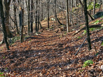
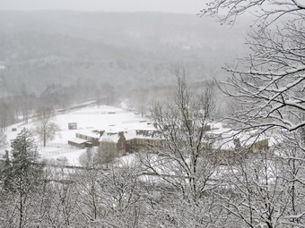 We started on the trail by turning left at the trailhead where I let Sheila off her leash so that she could explore. The trail was completely covered in snow but the path was obvious. We walk into the woods a little way and then I took some ore pictures. At the first trail junction, I stopped again to take more pictures of the trails in both directions. After packing up my camera, I followed Sheila as she continued straight up the hill toward the viewpoint. At the top of the hill, I turned left and walked out to the lookout. All the trees and buildings in town were covered in snow. There was also snow still falling forming a "haze". I took out my camera and took numerous pictures since everything was so beautiful. When I was done, I walked back the way I had come and turned left on the main trail. We turned right and followed the trail as it gently gained elevation toward the junction with the blue trail. The trail surface was a little slippery and snowshoes could have been used but were not necessary. At the next trail junction, we turned right to follow the yellow trail around the base of Round Top. I once again fit out the camera to take a few more shots. At the next trail junction we turned left and headed up to the summit of Round Top on the blue trail. This was definitely a challenge without any traction device but I had no problem making it to the top. We were soon passing over the top of the hill and starting down the other side. The trail was slippery but I used my poles and was soon back at the junction with the yellow trail. At the bottom of the hill we turn left to follow the yellow trail to the next trail junction. This time we turned right and followed the yellow trail down to the woods road that returned us to the first trail junction. All the time Sheila explored off-trail but stayed close enough to hear my voice. When we reached the first trail junction, we turned around and walked back up the woods road. I decided I would not take any pictures on this loop. At the first junction with the blue trail we turned left and followed the yellow trail along the base of Round Top. At the second junction, we turned right and walked up the blue trail through the ferns to the summit of Round Top. We walked down the other side to the junction and turned right. We followed the yellow trail turning left and the next junction to walk down to the lookout. At the lookout we stayed to the left and walked down the hill to the first trail junction. I was satisfied that I had done enough. We continued straight ahead and walked out toward the trailhead. I put Sheila on her leash and we walked down the hill, out through the church parking lot to the road and to our driveway. It was 1:45 PM and we had hiked over 2 miles in just over an hour.
![]()
![]()
![]()
![]()
![]() On Sunday, December 1st, the first big snowstorm of the year was forecast to dump as much as 20 inches of snow and .25 inches of ice over two days. I decided that I would go for a short "first day" hike before the brunt of the storm hit. I felt a little guilty that I was not staying home for possible ambulance class but I thought most people would be sensible enough to stay off the roads. When I got up just before 8:00 AM, the temperature was 22 degrees and it seemed raw outside. I knew I wanted to get started and finished as soon as possible. Brad was not available so it would be just Sheila and I on the hike. I started to get ready at 8: 30 AM. Sheila got wind of what was going on and began running around the house barking. I got dressed in a Patagonia 1/4-zip wool long-sleeved top for some extra warmth. I also put on a long-sleeved baselayer. I decided to wear my Columbia Titanium insulated pants to keep the chill away with a pair of light tights underneath. I wore my Salomon B-52 insulated boots which have been discontinued but are my favorite boots for snow. I grabbed a pair of Leki poles with external locks that I have been using lately. Finally, I also donned my Mammut hoody which blocks the wind and keeps me warm but has enough zippers to dump heat when needed. I put on a blaze orange hat and wore a medium weight pair of gloves. I found an orange vest and put it on Sheila who did not seem to mind. I put my gear in the back of the car and Sheila in the back seat. As we were about to leave, sleet began to fall. I decided to head for Frick Pond to see what the road conditions were like knowing I could always turn around. We left Livingston Manor at 9:45 AM as I drove out the DeBruce Road about 6 miles to Mongaup Road. I turned left and continued up the road to the point where it splits. I stayed left on Beech Mountain Road and drove to the parking areas on the left. I pulled into the smaller parking area and noticed that there was one car parked in the larger lot. My original plan had been to hike up the Flynn Trail to the lookout over Hodge Pond on Beech Mountain. I revised my plans and decided I would start hiking around Frick Pond clockwise and make a decision about my route when I reached Times Square. Just as we were about to begin rain and sleet began to fall despite the fact that the temperature was 26 degrees. I decided to start hiking and see what happened. I set my GPS and we walked out the woods road to the Quick Lake Trail at the register. The woods road was a mix of frozen mud and ice. The ruts caused by the DEC crews doing trail work did not seem to be "improvements" to me. Within a short distance, a dog began barking and I looked up to see a dog coming our way. I immediately put Sheila on her leash as the other dog advanced. The owner of the other dog called it back and got out a leash. As we passed, she offered an apology saying "I didn't expect to see anybody else." We continued in our separate directions and at Gravestone Junction we stayed left to walk down to Frick Pond.
On Sunday, December 1st, the first big snowstorm of the year was forecast to dump as much as 20 inches of snow and .25 inches of ice over two days. I decided that I would go for a short "first day" hike before the brunt of the storm hit. I felt a little guilty that I was not staying home for possible ambulance class but I thought most people would be sensible enough to stay off the roads. When I got up just before 8:00 AM, the temperature was 22 degrees and it seemed raw outside. I knew I wanted to get started and finished as soon as possible. Brad was not available so it would be just Sheila and I on the hike. I started to get ready at 8: 30 AM. Sheila got wind of what was going on and began running around the house barking. I got dressed in a Patagonia 1/4-zip wool long-sleeved top for some extra warmth. I also put on a long-sleeved baselayer. I decided to wear my Columbia Titanium insulated pants to keep the chill away with a pair of light tights underneath. I wore my Salomon B-52 insulated boots which have been discontinued but are my favorite boots for snow. I grabbed a pair of Leki poles with external locks that I have been using lately. Finally, I also donned my Mammut hoody which blocks the wind and keeps me warm but has enough zippers to dump heat when needed. I put on a blaze orange hat and wore a medium weight pair of gloves. I found an orange vest and put it on Sheila who did not seem to mind. I put my gear in the back of the car and Sheila in the back seat. As we were about to leave, sleet began to fall. I decided to head for Frick Pond to see what the road conditions were like knowing I could always turn around. We left Livingston Manor at 9:45 AM as I drove out the DeBruce Road about 6 miles to Mongaup Road. I turned left and continued up the road to the point where it splits. I stayed left on Beech Mountain Road and drove to the parking areas on the left. I pulled into the smaller parking area and noticed that there was one car parked in the larger lot. My original plan had been to hike up the Flynn Trail to the lookout over Hodge Pond on Beech Mountain. I revised my plans and decided I would start hiking around Frick Pond clockwise and make a decision about my route when I reached Times Square. Just as we were about to begin rain and sleet began to fall despite the fact that the temperature was 26 degrees. I decided to start hiking and see what happened. I set my GPS and we walked out the woods road to the Quick Lake Trail at the register. The woods road was a mix of frozen mud and ice. The ruts caused by the DEC crews doing trail work did not seem to be "improvements" to me. Within a short distance, a dog began barking and I looked up to see a dog coming our way. I immediately put Sheila on her leash as the other dog advanced. The owner of the other dog called it back and got out a leash. As we passed, she offered an apology saying "I didn't expect to see anybody else." We continued in our separate directions and at Gravestone Junction we stayed left to walk down to Frick Pond.
 At the bridge I decided to take a few pictures even though the scene was bleak and some precipitation was falling. I was surprised that the trees on Beech Mountain were not covered in frozen snow and ice. I snapped a few shots and then decided to get going. As we walked around the west side of the pond, I noted that the usually wet spots were completely frozen and that there were more ruts on the trails we had so carefully tried to preserve. At the next trail junction we turned right on the Big Rock Trail to walk around the pond on the wooden boardwalks. The boardwalks were covered in a layer of ice and snow which was very slippery. Since the boardwalks are elevated and surrounded by air, they are colder than the surrounding ground and often freeze. I took a few pictures and then we continued through the evergreen tunnel and across two more bridges. We passed by the large blowdown I had cleared on my last trip and I was glad to see it was still clear. When we reached Times Square, I decided I need the climb to the Flynn Trail for exercise. We continued straight ahead on the Big Rock Trail up the hill. From Times Square to the Flynn Trail junction the Big Rock Trail rises 625 feet in 1.1 miles. This doesn't sound like much but it always seems to be a little farther and a little longer than I remember. A little more than a third of the way up the trail we began to run into snow covering the ground. I stopped to take a few photographs and then continued up the hill. There are three different "tiers" to the trail and they sometimes go very slowly but this time I was near the top before I even thought about it. I have not been hiking as much as I would like and am out of shape. Soon we had walked 2.2 miles and were at the junction with the Flynn Trail. There was more snow here than anywhere else so I took some shot before continuing. We turned right to head down the Flynn Trail to the car. This return trip Sometimes seems longer than the 1.7 miles that is posted which is the correct distance. The trail is pretty but has no views. On this day it seemed to go much faster probably since it is mostly downhill after the climb up the Big Rock Trail. On the last section of the trail, the mixture of sleet and snow began to fall again only harder than before. Near the end of the trail we came to the "arch" Cindy and I had created through an enormous hemlock tree that had fallen across the trail. I noticed that there was a new blue marker on the tree marking it as official. I took a picture of the tree and another with Sheila. We continued on the Flynn Trail back down to the car staying to the left at the gate to avoid the private property around the cabin. We arrived in the parking area at 2:45 PM with the sleet and snow really coming down. We had covered 4.0 miles in 1 hour and 50 minutes with and elevation gain of 680 feet. The roads on the way home we starting to get very slippery. When I arrived home, I found out there had been several motor vehicle accidents on Route 17.
![]()
![]()
![]()
![]()
![]() On Friday, November 29th, I was ready to get out for a hike after nearly two weeks of school, coaching and other commitments. I had planned to head north to Chittenango State Park and some county parks in the area tom hike to some waterfalls but the forecast was for early morning freezing rain. The freezing rain and the two and a half hour drive put a damper on my enthusiasm so I began to look for someplace closer to home. Brad and Krista were in for the holiday and Bryce was available to hike so I decided to go to Trout Pond which would allow me to stop by the Roscoe Brewery to pick up a few bottles of their bourbon barrel-aged stout. It was 24 degrees when I got up at 8:00 AM and the forecast did not have the temperature increasing much. I picked up Bryce at 9:00 AM and dropped him at our house while I headed to Liberty to pick up some Bourbon County Stout which is a traditional adventure on Black Friday. The Liberty delivery had not arrived so I headed to Monticello where I scored 4 bottles. Monticello did not have any variants so I thought I might stop back in Liberty later in the day. I returned home to get ready to hike with the temperature still in the high 20's. Sheila got wind of what was going on and began running around the house barking. I got dressed in my Mammut long-sleeved crew that is warmer than most other tops I have. I also put on a long-sleeved baselayer. I decided to wear my Columbia Titanium insulated pants to keep the chill away with a pair of light tights underneath. I wore my Vasque Taku boots which are supportive and surprisingly roomy. I grabbed a pair of Leki poles with external locks that I have been using lately. I also donned my Mammut hoody which was enough zippers to dump heat when needed. I put on a blaze orange hat and wore a light pair of gloves. I found an orange vest and put it on Sheila who did not seem to mind. I lent Brad one of my many softshell jackets for warmth and to block the wind. At about 10:45 AM the skies were blue with some white clouds. There was even some sun although the temperature was still in the high 20's. We put our gear in the trunk and Sheila and Bryce in the back seat. I headed to Roscoe on State Route 17, got off at exit 94 and got on Route 206. I followed it across the Delaware County line to Morton Hill Road. After a left turn on Morton Hill Road, I drove to the intersection with Russell Brook Road. I turned around and parked on the side of the road to avoid the parking area which is private. I set my GPS and we began our hike down Russell Brook Road at 11:10 AM. Russell Brook Road looked almost completely bare as we started our hike. We continued on down Russell Brook Road to the overlook over the upper falls. There was enough water in the stream to make the upper falls interesting but I decided not to take any pictures as we were all a little cold. We continued down toward the parking area where three men were standing near the tailgate of a truck. We said "Hello" as we walked passed them but I could not determine whether they were hikers or hunters.
On Friday, November 29th, I was ready to get out for a hike after nearly two weeks of school, coaching and other commitments. I had planned to head north to Chittenango State Park and some county parks in the area tom hike to some waterfalls but the forecast was for early morning freezing rain. The freezing rain and the two and a half hour drive put a damper on my enthusiasm so I began to look for someplace closer to home. Brad and Krista were in for the holiday and Bryce was available to hike so I decided to go to Trout Pond which would allow me to stop by the Roscoe Brewery to pick up a few bottles of their bourbon barrel-aged stout. It was 24 degrees when I got up at 8:00 AM and the forecast did not have the temperature increasing much. I picked up Bryce at 9:00 AM and dropped him at our house while I headed to Liberty to pick up some Bourbon County Stout which is a traditional adventure on Black Friday. The Liberty delivery had not arrived so I headed to Monticello where I scored 4 bottles. Monticello did not have any variants so I thought I might stop back in Liberty later in the day. I returned home to get ready to hike with the temperature still in the high 20's. Sheila got wind of what was going on and began running around the house barking. I got dressed in my Mammut long-sleeved crew that is warmer than most other tops I have. I also put on a long-sleeved baselayer. I decided to wear my Columbia Titanium insulated pants to keep the chill away with a pair of light tights underneath. I wore my Vasque Taku boots which are supportive and surprisingly roomy. I grabbed a pair of Leki poles with external locks that I have been using lately. I also donned my Mammut hoody which was enough zippers to dump heat when needed. I put on a blaze orange hat and wore a light pair of gloves. I found an orange vest and put it on Sheila who did not seem to mind. I lent Brad one of my many softshell jackets for warmth and to block the wind. At about 10:45 AM the skies were blue with some white clouds. There was even some sun although the temperature was still in the high 20's. We put our gear in the trunk and Sheila and Bryce in the back seat. I headed to Roscoe on State Route 17, got off at exit 94 and got on Route 206. I followed it across the Delaware County line to Morton Hill Road. After a left turn on Morton Hill Road, I drove to the intersection with Russell Brook Road. I turned around and parked on the side of the road to avoid the parking area which is private. I set my GPS and we began our hike down Russell Brook Road at 11:10 AM. Russell Brook Road looked almost completely bare as we started our hike. We continued on down Russell Brook Road to the overlook over the upper falls. There was enough water in the stream to make the upper falls interesting but I decided not to take any pictures as we were all a little cold. We continued down toward the parking area where three men were standing near the tailgate of a truck. We said "Hello" as we walked passed them but I could not determine whether they were hikers or hunters.
 We got on the woods road that goes down to the bridge that crosses the brook. I decided not to walk to the falls and continued on the main trail to the register. The Japanese knotweed was all brown and dead but I knew it would be back next year. At the trail junction, just after the register, we turned to the left to climb the steeper hill toward Mud Pond. The trail was frozen and there were some patches of ice along the way. There were also a number of branches down on the trail and we spent time picking them up. The sun was out and as soon as we started to climb the hill, I felt warmer but was still cool. The ascent went quickly but I could feel that I was completely out of shape! We reached the top of the hill at 11:45 AM after hiking 1.4 miles. The woods road was wetter than the trail up but much of the water was frozen. At 1.6 miles we made a right to follow the trail up to the shoulder of Cherry Ridge. When we started on the trail, it was clear of ice and snow but the more elevation we gained the more snow we found on the trail. There were also areas where the trail was covered in water and we had to walk on the sides of the trail to avoid getting wet. The ascent continued for the next 1.2 miles and just before the highest point we stopped so I could take some pictures of the light covering of snow on the trail and in the woos. At 2.7 miles into the hike when we were at the highest point and ready to start the descent to Trout Pond. There were several small blowdowns across the trail which we could not clear without tools. We had been hiking the southern exposure and as we started down the other side there was a little more snow on the trail and there was frozen snow and ice on the trees. I stopped to take some additional pictures as the conditions were a real contrast to the previous section of trail. I also noticed that the skies were now grey and the sun had disappeared. Some precipitation was falling from the sky which appeared to be snow and ice. The trail remained snowy and slippery as we descended the trail toward the bridge at the inlet end of the pond. I decided to stop and take some pictures even though there was nothing remarkable about the scene. We continued on the main trail toward the outlet of the pond and found some wet and icy areas.
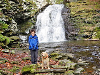 At the lower end of the pond, we turned right and walked out to the beach. I again stopped to take pictures of a scene I had photographed many times! The water level in the pond was much higher than it had been all summer and fall. There was ice accumulated at the edge of the water and it looked like the pond may have been frozen over at some time. The skies were still overcast but the precipitation had stopped. The hike from the outlet to the trail junction is all downhill but we had to be careful to avoid icy spots. Sheila did not seem to mind the icy or snow! By 1:40 PM we had hiked 4.8 miles and were back at the trail junction and register box. I decided that I wanted to walk over to the falls and we turned left on the path to the falls. We walked up the path toward the lower falls and then down the bank to the streambed. I was happy when I saw that the falls was flowing freely. I took a few quick pictures of falls including a few with Sheila and Bryce. We walked back up the bank and out to the main trail to continue our hike back to the car. We walked up to the lower parking area where a few people were gathered at the kiosk looking at the maps. None of them was wearing blaze orange or any bright colors. I advised them to stay on the trails as we had seen several hunters in the area. As we walked up the road back to the car, I stopped at the overlook but decided not to walk down to take pictures of the upper falls. We continued up the road and back to the car. We arrived back at 2:05 PM having covered 5.6 miles and 1120 vertical feet in 2 hours and 55 minutes. On the way home, we stopped at the Roscoe Brewery where I picked up three bottles of their bourbon barrel aged stout. I dropped Brad and Bryce at the house and went to Liberty Beer World to score two bottles of a Bourbon County variation.
![]()
![]()
![]()
![]()
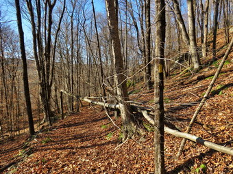
![]() On Saturday, November 16th, I did some chores in the morning. It was the first day of deer rifle season so I wanted to wait until mid-morning to start my hiking. I decided that I would go to Frick Pond and do some trail maintenance on the Flynn Trail. Some recent high winds had brought down some trees on the trail which I had found on a previous hike. Cindy was not interested in going with me so I knew I would be alone. As I started to get ready at 10:30 AM, the temperature was in the low 30's but the sky was blue and there was some sun. Sheila got wind of what was going on and began running around the house barking. I got dressed in my Mammut long-sleeved crew that is warmer than most other tops I have. I also put on a long-sleeved baselayer. I decided to wear my Columbia Titanium insulated pants to keep the chill away with a pair of light tights underneath. I wore my Vasque Taku boots which are supportive and surprisingly roomy. I grabbed a pair of Leki poles with external locks that I have been using lately. I also donned my Mammut hoody which was enough zippers to dump heat when needed. I put on a blaze orange hat and wore a light pair of gloves. I found an orange vest and put it on Sheila who did not seem to mind. I decided not to take poles as I would be carrying my Fiskars axe. I packed my Silky Sugowaza and Katanaboy saws which do an excellent job of clearing blowdowns. I also put in a pair of felling wedges in case the saws happened to bind. We left Livingston Manor at 10:40 AM and I drove out the DeBruce Road about 6 miles to Mongaup Road. I turned left and continued up the road to the point where it splits. I stayed left on Beech Mountain Road and drove to the parking areas on the left. I pulled into the smaller parking area where several other cars were already parked. As we got ready to head out on the Flynn Trail, another car pulled into the lot. A woman walked over to the trailhead kiosk to look at the map. I asked if she needed some help but she told me her husband knew where they were going. I did notice that neither of them were wearing any bright colors! I set my GPS and we walked across the road to get on the Flynn Trail at 11:00 AM. This trail is sited along what used to be Beech Mountain Road which was the access for the Beech Mountain Boy Scout Camp. We walked the trail through the woods and turned right on the woods road. I set a very quick pace up the Flynn Trail despite the load I was carrying since I was trying to stay ahead of the couple who left after us. The trail gains a little over 600 feet in 1.75 miles to the highest point at the junction with the Big Rock Trail. The temperature was still in the low 30's and there was a slight breeze blowing so I was glad I had dressed warmly. We passed through the arch Cindy and I had cut through an enormous hemlock that had fallen across the trail. After some time, I saw the couple approaching from behind and I stopped to move some brush off the trail. As they passed I suggested that they stay of the trails since the area in heavily hunted.
On Saturday, November 16th, I did some chores in the morning. It was the first day of deer rifle season so I wanted to wait until mid-morning to start my hiking. I decided that I would go to Frick Pond and do some trail maintenance on the Flynn Trail. Some recent high winds had brought down some trees on the trail which I had found on a previous hike. Cindy was not interested in going with me so I knew I would be alone. As I started to get ready at 10:30 AM, the temperature was in the low 30's but the sky was blue and there was some sun. Sheila got wind of what was going on and began running around the house barking. I got dressed in my Mammut long-sleeved crew that is warmer than most other tops I have. I also put on a long-sleeved baselayer. I decided to wear my Columbia Titanium insulated pants to keep the chill away with a pair of light tights underneath. I wore my Vasque Taku boots which are supportive and surprisingly roomy. I grabbed a pair of Leki poles with external locks that I have been using lately. I also donned my Mammut hoody which was enough zippers to dump heat when needed. I put on a blaze orange hat and wore a light pair of gloves. I found an orange vest and put it on Sheila who did not seem to mind. I decided not to take poles as I would be carrying my Fiskars axe. I packed my Silky Sugowaza and Katanaboy saws which do an excellent job of clearing blowdowns. I also put in a pair of felling wedges in case the saws happened to bind. We left Livingston Manor at 10:40 AM and I drove out the DeBruce Road about 6 miles to Mongaup Road. I turned left and continued up the road to the point where it splits. I stayed left on Beech Mountain Road and drove to the parking areas on the left. I pulled into the smaller parking area where several other cars were already parked. As we got ready to head out on the Flynn Trail, another car pulled into the lot. A woman walked over to the trailhead kiosk to look at the map. I asked if she needed some help but she told me her husband knew where they were going. I did notice that neither of them were wearing any bright colors! I set my GPS and we walked across the road to get on the Flynn Trail at 11:00 AM. This trail is sited along what used to be Beech Mountain Road which was the access for the Beech Mountain Boy Scout Camp. We walked the trail through the woods and turned right on the woods road. I set a very quick pace up the Flynn Trail despite the load I was carrying since I was trying to stay ahead of the couple who left after us. The trail gains a little over 600 feet in 1.75 miles to the highest point at the junction with the Big Rock Trail. The temperature was still in the low 30's and there was a slight breeze blowing so I was glad I had dressed warmly. We passed through the arch Cindy and I had cut through an enormous hemlock that had fallen across the trail. After some time, I saw the couple approaching from behind and I stopped to move some brush off the trail. As they passed I suggested that they stay of the trails since the area in heavily hunted.
 The first blowdown we came to was not really blocking the trail but I wanted to remove it. I dropped my pack and took 'before' pictures. I picked up some loose branches and then used the Sugowaza to trim some small branches. A few cuts with the small saw and I was able to drag the rest of the branches off the trail. I took some "after" pictures and we continued to the next blowdown. The second blowdown was a single tree that had broken off partially about 6 feet above ground. The rest of the tree had fallen across the trail. After taking pictures I used the axe to section the small tree. I made two cuts and was able to easily move the sections off the trail. I took some shots and then we continued on the hike. The next obstacles we ran across were a larger dead log and a small tree across the trail. I was able to pivot the log off the trail. After one cut with the small saw, I dragged the smaller tree sections off the trail. I was feeling a little warmer from the work as we continued up the Flynn Trail. The next blowdown was a large tree that I had partly trimmed on a previous trip. This one had a large diameter but I thought I could trim in back enough to clear the trail without cutting the main truck. I took some pictures and then got to work. I was able to use the large saw to cut off the pieces that were blocking the trail. I decided I did not want to fight with the large, main trunk so I took some "after" shots and walked to the junction with the Big Rock Trail. I had intended to turn around and walk back down the Flynn Trail but I remembered Lisa had told me about a large blowdown on the Big Rock Trail just after Times Square. After hiking 1.7 miles to the junction, we turned left and started down the Big Rock Trail toward Times Square. The trail was largely clear of branches and I did not have to remove any on the trip down. I set a very fast pace as we descended the trail passing through the various twists and turns that often make it seem like the bottom of the hill is close. We were soon at Times Square and I continued straight across to stay on the Big Rock Trail. I noticed that a few branches had been cut by chainsaw just after Times Square which I assumed was the work of a DEC crew. The tire tracks in the mud were still visible and were the result of the DEC crew running an ATV under wet conditions. I wondered of this was the blowdown Lisa had seen. We continued along the wet and muddy trail although most of the mud was frozen.
 Just before we entered the trees again, we came to a huge, complex blowdown that almost completely blocked the trail. I walked through it and dropped my pack on the other side. I immediately took pictures and then began to examine the mess. I used the small saw to begin to cut off small branches which is what I always do first. I continued to cut away smaller branches and the slightly large ones. At one point, Sheila barked and I saw a couple hiking toward us from Times Square. I told Sheila to "Stay" and said "Hello" as they passed. They thanked me for the trail maintenance and asked me if I needed some help. I considered the offer but in the end said "Thank you, no!" I had everything cleared down to the larger branches. I grabbed the large saw and began to cut. This saw has extra large teeth which cut deeply with each stroke but can more easily buck when cutting. Eventually, I had everything cleared off the trail leaving some of the blowdown which had fallen off the trail. I was tired as I took some final pictures and packed up my tools. We continued to the bridges over the streams that feed Frick Pond. There was water flowing freely under both bridges. We continued along the Big Rock Trail and passed over the series of wooden walkways which continue to deteriorate. As we neared the end of the Big Rock Trail, I heard an saw two hikers coming toward the trail junction on the Quick Lake Trail. I put Sheila on her leash as we approached the junction. The hikers turned out to be the couple that had come by while I was working. We turned left on the Quick Lake Trail and walked to the bridge over the outlet stream. There was plenty of water coming out of the pond and I decided to stop to take some shots. I also told the other hikers that Beech Mountain was the highest point in Sullivan County and we had a short discussion before they moved on. After a few minutes, Sheila and I were ready to leave just as a bow hunter came down the hill toward us. We said "Hello" and the continued toward Gravestone Junction. We continued on the Quick lake Trail back to the parking area. The trail was frozen with patches of ice and frozen mud. As we walked along the trail we met two more hunters with rifles headed toward the pond. We arrived at the car at 2:10 PM after hiking 4.4 miles in 3 hours and 5 minutes. The elevation gain was 700 feet and our moving speed was 2.3 mph!
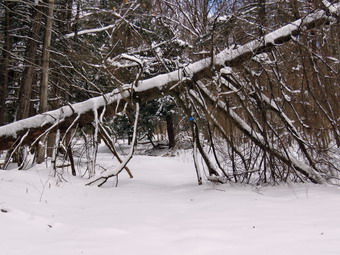
 On the way home I was thinking about a blowdown on the Round Top Trails. There was only one that I knew about but and it was not really blocking the trail. The blowdown consisted of one medium diameter tree which was hanging over the trail. The tree was very long and I did not like the fact that it was hanging over where people walked. As I drove into town, I decided top drive up to the Round Top trailhead and dispatch the blowdown. As I pulled up to the trailhead, I was surprised to see a couple stretched out on the steps taking in the sun. I parked and got Sheila and my tools out of the car. As we approached the steps, the couple did not move and did not speak to us. We walked to the first trail junction and turned right to walk up the old woods road. Almost immediately we came to the blowdown which was longer than I remembered. I walked passed it, dropped my pack and took some pictures. The tree had broken about 6 feet above the ground and I checked to see if it would just fall. The downed part was still securely connected to the standing trunk so I decided to section the trunk with the axe. I had just sharpened the axe and it bit deeply into the wood with very stroke. After making one cut I made another expecting that all the chopping would loosed the rest and it would fall. When the remaining section did not fall, I thought I might cut the standing trunk. I finally decided to use the big saw to make one more cut. This time when the cut was finished the reaming section swung down next to the standing truck. I rolled all the sections off the trail, took some pictures and returned to the car.
![]()
![]()
![]()
![]() On Monday, November 11th I wanted to take a hike but had to remain at home as we were having our in-ground oil tank replaced. Around 9:00 AM, Cindy let me know that Bryce would be coming and that I might be able to get away for a short hike. Bryce and Karl did arrive just before 10:00 AM. Karl went to work leaving Bryce with me to hike. I decided we would take a short walk on Round Top which is just across the street from my house. The day was warmer than previous days and the temperature was in the low 40's as we started to get ready. Sheila had been in her kennel all morning and so was more than happy to being going outside. I put on my long-sleeved Mammut top without a baselayer. I decided to wear my Columbia Titanium insulated pants to keep the chill away. I wore my Keen Targhee III boots which are supportive and surprisingly roomy. I grabbed a pair of Leki poles with external locks that I have been using lately. I also donned my Mammut hoody which was enough zippers to dump heat when needed. I put on a light hat and wore a light pair of gloves. At 11:00 AM we walked out the door to start the hike. I grabbed Sheila's leash from the car and we walked up the driveway. I decided we would try to do some figure 8's knowing Bryce had to be back a little after noon. I aimed to hike for about an hour. Sheila was happy to get out as we headed down the driveway and across the street. We crossed the street and walked to the parking area by the Presbyterian Church. We walked to the back of the church and began the ascent of the steepest hill behind the church. The hill is short but gets the circulation pumping and is the steepest and longest climb on the "trail." Sheila helped me along by pulling me up the hill. When we got to the top of the hill, we started on the trail by turning left at the trailhead. I let Sheila off her leash so that she could explore. The trail bed is becoming worn it which means that a few people are using the trail. I am always happy to see that someone else uses the trails.
On Monday, November 11th I wanted to take a hike but had to remain at home as we were having our in-ground oil tank replaced. Around 9:00 AM, Cindy let me know that Bryce would be coming and that I might be able to get away for a short hike. Bryce and Karl did arrive just before 10:00 AM. Karl went to work leaving Bryce with me to hike. I decided we would take a short walk on Round Top which is just across the street from my house. The day was warmer than previous days and the temperature was in the low 40's as we started to get ready. Sheila had been in her kennel all morning and so was more than happy to being going outside. I put on my long-sleeved Mammut top without a baselayer. I decided to wear my Columbia Titanium insulated pants to keep the chill away. I wore my Keen Targhee III boots which are supportive and surprisingly roomy. I grabbed a pair of Leki poles with external locks that I have been using lately. I also donned my Mammut hoody which was enough zippers to dump heat when needed. I put on a light hat and wore a light pair of gloves. At 11:00 AM we walked out the door to start the hike. I grabbed Sheila's leash from the car and we walked up the driveway. I decided we would try to do some figure 8's knowing Bryce had to be back a little after noon. I aimed to hike for about an hour. Sheila was happy to get out as we headed down the driveway and across the street. We crossed the street and walked to the parking area by the Presbyterian Church. We walked to the back of the church and began the ascent of the steepest hill behind the church. The hill is short but gets the circulation pumping and is the steepest and longest climb on the "trail." Sheila helped me along by pulling me up the hill. When we got to the top of the hill, we started on the trail by turning left at the trailhead. I let Sheila off her leash so that she could explore. The trail bed is becoming worn it which means that a few people are using the trail. I am always happy to see that someone else uses the trails.
At the first trail junction, we followed Sheila as she turned right on the woods road which is the shallower approach to the trail system. On the way up the old woods road we came across a tree that had come down across the trail. We could easily pass under the tree but I made a note to make another trip with a few tools to get rid of it. We continued to follow the yellow trail to the first junction where we turned left and followed it to the next trail junction. We kept a quick pace as we walked and talked. At the second junction with the blue trail, we turned right and started up the steep blue trail that leads over the summit of Round Top. As we ascended the trail, Sheila alerted and I looked back to see a couple hiking up the trail behind us. I put Sheila on her leash and we continued up the trail clearing a few branches along the way. We walked across the flat summit of Round Top and started down the other side. I had trimmed much of the trail earlier in the summer but this part still had some branches encroaching on the trail. Soon we were back at the yellow trail and the couple behind us had caught up. We stopped to talk and I explained I had helped construct and maintain the trails. It was their first time on the trails despite having a home in the area for 12 years. When we were done with our conversation, we turned right and walked the yellow trail to the next trail junction. This time we turned left and followed the yellow trail downhill toward the lookout. We continued down to the lookout and followed the yellow trail as it turned left and descended the hill to the first trail junction. The walk had gone quickly, so I decided we should explore some off the trails. We started up the woods road again but almost immediately turned left and followed a route up through the cliffs. Bryce and Sheila easily ascended the steep path up the hill and between some rocks. It took me a little longer but I was rewarded by a nice lookout. We walked to another set of rocks and climbed to the top of those. From there we walked along the edge of a small ravine eventually intersecting the yellow trail. We crossed the trail and began to bushwhack and ascent to the summit of Round Top. At the top of the hill, we found the blue rail and turned left to descend to the yellow trail. We turned left and followed the yellow rail back to the junction with the blue trail. Here we turned right and headed down the yellow trail to the woods road. On the way down we turned right and walked over to the base of the "cliffs" to a large slab of rock that seemed to have slipped off the others. We found that someone had built up some rooks walls and gathered wood. After a short inspection, we returned to the yellow trail on the woods road. we ended up back at the very first trail junction. I checked the time and determined that we should return home given the time. We walked out toward the trailhead where I put Sheila on her leash. We walked down the hill and through the church parking lot to the road and to our driveway. It was 12:15 PM and we had hiked for a little over an hour.
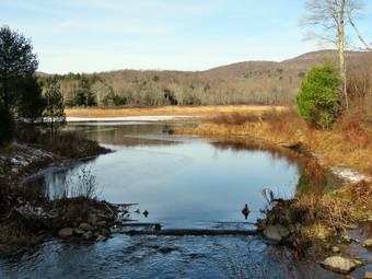
![]()
![]()
![]()
![]()
![]() On Saturday, November 9th I planned to hike in the afternoon following a joint drill between the LMFD and the LMVAC. We gathered at 9:00 AM at the firehouse for a drill involving an unconscious hunter in a tree stand. When we were paged, we headed off to the location on the Beaverkill Road. We all staged at an open space on the side of the road near the access trail to the tree stand. The fire department established a command post and sent resources up the hill using a newly commissioned UTV. I walked up the hill to the site which was les than a quarter mile. While the fire company was rigging ropes, I put on a harness and climbed the ladder of the tree stand to assess the patient. After I completed my assessment, I descended and participated in setting up a pulley and rope system to lower the patent to the ground. We completed the "rescue" and talked a little about the effort. We decided to repeat the exercise and this time it went much faster. Sometime after 11:00 AM, we returned to the ambulance and then to the building. I returned home and waited for Cindy to return from an appointment. When she arrived home, she did not feel like hiking so I began to get ready. The temperature was only 32 degrees despite some sun so I knew I would have to dress warmly. I began to get my gear together closely watched by Sheila who knew that we were going hiking. I got dressed in a Mammut long-sleeved crew top that is warmer than most I have. I wore a long-sleeved baselayer beneath it. I put on a pair of Columbia Titanium insulated pants over a light pair of tights. I decided to wear my Vasque Taku hiking boots which fit well and have been discontinued. These boots are not insulated and I new I would have to start wearing an insulated pair given the cold weather in the forecast. I topped this all off with my Mammut hoody, a light hat and a pair of light gloves. I grabbed a pair of Leki external lock poles I have been using lately and made sure I had a full water bottle. I put my gear in the car and Sheila in the back seat and left the house at 1:00 PM. I headed out the DeBruce Road and after six miles I turned left on Mongaup Road. Where the road split I stayed left on Beech Mountain Road and drove to the parking lots. There were already several cars in the lots as I pulled in to park. I got ready to get on the trail by setting my GPS.
On Saturday, November 9th I planned to hike in the afternoon following a joint drill between the LMFD and the LMVAC. We gathered at 9:00 AM at the firehouse for a drill involving an unconscious hunter in a tree stand. When we were paged, we headed off to the location on the Beaverkill Road. We all staged at an open space on the side of the road near the access trail to the tree stand. The fire department established a command post and sent resources up the hill using a newly commissioned UTV. I walked up the hill to the site which was les than a quarter mile. While the fire company was rigging ropes, I put on a harness and climbed the ladder of the tree stand to assess the patient. After I completed my assessment, I descended and participated in setting up a pulley and rope system to lower the patent to the ground. We completed the "rescue" and talked a little about the effort. We decided to repeat the exercise and this time it went much faster. Sometime after 11:00 AM, we returned to the ambulance and then to the building. I returned home and waited for Cindy to return from an appointment. When she arrived home, she did not feel like hiking so I began to get ready. The temperature was only 32 degrees despite some sun so I knew I would have to dress warmly. I began to get my gear together closely watched by Sheila who knew that we were going hiking. I got dressed in a Mammut long-sleeved crew top that is warmer than most I have. I wore a long-sleeved baselayer beneath it. I put on a pair of Columbia Titanium insulated pants over a light pair of tights. I decided to wear my Vasque Taku hiking boots which fit well and have been discontinued. These boots are not insulated and I new I would have to start wearing an insulated pair given the cold weather in the forecast. I topped this all off with my Mammut hoody, a light hat and a pair of light gloves. I grabbed a pair of Leki external lock poles I have been using lately and made sure I had a full water bottle. I put my gear in the car and Sheila in the back seat and left the house at 1:00 PM. I headed out the DeBruce Road and after six miles I turned left on Mongaup Road. Where the road split I stayed left on Beech Mountain Road and drove to the parking lots. There were already several cars in the lots as I pulled in to park. I got ready to get on the trail by setting my GPS.
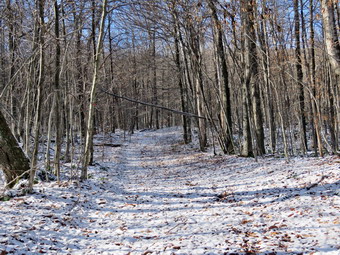 The temperature was 34 degrees and there was a slight breeze as we left the parking area at 1:15 PM. We headed out on the woods road that connects to the Quick Lake Trail at the register. The woods road after the register box was wet and muddy with some areas of frozen mud. There were several deep ruts on the trail made, I believe, by a DEC crew placing new signs and blazes. As we approached Gravestone Junction, I looked to the left at the memorial marker which was still in place. At Gravestone Junction I took note of the new sign which is still somewhat back from the trail but much more visible. We stayed to the left on the red Quick Lake Trail crossing the stepping stones the Willowemoc Trail Crew had installed. We walked down to the pond and I removed my pack to get out the camera. There was about an inch of snow on the ground and the was cloudy with some sun shining. The scene was much the same as always but I stopped to take a few pictures anyway. I took pictures of the pond and Flynn's Point. I picked up my pack and we crossed the bridge with Sheila madly dashing back and forth on the trail. We walked on the trail along the west side of the pond where there was more mud and frozen mud. At the trail junction with the Big Rock Trail, we headed left to stay on the Quick Lake Trail. We were keeping a pretty fast pace as we headed for Iron Wheel Junction. Sheila was running around following game trails and chasing a few chipmunks and squirrels. I began to notice a set of tracks that looked like two different boot prints. We passed through "spruce tunnel" to the small stream through the forest. The water was too high to cross where the trail crossed so I walked upstream to a shallower spot. I crossed without problems and Sheila crossed back and forth several times. We continued on the trail and arrived at Iron Wheel Junction. Here we turned left to head toward Hodge Pond staying on the Quick Lake Trail. We kept a quick pace up the hilly part of the trail and as we walked the snow depth increased to about two inches. The trail was washed out in several places by past and recent rains. The trail was wet and muddy but we were able to work our way around the worst spots. We continued on the trail until it leveled off and descended slightly to Junkyard Junction at 3.1 miles. We turned right at this intersection and headed across the Flynn Trail toward Hodge Pond. The Flynn Trail was mostly wet and muddy along the entire length. The trip across this part of the Flynn Trail went relatively quickly.
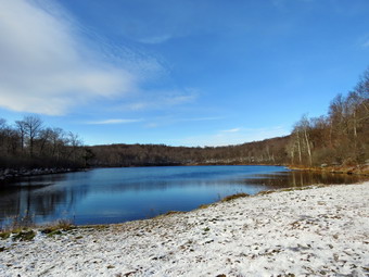 Soon we were at the gate where the trail turns right and heads down toward Hodge Pond. We reached the area near the shore of the pond and turned right to stay on the Flynn Trail along the west shore of Hodge Pond. The sky was still blue with some clouds and the sun was beginning to drop low in the sky. When we reached the open area at the southern end of the pond, I decided to stop for a few moments to take some pictures. The pond was very placid and almost bleak. After taking some final shots, we turned around and walked toward the opening where the Flynn Trail enters the woods. The hill up from Hodge Pond often seem long but on this day the walk went quickly. At the top of the hill, we turned right to stay on the Flynn Trail. The walk along the flat part of the Flynn Trail to the junction with the Big Rock Trail went quickly. As we neared the junction, Sheila alerted and I could see two hikers ahead of us. I assumed these were the footprints I had seen in the snow. I put Sheila on her leash as the other hikers headed down the Flynn Trail ahead of us. We had about 1.7 miles to go to get back to the car. This stretch can often seem long and boring but on this day I was occupied clearing a few blowdowns along the way. It seems the wind from the recent storms had brought down several trees across the trail. I was only able to clear a few loose branches from each before moving on. As we hiked, we nearly caught up to the couple ahead of us several times but fell back as I cleared the trail. Eventually we were close enough that I out Sheila on her leash so that we could pass them as they stopped to allow us to pass them. We said a quick "Hello" and then Sheila and I increased the pace. As we lost elevation there was less snow and soon we were passing through the opening Cindy and I had cut in a huge spruce that lies across the trail. This was still in good shape and allowed us to pass easily. We followed the Flynn Trail to the gate and then turned left to continue on the trail to avoid the private property around the cabin. We followed the trail through the woods and back to the car. As we were approaching the road, two cars pulled out from the parking area and started down the road. Before going to the car, I inspected the new map at the kiosk and found it to be a great improvement over what had been posted. We arrived back at 3:50 PM after hiking 6.4 miles in 2 hours and 35 minutes with 890 feet of elevation gain. We stopped for only 8 minutes and our moving average speed was 2.6 mph.
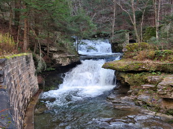
![]() On Saturday, November 2nd Cindy and I were returning from a hike on the Catskill Scenic Trail and a visit to Mine Kill Falls. On the way home I decided to take Barkaboom Road to Turnwood and then home. As I drove up the road, we could see the stream was flowing with some volume. I stopped at Tompkins Falls which was flowing nicely. I left Cindy and Sheila in the car and walked downstream on the road so that I could take some pictures. I have walked down to the stream bed in the past but this day I just walked down the bank to the narrow concrete shelf. From there I took pictures of the falls. I walked back up the bank and then back to the car. From here I walked down to the top of the falls and took more pictures. Some of the views here were very nice and the water volume was high. Some foundations and rock work were visible on the other side. Tompkins Falls was once dammed and was used to provide electrical power to Shavertown, Pepacton and Arena. These towns were flooded when the Pepacton Reservoir was created. After I finished taking, we returned to the car for the ride home.
On Saturday, November 2nd Cindy and I were returning from a hike on the Catskill Scenic Trail and a visit to Mine Kill Falls. On the way home I decided to take Barkaboom Road to Turnwood and then home. As I drove up the road, we could see the stream was flowing with some volume. I stopped at Tompkins Falls which was flowing nicely. I left Cindy and Sheila in the car and walked downstream on the road so that I could take some pictures. I have walked down to the stream bed in the past but this day I just walked down the bank to the narrow concrete shelf. From there I took pictures of the falls. I walked back up the bank and then back to the car. From here I walked down to the top of the falls and took more pictures. Some of the views here were very nice and the water volume was high. Some foundations and rock work were visible on the other side. Tompkins Falls was once dammed and was used to provide electrical power to Shavertown, Pepacton and Arena. These towns were flooded when the Pepacton Reservoir was created. After I finished taking, we returned to the car for the ride home.
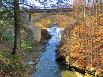
![]() On Saturday, November 2nd we left South Kortright and drove North on Route 10 toward Stamford. In Stamford I took Route 23 into Grand Gorge. From here I drove north on Route 30 toward Middleburg. After 5.5 miles, I turned into Mine Kill State Park and found the parking lot almost full. At 2:25 PM we got out of the car and headed down toward the viewing platform with the temperature hovering in the mid 40's. We knew the hike was short but I wanted to record a GPS track and take some pictures. I set my electronics and shouldered my pack. Since there were others enjoying the park, I put Sheila on her leash as we walked down the path toward the viewing platform. We walked down the steps to the platform passing a few people on the way. When we got to the platform, I put my pack down and got out my camera. There was another dog present so Sheila was excited. I took pictures from the wooer part of the platform as the water flows through a narrow crevice in the rocks. I walked back to the upper platform and took pictures of the falls under the road bridge. The water level was high but we had seen it higher. We left the platform and walked back up the trail. Just after the steps, we turned left and started to follow the trail down toward the base of the falls. The aqua blazes on the trail designated this as part of the Long Path. The trail was wet and muddy in places as it wound down to the pool at the base of the falls. I dropped my pack and took out the camera to get some pictures of the falls. The lighting was better than at other times but it still reflected off the water of the falls. The intermittent falls to the right of the main falls was flowing weakly. This falls has a higher drop than the main falls but a much lower volume. I was able to get pictures of the water as it flows between the rocks as well as shots of the lower falls as it spills into the pool. I also took pictures of the water falling from high off the cliffs. While I was doing this, another hiker with a dog said "Hello". I recognized the hiker as Jack, the principal of a local high school, who had worked in my school district. Cindy took a picture of Sheila and I in front of the falls. Jack offered to take a picture of all of us and Cindy gave him her cell phone. We talked for a minute and then headed back up the trail. We walked from the bottom of the falls back to the top and turned left to go back to the car. We were back at the car and leaving the parking area at 3:00 PM. I drove out to Route 30 and turned left to head toward Grand Gorge. I considered going to Pratt Rock or Red Falls but decided just to drive toward home. I thought I might stop at Tompkins Falls on the Barkaboom Road on the way home.
On Saturday, November 2nd we left South Kortright and drove North on Route 10 toward Stamford. In Stamford I took Route 23 into Grand Gorge. From here I drove north on Route 30 toward Middleburg. After 5.5 miles, I turned into Mine Kill State Park and found the parking lot almost full. At 2:25 PM we got out of the car and headed down toward the viewing platform with the temperature hovering in the mid 40's. We knew the hike was short but I wanted to record a GPS track and take some pictures. I set my electronics and shouldered my pack. Since there were others enjoying the park, I put Sheila on her leash as we walked down the path toward the viewing platform. We walked down the steps to the platform passing a few people on the way. When we got to the platform, I put my pack down and got out my camera. There was another dog present so Sheila was excited. I took pictures from the wooer part of the platform as the water flows through a narrow crevice in the rocks. I walked back to the upper platform and took pictures of the falls under the road bridge. The water level was high but we had seen it higher. We left the platform and walked back up the trail. Just after the steps, we turned left and started to follow the trail down toward the base of the falls. The aqua blazes on the trail designated this as part of the Long Path. The trail was wet and muddy in places as it wound down to the pool at the base of the falls. I dropped my pack and took out the camera to get some pictures of the falls. The lighting was better than at other times but it still reflected off the water of the falls. The intermittent falls to the right of the main falls was flowing weakly. This falls has a higher drop than the main falls but a much lower volume. I was able to get pictures of the water as it flows between the rocks as well as shots of the lower falls as it spills into the pool. I also took pictures of the water falling from high off the cliffs. While I was doing this, another hiker with a dog said "Hello". I recognized the hiker as Jack, the principal of a local high school, who had worked in my school district. Cindy took a picture of Sheila and I in front of the falls. Jack offered to take a picture of all of us and Cindy gave him her cell phone. We talked for a minute and then headed back up the trail. We walked from the bottom of the falls back to the top and turned left to go back to the car. We were back at the car and leaving the parking area at 3:00 PM. I drove out to Route 30 and turned left to head toward Grand Gorge. I considered going to Pratt Rock or Red Falls but decided just to drive toward home. I thought I might stop at Tompkins Falls on the Barkaboom Road on the way home.
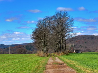
![]()
![]()
![]()
![]()
![]() On Saturday, November 2nd, I wanted to get out for a hike after a long week at school. I knew that Cindy would want a relatively flat hike so I suggested we hike a section of the Catskill Scenic Trail from South Kortright toward Bloomville. This was the only section I lacked to complete the trail. I estimated this would be about 84 to 5 miles round trip which is within our abilities. It was 26 degrees when I woke up but the sun was out and I hoped it would warm up some. The weather report indicated a beautiful day with no rain and plenty of but highs only in the mid 40's. I had to do some chores before we left so I didn't start to get ready until just before 10:00 AM. I got dressed in my Mammut pullover which is a little heavier than some of my other tops. I wore this over a short-sleeved baselayer but debated wearing a long-sleeved one. I put on a pair of RailRiders hiking pants which are expensive but last along time and have features like deep pockets and a generous cut which I really like. I though about wearing insulated pants but thought I would be warm enough without them. I decided to wear my Keen Targhee III hiking boots which fit well especially when there are no mountains involved. I grabbed a pair of Leki external lock poles I have been using lately and added a light windbreaker, light Mountain Hardwear hat and a pair of light Outdoor Research gloves. I put our gear in the car around 10:30 AM and let Sheila in the back seat. Sheila loves to get out an hike anywhere and she had kept her eye on both of us as we were getting ready. As we left Livingston Manor at 10:30 AM, it was still only 40 degrees. I drove north and west on State Route 17 to exit 94 (Roscoe) and headed north on Route 206 toward Downsville. At the Pepacton Reservoir, I turned left to stay on Route206/30 and drove through Downsville heading toward Walton. Just after the light in Downsville, I turned right on Telford Hollow Road. After driving over the hill, I turned right at the bottom of the hill and drove out to Route 10. I turned right and drove toward Delhi. I continued on Route 10 north for 13 miles to South Kortright and turned right on CR-18. I drove across a beautiful stone bridge over the West Branch of the Delaware River. At the end of the road, I turned right and almost immediately found the point where the trail crosses the road across from the South Kortright Cemetery. I turned around and found a place where I could pull off the road and park. I set my GPS and we started south on the trail toward Bloomville at 11:40 AM.
On Saturday, November 2nd, I wanted to get out for a hike after a long week at school. I knew that Cindy would want a relatively flat hike so I suggested we hike a section of the Catskill Scenic Trail from South Kortright toward Bloomville. This was the only section I lacked to complete the trail. I estimated this would be about 84 to 5 miles round trip which is within our abilities. It was 26 degrees when I woke up but the sun was out and I hoped it would warm up some. The weather report indicated a beautiful day with no rain and plenty of but highs only in the mid 40's. I had to do some chores before we left so I didn't start to get ready until just before 10:00 AM. I got dressed in my Mammut pullover which is a little heavier than some of my other tops. I wore this over a short-sleeved baselayer but debated wearing a long-sleeved one. I put on a pair of RailRiders hiking pants which are expensive but last along time and have features like deep pockets and a generous cut which I really like. I though about wearing insulated pants but thought I would be warm enough without them. I decided to wear my Keen Targhee III hiking boots which fit well especially when there are no mountains involved. I grabbed a pair of Leki external lock poles I have been using lately and added a light windbreaker, light Mountain Hardwear hat and a pair of light Outdoor Research gloves. I put our gear in the car around 10:30 AM and let Sheila in the back seat. Sheila loves to get out an hike anywhere and she had kept her eye on both of us as we were getting ready. As we left Livingston Manor at 10:30 AM, it was still only 40 degrees. I drove north and west on State Route 17 to exit 94 (Roscoe) and headed north on Route 206 toward Downsville. At the Pepacton Reservoir, I turned left to stay on Route206/30 and drove through Downsville heading toward Walton. Just after the light in Downsville, I turned right on Telford Hollow Road. After driving over the hill, I turned right at the bottom of the hill and drove out to Route 10. I turned right and drove toward Delhi. I continued on Route 10 north for 13 miles to South Kortright and turned right on CR-18. I drove across a beautiful stone bridge over the West Branch of the Delaware River. At the end of the road, I turned right and almost immediately found the point where the trail crosses the road across from the South Kortright Cemetery. I turned around and found a place where I could pull off the road and park. I set my GPS and we started south on the trail toward Bloomville at 11:40 AM.
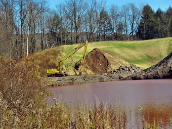 The trail is wide and flat for its entire length and this section is extreme flat. The first part of the trail passes through the backyard of some homes in South Kortright. I noticed that the duck pond near the cemetery was no longer completely. Green. Most of the trees had no leaves. We walked "through" a small farm with a house on the left and a barn on the right. The yard by the house had six small dogs all of which were yapping at the top of their lungs. There were to large boats in the yard one of which looked like an old lake tour boat. The trail passed through some tress with views of the flat valley and low surrounding hills on both sides. We could look ahead for at least half a mile. At one point, an ATV and a dirt bike came at us from the opposite direction. I did not think they were supposed to be on the trail but I grabbed Sheila to put on her leash. The riders waved and exited the trail until we passed by when they continued on their journey. I stopped to take a few pictures. As we continued on the trail we broke out of the trees into open farm land. I again took a few shots. We eventually entered the trees again where the river came closer to the trail on the right with a smaller creek on the left. Both streams were high and the water was flowing quickly. At 1.85 miles we came to a bridge and I knew that this should be the point where I had ended hiking from Bloomville toward South Kortright. Nothing looked familiar so we continued and crossed another bridge. At 2.5 miles we came to another bridge that had a bench on the other side. I knew that I had been there before so I told Cindy we would turn around.
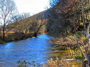 We got a drink, shared a bar and started back at 12:45 PM. I took some pictures of the river before we started out and then stopped at the second bridge to take some more. We came to a point where there was a sand pit on the right of the trail. I got out my camera and walked off the trail to take some shots. The sand and gravel pit was large than I though but it was filled with water. Despite the equipment still in place I thought it might be unused. We continued along the trail setting a fast pace as the return trip had nothing that the trip out did not have. All of the crops had been harvested leaving only short stalks behind. One farmer was using a disc harrow to till his field. Fortunately, the dogs that had greeted us at the beginning of the hike were not present when we returned. We were back at the car at 1:45 PM having hiked 5 miles in 2 hours and 5 minutes with only 150 feet of elevation gain. Since we still had some time, we decided to go to Mine Kill Falls to check out the waterfalls there.
![]()
![]()
![]()
![]()
![]() On Saturday, October 26th, I wanted to work on completing the Catskill Scenic Trail which is a rail trail that runs between Bloomville and Roxbury. The biggest section I had left was between Grand Gorge and Roxbury which I estimated was about 6 miles. I knew I could probably hike the distance round trip but I asked Cindy if she wanted to take two cars. Two cars would allow us to park one in Grand Gorge and drive to Roxbury allowing us to hike the trail one way. Cindy declined so I decided to go by myself. The weather forecast seemed prefect with sunny to partly cloudy skies and highs in the high 50's. It was cool and foggy early in the morning but I decided to get ready and leave. I got dressed in my White Sierra long-sleeved crew top with a short-sleeved baselayer. I put on a pair of RailRiders hiking pants which are expensive but last along time and have features like deep pockets and a generous cut which I really like. The pants have Velcro closures at the ankles which I hoped would mean I did not need gaiters. I decided to wear my Vasque Taku hiking boots which fit well and have been discontinued. I grabbed a pair of Leki external lock poles I have been using lately. I also added a new OR floppy hat which was another present from Cindy. I have decided it shields me from the sun and allows me to spray some insect repellant on it rather than on me. I also wore a light OR windbreaker and a pair of light gloves. Sheila loves to get out an hike anywhere and she had kept her eye on me as I was getting ready. I put my gear in the car and Sheila in the back seat and left Livingston Manor at 8:45 AM. The temperature was in the mid 40's and there was still some fog and haze. I drove north and west on State Route 17 to exit 94 (Roscoe) and headed north on Route 206 toward Downsville. At the Pepacton Reservoir, I turned right to get on Route 30 and drove to the Dunraven Bridge over the Pepacton Reservoir. I turned left and crossed the bridge continuing on Route 30. At the end of the road I turned right to continue of Route 30 and then turned left in Margaretville following Route 30 toward Roxbury. I passed through Roxbury and parked on the side of Hardscrabble Road across from the trailhead for the Catskill Scenic Trail. The trail as many nice features but parking is not one of them! The temperature was in the nigh 40's as I set my GPS and put Sheila on her leash to cross the road at 10:10 AM.
On Saturday, October 26th, I wanted to work on completing the Catskill Scenic Trail which is a rail trail that runs between Bloomville and Roxbury. The biggest section I had left was between Grand Gorge and Roxbury which I estimated was about 6 miles. I knew I could probably hike the distance round trip but I asked Cindy if she wanted to take two cars. Two cars would allow us to park one in Grand Gorge and drive to Roxbury allowing us to hike the trail one way. Cindy declined so I decided to go by myself. The weather forecast seemed prefect with sunny to partly cloudy skies and highs in the high 50's. It was cool and foggy early in the morning but I decided to get ready and leave. I got dressed in my White Sierra long-sleeved crew top with a short-sleeved baselayer. I put on a pair of RailRiders hiking pants which are expensive but last along time and have features like deep pockets and a generous cut which I really like. The pants have Velcro closures at the ankles which I hoped would mean I did not need gaiters. I decided to wear my Vasque Taku hiking boots which fit well and have been discontinued. I grabbed a pair of Leki external lock poles I have been using lately. I also added a new OR floppy hat which was another present from Cindy. I have decided it shields me from the sun and allows me to spray some insect repellant on it rather than on me. I also wore a light OR windbreaker and a pair of light gloves. Sheila loves to get out an hike anywhere and she had kept her eye on me as I was getting ready. I put my gear in the car and Sheila in the back seat and left Livingston Manor at 8:45 AM. The temperature was in the mid 40's and there was still some fog and haze. I drove north and west on State Route 17 to exit 94 (Roscoe) and headed north on Route 206 toward Downsville. At the Pepacton Reservoir, I turned right to get on Route 30 and drove to the Dunraven Bridge over the Pepacton Reservoir. I turned left and crossed the bridge continuing on Route 30. At the end of the road I turned right to continue of Route 30 and then turned left in Margaretville following Route 30 toward Roxbury. I passed through Roxbury and parked on the side of Hardscrabble Road across from the trailhead for the Catskill Scenic Trail. The trail as many nice features but parking is not one of them! The temperature was in the nigh 40's as I set my GPS and put Sheila on her leash to cross the road at 10:10 AM.
 The trail is wide and flat for its entire length and this section was no exception. As we started out on the trail, I was surprised that there were still leaves on the trail and enough color to make the landscape interesting. I stopped several times to take pictures of the trail and the surrounding mountains. Ti the right of the trail are Schultice and Irish Mountains that are on the Catskill highest Hundred list. In a short distance we crossed Teichman Road and passed through the grounds of a small factory. The smells coming from the facility were unpleasant so we hurried by as quickly as possible. I took some more pictures and then we continued crossing Schuman Road. The two mountains were on our right with others ahead of us. We came to the area which is marked as the "Headwaters of the East Branch of the Deleware River". There was evidence of beaver activity all along the waterways with water impounded by dams. At one point several ducks arose from a small pond along with a blue heron. I made sure to take pictures of all the K markers which marked the distance from Kingston on the railroad. The only person we saw on this stretch was a runner who passed us from the direction of Roxbury and again on his return trip. We passed several places where cars can access the trail from Route 30 and we were soon approaching Grand Gorge. As we passed behind the Firestone tire dealership, I noticed that the ground was very wet. We skirted the area to the side but soon came to the reason for the water. The beavers had put up a small dam which was backing up the water. We tried to find a way around but eventually turned around and walked back to the last access point. We walked out to Route 30 and walked east toward Grand Gorge. We passed the garage and I could see that the trail crossed the road. We turned left onto the trail and started to walk toward Route 23 where I had stopped on my last trip. There were some nice stone walls along this section of trail but the trail was also wet and muddy. We came to a nice "cut" through a small hill and I took a few shots. We continued to walk eventually crossing a side road. The distance was longer than I expected so I checked my GPS device and the Avenza app on my phone. Both showed we were on the right track and close to my goal.
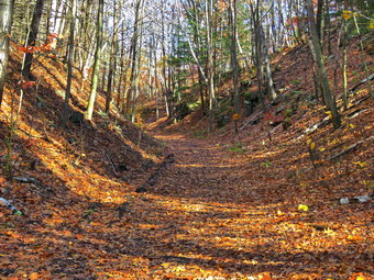 At 1:00 PM we crossed Route 23 and prepared to retrace our route back to the car. I checked my GPS and was surprised to see we had hiked 7.25 miles. I was certainly tired and knew that the return trip might be quicker as I did not intend to stop for pictures but that it would also be boring. We again crossed the road and began the walk back. Within a short distance, I heard "On your right" immediately behind me. A male rider passed us on his mountain bike. I thought that a little more advanced notice would have been nice! The walk back to Route 30 went quickly and we turned right to head back toward Roxbury. At the first access point we came to, we turned left and then right onto the rail trail. My back had begun to hurt and I tried stretching it occasionally. I eventually got a drink, gave Sheila one and dumped out the rest of the water. The pack seemed much lighter which made the walk easier. The trail on the way back looked familiar but there were few ways to tell exactly where we were and how far we had to go. We did meet a couple hiking toward us and I exchanged a "Hello" with them. I was still hurting and wishing the hike would end. When we broke out from under Te trees, I could see that the sky was filled with clouds and that some were very interesting. I stopped to take some shots and noticed some people with dogs further back toward Grand Gorge. They turned to walk away from us. When we passed marker 62, I knew we had just over a mile to go. We walked in back of the factory and continued to the point where the trail ended. We crossed the trail and I was never so happy to be back at the car. It was 3:50 PM and we had hiked 14 miles in 5 hours and 40 minutes with over 30 minutes of stopped time. The GPS unit showed 670 feet of elevation gained but I am not sure I believe it.
![]()
![]()
![]()
![]() On Monday, October 24th I was tired when I came home from school. Sheila met me and, as always, was happy to see me. I knew that she wanted to go for a walk so I asked Cindy if she would like to go across the street to take a short walk on Round Top. Cindy agreed and we got ready to go. The day was sunny and the temperature was in the mid 60's. I put on my long-sleeved White Sierra top without a baselayer. I put on a pair of RailRiders hiking pants which are expensive but last a long time and have features like deep pockets and a generous cut which I really like. The pants have Velcro closures at the ankles. I decided to wear my Keen Targhee III boots which are supportive and surprisingly roomy. I grabbed a pair of Leki poles with external locks that I have been using lately. I also donned a light windbreaker and put on my a floppy hat Cindy had bought me. At 4:05 PM we walked out the door to start the hike. I grabbed Sheila's leash from the car and we walked up the driveway. I decided we would try to do just two figure 8's. I aimed to hike for about an hour. Sheila was happy to get out as we headed down the driveway and across the street. We crossed the street and walked to the parking area by the Presbyterian Church. We walked to the back of the church and began the ascent of the steepest hill behind the church. The hill is short but gets the circulation pumping and is the steepest and longest climb on the "trail." Sheila helped me along by pulling me up the hill. We stopped once on the way up to take a look at the fall colors but there wasn't much in the way of any brilliant spots. When we got to the top of the hill, we started on the trail by turning left at the trailhead. I let Sheila off her leash so that she could explore. The trail bed is becoming worn it which means that a few people are using the trail. I am always happy to see that someone else uses the trails.
On Monday, October 24th I was tired when I came home from school. Sheila met me and, as always, was happy to see me. I knew that she wanted to go for a walk so I asked Cindy if she would like to go across the street to take a short walk on Round Top. Cindy agreed and we got ready to go. The day was sunny and the temperature was in the mid 60's. I put on my long-sleeved White Sierra top without a baselayer. I put on a pair of RailRiders hiking pants which are expensive but last a long time and have features like deep pockets and a generous cut which I really like. The pants have Velcro closures at the ankles. I decided to wear my Keen Targhee III boots which are supportive and surprisingly roomy. I grabbed a pair of Leki poles with external locks that I have been using lately. I also donned a light windbreaker and put on my a floppy hat Cindy had bought me. At 4:05 PM we walked out the door to start the hike. I grabbed Sheila's leash from the car and we walked up the driveway. I decided we would try to do just two figure 8's. I aimed to hike for about an hour. Sheila was happy to get out as we headed down the driveway and across the street. We crossed the street and walked to the parking area by the Presbyterian Church. We walked to the back of the church and began the ascent of the steepest hill behind the church. The hill is short but gets the circulation pumping and is the steepest and longest climb on the "trail." Sheila helped me along by pulling me up the hill. We stopped once on the way up to take a look at the fall colors but there wasn't much in the way of any brilliant spots. When we got to the top of the hill, we started on the trail by turning left at the trailhead. I let Sheila off her leash so that she could explore. The trail bed is becoming worn it which means that a few people are using the trail. I am always happy to see that someone else uses the trails.
At the first trail junction, we followed Sheila as she turned right on the woods road which is the shallower approach to the trail system. We continued to follow the yellow trail to the first junction where we turned left and followed it to the next trail junction. We kept a quick pace as we walked and talked. At the second junction with the blue trail, we turned right and started up the steep blue trail that leads over the summit of Round Top. Walking uphill we passed through what had been a sea of green ferns but was now a little brown and dried out. We walked across the flat summit of Round Top and started down the other side. I had trimmed much of the trail earlier in the summer but this part still had some branches encroaching on the trail. I sort of like the branches untrimmed as it makes the trail seem "wilder"! Soon we were back at the yellow trail. We turned right and walked the yellow trail to the next trail junction. This time we turned left and followed the yellow trail downhill toward the lookout. We continued down to the lookout and followed the yellow trail as it turned left and descended the hill to the first trail junction. The walk had gone quickly, so we turned around and started back up the hill back to the lookout. Sheila seemed happy we were going to stay out a little longer. We followed the yellow trail uphill toward the lookout and turned right to continue up to the next trail junction with the blue trail. At the trail junction, we turned right to stay on the yellow trail. At the next junction we turned left to climb the shallower side of the summit ascent. We again walked across the flat summit and descended the steeper trail which was almost completely dry. At the trail junction, we turned left and followed the yellow trail along the base of Round Top. At the next junction we turned right this time to follow the trail down to the woods road that leads out to the first trail junction. We completed the figure 8 ending up back at the very first trail junction. I checked the time and determined that we should return home given the time. We walked out toward the trailhead where I put Sheila on her leash. We walked down the hill and through the church parking lot to the road and to our driveway. It was 5:00 PM and we had hiked around 2 miles in about an hour.
![]()
![]()
![]()
![]()
![]() On Saturday, October 19th, I was with my ambulance corps standing by at a half marathon and 5K in Livingston Manor. Last year we did the same thing and were able to save the life of one of the runners who went into cardiac arrest. This year things went smoothly and the weather was nearly perfect. By 1:00 PM most of the runners had finished and we returned to our building. I went home and grabbed some lunch and waited until 1:30 PM to go out to hike. I had been planning to go to Alder Lake and hike to the Beaver Meadow Lean-to. The lean-to overlooks a beaver meadow which once a beaver pond. Recently, some pictures have been posted showing that the meadow is now a pond. The temperature was in the high 50's with plenty of sun and the conditions seemed perfect for a fall hike. As I began to get ready, Sheila was ready to go and stayed close to me to make sure she was going along. I got dressed in a new White Sierra long-sleeved crew top that Cindy had gotten me for my birthday with a short-sleeved baselayer. The White Sierra top has InsectSheild and is quite light. I put on a pair of RailRiders hiking pants which are expensive but last along time and have features like deep pockets and a generous cut which I really like. The pants have Velcro closures at the ankles but I decided to add a pair of OR BugOut gaiters. I decided to wear my Vasque Taku hiking boots which fit well and have been discontinued. I also grabbed a pair of Leki external lock poles. I put on a light windbreaker and new OR hat that was also a present from my wife. At 1:40 PM I put my equipment in the car and Sheila in the backseat and headed out the driveway. I drove north and west on Old Route 17 and turned right on Beaverkill Road heading toward Lew Beach. I passed through Lew Beach and followed the road as it passed through Turnwood. A little farther along, I turned left on Alder Creek Road and drove to the junction with Cross Mountain Road and the access road to Alder Lake. I turned right on the access road and drove to the parking area. The lot was almost full but I was able to find a spot to park at 2:00 PM. I set my GPS unit and put Sheila on her leash as there were some people in the area. We started our hike almost immediately by walking out the path passing the remains of the Coykendall mansion. I decided to walk down to the lakeshore and take some pictures. I was disappointed to find that most of leaves had fallen from the trees and there were no clouds in the sky. I took my camera out of my pack and took some shots. I was disappointed to find that the beautiful lawn at Alder Lake had been neglected with grass growing over knee high. Alder Lake is a popular spot for many people and I do not understand why the DEC has chosen to neglect it!
On Saturday, October 19th, I was with my ambulance corps standing by at a half marathon and 5K in Livingston Manor. Last year we did the same thing and were able to save the life of one of the runners who went into cardiac arrest. This year things went smoothly and the weather was nearly perfect. By 1:00 PM most of the runners had finished and we returned to our building. I went home and grabbed some lunch and waited until 1:30 PM to go out to hike. I had been planning to go to Alder Lake and hike to the Beaver Meadow Lean-to. The lean-to overlooks a beaver meadow which once a beaver pond. Recently, some pictures have been posted showing that the meadow is now a pond. The temperature was in the high 50's with plenty of sun and the conditions seemed perfect for a fall hike. As I began to get ready, Sheila was ready to go and stayed close to me to make sure she was going along. I got dressed in a new White Sierra long-sleeved crew top that Cindy had gotten me for my birthday with a short-sleeved baselayer. The White Sierra top has InsectSheild and is quite light. I put on a pair of RailRiders hiking pants which are expensive but last along time and have features like deep pockets and a generous cut which I really like. The pants have Velcro closures at the ankles but I decided to add a pair of OR BugOut gaiters. I decided to wear my Vasque Taku hiking boots which fit well and have been discontinued. I also grabbed a pair of Leki external lock poles. I put on a light windbreaker and new OR hat that was also a present from my wife. At 1:40 PM I put my equipment in the car and Sheila in the backseat and headed out the driveway. I drove north and west on Old Route 17 and turned right on Beaverkill Road heading toward Lew Beach. I passed through Lew Beach and followed the road as it passed through Turnwood. A little farther along, I turned left on Alder Creek Road and drove to the junction with Cross Mountain Road and the access road to Alder Lake. I turned right on the access road and drove to the parking area. The lot was almost full but I was able to find a spot to park at 2:00 PM. I set my GPS unit and put Sheila on her leash as there were some people in the area. We started our hike almost immediately by walking out the path passing the remains of the Coykendall mansion. I decided to walk down to the lakeshore and take some pictures. I was disappointed to find that most of leaves had fallen from the trees and there were no clouds in the sky. I took my camera out of my pack and took some shots. I was disappointed to find that the beautiful lawn at Alder Lake had been neglected with grass growing over knee high. Alder Lake is a popular spot for many people and I do not understand why the DEC has chosen to neglect it!
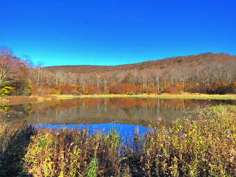 I picked up my pack and headed out on the trail along the north shore of the lake. We kept up a good pace and passed several occupied campsites along the way. The trail was very wet with many muddy spots along the way. We crossed the bridge and I found that the beaver dams that had been backing up water over the trail had been removed! I like beavers and don't like to see their work destroyed but this step was necessary. We crossed the second bridge and turned left to head toward the lean-to on the Millbrook Ridge Trail. The trail had several blowdowns along the way and it was very wet and muddy. There were areas of standing water and other places where the trail seemed like a stream. All of the streams crossing the trail were high and some were a little challenging to cross. As we walked, we could here Alder Creek to the right of us and see the sun sparkling off the water. We met a few people coming back down the trail and soon we could see some people hiking ahead of us. There seemed to be two groups with the first hiking a little faster. I stopped at the first beaver meadow to take a few pictures. After taking a few shots, I got back on the main trail and caught up to the slower hikers. They allowed us to pass and I sped up to get ahead of them. For the next 1.5 miles the trail climbs and then levels off several times. The elevation gain is several hundred feet but the grade is never more than 12% and averages around 6%. We caught up to the faster group of hikers as they pulled over to let us pass. One of them asked me about the trail ahead and I told her about the beaver pond. She had an Eastern European accent and they were all speaking a language other than English. There isn't too much to see along the way but this day was very pleasant. I enjoyed the sounds and sights of Alder Creek as it flows parallel to the trail much of the way. At one point there was a large blowdown across the trail which would have been easy to clear with a chainsaw but nothing had been touched. I ducked under some large branches and squeezed through an opening. The trail in this area was very wet and I had to find ways to avoid the mud. As I approached the lean-to, I saw that there was a pond where there had been a beaver meadow. Soon we arrived at the lean-to to and I dropped my pack to walk down the path to the beaver pond with my camera.
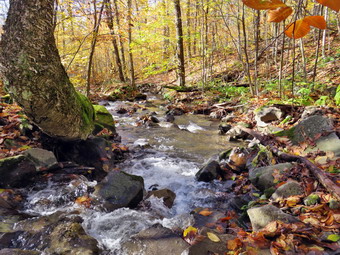 It had taken just over an hour to get to the laen-to. I walked out to the edge of the beaver pond and took pictures of the blue sky which had no clouds to add contrast. The sun was also hanging over the pond which made photography difficult. I looked for some wildlife but everything was quiet. After I got a drink and ate a bar we walked back to the main trail and continued east to the next beaver meadow. There wasn't much to see there but I took a fee shots before turning around and heading back to the car. On the way back I walked off the trail to the left to tale some pictures of the beaver pond with the sun more behind me. The group of hikers was there and I could hear a strange whirring sound. I finally figured out that it was a drone. I took my shots and ft back on the trail walking quickly. At one point I noticed the water in the creek and headed down the bank to Alder Creek to take a few picture. The group of hikers passed us as I was taking pictures at the creek. I walked back up the bank to the main trail and continued to hike. As we crossed a small stream we met the group of hikers again. I asked them if they were staying in the area and they said "yes". I suggested that they hike Balsam Lake Mountain on Sunday to see the view from the tower. At one point I decided to follow the blazes took us on a detour around the large tree that blocked the trail. The detour was clear on the way back but had been poorly marked on the way out. We continued along the trail and passed three more hikers who were having trouble with the water and the mud since they were wearing low-cut sneakers. When we came to the loop trail around the lake, we turned right. As we approached the bridges, some hikers were coming toward us so I leashed Sheila and let them pass. Sheila and I continued on the trail passing again many occupied campsites. When we got back to the lawn, we walked over to the dam and I looked at the spillway where there was a lot of water leaving the lake. I dropped my pack and took some pictures of the lake and of Cradle Rock Ridge on the south side of Alder Lake. I shouldered my pack and we walked back to the parking area which was still full of cars. We were back at 4:30 PM having covered 4.8 miles in 2 hours and 20 minutes total time. The total elevation gain was 660 feet.
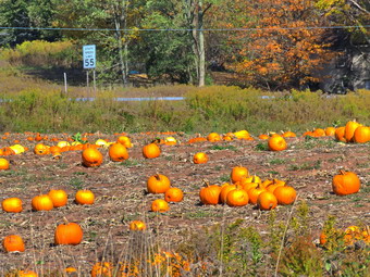
![]()
![]()
![]()
![]()
![]() On Monday, October 14th, I wanted to get for a long hike on a school holiday. The weather forecast seemed prefect with sunny to partly cloudy skies and highs in the low 60's. I decided to hike a section of the Catskill Scenic Trail from Hobart to Stamford and back. I estimated this would be about 8 miles which is long but the walk is almost completely flat. It was cool and very foggy early in the morning so I delayed my departure. I got dressed in my Mountain Hardwear long-sleeved crew top with a short-sleeved baselayer. I put on a pair of RailRiders hiking pants which are expensive but last along time and have features like deep pockets and a generous cut which I really like. The pants have Velcro closures at the ankles which I hoped would mean I did not need gaiters. I decided to wear my Vasque Taku hiking boots which fit well and have been discontinued. I grabbed a pair of Leki external lock poles I have been using lately. I also added a new OR floppy hat which was another present from Cindy. I have decided it shields me from the sun and allows me to spray some insect repellant on it rather than on me. I also wore a light OR windbreaker. Sheila loves to get out an hike anywhere and she had kept her eye on me as I was getting ready. I put my gear in the car and Sheila in the back seat and left Livingston Manor at 9:45 AM. The temperature was in the mid 50's and most of the fog and haze had burned off. I drove north and west on State Route 17 to exit 94 (Roscoe) and headed north on Route 206 toward Downsville. At the Pepacton Reservoir, I turned left to stay on Route206/30 and drove through Downsville heading toward Walton. Just after the light in Downsville, I turned right on Telford Hollow Road. As I was driving over the hill, I could see a lot of color in the leaves and thought I might stop on the way back to take pictures. I turned right at the bottom of the hill and drove out to Route 10. I turned right and drove toward Delhi. I drove through Delhi and continued on Route 10 north for 17 miles to Hobart. I turned on CR-18 and drove across a beautiful stone bridge over the West Branch of the Delaware River. I pulled into the parking lot of the bank and parked my car. I might not have done this on a business day but on this day the bank was closed. The temperature had just turned to 60 degrees. I set my GPS and we crossed Railroad Avenue to begin our hike at 11:05 AM.
On Monday, October 14th, I wanted to get for a long hike on a school holiday. The weather forecast seemed prefect with sunny to partly cloudy skies and highs in the low 60's. I decided to hike a section of the Catskill Scenic Trail from Hobart to Stamford and back. I estimated this would be about 8 miles which is long but the walk is almost completely flat. It was cool and very foggy early in the morning so I delayed my departure. I got dressed in my Mountain Hardwear long-sleeved crew top with a short-sleeved baselayer. I put on a pair of RailRiders hiking pants which are expensive but last along time and have features like deep pockets and a generous cut which I really like. The pants have Velcro closures at the ankles which I hoped would mean I did not need gaiters. I decided to wear my Vasque Taku hiking boots which fit well and have been discontinued. I grabbed a pair of Leki external lock poles I have been using lately. I also added a new OR floppy hat which was another present from Cindy. I have decided it shields me from the sun and allows me to spray some insect repellant on it rather than on me. I also wore a light OR windbreaker. Sheila loves to get out an hike anywhere and she had kept her eye on me as I was getting ready. I put my gear in the car and Sheila in the back seat and left Livingston Manor at 9:45 AM. The temperature was in the mid 50's and most of the fog and haze had burned off. I drove north and west on State Route 17 to exit 94 (Roscoe) and headed north on Route 206 toward Downsville. At the Pepacton Reservoir, I turned left to stay on Route206/30 and drove through Downsville heading toward Walton. Just after the light in Downsville, I turned right on Telford Hollow Road. As I was driving over the hill, I could see a lot of color in the leaves and thought I might stop on the way back to take pictures. I turned right at the bottom of the hill and drove out to Route 10. I turned right and drove toward Delhi. I drove through Delhi and continued on Route 10 north for 17 miles to Hobart. I turned on CR-18 and drove across a beautiful stone bridge over the West Branch of the Delaware River. I pulled into the parking lot of the bank and parked my car. I might not have done this on a business day but on this day the bank was closed. The temperature had just turned to 60 degrees. I set my GPS and we crossed Railroad Avenue to begin our hike at 11:05 AM.
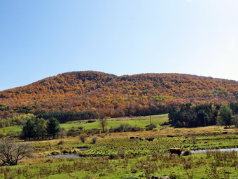 The trail is wide and flat for its entire length but does game some elevation on this section. The elevation gain is barely noticeable in all but a few locations. Ahead of us on the trail was a woman with two young children. As we passed under some trees, we came to an area where the railroad ties had not been completely removed but piled at the side of the trail. We continued on the rail which passed through the Hobart Industrial Park and then started out into the countryside. The trail was very straight and it seemed like I could look ahead for at least a mile. I took some pictures and then continued on the trail. In a short distance, we came to a field full on pumpkins on the left side of the trail. I stopped and took pictures and noticed that the leaves had more color than the last time I was in the area. We continued on the trail without see much more than beautiful countryside with some bright leaves and barns. At one point, I looked up to see cattle in a field on the right. I stopped to take some pictures and the noticed the hills beyond had some nice colors. I took some pictures of the hills and the noticed the donkeys in the field. Donkeys accompany the cattle as they discourage coyotes. I walked a little farther and got a better view of more cows so I took some more shots. Some of the cows started to "Moo" and I mooed back. The cattle looked up so I called again which made the cattle come closer. I grew up on a farm and am glad to see I haven't lost the ability to call cows! We continued our hike along the flat and straight trail. A little farther along I saw a mountain with towers at the top and I knew this was Mount Utsayantha and that I was nearing Stamford. To the right and a little closer was another mountain with some nice color which I knew was Churchill Mountain which I had climbed as part of the Catskill Highest Hundred. We continued the hike and were soon at a street crossing. Directly across the street was the Stamford Railroad Station which now acts as the headquarters for the Stanford Historical Society and the Catskill Scenic Trail. There were some maps in the kiosk and I took one. It was only 12:45 PM and I had hiked 4.1 miles in 1 hour and 40 minutes with plenty of stops along the way. I really wanted to extend the hike and maybe even hike to Grand Gorge. I knew this would be at least 10 miles and that I could not hike 20 mile round trip. I decided to call my brother-in-law Jeff who lives in Delhi to ask him if we would pick me up in Grand Gorge. I felt lucky that I had service and that Jeff was home. He readily agreed to my request and I can't thank him enough. I told him to give me 2 and a half hours which translated to 3:15 PM.
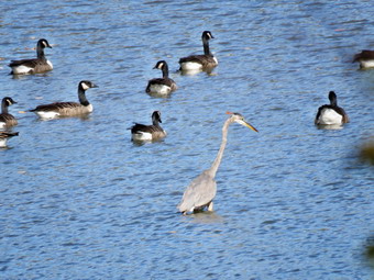 I had just passed a sign that indicated 6.0 miles to Grand Gorge but a little further along the trail another sign said 6.6 miles! Several other trail markers seemed to be in disagreement also. Since I didn't know exactly how far we had to hike I decided to keep a fast pace and only stop for exceptional pictures. As we crossed a street to stay on the trail I saw a woman with a dog farther up the trail. The dog was not on a leash and as we approached she asked if my dog was friendly. I said "Sometimes" so she leashed her dog. As we continued, I noticed a series of walkways over and around a wetland. Signs indicated that this was part of a Stamford park. I wanted to stop but knew I needed to keep a good pace. Not too far up the trail we ran into the first mile marker I had seen on this section of trail. The "K 73" marker indicated 73 miles from Kingston, NY. I took pictures of the marker and one of Sheila on the bench next to the marker. At 6.7 miles we came to Mayham Pond on the left or north side of the trail. It was hard to get a clear shot of the pond but I found a spot that gave a partial view. There was a larger number of geese on the pond and I took several pictures including some zoomed in. I noticed one of the geese had a very long neck and upon further examination I determined it was a blue heron. I took some more shots and then continued on the trail as quickly as possible. By this time my legs were beginning to feel tired and I still wasn't sure how far I had to hike. We continued along the trail which had turned east instead of northeast. At 10.0 miles we crossed Bruce Pond Road where a sign announced ".7 miles to Grand Gorge". I called Jeff who told me he was about 10 minutes away from Grand Gorge. I stepped up my pace so he wouldn't have to wait for me. The walk went quickly and at 10.7 miles the trail intersected Route 23. I called Jeff to see if he wanted to pick me up where I was but he did not answer. He did not answer because he was pulling up next to me! I opened the door to let Sheila into the backseat of the pickup truck. When she jumped in, she practically attacked Jeff showering him with "kisses"> It is a good thing he likes dogs! On the way to Hobart, Jeff and I talked and I again thanked him for giving us a ride. On the way back, I stopped on Telford Hollow Road to take some pictures of some of the best leaf colors around. We had hiked 10.7 miles in 4 hours for an overall speed of 2.7 mph and a moving speed of 3.2 mph. The elevation gain was almost 400 feet with over 500 feet of descent.
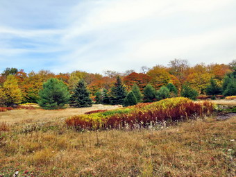
![]()
![]()
![]()
![]()
![]() On Sunday, October 13th I had planned to hike after returning from church. When services were over, I had meeting. As I was leaving the meeting, my wife called and told me there were two ambulance calls. I hurried home and met Brad at the ambulance building. We arrived at the site of the call and returned to the building shortly thereafter. We drove home to get ready to hike at about 1:45 PM. The temperature was in the low 60's with plenty of sun and the conditions seemed perfect for s fall hike. As I began to get ready, Sheila was ready to go and stayed close to me to make sure she was going along. I got dressed in a new White Sierra long-sleeved crew top that Cindy had gotten me for my birthday with a short-sleeved baselayer. The White Sierra top has InsectSheild and is quite light. I put on a pair of RailRiders hiking pants which are expensive but last along time and have features like deep pockets and a generous cut which I really like. The pants have Velcro closures at the ankles which I hoped would mean I did not need gaiters. I decided to wear my Vasque Taku hiking boots which fit well and have been discontinued. I also grabbed a pair of Leki external lock poles. Brad and I put our packs in the car and headed out the DeBruce Road at 2:05 PM. After six miles I turned left on Mongaup Road. Where the road split I stayed left on Beech Mountain Road and drove to the parking lots. There were already several cars in the lots as I pulled in to park. My plan was to walk up the Flynn Trail to the junction with the Big Rock Trail and start trimming the Flynn Trail to the junction with the Woods road. From here we would walk down to Hodge Pond and follow the Flynn Trail from beginning to end. At Junkyard Junction we would pick up the Quick Lake Trail and follow it back to the car. I put Sheila on her leash and set my GPS unit before we crossed the road and picked up the Flynn Trail. I asked Brad to keep Sheila on her leash until we reached the woods road. I was surprised that the dog from the cabin did not come out to greet us!
On Sunday, October 13th I had planned to hike after returning from church. When services were over, I had meeting. As I was leaving the meeting, my wife called and told me there were two ambulance calls. I hurried home and met Brad at the ambulance building. We arrived at the site of the call and returned to the building shortly thereafter. We drove home to get ready to hike at about 1:45 PM. The temperature was in the low 60's with plenty of sun and the conditions seemed perfect for s fall hike. As I began to get ready, Sheila was ready to go and stayed close to me to make sure she was going along. I got dressed in a new White Sierra long-sleeved crew top that Cindy had gotten me for my birthday with a short-sleeved baselayer. The White Sierra top has InsectSheild and is quite light. I put on a pair of RailRiders hiking pants which are expensive but last along time and have features like deep pockets and a generous cut which I really like. The pants have Velcro closures at the ankles which I hoped would mean I did not need gaiters. I decided to wear my Vasque Taku hiking boots which fit well and have been discontinued. I also grabbed a pair of Leki external lock poles. Brad and I put our packs in the car and headed out the DeBruce Road at 2:05 PM. After six miles I turned left on Mongaup Road. Where the road split I stayed left on Beech Mountain Road and drove to the parking lots. There were already several cars in the lots as I pulled in to park. My plan was to walk up the Flynn Trail to the junction with the Big Rock Trail and start trimming the Flynn Trail to the junction with the Woods road. From here we would walk down to Hodge Pond and follow the Flynn Trail from beginning to end. At Junkyard Junction we would pick up the Quick Lake Trail and follow it back to the car. I put Sheila on her leash and set my GPS unit before we crossed the road and picked up the Flynn Trail. I asked Brad to keep Sheila on her leash until we reached the woods road. I was surprised that the dog from the cabin did not come out to greet us!
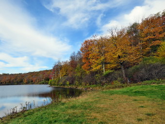 We turned right on the woods road that was once the extension of Beech Mountain Road and I let Sheila off her leash. It is a long climb toward the junction with the Big Rock Trail but it seemed to me we were moving very quickly and I was feeling full of energy. I knew that this was partly due to hiking 3500 foot peaks which made the smooth trail surface and easy grade feel so much easier. It was also true that talking to Brad made things go more quickly. At about 1.2 miles we came to the point where I sometimes turn off the trail to visit an interesting clearing. Since we were looking for fall colors, I decided we should make the visit. We walked uphill to the open field and I put my pack down to take some pictures. The scene was pretty but the leaf colors were only average. We returned to the main trail and continued toward the trail junction passing a rather large blowdown. We had cut the blowdown back on our last work trip but I would like to cut it back a little more. Our walk to the Big Rock Junction went quickly and we arrived after hiking 1.7 miles. We continued straight ahead on the Flynn Trail to the next trail junction. We stayed to the left to follow the Flynn Trail down to Hodge Pond. The grass on the trail had been mowed by OSI which owns the land. As we walked out into the sun, I noticed the apparent increase in temperature. I also noticed there was a breeze which helped offset the sun. We walked down the rest of the Flynn Trail and out into the field by Hodge Pound. We walked over to the shore and I took a few pictures. The sky was blue and there were nice white clouds to increase the contrast with the rest of the sky. The leaf colors were nice enough but not what I had hoped for. I did throw a few sticks for Sheila but she was not enthusiastic about swimming to retrieve them. I noticed a couple had come down to the field and followed the Flynn Trail along the west side of Hodge Pond. After a few minutes, we walked back to the Flynn Trail and followed it along the west side of the pond.
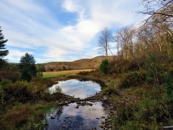 The trail was wet and muddy in places but these were easily avoided. At the next trail junction we stayed to the left to take the Flynn Trail up the hill rather than the jeep road around the back of the pond. The trail here was a little damper with more muddy spots. The walk to the Quick Lake Trail at Junkyard Junction went quickly. It was 3:55 PM and we had hiked 3.4 miles which is a little more than halfway through the hike. We turned left to start the hike back and we set a quick pace as we walked and talked. The trail initially rolls some but eventually descends toward Iron Wheel Junction. The trail was damp and muddy in several places. We did come across several new blowdowns but I knew I could return later to work on them or allow the snowmobile club to remove them. Just before the junction with the snowmobile trail, we spotted the couple we had seen before hiking away from us. We turned right at Iron Wheel Junction after hiking 5 miles. The turn allowed us to stay on the Quick Lake Trail heading for Frick Pond. The couple ahead of us stopped by the side of the trail and allowed us to pass by. We came to and crossed the small stream through the woods without a problem as it was almost dry. We walked through the spruce tunnel and out the other side. There were a few blowdowns but they were flat on the ground and easy to step over. This part of the trail was wet and muddy in places. We passed by the junction with the Big Rock Trail on the left and were soon at the bridge over the Frick Pond outlet. I dropped my pack and got out the camera. I have taken hundreds of pictures form the bridge but can't resist stopping to take a few more. The water level was very low although some water was still flowing in the outlet stream. Once again the leaf colors were nice but not spectacular. After I took some picture, we walked up the hill from Frick Pond to Gravestone Junction. The memorial stone was still in place and had not been moved. We continued straight ahead on the Quick Lake Trail. The trail was dry for almost the entire way back to the car. We passed by the register and walked the woods road back to the parking area. There were still a few other cars in the parking areas. We were back at the car at 5:05 PM having hiked 6.6 miles in 2 hours and 35 minutes with a vertical gain of 963 feet.
![]()
![]()
![]()
![]() On Saturday, October 12th I knew I had some chores to do in the morning and a family gathering in the afternoon. This left a limited amount of time to get in hike across the street on Round Top. I had planned to take a longer hike the day before but I got a call from my son Kurt early Friday morning. He was in the ER so I drove to Poughkeepsie and 5:00 AM to be with him. After a short time I drove him home and then returned to Livingston Manor. By the time I got home, I was only in the mood for a long nap! Brad, my son-in-law, was visiting and he decided to accompany me on the hike. After I finished my chores, we started to get ready around 10:30 AM. The temperature was in the high 50's so I knew I might want a light jacket. I put on my long-sleeved White Sierra top without a baselayer. I put on a pair of RailRiders hiking pants which are expensive but last a long time and have features like deep pockets and a generous cut which I really like. The pants have Velcro closures at the ankles. I decided to wear my Keen Targhee III boots which are supportive and surprisingly roomy. I grabbed a pair of Leki poles with external locks that I have been using lately. At 11:15 AM we walked out the door to start the hike. I grabbed Sheila's leash from the car and we walked up the driveway. I decided we would try to do just two figure 8's. I aimed to hike for about an hour. Sheila was happy to get out as we headed down the driveway and across the street. We crossed the street and walked to the parking area by the Presbyterian Church. We walked to the back of the church and began the ascent of the steepest hill behind the church. The hill is short but gets the circulation pumping and is the steepest and longest climb on the "trail." Sheila helped me along by pulling me up the hill. We stopped once on the way up to take a look at the fall colors but there wasn't much in the way of any brilliant spots. When we got to the top of the hill, we started on the trail by turning left at the trailhead. I let Sheila off her leash so that she could explore. The trail bed is becoming worn it which means that a few people are using the trail. I am always happy to see that someone else uses the trails.
On Saturday, October 12th I knew I had some chores to do in the morning and a family gathering in the afternoon. This left a limited amount of time to get in hike across the street on Round Top. I had planned to take a longer hike the day before but I got a call from my son Kurt early Friday morning. He was in the ER so I drove to Poughkeepsie and 5:00 AM to be with him. After a short time I drove him home and then returned to Livingston Manor. By the time I got home, I was only in the mood for a long nap! Brad, my son-in-law, was visiting and he decided to accompany me on the hike. After I finished my chores, we started to get ready around 10:30 AM. The temperature was in the high 50's so I knew I might want a light jacket. I put on my long-sleeved White Sierra top without a baselayer. I put on a pair of RailRiders hiking pants which are expensive but last a long time and have features like deep pockets and a generous cut which I really like. The pants have Velcro closures at the ankles. I decided to wear my Keen Targhee III boots which are supportive and surprisingly roomy. I grabbed a pair of Leki poles with external locks that I have been using lately. At 11:15 AM we walked out the door to start the hike. I grabbed Sheila's leash from the car and we walked up the driveway. I decided we would try to do just two figure 8's. I aimed to hike for about an hour. Sheila was happy to get out as we headed down the driveway and across the street. We crossed the street and walked to the parking area by the Presbyterian Church. We walked to the back of the church and began the ascent of the steepest hill behind the church. The hill is short but gets the circulation pumping and is the steepest and longest climb on the "trail." Sheila helped me along by pulling me up the hill. We stopped once on the way up to take a look at the fall colors but there wasn't much in the way of any brilliant spots. When we got to the top of the hill, we started on the trail by turning left at the trailhead. I let Sheila off her leash so that she could explore. The trail bed is becoming worn it which means that a few people are using the trail. I am always happy to see that someone else uses the trails.
At the first trail junction, we followed Sheila as she turned right on the woods road which is the shallower approach to the trail system. We continued to follow the yellow trail to the first junction where we turned left and followed it to the next trail junction. We kept a quick pace as we walked and talked. At the second junction with the blue trail, we turned right and started up the steep blue trail that leads over the summit of Round Top. Walking uphill we passed through what had been a sea of green ferns but was now a little brown and dried out. We walked across the flat summit of Round Top and started down the other side. I had trimmed much of the trail earlier in the summer but this part still had some branches encroaching on the trail. I sort of like the branches untrimmed as it makes the trail seem "wilder"! Soon we were back at the yellow trail. We turned right and walked the yellow trail to the next trail junction. This time we turned left and followed the yellow trail downhill toward the lookout. We continued down to the lookout and followed the yellow trail as it turned left and descended the hill to the first trail junction. The walk had gone quickly, so we turned around and started back up the hill back to the lookout. Sheila seemed happy we were going to stay out a little longer. We followed the yellow trail uphill toward the lookout and turned right to continue up to the next trail junction with the blue trail. At the trail junction, we turned right to stay on the yellow trail. At the next junction we turned left to climb the shallower side of the summit ascent. We again walked across the flat summit and descended the steeper trail which was almost completely dry. At the trail junction, we turned left and followed the yellow trail along the base of Round Top. At the next junction we turned right this time to follow the trail down to the woods road that leads out to the first trail junction. We completed the figure 8 ending up back at the very first trail junction. I checked the time and determined that we should return home given the time. We walked out toward the trailhead where I put Sheila on her leash. We walked down the hill and through the church parking lot to the road and to our driveway. It was 12:15 PM and we had hiked around 2 miles in about an hour.
![]()
![]()
![]()
![]() On Tuesday, October 8th I came home immediately after school and wanted to get in a short hike. I asked Cindy she wanted to hike a few loops on Round Top and she declines. Sheila began barking, running around frantically and spinning in place. Sheila misses the hiking as much as I do since I have returned to full-time teaching for the rest of this year! The temperature was in the high 50's so I put on my long-sleeved Mammut crew top. I knew this might be a little too warm but felt I don't mind being warm. I put on a pair of RailRiders hiking pants which are expensive but last a long time and have features like deep pockets and a generous cut which I really like. The pants have Velcro closures at the ankles. I decided to wear my Keen Targhee III boots which are supportive and surprisingly roomy. I grabbed a pair of Leki poles with external locks that I have been using lately. At 4:05 PM we walked out the door to start the hike. I grabbed Sheila's leash from the car and we walked up the driveway. I decided we would try to do at least two figure 8's which might be enough given the situation. I aimed to hike for about an hour. Sheila was happy to get out as we headed down the driveway and across the street. We crossed the street and walked to the parking area by the Presbyterian Church. We walked to the back of the church and began the ascent of the steepest hill behind the church. The hill is short but gets the circulation pumping and is the steepest and longest climb on the "trail." Sheila helped me along by pulling me up the hill. The hill seemed much easier as I had been hiking the 3500 foot mountains with Bryce during the summer. I paused before the top of the hill to see if there were any colors to be seen in the leaves but nothing much was visible.
On Tuesday, October 8th I came home immediately after school and wanted to get in a short hike. I asked Cindy she wanted to hike a few loops on Round Top and she declines. Sheila began barking, running around frantically and spinning in place. Sheila misses the hiking as much as I do since I have returned to full-time teaching for the rest of this year! The temperature was in the high 50's so I put on my long-sleeved Mammut crew top. I knew this might be a little too warm but felt I don't mind being warm. I put on a pair of RailRiders hiking pants which are expensive but last a long time and have features like deep pockets and a generous cut which I really like. The pants have Velcro closures at the ankles. I decided to wear my Keen Targhee III boots which are supportive and surprisingly roomy. I grabbed a pair of Leki poles with external locks that I have been using lately. At 4:05 PM we walked out the door to start the hike. I grabbed Sheila's leash from the car and we walked up the driveway. I decided we would try to do at least two figure 8's which might be enough given the situation. I aimed to hike for about an hour. Sheila was happy to get out as we headed down the driveway and across the street. We crossed the street and walked to the parking area by the Presbyterian Church. We walked to the back of the church and began the ascent of the steepest hill behind the church. The hill is short but gets the circulation pumping and is the steepest and longest climb on the "trail." Sheila helped me along by pulling me up the hill. The hill seemed much easier as I had been hiking the 3500 foot mountains with Bryce during the summer. I paused before the top of the hill to see if there were any colors to be seen in the leaves but nothing much was visible.
When we got to the top of the hill, we started on the trail by turning left at the trailhead. I let Sheila off her leash so that she could explore. The trail bed is becoming more and more worn which means that quite few people are using the trail. I am always happy to see that someone else uses the trails. At the first trail junction, I followed Sheila as she continued straight up the hill toward the viewpoint. At the top of the hill I gazed out over the town but didn't stop as the view was very familiar. We turned right and followed the trail as it gently gained elevation through a sea of ferns. At the next trail junction, we turned right to follow the yellow trail around the base of Round Top. I had been on the trail in July cutting back the brush and grass with my Stihl trimmer and loppers. I was glad to see that the trail was still nice and wide and had not been overgrown again. At the next trail junction we turned left and headed up to the summit of Round Top on the blue trail. As we hiked, I noticed that there were some branches encroaching on the trail but I didn't really mind. We were soon passing over the top of the hill and starting down the other side. The trail bed was a narrow path through a sea of green ferns which were quite pretty. At the bottom of the hill we turn left to follow the yellow trail to the next trail junction. This time we turned right and followed the yellow trail down to the woods road that returned us to the first trail junction. All the time Sheila stayed pretty close to me taking only a few off-trail excursions. When we reached the first trail junction, we turned around and walked back up the woods road. At the first junction with the blue trail we turned left and followed the yellow trail along the base of Round Top. At the second junction, we turned right and walked up the blue trail through the ferns to the summit of Round Top. We walked down the other side to the junction and turned right. We followed the yellow trail turning left and the next junction to walk down to the lookout. At the lookout we stayed to the left and walked down the hill to the first trail junction. I was satisfied that I had done enough. We continued straight ahead and walked out toward the trailhead. I put Sheila on her leash and we walked down the hill, out through the church parking lot to the road and to our driveway. It was 5:00 PM and we had hiked over 2 miles in just under an hour.
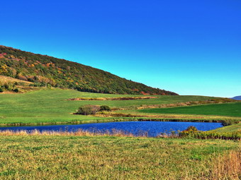
![]()
![]()
![]()
![]()
![]() On Saturday, October 5th, Cindy and I had hiked at Vroman's Nose and were still looking for some fall colors. We decided to head for Bald Mountain near Stamford in Delaware County to see if the leaves there were any brighter than those we had seen so far. I had only hiked this mountain once before and that had been 6 years ago! The mountain has many marked trails but no maps are available making the markings useless. I drove back to Grand Gorge on Route 30 and then turned right heading northwest on Route 23. Once we were in Stamford, I turned right to head northeast on Route 10 passing through Stamford. It was easy to find Archibald Field and I pulled in to park at 1:50 PM. There was one car already parked in the lot with two women getting ready to hike. I set my PGS unit and we started out on the gravel road that heads almost due east toward Bald Mountain. The mountain itself was not visible from the parking area but I remembered to head east and up! As we started our hike the temperature was in the low 50's and I kept on my light windbreaker to start the hike. We started to the east on a gravel and dirt road that ran along the south side of the field. The road became a woods road and crossed a footbridge over a stream as it entered the forest. We continued east and took a right at the first junction passing several other trails along the way. As promised the trails were marked in various ways but the markings meant little without a map to follow. I am sure there are many different ways to get to the top of the mountain and the route I chose was meant to be the shortest. At .8 miles we turned right and headed almost due south. From what I could remember this was the route I had followed the last time. We passed the slower of the two women who were ahead of us and at 1 mile passed a trail to the left that I knew would take us toward the summit.
On Saturday, October 5th, Cindy and I had hiked at Vroman's Nose and were still looking for some fall colors. We decided to head for Bald Mountain near Stamford in Delaware County to see if the leaves there were any brighter than those we had seen so far. I had only hiked this mountain once before and that had been 6 years ago! The mountain has many marked trails but no maps are available making the markings useless. I drove back to Grand Gorge on Route 30 and then turned right heading northwest on Route 23. Once we were in Stamford, I turned right to head northeast on Route 10 passing through Stamford. It was easy to find Archibald Field and I pulled in to park at 1:50 PM. There was one car already parked in the lot with two women getting ready to hike. I set my PGS unit and we started out on the gravel road that heads almost due east toward Bald Mountain. The mountain itself was not visible from the parking area but I remembered to head east and up! As we started our hike the temperature was in the low 50's and I kept on my light windbreaker to start the hike. We started to the east on a gravel and dirt road that ran along the south side of the field. The road became a woods road and crossed a footbridge over a stream as it entered the forest. We continued east and took a right at the first junction passing several other trails along the way. As promised the trails were marked in various ways but the markings meant little without a map to follow. I am sure there are many different ways to get to the top of the mountain and the route I chose was meant to be the shortest. At .8 miles we turned right and headed almost due south. From what I could remember this was the route I had followed the last time. We passed the slower of the two women who were ahead of us and at 1 mile passed a trail to the left that I knew would take us toward the summit.
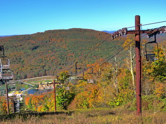 We continued up a short hill to an open field where I met the other woman. There was a small pond in the open field. To the east and south we could see Mount Utsayantha with the fire tower, Churchill Education Center and communication towers. To the north we could see more mountain.s I dropped my pack and got out the camera and took quite a few shots of the scenery. I decided we would return to the trail that ascended the mountain so we retraced our steps and turned right on the trail. The trail headed northeast and then turned east as it started to gain some elevation. We passed several side trails that I had used the last time to lengthen the hike. By the time we reached 1.7 miles, we had already made some steep climbs. Another steep but short climb ahead was a little too much for Cindy. She decided to wait as Sheila and I hike to the summit of the mountain. Sheila and I started up the steep trail which averaged over a 20% grade with some areas approaching 30%. At 1.9 miles we turned right and continued toward the summit. At 2.1 miles we were at the top of the ski slopes where I dropped my pack and got out my camera. I took pictures of the surrounding mountains to the east and then walked to a spot where I could get a view to the north. I took pictures of the ski lifts and slopes and then walked back to my pack. I took some more shots including some of the ski-lifts and other equipment. As I was taking my shots, I noticed two ATVs coming up the slopes from the north. They parked near the lifts and shut off their machines. The riders were a local couple and we chatted for a few minutes. They told me that what looked like a hotel at the base of the slopes was once a "village" associated with the slopes but was now between owners. I decided to get back to Cindy so I packed up and we started back down the trail. The descent of the steep trail wasn't easy as the fallen leaves made it slippery. As we neared the bottom, Sheila ran ahead to find Cindy. I decided we would simply retrace our route back to the car as we knew what the trails were like. The first part of this route was difficult because of the steepness but after this the hike went pretty easily. We were back at the car at 3:55 PM after hiking 4 miles in 2 hours with an elevation gain of 980 feet. I hope that someone creates maps of the area as they would greatly enhance the experience. The other car was still in the lot which concerned me as I though the other hikers should have been back. As we left the raking lot, I turned right to drive north on Route 10 to the "village" I had seen from the mountain. When we came to the entrance, I turned in but found a sign that said "The Zone" and one that said "No trespassing". As I was about to pull away, Cindy pointed out there was a camel in the field. I got out my camera and took some pictures of the camel and some long-horned cattle in the corral.
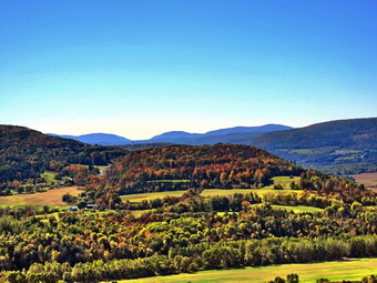
![]()
![]()
![]()
![]()
![]() On Saturday, October 5th I wanted to go somewhere to look for some fall colors. I knew that any of the local 3500 peaks and places like Giant Ledge would be mobbed by others looking for the same views. I decided to head for Vroman's Nose and Pratt Rock which I hoped would have fewer visitors. I asked Cindy if she would like to come along and she said "yes". When I got up in the morning the temperature was 31 degrees and there was a heavy fog. I decided to get a little more sleep after a busy week in school. I finally got up at 9:30 AM, ate breakfast and started to get ready. The temperature on the back porch was 48 degrees in the sun! Sheila was very happy to be getting out as we got dressed, packed our gear and got ready to go. The temperatures were forecast to be in the mid 50's but with a stiff breeze for most of the day. I put on my Mammut long-sleeved crew top with a short-sleeved baselayer. I put on a pair of RailRiders hiking pants which are expensive but last along time and have features like deep pockets and a generous cut which I really like. The pants have Velcro closures at the ankles which I hoped would mean I did not need gaiters. I decided to wear my Vasque Taku hiking boots which fit well and have been discontinued. I grabbed a pair of Leki external lock poles I have been using lately. We left Livingston Manor just after 10:00 AM. I took State Route 17 to Roscoe and then Route 206 to Route 30 at the Pepacton Reservoir. I made a right on Route 30 and then followed it along the reservoir to Margaretville and then through Roxbury and Grand Gorge to Middleburgh. Just outside of Middleburgh I turned left on Mill Valley Road. Less than a mile up the road I parked in the Vromans Nose parking lot on the left side of the road. The association that maintains the area had increased the parking lot to more than double its former size which is a good thing because there were more than 30 cars in the lot. I almost decided to go somewhere else but decided to hike where we were. I set my GPS and we started our hike at noon. I left my poles in the car and put Sheila on her leash. People were leaving the lot ahead of us and others were returning to their cars. It seemed like every other hiker had a dog and this continued for the whole hike. The trail was much drier than it had been in my last few visits. As we walked through the open field that leads to the trails, we found the trail to the right was still closed to allow the "old" trail to recover from overuse. We turned to the left to hike the steeper side first which would allow us to return on the gentle side. As we turned onto the yellow blazed trail I noted that it did not seem familiar and I questioned whether or not I was on the correct path but I soon realized it was just that I was traveling in a direction I had only taken only a few times before. My intention was to continue on the yellow path all the way to the top passing the Long Path as we went. We continued to meet people and dogs but Sheila was very well-behaved. We came to the more gentle trail that comes in from the right at .2 miles but decided to climb the steeper trail and continued straight ahead. I would much rather climb a steep trail than descend it especially when the teal is covered in oak leaves. The half mile from where we entered the trail to the top averaged about an 18% grade. We met many people coming down the steep trail looking very unsure of themselves.
On Saturday, October 5th I wanted to go somewhere to look for some fall colors. I knew that any of the local 3500 peaks and places like Giant Ledge would be mobbed by others looking for the same views. I decided to head for Vroman's Nose and Pratt Rock which I hoped would have fewer visitors. I asked Cindy if she would like to come along and she said "yes". When I got up in the morning the temperature was 31 degrees and there was a heavy fog. I decided to get a little more sleep after a busy week in school. I finally got up at 9:30 AM, ate breakfast and started to get ready. The temperature on the back porch was 48 degrees in the sun! Sheila was very happy to be getting out as we got dressed, packed our gear and got ready to go. The temperatures were forecast to be in the mid 50's but with a stiff breeze for most of the day. I put on my Mammut long-sleeved crew top with a short-sleeved baselayer. I put on a pair of RailRiders hiking pants which are expensive but last along time and have features like deep pockets and a generous cut which I really like. The pants have Velcro closures at the ankles which I hoped would mean I did not need gaiters. I decided to wear my Vasque Taku hiking boots which fit well and have been discontinued. I grabbed a pair of Leki external lock poles I have been using lately. We left Livingston Manor just after 10:00 AM. I took State Route 17 to Roscoe and then Route 206 to Route 30 at the Pepacton Reservoir. I made a right on Route 30 and then followed it along the reservoir to Margaretville and then through Roxbury and Grand Gorge to Middleburgh. Just outside of Middleburgh I turned left on Mill Valley Road. Less than a mile up the road I parked in the Vromans Nose parking lot on the left side of the road. The association that maintains the area had increased the parking lot to more than double its former size which is a good thing because there were more than 30 cars in the lot. I almost decided to go somewhere else but decided to hike where we were. I set my GPS and we started our hike at noon. I left my poles in the car and put Sheila on her leash. People were leaving the lot ahead of us and others were returning to their cars. It seemed like every other hiker had a dog and this continued for the whole hike. The trail was much drier than it had been in my last few visits. As we walked through the open field that leads to the trails, we found the trail to the right was still closed to allow the "old" trail to recover from overuse. We turned to the left to hike the steeper side first which would allow us to return on the gentle side. As we turned onto the yellow blazed trail I noted that it did not seem familiar and I questioned whether or not I was on the correct path but I soon realized it was just that I was traveling in a direction I had only taken only a few times before. My intention was to continue on the yellow path all the way to the top passing the Long Path as we went. We continued to meet people and dogs but Sheila was very well-behaved. We came to the more gentle trail that comes in from the right at .2 miles but decided to climb the steeper trail and continued straight ahead. I would much rather climb a steep trail than descend it especially when the teal is covered in oak leaves. The half mile from where we entered the trail to the top averaged about an 18% grade. We met many people coming down the steep trail looking very unsure of themselves.
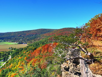 Soon we arrived at the top and I immediately began to take pictures. Fortunately, there were no people in the area. The fields below were still green and the Schoharie Creek had more water than many I have seen. At the very first lookout I took pictures in all directions including some of the crumbling rock that makes up the Nose. I was disappointed that the leaf colors were muted and many of the leaves had not yet changed. I decided to bypass a few of the lookouts along the way as the view is better from the top. I took a few pictures of Sheila and Cindy and then continued on the trail. The aqua blazes indicated this is the route of the Long path, a hiking trail that runs form New York City to Albany. Once on the summit I dropped my pack and got out the camera as Cindy took over holding Sheila's leash. I took some pictures to the south where the Catskills were prominent. From the top there were some glimpses of brightly colored leaves along the cliff. I was a little disappointed as the sky was a solid blue with no clouds. I took some pictures concentrating on the farmland below with alternating patches of green and brown. There was at least one harvester at work filling trucks which would drive away when full only to be replaced by another.Vromans Nose has an elevation of about 1220 feet above sea level which makes it about 500 feet higher than the surrounding plain. It isn't very high but it gives a great view of the plain below and the peaks both near and far. We continued our hike by walking along the edge of the cliff. We stopped at the far end of the cliffs where I again took some more shots concentrating on the hills to the north and the bends in the Schoharie Creek below. The descent starts out a little steep and slippery but soon become a wide path with a gentler slope. We passed the point where the Long Path comes up on the left. This is a very steep ascent which I made when I hiked the Long Path. The trail back was a mess with water and mud covering the trail from side to side almost all the way back. At this rate this trail will have to be closed to allow it to "rest". We turned right at 1.1 miles and continued to follow the trail as it looped back to the trail we used at the start of the hike. At 1.4 miles we turned left and hiked back to the car. We were back at the car at 1:00 PM having hiked 1.6 miles in 1 hour with an elevation gain of 500 feet. I suggested we leave the area to look for leaf colors in a different area. We decided to head for Bald Mountain outside of Stamford.
![]()
![]()
![]()
![]() On Friday, October 4th I came home immediately after school and wanted to get in a short hike. As I began to get ready to go Sheila began barking and running around frantically. Sheila misses the hiking as much as I do since I have returned to full-time teaching. The temperature was in the high 50's so I knew I might want a light jacket. I put on my long-sleeved Mammut crew top which is a little heavier than what I have been wearing and put on a light short-sleeved baselayer. I knew this might be a little too warm but felt I don't mind being warm. I put on a pair of RailRiders hiking pants which are expensive but last a long time and have features like deep pockets and a generous cut which I really like. The pants have Velcro closures at the ankles. I decided to wear my Keen Targhee III boots which are supportive and surprisingly roomy. I grabbed a pair of Leki poles with external locks that I have been using lately. At 3:45 PM we walked out the door to start the hike. I grabbed Sheila's leash from the car and we walked up the driveway. I decided we would try to do just two figure 8's. I aimed to hike for about an hour. Sheila was happy to get out as we headed down the driveway and across the street. We crossed the street and walked to the parking area by the Presbyterian Church. We walked to the back of the church and began the ascent of the steepest hill behind the church. The hill is short but gets the circulation pumping and is the steepest and longest climb on the "trail." Sheila helped me along by pulling me up the hill. When we got to the top of the hill, we started on the trail by turning left at the trailhead. I let Sheila off her leash so that she could explore. The trail bed is becoming worn it which means that a few people are using the trail. I am always happy to see that someone else uses the trails.
On Friday, October 4th I came home immediately after school and wanted to get in a short hike. As I began to get ready to go Sheila began barking and running around frantically. Sheila misses the hiking as much as I do since I have returned to full-time teaching. The temperature was in the high 50's so I knew I might want a light jacket. I put on my long-sleeved Mammut crew top which is a little heavier than what I have been wearing and put on a light short-sleeved baselayer. I knew this might be a little too warm but felt I don't mind being warm. I put on a pair of RailRiders hiking pants which are expensive but last a long time and have features like deep pockets and a generous cut which I really like. The pants have Velcro closures at the ankles. I decided to wear my Keen Targhee III boots which are supportive and surprisingly roomy. I grabbed a pair of Leki poles with external locks that I have been using lately. At 3:45 PM we walked out the door to start the hike. I grabbed Sheila's leash from the car and we walked up the driveway. I decided we would try to do just two figure 8's. I aimed to hike for about an hour. Sheila was happy to get out as we headed down the driveway and across the street. We crossed the street and walked to the parking area by the Presbyterian Church. We walked to the back of the church and began the ascent of the steepest hill behind the church. The hill is short but gets the circulation pumping and is the steepest and longest climb on the "trail." Sheila helped me along by pulling me up the hill. When we got to the top of the hill, we started on the trail by turning left at the trailhead. I let Sheila off her leash so that she could explore. The trail bed is becoming worn it which means that a few people are using the trail. I am always happy to see that someone else uses the trails.
At the first trail junction, I followed Sheila as she turned right on the woods road which is the shallower approach to the trail system. We continued to follow the yellow trail to the first junction where we turned left and followed it to the next trail junction. I set a slower pace than usual so that I could just enjoy the walk. At the second junction with the blue trail, we turned right and started up the steep blue trail that leads over the summit of Round Top. Walking uphill we passed through a sea of green ferns that grew very close to the narrow trail. We walked across the flat summit of Round Top and started down the other side. I had trimmed much of the trail earlier in the summer but this part still had some branches encroaching on the trail. I sort of like the branches untrimmed as it makes the trail seem "wilder"! Soon we were back at the yellow trail. We turned right and walked the yellow trail to the next trail junction. This time we turned left and followed the yellow trail downhill toward the lookout. We continued down to the lookout where there wasn't much to see. We followed the yellow trail as it turned left and descended the hill to the first trail junction. The walk had gone quickly, so we turned around and started back up the hill back to the lookout. Sometimes Sheila resists another loop but this time she had no objection. We followed the yellow trail uphill toward the lookout and turned right to continue up to the next trail junction with the blue trail. At the trail junction, we turned right to stay on the yellow trail. At the next junction we turned left to climb the shallower side of the summit ascent. We again walked across the flat summit and descended the steeper trail. At the trail junction, we turned left and followed the yellow trail along the base of Round Top. At the next junction we turned right this time to follow the trail down to the woods road that leads out to the first trail junction. We completed the figure 8 ending up back at the very first trail junction. That was enough for me given the time. We walked out toward the trailhead where I put Sheila on her leash. There was a car parked at the trailhead and the occupants were still in the car. I thought about suggesting they not park blocking the road but I decided against it. We walked down the hill and through the church parking lot to the road and to our driveway. It was 4:40 PM and we had hiked around 2 miles in about an hour.
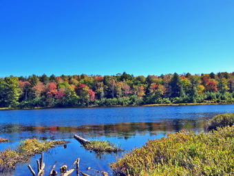
![]()
![]()
![]()
![]()
![]() On Sunday, September 29thth I decided I wanted to hike somewhere near home after returning from church. It was almost 1:00 PM before we got home from church and I might have given up the hike but Sheila convinced me to go! I asked Cindy if she wished to hike and she agreed as long as we did not have to drive very far. We talked about different possibilities and I suggested we head for Long Pond to do the big loop which is about 6 miles. We had not been to Long Pond in some time so I was anxious to see how the trails had faired after the recent rains and winds. We started to get ready and Sheila was there to watch our every move. The temperature was in the low 70's as we prepared to hike. I got dressed in a new White Sierra long-sleeved crew top that Cindy had gotten me for my birthday with a short-sleeved baselayer. The White Sierra top has InsectSheild and is quite light. I put on a pair of RailRiders hiking pants which are expensive but last along time and have features like deep pockets and a generous cut which I really like. The pants have Velcro closures at the ankles which I hoped would mean I did not need gaiters. I decided to wear my Vasque Taku hiking boots which fit well and have been discontinued. I grabbed a pair of Leki external lock poles I have been using lately. When we left the house at about 1:30 PM the skies were partly sunny. I got Sheila in the car and we put our gear in the trunk and headed out DeBruce Road for about 8 miles to Flugertown Road where I made a left. I parked in the lot a short distance up the road on the right where we found no other cars. As we pulled in and started to get ready another car pulled in and parked. Sheila really wanted to see who or what was in the car and I suspected thee might be another dog. I put Sheila on her leash just as the occupants began to exit the other car with their dog. I set my GarminGPS and we got started on the trail right away crossing the first bridge at 1:45 PM. I hoped we could set a quick pace and stay ahead of the other hikers. Sheila hand I had hiked the day before on Round Top but you wouldn't know it from the way she carried on. At the start the trail was dry which made it easier to keep a fast pace. The first .6 miles gains about 350 feet to the highest point on the hike. It isn't very steep but does act as a nice warm-up! Once the trail leveled it was easier walking but the trail became wet and muddy in spots. At 1.1 miles we were at the spur trail that leads down to the shore of Long Pond. We turned right and almost immediately ran into a large blowdown across the trail. We worked through the blowdown and went down to the pond so that I could take some pictures. At the shores of the pond I dropped my pack and got out my camera to take some pictures. Sheila tried to follow me through the mud but we discouraged her. The skies were blue with a few wispy clouds. The colors were not as bright as I had hoped but there were some brilliant trees. I took quite a few pictures trying to concentrate on the color. I returned to my pack and we returned to the main trail. We turned right and were soon at the first trail junction. We turned right at the junction at 1.3 miles. We found plenty of wet and muddy places on the trail but they were easily avoided. By 2:40 PM we had walked 1.8 miles and were passing the spur trail to the lean-to.
On Sunday, September 29thth I decided I wanted to hike somewhere near home after returning from church. It was almost 1:00 PM before we got home from church and I might have given up the hike but Sheila convinced me to go! I asked Cindy if she wished to hike and she agreed as long as we did not have to drive very far. We talked about different possibilities and I suggested we head for Long Pond to do the big loop which is about 6 miles. We had not been to Long Pond in some time so I was anxious to see how the trails had faired after the recent rains and winds. We started to get ready and Sheila was there to watch our every move. The temperature was in the low 70's as we prepared to hike. I got dressed in a new White Sierra long-sleeved crew top that Cindy had gotten me for my birthday with a short-sleeved baselayer. The White Sierra top has InsectSheild and is quite light. I put on a pair of RailRiders hiking pants which are expensive but last along time and have features like deep pockets and a generous cut which I really like. The pants have Velcro closures at the ankles which I hoped would mean I did not need gaiters. I decided to wear my Vasque Taku hiking boots which fit well and have been discontinued. I grabbed a pair of Leki external lock poles I have been using lately. When we left the house at about 1:30 PM the skies were partly sunny. I got Sheila in the car and we put our gear in the trunk and headed out DeBruce Road for about 8 miles to Flugertown Road where I made a left. I parked in the lot a short distance up the road on the right where we found no other cars. As we pulled in and started to get ready another car pulled in and parked. Sheila really wanted to see who or what was in the car and I suspected thee might be another dog. I put Sheila on her leash just as the occupants began to exit the other car with their dog. I set my GarminGPS and we got started on the trail right away crossing the first bridge at 1:45 PM. I hoped we could set a quick pace and stay ahead of the other hikers. Sheila hand I had hiked the day before on Round Top but you wouldn't know it from the way she carried on. At the start the trail was dry which made it easier to keep a fast pace. The first .6 miles gains about 350 feet to the highest point on the hike. It isn't very steep but does act as a nice warm-up! Once the trail leveled it was easier walking but the trail became wet and muddy in spots. At 1.1 miles we were at the spur trail that leads down to the shore of Long Pond. We turned right and almost immediately ran into a large blowdown across the trail. We worked through the blowdown and went down to the pond so that I could take some pictures. At the shores of the pond I dropped my pack and got out my camera to take some pictures. Sheila tried to follow me through the mud but we discouraged her. The skies were blue with a few wispy clouds. The colors were not as bright as I had hoped but there were some brilliant trees. I took quite a few pictures trying to concentrate on the color. I returned to my pack and we returned to the main trail. We turned right and were soon at the first trail junction. We turned right at the junction at 1.3 miles. We found plenty of wet and muddy places on the trail but they were easily avoided. By 2:40 PM we had walked 1.8 miles and were passing the spur trail to the lean-to.
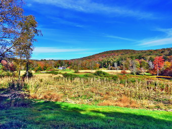 After passing the trail to the lean-to, we continued to find wet and muddy places on the trail but there was a little less than before. There isn't much to see on this section of trail but we kept busy by avoiding the muddy spots and talking. We continued on the main trail to the point where it intersects a woods road at 2.6 miles. We turned left on the woods road and found it to be very wet and recently used by vehicles. We followed the road until the intersection with Basily Road at 2.85 miles where we continued on Basily Road by bearing left. This section of road was also wet and muddy but it did not slow us down much. As we approached the Peters Hunting Camp, I got ready to put Sheila on her leash. The area near the footbridge across the outlet to the beaver pond was almost dry and I stopped to take a few pictures despite the paucity of fall colors. I heard a voice and then saw a mountain biker headed toward us and toward the camp. I grabbed Sheila as she passed. I remember wondering if she had permission to be on the private land and bridge. We continued on the trail but stopped after a short distance so that I could take some pictures of the cornfields around the hunting camp. The new bridge over the stream near the amp is already showing signs of wear from snowmobiles passing over it even though there is a sign that states "Private Bridge". We crossed the bridge to continue the trip back to the car but stopped so that I could take some pictures of Cindy and Sheila. The ford downstream of the bridge looked like it had been getting a lot of use by vehicles since the water was very shallow. We started up the little hill from the hunting camp and stopped again so that I could take a few shots of the valley which looked peaceful with the nice skies behind it. There were some isolated trees with nice colors and I wondered whether the colors would get better before the leaves fell off the trees. Once we started walking again we kept a fast pace since the road was now drier. At one point I noticed that there were some rocks in the stream covered with moss. I took a few pictures and then Sheila alerted. I hiker was approaching with her dog on a leash. I leashed Sheila which proved to be a good idea as the other dog began to bark and growl. We continued down the road toward the car until we arrived at the place where the road is paved. We stopped since I wanted to take a picture of a dead tree against the blue sky. Cindy suggested I take some close-ups of some brightly colored leaves. I noticed an apple, tree and took some pictures including some close-ups of the apples at Cindy's suggestion. Once I was done, I stowed my camera and we continued at an accelerated pace back to the parking area. We were back at the car at 4:25 PM having hiked 6.0 miles in 2 hours and 40 minutes with 20 minutes of stopped time. The elevation gain was only about 550 feet most of which was at the beginning of the hike.
![]()
![]()
![]()
![]() On Saturday, September 28th I was ready to get out for my first hike of the week and the first one of the fall season. I had been busy with a spate of after school and family commitments! I was scheduled to be on duty with the ambulance at the only home football of the season so I knew I couldn't go to far away from home. I did some chores around the house and decided I would go across the street to hike on Round Top. Before I could return home my ambulance pager sounded and I went to the building to wait for a driver. The call was cancelled and I went home to start to get ready around 9:30 AM. As I began to get dressed to go Sheila began arking and running around frantically. Sheila misses the hiking as much as I do since I have returned to full-time teaching. The temperature was in the low 70's so I knew I should dress for warm weather. I put on my long-sleeved light Mountain Hardwear crew top. I knew this might be a little too warm but felt I don't mind being warm. I put on a pair of RailRiders hiking pants which are expensive but last a long time and have features like deep pockets and a generous cut which I really like. The pants have Velcro closures at the ankles. I decided to wear my Vasque Taku boots which are supportive, surprisingly roomy and discontinued. I grabbed a pair of Leki poles with external locks that I have been using lately. At 9:50 AM, I grabbed Sheila's leash from the closet as we walked out the door to start the hike. We walked up the driveway and across the street. I decided we would try to do four figure 8's to make up for the lack of hiking during the week. We walked to the parking area by the Presbyterian Church and to the back of the church. We began the ascent of the steepest hill behind the church. The hill is short but gets the circulation pumping and is the steepest and longest climb on the "trail." Sheila helped me along by pulling me up the hill. When we got to the top of the hill, I stopped to look around at the hills around town. I had hoped to see some fall colors but there were none to speak of. We started on the trail by turning left at the trailhead. I let Sheila off her leash so that she could explore. The trail bed is becoming worn it which means that a few people are using the trail. I am always happy to see that someone else uses the trails.
On Saturday, September 28th I was ready to get out for my first hike of the week and the first one of the fall season. I had been busy with a spate of after school and family commitments! I was scheduled to be on duty with the ambulance at the only home football of the season so I knew I couldn't go to far away from home. I did some chores around the house and decided I would go across the street to hike on Round Top. Before I could return home my ambulance pager sounded and I went to the building to wait for a driver. The call was cancelled and I went home to start to get ready around 9:30 AM. As I began to get dressed to go Sheila began arking and running around frantically. Sheila misses the hiking as much as I do since I have returned to full-time teaching. The temperature was in the low 70's so I knew I should dress for warm weather. I put on my long-sleeved light Mountain Hardwear crew top. I knew this might be a little too warm but felt I don't mind being warm. I put on a pair of RailRiders hiking pants which are expensive but last a long time and have features like deep pockets and a generous cut which I really like. The pants have Velcro closures at the ankles. I decided to wear my Vasque Taku boots which are supportive, surprisingly roomy and discontinued. I grabbed a pair of Leki poles with external locks that I have been using lately. At 9:50 AM, I grabbed Sheila's leash from the closet as we walked out the door to start the hike. We walked up the driveway and across the street. I decided we would try to do four figure 8's to make up for the lack of hiking during the week. We walked to the parking area by the Presbyterian Church and to the back of the church. We began the ascent of the steepest hill behind the church. The hill is short but gets the circulation pumping and is the steepest and longest climb on the "trail." Sheila helped me along by pulling me up the hill. When we got to the top of the hill, I stopped to look around at the hills around town. I had hoped to see some fall colors but there were none to speak of. We started on the trail by turning left at the trailhead. I let Sheila off her leash so that she could explore. The trail bed is becoming worn it which means that a few people are using the trail. I am always happy to see that someone else uses the trails.
At the first trail junction, I followed Sheila as she turned right on the woods road which is the shallower approach to the trail system. We continued to follow the yellow trail to the first junction where we turned left and followed it to the next trail junction. I set a slower pace than usual so that I could just enjoy the walk. At the second junction with the blue trail, we turned right and started up the steep blue trail that leads over the summit of Round Top. Walking uphill we passed through a sea of green ferns that grew very close to the narrow trail. The ferns were a little damp as was the trail which made hiking a little slippery. I also noticed that I was a little tired which I attributed to the lack of hiking. We walked across the flat summit of Round Top and started down the other side. I had trimmed much of the trail earlier in the summer but this part still had some branches encroaching on the trail. I sort of like the branches untrimmed as it makes the trail seem "wilder"! Soon we were back at the yellow trail. We turned right and walked the yellow trail to the next trail junction. This time we turned left and followed the yellow trail downhill toward the lookout. We continued down to the lookout where there wasn't much to see and I noticed the lack of color in the leaves. We followed the yellow trail as it turned left and descended the hill to the first trail junction. The walk had gone quickly, so we turned around and started back up the hill back to the lookout. Sometimes Sheila resists another loop but this time she had no objection. We followed the yellow trail uphill toward the lookout and turned right to continue up to the next trail junction with the blue trail. At the trail junction, we turned right to stay on the yellow trail. At the next junction we turned left to climb the shallower side of the summit ascent. We again walked across the flat summit and descended the steeper trail. At the trail junction, we turned left and followed the yellow trail along the base of Round Top. At the next junction we turned right this time to follow the trail down to the woods road that leads out to the first trail junction. We completed the figure 8 ending up back at the very first trail junction. I was still fresh and even though repeated figure 8's are a little boring. I decided to head up the woods road and repeat the first figure 8. We completed the route and then did another one. After the fourth figure 8, we headed out toward the trailhead. As we approached the trailhead, I saw two people getting ready to come onto the trail. I put Sheila on her leash as we walked out to the cemetery. The hikers asked how far it was to the lookout and I let them know it was less than half a mile round trip. Sheila and I walked down the hill and through the church parking lot to the road and to our driveway. It was 11:15 PM and we had hiked around 4 miles in about an hour and a half.