
What You Missed
Winter 2006-2007
![]() On Saturday, March 17th 12" to 16" of new snow had fallen in Livingston Manor.
I took Sheba and headed for the hill behind the church. The snow was new and untouched. We had to break trail the
whole way. The views of town from the hill were beautiful. I made a right at the top of the trail and just headed UP
to the highest point I could find. This led me to the trail I usually take back so I just followed it and reversed
the route I normally take. The downhills were interesting on snowshoes and I was a little cautious at first. After
some experimenting, I found a great way to go down slopes. I lift the tips of the snowshoes and Lean back or "sit" on
the tails". This allows a "glide" similar to cross country skis! It makes going down a breeze. Now if I can only find
a similar technique for going up. After lunch I'm going out again with my wife and a friend. I am going to take the
camera this time!
On Saturday, March 17th 12" to 16" of new snow had fallen in Livingston Manor.
I took Sheba and headed for the hill behind the church. The snow was new and untouched. We had to break trail the
whole way. The views of town from the hill were beautiful. I made a right at the top of the trail and just headed UP
to the highest point I could find. This led me to the trail I usually take back so I just followed it and reversed
the route I normally take. The downhills were interesting on snowshoes and I was a little cautious at first. After
some experimenting, I found a great way to go down slopes. I lift the tips of the snowshoes and Lean back or "sit" on
the tails". This allows a "glide" similar to cross country skis! It makes going down a breeze. Now if I can only find
a similar technique for going up. After lunch I'm going out again with my wife and a friend. I am going to take the
camera this time!
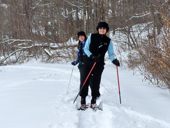 After lunch, around 1:00 PM, I again headed for Round Top. This time my wife, a friend. Kathy, and Sheba all came
with me. After crossing the street, there is a short rather steep climb to the top of the cemetery hill. Cindy
and Kathy had not been out before and were in good spirits as they climbed the hill.
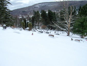 From the cemetery hill the view of Treyz Hill and the area between the hills, The Flats, is beautiful. The new
snow covered the cemetery and the hills beyond the flats. It makes everything look so clean and peaceful. A light
wind was blowing and causing the snow to drift in spots.
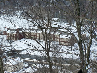 The view of town after climbing a short distance through the woods is very impressive. The Livingston Manor school
in particular looks beautiful. The school is old, built in the 1930's but the maintenance staff does a good job
of upkeep. Several recent bond issues have refurbished the roof and clock tower. The river running in front
is the Willowemoc.
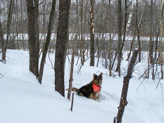 After a steady climb up to the second and highest part of the ridge, there is a long descent. Sheba and I waited as
my wife and Kathy descended. At this point, we were on the other side of the ridge overlooking State Route 17, the
Quickway. The descents were fun and I ended up throwing in an extra one as I tried to find an alternate trail.
Just before the turn to head back up to where we started there is a clearing that overlooks Exit 96. There are
also good views of the houses on White Roe Lake Road.
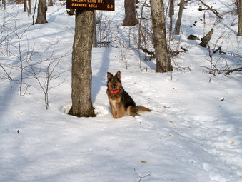
![]()
![]() On Wednesday, March 14th I had to take off from work since my back was
bothering me again. A little heat and some ibuprofen had it feeling better. Just before noon I decided to take Sheba
and climb Graham Mt. I took a complete complement of equipment since I didn't know what I would need. The parking lot
was bare but that was it! The trail off the parking area had a foot of snow so I decided to wear the MSRs and
take the crampons with me. Good decision! When we got to the turn for Balsam Lake Mt., Sheba was ready to go up the
steep slope but I told here we were going to Graham Mt.
On Wednesday, March 14th I had to take off from work since my back was
bothering me again. A little heat and some ibuprofen had it feeling better. Just before noon I decided to take Sheba
and climb Graham Mt. I took a complete complement of equipment since I didn't know what I would need. The parking lot
was bare but that was it! The trail off the parking area had a foot of snow so I decided to wear the MSRs and
take the crampons with me. Good decision! When we got to the turn for Balsam Lake Mt., Sheba was ready to go up the
steep slope but I told here we were going to Graham Mt.
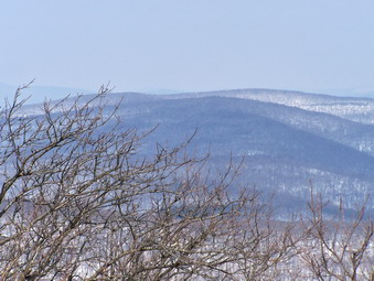 The trek to Graham Mt is long and parts are not too interesting. Several blowdowns on the narrow trail to the second
Balsam Lake turn required careful negotiation. I did find it just as easy to use the snowshoes as to hike over the
rocks that line the trail during the summer. The herd path to Graham was very obvious. It was clear that several people
had postholed their way along the trail. Others had worn snowshoes but had stayed on top of the crust that was present
when the weather was warmer. On this day the snow as loose from the warm temperatures and I was GLAD I had the snowshoes
since it would have been a miserable walk otherwise. Graham Mt always fools me since there are several parts of the trail
near the top that look like the summit but are not! I didn't stop for any pictures until I reached the top. It was
warm at the summit and there was less snow. Looking back toward Balsam Lake Mt the summit was clearly visible but I
could not spot the tower.
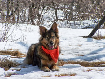 As always Sheba had a great time despite the fact that her lack of snowshoes meant she kept sinking into the
loose snow. It didn't seem to bother her much. She was able to follow the track of the others who had gone before
use. This was despite the fact that they had been there many days before. The one time I decided not to follow her was
the time I lost my way. Even Sheba took a short rest at the summit of Graham Mt. All too soon she was ready to go and
we were back on the trail. The descent was easier but I still had to be careful.
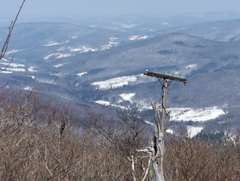 Just below the summit of Graham Mt on the west side of the trail is a nice place to look out over the valley. A pole
here attests to the function of the remains of the building at the top. At one time wires carried power and
telephone communications to the long abandoned radio station. The views from this spot are always beautiful and
change dramatically with the seasons. We only stopped for a short time at the lookout as the wind picked up and
some clouds started to blow in. Despite the sun, the weather prediction was for rain in the afternoon.
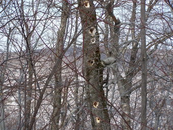 On the way back, still on the herd path from Graham, I noticed this tree that I had not seen on the way up.
Woodpeckers had perforated the dead tree with numerous holes. I didn't see any evidence of the birds themselves,
only the results of their labors.
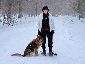
![]() On Sunday, March 11th I decided to take Sheba and snowshoe at Trout Pond. I
knew a group from Morgan Outdoors was coming but I decided to get a head start. Sheba and I parked at around 12:30
and hiked the big hill up to Mud Pond. We retraced our steps and walked back to Morton Hill Road where we
had parked just in time to meet four other people. This time we headed for Trout Pond. The group stopped and
turned around at the lower end of the pond. Sheba and I continued on to the lean-to. By this time it was getting late
and the Tubbs were beginning to irritate my left heel. We turned around and went back to the car. Altogether we
spent almost three hours snowshoeing and covered almost six miles.
On Sunday, March 11th I decided to take Sheba and snowshoe at Trout Pond. I
knew a group from Morgan Outdoors was coming but I decided to get a head start. Sheba and I parked at around 12:30
and hiked the big hill up to Mud Pond. We retraced our steps and walked back to Morton Hill Road where we
had parked just in time to meet four other people. This time we headed for Trout Pond. The group stopped and
turned around at the lower end of the pond. Sheba and I continued on to the lean-to. By this time it was getting late
and the Tubbs were beginning to irritate my left heel. We turned around and went back to the car. Altogether we
spent almost three hours snowshoeing and covered almost six miles.
![]()
![]() On Sunday, March 4th my wife and I decided to take Sheba and snowshoe at
Frick and Hodge Ponds. We decided to reverse the course we normally use. We started up the LONG incline which is
the Flynn Trail. Some of the snow was packed by DEC snowmobiles which made the trek easier. At the top of the hill, we
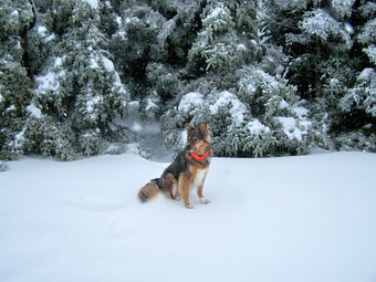
took a short break. Sheba objects to these interruptions in her hiking but can be placated by offering her a treat.
On Sunday, March 4th my wife and I decided to take Sheba and snowshoe at
Frick and Hodge Ponds. We decided to reverse the course we normally use. We started up the LONG incline which is
the Flynn Trail. Some of the snow was packed by DEC snowmobiles which made the trek easier. At the top of the hill, we
took a short break. Sheba objects to these interruptions in her hiking but can be placated by offering her a treat.
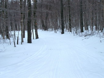 After our break, we turned left onto the Big Rock trail and headed back to the parking area. I would have preferred
to continue on to Hodge Pond but any time out is better than staying in. I would still like to get some more
pictures of Hodge Pond before the snow leaves. Maybe over the next couple of weeks I'll make it back there!
![]()
![]() On Saturday, March 3rd I decided to take Sheba and climb a 3500 somewhere
close to home. I was worried about the amount of snow and ice on some of the back roads so I headed for Slide.
Ulster County does a great job of maintaining Rt 47 and this day was no exception. In fact, most of the roads
were in better shape than I expected. I had doubts about whether we could cross the West Branch of the Neversink
behind the Slide parking area. It seemed those doubts were well founded as the river was running high. I pulled
into the parking area fully expecting to go with my backup plan of climbing Eagle and Balsam. I got out of the
car in the icy parking area, walked past the register to the river and found it completely covered with ice and
snow. I let Sheba out of the car. I decided to wear my snowshoes and take my crampons and Yaks. This turned out
to be a great decision. We started the hike and I was AGAIN reminded that a 3500 is DIFFERENT than hiking
small hills. I did not stop to take any pictures until the top! To the left Sheba is patiently waiting at the summit
of Slide to start hiking again.
On Saturday, March 3rd I decided to take Sheba and climb a 3500 somewhere
close to home. I was worried about the amount of snow and ice on some of the back roads so I headed for Slide.
Ulster County does a great job of maintaining Rt 47 and this day was no exception. In fact, most of the roads
were in better shape than I expected. I had doubts about whether we could cross the West Branch of the Neversink
behind the Slide parking area. It seemed those doubts were well founded as the river was running high. I pulled
into the parking area fully expecting to go with my backup plan of climbing Eagle and Balsam. I got out of the
car in the icy parking area, walked past the register to the river and found it completely covered with ice and
snow. I let Sheba out of the car. I decided to wear my snowshoes and take my crampons and Yaks. This turned out
to be a great decision. We started the hike and I was AGAIN reminded that a 3500 is DIFFERENT than hiking
small hills. I did not stop to take any pictures until the top! To the left Sheba is patiently waiting at the summit
of Slide to start hiking again.
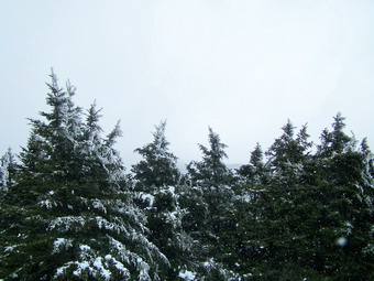 The weather when I left the parking area was overcast but the sun seemed to be ready to peek through the clouds.
The temperature was cooler than the 40's at home but not below the mid 30's. As we climbed the temperature continued
to drop and the wind picked up. The trail was packed down in most places but any attempt to go off the trail
showed that ether was between 1 and 2 feet of snow remaining in most places. Above 3500 feet the trail became VERY
icy and I was glad for the aggressive cleats on my MSRs. It also started to snow which I assumed was due to the
elevation. The view at the right is from Slide toward the Ashokan. Hiking in the snow with snow on the ground and ice
on the trees was beautiful but there were no views.
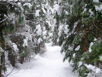 The snow and ice on the trees had weighed them down so much that they were bent over into the trail. This gave the
feeling of walking through a tunnel much of the time. Some branches hung so low they blocked the way. Many were
so heavy they were hard to move and we had to go around. Sheba went under. As we were descending I heard a CRASH
behind me! A rather large branch had snapped off and fallen on the trail about 10 feet behind me.
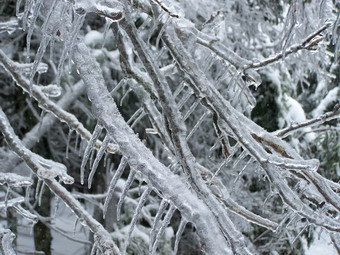 The ice on the trees above 3500 feet was truly impressive. This picture clearly shows the icy covering typical of
most of the trees at this elevation. The trail surface was also covered with ice. Sheba had some trouble slipping and
sliding around but she didn't seem to mind.
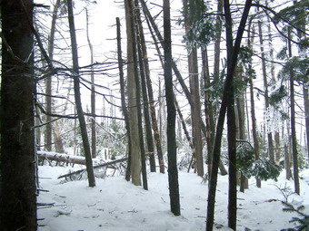 In the vicinity of the CO trail is an area on the east side of Slide where the trees have been destroyed. The area
has been this way for quite some time. I knew at one time what caused this destruction. The area has been slow to
recover but this is typical of the fragile ecology at this elevation. It acts as a reminder of the damage we could
do.
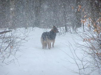 As we descended the snow did not abate as I had thought it would. In fact, the rate of snowfall increased and
it was snowing as when we reached the parking area. This picture shows Sheba leading the way near the junction
with the West Branch-Oliverea Trail. She was covered in snow at several points but managed to shake most of it
off. We covered the six mile hike in right around three hours! Although the snowshoes add weight, it may be
easier negotiating Slide this way. During the other seasons the rocks that make up the trail surface can
be real ankle turners!
![]()
![]() On Monday, February 26th school was closed AGAIN due to several inches of new
snow. I took Sheba and headed for Trout Pond to hike the SAME ROUTE as the day before. I intended to hike it faster
and throw in a side trip up the Campbell Mountain Trail. The parking area on Morton Hill was STILL not plowed so
I parked along the road trying not to get stuck since I had my mother's Alero and not the SUV. There was about 3 inches
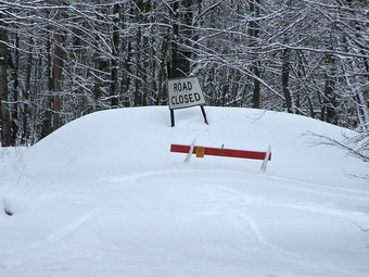
of new snow which had piled up on the trail. It clung to the trees making a beautiful sight. Near the parking area
on Russell Brook Road a sign marked the end of the passable roadway. Beyond this sign the road has become impassible
due to the series of floods that have eroded the roadway.
On Monday, February 26th school was closed AGAIN due to several inches of new
snow. I took Sheba and headed for Trout Pond to hike the SAME ROUTE as the day before. I intended to hike it faster
and throw in a side trip up the Campbell Mountain Trail. The parking area on Morton Hill was STILL not plowed so
I parked along the road trying not to get stuck since I had my mother's Alero and not the SUV. There was about 3 inches
of new snow which had piled up on the trail. It clung to the trees making a beautiful sight. Near the parking area
on Russell Brook Road a sign marked the end of the passable roadway. Beyond this sign the road has become impassible
due to the series of floods that have eroded the roadway.
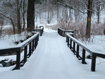 Hiking on snowshoes allowed extra grip in the new snow that had fallen on top of the hard-packed snowmobile trails.
As we descended toward Russell Brook, a small sign warned snowmobilers of the upcoming wooden foot bridge. The bridge
was covered by the new snow but showed signs of wear and tear from the motorized snowmobile treads. Most of the brook
was frozen over with only small patches of open water visible. I did not venture up to the waterfall because of the deeper
snow in that direction. From the road above, it too seemed partly frozen!
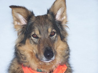 My hiking companion Sheba is ALWAYS ready to leave the house and head out on a new adventure. Today she did not
seem to be sure that I would take her. I did give it a second thought today since she is bothered by the snow
which collects on the hair between her toes and up her legs. Nothing seems to prevent this completely but I applied
a liberal coating of Musher's Secret which does help. I may try trimming the hair a little sine it takes only
minutes for her to form annoying ice balls. These seem to be more of an annoyance than anything else and her
"nibbling" at them more of a habit than a necessity. Sheba stayed close to me following in my steps part of the time
to take advantage of the trail I was breaking.
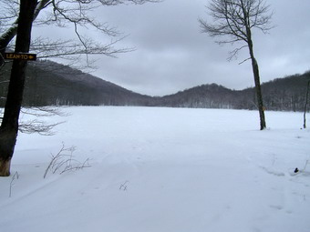 The hike went quickly and we only stopped briefly near Mud Pond for me to change gloves and adjust the ventilation
on my jacket. I gave Sheba a treat, cleaned her paws and we were off uphill again toward Trout Pond. On the way down
the other side of the hill from the highest point on the trail I began to notice a "hot spot" on my right foot. When
I put on the snowshoes I had cinched the right one down pretty tight. I had intended to loosen it but had not. The
rubbing became so painful that I removed the shows and carried them the rest of the way! Fortunately, the trail was
well-packed and I was going downhill and then along a flat area most of the way. At the upper end of Trout Pond, the
bridge is still missing. It washed out during the last flood and has not been replaced! The water level is low
and the water frozen. Multiple layers of snow and the packing from the snowmobiles has formed a sturdy bridge across
the creek. Trout Pond has a enough ice to support snowmobiles but it looks strange to see it completely covered. Snow
began to fall at this point so we hurried on!
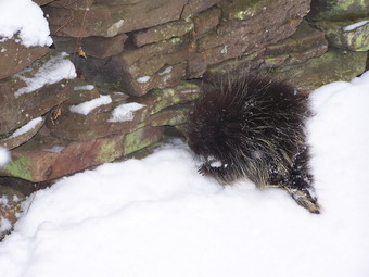 We descended the path from Trout Pond to the trail register quickly. I used one pole to steady myself as I continued
to carry the snowshoes and the other pole. As we neared the trail register to complete our loop, Sheba and I
noticed some wildlife out and about in the snow. It was a small porcupine lumbering along. I was VERY CONCERNED that
Sheba would want to investigate and immediately told her to STAY! She didn't seem all that interested and listened to
my commands. I tried to get a picture of the porcupine. I found that it simply wanted to be left alone. I could not get
a clear picture of its face since it would turn its back to be and display its quills! I snapped some shots and then
we got back on the trail. The uphill walk to the car was a little difficult without the traction from the snowshoes
but my foot felt better without the irritation on what turned out to be a small but painful blister. It took us about
2.5 hours to hike the 5 to 6 mile route. The camera always seems to add some time but I like recording our efforts!
![]() On Sunday, February 25th My wife and I took Sheba and headed for Trout Pond.
The parking area on Morton Hill was not plowed so we parked along the road. Several trucks, one with a snowmobile
trailer, were already parked. ALL of the trails were packed by snowmobiles and the walking was easy. We started by
hiking down to the Russell Brook parking area and then to the trail register. From here we turned left and went up
the hill toward Mud Pond. This climb is challenging since it is long if not steep. We turned right at the trail
that leads to Trout Pond and gradually ascended to the top. From here the trail is all downhill or flat back to the
trail register. From there we went back up Russell Brook Road to the car. The round trip took about 2.5 hours at a
rather leisurely pace. I was quite comfortable in my CoolGear and a Mountain Hardwear Link Jacket. I was glad I wore
my high gaiters since I tend to kick up a lot of snow.
On Sunday, February 25th My wife and I took Sheba and headed for Trout Pond.
The parking area on Morton Hill was not plowed so we parked along the road. Several trucks, one with a snowmobile
trailer, were already parked. ALL of the trails were packed by snowmobiles and the walking was easy. We started by
hiking down to the Russell Brook parking area and then to the trail register. From here we turned left and went up
the hill toward Mud Pond. This climb is challenging since it is long if not steep. We turned right at the trail
that leads to Trout Pond and gradually ascended to the top. From here the trail is all downhill or flat back to the
trail register. From there we went back up Russell Brook Road to the car. The round trip took about 2.5 hours at a
rather leisurely pace. I was quite comfortable in my CoolGear and a Mountain Hardwear Link Jacket. I was glad I wore
my high gaiters since I tend to kick up a lot of snow.
On Saturday, February 24th I got home around 5:00 PM from timing two basketball games. My wife and I decided to take the dog and go for a short snowshoe hike over Little Round Top just across the street from our house. We repeated the hike I had done recently with a few variations. As we finished, it was getting pretty dark in the woods. It has a good hour spent on a "warm" day."
On Thursday, February 22nd school closed early due to a snowstorm. I decided to take Sheba snowshoeing and we headed toward Trout Pond. As I ascended Morton Hill Road I decided it was a mistake. The snow was falling heavily and the road already had 2 inches covering it. I knew that I would be worried about the return trip for the entire hike. I turned around and went back to Livingston Manor. I went to the Orchard Street Cemetery with Sheba and reversed the route I had done the last time school closed on Valentine's Day. I walked the ridge from the cemetery parallel to Rock Avenue. I followed and old woods road/trail and some footprints. At one point I had a nice view of the school! I headed around Little Round Top and down into an open field. After skirting the field I reentered the woods and was able to see the Quickway. I paralleled the Quickway about half way to Exit 97 when the trail began to descend. I decided to head UP through the woods to the ridge. This UP is not a mountain but it is steep in places and a good workout. At the very top of the ridge I picked up my trail from the last hike. I followed this back toward the cemetery but then cut down through the woods and picked up my tracks from earlier. I retraced my steps back to their origin. A little over an hour with the Sheba outside in the fresh and falling snow was well worth it.
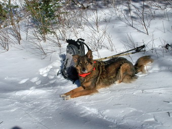
![]()
![]() On Monday, February 19th the morning temperatures were single digit. The low
temperatures combined with the winds created a "feel like" temperature of well below zero. I waited until about
1:00 PM and then headed out the door with Sheba. The trail reports from Balsam Lake Mountain were tempting but
I didn't want to do that hike alone. It was the first time I had carried a pack since the accident and I didn't
know how it would effect my lower back. Sheba and I parked at the Frick Pond parking area on Beech Mountain
Road at about 1:20 PM. I was happy to see over afoot of snow and unbroken trails. Only one other car was in the
lot. I signed in at the trail register and we quickly made our way to the trail junction at Frick Pond. Someone
had been "postholing"! I wore my MSR Lightning Ascents for their light weight. At Frick we turned left and went
down to the pond. I took some pictures of the pond. I though I heard a gunshot but chalked it up to a breaking tree
branch. We headed back up to the trail junction and continued toward Times Square. Several more loud "pops"
convinced me that they were indeed gunshots! I decided to continue.
On Monday, February 19th the morning temperatures were single digit. The low
temperatures combined with the winds created a "feel like" temperature of well below zero. I waited until about
1:00 PM and then headed out the door with Sheba. The trail reports from Balsam Lake Mountain were tempting but
I didn't want to do that hike alone. It was the first time I had carried a pack since the accident and I didn't
know how it would effect my lower back. Sheba and I parked at the Frick Pond parking area on Beech Mountain
Road at about 1:20 PM. I was happy to see over afoot of snow and unbroken trails. Only one other car was in the
lot. I signed in at the trail register and we quickly made our way to the trail junction at Frick Pond. Someone
had been "postholing"! I wore my MSR Lightning Ascents for their light weight. At Frick we turned left and went
down to the pond. I took some pictures of the pond. I though I heard a gunshot but chalked it up to a breaking tree
branch. We headed back up to the trail junction and continued toward Times Square. Several more loud "pops"
convinced me that they were indeed gunshots! I decided to continue.
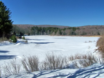 Past Frick Pond the snow began to deepen with drifts up to two feet! The trail was not clearly broken, although
in places I could see ski tracks. When we arrived at Times Square, the Loggers Loop and Big Rock Trail were
nicely packed by snowmobiles. Breaking trail is hard work by yourself and I was glad for the respite. The Big Rock
Trail is always more of a challenge than I remember. It is a little more than a mile from Times Square to the
junction with the Flynn Trail but it is all uphill. The elevation change is only 600 feet but seems like more.
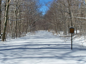 At the junction with the Flynn Trail I decided to return to the car. Sheba's feet were bothering from ice balls.
I didn't want to overexert myself. The snowmobile tracks continue on over the hill to Mongaup Pond. The Flynn Trail
was completely unbroken in both directions. After a brief stop for pictures, we turned right on the Flynn Trail and
hiked the 1.5 miles back to the parking area. Some places on this trail had drifts over 2 feet. For once, I felt that
the snowshoes were necessary! Around 4 miles in two hours doesn't set any records but I was happy with my effort.
On Saturday, February 17th the MSR/OR representative was at Morgan Outdoors. She gave a brief presentation on layering clothing and on the MSR snowshoes. Then, a group of about fifteen headed out to snowshoe. My wife and I decided to go along and take Sheba who had not been out in some time. We went to the Beaverkill Covered Bridge and parked. The group walked across the bridge, donned snowshoes and headed down a trail into the campsite. The terrain is relatively flat and snowshoes were not really needed since the snow depth was minimal. Still, the shows provides a grip on the icy crust and it was good to be out. The air temperature was in the twenties but the sun was out and there was little wind. As we approached the end of the campsites, I decided to head UP to the ridge above us to get in some work and see the sights. The climb was short but steep in places and I was glad I had worn by Lightning Ascents! At the top of the ridge I looked down and saw that only Sheba had followed me! The rest of the people were taking a break and waving to me. After a short traverse of the ridge, I returned to where I had ascended. Other places on the ridge were just too steep. On the way back we bushwhacked up through the pine forest which was beautiful. There were several small rises to negotiate and getting over some of the blowdowns prove a challenge. It was an enjoyable outing with new people to talk to. We spent about two hours and got some good exercise.
On Wednesday, February 14th we got our first real snowfall of the day and school was closed. My wife had to work so we planned on an earlier morning snowshoe excursion. When we looked outside, there was heavy, wet sleet falling. We decided to wait until she came home from work. Around 11 AM I was bored, so I decided to go out by myself. By the time I was dressed and ready to go the snow had turned to rain and I headed back inside. By 1 PM the snow had started again and was really falling hard. I went got outside this time and headed for a hilly cemetery across the street. I planned to do some laps but after a few I was bored. I headed into the woods along following a poorly defined trail. I decided to turn uphill and go to the top of a small ridge. Going uphill was interesting since a layer of snow had been covered by a layer of frozen rain and snow. On top of this was another layer of snow. My MSR Lightning Ascents were up to the job. Even so, paying attention to getting a good shoe and pole placement was critical. At the top of the ridge my heart rate was up but so were my spirits. The woods and trees were beautiful and fresh snow was falling. I walked for a distance across the top of the ridge and then decided to turn back and work my way home. I misjudged my direction a little! Some of the descent were a little steep on snowshoes but I quickly remembered the technique for walking on a side hill and traversing to descend. I was out for a little over an hour. My Columbia Six Glaciers over UnderArmor ColdGear was more than enough. When my wife came home from work, we went down to the school and snowshoed on the flat fields for a while. By this time the winds had picked up and the fields offered little protection. We headed in pretty quickly. All in all a very nice time.
On Thursday, February 8th my Mitsubishi Eclipse was struck from the rear by a full-sized pickup truck on about 45 mph. I was stopped at a red light on State Route 17 in Parksville. The driver behind me lost concentration and simply ran into me. The damage to my car was over $6,000. I still have pain in my lower back, right hip and thigh. Sitting and lying down are uncomfortable. Walking seems to be alright but I haven't tried carrying a pack yet! I know this isn't a hike but I feel it was an adventure albeit one that I could have done without.
![]() On Saturday, February 3rd I decided to try Doubletop from the Segar parking
area. I had wanted to do this earlier in the year but was unsure where to "cut up" to the peak. I read a message
from Aaron VFTT indicating he wanted to do this hike and I responded. Of course, the night before we got the first
major snowstorm of the winter! Aaron sent me an email that the hike was on for 10:30 AM since he was bringing some
people up from Harriman! I started out at about 9:30 AM and took the scenic drive passed Pepacton Reservoir and on
Millbrook Rd. The other group actually arrived before I did! They came up the Thruway to Kingston, took Rt 28 and then
Dry Brook Rd. from Arkville. We met shook hands and were off! The pace was quick and the weather cold so I never
really had a chance to get the camera out. There isn't much of a view along the way. The 8 inches of snow at the
peak was "scenic" as it draped the trees in winter's glory!
On Saturday, February 3rd I decided to try Doubletop from the Segar parking
area. I had wanted to do this earlier in the year but was unsure where to "cut up" to the peak. I read a message
from Aaron VFTT indicating he wanted to do this hike and I responded. Of course, the night before we got the first
major snowstorm of the winter! Aaron sent me an email that the hike was on for 10:30 AM since he was bringing some
people up from Harriman! I started out at about 9:30 AM and took the scenic drive passed Pepacton Reservoir and on
Millbrook Rd. The other group actually arrived before I did! They came up the Thruway to Kingston, took Rt 28 and then
Dry Brook Rd. from Arkville. We met shook hands and were off! The pace was quick and the weather cold so I never
really had a chance to get the camera out. There isn't much of a view along the way. The 8 inches of snow at the
peak was "scenic" as it draped the trees in winter's glory!
We headed up the Segar Trail and crossed Flat Iron Brook on ice and some stepping stones. This scenario was repeated several times as was the "thrill" of nearly falling into a freezing mountain stream! When the Segar Trail heads up the mountain we continued on the woods road. One of the stream crossings has a serviceable plank bridge with a wire guide line to help you across. It was slippery which added to the adventure. After about 2 miles traveling southeast, we turned right or southwest directly toward the highest peak of Doubletop. This is when the real fun began. We went down slightly, crossed a small stream and then headed UP! On the way back I really looked at what we had climbed and it seemed impossible! The distance is only a little more than a mile. There are at least three climbs up VERY steep, rocky slopes. It would be challenging in any season. The snow and ice on top of these steep slopes made finding footing an handholds nearly impossible in places. There were enough rocks and sticks to make wearing crampons impossible but not enough snow to consider snowshoes. Stabilicers seemed to help some but I "barebooted" all the way.
As we crawled our way up the steeper parts I began to wonder if I would make it to the top. My toes and fingers were getting cold and I was worried about the late start, our slow progress and the weather forecast. I did not want to be on the mountain as the temperatures started to drop and the winds started to increase. With some encouragement from Andy I followed him up the last slope to the "plateau" at the top. I then took the lead with my GPS. We walked toward the marked highest point and seemed to go right by it without seeing the canister. Just as we were about to retrace our steps, I spotted the can on a tree. Andy and I signed in and then Aaron showed up. We waited a few minutes for Bill and then headed back the way we came. After a couple of minutes we met Bill. He had been to the top several times so we all continued on down the trail.
I put own a pair of glove liners to keep my fingers warm and my toes started to warm as we worked our way down. Most of the way down I was able to "ski" using my boots or perform graceful glissade. It was a lot easier going down than up and the snow cushioned some of the minor slips, slides and fall that we took. We went up in a little over 3 hours and down in just over two! I was glad I did the hike and glad that I didn't quit near the summit. I want to return and use this route during another season. It is by far the shortest way I have been up this peak.
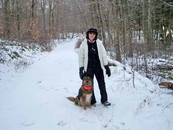
![]() On Saturday, January 27th I gave my wife a choice of doing a 35 like
Twin or Peekamoose or of hiking at Minnewaska. She chose a walk at Long Pond. We parked at the parking area
on Flugertown Road and started up the snowmobile trail. The weather was cold but there was no wind so I
immediately began to work up some body heat. The first part of the trail is ALL UP and it really gets the blood
moving! The usual mud along this trail was replaced by frozen mud. There was about a 2 inch covering of very fine
snow over the occasional patch of ice. Every now and then a footfall would break through the frozen mud of ice
covering. This factor combined with a flat landscape and nothing to view made for a forgettable hike. Sheba, of
course, seems unaffected by any obstacle. Her paws did seem to bother her a little this time despite the
Musher's Wax I applied.
On Saturday, January 27th I gave my wife a choice of doing a 35 like
Twin or Peekamoose or of hiking at Minnewaska. She chose a walk at Long Pond. We parked at the parking area
on Flugertown Road and started up the snowmobile trail. The weather was cold but there was no wind so I
immediately began to work up some body heat. The first part of the trail is ALL UP and it really gets the blood
moving! The usual mud along this trail was replaced by frozen mud. There was about a 2 inch covering of very fine
snow over the occasional patch of ice. Every now and then a footfall would break through the frozen mud of ice
covering. This factor combined with a flat landscape and nothing to view made for a forgettable hike. Sheba, of
course, seems unaffected by any obstacle. Her paws did seem to bother her a little this time despite the
Musher's Wax I applied.
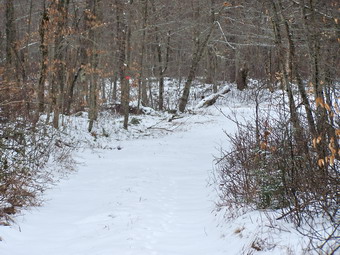 We had intended to hike passed the lean-to to Basily Road and then follow this to Flugertown Road to make a loop.
Even this didn't work out! Just before the intersection with Flugertown Road is a rather large stream and beaver
pond. Not wanting to get wet we turned around and retraced our entire hike to the car. The best part of the hike
was that it was six plus miles of exercise which is far better than sitting around the house! We must have set a
pretty good pace since we did it in just under 3 hours including stops.
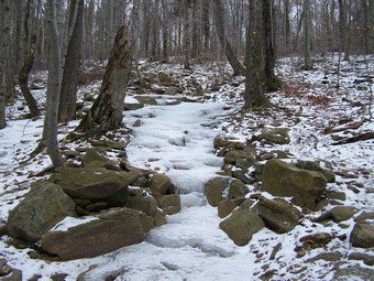
![]() On Wednesday, January 24th I was VERY tired when I got up for work and I
thought I might have the beginnings of the flu. I called in sick and went back to bed for a few hours. When I got
up I was rested and I felt much better. I did want to "waste" the day completely so I decided to take Sheba for a
hike up Giant Ledge and Panther. We got a LATE start and as I turned onto Route 47 I noticed the gas gauge very
close to E. We parked and started on the trail. I had dressed a little more lightly this time and was almost sorry
I did until we started hiking. This time I didn't have to stop to remove clothing. I had used Musher's Secret Wax
on Sheba's feet and was anxious to see if it prevented the snow from sticking. Things were going well until we hit
the first ice flow. There were several of these along the way. The rest of the trail was snowy with some
ice patches. I found the Yaks don't work well when stored in your pack. I again had to "encourage" Sheba across
the bridge.
On Wednesday, January 24th I was VERY tired when I got up for work and I
thought I might have the beginnings of the flu. I called in sick and went back to bed for a few hours. When I got
up I was rested and I felt much better. I did want to "waste" the day completely so I decided to take Sheba for a
hike up Giant Ledge and Panther. We got a LATE start and as I turned onto Route 47 I noticed the gas gauge very
close to E. We parked and started on the trail. I had dressed a little more lightly this time and was almost sorry
I did until we started hiking. This time I didn't have to stop to remove clothing. I had used Musher's Secret Wax
on Sheba's feet and was anxious to see if it prevented the snow from sticking. Things were going well until we hit
the first ice flow. There were several of these along the way. The rest of the trail was snowy with some
ice patches. I found the Yaks don't work well when stored in your pack. I again had to "encourage" Sheba across
the bridge.
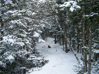 We avoided the ice flows as best we could although they don't bother Sheba. I knew there were two other hikers
ahead of us and we met them and their dog at Giant Ledge. I have to admit that following their footsteps made
hiking easier since I could better see the ice under foot. The hike up to the Ledge wasn't very eventful with only
a few slips. The trail began to get snowier as we got near the Ledge and as we continued on to Panther. After the
Ledge there were no more footsteps to follow and the descent into the col between Giant Ledge and Panther is
always interesting! As we started to ascend Panther I saw movement up ahead. It was big! It was brown! It was
another pair of hikers coming over from Fox Hollow. The ascent up Panther brought a few more ice flows and a few
steeper spots that had slipped my memory.
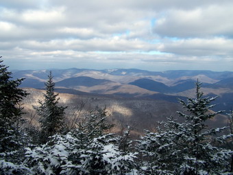 The view from the lookout at the top of Panther is usually not spectacular. This time was no different except
that the lighting made for some interesting views. We stopped for a moment to get a drink eat some snacks and take
some pictures. The wind wasn't bad but was cold lowered the temperature enough to make me want to get going again.
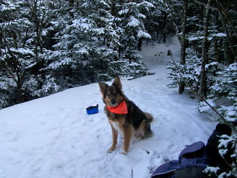 The Musher's Wax worked wonders on Sheba. Several times she stopped to checkout her feet but I think this was habit.
I looked several times and could not find any accumulated snow. At the top of Panther Sheba demanded a treat and I
knew she needed water since there was very little along the trail. She is a VERY good hiking companion as she will
show you were the ice is and she will pick a good way around it. She always stops to check to make sure
the people are OKAY even though she could be WAY out ahead. When we are alone, she tends to range farther than
when we are with a group. This hike proved to me that the Gunks and other hikes are wonderful exercise and
provide new and exciting views. However, climbing a 35 is a whole different experience! I am not in the same shape
I was in this summer but am trying to get there. The Catskill 35's provide the best workout for the time allowed.
![]() On Sunday, January 21st I decided to take the dog for another short hike in
our area. Church and choir practice ran late so we headed for Frick and Hodge Ponds after lunch. The air temperature
never got above 20 but there was no wind. Still, it did seem colder than Saturday until we started to move.
We started to hike at about 1:15 PM at the trail head on Mongaup Pond Rd. I signed the register and we arrived at
Frick Pond within 15 minutes. I decided to go the longer way around and turned left at the pond to head toward Iron
Wheel Junction. I had to DRAG Sheba across the wooden bridge. She does not like bridges that have gaps between the
boards! About half way across I let her go and she slinked the rest of the way across. The trail up to Iron Wheel is
heavily eroded in places and there is a lot of running water despite the recent low temperatures. From Iron Wheel we
turned right toward Times Square. At Times Square we turned left and headed UP the Big Rock Trail to the junction with
the Flynn Trail. I always forget that this part of the trail is a challenging climb. Anyone who claims that the
only good workout is on a 35 should try some of these other trails! After a long trek we arrived at the Flynn
Trail and turned left to hike the half mile to Hodge Pond. The pond is still there and is getting covered with ice.
We turned around and retraced our steps to the junction with Big Rock and then headed down the Flynn Trail back to
the car. As we got near the cabin a forest ranger pulled up and parked. I met Dell Jefferies, the head NYS Forest
Ranger for this area, for the first time. Dell and I talked for a while and then Sheba and I headed home. We had spent
about two and a half hours hiking.
On Sunday, January 21st I decided to take the dog for another short hike in
our area. Church and choir practice ran late so we headed for Frick and Hodge Ponds after lunch. The air temperature
never got above 20 but there was no wind. Still, it did seem colder than Saturday until we started to move.
We started to hike at about 1:15 PM at the trail head on Mongaup Pond Rd. I signed the register and we arrived at
Frick Pond within 15 minutes. I decided to go the longer way around and turned left at the pond to head toward Iron
Wheel Junction. I had to DRAG Sheba across the wooden bridge. She does not like bridges that have gaps between the
boards! About half way across I let her go and she slinked the rest of the way across. The trail up to Iron Wheel is
heavily eroded in places and there is a lot of running water despite the recent low temperatures. From Iron Wheel we
turned right toward Times Square. At Times Square we turned left and headed UP the Big Rock Trail to the junction with
the Flynn Trail. I always forget that this part of the trail is a challenging climb. Anyone who claims that the
only good workout is on a 35 should try some of these other trails! After a long trek we arrived at the Flynn
Trail and turned left to hike the half mile to Hodge Pond. The pond is still there and is getting covered with ice.
We turned around and retraced our steps to the junction with Big Rock and then headed down the Flynn Trail back to
the car. As we got near the cabin a forest ranger pulled up and parked. I met Dell Jefferies, the head NYS Forest
Ranger for this area, for the first time. Dell and I talked for a while and then Sheba and I headed home. We had spent
about two and a half hours hiking.
![]() On Saturday, January 20th I had planned to hike a 35 somewhere close to
home. My grid said that Panther was available and that is where I intended to go. I didn't think my wife Cindy
would want to brave the 20 degree air temperature and the 30+ mph winds but I was wrong! However, she didn't want
to climb a mountain so we took the dog and headed for Trout Pond. As we drove up Morton Hill Road the amount of snow
increased from none to several inches. We parked on Morton Hill and hiked down to the trailhead. Only one other
car was anywhere to be seen. We went straight passed the register and up the easier path to the pond. I had thought
we might turn around there but we were all feeling pretty good so we continued on around. The wind coming across
the pond made use zip up some of the clothes we had opened up! Sheba didn't seem to mind except for the
annoying "ice balls" that formed between her toes! I'll have to try Musher's Wax. There were several areas of ice
under the snow which made the going slippery in places. Around the other side of the pond these areas became more
frequent and we both went down several times. Next time we agreed to keep the Yaks in the pack. The pond is
an area of active beaver activity. In fact, the water is getting so high is threatening to cover the trail in
the lowest spots! The cold air is tiring and we were glad to be back at the car in just about 2 and a half hours.
On Saturday, January 20th I had planned to hike a 35 somewhere close to
home. My grid said that Panther was available and that is where I intended to go. I didn't think my wife Cindy
would want to brave the 20 degree air temperature and the 30+ mph winds but I was wrong! However, she didn't want
to climb a mountain so we took the dog and headed for Trout Pond. As we drove up Morton Hill Road the amount of snow
increased from none to several inches. We parked on Morton Hill and hiked down to the trailhead. Only one other
car was anywhere to be seen. We went straight passed the register and up the easier path to the pond. I had thought
we might turn around there but we were all feeling pretty good so we continued on around. The wind coming across
the pond made use zip up some of the clothes we had opened up! Sheba didn't seem to mind except for the
annoying "ice balls" that formed between her toes! I'll have to try Musher's Wax. There were several areas of ice
under the snow which made the going slippery in places. Around the other side of the pond these areas became more
frequent and we both went down several times. Next time we agreed to keep the Yaks in the pack. The pond is
an area of active beaver activity. In fact, the water is getting so high is threatening to cover the trail in
the lowest spots! The cold air is tiring and we were glad to be back at the car in just about 2 and a half hours.
![]() On Monday, January 15th my son Karl and I had planned to go hiking. He was
up from Virginia for the weekend. The prediction for Monday was freezing rain, sleet and ice. We figured that
if we could get on the roads safely, we should go south. We planned to hike Schunemunk Mountain, the highest
point in Orange County with some interesting features. When we got up, the temperature was hovering right around
freezing but we decided to chance the hike. As we left Livingston Manor it was raining and there was a lot of fog.
There didn't seems to be any ice on the roads and the rain abated as we got closer to Orange County.
On Monday, January 15th my son Karl and I had planned to go hiking. He was
up from Virginia for the weekend. The prediction for Monday was freezing rain, sleet and ice. We figured that
if we could get on the roads safely, we should go south. We planned to hike Schunemunk Mountain, the highest
point in Orange County with some interesting features. When we got up, the temperature was hovering right around
freezing but we decided to chance the hike. As we left Livingston Manor it was raining and there was a lot of fog.
There didn't seems to be any ice on the roads and the rain abated as we got closer to Orange County.
We pulled into the parking area off Otterkill Road near Salisbury Mills just before 10:00 AM. A short walk up the road brought us to the Metro North train trestle. At this point we cut into the woods and immediately started a long. and sometimes steep, ascent up a well used and well marked trail. After a little over a mile on the Trestle Trail we found ourselves on the western ridge. Along the way we had removed our middle layers since the climbing quickly warmed us up. At the junction with the red blazed Jessup Trail, we turned left and began a short but very steep descent. Much of this descent was over open rock faces with little to hold on to. The ice on the surrounding trees made me wonder about the wisdom of continuing. Fortunately, we encounter almost no ice on the trail but the rocks were plenty slippery from the rain. Still, the fun had only begun!
After the descent to the valley between the two ridges, we crossed Baby Brook without much trouble. The Jessup Trail then took us up to the eastern ridge in an initial steep ascent. This trail continued to ascend for the next two miles. The trail goes up and over bare rock faces and little ridges of conglomerate. The conglomerate is very interesting as it id pink from hematite in the rock. Large white quartz crystals are embedded in the rock. After a little over two miles, a short side trail blazed in white leads off to the right. A sign painted on the rock says "Megaliths". The side trail is short on worth the trip. The Megaliths are large pieces of rock that have broken away from the bedrock and simply "sit" where they dropped. Some are small while others are as big as small houses. Back on the main trail it is a VERY short distance to the top of Schunemunk Mountain. The "summit" is not very impressive and is marked with a painted 1664. We continued in for about a quarter mile where the blue blazed Western Ridge Trail turns off to the right.
The Western Ridge Trail leads back down into the area between the two ridges and starts as a gentle slope. The descent quickly become steeper until a right turn onto the red blazed Barton Swamp Trail. The swamp was, well, swampy with some makeshift logs to get us across. For a short distance the Western Ridge and Barton Swamp Trails run together. The Western Ridge trail then turns left and goes straight up to the western ridge without benefit of switchbacks or much of any vegetation on the open rock. At the top the trail ends at the Long Path. We made a right and followed the Long Path for just under two miles. The walk is much like the eastern ridge with some areas of open rock face and rock ridges and some areas of forest trail. We turned right onto the red blazed Jessup Trail which made a slight ascent to a higher point on the ridge. After a short walk, we were back to the Trestle Trail right where we had started. The walk back down this trail was not easy as it is steep and was slippery from the rain. The descent gave us some idea of why we warmed up quickly on the way up.
My GPS and computer software tell me that the hike was just about 6.4 miles. We did it in just over 4 hours making it a very slow pace for us. I suspect the distance is a little longer. I also suspect that the difficulty is a little greater than we thought
![]() On Sunday, January 14h I decided I needed to get out of the house for a
short excursion. Sheba was the only other taker and we got a late start after church. I looked at my "grid" and
saw that I hadn't climbed Balsam Lake Mountain in January. Sheba and I got in the car and made for the trailhead.
Only one other car was in the parking area and we got going right away. There was no snow or ice but lots of
water on the trail. The rain had stopped but the fog and mist were heavy in the air. NONE of this bothers the dog
in the least! By the time I has a little over half way to the turn up the mountain I was removing my middle layer
fleece and stowing it in the pack. The Mountain Hardwear Synchro seems very light but it is waterproof with just
enough lining. We turned up the steep side of Balsam Lake and shortly after that heard voices on the trail. Our
fast pace had overtaken the family that was headed up the mountain. We caught them and I decided to hike with them.
I had already discounted trying Graham because of the late start and the weather. They didn't seem to mind Sheba so
we walked and talked to the top of the mountain. When we arrived there was a young lady already at the top. She
had hiked up from the Millbrook side and we talked for a while. She is a naturalist at the Sharpe Preserve
near Fishkill. We took the other trail down the mountain as it is easier to descend. About halfway back to the
parking area a light rain began making me all the more happy that I was not on Graham. My recent hikes in the
Gunks had made me forget that a Catskill 3500 is still something special. No pictures were possible today. Even
the top of the fire tower was shrouded in fog and clouds.
On Sunday, January 14h I decided I needed to get out of the house for a
short excursion. Sheba was the only other taker and we got a late start after church. I looked at my "grid" and
saw that I hadn't climbed Balsam Lake Mountain in January. Sheba and I got in the car and made for the trailhead.
Only one other car was in the parking area and we got going right away. There was no snow or ice but lots of
water on the trail. The rain had stopped but the fog and mist were heavy in the air. NONE of this bothers the dog
in the least! By the time I has a little over half way to the turn up the mountain I was removing my middle layer
fleece and stowing it in the pack. The Mountain Hardwear Synchro seems very light but it is waterproof with just
enough lining. We turned up the steep side of Balsam Lake and shortly after that heard voices on the trail. Our
fast pace had overtaken the family that was headed up the mountain. We caught them and I decided to hike with them.
I had already discounted trying Graham because of the late start and the weather. They didn't seem to mind Sheba so
we walked and talked to the top of the mountain. When we arrived there was a young lady already at the top. She
had hiked up from the Millbrook side and we talked for a while. She is a naturalist at the Sharpe Preserve
near Fishkill. We took the other trail down the mountain as it is easier to descend. About halfway back to the
parking area a light rain began making me all the more happy that I was not on Graham. My recent hikes in the
Gunks had made me forget that a Catskill 3500 is still something special. No pictures were possible today. Even
the top of the fire tower was shrouded in fog and clouds.
![]()
![]() On Saturday, January 6th Kurt, Krista, Cindy, Sheba and I decided to try to
hike somewhere that would be least effected by the rains on Friday and overnight. The day had dawned cloudy at home
with some lingering showers. As we prepared to leave the sky was clearing and then clouding up again. We
decided that the wide and well-drained carriageways at Minnewaska would be best. In addition, Kurt and Krista had
never been through The Tunnel and only I had climbed the cliff from Hamilton Point to Castle Point.
On Saturday, January 6th Kurt, Krista, Cindy, Sheba and I decided to try to
hike somewhere that would be least effected by the rains on Friday and overnight. The day had dawned cloudy at home
with some lingering showers. As we prepared to leave the sky was clearing and then clouding up again. We
decided that the wide and well-drained carriageways at Minnewaska would be best. In addition, Kurt and Krista had
never been through The Tunnel and only I had climbed the cliff from Hamilton Point to Castle Point.
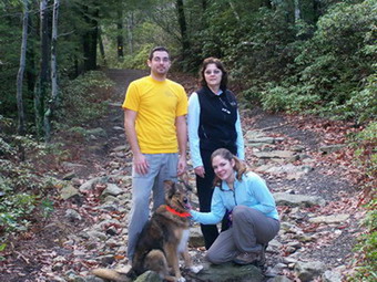 We parked at the upper lot at Minnewaska with no trouble but the spaces were filling up. The temperature is usually
cooler by the lake but must have been in the mid-50's when we started! Kurt wore short sleeves. I had on my
short-sleeve UnderArmor and only a long-sleeved hiking top. My wife and Krista were similarly dressed. After looking
at the blue waters of the lake we began our hike on the lake shore. After a short distance we turned onto the Hamilton
Point Carriageway. The views were great even when the sun was behind the clouds. The carriageway ascends gently for
several miles passed Echo Rock and on to Hamilton Point. We then decided to continue on the carriageway until the
unmarked, unnamed path that leads down to the Wolf's Jaw.
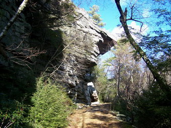 Just passed the Wolf's Jaw we turned onto the Long Path. The little stream at this junction was the only water
problem that we encountered. It was a little high from the rain and required more than the normal effort to
cross. Fortunately, stepping stones were available and several logs offered another way across the stream. A short
hike brought us to The Tunnel. It was a little wetter inside than usual but not really a problem. After The Tunnel
we continued on the Long Path to complete the loop back to the Hamilton Point Carriageway. We all decided to try
the ascent up the cliff to Castle Point.
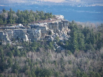 The Long Path follows the carriageway at this point for a few hundred feet and then turns into the woods to the
left. This path quickly begins the ascent up to Castle Point. It is challenging but not technical. The recent rain
made some of the holds slippery and required a close attention to business. Near the top gust of winds above 50 mph
made the final few steps that much more exciting. Hiking dog Sheba only needed a little boost up the last step!
The view of Gertrude's Nose and Lake Awosting from castle Point were great today despite the previous overcast
conditions and the unrelenting winds out in the open. From here we headed back along the Castle Point Carriageway.
We began to meet more and more people as we got closer to the lake. Most were hiking but there were quite a few
bikers! By the time we returned to the upper lot it was full on both sides with another row of cars down the
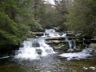
middle. The other lot at the top was also parked full! We covered almost 8 miles in just over 4 hours! Lunch at the
Gilded Otter was a treat as always!
![]()
![]() On Saturday, December 30th Karl, Krista, Cindy, Sheba and I decided to try to
hike to two more waterfalls in Ulster County. Vernooy Kill Falls is now in the Sundown Wild Forest Area making it
technically part of the Catskills. Our biggest problem was finding the trail head since the directions from trails.com
contained incorrect mileages for the roads. Just after the village of Kerhonksen we turned left on Ulster County Route
3 and continued about a mile to Cherrytown Road, a left hand turn. After 3.5 miles, we turned left onto Upper
Cherrytown Road. In 3.1 miles more we turned right into the parking area. Once at the parking area we headed across
the road and onto a blue-blazed trail that also has marking for snowmobiles and the Long Path. After crossing a small
stream on a bridge the trail ascends for about 1 mile. None of this is difficult but it is not easy either. We had
gotten a late start (AGAIN) and the temperature was "brisk" so we were hiking quickly. After about 1.8 miles, we
arrived at the falls. A bridge crosses at the base of the falls. And the view of the falls from the bridge is
probably the best of all.
On Saturday, December 30th Karl, Krista, Cindy, Sheba and I decided to try to
hike to two more waterfalls in Ulster County. Vernooy Kill Falls is now in the Sundown Wild Forest Area making it
technically part of the Catskills. Our biggest problem was finding the trail head since the directions from trails.com
contained incorrect mileages for the roads. Just after the village of Kerhonksen we turned left on Ulster County Route
3 and continued about a mile to Cherrytown Road, a left hand turn. After 3.5 miles, we turned left onto Upper
Cherrytown Road. In 3.1 miles more we turned right into the parking area. Once at the parking area we headed across
the road and onto a blue-blazed trail that also has marking for snowmobiles and the Long Path. After crossing a small
stream on a bridge the trail ascends for about 1 mile. None of this is difficult but it is not easy either. We had
gotten a late start (AGAIN) and the temperature was "brisk" so we were hiking quickly. After about 1.8 miles, we
arrived at the falls. A bridge crosses at the base of the falls. And the view of the falls from the bridge is
probably the best of all.
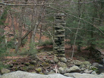 The ruins of an old water-powered mill is also visible from the bridge. This was built by the Vernooy family that
originally owned the land. It is unclear whether the wheel ran from the stream directly or had a mill race or run.
There is a small stream leading right to the mill. We walked upstream on both sides for a short distance to view
all the various steps that make up the falls. The water is cool and makes a moderate amount of noise as it rushes
over the rocks.
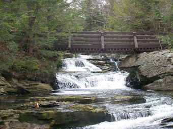 The view from downstream of the bridge is also nice since it takes in the bridge and most of the major steps that
make up the body of the falls. This vantage point also offers a better view of the mill. After exploring the area
of the falls for some time, we returned the way we came. We drove back on the same roads so that we did not get lost
again and headed for the now familiar Route 44/55 toward New Paltz.
![]()
![]() As we drove up the hill from Route 209 we kept a lookout for Minnewaska Trail on the right across from the road
to what is now the Hudson valley resort, the old Granite Hotel. We turned here and the made another quick left
onto Rock Haven Road. We continued on this road until it narrowed and the pavement deteriorated. Shortly Shaft 2A
Road appeared on the left. We drove to the end of the road and parked by the gate. There isn't much parking here and
it is first come first served. Shaft 2A is an access shaft to the aqueducts carrying water to New York City. We
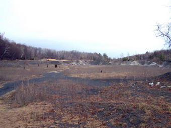
walked around the gate and headed generally south and west on a dirt road. We passed by Shaft 2A and a helipad once
used for quick repairs. A little further is an abandoned slate quarry which is interesting but mars the landscape.
Beyond this area the road and trail ends.
As we drove up the hill from Route 209 we kept a lookout for Minnewaska Trail on the right across from the road
to what is now the Hudson valley resort, the old Granite Hotel. We turned here and the made another quick left
onto Rock Haven Road. We continued on this road until it narrowed and the pavement deteriorated. Shortly Shaft 2A
Road appeared on the left. We drove to the end of the road and parked by the gate. There isn't much parking here and
it is first come first served. Shaft 2A is an access shaft to the aqueducts carrying water to New York City. We
walked around the gate and headed generally south and west on a dirt road. We passed by Shaft 2A and a helipad once
used for quick repairs. A little further is an abandoned slate quarry which is interesting but mars the landscape.
Beyond this area the road and trail ends.
 The Stony Kill is very obvious at this point since you can both see and hear it. We turned right and headed upstream
picking our way carefully along the banks. There are several opportunities to cross back and forth. Soon the sound of
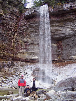
the falls could be heard and we saw the impressive site through the trees. The falls is supposed to be the highest
single drop in the Shawangunks, measuring over 80 feet from top to bottom. Like many of the sites on hikes, this one
is better experienced in person rather than through descriptions and pictures. While not easy to get to the base of
the falls the trip is not difficult if you are careful. From the looks of things around the falls, there is probably
a higher volume at many times of the year. The scene was beautiful this time because of the ice forming at the bottom
of the falls where it splashes on the rocks before entering a pool. We explored for some time and then retraced our
steps. The whole hike was less than 2 miles. A short hike with a great reward. It wouldn't be fair to visit the Otter
with my sons and not the rest of the family! For the third day in a row we feasted on the short but varied menu. We
also could not resist a pint of the beer they brew on the premises. Some of us think the Winter Wassail is the
smoothest dark beer we have ever tasted. At 7.5% alcohol it nearly doubles a "normal" brew! The pale ales are also
outstanding and even the "light" lager my wife drank was great.
![]()
![]() On Friday, December 29th my son, Karl, and I decided to try to hike to
Lake Awosting from the Lake Minnewaska upper parking area. Sheba had not been out for several days and began her
keening whine as soon as she saw me getting the pack ready. Karl has not hiked much in this area and I had never been
to Lake Awosting. It was sunny when we left Livingston Manor but grew increasingly cloudy as we headed toward Ulster
County. It was quiet a bit cooler when we parked so we headed out right away taking the Upper Awosting Carriageway.
There are several other carriageways and trails that we could have taken but I decided on this one. I knew the hike
would be over 9 miles and I had planned some more strenuous hiking on the Long Path.
On Friday, December 29th my son, Karl, and I decided to try to hike to
Lake Awosting from the Lake Minnewaska upper parking area. Sheba had not been out for several days and began her
keening whine as soon as she saw me getting the pack ready. Karl has not hiked much in this area and I had never been
to Lake Awosting. It was sunny when we left Livingston Manor but grew increasingly cloudy as we headed toward Ulster
County. It was quiet a bit cooler when we parked so we headed out right away taking the Upper Awosting Carriageway.
There are several other carriageways and trails that we could have taken but I decided on this one. I knew the hike
would be over 9 miles and I had planned some more strenuous hiking on the Long Path.
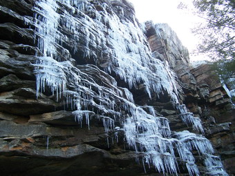 After a little more than two miles of easy walking a lookout opened up with a distant view of Rainbow Falls. I thought
we might hike the Long Path to the falls but after seeing the three falls the day before I decided to stay on the
carriageway. As we passed by Litchfield Ledge the ice on the rock cliffs made a beautiful design.
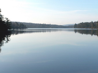 After about 3.5 miles we turned onto the Lake Awosting Carriageway and arrived at the eastern end of Lake Awosting.
The view was of a placid lake with a deep blue color. After taking a brief rest at the ranger's cabin, we continued
on around the lake on the northern shore. The trail rises on this side of the lake and we got a good view of the rock
"beach" as well as the cliffs on the other side. The lake is just over a mile long and this went quickly. As we
rounded the western end of the lake we kept an eye out for a sign and the aqua blazes of the Long Path. There was no
sign and the blazes were very faint. Fortunately, we figured it out and got on the Long Path and headed for Murray
Hill.
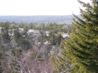 Murray Hill appears after only about a half mile on the trail. There are nice views to the south but the
day was very hazy. We continued on toward Margaret Cliff only 1.5 miles away. Although the trail is well marked and
the fairly easy it seemed to take a long time. Again, the views to the south were poor due to the haze. After
this point the Long Path continues and descends quickly and steeply into a ravine. Several side trails tried to
distract us but we stayed on track and began the ascent toward the Hamilton Point Carriageway.
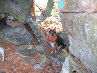 To get there we had to pass through an area known as The Tunnel. Here the rocks have split apart and other rocks have
fallen in to form a "roof". The Tunnel is narrow but very short and we got through it just fine. After another ascent
we were on the Hamilton Point Carriageway. We could have simply gone back to the parking area this way but I had
other plans. After only a few hundred feet the Long Path turns left and ascends into the woods. We very shortly
arrived at the base of the cliff that is Castle Point. The Long Path ascends this cliff with a series of hand
and foot holds some of which are very challenging. We all made it up OK including Sheba.
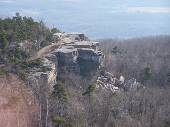 As always, the view from Castle Point was amazing. Gertrude's Nose and the approaching trails are clearly visible.
We could also see over to the opposite rim with Murray Hill and Margaret Cliff. After taking in the view of the
surrounding scenery we used the Castle Point Carriageway to make the 4 mile trek back to the car. We made just under
10 miles in 5 hours! It wouldn't be fair to visit the Otter with one son and not the other! For the second day in a
row I feasted and drank some of the best crafted beer around!
![]()
![]() On Thursday, December 28th my son, Kurt, and I decided to try to hike to
three of the falls along the Peters Kill near Lake Minnewaska. The day started cold and cloudy in Livingston Manor
with a dusting of snow from the night before. We both dressed warmly, leaving the house a little later than I had
planned. I was still hurting from the rock scrambling I had done yesterday but didn't want to give up a day.
We parked at the lower Minnewaska lot at about 10:15 AM and headed back toward the gate house. Turning
right at the park entrance we followed the road over the bridge which crosses the Peters Kill and then turned
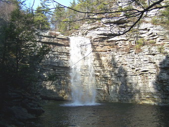
left on the Awosting Falls Carriageway. In only a few minutes we were at the top of the falls looking at the pool
below. In a few more minutes we were at the base of the falls. The view is beautiful as the 35 foot falls tumble into
a pool below.
On Thursday, December 28th my son, Kurt, and I decided to try to hike to
three of the falls along the Peters Kill near Lake Minnewaska. The day started cold and cloudy in Livingston Manor
with a dusting of snow from the night before. We both dressed warmly, leaving the house a little later than I had
planned. I was still hurting from the rock scrambling I had done yesterday but didn't want to give up a day.
We parked at the lower Minnewaska lot at about 10:15 AM and headed back toward the gate house. Turning
right at the park entrance we followed the road over the bridge which crosses the Peters Kill and then turned
left on the Awosting Falls Carriageway. In only a few minutes we were at the top of the falls looking at the pool
below. In a few more minutes we were at the base of the falls. The view is beautiful as the 35 foot falls tumble into
a pool below.
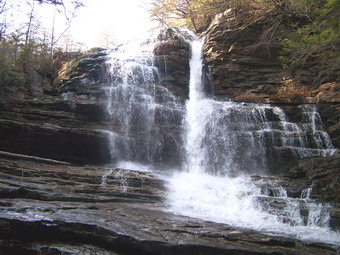 We continued to follow the carriageway which follows the Peters Kill until the stream goes under Routes 44/55. At
point the carriageway turns right but we continued to follow the stream by crossing the road. On the other side there
is no formal trail but a clear track has been left by others. Shortly after crossing the road Sheldon falls begins
a series of cascades over the exposed rock. The view is impressive and the roar of the water is loud for such as
small volume. The Peters Kill is fairly wide here and there are many opportunities to walk down the rocks next
to the stream. We were cautious since the rocks were wet and icy in places.
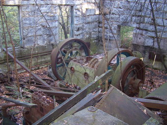 Just after the base of these falls are the ruins of an old power plant. Strangely, this plant burned wood and coal
and did not attempt to use the power of the water. The volume of the flow of Peters Kill is seasonal and could not
be relied on to provide power. Some of the machinery and distribution equipment can still be seen inside this
stone building.
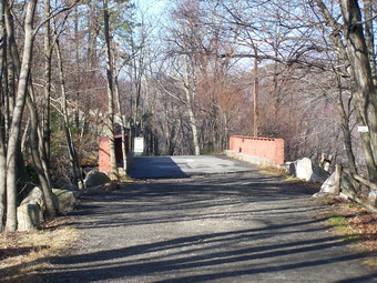
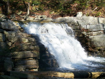 We continued to walk down the stream staying as close as possible which was difficult at times. In around half a
mile Peters Kill Falls can be seen. This is less impressive than the previous two falls. We picked up a red trail
and followed it to a well-marked yellow trail. This trail ended at the blue-blazed High Peters Kill Trail. We
crossed the stream on a bridge and started a 400 foot ascent up to the ridge. From the ridge the water can be heard
cascading over the rocks below but little if any can be seen. There are some nice views of the surrounding cliffs
and the road can be seen at times. After a walk that seemed like it would never end, but was actually short, we ended
up back at the parking lot. About 3.5 miles in less than 3 hours.
After the hike we went to the Gilded Otter in new Paltz. I am glad I do not live in New Paltz. I would be in this brew pub restaurant MANY times in one week. Their brews are outstanding especially the 7.5% Winter Wassail. The food is just right to compliment the brews!
![]()
![]() On Wednesday, December 27th I decided to go to the Trapps and hike the
Overcliff-Undercliff route to Sky Top. All the books talked about the Crevice up to the Smiley Tower and I was
ready for an adventure. Unfortunately, the members of my family were either busy doing something else or were
sick. Attacking the Crevice also means that I had to leave Sheba at home which proved to be the right decision.
When I left Livingston Manor, the weather was overcast and there was snow on the ground. By the time I entered
Ulster County the snow was gone. I started at the Trapps Bridge Parking area on Routes 44/55 at about 9:45 AM
and was the first car to park. I walked quickly walked up the road to the bridge and across. At this point I
took Overcliff since most guidebooks suggest this direction.
On Wednesday, December 27th I decided to go to the Trapps and hike the
Overcliff-Undercliff route to Sky Top. All the books talked about the Crevice up to the Smiley Tower and I was
ready for an adventure. Unfortunately, the members of my family were either busy doing something else or were
sick. Attacking the Crevice also means that I had to leave Sheba at home which proved to be the right decision.
When I left Livingston Manor, the weather was overcast and there was snow on the ground. By the time I entered
Ulster County the snow was gone. I started at the Trapps Bridge Parking area on Routes 44/55 at about 9:45 AM
and was the first car to park. I walked quickly walked up the road to the bridge and across. At this point I
took Overcliff since most guidebooks suggest this direction.
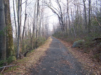 Overcliff is a long, 2.5 mile trek without many interesting views. Generally the land rises to the right to a ridge. To the left are occasional views
of cliffs and ridges with some incredible houses nestled in forested hollows along the way. Near the end of the trail
I descended toward the Rhododendron Bridge which is the junction of many trails. Here, Undercliff is and immediate
right. Crossing the bridge and taking a right puts you on Oakwood Drive. I crossed the Bridge and turned left on the
Old Minnewaska Carriageway. The guide books indicate that the route may be confusing but the signage isn't bad!
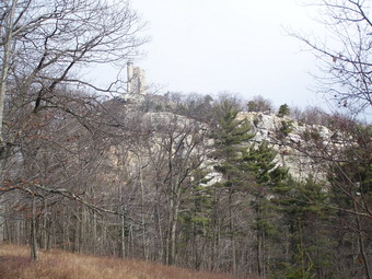 Somewhere along this carriageway, after the first ascent and several turns, I got my first view of Sky Top and the
Smiley Tower. The Tower itself is impressive but equal impressive is the idea of climbing almost straight up to the
Crevice to the top. When you look at the profile below, see if you can find the Crevice! I continued on the
Carriageway until I found a sign for Forrest Drive. Here I took a right and continued a very short distance to the
Mohonk Spring House on the left side of the trail. The total distance from the bridge is just over one miles.
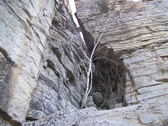 I walked up the trail from the spring and passed a Gazebo. Several trails crisscross here making finding the right
one a challenge. Soon I found the red arrows that point to the Crevice. I also found a sign that said the trail was
closed. I took this more as a suggestion than a mandate and continued on. The arrows generally lead up and over some
impressive boulders which are talus from the cliff in front. Things get rougher as you approach the cliff face and
the location of the crevice is not at all obvious at first. Suddenly, I saw it and I began to have serious doubts
about the wisdom of doing this on my own! There are several narrow ladders in the Crevice to help hikers advance
but these are interspersed with areas that require secure hand and foot holds and both upper and lower body strength.
The books say the crevice varies from 4 to 6 feet in width. They lie! Some places are around three feet. About
half way up I removed my pack and pushed it up the ladder in front of me. I hoped it would stay there! Further up
there has a small "hole" and I was glad I had removed the pack. At the top of the ladders there is still some more
rock scrambling left. This is the narrowest part of the climb. Just near the top there was a point where I
considered going back down since it required a "boost" that I was not sure my short legs could give me. I pushed the
pack up and decided to give it a try. I made it! At this point I was on a large ledge of rock. My heart
was beating VERY fast. At first I though it was the effort of the climb and then I realized it was the adrenaline
rush of the whole experience! The wind on the ledge was blowing at least 30 mph as I carefully snapped pictures
of the sheer drop to the talus below, the surrounding scenery and the Tower above. I crossed the bridge over the
Crevice just as another group of at least 10 people started the last part of their climb. Over the bridge was
another short rock scramble almost straight up. At the top it was just a short walk to the Tower.
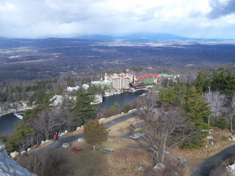 The climb up the Smiley Tower was more dangerous at times than the Crevice. Water dripping inside the structure has
formed some puddles which freeze and make slippery going in spots. The view from the Tower is 360 degrees and is
truly magnificent. The surrounding 'Gunks and Catskills are clearly visible. Guidebooks mention other landmarks and
mountain ranges but I found these hard to identify. The view of the Mohonk Mountain House and Lake Mohonk from the
Tower is hard to describe. The lake and the surrounding cliffs along with the mountains in the background frame
this guest house from a bygone era.
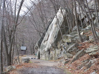 From Sky Top I took the Sky Top Path and wound my way down to the labyrinth. Along the way are several benches and
gazebos that offer views of the Lake and the House. I worked my way down the stairs and into the Labyrinth and
ended up just short of the Crevice. At this point I headed down to the Spring Path rather than up. From here
I retraced my steps to the Rhododendron Bridge and took a left on the Undercliff Carriageway. This path
parallels Overcliff but is on the "lower" side of the ridge. From the bridge the path is a little over a mile back
to the Trapps Bridge. Along the way cliffs loom on the right and drop offs dominate the left. These cliffs are
a favorite spot for climbers and boulderers. I saw several groups involved in both of these sports. It look
interesting but... I finished by 1:30 PM and was pleased with covering just over 7 miles in less than 4 hours. This
included the slow vertical climbs, the Tower and ample stops for taking pictures.
![]() On Saturday, December 23rd my son, Karl, his fiancee, Kathleen, Sheba and I
decided to hike at Sam's Point despite the atmospheric conditions. It had rained overnight and some showers were
lingering as we headed out. By the time we arrived at the Nature Center, the rain had stopped leaving a heavy mist
and lots of fog. We headed out intending to do the whole loop from Ice Caves to High Point and back. It was cooler
on the plateau than in Livingston Manor but we had brought along a variety of layers to combat the problem.
On Saturday, December 23rd my son, Karl, his fiancee, Kathleen, Sheba and I
decided to hike at Sam's Point despite the atmospheric conditions. It had rained overnight and some showers were
lingering as we headed out. By the time we arrived at the Nature Center, the rain had stopped leaving a heavy mist
and lots of fog. We headed out intending to do the whole loop from Ice Caves to High Point and back. It was cooler
on the plateau than in Livingston Manor but we had brought along a variety of layers to combat the problem.
As we approached Sam's Point, it was that there would be no view so we bypassed it and headed directly to the Caves. At the entrance to the Caves a sign stated they were CLOSED. There had been no indications anywhere else that the Caves would be closed, they were one of the reasons we had come and there was no snow or ice. We decided that the sign was more a suggestion than a prohibition. The caves were wet with a lot of water dripping off the rocks. Some areas were a little slippery from the rain and the mud but we got through with no problems. Sheba again was up to the task of scaling the areas where ladders have been provided for humans. We were doing the loop in the opposite direction from the one I normally take. I had wondered if the dog could make it UP all the areas that we usually go down. Sheba must be part mountain goat since she easily conquered all of these places.
Once out of the caves we headed for the falls. This part of the hike seems like it will never end no matter the direction you take. As we were walking this trail, the weather seems like it might clear. The falls had more water going over them than I had seen before. The view from the ledge was beautiful and as we were standing there the sun came out and the skies cleared. I was sorry at this point that I had not packed my camera! Crossing the top of the falls was tricky because of the volume and velocity of the water. We all had waterproof boots and Sheba simply wades across. We followed the trail UP to the escarpment rim and began walking the trail to High Point the wind picked up gusting to 30 mph at times. This was annoying but the temperatures were warm and we didn't feel cold. The views were beautiful along the way since the fog and haze had cleared and it was partly sunny. High Point offered us an almost 360 degree view which included a look at Sky Top and the Catskill Ranges.
From High Point we walked down to the High Point Carriageway to head back to the car. This is a long walk without much of a view and there seemed to be many areas of standing water and mud! On the way by we stopped briefly at Lake Maratanza since neither Karl nor Kathleen had been there. The entire hike of about 8 miles took a little over 5 and half hours.