
What You Missed
Summer 2009
Summer 2009
![]()
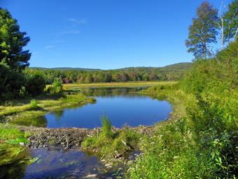
![]() On Sunday, September 20th I preached at my church in the morning. Cindy was too tired from our 13 mile excursion on Saturday so I had decided to join Doug again to tackle Schultice. I called him the night before and told him I would be too busy on Sunday and was a little tired from the Minnewaska hike. After taking my mom out to lunch, we returned home. I decided to take Sheba up to Frick and Hodge Ponds for a short hike. We parked at The Frick Pond Parking area around 3:00 PM and started the hike out to Frick Pond. The trail had been freshly mowed by the DEC and was a pleasure to walk on. It was really pretty dry even in areas that are usually marshy. We stopped at Frick Pond so that I could take a few pictures. A beaver dam just near the bridge has restricted the flow of water to the stream and the area is pretty dry also. My intention was to make the hike really short by taking the Logger's Loop back to Times Square but it was a nice day and I decided to take the short way around the pond to Times Square and then the Big Rock Trail to the Flynn Trail and Hodge Pond.
On Sunday, September 20th I preached at my church in the morning. Cindy was too tired from our 13 mile excursion on Saturday so I had decided to join Doug again to tackle Schultice. I called him the night before and told him I would be too busy on Sunday and was a little tired from the Minnewaska hike. After taking my mom out to lunch, we returned home. I decided to take Sheba up to Frick and Hodge Ponds for a short hike. We parked at The Frick Pond Parking area around 3:00 PM and started the hike out to Frick Pond. The trail had been freshly mowed by the DEC and was a pleasure to walk on. It was really pretty dry even in areas that are usually marshy. We stopped at Frick Pond so that I could take a few pictures. A beaver dam just near the bridge has restricted the flow of water to the stream and the area is pretty dry also. My intention was to make the hike really short by taking the Logger's Loop back to Times Square but it was a nice day and I decided to take the short way around the pond to Times Square and then the Big Rock Trail to the Flynn Trail and Hodge Pond.
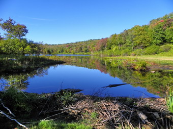 The trip around the pond was uneventful except that it was not very muddy. Even the junction at Times Square had only a few damp spots. Sheba and I went straight ahead and set a fast pace up the Big Rock Trail to the Flynn Trail. At the top we took the left and headed down to Hodge Pond. The beaver dam blocking the outlet was still the but it was possible to get across this area to make a loop hike. After taking a few photos, Sheba and I started back up the Flynn Trail passing the Big Rock junction and continuing down toward the parking area. At the gate we turned left to stay on the trail and were back at the car before 5:30 PM.
![]()
![]() On Saturday, September 19th Cindy and I wanted to hike in an area we had not visited for awhile. We chose Minnewaska State Park for our adventure and some adventure it was! We arrived at the park at about 10:30 AM and parked in the first lot which has the best access to the Lower Awosting Carriageway. There were only a few cars in the lot but a large group of hikers was meeting. I hoped they were not headed our way! As we were getting ready several cars with trail bicycles arrived. Cindy, Sheba and I started out and kept waiting for the bikers to pass. We could see them back on the trail but they were moving very slowly. They eventually passed us as we ascended a small hill toward Lake Awosting. We did meet a few other hikers but the hike was pretty quiet. After about 2.5 miles we arrived on the shores of Lake Awosting and turned right on the trail around the lake. At the ranger's cabin we turned right again onto the Smiley Carriageway to start our hike to Stony Kill falls.
On Saturday, September 19th Cindy and I wanted to hike in an area we had not visited for awhile. We chose Minnewaska State Park for our adventure and some adventure it was! We arrived at the park at about 10:30 AM and parked in the first lot which has the best access to the Lower Awosting Carriageway. There were only a few cars in the lot but a large group of hikers was meeting. I hoped they were not headed our way! As we were getting ready several cars with trail bicycles arrived. Cindy, Sheba and I started out and kept waiting for the bikers to pass. We could see them back on the trail but they were moving very slowly. They eventually passed us as we ascended a small hill toward Lake Awosting. We did meet a few other hikers but the hike was pretty quiet. After about 2.5 miles we arrived on the shores of Lake Awosting and turned right on the trail around the lake. At the ranger's cabin we turned right again onto the Smiley Carriageway to start our hike to Stony Kill falls.
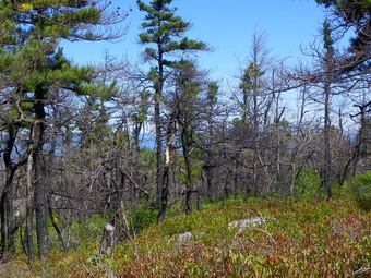
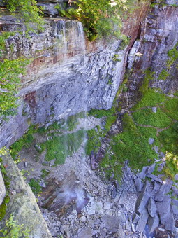 The area along the Smiley carriageway that had been burned appeared to be recovering nicely with lots of green leaves on the trees and some underbrush beginning to grow back. The track was very dry which was surprising since it was been know to be VERY wet! We took some pictures of the area before heading down to Fly Brook. The water level was low and the brook was easy to cross. Just after the brook we turned off the Smiley Carriageway and headed right toward Stony Kill falls. The trail is not completely maintained but the route is obvious. The trail really starts to drop as you near the falls. We walked to the creek above the falls where there is a small drop. The water level was extremely low as I took a few shots up and down the creek. We then were able to walk along the rock shelf that is normally covered by water until we were almost at the drop for the falls. At the brink of the falls we stopped to take pictures and eat some lunch right around 1:00 PM. I wandered along the edge of the cliffs and took some pictures of the trickle of water going over the falls. I continued on and found a path that looked like it led down to the base of the falls. I returned to where Cindy was sitting and we retraced our steps back to Lake Awosting.
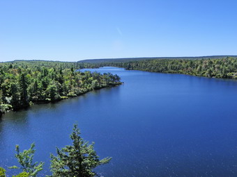 At the lake we decided there was no point in hiking around the lake so we turned left toward Minnewaska and then right toward the Hamilton Point carriageway. We met another couple hiking who seemed to want to "compete". They asked us how far we were going and then added a mile to our distance. After talking briefly, they took off at a pretty fast pace. Cindy and I didn't really care but thought that they didn't look like they could keep it up! Within a short distance we passed them on a short uphill and did not see them for the rest of the day. The lookouts over Awosting along the way are really beautiful as evidenced by the number and variety of hikers and bikers frequenting each viewpoint. We stopped several times to take pictures before getting back on the trail. Mountain biking seems to be more and more common in the park and the variety of bikes and abilities of the riders vary. I am surprised there aren't more accidents since some of the riders are going pretty fast and many of the hikers in groups occupy the entire width of the trail. We were soon at the junction of with the Hamilton Point Carriageway and I convinced Cindy that we should take the Long Path to Castle Point.
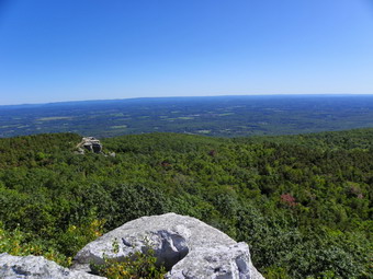 After a short walk of the Hamilton Point Carriageway, we turned left on the Long Path and began to climb UP to Castle Point. I like this rock scramble but it was a little steeper than I remembered! Sheba led the way as we worked upwards. It is always fun to listen to the people talking above and then sort of "pop out" into there view. Many are unaware there is a path up from below and wonder how anyone could make it up the cliff. Near the top I always have to give Sheba a "boost" since there is one place where she cannot get a running start. The views from castle Point were really nice and a number of people were on top taking them in. We stayed for a few minutes to take pictures and then started walking the Castle Point Carriageway back to Lake Minnewaska. At this point we had been hiking a little over 8 miles. The walk on the wide roads toward Minnewaska was easy and we made good time. At one point we stopped as a couple was looking into one of the crevices at ... a snake. It was clear it was not a poisonous snake by the shape of the head. It WAS over five feet long and was sunning itself. The eyes were milky showing it was about to shed its skin. We knew we had some hiking yet to do so we took pictures and left.
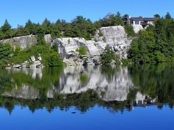 We hiked along the road greeting a few hikers and bikers that we met. In about 3 miles we were nearing the lake. At this point a large field opens to the left and we stopped to take in the view. The mountains in the Catskills are clearly visible from here and make a nice photo. We continued on toward the lake and were soon standing on the beach. The water was a deep, beautiful blue and the cliffs and trees around the lake were reflected in the still water. I took several pictures from the beach and then went up to the nearby rock to get a better view down the entire lake. After taking MANY pictures, we headed toward the Sunset carriageway to take us back to the main gate. We were getting tires but this route is mostly downhill. There was one viewpoint along the way where we stopped to again look at the Catskills. After crossing the access road we arrived near the main gate. I wanted to take a quick side trip to Awosting Falls but Cindy was tired after 2 miles of walking. Cindy and Sheba headed to the car and I went down to the stream.
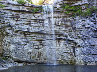 I took a few pictures of the Peters Kill as it makes its way toward the falls and then stood at the to of the falls to take some pictures. Despite the noise there was very little water going over the falls. I debated going to the base but decided to make a quick excursion. I took some pictures of the falls and the pool from below and then hurried back up the path and toward the car. I arrived just after 5:00 PM. Cindy and Sheba had not waited too long. The GPS recorded over 1 miles so I knew the actual hike would be longer we walked 12.5 miles total in 6.5 hours!
![]() On Sunday, September 13th Doug Garrity and I met at Hubbles Corners again to take on Irish Mountain. We drove to the DEP land at the Headwaters of the Delaware near Grand Gorge where we started our hike. We walked along the old railroad bed and then made a quick left up into the woods. From this point on the hike was one recurring story. We would find a woods road and hike it for awhile. Soon it wood be obvious that the road was heading in the wrong direction so we would take another bearing and head for the top. This required beating our way through the DOUBLE whammy of prickers and nettles. The vegetation at times covered blowdown that we would have to walk around or through. The day was hot and humid and the insects were out! Near the summit we found a woods road that seemed to circle the mountain but we decided to just bore straight ahead for the summit. I muse say that hiking with Doug is interesting as he is willing to lead the way and bash down anything in front of him. If you do get the opportunity to go with Sparty, make sure you have some bandages along since he always hikes in shorts! It took us about 2 hours to cover the 3 mil trip. At the summit we thought about heading for Schultice. We had heard about the private property issues and did not want to run across anyone who would object to our hiking. We were also tired and did not want to have to whack over to the next peak and then work our way back down to the car. We decided to return to the car and then drive over to Schultice and see what the access looked like. We drove over in Doug's jeep and did find one person working on his trailer. He didn't have the right to grant us permission to hike but we drove to the highest point on the road we could get. There is a cabin at the end of the drivable road that has a magnificent view of the valley. We decided to leave this for another day.
On Sunday, September 13th Doug Garrity and I met at Hubbles Corners again to take on Irish Mountain. We drove to the DEP land at the Headwaters of the Delaware near Grand Gorge where we started our hike. We walked along the old railroad bed and then made a quick left up into the woods. From this point on the hike was one recurring story. We would find a woods road and hike it for awhile. Soon it wood be obvious that the road was heading in the wrong direction so we would take another bearing and head for the top. This required beating our way through the DOUBLE whammy of prickers and nettles. The vegetation at times covered blowdown that we would have to walk around or through. The day was hot and humid and the insects were out! Near the summit we found a woods road that seemed to circle the mountain but we decided to just bore straight ahead for the summit. I muse say that hiking with Doug is interesting as he is willing to lead the way and bash down anything in front of him. If you do get the opportunity to go with Sparty, make sure you have some bandages along since he always hikes in shorts! It took us about 2 hours to cover the 3 mil trip. At the summit we thought about heading for Schultice. We had heard about the private property issues and did not want to run across anyone who would object to our hiking. We were also tired and did not want to have to whack over to the next peak and then work our way back down to the car. We decided to return to the car and then drive over to Schultice and see what the access looked like. We drove over in Doug's jeep and did find one person working on his trailer. He didn't have the right to grant us permission to hike but we drove to the highest point on the road we could get. There is a cabin at the end of the drivable road that has a magnificent view of the valley. We decided to leave this for another day.
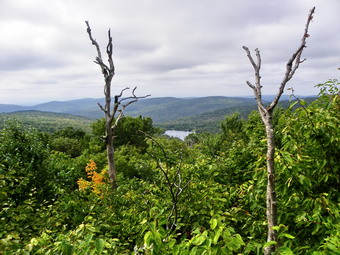
![]()
![]() On Monday, September 7th I wanted to get one more hike in with Cindy before the start of the new school year. We decided to spot a car at Alder Lake and then drive to the parking area for Balsam Lake Mountain. The plan was to hike to the fire tower and then walk along Millbrook Ridge to Alder Lake. We knew this would be a long hike especially for Cindy but most of the climbing is at the beginning with one ascent to the highest spot on Millbrook Ridge near the end. By the time we got out of the house and spotted the car at Alder Lake, it was later than he had hoped to get started. One nice surprise was that the access road into Alder Lake had been graded and crusher run had been added. It is still narrow but an improvement over the ruts that made it nearly impassable. We arrived at the Balsam Lake parking area just before 10:00 AM and started out on the trail. There was only one car in the lot. We made VERY good time to the trail junction up to the summit. We continued to keep up a nice pace up the mountain and arrived at the summit without stopping just after 11:00 AM.
On Monday, September 7th I wanted to get one more hike in with Cindy before the start of the new school year. We decided to spot a car at Alder Lake and then drive to the parking area for Balsam Lake Mountain. The plan was to hike to the fire tower and then walk along Millbrook Ridge to Alder Lake. We knew this would be a long hike especially for Cindy but most of the climbing is at the beginning with one ascent to the highest spot on Millbrook Ridge near the end. By the time we got out of the house and spotted the car at Alder Lake, it was later than he had hoped to get started. One nice surprise was that the access road into Alder Lake had been graded and crusher run had been added. It is still narrow but an improvement over the ruts that made it nearly impassable. We arrived at the Balsam Lake parking area just before 10:00 AM and started out on the trail. There was only one car in the lot. We made VERY good time to the trail junction up to the summit. We continued to keep up a nice pace up the mountain and arrived at the summit without stopping just after 11:00 AM.
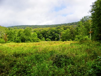 When we arrived a the fire tower, there were three other hikers present. They had come up from the Millbrook Road parking area. One of them recognized me or, more likely, Sheba from our Saturday hike on Windham. Cindy and I took turns going up the tower. There was quite a bit of haze but the view is always nice. We chatted with the other hikers for some time and then headed back to the Millbrook Ridge Trail to continue our hike. The first part of this trail is most a descent from the summit to the ridge and is pretty steep in places with several switchbacks to moderate the gradient. Along the way there are a few hints of a view but most are covered by the leafy trees. At around 1.35 miles from the trail junction we passed Woodpecker Ridge and then at around 2 miles arrived at the lookout over Beecher Lake. Along the way we got a nice glimpse of the fire tower from a viewpoint. The Beecher Lake viewpoint is wide open and offers a nice view of Woodpecker Ridge, Cradle Rock Ridge, the lake below, and the Buddhist monastery. We took a short break for a snack and to take pictures and then started in again. From the viewpoint the trail descends briefly and then climbs to the highest point on the ridge. At 3490 feet Millbrook Ridge easily makes it onto the CHH list is almost high enough to be a 3500 peak.
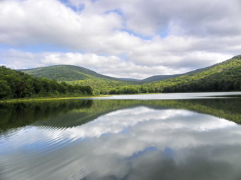 After climbing to the high point, we enjoyed the downhill on the other side. Someone did a LOT of trail maintenance by cutting back the briars and nettles and even tackling a few larger blowdowns along the way. Soon we were at the beaver meadow near the lean-to where we took some pictures and then continued on. At the lean-to, I walked down to take some pictures while Cindy relaxed for a moment. The beaver meadow here shows some signs of reverting to a pond. There was a lot of accumulating water but no evidence of a real dam. Perhaps the apparent rejuvenation is due to the wet summer season. After the lean-to, we picked up our pace and were at the head of the lake by 2:15 PM. By 2:30 PM we were at the outlet end having covered almost 8 miles in about 4.5 hours. We stopped and took some pictures of the lake and the Coykendall Mansion. The state finally demolished the house after determining it would cost too much to restore it. They did leave the fine stonework. We were both tired but still had to drive back to the Balsam Lake parking area to get my car and then drive all the way home.
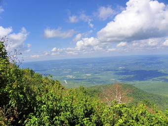
![]()
![]() On Saturday, September 5th I debated whether I had the time or energy to drive to Peck Road AND do another hike after the bushwhack of West Stoppel. In the end the philosophy of "I'm here so I might as well do it!" won out. We arrived at the Peck Road trailhead at 12:45 PM to find it packed with cars! It was the weekend but I was very surprised at the number of vehicles. I found a spot and we started out immediately. I could hear some kids screaming further along the trail and wondered what was happening. It appears that the private land off Peck Road has been developed and these children were actually in a pool at their house. I had only been up this trail a few times before and not for some time. I knew that it followed a gentle ascent along and old road to the Elm Ridge lean-to. From here the trail the trail continued out to Windham but I wanted to turn right on the blue Escarpment Trail. I was prepared for a muddy mess like the one I found on Kaaterskill the day before. I remembered several areas that had masses of tangled evergreen roots which was usually wet. I also recalled one area where there where log "bridges" over very wet areas. We made the mile to the turn by just after 1:00 PM and started up on the Escarpment Trail. The lean-to was occupied and we met a "summer ranger" who was coming down from the peak. I chatted with her for a few minutes and then continued passed the lean-to and UP the trail
On Saturday, September 5th I debated whether I had the time or energy to drive to Peck Road AND do another hike after the bushwhack of West Stoppel. In the end the philosophy of "I'm here so I might as well do it!" won out. We arrived at the Peck Road trailhead at 12:45 PM to find it packed with cars! It was the weekend but I was very surprised at the number of vehicles. I found a spot and we started out immediately. I could hear some kids screaming further along the trail and wondered what was happening. It appears that the private land off Peck Road has been developed and these children were actually in a pool at their house. I had only been up this trail a few times before and not for some time. I knew that it followed a gentle ascent along and old road to the Elm Ridge lean-to. From here the trail the trail continued out to Windham but I wanted to turn right on the blue Escarpment Trail. I was prepared for a muddy mess like the one I found on Kaaterskill the day before. I remembered several areas that had masses of tangled evergreen roots which was usually wet. I also recalled one area where there where log "bridges" over very wet areas. We made the mile to the turn by just after 1:00 PM and started up on the Escarpment Trail. The lean-to was occupied and we met a "summer ranger" who was coming down from the peak. I chatted with her for a few minutes and then continued passed the lean-to and UP the trail
 The trail from the lean-to to the summit alternates between steep sections and flatter areas. Many of the flatter areas are through pine forests with exposed roots. These areas are often VERY wet. This day these areas were mostly dry with only a few damp areas. I was surprised that I remembered many of the landmarks on the trail despite not having hiked the route in at least two years. The actual ascent to the summit was longer and steeper than I remembered. Somewhere along the way I met a group of 17 people from The Hudson Valley Ramblers led by David and Carol White. David recognized me since I attended their presentation at Morgan Outdoors. Sheba and I waited until most of this large group thinned out and then continued our climb. We met two more small groups along the way. Near the top we hit a few wet areas with one being quite large. There were several people at the first lookout so we walked to the viewpoint just beyond the summit. A family group was taking pictures and the kids were thrilled to see Sheba. I talked to the kids and the adults as I took some pictures across the valley. There was a lot of haze so I could not see all the way to Albany.
 After taking pictures and getting a snack, Sheba and I returned to the trail to retrace our steps back to the car. We stopped at the viewpoint facing south and chatted with two people who were already there. They also took pictures of Sheba and I discussed Catskill hiking routes with them. I took a few pictures of the Blacks and then returned to the trail. In this case down seemed much easier than up. We set a quick pace Down the mountain. A few people were still coming up and we did catch and pass some hikers on the way down. We were back at the parking area by 3:35 PM and the cars had thinned out by that time. We completed the 6 mile hike in under three hours.
![]()
![]() On Saturday, September 5th I decided to get a 3500 and a CHH all in one day. The mornings had been hazy so I thought I would do West Stoppel first since it has no view. Later in the day I would do Windham from Peck Road in the hopes that the haze would clear. I headed for Tannersville, turned left at the stoplight and drove through Onteora Park and down the other side. After taking a right on Colgate Lake Road, I was soon at the outlet end of the lake. The dam had been replaced and the lake was full of water. I almost parked at the main lot to walk across the dam and begin the hike. Instead, I parked at the upper lot on the left hand side of the road. Sheba and I were in the woods by 9:35 AM. As I walked through some dense pines, I kept heading to my right. This took me too ward to the south and west so that we were headed for the lake instead of the East Kill. I corrected and we ended up on the East Kill looking for a place to cross. The creek was a little wider and deeper than I thought but I found a place to hop across some rocks. One of the rocks rolled as I stepped on it but only my pants got wet. After ascending the bank on the other side. Sheba and I headed a little south and east and up. I was aiming for the Col between West Stoppel and the bump that is west of West Stoppel.
On Saturday, September 5th I decided to get a 3500 and a CHH all in one day. The mornings had been hazy so I thought I would do West Stoppel first since it has no view. Later in the day I would do Windham from Peck Road in the hopes that the haze would clear. I headed for Tannersville, turned left at the stoplight and drove through Onteora Park and down the other side. After taking a right on Colgate Lake Road, I was soon at the outlet end of the lake. The dam had been replaced and the lake was full of water. I almost parked at the main lot to walk across the dam and begin the hike. Instead, I parked at the upper lot on the left hand side of the road. Sheba and I were in the woods by 9:35 AM. As I walked through some dense pines, I kept heading to my right. This took me too ward to the south and west so that we were headed for the lake instead of the East Kill. I corrected and we ended up on the East Kill looking for a place to cross. The creek was a little wider and deeper than I thought but I found a place to hop across some rocks. One of the rocks rolled as I stepped on it but only my pants got wet. After ascending the bank on the other side. Sheba and I headed a little south and east and up. I was aiming for the Col between West Stoppel and the bump that is west of West Stoppel.
 Somehow as I walked I kept veering to the right again. We walked up some drainages that seemed to be a path. We found what looked like some old roads and paralleled them for a while. The biggest problem was the amount of blowdown everywhere! I tried to correct my bearing by heading more southeast but I kept getting pulled to the west. Eventually we were up but on the bump instead of in the Col. There was some very thick brush at the top but we soon found some open areas and tried to stay in those areas as I turned almost due east toward West Stoppel. Of course, we had to descend into the Col and then climb West Stoppel. This was not too difficult and the ascent wasn't very steep. The problem was that every time we would get to a flat area that I thought was the top another rise appeared through the trees. This repeated itself several times until I could not see any higher ground ahead. We walked a little further and then turned around to start the return trip. I had intentions of dropping down from the Col but using CPS (canine positioning system) is just too easy! I told Sheba "Back! Same way!" and just followed her. Going down through the blowdown and drainages proved interesting. At one point I stepped on a mossy rock without a good pole placement and went down HARD! For a minute I thought I had really injured my left wrist but it seemed OK and we continued. After crossing the East Kill in exactly the same spot, we headed directly for the road and got back just after noon. The 3.5 mile bushwhack took a little over 2.5 hours.
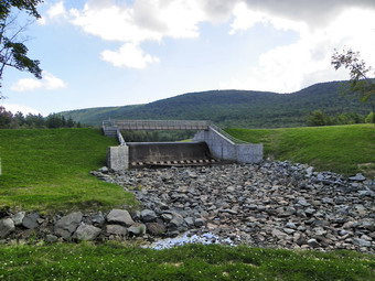
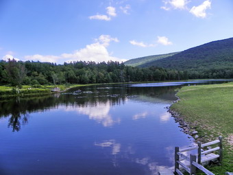 I was anxious to get to Windham since I had decided that I WOULD hike it this day. I drove down to the main parking area, left Sheba in the car and took only my camera to the lake. I walked along the road and then dropped to the base of the dam where large rocks had been installed. I took pictures of the dam and the new bridge over the dam as well as some pictures of the stream below. I crossed the stream and ascended the other side to take more pictures. I spotted a flock of geese on the lake and took some shots. I also took pictures of the lake with the clouds and mountains behind it. Quite a few people were swimming or just sitting by the lake in the sun. I walked over the bridge, returned to the car and headed toward Windham.
![]()
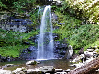
![]() On Friday, September 4th I got back to the Platte Clove parking area from Kaaterskill High Peak a little earlier than expected and decided to explore a few of the waterfalls in Platte Clove. I left the parking area for the High Peak and drove to the Platte Clove Preserve and parked along the road. A nice path leads down from the parking area through a gate and passes the Platte Clove Preserve "cabin". The trail winds its way down into the clove and has some signs which label the trees found along the way. At the base of this trail is a beautiful falls that cascades over the rocks in a free fall of perhaps 30 or 40 feet. The water level was high enough that the falls were active but low enough to allow me to walk out into the stream bed to take pictures. After taking some shots, I decided not to return the way I had come but to bushwhack my way to the top of the bank to get another look at the falls from above.
On Friday, September 4th I got back to the Platte Clove parking area from Kaaterskill High Peak a little earlier than expected and decided to explore a few of the waterfalls in Platte Clove. I left the parking area for the High Peak and drove to the Platte Clove Preserve and parked along the road. A nice path leads down from the parking area through a gate and passes the Platte Clove Preserve "cabin". The trail winds its way down into the clove and has some signs which label the trees found along the way. At the base of this trail is a beautiful falls that cascades over the rocks in a free fall of perhaps 30 or 40 feet. The water level was high enough that the falls were active but low enough to allow me to walk out into the stream bed to take pictures. After taking some shots, I decided not to return the way I had come but to bushwhack my way to the top of the bank to get another look at the falls from above.
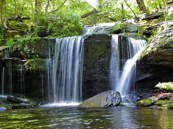 Climbing the bank proved trickier than it look. The rocks on the bank were loose with a nice covering of loose leaves and pine needles. The bank was also steeper than it looked. Once I got to the top, I walked to the area of the top of the falls and carefully took some more pictures before turning around and walking up the stream bank. As I approached the foot bridge I dropped down to the stream bed and walked out onto some rocks. This allowed me to take some shots of the post and tenon bridge and the falls just in front of it from an interesting angle. These falls have only about a 10 foot drop but are wider and pleasant none the less. After taking the pictures, I walked up the path to the main trail and back to the car. I drove up the road a little bit and parked at the Devil's Kitchen where Hell Hole Brook crosses under the road. I got out and took some pictures here as I worked my way along the north side of the chasm. It is deep here and one careless moment means a long fall with a sudden stop! Sheba and I then walked around to the other side of the bridge and started down that side, I was able to get a few pictures as we walked down the unmarked trail high above the brook. It was late in the day so we turned around and headed back to the car. (CAUTION: Several people have fallen from the slippery and steep paths in this area. Hiking here requires some experience and the proper equipment especially a good pair of hiking shoes! BE CAREFUL!)
![]()
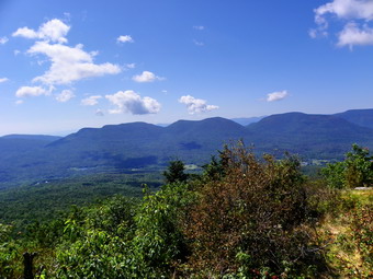
![]() On Friday, September 4th I decided to grab a 3500 for September and settled on Kaaterskill High Peak. I was particularly wanted to find Hurricane Ledge this time since the weather forecast made photography an attractive possibility. My plan was to hike up to the snowmobile loop from the Platte Clove parking and then to hike around the loop to the south side. I had never gone this way before and thought it would be a nice change. I wanted to see the 5 foot rock cairn and the plane crash near it. I parked in the main parking area with only a few other cars and then started up the road that serves as the first part of the trail. Soon the road became trail and we entered the avenue of pine trees. This area was VERY wet with a lot of standing water to avoid. As I walked along, I kept looking for a trail leading up through the woods on the right to the cairn that marks the beginning of the ascent on the eastern side of KHP. I did find a small path but was not sure it was the right one so I decided to wait until I got to the snowmobile trail and then hike to the cairn that way. Soon I was at the trail that turns right and up the mountain toward the snowmobile trail. We walked up this short trail and encountered the snowmobile trail. It was a muddy mess of ruts and standing water! The ATVs had been hard at work! We did turn left and start to try to negotiate the mess but I had some experience with how bad it could be from previous trips. After only a few hundred feet the trail did not improve and we turned back to find the herd path up KHP.
On Friday, September 4th I decided to grab a 3500 for September and settled on Kaaterskill High Peak. I was particularly wanted to find Hurricane Ledge this time since the weather forecast made photography an attractive possibility. My plan was to hike up to the snowmobile loop from the Platte Clove parking and then to hike around the loop to the south side. I had never gone this way before and thought it would be a nice change. I wanted to see the 5 foot rock cairn and the plane crash near it. I parked in the main parking area with only a few other cars and then started up the road that serves as the first part of the trail. Soon the road became trail and we entered the avenue of pine trees. This area was VERY wet with a lot of standing water to avoid. As I walked along, I kept looking for a trail leading up through the woods on the right to the cairn that marks the beginning of the ascent on the eastern side of KHP. I did find a small path but was not sure it was the right one so I decided to wait until I got to the snowmobile trail and then hike to the cairn that way. Soon I was at the trail that turns right and up the mountain toward the snowmobile trail. We walked up this short trail and encountered the snowmobile trail. It was a muddy mess of ruts and standing water! The ATVs had been hard at work! We did turn left and start to try to negotiate the mess but I had some experience with how bad it could be from previous trips. After only a few hundred feet the trail did not improve and we turned back to find the herd path up KHP.
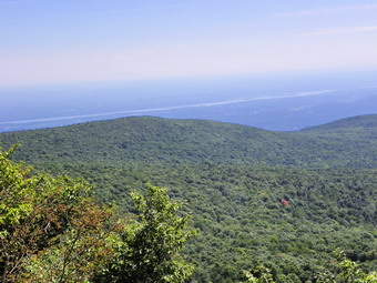 Once we got back to the trail we had ascended up to the snowmobile trail, it was a quick walk to the herd path. This part of the trail was also a mess but I knew exactly where I was going. The herd path although still officially unmaintained becomes more and more obvious with each hiker that uses it. The cairn which used to be helpful in finding the path is really no longer needed. We turned left onto the path and started the steep and rocky ascent up to the high point. Soon we were at the top marked by pieces of an airplane. I don't think these pieces were originally right at the top and I wish people would stop moving them around. Several paths lead away from the summit and I tried several. Most looked promising but then ended abruptly at some point. After two or three unsuccessful attempts I decided that I would try a different method of locating Hurricane Ledge. I would use my map and compass! After a brief consultation, it was obvious I had been looking in the wrong direction. We struck out on a prominent path in the other direction, lost some elevation and arrived at the Ledge. This is truly a viewpoint not to be missed. The views of the Blackhead Range across the valley are unmatched. There are also views to the east toward Saugerties and down the valley the other way to the west. It was a little hazy so the picture taking opportunities were limited. We wandered around to several different places until I felt we had exhausted all the possibilities and then followed our path back to the summit. From there we reversed our route back to the car. It took us about 4 hours to hike the 7.7 mile route but this included a LOT of time "exploring" at the top!
![]()
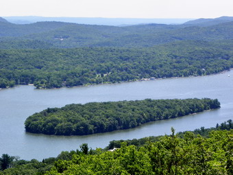
![]() On Tuesday, September 1st plans to hike with someone from the "north" fell through. After cross country practice , Cindy and I decided the two hour drive to Surprise Lake might be worth it. I had seen some pictures of the views from the ridge overlooking Greenwood Lake and was convinced we should go on this beautiful, clear day. We drove down the Quickway and then through Florida and Warwick toward Greenwood Lake. In Greenwood Lake we took Route 210 south along the west shore of the lake looking for the parking area which was supposed to be right on the New York-New Jersey border. It turns out that we drove passed it at least twice. The parking area is a short drive way shared with a marina across the road. We finally pulled into the parking area to find only a few cars. We got right on the trail which started out pretty flat as it passed behind some houses. We crossed a stream and then the trail began its climb. In many places the rail became diffuse and the blazes hard to find since the area is very popular locally. We did keep on the trail as it continued to climb to the Bellvale-Bearfort Ridge. Eventually we made the top of the ridge after about .7 miles and the trail leveled off some. We walked along the typically rocky trail on the ridge and got some nice views. In a mile or so we were at the shores of Surprise Lake. Only two other people were there. It was obvious this was a popular destination and that most people used another, shorter and easier access trail. We took some pictures of the lake and then continued our hike.
On Tuesday, September 1st plans to hike with someone from the "north" fell through. After cross country practice , Cindy and I decided the two hour drive to Surprise Lake might be worth it. I had seen some pictures of the views from the ridge overlooking Greenwood Lake and was convinced we should go on this beautiful, clear day. We drove down the Quickway and then through Florida and Warwick toward Greenwood Lake. In Greenwood Lake we took Route 210 south along the west shore of the lake looking for the parking area which was supposed to be right on the New York-New Jersey border. It turns out that we drove passed it at least twice. The parking area is a short drive way shared with a marina across the road. We finally pulled into the parking area to find only a few cars. We got right on the trail which started out pretty flat as it passed behind some houses. We crossed a stream and then the trail began its climb. In many places the rail became diffuse and the blazes hard to find since the area is very popular locally. We did keep on the trail as it continued to climb to the Bellvale-Bearfort Ridge. Eventually we made the top of the ridge after about .7 miles and the trail leveled off some. We walked along the typically rocky trail on the ridge and got some nice views. In a mile or so we were at the shores of Surprise Lake. Only two other people were there. It was obvious this was a popular destination and that most people used another, shorter and easier access trail. We took some pictures of the lake and then continued our hike.
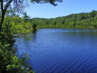 We hiked through some damp areas at the western end of the lake encountering a few insect swarms along the way. The trail began to ascend slightly and became a little rougher. At about 1.5 miles we were at the lookout over West Pond. This pond is very secluded and the views were beautiful. We stopped for a drink and a snack and I took pictures. After this brief rest, we went back to the main trail. We had been hiking northwest but soon the trail turned sharply northeast. After another .7 miles there was a slight jog in the trail and we came upon an AT section hiker. He seemed a little confused and perhaps dehydrated. We spoke to him a while and offered assistance but he declined and we went in opposite directions. After about half a mile we turned southeast and began our descent of the ridge. Soon we were back on or route from earlier in the day and headed for the parking area. We were back at the car in about 3 hours for the 4 mile hike.
![]()
![]() On Monday, August 31st I left Pennsylvania with instructions to get on Interstate 80 and then get off at the first exit in New Jersey. I did this and followed the instructions to pass back under the highway. After a couple of turns I found the large parking area and parked the car. It was later than I would usually start a hike but the trip down had been so long I was willing to give it a try without really knowing how long the hike might be. I always carry a headlamp and although that is not my ideal solution, it gave me the confidence I needed to start. From the parking area we took the blue trail toward the northeast. At first the trail was flat but it soon began to climb. It was very rocky and difficult to walk on and I was tired from earlier in the day. Parts of the trail looked like an old woods road with some areas being a little steep. After about 1.7 miles of hiking, we were on top of the ridge having gained about 1200 feet in elevation. As we walked along the ridge toward the southwest we passed by the summit of the mountain and had to make a side trip to bag the high point. There were no views yet but some open areas on our left suggested there would be.
On Monday, August 31st I left Pennsylvania with instructions to get on Interstate 80 and then get off at the first exit in New Jersey. I did this and followed the instructions to pass back under the highway. After a couple of turns I found the large parking area and parked the car. It was later than I would usually start a hike but the trip down had been so long I was willing to give it a try without really knowing how long the hike might be. I always carry a headlamp and although that is not my ideal solution, it gave me the confidence I needed to start. From the parking area we took the blue trail toward the northeast. At first the trail was flat but it soon began to climb. It was very rocky and difficult to walk on and I was tired from earlier in the day. Parts of the trail looked like an old woods road with some areas being a little steep. After about 1.7 miles of hiking, we were on top of the ridge having gained about 1200 feet in elevation. As we walked along the ridge toward the southwest we passed by the summit of the mountain and had to make a side trip to bag the high point. There were no views yet but some open areas on our left suggested there would be.
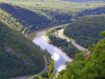
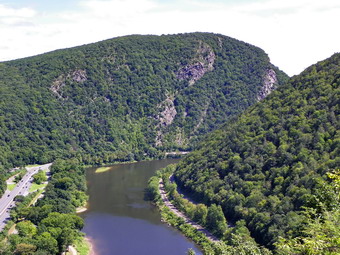
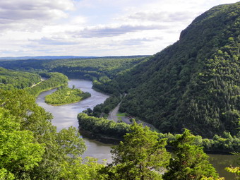 At the end of the ridge just as the trail turned and started to descend an incredible viewpoint opened up. BY walking out on the open rock outcrop views up and down the river in both directions were available. Just across the river was Minsi where I had been earlier! I had to watch my footing as I scrambled around for the best angles for pictures. I took many photographs before returning to the top, getting a drink and a snack and then continuing down the mountain. The descent was steep in places and much of it was rocky and very dry and dusty. As we descended I was surprised when another beautiful viewpoint appeared. This one looked toward the south down the river and I was able to get some more good pictures. The view also allowed me to see where I had been on the outcrop viewpoint before and I took pictures of this perch. From here it was back to descending the steep trail back down to the car. Somehow we ended up in another parking area but were able to easily walk back to our car. It had taken about 3 hours to hike the 3.5 mile distance.
![]()
![]() On Monday, August 31st I decided that I wanted to hike the two mountains at the extreme southwestern end of the Delaware Water Gap. Mount Minsi of the Pennsylvania side and Mount Tammany on the New Jersey side were touted by many to offer the best views of the Water Gap area. I got a late start after practice and did not realize that the trip was significantly longer than the others I had made to the same area. I parked in the parking area for Mount Minsi and we got right on the trail since our time was limited. There were several other cars in the lot but there was a lake with some walking trails to occupy most of the occupants. The "trail" started as a paved pathway on one end of the lake but soon turned into a rocky woods road as it gained some elevation. At one point there was a split with the right fork leading up the fire road to the summit. I chose the left fork knowing we could return by the fire road. At about 1.l2 miles there was a nice lookout on the river and across to Mount Tammany in New Jersey. A few other hikers showed up while I was taking some pictures. We discussed the hike and then Sheba and I departed up the mountain.
On Monday, August 31st I decided that I wanted to hike the two mountains at the extreme southwestern end of the Delaware Water Gap. Mount Minsi of the Pennsylvania side and Mount Tammany on the New Jersey side were touted by many to offer the best views of the Water Gap area. I got a late start after practice and did not realize that the trip was significantly longer than the others I had made to the same area. I parked in the parking area for Mount Minsi and we got right on the trail since our time was limited. There were several other cars in the lot but there was a lake with some walking trails to occupy most of the occupants. The "trail" started as a paved pathway on one end of the lake but soon turned into a rocky woods road as it gained some elevation. At one point there was a split with the right fork leading up the fire road to the summit. I chose the left fork knowing we could return by the fire road. At about 1.l2 miles there was a nice lookout on the river and across to Mount Tammany in New Jersey. A few other hikers showed up while I was taking some pictures. We discussed the hike and then Sheba and I departed up the mountain.
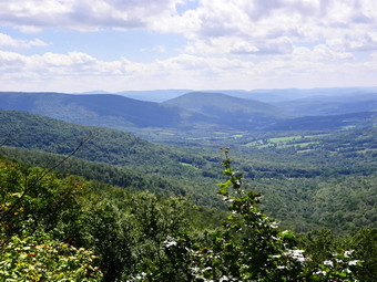
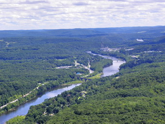 The trail passes through many different types of vegetation including hard woods, pines and a lot of laurel. At about 1.7 miles the trail emerged from the undergrowth to give another view across and down the river. After I took pictures, we continued up the mountain and arrived at the summit after 2 miles of hiking. The pylons from and old fire tower are near the summit and another structure with an electrical feed is in the same area. There was no view from here so we continued on the road on the summit and then walked off to our left. It was obvious many people come up to the top. There was evidence of recent campfires. I found several nice viewpoints but the day was a little hazy to get really good pictures. There was a lot of land laid out below and after some photographs, we turned around and started back. When we got to the junction with the fire road, we stayed to the left and followed it down the mountain. I did this more for variety than anything else since the walking was not too much better than the trail up. We eventually joined up with the trail near the bottom and returned to the car after only a little over 2 hours walking the 4.5 mile hike.
![]()
![]() On Sunday, August 30th Doug Garrity (Sparty) and I met at Hubbell Corners to hike Montgomery Hollow, Whiteman and Roundtop. We had permission from a local landowner to park and hike the mountains but were asked to do it on a Sunday to avoid logging operations in the area. We parked and started out on a woods road that went up and in the right general direction. Soon the road began to head more to the south and we wanted to go west. We started our bushwhack by heading generally west and a little north toward Montgomery Hollow. There were some prickers but they were not too bad and Sparty did a great job of clearing them out! After only one mile we were near the top of Montgomery Hollow fighting an ever increasing number of prickers! We continued over the top and headed. We knew this would be more difficult and that we would have to return on about the same route. We hit the col and then continued in the same general southwest direction. We began to pick up some logging roads and used them as much as we could. The problem with these roads were that the wandered first one way and then the other and were certainly not built with us in mind. It was only about a mile to the summit plateau of White Man Mountain. It was then that it struck me why this was also called Hack Flats. We walked along the top of the mountain for about a quarter mile looking for the highest spot. Eventually we found a spot where there did not seem to be any higher ground.
On Sunday, August 30th Doug Garrity (Sparty) and I met at Hubbell Corners to hike Montgomery Hollow, Whiteman and Roundtop. We had permission from a local landowner to park and hike the mountains but were asked to do it on a Sunday to avoid logging operations in the area. We parked and started out on a woods road that went up and in the right general direction. Soon the road began to head more to the south and we wanted to go west. We started our bushwhack by heading generally west and a little north toward Montgomery Hollow. There were some prickers but they were not too bad and Sparty did a great job of clearing them out! After only one mile we were near the top of Montgomery Hollow fighting an ever increasing number of prickers! We continued over the top and headed. We knew this would be more difficult and that we would have to return on about the same route. We hit the col and then continued in the same general southwest direction. We began to pick up some logging roads and used them as much as we could. The problem with these roads were that the wandered first one way and then the other and were certainly not built with us in mind. It was only about a mile to the summit plateau of White Man Mountain. It was then that it struck me why this was also called Hack Flats. We walked along the top of the mountain for about a quarter mile looking for the highest spot. Eventually we found a spot where there did not seem to be any higher ground.
 We started our hike back across the flats and then down White Man and up Montgomery Hollow. We emerged back onto the woods road where we began our bushwhack, walked own the road and promptly started in the wrong direction. Soon we realized our mistake and corrected it. We found some roads and then left them behind as we headed east toward Roundtop which would be the highest peak of the day. After a little more than a mile we arrived at the highest spot and claimed victory before starting back. Somewhere along the way we ran into a nice viewpoint and stopped to take pictures. As we neared the western end of the summit plateau, we ran into some roads we had not found before. They headed in the right direction ad were a better choice than more bushwhacking. After a few doubtful turns, we were back at he "main" woods road and hiking down to the car. The 7 mile hike had taken us just short of 7 hours!
![]()
![]() On Thursday, August 27th I decided to meet a group from the Andes Hikers and Hill Road near Margaretville to hike to the lookouts over the Pepacton Reservoir on Dry Brook Ridge. The group that met on Hill Road in the morning was about 15 strong with three dogs other than Sheba. There were many people of different abilities so I knew that I would have someone to hike with. The leader had "bad knees" and encouraged me to take the lead. I led out along with a few others and we were soon ahead of the main group. We stopped and waited and then slowed our pace as we started in again. This pattern would continue throughout the hike but I didn't mind slowing my pace since it was nice to hike with a group for a change. We made it up through the pine plantation and to the ridge. Here we took a right and headed out along the ridge toward the lookouts. This part of the walk meanders a bit and is always longer than I remember. We all eventually got to the lookouts and I took some pictures before continue on the trail a little farther. None of the rest of the group wanted to come. I just wanted to check out the possibility of other lookouts or viewpoints on the other side of the ridge. I found many interesting possibilities but none proved worthwhile so I went back to the main trail and headed back toward the group. Some were ready to go so we started out down the ridge to the trail junction and then back to the cars. The 7 mile hike took about 4 hours total and all those involved were pleasant and interesting people.
On Thursday, August 27th I decided to meet a group from the Andes Hikers and Hill Road near Margaretville to hike to the lookouts over the Pepacton Reservoir on Dry Brook Ridge. The group that met on Hill Road in the morning was about 15 strong with three dogs other than Sheba. There were many people of different abilities so I knew that I would have someone to hike with. The leader had "bad knees" and encouraged me to take the lead. I led out along with a few others and we were soon ahead of the main group. We stopped and waited and then slowed our pace as we started in again. This pattern would continue throughout the hike but I didn't mind slowing my pace since it was nice to hike with a group for a change. We made it up through the pine plantation and to the ridge. Here we took a right and headed out along the ridge toward the lookouts. This part of the walk meanders a bit and is always longer than I remember. We all eventually got to the lookouts and I took some pictures before continue on the trail a little farther. None of the rest of the group wanted to come. I just wanted to check out the possibility of other lookouts or viewpoints on the other side of the ridge. I found many interesting possibilities but none proved worthwhile so I went back to the main trail and headed back toward the group. Some were ready to go so we started out down the ridge to the trail junction and then back to the cars. The 7 mile hike took about 4 hours total and all those involved were pleasant and interesting people.
![]() On Wednesday, August 26th Lisa and I headed to Sam's Point near Cragsmoor to get in some hiking. We decided to forgo the Ice Caves and falls and hike around Lake Maratanza to High Point and then back along the other side of the lake. The first and last part of the hike around the lake are on paved road that is still used by maintenance and emergency vehicles. We passed the turn off to the ice caves and stopped by the shore of the lake. The water was high and I took a few shots before continuing around the end of the lake and picking up the High Point Trail. The trail was very wet with areas of standing water and others of deep mud. We worked our way around most of these as we approached the area where the trail starts to climb to the High Point plateau. Once on the plateau we followed the path and blazed trail toward High Point. We knew we had arrived when we saw the USGS survey marker. Actually, I have been here so many times that a marker was not needed. We took pictures and then reversed our path all the way back to the loop road around the lake. Rather than go back the way we had come, we turned right and continued around the lake to form a true loop back to the Conservation Center and the car.
On Wednesday, August 26th Lisa and I headed to Sam's Point near Cragsmoor to get in some hiking. We decided to forgo the Ice Caves and falls and hike around Lake Maratanza to High Point and then back along the other side of the lake. The first and last part of the hike around the lake are on paved road that is still used by maintenance and emergency vehicles. We passed the turn off to the ice caves and stopped by the shore of the lake. The water was high and I took a few shots before continuing around the end of the lake and picking up the High Point Trail. The trail was very wet with areas of standing water and others of deep mud. We worked our way around most of these as we approached the area where the trail starts to climb to the High Point plateau. Once on the plateau we followed the path and blazed trail toward High Point. We knew we had arrived when we saw the USGS survey marker. Actually, I have been here so many times that a marker was not needed. We took pictures and then reversed our path all the way back to the loop road around the lake. Rather than go back the way we had come, we turned right and continued around the lake to form a true loop back to the Conservation Center and the car.
![]()
![]() On Tuesday, August 25th after hiking the Middleburgh Cliffs, Cindy and I headed back down Route 30 to Grand Gorge. We still had a little time so we turned right onto Route 23 and headed toward Prattsville to explore Pratt's Rock. We parked in the small parking area just passed the kiosk and got going right away. We walked up to the kiosk and read about the history of the area and of the man who commissioned the art that we were about to see. Apparently the "artist" was an itinerant stone cutter who agreed to do the carvings for food and lodging. Mr. Pratt was a man of some means being a politician and the owner of one of the biggest tanneries in New York state. We walked through the park and the picnic area before taking a trail below the cliffs. It turned out that this trail revealed some of the art but not all of it so we backtracked and continued on the trail that seemed to go toward the top of the cliffs. After a steep but short hike, we arrived at and incredible viewpoint on and open flat rock outcrop at the top of the cliffs. The Schoharie Creek was below and the views down the valley were breathtaking. We took pictures from this point and then walked further on to find another lookout with a different but equally spectacular view.
On Tuesday, August 25th after hiking the Middleburgh Cliffs, Cindy and I headed back down Route 30 to Grand Gorge. We still had a little time so we turned right onto Route 23 and headed toward Prattsville to explore Pratt's Rock. We parked in the small parking area just passed the kiosk and got going right away. We walked up to the kiosk and read about the history of the area and of the man who commissioned the art that we were about to see. Apparently the "artist" was an itinerant stone cutter who agreed to do the carvings for food and lodging. Mr. Pratt was a man of some means being a politician and the owner of one of the biggest tanneries in New York state. We walked through the park and the picnic area before taking a trail below the cliffs. It turned out that this trail revealed some of the art but not all of it so we backtracked and continued on the trail that seemed to go toward the top of the cliffs. After a steep but short hike, we arrived at and incredible viewpoint on and open flat rock outcrop at the top of the cliffs. The Schoharie Creek was below and the views down the valley were breathtaking. We took pictures from this point and then walked further on to find another lookout with a different but equally spectacular view.
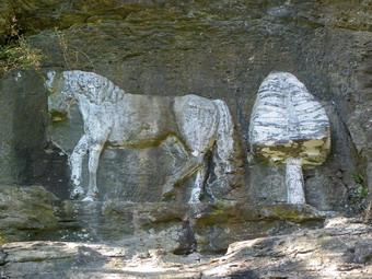 Cindy decided to rest at this point while Sheba and I did some exploring. We walked up into the woods and along the cliff edge and found the trail that descended steeply down to the front part of the cliffs. We went a little farther and found a series of natural rock overhangs and caves. Some of these looked large enough to take shelter but none looked so large as to really enter. I did not want to leave Cindy for too long so we headed back down to where she was. We found another trail down to the face of the cliffs. On the cliffs are various carvings that have been painted in white to accentuate them. The paint looks old and I found it sad that such an unusual place was falling into disrepair. There was a hollow carved into the stone that Mr. Pratt had intended for his final resting place but the dampness prevented this. We took pictures of the carvings and I walked further along the base of the cliff to find more overhangs and the trail leading up to the cliffs above. When we were done, we followed the trail down to where it met the one we had used to come up and returned to our car.
![]()
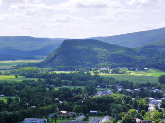
![]() On Tuesday, August 25th I thought it would be best to take advantage of the great weather on hike somewhere with a view. I had read about the Middleburgh Cliffs across the Schoharie Valley from Vroman's Nose and asked Cindy if she thought it sounded interesting. She was agreeable so we pack of the gear and the dog and headed to Roscoe to catch Route 206 to Route 30. About 2 hours later we were in Middleburgh. We parked at the school, walked across the street and down another side street into a small development. It was HOT for this area as we walked to the cliffs toward the back of the development. We found a woods road that started up the cliffs but seemed to go in the wrong direction. The banks were steep to climb but it was obvious where others had gone. The aqua blazes of the Long Path also headed up through this area so we did also. The initial climb was steep and the path little used making the hike seem like a bushwhack. Soon we were on more of a trail marked as the Long Path. We came across a high rocky outcrop which we thought might be impossible to climb. We began to realize that the trail went up and over this outcrop. It wasn't easy but we made it up and found Sheba waiting on top! There were some limited views from this area but the walking became easier on wide trail and woods road. The view opened up on one rocky outcrop to give a fabulous view of the Schoharie Plain below. Vroman's Nose was dramatic from this angle. When you hike up that feature, it is obvious that it is much higher than the surrounding plain but from the cliffs its prominence is that much more exaggerated! We continued along the edge of the cliff for some time grabbing views when we could. It became obvious that we were just getting further from the car without gaining any better views, so we reversed our route and headed back to the school.
On Tuesday, August 25th I thought it would be best to take advantage of the great weather on hike somewhere with a view. I had read about the Middleburgh Cliffs across the Schoharie Valley from Vroman's Nose and asked Cindy if she thought it sounded interesting. She was agreeable so we pack of the gear and the dog and headed to Roscoe to catch Route 206 to Route 30. About 2 hours later we were in Middleburgh. We parked at the school, walked across the street and down another side street into a small development. It was HOT for this area as we walked to the cliffs toward the back of the development. We found a woods road that started up the cliffs but seemed to go in the wrong direction. The banks were steep to climb but it was obvious where others had gone. The aqua blazes of the Long Path also headed up through this area so we did also. The initial climb was steep and the path little used making the hike seem like a bushwhack. Soon we were on more of a trail marked as the Long Path. We came across a high rocky outcrop which we thought might be impossible to climb. We began to realize that the trail went up and over this outcrop. It wasn't easy but we made it up and found Sheba waiting on top! There were some limited views from this area but the walking became easier on wide trail and woods road. The view opened up on one rocky outcrop to give a fabulous view of the Schoharie Plain below. Vroman's Nose was dramatic from this angle. When you hike up that feature, it is obvious that it is much higher than the surrounding plain but from the cliffs its prominence is that much more exaggerated! We continued along the edge of the cliff for some time grabbing views when we could. It became obvious that we were just getting further from the car without gaining any better views, so we reversed our route and headed back to the school.
![]()
![]() On Monday, August 24th I had planned to go to Storm King State Park as I had not been there in some time. The weather was very hazy in the morning and I had some work to do so Sheba and I did not arrive at the Route 9W parking until noon. We got right on the trail and I took a few shots as we climbed the orange Butter Hill Trail although the haze was still hanging around. At .3 miles I chose to bear right on the yellow Stillman Trail, one of the main trails in the park. We continued our climbing up to the top of the Stillman Trail at about .4 miles and then descended to the junction with the blue and red Bluebird Trail at .6 miles. There aren't many views along this trail and the walk was difficult alternating between rocky sections and wet areas. There was a woods road along the way that goes to some ruins but I had visited them before and was not too impressed. At 1 mile we were again at a junction with the yellow Stillman Trail and turned right. This part of the trail enters some nice evergreen forest and begins to climb on the edge of the mountain. The trail is narrow and in one place a bridge is needed to cross a usually dry "gorge". As the trail climbed it headed toward the river and skirting the summit of Storm King Mountain and in doing so we had many nice views of the river below. The Stillman Trail continued to the summit of Storm King where there were some nice views to the north despite the hazy conditions. I took a lot of pictures here and then we retraced our path back down the Stillman Trail to the junction with the white Bypass Trail. The Bypass Trail descended until at about 2.4 miles it met the blue Howell Trail which headed south.
On Monday, August 24th I had planned to go to Storm King State Park as I had not been there in some time. The weather was very hazy in the morning and I had some work to do so Sheba and I did not arrive at the Route 9W parking until noon. We got right on the trail and I took a few shots as we climbed the orange Butter Hill Trail although the haze was still hanging around. At .3 miles I chose to bear right on the yellow Stillman Trail, one of the main trails in the park. We continued our climbing up to the top of the Stillman Trail at about .4 miles and then descended to the junction with the blue and red Bluebird Trail at .6 miles. There aren't many views along this trail and the walk was difficult alternating between rocky sections and wet areas. There was a woods road along the way that goes to some ruins but I had visited them before and was not too impressed. At 1 mile we were again at a junction with the yellow Stillman Trail and turned right. This part of the trail enters some nice evergreen forest and begins to climb on the edge of the mountain. The trail is narrow and in one place a bridge is needed to cross a usually dry "gorge". As the trail climbed it headed toward the river and skirting the summit of Storm King Mountain and in doing so we had many nice views of the river below. The Stillman Trail continued to the summit of Storm King where there were some nice views to the north despite the hazy conditions. I took a lot of pictures here and then we retraced our path back down the Stillman Trail to the junction with the white Bypass Trail. The Bypass Trail descended until at about 2.4 miles it met the blue Howell Trail which headed south.
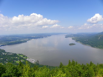
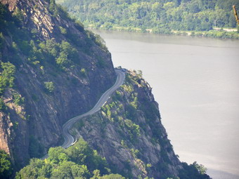 We headed down the Howell Trail into a low area called The Clove between the higher ground of Storm King on one side and North Point on the other. At 2.7 miles we hit the red Crossover Trail where we turned left. This trail is now unofficial and the blazes have been painted over but we took it anyway. At 3.0 miles we hit the white Stillman Spring Trail and headed left and continued to descend. The Stillman Spring Trail eventually brought us to Stillman Spring on the Storm King Highway. This would be our lowest point on the hike and represented an almost 1100 foot drop from Storm King. It was about 2:30 PM. At the spring we picked up the beginning of the blue Howell Trail which started the long climb we would have to make to North Point. At 3.6 miles we were at a nice lookout called Pitching Point and we walked out on a short spur trail so that I could take pictures. The Howell Trail continued to climb as it headed south and then southwest. The vegetation here is almost all hardwood with a lot of small trees and brush. There are also many open fields. The area around North Point has burned several times accounting for the ecology that is so evident. We hit the highest point on this part of the southern loop and then descended slightly before climbing to North Point. The area here is very open and there are intriguing views of the river, Pollepel Island and Storm King Highway as it winds its way around the mountain. I stopped to take a lot of pictures.
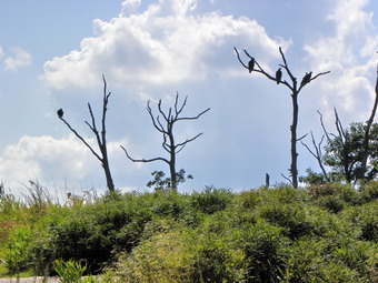 As we continued over the ridge, I was surprised to see at least half a dozen vultures sitting in the burned and skeletal trees at the top of the point. This was truly an eerie sight as the birds showed no sign of moving. We hurried across the open space and down to a wide woods road where the white Bobcat Trail joins from the lower parking area on 9W. We continued on the Howell Trail as it descended into The Clove passing the Stillman Trail at 5.4 miles and the crossover trail at 5.6 miles. By now I was getting tired and the hour was getting late. From this low point in the Clove, we had to gain almost 500 feet of elevation over the next .35 miles on the Howell Trail. This is not a very long distance and the elevation gain sounds minimal. On this day the 27% grade gave me all I could handle. At the top if the climb I decided to attempt to take the quickest way back to the car. We turned left on a "proposed" trail which seemed to be an extension of the Bypass Trail. There were only a few blazes but the wide road was easy to follow. on our right side were some really impressive cliffs that made up the foot of Storm King. As we approached 9W, we had to hike up a steep little grade to the parking area. The climb didn't bother me much since the car was near. What did bother me was the amount of garbage people had dumped in the area! We were back at the car by 4:45 PM covering our 6.5 mile hike in 4 hours and 45 minutes. This is a VERY slow time for us but a lot of it was dedicated to taking pictures and enjoying the view.
![]() On Saturday, August 22nd we decided to take a family hike. For various reasons we settled on Trout and Mud Ponds; close to home, short (5 mile) distance, medium difficulty. Getting 6 people and 2 dogs ready to go meant that we didn't arrive at the upper trailhead on Morton Hill Toad until around 11:30 AM. Two cars ahead of us headed down the road to the lower parking area but I decided we would walk down the road as always. As soon as we got out of the car, it began to rain lightly and I thought it would continue. We headed down the road under cloudy skies and with rain still falling. We met a small group of young men with a dog by the upper campsite and said hello. When we got to the lower parking area, we were surprised to see it nearly filled with cars! I was not prepared for a crowd but figured most would be camping not hiking. On the walk down to the falls we met three people who looked like they had come to see the falls and were returning to their cars. I signed in the trail register and we headed up the wide road to Trout Pond. The walk went quickly as we talked and caught up.
On Saturday, August 22nd we decided to take a family hike. For various reasons we settled on Trout and Mud Ponds; close to home, short (5 mile) distance, medium difficulty. Getting 6 people and 2 dogs ready to go meant that we didn't arrive at the upper trailhead on Morton Hill Toad until around 11:30 AM. Two cars ahead of us headed down the road to the lower parking area but I decided we would walk down the road as always. As soon as we got out of the car, it began to rain lightly and I thought it would continue. We headed down the road under cloudy skies and with rain still falling. We met a small group of young men with a dog by the upper campsite and said hello. When we got to the lower parking area, we were surprised to see it nearly filled with cars! I was not prepared for a crowd but figured most would be camping not hiking. On the walk down to the falls we met three people who looked like they had come to see the falls and were returning to their cars. I signed in the trail register and we headed up the wide road to Trout Pond. The walk went quickly as we talked and caught up.
At the pond the first thing I noticed was that some thoughtless idiot had destroyed the information panel at the outlet. I am still amazed when I find that people are so inconsiderate and have nothing better to do than destroy. The beaver dam at the outlet was gone and the lake level had dropped some. We stayed at the outlet a few minutes to take pictures and then headed up to the other end. No one was camped a the fire ring but the lower lean-to was occupied and we could hear people a the upper one. Someone was fishing along the lakeside and a few boats were on the lake. Crossing the inlet stream was easy and on the other side we let a few people coming down the trail. We started our ascent from the lake to Cherry Ridge. This part always seems longer than I remember and the climb is challenging in places. The trail was wet in some places and many of the rocks were slippery. Soon we had stopped going up and were walking flat and then down the other side of the ridge. After a short climb, the trail descends to the road and we turned left to get back to the trail junction by the trail register. The campsite by the stream was full and we met a few people hauling provisions to their camp. We stopped at Russell Brook Falls briefly and Kurt and Brad took a few pictures. There were a dozen people down in the stream bed so we stayed up on the trail overlooking the falls. After that, we got back on the road and hiked up to the car. We were back by about 1:30 PM which surprised me since I though we were going slower than that pace over the 5 mile distance.
![]() On Friday, August 21st Kurt was visiting from Florida and we wanted to hike somewhere before a family gathering. It had been sprinkling and the weather was hot and humid when we left the house to go to Frick Pond. The weather prediction was for heavy thunderstorms so we knew that whatever we did it would have to be fast. After we parked at about 9:30 AM, we headed for Frick Pond. The trail had been trimmed but was wet in places. As we approached the pond, there were several VERY muddy spots and this theme would repeat itself many places along the way. A heavy haze hung over the pond and I so no reason to take any pictures. We crossed the bridge and headed around the other side of the pond. At the trail junction we decided to stay close to the pond and head for Times Square. The boardwalks around the pond were VERY slippery and we were careful to negotiate them and avoid falling. After working our way through some impossibly muddy areas, we were at Times Square.
On Friday, August 21st Kurt was visiting from Florida and we wanted to hike somewhere before a family gathering. It had been sprinkling and the weather was hot and humid when we left the house to go to Frick Pond. The weather prediction was for heavy thunderstorms so we knew that whatever we did it would have to be fast. After we parked at about 9:30 AM, we headed for Frick Pond. The trail had been trimmed but was wet in places. As we approached the pond, there were several VERY muddy spots and this theme would repeat itself many places along the way. A heavy haze hung over the pond and I so no reason to take any pictures. We crossed the bridge and headed around the other side of the pond. At the trail junction we decided to stay close to the pond and head for Times Square. The boardwalks around the pond were VERY slippery and we were careful to negotiate them and avoid falling. After working our way through some impossibly muddy areas, we were at Times Square.
From here we headed up the Big Rock Trail toward the Flynn Trail. This climb is always longer and a little steeper than I remember. The insects were very thick and even 100% DEET didn't seem to help. As we ascended to the Flynn Trail the insects thinned out. At the Flynn Trail we turned left and walked down to Hodge Pond. This is a nice downhill stretch. When we got to the pond, we were surprised to find that the Flynn Trail across the Hodge Pond outlet was flooded. beaver dam had raised the water level and made the trail nearly impassable. It might be possible to hike across the dam but we were headed up to the remains of the Beech Mountain Boy Scout Camp. We took the road on the right of the pond and turned left at the top toward Beech and Mongaup Mountains. When the road split, we headed to the left and the old camp cabins appeared immediately. We took a quick look and then started back to the car.
We took the road back to the Flynn Trail and then turned left for the long walk back to the car. We passed the Big Rock Trail junction and headed down the Flynn Trail. Several times it sprinkled some but then stopped. However, the skies were getting darker and the rolls of thunder were becoming louder and closer. We increased our pace and soon I knew we were near then end of the trail. At the gate we went left to stay on the trail as the rain began to fall. We were back at the car by noon and quickly got in. We had covered a little over 5 miles in 2.5 hours. The rain was now constant and increased as we reached the Mongaup Pond Road. On the DeBruce Road home there was a constant downpour which nearly obscured the road.
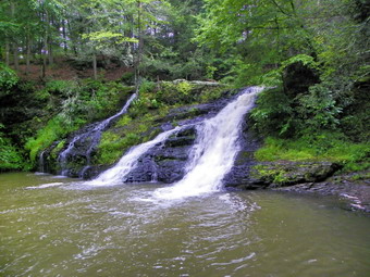
![]() On Wednesday, August 19th I turned onto Briscoe Mountain Road from Route 209 and headed north passed the PEEC. There was thunder rumbling in the sky but the PEEC had people going out into their pond in aluminum canoes! About two miles passed the PEEC the road crosses a small culvert over Hornbecks Creek and I parked in a small pullout just on the other side. Even though their was thunder and I was on a time schedule I decided to try to get these falls in. There was a path into the woods where the guidebook said it would be so I headed out on it with only my camera. The path quickly became a tangle of brush and briars but I am used to this and didn't think much of it. Soon the path disappeared and I headed toward the sound of water. I was high on a bank and could not see the creek below. I decided to return to the car BUT I did not have my GPS, compass or the sun to guide me and I was pretty turned around! I headed back in the direction I though was correct and several times came across what looked like the right path only to find it was not. I reflected on what a DUMB MOVE I had made but soon ran across a wide trail. When I turned right, I was back at the parking area. Since I had not been in the area before, I did not know that the path was closer to the culvert and was wide and well-traveled if unmarked. I decided that I could still hike to the falls and set off down the path.
On Wednesday, August 19th I turned onto Briscoe Mountain Road from Route 209 and headed north passed the PEEC. There was thunder rumbling in the sky but the PEEC had people going out into their pond in aluminum canoes! About two miles passed the PEEC the road crosses a small culvert over Hornbecks Creek and I parked in a small pullout just on the other side. Even though their was thunder and I was on a time schedule I decided to try to get these falls in. There was a path into the woods where the guidebook said it would be so I headed out on it with only my camera. The path quickly became a tangle of brush and briars but I am used to this and didn't think much of it. Soon the path disappeared and I headed toward the sound of water. I was high on a bank and could not see the creek below. I decided to return to the car BUT I did not have my GPS, compass or the sun to guide me and I was pretty turned around! I headed back in the direction I though was correct and several times came across what looked like the right path only to find it was not. I reflected on what a DUMB MOVE I had made but soon ran across a wide trail. When I turned right, I was back at the parking area. Since I had not been in the area before, I did not know that the path was closer to the culvert and was wide and well-traveled if unmarked. I decided that I could still hike to the falls and set off down the path.
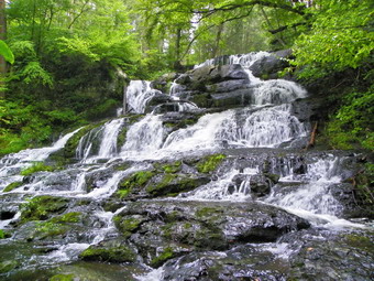 The path runs along the creek with side paths that lead to each falls. The first falls was an 18 foot slide into a pool and was easy to photograph. The water looked all riled up from the recent rain. I walked back up to the main trail and through a grove a pine trees. The second and third falls were hard to photograph. There did not seem to be any clear views and I was hurried. I took some pictures through the trees of the 6 foot chute that is the second falls and the 20 foot cascade of the third falls. The creek runs through a gorge here at it may be possible to get to the other side for better views on another day. The final falls required me to walk a little-used path covered by ferns and briars. The stones on the path were slippery and the path was steep. Further down the dirt and small rocks were loose and it was hard to get a grips. The fourth falls is a wide 40 foot slide and cascade over rocks. It was difficult to get a good view of the entire falls from the shore so I rock hopped to an island in the middle of the creek. The angle from here was much better to get some shots. As the thunder started to become continuous and the rain began to fall, I quickly worked my way back up the steep incline and then back to the car as quickly as possible. The final count wasn't big on mileage but visiting 13 falls made up for that!
![]() On Wednesday, August 19th I drove back down Lake road to Route 739 and then south to Route 209 at the Dingman's Ferry traffic light. From here I turned right onto Route 209 and drove south about 5.5 miles to a large parking area on the right side of the road. On the way I drove passed Briscoe Mountain Road where the Pennsylvania Environmental Education Center is located. I had only intended to "spot" these falls and then return another day but the rain had stopped and I decided to "investigate". I grabbed my camera and walked into the woods. I noticed a low stone building to the left of the trail. The stonework was in good condition and it was intriguing to guess whether this was a storehouse or some other vital part of a business that used the stream. The trail was VERY wet with small pools of water that had many small frogs in residence. I could hear the falls and then see them after only about a 15 minute walk. From the near shore the angle was poor so I worked by way across the swollen stream on the greasy rocks. The angle from midstream and the other bank was much better and I took some pictures of the whole scene and then focused in on some specific aspects of the 70 foot drop through a chute. This falls is interesting since the water comes from two places at the top, unites in one stream and then works its way through a clog of boulders.
On Wednesday, August 19th I drove back down Lake road to Route 739 and then south to Route 209 at the Dingman's Ferry traffic light. From here I turned right onto Route 209 and drove south about 5.5 miles to a large parking area on the right side of the road. On the way I drove passed Briscoe Mountain Road where the Pennsylvania Environmental Education Center is located. I had only intended to "spot" these falls and then return another day but the rain had stopped and I decided to "investigate". I grabbed my camera and walked into the woods. I noticed a low stone building to the left of the trail. The stonework was in good condition and it was intriguing to guess whether this was a storehouse or some other vital part of a business that used the stream. The trail was VERY wet with small pools of water that had many small frogs in residence. I could hear the falls and then see them after only about a 15 minute walk. From the near shore the angle was poor so I worked by way across the swollen stream on the greasy rocks. The angle from midstream and the other bank was much better and I took some pictures of the whole scene and then focused in on some specific aspects of the 70 foot drop through a chute. This falls is interesting since the water comes from two places at the top, unites in one stream and then works its way through a clog of boulders.
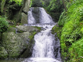 There were a few peels of thunder as I worked my way back across the creek but the guidebook said the upper falls were nice to I approached the path up the near side of the lower falls. It was here that I wished I had at least brought my hiking poles. The unmarked, informal trail was very eroded with a lot of slippery rocks and roots. In addition, the dirt and small stones were loose making getting a footing very difficult. Once up the steepest part, I followed the path through some brush back down to the edge of the stream and ducked under a large blowdown. I was looking for a place to cross but the water was too high between the two falls, I could see the upper falls but knew the pictures from the other side would be much better. I removed my shoes and waded through the cold, knee-deep water to the other side. I walked to the pool at the base of the falls and took pictures as the water slide 30 feet over the rocks into the pool. Another trail went up the right side of the falls but I decided that the growing sound of thunder made this a trip for another day. I waded back across the stream and stuffed my wet feet into my socks and donned my boots. I made my way down the steep slope to the base of the lower falls and then walked back out to the parking area. Another hiker/photographer had just pulled in and we talked for a while. He was optimistic that the rain had stopped. I was less so. He suggested I check out Hornbecks Creek and the Indian Ladders, I told him I was going to make sure I knew where they were located and then hike them some other time. I drove back to Briscoe Mountain Road on Route 09 and turned left toward the PEEC.
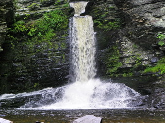
![]() On Wednesday, August 19th I walked back through the picnic area after the rain had all but stopped and down the steps to walk the path along the stream. After another up and down I was at the base of the last falls in the Childs Picnic Area, Deer Leap Falls. Here the water drops about 30 feet from a slot in the rocks above. It falls into a shallow, gravel lined pool below. I found several good angles for photographs including one from the bridge below the falls and the one above. After photographing this falls, I walked over the bridge to the other side to revisit Fulmer falls and then head to my next destination, Tumbling Waters Falls.
On Wednesday, August 19th I walked back through the picnic area after the rain had all but stopped and down the steps to walk the path along the stream. After another up and down I was at the base of the last falls in the Childs Picnic Area, Deer Leap Falls. Here the water drops about 30 feet from a slot in the rocks above. It falls into a shallow, gravel lined pool below. I found several good angles for photographs including one from the bridge below the falls and the one above. After photographing this falls, I walked over the bridge to the other side to revisit Fulmer falls and then head to my next destination, Tumbling Waters Falls.
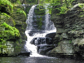
![]() On Wednesday, August 19th I walked downstream to Fulmer Falls in the Childs Picnic Area as the clouds became even darker. My first pictures were from the top of the falls where a large volume of water squeezes through a chute and cascades into the pool below. The drop is almost 60 feet and has cut back the rocks noticeably creating interesting formations. From the top I walked along the path to the base of the falls to take pictures. I walked to the base of the falls where others were painting and taking pictures. I snapped some photos of the scene and then zoomed in on a few special features. As I was doing this the rain began to fall in earnest and I headed back to the car. I was annoyed since I still had one falls to go and the rain appeared to be serious. I waited in the car for a while an the rain almost stopped so I walked back out to take pictures. I crossed a bridge to the other side and was able to find another viewpoint of Fulmer Falls. the rain had cleared out most of the swimmers and I got some good pictures from this close up viewpoint.
On Wednesday, August 19th I walked downstream to Fulmer Falls in the Childs Picnic Area as the clouds became even darker. My first pictures were from the top of the falls where a large volume of water squeezes through a chute and cascades into the pool below. The drop is almost 60 feet and has cut back the rocks noticeably creating interesting formations. From the top I walked along the path to the base of the falls to take pictures. I walked to the base of the falls where others were painting and taking pictures. I snapped some photos of the scene and then zoomed in on a few special features. As I was doing this the rain began to fall in earnest and I headed back to the car. I was annoyed since I still had one falls to go and the rain appeared to be serious. I waited in the car for a while an the rain almost stopped so I walked back out to take pictures. I crossed a bridge to the other side and was able to find another viewpoint of Fulmer Falls. the rain had cleared out most of the swimmers and I got some good pictures from this close up viewpoint.
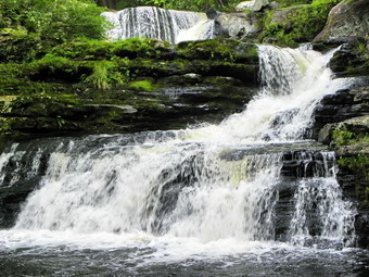
![]() On Wednesday, August 19th I turned south on Route 739 and headed toward Dingman's Ferry. I was looking for Lake Road on the right but could only find Silver Lake road. I continued to the traffic light at the junction with Route 209 and turned around to clock the mileage up the hill. After 1.2 miles, Silver Lake Road appeared on the left and I knew this was the correct turn. A drive of a little over 1.5 miles took me to the parking lot for the George Childs Picnic Area on the left side of the road. There were MANY cars parked in the lot despite the gathering storm. I found this area is a popular swimming and picnic area and also attracts painters and photographers. I walked down through the picnic area and then upstream on the near side of the creek. Just above Factory Falls is the remnants of a stone foundation or "factory". There were many swimmers above and below the falls and some were diving into uncertain waters. The falls is less than 20 feet high but, like all the others this day, had a good volume of water cascading over the rocks into the pool below. I took pictures from near the top and then moved down the slippery rocks to get a different angle. Near the bottom I edges between some painters and got some shots of the falls head on. I continued by walk down stream to Fulmer Falls.
On Wednesday, August 19th I turned south on Route 739 and headed toward Dingman's Ferry. I was looking for Lake Road on the right but could only find Silver Lake road. I continued to the traffic light at the junction with Route 209 and turned around to clock the mileage up the hill. After 1.2 miles, Silver Lake Road appeared on the left and I knew this was the correct turn. A drive of a little over 1.5 miles took me to the parking lot for the George Childs Picnic Area on the left side of the road. There were MANY cars parked in the lot despite the gathering storm. I found this area is a popular swimming and picnic area and also attracts painters and photographers. I walked down through the picnic area and then upstream on the near side of the creek. Just above Factory Falls is the remnants of a stone foundation or "factory". There were many swimmers above and below the falls and some were diving into uncertain waters. The falls is less than 20 feet high but, like all the others this day, had a good volume of water cascading over the rocks into the pool below. I took pictures from near the top and then moved down the slippery rocks to get a different angle. Near the bottom I edges between some painters and got some shots of the falls head on. I continued by walk down stream to Fulmer Falls.
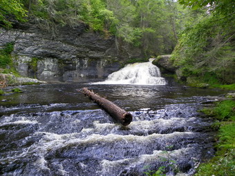
![]() On Wednesday, August 19th I drove up Raymondskill Road until it met SR 2001. I turned right here and drove .8 miles to a dirt road on the left. I turned in here and parked in the parking area for Hackers Falls. On the way in there was a beaver swamp on the right which sported many different plants and colorful flowers. Only one other car was in the lot but two others pulled in as I parked. I got started right away taking only my camera although the hike was almost a mile one way! The trail was just as the guidebook described it and after a bout .4 miles of flat walking I turned right down an obvious path. This path descended to the falls and was somewhat wet and buggy. When I arrived, there were three young people already there. The falls dropped only about 8 feet as a good volume of water ran over the rocks to the pool below. I took some pictures and then started to work my way downstream. As I was about to garb a small tree for balance, a young girl suggested that I watch where I put my hand! There on the tree was a rather large spider. Downstream was pretty with some high gorge walls as the Raymondskill heads toward its more famous drop at Raymondskill Falls. As I walked back up the trail, I decided to take a path to the top of the falls. From the top I took some pictures and got a better idea of the volume and power of these falls. As I walked back to the car four or five groups of people passed me headed for the falls. Apparently these falls are a local swimming hole and I had just missed the afternoon rush. I drove back out the entrance and turned left on SR 2001. I passed Raymondskill Road and started to look for Long Meadow Road which would take me to Adams Falls. Soon the road came up on the left and I turned. The road was paved for a short distance and then turned to dirt. At around .9 miles the road made a sharp turn to the left and there was a parking area on the left. After looking at the description of the hike, I decided to leave it for a later trip. The hike was about 2.5 miles and leads to the Sproul estate and the falls. A wheel that generated electrical energy is located by the falls. I decided to head back to SR 2001 and go south on Route 739 to find Lake road and the Childs Picnic Area and its three falls! The skies continued to get grayer and occasional thunder could be heard.
On Wednesday, August 19th I drove up Raymondskill Road until it met SR 2001. I turned right here and drove .8 miles to a dirt road on the left. I turned in here and parked in the parking area for Hackers Falls. On the way in there was a beaver swamp on the right which sported many different plants and colorful flowers. Only one other car was in the lot but two others pulled in as I parked. I got started right away taking only my camera although the hike was almost a mile one way! The trail was just as the guidebook described it and after a bout .4 miles of flat walking I turned right down an obvious path. This path descended to the falls and was somewhat wet and buggy. When I arrived, there were three young people already there. The falls dropped only about 8 feet as a good volume of water ran over the rocks to the pool below. I took some pictures and then started to work my way downstream. As I was about to garb a small tree for balance, a young girl suggested that I watch where I put my hand! There on the tree was a rather large spider. Downstream was pretty with some high gorge walls as the Raymondskill heads toward its more famous drop at Raymondskill Falls. As I walked back up the trail, I decided to take a path to the top of the falls. From the top I took some pictures and got a better idea of the volume and power of these falls. As I walked back to the car four or five groups of people passed me headed for the falls. Apparently these falls are a local swimming hole and I had just missed the afternoon rush. I drove back out the entrance and turned left on SR 2001. I passed Raymondskill Road and started to look for Long Meadow Road which would take me to Adams Falls. Soon the road came up on the left and I turned. The road was paved for a short distance and then turned to dirt. At around .9 miles the road made a sharp turn to the left and there was a parking area on the left. After looking at the description of the hike, I decided to leave it for a later trip. The hike was about 2.5 miles and leads to the Sproul estate and the falls. A wheel that generated electrical energy is located by the falls. I decided to head back to SR 2001 and go south on Route 739 to find Lake road and the Childs Picnic Area and its three falls! The skies continued to get grayer and occasional thunder could be heard.
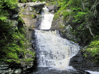
![]() On Wednesday, August 19th I drove back through Milford from the Grey Towers and headed south on Route 209 watching for Raymondskill Road and the sign for Raymondskill Falls on the right. It wasn't too long before the turn appeared on I was on the road to the falls. After about .7 miles a parking area appeared on the left and I pulled in. Another parking area and a building with bathrooms is just up the road on the left. I took my camera and started to walk down the path toward the falls. The path was not long but dropped about 85 feet. A trail came in from the left and shortly after one came in from the right. The second trail led up to the visitors center and I decided to investigate the other on the way back. The trail was wet and the stone were slippery in some places. The walk to the falls was short and I was soon at the lower viewing platform. There was plenty of water flowing over the falls which have a total drop of 180 feet. The water flows through a narrow slot a the top of the falls and then cascades into a pool below. To the right of the main falls was a smaller but very pretty horsetail falls from a tributary. After taking many pictures, I walked back up to the path that led down and away from the bathrooms.
On Wednesday, August 19th I drove back through Milford from the Grey Towers and headed south on Route 209 watching for Raymondskill Road and the sign for Raymondskill Falls on the right. It wasn't too long before the turn appeared on I was on the road to the falls. After about .7 miles a parking area appeared on the left and I pulled in. Another parking area and a building with bathrooms is just up the road on the left. I took my camera and started to walk down the path toward the falls. The path was not long but dropped about 85 feet. A trail came in from the left and shortly after one came in from the right. The second trail led up to the visitors center and I decided to investigate the other on the way back. The trail was wet and the stone were slippery in some places. The walk to the falls was short and I was soon at the lower viewing platform. There was plenty of water flowing over the falls which have a total drop of 180 feet. The water flows through a narrow slot a the top of the falls and then cascades into a pool below. To the right of the main falls was a smaller but very pretty horsetail falls from a tributary. After taking many pictures, I walked back up to the path that led down and away from the bathrooms.
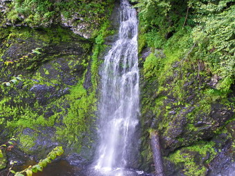 The trail led downward and was not too steep at first. The trail began to get steeper and had several switchbacks. Along the way there were two small falls. The trail led down to the Raymondskill to what appeared to be a swimming hole. I tried to work my way along the banks back to the falls but it was too much work for this day. I got back on the path and retraced my steps until I found a path to the visitor center. From here I crossed the parking lot and walked down the path to the top of the falls. There is a nice pool here and, despite the signs, several people were swimming. I took some pictures down the falls to the plunge pool below and then walked back to the car. I was already impressed with the diversity I had seen in waterfalls! I continued up Raymondskill Road in search of the turn to Hackers Falls.
![]() On Wednesday, August 19th I left Shohola Falls and headed back into Milford to go to the Grey Towers Historical site and Pinchot Falls. Gifford Pinchot was the person responsible for developing the idea of the National Forestry Service and had built the mansion and given his name to the falls. The falls are on the private property of his heirs and have now been closed due to inconsiderate visitors. I found this out by walking up to the mansion and asking the National Parks Service officer stationed there. I decided I would not go through the mansion but I did take pictures of the buildings and grounds. The main house is small but beautiful with two gray turrets on either side of the main entrance. I walked to the top of the gray turreted building that is just off the parking area. From here I took pictures of the hills and valleys below. I will return sometime when I can bring Cindy. I would also like to get permission from the Pinchot heirs to visit the falls. I left the Grey Towers and headed for Raymondskill Falls, the highest falls in Pennsylvania.
On Wednesday, August 19th I left Shohola Falls and headed back into Milford to go to the Grey Towers Historical site and Pinchot Falls. Gifford Pinchot was the person responsible for developing the idea of the National Forestry Service and had built the mansion and given his name to the falls. The falls are on the private property of his heirs and have now been closed due to inconsiderate visitors. I found this out by walking up to the mansion and asking the National Parks Service officer stationed there. I decided I would not go through the mansion but I did take pictures of the buildings and grounds. The main house is small but beautiful with two gray turrets on either side of the main entrance. I walked to the top of the gray turreted building that is just off the parking area. From here I took pictures of the hills and valleys below. I will return sometime when I can bring Cindy. I would also like to get permission from the Pinchot heirs to visit the falls. I left the Grey Towers and headed for Raymondskill Falls, the highest falls in Pennsylvania.
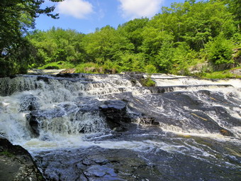
![]() On Wednesday, August 19th I was due to pick up Kurt From Stewart Airport at 7:00 PM. Cross country practice ended at 10:00 AM and I immediately headed for the Delaware Water Gap to visit as many falls as possible. The guidebook I used was Pennsylvania Waterfalls by Scott E. Brown, The book is a GREAT guide giving accurate directions to all the falls, information about the hike to them, a description of the falls and photography tips! I decided to get Shohola Falls first. I took Route 42 from Monticello to Port Jervis and then took Route 209 over the river to Milford. In Milford I turned right onto Route 6 West to the I-84 interchange. From here I followed the directions in the book traveling 8.5 miles to a left hand turn just before Shohola Lake. A left at the Shohola Inn and then a right into the parking area and I was there. I could here the falls from the parking lot and knew it was only a short walk so I took only my camera and walked toward the falls. The water was quite high and the falls were flowing at close to full volume. From the first viewpoint I could see down the creek and took some pictures of the falls from that angle. A path worked its way beside the creek but the rocks were slick from the spray and recent rains. I went anyway. The pool at the bottom was large and there was an accumulation of thick foam. I could see a curved rock wall on the other side which was another viewpoint. The falls have a drop of about to feet and are probably that wide at their widest point. I went as far as I dared and then started taking pictures of the falls. This was an excellent vantage point. I worked my way back up the path to take a look at the dam and then walked back to the car to drive to the Pinchot Falls near the Grey Towers mansion in Milford.
On Wednesday, August 19th I was due to pick up Kurt From Stewart Airport at 7:00 PM. Cross country practice ended at 10:00 AM and I immediately headed for the Delaware Water Gap to visit as many falls as possible. The guidebook I used was Pennsylvania Waterfalls by Scott E. Brown, The book is a GREAT guide giving accurate directions to all the falls, information about the hike to them, a description of the falls and photography tips! I decided to get Shohola Falls first. I took Route 42 from Monticello to Port Jervis and then took Route 209 over the river to Milford. In Milford I turned right onto Route 6 West to the I-84 interchange. From here I followed the directions in the book traveling 8.5 miles to a left hand turn just before Shohola Lake. A left at the Shohola Inn and then a right into the parking area and I was there. I could here the falls from the parking lot and knew it was only a short walk so I took only my camera and walked toward the falls. The water was quite high and the falls were flowing at close to full volume. From the first viewpoint I could see down the creek and took some pictures of the falls from that angle. A path worked its way beside the creek but the rocks were slick from the spray and recent rains. I went anyway. The pool at the bottom was large and there was an accumulation of thick foam. I could see a curved rock wall on the other side which was another viewpoint. The falls have a drop of about to feet and are probably that wide at their widest point. I went as far as I dared and then started taking pictures of the falls. This was an excellent vantage point. I worked my way back up the path to take a look at the dam and then walked back to the car to drive to the Pinchot Falls near the Grey Towers mansion in Milford.
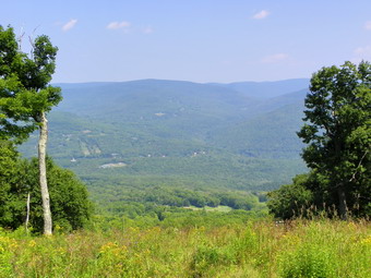
![]()
![]() On Tuesday, August 18th I wanted to do a hike near home with some distance or difficulty or both. The weather report called for afternoon showers but I had plenty of time to get something in. I decided to head for Lost Clove to hike Belleayre Mountain. I got Sheba in the car with my gear and we headed down the DeBruce Road and arrived a the parking area at the end of Lost Clove Road at about 12:00 PM. No on else was parked so I knew we would have a good part of the hike to ourselves. We started right in as there is no trail register on this trail. Sheba was out like a shot well ahead on me as we had not hiked for two days. This is probably because the first mile is an easement on private property. I remembered that the first part of the hike was steep but had forgotten how steep. For a good part of the first mile the trail simply goes UP with only short level parts to recover. To make things more difficult the trail has many loose stones. This day there were several wet spots and a large number of vicious, biting insects! The temperature was in the 80's with a humidity to match.
On Tuesday, August 18th I wanted to do a hike near home with some distance or difficulty or both. The weather report called for afternoon showers but I had plenty of time to get something in. I decided to head for Lost Clove to hike Belleayre Mountain. I got Sheba in the car with my gear and we headed down the DeBruce Road and arrived a the parking area at the end of Lost Clove Road at about 12:00 PM. No on else was parked so I knew we would have a good part of the hike to ourselves. We started right in as there is no trail register on this trail. Sheba was out like a shot well ahead on me as we had not hiked for two days. This is probably because the first mile is an easement on private property. I remembered that the first part of the hike was steep but had forgotten how steep. For a good part of the first mile the trail simply goes UP with only short level parts to recover. To make things more difficult the trail has many loose stones. This day there were several wet spots and a large number of vicious, biting insects! The temperature was in the 80's with a humidity to match.
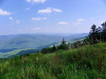 After about a mile the trail meets the Pine Hill West Branch Trail. My original plan had been to descend this trail into Pine Hill and then to ascend the Cathedral Glen Trail. Since the skies were beginning to cloud over, I opted to continue to the ski slopes to get some pictures and then perhaps descend the Cathedral Glen Trail. We hiked Up some more passing the first lean-to on the trail and arrived at the "summit" of Belleayre Mountain. A USGS marker to the left of the trail on a expanse of bedrock in an open field marks this spot. We continued on the Belleayre Ridge Trail toward the ski slopes. Soon we passed the turn for the Cathedral Glen Trail and the other lean-to just off the double black diamond Cathedral Brook run. The trail all along the way had been cut and trimmed wide and there were no prickers or nettles to catch the unwary hiker.
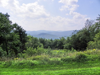 Soon we were in the area of the ski lodge and main lifts. I could see that many of the views were hazy. It was hot and humid and the skies were still overcast and threatening. I decided to walk to the extreme end of the ridge and then work back taking some pictures. The walk along the ridge through the ski area is almost a mile. The view from the last run is minimal but some better views became available from some of the other runs. Despite the haze I took a few pictures as we walked down some of the runs to get unobstructed views. We walked over to the other side of the lodge to get a view of Balsam and then retraced our steps across the ski area and then to the junction with the Cathedral Glen Trail. I was unsure of whether hiking this trail was a good idea but decided to give it a try. We turned onto the trail and I could immediately see that it was little used and poorly maintained. It was hard even to spot the trail and the blue markers were few and far between. Untrimmed vegetation hung over the trail hiding the numerous rocks and roots. After only a short distance, I decided to return to this trail at a point when we could hike up the trail and had more time to do so. Back on the main trail we made good time until we reached the steepest part in the last mile. As always, if climbing this kind of trail is difficult, descending is worse. As we neared the end we met a group of 4 or 5 young men doing a loop over Belleayre, Balsam and Eagle. They weren't exact sure where they were going and asked about sources of water. I said that they were spotty at best, wished them luck and continued down the trail. We arrived back just before 4:00 PM covering nearly 7 miles in under 4 hours. I was soaked in sweat and felt that I had exerted myself sufficiently.
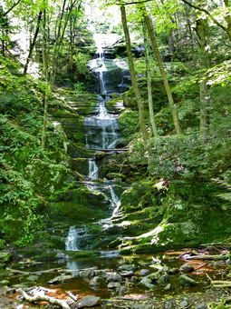
![]()
![]() On Saturday, August 15th Cindy and I finished Dingman's Falls quickly and then headed for Buttermilk Falls across the river in New Jersey. We went across the "historic" Dingman's Ferry Bridge. The bridge is old and not quite two lanes wide! The toll is taken by a person standing on the yellow line! Across the bridge we took Route 560 to Route 640 and then NPS 615 at the Peters Craft Village. In Walpack Center we turned left and right after a short distance on an unmarked road we hoped was Mountain Road. We got it right and continued our slow drive along the rough unpaved road until a parking area on our right and a falls on our left signaled we had arrived at Buttermilk Falls at around 11:00 AM. The falls were high but only a trickle of water cascaded down the rock face. We got out our full hiking gear AND Sheba and started toward the falls. We took some pictures at the base and then started up the steep stairs and pathways next to the falls. The pathways wound back and forth to make the going easier. Sheba did not like the open steps but seemed to make it up OK. We stopped at the viewing platform part way up but there wasn't much to see. I took some pictures from the platform at the top. We then crossed the bridge and started up the blue trail toward the stop of the ridge.
On Saturday, August 15th Cindy and I finished Dingman's Falls quickly and then headed for Buttermilk Falls across the river in New Jersey. We went across the "historic" Dingman's Ferry Bridge. The bridge is old and not quite two lanes wide! The toll is taken by a person standing on the yellow line! Across the bridge we took Route 560 to Route 640 and then NPS 615 at the Peters Craft Village. In Walpack Center we turned left and right after a short distance on an unmarked road we hoped was Mountain Road. We got it right and continued our slow drive along the rough unpaved road until a parking area on our right and a falls on our left signaled we had arrived at Buttermilk Falls at around 11:00 AM. The falls were high but only a trickle of water cascaded down the rock face. We got out our full hiking gear AND Sheba and started toward the falls. We took some pictures at the base and then started up the steep stairs and pathways next to the falls. The pathways wound back and forth to make the going easier. Sheba did not like the open steps but seemed to make it up OK. We stopped at the viewing platform part way up but there wasn't much to see. I took some pictures from the platform at the top. We then crossed the bridge and started up the blue trail toward the stop of the ridge.
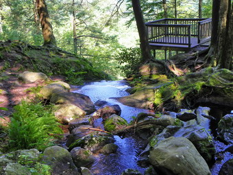 The trail here was almost as steep as the stairs but badly eroded. We worked our way up until the trail leveled off. This happened several times until we broke out into an open area with many dead tress. This area seemed to have been burned over and the direct sunlight made everything much hotter. We walked quickly through this area. The air temperature was in the 80's and the relative humidity was just as high. After about .8 mile, Cindy was looking for a break. When we met the Woods trail we headed right toward Hemlock Lake along a wide woods road. This trail was relatively flat with a few muddy areas. At one point we crossed the outlet from a swampy area created where beavers had dammed the water. We took a break here on the west side of the lake. We opted to turn left and follow a woods road along the eastern shore. As the road pulled away from the lake, I walked down and took a few pictures. back on the road we walked just a short distance and turned left onto the orange trail. This trail began a .7 mile ascent toward the ridge and Crater Lake.
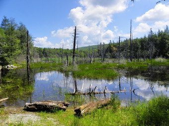 Near the top of the ridge the orange trail crossed the white blazed AT. We continued straight ahead following the orange trail and a series of woods roads down to the shore of the lake. There were quite a few people at the lake and we talked to one man. He explained that the lake was formed by a meteor impact in 1853. I have yet to confirm his story but the lake is less than 20 feet deep. There is a road on the other side that allows access to the lake. We took a few pictures and then returned to the AT and headed northeast. The trail started out fairly level and then began a long, shallow ascent. Along the way we could catch glimpses of the valleys and mountains beyond but could not take pictures. The open rock face and stunted pines reminded us a lot of Minnewaska or Schunemunk. Along the way we three young men came walking toward us with their dog, a boxer. All four were through hikers on the At headed south for Georgia. They had started June 8th at Katadhin. We talked for a minute and as we parted Cindy, looking ahead, yelled "Buck!" I spun around to see a rather large deer run into the forest. His coat was very light but he was sporting at least six point.
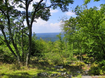 In less than a mile we were at the turn for the blue Buttermilk falls Trail back to the parking area. The top part of this trail was VERY steep and part way down we had to negotiated several open and steep rock faces. A little further on was the best view we had yet into the river valley and out across the hills. We paused for a moment to take pictures and then continued on down the hill. In about .5 Niles we were back at the Woods trail and this time we crossed it and started to retrace our path to the car. Once at the base of the falls, we decided to go down the road to try and find Hidden Falls. Although not as high as Buttermilk Falls these falls have a drop rather than just a cascade over rock. I estimated the distance to be about .5 miles and sure enough at about that distance there was a pull off on the right side of the road and a fain trial leading off into the woods. We took only our cameras and headed down the path. From the maps I remembered that we should take the left fork each time the trail split. We crossed a small creek and could hear the falls ahead. The trail walked along the creek and then ascended slightly. I edged my way along the path until I was standing almost in the creek bed to take pictures of the falls. I then worked my way up the steep, eroded path to the top of the falls and then lowered myself down the embankment. I was now standing at the top of the falls looking over the edge and up the creek. After a few more pictures, we headed back to the car arriving at 3:30 PM. We had covered a total of 6.5 miles in 4.5 hours with a lot of time for pictures!
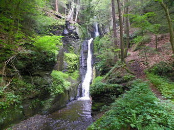
![]() On Saturday, August 15th Cindy and I decided to visit the Delaware Water Gap National Park for the first time. By going to Monticello, then Port Jervis and raking Route 209 South the trip would take only about 1.5 hours. We tried to get started early but, as always, didn't execute our plan too well! This wasn't all bad since a persistent haze hung over the landscape and even got a little worse as we crossed into Pennsylvania. Finding the turnoff to Dingman's Falls was easy and the road was good leading directly to a nice visitor's center with boardwalks leading to the falls. We arrived at just after 9:30 AM. As we got out of the car I noticed a sign that stated "NO DOGS!". This was news to me since all the guidebooks stated dogs on leashes were permitted. I checked in the visitor's center and they confirmed the ban on canines at Dingman's Falls AND Childs Park to the north. We almost got in the car and left but decided to take a quick run to the falls.
On Saturday, August 15th Cindy and I decided to visit the Delaware Water Gap National Park for the first time. By going to Monticello, then Port Jervis and raking Route 209 South the trip would take only about 1.5 hours. We tried to get started early but, as always, didn't execute our plan too well! This wasn't all bad since a persistent haze hung over the landscape and even got a little worse as we crossed into Pennsylvania. Finding the turnoff to Dingman's Falls was easy and the road was good leading directly to a nice visitor's center with boardwalks leading to the falls. We arrived at just after 9:30 AM. As we got out of the car I noticed a sign that stated "NO DOGS!". This was news to me since all the guidebooks stated dogs on leashes were permitted. I checked in the visitor's center and they confirmed the ban on canines at Dingman's Falls AND Childs Park to the north. We almost got in the car and left but decided to take a quick run to the falls.
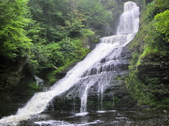 We took only our cameras as we quickly walked down the boardwalks to the first falls called Silver Thread Falls. I had just gotten a new Kodak z980 camera and was eager to try it out. This model doubled both the megapixels and the zoom. It also has image stabilization, a wide angle lens, a burst mode and takes videos in HD. I am still getting accustomed to all the settings but the pictures on automatic mode look GREAT! It was pretty and we took some pictures but I couldn't help fume about the lack of Sheba. The walkways made walking easy and soon we were at the platform that overlooks the base of Dingman's Falls. The amount of water and spray was impressive especially compared to the trickles I had seen in New Jersey earlier in the week. After taking some pictures, we started up the stairs that lead to the top of the falls. This is a steep climb and the stairs are often wet and slippery. The walkway crosses a small tributary stream and the heads of the side of the falls which would be nearly impossible without the steps. On the way up a platform overlooks the falls and another is placed at the top. We took pictures from these and then I continued up an "informal" path to an area above the falls. It was quite beautiful and I edged my way down to the creek to take some pictures upstream and downstream. I didn't waste too much time getting back to Cindy and then we both hurried back to the car. Sheba was glad to see us as we pulled away to head for Buttermilk Falls an a real hiking adventure.
![]() On Friday, August 14th I wanted to get some exercise after finishing summer school grading early. I knew that I would be hiking with my wife on Saturday so I wanted a long hike. I decided to hike from Long Pond on Flugertown Road to Mongaup Pond and back using the hiking and snowmobile trails to create a big loop. I had done this hike only once before and wanted to see if I could improve my time. Sheba and I got to the little pull off near the trail head at about 12:45 PM. The temp was in the low 80's but the relative humidity was about the same! There were also a lot of biting insects around and the trail appeared to be pretty wet. I knew the hike was pretty long but had forgotten the exact length from the road we took the red blazed Long Pond Beaverkill Ridge Trail north. This trail runs in conjunction with the yellow Mongaup Willowemoc Trail and a snowmobile trail for the first .4 miles and then continues through the woods on its own due north. The first part of the trail was wide and well maintained and even after turning into the woods the trail was well kept, for a while. We started to ascend slightly and passed through a wet area. The trail here was barely visible and overgrown with nettles! As we started to ascend and the trail dried out some the prickers started in. For a moment I thought I was in Delaware County.
On Friday, August 14th I wanted to get some exercise after finishing summer school grading early. I knew that I would be hiking with my wife on Saturday so I wanted a long hike. I decided to hike from Long Pond on Flugertown Road to Mongaup Pond and back using the hiking and snowmobile trails to create a big loop. I had done this hike only once before and wanted to see if I could improve my time. Sheba and I got to the little pull off near the trail head at about 12:45 PM. The temp was in the low 80's but the relative humidity was about the same! There were also a lot of biting insects around and the trail appeared to be pretty wet. I knew the hike was pretty long but had forgotten the exact length from the road we took the red blazed Long Pond Beaverkill Ridge Trail north. This trail runs in conjunction with the yellow Mongaup Willowemoc Trail and a snowmobile trail for the first .4 miles and then continues through the woods on its own due north. The first part of the trail was wide and well maintained and even after turning into the woods the trail was well kept, for a while. We started to ascend slightly and passed through a wet area. The trail here was barely visible and overgrown with nettles! As we started to ascend and the trail dried out some the prickers started in. For a moment I thought I was in Delaware County.
After about 1.25 miles, we had ascended to near the top of the ridge and the trail started to level some although we were still going up. At 2.4 miles we were near the Sand Pond high point and the junction with the Mongaup Hardenburgh Trail. We turned left on this blue blazed trail and headed west. Along the way there were some places with narrow viewpoints but I kept my camera in my pack and hustled along the trail. In about .6 miles we were at the top of East Mongaup and were starting to descend into the Col between East and Middle Mongaup Mountains. The climb up Middle Mongaup is not insignificant but the trail is good and in another mile we were at the top. I began to see boot prints on the people who stay at the campgrounds and climb up to this mountain. The trail was muddy in places but not too bad. Next it was down the other side of Middle Mongaup to the pond as the trail turns southwest and then due south. This is initially a pretty good descent followed by a flatter walk approaching the pond. In 1.3 miles or so we were at the pond and we made a left onto the snowmobile trail that goes around the pond. This trail was VERY muddy with few dry places and deep pits of OOZE! After about .5 miles of that the yellow Mongaup Willowemoc Trail appeared on the left and we turned onto it and headed southeast. This is also a snowmobile trail so it is wide and easy to walk. Unfortunately, it also had MANY wet and muddy areas. After a climb over a small hill, we descended to Butternut Creek which is the outlet to Sand Pond. I have never been to Sand Pond but by the amount of water flowing down the creek it must be fairly large!
We walked along the creek for a while continuing to head southeast until the trail swung first east and then northeast to meet the Long Pond Beaverkill Ridge Trail after about a mile. We went right and hiked the .4 miles back to the car. We were back around 4:00 PM having taken a little over 4 hours to hike the 9.3 mile loop and tackle over 200 feet of elevation gain AND loss. No pictures were taken and there weren't many memorable moments but the hike was what I wanted what I wanted and I had a feeling of accomplishment.
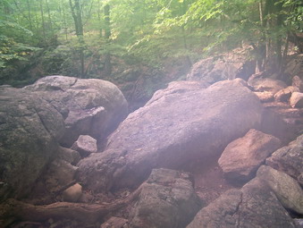
![]()
![]() On Wednesday, August 12th I was looking for a longer hike in a new area. I have been interested in the northern New Jersey Highlands for some time and just picked up a book that describes some hikes in that area. I also looked on trails.com and decided to go to the Norvin Green State Forest. This undeveloped land in only a few minutes from the Long Pond Ironworks but almost a two hour drive from Livingston Manor. The information I had mentioned two iron mines, several falls, and a couple of good lookouts. Unfortunately, the weather prediction had changed from Tuesday night and not for the better. Still, with partly sunny conditions until the afternoon I decided to give it a try. Sheba and I left Livingston Manor at 6:45 AM and headed down Route 17 to the Florida exit. I wanted to get to the Weis Ecology Center when it opened at 8:30 AM to get a map since the Trail Conference has still not sent me the Northern New Jersey set I ordered in May! From Here we took Routes 94 and 17A through Florida and Warwick to Greenwood Lake. In Greenwood Lake I took Route 210 south to the Warwick Turnpike where I turned left toward the Long Pond Iron Works. After the Ironworks, I watched for Stonehouse Road on the left and was surprised to see that this road crosses over the dam for the Monksville Reservoir. After a right turn on Westbrook Road and a left onto Snake Den Road, we arrived at the Weis Center by 8:40 AM to find...it closed. The new hours had it opening at 9:00 AM. One employee seemed too busy with a kid's field trip to talk to me but she did give me a map. Just as I was about to leave another employee arrived and graciously opened the Center early. I had questions about the trails especially since some trails I had wanted to use had been recently closed by the property owner. The woman at the Center was pleasant enough but seemed unable to help me get started.
On Wednesday, August 12th I was looking for a longer hike in a new area. I have been interested in the northern New Jersey Highlands for some time and just picked up a book that describes some hikes in that area. I also looked on trails.com and decided to go to the Norvin Green State Forest. This undeveloped land in only a few minutes from the Long Pond Ironworks but almost a two hour drive from Livingston Manor. The information I had mentioned two iron mines, several falls, and a couple of good lookouts. Unfortunately, the weather prediction had changed from Tuesday night and not for the better. Still, with partly sunny conditions until the afternoon I decided to give it a try. Sheba and I left Livingston Manor at 6:45 AM and headed down Route 17 to the Florida exit. I wanted to get to the Weis Ecology Center when it opened at 8:30 AM to get a map since the Trail Conference has still not sent me the Northern New Jersey set I ordered in May! From Here we took Routes 94 and 17A through Florida and Warwick to Greenwood Lake. In Greenwood Lake I took Route 210 south to the Warwick Turnpike where I turned left toward the Long Pond Iron Works. After the Ironworks, I watched for Stonehouse Road on the left and was surprised to see that this road crosses over the dam for the Monksville Reservoir. After a right turn on Westbrook Road and a left onto Snake Den Road, we arrived at the Weis Center by 8:40 AM to find...it closed. The new hours had it opening at 9:00 AM. One employee seemed too busy with a kid's field trip to talk to me but she did give me a map. Just as I was about to leave another employee arrived and graciously opened the Center early. I had questions about the trails especially since some trails I had wanted to use had been recently closed by the property owner. The woman at the Center was pleasant enough but seemed unable to help me get started.
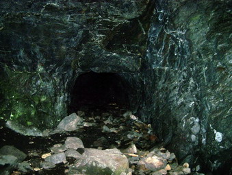 I put Sheba on her lead and we walked out the driveway of the Center and turned left. After a few minutes, I realized we should have turned right and we retraced our steps and were finally on the trail. The problem with the trails is that there are quite a few and many run together in different places. All are well marked with paint blazes and some even have signs pointing to attractions. The problem is that the map is barely adequate, some trails have changed and I was new to the area. As we walked, we passed by the Highlands Pool. The pool is a natural pool that has been developed for use by adding a fence, a cement apron and a lifeguard. Soon we were walking beside and nearly dry stream and through a hardwood forest. The bridge we walked over was hardly needed since everything was so dry! At a trail kiosk Sheba and I got on a yellow trail which I hoped would take use toward the mines. Along the way we came to Wyanokie Falls. These falls were almost try with barely a trickle of water going over them! We continued on the yellow trail until a new orange blazed trail went off to the left. I decided that was the way to go and we stayed on this trail even when another yellow trail branched off. Soon we were walking up what looked like an old reinforced mine road which led directly to the Roomy Mine.
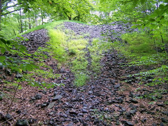 The Roomy Mine can be entered through a low and narrow opening but signs warn against it because of the white nose disease that is decimating the bat population. I took some pictures from outside the entrance and then walked up the hill to a shaft that looked down into the mine. This shaft was very wide and open. I decided there would be not bats in this first "anteroom" so I returned to the entrance and crawled into the first chamber. The chamber was large and dark despite the light coming in from the shaft. I took some pictures and noticed that the tunnel continued through a low and narrow opening. I had no intention of entering this part of the mine! I went back out and followed the orange trail until its junction with a red and yellow trail. We turned left or south and started to walk toward what I hoped would be the Highlands Trail and the Blue Mine. After a short walk and one wrong turn, we were at a bridge over Blue Mine Brook at the Junction with the Highlands Trail. I could see what I though was the mine entrance just down a side path but decided to walk up into the woods to explore further. We walked into the woods and I realized I was walking over some of the largest tailing dumps I had ever seen. I expected to find other working farther up the hill but none were evident. We slid down one pile to a path which led back to the mine entrance. On the way down I noticed some great sample of iron pyrite! The Blue Mine is completed flooded and it was impossible to see much in the dark opening. I took a few pictures before returning to the Highlands Trail which ran concurrently with the red WCI Trail
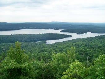 We stayed on the trail we were on passing junctions with the yellow Mine Trail and the white Lower Trail. Soon we were climbing a short but steep stretch of trail toward the Wyanokie High Point. The information I had said this was a bald half dome with 360 degree views. Soon we left a see of goldenrod and started to climb over bare rock. The skies at this point were completely clouded over and a particularly large and black cloud was directly over us! On the way up to the highest point a nice viewpoint offered and unobstructed view of the Wanaque Reservoir. I decided to get to the top and see if the descriptions were correct. I was not disappointed with the view except for the cloudy skies and haze still hanging around. The view was indeed 360 degrees with some directions more interesting than the others. I took many pictures of the surrounding views and the High Point itself. I went back down to the other viewpoint and took pictures of the reservoir. As I walked back to the top, a light rain began to fall, I was so hot it actually felt pleasant. The air temperature was in the mid 80's but the high humidity made it feel much warmer, I was soaked in sweat and very uncomfortable. I also was concerned that the rain would make the rock here and in other places along the trail too slippery. Sheba and I continued on the Highlands Trail as it now ran along with the blue Hewitt-Butler Trail.
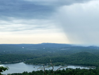 The descent from the High Point was pretty dramatic but not too difficult and the rain was barely a sprinkle was we walked under the forest canopy. After a brief descent and flat section, we began to climb again to another high area called Yoo-Hoo Point. I suspect it got its name from its close proximity to the High point. It is close enough to yell a greeting to someone standing there! I took a few pictures and then started to descend down the other side. At the junction with the yellow Carris Hill Trail, we turned to the left to follow this trail. I wanted to get another view from Carris Hill and descend to Posts Brook fro a look at Chikahoki Falls! Carris Hill was another ascent part of which was over bare rock. After the ascent the trail flattened out and opened up onto an area of bare rock with some trees and a large glacial erratic. The views to the south were OK but the skies were still cloudy and a few sprinkles were coming down, As we descended the hill, a few views opened up but I didn't feel like stopping to get the camera out. The trail didn't seem well used and was hard to follow in some areas. The descent was steep in some parts until it cut to the right across some open rock. The trail actually continued behind this large rock outcrop. I walked out onto the rock and got one of the best views of the day. The Wanaque Reservoir was just below with a dam clearly visible. There were also some nice islands and arms of land jutting out into the water. Some nice low hills also made for some great pictures. After taking my photographs, Sheba and I walked behind the rock and continued our descent toward the Posts Brook Trail. Soon we were on the trail and walking along the nearly dry brook toward Chikahoki Falls.
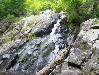 The white trail follow closely along the brook until in reached a small pool. A small amount of water running over a large rock outcrop signaled we were at the falls. This was a HUGE disappointment as the guidebook had mentioned crashing water, difficult crossings and frothy pools. We walked up the white trail beside the falls and I took a few pictures of some of the other cascades. None of these had much water and I wondered if the would be interesting even in the spring! At this point I decided to deviate from the route in the book and continue on the Highlands and Hewitt-Butler Trails to Otter Hole. This is another waterfall mentioned in some books. Along the way we met the only other people we would see on the trails this day. They described Otter Hole as not very impressive but I decided to go there anyway and then take the Otter Hole Trail back to the car. When we arrived at the green Otter Hole Trail we continued down the blue trail to Otter Hole. The other hikers were right! This was not much of a falls either. A few pictures later we were back on the Otter Hole trail headed north. There were a few lookouts along the way but none had much of a view. As we walked the sun seemed to come out but I could not really see the skies. I had two opportunities to turn east and walk back up To the High Point. I decided against that since I figured by the time we arrived the skies would again be cloudy. After some small ascents and descent, we were back at the trail and soon were passing the Highlands Pool. We were back at the car by a little after 2:00 PM. We had covered what turned out to be a little over 8 miles in 5 hours. The hike described on trails.com was actually a shorter route but was advertised at 9.3 miles. I know my GPS can be stingy but my computer software is usually accurate. After stopping at the center to get a fresh map and changing my shirt, I started the long drive home.
![]() On Tuesday, August 11thCindy and I wanted a short hike for the exercise. We agreed that Huggins Lake was close and we could go to Split Rock Lookout afterward if we wanted to. We arrived at the parking area at about 1:00 PM and this time I drove up the road to park in the parking area. We got right on the trail and started the hike. The trail was a lot wetter this time with some muddy spots and places where water was running down the trail. Other areas showed evidence that a LOT of water had run down the trail, probably during the last downpour. As we hiked, I remarked to Cindy that the hike seemed more uphill than last time. Soon we were At the lake and it was obvious that the water level was higher than last time. We walked to the dam and took some pictures before retracing our steps back to the woods road. Walking back up from the shore is a good uphill but after that the hiking is all downhill back to the parking area. We were back at 3:00 PM having had a good 4 mile workout!
On Tuesday, August 11thCindy and I wanted a short hike for the exercise. We agreed that Huggins Lake was close and we could go to Split Rock Lookout afterward if we wanted to. We arrived at the parking area at about 1:00 PM and this time I drove up the road to park in the parking area. We got right on the trail and started the hike. The trail was a lot wetter this time with some muddy spots and places where water was running down the trail. Other areas showed evidence that a LOT of water had run down the trail, probably during the last downpour. As we hiked, I remarked to Cindy that the hike seemed more uphill than last time. Soon we were At the lake and it was obvious that the water level was higher than last time. We walked to the dam and took some pictures before retracing our steps back to the woods road. Walking back up from the shore is a good uphill but after that the hiking is all downhill back to the parking area. We were back at 3:00 PM having had a good 4 mile workout!
![]()
![]() On Saturday, August 8th Cindy and I wanted to hike somewhere where we had not been before. Our preference was for a relatively flat hike with some points of interest. I suggested exploring some mines in Fahnestock Park in Putnam County. I had read descriptions of the various mines and had worked out a route that would take us to the Denny, Hamilton and Sunk Mines in one loop. We could then decide whether or not to drive to another section of the park to inspect other mines. We got started around 9:00 AM and arrived at the parking area near Sunk Mine Road by 10:30 AM. I chose the faster route this time going down Route 17 and the taking 17K to avoid the construction near Middletown. We hopped on Interstate 84 and then went south on Route 9 after crossing the Hudson River on the Newburgh-Beacon Bridge. After a few more turns, we were there! We started our walk by heading up Sunk Mine Road which is seasonal and very pretty. As we walked a car passed us and then parked in a little pullout. The occupants were going to walk the road to one of the numerous ponds in the area. They knew a little about the mines and we talked to them as we walked.
On Saturday, August 8th Cindy and I wanted to hike somewhere where we had not been before. Our preference was for a relatively flat hike with some points of interest. I suggested exploring some mines in Fahnestock Park in Putnam County. I had read descriptions of the various mines and had worked out a route that would take us to the Denny, Hamilton and Sunk Mines in one loop. We could then decide whether or not to drive to another section of the park to inspect other mines. We got started around 9:00 AM and arrived at the parking area near Sunk Mine Road by 10:30 AM. I chose the faster route this time going down Route 17 and the taking 17K to avoid the construction near Middletown. We hopped on Interstate 84 and then went south on Route 9 after crossing the Hudson River on the Newburgh-Beacon Bridge. After a few more turns, we were there! We started our walk by heading up Sunk Mine Road which is seasonal and very pretty. As we walked a car passed us and then parked in a little pullout. The occupants were going to walk the road to one of the numerous ponds in the area. They knew a little about the mines and we talked to them as we walked.
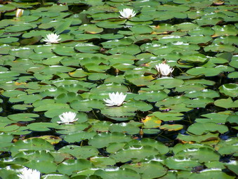 After a short walk on the road, it seemed like it was time to dive into the woods and head up the hill to try to find the Denny Mine. I didn't have too much information so I just picked a spot and walked off the road. Unfortunately, the spot I picked was thick with laurel and the going was tough! Fortunately, this didn't last too long and we broke out into open forest at the top of the hill. We walked along some paths and wandered around looking for the mine. There were some likely places but they didn't pan out. It didn't help that I wasn't sure whether we were looking for pits, trenches or a mine shaft. As we reached the end of the summit and started to descend, we doubled back and hiked to the top again. This time I walked off the eastern slope of the hill where there were some additional paths. Walking south revealed nothing but on the way north I noticed a tailing pile covered by leaves and brush. I followed this pile to a pit which is the only evidence we found of the Denny Mine. Not too much information is available so I don't know if there is more to this mine but I will be going back to find out! We walked off the hill and were soon at the road.
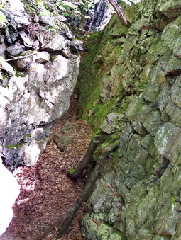 We walked down the road and passed a beautiful pond covered in lily pads and stopped to take pictures. After this we searched for an unmaintained trail or path on the left of the road near a small brook. The Hamilton Mine would be near the start of this trail which would eventually lead to the rather extensive Sunk Mine. We found what looked like a path but it was blocked by a large, fallen tree. We decided to take it anyway and we immediately noticed "rusted rocks" which must have come from a mine. The Hamilton Mine was marked on my maps at the top of the hill to the right of this path. I was going to head up the hill but we stayed on the path and soon extensive workings appeared on the right. The Hamilton Mine consisted of several connected trenches at least 400 feet long. They worked their way along the ore vein and up the hill. Various drill marks were visible as were some rail tracks in the cuts. I took many pictures before we moved on. We did not go further up the hill but may do that next time. This mine also is not well documented so it is hard to know how much to expect.
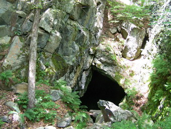 Next, it was on to the Sunk Mine which IS well documented and had extensive working above and below ground. At least one shaft has collapsed but one large adit remains with two or three other tunnels. We weren't sure of the exact location but knew it couldn't be too far up the road. We walked along the ridge looking for tailings or any other evidence of mining. Several areas looked promising including one that look like a collapsed tunnel but that was all. We decided to find the blue trail and walk back along it before cutting up to the ridge to try again. As we walked it was clear that cutting over to the ridge would not be too easy as the trail was lined with thick laurel and there was quite a "dip" between the trail and the ridge. We finally left the trail, fought through the laurel, made our way down and up from the dip and back up to the ridge. We remembered that when we had gotten to one promising spot we had gone left but not explored to the right or on the east side of the ride. This time we headed in that direction.
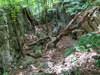 On the east side of a large outcropping was a steep, eroded path leading down to several lone and wide trenches. The way down was NOT easy but there seemed like no other access. I worked my way down this incline while Cindy chose to stay on top. I didn't blame her. Once at the lip of the more southern trench I could see the opening to what is now the main entrance to the mine. I edged my way along a ledge and then jumped down into the trench and walked down to the entrance. It was large perhaps 30 feet wide and 20 feet high and extend back into the mountain. At the back was a crack with several boards across it. What I didn't realize that this "crack" is large enough to walk through and leads to more underground tunnels and a deep shaft. For a complete description including other tunnels and GREAT pictures go to IronMiners.com. I took pictures of the trenches and the mine opening and walked along the trench to see how far it extended. After coming up out of the first trench I worked my way back north to look at another trench. This one was just as long but I did not see any opening. To get better pictures I went back up the path and walked north along the edge of the cliff to the end of the trench. I let myself down over a rock ledge and approached the lip of the trench. There was a narrow path down into the trench but a deep opening into the ground was on the left. I edged along the path and down into the trench. I took pictures of the trench and the opening as best I could. Cindy was getting impatient so I returned to the point where she was and we walked the old road out to Sunk Mine Road and back to the car. By the time we got to that car it was already 2:30 PM. We had covered only 4 miles but had a good time exploring. We decided to call it quits for the day. I know I will return to explore the other mines. After going on IronMiners.com and researching a little more on the internet it seems there is much more to see a the Sunk Mine!
![]() On Friday, August 7thI had hiked Silver Hollow from Notch in Road in the morning and wanted to get Olderbark done. I deiced to hike Olderbark from Mink Hollow Road rather than from the Warner Creek Trail junction. I drove back down Rt 214 into Phoenicia and then took Old Rt 28 or Rt 40 toward Mt. Tremper. I turned left on Rt 212 and drove for quite a while until Mink Hollow road appeared on the left. The drive was beautiful and much was along the Esopus Creek. Mink Hollow Road was paved all the way to the dead end where there was a large parking area with a few cars. I parked the car and took a bearing noting that Olderbark was to the northwest. I also noted that the contour lines were VERY close together especially nearer the top of the mountain. The road actually ran a little farther than the parking area in a private inholding. The Mink Hollow Trail also started here and headed northeast. We got going almost immediately by walking up a steep bank and onto...a nice woods road. This road continued on in about the right direction and turned into a path across a field before re-entering the woods. The road started again in the woods and was easy to follow with only a few blowdowns. The road branched at points and I made my decision based on the direction each branch took. After several turns we seemed to be going up the mountain, Several times the road seemed to give out and turn to trail and then widen again.
On Friday, August 7thI had hiked Silver Hollow from Notch in Road in the morning and wanted to get Olderbark done. I deiced to hike Olderbark from Mink Hollow Road rather than from the Warner Creek Trail junction. I drove back down Rt 214 into Phoenicia and then took Old Rt 28 or Rt 40 toward Mt. Tremper. I turned left on Rt 212 and drove for quite a while until Mink Hollow road appeared on the left. The drive was beautiful and much was along the Esopus Creek. Mink Hollow Road was paved all the way to the dead end where there was a large parking area with a few cars. I parked the car and took a bearing noting that Olderbark was to the northwest. I also noted that the contour lines were VERY close together especially nearer the top of the mountain. The road actually ran a little farther than the parking area in a private inholding. The Mink Hollow Trail also started here and headed northeast. We got going almost immediately by walking up a steep bank and onto...a nice woods road. This road continued on in about the right direction and turned into a path across a field before re-entering the woods. The road started again in the woods and was easy to follow with only a few blowdowns. The road branched at points and I made my decision based on the direction each branch took. After several turns we seemed to be going up the mountain, Several times the road seemed to give out and turn to trail and then widen again.
After a little more than a mile of relatively gentle ascent, the road flattened out and became damp. With the dampness came a dense growth of nettles. I know that the Delaware peaks get a bad reputation for briars during the summer but I find I can more easily beat those aside. I cannot tolerate the nettles! The road actually started to descend and head too much to the west. I decided this was a good time to turn UP the mountain. At first Sheba and I could pick out paths and drainages and things were tough but manageable. The last .3 miles was some of the MOST DIFFICULT hiking I have done this summer. This route was very steep on offered only a few open areas. It was not the densest stuff I have hiked through but the gradient made it very challenging. Without Sheba I probably would have given up but she kept on plugging up the mountain picking the best route she could find. I did not run into any real cliffs or ledges to speak of. After what seemed like forever we were on the relatively flat top. It was difficult to see anything in the thick trees and brush. I headed for the placed mark on the GPS map. This was not exactly the coordinates of the highest spot that I had so I tried to hit that latitude and longitude as well. This spot seemed much lower than where I had been so I decided to claim victory and head back.
I asked Sheba to kindly lead the way and followed her as she retraced the EXACT path we had taken up the mountain. Going down was quicker than coming up. Too quick in more than one place. This descent reinforced my feeling that I going up a steep climb is safer than going down one. Soon we were back on the road with the nettles and it was a simple matter of following the road back to the car. As we walked down the trail I realized that I felt GREAT! There are few better feelings than setting a difficult goal and meeting the challenge. We were back at the car at 4:15 PM. We had covered a little over 3 miles in 3 hours. This seems slow but you won't understand until you do the hike!
![]() On Friday, August 7thI was ready to take on a few more of the CHH peaks. I decided to try and finish some of those peaks still remaining in the Catskill park and chose to head for Silver Hollow and Olderbark. I had asked for some direction from someone who had completed these but got none so I was on my own. I decided to do Silver Hollow first from Notch Inn Road and then try to figure out how to approach Olderbark later. Sheba and I arrived at the parking area on Notch Inn Road at about 10:15 AM and took little time to get started. We headed up the old woods road toward the blue trail. I had been up this way before but only to hike the extension of the Warner Creek Trail that now goes up Plateau Mountain. The Long Path markings had been "removed" and the trail was now marked with yellow discs. This trail does not appear on either the Trail Conference maps or the Venture Out map. The trail actually leaves the road in places where it has become too eroded. I was glad since there was a fair amount of water running down the road and a good crop of nettles. Within only 15 minutes we were at the junction with the Warner Creek trail and turned right and started up to Silver Hollow.
On Friday, August 7thI was ready to take on a few more of the CHH peaks. I decided to try and finish some of those peaks still remaining in the Catskill park and chose to head for Silver Hollow and Olderbark. I had asked for some direction from someone who had completed these but got none so I was on my own. I decided to do Silver Hollow first from Notch Inn Road and then try to figure out how to approach Olderbark later. Sheba and I arrived at the parking area on Notch Inn Road at about 10:15 AM and took little time to get started. We headed up the old woods road toward the blue trail. I had been up this way before but only to hike the extension of the Warner Creek Trail that now goes up Plateau Mountain. The Long Path markings had been "removed" and the trail was now marked with yellow discs. This trail does not appear on either the Trail Conference maps or the Venture Out map. The trail actually leaves the road in places where it has become too eroded. I was glad since there was a fair amount of water running down the road and a good crop of nettles. Within only 15 minutes we were at the junction with the Warner Creek trail and turned right and started up to Silver Hollow.
The first part of the trail was a little steep but fairly well cut out. There was some evidence that others had walked the trail recently, at least within the last few days. After only about .7 miles we hit the flattened top of the Silver Hollow Ridge. Along the way a few views of Plateau, Olderbark and Little Rocky peeked through the trees but nothing that would allow a good photograph. Once on the top we walked until we hit the point marked on my GPS which was close to the latitude and Longitude posted for the highest point. Just to be sure we continued to walk to the next bump which seemed to me to actually drop more than go up. Once we really started to descend, we turned around and headed back the way we had come. I had an urge to simply drop down off Silver Hollow and head for Olderbark but a large tract of private land is in the way. Once back at the trail junction, I started to follow a route outlined by Tom Rankin. I intended to stay along the 2500 foot contour and then head down to Warner Creek and then up Olderbark. As I started the woods were wet and I could get no visual on where I was going. I also was not sure I could cross Warner Creek which was almost a mile away. I decided to return to the car and tackle Olderbark from Mink Hollow. We were back at the car by 12:30 PM finishing the 3.5 miles in a little over 2 hours. We got in the car and headed for Mink Hollow Road and Olderbark. If I had only known what awaited me!
![]() On Thursday, August 6thI wanted to take a quick hike after summer school. In addition, a new hiker, Patrick, had called me the night before and asked if he could tag along. I decided to visit Trout Pond since it was a short hike with several points of interest for a new hiker. I pick Patrick up at his house and we were at the parking area on Morton Hill Road by 1:00 PM. I always like to park at the top of Russell Brook Road and hike down to the lower parking area, The walk along the road is interesting especially with the brook running high. I pointed out the falls as we passed and told Patrick we would stop on the way back. I signed in at the register and we headed up the trail/road to Trout Pond. The walk seemed to go very quickly as we talked and hiked along and soon we were at the outlet end of the pond. We stopped to take some pictures and then walked toward the upper end. It look as if the water level was down despite the recent rains. I suspect the beaver dam was a little lower than normal. When we arrived at the inlet end, several people were occupying the lower lean-to. We waved and then turned to cross the inlet brook and start the loop. The trail remained pretty dry as we started the ascent up Cherry Ridge. Patrick did comment that the hill seemed long but not too steep. We were soon at the top and headed down the other side toward Mud Pond. Once on the woods roads we turned left and headed back toward the trail junction. After singing out at the register, we headed over to the falls and dropped down into the creek bed to take pictures. We ascended the hill and walked to the upper falls. A tree had fallen over and taken the stone wall there with it. In addition, several trees were now stuck in the area below the upper falls. Sad to see but completely natural. We decided to walk up the creek and find a place to cross which we did. A short scramble up the bank to the road and we were on the way back to the car. We arrived back at about 3:00 PM which is the usual time for a brisk walk on this 4 mile route.
On Thursday, August 6thI wanted to take a quick hike after summer school. In addition, a new hiker, Patrick, had called me the night before and asked if he could tag along. I decided to visit Trout Pond since it was a short hike with several points of interest for a new hiker. I pick Patrick up at his house and we were at the parking area on Morton Hill Road by 1:00 PM. I always like to park at the top of Russell Brook Road and hike down to the lower parking area, The walk along the road is interesting especially with the brook running high. I pointed out the falls as we passed and told Patrick we would stop on the way back. I signed in at the register and we headed up the trail/road to Trout Pond. The walk seemed to go very quickly as we talked and hiked along and soon we were at the outlet end of the pond. We stopped to take some pictures and then walked toward the upper end. It look as if the water level was down despite the recent rains. I suspect the beaver dam was a little lower than normal. When we arrived at the inlet end, several people were occupying the lower lean-to. We waved and then turned to cross the inlet brook and start the loop. The trail remained pretty dry as we started the ascent up Cherry Ridge. Patrick did comment that the hill seemed long but not too steep. We were soon at the top and headed down the other side toward Mud Pond. Once on the woods roads we turned left and headed back toward the trail junction. After singing out at the register, we headed over to the falls and dropped down into the creek bed to take pictures. We ascended the hill and walked to the upper falls. A tree had fallen over and taken the stone wall there with it. In addition, several trees were now stuck in the area below the upper falls. Sad to see but completely natural. We decided to walk up the creek and find a place to cross which we did. A short scramble up the bank to the road and we were on the way back to the car. We arrived back at about 3:00 PM which is the usual time for a brisk walk on this 4 mile route.
![]() On Tuesday, August 4thCindy and I wanted to hike somewhere together on her day off. We needed somewhere to go that was relatively close and somewhere we had not hiked before. The places we often go such as Trout and Frick Ponds are nice but get monotonous after a while. We decided to hike to Dr Brook Ridge from the Millbrook Trailhead since we had never been on that part of the trail before. We headed out toward the Pepacton Reservoir and up the Millbrook Arena Road. We parked at about 1:30 PM. I had forgotten how long this drive takes! There was only one other car parked in the parking area and that person was about to leave. My GPS was having trouble finding our location as I had it set for my last trip in New Jersey. After straightening this electronics problem out, we were off and hiking! The first part of the trail was through some nice open forest and was relatively gentle with a few switchbacks and rocks. This part of the trail was wet and muddy in places. As we progressed some steep areas alternated with flatter areas until we reached the top of the ridge. Some where along the way I remembered that Dry Brook Ridge is just short of 3500 feet! The elevation gain is significant but spread over 3 miles.
On Tuesday, August 4thCindy and I wanted to hike somewhere together on her day off. We needed somewhere to go that was relatively close and somewhere we had not hiked before. The places we often go such as Trout and Frick Ponds are nice but get monotonous after a while. We decided to hike to Dr Brook Ridge from the Millbrook Trailhead since we had never been on that part of the trail before. We headed out toward the Pepacton Reservoir and up the Millbrook Arena Road. We parked at about 1:30 PM. I had forgotten how long this drive takes! There was only one other car parked in the parking area and that person was about to leave. My GPS was having trouble finding our location as I had it set for my last trip in New Jersey. After straightening this electronics problem out, we were off and hiking! The first part of the trail was through some nice open forest and was relatively gentle with a few switchbacks and rocks. This part of the trail was wet and muddy in places. As we progressed some steep areas alternated with flatter areas until we reached the top of the ridge. Some where along the way I remembered that Dry Brook Ridge is just short of 3500 feet! The elevation gain is significant but spread over 3 miles.
Once near the top of the ridge most of the serious climbing was done. There were a few places where we descended only to ascend the next "bump". I thought I knew about where the Huckleberry Loop trail met the Dry Brook Ridge Trail but the distance seemed longer than I had expected. We got a few glimpses through the trees at some of the other surrounding hills but there were no real viewpoints anywhere on the trail. Finally, we were at the trail junction. We debated walking down to Ploutz Road and hiking the roads as a loop back to the car. In the end, we decided this added too much mileage and opted to go back the way we had come. Going back went quickly but I never got the feel we were moving as fast as we sometimes do on the return trip. We were back at the car by 5:30 PM. A nice 6.2 mile hike but no pictures to show for it!
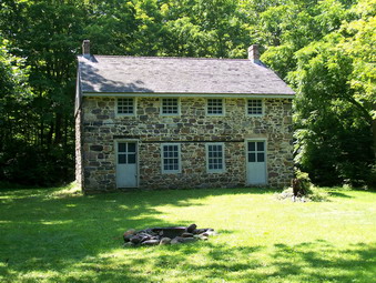
![]()
![]() On Saturday, August 1stI wanted to hike a little more after coming off Bellvale Mountain. By some chance I had run across some information about the Long Pond Ironworks and the Patterson Mine in nor then New Jersey, not far from Greenwood Lake. The site processed ore from the iron mines in southern New York and northern New Jersey starting at the time of the Revolutionary War through the Civil War. Several furnaces and forges were built and a community thrived in the area into the 20th century. when the Monksville Reservoir was created many structures were moved to other locations. The reservoir area was also the site of the discovery of many Native American artifacts. We arrived at the Visitor's Center at 2:45 PM by driving south on Route 210 along Greenwood lake and then turning west onto Route 511 which was designated the Greenwood Lake or Warwick Turnpike. After checking out the Center and getting a simple map of the walking tour, Sheba and I headed around the center to the left on a footpath. I took pictures of some of the interesting buildings including a beautiful stone house. There wear also some VERY large sycamore trees.
On Saturday, August 1stI wanted to hike a little more after coming off Bellvale Mountain. By some chance I had run across some information about the Long Pond Ironworks and the Patterson Mine in nor then New Jersey, not far from Greenwood Lake. The site processed ore from the iron mines in southern New York and northern New Jersey starting at the time of the Revolutionary War through the Civil War. Several furnaces and forges were built and a community thrived in the area into the 20th century. when the Monksville Reservoir was created many structures were moved to other locations. The reservoir area was also the site of the discovery of many Native American artifacts. We arrived at the Visitor's Center at 2:45 PM by driving south on Route 210 along Greenwood lake and then turning west onto Route 511 which was designated the Greenwood Lake or Warwick Turnpike. After checking out the Center and getting a simple map of the walking tour, Sheba and I headed around the center to the left on a footpath. I took pictures of some of the interesting buildings including a beautiful stone house. There wear also some VERY large sycamore trees.
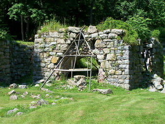 We followed the yellow Hansclever Iron Trail named after the person who constructed the first furnace. We passed by the company store and headed down the path toward the area of the iron furnaces. The furnaces are in ruins and some effort is being made to restore the stonework. At the furnaces we turned right to follow the trail over the Wanaque River. The trail here are low lying and were wet. There was a constant cloud of insect especially when we stopped. We continued to follow the trail which had signs posted at various point. The history was interesting but not many structures remained. At stop #6 I decided to make a left hand turn to head northwest toward the Patterson Mine. We followed the road until we recrossed a brook and then came to the intersection with another trail. The map showed the road that we were on going straight ahead but it seemed to dead end. I walked to the right and did not see anything. When I walked to the left, the road to the northwest continued after less than a hundred feet. The road ascended up the shoulder of one hill. It looked to me like the mine should be close and lie between two hills. I kept looking for the rusted rocks that signifies mine tailing but none appeared.
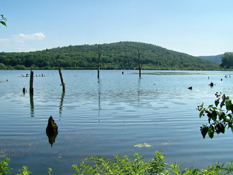 I decided to hike up the hill on the right to see if the mine was a little off the road. Some paths headed up in that direction but after going almost all the way to the top I gave up and returned to the main trail. We continued on and as we did I heard voices behind us. After a short distance I saw a pit on the right and some tailing on the left. The pit on the right was very shallow but the two on the left went down at least 15 feet. Unfortunately, the pits were filled with water and it was impossible to determine their true depth. The two young men that had come up behind us approached and I assured them that they were in the right place. They seemed disappointed and I suggested that they visit the Cranberry and Pine Swamp mines for a more satisfying experience. After taking pictures, I decided to continue out the road and hook up with the Sterling Ridge and Highlands trails back to the parking area. The road and these trails were highly eroded in places but the walk was pretty short. Soon we were back to the area where we had turned off on the Iron Trail. We crossed over the river and were back at the car by 5:00 PM. It took us a little over 2 hours to hike the 4.35 mile distance with a lot of time for exploration and pictures.
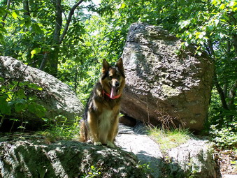
![]()
![]() On Saturday, August 1stI wanted to take a long but "easy" hike in a different area. I knew that the recent rain had made the vegetation and ground VERY wet and that bushwhacking in Delaware County would be "challenging". Most of these bushwhacks are for the rights to say that you conquered that peak and "bagged" it and I wanted some views on what was predicted to be a beautiful day. My plan was to park at the top of Mt. Peter on Route 17A outside of Warwick and hike south on the AT along the Bellvale/Bearfort Ridge for about 2 hours and then return to the car. There were other hikes to do in the area should I still have the energy. We arrived in the area about 9:50 AM and spent some time finding the right place to park. The parking area on Route 17A was not well marked and I had forgotten the directions to Continental Road. We finally parked just over the crest of the hill in a wide unmarked pull off next to a very dilapidated house. The only clue were the At logos and signs cautioning drivers about hikers. We were ready to go and entered the woods at about 10:10 AM. The first part of the trail was on soft earth and rambled up and down passing a few woods roads and path and some nice stone walls. The trail was remarkably dry considering the recent rain
On Saturday, August 1stI wanted to take a long but "easy" hike in a different area. I knew that the recent rain had made the vegetation and ground VERY wet and that bushwhacking in Delaware County would be "challenging". Most of these bushwhacks are for the rights to say that you conquered that peak and "bagged" it and I wanted some views on what was predicted to be a beautiful day. My plan was to park at the top of Mt. Peter on Route 17A outside of Warwick and hike south on the AT along the Bellvale/Bearfort Ridge for about 2 hours and then return to the car. There were other hikes to do in the area should I still have the energy. We arrived in the area about 9:50 AM and spent some time finding the right place to park. The parking area on Route 17A was not well marked and I had forgotten the directions to Continental Road. We finally parked just over the crest of the hill in a wide unmarked pull off next to a very dilapidated house. The only clue were the At logos and signs cautioning drivers about hikers. We were ready to go and entered the woods at about 10:10 AM. The first part of the trail was on soft earth and rambled up and down passing a few woods roads and path and some nice stone walls. The trail was remarkably dry considering the recent rain
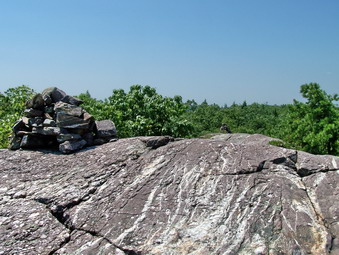 We soon passed across a power line right-of-way but there were no interesting views. Along the trail there were some massive rocks and interesting hardwood forest. Once on the top the trail was nearly flat and was easy to walk. We met a young family coming toward us. They had come up the Village Vista Trail from Greenwood Lake. As we approached this trail another hiker was coming toward us. He was young, wearing short and light hiking shoes and carrying a LARGE pack. He looked a little "grungy"! I regret not asking him whether or not he was an AT through hiker. We soon arrived at the Village Vista Trail which is well marked and has a map of the various businesses in the Greenwood Lake area. I decided not to walk out on this trail to the viewpoint since there were several lookouts on the trail we were on. I was not disappointed since within a short distance we broke out onto an open rock face which had great views of the lake below and the low lying hills all around. I took some pictures. I also noticed that when we came out of the woods the air temperature seemed to rise 10 degrees. This reminded me to get a drink and keep myself and Sheba hydrated throughout the day.
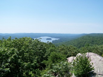 It turned out that this viewpoint began the difficult part of the trail which would continue for the rest of the hike out and back to this point. Much of the hike consisted of walking along open rock faces and ridges that reminded me of the Shawangunks and Schunemunk. In places it almost seemed that the people marking the trail took perverse pleasure in routing it along the most difficult places. This would NOT be a good hike wet or icy weather! Several times we got relief as the trail ducked back under the cover of both hardwood and evergreen forest. There were several small open clearing along the way. At times as I look away from the ridge there seemed to be wide open woods with what looked like trail or roads. As we crossed one small stream I noticed that the water looked like brewed tea from the tannins leached from the hemlock forest. The water even had a thick foam "head"! Another descent brought us through a deep, dark evergreen forest and the only really muddy place on the trail.
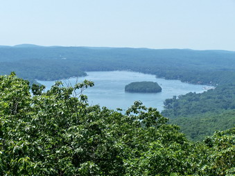 Most of the walk was across the open rock with several good views of the lake below. It was strange to be on such a rugged trail and be able to hear the boats and music on the lake below! At one point we met three young men who were through hikers on the AT. We said "Hello" and I advised them that there was a nice place to rest for lunch just ahead. As Sheba and I continued on, New Jersey got closer. I though about hiking to the state line and even around Lake Surprise. The more we hiked on the open rock in the heat the more I questioned that plan since there was always the hike back. Soon we were at the top of what looked to be the highest point around with another great view of the lake. This is a LONG lake. I check the GPS and found we were at the summit of Bellvale Mountain. From here the AT headed DOWN rather steeply. New Jersey was still about 1.5 miles away audit was just hours into the hike. I decided to turn around and head back. The hike back actually went quicker than some since I was planning to visit another place before going home! This kept me going. We met some more hikers along the way and ran into the three through hikers at the view point. As we talked I found out that they had started in Stone Mountain, Georgia on March 28th and hoped to finish in two months. I answered what questions I could and wished them well. The hike from this point back was easy since it was under cover. Near the end the group of three caught up to me even though I thought I was moving quickly. I guess being young and hiking the AT means you move FAST. Sheba and I were back at the car at about 2:10 PM which was exactly 4 hours for the 7.5 mile hike. After changing shirts and refilling my Camelbak, I was ready to head for the Long Pond Ironworks in northern New Jersey.
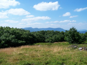
![]()
![]() On Thursday, July 30thI wanted to get out for some exercise after summer school. I was dead tired since the 3+ inches of rain the night before had kept me moving ambulances and helping evacuate people all night! Livingston Manor's Main Street and Pearl Street were under water but the rain stopped just in time to avert a major disaster. Since more rain is predicted for Friday, I don't know what will happen. I decided to head for Kanape Brook and Little Rocky. My plan was to hike up the trail to the Ashokan High Point trail and then cut west over Mombaccus to Little Rocky. I would then descend to the brook and cross it to return to the main trail. When I arrived at the parking area a group of young men was already there. It looked as if they were prepared for a weekend of camping and partying. By 1:45 we were all ready to start and we crossed the road together to get to the trail. As soon as got out of the car, I heard the water in the brook roaring and realized that there must be a high volume from the storms the night before. What I didn't realize was just HOW HIGH that volume was. As we crossed the bridge it was clear that my plan to cross the creek would NOT work. I signed in a the register as the young men started up the trail. By the size of the cooler it was clear they were not going very far! I spoke to one of them and they said they would be crossing the brook soon and he MEANT it! I wished them well and started up the trail.
On Thursday, July 30thI wanted to get out for some exercise after summer school. I was dead tired since the 3+ inches of rain the night before had kept me moving ambulances and helping evacuate people all night! Livingston Manor's Main Street and Pearl Street were under water but the rain stopped just in time to avert a major disaster. Since more rain is predicted for Friday, I don't know what will happen. I decided to head for Kanape Brook and Little Rocky. My plan was to hike up the trail to the Ashokan High Point trail and then cut west over Mombaccus to Little Rocky. I would then descend to the brook and cross it to return to the main trail. When I arrived at the parking area a group of young men was already there. It looked as if they were prepared for a weekend of camping and partying. By 1:45 we were all ready to start and we crossed the road together to get to the trail. As soon as got out of the car, I heard the water in the brook roaring and realized that there must be a high volume from the storms the night before. What I didn't realize was just HOW HIGH that volume was. As we crossed the bridge it was clear that my plan to cross the creek would NOT work. I signed in a the register as the young men started up the trail. By the size of the cooler it was clear they were not going very far! I spoke to one of them and they said they would be crossing the brook soon and he MEANT it! I wished them well and started up the trail.
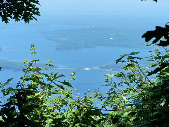 The trail very quickly started to look like a brook in many places with every little stream rushing with water that spilled across and down the trail on its way to the brook. The brook was raging as were many of its major tributaries. I picked my way around the deepest water on the trail while Sheba headed up the middle. I began to revise my hiking plan. Little Rocky would still be there when the brook was back to some kind of normal level. Having gotten a late start further cut down my options since I would have to hike back to the Ashokan High Point cutoff from Little Rocky. I decided to go up to the High Point and back and save Little Rocky for another day. The trail continued to be very wet with few dry spots. It was also further to the cutoff up to the High point than I remembered and somewhat more rugged.Despite the wet trail the hike was beautiful and the sound of the stream magnificent. Smaller streams continued to rush across the trail or through culverts under the trail. The forest alternates between hardwoods and evergreens with one particularly dark section. Even at the upper end of the trail the brook was still very full. Eventually we crossed over the brook and started the final walk up to the trail that goes to the High Point.
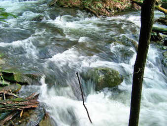 The trail up to the High Point alternates between short steep sections and more level ones. Down low there are no views although a few side trails do run off to the right. One trail looked very promising for a viewpoint but did not deliver! As the trail ascends there are three different sets of stone "steps" followed by a winding trail to the top with several steep sections. At one point the trail passes by a interesting glacial erratic right next to the trail. Near the top is a lookout over Mombaccus and Little Rocky. I knew that we had reached the top when I saw the USGS seal and swarms of flies attacked. The High Point ALWAYS has swarms of them and I don't know why. The views from the High Point are limited especially when there are leaves on the trees and this gets worse every year. I took a few pictures and then continued to walk along the trail. Another viewpoint opens up on the left but this is even more limited than the first. The trail passes through a series of open spaces and then enters a field. There is a stone fireplace with some stone "chairs" here. Even though there was a good deal of haze, There was a nice views of the Burroughs Range from here. After taking some pictures, I walked down a path looking for some view of the reservoir. I did find a very limited view through a hole in the vegetation. I made a note to return when the leaves were off the trees! I took pictures and then returned to the field. At this point id was 4:00 PM and I wanted to get home as quickly as possible so I decided NOT to do the loop but to retrace my steps.
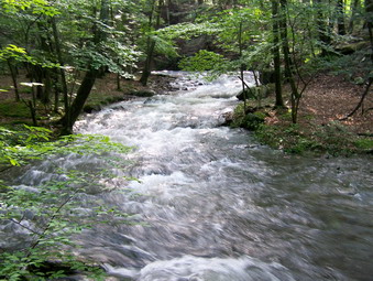 It had taken about 1 hour and 45 minutes to hike up and I though it might take about the same time to return since I had left the picture taking on the trail for the return trip. I took a few pictures on the trail down from the High Point and a few more on the upper part of the main trail. Further down I began to take pictures of the main stream and some of the tributary streams rushing down the hillsides. The volume of water was impressive and I slid down the bank fro the trail to the stream at least twice to get some pictures from closer up and at a different angle. I even stopped at one spot and braced myself on a large rock to take a 45 second movie. I wanted to record the moving water AND the sound of the stream. I also took quite a few still pictures. At the bridge I took some additional shots of the bridge and the confluence of streams at this point. We crossed the road to the car arriving at about 5:20 PM. Even with the photography the trip down had gone quickly. We had taken a little over 3.5 hours to cover the 7.2 mile hike.
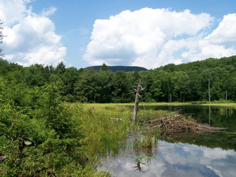
![]()
![]() On Tuesday, July 28thCindy and I wanted to hike together. She didn't want to climb a mountain so I suggested we hike to Vly and Tunis Ponds where I had been for the first time last week. I though the ponds were interesting and wanted to return under sunnier skies. I explained there were two short bushwhacks and Cindy said that was OK! We got our gear and Sheba and headed up the Beaverkill Road to the Balsam Lake parking area. We parked at about 1:30 and started to hike right away. When we arrived at Vly Brook I chose to bushwhack up the near side instead of crossing over as I had done last time. It was a short and easy bushwhack and we ended up just beyond the beaver dam near the beaver lodge. The view was different and the skies were clearer. He took some pictures and listened to the birds. There were several red wing blackbirds and we both snapped some pictures of them before heading back to the trail. We continued on the trail until the Beaverkill and then turned left up the road. The road was even wetter and muddier than the last time. Eventually I went off the road to the left and started the uphill bushwhack to the pond. Somehow I got turned a little to far to the south but quickly remedied the problem. Soon we arrived at he same place on the shore that I had been at the week before. The skies by now had turned cloudy with conditions similar to the previous week. We took some pictures, walked along the shore, took some more pictures and then headed back into the woods away from the pond. The path I chose this time was easier than before and we were soon back on the road. We walked and talked and were back at the car by 4:00 PM . We had walked about 5 miles in 3.5 hours including the bushwhacks and pictures.
On Tuesday, July 28thCindy and I wanted to hike together. She didn't want to climb a mountain so I suggested we hike to Vly and Tunis Ponds where I had been for the first time last week. I though the ponds were interesting and wanted to return under sunnier skies. I explained there were two short bushwhacks and Cindy said that was OK! We got our gear and Sheba and headed up the Beaverkill Road to the Balsam Lake parking area. We parked at about 1:30 and started to hike right away. When we arrived at Vly Brook I chose to bushwhack up the near side instead of crossing over as I had done last time. It was a short and easy bushwhack and we ended up just beyond the beaver dam near the beaver lodge. The view was different and the skies were clearer. He took some pictures and listened to the birds. There were several red wing blackbirds and we both snapped some pictures of them before heading back to the trail. We continued on the trail until the Beaverkill and then turned left up the road. The road was even wetter and muddier than the last time. Eventually I went off the road to the left and started the uphill bushwhack to the pond. Somehow I got turned a little to far to the south but quickly remedied the problem. Soon we arrived at he same place on the shore that I had been at the week before. The skies by now had turned cloudy with conditions similar to the previous week. We took some pictures, walked along the shore, took some more pictures and then headed back into the woods away from the pond. The path I chose this time was easier than before and we were soon back on the road. We walked and talked and were back at the car by 4:00 PM . We had walked about 5 miles in 3.5 hours including the bushwhacks and pictures.
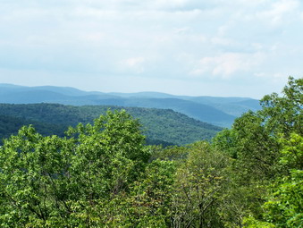
![]()
![]() On Monday, July 27th I wanted to hike a little more after our trip to Huggins Lake. I drove a little further on up Berry Brook Road and parked in the lot where the Mary Smith Trail crosses the road.There was a car and a large van parked in the lot. When I signed in at 2:35 PM, I noticed that the van belonged to an ADK cutting crew but I did not know which way they had gone. We crossed the road and got on the trail. It was immediately clear that the crew was ahead of us. I was dismayed to find that they had left what they cut in the middle of the trail making walking the trail very annoying. After a short walk, we crossed the power line right-of-way, walked through some tall grass and reentered the woods on the trail. The walk was a little more challenging than I remembered gaining 500 feet in the about a mile. Along the way there were several areas of briars and nettles that the ADK crew had ignored. I hoped that they were not finished and would come back to clean up their mess! They Mary Smith Trail ended at the junction with the Pelnor Hollow Trail on the ridge. We turned right and immediately started a steep descent losing 150 feet of elevation in about .15 miles. The reward was the Split Rock Lookout at the bottom of the descent. Here some of the bedrock had pulled away forming a crack over 4 feet wide and at least 10 feet deep. The views were a little hazy but still pretty. I wanted more so I walked to the left of a big boulder and was able to cross over to the split piece of rock. The views from here were even better and I took a lot of pictures. After a drink, Sheba and I turned around, climbed the short but steep hill and then retraced our path back to the car. We were back at the car before 4:00 PM having covered the 2.2 mile walk in under 1.5 hours with plenty of time for pictures.
On Monday, July 27th I wanted to hike a little more after our trip to Huggins Lake. I drove a little further on up Berry Brook Road and parked in the lot where the Mary Smith Trail crosses the road.There was a car and a large van parked in the lot. When I signed in at 2:35 PM, I noticed that the van belonged to an ADK cutting crew but I did not know which way they had gone. We crossed the road and got on the trail. It was immediately clear that the crew was ahead of us. I was dismayed to find that they had left what they cut in the middle of the trail making walking the trail very annoying. After a short walk, we crossed the power line right-of-way, walked through some tall grass and reentered the woods on the trail. The walk was a little more challenging than I remembered gaining 500 feet in the about a mile. Along the way there were several areas of briars and nettles that the ADK crew had ignored. I hoped that they were not finished and would come back to clean up their mess! They Mary Smith Trail ended at the junction with the Pelnor Hollow Trail on the ridge. We turned right and immediately started a steep descent losing 150 feet of elevation in about .15 miles. The reward was the Split Rock Lookout at the bottom of the descent. Here some of the bedrock had pulled away forming a crack over 4 feet wide and at least 10 feet deep. The views were a little hazy but still pretty. I wanted more so I walked to the left of a big boulder and was able to cross over to the split piece of rock. The views from here were even better and I took a lot of pictures. After a drink, Sheba and I turned around, climbed the short but steep hill and then retraced our path back to the car. We were back at the car before 4:00 PM having covered the 2.2 mile walk in under 1.5 hours with plenty of time for pictures.
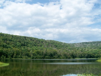
![]()
![]() On Monday, July 27th I wanted to do a local hike after summer school so that I did not waste too much time driving. I read about Huggins Lake and the Split Rock Lookout in the new AMC Guidebook I had just purchased at Morgan Outdoor in Livingston Manor. Bother were close to home on Berry Brook Road near Roscoe only about 20 minutes from home. Although the book said that they were popular, I had never been to either. I got my gear and put Sheba in the car and headed up the Beaverkill Road. After passing through the covered bridge, I took a right on Berry Brook and drove to the parking area for Huggins Lake. the sky looked dark but I though we would have time to get the hike in. We started at 1:00 PM and began to hike along a woods road. The trail was not marked in any way but was impossible to miss. The road ascended gently but continuously through hardwood forest gaining 700 feet for .2 miles. After this the trail wound down to the lake for about half a mile losing 200 feet of elevation. The small lake or pond was beautiful and seemed to be very secluded although less than 2 miles from the road. A man-made dam was at the end of the road and a path lead over the top of it. I found two brown snakes sunning themselves on the concrete. One slithered away but the other stayed. I took pictures of the snake and quite a few of the pond. The skies had cleared some and it was sunny as we turned around to retrace our path to the car. We were back by 2:25 PM having covered the 3.6 miles in around 1.5 hours. I wanted to hike a little more so we headed up the road to hike to the Split Rock lookout.
On Monday, July 27th I wanted to do a local hike after summer school so that I did not waste too much time driving. I read about Huggins Lake and the Split Rock Lookout in the new AMC Guidebook I had just purchased at Morgan Outdoor in Livingston Manor. Bother were close to home on Berry Brook Road near Roscoe only about 20 minutes from home. Although the book said that they were popular, I had never been to either. I got my gear and put Sheba in the car and headed up the Beaverkill Road. After passing through the covered bridge, I took a right on Berry Brook and drove to the parking area for Huggins Lake. the sky looked dark but I though we would have time to get the hike in. We started at 1:00 PM and began to hike along a woods road. The trail was not marked in any way but was impossible to miss. The road ascended gently but continuously through hardwood forest gaining 700 feet for .2 miles. After this the trail wound down to the lake for about half a mile losing 200 feet of elevation. The small lake or pond was beautiful and seemed to be very secluded although less than 2 miles from the road. A man-made dam was at the end of the road and a path lead over the top of it. I found two brown snakes sunning themselves on the concrete. One slithered away but the other stayed. I took pictures of the snake and quite a few of the pond. The skies had cleared some and it was sunny as we turned around to retrace our path to the car. We were back by 2:25 PM having covered the 3.6 miles in around 1.5 hours. I wanted to hike a little more so we headed up the road to hike to the Split Rock lookout.
![]() On Saturday, July 25thI was pretty tired after hiking all over the Plattekills. I though I might go to Upper Meeker Hollow Road to scout the access to Meeker Hollow Hill. After leaving Ski Plattekill, I took a convenient crossroad and turned left onto Upper Meeker Hollow Road at the Stone Tavern Farm. Just after the farm the road and turns to dirt but I figured I would head on up just to see what it looked like. After a VERY short distance, the road became impassible and I stopped by what I assumed to be the last driveway on the road. I got my GPS and map out to check that I was in the right place. As I was conforming my location a car drove up behind me. It was the residents of the house at the other end of the driveway. We talked for a moment and they warned me about bears and gave me permission to park on the other side of the road opposite their driveway. I thanked them and decided since I was there I might as well take another short hike. It turned out to be a short distance but not that easy a hike!
On Saturday, July 25thI was pretty tired after hiking all over the Plattekills. I though I might go to Upper Meeker Hollow Road to scout the access to Meeker Hollow Hill. After leaving Ski Plattekill, I took a convenient crossroad and turned left onto Upper Meeker Hollow Road at the Stone Tavern Farm. Just after the farm the road and turns to dirt but I figured I would head on up just to see what it looked like. After a VERY short distance, the road became impassible and I stopped by what I assumed to be the last driveway on the road. I got my GPS and map out to check that I was in the right place. As I was conforming my location a car drove up behind me. It was the residents of the house at the other end of the driveway. We talked for a moment and they warned me about bears and gave me permission to park on the other side of the road opposite their driveway. I thanked them and decided since I was there I might as well take another short hike. It turned out to be a short distance but not that easy a hike!
I parked the car and Sheba and I started up the road at about 3:00 PM. The road was posted on both sides by Stove Tavern Farm and others. Atone point blue markers with the word TRAIL headed up the mountain to the right but they were clearly on private land. I had figured that somewhere between .35 and .40 miles we should run into the small sliver of state land that hits the road. As we started to get close a sign from the Audubon Society declared the area a Wildlife Refuge. A little further on, just where I thought it might me was a state forest sign. Sheba and I made a hard right and headed up the hill. The first part was pretty easy going through some open woods. We crossed a woods road and kept going. In one area there was another posted sign and the yellow blaze marking the state boundary. I tried to stay on what I though was state land. Soon enough the terrain became steeper which was made more difficult by the fact that everything was damp and slippery. I kept drifting southeast since it seemed slightly easier. Soon we were wading through prickers. There were only a few at first but they soon became denser and MUCH taller. Thankfully they did last too long and I had Sheba to lead me.
After a few more steep areas and a few more patches of nettles, we seemed to be on the summit plateau. A look at my GPS and the maps showed me we still had to head north and west a bit. As we walked I spotted another rise up ahead and we climbed a short hill up to a higher area. I walked to what to me was the obvious high ground and check the GPS. The coordinates I had for the highest spot took me west and north a little more but they also seemed to lead down. I walked to the spot and then told Sheba "Back!" I followed Sheba back down the road on the exact track we had taken up. We were back at the car by 4:30 PM having covered the 1.55 mile excursion in about 1.5 hours!
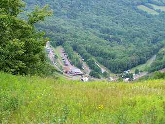
![]()
![]() On Saturday, July 25th I finished hiking Plattekill near Ski Plattekill right around noon. I was disappointed that I could get no pictures and thought I might go somewhere to take some. I thought that Ski Plattekill would be a good place. It was close and I was sure the slopes would offer some opportunity to take pictures. In addition, I wanted to see if North Plattekill was easier to access from the other side of the mountain. I took Harold Roberts Road back to New Kingston Mountain Road and turned left. It was a short drive to Lower Meeker Hollow Road where I took a left and head toward the ski center. I intended to find a groundskeeper and ask permission to hike. What I found was several hundred mountain bikers with an all day downhill race in progress. I checked in at the office and they were very polite, even offering me a map of the hill and suggestions on where to hike. They pointed me to the two beginner trails on either side of the main slopes. I chose to head to the right of the office on the Overlook Trail toward North Plattekill. I went back to the car and changed shoes, got my gear and put Sheba on a leash to begin the hike. I talked to some of the bikers who reminded me a California surfing dudes. They were all nice. Sheba and I headed toward the slopes at about 12:45
On Saturday, July 25th I finished hiking Plattekill near Ski Plattekill right around noon. I was disappointed that I could get no pictures and thought I might go somewhere to take some. I thought that Ski Plattekill would be a good place. It was close and I was sure the slopes would offer some opportunity to take pictures. In addition, I wanted to see if North Plattekill was easier to access from the other side of the mountain. I took Harold Roberts Road back to New Kingston Mountain Road and turned left. It was a short drive to Lower Meeker Hollow Road where I took a left and head toward the ski center. I intended to find a groundskeeper and ask permission to hike. What I found was several hundred mountain bikers with an all day downhill race in progress. I checked in at the office and they were very polite, even offering me a map of the hill and suggestions on where to hike. They pointed me to the two beginner trails on either side of the main slopes. I chose to head to the right of the office on the Overlook Trail toward North Plattekill. I went back to the car and changed shoes, got my gear and put Sheba on a leash to begin the hike. I talked to some of the bikers who reminded me a California surfing dudes. They were all nice. Sheba and I headed toward the slopes at about 12:45
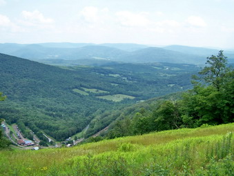 My mistakes started almost immediately as I went one level to high and got onto a rather steep ski run. The lower fields were full of high, wet grass and I hoped this would not be true of the whole hike. Fortunately the ski runs were grassy but the grass was not so high. The map only showed the ski runs at not the extensive network of bike trails. As we climbed I decided to head off the slopes and up the bike trails toward North Plattekill to see if the access to the highest point was easier from this side. The bike trails were truly impressive! They were steep and rocky with many jumps. Some of the trees were padded but I felt the padding and didn't think it would do much good. We stayed on watch for bikers but these trails did not appear to be used for the races this day. We continued to walk UP and I made decisions about where to turn based on the direction to the highest point. As we climbed one slope a bike trail came in from the left and I decided to take it up. It was very steep but short. From about halfway up I got my first good view and pictures of the day.We continued on the trails which lead directly to the highest spot on the mountain, almost. Since the latitude and longitude indicated a spot between the trail I whack through the area between the trails and claimed victory.
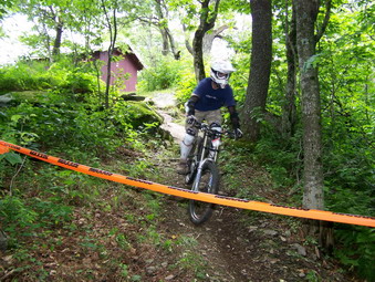 I decided that the best way to get good pictures was to walk across the top of the ski hill and descend by the Powder Puff Trail on the other side. In this way I could look down many of the ski runs and chair lifts to get the best views. It would also allow me to climb to the second highest point on the slopes. When we arrived at the Plunge, some nice views opened up and I took many pictures. From this area it wasn't too clear how to get across the top of the hill. It didn't help me that the map is horizontal and the area actually runs north and south! I didn't want to lose too much elevation but, in retrospect, it was necessary to come of the highest peak. We kept walking until we arrived at the central slope, a double black diamond, named Blockbuster. The views were magnificent from here since it is a steep run and the hill falls away quickly. In addition, there is no lift to mar the view. I took MANY pictures before moving on across the hill. After a short walk with a slight incline we arrived at The Face the northern most expert run. The trail in front of us was taped off since it was part of a race so I was careful to leash Sheba and stay off the trail.
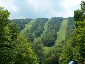 Riders were coming up the lefts with their bikes clamped onto the chairs. I took some pictures of them and the scenery behind them. Two young riders volunteered to ride down a steep rocky path in the woods and I took a couple of pictures of them. Sheba and I started down the Powder Puff Trail which was long but very gentle. There were few views but we could hear and see riders in the woods on one of the many parts of the various courses. At one point as the slope turned the steep main slopes were right in front of us. The angle was truly impressive and I took several pictures. As is almost always the case the pictures are good but cannot convey the actual excitement of being there. We were back down the hill to where we started at 2:50 PM. It had taken us just over 2 hours to cover the 3.15 miles including many stop to determine direction and just as many to take pictures.
![]() On Saturday, July 25th I wanted to finish up the peaks around Ski Plattekill and headed to Delaware County to hike Plattekill Mountain from Harold Roberts Road. The forecast was for sunny weather in the high 70's until late evening. I choose to take Route 28 toward Andes and then turn north on Route 6 toward New Kingston. Just passed New Kingston I turned right onto Thompson Hollow Road. I followed this until Harold Roberts Road appeared and I turned right. This was the first mistake. I found myself on the New Kingston Mountain Road which meant I had turned the wrong way on Harold Roberts Road. I Turned around and drove back to the intersection ad went straight ahead. This was my second mistake which I realized almost immediately. I turned around, went back to the intersection, and turned left and the parking area appeared on the right within a quarter mile. So, When you see Harold Roberts Road on the right continue straight ahead and save yourself some time! The parking area was very overgrown with grass and there is one way in and out. There isn't room for many cars but it isn't used all that much. Sheba and I got out of the car and were on our way by 10:15 AM.
On Saturday, July 25th I wanted to finish up the peaks around Ski Plattekill and headed to Delaware County to hike Plattekill Mountain from Harold Roberts Road. The forecast was for sunny weather in the high 70's until late evening. I choose to take Route 28 toward Andes and then turn north on Route 6 toward New Kingston. Just passed New Kingston I turned right onto Thompson Hollow Road. I followed this until Harold Roberts Road appeared and I turned right. This was the first mistake. I found myself on the New Kingston Mountain Road which meant I had turned the wrong way on Harold Roberts Road. I Turned around and drove back to the intersection ad went straight ahead. This was my second mistake which I realized almost immediately. I turned around, went back to the intersection, and turned left and the parking area appeared on the right within a quarter mile. So, When you see Harold Roberts Road on the right continue straight ahead and save yourself some time! The parking area was very overgrown with grass and there is one way in and out. There isn't room for many cars but it isn't used all that much. Sheba and I got out of the car and were on our way by 10:15 AM.
From the parking area a VERY well-defined road leads off toward the mountain. Just out of the parking lot is a gate to deter ATV use but it is obvious that has not deterred the riders. The grass was very wet and my Asolo Fugitive boots began to wet through after only a short distance. I love these boots especially since they fit so well but I expected more at the price and for a Goretex lined shoe! The trail switches back and forth at least four times but I stayed on the road rather then head directly up toward the peak. The time saved in distance NEVER overcomes the time spent in whacking through the woods! After the switchbacks the trail continues to climb gently for about .4 miles and then levels off. I began to get impatient and wanted to head off the road and up the peak. The road was lined with thick prickers and a high bank so I decided to be patient. After about .25 miles more of flat walking to the northeast, the prickers disappeared and a relatively gentle opening led into the trees. We took a right and started to head up and toward the southeast with me following the dog.
After a pretty uneventful .25 miles we were at the top and I wandered around to find what I though was the highest spot. I tried to correlate my spot with the maps with the GPS and finally gave up. I made sure I hit the correct latitude and longitude AND the spot marked on the GPS. At this point I told Sheba "Back!" and I followed her down to the road. The temperature had climbed into the 70's and it was humid. As we returned down the road I kept watching for viewpoints but only a few glimpses were available through the trees. The journey down went fast even with soaked feet and we were back at the car around noon having covered 3.4 miles in 1 hour and 45 minutes. I had to decide what to do next and chose to head for Ski Plattekill.
![]() On Friday, July 24th Brad and I headed for the Roundtop near the Plattekill Ski Area in Delaware County to hike Roundtop and North Plattekill. I thought we might have time for Plattekill also but we would have to watch our time as we had a commitment for late afternoon. The skies were cloudy as we left Livingston Manor and the forecast was for occasional showers in the morning with fog and then possible thunderstorms in the afternoon. We headed up to Roscoe and then toward Downsville on Rt 206. Route 30 took us around the Pepacton and I took a left at the junction with Route 28 and headed for Andes. Before Andes I turned north on Route 6 and continued on this through New Kingston. Just before Bovina I made a sharp right on Mountain Brook Road. The beginning of this road wasn't bad but it got steadily worse. My low slung Eclipse hit bottom once and then we saw the Plattekill State Forest sign next to a small pullover. I parked the car and we walked up the road from the "parking area" to check out where we were. Several signs let us know that we had parked in a private driveway. We got back in the car and began to revise our plans as I carefully turned us around. As we started back down the road I saw to gentleman sitting on their porch and I asked them if there was a place we could park. They gave us permission to park in an upper driveway and we were back in business.
On Friday, July 24th Brad and I headed for the Roundtop near the Plattekill Ski Area in Delaware County to hike Roundtop and North Plattekill. I thought we might have time for Plattekill also but we would have to watch our time as we had a commitment for late afternoon. The skies were cloudy as we left Livingston Manor and the forecast was for occasional showers in the morning with fog and then possible thunderstorms in the afternoon. We headed up to Roscoe and then toward Downsville on Rt 206. Route 30 took us around the Pepacton and I took a left at the junction with Route 28 and headed for Andes. Before Andes I turned north on Route 6 and continued on this through New Kingston. Just before Bovina I made a sharp right on Mountain Brook Road. The beginning of this road wasn't bad but it got steadily worse. My low slung Eclipse hit bottom once and then we saw the Plattekill State Forest sign next to a small pullover. I parked the car and we walked up the road from the "parking area" to check out where we were. Several signs let us know that we had parked in a private driveway. We got back in the car and began to revise our plans as I carefully turned us around. As we started back down the road I saw to gentleman sitting on their porch and I asked them if there was a place we could park. They gave us permission to park in an upper driveway and we were back in business.
We parked and got ready to go by 10:15 AM. We walked up the road and found that we probably could have made it up to the small parking area at the top. From here we headed almost due north on a wide access road. The gate at the beginning of the road had done little to stop the ATV traffic. We continued on the road to about the 2900 foot contour at which point we were passing the mountain and I was getting anxious to turn. After about .75 miles an ATV track appear on our right and headed up the mountain so we followed it. It lead directly to the top of the mountain in only .2 miles. We had bagged another CHH in less than 1 mile! At this point we decided to bushwhack off the top back down to the road we had been on and head for North Plattekill. I wasn't much of a bushwhack since more trails led north and slightly east. Once on the road we continued to follow it northeast as it drop into the Col between the two mountains and then began to ascend North Plattekill. The walking was pretty easy and I was looking forward to "bagging" North Plattekill. As the trail started to flatten I noticed a vehicle up ahead with two people. It turned out to be a forest ranger and driver who had followed the road over from the parking area on Harold Roberts Road. After a brief conversation, they pointed to some trails up the mountain. This is where the fun began. ALL the trails were overgrown with vegetation and much of that vegetation was prickers. NONE of the trails seemed to lead to the top where I knew we wanted to go. EVERY trail we took seemed to take us a little higher but would skirt the actual final ascent to the summit. We had no choice but to plunge through some pretty tall and nasty prickers to get up the last few hundred feet. Once on top we hit some paths and what looked like mountain bike trails. I found the highest spot around and we were ready to go back.
Since I didn't know any other way to return, we braved the prickers again and eventually were back to place where we had met the ranger earlier. We turned left to continue out toward Plattekill. We walked and talked for some time before I looked at my GPS. We were making good time but I had no idea how hard Plattekill would be. We decided to turn around and retrace our steps to the car. At the cutoff to Roundtop we stayed on the road. We were back at the car by 1:45 PM having covered the 7.2 miles in 3.5 hours.
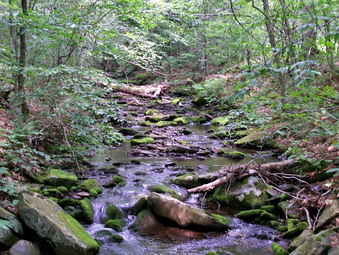
![]()
![]() On Thursday, July 23rd I decided to hike the Neversink Hardenburgh Trail to Vly and Tunis Ponds, a hike I had been wanting to do for some time. The weather reports were conflicting but I though that an early afternoon start might allow me to finish without getting too wet. Immediately after getting home I got the gear ready and put Sheba in the car. We headed up the Beaverkill Road and arrived at the Balsam Lake parking area at 1:00 PM. I had never hiked this trail and was eager to get started. The beginning of the trail passes through a field of ferns and is pretty overgrown and on this day was muddy. The skies were overcast with only a little sun. The register is placed just at the end of the field as the forest begins. I was pleasantly surprised to find that the trail was wide and easy to hike with only a few muddy areas. We descended for about .5 miles to Black Brook and crossed on a bridge. A brief ascent and another descent brought us to the bridge across the Gulf of Mexico Brook at 1.1 miles.
On Thursday, July 23rd I decided to hike the Neversink Hardenburgh Trail to Vly and Tunis Ponds, a hike I had been wanting to do for some time. The weather reports were conflicting but I though that an early afternoon start might allow me to finish without getting too wet. Immediately after getting home I got the gear ready and put Sheba in the car. We headed up the Beaverkill Road and arrived at the Balsam Lake parking area at 1:00 PM. I had never hiked this trail and was eager to get started. The beginning of the trail passes through a field of ferns and is pretty overgrown and on this day was muddy. The skies were overcast with only a little sun. The register is placed just at the end of the field as the forest begins. I was pleasantly surprised to find that the trail was wide and easy to hike with only a few muddy areas. We descended for about .5 miles to Black Brook and crossed on a bridge. A brief ascent and another descent brought us to the bridge across the Gulf of Mexico Brook at 1.1 miles.
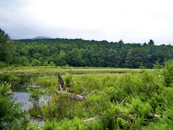 A very brief ascent and descent brought us to Vly Brook which was easy to step across. At this point I decided to bushwhack up to Vly Pond which was less than .25 miles away. We headed along the creek and soon came to signs of beaver activity. I was able to walk to the edge of the pond and onto the first of two dams. I took some pictures and decided to cross back to the other side of the brook to get a better view. As I returned to the path I had taken I thought it might be a good idea to check out the side if the pond I was on first! We headed up the shore through some thick balsam and over some slick rocks. A nice view opened up complete with a few high rocks to stand on. I took quite a few pictures and made a note to return to the area when there was blue sky and some sunlight. Behind the pond were Balsam lake and Graham Mountains. We headed back out to the main trail and I decided to continue despite the darkening skies. From the pond another ascent and descent brought us to a well used woods road at 2.0 miles. We made a left onto the road and started to follow the Beaverkill. The road had truck tracks and was very muddy in some spots.
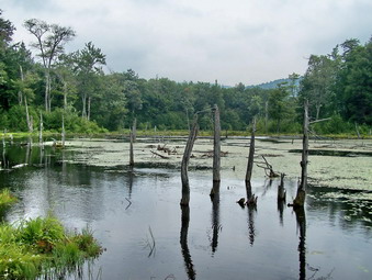 After walking along the road for about .5 miles, I decided to head off into the woods since the road/trail do not lead directly to the Tunis Pond. The woods were not too think and we only had to go about .25 miles to get to the pond. It was uphill all the way since Tunis Pond is said to be the highest named pond in the Catskills! Even with the overcast skies, the pond was beautiful. We came out on the south shore near the upper end. I took some pictures and then decided to walk along the shore. This wasn't too difficult despite the recent rain as a path seemed to snake its way around the pond. This presented many opportunities to take pictures from many different angles. Toward the lower end of the pond there was a large beaver house near the middle of the pond. I decided it was time to hurry back to avoid a drenching. We headed up into the woods and away from the pond. Within only a few minutes and about .3 miles we were back on the road. We kept up a fast pace on the way back and the rain held off. Back in the field I took several pictures of Balsam lake Mountain and then headed back to the car by 3:30 PM. We covered 5 miles in 2.5 hours including the two short bushwhacks and time to take pictures along the way!
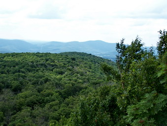
![]()
![]() On Wednesday, July 22nd Lisa Lyons and I wanted to do a hike with a view. I suggested hiking from Hill Road to the viewpoint over the Pepacton Reservoir on the Dry Brook Ridge Trail. Each time I have been to this viewpoint the view was good but hazy. I was hoping for a better time this day. I got my gear ready and Sheba and I headed over town to pick up Lisa near her shop. We headed for Roscoe and then toward Downsville on Route 206. We went right on Route 30 around the Pepacton Reservoir and continued straight ahead on Southside Road as we approached Margaretville. After turning right on Huckleberry Brook Road we turn left on Hill Road. This Road is in pretty good shape and we soon saw the DEC signs and then the parking area on the right and the trailhead across from it. We started our hike at about 1:30 PM by signing the trail register and walking into the woods.
On Wednesday, July 22nd Lisa Lyons and I wanted to do a hike with a view. I suggested hiking from Hill Road to the viewpoint over the Pepacton Reservoir on the Dry Brook Ridge Trail. Each time I have been to this viewpoint the view was good but hazy. I was hoping for a better time this day. I got my gear ready and Sheba and I headed over town to pick up Lisa near her shop. We headed for Roscoe and then toward Downsville on Route 206. We went right on Route 30 around the Pepacton Reservoir and continued straight ahead on Southside Road as we approached Margaretville. After turning right on Huckleberry Brook Road we turn left on Hill Road. This Road is in pretty good shape and we soon saw the DEC signs and then the parking area on the right and the trailhead across from it. We started our hike at about 1:30 PM by signing the trail register and walking into the woods.
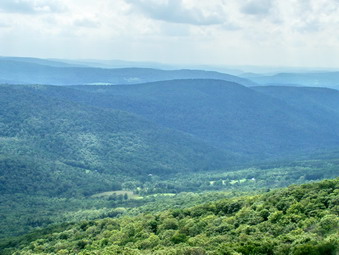 The first part of the hike passes through a red pine plantation with towering, straight as an arrow trees. The pine needle carpet makes a soft cushion under foot and makes walking nearly silent. Interspersed with the pines are much shorter hardwood trees. Several woods road cross the trail and an old foundation appears on the right of the trail. The trail remains wide and easy to walk for some time although rather steep in places. Numerous large boulders appear and most are covered with dark green moss and lighter green lichens. As the trail approaches Dry Brook Ridge it passes through some wetter areas with ferns , briars and nettles. On this day everything seemed to be cut back so that we were able to pass easily. Soon we entered the final section where the trail climbs and then levels several times as it finally gains the ridge. The Huckleberry Loop Trail ended at the junction with the yellow Dry Brook Ridge Trail. We turned right and continued toward the viewpoint called the Penguin Rocks.
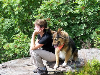 The trail along the ridge ascends some and then levels. Several other short steep climbs lead to the ridge line before the trail becomes almost levels. In about a mile views begin to appear on the right as brief glimpses through the trees. After a little "hook" in the trail a short spur leads to the right and a viewpoint over the valley below. We stopped here and the walked out onto the open rock face for and even better view! The Pepacton Reservoir was clearly visible as was the valley below and the surrounding hills. There was quite a bit of haze as the sky was beginning to change announcing the approaching change. We got a drink and took a few pictures. Mostly we just enjoyed the view before picking up and starting the return trip. The hike of about 3 miles up had taken about 1 hour 45 minutes and I expected the trip back to be faster. We kept up a good pace on the way back. As we approached the last third of the trail the bird songs in the woods became very obvious. We chose to hike silently over the pine needle carpet and listen to the natural sounds around us. We were back at the car by 5:00 PM having covered the 5.75 miles in about 3.5 hours. Allowing for the stop we had taken, the trip back was less than 1.5 hours!
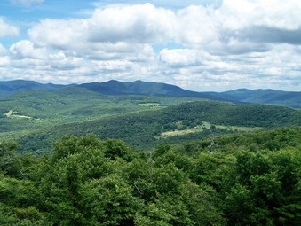
![]()
![]() On Sunday, July 19th Cindy and I wanted to do a short hike, close to home with a view. We decided to hike to the Red Hill Fire Tower since we had not been there in three years. I had the idea that we might drive over the Angel Falls in Yagerville near the Rondout Reservoir. We jumped in the car with Sheba and arrived in the parking area just before noon. We found the parking area rather easily this time but the route can be tricky. We turned on Route 55A just after the TriValley School and continued passed the turn where 55A crosses over the reservoir. The next road on the left is the Sugarloaf Road which we stayed on for about 4 miles. At this point Sugarloaf Road ends at Red Hill Road and we made a sharp left. IMMEDIATELY after this turn we made a right onto Coons Road which is "paved" with gravel. This road eventually becomes a Dead End seasonal use road. From that point to the parking area the road is dirt and can be rough going depending on the season. The parking area is small. The trail is very pretty and passes through hardwood forest with many ferns. The trail is almost flat in places and joins several woods road on its way up the mountain. There are a few steeper spots but the entire trip is only 1.3 miles to the tower. Along the way there are numbered wooden markers at various point. Brochures are available in the register box but should be returned.
On Sunday, July 19th Cindy and I wanted to do a short hike, close to home with a view. We decided to hike to the Red Hill Fire Tower since we had not been there in three years. I had the idea that we might drive over the Angel Falls in Yagerville near the Rondout Reservoir. We jumped in the car with Sheba and arrived in the parking area just before noon. We found the parking area rather easily this time but the route can be tricky. We turned on Route 55A just after the TriValley School and continued passed the turn where 55A crosses over the reservoir. The next road on the left is the Sugarloaf Road which we stayed on for about 4 miles. At this point Sugarloaf Road ends at Red Hill Road and we made a sharp left. IMMEDIATELY after this turn we made a right onto Coons Road which is "paved" with gravel. This road eventually becomes a Dead End seasonal use road. From that point to the parking area the road is dirt and can be rough going depending on the season. The parking area is small. The trail is very pretty and passes through hardwood forest with many ferns. The trail is almost flat in places and joins several woods road on its way up the mountain. There are a few steeper spots but the entire trip is only 1.3 miles to the tower. Along the way there are numbered wooden markers at various point. Brochures are available in the register box but should be returned.
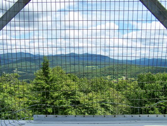 We arrived at the top at about 12:45 and found the tower staffed by two local volunteers. Cindy and I took turns climbing the tower so that Sheba would stay on the ground. The tower has a locating device and labels on each side to help orient visitors to the various features. This day the view was extremely clear with only a few clouds in the sky offering some contrast. I took many pictures from the cab and a few through the struts on the way down. The view is 360 degrees with many peaks and bodies of water visible. The cabin was also open and stocked with information about the Catskill fire towers and the restoration of the Red Hill tower. Everything was in great shape thanks to the many volunteers who keep it that way. The descent was easy but we took our time and were back at the car by 2:00 PM. The round trip hike was only about 3 miles.
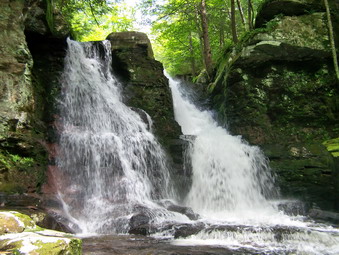 We decided to go find Angel falls and took the Yagerville Road by turning left from the Sugarloaf Road and then bearing right in Sundown. This road has a spectacular view of the Shawangunks from the top. We parked on some DEC land and walked down the main road to get a better view and snap some pictures. Back in the car we continued our search by driving down the Yagerville Road looking for Shalom Road. I could not find a road sign but did see one that said Bridge Out. We turned left on this road and soon found another DEP parking area just as the road became impassable. We walked down the road and saw the creek below and upstream we saw the falls. Cindy continued to walk along the road as I scrambled down a path to a faint trail that headed to the bottom of the falls. I eventually made it down to the side of the creek and took pictures of a very nice falls with a good volume. I also climbed up to the top of the falls and found a way to get out to the lip to take some more pictures. Once back on the path we walked toward the lower falls.
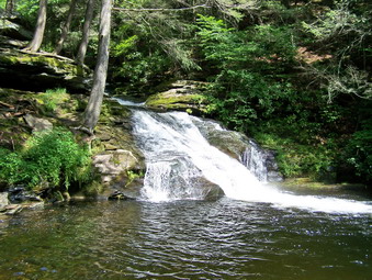 The first thing we noticed was that the lower falls are more "used" since there were broken bottles. This falls is not quite as high as the upper one but has two parts and a nice pool. I walked to the edge of the creek below the falls and out onto some rocks. I took some pictures and really wanted to go to the other side. Time and a lack of ambition prevented me. I walked to the top of the falls and took some more pictures before investigating the stone foundations near the falls. These foundations had features that make me think that there was more than just a farmhouse by the falls. I do not know the history of the area but there may have been a mill adjacent to the creek. Farther away but near this foundation is a larger foundation which may have been for storage. We walked back up to the car and drove after a day of moderate exercise and excellent photographic opportunities.
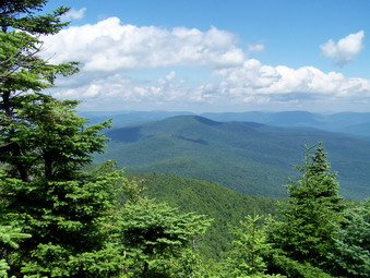
![]()
![]() On Saturday, July 18th Cindy and I decided to hike Slide Mountain. We had not been there in some time and I wanted an easy hike on a trail where there would be some people for a change. We didn't get an early start and arrived at the almost full parking area at about 10:30 AM. We signed the register as one other hiker was getting ready in the parking area and started up the trail. Crossing the river was pretty easy as was the crossing the smaller tributary a little farther along. The trail was very wet in many places on the lower part but not unmanageable as we climbed up the rocky part of the trail to road in from Winnisook. In a few minutes we were turning off the yellow Phoenicia-East Branch Trail and headed up the red trail to the summit of Slide. As we hike over slippery stones placed there specifically to test a hiker's ankles I was reminded that this hike is easier on snowshoes in the winter! We could hear a group approaching from behind so we picked up our pace a little. I kept looking for the 3500 foot sign but I never saw it. At one point my GPS decided to take a break on a bright and sunny day with few clouds. We stopped and the look out above 3500 feet to take some pictures. The group of three young women behind us caught up and we chatted for awhile before they continued on.
On Saturday, July 18th Cindy and I decided to hike Slide Mountain. We had not been there in some time and I wanted an easy hike on a trail where there would be some people for a change. We didn't get an early start and arrived at the almost full parking area at about 10:30 AM. We signed the register as one other hiker was getting ready in the parking area and started up the trail. Crossing the river was pretty easy as was the crossing the smaller tributary a little farther along. The trail was very wet in many places on the lower part but not unmanageable as we climbed up the rocky part of the trail to road in from Winnisook. In a few minutes we were turning off the yellow Phoenicia-East Branch Trail and headed up the red trail to the summit of Slide. As we hike over slippery stones placed there specifically to test a hiker's ankles I was reminded that this hike is easier on snowshoes in the winter! We could hear a group approaching from behind so we picked up our pace a little. I kept looking for the 3500 foot sign but I never saw it. At one point my GPS decided to take a break on a bright and sunny day with few clouds. We stopped and the look out above 3500 feet to take some pictures. The group of three young women behind us caught up and we chatted for awhile before they continued on.
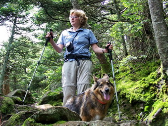 We picked up our gear and started toward the summit. I am always impressed by the sedimentary rock along the trail and the "sand" on the trail indicating the formation of this area under and ancient sea! We met a few people who were coming down. Soon we were at the junction with the Curtis-Ormsbee Trail from Denning. I always make the mistake of thinking this trail is closer to the summit than it really is! There are a lot of dead trees and branches along the trail from the various storms over the past few year and those from longer ago. Soon we were climbing the last few hundred feet to the lookout to the west toward Panther and Giant Ledge. There was one couple sitting on the viewpoint enjoying lunch. The view was exceptionally clear and I got the best look at Giant Ledge I have ever had. This view also makes it very clear that the climb to Panther is not trivial. We took some pictures and then more hikers arrived. Two young men with camping gear had just climbed Wittenberg and Cornell and were headed for the lean-to on Table. I answered a few questions and then we left as more hikers arrived.
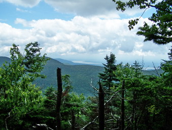 From this viewpoint it is only a short distance to the summit and the open rock face at the top of Slide. Near the location of the old fire tower a few more people were enjoying a snack. We arrived at the viewpoint at about 12:15 PM taking about 1 hour and 45 minutes to the summit. We were surprised that there were no hikers on the lookout but the view is blocked by many trees and the black flies were swarming. A few small groups of hikers arrived. The trail to the Burroughs plaque and down the other side of Slide has been rerouted to the right rather than the left. We went down the trail toward the spring. There are some interesting rock scrambles here and the rocks were very wet and slippery. After a short descent we arrived at a camping area on the left side of the trail. This offers a viewpoint toward Cornell and the Ashokan Reservoir. The view was good but some haze hung over the reservoir and clouds had started to roll in. We decided to return to the car to avoid the possible afternoon thunderstorm. The trip down went quickly since we both use poles which are particularly helpful on the descent. We met a pair of hikers near the trail junction and continued down with them arriving back at the car just before 2:30 PM having covered the 6 miles in just under 4 hours.
![]() On Friday, July 17th I was back in the parking area from Old Clump. After suffering leg cramps and with the darkening sky, the smart thing to do was to get in the car. So I drank some water and started out at 3:30 PM on the woods road we had been on earlier by mistake. The road headed UP which was a good thing but seemed to be headed too far to the east. Prickers lined the road so I decided to stay on it. Eventually we gained the ridge and continued to follow the road across the very narrow ridge line. There were no views that I could get although I could see that there might be some when the trees are bare. I also wasn't really looking to take pictures. I just wanted to bag the peak! The woods road headed north to the eastern side of Narrow Notch and then sort of disappeared. We turned west and a little north and fought the prickers for a little over a quarter mile to the highest point around. Back down seemed to go quickly especially when we reached the road. The skies were getting REALLY dark now and my leg still had a twinge. We were back at the car by about 6:00 PM having covered about 3.5 miles in 2.5 hours. For me an incredibly difficult day without much off a reward except meeting a challenge head on!
On Friday, July 17th I was back in the parking area from Old Clump. After suffering leg cramps and with the darkening sky, the smart thing to do was to get in the car. So I drank some water and started out at 3:30 PM on the woods road we had been on earlier by mistake. The road headed UP which was a good thing but seemed to be headed too far to the east. Prickers lined the road so I decided to stay on it. Eventually we gained the ridge and continued to follow the road across the very narrow ridge line. There were no views that I could get although I could see that there might be some when the trees are bare. I also wasn't really looking to take pictures. I just wanted to bag the peak! The woods road headed north to the eastern side of Narrow Notch and then sort of disappeared. We turned west and a little north and fought the prickers for a little over a quarter mile to the highest point around. Back down seemed to go quickly especially when we reached the road. The skies were getting REALLY dark now and my leg still had a twinge. We were back at the car by about 6:00 PM having covered about 3.5 miles in 2.5 hours. For me an incredibly difficult day without much off a reward except meeting a challenge head on!
![]() On Friday, July 17th I was back in the parking area from East Gray and was ready to tackle Old Clump. At least I thought I was ready. After a short break Sheba and I started out at 11:00 AM on a woods road. I check my GPS and we were walking AWAY from Old Clump on a road that would prove to be one way to get to Narrow Notch! We returned to the parking area and took another road which appeared to be contiguous with the road to the top. The road is actually shown on most maps. The road headed east and descended but it was easy walking. When the road turned south, we continued east and then slightly north to avoid dropping to much elevation into a drainage. As it was we dropped about 300 feet from the parking lot before beginning a 700 foot climb over the next .75 miles. At first the walking was pretty easy through open woods. No real path was evident but we found our own way. As we turned southeast and began to climb things still looked OK although the brush was thick. Then the prickers closed in and the steepness of the hill began to take its toll. We crossed woods roads several times but following them seemed pointless so we just crossed and pushed our way through wet, thick brush and prickers. The weather was extremely hot and humid and at least twice I had to overcome the desire to turn around and give up! Finally we broke out into an opening near the top. The place was a sea of prickers and I spent some time trying to get to what I thought was the highest spot without getting torn to shreds. We turned around and returned much the same way we had come. Once out of the prickers the walk went quickly but I was tired. At one point my right leg began to cramp BADLY! I thought I had been drinking enough water but I was very dehydrated. I sucked down a lot of water and massaged my leg to work out the cramp. It went away and came back several times. When I arrived at the car the cramp was gone but left behind that "just cramped" feeling. We were back at about 3:15 PM. Another LONG 3 miles which took us over 3 hours.
On Friday, July 17th I was back in the parking area from East Gray and was ready to tackle Old Clump. At least I thought I was ready. After a short break Sheba and I started out at 11:00 AM on a woods road. I check my GPS and we were walking AWAY from Old Clump on a road that would prove to be one way to get to Narrow Notch! We returned to the parking area and took another road which appeared to be contiguous with the road to the top. The road is actually shown on most maps. The road headed east and descended but it was easy walking. When the road turned south, we continued east and then slightly north to avoid dropping to much elevation into a drainage. As it was we dropped about 300 feet from the parking lot before beginning a 700 foot climb over the next .75 miles. At first the walking was pretty easy through open woods. No real path was evident but we found our own way. As we turned southeast and began to climb things still looked OK although the brush was thick. Then the prickers closed in and the steepness of the hill began to take its toll. We crossed woods roads several times but following them seemed pointless so we just crossed and pushed our way through wet, thick brush and prickers. The weather was extremely hot and humid and at least twice I had to overcome the desire to turn around and give up! Finally we broke out into an opening near the top. The place was a sea of prickers and I spent some time trying to get to what I thought was the highest spot without getting torn to shreds. We turned around and returned much the same way we had come. Once out of the prickers the walk went quickly but I was tired. At one point my right leg began to cramp BADLY! I thought I had been drinking enough water but I was very dehydrated. I sucked down a lot of water and massaged my leg to work out the cramp. It went away and came back several times. When I arrived at the car the cramp was gone but left behind that "just cramped" feeling. We were back at about 3:15 PM. Another LONG 3 miles which took us over 3 hours.
![]() On Friday, July 17th I decided to head to Delaware County to hit some of the CHH peaks in the Relay State Forest. I caught Route 206 out of Roscoe and then Route 30 North at the Pepacton Reservoir. I continued on Route 30 through Margaretville. Just passed Halcottsville was a sign for the Plattekill Ski Area (a place I mean to get to soon) and I turned left onto Cold Spring Road which becomes West Settlement Road and then Roxbury Mountain Road. The drive was pretty and was a continuous ascent. Soon Narrow Notch Road appeared on the right and I made the turn looking for Morse Road on the right as marked on the Venture Out map. The first road on the right should have been Morse Road but was marked Relay Road. I decided to try it. The road started out as gravel and dust and quickly turned into a two track dirt road. Three parking areas are marked on the map. I passed what could be used as parking on the right but the sign appeared to be missing. A little further another area appeared on the left but was also unmarked. The road got worse and I almost gave up but continued on. I soon saw evidence of logging and then hit a dead end near the top. The description matched some posts I had read and my location matched the map. East Gray Hill was right next to the parking area and looked to be a short hike. Looks can be deceiving.
On Friday, July 17th I decided to head to Delaware County to hit some of the CHH peaks in the Relay State Forest. I caught Route 206 out of Roscoe and then Route 30 North at the Pepacton Reservoir. I continued on Route 30 through Margaretville. Just passed Halcottsville was a sign for the Plattekill Ski Area (a place I mean to get to soon) and I turned left onto Cold Spring Road which becomes West Settlement Road and then Roxbury Mountain Road. The drive was pretty and was a continuous ascent. Soon Narrow Notch Road appeared on the right and I made the turn looking for Morse Road on the right as marked on the Venture Out map. The first road on the right should have been Morse Road but was marked Relay Road. I decided to try it. The road started out as gravel and dust and quickly turned into a two track dirt road. Three parking areas are marked on the map. I passed what could be used as parking on the right but the sign appeared to be missing. A little further another area appeared on the left but was also unmarked. The road got worse and I almost gave up but continued on. I soon saw evidence of logging and then hit a dead end near the top. The description matched some posts I had read and my location matched the map. East Gray Hill was right next to the parking area and looked to be a short hike. Looks can be deceiving.
We started at about 9:45 AM going due west on an old woods road which I hoped might go up the hill. It didn't. When it became clear that following the road would not work, we turned left or toward the southwest and headed Up the hill. For a while it was somewhat steep but rather open and I hoped it would stay that way. It didn't! I had read what reports of 7 foot briar canes near the top. I hoped they were exaggerating! They weren't! As we approached the top, the prickers got thicker and taller. I was HOT since I was wearing long sleeves but this was what probably saved me from an excessive loss of blood! There were a few pathways on the top and I used those to wander around until I found what I deemed to be the highest spot. We turned around to retrace our path and Sheba found a route with a few less prickers than the one to the top. The hike was less than a mile round trip but took us over an hour as we arrived back a the car at about 10:45 AM.
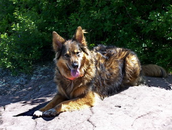
![]()
![]() On Wednesday, July 15th I was scheduled to meet Lisa Lyons to hike Giant Ledge. Lisa is the owner of Moran Outdoors, the excellent hiking store in Livingston Manor. She works so many hours at the store she seldom gets to hike. My job was to change that! I got to the store at about 12:45 PM and Lisa hopped in the car and we were off. The drive went quickly as we headed out the DeBruce Road passing Round Pond and then turning left onto the Frost Valley Road. We arrived at the parking area about 1:30 to find it parked full of cars. I turned around and parked below the parking area and we got started right away. The hike up to the turn to Giant Ledge and Panther was uneventful and went quickly. Lisa has had many interesting jobs and is very knowledgeable about many aspects of the Catskill watershed. We met a few people along the way and we wondered where all the people from the cars were. We turned at the trail up to Giant Ledge and walked through some slightly muddy areas.I pointed out the area of large rocks where some people like to rest, the spring and the viewpoint toward Slide.
On Wednesday, July 15th I was scheduled to meet Lisa Lyons to hike Giant Ledge. Lisa is the owner of Moran Outdoors, the excellent hiking store in Livingston Manor. She works so many hours at the store she seldom gets to hike. My job was to change that! I got to the store at about 12:45 PM and Lisa hopped in the car and we were off. The drive went quickly as we headed out the DeBruce Road passing Round Pond and then turning left onto the Frost Valley Road. We arrived at the parking area about 1:30 to find it parked full of cars. I turned around and parked below the parking area and we got started right away. The hike up to the turn to Giant Ledge and Panther was uneventful and went quickly. Lisa has had many interesting jobs and is very knowledgeable about many aspects of the Catskill watershed. We met a few people along the way and we wondered where all the people from the cars were. We turned at the trail up to Giant Ledge and walked through some slightly muddy areas.I pointed out the area of large rocks where some people like to rest, the spring and the viewpoint toward Slide.
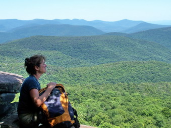 Soon we were at the last short but steep ascent to the plateau that is Giant Ledge. After conquering this we walked the relatively flat trail toward the ledges. We immediately found the people! They were gathered in a group on the first ledge which Lisa and I bypassed to move on to the next viewpoint. From this lookout the views were good but some haze was hanging low. Sheba and I continued on the trail leaving Lisa alone to contemplate the view. I took some pictures from some other places and then returned to the ledge where we had left Lisa. We talked for a while and took some shots until we could no longer hear the large group. We worked our way to the first viewpoint and took pictures from there before deciding to head back. It was at this point that I noticed a path to the left that I did not remember seeing previously. It led to an open space with a large rock and evidence of a campfire! The path continued along the edge of the ledge for some distance. I deiced to explore this area...at some later time. We walked up to the main path and then started the hike back to the car. We met several groups along the way coming up. We were back at the car by just after 3:30 PM having covered the 3.1 miles in a little over two hours. The parking lot had considerably more room!
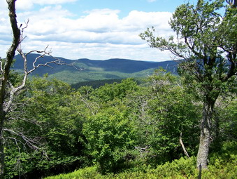
![]()
![]() On Monday, July 13th I was ready to go back to Black Bear Road and hike the Beaverkill Range after summer school. I arrived at the snowplow turnaround at 1:15 PM and began the walk up to the hunting camp. At the camp I turn left heading almost directly northwest. After some open woods I encountered a set of ledges with a GENEROUS supply of nettles. I guess I could have walked parallel to the ledge to find a better spot but I just plunged in. Pretty soon Sheba and I were through the mess and from that point on things went rather well. I kept my heading by always going up and adjusted every know and then by compass or GPS. The walking was rather easy as we skirted one bump by doing a little sidehilling. They only problem was that the thick woods left no possibility of getting a visual on the summit. After walking down some we were on our way up to the highest point on the range. The point marked on the GPS was different than the latitude and longitude I had and neither seemed to be the highest spot. As I stood on a high rock the coordinates took me down so I declared a success where I stood.
On Monday, July 13th I was ready to go back to Black Bear Road and hike the Beaverkill Range after summer school. I arrived at the snowplow turnaround at 1:15 PM and began the walk up to the hunting camp. At the camp I turn left heading almost directly northwest. After some open woods I encountered a set of ledges with a GENEROUS supply of nettles. I guess I could have walked parallel to the ledge to find a better spot but I just plunged in. Pretty soon Sheba and I were through the mess and from that point on things went rather well. I kept my heading by always going up and adjusted every know and then by compass or GPS. The walking was rather easy as we skirted one bump by doing a little sidehilling. They only problem was that the thick woods left no possibility of getting a visual on the summit. After walking down some we were on our way up to the highest point on the range. The point marked on the GPS was different than the latitude and longitude I had and neither seemed to be the highest spot. As I stood on a high rock the coordinates took me down so I declared a success where I stood.
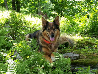 In this same area was a nice open, ferny spot that was an excellent lookout. I walked around this viewpoint, so unusual for CHH peaks and then made a little loop and started back. It did not bother me to follow the same track back to the area of the ledges and nettles but here I though I might look for a better way. In the end I decided it was quicker to go the same way. I actually found a harder way down because I did not believe Sheba! Will I EVER learn? We were back a the car by around 4:30 PM. This seemed slow for the 4 mile hike but bushwhacking and picture taking can slow the pace!
![]() On Friday, July 10th Brad and Krista were up for the weekend. I decided that I wanted to finally get over to hike High Falls Ridge and the Beaverkill Range. Brad wanted to hike so we headed out DeBruce Road to Round Pond. At round Pond we turned left onto Black Bear or Fresh Meadows Road and immediately ran into a private tree trimming crew blocking the road. We parked in the parking lot prepared to walk to the end of the road but I talked to the crew and they were just about to move. We drove down the road to the snow plow turnaround. I had permission to park at a hunting camp but decided to leave the car where it was. Our walk started at about 9:30 AM. We hiked on the road to the hunting camp and then turn left or east and slightly south off the road. We immediately dropped almost 200 feet to Fall Brook and found a place to cross which was not difficult. In the next half mile we climbed almost 700 feet to the High Falls Ridge and the highest point around. We wandered around until we found the highest spot. In this area there was a small break in the trees which might provide a good viewpoint in the late fall or winter. The hiking was steep at times with some thick underbrush on the route I chose but nothing was too difficult. I told Sheba "Back!" and we followed her back to the road. By the time we were back at the road we had been hiking for almost 4 hours. I decided to go back home since Krista was there alone. We walked back to the car driving at about 1:30 PM after hiking around 5.5 miles.
On Friday, July 10th Brad and Krista were up for the weekend. I decided that I wanted to finally get over to hike High Falls Ridge and the Beaverkill Range. Brad wanted to hike so we headed out DeBruce Road to Round Pond. At round Pond we turned left onto Black Bear or Fresh Meadows Road and immediately ran into a private tree trimming crew blocking the road. We parked in the parking lot prepared to walk to the end of the road but I talked to the crew and they were just about to move. We drove down the road to the snow plow turnaround. I had permission to park at a hunting camp but decided to leave the car where it was. Our walk started at about 9:30 AM. We hiked on the road to the hunting camp and then turn left or east and slightly south off the road. We immediately dropped almost 200 feet to Fall Brook and found a place to cross which was not difficult. In the next half mile we climbed almost 700 feet to the High Falls Ridge and the highest point around. We wandered around until we found the highest spot. In this area there was a small break in the trees which might provide a good viewpoint in the late fall or winter. The hiking was steep at times with some thick underbrush on the route I chose but nothing was too difficult. I told Sheba "Back!" and we followed her back to the road. By the time we were back at the road we had been hiking for almost 4 hours. I decided to go back home since Krista was there alone. We walked back to the car driving at about 1:30 PM after hiking around 5.5 miles.
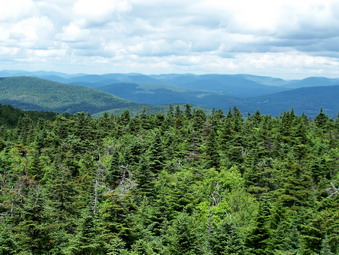
![]()
![]() On Thursday, July 9th I decided to get in a quick hike after summer school and before the predicted thunderstorms. Sheba and I had not been to Balsam Lake in some time so we headed there arriving in the parking area at just after 1:00 PM. The parking area was almost full and a friend informed me that the day camp from the Beaverkill Valley in was hiking the mountain. When I signed the register, I noticed that the day camp had signed in for 35 people! There was also another smaller group signed in before me. Sheba and I like a challenger so we started off at 1:15 PM and a pace intended to catch somebody. We met the group immediately ahead of us just before the turn up the mountain. We said hello and passed by them quickly making the turn. I slowed some on the steeper parts of the ascent but still kept a fast pace. We were soon at the turn for the lean-to, the 3500 foot sign and the spring. It was just a short ascent to the flatter portion of the trail. We could here the day camp group ahead of us as we climbed the last rise and made our way to the tower. We arrived at the top in just 40 minutes! At the summit, the scene was pretty impressive with about 30 kids and 5 counselors. Small groups were taking there turn on the tower and most of the kids seemed pretty well behaved. Some came over to talk to me and ask permission to pet Sheba. Sheba said it was Ok. Before long most of the kids were done on the tower and they started back down the steep side in groups. I went up the tower to take a few pictures. I had my camera but also brought my wife's new Nikon pocket camera to see the quality of pictures. I too some shots and then descended.
On Thursday, July 9th I decided to get in a quick hike after summer school and before the predicted thunderstorms. Sheba and I had not been to Balsam Lake in some time so we headed there arriving in the parking area at just after 1:00 PM. The parking area was almost full and a friend informed me that the day camp from the Beaverkill Valley in was hiking the mountain. When I signed the register, I noticed that the day camp had signed in for 35 people! There was also another smaller group signed in before me. Sheba and I like a challenger so we started off at 1:15 PM and a pace intended to catch somebody. We met the group immediately ahead of us just before the turn up the mountain. We said hello and passed by them quickly making the turn. I slowed some on the steeper parts of the ascent but still kept a fast pace. We were soon at the turn for the lean-to, the 3500 foot sign and the spring. It was just a short ascent to the flatter portion of the trail. We could here the day camp group ahead of us as we climbed the last rise and made our way to the tower. We arrived at the top in just 40 minutes! At the summit, the scene was pretty impressive with about 30 kids and 5 counselors. Small groups were taking there turn on the tower and most of the kids seemed pretty well behaved. Some came over to talk to me and ask permission to pet Sheba. Sheba said it was Ok. Before long most of the kids were done on the tower and they started back down the steep side in groups. I went up the tower to take a few pictures. I had my camera but also brought my wife's new Nikon pocket camera to see the quality of pictures. I too some shots and then descended.
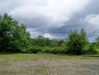 Sheba and I immediately started down the other side of the mountain passed the cabin. The descent went quickly and I was pleased since the sky was threatening. Just as we reached the gate on the trail I noticed a vehicle parked on the trail! It was a DEC jeep but I did not see any people. At this point I decided not to do Graham but to return to the car. As I turned right, I noticed that the trail had been cleared of all nettles and briars. I guessed that this was what the occupants of the DEC vehicle were doing and I expected to meet them on the trail. Sheba and I continued to set a fast pace which was easy on the now well-maintained trail. Soon we were approaching the turn up the mountain and there was no sign of anyone clearing the trail! We walked quickly back toward the parking area. As I signed out at the register I could here the day camp at the parking area but by the time we arrived they were gone. The dark skies and some commitments in down convinced me to get in the car. The trip down the longer side had taken only 50 minutes for a total round trip hiking time of 1.5 hours for about 4 miles.
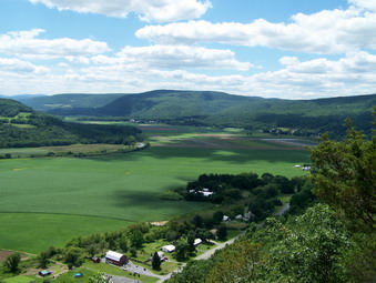
![]()
![]() On Sunday, July 5th After visiting Mine Kill Falls, Cindy and I drove toward Middleburgh to visit Vroman's Nose. As you approach this landmark on Route 30, you can't help but be impressed as this rocky cliff just up out of the flat plain. We turned left at the sign and drove to the parking area. There were quite a few cars already parked there but a spot opened up just as we arrived. We got right on the trail. I had been here before and hoped Cindy would be impressed as I was with the view from the top. We walked up through the field to the loop trail and turned right. The hike is only about 1.5 miles and no part is very steep and the "payoff" is enormous! The trail was a little muddy in places but we easy walked around these areas.
On Sunday, July 5th After visiting Mine Kill Falls, Cindy and I drove toward Middleburgh to visit Vroman's Nose. As you approach this landmark on Route 30, you can't help but be impressed as this rocky cliff just up out of the flat plain. We turned left at the sign and drove to the parking area. There were quite a few cars already parked there but a spot opened up just as we arrived. We got right on the trail. I had been here before and hoped Cindy would be impressed as I was with the view from the top. We walked up through the field to the loop trail and turned right. The hike is only about 1.5 miles and no part is very steep and the "payoff" is enormous! The trail was a little muddy in places but we easy walked around these areas.
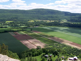 As we began the turn to the left on the ascent views began top open up mostly to the south. We stopped so that I could take some pictures despite the fact that I knew the view from the top was even better! We continued on the trail stopping at least once more for photographs. Soon we were on the top walking along the open rock and marveling at the vistas in front of us. I think Cindy was impressed! Below us were cultivated fields. A little further was the meandering Schoharie Creek. In the distance were some of the smaller mountains to the north of the Catskill Park.
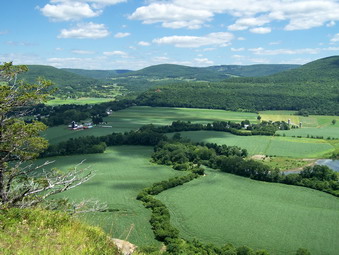 As we walked along the cliff, the views changed. Just before bending to the left for the final time and starting down a view to the east came into view and we could see the Middleburgh Cliffs on the other side of town. I had read about these briefly and though they would be good to visit. The hour was late by the time we got back and I decided to save the Cliffs for another day.
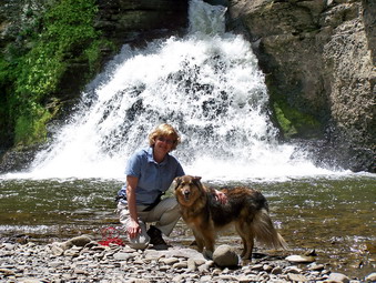
![]() On Sunday, July 5th Cindy and I had some time after church and we wanted to hike somewhere there would be a good view. I decided to take her and Sheba to Mine Kill Falls and Vroman's Nose since they both satisfied this requirement. We arrived at Mine Kill Falls at about 12:30 PM and walked down to the platforms that overlook the main part of the falls. The amount of water was enough to make a nice roaring sound and I took many pictures from this vantage point. We then walked back up the trail and took a left to follow the path down to the base of the falls. This trail is also part of the Long Path. At the base of the falls we stopped so that I could take more pictures. We then reversed our steps and went back to the car to go to Vroman's Nose/
On Sunday, July 5th Cindy and I had some time after church and we wanted to hike somewhere there would be a good view. I decided to take her and Sheba to Mine Kill Falls and Vroman's Nose since they both satisfied this requirement. We arrived at Mine Kill Falls at about 12:30 PM and walked down to the platforms that overlook the main part of the falls. The amount of water was enough to make a nice roaring sound and I took many pictures from this vantage point. We then walked back up the trail and took a left to follow the path down to the base of the falls. This trail is also part of the Long Path. At the base of the falls we stopped so that I could take more pictures. We then reversed our steps and went back to the car to go to Vroman's Nose/
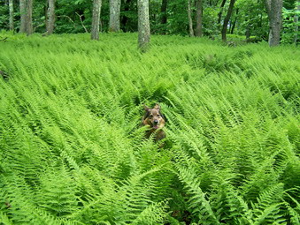
![]()
![]() On Saturday, July 4th I had family commitments in the afternoon. I decided to get in a quick hike in the late morning and early afternoon so I headed for Denman Mountain near Grahamsville. This peak is on the CHH list but is a short and easy bushwhack. I turned north from Route 55 on Moore Hill Road near the TriValley Central School. I follow this road as it ascended for about 3 miles. I didn't know exactly where I was going but I passed the first parking area on the left. At the 3 mile mark the road continued straight ahead as a seasonal road and a paved road turned right. The names of the roads vary from map to map and include Moore Hill Road, Glade Hill Road and Furmans Road. I parked in the large parking area on the corner at about 10:00 AM and walked across the road to pick up the snowmobile trails. The Trail Conference maps are useless here but the Venture Out map showed a network on dotted lines that seemed to get close to the summit. I followed these trails for a while but they led too far west and south. I could find none that headed north. We walked back to the road and north a short distance. I thought there might be more trails. Seeing none I simply walked off the road to the right and pushed my way through some thick brush. This was going to be a tough bushwhack if it continued to be this thick. Just then the woods opened up and the underbrush disappeared.
On Saturday, July 4th I had family commitments in the afternoon. I decided to get in a quick hike in the late morning and early afternoon so I headed for Denman Mountain near Grahamsville. This peak is on the CHH list but is a short and easy bushwhack. I turned north from Route 55 on Moore Hill Road near the TriValley Central School. I follow this road as it ascended for about 3 miles. I didn't know exactly where I was going but I passed the first parking area on the left. At the 3 mile mark the road continued straight ahead as a seasonal road and a paved road turned right. The names of the roads vary from map to map and include Moore Hill Road, Glade Hill Road and Furmans Road. I parked in the large parking area on the corner at about 10:00 AM and walked across the road to pick up the snowmobile trails. The Trail Conference maps are useless here but the Venture Out map showed a network on dotted lines that seemed to get close to the summit. I followed these trails for a while but they led too far west and south. I could find none that headed north. We walked back to the road and north a short distance. I thought there might be more trails. Seeing none I simply walked off the road to the right and pushed my way through some thick brush. This was going to be a tough bushwhack if it continued to be this thick. Just then the woods opened up and the underbrush disappeared.
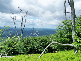 Since Denman Mountain was north and slightly west of the parking area I headed west first and after gaining some elevation turned north on a tongue on land coming down from the peak. Sheba and I found some nice woods roads and paths which we followed always heading generally north and UP. This hike was the driest in some time with no standing or running water. In fact, only a few spots were even muddy. Along the way there were vast seas of ferns some approaching waist height. We continued our route and I kept looking for some views but saw none. Just as I though we were near the top and another bump appeared. After a short, steep little climb we were on an open rock ledge which looked higher than anything else around. Upon consulting my GPS, the summit was marked to the north and a little west. I walked in that direction and did find a higher spot. The location marked on the GPS was definitely further DOWN the mountain so I claimed victory and began to plan my route back.
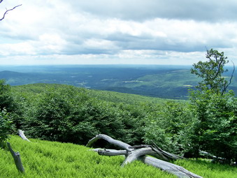 I could see some blue sky to the west so we started our descent by going a little to the west and then walked south along the high ground. I was careful not to lose any elevation to the west but only to the south. As we walked along the edge, I watched for viewpoints in vain for some time until, finally, up ahead, I saw an opening to a ferny glade. As I walked out of the woods there was a beautiful view to the west and north. It was hard to walk around the area since the high ferns hid many downed trees. I took pictures and then walked over to the next clear area to take more shots from another angle. After finishing the photography, we headed back to pick up the path that we had used on the way up. When I looked at the map, it seemed like the road was just to the east. For some variety, Sheba and I headed almost due east and picked up the road in about .25 miles. From here it was about .5 miles walking on the road back to the car. The little-used road made a nice walk. Sheba and I covered about 3 miles in 3 hours including our exploration of the snowmobile trails and time to take pictures.
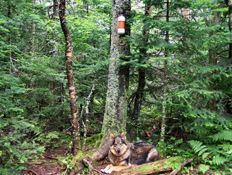
![]()
![]() On Friday, July 3rd I decided to return to Southwest Hunter to sign the canister register that I could not sign on Tuesday because of a sudden downpour. I also needed the peak for July and thought I would throw in Hunter also. The morning was very overcast and the weather forecast included a chance of showers. I was in no hurry to hike in the fog so Sheba and I started out about 8;30 AM from Livingston Manor and arrived at Notch Lake on Route 214 near the Devil's Tombstone Campground at just before 10:00 AM. I stopped at the office and paid the $6 "day use" fee to park my car! I parked and we started hiking immediately under partly sunny skies. Like so many of our other hikes lately, everything was wet. The rocks and dirt were wet and slippery and in many places there was running water across the trail or running down the trail. There was also a healthy crop of nettles along the side of the trail just waiting for the unsuspecting hiker. The trail gets quite a bit of use so they had not yet grown across the path.
On Friday, July 3rd I decided to return to Southwest Hunter to sign the canister register that I could not sign on Tuesday because of a sudden downpour. I also needed the peak for July and thought I would throw in Hunter also. The morning was very overcast and the weather forecast included a chance of showers. I was in no hurry to hike in the fog so Sheba and I started out about 8;30 AM from Livingston Manor and arrived at Notch Lake on Route 214 near the Devil's Tombstone Campground at just before 10:00 AM. I stopped at the office and paid the $6 "day use" fee to park my car! I parked and we started hiking immediately under partly sunny skies. Like so many of our other hikes lately, everything was wet. The rocks and dirt were wet and slippery and in many places there was running water across the trail or running down the trail. There was also a healthy crop of nettles along the side of the trail just waiting for the unsuspecting hiker. The trail gets quite a bit of use so they had not yet grown across the path.
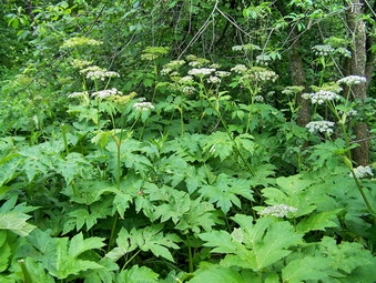 The trip up the Devil's Path was longer than I remembered and much steeper. There were also a few more switchbacks than I recalled but this, of course, moderates the steepness of the climb. After climbing for a while, Sheba and I were soon on the relatively level path that leads to the Devil's Acre lean-to. This always seems to be a long and boring walk but today I kept noticing a few glimpses of Southwest Hunter to our left and of some of the other peaks on the Devil's Path. Soon we were at the lean-to and we were off to find the herd path to Southwest Hunter. We continued along the Devil's Path but I could not spot the path despite the fact that it was a thoroughfare the last time I was there in the winter. We walked back down the Devil's Path with no luck. I decided to try one more time since I knew the cutoff was fairly far from the lean-to and after short ascent. Sure enough, after going a little bit further, there was the very prominent path to the left. We got on the path and had no trouble walking along it except for a few muddy spots and some blowdown. The point where we had to turn up the mountain was still marked by a cairn and a brush barrier across the path. Sheba and I turned at the right spot. The path up the mountain was even easier to follow than last time and I was soon signing in at the canister. At this point the skies seemed to darken so we hurried back down the mountain and out to the Devil's Path.
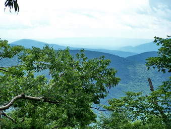 Back at the lean-to I noticed some very large plants with flowers like Queen Anne's Lace and large leaves. I took some pictures as I wonder if this was Giant Hogweed. My comparisons on line at home were inconclusive. A few raindrops fell as we reached the trail junction up Hunter Mountain and the skies were dark in one direction but bright in another. I decided to hike as fast as we could to "bag" Hunter and a few extra miles. We turned and were soon ascending the trail to the summit. The water running down the trail made it seem like we were walking in a small stream. When we reached the more level are at the top there was standing water and mud in many places along the trail. I tried to avoid the mud as much as possible at first but eventually gave up and followed Sheba through the muck. The skies were darker and more drops of rain were falling as we reached the tower. I decided that climbing the tower while hearing rumbles of thunder was a BAD IDEA. I had taken pictures from the tower many times so we tagged the top and headed back down the way we had come. By the time we were back at the Devil's Path the sun was shining and the rain drops had stopped falling.
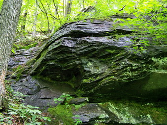 Sheba and I descended much faster than we had climbed except for a few stops along the way. This part of the trail has impressive ledges, cliffs and rock overhangs. Those who planned the trail managed to find a way up and through these formations. I stopped at one rock overhang that also had water flowing over it and took some pictures. At this point the rain began again and this time it threatened to be harder. By the time we crossed the bridge over the outlet stream from Notch Lake we were in a full downpour. When we made it to the car, I opened the door for Sheba and through my pack and other gear in the trunk. It was just after 3:00 PM and it had taken us a little more than 5 hours to 8.5 miles not counting the time to find the herd path. As I drove down route 214 toward Phoenicia the skies cleared and the sun came out.
![]() On Monday, June 29th I decided to bushwhack Roundtop and Kaaterskill for the first time. I needed Roundtop for the CHH and Kaaterskill for June. I have recently decided that bushwhacking with others is more interesting than going solo, in most cases, but there were no others available. I decided to start at the end of Gillespie Road and use the DEP access to bushwhack Roundtop first. From here I though I would head over to Kaaterskill through the col. From the summit of the High Peak I wanted to descend to the snowmobile loop and then use it to get back to the area of Roundtop. I though from here I would continue out to Clum Hill Road. follow the snowmobile loop until it crossed my path up or just bushwhack back to the car. The day started overcast and cool in Livingston Manor and I delayed my start some. I turned onto Clum Hill Road from Platte Clove Road and followed it up until it made the 90 degree left and turn. From here I went straight ahead on Gillespie. The road was dirt but started out OK. Shortly I was trying to avoid the rock outcrops in the middle of the road! I finally got to the small parking area at the end of the road which was clearly marked with DEP signs. We got out of the car and started to hike almost immediately. EVERYTHING was wet with running water on the trails and muddy spots all over.
On Monday, June 29th I decided to bushwhack Roundtop and Kaaterskill for the first time. I needed Roundtop for the CHH and Kaaterskill for June. I have recently decided that bushwhacking with others is more interesting than going solo, in most cases, but there were no others available. I decided to start at the end of Gillespie Road and use the DEP access to bushwhack Roundtop first. From here I though I would head over to Kaaterskill through the col. From the summit of the High Peak I wanted to descend to the snowmobile loop and then use it to get back to the area of Roundtop. I though from here I would continue out to Clum Hill Road. follow the snowmobile loop until it crossed my path up or just bushwhack back to the car. The day started overcast and cool in Livingston Manor and I delayed my start some. I turned onto Clum Hill Road from Platte Clove Road and followed it up until it made the 90 degree left and turn. From here I went straight ahead on Gillespie. The road was dirt but started out OK. Shortly I was trying to avoid the rock outcrops in the middle of the road! I finally got to the small parking area at the end of the road which was clearly marked with DEP signs. We got out of the car and started to hike almost immediately. EVERYTHING was wet with running water on the trails and muddy spots all over.
We started up a woods road just in time to see two black forms scoot across the road in front of us! These two black bear cubs were small enough to be from this year and I almost ended the hike at that point since I had no idea where the mother was. Instead, Sheba and I let the cubs go about their business, waited to see if another bear would show up and then QUICKLY hurried up the road. We continued to follow the road as it paralleled a small stream. After about .35 miles I decided I wanted to turn more southeast and head directly for the peak of Roundtop. Crossing the stream and its numerous tributaries was pretty easy and we were off. For a short time, maybe the next .4 miles the forest was relatively open but very wet. At some point after this we crossed the snowmobile loop trail but I decided to hear directly to the summit. The next .4 miles to the top was VERY STEEP in most places. There were a few ledges to work around or through but mostly it was just steep. When the ground began to level out, I walked around to try to make sure I hit the highest spot. I then began looking for a way to get to Kaaterskill. I wasn't sure I wanted to do the other peak since the wind had come up and the sky, or what I could see of it was dark, but I decided that I was already there and would go for it. Not being able to see Kaaterskill I started out heading too far north. Once I got a peek at the peak, I corrected my route and started southeast.
Descending Roundtop was just as steeper or steeper than the ascent. There were more ledges to work through on the way down but at least it went quickly. Soon we were in the Col between the two peaks and I wanted to make sure I stayed on the bridge of land between the two without drifting too far north or south and losing elevation. We walked about .25 miles on this "bridge" and then started up to the High Peak. This climb wasn't as steep but there were a few ledges to work. Near the summit there was some VERY dense evergreen forest. I could have looked for a way around but decided to push through. As the terrain started to level we came to a herd path that took us directly to the summit clearing. A piece of an aircraft was leaning against a tree. This was obviously placed by someone and I can think a few things I appreciate less! We wandered around the summit for a while and then started down the herd path to the north. It was immediately apparent that this was going to be a difficult descent. Everything was wet, slimy and slippery. Even rocks that looked almost dry weren't. In several places I had to go into the woods on short bushwhacks to avoid some of the steepest and slipperiest parts. Eventually, we were crossing the swampy area before the snowmobile loop and then turned right on the trail itself.
The snowmobile trail was VERY wet with standing water and mud everywhere. After walking only a short distance, it became clear to me that the entire walk back on this trail was going to be a wet and muddy nightmare. I was right! Soon it was obvious that ATV had been using the trail and churning up the mud. Walking alongside the trail helped at times but other times it was just as wet. In some areas blowdowns obscured the trail AND the most immediate path on each side. I decided to walk to where the trail begins to loop back around Roundtop and then get OFF the trail. There seemed to be an access road from the snowmobile trail out to Clum Hill Road. When I got to this area, the access "road" was more of the same muddy mess and was almost a mile long! We turned on the snowmobile trail and then I took a southeast bearing directly back to the car. I knew in this way we would either hit the path we took up earlier in the morning or we would cross Gillespie Road. This was a direct route but by no means an easy one! The initial part was a rather steep descent with a lot of loose and slippery rocks. Soon the terrain leveled some and we were near the road that was part of our original route. Once we hit this road I knew we weren't far from the car. As we walked back toward the car I heard a noise behind us and turned to see a LARGE black shape crossing the road were we had just been walking. This bear was a full grown adult but seemed to ignore us. Sheba didn't pay much attention to the bear. We quicken our pace and were back at the act within minutes. It was almost exactly :00 PM. It had taken almost 5 hours to cover less than miles!
![]() On Sunday, June 28th Cindy and I wanted to take a quick hike after church and before the thunderstorms hit. We decided to go to Trout Pond as we had not been there in some time. We parked at the top of Russell Brook Road since we like the hike down this dirt road to the lower parking area. There were a few cars parked along the road which seemed strange but some people are just lazy! As we approached the area of the falls we could hear the water rushing through the stream bed below. The recent rains had increased the stream flow significantly but I have seen it higher. We signed in at the register where a group of 0 was also signed in. They were occupying the campsite on the trail to Mud Pond so we decided to head up to Trout Pond first. The trail was wet but not as bad as I had thought it would be. Sheba was obviously happy to get out and led the way to Trout Pond. I had the camera with me but the day was cloudy and the picture opportunities did not differ much from those I had many times before.
On Sunday, June 28th Cindy and I wanted to take a quick hike after church and before the thunderstorms hit. We decided to go to Trout Pond as we had not been there in some time. We parked at the top of Russell Brook Road since we like the hike down this dirt road to the lower parking area. There were a few cars parked along the road which seemed strange but some people are just lazy! As we approached the area of the falls we could hear the water rushing through the stream bed below. The recent rains had increased the stream flow significantly but I have seen it higher. We signed in at the register where a group of 0 was also signed in. They were occupying the campsite on the trail to Mud Pond so we decided to head up to Trout Pond first. The trail was wet but not as bad as I had thought it would be. Sheba was obviously happy to get out and led the way to Trout Pond. I had the camera with me but the day was cloudy and the picture opportunities did not differ much from those I had many times before.
As the trail flattened and passed by the pond the areas of water and mud grew more frequent but were not as bad as in the past. A few people were in the lower lean-to as we passed by on the loop trail. The inlet brook was easy to cross and we were soon gaining elevation as we hiked around the pond and up to Cherry Ridge. We were setting a very quick since the hike was short. Soon we were up and over the ridge and at the junction with the trail around Mud Pond. We turned left as we had planned to go back to the area of the falls. A right would have taken us around Mud Pond and this route is ALWAYS wet. In addition, we had no idea what the recent rains and swollen brook had done to the lower crossing. The road back was wet in most places with some mud. As we approached the camping area we found...nothing. The campers had packed up and left. I signed out at the register and we walked back up the road to the lower parking area. Here, some campers were finishing packing their car. We walked back up to the car having covered a little over 4 miles in less than 2 hours.
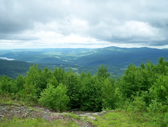
![]()
![]() On Wednesday, June 24th I decided to hike Bearpen and Vly for the month of June. This was appropriate since it had just rained and the underbrush would be nice and wet for this bushwhack. It seems that each time I do these peaks I get wet even though I have seldom encountered rain. The prediction was for showers as it had been for every day in June! However, the morning was overcast and I wanted at least the opportunity to get some pictures from Bearpen. This time I failed to make any of the wrong turns that mark my usual drive to these peaks and the trip was uneventful. I parked at about 10:00 AM and we got right on the trail. The "trail" is actually the continuation of County Route 3 but turns to an eroded woods road. The walk up to the hunting shack that marks the turn off to either peak always seems long. Today the rocks were wet and there was running water on the road. I decided to do Vly first since the sky was still overcast and because I though I might try South Bearpen. To cover this possibility I had spoken to a landowner who gave permission and even asked if I would like to begin on his property!
On Wednesday, June 24th I decided to hike Bearpen and Vly for the month of June. This was appropriate since it had just rained and the underbrush would be nice and wet for this bushwhack. It seems that each time I do these peaks I get wet even though I have seldom encountered rain. The prediction was for showers as it had been for every day in June! However, the morning was overcast and I wanted at least the opportunity to get some pictures from Bearpen. This time I failed to make any of the wrong turns that mark my usual drive to these peaks and the trip was uneventful. I parked at about 10:00 AM and we got right on the trail. The "trail" is actually the continuation of County Route 3 but turns to an eroded woods road. The walk up to the hunting shack that marks the turn off to either peak always seems long. Today the rocks were wet and there was running water on the road. I decided to do Vly first since the sky was still overcast and because I though I might try South Bearpen. To cover this possibility I had spoken to a landowner who gave permission and even asked if I would like to begin on his property!
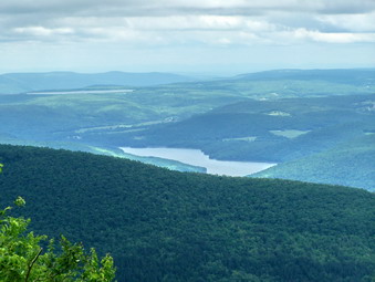 The last time Sheba and I hiked Vly and Bearpen there was still snow on the ground and we followed a faint but obvious track through the snow to the canister. On this day things looked completely different. I found the herd path and followed it for some time but lost it in some blowdown along the way. I found the light blue blazes again a little further on and then lost them. This was repeated several times. There were only a few nettles and prickers to bother us and the insects were not too bad. What WAS a bother was the large areas of standing water and mud! Sheba and I negotiated a few ledges and then we were on the summit. This part seemed to go quickly and we caught a herd path right to the canister. I signed in and noted that the last visit was the very early part of June. At some time the noon whistles sounded and we headed back down the herd path. Following the blazes down was easier than up and my GPS track showed we were pretty close to the path on the way up. Back at the shack we crossed the road and began to follow the roads to the summit of Bearpen.
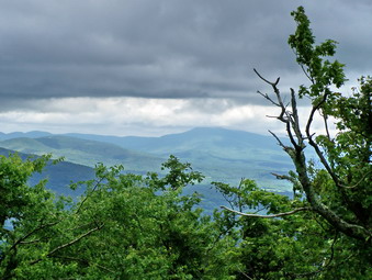 The roads on Bearpen alternated between running water on the steeper parts to standing water and mud pits everywhere else. We followed the roads until following would have meant losing elevation and heading in the wrong direction. Just at this point I noticed a rather distinct path turning off the road in the direction of Bearpen. It was also at this time that I remembered that the Bearpen marked on my GPS map was NOT the one I was looking for! The path we followed was very distinct and was very close to the route we had used the last time when snow lay on the ground. If anything, this one was more distinct and easier to follow. It didn't seem like it took long to get to the old ski area. I walked to the top to get the summit and then returned to the slopes to get some pictures. The day was still overcast and the view was much the same as before but I took some shots before heading back. I had intended to follow the roads back as I had last time but they were just too muddy. We hit the cutoff for the path we followed up and took it all the way back to the shack. At some point the wind picked up and the sky darkened. I cancelled the plans for South Bearpen and we headed down the woods road and back to the car. We got to the car just before 2:00 PM. We had covered just over 7 miles in under 4 hours.
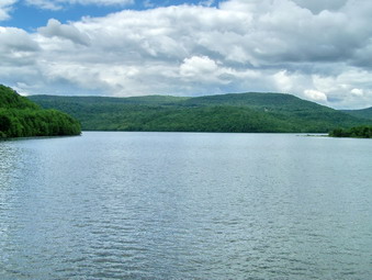 On the way home I stopped at the bridge across the Pepacton Reservoir as I had meant to do so many times. I took some pictures both ways from the bridge. In the future I think I will ride around the reservoir to take some additional shots.