
What You Missed
Fall 2010
Fall 2010
![]()
![]() On Thursday, December 16th I had to be at school early for an away basketball game so I decided to hike closer to home. I headed for Big Pond with the intent of hiking to Little Pond and then to Cabot Mountain. After visiting the Beaverkill vista on Cabot, I planned to loop back by way of Little Pond. The forecast was for clouds early and then some sun later in the morning. We arrived at the parking area at Big Pond around 9:00 AM and immediately began to hike. There was a few inches of snow on the ground at the beginning of the trail but not enough to require traction. The further we hiked the more snow we encountered with snow beginning to stick to the bushes and trees. The first 1.2 miles to the trail junction at the top of Touch-Me-Not Mountain is a constant uphill and really got me warmed up. About two-thirds of the way, I stopped and took off my midlayer despite the fact that the temperature was not yet up to 20 degrees! I also donned my new MicroSpikes for the first time. There was enough snow in places to warrant using them and, in places, the trail requires some sidehilling. After walking only a short distance with the MicroSpikes, I was a believer! Other hikers had always recommended them to me and now I see why. When we hit the trail junction, we turned right and walked the half mile to the turn up the Cabot Mountain Trail. We had not been out in several days so Sheba was crazed. She ran ahead and then doubled back at full speed and repeated this over and over. The first part of the trail toward Cabot is flat but poorly marked. I just followed my dog as soon we were at the base of the mountain. In the summer this climb is difficult due to the nettles and loose rock. In winter going up and down is hampered by steep slippery areas and some blowdown in awkward places. I found the MicroSpikes allowed me to have much more maneuverability than snowshoes and I was very pleased with their grip. The climb is only about .3 miles but gains around 450 feet with some steep areas. Once at the top we walked to the Beaverkill Vista where I dropped my pack to take some pictures. It was 10:35 Am and we had hiked 2.25 miles.
On Thursday, December 16th I had to be at school early for an away basketball game so I decided to hike closer to home. I headed for Big Pond with the intent of hiking to Little Pond and then to Cabot Mountain. After visiting the Beaverkill vista on Cabot, I planned to loop back by way of Little Pond. The forecast was for clouds early and then some sun later in the morning. We arrived at the parking area at Big Pond around 9:00 AM and immediately began to hike. There was a few inches of snow on the ground at the beginning of the trail but not enough to require traction. The further we hiked the more snow we encountered with snow beginning to stick to the bushes and trees. The first 1.2 miles to the trail junction at the top of Touch-Me-Not Mountain is a constant uphill and really got me warmed up. About two-thirds of the way, I stopped and took off my midlayer despite the fact that the temperature was not yet up to 20 degrees! I also donned my new MicroSpikes for the first time. There was enough snow in places to warrant using them and, in places, the trail requires some sidehilling. After walking only a short distance with the MicroSpikes, I was a believer! Other hikers had always recommended them to me and now I see why. When we hit the trail junction, we turned right and walked the half mile to the turn up the Cabot Mountain Trail. We had not been out in several days so Sheba was crazed. She ran ahead and then doubled back at full speed and repeated this over and over. The first part of the trail toward Cabot is flat but poorly marked. I just followed my dog as soon we were at the base of the mountain. In the summer this climb is difficult due to the nettles and loose rock. In winter going up and down is hampered by steep slippery areas and some blowdown in awkward places. I found the MicroSpikes allowed me to have much more maneuverability than snowshoes and I was very pleased with their grip. The climb is only about .3 miles but gains around 450 feet with some steep areas. Once at the top we walked to the Beaverkill Vista where I dropped my pack to take some pictures. It was 10:35 Am and we had hiked 2.25 miles.
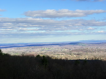
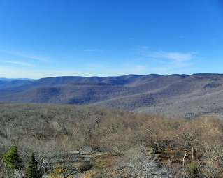
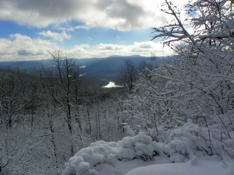 When we arrived at the vista, the sun was still behind the clouds but the view was very nice. Little Pond and the Beaverkill Valley lay below and to the right. Straight ahead were some hills. All the trees near and far were covered with snow. I took some shots and then the sun broke through. The sunlight sparkling off the snow on the trees offered a new photographic opportunity! I took some more pictures including some of Sheba. The air temperature was still cold and I started to cool down since I was dressed for hiking and not standing still. We got a drink and a snack and then I put away the camera. We started to hike back down the mountain which proved more challenging than the trip up. Back at the trail junction we turned right to hike down to Little Pond. By 11:15 AM we arrived at the open field that overlooks Little Pond and I stopped to take a few pictures before heading down the trail to the pond. Parts of the trail had some open water and I noticed that once my boots with the MicroSpikes were wet they tended to rapidly collect clumps of snow. I tried to solve this by kicking a few trees which did help some. We arrived at the loop trail around Little Pond at 11:15 AM about 4 miles into the hike. We turned left and walked a short distance before stopping and walking to the edge of the ice. I took a few shots before heading toward the outlet end if the pond. Along the way I took a few more pictures. Once we were near the Little Pond picnic area, we turned left and up the hill to climb back up the mountain and complete the loop. This part of the trail always seems longer and steeper than I remember. By 12:35 PM we had completed the loop by climbing up and over Touch-Me-Not Mountain and were at the trail junction at 5.6 miles into the hike. The last part of the hike back to the car seemed to go quickly and we were back at Big Pond by 1:10 PM. We had hiked 6.7 miles in just over 4 hours. I took a few pictures at Big Pond before heading for home.
![]() On Saturday, December 11th I was again, yes AGAIN, planning on going to Westkill as the forecast was for slightly higher temperatures and partly sunny skies. It had snow some overnight but I did not expect the roads to be to bad. I was wrong! As I left my driveway at 9:00 AM it was immediately obvious that the roads were very slippery and that only a little sand had been employed here and there. I don't give up easily so I drove out the DeBruce Road to head to Westkill. By the time I reached DeBruce it was clear it going to take a very long time to get to Spruceton if I made it at all. I was discouraged but decided to stop at the Long Pond trailhead on Flugertown Road and do a short hike. I knew I would feel better if I got some exercise. I parked at 9:20 AM and we started hiking immediately. As usual, I was overdressed but it was cool starting out. The first part of the trail is a nice steady ascent to get you warmed up. At 1.1 miles we were at the trail that leads down to the shore of Long Pond and we turned right to walk down to the pond. On the shore the pond seemed high as the ice extended further inland than I remembered. The sky was completely covered by clouds and the sun was directly across from where I was standing. Nome of this made taking pictures appealing so we walked back up to the main trail. At this point we picked up some footprints that seemed to indicate someone had walked to the turn off and then turned around. As we continued on the main trail, the tracks turned off to the left and I saw a hunter in Blaze standing in the woods about 100 feet off the trail We waved and I became aware that it was the last day of rifle season and I had turned my orange jacket in for a green one. I was well camouflaged. Sheba's blaze bandanna was our only really bright coloration. We continued on the main trail and turned right at the trail junction to head for the Long Pond lean-to. We arrived at the side trail to the lean-to at 10:10 AM after walking about 1.85 miles. I decided at this point that, rather than going to the lean-to, we would continue passed that point and go to Basily Road. At Basily Road we would turn right instead of left as we usually do. This would take us toward Black Bear Road. The sign at the beginning of Basily Road on Black Bear Road says "Bridge Out". I intended to walk to where the bridge was out and then reverse our route back to the car.
On Saturday, December 11th I was again, yes AGAIN, planning on going to Westkill as the forecast was for slightly higher temperatures and partly sunny skies. It had snow some overnight but I did not expect the roads to be to bad. I was wrong! As I left my driveway at 9:00 AM it was immediately obvious that the roads were very slippery and that only a little sand had been employed here and there. I don't give up easily so I drove out the DeBruce Road to head to Westkill. By the time I reached DeBruce it was clear it going to take a very long time to get to Spruceton if I made it at all. I was discouraged but decided to stop at the Long Pond trailhead on Flugertown Road and do a short hike. I knew I would feel better if I got some exercise. I parked at 9:20 AM and we started hiking immediately. As usual, I was overdressed but it was cool starting out. The first part of the trail is a nice steady ascent to get you warmed up. At 1.1 miles we were at the trail that leads down to the shore of Long Pond and we turned right to walk down to the pond. On the shore the pond seemed high as the ice extended further inland than I remembered. The sky was completely covered by clouds and the sun was directly across from where I was standing. Nome of this made taking pictures appealing so we walked back up to the main trail. At this point we picked up some footprints that seemed to indicate someone had walked to the turn off and then turned around. As we continued on the main trail, the tracks turned off to the left and I saw a hunter in Blaze standing in the woods about 100 feet off the trail We waved and I became aware that it was the last day of rifle season and I had turned my orange jacket in for a green one. I was well camouflaged. Sheba's blaze bandanna was our only really bright coloration. We continued on the main trail and turned right at the trail junction to head for the Long Pond lean-to. We arrived at the side trail to the lean-to at 10:10 AM after walking about 1.85 miles. I decided at this point that, rather than going to the lean-to, we would continue passed that point and go to Basily Road. At Basily Road we would turn right instead of left as we usually do. This would take us toward Black Bear Road. The sign at the beginning of Basily Road on Black Bear Road says "Bridge Out". I intended to walk to where the bridge was out and then reverse our route back to the car.
We walked about 1.0 mile to Basily Road, turned right and walked along a wide woods road designated as a snowmobile trail. The road was slightly uphill but the woods were pleasant and the temperatures had increased some. At some point along the way, I dumped my midlayer and traded in my heavy gloves for a light pair of stretch gloves. We kept walking and there was no sign of a bridge. About 3.9 miles into the hike we were nearing a private road and a hunting camp. On the left I noticed an enormous accretion of ice some 8 feet tall. This was to say the least, surprising. On closer inspection a black plastic hose ran up a tree near the ice. I took a few pictures of this since I had no idea what the pipe was doing there. The road was now dirt but well packed with a snowy coating. At 5 miles we were on Black Bear Road. I realized that the "Bridge Closed" sign meant the bridge all the way back at the Peters' hunting camp! I was ready to turn around and retrace our path when I heard several shots close by. I decided at that point to walk down Black Bear Road to Round Pond at walk Pole Road back to Flugertown Road and the car. We turned onto Pole Road at 11:35 AM and started the walk back to Flugertown. We made good time walking a little over 4 miles in a little under 1 hour and 15 minutes. We turned right on Flugertown Road and finished the last .85 miles to the car. The whole loop was 10.4 miles which we finished in 3 hours and 40 minutes arriving back at the car by 1:00 PM.
![]() On Thursday, December 9th I was again planning on going to Westkill as the forecast was for slightly higher temperatures and partly sunny skies. By the time I was ready to leave the air temperature was only 15 degrees and there was still a stiff breeze. I decided I might try Giant Ledge as it is closer and shorter. I worry a little about Sheba in the winter especially with the ice and snow accumulation on her paws. As I pulled out of the drive way, it became more and more cloudy and began to snow. I decided I would save the places with great views for a great viewing day and turned west on Route 17 to go to Roscoe and hike Trout Pond. Trout and Mud Ponds offer a variety of routes and I could back out early if the weather was too nasty. As I approached the Roscoe exit, I remembered that several people had asked me about hiking into this area from the other end of Russell Brook Road near Cooks Falls. I decided this would be a worthwhile endeavor and different as I had never hiked from that trailhead. I turned off at the Cooks Falls exit and turned onto Russell Brook Road. Just passed the campsites the road was not plowed and it had a few inches of snow on it. I went to the end, turned around and parked. We started our walk up the road at about 10:45. Just passed the STOP sign and pile of dirt that signal the end of the road, the road dropped away and we were confronted by Russell Brook. The brook had eroded the road and was too wide to cross. At first, I though that we would simply go to the parking area on Morton Hill road. As I looked ahead, I could see where the road was still intact and from that point on it seemed to be in good shape. I decided to bushwhack up the hill on the right side of the parking area and then walk the bank to an area that I could descend from to the road. Going up the bank and walking along the top was pretty easy. I found a place to descend and this wasn't so easy. The snow on top of leaves on top of rocks made the way down an adventure. Once I crossed two ditches filled with water I looked back and wondered how easy it would be to get back up that bank. The skies were still cloudy and the air temperature was 17 degrees.
On Thursday, December 9th I was again planning on going to Westkill as the forecast was for slightly higher temperatures and partly sunny skies. By the time I was ready to leave the air temperature was only 15 degrees and there was still a stiff breeze. I decided I might try Giant Ledge as it is closer and shorter. I worry a little about Sheba in the winter especially with the ice and snow accumulation on her paws. As I pulled out of the drive way, it became more and more cloudy and began to snow. I decided I would save the places with great views for a great viewing day and turned west on Route 17 to go to Roscoe and hike Trout Pond. Trout and Mud Ponds offer a variety of routes and I could back out early if the weather was too nasty. As I approached the Roscoe exit, I remembered that several people had asked me about hiking into this area from the other end of Russell Brook Road near Cooks Falls. I decided this would be a worthwhile endeavor and different as I had never hiked from that trailhead. I turned off at the Cooks Falls exit and turned onto Russell Brook Road. Just passed the campsites the road was not plowed and it had a few inches of snow on it. I went to the end, turned around and parked. We started our walk up the road at about 10:45. Just passed the STOP sign and pile of dirt that signal the end of the road, the road dropped away and we were confronted by Russell Brook. The brook had eroded the road and was too wide to cross. At first, I though that we would simply go to the parking area on Morton Hill road. As I looked ahead, I could see where the road was still intact and from that point on it seemed to be in good shape. I decided to bushwhack up the hill on the right side of the parking area and then walk the bank to an area that I could descend from to the road. Going up the bank and walking along the top was pretty easy. I found a place to descend and this wasn't so easy. The snow on top of leaves on top of rocks made the way down an adventure. Once I crossed two ditches filled with water I looked back and wondered how easy it would be to get back up that bank. The skies were still cloudy and the air temperature was 17 degrees.
The road remained in go condition for some time with parts of the stream on either side and us walking down the middle. At one point we crossed a bridge which seemed to be a culvert with metal guard rails. We also came across some old foundations and a privy. The area with the privy looked like it may once have been part of a state designed primitive campsite. As we continued our hike we had to negotiate several stream crossings and, a times, had to walk over large stones left from the stream erosion. Numerous blow downs also forced us to change directions several times. Eventually we made it to the place where a trail cuts up to the left and head to Mud Pond and then Trout Pond or the upper trailhead on Russell Brook road. It had only been about 1.4 miles and less than 45 minutes, so I decided to take the trail at least as far as Mud Pond. The sun had broken through the clouds but didn't seem to be adding much warmth. Despite the air temperature I was warm and opened the pit zips on my jacket and the front zippers on my shirts. I also switched from my Gordini mittens to much lighter Mountain Hardware stretch gloves. The trail to Mud Pond is about two miles long. the first mile climbs rather steadily but then the trail levels some. As we were walking Sheba stopped which usually means people or some other animal on the trail. I looked up to see a Great Blue Heron take off and wing its way through the trees. We continued our walk as the trail ascended and walked around some blow down on the way. When we arrived at the trail to Trout Pond, we had walked about 3.4 miles and the time as about 12:15 PM. Turning around at this point was probably the best idea since the total hike would be about hours and would cover 7 miles. I had somewhere I needed to be at 5:00 PM and this also figured into Mt decision. So I decided to make the left and hike all the way around Trout Pond, back to the spot where we were standing and then back to the car.
The trail to Trout Pond ascends to near the top of Cherry Ridge over the next 1.2 miles. Although the trail was well covered by snow the going wasn't too bad although there were some wet spots along the way. The sun came out once again and I thought I might get some pictures at Trout Pond. After the climb to Cherry Ridge, the next .7 miles of trail descends to the inlet end of Trout Pond. This part was a lot harder since the snow covered rocks were slippery and there were a lot of them! By 1:10 PM we were at the pond but the weather had changed to cloudy and snow filled the air. I was a little worried about the time so I decided I would not stop again even for pictures. After a drink and a quick snack we headed down the trail to the outlet end of Trout Pond. I knew that the rest of the hike would have some miles but at least most of the trail was flat or downhill!
![]() On Tuesday, December 7th I was planning on going to Westkill but the temperatures were so low (below 20 degrees) and the winds so high (20+ mph) that I was worried that it would bother Sheba. I knew going north and up in elevation would also lower the temperatures. Rather than stay at home, I decided we would go to Frick Pond for a short hike. My plan was to park, hike, evaluate the conditions and decide how long we would stay out. We parked and started to hike at about 9:45 AM. Surprisingly, the Quick Lake Trail to Frick Pond had a lot of standing and running water! I would have thought that the very low temperatures would have frozen it. When we got to Frick Pond, the wind was whipping across the water toward the outlet. Again, I was surprised to find that there was no ice on the pond. I had decided that I would not take pictures today unless something very special presented itself. When we arrived at the trail junction on the other side of the pond, we went to the left to stay on the Quick Lake Trail. My intent was to hike to the next junction and take the Logger's Loop back to Times Square. Once we were in the protection of the trees and away from the wind the cold didn't seem so bad. When we arrived at the next trail junction, I decided to stay on the Quick Lake Trail and hike up to the Flynn Trail to do our normal 6 mile loop. The higher we got in elevation the deeper the snow got. The 3 or 4 inches at the trailhead turned into 4 to 6 inches on the upper part of the Quick Lake trail. At the junction we turned right onto the Flynn Trail and encountered between 6 and 8 inches on the way to Hodge Pond. At Hodge Pond, we turned left to circle around the back of the pond. Hodge Pond had a skim of ice with only a little open water near the middle. As we walked down to the pond, we came across drifts of up to two feet. In other areas there was little snow at all as the wind had blown it away and into the drifts. We continued on the Flynn Trail up to the four way junction with the Big Rock Trail. Here we continued straight ahead and walked down the Flynn Trail and back to the car. It was 12:30 PM when we finished and I felt that 6.7 miles in 2 hours and 45 minutes was good considering the conditions.
On Tuesday, December 7th I was planning on going to Westkill but the temperatures were so low (below 20 degrees) and the winds so high (20+ mph) that I was worried that it would bother Sheba. I knew going north and up in elevation would also lower the temperatures. Rather than stay at home, I decided we would go to Frick Pond for a short hike. My plan was to park, hike, evaluate the conditions and decide how long we would stay out. We parked and started to hike at about 9:45 AM. Surprisingly, the Quick Lake Trail to Frick Pond had a lot of standing and running water! I would have thought that the very low temperatures would have frozen it. When we got to Frick Pond, the wind was whipping across the water toward the outlet. Again, I was surprised to find that there was no ice on the pond. I had decided that I would not take pictures today unless something very special presented itself. When we arrived at the trail junction on the other side of the pond, we went to the left to stay on the Quick Lake Trail. My intent was to hike to the next junction and take the Logger's Loop back to Times Square. Once we were in the protection of the trees and away from the wind the cold didn't seem so bad. When we arrived at the next trail junction, I decided to stay on the Quick Lake Trail and hike up to the Flynn Trail to do our normal 6 mile loop. The higher we got in elevation the deeper the snow got. The 3 or 4 inches at the trailhead turned into 4 to 6 inches on the upper part of the Quick Lake trail. At the junction we turned right onto the Flynn Trail and encountered between 6 and 8 inches on the way to Hodge Pond. At Hodge Pond, we turned left to circle around the back of the pond. Hodge Pond had a skim of ice with only a little open water near the middle. As we walked down to the pond, we came across drifts of up to two feet. In other areas there was little snow at all as the wind had blown it away and into the drifts. We continued on the Flynn Trail up to the four way junction with the Big Rock Trail. Here we continued straight ahead and walked down the Flynn Trail and back to the car. It was 12:30 PM when we finished and I felt that 6.7 miles in 2 hours and 45 minutes was good considering the conditions.
![]()
![]() On Friday, December 3rd the forecast was for temperatures in the high 30's with partly sunny skies. I decided to go to Spruceton and hike the Hunter Leavitt loop. I had an idea that the Westkill/Diamond Notch Falls might be nice due to the amount of rain we had experienced in the middle part of the week. Sheba and I arrived at the end of Spruceton Road around 9:15 AM and I started the drive to the parking area. It immediately obvious that there had been major flooding along the road. After the previous flood, the road had been closed and I am sure the latest rainfall had a similar effect. A "Road Flooded" sign was posted not too far in by I decided to drive and see what happened. The West Kill was still very high with a lot of angry looking, muddy water. Several road crews were working to shore up the road with large boulders or fill in the gaps in the road. It seems that every little stream that runs under the road boiled up and washed out some part of the road. The road was not flooded and we arrived at the parking area just before 9:30 AM. It was in the low 20's and I decided to put on a pair of light tights that I had packed. After changing, we got started right away and I signed into the trailhead register at exactly 9:30 AM. The trail up to the hairpin turn looked like a small stream! The running water was accompanied by patches of ice. After the turn, the trail was drier but the amount of ice increased. There was some running water up to the col and quite a bit of new blowdown on the trail. The views of Westkill on the right gave a hint of what might be seen from any viewpoint this day. The entire mountain was covered in low clouds which all but obscured any view! We made the turn up the mountain at around 10:00 Am and immediately encountered large amounts of ice on all the exposed rock faces. We worked our way around the ice without traction devices since I would have had to put them on and take them off many times. By 10:30 PM we arrived at the Lean-to. We walked down through the slot and out to the viewpoint. The Spruceton Valley was covered with a blanket of clouds with only limited views.
On Friday, December 3rd the forecast was for temperatures in the high 30's with partly sunny skies. I decided to go to Spruceton and hike the Hunter Leavitt loop. I had an idea that the Westkill/Diamond Notch Falls might be nice due to the amount of rain we had experienced in the middle part of the week. Sheba and I arrived at the end of Spruceton Road around 9:15 AM and I started the drive to the parking area. It immediately obvious that there had been major flooding along the road. After the previous flood, the road had been closed and I am sure the latest rainfall had a similar effect. A "Road Flooded" sign was posted not too far in by I decided to drive and see what happened. The West Kill was still very high with a lot of angry looking, muddy water. Several road crews were working to shore up the road with large boulders or fill in the gaps in the road. It seems that every little stream that runs under the road boiled up and washed out some part of the road. The road was not flooded and we arrived at the parking area just before 9:30 AM. It was in the low 20's and I decided to put on a pair of light tights that I had packed. After changing, we got started right away and I signed into the trailhead register at exactly 9:30 AM. The trail up to the hairpin turn looked like a small stream! The running water was accompanied by patches of ice. After the turn, the trail was drier but the amount of ice increased. There was some running water up to the col and quite a bit of new blowdown on the trail. The views of Westkill on the right gave a hint of what might be seen from any viewpoint this day. The entire mountain was covered in low clouds which all but obscured any view! We made the turn up the mountain at around 10:00 Am and immediately encountered large amounts of ice on all the exposed rock faces. We worked our way around the ice without traction devices since I would have had to put them on and take them off many times. By 10:30 PM we arrived at the Lean-to. We walked down through the slot and out to the viewpoint. The Spruceton Valley was covered with a blanket of clouds with only limited views.
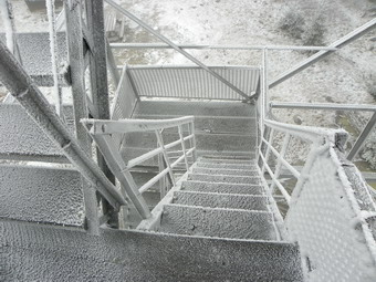 Back on the main trail we encountered more ice and soon passed by the turn to the Colonel's Chair. On the more level areas near the top there were large ponds covered by ice. Some of these were almost dry while others were filled with water. The hike seemed to go quickly even with the maneuvers we had to perform and we arrived at the tower around 11:15 AM. There was little or no snow on top but many of the trees and the tower were covered in frozen, blown snow. I took some pictures from the ground and then approached the tower. I knew that there wouldn't be much of a view from on the tower and it looked VERY slippery. Despite this I decided to ascend the tower. It was very slippery and there wasn't much of a view but I did take a few shots including close ups of the ice and snow on the tower. The wind on the tower and the fact that the air temperature was barely 20 degrees made the experience a cold one. When I returned to the ground, we headed out on the trail down the other side of the mountain to the Devil's Path. The area on the top that is normally wet had only a few frozen puddles. When we started down the trail, we again ran into running water and ice for almost the entire trip to the Devil's Path. Along the way the sun began to break through the clouds but this seemed like a futile effort and was short lived. Around noon we turned right onto the Devil's Path and headed toward the Devil's Acre lean-to.
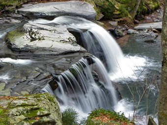 I know that I always misjudge the distance to the herd path to Leavitt. It is approximately .3 miles and I always feel that I have missed it. We climbed a little and I was about to reassess where we were when Sheba made the left turn. Each time I visit this path is more distinct. We made good time as I simply followed Sheba to the turn up to the canister. We were at the can at 12:35 PM with about 6 miles completed. We didn't stay long and then it was back to the Devil's Path. The first descent to the lookout was covered in ice. We stopped briefly so that I could take some pictures of Westkill and Leavitt. The sun was again trying to break through. After the lookout is a very wet area and today was no exception. There were several large marshy areas to work around. After this, things didn't get much better as the rest of the trail is a jumble of rocks on a good day. On this day the jumble of rocks was covered in ice and there was a stream running down the trail for almost the whole length. We walked on the edge of the trail most of the way, This trail is one of my least favorites and always seems too long. As we approached the end of the trail, I could here the falls. We arrived at the falls at 2:30 PM. There was more water going over the falls than I can ever remember. I stopped to take pictures from on top of the falls and the bridge. I then decided to work my way down into the stream bed at the base of the falls. As I did so, I realized that everything was covered in the frozen mist from the falls. This was beautiful but treacherous. I slid down to the falls and took some great shots of both halves and the entire scene as one. The trip back up was easier than I though and we were soon on our way back to the car. The trail back to the parking area had a lot of running water. The Westkill was raging and it was obvious the flood waters had eroded much of the bank on the other side. There was a lot of sediment deposited high up on the banks. In at least one place the trail was eroded severely. As we hit the road at the end of the trail the road near the culvert before the parking area was washed away. A barrier and sign a little further down announced that part of the road was closed. We were back at the car by 3:00 PM having covered 9.9 hard miles in 5.5 hours.
![]()
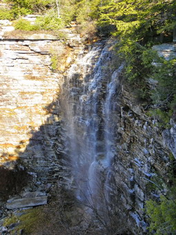
![]() On Monday, November 29th I studied the weather forecast for the week and saw that Tuesday and Wednesday looked as if they would bring significant rain. I decided to hike for the third day in a row. Since it was just Sheba and I, I decided to do a long hike and settled on Sam's Point near Ellenville. I knew that hunting was allowed in the preserve but that it was less popular than some of the Catskill Park areas I was considering. The Preserve opens at 9:00 AM and we arrived at about 9:30 AM at the Visitor's Center parking area. We got right on the carriage road that leads up to Sam's Point. My plan was to hike to Verkeerder Kill Falls and then up to the Escarpment, passed Mud Pond and on to Lake Awosting. After hiking around the shore of the lake, I planned to come back the same way. I has not totaled the mileage but figured it would be about 12 miles. The plan called for some fast hiking with limited interruptions for pictures. As we hiked up the carriage road toward the Sam's point spur trail, it was obvious that there was a lot of haze hanging in the valleys and on the hills. This would make photography difficult but this did not really concern me. We passed by the first lookout below Sam's Point stopping only to get a quick view. It was on passed the spur trail and to the road down to the ice caves. We took the right down the road and then a left onto the trail to the falls. It was 10:00 AM. The trail down to the falls has some beautiful views out over the flat valley. Ahead on the trail are the cliffs of Castle Point and Hamilton Point at Minnewaska. The blue waters of Lake Awosting can also be seen at times and it looks so far away. The trail drops 500 feet in about 1.75 miles to the lowest point on the hike at the falls. I was anxious to make sure we could cross the stream and decided not to take pictures on the near side. I need not have worried since the water was actually little low and the stream was easily crossed.
On Monday, November 29th I studied the weather forecast for the week and saw that Tuesday and Wednesday looked as if they would bring significant rain. I decided to hike for the third day in a row. Since it was just Sheba and I, I decided to do a long hike and settled on Sam's Point near Ellenville. I knew that hunting was allowed in the preserve but that it was less popular than some of the Catskill Park areas I was considering. The Preserve opens at 9:00 AM and we arrived at about 9:30 AM at the Visitor's Center parking area. We got right on the carriage road that leads up to Sam's Point. My plan was to hike to Verkeerder Kill Falls and then up to the Escarpment, passed Mud Pond and on to Lake Awosting. After hiking around the shore of the lake, I planned to come back the same way. I has not totaled the mileage but figured it would be about 12 miles. The plan called for some fast hiking with limited interruptions for pictures. As we hiked up the carriage road toward the Sam's point spur trail, it was obvious that there was a lot of haze hanging in the valleys and on the hills. This would make photography difficult but this did not really concern me. We passed by the first lookout below Sam's Point stopping only to get a quick view. It was on passed the spur trail and to the road down to the ice caves. We took the right down the road and then a left onto the trail to the falls. It was 10:00 AM. The trail down to the falls has some beautiful views out over the flat valley. Ahead on the trail are the cliffs of Castle Point and Hamilton Point at Minnewaska. The blue waters of Lake Awosting can also be seen at times and it looks so far away. The trail drops 500 feet in about 1.75 miles to the lowest point on the hike at the falls. I was anxious to make sure we could cross the stream and decided not to take pictures on the near side. I need not have worried since the water was actually little low and the stream was easily crossed.
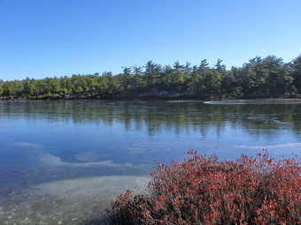 On the other side of the stream we stopped so that I could take some pictures. There was enough water going over the falls to make pictures interesting but I was surprised there wasn't more given the rain we had recently. I decided at this point that I was too warm, as usual, and removed my Patagonia Wool 1 top and my silkweight tights. From the falls we headed up the trail to the escarpment and turned right toward Lake Awosting. The trail at first passes over mostly open rock and hikers have constructed many small cairns along the way. After about 1.1 miles Mud Pond came into view. There was a light skim of ice on the surface and we stopped at an overlook so that I could take some shots. As we walked down the trail, I noticed a path to the right that went down to the shore of the pond. We followed it and I got another vantage point for the camera. It was 11:20 AM. We were making good time. Back on the trail we crossed the wooden walkway over some muddy areas and Fly Brook. After another mile and about 25 minutes we were at the viewpoint at the southwestern end of the lake. From here we took the short side path to the left and down to the carriageway around the lake and started to walk anticlockwise. I knew there were several nice viewpoints along the shore that would offer points to take pictures. There are several areas of land that jut out into the lake and we stopped several times. The water was an incredible deep blue. Along the way I saw one tree freshly fallen by what looked like beaver activity. Along this side of the lake we also met a lone mountain biker, the only other person we saw for the whole day! The "beach" was closed as evidenced by the signs posted there. The open rock shelf was covered in ice from the water that flows over it into the lake. This made walking tricky. On the other side of the beach the carriageway ascends to viewpoints above the lake and we stopped briefly at these. As we descended to the northeast end of the lake it was nearing 12:30 PM and I was beginning to be concerned about time and the route I had chosen.
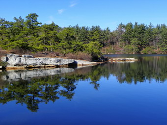 The path along the opposite shore of the lake is more direct and soon we were passing the ranger's cabin and then the final viewpoint near the end of the lake. We were back at the point we started by 1:00 PM. I was surprised to find that the walk around the lake was 3.6 miles! I had though Awosting was smaller than the other two "sky lakes" but it would seem it is the largest. We stopped briefly so that we could get a drink and a snack. We were 8.6 miles into the hike. As we continued on our way I noticed that the balls of my feet were "hot" especially when descending. A good pair of socks is essential and "good" can be different for different people. The Wigwam heavy socks I had chosen have a terry pile on the inside which does not agree with my feet after about 8 miles. A liner sock always help as long as it is smooth and I had forgotten all this. We stopped and I applied a bandaid and changed into a pair of Teko socks I had. Teko seems to be the best brand of sock for me no matter the style. We started in again and my feet were much better. At 2:15 PM we were back at the falls have covered 2.2 miles between Awosting and the falls without stopping. We were at 10.8 miles overall. We crossed the stream and started the long walk back to the loop road. The trail gains elevation and passes over a lot of uneven and large rocks. Somewhere along the way I heard a buck snort or a person imitating a buck. I decided to hurry passed this area and keep Sheba close by. As we continued along the view back to Minnewaska proved inviting for the camera. I stopped and took pictures of the cliffs. I then noticed that the clouds were interesting and took some more pictures. I also saw a sundog in the sky and was lucky enough to be bale to get a shot. BY 3:15 PM we had traversed the 1.8 miles and 500 foot elevation gain back to the loop road. We turned left and walked quickly of the carriageway back to the car at the visitor's center. We arrived back at 3:30 PM after covering 13.6 miles in just under 6 hours!
![]()
![]() On Sunday, November 28th Cindy and I wanted to do a relatively easy hike after church. We also wanted to do something we had not tried before. I suggested hiking the SRT from the Guymard Turnpike to the Graham fire tower. I knew that the hike was flat until the climb to the tower but that finding the "trailhead" would be the hardest part. We left Livingston Manor after taking care of a few things after church and drove down the Quickway to exit 113 and turned south toward Port Jervis on Route 209. When we passed the turn for Route 211 to Otisville, I knew we were getting close. In the hamlet of Godeffroy, I turned onto the Guymard Turnpike. Soon Guymard Lake appeared on the right and then the bridge over the Metro North tracks. Exactly where to park was a problem. I turned around at the tracks and parked at the side of the road. We disembarked and crossed the tracks to the SRT on the other side. The Shawangunk Ridge Trail runs concurrently with the Long Path at this point so we followed the aqua blazes northeast along what appeared to be the old track right-of-way. The road was wide and completely flat. We found several railroad spikes along the way. Juts to the east of where we were walking are some new homes and we assumed another road allowed access to them. We saw a couple of hunters in blaze orange and several vehicles going one way or the other on the road. One truck stopped and the driver asked where we were going. When I told him, he didn't seem to know about the tower. He did tell us that there were hunters in the area and that we shouldn't "mess it up for them". I felt like saying I hoped they would not "mess it up for us" but I thought better.
On Sunday, November 28th Cindy and I wanted to do a relatively easy hike after church. We also wanted to do something we had not tried before. I suggested hiking the SRT from the Guymard Turnpike to the Graham fire tower. I knew that the hike was flat until the climb to the tower but that finding the "trailhead" would be the hardest part. We left Livingston Manor after taking care of a few things after church and drove down the Quickway to exit 113 and turned south toward Port Jervis on Route 209. When we passed the turn for Route 211 to Otisville, I knew we were getting close. In the hamlet of Godeffroy, I turned onto the Guymard Turnpike. Soon Guymard Lake appeared on the right and then the bridge over the Metro North tracks. Exactly where to park was a problem. I turned around at the tracks and parked at the side of the road. We disembarked and crossed the tracks to the SRT on the other side. The Shawangunk Ridge Trail runs concurrently with the Long Path at this point so we followed the aqua blazes northeast along what appeared to be the old track right-of-way. The road was wide and completely flat. We found several railroad spikes along the way. Juts to the east of where we were walking are some new homes and we assumed another road allowed access to them. We saw a couple of hunters in blaze orange and several vehicles going one way or the other on the road. One truck stopped and the driver asked where we were going. When I told him, he didn't seem to know about the tower. He did tell us that there were hunters in the area and that we shouldn't "mess it up for them". I felt like saying I hoped they would not "mess it up for us" but I thought better.
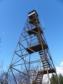
 After 1.7 miles of absolutely flat walking, we found red blazes going up the hill to the right and we turned onto another woods road. There was no sign of a tower anywhere! The road wandered up the mountain heading south, then east, then southeast. This was steeper than what we had been walking but the constant meandering cut the grade. At one point we crossed the white trail that I intended to use on the way back. We saw no hunters and no tower until we were practically on top of it. The distance from the SRT was less than a mile and we made it by 1:40 PM. The fire tower shared the top of the hill with cell towers and a nice little cabin. There is an access road for the cell towers which would probably be the quickest and easiest route to the top. Strangely, the cabin door was not locked but inside was wood for a fire and signs that someone had been there recently. Everything was in order. The tower was a different story! The entire first flight of treads was missing from the steps! Someone needs to replace these as soon as possible since the missing steps would make the climb difficult. After taking some pictures, we started back on the white trail. At one point this trail came very close to the edge of the cliff and I hoped to get a view but then it turned away from the view. The white trail twisted and turned but headed generally north. This route was much more of a trail than the red blazed woods road that we took up. It also looked as if no one had used it for awhile. The last .3 miles was a rather steep descent along a small stream. There was hardly any real trail in this area and lots of rocks to negotiate. I began to think of it as a "bushwhack with blazes". After slightly over a mile, we were back on the SRT just slightly north of the turn for the red trail. From here we hit our fast pace again and walked back to the car. Along the way we found a pile of fresh guts. There were also several more cars and trucks on the road. We were back at the car by 3:10 PM having covered 5.3 miles in under 2.5 hours.
![]()
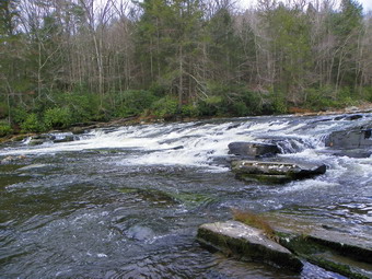
![]() On Saturday, November 27th Karl was up from Virginia and wanted to hike somewhere close by. I suggested we all go to the Neversink Unique Area at the end of Katrina Falls Road near Rock Hill. Cindy had not been to this part of the area either. Cindy, Karl and I piled into the car along with Sheba and Karl's dog Maggie. We arrived at the end of Katrina Falls Road in the parking area at 10:00 Am. There didn't some to be any other hikers but there were some hunters in the parking lot and we met some others as we began the hike. We took the blue trail that parallels the river and did not take any of the yellow spur trails until we got to the one that descends to Denton Falls. Along this 1.4 mile stretch we met two hunters walking back toward the parking area. The yellow spur trail down to Denton falls is about .3 miles with a few very short but steep sections. We were at the falls by 10:45 AM and the water was higher than I had seen it before. Walking out on the rocks to take pictures was a little harder this time but I was still able to get some shots including a video. We left the falls, ascended the trail back to the main blue trail and turned right. Within a few hundred feet we came to the trail junction with the red trail which forms a loop. We continued straight ahead on the blue trail to High Falls.
On Saturday, November 27th Karl was up from Virginia and wanted to hike somewhere close by. I suggested we all go to the Neversink Unique Area at the end of Katrina Falls Road near Rock Hill. Cindy had not been to this part of the area either. Cindy, Karl and I piled into the car along with Sheba and Karl's dog Maggie. We arrived at the end of Katrina Falls Road in the parking area at 10:00 Am. There didn't some to be any other hikers but there were some hunters in the parking lot and we met some others as we began the hike. We took the blue trail that parallels the river and did not take any of the yellow spur trails until we got to the one that descends to Denton Falls. Along this 1.4 mile stretch we met two hunters walking back toward the parking area. The yellow spur trail down to Denton falls is about .3 miles with a few very short but steep sections. We were at the falls by 10:45 AM and the water was higher than I had seen it before. Walking out on the rocks to take pictures was a little harder this time but I was still able to get some shots including a video. We left the falls, ascended the trail back to the main blue trail and turned right. Within a few hundred feet we came to the trail junction with the red trail which forms a loop. We continued straight ahead on the blue trail to High Falls.
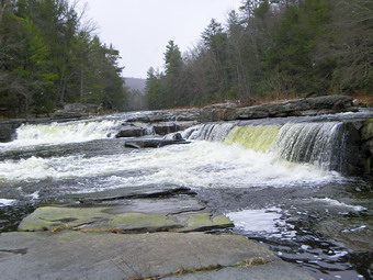 The walk to High Falls seemed longer than I remembered and I ended up scouting ahead to assess the distance my intention was to see if it was farther than Cindy wanted to go. I* was surprised that Maggie went with me while Sheba stayed back. I arrived at the yellow trail to the falls just before noon and after 2 miles of hiking from the trail junction, about 4 miles into the hike. At this point Sheba caught up to us. I decided to go down the short trail to the falls, take pictures and then go back to Cindy and Karl. Again, the water was high but I was able to get out onto the rocks to take pictures and a video. Snow was falling intermittently which made taking photographs harder. After grabbing these shots, I started back up the trail and...met Cindy and Karl coming toward me. We all went back down to the falls and stopped for some time. I took more pictures and we all had a drink and a snack. Some other people appeared on the other side of the river with young children. The kids skipped over the slippery rocks making me very nervous! Finally we left the falls and headed back. I had intended to take the red trail to form a loop but in the end we took the same route back. We arrived at the parking area at 1:45 PM after hiking 7.8 miles in 3 hours and 45 minutes.
![]()
![]() On Wednesday, November 24th I had already completed two short hikes by 12:15 PM but wanted a little more. From Winter Clove Inn I drove back to Palenville and then took Woodstock Avenue south toward West Saugerties. This eventually turned into the Manorville Road which paralleled a high ridge on my right. At one point I passed by Platte Clove Road and WA sable to see the reason it is called a clove for the first time. Platte Clove splits the high mountain ridge and offered a way through the mountains without going over them. Once we reached the Glasco Turnpike, I turned right and started looking for Meades Mountain Road. Somewhere along the way I missed the turn. By the time I found my error, I decided it would be easier to take McDaniel Road to Meades Mountain and the parking area. The parking area is near the top of the road and is impossible to miss. I parked at around 1:05 PM and we started to hike immediately. The route follows the access road for the WTZA tower which is near the summit. The road is in good condition and is never too steep. We made good time and met several individuals and small groups coming down. There were a few hunters on the way down. By 1:45 PM we had climbed steadily for 1.75 miles and were at the ruins of the Overlook Mountain House. I decided to keep hiking to the tower and stop at the ruins on the way back. Just up the road there is a junction for the trail out to Platte Clove Road and the trail to the summit and the fire tower. We turned right and walked the .5 mile trail to the tower arriving just before 2:00 PM. I dropped my pack and went up the tower. It was VERY windy and the views were hazy. I was careful to hold onto the tower as I took my pictures since the wind was gusting first in one direction and then in the other. I was getting cold and the conditions for photography were poor so I headed back down.
On Wednesday, November 24th I had already completed two short hikes by 12:15 PM but wanted a little more. From Winter Clove Inn I drove back to Palenville and then took Woodstock Avenue south toward West Saugerties. This eventually turned into the Manorville Road which paralleled a high ridge on my right. At one point I passed by Platte Clove Road and WA sable to see the reason it is called a clove for the first time. Platte Clove splits the high mountain ridge and offered a way through the mountains without going over them. Once we reached the Glasco Turnpike, I turned right and started looking for Meades Mountain Road. Somewhere along the way I missed the turn. By the time I found my error, I decided it would be easier to take McDaniel Road to Meades Mountain and the parking area. The parking area is near the top of the road and is impossible to miss. I parked at around 1:05 PM and we started to hike immediately. The route follows the access road for the WTZA tower which is near the summit. The road is in good condition and is never too steep. We made good time and met several individuals and small groups coming down. There were a few hunters on the way down. By 1:45 PM we had climbed steadily for 1.75 miles and were at the ruins of the Overlook Mountain House. I decided to keep hiking to the tower and stop at the ruins on the way back. Just up the road there is a junction for the trail out to Platte Clove Road and the trail to the summit and the fire tower. We turned right and walked the .5 mile trail to the tower arriving just before 2:00 PM. I dropped my pack and went up the tower. It was VERY windy and the views were hazy. I was careful to hold onto the tower as I took my pictures since the wind was gusting first in one direction and then in the other. I was getting cold and the conditions for photography were poor so I headed back down.
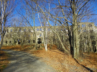 On the way to the tower we had passed by the cabin and noticed a sign for "Scenic overlook". I had never been to the overlook on Overlook and decided to see what it looked like. After a very short walk, we arrived at an open view of the valley below over to the Ashokan Reservoir. In some ways the view was nicer than from on the tower. One woman was at the lookout. We talked and found out she was related to the owner of a garage where I get my work done in Livingston Manor! We said goodbye and started back down the trail to the ruins. I took a picture of the cistern that supplied drinking water and then a few of the some "The Lodge". The Lodge was separate from the main building and was used after the last version of the hotel was never finished. The Overlook mountain House was originally constructed in the late 19th century. It was destroyed by fire on more than one occasion and rebuilt. The ruins that are still present are mostly convalesce with some stonework and apparently were never finished as the builder ran out of money. I took pictures of the exterior and then the interior before walking around to the front. I took some more shots from this angle of the rather impressive facade. Ruins like this remind me of an age now long gone and a history that is fading fast. After taking my photographs, Sheba and I set a quick pace back to the car interspersing a quick walk with jogging. A few people we still headed up the trail. We were back at the car by 3:00 PM covering 4.7 miles in under 2 hours with a lot of down time for picture taking!
![]()
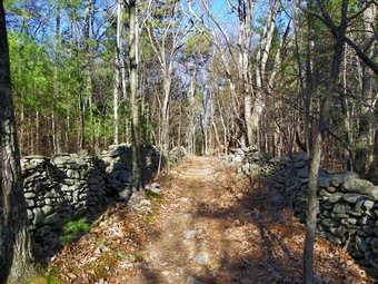
![]() On Wednesday, November 24th I arrived at the Winter Clove Inn at about 10:15 Am. I parked and went to the office to ask for permission. After permission was granted, Sheba and I walked across the lawn and down to the bridge across the creek. Artist Falls had quiet a bit of water flowing over it and I made a note to see if we could get down to the stream bed so that I could get a better angle for pictures. We walked out the trail that can lead to the Venus Bath or Stoppel Point. Where the trail splits passed the turn to the Venus Bath, we took the right Branch which was labeled 'Yankee Smith'. This trail leads to and area of stone walls that were built around the time of the American Revolution. The trail is blazed with red paint and is relatively easy to follow. It makes some twists and turns along the way. The first mile is a steady ascent and then it drops a little. At 1.25 miles the trail began to drop and some stone walls appeared. I thought I was at my destination since I lots the red blazes and I was unimpressed. I picked up the blazes and continued to follow them until about 1.5 miles where an smiley face on a tree announced the end of the trail. In the area was an impressive network of stone walls. The walls were on either side of a lane formed by more stone walls. I wandered around and took some pictures but could not find any evidence of a house or barn or homestead of any kind. I decided to follow the lane which went on for several hundred feet before joining a woods road. To the right the road was posted. Straight ahead through the forest and own a hill I could see a stream with another nice waterfall. Sheba and I bushwhacked down the hill to the creek. I took some shots and then walked down the creek and took some more. We climbed back up the hill to the road and lane. We hiked back down the lane and picked up the same trail back, now blazed in blue for the return trip.
On Wednesday, November 24th I arrived at the Winter Clove Inn at about 10:15 Am. I parked and went to the office to ask for permission. After permission was granted, Sheba and I walked across the lawn and down to the bridge across the creek. Artist Falls had quiet a bit of water flowing over it and I made a note to see if we could get down to the stream bed so that I could get a better angle for pictures. We walked out the trail that can lead to the Venus Bath or Stoppel Point. Where the trail splits passed the turn to the Venus Bath, we took the right Branch which was labeled 'Yankee Smith'. This trail leads to and area of stone walls that were built around the time of the American Revolution. The trail is blazed with red paint and is relatively easy to follow. It makes some twists and turns along the way. The first mile is a steady ascent and then it drops a little. At 1.25 miles the trail began to drop and some stone walls appeared. I thought I was at my destination since I lots the red blazes and I was unimpressed. I picked up the blazes and continued to follow them until about 1.5 miles where an smiley face on a tree announced the end of the trail. In the area was an impressive network of stone walls. The walls were on either side of a lane formed by more stone walls. I wandered around and took some pictures but could not find any evidence of a house or barn or homestead of any kind. I decided to follow the lane which went on for several hundred feet before joining a woods road. To the right the road was posted. Straight ahead through the forest and own a hill I could see a stream with another nice waterfall. Sheba and I bushwhacked down the hill to the creek. I took some shots and then walked down the creek and took some more. We climbed back up the hill to the road and lane. We hiked back down the lane and picked up the same trail back, now blazed in blue for the return trip.
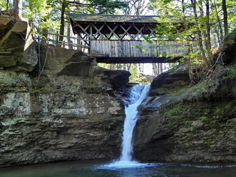 At 3.0 miles into the hike we were back at the trail junction with the Stoppel Point trail but continued straight back toward Winter Clove Inn. At 3.1 miles we turned left on the Lovers Loop trail and headed north toward the pond. We arrived at the small pond at 3.6 miles and then continued around the loop ending up back near Artist Falls. At this point I decided to try to find a way down to the stream bed below the falls. The only way I could find was a path that appeared to have been used by others. It passed over an almost vertical slab of rock which would be easy to slide down but not so easy to climb up over. The stream below the falls has sheer walls that are vertical and it appeared the water was high enough to making crossing nearly impossible. I decided to "go for it" and carefully descended the rock face and lowered myself to the stream bed. Sheba scrambled own behind me and we had arrived. I took some pictures from the stream bed. The angle was much better but the sunlight behind the falls interfered with the shots. We walked back over to the rock and somehow got back up. We were back at the car by 12:15 PM having covered 4.1 miles in just under 2 hours. It was still "early" so I decided to go to the trailhead on Meades Mountain Road. This trailhead is the shortest way to get to Overlook Mountain which sports the ruins to the Overlook Mountain House as well as, a fire tower.
![]() On Wednesday, November 24th I wanted to complete the GPS mapping of the trails at Winter Clove Inn but I knew this would be a short hike. I decided to visit some of the falls along Kaaterskill Creek and try to find the suspension bridge in Palenville. It was cloudy and overcast as we left Livingston Manor but the sun came out as we got on to Route 23A headed for Palenville. Around 9:00 AM I pulled off at the small parking area on the left side of the road to go to the falls known as the Naiad's Bath. We hopped over the guardrail and descended the short, steep path to the creek bed. The breeze was still blowing and down in the creek bed with no sun the temperature seemed chilly. We walked upstream and I took some pictures of the pretty little falls and its setting. The light coming from behind the falls made photography difficult.
On Wednesday, November 24th I wanted to complete the GPS mapping of the trails at Winter Clove Inn but I knew this would be a short hike. I decided to visit some of the falls along Kaaterskill Creek and try to find the suspension bridge in Palenville. It was cloudy and overcast as we left Livingston Manor but the sun came out as we got on to Route 23A headed for Palenville. Around 9:00 AM I pulled off at the small parking area on the left side of the road to go to the falls known as the Naiad's Bath. We hopped over the guardrail and descended the short, steep path to the creek bed. The breeze was still blowing and down in the creek bed with no sun the temperature seemed chilly. We walked upstream and I took some pictures of the pretty little falls and its setting. The light coming from behind the falls made photography difficult.
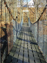
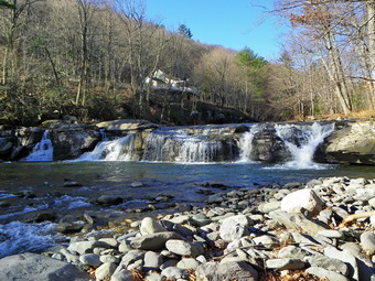 We walked back to the car and I drove down 23A to the Palenville Market. I parked across the street at the Gloria Dei Church and took some picture of the stone building. The path in the back left corner of the church property dropped down to Kaaterskill Creek. We turned left and soon the suspended footbridge appeared. The bridge has as sign that says 'Erected by the People of Palenville'. It uses a system of heavy wires or cables to support a deck of closely spaced longitudinal boards as a deck. The original year of its construction is unknown. I took pictures of the bridge from both ends and then dropped down into the stream bed to take some from the side. I noticed a small falls below the bridge and walked down the stream bed to stand on some rock ledges and take a few shots. We walked back across the bridge and then upstream along a path. Soon we were approaching Fernwood Falls which stretches across the width of the creek. The drop is not very high but it is pretty. Some POSTED signs forced us to drop into the creek which I assume are public property. I stopped nearer to the falls to take some pictures. From this viewpoint I could barely see Niobe Falls farther up the creek. We walked a little more up the stream bed and I was able to get a few pictures. I would like to get to the other side to take some pictures but it is all private land. Sheba and I retraced our route back to the church and I drive away headed for Winter Clove Inn.
![]()
![]() On Saturday, November 20th I considered going to Mount Greylock to hike with a group but decided I just didn't want to drive that far and Cindy agreed. Instead we decided to again join a group from the Catskill Mountain Club and hike to Tremper Mountain from the Phoenicia trailhead. The meeting time was 10:00 AM at the trailhead so we left Livingston Manor slightly after 8:00 AM and were the first to arrive at about 9:35 AM! The air temperature was in the low 40's but a persistent wind with some forceful gusts made standing around a little cool. While waiting, we took some pictures of the footbridges and small streams near the start of the hike and then Sheba and I did a little circuit up the hill be the parking area just to keep warm. Other cars began to arrive just as we were finishing and we went through a round of introductions. The head count for people was 11 or 12 but today there was only one dog! As we started, Bob Moses and I were talking and went up the hill together at a good pace. After reaching the top, we found only Sheba was with us and we slowed a little bit. Cindy and another woman caught up to use and we made the right turn onto the woods road that runs to the top of the mountain. the trail was pretty wet in spots with a lot of running water. Shortly after making the turn we stopped so that I could remove my middle layer. This inspired others and soon a few other hikers caught up. Terry, another hiker from Livingston Manor, was one who joined us. Cindy, Terry, another woman and myself formed a group of four and started out again at a good pace. The trail levels in some spots but mostly climbs at a steady incline toward the fire tower at the summit. In places it gets a little steeper but some switchbacks smooth out these portions. Tremper is known to be the site of at least one rattlesnake den but I was pretty sure it was too cold for them but I kept Sheba on the trail just in case.
On Saturday, November 20th I considered going to Mount Greylock to hike with a group but decided I just didn't want to drive that far and Cindy agreed. Instead we decided to again join a group from the Catskill Mountain Club and hike to Tremper Mountain from the Phoenicia trailhead. The meeting time was 10:00 AM at the trailhead so we left Livingston Manor slightly after 8:00 AM and were the first to arrive at about 9:35 AM! The air temperature was in the low 40's but a persistent wind with some forceful gusts made standing around a little cool. While waiting, we took some pictures of the footbridges and small streams near the start of the hike and then Sheba and I did a little circuit up the hill be the parking area just to keep warm. Other cars began to arrive just as we were finishing and we went through a round of introductions. The head count for people was 11 or 12 but today there was only one dog! As we started, Bob Moses and I were talking and went up the hill together at a good pace. After reaching the top, we found only Sheba was with us and we slowed a little bit. Cindy and another woman caught up to use and we made the right turn onto the woods road that runs to the top of the mountain. the trail was pretty wet in spots with a lot of running water. Shortly after making the turn we stopped so that I could remove my middle layer. This inspired others and soon a few other hikers caught up. Terry, another hiker from Livingston Manor, was one who joined us. Cindy, Terry, another woman and myself formed a group of four and started out again at a good pace. The trail levels in some spots but mostly climbs at a steady incline toward the fire tower at the summit. In places it gets a little steeper but some switchbacks smooth out these portions. Tremper is known to be the site of at least one rattlesnake den but I was pretty sure it was too cold for them but I kept Sheba on the trail just in case.
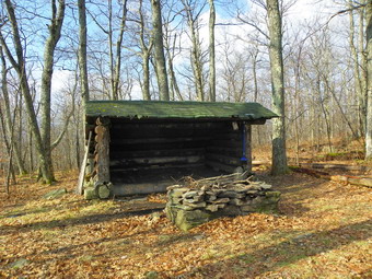
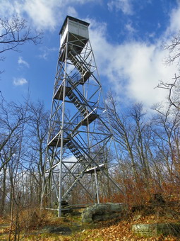 By 11:20 AM we were about 2.2 miles into the hike and had gained 1375 feet of elevation out of the over 1900 feet we would have to make to the top. At this point we were just below the first lean-to and I could see and smell smoke. I wondered whether the occupants were hikers or hunters but the lean-to is pretty far off the trail so I did not bother to find out. We pushed passed this area through steep section of trail. A switchback here mitigates the incline and soon we were headed directly for the top. Some interesting rock formations and cliffs start to appear on the right and the trail passes through some evergreens although the summit is mostly hardwoods. It was less than a mile to the top and the final part flattens and finally passes the second lean-to. This one was empty and I could see the tower ahead. Sheba and I ha d separated from the other three and I dropped my pack and poles near a tree and got out my camera. After a few shots, of the tower from the ground it was time to climb to the top. I knew the hike leader had keys to the cab but the glass makes taking photographs difficult so I thought I would settle for the landing just below. About this time the others arrived. There are some tall trees near the tower and they protected me from the wind until I rose above their level. At that point the wind began to buffet me as I climbed to the level below the cab and started to take shots. I made sure to hold on as some of the gusts were strong. The landscape was a little bleak but this means the views were unblocked by leaves. Silver Hollow, Carl Mountain and Olderbark were clearly visible in the foreground with the Devil's Path behind them. After taking pictures, I came down as the rest of the group arrived. Bob Moses had again brought a carrot cake and even Cindy was impressed. The group had been joined by a young couple who, it turned out, were the occupants of the lean-to. They had come out to the trail just as the main body of the group passed and joined them on their hike to the top.
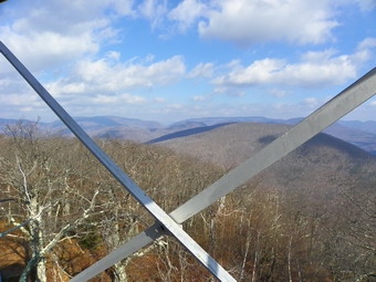 Since the wind was till blowing strong, I was beginning to get cool. I donned hat and gloves and asked Cindy if she was about ready to go. She was and Terry joined us on our way down. We had made the trip to the top in about 2 hours arriving just before noon. We stayed for about 30 minutes and started down at 12:25 PM. I thought we would probably make it down in about 1.5 hours. In some places it was hard to keep a sustained pace on the descent due to the slippery leaves on the slippery, wet rocks! On the way down we did meet several groups and individuals hiking up. One young man passed us on the way up and on the way down. He was new to the Catskills and had hiked to the Hunter tower earlier and intended to get Overlook before the end of the day! By 1:40 PM we were at the point where the trail turns left off the road to return to the car. We had covered 2.35 miles since the top and had descended 1767 feet. I considered staying on the woods road out to Old Route 28 and then walking the road back to the car. In the end I turned onto the path and waited for Cindy and Terry who did not know there was a turn. Soon we were all headed back to the parking area where we arrived at 2:00 PM. We covered the 6.1 mile hike in about 4 hours but this included the 30 minute stop at the summit and several other rest stops. Cindy and I stopped at the Sportsmen's Grill/Brio's in Phoenicia to eat. The Grande Nachos were VERY good and plenty for a small meal for two people. We both ordered a main meal but ended up taking a lot of food home. We will stop again!
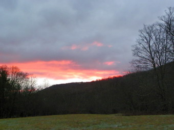
![]()
![]() On Friday, November 19th Sheba and I were ready to hike after three days occupied with other commitments and hampered by rain. An email from the Catskill Mountain Club touted a hike from the Sleepy Hollow horse trail near North South Lake to the Palenville Overlook and out the Harding Road Trail. This would be a one-way hike of about 8 miles with a cars spot. I don't often get to hike with a group or do a car spot so this sounded good. When I called one leader to announce that Sheba and I would be coming, she mentioned that there would be other dogs and two of them had "issues" especially when meeting new dogs at the start of a hike. I gave this a thought but knew I could control Sheba on a leash so I decided to go. The hike was meeting on White's Road just outside of Palenville at 8:30 AM so I got up at about 6:15 AM and was out of the house before 7:00 AM. I don't like to be late! As I drove out the DeBruce Road it was sunrise. Just before the DeBruce Country Inn I stopped to take pictures and then continued the drive. As I made the turn and started toward Frost Valley, a few flakes were in the air. The further I went the more flakes there were until at the Slide trailhead there was one or two inches of snow. The descent down the Panther hill was tricky as the snow kept falling. Route 28 was covered and there was even more snow in the air and on the ground on Route 42 passed Halcott. This continued after the turn onto Route 23 through Hunter and into Tannersville. There was less snow in Haines Falls and none when I made the turn onto White's Road. I drove all the way to the end of the road without finding the parking area. There is a very nice old mansion at the end where I turned around! On the way back I drove a little slower and found the turn into the parking area. It was about 8:20 AM and there were no other cars around. By 8:40 AM no one else had shown up and I wondered if the hike had been cancelled. About that time other cars showed up including Bob the hike leader. There was only one other dog but Bob explained that he had dropped the other two dog owners and their FOUR dogs at the other trailhead so they could get acquainted. Four people and two dogs hopped into my car and we were off for the beginning location at the Sleepy Hollow horse trail. We parked on the side of the road after about a 10 minute drive and started our walk up the road and through the gate onto the horse trail at about 9:00 AM. Just after we got on the horse trail we met the rest of the "pack". Three black labs or lab mixes and another black dog with a muzzle. The initial meeting was noisy but after we got a little further into the hike the dogs seemed to get along very nicely.
On Friday, November 19th Sheba and I were ready to hike after three days occupied with other commitments and hampered by rain. An email from the Catskill Mountain Club touted a hike from the Sleepy Hollow horse trail near North South Lake to the Palenville Overlook and out the Harding Road Trail. This would be a one-way hike of about 8 miles with a cars spot. I don't often get to hike with a group or do a car spot so this sounded good. When I called one leader to announce that Sheba and I would be coming, she mentioned that there would be other dogs and two of them had "issues" especially when meeting new dogs at the start of a hike. I gave this a thought but knew I could control Sheba on a leash so I decided to go. The hike was meeting on White's Road just outside of Palenville at 8:30 AM so I got up at about 6:15 AM and was out of the house before 7:00 AM. I don't like to be late! As I drove out the DeBruce Road it was sunrise. Just before the DeBruce Country Inn I stopped to take pictures and then continued the drive. As I made the turn and started toward Frost Valley, a few flakes were in the air. The further I went the more flakes there were until at the Slide trailhead there was one or two inches of snow. The descent down the Panther hill was tricky as the snow kept falling. Route 28 was covered and there was even more snow in the air and on the ground on Route 42 passed Halcott. This continued after the turn onto Route 23 through Hunter and into Tannersville. There was less snow in Haines Falls and none when I made the turn onto White's Road. I drove all the way to the end of the road without finding the parking area. There is a very nice old mansion at the end where I turned around! On the way back I drove a little slower and found the turn into the parking area. It was about 8:20 AM and there were no other cars around. By 8:40 AM no one else had shown up and I wondered if the hike had been cancelled. About that time other cars showed up including Bob the hike leader. There was only one other dog but Bob explained that he had dropped the other two dog owners and their FOUR dogs at the other trailhead so they could get acquainted. Four people and two dogs hopped into my car and we were off for the beginning location at the Sleepy Hollow horse trail. We parked on the side of the road after about a 10 minute drive and started our walk up the road and through the gate onto the horse trail at about 9:00 AM. Just after we got on the horse trail we met the rest of the "pack". Three black labs or lab mixes and another black dog with a muzzle. The initial meeting was noisy but after we got a little further into the hike the dogs seemed to get along very nicely.
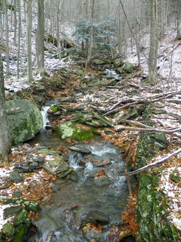 As we hiked up the horse trail we talked and I noticed that we were walking parallel to Stony Brook. The labs kept running off the trail to look for water. The brook had several nice waterfalls an rapids and I made a note that I would have to come back to take some pictures. I knew I could get some shots from the high bank but that the best shots would require getting Dow closer to the water and maybe even standing in the stream bed. At 9:30 AM the trail made a turn and we crossed over Stony Brook on a little bridge. I stopped to take a few pictures since by this time there was a coating of snow on the ground. A small sign by the bridge read "Rip Van Winkle House". By 9:50 AM we were 1.5 miles into the hike and the trail had risen a little over 900 feet. Picnic area with some views appeared on the left of the trail complete with hitching rails for horses. We stopped to get a drink and I took some photographs. Most of these showed clouds covering the valley toward the Hudson and more clouds hanging on the mountains. More snow was in the air. At 1.7 miles the trail turned sharply to the right or north in a switchback. This happened again at 2.0 miles when the trail turned left again and headed south. Just a little beyond this the trail flattened and we hit some VERY wet spots. There were pools and ponds of water that we had to negotiate. We crossed the power line right of way that leads directly up to the lakes. Along the right of way there are the remains of the stonework that supported the Otis Elevated railway that ran from Palenville in the valley up to the Escarpment where the Kaaterskill and Catskill Mountain Houses were located.
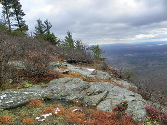 We continued along the swampy horse trail until about 3.8 miles where the trail to the Palenville Overlook turns left. It was 11:00 AM and we were about .5 miles away from the lookout. The trail is pretty flat until the little descent to the viewpoint where we arrive at 11:15 AM. The others stopped to eat while Sheba and I explored along the cliffs. I took picture from the lookout of Palenville below and of Kaaterskill High Peak and Round Top to the right. Some pictures shows white spots since it was snowing on and off. this did not match any of the weather reports most of us had read. We walked to the left down the escarpment passed the foundation and I took some more pictures. After this, we walked back up to the fire ring before the descent to the lookout and took a path out to toward the edge of the cliff. This was the first time I had done this and I was surprised to see an "official" sign that said Palenville Overlook. Sheba and I walked out to this viewpoint which allowed a little better view up the clove and different view of Palenville. After taking a few more pictures, we went back to the group just in time to get a piece of Bob's legendary carrot cake! After a brief snack for Sheba and myself, we were ready to press on. I knew that the final ascent to our highest point on the trail was steep. I also figured that the rain, wet leaves and snow would make the short ascent even more interesting.
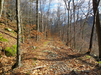 We left the overlook at just after 11:45 AM and made a left at the trail junction to start the short, steep ascent. We all made it up OK and walked along some more level trail, crossed a small stream and walked up a small hill to the trail junction with the Harding Road Trail. The initial section of this part of the trail parallels the trail to the overlook but at a greater elevation. It then stays relatively level but turns northwest at about 5.5 miles and meets the Harding Road Trail at 5.9 miles. I had never been on the Harding Road trail and found it beautiful as it began a constant descent toward Route 23A and Palenville. The walking was pretty easy and by 12:40 PM when we started down the trail the sun had come out. The sunlight "warmed" the landscape and cast shadow on the ground. I stopped several times along the way to take a few photographs. At 6.6 miles the trail turned left and headed southeast instead of southwest. At one point it flared a little to cross a stream and then continued on in the same direction. At 8.3 miles we hit the yellow connector trail that leads up to the parking area on Whites Road. After a brief climb, we arrived in the parking area at 2:00 PM taking about 5 hours to cover just under 9 miles.
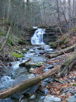 When the rest of the hikers and dogs got to the cars, we decided on the transport arrangements and headed back to the start of the horse trail. When we arrived, Sheba and I said our goodbyes. It was around 2:30 PM, so I decided we had enough time to visit the waterfalls on Stony Brook so back up the horse trail we went. I took some pictures of the first falls from the bank and then worked my way farther down to take some better shot. At the next falls, I went down to the stream bed and took some shots abut then worked my way across the creek for some even better angles. The next falls were in a deep ravine and I didn't have the time to figure out a way of getting to them safely. I did get some shots from the high bank by hanging onto a tree. I skipped the next set since they were small and set my sites on another. The only way to get pictures was to work down a STEEP bank and stand in the stream bed. This wasn't easy but proved to be worth it. We started to work our way back up the bank with Sheba in the lead. At one point I hit some rock underneath the wet leaves and began a slide down the steep bank toward the creek. I caught myself and immediately decided that I would call it a day. We were back at the car just after 3:00 PM and headed home.
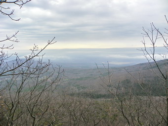
![]()
![]() On Monday, November 15th I was anxious to get out and hike since the forecast for the next few days was for rain. I decided to return to Winter Clove to try and find the trail from the Inn to Stoppel Point. When I was there the last time, I hiked up the trail to the Escarpment just east of North Mountain but could not find the trail down from Stoppel Point to the Inn. Sheba and I left Livingston Manor just before 8:00 AM and arrived at the Inn around 9:40 AM. We were on the trail by 9:50 AM under completely overcast skies. The air temperature was warm and I knew, as always, I would be shedding at least one layer a short distance into the hike. We headed out over the covered foot bridge but did not turn left to the Venus Bath or right on Lover's Loop. The trail straight ahead was marked in red paint and signs indicated the Yankee Smith Trail and Stoppel Point. The trail was well marked and looked "used" even after the Yankee Smith Trail turned to the right and we continued straight ahead at the sign that said Stoppel Point and Little Stoppel. At about this point I removed my light jacket a hiked the rest of the way in two layers of long-sleeved light wool. This was way too warm except when I was stopped but I was too lazy to change into short sleeves. The trail continued to ascend heading slightly south of west until we gained about 1500 feet of elevation to 2430 feet. Here the trail leveled some and a viewpoint appeared. This was at about 10:50 AM or 1.7 miles and an hour into the hike. The views on any other day would have been good but this day most of the valley below and the hills around were hidden in clouds and mist. We stopped and I took a few pictures before continuing on.
On Monday, November 15th I was anxious to get out and hike since the forecast for the next few days was for rain. I decided to return to Winter Clove to try and find the trail from the Inn to Stoppel Point. When I was there the last time, I hiked up the trail to the Escarpment just east of North Mountain but could not find the trail down from Stoppel Point to the Inn. Sheba and I left Livingston Manor just before 8:00 AM and arrived at the Inn around 9:40 AM. We were on the trail by 9:50 AM under completely overcast skies. The air temperature was warm and I knew, as always, I would be shedding at least one layer a short distance into the hike. We headed out over the covered foot bridge but did not turn left to the Venus Bath or right on Lover's Loop. The trail straight ahead was marked in red paint and signs indicated the Yankee Smith Trail and Stoppel Point. The trail was well marked and looked "used" even after the Yankee Smith Trail turned to the right and we continued straight ahead at the sign that said Stoppel Point and Little Stoppel. At about this point I removed my light jacket a hiked the rest of the way in two layers of long-sleeved light wool. This was way too warm except when I was stopped but I was too lazy to change into short sleeves. The trail continued to ascend heading slightly south of west until we gained about 1500 feet of elevation to 2430 feet. Here the trail leveled some and a viewpoint appeared. This was at about 10:50 AM or 1.7 miles and an hour into the hike. The views on any other day would have been good but this day most of the valley below and the hills around were hidden in clouds and mist. We stopped and I took a few pictures before continuing on.
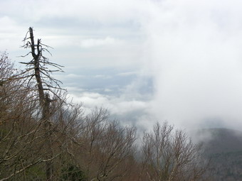 After a short distance the trail marking became VERY hard to follow and, in places, were non-existent. In other spots I could see faint blazes ahead but there was really no trail since there was so much blowdown and so much brush had overgrown the trail. Around 2.0 miles into the hike the "trail" turned right and started a steep climb up to Stoppel Point. There were no more red blazes on the trees. At times I could turn around and find blue blazes indicating the way back but sometimes even these were absent. A good part of the time the last .6 miles were a bushwhack with Sheba or I picking the best route through the cliffs. Near the top the terrain leveled a little and soon, to our right, I saw the plane crash on the Escarpment Trail. I turned left and bushwhacked a little and found a path that led to the Stoppel Point overlook. It was noon had about .7 miles into the hike. We stooped to get a snack and a drink. I took a few pictures since the mist rising off the hills looked a little interesting and I though these pictures would be a stark contrast to the ones I had taken several days before. Until the steep bushwhack, I had fully intended to simply retrace the route back to Winter Clove. Now I was sure I did not want the experience of a return trip and had to choose between the Dutcher Notch route that I had used the last time or descending the trail from just east of North Mountain. I decided on the latter since I did not want to repeat the exact route from last time. This was despite the fact that I knew that the descent would be tricky. I had a little trouble finding just where the trail turned off the Escarpment Trail but soon we were headed back.
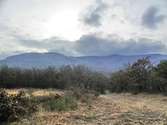 We stopped at the viewpoint I had found last time and I took a few photos of the Blackhead Range covered in clouds. The first part of the descent was slow but a little better than I though as the ground was not frozen this time and this allowed me to get good pole plants. The biggest problem the whole way down were the oak leaves and acorns. The leaves were VERY slick and I slipped more than once even on flatter terrain. As we were descending a little drizzle began and I thought I heard one roll of thunder. This never really developed into anything. The going was slow but we finally left the oaks behind and entered some pines as we continued to descend toward the junction with the trail to Winter Clove Falls. We were at the junction at 1:50 PM or about 4 hours and 5.2 miles into the hike. The trail from here levels some and is well-marked with the "return" blue blazes. Soon we were on the golf course and walking back to the car. It was 2:20 PM when we got back to the car after 4.5 hours of hiking and 6.6 miles. I had intended to hike the Yankee Smith Trail and maybe Lovers Loop but was pretty tired from the steep bushwhack ascent and the equally steep descent. I decided to try the Ledges trail.
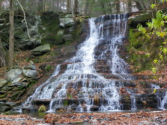 From the car we headed out the trail that Cindy and I had taken the week before. This trail crosses a stream, passes through a field and then heads toward the Indian Lookout and Rips Rock. At the trail junction Sheba and I turned left to head in the direction of the sign which said Ledges. From the trail junction we followed the trail and then a woods road for about .25 miles to a clearing on top of a small hill. The total distance was barely a mile. It was obvious that the views from here would be well worth the trip particularly for anyone who did not want to hike very far. In one direction I could look out over the valley and could even spot the INN down to the left. To the west the Wall of Manitou rises impressively behind the Inn. The clouds swirling around the wall with just a small amount of sunlight made for some interesting pictures. We stayed long enough for me to take some shots and then returned to the car by 3:00 PM. The trip was about 1,7 miles and took only 40 minutes including the stop. I decided to save the other two trails for the best trip. On the way back down Winter Clove Road I stopped at the Glen Fall Inn. I walked out to the observation deck and took some pictures of one of the two falls. Not satisfied with the view I worked my way down to the creek bead to get some better shots of both falls. These falls are just off the road and are well worth the stop. It is hard to find someone to ask permission.
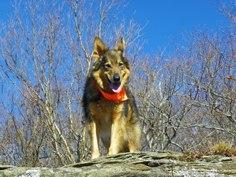
![]()
![]() On Saturday, November 13th Cindy was ready to hike and we thought we would go out to Quick Lake from Frick Pond. We slept in and got started a little late. In addition, when I looked at the distance it appeared to be about 15 miles which is more than we had time for and about twice the distance Cindy is usually prepared to do. We decided to hike to the Dry Brook Ridge lookouts from Ploutz Road, a route that I had done before but one that was new to Cindy and Sheba. Although the forecast was for temperatures in the 50's when we started it was barely 32 degrees in Livingston Manor. I drove to Roscoe and then up Rt 206 to Route 30 and turned right at the Pepacton Reservoir. Eventually I turned right on Millbrook Road and drove to Ploutz Road which is just passed Kelly Hollow. We had talked about hiking here after Dry Brook Ridge but we agreed to wait and see how much time and energy were left. I turned left on Ploutz Road which was in pretty good shape. A "limited maintenance" sign made both of us wonder if the town really plows the road until December 1st! The road condition deteriorated a little as we passed the last house but was still good enough to allow us to drive to the parking area for the trailhead. The parking area is small with room for at most four cars and there was no one else there. I didn't expect to see other hikers today unless they whereat the lookouts on the ridge. We left the car and entered the pine forest at 11:00 AM. Although not as impressive as the pine plantation on Hill Road the pine forest here is also nice. The initial part of the trail winds through and interesting and extensive set of stone walls. Right out of the parking area the trail crosses a lane with stone walls on either side. The lane leads to a large area surrounded by stone walls. This looks like an old field. It would be interesting to follow this lane in the other direction to see if there is a barn, a foundation or the remains of a farm. After this area, the trail begins a long climb to Dry Brook Ridge.
On Saturday, November 13th Cindy was ready to hike and we thought we would go out to Quick Lake from Frick Pond. We slept in and got started a little late. In addition, when I looked at the distance it appeared to be about 15 miles which is more than we had time for and about twice the distance Cindy is usually prepared to do. We decided to hike to the Dry Brook Ridge lookouts from Ploutz Road, a route that I had done before but one that was new to Cindy and Sheba. Although the forecast was for temperatures in the 50's when we started it was barely 32 degrees in Livingston Manor. I drove to Roscoe and then up Rt 206 to Route 30 and turned right at the Pepacton Reservoir. Eventually I turned right on Millbrook Road and drove to Ploutz Road which is just passed Kelly Hollow. We had talked about hiking here after Dry Brook Ridge but we agreed to wait and see how much time and energy were left. I turned left on Ploutz Road which was in pretty good shape. A "limited maintenance" sign made both of us wonder if the town really plows the road until December 1st! The road condition deteriorated a little as we passed the last house but was still good enough to allow us to drive to the parking area for the trailhead. The parking area is small with room for at most four cars and there was no one else there. I didn't expect to see other hikers today unless they whereat the lookouts on the ridge. We left the car and entered the pine forest at 11:00 AM. Although not as impressive as the pine plantation on Hill Road the pine forest here is also nice. The initial part of the trail winds through and interesting and extensive set of stone walls. Right out of the parking area the trail crosses a lane with stone walls on either side. The lane leads to a large area surrounded by stone walls. This looks like an old field. It would be interesting to follow this lane in the other direction to see if there is a barn, a foundation or the remains of a farm. After this area, the trail begins a long climb to Dry Brook Ridge.
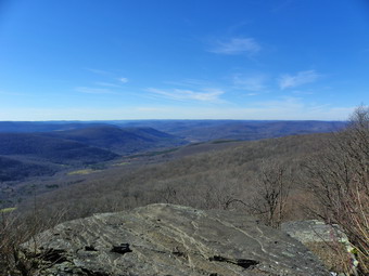 The climb to Dry Brook Ridge on this part of the Huckleberry Loop Trail is about 1.2 miles with a 1000 foot elevation gain. on the Ridge the Huckleberry Loop Trail ends at the Dry Brook Ridge Trail. The Dry brook Ridge Trail starts in Margaretville, crosses the Ridge and ends at the parking area for Balsam Lake Mountain on the Beaverkill Road! The first part of the trail has a relatively gentle ascent but this changes the closer you get to the ridge. In some areas the steep ascent is alleviated by switchbacks. In other areas the climb is simply steeper. As we neared the ridge, patches of snow appeared and then, in some areas, the ground was covered with and inch or more. It would be interesting to know how much snow fell here on Monday if this much was still on the ground five days later. The remaining snow was most pronounces on the north side of the slopes and in areas protected from the sun. Soon we were near the top walking through areas which were pretty despite the brown of the dead leaves. The browns and holds contrasted nicely with the remaining green ferns and moss, the blue sky and white snow. At noon we were at the trail junction and we turned left to head for the lookouts. There are several sets of lookouts along the ridge and I had always approached them from the Hill Road side. The last time I came from Ploutz Road I was in a hurry and did not pay any attention to the lookouts. The ridge is relatively flat with only a few ups and downs. As we walked and passed several viewpoints I began to doubt whether or not we had passed the best and most prominent lookout. This is the one that occurs first from the Hill Road side. I went ahead of Cindy a little to "scout" and found another viewpoint and then the one I was looking for. It was 12:40 PM.
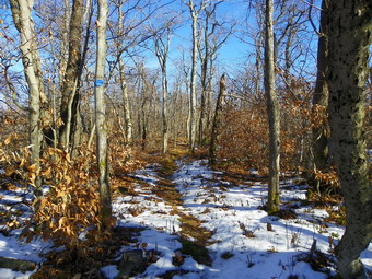 As I waited for Cindy at the lookout, I took many pictures of the far hills and the valleys below. I also took pictures of the Pepacton Reservoir which looked low even from up high and far away! After Cindy arrived, I took some shots of Sheba and then of Cindy and Sheba. At about 1:05 PM we started back. As we walked I took pictures from each lookout, five in all, and of the trail. I was especially careful to get some pictures of the snow! Soon we were back at the trail junction and we turned right to go back down to the car. Descending the steeper parts of the trail took some time. On the way back we noticed a rock overhang that I had not seen on the way up. We stopped to take pictures and then continued down into the pine forest. I took some pictures of the tall evergreens which looked interesting with the blue sky and sun peeking through. Back at the country lane, I took some shots of the stone walls and walked to the one end of the lane. The area surrounded by the stone walls was huge. When we arrived at the parking area, there was another car there which surprised us since we had not seen them anywhere on the trail. It was 2:40 PM and the sun was dipping low. We covered the 5.5 miles in 3.5 hours but stopped for periods of timekeeper several places. We drove passed Kelly Hollow on the way home deciding to leave that hike for another day. We did stop at the Millbrook Covered Bridge also known as the Grant Mills Covered Bridge. The bridge no longer carries traffic but has been restored and I took a few photographs. Rather than return the way we had come I turned onto Cross Mountain Road. The road has a dirt surface but was in good shape to the top of the climb. After the top the road is rutted in places and VERY narrow. As luck would have it we met a car coming up from Alder Lake. The other driver pulled over as far as he could to his right. I was able to inch by but Cindy said that was all that separated us from the edge of the road and the ravine below!
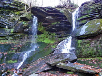
![]()
![]() On Thursday, November 11th I was interested in getting back to Winter Clove since the last trip had been so interesting. I knew about Winter Clove Falls but I was also interested in the trails to the Escarpment Trail both North mountain and Stoppel Point. I thought I might visit the falls and then take the trail up to the Escarpment to near North Mountain. I would then use the trail from Stoppel Point to return to Winter Clove. The weather forecast was for a beautiful sunny day with temperatures in the mid-50's. I was not surprised that the thermometer on my back porch read 25 degrees at 6:00 AM! After doing my "chores", Sheba and I headed out at about 8:00 AM. The trip is a long one for us so we arrived just before 10:00 AM. I went to check in at the main desk and this time one of the owners greeted me and happily granted permission to park and hike. I asked her if she would like some GPS maps to go along with the hike descriptions and she seemed very interested. I thought it was the least I could do for the hospitality the resort offers to hikers even those that are not paid guests! We talked for several minutes about the trails and especially the "return" trail from Stoppel Point. I went back to the car and Sheba and I started our hike at 10:00 AM. I was in trouble immediately trying to find the start of the hiking trail to the Falls. I walked up through the gold course and did not see any hiking signs. I walked around several greens and tees and then read the directions and found the sixth tee. I walked down the fairway and just before the green found the trail that started up just as the directions said. We walked up a small hill and then into a field or clearing. It was hard to pick up the hiking trail signs here but we walked along the left side of the field and found an old sign that said Webster's Pass on the left. We turned left here and walked along an old road. Soon a sign appeared on the right for North Point and Winter Clove Falls. We turned right here at about .6 miles into the hike.
On Thursday, November 11th I was interested in getting back to Winter Clove since the last trip had been so interesting. I knew about Winter Clove Falls but I was also interested in the trails to the Escarpment Trail both North mountain and Stoppel Point. I thought I might visit the falls and then take the trail up to the Escarpment to near North Mountain. I would then use the trail from Stoppel Point to return to Winter Clove. The weather forecast was for a beautiful sunny day with temperatures in the mid-50's. I was not surprised that the thermometer on my back porch read 25 degrees at 6:00 AM! After doing my "chores", Sheba and I headed out at about 8:00 AM. The trip is a long one for us so we arrived just before 10:00 AM. I went to check in at the main desk and this time one of the owners greeted me and happily granted permission to park and hike. I asked her if she would like some GPS maps to go along with the hike descriptions and she seemed very interested. I thought it was the least I could do for the hospitality the resort offers to hikers even those that are not paid guests! We talked for several minutes about the trails and especially the "return" trail from Stoppel Point. I went back to the car and Sheba and I started our hike at 10:00 AM. I was in trouble immediately trying to find the start of the hiking trail to the Falls. I walked up through the gold course and did not see any hiking signs. I walked around several greens and tees and then read the directions and found the sixth tee. I walked down the fairway and just before the green found the trail that started up just as the directions said. We walked up a small hill and then into a field or clearing. It was hard to pick up the hiking trail signs here but we walked along the left side of the field and found an old sign that said Webster's Pass on the left. We turned left here and walked along an old road. Soon a sign appeared on the right for North Point and Winter Clove Falls. We turned right here at about .6 miles into the hike.
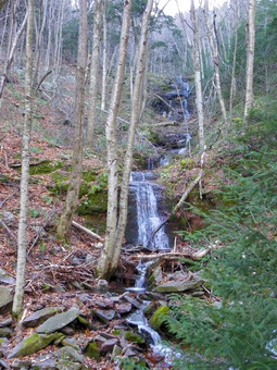 From here the trail climbed at little and then started downhill, At about .8 miles the trail turned to the left at a sign again designating North Point and Winter Clove Falls. From here the trail climbed steadily using old woods roads until at 1.35 miles it split. The sign to the left indicated North Point. We headed to the right toward Winter Clove Falls. For some time we had been hearing the roar of the water a creek to the right and, at times, could view the water forming small drops and rapids along the way. At 1.65 ,miles the trail descended a little and crossed an old creek bed with several downed trees. From this point on the trail markers were scarce and a little faded. The trail followed the creek bed which was full of leaves making the footing difficult. We kept getting closer to the creek and could see glimpses of the falls ahead. The trail climbed steeply at this point to the top of the falls. We arrived at about 11:00 AM and 2 miles into the hike. I dropped my pack and grabbed the camera. There was a view along the clove out into the valley toward the Hudson but the light made pictures difficult. It was also hard to get any perspective of the falls. The falls has two major drops and although there was water the flow was only moderate. I decided to work my way down the north bank to the area between the two drops. This was not easy but did allow me to get some shots of the upper drops with two streams of water. After a few pictures we went back to the top of the falls. Before returning on our route, I decided to bushwhack further up the stream where I thought I saw some more falls. I picked up my pack and we walked up the stream using the bed and north bank alternately. There were two different falls further up and we stopped so that I could take a few shots. I considered bushwhacking even further up the clove but wanted to stay on the trails so that I could make a map for the Inn. I will put this on my "to do" list for later. Further up the clove at 2800' and just below the escarpment is the crash of a Piper airplane that is hard to access.
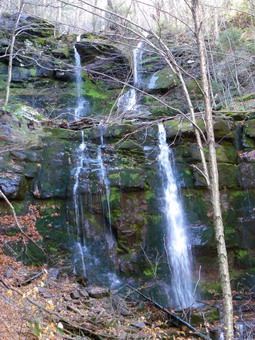 We headed back down the stream and down the trail we had come up. I wanted to take some photographs of the entire falls from down in the stream bed. I found several spots where paths started down to the stream but all were very steep and the combination of wet leaves and frozen ground made them impossible. I finally settled on one spot and started down after telling Sheba to "Stay!" The fact that she showed no reluctance to stay behind should have been a hint to me. After getting a little more than half way down the bank I could see that getting down would be nearly impossible and getting back would require a long walk down the stream. I stopped on the bank at this point with a pretty good view of the falls and took pictures from there. Again, the light was not as good as I could have hoped but some of the pictures were good. I walked back up the bank, collected Sheba and headed back down the trail to where it split. I hit the split at 2.75 miles and just before noon. We started up the trail toward North Point. The trail was steep in most places and steeper in others. It was clear this was "the road less traveled" as there was little evidence of use and many of the paint blazes were very faded. At about 3.0 miles the trail turned left and started an ascent that would be about a mile long and gain over 1300'. It was clear that parts of the trail followed old roads up the mountain and at other times left the roads to take even steeper ascents. Near the top the angle was at least 45 degrees and the frozen ground offered poor footing. All the way up the trail I could see the Blackhead Range to my left but taking pictures through the trees was difficult. At around 3.9 miles we skirted some cliffs and I took pictures of the icicles. On top there was one rock that offered and unobstructed view of the mountains. We stopped briefly so that Could take pictures and then continued on. The trail was ill-defined toward the top but at 4.0 miles into the hike just after 1:00 PM we hit the Escarpment Trail at 3100 feet and slightly northeast of North Mountain. There is a nice viewpoint over North South Lake at this point and I took a few pictures. I realized that the days were growing shorter and that it was no longer daylight savings time. My conclusions was that we had to move quickly to get back before I had to pull out the headlamp!
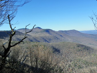 Now that we were on a trail which is relatively flat we picked up our pace heading toward Stoppel Point. There was an elevation gain of over 300 feet but this seemed easy compared to the 2200 foot gain from Winter Clove Inn! We arrived at Stoppel Point at about 1:40 PM and 5.4 miles into the hike. We stopped briefly for a few pictures and continued on toward the west. There was a brief stop on the left side on the trail to take some shots south toward KHP and Round Top before continuing on to the plane crash. We stopped and I took a few pictures before walking back along the trail. I had seen a pink ribbon in the woods and headed toward it thinking it might mark the trail from Stoppel Point back to Winter Clove Inn. After pushing through some brush trying to follow pink ribbons we were...back at Stoppel Point. I walked along the edge of the escarpment trying to find the trail down. I finally decided I didn't have enough time, did not know where the trail was and would be better off returning on the Dutcher Notch Trail. This didn't really bother me since I had never been Dow nor up this trail but I was concerned about the distance we still needed to cover to get back to the car. We kept up a good pace as we descended from Stoppel Point and approached Milt's Lookout. We hit the lookout at about 6.6 miles around 2:20 PM. We stopped and I took some pictures including couple of Sheba who jumped up onto a big boulder to "pose". From the lookout we began a 600 foot drop over the next 1.1 miles to the Dutcher Notch Trail. This was a little farther than I thought and the last part of the descent was steep. All the way down Arizona was straight ahead of us and seemed quiet high. At 3:00 PM as the sun began to dip low in the sky we hit the Dutcher Notch Trail, turned right and began to descend.
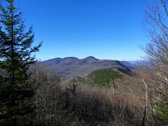 The Dutcher Notch Trail follows a road that was the main connection between the farms in the Jewett Valley and the markets near the Hudson in Catskill and Cairo. The road was sited at the lowest point in the Wall of Manitou. Since the wagons could not ascend or descend directly due to the elevation gain over a short distance the road on the east side had to have a sweeping switchback. The trail start slightly to the east but then turns southeast nearly paralleling the escarpment. It was interesting to walk Dow this trail below the escarpment where we had Ben earlier in the day. The trail appears to be suffering from lack of use with several areas of blowdown. The road is so eroded in places that the trail travels along the high bank often on stone walls. After about a mile and 770 feet of descent the trail swings toward the northeast and continues to descend. It begin to follow a stream bed and on this day was wet in spots. It also enters private property with an easement. We continued on the trail as it passed across the lawn of a private residence and through a locked gate onto paved road at about 9.7 miles. After about .5 miles on Storks Nest Road we hit Floyd Hawver Road and turned right. It was about 4:00 PM with the shadows getting longer each minute. Our walk along Storks Neck had been interesting with several encounters with farm animals. Once on the roads our pace quickened even more. We hiked a little more than 1.1 miles on Hawver Road before turning right on Winter Clove Road. After walking another .5 on Winter Clove Road, we were back at the Inn and our car. We had covered a total of almost 13 miles in 6.5 hours. Several adventures still await including a hike further up Kiskatom Brook past Winter Clove Falls. I am also anxious to return and hike up the trail to Stoppel Point to see if I can follow it and find out where it emerges on top!
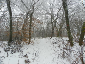
![]()
![]() On Tuesday, November 9th I wanted to see if the higher elevations had gotten more snow in Monday's storm than the 2 or 3 inches we got in Livingston Manor. I decided to head for Balsam Lake Mountain as it normally gets much more snow than anywhere else around. As I drove up the Beaverkill Road it was obvious that the amount of snow was increasing. The road had been cleared and just after the turn to Little Pond the road crews were working to prevent the rest of the road from falling into the river. After we passed Turnwood, there was still a car ahead of us. That car stayed with us all the way to the parking area. The lot was not plowed but there was a minimum of 4 inches and I had no trouble getting into the lot and parking. I talked briefly to the two people in the other car who were just there to take some pictures. Sheba and I started to hike just before 11:30 AM. The first part of the trail was slippery from the snow as we were the first to walk on the new fallen white stuff. By the time we were at the turn up the mountain I was ready to take a few pictures and shed a layer of clothing. It had only taken about 20 minutes to get to the junction. As we stared to climb the snow got a little deeper and I Egan to slip a little more. I had Stabilicers in my pack but knew they wouldn't really help so we just continued up the mountain. Along the way the sun peeked through the clouds some. At one point I thought it was raining but it was just the snow and ice melting off the trees. Soon we were being pelted by falling snow and ice which, at times, didn't feel so great. By 12:15 PM we were at the spring and we stopped so I could take some more pictures
On Tuesday, November 9th I wanted to see if the higher elevations had gotten more snow in Monday's storm than the 2 or 3 inches we got in Livingston Manor. I decided to head for Balsam Lake Mountain as it normally gets much more snow than anywhere else around. As I drove up the Beaverkill Road it was obvious that the amount of snow was increasing. The road had been cleared and just after the turn to Little Pond the road crews were working to prevent the rest of the road from falling into the river. After we passed Turnwood, there was still a car ahead of us. That car stayed with us all the way to the parking area. The lot was not plowed but there was a minimum of 4 inches and I had no trouble getting into the lot and parking. I talked briefly to the two people in the other car who were just there to take some pictures. Sheba and I started to hike just before 11:30 AM. The first part of the trail was slippery from the snow as we were the first to walk on the new fallen white stuff. By the time we were at the turn up the mountain I was ready to take a few pictures and shed a layer of clothing. It had only taken about 20 minutes to get to the junction. As we stared to climb the snow got a little deeper and I Egan to slip a little more. I had Stabilicers in my pack but knew they wouldn't really help so we just continued up the mountain. Along the way the sun peeked through the clouds some. At one point I thought it was raining but it was just the snow and ice melting off the trees. Soon we were being pelted by falling snow and ice which, at times, didn't feel so great. By 12:15 PM we were at the spring and we stopped so I could take some more pictures
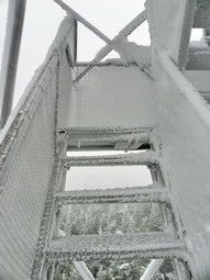 Once we were up on the summit plateau, I kept the camera out and took a lot of pictures. The scene was very different from several weeks before when the sun was shining. Many of the trees had a covering of ice and snow and some branches were bent under the weight. We walked slowly and I took pictures until we arrived at the tower at about 12:35 PM. I took pictures from the ground and then dropped my pack to go up the tower. The tower was encased in ice and snow and the steps were very slippery. I took pictures of the screening and the steps. As I climbed the wind picked up. Looking out it was clear that there were no views. I was either above or in the clouds. I cautiously made my way back down to a waiting dog and we started down the other side of the mountain. The snow here had drifted and the deepest spots measured 10 to 12 inches! Going down was easier than I though. We made the bottom of the mountain and turned right at the junction to go back to the car. The temperature was warmer now with a little sun. We were back at the car by about 1:45 PM having covered 4.25 miles in 2 hours and 20 minutes. On the way back stopped to take pictures at Beaverkill Falls. It was hard to take pictures through the trees so I will try to get permission to go down to the stream some time in the future.
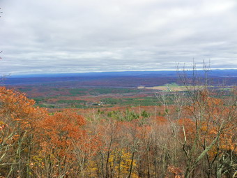
![]()
![]() On Saturday, November 6th I asked Cindy if she would like to go to Winter Clove and hike some of the trails there and she agreed. I had never been to this Catskill resort but the few reports I had read sounded interesting. Winter Clove is primarily a resort which offers room and board and various activities to those who stay there. It is located north of Palenville with the address being Round Top. The drawback for us is that this is around a two hour drive but I did want to see what they had to offer. Winter Clove has miles of hiking trails open to those who are paying guests but it has been reported that they will allow others to hike as long as they as they permission. From what I had read the trails included several nice lookouts and waterfalls. There was even supposed to be a trail to Stoppel Point! On our drive there we discussed the options and simply decided to get on a trail and hike to see where it went. I had no maps of the area so this seemed like a reasonable approach. After a few stops to look at the maps and a wrong turn or two we headed north out of Palenville on Route 32. The next turn was a left just after the Friar Tuck Inn onto Hearts Content Road and then another left onto Winter Clove Road. From that point on there are small signs indicating the various resorts in this area and there are quite a few. We arrived at Winter Cove at about 11:20 AM and I stopped to as for permission to park and hike. The woman at the desk could not have been nicer. She told me where to park and even allowed me to take copies of the written directions for the hikes on the various trails. These directions were in minutes and only one had a map but it was a nice gesture. We parked and started our hike just before 11:30 AM. The temperature was in the low 30's when we started and it didn't get much warmer all day. It was cloudy but there wasn't much of a breeze. I had noticed a sign in the field just up from where we parked so we headed in that direction to begin our adventure.
On Saturday, November 6th I asked Cindy if she would like to go to Winter Clove and hike some of the trails there and she agreed. I had never been to this Catskill resort but the few reports I had read sounded interesting. Winter Clove is primarily a resort which offers room and board and various activities to those who stay there. It is located north of Palenville with the address being Round Top. The drawback for us is that this is around a two hour drive but I did want to see what they had to offer. Winter Clove has miles of hiking trails open to those who are paying guests but it has been reported that they will allow others to hike as long as they as they permission. From what I had read the trails included several nice lookouts and waterfalls. There was even supposed to be a trail to Stoppel Point! On our drive there we discussed the options and simply decided to get on a trail and hike to see where it went. I had no maps of the area so this seemed like a reasonable approach. After a few stops to look at the maps and a wrong turn or two we headed north out of Palenville on Route 32. The next turn was a left just after the Friar Tuck Inn onto Hearts Content Road and then another left onto Winter Clove Road. From that point on there are small signs indicating the various resorts in this area and there are quite a few. We arrived at Winter Cove at about 11:20 AM and I stopped to as for permission to park and hike. The woman at the desk could not have been nicer. She told me where to park and even allowed me to take copies of the written directions for the hikes on the various trails. These directions were in minutes and only one had a map but it was a nice gesture. We parked and started our hike just before 11:30 AM. The temperature was in the low 30's when we started and it didn't get much warmer all day. It was cloudy but there wasn't much of a breeze. I had noticed a sign in the field just up from where we parked so we headed in that direction to begin our adventure.
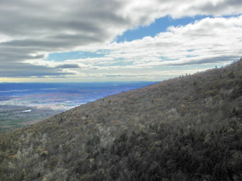 The neatly lettered sign mentioned Indian Lookout and Rips Rock as destinations and these sounded interesting so we continued through the field down to a creek and across a small bridge. There were many maples in this area and each had at least one pipe connected to them for the collection of sap. The trail went through a series of switchbacks as it climbed a moderate hill with other trails branching off along the way. There were some sins to indicate where we were going and red and blue paint blazes were also present. Soon the trail headed east and away from the brook through a field and passed by a lean-to. At about .6 miles a trail continued east toward "The Ledges" but we continued on the trail we were on, first west and then south. We crossed several small streams of running water some of which were on the trail. At .9 miles another sign point to a spur trail to "Lost Pond". Around 1.2 miles another spur trail headed to "Lost Bridge" and just beyond that point was a short trail to the left to a campsite. Just passed the campsite we met two hikers who were staying at Winter Clove. They were in the lead of another group who we met shortly after. At 1.5 miles we had the choice of turning left to the "Lower Rips Trail" or continuing on the trail we were on. We continued and walked parallel to a small brook that had cut a deep gorge between and into the surrounding rock. At 1.7 miles we cut across this brook. I checked my GPS and compared it to the maps and what was clear is that we were not on the way to Stoppel Point or North Mountain.
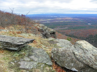 The trail began to level a little and at 2.1 miles we arrived at an opening in the trees that looked out to the east toward the Hudson River. The view was nice and, as always near the Hudson, a little hazy. There was still some color on some of the trees. We stopped for pictures, a drink and a snack. It was clear that we were walking the edge of an escarpment but there was another, higher ridge of rock to our right. To this point the trail was clear and looked used. From this point on the leaves appeared undisturbed and I could see only pink ribbons to mark the trail and no paint blazes. We did not know if this meant the Winter Clove trails had ended and someone else had marked this trail. We so had no idea where the trail went or where it ended. We were also wondering where Rips Rock was! We decided to continue to follow the ribbons for awhile. From the Indian Lookout the trail was level but then began to drop to a small stream not shown on the map. It continued to head south and followed the stream up a hill. The trail was not well-used but the ribbons appeared consistently. At 2.4 miles the a significant gorge began to appear and the trail swung left or southeast and ascended another small hill. It hugged the edge of the top of the hill and then several views opened up of the opposite side of the hollow. There were interesting rock formations and the sun behind the ridge made for some interesting lighting effects. We stopped to take a few pictures before deciding whether to turn around or continue. We still hadn't found Rips Rock. The trail was marked passed this point so we decided to go on.
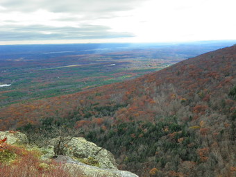 We slid down a slippery rock and then ducked under and through some brush to find...a beautiful, expansive lookout toward the east and southeast. A small sign declared "Rips Rock 1,809 feet". The Dee chasm immediately to the south is formed by Stony Brook and is sometimes called Rip Van Winkle Hollow. The sun was hidden behind the clouds and the apposing ridge but was peeking out just enough to give some unusual lighting effects. Even the drop down into the hollow offered some nice photographic opportunities. We stopped and I took many pictures of the ridge, the hollow and to the east toward the river. Walking along the trail at the edge of the cliff was...exciting. The wet rocks and overgrown brush tended to push us dangerously close to the edge but we made it in good shape. The views just kept getting better! We stopped two more times to take additional pictures before following the trail into the woods. The trail led us roughly around the top of the hill and we though it might simply connect to the trail we used on the way up. It did not. After a trip around the summit the trail made a short steep descent between ad over some rocks. The steepness and the wet, slippery leaves made for an interesting descent. After that point, the trail changed character totally becoming wide and well-used. We continued to descend and hit a few switchbacks. The trail continued to parallel the one we took up but at a lower elevation. It became clear this was the "lower" trail from earlier and at 3.9 miles we were back at the junction. From here we simply followed our early route in reverse back to the car and arrived at about 2:25 PM. We covered the 5.3 mile hike in 3 hours and 15 minutes. The suggested time was 4.5 hours.
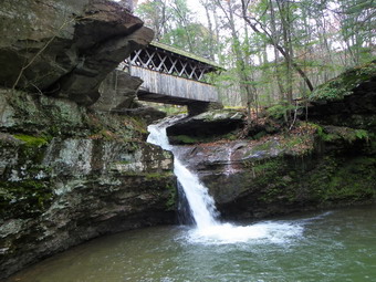 With a little time left, we decided that a trip to Winter Clove Falls was too ambitious but a walk to the covered bridge and the Venus Bath might be appropriate. From the car we headed to the gazebo in back of the main building and then crossed the dirt road and walked down to the bridge. The falls forms directly under the bridge so we took the path to the pool at the base of the falls. I snapped several pictures of the bridge, falls and pool before going back up to the bridge. We stopped again to get some pictures of the bridge and the water flowing underneath. After the brief stop, we continued our walk up Kiskatom Brook. There were several interesting rapids along the way for me to photograph. At .45 miles we passed the a footbridge to the other side and continued on the trail along the creek. At about .8 miles and 40 minutes of picture taking and hiking we arrived at the Venus Bath. Here a small set of rapids and waterfalls have carved a natural "bath" in the rock. I took a few pictures and then we started back to the car using the footbridge to cross to the other side. This time the walk was only .6 miles and took about 18 minutes! A short walk that was definitely worth the time for the "features" along the way. I think we may return to stay at the Winter Clove which is reasonably priced and has quite a history. I will return soon to try the hike to Winter Clove Falls and Stoppel Point.
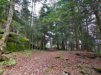
![]()
![]() On Monday, November 1st I wanted a quick but challenging hike not too far away from home. I like to hike Dry Brook Ridge near Margaretville but have never hiked it from the north over Pakatakan Mountain or the German Hollow Trail. This would be the day. When we left home the temperature was just above freezing and there was a slight breeze. As I drove up Rt 206 toward the Pepacton Reservoir it appeared that some of the higher elevations might have some snow. By the time I was on the roads around the reservoir the air temperature had dropped even more. At the turn back onto Rt 30 I continued straight ahead on Southside Rd. Just after Fair St on the left I found the trailhead kiosk for the Dry Brook Trail with room for a car or two across the road. I parked and we started hiking just before 9:00 AM with the temperature at about 35 degrees. The hike from the trailhead starts out steep right from the start. After a short climb it intersects a road and then starts to pass through a beautiful stand of evergreens. The trees are complemented by magnificent rock formations with green moss. In one spot the rocks overhand to form a natural shelter. In the first .6 miles there are several switchbacks and signs that make it clear that the trail passes through private land and then hugs the edge of private property and state land. At the .6 mile mark, the trail heads southwest in a major switchback rather than head directly up Pakatakan Mountain. The walk is a nice one but the direct route would be only .3 miles instead of 1 mile and the elevation gain is only 600 feet. As we climbed there was, at first, a dusting of snow on the ground that eventually gave way to a complete coating. The snow wasn't deep but I was glad to see it as I have many pairs of snowshoes!
On Monday, November 1st I wanted a quick but challenging hike not too far away from home. I like to hike Dry Brook Ridge near Margaretville but have never hiked it from the north over Pakatakan Mountain or the German Hollow Trail. This would be the day. When we left home the temperature was just above freezing and there was a slight breeze. As I drove up Rt 206 toward the Pepacton Reservoir it appeared that some of the higher elevations might have some snow. By the time I was on the roads around the reservoir the air temperature had dropped even more. At the turn back onto Rt 30 I continued straight ahead on Southside Rd. Just after Fair St on the left I found the trailhead kiosk for the Dry Brook Trail with room for a car or two across the road. I parked and we started hiking just before 9:00 AM with the temperature at about 35 degrees. The hike from the trailhead starts out steep right from the start. After a short climb it intersects a road and then starts to pass through a beautiful stand of evergreens. The trees are complemented by magnificent rock formations with green moss. In one spot the rocks overhand to form a natural shelter. In the first .6 miles there are several switchbacks and signs that make it clear that the trail passes through private land and then hugs the edge of private property and state land. At the .6 mile mark, the trail heads southwest in a major switchback rather than head directly up Pakatakan Mountain. The walk is a nice one but the direct route would be only .3 miles instead of 1 mile and the elevation gain is only 600 feet. As we climbed there was, at first, a dusting of snow on the ground that eventually gave way to a complete coating. The snow wasn't deep but I was glad to see it as I have many pairs of snowshoes!
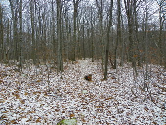 At about 1.7 miles, we were at the point marked on the map as the summit of Pakatakan Mountain. As we had walked around the summit, I thought I might have to bushwhack to the top just to say I had found the highest point. There was no need as the trail eventually got there. I could see high ground ahead for some distance which was Dry Brook Ridge. As we walked over the top of Pakatakan and along the edge of a cliff, I could see the Pepacton Reservoir through the trees. I could not get any clear pictures but it was there. There was some higher ground to the right but we were still ascending. Now in many places we were looking down some cliffs rather than up at them. We continued our long but gentle ascent until about 2.6 miles where the German Hollow Trail came in fr9m the right. Along the way there were a few steeper climbs but they were all short. After the trail junction, the ascent continued to about 3.0 miles where the trail leveled momentarily. After this is began to DESCEND and head southeast rather than climb toward the south or southwest. I was not very enthusiastic about losing elevation we would have to gain again. I also knew that this meant the return trip would be a steeper and longer descent. (What I did not know tat he time was that the trail from the other side was less than 300 feet horizontal and 80 feet vertical up on the ridge!) At 3.3 miles the trail finally headed due south a UP to the ridge. At 3.6 miles we were at the trail junction with the trail that comes up from Hill Rd. We stopped for a few minutes for a snack and a few pictures of the trail, trail signs and snow cover. Now it was back down the steep, snow covered descent. After this we simply followed our route back to the car. On the way back the sun came out and the snow disappeared. I was glad I had taken pictures on the way up! We were back at the car by noon covering a little over 7 miles in a little over 3 hours. Next time I plan to hike to the Penguin Rocks and/or create a longer loop in some way.
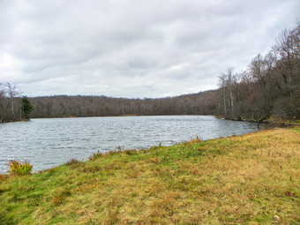
![]()
![]() On Sunday, October 31st I went to the Frick Pond trailhead to hike with a group from Morgan Outdoor, a hiking store in Livingston Manor. Some people were meeting at the store at 12:30 PM but I decided to go directly to the trailhead with Sheba. We arrived just after 12:30 PM and waited for others to appear. By about 12:45 I decided that no one else would show up and that Sheba and I were on our own. I based this assumption not only on the time but also on the weather. The temperature was in the mid-30's with a stiff breeze and a heavy mist alternating with some sputters of snow. Sheba and I started to walk out the Quick Lake Trail toward Frick Pond just as a car pulled into the parking lot. I knew the woman driving would be with the group from the store. We stopped to talk and she said that Lisa, the owner, was right behind her with three more hikers. We waited for the others. After they arrived and we introduced ourselves, we headed up the Flynn Trail toward Hodge Pond just before 1:00 PM. Their original plan was to hike to Hodge and back. My plan was to hike to Hodge Pond with them and then extend the hike in some way. The trip up the Flynn Trail seemed to go very quickly as we walked and talked. I enjoyed talking to some of the hikers I had not met before. We were at the Big Rock junction by 1:50 PM and down to the pond in another 15 minutes. We stopped for a snack and some pictures at the edge of the pond. I suggested we take the Big Rock Trail back for some variety and the others agreed.
On Sunday, October 31st I went to the Frick Pond trailhead to hike with a group from Morgan Outdoor, a hiking store in Livingston Manor. Some people were meeting at the store at 12:30 PM but I decided to go directly to the trailhead with Sheba. We arrived just after 12:30 PM and waited for others to appear. By about 12:45 I decided that no one else would show up and that Sheba and I were on our own. I based this assumption not only on the time but also on the weather. The temperature was in the mid-30's with a stiff breeze and a heavy mist alternating with some sputters of snow. Sheba and I started to walk out the Quick Lake Trail toward Frick Pond just as a car pulled into the parking lot. I knew the woman driving would be with the group from the store. We stopped to talk and she said that Lisa, the owner, was right behind her with three more hikers. We waited for the others. After they arrived and we introduced ourselves, we headed up the Flynn Trail toward Hodge Pond just before 1:00 PM. Their original plan was to hike to Hodge and back. My plan was to hike to Hodge Pond with them and then extend the hike in some way. The trip up the Flynn Trail seemed to go very quickly as we walked and talked. I enjoyed talking to some of the hikers I had not met before. We were at the Big Rock junction by 1:50 PM and down to the pond in another 15 minutes. We stopped for a snack and some pictures at the edge of the pond. I suggested we take the Big Rock Trail back for some variety and the others agreed.
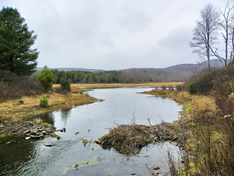 We headed back up the Flynn Trail and were back at the junction by 2:30 PM. Coming up Big Rock can be challenging but going down is a fast trip. Either way I always seem to forget that it is a little longer than I remember. We arrived at Times Square at 2:55 PM and decided to go around the back of Frick Pond. The trail passes through a pine forest and over some wooden walkways. The walkways can be very slick when wet but were passable this time. They do need some work and maintaining is always better than rebuilding. At the out let to Frick Pond we stopped to take a few pictures and then continued on the Quick Lake Trail back to the parking area. We were back by 3:30 having coverlets the .6 miles in 2.5 hours.
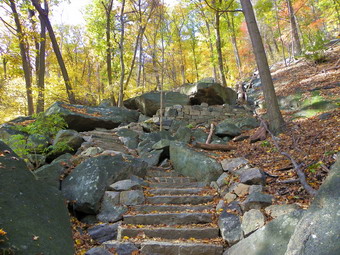
![]()
![]() On Saturday, October 30th I decided to see if Cindy wanted to go to Bear Mountain to hike. We ran in our league championship meet there on Friday and I was surprised to see that most of the trees still had there leaves and that the leaves had some nice colors. Cindy agree and I planned the hike. We had some "chores" to complete in the morning and got a late start. We arrived in the parking area just before 11:00 AM. The fee to park is now up to $8 and I had considered parking in some of the free lots along Seven Lake Drive. Ultimately I parked in the main lot since my primary objective was to climb the new trail that volunteers had constructed. The front lot was completely full and the back one was filling! There were a LOT of people at the park and I knew they weren't all there to hike. The new trail starts at the turn in the access road to the old ski jump and ends at the road to the viewpoint about half way up the mountain. Articles I had read talked about the 300+ stone steps that had been placed in creating the trail. The new trail has caused much controversy with some being opposed and others in favor. I wanted to see for myself. We were hiking by 10:55 AM and headed up the trail behind the skating rink and then turned up the new trail. Immediately we came across the first of the steps. We were both impressed at the workmanship on the stone and the placement of the stones to form the stairs. I took the first of 200+ pictures for the day. Only a few people were hiking up the stairs. The further we went the more impressed we both became. None of the description I had read really did this project justice! The hours of work that went into this engineering marvel were obvious and the result, in our opinion is fantastic! The stonework seems to fit into the natural environment and each set of stairs is placed just where the trail would be too steep for some hikers. The supporting stone work blends nicely and is aesthetically pleasing. The stone steps are interspersed with stretches of trail before the next set of steps. A small wooden bridge is also nicely constructed. I took TOO many pictures of the project along the way as we ascended. At one point there was a nice viewpoint where we stopped to take some pictures of the hills and valley before continuing up. At about 1.1 miles into the hike, the trail ends on the road to the small traffic circle and viewpoint. Here more stones are piled and some signs suggest the trail will be extended.
On Saturday, October 30th I decided to see if Cindy wanted to go to Bear Mountain to hike. We ran in our league championship meet there on Friday and I was surprised to see that most of the trees still had there leaves and that the leaves had some nice colors. Cindy agree and I planned the hike. We had some "chores" to complete in the morning and got a late start. We arrived in the parking area just before 11:00 AM. The fee to park is now up to $8 and I had considered parking in some of the free lots along Seven Lake Drive. Ultimately I parked in the main lot since my primary objective was to climb the new trail that volunteers had constructed. The front lot was completely full and the back one was filling! There were a LOT of people at the park and I knew they weren't all there to hike. The new trail starts at the turn in the access road to the old ski jump and ends at the road to the viewpoint about half way up the mountain. Articles I had read talked about the 300+ stone steps that had been placed in creating the trail. The new trail has caused much controversy with some being opposed and others in favor. I wanted to see for myself. We were hiking by 10:55 AM and headed up the trail behind the skating rink and then turned up the new trail. Immediately we came across the first of the steps. We were both impressed at the workmanship on the stone and the placement of the stones to form the stairs. I took the first of 200+ pictures for the day. Only a few people were hiking up the stairs. The further we went the more impressed we both became. None of the description I had read really did this project justice! The hours of work that went into this engineering marvel were obvious and the result, in our opinion is fantastic! The stonework seems to fit into the natural environment and each set of stairs is placed just where the trail would be too steep for some hikers. The supporting stone work blends nicely and is aesthetically pleasing. The stone steps are interspersed with stretches of trail before the next set of steps. A small wooden bridge is also nicely constructed. I took TOO many pictures of the project along the way as we ascended. At one point there was a nice viewpoint where we stopped to take some pictures of the hills and valley before continuing up. At about 1.1 miles into the hike, the trail ends on the road to the small traffic circle and viewpoint. Here more stones are piled and some signs suggest the trail will be extended.
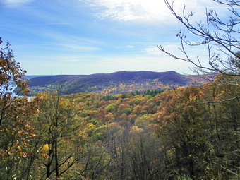 We turned right onto the road and walked uphill a little toward the area where the trail turns back up the mountain. Along the way there were some views down to the Hudson and Iona Island. We also noted the original stone retaining walls and even some stonework that supports a large rock. This old stonework looks a lot like the new or perhaps it is the other way around. We stopped to take some pictures and then continued up the road before turning left onto the trail at about 1.45 miles. From here the trail ascends through mostly open ground and over some rock outcrops. The trail crosses Perkins Drive once at about 1.6 miles and again at 1.75 miles. After the last crossing it enters an open forest on its way toward the tower at the summit. The trail passes by some interesting old metal pipes and some concrete ones with concrete junctions. The final part is a short climb over open rocks to the summit where we arrived right around noon after a 2 mile hike. On this day Perkins Drive was still open so the summit was crawling with people. There was also a very brisk wind at the top. We walked around on the open Rick face that makes up the viewpoint and tried to take some pictures without hordes of people in the foreground. It was a little hazy and we quickly headed for the west side of the mountain to catch the AT down to Seven Lakes drive.
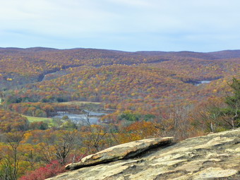 The plan was to walk a roughly clockwise loop out to Queensborough Lake and then north toward Popolopen Creek to Fort Montgomery and then across the creek on the footbridge and back to the car. I thought a visit to the Popolopen Torne might also be possible. As we started our descent down the AT, we did meet a few people coming up and passed few going down. After descending about ,2 miles from the summit at about 2.3 miles into the hike the trail went left where I thought it used to go right. It led to a high, rocky overlook with some nice views with only 5 people rather than 500! We stopped and took some pictures and then tried to follow the AT down to Perkins Drive. Apparently, according to the signs, the trail was closed for some trail work and sort of came to a dead end! We decided to bushwhack down to Perkins and were able to follow some paths for a short distance. We again walked up onto the cliff at this point. We could see Perkins Drive below but the descent was almost vertical. At this point I spotted some old blazes now painted over in gray on the rocks. We followed these along the ridge and then down the ridge toward the northwest. Soon the white blazes of the AT came into view slightly to the north and we headed that way following the trail down to Perkins Drive. From here we walked down Perkins for about .5 miles until the trail cut right into the woods. The trail then wandered up and down in a generally southerly direction until it hit Seven Lakes Drive at 3.75 miles into the hike. It was 1:15 PM. We crossed the road and found the 1777W Trail toward Queensborough Lake.
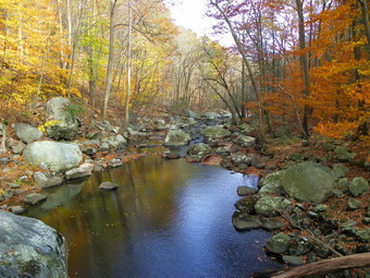 The 1777W Trail parallels Seven Lakes Drive for about 1.1 miles until it crosses the Palisades Parkway and Route 6. Along the way we passed through one of the free parking areas which was packed with cars. In places this trail is poorly marked but Cindy has a good eye for trail blazes and Sheba has a good nose! After crossing the highway we headed down the access road to the lake and toward the shooting range. After the range, we picked up the 1779 trail and followed it toward the northeast. We crossed Popolopen Creek on the strange cement bridge at about 6 miles. This "bridge" is only a little more than a foot wide and has some loose cabling covered with garden hose. There are some cement walls and foundations as well as some unsightly and more modern faded green pipe. We took pictures and then continued the hike, meeting a group of about six people heading toward us. The 1779 Trail continues northeast running along the high bank of Popolopen Creek and parallel to the parkway for about .6 miles until it dips back down to a footbridge across the creek. As we started across the bridge, I noticed an animal swimming downstream of the bridge. It was an otter surfacing and then diving looking for a meal. When it was underwater, it was invisible except for a trail of bubbles. As it neared the bridge, it surfaced with a silver fish in its mouth! I was so mesmerized I almost forgot to try a few shots. I did get one picture before the otter vanished. After a few more pictures of the creek and bridge, we crossed and continued toward Fort Montgomery.
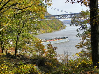 The 1779 Trail continues on the other side of the creek following an old road complete with supporting stonework. It is pretty flat until near the end where it ascends to the road. The trail follows the road and then heads into the woods to pass by Brooks Lake. At this point we were 7.85 miles into the hike and Cindy asked if we could stay on the flat surface of the road. I agreed and we walked about .25 miles until the trail headed right and back into the woods. The trail descends for about .3 miles where, at 8.4 miles, it passes under the Route 9W road bridge. It is interesting to look at the steel structure of the bridge. Just after this the trail hits a driveway that leads to Fort Montgomery. Cindy had never been at the fort so we took some time to walk around and see the excavations. The stone foundations of some barracks, a powder magazine, a guardhouse and the "necessary" have been found. The most impressive part is the main battery where replica 32-pounder cannon overlook the narrow stretch of river between Anthony's Nose and Bear Mountain. It is not hard to see how this was an important strategic position during the Revolution. As we were standing on the main battery, a barge pushed by a tugboat came by heading south. Sighting down the barrel of one of the guns brought the barge directly into view. From the fort we walked back to the visual center and then down to the pedestrian bridge across Popolopen Creek. This is one on the best viewpoints in the ark top get a low-to-high view of the Bear Mountain Bridge and Anthony's Nose. You can also look back up the creek toward Hell Hole. We stopped on the bridge to take numerous shots before crossing over. Since it was 4;00PM and the zoo was closed, we walked under the Bear Mountain Bridge to take some pictures and then followed the bypass trail up to the bridge. Traffic was heavy but we crossed over to Hessian Lake and walked back to the car. There was a flea market going on in the park which added nothing to the beauty of the scenery. We were back at the car by 4:20 PM having covered 10.3 miles in about 5.5 hours. On the way back to Livingston Manor, we could not resist a dinner break at El Bandido!
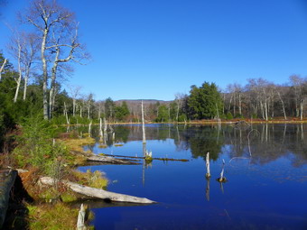
![]()
![]() On Thursday, October 28th I was interested in hiking to Tunis Pond but this time from the Black Bear Road end of the trail. My high school's boys soccer team was scheduled for a playoff game in the afternoon so I knew my time was limited. Even though I had never done the hike before, I thought I would have enough time to complete it. Sheba and I were up early and actually arrived at the end of Black Bear Road just after 8:00 AM, the time I had planned to start. The temperature was only 38 degrees but I decided I would only take my a jacket, hat and gloves with me and not wear them to start the hike. It was very obvious that there had been a lot of rain Wednesday night since the road was alternating between standing pools of water and small streams. We made it to the hunting camp in just over 10 minutes and passed by it to continue on the road/trail. The trail continued to be very wet in most places as we crossed over a brook and headed up a little gaining some elevation. The New Balance 1500's I wore are not my favorite shoes but they proved to be waterproof which is more than I can say for some other shoes I have! It took just a little more than 30 minutes to get to the Fall Brook lean-to which is about 1.7 miles into the hike. It didn't feel like we were rushing but this was a fast pace. After passing the lean-to, we ran into some more wet spots on the trail. Soon a swampy area appeared on the right of the trail which led into a series of beaver ponds and beaver meadows. Doubletop was in the background and I can remember hiking THROUGH the beaver ponds with Harry Rampe on my first bushwhack. The trail passed this area was completely new to me but I knew we were getting close to Tunis Pond. The trail paralleled the Beaverkill for a short distance and then ended at the edge of the stream. I checked the map and it showed that the trail crossed the stream a little further down. I was able to pick up the yellow trail markers ahead. The stream had simply eroded away the trail so Sheba and I bushwhacked up the bank and then back Down to the trail. When we reached the area where the trail crossed the stream, the water was to high and swift to safely cross. I was going to go back upstream but a tree across the water downstream caught my eye. We walked along the stream. bushwhacked up and down the bank and reached the log bridge. It was just right for me but Sheba decided to wade across.
On Thursday, October 28th I was interested in hiking to Tunis Pond but this time from the Black Bear Road end of the trail. My high school's boys soccer team was scheduled for a playoff game in the afternoon so I knew my time was limited. Even though I had never done the hike before, I thought I would have enough time to complete it. Sheba and I were up early and actually arrived at the end of Black Bear Road just after 8:00 AM, the time I had planned to start. The temperature was only 38 degrees but I decided I would only take my a jacket, hat and gloves with me and not wear them to start the hike. It was very obvious that there had been a lot of rain Wednesday night since the road was alternating between standing pools of water and small streams. We made it to the hunting camp in just over 10 minutes and passed by it to continue on the road/trail. The trail continued to be very wet in most places as we crossed over a brook and headed up a little gaining some elevation. The New Balance 1500's I wore are not my favorite shoes but they proved to be waterproof which is more than I can say for some other shoes I have! It took just a little more than 30 minutes to get to the Fall Brook lean-to which is about 1.7 miles into the hike. It didn't feel like we were rushing but this was a fast pace. After passing the lean-to, we ran into some more wet spots on the trail. Soon a swampy area appeared on the right of the trail which led into a series of beaver ponds and beaver meadows. Doubletop was in the background and I can remember hiking THROUGH the beaver ponds with Harry Rampe on my first bushwhack. The trail passed this area was completely new to me but I knew we were getting close to Tunis Pond. The trail paralleled the Beaverkill for a short distance and then ended at the edge of the stream. I checked the map and it showed that the trail crossed the stream a little further down. I was able to pick up the yellow trail markers ahead. The stream had simply eroded away the trail so Sheba and I bushwhacked up the bank and then back Down to the trail. When we reached the area where the trail crossed the stream, the water was to high and swift to safely cross. I was going to go back upstream but a tree across the water downstream caught my eye. We walked along the stream. bushwhacked up and down the bank and reached the log bridge. It was just right for me but Sheba decided to wade across.
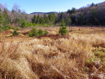 We picked up the trail on the other side. It was very narrow in several places as it clung to the bank of the stream and in at least one place all but disappeared. Only a short distance from the log bridge the trail opened into a little clearing and a very nice bridge crossed the stream! We continued down the woods road until I began to recognize some landmarks and knew it was time to head to the right of the trail and climb a little hill to get to Tunis Pond. The climb was steep but short and the approach was easier than I remembered. We arrived on the shore of the pond and I dropped my pack to get out my camera. After taking a few pictures, we walked along the shore so I could take some more shots. The water was very blue and the secluded pond is quiet. We walked back to the tree where I left the pack and after a drink and a snack for Sheba we headed back out to the trail. I decided to head almost directly south and down the hill which was more direct line to the main trail. On the way back I stopped to take pictures at the bridge and at several points along the stream. The water was high enough to form some interesting rapids in places and one area even had a small falls. I crossed my log bridge again and continued back along the same route we had used on the way in. When we got to the area of the beaver ponds, I stopped to take some pictures of Doubletop and the beaver meadows. After this point, I just wanted to get home so we hiked quickly back on the trail. We stopped at the lean-to briefly so that I could get a few shots and then continued back to the hunting camp. From the hunting camp to the car, the trail had considerably less water than on the way in. Someone had been busy with a front end loader helping the water to drain off the road. We were back at the car just after 11:00 AM. The hike was 7.3 which we managed in under 3 hours including the picture taking and the bushwhacking!
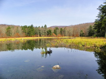
![]()
![]() On Monday, October 25th I decided after hiking Balsam Lake Mountain that Sheba and I needed a little extra time and mileage. I still had to be back for cross country practice but knew I had plenty of time to get to Vly and back. As we walked through the field just out of the parking area, I stopped and took some pictures of Balsam Lake and Graham Mountains. The trail drops as it leaves the field and heads east toward Black Brook. We crossed Black Brook at the bridge about .5 miles from the parking area. We then started to climb over a small hill as we made our way east toward Gulf of Mexico Brook. We descended to this next stream and crossed on the bridge about 1.4 miles from the car. We walked only a little farther with me looking to the left to see if I could spot Vly Pond. We climbed a little and then walked down to the next stream. I recognized this and the view upstream as the one to Vly so we turned left and bushwhacked along the near side of the stream to the pond. This seemed easier than last time with less brush.
On Monday, October 25th I decided after hiking Balsam Lake Mountain that Sheba and I needed a little extra time and mileage. I still had to be back for cross country practice but knew I had plenty of time to get to Vly and back. As we walked through the field just out of the parking area, I stopped and took some pictures of Balsam Lake and Graham Mountains. The trail drops as it leaves the field and heads east toward Black Brook. We crossed Black Brook at the bridge about .5 miles from the parking area. We then started to climb over a small hill as we made our way east toward Gulf of Mexico Brook. We descended to this next stream and crossed on the bridge about 1.4 miles from the car. We walked only a little farther with me looking to the left to see if I could spot Vly Pond. We climbed a little and then walked down to the next stream. I recognized this and the view upstream as the one to Vly so we turned left and bushwhacked along the near side of the stream to the pond. This seemed easier than last time with less brush.
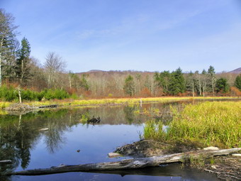 The water level in the pond looked high but some muddy areas around the shore indicated that it had been higher. The beaver dam is very solid with grass growing on the top but I did not see much signs of recent activity and the lodge looked abandoned. I took off my pack and took a lot of pictures while walking around. The sun was out and there was a nice coinsurance of colors and textures to choose from. Sheba and I walked all the way across the dam with little problem. I took pictures of the pond and its surroundings but also snapped some shots with Balsam Lake and Graham in the background. I was hoping to see some wildlife but the best we could scare up were some ducks on the pond. After putting the camera away, we headed back down to the main trail and turned right to go back to the car. There is at least one prominent road that runs perpendicular to the trail but on the way back I noticed several other older and less used roads. The positioning of the trails and paths in this area is interesting and I began to think about a loop from Balsam Lake to Black Bear Road to Long Pond to Mongaup Pond and back. As we walked back to the car, we stopped a few times for me to take pictures of the trail and the two bridges. we were back at the car by 12:30 PM with the 7.7 mile hike taking about 3.5 hours.
![]()
![]() On Monday, October 25th I was desperate to get back into the woods after a week of business and family commitments! Cross country season is still in progress so I chose something close to home and headed for Balsam Lake Mountain. This had been my destination on Friday when a flat tire sent me home! I have climbed this mountain more than any other so it seems like home. I though I would get some pictures of the trail at the top, some shots of the fire tower and some views from the tower before the snow flies. Once it does snow this mountain gets as much snow as any other place in the Catskills. The drive up the Beaverkill Road seemed long but we were at the parking are at the end just before 9:00 AM and started out immediately. The weather was warm with temperatures in the mid 50's so I was wearing a long sleeved Patagonia Wool 1 without a jacket. I was expecting the day to be a little drab but as we hiked I noticed a nice combination of orange, brown and green around us which got better as the skies cleared and the sun came out. We made the turn up the mountain in less than 20 minutes without hurrying. As the sun came out and we continued to climb I became very warm and switched to a short sleeved shirt. By 9:40 AM we were at the junction with the trail to Alder Lake. We stopped so that I could take some pictures of the trees and the trail. My thought was to compare before and after snow. The sky was still a little overcast and gray and some of the gnarled trees gave these shots a spooky appearance.
On Monday, October 25th I was desperate to get back into the woods after a week of business and family commitments! Cross country season is still in progress so I chose something close to home and headed for Balsam Lake Mountain. This had been my destination on Friday when a flat tire sent me home! I have climbed this mountain more than any other so it seems like home. I though I would get some pictures of the trail at the top, some shots of the fire tower and some views from the tower before the snow flies. Once it does snow this mountain gets as much snow as any other place in the Catskills. The drive up the Beaverkill Road seemed long but we were at the parking are at the end just before 9:00 AM and started out immediately. The weather was warm with temperatures in the mid 50's so I was wearing a long sleeved Patagonia Wool 1 without a jacket. I was expecting the day to be a little drab but as we hiked I noticed a nice combination of orange, brown and green around us which got better as the skies cleared and the sun came out. We made the turn up the mountain in less than 20 minutes without hurrying. As the sun came out and we continued to climb I became very warm and switched to a short sleeved shirt. By 9:40 AM we were at the junction with the trail to Alder Lake. We stopped so that I could take some pictures of the trees and the trail. My thought was to compare before and after snow. The sky was still a little overcast and gray and some of the gnarled trees gave these shots a spooky appearance.
 By 9:45 AM I was climbing the fire tower. Above the trees there was a pretty good breeze but I was still warm. The views were somewhat stark but still interesting. From the height and the distance the hardwood trees appeared bare. Only the evergreens offered any color, The far mountains were hazy, as usual, and had an interesting purple cast. I took pictures including some through the struts and stairs on the tower. Back at the base, Sheba and I Headed down the other side to complete the loop back to the parking area. As we walked own the trail, I continued to take pictures. The first set was in the evergreens near the top and showed little in color except for green. As we dropped own in elevation, the sun came out almost full force. Now the colors were softer oranges and browns highlighted by bright green. I took a lot of pictures of the trail all the way back to the parking area. Along the way, I tried going off the trail to the left to get a better view of the valley on that side. I actually found several spots with partial views but none proved good enough for pictures. As we approached the parking area, I noticed it was only 10:50 AM. We had covered the 4.5 miles in 2 hours including all the stops! I decided we needed a little more and headed out the other side of the parking area on the Neversink-Hardenburgh Trail.
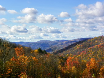
![]()
![]() On Monday, October 18th I wanted to return to Bear Spring State Park to finish hiking the few trails I ha missed on my other three trips. Sheba and I headed toward Roscoe and I chose to take Route 206 through Downsville and toward Walton so that I could park at the pull off at the top of the Bear Spring hill. We parked at about 8:30 and started out on the road right away. I quickly realized we were not walking ABOVE the clear cut area but THROUGH it and we headed back to the car to move to the next higher parking area. Back in the car I headed toward Walton and immediately Wilson Hollow Road appeared on the left. It was back to the parking area we had just left with Sheba giving me some strange looks! I parked and we head north on Route 206, this time to Wilson Hollow Road to start the hike at about 8:40 AM. As we passed the clear cut area, I was impressed by how big it really was. The area stretches over .5 miles along the road and well down into the valley. Wilson Hollow Road is also Trail 2 and we made good time as we walked along the wide open horse trail. I was watching for the place where Trail 11 comes over from just south of Launt Pond on East Trout Brook Road but soon the terrain looked unfamiliar and I knew I had missed it. Trail 2 was a continuously climb but not at all steep. At 2.2 miles a trail came in from the left an I was pretty sure this is where we would be after completing the loop and Trails 2 and 3. It was only 9:15 AM so we had made the 2.2 mile trip in about35 minutes. The GPS showed 3.5 mph! The trails were wet in places and just muddy in others after the recent rains but these spots could be avoided by walking around them. As we walked the trail began heading southeast instead of south as we started to make the loop. At one point another snowmobile trail headed off to the left. The sign said "Downsville: Gas and Food". We continued on the horse trail until after 3.4 miles we were at the junction with Trail 12 where we had been the day before. We turned right and walked out to the clear cut area at the junction of Trail 2 with Trail 3. Here we turned right to follow Trail 3 up the hill and back to Trail 2 to complete the loop. Trail 3 broke into a field just above the clear cut with nice views down the valley. We stopped for me to get some pictures and for us to both get a drink. By 10:20 AM we were back at Trail 2 where the trail had come in from the right earlier. We had already covered 5.3 miles. Now it was back to the car using Wilson Hollow Road, On the way I stopped to take some more pictures in the clear cut area. The leaves were most gone off the trees in the recent rain and high wind but some color remained. We were back at the car by 11:00 AM having covered the 7.6 miles in under 2 hours and 25 minutes including stops.
On Monday, October 18th I wanted to return to Bear Spring State Park to finish hiking the few trails I ha missed on my other three trips. Sheba and I headed toward Roscoe and I chose to take Route 206 through Downsville and toward Walton so that I could park at the pull off at the top of the Bear Spring hill. We parked at about 8:30 and started out on the road right away. I quickly realized we were not walking ABOVE the clear cut area but THROUGH it and we headed back to the car to move to the next higher parking area. Back in the car I headed toward Walton and immediately Wilson Hollow Road appeared on the left. It was back to the parking area we had just left with Sheba giving me some strange looks! I parked and we head north on Route 206, this time to Wilson Hollow Road to start the hike at about 8:40 AM. As we passed the clear cut area, I was impressed by how big it really was. The area stretches over .5 miles along the road and well down into the valley. Wilson Hollow Road is also Trail 2 and we made good time as we walked along the wide open horse trail. I was watching for the place where Trail 11 comes over from just south of Launt Pond on East Trout Brook Road but soon the terrain looked unfamiliar and I knew I had missed it. Trail 2 was a continuously climb but not at all steep. At 2.2 miles a trail came in from the left an I was pretty sure this is where we would be after completing the loop and Trails 2 and 3. It was only 9:15 AM so we had made the 2.2 mile trip in about35 minutes. The GPS showed 3.5 mph! The trails were wet in places and just muddy in others after the recent rains but these spots could be avoided by walking around them. As we walked the trail began heading southeast instead of south as we started to make the loop. At one point another snowmobile trail headed off to the left. The sign said "Downsville: Gas and Food". We continued on the horse trail until after 3.4 miles we were at the junction with Trail 12 where we had been the day before. We turned right and walked out to the clear cut area at the junction of Trail 2 with Trail 3. Here we turned right to follow Trail 3 up the hill and back to Trail 2 to complete the loop. Trail 3 broke into a field just above the clear cut with nice views down the valley. We stopped for me to get some pictures and for us to both get a drink. By 10:20 AM we were back at Trail 2 where the trail had come in from the right earlier. We had already covered 5.3 miles. Now it was back to the car using Wilson Hollow Road, On the way I stopped to take some more pictures in the clear cut area. The leaves were most gone off the trees in the recent rain and high wind but some color remained. We were back at the car by 11:00 AM having covered the 7.6 miles in under 2 hours and 25 minutes including stops.
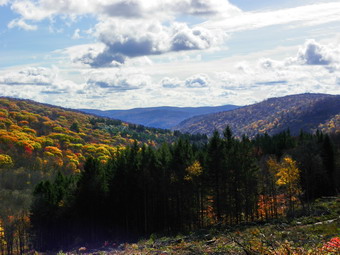 After completing the loop there was only one trail left to hike to complete all the numbered trails at Bear Spring. Trial 4 starts across the road from Middle Pond where we had parked on Sunday and climbs to Trail 5 on the ridge. Since it was early, I decided to drive to the parking area and hike the trail. The trail maps in the park pegged this as about ,6 miles OS I knew it would not take us long. I drove down East Trout Brook Road and parked. We were hiking by 11:15 AM. The trail immediately revealed its character as it became steep very quickly. The trail was damp in most places and there was some blowdown across the trail. The surface was loose and I did not look forward to the trip back down. This trail was wide and pretty well marked and we climbed quickly despite the steepness. After .6 miles we were nowhere near the top which did not surprise me as the mileage on the signs is often wrong. As we neared the top of the ridge a VERY steep section presented itself but we were up it quickly to where the trail flattened before making a quick right turn as it headed up again. Within minutes "junction" signs appeared and we were at Trail 5 on the top of the ridge. I checked the trail signs and found that the .6 miles marked was "as the crow flies"! Now it was back down to the car. As we descended the short, steep section I noticed the horse trail went to the left so we followed it. This section was simply a short switchback to avoid the steepest section and I ha d missed it on the way up. We made our way back down the trail quickly but carefully arriving at the car by 12:00 PM. We covered the 2 mile section in about 45 minutes and had now completed the trails in this area.
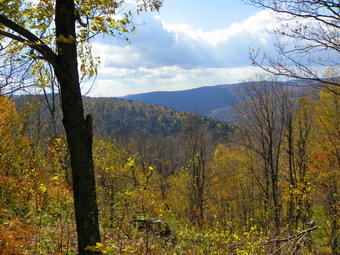
![]()
![]() On Sunday, October 17th Cindy and I wanted to take a nice walk somewhere not too far away from home. Cindy was not thrilled with bushwhacking or climbing mountains so I suggested Bear Spring where I wanted to hike some trails in the southeast part of the park. After church, we headed up the Quickway to East Branch and then took Route 30 to Shinhopple. We turned north on Trout Creek Road and were soon at the lower campgrounds and parking area where Trout Creek Road splits into West and East. We parked in the large lot and walked across the road to pick up the trail. My plan was to hike Trail 12 to Trail 2 and then return on Trail 8. We walked down into a field and followed the blue markers over some very wet ground to East Trout Creek. When we got to the creek it was obvious that horses would have no trouble crossing but we were going to get wet if we tried to cross. We walked up and down the creek looking for a place to cross but could find none. It is for situations just like this that I usually have a Plan B. Back in the car we drove north on East Trout Creek Road to the parking lot by Middle Pond. We parked at around 12:35 PM and started to hike immediately by walking down to the dam and bridge across the outlet of the pond. Just after the dam, we turned right on Trail 8 which follows the creek more or less as it heads south to the area where we had been earlier. In some places the trail opens into fields and becomes hard to follow. In these cases we could usually pick up the trail on the other side of the field. In some places a stake with a marker could be found in the middle of the field. The walk was pleasant for the most part with the sun lighting the brook and the water playing a tune as it flowed over the rocks. The only drawback was that the trails were wet from the recent rains and VERY muddy in spots. Some horse traffic in previous days had not helped. We walked by the sides of the trails in these places and didn't have too much trouble. As we walked I wondered if the junction with Trail 12 was on our side or the other side of the creek. After walking slightly downhill for 2.2 miles, we came to one of those fields but this time there were markers going in two different directions. We noticed a sign on a tree and it indicated Trail 8 continued straight ahead but that Trail 12 turned up the hill to the ridge. We gladly turned left and started up .
On Sunday, October 17th Cindy and I wanted to take a nice walk somewhere not too far away from home. Cindy was not thrilled with bushwhacking or climbing mountains so I suggested Bear Spring where I wanted to hike some trails in the southeast part of the park. After church, we headed up the Quickway to East Branch and then took Route 30 to Shinhopple. We turned north on Trout Creek Road and were soon at the lower campgrounds and parking area where Trout Creek Road splits into West and East. We parked in the large lot and walked across the road to pick up the trail. My plan was to hike Trail 12 to Trail 2 and then return on Trail 8. We walked down into a field and followed the blue markers over some very wet ground to East Trout Creek. When we got to the creek it was obvious that horses would have no trouble crossing but we were going to get wet if we tried to cross. We walked up and down the creek looking for a place to cross but could find none. It is for situations just like this that I usually have a Plan B. Back in the car we drove north on East Trout Creek Road to the parking lot by Middle Pond. We parked at around 12:35 PM and started to hike immediately by walking down to the dam and bridge across the outlet of the pond. Just after the dam, we turned right on Trail 8 which follows the creek more or less as it heads south to the area where we had been earlier. In some places the trail opens into fields and becomes hard to follow. In these cases we could usually pick up the trail on the other side of the field. In some places a stake with a marker could be found in the middle of the field. The walk was pleasant for the most part with the sun lighting the brook and the water playing a tune as it flowed over the rocks. The only drawback was that the trails were wet from the recent rains and VERY muddy in spots. Some horse traffic in previous days had not helped. We walked by the sides of the trails in these places and didn't have too much trouble. As we walked I wondered if the junction with Trail 12 was on our side or the other side of the creek. After walking slightly downhill for 2.2 miles, we came to one of those fields but this time there were markers going in two different directions. We noticed a sign on a tree and it indicated Trail 8 continued straight ahead but that Trail 12 turned up the hill to the ridge. We gladly turned left and started up .
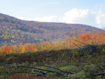 The horse trails in the park are marked on the map with colors to indicate difficulty. Yellow is easy. Blue is moderate, Red is difficult. There aren't many red trails but Trail 12 is one! We soon found out why as the trail started to climb to the ridge. A few switchbacks made things a little easier but we walked up about 900 feet in the next mile. The trail initially headed southeast but at about 2.9 miles into the hike it turned north and continued up the ridge. At 2:15 PM and 3.25 miles into the hike a short spur trail led off to the left to a very nice lookout. This viewpoint, like so many, had some trees in the way but for the most part was open. We got some pictures of the ridge to the west including some unusual cloud patterns and a view of a quarry. After this brief pause, we continued the hike as the trail wandered down and then up again and back and forth across the ridge. The wind came up strong with some stiff gusts. As clouds rolled in we wondered whether the forecast had missed the part about showers but none developed. Around 3:00 PM and 4.8 miles of hiking Trail 12 turned sharply left away from private land . The trail now began to look more and more like a road. Within a short distance, there was a STOP sign at the junction with Trail 2. I had thought about turning right but Cindy did not want to go up anymore so we turned left and started back toward the car. At 5.5 miles there was another junction, this time with Trail 3 and we again turned left rather than climb up a hill. At this trail junction was another clear cut area making at least four I had seen in the last week in the Bear Spring area. The trees have been cut down but many have not been removed. There also does not seem to be any effort to replace the forest. On the way back, I stopped at Middle Pond to take some pictures of the pond and the water falling over the dam. We were back at the car by 3:45 PM having covered 6.2 miles in 3 hours. On the way back we drove north on East Trout Brook Road and stopped at Launt Pond. I wanted Cindy to see this pretty little pond. Some color was still left in the leaves on the trees around the pond.
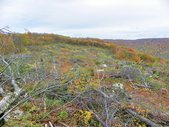
![]()
![]() On Thursday, October 14th I wanted to explore more of the trails at Bear Spring State Park. I had initially planned to do this on Friday and circumnavigate the whole park but the weather forecast looked questionable. I wanted to be there by 8:00 AM but we arrived at the main parking are at close to 9:00 AM. This time we started our hike by crossing the road and heading out on Trail 7. Some signs at the trail head announced mileages but I have learned to largely ignore these as they are often incorrect. I had pretty much memorized the trails I wanted to take from the map in the parking area. Unfortunately, this map has no distances posted on it nor does it have terrain marked. The VO map has proved to be accurate but does not have the trail numbers on it. This trail was pretty wet with muddy areas and some places where there was standing or running water. At about .5 miles we crossed Beers Brook Road heading almost due south. The trail followed the a ridge and rolled up and down at times. Around 1.3 miles I began to look for a side trail to the transmission towers as advertised on a sign at the trail head. There was no sign of the towers so I continued to walk to a trail junction at about 2.2 miles. Here a sign announced the trail to the towers. So much for believing the signage at the park. We turned left and walked down to another trail junction where it seemed that the horse trail turned right. We followed this trail as it started to climb more to a higher point on the ridge and meandered back and forth and up and down for almost 2 miles. I knew that we needed to head southeast and lose some significant elevation to get to West Trout Brook Road and the trail that would return us to the car. I was under a time constraint and wondered after being out for almost 2 hours whether to turn back or continue. We continued on the trail as it continued on the ridge but heading southeast. Eventually it did start down but I knew we had to find a switchback to take us north to a woods road that would lead to West Trout Brook Road. After another two miles and almost 6 miles into the hike the trail turned north and we ran across logger's clear cutting another hillside! The road was now clearly a logging road with some "improvements" and we walked quickly over the next .85 miles to another hairpin turn to the southeast. In .5 miles we crossed a bridge over West Trout Creek and came to the road at the lowest point on the hike so far. We had walked 7.3 miles, dropped 990 feet from the ridge and were still headed out, away from the car! Where the trail goes after hitting the road is NOT MARKED but because of our earlier trip up West Trout Creek Road, I knew to turn right and then head up the trail.
On Thursday, October 14th I wanted to explore more of the trails at Bear Spring State Park. I had initially planned to do this on Friday and circumnavigate the whole park but the weather forecast looked questionable. I wanted to be there by 8:00 AM but we arrived at the main parking are at close to 9:00 AM. This time we started our hike by crossing the road and heading out on Trail 7. Some signs at the trail head announced mileages but I have learned to largely ignore these as they are often incorrect. I had pretty much memorized the trails I wanted to take from the map in the parking area. Unfortunately, this map has no distances posted on it nor does it have terrain marked. The VO map has proved to be accurate but does not have the trail numbers on it. This trail was pretty wet with muddy areas and some places where there was standing or running water. At about .5 miles we crossed Beers Brook Road heading almost due south. The trail followed the a ridge and rolled up and down at times. Around 1.3 miles I began to look for a side trail to the transmission towers as advertised on a sign at the trail head. There was no sign of the towers so I continued to walk to a trail junction at about 2.2 miles. Here a sign announced the trail to the towers. So much for believing the signage at the park. We turned left and walked down to another trail junction where it seemed that the horse trail turned right. We followed this trail as it started to climb more to a higher point on the ridge and meandered back and forth and up and down for almost 2 miles. I knew that we needed to head southeast and lose some significant elevation to get to West Trout Brook Road and the trail that would return us to the car. I was under a time constraint and wondered after being out for almost 2 hours whether to turn back or continue. We continued on the trail as it continued on the ridge but heading southeast. Eventually it did start down but I knew we had to find a switchback to take us north to a woods road that would lead to West Trout Brook Road. After another two miles and almost 6 miles into the hike the trail turned north and we ran across logger's clear cutting another hillside! The road was now clearly a logging road with some "improvements" and we walked quickly over the next .85 miles to another hairpin turn to the southeast. In .5 miles we crossed a bridge over West Trout Creek and came to the road at the lowest point on the hike so far. We had walked 7.3 miles, dropped 990 feet from the ridge and were still headed out, away from the car! Where the trail goes after hitting the road is NOT MARKED but because of our earlier trip up West Trout Creek Road, I knew to turn right and then head up the trail.
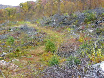 According to the trail map in the parking area Trail 7 had changed to Trail 6 somewhere along the ridge on the west side of the road. Signs said that we were headed to Spruce Grove which was supposed to be 7 miles from the parking area. I took a minute to stop and get a drink and a snack for Sheba and myself. I also took the time to remove a light pair on long underwear bottoms I had worn. I had long ago ditched the light softshell, hat and gloves! Whenever it first starts to get cool, I always overdress to hike and am always reminded of how much heat I generate. I also had to remove the Fox River liner socks I wore since the weave is too coarse. I like liners but my feet did feel better after this. I probably should have changed the long-sleeved Patagonia 1 Wool for short sleeves. At 7.6 miles we ran into a trail junction that was clearly marked with Trail 5! This was the trail I knew we needed to take back to the car and I immediately turned left and started to climb. The trail was wide and open but was almost constantly going up with a few flatter areas interspersed. In 1.3 miles we gained back the 900+ feet of elevation we had lost coming down off the west ridge. The trail leveled some and, then, at 9.5 miles we passed across Fork Mountain. From here it was mostly downhill. There were some side trails but Trail 5 was more clearly marked than any other trail I had seen and we stayed on it. Somewhere after Fork Mountain, about 10.3 miles into the hike I had a "deja vous" moment as we came to another clear cut area just like the one from the day before. It was on a side hill and the trail skirted the top. The leaves on the far ridge were colorful despite the overcast skies. It took me a moment to convince myself we were in a different area than the day before. I made my only photographic stop here to record what I saw. I began to wonder why the clear cutting was being done in at least three areas at Bear Spring! We continued on Trail 5 until it ended at West Trout Brook Road at 11 miles into the hike. Time was growing short but I thought we would be back to the car just when I had predicted which was amazing considering my earlier misgivings! A horse trailer was pulled off the road by the trail head and I assumed they had ridden out on Trail 7 since we had not seen horses or any "evidence" of horses on Trail 5. We crossed the road at this point and were back on Trail 7 that e had used earlier in the day with several hundred feet. I debated whether or not to walk up the road but decided to stay completely on the trails this day. As we completed the last mile back to the car I found hoof prints and other "evidence" that a horse had been over the trail although we never met them. We were back at the car before the rain just before 1:00 PM. We covered 12.2 miles in just minutes over 4 hours. At one point on the way out our moving average was 3.7 mph but the return trip UP Trail 5 cut into this some. There are still some more trails in the southeast to explore and map so I will be going back at some time in the near future.
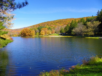
![]()
![]() On Wednesday, October 13th I was looking to do a short hike in a new area near home before XC practice. This is not easy since I have done most of these hikes in areas like Trout Pond, Frick Pond and Long Pond multiple times and had done the first two recently. I finally decided to go to Bear Spring State Park near Walton and check out the trail system there. The drive is about 40 minutes but Sheba and I got a late start due to my indecision. We arrived at 10:00 AM with only about 3 hours to hike so we got on the trail immediately. Bear Spring was slated to be closed by the state in the budget crunch but was kept open due to the lobbying of some dedicated supporters in the area. The area is unique since all of the trails are horse trails in the spring, summer and fall. In the winter most trails are open for snowmobiles. Of course, the trails cane hiked at any time and I thought they would be great for snowshoeing! Most of the trails are eight feet or more wide and are well groomed with no brush. The problem is that the trails are poorly marked and I could find no adequate trail maps. The VO map has some trails in the area but they occupy a 2 inch by 2 inch square on the map and have only a few of the trails. The trails are numbered and the main map on West Trout Brook Road just off Route 206 has a complete color coded map. It would be a help to be able to have a copy of this map. We started by getting on the trail to the left of the map and heading southeast. This is Trail 2 and within .2 miles we came to a field with no indication of where to go. We skirted the field and started to bushwhack parallel to Route 206. Within a short distance we were back on the trail. We walked down hill and crossed East Trout Brook Road at .5 miles. Immediately after the road the trail split three ways and we took the one furthest to the left heading uphill. There are really no views along the way but the walk is pretty. Within a mile we came to a trail junction where we could go left or right. I chose right and we headed uphill again until the trail topped out on plateau. here the trail ran through a very open forest. I knew we wanted to be going southwest and we were by the suns direction. At 1.4 miles the trail abruptly headed northwest and down which gave me an indication we were not on the right trail. Soon we were back at East Trout Brook Road which meant that LEFT was the proper choice back at the last trail junction! I decided to walk down East Trout Brook Road to Launt Pond and then pick up another trail there to try to complete a loop.
On Wednesday, October 13th I was looking to do a short hike in a new area near home before XC practice. This is not easy since I have done most of these hikes in areas like Trout Pond, Frick Pond and Long Pond multiple times and had done the first two recently. I finally decided to go to Bear Spring State Park near Walton and check out the trail system there. The drive is about 40 minutes but Sheba and I got a late start due to my indecision. We arrived at 10:00 AM with only about 3 hours to hike so we got on the trail immediately. Bear Spring was slated to be closed by the state in the budget crunch but was kept open due to the lobbying of some dedicated supporters in the area. The area is unique since all of the trails are horse trails in the spring, summer and fall. In the winter most trails are open for snowmobiles. Of course, the trails cane hiked at any time and I thought they would be great for snowshoeing! Most of the trails are eight feet or more wide and are well groomed with no brush. The problem is that the trails are poorly marked and I could find no adequate trail maps. The VO map has some trails in the area but they occupy a 2 inch by 2 inch square on the map and have only a few of the trails. The trails are numbered and the main map on West Trout Brook Road just off Route 206 has a complete color coded map. It would be a help to be able to have a copy of this map. We started by getting on the trail to the left of the map and heading southeast. This is Trail 2 and within .2 miles we came to a field with no indication of where to go. We skirted the field and started to bushwhack parallel to Route 206. Within a short distance we were back on the trail. We walked down hill and crossed East Trout Brook Road at .5 miles. Immediately after the road the trail split three ways and we took the one furthest to the left heading uphill. There are really no views along the way but the walk is pretty. Within a mile we came to a trail junction where we could go left or right. I chose right and we headed uphill again until the trail topped out on plateau. here the trail ran through a very open forest. I knew we wanted to be going southwest and we were by the suns direction. At 1.4 miles the trail abruptly headed northwest and down which gave me an indication we were not on the right trail. Soon we were back at East Trout Brook Road which meant that LEFT was the proper choice back at the last trail junction! I decided to walk down East Trout Brook Road to Launt Pond and then pick up another trail there to try to complete a loop.
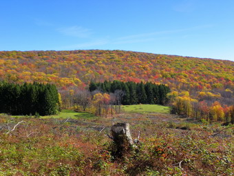 The walk down the road was only about .8 miles but this road is paved and had quite a bit of traffic, much more than I would have expected given its location. Launt Pond is simply BEAUTIFUL! We stopped for a minute at the boat launch and then walked to the dam and bridge at the outlet end. I took off my pack and got out the camera to take pictures. The fall leaves were still on the trees and the color was good. After taking many pictures, I decided to try and find a trail across the road. I was not sure where to find the trail but it seemed it would be at a parking area further south on the road. We walked down the road and came across a parking area after only .3 miles and there was a trail head just before the lot. There are trail maps insider plexiglass holders at most of these junctures but they are old and have not been replaced and most are impossible to read. We turned into the woods on the trail and headed slightly northeast. The trail began to climb slightly but leveled off and headed southeast. I began to wonder where the trail was headed and if we should turn around. At 3.7 miles the trail ended at a junction with a very wide open woods road. On my GPS this was marked as Wilson Hollow Road which is also Trail 2 and I knew we had to turn left and north. The road was even wider than the other trails and the walking was easy. At about 4.25 miles I could see an open area beginning to appear on the right and some brilliant colors on the far ridge. The "open" area was a clear cut logging area right next to the road where we were walking and it extended for some distance along the trail and down into the hollow. We stopped at several points along the way so that I could take pictures of the cleared area and the beautiful leaf colors. The fall colors this year have been variable with some areas having almost none and others having bright patches. We continued to walk almost out to Route 206 before turning left and up the hill to the trail junction where I had made the "mistake" earlier. From here we reversed our route from earlier and crossed East Trout Brook Road, This time I eschewed the bushwhack and stayed on the trail. Soon the trail opened into the field that we had encountered at the very beginning of the hike and it became clear the "trail" simply traverses the open field without markings whatsoever. We were back at the car by 12:30 PM having completed 6 miles in just under 2.5 hours. This was not as long as I had wanted but probably better than I could have expected given the confusion at several points. I deiced to come back another day to explore more of the trails.
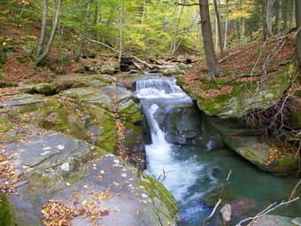
![]() On Monday, October 11th Cindy, Sheba and I hiked Ashokan High Point and were back in the car by 3:30 PM. One our drive back along the Peekamoose Road, we stopped at four small waterfalls to take some pictures. The first waterfall was near a section of road that had been washed away. From the road you can see a drainage with large rocks extending all the way up into the woods. It is not clear what happened to all the water that washed out the road and moved these large rocks! I walked up the drainage and found a delicate waterfall with a small stream of water cascading down a sheer cliff. I took some pictures and returned to the car. As I have done before, I made a note to return in wetter times. We stopped in two more places where there are culverts under the road since these indicate tributaries of the main stream. Each of these little falls has some beauty in its own right. Several are clogged with trees and other debris and I found myself wanting to clear them out to better expose the falls. The second one we stopped at had a nice drop but also a "nice" log down the face of the falls. The third falls had several parts to it and I had to hike along the steep banks to get even a glimpse of the upper cascade. Again, an area to revisit. The last stop we made was at Bear Hole Brook. There really isn't a falls here but more of a rapids over some rocks. There is evidence of a dam for a mill and the area is very pretty. Bear Hole also has a woods road that runs directly to the best area!
On Monday, October 11th Cindy, Sheba and I hiked Ashokan High Point and were back in the car by 3:30 PM. One our drive back along the Peekamoose Road, we stopped at four small waterfalls to take some pictures. The first waterfall was near a section of road that had been washed away. From the road you can see a drainage with large rocks extending all the way up into the woods. It is not clear what happened to all the water that washed out the road and moved these large rocks! I walked up the drainage and found a delicate waterfall with a small stream of water cascading down a sheer cliff. I took some pictures and returned to the car. As I have done before, I made a note to return in wetter times. We stopped in two more places where there are culverts under the road since these indicate tributaries of the main stream. Each of these little falls has some beauty in its own right. Several are clogged with trees and other debris and I found myself wanting to clear them out to better expose the falls. The second one we stopped at had a nice drop but also a "nice" log down the face of the falls. The third falls had several parts to it and I had to hike along the steep banks to get even a glimpse of the upper cascade. Again, an area to revisit. The last stop we made was at Bear Hole Brook. There really isn't a falls here but more of a rapids over some rocks. There is evidence of a dam for a mill and the area is very pretty. Bear Hole also has a woods road that runs directly to the best area!
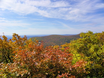
![]()
![]() On Monday, October 11th I was scheduled to lead a hike from Long Pond to Mongaup Pond and back but no one was signed up for the hike. Cindy had the day off and we decided to go look for some fall color. After hiking Little Ashokan with Hermit in March, I wanted to try it during a month that didn't have three feet of snow on the ground. We decided to give this hike a try and headed for the Kanape Brook parking area arriving just before 10:00 AM. This is a popular area so I was surprised to find that we were the only car in the lot! We crossed the road and got on the trail immediately. The brook had some water in it but was not particularly high. A week has made a lot of difference in the water in the streams. From the trail it was hard to tell how much color we would find from up above. There were definitely still leaves on the tress, many of the leaves had changed color but most were yellow and not too vibrant. The trail had only a few wet spots but all of the small tributaries were flowing well. This is definitely a nice walk except for the many stones on the trail in quite a few places which make walking the trail in snowshoes a pleasure. We walked uphill some and I pointed out the steepness of the bank on opposite side of the stream. This is one way to get up and down Little Rocky. The trail leveled and we walked through a dark pine forest where the stream is right next to the trail. It is obvious that the water had been over the trail in spot. We gained some more elevation and passed by places where the main brook and some side tributaries have cut deep beds. I remarked to Cindy how I always forget how far the hike is to the turn. This time I remembered it is about 2.75 miles but that didn't make it seem any shorter. We made the turn at 11:15 AM and passed by the left that is the trail that completes the loop. Now we started our 1 mile climb to the summit.
On Monday, October 11th I was scheduled to lead a hike from Long Pond to Mongaup Pond and back but no one was signed up for the hike. Cindy had the day off and we decided to go look for some fall color. After hiking Little Ashokan with Hermit in March, I wanted to try it during a month that didn't have three feet of snow on the ground. We decided to give this hike a try and headed for the Kanape Brook parking area arriving just before 10:00 AM. This is a popular area so I was surprised to find that we were the only car in the lot! We crossed the road and got on the trail immediately. The brook had some water in it but was not particularly high. A week has made a lot of difference in the water in the streams. From the trail it was hard to tell how much color we would find from up above. There were definitely still leaves on the tress, many of the leaves had changed color but most were yellow and not too vibrant. The trail had only a few wet spots but all of the small tributaries were flowing well. This is definitely a nice walk except for the many stones on the trail in quite a few places which make walking the trail in snowshoes a pleasure. We walked uphill some and I pointed out the steepness of the bank on opposite side of the stream. This is one way to get up and down Little Rocky. The trail leveled and we walked through a dark pine forest where the stream is right next to the trail. It is obvious that the water had been over the trail in spot. We gained some more elevation and passed by places where the main brook and some side tributaries have cut deep beds. I remarked to Cindy how I always forget how far the hike is to the turn. This time I remembered it is about 2.75 miles but that didn't make it seem any shorter. We made the turn at 11:15 AM and passed by the left that is the trail that completes the loop. Now we started our 1 mile climb to the summit.
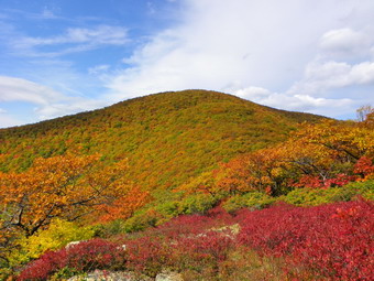 The climb to High Point is about 1 mile and 1000 feet of vertical gain. It starts slowly and then becomes a series of five short climbs interspersed with flatter areas. Several of the climbs have stone steps. The last two climbs are a little steeper and are just short of rock scrambles. Along the way we could look over our shoulders and see some views of the Mombaccus-Little Rocky ridge but nothing we could photograph. Just before the High Point there is a viewpoint on and we stopped to take some pictures of the ridge. The colors were there but not too bright and we continued up to the High Point. Like many of the viewpoints in the Catskills this one has become "grown in" and doesn't have too much of a view. We didn't stop for long as I wanted to get to Little Ashokan. We followed a path through the brush to the right of the High Point and down to a flatter area. From here it was down through some steeper areas and around some cliffs. When Cindy recognized we were going down and would have to come back up, she elected to stay and relax while Sheba and I pressed on. I am never happy about doing this but I really wanted to see the view from Little Ashokan! This part of the hike was definitely easier with snow on the ground. We descended about 350 feet and then started to climb up Little Ashokan. Along the way we climbed over another bump and followed the rather well-defined path around some cliffs and steeper slopes. On top of Little Ashokan there is a lot of scrub to walk through. A lot of this brush was a brilliant red. Once at the rocks near the top the views were great. The view back to the High point may have been the best with the red brush in the foreground and the bright yellows of the High Point in back. I took pictures from there and then walked to a lower rock to take more pictures of the valley and the Mombaccus-Little Rocky ridge. I walked to another lower viewpoint over and took more pictures but still could barely see the reservoir. After walking on paths around to the other side facing the Ashokan, I could still not get a clear shot of the reservoir. I returned to the top on started back to Cindy. We made the return trip so fast that I was out of breathe by the time we got back to the spot where we had last seen Cindy. I called her name and she responded from on top and we walked directly to the High Point and through a break in the rocks. A group of five people was at the High Point and we talked briefly before Cindy, Sheba and I headed out on the trail toward the field at the top. The field had some nice views of the Burroughs Range and we stopped at the fireplace and stone benches to take pictures. We walked over to where we could see the reservoir through the trees and took a picture or two but none of our exploring revealed a good view of the Ashokan. At this point we decided to hike the loop rather than go back the way we came. I even thought we might even bushwhack some down to the main trail when the loop trail turns left.
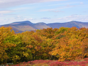 We descended for about .5 miles through some nice hardwood forest always with glimpses of the reservoir to the right. The trail then ascends a significant bump before continuing to descend. At about a mile from the top, a well-defined path leads off to the right. We walked down the path looking for where it went. We didn't see a lookout and the path eventually sort of stopped so we returned to the main trail. Just after this the trail turns southeast and then south to meet the trail we took to the top earlier. It was here that I wanted to bushwhack southwest to the main trail but Cindy wanted to stay on the trail. The next 1.5 miles of the trail to complete the loop is mostly loose stone with a slippery leaf covering. It doesn't matter if the leaves are wet or dry, they always seem slippery. As we descended the wind came up and blew in some clouds. We both began to wonder if rain was on the way early. By 2:30 PM we had made the turn and it was just a matter of hiking the nearly 3 mile trail back to the parking area. As we hiked up the trail the rocks did not seem that bad but after 4 hours of hiking each rolling rock annoyed me! The sun was back out and no rain had fallen. Along the way we caught up to and passed several hikers taking pictures. We also ran into several groups just starting to hike. Their lack of packs or any other equipment led me to believe they were just out for a walk and were not going to the High Point. Near the end of the trail we caught up to the group we had met on the High Point and talked to them on the way back to the car. We were back in the parking area by 3:30 PM having covered 9.8 miles in 5.5 hours. On the drive out Peekamoose Road I had seen several small waterfalls and thought we might stop on the way back.
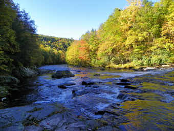
![]()
![]() On Friday, October 8th I was scheduled to lead a hike in the Neversink Unique Area starting at the end of Katrina falls road. One other hiker was signed up for the hike but the weather was the best it had been all week and Sheba and I were ready to get out. We arrived at the parking area at about 8:45 AM and the other hiker, Michael, was already there. It wasn't long before we were on the trail. The plan was to hike down to Denton and then High Falls and then back up to the trail junction to go to Mullet Falls before completing the loop back to the parking area. Michael is a strong hiker and we moved quickly along the trail which damp in most areas with a few spots with running water. By 9:40 AM we had traveled the 1.6 miles to Denton Falls. We took some time to admire the beauty of the river and for me to take some pictures. There was more water in the river than the last time I was there and the falls, although small, roared. After a brief stay, we were back on the trail bearing rile at the trail junction to head to High Falls. The trail is interesting as it parallels the river, sometimes closer and sometimes farther away. In one are it passes over a rocky stretch and then makes a sharp bend . Eventually the trail follows what looks like an old woods road. Shortly after this it drops toward High Falls. We made the 4 mile trip by 10:50 AM. High Falls isn't much higher than Denton Falls but it is wider and more impressive. We were still able to walk out on the rock shelves that give an almost head-on view of the falls. The rocks were slippery and we had to be careful as the river is deeper and swifter this point. I took quiet a few pictures and we lingered admiring the power of the water. The leaves in the area still had some color and they made a nice contrast with the river.
On Friday, October 8th I was scheduled to lead a hike in the Neversink Unique Area starting at the end of Katrina falls road. One other hiker was signed up for the hike but the weather was the best it had been all week and Sheba and I were ready to get out. We arrived at the parking area at about 8:45 AM and the other hiker, Michael, was already there. It wasn't long before we were on the trail. The plan was to hike down to Denton and then High Falls and then back up to the trail junction to go to Mullet Falls before completing the loop back to the parking area. Michael is a strong hiker and we moved quickly along the trail which damp in most areas with a few spots with running water. By 9:40 AM we had traveled the 1.6 miles to Denton Falls. We took some time to admire the beauty of the river and for me to take some pictures. There was more water in the river than the last time I was there and the falls, although small, roared. After a brief stay, we were back on the trail bearing rile at the trail junction to head to High Falls. The trail is interesting as it parallels the river, sometimes closer and sometimes farther away. In one are it passes over a rocky stretch and then makes a sharp bend . Eventually the trail follows what looks like an old woods road. Shortly after this it drops toward High Falls. We made the 4 mile trip by 10:50 AM. High Falls isn't much higher than Denton Falls but it is wider and more impressive. We were still able to walk out on the rock shelves that give an almost head-on view of the falls. The rocks were slippery and we had to be careful as the river is deeper and swifter this point. I took quiet a few pictures and we lingered admiring the power of the water. The leaves in the area still had some color and they made a nice contrast with the river.
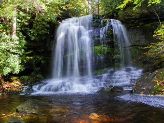 We left the falls and headed back on the same trail to the trail junction near the top of Denton Falls. Here we turned right to start the loop back to the car. Along the way we took the side trail down to Mullet Falls. We arrived at about noon and were 6.3 miles into the hike. This falls was the most dramatically different than last time. The water volume was much greater and the effect made the falls much more dramatic. The temperature was much cooler at the falls and the rocks were wet from the spray. I took some pictures and then carefully made my way over the rocks so that I could get a better angle. The pool at the bottom of the falls really adds to the pictures and has some interesting colors that contrast with the bright green moss in back of the falls. After taking some more shots, we packed up and headed back up to the main trail and turned left to continue the loop. The trail starts to climb and in about .5 miles another path leads off to the right. We thought we might see where the paths leads so we turned right. Within a very short distance, we saw posted signs to indicate private property, so we returned to the main trail. We crossed the wooden footbridge over Mullet Brook and within .2 miles a yellow trail branched off to the right, I had not been on this trail and thought it probably headed to Wolf Lake. We turned and enjoyed a pleasant walk that lead to a parking area within .5 miles. We decided to follow the road out of the parking area. the road heads almost due north and passes under some power lines before making an almost 90 degree right turn. We continued straight ahead on the power line right of way and crossed over Wolf Brook to Wolf Lake Road about a mile from the parking area. We turned left on the road and head toward Katrina Falls Road where we turned left to get back to the cat. We were back at the parking area by 1:40 PM having taken 4 hours and 40 minutes to cover the 10.2 mile hike.
On Thursday, October 7th I was scheduled to lead a hike to Vly and Tunis Ponds. When I woke up it was raining and overcast. The hike is along a trail but requires bushwhacking to both ponds. I called the only hiker signed up. He lives in Sullivan County and we decided to try this hike on another day. As I write this at 9:40 AM, the weather is bright an sunny with temperatures headed toward 60 but with a strong, gusting wind.
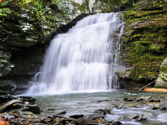
![]()
![]() On Wednesday, October 6th I was scheduled to lead a hike at Frick and Hodge Ponds for Lark in the Park. Only two people were signed up and one was another hike leader whose Westkill hike had been cancelled due to uncertain road conditions! Sheba and I arrived at the parking area on Morton Hill Road at about 8:40 AM and another car pulled up shortly after. Craig has a house in Roxbury and is from New Jersey. We talked and waited for the other hiker but at 9:05 AM we decided to get on the trail. It was not raining but the sky was pretty dark with a few patches of bright blue. We hiked own Russell Brook Road and remarked at the amount of water in the brook. A truck was parked at the lower Parking area and it turned out to be Bob, the other hike leader. Bob lives in Delancey and is a retired postal carrier and also a farrier. We all walked down to the falls and into the stream bed. I got out my camera and took some pictures. Bob decided to go back to his truck for his camera and while he was gone, Craig and I headed to the upper falls. I again took pictures and then noticed Bob had returned and was at the lower falls. We hurried down but did not find him there but as we walked out to the main trail he was waiting. I signed the register and we headed up to Trout Pond. Craig does work with the NYNJ Trail Conference and was noting the accuracy of the new digital maps compared to what we were finding on the trail. He uses the GPS on his Droid since it allows him to mark GPS coordinates and make notes as he hikes. Soon we were at Trout Pond with a dark and somewhat ominous sky handing over the water. We stopped for a few pictures and then continued on.
On Wednesday, October 6th I was scheduled to lead a hike at Frick and Hodge Ponds for Lark in the Park. Only two people were signed up and one was another hike leader whose Westkill hike had been cancelled due to uncertain road conditions! Sheba and I arrived at the parking area on Morton Hill Road at about 8:40 AM and another car pulled up shortly after. Craig has a house in Roxbury and is from New Jersey. We talked and waited for the other hiker but at 9:05 AM we decided to get on the trail. It was not raining but the sky was pretty dark with a few patches of bright blue. We hiked own Russell Brook Road and remarked at the amount of water in the brook. A truck was parked at the lower Parking area and it turned out to be Bob, the other hike leader. Bob lives in Delancey and is a retired postal carrier and also a farrier. We all walked down to the falls and into the stream bed. I got out my camera and took some pictures. Bob decided to go back to his truck for his camera and while he was gone, Craig and I headed to the upper falls. I again took pictures and then noticed Bob had returned and was at the lower falls. We hurried down but did not find him there but as we walked out to the main trail he was waiting. I signed the register and we headed up to Trout Pond. Craig does work with the NYNJ Trail Conference and was noting the accuracy of the new digital maps compared to what we were finding on the trail. He uses the GPS on his Droid since it allows him to mark GPS coordinates and make notes as he hikes. Soon we were at Trout Pond with a dark and somewhat ominous sky handing over the water. We stopped for a few pictures and then continued on.
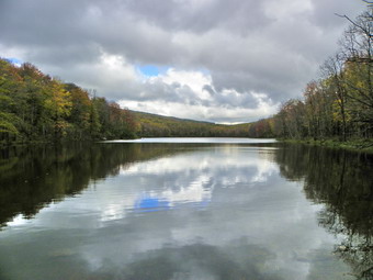 The trail along the pond was wet with some standing water but was not flooded and we made good time to the inlet. The small brook was full of water so we walked upstream a bit to cross. Craig was a fountain of knowledge on several subjects. He leads quite a few hikes in different areas of New York City and is very well informed about that area. We climbed the trail in back of Trout to Cherry Ridge and headed toward Mud Pond eventually descending to the snowmobile trail/woods road. We decided to skip Mud Pond and turned left to complete the loop. Back at the lower parking area, I noticed that the dirt piles blocking the road were gone so we decided to walk down the road to see what had happened. We walked until we got to a series of boulders placed across the road to announce its official end. There is a small parking are for here for two or three cars. The walk down Russell Brook Road is pleasant as it parallels Russell Brook which has proved to be its demise. In places the road seems unaffected while in other much of it is in the brook and in others it is eroded from small "streams" coming off the hill above it. We continued passed the "barrier" and negotiated some tricky areas where the road all but disappears until we got to an area where there is no road. Rather than sidehill passed this spot, we turned around and headed back to the parking area. Craig and I bid Bob farewell and hiked up the road to our cars. It was a little after 12:30 PM. We had hiked a little over 6 miles in 3.5 hours.
![]() On Tuesday, October 5th I was scheduled to lead a hike at Frick and Hodge Ponds for Lark in the Park. Only one person was signed up and it was sprinkling a little when I got up but Sheba and I arrived at the trail head at about 8:40 AM. We waited until 9:05 AM but no one showed up. I decided that it was raining only a little so that we would hike. I ALWAYS carry a pack with supplies and my camera but this day I decided to put on my rain jacket, an OR Revel made of Pertex, and stuff some essentials in my pockets a leave the pack behind. As I walked away from the car it felt strange not carrying the pack. Once I got accustomed to the lack of pack it was really nice to hike unencumbered. We headed out the Quick Lake Trail to Frick where we scared up some ducks and a heron. I chose to go around the back of Frick. The wooden walkways were slicker than ice with e the recent rain and a covering of algae. At Times Square, we headed up the Big Rock Trail and I began to get really warm in the rain jacket. I stopped and removed my light Patagonia wool leaving just my UnderArmor HeatGear under my jacket. The Revel was pitzips and I opened them even more so that they extended from elbow to just and inch above my waist. This helped some. The Big Rock Trail is always longer than I remember and can be challenging if you hike it quickly. When we arrived at the junction with the Flynn Trail, I had almost decided to turn right and go back to the car. It was early and we were both still ready to hike so we turned left and walked down to Hodge Pond. At the pond, we found the beaver dam that had blocked the outlet at the culvert was completely cleared. I guess it might have been the nigh water that washed it away but I though I saw the tracks of some machinery. The water was again flowing from the outlet of the pond in a stream. The wooden structure that had controlled the level of the pond is on pretty poor shape and there is still a small beaver dam right at the outlet of the pond. After only a short stay we walked up the hill to the right of the pond and continued up to the woods road that goes to Shin Creek Road. Here we turned right and were soon back at the Flynn Trail. From there it was just a matter of walking back to the car. We were back just after 11:00 AM covering about 6 miles in 2 hours.
On Tuesday, October 5th I was scheduled to lead a hike at Frick and Hodge Ponds for Lark in the Park. Only one person was signed up and it was sprinkling a little when I got up but Sheba and I arrived at the trail head at about 8:40 AM. We waited until 9:05 AM but no one showed up. I decided that it was raining only a little so that we would hike. I ALWAYS carry a pack with supplies and my camera but this day I decided to put on my rain jacket, an OR Revel made of Pertex, and stuff some essentials in my pockets a leave the pack behind. As I walked away from the car it felt strange not carrying the pack. Once I got accustomed to the lack of pack it was really nice to hike unencumbered. We headed out the Quick Lake Trail to Frick where we scared up some ducks and a heron. I chose to go around the back of Frick. The wooden walkways were slicker than ice with e the recent rain and a covering of algae. At Times Square, we headed up the Big Rock Trail and I began to get really warm in the rain jacket. I stopped and removed my light Patagonia wool leaving just my UnderArmor HeatGear under my jacket. The Revel was pitzips and I opened them even more so that they extended from elbow to just and inch above my waist. This helped some. The Big Rock Trail is always longer than I remember and can be challenging if you hike it quickly. When we arrived at the junction with the Flynn Trail, I had almost decided to turn right and go back to the car. It was early and we were both still ready to hike so we turned left and walked down to Hodge Pond. At the pond, we found the beaver dam that had blocked the outlet at the culvert was completely cleared. I guess it might have been the nigh water that washed it away but I though I saw the tracks of some machinery. The water was again flowing from the outlet of the pond in a stream. The wooden structure that had controlled the level of the pond is on pretty poor shape and there is still a small beaver dam right at the outlet of the pond. After only a short stay we walked up the hill to the right of the pond and continued up to the woods road that goes to Shin Creek Road. Here we turned right and were soon back at the Flynn Trail. From there it was just a matter of walking back to the car. We were back just after 11:00 AM covering about 6 miles in 2 hours.
On Monday, October 4th I was scheduled to lead a hike up the Dutcher Step Trail on Slide Mountain. Eight people were signed up for the hike but the weather report was grim so by the time Sunday night rolled around all but three had sent emails saying they would not attend. I decided to go anyway to see what would happen. Sheba and I arrived at the trailhead at 8:15 AM to find one other car that was not part of our group. We walked over to the West Branch to see if we could cross. I found a spot that made crossing easy and, in fact, crossing almost anywhere would have been okay depending on your balance and jumping skills. We went back to the car to wait. About 8:45 AM a forest ranger's truck pulled up and I met Kenneth Gierloff who covers Region 3 - Zone A - District 3-1. He explained that the other ranger Marie Ellenbogen was getting some sleep after being involved in late night search and rescues. He also told me that the rain and cold were not his idea of enjoyable recreational hiking and I tended to agree. When we had first arrived, there was only a heavy mist but by 9:00 AM it was pouring. We chatted some and I learned a lot about the job and the frustrations from this none year veteran. By 9:15 AM no one else had shown up and we parted. I thought about taking a short walk but the rain continued to come down and the temperature was only 39 degrees. Sheba and I left the trailhead and headed home.
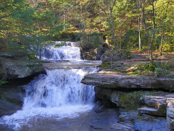
![]() On Sunday, October 3rd I wanted to visit as many waterfalls as possible by driving and/or hiking. Cindy seemed interested so we decided to go. We waited around for some time in the morning because there was so much fog photography would be a problem. We did not get stared until after 8:00 AM. As we drove out to the Beaverkill Road and turned to start toward Lew Beach we noticed there was little or no fog and probably hadn't been any for some time. Livingston Manor sits in a valley and no matter how long I live there I forget that it can be overcast or foggy at home and bright and sunny elsewhere. As we passed by Lake Waneta, the fog was scooting across the lake very quickly. I stopped to take a picture but in the few minutes it took to get to the lake shore the effect was almost gone. I took a few shots which were Ok. We drove on through Lew Beach and passed Little Pond Campgrounds. We headed out on the Barkaboom Road toward the Pepacton Reservoir. The roads generally were in good shape but it was clear many had been covered in water on Thursday and Friday. Just before the reservoir we stopped at Tompkins Falls, a falls I had just recently discovered and photographed. The last time I photographed the falls there was only enough water in the stream to see that there were falls. On this day, the water was flowing swiftly with a much greater volume. We worked our way down the bank from where we parked the car and tool some shots. We walked downstream along the near bank to get another angle and tale more pictures. The water was just high and fast enough to discourage trying to cross so we walked up the bank and on the road back to the car. From there we hit Route 28 and headed east to Shandaken.
On Sunday, October 3rd I wanted to visit as many waterfalls as possible by driving and/or hiking. Cindy seemed interested so we decided to go. We waited around for some time in the morning because there was so much fog photography would be a problem. We did not get stared until after 8:00 AM. As we drove out to the Beaverkill Road and turned to start toward Lew Beach we noticed there was little or no fog and probably hadn't been any for some time. Livingston Manor sits in a valley and no matter how long I live there I forget that it can be overcast or foggy at home and bright and sunny elsewhere. As we passed by Lake Waneta, the fog was scooting across the lake very quickly. I stopped to take a picture but in the few minutes it took to get to the lake shore the effect was almost gone. I took a few shots which were Ok. We drove on through Lew Beach and passed Little Pond Campgrounds. We headed out on the Barkaboom Road toward the Pepacton Reservoir. The roads generally were in good shape but it was clear many had been covered in water on Thursday and Friday. Just before the reservoir we stopped at Tompkins Falls, a falls I had just recently discovered and photographed. The last time I photographed the falls there was only enough water in the stream to see that there were falls. On this day, the water was flowing swiftly with a much greater volume. We worked our way down the bank from where we parked the car and tool some shots. We walked downstream along the near bank to get another angle and tale more pictures. The water was just high and fast enough to discourage trying to cross so we walked up the bank and on the road back to the car. From there we hit Route 28 and headed east to Shandaken.
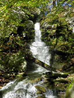 In Shandaken, we turned north on Route 42 which I had heard was closed. Shortly a sign did tell us the road was closed ahead but we continued on to Halcott Falls. This is a very small falls near the parking area for the bushwhack up Sleeping Lion and Halcott. We had passed several other similar falls on Route 42 but it was safest to park here. We parked at about 10:00 AM and took some pictures from the base of the falls. I climbed the path to the top and took a few more photos before going back to the car. We continued north on Route 42 but soon came across a sign indicating the road was closed 2 miles ahead. At this point I turned around and headed back. At Westkill I though about using Beech Ridge Road to bypass the closed bridge but decided to go to Phoenicia on try Route 214 north through the notch and passed Hunter. The weather reports said that Phoenicia had gotten over 8 inches of rain and by the looks of the streets it seemed to be true. There was a lot of mud and just outside of town Route 214 was reduced to one lane as the other lane was in the stream. Once passed this point the road was in good shape. Near the Devil's Tombstone Campgrounds a group of volunteers was cleaning up the roadside of litter. The parking lot at Notch Lake was nearly full. At Route 23 we turned east and headed through Tannersville and Haines Falls on our way to Bastion and Kaaterskill Falls.
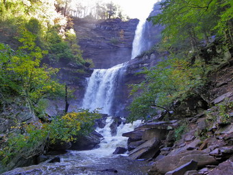 We arrived at the parking area for Kaaterskill Falls just before 11:00 AM and it was already full. Fortunately for us someone was leaving as we were arriving and we were able to get a legitimate parking space. We carefully walked down the busy road to the trail leading to both falls. Even before we got to where we could see Bastion Falls we could hear the roaring of the water! When we arrived, the volume of water going over the falls was epic. I took some pictures before continuing up the trail to Kaaterskill Falls. There were quite a few people on the trail but we passed many and were soon at the falls. Again the volume of water and the roar it made were impressive! the amount of spray from the falls and the angle of the sun made taking pictures difficult but we took as many as we could from different angles. We noticed one person trying to climb the edge of the lower falls but he gave up quickly and made it back down safely. After taking pictures, I started up the path to the top just to inspect it. It was more eroded than even and although it looked possible, I was not going to try it on this day. Cindy and I turned around and headed back to the car. Getting out was almost as easy as getting in which was surprising as there seemed to be more cars in the lot! This area gets more dangerous all the time with more and more cars parked illegally along the road and a greater number of people walking on the road to the falls. I suggested we visit the falls from the top but Cindy did not want to so we headed over Clum Hill Road to Platte Clove.
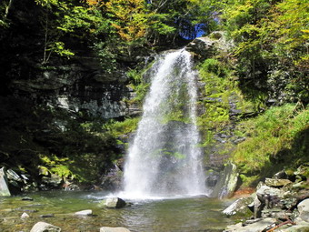 We arrived at the Platte Clove Preserve at noon and walked the trail down to the falls in about 15 minutes. Although there were other cars parked at the Preserve, there was no one at the falls so we had the place to ourselves. We took pictures of the small but pretty falls. I walked out a little on some rocks to get a different angle but the water was deep and looked cold! When we were finished, we bushwhacked up to the cabin and along the back to the stream above the falls. I walked down to the stream and stood on some rocks that jutted out into the stream to take pictures of the upper falls. The drop for these falls is less than 10 feet but they are still pretty. Up and behind the falls is the king post bridge that allows the Long Path to cross the stream. This bridge makes an interesting addition to pictures of the stream.
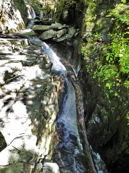 Back at the car we drove down Platte Clove Road and passed the parking area for Kaaterskill High Peak and arrived at the bridge over Kitchen Creek in the area known as the Devil's Kitchen. This is the area of several recent tragedies but we had no intention of doing more than visiting the area right around the bridge. After finishing, we walked back to the car and headed for Pancho Villa's in Tannersville for some lunch. After lunch, it was back to Phoenicia to pick up Route 28 to Route 28A to the Sundown Road. We wanted to visit Buttermilk Falls near Peekamoose and Angel Falls near Yagerville to complete our "Falls Saga" for the day. Driving toward Peekamoose it was obvious that certain areas had been flooded and the right edge of the road near the stream seemed to be just hanging on in some places.
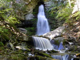 We arrived at Buttermilk Falls at about 2:30 to find only one other car but no sign of the occupants. We both took pictures of the falls and then hiked closer to the plunge pool and took some more. We started the climb to the top but decided it was too steep for an effort at the end of the day with one more falls to take on. We did walk to the other side of the bridge and approached the falls from a different angle. This produced a more unobstructed view of the falls and some nice shots. We got back in the car an drove down to Sundown turning left toward Yagerville. Just after the turn was another place where a part of a road had become part of a stream. We worked our way or the narrow one lane road and then started up and over the highest part of the road. We stopped at the top since Cindy wanted to take some pictures and then continued down the other side to Shalom Road and Angle Falls.
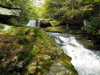 We parked at the end of the road at about 3:15 PM and started to walk down to the upper falls. There isn't much to see from above the falls OS we started down the path that parallels the stream.Sheba and I descended the steep bank to slip and slide our way down to the stream. Cindy chose a slightly longer but much easier path. At the base of the falls I was able to walk out on some slippery rocks that poked pout into the stream. From here I took pictures of the falls and a few downstream before heading back to the bank. Once there we climbed back up to the path and headed along the stream to the lower falls. The lower falls has a double drop while the upper falls is as single drop into a plunge pool. Both are nice in their own way. The lower falls has the stone foundation of several buildings in the vicinity. I took pictures of both parts of the lower falls before deciding to call it a day and return to the car!
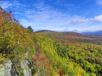
![]()
![]() On Wednesday, September 26th I wanted to hike somewhere to assess the fall leaf colors. I decided to try out Giant Ledge and Panther so Sheba and I headed off for the trailhead on Route 47, the Frost Valley Road. We parked at around 9:00 AM and were the only car in the lot. We got on the trail right away and I signed the trail register. I noticed that the trail was wetter than it had been all summer with some standing water in places. I also found that even though the temperature was in the 50's the long sleeved wool I was wearing was WAY too warm even though it was very light. In about 18 minutes we were at the turn up toward Giant Ledge and Panther and I changed into a short sleeved shirt. As we headed up the trail things were still pretty wet. I did not stop at the lookout toward Slide as the leaves block the view. There were quite a few yellow leaves littering the trail but most of the leaves were green and still on the trees. We arrived at the first viewpoint on the Ledges and found some very nice color in the valley and on the surrounding mountains. For once there was little or no haze and a bright blue sky with many different cloud formations. I took pictures from this viewpoint and the next. Some were back toward the Burroughs Range and others were toward Panther. I also turned the camera on the far peaks and on the valley below. When I had taken too many shots, Sheba and I headed for Panther. Along the way there were viewpoint I though I might hit on the way back and others I thought I might check out.
On Wednesday, September 26th I wanted to hike somewhere to assess the fall leaf colors. I decided to try out Giant Ledge and Panther so Sheba and I headed off for the trailhead on Route 47, the Frost Valley Road. We parked at around 9:00 AM and were the only car in the lot. We got on the trail right away and I signed the trail register. I noticed that the trail was wetter than it had been all summer with some standing water in places. I also found that even though the temperature was in the 50's the long sleeved wool I was wearing was WAY too warm even though it was very light. In about 18 minutes we were at the turn up toward Giant Ledge and Panther and I changed into a short sleeved shirt. As we headed up the trail things were still pretty wet. I did not stop at the lookout toward Slide as the leaves block the view. There were quite a few yellow leaves littering the trail but most of the leaves were green and still on the trees. We arrived at the first viewpoint on the Ledges and found some very nice color in the valley and on the surrounding mountains. For once there was little or no haze and a bright blue sky with many different cloud formations. I took pictures from this viewpoint and the next. Some were back toward the Burroughs Range and others were toward Panther. I also turned the camera on the far peaks and on the valley below. When I had taken too many shots, Sheba and I headed for Panther. Along the way there were viewpoint I though I might hit on the way back and others I thought I might check out.
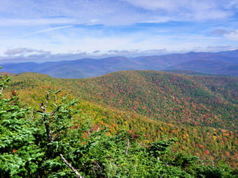 Around 10:45 AM we arrived on the summit of Panther where there was little or no view. I was also disappointed that the little "Panther" sign was gone. We walked back to the set of boulders that has become the lookout and we both mounted the rocks. The views from here were equally good as from the Ledges but in a different direction. The colors were nice but perhaps not peak yet. Many photos later, I packed up and we headed down the trail and back to Giant Ledge. There were some very wet spots and Panther and I sunk into the mud more than once coming down. We stopped at two different lookouts and I took a few more pictures since the sun had brightened and illuminated the area even more. As we left the area, Sheba alerted and came back to me but I did not see why. IN a minute a group of at least 12 hikers from southern California arrived. We talked for a while and then parted. The trip down went very quickly. We met only one other hiker on the trail until the little bridge near the trail head. A young photographer with some serious photographic equipment was setting up to take pictures of the little rivulet that goes under the bridge. We spoke for a minute and I suggested several other falls in the area he might visit. We arrived back at the parking lot at 12:$% PM covering the 6.5 mile trip in under 3 hours of actual walking time. I spoke to a hiker who was returning to the area after a 20+ years absence and then drove home.
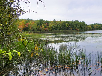
![]()
![]() On Sunday, September 26th Cindy and I wanted to hike together after church. We wanted a short hike but one with some possibilities of seeing leaf color. Giant Ledge was a possibility but we decided it was too far for the day. I suggested we go to Lake Superior State Park to hike in an area where I had walked a lot when I was a kid. We parked on Dr. Duggan Road by a small pond around 11:50 AM and hiked up over a hill and through a field to Indian Field Road. Taking a right on the road we headed toward Indian Field. Just borer their POSTED signs began on the right we turned onto a woods road which is the boundary between the club's private and the Lake Superior State Park. The Rocky Run Road is part of the old Newburgh-Cochecton Turnpike and we hiked it extensively when I was growing up on Dr. Duggan Road. The woods road was very prominent and showed traces of tracks. I remembered many of the twists and turns and the ridges that line the road in places. After about two miles, we came to the end of the woods road where it meets Pucky Huddle Road. We turned right and walked a few hundred feet down the road to Mallory Brook and turned right into the woods to follow Mallory Brook to the upper cove on Lake Superior. The walk was about .6 miles and varied between a woods road, a path and a pure bushwhack. We stopped on the shore of the lake to take some pictures before starting a bushwhack south and east along the shore.
On Sunday, September 26th Cindy and I wanted to hike together after church. We wanted a short hike but one with some possibilities of seeing leaf color. Giant Ledge was a possibility but we decided it was too far for the day. I suggested we go to Lake Superior State Park to hike in an area where I had walked a lot when I was a kid. We parked on Dr. Duggan Road by a small pond around 11:50 AM and hiked up over a hill and through a field to Indian Field Road. Taking a right on the road we headed toward Indian Field. Just borer their POSTED signs began on the right we turned onto a woods road which is the boundary between the club's private and the Lake Superior State Park. The Rocky Run Road is part of the old Newburgh-Cochecton Turnpike and we hiked it extensively when I was growing up on Dr. Duggan Road. The woods road was very prominent and showed traces of tracks. I remembered many of the twists and turns and the ridges that line the road in places. After about two miles, we came to the end of the woods road where it meets Pucky Huddle Road. We turned right and walked a few hundred feet down the road to Mallory Brook and turned right into the woods to follow Mallory Brook to the upper cove on Lake Superior. The walk was about .6 miles and varied between a woods road, a path and a pure bushwhack. We stopped on the shore of the lake to take some pictures before starting a bushwhack south and east along the shore.
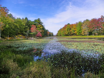 The problem with hiking along the shore of the lake is that there are thick stands of laurel which are hard to push through. We would hike along the shore and then head away from the shore when confronted with the laurel. Several times we walked down to the shore to take pictures. The leaf colors were not spectacular but some were good. The sky was very overcast but began to clear a little as we hiked down the lake offering some blue to add contrast to the pictures. Several spots along the shore looked like small campsites and I suspect people access these areas by boat. The closer we got to the outlet end of the lake the more prominent the path became. At the outlet we continued to follow the small "stream" that connects the lake to the small pond where we had parked. This all brought back a lot of memories since my friends and I crossed and recrossed this area so many years ago. We ran across the large ant hills that I remembered. There were over two dozen of them with the largest being 5 feet in diameter and more than a foot high! As we approached the pond, we chose to take the "low road" and hike near the shore. There is also a path higher up that walks along the ridge above the pond. We stopped to take pictures of the pond and the dam at the outlet end. We were back at the care at 2:10 PM covering the 4.2 mile hike in 2 hours and 20 minutes. After hiking we drove to Bethel and ate lunch a the Dancing Cat Saloon.
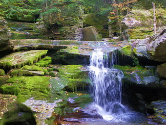
![]() On Friday, September 24th I intended to come back from Bearpen, Vly and South Bearpen by driving back around the Pepacton Reservoir. The reservoir was low and there was some evidence of nice leaf colors around the water. When I got to the Barkaboom Road, I changed my plans and turned left. This is shorter way back and I remembered the falls I had seen last time. I stopped at the top of the falls where there is room for a car or two. I grabbed the camera and slid down the bank to the stream. There wasn't much water but there was just enough to call it a falls. I roamed around taking pictures and eventually worked my way down to the area below the falls. There is some extensive old stonework indicating a sluice and a foundation. After taking pictures, I went downstream and climbed the back to walk the road back to the car. The VO map labels the falls as Tompkins Falls. One person in Livingston Manor thinks the falls may have generated electricity for Shavertown which is now under the Pepacton Reservoir.
On Friday, September 24th I intended to come back from Bearpen, Vly and South Bearpen by driving back around the Pepacton Reservoir. The reservoir was low and there was some evidence of nice leaf colors around the water. When I got to the Barkaboom Road, I changed my plans and turned left. This is shorter way back and I remembered the falls I had seen last time. I stopped at the top of the falls where there is room for a car or two. I grabbed the camera and slid down the bank to the stream. There wasn't much water but there was just enough to call it a falls. I roamed around taking pictures and eventually worked my way down to the area below the falls. There is some extensive old stonework indicating a sluice and a foundation. After taking pictures, I went downstream and climbed the back to walk the road back to the car. The VO map labels the falls as Tompkins Falls. One person in Livingston Manor thinks the falls may have generated electricity for Shavertown which is now under the Pepacton Reservoir.
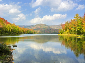 Our last stop was at Big Pond just before the turn onto the Beaverkill Road. The colors here were as nice as any and it was very quiet. One other car was parked and the occupant was sitting by the pond. I took some shots and then headed home.
![]() On Friday, September 24th I wanted to scout a route up South Bearpen from the DEP land shown on the VO map. When I got to the road I wanted to use it was marked as private. I almost gave up but pulled into a house near the road and knocked on the door. I explained what I wanted to do including parking on the DEP side of the road and hiking the last bit to South Bearpen on private property. I was granted permission and drove up the road. It got very rough for the vehicle I was driving and I believe I parked just short of the DEP land. Sheba and I headed northeast over some pretty steep ground. Woods with ferns alternated with areas of prickers. I was hoping to find some woods roads but nothing appeared. We hit the col between the south and middle bumps and continued northeast to the summit. As always we walked around a little until I found what I claim is the highest spot. I could have taken some pictures of ferns and prickers but I could find no views. We headed back much the same way we had come. The whole distance was less than 3 miles.
On Friday, September 24th I wanted to scout a route up South Bearpen from the DEP land shown on the VO map. When I got to the road I wanted to use it was marked as private. I almost gave up but pulled into a house near the road and knocked on the door. I explained what I wanted to do including parking on the DEP side of the road and hiking the last bit to South Bearpen on private property. I was granted permission and drove up the road. It got very rough for the vehicle I was driving and I believe I parked just short of the DEP land. Sheba and I headed northeast over some pretty steep ground. Woods with ferns alternated with areas of prickers. I was hoping to find some woods roads but nothing appeared. We hit the col between the south and middle bumps and continued northeast to the summit. As always we walked around a little until I found what I claim is the highest spot. I could have taken some pictures of ferns and prickers but I could find no views. We headed back much the same way we had come. The whole distance was less than 3 miles.
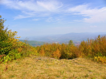
![]()
![]() On Friday, September 24th the weather showed all the signs of "Indian summer" with temperatures expected to be in the 80's. I decided to get Bearpen and Vly, two peaks I needed for September. I also though the views of the changing fall colors might be good from Bearpen. I expected to have enough time to either hike to South Bearpen from Bearpen or investigate another route to hike at a later time. Sheba and I arrived at the snowplow turnaround at the end of County Route 3 at about 10:00 AM and started to walk up the road to the hunter's shack that marks the col. I was surprised how hot it was already although the humidity seemed low and there was a slight breeze. The colors of the leaves were mostly muted yellows and not very spectacular. The road showed evidence that a vehicle had recent been driven on it and I expected there might even be someone at the cabin. When we arrived, no one was home and we turned right to head up Vly. It was at this point I remembered that I had wanted to approach from the north as several people had suggested. I hope I remember to vary by route next time! The herd path up Vly becomes more well defined each time I hike it and some of the blue paint blazes looked almost new. Perhaps this is because I have been up this route several times now. Sheba and I worked our way up through the first set of rocks and across the first flat area where I normally get lost. It was then on to some more ledges and rocks and a little climbing. I was thinking about a lot of things and was actually surprised when we hit the summit plateau and the canister soon afterward. Before signing in, we headed for the lookout. Most of the views were still blocked by the leaves but I could see that a dense haze was still hanging around despite the high temperatures and stiff breeze. This didn't really surprise me as I had noticed the haze as I looked over my shoulder while climbing up Vly. Back a the canister we signed in and then headed back down. We were back at the col by 11:30 AM and ready to try Bearpen. Because I knew the haze would make for poor photography, I considered skipping Bearpen But in the end decided it might be my last chance in September.
On Friday, September 24th the weather showed all the signs of "Indian summer" with temperatures expected to be in the 80's. I decided to get Bearpen and Vly, two peaks I needed for September. I also though the views of the changing fall colors might be good from Bearpen. I expected to have enough time to either hike to South Bearpen from Bearpen or investigate another route to hike at a later time. Sheba and I arrived at the snowplow turnaround at the end of County Route 3 at about 10:00 AM and started to walk up the road to the hunter's shack that marks the col. I was surprised how hot it was already although the humidity seemed low and there was a slight breeze. The colors of the leaves were mostly muted yellows and not very spectacular. The road showed evidence that a vehicle had recent been driven on it and I expected there might even be someone at the cabin. When we arrived, no one was home and we turned right to head up Vly. It was at this point I remembered that I had wanted to approach from the north as several people had suggested. I hope I remember to vary by route next time! The herd path up Vly becomes more well defined each time I hike it and some of the blue paint blazes looked almost new. Perhaps this is because I have been up this route several times now. Sheba and I worked our way up through the first set of rocks and across the first flat area where I normally get lost. It was then on to some more ledges and rocks and a little climbing. I was thinking about a lot of things and was actually surprised when we hit the summit plateau and the canister soon afterward. Before signing in, we headed for the lookout. Most of the views were still blocked by the leaves but I could see that a dense haze was still hanging around despite the high temperatures and stiff breeze. This didn't really surprise me as I had noticed the haze as I looked over my shoulder while climbing up Vly. Back a the canister we signed in and then headed back down. We were back at the col by 11:30 AM and ready to try Bearpen. Because I knew the haze would make for poor photography, I considered skipping Bearpen But in the end decided it might be my last chance in September.
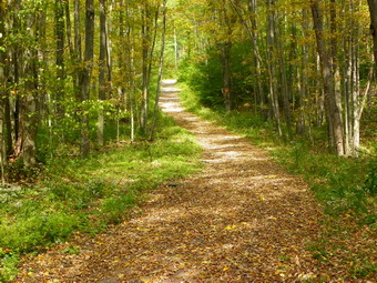 As Sheba and I walked out the road to start the ascent, a foul odor permeated the air in one spot. I moved quickly passed that point but Sheba took a couple of good whiffs. We moved quickly up the first and then the second ascent on the woods roads. At the top of the second, just before I normally turn into the woods, we ran across the new Snowmobile trail several people have mentioned. I could not remember whether the posts said it headed for the summit or not so I elected to bypass the trail and start a bushwhack in my regular spot. We turned into the woods and I whack my way through some stands of prickers. As we began to climb up the hill, we ran into the snowmobile trail. These people are serious about clearing a trail. The trail is 6 to 8 feet wide and all vegetation has been cut down and cleared. Sheba and I followed this for a while until the clearing effort stopped. After this we followed the orange ribbons until they started to curve the wrong way and then we followed a path headed in the right direction. It turned out this was the route we normally use and soon we were on the road to the summit. This road has developed several deep depression that have turned into small ponds complete with their own population of amphibians! Near the viewpoints I headed into the woods to make sure I found the highest point which is not something I always do. We walked out to the open clearing that marks the top of the old ski slope. There was indeed a lot of haze over the valley. I could still make out the reservoir and the Huntersfield-Ashland Pinnacle-Richmond formation but it wasn't easy. There was some evidence of color in the leaves but most of it was in the low brush and scrub around me. I too pictures and then we moved to the other lookout. The story hear was the same so, after some shots, we headed back. I checked the distance to South Bearpen on` my GPS and decided I didn't want to whack almost 1.5 miles. In addition, much of this would be on private land where I did not have permission to hike. As we neared the col, three large vultures flew up from just over the edge of the road. Upon inspection I saw that the source of the odor was a buck. It had at least 6 point and what appeared to be a gunshot wound on its right side. I deiced no closer inspection was needed and we continued on to the col and back to the car. We were back by 1:30 PM covering the 6.6 mile hike in 3.5 hours. The car thermometer read 84 degrees. I decided to drive to scout South Bearpen from some roads near Redkill Ridge. Along the way I stopped several times to take a few leaf pictures.
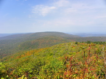
![]()
![]() On Wednesday, September 22nd I had not planned to hike but the weather looked so nice I gave into the temptation and decided to go to Graham Mountain since I needed it for September and had not been there in some time. After my adventure on Monday, I was careful to take on a peak I knew even if it is technically a trailless peak. We arrived at the trail head for Balsam Lake Mountain just before 9:5 AM and were ready to start the hike. In less than 20 minutes we were at the turnoff to hike up to Balsam Lake Mountain but continued straight ahead for Graham. This part of the trail is usually grown over but we had a pleasant surprise. The vegetation was cut back on the sides of the trail and even what grew in the trail had been trimmed. In several places rock cairns had been erected more for artistic enhancement than navigation. We made the turnoff for Graham in 45 minutes and started on the herd path. The path showed that it had been used a lot lately. I didn't see that anything had actually been cut back but the path was much more prominent than ever before. This made the trip much more enjoyable and faster. In a few places where I sometimes lose the path, I had no troubles this day. We were on the top of Graham and at the ruins by 10:50 AM! Graham mountain and the herd path are on private property. Make sure you call to get permission before hiking.
On Wednesday, September 22nd I had not planned to hike but the weather looked so nice I gave into the temptation and decided to go to Graham Mountain since I needed it for September and had not been there in some time. After my adventure on Monday, I was careful to take on a peak I knew even if it is technically a trailless peak. We arrived at the trail head for Balsam Lake Mountain just before 9:5 AM and were ready to start the hike. In less than 20 minutes we were at the turnoff to hike up to Balsam Lake Mountain but continued straight ahead for Graham. This part of the trail is usually grown over but we had a pleasant surprise. The vegetation was cut back on the sides of the trail and even what grew in the trail had been trimmed. In several places rock cairns had been erected more for artistic enhancement than navigation. We made the turnoff for Graham in 45 minutes and started on the herd path. The path showed that it had been used a lot lately. I didn't see that anything had actually been cut back but the path was much more prominent than ever before. This made the trip much more enjoyable and faster. In a few places where I sometimes lose the path, I had no troubles this day. We were on the top of Graham and at the ruins by 10:50 AM! Graham mountain and the herd path are on private property. Make sure you call to get permission before hiking.
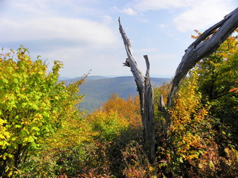 On the way up I had several views of the valleys and hills and I noticed that there was quite a bit of haze hanging around. One reason for the hike was to access the leaves to see how much the color had changed. Once on top I dropped my pack to take some pictures. I headed a little southwest and bushwhacked to what looked like a viewpoint. There was a lookout I had never seen before and another a little further along. These viewpoints offered very nice views with the second displaying almost unobstructed scenes. After taking some shots, we returned to the summit and I grabbed my pack for the trip back. On the way down we stopped at the lookout on the left side of the trail with views to the northeast. The leaves blocked the views here but I noticed a path leading down so I followed it. I found several viewpoints I had not been to before and took some more pictures. After this, it was only a matter of heading down the path to the trail and back to the car. We were back in the parking area by 12:40 PM. The clock said we took 3.5 hours to cover 7.9 miles but my GPS let me know that we used less than 3 hours of "moving time". It did not seem like we were rushing but this is the best time we have ever had for this hike.